4.0 Future Land Use Element
|
|
|
- Sylvia Phillips
- 5 years ago
- Views:
Transcription
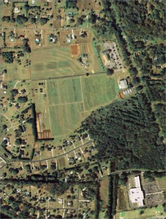
1 4.0 The Florida Agricultural and Mechanical University (FAMU) represents existing and proposed development patterns within the campus boundaries to be coordinated and not conflict with the adjacent areas planned by the City of Tallahassee / Leon County, Florida, Quincy / Gadsden County, Florida, and Crestview / Okaloosa County, Florida. The Future Land Use Maps (Figures 4.A 4.C) identify the developable parcels of University property and depict the land use zones appropriate for each. The main campus of FAMU is separated into two (2) distinct areas for planning purposes. The northern portion of campus includes the majority of academic facilities as well as housing, recreation/open space, and support services. The area extends to campus-owned boundaries to the north at FAMU Way, west to Perry Street, east to Martin Luther King Drive/Bronough Street/Adams Street parallel, and south to the Okaloosa/Osceola Street parallel. The southern portion of campus, while also consisting of some academic facilities, housing, and support services, is primarily utilized for conservation and recreation/open space use. The southern portion of campus extends to the campus boundaries south (along both sides of Orange Avenue), west (along both sides of Wahnish Way), east to Martin Luther King Drive/Adams Street parallel, and north to the Okaloosa/Osceola Street parallel match line. The academic functions of the University are projected to remain concentrated within the northern campus throughout the planning period. Although unimproved land resources to accommodate new buildings are limited, primary emphasis will be placed on efficient densification of this area. This will become most evident within those areas designated as academic land use zones. This initiative will, however, be met with an equal placement of importance on the retention and creation of connected campus green spaces. The northern campus will also absorb the majority of recommended transportation improvements that will create a more efficient traffic pattern around the University and reinforce a pedestrian campus core. Included in these plans are the development of a traffic circle and arrival plaza at the Gamble Street / Wahnish Way intersection and the closing of Wahnish Way from Gamble Street to Osceola Street to vehicular traffic. These improvements will combine to improve vehicular circulation around the periphery of the University and will assist in limiting pass-through traffic, enabling FAMU to better function as true urban campus. Strategically placed parking structures at the periphery of the northern campus and east of the Recreation Center at the eastern campus boundary will further limit unnecessary vehicular intrusion into the campus interior. Housing expansions and renovations are expected to occur in both the northern and southern portions of campus, creating bookends and providing connection to the academic campus core. These expansions and renovations include the planned Polkinghorne Village project and the transformation of the Palmetto Street Apartments into expanded campus and Greek Life housing. Conservation areas will be focused along the southeast portion of the campus boundary formed by Orange Avenue and Adams Street, bleeding north to Osceola Street creating an uninterrupted natural buffer between housing and recreation facilities in the southern portion of campus. There is also a proposed conservation area nestled between the School of Business and Industry and Lucy Moten in the northern portion of campus. Other proposed conservation areas are identified in Figures 16.1.A and 16.1.B. These conservation areas will also function as passive open space areas. Agriculture has always been, and will continue to remain, a focus of the University. As a result, those designated areas south of Orange Avenue within campus boundaries will remain available for the agricultural and research/testing functions of FAMU. Further the Lafayette Vineyards FAMU Master Plan Update 4-1 November 2012
2 Center Viticulture Sciences and Quincy Farms Campus in Quincy / Gadsden County, Florida will also function as agricultural and research/testing functions. As a singular building the Alatex site in Crestview / Okaloosa County, Florida shall serve as a community interface land use, providing health care services to persons in need while functioning as an academic / support facility for students and faculty. In conclusion, the land uses at FAMU have been established to more efficiently and compatibly address future growth. Transitional buffers between land use zones are further seen as an improvement to historical intrusions and lack of differentiation between land uses. The Goals, Objectives and Policies further outline the mechanisms that will be employed to address future growth at FAMU in a systematic and cohesive manner. FAMU Master Plan Update 4-2 November 2012
3 GOAL 1: Florida Agricultural and Mechanical University (FAMU) shall promote a development pattern that guides future growth into developable areas and away from environmentally sensitive areas in a manner that is compatible with the City of Tallahassee and Leon County. Objective 1.1: FAMU shall develop and adopt a Future Land Use Plan which establishes the following land use zones for the University-owned properties: Academic Agricultural Conservation Housing Parking (including surface & garage) Recreation/Athletics/Open Space Support Facilities (including utilities, roadways & infrastructure) Community Interface Policy FAMU shall continue to participate in the Florida Board of Governors master planning process, adopting a Master Plan Update, updating it in succeeding five (5)-year intervals and assessing progress toward achieving its stated goals, objectives and policies through the Florida Board of Governors strategic planning process. Policy FAMU shall define and approve the Future Land Use Map (Figure 4.1) as part of the master planning process which reflects the input of representatives of the University's administration, student body, faculty, and support personnel. The Future Land Use Map establishes land use zones that include academic, agricultural, conservation, community interface, housing, parking, recreation/open space, and support services which shall include utilities and infrastructure. Policy FAMU shall endeavor to retain, at a minimum, an existing 25.5 acres of the University's property, which has been previously identified and determined to be environmentally sensitive as Conservation land use zones on the Future Land Use Map. Policy FAMU shall identify the developable parcels on the University's property and shall establish and adopt intensities and densities to be implemented for each land use zone shown on Table 4.1 and Figure 4.1. These standards shall serve as maximum development thresholds for each land use zone. FAMU Master Plan Update 4-3 November 2012
4 Table 4.1 Land Use Zones/Maximum Intensities and Densities for Development LAND USE ZONE ACREAGE 1 INTENSITY 2 DENSITY 4 Academic FAR 4 Housing Bed Spaces Support Services FAR 5 Recreation/Open Space NA NA Parking (surface + garage) Spaces 6 (P) Conservation Agricultural FAR Community Interface 6.3 NA NA Source: Figure 4.A Future Land Use Map; WPi, 2011 LAND USE ZONE ACREAGE 1 INTENSITY 2 DENSITY 4 Academic FAR 4 Housing Bed Spaces Support Services FAR 5 Recreation/Open Space - NA NA Parking (surface + garage) Spaces 6 (P) Conservation Agricultural FAR Community Interface - NA NA Source: Figure 4.B Future Land Use Map - Viticulture; WPi, 2011 LAND USE ZONE ACREAGE 1 INTENSITY 2 DENSITY 4 Academic FAR 4 Housing Bed Spaces Support Services FAR 5 Recreation/Open Space NA NA Parking (surface + garage) Spaces 6 (P) Conservation Agricultural FAR Community Interface 5.5 NA NA Source: Figure 4.C Future Land Use Map Gadsden County; WPi, Acreage totals do not include miscellaneous lands such as sidewalks, service areas, roads etc. 2 Represents the maximum percentage, per acre, of allowed impervious improvements. 3 Not applicable to required utility/infrastructure improvements. 4 Represents the maximum density (by unit) per acre allowed to be developed within each land use. Per level thresholds apply to housing and parking garage. 5 FAR = Floor Area Ratio, including multilevel construction not to exceed fifty (50) feet in height. 6 At a minimum, these spaces shall be not less than approximately nine (9) by eighteen (18) feet in size. (P) = Parking Garage, (S) = Surface Parking. NA = Not applicable to the land use category. Policy FAMU shall establish a buffer area around each of the designated conservation areas. The criteria for establishing and adopting these buffers is contained within FAMU Master Plan Update 4-4 November 2012
5 13.0 Conservation Element and shall be followed when designating these buffer areas. Policy Variation(s) from and/or exception(s) to the Future Land Use Map (Figure 4.1) shall require an amendment to this Master Plan Update. Amendments that, alone or in conjunction with other amendments, exceed the thresholds established in s (a) F.S., shall be reviewed and adopted under the provisions of s (6)-(8) F.S. Objective 1.2: Using the Future Land Use Map (Figure 4.1) as a base, FAMU shall develop Master Plan Maps which detail the location and types of facilities required by the growth in student population anticipated during the planning period to meet their needs in the areas of academic, agricultural, conservation, community interface, housing, parking, recreation/open space, and support services and other related facilities improvements. Policy FAMU shall adhere to the Master Plan Update Map when authorizing construction of new facilities or when relocating or expanding existing facilities. Policy FAMU shall coordinate land use and development decisions with the priorities of capital improvement implementation specified within Table 14.1 of the 14.0 Capital Improvements Element. Policy In the event that unforeseen grant awards or other circumstances create a need to modify the Master Plan Update Map, FAMU shall, at a minimum, ensure that the planned facility is consistent with the Future Land Use Map. Policy The FAMU Director of Facilities Planning and Construction shall be responsible for coordinating future development densities with appropriate land use zones and shall amend the Capital Improvement Plan each year, if needed, under the requirements of 14.0 Capital Improvements Element. FAMU shall further coordinate inconsistent land use policies with the procedures established herein. Objective 1.3: FAMU shall utilize the Master Plan Update Map and Future Land Use Map to correct existing internal land use compatibility problems through such actions as densification, relocation, and acquisition of adjacent properties while continuing to avoid land use compatibility conflicts with surrounding non-university properties. Policy FAMU shall create a more homogenous Academic land use zone through densification and the relocation of non-academic facilities (such as housing, agriculture and parking) to newly developed areas along the periphery of campus. Policy FAMU shall locate Community Interface activities on the periphery of the University property. Such activities may include, but are not limited to, expanded athletic facilities, research facilities, multi-purpose educational facilities, mixed use development, and hospitality / conference facilities, and in FAMU Master Plan Update 4-5 November 2012
6 certain cases, academic facilities of not more than fifty (50) percent of the net assignable square footage of proposed building construction or additions. This will allow functions including public/private research and teaching functions to be conducted in a nontraditional academic environment when deemed appropriate by FAMU. Policy FAMU shall continue to be an active participant in City of Tallahassee-Leon County planning and zoning activities to assure that decisions regarding University land uses have a neutral or positive impact on surrounding land uses and, conversely, that land use decisions affecting properties proximate to the University have a neutral or positive impact on University activities. Policy The FAMU Director of Facilities Planning and Construction shall be responsible for ensuring compliance in coordinating land use and development decisions with the schedule of capital improvements specified in 14.0 Capital Improvements Element. Objective 1.4: FAMU shall utilize the Future Land Use Map and Master Plan Update Map to optimize the University's developable land resources and protect its natural resources, including its historic and archeological resources, while allowing the University flexibility in meeting its long-range needs. Policy Respecting the University property's natural resources, improvement and expansion of University facilities for the ten (10)-year planning period shall be limited to those areas identified in the Future Land Use Map. Policy As part of the design process for any programmed improvements and prior to approval and acceptance of the design of the University, FAMU shall require that geotechnical testing be conducted to determine the relevant soil characteristics of the site. Policy FAMU shall require that appropriate methods of controlling erosion and sedimentation to help minimize the destruction of soil resources be used during site development and use. These specific methods shall include, at a minimum, the following: 1. Adherence to the adopted Architectural Design Guidelines. 2. Adherence to the adopted Landscape Design Guidelines. 3. Adherence to stormwater level-of-service standards specified in 9.0 General Infrastructure Element. Policy FAMU shall require integration of natural topographic and other physical features in project designs in order to develop University property in harmony with its natural environment. Policy FAMU shall permit no new development, expansion or replacement of existing development in areas designated on the Future Land Use Map as Conservation. FAMU Master Plan Update 4-6 November 2012
7 Policy FAMU shall adopt and adhere to the policies stated in 13.0 Conservation Element with regard to environmental management and shall require adherence to these standards by all parties performing design and construction of facilities on University property. Policy FAMU shall protect and preserve all existing structures deemed to be historically or archaeologically significant. Methods for protection/ preservation are outlined in 15.0 Architectural Design Guidelines Element. Objective 1.5: FAMU shall make provisions for the infrastructure, parking and traffic circulation, utilities and support services systems required by new, expanded and/or relocated facilities concurrent with the facilities' construction. These provisions shall include required land(s) set aside. Policy As part of the planning, programming, design and construction of new facilities or the relocation or expansion of existing facilities, FAMU shall include modification of those infrastructure, utilities, parking and traffic circulation, and other support systems which are required to maintain the minimum service levels established under 9.0 General Infrastructure Element 10.0 Utilities Element and 11.0 Transportation Element of this Master Plan Update. Policy FAMU shall require that the modification of infrastructure, utilities and support service systems shall be completed concurrent with occupancy of new or expanded programmed facilities. FAMU Master Plan Update 4-7 November 2012
8
9
10
4.0 Future Land Use Element
 4.0 PURPOSE The purpose of this element is to describe the existing and future land use pattern to be developed on the University and to address how this land use pattern will be coordinated with that
4.0 Future Land Use Element
 4.0 PURPOSE The purpose of this element is to describe the existing and future land use pattern to be developed on the University and to address how this land use pattern will be coordinated with that
2.4 FUTURE LAND USE ELEMENT Goals, Objectives and Policies
 GOAL 1: To create developmental patterns that direct future growth to appropriate areas on campus, in a manner that promotes the educational mission of the University, the protection of environmentally
Evaluation and Appraisal Report
 Florida Agricultural and Mechanical University 2010 2020 Campus Master Plan Update (Five Year Comprehensive) Wood+Partners, Inc. 612 South Copeland Street Tallahassee, Florida 32304 (850) 391-0360 November
Goal 1 To establish and follow land use patterns for the long-range development of the campus.
 ELEMENT 4 FUTURE LAND USE Goal 1 To establish and follow land use patterns for the long-range development of the campus. Objective 1A Correct existing incompatible campus land uses. Policy 1A-1 Reduce
Goal 1: To Encourage the Orderly, Harmonious and Judicious Use of University Resources in the Development of University Land.
 2.0 Future Land Use Goal 1: To Encourage the Orderly, Harmonious and Judicious Use of University Resources in the Development of University Land. Objective 1.1: Make available future building sites that
Total Headcount 12,695 13,676 Source: FAMU Office of Institutional Research, 2010
 INTRODUCTION The development of the 2010-2020 Florida Agriculture & Mechanical (FAMU) Master Plan Update is a requirement pursuant to Subsection 1013.30 (9) F.S. The and Supporting Inventory and Analysis
CAMPUS MASTER PLAN, AMENDMENTS
 CAMPUS MASTER PLAN AMENDMENTS CAMPUS MASTER PLAN, 2015-2025 AMENDMENTS OCTOBER 2016 PLANNING, DESIGN & CONSTRUCTION DIVISION AMENDMENTS UNIVERSITY OF FLORIDA COMPREHENSIVE MASTER PLAN OCTOBER 2016 1. Acreage
2.4 FUTURE LAND USE ELEMENT Goals, Objectives and Policies
 GOAL 1: To create developmental patterns that direct future growth to appropriate areas on campus, in a manner that promotes the educational mission of the University, the protection of environmentally
FLORIDA STATE UNIVERSITY MASTER PLAN
 TRANSPORTATION ELEMENT NOTE: Unless otherwise noted, the goals, objectives and policies contained in this element shall guide development on the Tallahassee Campus, Southwest Campus and the Panama City
Gadsden County Planning Commission Agenda Request
 Date of Meeting: November 16, 2017 To: From: Through: Subject: Gadsden County Planning Commission Agenda Request Honorable Chairperson and Members of the Board Jill A. Jeglie, AICP, Senior Planner Clyde
implementation r expression in landscape
 6 ubc okanagan implementation campus plan r expression in landscape 68 6 implementation campus plan sections The Campus Plan supports the academic mission, values and commitments of the University by providing
Application Number: SD Project Name: Walton Farms Preliminary Subdivision (acting as Master Plan)
") STAFF REPORT Town of Clayton Planning Department 111 E. Second Street, Clayton, NC 27520 P.O. Box 879, Clayton, NC 27528 Phone: 919-553-5002 Fax: 919-553-1720 Planning Board May 22, 2017 Application Number:
STAFF REPORT Town of Clayton Planning Department 111 E. Second Street, Clayton, NC 27520 P.O. Box 879, Clayton, NC 27528 Phone: 919-553-5002 Fax: 919-553-1720 Planning Board May 22, 2017 Application Number:
Technical Appendix L, University Community Plan Town Center
 Technical Appendix L, University Community Plan Town Center Table of Contents L.1 Executive Summary L.2 Merced County University Community Plan, 2004 Findings L.2.1 Visioning L.2.2 UCP Goals, Objectives
11.0 TRANSPORTATION ELEMENT
 11.0 TRANSPORTATION ELEMENT Transit, Circulation and Parking Sub-Element: For all campuses, FIU's goal is to increase multimodal access. In combination with other measures - such as the development of
UAA School of Engineering Parking Garage Master Plan Amendment. 1. Purpose
 UAA School of Engineering Parking Garage Master Plan Amendment 1. Purpose Since the UAA campus master plan was drafted in 2003, adopted in 2004, and amended in 2009 a number of significant changes regarding
4.1.3 LAND USE CATEGORIES
 4.1.3 LAND USE CATEGORIES a. City Center District The City Center District incorporates the existing character and mix of uses in downtown Belmont to encourage redevelopment and new development in keeping
ARTICLE 6: Special and Planned Development Districts
 ARTICLE 6: Special and Planned Development Districts 6-10 Traditional Neighborhood Development (TND) District 6-10.10 Purpose and Intent The Traditional Neighborhood Development (TND) District provides
Baumgarten MPUD. Exhibit 3 Evaluation Criteria
 Pursuant to LDC subsections 10.02.13 B, 10.02.08 F and Chapter 3 G. of the Administrative Code, staff s analysis and recommendation to the Planning Commission, and the Planning Commission s recommendation
AWH REPORT OF THE PLANNING AND DEVELOPMENT DEPARTMENT FOR APPLICATION FOR REZONING ORDINANCE TO PLANNED UNIT DEVELOPMENT
 AWH REPORT OF THE PLANNING AND DEVELOPMENT DEPARTMENT FOR APPLICATION FOR REZONING ORDINANCE TO PLANNED UNIT DEVELOPMENT MAY 8, 2014 The Planning and Development Department hereby forwards to the Planning
Academics Efficient use of space will be used to enhance investments in new pedagogies such as active learning classrooms.
 Goals and Assumptions Physical Planning Goals and Objectives The guiding principles of this Master Plan were developed in consultation with various constituencies that make up the NMSU community and were
UMBC Facilities Management. UMBC Facilities Master Plan Update
 Management UMBC 2009-2019 February 19, 2010 A is the Vision for buildings, lands, open spaces and infrastructure Framework for the shape and development of the campus built environment driven by the University
Intergovermental Coordination
 Intergovermental Coordination CITY OF WINTER PARK CHAPTER 8: INTERGOVERNMENTAL COORDINATION ELEMENT INTERGOVERNMENTAL COORDINATION ELEMENT GOAL 8-1: PROVIDE FOR IMPROVED INTERGOVERNMENTAL COORDINATION
RECREATION AND OPEN SPACE ELEMENT GOALS, OBJECTIVES, AND POLICIES
 RECREATION AND OPEN SPACE ELEMENT GOALS, OBJECTIVES, AND POLICIES Goal 7 To provide park facilities, recreation programs, and open space resources that are safe, adequate, and accessible to all City residents,
12 Intergovernmental Coordination
 Intergovernmental Coordination Supporting Data The purpose of the Intergovernmental Coordination Element is to identify and resolve incompatible goals, objectives, policies and development proposed in
This is the East Carolina University Comprehensive Facilities Master Plan Final Draft Plan Review. This workbook reviews the campus draft master plan
 This is the East Carolina University Comprehensive Facilities Master Plan Final Draft Plan Review. This workbook reviews the campus draft master plan first presented on campus on June 29 and June 30, 2011.
The Ritz-Carlton, Paradise Valley
 The Ritz-Carlton, Paradise Valley 7000 E. Lincoln Drive Keys to Success Community Conversation II June 4, 2015 RITZ-CARLTON PARADISE VALLEY Town Council Study Session June 4, 2015 General Plan 2012 Land
Planning Commission April 4, 2013 BOCC Workshop Page 1
 Planning Commission April 4, 2013 BOCC Workshop Page 1 Planning Commission April 4, 2013 BOCC Workshop Page 2 Planning Commission April 4, 2013 BOCC Workshop Page 3 Planning Commission April 4, 2013 BOCC
Chapter 22. Alternatives to the Proposed Project
 Page 22-1 Chapter 22. Alternatives to the Proposed Project Introduction This chapter assesses the potential environmental effects of alternatives to the Proposed Project. The alternatives analyzed include
Division 9 Southwood Ranch (CR 484/475/475A Corridor-Gateway Development Overlay) Purpose and Intent Applicability.
 Purpose and Intent Applicability.") Division 9 Southwood Ranch (CR 484/475/475A Corridor-Gateway Development Overlay) 5.9.1 Purpose and Intent. The Southwood Ranch Overlay is intended to be a mixed use community with commercial and residential
Division 9 Southwood Ranch (CR 484/475/475A Corridor-Gateway Development Overlay) 5.9.1 Purpose and Intent. The Southwood Ranch Overlay is intended to be a mixed use community with commercial and residential
3.0 Urban Design Element
 3.0 PURPOSE The purpose of this element is to develop an understanding of the overall physical form of the development within the University and its relationship to the surrounding community, and based
Metro. Activity Center Design Guidelines. Recommendations For Developing Focused, Mixed-Use Commercial/Residential Centers
 Metro Activity Center Design Guidelines Recommendations For Developing Focused, Mixed-Use Commercial/Residential Centers Metro Activity Centers What is a MAC? Legacy, the adopted guide for the future growth
DENVER DESIGN DISTRICT GDP
 DENVER DESIGN DISTRICT GDP Urban Design Standards and Guidelines November 17, 2008 Amended February 3, 2016 City and County of Denver CF Property Management, Inc. C/O Denver Design District - Starboard
Developer s Program. The Station at East 54
 Developer s Program The Station at East 54 Existing Conditions The Station at East 54 is proposed for a 1.12 acre site at the northeast corner of Hamilton Road and Prestwick Road, tucked between the East
DRAFT MAP AMENDMENT FLU 04-4
 DRAFT MAP AMENDMENT FLU 04-4 SW 24 TH AVENUE ROADWAY CORRIDOR The University of Florida participates with the Metropolitan Transportation Planning Organization (MTPO) in its responsibilities for the continuing,
REQUEST Current Zoning: O-15(CD) (office) Proposed Zoning: TOD-M(CD) (transit oriented development mixed-use, conditional)
 (office) Proposed Zoning: TOD-M(CD) (transit oriented development mixed-use, conditional)") Rezoning Petition 2016-117 Zoning Committee Recommendation January 4, 2017 REQUEST Current Zoning: O-15(CD) (office) Proposed Zoning: TOD-M(CD) (transit oriented development mixed-use, conditional) LOCATION
Rezoning Petition 2016-117 Zoning Committee Recommendation January 4, 2017 REQUEST Current Zoning: O-15(CD) (office) Proposed Zoning: TOD-M(CD) (transit oriented development mixed-use, conditional) LOCATION
CITY OF PUYALLUP. Background. Development Services
 CITY OF PUYALLUP Development Services 333 South Meridian Puyallup WA 98371 To: City Council From: Katie Baker, AICP, Planning Division Re: South Hill Neighborhood Plan Adoption Date: (Meeting date: February
City of Heath. Town Center Concept
 In the give-and-take of getting projects designed, financed, and approved, the famous refrain from the film Field of Dreams is heard often: if you build it, they will come. From the perspective of the
MIDTOWN MIXED-USE VILLAGE. TECHNICAL DATA SHEET COMPONENT C-1 FOR PUBLIC HEARING - PETITION NUMBER Project No RZ1.1. Issued.
 N MIDTOWN MIXED-USE VILLAGE TECHNICAL DATA SHEET COMPONENT C- FOR PUBLIC HEARING - PETITION NUMBER 04-00 Project No. 496 Issued Revised SCALE: " = 0' N 0 0 0 40 RZ. c GENERAL PROVISIONS: a. SITE LOCATION.
R E S O L U T I O N. Single-Family Residence/ Church. 2,488 sq. ft. 2,488 sq. ft. Area Parking Required: Church
 R E S O L U T I O N WHEREAS, the Prince George s County Planning Board is charged with the approval of Detailed Site Plans pursuant to Part 3, Division 9 of the Zoning Ordinance of the Prince George s
Glenborough at Easton Land Use Master Plan
 Implementation 114 9.0 IMPLEMENTATION 9.1 OVERVIEW This chapter summarizes the administrative procedures necessary to implement the proposed land use plan, infrastructure improvements, development standards,
NORTHEAST DISTRICT. Description. Opportunities
 VI plan and major recommendations district plans northeast disrict NORTHEAST DISTRICT Description The Northeast District comprises approximately 38 acres. It is bounded by Campus Creek to the north, the
Dwelling Units Max 12 dwelling units per acre/min 8 dwelling units per acre. Development Mix 80% non residential/20% residential
 13. OSTEEN LOCAL PLAN Background: The Osteen Local Plan area is located in southwest Volusia County along the SR 415 corridor between Lemon Bluff Road and Acorn Lake Road and includes 3,990 acres. The
Gold Line Bus Rapid Transit Transit Oriented Development (BRTOD) Helmo Station Area Plan
 Helmo Station Area Plan") Appendix F Gold Line Bus Rapid Transit Transit Oriented Development (BRTOD) Helmo Station Area Plan Introduction and Purpose of the Plan The Gold Line Bus Rapid Transit facility is an eleven-mile dedicated
Appendix F Gold Line Bus Rapid Transit Transit Oriented Development (BRTOD) Helmo Station Area Plan Introduction and Purpose of the Plan The Gold Line Bus Rapid Transit facility is an eleven-mile dedicated
TRANSPORTATION ELEMENT GOALS, OBJECTIVES, AND POLICIES
 TRANSPORTATION ELEMENT GOALS, OBJECTIVES, AND POLICIES GOAL 2 The City shall provide a safe, convenient, effective, and energy efficient multimodal transportation system which is coordinated with the Future
PLANNING COMMISSION. Submitted
 PLANNING COMMISSION City Hall 1275 Main Street El Centro, CA 92243 Submitted PLANNING COMMISSION ACTION ITEM (1844) Meeting: 05/10/16 12:00 AM Department: Community Development Category: Public Hearing
Little Neck Planning Area
 Little Neck Planning Area Current Reality The Little Neck Planning Area is characterized by established residential neighborhoods, Town Center and Pembroke. The Eastern and Western Branches of the Lynnhaven
HEALTH SCIENCES BUILDING REDEVELOPMENT PROJECT
 INTRODUCTION In recent years, the University of Cincinnati (University) has demonstrated a commitment to identifying and implementing sustainable goals and objectives throughout University s Uptown Campuses.
Phasing and Implementation
 Phasing and Implementation Adaptive Reuse and New Construction Opportunities The reuse of existing buildings at UW Tacoma S 21st St S 17th St Tacoma Ave is highly valued for maintaining the history, character,
Chapter Master Planned Communities (MPC) District
 District") Sections 14.53.010 Purpose and Intent 14.53.020 Applicability 14.53.030 Procedure 14.53.040 MPC Standards 14.53.050 Required Findings 14.53.010 Purpose and Intent Chapter 14.53 Master Planned Communities
Sections 14.53.010 Purpose and Intent 14.53.020 Applicability 14.53.030 Procedure 14.53.040 MPC Standards 14.53.050 Required Findings 14.53.010 Purpose and Intent Chapter 14.53 Master Planned Communities
WHEREAS, after consideration of the evidence presented at the public hearing on January 14, 2010, the Prince George's County Planning Board finds:
 R E S O L U T I O N WHEREAS, the Prince George s County Planning Board has reviewed DDS-600 requesting a departure for the location of two loading spaces without driveway access along Toledo Terrace in
City of Grande Prairie Development Services Department KENNEDY DEVELOPMENTS LTD. OUTLINE PLAN OP-09-01
 City of Grande Prairie Development Services Department KENNEDY DEVELOPMENTS LTD. OUTLINE PLAN OP-09-01 July 27, 2009 TABLE OF CONTENTS 1.0 Introduction... 1 1.1 Plan Area Location & Context... 1 1.2 Ownership
LANGAN LANDSCAPE ARCHITECTURE + PLANNING FOR COLLEGES & UNIVERSITIES
 LANGAN LANDSCAPE ARCHITECTURE + PLANNING FOR COLLEGES & UNIVERSITIES CONTACT Philadelphia Pennsylvania 1818 Market Street Suite 3300 Philadelphia PA 19103 215.845.8900 215.845.8901 ST. JOSEPH'S UNIVERSITY
The transportation system in a community is an
 7 TRANSPORTATION The transportation system in a community is an important factor contributing to the quality of life of the residents. Without a sound transportation system to bring both goods and patrons
2010 Campus Master Plan Update - USF TAMPA Campus Master Plan Update USF TAMPA
 2010 Campus Master Plan Update USF TAMPA Purpose of the Update: Required by the Board of Governors Provides a framework for planned growth in a context of sustainability Master Plan Update Approval Process
Michael D, Harvey, Current Planning Supervisor. This project was originally approved in 2012 by the BOCC and is summarized as follows:
 PLANNING & INSPECTIONS DEPARTMENT Craig N. Benedict, AICP, Director Current Planning (919) 245-2575 (919) 644-3002 (FAX) www.orangecountync.gov 131 W. Margaret Lane Suite 201 P. O. Box 8181 Hillsborough,
McDonald s Restaurant - Purcellville Town of Purcellville Special Use Permit Statement of Justification July 24, 2014
 Introduction / Written Statement McDonald s Restaurant - Purcellville McDonald s Corporation is proposing to redevelop the existing McDonald s eating establishment with a drive-through located at 121 N
ORDINANCE AN ORDINANCE TO ADD A NEW SECTION 4.N. IN THE ZONING CODE FOR THE TOWN OF MIDDLETOWN, RELATING TO MIXED-USE DEVELOPMENT
 Introduced: November 5, 2018 Approved: ORDINANCE 18-11-01 AN ORDINANCE TO ADD A NEW SECTION 4.N. IN THE ZONING CODE FOR THE TOWN OF MIDDLETOWN, RELATING TO MIXED-USE DEVELOPMENT BE IT ENACTED BY THE MAYOR
M E M O R A N D U M January 6, 2017
 Item #4 M E M O R A N D U M January 6, 2017 To: 2035 Corridor Planning Committee From: Kenneth Baker, Sr. Director of Planning and Development Services Subject: Item #4 Overview Fidelis Purpose: Review
ESTABLISH AN EFFICIENT TOWN CENTER
 ESTABLISH AN EFFICIENT TOWN CENTER 4 Overview Lisbon residents are proud of the history of Newent and at the same time recognize its current importance as a centralized location for a variety of municipal
Transportation. Strategies for Action
 Transportation A major priority for the Overlake Neighborhood is to develop a multimodal transportation system. To achieve this system, a balance has to be found among travel, circulation and access needs;
Master Zoning Plan for the Northeast Property. in El Paso, Texas. Approved August Master Zoning Plan for the Northeast Property. City of.
 El Paso, Texas in El Paso, Texas Prepared for: City of Prepared by: Texas Kimley-Horn and Associates, Inc. 12700 Park Central Drive Suite 1800 Dallas, Texas 75251 Tel: (972) 770-1300 Approved August 2008
Bus Rapid Transit Backgrounder. December 2016
 Bus Rapid Transit Backgrounder December 2016 Background The City of London is completing the second stage of Shift, its public transit planning exercise. Shift, focuses on rapid transit, along with vehicular
LAND USE AMENDMENT DOWNTOWN COMMERCIAL CORE (WARD 7) MACLEOD TRAIL SE AND 5 AVENUE SE BYLAW 254D2017
 MACLEOD TRAIL SE AND 5 AVENUE SE BYLAW 254D2017") Page 1 of 10 EXECUTIVE SUMMARY This Land Use Amendment application seeks to redesignate a full downtown block (currently the YWCA site) from a Direct Control based on the CM-2 District (Land Use Bylaw
Page 1 of 10 EXECUTIVE SUMMARY This Land Use Amendment application seeks to redesignate a full downtown block (currently the YWCA site) from a Direct Control based on the CM-2 District (Land Use Bylaw
Chapter 5: Natural Resources and Environment
 NATURAL RESOURCES AND ENVIRONMENT 5-1 5 Chapter 5: Natural Resources and Environment BACKGROUND AND INTENT Urban expansion represents the greatest risk for the future degradation of existing natural areas,
Mitchell Ranch South MPUD Application for Master Planned Unit Development Approval Project Narrative. Introduction
 Mitchell Ranch South MPUD Application for Master Planned Unit Development Approval Project Narrative Introduction Mitchell Ranch South is a proposed single family (detached) residential development on
1.0 Future Land Use. 1.1 Introduction. 1.2 Future Land Use Objectives
 1.0 Future Land Use 1.1 Introduction Can Holly Springs continue to accommodate significant growth while retaining and enhancing a Village-like atmosphere? Can enough commercial land be set aside for business
Westwind Developments Ltd. PIONEER LANDS AREA STRUCTURE PLAN - PROPOSED AMENDMENT
 FEBRUARY 2013 TABLE OF CONTENTS 1.0 BACKGROUND... 1 1.1 Amendment... 1 2.0 LOCATION & CONTEXT... 2 2.1 Land Ownership... 2 3.0 POLICY CONTEXT... 3 3.1 Municipal Development Plan... 3 3.2 Capital Region
Exhibit A-1: Future Land Use Element Goals, Objectives, and Policies
 Exhibit A-1: Future Land Use Element Goals, Objectives, and Policies GOAL 1 IMPROVE THE QUALITY OF LIFE AND ACHIEVE A SUPERIOR, SUSTAINABLE, DEVELOPMENT PATTERN IN THE CITY BY CREATING AND MAINTAINING
Community Development Rezoning Report REZ16-018
 Community Development Rezoning Report Planning Commission Board of Supervisors March 1, 2016 March 23, 2016 Applicant Tax Map Id Present Zoning Proposed Zoning Location Medical Center 125-(17)- L1, 125-(17)-
14. INTERGOVERNMENTAL COORDINATION ELEMENT
 14. Introduction This Intergovernmental Coordination Element includes Goals, Objectives and Policies (GOP) that apply to the main campus and Alachua County Satellite Properties. The Intergovernmental Coordination
VILLAGE OF CLEMMONS PLANNING BOARD DRAFT STAFF REPORT
 VILLAGE OF CLEMMONS PLANNING BOARD DRAFT STAFF REPORT PETITION INFORMATION Docket # C-226 Staff Megan Ledbetter Petitioner(s) JBJH Properties, LLC Owner(s) JBJH Properties, LLC Subject Property 5892-49-1766
ARTICLE VI: SITE PLAN REVIEW
 Section 6.01 - Site Plan Review (All Districts) ARTICLE VI: SITE PLAN REVIEW Site plans give the Planning commission an opportunity to review development proposals in a concise and consistent manner. The
LAND USE ELEMENT. Purpose. General Goals & Policies
 LAND USE ELEMENT Purpose This Land Use Element contains the goals and policies necessary to support the City s responsibility for managing land resources and guiding development through implementing regulations,
Carleton University. Nicol Building New Sprott School of Business. Design Brief and Planning Rationale. Carleton University
 Carleton University Nicol Building New Sprott School of Business Design Brief and Planning Rationale Carleton University Design Team Proposal New Sprott School of Business Academic Building 2019 October
OFFICE CONSOLIDATION SECONDARY PLAN AREA 22 THE BRAMALEA SOUTH INDUSTRIAL SECONDARY PLAN
 OFFICE CONSOLIDATION SECONDARY PLAN AREA 22 THE BRAMALEA SOUTH INDUSTRIAL SECONDARY PLAN November 2010 EXPLANATORY NOTES (Secondary Plan Area 22) General (pertaining to all secondary plan office consolidations)
ROAD CLOSURE AND LAND USE AMENDMENT SILVER SPRINGS (WARD 1) NORTHEAST OF NOSEHILL DRIVE NW AND SILVER SPRINGS ROAD NW BYLAWS 2C2018 AND 29D2018
 NORTHEAST OF NOSEHILL DRIVE NW AND SILVER SPRINGS ROAD NW BYLAWS 2C2018 AND 29D2018") Page 1 of 19 EXECUTIVE SUMMARY This application proposes redesignating two parcels in the community of Silver Springs from Special Purpose Future Urban Development (S-FUD) District and undesignated road
Page 1 of 19 EXECUTIVE SUMMARY This application proposes redesignating two parcels in the community of Silver Springs from Special Purpose Future Urban Development (S-FUD) District and undesignated road
There are five comprehensive goals that inform the Urban Design element at FIU. They are:
 3.0 URBAN DESIGN ELEMENT This Comprehensive Master Plan Update reflects the University s commitment to the refinement and extension of the base concepts earlier master planning efforts have created. FIU
Open Space and Recreational Resources
 Chapter 3: Open Space and Recreational Resources A. INTRODUCTION Under the 2012 City Environmental Quality Review (CEQR) Technical Manual guidelines, open space is defined as publicly accessible, publicly
BROOKHILL NEIGHBORHOOD MODEL ZONING MAP AMENDMENT PREFACE TO APPLICATION
 BROOKHILL NEIGHBORHOOD MODEL ZONING MAP AMENDMENT PREFACE TO APPLICATION June 15, 2015 Revised: August 1, 2016 I. VISION Brookhill is a proposed community based upon the principles of Albemarle County
East Panorama Ridge Concept Plan Amendment
 Page 1 of 7 L003 : East Panorama Ridge Concept Plan Amendment Corporate NO: L003 Report COUNCIL DATE: March 4, 2002 REGULAR COUNCIL LAND USE TO: Mayor & Council DATE: February 27, 2002 FROM: General Manager,
FLORIDA STATE UNIVERSITY MASTER PLAN 3 Urban Design
 FLORIDA STATE UNIVERSITY MASTER PLAN 3 Urban Design 2008 UPDATE URBAN DESIGN ELEMENT NOTE: Unless otherwise noted, the goals, objectives and policies contained in this element shall Guide development of
3.0 LAND USE PLAN. 3.1 Regional Location. 3.2 Existing Conditions Existing Uses. Exhibit Regional Location Map
 3.0 LAND USE PLAN 3.1 Regional Location The Anaheim Resort Specific Plan (ARSP) area is located in the City of Anaheim, which is 35 miles southeast of downtown Los Angeles and 7 miles northwest of Santa
INTRODUCTION AND EXECUTIVE SUMMARY
 INTRODUCTION AND EXECUTIVE SUMMARY The University of South Florida was founded in 1956 as the first public university established specifically to address the needs of Florida s rapidly emerging urban regions.
KEIZER STATION PLAN INTRODUCTION
 KEIZER STATION PLAN INTRODUCTION Planning for this area began in 1987 when the Keizer Comprehensive Plan established the Chemawa Activity Center and McNary Activity Center. The first Chemawa Activity Center
Subject: Hendry County Evaluation and Appraisal Report Letter of Understanding - Identification of Major Issues
 HENDRY COUNTY PLANNING & ZONING DEPARTMENT POST OFFICE BOX 2340 165 S. LEE STREET LABELLE, FLORIDA 33975 (863) 675-5240 FAX: (863) 675-5317 SUNCOM 744-4750 November 16, 2007 Mr. Mike McDaniel, Chief Office
242 neighborhoods NEIGHBORHOOD 4: JORDAN AVENUE CORRIDOR
 NEIGHBORHOOD 4: JORDAN AVENUE CORRIDOR Aerial View of Jordan Avenue Corridor EXISTING CHARACTER The Jordan Avenue Corridor is the portion of North Jordan Avenue that extends north from East Third Street
12 February CAMPUS MASTER PLAN UPDATE Focus Group - Wayfinding & Signage
 12 February 2016 CAMPUS MASTER PLAN UPDATE Focus Group - Wayfinding & Signage AGENDA Introductions Planning Scope The 2004 Campus Plan Observations SWOT Exercise Analysis Goals and Advice Questions & Discussion
CHARLES PUTMAN CHARLES PUTMAN AND ASSOCIATES, INC
 MEMORANDUM CHARLES PUTMAN & ASSOCIATES, INC. LAND DEVELOPMENT CONSULTANTS PLANNING ZONING PERMITTING 4722 NW Boca Raton Boulevard, Suite C-106 Boca Raton, Florida 33431 Phone: 561/994-6411 FAX: 561/994-0447
Central and East Neighbourhoods - Hermitage Outline Plan
 Central and East Neighbourhoods - Hermitage Outline Plan Office Consolidation September 2013 Prepared by: Planning and Policy Services Branch Planning and Development Department City of Edmonton The Central
QUEEN-RIVER SECONDARY PLAN
 34 QUEEN-RIVER SECONDARY PLAN 34. QUEEN RIVER SECONDARY PLAN 1. INTRODUCTION The Queen-River area is approximately 6.4 hectares and is located at the eastern edge of the Downtown as shown on Map 34-1.
I615. Westgate Precinct
 I615. Westgate Precinct I615.1. Precinct Description The Westgate Precinct is located approximately 18km west of the Auckland city centre. There are seven Sub-precincts in the Westgate Precinct: Sub-precinct
Preci nct P l ans Figure 56 Campus Aerial Photo, 2008 CAL STATE EAST BAY, HAYWARD CAMPUS MASTER PLAN
 9 Precinct Plans This section contains a detailed discussion of the planning and design concepts for specific areas or precincts of the Cal State East Bay Hayward campus. The Precinct Plans pertain to
VILLAGE OF PALM SPRINGS COMPREHENSIVE PLAN GOALS, OBJECTIVES AND POLICIES
 VILLAGE OF PALM SPRINGS COMPREHENSIVE PLAN GOALS, OBJECTIVES AND POLICIES Adopted November 12, 2009 Amended October 9, 2014 Amended Janury 14, 2016 Amended November 10, 2016 Amended January 11, 2018 (EAR-based)
8.0 Recreation and Open Space Element
 8.0 PURPOSE The purpose of this element is to ensure the provision of adequate and accessible recreation facilities and open space to meet the future needs of the University. (1) DATA REQUIREMENTS. This
Access to the University of North Carolina at Chapel Hill, UNC Hospitals, and Chapel Hill Transit.
 M 1/ 4 1/ 2 E IL M E IL Station Family: County: City: UNC Hospitals WHY THIS STATION? University Village Orange Chapel Hill Access to the University of North Carolina at Chapel Hill, UNC Hospitals, and
1.0 Purpose of a Secondary Plan for the Masonville Transit Village
 Report to Planning and Environment Committee To: Chair and Members Planning & Environment Committee From: John M. Fleming Managing Director, Planning and City Planner Subject: Masonville Transit Village
DEPARTURE FROM DESIGN STANDARDS DDS-586
 The Maryland-National Capital Park and Planning Commission Prince George s County Planning Department Development Review Division 301-952-3530 Note: Staff reports can be accessed at www.mncppc.org/pgco/planning/plan.htm.
[THIS PAGE INTENTIONALLY LEFT BLANK]
![[THIS PAGE INTENTIONALLY LEFT BLANK]](/thumbs/77/76526040.jpg "[THIS PAGE INTENTIONALLY LEFT BLANK]") 1-1 LAND USE [THIS PAGE INTENTIONALLY LEFT BLANK] TABLE OF CONTENTS INTRODUCTION... 7 1-1. GOAL: TO DEVELOP AND MAINTAIN A WELL-BALANCED COMMUNITY WITH A VARIETY OF LAND USES THAT ARE COMPATIBLE WITH EACH
1-1 LAND USE [THIS PAGE INTENTIONALLY LEFT BLANK] TABLE OF CONTENTS INTRODUCTION... 7 1-1. GOAL: TO DEVELOP AND MAINTAIN A WELL-BALANCED COMMUNITY WITH A VARIETY OF LAND USES THAT ARE COMPATIBLE WITH EACH
To encourage commercial development which is consistent with the long range, comprehensive, general plan for Knoxville and Knox County.
 Page 1 of 5 9. - C-6 general commercial park district. A. Legislative purpose, intent and application. The legislative purpose, intent and application of the general commercial park development [district]