Official Zoning Map Amendment Application #2018I-00075
|
|
|
- Pamela Dean
- 5 years ago
- Views:
Transcription
1 Community Planning and Development Planning Services 201 W. Colfax Ave., Dept. 205 Denver, CO p: f: TO: Denver Planning Board FROM: Scott Robinson, Senior City Planner DATE: January 2, 2019 RE: Official Zoning Map Amendment Application #2018I Staff Report and Recommendation Based on the criteria for review in the Denver Zoning Code, Staff recommends approval for Application #2018I Request for Rezoning Address: Neighborhood/Council District: Globeville / Council District 9 RNOs: UCAN; Globeville Civic Association #2; Globeville Civic Partners; North Highlands Neighbors Association; Elyria Swansea/ Globeville Businesses Association; Globeville K.A.R.E.S.; Inter- Neighborhood Cooperation (INC) Area of Property: 2.7 acres Current Zoning: I-B UO-2 Proposed Zoning: C-MX-20 UO-2 Property Owner(s): Wagner Equipment CO Owner Representative: Jeanne Shaffer, Groundwork Entitlement Summary of Rezoning Request The subject property is in the 41 st and Fox station area. Specifically, it is located along 38 th Avenue and bordered by Galapago Street to the East, and the BNSF/RTD train tracks to the West. The property is currently occupied by Wagner Equipment CO which utilizes the site for the rental and storage of heavy duty construction equipment and vehicles. The applicant is requesting the rezoning to better align with the City & County of Denver s longterm plans for the 41 st & Fox station area and position the property for potential redevelopment. The C-MX-20 (Urban Center, Mixed Use, 20 story) zone district allows a wide range of commercial, civic/institutional, and residential primary uses in the General, Shopfront, and Town House building forms. Drive Thru building forms would not be allowed at the subject location because it is less than ¼-mile from the 41 st and Fox transit station. Further details of the zone districts can be found in Article 7 of the Denver Zoning Code (DZC). The applicant s request includes maintaining the Billboard Use Overlay, UO-2, on the property.


2 Rezoning Application #2018I January 2, 2019 Page 2

3 Rezoning Application #2018I January 2, 2019 Page 3 Existing Context The subject property is in the Globeville neighborhood, just northwest of the Fox St./38 th Ave./Park Ave./I-25 interchange. It is part of an approximately 164-acre portion of the Globeville neighborhood that is separated from other parts of Globeville and other nearby neighborhoods by Interstates 25 and 70 to the north, east and south, and rail facilities (BNSF and RTD) to the west. Recent rezonings suggest this area is transitioning from an industrial context to an urban center neighborhood context consistent with the Station Area Plan vision, adopted in The site can be accessed by vehicles via 38 th Avenue and Fox Street or West 44th Avenue to the east. In addition, a recently-constructed bridge provides bicycle and pedestrian access to the Sunnyside neighborhood with a multi-use path along Inca Street connecting into the South Platte River Trail. The subject property is located about 800 feet from the 41st and Fox station which will be served by the G Line. The following table summarizes the existing context proximate to the subject site: Existing Zoning Existing Land Use Site I-B UO-2 Industrial Existing Building Form/Scale 3 industrial buildings, 1-2 stories in height, mixed depth of setbacks from 38 th Avenue and Galapago Street Existing Block, Lot, Street Pattern A limited orthogonal grid extends along Fox Street from 38 th Ave. to 44 th Ave. The grid is limited by the rail

4 Rezoning Application #2018I January 2, 2019 Page 4 Existing Zoning Existing Land Use North C-MX-20 Vacant N/A South I-B UO-2 Right-of-way East C-MX-20 / C- MS-12 Industrial, Commercial/Retail, Parking West I-B UO-2 Rail right-of-way N/A Existing Building Form/Scale Undeveloped land south of 38 th Avenue for the I- 25 Interchange flyover Mix of industrial and commercial buildings; 1-2 stories; supportive parking for adjacent uses. Varied setbacks from Fox Street and Galapago Street. Existing Block, Lot, Street Pattern corridor to the west, I- 25 to the south and east, and by large industrial sites and I- 70 to the north. The area has limited access from other neighborhoods, including 44 th Ave. from the southeast portion of Globeville, 38 th Ave. from the Sunnyside neighborhood (west), and Fox Street to Park Avenue that provides direct access to downtown. 1. Existing Zoning

5 Rezoning Application #2018I January 2, 2019 Page 5 The existing zoning on the subject property is I-B UO-2. I-B is a general industrial zone district in the Industrial Context. It allows office, business, and intensive industrial uses. Residential uses are only permitted where an existing residential structure existed prior to July 1, The General and Industrial building forms are allowed in the I-B zone district and building mass is regulated by a maximum Floor Area Ratio of 2.0. No maximum building height is specified for the zone district except for when a site is within 175 feet of a Protected District, in which case the maximum permitted building height is 75 feet. There are no build-to requirements, transparency requirements, or street level activation standards in the I-B zone district. Surface parking is permitted between the building and primary and side streets. See DZC Division 9.1. The UO-2 Billboard Use Overlay allows for outdoor general advertising device signs (i.e. billboards) within the applicable area. Additional standards and limitations regarding minimum separation and distance requirements also apply. There are currently no billboards on the subject site, but the applicant is proposing to maintain the UO-2 overlay on the property. See DZC Section

6 Rezoning Application #2018I January 2, 2019 Page 6 2. Existing Land Use Map


7 Rezoning Application #2018I January 2, 2019 Page 7 3. Existing Building Form and Scale Site from 38 th Ave. North from 39th Ave. East from Galapago St. South from 38 th Ave. Source: Google Maps West from Inca St.
8 Rezoning Application #2018I January 2, 2019 Page 8 Summary of City Agency Referral Comments As part of the DZC review process, the rezoning application is referred to potentially affected city agencies and departments for comment. A summary of agency referral responses follows: Assessor: Approved No Response Asset Management: Approved No Comments Denver Public Schools: Approved No Response Department of Public Health and Environment: Approved See Comments Below: Notes. Denver Department of Public Health & Environment (DDPHE) concurs with the rezoning but recommends that surface and subsurface soil at the site be evaluated to confirm its suitability for future planned uses. DDPHE has information to indicate that past petroleum releases occurred at locations to the east, northeast and north of the site and the site and surrounding area have historically been utilized for industrial uses. For example, the former Texaco Bulk Plant occupied the adjacent location to the north (currently addressed as 689 West 39th Avenue and 700 West 40th Avenue) where the Colorado Department of Public Health and Environment (CDPHE) issued in June 2008 an environmental covenant for that site that prohibited all uses, except for industrial. This environmental covenant was revised in February of 2016; the current environmental covenant (HMCOV00049) removed the restriction on industrial uses only, but continues to prohibit the use of groundwater at 689 West 39th Ave and 700 West 40th Avenue. Additionally, the site is within Operable Unit 1 of the VB-I70 Superfund Site where elevated levels of metals in soil may exist. General Notes: Most of Colorado is high risk for radon, a naturally occurring radioactive gas. Due to concern for potential radon gas intrusion into buildings, DEH suggests installation of a radon mitigation system in structures planned for human occupation or frequent use. It may be more cost effective to install a radon system during new construction rather than after construction is complete. Denver s Noise Ordinance (Chapter 36 Noise Control, Denver Revised Municipal Code) identifies allowable levels of noise. Properties undergoing Re-Zoning may change the acoustic environment, but must maintain compliance with the Noise Ordinance. Compliance with the Noise Ordinance is based on the status of the receptor property (for example, adjacent Residential receptors), and not the status of the noise-generating property. Violations of the Noise Ordinance commonly result from, but are not limited to, the operation or improper placement of HV/AC units, generators, and loading docks. Construction noise is exempted from the Noise Ordinance during the following hours, 7am 9pm (Mon Fri) and 8am 5pm (Sat & Sun). Variances for nighttime work are allowed, but the variance approval process requires 2 to 3 months. For variance requests or questions related to the Noise Ordinance, please contact Paul Riedesel, Denver Environmental Health ( ). Scope & Limitations: DEH performed a limited search for information known to DEH regarding environmental conditions at the subject site. This review was not intended to conform to ASTM standard practice for Phase I site assessments, nor was it designed to identify all potential environmental conditions. In addition, the review was not intended to assess environmental conditions for any potential right-of-way or easement conveyance process. The City and County of Denver provides no representations or warranties regarding the accuracy, reliability, or completeness of the information provided.
9 Rezoning Application #2018I January 2, 2019 Page 9 Denver Parks and Recreation: Approved No Response Public Works ROW - City Surveyor: Approved No Comments Development Services - Transportation: Approved No Response Public Works Wastewater: Approved See Comments Below: DS Wastewater approves the subject zoning change. The applicant should note that redevelopment of this site may require additional engineering including preparation of drainage reports, construction documents, and erosion control plans. Redevelopment may require construction of water quality and detention basins, public and private sanitary and storm sewer mains, and other storm or sanitary sewer improvements. Redevelopment may also require other items such as conveyance of utility, construction, and maintenance easements. The extent of the required design, improvements and easements will be determined during the redevelopment process. Please note that no commitment for any new sewer service will be given prior to issuance of an approved SUDP from Development Services. Development Services Project Coordination: Approved No Response Development Services Fire Prevention: Approved No Response Public Review Process CPD informational notice of receipt of the rezoning application to all affected members of City Council, registered neighborhood organizations, and property owners: Property legally posted for a period of 15 days and CPD written notice of the Planning Board public hearing sent to all affected members of City Council, registered neighborhood organizations, and property owners: Date 9/27/ /24/2018 Planning Board Hearing: 1/9/2019 CPD written notice of the Land Use, Transportation and Infrastructure Committee meeting sent to all affected members of City Council and registered neighborhood organizations, at least ten working days before the meeting (tentative): 1/18/2019
10 Rezoning Application #2018I January 2, 2019 Page 10 Land Use, Transportation and Infrastructure Committee of the City Council review (tentative): 1/29/2019 Property legally posted for a period of 21 days and CPD written notice of the City Council public hearing sent to all affected members of 2/18/2019 City Council and registered neighborhood organizations (tentative): City Council Public Hearing (tentative): 3/11/2019 o o Registered Neighborhood Organizations (RNOs) To date, no comment letters have been received from Registered Neighborhood Organizations. Other Public Comment To date, no other comment letters have been received. Criteria for Review / Staff Evaluation The criteria for review of this rezoning application are found in DZC, Sections and , as follows: DZC Section Consistency with Adopted Plans 2. Uniformity of District Regulations and Restrictions 3. Public Health, Safety and General Welfare DZC Section Justifying Circumstances 2. Consistency with Neighborhood Context Description, Zone District Purpose and Intent Statements 1. Consistency with Adopted Plans The following adopted plans apply to this property: Denver Comprehensive Plan 2000 Blueprint Denver (2002) 41 st and Fox Station Area Plan (2009) Globeville Neighborhood Plan (2014) Denver Comprehensive Plan 2000 The proposal is consistent with many Denver Comprehensive Plan strategies, including: Environmental Sustainability Strategy 2-F Conserve land by: promoting infill development within Denver at sites where services and infrastructure are already in place; designing mixeduse communities and reducing sprawl, so that residents can live, work and play within their own neighborhoods; creating more density at transit nodes. (p. 39)
11 Rezoning Application #2018I January 2, 2019 Page 11 Environmental Sustainability Strategy 4-A Promote the development of sustainable communities and centers of activity where shopping, jobs, recreation and schools are accessible by multiple forms of transportation, providing opportunities for people to live where they work. (p. 41) Land Use Strategy 3-B Encourage quality infill development that is consistent with the character of the surrounding neighborhood; that offers opportunities for increased density and more amenities; and that broadens the variety of compatible uses. (p. 60) Land Use Strategy 4-A - Encourage mixed-use, transit-oriented development that makes effective use of existing transportation infrastructure, supports transit stations, increases transit patronage, reduces impact on the environment, and encourages vibrant urban centers and neighborhoods. (p. 60) Mobility Strategy 4-E Continue to promote mixed-use development, which enables people to live near work, retail and services. (p. 78) Denver s Legacies Strategy 3-A Identify areas in which increased density and new uses are desirable and can be accommodated. (p. 99) The proposed map amendment would allow for mixed-use infill development near the new 41 st and Fox station for the RTD G Line, which will provide high-quality transit service to downtown Denver, Arvada, and Wheat Ridge. The new transit station provides an opportunity to transform the area around it into a dense, mixed-use neighborhood. The proposed C-MX-20 UO-2 zoning would allow a range of appropriate uses at an intensity consistent with the desire for dense, walkable, mixed-use neighborhoods around transit expressed in Comprehensive Plan Blueprint Denver According to the 2002 Plan Map adopted in Blueprint Denver, this site has a concept land use of Transit Oriented Development and is located in an Area of Change. Future Land Use Transit Oriented Development areas offer an alternative to traditional development patterns by providing housing, services, and employment opportunities for a diverse population in a configuration that facilitates pedestrian and transit access (p. 44). Common attributes of Transit Oriented Developments include a balanced mix of uses (residential, retail, office, entertainment, public facilities and others); compact mid- to high-density development; and attractive, multistory buildings facing the station and adjacent streets (p. 44). The proposed C-MX-20 UO-2 zone district would allow a wide range of residential, commercial, and institutional uses at a high density. The zone districts in the Urban Center context also include build-to and transparency requirements to ensure buildings appropriately address the street, consistent with the plan recommendations. Area of Change / Area of Stability As noted, the site is in an Area of Change. In general, The goal for Areas of Change is to channel growth where it will be beneficial and can best improve access to jobs, housing and services with fewer and shorter auto trips (p. 127). The proposed C-MX-20 UO-2 zoning would allow additional development near a transit station, supporting jobs, housing, and services with less reliance on automobiles, consistent with the goals of Blueprint Denver.

12 Rezoning Application #2018I January 2, 2019 Page 12 Street Classifications The site is served by Galapago Street and 39 th Avenue, which are classified by Blueprint Denver as Undesignated Local streets. The plan describes local streets as influenced less by traffic volumes and tailored more to providing local access. Mobility on local streets is typically incidental and involves relatively short trips at lower speeds to and from other streets (p. 51). The site is adjacent to 38 th Avenue, which is classified as a Mixed-Use Arterial, but it does not does not have direct access to it. According to the plan, Mixed-use streets are located in high-intensity mixed-use commercial, retail and residential areas with substantial pedestrian activity (p. 57). The plan describes Arterial streets as being designed to provide a high degree of mobility and generally serve longer vehicle trips to, from, and within urban areas. Denver s arterial system interconnects major urban elements such as the central business district, employment centers, large urban and suburban commercial centers and residential neighborhoods. (p. 51). The proposed C-MX-20 UO-2 zoning would allow intense mixed-use development that would be appropriate for mixed-use arterial streets, but under certain circumstances, would not be appropriate for Local streets. However, the subject property is near the 41 st and Fox transit station which will soon serve the area with high-capacity transit. In addition, the site is one block from Fox Street, which is an arterial and connects to 38 th Avenue and Park Avenue, also both major arterials, and Interstate 25. While connectivity to the citywide street network is limited, the city is taking steps to limit the traffic generated in the area around the 41 st and Fox station and to improve transportation connections into and out of the area. These include the recent adoption of CPD and Public Works rules and regulations which require transportation demand management plans and manage vehicle trip capacity in this area. The local streets adjacent to the subject site will connect the property to the broader multimodal transportation network, consistent with the
13 Rezoning Application #2018I January 2, 2019 Page 13 recommendations of the plan. The proposed C-MX-20 UO-2 zoning is consistent with the concept land use, area of change, and street type recommendations of Blueprint Denver. 41 st and Fox Station Area Plan The 41 st and Fox Station Area Plan was adopted by City Council in 2009 and applies to the subject property. The plan focuses on the long-term redevelopment of the area east of the railroad tracks to create a complete, transit-friendly neighborhood (p. viii). Primary goals for the station area are as follows (p. vii): Improve pedestrian connections to the station, between neighborhoods, and along major corridors Create opportunities to add more housing, jobs and services to the station area Incorporate plazas, parks and open space into redevelopment areas Capitalize on the station area s proximity to Downtown and location on the Gold Line and Northwest Rail corridors Balance the needs of new development and existing uses Key elements of the plan concept include the following (p. viii): Development of a high intensity activity node close to the station on the east side Capture views of Downtown and buffer the station area by locating taller structures along I- 25 and I-70 The subject property is designated as Mixed-Use Office/Residential (3-20 stories) in the Land Use Plan. According to the plan, these areas are intended for a sizeable employment base as well as housing and may include a wide variety of uses including hotels and lodging (p. 15). The plan also states because these mixed-use developments are within the transit oriented development area, form of the buildings and pedestrian orientation are very important (p. 15). The 41 st and Fox Station Area Plan also includes urban design recommendations, including that the ground floors of buildings in all areas should contain the following elements: prominent, street facing entries, extensive ground floor windows and frequent entrances, pedestrian scaled facades, awnings to protect pedestrians and mark entrances, and building entrances that meet the sidewalk (p. 18). The plan also calls for buildings edges to be brought to the sidewalk with minimal setbacks (p. 18). The subject property has three existing structures the plan indicates are historically significant, which the plan recommends should be incorporated into future redevelopment by drawing design inspiration from the area s industrial character (p. 18). The structures are not designated for landmark preservation. The proposed C-MX-20 UO-2 zone district would allow a wide mix of uses including office, retail, residential, and lodging, in buildings up to 20 stories in height, consistent with the plan s land use recommendations. The proposed zone district also includes significant build-to and transparency requirements, ensuring development would meet the design and pedestrian-friendliness recommendations of the plan. If and when demolition of the existing structures is proposed by the property owner or a developer, they will be subject to the demolition review process administered by the Landmark Preservation division.
.")


14 Rezoning Application #2018I January 2, 2019 Page 14 The plan includes mobility infrastructure recommendations intended to ensure the area can accommodate the growth called for in the plan (p. 20). Some of these recommendations have been completed, such as the multi-use path connecting across 38 th Avenue to the South Platte River Trail and the new pedestrian bridge over the railroad tracks at the station. Some recommendations have not been completed, such as the proposed new street connection across the railroad tracks at 44 th Avenue or 46 th Avenue. With the RTD G Line opening soon and the proposed Rules & Regulations relating to parking and trip capacity currently under development, the potential development from the proposed C-MX-20 UO-2 zone district would be adequately accommodated by the transportation system and the proposed map amendment is consistent with the 41 st and Fox Station Area Plan.
15 Rezoning Application #2018I January 2, 2019 Page 15 Globeville Neighborhood Plan The Globeville Neighborhood Plan was adopted by City Council in 2014 and overlaps with the boundary of the 41 st and Fox Station Area Plan on the subject site. The Globeville Neighborhood Plan reinforces the land use and building height recommendations established in the 41 st and Fox Station Area Plan. It sets forth the following vision for this area of Globeville: The 41st and Fox Station will develop over the coming decades into the focal point of a diverse, transit supportive, and environmentally sustainable urban center. Many new residents and businesses will be drawn to the convenient location close to downtown and near some of Denver s most vibrant urban neighborhoods (p. 15). The Globeville Plan specifies that the concept land use and building height recommendations in this plan are intended to be fully consistent with the 41st and Fox Station Area Plan. Should any inconsistencies be found, please refer to the adopted Station Area Plan for the official Plan guidance (p.34). In the Strong section of the Plan, the 41 st and Fox Station area is identified as an opportunity site to create a broad base of new jobs in diverse economic sectors by redeveloping opportunity sites throughout the neighborhood (p. 44). As described above the proposed C-MX-20 UO-2 zone district is consistent with the recommendations of the 41 st and Fox Station Area Plan, which are reinforced in the Globeville Neighborhood Plan. The proposed rezoning would facilitate the redevelopment of the subject site and allow a wide mix of uses, strengthening the economy of the area consistent with the Globeville Neighborhood Plan recommendations. 2. Uniformity of District Regulations and Restrictions The proposed rezoning to C-MX-20 UO-2 will result in the uniform application of zone district building form, use and design regulations. 3. Public Health, Safety and General Welfare The proposed official map amendment furthers the public health, safety, and general welfare of the City primarily through implementation of the city s adopted land use plan. The proposed zone district enhances the pedestrian experience through improved building design standards including transparency, build-to, and street level active uses. The proposed rezoning would also facilitate the redevelopment of the property and investment in the neighborhood, enhancing the safety and welfare of the area and concentrating housing and services near transit. The traffic safety impacts of future development will be mitigated through strategies outlined above. 4. Justifying Circumstance The application identifies several changes as the Justifying Circumstance under DZC Section A.4, Since the date of the approval of the existing Zone District, there has been a change to such a degree that the proposed rezoning is in the public interest. The city adopted the Globeville Neighborhood Plan in 2014, after the current zoning was put in place in 2010, meeting subsection b of the criterion. In addition, there are changing conditions in the area, with the construction of the 41 st and Fox Station, the improved pedestrian and bicycle connections, and new retail development at 39 th
16 Rezoning Application #2018I January 2, 2019 Page 16 Avenue and Fox Street. These changing conditions, along with the recently adopted neighborhood plan, justify the rezoning to serve the public interest. 5. Consistency with Neighborhood Context Description, Zone District Purpose and Intent Statements The proposed C-MX-20 UO-2 zone district is within the Urban Center Neighborhood Context. The neighborhood context generally consists of multi-unit residential and mixed-use commercial strips and commercial centers (DZC, Division 7.1). While the area around the subject property does not currently fit the description of the Urban Center context, the future intent for the area, as described in the plans mentioned above, is for a mixed-use center consistent with that neighborhood context description. The proposed zone district of C-MX-20 UO-2 would allow development consistent with that vision and is therefore appropriate. According to the zone district intent stated in the Denver Zoning Code, the C-MX-20 district is intended to promote safe, active, and pedestrian-scaled, diverse areas through the use of building forms that clearly define and activate the public street edge (DZC Section A) and for areas or intersections served primarily by major arterial streets where a building scale of 3 to 20 stories is desired (DZC Section F). Though the subject property does not have direct access to an arterial street, it is served by arterials including Fox Street, one block to the east, which gives direct access to 38 th Avenue and Park Avenue both of which are major arterials and Interstate 25. The proposed C-MX-20 zone district would facilitate the development of an active and diverse urban center, consistent with the purpose and intent of the zone district. Attachments 1. Application

17 acres 2018I September 25th, 2018 $2000 fee pd CC

18 2018I September 25th, 2018 $2000 fee pd CC
19 2018I September 25th, 2018 $2000 fee pd CC
20 Rezoning Review Criteria Analysis - Map Amendment Application Number: 2018I October 19, 2018 (amd.) September 17, 2018 (org.) We represent the property owner, Wagner Equipment Co, who wishes to rezone their property at 805 W. 38 th Avenue from I-B, UO-2 to C-MX-20, UO-2. The letter includes information on the property, the proposed rezoning, and an analysis of the review criteria. Property Description The subject property is generally located in the northwest corner of W. 38 th Avenue and Fox Street. The property takes access from W. 39 th Avenue and Galapago Street. The property consists of approximately acres and is currently used as offices and storage yard for Wagner Rents. There are three buildings on the property; one two-story building, and two one-story buildings. The two-story building was constructed in Primary access to the property is taken from W. 39 th Avenue, but the property has frontage on W. 38 th Avenue. A ROW vacation request was submitted in March 2018, case number 2018-VACA The ROW vacation request includes two portions of the westerly ROW for Galapago Street. We understand from City Staff, that if the ROW vacation is approved and the rezoning request is approved, then the vacated ROW will be designated as the same zone district as the subject property. Rezoning/Map Amendment Request: The current zoning is I-B, UO-2. The proposed zoning is C-MX-20, UO-2. The total area to be rezoned is acres. At this time, there are no plans for redevelopment of the property. The property owner would like to rezone the property to encourage redevelopment opportunities. The property owner would like to retain the UO- 2 Billboard Use Overlay District. Maintaining the UO-2 overlay will provide a potential future revenue source on the site which is consistent with the economic development principles outlined in the Denver Comprehensive Plan Additionally, the property abuts W. 38 th Avenue to the south, a major arterial roadway and is in close proximity to I-25 for increased visibility. On W. 38 th Avenue between Osage and Inca Street, many properties have retained the UO-2 overlay with their new zoning designation from the new code. The owners would like to retain the UO-2 overlay given that the location of the property is well suited for this overlay and the construction of a billboard would not be out of character with existing development along W. 38 th Avenue. General Review Criteria 1. Consistency with Adopted Plans a. Denver Comprehensive Plan 2000 The Denver Comprehensive Master Plan seeks to manage growth and change through effective land use policies that address housing, employment, connectivity, mobility, preservation and enhancement of neighborhoods, and focus on transit-oriented development. The plans listed and analyzed below were created to further the goals of the Denver Comprehensive Plan. The proposed rezoning fulfills the focus of the plan recommendations to create a Transit Oriented Development that provides diverse housing, employment, and mobility opportunities. b. Blueprint Denver Page 1 of 5
21 The subject property is identified as a Transit Oriented Development (TOD) Land Use Concept in Blueprint Denver. The TOD land use concept focuses on development that has a correlated function with mass transit. TODs offer an alternative to traditional development patterns by providing housing, services, and employment opportunities for a diverse population in a configuration that facilitates pedestrian and transit access. The proposed rezoning would allow the subject property to redevelop from an industrial use (not supported by the TOD land use concept) to a development consistent with the TOD land use concept recommendations. The C-MX-20 district allows for a mixture of residential and commercial uses that encourage living and working in close proximity to a transit center. The rezoning proposal will allow land uses that are consistent with the recommendations of Blueprint Denver. c. Globeville Neighborhood Plan The Globeville Neighborhood Plan identifies the subject property as Transit Oriented Development Land Use Concept (TOD). The TOD concept accommodates uses with a direct correlation to the function of a mass transit system and typically located within a half mile walking distance of a transit station. TODs provide housing, services, and employment opportunities that facilitate pedestrian and transit access. The Plan recommends a maximum building height of 20 stories to accommodate mid-to-high rise redevelopment. The C-MX-20 district meets the maximum height recommendations as well as the recommended land use to provide a mixture of housing, services, and employment opportunities. d. 41 st and Fox Station Area Plan The 41 st and Fox Station Area Plan focuses on the development of the area as a diverse and transit supportive urban center. The plan seeks to improve pedestrian connectivity, create opportunities to add more housing, jobs, and services to the station area, and balance new development with existing uses. The land use concept for the subject property is Mixed-Use Office/Residential (3-20 stories). The proposed C-MX-20 district allow for a mixture of commercial and residential uses at 3-20 stories. The proposed zoning will create a redevelopment opportunity that would allowed the property to be developed in a manner consistent with the goals of the area plan related to providing for housing, jobs, and pedestrian/vehicular connectivity. 2. Uniformity of District Regulations and Restrictions The proposed rezoning will result in uniformity of district regulations and restrictions in accordance with Section (B) of the Zoning Code through the uniform application of the district s building form, use and design regulations. The C-MX-20 district is intended to be a mixed-use zone district that enhance the convenience, ease and enjoyment of transit, walking, shopping, and public gathering. The proposed zone district focuses on creating mixed, diverse neighborhoods for living and working. The C-MX-20 district specifically is intended to be located on major arterial streets; the subject property is adjacent to W. 38 th Avenue. The intent and purpose of the C-MX-20 district fulfills the goals and objectives of the application adopted plans analyzed above. 3. Public Health, Safety, and General Welfare The proposed map amendment implements the Denver Comprehensive Plan 2000, Blueprint Denver, the 41st and Fox Station Plan, and the Globeville Neighborhood Plan by allowing the opportunity for Page 2 of 5
22 redevelopment to provide housing, employment, and transit-oriented uses along with enhance pedestrian and vehicular connectivity. Therefore, the proposed rezoning furthers the public health, safety, and general welfare of the community. Additional Review Criteria 1. Justifying Circumstance: Since the date of the approval of the Existing Zone District, the land or its surroundings has changed or is changing to such a degree that it is in the public interest to encourage a redevelopment of the area to recognize the changed character of the area. The changes in the area include the newly adopted Globeville Neighborhood Plan December The construction of Fox Street Station was completed, encouraging redevelopment in the area. There have been numerous rezoning applications approved in the area, for C-MX-20, C-MX-12, C-MS-12, C-RX-8, C-RX-12, C-MS-8 zone districts. Additionally, while the 41 st and Fox Station Area Plan was adopted prior to the Denver Zoning changes in 2010, the subject property was not rezoned in conformance with the recommended area plan at that time. This was likely due to the existing industrial use on the site and the desire of the City to see how the 41 st and Fox Street area redeveloped over time. The owners of the subject property believe that now is a good time to rezone the property to bring it into conformance with the area plan recommendations. 2. Consistency with Applicable Neighborhood Context and with Stated Purpose and Intent of Proposed Zone District: The proposed official map amendment is consistent with the description of the applicable neighborhood context, and with the stated purpose and intent of the proposed Zone District. The neighborhood context, stated purpose, and intent of the C-MX-20 zone district is outlined below. a. General Character Section 7.1.1: The Urban Center Neighborhood Context consists of multi-unit residential and mixed-use commercial strips and commercial centers. Multi-unit residential uses are typically in multi-story mixed use building forms. Commercial buildings are typically Shopfront and General forms. Multi-unit residential uses are primarily located along residential collector, mixed-use arterial, and local streets. Commercial uses are primarily located along main and mixed-use arterial streets. The subject property is located along a main arterial street (W. 38 th ). The C-MX-20 district will further the recommendations of the adopted plans analyzed above by providing the opportunity for mixed use and multi-modal development within close proximity to transit. b. Street, Block and Access Patterns Section 7.1.2: The Urban Center Neighborhood Context consists of a regular pattern of block shapes surrounded by an orthogonal street grid. Orthogonal streets provide a regular pattern of pedestrian and vehicular connections through this context and there is a consistent presence of alleys. Block sizes and shapes are consistent and include detached sidewalks, tree lawns, street and surface parking, and landscaping in the front setback The rezoning request will provide an opportunity for redevelopment of the subject property to provide street block, and access patterns that are more in keeping with the surrounding street grid. c. Building Placement and Location Section 7.1.3: All building typically have consistent orientation and shallow front setbacks with parking at the rear and/or side of the building. Page 3 of 5
23 The adopted plans encourage development that encourages buildings close to the street for pedestrian activation. The C-MX-20 district will allow the redevelopment of the property to meet the recommendations of the adopted plans and the desired building patterns for this transitoriented area. d. Building Height Section 7.1.4: The Urban Center Neighborhood Context is characterized by moderate to high building heights to promote a dense urban character. Lower scale structures are typically found in areas transitioning to a less dense urban neighborhood. The C-MX-20 district allows for building heights up to 20 stories, which is the height limited recommended by the adopted plans as noted above. e. Mobility Section 7.1.5: There are high levels of pedestrian and bicycle use with the greatest access to multi-modal transportation system. The C-MX-20 district will encourage redevelopment of the property in a manner that can better implement pedestrian and bicycle access within and surrounding the subject property. f. Section F: C-MX-20 applies to areas or intersections served primarily by major arterial streets where a building scale of 3 to 20 stories is desired. The subject property is adjacent to W. 38 th Avenue which is classified as a major arterial street from Sheridan Boulevard to Fox Street. The subject property is also located within close proximity to the major intersection of W. 38 th Avenue and Fox Street and is located less than 500 feet from the 41 st & Fox light rail station. A building scale of 3 to 20 stories is appropriate in this area due to the proximity to a major arterial street, major intersection, and light rail station. The C-MX-20 district will allow dense development that will be compatible with the surrounding vehicular and pedestrian network. The context, purpose, and intent of the C-MX-20 district enables the implementation of the Transit Oriented Development land use recommendations and mobility goals in the Denver Comprehensive Plan 2000, Blueprint Denver, Globeville Neighborhood Plan, and 41 st & Fox Station Area Plan. Public Outreach Public outreach began on July 30 th, with project description mailers provided by or hard copy to the entities listed below. As of the date of this narrative, no responses have been received. City Councilman Albus Brooks Globeville Civic Partners Globeville Civic Association #2 Globeville K.A.R.E.S. North Highlands Neighbors Association Elyria Swansea/Globeville Business Association UCAN Inter-Neighborhood Corporation (INC) Adjacent property owners Page 4 of 5

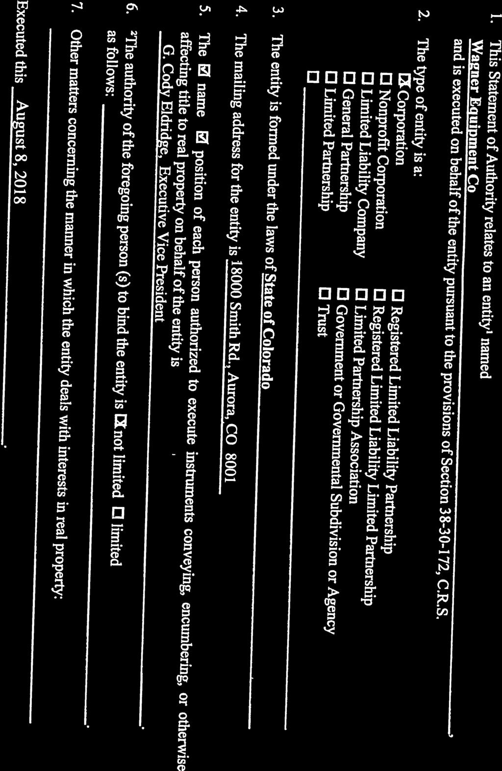
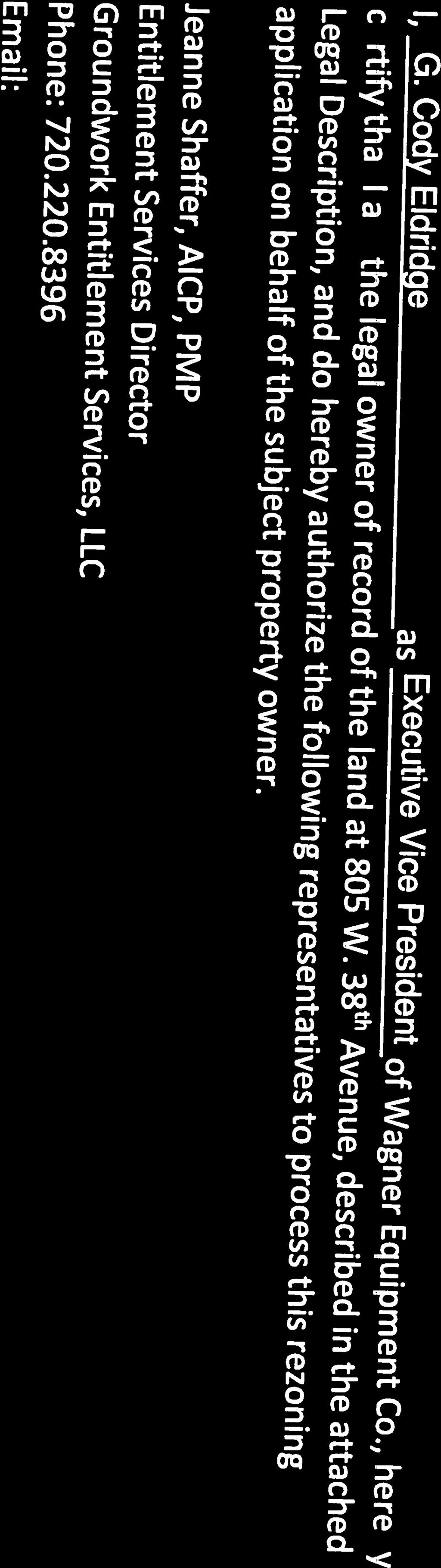
24 Contact Information (Property Owner Representative): Jeanne Shaffer, AICP, PMP Entitlement Services Director Groundwork Entitlement Services, LLC Phone: John Craig 4Site Advisors 1501 Wazee St, Unit 1C Denver, CO Phone: Property Owner: Wagner Equipment Co Smith Road Aurora, CO Kevin Pomeroy Phone: Page 5 of 5


25 2018I September 25th, 2018 $2000 fee pd CC


26 2018I September 25th, 2018 $2000 fee pd CC
27 2018I September 25th, 2018 $2000 fee pd CC

28 2018I September 25th, 2018 $2000 fee pd CC


29 2018I September 25th, 2018 $2000 fee pd CC


30 2018I September 25th, 2018 $2000 fee pd CC
31 2018I September 25th, 2018 $2000 fee pd CC
32 2018I September 25th, 2018 $2000 fee pd CC


33 2018I September 25th, 2018 $2000 fee pd CC
34 Legal Descriptions Zone Map Amendment (Rezoning) Total Rezoning Area: acres Property owned by Wagner Equipment Co A PARCEL OF LAND LOCATED IN THE SOUTHWEST 1/4 OF SECTION 22, TOWNSHIP 3 SOUTH, RANGE 68 WEST OF THE 6TH PRINCIPAL MERIDIAN, AND BEING A PORTION OF BLOCKS 37 AND 44, VIADUCT ADDITION TO DENVER, CITY AND COUNTY OF DENVER, STATE OF COLORADO, MORE PARTICULARLY DESCRIBED AS FOLLOWS: COMMENCING AT THE SOUTHWEST CORNER OF SAID SOUTHWEST 1/4 OF SECTION 22; THENCE NORTH EAST ALONG THE WEST LINE OF SAID SOUTHWEST 1/4, FEET; THENCE NORTH EAST ALONG THE SOUTH LINE OF BLOCK 44 OF VIADUCT ADDITION TO THE CITY OF DENVER PROJECTED WESTERLY, FEET TO A POINT ON THE EAST LINE OF THE DENVER, UTAH & PACIFIC RAILROAD (NOW BURLINGTON NORTHERN RAILROAD) RIGHT-OF-WAY AS DESCRIBED IN BOOK 607 AT PAGE 230 OF THE RECORDS OF THE CITY AND COUNTY OF DENVER, AND THE POINT OF BEGINNING; THENCE NORTH EAST ALONG SAID EAST LINE OF SAID RAILROAD RIGHT-OF-WAY, FEET; THENCE NORTH EAST, FEET TO A POINT ON THE CENTERLINE OF VACATED GALAPAGO STREET; THENCE SOUTH EAST ALONG SAID CENTERLINE OF VACATED GALAPAGO STREET, FEET TO A POINT ON THE NORTH LINE OF WEST 39TH AVENUE; THENCE NORTH WEST ALONG SAID NORTH LINE OF WEST 39TH AVENUE, FEET TO THE SOUTHEAST CORNER OF BLOCK 37 OF SAID VIADUCT ADDITION; THENCE SOUTH EAST ALONG THE WEST LINE OF SAID GALAPAGO STREET AND THE EAST LINE OF BLOCK 44 OF SAID VIADUCT ADDITION, FEET TO THE SOUTHEAST CORNER OF SAID BLOCK 44; THENCE SOUTH WEST ALONG THE SOUTH LINE OF SAID BLOCK 44, FEET TO THE POINT OF BEGINNING, EXCEPT THAT PORTION CONVEYED TO THE REGIONAL TRANSPORTATION DISTRICT IN WARRANTY DEED RECORDED OCTOBER 13, 2010 UNDER RECEPTION NO , CITY AND COUNTY OF DENVER, STATE OF COLORADO. TOTAL SURVEYED PARCELS CONTAINS (118,773 SQUARE FEET) ACRES, MORE OR LESS. Zone Map Amendment (Rezoning) 805 W. 38 th Ave Legal Description Page 1 of I September 25th, 2018 $2000 fee pd CC
September 25th, 2018 $2000 fee pd CC
 2.7267 acres 2018I-00075 September 25th, 2018 $2000 fee pd CC Rezoning Review Criteria Analysis - Map Amendment Application Number: 2018I-00075 805 W. 38 th Avenue October 19, 2018 (amd.) September 17,
Official Zoning Map Amendment Application #2018I-00077
 Community Planning and Development Planning Services 201 W. Colfax Ave., Dept. 205 Denver, CO 80202 p: 720.865.2915 f: 720.865.3052 www.denvergov.org/cpd TO: Denver Planning Board FROM: Scott Robinson,
Staff Report and Recommendation
 Community Planning and Development Planning Services 201 W. Colfax Ave., Dept. 205 Denver, CO 80202 p: 720.865.2915 f: 720.865.3052 www.denvergov.org/cpd TO: City Council Neighborhoods and Planning Committee
Official Zoning Map Amendment Application #2018I-00047
 Community Planning and Development Planning Services 201 W. Colfax Ave., Dept. 205 Denver, CO 80202 p: 720.865.2915 f: 720.865.3052 www.denvergov.org/cpd TO: Denver Planning Board FROM: Chandler Van Schaack,
Denver Land Use, Transportation and Infrastructure Committee FROM: Andrew Webb, Senior City Planner DATE: March 22, 2018 RE:
 Community Planning and Development Planning Services 201 W. Colfax Ave., Dept. 205 Denver, CO 80202 p: 720.865.2915 f: 720.865.3052 www.denvergov.org/cpd TO: Denver Land Use, Transportation and Infrastructure
Staff Report and Recommendation Based on the criteria for review in the Denver Zoning Code, Staff recommends approval for Application #2017I
 TO: Denver City Council Land Use, Transportation and Infrastructure Committee FROM: Theresa Lucero, Senior City Planner DATE: RE: Official Zoning Map Amendment Application #2017I-00149 Staff Report and
REZONING GUIDE. Zone Map Amendment (Rezoning) - Application. Rezoning Application Page 1 of 3. Return completed form to
 - Application. Rezoning Application Page 1 of 3. Return completed form to") Zone Map Amendment (Rezoning) - Application COMMUNITY PLANNING & DEVELOPMENT REZONING GUIDE Rezoning Application Page 1 of 3 PROPERTY OWNER INFORMATION* CHECK IF POINT OF CONTACT FOR APPLICATION Property
Zone Map Amendment (Rezoning) - Application COMMUNITY PLANNING & DEVELOPMENT REZONING GUIDE Rezoning Application Page 1 of 3 PROPERTY OWNER INFORMATION* CHECK IF POINT OF CONTACT FOR APPLICATION Property
Staff Report and Recommendation Based on the criteria for review in the Denver Zoning Code, Staff recommends approval for Application #2018I
 Community Planning and Development Planning Services 201 W. Colfax Ave., Dept. 205 Denver, CO 80202 p: 720.865.2915 f: 720.865.3052 www.denvergov.org/cpd TO: Denver Planning Board FROM: Sara White, AICP,
TO: Staff Report and Recommendation
 Community Planning and Development Planning Services 201 W. Colfax Ave., Dept. 205 Denver, CO 80202 p: 720.865.2915 f: 720.865.3052 www.denvergov.org/cpd TO: City Council Neighborhoods and Planning Committee
To: S-MX-8 AIO, S-MX-8A AIO, S-MX-12 AIO, C-MX-8 AIO, C-MX-12 AIO, and S-CC-5 AIO
 Community Planning and Development Planning Services 201 W. Colfax Ave., Dept. 205 Denver, CO 80202 p: 720.865.2915 f: 720.865.3052 www.denvergov.org/cpd TO: City Council Neighborhoods and Planning Committee
, C-MS I June 3, 2016 $1500 pd chk #216918
 , C-MS-8 LOTS 21 THROUGH 40, INCLUSIVE, BLOCK 299 CLEMENTS ADDITION TO THE CITY OF DENVER SOUTHEAST QUARTER OF SECTION 34, TOWNSHIP 3 SOUTH, RANGE 68 WEST, SIXTH PRINCIPAL MERIDIAN, CITY
Planning Services Community Planning and Development 201 W. Colfax Ave., Dept. 205 Denver, CO p
 TO: Denver Planning Board, Julie Underdahl, Chair FROM: Theresa Lucero, Senior City Planner DATE: RE: Official Zoning Map Amendment Application #2017I-00042 Staff Report and Recommendation Based on the
TO: Denver Planning Board FROM: Analiese Hock, Senior City Planner DATE: March 13, 2018 RE:
 Community Planning and Development Planning Services 201 W. Colfax Ave., Dept. 205 Denver, CO 80202 p: 720.865.2915 f: 720.865.3052 www.denvergov.org/cpd TO: Denver Planning Board FROM: Analiese Hock,
Staff Report and Recommendation
 Community Planning and Development Planning Services 201 W Colfax Ave, Dept 205 Denver, CO 80202 p: 720-865-2972 f: 720-865-3056 www.denvergov.org/planning TO: LUTI FROM: Steve Nalley, Senior City Planner
2 nd & St Paul, LLC and BAH-PLA, LLC
 Community Planning and Development Planning Services 201 W. Colfax Ave., Dept. 205 Denver, CO 80202 p: 720.865.2915 f: 720.865.3052 www.denvergov.org/cpd TO: Denver City Council FROM: Theresa Lucero, Senior
REZONING GUIDE. Zone Map Amendment (Rezoning) - Application. Rezoning Application Page 1 of 3. Return completed form to
 - Application. Rezoning Application Page 1 of 3. Return completed form to") Zone Map Amendment (Rezoning) - Application COMMUNITY PLANNING & DEVELOPMENT REZONING GUIDE Rezoning Application Page 1 of 3 PROPERTY OWNER INFORMATION* CHECK IF POINT OF CONTACT FOR APPLICATION Property
Zone Map Amendment (Rezoning) - Application COMMUNITY PLANNING & DEVELOPMENT REZONING GUIDE Rezoning Application Page 1 of 3 PROPERTY OWNER INFORMATION* CHECK IF POINT OF CONTACT FOR APPLICATION Property
Staff Report and Recommendation
 Community Planning and Development Planning Services 201 W. Colfax Ave., Dept. 205 Denver, CO 80202 p: 720.865.2915 f: 720.865.3052 www.denvergov.org/cpd TO: Denver City Council FROM: Steve Nalley, Neighborhood
CITY OF PUYALLUP. Background. Development Services
 CITY OF PUYALLUP Development Services 333 South Meridian Puyallup WA 98371 To: City Council From: Katie Baker, AICP, Planning Division Re: South Hill Neighborhood Plan Adoption Date: (Meeting date: February
DENVER DESIGN DISTRICT GDP
 DENVER DESIGN DISTRICT GDP Urban Design Standards and Guidelines November 17, 2008 Amended February 3, 2016 City and County of Denver CF Property Management, Inc. C/O Denver Design District - Starboard
REQUEST Current Zoning: O-15(CD) (office) Proposed Zoning: TOD-M(CD) (transit oriented development mixed-use, conditional)
 (office) Proposed Zoning: TOD-M(CD) (transit oriented development mixed-use, conditional)") Rezoning Petition 2016-117 Zoning Committee Recommendation January 4, 2017 REQUEST Current Zoning: O-15(CD) (office) Proposed Zoning: TOD-M(CD) (transit oriented development mixed-use, conditional) LOCATION
Rezoning Petition 2016-117 Zoning Committee Recommendation January 4, 2017 REQUEST Current Zoning: O-15(CD) (office) Proposed Zoning: TOD-M(CD) (transit oriented development mixed-use, conditional) LOCATION
#2017I E-RH-2.5 Highland Ventures Holdings, LLC and Irving Estates, LLC
 TO: Denver Planning Board - Joel Noble, Chair FROM: Theresa Lucero, Senior City Planner DATE: RE: Official Zoning Map Amendment Application #2017I-00178 1080 and 1090 King Street Rezoning from E-SU-D1x
Steering Committee Meeting
 Neighborhood Planning Initiative NPI EAST CENTRAL AREA PLAN Steering Committee Meeting November 9, 2017 6:00PM 8:00PM Tears McFarlane House East Central Area Plan Steering Committee Meeting 11/9/17 AGENDA
C. Westerly Creek Village & The Montview Corridor
 C. Westerly Creek Village & The VISION Community Vision When the goals of the city are achieved Westerly Creek Village, a distinctive community defined by Montview Boulevard and Westerly Creek, is a strong
AWH REPORT OF THE PLANNING AND DEVELOPMENT DEPARTMENT FOR APPLICATION FOR REZONING ORDINANCE TO PLANNED UNIT DEVELOPMENT
 AWH REPORT OF THE PLANNING AND DEVELOPMENT DEPARTMENT FOR APPLICATION FOR REZONING ORDINANCE TO PLANNED UNIT DEVELOPMENT MAY 8, 2014 The Planning and Development Department hereby forwards to the Planning
TO: Denver Planning Board FROM: Chandler Van Schaack, Senior City Planner DATE: March 27, 2019 RE:
 Community Planning and Development Planning Services W. Colfax Ave., Dept. Denver, CO 0 p:.. f:..0 www.denvergov.org/cpd TO: Denver Planning Board FROM: Chandler Van Schaack, Senior City Planner DATE:
Staff Report to the North Ogden City Planning Commission
 Staff Report to the North Ogden City Planning Commission SYNOPSIS / APPLICATION INFORMATION Application Request: Concept review on a legislative application to rezone land located at approximately 1750
Town Center (part of the Comprehensive Plan)
") Town Center (part of the Comprehensive Plan) Mercer Island Town Center Looking North (2014) In 1994, a year-long process culminated in a set of design guidelines and code requirements for the Town Center
Town Center (part of the Comprehensive Plan) Mercer Island Town Center Looking North (2014) In 1994, a year-long process culminated in a set of design guidelines and code requirements for the Town Center
FUTURE LAND USE ELEMENT
 FUTURE LAND USE ELEMENT GOAL I: To create and sustain a great place to live, play, and prosper Objective 1: The City of Ocala shall incorporate the principles and strategies of the Ocala 2035 Vision into
178 Carruthers Properties Inc.
 178 Carruthers Properties Inc. Planning Rationale for 178 Carruthers Avenue Site Plan Control Application June 2014 Table of Contents 1.0 Introduction 2.0 Overview of Subject Property 3.0 Current Zoning
SECTION UNIFIED DEVELOPMENT ORDINANCE SECTION Part 1 Ordinance. ARTICLE 1 Zoning Districts
 SECTION 1-100 UNIFIED DEVELOPMENT ORDINANCE SECTION 1-300 Part 1 Ordinance SECTION 1-100. Introduction. ARTICLE 1 Zoning Districts Crystal Lake strives to maintain a balance of various land uses for a
4.1.3 LAND USE CATEGORIES
 4.1.3 LAND USE CATEGORIES a. City Center District The City Center District incorporates the existing character and mix of uses in downtown Belmont to encourage redevelopment and new development in keeping
PLANNED UNIT DEVELOPMENT STAFF REPORT Date: June 2, 2016
 # 9 ZON2016-01032 PLANNED UNIT DEVELOPMENT STAFF REPORT Date: June 2, 2016 DEVELOPMENT NAME JJT Properties LLC LOCATION 1147 & 1151 East I-65 Service Road South and 1180 Sledge Drive (Southeast corner
A. Background Summary of Existing Challenges and Potential Possibilities. 1. Summary of Existing Assets and Potential Opportunities
 A. Background 1 A Main Street Master Plan Study was performed and completed in October of 2007. The study was initiated to review current land uses and development patterns along Main Street, from Parrish
PINE CURVE REZONING. BACKGROUND Purchased as two parcels in 2001 and 2002
 BACKGROUND Purchased as two parcels in 2001 and 2002 WHAT THE PROJECT IS AND IS NOT A Rezoning establishes the land use standards for Annexed and Zoned Greater Downtown District Historic Center September
City Of Sparks Planning Commission Item
 Page 1 of 12 City Of Sparks Planning Commission Item Meeting Date: May17, 2012 Subject: PCN12009, Public Hearing, Consideration and possible action on a Master Plan Amendment and Rezoning request to change
4400 Fox. Public Meeting: Rezoning, IMP and GDP Repeal May 24, 2017
 4400 Fox Public Meeting: Rezoning, IMP and GDP Repeal May 24, 2017 Project Location Process Summary GDP Repeal IMP Rezoning Repeal of the 25/70 GDP finding that the GDP is no longer necessary to implement
EXISTING COMPREHENSIVE PLAN
 EXISTING COMPREHENSIVE PLAN Town Center Land Use Element: V. LAND USE POLICIES Town Center Mercer Island's business district vision as described in "Your Mercer Island Citizen-Designed Downtown" was an
CHAPTER 1. Ms. Guajardo s Class - Central Elementary CH 1 1
 INTRODUCTION CHAPTER 1 Ms. Guajardo s Class - Central Elementary CH 1 1 1.1 SETTING South Centre City is a linear corridor south of Downtown Escondido paralleling Centre City Parkway and South Escondido
ARTICLE 6: Special and Planned Development Districts
 ARTICLE 6: Special and Planned Development Districts 6-10 Traditional Neighborhood Development (TND) District 6-10.10 Purpose and Intent The Traditional Neighborhood Development (TND) District provides
CPD Rules and Regulations. Arapahoe Square Zoning and Design Standards/Guidelines
 CPD Rules and Regulations Arapahoe Square Zoning and Design Standards/Guidelines Denver Planning Board May 4 th, 2016 Sponsor & Community Partners Sponsored by Albus Brooks, Council District 9 Developed
LAND USE AMENDMENT DOWNTOWN COMMERCIAL CORE (WARD 7) MACLEOD TRAIL SE AND 5 AVENUE SE BYLAW 254D2017
 MACLEOD TRAIL SE AND 5 AVENUE SE BYLAW 254D2017") Page 1 of 10 EXECUTIVE SUMMARY This Land Use Amendment application seeks to redesignate a full downtown block (currently the YWCA site) from a Direct Control based on the CM-2 District (Land Use Bylaw
Page 1 of 10 EXECUTIVE SUMMARY This Land Use Amendment application seeks to redesignate a full downtown block (currently the YWCA site) from a Direct Control based on the CM-2 District (Land Use Bylaw
Official Plan Review: Draft Built Form Policies
 PG.30.1 REPORT FOR ACTION Official Plan Review: Draft Built Form Policies Date: May 15, 2018 To: Planning and Growth Management Committee From: Chief Planner and Executive Director, City Planning Division
Prosperity Hucks Area Plan. Transportation and Planning Committee May 11, 2015
 Prosperity Hucks Area Plan Transportation and Planning Committee May 11, 2015 Presentation Outline 1. Background and Location 2. Community Dialog Process 3. Activity Center Recommendations 4. Wedge Recommendations
Policies and Code Intent Sections Related to Town Center
 Policies and Code Intent Sections Related to Town Center The Town Center Vision is scattered throughout the Comprehensive Plan, development code and the 1994 Town Center Plan. What follows are sections
STAFF SUMMARY FOR S17-02 SPECIAL USE PERMIT APPLICATION
 APPLICATION SUMMARY Case Number: S17-02 Request: STAFF SUMMARY FOR S17-02 SPECIAL USE PERMIT APPLICATION SUP application in order to develop a convenience food store. Applicant: Property Owner(s): Cindee
ARLINGTON COUNTY, VIRGINIA
 ARLINGTON COUNTY, VIRGINIA County Board Agenda Item Meeting October 15, 2005 DATE: September 28, 2005 SUBJECT: Request to Advertise the adoption of the 2005 Clarendon Sector Plan C. M. RECOMMENDATION:
PINE CURVE REZONING. Property does not meet criteria for open space preservation and is not a candidate for a park
 PINE CURVE REZONING BACKGROUND Purchased as two parcels in 2001 and 2002 Annexed and Zoned Greater Downtown District Historic Center September 25, 2002 and October 7, 2002 WHAT THE PROJECT IS AND IS NOT
NEW CASTLE COUNTY S ZONING DISTRICTS
 NEW CASTLE COUNTY S ZONING DISTRICTS This is general information about New Castle County s zoning districts. The information included is by no means exhaustive or complete. Before designing plans to develop
A. WHAT IS A GENERAL PLAN?
 I. Introduction A. WHAT IS A GENERAL PLAN? A general plan is the planning guideline for the future of a city. It contains goals and policies which regulate urban development, the protection of the natural
PLANNED UNIT DEVELOPMENT & SUBDIVISION STAFF REPORT Date: May 18, 2017
 & PUD-0000102-2017 PLANNED UNIT DEVELOPMENT & SUBDIVISION STAFF REPORT Date: May 18, 2017 NAME SUBDIVISION NAME Dauphin Creek Estates Subdivision Dauphin Creek Estates Subdivision LOCATION CITY COUNCIL
Gold Line Bus Rapid Transit Transit Oriented Development (BRTOD) Helmo Station Area Plan
 Helmo Station Area Plan") Appendix F Gold Line Bus Rapid Transit Transit Oriented Development (BRTOD) Helmo Station Area Plan Introduction and Purpose of the Plan The Gold Line Bus Rapid Transit facility is an eleven-mile dedicated
Appendix F Gold Line Bus Rapid Transit Transit Oriented Development (BRTOD) Helmo Station Area Plan Introduction and Purpose of the Plan The Gold Line Bus Rapid Transit facility is an eleven-mile dedicated
V. Vision and Guiding Principles
 V. Vision and Guiding Principles The Master Plan for the Powers Ferry Corridor seeks a foundation in the desires of the community. At times, various elements of the community offered opposing viewpoints,
Tyvola & Archdale Transit Station Area Plan. May 15, 2008
 Tyvola & Archdale Transit Station Area Plan First Public Meeting May 15, 2008 Presentation Outline 1. Purpose and Process 2. Station Area Overview 3. Plan Recommendations Vision Land Use Transportation
Rezoning Petition Post-Hearing Staff Analysis February 5, 2019
 Rezoning Petition 2018-053 Post-Hearing Staff Analysis February 5, 2019 REQUEST Current Zoning: R-5 (single family), B-1 (neighborhood business), I-1 (light industrial), and I-2 (general industrial) Proposed
Land Use Amendment in Southwood (Ward 11) at and Elbow Drive SW, LOC
 at and Elbow Drive SW, LOC") 2018 November 15 Page 1 of 10 EXECUTIVE SUMMARY This land use amendment application was submitted by Rick Balbi Architect on 2017 August 31 on behalf of Sable Developments Ltd, and with authorization from
2018 November 15 Page 1 of 10 EXECUTIVE SUMMARY This land use amendment application was submitted by Rick Balbi Architect on 2017 August 31 on behalf of Sable Developments Ltd, and with authorization from
The petition proposes to rezone 3.17 acres to allow all uses in the TOD-M (transit oriented development mixed-use) district.
 district.") Rezoning Petition 2018-053 Pre-Hearing Staff Analysis December 17, 2018 REQUEST Current Zoning: R-5 (single family), B-1 (neighborhood business), I-1 (light industrial), and I-2 (general industrial) Proposed
Rezoning Petition 2018-053 Pre-Hearing Staff Analysis December 17, 2018 REQUEST Current Zoning: R-5 (single family), B-1 (neighborhood business), I-1 (light industrial), and I-2 (general industrial) Proposed
EXECUTIVE SUMMARY DRAFT CHAPTER 1 INTRODUCTION EXECUTIVE SUMMARY
 CHAPTER 1 EXECUTIVE SUMMARY INTRODUCTION Through the joint efforts of the City of Tulsa planning staff and the Land Services division of Indian Nations Council of Governments (INCOG), the Berryhill Land
CITY OF COLWICH COMPREHENSIVE PLAN LAND USE LAND USE 1
 LAND USE LAND USE 1 WHAT YOU WILL FIND IN THIS CHAPTER: Discussion of today s conditions and tomorrow s projections Discussion of challenges and opportunities Discussion of the environmental quality goals,
New Partners for Smart Growth Conference February 5, 2010
 Dan Stroh, Planning Director City of Bellevue Planning and Community Development Bellevue, WA New Partners for Smart Growth Conference February 5, 2010 Summary of Project Long-range plan update for Bel-Red
Sheridan Boulevard S TAT I O N A R E A P L A N S H E R I D A N B O U L E VA R D S TAT I O N A R E A P L A N
 Sheridan Boulevard S TAT I O N A R E A P L A N 1 City of Lakewood Adopted November, 2006 S H E R I D A N B O U L E VA R D S TAT I O N A R E A P L A N The Vision The City of Lakewood s overall vision is
17.11 Establishment of Land Use Districts
 17.11 Establishment of Land Use Districts 17.11.010 Purpose. To promote the health, safety, and general welfare of City residents and those who come to South Salt Lake to work, exchange commerce and recreate.
Official Zoning Map Amendment Application #2018I-00131
 Community Planning and Development Planning Services 201 W. Colfax Ave., Dept. 205 Denver, CO 80202 p: 720.865.2915 f: 720.865.3052 www.denvergov.org/cpd TO: Denver Planning Board FROM: Kristofer Johnson,
COMMUNITY DESIGN. GOAL: Create livable and attractive communities. Intent
 COMMUNITY DESIGN Intent An attractive, well-designed County will attract quality development, instill civic pride, improve the visual character of the community, and create a strong, positive image for
VILLAGE OF CLEMMONS PLANNING BOARD DRAFT STAFF REPORT
 VILLAGE OF CLEMMONS PLANNING BOARD DRAFT STAFF REPORT PETITION INFORMATION Docket # C-226 Staff Megan Ledbetter Petitioner(s) JBJH Properties, LLC Owner(s) JBJH Properties, LLC Subject Property 5892-49-1766
The transportation system in a community is an
 7 TRANSPORTATION The transportation system in a community is an important factor contributing to the quality of life of the residents. Without a sound transportation system to bring both goods and patrons
Chapter Master Planned Communities (MPC) District
 District") Sections 14.53.010 Purpose and Intent 14.53.020 Applicability 14.53.030 Procedure 14.53.040 MPC Standards 14.53.050 Required Findings 14.53.010 Purpose and Intent Chapter 14.53 Master Planned Communities
Sections 14.53.010 Purpose and Intent 14.53.020 Applicability 14.53.030 Procedure 14.53.040 MPC Standards 14.53.050 Required Findings 14.53.010 Purpose and Intent Chapter 14.53 Master Planned Communities
I. Introduction. Prior Approvals
 Statement of Justification First National Bank 19790 Crystal Rock Drive, Germantown, Maryland Application for Site Plan and Limited Preliminary Plan Amendment I. Introduction DPH Architecture, for First
CHAPTER 7: VISION AND ACTION STATEMENTS. Noble 2025 Vision Statement
 CHAPTER 7: VISION AND ACTION STATEMENTS This chapter presents the vision, policy and action statements that transform the comprehensive planning study, an analysis of Noble s past, future trends and community
Complete Neighbourhood Guidelines Review Tool
 Complete Neighbourhood Guidelines Review Tool Prepared By: City of Regina Planning Department October 2014 Page 1 of 14 Community Development Review Checklist for Secondary Plans and Concept Plans The
TREASURE COAST REGIONAL PLANNING COUNCIL M E M O R A N D U M. To: Council Members AGENDA ITEM 5H
 TREASURE COAST REGIONAL PLANNING COUNCIL M E M O R A N D U M To: Council Members AGENDA ITEM 5H From: Date: Subject: Staff October 17, 2008 Council Meeting Local Government Comprehensive Plan Review Draft
DRAFT. 10% Common Open Space
 % OF CHARLOTTE IS CATEGORIZED AS A. LAND USES : Placeholder map displaying location of Place Type GOALS: Accommodate XX% of future growth. Provide a concentration of primarily commercial and civic activity
Rezoning Petition Final Staff Analysis June 18, 2018
 Rezoning Petition 2018-028 Final Staff Analysis June 18, 2018 REQUEST Current Zoning: MX-1 LLWPA (mixed use district, Lower Lake Wylie Protected Area), R-3 LLWPA (single family residential, Lower Lake
City of Tacoma Planning and Development Services
 Agenda Item D-3 City of Tacoma Planning and Development Services To: Planning Commission From: Stephen Atkinson, Associate Planner, Planning Services Division Subject: Land Use Designations - Phase 2 Meeting
12 January 12, 2011 Public Hearing APPLICANT: TAILWIND DEVELOPMENT GROUP,LLC PROPERTY OWNER: CITY OF VIRGINIA BEACH
 12 January 12, 2011 Public Hearing APPLICANT: TAILWIND DEVELOPMENT GROUP,LLC PROPERTY OWNER: CITY OF VIRGINIA BEACH STAFF PLANNER: Faith Christie REQUEST: Conditional Change of Zoning (from PD-H1 Planned
CHARLES PUTMAN CHARLES PUTMAN AND ASSOCIATES, INC
 MEMORANDUM CHARLES PUTMAN & ASSOCIATES, INC. LAND DEVELOPMENT CONSULTANTS PLANNING ZONING PERMITTING 4722 NW Boca Raton Boulevard, Suite C-106 Boca Raton, Florida 33431 Phone: 561/994-6411 FAX: 561/994-0447
MONTGOMERY COUNTY PLANNING DEPARTMENT THE MARYLAND-NATIONAL CAPITAL PARK AND PLANNING COMMISSION
 MONTGOMERY COUNTY PLANNING DEPARTMENT THE MARYLAND-NATIONAL CAPITAL PARK AND PLANNING COMMISSION MCPB Item No. Date: 3.10.2016 Site Plan 820160040 Nora School Parker Smith, Planning Technician, Area 1,
Urban Planning and Land Use
 Urban Planning and Land Use 701 North 7 th Street, Room 423 Phone: (913) 573-5750 Kansas City, Kansas 66101 Fax: (913) 573-5796 Email: planninginfo@wycokck.org www.wycokck.org/planning To: From: City Planning
CHAPTER 7: Transportation, Mobility and Circulation
 AGLE AREA COMMUNITY Plan CHAPTER 7 CHAPTER 7: Transportation, Mobility and Circulation Transportation, Mobility and Circulation The purpose of the Transportation, Mobility and Circulation Chapter is to
Planning Districts INTRODUCTION
 INTRODUCTION To facilitate detailed examination of development prospects for all areas of the community, Delano has been divided into 14 planning districts. The location of these planning districts is
Planning & Zoning Commission Staff Report
 Planning & Zoning Commission Staff Report Meeting Date: May 26, 2015 Drafted by: Katherine Harrison-Rogers CASE # Z2886 PROJECT NAME: APPLICANT/ REPRESENTATIVE: Shawna Runyan PROPERTY OWNER: 1840 (previously
SDOT DPD. SDOT Director s Rule DPD Director s Rule DCLU DR SED DR of 7 CITY OF SEATTLE
 SDOT SDOT Director s Rule 2-07 DPD Applicant: CITY OF SEATTLE Page 1 of 7 Supersedes: DCLU DR 11-93 SED DR 93-4 Seattle Department of Transportation (SDOT) Department of Planning and Development (DPD)
BUILDING SCALE AND SETBACKS 5 ELEMENTS:... 5 FAÇADES (COMMERCIAL/RESIDENTIAL) 5
 5") VISION STATEMENT 3 UTILIZATION OF THE GUIDELINES 3 IMPLEMENTATION 3 PROCEDURES FOR DESIGN REVIEW 3 LAND USE AND ZONING 4 LAND USE 4 ELEMENTS:... 4 ZONING 4 ELEMENTS:... 4 BUILDING SCALE AND SETBACKS 5
VISION STATEMENT 3 UTILIZATION OF THE GUIDELINES 3 IMPLEMENTATION 3 PROCEDURES FOR DESIGN REVIEW 3 LAND USE AND ZONING 4 LAND USE 4 ELEMENTS:... 4 ZONING 4 ELEMENTS:... 4 BUILDING SCALE AND SETBACKS 5
Danvers High Street I-1 District Study
 Danvers High Street I-1 District Study Presentation of Final Recommendations Planning Board Presentation June 26 th, 2018 1 Introductions Metropolitan Area Planning Council Sam Cleaves AICP, Principal
Executive Summary. NY 7 / NY 2 Corridor
 Executive Summary NY 7 / NY 2 Corridor Transportation and Land Use Study December 2005 Prepared for: Town of Colonie Capital District Transportation Committee Prepared by: Introduction: Land use decisions
Be it enacted by the Town Board of the Town of Guilderland that the following new A (Transit Oriented Development (TOD) District) is adopted:
 District) is adopted:") Local Law No. 4 of 2018 (Adoption of 280-18A (Transit Oriented Development District) Be it enacted by the Town Board of the Town of Guilderland that the following new 280-18A (Transit Oriented Development
Local Law No. 4 of 2018 (Adoption of 280-18A (Transit Oriented Development District) Be it enacted by the Town Board of the Town of Guilderland that the following new 280-18A (Transit Oriented Development
FORMER CANADIAN FORCES BASE (CFB) ROCKCLIFFE SECONDARY PLAN. Official Plan Amendment XX to the Official Plan for the City of Ottawa
 ROCKCLIFFE SECONDARY PLAN. Official Plan Amendment XX to the Official Plan for the City of Ottawa") FORMER CANADIAN FORCES BASE (CFB) ROCKCLIFFE SECONDARY PLAN Official Plan Amendment XX to the Official Plan for the City of Ottawa 1 INDEX THE STATEMENT OF COMPONENTS PART A THE PREAMBLE PAGE Purpose...
FORMER CANADIAN FORCES BASE (CFB) ROCKCLIFFE SECONDARY PLAN Official Plan Amendment XX to the Official Plan for the City of Ottawa 1 INDEX THE STATEMENT OF COMPONENTS PART A THE PREAMBLE PAGE Purpose...
Drexel, Barrell & Co.
 Drexel, Barrell & Co. June 18, 2018 Engineers/Surveyors Boulder Colorado Springs Greeley 3 South 7 th Street Colorado Springs, Colorado 80905-1501 719 260-0887 719 260-8352 Fax El Paso County Planning
Developer s Program. The Station at East 54
 Developer s Program The Station at East 54 Existing Conditions The Station at East 54 is proposed for a 1.12 acre site at the northeast corner of Hamilton Road and Prestwick Road, tucked between the East
City of Long Beach. creating vibrant and exciting places
 City of Long Beach creating vibrant and exciting places Land Use Element Urban Design Element Overview of the two draft General Plan elements Discuss areas of change Economic goals of the plans Case study
YONGE STEELES CORRIDOR SECONDARY PLAN. Young + Wright / IBI Group Architects Dillon Consulting Ltd. GHK International (Canada) Ltd.
 Ltd.") PART A: PREAMBLE 1.0 PURPOSE The purpose of this Secondary Plan is to provide a development framework for intensification of the Yonge/ Steeles corridor including the north side of Steeles Avenue West
PART A: PREAMBLE 1.0 PURPOSE The purpose of this Secondary Plan is to provide a development framework for intensification of the Yonge/ Steeles corridor including the north side of Steeles Avenue West
Urban Design Manual PLANNING AROUND RAPID TRANSIT STATIONS (PARTS) Introduction. Station Study Areas
 Introduction. Station Study Areas") 111111 PLANNING AROUND RAPID TRANSIT STATIONS (PARTS) Introduction The ION rapid transit system will link Waterloo, Kitchener and Cambridge through a central transit corridor (CTC). There are a number
111111 PLANNING AROUND RAPID TRANSIT STATIONS (PARTS) Introduction The ION rapid transit system will link Waterloo, Kitchener and Cambridge through a central transit corridor (CTC). There are a number
Wadsworth Boulevard S TAT I O N A R E A P L A N
 Wadsworth Boulevard S TAT I O N A R E A P L A N City of Lakewood Adopted November, 2006 The Vision The City of Lakewood s overall vision is to transform the area around the light rail station into a mixed-use
Regency Developments. Urban Design Brief. Holyrood DC2 Rezoning
 Regency Developments Urban Design Brief Holyrood DC2 Rezoning Stantec Consulting Ltd. 7-31-2017 1. Overview Regency Developments intends to rezone the lands located at 8510 and 8511 93 Avenue, within the
Planned Development Review Revisions (Project No. PLNPCM )
") Planned Development Review Revisions (Project No. PLNPCM2014-00139) Standard residential development Planned Development Example: Smaller lot sizes than what is allowed to create open space amenity. What
Planned Development Review Revisions (Project No. PLNPCM2014-00139) Standard residential development Planned Development Example: Smaller lot sizes than what is allowed to create open space amenity. What
14 October 10, 2012 Public Hearing APPLICANT: MPB, INC
 14 October 10, 2012 Public Hearing APPLICANT: MPB, INC PROPERTY OWNER: MUNDEN & ASSOCIATES, LP STAFF PLANNER: Karen Prochilo REQUEST: Conditional Change of Zoning (AG-1 & AG-2 to Conditional O-2) ADDRESS
Tyvola & Archdale Transit Station Area Plan. June 5, 2008
 Tyvola & Archdale Transit Station Area Plan Second Public Meeting June 5, 2008 Presentation Outline 1. Purpose and Process 2. Station Area Overview 3. Plan Recommendations 4. Comments Received and Proposed
VIRGINIA DRIVE SPECIAL PLAN
 August 15, 2017 Staff Report to the Municipal Planning Board CASE #GMP2017-10006 & LDC2017-00231 Item # 7 VIRGINIA DRIVE SPECIAL PLAN Location Map Subject Site SUMMARY Applicant City of Orlando, Planning
Public input has been an important part of the plan development process.
 Lakewood s Comprehensive Plan recognizes that transportation helps shape the community, and that the way the community provides for the safe and efficient movement of people affects the character of the
Rezoning Petition Pre-Hearing Staff Analysis July 16, 2018
 Rezoning Petition 2018-044 Pre-Hearing Staff Analysis July 16, 2018 REQUEST Current Zoning: R-3 (single family residential) Proposed Zoning: UR-2(CD) (urban residential, conditional) LOCATION Approximately
ROAD CLOSURE AND LAND USE AMENDMENT SILVER SPRINGS (WARD 1) NORTHEAST OF NOSEHILL DRIVE NW AND SILVER SPRINGS ROAD NW BYLAWS 2C2018 AND 29D2018
 NORTHEAST OF NOSEHILL DRIVE NW AND SILVER SPRINGS ROAD NW BYLAWS 2C2018 AND 29D2018") Page 1 of 19 EXECUTIVE SUMMARY This application proposes redesignating two parcels in the community of Silver Springs from Special Purpose Future Urban Development (S-FUD) District and undesignated road
Page 1 of 19 EXECUTIVE SUMMARY This application proposes redesignating two parcels in the community of Silver Springs from Special Purpose Future Urban Development (S-FUD) District and undesignated road