Foundation Document Walnut Canyon National Monument Arizona May 2015
|
|
|
- Carmella Ross
- 5 years ago
- Views:
Transcription

1 NATIONAL PARK SERVICE U.S. DEPARTMENT OF THE INTERIOR Foundation Document Arizona May 2015

2 Foundation Document 40 Visitor Center WALNUT CANYON NATIONAL MONUMENT Visitor Center to exit 204, 40 : 3mi/5km Pueblo and Pithouse Ruins Visitor Center 6690ft 2039m Visitor Center to downtown Flagstaff: 10mi/16km Picnic area Rim Trail C O C O N I N O N A T I O N A L F O R E S T Walnut Creek Island Trail Canyon floor elevation: 6340ft 1932m W A L N U T C A N Y O N N A T I O N A L M O N U M E N T North W A L N U T C A N Y O N Kilometer Mile 0.5 Island Trail, a 0.9-mile (1.5-kilometer) round-trip paved interpretive trail, requires a climb of 185 feet (56 meters) via 240 steps. Trail Overlook Cliff dwelling ruin CHERRY CANYON
3 Contents Mission of the National Park Service Introduction Part 1: Core Components Brief Description of the Monument Monument Purpose Monument Significance Fundamental Resources and Values Other Important Resources and Values Interpretive Themes Part 2: Dynamic Components Special Mandates and Administrative Commitments Assessment of Planning and Data Needs Analysis of Fundamental Resources and Values Analysis of Other Important Resources and Values Identification of Key Issues and Associated Planning and Data Needs Planning and Data Needs Part 3: Contributors Friends of Flagstaff Monuments Representatives NPS Intermountain Region Other NPS Staff Appendixes Appendix A: Presidential Proclamation and Legislative Acts for Appendix B: Inventory of Administrative Commitments Appendix C: Tribes Traditionally Associated with
4 Foundation Document
5 Mission of the National Park Service The National Park Service (NPS) preserves unimpaired the natural and cultural resources and values of the national park system for the enjoyment, education, and inspiration of this and future generations. The National Park Service cooperates with partners to extend the benefits of natural and cultural resource conservation and outdoor recreation throughout this country and the world. The NPS core values are a framework in which the National Park Service accomplishes its mission. They express the manner in which, both individually and collectively, the National Park Service pursues its mission. The NPS core values are: Shared stewardship: We share a commitment to resource stewardship with the global preservation community. Excellence: We strive continually to learn and improve so that we may achieve the highest ideals of public service. Integrity: We deal honestly and fairly with the public and one another. Tradition: We are proud of it; we learn from it; we are not bound by it. Respect: We embrace each other s differences so that we may enrich the well-being of everyone. The National Park Service is a bureau within the Department of the Interior. While numerous national park system units were created prior to 1916, it was not until August 25, 1916, that President Woodrow Wilson signed the National Park Service Organic Act formally establishing the National Park Service. The national park system continues to grow and comprises more than 400 park units covering more than 84 million acres in every state, the District of Columbia, American Samoa, Guam, Puerto Rico, and the Virgin Islands. These units include, but are not limited to, national parks, monuments, battlefields, military parks, historical parks, historic sites, lakeshores, seashores, recreation areas, scenic rivers and trails, and the White House. The variety and diversity of park units throughout the nation require a strong commitment to resource stewardship and management to ensure both the protection and enjoyment of these resources for future generations. The arrowhead was authorized as the official National Park Service emblem by the Secretary of the Interior on July 20, The sequoia tree and bison represent vegetation and wildlife, the mountains and water represent scenic and recreational values, and the arrowhead represents historical and archeological values. 1

6 Foundation Document Introduction Every unit of the national park system will have a foundational document to provide basic guidance for planning and management decisions a foundation for planning and management. The core components of a foundation document include a brief description of the park as well as the park s purpose, significance, fundamental resources and values, other important resources and values, and interpretive themes. The foundation document also includes special mandates and administrative commitments, an assessment of planning and data needs that identifies planning issues, planning products to be developed, and the associated studies and data required for park planning. Along with the core components, the assessment provides a focus for park planning activities and establishes a baseline from which planning documents are developed. A primary benefit of developing a foundation document is the opportunity to integrate and coordinate all kinds and levels of planning from a single, shared understanding of what is most important about the park. The process of developing a foundation document begins with gathering and integrating information about the park. Next, this information is refined and focused to determine what the most important attributes of the park are. The process of preparing a foundation document aids park managers, staff, and the public in identifying and clearly stating in one document the essential information that is necessary for park management to consider when determining future planning efforts, outlining key planning issues, and protecting resources and values that are integral to park purpose and identity. While not included in this document, a park atlas is also part of a foundation project. The atlas is a series of maps compiled from available geographic information system (GIS) data on natural and cultural resources, visitor use patterns, facilities, and other topics. It serves as a GIS-based support tool for planning and park operations. The atlas is published as a (hard copy) paper product and as geospatial data for use in a web mapping environment. The park atlas for Walnut Canyon National Monument can be accessed online at: 2

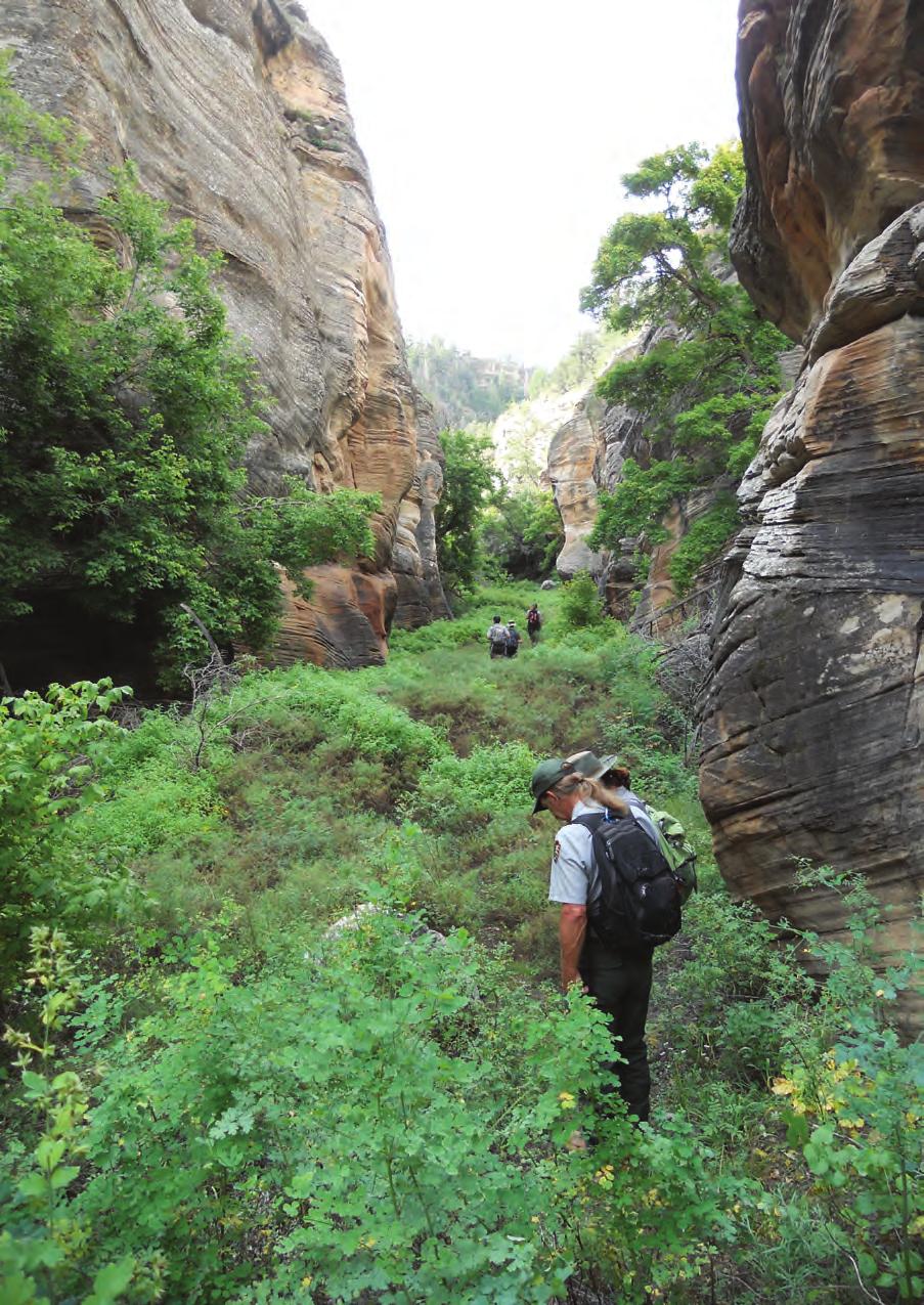
7 Part 1: Core Components The core components of a foundation document include a brief description of the park, park purpose, significance statements, fundamental resources and values other important resources and values, and interpretive themes. These components are core because they typically do not change over time. Core components are expected to be used in future planning and management efforts. Brief Description of the Monument protects a dense concentration of exceptionally well-preserved prehistoric cliff dwellings just 10 miles from downtown Flagstaff, Arizona. Established by presidential proclamation in 1915, the monument contains more than 500 archeological sites along 10 miles of Walnut Creek. The deep pools and reliable flow of the creek made the canyon a rare and valuable home for the Northern Sinagua people and supports the rich biological communities of this dry landscape. Scattered families farmed the upland areas around Walnut Canyon for hundreds of years, growing small gardens of corn, squash, and beans. After the eruption of Sunset Crater Volcano in the 11th century, the population of the area grew significantly and people began constructing dwellings in the limestone alcoves below the canyon rim. Stark variations in elevation and exposure in the canyon have created a unique biological hot spot where distinct ecological communities overlap and interact. Its location and orientation make it an important wildlife corridor, and even though the monument is relatively small, it provides habitat for numerous charismatic or rare wildlife species, such as mule deer, elk, black bear, mountain lion, peregrine falcon, and Mexican spotted owl. Dark night skies and low ambient sound levels contribute to the natural setting and biological diversity of Walnut Canyon. The monument contains a national register-listed cultural landscape, the Headquarters Area Historic District. Walnut Canyon s ancient dwellings and rich assortment of plants and animals hold traditional cultural importance for numerous tribes in the Southwest. For the American Indian people whose ancestors occupied the canyon for approximately 150 years, these sites contain evidence and information that verifies oral histories and maintains cultural identities. Volcanic eruptions and other geologic processes, combined with ancient and modern human influences in the area, highlight the dynamic nature and interplay of social and environmental history. Aside from its value as a classroom for for science and research, the monument represents an outstanding scenic and recreational attraction for visitors and local residents. 3

8 Foundation Document Monument Purpose The purpose statement identifies the specific reason(s) for establishment of a particular park. The purpose statement for was drafted through a careful analysis of its presidential proclamation and the legislative history that influenced its development. The park was established by presidential proclamation on November 30, 1915 (see appendix A for enabling legislation and subsequent amendments). The purpose statement lays the foundation for understanding what is most important about the park. The purpose of is to preserve and protect ancient Northern Sinagua cliff dwellings, pit houses, and other cultural resources found in the canyon s deeply incised and meandering topography. Perched on natural promontories and nestled in alcoves, these resources, of great ethnographic, scientific, and educational importance, provide public inspiration and enjoyment. 4

9 Monument Significance Significance statements express why a park s resources and values are important enough to merit designation as a unit of the national park system. These statements are linked to the purpose of and are supported by data, research, and consensus. Statements of significance describe the distinctive nature of the park and why an area is important within a global, national, regional, and systemwide context. They focus on the most important resources and values that will assist in park planning and management. The following significance statements have been identified for Walnut Canyon National Monument. (Please note that the sequence of the statements does not reflect the level of significance.) People in the Environment. The Northern Sinagua adapted to varied environmental exposure created by the tight meanders of the canyon, alcoves, and the concentration of available resources and water. Connections from Past to Present. Natural and cultural resources within the monument are significant to a number of contemporary American Indian tribes as evidenced by oral history, archeological study, and continuing traditional practices. Today s visitors experience an intimate connection to communities of the past, both through traditional knowledge shared by contemporary tribes and by visiting ancestral homes in Walnut Canyon. Biodiversity. Walnut Canyon and its meandering topography and ecological communities overlap to form ecotones, bringing together plants and wildlife usually separated by elevation. This creates a rare compression of flora/fauna zones. 5
10 Foundation Document Fundamental Resources and Values Fundamental resources and values (FRVs) are those features, systems, processes, experiences, stories, scenes, sounds, smells, or other attributes determined to warrant primary consideration during planning and management processes because they are essential to achieving the purpose of the park and maintaining its significance. Fundamental resources and values are closely related to a park s legislative purpose and are more specific than significance statements. Fundamental resources and values help focus planning and management efforts on what is truly significant about the park. One of the most important responsibilities of NPS managers is to ensure the conservation and public enjoyment of those qualities that are essential (fundamental) to achieving the purpose of the park and maintaining its significance. If fundamental resources and values are allowed to deteriorate, the park purpose and/or significance could be jeopardized. The following fundamental resources and values have been identified for Walnut Canyon National Monument: Archeological Resources. preserves a unique expression of Northern Sinagua culture cliff dwellings nestled in picturesque limestone alcoves. Other archeological resources include pit houses, free-standing pueblos, isolated field structures, forts (an archeological complex situated on a mesa top), quarries, agricultural fields, and petroglyphs. Natural Landscape and Setting. Walnut Canyon is a biological hot spot created by varying solar exposures, elevations, and seasonally abundant water. Several different ecological communities overlap within the canyon, mixing flora and fauna species usually separated by elevation and creating an environment where cacti can live alongside alpine Douglas-fir. Other Important Resources and Values contains other resources and values that are not fundamental to the purpose of the park and may be unrelated to its significance, but are important to consider in planning processes. These are referred to as other important resources and values (OIRV). These resources and values have been selected because they are important in the operation and management of the park and warrant special consideration in park planning. The following other important resources and values have been identified for Walnut Canyon National Monument: Historic Resources. The historic structures and landscapes at Walnut Canyon include the 1904 Ranger Cabin, reflecting early US Forest Service (USFS) administration of the area, and structures and trail features from the Civilian Conservation Corps (CCC) and Mission 66 eras of NPS management. 6

11 Interpretive Themes Interpretive themes are often described as the key stories or concepts that visitors should understand after visiting a park they define the most important ideas or concepts communicated to visitors about a park unit. Themes are derived from, and should reflect, park purpose, significance, resources, and values. The set of interpretive themes is complete when it provides the structure necessary for park staff to develop opportunities for visitors to explore and relate to all park significance statements and fundamental and other important resources and values. Interpretive themes are an organizational tool that reveal and clarify meaning, concepts, contexts, and values represented by park resources. Sound themes are accurate and reflect current scholarship and science. They encourage exploration of the context in which events or natural processes occurred and the effects of those events and processes. Interpretive themes go beyond a mere description of the event or process to foster multiple opportunities to experience and consider the park and its resources. These themes help explain why a park story is relevant to people who may otherwise be unaware of connections they have to an event, time, or place associated with the park. is managed with Sunset Crater Volcano National Monument and Wupatki National Monument as part of an administrative entity known as Flagstaff Area National Monuments. Because education and interpretive programming are administered by monument staff across all three units and because the sites share a common regional history, staff has identified both unified (combined) interpretive themes as part of the larger administrative group as well as themes for the individual units. 7

12 Foundation Document The following unified interpretive themes have been identified for Flagstaff Area National Monuments: The Human Experience and the Value of Heritage. Sunset Crater Volcano, Walnut Canyon, and Wupatki stand as separate monuments, yet are interconnected through the violent geologic past that shaped and transformed the environment. Each monument contains important physical traces of the cultures, communities, and families that made their homes for thousands of years in the landscape surrounding the San Francisco Peaks. Those physical traces on the landscape, and the landscape itself, tell the story of the human experience through time. The Continuum of Cultural Occupation and Ancestral Homelands. Places such as Wupatki, Walnut Canyon, and Sunset Crater Volcano figure into the regional history and provide evidence of long-time human habitation of the semi-arid Colorado Plateau. For some contemporary American Indian tribes, these sites contain evidence and information that are part of their oral histories and cultural identities. Investigating the past from varying points of view strengthens the collective ability to understand the world and to live in it more harmoniously. Landscape and Life. The Interplay of Human and Environmental History. From the alcove sites at Walnut Canyon, to the oral histories told about the Sunset Crater Volcano eruption, to the terraced slopes of Citadel Pueblo, the Flagstaff Area National Monuments contain evidence of the complex ways cultures adapt and impact the physical environment. Laboratories and Research Benchmarks. As a species, the human influence on natural systems is profound, with consequences not entirely understood; therefore, the monuments are valuable research laboratories for learning about these systems and their current condition. The monuments must have a sophisticated knowledge of these resources and their condition, and these findings must be effectively communicated to the public, as they would ultimately decide the fate of these resources. Geology within the San Francisco Volcanic Field. The violent, dramatic history of the San Francisco Volcanic Field transformed the landscape in and around the Flagstaff Area National Monuments. Through this explosive history, each of the monuments tells its own story of adaptation and change. Climate Change. Climate change is evolving and will continue to impact not only the natural and cultural resources of the Flagstaff Area National Monuments but the world as a whole. Reducing the carbon footprint of the Flagstaff Area National Monuments, providing awareness of climate change through education, maintaining ongoing research and monitoring of these changes, and initiating climate change adaptation are ways the monuments are dedicated to understanding, documenting, and responding to climate change. 8

13 The following interpretive themes have been identified for Walnut Canyon National Monument: Human Occupation. Walnut Canyon preserves a unique expression of the Northern Sinagua cultural landscape and provides insights into a resourceful, socially complex community. Ancestral Homelands and Cultural Traditions. Several contemporary American Indian tribes trace their migration and lineage through the homesites at Walnut Canyon and maintain specific ancestral claims to these dwellings. Present day lifeways, beliefs, and stories are reflected in these physical places. The plants and animals of the canyon remain important to contemporary American Indian tribes in their continuing traditional practices and connections to their ancestral homelands. Ecological Processes and Biodiversity. The water-sculpted meanders, steep walls, and deep gorge of Walnut Canyon create a mosaic of microenvironments where ecological communities overlap. People have long recognized the exceptional value of this biological hot spot readily available resources to sustain a family, a perfect place to study the effects of geography on plants and animals, and an intimate sanctuary that resonates with life. Geologic Processes. This stunning canyon is the latest manifestation of the continuous recycling process of uplift, erosion, and deposition within the greater history of continent-building and the evolution of unique regional landforms. Habitat Preservation. protects a small, critical portion of a much larger natural system near a growing urban population and is home to and a refuge for diverse and sensitive wildlife. Their survival depends on sufficient healthy habitats and minimal human interference and impacts across political boundaries. Cultural Resource Preservation. s history records evolving attitudes toward heritage preservation, from amassing collections, to systematic excavation of sites, to today s philosophy of less intrusive research and preservation strategies. 9
14 Foundation Document Part 2: Dynamic Components The dynamic components of a foundation document include special mandates and administrative commitments and an assessment of planning and data needs. These components are dynamic because they will change over time. New special mandates can be established and new administrative commitments made. As conditions and trends of fundamental and other important resources and values change over time, the analysis of planning and data needs will need to be revisited and revised, along with key issues. Therefore, this part of the foundation document will be updated accordingly. Special Mandates and Administrative Commitments Many management decisions for a park unit are directed or influenced by special mandates and administrative commitments with other federal agencies, state and local governments, utility companies, partnering organizations, and other entities. Special mandates are requirements specific to a park that must be fulfilled. Mandates can be expressed in enabling legislation, in separate legislation following the establishment of the park, or through a judicial process. They may expand on park purpose or introduce elements unrelated to the purpose of the park. Administrative commitments are, in general, agreements that have been reached through formal, documented processes, often through memorandums of agreement. Examples include easements, rights-of-way, arrangements for emergency service responses, etc. Special mandates and administrative commitments can support, in many cases, a network of partnerships that help fulfill the objectives of the park and facilitate working relationships with other organizations. They are an essential component of managing and planning for Walnut Canyon National Monument. For more information about the existing administrative commitments for Walnut Canyon National Monument, please see appendix B. Assessment of Planning and Data Needs Once the core components of part 1 of the foundation document have been identified, it is important to gather and evaluate existing information about the park s fundamental and other important resources and values, and develop a full assessment of the park s planning and data needs. The assessment of planning and data needs section presents planning issues, the planning projects that will address these issues, and the associated information requirements for planning, such as resource inventories and data collection, including GIS data. There are three sections in the assessment of planning and data needs: 1. analysis of fundamental other important resources and values 2. identification of key issues and associated planning and data needs 3. identification of planning and data needs (including spatial mapping activities or GIS maps) The analysis of fundamental and other important resources and values and identification of key issues leads up to and supports the identification of planning and data collection needs. Analysis of Fundamental Resources and Values The fundamental resource or value analysis table includes current conditions, potential threats and opportunities, planning and data needs, and selected laws and NPS policies related to management of the identified resource or value. 10

15 Fundamental Resource or Value Related Significance Statements Current Conditions and Trends Archeological Resources People in the Environment. The Northern Sinagua adapted to varied environmental exposure created by the tight meanders of the canyon, canyon alcoves, and the concentration of available resources and water. Connections from Past to Present. Natural and cultural resources within the monument are significant to a number of contemporary American Indian tribes as evidenced by oral history, archeological study, and continuing traditional practices. Today s visitors experience an intimate connection to communities of the past, both through traditional knowledge shared by contemporary tribes and by visiting ancestral homes in Walnut Canyon. Conditions All maintained archeological sites are inventoried and assessed and have been treated to maintain good condition (e.g., installation of drip edge to reduce erosion and ledge cutting). Approximately 500 archeological sites need condition assessments and required documentation. Vandalism and graffiti have occurred at archeological sites. Soil and slopes stabilized with erosion-control treatment demonstrate healthy herbaceous cover. Historic Ranger Cabin has been rehabilitated to provide interpretive opportunities. Trends Monitoring program is in place at a number of archeological sites in order to identify trends in the future. 11
16 Foundation Document Fundamental Resource or Value Threats and Opportunities Data and/or GIS Needs Archeological Resources Threats Fire vulnerability is high due to the health of surrounding forests (dead and downed trees) and warming temperatures associated with ongoing climate change. Sites are vulnerable to vandalism, particularly as staff capacity fluctuates. Need for greater formal interpretation about archeological site etiquette to build visitor understanding and protection ethic. Storm intensity, soil erosion, and site damage is accelerating with climate change. Impact of residential development at inholdings and neighboring private land could impact views and soundscape. Resource impacts from unauthorized access and vandalism. Neighboring land uses can contribute to increases in artificial light and noise which can negatively affect the setting at the park unit. Opportunities Work in partnership with US Forest Service, City of Flagstaff, and Coconino County to protect archeological resources on public lands in and around the monument (Walnut Canyon Study Area). Work with tourism bureaus and outlets to share information and educational opportunities. Partner with other federal, state, local, and private entities, including friends group, to expand existing preservation and education efforts. Engage volunteer site stewards to increase monitoring episodes and create a connection with local partners, including friends groups. Expand educational outreach with area school groups. Continue efforts to expand visitor access to Ranger Cabin and First Fort. Retrofit, replace, and maintain park infrastructure to use night sky friendly lighting and quieter machinery and equipment. Light detection and ranging (LiDAR) needed for development of base data. Update archeological overview and assessment of. Visitor use data. Tribal/ethnographic studies. Conduct comprehensive condition assessments to help develop appropriate and critical preservation strategies. Update List of Classified Structures (LCS) records. Visual resource inventory to assess the condition, value, and risks to scenic views and visual settings important to the monument. Continuous collection of credible weather data (temperature and precipitation at a minimum) that helps validate changes in climate over time. 12
17 Fundamental Resource or Value Planning Needs Laws, Executive Orders, and Regulations That Apply to the FRV and NPS Policy-level Guidance Archeological Resources Integrated pest management plan (underway 2014). Fire management plan amendment. Visitor use management plan. Collections management plan. Preservation treatment and management plan. Comprehensive interpretive plan and long-range interpretive plan. Scenery conservation plan using visual resource inventory. Climate change adaptation planning (e.g., climate change scenario planning), including integrated vulnerability assessments for cultural resources. Resource stewardship strategy (update from 2001). Archeological overview and assessment. Laws, Executive Orders, and Regulations That Apply to the FRV Antiquities Act of 1906 (16 USC ) National Historic Preservation Act of 1966, as amended (16 USC 470 et seq.) National Environmental Policy Act of 1969, as amended (42 USC 4321 et seq.) American Indian Religious Freedom Act of 1978 (42 USC 1996) Archaeological Resources Protection Act of 1979 (16 USC 470aa-mm) Native American Graves Protection and Repatriation Act of 1990 (25 USC 3001 et seq.) Executive Order 11593, Protection and Enhancement of the Cultural Environment Executive Order 13007, Indian Sacred Sites Curation of Federally-Owned and Administered Archaeological Collections (36 CFR 79) Secretarial Order 3289, Addressing the Impacts of Climate Change on America s Water, Land, and Other Natural and Cultural Resources NPS Policy-level Guidance (NPS Management Policies 2006 and Director s Orders) Director s Order 12: Conservation Planning, Environmental Impact Analysis, and Decisionmaking and DO-12 Handbook Director s Order 28: Cultural Resource Management Director s Order 28A: Archeology Director s Order 24: NPS Museum Collections Management Director s Order 71A: Relationship with American Indian Tribes Department of the Interior Tribal Consultation Policy, 2012 The Secretary of the Interior s Standards and Guidelines for Archeology and Historic Preservation The Secretary of the Interior s Standards for the Treatment of Historic Properties with Guidelines for Preserving, Rehabilitating, Restoring, and Reconstructing Historic Buildings NPS Management Policies , 4.10, Director s Order 47: Soundscape Preservation and Noise Management 13
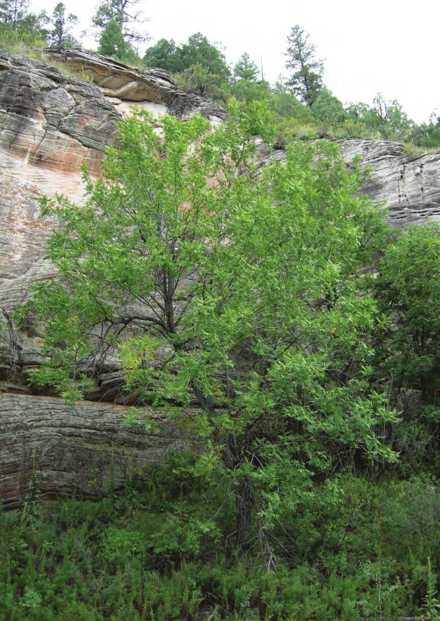
18 Foundation Document Fundamental Resource or Value Related Significance Statements Current Conditions and Trends Natural Landscape and Setting Biodiversity. Walnut Canyon and its meandering topography and ecological communities overlap to form ecotones, bringing together plants and wildlife usually separated by elevation. This creates a rare integration of flora/fauna zones. Conditions Millennial drought during and subsequent bark beetle infestations killed a large percentage of coniferous trees in the surrounding Coconino National Forest. Large-scale conifer mortality has resulted in an unprecedented accumulation of dead and downed wood/wildland fuel over the last 10 years. Active monitoring program underway for the Mexican spotted owl, golden eagle, and peregrine falcon (threatened and endangered species focused). Risk analysis completed to evaluate use areas prone to rockfall. Recent assessment of Arizona walnut tree population age class distribution within the canyon. Boundary fences have been improved to include wildlife passes/corridors to support access and migration patterns. Lack of Walnut Creek flow due to upstream dam and ongoing water diversion has impacted the quality of riparian areas and caused habitat loss. Determination of fire regime condition has been completed for vegetation resources. Nitrogen deposition may disrupt soil nutrient cycling and affect biodiversity of some plant communities. Wet nitrogen deposition warrants moderate concern based on Air Resources Division benchmarks and analysis. Ozone warrants moderate concern based on Air Resources Division benchmarks and analysis. Ozone-sensitive plants in the monument include ponderosa pine and quaking aspen. Presence of peregrine falcons observed in area is stable and healthy. The population of Arizona walnut trees within the monument is successfully reproducing and stable. The combination of high-elevation, excellent air quality, low population density, and frequent cloud-free weather at the Flagstaff area monument provides visitors with excellent night sky viewing conditions. Park managers are pursuing an International Dark Sky Park Designation from the International Dark-Sky Association. Trends Ongoing coordination, fuel management, and treatment partnership with Grand Canyon National Park fire program. Intermittent monitoring continues in rockfall prone areas for trail safety management. Increased Mexican spotted owl nesting observed and documented. Monitoring for loss and health of riparian plants; wildlife and insects are reflecting impacts from drought and climate changes. Riparian species have likely disappeared over the last century and others are at risk. Average annual temperature has shown a statistically significant increase over the past century. 14
19 Fundamental Resource or Value Threats and Opportunities Natural Landscape and Setting Threats Risk of severe to extreme wildfire due to vegetation condition is moderate but increasing due to rising temperatures from climate change. Climate change is impacting forest habitat and contributing to changes and degradation of ecosystems. Poaching and unauthorized access pose threats to flora and fauna. Habitat of riparian area critically impacted by continued use of Lower and Upper Lake Mary dams. Planned expansion of nearby shooting range would impact acoustic landscape for visitors and wildlife; gunfire from existing range is already audible. Potential development of existing inholding could impact the character of the canyon and impact visitor experience. Increased overflights could impact canyon soundscape. Ongoing or increasing air pollution may potentially damage biodiversity and some plant communities. Any increases in nearby artificial light could impact the night time environment and night sky resources. The projected increase in mean annual temperature (+4 F to 5 F by 2050) and increase in drought events, storm intensity, and storm frequency due to a changing climate would impact natural hydrologic regimes, geomorphic processes, and biotic responses. Opportunities Partnering with the US Forest Service and the City of Flagstaff to increase flood flows below Upper and Lower Lake Mary and improve the condition of the Walnut Creek riparian corridor. Develop interpretation and education about the ecotones within the monument. Continue existing partnerships with US Forest Service and park friends group for collaborative resource management, planning, and educational activities. Pursue potential development of Citizen Stewards program to expand the research capacity for data collection and resource improvement activities. Retrofit, replace, and maintain park infrastructure to use night sky-friendly lighting and quieter machinery and equipment. The monument could participate in the Colorado Plateau Dark Sky Cooperative Starry Starry Night, a voluntary effort to promote the preservation, enjoyment, and tourism potential for star gazing in the vast region. Data and/or GIS Needs Continue to monitor Mexican spotted owl for data on specified characteristics in designated Mexican spotted owl critical habitat (Douglas-fir/Gambel oak vegetation). Light detection and ranging (LiDAR) needed for development of base data. Monitoring of Riparian conditions (geomorphology, groundwater, and vegetation) to continue to monitor flows in Walnut Creek, Cherry Creek, and standing pool levels in the Cherry Canyon Pools. Need to understand local groundwater seepage, perching, and persistence in the Walnut Creek stream deposits. Monitor ponderosa stands for status and trend of pre-settlement trees and development of old-growth habitat characteristics. Continue to monitor natural acoustic conditions to identify changes due to activities on neighboring land (like the Northern Arizona Shooting Range) and potential impacts on wildlife and the acoustic environment. Air quality monitoring to assess the presence of air pollutants. Special studies to determine impacts of nitrogen deposition and ozone on plant communities. 15
20 Foundation Document Fundamental Resource or Value Data and/or GIS Needs (continued) Planning Needs Laws, Executive Orders, and Regulations That Apply to the FRV and NPS Policy-level Guidance Natural Landscape and Setting Continuous collection of credible weather data (temperature and precipitation at a minimum) that helps validate changes in climate over time. Visitor use data. Tribal/ethnographic studies. Continuous collection of (or access to) credible meteorological data to validate local climate change and to better understand natural resource responses to this change (e.g., storm event responses in Walnut Creek, alteration of wildfire frequency, proliferation of nonnative species). Visual resource inventory. Resource stewardship plan update. Visitor use management plan. Fire management plan amendment. Comprehensive interpretive plan and long-range interpretive plan. Climate change adaptation planning (e.g., climate change scenario planning), including integrated vulnerability assessments for natural resources. Environmental assessment and other compliance for new visitor contact facility and adaptive reuse of existing structure. Resource stewardship strategy (update from 2001). Laws, Executive Orders, and Regulations That Apply to the FRV National Environmental Policy Act of 1969, as amended (42 USC 4321 et seq.) Endangered Species Act of 1973, as amended (16 USC ) National Invasive Species Act of 1996 (16 USC 4701) Lacey Act of 1900, as amended (16 USC ) Migratory Bird Treaty Act of 1918 (16 USC ) Bald and Golden Eagle Protection Act of 1940 (16 USC c) Federal Noxious Weed Act of 1974, as amended (7 USC 2801 et seq.) Executive Order 13112, Invasive Species Executive Order 11988, Floodplain Management Secretarial Order 3289, Addressing the Impacts of Climate Change on America s Water, Land, and Other Natural and Cultural Resources Clean Air Act of 1977 (42 USC 7401 et seq.) NPS Policy-level Guidance (NPS Management Policies 2006 and Director s Orders) Director s Order 12: Conservation Planning, Environmental Impact Analysis, and Decisionmaking and DO-12 Handbook Director s Order 14: Resource Damage Assessment and Restoration Director s Order 18: Wildland Fire Management Director s Order 77: Natural Resource Protection Director s Order 79: Integrity of Scientific and Scholarly Activities Director s Order 13A: Environmental Management Systems, if the park uses the rationale of reducing its own operational emissions through the existing environmental management system as a response to climate change and natural resource protection. NPS Management Policies , 4.10, Director s Order 47: Soundscape Preservation and Noise Management 16
21 Analysis of Other Important Resources and Values Other Important Resource or Value Current Conditions and Trends Historic Resources Conditions Rehabilitation of the 1904 Ranger Cabin is almost complete. The Island Trail has undergone major repair and improvement. Interpretive displays and information at the visitor contact facility are out of date and do not reflect appropriate descriptions. Interpretive materials are currently being updated. The CCC-era museum and housing have been assessed and determined to be in fair to good condition. Mission 66 structures have been evaluated for preservation integrity and condition and determined to be in fair to good condition or appropriate. Vegetation and fuel conditions surrounding historic resources are in good condition. Vegetation clearing and fuels reduction is ongoing. Rodent entry into structures creates the potential for employee illness (hantavirus); staff must monitor for effective exclusion and trap to remove mice, wood rats, etc. Headquarters Area Historic District is listed in the national register. This cultural landscape is in fair condition and needs to be monitored. A cultural landscape inventory has been completed for this site. Trends Increased visitation at Ranger Cabin through guided activities. Improvements are being made to the Historic Island and Rim Trails. The CCC-era structures have improved to good condition. Threat of severe wildfire to park facilities and historic structures is decreasing with implementation of fire management projects to reduce fuels and restore forest health. Threats and Opportunities Threats Resource loss from structural and wildland fire. Rodent and bat entry creates potential health and safety issues for staff and visitors. Existing structures lack automated fire suppression systems and resilient egress alternatives for safety and efficiency. Resource impacts from vandalism and unauthorized access. Increased storm intensity and frequency are projected across the United States due to climate change. This could increase the vulnerability of historic resources to damaging wind and/or flood events. Opportunities Improve visitor accessibility by modifying existing multi-era visitor center. Centennial opportunity to build broader support for variety of stewardship projects. Increase interpretation at Ranger Cabin and visitor center. Continue to improve the Ranger Cabin historic landscape. Data and/or GIS Needs Update comprehensive condition assessment (tied to historic structure report and historic structure preservation guide). Visitor use data. Energy use data for buildings. Tribal/ethnographic studies. Detailed documentation of Mission 66 visitor center. Update List of Classified Structures (LCS) records. Visual resource inventory. 17
. Comprehensive interpretive plan and long-range interpretive plan.")
22 Foundation Document Other Important Resource or Value Planning Needs Laws, Executive Orders, and Regulations That Apply to the OIRV and NPS Policy-level Guidance Historic Resources Environmental assessments for a new visitor center and adaptive reuse of the CCC portion of the visitor center. Park asset management plan (update). Comprehensive interpretive plan and long-range interpretive plan. Historic resources fire protection planning. Climate change adaptation planning (e.g., climate change scenario planning), including integrated vulnerability assessments for cultural resources. Resource stewardship strategy (update from 2001). Visitor use management plan. Complete cultural landscape report for Headquarters Area Historic District. Laws, Executive Orders, and Regulations That Apply to the OIRV Antiquities Act of 1906 (16 USC ) Historic Sites Act of 1935, as amended (16 USC ) Management of Museum Properties Act of 1955 (16 USC 18f through 18f-3) National Historic Preservation Act of 1966, as amended (16 USC 470 et seq.) Curation of Federally-Owned and Administered Archaeological Collections (36 CFR 79) Executive Order 11593, Protection and Enhancement of the Cultural Environment Secretarial Order 3289, Addressing the Impacts of Climate Change on America s Water, Land, and Other Natural and Cultural Resources NPS Policy-Level Guidance (NPS Management Policies 2006 and Director s Orders) NPS Management Policies 2006 (chapter 5) Cultural Resource Management Director s Order 24: NPS Museum Collections Management Director s Order 28: Cultural Resource Management Director s Order 28A: Archeology NPS Museum Handbook, parts I, II, and III The Secretary of the Interior s Standards and Guidelines for Archeology and Historic Preservation Director s Order 13A: Environmental Management Systems, for park building operational emissions reduction 18
23 Identification of Key Issues and Associated Planning and Data Needs This section considers key issues to be addressed in planning and management and therefore takes a broader view over the primary focus of part 1. A key issue focuses on a question that is important for a park. Key issues often raise questions regarding park purpose and significance and fundamental and other important resources and values. For example, a key issue may pertain to the potential for a fundamental or other important resource or value in a park to be detrimentally affected by discretionary management decisions. A key issue may also address crucial questions that are not directly related to purpose and significance, but which still affect them indirectly. Usually, a key issue is one that a future planning effort or data collection needs to address and requires a decision by NPS managers. The following are key issues for and the associated planning and data needs to address them: Visitor Access. Visitor use and access needs to be evaluated against the current set of closures. Except for developed visitor use areas, most of Walnut Canyon National Monument is closed to unguided visitor entry. Discovery Hikes led by staff are offered periodically to provide additional opportunities for visitors to explore and experience the monument. There is both staff and public interest in evaluating the current closures to determine if additional areas may be opened to unescorted visitor use without harming monument resources. A visitor use management plan would involve the public and, probably, the development of special regulations. Existing and Proposed Tribal Uses. Traditionally associated tribes request the ability to collect a variety of plants for traditional uses, and the Hopi Tribe seeks to be able to gather eaglets. Currently, the National Park Service is developing an agencywide policy to guide how parks authorize collection of plants in parks. No authority for collecting eaglets currently exists. Shooting Range. In July 2010, the Arizona Game and Fish Department identified and purchased an 160-acre parcel of land to build a shooting range. The shooting range is less than 1 mile from the southeast boundary of, and additional facilities are planned for the property. The monument is habitat for a number of rare and sensitive wildlife species, including Mexican spotted owl, peregrine falcon, northern goshawk, golden and bald eagles, wild turkey, black bear, and mountain lion. Most of these species use habitat within 1 to 2 miles of the shooting range and may be affected by the gun fire, increased vehicle traffic, and reduced habitat connectivity. Gun fire is audible from all visitor use areas when the range is in use, impacting the acoustic environment and soundscape. However, sound level testing in 2010 found noise levels during a test firing to be in compliance with state and local ordinances. The Arizona Game and Fish Department constructed large earthen berms for sound abatement, but the shooting is still audible. The National Park Service has sound monitoring devices stationed within the monument to record and determine decibel thresholds from gunfire. If the decibels exceed state and local ordinances, the National Park Service would discuss other sound abatement options with the Arizona Game and Fish Department. There is a need to continue acoustic environment monitoring of shooting range. Riparian Corridor. In 2001, the City of Flagstaff, the National Park Service, and the Coconino National Forest signed a stipulation recognizing and confirming the water rights of each party within the Walnut Creek watershed. Each party agreed to not object, dispute, or challenge these rights in the Little Colorado River Adjudication. Additionally, the parties agreed to cooperate to meet the stipulation objectives. The City of Flagstaff made a one-time contribution of $100,000 to a trust account for studies to identify best management practices and evaluate methods that may increase the likelihood of flood flows and improve the inner-canyon environment in the monument. In 2014, the parties approved $45,000 to fund hydrology data collection. Riparian conditions monitoring and air quality monitoring would benefit the understanding and managing of the riparian corridor. 19
24 Foundation Document Entrance Road. The entrance road from Interstate 40 to the developed area of the monument is owned by the US Forest Service and maintained by the National Park Service. The National Park Service is interested in acquiring the road in the future. Until then, an agreement would outline the responsibilities of each agency. Planning is needed to determine the responsibilities of the National Park Service and the US Forest Service for the entrance road. Acquiring the Inholding. A key inholding within remains to be acquired. The current owners bought the land in 1988 from the Atchison, Topeka, and Santa Fe Railroad Company. The 237-acre parcel contains the national register-listed Santa Fe Dam and numerous cliff dwellings and petroglyph sites. The property also contains crucial riparian, Mexican spotted owl, and golden eagle habitat. The owner is interested in selling the property but several issues, including valuation of the parcel and the need to decommission the dam, remain to be resolved. Planning is needed to acquire this private inholding. Climate Change. The Southwest, including, is one of the areas most affected by climate change. The monument has experienced drought and soil erosion, which has affected the monument s FRVs (archeological, historical, and natural resources). Drought and bark beetle infestations in the early 2000s caused extensive dieback of coniferous trees at Walnut Canyon. This and numerous other cases of tree dieback around the world are consistent with climate change. Under continued warming, forest drought stress could continue to cause substantial tree dieback. Under some modeled climate change scenarios, fire frequencies could increase up to 25% by Past warming has reduced snowpack widely, which may continue to reduce summer stream flow and water supplies. The average annual temperature for the region that includes Walnut Canyon is projected to increase 2 F to 3 F by 2050 and 3 F to 5 F by Additional climate-related impacts to natural and cultural resources and park operations are likely to occur in the future, along with changes in park visitation and associated needs. Climate change adaptation planning is needed to address these potential impacts. Planning and Data Needs To maintain connection to the core elements of the foundation and the importance of these core foundation elements, the planning and data needs listed here are directly related to protecting fundamental resources and values, park significance, and park purpose, as well as addressing key issues. To successfully undertake a planning effort, information from sources such as inventories, studies, research activities, and climate change vulnerability assessments may be required to provide adequate knowledge of park resources and visitor information. Such information sources have been identified as data needs. Geospatial mapping tasks and products are included in data needs. Items considered of the utmost importance were identified as high priority, and other items identified, but not rising to the level of high priority, were listed as either medium- or lowpriority needs. These priorities inform park management efforts to secure funding and support for planning projects. 20
25 Data Needs Where Information Is Needed Before Decisions Can Be Made Related to a FRV or OIRV? Data and GIS Needs Priority (H, M, L) Notes Historic Resources Documentation for Mission 66 structures H In order to move forward on the new visitor contact facility, documentation is needed for sections of the Mission 66 structure before it is removed. Natural Landscape and Setting Continue acoustic environment monitoring of shooting range H A commercial shooting range is being developed by the Arizona Game and Fish Department within 1 mile of the park boundary. The National Park Service is greatly concerned about noise impacts on visitor experience and rare wildlife species/ habitat. Soundscape data are needed to document these impacts and to determine if additional noise mitigation is legally required by the Arizona Game and Fish Department. Archeological Resources, Natural Landscape and Setting, and Historic Resources Archeological Resources, Natural Landscape and Setting, and Historic Resources Visitor use data H Visitor use data, including use patterns, off-trail use, and visitor expectations, are needed in order to address multiple, complex, interrelated issues and prevent resource degradation. These data would also guide a visitor use plan and allow staff to enhance opportunities for visitor understanding of the park purpose and significance. Visual resource inventory H To assess the condition, value, and risks to scenic views and visual settings important to the monument. Natural Landscape and Setting Riparian conditions monitoring (geomorphology, groundwater, and vegetation) H Riparian corridors are crucial for sustaining native biodiversity within the arid Colorado Plateau region. Vegetation and wildlife habitat along the Walnut Creek corridor have been greatly impacted by upstream dams and water diversion, and species are at risk of being lost from the monument. Climate change is likely to exacerbate these impacts. Monitoring information is needed to develop mitigation strategies with upstream land managers. Natural Landscape and Setting Air quality monitoring and special studies M To assess the presence of air pollutants and the damage they may be causing to vegetation. Archeological Resources, Natural Landscape and Setting, and Historic Resources Natural Landscape and Setting Tribal/ethnographic studies M Ethnographic research is essential to preserve, manage, and interpret cultural and natural resources in an effective, culturally informed manner. Mexican spotted owl data L The entire monument is designated as critical habitat for the Mexican spotted owl, a threatened species. Monitoring information is required under the Mexican Spotted Owl Recovery Plan and is needed to support Endangered Species Act consultations for any NPS actions that could affect the Mexican spotted owl or its habitat. This species should also be examined in a climate change vulnerability assessment. 21
26 Foundation Document Data Needs Where Information Is Needed Before Decisions Can Be Made Related to a FRV or OIRV? Data and GIS Needs Priority (H, M, L) Notes Historic Resources Energy use data for buildings L Energy use data for each building would help with analysis of energy use, calculation of carbon footprint, and achievement of sustainability goals. Archeological Resources and Natural Landscape and Setting Light detection and ranging (LiDAR) needed for development of base data L Remote sensing data are needed to establish baseline geographic and topographic information for the park. LiDAR would be used to provide a benchmark for climate change effects in the park and for identification and monitoring of archeological sites and other significant natural and cultural resources. Planning Needs Where A Decision-making Process Is Needed Related to a FRV or OIRV? Planning Needs Priority (H, M, L) Notes, Including which Planning Need This Data Need Relates To Entrance road planning H Planning is needed to clarify responsibilities about management of the entrance road from the US Forest Service. Acquisition of inholding H Planning is needed to acquire a 237-acre private inholding that contains the national register-listed Santa Fe Dam and numerous cliff dwellings and petroglyph sites. Archeological Resources and Natural Landscape and Setting Fire management plan amendment H An updated fire management plan is needed to incorporate a variety of changing conditions, including different fuel loads and expanding vegetation types, climate change, new data and science to support management regimes, and changes in fire management on adjacent lands. An update is critical to protect and prevent future degradation of natural, archeological, and other cultural resources, and would address complex, interrelated issues. Archeological Resources, Natural Landscape and Setting, and Historic Resources Comprehensive interpretive plan and long-range interpretive plan (update) H An updated comprehensive interpretive plan / longrange interpretive plan is required to address new technology, observed and anticipated climate change impacts, improve relevancy for future audiences, enhance opportunities for youth engagement, and tie interpretive goals and programming to foundation outcomes for the three Flagstaff Area National Monuments. Partnership opportunities with the public, tribes, Flagstaff schools, Northern Arizona University, and other agencies would be a key component planning effort. Natural Landscape and Setting, and Historic Resources Environmental assessment and other compliance for new visitor contact facility and adaptive reuse of existing structure H A new visitor contact facility is called for in the park s general management plan and funding may be available in fiscal year Required compliance, including documentation of the current Mission 66 portion of the visitor contact facility to be removed, must be completed. 22
27 Planning Needs Where A Decision-making Process Is Needed Related to a FRV or OIRV? Planning Needs Priority (H, M, L) Notes, Including which Planning Need This Data Need Relates To Archeological Resources, Natural Landscape and Setting, and Historic Resources Archeological Resources, Natural Landscape and Setting, and Historic Resources Archeological Resources, Natural Landscape and Setting, and Historic Resources Historic Resources Archeological Resources Archeological Resources Historic Resources Archeological Resources Visitor use management plan H A plan is needed to address visitor use and resource protection goals related to visitor impacts. The plan would address who is visiting, expectations, new audiences, and relevancy for the next generation; the plan would include addressing safety concerns for bicycles and vehicles and providing interpretive opportunities for large groups. Resource stewardship strategy (update from 2001) Climate change adaptation plan Complete cultural landscape report for Headquarters Area Historic District Preservation treatment and management plan Collections management plan M M M M L The National Park Service currently does not have a comprehensive condition assessment or long-term management strategy for cultural and natural resources within the monument. Outcomes from this effort could be integrated in park planning and management to bring appropriate climate change adaptation into those documents (fire management plan, resource stewardship strategy, visitor use management plan, etc.). This planning process would allow the national monument to explore the range of climate futures that are plausible based on the latest modeled projection and to identify the associated impacts and management implications. Per NPS-28: Cultural Resource Management Guideline and the National Historic Preservation Act, a cultural landscape report needs to be completed for the Headquarters Area Historic District to provide landscape treatment guidance. This plan would identify resource impacts and prioritize efforts to preserve and protect archeological sites in frontcountry vs. backcountry. Since the last plan in 1994, the collections have quadrupled in size, made numerous moves, and since 2011 reside primarily in a private institution (the Museum of Northern Arizona). This planning document is required under the Checklist for the Protection and Preservation of Museum Collections because it records the current state of a museum program and recommends actions needed for programmatic growth and improvement in all areas including security, fire protection, and environmental conditions. Park asset management plan L The current park asset management plan was last updated in A revised plan would ensure that an updated strategy and roadmap is available to efficiently allocate limited resources to the highest priority assets. Archeological overview and assessment L An update to the 1986 archeological surveys is needed to reflect changed conditions, improved technology, and discovery of new sites. 23
28 Foundation Document Part 3: Contributors Lisa Baldwin, Archeologist Kayci Cook Collins, Superintendent Kat Eisenman, Administrative Assistant Gwenn Gallenstein, Museum Curator Mike Haubert, Law Enforcement Ranger Michael Monk Jones, GIS Specialist Joshua Kleinman, Compliance Program Manager Lisa Leap, Chief of Resources Hank Mallery, Interpretive Ranger Janet Phillips, Administrative Officer John Portillo, Chief Ranger Holly Richards, Interpretive Ranger Angela Saner, Facility Management Systems Specialist Don Sharlow, Facility Manager Cecilia Shields, Chief of Interpretation Matt Snider, Trails Maintenance Worker Caleb Waters, Maintenance Supervisor Paul Whitefield, Natural Resource Specialist Friends of Flagstaff Monuments Representatives Bern Carey Pamela Foti Carl Taylor Kim Watson NPS Intermountain Region Liza Ermeling, Landscape Architect Art Hutchinson, Chief of Planning Other NPS Staff Christine Bruins, Community Planner, Denver Service Center, Planning Division Tabitha Carver-Roberts, Contract Editor, Denver Service Center, Planning Division Rebecca Corning, Contract Librarian, Denver Service Center, Planning Division Pam Holtman, Quality Assurance Coordinator, Washington Support Office, Park Planning and Special Studies Wanda Gray Lafferty, Contract Editor, Denver Service Center, Planning Division John Paul Jones, Visual Information Specialist, Denver Service Center, Planning Division Laura Pernice, GIS Specialist, Denver Service Center, Planning Division Larissa Read, Project Manager, Denver Service Center, Planning Division Nancy Shock, Foundation Coordinator, Denver Service Center, Planning Division 24

29 Appendixes Appendix A: Presidential Proclamation and Legislative Acts for 25

30 Foundation Document 26
31 27

32 Foundation Document 28
33 Appendix B: Inventory of Administrative Commitments Name Agreement Type Start Date / Expiration Date Stakeholders Purpose Notes Agreements Listed Below Apply to All Flagstaff Area National Monuments Law Enforcement Agreements between USFS and NPS MOU with Coconino County Sheriff s Department Interpretive Partnership MOU with Museum of Northern Arizona Cooperative Agreement Western National Parks Association (WNPA) Memorandum of understanding (MOU) 11/22/ /31/2016 MOU 5/12/2011 5/12/2016 USFS interagency agreement 5/15/2014 9/30/2014 MOU 6/2011 6/2021 (renewable upon expiration) Cooperative agreement USFS and NPS Coconino County Sheriff s Department USFS and NPS National, regional, and local agreements exist that allow law enforcement operations on each other s lands. Outlines areas of responsibility within the national monument and provides for deputizing NPS park rangers through the Coconino County Sheriff s Department. This MOU authorizes park protection staff to enforce state laws and use state criminal justice system. This partnership, which has been in operation for several years, coordinates interpretive activities on NPS and USFS lands and encourages consistent messages through shared staffing. Provides storage space for collections and office space for the Flagstaff area monument s curator in exchange for 15% of the curator s time. Allows WNPA to operate a bookstore in each of the Flagstaff area monuments and headquarters, with support provided to NPS from those sales. MOU for NPS sites within AZ, TX, NM, OK, and in the southwestern region of USFS, law enforcement and investigations. MOU renewable every five years. Allows the museum to store and care for various artifacts from the three Flagstaff Area Monuments, while retaining NPS ownership of the collection. Agreement is regionwide for all parks that have WNPA as their cooperating association. Regional director is signatory to the agreement. 29
34 Foundation Document Name Friends of Flagstaff Area National Monuments (FOM) Fire Agreements with Grand Canyon National Park / Coconino National Forest and Summit Fire Department Cooperative Law Enforcement Agreement between NPS / Flagstaff Area National Monuments and City of Flagstaff Information Technology Agreement with Grand Canyon National Park Agreement Type Friends group agreement Intra-agency annual work plan / Grand Canyon National Park Interagency USFS annual operating plan Interagency for wildland firefighting Start Date / Expiration Date 1/6/2011 1/6/2016 4/4/2014 Five years 4/4/2014 Annual 5/6/2010 Five years Service 1st* 2/22/2012 Five years Cooperative agreement number P12AC10702 Shared services agreement 10/1/2012 8/31/2017 Annual per fiscal year Stakeholders Purpose Notes FOM board members USFS, Summit Fire Department, Grand Canyon National Park, park neighbors NPS, City of Flagstaff Police Department Park employees FOM is the primary nonprofit support organization to raise community awareness, raise funds for approved projects, support events and activities. Agreements provide for structural (Summit) and wildland fire suppression (Grand Canyon National Park, USFS) and emergency medical response (Summit). Provides dispatch services for enforcing laws and officer safety. Agreement provides funding to Grand Canyon National Park for information technology support and services to the Flagstaff area monuments. *National master interagency agreement on general terms and conditions for implementing service first interagency agreements. Five-year cooperative agreement with City of Flagstaff. Agreement is renewed annually; costs are based on number of computers. 30
35 Name Agreement Type Start Date / Expiration Date Agreements Listed Below Apply to Only Stakeholders Purpose Notes MOU for Lake Mary - Walnut Creek Watershed MOU and charter MOU signed 12/2012; charter signed 12/ /2022 City of Flagstaff (mayor), USFS Coconino National Forest (forest supervisor), Flagstaff Area National Monuments (superintendent) The parties agree to meet the objectives identified in the stipulation by identifying best management practices and evaluating methods that would increase flood flows through Walnut Canyon National Monument. As part of the stipulation, the City of Flagstaff made a one-time contribution of $100,000 to a trust account that may be used to fund studies that identify best management practices and that evaluate methods that may increase the likelihood of flood flows in Walnut Canyon National Monument. William Wells Special Use Permit Special use permit 1/1/ /31/1998 William Wells, NPS, USFS, City of Flagstaff Water Allows permittee to operate and maintain a waterline across the northwest corner of Walnut Canyon National Monument in connection with grazing operations; the waterline runs across the monument just inside the northwest corner, then follows FS303 on the north side to water storage tanks on the ranch north of the monument. Originally established as a special use permit, the proper permitting instrument to continue this use may be a right-ofway. 31
36 Foundation Document Appendix C: Tribes Traditionally Associated with Walnut Canyon National Monument Fort McDowell Yavapai Nation PO Box Fountain Hills, AZ Havasupai Tribe PO Box 10 Supai, AZ Hopi Tribe of Arizona PO Box 123 Kykotsmovi, AZ Hualapai Indian Tribe PO Box 179 Peach Springs, AZ Kaibab Band of Paiute Indians HC 65, Box 2 Fredonia, AZ Navajo Nation PO Box 7440 Window Rock, AZ San Carlos Apache Tribe of Arizona PO Box 0 San Carlos, AZ San Juan Southern Paiute Tribe of Arizona PO Box 1989 Tuba City, AZ Tonto Apache Tribe of Arizona Tonto Reservation #30 Payson, AZ White Mountain Apache Tribe PO Box 700 Whiteriver, AZ Yavapai-Apache Nation 2400 West Datsi Street Camp Verde, AZ Yavapai-Prescott Indian Tribe 530 East Merritt Prescott, AZ Zuni Tribe of the Zuni Reservation PO Box 339 Zuni, NM
37 33

38 Foundation Document 34


39 Intermountain Region Foundation Document Recommendation May 2015 This Foundation Document has been prepared as a collaborative effort between park and regional staff and is recommended for approval by the Intermountain Regional Director. RECOMMENDED Kayci Cook Collins, Superintendent, Date APPROVED Sue E. Masica, Regional Director, Intermountain Region Date As the nation s principal conservation agency, the Department of the Interior has responsibility for most of our nationally owned public lands and natural resources. This includes fostering sound use of our land and water resources; protecting our fish, wildlife, and biological diversity; preserving the environmental and cultural values of our national parks and historic places; and providing for the enjoyment of life through outdoor recreation. The department assesses our energy and mineral resources and works to ensure that their development is in the best interests of all our people by encouraging stewardship and citizen participation in their care. The department also has a major responsibility for American Indian reservation communities and for people who live in island territories under U.S. administration. WACA 360/ May 2015

40 Foundation Document NATIONAL PARK SERVICE U.S. DEPARTMENT OF THE INTERIOR
Community Conservation Workshop. Saranac River Basin Communities
 Community Conservation Workshop Saranac River Basin Communities 2 Community Conservation Program Welcome! We have designed a Community Conservation Program that listens to the needs of community members.
Community Conservation Workshop. Lake Placid
 Community Conservation Workshop Lake Placid 2 Community Conservation Program Welcome! We have designed a Community Conservation Program that listens to the needs of community members. We are conducting
Large Landscape Restoration and the National Park System
 National Park Service U.S. Department of the Interior Large Landscape Restoration and the National Park System April 21, 2016 National Conference on Ecosystem Restoration Raymond M. Sauvajot, Ph.D. Associate
FOREST SERVICE MANUAL NATIONAL HEADQUARTERS (WO) WASHINGTON, DC
 WASHINGTON, DC") Page 1 of 11 FOREST SERVICE MANUAL NATIONAL HEADQUARTERS (WO) WASHINGTON, DC FSM 2300 RECREATION, WILDERNESS, AND RELATED RESOURCE MANAGEMENT Amendment No.: 2300-2011-2 Effective Date: October 19, 2011
Page 1 of 11 FOREST SERVICE MANUAL NATIONAL HEADQUARTERS (WO) WASHINGTON, DC FSM 2300 RECREATION, WILDERNESS, AND RELATED RESOURCE MANAGEMENT Amendment No.: 2300-2011-2 Effective Date: October 19, 2011
Rocky Areas Project Guidance HABITAT
 Rocky Areas Project Guidance HABITAT Introduction Rocky habitats are surface areas dominated by exposed rock, such as mountain peaks, inland cliffs, buttes and rocky outcrops. In many cases, rocky areas
National Park Service U.S. Department of the Interior. Climate Change Response and Cultural Landscape Preservation
 Climate Change Response and Cultural Landscape Preservation National Park Service Climate Change Response Strategy (Sept. 2010) Preserving the Nation s Heritage The preservation and protection of cultural
Natural Resource Protection
 VISION Our Parker community will enhance the quality of life by avoiding development in environmentally hazardous areas and by safeguarding the natural environment. Natural Resource Protection Introduction
TOWN OF SPRINGFIELD, NEW HAMPSHIRE
 TOWN OF SPRINGFIELD, NEW HAMPSHIRE NATURAL RESOURCES INVENTORY EXECUTIVE SUMMARY March 2008 Prepared by: Watershed to Wildlife, Inc. Natural Resource Consultants 42 Mill Street, Suite 3 Littleton, NH 03561
Arlington, Virginia is a worldclass
 EXECUTIVE S U M M A RY Arlington maintains a rich variety of stable neighborhoods, quality schools and enlightened land use policies, and received the Environmental Protection Agency s highest award for
NATIONAL PARK SERVICE U.S. DEPARTMENT OF THE INTERIOR. Foundation Document Casa Grande Ruins National Monument
 NATIONA PARK SERVICE U.S. DEPARTMENT OF THE INTERIOR Foundation Document Casa Grande Ruins National Monument Arizona March 2017 Blackwater ateral Kenworthy Rd N Kenworthy Rd N Ironwood N Palo N Arizona
systems is available on the Colorado Wetland Information Center (CWIC) website.
 website.") Colorado Natural Heritage Program Wetland Program Plan -- Dec 2015 Status Update and Addendum -- The Colorado Natural Heritage Program (CNHP) developed a Wetland Program Plan (WPP) in 2010 for the planning
Colorado Natural Heritage Program Wetland Program Plan -- Dec 2015 Status Update and Addendum -- The Colorado Natural Heritage Program (CNHP) developed a Wetland Program Plan (WPP) in 2010 for the planning
Master Plan Objectives and Policies
 Master Plan Objectives and Policies Introduction This chapter identifies the Park issues and recommended policies established by this Master Plan. The issues were identified through meetings with staff,
Building Innovation Celebrating Park Architecture and Beyond: Building for Resilience and Stewardship
 Building Innovation 2017 Celebrating Park Architecture and Beyond: Building for Resilience and Stewardship Shawn Norton National Park Service January, 2017 1 Todays Goals Understand the history and trends
Dalla Mountain Park Management Plan
 Dalla Mountain Park Management Plan Adopted by Durango City Council February 7, 2006 I. INTRODUCTION Dalla Mountain Park, located on the southwestern slope of Animas Mountain, is a 177.8 acre tract rich
STEWARDSHIP OF LONG ISLAND SOUND S ECOLOGICAL AND RECREATIONAL RESOURCES
 STEWARDSHIP OF LONG ISLAND SOUND S ECOLOGICAL AND RECREATIONAL RESOURCES Robin Kriesberg, Save the Sound, Inc. Thomas Halavik, US Fish and Wildlife Service Coastal Program An Initiative to Identify, Protect
TABLE OF CONTENTS HISTORIC PRESERVATION ELEMENT I. INTRODUCTION HP. A. Purpose HP B. Assessment and Conclusions...
 TABLE OF CONTENTS HISTORIC PRESERVATION ELEMENT I. INTRODUCTION... 1 - HP A. Purpose... 1 - HP B. Assessment and Conclusions... 1 - HP II. GOAL, OBJECTIVES AND POLICIES... 3 - HP GOAL 1: PROTECTION AND
3. VISION AND GOALS. Vision Statement. Goals, Objectives and Policies
 Vision Statement Queen Creek s interconnected network of parks, trails, open spaces and recreation opportunities provide safe and diverse activities and programs that sustain its unique, small town, equestrian
Canyon Lake Master Plan Revision Public Information Meeting March 18, 2016
 Canyon Lake Master Plan Revision Public Information Meeting March 18, 2016 Marcus Schimank Canyon Lake Manager Capital Regional Office U.S. Army Corps of Engineers Fort Worth District US Army Corps of
Cotswolds AONB Landscape Strategy and Guidelines. June 2016
 Cotswolds AONB Landscape Strategy and Guidelines June 2016 Cotswolds AONB Landscape Strategy and Guidelines Introduction The evolution of the landscape of the Cotswolds AONB is a result of the interaction
PRESENTATION ON JOHANNESBURG S BIODIVERSITY PROGRAMME
 PRESENTATION ON JOHANNESBURG S BIODIVERSITY PROGRAMME Member of Mayoral Committee: Cllr Prema Naidoo Environmental Management & Johannesburg City Parks PRESENTATION OVERVIEW Jo burg Overview & Context
Foundation Document Devils Tower National Monument Wyoming September 2014
 NATIONAL PARK SERVICE U.S. DEPARTMENT OF THE INTERIOR Foundation Document Devils Tower National Monument Wyoming September 2014 Foundation Document 0 0.1 0 0.1 North 0.5 Kilometer 0.5 Mile Hiking trail
NORTHERN LANDS NORTHERN LEADERSHIP
 NORTHERN LANDS NORTHERN LEADERSHIP The GNWT Land Use and Sustainability Framework Our Lands, Our Interests, Our Future ii Land is Life MESSAGE FROM THE PREMIER Land is life. It is the link to our past.
Mendota Heights 2040 Comprehensive Plan Draft Vers
 4 Parks and Trails The City of Mendota Heights boasts a variety of recreational and open space opportunities. Few cities can claim access to regional trails, riverside and lakeside parks, scenic bluffs
Policy & Procedure Effective Date: Parks Department Page of
 City of Arvada Policy & Procedure Effective Date: Parks Department Page of TITLE: City of Arvada Prairie Dog Habitat Plan APPROVAL: PURPOSE: To establish a plan for the preservation of black-tailed prairie
CALGARY: City of Animals Edited by Jim Ellis
 CALGARY: City of Animals Edited by Jim Ellis ISBN 978-1-55238-968-3 THIS BOOK IS AN OPEN ACCESS E-BOOK. It is an electronic version of a book that can be purchased in physical form through any bookseller
SUSTAINABILITY PLAN OTTAWA COUNTY PARKS AND RECREATION COMMISSION FALL 2017
 SUSTAINABILITY PLAN OTTAWA COUNTY PARKS AND RECREATION COMMISSION FALL 2017 Table of Contents Introduction Natural Resources Quality of Life Community Continuing the Mission Sustainability Measuring Sustainability
Waco Mammoth Site Special Resource Study
 Waco Mammoth Site Waco, Texas Newsletter #2 August 2007 National Park Service U.S. Department of the Interior Waco Mammoth Site Special Resource Study We are pleased to share with you an update on the
McArthur Swamp Planning Unit. Fish, Plant, and Wildlife Habitat MCARTHUR SWAMP PLANNING UNIT
 McArthur Swamp Planning Unit Fish, Plant, and Wildlife Habitat Conduct surveys of the planning unit to identify biological resources and enable their protection. Most of the McArthur Swamp land acreage
Dolores River Restoration Partnership. A Collaborative Approach to River Restoration and the Development of a New Generation of Land Stewards
 Dolores River Restoration Partnership Dolores Public Lands A Collaborative Approach to River Restoration and the Development of a New Generation of Land Stewards Project Area From McPhee Reservoir to the
Staff will be providing an overview of the project need, purpose and intent for consideration as part of the Amendment cycle.
 Agenda Item D-2 City of Tacoma Planning and Development Services To: Planning Commission From: Stephen Atkinson, Planning Services Division Subject: Open Space Corridors Project Meeting Date: March 1,
National Association of Conservation Districts. Kris Hoellen Vice President, Sustainable Programs The Conservation Fund September 19, 2013
 National Association of Conservation Districts Kris Hoellen Vice President, Sustainable Programs The Conservation Fund September 19, 2013 Our Mission The Conservation Fund forges partnerships to conserve
3-2 Environmental Systems
 3-2 Environmental Systems 3.0 ENVIRONMENTAL SYSTEMS CONTENTS 3.1 GREENWAY SYSTEM 3.1.1 General Policies 3.1.2 Natural Heritage Network 3.1.3 Natural Heritage Network Enhancement Lands 3.1.4 Rouge Watershed
Joe Pool Lake Master Plan Revision Public Information Meeting May 23, 2017
 Joe Pool Lake Master Plan Revision Public Information Meeting May 23, 2017 Presented By Jason Owen Lake Manager U.S. Army Corps of Engineers Fort Worth District US Army Corps of Engineers Purpose of this
SECTION FOUR: MISSION STATEMENT, GOALS & OBJECTIVES
 SECTION FOUR: MISSION STATEMENT, GOALS & OBJECTIVES Chapter Summary Chapter Ten: Mission Statement, Goals & Objectives To fulfill its mission, the Parks and Recreation Commission has identified four basic
Lewisville Lake Master Plan Revision Public Information Meeting May 2 & 4, 2017
 Lewisville Lake Master Plan Revision Public Information Meeting May 2 & 4, 2017 Presented By Rob Jordan Lake Manager U.S. Army Corps of Engineers Fort Worth District US Army Corps of Engineers Purpose
2011 ASLA Design Awards. Westside Creeks Restoration Plan Merit Award AECOM, Fort Collins. Planning & Urban Design
 2011 ASLA Design Awards Westside Creeks Restoration Plan Merit Award AECOM, Fort Collins Planning & Urban Design Project Fact Sheet Category of Entry: Rotating Specialty Award: 2011 2011 ASLA Colorado
CONSERVATION ELEMENT GOALS, OBJECTIVES, AND POLICIES
 CONSERVATION ELEMENT GOALS, OBJECTIVES, AND POLICIES Goal 4 To conserve, manage, appropriately use and protect the natural resources of the City ensuring continued resource availability and environmental
2014 South Atlantic LCC
 2014 South Atlantic LCC Annual Report 1 Allie Stewart, U.S. FWS The South Atlantic LCC s 2014 Annual Report this year of progress and accomplishments is dedicated to South Atlantic LCC Coordinator, Ken
Foundation Document Morristown National Historical Park
 NATIONAL PARK SERVICE U.S. DEPARTMENT OF THE INTERIOR Foundation Document Morristown National Historical Park New Jersey June 2018 Foundation Document MORRISTOWN 287 Museum Visitor Information 202 Washington
General Terms Property, as used to describe eligibility for the National Register of Historic Places:
 Key Definitions Historic Landscapes Compiled by Camille Fife and Barbara Wyatt The field of historic landscape preservation has generated a specific vocabulary. Definitions have been published by two National
Member Service Plan Sierra Nevada AmeriCorps Partnership
 Member Service Plan Sierra Nevada AmeriCorps Partnership Service plans lay the framework for what each Member will be doing during their service. Service plans detail the major projects and expected results
Describing the Integrated Land Management Approach
 Describing the Integrated Land Management Approach ISBN No. 978-0-7785-8902-0 (Online Edition) Pub No. I/422 What is Integrated Land Management? Integrated land management (ILM) is the strategic, planned
THE FUTURE OF THE MCABEE FOSSIL BEDS HERITAGE SITE - Aligning the management of the site with fossil management approaches
 November 2014 A world class site with an interpretive and research centre that explores the role of fossils in our lives in a natural and cultural setting. PURPOSE The purpose of this document is to articulate
Conservation Corridor Planning and Green Infrastructure Themes
 Conservation Corridor Planning and Green Infrastructure Themes Prepared by the Green Infrastructure Center Inc. and the Northern Virginia Regional Commission February 22, 2011 Brief Overview Project Background
Call for Artists for: Design and Construction of Environmental Art Activation Story Mill Community Park, Bozeman, MT
 Call for Artists for: Design and Construction of Environmental Art Activation Story Mill Community Park, Bozeman, MT Seeking artists to design, fabricate and install art elements in the nature sanctuary
SCC PRD (2016) COUNTY PARK MASTER PLAN
 COUNTY PARK MASTER PLAN") SCC PRD (2016) COUNTY PARK MASTER PLAN MASTER PLAN UPDATE PARKS AND RECREATION COMMISSION NOVEMBER 7, 2018 PURPOSE OF THE MASTER PLAN The Sanborn County Park Master Plan will provide the Department with
SCC PRD (2016) COUNTY PARK MASTER PLAN MASTER PLAN UPDATE PARKS AND RECREATION COMMISSION NOVEMBER 7, 2018 PURPOSE OF THE MASTER PLAN The Sanborn County Park Master Plan will provide the Department with
Preliminary Management Recommendations for the proposed Sedona Verde Valley Red Rock National Monument
 Preliminary Management Recommendations for the proposed Sedona Verde Valley Red Rock National Monument The Monument shall be managed consistent with the values that underlie the designation as a National
INTRODUCTION Key Issues and Findings Goals, Objectives, and Policies - Natural Resources - Map M18 - Environmental Resources
 Natural, Environmental, Cu INTRODUCTION This Element provides policies related to the preservation and protection of the Centre Region s natural, environmental, cultural, and historic resources. This Element
Public Information Meeting
 Lavon Lake Master Plan Revision Public Information Meeting March 10, 2015 Presented By Michael Kinard Lake Manager U.S. Army Corps of Engineers Fort Worth District US Army Corps of Engineers Purpose of
Sustaining Historic Public Landscapes Preservation & Sustainability for Our Shared Heritage To Enhance Quality of Life & Experience of Place
 Body & Soul: Parks & the Health of Great Cities National Association for Olmsted Parks & City Parks Alliance Pittsburgh Parks Conservancy 22 September 2008 Sustaining Historic Public Landscapes Preservation
Chapter 19: Cultural Resources
 Chapter 19: Cultural Resources Introduction and Setting Traditionally the term "cultural resources" has been used rather narrowly to refer to archaeological remains and to historical structures. Archaeologists,
Parks, Open Space and Trails
 Introduction Parks have often been referred as the lungs of our cities, cleansing the air of pollutants and particulate matter. Parks are also gathering places for families and community. They offer spaces
This page intentionally blank.
 This page intentionally blank. Parks, Recreation, and Open Space Chapter Relationship to Vision Vision Parks, Recreation and Open Space Chapter Concepts County Government. County government that is accountable
Preface. Erie. Scranton. Allentown. Pittsburgh. Harrisburg. Philadelphia
 The Southern Alleghenies Region The Southern Alleghenies Region spans the Laurel Highlands and Allegheny Front in the west across the Appalachians to the east. It is comprised of Blair, Bedford, Cambria,
Mary Norwood. Mayoral Forum on Greenspace Responses
 1. What do you believe is the single most pressing issue impacting Atlanta s urban forest and greenspace, and how would you solve that issue? Preserving and Protecting Atlanta s forest cover Lungs of Atlanta
Town of Peru Comprehensive Plan Executive Summary
 Town of Peru Comprehensive Plan Executive Communities that plan grow by choice, not by chance. A plan makes growth thoughtful, understandable, and predictable. A plan shows that a community is managing
Sherman Pass Project Post-Fire Treatment Scenery Report Barbara Jackson, Landscape Architect, 3/30/2016
 Sherman Pass Project Post-Fire Treatment Scenery Report Barbara Jackson, Landscape Architect, 3/30/2016 Introduction This report updates the 2015 Sherman Pass Project Scenery Report based on changes in
City of Tacoma Planning and Development Services
 Agenda Item D-1 City of Tacoma Planning and Development Services To: Planning Commission From: Elliott Barnett, Planning Services Division Subject: Application #2014-08 Open Space Element Update Meeting
FAQ S about Restoration Planning FROM THE Department of Ecology WEBSITE:
 FAQ S about Restoration Planning FROM THE Department of Ecology WEBSITE: http://www.ecy.wa.gov/programs/sea/sma/st_guide/smp/restoration/qanda.html Notations in parentheses are staff notes directing you
Infrastructure, Development and Enterprise Services. Natural Heritage Action Plan (NHAP) Project Initiation
 Project Initiation") Staff Report To Service Area Committee of the Whole Infrastructure, Development and Enterprise Services Date Monday, March 6, 2017 Subject Natural Heritage Action Plan (NHAP) Project Initiation Report
Staff Report To Service Area Committee of the Whole Infrastructure, Development and Enterprise Services Date Monday, March 6, 2017 Subject Natural Heritage Action Plan (NHAP) Project Initiation Report
Lake O the Pines Master Plan Revision Public Information Meeting April 25 & 27, 2017
 Lake O the Pines Master Plan Revision Public Information Meeting April 25 & 27, 2017 Presented By Matthew Like, Lake Manager U.S. Army Corps of Engineers Fort Worth District US Army Corps of Engineers
Framework for Sustainable Recreation
 Framework for Sustainable Recreation USDA Framework for Sustainable Recreation Laurie Thorpe, USFS Rachel Franchina, USFS Robert Burns, WVU Service USDAForest Forest Service Presentation Outline USFS Framework
CHAPTER 8 ISSUES, CONCERNS, CONSTRAINTS AND OPPORTUNITIES
 CHAPTER 8 ISSUES, CONCERNS, CONSTRAINTS AND OPPORTUNITIES Introduction This River Conservation Plan was developed during a time of tremendous activity and effort in planning the transformation of the Delaware
10.0 Open Space and Public Realm
 10.0 Open Space and Public Realm 10.0 Open Space and Public Realm The Public Open Space System is comprised of: outdoor spaces available for public use that are either publicly owned (e.g., parks and
I. STAFF POLICY RECOMMENDATIONS. The following RMP policy strategies are proposed by staff in support of a Scenic Resource Protection Program:
 Policy Consideration: Scenic Resource Protection Program Status: For Consideration by the Highlands Council at September 14, 2006 Work session Date: September 12, 2006 I. STAFF POLICY RECOMMENDATIONS The
Gulf Islands National Park Reserve Management Plan Newsletter #3
 Management Plan Newsletter #3 P A R K S C A N A D A November 2011 Parks Canada is using a multi-phase planning process to develop the first management plan for the park. This newsletter provides a short
San Francisco General Plan Preservation Element: Objectives 7-9. Historic Preservation Commission August 20, 2014
 San Francisco General Plan Preservation Element: Objectives 7-9 Historic Preservation Commission August 20, 2014 Preservation Element Definition An element of the General Plan that establishes a long-range
Open Space, Natural Areas, Parks, and Recreation
 Open Space, Natural Areas, Parks, and Recreation WHAT ARE THE CITY S CURRENT VALUES? This section addresses open spaces, natural areas, parks and recreation, and stormwater multi-use projects under separate
WASHINGTON COUNTY OREGON
 WASHINGTON COUNTY OREGON LONG RANGE PLANNING DIVISION North Bethany Subarea Stream Corridors: Existing Regulations In Oregon, there is a distinct difference between the land use rules that apply in rural
Authority of the General Plan
 Authority of the General Plan This La Habra Heights General Plan will serve as the blueprint for future planning and development in the City. This General Plan describes the City s vision for the future
California State Parks
 California State Parks State Parks and Natural Resources 94% of land base is un-developed 31% of the state s endangered, threatened or rare species 19 units with national or international recognition
Foundation Document Chamizal National Memorial Texas April 2016
 NATIONAL PARK SERVICE US DEPARTMENT OF THE INTERIOR Foundation Document Chamizal National Memorial Texas April 2016 Foundation Document N 0 50 0 100 100 Meters / metros 500 Feet / pies Walking path Sendero
Statewide Greenways Vision
 Greenways Vision The formation of a greenways vision is based on a thorough analysis of the current state of recreation and open space in a region and the existing pressures that threaten it. Lehigh and
Water Sensitive Urban Design Site Development Guidelines and Practice Notes. Appendix
 Water Sensitive Urban Design Site Development Guidelines and Practice Notes Appendix 108 Appendix A Water sensitive developments involve simple design and management practices that take natural site features
Riparian Buffer on the Bushkill Creek. Policies
 Riparian Buffer on the Bushkill Creek Riparian buffers provide numerous benefits to landowners and the community by protecting groundwater recharge areas, providing flood control, providing stormwater
QUARRY REHABILITATION PLANS Specifications (version 1.3)
") For all our quarries, a rehabilitation plan must be developed from the outset. It is an integral part of the quarrying plan and provides for progressive and co-ordinated rehabilitation whenever possible.
For all our quarries, a rehabilitation plan must be developed from the outset. It is an integral part of the quarrying plan and provides for progressive and co-ordinated rehabilitation whenever possible.
An Introduction to the Far North Land Use Strategy
 An Introduction to the Far North Land Use Strategy December, 2013 Ministry of Natural Resources Table of Contents PREFACE... 3 About the Far North... 3 Evolution of Land Use Planning in the Far North...
This presentation has been developed by the Sustainable Sites Initiative for general audiences
 This presentation has been developed by the Sustainable Sites Initiative for general audiences Copyright 2011 by the Sustainable Sites Initiative. All rights reserved. 2011 2010 Sustainable Sites Initiative
2011 ASLA Design Awards. Top of the Rockies National Scenic and Historic Byway Merit Award Bluegreen. Planning & Urban Design
 2011 ASLA Design Awards Top of the Rockies National Scenic and Historic Byway Merit Award Bluegreen Planning & Urban Design ASLA Colorado 2011 Design Awards Category 2: Planning Project Fact Sheet Project
Green Infrastructure Policies and Ordinances
 Green Infrastructure Policies and Ordinances October 23, 2013 By Karen Firehock, Green Infrastructure Center 2013 Georgia Urban Forest Council s 23 rd Annual Conference The mission of the nonprofit Green
Wilderness Act. Wilderness Character Monitoring and the Saguaro Wilderness. Wilderness Character in Stewardship. Wilderness Character in Court
 Wilderness Character degraded improved Wilderness Character Monitoring and the Saguaro Wilderness Wilderness and Protected Area Management Jesse Engebretson The purpose of the Wilderness Act is to preserve
The Gianyar Declaration 2017
 The Gianyar Declaration 2017 Cultural Sustainability and Climate Change The 17 th International Conference of National Trusts was held in Bali from 11-15 September 2017. It was jointly hosted by the Indonesian
HALIFAX GREEN NETWORK PLAN
 HALIFAX GREEN NETWORK PLAN Community Planning & Economic Development Standing Committee June 21, 2018 Photo credit: Vlastimil Koutecky, Flickr Creative Commons HGNP PROCESS PHASE 1 FOUNDATIONS PHASE 2
Executive Summary Purpose of the Plan Defining Open Space and Greenways
 Executive Summary Bucks County possesses a vast array of open space resources including natural areas, parks, farmland and historic and cultural resources that contribute to a high quality of life valued
CHAPTER 1 Introduction
 CHAPTER 1 Introduction From sea to summit, Lane County covers almost 4,800 square miles of diverse Oregon landscape. Stretching from the Pacific Ocean through the Coastal Range, the Willamette Valley to
1 Introduction. Chapter. In this chapter:
 Chapter 1 Introduction In this chapter: 1.1 A Snapshot of the Region 1.2 Towards a Sustainable Region 1.3 The Provincial Context 1.4 Purpose and Organization The Regional Municipality of York Official
PSRC REVIEW REPORT & CERTIFICATION RECOMMENDATION
 PSRC REVIEW REPORT & CERTIFICATION RECOMMENDATION KITSAP COUNTY COUNTYWIDE PLANNING POLICIES July 2, 2012 BACKGROUND A major emphasis of the Washington State Growth Management Act (GMA) is the need to
The Rocky Mountain Arsenal and the Northeast Greenway Corridor Project:
 The Rocky Mountain Arsenal and the Northeast Greenway Corridor Project: Contamination to Collaboration Presented by Howard Kenison Overview of Presentation Rocky Mountain Arsenal Contamination Litigation,
Biodiversity Action Plan Background Information for discussion purposes
 Biodiversity Action Plan Background Information for discussion purposes Our commitment As directed by Council, The City of Calgary has agreed to sign the Durban Commitment, an international agreement on
7-1. Chapter 7: Historic Preservation. 7.0 Accomplishments since Introduction. New Castle County 2012 Comprehensive Plan
 7-1 Chapter 7: Historic Preservation 7.0 Accomplishments since 2007 Since the adoption of the 2007 Comprehensive Plan Update, the County has saved over 111 resources through the development review process.
CAMPUS HISTORY AND STEWARDSHIP
 CHAPTER TWO CAMPUS HISTORY AND STEWARDSHIP The stewardship of the UC Davis campus history and the rich collection of natural and cultural resources is a fundamental task for the LRDP. This chapter is organized
HISTORICAL AND ARCHAEOLOGICAL RESOURCES POLICIES
 HISTORICAL AND ARCHAEOLOGICAL RESOURCES POLICIES The County will: GOALS AND OBJECTIVES 5.1 Historic Resource Protection Protect historic resources for their historic, cultural, social and educational values
ADOPTION OF THE REVISED OPEN SPACE AND CONSERVATION ELEMENT OF THE GENERAL PLAN
 TO: FROM: SUBJECT: Honorable Mayor and City Council Planning Department ADOPTION OF THE REVISED OPEN SPACE AND CONSERVATION ELEMENT OF THE GENERAL PLAN RECOMMENDATION: It is recommended that the City Council:
Goal 4. The DNR demonstrates operational excellence and continuous improvement in service to citizens. The Challenge
 The DNR demonstrates operational excellence and continuous improvement in service to citizens. The Challenge DNR operations must adapt to an increasingly changing and diverse world. Rapid developments
Executive Summary. Parks and Recreation Plan. Executive Summary
 Parks and Recreation Plan Executive Summary The Whitemarsh Township Parks and Recreation Plan sets forth a vision for how Whitemarsh Township can provide a premiere parks and recreation system reflective
Peninsular Florida Landscape Conservation Cooperative. Marine and Estuarine Priority Resources and Conservation Targets
 Peninsular Florida Landscape Conservation Cooperative Marine and Estuarine Priority Resources and Conservation Targets Why are we here today? Workshop Goals: Develop a list of potential conservation targets
City of Missoula and Missoula County Open Space Planning Open House
 City of Missoula and Missoula County Open Space Planning Open House FEBRUARY 6, 2018 The following slides contain the display board content from the open house. Please use boards to answer questions in
Preliminary Plan Framework: Vision and Goals
 Preliminary Plan Framework: Vision and Goals Draft: May 2015 Introduction Since the Town of Milliken s comprehensive plan was last updated in 2010, the community was heavily impacted by the 2013 flood,
Research Projects on Governors Island
 Research Projects on Governors Island The Opportunity With over 130 acres of open space including a new park designed to adapt to a changing climate, Governors Island offers an unparalleled platform for
DRAFT Amsterdam/Churchill Community Plan (4/17/08) Adopted By the Gallatin County Commission
 Adopted By the Gallatin County Commission") DRAFT Amsterdam/Churchill Community Plan (4/17/08) Adopted By the Gallatin County Commission Table of Contents Acknowledgements Chapter 1: Introduction A Brief History What s Next Authority Organization
DRAFT Amsterdam/Churchill Community Plan (4/17/08) Adopted By the Gallatin County Commission Table of Contents Acknowledgements Chapter 1: Introduction A Brief History What s Next Authority Organization