WELCOME! MINNEHAHA-HIAWATHA Community Works Project. 46th Street Area Lighting Project July 2009
|
|
|
- Dina Gordon
- 5 years ago
- Views:
Transcription
1 WELCOME! MINNEHAHA-HIAWATHA Community Works Project 46th Street Area Lighting Project July 2009


2 Partners The 46th Street Lighting project is a collaboration between Hennepin County and: The City of Minneapolis The Longfellow Community Council; and The Standish Ericsson Neighborhood Association Funding provided by Hennepin County and the City of Minneapolis
3


4 Hennepin County Community Works Program
5 Community Works Concept Coordinated investments in......can be used to: Stimulate employment development Public Works Infrastructure Parks and Natural Environment Improved Implementation Systems Maintain / improve natural systems Build relationships for effective planning and implementation Strengthen communities through connections Enhance the tax base


6 Community Works Projects Midtown Greenway Humbolt Greenway


7 Minnehaha-Hiawatha Opportunities Commercial and employment centers Proximity to LRT line Proximity to green space and trail connections Strong neighborhood / community organizations


8 Minnehaha-Hiawatha Challenges Economic development Existing utility and rail infrastructure Land use conflicts Pedestrian and bike connectivity Transportation-system capacity
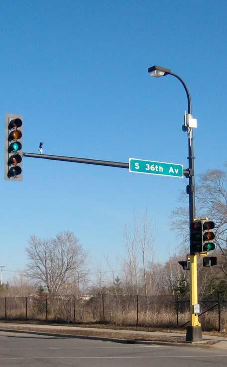
9 OVERALL PROJECT PROCESS Three key project phases: Data inventory Issues and priorities Framework development -- We are here in the process
10 PURPOSE OF TODAY S MEETING To share with the community the details of the 46th Street lighting concept. Why are doing it? What is it (where will they be installed, what will they look like, what kind of lights will they be)? How will it be paid for? Will there be assessments? When can we expect it to be built? To provide an opportunity for the community to comment on the project.
11 Why are we doing it? Improves the pedestrian realm along a key gateway to the community. Walkability - Safety - Image and appearance Creates a stronger LRT connection. Creates a safe environment. Consistent with Great City Design Team concepts. Can happen within existing Right of Way. Good use of available capital dollars. Is and energy efficient and environmentally sustainable solution.

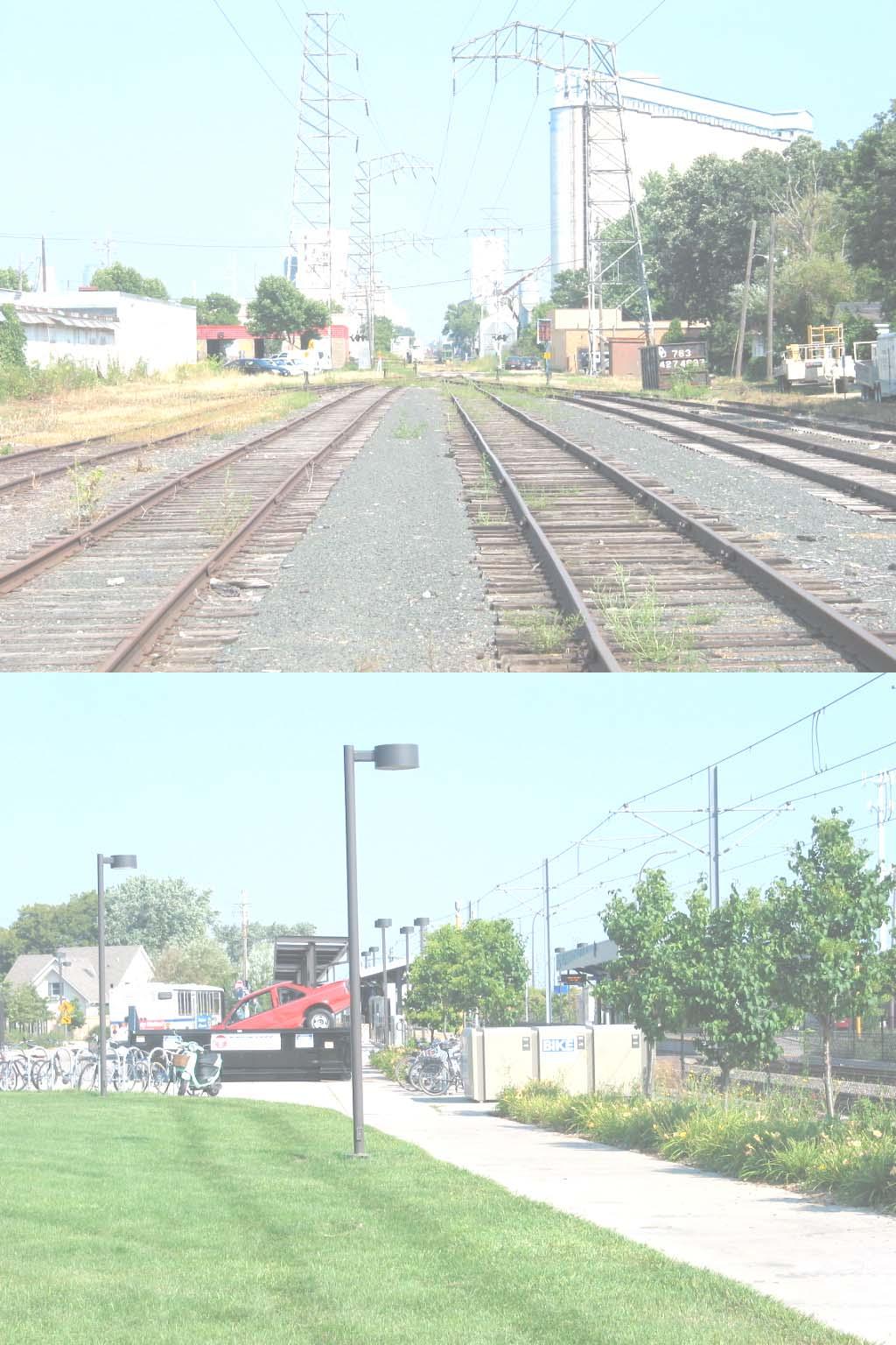
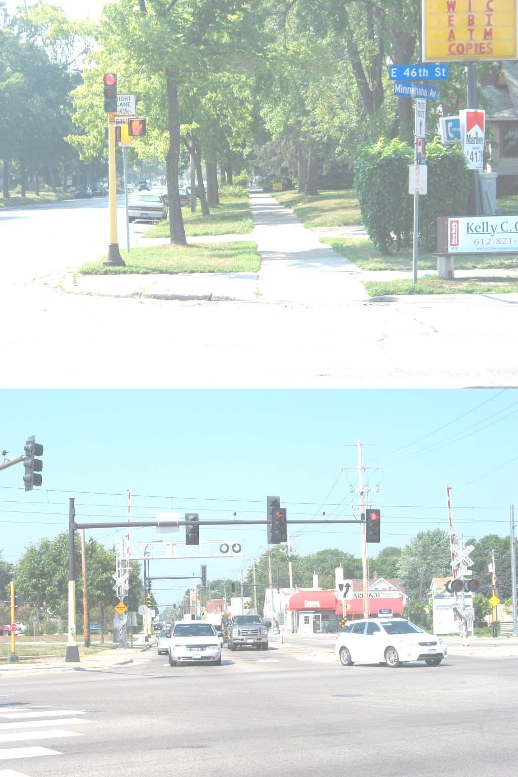
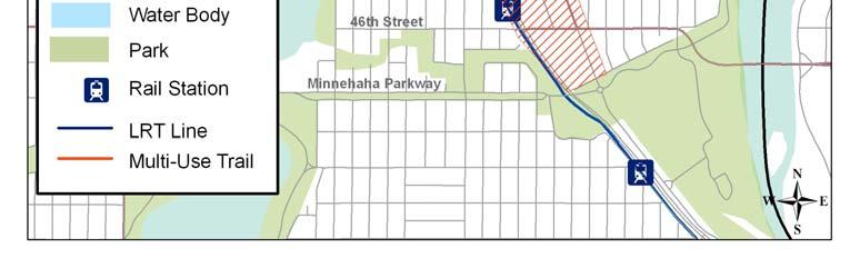
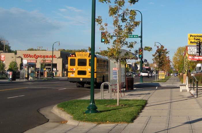
12 What is it? Pedestrian and Street level lighting improvements along 46th Street from 34th Avenue on the west to 46th Avenue on the East and including 36th Street to the Minnehaha Creek Bridge.
13 What is it? Implemented as a Pilot project to study various lighting technologies: Light Emitting Diode (LED) Induction High Pressure Sodium Enables the evaluation of key characteristics: Energy Usage Illumination Levels (do they light what we need them to light?) On-going operations and maintenance costs Capital Costs
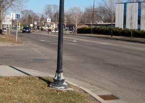

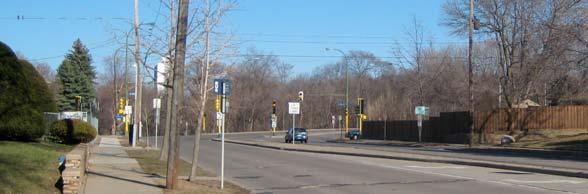


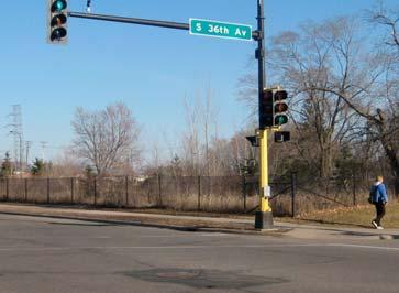


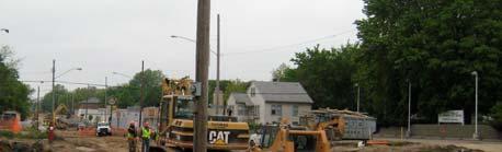
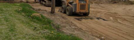
14 Existing Conditions
15 Light Technology Comparison Different technologies have different pros and cons that need to be evaluated. Difficult to compare because many factors are involved.
16 Fixture types: What are the variables? full cut off (casts lighting downward to reduce glare and dark sky affect) lantern, acorn, or shoebox fixtures Spacing of lighting: depends on (lighting technology and width of street) generally 75 or more between lights Pattern of lights staggered or soldier pattern

17 Fixture Types


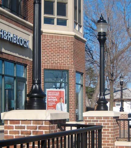
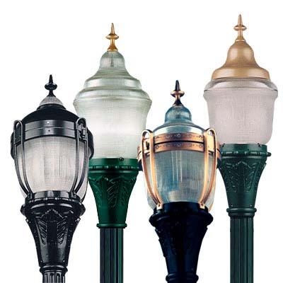
18 Fixture Types
19 Patterns right-of-way Roadway Staggered - west of Hiawatha Roadway right-of-way Soldier - east of Hiawatha Ornamental fixture on 15 pole Shoebox fixture on 30 pole
20 How will they be paid for? Lighting will be paid for out of two funding sources: City of Minneapolis Energy Efficiency Pilot program Hennepin County Capital Improvement Budget No property will be assessed for this project On going operations and maintenance will be handled the same as they currently are
21 When can we expect it to be built? Next Steps Agreements with Hennepin County and City of Minneapolis Lighting/Electrical Engineering of project Construction Fall of 2009
22 Question and Answers Maps and drawings are provided at the tables. Please use post it notes to offer comments and stickers to express opinions. Please fill out comment form. Staff are here to answer questions: Bill Prince and Steve Mosing - Minneapolis Public Works Patrick Connoy and Robb Luckow- Hennepin County Mark Garner - Minneapolis CPED
23 Thank You!
46th Street Pilot Lighting Project
 46th Street Pilot Lighting Project Hennepin County & City of Minneapolis Minnehaha-Hiawatha Community Works Project Partners Hennepin County Community Works City of Minneapolis Longfellow Community Council
MINNEHAHA. Hiawatha. Strategic. Framework. Community Works. Investment
 Strategic Investment Framework MINNEHAHA Hiawatha Community Works A partnership and unity between County, City, Neighborhoods and Community Project Partners Hennepin County City of Minneapolis Neighborhood
Corridor Vision. 1Pursue Minnehaha-Hiawatha Community Works Project. Mission of Hennepin County Community Works Program
 1Pursue Minnehaha-Hiawatha Community Works Project Minnehaha-Hiawatha Community Works is a project within the Hennepin Community Works (HCW) program. The mission of the HCW program is to enhance how the
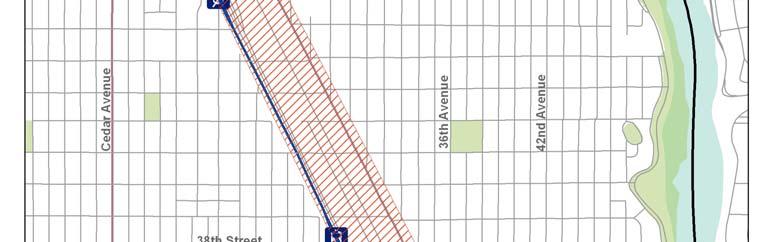
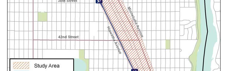
Corridor Background. Defining the Corridor Study Area. Lake Street. 38th Street. 46th Street
 1 Corridor Background Defining the Corridor Study Area Minnehaha Avenue (CSAH 48) and Hiawatha Avenue (MN 55) are parallel diagonal roadways, approximately three blocks apart, that provide two direct arterial
Robbinsdale LRT Station. CDI Development Guidelines. August Overview
 Robbinsdale LRT Station August 2018 Overview The City of Robbinsdale may have the coolest opportunity site along the 13 mile stretch of the Bottineau LRT corridor / Blue Line extension. Located a block
Chapter 1: Introduction
 Chapter 1: Introduction The Penn Avenue Community Works Corridor Vision and Implementation Framework presents an integrated communitybased vision and a coordinated, long-term implementation framework for
ROBBINSDALE LRT STATION CDI DEVELOPMENT GUIDELINES
 August 2018 OVERVIEW The City of Robbinsdale has a prime-opportunity site in the middle of the 13 mile stretch of the Bottineau LRT corridor / Blue Line extension. Robbinsdale offers a prominent, vital,
Hopkins. Development Guidelines May Overview. Sponsored by: Blake Road Corridor Collaborative City of Hopkins
 Hopkins Blake Road LRT Station Area Development Guidelines May 2015 Sponsored by: Blake Road Corridor Collaborative City of Hopkins Overview Hopkins is a dynamic community of over 17,000 residents located
#27. Timing: Short term. Costs: $$
 Land Use & Physical Resources PROJECT #27 Mobility S t u d y a n d i m p l e m e n t H i a w a t h a A v e n u e / M N 5 5 traffic signal improvements Environment & Natural Resources Economic Development
Midtown Greenway PROJECT REPORT CARD
 Midtown Greenway PROJECT REPORT CARD Project Overview and History The Midtown Greenway is a 5.5-mile multi-use trail that connects the Mississippi River to the Minneapolis Chain of Lakes. The corridor,
Potential Funding Sources: Mn DNR Local Trail Connections Grant City of Minneapolis CIP Hennepin County CIP
 Land Use & Physical Resources PROJECT #33 Mobility B u i l d a b i k e / p e d e s t r i a n c o n n e c t i o n b e t w e e n L a k e S t L R T s t a t i o n a n d M i d t o w n G r e e n w a y on east
Southwest Light Rail Transit (LRT) A corridor of opportunity
 A corridor of opportunity") Southwest Light Rail Transit (LRT) A corridor of opportunity Minneapolis Jobs: 151,200 Suburban Jobs: 72,400 Downtown Minneapolis 147,000 emp.* West Calhoun 4,200 emp. Beltline Business Park 6,000 emp.
Southwest Light Rail Transit (LRT) A corridor of opportunity Minneapolis Jobs: 151,200 Suburban Jobs: 72,400 Downtown Minneapolis 147,000 emp.* West Calhoun 4,200 emp. Beltline Business Park 6,000 emp.
NORTH CLAYMONT AREA MASTER PLAN COMMUNITY WORKSHOP #1 FEBRUARY 3, 2016
 NORTH CLAYMONT AREA MASTER PLAN COMMUNITY WORKSHOP #1 FEBRUARY 3, 2016 1. Introduction To the team and to the Plan Planning Partners The Claymont Community WILMAPCO New Castle County Claymont Renaissance
Highway 100 / The Grandview Green Feasibility Study
 Highway 100 / The Grandview Green Feasibility Study Request for Funding Support January 26, 2016 Executive Summary The City of Edina requests support to investigate the feasibility of constructing a public
JANUARY 19, 2011 CENTRAL AVENUE-METRO BLUE LINE TRANSIT-ORIENTED DEVELOPMENT IMPLEMENTATION PROJECT COMMUNITY FORUM
 CENTRAL AVENUE-METRO BLUE LINE TRANSIT-ORIENTED DEVELOPMENT IMPLEMENTATION PROJECT COMMUNITY FORUM JANUARY 19, 2011 THE MARYLAND-NATIONAL CAPITAL PARK AND PLANNING COMMISSION PRINCE GEORGE S COUNTY PLANNING
The transportation system in a community is an
 7 TRANSPORTATION The transportation system in a community is an important factor contributing to the quality of life of the residents. Without a sound transportation system to bring both goods and patrons
Public Forum. Kelley s Corner: The Corner that Connects Us. The Cecil Group. March 7, Acton 2020 Town of Acton.
 Public Forum Acton 2020 Town of Acton March 7, 2013 AGENDA Purpose of Forum Kelley s Corner Project Examples of the Planning Processes Next Steps Dialogue: Questions and Answers PURPOSE Acton 2020 April
BROOKLYN PARK / 85TH AVE LRT STATION CDI DEVELOPMENT GUIDELINES DRAFT
 August 2018 Page intentionally left blank The Brooklyn Park Library adjacent to the 85th Ave LRT Station Area. OVERVIEW The Blue Line LRT Extension / Bottineau corridor offers a unique opportunity to leverage
V. Case Study Sites. Case Study Site Descriptions and Concepts. Case Study #1: Lake Street and Calhoun
 V. Case Study Sites The project area includes a wide variety of neighborhood contexts with diverse development opportunities. To better understand these contexts and how they affect choices concerning
Implementation Guide Comprehensive Plan City of Allen
 Implementation Guide 2030 Comprehensive Plan City of Allen DRAFT 2015 Implementation Guide Allen 2030 Comprehensive Plan INTRODUCTION The Comprehensive Plan serves as a guide for the growth and development
Midtown Greenway to lake street
 Making the connection: Midtown Greenway to lake street May 2016 Design experiment: site amenities, wayfinding, and activities at Cepro, near the Midtown Global Market Recent Greenway Development Highlights
Midtown Greenway Land Use and Development Plan Executive Summary
 Midtown Greenway Land Use and Development Plan Executive Summary Introduction The Midtown Greenway Land Use and Development Plan sets policy direction for land use and development in the Midtown Greenway
Community Open House March 26 th, 2018
 Community Open House March 26 th, 2018 Open House Agenda 1. Overview of Planning Process What we heard 2. Future Land Use Policy 3. Priority Growth Areas 4. Plan Elements Making it happen What is a Comprehensive
Historic Preservation Preserve, restore or adaptively re-use historic structures and landscapes.
 Checklist for New Construction Developers of building projects in the Loring Park Neighborhood are encouraged to pursue the standards that are identified below. For large projects requiring special allowances,
Taming Tysons Corner Transforming the Quintessential Edge City
 Taming Tysons Corner Transforming the Quintessential Edge City Transit is the greatest catalyst for change at Tysons, but how do we take advantage of this billion-dollar investment? If transit is built
DELIVERING ON THE TRANSIT PROMISE
 DELIVERING ON THE TRANSIT PROMISE Dena Belzer October 6, 2015 Presentation Overview 1. Puget Sound As a Transit Region: Putting SeaTac in Context 2. Starting at the Beginning: How Does TOD Work? 3. Strategies
GAINING LEVERAGE through
 GAINING LEVERAGE through FTA s New Starts Land Use Criteria Brigid Hynes-Cherin Associate Administrator FTA Office of Planning and Environment Evaluation and Rating of Transit Supportive Land Use Agenda
Atlanta BeltLine Subarea 3 Master Plan Update
 Atlanta BeltLine Subarea 3 Master Plan Update April 14, 2018 Workshop Meeting 1 22 miles, connecting 45 neighborhoods 22 MILES of transit 46 MILES of streetscapes and complete streets 33 MILES of urban
Community Advisory Committee. February 24, 2015
 Community Advisory Committee February 24, 2015 1 Today s Topics Welcome & Introductions Approve Charter 2015 Meeting Calendar Hennepin County Community Works Update Development Update Environmental Update
St. Louis Park Wooddale LRT Station Site development guidelines
 St. Louis Park Wooddale LRT Station Site development guidelines November 2013 OVERVIEW St. Louis Park s convenient location as a neighbor to Minneapolis means you re only minutes away from some of the
Northwest LRT Downtown to. Northwest Edmonton Study. Public Workshops
 Northwest LRT Downtown to Northwest Edmonton Study Public Workshops March 23 & 24, 2010 Welcome Thank you all for attending Welcome Introductions Welcome Our Team s Commitment to You for Tonight To provide
RE-Imagining the Downtown Colorado Springs Master Plan
 RE-Imagining the Downtown Colorado Springs Master Plan 2016 APA Colorado State Conference October 25, 2016 Overview 8:00 Welcome, Introductions, and Overview 8:15 Downtown s Planning History 8:30 A Market
Economy Vision Statements: Social Wellbeing Vision Statements: Natural Environment Vision Statements:
 Economy Vision Statements: 1. Our business environment makes us a region of choice for new employers as we encourage entrepreneurship and have a vibrant, diversified and resilient regional economy. 2.
New Partners for Smart Growth Conference February 5, 2010
 Dan Stroh, Planning Director City of Bellevue Planning and Community Development Bellevue, WA New Partners for Smart Growth Conference February 5, 2010 Summary of Project Long-range plan update for Bel-Red
Don Mills Crossing Study and Celestica Lands Development Application Community Meeting, Open House, and Breakout Discussions
 Consultation Summary Don Mills Crossing Study and Celestica Lands Development Application Community Meeting, Open House, and Breakout Discussions This report is not intended to provide a verbatim transcript
NorthPoint, Inc. Community-Based Development Concept
 NorthPoint, Inc. Community-Based Development Concept 6.0.01 EXECUTIVE SUMMARY The NorthPoint Community Board Development concept is a community development strategy. It leverages NorthPoint s mission,
Infrastructure Engineering Planning Construction Suite 300 Minneapolis, MN Tel: Fax:
 Infrastructure Engineering Planning Construction 701 Xenia Avenue outh uite 300 Minneapolis, MN 55416 Tel: 763-541-4800 Fax: 763-541-1700 Memorandum To: Minnehaha Creek Watershed District Board From: Tony
Access to the University of North Carolina at Chapel Hill, UNC Hospitals, and Chapel Hill Transit.
 M 1/ 4 1/ 2 E IL M E IL Station Family: County: City: UNC Hospitals WHY THIS STATION? University Village Orange Chapel Hill Access to the University of North Carolina at Chapel Hill, UNC Hospitals, and
Corridor Enhancements
 Corridor Enhancements Safety is MoDOT s first priority in widening and rebuilding I-70 across the state of Missouri. MoDOT also understands that the interstate - and its interchanges and overpasses - are
Port Lavaca Future Land Use
 Port Lavaca Future Land Use Introduction The City of Port Lavaca is beginning to see sustained growth, after many years of relative stable population. New single family homes, apartments, and businesses
DRAFT PLAN PRESENTATION
 DRAFT PLAN PRESENTATION 1.23.2018 AGENDA Process Project Schedule Results from Visioning Workshop Draft Plan Highlights Concept Plans Feedback Next Steps PROJECT SCHEDULE KICK-OFF WORKSHOP August 29 th
2030 Comprehensive Plan VISION STATEMENT
 RESOURCE DOCUMENT for Steering Committee Meeting #2 July 12, 2017 2030 Comprehensive Plan VISION STATEMENT Steering Committee from 2008 Established the Lauderdale s Vision as: Creating a livable, lovable
City of Hopkins 2012 Mission and Goals
 City of Hopkins 2012 Mission and Goals Mission Statement Partnering with the community to enhance the quality of life by Inspiring Educating Involving Communicating Collaborative with School District Overcoming
REGIONAL ACTIVITY CENTER
 DRAFT REGIONAL ACTIVITY CENTER 70 EAST BENCH MASTER PLAN DRAFT 06 Introduction The East Bench Regional Activity center is comprised of large educational, research, medical, and employment centers. These
BAGBY STREET RECONSTRUCTION PROJECT OCTOBER 2, 2015
 BAGBY STREET RECONSTRUCTION PROJECT OCTOBER 2, 2015 CLAIRE HEMPEL, PLA, AICP, LEED GA PREPARED BY Aspen Asheville Austin Chicago Denver Dubai Houston Lake Tahoe Los Angeles MIDTOWN : A MODEL OF URBAN DEVELOPMENT
Welcome! Community Meeting FOR YOUR NEW WEBBER PARK LIBRARY
 Community Meeting FOR YOUR NEW WEBBER PARK LIBRARY Tuesday, April 21, 6 p.m. to 7:30 p.m. Webber Community Center Multipurpose Room 4400 Dupont Ave. N., Minneapolis, MN 55412 Welcome! Please join Hennepin
Atlanta BeltLine. Subareas 9 & 10. Master Plan Updates. March 26, Washington Park Jamboree 1
 Atlanta BeltLine Subareas 9 & 10 Master Plan Updates March 26, 2018 Washington Park Jamboree 1 22 miles, connecting 45 neighborhoods 22 MILES of transit 46 MILES of streetscapes and complete streets 33
PREVIOUS PUBLIC PARTICIPATION BRIEF October 2014
 Comprehensive Planning During the development of the county comprehensive plan, Cultivating Community: A Plan for Union County s Future from 2007 through 2009, and three concurrent multi municipal plans
Midtown Corridor Alternatives Analysis. Appendix A - Initially Considered Alternatives Screening
 Midtown Corridor Alternatives Analysis Appendix A - Initially Considered Alternatives Screening Arterial BRT on Lake Street - Overall Rating: RATING Metropolitan Council recommendations stated in the Transportation
GUIDELINES EXHIBITION PLACE LOCATION: OBJECTIVES. Structure Plan URBAN DESIGN GUIDELINES
 Development in the Exhibition Place lands will be consistent with the following urban design guidelines. They provide a framework for new development of the lands and are to be read in conjunction with
Laird in Focus Community Information Session
 Laird in Focus Community Information Session Tuesday, December 5, 2017 St. Anslem Catholic School, 182 Bessborough Drive Session 1: 5:30 pm - Presentation and Question and Answer Period 6:15 pm - Breakout
MINNESOTA ARCHITECTURE - HISTORY INVENTORY FORM
 Identification Historic Name Dean Parkway Bridge Current Name Bridge 90661 Field # Address Midtown Greenway over Dean Parkway City/Twp Minneapolis County Hennepin Legal Desc. Twp 29N Range 24W Sec 32 QQ
Elliot Park 2. Neighborhood Master Plan. Historical Perspective
 Elliot Park 2 Neighborhood Master Plan Historical Perspective August 2002 Early History Development patterns and the growth of Minneapolis largely grew out of the city s historical response to its geography.
LED LIGHTING DOWNTOWN OKEMOS
 LED LIGHTING DOWNTOWN OKEMOS Michigan State University Practicum 2010 Agenda Introduction Project Background Site Background Importance of Illumination LED Advantages/Disadvantages Application in Other
Chapter 2: Vision, Goals and Strategies
 Chapter 2: Vision, Goals and Lake Elmo Today & Tomorrow Comprehensive Plan 2040 2 VISION, GOALS & STRATEGIES - DRAFT 4-6-2018 INTRODUCTION Comprehensive Plan Purpose Perhapse the most important objective
DOMINION BOULEVARD CORRIDOR STUDY AND ECONOMIC DEVELOPMENT STRATEGIC PLAN A MODEL FOR CHESAPEAKE S FUTURE
 DOMINION BOULEVARD CORRIDOR STUDY AND ECONOMIC DEVELOPMENT STRATEGIC PLAN A MODEL FOR CHESAPEAKE S FUTURE Overview I. Draft Plan Process II. Draft Plan Overview a. Market Analysis b. Master Land Use Plan
The Five Components of the McLoughlin Area Plan
 The Five Components of the McLoughlin Area Plan This documents contains the complete language of the five components of the McLoughlin Area Plan: The Vision Statement The Values The Guiding Principles
Community Engagement Committee Meeting #1 December 10, :30pm-8:30pm
 Community Engagement Committee Meeting #1 December 10, 2014 6:30pm-8:30pm Welcome and Introductions Dana Murdoch Minneapolis Park and Recreation Board Project Manager Ryan French Walker Art Center Director
Transportation Land Use Integration & Regional Planning. Don Kostelec, AICP Senior Planner, Louis Berger Group February 1, 2010
 Transportation Land Use Integration & Regional Planning Don Kostelec, AICP Senior Planner, Louis Berger Group February 1, 2010 Transportation Land Use Integration DOT-HUD-EPA Sustainable Communities Initiative
Sidewalks Street Lights
 Boston Complete Streets Guidelines 013 Boston Transportation Department Sidewalks Introduction 17 Sidewalk Design Principles 18 Sidewalk Zones 0 Sidewalk Zones Widths Preferred and Minimum Widths for Sidewalk
Bachman Creek Greenbelt Park
 1 Bachman Creek Greenbelt Park A Portion of Bachman Needs Renovation The Bachman Creek Greenbelt is a 54 acre park in the City of Dallas (the Park or the Greenbelt ). Most of the Greenbelt is contiguous
Charles P. Johnson and Associates. Annapolis Landscape Architects
 Charles P. Johnson and Associates Annapolis Landscape Architects AGENDA Introduction Project Limits and Scope Site Analysis Opportunities & Constraints Program Goals Image Boards Design Alternatives Pros
Welcome to the Oakridge Centre Open House
 Welcome to the Oakridge Centre Open House Why is the City hosting this event? This open house is to inform you of a rezoning application submitted to the City of Vancouver to amend the existing CD-1 (Comprehensive
Secrest Short Cut and Monroe Expressway Small Area Plan AUGUST 29, 2018
 Secrest Short Cut and Monroe Expressway Small Area Plan AUGUST 29, 2018 Background and Process Monroe Expressway will be open by the end of 2018 Union County and Indian Trail identified a need to revisit
Build on community input
 Build on community input 1/8 8 WAYS TO CREATE GREAT PLACES Employ effective facilitation to encourage broad participation, deliver an aligned vision, and realize neighborhood plans. On front: Planning
Table L-1 Summary Action Strategy. Action Item Timing Status Responsible Agency
 CHAPTER 4: CIRCULATION ELEMENT ISSUE #1: MAJOR THOROUFARES AND TRANSPORTATION ROUTES A balanced transportation system for Fontana is provided that meets the mobility needs of current and future residents
BeltLine Corridor Environmental Study
 BeltLine Corridor Environmental Study Joint TAC and SAC Meeting December 8, 2008 What We Will Discuss Today Outreach and Agency Coordination Scoping Results Existing Conditions Historical and Archeological
COMMUNICATION URBAN DESIGN REVIEW BOARD CITY OF DES MOINES, IOWA MAY 16, 2017 MEETING
 COMMUNICATION URBAN DESIGN REVIEW BOARD CITY OF DES MOINES, IOWA MAY 16, 2017 MEETING Subject: Recommendation Prepared by: PRELIMINARY DESIGN REVIEW OF LOCUST STREET BRIDGE CONSTRUCTION & COURT AVENUE,
3. VISION AND GOALS. Vision Statement. Goals, Objectives and Policies
 Vision Statement Queen Creek s interconnected network of parks, trails, open spaces and recreation opportunities provide safe and diverse activities and programs that sustain its unique, small town, equestrian
CHAPTER 7: Transportation, Mobility and Circulation
 AGLE AREA COMMUNITY Plan CHAPTER 7 CHAPTER 7: Transportation, Mobility and Circulation Transportation, Mobility and Circulation The purpose of the Transportation, Mobility and Circulation Chapter is to
Outdoor Lighting for Julian Dark Sky Network, 2/10/18. Paul Ericson, PE San Diego IDA Board Member / Design Principal, Stantec
 Outdoor Lighting for Julian Dark Sky Network, 2/10/18 Paul Ericson, PE San Diego IDA Board Member / Design Principal, Stantec Introduction to Outdoor Lighting And How it Affects Light Pollution Nighttime
Town of Blooming Grove Comprehensive Plan. Public Meeting October 13, 2004
 Town of Blooming Grove Comprehensive Plan Public Meeting October 13, 2004 Overview of Presentation Process Plan Vision Recommendations Next Steps Process: Listening to the Public Monthly meetings with
TOWN BRANCH COMMONS & VINE STREET MOBILITY IMPROVEMENTS
 TOWN BRANCH COMMONS & VINE STREET MOBILITY IMPROVEMENTS CONTACT: Jeff Fugate, President O: 859-367-4972 F: 859-425-2292 JFugate@LexingtonDDA.com www.lexingtondda.com TOWN BRANCH COMMONS & VINE STREET MOBILITY
Small Area Plan. South Gateway
 Small Area Plan Adopted May 12, 2008 South Gateway Purpose. The South Gateway Small Area Plan defines the City s expectations for the future of the southern entrance to the City at Interstate 85 and Highway
SECTION II SECTION II STATEMENT OF GOALS, OBJECTIVES, PRINCIPLES, ASSUMPTIONS, POLICIES AND STANDARDS
 STATEMENT OF GOALS, OBJECTIVES, PRINCIPLES, ASSUMPTIONS, POLICIES AND STANDARDS 1 2 STATEMENT OF GOALS, OBJECTIVES, PRINCIPLES, ASSUMPTIONS, POLICIES AND STANDARDS INTRODUCTION The New Jersey Municipal
Windsor Locks Transit-Oriented Development Planning Grant Request. Project Background
 Windsor Locks Transit-Oriented Development Planning Grant Request Project Background Downtown Windsor Locks runs along Main Street in the vicinity of the intersection of Routes 159 and 140. The current
#5 Develop wayfinding systems for each of the
 Land Use & Physical Resources PROJECT #5 Develop wayfinding systems for each of the diagonal districts Mobility Environment & Natural Resources Economic Development Social, Cultural and Heritage The concept
MURRAY CENTRAL STATION MASTER PLAN Central Station Area of Influence and Site Analysis
 CENTRAL STATION MASTER PLAN Central Station Area of Influence and Site Analysis OVERVIEW Planned Fire Station TAYLORSVILLE A thorough Site Analysis was conducted to ensure planning and design concepts
TORTI GALLAS and partners, inc. How to Retrofit Your Suburb to Make a Downtown
 How to Retrofit Your Suburb to Make a Downtown April, 2010 Where to Start What should the Town look like? How do I attract new residents, businesses and visitors?? Should we preserve our heritage? How
Cumberland Region Tomorrow is a private, non-profit, citizen based regional organization working with Greater Nashville Regional Council
 Cumberland Region Tomorrow is a private, non-profit, citizen based regional organization working with Greater Nashville Regional Council and others in the public and private sectors, dedicated to planning
UPDATE ON THE INDEPENDENCE BOULEVARD AREA PLAN. Citizen Advisory Group Meeting March 3, 2011
 UPDATE ON THE INDEPENDENCE BOULEVARD AREA PLAN Citizen Advisory Group Meeting March 3, 2011 Purpose: Why are we here? To provide an update on the Independence Boulevard Area Plan 1. Overview of the ULI
Sherri Ferguson. President/CEO Portland Chamber of Commerce. Tennessee Certified Economic Developer Capstone Project
 Sherri Ferguson President/CEO Portland Chamber of Commerce Tennessee Certified Economic Developer Capstone Project Strategic Plan Development for the North Gateway of Portland, Tennessee The New Gateway
Johnson Street Bridge Public Realm Update
 Johnson Street Bridge Public Realm Update August 20, 2015 Background Johnson Street Bridge Replacement Project impacts a diverse range of stakeholders In addition to a new bridge, the project also includes
V. Vision and Guiding Principles
 V. Vision and Guiding Principles The Master Plan for the Powers Ferry Corridor seeks a foundation in the desires of the community. At times, various elements of the community offered opposing viewpoints,
the west loop HOME TO 5,000 NEW DOGS
 the west loop the west loop HOME TO 5,000 NEW DOGS the west loop HOME TO 5,000 NEW DOGS AND 20,000 NEW RESIDENTS outline: the west loop now the vision how do we get there? opportunity LEVERAGE TRANSIT
Welcome to the Sellwood Bridge Project Pre-Construction Open House
 Welcome to the Sellwood Bridge Project Pre-Construction Open House 5:30 7:30 p.m. Please sign in here Information stations and project staff are located throughout the room. Goals for Tonight s Meeting
Kenilworth Avenue and Town of Cheverly Industrial Study Briefing
 Kenilworth Avenue and Town of Cheverly Industrial Study Briefing The Maryland-National Capital Park and Planning Commission Prince George s County Planning Department www.pgplanning.org Vanasse Hangen
Monterey Downtown Lighting Strategy
 Monterey Downtown Lighting Strategy design standards and guidelines July 2013 public review draft 1 content Introduction 1 Scope of the Project 1 Project Process 2 Character Areas 3 Project Goals 3 The
Chapter 1.0 Introduction
 Chapter 1.0 Introduction 1.1 Background The North Metro commuter rail line is part of the RTD FasTracks regional transit system expansion program to build more than 100 miles of rail transit throughout
Corridors. Re-vitalize our Corridors and Gateways
 Corridors Re-vitalize our Corridors and Gateways Artist s rendering from the 287 Strategic Plan, 2015 Corridors are the major throughways of Loveland but they also provide important commercial, community
Mendota-Lebanon Hills Greenway Master Plan Executive Summary. August draft for more information visit
 Mendota-Lebanon Hills Greenway Master Plan Executive Summary August 2013 draft for more information visit www.hkgi.com/projects/dakota INTRODUCTION The Mendota-Lebanon Hills Greenway Master Plan portrays
METROPOLITAN COUNCIL 390 North Robert Street, St. Paul, MN Phone (651) ; TDD (651)
 ; TDD (651)") DATE: December 20, 2011 METROPOLITAN COUNCIL 390 North Robert Street, St. Paul, MN 55101 Phone (651) 602-1000; TDD (651) 291-0904 TO: Metropolitan Parks and Open Space Commission FROM: Tori Dupre, Senior
DATE: December 20, 2011 METROPOLITAN COUNCIL 390 North Robert Street, St. Paul, MN 55101 Phone (651) 602-1000; TDD (651) 291-0904 TO: Metropolitan Parks and Open Space Commission FROM: Tori Dupre, Senior
WELCOME and introduction
 1 WELCOME and introduction Mobility Hub Locations within Burlington STUDY OVERVIEW STUDY OBJECTIVES The City of Burlington is developing four Area Specific Plans, one for each of Burlington s Mobility
4 Park Planning and Design
 4 Park Planning and Design Park Constellations Elliot Gateway/Mills Loring North Loop Commons Twins Minneapolis Park & Recreation Board Downtown Service Area Master Plan 4-1 PROJECT APPROACH REFERENCE
Potential Green Infrastructure Strategies May 6, 2015 Workshop
 Potential Green Infrastructure Strategies May 6, 2015 Workshop Background The City of Cortland is developing the Tioughnioga Urban Headwaters Green Infrastructure Action Plan with funding from the National
The Floyds Fork Area Study A Framework for Growth
 The Floyds Fork Area Study A Framework for Growth Planning Committee 7/8/10 City of Parks 2 Growth Pattern REZONINGS (1976 2007) 1976 1983 1984 1991 1992 1999 2000 2007 1976-1983 3 Growth Pattern REZONINGS
Somers Point Master Plan
 Somers Point Master Plan Progress Report and Public Meeting August 20, 2014 Master Plan Reexamination Municipal Land Use Law require that all municipalities reexamine their master plan every ten years.
D-O LRT Zoning Discussion. Chapel Hill Boards & Commissions October 16, 2017
 D-O LRT Zoning Discussion Chapel Hill Boards & Commissions October 16, 2017 Update on Overall D-O LRT Station Area Initiative Objectives Design and educate on principles of Good Transit-Oriented Development
STREET LIGHTING CATALOGUE
 STREET LIGHTING CATALOGUE 2 3 CONTENTS About FortisAlberta... 2 Overview... 3 Guidelines... 3 Bug Rating... 4 Typical Lighting Arrangements... 4 Road and Pedestrian Classifications... 5 LED Streetlight
Comprehensive Plan. Faribault, Minnesota. Hoisington Koegler Group Inc. Claybaugh Preservation Architecture Inc. Howard R. Green Company Bonz/REA
 Comprehensive Plan Faribault, Minnesota Adopted by the Faribault City Council July 8, 2003 prepared for: prepared by: Hoisington Koegler Group Inc. Claybaugh Preservation Architecture Inc. Howard R. Green