Capital Urban Lands Plan and Parkways Policy Review. Public Consultation Report
|
|
|
- Anastasia Foster
- 5 years ago
- Views:
Transcription

1 Capital Urban Lands Plan and Parkways Policy Review Public Consultation Report 1
2 HIGHLIGHTS Highlights In March 2014, the National Capital Commission (NCC) held public consultations on the Capital Urban Lands Plan and Parkways Policy to hear what people had to say about our national capital s urban lands and parkways. A few highlights from these consultations are as follows: A Public Advisory Committee met to provide high-level input. Two workshops were held with members of the public in Ottawa and Gatineau, attended by 100 participants. The online questionnaire had over 600 respondents. Over 1,400 comments were provided. Six submissions were received from interest groups and community associations. Fourteen submissions were received from members of the public. Top 10 comments 1. Keep it green and add more green spaces. 2. Animate the space and have year-round activities. 3. Build facilities (washrooms, water fountains, boat launches, restaurants, and so on). 4. Work with communities. 5. Include heritage conservation. 6. Integrate federal employment areas with their surroundings. 7. Keep consulting but in plain language! 8. Provide access to the waterfront. 9. Think of pedestrians and cyclists year-round. 10. Work with the cities. 2
3 TABLE OF CONTENTS Highlights... 2 I. Capital Urban Lands Plan and the Parkways Policy Review... 5 II. Consultation Process... 6 III. Capital Urban Lands: Vision Statement... 7 WORKSHOP FEEDBACK... 7 INTEREST GROUP SUBMISSIONS S FROM THE PUBLIC... 8 NCC RESPONSE... 8 IV. Planning Concept: Roles and Goals... 9 WORKSHOP FEEDBACK... 9 ONLINE QUESTIONNAIRE FEEDBACK S FROM THE PUBLIC NCC RESPONSE V. Capital Enhancement Efforts NCC RESPONSE VI. Planning Concept: General Policies WORKSHOP FEEDBACK ONLINE QUESTIONNAIRE FEEDBACK INTEREST GROUP SUBMISSIONS S FROM THE PUBLIC NCC RESPONSE VII. Capital Realm WORKSHOP FEEDBACK INTEREST GROUP SUBMISSIONS NCC RESPONSE VIII. Land Designations WORKSHOP FEEDBACK ONLINE QUESTIONNAIRE FEEDBACK S FROM THE PUBLIC NCC RESPONSE IX. Parkways Policy: Vision WORKSHOP FEEDBACK
4 TABLE OF CONTENTS ONLINE QUESTIONNAIRE FEEDBACK INTEREST GROUP SUBMISSIONS S FROM THE PUBLIC NCC RESPONSE X. Parkways Policy: Directions and Guidelines WORKSHOP FEEDBACK INTEREST GROUP SUBMISSIONS S FROM THE PUBLIC NCC RESPONSE XI. Parkways Policy: Categories and Characteristics WORKSHOP FEEDBACK ONLINE QUESTIONNAIRE FEEDBACK INTEREST GROUP SUBMISSIONS S FROM THE PUBLIC NCC RESPONSE Next Steps Conclusion...31 Appendix A: Public Advisory Committee Members...32 Appendix B: Public Advisory Committee Meeting Notes, March 19, Date and Location Action Item Summary Meeting Objectives Discussion Summary Adjournment Appendix C: Advertisements Appendix D: Database Invitation Appendix E: Media Invitation and Press Coverage
5 CONTEXT AND PROCESS I. Capital Urban Lands Plan and the Parkways Policy Review The National Capital Commission (NCC) has developed the Capital Urban Lands Plan, which will guide development, conservation and improvements in the Capital, as well as NCC and federal government decisions related to these lands. The Parkways and Driveways Policy (1984) review is also under way. This policy aims to recognize the evolution of the parkways, their distinctive qualities, and their role as important green spaces and linkages in the Capital. Under the National Capital Act, the NCC s mandate is to plan, conserve and improve federal lands on behalf of the Government of Canada. To do so, the Plan for Canada s Capital sets out the major planning directions, while three specific master plans provide further detail for the following sectors: the Greenbelt (2013) Gatineau Park (2005) Capital urban lands (under way) The Capital Urban Lands Plan will apply to all federal lands, including NCC lands, within the urban boundaries in the city of Gatineau and within the Greenbelt in the city of Ottawa. It will assist the federal government in developing the Capital s urban lands in an efficient and responsible manner. The plan will include the following: a mission, a planning concept, as well as planning directions related to roles and goals, and major land designations and general policies. The development of the plan included a first phase of inventory and analysis work and an overall assessment of the roles of the urban lands. This was followed by the second phase, which focused on providing guidance for the future, a visioning exercise and the overall planning context in the Capital. The NCC s Advisory Committee on Planning, Design and Realty provided feedback as the plan was created. The City of Ottawa s official plan and the Ville de Gatineau s official plan were also taken into account in the planning process. The parkways and driveways are important elements of the Capital s urban landscape. They provide links between neighbourhoods, and form a network of urban green spaces that communities can enjoy. As the Capital Region s development has evolved, the parkways now need to fulfill different objectives. For example, they could be seen as linear parks into the future. The updated Parkways Policy will recognize the diversity and qualities of the various parkways, and will provide for the development of the following: management plans to protect resources, amenities for visitors, a greater understanding of user needs and how users experience the parkway corridors, plans to help residents and visitors appreciate the significance of the parkways, sound stewardship practices. 5
6 CONTEXT AND PROCESS II. Consultation Process The objectives of the consultation were to provide information and gather feedback on the proposed Capital Urban Lands Plan and renewed Parkways Policy. In 2010, a public consultation for the first phase (analysis) of the project gathered feedback from over 225 participants, contributing to a comprehensive assessment of the Capital s urban lands. Participants identified which urban lands they were aware of and the relative importance of these lands. A public advisory committee was also created to gather feedback from interest groups. This public consultation allowed NCC urban planners to better understand how the lands were used, as well as to complete an analysis of issues and opportunities. A public consultation for the second phase (planning) of the Capital Urban Lands Plan project and the Parkway Policy was held in the winter spring This consultation included the following: A public advisory committee meeting on March 19, 2014, with interest groups (see Appendix A for the list of invited groups and Appendix B for the meeting notes); Two public workshops, on March 25 (Canadian Museum of History, Gatineau) and on March 26 (Canadian Museum of War, Ottawa), with 100 participants over both days; An online questionnaire posted from March 17 to April 6, 2014, with over 600 respondents. The NCC engaged the public, interest groups and community associations in many different ways, including through in-person and online feedback, submissions and social media. The public consultation was promoted through the following: Advertisements in La Revue (19 March), EMC (20 March), Le Droit (15 March) and the Ottawa Citizen (15 March) (See Appendix C); s to the NCC Public Affairs database (over 2,300 subscribers) (See database invitation in Appendix D); Social media messages (Facebook and Twitter) and advertisements; Media invitations and a media technical briefing (see Appendix E for the media invitation and press clippings). Feedback from the 2014 public consultation process allowed the NCC to complete the final version of the plan, which will go before the Board of Directors, as well as the Parkways Policy. Once the vision, planning concept, general policies and major land designations for the Capital Urban Lands Plan are finalized, sector plans will be developed. 6
7 WHAT WE HEARD III. Capital Urban Lands: Vision Statement A vision statement speaks to our aspirations for the Capital s urban lands what they should look like and how they should develop in the next five, 10 and even 50 years. This vision is the anchor for articulating strategic directions that will help us fulfill our stewardship role with imagination and innovation. This vision commits the NCC to continue to be the guardian of the Capital by pursuing the highest-quality standards for all facilities, activities and properties under its authority. It provides clear direction for the planning, development and use of the Capital s urban lands. WORKSHOP FEEDBACK Participants were asked what they thought of the proposed vision statement for the Capital s urban lands. Below is a summary of what participants had to say. The vision should be holistic and more explicit. The statement should be shorter and include words such as preserve and combine nature and culture and innovative and inspiring. The vision should integrate past legacies, and should not combine nature and culture, but instead balance a respect for nature with cultural experiences (another priority). The vision needs to recognize the importance of biodiversity and environmental responsibility, and convey a sense of pride in these elements. The vision statement should be better integrated with the urban fabric, and we should be careful not to dilute our assets. It was suggested that the Central Experimental Farm should be transformed into an urban park, and that LeBreton Flats should have a vision. One organization mentioned that they were happy with the vision statement, to contribute and be part of this vision and its success. INTEREST GROUP SUBMISSIONS The Poets Pathway approves most of the vision articulated in the draft Capital Urban Lands Plan. 7
8 WHAT WE HEARD S FROM THE PUBLIC Why is the time horizon of the plan so long? It was suggested that 25 years would be more appropriate, given the rapid pace of change today. Reworded vision statement: A viable and dynamic enhancement of the Capital urban lands, combining nature and culture, aesthetics and functions, today and tomorrow. That the master plan should strive to make the city more enjoyable, to recharge and refresh, while respecting our surroundings, and establishing policies to protect, restore and enhance biodiversity in the Capital. First Nations should also be involved in protecting these lands. Support for sustainable forms of transportation and complementing the transportation plans of the City of Ottawa and Ville de Gatineau. Ensure segregated cycling and pedestrian lanes across the city to reduce user conflicts. NCC RESPONSE The comments related to the vision statement have been taken into consideration for the development of the mission statement in the plan. This overarching mission statement has a very long time horizon, understanding that short-term specific action may evolve over time, while following high-level aspirations. Comments related to specific areas within the study area will be integrated in more detailed planning work to come. 8

9 WHAT WE HEARD IV. Planning Concept: Roles and Goals A detailed analysis was undertaken prior to the development of the vision. The roles outlined below are a result of that analysis. These roles are directly related to the NCC mandate, and highlight ways in which these lands can contribute to make Canada s Capital a great world capital. A set of goals was developed for each of the three roles in the strategic framework. These goals propose a specific course of action for short-term and long-term implementation by the NCC. The roles combined with the goals translate into three distinct planning directions. Planning Direction 1: Contact with nature Conserve urban natural areas, enhance existing landscapes and provide for public recreation uses in keeping with site carrying capacities. Planning Direction 2: Expression and experience Provide a range of enjoyable, welcoming and lively places offering a rich and varied expression and experience of the Capital. Planning Direction 3: Urban and regional viability Contribute to regional viability through interaction of the federal presence with the overall context and through the support of sustainable and active mobility. WORKSHOP FEEDBACK It is interesting to note that, overall, equal importance was given to the three roles, with a slight inclination toward contact with nature, green spaces and waterways. When asked if they would like to see anything else added or removed within the roles and goals, participants suggested the following: Riverfront spaces should be preserved, shared and open to all. 9
10 WHAT WE HEARD These spaces should become destinations that provide additional opportunities for activities, interpretation and education year-round, as well as amenities such as restrooms. There should be greater integration with the municipalities with regard to planning and a greater emphasis on community needs. The cultural contributions of the First Nations should be highlighted, as well as the history of the region (fur trade route, logging industry, construction of the Rideau Canal and so on). A higher priority should be given to pedestrians and cyclists. The NCC should focus more of its plans on local needs, and reduce the national component on nonnational elements. Heritage buildings under the purview of the NCC should be transferred to the municipalities or to another federal department such as Public Works and Government Services Canada (PWGSC). ONLINE QUESTIONNAIRE FEEDBACK When asked about the three planning directions for the Capital, online questionnaire respondents overwhelmingly agreed with Direction 1 (85%), then Direction 2 (75.8%) and finally Direction 3 (63.8%). 1. Do you agree with the three planning directions for the Capital? Agree Neutral Disagree Don t know/no answer Total Responses Direction 1 Contact with nature/conserve urban natural areas, enhance existing landscapes and provide for public recreation uses in keeping with site carrying capacities. 516 (85.0%) 37 (6.1%) 33 (5.4%) 21 (3.5%) 607 Direction 2 Expression and experience/provide a range of enjoyable, welcoming and lively places offering a rich and varied expression and experience of the Capital. 457 (75.8%) 90 (14.9%) 24 (4.0%) 32 (5.3%) 603 Direction 3 Urban and regional viability/contribute to regional viability through interaction of the federal presence with the overall context and through the support of sustainable and active mobility. 385 (63.8%) 85 (14.1%) 53 (8.8%) 80 (13.3%) 603 A total of 322 people provided additional comments or suggestions, which are broadly summarized below, divided by each planning direction. Comments are listed in the order in which they were most frequently mentioned. Direction 1 Contact with nature: Conserve urban natural areas, enhance existing landscapes and provide for public recreation uses in keeping with site carrying capacities. In the online questionnaire, 66 additional comments were received. They can be summarized as follows: Many expressed the need to maintain and preserve the existing green spaces in the Capital. The comments clearly conveyed the importance of maintaining these spaces for the health and vitality of present and future generations of Canadians. 10
11 WHAT WE HEARD Some participants also mentioned the importance of maintaining areas that facilitate contact with nature. A few respondents stated that the NCC should increase the number of activities and services available in its green spaces. Direction 2 Expression and experience: Provide a range of enjoyable, welcoming and lively places offering a rich and varied expression and experience of the Capital. A total of 63 additional comments were received, indicating the following: Increased access to the waterfront is important, and these lands should provide more lively spaces and areas where people can congregate, such as cafés, patio restaurants, food carts, boutiques, art galleries and so on. This planning direction needs to be balanced with the natural landscape. Several participants also expressed an interest in sustainable urban agriculture and the creation of community gardens. Some respondent stated the need for increased amenities such as picnic tables, toilets and barbecues. Direction 3 Urban and regional viability: Contribute to regional viability through interaction of the federal presence with the overall context and through the support of sustainable and active mobility. A total of 102 comments related to this topic, with the majority of participants interested in active transportation. Many suggested segregated bike lanes on NCC parkways. Some requested designated bike-only pathways. NCC pathways should be cleared for year-round use. 11
12 WHAT WE HEARD Other comments or suggestions (91 in total) from respondents fell outside the scope of the three planning directions, and can be summarized in the following themes. Commuting: for and against Pedestrian access Light rail transit (LRT): for and against Dogs Questionnaire consultation process Municipal collaboration NCC mandate S FROM THE PUBLIC The NCC should implement a strict code of environmental practice on all lands under its jurisdiction to ban the use of pesticides and herbicides. The NCC should engage urban planners from all levels of government to produce a transportation master plan for the region. Another priority should be heritage, including Parliament, the Rideau Canal, locations along the Ottawa River and other cultural landscapes. It was suggested that Expression and Experience be changed to Cultural/Social Contact to emphasize how people interact with the other roles. Lands, monuments and assets should be easily accessible and convenient to get to, while focusing on non-motorized vehicle access. NCC RESPONSE The main focus of the plan is to provide guidance for federal lands that play a role for the Capital, in how they are then managed, developed or designed for future uses. It goes without saying that the end result may benefit local residents, but ultimately the first function of federal lands is to meet Capital roles and goals. 12
13 WHAT WE HEARD V. Capital Enhancement Efforts Questionnaire respondents were then asked to consider five areas for Capital enhancements, and rank them from most important (1) to least important (5). The results indicate that respondents think that improvements should be focused on the Capital urban green space network and the cultural, historical and artistic functions. 2. In your opinion, where should we focus our Capital enhancement efforts? Total Responses The Capital Urban Green Space Network (Leamy Lake Park, Vincent Massey Park, the parkway corridors, for example) 299 (55.8%) 86 (16.0%) 49 (9.1%) 45 (8.4%) 57 (10.6%) 536 Political functions (Parliament Hill, for example) 65 (12.1%) 96 (17.8%) 132 (24.5%) 126 (23.4%) 120 (22.3%) 539 Federal administrative and scientific functions (Tunney s Pasture, for example) 31 (5.7%) 47 (8.7%) 93 (17.1%) 151 (27.8%) 221 (40.7%) 543 Cultural, historical and artistic functions (the national museums and commemorative features, for example) 99 (18.4%) 212 (39.3%) 130 (24.1%) 75 (13.9%) 23 (4.3%) 539 Capital links (capital arrivals and scenic entries, for example) 53 (9.7%) 94 (17.3%) 139 (25.6%) 141 (25.9%) 117 (21.5%) being the most important and 5 being the least important When asked for additional comments or suggestions regarding where the NCC should focus its Capital enhancement efforts, a total of 205 responses were received. Comments can be summarized as follows. Many comments stated that the Capital s green spaces, especially those along the river and canal corridor, are far too underused. It was suggested that these spaces should provide additional amenities such as picnic tables, washroom facilities and drinking fountains, as well as services such as food vendors and restaurants. The enhancement of Ottawa s arrival points was also indicated by many respondents as being an important focal point. Visitors should feel like they are entering the capital of a G8 nation when arriving from the airport or from the various highways on both sides of the river. Respondents conveyed the importance of maintaining and enhancing the Capital s green space as well as improving connectivity between green spaces and the various sites and attractions. Active mobility was also a common theme among some respondents. However, it was mentioned that pathway links require improvement, and suggestions were made that pathways should be accessible year-round. 13
14 WHAT WE HEARD NCC RESPONSE The comments reflect the direction taken in developing the plan, and further confirm the priorities established in the Capital Urban Lands Plan. VI. Planning Concept: General Policies The Capital Urban Lands Plan establishes three general policy categories that can be applied to all three planning directions. These aim at reinforcing the Capital s distinctive urban, natural and cultural features. The three categories are as follows: Eco-responsible management and green synergy Quality, sense of place and heritage Integrated and responsible planning WORKSHOP FEEDBACK Participants were asked to identify the strengths and weaknesses of the three general policies suggested in the Capital Urban Lands Plan. The participants primarily provided further comments on issues of importance to them, as indicated in the following examples. Some people mentioned the necessity of eco-responsibility and green synergy and their integration with urban areas. It was also stated that green spaces must be used in order to be valued; therefore, it is essential to provide activities and create reasons for people to visit the green spaces. Furthermore, it was conveyed that sustainability and sense of place should really be at the heart of the plan. Others commented that there needs to be more of a focus on partnerships, especially with the municipalities. Integrated planning to establish further connectivity between municipal and NCC amenities is vital, especially with respect to pathway linkages and year-round use of the pathways. The emphasis needs to move away from the use of cars. Additionally, the NCC needs to look for inspiration in the success stories of other cities around the world, in order to create a dynamic, world-leading capital. ONLINE QUESTIONNAIRE FEEDBACK Questionnaire participants were also asked to rate the importance they attribute to the three proposed general policies, which seek to attain and maintain high standards for all projects and development activities involving the Capital s urban lands. All three general policies were identified as being important by the majority of respondents. Integrated and responsible planning resonated with the greatest number of respondents (81.4% identified it as being 14
15 WHAT WE HEARD important), eco-responsible management and green synergy was the second-most important (76.3%), while quality and a sense of place was third (but still had 73.3% of respondents identifying it as being important). 3. Please rate the importance you give to the proposed General Policies that seek to attain and maintain high standards for all projects and development activities involving capital urban lands. Important Neutral Not very important Don t know/no answer Total Responses Eco-responsible management and green synergy 329 (76.3%) 61 (14.2%) 33 (7.7%) 8 (1.9%) 431 Quality and a sense of place 316 (73.3%) 80 (18.6%) 25 (5.8%) 10 (2.3%) 431 Integrated and responsible planning 351 (81.4%) 51 (11.8%) 21 (4.9%) 8 (1.9%) 431 When asked for further comments and suggestions regarding the proposed general policies, 161 participants responded. The comments that came back most frequently included the following: The importance of an integrated planning approach for the Capital, especially with respect to transportation planning The need for the NCC to work in partnership with the local municipalities to develop and encourage active and sustainable transit and mobility The removal of car-focused amenities, and possibly even the conversion of the parkways into parks or pathways, allowing for easier and safer access to the waterfront Many respondents also expressed their support for and against, in equal numbers, the LRT along the Sir John A. Macdonald Parkway. INTEREST GROUP SUBMISSIONS Heritage Ottawa indicated the need to consult with community associations and residents as part of the process in dealing with its properties. S FROM THE PUBLIC The NCC should make a significant contribution to the further development of the region, and should work with others to make joint decisions. Integrated and responsible government should be in concert with municipal governments. 15
16 WHAT WE HEARD NCC RESPONSE The NCC recognizes that participants agreed with these general policies, and has continued to develop the plan in the same direction, simplifying the general policies by embedding them in the land use designations. Particular comments will be taken into consideration in more specific planning initiatives. VII. Capital Realm The Capital Realm is much more than a collection of federal properties. Together, these lands convey the images of Canada and its capital, and symbolize Canadians values and deep attachment to their country, in addition to showcasing Canada s rich natural and cultural heritage. WORKSHOP FEEDBACK When asked whether or not anything should be changed or added to the Urban Lands: Capital Realm map, workshop participants indicated that the following lands or elements should be added to the map: Bike paths (along the western bank of the Rideau River, along the Rideau Canal south of Dows Lake and better connections to the Greenbelt pathways) Natural features (trees or natural features that predate Confederation should be highlighted) Kettle Island Rochester Field (some felt that it should be added to the Capital Realm, while others felt that it should be removed and made into a park) Other Capital NCC lands (should be Capital Realm or Capital urban green space) Western Parkway (should be preserved and more accessible for water sports, for example, kayaking) Pinhey sand dunes (should be taken off the map) The following outlines other general comments related to the Capital Realm lands: The idea of a unified regional master plan to connect with the urban fabric A suggestion to include Gatineau Park and the Greenbelt in this plan The Capital Realm should be the Federal Capital Realm for clarity Community use and increased communication with NCC would need to be incorporated There should be integrated mapping of all of the access points and connections from Parliament to other attractions and natural lands in the urban core. 16
17 WHAT WE HEARD INTEREST GROUP SUBMISSIONS The Old Ottawa East Community Association supported the importance of urban lands that make Ottawa so much more beautiful, sustainable and lovely, while also suggesting that the NCC acquire the western shore of the Rideau River and ensure the creation of a simple footbridge across the Rideau River. The Poets Pathway asked that the Southern Corridor be kept and that the NCC consider a poets park in that area. Underground Solution suggested that Rochester Field be a transition space from commercial/residential to recreation, by creating a park. NCC RESPONSE The NCC has created the Regional Interest Land Mass (RILM) to take into account lands which serve regional goals that the public has identified as important. The plan distinguishes between regional and Capital realms. With regard to specific comments, the NCC has identified the following: For the lands surrounding McCarthy Woods in the Southern Corridor, the lands will remain in the public domain and will be identified as RILM. For Rochester Field, an agreement in principle was reached between the City of Ottawa and the NCC ensuring that most of the lands remain in the public domain, designated as Capital urban green space. Kettle Island is not federal land, but it is identified as part of the Capital Realm. For the Sir John A. Macdonald Parkway, comments have been directed to the planning exercise under way for this parkway. The sand dunes are within the Greenbelt and are not subject to this plan. VIII. Land Designations The major land designations describe the possible uses in a particular location, as well as how lands should be developed, based on the stated planning directions and objectives. The Capital Urban Lands Plan expresses the type of uses that are permitted on federal lands, and clarifies what is in the Capital Realm for visitors and residents understanding. The primary land designation specifies the principal use of any given site. Secondary and complementary designations for additional uses may also be applied. Federal planning endorses the objectives of mixed-use and compact urban areas, aligned with regional and municipal planning. 17
18 WHAT WE HEARD WORKSHOP FEEDBACK When asked whether or not anything should be modified or improved on the Urban Lands: Land Designations map, workshop participants highlighted the following: Create a new designation for Capital Urban Space that would include community-based projects of regional interest (e.g. community gardens, animation, cafés, music, activities) along the fringes of urban lands. Preserving natural habitats: For birds, meadows in the Southern Corridor; or that the Valued Natural Habitat and Capital Urban Green Space designations be merged, that lands adjacent to the Rideau River be purchased by the NCC and become active park lands. Central Experimental Farm: A participant thought that it should be transformed into an urban park, while another would like to preserve the lands. LeBreton Flats: A special study area should be designated to create a Central Park/Hyde Park type of space. ONLINE QUESTIONNAIRE FEEDBACK In the online questionnaire, respondents were asked if the major land designations corresponded to their view of the future of the Capital. A majority of respondents (61 %) felt that these designations reflected their views of the future of the Capital, whereas a significant proportion (39%) felt that they were inaccurate. 4. Do the proposed Major Land Designations correspond to your view of the future of the Capital? Response Chart Percentage Count Yes 61% 244 No 39% 158 Total Responses 402 Online questionnaire respondents who answered No were asked to provide further input to explain why they felt that these designations did not correspond to their view. A total of 190 responses were received for this question, which have been divided by theme. Green Space All comments received regarding green space can be further categorized into three broad areas: those advocating for the preservation and protection of green spaces (19 comments in total), those advocating for an increase in the public accessibility and range of recreational opportunities in various green spaces (14 comments), and those indicating that some of the green spaces in the Capital should be eliminated, developed or reduced (6 comments). Some of the more frequently mentioned items include the following: The Central Experimental Farm could be improved or repurposed. 18
19 WHAT WE HEARD The protection of valued natural habitats was a priority for several respondents, who called for a limit on development, an increase in the amount of land designated as a valued natural habitat, and the protection of corridors and connections between green spaces. Many respondents supported an increase in the amount of green space that is publicly accessible. Federal employment areas A number of people commented on the designation of federal employment areas, suggesting that these areas be centralized, mixed-use, and better integrated with the community and amenities around them. Transportation Comments in this category refer to what we heard about LRT, use of the parkways and active and public transportation. While some expressed concern over LRT on the Sir John A. Macdonald Parkway and the fragmentation this would cause vis-à-vis access to the shorelines, others noted that LRT is a more environmentally friendly option than the existing car traffic/congestion. Some of the other transportation-related comments included the following: Better pathway connections (between pathways, leading to national institutions and maintained in all four seasons) would better facilitate active transportation throughout the region. While some advocated for a reduction in the number of lanes available for cars on the parkways, a greater number of respondents indicated that the restriction of cars on the parkways would be problematic. Working with partners Several respondents (12 comments) indicated that they would like to see greater cooperation between the NCC and various private and public partners. Shorelines A handful of comments were specific to the shorelines of the Ottawa River; various uses and designations for the shorelines were suggested. These included the following: Designating the shorelines as parkland or even as a valued natural habitat to ensure protection Facilitating economic opportunities along the shorelines Increasing public accessibility and recreational opportunities Urban redevelopment Respondents indicated that there are several enhancements which could be made in the core of the region. These include the following: Future buildings at the LeBreton Flats should be interesting, inspiring and architecturally significant, and there should be public amenities that encourage public use. The Canada Science and Technology Museum should be relocated to the core, and the parking lot at the Canadian Museum of Nature should be buried. Shopping opportunities in the core and areas such as Dows Lake should be diversified and should support the community (i.e. not just boutiques, but stores that residents need). There is an opportunity for urban redevelopment at Rochester Field. Cultural, historical and artistic functions in the Capital While only a small number of respondents commented on this designation, there was agreement that historical preservation was important in the Capital and that cultural areas should be enhanced, perhaps overlapping with green spaces. General comments about the land designations Looking at the bigger picture, the following comments were received from several participants: The land designations do not reflect the importance of commercial activity. 19
20 WHAT WE HEARD Urban green space should mean that spaces are significant (not just small patches of grass). Urban redevelopment should be for public use. Valued natural habitat is an important designation, but should not come at the expense of public access. Urban green spaces could also be valued natural habitats. Respondents were also asked whether or not they agreed with the directions set out in the proposed major land designations. A majority of respondents agreed with the proposed designations, although many indicated that they did not know. 5. Do you agree with the directions set out in the proposed Major Land Designations? Yes No Don t know Total Responses Capital Realm Major Land Designations 219 (52.0%) 56 (13.3%) 146 (34.7%) 421 Valued natural habitats 286 (67.9%) 48 (11.4%) 87 (20.7%) 421 Capital parks 291 (69.1%) 45 (10.7%) 85 (20.2%) 421 Capital urban green spaces 273 (64.8%) 58 (13.8%) 90 (21.4%) 421 Agricultural research 242 (57.6%) 56 (13.3%) 122 (29.0%) 420 Political functions 217 (51.5%) 51 (12.1%) 153 (36.3%) 421 Major federal employment areas 206 (48.9%) 71 (16.9%) 144 (34.2%) 421 Other federal facilities 182 (43.2%) 57 (13.5%) 182 (43.2%) 421 National cultural, historical and artistic functions 288 (68.4%) 26 (6.2%) 107 (25.4%) 421 Urban redevelopment 191 (45.4%) 87 (20.7%) 143 (34.0%) 421 When asked why they did not agree, over 175 respondents provided further clarification. Their explanations are outlined below. General comments The greatest number of comments fell into the category of general comments (75 comments), and related principally to the structure, accessibility and nature of the survey. The majority of respondents who provided additional comments in this section noted a lack of information, problems with identifying certain lands on the map and unclear definitions. The 120-page document provided as an attachment was too long to go through, and 500 characters was not enough space to provide detailed feedback. Several people also mentioned that the waterfront and shorelines were missing from the land designations, and that greater access, recreational opportunities and low-impact development were warranted on these lands (although it should also be noted that a small number of people advocated the inclusion of the shorelines as green space or valued natural habitat to be protected). Urban redevelopment Many respondents indicated the need to involve partners in the discussions around urban redevelopment, including the City of Ottawa residents of the region. Some questioned the need to redevelop areas in the core. Others suggested including portions of the waterfront in this category to enhance amenities available in those areas. 20
21 WHAT WE HEARD Several other respondents mentioned the need to further enhance green spaces and parklands in areas that were designated as urban redevelopment. Major federal employment areas Survey respondents indicated that transportation and the implications of centralized versus decentralized employment areas on the surrounding communities should be considered. While both centralization and decentralization of these lands were mentioned by respondents, a slight preference for centralized, mixed-use and high-density areas was noted, with a particular emphasis on the redevelopment of Tunney s Pasture. Capital urban green spaces The majority of respondents who commented further on this designation advocated multiple designations for these areas, including the following: the inclusion and protection of the shorelines, enhanced recreational opportunities and supporting amenities, the possibility of having agricultural uses within these green spaces, and the enlargement of these areas for greater protection and preservation, and sustainable transportation options within them. A very small number felt that these spaces should be developed, because they are underutilized or because the lands would be better served with an alternative designation. Agricultural research The majority of respondents who provided additional comments on this topic believe that the agricultural research function should be located outside of the core. Lands currently designated in line with this function should be enhanced in order to facilitate recreational use; in particular, the Central Experimental Farm should be converted into parkland and made more publicly accessible. National cultural, historical and artistic functions Respondents indicated that these functions should be concentrated in the core of the region and should be easily accessible. Greater acknowledgements of historical elements, as well as the preservation of heritage were some of the respondents priorities. Enhancing the quality of architecture and beautification initiatives in the Capital was also mentioned. Capital parks A handful of respondents mentioned the need for enhanced recreational opportunities within Capital parks, as well as a lack of park space in the Capital s core. Some respondents questioned the difference between Capital parks, valued natural habitat and green space, and wondered about the implications of the different designations on how they use these spaces. Valued natural habitats Those who provided additional comments relating to valued natural habitats mentioned the need to enhance and protect these lands. Connecting different valued natural habitats was noted as being an important element to their preservation, and several specific areas, including Victoria Island, Leamy Lake and Old Quarry Trail, were suggested as lands that should be designated in this category. Public access to nature and natural areas was also suggested as being an important component of this designation. 21
22 WHAT WE HEARD Political functions Survey respondents indicated that they were not sure why the NCC was involved in the management of lands in this category, and questioned whether or not this function would best be served by other departments. Other federal facilities Respondents indicated that terminology would have to be further clarified in order to provide additional comments. The need to work with PWGSC to redevelop these areas was also noted. S FROM THE PUBLIC How is a site s landscape character determined or established in the first place? For Capital links: What does the NCC mean by saying All lands abutting Capital arrivals are to be developed aesthetically? Instead of the Political designation, it could be federal government grounds or Parliamentary Precinct. Concern was expressed that the Central Experimental Farm was covered by three designations. Science and administration are two different functions, and should be separate. NCC RESPONSE Most of the comments have been integrated into the land designations. It is important to note that the NCC s mandate is to plan and preserve the Capital, and some comments were related more specifically to amenities for neighbourhood uses or surrounding communities. While these concerns are important in any city-building initiative, the NCC must focus its efforts on capital building. The plan makes it clear that the urban lands must be of use for a variety of needs for all Canadians, and may also benefit local residents. The Urban Redevelopment designation remains as proposed. It includes lands that have no Capital function, and are to be developed in accordance with shared regional sustainable planning principles. A new concept was developed to address the concerns brought forward regarding the development of some lands. The RILM are lands that serve a regional vocation and will be kept in the public domain (e.g. lands near Southern Corridor /McCarthy Woods). IX. Parkways Policy: Vision The draft Parkways Policy is an update to the 1984 Policy on Parkways and Driveways that will guide the NCC in decisions and programs to safeguard and enhance the parkways and driveways in the Capital. The rich legacy of parkways is fundamental to the Capital s quality of life. 22
23 WHAT WE HEARD These special corridors embody many values important to our capital and to Canadians: heritage and history, urban forests, colourful flora, outstanding urban design and exceptional user experience. The proposed vision for the parkways is the creation of the following: A continuous ribbon of renowned scenic corridors that provide access to and protect treasured Capital assets and places, convey unique stories, enhance the quality of experiences, and promote healthy active lifestyles. WORKSHOP FEEDBACK Participants were asked if they believed that the suggested Parkways Policy guidelines captured their vision of the parkways. A majority confirmed that the guidelines matched their vision of the parkways, while also suggesting that there should be the following: o more green space protection, o more parks along the waterfront, o greater focus on people, recreation and the natural environment. Some participants felt that the parkways could not fulfill both transportation and recreation roles, and that a choice should be made between one or the other. The Sir John A. Macdonald Parkway has become a traffic-congested highway, and imposing additional travel routes, such as the LRT, will degrade the intention of the NCC s mandate and compromise the nature of the parkway. ONLINE QUESTIONNAIRE FEEDBACK Online questionnaire respondents were asked what their vision was for the future of the parkways and, of the 279 responses, three main themes with an equivalent number of comments stood out. Active transportation Parkways should be pedestrian- and cyclist-friendly, supporting active transportation. Many suggestions were made to help achieve this. Close the parkways to motorized vehicles more often. Separate cyclists and pedestrians with different paths or by creating a cycling lane on the roadway. Remove two lanes of vehicle traffic. Provide more amenities to facilitate access. Install cycle-share stations. Ban cars. Increase the number of buses and stops. 23
24 WHAT WE HEARD Add more pedestrian crossings or build overpasses. Do not allow or allow the western LRT on the Sir John A. Macdonald Parkway. Build a trolley system to access the waterfront. Green spaces Respondents overwhelmingly said that the parkway green spaces should be enhanced. They should be places of enjoyment, relaxation and recreation that are maintained appropriately. Certain parkways or areas should be kept in a natural state to provide safe passage for wildlife, while also calling for more wildlife crossings and mitigation measures. Spaces need to be accessible to residents and visitors, and to act as parks, rather than as spaces that people travel through. Destinations Many participants indicated that the parkways need to become destinations that are enjoyed for recreation, either through sports or water-based activities, entertainment, cultural initiatives, gathering places or cafés/restaurants. Comments related to the following issues. Allowing some form of low-impact development to attract visitors and residents. Increasing amenities (washrooms, kayak or canoe rentals, cafés, benches, art, and so on). Facilitating access for many different people (children, seniors or those with mobility restrictions). Increasing transit, pedestrian crossings, lookout points, and more frequent parking and rest areas. Regional transportation The role of transportation on the parkways in relation to the region s transportation network was often discussed. Several solutions were proposed to alleviate commuter traffic on the parkways: o Limiting car access to certain times, o Lowering traffic speeds, o Charging a toll for parkway use, o Encouraging transit on the parkways, o Having fewer lanes. However, many other respondents reiterated the importance of the parkways as a major thoroughfare to cross the city, especially with current ongoing construction projects. It was felt by some respondents that the concept of parkways as an opportunity for a leisurely Sunday drive was out of date and needed to be revisited. 24
25 WHAT WE HEARD Other comments There is a need for increased safety awareness for pedestrians. The parkways should be left as-is. There should be no buses or commercial vehicles allowed on the parkways. Additional wayfinding should be installed. The historical and heritage elements of the parkways should be recognized (e.g. through interpretive signage). There should be pathway maintenance along the parkways in the winter, including cross-country ski trails. INTEREST GROUP SUBMISSIONS The City Centre Coalition (CCC) indicated that the vision for the parkways strikes a good and clear expression of where the NCC wants to go and it would like to see the addition of date-specific targets and metrics in order to measure progress toward the NCC s goals, along with an annual report. Heritage Ottawa thought that some types of development, to provide greater access to the parkways and more animation, would be excellent. Its representatives did not think that mass transit should impede public access, and felt that the NCC should consider designating the parkways as national historic sites. Heritage Ottawa supports strategies that animate the parkways and improve public access, in ways that respect the parkways for their heritage and scenic values. The Old Ottawa East Community Association provided perspectives on the Parkways Policy Review, indicating that Colonel By Drive and the Queen Elizabeth Driveway are essential routes for residents, as well as a vital part of the community s green and blue landscape. Its recommendations were related to the following: o Safe crossings o Safe cycling and walking o Support for the Fifth Avenue Clegg Street Canal footbridge o Landscaping plan for Colonel By Drive o Enhanced Canal usage and visual aspects (more accessibility in the summer; kilometre markers; more places to eat, drink and relax; hydro wires hidden; and no video displays on the Ottawa Convention Centre or any displays on Lansdowne Park). Underground Solution explained that the parkways should not be used for commuter traffic, and should be considered as urban green spaces, accessible through public transportation (OC Transpo or shuttle) to connect with cultural institutions and local communities. S FROM THE PUBLIC Further safety improvements should be made on the Rockcliffe Parkway, such pedestrian crossings or additional signage. It was also suggested that vehicle traffic should be banned for inbound and outbound traffic at peak hours on the western and eastern parkways. 25
26 WHAT WE HEARD Two lanes should be removed and made into parkland. A third should be added to the remaining lanes with bidirectional signage at peak times (like the Champlain bridge), or the two remaining lanes could become segregated bike lanes. The western LRT route should be completely underground in order to preserve and protect the parkway. There should be additional facilities that draw people to the waterfront. It was suggested that lookouts, boats, restaurants, teahouses be built, and historical sites be enhanced. Some pathways along the river should be widened to allow for better pedestrian access to the riverfront. Some parkways, such as the Sir John A. Macdonald Parkway, should be converted to natural-setting parks with direct access, while others are tremendously valuable as scenic roadways that offer access to Capital assets. The NCC has the opportunity of improving the urban watershed by naturalizing and daylighting Pinecrest Creek. NCC RESPONSE The public comments received are noted. The majority of public input seems to place significant importance on active mobility, traffic reduction and the inherent scenic, heritage and cultural aspects of parkway corridors. These priorities placed by respondents closely resemble the essence of the proposed draft policies. The Sir John A. Macdonald Parkway and other parkways are vital windows to the intrinsic cultural, heritage, natural, scenic, environmental and recreational qualities of the Capital. In other words, they are the lenses through which the Capital experience or Capital impression may be communicated through their signature natural, heritage, cultural, landscape and scenic features. The proposed policies are a blueprint or framework for managing, promoting, preserving and enhancing the image and function of parkway corridors as distinctive places and experiences. The policies identify a typology of parkway corridors with varied corresponding potential for enhancement of quality of life; intrinsic qualities; scenic, natural, historic, cultural and recreational features; and accommodation of appropriate public resources and amenities. X. Parkways Policy: Directions and Guidelines The directions from the revised Parkways Policy are included in the Capital Urban Lands Plan. Though complementary to the Capital Urban Lands Plan, the Parkways Policy is a distinct, stand-alone document. The parkways are invariably a key component of any Capital planning exercise involving urban lands and the core area. The parkways are a testament to significant Capital planning endeavours, dating back to the work of the Ottawa Improvement Commission in
27 WHAT WE HEARD WORKSHOP FEEDBACK Workshop participants discussed how they would rank the Parkway Policy directions and guidelines from 1 (most important) to 14 (least important). Those that received the most rankings were the following. 1. Encourage parkway and shoreline accessibility for active transportation, and improve the safety of crossings. 2. Provide public access for people to scenic areas, natural institutions and recreational facilities. 3. Connect people with nature. 4. Emphasize the role of the parkways as places and destinations, and highlight their multi-use nature. 5. Emphasize the importance of the parkways as a distinct component of the Capital that includes scenic roads and adjacent green space and that showcases a specific character of the Capital. 6. Provide alternative scenic access to the core of the Capital Region. 7. Facilitate public access through the development of corridor management plans. 8. Maintain, protect and enhance the distinctive and picturesque character of the Capital parkway network. 9. Host events of Capital, national and international significance. 10. Utilize parkways as ceremonial routes, with periodic closures for special events. 11. Develop sites in a manner compatible with the profile and character of the sites, and maintain a landscape that is befitting the parkway character. 12. Limit roadway connections to the parkway network (i.e. entrances and exits to the parkways). 13. Preserve the fluid nature of the experience, while maintaining unhurried traffic flow. 14. Develop specific planting plans for each parkway. INTEREST GROUP SUBMISSIONS Citizens for Safe Cycling indicated that it was time to prioritize sustainable and active transportation, by increasing the cycling modal share in the respective corridors. Representatives said that the policy should maintain the prohibition of commercial vehicles, the small number of at-grade crossings or intersections, and the existing travel lands for motor vehicles as an upper limit. They called for the accommodation of bicycle commuting through several measures, while maintaining their characteristics as people places. Underground Solution highlighted the need for clear signage and enhancement of Sir John A. Macdonald Parkway activities and amenities, such as guided walks, walking trails, points of geographic and heritage interest, picnic spots, wheelchair accessible walks, shaded areas, kayak and canoe launches, whitewater sports, increased fundraising walks/races, children s play areas, dog parks, and restaurants. 27
28 WHAT WE HEARD S FROM THE PUBLIC Walkers of all ages need more access to the special locations along the Ottawa River, with pedestrianonly paths and easier parkway crossings. NCC RESPONSE Based on public feedback, it appears that most respondents think the main focus of the policies should be on emphasizing the importance of parkways as distinct components of the Capital that showcase specific characteristics of the Capital; on providing public access to scenic areas, natural institutions and recreational facilities; on connecting people with nature, and highlighting the parkways as public spaces and destinations, as well as their multi-use nature. These elements are all reflected in the draft policy. XI. Parkways Policy: Categories and Characteristics NCC parkways are distinctive in that they have a special relationship with their surrounding context and that they perform various functions. Parkways differ from local roadways, because they are generally understood to be within a park or park-like setting; they are also distinguished by their scenic and landscape qualities or by their access to such qualities. The proposed parkway categories are one of the following three types. Urban: While set in a predominately urban backdrop, they provide access to and connect Capital green spaces, parks, institutions and attractions. Natural: Primarily located within green park-like settings, they provide access to recreational sites including picnic areas, trails, vistas and lookouts. Waterfront: They follow a watercourse in a curvilinear alignment. WORKSHOP FEEDBACK For the workshop discussion, participants were asked whether or not they felt that the proposed categories (natural, urban, waterfront) describe the parkways effectively and if any other categories should be added. Half of the participants agreed with the proposed categories. Other participants either disagreed or did not indicate their thoughts. A few participants said that it was difficult to assign one category to a particular parkway, since a parkway could have many qualities, either as an urban or waterfront parkway, depending on the particular segment of parkway and its location. Cultural, recreational or animation categories were suggested as additional categories by some workshop participants. 28
29 WHAT WE HEARD ONLINE QUESTIONNAIRE FEEDBACK When asked which parkway characteristics were most important to them, online questionnaire respondents placed the characteristics in the following order (highest importance to lowest importance): Scenic Natural Recreational Mobility Cultural and heritage (equal) Archaeological Other 6. Which parkway characteristics are the most important to you? Total Responses Scenic 105 (28.1%) 97 (25.9%) 61 (16.3%) 49 (13.1%) 17 (4.5%) 24 (6.4%) 15 (4.0%) 6 (1.6%) 374 Cultural 5 (1.3%) 28 (7.5%) 40 (10.7%) 69 (18.4%) 108 (28.8%) 69 (18.4%) 39 (10.4%) 17 (4.5%) 375 Recreational 57 (15.2%) 94 (25.1%) 91 (24.3%) 56 (15.0%) 33 (8.8%) 23 (6.1%) 12 (3.2%) 8 (2.1%) 374 Archaeological 4 (1.1%) 9 (2.4%) 16 (4.3%) 29 (7.8%) 48 (12.8%) 103 (27.5%) 126 (33.7%) 39 (10.4%) 374 Heritage 11 (2.9%) 22 (5.9%) 47 (12.5%) 58 (15.5%) 97 (25.9%) 80 (21.3%) 54 (14.4%) 6 (1.6%) 375 Natural 92 (24.5%) 68 (18.1%) 76 (20.3%) 57 (15.2%) 33 (8.8%) 24 (6.4%) 12 (3.2%) 13 (3.5%) 375 Mobility 73 (19.5%) 38 (10.1%) 32 (8.5%) 51 (13.6%) 23 (6.1%) 36 (9.6%) 94 (25.1%) 28 (7.5%) 375 Other 24 (11.5%) 15 (7.2%) 12 (5.7%) 4 (1.9%) 8 (3.8%) 7 (3.3%) 12 (5.7%) 127 (60.8%) 209 When asked to specify which other characteristic they would suggest, questionnaire respondents mad the following suggestions: A transit-oriented, active transportation use of the parkways with a focus on traffic-calming measures for cars A transportation or commuting characteristic An environmental characteristic A destination characteristic, in order to bring more animation to the parkways A community characteristic A development characteristic An accessibility characteristic to ensure that the parkways are connected and to build upon their waterfront location INTEREST GROUP SUBMISSIONS The City Centre Coalition indicated that categorizing the parkways is a good start in the right direction. Representatives suggested that the Champlain Bridge be included in the scope of the policy. They also called for the following: o safer access points for pedestrians and cyclists, o traffic calming measures, o separate pathways for cyclists, o realigned segments to create greater green spaces for recreation, 29
30 WHAT WE HEARD o o o o o o separation between cars and active transportation, landscaping to reduce tire noise, rehabilitation of the pathways along the Sir John A. Macdonald Parkway between Holland Avenue and Island Park Drive, better signage and restoration work to improve access points along the Ottawa River, restoration of the former beach along the Ottawa River to the west of Tunney s Pasture, and the evaluation of Bate Island s recreation potential. S FROM THE PUBLIC The three categories are somewhat meaningless. It would be better to focus on the qualities that characterize each parkway and suggested that the NCC model its analysis to the Ottawa River Parkway Corridor Cultural Landscape Study, delivered to the NCC by ContentWorks in NCC RESPONSE The focus placed by respondents on active mobility and traffic calming closely resembles the essence of the proposed draft policies. 30
31 NEXT STEPS Next Steps Finalize the Capital Urban Lands Plan, integrating the comments from this consultation report: detailed planning is currently under way. April 2015: Approval of the Capital Urban Lands Plan by the Board of Directors Fall 2015: Approval of the Sir John A. Macdonald Linear Park Plan Conclusion Throughout this consultation process, we heard from a large number of residents, organizations, community groups, elected officials and Canadians across the country. A majority of comments supported the plan s proposed vision and directions, as well as the directions set forth in the Parkways Policy. The next iteration of the Capital Urban Lands Plan will provide more in-depth descriptions of the various sections, explain the differences between the Capital Realm and the Regional Realm, and simplify the land designation section. In addition, many of the specific comments provided will be helpful for other plans or initiatives, such as the Sir John A. Macdonald Parkway Linear Park Plan, the development of LeBreton Flats and other projects undertaken in the urban core in future years. The NCC would like to thank everyone for taking the time to attend the workshops, complete the surveys and meet with us, as well as for taking an interest in the Capital. Because of your input, we can be confident that we are building an inspiring Capital for all Canadians for many years to come. 31
32 APPENDICES Appendix A: Public Advisory Committee Members List of invited organizations: Canadian Parks and Wilderness Association (CPAWS) Conseil régional de l environnement et du développement durable de l Outaouais (CREDDO) Greenspace Alliance of Canada s Capital Ottawa Riverkeeper Agence Bassin Versant des 7 Transport Action Canada Citizens for Safe Cycling Action Vélo Outaouais Walk Ottawa Heritage Ottawa Société d histoire de l Outaouais Federation of Citizens Associations of Ottawa-Carleton Commission Jeunesse Youth Ottawa Regroupement des gens d affaires de la Capitale nationale Ottawa Chamber of Commerce Chambre de commerce de Gatineau Creative City Network of Canada HubOttawa Council for the arts in Ottawa Conseil Régional de la Culture de l Outaouais Ottawa Forests CAFES (Community Association Forum on Environmental Sustainability) Poet s Pathway 32
33 Appendix B: Public Advisory Committee Meeting Notes, March 19, 2014 APPENDICES Date and Location: March 19, 2014; NCC room 323; 6:00-7:45 pm Present: Heritage Ottawa Poets Pathway Greenspace Alliance of Canada s Capital NCC Staff Action Item Summary The main action item is: 1. Feedback and comments from this discussion will be considered and conclusions reflected in the draft Capital Urban Lands Plan. Meeting Objectives Review Capital Urban Lands Plan material, vision, planning concept, general policies and major land designations. Obtain feedback from the Public Advisory Committee (PAC) on the content. Discussion Summary The meeting format and timing was discussed and agreed upon by participants. An overview of the last PAC meeting was described, as well as the objectives of the PAC going forward. The public consultation process was explained, including the online questionnaire and in-person workshop information. The Chief of Planning and Transportation presented an overview of the Capital Urban Lands Plan, followed by a presentation on the Parkways Policy review. Question period A participant asked whether there was more area for sustainable development and what we meant by urban vitality on the map. It was confirmed that there will be land that contributes to urban vitality, for instance on federal lands that are already looking at mixed use developments. Urban vitality is defined as the development of mixed use communities with access through transportation connections. Another participant asked what the special study areas referred to. The special study areas refer to Bayview, Hurdman and the former Rockcliffe air base. 33
34 APPENDICES A participant asked whether there was a proposal for adding signage welcoming people to the capital and the Rideau Canal World Heritage Site, perhaps near the convention centre. This is not a proposal currently under way. Participants then engaged in a discussion on the importance of urban regional viability and integration with surrounding communities. They asked what would be involved in creating more integrated communities. They wondered about specific lands, such as the Rockcliffe Airbase and the Chaudières islands. They also asked why some lands had been designated as Other lands, such as McCarthy Woods. The Rockcliffe Airbase is being developed by CLC and in other cases, PWGSC is the land owner. We are working with our federal partners to provide advice when it is appropriate. The Capital Urban Lands Plan will provide the framework for these discussions. A participant asked whether all of the plans would be integrated and have all of the same principles. Are ecological corridors being looked at as a whole? The Plan for Canada s Capital will be the over-arching statement. This plan will ensure that ecological corridors are connected and aligned with regional ecosystems. A participant was interested in how the Capital realm intersects with the Civic realm, from a heritage perspective. He said that we were lucky to have a Capital realm and that we look to the federal government to lead by example in heritage and architectural design excellence while weighing cultural and economic realities. Adjournment The PAC meeting was adjourned. 34

35 APPENDICES Appendix C: Advertisements ipolitics 35

36 APPENDICES Le Droit and La Revue: 36

37 APPENDICES The Ottawa Citizen and EMC : 37
38 APPENDICES Appendix D: Database Invitation Having trouble reading this ? View it on your browser. Si vous ne pouvez lire ce courriel, consultez-le à l aide de votre navigateur. Capital Urban Lands Plan Public Consultation Take part in the public consultation on the vision, planning concept, general policies and major land designations for this plan. We would also like to hear your ideas about the Parkways Policy, which will guide the future of these trademark features of the Capital. Online: March 17 to April 6, 2014 ncc-ccn.gc.ca/urbanlands Follow the consultation on our Facebook page or on NCC_CCN #urbanlands In person: Tuesday, March 25, :30 pm to 9 pm Canadian Museum of History, Northern Salon and Southern Salon 100 Laurier Street, Gatineau Wednesday, March 26, :30 pm to 9 pm Canadian War Museum, Barney Danson Theatre 1 Vimy Place, Ottawa Agenda 5:30 pm to 6:30 pm Open house 6:30 pm to 7 pm Presentation 7 pm to 7:20 pm Plan directeur des terrains urbains de la capitale Consultation publique Participez à la consultation publique sur la vision, le concept d aménagement, les politiques générales et les grandes affectations du sol de ce plan. Nous voulons également recevoir vos idées au sujet de la politique sur les promenades qui guidera l avenir de ces joyaux de la capitale. Participez en ligne : Du 17 mars au 6 avril 2014 ccn-ncc.gc.ca/terrainsurbains Suivez la consultation sur notre page Facebook ou sur #terrainsurb Participez en personne : Le mardi 25 mars 2014 De 17 h 30 à 21 h Au Musée canadien de l histoire, Salon du nord et Salon du midi 100, rue Laurier, Gatineau Le mercredi 26 mars 2014 De 17 h 30 à 21 h Au Musée canadien de la guerre, théâtre Barney- Danson 1, place Vimy, Ottawa Ordre du jour De 17 h 30 à 18 h 30 Portes ouvertes De 18 h 30 à 19 h Présentation 38
39 APPENDICES Questions 7:20 pm to 8:20 pm Workshop 8:20 pm to 8:50 pm Plenary session 8:50 pm to 9 pm Closing remarks Thank you for your interest in the NCC. If you have comments or questions, please contact Émilie Girard-Ruel, Senior Public Consultations Officer, at , ext (TTY: ) or send an to info@ncc-ccn.ca. De 19 h à 19 h 20 Questions De 19 h 20 à 20 h 20 Atelier De 20 h 20 à 20 h 50 Séance plénière De 20 h 50 à 21 h Mot de la fin Merci de votre intérêt envers la CCN. Si vous avez des questions ou des commentaires, veuillez communiquer avec Émilie Girard-Ruel, agente principale, Consultations publiques, poste 5777 (ATS : ) ou par courriel au info@nccccn.ca Not interested anymore? Unsubscribe. Si vous ne désirez plus recevoir cette information, annulez votre abonnement. 39
40 APPENDICES Appendix E: Media Invitation and Press Coverage Le français suivra l anglais. FOR IMMEDIATE RELEASE NCCN MI March 18, 2014 Media Invitation Technical Briefing for the Capital Urban Lands Plan Public Consultation Canada s Capital Region The National Capital Commission (NCC) invites the media to attend a technical briefing on the next steps of the Capital Urban Lands Plan. DATE: Wednesday, March 19, pm LOCATION: National Capital Commission 40 Elgin Street Room 702 (7th floor) Ottawa, Ontario WHAT: 1. Presentation: Master Plan update 2. Unveiling of the details and objectives of next round of public consultation The Capital Urban Lands Plans will identify the key planning directions and oversee the activities and uses of federal lands in Ottawa, within the Greenbelt perimeter, and within the urban sector in Gatineau, in order to ensure that they contribute to the Capital by offering unique experiences for residents and visitors. Media Information: Mario Tremblay NCC Media Relations , ext (office) (cellular) mario.tremblay@ncc-ccn.ca 40
41 CFRA News: Have your say on NCC's Capital Urban Lands Plan tonight Posted on 3/25/2014 1:40:00 PM by Alison Sandor APPENDICES The National Capital Commission is holding a public consultation at the Museum of History this evening to discuss its Capital Urban Lands Plan. The plan identifies the NCC's key planning directions and will oversee the activities and uses of federal lands within the Greenbelt and the urban sector in Gatineau. Those include the parkways and recreational pathways, river banks, natural habitats, the experimental farm, national museums and federal buildings. The public meeting starts at 5:30 p.m. in the Northern and Southern Salons of the museum. Categories:Ottawa Region 41

42 APPENDICES Opening up Ottawa s parkways to people BY OTTAWA CITIZEN EDITORIAL, OTTAWA CITIZENMARCH 25, :46 PM Ottawa s Aviation Parkway. Leslie Schachter/Ottawa Citizen Photograph by: Leslie Schachter The National Capital Commission has long been criticized for often putting the cart before the horse in its dealings with Ottawa residents on important planning issues affecting the capital. Time and again the NCC has infuriated residents by making big decisions on land-use planning in the capital, and then presenting what can seems like a fait accompli to residents for consultations. Much of the animosity between the NCC and residents comes from this lack of proper consultation, and it is commendable that the federal agency is now doing things differently or at least trying. So kudos to the agency for holding public consultations on the future of the national capital region s parkways before any decisions are made. The 120 kilometres of scenic parkways and driveways in both Ottawa and Gatineau are one of the defining characteristics of the capital, and as the commission says, represent values that are important to the city and Canadians at large. Ottawans take the city s relationship to nature seriously. Many already walk, jog and cycle on pathways along 42
43 APPENDICES the parkway corridors. But the parkways, built as they were for car traffic, can be sterile and even represent a barrier between the city and its natural features, such as the Ottawa River. The River is always there, part of the city, but it is seldom a destination. Places such as the Canadian Museum of History on the Gatineau side are the few exceptions that actually allow people to enjoy the River year-round. Much of the city s infrastructure seems to be built to get us over the River, past it, around it. In determining how the parkways evolve over the next 20 years, area residents must have a say. The last of two public consultations will end Wednesday at the Canadian War Museum, but online participation will continue until April 6. The character of the parkways and driveways has been changing with growing urbanization and expanding suburbs, with the demand for more local access and the inevitable traffic congestion placing a heavy burden on the corridors. The NCC says that increasing pressure to accommodate local transportation needs is putting the integrity of the parkway system at risk. The Airport Parkway for instance, was transferred to the city after it became a veritable commuter route, and controversy surrounds the future of the Sir John A. Macdonald Parkway, with the NCC resisting the city s desire to run its western light rail route along the scenic corridor. Still, the NCC is not planning anything dramatic such as removing commuter traffic from parkways or even limiting the number of vehicles on them. In fact officials say vehicular traffic will continue even as they worry about increasing municipal desire to use the parkways as part of the solution to local transportation needs. One option under consideration, to maintain the integrity of the parkways as green corridors, is more closures to vehicular traffic on weekends. This would create more opportunities for people to walk, jog or cycle along the river. As well, the NCC wants to find a way to provide unimpeded public access to the waterways and shorelines. It also wants to wants to animate the shoreline and will welcome ideas on how to do this allow more people to enjoy water. Whether the NCC can make any significant difference to the parkways without more fundamental changes is an open question, to say the least. The NCC says it is looking for ideas and the feedback from Ottawa residents will form the basis of proposals for the board. We urge residents to participate and offer some bold ideas on how the parkway system should evolve. Ottawa Citizen 43
44 APPENDICES 44
45 APPENDICES Public Consultation on Directions for the Capital Urban Lands Master Plan News Posted by OttawaStart on March 19, 2014 The National Capital Commission (NCC) invites the public to take part in a consultation on the development of the first Capital Urban Lands Plan, to be held on March 25 and 26 in Gatineau and Ottawa. The consultation is an opportunity for the public to comment on the general directions being proposed at this stage. Capital Urban Lands Plan The purpose of the master plan is to clarify the structure of all lands that are significant to the Capital and to better define their role. It will guide the management of these lands and support the NCC s work and coordination with federal, provincial and municipal partners. Located in urban areas in Gatineau and within the Greenbelt in Ottawa, federal urban lands include green spaces and corridors along waterways; recreational pathways; scenic parkways; large parks; federal museums and buildings; and places for public gathering, commemoration and celebration, as well as other lands and buildings with no capital roles. Vision of the Capital Urban Lands Plan The vision of the master plan is to identify lands considered essential to the symbolism, function, physical structure, and long-term natural and cultural landscape of Canada s Capital. The vision is based on three main directions. Contact with nature: green spaces and waterways are important features of the Capital Expression and experience: an enhanced and welcoming capital offers a wide range of natural, cultural and historical sites A vibrant capital at the forefront of urban planning During the March 2014 consultation, the public is invited to comment on these main directions. Comments received will be taken into account in developing the master plan. Relevant documents, an online questionnaire and details about the consultation are posted on our website. You can also follow us on social media. 45
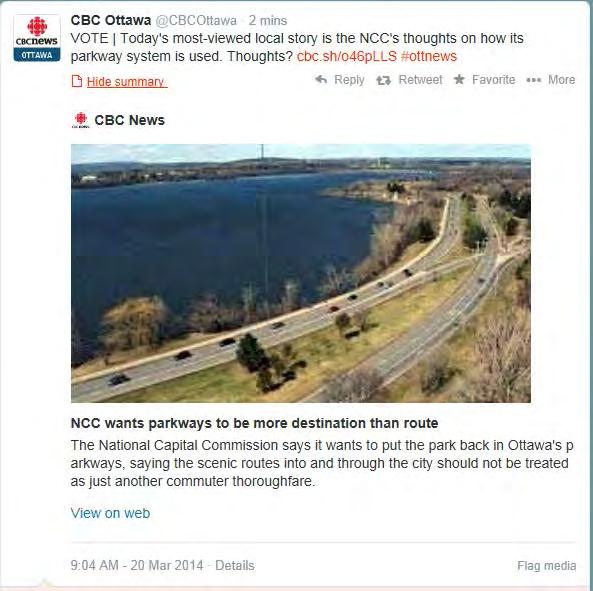
46 APPENDICES CBC News March 20, 2014 NCC wants parkways to be more destination than route Suburban traffic has congested once scenic routes, federal landowner says The National Capital Commission wants to revisit the role its parkways play in developing the character of the city. (NCC) The National Capital Commission says it wants to put the park back in Ottawa's parkways, saying the scenic routes into and through the city should not be treated as just another commuter thoroughfare. The federal landowner has updated its policy governing those driveways for the first time in thirty years. The Sir John A. Macdonald Parkway and Queen Elizabeth Drive and other routes in the city and through the Greenbelt have veered from their original purpose as Ottawa has grown. "Conceived of and designed for uninterrupted, pleasurable driving in park-like settings with scenic views, and hailed as marvels of transportation innovation and design, the early parkway concept is today overshadowed by local municipal demands for supplementary regional transport capacity," the NCC writes in its policy document, unveiled Wednesday. The NCC said increasing demands to accommodate local transportation on federal lands has put the "future integrity" of the parkways at risk. NCC wants more activities at park space The commission wants to focus on giving people more access to shorelines and holding more activities on those lands. "Cars will continue to be on the parkways but the parkways should not just be seen as a commuter route, and what this policy is doing is putting more emphasis on the corridor rather than only on the paving and on the road," said NCC head of planning and transportation Lucie Bureau. Fred Gaspar, acting vice-president of capital planning, said the NCC and City of Ottawa staff have been having positive discussions about the updated parkway policy, which he says can align with the city's goals for western light rail. 46
47 APPENDICES "We're making it quite clear our goal for the parkway is really to emphasize the park element of the parkways and that's why the need to enable pedestrian and cycling activities is so important," said Gaspar. The public can also weigh in on the new parkway plans on the NCC's website and at open houses next week. 47

48 APPENDICES Radio-Canada, March 20, 2014 La CCN veut revaloriser ses espaces urbains nationale (archives). Commission de la capitale La Commission de la capitale nationale veut encourager les résidents à faire une meilleure utilisation de ses promenades, de ses sentiers récréatifs et de ses espaces verts. La CCN tiendra d'ailleurs deux journées de consultation, les 25 et 26 mars, dans le cadre de l'élaboration de son nouveau plan directeur des terrains urbains, qui devrait être complété à la fin de l'année Ce document est un descendant direct du plan Gréber des années 1950 et il prévoit redonner à certaines promenades de la CCN leur vocation d'antan de routes panoramiques. La Commission affirme que plusieurs de ses promenades sont aujourd'hui perçues comme de simples routes, alors qu'elles sont pourtant entourées d'espaces verts et qu'elles ont une valeur historique. «Tous ses espaces verts, quand on les voit d'une façon séparée, ils nous semblent isolés, mais quand on se met à les mettre sur une carte, on se rend compte qu'ils constituent un réseau. C'est assez unique, je dirais, en Amérique du Nord et dans la région de la capitale. Ça forme ce que les gens considèrent comme étant l'un des ses joyaux», explique la responsable de la planification et des transports à la CCN, Lucie Bureau. Le nouveau plan directeur des terrains urbains prévoit aussi l'organisation d'activités sur les berges de la rivière des Outaouais, afin d'y attirer davantage de visiteurs. 48
Nepean Point CONSULTATION REPORT JUNE 2014
 Nepean Point CONSULTATION REPORT JUNE 2014 Workshop: Nepean Point I Project description Objective: With the renewal of Nepean Point, the National Capital Commission (NCC) presented a project to develop
10.0 Open Space and Public Realm
 10.0 Open Space and Public Realm 10.0 Open Space and Public Realm The Public Open Space System is comprised of: outdoor spaces available for public use that are either publicly owned (e.g., parks and
Animating the Rideau Canal December 2013
 Executive Summary Animating the Rideau Canal December 2013 Why study the Rideau Canal? The Rideau Canal has been an important part of Ottawa throughout its history, and has shaped and been shaped by the
Site visit and public consultation: Bronson Pulp Mill ruins public access and Richmond Landing shoreline access. Consultation Report
 Site visit and public consultation: Bronson Pulp Mill ruins public access and Richmond Landing shoreline access Consultation Report Site visit and public consultation: Bronson Pulp Mill ruins public access
- Document 2 - Algonquin Interpretation and The Continuing Conversation toward a Vision for a Revitalized Lansdowne
 140 - Document 2 - Algonquin Interpretation and The Continuing Conversation toward a Vision for a Revitalized Lansdowne On May 4, 2012, the City of Ottawa participated in a Forum with a number of Elders,
Report to: Development Services Committee Report Date: April 24, 2017
 SUBJECT: Cornell Rouge National Urban Park Gateway - Report on Design Charrette and Next Steps PREPARED BY: Lilli Duoba, MES, MCIP, RPP, Manager, Natural Heritage (ext. 7925) REVIEWED BY: Marg Wouters,
CITY CLERK. Parkland Acquisition Strategic Directions Report (All Wards)
") CITY CLERK Clause embodied in Report No. 10 of the, as adopted by the Council of the City of Toronto at its meeting held on November 6, 7 and 8, 2001. 10 Parkland Acquisition Strategic Directions Report
CITY CLERK Clause embodied in Report No. 10 of the, as adopted by the Council of the City of Toronto at its meeting held on November 6, 7 and 8, 2001. 10 Parkland Acquisition Strategic Directions Report
38 Queen s University Campus Master Plan Part 1
 38 Queen s University Campus Master Plan Part 1 46 The Campus at the City Scale Chapter 4 The Campus at the City Scale 39 Queen s is an urban University centrally located in Kingston. Decisions made by
Workshop 3. City of Burlington Waterfront Hotel Planning Study. September 14, The Planning Partnership
 Workshop 3 City of Burlington Waterfront Hotel Planning Study September 14, 2017 The Planning Partnership The Waterfront Hotel Planning Study 01 The Brant & Lakeshore Planning Study will establish a Strategic
SUBJECT: Waterfront Hotel Planning Study Update TO: Planning and Development Committee FROM: Department of City Building. Recommendation: Purpose:
 Page 1 of Report PB-23-18 SUBJECT: Waterfront Hotel Planning Study Update TO: Planning and Development Committee FROM: Department of City Building Report Number: PB-23-18 Wards Affected: 2 File Numbers:
SALISBURY TOMORROW Our Vision
 SALISBURY TOMORROW Our Vision Salisbury is committed to supporting a high quality of life and sense of community for all residents. These commitments need to be reflected in our community programs, services
John M. Fleming Managing Director, Planning and City Planner. Old East Village Dundas Street Corridor Secondary Plan Draft Terms of Reference
 Report to Planning and Environment Committee To: From: Subject: Chair and Members Planning & Environment Committee John M. Fleming Managing Director, Planning and City Planner Old East Village Dundas Street
Uptown Rideau Street Secondary Plan [Amendment #166, January 12, 2016]
![Uptown Rideau Street Secondary Plan [Amendment #166, January 12, 2016]](/thumbs/76/73760497.jpg "Uptown Rideau Street Secondary Plan [Amendment #166, January 12, 2016]") [Amendment #166, January 12, 2016] The policies of this Secondary Plan are in effect, save and except for the property at 560 Rideau Street, for which there remains a site specific appeal to this Secondary
[Amendment #166, January 12, 2016] The policies of this Secondary Plan are in effect, save and except for the property at 560 Rideau Street, for which there remains a site specific appeal to this Secondary
Section 1 Introduction
 Section 1 Section 1,, describes the role of the Official Plan. The Official Plan is one of five growth management plans that was completed under the umbrella of Ottawa 20/20. 1.1 The Role of the Official
What We Heard Report: Westmount Architectural Heritage Area Rezoning Drop-in Workshop
 What We Heard Report: Westmount Architectural Heritage Area Rezoning Drop-in Workshop August 2018 What We Heard Report: Westmount Architectural Heritage Area Rezoning Drop-in Workshop Executive Summary
Urban Design Manual PLANNING AROUND RAPID TRANSIT STATIONS (PARTS) Introduction. Station Study Areas
 Introduction. Station Study Areas") 111111 PLANNING AROUND RAPID TRANSIT STATIONS (PARTS) Introduction The ION rapid transit system will link Waterloo, Kitchener and Cambridge through a central transit corridor (CTC). There are a number
111111 PLANNING AROUND RAPID TRANSIT STATIONS (PARTS) Introduction The ION rapid transit system will link Waterloo, Kitchener and Cambridge through a central transit corridor (CTC). There are a number
Welcome. Walk Around. Talk to Us. Write Down Your Comments
 Welcome This is an information meeting introducing the applications for proposed redevelopment of the Yorkdale Shopping Centre site at 3401 Dufferin Street and 1 Yorkdale Road over the next 20+ years,
Don Mills Crossing Study and Celestica Lands Development Application Community Meeting, Open House, and Breakout Discussions
 Consultation Summary Don Mills Crossing Study and Celestica Lands Development Application Community Meeting, Open House, and Breakout Discussions This report is not intended to provide a verbatim transcript
HE VISION. Building a Better Connected Place
 HE VISION Building a Better Connected Place WALK INTO THE FUTURE. Life in Cranberry, 2030 Here s what our residents told us they wanted to see in their community by 2030: The Cranberry of 2030 is a place
Former Rockcliffe Airbase Community Design Plan Guiding Design Vision and Principles December 4, 2013
 APPENDIX 5 - Guiding Design Vision and Principles Former Rockcliffe Airbase Community Design Plan Guiding Design Vision and Principles December 4, 2013 Vision Statement The redevelopment of the former
Chapter 2: Vision, Goals and Strategies
 Chapter 2: Vision, Goals and Lake Elmo Today & Tomorrow Comprehensive Plan 2040 2 VISION, GOALS & STRATEGIES - DRAFT 4-6-2018 INTRODUCTION Comprehensive Plan Purpose Perhapse the most important objective
[PLANNING RATIONALE] For Site Plan Control and Lifting of Holding Zone By-Law 101 Champagne Avenue. May 23, 2014
![[PLANNING RATIONALE] For Site Plan Control and Lifting of Holding Zone By-Law 101 Champagne Avenue. May 23, 2014](/thumbs/75/71599615.jpg "[PLANNING RATIONALE] For Site Plan Control and Lifting of Holding Zone By-Law 101 Champagne Avenue. May 23, 2014") [PLANNING RATIONALE] For Site Plan Control and Lifting of Holding Zone By-Law 101 Champagne Avenue May 23, 2014 Contents 1.0 Introduction... 2 2.0 Site Context... 2 2.1 Adjacent Uses... 2 Figure 1: Site
[PLANNING RATIONALE] For Site Plan Control and Lifting of Holding Zone By-Law 101 Champagne Avenue May 23, 2014 Contents 1.0 Introduction... 2 2.0 Site Context... 2 2.1 Adjacent Uses... 2 Figure 1: Site
A Vision for Walnut Creek
 A Vision for Walnut Creek Photo: City of Clive Walnut Creek Booklet 8 of 8 Greater Des Moines Water Trails and Greenways 1 Table of Contents Booklet 1: Water Trails Strategies and Policies Booklet 2: Beaver
V. Vision and Guiding Principles
 V. Vision and Guiding Principles The Master Plan for the Powers Ferry Corridor seeks a foundation in the desires of the community. At times, various elements of the community offered opposing viewpoints,
13 THORNHILL YONGE STREET STUDY IMPLEMENTATION CITY OF VAUGHAN OPA 669 AND TOWN OF MARKHAM OPA 154
 13 THORNHILL YONGE STREET STUDY IMPLEMENTATION CITY OF VAUGHAN OPA 669 AND TOWN OF MARKHAM OPA 154 The Planning and Economic Development Committee recommends the adoption of the recommendations contained
4- PA - LD - LIVELY DOWNTOWN. LD - Background
 4- PA - LD - LIVELY DOWNTOWN LD - Background The downtown has been the service centre for the community since the city s inception and the area continues to supply people with their personal services,
Plan for Canada s Capital,
 Plan for Canada s Capital, 2017 2067 Public Consultation Report Summer 2016 Plan for Canada s Capital, 2017 2067 Public Consultation Report I Description Background The National Capital Commission (NCC)
SECTION ONE: INTRODUCTION. introduction
 introduction 1 INTRODUCTION Since it was first established in 1843 as a trading post for the Hudson s Bay Company, Victoria has evolved into a Provincial capital city that is recognized across Canada and
Town Center (part of the Comprehensive Plan)
") Town Center (part of the Comprehensive Plan) Mercer Island Town Center Looking North (2014) In 1994, a year-long process culminated in a set of design guidelines and code requirements for the Town Center
Town Center (part of the Comprehensive Plan) Mercer Island Town Center Looking North (2014) In 1994, a year-long process culminated in a set of design guidelines and code requirements for the Town Center
Summary of Heritage Input
 Summary of Heritage Input Commonwealth is providing services to the City of Ottawa, as heritage expert in the Lansdowne Revitalization project recognizing not only that Lansdowne accommodates designated
1. MAKING CHOICES. What kind of city will Toronto be in the 21st century?
 1. MAKING CHOICES Toronto is a great city! It has evolved into a special place that people care about deeply. It is a wonderful city in which to live, offering a diversity and richness of urban life that
Concord Community Reuse Project Goals and Guiding Principles. Overarching Goals (OG)
") Concord Community Reuse Project Goals and Guiding Principles Overarching Goals (OG) No priority is implied by the order of presentation of the goals and guiding principles. Overarching goals for the Concord
Concord Community Reuse Project Goals and Guiding Principles Overarching Goals (OG) No priority is implied by the order of presentation of the goals and guiding principles. Overarching goals for the Concord
Arlington, Virginia is a worldclass
 EXECUTIVE S U M M A RY Arlington maintains a rich variety of stable neighborhoods, quality schools and enlightened land use policies, and received the Environmental Protection Agency s highest award for
Corridor Vision. 1Pursue Minnehaha-Hiawatha Community Works Project. Mission of Hennepin County Community Works Program
 1Pursue Minnehaha-Hiawatha Community Works Project Minnehaha-Hiawatha Community Works is a project within the Hennepin Community Works (HCW) program. The mission of the HCW program is to enhance how the
CITY COUNCIL AGENDA REPORT
 CITY COUNCIL AGENDA REPORT Subject: COUNCIL MOTION LRT ALIGNMENT REMOVAL FROM THE TRANSPORTATION MASTER PLAN On February 10, 2016 Councillor Hughes provided notice in accordance with Section 23 of Procedure
Phase 1 : Understanding the Campus Context. Phase 2 : APPROACHES - Alternates & Preferred Plan
 Introduction MASTER PLAN PURPOSE WHY A CAMPUS MASTER PLAN? The purpose of the Master Plan at the University of Illinois at Chicago is to translate UIC s strategic goals and objectives into a compelling
Urban Planning and Land Use
 Urban Planning and Land Use 701 North 7 th Street, Room 423 Phone: (913) 573-5750 Kansas City, Kansas 66101 Fax: (913) 573-5796 Email: planninginfo@wycokck.org www.wycokck.org/planning To: From: City Planning
CHAPTER 7: Transportation, Mobility and Circulation
 AGLE AREA COMMUNITY Plan CHAPTER 7 CHAPTER 7: Transportation, Mobility and Circulation Transportation, Mobility and Circulation The purpose of the Transportation, Mobility and Circulation Chapter is to
NEW REGIONAL OFFICIAL PLAN HIGH LEVEL PROCESS & FRAMEWORK
 NEW REGIONAL OFFICIAL PLAN HIGH LEVEL PROCESS & FRAMEWORK Why A New Official Plan Originally the role of Regionally Planning and content of Regional Official Plan (1970s) primarily focused on protecting
NORTHERN LANDS NORTHERN LEADERSHIP
 NORTHERN LANDS NORTHERN LEADERSHIP The GNWT Land Use and Sustainability Framework Our Lands, Our Interests, Our Future ii Land is Life MESSAGE FROM THE PREMIER Land is life. It is the link to our past.
Denton. A. Downtown Task Force
 2 Public Involvement Early and ongoing public involvement was solicited so that the public had ample opportunity to help direct the DTIP s concepts and implementation strategies. The residents of Denton
Parks Master Plan Implementation: Phase I Waterfront Use and Design REPORT #: September 7, 2016 File #
 0 'O DI Lan-171-14 1 - THE CORPORATION OF THE TOWN OF COBOURG..,. STAFF REPORT TO: FROM: Mayor and Members of Council Dean A. Hustwick, Director of Recreation and Culture DATE OF MEETING: Committee of
Plan Overview. Manhattan Area 2035 Reflections and Progress. Chapter 1: Introduction. Background
 Plan Overview The Manhattan Urban Area Comprehensive Plan (the Comprehensive Plan) is a joint planning initiative of the City of Manhattan, Pottawatomie County, and Riley County. The 2014 Comprehensive
Town of Oakville Streetscape Strategy
 Town of Oakville Streetscape Strategy Endorsed by PDC on February 10, 2014 (PD-011-14) Town of Oakville Streetscape Strategy [endorsed by PDC February 10, 2014] 0 Town of Oakville Streetscape Strategy
Port Lavaca Future Land Use
 Port Lavaca Future Land Use Introduction The City of Port Lavaca is beginning to see sustained growth, after many years of relative stable population. New single family homes, apartments, and businesses
The Recreational Heart of Cannington - MacLeod & Claire Hardy Parks
 The Site Claire Hardy Park and MacLeod Park are both located within the community of Cannington on opposing shorelines of the Beaver River and are accessible to each other by a footbridge spanning the
Economy Vision Statements: Social Wellbeing Vision Statements: Natural Environment Vision Statements:
 Economy Vision Statements: 1. Our business environment makes us a region of choice for new employers as we encourage entrepreneurship and have a vibrant, diversified and resilient regional economy. 2.
The Five Components of the McLoughlin Area Plan
 The Five Components of the McLoughlin Area Plan This documents contains the complete language of the five components of the McLoughlin Area Plan: The Vision Statement The Values The Guiding Principles
Reimagining Arnolds Creek. Community engagement report. May 2018
 Reimagining Arnolds Creek Community engagement report May 2018 Melbourne Water is owned by the Victorian Government. We manage Melbourne s water supply catchments, remove and treat most of Melbourne s
3. VISION AND GOALS. Vision Statement. Goals, Objectives and Policies
 Vision Statement Queen Creek s interconnected network of parks, trails, open spaces and recreation opportunities provide safe and diverse activities and programs that sustain its unique, small town, equestrian
STAFF RECOMMENDATION: Adopt the Parks and Recreation Master Plan 2013, or take other action as deemed appropriate.
 Regular 7. CITY COUNCIL AGENDA Meeting Date: 12/02/2013 TITLE: Parks and Recreation Master Plan 2013 Adoption Proposal - Dwight Curtis Responsible Staff: Dwight Curtis Backup Material: Backup material
Loved hearing what others shared and having a dialogue about the possibilities/opportunities
 MEMO To: Dave Efland, Director of Planning & Community Development November 7, 2018 From: Sarah Kelly and Emily Long, planning NEXT Re: Round 1 of Public Engagement, Delaware Together, Comprehensive Plan
Blood Alley Square/Trounce Alley Redesign
 June 216 Kick-Off Events Questionnaire and Engagement Summary Background The City of Vancouver is redesigning Blood Alley Square and Trounce Alley, important public spaces in the heart of Gastown, which
Regional Context Statement
 Regional Context Statement REGIONAL CONTEXT STATEMENT 3. REGIONAL CONTEXT STATEMENT In 1995, the Provincial Government passed into law the Growth Strategies Act. The purpose of this provincial initiative
Queensborough Eastern Neighbourhood Node. Community Open House
 Queensborough Eastern Community Open House The Vision The Queensborough Eastern will become the heart of eastern Queensborough. Through a sensitive mix of viable commercial and residential areas, the neighbourhood
CAL POLY MASTER PLAN UPDATE, March 2015
 Some Key Themes in the General Guiding Principles Academic Mission The plan must foremost advance the University s academic mission and student success. Foresight and Adaptability The plan should take
Clair-Maltby Community visioning
 Clair-Maltby Community visioning workshop #1 Summary April 27th, 2017 Table of Contents INTRODUCTIon 1 PURPOSE 1 CONSULTATION STRUCTURE 2 PARTICIPANT FEEDBACK 3 VISIONING EXERCISE 8 ONLINE SURVEY RESULTS
Official Plan Review
 Official Plan Review Summary Report - The Built Environment August 2014 Part 1: Introduction Planning for a healthy, prosperous and sustainable community is an important goal for our municipality. From
178 Carruthers Properties Inc.
 178 Carruthers Properties Inc. Planning Rationale for 178 Carruthers Avenue Site Plan Control Application June 2014 Table of Contents 1.0 Introduction 2.0 Overview of Subject Property 3.0 Current Zoning
Central City District What we heard
 What we heard Vision to 2056 and Priorities Governance and implementation Infrastructure and funding The vision for a metropolis of three cities, and the 30 minute city. Feedback requested: Clearer communication
1 Introduction. Chapter. In this chapter:
 Chapter 1 Introduction In this chapter: 1.1 A Snapshot of the Region 1.2 Towards a Sustainable Region 1.3 The Provincial Context 1.4 Purpose and Organization The Regional Municipality of York Official
Richmond Road Complete Street Meeting #1, April 25, 2016
 Richmond Road Complete Street Meeting #1, April 25, 2016 Agenda Overview Richmond Road Complete Street Other Ongoing Studies Discussion Map buses/day removed from Sir John A. Macdonald Parkway Confederation
Further input invited as Colchester Growth Strategy nears final phase
 IUE 3 / NOVEMBER 2015 Further input invited as Colchester Growth trategy nears final phase trathcona County is seeking public feedback as it enters the final phase of work on a Growth Management trategy
CHAPTER 8 ISSUES, CONCERNS, CONSTRAINTS AND OPPORTUNITIES
 CHAPTER 8 ISSUES, CONCERNS, CONSTRAINTS AND OPPORTUNITIES Introduction This River Conservation Plan was developed during a time of tremendous activity and effort in planning the transformation of the Delaware
Whitemarsh Comprehensive Plan Update: Housing & Land Use. Public Workshop #3: September 20, 2018
 Whitemarsh Comprehensive Plan Update: Housing & Land Use Public Workshop #3: September 20, 2018 Agenda Welcome Process Recap What We ve Heard The Plan Framework Review of Recommended Actions Land Use Housing
Town of Cobourg Heritage Master Plan. Statutory Public Meeting
 Town of Cobourg Heritage Master Plan Statutory Public Meeting April 25 th 2016 Presentation Overview 1. Introduction 2. Project background and schedule overview 3. Review of strategic direction content
TOWN OF INNISFIL SPECIAL COUNCIL AGENDA OUR JOBS INNISFIL HEIGHTS WORKSHOP WEDNESDAY JANUARY 20, :30 P.M.
 January 13, 2016 TOWN OF INNISFIL SPECIAL COUNCIL AGENDA INNISFIL HEIGHTS WORKSHOP WEDNESDAY JANUARY 20, 2016 5:30 P.M. PLEASE REMEMBER TO TURN OFF CELL PHONES 1. OPENING OF MEETING BY THE MAYOR Opening
THE GARDEN CITY PLAN. City of St. Catharines Official Plan. City of St. Catharines
 THE GARDEN CITY PLAN City of St. Catharines Official Plan City of St. Catharines August 2010 APPROVAL INFORMATION This Official Plan of the City of St. Catharines Planning Area, known as the Garden City
CITY OF LANGLEY OFFICIAL COMMUNITY PLAN BYLAW, 2005, NO APPENDIX II - REGIONAL CONTEXT MAP
 CITY OF LANGLEY OFFICIAL COMMUNITY PLAN BYLAW, 2005, NO. 2600 APPENDIX II - REGIONAL CONTEXT MAP ± Legend Agricultural Mixed Employment Industrial Conservation & Recreation Regional City Centre Urban Containment
Workshop: Ottawa River North Shore Improvement Plan
 Workshop: Ottawa River North Shore Improvement Plan Consultation Report, November 25, 2014 Planning Workshop: Ottawa River North Shore Improvement Plan I Description Background The National Capital Commission
Local Growth Planning in North Central Green Line Communities
 2018 April 30 Page 1 of 6 EXECUTIVE SUMMARY This report outlines a high-level scope for local growth planning for north central Green Line communities. The catalyst for this review is the significant investments
Official Plan Review: Draft Built Form Policies
 PG.30.1 REPORT FOR ACTION Official Plan Review: Draft Built Form Policies Date: May 15, 2018 To: Planning and Growth Management Committee From: Chief Planner and Executive Director, City Planning Division
Introduction. Community Outreach Approach. Sacramento Valley Station Master Plan. Online Questionnaire Summary of Feedback.
 Introduction Located in the northwest sector of downtown Sacramento, the Sacramento Valley Station (SVS) is the primary rail station in northern California and the seventh busiest station in the country.
SAN RAFAEL GENERAL PLAN 2040 INTRODUCTION AND OVERVIEW
 SAN RAFAEL GENERAL PLAN 2040 INTRODUCTION AND OVERVIEW Steering Committee Presentation February 14, 2018 Purpose of General Plan Guide land use and development decisions Coordinate transportation, infrastructure,
CALGARY: City of Animals Edited by Jim Ellis
 CALGARY: City of Animals Edited by Jim Ellis ISBN 978-1-55238-968-3 THIS BOOK IS AN OPEN ACCESS E-BOOK. It is an electronic version of a book that can be purchased in physical form through any bookseller
CITY OF CHARLOTTESVILLE, VIRGINIA CITY COUNCIL AGENDA
 CITY OF CHARLOTTESVILLE, VIRGINIA CITY COUNCIL AGENDA Agenda Date: December 16, 2013 Action Required: Adoption of Resolution Presenter: Staff Contacts: Title: James E. Tolbert, AICP, Director of NDS James
ELMVALE ACRES SHOPPING CENTRE MASTER PLAN
 ELMVALE ACRES SHOPPING CENTRE MASTER PLAN Contents 1.0 INTRODUCTION... 2 2.0 LOCATION... 2 3.0 EXISTING CONTEXT... 2 4.0 VISION & GUIDING PRINCIPLES... 2 5.0 LAND USE AND BUILT FORM... 4 5.1 St. Laurent
KANATA CENTRUM 255 KANATA AVENUE OFFICIAL PLAN AMENDMENT ZONING BY-LAW AMENDMENT
 KANATA CENTRUM 255 KANATA AVENUE OFFICIAL PLAN AMENDMENT ZONING BY-LAW AMENDMENT JUNE 2015 PREPARED BY: FOTENN Consultants Inc. 223 Mcleod Street Ottawa, ON K2P OZ8 (613) 730-5709 PREPARED FOR: Kanata
This page intentionally blank.
 This page intentionally blank. Parks, Recreation, and Open Space Chapter Relationship to Vision Vision Parks, Recreation and Open Space Chapter Concepts County Government. County government that is accountable
CDAC. Update: Downtown Dartmouth Update: CDAC July 25 th Motion
 CDAC Update: Downtown Dartmouth Update: CDAC July 25 th Motion 2018-10-24 Downtown Dartmouth Plan Open House October 22, 2018 6:00 pm Open House 6:30 pm Presentation + Q&A 7:20 pm Open House 8:30 pm Close
HERITAGE ACTION PLAN. Towards a renewed Heritage Conservation Program. What is the Heritage Action Plan? Key areas of work. A Collaborative Approach
 HERITAGE ACTION PLAN Towards a renewed Heritage Conservation Program What is the Heritage Action Plan? The Heritage Action Plan (HAP) is a set of actions to update the City s Heritage Conservation Program
SUMMARY. An Attractive, Competitive and Sustainable GREATER MONTREAL. Draft Metropolitan Land Use and Development Plan. April 2011
 April 2011 Draft Metropolitan Land Use and Development Plan GREATER MONTREAL An Attractive, Competitive and Sustainable SUMMARY Message from the Chair I am pleased to introduce this draft of the Metropolitan
PART 1. Background to the Study. Avenue Study. The Danforth
 The Danforth 1.1/ Study Purpose & Key Municipal Goals 1.2/ The Local Advisory Committee 1.3/ The Project Team 1.4/ Study Process/Summary of Method 1.5/ Summary of Consultation 1.1 Study Purpose and Key
Welcome to the Oakridge Centre Open House
 Welcome to the Oakridge Centre Open House Why is the City hosting this event? This open house is to inform you of a rezoning application submitted to the City of Vancouver to amend the existing CD-1 (Comprehensive
1 October Dear Citizens of Charlotte and Mecklenburg County,
 1 October 2011 Dear Citizens of Charlotte and Mecklenburg County, As co-chairs of the Center City 2020 Vision Plan Steering Committee, we are proud to present the Center City 2020 Vision Plan, which sets
ELK GROVE GENERAL PLAN VISION
 2-1 CHAPTER 2: 2-2 CREATING OUR The Community Vision for Elk Grove, expressed through a Vision Statement and a series of Supporting Principles, is a declaration of the kind of community that Elk Grove
3. Endorse the LRT vision in transforming Surrey into Connected-Complete-Livable communities, and more specifically, the official vision statement:
 CORPORATE REPORT NO: R038 COUNCIL DATE: February 20, 2017 REGULAR COUNCIL TO: Mayor & Council DATE: February 16, 2017 FROM: General Manager, Engineering FILE: 8740-01 SUBJECT: Surrey Light Rail Transit
Western City District What we heard
 What we heard Vision to 2056 and Priorities Governance and implementation Infrastructure and funding The protection of the natural landscape including biodiversity and the Metropolitan Rural Area for food
CONTENTS 6.1 URBAN DESIGN
 6-2 Urban Design and Sustainable Development 6.0 URBAN DESIGN AND SUSTAINABLE DEVELOPMENT CONTENTS 6.1 URBAN DESIGN 6.1.1 General Policies 6.1.2 The Public Realm 6.1.3 Streets and Blocks 6.1.4 Streetscapes
City of Farmington. Downtown Plan. Amendment to the 1998 Master Plan Adopted October 11, 2004
 City of Farmington Amendment to the 1998 Master Plan Adopted October 11, 2004 Introduction Planning Background 1 Scope and Components of the Plan Amendment 2 Concept Introduction 3 Plan Concepts 3 Conceptual
Cambie Corridor Planning Program Phase Two Draft Plan. Standing Committee on City Services and Budgets May 5, 2011
 Cambie Corridor Planning Program Phase Two Draft Plan Standing Committee on City Services and Budgets May 5, 2011 Cambie Corridor Program Terms of Reference approved July 2009 Land Use Transportation Energy
greenprint midtown SUSTAINABILITY ACTION PLAN 2012
 greenprint midtown SUSTAINABILITY ACTION PLAN 2012 MIDTOWN ALLIANCE SOUTHFACE ENERGY INSTITUTE RENAISSANCE PLANNING GROUP SUSTAINABLE ATLANTA PERKINS+WILL 2 GREENPRINT MIDTOWN 1. Introduction Sustainability
Response to the London Bridge Area Vision and Site Allocations within the New Southwark Plan
 1 Melior Place London SE1 3SZ 020 7407 4701 teamlondonbridge.co.uk info@teamlondonbridge.co.uk 28 April 2017 Response to the London Bridge Area Vision and Site Allocations within the New Southwark Plan
INTERNATIONAL SOCIETY OF CITY AND REGIONAL PLANNERS 2016 ISOCARP AWARD FOR EXCELLENCE
 INTERNATIONAL SOCIETY OF CITY AND REGIONAL PLANNERS 2016 ISOCARP AWARD FOR EXCELLENCE PROJECT DESCRIPTION WHAT IS ZIBI? Zibi is a world-class sustainable community and redevelopment project by Windmill
Comprehensive Plan. Faribault, Minnesota. Hoisington Koegler Group Inc. Claybaugh Preservation Architecture Inc. Howard R. Green Company Bonz/REA
 Comprehensive Plan Faribault, Minnesota Adopted by the Faribault City Council July 8, 2003 prepared for: prepared by: Hoisington Koegler Group Inc. Claybaugh Preservation Architecture Inc. Howard R. Green
Proposed new Tasmanian Planning Scheme what it will mean
 Please share this article with your networks, politicians, community leaders and interested others. This article is supported by the Tasmanian Planning Information Network (www.taspin.net) and Blackmans
WELLINGTON STREET WEST COMMUNITY DESIGN PLAN
 36 3.CDP POLICIES 37 Wellington Street West CDP Vision Statement 38 3.1 Introduction 3.1.1 Purpose The development of buildings and public spaces is influenced by a variety of factors over time. City of
Pedestrian Project Award Institute of Transportation Engineers
 Pedestrian Project Award Institute of Transportation Engineers Rideau Canal Pedestrian Crossing Planning and Environmental Assessment Report The Setting The Rideau Canal and its adjacent pathways are highly
Table 8-4: Road Classification Local Roads, second table, of Chapter 8 Create a Multi-Modal City, be amended by adding the following:
 1 Port Street East Official Plan Amendment APPENDIX 3 Amendments to Mississauga Official Plan Table 8-4: Road Classification Local Roads, second table, of Chapter 8 Create a Multi-Modal City, be amended
The John Bartram Association Action Plan to advance the 10 year Strategic Plan
 The John Bartram Association 2013-2015 Action Plan to advance the 10 year Strategic Plan We are poised to take significant leaps with the opportunities that surround us. In the next three years we are