Urban design for sustainable cities. Alec Tzannes September 2007
|
|
|
- Annis Moore
- 6 years ago
- Views:
Transcription
1 Urban design for sustainable cities Alec Tzannes September 2007
2 The design of urban environments represents our collective identity who we are and what we value. As urban designers, planners and architects we are familiar with the role of imagining the future, and our knowledge and skills are important community assets to guide the future world we design today. Our professions are at the intersection of conflicting cultural, financial and political objectives with passionate debate occurring both in private as defined by client requirements and in public via approval processes defined by planning law that is, in turn, the result of our democratic political system. In the debate, our work is often condensed to relatively dry instruments that control the outcome of whole cities. These instruments represent layers of interpretative material defining a collective societal identity who we are as a society and what we value. When future generations look back at what we have built, they will see what sort of society we were, and know what we valued through our work today. We as a group need to work together more effectively and conceive a new planning and legal paradigm to contribute to a sustainable future for the built environment.
3 Today we face unprecedented environmental change threatening the physical sustainability of the world, as we know it. As citizens, our communal responsibility for the environment we live in today, and as urbanists, our role within the process of environmental change, cannot be underestimated. After all, next to nothing has happened without a design, a plan or a decision within or even outside of some law we created. Everything we occupy, all the places we know in the world and even our most sensitive environments are in some way affected by human endeavour. As people trained to design and manage urban environments we must be key players in the process of creating sustainable cities.
4 The urban environments we design today our cities, towns and places will significantly affect global sustainability in the future. The sustainable city is one of the most important concepts for the survival of the world as we know it a city of the future with neutral effect (at least) on the environment through design. Australia is a leader in many specialised fields of environmental design and well positioned to transform urban infrastructure into a sustainable model. Unlike many other places within developed nations much of our built urban fabric is of a relatively low level of cultural significance. We have extraordinary opportunity, as there is a substantial amount of built infrastructure to renew to a higher, more durable and environmentally appropriate standard. We are a nation with enormous environmental issues requiring intense focus on developing better ways of practicing planning, urban design and architecture as improving the environmental footprint of cities is critical to sustaining every aspect of the environment.
5 The contribution to environmental sustainability by Urban Design through practice and process cannot be understated. In most Australian urban environments today, the production of architecture is managed through a variety of societal mechanisms including the economy and micro-managed through planning controls. Planning controls provide a useful focus for discussion of a framework for the sustainable city as planning laws control the design of the city itself. They substantially define the scope of work for architects for example, and built architecture in turn influences new planning law. Urban Design practice and process is not overtly present in planning controls or required in the design process for architecture. Increasing community and political awareness of the value of urban design practice and process is vital to improving the design of the public domain of cities, particularly from a sustainability point of view. Today within most planning frameworks the general built form and density is controlled through mechanisms such as FSR, height and setback. Each of these and other similar controls is conceived with an objective to achieve a preconceived, often scenographic idea about the deemed appropriate scale, height, physical form and character of a place within an urban or suburban environment. Such a framework is unsuitable for the design of sustainable cities. Most sustainable concepts in planning controls today in Australia are bolt ons added to pre-existing, often unsustainable, scenographically derived building form controls. We need to rewrite the planning framework for architecture to place the sustainable city concept as the critical if not sole criterion for determining the architecture we create.
6 Planning law and process requires reform to ensure appropriate emphasise on environmental sustainability, particularly as administered through local government in Australia. A sustainable planning and architectural framework will conceive the best quality and sustainable public environment first the streets, blocks, parks, water management technology and system, sewer system, urban air movement patterns, solar access requirements, energy supply infrastructure, transportation network and community facilities. Building form and use controls would then be conceived in relation to protecting the amenity and sustainability of the public environment as well as ensuring reasonable levels of interior amenity through more detailed building controls. The aim in urban environments must be to maximise density within the established planning and building design principles.
7 Planning controls in Australia today are commonly underpinned by scenographic concepts of what make an attractive place based on successful urban models with relatively low density levels. Under this new planning framework scenographic issues are irrelevant, allowing the architect to design freely within a genuine and serious community objective the sustainable city. The architect, then, is vital to adding an important interpretive and expressive layer to the sustainable city. The argument is developed from the premise that new strategic planning and urban design frameworks be focused and limited to the design of the public domain based on sound environmental principles. In effect, new development controls are proposed that minimize, if not eliminate, building design controls in planning legislation not relevant to these issues. Architects and their clients are then guided by less prescriptive development controls for building design in parallel with more specific public domain controls framed from environmental requirements. The objective is to more effectively acknowledge and integrate the valuable work of architects in site specific design processes. Implicit in this proposition is the concept that planning legislation is not as effective as architectural processes on a site specific basis for solutions to building infrastructure.
8 Architecture in a new environmentally based planning framework may have greater expressive opportunity and more objectively defined responsibility to deliver environmentally sustainable built infrastructure. The proposal in this planning framework is for the responsibility for architecture to be understood by all to be with architects and their clients. Review processes for architecture by the community and rights to object to development proposals are retained, but with fewer and more significant environmentally based considerations defined by planning legislation to form the basis of any determination by an approving authority.. This aims to accordingly focus public debate about new building infrastructure on the design of the public domain from an environmental and amenity perspective, with fewer avenues to argue the merits of a particular architectural approach based on scenographic or aesthetic considerations.
9 Architecture is seen as one aspect of the process and more culturally orientated with more community focus on the design of the public domain from environmental analysis and public amenity viewpoints.
10 A relatively straightforward but perhaps difficult to implement aspect of the reform process is the application of a consistent vocabulary, including definitions, to the legal frameworks and processes controlling urban development across all political jurisdictions in Australia. One starting point is to eliminate planning jargon such as urban village or villa home or high rise from legal instruments and use instead a plain English approach to vocabulary to communicate concepts related to environmental sustainability. FSR, height, setback and other development controls remain as clearly defined tools for implementing simply expressed environmental concepts. Vocabulary and terminology within development controls must be aimed at defining actual environmental effects in plain English and not scenographic or building form concepts as pre-conceived solutions to development propositions.
11 An aim of any planning code in the future is to not limit the range of solutions, tools or concepts that are available to use to provide architecture and other built infrastructure but to define objectives that have to be met for a sustainable future that the community understands as reasonable and necessary to implement. One of the questions to consider in this debate about planning reform comes from the widely accepted observation that most architects have a unique voice or way of formulating architecture. The argument may go something like this. Allowing greater freedom for architects to express this voice is not in the public interest as the community will experience more architecturally inappropriate applications for approval and a generally lower standard of built infrastructure as an outcome.. This line of thinking intimates that places and neighbourhoods will be less successful as architects and their clients tend to not to see their work in relation to the work of others, thus compromising cohesive built form outcomes. In such a scenario it is acknowledged that there is an increase in architectural empowerment or flexibility and potential reduction in the ability to control architecture in the public domain through legislation. In reality, cohesive built form outcomes can still be easily be achieved, perhaps even more comprehensively, where they are required.. For example, a relatively straightforward requirement defining solar access will produce building forms that are cohesive relative to solar access. If solar access is the only prescriptive control, then other elements of architecture are less likely to be cohesive, and does this really matter? It is worth noting that in urban environments, under controls related to the environmental performance of building services, energy and water management technology, land use, solar access, urban connectivity at the ground plane, heritage, view corridors and vehicular management, architecture will still remain substantially regulated. The main difference is that the proposed new ways of regulating the built environment are based on sound environmental design principles. Within the proposed regulation framework, how architects develop a site-specific response to a particular brief need not be the subject of specific regulation. In suburban and non-urban areas, environmentally-based controls may focus more on the management of water systems, natural habitats for fauna, landscape structures and planting regimes, soil management, and scenic protection (or natural heritage) and less on built form and other architectural controls. Architectural considerations in non-urban environments as a consequence are likely to be significantly less regulated, and again, does this really matter?
12 Architecture in this environmentally based planning and urban design framework is given a clear role and responsibility. Recognizing and supporting the full range of collaborative skills required to design, deliver and manage the built environment is ultimately a planning and legal responsibility and integral to achieving sustainable cities valued for amenity and cultural significance.
13 Case Study: The redevelopment Carlton & United Brewery Site in the City of Sydney
14 An example of this approach is reflected in the Council of the City of Sydney s planning reform agenda summarised in the slogan: A City of Villages. Scenographic controls are not usually derived from principles engaged with environmental sustainability. The Council of the City of Sydney is not alone in providing evidence to support this observation. The key environmental benefit that results from increasing density where extremely high levels of public infrastructure exist or can be implemented is not a prominent feature of many contemporary planning regimes controlling development in Australia. Increasing density whilst maintaining an excellent urban environment with vital, cohesive neighbourhoods is not easy and places new challenges on the design of the public domain and internal amenity of buildings.
15 The (former) CUB site on Broadway near the Central Railway Station, University of Technology and Sydney University Campuses within the mixed use urban neighbourhood of Chippendale is a useful case study to demonstrate some of the appropriate urban design tools and controls to establish well designed public domain outcomes and interior amenity at levels of density that required the intervention of the Minister for Planning in NSW in the approval process to be implemented.
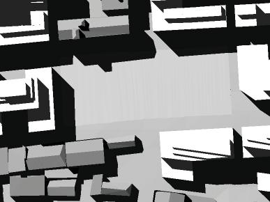
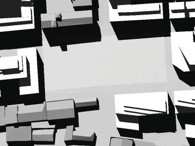
16 CARLTON & UNITED BREWERY SITE COX / ATA 2006 CONFIDENTIAL
17
18 Sustainable Transport Mode of travel for different locations (for the journey to work): Train Bus Car Other Ultimo / Chippendale 15% 25% 25% 33% Rouse Hill 10% 2% 82% 5% Average Travel distances by car (for the journey to work): Ultimo / Chippendale 6.7 km Rouse Hill 14.1 km Residents located at a greenfi eld site are likely to generate 10 times the vehicle kilometres of residents at the CUB site. CARLTON & UNITED BREWERY SITE COX/ATA SUSTAINABLE TRANSPORT 2006 Confidential
19 Sustainable Density Comparison of residential dwellings at the CUB site with a new release suburban area: The minimum density of development per hectare advocated by the NSW State Government in new release areas is 15 dwellings per hectare, excluding streets and parks. Applied to the CUB site at the proposed FSR and residential yield gives the following equation: 1690 divided by 15 = 112 hectares residential units dwellings / hectare developable land The CUB site is 6 hectares. To locate the proposed residential population of the CUB site in a new release suburban site would require an additional 106 hectares of greenfi eld land, plus new streets and parks than if located at the CUB site. CARLTON & UNITED BREWERY SITE COX/ATA SUSTAINABLE DENSITIES 2006 Confidential
20 LEGEND 400m walking distance from regional open space existing controlled crossing park CARLTON & UNITED BREWERY SITE COX / ATA 2006 CONFIDENTIAL
21 1 LOCATE PARK AWAY FROM INTRUSIVE ROADS AND AIRBORNE POLLUTION CARLTON & UNITED BREWERY SITE COX / ATA 2006 CONFIDENTIAL PARK LOCATION
22 2 LOCATE PARK ALONG FORMER WATERCOURSE CARLTON & UNITED BREWERY SITE COX / ATA 2006 CONFIDENTIAL PARK LOCATION
23 3 LOCATE PARK ADJACENT TO MAJOR HERITAGE GROUP CARLTON & UNITED BREWERY SITE COX / ATA 2006 CONFIDENTIAL PARK LOCATION
24 4 LOCATE PARK ADJACENT TO RESIDENTIAL AREAS OF CHIPPENDALE CARLTON & UNITED BREWERY SITE COX / ATA 2006 CONFIDENTIAL PARK LOCATION
25 5 OVERLAY OF ALL FACTORS CARLTON & UNITED BREWERY SITE COX / ATA 2006 CONFIDENTIAL PARK LOCATION
26 6 OVERLAP OF THREE OR MORE CRITERIA CARLTON & UNITED BREWERY SITE COX / ATA 2006 CONFIDENTIAL PARK LOCATION
27 1. Existing streets and heritage items CARLTON & UNITED BREWERY SITE COX/ATA LAYOUT 2006 Confidential
28 2. Extend existing streets CARLTON & UNITED BREWERY SITE COX/ATA LAYOUT 2006 Confidential
29 3. New laneway - Chippen Lane CARLTON & UNITED BREWERY SITE COX/ATA LAYOUT 2006 Confidential
30 4. Creation of Tooth Avenue - links heritage items CARLTON & UNITED BREWERY SITE COX/ATA LAYOUT 2006 Confidential
31 5. Blocks CARLTON & UNITED BREWERY SITE COX/ATA LAYOUT 2006 Confidential
32 6. Layout with overlay of Park Location diagram CARLTON & UNITED BREWERY SITE COX/ATA LAYOUT 2006 Confidential
33 1 PARK and PLACE CARLTON & UNITED BREWERY SITE COX / ATA 2006 CONFIDENTIAL HIERARCHY OF PUBLIC SPACE
34 2 GREEN CORRIDOR : JONES / BALFOUR STREETS CARLTON & UNITED BREWERY SITE COX / ATA 2006 CONFIDENTIAL HIERARCHY OF PUBLIC SPACE
35 3 CONNECT PARK TO CHIPPENDALE : IRVING / O CONNOR / KENSINGTON STREETS CARLTON & UNITED BREWERY SITE COX / ATA 2006 CONFIDENTIAL HIERARCHY OF PUBLIC SPACE
36 4 IMPROVE EXISTING STREETS BOUNDING SITE : ABERCROMBIE / WELLINGTON STREETS CARLTON & UNITED BREWERY SITE COX / ATA 2006 CONFIDENTIAL HIERARCHY OF PUBLIC SPACE
37 5 SHARED WAYS : CARLTON STREET / CHIPPEN LANE CARLTON & UNITED BREWERY SITE COX / ATA 2006 CONFIDENTIAL HIERARCHY OF PUBLIC SPACE
38 6 STREETS CARLTON & UNITED BREWERY SITE COX / ATA 2006 CONFIDENTIAL HIERARCHY OF PUBLIC SPACE
39 7 PUBLIC SPACE CARLTON & UNITED BREWERY SITE COX / ATA 2006 CONFIDENTIAL HIERARCHY OF PUBLIC SPACE
40 LEGEND Lanes and walkways 3-6 metres wide Street closures and parks CARLTON & UNITED BREWERY SITE COX / ATA 2006 CONFIDENTIAL CHIPPENDALE STREET HIERARCHY - 1. lanes and walkways 3m - 6m wide
41 LEGEND Minor streets 9-15 metres wide Street closures and parks CARLTON & UNITED BREWERY SITE COX / ATA 2006 CONFIDENTIAL CHIPPENDALE STREET HIERARCHY - 2. minor streets 9-15m wide
42 LEGEND Streets metres wide Street closures and parks CARLTON & UNITED BREWERY SITE COX / ATA 2006 CONFIDENTIAL CHIPPENDALE STREET HIERARCHY - 3. streets 15m - 20m wide
43 LEGEND Streets > 25 metres wide Street closures and parks CARLTON & UNITED BREWERY SITE COX / ATA 2006 CONFIDENTIAL CHIPPENDALE STREET HIERARCHY - 4. streets greater than 25m wide
44 LEGEND Lanes and walkways 3-6 metres wide Minor streets 9-15 metres wide Streets metres wide Streets > 25 metres wide Street closures and parks CARLTON & UNITED BREWERY SITE COX / ATA 2006 CONFIDENTIAL CHIPPENDALE STREET HIERARCHY - overlay of all street types
45 LEGEND 400m walking distance from regional open space 200m walking distance from Peace Park and Central Park existing controlled crossing proposed controlled crossing park CARLTON & UNITED BREWERY SITE COX / ATA 2006 CONFIDENTIAL CONTEXT PLAN
46 1. Sun Access Plane to Central Park - noon, 2pm, Winter Solstice CARLTON & UNITED BREWERY SITE COX/ATA SUN ACCESS PLANES 2006 Confidential
47 2. Sun Access Plane to O Connor Street - noon, Winter Solstice CARLTON & UNITED BREWERY SITE COX/ATA SUN ACCESS PLANES 2006 Confidential
48 3. Sun Access Plane to Wellington Street - noon, Winter Solstice CARLTON & UNITED BREWERY SITE COX/ATA SUN ACCESS PLANES 2006 Confidential
49 4. Combined Sun Access Planes CARLTON & UNITED BREWERY SITE COX/ATA SUN ACCESS PLANES 2006 Confidential
50
51


52 Shadows at 12pm, 21 March Shadows at 1pm, 21 March Shadows at 2pm, 21 March Shadows at 12pm, 14 April Shadows at 1pm, 14 April Shadows at 2pm, 14 April Shadows at 12pm, 21 June Shadows at 1pm, 21 June Shadows at 2pm, 21 June CONCEPT PLAN SUN ACCESS TO PARK CP_05_A-04-01_04
53
54

55 c 03 a broadway dwyer street regent street kensingtonstreet old kent road tooth avenue goold street regent street scale - A1 1:1000@ A3 abercrombie st carlton lane balfour st chippen lane irving street outram street o'connor street 7 KEY 1 Central Park Brewery Square 6 3 Pocket park 3 4 Interpretation of heritage listed drain 7 5 Bioretention swale 6 Private communal gardens dick street wellington street Roof gardens Carlton & United Brewery Site LDA01 sue barnsley design COX/ATA landscape architecture Landscape Concept: Plan Landscape Concept - DA: Plan Date September Confidential
56
57
58
59
60
61
62
63

64 CARLTON & UNITED BREWERY SITE COX/ATA 2006 Confidential

65 CARLTON & UNITED BREWERY SITE COX/ATA 2006 Confidential

66 CARLTON & UNITED BREWERY SITE COX/ATA 2006 Confidential

67 CARLTON & UNITED BREWERY SITE COX/ATA 2006 Confidential

68 CARLTON & UNITED BREWERY SITE COX/ATA 2006 Confidential

69 CARLTON & UNITED BREWERY SITE COX/ATA 2006 Confidential

70 CARLTON & UNITED BREWERY SITE COX/ATA 2006 Confidential
01 the vision NEW LYNN IS WAITING FOR THE GREAT LEAP FORWARD
 [A] FRAMEWORK 01 the vision 02 the framework 03 urban design principles 04 c o n t e x t 05 issues a n d o p p o r t u n i t i e s 06 creating a t.o.d. 07 key recommendations 08 seven strategic areas of
SUE ROSEN ASSOCIATES. Re: DA DA/485/2016. Thank you etc
 Re: DA DA/485/2016 Thank you etc I m an Epping based heritage consultant commissioned by the Epping Civic Trust to comment on the heritage aspects of the proposed development and on the reportage associated
Subdivision Design Criteria. Penihana North GUIDELINES TO THE RULES
 Created September 2013 Penihana North Subdivision Design Criteria GUIDELINES TO THE RULES This part of the Plan sets out the design criteria for subdivision in Penihana North. The criteria will be considered
Scottish Natural Heritage. Better places for people and nature
 Scottish Natural Heritage Better places for people and nature Contents Summary... 3 SNH approach... 5 Place-making in policy and practice... 6 Developing the contribution of the natural heritage to place-making...
Western City District What we heard
 What we heard Vision to 2056 and Priorities Governance and implementation Infrastructure and funding The protection of the natural landscape including biodiversity and the Metropolitan Rural Area for food
PO Box 484 North Sydney NSW T: F:
 PO Box 484 North Sydney NSW 2059 T: 02 8904 1011 F: 02 8904 1133 nswmanager@planning.org.au P l a n n i n g I n s t i t u t e o f A u s t r a l i a ( N S W D i v i s i o n ) S u b m i s s i o n : S E P
The Charter of European Planning BARCELONA 2013
 The Charter of European Planning BARCELONA 2013 The Vision for Cities and Regions Territoires of Europe in the 21st Century ECTP-CEU (The European Council of Spatial Planners Le Conseil Européen des Urbanistes)
Northern Territory Compact Urban Growth Policy
 Northern Territory Compact Urban Growth Policy A Reference Policy Document to clause 2.7 (Reference to Policy) of the NT Planning Scheme May 2015 Table of Contents 1 Policy Setting... 3 1.1 Context for
INTRODUCTION TO TOWN PLANNING
 INTRODUCTION TO TOWN PLANNING What is planning? Definition of planning is subjective It is considered a science and art. It is pre-thinking and pre-arranging things. Planning is a future-oriented problem
10/23/18. Science informed regional planning: opportunities for better outcomes. Seeking Better Outcomes for Our Regions
 SEGRA 2018: Beyond the Boom: opportunities for growth and vitality Acknowledge the Traditional Owners of the country where we are meeting today Science informed regional planning: opportunities for better
INCREMENTAL CHANGE AREA REVIEW March 2015 Page 1
 INCREMENTAL CHANGE AREA REVIEW March 2015 Page 1 Table of Contents Introduction... 3 Background to Review... 3 Comparison of the Schedules to the General Residential Zone... 7 Methodology... 7 Policy Context...
Institute Response to Design Guidelines: Design Quality and Housing Choice
 Institute Response to Design Guidelines: Design Quality and Housing Choice The Australian Institute of Landscape Architects South Australian Chapter (AILA SA) is pleased to provide a response on the Draft
Medium Density Design Guide. Submission to the Department of Planning & Environment
 Medium Density Design Guide Submission to the Department of Planning & Environment SUBMISSION BY Australian Institute of Architects NSW Chapter ABN 72 000 023 012 Tusculum, 3 Manning Street POTTS POINT
Urban Design Expert Evidence Leanne Hodyl
 Fishermans Bend GC81 Panel Hearing Urban Design Expert Evidence Leanne Hodyl 14 March 2018 1 Fishermans Bend GC81 Panel Hearing - Urban Design Expert Evidence Leanne Hodyl Overview 1. Role of the Urban
The Gianyar Declaration 2017
 The Gianyar Declaration 2017 Cultural Sustainability and Climate Change The 17 th International Conference of National Trusts was held in Bali from 11-15 September 2017. It was jointly hosted by the Indonesian
POLICY AMENDMENT AND LAND USE AMENDMENT TUXEDO PARK (WARD 9) CENTRE STREET N AND 26 AVENUE NE BYLAWS 36P2017 AND 234D2017
 CENTRE STREET N AND 26 AVENUE NE BYLAWS 36P2017 AND 234D2017") Page 1 of 11 EXECUTIVE SUMMARY This application proposes to redesignate a single parcel of land in the Community of Tuxedo Park from Commercial Corridor 2 (C-COR2 f1h10) District to Mixed Use Active Frontage
Page 1 of 11 EXECUTIVE SUMMARY This application proposes to redesignate a single parcel of land in the Community of Tuxedo Park from Commercial Corridor 2 (C-COR2 f1h10) District to Mixed Use Active Frontage
13 THORNHILL YONGE STREET STUDY IMPLEMENTATION CITY OF VAUGHAN OPA 669 AND TOWN OF MARKHAM OPA 154
 13 THORNHILL YONGE STREET STUDY IMPLEMENTATION CITY OF VAUGHAN OPA 669 AND TOWN OF MARKHAM OPA 154 The Planning and Economic Development Committee recommends the adoption of the recommendations contained
Chapter 2: OUTLINE PLANNING APPLICATION PROPOSALS. A New Garden Neighbourhood Matford Barton 17
 Chapter 2: OUTLINE PLANNING APPLICATION PROPOSALS A New Garden Neighbourhood Matford Barton 17 2.1. SUMMARY AND STATUS OF THE PROPOSALS 2.1.1. The parameter plans and associated wording in this chapter
Draft Eastern District Plan
 Draft Eastern District Plan Submission_id: 31238 Date of Lodgment: 13 Dec 2017 Origin of Submission: Online Organisation name: Turrulla Gardens Pty Ltd C/- Mecone Organisation type: Industry First name:
URBAN DESIGN BRIEF. 2136&2148 Trafalgar Road. Town of Oakville
 URBAN DESIGN BRIEF 2136&2148 Trafalgar Road Town of Oakville Prepared By: METROPOLITAN CONSULTING INC For 2500674 Ontario Inc November 2016 TABLE OF CONTENTS Page No. 1.0 Introduction/Description of Subject
PLACE WORKSHOP REPORT. A+DS SNH sustainable placemaking programme
 PLACE briefing WORKSHOP REPORT A+DS SNH sustainable placemaking programme INTRODUCTION This report summarises the outcome of a Scottish Natural Heritage workshop on placemaking which was held on Wednesday
South Worcestershire Development Plan. South Worcestershire Design Guide Supplementary Planning Document
 South Worcestershire Development Plan South Worcestershire Design Guide Supplementary Planning Document Statement of Consultation: Early Engagement Scoping Paper February 2017 1. Introduction 1.1 This
URBAN DESIGN BRIEF URBAN DESIGN BRIEF 721 FRANKLIN BLVD, CAMBRIDGE August 2018
 URBAN DESIGN BRIEF URBAN DESIGN BRIEF 721 FRANKLIN BLVD, CAMBRIDGE August 2018 DESIGN BRIEF CONTENTS PART A 1.0 INTRODUCTION 2.0 DESCRIPTION & ANALYSIS OF SITE CONTEXT 3.0 DESIGN CONSTRAINTS AND OPPORTUNITIES
4 Sustainability and Growth Management
 4 Sustainability and Growth Management Introduction Traditionally, has assumed growth and development with limited consideration for the long-term negative social, environmental or economic impacts on
Create Policy Options Draft Plan Plan Approval. Public Consultation Events. Phase 2
 Background Grandview-Woodland Community Plan In the spring of 2012, the City of Vancouver embarked on a comprehensive community planning program in the Grandview-Woodland neighbourhood. The process has
Central City District What we heard
 What we heard Vision to 2056 and Priorities Governance and implementation Infrastructure and funding The vision for a metropolis of three cities, and the 30 minute city. Feedback requested: Clearer communication
SUSTAINABLE MANAGEMENT
 . Sustainable Management.1 The Concept of Sustainable Management The concept of sustainable management recognises there are limits to the use of natural and physical resources and there is a need to balance
Chapter 13 Residential Areas: Appendices APPENDIX 1 Residential Areas
 Chapter 13 Residential Areas: Appendices Page 1 Chapter 13 Residential Areas: Appendices APPENDIX 1 Residential Areas Design Code for Intensive Housing INTRODUCTION DESIGN ELEMENTS A NEIGHBOURHOOD DESIGN
STATEMENT OF OBJECTION TO THE PROPOSED DEVELOPMENT OF LAND AT CHURCH CLIFF DRIVE FILEY
 STATEMENT OF OBJECTION TO THE PROPOSED DEVELOPMENT OF LAND AT CHURCH CLIFF DRIVE FILEY You will be aware that Scarborough borough council have adopted a new local plan that includes land at Church Cliff
Lake Macquarie City. A copy of the published amendment including the instrument and maps, is provided in Attachment 7 of this report.
 Planning Proposal Amendment No. 77 to Lake Macquarie Local Environmental Plan 2004 and proposed Amendment to Draft Lake Macquarie Local Environmental Plan 2013 Minor Zone Boundary Adjustment - Pasminco
Fixing the Foundations Statement
 Fixing the Foundations Statement 13 th August 2015 The Heritage Alliance is the largest coalition of non-government heritage interests in England, bringing together 98 national organisations which are
Mark-up of the effect of the proposed Bronte Village Growth Area OPA No.18 on the text of section 24, Bronte Village, of the Livable Oakville Plan
 Mark-up of the effect of the proposed Bronte Village Growth Area OPA No.18 on the text of section 24, Bronte Village, of the Livable Oakville Plan Notes: This document is provided for information purposes
South District What we heard
 What we heard Vision to 2056 and Priorities Governance and implementation Infrastructure and funding Feedback supported: The vision for a metropolis of three cities, but emphasised the importance of infrastructure
178 Carruthers Properties Inc.
 178 Carruthers Properties Inc. Planning Rationale for 178 Carruthers Avenue Site Plan Control Application June 2014 Table of Contents 1.0 Introduction 2.0 Overview of Subject Property 3.0 Current Zoning
HS2 Hybrid Bill Petitioning. Summary of SMBC Asks 23/09/13. Background
 Summary of SMBC Asks 23/09/13 Background The Council has a developed a significant number of asks and propositions for consideration by HS2 Ltd and Government throughout further development of the HS2
Graduate-Level Course List
 CRPLAN 5001 - Introduction to GIS (4) Introduction to the basic principles of geographic information systems and their use in spatial analysis and information management. Prereq: Sr or Grad standing. Not
4 RESIDENTIAL ZONE. 4.1 Background
 4 RESIDENTIAL ZONE 4.1 Background The residential areas within the City are characterised by mainly lowrise dwellings sited on individual allotments. Past architectural styles, settlement patterns and
DUNSFOLD NEIGHBOURHOOD PLAN Site Selection Policies
 DUNSFOLD NEIGHBOURHOOD PLAN Site Selection Policies The criteria for assessing sites for future housing and business development in Dunsfold are set out below. (Development criteria, covering what it is
Excellencies, Dear colleagues from other agencies and organizations, Ladies and Gentlemen,
 Address by Dr Mechtild Rossler Deputy Director of UNESCO s World Heritage Centre The UNESCO Recommendation on the Historic Urban Landscape on the occasion of the European Heritage Heads Forum Leuven, Belgium,
Integrated Urban Structuring in Australia An Overview of Principles and Practice
 ACNU08 Brisbane Integrated Urban Structuring in Australia An Overview of Principles and Practice Wendy Morris Ecologically Sustainable Design Pty Ltd Melbourne, Australia esdesign@netspace.net.au Ecologically
Official Plan Review: Draft Built Form Policies
 PG.30.1 REPORT FOR ACTION Official Plan Review: Draft Built Form Policies Date: May 15, 2018 To: Planning and Growth Management Committee From: Chief Planner and Executive Director, City Planning Division
I615. Westgate Precinct
 I615. Westgate Precinct I615.1. Precinct Description The Westgate Precinct is located approximately 18km west of the Auckland city centre. There are seven Sub-precincts in the Westgate Precinct: Sub-precinct
BRE Strategic Ecological Framework LI Technical Information Note 03/2016
 BRE Strategic Ecological Framework Technical Information Note 03/2016 September 2016 Contents 1. Introduction 2. Aims of BRE s Strategic Ecological Framework 3. How SEF is different from previous approaches
Animating the Rideau Canal December 2013
 Executive Summary Animating the Rideau Canal December 2013 Why study the Rideau Canal? The Rideau Canal has been an important part of Ottawa throughout its history, and has shaped and been shaped by the
CHAPTER 5: GUIDING PRINCIPLES
 CHAPTER 5: GUIDING PRINCIPLES The following 10 principles were developed based on public consultation, planning policy and the background analysis conducted during Phase 1. The Guiding Principles significantly
Newcourt Masterplan. November Exeter Local Development Framework
 Newcourt Masterplan November 2010 Exeter Local Development Framework Background The Exeter Core Strategy Proposed Submission sets out the vision, objectives and strategy for the development of Exeter up
Leveraging Cultural Heritage for Community Identity and Economic Development
 Leveraging Cultural Heritage for Community Identity and Economic Development Anne Ketz and Nathan Moe 106 Group, www.106group.com Introduction Heritage-based planning and design is an approach to community
12 TH ANNUAL CHILTERNS AONB PLANNING CONFERENCE ENGLISH HERITAGE: HISTORIC ENVIRONMENT GOOD PRACTICE ADVICE
 12 TH ANNUAL CHILTERNS AONB PLANNING CONFERENCE ENGLISH HERITAGE: HISTORIC ENVIRONMENT GOOD PRACTICE ADVICE MARTIN SMALL HISTORIC ENVIRONMENT PLANNING ADVISER ENGLISH HERITAGE Policy ENGLISH HERITAGE GOOD
The Corporation of the Town of Milton
 Report To: From: Council Barbara Koopmans, Commissioner, Planning and Development Date: May 7, 2018 Report No: Subject: Making it Possible Positioning the Town s Strategy for Growth and Economic Development
QUEEN-RIVER SECONDARY PLAN
 34 QUEEN-RIVER SECONDARY PLAN 34. QUEEN RIVER SECONDARY PLAN 1. INTRODUCTION The Queen-River area is approximately 6.4 hectares and is located at the eastern edge of the Downtown as shown on Map 34-1.
TOURIST AREA DESIGN GUIDELINES
 TOURIST AREA DESIGN GUIDELINES INTRODUCTION The purpose of the Tourist Area Design Guidelines is to provide a comprehensive reference manual to the urban design principles that will be used to evaluate
Urban Growth Management in Seven New World cities: Aligning visions and quality neighbourhood outcomes
 Urban Growth Management in Seven New World cities: Aligning visions and quality neighbourhood outcomes New Zealand Centre for Sustainable Cities 14 August 2013 Errol Haarhoff & Lee Beattie School of Architecture
The Gwennap Parish Vision Statement
 QUICK GUIDE What is a Neighbourhood Development Plan? Ultimately it is a document used by developers or anyone wishing to submit a planning application that describes the vision, strategy, plans, regeneration,
Published in March 2005 by the. Ministry for the Environment. PO Box , Wellington, New Zealand ISBN: X.
 Action Pack Published in March 2005 by the Ministry for the Environment Manatū Mō Te Taiao PO Box 10-362, Wellington, New Zealand ISBN: 0-478-18994-X ME number: 580 This document is available on the Ministry
North District What we heard
 What we heard Vision to 2056 and Priorities Governance and implementation Infrastructure and funding The vision for a metropolis of three cities, and the 30 minute city. Feedback emphasised: That for the
Chapter 5 Urban Design and Public Realm
 5.1 Introduction Public realm is all areas of the urban fabric to which the public have access. It is where physical interaction takes place between people. It therefore, includes buildings and their design,
WELLINGTON HOSPITAL DESIGN GUIDE TABLE OF CONTENTS
 WELLINGTON HOSPITAL DESIGN GUIDE TABLE OF CONTENTS 1.0 Introduction Page 2 The Place of Wellington Hospital 2 The Future of the Hospital 2 2.0 The Intention of the Design Guide 3 3.0 Analysis 4 General
Valuing Historic Places
 Valuing Historic Places Introduction Historic buildings and places have played an increasingly central role in the delivery of a range of public benefits, including education, economic development, sustainable
Local Growth Planning in North Central Green Line Communities
 2018 April 30 Page 1 of 6 EXECUTIVE SUMMARY This report outlines a high-level scope for local growth planning for north central Green Line communities. The catalyst for this review is the significant investments
Describing the Integrated Land Management Approach
 Describing the Integrated Land Management Approach ISBN No. 978-0-7785-8902-0 (Online Edition) Pub No. I/422 What is Integrated Land Management? Integrated land management (ILM) is the strategic, planned
Regency Developments. Urban Design Brief. Holyrood DC2 Rezoning
 Regency Developments Urban Design Brief Holyrood DC2 Rezoning Stantec Consulting Ltd. 7-31-2017 1. Overview Regency Developments intends to rezone the lands located at 8510 and 8511 93 Avenue, within the
SECTION E. Realizing the Plan
 SECTION E Realizing the Plan 60 DESIGN REGINA - OFFICIAL COMMUNITY PLAN SECTION E Realizing the Plan Design Regina has been an ambitious plan-making exercise, with a high level of community, stakeholder,
Ref: A073350/SM/sm Date: 13 September 2013
 Ref: A073350/SM/sm Date: 13 September 2013 Ian Parkinson Development Control Team Leader Planning Portsmouth City Council Civic Offices Guildhall Square Portsmouth PO1 2AY Dear Ian LIGHT & GLEAVE VILLA
PLANNING INSTITUTE OF AUSTRALIA, NSW DIVISION SUBMISSION ON THE NSW DRAFT HOUSING CODE AND NSW DRAFT COMMERCIAL CODE
 PLANNING INSTITUTE OF AUSTRALIA, NSW DIVISION SUBMISSION ON THE NSW DRAFT HOUSING CODE AND NSW DRAFT COMMERCIAL CODE This Submission provides detailed comment on draft Codes following feedback from PIA
Urban Growth Boundaries
 Urban Growth Boundaries Discussion Document July 2008 Contents page Introduction... 3 What are urban growth boundaries?... 3 The need to manage growth... 3 Purpose of urban growth boundaries... 4 How will
ADMINISTRATION RECOMMENDATION(S) 2018 January 25. That Calgary Planning Commission recommend APPROVAL of the proposed Land Use Amendment.
 2018 January 25. That Calgary Planning Commission recommend APPROVAL of the proposed Land Use Amendment.") Page 1 of 9 EXECUTIVE SUMMARY This land use amendment proposes to redesignate a parcel from DC Direct Control District to Multi-Residential Contextual Grade-Oriented (M-CG) District to allow for multi-residential
Page 1 of 9 EXECUTIVE SUMMARY This land use amendment proposes to redesignate a parcel from DC Direct Control District to Multi-Residential Contextual Grade-Oriented (M-CG) District to allow for multi-residential
CITY CLERK. Parkland Acquisition Strategic Directions Report (All Wards)
") CITY CLERK Clause embodied in Report No. 10 of the, as adopted by the Council of the City of Toronto at its meeting held on November 6, 7 and 8, 2001. 10 Parkland Acquisition Strategic Directions Report
CITY CLERK Clause embodied in Report No. 10 of the, as adopted by the Council of the City of Toronto at its meeting held on November 6, 7 and 8, 2001. 10 Parkland Acquisition Strategic Directions Report
SWLP 42: Worcester City Centre
 SWLP 42: Worcester City Centre A. The following sites are allocated for retail development (as shown on the Proposals Map): Policy Reference SWDP7/1 SWDP7/2 SWDP7/3 Sites allocated for retail development
Appendix 7 Precinct Analysis Carlton
 Appendix 7 Precinct Analysis Carlton (Andover Street) Rezone from R2 Low Density Residential to R3 Medium Density Residential Retain existing B1 Neighbourhood Centre zone Existing Zoning Map (R2 Low Density
Innovative Solutions for Cities Sustainable Development
 23 Issue 13 January 2016 Innovative Solutions for Cities Sustainable Development Eng. Nadine Chahine Bitar Founder Place Making Turning urban spaces into places Email: nadine@placemakingme.com In resolution
Stephen Dredge Managing Consultant Asia Pacific
 Submitted to 2013 Planning Institute of Australia National Congress 26 March 2013 Stephen Dredge Managing Consultant Asia Pacific What is this all about? Risk is applied in many professions Legal, Financial,
Planning Proposal Toronto Road, Booragul. Amendment to Lake Macquarie Local Environmental Plan (LMLEP) 2014
 2014") Planning Proposal Toronto Road, Booragul Amendment to Lake Macquarie Local Environmental Plan (LMLEP) 2014 Local Government Area: Name of Draft LEP: Subject Land: Land Owner: Applicant: Folder Number:
Planning Proposal Toronto Road, Booragul Amendment to Lake Macquarie Local Environmental Plan (LMLEP) 2014 Local Government Area: Name of Draft LEP: Subject Land: Land Owner: Applicant: Folder Number:
Mid-Rise Buildings on Toronto s Avenues Responding to the Public Realm Andrea Oppedisano, City of Toronto
 Mid-Rise Buildings on Toronto s Avenues Responding to the Public Realm Andrea, City of Toronto Introduction The Avenues and Mid-Rise Buildings Study explores opportunities to encourage a built form that
New-Cast Mixed-use Development Proposal King Street West, Newcastle, Ontario
 URBAN DESIGN BRIEF New-Cast Mixed-use Development Proposal King Street West, Newcastle, Ontario TABLE OF CONTENTS: 1.0 Executive Summary 2.0 Creating Vibrant and Sustainable Urban Places: Excerpts from
Our City Centre is a vibrant, creative and welcoming destination, with a modern business, cultural, shopping, leisure and residential offer
 3. Sheffield in 2034 Our City sits at the heart of a strong, distinctive and internationally successful City Region economy which supports innovation and enterprise Our City Centre is a vibrant, creative
Cotswolds AONB Landscape Strategy and Guidelines. June 2016
 Cotswolds AONB Landscape Strategy and Guidelines June 2016 Cotswolds AONB Landscape Strategy and Guidelines Introduction The evolution of the landscape of the Cotswolds AONB is a result of the interaction
Transforming Library Services in the digital information environment
 Transforming Library Services in the digital information environment Jennefer Nicholson, IFLA Secretary General Colombo, 29 December 2015 2/11/2016 Major global influences and opportunities United Nations
Longbridge Town Centre Phase 2 Planning Application
 Longbridge Town Centre Phase 2 Planning Application Non-Technical Summary of the Environmental Statement December 2013 Introduction A full application for Planning Permission has been submitted to Birmingham
SUSTAINABLE URBAN DEVELOPMENT AND COHESION POLICY EUROPEAN COMMISSION. Urban Policy within the framework of EU Cohesion Policy
 Urban Policy within the framework of EU Cohesion Policy 2007-2013 16/09/2007 SUSTAINABLE URBAN DEVELOPMENT AND COHESION POLICY 2007-2013 Marco Orani European Commission Directorate General for 1 SUSTAINABLE
Section 1 Introduction
 Section 1 Section 1,, describes the role of the Official Plan. The Official Plan is one of five growth management plans that was completed under the umbrella of Ottawa 20/20. 1.1 The Role of the Official
Urban Design Guidelines
 Urban Design Guidelines These Urban Design Guidelines comprise the Key Design Objectives below, the Roads Design Guidelines overleaf and Neighbourhood Framework Plans. Together with Section 3: Urban Design
NORTH TORONTO COLLEGIATE INSTITUTE. the Journey to a New Urban School + the Partnerships which gave it Life
 NORTH TORONTO COLLEGIATE INSTITUTE the Journey to a New Urban School + the Partnerships which gave it Life NORTH TORONTO COLLEGIATE INSTITUTE the Journey to a New Urban School + the Partnerships which
Selected Area Study. Vision Plan Draft
 East Polk County Selected Area Study Draft 10.30.08 Contents Guiding Principles...4 Context Conclusions...5 Current Context...8 Scenarios...9 Scenario: Status Quo...10 Scenario: Connected & Directed Growth...12
2 FUTURE STREET POSITION STATEMENT
 POSITION STATEMENT 2 FUTURE STREET POSITION STATEMENT Future Street was a public activation, demonstrating the design concepts and technology for our future public spaces. Transforming a prominent Sydney
Draft Western District Plan
 Powered by TCPDF (www.tcpdf.org) Draft Western District Plan Submission_id: 31440 Date of Lodgment: 15 Dec 2017 Origin of Submission: Online Organisation name: Goodman Property Services Australia Pty Ltd
Long Branch Neighbourhood Character Guidelines Final Report
 STAFF REPORT ACTION REQUIRED Long Branch Neighbourhood Character Guidelines Final Report Date: October 26, 2017 To: From: Wards: Reference Number: Etobicoke York Community Council Director, Community Planning,
Wollondilly Resilience Network (WReN) Inc. Comments on the Draft South West District Plan
 Inc. Comments on the Draft South West District Plan") Wollondilly Resilience Network (WReN) Inc. Comments on the Draft South West District Plan March 2017 About WReN Wollondilly Resilience Network (WReN) Inc. is a not for profit community association based
Wollondilly Resilience Network (WReN) Inc. Comments on the Draft South West District Plan March 2017 About WReN Wollondilly Resilience Network (WReN) Inc. is a not for profit community association based
I539. Smales 2 Precinct
 I539. Smales 2 Precinct I539.1. Precinct Description The Smales 2 Precinct applies to a 4.8 hectare block of land located on the southern side of Northcote Road and fronting Lake Pupuke, Takapuna. The
THE WORTHING SOCIETY. 18 Mill Road Angmering BN16 4HT
 1 THE WORTHING SOCIETY 6 th January 2015 The Head of Planning, Regeneration and Well-being Portland House, Worthing. Dear Sir, Aquarena Redevelopment Application Reference: AWDM/1636/14 18 Mill Road Angmering
CA//17/02777/FUL. Scale 1:1,250. Planning Services Canterbury City Council Military Road Canterbury Kent CT1 1YW
 O CA//17/02777/FUL Scale 1:1,250 Map Dated: 15/03/2018 Planning Services Canterbury City Council Military Road Canterbury Kent CT1 1YW AGENDA ITEM NO 16 PLANNING COMMITTEE APPLICATION NUMBER: SITE LOCATION:
Response to Review Panel Stage 2 Consultation on Designated Landscapes in Wales. UK Environmental Law Association s Wales Working Party
 Response to Review Panel Stage 2 Consultation on Designated Landscapes in Wales UK Environmental Law Association s Wales Working Party The UK Environmental Law Association (UKELA) aims to make the law
WOKING DESIGN SUPPLEMENTARY PLANNING DOCUMENT (SPD)
") Agenda Item No. 5 EECUTIVE - 15 JANUARY 2015 Executive Summary WOKING DESIGN SUPPLEMENTARY PLANNING DOCUMENT (SPD) The report outlines the various responses to the consultation on the Design Supplementary
Agenda Item No. 5 EECUTIVE - 15 JANUARY 2015 Executive Summary WOKING DESIGN SUPPLEMENTARY PLANNING DOCUMENT (SPD) The report outlines the various responses to the consultation on the Design Supplementary
SCHEDULE 12 TO THE DESIGN AND DEVELOPMENT OVERLAY GLEN WAVERLEY ACTIVITY CENTRE STRUCTURE PLAN
 DD/MM/YY Proposed C120 SCHEDULE 12 TO THE DESIGN AND DEVELOPMENT OVERLAY Shown on the planning scheme map as DDO12. GLEN WAVERLEY ACTIVITY CENTRE STRUCTURE PLAN 1.0 Design objectives DD/MM/YY Proposed
1Planning. Approach. Part I Chapter 1: Planning Approach
 1Planning Approach Part I Chapter 1: Planning Approach 1 Planning Approach page 5 1Planning Approach The preparation of the Master Plan constitutes a unique opportunity to reflect collectively on the
Davis Landscape Architecture. Davis. Landscape Architecture
 23a Iliffe Yard, London, SE17 3QA, UK +44 (0)20 7277 1035 mail@davisla.com www.davisla.com Practice Overview We are a design led London based practice that prides itself on the delivery of schemes that
Land Use Amendment in Southwood (Ward 11) at and Elbow Drive SW, LOC
 at and Elbow Drive SW, LOC") 2018 November 15 Page 1 of 10 EXECUTIVE SUMMARY This land use amendment application was submitted by Rick Balbi Architect on 2017 August 31 on behalf of Sable Developments Ltd, and with authorization from
2018 November 15 Page 1 of 10 EXECUTIVE SUMMARY This land use amendment application was submitted by Rick Balbi Architect on 2017 August 31 on behalf of Sable Developments Ltd, and with authorization from
22.15 OUTDOOR ADVERTISING SIGNAGE POLICY
 22.15 OUTDOOR ADVERTISING SIGNAGE POLICY This policy applies to all land where a planning permit is required to construct or display a sign under the provisions of the Kingston Planning Scheme. 22.15-1
Section 9 NEIGHBORHOOD DESIGN
 Section 9 NEIGHBORHOOD DESIGN City of Lancaster Comprehensive Plan D u n k i n, S e f k o & A s s o c i a t e s, I n c. NEIGHBORHOOD DESIGN INTRODUCTION There are many ways in which a neighborhood can
Implementing sustainable water strategy through development industry engagement
 Implementing sustainable water strategy through development industry engagement Ian Director, Organica Engineering, Melbourne, Australia E-mail: iadams@organicaeng.com.au Edward Cotter Sustainability Leader,
Welcome. Walk Around. Talk to Us. Write Down Your Comments
 Welcome This is an information meeting introducing the applications for proposed redevelopment of the Yorkdale Shopping Centre site at 3401 Dufferin Street and 1 Yorkdale Road over the next 20+ years,