PHASE 3-4 PARKS SOUTH PARK AND CHANNEL PARK
|
|
|
- Cornelia Washington
- 6 years ago
- Views:
Transcription

1 PHASE 3-4 PARKS SOUTH PARK AND CHANNEL PARK Sheet List L1.0 L2.0 L3.0 L4.0 L5.0 L6.0 L7.0 L8.0 L9.0 L10.0 L11.0 L12.0 L13.0 L14.0 L15.0 L16.0 L17.0 L18.0 L19.0 L20.0 L21.0 L22.0 Cover Open Space Context Narrative Site Amenities Open Site Character Shoreline Park Illustrative Plan Ripple Walk Ripple Walk Ripple Walk Gateway Plaza Gateway Plaza North Promenade South Promenade Promenade Detail Plan Restaurant Zone Section Cafe Zone Section Salvage Seating Section Salvage Seating Section Seat Wall Section Patio Area Section Salvage Elements Appendix COVER L1.0

2 Lake Merritt to Bay Trail Connection The Lake Merritt to Bay Trail Connection is currently in design through the city of Oakland. No funding is available for construction at this time. At Grade 5th Ave. Connection under Freeway This is a critical location for connecting neighborhoods across I-880. Embarcadero Bridge n i m i t z f r e e w a y (i-880) e m b a r c a d e r o City of Oakland Project. Currently under construction with targeted completion May l a k e m e r r i t t c h a n n e l Private (Not a part of Brooklyn Basin) Gateway Park Estuary Park Estuary Park will be remediated as part of the Brooklyn Basin Project and will be undergo a redesign starting with a public process.the city of Oakland will direct the work for Estuary Park through a publicly bid RFP. Channel Park Project Area e x i s t i n g m a r i n a EXISTING WETLAND TO REMAIN South Park Project Area Shoreline Park Shoreline Park is under construction and will open in early It is located at the site of the 9th Avenue Terminal. PHASE 3-4 PARKS south park & channel park open space CONTEXT L2.0


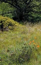
3 South Park and Channel Park complment the dynamic industrial character of Shoreline Park and Gateway Park with a more contemplative natural character. HISTORY Historic maps and aerial photographs show the Brooklyn Basin site was once a large natural marsh. In the early 1900s it was filled-in for industrial purposes such as lumberyards, break-bulk-cargo, ship repair, food warehouses, and other activities. Shoreline Park at the site of the 9th Avenue Terminal will remain the most industrial in character--preserving some of the 9th avenue Terminal and integrating the overall geometry and scale of the railroads and building into the design. As the terminal building gives way to lands at the north end, the parks will become softer and will wrap across to South Park with a more natural landscape in the bioswales and upland at Channel park. Existing Site at South Park view from the water CONTEXT South Park and Channel Park are located on the Oakland Estuary at the northern end of the Brooklyn Basin Development in Oakland, California. These parks will be the third and fourth phase of development for open space within the Brooklyn Basin project following Gateway park and the development of Shoreline Park at the site of the 9th Avenue Terminal. The site is located adjacent to the Lake Merritt Channel and faces Estuary Park s beloved and heavily used community boating facility. A new bridge connection along Embarcadero will provide improved access for cars and bicycles in A planned bicycle and pedestrian bridge from Lake Merritt will make a critical connection to the waterfront trails from neighborhoods to the east. FREEWAY EXISTING WETLAND OAKLAND HILLS CHARACTER Each of the open spaces at Brooklyn Basin as well as Estuary Park to the north will provide a continuous family of open space, but will also establish very different strong characters. South Park and the southern end of Channel Park will be the most contemplative providing spaces for quiet views to the water surrounded by native plantings. Smaller picnic areas and activation at the edges will provide clear nodes for accessing the Bay Trail at the water s edge. An existing wetland site that was created through a mitigation with the Port of Oakland will remain as a feature in the landscape. The centeral and northern edges of Channel Park are designed for larger groups and more dynamic passive recreation. A large flexible pavement area provides opportunities for parking by cars or bicycles as well as the staging area for events. The design of the pavement area can be right sized for changing needs of transportation and events. At the water s edge a community porch provides porch swings for visiting the water and defining your arrival. The porch swings repeat elsewhere in the parks as a trail maker and wayfinding device. At the northern edge of Channel Park a large mound elevates park goers for bigger water views and provides a gentle slope for play and picnicing. In compliance with the State Lands Commission, the parks must be regional in program and will serve the entire Bay Area. Existing Site Water s Edge at South Park LAND TRAILS In compliance with locating the Bay Trail at the edge of water, a new 30-0 wide trail area will circumnavigate Brooklyn Basin and connect to existing Bay Trail at both the north and south ends. The design was created to emphasize the public access by multiple modalities and to strengthen connects to the existing residential fabric of Oakland at numerous critical intersections. The team is working with the city led project for the new bike bridge connection to insure the designs are integrated and positively reinforce each other. In total South Park and Channel Park provide nearly 2000 Linear Feet of water s edge trail. PHASE 3-4 PARKS south park & channel park NARRATIVE L3.0


4 FREEWAY EMBARCADERO BRIDGE FUTURE CHANNEL PARK Channel Park makes important connections for trails on water and on land. WATER TRAILS The Oakland Estuary has long been an important site for boating and water use. With increasing congestion on roads the interest in water transportation and recreation is growing. The park designs recognize the water experience as different from the land experience of the landscape provide visual elements for wayfinding from the water as well as informal places where a kayak may pause along its way. ESTUARY PARK DOCK Existing Site at Channel Park viewed from Estuary Park EMBARCADERO BRIDGE FUTURE CHANNEL PARK BROOKLYN BASIN Existing Site at Channel Park viewed from Kayak Water Trail Map PHASE 3-4 PARKS south park & channel park NARRATIVE L4.0

5 All of the open spaces in Brooklyn Basin will be programmed with a commitment to creating activated, well maintained open space throughout the neighborhood. The parks will be owned by the City of Oakland, but maintenance will be funded and provided by a community facilities district. PHASE 3-4 PARKS south park & channel park site amenities L5.0

 P A R K (PUBLIC (11.62 AC) RFP) 5 4 C L I N T O N C H A N N E L B A S I N P A R K (3.")
 Each park in Brooklyn Basin will have a strong character and together they will form a family of open spaces linked by trails.")


6 G A T E W A Y P A R K 1 SHORELINE PARK A large, south facing deck and event space is at the heart of Shoreline Park. The retrofit of 9th Avenue Terminal offers a visitor center and restaurant. Historic interpretation of the old wharf occurs throughout the park. E S T U A R Y E S P T A U R A KR Y (PUBLIC RFP) P A R K (PUBLIC (11.62 AC) RFP) 5 4 C L I N T O N C H A N N E L B A S I N P A R K (3.20 AC) (5.97 AC) S O U T H P A R K 3 (2.30 AC) S H O R E L I N E P A R K (9.86 AC) Each park in Brooklyn Basin will have a strong character and together they will form a family of open spaces linked by trails GATEWAY PARK AT CLINTON BASIN A clear entrance to the park that incorporates large-scale wayfinding, kiosks and cafes to welcome visitors to the park. Boardwalk promenade along Clinton Basin and the boat marina guides visitors into park. SOUTH PARK Natural area with picnic tables and bbq grills for public use is located adjacent to existing wetland. A large, communal bench offers space for community to come together and take in views over the water or may act as a meeting spot. 5 ESTUARY PARK Historic park with a beloved Aquatic Center providing access to the water for rowers and paddlers. Currently under redesign through a public RFP through the city of Oakland underway 4 CHANNEL PARK Viewing hill and waterfront trails adjacent to lawn areas for picnicking and impromtu gatherings. Regional parking lot that acts as a flexible space with bike parking/station and a design that can accommodate public events. PHASE 3-4 PARKS south park & channel park overall site character L6.0


7 Shoreline Park is under construction and the demolition of the 9th Avenue Terminal has opened up views to the estuary. PHASE 3-4 PARKS south park & channel park SHORELINE PARK L7.0

8 South Park will be a place of quiet and contempation within the overall family of parks in Brooklyn Basin. PRIVATE PROPERTY NOT A PART OF BROOKLYN BASIN PARKING PICNIC GROVE SOUTH Meadow WETLAND WALK PARCEL K OAKLAND ESTUARY BAY TRAIL OVERLOOK CORNER EXISTING WETLAND TO REMAIN CLINTON BASIN SOUTH PARK PLAN L8.0


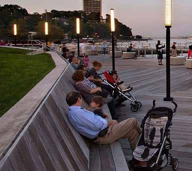
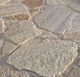
9 1. Communal Bench 2. Existing Wetland 3. Clinton Basin 4. Water Interpretation 5. Cafe Opportunity 6. Shade Trees 7. Wetland Walk 8. Flagstone DG Patio 9. Rustic Furniture 10. Native Plantings Communal Bench Flagstone DG Rustic Furniture Native Plantings 3 PLAN Key Plan Overlook corner is designed to provide a point of slowness in the trail similar to an eddy in a stream. It will offer views over the existing wetland, a cafe opportunity, and a community scaled bench for lounging. The materials palette will shift to evoke the raw qualities of natural materials. OVERLOOK CORNER L9.0


10 Existing Wetland Slope Transition Wetland Walk Oakland Estuary Existing Gate Beach Area 4 Trash Overview PLAN Key Plan The existing wetland was created as a mitigation and includes a metal fence with a heron at its gate. Invasive plant and trash within the existing wetland area should be removed. New native planting will augment the wetland area and extend its habitat value. Existing Wetland Proposed View EXISTING WETLAND L10.0


11 PRIVATE PROPERTY NOT A PART OF BROOKLYN BASIN Washingtonia filifera allee Flagstone DG PLAN Picnic tables Oyster Shells for Wetland Walk Key Plan The Picnic Grove is designed to provide easy access to a natural area for picnicing near the water and parking. A special walkway-- also providing EVAC--recalls the importance of oysters in the history of the site Parking Picnic Tables Native Palm Trees Wetland Walk Stormwater treatment area Meadow PICNIC GROVE L11.0


12 Bay Trail with Asphalt and DG Meadow Edge Plantings 6 2 Interpretive Sign Key Plan Meadow The Meadow is a natural area with a combination of low grasses, groundcovers, and small shrubs that is designed to augment habitat value of the area. PLAN Bay Trail Shade Trees Meadow Coastal Scrub Plantings Interpretive Sign Swings MEADOW L12.0
13 Communal Bench Upper Path + Firetruck Access Existing Wetland to Remain OVERLOOK CORNER L13.0
14 PICNIC GROVE L14.0

15 DETAIL PLAN L15.0
16 DETAIL PLAN MEADOW TRAIL L16.0

17 Channel Park is designed to encourage passive recreation and a connection to both the estuary and channel. It will be an important wayfinding point for the trail network. lake MERRITT CHANNEL e m b a r c a d e r o PLANNED BICYCLE PEDESTRIAN CONNECTION TO LAKE MERRITT OAKLAND ESTUARY VIEWING HILL NEW VEGETATED SHORELINE ARRIVAL COURT PARCEL NORTH MEADOW PRIVATE PROPERTY NOT A PART OF BROOKLYN BASIN CHANNEL PARK L17.0

18 Viewing Hill 2. Regional Parking + Bike Parking Station 3. Picnic and Bioretention Area 4. Porch Swings 5. Waterside Picnic Area 6. Lake Merritt to Bay Trail Connection 7. Upper Trail 8. Lower Trail 9. Swings 10. New Vegetated Shoreline 10 channel park bird s eye view L18.0


19 6 Bay Trail with Asphalt and DG Meadow Edge Plantings Meadow PLAN Interpretive Sign Bay Trail Shade Trees Meadow Coastal Scrub Plantings Interpretive Sign Swings New Vegetated Shoreline Key Plan The Meadow is a natural area with a combination of low grasses, groundcovers, and small shrubs that is designed to augment habitat value of the area PRIVATE PROPERTY NOT A PART OF BROOKLYN BASIN NORTH MEADOW + SHORELINE TRAIL L19.0


20 PLAN Key Plan Bay Trail Shade Trees Meadow Coastal Scrub Plantings Interpretive Sign Swings New Vegetated Shoreline The Meadow is a natural area with a combination of low grasses, groundcovers, and small shrubs that is designed to augment habitat value of the area Sculptural Swings ARRIVAL COURT L20.0


21 Swings Trail Viewing Hill Planned Bike Ped Connection New Vegetated Shoreline PLAN Key Plan The viewing hill is... Multi-level Trail Viewing Mound VIEWING HILL L21.0
22 Adaptive Zone 15 8 Regional Parking + Event Space 10 Viewing Hill Path Upper Trail BFE MHHW 0.56 MHW Lower Trail MLW Adaptive Zone BFE MHHW 0.56 MHW MLW Vegetated Shoreline Swings/ Trail Drop Off Food Truck Parking Regional Parking + Event Space VIEWING HILL L22.0


23 DETAIL PLAN SEPARATED TRAIL L23.0


24 KEY View From Top of Hill 1 3 Proposed Lake Merritt Connection Channel Park Arrival Lower Trail VIEWING HILL L24.0


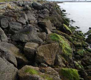
25 Rip-rap Edge ACB Mat Vegetated Shoreline, Mudflat, and Open Water Shoreline reconfiguration and protection will be addressed in the parks through various methods. Some areas will have rip-rap edges with and without retaining walls or similar engineering to provide wave attenuation for shoreline erosion. There will also be zones of vegetated shoreline areas that will be designed to optimize the potential for natural vegetation to establish in areas where the elevation is appropriate. SHORELINE RECONFIGURATION L25.0


26 l a k e m e r r i t t t o b a y t r a i l c o n n e c t i o n c h a n n e l p a r k s o u t h p a r k The parking lot at Channel Park has been designed as a flexible space that acts as a regional parking lot, but can also be utilized by the community for public events of various sizes. We anticipate rightsizing the day one parking, bike parking, and bike station uses and having the flexibility to close the lot for events. The design will surface the lot with paint or another material that dimishes its assumed use for automobiles and suggests alternative uses. Flexible Parking + Event Space Auto Parking Bike Share Station Community Events PHASE 3-4 PARKS south park & channel park ARRIVAL COURT L26.0


27 Regional Parking + Bike Parking Event Space + Bike Parking Bke Share Station Public Bike Parking Public Bike Parking Bke Repair Station With connections to the Bay Trail, Lake Merritt, and city bike lanes, biking will be a popular mode of transit to access Brooklyn Basin. The design suggests that the Channel Park Flexible Parking Lot provide bike racks for personal bicycles as well as a bike share station and a bike repair station. Bike Share Station ARRIVAL COURT L27.0

28 UPDATE 8 Regional Parking + Event Space show bikes UPDATE Path Swings/ Trail Drop Off Food Truck Parking Regional Parking + Event Space Drop Off Food Truck Parking Regional Parking + Event Space UPDATE 8 Regional Parking + Event Space Path Swings/ Trail ARRIVAL COURT L28.0

29 Regional Parking Regional Parking + Event Space Event Space The above diagrams and those shown on page L11.2 demonsrate the flexibility of the arrival plaza. It allows for many different kinds of activities to occur in the space, whether it be just parking, parking and an event at the same time or an event taking up the entire space. The rightsizing of the number of car spaces relative to bike parking spaces and bike stations will be developed as the design evolves. All of the parking is public. ARRIVAL COURT L29.0


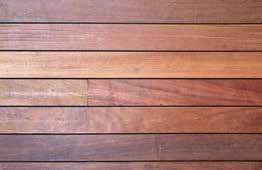
30 Asphalt path with Concrete Border Rip-rap Edge or Similar Painted Asphalt Concrete Boardwalk with Cobblestone Edge Cobblestone Paving Timber Communal Bench Concrete with Timber Elements Picnic Table Long Park Bench Moveable Cafe/Plaza Seating Bike Rack Site lighting Materials + Furnishings palette L30.0


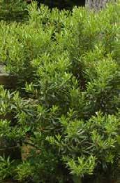
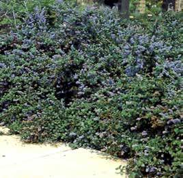
31 SCULPTURAL + ICONIC TREE SPECIES COASTAL SCRUB FLOWERING SHRUBS HIGH MARSH GRASSES + GROUNDCOVER Plant material species shown are representative of concept and design goals for planting. Water Efficient Landscaping and the use of native and endemic plants is a design criteria for our selections. Final selection of plants will be based on plant quality, availability, and season. Additional changes may be made to achieve a unified design following any required changes. Plant palette L31.0
32 LIGHTING L32.0

33 BROOKLYN BASIN firetruck access EVAC CIRCULATION L33.0
 BIKE LANES - CLASS II (ON STREET) BIKE ROUTES - CLASS III (ON-STREET) PEDESTRIAN WAYS/PASEOS (OFF STREET) PEDESTRIAN AND BICYCLE CIRCULATION")
34 BROOKLYN BASIn bay trail access TO LAKE MERRITT FUTURE CONNECTION TO LAKE MERRITT CHANNEL TRAILS LEGEND OAKLAND WATERFRONT TRAIL/BAY TRAIL BIKEWAY - CLASS I (OFF-STREET TRAILS) BIKE LANES - CLASS II (ON STREET) BIKE ROUTES - CLASS III (ON-STREET) PEDESTRIAN WAYS/PASEOS (OFF STREET) PEDESTRIAN AND BICYCLE CIRCULATION L34.0
Illustrative Development Plan
 Illustrative Development Plan December 7, 005 045 Sansome St., Studio 3 San Francisco, CA 94 Area A - Increase visibility to waterfront and aquatic center from the Embarcadero - Provide streets rather
900 Innes & India Basin Shoreline Park
 India Basin Waterfront Study Task Force A. Philip Randolph Institute Golden Gate Audubon Society Bay Institute Aquarium Foundation Build Inc. Five Points Green Action for Health and Environmental Justice
The open space system should provide connective elements, relate to natural resources, and enhance the suburban character of the landscape..
 The open space system should provide connective elements, relate to natural resources, and enhance the suburban character of the landscape.. Mixed-use and infill development should maintain or enhance
Table of Contents. Executive Summary... vii
 Table of Contents Executive Summary... vii Section I: Background...1 Introduction... 3 Study History... 3 Purpose and Role of the Plan... 6 Plan Organization... 7 The Estuary Shoreline... 11 Multiple Jurisdictions...
VEHICULAR AND PEDESTRIAN CIRCULATION
 This perspective sketch communicates the intended character and quality of a proposed streetscape design. Locate benches near a major intersection where people tend to gather. Seating and lighting provide
WELCOME PG&E HUNTERS POINT COMMUNITY OPEN HOUSE THANK YOU FOR COMING PG&E
 WELCOME PG&E HUNTERS POINT COMMUNITY OPEN HOUSE THANK YOU FOR COMING NEWHALL ST JENNINGS ST B SHORELINE I SHORELINE EVANS AVE J C/D MIDDLE POINT ROAD OPERATING SUBSTATION A SHORELINE H Remediation Complete
Popp s Ferry Causeway Park Back Bay Environmental Educational Center CASHIO COCHRAN LLC
 Popp s Ferry Causeway Park Back Bay Environmental Educational Center CASHIO COCHRAN LLC A LIMITED LIABILITY COMPANY Popp s Ferry Causeway Park Master Plan Prepared for: City of Biloxi Department of Parks
PUBLIC RIGHT-OF-WAY IN THIS CHAPTER PUBLIC REALM
 PUBLIC RIGHT-OF-WAY This section provides design guidelines for improvements in the public right-of-way. The public right-of-way refers to streets, sidewalks, non-vehicular thoroughfares, parks and greenways
1. Parks & Recreation Neighborhood Parks Community Parks Special Use Sites 2. Open Space 3. Trails
 Appendix A: Park Classifications The intent of parks and recreation classifications is to aid in making acquisition and design decisions for park sites, facilities and the organization of recreation space
GREENING THE BOULEVARD Master Plan Concepts for Venice Boulevard between Lincoln and Sawtelle
 GREENING THE BOULEVARD Katherine Spitz Associates Inc. 4212½ Glencoe Avenue Marina Del Rey, CA 90292 310 574 4460 Fax 574 4462 January 2008 Table of Contents Overview Proposed Design Improvements Illustration
Reconnecting to a Forgotten River St. Cloud MN. Aaron Hanson Design Design Thesis LA 572, Thesis, Spring 2012
 Reconnecting to a Forgotten River St. Cloud MN Aaron Hanson Design Design Thesis LA 572, Thesis, Spring 2012 site context 2.5 Miles Sartell St. Cloud to Fargo 170 Miles (2 hrs 45 mins) Hwy 10 infrastructure
SFMTA PHELAN LOOP AND PUBLIC PLAZA PHELAN OCEAN AVENUE
 SFMTA Municipal Transportation Agency Image: a bus in front of the Palace of the Legion of honor SFMTA PHELAN LOOP AND PUBLIC PLAZA PHELAN AVENUE @ OCEAN AVENUE Community Meeting May 23, 2012 San Francisco,
Notice of Preparation (NOP) of an Environmental Impact Report and Public Scoping Meeting for the Alameda Shipways Residential Project
 of an Environmental Impact Report and Public Scoping Meeting for the Alameda Shipways Residential Project") Notice of Preparation (NOP) of an Environmental Impact Report and Public Scoping Meeting for the Notice is hereby given that the City of Alameda, Lead Agency, will prepare an Environmental Impact Report
Notice of Preparation (NOP) of an Environmental Impact Report and Public Scoping Meeting for the Notice is hereby given that the City of Alameda, Lead Agency, will prepare an Environmental Impact Report
City of Plattsburgh DRI: Downtown Streetscapes & Riverfront Access. Downtown Streetscape and Riverfront Access Design
 City of Plattsburgh DRI: Downtown Streetscapes & Riverfront Access Welcome Thank you for coming this evening. Agenda PART I - Project Context The Downtown Revitalization Program Our DRI Projects Other
BAY AREA PARKS & RECREATION
 BAY AREA PARKS & RECREATION ALCATRAZ ISLAND CLIFF STABILIZATION Alcatraz Island San Francisco Bay California National Park Service Wiss Janney Elstner Associates Geologic Hazards Geotechnical Site/Civil
Neighborhood Districts
 NEIGHBORHOOD DISTRICTS SEVEN MAIN DISTRICTS Neighborhood Districts While the Development Plan provides a broad-scale overview of the neighborhood, this section focuses on uses and relationships at the
Mendota Heights 2040 Comprehensive Plan Draft Vers
 4 Parks and Trails The City of Mendota Heights boasts a variety of recreational and open space opportunities. Few cities can claim access to regional trails, riverside and lakeside parks, scenic bluffs
Pedestrian and Bike Bridge LOGO
 6.2.2 Pedestrian and Bike Bridge The proposed pedestrian and bike crossing re-envisions the existing bridge at Pismo Creek on Cypress Street. The bridge is currently underutilized by vehicular through
MCCOYS CREEK RESTORATION 30% DESIGN
 MCCOYS CREEK RESTORATION 30% DESIGN THE MCCOYS CREEK RESTORATION PLAN The restoration plan aims to reduce flooding, restore ecosystem health, expand recreational opportunities along the creek, and connect
ANCHORAGE PARK REPORT CARD Assessing A Park s Appearance, Function, & Condition
 ANCHORAGE PARK REPORT CARD Assessing A Park s Appearance, Function, & Condition Park Name: Is Your Park an A or an F? Your Name: Contact Information Optional: Date: General Instructions: Phone: Email:
lakeway mixed use tract open space plan
 LEGEND:. UNDISTURBED NATURAL AREA. ENTRY STATEMENT BUILT INTO HILLSIDE. R.O.W. PLANTING (STREET TREES/LIGHTS). HEB ENTRY DRIVE 5. BIO-FILTRATION IN MEDIAN 6. MAIN ENTRY @ MAIN STREET. EXISTING TREES TO
ROME WATERFRONT VILLAGE PROJECT NARRATIVE January 25, 2018
 January 25, 2018 The Rome Waterfront Village project is intended to foster the revitalization of the area between South James Street and Erie Boulevard north of the Erie Canal as well as improve public
Manchester. Vision for Manchester
 Manchester Vision for Manchester The Manchester Community Plan is a statement of the community values and aspirations for the future. This is an effort to recognize what originally attracted visitors in
Clairtrell Area Context Plan
 Clairtrell Area Context Plan March 2005 Urban Development Services City Planning Contents 1. Introduction... 4 2. Development Structure... 6 2.1 Streets... 7 2.1.1 Sheppard Avenue and Bayview Avenue...
5. Father Hennepin Blufs Park and Hennepin Island Father Hennepin Bluffs Park Supporting Initiatives (see Figure 36): 7-22
: 7-22") 5. Father Hennepin Blufs Park and Hennepin Island As described in existing conditions portion of Chapter 2, Father Hennepin Blufs Park lies on the upland portion of the park and Hennepin Island spans the
5. Father Hennepin Blufs Park and Hennepin Island As described in existing conditions portion of Chapter 2, Father Hennepin Blufs Park lies on the upland portion of the park and Hennepin Island spans the
M i s s i o n B a y W a t e r f r o n t
 114 M i s s i o n B a y W a t e r f r o n t Character of the Area: The Mission Bay Waterfront extends from Pier 48 at China Basin Channel to 18th Street in the Central Basin. This area of the waterfront
4 Park Planning and Design
 4 Park Planning and Design Park Constellations Elliot Gateway/Mills Loring North Loop Commons Twins Minneapolis Park & Recreation Board Downtown Service Area Master Plan 4-1 PROJECT APPROACH REFERENCE
Figure 3-1: Public Realm Plan
 3 Public Realm Figure 3-1: Public Realm Plan 3.1 Public Realm Concept The public realm concept for the Little Mountain site integrates a clear and accessible movement network with public spaces for social
R STREET CORRIDOR NEIGHBORHOOD Site Plan and Design Review Supplemental Guidelines Checklist
 R STREET CORRIDOR NEIGHBORHOOD Site Plan and Design Review Supplemental Guidelines Checklist Applicant s Name: Project Address: Phone: Email: Applicant shall fill out the design guidelines checklist for
Courthouse Square Planning & Urban Design Study. Courthouse Square Working Group #13 October 15, 2014
 Courthouse Square Planning & Urban Design Study Courthouse Square Working Group #13 October 15, 2014 1 Courthouse Square Process Working Group Community Courthouse Square Advisory Groups & Civic Associations
Project Location. Jay and Patty Baker Park and Gordon River Greenway Connector Bridge. Naples Beach Golf Club. Gordon River. East. Naples.
 Gordon River Project Location Naples Beach Golf Club East Naples Naples Naples Bay Evergreen Golf and Country Club and Gordon River Greenway Connector Bridge Gordon River Greenway CONNECTOR BRIDGE AND
BRADENTON RIVERWALK EXPANSION MASTER PLAN
 BRADENTON RIVERWALK EXPANSION MASTER PLAN INTRODUCTION & AGENDA Process Update Community Engagement Summary Center for Active Design (CfAD) Recommendations Context and Existing Conditions Master Plan Alternatives
Preci nct P l ans Figure 56 Campus Aerial Photo, 2008 CAL STATE EAST BAY, HAYWARD CAMPUS MASTER PLAN
 9 Precinct Plans This section contains a detailed discussion of the planning and design concepts for specific areas or precincts of the Cal State East Bay Hayward campus. The Precinct Plans pertain to
RECREATION AND OPEN SPACE VISION
 City of South Lake Tahoe General Plan Policy Document Recreation and Open Space Element INTRODUCTION This element provides the policy context for the City of South Lake Tahoe to achieve its vision for
Charles P. Johnson and Associates. Annapolis Landscape Architects
 Charles P. Johnson and Associates Annapolis Landscape Architects AGENDA Introduction Project Limits and Scope Site Analysis Opportunities & Constraints Program Goals Image Boards Design Alternatives Pros
Shared Principles and Emerging Plan Directions
 Shared Principles and Emerging Plan Directions Introduction Since the Fairfield Neighbourhood planning process launched in June 2016, we have heard from many residents, businesses, groups and other people
BEMIDJI CITY COUNCIL Work Session Agenda Monday July 9, 2012
 BEMIDJI CITY COUNCIL Work Session Agenda Monday July 9, 2012 City Hall Conference Room 5:30 p.m. 1. CALL TO ORDER / ROLL CALL 2. REVIEW PARK PLANS FOR PAUL BUNYAN PARK, LIBRARY PARK AND SOUTH SHORE BAUER
Eastcreek Farm. Planned Development Standards September, 2014
 Eastcreek Farm Planned Development Standards September, 2014 ekfarm Contents 01. General Standards 02. Residential Development Standards 03. Architectural Design Standards 04. Landscape Design Standards
Chapter 14 Streetscape Improvements
 This chapter presents streetscape design concepts for key streets and gateways in the Downtown Specific Plan area. This chapter is organized as follows: 14 Streetscape Improvements 14.1 Streetscape Treatments
IMAGINE CLEARWATER. Community Workshop 3. November 2016
 IMAGINE CLEARWATER Community Workshop 3 November 2016 Imagine Clearwater has been a 6-month community-focused process to re-envision the downtown waterfront. VISIONING FRAMEWORK MASTER PLAN HOW CAN WE
JACKsON STREET PIER CONCEPTUAL DESIGN PACKAGE SEPTEMBER 21, 2017
 JACKsON STREET PIER CONCEPTUAL DESIGN PACKAGE SEPTEMBER 21, 2017 JACKsON STREET PIER Process outline DESIGN PROCESS OVERVIEW: Sandusky s Jackson Street Pier Conceptual Design process included input from
Standards (R-3) Figure B-11: R-3 Residential Standards Exhibit
 Figure B-11: R-3 Residential Standards Exhibit") Avila Ranch Avila Ranch Specific Plan Development Standards High Medium Density - High Residential Density Residential Lot and Building Lot and Standards Building (R-3) Standards (R-3) EXAMPLES These sketches
Avila Ranch Avila Ranch Specific Plan Development Standards High Medium Density - High Residential Density Residential Lot and Building Lot and Standards Building (R-3) Standards (R-3) EXAMPLES These sketches
Dowdy Park. Concept Plans TOWN OF NAGS HEAD NORTH CAROLINA. Developed by: Albemarle & Associates, Ltd VHB/ Vanasse Hangen Brustlin, Inc.
 TOWN OF NAGS HEAD NORTH CAROLINA Concept Plans Developed by: Albemarle & Associates, Ltd VHB/ Vanasse Hangen Brustlin, Inc. Site Looking Southeast Dowdy Park Existing Conditions Nags Head Woods Sound Future
Preferred Riverwalk Alternative Components August 17, 2017:
 Preferred Riverwalk Alternative Components August 17, 2017: 1. Entrance and Future Pump Station Location: Entrance location to line up with main parking entrance to Captain Parkers and allows future Pump
Landscape and Streetscape Design 2.5
 Landscape and Streetscape Design 2.5 2.5.1 Goals 2.5.2 Planting 2.5.3 Sidewalks and Pavement 2.5.4 Furnishings 2.5.5 Walls 2.5.6 Lighting 2.5.7 Stormwater 2.5.8 Street Cross Sections 2.5 LANDSCAPE AND
AREA-WIDE PEDESTRIAN AND BICYCLE CIRCULATION
 OUSD LANEY CHILD CARE CENTER ART BUILDING LANEY COLLEGE BALL FIELDS PCCD OFFICES PERALTA PARK AQUATIC CENTER & ESTUARY PARK EDOFF MEMORIAL BANDSTAND SNOW PARK COURT HOUSE OAKLAND MUSEUM OAK ST AREA-WIDE
PRELIMINARY DESIGN + DEVELOPMENT PLAN
 WELCOME! To The Public Open House May 30 th, 2017 HARBOUR WEST PARKS Vision Project Overview The City s vision for Port Credit Harbour West Parks is to develop a vibrant waterfront destination that integrates
TURN TO THE RIVER CITY PLAZA LANDSCAPE DESIGN CONCEPT May 25, 2016
 Turn to the River is a multi-year project of Art Spaces - Wabash Valley Outdoor Sculpture Collection, Inc. to connect downtown Terre Haute with the Wabash River through public art and design. The four-square
3.1 community vision. 3.3 required plan elements
 Chapter 3 Community Form 3.1 community vision 3.2 Parks & landscaping concepts 3.3 required plan elements D R A F T 20 Community Form Chapter 3 3.0 Community form 3.1 community vision The Specific Plan
Hidden Pointe Landscape Master Plan. June, archi terra
 Hidden Pointe Landscape Master Plan June, 2006 t h e archi terra g r o u p 1 Table of Contents Background Purpose and Goals of the Master Plan Master Plan Process Existing Conditions Entrance Hidden Pointe
ADOPTED CAPITAL IMPROVEMENT PROGRAM BUDGET ARROYO PROJECTS
 ADOPTED CAPITAL IMPROVEMENT PROGRAM BUDGET ARROYO PROJECTS HAHAMONGNA FY 212-216 Capital Improvement Program Priority Description Total Estimated Costs Appropriated Through FY 211 Adopted FY 212 FY 213
Campus Master Plan Description Section 6 Storm water management and people places at campus buildings. Section 6 Campus MP Description
 Campus Master Plan Description Section 6 Storm water management and people places at campus buildings Section 6 Campus MP Description THIS PAGE INTENTIONALLY LEFT BLANK. appendix The following provides
APPENDIX K WINDSOR OFFICIAL PLAN
 CEAA ENVIRONMENTAL ENVIRONMENTAL IMPACT ASSESSMENT AMBASSADOR BRIDGE ENHANCEMENT PROJECT Replacement Span and Plaza Expansion APPENDIX K WINDSOR OFFICIAL PLAN Avalon Consulting Professionals of Ontario,
Lansing s Moores River Drive Regional Network Trail project extended the Lansing River Trail system to Waverly Road, and also included bike lane
 Lansing s Moores River Drive Regional Network Trail project extended the Lansing River Trail system to Waverly Road, and also included bike lane striping on W. Mount Hope Avenue. The boulevard on Moores
WEST LOOP DESIGN GUIDELINES CHECKLIST
 WEST LOOP DESIGN GUIDELINES CHECKLIST Section 1.0 General Strategies 1.1 DESIGN EXCELLENCE: ENCOURAGE HIGH QUALITY AND INNOVATIVE DESIGN OF NEW BUILDINGS WITHIN THE WEST LOOP WITHOUT BEING PRESCRIPTIVE
Route 347. New York State Department of Transportation Region 10, Long Island. THE GREENING of ROUTE 347
 The GREENING of Route 347 The Greening of Route 347 The Greening of Route 347: History 3 The Greening of Route 347 4 The Greening of Route 347 5 The Greening of Route 347 Smith Haven Mall 6 The Greening
Transportation. Strategies for Action
 Transportation A major priority for the Overlake Neighborhood is to develop a multimodal transportation system. To achieve this system, a balance has to be found among travel, circulation and access needs;
ELEMENT 16 - LANDSCAPE DESIGN GUIDELINES ELEMENT
 16 ELEMENT 16 - LANDSCAPE DESIGN GUIDELINES ELEMENT Goal 1 To establish an overall landscape character that provides: A pedestrian friendly environment that provides ample tree canopy and shade. An overall
public review draft Key objectives for this chapter are:
 5 - parks & open space Providing a rich collection of outdoor places for informal gathering and recreation, as well as planned promotional activities and community events, is a key concept for Midtown.
JULIA M. CARSON TRANSIT CENTER
 CATEGORY New Construction (Project Cost Greater Than $1 Million) PROJECT TYPE Public Transportation Facility ADDRESS 201 East Washington Street, Indianapolis, Indiana, 46202 COMPLETION June 2016 As the
THE NEIGHBORHOOD TODAY
 THE NEIGHBORHOOD TODAY CORE AREA VISION How are we Good Urbanism A Site s DNA thinking about Elements of great Unique elements urban communities embedded in a place the site and design? ELEMENTS LIKE:
More than 30 adults and 19 children were involved in these community workshops.
 Linwood Workshops held at Household of Faith Deliverance Church 3.29.08 and 4.05.08 What is a Design Workshop? We use the term workshop (often called charrette among design professionals) to describe a
Point Defiance Park. Master Plan Update. April 23 rd 2015
 Point Defiance Park Master Plan Update April 23 rd 2015 Public Participation 1/29, 2/26, 3/26 & 4/23 Tonight s Agenda: Introduction: March Meeting Recap: Overview Feedback Responses Presentation of Master
GPCID Mall Boulevard & Gwinnett Place Drive Complete Street: Sectional View of Concepts
 Sectional View of Concepts PAVEMENT FEATURES PAVEMENTS INTERSECTION INTERSECTION TREATMENTS LANDSCAPE BUFFER LANDSCAPE DESIGN GPCID CD D: GWINNETT P LACE DRIVE & MALL B COMPLETE STREET DESIGN ELEMENTS
FLORIN ROAD CORRIDOR Site Plan and Design Review Guidelines Checklist
 FLORIN ROAD CORRIDOR Site Plan and Design Review Guidelines Checklist Applicant s Name: Project Address: Phone: Email: Applicant shall fill out the design guidelines checklist for all guidelines applicable
A Vision for Walnut Creek
 A Vision for Walnut Creek Photo: City of Clive Walnut Creek Booklet 8 of 8 Greater Des Moines Water Trails and Greenways 1 Table of Contents Booklet 1: Water Trails Strategies and Policies Booklet 2: Beaver
PIKE PINE RENAISSANCE: ACT ONE. October 19, 2017
 PIKE PINE RENAISSANCE: ACT ONE October 19, 2017 WATERFRONT SEATTLE PROGRAM PROJECT INTRODUCTION Pike and Pine streets, between First and Melrose avenues Pedestrian and streetscape improvements Budget:
BUILDING 1 PLAZA - VIEW AT UPPER PLAZA
 BUILDING 1 PLAZA - VIEW AT UPPER PLAZA FIGURE 4.38 BUILDING 1 PLAZA VIEW FROM UPPER PLAZA TREASURE ISLAND & YERBA BUENA ISLAND MAJOR PHASE 1 APPLICATION 4 - PARKS AND OPEN SPACE 131 FIGURE 4.39 MARINA
EcoVerde MADISON TO DOWNTOWN TO BEACH. Legend Highway Major Connection Major Street Local Street Proposed Access. Response to Tropicana Field RFP
 EcoVerde TO BEACH 275 16th Street North 16th Street South 13th Street North 13th Street South 11th Street North 11th Street South 1st Avenue North Central Avenue 1st Avenue South TO DOWNTOWN 2nd Avenue
MIAMI 21 PUBLIC HEARING-FIRST READING 2009
 General Principles Public access waterfront walkways shall: 1. Feel public. No one should feel as if he or she is intruding on private property. The public should feel welcome and at ease to move along
RZC Public View Corridors and Gateways
 RZC 21.42 Public View Corridors and Gateways 21.42.010 Purpose 21.42.020 Scope and Authority 21.42.030 Administration 21.42.040 Gateways Design 21.42.050 Unidentified Public Views 21.42.060 Identification
Port Macquarie Town Centre Landscape Architects
 Port Macquarie Town Centre Town Green Master Plan Review Tract Landscape Architects Urban Designers Town Planners A review of the Town Green Master Plan Port Macquarie, New South Wales Prepared by Tract
SECTION TWO: Overall Design Guidelines
 SECTION TWO: Overall Design Guidelines This section provides overall design principles and guidelines for the Gardnerville Mixed-use Overlay. They provide criteria for mixed-use places consisting of residential,
Fifth and Detroit Street Design May 2017 Capital Improvements Committee. DOWNTOWN Street Design
 1 Fifth and Detroit Street Design May 2017 Capital Improvements Committee Agenda 2 Review Street Configuration Prior Meeting Review Outreach Synopsis Functional Street Design Refinements Curb Edge, Turning
ENVIRONMENTAL / OPEN SPACE
 INTRODUCTION OPEN SPACE RESPONSILBILITIES COMPREHENSIVE PARKS & RECREATION MASTER PLAN WATERFRONT PARK RESOURCED-BASED AND NEIGHBORHOODPARKS ACTIVITY-BASEDPARKS LANDSCAPING & VEGETATIONPROTECTION PROTECTING
City of Iowa City Department of Neighborhood and Development Services Department of Parks and Recreation Department of Public Works City Manager s
 RFP Pre-submittal meeting December 18, 2015 City of Iowa City Department of Neighborhood and Development Services Department of Parks and Recreation Department of Public Works City Manager s Office Background
Stakeholders Advisory Working Groups (SAWGs) Smart Growth and TOD Land Use (#11) SAWG Meeting
 Smart Growth and TOD Land Use (#11) SAWG Meeting") Presentation - Part II Tappan Zee Bridge/I-287 Corridor Project July 21, 2010 Slide 1. David Kooris (Regional Plan Association) welcomed members of the Land Use Stakeholders Advisory Working Groups (SAWGs)
Presentation - Part II Tappan Zee Bridge/I-287 Corridor Project July 21, 2010 Slide 1. David Kooris (Regional Plan Association) welcomed members of the Land Use Stakeholders Advisory Working Groups (SAWGs)
Wentworth Point Peninsula Park
 WELCOME Welcome to today s community information session. Landcom has been appointed by Roads and Maritime Services (owners of the land) to construct Point Park. Today s information session is to give
San Francisco Bay Pilot: Sausal Creek Community Leader Charrette May 11, 2016 Marcus Griswold
 San Francisco Bay Pilot: Sausal Creek Community Leader Charrette May 11, 2016 Marcus Griswold 1 Overview Project Overview Watershed Context Assets and Challenges Opportunities Green Streets Creek Access
Long Branch-Wayne Local Park Renovation Project
 Montgomery Parks Long Branch-Wayne Local Park Renovation Project Community Meeting #2 September 20, 2016 Oak View Elementary School 7:00-9:00 PM Welcome / Team Introductions M-NCPPC (Montgomery Parks)
Chapter 4: Jordan Road Character District
 4: Jordan Road Character District 4.1 Introduction The Jordan Road character district encompasses much of the former Jordan orchard and farmstead, which was a significant part of Sedona s history. The
Throughout. square. (Crystal City Vision Plan 2050)
") 1: Terms related to the PSMP document 1 public space (see also public realm, civic space) An open space designated on the regulating plan, accessible to all, including Plazas, Mini Parks, and Neighborhoods
1: Terms related to the PSMP document 1 public space (see also public realm, civic space) An open space designated on the regulating plan, accessible to all, including Plazas, Mini Parks, and Neighborhoods
4. Parks, Open Space and Urban Forest
 4. Parks, Open Space and Urban Forest Goals 1. Enhance parks as public gathering places for the neighbourhood 2. Refresh park facilities to attract diverse ages and activities 3. Improve waterfront access
Title: South Britannia Community Centre Tobi Fenton
 Title: South Britannia Community Centre Tobi Fenton South Britannia is laid out in a grid of 120x60 meter blocks with Main Street oriented towards Howe Sound. The concentrated centre is located at the
CENTRAL ESTUARY PLAN AVISION FOR OAKLAND S WATERFRONT
 Central Estuary Plan A VISION FOR OAKLAND S WATERFRONT Specific Plan and Environmental Assessment Presentation to the Parks and Recreation Advisory Commission December 9, 2009 This Afternoon s Presentation
RLRC COMMUNITIES THIEF RIVER FALLS AREA CHARACTER COMMUNITY TRAIL OPTIONS OAKLAND PARK EXISTING CONDITIONS OAKLAND PARK DESIGN DESIGN DETAILS
 THIEF RIVER FALLS AREA CHARACTER COMMUNITY TRAIL OPTIONS OAKLAND PARK EXISTING CONDITIONS OAKLAND PARK DESIGN DESIGN DETAILS 61 THIEF RIVER FALLS AREA CHARACTER Thief River Falls has a number of existing
EXISTING VEHICULAR & PEDESTRIAN CIRCULATION
 46 EXISTING CONDITIONS EXISTING VEHICULAR & PEDESTRIAN CIRCULATION Vehicular and pedestrian circulation patterns are illustrated on this graphic. Campus entry points and major vehicular circulation routes
Benches Trash & Recycling Containers Railings and Bullrail Edges Paving Planting Pier Apron Lighting Interpretive Signage
 130 Appendix C: PortWalk The PortWalk give guidance for improvements within the Port s public access and open space system to ensure a certain standard of design consistency while preserving opportunities
4 LAND USE DESIGNATIONS
 4 LAND USE DESIGNATIONS Chapter 4 describes the land use designations and densities that will implement the development vision for North Burlingame outlined in Chapter 3. Land use densities are described
V. Gateways GATEWAYS / V-1
 V. GATEWAYS / V-1 Many of Chesapeake s gateways are located on highways and call for bold and attractive designs that motorists can understand, appreciate, and enjoy. can also take the form of natural
The University District envisions, in its neighborhood
 Envisioning the University District Link Light Rail in Seattle s neighborhoods CIY OF SEALE CONCEP-LEVEL SAION AREA PLANNING RECOMMENDAION RESOLUION # 30165 EXHIBI L Vision 08.2000 he University District
INTRODUCING THE BALTIMORE CITY GREEN NETWORK VISION PLAN
 INTRODUCING THE BALTIMORE CITY GREEN NETWORK VISION PLAN GOALS OF THE GREEN NETWORK PLAN Protect and enhance the unique ecological resources of our city Support economic growth and sustainable redevelopment
ARROYO PROJECTS ADOPTED CAPITAL IMPROVEMENT PROGRAM BUDGET
 A RROYO P ROJECTS ADOPTED CAPITAL IMPROVEMENT PROGRAM BUDGET FISCAL YEARS 214-218 HAHAMONGNA Priority Description 1 Hahamongna Watershed Park - Implement Master Plan 211,6 211,6 (77565) 2 Hahamongna -
Millbrae TOD #2 Project Analysis
 Millbrae TOD #2 Project Analysis Project Description A Site Development Permit and Conditional Use Permit are proposed to allow for a mixed-use transitoriented development on approximately 9 Acres located
BUILDINGS AND STRUCTURES
 BUILDINGS AND STRUCTURES Principle: Preserve contributing buildings and structures, ensure new buildings and structures are consistent with park character, and provide opportunities for compatible park
Four Big Ideas. Three Key Opportunities. Principles. Draft Place Making Master Plan. 1. The Foreshore 2. Green Links. 3.
 project background Four Big Ideas 1. The Healthy Thriving Place. An International Focus 3. Reclaiming Mooloolaba 4. The Resort Heart of the Coast In November 01 a big ideas workshop was held involving
Executive Summary. Section II: Objectives Issues & Opportunities. Section III: District Recommendations. Oak-to-Ninth Avenue District
 The Oakland Estuary Policy Plan is amended as follows: Executive Summary Page vi The plan proposes the large-scale transformation of the area from the Lake Merritt Channel to the Ninth Avenue Terminal
Welcome. Community Consultation Meeting November 28, Review and discuss the Bathurst Quay Neighbourhood Plan Framework
 Welcome Community Consultation Meeting November 28, 2016 Why Are We Here Today? Review and discuss the Bathurst Quay Neighbourhood Plan Framework Review and discuss an Action Plan for Implementation Next
COASTAL CONSERVANCY. Staff Recommendation December 13, 2007 COASTAL TRAIL AT LAND S END. File No Project Manager: Joan Cardellino
 COASTAL CONSERVANCY Staff Recommendation December 13, 2007 COASTAL TRAIL AT LAND S END File No. 07-086-01 Project Manager: Joan Cardellino RECOMMENDED ACTION: Authorization to disburse up to eight hundred
Waterfront Development Master Plan
 PORT of VANCOUVER USA Vancouver, WA Waterfront Development Master Plan DRAFT - FINAL CONCEPTUAL MASTER PLAN PROJECT TEAM NBBJ Heritage Research Associates JLA Kittelson Associates Leland Consulting Group