Evaluations of Nominations of Cultural and Mixed Properties
|
|
|
- Dwayne Burke
- 6 years ago
- Views:
Transcription

1 2013 WHC13/ 37. COM/ I NF. 8B1
2 UNESCO World Heritage Convention World Heritage Committee 2013 Evaluations of Nominations of Cultural and Mixed Properties ICOMOS report for the World Heritage Committee 37th ordinary session, Phnom Penh, June 2013
3 ICOMOS International Secretariat rue de la Fédération Paris France Tel: +33 (0) Fax: +33 (0)
4 World Heritage List Nominations 2013 I II Introduction ICOMOS analysis of nominations 1 ICOMOS procedure 5 ICOMOS check tool recommendations 9 Tables Alphabetical index of the evaluations (by State Party) 11 Nominations by category 13 Geographical spread of nominations 15 Numerical index of the evaluations 17 Technical evaluation mission experts 19 World Heritage List Nominations received by 1 st February 2012 III Mixed properties A Africa New nominations Guinea-Bissau [N/C 1431] Bijagós Archipelago Motom Moranghajogo 21 Extensions Lesotho [N/C 985bis] Sehlabathebe National Park [extension of ukhahlamba / Drakensberg Park (South Africa)] 27 B Europe North America New nominations Canada [N/C 1415] Pimachiowin Aki 35 Russian Federation [N/C 1419] Sviyazhsk Historical, Architectural, Natural and Landscape Complex 47 IV Cultural properties A Africa New nominations Madagascar [C 1428] Isandra Zoma 55 Niger [C 1268] Agadez (Historic Centre of Agadez) 63 B Asia Pacific New nominations China [C 1111] 74 Cultural Landscape of Honghe Hani Rice Terraces
5 Fiji [C 1399] Levuka Historical Port Town 87 Iran [C 1422] Golestan Palace 97 Iran [C 1423] The Cultural Landscape of Maymand 106 Japan [C 1417] Kamakura, Home of the Samurai 116 Japan [C 1418] Fujisan 126 Nominations deferred by previous sessions of the World Heritage Committee Democratic People s Republic of Korea [C 1278rev] The Historic Monuments and Sites in Kaesong 140 C Europe North America New nominations Canada [C 1412] 152 Red Bay Basque Whaling Station Germany [C 1413] Water features and Hercules within the Bergpark Wilhelmshöhe 161 Italy [C 175] Medici Villas and Gardens 169 Luxembourg [C 1420] The Town and the Castle of Vianden 183 Netherlands [C 1421] Teylers, Haarlem 191 Portugal [C 1387] University of Coimbra Alta and Sofia 198 Turkey [C 1354] Historic City of Alanya 207 Ukraine / Poland [C 1424] Wooden Tserkvas of the Carpathian Region in Poland and Ukraine 216 Ukraine [C 1411] The ancient city of Tauric Chersonese and its chora (5 th century BC 14 th century AD) 229 Extensions Poland [C 32ter] Wieliczka and Bochnia Royal Salt Mines [extension of Wieliczka Salt Mine (Poland)] 241 Nominations deferred by previous sessions of the World Heritage Committee Russian Federation [C 981rev] The Bolgar Historical and Archaeological Complex 251
6 World Heritage List Nominations received by 1 st February 2013 See Addendum (WHC-13/37.COM/INF.8B1.Add) which also includes minor modifications to boundaries and creations of buffer zones V Cultural properties A B C Arab States Nominations referred back by previous sessions of the World Heritage Committee Qatar [C 1402rev] AI Zubarah Archaeological Site Asia Pacific Nominations referred back by previous sessions of the World Heritage Committee India [C 247rev] Hill Forts of Rajasthan Europe North America Nominations referred back by previous sessions of the World Heritage Committee Croatia [C 1395rev] Sacral Complex on the remains of the Roman Forum in Zadar
7 I Introduction ICOMOS Analysis of nominations In 2013, ICOMOS was called on to evaluate 41 nominations. They consisted of: 21 new nominations 4 referred back nominations 2 deferred nominations 2 extensions 12 minor modifications/creations of buffer zone The geographical spread is as follows: Europe and North America Total: 22 nominations, 13 countries 11 new nominations 2 referred back 1 deferred 7 minor modifications/creations of buffer zone (19 cultural properties, 3 mixed properties) Latin America and the Caribbean Total: 0 Arab States Total: 2 nominations, 2 countries 1 referred back 1 minor modification/creation of buffer zone (2 cultural properties) Africa Total: 4 nominations, 4 countries 3 new nominations 1 extension (2 cultural properties, 2 mixed properties) Asia-Pacific Total: 13 nominations, 10 countries 7 new nominations 1 referred back 1 deferred 4 minor modifications/creations of buffer zone (13 cultural properties) General remarks 1. Quality and complexity of nomination dossiers Generally speaking, ICOMOS notes that nominations are increasingly complex, sometimes to the detriment of the dossiers clarity and coherence. Certain nominations would benefit if more time were taken in preparing the nomination, for example to complete the legal protection process, finalise a management plan or undertake additional research. ICOMOS hopes that the publication of the Resource Manual for the Preparation of Nominations, of which an electronic version is now available on its website, and on the World Heritage Centre website, will help the State Parties to improve the quality of nomination dossiers. In most cases, the weakest parts of the nomination dossiers are the comparative analysis, integrity and/or monitoring. When evaluating the comparative analysis included in nomination dossiers, ICOMOS examines the methodology used by the State Party and the relevance of the examples given by using the following parameters. Comparisons should be drawn with properties expressing the same values as the nominated property and within a defined geo-cultural area. Therefore the values need to be clearly defined and the geo-cultural framework should be determined according to these values. Comparisons should be drawn with similar properties already inscribed on the World Heritage List and with other examples at national and international level within the defined geocultural area. On the basis of the above, ICOMOS indicates whether or not the comparative analysis is complete and whether or not the analysis justifies consideration of the property for the World Heritage List. If the nomination is considered incomplete or insufficient according to the parameters indicated above, ICOMOS requests additional information from the State Party, checks relevant ICOMOS thematic studies, and the wealth of information available about properties already evaluated and/or inscribed on the World Heritage List, and on the Tentative Lists, and 1
8 consults the ICOMOS network of experts to improve its understanding of the nomination. ICOMOS wishes to point out that its role is to evaluate the properties on the basis of the information provided in the nominations (i.e. the dossiers), and on the basis of on-the-spot assessment and additional studies. Similarly, it evaluates the protection, conservation and management of the property at the time of the nomination and not at some unspecified time in the future after the adoption of the laws and management plans. It is the duty of ICOMOS to indicate to the Committee whether or not adequate protection and management are in place prior to inscription. 2. ICOMOS evaluations The objective of ICOMOS is the conservation and long-term protection and presentation of the cultural heritage, whether or not it is of outstanding universal value. In formulating its recommendations, ICOMOS therefore aims to be as helpful as possible to State Parties, whatever the final recommendation proposed. ICOMOS is well aware that it cannot please everyone. Despite being under considerable pressure, not only from State Parties, it must remain objective, rigorous and scientific, and its first duty remains the conservation of properties. 3. Strengthening of dialogue with State Parties The requests for additional information were sent out prior to the carrying out of the evaluation process. The ICOMOS World Heritage Panel meeting was held at the beginning of December 2012, so that the letters requesting additional information could be sent out in December, leaving the State Parties time to reply. The replies provided by the State Parties have in many cases confirmed or assisted the adoption of the final recommendations made by ICOMOS. 4. Referred back nominations Deferred nominations At the request of the World Heritage Committee, ICOMOS and IUCN presented at the 34 th session in Brasilia an information document concerning the processes, points of reference and time constraints arising from decisions to refer back or defer the examination of a nomination. ICOMOS wishes to once again express its concerns about the difficulties raised when a deferred recommendation is changed into a referred back recommendation, which does not allow the advisory bodies to carry out an appropriate evaluation of nominations which are in many cases entirely new. ICOMOS has moreover carried out two advisory missions for referred back properties, at the request of the World Heritage Committee at its 36 th session. This process is not covered by the Operational Guidelines and its implementation may prove to be complex. In its recommendations, ICOMOS clearly distinguishes between nominations which are recommended to be referred back and those which are deferred. For referred back nominations, Outstanding Universal Value has been demonstrated to the satisfaction of ICOMOS; supplementary information must be supplied to satisfy other requirements of Operational Guidelines, but no further technical evaluation mission will be required. For deferred nominations, the very nature of the information requested (a more thorough study, major reconsideration of boundaries, a request for a substantial revision, or serious gaps as regards management and conservation issues) means that a new mission and consideration by the full ICOMOS World Heritage Panel are necessary to evaluate the nomination again, and to ensure that it has the consideration needed to advance the nomination further. 5. "Minor" modifications to boundaries The number of such requests has greatly increased. They originate either from monitoring, the retrospective inventory or periodic reporting. The examination of these requests involves a considerable workload for ICOMOS in terms of examining the initial nomination, progress reports on conservation and earlier decisions of the World Heritage Committee, research, consultations and analysis. This year several requests for minor modifications were made by State Parties in respect of a report on the state of conservation or a retrospective inventory. To ensure that they are examined in the most favourable conditions, ICOMOS encourages State Parties to submit a separate request complying with the procedures set out in the Operational Guidelines for the Implementation of the World Heritage Convention (annexe 11) and within the prescribed deadlines, i.e. 1 st February at the latest. ICOMOS also notes that all modifications to the boundaries of a property and its buffer zone are proposed as "minor" modifications, even when they 2
9 constitute in fact substantial modifications to the property, or even in some cases an extension of the property. According to the Operational Guidelines, proposals for major modifications, whether extensions or reductions, constitute a new nomination (paragraph 165). ICOMOS recommends to the Committee that this provision should be consistently and rigorously applied. ICOMOS suggests moreover that an extension of the calendar for the evaluation of such requests should be considered, to bring it into line with the calendar in force for new nominations, which would open up the possibility of dialogue and exchange of information with the States Parties. 6. Serial nominations and extensions ICOMOS wishes to point out that the Operational Guidelines of November 2011 (paragraph 137) validated a change in the approach to serial properties. Serial nominations should not consist merely of a catalogue of sites, but should instead concern a collection or ensemble of sites with specific cultural, social or functional links over time, in which each site contributes substantially to the Outstanding Universal Value of the serial property as a whole. ICOMOS wishes to encourage States Parties to give consideration to the implications of this change when preparing serial nominations. This year, ICOMOS has examined 9 serial nominations, including 93 monuments, ensembles and sites. These nominations require a more substantial investment in terms of human and financial resources at all levels of evaluation of the properties. Because the number of serial nominations is growing, this needs to be taken into account in the budgets and contracts. Furthermore, ICOMOS notes that there are also calendar pressures arising from the task of evaluating these large and complex serial nominations and repeats its suggestion, supported by the Jade Tabet 1 review, that the World Heritage Committee give consideration to an extended timeframe for these kinds of nominations. A specific evaluation format was set up in 2009 for the serial nominations and extensions. ICOMOS explicitly informs the Committee of the questions it asks in relation to the nature of serial nominations: a) What is the justification for the serial approach? b) How were the chosen sites selected? How do they 1 Tabet J., Review of ICOMOS working methods and procedures for the evaluation of cultural and mixed properties nominated for inscription on the UNESCO World Heritage List, Paris, ICOMOS, each relate to the overall Outstanding Universal Value of the property? c) Does the comparative analysis justify the selection of properties? d) Are the separate components of the property functionally linked? e) Is there an overall management framework for all components? The answers to these questions have been integrated in the evaluation format under relevant sections. 7. Development projects To address the growing need to identify development projects within World Heritage properties during the evaluation cycle, ICOMOS has included in its letters to the State Parties a specific question intended to bring to ICOMOS attention any development projects that are planned within the nominated property or in its vicinity, to ensure that comprehensive information is received concerning these potential projects. This has been introduced to respond to growing concern felt by the World Heritage Committee about such development plans and projects. ICOMOS has once again suggested that during the nomination evaluation procedure the Committee should apply provisions similar to those stipulated in paragraph 172, inviting the States Parties to inform the Committee of their intention to undertake or to authorize in an area protected under the Convention major restorations or new constructions which may affect the Outstanding Universal Value of the property [ ]. ICOMOS points out that it has drawn up a document entitled Guidance on impact assessments for cultural World Heritage sites, which was made available to the World Heritage Committee at its 34 th session, and can be consulted on its website. This guidance has been translated into several languages. 8. Issue of calendar and timing ICOMOS is working under increasing time pressure due to the growing number of complex nominations (serial properties and cultural landscapes). Furthermore, in the past, supplementary information received from States Parties was examined after the meeting of the Bureau of the World Heritage Committee, which was held in June/July, following the initial assessment process for nominations. Today this examination is carried out during the evaluation period itself, well ahead of the World Heritage Committee meeting. 3
10 9. Upstream process ICOMOS, at the request of the World Heritage Committee, has participated in the drawing up of feasibility studies for 10 pilot projects selected in conjunction with the World Heritage Centre, and has contributed to the advancement of the projects implementation. Unfortunately, because of a lack of resources, ICOMOS has been unable to review and provide advices concerning certain draft nomination dossiers received by the Centre on 30 September As was stressed during the meeting entitled The World Heritage Convention: Thinking Ahead, held on 2 and 3 October 2012, ICOMOS is prepared to make its expertise available for the development of the upstream process in preparing and following up nomination dossiers, as far as this is possible with the resources available. The activities in which ICOMOS has been involved in this respect (advisory missions, meetings, consultations), organised sufficiently in advance, have already had positive outcomes for some nominations. 10. Integrated management in natural reserves ICOMOS has noted, in its evaluations of properties located in natural reserves (mixed properties or cultural landscapes), that there is frequently an imbalance, compared with natural elements, in the attention paid to cultural values and elements in the reserves conservation and management tools. It would therefore be advisable to reinforce the integrated management of natural and cultural elements and values. 4
11 ICOMOS procedure The ICOMOS procedure is described in Annex 6 of the Operational Guidelines for the Implementation of the World Heritage Convention. It is regulated by the Policy for the implementation of the ICOMOS World Heritage mandate (latest revision in October 2012). This document is available on the ICOMOS web site: This policy makes public the existing procedure, and sets out the fair, transparent and credible approach ICOMOS adopts in fulfilling its world heritage remit, and the way it avoids conflicts of interest. The evaluation of nominations is coordinated by the World Heritage Unit of the International Secretariat of ICOMOS, in collaboration with the ICOMOS World Heritage Working Group and the ICOMOS World Heritage Panel. The ICOMOS World Heritage Working Group consists of officers of ICOMOS, the World Heritage Unit and ICOMOS advisers. It meets two or three times a year, and is responsible for the guidance and orientation of work relating to the World Heritage. The ICOMOS World Heritage Panel, which brings together some thirty persons, is made up of members of the ICOMOS Executive Committee and of experts who are invited each year depending on the nature of the properties nominated (rock art, 20 th century heritage, industrial heritage, etc.). TICCIH and DoCoMoMo are also invited to participate in discussions in which their expertise is relevant. The Panel represents the various professional, geographic and cultural sensibilities present at the international level. It prepares the ICOMOS recommendations for each nomination on a collegial basis. For each nominated property, ICOMOS assesses: Whether it bears testimony of an outstanding universal value: - whether it meets the criteria of the Operational Guidelines; - whether it meets the conditions of authenticity and integrity; Whether legal protection is adequate; Whether the management processes are satisfactory. All properties are given equal attention, and ICOMOS also makes every effort to be as objective, scientific and rigorous as possible. In order to reinforce consistency of the evaluations and recommendations, and to check which additional information requests should be sent to State Parties, ICOMOS uses a check box tool, which is included in this volume. In September 2012, a specific session with the advisers was organised to ensure consistency of approach on all aspects throughout all evaluations. An external review of the principles, methods and procedures used by ICOMOS in evaluating nominations was carried out in The final report and the ICOMOS response were made available to the World Heritage Committee at its 34 th session. 1. Preparatory work The preparatory work is done in several stages: a. Initial study of dossiers: This first stage of the work consists of the creation of an inventory of the nomination dossier documents, a study of them to identify the various issues relating to the property and the choice of the various experts who will be called on to study the dossier (ICOMOS advisers, experts for mission, experts for consultations). A compilation of all relevant comparative material (Tentative Lists, properties already on the World Heritage List, nomination dossiers, filling the gaps ICOMOS study, etc.) is prepared in order to assist the work of the advisers on the specific item of comparative analysis. b. Consultations: Experts are consulted to express their opinion about the comparative analysis and the outstanding universal value of the nominated properties with reference to the ten criteria set out in the Operational Guidelines for the Implementation of the World Heritage Convention (July 2012), 77. For this purpose, ICOMOS calls on the following: ICOMOS International Scientific Committees; Individual ICOMOS members with special expertise, identified after consultation with International and National Committees; 5
12 Non-ICOMOS members with specific expertise, identified after consultation within the ICOMOS networks. For the nominations to be considered by the World Heritage Committee at its 37 th session, around a hundred experts were consulted. c. Technical evaluation missions: As a rule, ICOMOS calls on a person from the region in which the nominated property is located. In certain exceptional circumstances, often in cases in which the nature of the property is unusual, the expert may not originate from the region concerned. The objective of the missions is to study the authenticity, integrity, factors affecting the property, protection, conservation and management (Operational Guidelines, 78). Experts are sent a copy of the nomination (or all relevant parts of it, when the dossier is particularly extensive), a note with key questions based on a preliminary examination of the dossiers, documentation on the Convention and detailed guidelines for evaluation missions. All experts have a duty of confidentiality. Their opinion about the nomination does not necessarily reflect that of the organisation; it is the ICOMOS World Heritage Panel which, after acquainting itself with all the information, analyses it and determines the organisation's position. Missions are sent to all the nominated properties except in the case of nominations referred back for which the Operational Guidelines do not stipulate that a mission is necessary. (Note: The principle is that properties are referred back because additional information is necessary, and not because thorough or substantial modifications are needed; the deadlines set in the Operational Guidelines mean moreover that it is not possible to organise missions, desk reviews or consideration by the full ICOMOS World Heritage Panel for properties referred back). 25 experts representing 23 countries took part in field missions as part of the evaluation of the 25 nominated properties, which in turn represented 20 countries. 2 advisory missions were organised in November- December 2012 at the request of the World Heritage Committee at its 36 th session. Technical evaluation missions were carried out jointly with IUCN for four mixed property nominations. This year ICOMOS and IUCN took part in a conference call held during the ICOMOS panel meeting, just before the IUCN panel. ICOMOS and IUCN have also exchanged information about draft recommendations concerning mixed property nominations. ICOMOS received comments from the IUCN concerning three cultural landscape nominations. These comments have been included in the evaluations and taken into account by ICOMOS in its recommendations. 2. Evaluations and recommendations a. ICOMOS World Heritage Panel: Draft evaluations (in either English or French) were prepared on the basis of the information contained in the nomination dossiers, mission reports, consultations and research. They were examined by the ICOMOS World Heritage Panel at a meeting in Paris from 3 to 6 December The Panel defined the recommendations and identified the additional information requests to be sent to the State Parties. b. Additional information request: Additional information requests for some of the nominated properties were sent to the State Parties by 31 January 2013, in accordance with the normal procedure. All documents received by 28 February 2013 were examined by the World Heritage Working Group at its meeting on 5 and 6 March c. Finalisation of the evaluation volume and its presentation to the World Heritage Committee: Following these meetings, revised evaluations have been prepared in both working languages, printed and dispatched to the UNESCO World Heritage Centre for distribution to members of the World Heritage Committee at its 37 th session in June Nominated properties and ICOMOS recommendations will be presented to the World Heritage Committee by ICOMOS advisers in PowerPoint form. As an advisory body, ICOMOS makes a recommendation based on an objective, rigorous and scientific analysis. However, decisions are the responsibility of the World Heritage Committee. The process relies on the Committee members and their knowledge of the nominations and the evaluations published by the advisory organisations. 3. Dialogue with State Parties ICOMOS makes every effort to maintain dialogue with the State Parties throughout the nomination evaluation process, i.e. following receipt of the 6
13 nominations, during and after the technical evaluation mission, and following the meeting of the ICOMOS World Heritage Panel. The information requested relates to precise details or clarifications, but does not invite a complete reformulation of the nomination dossier. ICOMOS is in favour of this dialogue. The replies provided by the State Parties have often provided confirmation or assistance in the adoption of the final recommendations made by ICOMOS. ICOMOS recommendations are made available to the members of the World Heritage Committee six weeks before the beginning of the session. ICOMOS is at the State Parties disposal for discussions and explanations about its recommendations. However, time constraints are a problem, and ICOMOS is in favour of fuller discussions about how this dialogue may be improved. review. ICOMOS represents cultural heritage experts throughout the five regions and is working to protect the entire cultural heritage of the world. ICOMOS takes a professional view of the dossiers reviewed, and when appropriate makes recommendations for all the properties for which nominations have been submitted to it, independently of the outstanding regional or universal scope of their values. Paris, April Referred back nominations and requests for minor modifications On 1 st February preceding the World Heritage Committee meeting, ICOMOS also receives supplementary information on nominations referred back during previous sessions of the Committee. As indicated above, ICOMOS does not organise technical evaluation missions for the evaluation of this supplementary information. It was examined by the World Heritage Working Group, which this year met on 5 and 6 March ICOMOS also examines requests for "minor" modifications to boundaries or creation of buffer zones, and for changes of criteria or name for some properties already inscribed on the World Heritage List. 12 requests were submitted by the State Parties concerned before 1 st February this year. At the request of the World Heritage Centre, all requests have been examined and included in the following document: WHC-13/37.COM/INF.8B1.Add. 5. Conclusion All the evaluated cultural properties are remarkable and deserving of protection and conservation. In reaching its recommendations to the World Heritage Committee, ICOMOS relies on the Operational Guidelines and the direction of the World Heritage Committee. The opinion of ICOMOS is both independent and institutional. The opinion of one of its members is not binding on the organisation, and the evaluation texts are each the work of between persons for each nomination, with several stages of in-depth peer 7
14 Check tool recommendations Comparative analysis Integrity Authenticity Criteria Selection justified (series) Boundaries Protection property Protection buffer zone Conservation Management Threats addressed Mission required Conclusion No Inscription Х Х No Referral Х Х Х Х Х Х Yes Deferral O O Yes Deferral O O O O O Yes Deferral Х Х Х Х Х - No inscription OK - Good Adequate - Can be improved The grid does not give all possible combinations, but only the lowest benchmarks below which a nomination moves to another category. This tool is to be used jointly with the table summarizing the ICOMOS recommendations. O Not demonstrated at this stage Х Not OK - Not adequate 9
15 Cultural and Mixed Properties Alphabetical Index of the evaluations (by State Party) State Party ID number Name of the property Page Canada C 1412 Red Bay Basque Whaling Station 152 Canada N/C 1415 Pimachiowin Aki 35 China C 1111 Cultural Landscape of Honghe Hani Rice Terraces 74 Croatia C 1395rev Sacral Complex on the remains of the Roman Forum in Zadar Add Fiji C 1399 Levuka Historical Port Town 87 Germany C 1413 Water features and Hercules within the Bergpark Wilhelmshöhe 161 Guinea-Bissau N/C 1431 Bijagós Archipelago Motom Moranghajogo 21 India C 247rev Hill Forts of Rajasthan Add Iran C 1422 Golestan Palace 97 Iran C 1423 The Cultural Landscape of Maymand 106 Italy C 175 Medici Villas and Gardens 169 Japan C 1417 Kamakura, Home of the Samurai 116 Japan C 1418 Fujisan 126 Korea, Democratic People s Republic of Lesotho C 1278rev The Historic Monuments and Sites in Kaesong 140 N/C 985bis Sehlabathebe National Park [extension of ukhahlamba / Drakensberg Park (South Africa)] Luxembourg C 1420 The Town and the Castle of Vianden 183 Madagascar C 1428 Isandra Zoma 55 Netherlands C 1421 Teylers, Haarlem 191 Niger C 1268 Agadez (Historic Centre of Agadez) 63 Poland C 32ter Wieliczka and Bochnia Royal Salt Mines [extension of Wieliczka Salt Mine (Poland)] Portugal C 1387 University of Coimbra Alta and Sofia 198 Qatar C 1402rev Al Zubarah Archaeological Site Add Russian Federation C 981rev The Bolgar Historical and Archaeological Complex 251 Russian Federation N/C 1419 Sviyazhsk Historical, Architectural, Natural and Landscape Complex 47 Turkey C 1354 Historic City of Alanya 207 Ukraine C 1411 Ukraine/Poland C 1424 The ancient city of Tauric Chersonese and its chora (5 th century BC 14 th century AD) Wooden Tserkvas of the Carpathian Region in Poland and Ukraine
16 Cultural and Mixed Properties Nominations by category New nominations (21) Canada C 1412 Red Bay Basque Whaling Station Canada N/C 1415 Pimachiowin Aki China C 1111 Cultural Landscape of Honghe Hani Rice Terraces Fiji C 1399 Levuka Historical Port Town Germany C 1413 Water features and Hercules within the Bergpark Wilhelmshöhe Guinea-Bissau N/C 1431 Bijagós Archipelago Motom Moranghajogo India C 920 The Qutb Shahi Monuments of Hyderabad: Golconda Fort, Qutb Shahi Tombs, Charminar Iran C 1422 Golestan Palace Iran C 1423 The Cultural Landscape of Maymand Italy C 175 Medici Villas and Gardens Japan C 1417 Kamakura, Home of the Samurai Japan C 1418 Fujisan Luxembourg C 1420 The Town and the Castle of Vianden Madagascar C 1428 Isandra Zoma Netherlands C 1421 Teylers, Haarlem Niger C 1268 Agadez (Historic Centre of Agadez) Portugal C 1387 University of Coimbra Alta and Sofia Russian Federation N/C 1419 Sviyazhsk Historical, Architectural, Natural and Landscape Complex Turkey C 1354 Historic City of Alanya Ukraine C 1411 The ancient city of Tauric Chersonese and its chora (5 th century BC 14 th century AD) Ukraine/Poland C 1424 Wooden Tserkvas of the Carpathian Region in Poland and Ukraine Extensions (2) Lesotho Poland N/C 985bis C 32ter Sehlabathebe National Park [extension of ukhahlamba / Drakensberg Park (South Africa)] Wieliczka and Bochnia Royal Salt Mines [extension of Wieliczka Salt Mine (Poland)] Referred back nominations (4) Croatia C 1395rev Sacral Complex on the remains of the Roman Forum in Zadar India C 247rev Hill Forts of Rajasthan Qatar C 1402rev Al Zubarah Archaeological Site Russian Federation C 1378rev Russian Kremlins Deferred nominations (2) Korea, Democratic People s Republic of C 1278rev The Historic Monuments and Sites in Kaesong Russian Federation C 981rev The Bolgar Historical and Archaeological Complex 13
17 Cultural and Mixed Properties Geographical spread of nominations Africa Guinea-Bissau N/C 1431 Bijagós Archipelago Motom Moranghajogo Lesotho N/C 985bis Madagascar C 1428 Isandra Zoma 4 States Parties, 4 nominations Sehlabathebe National Park [extension of ukhahlamba / Drakensberg Park (South Africa)] Niger C 1268 Agadez (Historic Centre of Agadez) Arab States Qatar C 1402rev Al Zubarah Archaeological Site 1 State Party, 1 nomination Asia Pacific China C 1111 Cultural Landscape of Honghe Hani Rice Terraces Fiji C 1399 Levuka Historical Port Town India C 247rev Hill Forts of Rajasthan India C 920 Iran C 1422 Golestan Palace 6 States Parties, 9 nominations The Qutb Shahi Monuments of Hyderabad: Golconda Fort, Qutb Shahi Tombs, Charminar Iran C 1423 The Cultural Landscape of Maymand Japan C 1417 Kamakura, Home of the Samurai Japan C 1418 Fujisan Korea, Democratic People s Republic of C 1278rev The Historic Monuments and Sites in Kaesong Europe North America Canada C 1412 Red Bay Basque Whaling Station Canada N/C 1415 Pimachiowin Aki 11 States Parties, 15 nominations Croatia C 1395rev Sacral Complex on the remains of the Roman Forum in Zadar Germany C 1413 Water features and Hercules within the Bergpark Wilhelmshöhe Italy C 175 Medici Villas and Gardens Luxembourg C 1420 The Town and the Castle of Vianden Netherlands C 1421 Teylers, Haarlem Poland C 32ter Wieliczka and Bochnia Royal Salt Mines [extension of Wieliczka Salt Mine (Poland)] Portugal C 1387 University of Coimbra Alta and Sofia Russian Federation C 981rev The Bolgar Historical and Archaeological Complex Russian Federation C 1378rev Russian Kremlins Russian Federation N/C 1419 Sviyazhsk Historical, Architectural, Natural and Landscape Complex Turkey C 1354 Historic City of Alanya Ukraine C 1411 The ancient city of Tauric Chersonese and its chora (5 th century BC 14 th century AD) Ukraine/Poland C 1424 Wooden Tserkvas of the Carpathian Region in Poland and Ukraine 15
18 Cultural and Mixed Properties Numerical Index of the evaluations ID N State Party Proposed World Heritage property Page C 32ter Poland Wieliczka and Bochnia Royal Salt Mines [extension of Wieliczka Salt Mine (Poland)] C 175 Italy Medici Villas and Gardens 169 C 247rev India Hill Forts of Rajasthan Add C 981rev Russian Federation The Bolgar Historical and Archaeological Complex 251 N/C 985bis Lesotho Sehlabathebe National Park [extension of ukhahlamba / Drakensberg Park (South Africa)] C 1111 China Cultural Landscape of Honghe Hani Rice Terraces 74 C 1268 Niger Agadez (Historic Centre of Agadez) 63 C 1278rev Korea, Democratic People s Republic of 241 The Historic Monuments and Sites in Kaesong 140 C 1354 Turkey Historic City of Alanya 207 C 1387 Portugal University of Coimbra Alta and Sofia 198 C 1395rev Croatia Sacral Complex on the remains of the Roman Forum in Zadar Add C 1399 Fiji Levuka Historical Port Town 87 C 1402rev Qatar Al Zubarah Archaeological Site Add C 1411 Ukraine The ancient city of Tauric Chersonese and its chora (5 th century BC 14 th century AD) C 1412 Canada Red Bay Basque Whaling Station 152 C 1413 Germany Water features and Hercules within the Bergpark Wilhelmshöhe 161 N/C 1415 Canada Pimachiowin Aki 35 C 1417 Japan Kamakura, Home of the Samurai 116 C 1418 Japan Fujisan 126 N/C 1419 Russian Federation Sviyazhsk Historical, Architectural, Natural and Landscape Complex C 1420 Luxembourg The Town and the Castle of Vianden 183 C 1421 Netherlands Teylers, Haarlem 191 C 1422 Iran Golestan Palace 97 C 1423 Iran The Cultural Landscape of Maymand 106 C 1424 Ukraine/Poland Wooden Tserkvas of the Carpathian Region in Poland and Ukraine C 1428 Madagascar Isandra Zoma 55 N/C 1431 Guinea-Bissau Bijagós Archipelago Motom Moranghajogo
19 Cultural and Mixed Properties Technical evaluation mission experts State Party ID number Name of the property Field mission Date New Nominations Canada C 1412 Red Bay Basque Whaling Station Susan Barr (Norway) Sept Canada N/C 1415 Pimachiowin Aki China C 1111 Cultural Landscape of Honghe Hani Rice Terraces Fiji C 1399 Levuka Historical Port Town Germany C 1413 Guinea-Bissau N/C 1431 India C 920 Water features and Hercules within the Bergpark Wilhelmshöhe Bijagós Archipelago Motom Moranghajogo The Qutb Shahi Monuments of Hyderabad: Golconda Fort, Qutb Shahi Tombs, Charminar Maunu Häyrynen (Finland) Mikiko Ishikawa (Japan) Aidan Challis (New Zealand) Barbara Werner (Poland) Bako Rakotomamonjy (Madagascar) Chahryar Adle (Iran) Aug. - Sept Sept Sept Sept Oct Oct. - Nov Iran C 1422 Golestan Palace Ratish Nanda (India) Sept Iran C 1423 The Cultural Landscape of Maymand Italy C 175 Medici Villas and Gardens Mónica Luengo (Spain) Monique Mosser (France) Nov Sept Japan C 1417 Kamakura, Home of the Samurai Lijung Wang (China) Sept Japan C 1418 Fujisan Luxembourg C 1420 The Town and the Castle of Vianden Madagascar C 1428 Isandra Zoma Lynne di Stefano (Canada) Leo Schmidt (Germany) Sébastien Diallo (Mali) Aug. - Sept Oct Aug Netherlands C 1421 Teylers, Haarlem David Adshead (UK) Oct Niger C 1268 Agadez (Historic Centre of Agadez) Portugal C 1387 University of Coimbra Alta and Sofia Russian Federation N/C 1419 Sviyazhsk Historical, Architectural, Natural and Landscape Complex Turkey C 1354 Historic City of Alanya Ukraine C 1411 Ukraine/Poland C 1424 The ancient city of Tauric Chersonese and its chora (5 th century BC 14 th century AD) Wooden Tserkvas of the Carpathian Region in Poland and Ukraine Rodrigue Kessou (Mali) Colm Murray (Ireland) Gergely Nagy (Hungary) Philippe Bragard (Belgium) Willem Willems (The Netherlands) Eleftheria Tsakanika (Greece) Sept Sept Oct Sept Sept. - Oct Sept
20 State Party ID number Name of the property Field mission Date Extensions Lesotho N/C 985bis Sehlabathebe National Park [extension of ukhahlamba / Drakensberg Park (South Africa)] John Kinahan (Namibia) Oct Poland C 32ter Wieliczka and Bochnia Royal Salt Mines [extension of Wieliczka Salt Mine (Poland)] Massimo Preite (Italy) Sept Referred back nominations Croatia C 1395rev Sacral Complex on the remains of the Roman Forum in Zadar India C 247rev Hill Forts of Rajasthan Qatar C 1402rev Al Zubarah Archaeological Site Russian Federation C 1378rev Russian Kremlins Franco Bocchieri (Italy) Doo Won Cho (Rep. of Korea) Susan Denyer (UK) and Giles Tillotson (UK)* Mahmoud Hawari (UK/Palestine) Joseph Štulc (Czech Republic) Todor Krestev (Bulgaria)* Sept.2011 Aug. Sept Nov Oct Sept. Oct Dec Deferred nominations Korea, Democratic People s Republic of C 1278rev The Historic Monuments and Sites in Kaesong Joy Mananghaya (Philippines) Sept Russian Federation C 981rev The Bolgar Historical and Archaeological Complex Zsolt Visy (Hungary) Sept. - Oct * Advisory missions recommended by the World Heritage Committee at its 36 th session 20
21 III Mixed properties A B Africa New nominations Extensions Europe North America New nominations
22 Bijagós Archipelago (Republic of Guinea-Bissau) No 1431 Official name as proposed by the State Party Bijagós Archipelago Motom Moranghajogo Location Bolama Bijagós Region Guinea-Bissau Brief description Off the Atlantic Coast of West Africa, the Bijagós Archipelago consists of a vast network of 88 small islands and tidal mudflats formed in the ancient delta of the Rio Geba and Rio Grande de Buba rivers, and protected by shoals, reefs and surf. The islands are inhabited by the Bijagós group of people, now mainly farmers and fishermen. Until the late 19 th century the economy of the islands was built on trade. Twenty-one islands are now used for habitation and cultivation and twenty others for cultivation only. The rest of the islands are considered sacred, protected by spirits, and used for initiation rites and religious ceremonies. The Bijagós villages, clusters of square thatched buildings, lie in the interior of the islands. Their economy is based on the cultivation of rice and oil palms. The ubiquity of the rich natural resources of the islands has traditionally been protected through customs and practices reinforced by taboos and reflected in sculptures and ritual dances. The entire nominated area is a Biosphere reserve in recognition of its remarkable biodiversity in water birds, turtles and hippos. The five main islands, Orango, Canogo, Imbone, Meneque and Orangozinho, make up the Ilhas de Orango National Park. Category of property In terms of categories of cultural property set out in Article I of the 1972 World Heritage Convention, this is a site. In terms of the Operational Guidelines for the Implementation of the World Heritage Convention (November 2011) paragraph 47, it is also a cultural landscape. [Note: the property is nominated as a mixed cultural and natural site. IUCN will assess the natural significances, while ICOMOS assesses the cultural significances.] 1 Basic data Included in the Tentative List 13 October 2006 International Assistance from the World Heritage Fund for preparing the Nomination 2008 Date received by the World Heritage Centre 26 January 2012 Background This is a new nomination. Consultations ICOMOS has consulted its International Scientific committee on Cultural Landscapes. Technical Evaluation Mission A joint ICOMOS/IUCN technical evaluation mission has visited the property from 14 to 27 October Additional information requested and received from the State Party None Date of ICOMOS approval of this report 6 March The property Description ICOMOS notes that the nomination dossier provides very little detailed and analytical information on cultural aspects in comparison to what has been provided for the natural aspects of the property. Although cultural and sacred practices are mentioned this is only done so in very general terms. For instance there are no details of the villages or the traditional houses, the extent of the rice fields or of the traditional practises associated with these activities, or with oil palm cultivation. Some further details were provided by the ICOMOS mission and in Desk Reviews and these have been incorporated into this text. However, the following text is still based on very general data and this is reflected in the overall conclusions. Approximately 30,000 people live in the scattered islands of the Bijagós Archipelago. They are known collectively as the Bijagós (or Bidjogó), a group of people of different ethnic and linguistic groups, whose origins have not all been studied in detail. Of those that have, the Anhaki are known to have migrated from what is now Mali and to be related to the Coniaguis settlers on the mainland. The Bijagós are a matriarchal society and thus it is women who choose their husbands. 21
23 The strong association between the Bijagós and the natural landscape, and their system of management and spatial organisation, is seen to have been instrumental in sustaining the natural value of the islands. Sacred sites have pristine landscapes and the location of the villages leaves the edges of the island untouched. However the mechanisms, such as the Biosphere Reserve, that have been put in place to protect these natural places are now beginning to constrain the traditional practices of the Bijagós, particularly their ability to hunt hippos, and are also seen to frustrate attempts to improve their economic activities and increase land under cultivation. The nominated area is ha. The nominated landscape consists of the following: Villages Farm land Palm groves Sacred sites Villages There are 177 villages within the property. As well as houses, each village includes shrines (Baloba), a ceremonial public space, places of storage of shells, and small areas for growing beans. The building that make up the houses are rectangular in form, built in adobe or cob or just cob depending on the type of land available, and are covered with overhanging straw roofs. Those buildings used for the storage of crops are raised on wooden poles. Farm land Farming is carried out on the settled islands and also on twenty others. Areas of moist ground are used for cultivating lowland rice during the rainy season. The land is divided into small fields separated by dikes and connected to a drainage system. As these fields are away from the villages, some members of the community live on a temporary basis near the fields in open hemispherical thatched shelters. Hill rice is also grown on a rotational basis. After 6 to 10 years, the plots for cultivation of upland rice are cleared and burned and left vacant for a few years. Palm groves Oil palms shelter the areas of lowland rice. The palms are selectively protected and then harvested for a wide range of products such as oil, fronds for building and plaiting mats, and roots for medicines. Cattle are also kept but where their grazing grounds are is not clear. Fish harvested with harpoon traps and nets, and white mangroves provide important components of the local diet. In common with many societies across Africa, there is an obligation to share resources which means that the accumulation of wealth does not benefit individuals. Sacred sites In common with many other peoples of the forest areas of West Africa, the Bijagós hold nature that is unrelated to economic and subsistence activities as sacred and respect areas where spirits reside, such as mangroves, beaches and small islands. Family clans, who have close ties with certain deities monitor sacred sites and establish guidelines for ritual and other behaviour within the sites, rules that are followed by other islanders. Certain islands are designated for ceremonies related to rites of passage, with access restricted to those who have already completed certain ceremonial duties. History and development The nomination dossier states that the probable origin of the Bijagós people is somewhere in what is now Mali. It is suggested that they migrated westwards as a result of the expansion of the Empire of Mail in the 13 th century. The people who lived in the plains were pushed to the coastal zone they occupy today, which includes some islands in the archipelago. ICOMOS notes that research has indicated that the Bijagós are not a single ethnic group and that only some of them are known to have migrated from Mali. Taking advantage of the strategic location of the islands the Bijagós used flotillas of up to 40 armed canoes to capture slaves that they then resold, a trade that continued well after the official end of slavery. The trade was centred on islands such as Galinhas and Bolama. The peace process eventually instituted by the Portuguese included containing the means to raid. Canoes were thus destroyed and movement between islands restricted. This led to changes in the economy with the pirates and traders becoming farmers and fishermen. It also led to changes in the ecology of the islands as to increase farming activities, forests were cut and the land transformed into palm plantations. A processing plant for palm oil was built by the Germans in 1913 and in 1930 a wharf created in order to export the oil to Germany. The development of oil palm plantations also encouraged the growing of wet rice under the palms. At this time, the old capital city of Bolama was largely abandoned and around the same time Catholic missions arrived in the area and with the support of colonial officers, began to push for changes to what were seen as pagan practices and initiation ceremonies. Since independence in 1974, the sea has proved attractive. Fishermen from other parts of West Africa have migrated to the area, settled on some islands and set up commercial operations such as supplying sharks fins to Asia and smoking sardines using mangrove 22
24 wood. In spite of prohibition, these operations continue. Tourism has also been directed at fish resources and this has led to some coastal development. 3 Justification for inscription, integrity and authenticity Comparative analysis Although there is a section on comparative analysis in the nomination dossier on the natural aspects of the property, nothing is provided in terms of comparisons for the cultural aspects. Currently the dossier suggests that the main value of the cultural system of the Bijagós is in terms of the beneficial impact they have on the natural qualities of the property. If a case is to be made that the Bijagós islands in some way reflect an outstanding interaction between people and their environment, then a detailed comparative analysis would need to be provided. ICOMOS notes that many of the cultural practices of the Bijagós people have strong similarities with many other societies across West Africa in terms of cultivation systems, house building, spatial organisation, and a spiritual respect for nature that manifests itself in sacred sites associated with rites of passage. It also notes however that the history of the archipelago has not always been harmonious. Until the mid-19 th century, people were mainly occupied as pirates and traders. Thus the apparently strong traditions of farming and fishing actually have a comparatively short time depth. ICOMOS notes that no comparative analysis has been provided to justify consideration of this property for the World Heritage List under cultural criteria. Justification of Outstanding Universal Value The nominated property is considered by the State Party to be of Outstanding Universal Value as a cultural property for the following reasons: The 32,500 inhabitants, most of whom belong to the Bijagós ethnic animist group permanently occupy only 21 of the 88 islands and islets of the archipelago. The other islands are considered ancillary, or as sacred islands, protected by the spirits and used as initiation sites where access is forbidden to the uninitiated, and thus are all wilderness. The ubiquity of biodiversity is expressed in sculpture and ritual dances. The villages are located in the interior, leaving the coastal fringes pristine. The exceptional state of nature conservation of the property is mainly due to the mode of spatial organization and management of resources by the local population. The archipelago thus remains an oasis of biodiversity, sheltering nesting beaches for marine turtles and breeding colonies of water birds. ICOMOS considers that this justification is offered from the perspective of nature conservation: how the Bijagós community contribute towards the natural value of the property. What it does not set out is how the cultural landscape that results from the traditional practices of the Bijagós, and is associated with their beliefs and sacred rituals, might be considered to be outstanding. Integrity and authenticity The nomination dossier does not provide a section on Authenticity and the section on Integrity only considers natural attributes. Integrity The boundary of the property is the same as that of the Biosphere Reserve. The boundary was defined in consultation with local people to take into account all resources useful to their cultural expressions. It includes all islands and islets and the sandbanks along the islands and also an area of sea of less than 10 metres in depth beyond which the traditional modes of navigation do not access. The boundary thus encompasses all the land that the Bijagós draw upon for physical and spiritual sustenance. The insularity and strength of Bijagós traditions have helped to ensure that most of this land is in a remarkably good condition. Authenticity The authenticity of all the cultural processes such of farming, fishing, and house buildings, and the sacred traditions associated with all aspects of the passage of life are still intact although highly vulnerable to a range of threats (see below). Although it can be said that the authenticity and integrity of traditional practices is intact and the property is of adequate size to demonstrate those processes, ICOMOS would like to point out that in relation to Outstanding Universal Value, a strong case has not been set out for which attributes can be said to be outstanding. ICOMOS considers that the conditions of integrity and authenticity have been met although both are highly vulnerable. Criteria under which inscription is proposed The property is nominated on the basis of cultural criterion (v) (and natural criteria (vii), (ix) and (x)). Criterion (v): be an outstanding example of a traditional human settlement, land-use, or sea-use which is representative of a culture (or cultures), or human 23
25 interaction with the environment especially when it has become vulnerable under the impact of irreversible change; This criterion is justified by the State Party on the grounds that the Bidjogó people keep alive animist traditions more effectively than in other areas of the West African coast and, as a consequence of this and of the remoteness of the islands, the Bidjogó people have an harmonious footprint on the landscape that has led to an exceptional degree of nature conservation, an oasis of diversity, especially for marine turtles and breeding colonies of water birds. ICOMOS considers that what has not been demonstrated is the cultural value of the Bidjogó way of life and cultural traditions in terms of their impact on the landscape of the archipelago and whether this interaction with the landscape can be seen as outstanding. From the information provided, it appears that the harmonious and isolated life of the famers is comparatively recent. ICOMOS considers that this criterion has not been justified. ICOMOS considers that the conditions of integrity and authenticity have been met although highly vulnerable and that the cultural criterion has not been justified. 4 Factors affecting the property There has been an increase in recent decades in the extent of oil palm plantations, and with them an increase in rice production. Both are impacting on the forest areas. The development of the culture of cashew and coconut trees introduced by Portuguese settlers in the early twentieth century, and developed after independence by the State of Guinea Bissau, has changed the landscape of the islands of Formosa and Bolama. Excessive woodcutting for fuel is also impacting on forests. In 2003, the Spanish company DDY de Comercio Exterior SA proposed to set up a ship-breaking area around Bolama Island. An intention protocol was signed with the government of Guinea-Bissau. The government agreed not to tax the company s operations on the rationale that it was bringing a sustainable business enterprise to the islands. In reality such an enterprise would be harmful and polluting. Industrial fishing faces little regulation. Ships from China, Japan and South Korea all fish in what is seen as one of West Africa s most fertile fishing regions. The government of Guinea-Bissau simply does not have the resources to enforce regulations: they have fuel shortages and the waters to be patrolled are twice the country s land base. Most recently, drug cartels from Latin America have begun using the isolated Bijagós archipelago as a weigh station for smuggling illegal drugs into Europe. The lack of government patrols is a factor in the growth of this trade as is the need of the Bijagós people for alternative sources of income. The Bijagós people wish to have the benefits of the modern world, education, health care, and a monetary economy that would allow them to trade. They also realise that the length of their initiation ceremonies up to six years can militate against some of these aims. In response it is said that they would be willing to adjust their traditional practices as indeed many other communities have done in the wider area. The great poverty of the communities means that any offers of development are hard to resist. Fishing tourism has led to some coastal development. This and other development is regulated and subject to impact assessment and agreement by the communities. However there are flaws in the system as a tour operator settled on the sacred island of Rubane without permission. Currently the overall impact of tourism is slight. Access to the islands is difficult, there is minimal infrastructure and some nature is hostile (poisonous snakes, etc.). However, the beauty of the property, and the needs of the communities mean that there is an obvious potential for development. In order that this can be achieved in a sustainable way, there is a need to take forward the proposed development of a master plan to define the possible tourist areas and to develop a charter on the type of tourism that could be adapted to the environment. The nomination refers to two types of mining, oil and bauxite, both outside the property boundary. Although the oil project is still at an exploratory stage the risks to mangroves and the marine environment have been highlighted. A joint Guinée-Bissau Angola bauxite project was launched in 2007 to exploit bauxite reserves around Boé in the south of Guinée-Bissau and export them through a new deep-water port at Buba on the mainland. Although the project has been slowed by political difficulties, a renegotiation was announced in August Suggested adverse impacts include the possible crossing of the archipelago by ships going in and out of the port, and pollution carried by currents. 24
26 The hunting of manatees, hippos, sharks, and turtles etc. once consumed by the Bijagós and also used for worship, is now limited to ceremonies, because of their position on the list of threatened wildlife. The Bijagós interviewed during the mission on the impact of these limitations, expressed their wish to review these regulations particularly to allow for them to undertake their traditional decennial celebrations. The increase in hippos has also meant that rice fields now have to be fenced with electric fences. ICOMOS considers that the main threats to the property are first the lack of structured sustainable development, and secondly the lack of resources to patrol illegal activities in the waters of the archipelago. ICOMOS considers that the legal protection in place is not adequate for cultural heritage and need to be strengthened to support traditional practices and deflect hostile development. Conservation The mission confirmed that the property is in a good state of conservation overall. Traditional management practices including traditional knowledge are being transferred to younger generations. Certain traditional practices are supported. These are mainly related to the reservation of marine resources essential for communities, but also include Bijagós cultural traditions. 5 Protection, conservation and management Boundaries of the nominated property and buffer zone The boundaries of the property are clearly defined and relevant. They include the archipelago delta and all the Bijagós resources of land and sea; and coincide with the Biosphere Reserve boundaries. There is no legally defined or protected buffer zone. The nominated area contains sea surrounding most of the islands. ICOMOS considers that the boundary of the nominated property is adequate. Ownership All land is state owned. Customary rights are recognised as are concessions. Excluding the urbanized areas and Bolama Bubaque and concessions to tour operators, there are virtually no private concessions in the Bijagós archipelago. Protection Legal protection relates to three large marine protected areas: the Orango National Park, the National Marine Park of João Vieira-Poilão, both created in 2000, and the Urok protected area, and also to the Biosphere Reserve which has the same coboundaries as the nominated property. There is no protection for cultural heritage. Various laws bring some control to aspects of the landscape: - Law No. 5/98 in Article 7 controls the right to access and use by communities of protected areas, if these practices are not contrary to law; - Law No. 9/2011 regulates artisanal fishing, to ensure control of the exploitation of marine resources; - Law No. 10/2010 sets out requirements for environmental impact assessment (economic, ecological and social). ICOMOS considers that conservation is currently good. Management Management structures and processes, including traditional management processes The traditional system of decision making is still in force. Important decisions are made through the traditional chief, the council of elders, and traditional religious leaders. All government and non-state actors respect and follow these procedures. However this traditional system is not robust enough to cope with illegal fishermen or illegal settlements. The Bijagós seem overwhelmed by the practices of exogenous populations that do not seem to respect their prohibitions. Policy framework: management plans and arrangements, including visitor management and presentation The management plan for the Biosphere reserve was developed in 1996, and more recently an action plan for has been adopted. There are also specific management plans for protected areas Orango ( ), João Vieira-Poilão ( ) and Urok ( , awaiting renewal). The plans are all directed towards sustaining nature. They do however respect the traditional zoning arrangements of the islands and state that the presence of resident communities, far from being an obstacle to conservation, is considered a major asset because of their wealth of local knowledge that contribute to the understanding of ecological processes. Involvement of the local communities The management structure is community based and involves village committees, island assemblies and youth forums. 25
27 ICOMOS considers that the management system for the property is aimed primarily at nature conservation while respecting cultural systems but does not have cultural aims at its heart. place for the cultural attributes in order to allow for sustainable development that might improve the monetary economy of the villages while respecting their strong traditional associations with nature. 6 Monitoring Work on preparing inventories and on documentation of the archipelago has been on-going for the past 15 years. Much of the data is GIS based and a good basis for monitoring in the future. Created in 1995, it was updated in Cards annexed to the nomination illustrate the quality of this tool and its capabilities. Elements identified include: bathymetry, sedimentology, fishing areas, land and land use, population density, mammals, topography, roads, and initiation sites. However ICOMOS notes that the research is generally oriented on natural features. The cultural assets of the property need further research. ICOMOS considers that there is a good basis for a monitoring system that needs to be augmented to cover more cultural features. 7 Conclusions 8 Recommendations Recommendations with respect to inscription ICOMOS recommends that the examination of the nomination of Bijagós Archipelago Motom Moranghajogo, Republic of Guinea-Bissau, to the World Heritage List be deferred on the basis of cultural criteria in order to allow the State Party, with the advice of ICOMOS and the World Heritage Centre, if requested, to: Deepen the comparative analysis so as to ascertain whether the property might be considered to have the potential to demonstrate Outstanding Universal Value for cultural criteria. ICOMOS considers that any revised nomination would need to be considered by an expert mission to the site. ICOMOS would be willing to respond to requests for advice from the State Party, in line with Upstream Processes. The Bijagós Archipelago because of its remoteness and comparative inaccessibility has been left behind in terms of development. Its comparatively small population, with its subsistence economy and respect for sacred spaces has resulted in the islands becoming valued for what is now seen as the extraordinary diversity of their almost pristine nature. The way of life of the communities is one that has been fostered by need, following the collapse of their previous involvement in the slave trade, and many islanders would like to benefit more from modern society. The remoteness of the island and the difficulty of patrolling them have led to an increase in illegal fishing. There are also a few illegal settlements associated with fishing tourism. The traditional management is in some places struggling to cope with these external pressures. Although the way of life of the Bijagós is seen as crucial to maintaining the ecosystem of the islands, it is highly vulnerable to a range of different pressures and opportunities, such as mining and oil exploration, and currently there are insufficient structures in place to produce coordinated responses that would allow for sustainable development that supports traditional systems. ICOMOS considers that the exceptionality of the interaction between the Bijagós communities and their landscape has not been demonstrated. It nevertheless considers that stronger management needs to be put in 26

28 Map showing the boundaries of the nominated property


29 Typical landscape of the archipelago Village in Orango Island


30 Rice fields in the palm groves Ritual dance
31 III Mixed properties A B Africa New nominations Extensions Europe North America New nominations
32 Sehlabathebe (Lesotho) No 985bis Official name as proposed by the State Party Sehlabathebe National Park Location Sehlabathebe, District of Qacha s Nek Kingdom of Lesotho Brief description The Sehlabathebe National Park is located in the Maloti Drakensberg mountain range that links Lesotho and South Africa along a 300km border on the Great Escarpment of southern Africa. The property borders the ukhahlamba / Drakensberg mixed World Heritage Site, South Africa, to which it is proposed as an extension. In its distinctive mountain landscape, Sehlabathebe contains at least 65 San rock art sites with paintings, which are said to be examples of the Southern Style of Maloti Drakensberg rock art. These can be found in various settings, including rock shelters containing a large variety of images or small rock overhangs with a few paintings. The age of the drawings is diverse with the oldest dating back to the 2 nd millennium BCE and the most recent created in the 1920s. Category of property In terms of categories of cultural property set out in Article I of the 1972 World Heritage Convention, this is a site. [Note: The property is nominated as a mixed cultural and natural site. IUCN will assess the natural significances while ICOMOS assesses the cultural significances.] 1 Basic data Included in the Tentative List 8 October 2008 International Assistance from the World Heritage Fund for preparing the Nomination None Date received by the World Heritage Centre 27 January 2012 Background This is an extension to the ukhahlamba / Drakensberg Park in South Africa, inscribed on the World Heritage List at the 24 th session of the World Heritage Committee (Cairns, 2000) on the basis of criteria (i), (iii), (vii) and (x). Consultations ICOMOS consulted its International Scientific Committee on Rock Art and several independent experts. Technical Evaluation Mission A joint ICOMOS/IUCN technical evaluation mission visited the property from 7 to 13 October Additional information requested and received from the State Party ICOMOS sent a letter to the State Party on 9 October 2012 requesting additional information with regard to the identification, exact location and name of the property, the justification for the Outstanding Universal Value, the state of conservation, protection and management of the cultural components of the property and the monitoring system in place. The State Party provided additional information in response to the questions raised on 5 November 2012, which is included under the relevant sections below. Date of ICOMOS approval of this report 6 March The property Description Sehlabathebe Park is located in the Maloti Mountains in the south-easternmost part of Lesotho and covers an area of 6,500 hectares. The property shares a twelve kilometre border with the World Heritage property ukhahlamba / Drakensberg Park in the Republic of South Africa. Sehlabathebe consists of plateaus at an altitude of about 2,400 meters, which to the east rise towards 2,900 meters in steep basalt mountains, creating a spectacular scenery of rock formations. The park contains rock paintings of the San people, which are said to be found in high concentration and which represent the Southern Style of Maloti Drakensberg rock art. These rock paintings have been interpreted as documenting the arrival of the Bantu and White settlers to Sehlabathebe, which is highlighted as a specific feature unique to this area. As depictions of the San culture, the rock art conveys scenes of daily life of hunter gatherers but also shows dances and mystical performances. Among the many animals depicted, the eland is by far the most dominant; it was highly valued by the San as a symbol, amongst others, of the power the shamans harnessed to enter the spirit world. The pigments used for the rock paintings are made from the natural resources of the Sehlabathebe landscape and range from earthen yellows, browns and dark reds to white and, occasionally, black. Both single colour and mixed colour paintings exist, of which those with a combination of colours illustrate higher artistic quality. Most rock art sites show a combination of humans and animals although both are also shown in isolation. The sizes of the individual drawings vary considerably from miniature to close to life-size. 27
33 The Sehlabathebe National Park is said to contain 65 documented rock art sites, which were recorded during a survey in the 1980s. Studies suggest that the locations of the rock art sites were selected intentionally and relate to ritual or livelihood centres. The rock paintings have apparently been analysed with radiometric dating (C 14 techniques) which suggested that the oldest paintings date back around 4,000 years while the newest are likely to be not older than 100 years. Extension The Sehlabathebe National Park is nominated as an extension of ukhahlamba / Drakensberg Park in South Africa. From a cultural point of view, the ukhahlamba / Drakensberg Park was recognised as of Outstanding Universal Value for its rock art which represents the largest and most concentrated group of rock paintings in Africa south of the Sahara, and was acknowledged to be outstanding both in quality and diversity of subjects. The rock art was also inscribed as an exceptional testimony, which throws much light on the way of life and beliefs of the San people, who lived in the mountainous area for more than four millennia and left behind this corpus of outstanding rock art. History and development In history, Sehlabathebe was almost exclusively inhabited by the San people, who are estimated to have lived in the property from around 8,000 years ago until the late 19 th and early 20 th centuries. Two authors cited in the nomination dossier even suggest that the area may have been populated from 20,000 years ago, which would be closer to evidence found in South Africa dating back to about 25,000 years ago. However, the South African research specifies that the earliest occupiers were not yet the San people, who are assumed to have arrived around 8,000 years before present. The history of the San in Sehlabathebe is largely unknown with the exception of the information that can be garnered from the rock paintings. These suggest that there have been hunter gatherer communities here who practiced mystic rituals and dances. The paintings likewise document the arrival of the first white settlers in the 19 th century, which were to change the course of the life of the San. The rock art of Sehlabathebe was first researched in the 1980s when the Analysis of the Rock Art in Lesotho (ARAL) project was conducted by the National University of Lesotho. The results of this project still provide the key inventory and reference document for rock art in Lesotho today. In 1970 Sehlabathebe had already been recognized as a Wild Life Sanctuary and National Park, which created additional interest in the rock art being preserved and presented as part of the overall park concept. ICOMOS considers that little is known about the history of the San people in the Sehlabathebe National Park, although the San have perhaps lived here well into the 20 th century and that an oral history survey may help to provide more in-depth knowledge of the lifestyle and rituals which are depicted in the rock art paintings. ICOMOS therefore recommends that, along with a general comprehensive survey of rock art in Sehlabathebe, an oral history survey is also initiated, aimed at collecting further information which may assist the understanding and interpretation of San rock art. 3 Justification for inscription, integrity and authenticity Comparative analysis The comparative analysis names a number of important areas in Southern Africa which contain high concentrations of San rock art, including Cederberg, South Africa, part of the World Heritage property Cape Floral Region Protected Areas (2004, criteria (ix) and (x)), Matobo Hills, Zimbabwe, inscribed on the World Heritage List in 2003 (criteria (iii), (v) and (vi)), and Brandberg, Namibia (on the Tentative List). However, these are named rather than compared and are categorically dismissed as not being of comparable size to Sehlabathebe. ICOMOS considers that the size of a rock art area may perhaps not be a relevant factor as high concentrations of rock art sites can occur in very small areas. Based on the considerations described above, the only detailed comparison which remains is with the rock art in ukhahlamba / Drakensberg Park. It is acknowledged that ukhahlamba / Drakensberg contains the best preserved San rock art and that the almost three-dimensional aspect achieved through foreshortening in some paintings is unique to ukhahlamba / Drakensberg. Yet, it is argued that the Sehlabathebe rock art is an excellent example of the so-called Southern Style, which is then not defined any further. ICOMOS considers that, based on the presently available knowledge and information provided on Sehlabathebe rock art, it is impossible to judge what specific features Sehlabathebe may contribute to the representation of rock art already contained in the ukhahlamba / Drakensberg property. Since no comparison has been undertaken with rock art sites in other parts of Lesotho, in particular in the area proposed as a buffer zone to the World Heritage property, the analysis cannot illustrate that the rock art in Sehlabathebe has indeed a higher density or different quality than elsewhere. ICOMOS considers that a comparative analysis has to be based on full and comprehensive knowledge of the exact features, locations and distribution of the rock art proposed, which could then be compared against and used to assess different rates of rock art concentrations. Although it may be likely that the Sehlabathebe rock paintings illustrate precise features not yet recognized in ukhahlamba / Drakensberg Park, these features need to be specified and their documentation substantiated. 28
34 ICOMOS considers that the comparative analysis does not justify consideration of this extension for the World Heritage List at this stage and needs to be further substantiated. Justification of Outstanding Universal Value The nominated property is considered by the State Party to be of Outstanding Universal Value as a cultural property for the following reasons: The Sehlabathebe National Park forms the natural extension of the ukhahlamba / Drakensberg Park and, together with it, forms the largest and most concentrated group of rock paintings in Africa south of the Sahara. The rock paintings are outstanding in quality and diversity of subjects and characteristically include depictions of the arrival of white settlers in the 19 th century. People have continuously lived in Sehlabathebe for tens of thousands of years and have illustrated their beliefs and rituals in exceptional rock paintings. Although the justification presented corresponds to the justification of the initial nomination of ukhahlamba / Drakensberg Park, South Africa, ICOMOS considers that the claim for exceptional density of rock art sites in Sehlabathebe as well as for diversity of motifs and introduction of new image genres, such as the arrival of white settlers, needs to be further documented and substantiated. ICOMOS considers that although it seems likely that Sehlabathebe illustrates exceptional rock art like that found in ukhahlamba / Drakensberg Park, Outstanding Universal Value can only be acknowledged based on exact knowledge of the cultural features of the property. Such knowledge needs to be based on survey data providing detailed descriptions and illustrations of the exceptional rock art paintings as well as cartographic data of rock art in the property and in its surroundings, which highlights the concentration of sites in Sehlabathebe. ICOMOS further notes that with the more recent expansion of knowledge on the life of the San in Southern Africa, in particular gained through advances in research and documentation of their rock art, scholars have recognized cultural significance beyond the paintings which includes elements of the landscape which equally had ritual significance. In light of the latest research, ICOMOS considers that the rock pools, an important component of the Sehlabathebe landscape, are likely to have been perceived as portals to the supernatural realm by the San people and thus sites like the Tsoelikane Falls may have cultural significance that is not yet fully recognized. ICOMOS therefore recommends exploration of the potential contribution of exceptional landscape features to the cultural significance of the property. Integrity and authenticity Integrity ICOMOS considers that the information provided in the nomination dossier, including the additional information provided by the State Party at the request of ICOMOS, is not sufficient to judge whether the proposed extension is of adequate size or whether it contains all elements necessary to convey the Outstanding Universal Value proposed. This results from the fact that no detailed map indicating the location of all rock art sites in the property and its surroundings was provided and no inventory or description of features of all individual sites has been made available. Both experts and locals suggested to ICOMOS that the concentration of rock art sites in parts of the buffer zone may be as high or even higher than in Sehlabathebe National Park. With regard to the third aspect of integrity which relates to potential negative impacts on the property, ICOMOS considers that Sehlabathebe is in a very remote location and the rock art sites in it even more so. Remoteness may be one of the most effective protection mechanisms for rock art sites. The location of rock art sites within the property is largely unknown. The known sites are difficult to access via rough bridle paths and most sites with known locations are reportedly well outside areas of regular human activity. ICOMOS therefore concludes that at present adverse effects from development are very limited. Authenticity The synthesis of rock art sites and their natural setting in Sehlabathebe convey a very strong sense of authenticity in setting, location and atmosphere but also material, substance and workmanship. It is a positive factor in this respect that no systematic conservation or consolidation treatment has been attempted, which has left all the rock art sites perhaps more fragile but with the utmost possible degree of authenticity. The sites remain closely integrated with their surrounding landscape and credibly convey the narratives of San life and activity in respect to the harsh climatic conditions of the area and necessary exploitation of natural resources and shelter. However, the exceptional degree of authenticity and ability of the rock art sites to truthfully convey the life and traditions of the San people is reduced by a tendency towards misrepresentation of San culture in the recently opened Environmental Centre (see chapter 5 of this evaluation). In conclusion, ICOMOS considers that the conditions of integrity cannot be demonstrated on the basis of the material provided, but that authenticity is met. Criteria under which inscription is proposed The property is nominated on the basis of cultural criteria (i) and (iii), and natural criteria (vii) and (x). 29
35 Criterion (i): represent a masterpiece of human creative genius; This criterion is justified by the State Party on the grounds that the ukhahlamba / Drakensberg Park, extended by Sehlabathebe National Park, is one of the largest concentrations of rock art paintings in southern Africa. It is further claimed that the rock art is outstanding in quality and diversity of subjects and this will be diversified further through the 65 new rock art sites added by the Sehlabathebe extension. These are supposed to be an excellent representation of the Southern Style of the San tradition, which is said to not yet be well represented in ukhahlamba / Drakensberg. ICOMOS considers that the justification is predominantly built on the shared value the extended World Heritage property would have by reiterating the Outstanding Universal Value already acknowledged for ukhahlamba / Drakensberg, rather than highlighting the potential contribution of the Sehlabathebe extension to this criterion. The specific Southern Style, which it is said to represent, would need to be more clearly defined. ICOMOS considers that the general lack of information and documentation of rock art sites in and around Sehlabathebe National Park, including their exact locations, motifs, sizes, physiographic features and materials used, makes it very difficult to confirm that the group of 65 identified rock art sites in Sehlabathebe contributes to a group of rock art sites which can be said to be a masterpiece of human creative genius. ICOMOS considers that this criterion has not yet been justified. Criterion (iii): bear a unique or at least exceptional testimony to a cultural tradition or to a civilization which is living or which has disappeared; This criterion is justified by the State Party on the grounds that the San people lived in the inland mountainous area for more than four millennia and left behind an exceptional testimony of rock art, which sheds much light on their way of life and beliefs. The State Party adds that the specific contribution of Sehlabathebe rock art to this criterion are the depictions of more overt ritual activity and less hallucinatory imagery, which is said to be present in ukhahlamba / Drakensberg. ICOMOS considers that as for the above criterion (i) the very restricted knowledge of the motifs and features of the Sehlabathebe rock art and the lack of a comprehensive inventory and imagery make it difficult to judge the contribution of the Sehlabathebe rock art sites to the testimony of the San people in the ukhahlamba / Drakensberg World Heritage property. ICOMOS considers that this criterion has potential to be justified but that knowledge of the attributes which would present such exceptional testimony of the San people needs to be complemented by a comprehensive survey of the existing rock art sites. ICOMOS considers that this criterion has not yet been justified. In conclusion, ICOMOS does not consider that the criteria have been justified at this stage. 4 Factors affecting the property The cultural aspects of Sehlabathebe National Park are not affected by short- or medium-term development pressures. The remoteness of the property acts as a natural protection in addition to the development regulations established by the park administration, dividing the Park into wilderness, natural environment and service areas. Yet, the complete absence of a management strategy for the rock art sites may eventually lead to development pressures related to the provision of better accessibility. The most significant factors influencing the property can be summarized under the heading environmental pressures. This includes in particular the effects of the extreme weather conditions, such as heavy snowfalls which sometimes create the need for emergency airlifts for staff and visitors, and occasional wildfires. Especially in the event of fire, no risk preparedness or disaster response plan seems to be in place. ICOMOS recommends that a risk preparedness and disaster response plan should be established as a priority, which should in particular address the lack of knowledge among the emergency response teams as to where the most significant rock art sites are located, as well as specific measures to protect these in the event of fire. In the past some of the rock art sites had been utilized as shelters by livestock herders, but such practices seem to have been significantly reduced by the park administration through awareness-raising. Although the nomination dossier highlights efforts to completely restrict access to the rock art sites for herders, this seems at present not practicable given the lack of precise knowledge of the rock art locations and a general shortage of staff required to monitor access restrictions. Instances of domestic stock straying into the park occur but their effect on the rock art sites is considered negligible. Despite precise figures not being available at present, the number of visitors to Sehlabathebe National Park in general and its rock art sites in particular is very low. The park administration estimates that the rock art sites attract no more than 200 visitors per year. In spite of the fragility of some of the rock art, much higher visitor numbers could occur without posing a risk to the rock art as long as acts of vandalism can be prevented. ICOMOS considers that the main threats to the property are the extreme climatic conditions and wildfires. 30
36 5 Protection, conservation and management Boundaries of the nominated property and buffer zone The boundaries of the area proposed for World Heritage inscription enclose 6,500 hectares, a comparatively large area for cultural heritage sites. It coincides with the area proclaimed as the Sehlabathebe National Park. However, despite its size, in the absence of a comprehensive inventory of rock art sites in the property as well as in the buffer zone and wider surroundings, it is not possible to judge whether the most important sites are enclosed by the proposed boundaries. ICOMOS was given the impression that groups of rock art sites of comparable or even higher significance may be located in the area at present designated as the buffer zone. The buffer zone does not at present surround the nominated property. Toward the east, a buffer zone is unnecessary as the proposed property borders the South African ukhahlamba / Drakensberg World Heritage Site, at present here buffered by the Sehlabathebe National Park without official buffer zone recognition. To the west and north a proposed buffer zone covers a length of approximately 20 km, but no buffer zone is provided in the south. The likely reason is that the Sehlabathebe National Park borders South Africa along its southern boundaries and a buffer zone would need to be defined within South African territory. ICOMOS received information that an active process to create a formal buffer zone in the South African territories is already underway but needs to be finalized. ICOMOS recommends that in line with the transfrontier cooperation of Maloti Drakensberg, the two State Parties consider providing mutual buffer zones to the west and north of ukhahlamba / Drakensberg located in the territory of Lesotho and in the south of Sehlabathebe located in the territory of South Africa. ICOMOS considers that the boundaries of the nominated extension cannot be considered adequate on the basis of the information provided and that its buffer zone should ideally extend into South African territory to surround the south of Sehlabathebe. Ownership The Sehlabathebe National Park is entirely owned by the Government of Lesotho as gazetted under the Land Act of Control, management and administration are delegated to the Ministry of Tourism, Environment and Culture. Protection Sehlabathebe was declared a Wild Life Sanctuary and a National Park according to the provisions of the Game Preservation Proclamation (No. 55) of This proclamation was later superseded by the National Parks Act of In terms of cultural property, the Historical Monuments, Relics, Fauna and Flora Act (No. 41) of 1967 is said to provide the legal framework for the protection of all engravings and paintings that are found in Sehlabathebe. The Act provides that monuments and relics found, which have been identified for preservation and protection, are listed and publicized by legal notice. The nomination dossier did not include information on the legal status of the 65 rock art sites and whether they had been gazetted through this mechanism. The additional information provided by the State Party at ICOMOS request suggests that the sites are considered to be generically protected by the Act as are any other rock art site discovered in the Kingdom but that they are not designated as national monuments. It is therefore the remoteness and inaccessibility of the rock art sites that makes the strongest contribution to their protection, rather than their legal status. The administration of Sehlabathebe National Park cooperates with grazing associations in forms of traditional protection of the property as these regulate access to the pastures and prevent overexploitation. However, there is no indication that these traditional protection mechanisms also cover the rock art sites. ICOMOS recommends that, based on a comprehensive inventory of rock art in Sehlabathebe, all significant rock art sites are designated as national sites through public gazetting. ICOMOS considers that the legal protection in place should be strengthened through designation of the rock art sites as national monuments. Conservation Like the Outstanding Universal Value, integrity and other factors, the state of conservation of the rock art is also difficult to judge on the basis of the material provided and data collected during the technical evaluation mission. The core reason for these difficulties in assessment is the lack of a comprehensive inventory which contains the exact coordinates of rock art sites, their geophysical and artistic features, motifs, materials used, approximate age and level of significance. The only inventory which exists at present was produced during the Analysis of the Rock Art in Lesotho (ARAL) project conducted by the National University of Lesotho in the 1980s. The inventory list provided in the nomination dossier contains a reference number for each site, a site name that was attributed by the surveyors, and the date of the visit, including the name of the person who visited. In response to ICOMOS request for additional information on the inventory, the State Party also supplied a digital copy of the archaeologist s documentation, including a topographic map with approximate locations of rock art sites, field sketch maps indicating in more detail some of the local settings, and site record forms for 25 of the 65 rock art sites referred to. ICOMOS has no information except the name and reference number for the remaining 40 rock art sites and the available information on the 25 sites does not include baseline assessments of their state of conservation. ICOMOS recommends more up-to-date and ample research be conducted on rock art in Sehlabathebe National Park and its surroundings, using as the basis the 31
37 earlier ARAL surveys, to allow for informed assessments regarding its cultural significance, special characteristics and features but also to consider the state of conservation of the rock art sites and to monitor natural degradation processes. No conservation activities have so far been undertaken or scheduled for the rock art sites, which is a positive factor that has contributed significantly to the preservation of their authenticity. In ICOMOS view conservation activities should only be undertaken in exceptional circumstances as well as on the basis of in-depth documentation. ICOMOS recommends that priority is given to the establishment of a full inventory on the basis of a rock art survey, which should also document the state of conservation of the recorded sites. ICOMOS considers that an inventory of rock art in Sehlabathebe needs to be established on the basis of new comprehensive surveys and the previous ARAL project documentation to enable the establishment of conservation strategies. Management Management structures and processes, including traditional management processes The property is currently managed by the Sehlabathebe management staff based at Ha Paulusi (Kouung). The base consists of 11 permanent staff members with qualifications in natural resource management, maintenance, tourism and hospitality. No staff member is trained or responsible for the conservation and inventorying of rock art or other cultural attributes of the property. Temporary staff are occasionally engaged on a seasonal basis for fire management, road maintenance or control of invasive species. For the cultural heritage context, the management base is said to be in contact with the Department of Culture, which offers expertise in the fields of heritage management, museums and cultural tourism. ICOMOS recommends offering staff from both the Sehlabathebe management bases and the Department of Culture additional training on the identification, documentation and conservation of rock art. The management base conducts fire prevention measures by constructing and maintaining fire breaks or belts in Sehlabathebe National Park on an annual basis. However no further risk preparedness strategies or emergency response plans are currently in place and the responsible fire fighting agencies are not aware of the specific locations of rock art sites. ICOMOS recommends the development of risk preparedness and emergency response strategies which also recognize the specific needs of the cultural features of the property. In terms of financing, most resources available seem to be channelled through the transfrontier cooperation project, although in principle rock art sites are supported by a recurring budget allocation to the Ministry of Environment and Culture. Yet, no specific annual amount has been allocated to Sehlabathebe National Park. A representative of the Ministry of Finance stated at ICOMOS inquiry during the technical evaluation visit that although no specific budget allocation was available it was in principle possible to designate a specific annual attribution. ICOMOS recommends that a specific and adequate annual budgetary allocation should be defined to allow for medium- and long-term planning in conservation, further inventorying and monitoring. Policy framework: management plans and arrangements, including visitor management and presentation The Sehlabathebe National Park is covered by a Joint Management Initiative for the Transfrontier Park (ukhahlamba / Drakensberg Park World Heritage Site / Sehlabathebe National Park). As part of the initiative a five year management plan has been developed which expires in 2012, if not renewed. This plan is said to guide all management decisions and a Joint Management Committee has been established, made up of representatives from both parks. The objectives of the management plan are adequate and, because of the similarity of the Outstanding Universal Value of the existing ukhahlamba / Drakensberg World Heritage Site and the justification of the proposed extension, can also be said to be addressing the proposed Outstanding Universal Value. However, the progress report included in the nomination is a cause for concern. For example, it reports that the Sehlabathebe National Park has completely achieved one of its management objectives, namely that an inventory of all rock art sites has been established. However, the site inventory referred to is the one conducted in the 1980s and which has evidently not been checked or expanded in the implementation period of the management plan ( ). This implies that while the authors of the management plan have recognized the necessity of comprehensive new surveys of rock art sites in Sehlabathebe, the local authorities have not implemented them. The interpretation and presentation of rock art provided in the nomination dossier and the Sehlabathebe National Park is scarce and not well-founded. Often it doesn t reflect the current knowledge and state of research in rock art studies in southern Africa. Presentation of rock art in the park hardly exists, with the sole exception of the newly opened Environmental Centre. There the information is broadly culture-historical with a small diorama of the San people located outside the centre beneath an overhanging rock and additional displays inside the Centre. Unfortunately the quality of this diorama is questionable as it seems to create an untenable dichotomy between the San and the BaSotho. The panels inside the Environmental Centre are solely focused on the rise of the BaSotho state from pre-colonial times through colonization and Christianization but do not pay attention to the cultural 32
38 traditions of the San people or their rock art. ICOMOS considers that an improved presentation of the rock art sites within the Environmental Centre would be an asset. Involvement of the local communities The Sehlabathebe National Park attempts to utilize the limited opportunities for local participation in the tourism accommodation market. Small-scale enterprises offering home stays have been established in the form of traditional village hut accommodation and have become a local speciality. ICOMOS recommends continuation of the involvement of the local communities in the buffer zone and assistance for them in establishing small-scale visitor services to generate direct revenue for the community and counteract the negative perceptions of state-dominated tourism in Sehlabathebe National Park. In conclusion, ICOMOS considers that special attention is needed in the extension of the joint management plan to include more prominently the management of rock art sites and other cultural resources identified through a new comprehensive inventory. ICOMOS further recommends that the team at the Sehlabathebe Park Management or the Department of Culture should involve experts in the identification and conservation of rock art, and that a regular annual budget is dedicated for this purpose. 6 Monitoring The monitoring system present in the nomination dossier includes a single indicator for monitoring of cultural aspects in Sehlabathebe National Park, the state of conservation of rock art sites being based on annual inspection visits of the sites by the Department of Culture. Previous monitoring exercises have not yet taken place and at present the Department of Culture does not seem to have personnel fully capable of assessing the state of conservation of rock art as well as determining necessary actions and priorities for intervention. The additional information provided by the State Party at the request of ICOMOS specifies that in cases where local expertise is unavailable, South African counterparts would support the monitoring exercise. While this transfrontier exchange is important and commendable, ICOMOS recommends that local experts on rock art are trained during the initial monitoring processes and that more specific monitoring indicators are established based on a new inventory and the specific requirements of the individual rock art sites. ICOMOS considers that the monitoring indicators need to be further specified based on an updated inventory and data on the present state of conservation of rock art sites. 7 Conclusions The key challenge of this extension proposal lies in an essential lack of information concerning the cultural elements included in the property. ICOMOS has no information except name, reference number and approximate location for 40 of the proposed 65 rock art sites. The information available on the remaining 25 sites does not include details on the materials used, painting techniques, exact motifs and styles, geographic coordinates or a baseline assessment of the state of conservation. ICOMOS considers that, based on the information available, it is impossible to judge whether the rock art in Sehlabathebe may contribute relevant features to the representation of rock art in the ukhahlamba / Drakensberg property. ICOMOS notes that, based on a more recent expansion of knowledge on the life of the San, other elements of the landscape have been recognized as carrying ritual and cultural significance comparable to the rock art sites. ICOMOS therefore recommends exploration of the potential outstanding characteristics and features of the wider landscape of Sehlabathebe, in particular the characteristic rock pools. Also, in present scholarly discourses on the San s artistic and ritual expressions, the specific Southern Style, which the property is said to represent, is not clearly defined. ICOMOS considers that the key aspects of this style need to be defined and that the State Party needs to demonstrate how this style differs from the other rock art sites already inscribed. Based on the general lack of knowledge on the above elements, ICOMOS can neither confirm whether Outstanding Universal Value has been justified nor whether the conditions of authenticity or integrity have been met. The key threats to the property are the extreme climatic conditions and wildfires. ICOMOS considers that therefore a risk preparedness and disaster response plan is critical for the long-term conservation of the property. The property is at present not protected by a buffer zone in all directions, as in the south it meets the international border with South Africa, beyond which no buffer zone is defined. It seems that cooperation between the two states for setting up a buffer zone in South Africa is underway and ICOMOS strongly encourages this process to be finalized. The management of the site is restricted by the lack of personnel with expertise in rock art identification and conservation. A joint management plan and Committee created by the Transfrontier Park (ukhahlamba / Drakensberg Park World Heritage Site/Sehlabathebe National Park) which was already encouraged by ICOMOS at the time of the inscription of ukhalamba/ Drakensberg Park World Heritage Site in 2000 has guided the management initiatives since However, this joint management plan expires in 2012, if not extended and it does not yet give sufficient attention to the cultural elements in both the existing World Heritage property and the proposed extension. ICOMOS considers that special attention is needed to continue the 33
39 evaluation and implementation of the joint management plan and to give more prominence to the management of rock art sites and other cultural resources identified on the basis of a new comprehensive inventory. ICOMOS also considers that local experts need to be trained in aspects of rock art identification and conservation and at least one rock art specialist should be included in the management team of Sehlabathebe National Park. 8 Recommendations Recommendations with respect to inscription ICOMOS recommends that the examination of the extension of ukhahlamba / Drakensberg Park, South Africa to include Sehlabathebe National Park, Lesotho, to the World Heritage List be deferred on the basis of cultural criteria in order to allow the State Party, with the advice of ICOMOS and the World Heritage Centre, if requested, to: Conduct, on the basis of the ARAL project findings, sufficient updated research on rock art in Sehlabathebe National Park and its surroundings to create an inventory, which will allow informed assessment of the property s cultural significance, special characteristics and features; Include in this inventory the state of conservation of the documented rock art sites; ICOMOS considers that any revised nomination would need to be considered by an expert mission to the site. Additional recommendations ICOMOS further recommends that the State Party give consideration to: submitting an International Assistance request to conduct the surveys and studies required to strengthen the justification of Outstanding Universal Value and to prepare the revised nomination dossier; conducting an oral history survey aimed at collecting further knowledge to assist the understanding and interpretation of San rock art; continuing a cautious approach towards conservation interventions on rock art sites and restrict such interventions to exceptional cases where rock art would otherwise become very fragile and vulnerable; improving the presentation of cultural aspects and in particular the rock art sites within the Environmental Centre; continuing the involvement of the local communities in the buffer zone and assisting them in establishing small-scale visitor services to generate direct revenues for the community. Study the potential cultural contribution of landscape elements, such as rock pools, to the significance of Sehlabathebe; Define the characteristics of the Southern Style and demonstrate how the representation of this style in Sehlabathebe differs from the other rock art sites already inscribed; Designate on the basis of the revised inventory and the research, the most significant rock art sites as national historic sites through public gazetting; Establish and adopt a comprehensive management plan for the cultural elements of Sehlabathebe, including a risk preparedness and disaster response plan; ICOMOS further recommends to the two State Parties of Lesotho and South Africa to: continue their cooperative attempts towards providing a buffer zone to the south of Sehlabathebe located in the territory of South Africa. Establish more specific monitoring indicators on the new inventory and the specific requirements and conditions of the rock art sites; Train staff of the Sehlabathebe management base and the Department of Culture in the documentation and conservation of rock art; Allocate a specific and adequate annual budget to allow for medium-term planning in conservation, inventorying and monitoring. 34

40 Map showing the boundaries of the nominated property

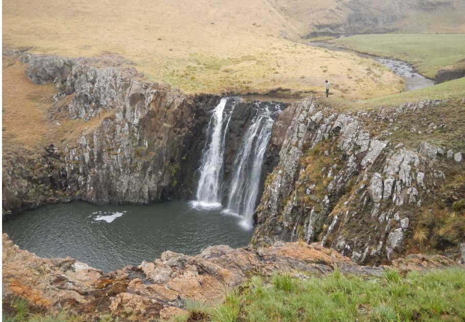
41 Rock formation Tsoelikane Falls

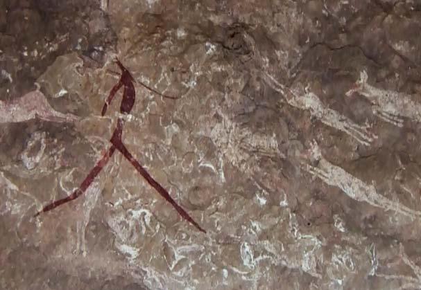
42 Rock painting Rock painting
43 III Mixed properties A B Africa New nominations Extensions Europe North America New nominations
44 Pimachiowin Aki (Canada) No 1415 Official name as proposed by the State Party Pimachiowin Aki Location Manitoba and Ontario provinces Canada Brief description Pimachiowin Aki lies within the North American boreal shield landscape of forest, granite rocks and free-flowing rivers shaped by wild fires. The property encompasses 33,400 square kilometres of Anishinaabe ancestral lands at the headwaters of the Berens, Bloodvein, Pigeon and Poplar rivers. This includes portions of the lands of five Anishinaabe First Nations: Bloodvein River First Nation, Little Grand Rapids First Nation, Pauingassi First Nation, Pikangikum First Nation and Poplar River First Nation. There are five small isolated Anishinaabe settlements with a total population of 6,200. These, together with the lands that support them, are seen to represent the diversity of Anishinaabeg culture. The Anishinaabeg are an Indigenous hunting-gatheringfishing people who have made use of the landscape for over 6,000 years. There is evidence of Anishinaabe occupation and land use over time in routes, sites of camps, sacred and ceremonial sites, and rock art, all largely near the rivers. Today Anishinaabeg use powerboats, snowmobiles, nylon fish nets, and high powered rifles to access and harvest animals, plants and fish as an adaptation of their traditional practices, and they are based in permanent settlements. They still maintain their strong spiritual interactions with the natural landscape through the legendary beings and spirits who are seen to control the natural world. The Anishinaabeg see their land-use as sustaining the boreal shield eco-system. Category of property In terms of categories of cultural property set out in Article I of the 1972 World Heritage Convention, this is a site. In terms of the Operational Guidelines for the Implementation of the World Heritage Convention (November 2011) paragraph 47, it is also a cultural landscape. [Note: the property is nominated as a mixed cultural and natural site. IUCN will assess the natural significances, while ICOMOS assesses the cultural significances.] 1 Basic data Included in the Tentative List 1 October 2004 International Assistance from the World Heritage Fund for preparing the Nomination None Date received by the World Heritage Centre 24 January 2012 Background This is a new nomination. Consultations ICOMOS has consulted its International Scientific Committee on Cultural Landscapes and several independent experts. Technical Evaluation Mission A joint ICOMOS/IUCN technical evaluation mission visited the property from 12 to 19 October Additional information requested and received from the State Party On 2 October 2012 ICOMOS wrote to the State Party requesting further information on the comparative analysis and clarity over whether the property was being nominated to reflect a particular geographical or geocultural area or areas. The State Party responded on 29 October ICOMOS wrote a further letter to the State Party on 21 December 2012 requesting more detailed information on the support for the nomination by First Nations, collaboration amongst First Nations, the rationale for the boundary, proposed socio-economic development projects, and the justification for the criteria and Outstanding Universal Value. The State Party responded on 27 February The additional material is reflected in this report. Date of ICOMOS approval of this report 6 March The property Description Pimachiowin Aki can be translated as the Land that Gives Life. The nominated area extends to some 33,400 square kilometres across the heart of the North American boreal shield, a landscape of forest, ancient granite bedrock exposures, long free-flowing rivers, myriad lakes and wetlands. 35
45 The North American Boreal shield is part of a global boreal biome that encircles the globe just south of the Arctic Circle. Thus there is a Eurasian boreal shield as well as one in North America. Pimachiowin Aki has been nominated under natural criteria to reflect the specific eco-system of the North American area. Although a large area, Pimachiowin Aki is only part of the overall North American boreal biome system. The Anishinaabeg (Ojibwe people) live within Pimachiowin Aki. The nominated area includes portions of the ancestral lands of five Anishinaabe First Nations: Bloodvein River First Nation, Little Grand Rapids First Nation, Pauingassi First Nation, Pikangikum First Nation and Poplar River First Nation. Today they number around 6,200 people. The boundaries of the nominated area have been determined through a community-led land-use planning initiative between indigenous peoples and the Provincial authorities that had the aim of creating new livelihoods to help sustain aboriginal communities. The boundaries do not encompass all the Anishinaabeg ancestral lands; some 8,900 square kilometres lie outside the boundaries and are in the buffer zone. The Anishinaabe / Ojibwe language is spoken in an extensive area on both sides of the border between Canada and the United States of America. The nominated area encompasses around a quarter of the lands occupied by Anishinaabeg peoples. The people within the nominated area represent around one quarter of all those speaking Anishinaabemowin as their first language. The Anishinaabe cultural landscape and beliefs and practices connected with it thus continue beyond the boundaries of the nominated area. The communities moved prior to permanent settlement and there are references to culturally important sites outside the nominated area. However, the nominated area is where the Anishinaabe culture is seen to persist most strongly. The Anishinaabeg are an indigenous hunting-gatheringfishing people who are believed to have lived in the surrounding area for at least 6,000 years. In spite of being subject to significant social disturbances as a result of European colonization, such as being placed on Reserves and children being separated from their families by residential schooling, the Anishinaabeg have retained their traditional knowledge of, and respect for, natural resources. Their landscape has also been opened up to tourists, with operators from the outside the area developing fly fishing lodges and hunting camps (see below). Hunting, trapping and fishing The Anishinaabeg now employ modern technology for moving along the waterways and for hunting and fishing. Their traditional tools of snow sleds drawn by dogteams, and canoes have been replaced by powerboats, snowmobiles, nylon fish nets, high powered rifles, light aircraft and trucks. Hunting, trapping and fishing is today carried out for briefer periods than in the past from the basis of their permanent settlements. It is also regulated by provincial trapping regulation introduced in the 1940s. Summer fishing takes place by nets and lines and increasingly by rod and reel, indicating a shift from subsistence towards recreational fishing. Weirs, fish traps or harpooning are no longer practised. Autumn is the time in particular for moose hunting, with a specific school leave dedicated to it so that the younger generations may participate. Apart from trapping, the communities hunt and fish for their own food. Berries, lichen and medicinal plants are still commonly gathered and wild rice is cultivated on a small scale for domestic use, but former garden plots for larger scale rice production are now largely grown over. The communities maintain their traditional world view and pass it on to new generations through oral history and rituals. Community Elders are respected, traditional values and teachings heeded, and culturally important sites memorised. A major part of the population speaks Anishinaabemowin, some as their only language. The five communities differ from one another culturally, socially and economically. The Pimachiowin Aki nomination has been led by the Anishinaabeg who wish to have recognition for their role in sustaining the boreal shield ecosystem. Within the landscape, the impact of the Anishinaabeg activities can be seen mostly along the rivers in ancient routes, some still in use, ceremonial sites and rock pictographs, camps and cabin sites, both abandoned and actively-used, and settlements. The landscape has shaped the way of life of the people and in turn is embedded in their oral traditions and cosmology. Routes The principal watercourses form a network connecting the communities with one another. Winter and summer routes branch out from them to the extensive harvesting areas. The traditional routes continue to be used, although canoes have been replaced by outboards, and the wintertime dogsleds have been replaced by snowmobiles on the winter tracks. Mnemonic narratives connected with the travel routes have continued. Elders have begun to document these travel routes and associated traditions using cultural GIS mapping. Ceremonial sites, including ancestral burial sites Numerous sacred sites, such as petroforms, and ceremonial sites occur in the area but, to preserve their cultural sensitivity, few have been formally recorded. 36
46 There are strong associations between the Anishinaabeg people and these rock art images which are seen to designate sacred sites. From the information gathered during the mission it appears that some of the sacred sites in the area are still regularly visited and respected, as evidenced by prayer bundles and offerings, and others are not. Culturally important movable heritage has been relocated in different museums and collections outside the nominated area but is mostly accessible to the communities and is linked with the presentation of the property. Pictographs Several hundred pictographs have been recorded at thirty-nine locations. Some of the images correspond in form and material to other pictographs in the Lake-ofthe-Woods Style associated with the Archaic Period in North America. A few of the images could have been made as late as c1800ad. Camps and cabin sites In the spring and autumn, people used to move to seasonal camps in search of animals and other resources. Over 700 cabin and camping sites have been recorded in Pimachiowin Aki through collaborative research by Anishinaabeg and archaeologists. Some of these might date back over several centuries. So far no definite dating has been achieved. Due to the transition from a semi-nomadic way of life to permanent settlement, the traditional seasonal settlement sites are no longer in use. They are still remembered by the communities and may have temporary uses as campsites. Settlements There are five comparatively modern, permanent settlements for the five different First Nations. These are separated from each other and each surrounded by its own reserve. Until a century ago, people mainly gathered in one place only in the summer months. Oral traditions The boreal landscape is part of the Anishinaabeg world view which is based on a symbiotic relationship between people and nature. This attributes animacy to objects in the natural world giving meaning to peoples existence in this environment over time and through the seasons. It reinforces sacredness, relates the landscape to creation stories and puts landscape at the heart of Anishinaabeg cosmology. Some of the Anishinaabe cultural practices have long continuity whereas others are fairly recent in origin. The Creator, Manitou, has a central place. The Anishinaabeg believe that He has placed them on their ancestral lands. Two kinds of spirit beings are repeatedly referred to: the Thunderbirds or Binesiwag and the Little Rock People or Memegwesiwag. The first represent a cultural tradition widely shared across continents. They are generally known and awed by the Anishinaabe communities, like many other First Nations, as powerful helpers and carers for the land. In the nomination they are said to nest in rock formations created at a time when plants still did not exist. Their nests are respected. They are believed to cause forest fires by lightning. History and development Although human occupation in the Pimachiowin Aki area can be dated to Late Paleo-Indian Plano traditions around 10,000-8,000 years ago, associated with small isolated communities of hunters, the direct ancestors of the Anishinaabeg people appear to have begun to settle the areas when the climate turned warmer between 7,000 to 2,200 years ago. This is when pictographs are believed to have first appeared. By 2,200 years ago a definite seasonal pattern of hunting appears to have been established. There are differing views about the continuity of occupancy of the area but the present-day Anishinaabe have their cultural roots in the Great Lakes area and moved into to the nominated area by the late 18 th century, and were officially recognised in the Treaty of Pimachiowin Aki s geographic position in the centre of the continent, has led to techniques and ideas being introduced from all directions, such through involvement with the international fur trade in the 18 th century AD and through the spread of Christianity in the 19 th century. Euro-Canadians who organised the fur trade bought pelts from animals trapped by the Anishinaabeg. By the 1820s the initial intense fur trade had ended and the beaver population had been decimated. The Anishinaabeg communities returned to their traditional seasonal trapping activities. In the second half of the 19 th century, a second commercial harvesting activity was developed around the export of oil from sturgeon in Lake Winnipeg organised by non-anishinaabeg people. As with the fur trade, intense exploitation led to a rapid decline in resources. In the 1930s and 40s smaller sturgeon fishing enterprises were set up in the nominated area but these were short lived. Between the 1950s and 70s, the growth in air traffic, and the support of the Federal Government, allowed the Anishinaabeg people to exploit other species of fish for trade. During these two decades, fishing took over from traditional trapping as the main source of income and brought increased material prosperity. In the 1970s, commercial fishing opportunities declined dramatically in the face of rising costs, conservation concerns, and unstable markets. During the 1980s, international markets for fur also went into steep decline as a result of international anti-trapping campaigns. 37
47 From the 1940s changes were also brought about by an increase in the activities of government agencies, particularly in relation to education and health care. Both of these were centralised and this had the effect of pulling communities towards the development of fixed settlements and a concomitant decline in seasonal hunting and fishing. At the same time, fur trapping became regularised and quotas were set under what is known as a trapline system. The decline in opportunities for commercial fishing and trapping over the past fifty years has greatly diminished independent incomes amongst the Anishinaabeg. They are now strongly dependent on public subsidies. During the same time the population has greatly increased. This loss of income combined with the pull of federal services and the push off the land has spurred cooperative relations between First Nations, and the provinces of Manitoba and Ontario. In 2002, the five First Nations of Pimachiowin Aki came together to develop a cooperative accord they titled Protected Areas and First Nation Resource Stewardship: A Cooperative Relationship Accord. This has since come to be known as the First Nations Accord. It aims to strengthen mutual support. There are other Anishinaabe First Nations outside the Accord. The Accord was subsequently extended to a partnership with provincial planning partners that are the two Provincial governments of Ontario and Manitoba. This partnership took shape as the Pimachiowin Aki Corporation that comprises all five First Nations and both provincial governments. The Corporation had as its aims to create an internationally recognized network of linked protected areas and managed landscapes (including aboriginal ancestral lands) that is worthy of UNESCO World Heritage Listing. A Project Framework was developed for the nomination process that built upon the outcomes of land-use planning and the results of a variety of background studies. Community based landuse planning was instrumental in determining the final boundaries of the nominated area. Within the planning areas, community-based land-use planning has resulted in the delineation of ones associated with specific landuses, including protected areas and areas where commercial resource development is and will be permitted. 3 Justification for inscription, integrity and authenticity Comparative analysis The comparative analysis provided in the nomination dossier for cultural value provided international comparisons of the property with places already inscribed on the World Heritage List, with places on Tentative Lists, and with places protected on the national list in Canada. What it did not offer was comparisons with places outside Canada that are not inscribed or on Tentative Lists, or with places within Canada that are not on the national list. ICOMOS notes that for natural value, the comparative analysis does include this wider and more comprehensive perspective. ICOMOS requested the State Party to provide further comparisons and to clarify whether Pimachiowin Aki was being considered exceptional in comparison with other areas and communities within the overall Boreal Shield Biome area or in comparison with other communities in the geo-cultural area of North America. The supplementary material provided by the State Party emphasised that the Outstanding Universal Value put forward was linked to the particular associations between the Anishinaabeg and the Boreal Shield: The natural and cultural heritage values for which Pimachiowin Aki is being nominated are associated specifically with the boreal biome. Further comparisons were therefore offered only within the Boreal Shield in North America and in Eurasia. Clarification was also offered on other sites in Canada not on the Tentative List. First in terms of other sites in Canada, it was clarified that apart from sites on the Tentative List and the National List there were four other sites that had been identified as being similar but these currently did not have national protection. In terms of the wider comparisons with other places within the overall Boreal Biome, the sites selected for comparison were those on the IUCN 2010 World Database of Protected Areas, which were at least 10,000 square kilometres in extent, thus of sufficient size to support all significant boreal ecological and biological processes, and within or overlapping the Udvardy boreal biome (Temperate needle-leaf forests / Woodlands), which is represented in North America (Alaska), Scandinavia and Russia. Eleven sites were identified (of which one - Laponia - had been included in the nomination text), of which three are inscribed as natural sites. These sites are within the Russian Federation and the USA. The research was mostly done via the web and with some contact. The conclusions were that there was an absence of information on two key topics: the current status of specific land uses of indigenous peoples within the sites, and the integration of customary governance in site management. In the Russian Federation the information on the role of communities in terms of protecting the Boreal Biome was slight. In the USA, Eskimos and several sub-groups, or tribes, of which the main ones are the Athabascan Gwich in and Koyukon, and the Inupiat (an Inuit/ Eskimo people) were considered. It was suggested that for the most part, the traditional land-use of indigenous peoples of the interior, boreal forest sites in Alaska is highly similar to that of Anishinaabeg in Pimachiowin Aki. Hunting and fishing form an important part of the rural economy in Alaska, while the traditional land-use of Nunamiut Inupiat 38
48 Eskimos and Athabascan Gwich'in is somewhat different in that there is a stronger reliance on caribou. In summary, for Alaska Natives, the landscape is home, a land to be respected, but equally important, a land to be utilized. However overall it is considered that the Russian Federation site of Putoransky Zapovednik and all four of the Alaskan sites are shown to differ from Pimachiowin Aki in the way that jurisdictional and regulatory complexities limit sustained, effective access to resources for the purpose of pursuing a traditional landuse. ICOMOS considers that the further information is helpful in clarifying the particular focus of the nomination. While ICOMOS finds that the clarified and extended scope of the comparative analysis is relevant, it does not address some of the key factors of this nomination. In the nomination the cultural traditions of the Anishinaabeg are not considered per se but rather in the way the First Nations are custodians of the Boreal Biome through their community based planning and management systems. The additional information provided by the State Party does not yet adequately establish a comparative context for this important focus. Although it might be relevant to recognise the essential nature of the role of the Anishinaabeg peoples in sustaining the natural value of the Boreal Biome under natural criteria, this is outside the role and expertise of ICOMOS and the evaluation report of IUCN should be consulted on this point. To satisfy cultural criteria, the value of the interaction between people and their environment over time needs to be shown to be exceptional in cultural terms. ICOMOS considers that, while the additional information provided by the State Party has been useful, further work is needed on the comparative analysis. ICOMOS considers that the comparative analysis has not so far justified consideration of this property for the World Heritage List under cultural criteria. Justification of Outstanding Universal Value The nominated property is considered by the State Party to be of Outstanding Universal Value as a cultural property for the following reasons: The boreal shield eco-system of Pimachiowin Aki reflects the land-use, customary governance and cultural values of the Anishinaabeg who engage in a form of reciprocity with the land (Aki) that sustains them, a relationship that is considered unique. ICOMOS considers that Pimachiowin Aki encompasses tangible and intangible elements of a living Anishinaabe cultural landscape that is vulnerable to irreversible change. It is not a landscape where traditional practices in terms of those associated with food production or trade have persisted strongly over time. Where cultural traditions persist is in connection with the intangible relationship between the Anishinaabeg and the land and in their oral traditions and oral histories in which landscape has a central role. Such a relationship is not unique and persists in many places associated with indigenous peoples in North America and other parts of the world. It is present in other areas of the North American boreal forest not included in the nominated area. What has not been demonstrated is how this strong association between the Anishinaabeg and the land in the area nominated can be seen to be exceptional in other words of wider importance than to the Anishinaabeg themselves. However in the supplementary information provided by the State Party it was made clear the First Nations do not wish to see their property as being exceptional as they did not want to make judgements about the relationships of other First Nations with their lands and thus make comparisons. ICOMOS considers that this view sets up a difficult dilemma and that further discussions are needed, perhaps through some sort of upstream process. Integrity and authenticity Integrity The nominated area encompasses around a quarter of the lands occupied by Anishinaabeg peoples. The boundaries partly conform to historic trapline areas but do not include all the ancestral areas of the five communities see boundaries below. In terms of the area within the boundaries including the attributes necessary to convey value, the area is of sufficient size to encompass aspects of Anishinaabeg cosmology, traditional knowledge of the landscape and seasonal rounds of travel, for hunting, trapping, fishing and gathering, although some of this extends beyond the boundaries. The traditional interaction between the Anishinaabeg and their environment is fragile and vulnerable to a range of threats (see below) such as loss of memory and skills, and the possibility that recording and re-learning may lead to a freezing of traditions and gradual acculturation. Authenticity The ability of Pimachiowin Aki to convey its value is not self-explanatory in terms of the long and continuous indigenous settlements and the land-use traditions. And indeed it is made clear in the nomination dossier that continuity of land-use traditions will not necessarily be the way forward as the Anishinaabeg will seek new livelihood opportunities to allow them to continue to live in the area. What is visible are some traces of this long association in terms of pathways and rock art. The landscape is 39
49 meaningful only with knowledge of the strong, symbiotic relationship between the people and nature and the link between language and place, in other words its associations. However there is evidence that some of these traditions have been lost in recent decades and others are vulnerable (see below) to a range of threats. ICOMOS considers that the conditions of integrity and authenticity have been met but are highly vulnerable. Criteria under which inscription is proposed The property is nominated on the basis of cultural criterion (v) (and natural criterion (ix)). Criterion (v): be an outstanding example of a traditional human settlement, land-use, or sea-use which is representative of a culture (or cultures), or human interaction with the environment especially when it has become vulnerable under the impact of irreversible change; This criterion is justified by the State Party on the grounds that Pimachiowin Aki is an outstanding example of Indigenous traditional land-use continuously adapted and evolved for more than 6,000 years. Customary harvesting areas, travel routes, livelihood and ceremonial sites, and ancient pictographs provide testimony to holistic connectedness with the environment. ICOMOS considers that the Pimachiowin cultural landscape is an example of a landscape associated with traditional land-use over several millennia that survived until comparatively recently, and one where the people have a spiritual relationship with certain aspects of nature. The traditions of hunting, fishing and trapping are continuing, although they now incorporate the use of modern technologies. Seasonal movement is now less frequent, and the Anishinaabeg people intend to look for other livelihood opportunities in the future to maintain their relationship with the area. While the cosmological associations with the landscape are continuing, the traditional land-use has and is continuing to change. Possibly for this reason, the traditional land-use itself is not at heart of the justification put forward for the Outstanding Universal Value, but rather the maintenance of the cultural associations with the land. The focus is on the way that the Anishinaabeg support the Boreal Biome through community based land management systems, and their continuing and strong spiritual association with the land. These strong intangible associations between the Anishinaabeg and the landscape persist in terms of communal knowledge, cosmology and linguistic relationships between people and place. What has not been demonstrated is how these intangible associations have come to be of outstanding importance when compared to many other places with similar strong linguistic and cosmological associations. Indeed the Comparative Analysis suggests that there are many other similar areas and that the Five Nations do not want to single themselves out as being exceptional. ICOMOS considers that this criterion has not been justified at this stage. Other criteria ICOMOS asked the State Party if they had considered criteria (iii) and (vi). In their response they stated that criterion (iii) had been excluded as the First Nations considered that the notion of bearing testimony implied the creative process is completed. In addition, they considered that concepts of uniqueness or exceptionality in criterion (iii) were found to be inappropriate out of respect for other indigenous sites in Canada that contain similar values. For criterion (vi), it was stated that the First Nations considered that although place names, artefacts and movable heritage, and cosmology may be seen as consistent with criterion (vi) where they are primarily associations with a property, at Pimachiowin Aki, the true significance of these values was considered to be in their continued manifestation through land-based activities within the property, such as through regulation of land-use behaviour. The conclusion by the State Party was thus that intangible cultural attributes identified in the nomination are best seen as integral to the traditions, techniques and management systems that underpin continuing traditional land-use. Criterion (vi) was therefore also excluded. ICOMOS considers that there appears to be some lack of clarity as to how the criteria might be satisfied in relation to the notions of outstanding and exceptional and how a property defined around the relationship between the five First Nations and their land might be seen to have universal value within the context of similar landscapes in North America or associated with the boreal biome. As stated above, ICOMOS considers that further discussions are needed, perhaps through some sort of upstream process, to discuss the way the property might be defined, protected and management with respect to cultural criteria as a way of exploring how the property might be considered to justify Outstanding Universal Value. ICOMOS does not consider that the cultural criterion has been demonstrated at this stage. 4 Factors affecting the property New all-weather roads are being planned within the property in response it is stated to worsening climatic 40
50 conditions, to try and address the high cost of staple foods being transported into the area, to provide jobs for locals and to promote tourism. The main construction will be a new all-season road that will run on the east side of Lake Winnipeg, for some 200 kilometres inside the nominated property. This East Side road will replace the existing winter road network which currently extends through and beyond the nominated area. The road will link the four Manitoba First Nation communities of Pimachiowin Aki, and the neighbouring First Nation community of Berens River, with the existing all-season road system to the south. This is a long-term project. The road is planned to reach Bloodvein River, the southernmost First Nation in Pimachiowin Aki, in 2015, Poplar River in 2036, and Little Grand Rapids and Pauingassi in Another road may be built from Berens River outside the nominated area to Pauingassi and Little Grand Rapids. These new roads are subject to Environmental Impact Assessments that consider impact on fish habitats and uninterrupted natural waterways. The gravel / crushed stone is extracted locally from the management areas designated in the land use plans. Direct landscape disturbances may occur locally in terms of gravel extraction and the building of embankments, bridges and other structures. None of the land use plans contained any strategies for mitigating the impacts of road construction. The new roads will provide opportunities for unrestricted movement, particularly of tourists and this increased access may accelerate acculturation. Road construction constitutes the most significant imminent change to the area. In the land use plan of Bloodvein River First Nation a commercial zone of 690 sq km is proposed alongside Lake Winnipeg within the nominated area where commercial forestry and peat extraction could be allowed. Pikangikum First Nation is also making plans for a community-led commercial forestry operation within the management area of Whitefeather Forest, adjacent to the nominated area. These proposals pose potential conflicts with the traditional land uses and associations. They are justified on the grounds that they would allow an indigenous approach to forest harvesting and renewal rooted in Pikangikum Anishinaabe customary technological and stewardship knowledge to be applied, for instance to harvesting patterns, to commercial forestry. It is stated that if this community-based forestry proposal was ever to reach its full allowable harvest, it could be viewed as a medium- to large-scale development. Even though it is stated that the potential adverse effects of the economic forestry on the natural and cultural values of Pimachiowin Aki will be mitigated by effective design of land-use zones and the idea of involvement of First Nations in forestry could be considered as a valuable exercise, it is not quite clear how inclusion of this area within the boundaries can be justified. There is no mining in the nominated area and mineral exploration and mining development are not allowed in the community land-use plans. However, in parts of the buffer zones there are pending mineral claims. Should these be revived, mining activity would have to be approved by the First Nation on whose traditional land it would take place as well as by the provincial government. Of the land use plans, four First Nations have not ruled out mining activity in their respective Management Areas and areas of potential mineral exploration have been identified some 50 to 80km north of the boundary. Gold mining already occurs in Red Lake outside the buffer zone. It is not legally possible to ban mining in the adjacent areas. Stronger preventive measures to mitigate the environmental impacts of mining are suggested in the nomination dossier, for instance a strict permit procedure involving control by First Nations. The likelihood of adverse effects resulting from road development is high as is the proposed commercial forestry development suggested in the commercial zone of Bloodvein River First Nation. In comparison, the likelihood for new mining activity near the nomination is low, but if it were to occur could have a major impact on the local area. The likelihood of adverse effects caused by tourism development and changing socio-economic circumstances is moderate. Road construction is necessary for the wellbeing of the communities. Its environmental impacts should be carefully assessed and checked by high-quality planning, fitting the road into landscape and minimising its disrupting effects to wildlife and traditional land uses. This might involve higher than normal costs. The sociocultural impacts of new roads should be assessed as well, including the effects of increased accessibility on the communities and on the road corridors. Development within the nominated area is also associated with tourism activities such as canoeing and fishing. The building of lodges without negotiations is still a cause for resentment for the First Nations, as well as the overuse of certain fish stocks by tourists. The current scale of development, however, remains modest with the amount of visitors around 2,000 per year. Provincial parks intend to channel tourism by providing more fixed structures such as campsites. The First Nations express their willingness to develop sustainable tourism in a limited way, under their own control, through providing their own services and 41
51 interpretation centres and by offering guiding to selected sites. The biggest tourism pressure is expected to be the Atikaki Provincial Park, the most accessible part of the nominated area. Only Bloodvein River will welcome tourism to its entire reserve area. As tourism as such is a key factor in the alternative economic development of the nominated area, the potential negative impacts need to be addressed and currently this is not the case in any of the land use plans. A sharp increase of tourism could lead to other adverse effects such as loss of cultural privacy, overexploitation of natural resources, wear and tear and a distorted economic structure. There is also a risk that tourism development could fall into the hands of external operators, commercialising Anishinaabe heritage without respect for its original meaning and introducing incompatible elements from elsewhere. The ability of the First Nations to sustain their culture is threatened by socioeconomic and health issues and by acculturation. The former include extremely high unemployment, and health problems. Each of the five First Nations has their own distinct tradition, including their unique and thriving dialects. Some of the teachings and skills have been lost or weakened and are being re-learned. The extensive recording of oral history and its codifying into educational programmes and tourist interpretation is an important cultural process, and care needs to be exercised to protect the use of this knowledge, and also to avoid a situation in which a corpus of recorded and distributed frozen tradition may partly substitute living tradition as the basis of Anishinaabe identity. Threats may also come from the commercial heritage industry, disneyfication, or from substitution of genuine Anishinaabe traditions by a pan-indian contemporary faith for therapeutic purposes (already occurring in some other areas). ICOMOS considers that the main threats to the property are the physical impacts of roads and commercial forestry, the rapid expansion of tourism, the loss of traditional knowledge and acculturation. 5 Protection, conservation and management Boundaries of the nominated property and buffer zone The boundaries of the nominated area follow those of the respective planning areas of the five communities. These are based on historic trapline boundaries, often along watersheds. The boundaries largely coincide with the existing traditional land uses of the five communities. Traplines also cover the two provincial parks not included in the First Nations planning areas. The key determinant of the boundaries was the extent of land allocated to protection within the five communitybased plans, and the land already designated as Provincial Parks. Communities allocated some 76% of their combined planning areas to protection and to the nominated area (as well as one small zone that permits forestry). Areas identified as having mineral potential are excluded from the nominated area. The boundaries have been defined by each community in a slightly different way. Pikangikum has included only its cultural waterways, leaving the ancestral land of Whitefeather Forest to the buffer zone as an adjoining management area, whereas Poplar River and Bloodvein River have included their respective management areas and the commercial zone in the nomination. While this reflects the relative autonomy of the First Nations, it leads to a certain inconsistencies for the property overall that could be reviewed further in the future. The cultural landscapes of the partner communities stretch beyond the nomination boundary and those of neighbouring non-partner First Nations partly overlap with them inside it. Thus there are likely to be elements reflecting value presented in the nomination in the buffer zones and even outside them especially along the cultural waterway. The boundaries are thus not complete in terms of encompassing the lands of all five First Nations. However given the large area concerned, and the information provided by the State Party concerning the process by which the boundaries were determined, the boundary is adequate. ICOMOS considers that the boundaries of the nominated property and of its buffer zone are adequate. Ownership All the nominated area is government owned. Protection There are no federal designations such as National Parks in the nominated area. Heritage protection for the nominated property takes place under provincial rather than federal legislation. In addition there is supportive enabling legislation at federal and provincial levels relating to protecting species at risk, regulating resources and development as well as public consultation on proposed land-uses. Provincial protective legislation covers less than a third of the nominated area. The institutional framework for the protection of Pimachiowin Aki is a patchwork involving protected and non-protected land and allowing development in parts of the latter. 42
52 The Manitoba Parks Act and Regulations (1993) apply to Atikaki Provincial Park. The Ontario Provincial Parks and Conservation Reserves Act and related regulations apply to Woodland Caribou Provincial Park and the Eagle-Snowshoe Conservation Reserve. Both the Atitak and Woodland Caribou parks are IUCN Category II Protected areas. In most cases the protection is primarily for nature conservation but the Park legislation allows cultural heritage to be taken into account. Voluntary tradition-based protection mechanisms cover 3,670 square kilometres of land that has no protective legislation. This arrangement reflects the independent position of the First Nations but is not without flaws. The negotiation-based and consensus-seeking approach on land use priorities is not entirely clear and remains to be tested for instance in case of land use disputes. Jurisdiction over public lands is in principle shared between the federal government, the provincial governments of Ontario and Manitoba and the five First Nations of the Accord. Section 35 of the Federal constitution frames Aboriginal and Treaty rights. The rights of the First Nations in the area were originally defined in the Treaty 5 in Treaty rights do not surpass provincial legislation and in practice the First Nations co-operate with the provinces. They do not have sovereignty over their lands, meaning that theoretically the Treaty rights could be reinterpreted by the Crown. In the past staking of third-party claims has occurred in First Nation ancestral lands of the nomination without their consent. The nominated area is divided in two by the provincial border. Ensuring the effectiveness of protection requires a common management policy for the two provincial governments. It is noted that plans are underway to form an interprovincial park out of Atikaki and Woodland Caribou, pointing the way to a cooperative management approach between the provinces. Otherwise current level of protection appears to be effective against foreseeable negative development impacts within the nomination. The procedures of solving eventual conflicts over land use and conservation remain however untested. Such conflicts could arise over mining permits, hunting regulations, licences for tourism development or distribution of benefits. More clarity is needed about the mechanisms for making exceptions on land use decisions or regulations, their disputing and sanctions for their enforcement. All buffer zones have some degree of protection and the neighbouring First Nations participate in their land use decision-making. The level of protection will be enhanced by forthcoming legislation of both provinces. Whether it will preclude all potentially harmful developments within the buffer zones, for instance in the context of mining, is unclear. The mechanisms for the protection of the nominated area and the buffer need to be explained more concretely. ICOMOS considers that the legal protection in place needs more clarity. Conservation The state of archaeological evidence is in general good. Typical archaeological sites along the watercourses are still easily identifiable in the landscape. Only a few of them have yet been excavated. Wear and tear from tourism or traditional land uses is minimal. The pictographs, painted by red ochre with sturgeon oil as binding agent appear in some cases to be of prehistoric origin. The pictographs from different periods have been extensively documented and studied. They are mostly well preserved, considering that they are found in places beneath the high water mark. The state of preservation does however vary. It remains unknown whether they are protected by a natural silica film. Whether or not they are, the practise of splashing them with water to improve visibility must be prohibited. All conservation of pictographs should be undertaken by professional conservationists or with the support of professional advice Visits to pictographs should be guided and tourists should be informed about their value. The pictographs have spiritual meaning to the First Nations and in terms of both preservation and cultural sensitivity the locations of all of them should not be publicly disclosed. The same applies to petroforms, which are less problematic from the preservation point of view but are strongly valued by the First Nations. Their preservation is ensured by enculturation in the communities, by respecting cultural privacy and by contact between the First Nations and the relevant authorities. In terms of the intangible associations between the Anishinaabe and the landscape, this is vulnerable to all the pressures outlined above. In terms of other structures (traps, smoking racks, marking poles etc.) modified landscapes (wild rice paddies, burned-over grassy shores), most are ephemeral and the buildings (cabins, campsites) of fairly recent origin. In the community settlements some intrusive buildings and structures, such as relay masts, airstrips, sewage treatment plants or gravel pits may be detected. However, due to the small size of the communities their impact remains limited. Preservation of the natural environment allows for the continuation of hunting, trapping and fishing, and this is well protected. The state of nature conservation will be reviewed in detail as part of the IUCN evaluation. ICOMOS considers that conservation is satisfactory. 43
53 Management Management structures and processes, including traditional management processes The legislative processes of both provinces support the governance of the First Nations. A joint negotiation mechanism is provided by the Pimachiowin Aki Corporation that comprises all five First Nations and both provincial governments. This aims for protection through traditional stewardship, land-use planning and collaboration. The current fixed trapline system to control hunting was introduced in the 1940s by the provincial governments together with harvest quotas. It is based on traditional tenure of families or groups of families. Prior to the trapline system, harvesting was not strictly regulated, although harvesting areas were associated with particular groups. Now a permit from the officially registered head trapper is mandatory. The head trapper is a non-hereditary position although often it remains within certain families. At the community level the Elders have a decisive say in the control of traditional land use. Besides them there are elected councils and chiefs as well as community planners. Policy framework: management plans and arrangements, including visitor management and presentation Currently two of the First Nations, Poplar River, and Bloodvein River, have approved management plans, dating from between 2008 and 2011, and two have draft Management Plans: Little Grand Rapids, and Pauingassi. Land use plans are in place for Little Grand Rapids, Pauingassi, Bloodvein and Pikangikum. There is also a Woodland Caribou Signature Site Management Plan. Thus some of the community land use and management plans have so far been approved and implemented, while others have not. The Pimachiowin Aki Corporation Management Plan sets out a shared vision of Pimachiowin Aki as a living entity with a commitment to common goals. The plan is more a policy document framing the Partnership than a concrete plan for programmed action. Short, medium and long term actions are presented in the Plan but neither the specific actions nor an integrated approach are discussed in detail. The plan addresses the property as well as the buffer zones but does not elaborate on the management of the latter. Resource allocation and capacity building are dealt with in the Plan in general terms. Currently there is a joint provincial budget of CAD per year. Further the work of the Corporation will be facilitated by the Pimachiowin Aki Fund, a legacy endowment fund that has been established. This aims to raise a $20million endowment fund. The Corporation envisages that its size and function will evolve over time as it assumes additional responsibilities and greater financial capacity. For the time being it proves an effective negotiating mechanism for the Partners, ensuring good governance principles. However, the actual powers of legislation, land management and resource distribution remain with the provincial governments. Involvement of the local communities Involvement of the five First Nations totally underpins this nomination. Overall a basic framework for the management of the property is envisaged based on coordination by the Pimachiowin Aki Corporation and underpinned by individual management and land-use plans for each of the First Nation s land. While this approach appears to be appropriate for the values of this area, so far the integration is at a general level and needs to be made more specific. In order to allow the possibility of consensus at different levels over land use planning and management, the Plan needs to be restructured to harmonise zoning principles and concepts of the different component plans and to provide more room for defined action plans. The individual land-use and management plans for all the areas need to be completed and approved. In order to provide a framework for the management of the Corporation, a Joint interprovincial management policy for the nominated area needs to be formulated in cooperation with the provinces of Ontario and Manitoba. A more specific plan could address visitor management, capacity building in the communities for tourism, interpretation and marketing to ensure community-led development of tourism. The potential negative effects of increasing tourism should be studied and evaluated, ranging from wear and tear to acculturation, packaging culture and uneven distribution of benefits. Action plans including regulations and restrictions for tourism should be undertaken. Visitor centre projects in the land use and management plans should also be synchronised across the nominated area, as should proposals for lodge and tourism infrastructure development, currently mostly envisaged by individual partners. A more detailed plan could also address all open mining claims close to the nomination boundaries, including the potential permit processes, and environmental impact assessments, and the need to deal with the physical and socio-economic impacts of roads. Perhaps most significant of all, there is a need for the Plan to address the socio-economic problems of the communities through promoting diversification and strengthening of their economies as well as genuine empowerment to avoid over emphasis on tourism. 44
54 ICOMOS considers that the management system for the property needs to be further developed through the provision of an inter-provincial framework, the completion of land-use and management plans for the First Nations areas, and through a more detailed overarching management strategy for the Pimachiowin Aki Corporation, that could actively coordinate activities and infrastructure. 6 Monitoring Research activity has extensively documented the Anishinaabe oral history and place-related traditions since the 1930s. More recently, place-related traditions have been collected in the context of First Nations land use planning into GIS databases. Key indicators are described in the nomination dossier with timelines and responsible authorities. The indicators are for fire regimes, hydrology, intactness, species diversity, community benefits (involvement in tourism), public understanding and appreciation of culture (educational programmes, media stories, web traffic, and info requests), governance / leadership (implementation of land use plans), culture (language use and retention), archaeological sites (integrity of sites) and traditional land use (level of trapping). ICOMOS considers that the indicators are satisfactory. 7 Conclusions The nomination of Pimachiowin Aki has been driven by the First Nations in order to achieve recognition of their need to sustain a living, working engagement with their all-encompassing natural and ancestral landscapes, with their strong symbiotic relationship with nature and with their role in sustaining the boreal shield ecosystem. Since 2002, the five First Nations of Pimachiowin Aki have come together to develop a cooperative First Nations Accord that aims to strengthen mutual support. The Accord was subsequently extended to a partnership with provincial planning authorities that developed the nomination and aims to develop alternative sources of income for the communities. There are other Anishinaabe First Nations outside the Accord, and the areas associated with the five nations participating in the nomination extend beyond the nominated area. ICOMOS commends this collaborative and community based approach. It considers that the management system if refined as outlined above, could provide much needed support to sustain and empower the communities. The main aim of the nomination is to sustain the spiritual relationship between the five First Nations and the natural environment and the natural landscape itself. In order to achieve this, considerable changes are seen as necessary in socio-economic terms to make their communities viable including the development of economic forestry, new roads and the development of tourism. ICOMOS understands that the focus of this nomination is the essential role that the Anishinaabe play in sustaining the Boreal Biome. ICOMOS cannot comment on the effectiveness of this role (because this is the role and expertise of IUCN), but in general terms acknowledges the essential role that many communities and Indigenous peoples play in sustaining natural values in many parts of the world through their continuing traditional practices and spiritual associations with nature. ICOMOS considers that although this association between people and nature is strong in Pimachiowin Aki what has not been demonstrated is how this association can be seen to have outstanding cultural value within their geo-cultural area. While ICOMOS considers that this nominated landscape might have the potential to demonstrate Outstanding Universal Value for its cultural values, the justification in relation to cultural criteria needs to be further developed. The inability of the State Party to do this within the limited timeframe available within the evaluation process suggests that more time and dialogue is essential. This nomination raises fundamental issues in terms of how the indissoluble bonds that exist in some places between culture and nature might be recognised on the World Heritage List for the cultural value of nature. These issues are not uniquely found in Pimachiowin Aki; indeed they are present in two other nominations that will be considered by the World Heritage Committee at its next session. They have also been found in a considerable number of nominations presented to the World Heritage Committee over the years, in both cultural and natural properties but in the case of the latter not contributing to the justification of natural criteria. Some such as Purnululu, Australia, remain unresolved. Although the World Heritage Convention is the sole international Convention that relates to both culture and nature, the recognition of both cultural and natural aspects in one property still needs in effect two nominations one for cultural criteria and one for natural criteria, each of which is evaluated separately and each of which can be accepted without reference to the other. Although cultural and natural criteria have been merged, their use has not. Currently there is no way for properties to demonstrate within the current wording of the criteria, either that cultural systems are necessary to sustain the outstanding value of nature in a property, or that nature is imbued with cultural value in a property to a degree that is exceptional. 45
55 ICOMOS considers that for Pimachiowin Aki more discussion is needed, within the framework of the Upstream Processes, in order to consider if there is a way that the spiritual relationship with nature that has persisted for generations between the Anishinaabe First Nations and Pimachiowin Aki, might be considered exceptional and could be seen to have the potential to satisfy one or more of the cultural criteria. ICOMOS further considers that ideally such a reflection should be carried out jointly with IUCN in order to allow a wider understanding of the inter-relationship between culture and nature within Pimachiowin Aki. 8 Recommendations Recommendations with respect to inscription ICOMOS recommends that the examination of the nomination of Pimachiowin Aki, Canada, to the World Heritage List be deferred on the basis of cultural criteria in order to allow the State Party, with the advice of ICOMOS and the World Heritage Centre, if requested, to: Invite an Advisory mission in the framework of the Upstream Processes in order to explore whether there is a way that the spiritual relationship with nature that has persisted for generations between the Anishinaabe First Nations and Pimachiowin Aki, might be considered exceptional and could be seen to have the potential to satisfy one or more of the cultural criteria; If possible, also invite representatives of IUCN to participate in the mission to allow a fuller understanding of the inter-relationship between culture and nature within Pimachiowin Aki and how these can be related to the World Heritage Convention. 46

56 Map showing the boundaries of the nominated property


57 Pikangikum First Nation settlement Pikangikum First Nation wild rice paddies and burned-over grassy shore


58 Bloodvein River First Nation sacred site Bloodvein River First Nation pictographs
59 Sviyazhsk (Russian Federation) No 1419 [Note: the property is nominated as a mixed cultural and natural site. IUCN will assess the natural significances, while ICOMOS assesses the cultural significances.] 1 Basic Data Included in the Tentative List 31 August 1998 Official name as proposed by the State Party Sviyazhsk Historical, Architectural, Natural and Landscape Complex Location Republic of Tatarstan Zelenodolsk and Verkhneuslonsk districts Russian Federation Brief description The Sviyazhsk Historical, Architectural, Natural and Landscape Complex is an island at the confluence of the Volga and Sviyaga rivers that was formed in 1956 as a result of the construction of the Kuibyshev reservoir. Founded in 1551 as a strategic fortress, from which the Kazan Khanate was conquered by Russian forces in 1552, Sviyazhsk flourished as a trading and administrative centre. Its two monasteries, one with early 17 th century mural paintings, were the centre of religious activity for the wider region. Its influence declined in the 19 th century following the construction of a nearby railway and the subsequent loss of its trade. It survived as a small agricultural and fishing centre, and then in the mid-20 th century served as a Gulag. Around 70% of the town s buildings were demolished when the reservoir was created and its new isolation led to a drastic decline in population. What has survived are its two monasteries, its parochial church and some 30 houses and administrative buildings dating from the 19 th century What now lies above the water is an area that equates to the mid-16 th century fortress. The trading quarter beyond the walls was partially inundated. Since 1995 a large scale restoration and reconstruction programme has been undertaken for the Village Settlement of Sviyazhsk to revive it as a settlement and to turn it into a tourist centre for the region. Category of property In terms of categories of cultural property set out in Article I of the 1972 World Heritage Convention, this is a site. In terms of the Operational Guidelines for the Implementation of the World Heritage Convention (November 2011), paragraph 47, it is nominated as a cultural landscape. International Assistance from the World Heritage Fund for preparing the Nomination None Date received by the World Heritage Centre 30 January 2012 Background This is a new nomination. Consultations ICOMOS has consulted its International Scientific Committee on Historic Towns and Villages and several independent experts. Technical Evaluation Mission An ICOMOS technical evaluation mission visited the property from 30 September from 5 October An IUCN technical evaluation mission visited the property in October Additional information requested and received from the State Party None Date of ICOMOS approval of this report 6 March The property Description The fortified settlement of Sviyazhsk was founded by Tsar Ivan IV in 1551 on a wooded promontory that rose above the confluence of the Volga and Sviyaga rivers. Its Kremlin provided a strategic military base from which the Russians successfully campaigned to acquire the Khanate of Kazan. Its wooden fortifications were apparently constructed in only 24 days. From their dimensions, the fortifications exceeded in area those of the kremlins of Moscow and Velikiy Novgorod. During the first phase of urban construction the Monastery of the Trinity and St. Sergius was founded. In the late 17 th and early 18 th centuries the main buildings of the town were gradually replaced in stone or brick and the fortifications which were no longer needed disappeared. Following a fire, the layout of the town was re-ordered and extended in the 19 th century and new civic buildings constructed. 47
60 The town is now a shadow of its former glory. What have survived after the demolition accompanying the buildings of the reservoir in the 1950s that turned the town into an island, are the religious buildings, two monasteries, a church, and around 20 houses and administrative buildings. In between these are the empty plots of former dwellings and the ruins of four churches. One timber church reflects the initial building activities at the time the town was founded. The others churches and monastic buildings have been re-built or built in masonry during the 17 th, 18 th and 19 th centuries. Considerable archaeological excavations have been undertaken over the past twenty years and the waterlogged ground has revealed evidence of former buildings and the pre-history of the site. During the past three years most of the main standing buildings have been the subject of major restoration and re-building projects. The nominated property extends to ha and is surrounded by a buffer zone of 9, ha. The village of Sviyazhsk now contains the following buildings, planning layout and archaeological evidence: ICOMOS considers that a few of the dates and attributes in the nomination dossier are not in line with recent research, which the following text aims to reflect: Uspensky (Assumption) Monastery The monastery at the west of the island was established in It was closed in 1923, but resumed its activity in It consists of the following buildings set within an enclosing brick wall: Voznesenskaya (Ascension) church The monastery is entered through a gate above which is the small Voznesenskaya (Ascension) Church. Uspensky Cathedral The white painted Cathedral was constructed in Although it is stated that this was designed by Postnik Yakovlev-Barma, the architect of St Basil s Cathedral in Moscow, there is no evidence for this attribution. Within the cathedral is a complete cycle of monumental early 17 th century frescoes. The upper tier represents scenes from the Old Testament while the lower tier illustrates the life of the Virgin Mary. Around 1700, Russian Baroque details were added to the cathedral s façade. The brick refectory was added in the mid-17 th century. St Nicholas Church Nikolskaya (St. Nicholas the Thaumaturgist Church) was constructed in white limestone and brick between by an unknown architect. The main body of the church, the lower part of the bell tower and the walls of the refectory are limestone. The drum of the bell tower and apses of the church are in brick. The Church and its bell tower are major contributors to the silhouette of the village. Archimandrite block The Archimandrite block (Abbot s quarters) dates from the mid-17 th century. It is built in brick over two floors in the Russian tower-chamber style having a double storey porch supported on stone columns. Abbot s quarters; Monastery School Building: Brethren s Building The Brethren s buildings were built at the end of the 17 th and in the early 18 th centuries and rebuilt in a similar style in the late 18 th century. The long block is partly two and partly three storeys in height. The complex was badly damaged in the Soviet period and only the outer walls survived. It has been reconstructed with modern materials in the interior. Uspensko-Bogoroditsky Monastery Stables Outside the walled monastery complex are the Uspensko-Bogoroditsky Monastery Stables, built in the mid-18 th century and forming an enclosed square. By the end of the 20 th century, only part of the complex had survived. The stables have been rebuilt to preserve the line of their outer walls. The interior will be used for tourist purposes. Former Ioanno-Predtechensky (John the Baptist) Monastery This convent is situated in the centre of the southern side of the island. Within an enclosing, stone wall are the following buildings: Troitskaya (Trinity) Church The Troitskaya church is the oldest surviving wooden building on the island. It is stated to have been constructed in on one day in 1551 onto a platform that had been levelled, the timbers having been prepared from the forests of Uglich north of Moscow and transported on ships down the River Volga. The main decoration in the church is the iconostasis originally 4-tiered and perhaps transferred from another church. The tracery of the iconostasis survives only in part. Among the 19 surviving icons, 12 are dated to the 16 th century. Sergievskaya (St Sergiy) Church The church and refectory were originally built in the 16 th century from white limestone. They were remodelled around 1700 when the refectory was turned into the church and a brick bell tower added. The exterior with its pilasters and arched windows is in the old-russian Pskov style. Cathedral The brick Cathedral was constructed between 1898 and 1906 and designed by the architect E. D. Malinovskiy in pseudo-byzantine style with clusters of apses, topped by domes. 48
61 Besides the churches, the following are located in the territory of the monastery: wooden Abbot s Quarters, stone refectory and two wooden cells for nuns and novices. Constantine and Helen Parish Church The church was built in brick at the end of the 17 th century, to replace a wooden church built by the order of Tsar Ivan the Terrible. It sites on a hill to the north-east of the island outside the line of the original fortification. Around 1700 the church and its bell tower were united by a refectory. Urban Planning Structure The 16 th century layout of Sviyazhsk was radial, centred on a square, and within an oval fortress that had nine gates. In the 19 th century after a fire this planning was extensively modified to produce streets laid out in a rectilinear grid but still reflecting the line of the fortress wall. Urban buildings The most important secular urban buildings to have survived are the following houses built in the second half of the 19 th century: House of the Mayor F. P. Polyakov, Dwelling House of Medvedev-Brovkin, the Alms-House, House of Agafonov with Shop, House of Krylosov, and Merchant F. Kamenev s Estate. There is also a timberbuilt hospital, a school of similar date, various public buildings from the turn of the 20 th century and some small, traditional village houses. Archaeology Excavations have revealed evidence of Bulgar-Tatar cult places before the fortress was constructed, and slight remains of the 16 th century fortress in the form of a 16 th century shaft. In the northern part of the island, remains of timber houses have been revealed. A substantial number of artefacts from the 16 th century town have been found, documented and stored, and will be presented in a new museum. History and development The foundation of Sviyazhsk in the 16 th century reflects Russian foreign policy at that time which was to conquer lands to the east and south of the middle reaches of the Volga River, in order to unite a territory from the Volga to the Urals and from Kazan to the Caspian Sea. The main obstacle to such a policy was Kazan and the Kazan Khanate. In 1550, after two unsuccessful Kazan campaigns, Tsar Ivan IV decided that he would not be able to conquer the Kazan Khanate without a strong base close to its capital. Thus the wooden Kremlin of Sviyazhsk was established over a period of about 16 months. With its fortified walls, 11 gates, administrative buildings and two monasteries, it provided the necessary military quarters and administrative and religious support. After the fall of the Kazan Khanate in 1552 the administration of its territory was divided between Sviyazhsk and Kazan, with Sviyazhsk administering the territory across the right bank of the Volga. The trade that this brought allowed Sviyazhsk to prosper. At its height, Sviyazhsk had a population of around 7,500 people. By the 18 th century this had dropped to 4,000 and by the end of the 19 th to 3,000 after a new railway by-passed the town and it lost its strategic mercantile importance. In 1926, Sviyazhsk was deprived of the status of town and became a village. For around twenty years from the 1930s, the monasteries were used as a Gulag. In 1953, when the Kuybyshev Reservoir was planned the people of Sviyazhsk were resettled, their houses abandoned, and some 70% of civil and industrial buildings and structures were removed or pulled down. By 1965, the population had dropped to 500 people. In 1995 Sviyazhsk s self-governing authority was restored, and planning for its large-scale reconstruction and restoration were started within the framework of the Republican Fund for the Restoration of the Monuments of History and Culture of the Republic of Tatarstan. In 2007, the Tatarstan Republic Cabinet of Ministers approved the Main Lines of the Socio-Economic, Ecological and Architectural/Art Restoration of Sviyazhsk as a Historically Small Town. In , a motor road connecting the island with the mainland was constructed. The monasteries have now been given back to the church to be run by the religious community. Residents who formerly lived in the monastic areas have been rehoused in new buildings. Between 2010 and 2011, major restoration and rebuilding projects were undertaken on the churches and monastic buildings with a view to developing the island as a tourist centre. 3 Justification for inscription, integrity and authenticity Comparative analysis In the nomination dossier, the comparisons are carried out to show how similar Svijazhsk is to already inscribed properties rather than showing differences. ICOMOS considers that the comparative analysis needed to show why the combination of value and attributes that characterises Sviyazhsk is not already represented on the World Heritage list nor is it found in other towns that could in the future be nominated. ICOMOS does not consider that this has been achieved. Within the Russian Federation, Sviyazhsk is compared to two inscribed sites: Solovetsky (1992, criterion (iv)) and Kizhi Pogost (1990, criteria: (i), (iv), (v)). It is said 49
62 that although Sviyazhsk is seen as very different from Solovetsky in developing as a military fortress and a town rather than as an Orthodox monastery, its architecture and frescoes are considered to be comparable to the monastic buildings of Solovetsky. The claim is made that as the timber structure of the Troitskaya (Trinity) Church in Sviyazhsk is the only one from the 16 th century to have survived in the Urals and Siberia, it can be seen as a masterpiece of Russian wooden architecture similar to Kizhi. Dating is not necessarily be the only reason to consider a building outstanding, neither is its uniqueness as a sole survivor. Although the Trinity church was founded in the 16 th century, it has been extensively restored since then and cannot be considered as unaltered. Furthermore, no detailed study has been provided to substantiate its place within the corpus of wooden architecture of the Urals and Siberia. In Europe, Sviyazhsk is said to have similarities to Mont- St. Michel and its Bay, France (1979, criteria (i), (iii), (vi)), Monastic Island of Reichenau, Germany (2000, criteria (iii), (iv), (vi)), Medieval City of Rhodes, Greece (1988, criteria (ii), (iv), (v)), the medieval settlement of Chora with the Monastery of Saint John the Theologian and the Cave of the Apocalypse on the Island of Patmos, Greece (1999, criteria (iii), (iv), (vi)), and Lake Ohrid, the Former Yugoslav Republic of Macedonia (1979, criteria (i), (iii), (iv), (vii)). Outside Europe comparisons are made with Old Town of Galle and its Fortifications, Sri Lanka (1988, criterion (iv)) and the Island of Mozambique, Mozambique (1991, criteria (iv), (vi)). Since some of the monuments are said to have been designed by masters from Pskov, these architectural works could have been compared with other examples of the so-called Pskov s style in Russia and particularly in Pskov (on the Tentative List). Similarly, the unique value of the ensemble of architecture and murals within the Assumption Cathedral are not compared in detail with other complexes. In terms of considering Sviyazhsk as the remains of a fortified Kremlin, still retaining some of its layout and monastic buildings, no comparisons were provided with other fortified settlements within Russia apart from Solovetsky and Kizhi, where in both cases their monastic buildings are in a different scale and value to Sviyazhsk. Sviyazhsk is also said to be a rare example of an island town. Although no comparisons are offered with other island towns, ICOMOS considers that this aspect of the town, being so recent, cannot contribute to Outstanding Universal Value. The proposed Statement of Outstanding Universal Value suggests that Sviyazhsk has from ancient times, been a religious centre for the pagan population of Povolzhie and since the 16 th century, a spiritual centre of Orthodoxy in the region. No comparisons are put forward to justify this statement. Similarly although the Statement of Outstanding Universal Value also suggests that Sviyazhsk was one of the first camps for political prisoners in Russia and is today a memorial place for the victims of Stalin s repressions, this aspect is not provided with any comparisons. ICOMOS considers that the complex of Svijazhsk is important in historical terms, for the way it reflects Russian military history, and for the survival of two monasteries that were founded in the 16 th century, one still retaining early 17 th century frescoes. However this value has not been shown to be of more than national importance. ICOMOS considers that the comparative analysis does not justify consideration of this property for the World Heritage List. Justification of Outstanding Universal Value The nominated property is considered by the State Party to be of Outstanding Universal Value as a cultural landscape for the following cultural reasons: Sviyazhsk has preserved the form, area, planning and some elements of a 16 th century fortress, and is an outstanding architectural ensemble from the 16 th early 20 th centuries with unique 16 th century wallpainting. It has an archaeological layer that has been uniquely preserved because of the island s natural peculiarities. The Sviyazhsk complex directly relates to many 16 th century geopolitical and historical events having extreme importance for Eurasia. From ancient times, it had been a religious centre for the pagan population of Povolzhie. In the 16 th century, it became a spiritual centre of Orthodoxy in the region. Sviyazhsk was one of the first camps for political prisoners in Russia. Today it is a memorial place for the victims of Stalin s repressions. ICOMOS considers that although Sviyazhsk was of great strategic importance in the part it played in ensuring victory of the Russian forces against the Kazan Khanate in 1552, Sviyazhsk today only has slight traces of its form and function in the 16 th century, such as the line of its fortifications and its one wooden church. It cannot therefore be said to be an outstanding reflection of this period in its history. ICOMOS does not consider that a case has been made for the influence Sviyazhsk has as a religious centre whether before it was developed as a fortified centre or since. Although evidence of pre-christian remains has been identified, there is no suggestion as to how these might have been influential in regional terms. And although the two monasteries were used as centre for the dissemination of Christianity through the Volga 50
63 region, it has not been substantiated how this influence was in any way exceptional. The archaeological layers of Sviyazhsk have been well researched and do display evidence of its 16 th and later form. However as a corpus of information it is difficult to understand how it might be seen as outstanding. In terms of whether Sviyazhsk might be seen as exceptional for the way it reflects the evolution of its fortress and monasteries over time, ICOMOS considers that the comparisons put forward do not justify this claim. The town as a whole is a shadow of the once thriving trading centre. Its plan has been modified quite considerably since its founding in the 16 th century. The monasteries are interesting survivals, and as architecture and for the frescoes of the Assumption Cathedral are clearly of national importance but are not outstanding in terms of being complete monastic complexes with all the accoutrements to reflect their former roles, functions and influence. Integrity and authenticity Integrity In terms of the boundary including all the attributes that are put forward to convey Outstanding Universal Value, the boundaries are limited by the way the water has drowned part of the original settlement. No more could be nominated. In terms of how far the attributes convey the suggested Outstanding Universal Value, then there are issues connected to what survives from the 16 th century, in relation to how far Sviyazhsk might be seen as a reflection of the town that played a decisive role in the history of the region. The town has evolved, its layout altered, and much has been destroyed in terms of its urban form. Overall the town cannot be said to have integrity as a 16 th century settlement. Nor can it be said to have integrity as a settlement that has evolved over time to reflect some form of persistent social and economic circumstances. Sviyazhsk today reflects most of all the impact of the dam and the associated demolition of its buildings. Authenticity In terms of authenticity of the overall settlement, ICOMOS considers that it cannot be said that what remains reflects the town s crucial role as a military fortress. In terms of the authenticity of individual components, almost all of the surviving buildings have been extensively restored and/or re-built over the past few years, as explained in the nomination dossier. What has not been provided, however, is an understanding of the conservation approach that has been used as the basis for the work, nor the documentation that has been undertaken before and since. In the case of the wooden church, photographs show that the form of the building has been changed with a new covered area built out around the entrance and two side wings demolished. The basis for these changes has not been set out. Similarly the rationale for the rebuilding of the Brethren s buildings from a state of near collapse, or the partly collapsed stables, has not been explained. Clearly many structures have been made usable and put in good repair but it is not clear that the authenticity of their fabric has been maintained. The nomination dossier states that it is the intention to restore the integral architectural/art appearance of Sviyazhsk as it was in the mid-19 th -early 20 th centuries. This appears to mean re-building houses and reinstating streets and urban features such as kiosks, pavements, and greenery. As much of the urban fabric has been destroyed, such interventions could have a considerable negative impact on the overall authenticity of the settlement. ICOMOS considers that the conditions of integrity and authenticity have not been met. Criteria under which inscription is proposed The property is nominated on the basis of cultural criteria (iv) and (vi) (and natural criterion (vii)). Somewhat confusingly the justification put forward for the criteria is not in line entirely with the proposed Justification for Outstanding Universal Value and new arguments are introduced. Criterion (iv): be an outstanding example of a type of building, architectural or technological ensemble or landscape which illustrates (a) significant stage(s) in human history; This criterion is justified by the State Party on the grounds that Sviyazhsk is the world s only example of instant settling and super-fast construction, and it has preserved the principles of its original town-planning, as well as original town structures (the wooden Saint Trinity Church, Nikolskaya Church and Uspenskiy Cathedral). The wall-paintings of Uspenskiy Cathedral include the world s only fresco ensemble of Ivan the Terrible s epoch and one of the best preserved cycles of mid-16 th century monumental wall-painting. Saint Trinity Church is the first wooden Orthodox religious construction on the Volga River right bank and the only monument of 16 th century Russian wooden architecture that has been preserved in Povolzhie. The Sviyazhsk ensemble structure features architectural works by the outstanding Russia architect of the mid-16 th century, Postnik Yakovlev-Barma. The Sviyazhsk territory is a unique archaeological testimony of the past. 51
64 First of all ICOMOS suggests that recent research has not confirmed the association between the Sviyazhsk Cathedral and the architect Postnik Yakovlev-Barma. Also recent research has now suggested that the wall paintings are later than mid-16 th century and probably date to the early 17 th century. As stated above, ICOMOS does not consider that the individual buildings can be seen as exceptional, nor the archaeological layers. On the question of super-fast construction, the nominated property should have been compared with the remnants of Roman castra, perhaps some bastides, Santa Fe de Granada, and other fortified settlements that have been built during processes of conquest, and not only with other Russian military settlements. However the nomination dossier does suggest that the overall construction was not that fast, if the time taken for preparatory work is also taken into account. It states that the soldiers cut the forest in the territory of 150 ha over 24 days and levelled the site for construction. After that they assembled and built the walls with towers and buildings. It took them only 16 months to implement the idea of the tsar. Also it must be stated that the speed of construction is not a measure of outstanding value if it does not lead to a lasting technological achievement. In the case of the Sviyazhsk fortification, it does not survive so cannot be seen as an outstanding achievement. Overall what has not been demonstrated is how Sviyazhsk can be read as a settlement that reflects symbols of power and influence. Clearly Sviyazhsk is of importance in history for making possible the conquest by Ivan the Terrible of the Kazan Khanate, as part of his territorial expansion to the east. This battle could be said to have wider influence than just for Russia. However, the nomination has not demonstrated that Sviyazhsk has sufficient attributes to provide a vivid demonstration of this period in history. ICOMOS considers that this criterion has not been justified. Criterion (vi): be directly or tangibly associated with events or living traditions, with ideas, or with beliefs, with artistic and literary works of outstanding universal significance; This criterion is justified by the State Party mainly on the grounds that Sviyazhsk is directly associated with the conquest of the Kazan Khanate that significantly changed the geopolitical situation in Europe and influenced the eastward spread of Christianity and is thus considered to be an historical event of outstanding historic significance. ICOMOS acknowledges that Sviyazhsk played a crucial role in the decisive battle for the Kazan Khanate. However to justify this criterion it would be necessary to show that this event is still directly or tangibly associated with the town and that era of its history. What survives of the town does not largely relate to the 16 th century. The town has lost its military character and the surviving monasteries cannot be seen to convey a direct association with this military campaign. ICOMOS considers that this criterion has not been justified. ICOMOS does not consider that the conditions of integrity and authenticity have been met and that the criteria have been justified. 4 Factors affecting the property The nomination dossier acknowledges that there are considerable threats to the settlement from development as well as water ingress. The formation of the reservoir has raised the water table with the result that the surviving buildings have become vulnerable to subsidence from the soft ground as well as from damp. It is suggested that there is a need to reinforce the foundations of some buildings by injecting polymer cement mortar and installing bore-injected piles under others. It is also stated that the following will also be adopted: preventing the seasonal watering and wetting of foundations, cellar walls and ground floors by vertical earth levelling and removing the cultural layer, creating needed slopes and drainage systems and installing horizontal and vertical hydro-insulation. It appears that such treatments have been already undertaken for many of the surviving buildings and will be undertaken for the rest. Water level in the reservoir may change between 1-2 m during a year, but in dry weather this can be as much as 4 m. In strong wind the waves can destroy the shore of the island. An embankment is thus being built joined to a road which is being constructed all around the island. Sviyazhsk is being developed as a tourist destination. It is anticipated that tourist numbers will rise from the current 30,000 to 100,000 by the year As well as the new road connection to the island, a new port has been constructed. Hotels are also being developed. In the nomination dossier other different types of development are mentioned such as new river terminal and river harbour, the construction of new tourist hotels by 2013 to accommodate between 1,100-1,200 guests, new houses, and new museum buildings. Nearly all of these will be outside or in the buffer zone. Only a small hostel has been allowed in the old town. 52
65 It is understood that up 50 new buildings will be constructed in the old town. So far 27 new buildings have been built including blocks of low rise flats for residents who used to live in the monastic complexes. The aim is to provide housing for staff to service tourist facilities. ICOMOS considers that the main threats to the property are from development that will overwhelm the surviving buildings. In the Assumption Cathedral, the frescoes are undergoing cleaning and restoration by experts from the Scientific Centre of Restorers of the Federation in Moscow. Before they started work, a German company treated the walls for their high water content through the application of Baumix plaster. ICOMOS considers that it is difficult to assess the effectiveness of the conservation processes on the basis of the limited information available. 5 Protection, conservation and management Boundaries of the nominated property and buffer zone The boundaries of the nominated area extend to the land rising above the reservoir. The buffer zone covers an extensive area. Both are satisfactory. ICOMOS considers that the boundaries of the nominated property and of its buffer zone are adequate. Ownership The land and the main buildings belong to the Republic of Tartarstan. A few buildings are apparently in private ownership but no list has been provided. Protection The monasteries and churches are protected at Federal level. The remainder of the standing buildings on the island are protected at the level of the State of Tartarstan. The island of Sviyazhsk is also protected as a settlement under Federal and State Law. This protection is not constraining considerable development see below. ICOMOS considers that the legal protection in place is adequate for individual structures but is not having the effect of protecting the urban landscape of the island. Conservation Most of the buildings on the islands have undergone extensive restoration/re-building since In nearly all cases this includes bore-injected piles to counteract the impact of the rising water table. No details have been provided on these projects, or any before details in terms of photographs, plans or other documentation. As stated above, some of these interventions have included re-building, such as the Brethren s buildings and the stables, including recreating missing elements. In the case of the timber Trinity Church, the front of the building was given a new promenade gallery and the evidence on which this is based has not been set out. Management Policy framework: management plans and arrangements, including visitor management and presentation The basis of the present management system for the property is the Development Concept of the State Historical, Architectural and Art Museum Island-City Sviyazhsk that was approved by Order No. 453 of the Minister of Culture of the Republic of Tatarstan on The Concept has four strategies: To preserve and promote the spiritual, historical, cultural and natural heritage site Island-city Sviyazhsk, access to its cultural values in the interests of the spiritual and cultural development of Russia, social and economic development of the local community; Elaboration of the strategy and a set of measures for the development of the Museum "Island-city Sviyazhsk"; Establishment of a Federal Museum-Reserve on the basis of the Museum "Island-city Sviyazhsk"; Elaboration of lines of actions for optimal and efficient use of capacity of Sviyazhsk as a tourism destination, and for cultural and educational activities. An Integrated development Project Cultural Heritage: Island-City of Sviyazhsk and Ancient Bolgar for has been developed to realise the four strategic objectives of the Concept. This Integrated Project links together two nominated sites: Sviyazhsk and Bolgar, and is part of the Tatarstan Development programme for the River Volga which aims to bring more tourists to visit the Kremlins of Sviyazhsk, Bolgar and Kazan. Sviyazhsk is seen to reflect the spread of Christianity and the most eastern orthodox Russian tradition while Bolgar is related to Islamic heritage and is seen to reflect the most northward Muslim traditions. The total budget to implement the Project from the Federal Tatarstan Republic Budget is 80,000,000 EUR, divided 50-50% between Sviyazhsk and Bolgar. 53
66 For Sviyazhsk, the thrust of this Project is on the revitalization of the island and on providing alternative uses for the historic buildings (apart from the monasteries) that will contribute to tourism and education. It does not cover conservation to any degree, nor is conservation one of its main aims. The part of the Integrated Project relating to Sviyazhsk is seen as the Management Plan for the property. It was developed in broad consultation with various governmental and nongovernmental partners. The Plan has three sub-themes: 1: Studying and popularizing the historical and cultural heritage; 2: Ensuring the safety of the historical and cultural heritage (this includes Adaptation of cultural heritage objects of the property to their use for cultural, educational, and tourist purposes) and 3: Developing the museum, housing, tourism, pilgrimage, transportation infrastructure and utilities, as well as improving the territory. Involvement of the local communities Although one of the main aims of the Integrated Development Project is the social and economic development of the local community, there appears to have been very little involvement of the community in its development. ICOMOS considers that the Management system is effective in delivering clear objectives linked to developing the island as a tourist destination through the adaptive re-use of buildings. It is however not a plan that takes as its priority conservation and is thus not adequate as a plan for conserving the cultural importance of the island. Sviyazhsk a tourist destination for those who come on large river ferries or by bus or car. People on the island will be able to service this economy. As a result of major investment, Sviyazhsk is now seen as an asset in Tatarstan that can contribute positively to the region. ICOMOS considers that this transformation has huge positive aspects. However, what ICOMOS has had to judge is whether Sviyazhsk, as a cultural landscape, once the Integrated Development Project has been fully delivered, can be seen as having Outstanding Universal Value. As set out above, ICOMOS considers that the island as a whole cannot be said to reflect in an outstanding way the role it played in the defeat of the Kazan Khanate, too little remains from that time. Nor does ICOMOS consider that the standing remains can be seen as an exceptional as a fortified urban ensemble, or as monastic communities, or in terms of individual buildings, or as an overall cultural landscape. ICOMOS thus considers that although the island clearly has great importance at a regional and at a national level, it does not consider that it has attributes that can be said to give it international status and outstanding universal value. 8 Recommendations Recommendations with respect to inscription ICOMOS recommends that Sviyazhsk Historical, Architectural, Natural and Landscape Complex, Russian Federation, should not be inscribed on the World Heritage List on the basis of cultural criteria. 6 Monitoring The nomination dossier states that the cultural heritage properties will be monitored once a year and that this will include the any changes to the structures. ICOMOS considers that the proposed monitoring regime is satisfactory. 7 Conclusions Two decades ago Sviyazhsk was a sad place, 70% of its buildings had been demolished in the 1950s, its monasteries still lay empty after being used as a Gulag, its population was reduced to an almost minimal level, and its island status hindered transportation links with the surrounding areas. Now it sees a future. The monasteries have been restored and bought back to life as religious communities, new flats have been constructed, and a road link to the mainland built. Ports, and tourist infrastructure are planned and the aim is to make 54

67 Map showing the boundaries of the nominated property

")
68 View of the Uspensky (Assumption) Monastery and the former Ioanno-Predtechensky (John the Baptist) Monastery Uspensky (Assumption) Monastery - Uspensky Cathedral
 Monastery")

69 The Ioanno-Predtechensky (John the Baptist) Monastery Troitskaya (Trinity) Church Constantine and Helen Parish Church
70 IV Cultural properties A B C Africa New nominations Asia Pacific New nominations Nominations deferred by previous sessions of the World Heritage Committee Europe North America New nominations Extensions Nominations deferred by previous sessions of the World Heritage Committee
71 Isandra Zoma (Madagascar) No 1428 Official name as proposed by the State Party Isandra Zoma Location Haute Matsiatra region Southern Betsileo Isandra District Rural communes of Isorana and Ambalamidera II Brief description The Isandra Zoma (or caves) is located at the foot of a cliff. It corresponds to the heart of a royal and ritual territory with the oldest vestiges of occupation dating from the 14 th century. A fortified place of habitation that served as a refuge in troubled times, it provides a notable contribution to knowledge about the ancient Malagasy peoples through an ensemble of topographical, material, archaeological and ethnological testimonies. They provide an understanding of the human settlements, life styles, technical practices, defence systems, beliefs and sociopolitical structures of these peoples. It still today acts as a reference for the local population to define their identity. Category of property In terms of categories of cultural property set out in Article I of the 1972 World Heritage Convention, this is a site. In terms of the Operational Guidelines for the Implementation of the World Heritage Convention (November 2011), paragraph 47, it is also a cultural landscape. 1 Basic data Included in the Tentative List 14 November 1997 International Assistance from the World Heritage Fund for preparing the Nomination 17 October 2011 Date received by the World Heritage Centre 31 January 2012 Background None Consultations ICOMOS consulted its International Scientific Committee on Archaeological Heritage Management and several independent experts. Comments about the evaluation of this landscape were received from IUCN in December ICOMOS carefully examined this information to arrive at its final decision and its March 2013 recommendation; IUCN also revised the presentation of its comments in accordance with the version included in this ICOMOS report. Technical Evaluation Mission An ICOMOS technical evaluation mission visited the property from 13 to 24 August Additional information requested and received from the State Party None Date of ICOMOS approval of this report 6 March The property Description The property is located in a mountainous section of the Malagasy inland plateau, south of the Matsiatra River, in South Betsileo. The western part of the nominated property corresponds to a crystalline plateau which ends in a steep cliff around 150 m high. It rises above the scree-covered foot of the cliff which forms the eastern section of the property, where the historic human settlement occurred. The mountainous section is covered with savannah vegetation. The foot of the cliff is timbered, opening out onto a mixed area of savannah, forest and then irrigated (rice) and dry crop fields. The property includes the following main components: The defences and their access The natural features of the cliff and the scree provided the opportunity for people to create a system of defenses. It served to protect the royal area. It comprises: The cliff with its four main vertical masses forming an impenetrable rampart; The scree at the foot of the cliff naturally hiding the caves and refuges under the rocks; they form the boundary of the royal area; The five entrance gates to the inhabited areas are formed of large standing flat stones and lateral walls along the access ways, sometimes paved; The two main access ways into the heart of the property with their gates and winding paths inside the scree form a passage that is both defensive and ritual in purpose; 55
72 The property includes five protective talismans or tafotogna stones; they are placed at the entrance to the villages and at the entrance to the refuges; they correspond to the position of sacred ritual spots; Trenches to the east (outside the property) form the property s forward defence system with an earthen access bridge. The rock refuges and habitations The rock refuges and habitations comprise: Twelve rock shelters within the property, formed by rocky overhangs or spaces created between large rocks in the scree. They were used as refuges in the event of unrest or siege, as well as permanent dwellings. Most of these shelters have names and have been excavated to reveal extensive archaeological artefacts. The largest measure almost 20 metres long by up to about 10 metres wide. They may have several successive chambers. The entrances may be narrow, with added stone walls or steps cut into the rock. All the rock shelters reveal a varied typology and numerous adaptations to the local conditions. The abundant pottery finds date right back to the 14 th century and reveal external contacts as far away as the Persian Gulf. Some of the shelters had precise social functions, even in the 19 th century: court, prison, guardroom, infirmary, etc. Three caves lie at the heart of the system. They have narrow entrance ways and extend below the cliff with larger spaces. These supplement the social functions of the shelters. They seem to be directly related with the royal family and the exercise of power. They are of a sacred nature (source); A 48-metre underground gallery leads to shelter No 12. It contains three habitable intermediate caves. It provided an escape route during a siege. Open-air areas There are five arranged spaces, each differing in size and shape, but all sharing the characteristic of being completely hidden from external view. They were used as living spaces or for growing food crops in the particularly fertile soil. They are surrounded by rocky scree, connected by dry stone walls. They are sometimes terraced. They have functional links with the rock shelters and caves. Some are still cultivated today by the farmers from the surrounding villages. In places, they include relatively recent earthen constructions. The villages The property includes the remains of two main villages: The former village of Ambatobe, in the north, dating from the 19 th century. Built on three terraces, it is accessed via the north-east access way, which is older. It includes ruins of houses and zebu pits, an important animal in Betsileo tradition. The royal quarter of Ambalamena (or red village) lies to the southeast on three terraces. It was the site of the palace of King Andriamanalina III (who reigned from 1796 to 1810). It is very well protected by scree, high dry stone walls and a natural precipice to the north. Its original access passages have been blocked by scree. It includes two rock shelters, ruins of dwellings made of rammed earth and a zebu pen. The villages are protected in the east by a main tafotogna (a talisman warding off invaders). The siting and orientation of the houses, together with those of the tombs and zebu pens, follow the traditional cosmogony principles specific to Malagasy society. For example, the east represents the direction of the sacred, north that of power. The property s other components The property includes two tombs, one in the north and one in the east. They are square stone constructions on a rock. The second is said to contain the remains of the regent Ramavo, who did not have royal status and couldn t claim a place for her remains in the necropolis of the Isandra kings located in another cliff called Vohitsisaky. The property includes green areas of three main types: Wooded areas with diversified vegetation in the centre and north; Grass and fern savannah with some trees in the east and southeast; The scree and cliff with specific vegetation. The summit of the cliff affords a remarkable panoramic view over the Betsileo region. The property also includes significant archaeological finds unearthed during two archaeological digs in 1964 and The finds make it possible to date the successive human occupations and provide an understanding of life styles and technical practices. The property s surroundings (buffer zone and beyond) It is essentially agricultural, with several villages. It is characterised by the presence of several dozen standing stones (vatolahy), related to the royal presence in the property. They are erected along the access paths to the royal site. They are cut from blocks of granite using the fire-setting method. The environment to the property s southeast (a direction that is considered sacred) also includes necropolises containing several dry stone tombs accompanied by vatolahy. They are located near to the access paths. History and development Nothing is known of the property s history of human occupation, and more broadly, that of the settlement of Madagascar, prior to the 5 th century CE. It is a time when waves of immigration have been noted from East Africa and the shores of the Indian Ocean. They settled on the coast and then certain groups penetrated the hinterland of 56
73 plateaux and mountains (8 th -10 th centuries). The most elevated areas were gradually occupied. Archaeology reveals that occupation of the Isandra Zoma dates back to the 14 th century. It first appears as a site of underground refuges for the Betsileo peoples who, at the beginning of the 15 th century, successfully created a lasting troglodyte settlement. At the end of the 17 th century, Prince Ralambo conquered the Isandra Zoma which he then raised to the status of royal city and military camp. He took control of vast territories over which he reigned for around 20 years ( ). He was succeeded by a dynasty, notably the long reign of his grandson Andriamanalimbe ( ). The Kingdom of Isandra reached its peak at this time in terms of its agricultural and artisanal wealth and by the extension of its territory. The Isandra people grew rice and ate beef. They achieved a high level of mastery of pottery in the 18 th and 19 th centuries. They worked iron, and wove baskets and fabrics. There are also many finds of imported objects demonstrating the high levels of trade by these peoples. A tradition of wood-built palaces is also referred to but of which there are no material remains. A technical development accompanied the birth and development of the refuge sites, involving the working of stone and then its sculpting. This enabled the Betsileo kings to carry out construction work including fortifications, walls, trenches, crop terraces, zebu pits, sepulchres, underground houses and carved standing stones (vatolahy). Under Andriamanalina III ( ), the Kingdom of Isandra was no longer as powerful and was threatened with instability. The King mainly resided in the Isandra Zoma (Isorana), a strongly defended site, but his successors at the head of the Kingdom of Isandra lived in other royal cities. The property s region became a poorly controlled protectorate that fluctuated between being a bandits stronghold and a temporary refuge for the local population. However, the Regent Ramavo returned to Isorana, making it her residence through to the ending of the Kingdom under the impact of French colonisation (1896). Ratovonony II, Ramavo s son, was named Governor of the Betsileo region by the colonial power. The property, like all other Malagasy princely cities or royal palaces then lost its status. For fear of the colonialists, people avoided speaking about them publicly and these ancient refuge sites seem to disappear from the social landscape. The property was taken over by vegetation. In the 1930s, the French administration drew up an inventory of Malagasy sites and monuments. They noted at the time that the fantastic rocks in southern Betsileo were not just natural monuments but also formerly inhabited historic sites. In the 20 th century, the Isandra Zoma was occasionally used as a refuge by thieves and in 1947, at the time of the Malagasy Uprising, the site was occupied by local people fearing repression and by the Malagasy partisans. In the early 1960s, interest in this abandoned site was rekindled. A campaign of excavation was carried out in 1964 by the Archaeology Centre of the University of Madagascar. Abundant archaeological finds were collected and deposited at the Museum of Art and Archaeology in Antananarivo. An entry ritual at the Isandra Zoma is still performed today, even though this is not a sacred territory in the traditional sense of the term. A three-stage progress is observed starting from the east in the place called Alobola, then at the sacred stone (tafotogna), and finally in the royal quarter within the property (the Ambalamena). 3 Justification for inscription, integrity and authenticity Comparative analysis The comparative analysis by the State Party examines a series of properties already inscribed on the World Heritage List and corresponding to troglodyte dwellings in order to immediately put to one side all prehistoric sites. The Isandra Zoma corresponds to occupation dating at the earliest from the 14 th century and which, already at this time, showed links with major civilisations, notably, the Persian Gulf and the Arab-Islamic world. The properties that are closest to the Isandra Zoma are the Le Morne Cultural Landscape in Mauritius (inscribed in 2008, criteria (iii) and (vi)) and the Cliff of Bandiagara (Land of the Dogons) in Mali (1989, (v) and (vii)). The similarities are topographical, with caves and rock shelters at the foot of cliffs. The three properties also correspond to similar periods of occupation and they have all acted as a refuge for regional populations. The Isandra Zoma differs in terms of its quite remarkable natural scree feature that plays a major role in the property s sophisticated defensive structure. The nominated property illustrates a type of place of refuge and royal city with a different topographical, social and ritual organisation that is specific to the region. The site has also been totally protected from the influences of tourism and retains to this day a high degree of authenticity. ICOMOS considers that other regional sites with analogous geomorphology or which have exercised the role of royal capital have been disregarded and could have been considered: in Zimbabwe, Matobo Hills (2003, (iii) (v) (vi)), Great Zimbabwe National Monument (1986, (i) (iii) (vi)) Khami Ruins National Monument (1986, (iii) (iv)); in South Africa, Mapungubwe Cultural Landscape (2003, (ii) (iii) (iv) (v)); in Burkina Faso, Ruins of Loropéni (2009, (iii)); and in Nigeria, Sukur Cultural Landscape (1999, (iii) (v) (vi)). In this respect, it would be desirable for the analysis to be completed at the regional level. 57
74 ICOMOS notes that no comparative analysis with the other Malagasy sites has been made, especially for the Kingdom of Isandra and the Betsileo culture. Other royal capitals, a royal necropolis, and other cliffs with rock shelters were developed and used on the high plateaux in Madagascar. Information on the state of conservation of these other sites should be provided, together with their differences and similarities with the nominated property in order to understand in what way the Isandra Zoma landscape is exceptional or not. A comparative analysis at the national level therefore needs to be undertaken, especially of the sites in the central highlands. ICOMOS considers that the comparative analysis does not justify consideration of this property for the World Heritage List. Justification of Outstanding Universal Value The nominated property is considered by the State Party to be of Outstanding Universal Value as a cultural property for the following reasons: The Isandra Zoma is an important representation of the past and present Malagasy cultural identity. It is no longer occupied but it still retains a strong spiritual and symbolic value for the current population. It provides a major contribution to the understanding of the groups of people who have lived in Madagascar since the 14 th century. It provides testimony to their life style, beliefs, socio-political structure and expertise, in particular that of the Betsileo culture. The Isandra Zoma is testimony to humans adaptation to their natural environment, notably through the use of the cliff and its scree for defence, habitation and collective symbolism. The defence system was also designed to be fully integrated in the natural landscape surrounding the property to make it invisible from the outside. The property is among the rare examples in the world of a 19 th -century royal city established in a semi-subterranean environment and formed from stone and rock. In conclusion, ICOMOS considers that the justification of the property s Outstanding Universal Value must be revised to reflect the results from a more extensive regional and national comparative analysis, in accordance with the foregoing. IUCN suggested to further develop research on the values of the property, including Push the research on intangible assets related to the site including oral traditions, myths and legends associated with the site. Integrity and authenticity Integrity The property has retained in their natural state its various natural components, strongly associated with the manmade developments for defence, habitation, farming and symbolic use. However, a certain number of components have not been taken into account when the property was defined; they have been included in the buffer zone, or are located further afield: tombs and necropolises, access paths with standing stones, defence trenches, the cult stones for the protection of the sites. Significant archaeological finds have been unearthed during two excavation campaigns. They satisfactorily explain the settlement and life style within the property. However, they are now all housed in the capital s museums and cultural institutions 400 kilometres from the property. ICOMOS considers that the conditions of integrity could be met provided a deeper comparative analysis is made, together with a reconsideration of the property s definition and boundaries and of its outstanding universal value. Authenticity The property was abandoned as a place of permanent habitation at the end of the 19 th century and was then subsequently reused temporarily during the Malagasy Uprising in No restoration work has ever been carried out, but the access paths have been maintained. The entire property has retained its structures, their shapes and the original materials. The deterioration observed is essentially due to the natural conditions. The terraces have continued to be used for the same traditional agricultural activities within the property. ICOMOS considers that the various conditions of authenticity, especially the property s structure, forms and materials are satisfactory. Its former use as a refuge and royal city is fully comprehensible. Its current ritual use testifies to its social authenticity. However, they are fragile and could well deteriorate under the action of natural elements (erosion and disappearance of the paths) and the development of uncontrolled tourism or non-traditional farming activity. ICOMOS considers that the conditions of integrity have not been met at this stage, but that the conditions of authenticity have been met despite being fragile. Criteria under which inscription is proposed The property is nominated on the basis of cultural criteria (iii) and (v). Criterion (iii): bear a unique or at least exceptional testimony to a cultural tradition or to a civilization which is living or which has disappeared; This criterion is justified by the State Party on the grounds that the nominated property provides remarkable testimony of the main aspects of the original civilisation of the Malagasy central highlands, especially the Betsileo culture. It is based on the sophisticated use of a natural environment that is restricted, rocky and semiunderground. The property also illustrates a traditional cosmogony conception of space based on a system of 58
75 gateways and talismans, as well as beliefs and ritual practices. It is testimony to a royal city and a place of refuge based on defence and symbolic values specific to a cultural tradition that has all but disappeared today, but which still lives in the memory of the local population. ICOMOS considers that this criterion will be fully justified once the comparative analysis and definition of the property have been better developed. ICOMOS considers that this criterion has not been justified at this stage. Criterion (v): be an outstanding example of a traditional human settlement, land-use, or sea-use which is representative of a culture (or cultures), or human interaction with the environment especially when it has become vulnerable under the impact of irreversible change; This criterion is justified by the State Party on the grounds that the use of troglodyte dwellings for refuge is typical of the life styles of the central highlands of the Malagasy hinterland from the 8 th to the 17 th centuries and was continued into the 18 th -19 th centuries by the Betsileos. It is completed by outdoor dwellings and terrace systems characteristic of the life styles of the ancient highland peoples, together with expertise in the areas of agriculture (rice), animal husbandry (zebus), craft (pottery and basket weaving) and granite stoneworking. ICOMOS considers that this criterion will be fully justified once the comparative analysis and definition of the property have been better developed. ICOMOS considers that this criterion has not been justified at this stage. ICOMOS considers that the nominated property meets the conditions of authenticity but not the conditions of integrity; the criteria under which the property has been nominated have not been justified at this stage. 4 Factors affecting the property Several traditional farming villages are located close to the property which are largely inhabited by the descendants of the former 19 th century occupants of the Isandra Zoma. The most fertile terraces are still used for farming, which may lead to involuntary deterioration or through a lack of knowledge of the remaining vestiges of the property. The presence of domestic animals inside the property, especially zebus, may also cause involuntary damage. Another threat is the practice of slash and burn agriculture and brush fires that may occur in the eastern and southern parts of the property on the savannah lands. The property is not really visited at the moment and it is relatively difficult to access. A few students occasionally go there. The natural environment has a permanent and durable action on the property s conservation, especially since it is currently not subject to any specific maintenance or restoration other than maintenance of the access paths by farmers. The associated threats are mainly erosion caused by rain. The dry stone supporting walls tend to bulge and then deteriorate; the remains of the earthen walls are tending to disappear, etc. Uncontrolled plant growth in the rocky structures and built or arranged remains pose a threat to the built structures. The natural vegetation undermines the legibility of the property s components and their relationships, whilst also providing a potential source for brush fires. Wild animals, like bats, also cause a nuisance in some of the shelters. The main natural risk is earthquakes, even small ones, which could destabilise the natural rock shelters, caves and galleries, or at the very least lead to rock falls or some rocks falling from the overhanging cliff face. Climate change could result in a significant increase in torrential rain and the intensity of dry periods and so increase erosion. ICOMOS considers that the main threats to the property are the pressure from uncontrolled traditional farming within the property and its environment, and natural risks (rain, natural vegetation and earthquakes) that may lead to rock falls and deterioration of the remains of the property. 5 Protection, conservation and management Boundaries of the nominated property and buffer zone The nominated property is the rocky cliff and its gentle slope to the west; in the centre and east, it includes the caves, scree rock shelters, terraces and spaces directly associated with the ancient city of refuge and its royal use from the 17 th to the 19 th centuries. A certain number of components beyond to the north, east and south are not included: access paths and the carved stone monoliths (vatolahy), sacred stones (tafotogna), tombs and defence trenches. They are outside the property, inside the buffer zone and sometimes beyond. Also, the property s map boundaries need to be identifiable on the ground, and the village boundaries should be shown on the maps. The buffer zone has been defined as a relatively narrow strip around the main property. On the one hand, it is designed to contain certain attributes, notably the sepulchres linked to the nominated property, and on the other hand to keep at bay the development zones of the three nearby villages. 59
76 The nominated property has a surface area of ha and the buffer zone ha. ICOMOS considers that the nominated property s boundaries should be revised to include the main attributes of the eastern and southern parts of the current buffer zone; the latter could then be revised accordingly. ICOMOS also recommends that the property s map boundaries be identifiable on the ground and that the maps include the village boundaries. Ownership The Isandra Zoma is on land owned by the State Party. The property s protection is entrusted to the Ministry for Culture and Heritage. Protection Properties with national heritage status benefit from protection under Order No governing their safeguarding and protection, together with the Implementation Decree No The property was given national heritage status by Decree No of 6 September There is also traditional protection by the people living in the villages neighbouring the property, which involves asking the elders permission to visit the site. Once approved, the visit must be preceded by a ritual led by one of these elders. This customary protection shows the concern for the property s management by the neighbouring communities. The local village people also regularly use the property to practice their customary rites. The Ministry of Culture and Heritage entrusts the application of the protection measures stipulated by law to the Department of Cultural Heritage and its Sites and Monuments Service. It relies on decentralised interregional departments. When a property is inscribed on the World Heritage List, the Ministry entrusts its management to a specific set-up called the Property Office, considered an autonomous department, in this case prefigured by a Management Unit being set up. ICOMOS notes that the property s provisional management structure was set up on 20 August 2012, but that it has made no provision for any local body to oversee the property s protection. IUCN notes that According to IUCN records the Zoma de l Isandra is not currently designated as a protected area. [ ] Across the country, a significant amount of illegal logging and extraction of natural resources continues to take place. [ ] IUCN Guidelines on the good management and governance of sacred natural sites (SNS), as well as indigenous and community conserved areas (ICCAs) may be highly relevant in this case. ICOMOS considers that the legal protection in place will be appropriate once the property s protection body is in place and operational on site at the property. Conservation The documentation concerning the property mainly includes the two reports and archaeological excavation documents (1964 and 2012). The associated publications are used to describe the property, the scientific inventory of its archaeological finds, and the historical and anthropological interpretation of its use. The archaeological finds and associated documentation are held at the Sites and Monuments Service, Art and Archaeology Centre and the Museum of Art and Archaeology, all in Antananarivo. The 2012 mission, organized just a few days prior to the nomination closing date, aimed to provide an overall view of the property for the nomination dossier, without being an archaeological campaign in the usual sense of the term. As a result, records of the property s condition were taken from the 1960s excavations, and as such are only indicative without being an updated scientific record that would be useful for the nomination dossier and the management plan. In general, the Isandra Zoma is fairly well preserved both in terms of its natural formations and its characteristic man-made arrangements. However, some of its components have suffered deterioration under the combined effect of human activity and nature. The January 2012 mission provided a list of the property s components and a diagnosis of the problems associated with its conservation. A conservation plan has also been announced for the management plan that aims to consolidate the state of conservation, but ICOMOS notes that nothing is currently in place or really defined. There is no actual maintenance of the property, since there is no management structure in place. However, the property s use by the villagers for ritual and farming purposes, contributes to its maintenance, notably maintenance of the access paths. ICOMOS considers that the property is currently in a satisfactory state of conservation, but that the property data needs to be updated by up-to-date archaeological surveys and regular scientific monitoring in order to determine the priority actions to be implemented to stop its deterioration and to implement the conservation plan announced, and lastly, to put in place a management structure with a local office for the property s conservation. Management Management structures and processes, including traditional management processes The property s Management Unit was created in August 2012, on the eve of the ICOMOS mission. It has 17 members, under the ultimate responsibility of the Regional Department of Culture and Heritage in Fianarantsoa. However, no local set-up is planned, making its effectiveness uncertain. 60
77 Policy framework: management plans and arrangements, including visitor management and presentation The management plan announced for is simply a new version of the nomination dossier, in a slightly different structure with the addition of several other elements, such as a SWOT analysis summarising the property s strengths and weaknesses in a table. It includes a series of intentions without any schedule for their implementation. Management of future tourism is addressed marginally in the nomination dossier, but in practical terms that must be retained and implemented in the form of a tourism development and management plan: It is necessary to consider without delay repair of the so called Fiévet access road; It is necessary to install without delay a site team which includes an experienced curator with a good level of scientific knowledge of African archaeology and history of the Malagasy people, and guardguides, if possible from the local community; Premises must be provided in Isorana as a base for the local management team that will act as an interpretation and events centre for the local population and tourists; A local interpretation centre should eventually house a museum section of reasonable size in addition to the museum collections housed in Antananarivo; consideration should also be given to site signage; Housing for tourists will have to be provided in the villages with the involvement of the local population. IUCN considers that: The State Party may be encouraged to establish a permanent consultative mechanism or local consultative body (LCB) with the different stakeholders involved with the WHS governance as part of the action plan for The Isorana Commune Development Plan is also concerned with the region that the property is in. It seems compatible with a plan for the property s conservation and its development through a tourism management plan. There is no actual risk preparation. However, a vision for the property s co-development alongside the local communities could encourage awareness among these communities, notably with regard to risks associated with agricultural activities near the property. It is the Heritage Department s budget that is responsible for the property s initial management budget. There are hopes for partnerships with other funding thereafter. Paying visitors will also contribute to the property s conservation and management. The State Party emphasises the financial difficulties and insufficient resources to ensure the property s conservation and management. The Heritage Department, the Regional Department of Fianarantsoa, the Art and Archaeology Centre and the Museum of Art and Archaeology staff in Antananarivo, and University of Madagascar staff could provide the scientific and professional supervision needed to oversee the property s management. Involvement of the local communities The site covers a relatively small area and a traditional customary management system still exists, with its values and taboos. It could form the basis of broader protection and conservation of the property s values. For this purpose, the management body referred to for the local branch, linked with the commune development plans, would enable a consultation system with the local population leading to concerted management of the property. There are plans to include the local communities in the property management unit but it is not yet organised. ICOMOS considers that the management system will be appropriate once the property s temporary Management Unit and then Office have been put in place, including the properly set-up local branch with a director and guard-guides recruited from the local communities and trained in the property s values. The Office will have to take charge of preparing and implementing a management plan, a significant part of which will involve tourism development and management. Particular attention must be paid to involving the villagers in the property s maintenance and conservation, and in its management, and finally the property s enhancement through a comprehensive development project involving the local communities. 6 Monitoring The property s monitoring is currently based on the January 2012 mission report reviewing its state of conservation. Monitoring is currently under the responsibility of the Ministry of Culture s Heritage Department. It will then pass to the Property Management Office. A table of indicators outlines the main categories the State Party intends to monitor. ICOMOS considers that the table of indicators proposed by the State Party needs revising and expanding, as it contains property component counts that are the responsibility of the inventory (point (i)), or binary indexes of poorly identified measures (other points). Priorities need to be established both globally (topographic and vegetation situation) and component-bycomponent for the property, the state of the dry stone and earthen remains, the impact of plant invasion, rain run-off, and, once again, the state of conservation of the rock shelters. 61
78 ICOMOS considers it necessary to identify the nature of the monitoring required for each component of the property and for the property overall (systematic photographic monitoring of the landscapes, for example); define the frequency; and institute and organise conservation monitoring in the Management Unit, and afterwards the Management Office. 7 Conclusions The interest of the Isandra Zoma for the understanding of the cultures and life styles of the central highlands of Madagascar, notably in the 18 th and 19 th centuries, is undeniable. The property constitutes an authentic Malagasy cultural heritage of great value and it could demonstrate Outstanding Universal Value which would permit its inscription on the World Heritage List; however, a comparative study with similar or complementary properties in Madagascar must be carried out, notably with regard to the central highlands, and also at the regional level; furthermore, a series of major technical points (property boundaries, local management structure, conservation plan, etc.) need reviewing or implementing so that the property can be considered in a clear and credible manner. Prepare and implement a management plan for the property by the overarching management body, which must include a tourism development and management plan, and be able to be incorporated into the local community development plans; Review and expand the notion of indicators for the property s monitoring and conservation. ICOMOS considers that any revised nomination would need to be considered by an expert mission to the site. Additional recommendations ICOMOS also recommends that the State Party give consideration to the following: Making the property s map boundaries identifiable on the ground; Developing tourism facilities and accommodation involving the local population. 8 Recommendations Recommendations with respect to inscription ICOMOS recommends that the examination of the nomination of Isandra Zoma, Madagascar, to the World Heritage List be deferred in order to allow the State Party, with the advice of ICOMOS and the World Heritage Centre, if requested, to: Complete the comparative analysis at the national level (historic areas of the Betsileo people and of the central highlands), to determine whether the property is the most representative and best preserved in Madagascar and in what way it is outstanding; and complete the comparative analysis at the regional level, notably in Africa; Review the property boundaries to include its various attributes currently in the buffer zone: tombs, vatolahy, defensive trenches, etc.; Update the property data with up-to-date archaeological surveys and regular scientific monitoring; Implement a conservation plan for the property based on regular monitoring; Put in place the temporary Management Unit and then the Office; provide these with a permanent local set-up with significant human resources (director and guard-guides), and an interpretation centre for tourists and to improve awareness of the property s values among the local population; 62
79 Map showing the boundaries of the nominated property


80 View of the property from north-east Entrance gate


81 Rock shelter Ruins of dwelling made of rammed earth
82 Historic Centre of Agadez (Niger) No 1268 Official name as proposed by the State Party Agadez (Historic Centre of Agadez) Location Town of Agadez, Capital of Agadez Region, Niger Brief description The historic centre of Agadez dates from the 15 th and 16 th centuries, when the Sultanate of Aïr was established there, encouraging the consolidation of Tuareg tribes and the development of trans-saharan economic and cultural exchanges. The process of sedentarisation respected the old encampment boundaries, giving rise to an original street pattern which is still respected today. The historic centre contains a considerable number of dwellings, and a well-preserved group of palatial and religious buildings, including a lofty minaret made entirely of mudbrick. It reflects the vernacular mudbrick architecture and decorative style specific to the Aïr region. The traditional sultanate system is still in place, supporting social unity and economic prosperity. Category of property In terms of categories of cultural property set out in Article I of the 1972 World Heritage Convention, this is a group of buildings. 1 Basic data Included in the Tentative List 26 May 2006 International assistance from the World Heritage Fund for preparing the Nomination 2002 Date received by the World Heritage Centre 31 January 2012 Background This is a new nomination. Consultations ICOMOS has consulted its International Scientific Committees on Earthen Architectural Heritage (ISCEAH), and on Historic Towns and Villages (CIVVIH). Technical Evaluation Mission An ICOMOS technical evaluation mission visited the property from 22 to 30 September Additional information requested and received from the State Party On 29 October 2012, ICOMOS asked the State Party for additional information about the inventories currently under way, and for a more thorough comparative analysis with regard to the urban fabric and the specific style of the housing. It also sent a letter on 21 December 2012 concerning: the implementation of the urban development plan, the implementation of the inventory of the property, the stipulation of conservation standards, the role of the Local Management Committee, and a description of monitoring initiatives. The State Party responded by sending additional documents on 26 November 2012 and on 25 February 2013, which have been taken into account in this evaluation. Date of ICOMOS approval of this report 6 March The property Description The city of Agadez is located on the south-eastern fringes of the Sahara desert, at the southern end of the Aïr Massif. From a very early date it became an essential staging post on the western trans-saharan route linking the Maghreb (Eastern Algeria, Tunisia and Libya) to the Sahel region between the loop of the Niger River and Lake Chad. In the collective imagination, it is seen as a gateway to the desert, which reflects its strategic role as a commercial crossroads. It also formed part of the Saharan Salt Route leading towards the Sahel in Africa. Today it is the largest city in the region, and the capital of the northern and north-eastern part of the Republic of Niger. The historic town of Agadez forms the centre of the present-day city, which has spread out into the surrounding area. It comprises 11 quarters with irregular shapes, which bear witness to the boundaries of the encampments of the Tuareg tribes as they were when the process of sedentarisation began. These quarters today still form the administrative fabric of the historic centre. A major north-south thoroughfare, created during the period of colonisation, divides it into two parts. The quarters are as follows: Katanga (quarter of the ramparts and the Sultan s Palace); Amarewat (potters quarter); Amdit (quarter of the Igdalen Tuaregs); Imourdan-Magass, Imourdan-Nafala and Akanfaya (Kel Away Tuaregs); Oungoual-Bayi (quarter of the servants); Agar-garinsaka (square of the caravans); Founé-Imé; Obitara (the exterior market and the craftspeople); Hougoubéré (the former commercial centre of the grand market Tamallakoye). The earliest built heritage in Agadez dates from the 15 th and 16 th centuries. Other construction works followed, up to the building of houses for rich traders until the early 20 th century. The old town contains many traditional houses, which are arranged around an internal courtyard. They have one or two levels, are between 3 metres and 6 63
83 metres high, and have terraced roofs. For protection from the sun, the facades have very few external openings. The main door is often flanked by earthen benches, or dakali, which serve as seats and also protect the base of the buildings from erosion. The terrace has a balustrade, often with openwork patterns or decorative crenellations. Along with the entrance door frames, and sometimes buttresses, these elements create a style which characterises the traditional houses of Agadez. The principal building material is clayey earth (banco). It is utilised in the form of conical bricks shaped by hand (kounkou) or more recently as rectangular moulded bricks (tubali). The bricks are laid using an earth-based mortar, and the walls are also plastered with earth. Trunks of doum or Palmyra palm and mats support the roofs, which are made of the same clayey earth. The earthen arch, and its use in crossed arches, were developed by the Haoussas, the founders of the art of construction at Agadez; these allow the construction of earthen vaults and cupolas. The traditional house has an entrance vestibule (zauré). This room is used to receive visitors, for cooking-related activities (pounding of wheat or millet), or for the production and sale of handicraft products. The house is arranged around the main courtyard, which facilitates the lighting and aeration of all the rooms. The courtyard is the venue for everyday activities, giving access to the surrounding rooms and to the terraces and to the upper floor (if any). The interior rooms may be richly decorated with geometrical patterns, both stylised or symbolic. The historic centre includes a group of 18 major sites: the Grand Mosque, the Palace of the Sultan of Aïr, the Squares of Toundoun, Kofar Sarki, the Chérifiens and the night market, the Residence of the Sultan Almoumine, the Mosques of Tendé, Abawagé and El Hadji Bianou, the Qadi s House, the Palace of the Anastafidet, the Houses of Sidi Kâ, Ati Sarkin Fawa and Mahadi, the Hotel de l Aïr, the Restaurant Le Pilier and the ancient Square of Tamallakoye. Amongst this group, the following are the most noteworthy monuments and sites: The Palace of the Sultan of Aïr dates back to the 15 th century, when the sultan settled in Agadez. The residence of the sultan s family and the seat of government, the palace is still in use. It comprises a large number of buildings arranged around courtyards. Protected by a perimeter wall, it has an area of 1.2 ha. The main building is on three levels. With the minaret, it forms an impressive group of monuments on the city s skyline. The palace has two main entrances: one in the north-east for the administrative buildings and the sultan s living quarters, and one in the west for ceremonial purposes. The palace has various annexes, in the northern part, and areas originally used to keep horses and camels, which are today car parks. In the south, the palace is linked to the Grand Mosque by a special access way, reserved for the sultan. The Grand Mosque of Agadez took on its general present-day appearance in the early 16 th century. It is located in the north-west of the old town, next to the Sultan s Palace. This highly symbolic monument is still used for main Friday prayers. Its 27 metre tall minaret is in the form of a truncated pyramid. The minaret is made entirely of mudbrick, and its surface is covered with projecting wooden stakes used as permanent supports for scaffolding. The Sudanese-style minaret is held to be the tallest minaret ever built entirely out of mudbrick, which is its distinctive feature. It has an interior spiral staircase. The minaret is an emblematic monument in Niger, and is the focal point of the city s panorama. The mosque and its dependencies, which include two oratories, a tomb and various courtyards and cemeteries, are surrounded by walls. The group of buildings occupies an area of 5600 sq.m. It was extended at various periods, respecting the traditional techniques and materials, in particular a partial reconstruction of the minaret in the 19 th century and new prayer rooms in the 19 th and 20 th centuries. Two other mosques in the old town date from the 16 th century: the Tendé Mosque, with its two decorated monumental central pillars, and the Abawagé Mosque, which is still used. These two mosques have no minaret. The Qadi s House dates from the 19 th century. It has a large vestibule which opens on to the outside, where legal judgments are delivered. The Palace of the Anastafidet dates from the early 20 th century. This represents the chieftancy of a group of Tuaregs who played a leading role in the management of caravans. The palace has some twenty rooms and several courtyards, arranged around a large reception room, covered by a ribbed vault. The House of Sidi Kâ, or Baker s House, is a building with an upper floor and dates from It was richly decorated, in a style reflecting a mixture of cultural influences, by its designer, the merchant himself. The former residence of the Sultan Almoumine is still inhabited by his descendants; this is a place to stay for the future brides of the sultan s house. The house and butcher s shop of Ati Sarkin Fawa are two noteworthy buildings dating from The Hotel de l Aïr is a palace built in 1917 for Kaossen, the leader of the rebellion against the colonial power. It was later converted into a hotel. The hotel restaurant has remarkable ribbed vaults, supported by four large pillars. History and development In the 11 th century, the first occupants to settle on the site of Agadez were the Haoussas, who came from the south. The site had springs whose water came from the foothills of the Aïr Massif. The Haoussas took up Islam, but retained some animistic traditions. Using local materials, they developed a refined art of construction using mudbrick, which was to be continued by their Berber, and later Tuareg, successors. The Sultanate of Aïr was created by the Tuaregs in the early 15 th century. It succeeded in establishing preeminence in the South-eastern Sahara by controlling the caravan trade. The Sultanate established itself at Agadez from the reign of Ilisawan ( ) onwards. The sedentarisation of the various nomadic Tuareg tribes then 64
84 began, giving rise to the old town which exists today, which became their capital. It was a great centre for the caravan trade, and a meeting point between traders and the Muslim intellectual elites. In the early 16 th century, the power of the sultanate was strengthened, and this led to the embellishment of the town. The Grand Mosque was, after several tries, provided with an outstanding minaret by Zakaria, a sheikh who is still revered for his building prowess. It was during this period that the links between the mosque and the sultan s palace were strengthened, giving tangible expression to a power structure that was at once temporal and spiritual. Zakaria built two other mosques in the old town of Agadez. The 16 th century was notable for the conflicts with the Songhoi empire and the Berber kingdom of Takedda. In the West, Agadez was known through the written description of Leo Africanus (1526). The town s development was hampered by difficulties which arose at various periods, including an epidemic ( ), and an invasion by a rival Tuareg group, the Kel Away (1740). Frequent conflicts between the various Tuareg tribes gave rise to a lasting sense of insecurity, particularly in the 19 th century. The preservation of the built heritage, including the minaret and the mosque, suffered as a result. French troops took control of Agadez in They were then in turn threatened by the Kaossen revolt, supported by the Sultan of Aïr ( ). The sultanate was temporarily impoverished, but it rapidly re-established itself, as it acted as an intermediate power between the nomadic tribes of the region, and as the guarantor of commercial activities. When independence came in 1960, the Sultanate of Aïr was maintained, keeping an important socio-political role in the town of Agadez and the Aïr region. Today the sultanate is regarded as a factor for security and social peace, a conciliatory power and a moral authority. In the early 1980s, the extraction of uranium in the Sahara, and the opening of the asphalted Niamey Arlit road gave the city a new impetus. The population of Agadez reflects a melting-pot between the sultan s people (the main group of inhabitants, descended from the Tuareg tribes and their slaves), and foreign merchants, usually of Arab origin. The sultan s people comprise the sultan s family, and the descendants of the various socio-cultural groups directly linked to the history of the sultanate. In addition to the sultan himself, the sultan has followers such as the Dangaladima or vice-sultan, the Tourawa, a qadi in charge of justice, the Magagia, the sultan s sister, who is in charge of women s issues, and the sultan s secretary, etc. This social group includes the prominent figures and administrators of the sultanate, of various ranks, such as the head of military functions, and the Dogaris in charge of the police, etc. The imam is responsible for religious matters, assisted by the Madaha and by marabouts. The sultan s people also exercise the main economic and commercial responsibilities: the organisation of markets and the butchery; the Serki Guina is the head of the master masons, etc. The gontos are the neighbourhood chiefs, who act as intermediaries between the sultan and the local residents. The ritual parade of the sultan each year in which the sultan is accompanied by his prominent officials - symbolises the long existence of the sultanate as an institution. The parade processes throughout the city, beginning from the palace and mosque, and a series of codified stops are made, where the sultan addresses the population, invoking the benefits of peace, security and prosperity ensured by the sultanate. There are a large number of squares in the various quarters. The largest squares were used for commercial purposes, or were used for holding camels. Other squares were used for celebrations and weddings, for social exchanges and traditional games. Finally, the peripheral squares were transformed into temporary ponds during the rainy season. The building of the house is the work of the master mason, the maghalami, i.e. the educated man, who designs the plan and who then directs the construction work. The construction of a house is accompanied by religious rites from the start of the works until the end, and again once the house is inhabited. The traditional urban house is not only characterised by its architecture, its decoration and its furniture, but also by its significance in terms of the family. It is the cradle of the family, where the parents have been born, and where the main events in the lives of the different generations are played out. The house is considered as a common property for the whole of the enlarged family. The regular replastering of the minaret is a maintenance operation conducted by the master mason, under the direct responsibility of the sultan. It has a ritual significance, and the masons are assisted by students from the Koranic schools. An important caravan centre and staging post, Agadez developed from an early date a highly diversified range of handicrafts, for tools, hardware, arms, pottery, saddlery and bridles, jewellery, etc. The jewellery is emblematic of the town, and includes the celebrated Agadez cross. A great deal of handicraft activity continues today in some quarters, making use of local materials: Amarewat for pottery, Obitara for the making of leather boxes for incense, and others for their commercial functions, such as Tamallakoye, the square of the former grand market. The music, singing and dances reflect mutual influences between traditions from the various communities which made up the city. The songs refer to love, honour, politics and feats of warfare. They remain very popular and they are supported by the use of many traditional instruments, made using techniques specific to the region. 65
85 3 Justification for inscription, integrity and authenticity Comparative analysis The geographical area around the meeting point between the Southern Sahara and the Sahel has seen the development of some remarkable staging towns from the 14 th century onwards. They give tangible expression to economic movements which are often of vital importance (salt, slaves, gold, etc.), via trans-saharan caravans; they are also closely linked to important cultural and religious exchanges, as a result of the spread of Islam. They became major spiritual and intellectual centres, and thus centres of power. Several towns of this type, or their monuments, have already been inscribed on the World Heritage List. There are notable similarities between them and Agadez, particularly because of historical parallels and similar socio-economic functions, but each one has its differences and specific features. The sites concerned include the Ancient Ksour of Ouadane, Chinguetti, Tichitt and Oualata, in Mauritania (inscribed in 1996, criteria (iii) (iv) and (v)), where however stone construction techniques are used. In Mali, it is important to note the unity of use of mudbrick, as in Agadez; this has led to the formation of a homogeneous Sub-Saharan cultural zone in terms of construction techniques, with considerable similarities of use and application. Timbuktu (1988, (ii) (iv) and (v)) played a major role in the 15 th and 16 th centuries as an intellectual centre and a pivotal role in the spread of Islam in Western Africa; its town planning is relatively similar to that of Agadez, although the latter stands out because of the shape of its minaret, its original decorative motifs and the use of ribbed vaults. The Tomb of Askia at Gao (2004, (ii) (iii) and (iv)) bears witness to the power and wealth of the Songhai empire from the late 15 th century onwards. The Old Towns of Djenné (1988, (iii) and (iv)) embody, as in the case of Timbuktu, urban development which is broadly similar to that of Agadez. In the State Party s view, the originality of the development of Agadez stems primarily from the role played there by the Sultanate, which in heritage terms is reflected in the presence of the Sultan s Palace, which is closely associated with the Grand Mosque. Secondly, the original street layout, which is quite different from the hierarchical street system found in traditional Arab-Islamic towns, is linked to the Tuareg origins of the town, reflected in an urban layout comprising broader streets with many small squares. Furthermore, the continuous use of mudbrick, since the 15 th century, has resulted in a remarkable level of knowhow which is reflected in the height of the minaret, held to be the tallest ever erected in the world exclusively with the aid of this construction technique. Finally, Agadez bears witness to an architecture which is specific to the Aïr region. ICOMOS considers that the response of the State Party in the additional documentation of November 2012 only partly answers the questions regarding the need for a more thorough comparative study. The four points which are held to constitute the Outstanding Universal Value of Agadez seem to be both coherent and logical, but they need to be established on a more solid footing, and not simply stated as established facts. The emphasis placed on the minaret is based mainly on height comparisons and not on stylistic aspects, but stylistic issues must be considered in addition to the undeniable originality of a structure made entirely of mudbrick. It would be advisable to extend the comparative study to include many other architectural and decorative aspects of the property, in order to thoroughly examine the originality of a style which is specific to Agadez and the surrounding region. To this end, it is necessary to consider the examples mentioned in more detail, and to make an enlarged comparison to include other towns in Saharan desert regions, particularly those which embody long traditions of mudbrick use, such as the Old Town of Ghadamès (Libya, 1986, (v)); M Zab Valley (Algeria, 1982, (ii) (iii) (v)); and the Ksar of Ait-Ben- Haddou (Morocco, 1987, (iv) (v)). Comparisons relating to urban fabric and vernacular architecture can also be made with the Medina of Marrakesh (Morocco, 1985, (i) (ii) (iv) (v)). Other old towns and monuments of a similar type, which are currently on the Tentative Lists of the various States Parties, could also be considered, starting with Niger itself with the Old Town of Zinder and the Palace of the Zamakoyé of Dosso; or the cultural Salt Route project which includes Agadez. Architectural influences from the south (Southern Niger and Northern Nigeria) should also be taken into consideration. Finally, other cultural zones where mudbrick is traditionally used for construction could also be considered, such as Asante Traditional Buildings (Ghana, 1980, (v)); the At- Turaif District in ad-dir iyah (Saudi Arabia, 2010, (iv) (v) (vi)); Bam and its Cultural Landscape (Iran, 2004, (ii) (iii) (iv) (v)); and urban centres in Yemen such as the Old Walled City of Shibam (1982, (iii) (iv) (v)), and the Old City of Sana a (1986, (iv) (v) (vi)). ICOMOS considers that the comparative analysis presented, despite some shortcomings, justifies consideration of this property for the World Heritage List. Justification of Outstanding Universal Value The nominated property is considered by the State Party to be of Outstanding Universal Value as a cultural property for the following reasons: The urban structure of Agadez reflects the original history of its foundation, based on the sultanate and the peaceful consolidation of various Tuareg populations, whose initial encampments were later transformed into quarters. This has given rise to an original irregular street layout, with wide streets, and a large number of intermediate squares and small squares between the quarters. A staging town for trans-saharan caravans and an important trading centre, its wealth gave rise to a 66
86 richly decorated and original vernacular architecture, constituting a style which is specific to Agadez and the Aïr region. Agadez has the world s tallest minaret made entirely of mudbrick. The group of monuments, the urban fabric and the architecture bear witness to a lifestyle based on making the best use of local resources; the property is fully adapted to its environment and to the climate. The Grand Mosque, the Sultan s Palace, the Qadi s House and a large number of public buildings are still living places today, and continue to play an important role in the inhabitants daily lives, which perpetuates the traditional culture of peace and prosperity built up by the Sultanate of Aïr over the last five centuries. ICOMOS considers that Agadez constitutes a vast and well-preserved historic urban ensemble, which uses mudbrick architecture both for its monuments, which in some cases are extremely impressive, such as the great minaret, and for its housing. Its original street layout stems directly from the settling down of Tuareg tribes in the 16 th century. The town displays an original architectural and decorative style, with mudbrick arches, and inspirations from a great variety of sources and periods. It is a living historic urban centre, still supported by its traditional organisational structure, as a result of the institutional and spiritual presence of the Sultanate of Aïr. Integrity and authenticity Integrity The boundaries of the nominated property are those of the historic centre, whose specific urban planning contrasts sharply with the other parts of the town, which were developed at a later date and are of less interest. The overall urban fabric has been well preserved, and is spatially organised around politico-religious monuments put in place by the Sultanate of Aïr. The ensemble formed by the Sultan s Palace, the Grand Mosque and the minaret is well complete, well preserved and satisfactorily maintained, allowing the expression of a social and religious tradition which is still alive today. A significant number of houses, representing well over half the total, have been preserved inside the property, allowing the satisfactory expression of the specific values linked to mudbrick architecture and decoration specific to the Aïr region. The nominated property has good visual unity, from numerous observation points, and generates for the visitor the sense of a truly historic town. There are however some localised major alterations which impair this visual integrity: inappropriate breeze block buildings, particularly along the main shopping street and next to the new market, the use of corrugated iron roofs, an overhead electricity supply network which is particularly visible and unsightly, and finally, the appearance of large advertisements painted on walls. Authenticity The urban layout, consisting of irregular streets which are relatively wide, and open spaces (squares and small squares), still conforms to its historic origins, with the exception of the main shopping street along a north-south axis, created in the early 20 th century. This urban layout is in stark contrast to the rest of the town, which is of modern design with a regular grid pattern. The historic centre consists almost exclusively of traditional mudbrick constructions, for monuments, palaces and housing. The spatial organisation, form and techniques of present-day construction are still based on the principles of traditional mudbrick architecture. It is necessary to note however that modern building materials and cement-based plasters have begun to appear. This phenomenon remains limited, except in the main shopping street. The windows and doors, traditionally made of doum or Palmyra palm wood, are being systematically replaced by metal windows and doors. This is a general trend, and applies also to monuments such as the Grand Mosque and the Sultan s Palace. ICOMOS considers that the conditions of integrity and authenticity have been met, despite various undesirable alterations, which should be limited by active protection and appropriate conservation. Criteria under which inscription is proposed The property is nominated on the basis of cultural criteria (i), (ii) and (iii). Criterion (i): represent a masterpiece of human creative genius; This criterion is justified by the State Party on the grounds that the construction of the minaret of the Agadez mosque dates back to the 16 th century. With a height of 27 metres, the minaret is the tallest construction in the world with a load-bearing structure exclusively made of mudbrick (foundations, walls and plastering). This remarkable technical achievement was the result of a long process of experimentation. The minaret is attributed to Sheikh Zakharia, who has thus become one of the city s most venerated figures. ICOMOS considers that the height of the minaret is indeed a remarkable technical achievement, bearing testimony to considerable expertise in the use of mudbrick. However, the stylistic elements and the ensemble formed by the minaret, the mosque and its dependencies do not in themselves, or as a complete monumental ensemble, attain the level of a unique masterpiece. The arguments put forward correspond more closely to criterion (iii) than to criterion (i). ICOMOS considers that this criterion has not been justified. 67
87 Criterion (ii): exhibit an important interchange of human values, over a span of time or within a cultural area of the world, on developments in architecture or technology, monumental arts, town-planning or landscape design; This criterion is justified by the State Party on the grounds that Agadez, situated in the southern Sahara, became as early as the 15 th century an important place for commercial, technical, artistic and religious interchanges, and gave rise to a unique urban pattern, the result of the gradual development of a true lifestyle, in harmony with the town s cultural and natural setting. ICOMOS considers that since the 15 th century Agadez, the gateway to the desert, has been a noteworthy crossroads of the caravan trade. It bears witness to a historic old town, forming a major centre for trans- Saharan cultural interchange. Its architecture reflects a synthesis of stylistic influences in the setting of an original urban ensemble, made entirely from mudbrick, and specific to the Aïr region. ICOMOS considers that this criterion has been justified. Criterion (iii): bear a unique or at least exceptional testimony to a cultural tradition or to a civilisation which is living or which has disappeared; This criterion is justified by the State Party on the grounds that Agadez bears witness to a determination to establish a commercial town at the gateway to the desert, based on a policy of peace and hospitality established by the Sultanate of Aïr, created in the 15 th century. ICOMOS considers that the historic town and its noteworthy monumental ensembles, particularly the Grand Mosque, its minaret (the tallest ever constructed in mudbrick) and the Sultan s Palace, bear witness to an exceptional tradition based on the sophisticated use of mudbrick architecture. Over more than five centuries, the town has developed a cultural, commercial and handicraft tradition based on the continuity of the Sultanate of Aïr, right up to the present day. ICOMOS considers that this criterion has been justified. ICOMOS considers that the conditions of integrity and authenticity have been met, and that criteria (ii) and (iii) have been justified. 4 Factors affecting the property The historic centre of Agadez is a living urban site with a population of approximately 20,000 people. Today it is confronted by the aspirations of the residential population for an improvement in living conditions, and the simultaneous influences of modernity and poverty. However the urban expansion of Agadez (which is still limited) has primarily been focused on the outskirts of the town, and up to now impact on the historic centre has been relatively slight. Population pressure remains moderate. As already indicated, development pressure is leading to the introduction of modern building materials (cement, breezeblocks, metal, corrugated iron, etc.) in the old buildings. The impulse to build additional floors is also starting to appear. At present this tendency remains essentially limited to the main shopping street and to the area around the new market. The replacement of windows however is becoming systematic, and the use of cementbased plaster is tending to grow, which adversely affects authenticity and could have serious consequences in the medium-term on the conservation of the mudbrick buildings. In the shopping districts, pressure from large advertisements, in aggressive colours, painted on the walls, is now appearing, in a way that is both garish and unsightly. This tendency, like the use of cement-based plaster, could also have an impact on the conservation of the traditional buildings. In the buffer zone, in areas immediately adjacent to the property, service buildings and shops have been built in a modern architectural style which is extremely jarring, compared with the vernacular architecture of the property. Tourism in Agadez is embryonic at present, and has been held back by the regional conflicts of recent years. Agadez is a transit town, in the past for caravan traffic and today for road traffic. While the traffic does not directly affect the historic centre, pressure from road traffic and parking is beginning to emerge, and this could grow in the future, particularly if there is a revival of tourism. There have been no major natural disasters in the history of Agadez. The only destruction which has taken place has been of human origin, caused by conflicts. Generally speaking, the town s pollution level is low. Vehicles driven in the town raise a fine dust, but this does not have any particular negative impact on buildings. The impact of dust is far more intense during sandstorms, but in fact their effects seem to be beneficial for the conservation of mudbrick buildings, as they deposit a fine coating of mineral particles on the surfaces. Rainfall is rare, but can be violent when it occurs. For the property, which is on slightly elevated land, the natural slope drains the water away, but subsequently the water stagnates on the perimeter of the property and in the streets of the buffer zone, which can affect the buildings foundations. It seems that climate change is tending to increase the occurrence of exceptional rainfall events. The supply of drinking water sometimes leads to the discharge of waste water directly into the street, if there is no sump or septic tank. 68
88 Difficulties are arising in the supply of traditional woods for roofs and timber frames, because of the growing rarity of certain wood species in the region, and termite attacks, and these factors partly explain the use of metal for door and window frames. ICOMOS considers that the main threats to the property are urban development which is insufficiently controlled in terms of inappropriate constructions, the use of unsuitable materials and the presence of large advertisements in aggressive colours. The general question of sanitation requires action both from a technical and health viewpoint. Particular attention should be paid to the question of traditional species of wood. 5 Protection, conservation and management Boundaries of the nominated property and buffer zone The property has an area of 77.6 ha; the population is around 19,500 (2011); this number is considered to be stable at the present time. The buffer zone has an area of 98.1 ha and a population of about 8000 people (2011). This number is also considered to be stable. Public thoroughfares provide a material expression of the boundaries of the property and the buffer zone. ICOMOS considers that the boundaries of the nominated property and the buffer zone are adequate. Ownership There is no land registry in Agadez. In the old town, family property rights remain customary rights which were formerly guaranteed by the sultanate. With few exceptions, properties are joint possessions which are bequeathed from generation to generation. The attachment of the residents to tradition and to the sultan s authority ensures the smooth operation of the ownership system, and limits land disputes. Property transactions are rare, but are possible, through a deed delivered by the neighbourhood chief, under the control of the sultan. The deed is recognised by the municipal departments and by the regional town planning directorate, and can thus where necessary be transcribed into documents to meet modern legal requirements. Protection The acts, decrees and regulatory texts concern heritage protection and the regulation of urban planning: 54 of 17 September 2010, instituting the General Code of the Territorial Authorities of the Republic of Niger. With the written approval of the Sultan, the old town of Agadez was designated as national cultural heritage in February Decree 87 of December 2011 institutes the town planning regulations applicable to the designated zone of the Old Town of Agadez and its buffer zone. The acts and regulations that protect the old town of Agadez come under the remits of various ministries (Youth and Culture, Town Planning and Sanitation, Tourism and Handicrafts). Their local application is carried out under the authority of the Municipality of Agadez and the customary law of the Sultanate of Aïr. The town planning regulations that apply to the property and the buffer zone are the responsibility of the municipality, assisted by CECOGAZ (Old Town of Agadez Conservation and Management Unit). The regulations cover the control and authorisation of all construction and works inside the property boundaries. They limit the height of structures in the buffer zone to a maximum of eight metres, in order to conserve the integrity of the urban landscape. As in most Sub-Saharan African countries, modern law co-exists with customary law, which is embodied in Agadez by the sultan. In the Old Town, customary law takes precedence, and this is recognised by the various central and local administrations. The sultan, assisted by the neighbourhood chiefs, applies the customary rules and settles any disputes. Furthermore, the residents of the Old Town are strongly attached to the various monuments with religious and customary significance, which helps to protect them. Town planning regulations were recently introduced, and seem to constitute an appropriate tool. The building permit procedure was set out in detail in a reply from the State Party in February Permits are issued by the Municipality of Agadez, in accordance with existing legal procedures. The examination of a building permit in terms of conformity with the conservation of the property involves not only the local town planning department, but also the neighbourhood committees, which are already in place, and CECOGAZ, which states its reasoned opinions. To meet the needs of residents, in terms of information and understanding the values of the property, public meetings are organised by the administrative authorities (CECOGAZ) and the customary authorities. A simplified building permit procedure will be considered for the future management of the property, in cases in which no particular problem arises, in order to facilitate the proceedings for the residents. Act 022 of 30 June 1997 concerns the protection and conservation of the national cultural heritage. Act 03 of 30 April 2008 concerns town planning and land development; it is amended and augmented by Order 69
89 ICOMOS considers that the legal protection in place is adequate, and that its practical implementation through the town planning scheme, in concert with the local population, is important. The first consideration for building permits must be the conservation of the property. Conservation At the moment there is no general inventory of the site. There are plans to draw up an inventory under the aegis of the CECOGAZ management unit. Following the identification of human resources and the structures required for an inventory of the buildings, the work has just begun with a preliminary survey of the most significant elements of the property (January 2013). The initiative is financed by the Ministry; it also encompasses an inventory of written data and the recording of customs and cultural practices. Furthermore, knowhow about traditional construction practices, and its transmission to the younger generation are essential for the sustainable conservation of the property. Knowledge of these practices, notably the use of mudbrick, are still widespread in the population today. The property s state of conservation is generally relatively good. The religious monuments and the palaces are well maintained, under the responsibility of the sultan or the neighbourhood chiefs. In the case of the housing, the situation is more variable. While many houses are in a satisfactory condition, some are facing great problems, such as the Maison Sidi Kâ, even though it is one of the most outstanding examples of the architecture of Agadez. In view of the growing tendency, mentioned earlier, to use inappropriate new materials, an initiative has been taken to raise the awareness of residents. It is supported by a priority programme (early 2013) for the replacement of inappropriate door and window frames in the Sultan s Palace and the Grand Mosque. The maintenance of the buildings consists of regularly replastering the mudbrick with earth. This takes place at the end of the rainy season, and the practice is still carried out. The Grand Mosque and its minaret, which have permanent scaffolding supports, are regularly maintained, and the earth plastering is renewed at intervals of between 5 and 8 years. The task takes about one month to complete. The town planning regulations are the main tool for controlling inappropriate constructions and alterations. Although introduced relatively recently, the regulations seem to be an appropriate tool for the conservation and restoration of the authenticity of the buildings. It is planned that the regulations should be supplemented (in 2014) by detailed technical guidelines for the conservation of the property and its visual integrity, and that the population should be informed about them in a way that is both understandable and educational. It is important to note that the various authorities in place are capable of taking action to preserve the property s visual integrity, as for example in 2011, when a particularly jarring metal telecommunications tower inside the town was demolished. ICOMOS considers that the current state of conservation of the property is satisfactory, and that the State Party should be encouraged in its efforts to: Carry out the proposed inventory of the built heritage, Formulate restoration standards which are appropriate for the conservation of the property s authenticity, Introduce procedures for engaging with the population and for raising people s awareness of the importance of conservation of the property, Strengthening the process of transmitting knowhow about traditional construction practices to the younger generation. Management Management structures and processes, including traditional management processes The property management process leads out of a series of practices and institutional balances that are based on three levels of authority: The State intervenes through the Ministry for Culture and its Cultural Heritage Department, The Municipality of Agadez intervenes in its fields of responsibility for town planning, hygiene and sanitation; Customary law is particularly active in the Old Town of Agadez, via the sultanate system. The sultanate is a moral authority whose influence on local populations is still strong. Accordingly, it acts as a lever supporting the modern administrations, and provides an opportunity for effective application of the traditional protection of the property. Several management structures co-exist. Their respective roles have been partly clarified by the response provided in the additional documentation from the State Party (November 2012): The Local management committee of the Old town of Agadez has supervised the property nomination dossier; CECOGAZ (Old Town of Agadez Conservation and Management Unit) was instituted in January 2012 and recently moved into temporary premises. Its efforts are focused on the technical management of the property and on the examination of building permit applications. At present it is attached to the Ministry for Culture and Heritage, but it should ultimately become an autonomous public institution, and is also presented as an overarching body linking the Municipality of Agadez and the Sultanate. The Unit s director has been appointed, but at present the unit s human resources come from the Regional Town Planning Department and the Technical Departments of the municipality. 70
90 The Management Committee has taken over the role of the Local Committee; its role is to supervise and control the operational structure (CECOGAZ). Policy framework, management plans and arrangements, including visitor management and presentation There is a Development plan for the Agadez region. Within this framework, the Municipality of Agadez has drawn up a Communal Development Plan which is to come into force in Two aspects of the plan are related to the property: a general water supply plan for the Old Town, and an initiative to promote handicrafts and tourism. A Management plan for the property has been drawn up for the period The plan has the following components: Ensuring the full setting up of CECOGAZ, the property s conservation and management unit, Definitive introduction of the building and alteration permit regulations, Drawing up the inventory of the property, Setting up a programme to restore the property s authenticity, by reducing the use of corrugated iron and cement-based plasters, and by controlling the colours of facades, etc., With regard to houses: encouraging and providing guidance for maintenance work, making sure it complies with authenticity requirements, Making sure that traditional materials are available for conservation and restoration work, Introducing monitoring of the conservation of the property, Considering the possibility of an archaeological programme, Improving rainwater drainage, Organising tourist visits to the site s main points of interest, etc. The Management Plan is supplemented by an Action Plan, which consists of a relatively detailed schedule of the interventions to be performed and the bodies responsible for each intervention. The technical competencies come firstly from the staff of the Cultural Heritage Department assigned to the Agadez region, secondly from the services of the Municipality of Agadez, and thirdly from the town s corporation of mudbrick masons, which maintains traditional technical knowhow and ensures its transmission. The director of CECOGAZ has been appointed: he is a heritage conservation professional. The property can also take advantage of the technical support of the internationally renowned earthen architecture laboratory in Grenoble, CRATerre-ENSAG. The funding comes from the following sources: Various ministerial departments involved in the management of the property (cultural heritage, town planning and housing, tourism and handicrafts), for a sum totalling CFA 13 million, The municipal budget of Agadez, for a sum totalling CFA 5.5 million, for the maintenance of the property by its technical services (household waste disposal, sanitation, roads), Private investments made for maintenance and restoration works, for monumental structures and palaces which are the responsibility of the sultan, and for housing by residents, CECOGAZ should for its part be granted an annual budget of CFA 15 million from government funds. Involvement of the local communities This involvement is substantial, through the role played by the Municipality of Agadez, and by the traditional institution of the customary law of the Sultanate, together with the announced setting up of neighbourhood committees in the future. It is important however that the committees should be fully involved in engagement with the local populations, so as to improve awareness of the property s values, and of the resulting requirements in conservation terms. ICOMOS considers that the management system and the Management Plan are just being put in place, and that the World Heritage Committee should be kept informed about their progress. The human resources and the financial means of CECOGAZ also need to be confirmed. 6 Monitoring Three groups of monitoring indicators are stated: conservation of the property s environment (15 indicators), conservation of knowhow (5 indicators) and conservation of tradition and intangible heritage (6 indicators). The Management Plan is based on applying the SWOT method in the evaluation and monitoring of the property. The Ministry for Culture carries out monitoring, and an annual evaluation of the indicators of the property. In practice, this means that the management authority (CECOGAZ) carries out a technical inspection of the Old Town each month, and the inspection s findings are examined by the Management Committee. ICOMOS considers that the monitoring of the property will be operational once the Management Unit (CECOGAZ) has been physically set up. The monitoring must describe in a unified and practical way the stated indicators and how they are used. 71
91 7 Conclusions ICOMOS recognises the Outstanding Universal Value of the Historic Centre of Agadez. It has an original urban plan, stemming from the sedentarisation of the 15 th century nomad camps, following the choice of Agadez as the residence of the Sultanate of Aïr. It has an ensemble of dwellings and monuments which reflect a high degree of expertise in the use of mudbrick and local materials. It bears witness to the continuity of a type of urban development which has been well preserved right up to the present day, and to a lifestyle based on ancient cultural traditions which are still alive today. The town displays an original architectural and decorative style, featuring mudbrick arches and decorative styles originating from highly diverse sources and periods. It is a living historic urban centre, still supported by a traditional organisational structure, the institutional and spiritual presence of the Sultanate of Aïr. 8 Recommendations Recommendations with respect to inscription ICOMOS recommends that the Historic Centre of Agadez, Niger, be inscribed on the World Heritage List on the basis of criteria (ii) and (iii). Recommended Statement of Outstanding Universal Value Brief synthesis The historic centre of Agadez dates back to the 15 th and 16 th centuries, when the Sultanate of Aïr established itself there, encouraging the consolidation of Tuareg tribes and the development of trans-saharan economic and cultural exchanges. Sedentarisation took place based around the former encampments, which led to an original street plan, which is still respected today. The historic centre includes a large amount of housing, and a well preserved palatial and religious ensemble, including a tall minaret made entirely of mudbrick. The old town is characterised by mudbrick architecture and a decorative style that are specific to the Aïr region. The traditional sultanate system is still in place, ensuring social unity and economic prosperity. It is a living historic centre inhabited by about 20,000 people. Criterion (ii): From the 15 th century, Agadez, the gateway to the desert, became an exceptional crossroads for the caravan trade. It bears witness to an early historic town, forming a major centre for trans- Saharan cultural interchanges. Its architecture embodies a synthesis of stylistic influences in an original urban ensemble, made entirely of mudbrick and which is specific to the Aïr region. Criterion (iii): The historic town and its outstanding monumental ensemble, including the Grand Mosque, with its minaret, the tallest ever constructed in mudbrick, and the Sultan s Palace, bear witness to an exceptional architectural tradition, based on sophisticated use of mudbrick. For more than five centuries, the city has developed a cultural, commercial and handicraft tradition, based on the continuity of the Sultanate of Aïr, up to the present day. Integrity The boundaries of the nominated property are those of the historic centre. The overall urban fabric is well preserved, and is spatially organised around the politicoreligious monuments linked to the Sultanate of Aïr. A significant number of houses (easily a majority) have been preserved, which allows the satisfactory expression of the specific values linked to the mudbrick architecture and decoration specific to the Aïr region. The nominated property has good visual unity from many observation points, and gives the visitor the sense of being in an historic town of great integrity. There are however some significant local alterations: inappropriate buildings made of breeze blocks, the use of corrugated iron for roofs, an overhead electricity cable network which is particularly visible and unsightly, and the appearance of large advertisements painted on walls. Authenticity The authenticity of the component parts of the property is generally satisfactory, particularly for the monuments and palaces, except for the window and door frames, which have often been renewed using non-traditional materials. The authenticity of the housing is good, but it is also threatened by the use of modern materials which do not respect tradition: breeze blocks, cement-based plasters, metal elements and corrugated metal, and the appearance of painted advertisements in aggressive colours. Management and protection requirements The property is in a good general state of conservation. The religious monuments and palaces are well maintained, under the responsibility of the sultan and of the neighbourhood chiefs. In the case of the houses, the situation is more variable. The property is protected by national legislation and by the traditional local power of the sultanate, with its system of neighbourhood chiefs and committees. Town planning regulations were recently instituted for the property inside the protected perimeter; the building permit regulations must however be implemented in a way that is both homogeneous and educational, so that the population is informed about the values of the property and the maintenance efforts required for its conservation. The putting in place of the Property Conservation and Management Unit must be completed, and the Unit must be provided with sufficient staffing and material resources to carry out its missions. The definition and organisation of the monitoring of the property must be specifically stated. 72
92 Additional recommendations ICOMOS recommends that the State Party give consideration to the following: Continuing working on the inventory of monuments and housing, and on the intangible heritage; Establishing restoration standards to ensure the conservation of the authenticity of the property; Monitoring the results of the recently introduced policy to ban the use of non-traditional materials for walls, rendering, roofs and the renovation of door and window frames; Paying particular attention to the situation of advertisements inside the property and buffer zone limits, and the effectiveness of the measures taken to curb this phenomenon; Describing in a unified and practical form the indicators for monitoring the property and the results of their application; Submitting by 1 st February 2014 a report to the World Heritage Centre about the progress made in implementing the above requests and recommendations, to be examined by the Committee at its 38 th session in 2014; Putting in place procedures for engagement with the population and for raising the population s awareness about the conservation of the property; Paying particular attention to the transmission of knowhow concerning traditional construction practices; Paying particular attention to the question of traditional wood species which are now becoming rare; Paying more attention to the question of sanitation in general, both in technical and health terms. 73

93 Map showing the boundaries of the nominated property


94 Panoramic view from the minaret of the Grand Mosque of Agadez View of the Grand Mosque of Agadez


95 The Palace of the Sultan of Aïr The Hotel de l Aïr Ribbed vault of the Agadez Town Hall
96 IV Cultural properties A B C Africa New nominations Asia Pacific New nominations Nominations deferred by previous sessions of the World Heritage Committee Europe North America New nominations Extensions Nominations deferred by previous sessions of the World Heritage Committee
97 Honghe Hani Rice Terraces (China) No 1111 Official name as proposed by the State Party Cultural Landscape of Honghe Hani Rice Terraces Location Yuanyang County, Honghe Hani and Yi Autonomous Prefecture, Yunnan Province People Republic of China Brief description On the south banks of the Hong River in southern Yunnan, the Honghe Hani Rice terraces cascade down the towering slopes of the Ailao mountains. Carved out of dense forest over the past 1,300 years, by the Hani people who migrated here from further to the north-west, the irrigated terraces support paddy fields overlooking narrow valleys. In some places there are as many as 3,000 terraces flowing along contours between the valley and the lower edges of the forest. The nominated area displays the most concentrated and best developed terraces in three different valleys. As well as the terraces, the property includes the still forested mountain tops, and 82 villages that house the farmers, many within the traditional thatched mushroom houses. The landscape reflects complex inter-mountain water systems, that distribute water garnered in the forested mountain tops throughout the terraces, and an integrated farming system involving buffalos, cattle, ducks, fish and eels that supports the production of the primary product, red rice. Underpinning these systems are long-standing traditional social and religious structures, both based on a duality of approach between the individual and the community, and between people and gods, one reinforcing the other. Overall the rice terraces are seen as an example of a resilient land management system that optimises social and environmental resources and demonstrating an extraordinary harmony between people and their environment in ecological and visual terms. Category of property In terms of categories of cultural property set out in Article I of the 1972 World Heritage Convention, this is a site. In terms of the Operational Guidelines for the Implementation of the World Heritage Convention (November 2011), paragraph 47, the property is nominated also as a cultural landscape. 1 Basic data Included in the Tentative List 28 March 2008 International Assistance from the World Heritage Fund for preparing the Nomination None Date received by the World Heritage Centre 20 January 2012 Background This is a new nomination. Consultations ICOMOS has consulted its International Scientific Committee on Cultural Landscapes. IUCN provided comments on this cultural landscape 19 December The information was carefully considered by ICOMOS in reaching the final decision and recommendation in March 2013, and IUCN has also reviewed the presentation of its comments as included in this report by ICOMOS. Technical Evaluation Mission An ICOMOS technical evaluation mission has visited the property from 8 to 14 September Additional information requested and received from the State Party On 19 th December 2012, ICOMOS wrote to the State Party to request further information on the following aspects of the nomination: Including all villages within the boundary; Providing further details of the farming system; Augmenting the Comparative Analysis; Sustaining traditional building materials and techniques; Developing a Tourism strategy; Developing an Interpretation strategy. This report includes information provided by the State Party in response to this request. Date of ICOMOS approval of this report 6 March The property Description In the mountainous terrain of southern Yunnan, with its extremely high rainfall (around 1,400mm) and sub-tropical valley climate, is found the most concentrated area of steep rice terraces in China. Responding to the difficulties and opportunities of this environment of high mountains and narrow valleys criss- 74
98 crossed by ravines, the Hani people have, over the past 1,300 years, created out of dense forest an extraordinarily complex system of irrigated rice terraces that flow around the contours of the mountains. Water and irrigation channels (ditches) Terraces & farming practices Villages Traditional customs related to rice cultivation The villages to which they belong are normally constructed at the top of the terraces just below the mountain top forests. Overall this is said to be a four-fold integrated system of forests, water supply, terraces and houses. The mountain top forests are the sources of the water, the clefts in the rocks channel the rainwater, and the sandstone beneath the granite mountains traps the water and then later releases it as springs. A complex system of channels has been developed to spread this water around the terraces in and between different valleys. The terraces produce red rice on the basis of a complex and integrated farming and breeding system that is underpinned by symbiotic relationships between plants and animals, and supported by social and religious structures that reinforce communal obligations and the sacredness of nature. The terraces system exists across a wide area of some 1,000 square kilometres. The nominated property consists of three blocks of terraces, Bada, Duoyishu and Laohuzui within three river basins (Malizhai, Dawazhe and Amengkong-Geta respectively). The characteristics of these three blocks differ, because of their differing underlying geological characteristics. The gradient of the terraces in Bada is gentle, in Duoyishu steeper, and in Laohuzui very steep. It should be noted that while within the nominated area the people are mainly Hani, Hani also live outside the nominated area and not all of them farm on terraces: some practice slash and burn agriculture. Also many terraces exist outside the nominated area and some are farmed by Yi people along the Hong river. A large buffer zone extends over three watersheds and thus protects the whole area within which water is supplied to the rice terraces. Forest still covers about 50% of land area while the terraces amount to around 28%. The nomination dossier states that the terraced area has not grown in size since the Qing Dynasty. It is considered that a balance has been reached between optimising the natural forest resources that supply the water and optimising the development potential of the terraces for rice production. The area of the nominated property is 16, ha with a buffer zone of 29, ha. The property consists of: Forest All are tightly integrated to form an overall landscape. These elements are considered in turn: Forests The forests are the lifeblood of the terraces in capturing and sustaining the water needed for the irrigation. There are four types of forests, the ancient water recharge forest, sacred forest, consolidation forests, and village forests for the provision of timber for building, food and firewood. The water recharge forests have been protected intensively from generation to generation, as have the sacred forests. The consolidation forests are where trees are planted to stabilise steep slopes and these are well maintained. Some of the village forests, on the other hand, were cut during the 1950s to provide extra land for vegetables in response to the need to increase agricultural production. Now a project to replant these village forests is underway. In each village, there is forest guard, who is employed by the village and is responsible for over-seeing the traditional management of sacred and water re-charge forests. The sacred forests still have strong connotations. Above the village are places for the Village God Angma (the soul of the village) and for the Land Protection God Misong, where villagers pray for peace, health and prosperity. IUCN notes that the Ailao mountains are home to the large, virgin, subtropical, mountane, evergreen broadleaf forests. These hold a highly significant population of the Endangered Black Gibbon (Nomascus concolor), whose population is assessed in the IUCN Red List as decreasing. According to a recent survey, the majority of the region s gibbon population occurs in areas to the north of the property while there are several isolated small populations to the south. There are also endangered plant species within the forests or near the property such as Manglietiastrum sinicum (not assessed on the Red List at present, but suggested as endangered) and up to four endangered endemic Cycas species. The Honghe valley is the geographical divide between the Southwest Mountains (Hengduan Mountains) and Yunnan-Guizhou Plateau. The river may also be important for the largest and most critically endangered freshwater turtle in the world, Rafetus swinhoei. The nomination document offers little information on the biodiversity of global importance in and around the 75
99 nominated site, only a simple vegetation table and a few descriptive texts cited from the folk poem were presented. Water and irrigation channels (ditches) Water is collected from brooks and natural springs in and around the forests and distributed to the fields and villages through a gravitational system of dug out streams, ditches, canals and bamboo tubes/pipes. There are four trunk canals and 392 branch ditches which in length total km. Ditches are maintained communally. Water distribution is organised by wood-cuts on posts to indicate how much water is needed when water is plentiful, or by taking turns if it is in short supply. In each village, there is a ditch watcher, who supervises the distribution of water. Their role is crucial in ensuring that water is fairly shared when it is scarce and that not too much is delivered when it is plentiful. The water allocation regulations are passed on through the generations and endorsed by the whole community as the collective will. Therefore, any violation of the system is a violation of the interest of the whole village. If a villager violates the tradition, the collective under the leadership of Migu and Mopi, the religious leaders (see below) will step in and penalize the person. Artesian wells in the villages provide drinking water for humans and animals. Villagers sacrifice various animals to the Well God, and pray for endless water to use all year round. Terraces and farming practices The terraces are constructed out of black clay. There are no retaining walls merely the cut face of the clay. Terraces are allocated to families through a traditional system implemented on a village basis. But at the same time as families have their own terraces, they have as well an allegiance to working communally for the good of the whole system. This duality is evident in all aspects of their social and religious life. The dominant crop on the terraces is red rice and this forms the economic basis of the villages. But growing the rice is part of a complex and diverse farming and breeding system that brings in cattle, buffalos, pigs, ducks, fish (which are also sold in considerable quantities), eels and snails, and the cultivation of vegetables, all of which are essential components. Rice is grown from late April to late September. Fish are bred twice a year: first, small fry are put into terraces with the new rice seedlings and caught when the rice is pollen. Secondly in early October, after the rice has been harvested and the terraces plowed using cattle or buffalos, fish are again raised to control pests. Ducks are bred to protect young seedlings and ripe rice, as they eat weeds, as do snails and finless eels that also inhabit the water-filled terraces. Both fish and ducks improve land fertility and are sources of food for people and animals. Water buffalo and cattle contribute organic fertilizer to the terraces, are used for ploughing, provide villagers with meat. They are also a bridge that connects people with the gods being sacrificed at the Kuzhazha Festivaland at funerals. Each farmer may have one or two buffalos and a cow and its calf. When not being used to pull ploughs (only around 100 days a year) cattle and buffalo are taken to graze high level grasslands. On field ridges above the terraces, soya and calla can be cultivated or edible wild herbs such as cress and herba houttuyniae collected. This cultivation helps to fertilize the paddy fields. Around the houses, pigs, dogs and chickens are bred. In the woods mushrooms and other fungi are gathered and most villages have a small tea plantation. The growing of rice is thus part of a complex, socioeconomic farming and breeding system that has sustained the landscape and its village communities for many centuries. The essential elements of this wider farming system, ducks, fish, snails, and water buffalo, are all part of an integrated ecological approach that supports the production of organic red rice. Hani people choose different rice varieties and farming methods in different areas according to local conditions and altitude. There are apparently as many as 48 varieties of the local red rice, and some of these are specific to this area. Where traditional red rice is planted no chemical fertilisers are used. As however the traditional red rice has a lower productivity than hybrid rice, in some low level terraces hybrid rice is planted and chemical fertilizer used. Hybrid rice does not survive at altitudes over 1,500 metres. Chemical fertiliser impacts adversely on the integrated system, in terms of the negative impact that it can have on fish and ducks. Villages Within the nominated property there are 82 villages, which house the farmers who farm the terraces. Of these 5 are said to be the most representative. They are: Shangzhulu Old Village, Quanfuzhuang Middle Village, Niuluopu Village, Azheke Village, and Yakou Village. The villages are of relatively small size, most with between 50 and 100 households. Each household farms one or two plots of the rice terraces. The traditional vernacular buildings have walls built of rammed earth, adobe bricks or of earth and stone under a tall, hipped, roof thatched with straw that gives the houses a distinctive mushroom shape. The houses are 76
100 of three stories: the lowest is for domestic animals, the centre is the family s living quarters and the top floor is for storage of grain. Overall 66% of houses in all the villages are said to be mainly or partly of traditional materials, while in a small number of villages the proportion of intact traditional houses is as high as 90%. In the centre of each village is an open area, known as the Moqiu field on which is a building and these are used for festivities. Water powered mills (for grinding grain), and water-operated tilt hammers (for hulling rice) are found in most valleys. Little specific information is provided on each of the settlements in terms of the number of houses, and their characteristics in terms of construction and materials, and who now has the necessary traditional building skills. Quanfuzhuang village has houses that have been improved internally to provide better accommodation for their residents, whilst respecting traditional materials and techniques, and this has now become a demonstration village in this respect. In some villages, new building materials have had a considerable impact on individual buildings, particularly in houses that have been adapted to accommodate tourists. Overall a large number of incremental changes can be observed. These changes relate to the difficulty of obtaining traditional materials as well as to the inherent constraints of the traditional buildings in terms of being adaptable to modern needs. To address these tensions, local government and farmers have reached a consensus on how to respect traditional forms, materials and planning and this is detailed below. Traditional customs related to rice cultivation The Hani people s faith is based on a human-nature ideology. The harmony between people and nature underpins their thinking, actions and living. They worship the sun, moon, mountains, rivers, forests and other natural phenomena such as fire. The sacredness of nature is reflected in sacrificial activities, offerings and sacrifices to water, fields and sacred woods at various times of year. The main traditional festivals are those held in the forest in February to celebrate village gods and in June at the Moqui celebration grounds at the foot of the village to worship the god of agriculture and other natural deities and to pray for a good harvest. The harvest itself is celebrated with a Long Street Banquet and the Angmatu Festival. These festivals reinforce community cohesiveness. Migu and Mopi are two types of priests; Mopi is a person with outstanding wisdom and is seen as the custodian of Hani culture for an entire clan, while Migu is related to a village and is considered to be the embodiment of village gods and spirits. A Migu often performs leading administrative duties. Mopi and Migu are thus seen as complementary and reflect allegiance to both locality and to the wider community through blood relations. History and development The earliest history book in China: the Classic of History Yu gong refers to terraces in relation to Hani people, and to them being an independent ethnic group. On the basis of oral traditions and ethnological research, it is currently considered that the Hani derive from the ancient Diqiang tribe who once lived in Gansu and Qinghai provinces in north-west China. From there, after migrations lasting several hundred years, they settled in Yunnan in the area they inhabit today. A History of Yunnan, completed in 863 AD, mentions terraces in perfect condition as well as springs used for irrigation. It is not certain whether the people who created these terraces were the Hani, their ancestors or another group of people. A dated well stone in Quanfuzhuang village suggests that by the 9 th -10 th century at the latest, the Hani people had begun to distribute water to villages and terraces by using water distribution stones. In late Yuan Dynasty and early Ming Dynasty, a Native Chieftain System for ethnic minorities in south-western China known as the Tusi system begin to be implemented. This established hereditary chiefs who were recognised as imperial officials. This system exerted positive influence on the development of terraces, stimulated their cultivation and management and played an important role in forming the present scale of Yuanyang rice terraces. As a result of this expansion, by the Qing dynasty the terraces appear to have reached their current extent. Since the founding of PRC in 1949, and its focus on agricultural production, laws have been passed and special agencies established to strengthen the protection of forests, terraced fields and watersheds. Within Yuanyang county, as well as the Hani, there are also other people such as Yi, Miao, Yao, Dai, and Zhuang people, who practice terrace farming and still reflect their ancestral customs and traditional culture, although these are increasingly under pressure from modern culture. In the past two decades, the value of the terraced landscapes as cultural heritage has been recognized by governments, scholars and residents. Governments at all levels have strengthened the protection and management of the property, and its regulation and conservation. 77
101 During the same period, a wealth of scholarly literature has been produced on the property that helps to inform its management. 3 Justification for inscription, integrity and authenticity Comparative analysis The comparative analysis compares the nominated property with other rice terraces around the world in Nepal, India, Vietnam, Japan, Bhutan, Thailand, Indonesia and the Philippines. Other areas could have been included such as Baltistan in Pakistan. Within China the property is compared to Longji Terraces, Guangxi, and Ziquejie in Hunan. The analysis compares altitude, crops grown and irrigation arrangements and concludes that in each case there are marked differences in terms of altitude, drop of terraces and whether or not the social and economic functions are intact. The most similarities are found in the Rice terraces of the Philippine Cordilleras (1995, criteria (iii), (iv) and (v)) in terms of irrigation methods and overall physiognomy. The analysis is limited mainly to the physical manifestations of the terraces, where they are sited and how they are watered and thus considers the image of the terraces rather than exploring the cultural, social and economic traditions that underpinned them. Several terrace systems could be said to have similarities with the form the Honghe Hani terraces. And indeed the similarities are underlined in the Justification for inscription which states that the Honghe Hani terraces share similarities with other rice terraces in South China, South Asia, and Southeast Asia and therefore can be seen as mutually supplementary with its own characteristics to other famous mountainous rice terraces listed in World Heritage List or Tentative List of World Heritage. If the Honghe Hani terraces are to be considered as cultural landscapes, they need to be understood for the ways in which their communities have interacted with their environment over time in cultural, social and spiritual ways as well as in terms of the practical outcomes of those interactions. Comparisons need to go beyond visual aspects. Any comparisons need to be based on a combination of the potential Outstanding Universal Value and the attributes that convey that value and thus bring in the social, economic and technical systems that underpin the traditional agricultural and water management processes. ICOMOS considers that the Hani Terraces need to be valued for a combination of the physical terraces and the robust overall socio-economic-religious systems that underpinned their creation and which have persisted for many centuries. Looked at in this way, ICOMOS considers that the extensive and dramatic terraces can be seen as a reflection of dynamic interactions between people and their environment, that are characterized by a four element system of forest, water-system, village and terrace, and are underpinned by a social and religious systems that reinforce relationship between the individual and the community and between people and nature and one that has persisted over at least a millennium. Such a precise combination of extensive terraces and a socio-economic-religious system, with a long historical perspective cannot be paralleled outside the Honghe area. However it should be noted y that not all Hani people cultivate rice by means of terrace farming. Some of those living in the Xishuangbanna area apparently cultivate their fields by means of slash and burn agriculture and other people who live in Yunnan province such as the Yi and other minorities along the Hong River also practice terrace farming, The text sates Where there are Hani people, there are terraces; where there are terraces, there are Hani people. In reality some 50% of Hani people farm terraces. The nominated area covers part of this Hani terraced landscape. The boundary has been chosen to reflect those areas with the most intact terraces and where the traditional system has persisted most strongly. ICOMOS considers that a comparative analysis can justify consideration of this property on the World Heritage list. Justification of Outstanding Universal Value The nominated property is considered by the State Party to be of Outstanding Universal Value as a cultural property for the following reasons: Hani people have created a large-scale and harmonious style of living and production and a unique forest-water system-village-terrace system in a harsh mountainous region. The landscape still keeps great vitality and reflects the extraordinary creativity, willpower, optimism and respect for nature in extremely difficult living conditions. The landscape is just like a boundless beautiful painting; it is appreciated as a great earth sculpture. The rice terraces share similarities with other rice terraces in South China, South Asia, and Southeast and thus may be seen as mutually supplementary with their own characteristics. The structure, elements and natural and cultural environment of Cultural Landscape of Honghe Hani Rice Terraces have not been changed radically for thousands of years. The terraced landscape is a perfect model of harmonious ecological system and good lifestyle. 78
102 ICOMOS considers that the rice terraces undoubtedly share visual characteristics with other areas of rice terraces in China and south and south-east Asia. However in order to justify Outstanding Universal Value, it needs to be set out how the Honghe Hani terraces are different from these others if viewed as a combination of the physical terraces and the very specific social, economic and religious systems that produced and continue to support them. Although the rice terraces are visually spectacular, valuable as a good ecological system, and still display vitality, these factors alone do not justify Outstanding Universal Value. ICOMOS considers that the Honghe Hani terraces need to be considered as an exceptional reflection of a socioeconomic-religious system that has allowed communities to farm successfully in harsh conditions using a finely tuned agricultural system supported by a spiritual respect for nature and by respect for both the individual and community. Integrity and authenticity Integrity The nomination states that each of the four elements: forest, water system, villages and terraces are well preserved, that the internal dynamic of the system are still in place and that the buffer zone protects the visual setting and contains enough space to allow for coordinated social and economic development. ICOMOS considers that the overall boundary is an adequate area within which the overall terraced system can be appreciated and all its attributes are present. None of the key physical attributes are under threat and the traditional system is currently robust and well protected although ICOMOS considers that the way that the traditional system adapts itself to modern demands, which are already drawing people away from the villages, and to the impact of tourism could lead to difficult tensions. Authenticity The State Party states that the terraced landscape has maintained its authenticity in relation to the traditional form of the landscape elements; continuity of landscape function, practices and traditional knowledge, and continuity of rituals, beliefs and customs. The one area highlighted where authenticity is or could be vulnerable is in the traditional materials for traditional houses, as these are said to be difficult to obtain. ICOMOS notes that new materials in houses such as concrete bricks that replace adobe or tiles that replace thatched roofs are beginning to have a marked impact on the overall image of villages in the landscape as the colour as well as the forms of the buildings are subject to change. There is a need for detailed guidelines in order to control the process of upgrading and improving houses. ICOMOS also draws attention to the use of concrete in the main waterways, introduced between the 1960s and the 1980s. Since the topography is very steep, it is understandable that concrete was seen as a way to stabilise certain channels. However its use should be strictly controlled and if possible existing concrete channels reversed. Overall ICOMOS considers that traditional practices are vulnerable to the desire for improved lifestyles amongst the farmers, and to the potential impact of tourism which currently does not have an overall defined strategy to ensure its sustainable development. ICOMOS considers that the condition of and authenticity and integrity are met but it considers that the authenticity is vulnerable to increasing expectations which draw people away from the villages, and to the impacts of tourism, which needs to be subject to an overall sustainable tourism strategy. Criteria under which inscription is proposed The property is nominated on the basis of cultural criteria (i), (iii), (iv), (v) and (vi). Criterion (i): represent a masterpiece of human creative genius; This criterion is justified by the State Party on the grounds that the skilful interaction of the Hani people with their environment has produced a landscape that could be considered as a magnificent earth sculpture, developed over a period of thousands of years. ICOMOS considers that although the rice terraces might be considered by those viewing them from the outside as visually pleasing or even spectacular, the aesthetic value is not shown to be an outcome that was considered by those who created the terraces. It is thus a somewhat subjective reaction and not necessarily related to any aesthetic creativity by the generations of people who constructed this landscape. This is not to say that such an artistic sensitivity did not exist but this has not been demonstrated in the nomination. ICOMOS considers that this criterion has not been justified. Criterion (iii): bear a unique or at least exceptional testimony to a cultural tradition or to a civilization which is living or which has disappeared; This criterion is justified by the State Party on the grounds that the terraced landscape reflects the Hani people s worship of nature, traditional production styles, including social structure, site selection and construction of settlements and buildings, water source protection and distribution, knowledge and understanding of the 79
103 farming season and rice farming, technology, etc. And also because the cultural traditions of the Hani people, in the form of sacrificial activities and festivals, support the ecological system. ICOMOS considers that the terraces need to be seen as an outstanding reflection of elaborate and finely tuned agricultural and water distribution systems that are reinforced by a socio-economic-religious system that is a long-standing and distinctive. Although the main crop of the Hani is rice, they also farm vegetables, fish and poultry and gather wild food from the forests. In a strong integrated system of food production, ducks fertilise the young rice plants, while chickens and pigs contribute fertiliser to more mature plants and water buffalo slough the fields for the next year s planting. Snails growing in the water of the terraces consume various pests. The rice growing is thus integrated into a much wider agricultural process. And this process is sustained by elaborate socioeconomic-religious systems that strengthen peoples relationship with the environment, through obligations to both their own lands and to the wider community, and affirm the sacredness of nature. This system of dual interdependence known as the Man-God Unity social system, and its physical manifestation in the shape of the terraces, together form an exceptional still living cultural tradition. ICOMOS considers that this criterion has been justified. Criterion (iv): be an outstanding example of a type of building, architectural or technological ensemble or landscape which illustrates (a) significant stage(s) in human history; This criterion is justified by the State Party on the grounds that terraced landscape dates back to the 7 th century and is a most outstanding representative work, as well as an example of a sustainable, time-honoured agricultural civilization with profound significance, extensive influence, unique features and connotations. ICOMOS considers that what has not been set out is how these landscapes can be seen to reflect a significant stage in human history. Their value is better reflected in terms of their continuity over time rather than in terms of a moment in history. ICOMOS considers that this criterion has not been justified. Criterion (v): be an outstanding example of a traditional human settlement, land-use, or sea-use which is representative of a culture (or cultures), or human interaction with the environment especially when it has become vulnerable under the impact of irreversible change; This criterion is justified by the State Party on the grounds that he Cultural Landscape of Honghe Hani Rice Terraces features a perfect integration of the forest, water, village and terrace four element system, showing a harmonious combination of human and nature. ICOMOS considers that this criterion can be justified for the exceptional way in which the terraced landscape reflects a specific interaction with the environment mediated by integrated farming and water management systems and underpinned by socio-economic-religious systems that express the dual relationship between people and gods and between individuals and community, has persisted for at least a millennium, as can be shown by extensive archival sources. ICOMOS considers that this criterion has been justified. Criterion (vi): be directly or tangibly associated with events or living traditions, with ideas, or with beliefs, with artistic and literary works of outstanding universal significance; This criterion is justified by the State Party on the grounds that the core value of the Rice Terraces is related to the special cultural traditions of the Hani people, and that the rice terraces have become an important symbol of cultural identity for the Hani ethnic group. ICOMOS considers that although the cultural traditions of the Hani people undoubtedly underpin the interaction between the Hani people and their environment, what has not been demonstrated is how these traditions might be said to have outstanding universal significance. ICOMOS further considers that these traditions could be adequately reflected within criterion (iii). ICOMOS considers that this criterion has not been justified. ICOMOS considers that the conditions of authenticity and integrity have been met and that the nominated property meets criteria (iii) and (v). 4 Factors affecting the property The population in the nominated area and buffer zones is slowly increasing. Currently few impacts of this slow increase can be seen in the landscape. The Xinjie town, the largest town in the area, is outside the nominated property. Traditionally, some people used to work outside the valleys and return to villages to help in busy farming seasons. Such traditions, helped to maintain a relative balance between the population and the needs of the 80
104 farmland. However today more and more people, both men and women, are taking work outside the villages. Traditionally organic manure is used for the rice terraces where red rice is grown as outlined above. At some lower levels chemical fertilisers are used on crops of hybrid rice. However as the market for traditional rice is expanding, and the demand for pollution free organic agriculture products in general is increasing, traditionally grown hill rice is beginning to be advantageous. A private business group has recognized the advantages of red rice as a nutritious, organic food and has successfully turned it into high-end food product which increases its price. Government policy also encourages farmers to promote organic products and a compensation scheme has been agreed to encourage farmers to adopt environmentfriendly ways of farming so as to benefit the ecological and social functions of agricultural production. Increasing the value of red organic hill rice has thus become the main way to raise the social and economic level of local areas. The utilization of chemical fertilizers in the nominated property might remain limited. Currently domestic sewage is discharged onto the fields. While this system might be sustainable for the current village communities, the demands of tourists could easily upset the delicate balance that now prevails. It is not clear what arrangements are made for sewage disposal in connection with tourism facilities. As people s demands for more amenities grow, it is anticipated that there will soon be a need for a sewage system for all villages. The Management Plan states that projects have been launched to reinforce infrastructure construction in villages and to establish a rubbish disposal system, which it is presumed will include sewage. It would be desirable if environmentally sustainable systems could be explored. In the Management plan it is stated that the local government has prepared strategies to increase the price of organic agricultural products, and thus protect the terraces but also the overall wider farming and forestry systems as part of the circulation of resources. (see section below on management). Most rice terrace areas in Asia face similar challenges. If the Hani rice terraces can provide sustainable livelihoods for their villages through sustaining the traditional socio-economic-religious systems, while meeting the increasing expectations of residents, then it could be helpful if ways to achieve this are shared with other similar areas. In all the villages but the most representative, development for tourist activities will be allowed. As the villages are within the overall terraced landscape and indeed occupy a strategic position in the four tier system development could quickly lead to a change in building form and material that could have an adverse visual impact on the integrity of the overall landscape. How to contain tourism pressure in the villages could become a major issue. The villages are small, one with between around 40 and 80 households and local infrastructure relatively poor. Tourist numbers have already increased over the past five years from 240,000 per annum to 640,000 and within one year up to 2012 by 17.6%. It is stated that tourism facilities and tourism management are a challenge for the property. Currently there are no adverse impacts as tourism is only just beginning and some of the villages are currently off the tourist trails. However there is no specific tourism management strategy to guide development towards sustainable ecotourism. The Management Plan includes the medium term goal ( ) of developing a tourist town at Xinjie. This existing town is just to the north of the nominated area, within the buffer zone. It provides the main access to the terraces. Such a new tourist town could rapidly escalate the numbers of people who visit as could inscription on the World Heritage List. Currently the property appears to be unready for such an impact. The Management Plan also states that there will be no hotel within the property except where the people s government Panzhihua and Shengcun village committee are located and that there should be no catering or recreation facilities within the property. The terraces are said to have high resilience against climate change and drought as has been demonstrated during the major drought of They are however vulnerable to landslides as on average the terraces are constructed on 25% slopes. ICOMOS considers that the main threats to the property are first the overall vulnerability of the integrated farming and forestry system in relation to how far they are capable of providing an adequate living for farmers that will allow them to remain on the land, secondly the potential adverse impact of tourism on the villages. 5 Protection, conservation and management Boundaries of the nominated property and buffer zone The boundary of the nominated area is logical in the way it encompasses three large areas of terraces which reflect the most intense, most concentrated, and best developed terraces. 81
105 The buffer zone is also very logical and satisfactory as it encompasses the entirety of the watersheds that feed water into the nominated area. Both the property boundary and the buffer zone boundary are marked by stone markers. ICOMOS considers that the boundaries of the nominated property and of its buffer zone are adequate to encompass the rice terrace areas and their watersheds. Ownership The majority of the land 97.82% is owned by collectives. The remainder is owned by the national government. Protection The property is listed in the application for the 7 th batch of State Priority Protected Sites put forward by the State Council of China to be protected by law. This means that if the property is inscribed, and if the List is adopted, the property will be protected by law as one overall asset. Meanwhile the property was designated in 2008 as a protected historic site by Yuanyang County People s government. Furthermore, all property in China which is either inscribed or on the Tentative List is protected within the Measures for Conservation and Management of World Cultural Heritage Sites, issued by the Ministry of Culture, and the supreme legislation issued by the national authority of China. This legal instrument, along with conservation and management plans, special local laws and regulations, and village rules, are combined to constitute a complete system for identification, conservation, management and monitoring of World Heritage sites. This means that these sites need to be managed in line with requirements of the Ministry of Culture. ICOMOS considers that the legal protection in place is adequate. Conservation The terraces are constantly maintained by the communities and are in an excellent state of conservation. So too are the forests. Only some of the 82 villages were visited during the evaluation mission. The standard of conservation of traditional houses in the five most distinctive villages and in one other was found to be good. The nomination dossiers notes that many new houses have been built and highlights the potential conflict between sustaining traditional houses and continuing to support traditional building material and techniques and meeting modern aspirations for domestic spaces and the way that in recent decades, extraneous architectural styles have entered into the villages, causing some negative effects. In order to address these issues, the local government has issued the Measures for Protection and Management of the Villages and Residences of the Cultural Landscape of Honghe Hani Rice Terraces and Guidelines for Conservation, Renovation and Environmental Treatment of Traditional Hani Residences in Honghe. These two legal documents set out technical standards to be followed within all the villages to control development and construction activities. New construction projects within the property will be strictly examined and controlled, by the provincial authority. The Guidelines were developed in association with School of Architecture, Tsinghua University. They stress the need to acknowledge that buildings in different villages and areas have their own characteristics that need to be respected. It is anticipated that buildings that are inconsistent with traditional style but not to the extent seriously threatening the overall landscape will be gradually improved in accordance with these guidelines. ICOMOS considers that it would be helpful if overall conservation/development plans were developed for each of the villages to allow for a coherent approach. ICOMOS considers that conservation of the property is satisfactory. Management Management structures and processes, including traditional management processes The Hani Rice Terraces Cultural Heritage Protection and Development Management Committee is responsible for implementing the Plan. This includes members from many departments of the Honghe Prefecture. The Hani Terraces Administration of Honghe Prefecture set up in 2007 with 12 staff members services the Committee, oversees the day-to-day administration carried out at County level and liaise with local stakeholders. Each of the villages is under the administration of village committees. The Tusi Native Chieftain System is still an important part of the terrace culture in Ailao Mountain. Two Tusi governments, namely, Mengnong Government and Zongwazhai Government in Yuanyang County, are involved in the planned area. As the basic unit of Hani People society, each village has developed a series of customary laws for managing natural resources and solving the inner discords of villagers and exterior grievances against other villages. Customary laws of Hani People involve almost any sections of lifestyle, as well as the utilization, management and protection of forest. In most Hani villages within the nominated property, Migu and Mopi still perform their traditional functions as 82
106 spiritual and administrative leaders, and forest rangers and Ditch Keepers still preserve water resource and allocate water fairly as they did in the past. Such traditional practice is still accepted and continued by the government and villagers. IUCN notes that from an ecological prospective, the water cycle between the Ailao Mountains and the Red River is significant in terms of biodiversity as well as agriculture. Awareness of this should be raised and should be emphasized in future landscape conservation and management. Policy framework: management plans and arrangements, including visitor management and presentation A Management Plan has been written for the property. After legal approval, it will be accepted as a legal and technical document for the protection, conservation and management of the property and included in Honghe Hani & Yi Autonomous Prefecture s Urban System Plan, Master Plan for Towns and related plans of local social and economic development. The plan runs from 2011 to 2030, and is divided into short term, from 2011 to 2012, medium term from 2013 to 2020, and long term from 2021 to 2030, aims. A tourism regulation principle of minimum intervention has been worked out for visitors that is based on a transport system for visitors whereby incoming visitors arrive at Xinjie Town in the buffer zone and then take low-emission small-sized buses for a round tour that encompasses visits to observation platforms at Laohuzui, Duoyishu and Bada. Villages that currently receive most visitors are Dayutang, Qingkou and Pugaolaozhai near this main route. The number of restaurants in theses villages is currently limited. Local authorities are formulating specific plan for tourism management and development of the region and this plan is expected to be completed by the end of ICOMOS would be ready and willing to comment on this plan as suggested by the State Party. A major information centre is being developed at Xinjie Town that will focus on the terraces and their social and religious structures and this will be completed by There is currently an Exhibition hall at the management centre that introduces visitors to the terraces in their context and there are also exhibition halls in Laohuzui, Duoyishu and Bada villages. The State Party indicates that it would welcome comments to allow the overall interpretation to be improved in the second half of ICOMOS would commend the development of a wider Interpretation Strategy that included opportunities for visitors to interact with farmers and for structured walking trails for sustainable numbers of people. ICOMOS would be ready and willing to offer advice. Involvement of the local communities Clearly local communities underpin this nomination. At village level villagers through their traditional leaders still manage decisions related to the traditional management of the terraces and their locality. Modern administrators respect the traditional managers, and do not intervene with the traditional systems of Mopi and Migu. It would however be helpful to have more information provided on how residents participate in decision making at the macro level in terms of public projects, tourism policies and infra-structure development that are dealt with by village cadres. ICOMOS considers that the management system for the property is adequate but would support the need for further development of sustainable tourism and interpretation strategies. 6 Monitoring Detailed monitoring indicators have been developed for most aspects of the property including the income of farmers. However, as IUCN notes, there is a gap in monitoring requirements related to biodiversity and ecosystem service, according to Table 6.1 of the nomination. A monitoring centre for the property has been established within the property. This covers heritage, heritage records, and provides a scientific basis for protection and preservation. A daily patrolling system has also been put in place, to check on instances of sand dredging, quarrying and earth borrowing etc. ICOMOS considers that the monitoring system is adequate. 7 Conclusions The visually spectacular Honghe Hani rice terraces reflect a long-standing interaction between communities and their environment over at least a thousand years. The extensive scholarly research over the past decade that has allowed an understanding of their longevity and persistence as well as of their complex, integrated agricultural and water management systems and the way that these are underpinned by social-economicreligious systems lined to a duality between people and their environment and between individual and the community. 83
107 Although the terraces have many similarities in form and function with other rice terraces in Asia, they can be seen as entirely distinctive in terms of their very specific combination of farming and water management structure with socio-economic-religious systems and their spectacular scale. The Hani rice terraces extend way beyond the boundaries of the nominated property, but the ones nominated encapsulate the best preserved examples from three valleys. Terraced systems are managed by other peoples besides the Hani such as the Yi, Miao, Yao, Dai, and Zhuang peoples, but some 50% of the Hani farm the terraces. Rice terraces over Asia all face challenges as to how they can provide adequate resources for farmers to allow them to stay on the land, while meeting increasing social and financial expectations. While tourism could be an important strand in structuring a viable economy for the Honghe Hani terraces, it could also overwhelm the traditional villages unless it is structured to allow it to be dispersed throughout the area. These villages could easily become museumified and overwhelmed by tourists. If the Hani Honghe terraces are to survive as a true reflection for their distinctive, complex, farming, water management and socio-economic-religious systems, they will need to adapt to meet the 21 st century needs of farmers and their families and avoid the more damaging impacts of tourism. Sustaining the grand sweeps of the terraces ultimately relies on environmental micro-management and sustaining the commitment of farmers to work their land and contribute to the overall good of their communities. The Management Plan presented puts forward a commitment to protect the traditional systems and to support the cultivation of red rice. ICOMOS considers that this needs to be supported by a detailed Sustainable Eco-Tourism Strategy and by an Interpretation Strategy so as to ensure there is a clear understanding of what is being sustained and how tourists can support the overall management process. ICOMOS is ready and willing to offer any help it can to the development of these. Given the size and scale of the Honghe Hani terraces and the commitment that has been given to their support, ICOMOS would welcome the possibility of engagement between representatives of the property with representatives of other terraced properties in Asia in order that measures taken to sustain the traditional societies might be shared. 8 Recommendations Recommendations with respect to inscription ICOMOS recommends that the Cultural Landscape of Honghe Hani Rice Terraces, People Republic of China, be inscribed as a cultural landscape on the World Heritage List on the basis of criteria (iii) and (v). Recommended Statement of Outstanding Universal Value Brief synthesis On the south banks of the Hong River in the mountainous terrain of southern Yunnan, the Honghe Hani Rice terraces cascade down the towering slopes of the Ailao mountains. Carved out of dense forest over the past 1,300 years by Hani people who migrated here from further to the north-west, the irrigated terraces support paddy fields overlooking narrow valleys. In some places there are as many as 3,000 terraces between the lower edges of the forest and the valley floor. Responding to the difficulties and opportunities of their environment of high mountains, narrow valleys crisscrossed by ravines, extremely high rainfall (around 1400mm) and sub-tropical valley climate, the Hani people have created out of dense forest an extraordinarily complex system of irrigated rice terraces that flows around the contours of the mountains. The property extends across an area of some 1,000 square kilometres. Three areas of terraces, Bada, Duoyishu and Laohuzui, within three river basins, Malizhai, Dawazhe and Amengkong-Geta, reflect differing underlying geological characteristics. The gradient of the terraces in Bada is gentle, in Douyishu steeper, and in Laohuzui very steep. The landscape reflects an integrated four-fold system of forests, water supply, terraces and houses. The mountain top forests are the lifeblood of the terraces in capturing and sustaining the water needed for the irrigation. There are four types of forests, the ancient water recharge forest, sacred forest, consolidation forests, and village forests for the provision of timber for building, food and firewood. The sacred forests still have strong connotations. Above the village are places for the Village God Angma (the soul of the village) and for the Land Protection God Misong, where villagers pray for peace, health and prosperity. Clefts in the rocks channel the rain, and sandstone beneath the granite mountains traps the water and then later releases it as springs. A complex system of channels has been developed to spread this water around the terraces in and between different valleys. Four trunk canals and 392 branch ditches which in length total km are maintained communally. Eighty-two relatively small villages with between 50 and 100 households are constructed above the terraces just below the mountain top forests. The traditional vernacular buildings have walls built of rammed earth, of adobe bricks or of earth and stone under a tall, hipped, roof thatched with straw that gives the houses a distinctive mushroom shape. At least half the houses in the villages are mainly or partly of traditional materials. 84
108 Each household farms one or two plots of the rice terraces. Red rice is produced on the basis of a complex and integrated farming and breeding system involving buffalos, cattle, ducks, fish and eels. This system is under pinned by long-standing traditional social and religious structures, based on symbiotic relationships between plants and animals that reinforce communal obligations and the sacredness of nature and reflect a duality of approach between the individual and the community, and between people and gods, one reinforcing the other. The Honghe Hani rice terraces are an exceptional reflection of a resilient land management system that optimises social and environmental resources, demonstrates an extraordinary harmony between people and their environment in spiritual, ecological and visual terms, and is based on a spiritual respect for nature and respect for both the individual and the community, through a system of dual interdependence known as the Man-God Unity social system. Criterion (iii): The Honghe-Hani terraces are an outstanding reflection of elaborate and finely tuned agricultural, forestry and water distribution systems that are reinforced by long-standing and distinctive socioeconomic-religious systems. Red rice, the main crop of the terraces is farmed on the basis of a complex, integrated farming and breeding system within which ducks fertilise the young rice plants, while chickens and pigs contribute fertiliser to more mature plants, water buffalo slough the fields for the next year s planting and snails growing in the water of the terraces consume various pests. The rice growing process is sustained by elaborate socio-economicreligious systems that strengthen peoples relationship with the environment, through obligations to both their own lands and to the wider community, and affirm the sacredness of nature. This system of dual interdependence known as the Man-God Unity social system and its physical manifestation in the shape of the terraces together form an exceptional still living cultural tradition. Criterion (v): The Honghe Hani Rice terraced landscape reflects in an exceptional way a specific interaction with the environment mediated by integrated farming and water management systems, and underpinned by socioeconomic-religious systems that express the dual relationship between people and gods and between individuals and community, a system that has persisted for at least a millennium, as can be shown by extensive archival sources. Integrity The overall boundary encompasses a large area within which the overall terraced system can be appreciated and all its attributes, forests, water system, villages and terraces are present to a sufficient degree. None of the key physical attributes are under threat and the traditional farming system is currently robust and well protected. The buffer zone protects the water-sheds and the visual setting and contains enough space to allow for coordinated social and economic development. The terraces are said to have high resilience against climate change and drought as has been demonstrated during the major drought of They are however vulnerable to landslides as on average the terraces are constructed on 25% slopes. There is an overall vulnerability of the integrated farming and forestry system in relation to how far they are capable of providing an adequate living for farmers that will allow them to remain on the land. The overall farming system is also vulnerable to fluctuations in the price of red rice, but there are strategies in place to increase the price of organic agricultural products. Currently there are no adverse impacts from tourism as this is only just beginning and some of the villages are currently off the tourist trails. But tourist number are increasing rapidly and it is acknowledged that the provision of tourism facilities and overall tourism management are challenges for the property in order that the villages are not over-whelmed by the more damaging impacts of tourism. Authenticity The terraced landscape has maintained its authenticity in relation to the traditional form of the landscape elements, continuity of landscape function, practices and traditional knowledge, and continuity of rituals, beliefs and customs. An area where authenticity is or could be vulnerable is in the traditional materials for traditional houses, as these are said to be difficult to obtain. New materials in houses such as concrete bricks that replace adobe or tiles that replace thatched roofs to are beginning to have a marked impact on the overall image of villages in the landscape as the colour as well as the forms of the buildings are subject to change. There is a potential conflict between sustaining traditional houses and continuing to support traditional building materials and techniques and meeting modern aspirations for domestic spaces. In recent decades, extraneous architectural styles have entered into the villages, causing some negative effects. Overall traditional farming practices are also vulnerable to increasing expectations amongst farmers which could draw them away from the valleys, and to the potential impact of tourism which currently does not have an overall defined strategy to ensure its sustainable development. Management and protection requirements The property is protected by law as a State Priority Protected Site designated by the State Council of China. The property was also designated in 2008 as a protected historic site by Yuanyang County People s government. 85
109 Along with all inscribed properties in China the property is protected within the Measures for Conservation and Management of World Cultural Heritage Sites, issued by the Ministry of Culture, and the supreme legislation issued by the national authority of China. This legal instrument, along with conservation and management plans, special local laws and regulations, and village rules, are combined to constitute a complete system for identification, conservation, management and monitoring of World Heritage sites. This means that these sites need to be managed in line with requirements of the Ministry of Culture. The local government has issued the Measures for Protection and Management of the Villages and Residences of the Cultural Landscape of Honghe Hani Rice Terraces and Guidelines for Conservation, Renovation and Environmental Treatment of Traditional Hani Residences in Honghe. These two legal documents set out technical standards to be followed within all the villages to control development and construction activities. They cover the rice terraces, forests, irrigation systems, traditional villages and residences, and the traditional culture in the region. These measures are ways of delivering the obligations of the national protection for World Heritage. New construction projects within the property will be strictly examined and controlled, by the provincial authority. The Guidelines were developed in association with School of Architecture, Tsinghua University. They stress the need to acknowledge that buildings in different villages and areas have their own characteristics that need to be respected. It is anticipated that buildings that are inconsistent with traditional style but not to the extent seriously threatening the overall landscape will be gradually improved in accordance with these guidelines. Each of the villages is under the administration of village committees. The Tusi Native Chieftain System is still an important part of the terrace culture in Ailao Mountain. Two Tusi governments, namely, Mengnong Government and Zongwazhai Government in Yuanyang County, are involved in the planned area. As the basic unit of Hani People society, each village has developed a series of customary laws for managing natural resources and solving the inner discords of villagers and exterior grievances against other villages. A Management Plan has been written for the property. After legal approval, it will be accepted as a legal and technical document for the protection, conservation and management of the property and included in Honghe Hani & Yi Autonomous Prefecture s Urban System Plan, Master Plan for Towns and related plans of local social and economic development. The plan runs from 2011 to 2030, and is divided into short term, from 2011 to 2012, medium term from 2013 to 2020, and long term from 2021 to 2030, aims. The Hani Rice Terraces Cultural Heritage Protection and Development Management Committee is responsible for implementing the Plan. This includes members from many departments of the Honghe Prefecture. The Hani Terraces Administration of Honghe Prefecture set up in 2007 with 12 staff members services the Committee, oversees the day-today administration carried out at County level and liaises with local stakeholders. Local authorities are formulating specific plans for tourism management and development of the region and these plans are expected to be completed by the end of A major information centre is being developed at Xinjie Town that will focus on the terraces and their social and religious structures and this will be completed by So as to ensure there is a clear understanding of what is being sustained and how tourists can support the overall management process. it would be desirable if the Management Plan could be supported by a detailed Sustainable Eco-Tourism Strategy for the property and its buffer zone and by an Interpretation Strategy that allows understanding of the complex farming and water management systems and the distinctive socialeconomic and religious systems of the Hani communities. Additional recommendations ICOMOS further recommends that the State Party give consideration to the following: Putting in place a sustainable eco-tourism strategy for the property and its buffer zone; Providing an interpretation strategy that allows understanding of the complex farming and water management systems and the distinctive socialeconomic and religious systems of the Hani communities; Submitting, by 1 February 2015, a report to the World Heritage Centre outlining progress made in the implementation of the demands and abovementioned recommendations to be examined by the World Heritage Committee at its 39 th session in 2015, given the considerable pressure that the rice terraces could face from increased tourism, if the property is inscribed. ICOMOS further recommends that consideration is given to arranging an international workshop on the management of extensive terraced landscapes so that the work done on putting in place sustainable management of the Hani Honghe terraces might be shared with other properties in Asia that face similar challenges. 86

110 Map showing the boundaries of the nominated property


111 View of the terraces Forest in Aicun village


112 Irrigation system View of Hani village and houses
113 Levuka Historical Port Town (Fiji) No 1399 Official name as proposed by the State Party Levuka Historical Port Town Location Island of Ovalau, Province of Lomaiviti Republic of Fiji Brief description The historical port town of Levuka comprising the low line of buildings amongst coconut and mango trees along the beach front was the first colonial capital of Fiji, peacefully ceded to the British in Set against the forested slopes of the extinct Ovalau volcano, it developed from the early 19 th century as a centre of commercial activity by American and European colonisers in the South Pacific. Warehouses, bond stores, port facilities, residences, religious, educational and social institutions grew up around the villages of the indigenous population. Category of property In terms of categories of cultural property set out in Article I of the 1972 World Heritage Convention, this is a group of buildings. 1 Basic data Included in the Tentative List 26 October 1999 International Assistance from the World Heritage Fund for preparing the Nomination 2003 and 2008 Date received by the World Heritage Centre 30 January 2012 Background This is a new nomination. Consultations ICOMOS has consulted its Regional Committee Pasifika, and its International Scientific Committees on Historic Towns and Villages and Shared Built Heritage as well as several independent experts. Technical Evaluation Mission An ICOMOS technical evaluation mission visited the property from 21 to 30 August Additional information requested and received from the State Party A letter was sent to the State Party on 21 September 2012 requesting clarification in particular on boundaries, and why they did not include all the key evidence in relation to the justification of criteria, and why the nominated property and buffer zone boundaries were not the same as those specified in the Management Plan, as well as on legal protection and management. A response was received from the State Party on 26 October 2012 and the information has been incorporated in the relevant sections below. A second letter was sent to the State Party on 20 December 2012 requesting additional information on boundaries and protection. ICOMOS considered that the boundaries proposed did not include sufficient attributes to justify the nomination as argued by the State Party, and the proposed buffer zone was inadequate, whereas the boundaries proposed for Levuka Town and its buffer zone in the Management Plan would be adequate. A response was received on 28 February 2013 which accepted ICOMOS suggestion and the evaluation below now assesses the nomination on the basis of the revised boundaries provided by the State Party in its additional information. Date of ICOMOS approval of this report 6 March The property Description The nominated property comprises the area within the Levuka Town boundary and a 100m coastal margin extending eastward to a total area of 69.6 ha. The surrounding buffer zone covers a land area of 363 ha extending westward to the main crater rim of the island of Ovalau and a sea area of ha extending eastward from the northern and southern boundaries of Levuka Town to the edge of the outer reefs, giving a combined area of Behind the nominated property, forested land rises steeply to the ridge of the extinct volcano s crater, curving round to Gun Rock marking the indigenous village beyond the northern edge of the buffer zone and to a smaller headland in the south, forming an amphitheatre enclosing the beach and town. A stone and concrete sea wall runs the length of Beach Street, from which other streets and lanes branch inland in a radial pattern following the contours of the land. Inland are the sites of two former indigenous villages Totoga (Vitoga) and Nasau located on one of the three creeks draining the slopes above the coastal plain. The site of Nasau village north of Totoga Creek is now occupied by the Nasau Park sports field. The site of Totoga is south of Totoga Creek in the oval area now occupied by the Police Station Compound and the former Lomaiviti Provincial Council Office. Behind these, at the base of the foothills is the Baba settlement associated with the Pacific Island labour trade for the sugar, cotton and palm oil industries, occupied since the 87
114 1890s by the descendants of Melanesian plantation labourers. Within the nominated property, the copra sheds, warehouses, Port Authority, Post and Customs house buildings together with their remnant tram tracks to the wharf define the port area to the south. These are mostly single storey corrugated iron or weatherboard clad timber buildings with hipped or gable roofs. The commercial buildings in the central part of Beach Street are generally single storey buildings constructed of similar materials but fronted with verandas below parapets bearing the business name. They line the landward side of the street, while on the seaward side trees and green turf fringe the foreshore and seawall. Residential buildings are bungalow-style constructed in timber and corrugated iron, with gabled roofs and verandas. Religious institutions include the timber Gothic Revival style Sacred Heart Cathedral and Presbytery dating from the 1860s. The Cathedral s detached concrete tower is a distinguishing landmark in the centre of the town and serves as a navigation beacon for the harbour. The Royal Hotel founded in the late 1860s is located to its north. A two-storey, timber building with hipped roof, verandas and a look-out for shipping, this is now the last surviving hotel in Levuka and one of the oldest surviving in the South Pacific. Other important buildings which together with the warehouses and residences testify to the four stages of Levuka s development as a historical port town include Levuka Village Methodist Church, Navoka Methodist Church, Delana Methodist Complex, Levuka Public School, the Marist Convent School, Levuka Town Hall, the Masonic Hall, and the Baba Settlement. Important sites include the Deed of Cession and Cakobau s Parliament House (current European memorial) sites and the former Governor s House, which testify to colonial relations between the indigenous people and the British. Running along the seaward side of Beach Street is the sea wall constructed by the British Royal Engineers in the 1870s following cession of Fiji by the Cakobau Government to Britain as a Crown Colony in Canalised creeks, bridges and drainage systems also date from this time. History and development The nomination dossier sets out the history of Levuka in four stages. As part of the overall European expansion in the Pacific islands during the 19 th century focused largely on the exploitation of resources, Fiji became the centre of the bêche-de-mer trade after Coinciding with a general breakdown of previous indigenous stability and transition from a loose network of local chiefdoms to larger geographical units, this was enabled by co-operation from the indigenous political hierarchy as mediated by beachcombers, Europeans who lived for various periods with the indigenous communities and adopted their lifestyles. This first stage at Levuka (1820s-1850) occurred with the encouragement of the chief of Levuka, when the safe harbour provided by its reef became a transhipment and information centre for the bêche-de-mer trade, and a handful of Europeans settled there. They are recorded as living in Fijian style houses in or near the village of Levuka. Tangible evidence of this period within the nominated property includes the trace of the site of Vitoga village in Levuka s street plan, and archaeological deposits which reflect early indigenous and European contact and the introduction of European technologies and materials. Trouble between the leading indigenous families of the Island of Bau, to which Levuka was subject, led to a coup in 1837 by the son of the deposed high chief of Bau. Cakobau later became Tui Viti (King of Fiji) and set up the first administration of the Kingdom of Fiji in Levuka in The site of his Parliament House, which was later used as a court house, is now marked by the European War Memorial located on a promontory to the north of the nominated property. The second stage ( ) was the transition from beachcomber settlement to colonial port, marked by the arrival of settlers associated with the cotton trade and the consequent indentured labourers for which Levuka acted as a clearing house. The Wesleyan and Roman Catholic missions were established in the early 1850s. By 1870 the non-indigenous population numbered over 2,000. The first European buildings appeared along the beachfront and land reclamation allowed the formation of Beach Street. Three Methodist institutions (Levuka Village Methodist Church, Navoka Methodist Church and the Delana Methodist School Complex and Old Mission House) survive together with the Roman Catholic Marist Convent School built in coral stone in The Baba settlement at the base of the foothills to the west accommodated the migrant labourers imported to and exported from Levuka as forced labour for the plantation economies. The third stage ( ) covers the period of Levuka as the colonial capital of Fiji following cession to Britain in 1874 until 1882 when the capital was moved to Suva. The British governor took over a previous Cakobau government building at Nasova, south of the port area. The site of this, together with the associated landing area is known as the cession site, where Cakobau signed the deed of cession to Britain and the Union Jack was raised. The Queen s Wharf and Customs House were built, the sea wall and drainage canals were constructed and stores expanded as the first large Pacific trading companies were established. The Royal Hotel was built in 1874 and the Levuka Public School opened in The fourth stage ( s) covers the later period of Levuka as a colonial port, no longer Fiji s capital. The decision to move the capital was taken primarily because of the restriction the topography placed on development. The Copra trade continued to use Levuka port however and several companies established bases at Levuka to take advantage of the port facilities. These included Morris Hedstrom Ltd and Hennings whose bond store and residence respectively survive within the nominated property. Copra was brought from plantations all over eastern Fiji and then dried and loaded for export. Copra 88
115 sheds were built and a network of rail lines to carry the dried copra to and from the ships. Commercial fishing was important in the 20 th century and the PAFCO fish cannery adjacent to the port remains Ovalau s major employer. A cyclone in 1895 destroyed large parts of the town and many bungalows were subsequently rebuilt. The Queen s Wharf was also destroyed and rebuilt as King s Wharf. The proclamation of Levuka as Fiji s first municipality in 1877 was followed by the building of Queen Victoria Hall (Town Hall) in The Ovalau Club and Levuka Bowling Club were British institutions of leisure constructed in the early 20 th century. In 1973 a proposed tourism development program for Fiji aroused interest in the cultural heritage of the historic town of Levuka and elsewhere on Ovalau. Following the recommendations of a Pacific Travel Association Task Force Study of Levuka in 1984/85, a new town planning scheme for Levuka was approved and Levuka was declared a historic town in ICOMOS notes that at the time of early European settlement the Nasau and Totoga villages were occupied by the Lovoni people, whose power base was well inland. The Totoga village community dispersed in the face of European settlement and subsequently during the 1840s tried to reclaim their lands. However the Tui Levuka overcame them in 1871 and confiscated their lands. The grievance has never been settled and surfaced as civil unrest in 2000, resulting in the burning of Lodge Polynesia/Masonic Hall near the site of the former Totoga village. The land dispute is currently the subject of negotiation between the Lovoni leaders and the Government of Fiji. 3 Justification for inscription, integrity and authenticity Comparative analysis An extensive comparative analysis is included in the nomination dossier. It has been undertaken with properties bearing similar values to those of Levuka Historical Port Town, inscribed or not on the World Heritage List and at national, regional and international level. It is shown that of all the typologically relevant properties already inscribed on the World Heritage List, none represent 19 th century British colonisation (ICOMOS notes that the same applies to the South American examples on the World Heritage List and Likiep Village which is on the Tentative List for the Marshall Islands, which were not considered in the nomination dossier), and do not reflect initial European negotiation and interaction with indigenous peoples during the process of colonisation. Extensive comparison is also made with a number of other 19 th century colonial port towns within the Pacific including Suva (which replaced Levuka as the British capital of Fiji in the 1880s); other ports in the Fiji islands including Lautoka, Savusavu and Lomaloma; Apia, Samoa; Kororareka, New Zealand; Papeete, Tahiti; and Honolulu and Lahaina, Hawaii - all of which began as beachcomber settlements in the early 19 th or late 18 th century; Honiara, Solomon Islands, built by the British after World War II; Port Moresby and Rabaul, Papua New Guinea, established by Australia and Germany respectively in the late 1880s; Port Vila, Vanuatu, established by the French and British in 1906; Noumea, New Caledonia, established as a penal settlement by France in the 1850s and Norfolk Island Australia, established as a penal colony by Britain in the 1770s, as well as numerous other ports listed in Table 16. It is concluded that only Apia, Savusavu, Lomaloma and Lahaina are comparable with Levuka in terms of representing all aspects of 19 th century maritime colonisation in the Pacific, and of these only Apia became a colonial capital. However in remaining the capital of Samoa, it has undergone subsequent development obscuring some stages of its history, unlike Levuka which has retained evidence of all stages. It is therefore concluded in the nomination dossier that Levuka, in retaining evidence of all stages of its development as a historical port town and of the interchange of human values in terms of European-Indigenous relations over the period of its settlement, stands out as an example of a colonial port town in the Pacific region. ICOMOS considers that the criteria addressed in the comparative analysis are narrower in some ways than the type of place Levuka Historical Port Town represents, being an urban landscape within a land and sea setting that very much represent its story and meaning. Of the Pacific colonial port towns considered in the nomination dossier, ICOMOS considers that Lahaina, Hawaii most closely resembles the combination of seafront development and dramatic volcanic mountain backdrop found at Levuka, but Lahaina has a much deeper hinterland between the ocean front and the mountains, creating a far less dramatic contrast between buildings and backdrop. Rabaul was a comparable combination before it was destroyed by volcanic eruptions in ICOMOS considers that the narrow flat and linear layout of Levuka s Beach Street facing east towards the deep sea port, the backdrop of massive dark basalt volcanic cliffs, the encirclement of volcanic rim as sea reefs, brilliant green tropical palms, flowers & vegetation, series of streams, bridges, stairs and gardens make Levuka stand out in the Pacific region as a visually dramatic combination of buildings and landscape. ICOMOS notes that this nomination accords with the World Heritage Committee s strategy in relation to achieving a balanced and credible World Heritage List through filling gaps in the Pacific region. ICOMOS considers that the comparative analysis justifies consideration of this property for the World Heritage List. Justification of Outstanding Universal Value The nominated property is considered by the State Party to be of Outstanding Universal Value as a cultural property for the following reasons: 89
116 It is one of only a handful of sites where tangible heritage reflects early stages in European colonisation in the Pacific and elsewhere. Levuka reflects the specific form of cultural interaction associated with the history of European civilisation in the Pacific. Levuka is representative of global patterns in infrastructure development, urban and social change associated with the British Empire following formal annexation of new territory but in a unique vernacular form due to the moving of the capital to Suva in ICOMOS considers that this justification is appropriate for Levuka Town, because as an example of a colonial port town in the Pacific region Levuka stands out in retaining evidence testifying to all stages of its development from intial port use and early European settlement, development as a port town, a regional centre of British colonial administration while capital of Fiji, to an early 20 th century colonial port. Integrity and authenticity Integrity ICOMOS considers that all of the elements necessary to express the full range of relevant themes and values in terms of the justification provided in the nomination dossier are included in the nominated area. There are adverse effects due to development within the nominated property in the form of the PAFCO fish processing factory constructed on reclaimed land south of Levuka Wharf 40 years ago, which is prominent in all perspective views from the sea and along the coastline; the telecommunications tower erected recently in the port area without a planning permit; and the Fiji Electricity Authority generating station. There are also adverse effects due to neglect of a number of buildings within the nominated property. Conversely the lack of funds resulting in the lack of repairs and maintenance has also resulted in the absence of inappropriate alterations, additions and redevelopment. ICOMOS notes that the management plan provides excellent guidelines for good practice in the form of the Levuka Code, the general maintenance guidelines, and the development guidelines for existing and new buildings. In the additional information the State Party has said that the integrity of the town and the important views to and from thereof is protected from development by the itaukei Lands Act (Cap.133); itaukei Affairs Act (Cap. 120); Forest Act (Cap. 150); Land Conservation and Improvement Act (Cap. 141); Rivers and Streams Act (Cap. 136); Crown (state) Lands Act (Cap. 132); Environment Management Act (2005). Authenticity ICOMOS considers that the material cultural evidence as a whole demonstrates the evolution of Levuka Historical Port Town in its setting, expresses the interchange between the indigenous Fijian and the European cultures, and illustrates the wide range of functions and institutions of European colonisation. The ensemble of heritage elements illustrative of these stages, themes, and functions possesses an inherently high authenticity as a primary source of information, supported by documentary and photographic data in Fijian and overseas archives. The main street and the lanes, bridges, footpaths, and steps follow the topography, and have remained substantially unchanged since they were first laid out. Established building uses generally persist. ICOMOS considers that the conditions of integrity and authenticity have been met. Criteria under which inscription is proposed The property is nominated on the basis of cultural criteria (ii) and (iv). Criterion (ii): exhibit an important interchange of human values, over a span of time or within a cultural area of the world, on developments in architecture or technology, monumental arts, town-planning or landscape design; This criterion is justified by the State Party on the grounds that Levuka Historical Port Town is representative of an important interchange of human values and cultural contact that took place as part of the process of European maritime expansion over the 19 th century in the geo-cultural region of the Pacific Islands. In all regions of the world initial European settlement in locations of safe harbour was characterized by the negotiation of social and cultural differences between Indigenous and European systems of authority. Levuka Beach Street is a rare and authentic example of a site in the Pacific Islands that continues to reflect initial European negotiation and interaction with Indigenous Fijians, during the process of colonization. ICOMOS considers that Levuka is indeed a rare example of a late colonial port town, which in an exemplary manner illustrates the cultural hybridity of non-settler communities in the Pacific, in which the local indigenous community decisively influenced the city planning and style and continuously outnumbered the European settlers. The town exhibits the processes of the late, industrialized stage of colonization, which was based on Maritime extraction and export processes facilitated through protected port settlements. ICOMOS considers that this criterion has been justified. Criterion (iv): be an outstanding example of a type of building, architectural or technological ensemble or landscape which illustrates (a) significant stage(s) in human history; This criterion is justified by the State Party on the grounds that Levuka Town reflects the global characteristics and institutions of European colonization in 90
117 the 19 th century - an important stage of human history - especially that of the British Maritime Empire, but in a unique form that is a response to the cultures and geography of the Pacific Islands. The archaeological, built and maritime heritage and landscape features of Levuka Town make it the outstanding example of port towns established throughout the Pacific Islands during the colonial period of the 19 th and early 20 th century. ICOMOS considers that the nominated property is an outstanding example of Pacific port settlement typology which reflects the late 19 th century stages of maritime colonization. The urban typology reflects the integration of a supreme naval power into a specific oceanic environment, which in combination with the local building tradition created a unique type of Pacific port town landscape. ICOMOS considers that this criterion has been justified. ICOMOS considers that the nominated property meets criteria (ii) and (iv) and conditions of authenticity and integrity. 4 Factors affecting the property Development and tourism pressure have been stagnant apart from the matters mentioned under Integrity above, due largely to the lack of infrastructure needed to support it, particularly wharfing and sewerage, as well as to the general economic situation in Fiji and worldwide. However it is expected that World Heritage listing would create tourism development pressures in Levuka before too long, which would be welcomed by the Levuka Town Council as assisting in developing a sustainable economy. At present visitors are accommodated locally in private accommodation and a small number of hotels. Hotel/marina/resort development would need to be carefully controlled in order to prevent adverse effects on the nominated property. ICOMOS notes that speculative ideas include the possibility of hotel construction on the hills above the town, and a chair lift or cable car to provide access up the steep slope. ICOMOS therefore considers that it is necessary to identify suitable locations for hotel development elsewhere at an early stage, in order to avoid what could be extremely detrimental impacts on the nominated property. Environmental pressure stems from Levuka being built in part on flood deposits and landslide fans. It is necessary to keep drainage channels clear, and to reduce burning or felling of tress in the creek catchments. Levuka has suffered previously from hurricanes and cyclones and is vulnerable to coastal storm surge, erosion and inundation. ICOMOS notes that this vulnerability is likely to increase with climate change. Earthquake risk is considered medium. A number of buildings have been destroyed or affected by fire in recent years, mostly due to electrical faults, and fire is considered to be a serious risk to the heritage buildings. There is a fire station with appropriate staff and equipment and 33 fire hydrants within the property boundary, but no building in Levuka is fitted with a sprinkler system. A National Disaster Management Office is established under the Ministry of Provincial Development and covers training for government departments, schools and other organisations as well as awareness promotion. All local authorities are required to have an emergency management plan in ICOMOS considers that the main threats to the property are fire, flooding, natural disasters and possible tourismrelated development. 5 Protection, conservation and management Boundaries of the nominated property and buffer zone The revised boundary of the nominated property follows the Levuka Town municipal boundary and extends 100m east on the seaward side to the mean high water mark to capture existing port features. The revised buffer zone extends from the western boundary of Levuka Town, and from the northern and southern limits of the Levuka Town boundary westwards upslope to the main crater rim of Ovalau, and from the 100 m coastal margin and from the northern and southern limits of the Levuka Town boundary eastwards to the outside of the outer reef to about 20 metres in depth. The buffer zone thus follows the complete visual ridgeline enclosing the town and watershed catchment on the north, west and south, and to the east encloses Levuka harbour and port which is known to contain a number of shipwrecks. ICOMOS considers that the revised boundaries of the nominated property and its buffer zone are adequate. Ownership Within the nominated property 52ha is privately owned freehold land and 21.18ha is State-owned land in civic, community and general industrial use. Freehold land is mostly held by business people who have occupied the same property for generations. Other owners include the Catholic Church and the Royal Hotel. A total area of 3.2ha is Native Land. The last is mostly developed for civic uses such as government offices and civil servant accommodation. Protection There is currently no national heritage legislation and it is proposed that any World Heritage properties in Fiji will be protected under the proposed Fiji World Heritage Decree, which according to the time schedule provided by the State Party in response to ICOMOS s request will be submitted to Cabinet in April 2013 and implemented in May According to the draft decree, the nominated 91
118 property as a whole will be registered under the provisions of this Decree. The buffer zone will also be protected by the provisions of this decree. The Decree will be administered by the Fiji World Heritage Council in conjunction with the Town Council (in the case of Levuka) and the Director of Town and Country Planning. The National Trust of Fiji has no regulatory power but under the National Trust of Fiji Act is responsible for creating a National Heritage Register and is required to be consulted by town councils, the Department of Town and Country Planning, and the Department of Environment in the administration of their regulatory responsibilities. The Levuka Town Planning Scheme under the Fijian Town Planning Act is the primary mechanism for regulating the development of new buildings and the alteration of existing buildings within the Levuka town boundary. However, while Levuka is declared a historic town for the preservation and restoration of historic buildings and places, and the Scheme requires that any exterior changes, demolition, or new construction shall be considered by a review body comprising the Levuka Town Council, the Levuka Historical and Cultural Society, the Director of Town and Country Planning, and the National Trust of Fiji, and approval of a development proposal may be subject to conditions based on recommendations from the National Trust of Fiji or the Fiji Museum, such as requiring an archaeological management plan or a prior archaeological investigation, no heritage buildings or sites have been formally listed in the Levuka Town Planning Scheme. ICOMOS notes that development has occurred without permits as mentioned above. It is stated in the nomination dossier that the Levuka Town Planning Scheme will be reviewed , with the draft to be released for public consultation later in 2012 and finalised in ICOMOS considers that the draft maximum building height and maximum building density specified for hotel developments in the draft revised Levuka Town Planning Scheme should be reduced. The Environment Act regulates activities which would be likely to alter the land or water in Levuka Historical Port Town or in the surrounding marine or terrestrial areas, including those which may harm cultural or historic resources. The only recent development applications under the Environment Act from the Island of Ovalau are a proposal to relocate the Fiji Electricity Authority generating station in Levuka Town (because of noise issues), and proposals for the extraction of gravel and road metal in rural areas. The Preservation of Objects of Archaeological and Palaeontological Interest Act empowers the Fiji Museum to declare any area of land in which any objects of archaeological interest are believed to exist as a monument. None have been declared in Levuka. The Act requires that if any person discovers any object of archaeological interest, whether in the course of operations permitted by the Fiji Museum or not, notice of the site and the circumstances of the discovery must be given to the Fiji Museum without undue delay. In the additional information provided to ICOMOS, the State Party has stated that revision of the Act is now being considered to also encompass Maritime Heritage and provide the necessary protection mechanism. Customary protection by the Tui Levuka operates over the shipwrecks in Levuka Harbour. There is a division within the Levuka Town area between two territories of customary traditional authority, with that of the Tui Levuka extending northwards from the north side of Totoga Creek, and that of the Lovoni Chief extending southwards from the south side. This line extends out across Levuka Harbour to the reef, from the mouth of Totoga Creek eastwards to the Natubari entrance to the harbour, separating traditional fishing rights. In conclusion, ICOMOS welcomes the State Party s commitment that the property as a whole will be included in the National Heritage Register; that the Fiji World Heritage Decree will be approved and implemented in the second quarter of 2013, and will include protection of World Heritage buffer zones. ICOMOS considers that the legal protection in place will be adequate when this process is complete, and further recommends that the Levuka Town Planning Scheme should be finalised. Conservation According to the nomination dossier there is no complete inventory of heritage structures and features but a nonstatutory Levuka and Ovalau Heritage Register and Database is currently being developed by the National Trust of Fiji. The State Party s additional information states that the inventory of buildings within the nominated property is now complete and buildings named on the maps included in the nomination dossier have now been included on the Levuka Heritage Register. The inventory of buildings in the proposed buffer zone is still underway. The present state of conservation varies from very good to poor, with no buildings threatened with collapse. ICOMOS recommends that a medium and long-term plan for the conservation of buildings in poor condition be established. A comprehensive survey of the state of conservation of the tangible heritage is currently underway. Active conservation projects underway include repairs to Queen Victoria Hall/Town Hall and Nasova House. ICOMOS considers that the state of conservation of buildings and bridges ranges from excellent to poor, and notes that one building (Lodge Polynesia /Masonic Hall) is derelict and ruined by fire. ICOMOS also considers that the conservation and maintenance work being carried out is in accordance with conservation practice appropriate to the significance of the buildings, but that the proposed firewall work needs to ensure that authentic material is retained. In conclusion, ICOMOS considers that the inventory should include archaeological sites and be completed as soon as possible as a basis for active conservation and monitoring, and that a plan for the conservation of structures in poor condition be established. 92
119 Management Management structures and processes, including traditional management processes Levuka is currently managed by the Levuka Town Council in accordance with its Strategic Plan and Levuka Town Scheme in consultation with the Department of National Heritage, Culture and the Arts and a number of other agencies, overseen by the Fiji National World Heritage Committee. As part of the implementation of the proposed Fiji World Heritage Decree, a World Heritage Council comprising 13 members representing relevant government, statutory, and non-governmental organisations, and chaired by the Permanent Secretary for the Ministry of Education, National Heritage, and Culture & Arts will replace the current committee. This will oversee a Core Group of the Levuka and Ovalau Management Forum (see below re local communities). The role of the Core Group will be to implement the Management Plan, and report to the Fiji World Heritage Council. At present the Core Group s role is fulfilled by an Interagency Levuka Heritage Working Group chaired by the Commissioner Eastern (Provincial Governor) comprising representatives from government departments, statutory bodies and non-government organisations who have a part to play in the management of the town of Levuka. Risk management is covered in the Management Plan and includes obtaining reports on the adequacy of the present flood and landscape protection measures and remedial work that may be required; commission of a structural engineering report on Levuka s building types in order to assess earthquake vulnerability; and design of an electric fire alarm system to be connected to the fire station and the design of fire walls between shop houses to reduce the spread of fire. The Levuka Town Council employs 5 administrative staff and a labour force of 7. A town planner for Levuka is under training. The Council is assisted by the Heritage Officer and another staff member appointed by the Department of National Heritage, Culture and the Arts, and three staff members employed by the National Trust of Fiji. The latter have access to a conservation architect and engineering firm based in Suva. ICOMOS considers that the current level of conservation expertise is insufficient and the lack of archaeological expertise is an issue. According to the nomination dossier Government funding allocation commitments have been increased from ICOMOS considers that progress can be achieved at these levels but notes that these funds will be withdrawn if not spent in the allocated time frame, and this is not conducive to careful conservation work. It is proposed in the nomination dossier to establish a trust fund for incentive funds; to develop a sponsorship and donation program; to apply to the World Heritage Committee for international assistance and to explore opportunities for overseas development assistance. Policy framework: management plans and arrangements, including visitor management and presentation The Management Plan was prepared for the historic town of Levuka and the island of Ovalau between November 2009 and July 2010 with the involvement of stakeholders and was approved by the Minister for Education, National Heritage, Culture and Arts on 25 November According to the additional information provided by the State party it has subsequently been amended to comply with the boundaries of the property and buffer zone as now nominated. The Management Plan includes the Levuka Conservation Code, a new Fijian charter drawing on ICOMOS charters, tailored to fit the needs and cultural context of Levuka, and intended to apply to heritage places and also to other structures which make up the general fabric of the town and contribute to its character; building maintenance guidelines; development guidelines for existing and new buildings, and criteria for action plans. The Management Plan includes a tourism strategy which refers to the goal for regional prosperity under Fiji s Tourism Development Plan as being to grow tourism that supports the prosperity of the local area, and supports the development of small local cruise ships, including visits to Levuka. The Levuka Cultural Code has been developed to protect the cultures of Fiji and Ovalau in their relationship with visitors. The section on visitor management and presentation covers plans for development of guiding skills, the web site, improving signage, maps and brochures and developing the present Community Centre in the former Morris Hedstrom Store into the Levuka Visitor Centre. ICOMOS considers that the tourism strategy for Levuka underestimates the possible future demand for tourist and resort accommodation should Levuka be inscribed on the World Heritage List. Such development needs to be anticipated in zoning plans. Involvement of the local communities According to the nomination dossier, stakeholders including property owners, indigenous Fijian villagers, townspeople, businesses and government agencies are currently co-ordinated through the Levuka Heritage Committee. As part of the implementation of the proposed Fiji World Heritage Decree, this will be replaced by the Levuka and Ovalau Management Forum which will comprise representatives of the National Trust of Fiji; Department of National Heritage, Culture and the Arts; Fiji Museum; Levuka Town Council; Lomaiviti Provincial Council; Levuka Heritage Society; Levuka and Ovalau Tourism Association and other groups as required. ICOMOS considers that there is a strong and co-ordinated approach within government to the protection and management of the heritage value of Levuka Town, and promoting the objective of World Heritage listing. However it is apparent and stated by the State Party in its response to ICOMOS that further consultation with local stakeholders and the indigenous communities through their Paramount Chiefs is required. 93
120 In conclusion, ICOMOS considers that the proposed management system for the property is adequate. In addition, ICOMOS considers that expertise in archaeology and conservation needs to be urgently built among the local authorities. 6 Monitoring The nomination dossier sets out key indicators for monitoring, which process it expects be substantially enhanced following the full survey of the tangible heritage of the town and its state of conservation planned for ICOMOS notes that the inventory will also need to be completed and should include archaeological sites. A list of previous relevant studies is given in Table 32 of the nomination dossier. Among these in particular is a previous study of Levuka s heritage and its state of conservation prepared in covering over 100 buildings of Levuka and related sites on Ovalau, which has had a positive influence on the protection and management of the town and continues to be relevant. ICOMOS considers that completion of the inventory and survey is crucial to the success of the monitoring regime. 7 Conclusions ICOMOS considers that the comparative analysis justifies consideration of this property for the World Heritage List. The condition of integrity is met. The condition of authenticity is met. ICOMOS considers that criteria (ii) and (iv) are justified. ICOMOS considers that the property boundary coinciding with the Levuka Town municipal boundary plus a 100 m coastal margin along its eastern side as submitted in the State Party s additional information is adequate and that the buffer zone extending from the western boundary of Levuka Town, and from the northern and southern limits of the Levuka Town boundary westwards upslope to the main crater rim of Ovalau and extending from the 100 m coastal margin, and from the northern and southern limits of the Levuka Town boundary eastwards to the outside of the outer reef, as submitted in the State Party s additional information, is adequate. The main threats to the property are fire, flooding, natural disasters and possible tourism-related development. The latter requires careful attention and restrictive planning policies. In particular, ICOMOS considers that the tourism strategy for Levuka underestimates the possible future demand for tourist and resort accommodation should Levuka be inscribed on the World Heritage List. Such development needs to be anticipated in zoning plans and the visual setting of Levuka needs to be protected through controls on development in the buffer zone and surrounding terrain. ICOMOS considers that the legal protection will be adequate when the Fiji World Heritage Decree is approved by Cabinet and promulgated, which is expected in April 2013, following which the property will be included in the National Heritage Register. ICOMOS considers that the current level of archaeological and conservation expertise is insufficient. The inventory should be completed as soon as possible as a basis for active conservation and monitoring, and should include archaeological sites, and conservation measures. Completion of the inventory and survey is crucial to the success of the monitoring regime. ICOMOS considers that the proposed management system for the property is adequate. 8 Recommendations Recommendations with respect to inscription ICOMOS recommends that Levuka Historical Port Town, Republic of Fiji, be inscribed on the World Heritage List on the basis of criteria (ii) and (iv). Recommended Statement of Outstanding Universal Value Brief synthesis Levuka Historical Port Town is set amongst coconut and mango trees along the beach front of Ovalau Island against the forested slopes of the island s extinct volcano. From the 1820s onwards the port was developed as a centre of commercial activity by American and European colonisers and the town became the first colonial capital of Fiji, peacefully ceded to the British by Tui (King) Cakobau in A stone and concrete sea wall runs the length of Beach Street, from which other streets and lanes branch inland in a radial pattern following the contours of the land. Inland are the sites of two former indigenous villages Totoga (Vitoga) and Nasau located on one of the three creeks draining the slopes above the coastal plain. Copra sheds, warehouses, bond stores, port facilities and commercial buildings developed along Beach Street, and residences, religious, educational and social institutions grew up around the villages of the indigenous population. These are generally single or two storied corrugated iron or weatherboard clad timber buildings with hipped or gable roofs. Development continued beyond removal of the capital to Suva in 1882 as companies continued to establish bases at Levuka, reflecting all stages of colonial development in the South Pacific. Key elements include the former Totoga and Nasau village sites, the former Cakobau Parliament House site (now the European Memorial), Morris Hedstrom bond store, the Baba indentured labour settlement, the Hennings residence, Captain Robbie s bungalow, Sacred Heart Cathedral and Presbytery dating from the 1860s, the Royal Hotel founded in the late 1860s, Deed of Cession site, former Government (Nasova) House site, Port Authority, Post and Customs buildings together with their remnant tram tracks to the wharf, former Methodist Church and mission, Levuka Public School, Town Hall, Masonic Lodge, Ovalau Club, Bowling Club, workers cottages and the shell button factory site. 94
121 Criterion (ii): Levuka Historical Port Town exhibits the important interchange of human values and cultural contact that took place as part of the process of European maritime expansion over the 19 th century in the geocultural region of the Pacific Islands. It is a rare example of a late colonial port town, which illustrates the cultural hybridity of non-settler communities in the Pacific, with an urban plan that merges local settlement traditions with colonial standards. As such, the town exhibits the processes of the late, industrialized stage of colonization, which was based on maritime extraction and export processes. Criterion (iv): The urban typology of Levuka Historical Port Town reflects the global characteristics and institutions of European colonization in the 19 th century. As a specific type of Pacific port settlement, which reflects the late 19 th century stages of maritime colonization, Levuka provides insights to the adaptation of European naval powers to a specific oceanic social, cultural and topographic environment. The combination of colonial settlement typologies with the local building tradition has created a special type of Pacific port town landscape. Integrity All of the elements necessary to express the full range of relevant themes and values in terms of Levuka s Outstanding Universal Value are included in the property. The buildings are remarkably intact, largely due to the attention paid to the town s historic values since these were first recognised in Some commercial buildings are vulnerable to underuse, lack of maintenance and lack of fire protection. The setting of the property depends on strict protection of the cliff terrain behind the town, which is vulnerable to storm damage and tourism development. Authenticity The ensemble of heritage elements of Levuka Historical Port Town in its setting possesses an inherently high authenticity as a primary source of information in terms of materials, form, layout and function. This is supported by documentary and photographic data in Fijian and overseas archives. The main street and the lanes, bridges, footpaths, and steps follow the topography, and have remained substantially unchanged since they were first laid out. Established building uses generally persist. Management and protection requirements Levuka Historical Port Town will be protected under the Fiji World Heritage Decree 2013, approved by Cabinet in April 2013 and subsequently implemented. The Decree will be administered by the Fiji World Heritage Council in conjunction with the Town Council and the Director of Town and Country Planning. The National Trust of Fiji has no regulatory power but is compiling the National Heritage Register, which includes Levuka Historical Port Town and is required to be consulted by the Town Councils, the Department of Town and Country Planning, and the Department of Environment in the administration of their regulatory responsibilities. The Levuka Town Planning Scheme under the Fijian Town Planning Act is the primary mechanism for regulating the development of new buildings and the alteration of existing buildings within the Levuka town boundary and requires that any exterior changes, demolition, or new construction shall be considered by a review body comprising the Levuka Town Council, the Levuka Historical and Cultural Society, the Director of Town and Country Planning, and the National Trust of Fiji, and approval of a development proposal may be subject to conditions based on recommendations from the National Trust of Fiji or the Fiji Museum, such as requiring an archaeological management plan or a prior archaeological investigation. Tourism developments constitute a major risk for potential negative impact on the property and have to be strictly regulated, and where approved carefully designed and evaluated by Heritage Impact Assessments following the ICOMOS Guidance for world cultural heritage properties (2011). The Environment Act regulates activities which would be likely to alter the land or water in Levuka Historical Port Town or in the surrounding marine or terrestrial areas, including those which may harm cultural or historic resources. The Preservation of Objects of Archaeological and Palaeontological Interest Act empowers the Fiji Museum to declare any area of land in which any objects of archaeological interest are believed to exist as a monument. Revision of the Act is now being considered to also encompass Maritime Heritage and provide the necessary protection mechanism. Under the Fiji World Heritage Decree, a World Heritage Council comprising 13 members representing relevant government, statutory, and non-governmental organisations, and chaired by the Permanent Secretary for the Ministry of Education, National Heritage, and Culture & Arts oversees a Core Group of the Levuka and Ovalau Management Forum which comprises representatives of the National Trust of Fiji; Department of National Heritage, Culture and the Arts; Fiji Museum; Levuka Town Council; Lomaiviti Provincial Council; Levuka Heritage Society; Levuka and Ovalau Tourism Association and other groups as required. The role of the Core Group is to implement the Management Plan, and report to the Fiji World Heritage Council. A Management Plan was prepared for the historic town of Levuka and the island of Ovalau between November 2009 and July 2010, amended in February 2013 with the involvement of stakeholders and has been approved by the Minister for Education, National Heritage, Culture and Arts. Additional recommendations ICOMOS further recommends that the State Party give consideration to the following: Approving, promulgating and implementing the Fiji World Heritage Decree which provides for legal protection of the property and the buffer zone; Developing a medium-term plan for the conservation of structures in poor condition and for the professional development of expertise in conservation; 95
122 Including archaeological sites in the inventory and completing it as soon as possible; Keeping the maximum building height and building density specified for hotel development to the prevalent level of existing buildings and integrating the requirement of Heritage Impact Assessments for any type of tourism developments in the property, buffer zone and wider setting; Finalising the Levuka town planning scheme. 96

123 Map showing the revised boundaries of the nominated property


124 View of the Levuka Wharf Views of Beach Street


125 Former Morris Hedstrom Ltd. Store, Beach Street Sacred Heart Cathedral and Presbytery
126 Golestan Palace (Iran) No 1422 Official name as proposed by the State Party Golestan Palace Location City of Tehran, Tehran Province Islamic Republic of Iran Brief description Golestan Palace is one of the oldest complexes in Tehran, originally built during the Safavid dynasty in the historic walled city. Following extensions and additions, it received its most characteristic features in the 19 th century, when the palace complex was selected as the royal residence and seat of power by the Qajar ruling family. At present, Golestan Palace complex consists of eight key palace structures which surround the eponymous gardens and are mostly used as museums. The complex exemplifies architectural and artistic achievements of the Qajar era including the introduction of European motifs and styles into Persian arts. Category of property In terms of categories of cultural property set out in Article I of the 1972 World Heritage Convention, this is a group of buildings. 1 Basic data Included in the Tentative List 9 August 2007 International Assistance from the World Heritage Fund for preparing the Nomination None Date received by the World Heritage Centre 30 January 2012 Background This is a new nomination. Consultations ICOMOS has consulted several independent experts. Technical Evaluation Mission An ICOMOS technical evaluation mission visited the property from 16 to 19 September Additional information requested and received from the State Party ICOMOS sent a letter to the State Party on 18 September 2012 requesting additional information with regard to the identification and exact boundaries of the property, the justification of Outstanding Universal Value, further details in relation to the comparative analysis, integrity, ownership and the existence of a management plan. Following its World Heritage Panel discussion, ICOMOS sent a second letter to the State Party on 20 December 2012 requesting additional clarification regarding a possible expansion of the buffer zone based on a visual impact study, the integration of the proposed or extended buffer zone into the Tehran Master Plan and the adoption of a site management plan, including risk preparedness and disaster management strategies. The State Party provided additional information in response to the questions raised in both letters on 29 October 2012 and on 28 February 2013, which is included under the relevant sections below. Date of ICOMOS approval of this report 6 March The property Description Golestan Palace is located in the heart and historic core of Tehran. It consists of eight palace complexes arranged around the Golestan Garden, a green shared centre of the complex, and surrounded by an outer wall with gates. Golestan Palace was not only used as the governing base of the Qajari Kings but also functioned as a recreational and residential compound and a centre of artistic production in the 19 th century. Through the latter activity, it became the source and centre of Qajari arts and architecture. Key to the reason for the variety and amount of artistic production during Qajar rule was the personality of the ruler Naser ed-din Shah, a talented artist himself and predominantly the creator of the components of Golestan Palace which remain today. The eight key palace complexes which survive are Ayvān-e Takht-e Marmar, Talar-e Almas, Chador Khaneh, Imarat-e Badgir, Shams-ol Imareh, Imarat-e Brelian, Kakh-e Asli and Kakhe Abyaz. A selection of these shall be described in further detail. The nominated area is 5.3 ha and the buffer zone is 26.2 ha. Ayvān-e Takht-e Marmar is the oldest remaining structure in the palace complex and dates back to the Zand dynasty. As the terrace which hosted many coronation ceremonies of rulers, its decoration was revised several times and it is now dominated by a marble throne built during the Qajari reign. Despite its Zand origin, the wall decorations changed so substantially that at present the ayvān provides a rich reference to Qajari artistic production, including pictorial wall paintings and mosaic tile work. The two most admired buildings in the complex are the Shams-ol Imareh and Imarat-e Badgir. Shams-ol Imareh was based on Naser ed-din Shah s inspirations following 97
127 a journey to Central Europe. It represents the proportions, features and motifs of outwardly oriented European architecture and combines these with Persian architectural language and layout. It is also the highest structure of Golestan Palace and its two towers offer good views over the townscape of Tehran and the mountains beyond. Imarat-e Badgir was built at the order of Fat h Ali Shah and executed by local master builders. The name of the building refers to the fine and high wind towers adorned with geometrical patterns, which characterize the outer silhouette and provide cool air in the interior halls during the summer months. Imarat-e Brelian combines a few luxurious chambers and halls. Its interior decorations remain complete, including mirror works and chandeliers. The ceiling which is covered by quadrangular mirrors creates vivid reflections in the halls. Kakh-e Abyaz dates to the later years of Qajar rule and illustrates the continued reception and adaptation of architectural elements from 18 th century Europe. Originally built as the Prime Minister s Palace, which included a storage facility for valuable state gifts received, it also hosted the cabinet of ministers. It is nowadays open to the public as a Museum of Anthropology. History and development Golestan Palace is built on the first fortified core of the city of Tehran, the so-called Arg. In the Zand dynasty in the late 18 th century, the Arg was expanded and the first segment of Golestan Palace, an audience chamber named Divan Khaneh, was built, today s Imarat-e Takht-e Marmar. When the Qajar family came to power in 1779, Aqa Mohammad Khan ( ) chose Tehran as his capital. Golestan became the palace and administrative centre, which required extension to accommodate the various state functions. The Qajar expansion started with a new palace structure on the east-west axis of today s garden, the Qsar-e Golestan, which no longer exists. Construction works continued during the rule of Fat h Ali Shah ( ), who not only completed all constructions started by his predecessor but also initiated the creation of Talar-e Almas in His successor Mohammad Shah was not very active in the creation of architectural legacies. The most characteristic palaces in Golestan date back to the subsequent reign of Naser ed-din Shah ( ). These include the Imarat-e Badgir, already begun under Fat h Ali Shah, the Shams-ol Imareh and the Kakh-e Asli. At the same time the Arg Castle was renovated, the Divan Khaneh expanded and the Arg Square restored. Apart from the construction of these key buildings the Golestan Palace complex expanded generally with the addition of new structures in all directions of the garden. Naser ed-din Shah s construction activities are often divided into five key phases: (1) the first phase in which Imarat-e Badgir was reconstructed and a museum for royal weapons was built ( ); (2) the second phase during which the new defensive wall with 12 gates and Shams-ol Imareh were added ( ); (3) the third phase, in which Takiyeh Dowlat, a large scale theatre building, which has since been demolished, and a part of the governmental and administrative complexes of Kakh-e Asli were built ( ); (4) the fourth phase in which the former palace of Fat h Ali Shah was demolished and replaced by gardens including pools, flowers and trees ( ); and finally (5) the last phase which produced the Talar-e Brelian and the Kakh-e Abyaz, the Prime Minister s Palace built in In the Pahlavi Period ( ) Golestan Palace and the historic Arg complex were subject to a number of alterations. Several earlier buildings were removed to allow for the construction of the modern complexes of the Ministries of Finance and Justice, which still dominate the buffer zone. Many changes were catered to facilitate official state visits, such as the removal of a portal to allow for the car entrance of an Iraqi King or construction of a new guest complex for the visit of Queen Elisabeth II. Unfortunately also, some of the most characteristic Qajari buildings, such as the Takiyeh Dowlat were demolished. After the Islamic Revolution, the palace was preserved in its previous condition and responsibility for it was transferred to the Iranian Cultural Heritage, Handicrafts and Tourism Organization (ICHHTO) in In the following decade efforts to restore most of the palaces were undertaken and, one by one, the palaces were made accessible to the public. At present most palaces are used as museums, while a few remain storage and office complexes. 3 Justification for inscription, integrity and authenticity Comparative analysis The comparative analysis compares Golestan Palace with other palace complexes, initially those which are of Qajari origin and located in Iran. A second section compares a variety of other palace complexes, including several inscribed on the World Heritage List as well as some which may have been sources of inspiration for the integration of European motifs in Golestan Palace. Among the Qajari palaces compared are Kakh-e Negarestan Palace and Garden in Tehran, Kakh-e Saheb Qaranieh Palace and Garden, Niavaran, Kakh-e Masuodieh Palace and Garden in Dowlat neighbourhood of Tehran, Eshrat Abad Palace and Garden north east of Tehran Hisar, Lalezar Garden and Palace north of Tehran outside the Hisar-e Tahmasbi and Shahrestanak Palace and Garden, Sorkhe Hisar (Qasr-e Yaqut). It should be noted that this comparison also includes palace structures which no longer exist, as it aims to illustrate that Golestan was the most exceptional complex of Qajari arts and architecture ever created and not merely the most exceptional which has survived into the present time. Among the international examples compared are the Topkapi Palace, integrated in the World Heritage Site Historic Areas of Istanbul, Turkey, inscribed in 1985 (criteria (i), (ii), (iii) and (iv)), the Imperial Palace of the 98
128 Ming and Qing Dynasties in Beijing, integrated in the World Heritage Site Imperial Palaces of the Ming and Qing Dynasties in Beijing and Shenyang, China (1987, 2004, criteria (i), (ii), (iii) and (iv)), Windsor Castle, United Kingdom, the Palace and Park of Versailles, France, inscribed on the World Heritage List in 1979 (criteria (i), (ii) and (vi)), the Palace and Gardens of Schönbrunn, Austria, inscribed in 1996 (criteria (i) and (iv)) and the Kremlin in Moscow, Russia, inscribed on the World Heritage List as part of Kremlin and Red Square, Moscow in 1990 (criteria (i), (ii), (iv) and (vi)). ICOMOS considers that the comparative analysis comprehensively weighs the Golestan Palace against other Qajari and world renowned palace structures, although not all of the latter seem relevant comparators. With this methodology the analysis establishes that Golestan Palace is an exceptional example of palace architecture of the Qajari era. However, since Golestan Palace was not only proposed as the most exceptional testimony of Qajari palace architecture but also more generally of Qajari architecture and decoration, ICOMOS requested the expansion of the comparative analysis to also include other Qajari architectural creations. The additional material provided by the State Party highlights that the key expression of Qajari architecture lies in the palace and pavilion architecture it created and that although a number of religious and commemorative complexes of high quality exist, these could not in the same way represent the artistic quality of Qajari arts and architecture. ICOMOS considers that the comparative analysis justifies consideration of this property for the World Heritage List. Justification of Outstanding Universal Value The nominated property is considered by the State Party to be of Outstanding Universal Value as a cultural property for the following reasons: Golestan Palace is presented as the most complete and only remaining example of a royal palace which is an architectural masterpiece of the Qajar era. The complex is presented as an outstanding example of successful integration of traditional Persian crafts and architectural forms from earlier periods, such as the Safavid dynasty, with Western influences. Based on this earliest architectural synthesis it is perceived as the origin of the modern Iranian architectural and artistic school. The artistic quality and variety of architectural motifs and interior decoration makes Golestan Palace a unique testimony of Qajari arts and aesthetics. ICOMOS considers that Golestan Palace represents a unique and rich testimony of the architectural language and decorative art during the Qajar era represented mostly in the legacy of Naser ed-din Shah. ICOMOS also recognizes the considerable inspirations of European origin which are reflected in the palace complex and confirms that these are the earliest representations of merged European and Persian styles which became so characteristic of Iranian art and architecture in the late 19 th and 20 th centuries. As such parts of the palace complex can be seen as the origins of the modern Iranian artistic movement. ICOMOS considers that the justification provided is appropriate because of the remarkable accumulation of Qajari architectural creations of the highest quality, which despite several losses and demolitions in the 20 th century remain the most complete ensemble providing testimony to the Qajar era. Integrity and authenticity Integrity As a representation of Qajari palace architecture, integrity requires that the delimitation of the palace compound includes all elements required to convey the proposed Outstanding Universal Value. The nomination dossier documents that the Qajari architectural heritage of Golestan Palace has been much richer in the past and that three quarters of the palace complex have been demolished and replaced under successive rulers. Demolished buildings include the famous Takiyeh Dowlat, a round theatrical building for religious shows and ceremonies, but were mostly auxiliary buildings such as stables and living quarters. At times the Golestan Palace complex expanded up to the boundaries of the designated buffer zone. Nevertheless Golestan Palace seems to combine the most complete expression of Qajari architectural and artistic heritage and all elements of Golestan Palace which have survived until the present time are included within the property boundaries. However, integrity cannot be confirmed with regard to expressions of Pahlavi rule, since more important architectural creations of this era are located outside the property boundaries. The additional information provided by the State Party at ICOMOS request clarifies that the site is free of any acute threats, especially those which could compromise the visual perspectives into the wider landscape from within the palace compound. The reason given is that the property and its buffer zone are embedded in a wider historic protection area, which is guided by a heritage driven master plan and strictly applied protection principles. Despite this situation, a six storey structure has recently been built across the road to the east of Golestan Palace, a fact which casts doubt on the present effectiveness of the protection system for the site s wider surroundings. The State Party stated that processes were underway to reduce the height of this building. ICOMOS recommends that all recent additions exceeding the height proportions appropriate to the palace complex need to be reduced and that the poorly built commercial structures flanking Shams-ol Imareh are rehabilitated to 99
129 ensure the integrity of the property and the important views to and from thereof. ICOMOS in its second request for additional information inquired whether further emphasis could be given to the protection of visual perspectives from the inside of Golestan Palace and Gardens to ensure that the current visual disturbance of the complex by the early 20 th century architecture surrounding it when viewed from the main entrance gate remains a single exception. ICOMOS also questioned whether an enlargement of the buffer zone based on a three-dimensional visual impact study could be envisaged. The State Party responded in the additional information provided that the 20 th century structures surrounding Golestan Palace were monuments in their own right listed according to degree no of 2003, and that according to recent government decisions these properties are being converted to urban museums, including the Ministry of Justice building, which shall become a Justice Museum and the Ministry of Finance, which shall become the Finance Museum of Iran. The Palace complex will accordingly be surrounded by urban museums which, following the explanation given by the State Party, will prevent any negative visual impact. Authenticity The characteristic architectural structures of the Qajari era combined in this property, retain their design and layout and have preserved the exceptional interior and exterior façade decorations. All conservation activities carried out have paid due respect to authenticity of material, design and workmanship. The palace complex has partly retained its use and function, in particular those galleries and wings that were created as museums during Qajari times. Many of the residential, representative and administrative rooms have changed purpose but the palace is still used as a location for contemporary state activities. It is probably the setting of the Qajari monuments that has changed most significantly during Pahlavi times and the authenticity of which is only retained in fragmented form. While accepting this situation in light of the demonstrated authenticity in material and design seems possible, it is essential that all remaining references to the historic Qajari setting of the property are carefully managed and preserved. ICOMOS considers that the conditions of integrity and authenticity have been met but are extremely fragile and likely to be affected by changes to the site s setting. Criteria under which inscription is proposed The property is nominated on the basis of cultural criteria (i), (ii), (iii) and (iv). Criterion (i): represent a masterpiece of human creative genius; This criterion is justified by the State Party on the grounds that the Golestan Palace is an exceptional artistic achievement integrating Persian arts and contemporary ideas from the West. This is said to be expressed in the exquisite craftsmanship involving the combined use of stone carvings, mosaic tiles, paintings, stuccowork and mirrors. ICOMOS considers that the quality of the artistic expression and craftsmanship in the decorations and architectural details is indeed very intricate and high but that the justification provided for this criterion did not illustrate in what way these artistic expressions could be considered outstanding masterpieces of human creative genius. The combination of European influences with traditional Persian art which has since guided local and regional creativity and become a source of inspiration for modern Iranian art is better recognized under criterion (ii) discussed below. ICOMOS considers that this criterion has not been justified. Criterion (ii): exhibit an important interchange of human values, over a span of time or within a cultural area of the world, on developments in architecture or technology, monumental arts, town-planning or landscape design; This criterion is justified by the State Party on the grounds that Golestan Palace exhibits an important interchange between Persian arts and crafts and European architecture and technology, which had considerable influence on Iranian contemporary architecture. This form of adaptation was triggered by the visits of Persian rulers to Europe and their cultural, scientific and educational contacts established in this context. ICOMOS considers that Golestan Palace represents an important example of the merging of Persian arts and architecture with European styles and motifs and the adaptation of European building technologies, such as the use of cast iron for load bearing, in Persia. As such Golestan Palace can be considered an exceptional example of an east-west synthesis in monumental arts, architectural layout and building technology, which has become a source of inspiration for modern Iranian artists and architects. ICOMOS considers that this criterion has been justified. Criterion (iii): bear a unique or at least exceptional testimony to a cultural tradition or to a civilization which is living or which has disappeared; This criterion is justified by the State Party on the grounds that Golestan Palace bears an exceptional testimony to important cultural and political processes, which are reflected in the successive contributions by Qajari and Pahlavi rulers recognisable in its structure, 100
130 and that Golestan Palace has been the venue of key political events. ICOMOS considers that although the reasons provided in relation to important political processes and historic events do not justify consideration of criterion (iii), in light of the additional information provided by the State Party at ICOMOS request, it can be confirmed that Golestan Palace bears an exceptional testimony to the Qajar era. It contains the most complete representation of Qajari artistic and architectural production and bears witness to the centre of power and arts at the time. However, also taking into consideration the additional information provided, ICOMOS considers that Golestan Palace cannot demonstrate Outstanding Universal Value as a exceptional testimony of the Pahlavi era, since other architectural creations outside the property boundaries would be more representative of this era. ICOMOS considers that this criterion has been justified as representing a testimony of the Qajari tradition. Criterion (iv): be an outstanding example of a type of building, architectural or technological ensemble or landscape which illustrates (a) significant stage(s) in human history; This criterion is justified by the State Party on the grounds that Golestan Palace is a prototype of arts and architecture in the 19 th century, when Persian society underwent processes of modernization. ICOMOS considers that Golestan Palace uniquely combines different typological influences from Persian and European arts and architecture, but has not developed a specific new type of architecture which has later been reproduced. While it has without doubt inspired later artistic production in terms of style and motifs, it has not created a new or unique type of building or architectural ensemble, which could be recognized under this criterion. ICOMOS considers that this criterion has not been justified. ICOMOS considers that the nominated property meets criteria (ii) and (iii) and the conditions of authenticity and integrity. Description of the attributes The attributes of Outstanding Universal Value are manifest in the Qajari artistic decorations and crafts products which ornament the interior and exterior facades of the palace structures. Special importance is to be given to those elements which illustrate the earliest combination of European 18 th century architecture and technology with traditional Persian arts and crafts, which include amongst others wall decorations with figurative paintings and facades integrating Western architectural language. 4 Factors affecting the property Golestan Palace is located in an area of 5.3 hectares in the historic centre of Tehran. Like other capitals with many inhabitants and commercial activities, it is affected by air pollution caused by vehicular traffic and industrial production. In combination with regular rainfall, this pollution turns into acid rain which affects the delicate decorations on the outer facades. This factor is well known and evaluated by the local team and continuous maintenance works are undertaken to minimize the negative effects. In terms of potential hazards and catastrophes, Tehran is located in a seismically active area and earthquakes have occurred previously. Although the State Party argues that previous earthquakes have not caused severe damage to Golestan Palace, ICOMOS considers that it seems necessary to give adequate consideration to earthquake preparedness and response strategies in the disaster and risk management planning for the property. Fire may constitute the most immediate threat to the property and is likely to inflict severe damage to the timber roofed palace structures. Although the complex has been well-equipped with fire extinguishers, the functionality of which is regularly monitored, ICOMOS considers that more strategic consideration should be given to fire risks and detection in the management of the property. Development pressures are said to be well controlled as a result of the specific regulations for the buffer zone and the wider historic area surrounding the buffer zone. Despite the existing regulations, buildings which exceed the regulated height and proportions have been constructed. ICOMOS considers that the potential negative impact of inappropriate development is high, and that well-defined and endorsed strategies and regulations are necessary to guide future development of the surrounding areas of Tehran bazaar and city centre. Golestan Palace and its museums are well-visited and attract an average of 800 daily visitors with considerably higher peaks on weekends and public holidays. ICOMOS considers that the palace complex is large enough to welcome these and even much higher numbers of visitors without noticeable risks to the historic structures. However, in response to the very high number of visitors during the annual Nouruz holidays, it may be advisable to develop entrance limitations to the climatically most sensitive interiors on this day. ICOMOS considers that the main threats to the property are fires and earthquakes as well as development pressures in the surrounding historic district. 101
131 5 Protection, conservation and management Boundaries of the nominated property and buffer zone The boundaries of Golestan Palace contain all key buildings and gardens of the Qajari era and coincide with today s administrative boundaries of the museum complex. The proposed buffer zone is explained as having been defined on the basis of visual characteristics and contains those areas where visual intrusions would negatively impact on the Outstanding Universal Value. Regulations for the buffer zone require that any development, including architectural and infrastructural projects, would need to be approved by ICHHTO. In addition several improvements of historic facades and streetscapes are required by the buffer zone regulations. ICOMOS considers that although beautification of the buffer zone may be desirable, this has to be conducted with the aim of preserving the historic character and atmosphere of the setting and retaining its already fragile authenticity. The State Party argues that the buffer zone is further protected by the surrounding historic districts which are equally subject to development restrictions. ICOMOS observed that at least one construction project to the east of Golestan Palace has been implemented with undesirable height and proportions, which casts doubt on the effectiveness of the regulations for the wider historic district. ICOMOS considers that the proposed buffer zone, in particular towards the east, is not sufficient to protect the visual perspectives from the palace compound towards its surrounding landscape. ICOMOS inquired in its second request for additional information whether the State Party could consider expanding the buffer zone boundaries to cover wider areas of the surrounding historic quarters, ideally on the basis of a threedimensional visual impact study conducted to set the maximum construction heights in each area based on the visual relations between Golestan Palace and its gardens. The State Party responded that it considered the buffer zone adequate given that the other surrounding districts of Bazaar, Sangladj, Chaleh Meydan and Udlajan were subject to the special regulations of the historic core of Tehran and under the supervision of ICHHTO. ICOMOS considers that these regulations have been in place prior to this nomination proposal but have not succeeded in preventing at least one inappropriate new construction. Possible future strategies such as reorganization of land use for Udlajan raise further concerns. Given that strict regulations are already in place, ICOMOS considers that an extension of the buffer zone seems a formality and would like to see any form of extended view protection area designated in its relation to Golestan Palace. In conclusion, ICOMOS considers that the boundaries of the nominated property are adequate and that the buffer zone should be expanded to cover wider areas of the surrounding historic fabric. Ownership In the additional information provided by the State Party at the initial request of ICOMOS, it was clarified that the entire property is in government ownership and administered by the ICHHTO. The same applies to the majority of the proposed buffer zone, which is further administered by other government agencies and includes a few privately owned commercial structures in the eastern-most part. Protection Golestan Palace is classified as a national monument according to the Law for Protection of National Heritage (1930). It has further been transferred into government ownership according to the Law Concerning the Acquisition of Land, Building and Premises for Protection of Historic Properties (1969) and is accordingly protected by both legislative means and property ownership. The buffer zone is protected by legal regulations, which were approved by ICHHTO. These limit construction and infrastructure developments, the cutting of trees, create a pedestrian zone and suggest a variety of measures for the improvement of facades and structures. It is essential for the protection of the property that the regulations for the buffer zone are complemented by recommendations regarding height, proportions and styles for new constructions and renovations. ICOMOS further considers that the key governmental bodies located in the buffer zone, including the Ministry of Finance, the Ministry of Justice, the Foreign Investment Administration and the Public Revolutionary Court have to be fully committed to these regulations. ICOMOS considers that the legal protection for the property and the protective measures in place for the buffer zone are adequate but should be strengthened by regulations concerning heights and proportions of new constructions and alterations in the wider setting. Conservation Research and documentary records for the structures in Golestan Palace have been conducted in an exemplary fashion. A 3D high definition laser survey allowed very accurate technical drawings. Likewise the trees and plants of the garden have been meticulously surveyed. Over the past two decades conservation activities were undertaken at various buildings of the complex which in principle followed an approach that respected the historic material authenticity of the site. These measures included specifically developed conservation approaches for the intricate Orsi windows (sash windows) and the elaborate mirror works. Only damaged tiles in the wall decorations needed to be occasionally replaced. 102
132 However, the living craft tradition in tile production which has continued in Iran allowed for the production of replacement fragments which carry the exact or at least very similar material characteristics of the originals. As a result of the often extensive conservation activities, the present state of conservation can be judged as satisfactory. A conservation plan for Golestan Palace was compiled in 1996 and was approved by the Technical Committee of ICHHTO. This plan is still being followed in the programming and implementation of conservation activities. The plan is evaluated and revised on an annual basis. The results and documentation of all activities are presented in annual reports and assessed by the Steering Committee of Golestan Palace. The procedure for decision-making on conservation priorities and the assessment of results is participatory involving up to seven technical advisory committees and seems very effective. However, one smaller area in the complex, the area north of Shams-ol Imareh, seems to have been neglected by these procedures and is at present used as a storage yard and plant nursery, including a small greenhouse. As a working and storage area, this section is in a rather poor state of conservation. The State Party informed ICOMOS that it was in the process of shifting these auxiliary functions elsewhere and that anticipated conservation work will integrate this space into the museum function. ICOMOS recommends that an alternative location for the storage and nursery functions should be identified to allow for proper conservation and maintenance of the area north of Shams-ol Imareh. ICOMOS considers that the state of conservation of the property is adequate and that conservation planning and procedures are effective, but that the area north of Shams-ol Imareh needs to be given closer attention. Management Management structures and processes, including traditional management processes The management of the property is guided by short, medium and long-term objectives which emphasize the conservation and restoration of the palace complex. Responsibility lies with the Golestan Palace Base, a subsection of ICHHTO exclusively responsible for the property and functioning as a site management office. It is supported by both a technical and the previously referred to Steering Committee, which among other tasks assesses the conservation quality and the management effectiveness. The team at Golestan base consists of the Director and 17 professional staff with technical skills in conservation, restoration and maintenance as well as researchers and personnel dedicated to interpretation and presentation. In addition, a number of general staff including security personnel, cashiers and guides are employed. The core team, which comprises the Director and the heads of units, meets on a monthly basis to review management priorities and procedures. ICOMOS noted a need for management procedures in cases of emergency, especially fires or earthquakes. Risk preparedness and risk response plans for such incidents do not exist and managerial competences in case of emergencies are not clarified. ICOMOS recommends the establishment of a detailed risk preparedness and emergency response plan. Policy framework: management plans and arrangements, including visitor management and presentation The management system of Golestan Palace is based on 15 strategic objectives dedicated to conservation, restoration, monitoring, security arrangements, research, private sector involvement and training. The management of the buffer zone, in particular the management of new construction and modification permissions, is notably absent in the management strategies. Despite existing municipal plans and procedures for the buffer zone and the wider historic district, a framework for participatory decision making involving the World Heritage managers, the municipal representatives and urban planning authorities does not seem to exist, although ICHHTO is consulted in municipal approval processes. As the development of the site s setting is one of the most critical elements in its protection and conservation, ICOMOS recommends even closer links between the local office of ICHHTO and the urban planning authorities. The strategic objectives are linked to action plans for the short, medium and long-term. Like the objectives these are exclusively focused on the Golestan Palace Complex and do not consider its surroundings. The action plans provided remain on a rather general level and do not cover specific measures to be implemented, specific timeframes, responsibilities for implementation or indicators for quality assessment. The bullet-points of actions proposed could be considered as an initial guidance for the establishment of a comprehensive management system. As yet, a management plan does not exist. ICOMOS requested additional information with regard to progress in its drafting and expected finalization. In the additional information provided, the State Party outlined that the material presented provided a sufficient basis for the management of the site and that no further drafting of a management plan is planned. ICOMOS considers that the material provided does not fully correspond with international standards of World Heritage Management Plans and that the site would benefit from a Management Plan which integrates specific activities, timeframes, responsibilities and quality assessment indicators. It would also be beneficial if the management system made explicit reference to comprehensive risk preparedness and disaster management plans, as well as a public participation and outreach strategy. 103
133 Involvement of the local communities There are no systematic attempts to involve the local community in the management of Golestan Palace, which may in part result from the fact that the property is completely in government ownership. However, as the upgrading of surrounding structures is planned as part of the buffer zone regulations, including of those commercial structures in private ownership, ICOMOS recommends involving merchants and residents in decision-making processes on upgrading, including on the conversion into a pedestrianised zone, access regulations, utilities and design. ICOMOS recommends designing a public participation and outreach plan as part of the management strategies for this purpose. ICOMOS considers that the management processes are strongly focused on conservation of the complex but do not adequately cover the surroundings of the property. ICOMOS further considers that management strategies and actions are defined too broadly and need to be specified. ICOMOS considers that this could ideally be achieved through a revised and approved management plan. ICOMOS recommends that the management system be expanded to include risk preparedness, disaster response, public participation and outreach. 6 Monitoring The coordinated monitoring system is well documented, comprehensive and covers various aspects of Golestan Palace, including the architectural structures, gardens, irrigation systems, museum objects and urban development. Tables provided establish indicators and periodicity of the monitoring exercises. Historic and contemporary photographs at different angles and in different sections of the palace function as references for the monitoring of façade conditions and visual intrusions. ICOMOS considers that the monitoring system is commendable. ICOMOS considers that the monitoring system is adequate. Iranian architecture ever since, and criterion (iii) as an exceptional testimony to the Qajar civilization. ICOMOS further concluded that the property meets the conditions of integrity and authenticity, however both are very fragile and depend on improved protection and management of the property s surroundings. One recent construction activity has cast doubts on the effectiveness of the protective system in place, which also is not yet well integrated with the property s management system. While the property boundaries suggested are adequate, the delimitation of the buffer zone does not cover a large enough area to provide for the long-term protection of the property s setting. ICOMOS recommends expanding the buffer zone to cover all areas within the historic quarters, in which new developments or alterations could create a negative visual impact by altering the visual relations from within Golestan Palace. The state of conservation of the complex as well as the conservation and restoration activities carried out are adequate. Only a small area north of Shams-ol Imareh has so far been neglected and is used as an auxiliary yard, storage space and plant nursery. ICOMOS recommends that an alternative location for these functions should be identified to allow for proper conservation and maintenance of the area north of Shams-ol Imareh. The monitoring system provided is commendable. ICOMOS considers that the management system is not adequate and a management plan does not exist. The management system is too focused on conservation and does not consider the wider surroundings of the site, risk preparedness strategies or community involvement. ICOMOS recommends that the management system be expanded to include sections on risk preparedness and disaster management as well as strategies and a programme for public involvement and outreach. ICOMOS further considers it essential to create closer links between the site management and the formal mechanisms for urban planning and development. 7 Conclusions ICOMOS considers that Golestan Palace represents a unique and rich testimony of the Qajar era and provides reference to the exchange between European architecture and technology and local Persian traditions of crafts and decoration. Although parts of the complex were lost as a result of demolitions in the 20 th century, it remains the most complete ensemble of Qajari architecture. ICOMOS considers that for the abovenamed reasons the property justifies criterion (ii) as an exceptional example of the combination of European and traditional Persian architectural motifs in monumental arts and architectural design as well as an early example of adaptation of European building technology, which has become so characteristic of 8 Recommendations Recommendations with respect to inscription ICOMOS recommends that the nomination of Golestan Palace, Iran, be referred back to the State Party in order to allow it to: Expand the buffer zone to a wider area which will allow for long-term protection of the property from potential negative visual impacts; Integrate within the management system a comprehensive risk preparedness and disaster management plan, a public participation and outreach strategy as well as the management of the wider surroundings of the property with the focus on an extended buffer zone. 104
134 Additional recommendations ICOMOS further recommends that the State Party give consideration to the following: Reducing the recent six-storey construction to the east of Golestan Palace to ensure that it does not constitute a negative visual impact on the property; Identifying an alternative location for the storage yard and plant nursery north of Shams-ol Imareh to allow for adequate conservation of this section of Golestan Palace as well as future public access. 105

135 Map showing the boundaries of the nominated property


136 The Golestan Garden Ayvān-e Takht-e Marmar, façade


137 Shams-ol Imareh, east façade Imarat-e Badgir, interior view
138 The Cultural Landscape of Maymand (Islamic Republic of Iran) No 1423 Official name as proposed by the State Party The Cultural Landscape of Maymand Location Kermān Province, Shahr-e Bābak Township Islamic Republic of Iran Brief description Maymand is an isolated semi-desert area at the head of a valley in the southern end of Iran s central range of mountains. Surrounding the village on three sides are dramatic mountain peaks rising to around 2,000 metres. The people of Maymand are semi-nomadic agropastoralists herding sheep and cattle on the mountain pastures where they have temporary spring, summer and autumn settlements. Around the summer houses are pistachio orchards and terraced arable fields for wheat and barley. During the winter months they live lower down in troglodytic houses carved out of soft kamar rock. These are reputed to have been lived in continuously for thousands of years. In this extremely arid area, water for crops and animals was traditionally harvested from multiple sources: springs, rainfall tanks, a network of seasonal rivers and subterranean pools channelled along 51 underground qanats. Many of these have now been supplanted by small reservoirs and pipes. Category of property In terms of categories of cultural property set out in Article I of the 1972 World Heritage Convention, this is a site. In terms of the Operational Guidelines for the Implementation of the World Heritage Convention (November 2011) paragraph 47, it is also a cultural landscape. 1 Basic data Included in the Tentative List 9 August 2007 International Assistance from the World Heritage Fund for preparing the Nomination None Date received by the World Heritage Centre 30 January 2012 Background This is a new nomination. Consultations ICOMOS has consulted its International Scientific Committees on Cultural Landscapes and Vernacular Architecture. IUCN provided comments on this cultural landscape 19 December The information was carefully considered by ICOMOS in reaching the final decision and recommendation in March 2013, and IUCN has also reviewed the presentation of its comments as included in this report by ICOMOS. Technical Evaluation Mission An ICOMOS technical evaluation mission visited the property from 5 to 11 November Additional information requested and received from the State Party None Date of ICOMOS approval of this report 6 March The property Description Maymand is a south facing valley within the arid chain of Iran s central mountains. The villagers are agro-pastoralists and practice a distinctive type of transhumance which involves moving with their animals to different pastures, traditionally four, and more recently three times a year. In the exceptionally arid climate, traditionally every drop of water needed to be collected from a variety of source to provide enough for the animals, orchards and small vegetable plots. The community is said to have a strong bond with the natural environment that is expressed in social practices, cultural ceremonies and religious beliefs. Although communities in other neighbouring valleys practice very similar livelihoods, in the Maymand valley there is one difference: the winter housing is troglodytic, carved out of a particular soft stone in one part of the mountain chain. These troglodytic houses are said to have been lived in for thousands of years. In response to what are seen as deteriorating climatic conditions in the valley, which are impacting adversely on farming, the villagers have initiated creative strategies to improve their living standards. Among these are more 106
139 modern methods of water storage using small dams, concrete pipes and tanks. The strong social structures are also beginning to weaken as people move into the valley from other areas such as Kerman and Yazd and others move out to the nearby town. These changes are starting to impact on the pattern of seasonal movements which have in recent years been reduced from four to three a year and on the full time occupation of the valley. In winter although some people stay in the troglodytic houses during the cold winter months, many others move to nearby towns. The nominated property covers an area of 4, hectares and the buffer zone covers an area of 7, hectares. The property consists of the following: Houses and animal shelters There are traditionally four types of houses that relate to the traditional four phase seasonal migrations. These are: Sar-e-Āghol, Eshām, Sar-e-Bāgh and the Kiches, the troglodyte houses of Maymand. Three of these are temporary houses, while the fourth, the troglodytic houses, are permanent. The second type, Eshām, is the one that now has very limited use. Sar-e-Āghol are settlements used from the end of winter until late spring and are on the southern fields. They consist of houses and shelters for animals. The houses come in two different types. Markhāneh are circular houses, semi-underground to shelter them from the wind, with low dry stone wall and a roof covering of wood and thatch of wild thistles. Mashkdān houses are above ground and built with dry stone walls and a conical roof of branches. Some of the buildings for cattle are much more substantial and have barrel vaulted brick or stone roofs. There are also stone lined Kūz and Darkūz, underground chambers for lambs, and enclosures for animals, that come in three types: Talgard, constructed of stones, wood and branches, and Jirehdān and Zendān, both built with stone. Eshām houses were used for a short period in early spring at places were wild almonds could be collected. Traditionally the houses were tents of goat hair or shelters of brushwood. This is the second of the four stage transhumance that has almost disappeared. Sar-e-Bāgh houses are used during summer and early autumn. The groups of houses are sited near seasonal rivers. When the weather is hot the structures are light. Dry stone walls support a roof structure of vertical and horizontal timbers covered with grass thatch. In inclement weather more substantial houses are constructed with taller stone walls and a conical roof. When the houses are un-occupied the roof covering is removed. Cattle are collected in roofless stone enclosures. Near seasonal rivers around these summer villages are terraces for growing wheat and barley, and the remains or now ruined water-mills (of which one has been restored). Pits for boiling and straining grape juice are still in use as are Kel-e-Dūshāb which are used to contain the resulting Dūshāb or syrup of grapes. The troglodyte houses of Maymand are used during the late autumn and winter. Carved out of the soft rock on both sides of a shallow valley, they are constructed in layers of up to five houses in height. The houses are connected by very narrow paths, some with stone stairs. Around 400 Kiches or houses have been identified. Each house has between one and seven rooms. Traditionally these were used for living, and storage. Most rooms have only one opening, the door, but a few have skylights. The entrance doorways were embellished with a variety of different types of carved arches. 123 units are intact but only around 40 still inhabited. Other Kiches are used as a management centre, guest house, restaurant, handicraft shop, workshops, child centre, etc. In the centre of the village is an open central space used for ceremonies and meetings and now also for shopping. There is also a mosque, former bath house, former school (now a cultural centre) and a possible fire temple. New buildings have also been built in the village such as a large laboratory, and an interpretation centre, both built in the 1960s. These are being remodelled, to allow them to fit in better with the traditional buildings. The nomination dossier contains detailed photographs and survey drawings of all aspects of the various types of traditional dwellings. Water collection Traditionally water was gathered from all available sources such as rivers, springs and subterranean pools and collected in reservoirs or channelled through underground qanats to the fields and village. No detailed information has been provided in the nomination dossier on the layout, or construction of the 51 qanats mentioned in the nomination dossier. However it is understood that only two are still working. The village has now a public water system that has been built in recent years to assure a regular distribution of water for irrigation even in times of severe drought. Small dams have been constructed, and some water is also now provided by water tankers. As a result stone reservoirs for drinking water have largely been abandoned. 107
140 Agro-pastoral systems This nomination is based on the agro-pastoral transhumance system of moving flocks of sheep and herds of cattle to different pastures following the new grass and other plants as they emerge in the spring and summer months. Near the summer pastures, terraced fields grow crops of wheat and barley. ICOMOS notes that although very detailed information is provided for the various types of houses, almost no information is given on the agro-pastoral system. Are the farmers self-sufficient or do they sell some of their animals for meat? How is the sheep wool used? Do the arable crops just feed the families? Have numbers of animals increased in recent years? How are grazing ground allocated? And who decides or how grazing lands are apportioned and when families will move from one grazing ground to the next? IUCN notes that the nomination dossier shows the way people use various resources, but does not set out how residents actually depend on natural resource use (livestock, agriculture etc.). Rock Art and other archaeological sites The nomination dossier refers to various rock art sites scattered across the area, and other evidence or prehistoric and early historic activities such as Dezhs (forts) and pre-islamic graves. However few details are provided as to the location of these sites, or of research associated with them. History and development Although the nomination dossier states that Maymand village may be considered as one of the oldest in Iran and the world, the specific evidence for this is not substantial. The red rock art images have been dated on stylistic grounds to around 10,000 to 12,000 BP, while it has been suggested that black pictographs could date to the 6 th millennium BC. Fragments of pottery collected on the surface have been linked to around 2,000 to 1,000BP. But no correlation is provided between the rock art and the construction of the rock cut dwellings. In terms of the layout of the rock cut houses, it is suggested that these do not reflect a matriarchal society and thus cannot be considered to relate to a time before the arrival of the Aryan peoples around the 2 nd and early 1 st millennium BC. Further suggestions are that the form of the houses could be influenced by Medean rock cut architecture in Western Iran although the dating evidence for this is not provided or that evidence from graves and forts could point to development during the Sassanian period by Parthian tribes when the Kerman area was a flourishing part of the empire. During the Arab invasion in the 7 th century, Kerman was attacked and it is suggested that Maymand provided shelter for Kermani troops. However it is also said that the existence of a cemetery within the village might suggests that the settlement was created later during the Islamic period. In the absence of further research, conclusions cannot be drawn about the origins of the settlement or in particular the troglodytic houses. In modern times, during the 1950s, an increase in population led to the development of new houses in the village constructed out of bricks. Around 44 still exist. Even more recently, materials such as iron and glass have been use to a limited degree but are said to have impacted on the overall unity of the village. 3 Justification for inscription, integrity and authenticity Comparative analysis The comparative analysis is divided into two parts. The first deals with comparison of troglodyte rock cut dwellings while the second part considers sites reflecting transhumance. For Troglodyte dwellings, comparisons are made with sites in Iran including the villages of Kandovān, Hīlehvar, Sevar, Qorveh, and Vīnd, the underground town of Nūsh Ābād, Karaftū Cave and the following sites: Chelleh Khāneh in Būshehr, Zoroastrian (Gabrī) grottoes in Khārk Island, Tamīn village in Sīstān and Balūchestān province, Zoroastrian (Gabrī) houses around Tabas, and similar sites near Ābesk. Some of these sites have much grander examples of troglodytic architecture, comparable to some extent to that of Cappadocia, particularly Kandovān. However, this village is said to be compromised by tourism and inappropriate conversions. Hīlehvar has been abandoned; Sevar could have been developed for animals rather than humans. While Qorveh village has similarities, it has been abandoned and new houses constructed. And none of these sites are said to be associated with three phase transhumance. The underground town of Nūsh Ābād was built below the existing town for defence purposes. Therefore it was never lived in full time except in times of siege. Karaftū Cave because of its pictographs and dated potsherds is important but not a residential unit. Outside Iran, Maymand is compared with a selection of rock-cut structures in Cappadocia, Matera, Syracuse, Petra, Santorin, Greece, Bamiyan Valley, and Huang Ho (Yellow river) in China, with caves and grottoes in India, and with villages in Tunisia. ICOMOS notes that these comparisons are interesting but rather too broad. Several millions of people live in rock cut and underground houses in China; and the ceremonial sites of Petra and India are hardly comparable in terms of function. The conclusion drawn is that the rock in Maymand is different from elsewhere in terms of geology, spatial organization, landscape and continuation of life. But what has not been demonstrated is that the troglodytic dwellings on their own are 108
141 exceptional for the way the ensemble has been created out of the soft rock. For transhumance, Maymand is compared mainly with other societies in Iran. It is noted that there are broadly two types of nomadism, fully nomadic and partly nomadic. The Maymand community comes into the latter category, moving seasonally from a fixed base. It is further noted that no common view exists of the delineation and boundaries of nomadic groups of people in Iran. The comparison suggests that Maymand is the only place where three phase migrations take place in association with troglodytic dwellings. ICOMOS considers that there are many reasons to differentiate transhumance pastoral systems apart from how many moves communities make during the warmer months. Pastoralism reflects a host of different socioeconomic-cultural practices. Comparisons are more meaningful if they can be made on the basis of a combination of the socio-economic-cultural practices that underpin pastoralism in a particular place and the features of the cultural landscape that has resulted from the interaction between people and their environment over time. As little information is provided on the socioeconomic-cultural system that prevails in Maymand, this approach has not been taken in the comparative analysis and cannot be inferred. Further details are provided on two examples of transhumance one in Europe, and one in Africa. No details are provided of transhumance in the countries immediately around Iran. Global comparisons do not provide much enlightenment as agro-pastoralism was until a century ago a dominant way of life over large parts of the globe and reflected a host of different socio-economic-cultural systems. Just comparing the idea of communities moving to different grazing grounds throughout the year is to provide an analysis based on only one facet of complex cultural landscapes. For the nomination of The Causses and the Cévennes, Mediterranean agro-pastoral Cultural Landscape (France), a Thematic Study was undertaken of agropastoralism in the Mediterranean area in order to allow the site to be understood in its full socio-economiccultural context. ICOMOS considers that for Maymand, similar comparisons are needed within its geo-cultural region which could be seen to extend to the Eastern Mediterranean and South-West Asia, and undertaken on the basis of a full analysis of cultural landscapes as a reflection of their social economic and cultural backgrounds. ICOMOS considers that what has not been demonstrated is how the three-phase (formerly four-phase) transhumance system is unique or outstanding in any specific way as a system within Iran and its surrounding area or more widely. Most systems of transhumance involve several different habitation sites used at different times of year. Nor has it been demonstrated how the Maymand landscape is an exceptional reflection of a three-four phase pastoral system. In nominating a property that combines rock-cut dwellings and agro-pastoralism, what has not been demonstrated is how Maymand might be considered to be a very exceptional manifestation of agro-pastoralism. ICOMOS considers that the comparative analysis has not justified consideration of this property for the World Heritage List. Justification of Outstanding Universal Value The nominated property is considered by the State Party to be of Outstanding Universal Value as a cultural property for the following reasons: Maymand is an outstanding example of a threephased transhumance system of agro-pastoralism that still continues to be practised. The landscape displays a great diversity of different types of shelter for both humans and animals and of water collection methods such as wells and qanats. The focal point of the landscape is the troglodytic village that provides winter accommodation. The various house forms are completely organic and vernacular in form and use virgin materials. The whole life cycle (including food and medicine as well as architecture) is guided by wisdom and knowledge of nature. ICOMOS considers that if Maymand is to be considered as exceptional for a very specific outcome of an agropastoral system the development of rock cut winter quarters there would need to be a clearer understanding of how it is related to a larger area in terms of history. Without further assessment and understanding of the socio-economic-cultural practices related to agro-pastoralism, within its geo-cultural area and of its history and development, it is difficult to say that this small scale agro-pastoral landscape has the potential to justify Outstanding Universal Value as a living, evolving cultural landscape. Integrity and authenticity Integrity All the components of the landscape reflecting the agropastoral system and permanent and seasonal dwellings are within the boundaries as are various pre-historic elements such as rock art, and more recent historic structures such as forts. The components are however vulnerable, in relation to the resilience of the transhumance systems. This continues for the present, with a decreasing population. Improved communications, such as with nearby towns means that people can look after their animals and vegetable plots in different ways than previously. 109
142 As a result far fewer people are over-wintering in the troglodytic villages than a generation ago and there are far fewer families using the seasonal settlements. Only around 90 out of 400 of the troglodytic dwellings are inhabited during the winter. A few more of them are inhabited only during weekends, when people return from the nearest town to where they have moved. The number of Āghols has reduced in the last few years due to the decreasing numbers of pastoralists. In the nominated property there remain at least 8 Āghols that are still living and used by families who have sufficient cattle to ensure their survival. There are two others that are abandoned. Most of the seasonal buildings are largely re-constructed each season and are therefore a reflection of a traditional practice that has persisted for generations. But this is a practice that could disappear within a generation if the pastoral way of life is not attractive to the younger generation. Authenticity There is little doubt of the authenticity of most of the components of the property, in terms of the landscape itself and the traditional practices that interact with it, as reflected in troglodytic houses, seasonal shelters and water structures. Some of the latter have been adapted in recent decades and only two of the qanats survive. The troglodytic structures have undergone extensive restoration over the past ten years and unfortunately ICOMOS notes that no details have been provided to set this work into context such as data on the village before work commenced, on the degree of intervention or on the conservation approach adopted. Authenticity is also vulnerable to a weakening of traditional practices which could lead to a reduction in the size of the community that manages the landscape, to more families only living in the valley during the summer months, and to the impacts of tourism in particular on the troglodytic dwellings, as has happened in Kandovān. As so little information is provided on the pastures, it is not clear how healthy these are. ICOMOS considers that the conditions of integrity and authenticity have been partially met but further information needs to be provided on the conservation of the troglodytic houses and the grazing grounds. Overall both integrity and authenticity are highly vulnerable to socio-economic changes and to the pressures of tourism. Criteria under which inscription is proposed The property is nominated on the basis of cultural criteria (iii), (iv) and (v). Criterion (iii): bear a unique or at least exceptional testimony to a cultural tradition or to a civilization which is living or which has disappeared; This criterion is justified by the State Party on the grounds that Maymand bears an exceptional testimony to the evolution of a traditional way of life in close interaction with nature, reflecting significant social, economic and religious activities from ancient times. The landscape comprises a range of troglodyte villages, mountain villages, gardens, and spring-time shelters on the plains (Sar-e-Āghol) reflecting seasonal requirements. ICOMOS considers that as a landscape that reflects transhumance Maymand is interesting for the way it is connected with troglodytic winter quarters, but on the basis of evidence provided, it cannot be considered as an exceptional agro-pastoral cultural landscape. Moreover the overall system of transhumance and troglodytic structures is found in one small valley and is sustained by a very small community of some fifty families. Without a better understanding of the systems that underpin it and its persistence over time, it is difficult to say that this highly specialised adaptation to agropastoralism in a very small area can be considered as a reflection of a cultural tradition or civilisation. ICOMOS considers that this criterion has not so far been justified. Criterion (iv): be an outstanding example of a type of building, architectural or technological ensemble or landscape which illustrates (a) significant stage(s) in human history; This criterion is justified by the State Party on the grounds that Maymand illustrates significant stages in the development of human habitat based on transhumance that dates back initially to the Parthian and early Sassanid periods, c 3 rd century BC to AD 3 rd century. The troglodyte residences of Maymand illustrate the evolution of such habitat from the use of natural caves to more elaborate spaces for a diversity of purposes, including residences, religious spaces, mosques, baths, and schools. The landscape also includes pools, water tanks, wells, and underground water canals (Qanāts), as well as graveyards (Pre- Islamic and Islamic), providing the framework for living in different seasons. ICOMOS considers that the lack of detailed historical information on the development of the troglodytic dwellings in association with agro-pastoral traditions and water management systems, means that so far it has not been demonstrated how this small valley illustrates a significant stage in human history. ICOMOS considers that this criterion has not been justified. 110
143 Criterion (v): be an outstanding example of a traditional human settlement, land-use, or sea-use which is representative of a culture (or cultures), or human interaction with the environment especially when it has become vulnerable under the impact of irreversible change; This criterion is justified by the State Party on the grounds that Maymand reflects transhumance that is the seasonal and daily movements of people with their livestock over relatively short distances, typically to higher pastures in summer and to lower valleys in winter, based on an excellent knowledge of nature and an ingenious use of natural resources, scarce water and herbal plants and wild almond trees. ICOMOS considers that Maymand currently reflects a traditional transhumance system with unusual troglodytic winter housing. If it is to be considered as an exceptional interaction with the environment over time, and one that, although vulnerable, can be sustained, ICOMOS considers that further information would be needed on its socio-economic systems, on its history, on how it has persisted over time and on how it relates to agropastoralism in the Eastern Mediterranean and South- West Asia. ICOMOS considers that this criterion has not been justified. ICOMOS considers that that the conditions of integrity and authenticity have been partially met and that the criteria have not been justified at this stage. 4 Factors affecting the property The largest threat to the overall agro-pastoral landscape is its vulnerability as a result of decreasing population through migration to nearby towns. In the past century the population has decreased from 3,000 inhabitants to the current 850. In the village, during the winter, the current population is 145 people in 58 families with the rest of the population living in the nearby town of Shar-e-Baback and some working in the nearby copper factory (see below). It is easy to understand the migration way from the area over winter, when temperatures fall to low levels and there are few modern amenities (only communal toilets for instance). Nevertheless, the population increases during the week ends, when many of the owners return from the nearby town. Also for the past three years the population has very slightly increased, possibly due to governmental initiatives such as tax exemptions, etc. In the medium and longer term, sustainability of this overall landscape system the troglodytic village as part of the agro-pastoral transhumance system will only be possible if support, through grants and subsidies, is available to the farmers to allow them to earn a reasonable income when combined with benefits from tourism. In other parts of the world support for marketing produce has proved beneficial when the food the farmers grow is in some ways special or scarce and can command a higher value than similar food from elsewhere. In the case of Maymand, that does not seem to be a possibility, as the flocks of sheep and herds of cattle are apparently not distinctive. And also the basic agro-pastoral system was geared toward self-sufficiency rather than producing a surplus for trade as an increase in stock number could upset the balance with nature and lead to over-grazing. An overall plan for the sustainability of Maymand would need to address the rising expectations of people living in the valley. Education and transport and electricity and water are already provided. How individual Kiches can be bought up to date in terms of services needs to be addressed perhaps looking at what has been achieved in other troglodytic areas. However whether their size would allow this, is not at all clear. One further over-riding concern is whether the size of the overall socio-economic unit based on only 58 families is adequate if in the future agro-pastoral activities in the neighbouring valleys do not survive. Would this small island of traditional transhumance be viable? The State Party is aware of this danger and has set forth a series of initiatives in order to attract the population back again to the site, with good results, as since 2005, the population has risen in the village from 114 to 154 inhabitants. This increase does not however seem to be reflected in a comparable increase in families involved in pastoral activities. This is hardly mentioned in the nomination dossier but is a factor in many pastoral communities when extra stock is taken on to increase profits and when customary stocking levels, related to the ability to produce enough feed for the animals over winter, are no longer relevant as fodder can be bought in. It is mentioned that measures are being taken to address this issue but not how much of an issue it is and what can be done. The troglodyte village is a main tourist attraction and on certain days in each of the past few years, the number of visitors has exceeded the appropriate limit. There is currently strong control of the number of visitors by special ecological police, who are being helped by the army in the task of visitor control and also by local guides and even the local community. Nevertheless there remain concerns over the negative impact of large numbers of visitors on these fragile buildings. As well as the loss of vitality of the agro pastoral system, there is also the threat that the village could become a set piece for tourists, where activities such as weaving and embroidery are demonstrated in a way that is unrelated to traditional activities. 111
144 Electricity poles in the village impact on the overall visual integrity of the open almost treeless landscape. The State Party has already implemented initiatives to bury more than 3m of electrical infrastructure. It is crucial that the excavation work that this will require should be subject to adequate research and analysis before it commences and during the work. Another threat to visual integrity is the large communications antenna. Although there have been some attempts to hide it, there is still no solution. The tarmac road to the village passes over the old village baths, and this presents a threat to its structure. To counteract major damages caused by entry of heavy machinery or intense traffic on certain days, a guardsman has been appointed to control the situation. The Khatun Abad Copper factory, located to the south, outside the buffer zone, was a menace in the past due to the air pollution and soil and water contamination. Filters have now been installed to minimize the problem. Currently, the Managers of the Copper Factory are funding some of the projects carried out in Maymand. The factory attracts the young population and is also seen as an important part of the strategy to revitalise the region. It is a satellite of a huge mining complex located some 150 km away, being one of the main resources for development in the whole Kerman province. Another kind of pollution is related to the seasonal migrations. When the seasonal Ābādīs are abandoned at the end of summer, much waste is left behind. Traditional waste was biodegradable, but current waste includes plastic bottles, tires, etc. ICOMOS considers that this issue needs to be addressed in the Management Plan. The decrease in rainfall and in water levels of seasonal rivers is resulting in changes to crops. Also the increasing desertification threatens the overall pastures. Humidity has affected some of the Kiches, but ceilings have been rebuilt and dehumidifiers have been used experimentally. A new mason (traditional master) has also carried out some experiments in the last year, using traditional materials (calk and mortars) that seem to have had good results. ICOMOS considers that there are two main threats to the property. The first is the vulnerability of the transhumance system related to the small size of the socioeconomic unit which supports it, which means that overall the property has weak resilience. The second threat relates to the troglodytic village becoming a museum where the spirit and feeling of a living settlement that is part of the agro-pastoral system no longer exists. 5 Protection, conservation and management Boundaries of the nominated property and buffer zone All elements necessary to express the values of the property are included within the boundaries of the nominated area. The buffer zone is merely a protection area that does not apparently include any important elements relating to the overall value. ICOMOS considers that the boundaries of the nominated property and of its buffer zone are adequate. Ownership The ownership varies for different areas. The pasture lands are in public ownership but traditional local ownership that allocates pastures to different families according to customary practices is respected in Iranian law. Ābādīs, Āghols, arable areas, water mills, and village qanats are privately owned and managed traditionally. Some of the qanats and springs are also public property. The trodglodyte village houses are all in private ownership of different families. Other elements such as local toilets, parking, archaeological remains, pre-islamic graves and petroglyphs are considered public property. The only state ownership in the village is the new school, post office and health centre. The authorities have preferred not to purchase any property in the village, so as to not alter the prices; places such as the project headquarters, the documentation centre, etc. are leased on a long-term basis. Protection The troglodyte village is registered in the National Heritage List, and is protected under the Historical Monument s Protection and Conservation Law. However the overall landscape is not protected, nor does the buffer zone have any protection. It would be appropriate for the whole nominated area to be registered and protected by the same Law. It was suggested to the ICOMOS mission that if the site is inscribed, the whole property will becomes immediately registered, as happened with all other Iranian World Heritage inscriptions. Currently the site is protected by other cultural and natural Iranian laws, such as the Iranian Civil Law that forbids transferring the ownership of public monuments and prohibits private ownership of significant cultural property. The Islamic Penal Law also protects the site, as no restoration, repair, renovation, transfer, or change of 112
145 functions, etc. of registered monuments can be done without the ICHHTO approval. The area is also under regulation concerning natural heritage protecting the natural environment The Management Plan includes regulations for the nominated area and buffer zone but does not specify under which laws they are established. Furthermore it is not clear what function the buffer zone might provide as it is stated that there is no presumption within it against large scale development. It is stated that such large scale plans that may include industrial complexes and development projects such as highways, etc. in the buffer zone must be agreed by ICHHTO. ICOMOS considers that the legal protection in place needs to be extended to cover the landscape. Conservation For some elements of the property a great deal of inventory and research work has been carried out while for others there is still much to do. The troglodyte village has been the focus of much of the attention and all the Kiches are inventoried with exhaustive documents and plans. The different architectural typologies, in the village, Āghols and Ābādīs, have been researched and there are detailed descriptions, including location, number, state of conservation, building techniques, etc. in the archives at the Maymand Cultural Heritage Base (MCHB). The village has also been the subject of much restoration work which led to it being awarded the Melina Mercury Prize in Similarly, local flora and fauna have also been studied and researched quite exhaustively as have local handicrafts, language and traditional medicinal knowledge. Petroglyphs have not been fully recorded and studied and neither have archaeological remains. Such work could enrich the understanding of the site, especially in relation to its history and origins that are still subject to discussion. The MCHB is currently developing new studies in this direction that are included in the Management Plan. Furthermore, an overall landscape study that mapped all the evidence in spatial terms would be very helpful in implementing new protective or development initiatives. The landscape appears to be in good heart although over-stocking is an issue that is being addressed. The traditional infrastructures are kept in a good state, except for the water mills, old stone reservoirs and qanats that have been abandoned as they are no longer used. The conservation of the temporary settlements can be considered good only insofar that many of these constructions are constantly renewed due to the decay of the materials with which they are built (bushes, wood, thistles, etc). It is impossible to know if the troglodyte village has been very much altered as there is a lack of any graphic documentation before the 60s. During the 60s some new buildings and facilities were built in the village. Some of these have been demolished or re-structured during recent years, including the Telecommunication building that was located in the entrance of the village. There is also a shortage of information on the more recent conservation work that has been carried out. Since the establishment in 2001 of the Maymand Cultural Heritage Base (MCHB), there has been an increase in conservation measures with the aim to protect both the physical and spiritual aspects of the property and its local sustainable development. This work has been carried out with the benefits of sponsorship from a variety of organisations and with the support of the local community. There has been demolition of non-adequate structures, modification of existing infrastructures (water, sewage), restoration of village s main pathways, development of necessary restrooms, cleaning, 1 st phase of electricity networking, buffer zone marking, and construction of parking and a children playground. Ceilings have been restored, metallic doors replaced, Āghols and Ābādīs reorganized, a watermill restored, etc. In summary, the general state of conservation of the built heritage is good. ICOMOS considers that the overall state of conservation is adequate. Management Management structures and processes, including traditional management processes The customary laws and traditional management are the most important management measures. The transmission of expertise and knowledge about cattle breeding, agricultural practices, the management of the hydraulic system, house building, etc is still being practiced. These traditional measures do however need to have a supportive framework at regional and national level. In Iran it is necessary to have a Master Plan for the development of cities. Maymand was included in the Master Plan of Shahr-e Baback, the nearest town and in this plan it was considered as a tourist destination. The 113
146 consequences of this definition are not explained in the dossier and need clarification. The property is under the supervision of diverse organizations: Environment and Natural Resources, Police Forces, Government Office, Roads and Communication Authority, Water and Sewage, Electricity, Public Health, Communication and Education agencies and ministries. These are drawn together through a management system that is based on the role of a mayor of the whole area. He is elected by the inhabitants and is the link with the regional government. He is a respected native of the village who studied away from his region and has returned to manage the site, in collaboration with the MCHB and the regional government. He maintains the traditional system of sharing the land for the grazing of the cattle, and all the hydraulic systems. Policy framework: management plans and arrangements, including visitor management and presentation The property has an adequate Management plan. However as IUCN notes, the main emphasis seems to be on restoration, construction of tourist facilities, education and regulation of traditional styles. It is not clear how land use will be regulated, how much intervention into and regulation of economic activities will occur and, therefore, how much impact regulation would have on the incomes of local people. The long-term plans include Economic development considering a home-oriented outlook (p 520). It is not clear what this means, but it does sound as if objectives will be set by the MCHB. There are also currently adequate local resources for administration. Since 2001 the Iranian Cultural Heritage, Handicrafts and Tourism Organization (ICCHTO) has assumed responsibility for the site and a Maymand Cultural Heritage Base (MCHB) has been established, with close links to the Maymand village council and the Maymand village administration office. The staff includes a traditional master mason. The local council manages the day-to-day affairs in collaboration with the MCHB. Although funds spent on conservation and other actions have been set out in some details, there is no detailed plan for future funds or any commitment for them. The authorities indicated that future funds would depend on the success of the nomination. A strong commitment on this issue is needed. Involvement of the local communities Although the nomination is in one sense celebrating the interaction of the local community with the Maymand landscape over time, it provides very little information as to how the community is involved in management. IUCN observes that the extent of consultation with the population is barely mentioned except in the most general terms and the extent of representation and influence on decision-making and objective setting is not at all clear. All this is potentially a matter of great concern as the impacts of regulations on dwellings buildings and (especially) land use are likely to be very significant, as are the likely numbers of tourists. ICOMOS considers that the management system for the property is adequate but recommends that the State Party ensures sufficient resources to implement future actions and the involvement of local communities. 6 Monitoring A detailed system of monitoring has been put in place that addresses the static heritage, the agro-pastoral system and the people who maintain that system. ICOMOS considers that the monitoring system is adequate. 7 Conclusions Maymand is an unusual property where an agro-pastoral system, based on a three stage system of transhumance is linked to a troglodytic village that traditionally provided the winter housing for the famers. The nominated property forms a discrete valley within which a small community of farmers still practice most aspects of the traditional agro-pastoral system, moving to different settlements three times a year to graze their animals, and growing wheat and barley on terraces near seasonal rivers at the summer settlements. The once crucial methods of harvesting and storing water have mostly been replaced by modern dams and water distribution systems. And in the winter some farmers no longer stay in the troglodytic village and live instead in the nearby town. However, this tiny community is strongly committed to its traditions and is supported in its efforts by the local, regional and national authorities. The key issues are how far this one variant of an agropastoral system can be seen as exceptional, secondly how far the local farmers will be prepared to continue their harsh and not particularly profitable lifestyle in the face of more lucrative opportunities in the towns, or nearby mines, and thirdly how tourism can be prevented from museumifying the village. For the first issue, ICOMOS does not consider that a case has been made for why the overall valley can be seen as exceptional in international terms. Very little is known of its history in terms of the origins of the rock-cut settlements, and there has been no overall detailed archaeological survey of the wider landscape. It is therefore not possible to say how this agro-pastoral system with its rock cut houses has persisted over time. 114
147 Moreover no details have been provided to suggest how the agro-pastoral system of Maymand could be differentiated from many others where people move with their animals on a seasonal basis. In order to understand whether the property might have the potential to justify Outstanding Universal Value, ICOMOS considers that a more detailed study is needed of agro-pastoralism in the Eastern Mediterranean and South-West Asia, in order to set Maymand into its wider agro-pastoral context. The second issues relates to how such a small community of some 50 families can form a sustainable and resilient unit that will keep this agro-pastoral system alive even if it does not survive in neighbouring valleys. In the comparatively harsh environmental conditions, is this population going to remain on the land when it has new and better possibilities in the nearby towns? Future land-use strategy is far from clear in terms of how traditional practices might be integrated into an economic development strategy. Currently, there are still sufficient inhabitants to maintain the system, but will they resist the challenge in the coming years? Providing a good enough lifestyle in the troglodytic houses is going to be a challenge, as the dwellings are not that large and interventions for services could have a major negative impact. Also as the farming system was geared towards self-sufficiency, and the animals are not particularly distinctive, there seems to be little opportunity to increase the farming income. Thus if farmers are to remain on the land, they will need support in the form of grants and subsidies or will need to rely on income from tourists. ICOMOS considers that it has not been shown how this small remote settlement can be sustained over time in a way that allows the communities to develop their agriculture to a point where it becomes sustainable. 8 Recommendations Recommendations with respect to inscription ICOMOS recommends that the examination of the nomination of the Cultural Landscape of Maymand, Islamic Republic of Iran, to the World Heritage List, be deferred in order to allow the State Party, with the advice of ICOMOS and the World Heritage Centre, if requested, to: Set the property into its wider agro-pastoral context, preferably through convening an international expert workshop, and/or through developing an international Thematic Study, on transhumance in the Eastern Mediterranean and South-West Asia, in order to understand whether the property might be considered to be an outstanding reflection of transhumance in its geo-cultural region; If such a study suggests that a robust case could be made to justify the Outstanding Universal Value of the property, then: o o o o Put in place national protection for the landscape; Develop a land-use strategy that integrates traditional agro-pastoralism into an economic development strategy; Involve local communities in decision making processes; Put in place a management and conservation strategy for the troglodytic village, in order that interventions respect traditional practices and conservation principles. ICOMOS considers that any revised nomination would need to be considered by an expert mission to the site. For the third issue, ICOMOS is concerned that the designation of Maymand as a tourist town could mean that tourism overwhelms the village, turns farming life into a show for tourists, and impacts adversely on the way farming is practiced. ICOMOS strongly commends the initiatives that have been taken to support the restoration of the village and the continuing agro-pastoral traditions. What remains unclear is how this landscape might be considered to be an outstanding reflection of transhumance in its geocultural region, and, if that could be demonstrated, how such a system might be supported to allow it to have sufficient resilience to survive. 115

148 Map showing the boundaries of the nominated property


149 General view of the nominated property Kiches The former bath house
150 Sar-e-Āghol Sar-e-Bāgh
151 Kamakura (Japan) No 1417 Additional information requested and received from the State Party The State Party provided additional documentation on 11 January Date of ICOMOS approval of this report 6 March 2013 Official name as proposed by the State Party Kamakura, Home of the Samurai Location Cities of Kamakura, Yokohama and Zushi Kanagawa Prefecture Japan Brief description Kamakura bears testimony to the establishment of the shogunate, under the protection of Samurai warriors, which was Japan s first system of civil and military government to be distinct from the imperial court. It was established at Kamakura, from the late 12 th century until the early 14 th century, on a coastal site in the Kanto region naturally defended by hills and passes, which were then fortified. The testimony today consists of a vast ensemble of Shinto shrines and Buddhist (in many cases Zen Buddhist) temples, surrounded by gardens. Kamakura also includes archaeological remains, a Great Buddha statue, man-made caves and tombs. The property expresses the cultural and spiritual values established by the Samurai, which subsequently spread to Japanese society in general. Category of property In terms of categories of cultural property set out in Article I of the World Heritage Convention of 1972, this is a serial nomination of 10 groups of buildings. 1 Basic data Included in the Tentative List 1 st October 1992 International Assistance from the World Heritage Fund for preparing the Nomination None Date received by the World Heritage Centre 26 January 2012 Background This is a new nomination. Consultations ICOMOS has consulted several independent experts. Technical Evaluation Mission An ICOMOS technical evaluation mission visited the site from 23 to 28 September The property Description Kamakura is a small coastal plain whose mountains constitute a natural defensive landform. The ridgeline, at an altitude of about 100 metres, is on three sides of the plain, with the bay forming the fourth side. The nominated property includes preserved natural elements (hills, forests), the surviving structural elements (the passes, the start of the urban development axis, the port), the preserved monuments and their immediately surrounding landscapes (temples on the slopes or the area at the foot of the mountains, gardens and ponds) and various archaeological sites (temples, residences, caves). The plain is today occupied by the modern city of Kamakura, an outlying residential and seaside resort suburb of the Tokyo conurbation. The city is interspersed with the elements of the preserved property, primarily at the edge of the city and on the hillsides. Modern-day urban development has totally erased the earlier city. A very complex delimitation of the boundaries of the property has been carried out in an effort to separate the historic remains and their garden environments from extremely dense modern housing. The property is presented on the basis of two complementary approaches. The first is territorial, and presents the serial property in the form of ten component parts (CP1 to CP 10). Eight of these parts (CP1 to CP8) are located in the hills and at their feet. The gaps between the components consist of the corridors of modern urban development. CP9 is an isolated temple, in the north-east, in the city of Yokohama, some 7 km from the centre of Kamakura. CP10 is the archaeological site of the Medieval port, at the east of the bay. The second approach is that of the typology of the 21 important elements supporting the value of the property (from A to U), which themselves may include subdivisions for the most important monuments and gardens, indicated by a number (e.g. A1, A2). Furthermore, these constituent elements are associated with their immediate environment, which forms a Preservation Area of Historic Landscape (PAHL). A territorial hierarchy is thus established, beginning with individual components, followed by the important sites, the landscape and environmental setting, and finally the boundaries of the property. The property consists essentially of a vast ensemble of Shinto shrines and Buddhist temples, with gardens (some 116
152 of which have been reconstructed), together with archaeological remains of the temples, the port and a Samurai residence, and finally caves and fortified passes. Shinto shrines: The wooded foothills were the location for the construction of the temples of Kamakura, and the residences of the Samurai, while the city itself was established in the plain. In this ensemble, the central point is the Tsurugaoka Hachimangu shrine. A- Tsurugaoka Hachimangu (CP1) is the first shrine built at Kamakura, in the second half of the 11 th century, by the Minamoto clan. The shrine was then remodelled in the late 12 th century by Yoriyoshi, the first shogun, who used it as his residence. It occupies a central position, and still today defines the main axis of the city leading towards the bay, at the point where the plain meets the hills. It includes Wakamiya Oji Avenue and its torii gates (part A1), the main Jogu temple (A2), and Sessha Wakamiya park (A3), which contains an ensemble of secondary shrines. Tsurugaoka Hachimangu symbolises the assertion of the power of the Samurai and the birth of their power structure, the shogunate. B- Egara Tenjinsha (CP5) dates from the early 13 th century, and is associated with the power of the shogun. It occupies a hollow at the foot of the hill, in a wooded environment. It includes an important shrine (B1). The Buddhist temples: C- Jufukuji (CP1) occupies a strategic position. This was the first Zen Buddhist temple constructed in Kamakura, in around It was here that the tea ceremony was first introduced into Japan. D- Kenchoji (CP1) is located in a narrow valley in the northern hill. It is the most important Zen Buddhist monastery at Kamakura. It played a major religious and cultural role because of its close links with China. It includes gardens (D1), the gate of light (D2), the temple of Buddha, Butsuden, (D3), the Dharma (or Hatto) temple (D4), the Zen Shodo temple (D5), the pagoda of Daikakuzenji (D6) and the Shudaruki yagura caves (D7). E- Engakuji (CP3) is a Zen Buddhist foundation dating from the late 13 th century, in a small valley at the foot of a hill. It continued to play the same role after the end of the shogunate of Kamakura. It includes gardens (E1) and the Shariden Relic Hall (E2). F- Zuisenji (CP1) was created at the end of the shogunate, in It paved the way for the acceptance of Zen Buddhism by the imperial court. The most important element is the temple garden (F1). G- Daibutsu of Kamakura (CP1) is a monumental statue of the Great Buddha Amida (11.5 m), illustrating the idea of spiritual protection for the power of the shogunate. Made in the mid-13 th century, it represented the apogee of technical expertise in the casting of bronze in Japan. It is well preserved, despite its situation in the open air, and the effects of an earthquake (1703). H- Kakuonji (CP1) is a Buddhist compound used for teaching by the various sects of Kamakura, and played the role both of a school and a cultural centre for the Samurai. The site is a long, narrow valley. To the rear, on the hillside, are the large Hyakuhachi yagura caves (H1). I- Jokomyoji (CP4) is a Buddhist temple and residential compound dating from the mid-13 th century. It was constructed with a strategic purpose, as it formed an entrance to the earlier city. In its foothills, it includes tombs and a cliff with caves. J- Gokurakuji and the archaeological site of the Buppoji temple (CP2 and CP1). The Buddhist temple of Gokurakuji was established in the mid-13 th century, under the direct protection of the shogun. Its founders carried out a wide range of religious and philanthropic activities there, along with administrative and technical tasks. The archaeological site of the former Buppoji temple, on a nearby summit, provides an excellent view over the bay of Kamakura. K- Shomyoji (CP9) is an advanced defensive base east of Kamakura. It was also a very active and well-known centre for the teaching of Buddhism, and was known as the Kanazawa school. It played a part in the dissemination of the Samurai culture throughout the Middle Ages. The ensemble is considered to constitute a very pure landscape typical of Samurai Buddhism. The archaeological sites of Buddhist temples: L- Yofukuji (CP1) was a vast Buddhist complex dating from the beginnings of the shogunate and the city. It was established by the first shogun, Minamoto no Yoritomo, in the late 12 th century. It went into decline at the end of the shogunate and then disappeared. M- Hokkedo (CP1) is the site of a great square temple constructed to glorify the founder of the shogunate, built halfway up the slope of a hill, in an area which had been levelled out. N- Toshoji (CP7) is an example of a Buddhist temple in a mountainous setting. It includes a set of caves. It was here that the defeated Hojo clan, the last regents of the shogunate, committed suicide (1333). The archaeological residential site: O- Hojo Tokiwa (CP1) is a vast residential compound, built in a hilly area which controls the point at which the valley opens out. It was constructed in the mid-13 th century for the Samurai. The stone foundations of the buildings have been found, along with an abundance of artefacts. The kiridoshi passes providing access to Kamakura: The five kiridoshi passes were constructed by the shogunate in order to enable military control of access to 117
153 Kamakura and to strengthen its natural defences. They consist of passes cut in the hills in order to provide a long, narrow pathway with cliffs on either side, which were in some cases cut out of the rock. They are often flanked by additional excavations, a patrol path overlooking the pass, and caves. P- Asaina Kiridoshi Pass (CP6) controls access from the north-east, towards Yokohama and Tokyo Bay. It was constructed in 1240 and is about 900 m long. Q- Nagoe Kiridoshi Pass (CP8) controls access from the south-east, towards the Miura peninsula. It dates from the early 13 th century. It is about 500 m long and has vertical walls up to 10 m high. There are a large number of noteworthy caves (Q1). R- Kamegayatsuzaka Pass (CP1) controls the northern road, in an intermediate position between several temples and the centre of Kamakura. At the summit, the pass is defended by cliffs 20 metres high. S- Kewaizaka Pass (CP1) is the north-west passage, towards the Kanto. The path was cut out along a slope. T- Daibutsu Kiridoshi Pass (CP1) controls the road to the west, in the direction of Kyoto. It is 500 m long. It has high walls and caves. The archaeological site of the port: U- The port of Wakaenoshima (CP10) was located at the western end of the bay. This is the oldest known port site in Japan, and played a very important role in the shogunate s trade activities, particularly with China. The remains have been severely damaged by waves and tsunamis, but the lower stone structures of embankments are still visible at low tide. History and development In the 11 th century, Kamakura became a base for the regional military operations of the Minamoto clan, carried out in the name of the imperial regime. A new provincial military elite developed during this period. The beginning of the 12 th century was a period of tension between the aristocratic power base of the imperial court and the new military forces. The Taira clan rose to a dominant position. The Minamotos were exiled, and they withdrew with their Samurai warriors to the region of Kamakura (1180). The supremacy of the Minamotos in the east of Japan was recognised by the emperor (1183); later they overcame the Taira and became the most powerful clan in Japan (1185). Finally, they imposed the civil power of the shogunate at the imperial court; Yoritomo was declared to be the military and civil leader of Japan, or shogun (1192). Throughout the 13 th century, the shogunate developed its capital city of Kamakura, a long way from the imperial court. The city was built on the plain, between the founding temple of Tsurugaoka Hachimangu and the bay; its passes were fortified and many temples were constructed in the mountainous areas. Buddhism, which was already present in Japan, quickly assumed a dominant position in the spiritual and cultural system developed by the shogunate. As a result of relations with China, Zen Buddhism was introduced, and it became a major characteristic of Kamakura in the 13 th century, and the basis of the culture of the Samurai. The temples were built partly as a tribute to significant war events, and partly as necessary for the control of the territory of Kamakura and its points of access. By the end of the shogunate, Zen Buddhism had become one of the major spiritual features of Japanese society as a whole. After the death of Yoritomo, the power of the shogunate was transferred to his direct descendants, but the Hojo clan quickly imposed its control by instituting the system of the regent of the shogunate. Although shogunal power was at one point challenged by the emperor Go-Toba (1221), it asserted its full control through its military resistance to the Mongol invasions (1274 and 1281). The Hojo clan held on to power until 1333, when the emperor went back onto the offensive, and was victorious after the attack on Kamakura, and the joining to his cause of the general Takauji Ashikaga. The Ashikaga clan established its power, but it soon withdrew its support for the restoration of the emperor. It once again proclaimed the shogunate, this time that of Muromachi (1338), but established it at Kyoto. Kamakura again became a regional centre, while remaining a symbol of shogunal power. The many temples that were still in use were maintained during the 14 th century. In the mid- 15 th century, the power of the Ashikaga and the shogunate came to an end. Kamakura entered a long period of decline marked the beginning of the third shogunate (Edo), which was established nearby, at Tokyo. Kamakura was then seen as a highly symbolic place. Intensive restoration and rebuilding work was carried out on the temples. The temples of Kamakura were subsequently regularly maintained and repaired. In 1868, the triumph of the Meiji movement put an end to the shogunate and the system of religious foundations which supported the activity of the temples. Kamakura went through a difficult period, which was however brief. Located close to Yokohama and Tokyo, Kamakura quickly emerged as a wealthy residential area, which was soon linked by a railway line (1889). The city underwent rapid urban development. Kamakura was affected by the 1923 earthquake, and most of the temples were either damaged or destroyed. There was a powerful urge to rebuild the city and restore the temples. The population s awareness of its heritage was raised by the creation of a national museum. 118
154 Like Nara and Kyoto, Kamakura was spared by the bombardments of World War Two. The post-war period was marked by contradictory trends: on the one hand, efforts were made to enhance the heritage value of the city; on the other, a vast urban planning project was undertaken, which not only disregarded but in fact threatened the heritage (1964). A strong social movement emerged to press for heritage protection, and this led to Japan s Ancient Capitals Preservation Act (1966) and the application of the Law for the Protection of Cultural Properties to the temples of Kamakura. 3 Justification for inscription, integrity and authenticity Comparative analysis The State Party examines the tangible, cultural and spiritual forms of the Samurai government and possible analogies with other regional, and then international, situations. Accordingly, 16 regional sites already inscribed on the World Heritage List are examined, along with 7 on Tentative Lists. About half the sites are in Japan, including the pre-eminent Buddhist site of Horyuji (criteria (i), (ii), (iv) and (vi)), while the others are in China, South Korea, the People s Democratic Republic of Korea, Thailand, Vietnam, Cambodia and Mongolia. Other World Heritage sites are also referred to, in order to establish a wider international comparison, particularly in Europe and the Middle East, relating to other examples of military power structures and their tangible and cultural achievements: the Knights in the West, the Mamluks in the Islamic world, and the nomadic warriors of Central Asia. In a regional perspective, the State Party presents a comparative historic study of the morphology and architectural characteristics of the Kamakura site. It thus compares the city plan to that of other major capitals, either from the same period or earlier periods: Chang an in China, and Nara (1998, (ii) (iii) (iv) (vi)) and Kyoto (1994, (ii) (iv)) in Japan. Nara and Kyoto use the rectangular grid pattern of Confucian thought and Feng Shui theory, and they are also aristocratic capitals. This is quite different from Kamakura, which is primarily the capital of a political power with a military culture. The choice of Kamakura was dictated by the defensive possibilities of the site, as a result of its mountainous environment, and its openness to the sea. Finally, the spiritual references involved in its organisation are primarily the Shinto shrine of Tsurugaoka Hachimangu (A), followed by the scattering of Buddhist temples and residences at the foot of the mountains or on the hillsides. The system of passes dictates the location of the thoroughfares of the city, resulting in a street layout which is irregular but which is well adapted to the environment. Power is not located in a single palace, but scattered between various places: the residence of the shogun (which changes with each succession), the administrative centre, the military vassals office, the judicial office, etc. Nor is there any trace of a central castle, of a kind which emerges later in Japan, in the 16 th 17 th centuries, such as Himeji-jo (1993, (i) (iv)). It is claimed that this type of capital, in this period of the history of the Far East, is unique. The State Party also studies the topography, architecture and landscapes of Shinto complexes, and of Buddhist complexes (from their origins in China), and the specific features related to Zen Buddhism. The temples of Kamakura embody a high degree of adaptation and are a consummate expression of the strongly organised and symbolic relationship between the hills and the urban plain. In conclusion, in an international context there are few military classes which have created their own power dynasty and maintained it over a long period as a political system of government. As for the urban, cultural and spiritual form taken by the shogunate government at Kamakura, it appears to be a unique tangible and intangible ensemble. ICOMOS notes the many international, regional and national comparisons made by the State Party, essentially from the viewpoint of places of civil and military power. There is however no sufficiently deep national and regional comparison about the Buddhist and Shinto heritage which is however the essential aspect of the nominated property. A comparison with Buddhist landscapes in Japan would have been very useful, but would not really have been favourable for the establishment of outstanding value for Kamakura (compared with Horyu-ji, Kyoto, Nara, etc.). The site of course remains the historical place of the development of the first shogunate, an original system of government which is specific to Japan. The comparative historic specificity of the organisation of the shogunal government at Kamakura is clearly highlighted, both in material terms and in cultural and spiritual terms. However, no more than moderate emphasis should be given to the defensive territorial structure of Kamakura. On the one hand, the defensive organisation of any capital is always a process of adaptation to the geographic conditions of its location, and in this sense, the situation of Kamakura is clearly original but not outstanding. Furthermore, tangible testimony of the places of shogunal power and the urban development of the medieval city, except for the shrines and temples, is very limited. ICOMOS considers that the comparative analysis does not justify consideration of this property for the World Heritage List. Justification of Outstanding Universal Value The nominated property is considered by the State Party to be of Outstanding Universal Value as a cultural property for the following reasons: It bears testimony to the profound changes made to the government of Japan by the invention of the 119
155 shogunate system, distinct from the Imperial Court, with the support of the warrior class, or Samurai. It bears tangible and symbolic testimony to the establishment of the Samurai culture and its influence on Japan. It demonstrates the choice of placing the seat of the shogunate government in a site which is favourable from a defensive viewpoint, and the structural intervention works carried out. It presents a particularly significant ensemble of Shinto shrines and Buddhist temples, and Samurai residences, which are associated with the stages of the tangible and cultural history of Kamakura. The property includes all the architectural, monumental and layout aspects of gardens laid out around artificial lakes, which are specific to the traditions of different branches of Buddhism, including Zen Buddhism, introduced into Japan via Kamakura. The justification for the serial approach is firstly its territorial completeness in a coherent space, even though today it is divided by modern urban development, and secondly the complementarity of its monumental, architectural and landscape components from the viewpoint of understanding the cultural and historic significance of Kamakura. ICOMOS considers that this justification is fully comprehensible and justified in historic terms, but that the value of the serial property as it exists today in its tangible testimony does not by itself attain Outstanding Universal Value. In other words, however remarkable and important the history of the place may be, it is not supported by a sufficiently complete and outstanding heritage testimony. Integrity and authenticity Integrity The twenty-one elements proposed in the ten territorial areas include almost all the known remains dating from the first shogunate in Kamakura. They also include the natural hills and forests which provide the defensive framework of the city, and in particular the kiridoshi passes. A sophisticated process of delimitation, made necessary by the modern-day urban development, enables the presentation of this relatively complex ensemble, which essentially illustrates the temples and the ring of hills used for the defence of Kamakura. The monuments preserved are almost exclusively temples, and the original street layout and the urban layout of the early city of Kamakura is hardly present today, and can only be deduced in the grand lines of temples and hill sites, cross-checked with the historic documentation. The integrity of structure and composition can thus be termed good for the defensive system and the temple ensemble, but it is weak or even non-existent for the other urban elements that illustrate the shogunal government. The ensemble of Shinto shrines and Buddhist temples, their gardens, their ponds and their landscapes, together with the archaeological elements and caves, provide testimony to the religious origins of the Samurai culture and its expression throughout the Kamakura shogunate. However, only this spiritual aspect of Samurai culture is satisfactorily illustrated in the nominated property, while the other components are embodied to a lesser extent (town planning, politico-military government, economy and material culture, etc.) Visual integrity is good for a series of very precise viewpoints inside a given important component, in relation to its immediate landscape environment. However, because of the sometimes very close proximity of modern urban development, perceived visual integrity is seriously reduced if the line of sight is slightly changed. The efforts made since the 1960s to control urban development have however limited the most serious impact of disproportion between the buildings. The serial approach is justified by the State Party on the grounds that the territorial elements presented form an extremely complete and homogeneous ensemble. It brings together essential testimonies to the establishment of the power of the Samurai from the end of the 12 th century until the early 14 th century. The serial properties include a very large and highly significant ensemble of temples, monuments, gardens, archaeological sites, defensive sites and cave sites, all of which date from the Kamakura shogunate period and are particularly well preserved. A list of recent constructions (20 th century) which could in specific places affect the integrity of the important elements forming the property is included in the additional documentation provided by the State Party in January ICOMOS considers that the integrity of the nominated property is extremely variable. It is relatively good for the ensemble of temples and their gardens. The defensive elements are primarily illustrated by the passes and their environment. Integrity is weaker and more fragile in terms of visual integrity, which is compromised by the omnipresent modern urban environment. This is also the case for residential elements, which consist of only a limited number of archaeological sites. Furthermore, the tangible testimonies of the places of shogunal power, other than the temples, are few in number and are often rather inexplicit. The Medieval city of the plain is absent from the property, and today has been overlain by 20 th century urban development. Apart from the remains of the port, which are in a very poor condition, nothing really provides testimony to the way the city of Kamakura functioned economically and socially during the shogunate period. It would be a good idea to take into account the archaeological results of the preventive excavations carried out prior to construction work in the lower parts of the city to gain a better knowledge of the historic urban fabric, and of the associated social and economic values. In conclusion, many elements of 120
156 knowledge about the power of the shogunate in Kamakura, except for the temples, are historic rather than heritage-related. The integrity of the property is therefore not sufficient to justify Outstanding Universal Value. Authenticity The archaeological sites, the port and the kiridoshi passes have not been greatly affected by human action; they are authentic, but their state of conservation compared with their original state may pose problems, and the same is true of the remains of the port. All the built elements, and even the Great Buddha bronze statue have undergone restorations (numerous restorations in many cases), or reconstructions, for three fundamental reasons: the large-scale use of wood, in accordance with the Japanese tradition; periods of abandonment or neglect which are often disastrous for this type of architecture; and destructive events such as earthquakes (1923) and fires. The elements of authenticity of the temples and gardens must therefore be assessed bearing in mind the works carried out at different historic periods, as regards form and conception, materials and decoration, technical expertise and indeed spirit, from the viewpoints of their value and use. Fortunately, documentary drawings of good quality are available, some of which date from the mid-14 th century, shortly after the end of the shogunate. The history of the property demonstrates that the temples had an activity of their own, which in many cases continued long after the end of the shogunate. Furthermore, during the next two shogunates, the shoguns did not reside in Kamakura, but they considered that the city and its temples were the foundation relics of their culture. They carried out substantial restoration work, respecting the architecture and spirit embodied in their construction. There was clearly conservation of authenticity in the sense indicated above. Whenever there have been recent alterations to gardens with ponds, they have been based on documentation from earlier periods, which has enabled them to remain true to their structural authenticity and maintain the same links with the environment. The uses of the temples have continued to be dedicated to religious or cultural practices reflecting continuity with their origins and respect for their spiritual authenticity. ICOMOS considers that the conditions of integrity have not been met, as the integrity of the property is not sufficient in terms of testimony, except in the cases of the temples and kiridoshi passes, to illustrate the proposed historic theme at the level of Outstanding Universal Value. The conditions of authenticity have however been met. Criteria under which inscription is proposed The property is nominated on the basis of cultural criteria (iii) and (iv). Criterion (iii): bear a unique or at least exceptional testimony to a cultural tradition or to a civilization which is living or which has disappeared; This criterion is justified by the State Party on the grounds that, at the end of the 12 th century, the Samurai created the shogunate government and established it at Kamakura. They developed a specific culture based on Shintoism and Buddhism (Zen Buddhism in particular), which formed the basis of their codes and behaviour. They created temples and developed the territory of Kamakura. The culture they established proved to be lasting, and inspired 700 years of governance of Japan. ICOMOS considers that the multi-secular political and cultural tradition of the civil and military government of Japan by the shogunate system is unquestionable, and is unique in historic terms. The same is true for the historic role played by the city of Kamakura in its establishment in the 12 th and 13 th centuries. However, today Kamakura bears full testimony only to the spiritual and cultural dimension associated with the temples, while the other material elements preserved from this period are of more modest significance (the site, the defensive elements), or of only partial significance (residence of the Samurai, port), or have almost no significance (urban development, places of power, lifestyles, etc.). The integrity of the property is insufficient to fully illustrate this criterion. ICOMOS considers that this criterion has not been justified. Criterion (iv): be an outstanding example of a type of building, architectural or technological ensemble or landscape which illustrates (a) significant stage(s) in human history; This criterion is justified by the State Party on the grounds that the site of Kamakura was chosen because of its coastal location, naturally protected by hills. It enabled the establishment of a military government of a new type, at the transition between ancient Japan and the Middle Ages, which strengthened these natural dispositions by military engineering interventions. It created an exceptional ensemble of Shinto shrines and Buddhist temples (Zen Buddhist in particular), residences for Samurai and administrative and economic departments, forming a place of power with unique architectural characteristics and landscapes. ICOMOS considers that, although the natural situation of Kamakura was favourable for defensive purposes and was chosen and modified by the new shogunal power, and while its purely military characteristics are clearly interesting and original (the kiridoshi passes), they do not attain Outstanding Universal Value. Furthermore, while the ensemble of Shinto shrines and Buddhist temples, and their landscapes of gardens and ponds, are important, and are certainly of very great national value as is the site of Kamakura as the historic location of the first shogunal capital - the comparative analysis 121
157 has not demonstrated that they have Outstanding Universal Value. ICOMOS considers that this criterion has not been justified. ICOMOS considers that, in view of the testimonies preserved, the serial approach is justified. ICOMOS considers that the conditions of authenticity have been met, but that the conditions of integrity have not been met, and that the criteria have not been demonstrated. 4 Factors affecting the property Urban development is particularly intense in the modern city of Kamakura. Since the end of the 19 th century, there has been a competitive balance between this development and heritage preservation, and it is therefore a constantly recurring challenge. In this context, the issue of public opinion in Kamakura and the region in favour of preserving its heritage is crucial. The pressure of urban traffic near the historic centre is high, and is being made more severe by the presence of tourists. Furthermore, religious celebrations (such as the traditional new year) are extremely popular, and on such occasions the property may suffer damage. More generally, a very large number of tourists from Greater Tokyo visit the Kamakura region, both for cultural reasons and as a seaside resort. The seismic risk is considerable. The property has already been significantly affected by earthquakes. The possibility of a tsunami in the lower part of the city is also a significant risk, but most of the elements of the property are relatively far from the coast, and are generally in a slightly elevated position. Climate change may intensify the violence of storms and the risks associated with typhoons. The wooden structures of the temples are extremely vulnerable to the risk of fire. ICOMOS considers that the main threats to the property are urban pressures (buildings, traffic) and various natural and environmental risks (earthquakes, tsunamis, violent storms, fires). If tourist visits are not kept under control, they can also lead to pressure which adversely affects the conservation of the property. 5 Protection, conservation and management Boundaries of the nominated property and buffer zone The territorial component parts of the property are as follows: Component parts Important elements Area (ha) CP1 A, C, D, F, G, H, L, M, O, R, S and T CP2 J 9.8 CP3 E 29.0 CP4 I 0.9 CP5 B 0.6 CP6 P 9.0 CP7 N 65.5 CP8 Q 23.6 CP9 K 10.0 CP10 U 7.2 Total Component parts 1 to 8 and 10 are included in a single buffer zone of ha; component part 9 is in a buffer zone of 4.7 ha. The main buffer zone consists of the whole city centre and its surrounding area. The property has a total population of about 300, and the buffer zones have a total population of about 52,900 people. ICOMOS considers that the boundaries of the nominated property and its buffer zones are satisfactory. Ownership The owners of the temples and their gardens are usually either religious foundations, or public governmental or local institutions (municipality); the same is true for the land in the mountainous and forested parts of the property, along with private owners. Protection The property as a whole, with the exception of parts CP4, CP5 and CP9, is protected by the Ancient Capitals Preservation Act and the Act on Special Measures Concerning the Preservation of Historic Landscape in Ancient Capitals of The Special District corresponds to parts CP1 to CP3, and CP6 to CP8. The 21 important elements, and the parts CP4, CP5, CP6 and CP9 are protected by the Law for the Protection of Cultural Properties of 1950 which refers to earlier protection categories established since the enactment of the Ancient Shrines and Temples Preservation Law (1897), the Law for the Preservation of Historic Sites (1919) and the National Treasures Preservation Law (1929). The property and the buffer zone are also subject to the laws for the protection of forests and the preservation of green spaces in urban and suburban zones, and to the law for the preservation of coastal areas. 122
158 The national acts are complemented by regional and municipal acts and regulations, concerning especially urban planning and the control of its landscape values. The legal protection of the buffer zones includes a set of regulatory provisions which forms a code of town planning and civil engineering, under the responsibility of the municipalities. It includes in particular graduated controls of the height of buildings, depending on their proximity to the properties and vision cones: 8 m high (about 70% of the buffer zones), and then 10 m and 15 m high in Kamakura city centre. Architectural projects are controlled by the municipal departments, and preventive excavations are compulsory before works are carried out. The religious institutions which manage many of the temples provide traditional protection, by their continuous presence, in addition to their cultural role. In its additional documentation of January 2013, the State Party provides a detailed list and map of technical systems for fire protection and for surveillance relating to the important elements of the property. ICOMOS considers that the legal protection in place is adequate: however it must be systematically applied to the height of buildings in the buffer zone. Conservation A considerable amount of historic documentation exists about the shogunate and its history, and earlier periods of the history of Kamakura. It provides information about the components of the property itself, particularly from the 14 th to the 17 th century, and in the 19 th and 20 th centuries. It provides an excellent basis for restoration work, both yesterday and today, sometimes for the virtual reconstruction of vanished ensembles. Archaeological excavations have given rise to documentation and artefacts. Each of the 21 important elements has its own information dossier. A set of research papers is available about Kamakura and its history, and other papers are in preparation. Furthermore, a data base exists describing interventions carried out for the conservation of the various components of the property, from 1900 to the present day. Each element of the property has a conservation plan. All the religious buildings and the associated landscapes are in a satisfactory state of conservation, and there is practically no work required in the near future. The restorations are carried out in accordance with strict procedures by competent professionals, and are monitored by the public authorities and religious foundations. The temples are well maintained by the temples own technical teams, who have demonstrated their competence. The reinforcement of certain ancient walls of the passes has been carried out or is in progress. The vestigial remains of the port have been left in their existing condition, as it seems that no intervention is possible. The areas adjoining the properties and the buffer zone are subject to urban planning rules and/or to appropriate landscape or environmental directives. ICOMOS considers that the state of conservation of the property is satisfactory, as is the management of its conservation. Management Management structures and processes, including traditional management processes Up to now the property has been managed by the local authorities and the religious foundations, with the assistance of the Ministry in charge of heritage (Monuments and Sites Division), which provides a considerable proportion of the funding, along with technical support. To take into account the parts of the property which are the responsibility of the Municipalities of Yokohama and Zushi, a Preservation and Management Committee for the serial property has been created, bringing together the Prefecture of Kanagawa and the three municipalities. The scientific coordination of management is to be entrusted to a Research and Presentation Committee with a consultative role. The Board of Education of the Prefecture of Kanagawa intervenes in the designation of experts and professionals for the conservation and management of the property. The religious foundations and a series of approved notfor-profit cultural foundations and associations also participate in the management of the properties, in accordance with each one s specific missions and objectives. ICOMOS considers that the effective functioning of the Preservation and Management Committee and of the Research and Presentation Committee must be confirmed, and their attributions specified. Policy framework: management plans and arrangements, including visitor management and presentation There is a Comprehensive Property Management Preservation and Management Plan, whose implementation and coordination is the responsibility of the Committee, and which runs from January 2012 for a period of 6 years. The plan takes account of the other municipal plans, so that they can be coordinated with the objectives of preservation and conservation. This document is a detailed report of conservation, the factors affecting the property and a guide to conservation and its monitoring. The urban traffic plan is tending to reduce the pressure of motor vehicle traffic in the city centre. A scheme is 123
159 planned to enable free railway travel from outside the city to the city centre. The water drainage and discharge plan covers the property and the buffer zone. There is a specific plan for the development of the coastal zone (beach, fishing port). A high quality fire protection system exists for each of the vulnerable elements of the property, covering fire detection and intervention procedures. Teams of volunteers have been trained for intervention on the temples, in conjunction with the monks, and there are brigades of professional fire-fighters with equipment adapted to the fabric of the temples. Additional information about fire protection and civil protection was provided in the documentation of January The alert system for tsunamis and the activation of civil defence measures has been reinforced. Fifty percent of the funding required for restoring and maintaining the temples, and monitoring their conservation, is provided by the government, with the rest being provided by the regional and local authorities, and by religious or private foundations. Sufficient numbers of staff with the required level of competence are either available on-site, or can be deployed as needed. Information is provided for each temple, monument and important site, to enable visitors to interpret what they see, and to guide them during their visit. More generally, there is a national museum, and a visitor interpretation centre covering the whole of the property is planned for A set of plans included in the additional documentation of January 2013 specifies the location of the installations for the use of the public. A donation recently made to the city of Kamakura will enable the installation of a tourism centre for the property from Involvement of the local communities Local communities are involved through the religious foundations which occupy eleven of the temples, and through not-for-profit cultural associations of volunteers. It would be useful to have them participate in the property s Preservation and Management Committee, at least on a consultative basis. ICOMOS considers that the management system for the serial property will be appropriate once it has been confirmed that the Management Committee and the Scientific Committee are functioning. It would be useful to involve the religious foundations and the associations of volunteers in the management process. 6 Monitoring The proposed monitoring is carried out, or will be carried out, with regard to three basic aspects: The state of conservation of the attributes of the property that support its value; The periodic evaluation of the factors that could affect the property and its buffer zone; The state of transmission of the property s values and of knowledge about the property. In point of fact, the first aspect is included in the individual conservation programmes for each of the 21 important elements of the property. However, the publication of an annual general report of the monitoring of conservation by the property s Management Committee, which has been announced, is essential. The second and third aspects are to be dealt with by a planned coordinated monitoring scheme covering numerous factors, which have already been individually observed by a series of different public bodies, on a twiceyearly or yearly basis. The property s Management Committee will be the coordinating organisation. The aim is especially to monitor the impact of urban development, changes in pressures resulting from the environment and natural disasters, the impact of tourism in all its forms, and projects relating to communication about the property and its interpretation. ICOMOS considers that individual monitoring of the component parts of the properties and the factors which could affect them is in place. However, the effective coordination of monitoring by the property s Management Committee must be confirmed, and the publication of an annual general report of conservation monitoring should be considered as essential. 7 Conclusions ICOMOS recognises the very great historic value of the birth of the civil and military government system of the shogunate, instituted by the Samurai, and the role of the site of Kamakura where the shogunate was first established, from the late 12 th century until the early 14 th century. This resulted in the development of a particularly important capital city in a coastal plain, naturally protected by hills on three sides. The tangible testimony of this military, governmental and urban settlement today rests primarily on the hills whose defensive role is illustrated by the series of kiridoshi passes, and an ensemble of Shinto shrines and Buddhist temples founded during the Kamakura shogunate. The temples and their gardens are located at different levels along the hillsides, having at their feet or nearby a densely developed modern city which covers the whole of the coastal plain that was the site of the earlier town. The other elements forming the property are either 124
160 archaeological (residences of Samurai, other temples, some vestigial remains of the port) or consist of caves. The urban elements are limited to the laying-out of the former main axis of the shogunal city. As a result, all the elements forming the property today offer an incomplete material testimony which really only illustrates the spiritual dimension of the Home of the Samurai, partially the military dimension, and to a much lesser extent, or not at all, the other aspects (town planning, civil power, economy and lifestyles, etc.). The integrity of the nominated property is thus inadequate, and the comparative analysis fails to demonstrate Outstanding Universal Value, even in the case of the best represented military and religious vestiges. 8 Recommendations Recommendations with respect to inscription ICOMOS recommends that Kamakura, Home of the Samurai, Japan, should not be inscribed on the World Heritage List. 125

161 Map showing the boundaries of the nominated properties


162 Aerial view of Kamakura from the south Shinto shrines Tsurugaoka Hachimangu


163 Buddhist temples Kenchoji Archaeological sites of Buddhist temples Yofukuji


164 Archaeological residential site Hojo Tokiwa Kiridoshi passes providing access to Kamakura Asaina Kiridoshi Pass
165 Fujisan (Japan) No 1417 Official name as proposed by the State Party Fujisan Location Yamanashi and Shizuoka Prefectures Japan Brief description The beauty of the solitary, often snow-capped volcanic Fujisan (Mount Fuji), rising above villages and tree fringed sea and lakes, has inspired artists and poets and been the object of pilgrimage for centuries. Pilgrims ascending the crater at the summit and returning to shrines at its foot, drew power from the Shinto deities residing on the mountain and experienced a symbolic death and rebirth. Today, although urban development has spread towards the mountain, Fujisan still retains its sacred nature. The top of the conical mountain above 1,500 metres has been nominated with its pilgrim routes and crater shrines, and, separately, around its base Sengen-jinja shrines, "Oshi" Lodging Houses, and natural volcanic features such as lava tree moulds, lakes, springs, and waterfalls that became sacred destinations for pilgrims. Together these 25 sites form a serial nomination to reflect the essence of Fujisan s sacred and inspirational landscape. Category of property In terms of categories of cultural property set out in Article I of the 1972 World Heritage Convention, this is a serial nomination of 25 sites. 1 Basic data Included in the Tentative List 30 January 2007 International Assistance from the World Heritage Fund for preparing the Nomination None Date received by the World Heritage Centre 26 January 2012 Background This is a new nomination. Consultations ICOMOS has consulted several independent experts. Technical Evaluation Mission An ICOMOS technical evaluation mission visited the property from 28 August to 6 September Additional information requested and received from the State Party ICOMOS sent a letter to the State Party on 19 December 2012 requesting clarification on management system, vision for the property, pilgrim routes, visitor management strategy, conservation of upper access routes, development control, interpretation strategy, monitoring indicators, exclusion of Mihonomatsubara site and the name of property. A response was received from the State Party on 28 February 2013 and the information has been included in relevant sections below. Date of ICOMOS approval of this report 6 mars The property Description Fujisan is a solitary stratovolcano, around 100 km southwest of Tokyo that rises to 3,776 meters in height. The base of its southern slopes extends to the sea shores of Suruga Bay. From ancient times, pilgrims carrying a long staff, have set off from the compounds of the Sengenjinja shrines at its foot to climb the mountain, and reach the crater at its summit where it was believed that the Shinto deity, Asama no Okami resided. At the summit, they carried out a practice called ohachimeguri (literally, going around the bowl ), processing to a number of slightly elevated points on the crater wall. There were two types of pilgrims, those who were led by mountain ascetics, and from the 17 th century onwards, those in greater numbers who belonged to Fuji-ko societies that flourished in the prosperous and stable Edo period. As pilgrimages became more popular from the 18 th century onwards, organizations were established to support the pilgrims needs and routes up the mountain were delineated, huts provided, and shrines and Buddhist facilities built. Curious natural volcanic features at the foot of the mountain, created by lava flowing down after volcanic eruptions, came to be revered as sacred sites, while the lakes and springs were used by pilgrims for cold ablutions, Mizugori, to purify their bodies prior to climbing the mountain. The practice of making a circuit of eight lakes, Hakkaimeguri - including the five lakes included in the Fujigoko (Fuji Five Lakes) - became a ritual among many Fuji-ko adherents. Pilgrims progressed up the mountain through what they recognised as three zones; the grass area around the 126
166 base, above that the forest area and beyond that the burnt or bald mountain of its summit. The higher routes are (clockwise) now known as the Yoshida, Subashiri, Gotemba, and Fujinomiya. There are an additional four routes from the foot of the mountain: Shojiko, Yoshida, Suyama, and Murayama but these are currently less well used than the higher ones. From the additional information provided it is apparent that the locations and courses of the lower pilgrim routes varied, depending on the religious group who made the pilgrimage and the routes also changed over time. From the 14 th century, artists created large numbers of images of Fujisan. In the period from the 17 th to the 19 th century, the form of Fujisan became a key motif not only in paintings but also in literature, gardens, and other crafts. In particular the wood block prints of Katsushika Hokusai, such as the Thirty-Six Views of Mount Fuji, had a profound impact on Western art in the 19 th century and allowed the form of Fujisan to become widely known as the symbol of Oriental Japan. The serial nomination consists of the top zone of the mountain, and, spread out around its lower slopes and base, seven shrines, two lodging houses and a group of revered natural phenomena consisting of eight springs, a waterfall, a pine tree grove and two lava tree moulds. Some of the lower level sites are now surrounded by urban development and no longer have inter-visibility with each other or with the upper part of the mountain nor a clear relationship with the lower routes. The twenty-five sites are as follows: 1. Fujisan Mountain Area This site covers the mountaintop worship areas and includes eight sites : i. Omiya-Murayama (present Fujinomiya) ascending route ii. Suyama (present Gotemba) ascending routes iii. Subashiri ascending route iv. Yoshida ascending route These ascending routes take pilgrims from station 5 to the top of the mountain. They in turn are linked to the now little used lower pilgrimage routes that are not part of the nominated area. Alongside the routes are mountain huts for pilgrims. v. Kitaguchi Hongu Fuji Sengen-jinja shrine vi. Lake Saiko vii. Lake Shojiko viii. Lake Motosuko 2. Fujisan Hongu Sengen Taisha Shrine 3. Yamamiya Sengen-jinja Shrine 4. Murayama Sengen-jinja Shrine 5. Suyama Sengen-jinja Shrine 6. Fuji Sengen-jinja Shrine (Subashiri Sengen-jinja Shrine) 7. Kawaguchi Asama-jinja Shrine 8. Fuji Omuro Sengen-jinja Shrine These shrines are spread around the foot of the mountain. 9. "Oshi" Lodging House (Former House of the Togawa Family) 10. "Oshi" Lodging House (House of the Osano Family) 11. Lake Yamanakako 12. Lake Kawaguchiko 13. Oshino Hakkai springs (Deguchiike Pond) 14. Oshino Hakkai springs (Okamaike Pond) 15. Oshino Hakkai springs (Sokonashiike Pond) 16. Oshino Hakkai springs (Choshiike Pond) 17. Oshino Hakkai springs (Wakuike Pond) 18. Oshino Hakkai springs (Nigoriike Pond) 19. Oshino Hakkai springs (Kagamiike Pond) 20. Oshino Hakkai springs (Shobuike Pond) Pilgrims made a circuit of all eight ponds and conducted ablutions before resting and setting out on the ascent of Fujisan next morning. It is now difficult to appreciate the eight ponds as a group given their current context, with low-rise development, including such commercial development as shops and restaurants, especially around Wakuike Pond. However, steps have been taken to improve the connections, i.e. Sokonashiike Pond and Choshiike Pond will be pulled together by a connecting pathway and the road connecting Wakuike Pond and Kagamiike Pond may be pedestrianized. Nonetheless, it will probably be difficult to achieve a fully integrated whole, especially a whole that demonstrates the continuity of the water system. 21. Funatsu lava tree moulds 22. Yoshida lava tree moulds Set within extensive forestland, the two clusters of lava tree moulds are extensive. There are 57 tree moulds in the Funatsu lava tree moulds and 62 tree moulds in the Yoshida lava tree moulds. (The clusters of tree moulds are associated with specific lava flows.) 23. Hitoana Fuji-ko Iseki 24. Shiraito no Taki waterfalls The mission expert was told that the shops and storehouses located along the top edge of the falls would be removed (and the business[es] relocated) for both aesthetic and safety reasons. A time line was not given, although work has commenced on needed improvements along the base of the falls. 25. Mihonomatsubara pine tree grove This is located some 45km southwest of the Fujisan mountain and consists of a sand bar with a grove of some 50,000 pine trees facing Suruga Bay. It is a place from which could be gained the specific views of Fujisan that were depicted by the artist Hiroshige. The single viewpoint is potentially problematic. It certainly captures the viewpoint as seen in the relevant woodcuts, but there are multiple associated viewpoints, some of which are not as aesthetically pleasing because 127
167 of shoreline barriers. There has however been an attempt to blend the barriers with the natural landscape in terms of colour and shape. The current area of pine trees extends to around 4.5km. Until the mid-20 th century the trees were on a 7km spit of white sand and it was this combination of trees and white sand that were celebrated. The sand was subsequently turned black apparently because of disruption during the construction of a shinkansen train line when much of the Abe River s white sand was used and the sea swept away the remainder. Remedial action is being undertaken. History and development There is evidence for settlement at the base of Fujisan from around 13,000-14,000 years ago. Because of frequent volcanic eruptions (at least over the past 1,200 years), Fujisan was revered at a distance and worshiped it seems from afar. Around the 8 th century AD people sought to quell the eruption through building shrines in a place with views of the mountain and dedicating them to the god of the mountain, Asama no Okami, who was thought to reside in the crater. And gradually the god and the mountain came to be seen as one. And by the 11 th century, the form of Fujisan came to inspire literature and art notably on painted paper screens. When eruptions began to subside during the 12 th century, Fujisan became a centre of training for ascetic Buddhism, a fusion of Buddhism and Shintoism that revered mountains as elements of nature. Ascetics would climb the mountain to obtain spiritual power form the god of the mountain who was seen as a Shinto manifestation of Buddha. Dainichiji temple was built on the summit. The popularity of mountain ascetics increased in the 15 th and 16 th centuries and by this time the routes to the summit still sued today had been created. Lodging begun to be created around the shrines at the foot of the mountain and along the ascending routes. During the peace and prosperity of the Edo period, the fundamental originations for Fujisan worship that came to be known as Fuji-ko were put in place by Hasegawa Kakugyo, the ascetic who found enlightenment in a cave on the mountain. He responded to the needs of common people for more spiritual and material benefits from Buddhist teachings and his teachings were passed down through disciples. By the 18 th century, in response to the growing popularity of pilgrimages, arrangements for visiting the mountain were formalised; pilgrims stayed in lodging houses, took on a guide, and carried out religious ablutions in lakes and springs around the base before their climb to the summit. During the two months in the summer when the mountain was open up to 20,000 people reached the summit. In 1868, the Meiji government overthrew the Edo Shogunate, and moved the capital to Tokyo. At that time, Fujisan was visible from the hills of the new capital and this fuelled interest in pilgrimages. The new government also allowed women to climb the mountain, and as a result the number of pilgrims rapidly increased facilitated by improved transport along new railways and roads. Today, the cultural tradition of climbing the mountain as part of the worship of Fujisan continues and has enormous popular appeal. 3 Justification for inscription, integrity and authenticity Comparative analysis The analysis provided in the nomination dossier compares Fujisan with other mountains in Japan and around the world that share similar characteristic nature as an object of worship and as a source of artistic inspiration. The analysis did also consider the implications of the fact that the mountain was worshiped in terms of the paths that reflect the act of climbing, the shrines, both built and natural that became specific sacred places on the mountain, and lodging houses to houses the pilgrims, all of which reflect a persistent formalised tradition, and one that attracted large numbers of people. And it also took account of the fact that images of Fujisan had an impact way beyond the boundaries of Japan. Fujisan is compared to 36 mountains outside Japan, including 13 in China, and others in Central Asia, Europe, North America and Australia. In terms of worship, two major differences are noted between Fujisan and many others in that first the object of pilgrimage for pilgrims visiting Fujisan is to gain spiritual benefit from climbing the mountain rather than visiting temples on or near the summit, and second natural features such as springs and lava rocks are considered sacred. Only Mounts Taishan, Emei, Wutai and Kailas, all in China, and Admas Peak in Sri Lanka, have similar characteristics. However the tradition of mountain climbing, is considered strongest in Fujisan and mass ascent is still practiced today. In terms of artistic influence, Fujisan is compared to mountains that inspire artists and writers and especially where images have had a major impact or influence outside this region and have contributed strongly to the evolution of art history. Only Mounts Huangshan, Lushan, in China, the Rocky Moutains, USA, Mount Sainte-Victoire, France, the Swiss Alps, and Appalachian Mountains, USA are seen as have some similar characteristics. However in all cases the artistic impact of Fujisan is considered to be more far-reaching. 128
168 For mountains outside Japan, the analysis demonstrates that a combination of worship-ascent and far-reaching impact of paintings of the mountain is not matched. For mountains within Japan, the analysis considers seven sacred mountains, of which three are already inscribed. All of them display associations between religion and sacred nature and five have inspired artists. In the Kii mountains and Mounts Asosan and Tateyama, worship is linked to climbing the mountains. Although all the mountains could be said to have similar avocations between mountain gods and nature, and most had links to artists and poets, none of the mountains have attained the sustained prominence of Fujisan in terms of worship, of its image and of the impact artistic representations of it had in the history of Western art. What is omitted from the comparative analysis is a justification for the selection of all of the sites that comprise the serial nomination. Not all the mountain has been nominated from its summit to its base. Instead 25 sites have been selected including the top part of its cone, and shrines, lodging houses and natural features scattered around its base. Additional information supplied by the State Party on 4 September 2012 sets out the criteria for the selection of shrines. Although around 90 Shinto shrines have an association with Fujisan, only those sites that have a particularly close association with mountain worship, and the ascending routes in particular, have been included. The shrines selected were those: that give testimony to the transition of Fujisan worship from its origin to the present; that are still in operation as religious centers today; in locations directly connected with Fujisan itself; or that retain the historical and natural environments very well. The criteria for the selection of natural phenomena and lodging houses are not set out. ICOMOS understands that development in the past has resulted in the loss of a number of Oshi Lodging Houses. Only ten remain in Yamanashi Prefecture (associated with the Yoshida Ascending Route) while those associated with ascending routes in the southeast have been demolished. Of the ten, only two have been nominated as others are in private ownership or need restoration. ICOMOS considers that the comparative analysis justifies consideration of this property for the World Heritage List. Justification of Outstanding Universal Value The nominated property is considered by the State Party to be of Outstanding Universal Value as a cultural property for the following reasons: The sacred, majestic form of its solitary, volcanic cone is known throughout the world. The worship of Fujisan is unique, centring on pilgrims drawing power from the deities residing in the mountain through experiencing symbolic death and rebirth in the course of making visits to the religious sites at the foot of the mountain and worship-ascents to the summit. The awe that Fujisan inspired gave birth to traditions that emphasized coexistence with nature, reverence for Fujisan s majestic form, and gratitude for the blessings it provides through the springs at its base and other natural attributes. These traditions served as inspiration for the Ukiyo-e prints of the artists Katsushika Hokusai and Utagawa Hiroshige that depicted the many facets of Fujisan, and helped it become a significant symbol of Japan and Japanese culture. Fujisan is now one of the world's most celebrated mountains. ICOMOS considers that what is significant is the awe that Fujisan s majestic form inspired and the way that this was transformed into religious practices that linked Shintoism and Buddhism, people and nature, and symbolic death and re-birth with ascents to, and descents from, the summit, formalised in routes, shrines and lodging houses. And secondly the way the almost perfect, snow-capped conical form of Fujisan inspired artists in the early 19 th century to produce images that transcended cultures, allowed the mountain to be known around the world, and had a profound influence on the development of Western art. Although Fujisan is undoubtedly a national symbol in Japan, ICOMOS considers that its influence has extended far beyond Japan and it is now of wider than national significance. Although it is the form of the mountain that has underpinned sacred nature and its aesthetic appeal, the whole form from the summit to the base has not been nominated. Rather twenty-five sites have been selected that together reflect the way the mountain was used by pilgrims. The key issue is how this series of sites may be perceived to represent the whole idea of the mountain landscape. ICOMOS appreciates that is not practical to nominate the whole mountain as significant development has enveloped its lower slopes, and part is used for military activity. However, many of the various sites nominated no longer have a clear relationship with the former pilgrimage routes and, as it is this relationship that gives them their value, this link must be clearly established. ICOMOS considers that the ability of the series as a whole to convey its meaning will be crucial to an understanding of its value. This means that each of the individual sites must be readily understood in the context of the whole. How each of the sites was used in connection with the pilgrim routes around the base and for the ascent and descent needs to be readily 129
169 appreciated as does the relationship between the sites such as between the lodging houses and ascent routes. Individual sites have no meaning on their own: they are elements in a larger picture. The Outstanding Universal Value that has been put forward relates to the sacred nature of the mountain and its formal pilgrim routes, and to the ability of the mountain to inspire artists. If the latter is to be properly understood, that beauty of the whole mountain needs to be appreciated from an adequate number of places where the views will be protected. However it is not necessary to include the viewpoints as part of the property as they in themselves are not part of the value. Currently one viewpoint has been included: the Mihonomatsubara pine grove. This does not contribute to the value of the mountain but is a place from which to appreciate the form of the mountain. Integrity and authenticity Integrity The integrity of the nominated series is not easy to appreciate. The issue is whether the 25 sites can together be said to convey the spiritual and aesthetic value of Fujisan. The critical issue in regard to the integrity of the serial property is how well the attributes can be understood as a whole. There is no question that they can mostly be understood, but currently it takes considerable time and effort to do so. Not only are some of the attributes widely separated, but existing interpretation (from brochures to panels and plaques) is piecemeal and/or lacks clarity. The Guide Map for Pilgrimage of 1843 illustrated in the nomination sets out clearly the pilgrim routes around the shrines and ablution springs on the lower slopes, then up to the summit. The upper parts of the ascent routes are included in the nominated top part of the mountain, and most pilgrims it seems start their walk half way up. However, the pilgrim routes around the lower part of the mountain are not nominated and now apparently little used. Their relationship to the lower shrines and lodging houses is unclear. Thus the whole ensemble of pilgrim routes and supporting shrines and lodging houses cannot readily be apprenticed. The publicity for the nomination such as the Designating Fujisan as a World Cultural Heritage Site brochure (Shizuoka-Yamanashi Joint Council for Fujisan World Cultural Heritage Inscription) separates the attributes by ownership, i.e. which attributes are in Yamanashi Prefecture and which attributes are in Shizuoka Prefecture. The relationship of the attributes has to be constructed by the reader. The Fujisan brochure (Agency for Cultural Affairs) groups the attributes under object of worship and source of artistic inspiration. The attributes are grouped according to type and not according to association, i.e. shrine compounds and buildings and Oshi lodging house are grouped together rather than linked to specific ascending routes. The serial property therefore currently does not clearly project itself as a whole nor does it allow a clear understanding of how each of the component sites contributes to the whole property in a substantial way. In terms of spiritual integrity, the pressure from very large numbers of pilgrims in two summer months and the infrastructure that supports them in terms of huts, tractor paths to supply the huts and large barriers to protect the paths from falling stones works against the spiritual atmosphere of the mountain. As does the low rise development around the ponds and some areas of the lakes. The integrity of individual component sites relates in part to their fabric but also to their context and the latter is for some sites vulnerable. For instance the series of eight ponds cannot readily be appreciated as a whole because of low-rise development and there are few links between them. Pilgrims traditionally made a circuit of all eight before resting and setting out on the ascent next morning. This interconnectedness needs to be strengthened to allow the ponds to display their functions in relation to the pilgrimages. In the immediate proximity of the waterfalls, there are currently shops and storehouses that weaken their integrity. However it is stated that Fujinomiya City is to take comprehensive measures, including the possibilities of their removal and/or relocation, in agreement with their owners The one component that cannot be seen to contribute to integrity is the Mihonomatsubara site, which is 45km from the mountain. Authenticity Authenticity is the ability of the series as a whole to convey its value through its attributes related to its spiritual significance, and the ability of its beauty to inspire. As stated above, the individual component sites currently do not project their meaning in relation to each other and the ability of the whole mountain to display its spiritual and aesthetic value is to a degree limited. The component parts need to be better integrated into the whole, with the relationship between shrines, and lodging houses and the pilgrim routes being clearly set out. In terms of the authenticity of individual sites, the physical attributes relating to the upper routes, shrines and lodging houses are intact. The renewal of shrines on a periodic basis is a living tradition. The Ise Shrine is renewed on a 20-year cycle while some shrines (or parts of some shrines) associated with Fujisan are renewed on a 60-year cycle. This means their authenticity rest on their siting, design, materials and function rather than on the age of their component parts. However the location 130
170 and setting of some of the component parts is compromised by development that interferes with the inter-visibility between the sites such as between the five lakes. The one component that cannot be seen to be linked to the other 24 is the Mihonomatsubara site, which is 45km from the mountain and not part of the pilgrimage circuit. ICOMOS considers that the conditions of integrity and authenticity have been met but for some components are weak and need to be strengthened and for the overall series, the relationship between the sites needs to be strengthened. Criteria under which inscription is proposed The property is nominated on the basis of cultural criteria (iii), (iv) and (vi). Criterion (iii): bear a unique or at least exceptional testimony to a cultural tradition or to a civilization which is living or which has disappeared; This criterion is justified by the State Party on the grounds that the worship of deities believed to reside on Fujisan inspired traditions that emphasized coexistence with the volcano and gratitude for the blessings it provides through the springs and other natural attributes found at its base. These traditions continue to be faithfully preserved to the present day, influencing the form and spirit of contemporary ascents of the mountain and pilgrimages to the sites on and at the base of Fujisan. Fujisan is an exceptional testimony to a living cultural tradition centred on mountains. ICOMOS considers that this justification is appropriate for a series of 24 sites, excluding the Mihonomatsubara site, which is 45km from the mountain, although it is essential that there is a clear understanding and appreciation of the relationships between the components parts in order that the property can be perceived as a whole. ICOMOS considers that this criterion is justified for the series if the Mihonomatsubara site is excluded. ICOMOS considers that what has not been demonstrated is how the landscape of Fujisan can be seen as illustrating a significant stage in human history. The long-standing religious traditions indeed transcended historical periods. Although the illustrations of Fujisan that influenced Western artistic thinking are more closely related to one period, it is the fusion of religious and artistic traditions that can be seen as making Fujisan outstanding. ICOMOS considers that this criterion has not been justified. Criterion (vi): be directly or tangibly associated with events or living traditions, with ideas, or with beliefs, with artistic and literary works of outstanding universal significance; This criterion is justified by the State Party on the grounds that the images of Fujisan in early 19 th -century Ukiyo-e prints have had a significant impact on many Western works of art, and have established Fujisan as a universal symbol of Japan and Japanese culture throughout the world. ICOMOS considers that early 19 th century prints of Fujisan had a profound impact on the development of Western art and allowed the form of Fujisan to be known around large parts of the world. ICOMOS does not consider that the Mihonomatsubara site, which is 45km from the mountain, can be considered as part of the mountain. ICOMOS considers that this criterion has been justified. ICOMOS considers that the serial approach is justified although the links between the component parts need to be strengthened, better articulated and presented to allow appreciation of how they each relate to pilgrimage routes and to the overall spirituality and aesthetic value of the mountain landscape. In conclusion, ICOMOS considers that the nominated property meets criteria (iii) and (vi) but that authenticity and integrity are in places weak and need to be strengthened. Criterion (iv): be an outstanding example of a type of building, architectural or technological ensemble or landscape which illustrates (a) significant stage(s) in human history; This criterion is justified by the State Party on the grounds that through a combination of religious practices centred on Fujisan since pre-modern times, and artistic activity based on the views of the mountain, Fujisan has come to be recognized as an outstanding example of a sacred and majestic mountain landscape typifying Japan, and as one of the world s celebrated mountains. 4 Factors affecting the property The nomination states that development pressures include the construction of hotels and other tourist facilities, industrial parks at the mountain foot, and around the local people s residential areas. The construction of urban infrastructure facilities such as roads and sewage are also envisaged. 131
171 ICOMOS considers that there is a need for a landscape approach to planning that acknowledges the relationship between the various sites and the wider mountain. In particular tighter development controls are needed along the lower mountain slopes (especially in Yamanashi Prefecture) and along the shorelines of Fuji Five Lakes (Fujigoko). Utility poles block views of Fujisan from certain places. Yamanashi Prefecture has taken (and will continue to take) steps to remove roadside utility poles that block views. Poles blocking views of Fujisan have already been removed from Oshino Hakkai Springs (Kagamiike Pond [Component 19]) and those around Omiya Bridge (access point to Oshino Hakkai Springs) have been removed as well; utility poles on the east side of Route 139, the side fronting the Oshi Lodging Houses (Components 9 & 10), have also been removed. It is understood that as roads are upgraded, and when there is the potential to improve viewpoints/views, utility poles will continue to be removed. The view of Fujisan from Mihonomatsubara pine tree grove (Component 25) is potentially problematic. It captures the viewpoint as seen in the well-known Hokusai woodcut, but there are multiple associated viewpoints, some of which are not as aesthetically pleasing because of shoreline barriers (five in all, four of which create distinct hills as the shoreline meets the water). There has however been an attempt to blend the barriers with the natural landscape in terms of colour and shape. As stated above, the lower level pilgrimage paths are hardly used and their tracks that linked shrines and lodging houses and led pilgrims to the upper ascent routes are no longer visible as part of the way the mountain was used. There is a need to consider how these lines might be promoted and interpreted. The ascending routes, especially the Yoshida Ascending Route (Component 1-5), have unique challenges as some 270,000 people climb to the summit from the 5 th Station each year. Some 30,000 persons use the other routes. Since the trails are only open during the summer (July and August), those wishing to make the ascent, have a narrow window to do so. The number of hikers/climbers puts great strain on the trail and on the associated mountain huts. The overall carrying capacity of the mountain needs to be considered in relation to both the physical damage inflicted by visitors and to his impact on spirituality of the mountain. Although much of the trail is in good condition there are steep sections where dirt-filled cages had partially failed, exposing the metal armature. The nomination mentions proposed civil engineering work to be undertaken to prevent erosion at Osawakuzure and elsewhere to address collapse of the mountain slopes. ICOMOS considers that attention needs to be given to the means used to stabilise the paths and prevent water erosion. Currently in places the interventions are of an industrial nature with retaining walls cutting across the landscape. For a spiritual landscape more sensitive interventions would be appropriate. Perhaps there could be exchanges of ideas with other mountainous areas where erosion caused by walkers has been repaired using local materials. There is a need for harmonious visitor facilities on worship ascent routes. On Fujinomiya Ascending Route (Component 1-2), the rear façade of the building for visitor facilities at the 5 th Station needs to be treated in a more harmonious manner. Its stark exterior is in marked contrast to its front elevation, which is faced in lava stone. On Subashiri Ascending Route (Component 1-4): its two huts, both with restaurants, and two free-standing toilets at the 5 th Station are all simple small-scale buildings/structures which sit in relative harmony with the forest environment. However on Yoshida Ascending Route (Component 1-5): design improvements are needed and underway for the facilities at the 5 th Station. Considerable numbers of power boats and jet skis on the lakes disturb the peace of the surroundings. Associated with them are car parking needs some of which are situated in an informal way along the lake shores. The larger two lakes (Lake Yamanakako and Lake Kawaguchiko) have adequate parking facilities, while the smaller lakes face more intense usage and have inadequate parking. Appropriate parking places need to be developed away from the lake shores. Some of the popular places and the shrines have multiple signs that detract from the beauty of the landscape. During peak times for visitors in July and August, there is enormous pressure on the roads from private cars driving to the access routes. Fumes from cars and buses are a recognised concern. There is discussion on the possible use of shuttle buses. Concern has been expressed that radioactive waste from Fukushima is being accepted by Shizuoka and Yamanashi prefecture and its municipal governments for burning without any environmental impact assessment. The State Party has confirmed that only the (nonradioactive) earthquake/tsunami-caused disaster wastes from the coastal areas of Iwate Prefecture and Miyagi Prefecture are treated at waste treatment facilities off the disaster-hit sites, not radioactive wastes from Fukushima Prefecture. Shizuoka Prefecture started to accept disaster wastes in which no or negligibly low radioactive Cs (cesium) has been detected after their safety has been carefully 132
172 examined and confirmed. Yamanashi Prefecture does not accept wastes from other prefectures. It is stated in the nomination dossier that: forest fires in the Fujisan Mountain Area and the unexpected spread of a fire on the occasion of the prescribed field burning that is periodically carried out in the grassland at the mountain foot are anticipated. Although there is continuing traditional land management by a variety of prefectural and local organizations, ICOMOS considers that grassland fires should be regulated or prohibited. Currently, there is no disaster plan in place in the event of a volcanic eruption or fire. ICOMOS considers that a plan should be prepared as soon as possible. ICOMOS considers that the main threats to the property are incremental developments that could compromise further the ability of the mountain to fully display the way it has developed as a pilgrimage site, could preclude the visibility of the network of links between the individual sites, and could impact adversely on the spirituality of the mountain. The large visitor numbers appear to cause considerable problems in relation to erosion of the slopes and the engineering work proposed to deal with this needs to be considered in terms of its adverse impact on the sacred mountain. There is an urgent need for further development control within some of the nominated sites and their setting, for a visitor management strategy and also for a risk preparedness plan. 5 Protection, conservation and management Boundaries of the nominated property and buffer zone The property and buffer zone boundaries for each component/constituent part are logical (defensible) and clearly defined. All boundaries are marked by boundary markers (at each turn) and/or marked by existing manmade or natural boundaries such as high water marks (Oshino Hakkai springs [Components 13 to 20]), roads, ridgelines, settlements, shorelines and/or sight lines. In some cases, ownership patterns have established the property boundaries, such as around the shrines. ICOMOS considers that the boundaries of the nominated property and of its buffer zone are adequate but that the Mihonomatsubara site does not contribute to Outstanding Universal Value. Ownership Four of the Lakes are owned by the Ministry of Land, Infrastructure, Transport and Tourism, and one is owned jointly with religious organisation. Four of the springs are owned by the Ministry of Finance; the lava tree moulds by Yamanashi Prefecture; and one of the 14 lodging houses by Fujiyoshida city and the other is in private ownership. The mountain area (component 1) is owned by many different owners including government agencies, religious organisations and private owners. Most of the shrines are owned by religious organisations. The mountain huts are owned by their operators on leased land. Protection The extensive layering of laws as well as their integration offers sufficient protection with some exceptions. A variety of controls are in place, ranging from the national level to the local level. At the national level the most relevant laws are: Law for the Protection of Cultural Properties, Natural Parks Law (National Park Special Zone); Natural Parks Law (National Park Ordinary Zone); and Law on the Administration and Management of National Park Ordinary Zone (sometimes referred to as the Law on the Administration and Management of National Forests). At the prefectural level there is the Yamanashi Prefecture Landscape Ordinance, the (Yamanashi Prefecture) City Planning Act (Yamanashi Prefecture Scenic Zone Ordinance) and the (Shizuoka Prefecture) City Planning Act (Urbanization Control Area). At the city, town and village levels there are a number of Landscape Plans and Guidelines for Land Use Projects. Guidelines for Land Use Projects for Gotemba City, Oyama Town and Susono City will be replaced by Landscape Ordinances between 2013 and 2016; Fijikawaguchiko, which includes Lake Kawaguchiko, will have its Landscape Plan completed in 2013 [under the current Landscape Ordinance]. The overall landscape of component 1, the Fujisan Mountain area is protected as part of the Fuji-Hakone National Park and this includes the lava tree molds and Lakes Yamanakako and Lake Kawaguchiko. Most component sites, including the ascending routes, shrines and lakes within component 1, have been given national protection as important cultural properties, historic sites or places of scenic beauty within the last two years. The Murayama and Fuji Sengen-jinja Shrines (components 4 and 6) and the Oshino Hakkai springs (components 13-20) were protected in September Of the component sites, only the Mihonomatsubara pine tree grove site is not currently protected at a national level. What remains unclear is how these various laws in practice control the scale and location of buildings that might impact on the sites. The Landscape Acts and the Guidelines for Land Use Projects (and related legislation) indicate an understanding of the need for harmonious development (in colour, design, form, height, materials and sometimes scale). However, the strictest controls seem to relate primarily to colour and height. This is problematic as there is a need to control more tightly the scale of buildings, such as hotels as well 133
173 as the location of buildings, especially the siting of buildings, including hotels, on the lower flanks of mountains. It is understood that all component parts and the buffer zones are planned to be covered completely by Landscape Plans around These provide the framework within which Municipalities undertake development control. There also appears to be little control over the use of the Fuji Five Lakes, where jet skis are allowed on Lake Kawaguchiko even though it is part of the National park and an area of Scenic Beauty. However, it is understood that only through a bottom-up approach will local communities buy in to stronger controls. Accordingly, village/town meetings are being held on a regular basis to address problems of this kind. ICOMOS considers that the legal protection in place for the component sites is adequate but development control needs strengthening for the setting of the lower sites. Conservation In general, most of the relevant components are well conserved or undergoing appropriate conservation. The exceptions are one of the lodging houses and the ascent routes. There is a conservation plan for the lodging houses, but no action plan(s). Of particular concern are modern interventions to the elevation facing the street. The ascent routes are in places heavily eroded and in other places have been protected by harsh, intrusive barriers. The routes, barrier and huts along the routes, although a highly important part of the image of the mountain from close range, need to be the subject of a conservation strategy that reflects the spiritual nature of the mountain and the reasons why pilgrims visit. The sacredness of the place needs to influence conservation approaches. The nomination dossier states that the repair and restoration of Sengen-jinja shrine buildings, Oshi lodging houses, and archaeological sites included in the component parts and their constituent elements shall be conducted with a high degree of accuracy based on the results of various academic researches such as the study of structural members. Yamanashi Prefecture has started comprehensive research on Fujisan from the perspectives of history, worship, and art under the Yamanashi Prefecture Fujisan Comprehensive Academic Research Committee. This will collect and inventory relevant materials. In addition, as an awareness-raising activity, an explanatory meeting for local people is organized at least once a year to promote the results. ICOMOS considers that the processes in place for the conservation of individual structures are good; there appears to be less developed conservation approaches for the mountain ascent paths and their associated barriers and huts and these need to be developed in order that interventions respect the spiritual nature of the mountain. Management Management structures and processes, including traditional management processes The two prefectures, Yamanashi and Shizuoka with relevant municipal governments have established the Fujisan World Cultural Heritage Council to create a comprehensive management system for the property. These bodies also work in close cooperation with the main relevant national agencies that are the Agency for Cultural Affairs, which is the competent authority charged with preserving and managing Japan s cultural heritage properties, the Ministry of the Environment and the Forest Agency. This Council is receiving input from an academic committee of experts for the surveying, preservation and management of Fujisan. Policy framework: management plans and arrangements, including visitor management and presentation In addition to a management system, there is a comprehensive management plan The Fujisan Comprehensive Preservation and Management Plan, which was established in January Essentially, the aim of the Management Plan is to coordinate the actions of all parties, including local residents. The plan lays out not only methods for the preservation, management, maintenance, and utilization of the property overall but also for each individual component site and also sets out the respective roles that the national and local public bodies and other relevant organizations should play. In addition there are park plans under the Natural Parks Law and the National Forest Law that provide measures for the management of the visual landscape from important viewpoints. The challenges that the management of the property will have to face include how to manage the overall series as a landscape, how to balance conservation of the special qualities of the mountain landscape with commercial and recreational activities that undermine the harmonious qualities of the lakes, and how to promote an understanding of the relationships between the component parts, the pilgrim routes and the overall mountain. 134
174 Fujisan has long been both a sacred place and a recreational destination. The two are intertwined in space and over time. However, some component and constituent parts now need to ensure that the balance remains an appropriate, sustainable one. The property is subject to conflicting needs between access and recreation on the one hand and maintaining spiritual and aesthetic qualities on the other hand. A vision for the property needs to be drafted to set out approaches to address this necessary fusion and to show how the overall series can be managed as a cultural landscape that draws together the relationships between the components and stresses their links with the mountain. From the additional information provided, it is understood that the property will be managed as a cultural landscape and that a vision will be developed by the Fujisan World Cultural Heritage Council and adopted by the end of Thereafter the Management Plan will be revised with a view to clarifying the measures needed by around the end of The Fuji Five Lakes (Fujigoko), and especially the two larger lakes Lake Yamanakako (Component 11) and Lake Kawaguchiko (Component 12), face increasing pressure from tourism and there is some disagreement as to how the recreational use of the lakes should be controlled. Fortunately, local communities, through workshops, have begun to work together to ensure a clean environment with appropriate controls on lake usage. Similarly, the local community associated with Oshino Hakkai Springs (Components 13 to 20) has started to address the need to create an appropriate setting for the springs and to provide clear access to them. A visitor management strategy is needed as a basis for some of the decisions on carrying capacities for the heavily used upper routes, parking, service buildings and visual clutter but also on how visitors may perceive the coherence of the nominated parts and their associations. This is particularly crucial for the sites in the lower parts of the mountain where their relationship with the pilgrim routes is unclear. There is a need to delineate the pilgrim routes on the lower slopes of the mountain, in relation to the shrines and lodging sites and to the upper ascent routes, and to show how these might be perceived and understood. The additional information provided states that further measures to delineate the locations and courses of pilgrim routes at the mountain foot will be explored and measures will be developed to facilitate visitors perception and understanding of the inter-relationship amongst the individual component parts. For the upper routes an overall conservation approach is needed for these and for the associated mountain huts in order to stabilize the paths, manage the erosion caused by visitors and water, and manage delivery of supplies and energy. In the additional information, it is stated that The Fujisan World Cultural Heritage Council is planning to complete the development of the Visitor Management Strategy and adopt it by the end of Also an Interpretation Strategy will be adopted around the end of It is unclear whether or not the current staff associated with the inscription will be involved with post-inscription responsibilities. Judging from the quality of the current staff, and their deep understanding of the proposed property, it would be unfortunate to lose their expertise, especially given the complexity of the property and the need to create integration through effective interpretation. ICOMOS considers that the management of this extensive property faces considerable challenges to ensure an equitable balance between providing access and recreation on the one hand and on the other hand sustaining the spiritual and aesthetic qualities of the mountain. Currently facilities built to serve the active visitors seem to dominate some areas of the landscape to the detriment of its sacred and aesthetic qualities. ICOMOS considers that although the overall management system for the property is adequate, there is an urgent need to operationalize it and to extend it through the development of visitor management strategies, and interpretation strategies that are based on a clear vision of the property as a whole and on a cultural landscape focus. ICOMOS recommends that this over-arching vision and the two strategies need to be developed as soon as possible and before further decisions are taken on new interpretive centres. 6 Monitoring Monitoring indicators have been developed that include environmental pressures, natural disasters, tourism pressures, impacts on component parts such as water quality, deterioration of historic buildings, and the number of visually intrusive elements. These are to be augmented with indicators relating to the observation of landscape from fixed viewpoints and the status of religious events associated with the worship of Fujisan. The links between the component parts need to be understood, and indicators should be developed to reflect progress with promoting and understanding these links. 135
175 ICOMOS considers that the monitoring indicators are adequate but could be augmented to reflect progress with establishing ways of understanding links between the component parts. 7 Conclusions The image of Fujisan is clearly of outstanding universal significance for the impact it has had on Western art as an expression of Japanese culture. Fujisan has long been a sacred place, related to the idea of its perfect form and its assertions with Shinto deities. While the summit of the mountain was its most sacred place, the lower slopes became important staging posts with their formalised shrines and lodging houses linked to the symbolic preparations that pilgrims made before they took the higher paths. Today the lower slopes have been encroached by development that has fragmented the relationship between some of the shrines and the lower paths and the paths themselves are now hardly used. Most pilgrims ascend the mountain from the 5 th stage half way up. Nevertheless many elements of these essential preparatory stages remain and have been nominated. These sites have however been nominated individually as a series rather than as part of the overall landscape of the mountain. The once important links between the shrines and the lower paths and the formalised circuits made by the pilgrims are now in places difficult to perceive. ICOMOS considers that although the development that has taken place does not allow these lines to be reinstated as they once were, it nevertheless considers that the property needs to be managed and presented in such a way that these links can be perceived and readily understood in order that the contribution that each of the sites makes to the whole is clearly apparent. To this end, ICOMOS considers that the overall vision for the property needs to be strengthened so that it informs the way the series is managed and interpreted to allow an understanding of the component sites as all part of one mountain and linked as part of a landscape. As the main value of the mountain relate to its aesthetic and spiritual qualities, ICOMOS also considers that these aspects need to be given a higher profile in its management. Although ICOMOS considers that the main structures of the management that are in place are satisfactory, it considers that the enormous size and complexity of this property brings the need for more focused strategies on interpretation, conservation and access. As a series that reflects the spiritual and artistic importance of Fujisan, ICOMOS considers that the component sites need to be part of the mountain. Twenty-four sites cover the summit of the mountain and a large number of sites around the pilgrim routes. The one site that does not fit this group is the Mihonomatsubara site. This lies 45 km away from the mountain and is a place from which Fujisan can be viewed. Its importance lies in its association with 19 th century prints of Fujisan. ICOMOS considers that long distance views of Fujisan have been an extremely significant part of its development and still are valued. Those that remain need to be protected to help promote an understanding of the property but they cannot be said to be an integral part of the spiritual and inspirational mountain. ICOMOS therefore recommends that the Mihonomatsubara site should not be included in the overall series. 8 Recommendations Recommendations with respect to inscription ICOMOS recommends that Fujisan, Japan, excluding the Mihonomatsubara site, be inscribed on the World Heritage List on the basis of criteria (iii) and (vi). Recommended Statement of Outstanding Universal Value Brief synthesis The solitary, often snow-capped Mount Fuji (Fujisan), rising above villages and tree-fringed sea and lakes, has inspired artists and poets and been the object of pilgrimage for centuries. Fujisan is a solitary stratovolcano, around 100 km south-west of Tokyo that rises to 3,776 meters in height. The base of its southern slopes extends to the sea shores of Suruga Bay. The awe that Fujisan s majestic form and intermittent volcanic activity has inspired was transformed into religious practices that linked Shintoism and Buddhism, people and nature, and symbolic death and re-birth, with worship ascents and descents to and from the summit, formalised in routes and around shrines and lodging houses at the foot of the mountain. And the almost perfect, snow-capped conical form of Fujisan inspired artists in the early 19 th century to produce images that transcended cultures, allowed the mountain to be known around the world, and had a profound influence on the development of Western art. From ancient times, pilgrims carrying a long staff, set off from the compounds of the Sengenjinja shrines at the foot of the mountain to reach the crater at its summit where it was believed that the Shinto deity, Asama no Okami resided. At the summit, they carried out a practice called ohachimeguri (literally, going around the bowl ), processing around the crater wall. There were two types of pilgrims, those who were led by mountain ascetics, and from the 17 th century onwards, those in greater 136
176 numbers who belonged to Fuji-ko societies that flourished in the prosperous and stable Edo period. As pilgrimages became more popular from the 18 th century onwards, organizations were established to support the pilgrims needs and routes up the mountain were delineated, huts provided, and shrines and Buddhist facilities built. Curious natural volcanic features at the foot of the mountain, created by lava flowing down after volcanic eruptions, came to be revered as sacred sites, while the lakes and springs were used by pilgrims for cold ablutions, Mizugori, to purify their bodies prior to climbing the mountain. The practice of making a circuit of eight lakes, Hakkaimeguri - including the five lakes included in the Fujigoko (Fuji Five Lakes) - became a ritual among many Fuji-ko adherents. Pilgrims progressed up the mountain through what they recognised as three zones; the grass area around the base, above that the forest area and beyond that the burnt or bald mountain of its summit. From the 14 th century, artists created large numbers of images of Fujisan and between the 17 th to the 19 th century, its form became a key motif not only in paintings but also in literature, gardens, and other crafts. In particular the wood block prints of Katsushika Hokusai, such as the Thirty-Six Views of Mount Fuji, had a profound impact on Western art in the 19 th century and allowed the form of Fujisan to become widely known as the symbol of Oriental Japan. The serial property consists of the top zone of the mountain, and spread out around its lower slopes shrines, lodging houses and a group of revered natural phenomena consisting of springs, a waterfall, and lava tree moulds, which together form an exceptional testimony to the religious veneration of Fujisan, and encompass enough of its majestic form to reflect the way its beauty as depicted by artists had such a profound influence on the development of Western art. Criterion (iii): The majestic form of Fujisan as a solitary strato-volcano, coupled with its intermittent volcanic activity, has inspired a tradition of mountain worship from ancient times to the present day. Through worshipascents of its peaks and pilgrimages to sacred sites around its lower slopes, pilgrims aspired to be imbued with the spiritual powers possessed by the gods and buddhas believed to reside there. These religious associations were linked to a deep adoration of Fujisan that inspired countless works of art depicting what was seen as its perfect form, gratitude for its bounty, and a tradition that emphasised co-existence with the natural environment. The series of sites are an exceptional testimony to a living cultural tradition centred on the veneration of Fujisan and its almost perfect form. Criterion (vi): Images of Fujisan as a solitary stratovolcano, rising above lakes and sea, have been a font of inspiration for poetry, prose and works of art since ancient times. In particular the images of Fujisan in early 19 th -century Ukiyo-e prints by Katsushika Hokusai and Utagawa Hiroshige had an outstanding impact on the development of Western art, and have allowed the majestic form of Fujisan, which can still be appreciated, to be known around the world. Integrity The series contains all the necessary components needed to express the majesty of Fujisan and its spiritual and artistic associations. However, because of development in the lower part of the mountain, the relationship between pilgrims routes and supporting shrines and lodging houses cannot readily be appreciated. The serial property currently does not clearly project itself as a whole, nor does it allow a clear understanding of how each of the component sites contributes to the whole in a substantial way. There is a need to strengthen the inter-connectedness between the component sites and to introduce interpretation that allows a more accessible understanding of the value of the whole ensemble and the functions of the various parts in relation to pilgrimages. In terms of spiritual integrity, the pressure from very large numbers of pilgrims in two summer months, and the infrastructure that supports them in terms of huts, tractor paths to supply the huts and large barriers to protect the paths from falling stones, works against the spiritual atmosphere of the mountain. The Fuji Five Lakes (Fujigoko), and especially the two larger lakes Lake Yamanakako and Lake Kawaguchiko, face increasing pressure from tourism and development, and the springs and ponds also face threats from low-rise development. Authenticity In terms of the ability of the series as a whole to convey its spiritual and aesthetic value, currently this is limited in relation to the way individual sites project their meaning in relation to each other, and to the whole mountain. The component parts need to be better integrated into the whole, with the relationship between shrines, and lodging houses and the pilgrim routes being clearly set out. In terms of the authenticity of individual sites, the physical attributes relating to the upper routes, shrines and lodging houses are intact. The renewal of shrines on a periodic basis is a living tradition. The Ise Shrine is renewed on a 20-year cycle while some shrines (or parts of some shrines) associated with Fujisan are renewed on a 60-year cycle. This means their authenticity rest on their siting, design, materials and function as well as on the age of their component parts. However the location and setting of some of the component parts, such as between the five lakes, ponds and waterfall, is compromised by development that interferes with their inter-visibility. 137
177 Management and protection requirements Various parts of the property have been officially designated as an Important Cultural Property, a Special Place of Scenic Beauty, a Special Natural Monument, a Historic Site, a Place of Scenic Beauty, and a Natural Monument, in addition to it being designated as a National Park. The overall landscape of the summit is protected as part of the Fuji-Hakone National Park and this includes the lava tree molds and Lakes Yamanakako and Lake Kawaguchiko. Most component sites, including the ascending routes, shrines and lakes within the summit, have been given national protection as important cultural properties, historic sites or places of scenic beauty within the last two years. The Murayama and Fuji Sengen-jinja Shrines and the Oshino Hakkai springs were protected in September For the buffer zone protection is provided by the Landscape Act and Guidelines for Land Use Projects (and related legislation). All component parts and the buffer zones are planned to be covered by Landscape Plans around These provide the framework within which Municipalities undertake development control. What needs strengthening is how these various measure in practice control the scale and location of buildings that might impact on the sites. In principle they relate to the need for harmonious development (in colour, design, form, height, materials and sometimes scale). However, the strictest controls seem to relate primarily to colour and height. There is a need to control more tightly the scale of buildings, as well as the location of buildings, especially the siting of buildings, including hotels, on the lower flanks of mountains. The property is subject to conflicting needs between access and recreation on the one hand and maintaining spiritual and aesthetic qualities on the other hand. A vision for the property will be adopted by the end of 2014 that will set out approaches to address this necessary fusion and to show how the overall series can be managed in a way that draws together the relationships between the components and stresses their links with the mountain. This vision will then overarch the way the property is managed as a cultural landscape and inform the revision of the Management Plan by around the end of An overall conservation approach is needed for the upper routes and for the associated mountain huts in order to stabilize the paths, manage the erosion caused by visitors and water, and manage delivery of supplies and energy. The Fujisan World Cultural Heritage Council is planning to complete the development of a Visitor Management Strategy and adopt it by the end of This is needed as a basis for decisions on carrying capacities for the heavily used upper routes, parking, service buildings and visual clutter, but also on how visitors may perceive the coherence of the sites and their associations. This is particularly crucial for the sites in the lower parts of the mountain where their relationship with the pilgrim routes is unclear. An Interpretation Strategy will be adopted around the end of Additional recommendations ICOMOS recommends that the State Party give consideration to the following: The two prefectures, Yamanashi and Shizuoka with relevant municipal governments have established the Fujisan World Cultural Heritage Council to create a comprehensive management system for the property. These bodies also work in close cooperation with the main relevant national agencies that are the Agency for Cultural Affairs, which is the competent authority charged with preserving and managing Japan s cultural heritage properties, the Ministry of the Environment and the Forest Agency. This Council is also receiving input from an academic committee of experts for the surveying, preservation and management of Fujisan. The Fujisan Comprehensive Preservation and Management Plan was established in January 2012, to coordinate the actions of all parties, including local residents. The plan lays out not only methods for the preservation, management, maintenance, and utilization of the property overall but also for each individual component site and also sets out the respective roles that the national and local public bodies and other relevant organizations should play. In addition there are park plans under the Natural Parks Law and the National Forest Law that provide measures for the management of the visual landscape from important viewpoints. Operationalizing the management system in order to manage the property as an entity and as a cultural landscape with respect to the following: o Put in place an overall vision for the property related to its conflicting needs to offer access and recreation and to maintain spiritual and aesthetic qualities; o Delineate the pilgrim routes on the lower slopes of the mountain in relation to the shrines and lodging sites and to their links to the upper ascent routes, and consider how these might be perceived and understood; o Develop a visitor management strategy based on researched carrying capacities for the upper access routes; o Develop an overall conservation approach for the upper access routes and their associated huts and tractor routes; o Develop an interpretation strategy that informs how each of the individual sites can be appreciated and understood as part of the overall property and of the overall pilgrimage routes around both the upper and lower slopes of the mountain, in order to guide the development of visitor centres and interpretation at individual sites; 138
178 o Strengthen the monitoring indicators to reflect spiritual and aesthetic aspects of the landscape. Amplifying the name of the property to allow it to reflect its sacred and artistic associations. Given the considerable complexity of the management of this property, and the need to develop supplementary management and conservation strategies and revise the management plan to reflect a cultural landscape approach, ICOMOS recommends that the State Party submit a State of Conservation Report to the World Heritage Centre by the 1 st February 2016 in order to provide progress with the development of an overall vision for the property, a tourism strategy, a conservation approach for the access routes, an Interpretation strategy, a risk management strategy and with the overall revision of the management plan to reflect a cultural landscape approach and to be examined by the World Heritage Committee at its 40 th session in ICOMOS would be ready and willing to offer advice if requested on these approaches. 139

179 Map showing the boundaries of the nominated properties


180 Aerial view of Fujisan from north Yoshida ascending route


181 Fujisan Hongu Sengen Taisha Shrine Oshi Lodging House (Former House of the Togawa Family)


182 View of Fujisan from Lake Yamanakako Oshino Hakkai springs (Wakuike Pond)
183 IV Cultural properties A B C Africa New nominations Asia Pacific New nominations Nominations deferred by previous sessions of the World Heritage Committee Europe North America New nominations Extensions Nominations deferred by previous sessions of the World Heritage Committee
184 Monuments and Sites in Kaesong (DPR of Korea) No 1278rev Official name as proposed by the State Party The Historic Monuments and Sites in Kaesong Location Kaesong City, North Hwanghae Province Democratic People s Republic of Korea Brief description The ensemble of monuments and sites at Kaesong testifies to the history and culture of the Koryo Dynasty from the 10 th to 14 th centuries, embodying the political, cultural philosophical and spiritual values of the capital of the unified state through the geomantic layout of the city, palace and tomb complexes, the urban defence system of walls and gates, and educational institutions. The period was a key phase in Korean history; the culmination of developments in earlier periods and covering the transition from Buddhist to Confucian philosophy, which in turn contributed to cultural development in East Asia. Category of property In terms of categories of cultural property set out in Article I of the 1972 World Heritage Convention, this is a serial nomination of 12 monuments and sites. 1 Basic data Included in the Tentative List 20 May 2000 International Assistance from the World Heritage Fund for preparing the Nomination None Date received by the World Heritage Centre 17 January 2007 Background This is a deferred nomination (32 COM, Quebec, 2008). The World Heritage Committee adopted the following decision (Decision 32 COM 8B.21): The World Heritage Committee, 1. Having examined Documents WHC-08/32.COM/8B and WHC- 08/32.COM/INF.8B1, 2. Defers the examination of the nomination of the Historic Monuments and Sites in Kaesong, Democratic People s Republic of Korea, to the World Heritage List in order to allow the State Party to: a) reconsider and sufficiently justify the selection of the nominated properties as significant and representative examples of the Koryo Dynasty and its capital Kaesong; b) redefine the boundaries of the property and the buffer zones in order to include all the significant heritage components and the cultural and natural settings of the nominated properties. This consideration could take into account the possibility of linking some monuments and sites in Kaesong by extending the buffer zones in order to encompass significant examples of traditional architecture; c) ensure that potential threats to the values of the property caused by future development can be managed by the definition of appropriate buffer zones; 3. Recommends that, in case of a revised nomination, as the property and buffer zones must be revised by the State Party, an on-site mission should be arranged to test the appropriateness of the new proposed boundaries; 4. Further recommends that: d) the Management Plan should take into account the impact of the current economic transformation of the region and its potential effects on social and cultural aspects that could impact the nominated monuments and sites. This should be especially considered for properties located in Kaesong; e) in order to improve the monitoring system, it is necessary to review some indicators so as to define exactly what to measure, and to improve and update the documentation techniques. On 14 February 2011 the State Party submitted a revised nomination. Consultations ICOMOS has consulted several independent experts. Technical Evaluation Mission An ICOMOS technical evaluation mission visited the property from 26 September to 1 October Additional information requested and received from the State Party For the revised nomination, ICOMOS sent a letter to the State Party on 21 September 2012 requesting clarification on Identification and Boundaries; Justification (the nature of Kaesong s contribution to cultural development in Far East Asia; Comparative Analysis; Authenticity (the proposed restoration of Taesong Hall); the Buffer Zone, and Management. A response was received from the State Party on 19 October 2012 and the information has been included in relevant sections below. A second letter was sent to the State party on 20 December 2012 requesting additional information on protection and boundaries. A response was received from the State Party on 27 February 2013 and the information has been included in relevant sections below. Date of ICOMOS approval of this report 6 March
185 2 The property Description The Historic Monuments and Sites in Kaesong are located within the built-up area of Kaesong and extend into the foothills of the mountainous area to the west of the town. They comprise twelve separate property components totalling 494.2ha and are surrounded by a buffer zone of 5,222.1ha. In response to the request of the World Heritage Committee at its 32 nd session, decision 32 COM 8B.21 point 2. a), the revised nomination has deleted two of the sites some distance to the north that were previously included in the nominated property to concentrate on an ensemble of monuments and sites at Kaesong that represents the ruling base of the Koryo dynasty ( ) with their associated tombs. The buffer zone has been extended to enclose all the nominated property components and now comprises the basin in which Kaesong City is sited including areas of traditional architecture, and the hilly areas to the west where the royal tombs are located. It includes the geomantic markers around the city: Mt Songak to the north, Mt Jine to the west, Mt Puhung and Tokam Peak to the east and Mt Ryongsu to the south; and Mt Mansu, Ripam, Sinjong-dong, Myongrung-dong and Tumun-dong villages in the western part to the south of the tombs. Five of the nominated property components are five separate sections of the Kaesong City Walls. The other seven nominated property components are the Manwoldae Palace archaeological site and remains of the Kaesong Chomsongdae (an astronomical and meteorological observatory); the Kaesong Namdae Gate (the main southern city gate); Koryo Songgyungwan (a former high state education institute which educated Koryo national officials); Sungyang Sowon (a Confucian private school); Sonjuk Bridge and Phyochung Monuments (the latter being two commemorative steles); Mausoleum of King Wang Kon with associated Seven Tombs Cluster and Myongrung Tombs Cluster; and the Mausoleum of King Kongmin. Manwoldae & Kaesong Chomsongdae Manwoldae is the site of the Royal Palace of the Koryo, built in 919 AD and burnt down to the stone foundations during a foreign invasion in Located in accordance with geomantic principles at the southern foot of Mt Songak as its northern guardian mountain, it is surrounded by Mounts Janam, Jine and Jujak as the other three guardian mountains. To the south of the palace Kwangmyong Stream flows from northwest to southeast. The central group of palace buildings has been excavated to expose three main halls and subsidiary buildings stepping up the site, on a slightly staggered axis to suit the terrain, and accessed from the south through three gates on axis with the first and lowest terrace. This was reached via four groups of 33 steps across the front, indicating a higher level for the palace than the second heaven in Buddhist cosmology. To the west are the largely unexcavated remains of halls, shrines and temples. To the east there were also palace buildings, gardens, ponds, pavilions and temples. These await a detailed archaeological survey. The names and usage of palace remains have been identified in historical records. The remains of the Kaesong Chomsongdae observatory, being the raised granite platform which carried the apparatus for surveying the heavens, are located to the east of the palace. Astronomy was important to the Koryo both for agricultural and other economic activities and for predicting auspicious periods according to the positions of the celestial bodies. Historical records include the results of astronomical and meteorological surveys taken over the whole Koryo period. The observatory dates from about 919 and is said to be one of the two earliest worldwide. The surrounding area awaits a detailed archaeological survey. The area of the nominated property component is 43.5ha. Kaesong City Walls The city walls originally comprised the innermost Palocham Wall of 896, within which the palace was later built; the Outer Wall built to surround the city, connecting the mountains that protect it according to geomancy (Mt Songak, Mt Puhung, Tokam Peak, Mt Ryongsu and Mt Jine); and the Inner Wall built The largest component includes part of the outer wall south of Mt Jine; the east, north and west sections of the Palocham Wall including the Yongpyong and Jaan gates; the north and west sections of the Outer Wall including Songdo Gate, and the section of the Inner Wall running south from the Songdo Gate. The second largest component is the southern section of the Outer Wall to the east and west of Mt Ryongsu. Two further nominated components are sections of the western part of the Outer Wall, one between Mt Puhung and Tokam Peak, the other running along the west side of Tokam Peak. The fifth nominated component is a section of the southern part of the Inner Wall, west of the Kaesong Namdae Gate. The walls are constructed of granite with an earthen core. The nominated property area extends 5m either side of the five nominated wall sections. The five nominated property components of the Kaesong Walls total 175.8ha. Kaesong Namdae Gate The Kaesong Namdae Gate was built as the main south gate, one of five gates in the Inner Wall, in 1393, and is the oldest of all the long-standing gates on the Korean Peninsula. It is now a freestanding monument in the middle of an intersection in central Kaesong City, separating the northern and southern parts of the city. The ground storey of the Gate is constructed of granite slabs with an arched gateway in the centre. The upper section is a single-storey wooden pavilion three bays long by two bays wide with a hipped gable roof. It now houses one of five major bells in Korea, the Yonbok temple bell made in The nominated property component covers 0.5ha. 141
186 Koryo Songgyungwan Koryo Songgyungwan was the highest state educational institution for training officials of the central government in the period of the Koryo dynasty. It is the oldest existing in Korea, having been developed from an earlier national educational institution in Located around 2.5 km west of Manwoldae within the line of the Outer Wall but outside the Inner Wall, the nominated property component comprises 17 structures in a treed setting, including the Myongrung lecture hall and associated student accommodation with a triple gate leading to the Shrine compound; the Taesong Hall and shrines where memorial services for Confucius and famous Confucian scholars were held; and to the west of the hall compound three pagodas, a stupa and other monuments. Visitor facilities are located to the south of the hall complex. The area of the nominated property component is 3.5ha. Sungyang Sowon To commemorate Jong Mong Ju ( ), a minister in the late Koryo government who was assassinated during the overthrow of the Koryo by Ri Song Gye, Sungyang Sowon was built on the site of Jong s former home in Stepping up the lower rise of Mt Janam, 500m east of Kaesong Namdae Gate, the Sowon comprises a lecture hall in the south and a shrine compound in the north. The latter includes the rooms where memorial services for Jong Mong Ju and other famous Confucian scholars were held. The area of the nominated property component is 2.9 ha. Sonjuk Bridge and Phyochung Monuments Sonjuk Bridge built of granite posts, beams and slabs across the Sonjuk Stream is where the assassination of Jong Mong Ju took place. Located about 500m east of Jong s former house, it is 8.35m long and 3.36m wide. Stone railings were added in To the east is a later bridge built in 1780 and a number of monuments dating from the Ri period, including one set up in 1641 to commemorate Jong Mong Ju s loyalty. The two large, stone Phyochung Monuments of 1740 (northern) and 1872 (southern) are housed in a pavilion to the west of the Bridge and surrounded by a fence with a triple gate. The monuments comprise large turtle-shaped granite plinths weighing over ten tons, supporting black marble stelae inscribed with poems commemorating Jong Mong Ju, and topped by pavilion-style hipped-gable caps carved from granite with dragon reliefs. The area of the nominated property component is 1.8ha. Mausoleum of King Wang Kon, Seven Tombs cluster and Myongrung tombs cluster The Mausoleum of King Wang Kon, founder-king of the Koryo, is located 3km west of Manwoldae and is approached from the small plain to the south via steps and terraces rising up the lower slope of Mt Mansu. The stoneroofed burial chamber is covered by a turf-covered earth mound, with decorative wall and ceiling paintings including astrological constellations on the ceiling. The mound is surrounded by a stone slab screen carved in relief with the signs of the zodiac. This is surrounded in turn by stone railings, stone tigers, pillars, a stone lantern and a stone table. On both sides of the approach stairs are statues of military and civil officials. The seven tombs located along a ridge across a valley to the north-west of the Mausoleum are assumed to be royal tombs although the identities of those buried have not been established. They date from the 12 th -13 th centuries and comprise earth mounds surrounded by dodecagonal screen slabs, stone railings and stone animals. There is a celestial design drawn on the ceiling of the easternmost tomb. The tombs have been robbed several times. The Myongrung Cluster is located at the base of a mountain 1km south-west of the Mausoleum of King Wang Kon and comprises three tombs: the Myong tomb of Chungmok, 29 th king of Koryo, and two other tombs, the identities of which are not known. All three date from the mid 14 th C. The design and layout are similar to the other tombs; the Myong tomb retains traces of murals on its flat stone walls and part of a celestial design on the flat ceiling. The area of the nominated property component is 214.6ha Mausoleum of King Kongmin The mausoleum of the 31 st king of Koryo, Kongmin, and that of his queen Princess Roguk stand side by side. They consist of two mounds each over one tomb chamber and are located on the topmost of four terraces halfway up the Muson Peak of Mt Pongmyong, 3km west of the Mausoleum of King Wan Kon and were completed in The walls of the tomb chambers have mural paintings depicting the twelve zodiac figures, and the ceiling has a celestial design. The mounds are surrounded by screen slabs carved with twelve zodiac figures, in turn encircled by railings with stone sheep and stone tigers alternately arranged. Statues of civil and military figures are placed on each side of the stairs connecting the terraces. To the east at the foot of the lowest terrace is a hall for memorial services and on the west is the site of the Kwangthongbojeson Temple, built to the memory of the king and queen, with its monument to the east. This double mound form of tomb for king and queen was followed during the Ri dynasty which took over the Koryo. The area of the nominated property component is 51.6ha. History and development The Koryo dynasty ( ) oversaw a period of relatively stable government for 475 years, unifying the country in spite of interruptions due to the military coup in 1170, and fighting off several foreign invasions. Buddhism was the official religion but Confucianism provided the underlying principles of government and Confucian scholars and bureaucrats began to prevail over Buddhism during the second half of the period. Taoism implanted the concept of eternal life in the Koryo people and influenced the building of tombs with their protective screens bearing reliefs of the twelve zodiac figures. Geomancy influenced social life and guided the selection and layout of sites for the capital, royal palace, royal tombs and temples. Kaesong was located south of Mt Songak, predicted as an auspicious location by geomancers, and the Wang family moved there. Wang Kon was born in 877 and built the first 142
187 city walls (Palocham walls) in 896, becoming lord and founding the dynasty in 918, unifying the Korean Peninsula in 936. His palace was built on the site of his family house. In the 11 th and 12 th centuries, Kaesong flourished as a commercial city, trading through its port, Pyokrando on the lower reaches of the Ryesong River. From here the Koryo exported its celadon, silks, paper, folding fans and ginseng to Song China, Jurchen, Khitan and Japan and other countries through Arab merchants. When the Ri dynasty, which entirely rejected Buddhism, replaced the Koryo in 1393, Seoul became the capital and Kaesong was reduced to a regional city. Pyokrando ceased operating as a trading port and temples in Kaesong were destroyed. However the Inner Wall surrounding Kaesong City continued to be repaired by the Ri dynasty up until 1873, after which several gates and sections of wall were demolished during Japanese colonial rule in accordance with the urban development plan, including the walls either side of Kaesong Namdae Gate. Roads and a railway line now pass through the southern part of the outer walled city from east to west. In 1950 the Pavilion above the Namdae Gate was burnt down during US bombing, but since 1954 has been gradually reconstructed on the basis of its remaining corner stones, early photographs and information from local people. From 1956 the Kaesong Walls began to be managed by the Kaesong Conservation Committee of Cultural Relics and Remains and various sections have since been repaired. Manwoldae was destroyed by fire several times during invasions and not retained by the Ri dynasty, and Kaesong Chomsongdae observatory was also abandoned. The palace site became a venue for gatherings of the local people who later prevented US troops building military barracks there following World War II. During the Korean War ( ) the southern part of the central complex suffered bomb damage but this was reconstructed by local people and the Korean People s Army in and then registered as a National Treasure Site. Excavations were undertaken in by the Archaeological Institute of the Academy of Social Sciences and again from 2007 to Koryo Songgyungwan was burnt down by Japanese invaders in 1392; rebuilt over nine years from 1602, and repaired several times between 1677 and Kaesong Shrine was built to the west of Taesong Hall in The complex was converted to a museum in 1988 and now houses 10,000 relics unearthed or collected in the Kaesong area. Sungyang Sowon was repaired in the 17 th and 19 th centuries but remains essentially intact except that the outer gate was changed to a triple gate in the early 20 th century. It has been continuously used as a school. In 1780 a parapet was set up by a descendant of Jong Mong Ju to block traffic on Sonjuk Bridge and he had a new bridge built beside the old one to carry traffic. The pavilion of the Phyochung Monuments, triple gate and fence were repaired in 1957, 1980 and 2001 respectively. The Mausoleum of King Wang Kon has been repaired several times, including major works in the 18 th and 19 th centuries during which the positions of the screen slabs and railings were altered. The mound was enlarged and the stone structures rebuilt in In 1905 the Mausoleum of King Kongmin was dynamited at the back and robbed. It was repaired in Justification for inscription, integrity and authenticity Comparative analysis In this revised nomination, the nominated property components have been reduced to the remaining elements of the capital city of the Koryo dynasty and its associated tombs, within their geomantic landscape setting. As such it has been compared in terms of representing an interchange of human values, testimony to a cultural tradition/civilisation and as a capital exhibiting the transitional stage of government between Buddhism and Confucianism, with other capitals in Korea, China and Japan. Within the Korean Peninsula, the city is compared with Pyongyang, the 3 rd capital of the Koryo (277BC-AD668, Tentative List), DPR of Korea; Kyongju, the capital of the Silla (57BC-AD935), Republic of Korea, and Seoul, capital of the Ri dynasty ( ), Republic of Korea. There are various physical differences illustrative of the influences and period in which they were built. Very little can be traced of Kyongju s defence system and its palace remains buried. Kaesong is the first to adopt a geomantic setting and layout, although its walls are in the same style as built by the Koguryo at Pyongyang. The Manwoldae Palace of Kaesong adopted the siting of Pyongyang s palace, Anhak up a mountain slope, but unlike Anhak was laid out according to the topography, rather than on a strict axis. Seoul, capital of the Ri dynasty which ousted the Koryo, then adopted the layout of Kaesong in building the city walls linking mountainous areas according to geomantic principles. Its main palace, Kyongbok ( ), differed from Manwoldae in being laid out in the plain on axial principles related to the Confucian hierarchical system. The later Changdok Palace (1405) followed Manwoldae in being laid out according to the natural terrain. It can be seen that Kaesong is illustrative of its time and place, bringing together influences from the earlier Buddhist influenced Koguryo capital with geomancy, and combining the earlier Koguryo stone-chambered earthen mound tomb type with Taoist influenced mural decoration in geomantic settings. The idea of a Songgyungwan (education institute for state bureaucrats) was adopted in Seoul, but is laid out differently. Koryo Songgyungwan was the first in Korea. Sungyang Sowon, the Sonjuk Bridge and Phyochung monuments pertain famously to Kaesong as the site of the former house, assassination place and monument to a famous Koryo minister, who supported reform of the existing government. As a private Confucian academy the Sowon emphasises the 143
188 transition from Buddhist to Confucian principles of government during the late Koryo. The nomination dossier compares the property with cities of the Tang dynasty ( ) Changan (Tentative List as part of the Chinese Section of the Silk Road), and the North Song ( ) Kaifeng in China, and the capital city of the Heijyokyo ( ) Nara in Japan (1998, criteria (ii), (iii), (iv) & (vi)). The layout of these cities similarly illustrates their time and place as in Korea, with Kaesong representing a development in terms of adopting geomantic principles for its layout and setting. In this Kaesong can be compared with the Citadel of the Ho Dynasty in Vietnam (2011, criteria (ii) & (iv)), and with the Ming capital, Nanjing in China. The outer wall of the former connected the geomantic markers around the citadel located in the plain with an earthen defensive wall of around 10km constructed in The palace city of the latter is also located in the plain, and the outer wall was constructed by the first Ming emperor from 1368 to follow the surrounding topography for a length of around 38km. The Kaesong outer wall however is three centuries earlier in date. It is argued in the nomination dossier that the Koryo did not follow the patterns and values of East Asia in designing a city, its defence system and royal tombs, but developed its own in line with its particular conditions. It is argued that comparison with the imperial tombs of the Tang ( ); imperial tombs of the North Song ( ), and royal tombs after the Nara period (7 th to late 19 th century) shows that the Koryo royal tombs made significant contributions to establishing the traditions of (later) royal tombs in the Korean Peninsula. These appear to be the astronomical and astrological interior decorations attributed to the influence of Taoism. In its clarification in response to ICOMOS the State Party argues that these and geomantic planning and defence concepts were transmitted via Kaesong s extensive trading contacts. ICOMOS notes that the World Heritage listed Changdeokgung Palace Complex (1997, criteria (ii), (iii) & (iv)), the World Heritage listed Royal Tombs of the Joseon Dynasty (2009, (iii), (iv) & (vi)), and Imperial Tombs of the Ming and Qing Dynasties (2000, criteria (i), (ii), (iii), (iv) & (vi)) are later in date. The World Heritage listed Gyeongju Historic Areas property in the Republic of Korea is earlier in date, and is listed primarily for its Buddhist art of the Silla dynasty (2000, criteria (ii) & (iii)), as is the Complex of Koguryo Tombs, Democratic People s Republic of Korea (2004, criteria (i), (ii), (iii) & (iv)) and the Capital Cities and Tombs of the Ancient Koguryo Kingdom in China (2004, criteria (i), (ii), (iii), (iv) & (v)). ICOMOS considers that the comparative analysis justifies the selection of sites. The revised nomination dossier has reinforced the comparisons with the neighbouring countries in order to better understand the specifities and qualities of Kaesong. ICOMOS considers that the comparative analysis justifies consideration of this property for the World Heritage List. Justification of Outstanding Universal Value The nominated property is considered by the State Party to be of Outstanding Universal Value as a cultural property for the following reasons: The Historic Monuments and Sites in Kaesong exhibit the synthesis of cultural, spiritual and political values of pre-existing states unified under the Koryo and the interchange of such values with other neighbouring states. The nominated property testifies to the formation of Koryo national and cultural identity as Buddhism gave way to neo-confucianism in East Asia. The nominated property was the capital of the Koryo Dynasty, which unified the hitherto separated kingdoms in the Korean peninsula. The Historic Monument and Sites in Kaesong are an outstanding example of a capital city in transition from Buddhism to neo-confucianism as a guiding philosophy for government. The serial approach is necessary because the extant remains of the Koryo capital city are scattered around and amongst the modern city, and the tombs are located some distance from the city in the mountainous area. ICOMOS considers that this justification is appropriate because the city and tombs as a whole are enclosed by the buffer zone, which is bounded by the topographical features defining the basin in which the city is located and the geomantic features surrounding it and the tombs. Integrity and authenticity Integrity Manwoldae & Kaesong Chomsongdae The excavated stone foundations of the Manwoldae Palace have been left exposed and indicate walls, column footings and other structural elements forming the outline of the royal palace. The five standing columns and stone platform foundations of the Kaesong Chomsongdae observatory remain intact. The nominated property is of sufficient size to include areas yet to be excavated which may contribute further to the understanding of the palace and observatory. The natural environment of the property has remained intact. It is surrounded by some low rise development on its borders. Kaesong City Walls Many parts of the overall wall system have disappeared. Of the parts that are designated as components of the nominated property, ICOMOS found that areas of the earthen walls are eroded and require consolidation. Stone sections of the wall are generally in a stable condition. The property components are confined to a 144
189 width of 5 metres either side of the wall, based on the boundary established in 1994 under the Korean Law on the Protection of Cultural Property. The wall components total 23 km and are mostly located in remote and inaccessible areas, although some have been integrated into Kaesong s modern fabric. ICOMOS found that in the latter case, the stonework of the wall is well-maintained. The wall components cannot be visually appreciated as a whole, but ICOMOS considers that they are adequate to convey the original layout of Kaesong and its importance to the Koryo dynasty. Kaesong Namdae Gate The Namdae gate is considered the prime representation of an important main point in historic Kaesong as it was in the Koryo dynasty and all the attributes within the confines of its structure are well preserved within the boundaries of the nominated area. However it is approached by roads lined with low to medium and high rise buildings and the State party has advised in its additional information that in order to ensure protection of visual perspectives that allow its full appreciation as an important historic structure of the Koryo dynasty, the park located at the south eastern part has now been included in the nominated property. Koryo Songgyungwan The previous evaluation of this nominated property component in 2008 noted that the adaptive re-use of the structures within the complex has paid little respect to the original uses of spaces. This refers to the Taesong Hall and the East and West shrines which together form the only museum in DPR Korea that is solely dedicated to housing Koryo artefacts. The State Party now proposes to construct a new museum and return the Songgyungwan to its original state by ICOMOS finds that the building parts remain intact and display cabinets are moveable and free-standing. Original painted decoration of the roof framing and eaves is preserved. All elements necessary to express the value of the property are included within the boundary. The large, imposing Songgyungwan University building outside the property is screened by trees. Sungyang Sowon This nominated property component is intact and the lecture hall retains original, untouched painted decoration on its roof framing. All elements necessary to express the value of the property are included within the boundary. Residential quarters not associated with the significance of the Sowon are located within the property to the northwest but are not visible from the confines of the Sowon. Structures surrounding the property adversely affect the integrity of the property and the important views to and from thereof, particularly the large buildings and boiler stack to the south. The property is vulnerable to the visual impact of development in this and the surrounding area. Sonjuk Bridge and Phyochung Monuments All these monuments and associated pavilions are in good condition and have been preserved. ICOMOS considers that they completely represent their values in commemorating Jong Mong Ju as a significant figure in the history of the Koryo. Within the property are green spaces and waterways that contribute to the appreciation of the natural environment of the Koryo period. However ICOMOS finds that the existing restaurant and snack bar within the property are overlarge and impact adversely on the property. Mausoleum of King Wang Kon, Seven Tombs cluster and Myongrung tombs cluster The previous evaluation of the mausoleum of King Wang Kon in 2008 noted that the landscape had been completely redone. This was at the order in 1992 of the now deceased DPR Korea leader Kim Il Sung, who wished the tomb to be improved to conform to one that is befitting the founder of the Koryo dynasty. The works were carried out on the basis of the historical records of the Silla and Koryo dynasties. The Seven Tombs were robbed in the past and surveys have shown that some elements are missing. The Myongrung tombs are located within an area that is being used for non-invasive agricultural activities. ICOMOS considers that the property component is of adequate size to ensure the complete representation of the features and processes which convey royal burial practices of the Koryo, and does not suffer from development or neglect. Within the property at the southeast is a residential village (Haeson-ri) of modern buildings in traditional style. Otherwise the tombs retain their natural setting within the landscape. Mausoleum of King Kongmin The nominated tombs are intact within a natural setting that is well-preserved. ICOMOS notes that the Kwangthongbojeson temple and monument within the property are in need of repair and conservation. The revised nomination focuses on Kaesong as the ruling base of the Koryo dynasty and the chosen sites were selected to convey the value of this dynasty which unified the hitherto separated kingdoms on the Korean peninsula. In doing so the Koryo assimilating the various cultural, spiritual and political values of the earlier states to create a strong national and cultural identity as Buddhism gave way to neo-confucianism as a guiding philosophy for government in East Asia. According to the nomination dossier the twenty monuments and sites include the site of the royal palace, city walls and gates that show the ruling base of Koryo, its town planning and urban defence system and monuments, royal tombs and educational institutions related to Confucianism, Buddhism and Taoism that give an understanding of the political ideas of the ruling circles and the religious and philosophical world view prevalent in society at that time. The two components included in the previous nomination were removed because they were not part of Kaesong City during the Koryo period. They are located in Pakyonri region 28 km from the city and while Taechungsan Fortress was built to defend the capital in Koryo times, and the Kwanum Temple dates from the Koryo period, they did not play a vital role in the development of the Koryo dynasty. They have therefore been removed from the nomination in order to comply with the request of the World Heritage Committee in its Decision 32 COM 8B.21 point 2. a). The 145
190 chosen sites are linked by geomantic concepts, which can still be perceived in the setting of the overall property covered by the buffer zone, and within the individual property components. These concepts were superceded in the 20 th century, when high rise buildings began to appear in the southern part of the city in the 1970s, following the policy stated by the North Korean Leader in 1957 after the Korean War, which was to develop the city south of the Namdae gate while preserving the historic image of the northern part. ICOMOS considers however that the elements that constitute the existence of an auspicious site continue to dominate. This linkage is associated with history, beliefs and traditions, the physical manifestations of which are reflected in the cultural dimensions of each property, a reflection of a single historic identity associated with the Koryo dynasty and with feng shui. Authenticity The authenticity of the individual nominated property components is considered to be high in terms of form, design, materials, spirit and feeling, location and the overall geomantic setting of surrounding mountains. ICOMOS notes the concern expressed in the previous evaluation regarding the interventions at the Mausoleum of King Wang Kon, which essentially amounted to a reconstruction of the exterior of the tomb, but considers that this needs to be seen in the light of ongoing traditions of respect for departed leaders, manifested in the presentation of their tombs. ICOMOS also notes the concern expressed in the previous evaluation regarding the adaptive re-use of Koryo Songgyungwan, which has resulted in the decision by the State Party to build a new museum in another place and to restore the property to its original state. ICOMOS notes that in the event of World Heritage inscription of the property, details of the location and design of the new museum should be submitted to the World Heritage Committee for information in accordance with paragraph 172 of the Operational Guidelines for the Implementation of the World Heritage Convention. ICOMOS considers that the spirit that binds the nominated properties together will remain and will continuously be perceived and appreciated if clear controls and regulations for the development of the city are formulated, continuously upheld and followed. In conclusion, ICOMOS considers that the conditions of integrity and authenticity have been met. Criteria under which inscription is proposed The property is nominated on the basis of cultural criteria (ii), (iii) and (iv). Criterion (ii): exhibit an important interchange of human values, over a span of time or within a cultural area of the world, on developments in architecture or technology, monumental arts, town-planning or landscape design; This criterion is justified by the State Party on the grounds that the Historic Monuments and Sites in Kaesong exhibit the assimilation of the cultural, spiritual and political values of the various states that existed on the Peninsula prior to the Koryo, and the interchange of such values with other neighbouring kingdoms over five centuries. ICOMOS considers that the nominated property demonstrates the integration of Buddhist, Confucian, Taoist and geomantic concepts in its planning and architecture and that aspects of the synthesis were picked up and further adapted during the Ri dynasty in Korea and can also be found at other sites in East Asia. ICOMOS considers that this criterion has been justified. Criterion (iii): bear a unique or at least exceptional testimony to a cultural tradition or to a civilisation which is living or which has disappeared; This criterion is justified by the State Party on the grounds that the Historic Monuments and Sites in Kaesong are exceptional testimony to the unified Koryo civilisation, the cultural traditions of which are still part of the living society today. ICOMOS considers that the criterion is justified in terms of the remains of the palace, the astronomical observatory, the city walls and Namdae gate, the educational institutions, and the royal tombs being an exceptional testament to the cultural, political and religious beliefs of the Koryo dynasty as Buddhism gave way to neo-confucianism in East Asia. ICOMOS considers that this criterion has been justified. Criterion (iv): be an outstanding example of a type of building, architectural or technological ensemble or landscape which illustrates (a) significant stage(s) in human history; This criterion is justified by the State Party on the grounds that Kaesong as represented by the nominated monuments and sites is an outstanding example of a city illustrating one of the most important stages in the cultural development of East Asia when Buddhism gave way to Confucianism as a guiding philosophy for government. ICOMOS considers that the value of the nominated property relating to the transition from Buddhism to neo- Confucianism has already been dealt with under criterion (iii), and that the remaining monuments and sites are insufficient as a whole to be perceived as an outstanding example of a city. The nominated property does not contain any identified residential remains relating to ordinary people of the Koryo period for example. ICOMOS considers that this criterion has not been justified. 146
191 ICOMOS considers that the serial approach is justified and ICOMOS considers that the selection of sites is appropriate. ICOMOS considers that the nominated property meets criteria (ii) and (iii) and conditions of authenticity and integrity. Description of the attributes The attributes include the geomantic layout and placement of Kaesong city walls and Namdae Gate, and of the royal mausoleums and tombs with their astrological symbols and decoration; and of the archaeological remains of the Manwoldae palace and Chomsongdae observatory; the architectural layout and placement of the buildings and shrines of the educational institutions Songgyungwan and Sungyang Sowon; together with the Sonjuk Bridge and Phyochung Monuments; all within their surrounding overall geomantic setting. 4 Factors affecting the property The urban area in the proposed buffer zone is subject to development or redevelopment pressure. This is to be controlled by continuation of the existing policy of development in the southern part of the city (south of Namdae Gate) with laws and guidelines to control height limits. The population of the proposed buffer zone is 148,986. The nominated properties are not subject to environmental pressure from pollution. The industrial zone for factories (Economic Development Zone) is located 8-10 km south-east of the city. Climate change is affecting Kaesong in the form of increased heavy rains in summer causing roof leaks, washing away of soil and landslides on mountain slopes. Regular monitoring is conducted after heavy rains and repairs carried out immediately if any damage is identified. The timber structures and trees within the nominated property are vulnerable to insect attack. This is countered by annual treatment with insecticide. The timber buildings are also vulnerable to fire. Fire-fighting equipment at the properties is being updated and strict controls applied to lighting fires and smoking within the properties. The environment of the tombs is vulnerable to forest fire. It is proposed to strengthen fire prevention measures in the mountainous areas. Records indicate that Kaesong suffered 151 earthquakes between 971 and More recently in the 1960s tremors occurred in the West Sea of Korea near Kaesong. Kaesong opened to international tourism in 2007 and has recently attracted an annual average of 10,000-20,000 visitors to Koryo Songgyungwan, the mausoleums of King Wang Kon and King Kongmin and the Sonjuk Bridge. This has put pressure on the road access to Koryo Songgyungwan and the access to the shrine at the Mausoleum of King Kongmin. New facilities or extension to existing facilities are planned at the Kaesong Walls, Manwoldae Palace, Sonjuk Bridge and Phyochung Monuments. Several routes will be established to control access and limit numbers of visitors to individual sites. Access to the mausoleum of King Wan Kon is restricted to experts treating the mural paintings, four or five at a time. It is planned to build a field model that shows the interior of the mausoleum to visitors. ICOMOS considers that the main threat to the property is urban development in the buffer zone. 5 Protection, conservation and management Boundaries of the nominated property and buffer zone In conformity with Decision 32 COM 8B.21, point 2. b), the revised boundaries of the nominated property components have been determined by the land uses in adjacent areas and coincide with the boundaries protected under the Law of the Democratic People s Republic of Korea on the Protection of Cultural Property. The property boundary of the Kaesong Walls, defined as a 5m wide area along both sides of the existing walls was regulated in Where a building constructed before that date intrudes into that space, the boundary is delineated around it. The boundaries of the buffer zone are clearly delineated and follow existing roads, mountain ridges or edges of valleys. The buffer zone encloses and links together all the separate nominated property components. All elements essential to the geomantic concept applied in the design and architecture of the nominated property components have been included in the buffer zone. According to the State Party, all important views have been considered and areas having significant views are included within the boundary. ICOMOS considers that there is sufficient area provided to ensure an added layer of protection to the nominated property components. ICOMOS considers that the boundaries of the nominated property are adequate with the inclusion of the park at the south east of the Kaesong Namdae Gate component. The boundary of the buffer zone is adequate. Ownership All of the nominated property components are owned by the State. The buffer zone land is owned by the Kaesong People s Committee or the Kaesong Cooperative Farm Management Committee, depending on where it is located. Protection The nominated property components are protected at the national level by the Law of the Democratic People s Republic of Korea on the Protection of Cultural Property 147
192 (1994) and its Regulations (2009), administered by the National Bureau for Cultural Property Conservation (NBCPC). All except the Seven Tombs Cluster and the Myongrung Tombs Cluster are designated as National Treasure Sites; these two are protected as Preservation Sites. The mountains and forests in the buffer zone are protected by the Law of the Democratic People s Republic of Korea on Environmental Protection (1986) and the Forest Law of the Democratic People s Republic of Korea (1992). The urban land within the buffer zone is administered under the Land Law of the DPR Korea (1977) and the Law of the DPR Korea on City Management (1992). The State Party responded to ICOMOS request for clarification on protection of the integrity of the nominated property and the important views to and from thereof by giving details of the proposed Guidelines for the management of the buffer zone (see below). The State Party has advised in its additional information that the amended Law on Protection of Cultural Property, the Regulation for the Implementation of the Law on Protection of Cultural Property and the newly prepared Guidelines for Protection and Management of the Historic Monuments and Sites in Kaesong will be approved for implementation around September 2013 and that these will enable stricter regulations and controls to be enforced in this area as requested by the World Heritage Committee in its decision 32 COM 8B.21, point 2. c). The area of traditional houses located immediately northnorthwest of the Namdae Gate will be put under strict protection and control within the legal framework of the amended Law on Protection of Cultural Property. ICOMOS considers that the protective measures for the property are adequate. In relation to the buffer zone, legal protection in place will be adequate when the amended Law on Protection of Cultural Property, the Regulation for the Implementation of the Law on Protection of Cultural Property and the newly prepared Guidelines for Protection and Management of the Historic Monuments and Sites in Kaesong are in place and implemented. Conservation There is an inventory of all the historic sites in the Korean language that is kept together with all documented conservation work on the properties in the Kaesong City People s Committee Cultural Property Management Office. Reports date back to the 1950s and 60s and cover historical profiles, background information and architectural drawings of all the structures within each site and in some cases historical photos from the Japanese period and before and after the Korean War. Further archaeological studies including work at Manwoldae are scheduled in the Management Plan. Except for some sections of the Kaesong City Walls, which are eroded and in a bad condition, requiring maintenance, ICOMOS considers that the other nominated property components are well kept and in good condition. Conservation work is done using traditional methods handed down through generations. Repair of damaged areas is carried out by the replacement of damaged parts using same or similar materials. Wooden parts that have decayed are replaced whilst damaged wall systems are repaired using traditional materials and methods. Restoration of eroded paintings on roof systems has used similar materials, although research and studies are still underway to determine the exact pigments and materials used in historic times. As part of the conservation practices, communities living within Kaesong are called upon to help in the regular upkeep as well as in repair works at the properties. There are properties where communities have been actively involved in the maintenance of historic sites going back generations. A system of training and apprenticeship is practiced to ensure the transfer of traditional building techniques and knowledge to the next generations. ICOMOS considers that there is a need for capacity building and training workshops in the international arena, to both learn from and share with the good and best practices in heritage protection and conservation of other countries. ICOMOS considers that the state of conservation is adequate. Management Management structures and processes, including traditional management processes Management of the nominated serial property is hierarchical, deriving from the National Bureau for Cultural Property Conservation (NBCPC), which authorized the Korean Cultural Preservation Centre (KCPC) to prepare the Management Plan for the protection and management of the nominated property components (approved by the Government of DPR Korea on 15 January 2011) and delivered it via the People s Committee of North Hwanghae Province to the Cultural Preservation Department of the Kaesong People s Committee. Under this committee are the Cultural Property Management Office and the Management Office for the Mausoleum of King Wang Kon, which are responsible for executing the management plan. Under these offices, site managers are assigned to each site, with their corresponding monitors and caretakers. The site managers oversee actions related to the daily maintenance of the sites, including restoration and repair works, as well as convening the communities who are engaged to assist in the regular activities and maintenance of the properties. Apart from this administrative system, a non-standing consultation committee has been set up; the Kaesong City Cultural Heritage Preservation Committee, which includes the head officials of the institutions that are involved in the implementation of national laws and polices related to the protection of cultural property in Kaesong. 148
193 Policy framework: management plans and arrangements, including visitor management and presentation Existing plans for the municipality and region in which the nominated property is located include the Long-term Plan for Kaesong City Construction (2010), which covers construction of residences and roads in the buffer zone and the General Plan for Land Development of Kaesong City (2010), which covers forestation in the buffer zone. The Management Plan for the nominated serial property was approved by the Government of the DPR Korea on 15 January 2011 and also relates to the buffer zone, with the aim of conserving the environment of the nominated property while enabling sustainable use. It has 5 and 10 year objectives and was drawn up in consultation with both the Kaesong City People s Committee and the Kaesong City Cooperative Farm Management Committee. It is intended that the Plan should be taken into account by the local government organs in framing and implementing their regional development plans. It is proposed that it will be supplemented by guidelines for development in the buffer zone as recommended by the World Heritage Committee in its decision 32 COM 8B.21, point 4. a). The State Party clarified that the Guidelines for the management of the buffer zone will specify that heights will be controlled on the basis of sightlines between key elements of the nominated property components and natural features; the original alignment of ancient roads in Kaesong city will be preserved; the visual harmony in form and colour of buildings will be controlled; the layout of waterways and volume of water flowing in the vicinity of the historical sites will be controlled; new development will be prohibited in the surrounding natural landscape that shows the relationship of feng shui with individual historical sites, including Mt Songak, Mt Jine, Mt Ryongsu, Mt Puhung, Tokam peak, Mt Janam, Jujak hill, Mt Mansu and Acha peak; any unnecessary and obtrusive structures or facilities will be removed and the natural landscape recovered as much as possible by promoting forestation where appropriate; and factory construction will be prohibited in the urban area. The Management Plan states that the nominated property components require tourism management and interpretation plans. The Kaesong Cultural Property Management Office has two historians, two architects, two designers, three painters, a physician, a chemist, a landscape architect as well as several craftsmen including a carpenter, tile layer, plasterer and mason. The Management Office for the Mausoleum of King Wang Kon employs a historian, a construction engineer, a physician, a chemist and two landscape architects as well as a carpenter, mason and horticulturist. The technicians deal with the changes in temperature and humidity in the tomb chamber, discoloration of mural paintings and separation of renders, while the horticulturists take care of trees and turf around the tomb. Training courses for the experts and technicians are organized once a year by the KCPC. Financial resources are provided directly from the national budget for large projects. For small projects, repairs and maintenance funds come from the budget of the Kaesong People s Committee. Details of the proposed risk preparedness action plan were provided by the State Party in response to ICOMOS request for clarification. Involvement of the local communities Local communities are involved in annual work parties at the nominated sites as described above. In response to ICOMOS request for additional information, the State Party stated that they are represented on the Kaesong City Cultural Heritage Preservation Committee through the Education Section of Kaesong City People s Committee and Kaesong Cooperative Farm Management Committee, and buffer zone residents are represented through relevant organs and institutions involved on that committee. ICOMOS considers that while management of the nominated property components is adequate there is still a need for capacity building and training for those who are in charge of and managing the properties. In conclusion, ICOMOS considers that the management system for the property is adequate. The management plan will be adequate when the newly prepared Guidelines for Protection and Management of the Historic Monuments and Sites in Kaesong are in place and implemented in accordance with the request of the World Heritage Committee in its decision 32 COM 8B.21, point 4. a). Interpretation and visitor management plans are required. 6 Monitoring A table showing key indicators for measuring the state of conservation, periodicity and the location of records is given in the nomination dossier. Monitoring is directed by the NBCPC but is the responsibility of site managers who report back up the hierarchy. Specific scientific and technical monitoring is carried out by the Korean Cultural Preservation Centre. The criticism that the monitoring arrangements described in the previous nomination did not indicate what should be measured has now been remedied as requested by the World Heritage Committee in its decision 32 COM 8B.21, point 4. b). Monitoring of the buffer zone involves the Urban Management Bureau and the Management Bureau for Land and Environmental Conservation of the Kaesong City People s Committee and the Kaesong Cooperative Farm Management Committee, however it is not clear how these are coordinated. ICOMOS considers that the monitoring system needs further development in terms of coordination, particularly for the buffer zone. 149
194 7 Conclusions ICOMOS considers that the State Party has addressed the requests and recommendations of the World Heritage Committee in its decision 32 COM 8B.21 (2008) as follows. The revised nomination dossier has reinforced the comparisons with the neighbouring countries in order to better understand the specificities and qualities of Kaesong. The serial approach and the selection of sites are appropriate since the nomination now focuses on Kaesong city as the ruling base of the Koryo, and two formerly included components have been removed to comply with point 2. a) of the decision. ICOMOS considers that the nominated property meets criteria (ii) and (iii) and conditions of authenticity and integrity and that Outstanding Universal Value has been demonstrated. ICOMOS considers that the boundaries of the nominated property and of its buffer zone have been redefined in accordance with point 2. b) of the decision. ICOMOS considers that the main threat to the property is urban development in the buffer zone. The state of conservation is adequate and the monitoring system has been improved in accordance with point 4 b) of the decision. The legal protection for the buffer zone will satisfy points 2. c) and 4. a) when the amended Law on Protection of Cultural Property, the Regulation for the Implementation of the Law on Protection of Cultural Property and the newly prepared Guidelines for Protection and Management of the Historic Monuments and Sites in Kaesong are in place and implemented, including specific protection in the buffer zone for the area of traditional houses located immediately north-northwest of the Namdae Gate as advised by the State party in its additional information. Interpretation and visitor management plans are required. There is a need for capacity building and training workshops in the international arena, to both learn from and share with the good and best practices in heritage protection and conservation of other countries. 8 Recommendations Recommendations with respect to inscription ICOMOS recommends that The Historic Monuments and Sites in Kaesong, Democratic People s Republic of Korea, be inscribed on the World Heritage List on the basis of criteria (ii) and (iii). Recommended Statement of Outstanding Universal Value Brief synthesis Within the mountain-ringed basin of Kaesong City and extending into the foothills to the west, the Historic Monuments and Sites in Kaesong comprise an ensemble representing the ruling base of the Koryo dynasty ( ) with its associated tombs. The ensemble embodies the political, cultural, philosophical and spiritual values of the capital of the unified Koryo state as it transitioned from Buddhist to Confucian philosophy, through the geomantic layout of the city, palace and tomb complexes, the urban defence system of walls and gates, and educational institutions. The serial property consists of twelve separate property components, five of which are separate sections of the Kaesong City Walls forming parts of the triplewalled Koryo defence system. This included the innermost Palocham Wall of 896, within which the palace was later built; the Outer Wall built to surround the city, connecting the mountains that protect it according to geomancy (Mt Songak, Mt Puhung, Tokam Peak, Mt Ryongsu and Mt Jine); and the Inner Wall of The other seven components are the Manwoldae Palace archaeological site and remains of the Kaesong Chomsongdae (an astronomical and meteorological observatory); the Kaesong Namdae Gate (the main southern city gate in the Inner Wall); Koryo Songgyungwan (a former high state education institute which educated Koryo national officials); Sungyang Sowon (a Confucian private school on the site of the former residence of Jong Mong Ju, , a Koryo minister whose assassination marked the overthrow of the Koryo); Sonjuk Bridge (where Jong Mong Ju was assassinated) and Phyochung Monuments (two stelae commemorating Jong Mong Ju); the Mausoleum of King Wang Kon with associated Seven Tombs Cluster and Myongrung Tombs Cluster; and the Mausoleum of King Kongmin. Criterion (ii): The Historic Monuments and Sites in Kaesong exhibit the assimilation of the cultural, spiritual and political values of the various states that existed on the Peninsula prior to the Koryo, and the interchange of such values with other neighbouring kingdoms over five centuries. Criterion (iii): The Historic Monuments and Sites in Kaesong are exceptional testimony to the unified Koryo civilisation as Buddhism gave way to neo-confucianism in East Asia. Integrity The property components individually and together ensure the complete representation of the values of the Koryo state as it transitioned from Buddhism to neo- Confucianism and do not suffer from development or neglect. The excavated remains of Manwoldae Palace express credibly and truthfully its value in demonstrating the Buddhist foundation and geomantic beliefs of the Koryo dynasty and the property component is of sufficient size to include areas yet to be excavated which may contribute further to the understanding of the palace and observatory. Its natural environment has remained intact. The geomantic setting of the property is contained within the buffer zone, which encloses all the property components and covers the basin in which Kaesong City is sited including areas of traditional architecture, and the hilly areas to the west where the royal tombs are located. It includes the geomantic markers around the city: Mt Songak to the north, Mt Jine to the west, Mt Puhung and 150
195 Tokam Peak to the east and Mt Ryongsu to the south. Strict management of the buffer zone will ensure that these elements that constitute the existence of this site and unite the property components as a reflection of the Koryo dynasty continue to dominate. Authenticity The authenticity of the individual nominated property components is retained in terms of form, design, materials, spirit and feeling, location and the overall geomantic setting of surrounding mountains. Management and protection requirements The serial property components are protected at the national level by the Law of the Democratic People s Republic of Korea on the Protection of Cultural Property (1994) and its Regulations (2009), administered by the National Bureau for Cultural Property Conservation (NBCPC). All except the Seven Tombs Cluster and the Myongrung Tombs Cluster are designated as National Treasure Sites; these two are protected as Preservation Sites. The mountains and forests in the buffer zone are protected by the Law of the Democratic People s Republic of Korea on Environmental Protection (1986) and the Forest Law of the Democratic People s Republic of Korea (1992). The urban land within the buffer zone is administered under the Land Law of the DPR Korea (1977) and the Law of the DPR Korea on City Management (1992). The amended Law on Protection of Cultural Property, the Regulation for the Implementation of the Law on Protection of Cultural Property and the newly prepared Guidelines for Protection and Management of the Historic Monuments and Sites in Kaesong to be approved and implemented in September 2013 will ensure protection of the buffer zone as a contiguous property, and will cover specific protection of the area of traditional houses located immediately north-northwest of the Namdae Gate. Conservation (NBCPC), and was approved by the Government of DPR Korea on 15 January The Management Plan has 5 and 10 year objectives and was drawn up in consultation with both the Kaesong City People s Committee and the Kaesong City Cooperative Farm Management Committee. It will be supplemented by guidelines for development in the buffer zone and should be taken into account by the local government organs in framing and implementing their regional development plans. The guidelines will specify that heights will be controlled on the basis of sightlines between key elements of the nominated property components and natural features; the original alignment of ancient roads in Kaesong city will be preserved; the visual harmony in form and colour of buildings will be controlled; the layout of waterways and volume of water flowing in the vicinity of the historical sites will be controlled; new development will be prohibited in the surrounding natural landscape that shows the relationship of feng shui with individual historical sites, including Mt Songak, Mt Jine, Mt Ryongsu, Mt Puhung, Tokam peak, Mt Janam, Jujak hill, Mt Mansu and Acha peak; any unnecessary and obtrusive structures or facilities will be removed and the natural landscape recovered as much as possible by promoting forestation where appropriate, and factory construction will be prohibited in the urban area. Tourism management and interpretation plans are also required. Additional recommendations ICOMOS further recommends that the State Party give consideration to the following: Developing tourism management and interpretation plans for the nominated property components; Further developing the monitoring system to ensure coordination between the monitoring bodies. Management of the serial property components as a whole is overseen by the Kaesong City Cultural Heritage Preservation Committee, which includes the head officials of the institutions that are involved in the implementation of national laws and polices related to the protection of cultural property in Kaesong. Individual property components are managed by the Cultural Preservation Department of the Kaesong People s Committee, of which the Cultural Property Management Office and the Management Office for the Mausoleum of King Wang Kon are responsible for executing the Management Plan. Under these offices, site managers are assigned to each site, with their corresponding monitors and caretakers. The site managers oversee actions related to the daily maintenance of the sites, including restoration and repair works, as well as convening the communities who are engaged to assist in the regular activities and maintenance of the properties. The Management Plan for the property was prepared by the Korean Cultural Preservation Centre (KCPC) as authorised by the National Bureau for Cultural Property 151

196 Map showing the boundaries of the nominated properties


197 Manwoldae Kaesong City Walls
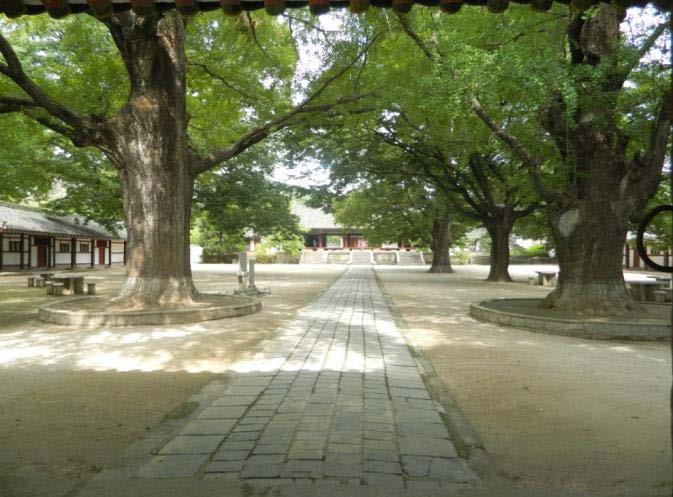
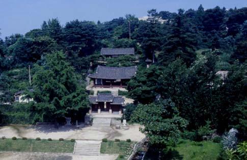
198 Koryo Songgyungwan Sungyang Sowon


199 Phyochung Monuments Mausoleum of King Wang Kon
200 IV Cultural properties A B C Africa New nominations Asia Pacific New nominations Nominations deferred by previous sessions of the World Heritage Committee Europe North America New nominations Extensions Nominations deferred by previous sessions of the World Heritage Committee
201 Red Bay (Canada) No 1412 Official name as proposed by the State Party Red Bay Basque Whaling Station Location Newfoundland and Labrador Province. Town of Red Bay Canada Brief description Located in Labrador on the shore of the Strait of Belle Isle, Red Bay provides the earliest, most comprehensive and best preserved testimony of a pre-industrial whaling station in the Arctic zone. Established by Basque mariners in the 16 th century, it enabled the organisation of summer coastal whale hunting, the butchering of the whales, the rendering of whale fat by heating to produce oil, and the storage of the oil. Sold in Europe, the oil was primarily used for lighting. The property includes remains of rendering ovens, cooperages, wharves, temporary living quarters and a cemetery, together with underwater remains of vessels and whale bone deposits. Category of property In terms of categories of cultural property set out in Article I of the 1972 World Heritage Convention, this is a site. 1 Basic data Included in the Tentative List 1st January 2004 International Assistance from the World Heritage Fund for preparing the Nomination None Date received by the World Heritage Centre 16 January 2012 Background This is a new nomination. Consultations ICOMOS has consulted its International Scientific Committees on Archaeological Heritage Management and on Underwater Archaeological Heritage. Technical Evaluation Mission An ICOMOS technical evaluation mission visited the property from 22 to 25 September Additional information requested and received from the State Party A letter was sent to the State Party on 20 December 2012, asking it to: Significantly reinforce the analysis of the sociotechnical system that operated at the Red Bay site, in order to better justify criterion (iv); Present the scientific results with regard to the state of health of the populations; Provide additional information about the Management Committee; Consider the possibility of an extension of the buffer zone; Specify the conditions with regard to the monitoring and protection of the underwater remains. The State Party provided an additional reply dated 25 February 2013, which has been taken into account in this evaluation. Date of ICOMOS approval of this report 6 March The property Description Red Bay is situated at the north-eastern tip of Canada, north of the Strait of Belle Isle which separates the island of Newfoundland from Labrador. It is the archaeological site of a 16 th century Basque whaling station. It was located close to a zone highly favourable at the time for whale hunting, as the mixing of the cold Labrador current and the warmer waters of the St. Lawrence River meant that it was rich in plankton and small crustaceans. The site is located in a bay naturally protected by Saddle Island. The higher land close to the coast provided favourable conditions for observing whales in the strait. The terrestrial and underwater archaeological excavations carried out at Red Bay enable the reconstruction of the establishment of the Basque community, and of the entire series of processes carried out on the whale carcasses, up to the shipping of the products to Europe. The excavation sites have been reburied for protection, or are underwater, covered by tarpaulins. Few elements are immediately visible to the inexpert visitor. The two major whaling locations at Red Bay have undergone excavation. One occupies the western continental side of the bay, corresponding partly to the site of the present-day village of Red Bay. The second, which is the most important in terms of archaeological remains, is on the other side of the strait, on the northern part of Saddle Island, on a site which has historically not been much reused. The underwater elements have essentially been studied in-situ. 152
202 The property forms a landscape which, because of the low level of human occupation in the village of Red Bay and the natural coverage of Arctic grassland, still retains the same geomorphological and environmental characteristics as in the 16 th century. The main elements of the property are as follows: The two main sites of the property, and Saddle Island in particular, had in total around fifteen buildings for the rendering ovens used to melt the whale blubber and produce the oil. All of them are located next to the beaches where the whales were butchered, and provide easy access for the transport by sea of the final cargo. Today they are visible as grass-covered mounds. The oven buildings were low stone structures with wood-frame roofs covered with imported clay tiles, of which piles of fragments remain. Twelve oven sites have been excavated, and then in most cases reburied for protection (giving each one the appearance of a tumulus once again); the others have remained unexplored. Near the shore and the oven buildings, but slightly further back on terraces, are the remains of five cooperages for the assembly of the barrels used to transport the oil. Each barrel (barrica) had a standard capacity of 211 litres. The cooperages were originally quite large wooden buildings, stoutly constructed with clay-tiled roofs. Tools used to bend the barrel staves have been found, along with nails. The remains of living quarters show that the houses were made of wood. They were occupied in the summer, which was the only season favourable for whale hunting in acceptable conditions. The houses are located close to the rendering oven complexes. Other flimsier constructions seem to have been temporary warehouses. In one case, the remains seem to suggest an early chapel. The site of a 16 th century Basque cemetery still exists at the tip of Saddle Island, with tombs hollowed out of the rock. Some of the human remains have been used for anthropological research, which has provided important information about the whaler populations, their state of health and the causes of their deaths (documentation of February 2013). Many extremely large whale bone deposits are scattered around the bay, some of them under the water (the most numerous being offshore from the village of Red Bay), and others on the shore or a small distance away, on the western coast of the bay at the foot of Tracey Hill and to the east of the strait opposite the Twin Islands. Remains of shipwrecks from the 16 th century have been found in the bay: three at a depth of around metres and one at 72 metres. Their state of preservation is good, and they are perfectly identifiable, such as the San Juan, built in The wrecks provide information about naval architecture and the use of the vessels for whaling purposes. A fifth wreck of a small vessel has also been found. The remains of the foundations of a wood and stone wharf have also been uncovered at Saddle Island. Large numbers of archaeological artefacts have been discovered through excavations both on land and at sea. The artefacts are on site, or have been deposited at the Memorial University of Newfoundland at St. John s (particularly those objects requiring technical follow-up for conservation purposes). The remains at the Red Bay site are reinforced by substantial archives, at the Memorial University of Newfoundland and in the archive services of the Basque Region in Spain. The present-day village of Red Bay reuses the port facilities of the strait and the favourable coastal plain. The village is thinly populated with scattered housing, an access road and a few streets. The excavations have been carried out in unoccupied areas. The present-day houses are light in structure, and have no more than one upper floor. Their foundations consist of wooden posts, and they have no cellars, which means that the subsurface has not been damaged from the viewpoint of possible future excavations. There is also a former fishery and corresponding wharf, which have been closed since the 1990s and are currently being converted into a centre for maritime tourism (2012). There is also a Visitor Interpretation Centre set up in an elevated position, which provides an excellent panorama of the property and its environment. Saddle Island has a lighthouse, and Penney Island has a 19 th century cod fishery establishment, which has now been abandoned. The property also includes some small maritime structures. History and development On the terrestrial part of the site there are archaeological artefacts dating back as far as BCE. This is followed by evidence of the first Paleo-Eskimo populations, who occupied the bay on several occasions between 3000 and 1400 BCE. From the 11 th and 12 th centuries onwards, the Basques (from northern Spain and south-western France) became the first European specialists in the hunting of whales, which they captured in their coastal areas or nearby. Their first transatlantic expeditions were for cod fishing, around Newfoundland, in the 1520s. The Basques realised that the Strait of Belle Isle and the north of the St. Lawrence River estuary were favourable for summer whale hunting. A stage was reached when they organised whale hunting on an annual basis, with the aim of achieving a monopoly in lighting oil in Europe. Whale fat, once heated, liquefies and then remains liquid. This enterprise took on a pre-industrial dimension at a very early stage, with a market that was rapidly expanding. Grand Bay (or la Gran Baya ), today known as Red Bay, became an important Basque whaling centre from the 1530s onwards. The site was occupied during the summer months for whale hunting, the butchering of the whales and the production of oil in rendering ovens on the 153
203 shore, and finally the shipping of the oil in barrels to Europe. The whales hunted were of two main species: Eubalaena glacialis and Balaena mysticetus. In addition to lighting, the oil was also used as a mechanical lubricant, as a solvent, or as a raw material for making soap. Other whale products were also marketed. During this period, the Basques had around 15 similar installations in the region. In whale hunting terms, Red Bay s peak came in the years : a thousand men and a dozen ships operated in the bay each summer, and a dozen rendering ovens were in use at that time. The socio-technical system for the organisation of the expeditions, the stopover at Red Bay, the whale-hunting, oil production, and the economics of whale oil commercialisation have been described in a detailed text (documentation of February 2013). The question of the fuel economy for the oil rendering ovens has remained unanswered, apparently because of a lack of source material on this matter. From the end of the 16 th century onwards, it seems probable that regional overexploitation of whales had depleted populations in the Strait of Belle Isle. In response, an attempt was made to extend the whale hunting season into the autumn, but this proved to be difficult. Whale hunting techniques had moved on, and there were new competitors (the Dutch, English and Norwegians), which led to changes in the locations and then the commercial balance of whaling. Whaling stations in Labrador and the St. Lawrence River went into decline in the early 17 th century. The Basques no longer held a monopoly and they finally abandoned their transatlantic whaling operations. The pressure of political events, particularly the mobilisation of Basque mariners by the Spanish government for military purposes, also played an important role in reducing the number of whale hunting expeditions (defeat of the Invincible Armada in 1588). In the 17 th and 18 th centuries, the site became a trading post for the French and the Inuits of Labrador and a small seasonal port for cod fishing. At certain points in time, Thule Inuits occupied the Red Bay site, alongside the fishermen. Long-term settlement, leading to Red Bay becoming a proper village, dates back to the 1840s. The first discoveries on the role of Red Bay as a 16 th century whaling station date from the 1970s. In 1979, the site was listed as a National Historic Site of Canada by the government. 3 Justification for inscription, integrity and authenticity Comparative analysis The property is compared with the other Basque whaling stations identified archaeologically along the Strait of Belle Isle and the shores of the St Lawrence River estuary. All the other sites are less rich in terms of evidence, and are less well preserved. Red Bay is indisputably the most complete, the most significant and the best preserved of all. Red Bay was furthermore one of the largest stations, clearly reflecting the pre-industrial dimension this activity had assumed in the region. The Basque Country, which today sits astride Spain and France, today has no surviving remains of its whaling facilities either from the Middle Ages or the early modern period, as all of them were located in ports which have been affected by frequent rebuilding. In addition to its significance in representing the first generation of transatlantic whaling stations, Red Bay provides the best preserved historic testimony to European whaling, particularly as carried out by the Basques. Other whaling sites around the world are generally from later periods. None have yet been included in the World Heritage List, although some are on national Tentative Lists. Bangu-Dae in South Korea is the only site of any importance which is earlier than Red Bay. The South Korean site is protohistoric, and has Palaeolithic engravings showing whales, amongst other motifs. This site is not really comparable with Red Bay in terms of period or of the record. Japan was also engaged in whaling at an early period, from the 7 th century onwards. Indications exist which date back to the second half of the 17 th century, bearing witness to an organisation of coastal whaling which resembles that of Red Bay, but these are very limited in heritage terms. A series of whaling stations were set up by the Dutch and English in the Arctic archipelago of Spitzbergen (Norway), in the early 17 th century. Evidence of the first of these is found at Jan Mayen Island and Smeerenburg. These new stations contributed to the decline of Basque whaling expeditions. The Jan Mayen site has been damaged by coastal erosion, and is less complete than Red Bay, but good documentation has been preserved; Smeerenburg was the largest Dutch station in this zone. The two sites are located in a protected natural zone and have a large number of well-preserved archaeological elements. Remains have also been preserved at the British whaling stations: at Graveneset, with the port of Trinity, at Lægernes and Midterhuken, and at Strákatangi. They include elements similar to those of Red Bay, such as oil rendering ovens and cooperages, along with brick ovens and forges. These are important examples which are complementary to the testimony of Red Bay, both in terms of tangible remains and in chronological terms, as they represent the second period of Arctic whaling by Europeans, in proto-industrial conditions. In more recent periods, particularly at the end of the 19 th century and in the 20 th century, there were whaling ports in North America, and in the Labrador and Newfoundland 154
204 regions, such as Hawke Harbour, Schooner Cove, Williamsport, Aquafort, Trinity and Dildo, and on the Pacific coast, such as Monterey. Remains also survive in the Azores, on the Island of Pico. Similarly, a series of Antarctic stations were established in the 20 th century in Southern Australia and in New Zealand, on the island of South Georgia in the South Atlantic (United Kingdom) and in South Africa. These stations however have no direct parallels with Red Bay, as the technical systems employed are very different. To sum up, Red Bay is the largest and best preserved whaling station amongst the earliest set of stations, created by Basque whalers in the first half of the 16 th century in north-eastern Canada. ICOMOS considers that the comparative analysis justifies consideration of this property for the World Heritage List. Justification of Outstanding Universal Value The nominated property is considered by the State Party to be of Outstanding Universal Value as a cultural property for the following reasons: The property bears testimony to the pioneering establishment of Basque transatlantic whale hunting in the 16 th century, in the Arctic maritime provinces of north-eastern Canada. It exhibits a full ensemble of archaeological remains, both on land and under water, which are in many cases well preserved: vessels, oil rendering ovens, cooperages, whale bone deposits, temporary living quarters, a cemetery and a significant set of archaeological artefacts. The remains embody all the stages of the sociotechnical process of 16 th century whale hunting, and the exploitation of whale blubber to produce lighting oil. It is the best preserved whaling station of this type and of this early period, and the most complete in terms of constituent elements; it illustrates a largescale pre-industrial and commercial whaling process. ICOMOS considers that this justification is appropriate, as the synthesis of historical and archaeological knowledge about the property enables a sufficient overall understanding both of the site and of the way it functioned from a human and technical viewpoint. Integrity and authenticity Integrity The boundaries of the nominated property encompass all the terrestrial and underwater archaeological elements constituting the Red Bay whaling station. Geographical and maritime conditions are such that there is little possibility of finding others outside the boundaries of the property. The variety of the elements is such that they bear witness to all the main stages of the whale hunting process: wrecks of vessels, archaeological remains of hunting, whale bone deposits attesting the butchery of the whales on the coast, remains of the oil rendering ovens, seasonal living quarters and a cemetery. Development at Red Bay after the abandonment of whaling remained modest. Today the site includes the coastal village and some modest port facilities already referred to. These elements did not interfere with the excavations in 1970 to 1990, and the inaccessible archaeological elements have been preserved; it will thus be possible to study them at a later date. The climate of Red Bay, particularly for the underwater remains, has enabled good preservation of the timbers of the ships and their cargos. The landscape question is paradoxical. On the one hand, the uncultivated Arctic tundra vegetation means it is relatively easy to interpret the geographical space, which has not really changed since the Basque whaling period, except for the scattered houses of the village and the road. It also enables good interpretation of its general content for the specialist (mounds above terrestrial archaeological remains, organisation of the station). On the other hand, this kind of landscape is not at all explicit even for a highly motivated visitor: nothing is directly visible as the excavated remains have been carefully reburied for protection, and even the underwater remains have been covered by tarpaulins held down by ballast. This does not affect integrity, as this technical situation is justified for reasons of conservation. However, interpretation of the site is therefore essential for a visitor wishing to gain an understanding of the property. In the additional documentation it provided in February 2013, the State Party has largely answered ICOMOS questions concerning the adequacy of knowledge about the social, economic and technical phenomena enabling an understanding of the ensemble of archaeological remains proposed for inscription. Only the fuel economy for the oil rendering ovens remains insufficiently established, apparently because of a lack of source material. A fuel crisis (supply, cost) may possibly have occurred, which may have added another reason to those already proposed for the decline of the Basque whaling stations in the Strait of Belle Isle (maritime warfare in Europe, decline of whale populations). In conclusion, ICOMOS considers that the archaeological integrity of the property is satisfactory, as it has been made comprehensible by a good overall body of knowledge of the social, economic and technical processes associated with its history. Authenticity The authenticity of the structural elements uncovered by the archaeological excavations is unquestionable. The items found have not been disturbed or reused, but were simply abandoned in the natural condition of their preservation. The conditions were relatively favourable for the stone and ceramic structures of the terrestrial 155
205 elements, but not for the wooden structures. Wooden structures were only reasonably well preserved if underwater, where conversely the conditions were extremely favourable. However, the legibility of the authenticity is less clear, and is extremely variable depending on the point of view. It may be considered to be good in archaeological terms, especially with regard to the general structures of the vessels, naval architecture, and spatial and functional relationships. The appearance of the landscape is also relatively authentic, because of the stability and permanency of the vegetation and the limited impact of human presence (although there is some impact, because the present-day village is situated exactly above one of the two major features of the property). The abundant documentary archives are helpful in enabling a better understanding of authenticity. The same applies to the collections of archaeological artefacts, which are not always stored on-site, for conservation and research reasons. ICOMOS considers that the authenticity of the property is unquestionable, but that the presentation of this authenticity to visitors is a delicate task. The initial concern about the lack of correlation between the material evidence, which often seems inexplicit or difficult to perceive, has largely been overcome by the additional documentation of February ICOMOS wishes to draw the State Party s attention to the importance of the scientific reconstructions for visitors, in order to enable them to fully understand the authenticity of the testimony provided by Red Bay. ICOMOS considers that the conditions of integrity and authenticity have been met. Criteria under which inscription is proposed The property is nominated on the basis of cultural criteria (iii), (iv) and (v). Criterion (iii): bear a unique or at least exceptional testimony to a cultural tradition or to a civilization which is living or which has disappeared; This criterion is justified by the State Party on the grounds that Red Bay is an exceptional example of the 16 th century Basque whaling tradition, and its transatlantic commercial exploitation. Through its archaeological remains, it constitutes the largest, best preserved and most complete whaling station of this type. ICOMOS considers that Red Bay does indeed constitute the most complete, earliest and best preserved archaeological testimony of the European whaling tradition. In the 16 th century, Basque mariners carried out this seasonal activity to produce oil which was then used for transatlantic commerce. ICOMOS considers that this criterion has been justified. Criterion (iv): be an outstanding example of a type of building, architectural or technological ensemble or landscape which illustrates (a) significant stage(s) in human history; This criterion is justified by the State Party on the grounds that Red Bay is the largest and most extensive archaeological site illustrating the technological process of producing whale oil in an Arctic station. The remains consist of rendering ovens, cooperages, temporary living quarters and wrecks of vessels. No other comparable site provides such a complete understanding of the technology used at that time for whale oil production, and which played a strategic role for three centuries. ICOMOS considers that Red Bay constitutes a fully comprehensible set of archaeological elements illustrating the establishment of a proto-industrial process of large-scale whale oil production, during the 16 th century. ICOMOS considers that this criterion has been justified. Criterion (v): be an outstanding example of a traditional human settlement, land-use or sea-use which is representative of a culture (or cultures), or human interaction with the environment especially when it has become vulnerable under the impact of irreversible change; This criterion is justified by the State Party on the grounds that the whaling station at Red Bay is the most outstanding example of land and sea use associated with whaling and large-scale whale oil production in the 16 th century. The archaeological resources found there illustrate the adaptation of the Basque mariners to the harsh terrestrial and marine environment in the course of the establishment of their station at Red Bay. ICOMOS considers that this was a pre-industrial establishment of notable length, but which covered a time span limited to some 70 years, and that this does not constitute a really long-term example of the traditional exploitation of a marine resource. The property also provides testimony to human pressure on the natural stocks of whales in the region, and their depletion by the end of the 16 th century, which probably led to the decline and abandonment of the station. The specific qualities of the site are satisfactorily expressed by the previous criteria, but not by this one. ICOMOS considers that this criterion has not been justified. ICOMOS considers that the nominated property meets the conditions of integrity and authenticity, and meets criteria (iii) and (iv). Description of the attributes Red Bay has the most comprehensive and best preserved archaeological remains of a whaling station established by Basque mariners in the first 156
206 half of the 16 th century, in the Arctic regions of northeastern Canada. The property has both terrestrial and underwater archaeological remains: whale oil rendering ovens, cooperages, wrecks of ships and chalupas (whale boats), vast whalebone deposits, temporary living quarters and a cemetery. The property bears testimony to the use of the port and coastal areas for whaling purposes, for the butchery of the whales, the organisation of whale oil production and the storage of the oil in barrels. The property provides a well preserved and authentic panorama of the site and its main geographical characteristics. The property has important archaeological artefacts and archives which are useful for understanding the fixed tangible remains. All these testimonies combined enable a credible reconstruction of the socio-technical process of whaling in the 16 th century, and the processing of blubber to produce lighting oil on a proto-industrial scale for a transatlantic commerce. 4 Factors affecting the property There is no important threat from the development of the village of Red Bay, either to the property or its buffer zone. Red Bay s socio-economic situation may be considered to be stationary, with a few small-scale fishery activities, and its population is slightly in decline. There are however some uncertainties about the future use of certain sectors near the property for agricultural or mining purposes. The main projects known about are linked to the promotion of the property for tourism purposes, with the recent opening of the Visitor Interpretation Centre in an elevated position above the village, and the conversion (currently taking place) of the fishing cooperative and wharf into a marine tourism office. But Red Bay is located far from any densely populated areas, and its climate is often harsh. The increase in tourism, leaving aside the initial modest increase in numbers, will remain limited. However, excessive numbers of walkers visiting the terrestrial archaeological sites or the cemetery could affect them, as they are relatively fragile. Some of the rendering oven locations are right on the coast, and are thus threatened by coastal erosion. This is a relatively slow process at the moment. With climate change, the situation could worsen in the medium-term, with more violent storms and a rise in seawater levels. ICOMOS considers that the main threat to the property is coastal erosion. 5 Protection, conservation and management Boundaries of the nominated property and buffer zone The boundaries of the property correspond to the crests of the hills for the continental part, and to a maritime area which includes the main island of Saddle, Penney Island and the Twin Islands group. The surface area is ha, and the population does not exceed 95 persons (seasonal workers are also present). The buffer zone extends to a distance of 200 metres beyond the boundaries of the property to the east, south and west, and to the cove to the north. The area covers ha and the population does not exceed 100 (presence of seasonal employees). ICOMOS considers that the boundaries of the nominated property and of the buffer zone are adequate. Ownership Approximately 85% of lands included in the nominated property are owned by the Province of Newfoundland and Labrador (Crown Lands), including the shores and the uninhabited islands. Ownership is exercised by the provincial Department of Environment and Conservation, but the territorial administration is carried out on the basis of the municipal plans of the Town of Red Bay. The coastal sea beds of the property are also considered to be Crown Lands. The remaining lands are the property of the Canadian government, and this is also the case for the underwater archaeological site 24M. A certain number of lots are the responsibility of Parks Canada, including the Visitor Interpretation Centre and the whole of Saddle Island. The federal Department of Fisheries and Oceans has title to the shoreline used for berthing vessels. There are no private ownership rights, but parcels of land are leased or granted to homeowners in the town enabling them to build and carry out works subject to compliance with the legislation. Protection The legal and administrative protection of the property is exercised by the three levels of government having jurisdiction (governmental, provincial and local). The three levels of protection are coordinated so that the measures taken are effective and complement each other. They form the legal framework for conservation and management of the property. The main federal legislation consists of: The Navigable Waters Protection Act (1995); The Parks Canada Agency Act (1998). 157
207 Their application for the protection of the property is the responsibility of the Parks Canada Agency, which is in charge of cultural and natural properties of national significance. Red Bay is one such property, as it was awarded National Historic Site of Canada status in The provincial protection legislation consists of: The Historic Resources Act (1990), of which the Department of Tourism, Culture and Recreation is in charge; The Municipalities Act (1990) and the Urban and Rural Planning Act (2000). The Municipal Plan of the Town of Red Bay ( ) contains the territorial planning information concerning the uses of the property, with a mixed development zone, a preservation zone for the archaeological sites, a commercial zone, and a rural resources zone. The commercial zone includes small shops, along with smallscale fishing and tourist accommodation. It may be considered that the attachment of the inhabitants to the historic property of Red Bay and its remains constitutes a form of traditional protection. The additional documentation of February 2013 specifies the condition of the monitoring and protection of the underwater remains forming part of the property. ICOMOS considers that the legal protection in place is adequate. Conservation The property has been the subject of a series of terrestrial and underwater archaeological campaigns, from 1978 to 1992, concerning 32 features. The knowledge gained has been complemented by three collections: vessels and underwater archaeological features, whale bone deposits, and terrestrial archaeological artefacts. Further excavations are not considered necessary; they would probably not increase overall knowledge of the property, just increase the collections. The provincial authorities are responsible for archaeological matters. Some of the artefacts are conserved locally, and some (particularly the most fragile items) have been entrusted to the Memorial University of Newfoundland at St. John s. The Basque archives have also been studied since the mid-1970s. The upper wooden structures of the terrestrial remains have disappeared, whilst the stone footings and fragments of tiles have been preserved. The timbers of the wrecked vessels have resisted the impact of time well, because the water is relatively cold and the eco-biological environment is favourable. In accordance with the request made by ICOMOS, the State Party has incorporated the scientific results of the study of human remains from the cemetery into the general knowledge of the property and its history. The structural elements present on the site today are in a stabilised and durable state of conservation. No interventions are planned in the short to medium term. The small population residing at the site, and very limited building development also contribute to the conservation of the property. The motivation of the local residents to preserve their heritage is an active factor for conservation. ICOMOS considers that the state of conservation of the property is satisfactory, and that the measures taken are effective. Management Management structures and processes, including traditional management processes The parties involved in the management of the property are: Parks Canada, the federal Department of Fisheries and Oceans, the Provincial Archaeology Office, and the Town of Red Bay. The Memorandum signed in the early 2000s by the four entities involved in the management of the historic site of Red Bay was renewed in December 2011, in view of the work required to produce the nomination dossier for inscription on the World Heritage List. It instituted a common Management Committee, which has been in charge of the implementation of the Management Plan since Parks Canada provides an annual budget of CAD310,000 to its Red Bay unit, excluding salaries. The Provincial Archaeology Office also contributes to the site management budget, as does the Town of Red Bay. The personnel employed at Red Bay are those of Parks Canada and the Visitor Interpretation Centre. They comprise one supervisor in charge of the site, one person in charge of maintenance, and six seasonallyemployed guides. The municipality provides one person for site management purposes, and can carry out specific programmes with the help of the relevant provincial departments. In view of the conservation options adopted, there is no longer an archaeological mission or any permanent conservation personnel on-site. Only as-needed missions are carried out. Parks Canada and the Provincial Archaeology Office supply the personnel needed for the scientific management of the site. They can intervene as part of a project, or when a specific request is made. Red Bay can also count on a group of experienced volunteers for any terrestrial or underwater archaeological work, and for site maintenance and servicing work. The catering and accommodation services are provided by private individuals (family-owned companies). 158
208 Policy framework: management plans and arrangements, including visitor management and presentation Parks Canada is accountable to the federal government for the Management Plan of Red Bay, National Historic Site of Canada. The plan has been approved and covers a period of 5 years beginning in January 2012; it provides a long-term strategic vision. It is designed to be used in conjunction with the Management Plan for the Red Bay Basque Whaling Station, which brings together all the partners involved in the management of the property (January 2012). The plan was preceded by the Memorandum of Understanding (MOU) between the various management partners. The joint Management Plan has been devised to be used in conjunction with the provincial plans for the development of the straits region. Parks Canada is monitoring the state of coastal erosion at those points where it threatens rendering oven locations. If necessary, preventive rock barriers will be put in place. The most threatened site, on Penney Island, is considered to be a pilot site. There are two buildings for the reception of visitors. The Visitor Interpretation Centre is the responsibility of Parks Canada. It is located in an elevated position which provides a panoramic view of the site. It has collections of objects and models. A second tourist information centre is currently being constructed (September 2012) at the small port. Tourist itineraries inside the property have been set up, with appropriate signage and information. ICOMOS considers it necessary to improve and deepen the interpretation of the site for visitors, in view of the rather inexplicit nature of the remains preserved on land and in the bay: the addition of photographs on the information panels showing the sites before they were reburied; cutting of the grass to make the terrestrial remains more understandable; improving the signs leading to the Visitor Interpretation Centre Museum; ensuring the homogeneity of, and enhancing, the scientific content at the various visitor reception locations, etc. Involvement of the local communities The local community consists of the residents of Red Bay. They are few in number (around one hundred adults), but are strongly involved in the preservation of the property. Most of them have already participated on a voluntary basis in maintenance work, or assisted the archaeologists. Almost all of them have signed a common declaration of support for the heritage project. They are officially represented on the decision-making bodies by the Town of Red Bay. ICOMOS considers that the property management system is adequate and effective, and that sufficient additional information has been provided about the functioning of the Management Committee, and about its role as the property management coordination authority. ICOMOS also recommends that the presentation of the property to visitors be improved and deepened, in view of the property s lack of visible remains. 6 Monitoring A monitoring programme has been in place since 1985, led by Parks Canada in association with the Provincial Office of Archaeology. It gathers information about the conservation of the attributes of the property. It also monitors the quality and efficacy of the presentation to the public of the values of the property. For the terrestrial remains, the quantified periodic monitoring exercise, carried out annually, covers the elements which have remained intact, the reburial mounds covering terrestrial attributes, coastal erosion, constructions and housing works, and visitors. For the underwater properties, the monitoring is concerned with physical changes occurring to the protective coverings of the re-covered archaeological sites (annual), the physical and chemical characteristics of the water (5 years), and the deterioration of the wood (5 years). A thorough Commemorative Integrity Evaluation was also carried out by multi-disciplinary teams from the State Party (October 2011). This was a detailed inventory of the attributes present in a given place, considered in terms of their contribution to the understanding of the property as a whole. This evaluation will provide yardsticks used as a basis for future monitoring. ICOMOS considers that monitoring of the property is in place, and that it is satisfactory. 7 Conclusions ICOMOS recognises the Outstanding Universal Value of Red Bay, which provides the most comprehensive and earliest terrestrial and underwater archaeological testimony of European Transatlantic whaling, by Basques in the 16 th century, for the production of whale oil on a grand scale. Sufficient additional information about the knowledge of the socio-technical processes at play during the whale hunting period has been provided by the additional documentation to fully justify criterion (iv). 159
209 8 Recommendations Recommendations with respect to inscription ICOMOS recommends that the Red Bay Basque Whaling Station, Canada, be inscribed on the World Heritage List on the basis of criteria (iii) and (iv). Recommended Statement of Outstanding Universal Value Brief synthesis Situated in Labrador, in north-eastern Canada, on the shores of the Strait of Belle Isle, Red Bay was an Arctic maritime base for Basque mariners in the 16 th century. It is the earliest, most comprehensive and best preserved archaeological testimony of a pre-industrial whaling station. It was used for coastal whale hunting in the summer, the butchery of the whales, and the rendering of the oil and its storage. The whale oil was sold in Europe primarily for lighting purposes. The property includes the remains of rendering ovens, cooperages, a wharf, living quarters and a cemetery, together with the underwater wrecks of vessels and whale bone deposits. Criterion (iii): Red Bay Basque Whaling Station is an outstanding example of the tradition of whale hunting established by the Basques in the 16 th century for the production of oil which was transported for sale in Europe. In terms of the diversity of its archaeological remains, this is the most extensive, best preserved and most comprehensive whaling station of this type. Criterion (iv): Red Bay Basque Whaling Station constitutes a fully intelligible ensemble of archaeological elements illustrating the establishment of a protoindustrial process of large-scale production of whale oil, during the 16 th century. Integrity Centre is essential to enable an understanding of the site and its authenticity. Management and protection requirements Red Bay was listed as a National Historic Site of Canada in The property management and protection plan has been in place for a long time; it is effective, and the responsibilities of each of the players are clearly identified. The Management Committee was set up at the end of the preparation of the nomination dossier, between the four institutional property management partners. The Management Plan for Red Bay, the National Historic Site of Canada is designed to be used in conjunction with the Management Plan for the Red Bay Whaling Station, which brings together all the partners involved in the management of the property. At present, the protection of the property following an intensive phase of archaeological research from the 1970s to the 1990s - is ensured by the permanent covering and reburying of both terrestrial and underwater remains. Current management thus consists of monitoring the state of conservation and developing structures for visitor interpretation and reception. Additional recommendations ICOMOS recommends that the State Party give consideration the following: Notifying the World Heritage Committee of any agricultural or mining project which could possibly arise in the environment of the property and which could potentially have a negative impact on it, in accordance with paragraph 172 of the Operational Guidelines; Improving and deepening the interpretation of the site for visitors, in view of the inexplicit nature of the remains preserved on land and in the bay. The property includes all the terrestrial and underwater elements that illustrate all the major phases of the whale hunting process. The various attributes of the property are generally well preserved, and their relationships with the land remain engraved on and visible in the landscape. They therefore satisfactorily express the Outstanding Universal Value of the property; however, as visibility of the remains is limited, a policy of active and thorough interpretation is necessary. The knowledge of the sociotechnical system involved is sufficient to allow full interpretation of the ensemble of preserved remains at Red Bay. Authenticity The various attributes of the property are of unquestionable authenticity, as is the general landscape around the present-day village of Red Bay. However, the authenticity perceived by the visitor remains limited to an impression of the landscape, as the tangible attributes have been reburied, which is however justified in view of the need for conservation. The Visitor Interpretation 160

210 Map showing the boundaries of the nominated property


211 View of the Red Bay port Whale bone deposit


212 Oven site on Penney Island Remains of cooperages for the assembly of the barrels
213 Bergpark Wilhelmshöhe (Germany) No 1413 Official name as proposed by the State Party Water features and Hercules within the Bergpark Wilhelmshöhe Location State of Hesse Federal Republic of Germany Brief description Descending a long hill crowned by the giant statue of Hercules visible from great distances, the monumental water displays of Wilhelmshöhe were created from 1689 by the Landgrave Carl around an east-west axis linking the Carlsberg with the palace of Karlsaue. Reservoirs and channels behind the Hercules Monument supply water to the complex system of valves to the extensive Baroque water theatre with its hydro-pneumatic devices, grotto, fountains and 350 metre long Grand Cascade. Beyond this, channels and contrived waterways wind across the axis, feeding a series of dramatic waterfalls and wild rapids, the geyser-like Grand Fountain which leaps 50m high, the lake and secluded ponds that enliven the Romantic garden created in the 18 th century by Carl s great-grandson, Elector Wilhelm I. Category of property In terms of categories of cultural property set out in Article I of the 1972 World Heritage Convention, this is a site. ICOMOS considers that in terms of the Operational Guidelines for the Implementation of the World Heritage Convention (November 2011), paragraph 47, this is also a cultural landscape. 1 Basic data Included in the Tentative List 15 March 2010 International Assistance from the World Heritage Fund for preparing the Nomination None Date received by the World Heritage Centre 19 January 2012 Background This is a new nomination. Consultations ICOMOS has consulted its International Scientific Committee on Cultural Landscapes and several independent experts. Technical Evaluation Mission An ICOMOS technical evaluation mission visited the property from 11 to 15 September Additional information requested and received from the State Party A letter was sent to the State Party on 21 September 2012 requesting clarification on identification, conservation, boundaries, protection and management. A response was received from the State Party on 16 October 2012 and the information has been incorporated into relevant sections below. A second letter was sent to the State Party on 20 December 2012 requesting additional information on protection, management and the name of the property. The response from the State Party dated 15 February 2013 has been incorporated into this report. Date of ICOMOS approval of this report 6 March The property Description Located in the Habichtswald forest on the western outskirts of the City of Kassel, the nominated property includes the drainage catchment of the Essigberg west of the Hercules Monument which supplies the water features, the total area of the garden park with its woodlands, and the Aschgraben ditch, which connects the water catchment with Drusel Creek and the lower part of the garden as an outlying loop. The nominated property area is 558.7ha, surrounded by a buffer zone of 2,665.7ha. The Bergpark was laid out by the Landgrave Carl of Hesse-Kassel from1689 onwards along an east-west axis descending a height of about 315 m overall from the stone octagonal building on the Carlsberg plateau. With its 40 m high pyramid carrying the 8.5 m high bronze statue of Hercules Farnese, the Octagon/Hercules Monument is visible for miles around. On the terrace below the Octagon rustic stonework surrounds the Vexing Grotto with Polyphemus playing his flute its sound being produced by the hidden water-wheel-powered organ, in front of which is the Artichoke Basin with its acoustic firework effect fountain. Water descends in steps around each side of the grotto to the tumbling Felsensturz waterfall at Giant s Head Basin on the next terrace, where a large boulder representing the head of Enceladus gives rise to a 12 m high fountain. In two semicircular niches are statues of a faun and a centaur each playing a horn with sound produced by the hidden camera aeolia. The Grand Cascade hurries the water on down a central cascade flanked by two narrower cascades via three oval basins to Neptune s Basin with 235 cu m of water every 161
214 ten minutes gradually obscuring the figure of Neptune in his grotto. From here the water is conducted via a partly underground conduit to the Fountain reservoir to supply the Grand Fountain in its pond. This was completed during the reign of Carl s grandson Friedrich II, when cast iron pipes could be made sufficiently strong to withstand the water pressure required to send the water up 150 feet - higher than every other fountain in Europe at the time. The fountainhead consists of a strong central jet surrounded by 12 small ones, resulting in a geyser effect. On axis and east of the Grand Fountain, Grand Cascade and Hercules Monument is the Neo-classical Wilhelmshöhe Palace, built by Carl s grandson, Elector Wilhelm I to replace an earlier Renaissance building. To its north are the Great Greenhouse, Ballroom Pavilion, Stables, Riding Hall, Orchard House and Carriage House. To its south is the mock Chinese village known as Mulang, with its pagoda and pavilions, constructed as part of the Picturesque garden extension with its numerous philosophical and mythological follies including Pluto s Grotto, during the reign of Wilhelm s father, Friedrich II. A little further west is Löwenburg Castle with its medieval garden, testament to Wilhelm s Romantic taste, which is further expressed in the wild, natural waterfalls, cascades and ruins of his period. The water for these later displays is supplied from the Drusel Creek via the one kilometre long Aschgraben channel into the Aschsee pond. Water is also drained from the disused Hercules coal mine into the Aschgraben channel, and can be supplemented from the Sichelbach reservoir via an open connecting ditch. The Romantic water displays of Elector Wilhelm I begin with the dramatic Steinhöfer Waterfall supplied from Aschsee pond via Pfaffenteich pond. The water is released via two valves operated consecutively, starting with a waterfall over a 20 m high wall of rock 50 m wide, and then hurtling for ten minutes down rapids between massive basalt steles before running along a natural-looking stream to the Fountain reservoir. Overall it uses 430 cu m water every 20 minutes - about the same quantity as the Grand Cascade. Next the water is released from the Fountain reservoir by two valves simultaneously, to roar down the rocky bed beneath Devil s Bridge (adjacent to Pluto s Grotto) and tumble over a 10 m waterfall into Hell pond. From here the water is led on to the large ruined Aqueduct, spilling over a 30 m drop to run on via the Peneus Cascades to the Fountain pond. East of the Palace the tranquil Lac is supplied by water meandering down a stream from the Fountain pond via the Jussow waterfall and other falls around the Isle of Roses. Below the Lac the water drains back into the lower reaches of Drusel Creek via small cascades and once outside the property, in pipes. To the north-west of the palace beyond the Aqueduct the largest waterfall, the New Waterfall comprising three falls each 16 m wide and deep was supplied by water collected in reservoirs from springs and wetlands north of the woodland and a ditch from Hell pond. A riverbed lined with basalt steles conducted the water down several cascades towards the valley. However problems with leaks soon after the waterfall s completion and again in 1943 resulted in its closure. The reservoirs, ditches and the rocky architecture of the falls are still intact. The technical details of the hydraulic features are described in detail in the nomination dossier, and include complex valve systems, and some of the original cast iron pipes still serving their original purpose. The camera aeolia which operates the horns was restored in the 1960s.. History and development The Bergpark was built over the earlier hunting lodge estate of Landgrave Moritz of Hesse dating from It had included a grotto with water displays, thought to have been in the location of the present Pluto s Grotto. By the time Landgrave Carl came to power, following the Thirty Years War, the property was largely in ruins. Carl s father Wilhelm VI had an interest in hydraulics but it was Carl who developed the property then known as the Winterkasten, creating the Baroque water display that exists today. Carl engaged the well-known engineer Denis Papin to advise him on hydraulic works, and following his tour to Italy in 1669/70 he appointed the architect Giovanni Francesco Guerniero to take charge of the design. That it was intended to extend to double the length of the current Grand Cascade is attested by drawings and the model now on display in the Wilhelmshöhe Place. It is assumed that lack of funds prevented the full project being achieved. Following Carl s death in 1730 the park s water supply system and water features were maintained by his sons Friedrich I ( ) and Wilhelm VIII ( ). Major repairs and development were undertaken by Carl s grandson Friedrich II ( ), who restored the Baroque features and surrounded them with a Picturesque landscape park based on English models. Married to a daughter of the British king and in personal contact with William Chambers, he had visited Kew Gardens on several occasions. He continued the swathe along the axis from the Octagon towards the City of Kassel, built Pluto s Grotto across its path and created meandering paths though densely planted trees and shrubs leading to settings adorned with garden buildings reflecting themes from literature or Classical mythology. His major hydraulic work was the successful completion of the Grand Fountain begun by his grandfather. It is suggested in the nomination dossier that the Grand Cascade extension planned by Carl was not undertaken by Friedrich II because it would not have been in accordance with Chambers principles. Friedrich s son Wilhelm IX (who became the Elector Wilhelm I) took over the Bergpark on the death of his father in He continued to employ his father s architect Heinrich Christoph Jussow and Court Gardener Daniel August Schwarzkopf together with the water engineer Steinhöfer, and ordered the removal of numerous wooden statues and small buildings, and the conversion of artificial terraces into more natural slopes. 162
215 His new palace, completed in 1798 is said to derive from the tradition of English palaces of the period, Jussow having made a study tour to England in The subsequent development of the Gothic Revival Löwenburg Castle, with its part ruinous exterior and sumptuously decorated interior rooms, was used by Wilhelm as a private refuge; the ruined Aqueduct, wild and craggy waterfalls and cataracts and other Romantic features are said to derive from the Romantic ideas expressed by Thomas Whately and Christian Cay Lorenz Hirschfeld in their works on garden art theory. Wilhelm also converted the former Fountain basin into a naturallooking pond, and Friedrich s fishponds into the Lac. During the French occupation of , the park was used by the emperor Napoleon s brother, Jerome Bonaparte. On his return from exile Wilhelm added a couple of temples. His successor Elector Wilhelm II ( ) extended the park to the north, and added the New Waterfall, the last great cataract to be designed by Steinhöfer. He also added new buildings to the north of the Palace including the early glass and iron Great Greenhouse and the new cast-iron Devil s Bridge. Since 1830 the Octagon and Baroque water features have undergone large scale repairs, the Octagon having been threatened with collapse in south and southwestern parts. Various reservoirs and channels were also repaired and some alterations made. At the end of World War II the park passed into state-ownership, managed by the Prussian authority in charge of palaces and gardens. The Palace became a museum focusing on the period of landgraves and electors. The Hercules Monument and Baroque water features were repaired using modern bonding and water proofing materials. Following WWII management passed to the administrative authority of the federal state of Hesse in 1949 and in 2006 it passed to the State Museums of Kassel. An extensive program of restoration and repair of the Hercules statue and Octagon was carried out from 1950 to 1971, including consolidation of the subsoil, masonry anchoring, stone repair and grouting. The stairs and basins of the Grand Cascade were also repaired and resurfaced. The water displays, which had been suspended in 1947 due to leaks and lack of water, were resumed for the 1963 season. Further repairs were undertaken in the early 1990s. 3 Justification for inscription, integrity and authenticity Comparative analysis Wilhelmshöhe is compared in the nomination dossier with other Baroque gardens in Germany including the World Heritage listed Castles of Augustusburg and Falkenlust at Brühl (1984, criteria (ii) & (iv)) and the Garden Kingdom of Dessau-Wörlitz (2000, criteria (ii) & (iv)), and with Schönbrunn in Austria (1996, criteria (i) & (iv)), none of which are laid out on similar topography and do not feature grand, dramatic water displays of the type evident at Wilhelmshöhe. ICOMOS notes that the same comment applies to the World Heritage listed Würzburg Residence with the Court Gardens and Residence Square (1981, criteria (i) & (iv)). It also applies to several other German gardens discussed in the nomination dossier, including Muskauer Park (2004, criteria (i) & (iv)). The nomination dossier notes that gardens had served as a means of princely representation ever since the Renaissance in Italy, and from the 17 th century onwards in France. The Wilhelmshöhe water features are compared with those at a number of earlier Italian and French gardens of the Renaissance period on the World Heritage and Tentative Lists. In particular the Grand Cascade is compared with the water stairs at Villa Lante, Bagnaia and Villa Aldobrandini, Frascati (Tentative List, 2006) and said to have derived from the latter which also featured the waterspouting giant Enceladus and the musical statue of a centaur. It is asserted in the nomination dossier and ICOMOS concurs, that these and the World Heritage listed Villa d Este, Tivoli (2001, criteria (i), (ii), (iii), (iv) & (v)) while presenting proof of wealth and sophistication do not compare in terms of size and dramatic display with the monumental Baroque water theatre at Wilhelmshöhe. Similarly, a number of grand Baroque period gardens and water features in other European countries are discussed in the nomination dossier, as well as those on the World Heritage List including the Palace and Park of Versailles, France (1979, criteria (i), (ii) & (vi)); the Gardens and Castle at Kroměřiž, Czech Republic (1998, criteria (ii) & (iv)); the Royal Domain of Drottningholm, Sweden (1991, criterion (iv)); Blenheim Palace, UK (1987, criteria (ii) & (iv)); Studley Royal Park including the Ruins of Fountains Abbey, UK (1986, criteria (i) & (iv)) and the Château de Vaux-le-Vicomte on the Tentative List of France and considered not comparable in terms of the grandiose design concept, scale and drama. It is considered that the World Heritage listed 18 th -Century Royal Palace at Caserta with the Park, the Aqueduct of Vanvitelli, and the San Leucio Complex (1997, criteria (i), (ii), (iii) & (iv)) is comparable in scale and vision encompassing the water displays, palace and city, and that it derived from Wilhelmshöhe being constructed 50 years later. However this is the only known example of Wilhelmshöhe s influence. It is suggested in the nomination dossier that the value of Wilhelmshöhe is not diminished by this later echo of its achievement, and ICOMOS concurs with this assessment. The Grand Fountain was the tallest artificial waterspout fountain in the world when it was built and inspired others to go higher. Its height was exceeded by the Emperor fountain in Chatsworth The Hercules monument at the west end of the main axis of the garden is unmatched in terms of its size and dominance over the landscape and visibility from beyond. The construction of the giant Hercules statue, crowning the Octagon on a pyramid was an exceptional technical challenge in its time; later statues using wrought copper over a structural frame cannot be said to match this in terms of its innovation. Regarding the water features of the Romantic period, the nomination dossier names and describes waterfalls in many landscape gardens throughout Europe concluding that there are none that match the examples from the Bergpark. Even in Great Britain with its vast number of 163
216 landscape gardens preserved from the 18 th and 19 th centuries none are comparable with the Steinhöfer water fall at Wilhelmshöhe. Aqueducts in the form of artificial ruins can be found in some other landscape gardens (Lednice-Valtice, Schwetzingen), but they are humble compared to the 30m fall from the aqueduct at Wilhelmshöhe. It is argued in the nomination dossier that the ensemble of these water features, in their variety of design and response to models in nature, linked by a continuous water course, stands out as an extraordinary achievement in late 18 th century and 19 th century garden philosophy. ICOMOS concurs with this assessment. ICOMOS notes that the comparative analysis has been undertaken with properties bearing similar values to those of Water features and Hercules within the Bergpark Wilhelmshöhe, inscribed or not on the World Heritage List and at national, regional and international level. ICOMOS considers that the comparative analysis justifies consideration of this property for the World Heritage List. Justification of Outstanding Universal Value The nominated property is considered by the State Party to be of Outstanding Universal Value as a cultural property for the following reasons: Its design synthesised ideas from earlier gardens in France, Italy and England into a work of garden art that subsequently influenced water features in later garden designs. It constitutes a unique expression of Absolutist rulership. The water features are an outstanding and unique example of monumental water structures in the context of garden art. The steam pump developed by Denis Papin was a precursor of the steam engines in Great Britain and as such was a trailblazer of the Industrial Revolution in the Western World. ICOMOS considers that the first point is debateable, the second and third points are appropriate, but the fourth is not appropriate. Regarding the latter the steam pump was not actually used for the water features, so there is a lack of direct or tangible association. Integrity and authenticity Integrity ICOMOS considers that the nominated property includes all elements necessary to express its value and does not suffer from adverse effects of development or neglect. All water features except the New Waterfall are still operable and together with the Hercules Monument preserve their visual integrity and setting. Authenticity ICOMOS considers that the nominated property is authentic in terms of its form and design, materials and substance, use and function, techniques, location and setting. The technology required for the water features has been preserved, complete and functional. ICOMOS considers that the conditions of integrity and authenticity have been met. Criteria under which inscription is proposed The property is nominated on the basis of cultural criteria (ii), (iii), (iv) and (vi). Criterion (ii): exhibit an important interchange of human values, over a span of time or within a cultural area of the world, on developments in architecture or technology, monumental arts, town-planning or landscape design; This criterion is justified by the State Party on the grounds that the Hercules Monument and Water Features combine elements derived from water displays and monumental foci in the gardens and parks of Italy, France and England. The steeply sloping terrain at Wilhelmshöhe enabled them to become a monumental display of unprecedented scale and impact, able to be created in very few places elsewhere. ICOMOS considers that the justification of this criterion is traceable in terms of representing a development in landscape design but is weak because many gardens were influenced by other European examples, and there is only one major example that appears to have been directly inspired by the Bergpark. ICOMOS considers that this criterion has not been justified. Criterion (iii): bear a unique or at least exceptional testimony to a cultural tradition or to a civilization which is living or which has disappeared; This criterion is justified by the State Party on the grounds that the towering statue of Hercules and the water displays of the Bergpark Wilhelmshöhe constitute a unique expression of the symbolism of Absolutist rulership. This is achieved through the size and domination of the Hercules and the demonstration of mastery of the elementary forces of nature. ICOMOS considers that the monument and water displays are an exceptional symbol of the era of European Absolutism. ICOMOS considers that this criterion has been justified. Criterion (iv): be an outstanding example of a type of building, architectural or technological ensemble or landscape which illustrates (a) significant stage(s) in human history; This criterion is justified by the State Party on the grounds that the water displays of Bergpark Wilhelmshöhe are an outstanding and unique example 164
217 of monumental water structures. Cascades of similar size and artificial waterfalls of comparable height can be found nowhere else. The Hercules statue, towering over the 560 hectare park, is both technically and artistically the most sophisticated and colossal statue of the Early Modern era. The ensemble of water features with their monumental architectural settings reflects both the Absolutist demonstration of power and princely display in an unparalleled manner. The water displays are thus an outstanding example of European spirit spanning two eras equally important to cultural history the Baroque and the Romantic age. ICOMOS considers that the Hercules Monument and water displays are an outstanding combination of features in garden art of the Baroque and Romantic periods in the era of European Absolutism. ICOMOS also considers that the water features in Kassel are part of a unique manmade designed Cultural Landscape, completely without borders integrated in an evolved landscape. Comparison with the World Heritage listed Aranjuez Cultural Landscape, Spain (criteria (ii) and (iv)) indicates that Kassel again stands out in terms of its mastery of the topography for the ingenious display of water, uniquely integrated into the landscape. ICOMOS considers that this criterion has been justified. Criterion (vi): be directly or tangibly associated with events or living traditions, with ideas, or with beliefs, with artistic and literary works of outstanding universal significance; This criterion is justified by the State Party on the grounds that the Baroque notion of creating the world s tallest fountain inspired Landgrave Carl of Hesse-Kassel to commission Denis Papin to construct a steam pump. This was a direct precursor of the later atmospheric steam engines by Thomas Newcomen and James Watt, in themselves technical prerequisites of the Industrial Revolution. ICOMOS considers that there is no direct or tangible association of Bergpark Wilhelmshöhe with the Industrial Revolution because Papin s steam pump was never used there. ICOMOS considers that this criterion has not been justified. Vexing Grotto, Artichoke Basin, Felsensturz Waterfall, Giant s Head Basin, Grand Cascade and basins, Neptune s grotto and basin, the Grand Fountain and its pond, and the associated statues, acoustic devices, fountains, water catchment, reservoirs, ponds, wells, ditches, tunnels, valves, pipes; Aschgraben channel, Steinhöfer Waterfall, Devil s Bridge Waterfall, Aqueduct Waterfall, Peneus Cascades, Jussow Waterfall, Isle of Roses waterfalls, the Lac, the New Waterfall and all associated water sources, valves, channels, pipes, reservoirs; the east-west axis to Kassel city, park setting including plantings and paths, garden buildings, Palace, Löwenburg Castle, views and vistas. 4 Factors affecting the property According to the nomination dossier there are 61 permanent inhabitants of the property and 3,337 in the buffer zone, but it is stated that the property is not threatened by development. The water features can be viewed twice a week from May to October, attracting an average attendance of 5,000 visitors. Attendance at major events in the Bergpark is capped at 15,000. Annual visitor numbers to the park overall vary between 250,000 and 700,000 the latter being the year of the major art exhibition held at the Bergpark. It has been calculated that the park could accommodate 1,000,000 visitors annually. Consequently visitor pressure is not considered a threat. Climate change has had an impact in reducing snowfall and therefore the natural water capacity of the catchment supplying the water displays, to the extent that during very hot summers the water displays have had to be reduced for the rest of the season or even ceased altogether. In response to ICOMOS request for additional information about this, the State Party responded that the lack of water was primarily due to leakage or pipe bursts and that since these have been repaired there is sufficient water to operate the displays in accordance with the schedule described. Storms and fires are not expected to affect the property. ICOMOS considers that the main threats to the property are climate change and associated loss of water supply. Storms and fires could become more of a threat with climate change also. ICOMOS considers that the nominated property meets criteria (iii) and (iv) and conditions of authenticity and integrity. Description of the attributes The attributes carrying Outstanding Universal Value are essentially the water features and the landscape s topography which enables their unique integration into a masterly display. Individual components include the Hercules Monument (statue, pyramid and octagon), 5 Protection, conservation and management Boundaries of the nominated property and buffer zone The boundary of the nominated property follows the boundary of the property designated under the Hessian Act on the Protection of Cultural Monuments and the boundary of the property owned by the Museumslandschaft Hessen Kassel except to the west 165
218 where it also includes additional land covering the water catchment supplying the water features of the Bergpark. There is no visible border separating the park from its surrounding buffer zone. The boundary is not fenced. The buffer zone boundary includes landscape protection areas and special conservation areas (fauna-flora-habitat) which surround the property to the north and west. On the southern side it includes built up areas to the immediate south and special conservation areas (fauna-flora-habitat) beyond. To the east the buffer zone covers the 20 m wide axis of Allee Wilhelmshöher to the centre of the City of Kassel. In response to ICOMOS request, the State Party has extended the buffer zone to include the urban blocks either side of the Wilhelmshöher Allee monumental axis to a minimum building depth of 25 m either side of the Allee as shown in Map 2 of the appendix to its additional information. ICOMOS considers that the boundaries of the nominated property and of the extended buffer zone are adequate. Ownership The property is owned by the Federal State of Hesse. Protection The nominated property is protected by laws of the Federal Republic of Germany including the Regional Planning Act, Town and Country Planning Code, Federal Nature Conservation Act, the Environmental Impact Assessment Act, and the Federal Forest Act, as well as by the laws of the Federal State of Hesse including the Act on the Protection of Cultural Monuments since 1974, the Hessian State Planning Act, Hessian Forest Act, the Hessian Act on the Implementation of the Federal Nature Conservation Act, and the Hessian building regulations. The protection measures are considered to be effective. In response to ICOMOS s query regarding extension of Cultural Monuments protection to the water catchment to the west, which includes the man-made ponds and ditches supplying water to the water features, the State party has advised that in accordance with its review of the matter this area has now been protected by the Hessian Act on the Protection of Cultural Monuments as shown on Map 1 in the appendix to the additional information. ICOMOS considers that the legal protection currently in place is effective, and the legal protection is adequate. Conservation The digital catalogue maintained by the Museumslandschaft Hessen Kassel provides a record of the state of preservation of all the historic structures and vegetation in the Bergpark as well as past and current repair projects. A list of the latter from 1945 to 2006 is included in the nomination dossier, as well as the current works program from 2006 to 2015 which includes the water supply catchment. Detailed information on the currently active conservation program was provided by the State Party in response to ICOMOS request. This covers repairs to the Hercules monument, including internal fixings to hold the statue s supporting armature to the pyramid and particular attention to repairing, pointing and pinning the tuff stone facings of the Octagon s core structure, which has itself required grouting to fill cavities caused by water ingress. In some cases (new stairs and floor platforms), an artificial tuff stone made using 60% of tuff off-cuts from ashlar production together with natural additives and pigments has been used in order to conserve limited resources of natural tuff. The structure has been stabilised also by insertion of a stainless steel ring at second floor level with straps tying back to the internal columns. At present the Artichoke Basin is closed while repairs are undertaken to the stone facings of the grottos and vaults. Other work includes the sealing of joints in water features and channels to prevent water loss. As part of the current works program the area around the Hercules Monument has received a new visitor centre and car-parking. Paths are being re-laid according to the layout shown in the Virchow Plan of The property has received consistent care and maintenance under State management since ICOMOS finds that the conservation measures taken are adequate and effective. ICOMOS considers that conservation measures are adequate and effective. Management Management structures and processes, including traditional management processes The Hessian Ministry of Higher Education, Research and Art is responsible for the Bergpark Wilhelmshöhe with its water features and the Hercules Monument. The Museumslandschaft Hessen Kassel (MHK) is responsible for the general local management of the Bergpark Wilhelmshöhe including the Sichelbach reservoir, Sichelbach creek and Aschgraben, and covers public relations, presentation, study, conservation, restoration and visitor management. The woods and open spaces of the water catchment areas of the Habichtswald are managed by the Hessen-Forst State Forestry Administration, Wolfhagen forestry office, covering administration, maintenance and management of these areas. The National Heritage Council provides consultation and assistance to the Hessian Ministry of Higher Education, Research and Arts in principal matters of monument protection and preservation. Coordination of these agencies is ensured through the Co-operation Agreement made between the State of Hesse and the City of Kassel in 2007 which established a Steering Committee comprising representatives of the Ministry, the City of Kassel, the Museumslandschaft and Kassel County and served by a Steering Board, which is a panel of experts that appoints specialised task groups as required, one of these being the World Heritage Working Group. The 166
219 World Heritage Hesse Staff Unit within the Hessian State Office for the Preservation of Historical Monuments works with the World Heritage Working Group and Advisory Board. The Bergpark has its own maintenance facilities and is staffed by the Department of Gardens and Garden Architecture within the Museumslandschaft including wellqualified and trained engineers, trades people and gardeners. A structural engineer with additional qualifications in monument protection was appointed in January 2012, and two qualified masons are available. It is proposed that a specialist shed (Bauhütte) will be set up to focus on the maintenance of the Hercules Monument and large structures made of tuff. Financial resources are allocated by the State of Hesse and are considered adequate. The State party has provided additional information on risk preparedness in response to ICOMOS request and has stated that the management plan will be extended to include the necessary risk preparedness measures. Policy framework: management plans and arrangements, including visitor management and presentation The Bergpark is considered as a protected complex in the Regional Plan North Hesse 2009, and as having recreational value within a pristine environment. The City of Kassel s Urban Development Concept (2006) considers improvement of the traffic situation around the Bergpark; finalisation of the Wilhelmshöher Allee s periphery as a boulevard; and closure of certain roads through the park. The Management Plan for the Water features and Hercules within the Bergpark Wilhelmshöhe was prepared in jointly by representatives of the State of Hesse, the city and county of Kassel, and citizens representatives. Its implementation is the responsibility of the Steering Committee. It focuses on protection and preservation of the monuments, garden buildings, natural resources, views and vistas; and sustainable tourism and public use. Considerable attention is given to identification of lost or obscured views and vistas, and proposals for the restoration of these are included. Visitors can arrive via the new visitor centre at the upper end of the Bergpark near the Hercules Monument, or via the one in the Tramway station at the lower end towards the city of Kassel. There are car parks at each. From these visitors access the park via a network of 45km of historical pathways. All access paths have signs showing the park rules. A shuttle bus running outside the park connects the upper and lower visitor centres with the City of Kassel. Elderly or disabled visitors and families with children under six can use an electric mini bus within the park. In addition 300 tour buses annually are scheduled to travel through the Bergpark with an onboard visitor guide. Involvement of the local communities ICOMOS notes that local citizens are involved through an association named Verein Bürger fur das Welterbe e. V., which is represented on World Heritage Workshops, the Advisory Board and the World Heritage Working Group. According to the additional information provided by the State Party, residents in the buffer zone are consulted on all planning matters relating to the Bergpark. ICOMOS considers that management is effective and notes that the State party has provided additional information on risk preparedness measures in the event of storms and fires, to be included in the management plan. In conclusion, ICOMOS considers that the management system for the property is adequate. 6 Monitoring Key indicators have been identified to allow evaluation of the state of conservation of the water course, water catchment areas, Hercules monument, overall features in the Bergpark and tourism development. Annual reports are submitted by the relevant institutions to the World Heritage Hesse Staff Unit for action, and are archived by the Museumslandschaft Hessen Kassel. Results of previous reporting exercises are included in the nomination dossier. ICOMOS considers that the monitoring system is adequate. 7 Conclusions ICOMOS considers that the nominated property meets criteria (iii) and (iv) and conditions of integrity and authenticity and that Outstanding Universal Value has been demonstrated. ICOMOS also considers that the water features in Kassel are part of a unique manmade, designed Cultural Landscape, completely without borders integrated in an evolved landscape. The main threat to the property is climate change and consequent shortage of water, and possibly increased storms and fires. The boundaries of the property are adequate, and the buffer zone boundary is adequate with the inclusion of the urban blocks either side of the Wilhelmshöher Allee monumental axis in accordance with Map 2 provided in the State party s additional information. The legal protection in place is adequate with the inclusion of the water catchment in the area covered by the Hessian Act on the Protection of Cultural Monuments as shown in Map 1 of the additional information provided by the State party. According to this additional information the Management Plan will be extended to include risk preparedness measures. In response to ICOMOS request, the State Party has agreed to change the name of the nominated property to become: Bergpark Wilhelmshöhe. 167
220 8 Recommendations Recommendations with respect to inscription ICOMOS recommends that the Bergpark Wilhelmshöhe, Federal Republic of Germany, be inscribed on the World Heritage List as a cultural landscape on the basis of criteria (iii) and (iv). Recommended Statement of Outstanding Universal Value Brief synthesis Inspired by the dramatic topography of its site, the Hercules monument and water features of the Bergpark Wilhelmshöhe created by the Landgrave Carl from 1689 combine in an outstanding demonstration of man s mastery over nature. The monumental display of rushing water from the Octagon crowned by the massive Hercules statue via the Vexing Grotto and Artichoke Basin with their hydro pneumatic acoustic effects, Felsensturz Waterfall and Giant s Head Basin down the Baroque Cascade to Neptune s Basin and on towards the crowning glory of the Grand Fountain, a 50 metre high geyser that was the tallest in the world when built in 1767, is focused along an east-west axis terminating in the centre of the city of Kassel. Complemented by the wild Romantic period waterfalls, rapids and cataracts created under Carl s great-grandson the Elector Wilhelm I, as part of the 18 th century landscape in the lower part of the Bergpark, the whole composition is an outstanding demonstration of the technical and artistic mastery of water in a designed landscape. Together with the 11.5m high bronze Hercules statue towering above the park and visible from many kilometres, which represents an extraordinary sculptural achievement, they are testimony to the wealth and power of the 18 th & 19 th century European ruling class. Criterion (iii): The towering statue of Hercules and the water displays of the Bergpark Wilhelmshöhe are an exceptional symbol of the era of European Absolutism. Criterion (iv): The water displays of Bergpark Wilhelmshöhe are an outstanding and unique example of monumental water structures. Cascades of similar size and artificial waterfalls of comparable height can be found nowhere else. The Hercules statue, towering over the 560 hectare park, is both technically and artistically the most sophisticated and colossal statue of the Early Modern era. The ensemble of water features with their monumental architectural settings is unparalleled in the garden art of the Baroque and Romantic periods. Integrity Authenticity The nominated property is authentic in terms of its form and design, materials and substance, use and function, techniques, location and setting. The technology required for the water features has been preserved, complete and functional. Management and protection requirements The property is protected by laws of the Federal Republic of Germany including the Regional Planning Act, Town and Country Planning Code, Federal Nature Conservation Act, the Environmental Impact Assessment Act, and the Federal Forest Act, as well as by the laws of the Federal State of Hesse including the Act on the Protection of Cultural Monuments, the Hessian State Planning Act, Hessian Forest Act, the Hessian Act on the Implementation of the Federal Nature Conservation Act, and the Hessian building regulations. The property is protected in its entirety by the Hessian Act on the Protection of Cultural Monuments. The property is managed under the direction of a Steering Committee comprising representatives of the Hessian Ministry of Higher Education, Research and Arts, the City of Kassel, the Museumslandschaft and Kassel County and served by a Steering Board, which is a panel of experts that appoints specialised task groups as required to work with the World Heritage Hesse Staff Unit within the Hessian State Office for the Preservation of Historical Monuments. The woods and open spaces of the water catchment areas of the Habichtswald are managed by the Hessen-Forst State Forestry Administration, Wolfhagen forestry office. The Bergpark is considered as a protected complex in the Regional Plan North Hesse 2009, and as having recreational value within a pristine environment. According to the City of Kassel s Urban Development Concept (2006) the traffic situation around the Bergpark will be improved, Wilhelmshöher Allee s periphery will be finalised as a boulevard and certain roads through the park will be closed. The Management Plan for the Water features and Hercules within the Bergpark Wilhelmshöhe, prepared in jointly by representatives of the State of Hesse, the city and county of Kassel, and citizens representatives is being implemented by the Steering Committee and focuses on protection and preservation of the monuments, garden buildings, natural resources, views and vistas, sustainable tourism and public use. Local citizens are involved in working groups and residents in the buffer zone are consulted on all planning matters relating to the Bergpark. Management will be improved by inclusion of a risk preparedness strategy. The nominated property includes all elements necessary to express its values and does not suffer from adverse effects of development or neglect. All water features except the New Waterfall are still operable and together with the Hercules Monument preserve their visual integrity and setting. 168

221 Map showing the revised boundaries of the nominated property


222 Hercules Monument and Grand Cascade Wilhelmshöhe Palace


223 Aqueduct and Peneus Cascades Grand Fountain and Fountain pond
224 Medici Villas and Gardens (Italy) No 175 Official name as proposed by the State Party Medici Villas and Gardens Location Region: Tuscany Provinces: Florence (10 sites), Prato (2), Lucca (1) and Pistoia (1) Municipalities: Barberino di Mugello (1 site), San Piero a Sieve (1), Florence (5), Fiesole (1), Poggio a Caiano (1), Cerreto Guidi (1), Seravezza (1), Vaglia (1), Quarrata (1), Carmignano (1) Brief description The economic, financial and political fortunes of the Medici were behind extensive patronage that had a decisive effect on the cultural and artistic history of modern Europe. Among the resulting architectural and aesthetic forms, the Medici villas, which have a profound harmony with their gardens and rural environment, are among the most original of the Italian Renaissance. The nominated property is a selection of twelve complete villas and two pleasure gardens spread out across the Tuscan countryside and close to Florence. The Medici villa and its gardens embody an ideal of the princely country residence where it was possible to live in harmony with nature and dedicate as much time to leisure pastimes as to the arts and knowledge. Category of property In terms of categories of cultural property set out in Article I of the 1972 World Heritage Convention, this is a serial nomination of fourteen ensembles. As ICOMOS considers that the property is a clearly defined landscape designed and created intentionally by man, it is therefore a cultural landscape. 1 Basic data Included in the Tentative List 6 January 2006 International Assistance from the World Heritage Fund for preparing the Nomination None Background The property was presented at the 6 th session of the World Heritage Committee Bureau (Paris, 1982) under the name Medici villas in the Florence region, and then withdrawn by the Italian authorities. ICOMOS had recommended that the property s examination be deferred while recognising at the time the possibility for its future inscription under criteria (ii) and (iv), but noting that the proposed choice of eleven villas was neither exhaustive nor sufficiently selective. The Medici villa in Pratolino had, for example, been destroyed in the 19 th century, and the park of the Demidoff villa had retained only the memory of wonderful Medici gardens. The recommendation also noted that protection did not always extend to the landscape, an essential aspect of the aesthetics of the Medici villa, whilst the built environment had at times significantly changed. Furthermore, ICOMOS considered that the great variety of legal contexts and uses (private home, school, clinic, etc.) meant the conservation of several of the nominated property s sites was problematic. The Boboli Gardens are already part of the Historic Centre of Florence inscribed on the World Heritage List in Consultations ICOMOS consulted its International Scientific Committee on Cultural Landscapes and several independent experts. Technical Evaluation Mission An ICOMOS Technical Evaluation Mission visited the property from 16 to 22 September Additional Information requested and received from the State Party ICOMOS sent a letter to the State Party on 12 October 2012 requesting further details about the significant contribution of each of the sites forming the series to the potential Outstanding Universal Value, in accordance with paragraph 137b of the Operational Guidelines. The State Party responded on 12 November 2012 with a detailed document containing around twenty pages. A second letter was sent to the State Party on 20 December 2012 requesting it to institute a transversal body to manage, coordinate and monitor the conservation of the sites. The State Party replied with additional documentation on 27 February 2013 that is incorporated into the present evaluation report. Both these replies have been taken into consideration in the present evaluation. Date of ICOMOS approval of this report 6 March 2013 Date received by the World Heritage Centre 30 January
225 2 The property Description The serial property comprises 12 villas and two gardens formerly associated with villas. They are located in the provinces of Florence (10 villas), Pistoia (1 villa), Prato (2 villas) and Lucca (1 villa). This latter villa (site No 10) is relatively distant from the 13 others that form an ensemble fairly tightly grouped around Florence. The economic, financial and political fortunes of the Medici were behind extensive patronage that had a decisive effect on the cultural and artistic history of modern Europe. All the arts benefited, especially the arts of building and town planning. Among the resulting architectural forms and landscaping, the Medici villas dotted across the Tuscan countryside are among the most original and the most accomplished, illustrating the art of living and culture specific to the Italian Renaissance. The word villa comes from Latin but acquired a new meaning in the Italian Renaissance, notably following the Medici s initiatives in Tuscany. It then spread throughout Western Europe. It refers to a comfortable residence, initially in the countryside. It is usually elegantly designed and included a park or garden. It is considered a valuable microcosm in terms of its landscape, environment and climate. The villas built by the Medici, from the 15 th to the 17 th centuries, are not simple farms, like all prosperous Florentine families owned at the time in Tuscany. Nor are they castles or visible symbols of a baronial or military might. The Medici villas were innovative in form and function, embodying an ideal of the princely residence in the country where it was possible to live in harmony with nature, far from the hustle and bustle of the city and following the ideal of the domus rustica. In some cases, they were remodelled older buildings, such as at Cafaggiolo (site No 1), Trebbio (2) and Petraia (7), or completely new architectural creations such as Poggio a Caiano (6), Pratolino (11) and Artimino (13). The order in which the sites are presented for the serial property follows the chronology of their acquisition and their establishment as a Medici villa. It is not a question of the development of a Medici style that would gradually be identified in stone and architectural forms, but rather a system of construction within a rural landscape, imbued with many cultural meanings and numerous typological variants, spanning three centuries of construction and development. The extreme poles are, on the one hand, the earliest style of the Michelozzo villa castle dating from the first half of the 15 th century (1, 2 and 3), and, on the other, the Renaissance villa of Lorenzo the Magnificent in Poggio a Caiano (6) and finally the mannerist garden in Pratolino (11). The latter two prototypes have been widely copied throughout Europe. Part 1: The Villa di Cafaggiolo (Barberino di Mugello Municipality) is an ancient Medici family property acquired in the 14 th century. It is located close to the road to Bologna. It was originally a medieval farm. In 1451, Cosimo the Elder asked the architect Michelozzo to restructure it and make it grander while also transforming it into a summer residence with a garden for leisure and rest. The ancestral home of the Medici, it retains the overall aspect of a medieval building with different sized square towers and machiolated battlements. In plan, it is a square-shaped complex, determined by the assemblage of medieval buildings and additional buildings around two asymmetrical courtyards. It is the prototype of the early fortified Medici villa. This is the typical transitional solution between medieval and Renaissance architecture and the first appearance of the domus rustica. A west wing facing the gardens was added in the 16 th century, along with several interior renovations. A change was also noted in the 19 th century, but without making any major alteration to the ensemble or to its architectural characteristics. The garden is a wide flat lawn. Part 2: The Villa del Trebbio (San Piero a Sieve) was acquired in the 14 th century, in the early days of the rise in the Medici s fortunes. It was built on the ruins of a Lombard tower. Also restored by Michelozzo, its architecture retains medieval motifs with a large square tower closely associated with a tall residential building punctuated with regular window openings on its first floor. The internal courtyard has a glazed loggia with slender pillars and an exterior staircase. The main building is crowned with an exterior walkway in medieval style. Located on the top of a hill, it dominates the Mugello Plain whilst retaining its appearance of a cloistered residence. This tall and austere ensemble was connected to its garden in the 15 th century via a pergola walk with Romaninspired columns. Part 3: The Villa di Careggi (Florence) was acquired by the Medici in 1417, north of Florence. Like the previous villas, it was rearranged by Michelozzo and its general structure and its architectural motifs still closely reflected the late medieval spirit, notably through the stylistic use of a crenelated overhanging parapet. For the first time, a relationship between the villa and its surrounding countryside was deliberately sought by the removal of walls in order to open up perspectives. It has one of the first examples of a loggia decorated with arabesques. It displays a new cultural ambition, participating in the Medici s urban activities through its close proximity to the city while still remaining a rural villa. It hosted the Platonic Academy with Cosimo the Elder and Lorenzo the Magnificent. Two porticoes show a Renaissance style: the western one opens onto a lawn overlooking the surrounding landscape. The internal courtyard has two galleries. The villa has fine interior decoration dating back to several periods of occupation by the Medici. There is a garden in front of the main façade and a large landscaped park surrounding the villa on all sides. Today, it lies at the edge of a hospital complex, of which it was a part until
226 Part 4: Construction of the Villa Medici in Fiesole (Fiesole) was started in 1458 by Michelozzo. This is the first of the Medici s architectural creations that abandons medieval references. The sloping roof and round tiles are now visible from the outside. It is the first example of a Medici villa that fully integrates the values of Humanism and the Renaissance, to the extent that it became one of the reference models together with Poggio a Caiano (No 6). It is located on a steep slope overlooking the Arno Valley. With its terraced gardens, it is also a characteristic component of the Florentine landscape. Its structure complies with Léon Batista Alberti s criteria of symmetry, and the rational distribution of space and light. In appearance, it is a cube-shaped ensemble incorporating arcaded loggias opening onto the terraced gardens, the countryside and the valley looking towards Florence. The ensemble is particularly well adapted to the site s morphology, and its architecture and planted components balance each other, while still retaining an organic relationship with their surrounding landscape. Here, the villa becomes a place where humanist intellectuals and artists meet, thereby forming an emblematic place of the literary and artistic renewal of the Renaissance. Part 5: Villa di Castello (Florence) was acquired in 1477 by the Medici. It is an ensemble built on a hillside location, northeast of the city. It was extensively remodelled in relation to its natural and rural environment featuring olive groves. The villa is rectangular in form and built around a central courtyard of the 16 th century; its style is close to that of an urban ensemble. It has loggias open to the outside. Its garden is considered the prototype for the Italian Renaissance garden in which water, plants and mineral elements blend harmoniously in fountains, grottoes and topiaries. The terrace closest to the villa has 16 square beds. The central fountain includes an ensemble of bronze sculptures and a water jet that was considered a wonder of hydraulic engineering. The greenhouses on the second terrace were an important place for experimenting with the conservation of exotic species and plant hybridisation, notably for ornamental plants. A grotto, ponds and a collection of animal and allegorical statues are still renowned. The villa and its gardens claim to be an illustration of the genius and influence of Cosimo I, who sought to dominate nature and her mysteries, to which he brought order and harmony. The Castello garden is presented as the most typical and best preserved example of the Italianate garden that has come down to us today. Part 6: Villa di Poggio a Caiano (Poggio a Caiano) also sits on an elevated site. Guiliano da Sangallo was commissioned to carry out the work that started in It is a vast enclosure at the centre of which lies the villa. The relationship between architecture and nature reaches its apotheosis here. The villa stands on a square platform with an arcaded gallery. Its plan is H-shaped. The entrance façade has a staircase and entrance portico who s proportions are perfectly balanced. It is a clear and elegant style in which the geometric relationships between the base, façade and portico are fully mastered. The villa ensemble is deliberately designed to relate to the composition of the surrounding landscape. It includes a certain number of references harking back to Hellenistic times. The combination of classical architectural components and the wealth of its new decorative elements blend in a type of balance that will later be used by Serlio, Palladio and Vasari. Lorenzo the Magnificent made it an old residence in the ancient style, a model villa respecting both the de re rustica and the ideal place of the otium in a humanised nature (Chastel). It is considered the first fully accomplished Renaissance villa. Today, it houses one of the museums of the Medici collections. It also has important 16 th century wall paintings, notably in the central hall. Part 7: The Villa La Petraia (Florence) was acquired by Cosimo I and remodelled to form a princely residence, starting in The villa occupies a panoramic position. Its architecture is characterised by a closed, compact square plan, a central courtyard and a massive tower. One side is mannerist with large openings linking with the gardens below; the façade of the other side facing uphill is dominated by the tower and reminiscent of medieval architecture with small windows opening onto a vast area planted with oak and cypress. The courtyard wall paintings include the Splendour of the Medici by Volterrano. The courtyard was covered with a metal and glass roof in 1872 to turn it into a ballroom. Significant interior changes date from the 19 th century. The gardens are on several levels and include many trees and flower beds; a fountain attributed to Tribolo includes bronze statuary by Giambologna. The southeast corner of the upper garden forms an architectural belvedere with stucco decoration. A vast landscaped park with a pond completes the ensemble. Part 8: The Boboli Gardens (Florence) lie within a property acquired by the Medici in Designed as a princely garden and theatrical place to complement the Pitti Palace, it is now part of the Historic Centre of Florence. The gardens were designed in two stages: the first is linked to their acquisition by Eleanor of Toledo, the second is the gardens extension in the early 17 th century up to the city s Roman Gate, incorporating the former defensive system of Cosimo I. With various levels and at times steep slopes, the gardens are arranged along two main axes that intersect at the Fountain of Neptune. Leading off these, a series of terraces and paths unfold to reveal perspectives lined with statues, planted ensembles, walled gardens, architectural motifs, etc. These gardens are not only the largest example of the Renaissance Italianate garden, but also the prototype par excellence of a unified and coherent architectural and landscaped complex. The collection of art and sculpture includes unique works and the gardens are an ideal open-air museum. The gardens also house significant plant collections. This archetype was in particular adopted by Marie de Medici in France. Part 9: The Villa di Cerreto Guidi (Cerreto Guidi) was also acquired in the mid-16 th century by the Medici. It is located on the top of a hill, in the heart of Cerreto Guidi, a village that owes much of its growth to the villa. It commands a vast land complex belonging to the family dynasty. Its 171
227 compact block typology is arranged around the central hall, accessed directly from the entrance. The living spaces are grouped along the sides. Its main façade is characterised by its decorative simplicity, whereas the access to the entrance esplanade is made by four symmetrical and monumental stair ramps, which create an imposing basement housing the stables. The ensemble is both simple and effective, in particular for those areas reclaimed by drainage. Attributed to Buontalenti, this model of villa was to become widespread in Tuscany. The building includes reconstructed decoration that claims to be faithful to historic records. Today, the villa houses a museum. Part 10: The Palazzo di Seravezza (Seravezza) was also acquired and transformed in the mid-16 th century by the Medici, in Lucca province. Located in the foothills of the Apuan Alps, it looks out over a farming landscape and a mountain valley that have retained their main features. It was initially a border defence post that was also used for hunting and managing the nearby quarries. The building borrows solutions from the period s military architecture. It was long used as the town hall. Today, it is an archives and exhibition centre. Part 11: Parco di Pratolino (Vaglia) belonged to an ensemble started in 1568 by the Medici family, under the direction of Buontalenti. Covering 24 hectares, it is located on the eastern flank of Monte Uccellatoio. The original villa no longer exists, and was in part replaced by a residence of the nobility built at the end of the 19 th century. Various Medici buildings remain nearby and within this site, including the stables. The garden has lakes, grottoes, an aqueduct, statuary, pools and fishponds associated with a vast 16 th century hydraulic system. It is not a traditional garden as it is more irregular, and ushers in the concept of the park. It has sometimes been referred to as a mannerist garden or garden of wonders. This concept of an artificial nature contained within a natural environment is also found in Bavaria (Germany) and Saint-Germain-en- Laye (France). The huge Apennine Colossus sculpture by Gianbologna still retains its place as the focal point at the centre of the Pratolino gardens. Part 12: Villa La Màgia (Quarrata) became part of the Medici assets in This princely villa is located in a strategic position on a hill. It is surrounded by a mainly hilly landscape, traditionally given over to mixed farming (grapes, cereals and olives). This landscape was, however, altered by industrialisation in the 20 th century. Work on restructuring the villa is attributed to Buontalenti. It is a compact, closed quadrangular construction built around a central courtyard. It has two projecting wings. The rich interior decoration, notably on the first floor, dates from several periods. The exterior areas were extensively restructured by Buontalenti, with the creation of an artificial lake, and a hunting and fishing park. There are also parterre gardens with stone and ceramic borders, and two orangeries. Today, the site is a contemporary art centre. Part 13: Villa di Artimino (Carmignano) was begun in It is located on a high crest and has a remarkable panoramic view over the Arno Valley, Pistoia Plain and the Apuan Alps. It is a typically Tuscan landscape with large forests enclosing meadows and fields. The villa is a fortified rectangular building with corner bastions. This military appearance is softened by the eastern terrace and the first floor loggia that opens onto a grand staircase, an architectural masterpiece. This arrangement is attributed to Buontalenti and was inspired by several earlier Medici villas. It forms a compromise between the requirements of a somewhat isolated position and new construction and decorative motifs. The building is also notable for its many chimneys. Part 14: Villa del Poggio Imperiale (Florence) was acquired by the Medici in the second half of the 16 th century, but the alterations were only undertaken starting in the 17 th century. It is located on the Hill of Arcetri, around 1 km from Florence s Roman Gate in a remarkable landscape environment. This late property was intended to replace the Pitti Palace as the princely residence because of its size and the richness of its furnishings. The typology used is that of an urban palace with an interior courtyard. The building is in the form of a compact, rectangular central block arranged around three courtyards, with two massive lateral wings perpendicular to the main façade. They frame a `semi-circular space that could be used for theatrical presentations and festivities. The main façade is Neoclassical, with a central gallery. This site is innovative for the perspective of its grand road leading towards the urban space. Already included in plans when the property was remodelled in 1622, the current axis only dates from The palace is described as sumptuous. Today, it houses a private school. The common denominator of the Medici villas is not found in any regular organisation of their volumes or their layouts, nor in a stylistic or decorative similarity making them a specific type of construction, but rather it should be sought in the geometric rationality of the buildings and their ordered relationship with their gardens and surrounding landscapes. As a serial ensemble, these various villas and gardens clearly express the semantic versatility (architectural, cultural and technical) of the model of the Renaissance villa as defined by the best authors (André Chastel and James S. Ackerman). The nominated series represents the power of the Medici family that reigned over Tuscany for three centuries. It is testimony to a territorial network the aim of which was to control the roads. The unique character of these villas, the veritable stylistic and landscape signatures of the Medici, announce to the traveller that he or she has entered Tuscany. The aim was not just to demonstrate political pre-eminence, but also commercial power, and cultural and artistic influence, whilst retaining the character of the fortified house specific to a rural residence. In addition to the Medici s regional power, the property also illustrates the innovative way this region was organised and managed, the resultant residence style, the dialectic relationship established between the architecture and the landscape through the intermediary of the garden, 172
228 and the intellectual and artistic climate that developed around this princely habitat and which is one of the fundamental traits of the Italian Renaissance. Lastly, the gallery of remarkable people who frequented these places and who have left behind significant traces make it a true place of memory according to the concept of Pierre Nora. The unity of the ensemble of the Medici villas is in particular highlighted by a pictorial collection of the Villa di Artimino, attributable to G. Utens (ca. 1600), and a set of engravings by G. Zocchi of the villas (18 th century). The villas form an agricultural, rural and sometimes urban or forest ensemble that is generally well preserved for the 14 sites proposed for inscription. History and development The social, political and cultural history of the Medici family profoundly affected the course of the Italian Renaissance, and continued from the end of the 14 th century through to the middle of the 18 th century, either in their role as governors of Florence, then its princes, and several popes and royal and princely spouses in Europe. The wealth of the Medici was affirmed by Giovanni de' Medici, an illustrious merchant and banker involved in governing the city of Florence at the end of the 14th and the start of the 15 th century. The Medici s property assets in Tuscany were initially limited to the Mugello region (sites 1 and 2), and then extended to Careggi (3), all close to the city. The family s political ascendency over the city was affirmed by Cosimo the Elder, especially from 1434 onwards, when the Medici s banking power extended throughout the whole of Europe. He invested his income in architecture and artistic works. While the family s assets grew (4), above all, he commissioned the architect Michelozzo to undertake major restoration and remodelling work on existing properties. He died in The family s other outstanding figure in the 15 th century was Lorenzo the Magnificent who governed a city then at its economic, cultural and artistic peak, until Acquisitions in the second half of the century were made by family members (5) and especially by Lorenzo himself in Poggio a Caiano (6) and many other places around Tuscany. The campaign by the King of France in Italy led to the Medici s loss of political power in Florence in 1494, which they only regained through the intervention of Pope Leo X, Lorenzo s second son, in 1513, then of Pope Clement VII. The Duchy of Florence was instituted in 1531, by Alessandro de Medici, with the support of the Habsburgs, bringing the troubled period to an end. Cosimo I, the son of a younger branch, acceded to the ducal throne in 1537 starting a long reign during which Florence regained its independence and extended its territorial domination. The Medici s personal assets were further extended at this time (7, 9 and 10). During the first half of the 16 th century, the Medici turned their property acquisitions to marshes, lakes and forests, accompanied by improvements and the establishment of reserves. The architect and painter Buontalenti was, throughout these years, one of the leading figures both at the Tuscan Court and in their property and landscape projects, whilst engineers such as Tribolo resolved many of the garden problems, notably hydraulics. The son of Cosimo I, Francesco I, succeeded him and ruled from 1574 to He, too, expanded the dynasty s assets (11 and 12), as did his brother Ferdinando I (13) who succeeded him from 1587 to They continued to entrust Buontalenti with their villa and garden projects, notably in Pratolino (11) and Artimino (13), two ensembles considered magnificent by their contemporaries and surpassing all that had been achieved up to that point in the realm of the country villa. Alongside the family s endowments of villas and land, there was considerable sale, transfer and purchase activity at the end of the 16 th century and for much of the following one. The 17 th century corresponded with a gradual weakening of the Duchy s political and cultural influence during the reigns of Cosimo II ( ) and then Ferdinando II ( ). The last major works took place during his long reign, especially the renovation of Poggio Imperiale by Giulio Parigi. The last Medici dukes to reign were Cosimo III ( ) then Gian Gastone ( ). The Duchy, drained of all its past influence and impoverished, then passed into the hands of a prince of the Hapsburg family, Francis of Lorraine. Numerous villas and estates were sold and left the ducal domain in The proceeds were used to restore and glorify Poggio Imperiale (14) and the Boboli Gardens (8). Extensive work was carried out by the Habsburgs of Lorraine in the first two thirds of the 19 th century on Poggio Imperiale (14) and Pratolino (11). With the Unification of Italy and then the Kingdom of Italy, many Medici villas were allocated by the State to public use, others were sold, and a few remained in the hands of the House of Savoy. 3 Justification for inscription, integrity and authenticity Comparative analysis The State Party has compiled an historic overview of the influence exercised by the Medici villas and gardens over the creation or modification of numerous properties throughout modern and Europe at the time, up to the 19 th century. It examines the role of individuals, princes, artists, architects, gardeners, etc., in the genesis of projects and their ties with the Medici of Tuscany and their work. 173
229 It then compares the Medici villas and gardens to several properties already inscribed on the World Heritage List. Four of them are Italian: Ferrara, City of the Renaissance, and its Po Delta (1995, criteria (ii), (iii), (iv), (v) and (vi)); Villa d Este, Tivoli (2001, criteria (i), (ii), (iii), (iv) and (vi)), especially the gardens considered less well preserved; Residences of the Royal House of Savoy (1997, criteria (i), (ii), (iv) and (v)), typical of monumental European architecture; and City of Vicenza and the Palladian Villas of the Veneto (1994, criteria (i) and (ii)), renowned for its design and construction brilliance. These various properties are considered, notably with regard to their gardens, as being inferior to those of the Medici villas, because of the latters hydraulic installations. Their rural unity and the continuity of the Medici s building work over three centuries also provide a unique characteristic. The comparison is then extended to a series of international properties considered in relation to the Medici villas and gardens: in Germany, Palaces and Parks of Potsdam and Berlin (1990, criteria (i), (ii) and (iv)), and Garden Kingdom of Dessau-Wörlitz (2000, criteria (ii) and (iv)); in France the Loire Valley between Sully-sur-Loire and Chalonnes (2000, criteria (i), (ii) and (iv)). It then continues with the examination of royal residences and gardens in France, England and of the Hapsburgs. ICOMOS considers that the argument of the remarkable hydraulic work associated with certain Medici gardens needs to be balanced against their state of preservation. The series of Palladian villas indeed provide an excellent example for comparison. Their unity is certainly not rural or political in nature, but masterfully stylistic, and the comparison is not necessarily in favour of the nominated property, which is far more composite and demands extensive historical and cultural explanation to reveal its meaning. The comparison with the three other European properties quickly comes up against significant limitations. The first two do not refer to the same historical period, although they are certainly garden cultural landscapes and palaces, but are more homogeneous. The Loire Valley includes royal and princely castles, but the unity here is provided by the river. The comparison with other royal residences and gardens in Europe is somewhat excessive because, despite their success, the Medici cannot be raised to the level of sovereigns reigning over empires or vast, fully unified national territories. A more appropriate comparison might be the noble residences of the Île-de- France, also built during the same epoch and which represent a type of noble intermediary between the royal court and land managers, or even the neo-palladian villas in England that testify to the country living of powerful but not royal aristocratic families. In conclusion, it is a humanist concept of life in the country that works in the favour of the nominated property. This is reflected in an evolving architectural form spanning three centuries, comprised of villas opening onto the outside world, in symbiosis with their gardens and the surrounding rural landscape. The panoramic views are remarkable and the perspectives sought between the buildings, gardens and the rural environment form a particularly well balanced and innovative ensemble. The world of the Medici villas is by definition open to an art of living that relates directly to the artistic, literary and scientific progress of the Italian Renaissance, of which it is one of the main centres. The ensemble affirms the presence of a long-term political, economic and cultural power over an entire region. The presence of the gardens encouraged technological progress, such as the scientific study of plant species. From a comparative point of view, the series is justified by the State Party by the choice of the most characteristic and best preserved sites, which led to a selection that rejected around twenty Tuscan Medici villas in order to retain just fourteen. ICOMOS considers that the comparative analysis justifies consideration of this property for the World Heritage List. Justification of Outstanding Universal Value The nominated property is considered by the State Party to be of Outstanding Universal Value as a cultural property for the following reasons: The Medici established a system of regional control, in defensive, political, economic, cultural and symbolic terms, through the proliferation of villas with gardens. The property expresses the evolution of the rural aristocratic residence in close relationship with the development of Humanism and the Renaissance; the villa is a place with numerous social and cultural functions. The Medici villas and gardens form the first example of the connection between habitat, gardens and the environment; they contribute to the emergence of an aesthetic sensibility for landscape and panoramas in Europe. Rural architecture acquired a baronial dignity both through the Medici princes commissions and the great artists who responded to them. For the first time, suburban residences became showcases for artistic treasures: rare manuscripts and books, statuary, collections of paintings, etc. The definition of the garden is as much aesthetic as rational; it is the result of clear boundaries, geometric concepts, regular flower beds, a central axis in relation to the villa, and significant hydraulic work for both functional and decorative purposes. The Medici villas and gardens were a constant reference for all similar Italian and European princely residences. The serial justification is based on the concept of the aristocratic villa in the countryside, developed by the Medici dynasty throughout its long history spanning three centuries. The typological forms evolved, providing historical markers for political, economic and cultural thought marking the main stages in the Italian Renaissance. The relationship between buildings, gardens and the rural environment led to the concept of 174
230 the cultural landscape for the first time in Europe. All the components of the property underscore this definition, which unites them. ICOMOS recognises that the property forms a series of clearly defined landscapes designed and created intentionally by man, and so it forms a cultural landscape within the meaning given in the Operational Guidelines for the Implementation of the World Heritage Convention. In its reply to the request from ICOMOS, the State Party provided additional details for the serial justification. The choice was guided by the need to identify sites that all illustrate, to the highest degree, exceptional visual harmony between the built components, the composition of the gardens and the surrounding landscape. Based on this constant common ground, each of the nominated property s sites illustrates a high point in the architectural, aesthetic or intellectual history of the Italian Renaissance and/or the political-economic history of Florence. Finally, a detailed analysis of the contribution of each of the sites in architectural, decorative, landscape and historical terms to the overall value was presented. In conclusion, ICOMOS considers that this justification is appropriate. The property provides a series of precise and complementary testimonies, in the form of villas, gardens and landscapes that illustrates the evolution in man s relationship with his rural and natural environment from the end of the Middle Ages to the 17 th century. These places fully express the new humanist ideas and their development, both through a series of residential ensembles built in an aesthetic relationship with their natural environment, and the establishment of an art of living in the countryside expressing the cultural, artistic and scientific renewal of the Italian Renaissance, especially in Florence under the aegis of the Medici. Integrity and authenticity Integrity The property is presented by the State Party as expressing in a complete and unified manner the concept of the Medici rural aristocratic villa, each part of which has been preserved in its original integrity through remarkable continuity of management. The close association of the villa, its gardens and its environment has been preserved with integrity, notably by the careful conservation of the sites and the adequate protection of the environments in the form of landscaped or forested areas. The natural, architectural and landscape components have not undergone any significant changes, preserving good visual integrity and a good sense of the structural and functional integrity of the nominated villa and garden ensembles. ICOMOS considers that the State Party s proposition regarding the property s integrity requires some qualification, while still considering its overall level acceptable. Extensive restorations and at times complete remodelling have occurred at a significant number of the sites comprising the serial property, sometimes as early as the 18 th century, then in the 19 th and the 20 th centuries, notably as a result of changed use or extensive rearrangements of buildings and gardens as new owners took over. The Pratolino villa was destroyed and replaced by buildings that bear no relation to the original; similarly, the neoclassical façade of Poggio Imperiale. Nonetheless, it is true that much of this past work has been carried out in the spirit of continuity of residential use or public purpose that has respected the original. The same applies to the initial rural environment around the various sites which, prior to recent landscape conservation efforts, was often undermined by pockets of urban (sites 3, 6 and 7) and at times industrial (5) development. In Pratolino (11), the garden was abandoned for a relatively long time, which has affected its integrity. Today, there is an identified heritage of 36 major villas created by the Medici in Tuscany. Of these, just 14 have been selected and 22 have been excluded, despite at times having significant heritage and high quality artistic testimonies. The selection of the sites (villa with garden, villa alone or garden alone) has been limited to those with the highest integrity in terms of composition, the most characteristic in terms of sustained use as a residential villa and finally those sites that have been least affected by later modifications. Each of the selected sites illustrates the architectural, landscape and philosophic meaning of the Medici princely residence in the country. The State Party has provided additional justifications (see justification for the property s value above). ICOMOS considers that despite some reservations due to the changes made to certain sites and their environment, at times affected by changing usage and modern development, the serial nomination forms an ensemble with sufficient integrity to testify credibly and adequately to its Outstanding Universal Value. The serial composition has been fully justified. A significant effort to conserve the characteristic landscapes associated with the sites, those still preserved to this day, has been announced by the State Party. Authenticity For the State Party, the property s authenticity resides primarily in the continuous respect for its original architectural and landscape identity, including the later changes justified by the necessities of modern life. The current appearance of the nominated serial property has retained the mark of the Medici, their ideals and their lifestyles. They themselves continuously adapted the sites to fit with the economic, cultural and political requirements encountered over a period spanning more than three centuries. In this living and dynamic vision of the Medici villa, the state of preservation of the sites forming the series is remarkable, because it has been protected by continual management concerned with maintaining the spirit of an art of living in a natural and cultural environment of the highest quality. In general, there has been no major transformation wrought with the changes in ownership, whether the owners have been public or 175
231 private. Today, all the sites for the nominated serial property are managed in a way that protects the conservation of the authenticity of both the villas and the gardens. The protection of the surrounding landscape and natural environment, referred to above, also contributes to protecting the authenticity. Finally, abundant and high quality documentation contributes to specific knowledge of the various stages associated with the definition of authenticity of the sites, and to precise knowledge about their contents and changes over time, not just for the architectural and decorative components, and the structure and plant management of the gardens, but also for the composition of the landscapes and panoramas. ICOMOS notes with interest the dynamic and lively approach to authenticity adopted by the State Party, as a function of historic adaptation in accordance with an architectural, landscape and cultural paradigm, while not sharing all the, at times optimistic, conclusions it reaches. Firstly, such an approach is credible as it is based on very extensive and high quality architectural, literary and iconographic documentation, and also on in-depth knowledge of the cultural and political history of the Medici in Florence together with the history of each of the sites that make up the nominated series. The conclusions drawn on a case-by-case basis for each of these sites is interesting and welcome, but they occasionally rely more on the brilliance of the illustrations and on a literary art of synthesis than on a critical analysis of the architectural and decorative condition of each of the built components and the composition of the gardens or landscapes. Often, the precise information about the sites authenticity is indirect and scattered, or has been noted visually. The case-by-case study reveals several notable reservations about certain restoration or transformation choices attributable to a change in use, notably in the mid-19 th century through to the end of the 20 th century. In particular, ICOMOS notes the following changes of use: a convent (site No 1), hospital (3), town hall (10), conference centre (13) or boarding school (14), that may have affected the authenticity of the buildings. In conclusion, for ICOMOS, those components of the sites testifying to the preservation of the authenticity of the architectural forms, the preservation of the decorative styles and materials, the composition of the gardens, uses of the places that are respectful of the Medici s achievements and ideals, and the preservation of the main components of the landscapes, largely offset the reservations raised during the critical examination of each of the sites that make up the serial property. For those attributes whose authenticity has suffered, several are the subject of a restoration or usage reassignment programme, notably as museums or cultural venues. ICOMOS considers that despite several specific reservations the conditions of integrity and authenticity have been met. Criteria under which the inscription is proposed The property is nominated on the basis of cultural criteria (i), (ii), (iv) and (vi). Criterion (i): represent a masterpiece of human creative genius; This criterion is justified by the State Party on the grounds that the series of Medici villas and gardens form a cultural property of unified character. It includes extraordinary architectural and artistic works produced by many leading artists. These works were borne out of a historic relationship between nature and culture at the time of the Renaissance. ICOMOS considers that the development of the domus rustica by the Medici s architects and the artists benefiting from their patronage has resulted in a remarkable series of villas, gardens, landscapes and technical and artistic works over a long period of history. While it is a contribution testifying to an aspect of the creative genius of the Italian Renaissance, the Medici rural aristocratic villas and gardens (leaving aside the Boboli Gardens which are already recognised under this criterion as part of a different property) do not justify this criterion by themselves. Even if the Medici villas are a reference and a major source of inspiration in Italy and in Europe (criterion (ii)), they do not constitute a fully defined architectural and aesthetic form identifiable at a given historical time, unlike the Palladian model for example. From this point of view, the property s undeniable great qualities fit fairly typically with criterion (iv), providing eminent examples, throughout several centuries, of various adaptations of a building ideal. ICOMOS considers that this criterion has not been justified. Criterion (ii): exhibit an important interchange of human values, over a span of time or within a cultural area of the world, on developments in architecture or technology, monumental arts, town-planning or landscape design; This criterion is justified by the State Party on the grounds that the property illustrates in an exceptional manner the ideals and tastes that appeared and were adopted in Italy during the Renaissance, and which later spread throughout Europe. The property was one of the places privileged to be the birthplace of a new art of living specific to the political-economic elite in Florence, and which became a widely adopted model. It is testimony to the emergence of a concept of European modernity through the rebirth of the arts, sciences and technology. It provides an early representation of the alliance between political power, the economy and culture. It witnessed the birth of Humanism and the Renaissance, becoming one of the main centres for its influence. The relationship between nature and culture occurred here in an innovative way both through architecture, the art of gardens and their technical equipment, and through the invention of the European cultural landscape par excellence. This gave rise to a lasting model for the suburban villa closely tied to its garden and landscape. 176
232 ICOMOS considers that the Medici villas and gardens in Tuscany are testimony to a synthesis of the aristocratic rural residence at the end of the Middle Ages, which incarnated a series of new political, economic and aesthetic ambitions. Villas and gardens formed models that spread widely throughout Italy during the Renaissance and then to the whole of modern Europe. ICOMOS considers that this criterion has been justified. Criterion (iv): be an outstanding example of a type of building, architectural or technological ensemble or landscape which illustrates (a) significant stage(s) in human history; This criterion is justified by the State Party on the grounds that the property constitutes a new type of suburban baronial residence based on a new relationship between the city and countryside, aimed at a specific territorial organisation. It employs human intervention in natural elements to promote the cultural and artistic objectives specific to Humanism and the Renaissance, evident in a series of incomparable Tuscan landscapes. It influenced the notion of the European cultural landscape. The Medici gardens are, still today, considered as an example and an exceptional historical model of the Italianate garden, a fundamental contribution to the development and dissemination of the art of topiary. ICOMOS considers that the Medici baronial residences provide eminent examples of the rural aristocratic villa dedicated to leisure, the arts and knowledge. Over a period spanning almost three centuries, the Medici developed many innovative architectural and decorative forms. The ensemble is testimony to the technical and aesthetic organisation of the gardens in association with their rural environment, giving rise to a landscape taste specific to Humanism and the Renaissance. ICOMOS considers that this criterion has been justified. Criterion (vi): be directly or tangibly associated with events or living traditions, with ideas, or with beliefs, with artistic and literary works of outstanding universal significance; This criterion is justified by the State Party on the grounds that the Medici villas and gardens were always places of reflection or encounter for men of science and culture, artists and poets. They form an exemplary series testifying to an architectural culture in symbiosis with nature and the landscape. They express Humanism and the Renaissance in which all the arts formed a unified body of knowledge that manifested itself comprehensively for the first time in these places under the aegis of the Medici family. ICOMOS considers that the villas and gardens, together with the Tuscan landscapes of which they are a part, made an early and decisive contribution to the birth of a new aesthetic and art of living. They are testimony to an exceptional cultural and artistic patronage developed by the Medici. They form a series of major places related to the emergence of the ideals and tastes of the Italian Renaissance, followed by their diffusion throughout Europe. ICOMOS considers that this criterion has been justified. ICOMOS considers that the serial approach is justified and that the selection of the serial components is appropriate. In conclusion, ICOMOS considers that the nominated property meets criteria (ii), (iv) et (vi) and that the conditions of authenticity and integrity have been demonstrated. Description of the attributes of the Outstanding Universal Value The property includes an ensemble of villas and gardens remodelled or built by the Medici in the Tuscan countryside, from the 15 th to the 17 th centuries. The property expresses the evolution of the rural aristocratic residence in close relation to the development of Humanism and the Renaissance. The villa became the place for a new art of living, with numerous social, cultural and intellectual functions. The property is the expression of a system of territorial control in defensive, political, economic, cultural and symbolic terms. The Medici villas and gardens are the first European example of the connection between residence, gardens and the environment; they contributed to the emergence of an aesthetic sensibility towards nature and the landscape recomposed by Man. Rural architecture acquired baronial dignity both through the Medici prince s commissions and the great artists who responded to them; the villas became showcases containing artistic treasures: collections of statues, murals and paintings, rare manuscripts and books, etc. The Medici villas and gardens were a constant aesthetic and cultural reference for princely residences in Europe. 4 Factors affecting the property The protection of the nominated sites is not subject to any direct development issues now or in the future. On the other hand, the buffer zones in urban or periurban areas are subject to the development of housing, commercial and services activities, and transport infrastructure in some cases. Specific pressure is noted by the presence of a large hospital at the boundary of Careggi (site No 3) and by the 177
233 proximity to industrial facilities and an airport on the plain at the foot of Castello (5). The sites open to the public are visited by a relatively moderate number of visitors, some several tens of thousands a year, except for the Boboli Gardens (8), already inscribed on the World Heritage List (around 600,000 visitors). There are no particular issues related to tourism or its future growth. There are no notable pollution issues affecting the sites. There is a high seismic risk (level 2) in much of Tuscany, and almost all the sites in the nominated property are affected. The sites are all in the Arno hydrological basin, but they are built on hill tops or hillsides, so they are not affected by the significant risk of flooding. Some of the gardens and terraces could however be affected by destructive run-off in the event of a large storm or tornado. Climate change could aggravate this risk. ICOMOS considers that the main threats to the property are urban and periurban growth in the buffer zone and seismic risk. 5 Protection, conservation and management Boundaries of the nominated property and buffer zone The 14 sites of the nominated property and their buffer zones are: Villa / garden name Site (ha) Buffer zone (ha) 1. Villa di Cafaggiolo V. Il Trebbio V. Careggi V. Medici Fiesole V. Castello V. di Poggio a Caiano 7. V. la Petraia Boboli Gardens V. di Cerreto Guidi Palazzo di Seravezza 11. Parco di Pratolino V. La Màgia V. di Artimino V. del Poggio Imperiale Total There are 90 people living in site No 8; 10 in site No 4; and 1 in site No 2. No one lives in any of the other sites. All the buffer zones are inhabited with numbers ranging from one to several hundred (Nos 1 to 4, Nos 9 to 13) or several thousand (Nos 5 No 8 and No 14), and a maximum of 5,500 (site No 6). The total number of people living within the serial property and its buffer zones is slightly over 25,000. ICOMOS considers that the boundaries of the nominated serial property and its buffer zones are adequate. Ownership The various sites comprising the serial property are mainly owned by the State (sites Nos 5, 6, 7, 8, 9 and 14), the Region of Tuscany (site No 4), the Province of Florence (site No 11) or municipalities (sites Nos 10 and 12). Four come under private law and belong to companies (sites Nos 1 and 13) or to private owners (sites Nos 2 and 4). Protection The serial property includes villas and gardens listed as national monuments. They are subject to Italian laws on the protection of monuments and landscapes. These are framework laws No 1089 and No 1497 of 1939 for the protection of properties considered as historic monuments or cultural sites of national importance. These laws were revised and updated under the Legislative Decree No 42 of 2004, which instituted the Cultural Properties and Landscapes Act, subsequently augmented by Decree No 63 of These legislative texts are implemented under the Regional Orientation Plan of the Region of Tuscany, then within each municipality through approved structural plans. In accordance with Italian legislation, the tools for the legal protection of monuments and landscapes are incorporated into regional and municipal plans, notably within urban development plans. In addition to the buffer zones, a series of listed or protected landscape zones has been instituted for all the sites, except two (Nos 9 and 10). In several cases, this landscape protection only concerns a privileged vista cone viewed from the site, whereas the others are urban or periurban areas or not protected by this regulation (sites Nos 1, 3, 6, 8 and 12). This corresponds to a specific and significant effort to protect the best preserved landscape cones. The sites are subject to inspection and regular monitoring by the regional services of the Ministry of Cultural Heritage and Activities (Regional Superintendencies). The application of regional, provincial and municipal planning tools incorporates requirements for protection against urban and periurban development pressure to ensure compatibility with the conservation of the sites and their landscapes. ICOMOS considers that the legal protection in place is adequate. Conservation There is abundant architectural, literary and iconographic documentation concerning the various sites. It is often located at the actual sites, or in the region s libraries and municipal, provincial and Tuscany regional archives. The 178
234 sites have also been inventoried and documented in the Ministry of Cultural Heritage and Activities database of national monuments. The Regional Orientation Plan of the Tuscany Region (PIT) provides the general framework and funding for conservation projects, and structural thematic plans, such as the Cultural Landscape Recognition Plan. The provincial plans (PTCP) define the local territorial systems, which serve as tools both for research and documentation, and for the protection and conservation management of the sites and landscapes and their monitoring. It is within the framework of these various institutional plans and programmes, together with the municipal plans, that the conservation actions are implemented at the level of each site, and the public funding that is required is obtained. The state of conservation of the nominated property s sites is considered good overall by the State Party, but varies considerably. After the period of Medici ownership, a variety of uses, at times long-standing, led to work which was often useful for safeguarding the buildings, but also to modifications that have affected the authenticity, as mentioned earlier. Most of the sites have undergone major maintenance or restoration work since 1945, work that has been stepped up since the 1970s, the quality of which has been uneven. Some sites were in part rehabilitated, and Villa di Poggio a Caiano (site No 6) was partially rebuilt after suffering war damage. Today, a good half of the sites of the serial nomination are in an adequate state of conservation; for the remainder, restoration of major components is underway or planned. Conservation work is carried out under the responsibility of the regional services of the Ministry of Cultural Heritage and Activities (Superintendencies). This means conservation is performed homogeneously under strict adherence to the principles and methods of the Italian school of restoration. Maintenance of each site is provided by the entity or institution responsible for its management when it is publicly owned, or by the site s owner or assignee when privately owned. All work designed to conserve, consolidate or restore the monuments, villas and gardens must be presented for authorisation to the Ministry of Cultural Heritage and Activities, or be directly managed by its services. ICOMOS considers that the property s conservation is adequately organised; however, its overall planning should be better highlighted in the Management Plan. Management Management structures and processes, including traditional management processes The publicly owned sites are managed by the services or institutions in charge of their permanent use, within the framework of a public service mission. The privately owned sites come under various types of management depending on the owner (company or private individual) and how they have been assigned. The serial property s partners are, on the one hand, public bodies which cover the entire property: the Region of Tuscany and services of the Ministry of Cultural Heritage and Activities; and on the other hand the public bodies of the four provinces and ten municipalities concerned with the sites and their buffer zones; and lastly the private owners. General consultation exists between these various levels of management of the sites within the framework of the Region of Tuscany, and has long applied for the conservation of the property s various components through the involvement of the Ministry of Cultural Heritage and Activities regional and provincial services and those of the Region of Tuscany. This cooperation for standardised and agreed management was recently formalised in a deed signed by the various parties, the Memorandum of Understanding (February 2012). It has led to the creation of a Steering Committee for the serial property (May 2012). Starting with the fiscal year 2013, its funding is assured by the Region. It is responsible for monitoring the implementation of the Management Plan, and coordinating the property s protection, promotion and communication. The Committee will be supported by a Technical Bureau and an Observatory for the property and its conservation. However, their actual implementation needs to be specified. The allocated personnel will be selected from various public reference bodies and the Region s former Working Group. Policy framework: management plans and arrangements, including visitor management and presentation The various plans will operate at complementary levels (province, region and municipality); they adhere to a hierarchy of coordination, which in particular governs project funding and the allocation of human resources. At the serial property s cross-management level, implementation of the plans for each of the serial components is grouped in the Management Plan. The Regional Orientation Plan of the Tuscany Region (PIT) is the legal and administrative tool framing and directing the general regional policy including the protection, conservation and management requirements for the sites and cultural landscapes. The four Regional Coordination Plans (PTCP) of the Florence, Prato, Pistoia and Lucca provinces define the general framework for conservation and management actions, and the sector plans to inform and harmonise the local plans. The eleven Structural and Urban Development Regulation Plans of the municipalities concerned with the property implement at the local level the principles for the 179
235 protection and conservation of the environment and landscape values. Within these plans, the sites are defined as sub-systems for which resources and specific programmes (protection, maintenance and works, tourism management and promotion programmes, etc.) are allocated. Additionally, the sites located in the municipality of Florence (Nos 3, 5, 7, 8 and 14) come under the municipality s General Regulator Plan and (for No 8) the Management Plan for the Historic Centre of Florence within the context of its inscription on the World Heritage List (Property No 174, 1982). The Medici Villas and Gardens Management Plan (2011) groups together and presents the various levels of plans examined above. It focuses on thematic groupings: protection and conservation; enhancement and socioeconomic environment; promotion, training and communication plan; and monitoring plan. Risk preparation and prevention is included in the provincial plans (PTCP), notably with regard to hydrogeological protection, rural development management and the impact of urban growth. The property s management plan implies that the property has qualified personnel for its management and conservation, at its various regional levels, but without providing any details. Most conservation and maintenance actions under way or planned within the short term have funding in place. Each site s practical (hotels, restaurants, car parks, etc.) and cultural (information centres, museums, etc.) visitor facilities can easily cope with an increase in current numbers. Sufficient interpretation and communication facilities exist, although they may benefit from improvement in some cases. Various enhancement and promotion programmes for the property are being implemented. Involvement of the local communities The local communities are mainly involved through political representation by their elected officials at various levels: municipal, provincial and Region of Tuscany. ICOMOS considers that an adequate individual management system is in place at each of the sites, together with technical coordination for conservation actions, but that operational confirmation is needed for the recently instituted cross-site management system, the Steering Committee and its two bodies, the Technical Bureau and the Observatory, and specifying the human and material resources available. ICOMOS considers that the Management Plan provided is more of a compilation of the existing situation regarding protection, conservation and enhancement of each of the sites than an effective management plan compiled by a coordination body for the entire serial property. A detailed list of the human resources, personnel and training requirements should also be provided. 6 Monitoring A series of nine key indicators has been defined for the property s periodic annual monitoring: 1) natural risks, 2) statistical monitoring of new construction and restoration work, 3) pollution, 4) level of conservation of the Medici villas, 5) restoration and/or maintenance work on the Medici villas, 6) phytosanitary state of the Medici parks and gardens, 7) phytosanitary actions and garden maintenance, 8) tourist flows and 9) public works. Depending on the content, monitoring operations will be carried out by the Regional Department for Heritage and Landscape, the region s ad hoc technical services, or by municipal services. They will be coordinated by the Regional Head Architect for Cultural Heritage. No monitoring of the property taken as a whole has been performed as of yet. ICOMOS considers that at present the proposal made only concerns the bulk of the monitoring and that it is necessary to build on the 9 principal indicators by creating a series of more precise secondary indicators, with their frequency reviewed in some cases. The lack of any monitoring coordination by a real transversal inspection body able to make executive decisions is unfortunately evident at various points in the table: the monitoring of building and other works in the buffer zones seems merely to be a collation of municipal data; the notion of appropriate tourism services to be monitored remains somewhat vague for the moment. ICOMOS considers that the monitoring policy needs to be deepened with precise secondary indicators and coordinated and analysed by an overarching body with significant inspection and regulatory powers. 7 Conclusions ICOMOS recognises the Outstanding Universal Value of the Medici villas and gardens as testimony to the creation of new aristocratic life styles in the country by the Medici in Tuscany. They illustrate the evolution of the relationship between Man and Nature during the periods of Humanism and the Renaissance, in Italy and then in Europe. The value and cultural wealth of this ensemble and its historic importance are beyond doubt. It is one of the major models of the art of living and of the foundation of new characteristic aesthetic forms leading to European culture in the Modern Era. 180
236 8 Recommendations Recommendations with respect to inscription ICOMOS recommends that the Medici Villas and Gardens, Italy, be inscribed on the World Heritage List as a cultural landscape on the basis of criteria (ii), (iv) and (vi). Recommended Statement of Outstanding Universal Value Brief synthesis The economic, financial and political fortunes of the Medici were behind extensive patronage that had a decisive effect on the cultural and artistic history of modern Europe. Among the resulting architectural and aesthetic forms, the Medici villas in deep harmony with their gardens and rural environment are among the most original of the Italian Renaissance. The nominated property is a selection of twelve complete villas with their gardens and two additional pleasure gardens spread across the Tuscan countryside and near to Florence. The Medici villa and its gardens embody an ideal of the princely residence in the country where it was possible to live in harmony with nature, and dedicate as much to leisure pastimes as to the arts and knowledge. Criterion (ii): The Medici villas and gardens in Tuscany are testimony to a synthesis of the aristocratic rural residence, at the end of the Middle Ages, which made material a series of new political, economic and aesthetic ambitions. Villas and gardens formed models that spread widely throughout Italy during the Renaissance and then to the whole of modern Europe. Criterion (iv): The Medici baronial residences provide eminent examples of the rural aristocratic villa dedicated to leisure, the arts and knowledge. Over a period spanning almost three centuries, the Medici developed many innovative architectural and decorative forms. The ensemble is testimony to the technical and aesthetic organisation of the gardens in association with their rural environment, giving rise to a landscape taste specific to Humanism and the Renaissance. Criterion (vi): The villas and gardens, together with the Tuscan landscapes of which they are a part, made an early and decisive contribution to the birth of a new aesthetic and art of living. They are testimony to exceptional cultural and artistic patronage developed by the Medici. They form a series of key locations for the emergence of the ideals and tastes of the Italian Renaissance followed by their diffusion throughout Europe. Integrity Despite some reservations due to the changes made to certain of the sites and their environment, at times affected by changes in use and modern development, the serial nomination forms an ensemble with sufficient integrity to testify in a credible and satisfactory manner to its Outstanding Universal Value. The serial composition has been fully justified. A significant effort to preserve the characteristic landscapes associated with the sites, and still surviving today, has been announced by the State Party. Authenticity The components of the sites testifying to the preservation of the authenticity of the architectural forms, the preservation of decorative styles and materials, the composition of the gardens, usage of the places respectful of the Medici s achievements and ideals, and the preservation of the main components of the landscapes largely offset the reservations raised during the critical examination of each of the sites that make up the serial property. For those attributes whose authenticity has suffered, many are the subject of a restoration or usage reassignment programme, notably as museums or cultural venues. Management and protection requirements The serial property includes villas and gardens listed as national monuments. They are subject to Italian laws on the protection of historic monuments or as cultural sites of national value. These legislative texts are implemented under the Regional Orientation Plan of the Region of Tuscany, then within each municipality through approved structural plans. In addition to the buffer zones, a series of listed or protected landscape zones has been instituted for all the sites, except two (Nos 9 and 10). An adequate individual management system is in place at each of the sites, together with technical coordination for conservation actions, under the aegis of the Region of Tuscany and the Ministry for Cultural Heritage and Activities. This cooperation for standardised and agreed management was recently extended and formalised in the Memorandum of Understanding, a deed shared by the property s various partners (Ministry, Region, 4 provinces and 10 municipalities). It has led to the creation of a Steering Committee for the serial property that is scheduled to begin operation starting in fiscal year It is responsible for monitoring the implementation of the Management Plan, and coordinating the property s protection, promotion and communication. The Committee will be supported by a Technical Bureau and an Observatory for the property and its conservation. However, their actual implementation needs to be specified. Furthermore, while the conservation of each of the sites is adequately organised, its overall planning should be better highlighted in the Management Plan. Additional recommendations ICOMOS recommends that the State Party give consideration to the following: Confirming the actual operation of the Steering Committee s transversal management system and its two bodies: the Technical Bureau and the Observatory, detailing the human and material resources available to them; 181
237 Establishing precise secondary monitoring indicators; coordinate and analyse the property s monitoring by the transversal management entity; Establishing an updated Management Plan, including implementation dates, and in particular add a conservation schedule for the property s constituent components; As part of the management plan, compiling a table of the available and necessary human resources, levels of qualification and training requirements. 182

238 Map showing the location of the nominated properties

239 Villa del Trebbio, general view Villa Medici in Fiesole, general view


240 Villa di Poggio a Caiano, main façade Villa del Poggio Imperiale, main façade


241 Villa di Artimino, loggia Boboli Gardens, general view
242 Vianden (Luxembourg) No 1420 Official name as proposed by the State Party The Town and the Castle of Vianden Location Town of Vianden, Canton of Vianden Luxembourg Brief description Vianden is a small town located in the Ardennes Mountains in the north of the Grand Duchy of Luxembourg. The property includes settlements on both banks of the River Our as well as Vianden Castle, which is situated on a hill plateau and dominates the local scenery. The earliest fortifications on this hill date back to the 5 th century AD and a medieval castle was completed in the 14 th and 15 th centuries. Following decay and dismantling of the medieval structures in the early 19 th century, the castle that is visible today is largely a 20 th century reconstruction. Category of property In terms of categories of cultural property set out in Article I of the 1972 World Heritage Convention, this is a site. 1 Basic data Included in the Tentative List 1 October 1993 International Assistance from the World Heritage Fund for preparing the Nomination None Date received by the World Heritage Centre 30 January 2012 Background This is a new nomination. Consultations ICOMOS consulted its International Scientific Committee on Historic Towns and Villages and several independent experts. Technical Evaluation Mission An ICOMOS technical evaluation mission visited the property from 7 to 10 October Additional information requested and received from the State Party ICOMOS sent a letter to the State Party on 8 October 2012 requesting additional information with regard to the description of the settlement, further detail on history and building phases, the justification of Outstanding Universal Value, the comparative analysis, authenticity, level of legal protection as well as the delimitation of boundaries and buffer zone. The State Party provided additional information in response to the questions raised on 4 November 2012, which is included under the relevant sections below. Date of ICOMOS approval of this report 6 March The property Description The property comprises two key components; the Castle of Vianden, situated on a hilltop plateau, and the historic town of the same name which it overlooks. It covers a total of ha and is surrounded by a buffer zone of ha. A representative Medieval building of around 90 meters in length, the castle conveys the appearance of an early medieval fortified palace structure. However, most of the castle s upper walls and roofs are a 20 th century reconstruction, erected on the base of a much reduced and ruinous medieval fabric. Vianden Castle is accessed via an ascending path to its north-west and a succession of five entrance gates, which lead to the Outer Court. The first of these gates has a drawbridge. The functions of the castle are arranged over three storeys. The lower level is characterized by the kitchens, hall of arms and dining halls. This level also contains a well dating back to early medieval times, which descends 53 meters into the rocky outcrop on which the castle is situated and which ensured access to fresh water. The upper level accommodates representative and residential functions, including a banquet hall, genealogical gallery and bedrooms. The topmost level includes two halls under the gables. The castle reflects medieval palace architecture through its surrounding fortified walls and in its spatial layout, including its monumental gallery, a knight s hall with crossrib vaulted ceilings, a crypt with Carolingian archaeological remnants, and a lower and an upper chapel, the latter of which has an impressive reconstruction of a medieval vaulted ceiling. Other interiors, such as the banquet hall, the large hall, the genealogical gallery or the kitchen provide the contemporary visitor with a medieval atmosphere by means of exhibitions of furnishings and decorative objects. 183
243 The Town of Vianden is located in the valley of the River Our and extends westwards along the ascending street leading to the castle, the so-called Grand Rue. It includes a number of historic, religious buildings identified as historic monuments, such as the Trinitarian Church, originally dating back to the 13 th century, which was extended in the 17 th century and contains an organ installed in The church also houses the head relic of Countess Yolande de Vianden, an historic figure of great importance in the history of Luxembourg and its language. Also dating back to the 13 th century, the Church of St Nicolas and the Church of St Roch are smaller religious monuments in Vianden. While the interior of St Nicolas is well preserved, St Roch today predominantly presents 18 th century features and underwent less than ideal modernization treatments in the 20 th century. Vianden s urban fabric illustrates historical diversity, with structures dating back to medieval times but also a large number of 20 th century structures, built after extensive destruction in World War II. A large number of facades were remodelled in the 18 th and 19 th centuries and interiors have often been adapted to contemporary living standards. The architectural style is based on modest scale residential buildings built in local stone and facades are decorated with plaster and mineral paints in light colours ranging from white to ochre tones. In some parts of the town the historic street layout has been retained and streets and squares have been paved with cobblestones. However, the historic centre of the town has been enlarged by residential area extensions in the 20 th century, which have changed the urban boundaries. History and development The earliest archaeological evidence in Vianden goes back to the late 4 th and early 5 th centuries AD, during which time a Roman garrison was located on the rocky outcrop on which the later Vianden Castle was built. This Roman fortification may have survived into early medieval times, during which time its tower at least was still in use until around the year 1000, when a new castle was built. Based on an oval-shaped fortification wall, this castle contained an inner court, a chapel and a hall. The earliest foundations of the residential castle that is referenced today were laid around the year 1150 AD during the reign of Count Frederick I of Vianden ( ). During this phase the previous chapel was replaced by a larger structure and kitchens as well as residential halls and rooms were added. This residential castle for the Counts of Vianden was then successively extended, including the substantial Romanesque extension around 1200, in which the palace structure was largely reorganized and the first buildings were added on the lower level of the Outer Court. Half a century later another extension under Henry I of Vianden introduced new architectural features in Gothic style. Many of the representative interior features which are seen today, were associated with this period of extension including the monumental gallery and the Upper Chapel. It is also this phase of construction activity that the outline of the present castle aims to recall. Towards the end of the thirteenth century, the House of Vianden fell under the sovereignty of the Counts of Luxembourg and rapidly lost its influence and importance. In addition, after the death in 1417 of the Countess Marie of Vianden, last descendant of the line of Vianden, the county and castle became the property of the Ottonian branch of Orange-Nassau. With this change, the castle lost its representative function as the central family seat and it started to decay. Over the following centuries the architecture was adapted to its revised function and new structures were added, including for agricultural use and craft production, such as stables, ironworking and a brewery. In 1820 the castle was sold in a public auction to the middle-class Wenceslas Coster. The new owner used the castle as a quarry for construction materials and immediately started to dismantle it and sell its resources. In 1827 the then partly dismantled castle was again sold but the reuse plans of the new owner were stopped by the Belgian Revolution of 1830 and Vianden Castle continued to crumble. Parts of the structure collapsed. Only in the late 19 th century did the fate of the ruined castle change direction, more precisely with the restoration of the chapel in In the early 20 th century Bodo Ebhardt led a stabilization campaign aimed at preventing further collapses and providing the foundation for later restorations. These restorations and reconstructions were started in the 1960s and early 1970s when the hall of arms and the Counts residential palace were reconstructed. In 1978, after acquisition of the castle by the State of Luxembourg, a major reconstruction project was initiated with a comprehensive photogrammetric survey. In the following years the remaining wall fragments were stabilized, rebuilt up to their original height and covered over with a reconstruction of the gothic roofs. The reconstruction was carried out over several years and was completed with the stabilization of the outer fortifications during the past decade. At present the castle is open to the public and is used as a museum and event venue. The history of the town is interwoven with that of the castle and the town also had its first heyday in the 13 th century. However, the town further developed with significant new architectural structures in the 18 th and 19 th centuries, most likely utilizing a considerable amount of building materials removed from the castle. Unfortunately the town was considerably damaged during World War II. After the war, reparation funds were made available and a number of buildings were rebuilt in the 1950s and 1960s. 184
244 3 Justification for inscription, integrity and authenticity Comparative analysis The comparative analysis is focused on the Castle of Vianden and does not explicitly seek comparators for the combination of castle and town, with one exception, which is the Wartburg and the city of Eisenach, Germany, inscribed on the World Heritage List in 1999 (criteria (iii) and (vi)). Other comparators in the initial nomination dossier are a number of different castles and similar structures, including some which have previously been inscribed on the World Heritage List. These are the Historic Fortified City of Carcassonne, France, inscribed in 1997 (criteria (ii) and (iv)), the Castle of the Teutonic Order in Malbork, Poland, inscribed in 1997 (criteria (ii), (iii) and (iv)), Durham Castle and Cathedral, United Kingdom, inscribed in 1986 (criteria (ii), (iv) and (vi)), Chillon Castle on Lake Geneva in Switzerland and Marksburg Castle in Braubach, Germany. The latter is part of the World Heritage Site Upper Middle Rhine Valley, inscribed in 2002 (criteria (ii), (iv) and (v)). In response to ICOMOS s request for additional information, the State Party expanded the comparative analysis to consider other central European castles with medieval origins. These include the castles of Lahneck, Eltz, Stahleck, Eltville, Cochem and Hohenzollern in Germany, Hardegg in Austria, Bojnicky Castle in Slovakia and Karlstein Castle in the Czech Republic. The key argument presented is that the Castle of Vianden differs from these other medieval castles because of its size and architectural style. It is said to be the largest castle preserving transitional architecture between the Romanesque and Gothic periods. It is further argued that the end of use of the castle as the residence of the Vianden dynasty in the early 15 th century reduced the representational building activity in later centuries and therefore allowed a unique impression of representative residential castle architecture of the 14 th and 15 th centuries to be preserved. ICOMOS considers that whilst the architecture of the Castle of Vianden may be able to provide a large scale visualization of representative medieval architecture, this has been achieved predominately through the 20 th century reconstruction of its presumed medieval shape. The other castles considered, despite changes and expansions over centuries of use, have retained considerably more of their medieval fabric and thereby illustrate a higher degree of authenticity. ICOMOS does not consider that the comparative analysis supports the claim that the Castle of Vianden is to be seen as the best possible representation of castle architecture in the transition from Romanesque to Gothic style. ICOMOS considers that the claim of Vianden to be the largest medieval castle in Central Europe is doubtful. Nevertheless, ICOMOS considers that moderate size differences are not essential factors in the valuation of the significance and the potential Outstanding Universal Value of medieval castles. Therefore, even if the claim was correct, this would not constitute a relevant comparative element. ICOMOS also considers that the architectural elements of Vianden Castle and Town, referred to in the additional information provided by the State Party at the request of ICOMOS, do not seem to stand out among other medieval castles in Central Europe, which often present a greater amount of medieval fabric. ICOMOS considers that the comparative analysis does not justify consideration of this property for the World Heritage List. Justification of Outstanding Universal Value The nominated property is considered by the State Party to be of Outstanding Universal Value as a cultural property for the following reasons: The Castle of Vianden is a paradigmatic example of the transition between medieval Romanesque and Gothic architecture and represents the architectural styles of this historic moment in a unique fashion; As the seat of residence of the powerful line of the Counts of Vianden, the Caste illustrates the characteristics of representative Medieval architecture of the 14 th century. The Trinitarian Church erected on an asymmetric horizontal plan houses the relics of Countess Yolande de Vianden, a revered figure in the history of Luxembourg and especially its language and women, as well as the tomb of Maria von Spanheim, the last representative of the line of Vianden. Vianden and its castle are symbols of freedom and human dignity, based on their tangible association with Victor Hugo, a writer of universal value, who condemned all forms of slavery and inhumanity, and the Countess Yolande de Vianden, whose influence extends beyond the national or European context. ICOMOS considers that Vianden Castle s capacity to symbolize or represent an outstanding example of the medieval transition between Romanesque and Gothic style is very limited as a result of the significant reduction of its medieval fabric. The castle was systematically restored and largely rebuilt after 1978 and most of the structures that constitute the impressive silhouette of the castle date to the 20 th century. ICOMOS does not share the view that a reconstruction, even one of the highest quality and precision, could represent a unique example of what it is attempting to recreate. ICOMOS likewise considers that the material remains, which could be directly related to the historic figures of Yolande de Vianden and Victor Hugo, are rather patchy. Yolande de Vianden s life seems to have been centred around the monastery at Marienthal rather than Vianden, and Victor Hugo was an occasional visitor, who seemed completely opposed to efforts to rebuild parts of the castle, which he praised for its ruinous atmosphere. 185
245 Integrity and authenticity Integrity The State Party suggests that apart from a few fragments and two medieval gates, the Castle and the Town of Vianden are fully preserved in their original state and that all the elements justifying its Outstanding Universal Value are located within the nominated area. ICOMOS considers that the property boundaries contain all necessary historic structures required to illustrate its historic significance. However, in ICOMOS s view the integrity of the castle and the town are compromised by the fact that these historic structures are to a large extent considerably younger than the historic period they are meant to represent. Therefore, the completeness of elements is undermined by their inability to convey the historical context. ICOMOS considers that this fact not only applies to the dismantled fabric and reconstructed elements of Vianden Castle but also to the urban fabric of the town, which suffered extensive damage in World War II as well as later demolitions for development and traffic projects. In terms of integrity of the property and the important views to and from thereof, ICOMOS considers that if the aesthetic landscape character of the castle s silhouette on its rocky outcrop is considered part of its cultural significance, as seems to be suggested by the State Party, the surrounding landscape features would need to be included in the property or at least its buffer zone, to ensure its long-term protection. Authenticity Vianden Castle was significantly transformed by the works carried out after its acquisition by the State of Luxembourg, in Following the arguments presented by the State Party in the nomination dossier and the additional information provided at the request of ICOMOS, the reconstruction is understood to have been inspired by the principles of the Venice Charter. Although in general, the reduced and ruinous medieval fabric which remained in-situ has been preserved and integrated within the reconstructed structures, in some cases authentic details were considered too weak structurally to be retained and therefore were replaced by copies. While the reconstruction has followed the medieval outline on the larger scale, on a more detailed level in several locations features belonging to different phases are now shown next to each other although they were never seen simultaneously. In other parts, e.g. the foundations revealed in the forecourt, new façade elements were built across the historic foundations of an octagonal tower and now physically and visually intersect the historic remains. With regard to authenticity of material, substance and workmanship, ICOMOS is concerned that a large amount of new fabric was introduced in the reconstruction phase, including rebuilt towers, wooden ceilings and stone vaults, with concrete structures between the reconstructed stone ribs. ICOMOS has little doubt that these measures were executed very conscientiously, based on archaeological observations and analysis and that the new structures can be regarded as an accurate reflection of the original. In spite of the good intentions and honesty of this approach it cannot be denied that the visitor is presented with a creation from 1978 onwards, an abstraction of the structure that once existed. In ICOMOS s view however, this abstraction does not meet the condition of authenticity established in the World Heritage context. The streets and individual houses of the Town of Vianden display their fair share of conventional repairs and restorations, including new windows and other features, some of which are unfortunately rather unsympathetic. It therefore likewise does not leave the impression of being authentic with regard to material and substance, despite the fact that a good part of the urban pattern and proportions seem to be retained. In conclusion, ICOMOS considers that the conditions of integrity and authenticity have not been met. Criteria under which inscription is proposed The property is nominated on the basis of cultural criteria (iv) and (vi). Criterion (iv): be an outstanding example of a type of building, architectural or technological ensemble or landscape which illustrates (a) significant stage(s) in human history; This criterion is justified by the State Party on the grounds that the medieval Town of Vianden and its castle are an outstanding example of a medieval ensemble, illustrating the urban, military, civil and religious characteristics of the 14 th century. This is expressed in the preserved town walls, the fortified castle as well as its religious monuments and public buildings. ICOMOS considers that Vianden cannot be considered an outstanding example of a medieval town nor can its castle or religious monuments act as outstanding examples of medieval religious buildings or fortified structures. All three elements, town, castle and fortifications as well as religious monuments have been subject to extensive reconstruction, repair or restoration activities, which have unfortunately reduced the site s capacity to represent a type of medieval architecture or urban ensemble. ICOMOS considers that this criterion has not been justified. 186
246 Criterion (vi): be directly or tangibly associated with events or living traditions, with ideas, or with beliefs, with artistic and literary works of outstanding universal significance; This criterion is justified by the State Party on the grounds that the Town and the Castle of Vianden are strongly associated with literary and artistic works and ideas in relation to Victor Hugo and Countess Yolande de Vianden. Based on the shared vision of freedom, peace and progress, which unites these two historic figures, the nomination dossier suggests that Vianden can be seen as a symbol for human dignity, the fight for gender equality and, even more generally, universal humanism. At the request of ICOMOS, the State Party in the additional information provided, highlighted specific elements, which it claims carry these values, including the Knights Hall, in which Yolande participated in festivities during her youth, the general splendour in the castle which symbolizes what she opposed, and the house at the bridge, in which Victor Hugo sought political refuge. ICOMOS considers that tangible associations to the ideals conveyed through these two individuals are not fully established. The life of Yolande de Vianden was centred around the Dominican monastery in Marienthal and could better be reflected there. Likewise, for Victor Hugo, Vianden was merely a temporary home and refuge, which may have inspired him as a writer and activist but can hardly be referred to as the key symbol for his or a general call for human dignity. ICOMOS would like to recall in this context that the World Heritage Convention is a property or site-based convention without a mandate for the commemoration of the world s most outstanding individuals. Although the literary and artistic works, as well as the historic vision, of Countess Yolande de Vianden and Victor Hugo could perhaps be considered outstanding, the tangible manifestation of their vision in the property would still need to be demonstrated. ICOMOS considers that this criterion has not been justified. In conclusion, ICOMOS does not consider that the criteria have been justified. 4 Factors affecting the property There is little development pressure in Vianden and a project to build a multi-storey car park was recently abandoned, unfortunately after a few houses had already been demolished for this project, which now leaves an empty plot. It seems that at present no other projects are envisaged in or around the property. A new visitor centre is about to be completed, which caters well for the present and even a future potential increase in visitor numbers. The Town of Vianden already has a number of hotels and restaurants and it is unlikely that tourism pressures may arise, which would create risks or danger to the property. The Ardennes Mountains are characterized by frequent rain and cold winters, which for the rocky outcrop of Vianden Castle may pose a risk of rock and landslides. A rock slide in 1850 destroyed several houses on the eastern tip of the hill. The northern slope of the castle hill, onto which the town houses of the main street back, is supported by arcades constructed in slate. These may be susceptible to deterioration unless they are regularly maintained. Like in any other town of medieval origin in which houses are built in close proximity, Vianden is likely to suffer considerable damage in the event of fire. Although a voluntary fire brigade exists in the town, no special emergency response strategies are in place for cultural heritage resources. Also, a risk preparedness plan does not exist; however, ICOMOS s inquiry about such a plan was met with interest and willingness to immediately commence preparation of one. To the north of the town, immediately behind the Church of St Roch, a dam constructed in the 1950s dams the River Our, creating a reservoir of more than six million cubic meters of water and containing some of the largest hydro-electric pumps in Europe. The dam creates a somewhat unsympathetic visual intrusion in the wider landscape, but it is not at all visible from the historic town and only at rare angles from the castle. Although the dam is considered perfectly safe, any breach or disaster would cause severe damage, as it would flood the lower historic town with very fast currents. However, it seems that given the regular monitoring and maintenance procedures, such an event is extremely unlikely to occur. ICOMOS considers that the main threats to the property are rock and landslides as well as fire. 5 Protection, conservation and management Boundaries of the nominated property and buffer zone The area that defines the property was delineated by the historic built core of Vianden and the historic town walls on the west banks of the River Our and by the existing urban fabric of the 18 th century on the eastern side. In terms of a definition of the historic Town of Vianden this delimitation is comprehensible. The buffer zone is drawn far too narrowly around the property and in some locations, in particular to the north west, is non-existent. Especially if the dramatic landscape character of Vianden Castle s silhouette on the hilltop is considered part of its heritage significance, then the buffer zone should include the wider landscape features around the historic settlement to protect this impressive view. In the additional information provided at the request of ICOMOS, the State Party outlined that the hillsides outside of the built-up zone were protected against any 187
247 form of construction by the land-use plan, which designated them as forest areas, and that therefore it had not been considered necessary to include these. Following ICOMOS s inquiry the State Party expressed willingness to expand the buffer zone towards the surrounding hills. ICOMOS considers that the boundaries of the nominated property are adequate and that its buffer zone requires expansion towards the surrounding ridges. Ownership Vianden Castle has been in the continuous ownership of the State of Luxembourg since 1978, and the houses in Vianden Town belong to a variety of private owners as well as religious and public institutions. The latter include Vianden Town Council as well as the Catholic Church of Luxembourg. Protection The property is only partially protected at the highest national level. While the castle, religious structures and a few public and private buildings in Vianden are protected as monuments in accordance with the National Law for the Protection of National Monuments and Sites (1983), the majority of individual houses are not designated as monuments, nor is Vianden formally registered on the national level as a historic protection zone. Nevertheless, according to the planning practice in Luxembourg, the National Monuments Service participates in planning decisions on all other historic structures even though these are the responsibility of the local authorities. Several other houses in Vianden have been highlighted on a local register as of special historic interest. The Ministry of the Interior issued special regulations for the so-called Safeguarded Sector in Vianden (1996), which regulate permissible building alterations as well as proportions and stylistic features of any intended new constructions. These regulations contain a large amount of detail and do not allow for any changes of the historic facades without written permission by the mayor. Despite the lack of formal legal designation of most privately owned houses, the town administration provides public financial support to all owners willing to cooperate. While these regulations in principle provide a good level of protection for the urban ensemble, it must be noted that there is little space for intervention by the authorities in cases of uncooperative owners, who let their properties decay. Furthermore, according to the regulations in place, the mayor can veto or ignore any restrictions or decisions on the basis of the written regulations as he or she sees fit. It seems that the predecessor of the present major has utilized this right in at least one instance and approved rather unsympathetic window alterations of one property. It further seems that the regulations in place are also ineffective in terms of penalties applied for constructions or alterations carried out without prior permission. These can only be responded to through lengthy and costly court procedures, which are often avoided for economic reasons. ICOMOS considers that the legal protection in place should be strengthened to encompass all architectural structures in the property and provide more holistic protection through removal of mayoral exceptions and provision of penalties. Conservation Extensive historical and archaeological research has been undertaken before and during the reconstruction of the castle. However, as yet there is no proper inventory of the historic buildings of the town and, by all accounts, very little research into the fabric and history of the buildings has so far been carried out. The reconstructed castle is naturally in a very good state of conservation. As a property owned by the state there can be little doubt that it will be maintained properly. The three churches in the town are in varying states of repair, with St Roch being the one that needs most urgent attention. Their upkeep is the responsibility of the state, whose willingness and ability to finance such work has been confirmed by the State Party. With reference to the residential fabric, few properties are in an advanced state of decay and a considerably larger number of properties can be said to be in a good state of repair but have in the past been treated inappropriately as far as details and materials are concerned. Also the castle is not exempt from criticism of the ways in which the historic site is treated and presented, with aesthetic insensitivity being a particular problem in the entrance area, where a Coca Cola dispenser dominates the view, as well as in recently added architectural structures, such as the new visitor centre. A conservation plan or programme for conservation works has not been prepared for either Vianden Castle or for the religious, public or residential buildings in the town. For the latter, it is left to the private owners of houses to initiate conservation works, as and when they see fit, in which case they can apply for financial support from the state. It appears that such funding is usually granted when applied for and when the project in question is agreed to by the National Monuments Service. Unfortunately, this system is only effective when property owners are actively committed to historic preservation. ICOMOS considers that the state of conservation of the castle is acceptable but that conservation planning for the religious structures is necessary, and that the conservation of the residential houses depends almost entirely on the commitment of their owners. Management Management structures and processes, including traditional management processes Decision-making procedures for changes and alterations are guided by the provisions of the Special Regulations for the Safeguarded Sector of Vianden (1996), the only regulatory and policy document in existence. Decisions are being taken in the mayor s office and usually in 188
248 consultation with the National Monuments Service. Otherwise, no formal management structures or procedures exist for the Town of Vianden. The administration of Vianden Castle is run by the Friends of Vianden Castle, a public association. Management is characterized by its visitor-oriented function and focus is given to the visitor centre and a multifaceted programme of different events. Vianden Castle has nine employees, comprising four cashiers, four security guards and one person coordinating the administration and information services. The Town of Vianden employs 22 people, including an engineer concerned with processes related to physical development and restoration. Policy framework: management plans and arrangements, including visitor management and presentation No management plan or management system exists at present, nor is one under preparation. Upon ICOMOS s inquiry, the local authorities were in principle open to the idea of a more formalized management framework and willing to explore the establishment of one. The interpretation strategy of the castle offers historical and archaeological information for the visitors, but the management has expressed its desire to improve the level and quality of information available. As mentioned previously, a new visitor centre is being completed and will be the future information centre. The town provides well-designed bilingual information boards at specific locations of historic interest. Involvement of the local communities Despite occasional articles in the local press, the majority of the population is not aware of or involved in the proposal of Vianden as a potential World Heritage Property. The owners of houses located within the property are currently unaware of the World Heritage bid and the consequences it could have for them. Apparently no systematic attempts have been made to inform or involve the population. ICOMOS considers that no systematic management framework or plan exists and that few attempts have been made to inform or involve the local population. 6 Monitoring The nomination dossier includes a tabular overview of approaches to measure the state of conservation of the castle. However, this appears more like an overview of the on-going major restoration and construction projects rather than monitoring procedures, indicators or responsibilities, which could be applied following the completion of the restoration projects in, at latest, Monitoring activities in the town are said to be coordinated by the National Monument Service and the engineer working for the town administration. Surveys conducted are based on visual observation and comparison of photographs. However, the indicators listed in the nomination dossier in this context refer more to the sources of documentation and comparison, such as written reports held by the Town Council, than references that would allow measurement of changes in the condition of the property. ICOMOS recommends that the monitoring system and indicators proposed should be expanded to allow for adequate monitoring of the property. 7 Conclusions Vianden Castle and Town were significantly transformed in the 20 th century. The castle was largely reconstructed through the addition of walls, vaults and roofs. These reference the castle s original medieval form and have recreated its impressive silhouette. The town has integrated new architectural elements following considerable destruction during World War II. ICOMOS considers that Vianden s capacity to symbolize or represent an outstanding example of the architectural transition between the medieval Romanesque and Gothic styles is limited, due to the considerable material additions introduced to create its current appearance. In ICOMOS s opinion reconstruction, even if of the highest quality, cannot represent a unique example of an earlier era that it attempts to revive. ICOMOS therefore considers that the qualifying conditions of integrity and authenticity are not fulfilled. When compared with other medieval castles and towns in Central Europe, the material substance retained by Vianden does not seem exceptional. ICOMOS further considers that the tangible associations to the ideas and ideals of Victor Hugo and Countess Yolande de Vianden, which the State Party refers to, are not strong enough to justify Outstanding Universal Value under criterion (vi) and that therefore Outstanding Universal Value has not been demonstrated for the property. While the boundaries of the site are logically fixed, the buffer zone would require expansion to ensure protection of the property including its aesthetic landscape features. Also the legal protection would need to be augmented to cover the complete urban fabric of the proposed property as well as restrict the ability to grant mayoral exceptions and introduce penalties for illegal alteration and construction activities. While the reconstructed castle is naturally in good condition, some of the religious and residential buildings require conservation. However, at present a programme for conservation works does not exist and conservation works are almost exclusively initiated by committed property owners. Likewise, neither a management plan nor management system exist, although following ICOMOS s inquiries the State Party has committed to 189
249 consideration of establishing a more systematic management approach. Apparently no organized attempts have been made to inform or involve the local community and even owners of houses situated in the property are unaware of Vianden s World Heritage nomination or the potential consequences it could have for them. In conclusion, ICOMOS considers that the conditions of integrity and authenticity are not met, the Outstanding Universal Value has not been justified, no management plan or system exists, and that the legal protection as well as conservation and community involvement activities need to be augmented. 8 Recommendations Recommendations with respect to inscription ICOMOS recommends that the Town and the Castle of Vianden, Luxembourg, should not be inscribed on the World Heritage List. 190

250 Map showing the boundaries of the nominated property


251 Aerial view of the Town and the Castle of Vianden View of the Castle


252 The knight s hall Lower part of the Grand Rue
253 Teylers (Netherlands) No 1421 Official name as proposed by the State Party Teylers, Haarlem Location Haarlem, Province of Noord-Holland Kingdom of the Netherlands Brief description Teylers is a museum complex located in the historic centre of Haarlem. It was established in the 18 th century as an institution spreading understanding of the world s arts, and emerging sciences and discoveries. Centred around the former residence of Pieter Teyler, a silk merchant, banker and founder of the museum complex, it has since gradually expanded through the addition of galleries, an auditorium, laboratory, observatory, offices and lately a shop and information centre. The museum continues to celebrate its 18 th century atmosphere and abides by the intention of its founder to promote theology, arts and sciences in the spirit of the Age of Enlightenment. Category of property In terms of categories of cultural property set out in Article I of the 1972 World Heritage Convention, this is a group of buildings. 1 Basic data Included in the Tentative List 17 August 2011 International Assistance from the World Heritage Fund for preparing the Nomination None Date received by the World Heritage Centre 30 January 2012 Background This is a new nomination. Consultations ICOMOS consulted several independent experts. Technical Evaluation Mission An ICOMOS technical evaluation mission visited the property from 1 to 3 October Additional information requested and received from the State Party None Date of ICOMOS approval of this report 6 March The property Description Teylers is almost completely hidden in a block of buildings on the edge of Haarlem s historic city centre, close to the River Spaarne. The museum complex is arranged northeast of the residence of Pieter Teyler, which is now referred to as the Foundation House. The most significant architectural additions, which were added to the complex over the years, are the Oval Room (1784) immediately north of the Foundation House, and the Coin and Medal Room and Reading Rooms ( ), as well as the first Painting Gallery (1838). Later, the laboratory was added in the garden (1838), a new wing with a grand entry provided more space for the fossil collections and an auditorium, and a library was constructed ( ). The most recent additions ( ) include a new exhibition space, educational centre, restaurant and shop on either side of the New Wing. The area of the nominated property is 2.5 ha and the buffer zone is 10.7 ha. The historic key components of Teylers are described below in more detail: The Foundation House had previously been remodelled in 1715 and kept this appearance until Pieter Teyler bought it in It has an austere façade constructed of natural stone and is now entered from Damstraat through an entrance portal framed by Ionic pilasters. These were added after Teyler s death and are the only indication of a larger public building hiding behind the modest façade. The Foundation House has two floors and is divided into front and back wings according to the typical layout of wealthy Dutch homes in the 17 th and 18 th centuries. It reaches exceptionally far back into the inner block with its 42 meters length. Connected to it is the building of the Oval Room, constructed in 1784 in neoclassical style. The interior of the front room was redesigned in Louis XVI style, the connecting room has retained its early 18 th century decoration and the Oval Room, decorated by Viervant, has entirely retained its neoclassical style. It is considered the heart of Teylers with regard to its practical but also symbolic function. With references to Greek and Roman architecture, it also symbolizes the Age of Enlightenment, not only with its unexpected lighting effect upon visitors, who step out of the dark connecting rooms into the bright Oval Room. It was dedicated predominantly to scientific demonstrations, experiments and public lectures and still retains its bookcases and display cabinets. Several rooms at Teylers are focused on the observation of natural phenomena, such as the observatory with its telescope, the windowless room with a full-scale camera obscura, the Van Stolk Room, which is designed to reveal the secret of illusions, and the Luminescence Room dedicated to optical phenomena. A later extension added 191
254 the Fossil Rooms and the Instruments Room to the south, as well as the Medal and Coins Room to the east which connects to the Painting Gallery built in At its first centenary, Teylers was given a second visible façade to the outside, this time towards the Spaarne River. The monumental new museum entrance building is crowned by three sculptures representing Fame awarding laurels to Arts and Sciences. After the opening of the New Wing, this became the main entrance to the museum. In the 1990s three further buildings were added; an exhibition space, an area for educational activities and a café. These were constructed in glass, steel and wood and are structurally separate from the older buildings. In 2002, a shop and information room were introduced as the latest extensions of the Teylers complex. History and development Teylers is an institution that cannot be understood in isolation from its historic establishment in the emerging European Age of Enlightenment. Pieter Teyler van der Hulst ( ), a Mennonite banker and silk trader, founded the institution to promote religion and encourage the arts and sciences for the common good of society. He intended to make Teylers a centre of learning in which superstition could be replaced by understanding and ignorance by knowledge. This idea was only really implemented after Teylers death and started by the first board members all Teyler s friends who followed the instructions laid down in his will. The Oval Room the heart of Teylers was constructed by the first director of Teylers, van Marum ( ), a medical doctor and philosopher, despite opposition from the other board members who considered the project too expensive. He also established the experimental areas of Teylers, in which several inventions and discoveries were developed, among them the portable fire extinguisher and the pressure cooker. Teylers introduced biennial essay competitions to honour contemporary thinkers contributing to its ideals and values. The titles of these competitions, such as Human Equality or Is our Age one of Common Sense and Humanity? read like epitomes of the spirit that was being promoted. The growing interest in Teylers in the 19 th century and especially the increasing numbers of spectators for its scientific experiments necessitated several subsequent extensions, which have partly been referred to in the above description. In the 1920s the funds Teyler had left behind were no longer sufficient to allow Teylers to continue its focus on scientific research, given the increasing demands of the modern age. Hence, the laboratories were closed and the institution turned into a museum. Its focus has nowadays moved on from the traditional transmission of knowledge towards the preservation of the heritage of education that the Age of Enlightenment has left behind in the institution. 3 Justification for inscription, integrity and authenticity Comparative analysis The comparative analysis compares the property on the basis of three key themes presented in the nomination dossier with other so-called institutions of knowledge. It aims to illustrate that no other institution (1) provides such an exceptional testimony of the Age of Enlightenment in the 18 th century, (2) is such an outstanding example of an 18 th century merchants complex with purpose built public rooms or (3) shows such a continuity of the ideals of Protestant enlightenment in the most possible, tangible way. As many learning institutions were founded in the 18 th century, the comparative analysis further aims to demonstrate the uniqueness and exceptionality of Teylers in this context. The methodology set out considers a number of categories, including whether the foundation was private, as opposed to state or church initiated, its architectural qualities, and continuity. Eighty-six such learning institutions have been identified for comparison, of which 26 were founded in the 18 th century. These include, amongst others, the British Museum, London, United Kingdom (1753), La Specola, Florence, Italy (1771), the Musée des Arts et Métiers, Paris, France (1794), the Danish and Swedish Royal Academies (1742) or the Museu de Cienca da Universidade de Coimbra, Portugal (1772). Most of these institutions are prominent symbols of the Age of Enlightenment and a majority retain their original site and facilities. Among World Heritage Sites inscribed, the State Party further compares Teylers with the Plantin-Moretus House-Workshops-Museum Complex in Antwerp, Belgium, inscribed in 2005 under criteria (ii), (iii), (iv) and (vi), the Royal Botanic Gardens, Kew, United Kingdom, inscribed in 2003 under criteria (ii), (iii) and (iv), the Tartu Old Observatory, Estonia, inscribed as part of the Struve Geodetic Arc under criteria (ii), (iii) and (vi), Altes Museum, Germany, inscribed as part of Museumsinsel (Museum Island), Berlin, in 1999 under criteria (ii) and (iv) and a number of others. ICOMOS considers that although the comparative analysis is comprehensive, it serves, in the end, to illustrate just how many establishments there are which have, in different ways, characteristics similar to those of Teylers. It does not succeed in highlighting how, without a multitude of detailed qualifiers (such as being the only partly purpose-built privately founded institution, which is located behind an architecturally modest private residence), it can be said to be the most exceptional example among those discussed and be considered the best representative of the ideals and new learning institutions of the European Age of Enlightenment. 192
255 ICOMOS considers that the comparative analysis has not succeeded in outlining what exactly makes Teylers the icon of the Enlightenment among all these institutions and how it is a unique representation of a small universe, a microcosm of the world which celebrates the miracle of creation, as is suggested in the nomination dossier. ICOMOS considers that the comparative analysis does not justify consideration of this property for the World Heritage List. Justification of Outstanding Universal Value The nominated property is considered by the State Party to be of Outstanding Universal Value as a cultural property for the following reasons: Teylers is an exceptional example of the ideals of the Age of Enlightenment associated with Protestantism and bourgeois citizenry. It was set up by a citizen without state or church help and reflects the central ambition of its founder, the understanding of God s creation; The layout of buildings and rooms and the scientific and educational mission of Teylers bear witness to the continuation of the Enlightenment ideal into the present; The Oval Room at Teylers represents a classical musaeum, a temple of the arts and sciences, in which experiments and observations were conducted in laboratories and galleries and several discoveries were made; The Foundation House is a unique example of an 18 th century merchant s residence combined with purpose-built public rooms and is therefore the only learning institute for the public located behind a private house, demonstrating the typical discrete Dutch civilian culture. ICOMOS considers that Teylers is a remarkable example of an institution providing testimony to the striving for public education that was initiated during the Age of Enlightenment and to the role played by citizens and individual founders in this context. ICOMOS further considers that the continuity of this atmosphere of exploration and understanding is not fully transmitted in Teylers, as its scope was reduced in the early 20 th century and the institution at present predominantly fulfils the function of a museum, with the notable exception of its cultural programme and recently-built educational space. However, these cannot be related easily to the architectural structures of the institution which date to the Age of Enlightenment. ICOMOS considers that the Foundation House is not an exceptional example of an eighteenth century merchants residence and that the key parts of Teylers were only built after the lifetime of Teyler in new structures behind his previous residence. Therefore the special aspect of the intended combination of public institution and private residence of the founder in spatial succession does not seem to fully apply. The Oval Room is an impressive structure, especially in relation to the cabinets and collections it holds. However, ICOMOS recalls that the World Heritage Convention is a site-based convention recognizing immovable properties only. Therefore the content of the Oval Room and all other sections of Teylers can only be considered insofar as it relates to interior fixed furniture or installations as well as flooring and immovable wall decorations. ICOMOS acknowledges that Teylers within its institution provides an illustration of the striving for knowledge and a new public access to learning in the Age of Enlightenment. However, it does not consider that the structures included in the property can be considered to demonstrate Outstanding Universal Value. ICOMOS notes that the nomination presented relies on multiple qualifiers to illustrate why Teylers is outstanding and that these qualifiers do not fully support the key theme of the nomination, which presents Teylers as an eighteenth century centre which developed the study and dissemination of the arts, sciences and technology. Integrity and authenticity Integrity The complete complex of Teylers is contained within the site boundaries including the original Foundation House and all later extensions. None of the structures in the complex has previously been subject to demolition, fire, flood or any other kind of destruction. ICOMOS considers that while all elements necessary to represent the significance of Teylers in the context of the Age of Enlightenment are included in the property boundaries, the constructions added in the 20 th and 21 st centuries, such as the café and museum shop, education centre and new exhibition gallery, are also included, which do not relate as well to the Outstanding Universal Value proposed. ICOMOS considers that the regulations in place for the historic district surrounding Teylers are likely to reduce any adverse effects of development. Teylers is unlikely to be affected by visual impacts of new constructions due to its inward-oriented nature. The zoning regulations in place prevent high-rise developments, which could impact on the visual perspectives in the courtyards of the complex. ICOMOS considers that the condition of integrity could be justified. Authenticity The condition of Teylers is documented in its original location, which has expanded since its establishment in several successive phases. While these expansions had an impact on the layout of the institution and increased the density of the building block, its original architectural structures remained with only minor impacts related to the connection of existing and new parts of the complex. In terms of authenticity of material, substance and workmanship the Oval Room should be highlighted; it is preserved in its original condition and its recent restoration 193
256 was focused exclusively on cleaning and stabilization. However, the two painting galleries and the modernized Print Room have lost their original appearances as a result of modernization projects. Most of the rooms retain their original function, with the exception of the laboratory, which is no longer used for experiments, and the Print Room, which has been refurbished. Teylers retains the atmosphere of the 18 th century in its use of daylight in the exhibitions. When Teylers first opened, electric lights did not yet exist and the rooms were lit solely through windows and glass ceilings. This principle has been retained and towards dusk the fading of daylight plays an essential role in the visitor experience. ICOMOS considers that authenticity is likely to be met by the 18 th century rooms but cannot in the same way apply to the painting galleries and the modern extensions of the 19 th and 20 th centuries. ICOMOS considers that if a reduced section of Teylers would be considered the condition of authenticity could be met. ICOMOS considers that the conditions of integrity and authenticity could be met for part of the property. Criteria under which inscription is proposed The property is nominated on the basis of cultural criteria (iii), (iv) and (vi). Criterion (iii): bear a unique or at least exceptional testimony to a cultural tradition or to a civilization which is living or which has disappeared; This criterion is justified by the State Party on the grounds that Teylers provides a unique testimony to the Age of Enlightenment, as a tangible manifestation of the excitement and optimism of European society in the 18 th century. This is expressed by the original interior arrangements that have been preserved, in particular the Oval Room which still encapsulates the spirit of its time. ICOMOS considers that the Oval Room is indeed an impressive testimony of the Age of Enlightenment but that this does not equally apply to all other structures currently encompassed in the property. ICOMOS notes that the nomination dossier explicitly highlights that not all parts of Teylers contribute to all the nomination criteria proposed, which poses methodological challenges. ICOMOS considers that only a small part of what is proposed could be seen as exceptional when compared to the numerous other learning institutions established during the 18 th century, and that this part the Oval Room is at least partly exceptional as a result of its interior furnishings and collections, which cannot be considered as key elements constituting Outstanding Universal Value in the context of the World Heritage Convention. ICOMOS considers that it has not been demonstrated why Teylers should be judged the best possible example of an educational institution providing testimony to the European Age of Enlightenment. ICOMOS considers that this criterion has not been justified. Criterion (iv): be an outstanding example of a type of building, architectural or technological ensemble or landscape which illustrates (a) significant stage(s) in human history; This criterion is justified by the State Party on the grounds that Teylers is a unique example of an 18 th century merchant s residence combined with purposebuilt public rooms. The various architectural styles and original interiors are said to reflect in their successive development the specific type of a public learning institute and educational centre. ICOMOS considers that the Foundation House of Teylers cannot be said to be outstanding as an example of a merchant s residence or townhouse of the 18 th century. The majority of Teylers behind the Foundation House was built after the death of its founder and the chronology of construction in the complex seems to contradict the idea that it is unique as an institution which combined purpose-built public rooms with a private residence. The successive extensions in fact seem to be a response to the available space inside the block of historic Haarlem which Teylers occupies, rather than the conscious development of a typology. The Oval Room, which according to its initial designs was intended to be circular, provides prominent testimony to this fact. ICOMOS considers that Teylers is a smart architectural creation in making best use of the available space in the densely built up historic fabric of Haarlem, but that this fact does not make it a type of architectural ensemble which could reflect a significant stage in human history. ICOMOS considers that this criterion has not been justified. Criterion (vi): be directly or tangibly associated with events or living traditions, with ideas, or with beliefs, with artistic and literary works of outstanding universal significance; This criterion is justified by the State Party on the grounds that Teylers embodies the persisting ideals of the Protestant Enlightenment and continues to encourage citizens to learn about art, science and technology. It retains its scientific and educational mission by organizing academic lectures, guided tours, educational activities for every age and temporary exhibitions. ICOMOS considers that the continuation of the Enlightenment spirit as described under this criterion is present in many educational institutions and museums. Teylers has previously reduced its activities in 194
257 explorative sciences after it ended its experiments and observations for financial reasons in the early 20 th century, and has since moved more closely to the field of activities undertaken by many comparable museums. ICOMOS considers that it has not been demonstrated how, in comparison with other museum complexes which were established in the Age of Enlightenment, Teylers could be said to continue the scientific and education mission as a learning institution in an outstanding way and reflect the continuity of this over centuries in an exceptional manner. ICOMOS considers that this criterion has not been justified. ICOMOS does not consider that the criteria have been justified. 4 Factors affecting the property The property is situated in Haarlem s urban conservation area, which is subject to various restrictions regarding development. No concrete development plans are currently discussed or approved. Major projects which could have negative impacts on the integrity of the Teylers complex and the important views to and from thereof seem unlikely. Development plans for the Teylers Museum involve merely the restoration of the painting galleries to their original conditions and the opening of the Foundation House to the public. No further architectural extensions are planned. With regard to environmental pressures, Haarlem is affected by the standard levels of air and noise pollution that occur in European urban conglomerations. As a result of the prior industrial use of part of the complex, low levels of soil contamination may be possible but pose no risks to buildings or visitors. The risk of natural disasters to Teylers is relatively low. This part of the Netherlands has never registered any relevant seismic activity but due to its low lying level the main threat is water. A solid and broad chain of dunes in front of Haarlem have always protected the historic city and are regularly and well maintained by the Rijnland Water Board. Despite previous floods in Haarlem, Teylers has never been affected, as the quay along the Spaarne River is relatively high and the historic rooms are situated at an even higher level. Disaster and contingency plans exist for Haarlem and Teylers has its own security plan, linked to a new intruder detection and alarm system to prevent theft and vandalism. Emergency drills are held three times annually. These prepare employees well for cases of emergency, in particular fire which has more regular drills. Teylers receives an average of 100,000 visitors per year, with peaks on the weekends and public holidays. Studies have looked at the volumes of visitors that Teylers can accommodate, in particular its most fragile historic rooms, and has set the maximum possible number within its current premises to 150,000 visitors per year. At present the rise in visitor numbers have led to consideration as to whether shoe covers should be provided in parts of the complex to reduce wear and tear on the historic floors. Studies on possible benefits and disadvantages are being conducted at present. ICOMOS considers that the main threats to the property are vandalism, fire and floods. 5 Protection, conservation and management Boundaries of the nominated property and buffer zone The proposed property boundaries delineate the complete complex of the Teylers Foundation, including the most recent extensions built in the 1990s and in ICOMOS considers that the significance of Teylers as a testimony to the Age of Enlightenment is concentrated in the 18 th century architecture and that the boundaries have been drawn somewhat generously. ICOMOS considers that boundaries limiting the property to its 18 th century components would more adequately reflect the proposed significance. The buffer zone has been defined on the basis of lines of sight towards the Teylers complex from the neighbouring streets but also from the opposite banks of the Spaarne River. ICOMOS considers that the buffer zone seems adequate to protect Teylers from potential negative impacts of new developments given that the museum is essentially an inward-looking complex of buildings, which is not characterized by particular views. In conclusion, ICOMOS considers that the boundaries of the nominated property are not adequately defined but that the general approach to its buffer zone is adequate to protect the complex s significance. Ownership Teylers is entirely owned by the Teylers Foundation (Teylers Stichting), based on the will of Pieter Teyler, by which he transferred his estate and wealth to a foundation to be formed after his death. Since then until today, the foundation has been governed by five board members. The management of the heritage property of Teylers Foundation became the task of a second foundation, called the Foundation for the Management and Conservation of Teylers Museum, established in Protection Part of the Teylers complex is recognized under the Dutch Monuments and Historic Buildings Act as a listed monument. This designation covers the Foundation House and the historic parts of Teylers Museum. It does not currently cover the former laboratory in the garden, the new galleries or the extensions of the 20 th and 21 st centuries which are equally part of the property. The State Party highlighted that the procedure to gain protective 195
258 status for the laboratory had been initiated and that it was likely to be awarded monument designation in mid However the later extensions of Teylers Museum, which are included in the property, are not designated as monuments, and their recent age precludes their listing. ICOMOS notes that according to paragraph 97 of the Operational Guidelines properties to be inscribed on the World Heritage List should have adequate long-term legislative and regulatory protection. The Monuments and Historic Buildings Act (1988) also awards protected cityscape status. Such a protective level was granted to the designated buffer zone, which completely falls within a historic conservation area. Regulations for zoning and building approvals in the historic conservation areas are indicated in the Local Plan Areas. The buffer zone extends into three of these areas: the Bakenes, Burgwal and Oude Stad. In addition an independent Advisory Committee for Urban Planning, Heritage and Design (ARK), needs to be consulted before any development approval is granted. Supplementary to the existing regulations, the Municipality of Haarlem and the Teylers Management Foundation have recently signed an agreement to underline the importance of urban protection for the property s surroundings. ICOMOS considers that not all parts of the property are adequately protected but that the protective measures for the buffer zone are sufficient. Conservation The components of the Teylers Museum are well documented and inventoried, both their architectural structures and interiors and also their collections. The block of historic Haarlem, in which Teylers is located, is well preserved and many of the historic buildings that form its perimeter are owned by the Teylers Foundation. Larger conservation projects have been carried out in the past decade, in particular the conservation of the Oval Room on the occasion of the 225 th anniversary, which was undertaken after extensive research and with an extremely cautious approach. Continuous maintenance measures and preventive conservation are guided by the Maintenance Plan , which sets out a programme of works, including indicators ensuring commitment to high conservation standards. Teylers has an in-house maintenance and conservation team but draws on the services of consultants for all conservation tasks that require specialist advice. For each intervention so-called room books are being compiled, which set out all that is known about the history, evolution and condition of the space and which henceforth will guide and document the interventions. ICOMOS considers that the level of research undertaken is commendable and constitutes a good basis of information for future generations of heritage professionals at Teylers. ICOMOS considers that the state of conservation is satisfactory and that conservation and maintenance activities are effective. Management Management structures and processes, including traditional management processes Teylers Museum is managed by the Foundation for the Management and Conservation of Teylers Museum (henceforth called the Management Foundation), which was established with the sole aim of managing, operating, financing, and conserving the buildings and collections. Teylers Foundation and the Management Foundation have contractually regulated their relationship with full responsibility for management of the complex granted to the Management Foundation, to which buildings and collections were given as loans. However, two members of the board of Teylers Foundation are also ex officio board members of the Management Foundation s sixmember board. Management is financed through ticketing and visitor spending but also financially supported through state subsidies granted by the Cultural Heritage Agency. Teylers has been given a grant under the national conservation scheme, which allows for specific conservation measures during the period. It also received considerable contributions from the Bank Giro Loterij, the largest private cultural fund in the Netherlands. Finally, the Haarlem Monument Conservation Foundation agreed to finance the conservation of the Foundation House. ICOMOS considers that this data illustrates the successful fundraising strategy of Teylers and that with its own funds and the regular state subsidies, the financing can be considered sufficient. Teylers builds on its own experienced team which collaborates closely with the Cultural Heritage Agency of the Netherlands and the Municipality of Haarlem to utilize the best possible expertise required on any specific issue. Employees of the Management Foundation include specialists in architectural history and conservation. The security and disaster response system is adequate and staff are regularly trained in emergency procedures. Policy framework: management plans and arrangements, including visitor management and presentation The nomination dossier contains a document entitled Management Plan. However, the content of this document is largely a summary introduction of the nomination dossier, standard references and legal documents, and an introduction to the organisations concerned with the management, such as the Management Foundation. In a small, final section entitled Key Management Issues it contains a list of regular maintenance procedures and a summary of information the nomination dossier provided on conservation, presentation and risk management. 196
259 ICOMOS considers that the so-called Management Plan does not qualify as a management plan as required for managing World Heritage properties, as it lacks clearly formulated objectives, management strategies, action plans, specific responsibilities and related sources of finance, as well as monitoring indicators for the actions undertaken. ICOMOS considers that the existing management system should be documented and that a revised management plan, incorporating parts of the existing maintenance plan and following strategic medium- and long-term objectives, would be a clear asset for the management of the property. As a museum, Teylers is well prepared to cater for visitor needs and provides ample guidance and information throughout the complex. Teylers largely avoids information boards and displays in the galleries and historic rooms and instead guided audio tours are available for a variety of age groups and audiences. Although Teylers has both permanent and temporary exhibitions on display, increased emphasis has recently been given to encouraging visitors to also explore the architectural structures and interiors of the complex. Involvement of the local communities Although the involvement of local communities has not been specifically brought up in the nomination dossier, it seems that the educational activities offered for children bind to a large extent a local community audience and thereby establish long-term linkages between the museum and the local population. In conclusion, ICOMOS considers that the current management system seems largely effective and based on acceptable financing, although major conservation measures will remain dependant on extra budgetary funding. ICOMOS however notes that a management plan does not yet exist. 6 Monitoring The key indicators presented in the monitoring system are the components presented as constituting the Outstanding Universal Value, including the presence and degree of retention of Outstanding Universal Value, authenticity and integrity as well as management and the buffer zone. ICOMOS considers that it will be necessary to develop more precisely defined monitoring indicators, which can be compared at defined intervals to allow for successive judgements on the state of conservation and management effectiveness of the property. 7 Conclusions ICOMOS considers that Teylers, Haarlem is a remarkable learning institution, which reflects the striving for understanding of the arts and sciences in the Age of Enlightenment. However, ICOMOS considers that it has not been demonstrated how, without a considerable number of detailed qualifiers, it can be seen as the most exceptional example among the many learning institutions of the European Age of Enlightenment, which have been preserved. In ICOMOS view the comparative analysis did not explain what exactly makes Teylers the icon of the Enlightenment among all these institutions, as is suggested in the nomination dossier. ICOMOS considers that the continuity of the atmosphere of exploration at Teylers has been reduced to a function which predominantly reflects the field of activity of a museum, and that the Foundation House is not an exceptional example of an eighteenth century merchants residence. ICOMOS further considers that constructions added in the 20 th and 21 st centuries, like the café and museum shop, education centre and new exhibition gallery, do not easily relate to the Outstanding Universal Value proposed and are not presently protected by national legislation. In ICOMOS view the conditions of integrity and authenticity could be met for some parts of the Teylers complex, in particular the well-preserved 18 th century structures. ICOMOS considers that the state of conservation is acceptable, conservation measures are very cautious and of high quality, and the level of research undertaken for these is commendable. The security and disaster response system is adequate and staff are regularly trained in emergency procedures. However, ICOMOS considers that the management plan submitted is neither a sufficient documentation of the management system nor an operational management plan. ICOMOS therefore recommends revision of the management plan on the basis of medium- and long-term strategic objectives and action plans towards their implementation, including responsibilities, sources of finance and performance indicators. 8 Recommendations Recommendations with respect to inscription ICOMOS recommends that Teylers, Haarlem, Netherlands, should not be inscribed on the World Heritage List. ICOMOS considers that the monitoring indicators require revision to allow for anticipation of threats and challenges, and allow for the adequate monitoring of the property. 197

260 Map showing the boundaries of the nominated property


261 The monumental façade of Teylers towards the Spaarne River The Oval Room


262 The first Painting Gallery Staircase and observatory on the roof of the Oval Room
263 Coimbra University (Portugal) No 1387 Official name as proposed by the State Party University of Coimbra Alta and Sofia Location Beira Litoral, Baixo Mondego Portugal Brief description Situated on a hill overlooking the city, the University of Coimbra has grown and evolved over more than seven centuries to form its own well-defined urban area within the old town. Established initially as an academy in the late 13 th century it coalesced in Coimbra as a series of colleges including the College of Jesus. Key markers of the university s ideological, pedagogical and cultural evolution are the 16 th & 17 th century buildings including the Royal Palace of Alcáçova which has housed the University since 1537, St Michael s Chapel, the Joanine Library and the remaining colleges; the 18 th century facilities including the laboratories, Botanical Garden and the University Press, and the large University City created during the 1940s. Category of property In terms of categories of cultural property set out in Article I of the 1972 World Heritage Convention, this is a serial nomination of two groups of buildings. 1 Basic data Included in the Tentative List 26 November 2004 International Assistance from the World Heritage Fund for preparing the Nomination None Date received by the World Heritage Centre 30 January 2012 Background This is a new nomination. Consultations ICOMOS has consulted several independent experts. Technical Evaluation Mission An ICOMOS technical evaluation mission visited the property from 17 to 23 September Additional information requested and received from the State Party A letter was sent to the State Party on 20 September 2012, requesting a map showing the buildings clearly identified, and clarification regarding Justification, Comparative analysis, Integrity/boundaries, Conservation, Protection, Ownership and Management. A response was received from the State Party on 19 October 2012 and the information has been incorporated into relevant sections below. A second letter was sent on 20 December 2012 requesting additional information on Protection and the boundary of the buffer zone. A response was received from the State Party on 27 February 2013 and the information has been incorporated into relevant sections below. Date of ICOMOS approval of this report 6 March The property Description The two nominated property components of the University of Coimbra are the former college area of 6.5ha originally established in the 16 th century along Sofia Street in the lower section, and the Alta area of 29ha on top of the hill where the University was originally established in the 14 th century and has subsequently developed through to the present century. They are together encircled by a protection (buffer) zone of 81.5ha. This comprises the surrounding urban area including the medieval old town centre and the area where student housing (repúblicas) is located. Alta The Alta component of the nominated property includes the 12 th century Cathedral of Santa Maria and the former Royal Palace of Alcáçova which was donated to accommodate the University in 1537, becoming known as the Palace of the Schools, and comprising the Chapel of St. Michael and associated Museum of Sacred Art which houses the collections from the Chapel s Treasury; the former Throne Room which is now the University s Grand Hall where all the important ceremonial events are held; the sumptuous Baroque Joanine Library with its extensive bibliographic collections; the University Tower and the Via Latina colonnade and Portico. Around the palace are colleges constructed in the 16 th -17 th centuries including the College of Jesus, Holy Trinity, St. Jerome, St. Benedict, St. Anthony of the Quarry and St. Rita, together with the Chemistry Laboratory, Botanical Garden and University Press representing the 18 th century Enlightenment facilities, and the 1940s development of University City. The latter includes the University Archives, General Library (incorporating the site of the 14 th century Studium Generale or Old Studies building) with its ancient books collection, Faculty of Letters, Faculty of Medicine, Mathematics Department, the Chemistry and Physics buildings and the Student Union building. The scientific collections of the University are extensive and 198
264 are housed in the Science Museum installed in the College of Jesus and the Chemistry Laboratory. Sofia The Sofia component includes the 12 th century Monastery of Santa Cruz and a number of colleges built along Sofia Street, running down the hill to the north-west, in the 16 th century. These were abandoned in the 19 th and 20 th centuries when the University consolidated on top of the hill at Alta but are now being brought back into use by the University. They include St Michael (Inquisition - old Royal College of the Arts), Holy Spirit, Our Lady of Carmel, Our Lady of Grace, St Peter of the Third Order, St. Thomas, New St Augustine, and St Bonaventure. History and development Located on the site of the Roman city of Aeminium, Coimbra was the seat of a bishop before its Moorish conquest by Almansor in 987, and the subsequent building of a square walled citadel on the top of the hill. This was eventually subsumed in the palace that developed on the site following Christian reconquest in 1064, becoming the main royal palace of the King of Portugal in the 12 th century. The Monastery of Santa Cruz was founded at this time. The University was founded in 1290 as a studium generale in Lisbon but transferred by King Dinis to Coimbra in 1308 where it occupied its own building (Old Studies building) near the Royal Palace. It was moved twice more, eventually settling in the Royal Palace at Coimbra in 1537 under the auspices of King João III, where it developed a focus on the humanities and a wide network of over 20 residential colleges following his reforms. These took the urban monastic form of enclosed, cloistered courtyards with their own chapels and were located around the Royal Palace on the hill and along the newly formed Sofia Street which cut directly through the lower section of the town extending north-west from the Monastery of Santa Cruz. The latter was also incorporated into the University at this time. The turn of the 16 th -17 th centuries was marked by publication of the commentaries ( ) by Jesuit professors on the works of Aristotle, of which there were over 100 editions and which became known throughout Europe, along with the work of Francisco Suárez which heavily influenced the formation and development of modern international law. The construction of the grand entrance to the University Palace (known as the Iron Gate) in 1633 and the remodelling of the Grand Hall emphasised the prestige attached to the University and its links with political power. The building of the lavish Baroque-style Coimbra University Library (the Joanine Library ) during the reign of King João V marked the opening up of the University to Enlightenment ideas, with the purchase of scientific books and mathematical instruments from abroad. The new clock tower of 1728 which replaced the one built in the courtyard of the Palace in 1561 combined the functions of time-keeping with astronomy. Coimbra graduates from the law courses filled positions with the Church, royal service and the courts across the country and its colonies. Later in the century following the reform instituted in 1772 by the Marquis of Pombal on behalf of the monarch (the Pombaline reform), an emphasis on the physical and natural sciences, fuelled by new discoveries made during the philosophical journeys of explorerscientists abroad saw the creation of new facilities such as the Chemical Laboratory in classical revival style and the remodelling of existing buildings in a similar architectural form. The Botanical Garden was also created at this time. Educational and cultural institutions inspired by the Coimbra model were founded elsewhere in Portuguese colonies, increasing contacts and the flow of ideas and information, particularly with Brazil. Closure of the colleges following the dissolution of the religious orders in 1834 led to major adaption and alteration of the existing buildings, and to the breaking up of their libraries and collections. The reduction of student accommodation led to the increase of student communities living in rental accommodation in the old town. They became known as repúblicas, reflecting the fraternal nature of the accommodation and the political activism of the student body, which developed during the latter half of the century. Under the Republic of Portugal proclaimed in 1910, with the legal separation of Church and State, the University and its students maintained continuity through retaining and continuing to practise long held academic ceremonies and student traditions. Under the military regime of the Second Republic ( ), the University was subordinated to political power and its space was massively reorganised. Existing buildings around the University Palace were demolished, and large new buildings in stripped classical style were arranged rectangularly across the old morphological pattern, embodying the authority and domination of the regime in a similar manner to that found in other authoritarian and totalitarian regimes across Europe. From the 1970s, when democracy was established following the Revolution of 1974, and particularly since the beginning of this millennium, the University has dispersed beyond its original confines of Alta and Sofia. Within the original space it intends to recover existing buildings, establishing new uses in the Sofia area and in the old colleges in Alta on the hill, as well as building new facilities when needed to complement the evolving needs of the University as a recognised historic architectural property. 3 Justification for inscription, integrity and authenticity Comparative analysis The two nominated components of the serial nomination comprise one institution, the University of Coimbra. Their selection is justified by the comparative analysis, which compares the Coimbra institution comprising its two parts with other similar universities which have influenced university development in their nations colonies, and which have undergone a similar process of historical development. Within Europe the nomination dossier argues that Coimbra was unique in that its foundation was accompanied by the construction of 199
265 buildings for that specific purpose in 1291 and The collegiate network, which expanded along Sofia Street in the 16 th century followed the model of the University and Historic Precinct of Alcalá de Henares, Spain (1998, criteria (ii), (iv) & (iv)), a model also followed at the University of the Old City of Salamanca, Spain (1988, criteria (i), (ii) & (iv)). Within Portugal, the Jesuits established the College of Jesus at Coimbra in 1547 and taught at the University of the Holy Spirit in the Historic Centre of Évora (1986, criteria (ii) & (iv)) from 1553, contributing to its intellectual and religious influence which paralleled that of Coimbra in the north until the expulsion of the Jesuits in However it is argued that Coimbra differs from Évora and the Spanish examples in that the University was established at Coimbra in the Royal Palace, attaching royal prestige to the institution and beginning a university building type which continued in parallel with the collegiate type through the 16 th and 17 th centuries. In this it is argued, Coimbra differs from Toulouse, Oxford or Cambridge universities, which continued as representative of the church, based on residential colleges and tutorial teaching. However ICOMOS considers that this argument does not give an accurate assessment of these universities. The Royal Academy as the Palace became, is distinguished by the use of the former Throne Room for formal University ceremonies. Royal support is also demonstrated in the purpose built Joanine Library, considered a masterpiece of the Baroque style. While other libraries of the period are mentioned in the nomination dossier as having similar Baroque splendour, it is argued that they did not have an equivalent function in terms of public use. Regarding 18 th century comparisons of the Enlightenment reformation period, the nomination dossier argues that the Chemical Laboratory stands out as the first one purpose built for that programme. At the same time the Botanical Garden was built to contain plants to be used in the Natural Sciences and Medicine studies. This was predated by the Botanical Garden (Orto Botanico), Padua (1997, criteria (ii) & (iii)). The 20 th century buildings and layout of the university city ( ) are closely related to that of the University of Lisbon, which was planned almost simultaneously with a common ideology, and followed similar authoritarian models at the University City of Madrid, Moncloa Campus (1928) or the University of the City of Rome University La Sapienza ( ). It is argued in the nomination dossier that while there are similarities between the Coimbra University buildings and others of similar period at other European universities, not all periods and types are represented in the way they are at Coimbra, and Coimbra therefore stands out in demonstrating the evolution of European universities by exhibiting four periods of architecture and art relating to the four historical phases of the University s development in terms of ideological, pedagogical and cultural reformations. In terms of disseminating knowledge and influence to the colonies, Coimbra is compared again with the University of Alcalá de Henares, Spain, which had a similar role in relation to Spanish colonies as Coimbra had for Portuguese colonies. The nomination dossier records the influence of Coimbra s architecture on universities in Brazil, in the central portico of São Luis do Maranhâo, the towers at the main hall of São Paulo and in the centre of the campus of the Federal University of São Carlos. It is argued that Coimbra s role is emphasised by the fact of the establishment of the Coimbra Group of Brazilian Universities, and its overall influential role in Europe is emphasised by the establishment of Coimbra Group of Ancient European Universities which acknowledges Coimbra as the archetype of an institution that blends with the city a university city par excellence. ICOMOS recognises the important role Coimbra University played as a centre of knowledge distribution for the Portuguese world. ICOMOS also notes that the historical values of Coimbra University as an evolving institution have been well described, and it seems that it is an exceptional example in terms of its influence on the institutional and architectural development of universities in the Lusophone world. In addition the comparative analysis has illustrated that the Coimbra University is a noteworthy example of an integrated university city, which reflects a specific urban typology that cannot be found in other comparative examples. ICOMOS considers that the comparative analysis justifies consideration of this property for the World Heritage List. Justification of Outstanding Universal Value The nominated property is considered by the State Party to be of Outstanding Universal Value as a cultural property for the following reasons: The University of Coimbra received and disseminated knowledge and influence in the fields of arts, sciences, law, architecture, town planning and landscape throughout the Portuguese world. The University maintains and perpetuates its formal and informal traditions and ceremonies which have been recreated by other universities. The university illustrates through the ensemble of buildings the purposes and evolution of a European university from the medieval period to the present. The University is associated with the spread of Portuguese language, literature and ideas. The serial approach has been adopted because both nominated property components are necessary to fully demonstrate the evolution of the architectural and urban components of the university. 200
266 ICOMOS considers that the University of Coimbra played an important role in the institutional and architectural development of universities in the Lusophone world by providing inspiration and reference for the establishment of universities in the Portuguese colonies. As such it also featured prominently in the distribution of knowledge, tradition and Portuguese language, although these aspects can only be recognized where they become evident in the material manifestation of the property. The nomination dossier puts some reliance on the recognition by the Coimbra Group of Ancient European Universities of the nominated property as the archetype of an institution that blends with the city. ICOMOS considers that Coimbra University presents an exceptional example of a university city, which illustrates the interdependence between city and university and in which the city s architectural language reflects the university s institutional functions. To underline this aspect, it is important that the functional and visual links of the two components with the old city are integrated in the property s protection and management. Integrity and authenticity Integrity The nominated property components were chosen because they comprise the historical University of Coimbra and demonstrate its evolution over time, thus demonstrating its value as an example of a type of architectural ensemble. Sofia includes the Monastery of Santa Cruz, which was part of the scholastic period of the University in the 14 th century, and 16 th 17 th century colleges including the Former College of the Arts representing the period of Renaissance Humanism. Alta includes the partly excavated site of the 14 th century general studies building; the University Palace with its former Throne Room and the Joanine Library; the College of Jesus, famous for the commentaries on the principal works of Aristotle, the Conimbricenses, other 16 th 17 th century colleges representing the period of Renaissance Humanism; the Chemistry Laboratory, Botanical Garden and University Press representing the period of Enlightenment Rationalism; and the Faculty of Medicine, Physics and Chemistry building and General Library among others representing Modernism. Summary tables showing the chronology and the state of conservation and inconsistencies provided by the State Party in response to ICOMOS request for clarification indicate that few buildings have remained intact over the life of the University but those named above are considered to most clearly represent the chronological periods relating to the specific stages of the University s development and be relatively intact. Discrete parts of other buildings within the property also testify to the various stages of the university s development. In response to ICOMOS s request for clarification regarding other buildings outside the property boundary that were part of the University, the State Party explained that the former College of São José dos Marianos, now the Military Hospital, has been altered irreversibly; the Royal College of Nossa Senhora da Conceição da Ordem de Cristo (Tomar) was demolished in the 19 th century and replaced by the present prison, and regarding the repúblicas, that the physical location of the students traditions is not relevant. ICOMOS notes that the nominated property boundaries tightly enclose the buildings owned by the University in Alta, and in Sofia, tightly enclose the former colleges and Santa Cruz monastery. ICOMOS considers that the integrity of the nominated property will be impacted by proposed future development including new building associated with the planned Linha Hospital Metro Mondego transport corridor from the riverside across Sofia Street just north of Santa Cruz Monastery and around the northern edge of the central part of the buffer zone; a new building housing an interpretation and documentation centre near the College of St Jerome; rebuilding near the cathedral cloister to house a new Law Library; infill of two courtyards of the College of Jesus to house collections and an underground car park at the Marquês de Pombal Square and/or D. Dinis Square. ICOMOS recommends that comprehensive Heritage Impact Assessments (HIA) according to the ICOMOS Guidance on heritage impact assessments for Cultural World Heritage Properties are conducted for these proposed developments to prevent any negative impact on the Outstanding Universal Value of the property. The University s program of repairs and rehabilitation means that overall deterioration is controlled, with projects aimed at keeping the buildings in use and maintained. The integrity of the property setting is partly compromised by development outside the proposed buffer zone which impacts on views of and from within the property. Authenticity The nomination dossier emphasises authenticity of use, institutional influence and cultural traditions as the primary factors in relation to the University. It is stated that in formal, architectural and material terms, each of the buildings is representative of the historical, artistic and ideological periods in which it was constructed, and that conservation, restoration and rehabilitation interventions have been made in accordance with the prevailing theories in each period. Some interventions used new materials that were incompatible and have been corrected in later conservation campaigns. The topographical setting of a hilltop town in the landscape remains clearly defined, but its authenticity has been compromised by the development of large scale buildings in the surrounding landscape. The cultural traditions of the university continue to be maintained. However, not all components of the university complex remain in authentic use and function due to adaptive re-use as well as abandonment. ICOMOS considers that the nominated property is authentic in terms of form and design, materials and substance, location, and spirit and feeling, while vacant 201
267 buildings and changes in ownership affect the authenticity of use and function and well as traditional management. ICOMOS considers that the condition of integrity is partly met but is vulnerable to future urban development and that the condition of authenticity is met for some information sources and could be strengthened through continued use and management by the University of the vacant components. Criteria under which inscription is proposed The property is nominated on the basis of cultural criteria (ii), (iii), (iv) and (vi). Criterion (ii): exhibit an important interchange of human values, over a span of time or within a cultural area of the world, on developments in architecture or technology, monumental arts, town-planning or landscape design; This criterion is justified by the State Party on the grounds that the University based on the cultural, artistic and ideological influences of the former Portuguese empire received and disseminated knowledge in the fields of arts, sciences, law, architecture, town planning and landscape design within the regions formerly colonised by Portugal. ICOMOS considers that this justification is correct in that Coimbra University played a decisive role in the development of institutional and architectural design of universities in the Lusophone world and can be seen as a reference site in this context. ICOMOS considers that this criterion has been justified. Criterion (iii): bear a unique or at least an exceptional testimony to a cultural tradition or to a civilisation which is living or which has disappeared; This criterion is justified by the State Party on the grounds that the University s ceremonial and cultural traditions are extensive and have been kept alive including songs and festivities, and that these have been recreated by other university communities. ICOMOS considers that there are yet other universities that have independently created and maintained these kinds of traditions, and that the comparative analysis did not succeed to justify the exceptionality of the traditions of Coimbra. In addition, ICOMOS notes that these could only be recognized in their manifestation in the architectural and urban substance of the university and that the exact attributes illustrating these traditions have not been identified. ICOMOS considers that this criterion has not been justified. Criterion (iv): be an outstanding example of a type of building, architectural or technological ensemble or landscape which illustrates (a) significant stage(s) in human history; This criterion is justified by the State Party on the grounds that Coimbra University Alta and Sofia illustrates through its architectural ensemble the several periods of university development relating to ideological, pedagogical and cultural reformations. These periods are represented by the corresponding periods of Portuguese architecture and art. ICOMOS considers that while the justification provided by the State Party cannot be recognized under this criterion, the nominated property is an outstanding example of an integrated university city demonstrating a specific urban typology, which illustrates the far-ranging integration of a city and its university. In Coimbra the city s architectural and urban language reflects the institutional functions of the university and thereby presents the close interaction between the two elements. This feature has also been reinterpreted in several later universities in the Portuguese world. ICOMOS considers that this criterion has been justified. Criterion (vi): be directly or tangibly associated with events or living traditions, with ideas, or with beliefs, with artistic and literary works of outstanding universal significance; This criterion is justified by the State Party on the grounds that the University has had a unique role in disseminating Portuguese literature and ideas through hosting writers and educating elites in the former colonies, and that the exchange continues. ICOMOS considers that a direct or tangible association to the physical properties of the site which could illustrate the dissemination of these ideas and works has not been demonstrated. ICOMOS considers that this criterion has not been justified. ICOMOS considers that the serial approach is justified. In conclusion, ICOMOS considers that conditions of integrity and authenticity have been partly met and criteria (ii) and (iv) have been demonstrated. Description of the attributes The attributes carrying Outstanding Universal Value are the location and interrelation of the Coimbra university in the city, including the functional and visual relationships that this generates in the architectural and institutional design, which was referenced in later university developments in the Portuguese worlds as well as the buildings and associated artworks that demonstrate the 202
268 characteristic artistic, architectural and urban features of the university. 4 Factors affecting the property Development pressure arises from the ongoing need for the University to continue to evolve. New buildings that are inappropriate in design or location have the potential to impact negatively on the scale and spatial relationships of the existing buildings. ICOMOS considers that some of the proposals referred to in the nomination dossier fall into that category. Development pressure within the buffer zone relating to rehabilitation of the historic town centre is controlled by the local authority. Development pressure outside the proposed buffer zone has the potential to result in projects that further compromise views of and from within the nominated property. Conversely, the property is vulnerable to lack of funds for ongoing repair and rehabilitation; Sofia currently has no university occupation, which reduces the property s authenticity in use and function. Alta is occupied by about 16,000 students and a few hundred teachers and staff members. Sofia will have around 750 users and 12,000 occasional users when the College of Graça rehabilitation is complete. The buffer zone has a resident population of 4, of the 1,587 buildings are empty. Alta is visited by about 500,000 tourists annually and this number is expected to rise. ICOMOS considers that the present visitor numbers as well as future medium-term increases can be managed adequately. Environmental pressures relate to humidity and consequent biological growth and are mitigated by regular maintenance. The property is not generally subject to natural disasters. The buildings did not suffer in the 1969 earthquake, which was the most severe in the past 50 years but remain in a zone of seismic activity. Buildings in the proposed buffer zone have a higher vulnerability to potential earthquakes due to their poorer construction. The risk of floods in the Mondego River is controlled by dams. Alta is considered non-floodable due to its high location. Sofia is lower but above the flood limit. Fire protection measures in the Botanical Garden and associated woods include fire fighting infrastructure and access. Evacuation plans and early detection and attack systems are provided in the buildings. ICOMOS considers that the main threats to the property are development pressures within the nominated property, its buffer zone and wider setting, the lack of maintenance as well as earthquakes and fires. 5 Protection, conservation and management Boundaries of the nominated property and buffer zone The boundaries of the two components of the nominated property and its buffer zone are clearly described and delineated on plans in the nomination dossier. The buffer zone surrounds the two property components and includes their immediate settings. Additional information provided by the State Party in response to ICOMOS request indicates that the wider surroundings of the properties and buffer zone including views to and from the properties will be protected under the revised Coimbra Municipal Master Plan to be completed in November In conclusion, ICOMOS considers that the boundaries of the nominated property are adequate and that the boundaries of the buffer zone will be adequate once the revision to the Coimbra Municipal Master Plan is officially approved and implemented. Ownership Alta is almost entirely owned by the University of Coimbra. In Sofia private ownership prevails. Most buildings in the buffer zone are privately owned. Ownership is clearly designated on the plan appended as Annex 4 to the additional information provided by the State Party. Protection At present, not all buildings of the university complexes enjoy legal protection at the highest national level. However, the nominated property components are in the process of being recognised as protected areas through the administrative mechanisms of Portuguese national legislation. In response to ICOMOS request for a timeframe for this, the State Party advised that once inscribed on the World Heritage List the properties will be automatically protected as national monuments in accordance with Law 107/2001, no. 7 article 15. Of the 31 buildings selected as the expression of the exceptional value of the nominated property, nine buildings are National Monuments (partially or totally), and accordingly protected by decree with surrounding protection areas. Further seven are designated as Public Interest Buildings, and therefore under the responsibility of the State entities responsible for the National Cultural Heritage. The remaining 15 buildings are located in the Protection Zones or Special Zones of Protection of the former buildings or of other classified buildings or buildings in process of classification also under the responsibility of the State. At present, these enjoy no explicit protective status. 203
269 According to the additional information provided by the State party, the buffer zone will be fully covered by a Special Protection Zone to be integrated in the revised Coimbra Municipal Master Plan and protected according to Decree-Law 309/2009, article 72. The official adoption of this revised plan is anticipated for November 2013.The State Party has further advised in its additional information provided in response to ICOMOS s query that the revised Plan will also ensure the protection of views to and from the properties. ICOMOS considers that the legal protection and protective measures in place will be adequate once the revised Coimbra Municipal Master Plan is officially adopted and implemented. Conservation Not all buildings within the nominated property components have been inventoried. Inventories are complete for 29 of the most important building complexes as documented in L5, Master Plans accompanying the nomination dosser. Of the list in Annex 2 of the additional information provided by the State Party, it covers all except the Old Cathedral and Santa Cruz Monastery. Annex 2 indicates that most complexes are in a good or satisfactory state of conservation, with three being unsatisfactory and two being partly unsatisfactory. The College of St Agostinho is shown as requiring in-depth rehabilitation. ICOMOS considers that Alta is generally well-conserved and that works carried out to date have been adequately documented and recorded. In Sofia a Visual Arts Centre has been successfully created in the former College of the Arts/ Inquisition by the Municipality. The College of Nossa Senhora da Graça is currently undergoing conservation and rehabilitation by the University as a research centre. ICOMOS noted that conservation works are being carried out at the Old Cathedral, and considers that the church of Santa Cruz Monastery also requires conservation. ICOMOS considers that the state of conservation of the non-inventoried buildings in the property ranges from fair to good. According to the nomination dossier, conservation works in accordance with the individual master plans and ongoing maintenance depend on the acquisition of funds. ICOMOS recommends that adequate financial resources are made available to respond to the most immediate conservation needs. In conclusion, ICOMOS considers that the overall state of conservation is adequate but inventories need to be completed. Management Management structures and processes, including traditional management processes As advised by the State Party in response to ICOMOS request for clarification, management of the nominated property components is the responsibility of the Association RUAS (Recreate the Univers(c)ity Uptown and Sofia) set up for the purpose whose foundation members are the University of Coimbra (UC), the City Hall of Coimbra (CMC), the Regional Delegation of the Ministry of Culture (DRCC), and Coimbra Viva (SRU - Society for Urban Rehabilitation). The Association RUAS is headed by a presidency (held alternately by the University of Coimbra and the City Hall of Coimbra) and by an Executive Board which is responsible for carrying out the management plan with the assistance of three Technical Offices staffed by architects, engineers, archaeologists and administrative personnel from each institution. The participation of the owners is articulated through these offices, in place of an Advisory Board. Funds for rehabilitation works until 2013 have been provided through national programs and ongoing funding is provided through the State s annual budget allocation to the University. Risk preparedness is covered by the Municipal Emergency Plan approved in Policy framework: management plans and arrangements, including visitor management and presentation The Coimbra Municipality is governed by the Municipal Master Plan of 1994 which is currently under revision. According to information from the State Party in response to ICOMOS request it is expected that the revision process will be completed in November 2013 and will incorporate the nominated property and buffer zone as Special Protected Zones. The detailed University Alta Master Plan of 2001 is under evaluation. The main goal of that is to improve public space in the area by reducing surface parking, and improving vehicular traffic control. A detailed Master Plan has been prepared for the historic town outside and to the west of the nominated property aimed at rehabilitation of the urban area and improvement of open space, and Municipal Regulations control works in this area. The main goal of the Management Plan as described in the nomination dossier is to sustain the University as the raison d être of the city; preserving the heritage and at the same time reinforcing the functions of education and research in the nominated property. It includes principles and policies, strategies and responsibilities, and action plans for the period with completion dates and funding requirements. No information is given on when or whether it has been approved. Visitor management will concentrate on Colleges Square, around which are located St. Jerome s College and the Royal College of Arts with their important collections. Just north of this is the College of Jesus and the Chemistry Laboratory which hold the consolidated scientific collections. It is proposed to construct a stone and glass-clad Interpretation and Dissemination Centre to house visitor facilities including a catering unit along the west side of Colleges Square. An underground car park is proposed at D. Dinis Square, which will be the main visitor entry point. Visitors will be guided around specified routes through Alta. Visitors currently have access via guided tours with an entry fee to the University Palace including the Throne Room, Joanine 204
270 Library, St. Michael s Chapel and Sacred Art Museum, and the University Tower. In Sofia visitor attractions include the church of Santa Cruz with associated cloister and the nearby Visual Arts centre. Posters giving the history and architectural evolution of the buildings are located in entrance lobbies and other semi-public spaces. Involvement of the local communities The primary focus within the property to date has been on property in the University s ownership and control, with some projects being carried out by the Municipality; however a stakeholders meeting held during the visit of the ICOMOS mission indicated the community s desire to be further involved. ICOMOS considers that this consultative involvement would be advantageous to the future of the property and recommends that a stakeholder forum be set up as a means of consultation with RUAS. ICOMOS considers that current management is adequate but notes that the integration of the buildings not owned by the university could be improved and that several development projects described in the nomination dossier are likely to have a strong impact on the character of the nominated property. Not all are anticipated to have a negative impact, but ICOMOS considers that these projects need to be the subject of Heritage Impact Assessments in accordance with the requirements of Operational Guidelines paragraph 110 and the ICOMOS 2011 Guidance, before any of these projects is implemented. ICOMOS also considers that there is a need to address the role that minor buildings within the nominated property should play in sustaining and communicating the values of the significant buildings. In conclusion, ICOMOS considers that the management system should be extended to include a consultative forum for community and non-government organisation involvement, and the management plan should be extended to include provision for impact assessments for all development projects and policies for minor buildings within the nominated property. 6 Monitoring The monitoring system relates to a database based on the assessment of the buildings within the nominated property made between 2007 and 2009 and covers indicators including the state of conservation, adaptation and numbers of visitors. According to the nomination dossier it will be carried out by various institutions and it is not stated how they will be co-ordinated. ICOMOS considers that the monitoring system should be augmented through development of detailed monitoring indicators linked to specific responsibilities and timeframes. 7 Conclusions ICOMOS considers that the nominated property justified Outstanding Universal Value as an outstanding example of an integrated university city, a university which became reference in the Portuguese world through the reproduction of its institutional, architectural and urban organisation. According to additional information provided by the State Party the component buildings shall be fully protected on the highest national level once the inscription on the World Heritage List will have taken place and the buffer zone protection will be supplemented by controls to be introduced in the revised Coimbra Municipal Master Plan which shall also protect views to and from the property components. ICOMOS considers that legal protection and protective measures for the property will be adequate once the revision of the Coimbra Municipal Master Plan is completed, officially adopted and implemented, which is expected for November The overall state of conservation is adequate but inventories need to be completed. Current management is in principle adequate but ICOMOS notes that several development projects proposed will have significant impact on the property and the character of its setting as well as key view connections. Not all of these projects are anticipated to have a negative impact, but ICOMOS recommends that these projects would need to be the subject of Heritage Impact Assessments in accordance with the requirements of Operational Guidelines paragraph 110 and the ICOMOS 2011 Guidance, before any of the proposed developments is commenced. There is also a need to address the role that minor buildings within the nominated property should play in sustaining and communicating the values of the significant buildings. ICOMOS considers that stakeholder consultative involvement in management of the property would be beneficial to the future of the property. ICOMOS also considers that the monitoring system would benefit from further augmentation. 8 Recommendations Recommendations with respect to inscription ICOMOS recommends that the nomination of University of Coimbra Alta and Sofia, Portugal, be referred back to the State Party in order to allow it to: Strengthen the protection of the wider setting to ensure adequate development regulations for all areas which are visually related to the property and in which developments could have a significant visual impact; ICOMOS considers that the monitoring system is not yet adequate. Complete the process of protecting all components of the property as National Monuments; 205
271 Complete and officially adopt the revised Coimbra Municipal Master Plan to incorporate the nominated property and buffer zone as Special Protection Zones, and integrated height controls for the site s wider setting and important view sheds; Extend the management system to integrate the requirement of heritage impact assessments for developments proposed within the property, the buffer zone or the wider setting; Augment the monitoring system to include specific indicators, responsibilities and timeframes for monitoring exercises in the different property components. Additional recommendations ICOMOS further recommends that the State Party give consideration to: creating a consultative forum for community and NGO involvement. 206

272 Map showing the boundaries of the nominated property


273 Aerial view of the Alta area The Via Latina after conservation works


274 View of Sofia Street towards Alta Sofia Former College of the Arts
275 Historic City of Alanya (Turkey) No 1354 Official name as proposed by the State Party Historic City of Alanya Location Antalya Province, Alanya District Turkey Brief description The Historic City of Alanya occupies a spectacular site on a mountainous peninsula on Turkey s southern coast. Built on Hellenistic and Byzantine remains, it is testimony to the peak of the Anatolian Seljuk s military, marine and urban culture in the first half of the 13 th century. It includes a vast ensemble of ramparts, two citadels, a royal palace, several fortified areas, a covered arsenal with five bays, urban archaeological elements such as cisterns and graffiti, as well as later remains from the Ottoman period and housing dating at the earliest to the 19 th century. Category of property In terms of categories of cultural property set out in Article I of the 1972 World Heritage Convention, this is a site. In terms of the Operational Guidelines for the Implementation of the World Heritage Convention (November 2011), this is also nominated as an inhabited historic town. 1 Basic data Included in the Tentative List 25 February 2000 International Assistance from the World Heritage Fund for preparing the Nomination None Date received by the World Heritage Centre 31 January 2012 Background The property was submitted for examination at the 35 th session of the World Heritage Committee (Brasília, 2010). At that time, ICOMOS recommended that the Old City and Ramparts of Alanya and Seljuk Naval Shipyards not be inscribed on the World Heritage List. At the State Party s request the nomination was withdrawn prior to the session being held. Consultations ICOMOS consulted its International Scientific Committees on Military Heritage and Fortifications and Historic Towns and Villages. Technical Evaluation Mission An ICOMOS technical evaluation mission visited the property from 15 to 20 September Additional information requested and received from the State Party The State Party sent additional documents concerning the restoration plans for individual monuments and constructions within the property, in September ICOMOS sent a letter to the State Party on 11 October 2012, requesting additional documentation concerning the historic urban plan, the historic city s hydraulic system, the graffiti inventory, the comparative analysis, the property s integrity and authenticity, the buffer zone, and the property s conservation and management. The State Party responded on 15 November 2012 with nine additional thematic dossiers each containing maps and reference text. These documents have been taken into consideration in the present evaluation. Date of ICOMOS approval of this report 6 March The property Description The historic fortified city of Alanya is located on the Mediterranean coast of southern Turkey, in the current Antalya province, at the far eastern end of the Gulf of Antalya. It occupies the site of a steep rocky peninsula that peaks at a height of 250 m. It overlooks and surrounds the historic harbour and its arsenal, built in a small bay on the peninsula s eastern flank. A place hard to access overland, it was a fortified urban ensemble from Antiquity. The site has been little affected by the contemporary development of the city of Alanya, which took place to its rear along the beaches. The system of fortifications visible today was erected or rebuilt, mainly in the 13th century during the Seljuk period. It follows the natural contours already fortified in Hellenistic times and then in the Byzantine Period of which extensive remains are still visible, whilst developing and extending them. Topographic description The defensive system divides the city and the peninsula into six segments that could constitute separate defendable areas: The lower city, along the harbour bay, between the Red Tower (Kizil Kule) and the arsenal (Tersane). In addition to these two imposing monuments, it still 207
276 contains a fortified bastion (Tophane) defending the arsenal, a hamam and a cistern. It was the hub of the harbour s trading activities. The city s south-eastern flank, from the arsenal bastion, overlooks the sea and forms a residential quarter today. It is bordered to the north, halfway up the slope, by the remains of the first wall of the Seljuk enclosure. Ehmedek is a citadel on a promontory facing north from the peninsula. It is formed by two separate groups of towers, a fortification line and remains of houses. It has three large cisterns. The citadel and royal palace of Saray occupies the summit of the peninsula, above the historic urban ensemble. It overlooks the sea, on a cliff on the west side. It forms a strongly defended, more or less rectangular ensemble and includes service buildings on three sides. On the site of the royal palace, there are two brick cisterns. The space between the two citadels formed the initial urban core, or High City, of the Seljuks and then the Ottomans. It includes various urban remains (mosque, covered market from the Ottoman period, bathhouses, etc.) and dwellings. The southernmost rocky section of the peninsula (Cilvarda) does not have any fortifications per se but is completely cut off between the sea and the other fortified parts of the city. The property s main components are: The Seljuk fortifications are built in stone, in a generally irregular manner. They include numerous towers, crenelated walls often repaired during the Ottoman period and a series of six gates. The defensive ditch, in the north, is still clearly visible. The harbour bay is defended by an encircling wall above the beach, recently reconstructed. The total length of the ramparts is around 6.5 km. The octagonal Red Tower (Kizil Kule) is the most remarkable construction of the Seljuk defensive ensemble. Massive and powerful, 33 meters high, it has five levels, each of which has a different floor plan articulated around a central pillar. The top level, which underwent later reconstruction, has a water cistern. The tower is a good example of 13 th century Seljuk military architecture, already adapted for artillery. The Arsenal (Tersane) has five parallel galleries with pointed vaulted arches. The galleries communicate with each other and the front is open to the sea. The building has a sea façade measuring 57 m and a depth of approximately 40 m. It forms a protected and fortified shipyard. Its regular masonry is similar to that of the Red Tower. It was used for boats until the 1960s. The adjoining Tophane bastion was built on a rocky outcrop; it dates from the same period and has two levels. The upper parts of these two constructions were restored in the Ottoman period, during the Cypriot Wars. The citadel and the royal palace (Saray or IçKale) were built by the Seljuk Sultanate at the beginning of the 13 th century on Byzantine remains. This building, today in ruins, has an interior courtyard, defensive walls, corridors and the remains of palatial constructions. It contains a series of Seljuk wall paintings. The property includes the remains of several mosques, of which Süleymaniye and Gemili Mescit are the most remarkable, with the Aksebe Tomb (13 th century). It also has the remains of six Byzantine Orthodox churches from the 11 th and 12 th centuries. The two residential quarters in the property, Tophane and Hisariçi, formerly places of a compact urban fabric, consist today of a dispersed ensemble of more recent houses from the 19 th and early 20 th centuries. These houses present a diversity of architectural forms and many different types of construction materials. These two quarters still form a residential area, but sparsely populated. The Greek quarter has been left abandoned since the organised departure of this community in the 1920s. Today, it is an archaeological site that has recently been cleared of its vegetation cover. The lack of springs on the promontory led to the creation of a series of large cisterns scattered around all parts of the historic city and in the citadels. They collect rainwater and most were dug directly in the rock. They were used right up until the 1970s. Almost 400 cisterns have been identified within the historic city. Also, eight gardens from the Seljuk period have been identified. The public baths (hamams) from the same period are represented by the Liman Hamami, near the Red Tower, used until the 20 th century, and the ruins of the hamam in the citadel. A large number of graffiti can be seen on the city s walls, dating from the 14 th to the 17 th centuries. They depict ships or subjects linked to Alanya s long-standing maritime and trading traditions, as well as animals and human figures. History and development Human occupation of the promontory and its fortification is attested since the Hellenistic period, in the 2nd century B.C., but it was perhaps occupied in earlier periods because of its remarkable defensive potential and maritime position. Many defensive elements from the Hellenistic period are still visible. After a period of turmoil due to the conflicts between the Ptolemaic and Seleucid Empires, the region became an area of piracy. It was conquered by the Romans (65 B.C.), and named Coracesium. There are few finds from this period other than some 2nd century coins. In the late Byzantine period (11 th to 12 th centuries), the city underwent major renewal, and building programmes were developed for the fortifications, churches and a monastery. It was also an urban and commercial centre. The Byzantines influence waned in the 12 th century, initially to the benefit of Armenian princes; then the region was conquered by the Anatolian Seljuks, in the early 13 th 208
277 century, at a time when their influence extended as far north as the Black Sea. They became a maritime power and their trading role was reinforced, for example, through agreements signed with the Venetians. The reign of Sultan Alaaddin Keykubat ( ) corresponds to a golden age for the Anatolian Seljuks and a high level of prosperity enjoyed by all. His role was crucial in the rebuilding of the city of Alanya, its citadels and its fortifications. His defensive system was extended to the harbour which was equipped with an arsenal housing a shipyard and commercial activities. Exports were, in particular, timber from the forests of the Taurus in the eastern Mediterranean. The lower town was home to numerous foreign merchants and it s urban fabric expanded. Although Alanya enjoyed the status of a royal city, the capital of the Seljuk sultans remained in the interior, at Konya, on the Anatolian plateau. Alanya reached its medieval peak during the prosperous period of the Sultanate of Rum, but it rapidly came to an end. After the Mongol attack in 1243, the Seljuk Dynasty split into local emirates. These persisted through to 1308, thanks to a system of alliances and vassalage. Starting from the final quarter of the 13 th century, the Mamluks took control of central Anatolia. However, the coastal sections south of the Taurus experienced a period of complex history, between the heirs of the Seljuk principalities, the influence of the Mamluks and the Christian Kingdom of Cyprus. The latter controlled the port of Alanya at the end of the 14 th century and the start of the following century. The annexation of the coastal part by the Mamluks then occurred and Alanya became part of their sultanate. In 1471, the city was absorbed by the then rapidly growing Ottoman Empire. Alanya by this time was a port city of modest importance and only temporarily regained a role at the time of the conquest of Cyprus ( ). The Süleymaniye Mosque was rebuilt and a new bazaar built; the fortifications, certain forts and the arsenal were restored. After the proclamation of the Turkish Republic and the Lausanne Treaty (1926), Alanya, like many other cities in Turkey and Greece, experienced migratory movements. The Christian Orthodox quarter has remained uninhabited and abandoned since then. 3 Justification for inscription, integrity and authenticity Comparative analysis Details of the successive contributions of the Seljuk civilisation to the property s history and heritage are first given as an introduction to the actual comparative analysis. It is necessary to distinguish between different chronological periods and the variety of geopolitical zones concerned through a long period of complex history spanning several centuries. The Sultanate of Rum, which presided over Alanya s development from the early 13 th century is a late period in the general history of the Seljuks, and marks a final apogee, with a wealth of influences synthesised from its contact with the Mediterranean world: a brilliant but brief period. On the one hand, there is the specific heritage of the Seljuk traditions, military in particular, on the other hand where it comes into contact with a significant heritage from Antiquity, with the close presence of the declining but nonetheless culturally influential Byzantine Empire, and finally with the direct and lasting relations with the Western world, especially with regard to trade. In heritage terms, the national and nearby regional context of the built heritage of the Anatolian Seljuks in the 13 th century is examined first: Konya - A capital of Seljuk Civilization (Turkey s Tentative List), rebuilt by the same sultan, the complex of Kubadabad, Sivas and Kayseri (Central Anatolia), as well as the cities of Antalya (southern coast of Turkey), and Sinop (Black Sea coast), which also contain remains of Seljuk palaces and fortifications. For the State Party, Alanya is the best preserved of the Seljuks cities and the most complete, as the others have been affected by 20 th century urban development and their remains are less complete, or ad hoc. The State Party then examines properties that may provide some similarity to Alanya in terms of urbanism, fortifications, the geographic position of the harbour, or even the historic period. It examines, in succession: Medieval City of Rhodes, Greece (1988, criteria (ii), (iv) and (v)), City of Valletta, Malta (1980, (i) and, (vi)), Old City of Dubrovnik, Croatia (1979, (i), (iii) and (iv)), Old Town of Corfu, Greece (2007, (iv)), Old City of Acre, Israel (2001, (ii), (iii) and (v)), Archaeological site of Mystras, Greece (1989, (ii), (iii) and (iv)), Crac des Chevaliers and Qal at Salah El-Din, Syria (2006, (ii) and (iv)), and Ancient City of Aleppo, Syria (1986, (iii) and (iv)). Many medieval Mediterranean port or continental cities may show similarities with Alanya. However, it is the only fortified royal Islamic harbour remaining from this period. It is also built on a significant Hellenistic and Byzantine heritage. It fully illustrates the particularly brilliant apogee of the Anatolian Seljuks. None of the examples examined provide as complete a synthesis between a fortified rocky peninsula, an outstanding royal palace, an urban ensemble, a harbour city and a fortified arsenal. The State Party then expands its comparative analysis with regard to two specific elements: Alanya s octagonal Red Tower is compared to the great bastions of the Turkish cities of Diyarbakir and Kayseri, dating from the same period, and the citadel of Harran which show similarities. The Red Tower is undeniably the best preserved and the most imposing, and it is of extremely high architectural quality. It perfectly illustrates the specific qualities of Eastern Mediterranean military architecture in the 13 th century and the military engineering specific to the Anatolian Seljuks. 209
278 The Alanya arsenal is compared to other medieval arsenals in fortified harbours in the Mediterranean: either the medieval arsenals no longer exist and are only known through historical documents, or they have been rebuilt and only secondarily show the traits specific to this period, or they date from significantly later periods. ICOMOS considers that the State Party has partially filled the gaps in the comparative analysis presented in the 2011 nomination dossier, notably with regard to the property s importance at a national and regional level. It also strengthened its analysis of similar properties already inscribed on the World Heritage List. The thematic comparative studies (Red Tower and Arsenal) are a welcome addition, and would benefit from being extended to include the cisterns and technical system for water usage in relation to the gardens, bathhouses, etc., as it is one of the unique features of the property s infrastructure, but of which no mention is made in comparative terms. Alanya has a remarkable series of individual Seljuk monuments and a fortified ensemble. As a consequence, Alanya is without doubt the most complete and the most diversified representative of the military and port settlements made by the Seljuks of the Sultanate of Rum, in the 13 th century. The site reuses pre-existing ancient and Byzantine defence elements, in a remarkable but unforgiving marine location; it illustrates the military and maritime art of the Anatolian Seljuks in the 13 th century. However, the comparative conclusion regarding the central theme for the nominated property s inscription, that of an inhabited historic town, is absolutely not convincing. Alanya has only retained archaeological traces of the town plan and housing of the Seljuks medieval city; its living urbanism today is both recent (at best dating from the 19 th century), diffuse and partial (abandoned quarter). The archaeological study of the urban structures and the remains of its dwellings remains largely to be done. The comparative study shows that Alanya, although retaining remains of the defensive and harbour infrastructure of considerable value, does not constitute overall an inhabited historic town of outstanding value. ICOMOS considers that the comparative analysis does not justify consideration of this property for the World Heritage List as an inhabited historic town. Justification of Outstanding Universal Value The nominated property is considered by the State Party to be of Outstanding Universal Value for the following reasons: Alanya is an inhabited historic city testifying to a significant medieval urban settlement of the Seljuk period (early 13 th century), as well as containing vestiges from Antiquity and the Byzantine and Ottoman periods. It has been continuously inhabited. Alanya provides the only remaining example of an urban, palatial and harbour ensemble fortified by the Anatolian Seljuks; the ensemble is well preserved as it has suffered very little from modern urbanisation. The citadel, ramparts, Red Tower, fortified covered arsenal, Ehmedek fortress and the sultan s palacecitadel represent an exceptional tangible example of the Anatolian Seljuk culture. The historic city also includes Byzantine churches, hundreds of medieval cisterns and public baths, mosques from various periods, a covered Ottoman market, and numerous 19 th century houses. Alanya s maritime traditions are represented by the covered arsenal, a unique and well-preserved testimony to the period; along with numerous examples of graffiti evoking harbour and trade activities in the Middle Ages. The frescoes and decorative wall paintings in the palace ensemble and other structures dating from the Seljuk period are among the best preserved of this period. ICOMOS considers that while the property s historic, military and maritime values have been adequately established, notably for the Seljuk period, the inhabited historic town does not in itself demonstrate Outstanding Universal Value. Additionally, the property s specific archaeological urban dimensions are yet to be established (Seljuk town plan, lower town topography, study of the hydraulic system, etc.). Integrity and authenticity Integrity The Seljuk infrastructure s integrity only truly exists for the walls, the remains of the palace and citadel, as well as for the remains of the harbour and covered arsenal. However, these are really individual military or monumental remains, sometimes of an archaeological nature, rather than an inhabited historic town. The Seljuk town plan and its possibly original hydraulic system are not included as part of an overall understanding at this point, other than as general ancient locations within the larger area of the property and which are delimited by the system of fortifications. The same applies to the testimony provided by the houses which today represent either a relatively recent diffuse and sparsely populated habitat, at best dating from the 19 th century, or an abandoned quarter (quarter D). These housing components do not form a basis of sufficient integrity to qualify the property as an inhabited historic town of Outstanding Universal Value. In conclusion, ICOMOS considers that the property s integrity as it is presented is not adequate and that its definition has not really evolved since the first nomination dossier. It is rather a series of separate monuments and a medieval defensive system rather than an inhabited historic city comprising a sufficiently complete and explicit set of attributes corresponding to this definition. The archaeological knowledge of the medieval city is still insufficient to contribute in any significant way to the urban integrity (streets, hydraulic system, etc.). 210
279 Authenticity Alanya s relative decline as a port and urban centre from the 15 th to the 19 th centuries, contributed to the preservation of its major structural components (fortifications, monuments, cisterns, etc.) and to the preservation of their authenticity. Work, notably in the Ottoman period (16 th century), partially restored its urban network and system of defences, the arsenal was repaired, community facilities built (mosque and market). Its dwellings were, on the other hand, abandoned or rebuilt, notably in the modern era, in the relatively widespread style of dwellings of the region. The population movements in the 1920s left the Greek quarter abandoned. It is also an area of habitation that is diffuse and relatively unpopulated, and the location of which has little relationship with the medieval urban fabric. The trend has been to abandon the old town, which is relatively difficult to access, for new dwellings in new quarters outside. The inhabited ancient town almost disappeared as a result, and its revival is relatively recent, with only about 200 people living inside the old town, and some tourism development projects. The authenticity of the historic city is above all present in its defensive components (walls and towers), its palaces and citadels, and its archaeological components (cisterns); in a few urban monuments (mosques, Byzantine churches, etc.) of definite but limited interest; and perhaps in its medieval network of streets but which needs to be scientifically established. The authenticity of the inhabited historic city is on the other hand virtually non-existent. ICOMOS considers that while the notion of authenticity is acceptable for the monumental military components and for the arsenal, it is uncertain for various urban elements, of an archaeological nature today and which need to be better established (network of streets and hydraulic system). It is, however, insufficient to justify the authenticity of an inhabited historic city of Outstanding Universal Value. ICOMOS considers that the conditions of integrity and authenticity required for an inhabited historic city of Outstanding Universal Value have not been met. Criteria under which inscription is proposed The property is nominated on the basis of cultural criteria (iii) and (iv). Criterion (iii): bear a unique or at least exceptional testimony to a cultural tradition or to a civilization which is living or which has disappeared; This criterion is justified by the State Party on the grounds that the fortified historic harbour city of Alanya is the best example, the best preserved and the most complete of the Anatolian Seljuk civilisation. It demonstrates the culmination of their military, urban and naval traditions in the 13 th century in the eastern Mediterranean. The artistic and economic evidence is provided by the exceptional wall paintings and graffiti. The Seljuks also demonstrated remarkable technical expertise in the utilisation of freshwater with a series of cisterns dug into the rock to collect rainwater, to provide a water supply for the city and its gardens. ICOMOS considers that Alanya definitely provides convincing testimony to the military, naval and trading traditions of the Anatolian Seljuks, at the start of the 13 th century, but that the urban ensemble supporting them has insufficient integrity and insufficient authenticity to justify this criterion. ICOMOS considers that this criterion has not been justified. Criterion (iv): be an outstanding example of a type of building, architectural or technological ensemble or landscape which illustrates (a) significant stage(s) in human history; This criterion is justified by the State Party on the grounds that the property, notably the fortified arsenal, represents the adaptation of a mediaeval continental civilisation to the Mediterranean world, from both the naval and commercial points of view. It is the only example of a Seljuk arsenal and it is the best preserved in the Mediterranean world from this period of history. The property also bears exceptional testimony to a well preserved system of Seljuk urban fortification, notably the Red Tower, the Tophane bastion, Ehmedek citadel, the sultan s citadel palace and an ensemble of defensive walls, gates and towers. Alanya also presents an exceptional ensemble of hydraulic civil engineering based on the collection of rainwater, in cisterns, the water supply and its use for public baths and gardens. ICOMOS considers that the property includes important components of military and port architecture specific to a period of history that marks the high point of the Anatolian Seljuks along the Mediterranean coast. However, these are individual monumental testimonies rather than a complete and living urban ensemble bearing testimony to this period, as presented in the dossier. ICOMOS considers that this criterion has not been justified. ICOMOS considers that neither the conditions of integrity and authenticity, nor the criteria have been justified. 4 Factors affecting the property The post-war urban development pressure has had only a limited effect on the historic city of Alanya. It does however include several new constructions and inappropriate 211
280 house restorations. Potential new owners, both local and foreign, could have an effect in years to come. A significant harbour project has been announced that would extend the current marina. The fact that many houses are empty and in a state of abandonment, notably in the old Greek quarter, is one factor affecting the property. A relatively high number of tourists visit the old town and its monuments, 300,000 to 400,000 visitors a year. This number can only increase. A project for a tourism activity zone within the property and the impact of car and coach access and parking within the property are all threats. There are threats to the property s conservation linked to the humidity, notably the sea air, as well as the tendency for vegetation to grow on poorly maintained ruins. A certain number of cisterns still collect rainwater, which means that this water needs to be managed given the absence of any traditional use in most cases today. The risk of fire could affect the town buildings, which use a lot of timber. A change in sea level and an increase in torrential and violent rainstorms connected with current climate change could eventually affect the property s conservation. ICOMOS considers that the main threats to the property are the state of abandonment of a large number of dwellings and a possible poorly controlled trend for owners to restore and reconstruct them; and the projects for commercial tourism activities, tourist bus traffic and car parking within the historic city. 5 Protection, conservation and management Boundaries of the nominated property and buffer zone The property has a surface area of ha. It has 464 inhabitants. It is delimited on the three sea-facing sides by a line drawn in the sea set at 100 m from the coast. On the continental side, the property boundary is the beginning of the private residential lots or public infrastructure (streets, squares, etc.). A group of Ottoman houses close to the Red Tower has been incorporated into the property. The buffer zone has a surface area of ha. It has a population of 3,339. It corresponds to the base area of the mountainous peninsula escarpment, in the direction of the coastal plain. The habitation consists of low dwellings. Damlatas Avenue forms the northern boundary. ICOMOS considers that the entire harbour zone should be included in the buffer zone because of the views it affords over the old city of Alanya. Measures should also be taken to avoid any permanent construction in this zone. ICOMOS considers that the boundaries of the nominated property in respect of the historic city are adequate, but that the buffer zone could be extended: Westwards, along Cleopatra Beach as far as and including the cemetery; Eastwards, as far as and including the current town hall building as well as the entire harbour, with the boundary being extended to the end of the jetties; In front of the historic city and harbour. Ownership The monumental components of the property are under mixed public ownership: the perimeter walls, monuments and archaeological zones are owned by the State; part is under municipal responsibility. The Directorate for Religious Foundations (Waqf) owns the mosques and the old covered market. The houses and urban plots are mainly privately owned. Protection The property is governed by the following laws and decisions: Law for the Protection of Cultural and Natural Heritage No 2863 of 1963, modified in 1987 and It stipulates a series of building regulations for dwellings within the property (heights, number of floors, projections, angles of roofs, etc.). The decision to protect the historic city of Alanya by the Superior Council for Immovable Antiquities and Monuments (A-386, 1977). The protection decision as a 1st Grade Natural, Archaeological, Historical, and Urban Conservation Site (3782, ). The Alanya Conservation and Development Plan specified in the Heritage Protection Law by the Antalya Regional Conservation Council for the Conservation of Cultural and Natural Properties (4308, ). Additional protection was provided in 1999, by the establishment of a buffer zone around the ancient city of Alanya. This was reinforced by the Antalya Regional Conservation Council (941, ) and approved by the Turkish Ministry ( ). An additional decision concerning the property's boundaries was taken by the Antalya Regional Conservation Council (4442, ). ICOMOS observes that there are no clear criteria governing the maximum height of buildings, or for the protection of the main vistas within the property. This is in particular the case for Iskele Avenue which must be given special attention because of its role as the main access to the property. More precise building regulations are deemed desirable. 212
281 ICOMOS recommends that any future extension to the harbour be examined taking into account potential visual impacts on the property. For this reason, it would be good to include it in the buffer zone. ICOMOS considers that the legal protection in place is adequate, but that it needs to be completed by improving and clarifying the urban management regulations in the buffer zone and for visibility of the property from Iskele Avenue and the harbour. Conservation Numerous architectural drawings and archaeological studies of the property's main monumental components already exist. Detailed specific documentation is available for each component. The Regional Conservation Council, Alanya Museum and municipal services manage the archives and documentation for the property and its study. There have been extensive restoration campaigns on the fortifications, the Arsenal, and the Sultan's palace since the 1950s. They have generally respected the architectural and construction methods of the original buildings. The Conservation and Development Plan is a framework administrative document. It has served as the conservation master plan since It includes two principal large projects: the first is for the division of the old town into "sub regions", and the second concerns development of the urban axis leading to the Red Tower. The four "sub regions" of the property's Conservation Plan are: A, the "archaeological site" including the citadel, palace, ramparts, shipyard and Red Tower: no construction is allowed; B, for tourism purposes: only structures approved for tourism activities are allowed; C, for residential purposes: changes to buildings and structures which conform to the plan s directives are allowed; D is the "special project zone"; no construction is allowed here until such time as the archaeological excavations have been completed. No project is currently planned for this zone. A nature protection zone has been added in the uninhabited sections formed by the hill slopes and cliffs (south and west of the property, and the northern escarpment). The methodology of the monument conservation is fully rehearsed and operates under "sub-projects" in the Conservation Plan. These projects are individually approved by the various bodies of the Alanya Regional Council for the Conservation of Cultural Heritage. Work is then carried out under their supervision. The most recent major work was the reconstruction of the harbour sea wall, the consolidation of some of the Arsenal's vaults and the restoration of a hamam. Current archaeological work and excavation is concentrated in zone B (tourism development) and on the conservation of wall paintings. A documentation and restoration plan is under way for the citadel and sultan's palace zone, including the Byzantine church and the reinstatement of the original gate. Work has been carried out since A research and documentation programme for Greek Orthodox heritage is in progress for one church and for cleaning and recording the abandoned dwellings in the Greek quarter. Restoration of the great fortified Kale Kapisi gate has begun. Most of the wall paintings and graffiti are currently protected, notably from humidity. Action aimed at controlling and eliminating vegetation growth from the fortifications and other constructions is in place. Maintenance of the urban areas could be improved by better rubbish removal and a better drainage system. The Municipality of Alanya has purchased several houses with a view to restoring them to serve as public spaces for the property's interpretation, including the future museum. The additional documentation provided in November 2012 includes an update on the progress made with these various programmes for the conservation of the property's main components. It also provides planning details for the period The Municipality of Alanya is responsible for implementing the conservation and development plan and for the buffer zone. It works with the local office of the Minister of Culture and Tourism. The buffer zone is protected by urban regulations and projects in it must be approved by the Conservation Council of the Antalya Region. Some Ottoman villas and houses are protected along with their immediate environment. ICOMOS considers that the conditions are adequate for a good level of conservation, notably for the monumental components. The property's overall state of conservation is adequate. However, past and current work needs to be completed in various areas: recreation of the overall layout of the hydraulic system from the Seljuk period, strengthen archaeological studies for outside the Seljuk period, etc. ICOMOS considers that the notion of the "tourist zone" (B) needs to be carefully and rigorously managed to avoid any architectural excesses or urban furniture, advertising hoardings, etc., or visitor bus and car parking. 213
282 ICOMOS recommends updating the Conservation Plan with particular attention to the tourist zone B and a program for quarter D, abandoned up until recently. Management Management structures and processes, including traditional management processes The structures providing supervision and management for the property and its conservation are the Antalya Regional Council and the Municipality of Alanya, under the supervision of the State Party's Ministry for Culture and Tourism. A Management Committee for the Alanya Property, its museum and monuments has been officially created (National decision 5226, ). This has resulted in: The recruitment of a director for the Alanya Museum and property coordinator by the Municipality; The creation of a scientific and professional Consultative Committee; The creation by the Municipality of a Bureau for the implementation and supervision of conservation work (KUBED). Other bodies are referred to in the documents, without the links between them being clearly established nor potential overlaps under different names: the Coordination and Audit Board, the Conservation Council or even the Bureau for the implementation and supervision of conservation. ICOMOS considers that the management system basically resides with the Museum Director, the property coordinator, and on the Bureau for the implementation and supervision of conservation (KUBED). Within a complex ensemble of consultative institutions, private consultants and administrative services, the Site Management, Museum Management and Monuments Commission would seem to be the only official body in charge of the general policy for the property's management and the supervision of its conservation. Its role, composition and actual operation need to be clarified, together with its relationship with the other organisations. Policy framework: Management plans and arrangements, including visitor management and presentation The conservation and development plan for the 1st Grade Natural, Archaeological, Historical, and Urban Conservation Site (1999), referred to earlier, would seem to be the main administrative framework document for the property's conservation and management. It is updated with the addition of successive individual programmes specific to each of the property's monuments. An updated Management Plan is presented in the additional documentation. It provides planning details for the current period, from 2010 to 2014, adopting an operational aspect that was absent from this document up until now, while still remaining an analytical and prospective document, and not an official administrative text. Its "action plan" section is a catalogue of brief recommendations and good intentions. The natural risks, such as uncontrolled vegetation and damage caused by humidity and rain are the subject of maintenance actions for the property. Fire hydrants have been installed in case of fire in areas where access to motorised vehicles is difficult. A social risk reduction plan has been announced, in particular with regards to vandalism. Tourism infrastructure involves information boards, sector plans and sign-posted visitor circuits. A particular effort has recently been made for the Arsenal's interpretation. Toilets have been provided. The overall approach to tourism is for the time being limited to dividing the property into zones including locations for tourism development (zone B) and a traffic and parking plan. There is still no interpretation centre for the property and its history within the historic city; however, a building has been bought for this purpose. Annual budgets are guaranteed for the property's management and conservation. They are concerned with current projects: the restoration of the Sultan's Palace, maintenance of the historic city in general, archaeological excavations, etc. They are funded by the Ministry of Culture, the Municipality of Alanya and tourism taxes. The Museum, in addition to its Director of Archaeological Services, has a team including art historians and archaeologists. The Municipal Conservation Office, the Director of which is a conservation architect, also has a town planner, an art historian, a civil engineer and an architect. Since 2008, the two organisations have been jointly organising training workshops for the property's management and conservation. A considerable number of local craftspeople are capable of carrying out work and repairs in accordance with traditional construction techniques. External professional and academic expertise is brought in for large restoration projects. Involvement of the local communities A participatory process has been announced, involving information meetings. A municipal annex has been planned in Tophane, to facilitate contact with the property's inhabitants. 214
283 ICOMOS considers that an adequate management system is in place, notably for the management and conservation of the main monuments. Consideration should however be given to the following: Stipulate the role of the property Management Committee and of the Consultative Committee within the property's management and supervision; Finalise and approve the management plan; Limit tourist bus and car traffic and parking within the property, to be replaced with public shuttles; Strengthen the property's interpretation as a whole; Draw attention to the risk of landslides, and to the preparation of a response plan in case of fire. authenticity, and its Outstanding Universal Value has not been demonstrated. 8 Recommendations Recommendations with respect to inscription ICOMOS recommends that the Historic City of Alanya, Turkey, should not be inscribed on the World Heritage List. 6 Monitoring The nomination dossier lists a certain number of indicators that are considered as relevant for measuring the property's state of conservation. They essentially concern the monuments. Monitoring is the responsibility of the local branches of the Ministry of Culture and Tourism and the Municipality of Alanya. The reports for these monitoring operations are archived by the Alanya Museum, the Antalya Department of Cultural Heritage and the Municipality of Alanya. ICOMOS considers that an overall monitoring strategy with clearly defined objectives and priorities must be developed as part of a conservation plan for the property as a whole. 7 Conclusions There is no doubt as to the historical value and the remarkable position of the fortified site of Alanya, which forms a rocky outcrop reaching into the Mediterranean that has been strongly defended since Hellenistic times. Entirely rebuilt in the early 13 th century, during the apogee of the Anatolian Seljuks, the nominated property still has important evidence of this historic period, the value of which in terms of its individual monuments and archaeological elements is undeniable: Red Tower, covered arsenal, fortification walls and gates, sultan's palace and citadel, series of cisterns, etc. However, other than the fortifications that mark the boundaries of the various zones of the promontory and whose general ancient function is identified (lower town, high town, palace and citadel), the urban and road infrastructure is only vaguely represented and not identifiable as an urban archaeological ensemble (layout of the Seljuk city and hydraulic network in particular). The public buildings that remain date from various periods (Byzantine, Seljuk and Ottoman) and are of regional interest. The current habitat inside the property is recent, at best dating from the 19 th century; it is also either diffuse without any great relationship to the initial mediaeval context and with a reduced number of inhabitants, or in a state of abandonment. The nominated inhabited historic city therefore does not meet the conditions of integrity and 215

284 Map showing the boundaries of the nominated property


285 The rocky peninsula of Alanya Ehmedek, view towards the harbour and the lower city


286 The octagonal Red Tower (Kizil Kule) The arsenal (Tersane)
287 Tserkvas of the Carpathian Region (Poland and Ukraine) No 1424 Official name as proposed by the State Party Wooden Tserkvas of the Carpathian Region in Poland and Ukraine Location Malopolskie and Podkarpackie Provinces Republic of Poland Lviv, Ivano-Frankivs k and Transcarpathia Regions Ukraine Brief description On the eastern fringes of Central Europe in the Carpathian Mountains of Poland and Ukraine, lie numerous tserkvas (churches) of horizontal log construction built by communities of the Eastern Orthodox and Greek Catholic faiths in the 16 th -19 th centuries. Specific types identified with particular communities in isolated mountain regions are represented by sixteen selected examples, which cover not only the cultural expression of four ethnographic groups but also the formal, decorative and technical changes adopted by them over time. They include Lemko types at Brunary Wyźne, Kwiatoń, Owczary, Powroźnik and Turzańsk in the Polish Western Carpathians; Boyko types south-east of these at Smolnik (Poland), Uzhok and Matkiv (Ukraine); Halych types in the Northern Carpathians at Chotyniec and Radruż (Poland), Potelych, Zhovkva, Rohatyn and Drohobych (Ukraine); and Hutsul types at Nyzhniy Verbizh and Yasynia in the Ukrainian Eastern Carpathians. Category of property In terms of categories of cultural property set out in Article I of the 1972 World Heritage Convention, this is a transnational serial nomination of 16 monuments. 1 Basic data Included in the Tentative List 28 January 2010 (Ukraine) 29 January 2010 (Poland) International Assistance from the World Heritage Fund for preparing the Nomination None Date received by the World Heritage Centre 30 January 2012 Background This is a new nomination. Consultations ICOMOS has consulted its International Scientific Committee on Wood and several independent experts. Technical Evaluation Mission An ICOMOS technical evaluation mission visited the properties from 23 to 30 September Additional information requested and received from the State Party A letter was sent to the State parties on 21 September 2012 requesting clarification on the comparative analysis, boundaries, authenticity, legal protection and management. A response was received from the State parties on 23 October 2012 and the information has been incorporated below. A second letter was sent to the State Parties on 20 December, 2012 requesting additional information on conservation, protection and management. A response was received from the State Parties on 25 February 2013 and the information has been incorporated below. Date of ICOMOS approval of this report 6 March The property Description The sixteen nominated components of the transnational property are located in the Carpathian Mountains in Poland along the borders between Poland and Slovakia and Poland and Ukraine, and in Ukraine along the border between Poland and Ukraine and further east. Eight nominated tserkvas lie in Poland: Powroźnik, Brunary Wyźne, Kwiatoń, Owczary, Turzańsk, Smolnik, Chotyniec and Radruż; and eight lie in Ukraine: Potelych, Zhovkva, Rohatyn, Drohobych, Nyzhniy Verbizh, Yasynia, Matkiv and Uzhok. The nominated property area is 3.29ha in Poland and 3.74ha in Ukraine, totalling 7.03ha. Each nominated component has its own buffer zone, which together total 92.73ha. The sixteen nominated tserkvas were constructed using horizontal coniferous or oak squared logs with notched, dovetailed or halved corner joints on stone foundations. Roofs and walls were clad with timber shingles. They are mostly located in rural landscape settings. The nomination categorises the tserkvas into four groups according to ethnographic architectural traditions. The western-most is the Lemko group of five tserkvas located in the Carpathians along the southern border of Poland with Slovakia. The Halych group of six tserkvas is located north-east and east of these, either side of the border between Poland and Ukraine. The Boyko group of three tserkvas is located either side of the border between Poland and Ukraine near its junction with Slovakia to the south-east. The Hutsul group is located further to the south-east in Ukraine, towards Romania. 216
288 Early Halych group The earliest of the nominated tserkvas are in the Halych group and represented by three tserkvas of the older type of which about 100 survive, characterised by a longitudinal tri-partite plan of narthex, nave and sanctuary with a twotiered, pyramid-shaped shingled roof topped with a lantern and finial over the nave; lower gabled or hip roofs above skirt roofs over the narthex and sanctuary, and a separate bell tower. The nominated examples of this group are: Potelych, Ukraine, Lviv Region The Tserkva of the Descent of the Holy Spirit was built in 1502 with the traditional double-tiered, pyramid roof over the nave, but in 1753 its form was altered by the addition of a helmet-shaped dome over the sanctuary. The interior polychrome decoration dates from the 17 th and 18 th centuries. Walls and roofs above and including the skirt roof are all shingle clad; the walls below are clad in board and batten. During repair works in 1923 all the shingles on the roofs and walls were replaced with metal, but this was reversed during the restoration project of The iconostasis and a donor s pew date from the 17 th century. The nominated component includes the surrounding wooden fence and two low guard towers with shingled pyramidal roofs, as well as a two-tiered, square belfry to the south-east built at the same time as the original tserkva. It also includes the associated old and new cemeteries. The tserkva is one of the oldest to survive in the region. It is currently in ecclesiastical use by the Ukrainian Greek Catholic community. The nominated property area is 0.19ha surrounded by a buffer zone of 1.10ha. Radruż, Poland, Podkarpackie Province The Tserkva of Saint Paraskeva was built c.1583 and retains its traditional form of double-tiered pyramidal roof over the nave with gables over the narthex and sanctuary, surrounded by an open veranda. The interior carries figural polychrome decoration dating from the 17 th century including paintings of the prophets. The tserkva was completely refurbished in The nominated component includes the complete complex, with shinglecapped, stone boundary wall and two shingle-roofed gateways enclosing the tserkva, a freestanding wooden bell tower with pyramidal shingled roof, a stone mortuary (19 th C) and the former graveyard. The tserkva represents one of the oldest and most complete complexes of the early Halych type. It is currently used as a museum. The nominated property area is 0.30ha surrounded on three sides by a buffer zone of 2.11ha. Two historic cemeteries are located in the buffer zone. Rohatyn, Ukraine, Ivano-Frankivs k Region The Tserkva of the Descent of the Holy Spirit built at the beginning of the 16 th century takes essentially the traditional form except that the roof over the sanctuary is hipped and flares out over the polygonal east end of the sanctuary, and the belfry abuts the narthex, rising out of the gable roof extended west from the narthex, rather than being freestanding. All roofs are shingled; walls above the skirt roof are vertically boarded and below the skirt roof the horizontal squared log construction is visible. The iconostasis installed in 1650 is considered to be exceptionally fine. The nominated component includes the traditional wooden fence with shingle-roofed gateway, and the old graveyard. The tserkva with its post and beam attached belfry is unique to the region. In its current use as a museum it houses a large collection of 16 th -19 th century icons and furnishings from neighbouring churches. The nominated property area is 0.49ha surrounded by a buffer zone of 1.47ha. Later Halych group These 17 th century churches, of which over 250 examples survive in the overall region of the nomination are seen as continuing the tradition of tripartite Byzantine Orthodox churches with polygonal domes resting on drums and topped by bulbs and lantern finials, but with the addition of western Renaissance and Baroque decorative elements. They represents the development of the earlier type in which the pyramidal and gable/hipped roofs over the three parts of the plan gave way to almost spherical domes over narthex, nave and sanctuary above one or two skirt roofs. The nominated examples of this group are: Chotyniec, Poland, Podkarpackie Province The Tserkva of the Birth of the Blessed Virgin Mary dates from c and has the traditional raised cupola over the nave now crowned with a shingled dome and flanked by two lower domes over the sanctuary and narthex. A large hip-roofed porch added in 1925 extends west from the narthex. Walls above the lowest skirt roof are shingled; below the skirt the horizontal squared log construction can be seen. The church is distinguished by the half-open arcaded gallery running around the upper level of the narthex, and the polychrome mural on the south wall of the nave depicting the Last Judgement with western influences. The nominated component includes the remains of the former graveyard and the freestanding, shingled 18 th century wooden bell tower with splayed pyramidal roof relocated from Torki in 1993 to replace the 1924 bell tower which in turn had replaced the original destroyed in WWI. The tserkva is used as a Ukrainian Greek Catholic church. The nominated property area is 0.67ha surrounded on three sides by a buffer zone of 4.34ha.The new cemetery is located to the east in the buffer zone. Zhovkva, Ukraine, Lviv Region The Tserkva of the Holy Trinity was built in 1720 in the domed form of the later Halych type with shingled roofs and walls above the skirt, but a stone sacristy was added to the east of the sanctuary before It is distinguished by the choir loft along the west and north walls of the narthex and the west wall of the nave. Original intact interior furnishings include the 18 th century iconostasis, wall paintings, the main altar, and pews. The nominated component includes the surrounding wooden fenced, churchyard and the stone belfry in its north-east corner, which was built in 1891 to replace the former timber one. At that time the domes were clad in sheet metal but this was removed and the roofs were re-shingled in
289 and again in the mid-1990s. The tserkva is considered one of the best preserved of the three-domed type based on the traditional Kievan church form. It is currently used as a church by the Ukrainian Greek Catholic community. The nominated property area is 0.25ha surrounded by a buffer zone of 1.06ha. Drohobych, Ukraine, Lviv Region The Tserkva of Saint George was built in the second half of the 17 th century in the typical tri-partite form with octagonal drums and domes over the narthex, nave and sanctuary. It is distinguished by the two polygonal choir bays (cliros) either side of the nave which are also roofed with small domes above a double skirt roof, and by an external gallery running around the chapel in the choir loft above the narthex. All roofs and walls above the lowest skirt are shingled and walls are decorated with arcaded relief encircling each of the three parts immediately below each skirt roof. The lower skirt encircles the whole church and provides an arcaded veranda around the sides of the nave, extending to form a wider veranda area at the west end of the narthex. The iconostasis and wall paintings in the nave, narthex and choir loft, and paintings to the interior of the drum and cupola over the nave date from the 17 th century. The nominated component includes the surrounding traditional wooden, shingle-roofed fence and gateways, and the freestanding, three-tiered wooden, domed bell tower, in which wooden fixtures beneath three bells survive on the third tier. The tserkva is considered to represent the pinnacle of wooden dome construction technology. It was built as an urban tserkva for the Ruthenian community and is currently used as a museum. The nominated property area is 0.18ha surrounded by a buffer zone of 1.06ha. Boyko group Tserkvas of this group follow the traditional longitudinal tripartite form but are distinguished by their hipped, multitiered roofs sometimes resembling Asian pagodas, and high, multi-faceted domes, of which the central one over the nave is always the highest. The three nominated tserkvas selected from 70 extant examples in this group are: Smolnik, Poland, Podkarpackie Province The Tserkva of Saint Michael the Archangel dating from 1791 is now located in a deserted village, its community having been relocated to the former Soviet Republic of Ukraine in The tserkva takes the form of three square pyramidal-roofed towers over narthex, nave and sanctuary of almost equal size. In the 1920s/30s the roof shingles were replaced with sheet metal and the shingle wall cladding was replaced with board and batten. It was restored to its current form in 1969; all walls and roofs are now shingled. There is a choir loft along the west wall of the nave. Wall paintings in the sanctuary and nave date from the 19 th century. Originally a Greek Catholic church, the tserkva is now used as a church by the Roman Catholic community and the original interior furnishings are displayed at the Lańcut Museum. The tserkva property is surrounded by a wooden fence and includes the former graveyard. The tserkva is one of few extant Boyko examples with three pyramid roofs. The nominated property area is 0.35ha surrounded by a buffer zone of 34.85ha. Uzhok, Ukraine, Transcarpathia Region The Tserkva of the Synaxis of the Archangel Michael built in 1745 takes the three-towered, pyramid roofed form but with a larger, three-tiered roof over the central nave. The shingled roofs are capped with small shingled tiers and metal clad bulbs and cross finials. The whole is surrounded by the lower shingled skirt roof. The windows were enlarged between 1947 and The tower over the narthex is in fact the bell tower constructed with posts and beams, below which is the choir loft. Interior furnishings date from the 17 th -18 th centuries and include icons of folk character. The nominated component includes the fenced churchyard containing the old cemetery and a two-tiered wooden bell tower with metal clad roofs built in its north-west corner in Three bells are suspended on wooden fixtures in the second tier. The tserkva is a unique example of a tri-partite tserkva with bell tower over the narthex. It is currently used as a Ukrainian Orthodox church. The nominated property area is 0.12ha surrounded by a buffer zone of 1.81ha. The new cemetery extends north of the old cemetery and is located in the buffer zone. Matkiv, Ukraine, Lviv Region The Tserkva of the Synaxis of the Blessed Virgin Mary was built in 1838 with three high, octagonal, multi-tiered pagoda-like towers surmounted by small domes, bulbs and finials. Two sacristies were added either side of the sanctuary in 1930 beneath the skirt roof that encircles the building. The walls are clad in board and batten; the domes and roofs in sheet metal. The three-arched porch along the west side of the narthex was enclosed in The interior space, formerly open up to the roof, was covered with dome vaulting at the level of the first tier in A choir loft runs around three sides of the narthex. The original iconostasis, altars and donor s pew are preserved. Interior wall paintings date from the late 19 th century. The nominated component includes the fenced churchyard and the wooden two-tiered belfry with metal clad, hip roof in its south-west corner. The tserkva is located on a raised mound and is considered the best of this distinctive 19 th century style due to its striking silhouette within the landscape. It was reconsecrated in 1989 as St Dmytro s and is currently used as a church by the Ukrainian Greek Catholic community. The nominated property area is 0.16ha surrounded by a buffer zone of 1.16ha. Hutsul group Hutsul tserkvas derive from Ruthenian traditions and are distinguished by their cruciform plan, created by adding wings to either side of the nave of the tri-partite plan. The central nave is always covered by a high, octagonal tented roof or cupola; the four arms are covered with cupolas or gables. The two tserkvas nominated from 150 extant examples of the Hutsul group are: 218
290 Nyzhniy Verbizh, Ukraine, Ivano-Frankivs k Region The Tserkva of the Nativity of the Blessed Virgin Mary built in takes a cruciform plan of four almost equal arms with polygonal ends extending from the central nave, all crowned with five domes surmounted by bulbs and finials. The tserkva was relocated from the village of Sheparivtsi in 1876 following which the walls were lined with linen and decoratively painted. This was renewed in the late 1980s. The domes and roofs were metal clad in 1956 and the walls received sheet metal cladding with embossed and chased decoration including images of saints in The interior polychrome decoration extends into the spaces beneath the cupolas and dates from the late 20 th century; the original iconostasis and altars date from the beginning of the 19 th century. An enclosed porch has been added to the southern entrance to the narthex, and a sacristy on the north side of the sanctuary. The nominated component includes the churchyard within the concrete wall constructed in 1937; the old cemetery, single-story brick chapel, wooden service house and the wooden two-tiered bell tower located north-west of the tserkva. The pyramidal roof, skirt roof and walls of the second tier of the bell tower are clad with engraved sheet metal. The tserkva is considered to be of high artistic value and unique in the region. It is currently used as a Ukrainian Orthodox church of the Kiev patriarchy. The nominated property area is 2.22ha surrounded by a buffer zone of 31.11ha. The new cemetery extends west from the old cemetery and is located in the buffer zone. Yasynia, Ukraine, Transcarpathia Region The Tserkva of Our Lord s Ascension was built in 1824 with a square nave covered by an octagonal tented dome surmounted by a miniature dome capped with a miniature cone and cross. The sanctuary, narthex and side arms are covered with gable roofs and the whole is surrounded by a continuous skirt. All roofs and walls above the skirt are shingled except the gable walls which are boarded. Below the skirt the squared log construction is visible, including the intricately dovetailed corner joints. A large square porch was added to the west wall of the narthex in 1994, replacing several earlier versions. The interior space of the nave opens up to the base of the lantern-like structure beneath the octagonal drum of the dome. The nominated component includes the wooden fenced churchyard with the old cemetery located in its northern part, as well as the three-tiered bell tower with octagonal tented dome built in 1813 and relocated to the north of the tserkva from the Church of the Descent of the Holy Spirit in The tserkva is one of the best preserved of its type with cruciform layout and central dome. The walls and ceilings have no painted decoration (except for the iconostasis screen), leaving the timber structure and intricate detailing exposed. It is shared as a church by both the Ukrainian Orthodox and the Ukrainian Greek Catholic communities. The nominated property area is 0.13ha surrounded by a buffer zone of 0.49ha. The new cemetery extends north of the old cemetery and is located in the buffer zone. Lemko group Lemko-type tserkvas were based on the traditional tripartite plan but incorporated high bell towers above the narthex constructed in post and beam typical of Catholic wooden churches in southern Poland. The lofty bell tower became an essential attribute of Lemko tserkvas of which approximately 70 survive in Poland and Ukraine. The nave and sanctuary were covered with traditional multitiered, hipped roofs surmounted by small onion domes. The Lemko tserkvas embody links between the Eastern and Western Church in accommodating elements of each rite. The nominated examples from this group are: Powroźnik, Poland, Malopolskie Province The Tserkva of St James the Less, the Apostle was built in 1600 with the tower added in The tserkva was relocated in 1813 due to floods. At that time a new rectangular sanctuary was built and the polygonal one of the earlier church was rebuilt as a sacristy to its north. In the 1930s the roofs were clad with metal but this has since been replaced with shingles. The interior of three of its walls are painted with scenes of the Old and New Testaments, dating from Interior furniture and icons date from the 17 th -19 th centuries, and include the 17 th century iconostasis, which has been partly dismantled and stands in the sanctuary. The property includes the tserkva and its former graveyard encircled by a stone wall with two gates, and extends a considerable distance to the north. The tserkva is the oldest of the West Lemko style in Europe. It is now used as a Roman Catholic church. The nominated property area is 0.71ha surrounded by a buffer zone of 1.10ha. Brunary Wyźne, Poland, Malopolskie Province The Tserkva of Saint Michael the Archangel dates from In a new sanctuary was added to the east, the old sanctuary being incorporated into the nave, and the porch was added to the west of the narthex. The bell tower is of post and beam construction and the crowing onion dome, bulb and finial are clad in metal. The iconostasis and pulpit date from the 18 th century and the interior polychrome decoration dates from the 18 th -19 th centuries. The property includes the tserkva and its former graveyard encircled by a stone wall with three gates. The tserkva is considered the largest example of its type. It is now used as a Roman Catholic church. The nominated property area is 0.32ha surrounded by a buffer zone of 3.36ha. Kwiatoń, Poland, Malopolskie Province The Tserkva of Saint Paraskeva dates from the 17 th century and is entirely shingle-clad. The bell tower is of post and beam construction. The furnishings and interior decoration date from the 18 th -19 th centuries. The iconostasis was painted in The nominated property component includes the 18 th century shingle-roofed gatehouse south-west of the tserkva s tower located in the concrete perimeter wall encircling the tserkva and former graveyard, and another gate to the south-east. The nominated property extends a considerable distance to the north and includes four contemporary buildings. It is 219
291 now shared as a church by both Roman Catholic and Orthodox communities and retains its original interior furnishings and wall paintings. The nominated property area is 0.26ha surrounded by a buffer zone of 1.82ha. Owczary, Poland, Malopolskie Province The Tserkva of Our Lady s Protection dates from Its walls and roofs are shingle clad, but the onion domes, bulbs and finials are clad in sheet metal. The sanctuary was rebuilt in 1701 and the tower over the narthex was erected in The narthex was enlarged to the width of the nave in 1870; hence two posts of the tower are inside it. The iconostasis, furnishings and decoration date from the 17 th -19 th centuries, with figural polychrome decoration added in 1938 to commemorate the 950 th anniversary of Ruthenia s conversion to Christianity. In the 1980s sheet metal cladding to the lower roofs and walls was replaced with shingles. The nominated property component includes its stone enclosing wall incorporating a twostorey masonry gateway surmounted by a belfry built in 1928 to the west on the longitudinal axis of the tserkva, with a tent roof topped by an onion dome and cross. A second timber gateway to the south has a tent roof topped with small dome. The property includes the former graveyard and extends a considerable distance to the west. It is now used as a Roman Catholic church but shared with the Ukrainian Greek Catholic community. The nominated property area is 0.38ha surrounded by a buffer zone of 2.87ha. Turzańsk, Poland, Podkarpackie Province The Tserkva of Saint Michael the Archangel was built in and enlarged in Its triple-domed, tripartite plan is made cruciform by the addition of sacristies either side of the sanctuary, each crowned with an onion dome, thus creating a five-domed tserkva. The roofs and domes, bulbs and finials were all clad in metal sheet in 1913, when the windows were also enlarged. By 2003 the metal sheet cladding was leaking and had to be replaced. The iconostasis, altars and figural polychrome painting of the interior date from the 19 th century. A free-standing, threetiered, wooden bell tower is located to the west on the longitudinal axis of the tserkva, built into the perimeter stone churchyard wall, which also incorporates three gates. The former graveyard included in the nominated property component east of the tserkva includes gravestones dating back to the 1830s. The tserkva is the oldest example of the East Lemko style and reflects Halych influence. It is now used as an Eastern Orthodox church. The nominated property area is 0.30ha surrounded (except at the eastern corner) by a buffer zone of 3.02ha. The new cemetery is included in the buffer zone to the south-west. History and development The earliest extant wooden tserkvas (tserkva being originally the term for an Orthodox church) in the Polish and Ukrainian Carpathians date from the 15 th century; however the earliest of the nominated tserkvas dates from the 16 th century and most represent the union of the Eastern Orthodox and Western Catholic Church in 1595 as expressed in the Greek Catholic Church, as well as the local cultural traditions of the communities that created them. The qualities of the wooden tserkvas were recognised by architectural historians in the early 19 th century and became of interest to advocates of historic site conservation with the setting up of the National Commission for the Preservation of Antiquities in Lviv in 1856 as a branch of the Vienna Central Commission and the formation of the Art and Archaeology Division of the Cracow Learned Society in Galicia. The first research expeditions to examine the oldest wooden tserkvas took place in and in 1888 two conservation groups were formed: the Eastern Galicia Group in Lviv and the Western Galicia Group in Cracow. The combined work of these groups included inventories and publication of the topographical surveys. The disruption caused by the two World Wars and intervening and subsequent population upheavals left its mark on all the churches. Some were abandoned for a period and almost reduced to ruin, but were then recovered by new church communities or state authorities and repaired and restored in the 1950s-60s as noted in the individual descriptions above. Most of the nominated tserkvas have been repaired and altered several times over their life. Some, particularly the freestanding bell towers, were relocated from other sites. Alterations include the addition of sacristies, porches, and extensions of sanctuaries; the addition or removal of choir lofts/chapels and galleries, and closure of belfry openings with board and batten cladding. In a couple of cases the windows were enlarged in the 20 th century. Where an Orthodox church has been adapted for Roman Catholic use, the iconostasis was retained in the church. The most obvious visual change was the replacement at some tserkvas of roof shingles with metal cladding in the 1920s- 30s or earlier, and the replacement of shingle wall cladding with board and batten. However in several cases the shingle cladding has since been restored as noted under the individual descriptions above. 3 Justification for inscription, integrity and authenticity Comparative analysis The comparative analysis in the nomination dossier explains that the nominated tserkvas have been selected as the most representative examples of the sophisticated timber church building types created by four distinctive mountain cultures in the Carpathians Halych, Boyko, Hutsul and Lemko. As an overall group they are considered to represent the best examples of horizontal squared log construction with sophisticated corner joints in the region. The examples representing the sub groups are considered to be the most representative of the particular characteristics of the relevant cultural type, having been selected from the remaining examples of each type. 220
292 ICOMOS notes that there are examples of wooden churches already inscribed on the World Heritage List in Poland, Slovakia, Romania, Russian Federation, Norway and Finland and others on the Tentative Lists of Hungary and Belarus. At the time of inscription of the Wooden Churches of Maramureş, Romania (1999, criterion (iv)), the World Heritage Committee noted that the neighbouring States Parties could consider proposing to add other wooden churches to this inscription. In the case of the inscription of the Wooden Churches of Southern Little Poland (2003), which were inscribed under criterion (iii) as related to the liturgical and cult functions of the Roman Catholic Church, and under criterion (iv) as the most representative examples of surviving Gothic churches built in the horizontal log technique, the World Heritage Committee recommended that the nomination could be completed with properties in Hungary, Romania, Slovakia, and/or Ukraine, where the churches can represent later periods as well as other types of traditions (potential for serial nomination). The Wooden Churches of the Slovak part of the Carpathian Mountain Area were inscribed in 2008 (criteria (iii) and (iv)). These are examples representing the cultural traditions of three different religious faiths Roman Catholic, Greek Orthodox and Protestant (Lutheran). The nomination dossier compares the nominated tserkvas with all the previously inscribed groups of wooden churches in detailed tables comparing plans, sections and elevations. The discussion in relation to typological value (criterion (iv)) indicates that distinguishing features include tripartite ground plans comprising a combination of quadrilaterals and octagons; tiered roofs; log-built domes of quadrilateral or octagonal form surmounted by cupolas; interior forms of the dome following the exterior outline (the interior space extends up into the roof area); and division of the interior space with an iconostasis screen. In relation to criterion (iii), it is argued that the nominated tserkvas are exceptional testimony to living cultural traditions in that in the Carpathians and in Ukraine log tserkvas are still being built because they constitute part of the identity of local communities. Examples in Canada, the United States, Brazil, Argentina and Australia built by emigrant communities are also cited in support of this argument. ICOMOS notes that the nominated churches located in Poland north of the border with Slovakia are in the same close region as those in the Southern Little Poland and Slovakia inscriptions. The currently nominated churches in the Lemko tradition at Powroźnik, Brunary Wyźne, Kwiatoń and Owczary are similar in form to the Greek Orthodox churches of St Nicholas at Bodruzal and Archangel Michael at Ladomirova inscribed as two of the Wooden Churches of the Slovak part of the Carpathian Mountain Area. As noted in the ICOMOS evaluation of the Slovakian properties, the Greek Orthodox churches at Bodruzal, Ladomirova and Ruska Bystra, are located at the junction of the western and central Carpathians in the north-east corner of Slovakia where life was impacted by the Lemko ethnic group. The Wooden Churches of Southern Little Poland were all built in the Roman Catholic, Gothic cultural and liturgical tradition, as distinct from the currently nominated examples, which although in Roman Catholic use now, were built as Greek Catholic/Orthodox with different liturgical traditions and retain their iconostases. The Little Poland Roman Catholic churches take a single ridge roof form and have a separated belfry in contrast to the three towers of the Lemko type. In response to ICOMOS query re comparison with the Wooden churches of the Northern part of the Carpathian Basin, which is on Hungary s Tentative List, the State Party noted that this property actually concerns stand-alone bell towers, and in terms of architecture, historical context and style relates to the Wooden Churches of Maramureş, Romania and forms of Gothic architecture. ICOMOS considers that the comparative analysis justifies the selection of sites and demonstrates that the nominated properties are of great historical and social importance to the whole region and constitute a valuable addition to the category of wooden churches already inscribed on the World Heritage List. ICOMOS considers that the comparative analysis justifies consideration of this property for the World Heritage List. Justification of Outstanding Universal Value The nominated property is considered by the State Parties to be of Outstanding Universal Value as a cultural property for the following reasons: Their representativeness in the architectural, artistic, devotional and cultural context for this part of Central Europe. The connection of the properties with important ideas and meanings concerning intellectual activity and historical reflection in an individual and national capacity. The durability of their forms and function, their historical and contemporary role and enduring contribution to shaping national and cultural identity. The justification for the serial approach is that the properties comprise four types of architectural traditions (Halych, Boyko, Hutsul and Lemko) in tserkva construction that represent these ethnographic groups and the multicultural heritage of the Carpathian Mountains. The nominated properties are the most representative of their typologies and the most outstanding examples of the once widespread timber-building tradition that survives to the present, combining the local building and art traditions with Byzantine rules of creating orthodox sacred spaces. ICOMOS considers that the serial approach is justified and supports the wooden structures using construction techniques specific to the regional context of the Orthodox ecclesiastical building tradition. Based on mainstream orthodox building models which were combined with the four types of architectural traditions, 221
293 some of which are found on either side of the present boundary between Poland and Ukraine, the churches illustrate a unique combination of structural and design features with strong symbolic references to regional sacred traditions. In this they represent the devotional and cultural context and the historical and intellectual connections with Kiev, particularly through the octagonal domes of the later Halych group. Integrity and authenticity Integrity The chosen sites were selected as the best examples of Greek Catholic/Orthodox churches from the numerous examples remaining of each ethnographic group, which illustrate various aspects of the cultural traditions of that group. The State Parties provided detailed plans in response to ICOMOS request showing each nominated property and its components. All elements necessary to express the value of the properties are included within the boundaries. As noted under the individual descriptions above, they include the perimeter wall or fence with gateways, and may include bell towers, graveyards and secondary buildings. In response to ICOMOS request for clarification, the State Parties explained that only the original graveyard/old cemetery associated with the parish is included within the property; new cemeteries are included in the buffer zones (except at Potelych). The buildings are not threatened by development or neglect. The setting of the properties is well maintained; the perimeter walls or fences with trees planted along them constitute a clearly recognizable zone or landmark. Authenticity The properties are considered to be authentic in terms of location and setting, use and function; 13 tserkvas are still used as churches, the other three (Radruż, Rohatyn and Drohobych) are kept intact as museums; materials (in that the structural timbers have been carefully repaired by traditional methods over the years, the art work has a high degree of authenticity, and the timber exterior roof and wall cladding which requires replacement every years has in most cases been restored). The forms of some tserkvas have been modified as described in the individual descriptions above. ICOMOS notes that almost all tserkvas retain their original doors and locking devices, with inscription on the lintels giving the date of construction and names of carpenters. ICOMOS considers that the conditions of integrity and authenticity have been met. Criteria under which inscription is proposed The property is nominated on the basis of cultural criteria (iii) and (iv). Criterion (iii): bear a unique or at least exceptional testimony to a cultural tradition or to a civilisation which is living or which has disappeared; This criterion is justified by the State Parties on the grounds that the nominated tserkvas are a unique example illustrating the interweaving of building traditions grounded in the Orthodox Church with local cultural traditions. They form a representative group of different types of properties which are fundamental expressions of the cultural diversity of the communities that created them and their relationship with their surroundings. Building designs, structural solutions showcasing mastery of timber building techniques, and decorative schemes and art works convey and symbolise spiritual beliefs. The tserkvas continue to be immensely important spiritual centres for local communities. ICOMOS considers that the tserkvas bear exceptional testimony to a distinct orthodox ecclesiastical building tradition in Slavic countries, which is grounded in the mainstream traditions of the Orthodox Church interwoven with elements of local tradition and architectural language. The architectural structures, designs and decorative schemes reference the local cultural traditions of the communities in the Carpathian region and illustrate a multiplicity of symbolic references and sacred meanings related to the traditions, which represent the universe as perceived by the communities. ICOMOS notes that in some cases the tserkvas and graveyards represent communities who were displaced and are now the only connection these communities have with their cultural tradition. ICOMOS considers that this criterion has been justified. Criterion (iv): be an outstanding example of a type of building, architectural or technological ensemble or landscape which illustrates (a) significant stage(s) in human history; This criterion is justified by the State Parties on the grounds that the nominated tserkvas form an outstanding group demonstrating the horizontal cornerjoined logs with overlapping ends, which illustrate every stage of evolution over the centuries of this type of ecclesiastical architecture and its adaptation to local circumstances. The form and design are expressed in a tripartite ground plan composed of quadrilaterals and octagons opening up into domes and cupolas, with the interior space divided by an iconostasis screen. The polychromatic decoration constitutes one of the most highly valued assemblages of wall paintings, distinguished by their iconographic and ideological programmes, and demonstrate a diversity of techniques combined with high levels of technical and artistic skill. ICOMOS considers that the nominated tserkvas are an outstanding example of building typology which represents and important historical stage of Orthodox ecclesiastical architecture. The corner-joint logs with 222
294 overlapping ends, characteristic of the Slavic building traditions in combination with decorative schemes and immovable interior furnishings, especially the interior contours in the cupolas provide a unique typological ensemble, which evolved from the 16 th to the 19 th centuries. ICOMOS considers that this criterion has been justified. ICOMOS considers that the serial approach is justified and ICOMOS considers that the selection of sites is appropriate. ICOMOS considers that the nominated property meets conditions of authenticity and integrity and criteria (iii) and (iv). Description of the attributes The attributes carrying Outstanding Universal Value are the traditional log construction with notched, dove-tailed or halved corner joints, tri-partite plan form surmounted with open quadrilateral or octagonal domes and cupolas, wooden bell towers, iconostasis screen, interior polychrome decoration, walled or fenced churchyards surrounded by trees, with graves, and gatehouses, all of which demonstrate the distinct construction style of the churches and their connection with the Orthodox ecclesiastical building tradition, in which the tserkvas were created. 4 Factors affecting the property The tserkvas are not considered to be threatened with development. Tourism numbers are not high: 20,000 50,000 in urban centres; 2,000-6,000 in villages. The exception is Kwiatoń which has around 80,000 visitors annually. ICOMOS notes that car parks are proposed to be located at some properties and their location needs careful consideration. Air pollution monitoring in Poland has shown that pollution has decreased since the 1970s and 80s. In Ukraine, the tserkvas at Zhovkva, Rohatyn and Drohobych are located in towns with manufacturing industries and heavy traffic but pollution levels are not considered to be excessive. No risks due to climate change have been identified. However ICOMOS considers that an increase in insect infestation could be expected. The structure and interior decoration and icons are vulnerable to decay in the event of damage to roofs and to wood borer. This is addressed by regular monitoring and maintenance. ICOMOS notes that in view of the sensitivity of the icons and timber structures to microclimatic conditions both State Parties have declared that no heating will be installed in the tserkvas. Earthquake risk is considered low for both Poland and Ukraine. Slope erosion is a risk and is addressed in municipal development plans. Storms and floods are threats to roofs and to the stone footings and timber sills on which the log structures are founded. The threat of flooding is being addressed through correction of drainage around the buildings. Fire risk is very high. All tserkvas and bell towers have fire extinguishers and fire alarm systems are being provided where they are not yet in place (at Brunary Wyźne and Yasynia). There is no fire alarm system in place or planned at Smolnik, which is not connected to electric power. Lightening conductors are installed at Chotyniec, Drohobych, Yasynia, Matkiv, Potelych, Radruż, Rohatyn, Smolnik, Turzańsk, Uzhok and Zhovkva. Security systems are provided at Chotyniec, Kwiatoń, Owczary, Powroźnik, Radruż and Turzańsk and are required in all properties as the burglary risk is high. ICOMOS considers that fire and security plans should be completed and implemented as a high priority and the State Parties have provided a timetable in response to ICOMOS request. ICOMOS notes that the threat of municipal waste mentioned in the nomination dossier is now considered to be under control. ICOMOS considers that the main threats to the property are storms, fire and floods. Special attention is needed to the location of car parking. 5 Protection, conservation and management Boundaries of the nominated property and buffer zone The boundaries of the nominated properties are clearly shown on the plans provided by the State Parties in response to ICOMOS request. In Poland the boundary closely follows the perimeter wall of the churchyard at Smolnik and Turzańsk. At Chotyniec it follows surrounding roads and encloses land and trees outside the perimeter churchyard wall. At Radruż and Brunary Wyźne the boundary encloses trees and land outside and surrounding the perimeter wall. At Owczary it encloses additional land and an unidentified building to the north west of the perimeter wall. At Powroźnik it extends north to enclose considerable additional land and an unidentified building. At Kwiatoń the boundary encloses additional land to the north containing four contemporary buildings, details of which have not been provided. ICOMOS considers that details need to be provided by the State Party of the unidentified buildings included within the property boundaries at Owczary, Powroźnik and Kwiatoń. The buffer zones at Brunary Wyźne, Kwiatoń, Owczary, Powroźnik and Smolnik surround the properties and enclose primarily agricultural land. At Chotyniec the buffer zone boundary is the same as the property boundary along the northern side which is abutted by a road. At Radruż the buffer zone boundary is the same as the property boundary along the northern side and is abutted by a band of trees and then fields. At Turzańsk the buffer zone boundary meets the property boundary at its eastern corner, abutted by a field. 223
295 In Ukraine the property boundaries closely follow the perimeter fence at all tserkvas: Drohobych, Matkiv, Nyzhniy Verbizh, Potelych, Rohatyn, Uzhok, Yasynia and Zhovkva. The buffer zones at Drohobych, Rohatyn and Zhovkva surround the properties and enclose urban areas. At Matkiv, Yasynia and Uzhok the buffer zone surrounds the properties and encloses the associated villages and adjacent agricultural land. At Nyzhniy Verbizh and Potelych the buffer zones surrounds the properties and encloses agricultural land. ICOMOS considers that the boundaries of the nominated property and of its buffer zone are adequate, but details are required of unidentified buildings within the property boundaries at Owczary, Powroźnik and Kwiatoń. Ownership The tserkvas in Poland are owned by Christian Churches (Roman Catholic, Greek Catholic and Orthodox) except for Radruż which is owned by the State and used as a museum. In Ukraine, the tserkvas in the villages of Yasynia, Uzhok, Matkiv, and Nyzhniy Verbizh belong to Christian Churches (Ukrainian Catholic, and various Orthodox denominations) represented by governing bishops and parishes. The tserkvas in the towns of Rohatyn and Drohobych are owned by the State for use as museums. In the town of Zhovkva and the village of Potelych the tserkvas are owned by the State and are made available to the local religious community. Protection All nominated properties in Poland are protected at the highest level by inclusion in the National Heritage Register under the Act on Preservation and Protection of Historic Monuments (2003). In Ukraine all nominated properties except Nyzhniy Verbizh were protected at the highest level by inclusion on the State Register of Immovable Historical Monuments under the State Law on Protection of Cultural Heritage (2000) at the time of nomination. Nyzhniy Verbizh was protected at regional level and was in the process of being protected at the State level. In response to ICOMOS request for a timetable for this, the State Party has stated that the Council of Ministers resolved to add the property to the State Register on 10 October 2012 (Decision no. 929). The buffer zones are not all specifically protected by current legislation. In Poland they come under land use plans being prepared for the various communes in which the properties are located, which limit residential development to two storeys above ground and have specific requirements related to architectural design, plot coverage and setbacks. In Ukraine, the buffer zones come under the development plans for the urban centres of Zhovkva, Rohatyn and Drohobych, and for the villages of Potelych, Matkiv, Nyzhniy Verbizh, Uzhok and Yasynia. ICOMOS considers that the buffer zones require specific protection in all land use/development plans. ICOMOS considers that the current protection measures are effective, but that all properties should be recognised in district and local land use/development plans, and specific protection provided to buffer zones in those plans. The State parties have provided a time schedule for this in response to ICOMOS request. ICOMOS considers that the legal protection in place for the nominated properties is adequate. ICOMOS considers that the protective measures for the property will be adequate when all properties and buffer zones are recognised and protected in accordance with the details provided by the State Parties in their additional information. Conservation According to the nomination dossier the nominated properties in Poland were inventoried using a 3D scanner in 2011 and records are held at the National Heritage Board in Warsaw. Other research and documentation are held in the archives of the National Heritage Board of Poland, the Provincial Heritage Authority offices in Cracow and Przemysl. In Ukraine, Matkiv, Nyzhniy Verbizh and Yasynia have not been inventoried. The tserkvas that are now museums at Drohobych and Rohatyn have paper inventories that are kept at the properties; the tserkva at Zhovkva has both paper and digital inventories kept at the State Historical Architectural Reserve in Zhovkva; the paper inventory and records for Potelych are held at the Lviv Regional State Administration in Lviv, and the inventory and records for Uzhok are held at the Transcarpathia Region State Administration, Uzhhorod. ICOMOS notes that a full inventory using a 3D scanner is currently underway at Drohobych. A significant body of scientific, planning and restoration documents is held in the archives of the Regional Administration of Architecture and Protection of Cultural Heritage in Lviv, and at the Ukrainian Regional Specialist Research and Restoration Institute in Lviv. In Poland all tserkva complexes are considered to be in a good state of conservation. At Brunary Wyźne, Powroźnik and Smolnik the iconostasis and wall paintings have been conserved and are in good condition, and the wall paintings have been conserved at Chotyniec. At Radruż the iconostasis is currently undergoing conservation treatment. In Ukraine, the physical condition of the tserkva structure and the bell tower is considered satisfactory at Matkiv but the work undertaken to the interior decoration is unsatisfactory; the state of conservation at Yasynia, Zhovkva, Nizhniy Verbizh, Potelych, and Uzhok is considered good, but there are drainage problems requiring protective earthworks against flooding of the Biala River at Nizhniy Verbizh and the state of the interior is unsatisfactory; both there and at Uzhok, the lining of the interior with plastic sheets has the potential to cause problems. At Rohatyn the tserkva s structure is satisfactory but the wall timbers are damp and as a result damage has occurred to murals and roof vaulting. The physical condition is not satisfactory at Drohobych and the necessary works lack funds. 224
296 Ongoing conservation and maintenance work is scheduled at all nominated properties as set out in the nomination dossier and addresses the problems noted above. Scheduled works include the installation or updating of fire protection and lightening systems and installation of security systems. ICOMOS notes that the most typical intervention in all churches concerns the replacement or maintenance of the external covering of the walls and roofs by wooden shingles. The latter have traditionally required replacement every years. In Ukraine wooden shingles are still produced manually. In the past shingles have also been preserved by the application of crude oil as at Uzhok. In Kwiatoń a new method is currently underway; this comprises cleaning with steam under pressure, brushing, and treatment against fungi, insects and fire. In response to ICOMOS request for clarification regarding sheet metal cladding, the State Parties stated that sheet metal was regarded as an appropriate conservation treatment in the 19 th century, lasting longer than shingles and did not require structural changes. It was admired by visitors and writers at the time and has a tradition of use in Bukovina and Russia. It is now replaced with shingle roofing when it reaches the end of its life and this is planned at Owczary, Brunary Wyźne and Uzhok. At Turzańsk the sheet metal covering dates from the 1913 renovation of the church and its image has become established in the public consciousness and iconography. It is considered as a subsequent development phase of the church. Thus the issue of its replacement will be the subject of further analysis when the time comes. ICOMOS notes that in fact according to the nomination dossier the metal cladding was renewed in ICOMOS also notes that inventories are required at Matkiv, Nyzhniy Verbizh and Yasynia. A timeframe for completing these by May 2013 has been provided by the State Parties in response to ICOMOS request. ICOMOS considers that the state of conservation is adequate but inventories are still required at Matkiv, Nyzhniy Verbizh and Yasynia in accordance with the timeframe provided by the State Parties. Management Management structures and processes, including traditional management processes In Poland management of the nominated tserkvas is the responsibility of the Ministry of Culture and National Heritage delegated to the Provincial Departments of State Heritage in Cracow and Przemyśl, the Conservation Officers of which in turn supervise works coordinated by the parish priests, or in the case of Radruż, by the museum in Lubaczow, with the participation of the conservator representing the relevant Diocesan Curia. Each commune administration has a Department of Architecture responsible for carrying out works related to the tserkvas, and for each tserkva a strictly defined protection zone is demarcated in the applicable area development plan. In Ukraine, management is the responsibility of the District Departments of Cultural Heritage Protection through protection agreements with the owners (parishes or museums who traditionally coordinate regular maintenance and minor repairs under the supervision of the eparchy departments and Diocesan administration), and the District Departments of Culture and Tourism. Works are supervised by the State Architectural Building Inspection Office. Current legislation delegates plenary powers to local authorities. Consequently, at each local council there are people responsible for the cultural heritage. The nomination dossier states that in the case of tserkvas operating as churches as distinct from museums all issues relating to the heritage asset must be settled with the traditional curators - the priests and parish community. In response to ICOMOS request for clarification on the transnational management arrangements, the State Parties advised that the Working Group responsible for the nomination documentation keeps in touch with the administrators of tserkvas and inspires their activity with regard to the nomination for World Heritage inscription. The Working Group is headed by the director of the Historical and Architectural Reserve in Zhovkva for Ukraine, and the deputy director of the National Heritage Board of Poland, assigned to the task by the Polish and Ukrainian Ministers of Culture. The Working Group has organised a conference and two seminars on the protection and conservation of the wooden tserkvas in the past year. In the event of inscription of the properties, the Steering Committee proposed in the nomination dossier will take over the tasks of working with the administrators of the tserkvas to ensure their conservation and initiate training courses, acting on behalf of the Ministers for Culture of both countries. It is proposed in the nomination dossier that experts in various fields will be invited to meetings of the Steering Committee, which is also obliged to invite the owners and curators of properties, as well as ecclesiastical and secular authorities to participate in the ongoing cooperation, and regional and local selfgovernment authorities and restoration services. ICOMOS considers that the overarching management framework for the serial property is insufficiently developed at this stage. The concept is there, but the membership and setting up of the Steering Committee is not yet complete. A time schedule for setting up the Steering Committee by June 2013 and for its subsequent operation was provided by the State Parties in response to ICOMOS s request and will be sufficient once implemented. Policy framework: management plans and arrangements, including visitor management and presentation As noted above, most of the nominated properties are covered by district and municipal land use or development plans. According to the nomination dossier, these plans protect properties included on the World Heritage List, at the same time promoting both cultural heritage and the 225
297 development of tourism. It is proposed that the Steering Committee will oversee these plans in cooperation with local authorities. In place of individual management plans, it is proposed that the Steering Committee will also oversee all matters relevant to the continuing maintenance of the properties cultural value; maintenance of their physical condition and elimination of potential threats. In relation to this an extensive list of tasks and activities is included in the nomination dossier, divided into periodical, two yearly and five yearly stages. These include tasks related to restriction of development in land use plans within the immediate vicinity of the properties and their buffer zones; optimisation of tourist accessibility including construction of tourist facilities and car parking, and risk prevention involving prevention against fire and floods. In addition detailed tasks are given for each property. Financial resources in Poland are provided through the national and local government budgets. In Ukraine funds are provided through State budgets for specialist work; maintenance and repairs are funded by the parishes from their congregations. Regional funds are available for project documentation and damage prevention measures such as fire protection systems. It is proposed in the nomination dossier that a special fund will be set up to be administered by the Steering Committee but this will need to be ratified by legislation in both countries. The wooden tserkvas of Poland are promoted through the Wooden Architecture Route across Malopolskie and Podkarpackie Provinces, which links shrines, houses, churches, farm buildings, and inns and is supported by the National Heritage Board of Poland, and provincial and local authorities. The properties along the trail have information panels at the front entrance in Polish, English and German. In Ukraine, the wooden tserkvas are promoted by museum institutions responsible for wooden tserkvas and outdoor museums, and promoted through the State Programme on the Protection and Use of Wooden Ecclesiastical Architectural Monuments, and the Regional Programme on the Extent of Cultural Heritage Protection in Lviv. According to the nomination dossier, traditional wooden churches are still being built in the Carpathians and there are many craftsmen with traditional woodworking skills. In Ukraine a restoration workshop has existed since the 1950s in Lviv and is supported by a specialist conservation department. Training institutions for painting and masonry restoration include the Lviv Polytechnic, National Academy of Arts and the Ivan Trush College of Applied Arts. A branch of the National Restoration Centre in Lviv restores the iconostases in wooden churches. Courses for owners and administrators are provided by the International Centre of Cultural Heritage protection in Zhovkva. In Poland various training course are available to owners and guardians of the nominated properties including a summer School in Zamość and the international summer school Academia Nieswieska arranged jointly by Poland and Belarus. Training in restoration is provided by the Training Centre for the Protection of People and Cultural Heritage in Cracow, established in Restoration of interiors is carried out primarily by the Faculty of Conservation and Restoration of Works of Art of the Academy of Fine Arts in Cracow. Polish-Ukrainian collaboration in the area of protection and restoration and research of wooden churches goes back to the establishment of the two conservation groups in Cracow and Lviv in the late 19 th century. Involvement of the local communities Since 13 of the 16 nominated tserkvas are still in church use, the involvement of the local communities in the form of local congregations and parish priests is high. The local priest in each case is the traditional curator of the buildings. In some cases the local community is involved in maintenance and cleaning of the properties, in the organisation of cultural activities and also in the preparation of leaflets and information about the properties. In 1995 the tserkva in Owczary and the church in the nearby village of Sękowa received the Europa Nostra award for exemplary maintenance of a historic building, attributed to the support and involvement of the local community. ICOMOS considers that the current management is effective. ICOMOS considers that the proposed management system for the serial property will be adequate once the Steering Committee has been officially established and has taken up its functional duties. 6 Monitoring According to the nomination dossier the nominated properties are currently monitored in Poland and Ukraine by means of annual reviews of the property s condition, conducted by the traditional curator and the state conservation service; periodic inspections of technical installations (fire and lightening protection, security systems) financed by the parish and carried out by specialist services and the National Fire Service; visitations by the Diocesan authorities in accordance with canon law required to monitor the preservation of the tserkva including its interior; regular supervision by local authorities relating to clear access and vistas, and periodical inspections of roofs and rainwater drainage. It is proposed that the Steering Committee will take over monitoring of the World Heritage properties and key indicators for measurement of the state of conservation to be monitored by the Committee together with methods of measuring, frequency of data collection and the institution responsible are given in the nomination dossier. The indicators encompass a much greater scope than currently, and include landscape changes, changes in the local context and land use plans, archaeological work, new projects and visitation in addition to the traditional monitoring indicators. Monitoring will be the responsibility 226
298 of the custodian of the particular property in cooperation with the Steering Committee, services responsible for heritage protection in Poland and Ukraine and specialist institutions as required. The data will be collated in a single database by the Steering Committee, and will be available to the properties to allow for joint activity and other interested entities. ICOMOS considers that the proposed monitoring system for the serial property is adequate. 7 Conclusions ICOMOS considers that the comparative analysis justifies consideration of this serial property for the World Heritage List; the serial approach is justified and the selection of sites is appropriate. ICOMOS considers that the nominated property meets criteria (iii) and (iv) and conditions of authenticity and integrity and that Outstanding Universal Value has been demonstrated. The main threats to the property are storms, fire and floods. Fire plans need to be completed and implemented in accordance with the time schedule provided by the State parties in their additional information. Special attention is needed to the location of car parking. The boundaries of the nominated property and of its buffer zone are adequate. The legal protection in place for the nominated properties is adequate. ICOMOS considers that the protective measures for the property will be adequate when all properties and buffer zones are recognised and protected in accordance with details provided by the State Parties in their additional information. The state of conservation is adequate but inventories are required for three properties, in accordance with the time schedule provided by the State Parties. ICOMOS considers that the overarching management framework for the serial transnational property will be adequate once the Steering Committee is established in accordance with the time schedule provided by the State Parties in their additional information. The current management of the individual site components is effective. The proposed monitoring system for the serial property is adequate. 8 Recommendations Recommendations with respect to inscription ICOMOS recommends that Wooden Tserkvas of the Carpathian Region in Poland and Ukraine, Republic of Poland and Ukraine be inscribed on the World Heritage List on the basis of criteria (iii) and (iv). Recommended Statement of Outstanding Universal Value Brief synthesis Located at the eastern fringes of Central Europe within the Polish and Ukrainian Carpathian mountain range, the sixteen wooden tserkvas (churches) are outstanding examples of the once widespread Orthodox ecclesiastical timber-building tradition in the Slavic countries that survives to this day. The architectural forms of the tserkvas with tri-partite plans, pyramidal domes, cupolas and bell towers conform to the requirements of Eastern liturgy while reflecting the cultural traditions of the local communities that developed separately due to the mountainous terrain. They include Hutsul types in the Ukrainian south-eastern Carpathians at Nyzhniy Verbizh and Yasynia; Halych types in the northern Carpathians either side of the Polish/Ukrainian border at Rohatyn, Drohobych, Zhovkva, Potelych, Radruż and Chotyniec; Boyko types either side of the Polish/Ukrainian border near the border with Slovakia at Smolnik, Uzhok and Matkiv, and western Lemko types in the Polish west Carpathians at Powroźnik, Brunary Wyźne, Owczary, Kwiatoń and Turzańsk. Built using the horizontal log technique with complex corner jointing, and exhibiting exceptional carpentry skills and structural solutions, the tserkvas were raised on wooden sills placed on stone foundations, with wooden shingles covering roofs and walls. The tserkvas with their associated graveyards and sometimes free-standing bell towers are bounded by perimeter walls or fences and gates, surrounded by trees. Criterion (iii): The tserkvas bear exceptional testimony to a distinct ecclesiastical building tradition, which is grounded in the mainstream traditions of the Orthodox Church interwoven with local architectural language. The structures, designs and decorative schemes are characteristic for the cultural traditions of the resident communities in the Carpathian region and illustrate a multiplicity of symbolic references and sacred meanings related to the traditions. Criterion (iv): The tserkvas are an outstanding example of a group of buildings in traditional log construction type which represents an important historical stage of architectural design in the Carpathian Region. Based on building traditions for Orthodox ecclesiastical purposes which were adapted in accordance with the local cultural traditions, the tserkvas, as they evolved from the 16 th to the 19 th centuries, reflect the sacred references of the resident communities. Integrity All elements necessary to express the value of the properties are included within the boundaries, including the perimeter wall or fence with gateways, and may include bell towers, graveyard and secondary buildings. The buildings are not threatened by development or neglect. However, special attention needs to be given to the location of car parks, as the integrity of the properties and the important views to and from thereof are still well maintained. The perimeter walls or fences with trees planted along them constitute a clearly recognizable zone or landmark. Authenticity The properties are considered to be authentic in terms of location and setting, use and function, 13 tserkvas are still 227
299 used as churches, the other three - Radruż, Rohatyn and Drohobych are kept intact as museums. Also the authenticity of materials remains high as the structural timbers have been carefully repaired by traditional methods over the years. The art work has a high degree of authenticity and the timber exterior roof and wall cladding which requires replacement every years has in most cases been appropriately restored. Given that periodic replacement of the wall cladding is part of the ongoing maintenance schemes, continuation of technical knowledge related to techniques and workmanship is and essential requirement for future preservation of authenticity in workmanship and maintenance techniques. Almost all tserkvas retain their original doors and locking devices, with inscriptions on the lintels giving the dates of construction and names of carpenters. Additional recommendations ICOMOS further recommends that the State Parties give consideration to the following: ensuring that all district and local land use and development plans recognise and provide specific protection for the nominated properties and buffer zones in order to provide protection at all levels and prevent any negative impact of future developments; completing the establishment of the overarching Steering Committee in accordance with Operational Guidelines for the Implementation of the World Heritage Convention, paragraph 114 and the timeframe provided by the State Parties. Management and protection requirements All nominated properties in Poland are protected at the highest level by inclusion in the National Heritage Register under the Act on Preservation and Protection of Historic Monuments (2003). In Ukraine all nominated properties are protected at the highest level by inclusion on the State Register of Immovable Historical Monuments under the State Law on Protection of Cultural Heritage (2000). The properties and buffer zones will be recognised and protected in relevant district and local land use/development plans. Management of the serial property will be coordinated by a Steering Committee acting on behalf of the Ministers for Culture of both countries, which will work with the administrators of the tserkvas to ensure their conservation and initiate training courses. Experts in various fields will be invited to meetings of the Steering Committee, which is also obliged to invite the owners and curators of properties, as well as ecclesiastical and secular authorities to participate in the ongoing cooperation, together with regional and local self-government authorities and restoration services. The Steering Committee will oversee municipal land use/development plans in cooperation with local authorities. In place of individual management plans, the Steering Committee will also oversee all matters relevant to the continuing maintenance of the properties cultural value; maintenance of their physical condition and elimination of potential threats, including restrictions of development in land use plans within the immediate vicinity of the properties and their buffer zones. These restrictions are essential in some cases and the State Parties committed to establish adequate protection mechanisms in all concern land-use and development plans. Optimisation of tourist accessibility involving construction of tourist facilities and car parking has to be carefully planned to not compromise the integrity of the property components the important views to and from thereof, and risk prevention involving protection against fire and floods needs to be strong at all times to prevent impacts from potential disasters. 228

300 Map showing the location of the nominated properties


301 Early Halych group Potelych, general view Later Halych group Drohobych, iconostasis


302 Boyko group Matkiv, general view Hutsul group Nyzhniy Verbizh, interior view


303 Lemko group Owczary, general view Early Halych group Chotyniec, polychrome painting
304 Tauric Chersonese (Ukraine) No 1411 Official name as proposed by the State Party The ancient city of Tauric Chersonese and its chora (5 th century BC 14 th century AD) Location Sevastopol, Administrative Region of Sevastopol Ukraine Brief description Tauric Chersonese and its chora are the remains of an ancient city located on the Heraclean Peninsula in southwest Crimea. Chersonese city was founded in the 5 th century BCE as a colonial settlement of the Dorian Greeks and soon after became a major commercial port for trade in the Northern Black Sea area. The city is surrounded by an agricultural hinterland which has been demarcated by the city s inhabitants into separate plots starting from the 4 th century BCE. The most distinctive feature of this chora is its perpetuation of the city s orthogonal planning system in 400 rectangular allotments of equal size. Category of property In terms of categories of cultural property set out in Article I of the 1972 World Heritage Convention, this is a serial nomination of 7 sites. ICOMOS considers that in terms of the Operational Guidelines for the Implementation of the World Heritage Convention (November 2011), paragraph 47, the property is also a cultural landscape. 1 Basic data Included in the Tentative List 13 September 1989 International Assistance from the World Heritage Fund for preparing the Nomination None Date received by the World Heritage Centre 30 January 2011 Background This is a new nomination. Consultations ICOMOS has consulted its International Scientific Committee on Archaeological Heritage Management and several independent experts. Technical Evaluation Mission An ICOMOS technical evaluation mission visited the property from 27 September to 1 October Additional information requested and received from the State Party ICOMOS sent a letter to the State Party on 18 September 2012 requesting additional information with regard to the description of the identification of underwater components, the justification for Outstanding Universal Value, integrity, future development plans, protection and management as well as the monitoring system. In a second letter sent on 20 December 2012, ICOMOS requested further information related to the protection mechanism for the buffer zone, the envisaged conservation programme and its financing, the finalization of the Management Plan, the exact contribution of one serial component (7) and the name of the property. The State Party provided additional information in response to the first set of questions raised on 25 October 2012 and to the second request for additional information on 28 February The information provided in both documents is included under the relevant sections below. Date of ICOMOS approval of this report 6 March The property Description The property is a serial nomination of seven component sites, which present the remains of the city of Tauric Chersonese and the agricultural hinterland that supported an extensive viticulture and provided products for the city s significant export trade. The city was founded in the 5 th century BCE and existed uninterruptedly for over 2000 years until its sudden decline in the 15 th century CE. Chersonese city and its chora occupied an area of more than 10,000 hectares covering most of the Heraclean Peninsula. 267 hectares of the remaining best preserved structures were selected as representative sites of the most characteristic features of the city and its chora. These component sites shall be considered separately below: Ancient City of Tauric Chersonese Located on a peninsula between Quarantinnaya and Pesochnaya Bay, the remains of the ancient city of Tauric Chersonese are visible in a vast archaeological area of over 40 hectares. The city was inhabited continuously between the 5 th century BCE and the 15 th century CE, when it suddenly declined and remained abandoned for centuries until it was rediscovered as a strategic location by the military in the 20 th century. It appears that its very abandonment and the later military use of part of the site as a quarantine cemetery have led to an isolation that allowed the physical preservation of much of the site until present times. Merely an orthodox monastery built in the centre of the ancient city has left an irreversible mark of later usage. 229
305 The city is surrounded by fortification walls in two lines. The first of these dates back to the 5 th century BCE while the second was added during an expansion in the 4 th and 3 rd century BCE. The city was entered through no less than four gates including a main city and a port gate. Chersonese s street network is laid out according to the orthogonal model introduced by Hippodamus of Miletus, with parallel longitudinal streets intersected at right angles to form accurate rectangular blocks. The main street which functioned as the linear centre in this rectangular system, connected the main entrance gate and the temenos, a sacred enclosure at the north-eastern end of the city. The remains of several public building complexes but also residential neighbourhoods and early Christian monuments remain documented in the archaeological remains. Chersonese chora on the Heraclean Peninsula The remaining six of the seven serial components are presented as representing features of the chora of Chersonese City. The chora combines the agricultural hinterland of the city, in which all land plots were owned and used by citizens of the polis. Developed from the 4 th century BCE onwards, the land plots were clearly demarcated by a network of roads and division walls, especially in the immediate vicinity of the city and along the cape areas of the Heraclean Peninsula. These delineations divided the chora into more than 400 equal plots of 26.5 hectares each. Component site two, the chora plot at Yukharina Gully, lies in the centre of the Heraclean Peninsula and illustrates land division features of the second half of the 4 th century BCE. The property contains five almost complete plots of 25.5 hectares each, together with fragments of six other plots. The third serial component, the chora plot in Berman s Gully, is approximately 20 hectares in size. It contains remains of Stone Age and Bronze Age settlements, which appeared before the area was demarcated as well as fragments of two chora plots, unearthed ruins of several farmsteads, Roman and medieval tower fortifications and water supply systems. In the fourth component on the Bezymyannaya Height, a site of 17 hectares, one finds the remains of an outer boundary segment of the chora demarcations. Since this property lies at the highest point of the peninsula it also provides a view over the wider chora landscape. The component also contains the remains of a multi-layered fortification structure which made use of this strategic high point. Component number five, the chora plot in the Streletskaya Gully, contains fragments of two Hellenistic chora plots in an area of 17 hectares. It is said to contain some of the best preserved examples of vineyard planting and division walls. The chora plot on the isthmus of the Mayachny Peninsula forms the sixth component and contains a fortified Hellenistic settlement, identified as the so-called old Chersonese mentioned by the Greek geographer Strabo, and two parallel lines of defensive walls. Unfortunately the south-western part of the settlement was destroyed when the coastal artillery battery established its base. The seventh and final component is the chora plot on Cape Vinogradny, a scenic rock cliff setting with stunning views. Archaeological excavations undertaken here revealed remains of a cave church, a crypt with tombs, and traces of a monastery which functioned from the 6 th up to the 15 th century. History and development The city of Tauric Chersonese was founded in the 5 th century BCE and in the following centuries expanded its chora. Some earlier small scale Stone and Bronze Age settlements have previously existed at the spot of the city but are not precisely dated. Originally a small trading and exploration post to the north of the Black Sea, Chersonese soon developed into a classic ancient Greek polis. Agricultural needs and activities determined the layout and demarcation of the chora which is characterized by the plot sizes needed for viticulture. In the first half of the 3 rd century Chersonese was known as the most productive wine centre of the Black Sea. However, the location of Chersonese at the crossroads of two Black Sea routes equally strengthened its role as a trade centre and transit port for sea trade. Tauric Chersonese became an intermediary port for trade relations with the populations in north-eastern and mountainous Crimea, the capital of the Scythian state of Neapolis and through further trading posts such as Olbia to the Scythians of the lower Dnieper and Don regions. Its main trade goods besides wine were handicraft items, which were exchanged for grain and livestock products. Chersonese s decline started as early as in the middle of the 3 rd century BCE when a period of prolonged Greco- Scythian wars affected trade conditions and later the Greeks lost their domains in Crimea. In 63 BCE, the Romans send an expedition at the request of the Chersonese and managed to subdue the Scythians. In the first centuries CE the Chersonese launched several attempts to restore their independence which succeeded in the mid-2 nd century. Formally part of the Roman Empire Chersonese again became a strategic outpost. However, significant changes took place in the land use, as grapes ceased to be the main crop and were replaced by livestock farming and stone quarries, both with radically different requirements in terms of land-use. The 2 nd and 3 rd century CE also saw some intensification in urban development. Starting from the second half of the 3 rd century, the north-eastern frontiers of the Roman Empire were increasingly raided by the Goths. After the breakdown of the Roman Empire, Chersonese remained an allied city to Rome and Byzantium. With the advent of Christianization, churches were established in Chersonese in the 4 th and 5 th century and later an early medieval culture and economy established. In the 6 th century, the Byzantine name of the city, Cherson, completely replaced the previous Chersonese. 230
306 Even during the so-called Dark Ages (7 th to mid-9 th century) Cherson continued its trade and handicraft production. However, in the 9 th century it suffered the vehement wars between Khazars, Hungarians and Pechenegs. Important was also the so-called Khorsun campaign of Prince Vladimir of Kiev in the 10 th century, as it imposed a nine months siege on Cherson which ended with a dramatic seizure of the city. After yet another intense period of trade and exchange particularly with ports like Venice and Genua, from the mid-13 th century onwards the city fell victim to nomadic raids and was seized by the Golden Horde. With this the initially gradual and later complete decline of Chersonese started, which was abandoned until coastal artillery batteries were installed in the area in the second half of the 19 th century and early 20 th century. 3 Justification for inscription, integrity and authenticity Comparative analysis The methodology of the comparative analysis is clearly set out in the nomination dossier. The aim is to compare the three key aspects of the site in a chronologicalregional and thematic framework. These key aspects are identified as (1) Chersonese s role in the movement of people in the Greek, Roman and Byzantine period as a centre in the periphery, (2) its well-preserved grid layout with what is claimed an unparalleled preservation of housing blocks, and finally (3) its lot division in the chora which provides a well-preserved testimony to large-scale Greek viticulture. The comparison is therefore focused on (1) cities which were essential for the movement of people in the Black Sea region, (2) cities illustrating remains of orthogonal Greek planning, and (3) sites illustrating the land division systems and viticulture, which survived from the Hellenistic civilization and which were used over several centuries. The comparison of other centres of movement and trade is focused on a number of already inscribed World Heritage properties, including the Ancient City of Nessebar, Bulgaria, inscribed in 1983 as a Greek settlement on the west Coast of the Black Sea (criteria (iii) and (iv)), the City of Safranbolu, Turkey, inscribed in 1994 as an important caravan station in the medieval east-west trade (criteria (ii), (iv) and (v)), and the Old City of Acre, Israel, inscribed in 2001 as a Phoenician city on the Mediterranean coast, now most distinguished by its Ottoman architecture (criteria (ii), (iii) and (v)). The State Party further compares cities which are not recognized as World Heritage but are included on Tentative Lists, such as Sudak in eastern Crimea, a Genoese outpost with Mediterranean trade connections and Tanais, a Greek colony at the Sea of Azov, which is placed on the Tentative List of the Russian Federation as a key site for the trade relations between the Greek and the Scythians. Other sites compared include Olbia, Kerch (the Greek Panticapaeum) and Feudosia (Theodosia). ICOMOS considers that the aspects of exchange of cultures, movements of people and trade across the Black Sea occurred in a variety of Greek outposts, and that the cities of Olbia, Tanais, Kimmerikón, Theodosia as well as Kerkinitis are perhaps the most relevant comparators. Chersonese among these illustrates an exceptional state of conservation. However, ICOMOS considers that it has not been shown in the comparative analysis, how, compared to the other ancient centres around the Black Sea its archaeological remains can be said to reflect this movement of people in an outstanding way. Yet, what seems well illustrated is that Chersonese maintained its role as a centre in the periphery far longer than any of the other outposts and is therefore unique in its continuity and longevity as a mercantile centre along the different Black Sea routes. The comparison of Greek cities which illustrate exceptionally well preserved orthogonal grid systems, starts with a view on World Heritage properties including Nessebar, Bulgaria, which however does not preserve its original grid plan, Butrint, Albania, inscribed in 1992 and extended in 1999 (criterion (iii)), the Archaeological Site of Cyrene, Libya, inscribed in 1982 (criteria (ii), (iii) and (vi)), which does present a significant grid system but is not explicitly recognized for this, as well as other World Heritage properties linked to the Greek and Roman civilizations. Among other sites Nicopolis is said comparable on the basis of its orthogonal grid plan, which however was changed to a larger extent than Chersonese as its heyday was in the Byzantine period. Other comparators include Olbia in Ukraine, Apollonia in Bulgaria and Istria in Romania. ICOMOS considers that it may be difficult to establish how the urban layout following a Hippodamian Plan could be considered exceptional in comparison to the remaining examples in Greece and around the Mediterranean. In the additional information provided at ICOMOS request, the State Party acknowledged that the urban layout was not exceptional in this context and that it was not intended to propose the typology of the urban plan as being of Outstanding Universal Value, but its longevity and continuity as result of the respect paid to it over centuries. The State Party further added that the urban plan was only exceptional in a typological context because it extended into the chora. The third aspect of the comparative analysis dedicated to the chora and its agricultural land use compares the Stari Grad Plain, Croatia, inscribed on the World Heritage List in 2008 (criteria (ii), (iii) and (v)), a unique example of Greek land allotment of roughly the same period, however the continuous use and maintenance of the division system here has led to the gradual replacement and repair of the division walls, which now often date to medieval times. It also does not have retained the linkage between polis and chora as in the case of Chersonese. Further comparison is made with Cyrene, which only shows traces of a divided chora, Kerkinitis and Kalos Limen in Crimea, Ukraine, the chorae of which were partly controlled by Chersonese 231
307 and thereby could be considered a further extended chora; Metaponto, in Italy, a colonial Greek site with an extensive chora and others. In the latter example of Metaponta, the division differed as it was established through ditches and canals rather than walls. The comparative analysis in the nomination dossier did not discuss the selection of the seven serial components as opposed to other sites in the wider chora landscape of Tauric Chersonese. The additional information provided at the request of ICOMOS explained that the selection was based on the sites that had been sufficiently explored and demonstrated an acceptable degree of integrity and preservation. It was acknowledged that other sites of comparable value existed but that these were not yet comprehensively explored and may be added as extensions at a later stage. A comparison to other archaeological sites in the chora was not presented which provides the impression that all known well preserved and well explored sites have been combined for the nomination proposal. ICOMOS considers that the comparative analysis including the additional information provided at ICOMOS request draws on the relevant examples that can be compared to the three categories identified. ICOMOS considers that the comparative analysis did not justify Outstanding Universal Value of Tauric Chersonese as a city based on an orthogonal grid system. Yet, ICOMOS considers that the comparison supported that Tauric Chersonese is unique or at least exceptional as a centre of movement of people and acted as an important gateway to the north-eastern parts of the Greek trade influence. ICOMOS also considers that the comparative analysis supports the property s exceptional characteristics as an extended chora landscape, which retains Greek division walls and farmsteads. However, ICOMOS considers that it has not been sufficiently illustrated how each of the seven proposed components sites contributes to the Outstanding Universal Value of the property, in particular how component seven, Cape Vinogradny, which seems to exclusively relate to later monastic remains, is an exceptional representation of the wider chora landscape. ICOMOS therefore considers that the comparative analysis and the additional information provided has not yet justified the inclusion of this component. ICOMOS considers that the comparative analysis justifies consideration of this property as a centre of cultural and trade exchange and as an exceptional landscape of a Greek polis and its wider chora. However ICOMOS considers that the comparative analysis does not justify the selection of all serial components. Justification of Outstanding Universal Value The nominated property is considered by the State Party to be of Outstanding Universal Value as a cultural property for the following reasons: The polis and chora of Tauric Chersonese are an outstanding example of an ancient architectural and technological ensemble, consisting of a city and its agricultural hinterland established as part of Greek colonist activities in the 4 th and 3 rd century BCE. The city of Chersonese preserves exceptional archaeological ruins of an ancient city which was an important political and economic centre in the Northern Black Sea and the layout of which was based on an orthogonal grid system. Chersonese s chora sites continue this orthogonal grid and have retained fragments of a vast land division system of 400 equal allotments in an area of 10,000 hectares. Tauric Chersonese is presented as an important political, economic and cultural centre, which played a decisive role in the dissemination of Christianity in south-eastern Europe, particularly in Kievan Rus. ICOMOS considers that Tauric Chersonese is an exceptional example of an archaeological landscape which combines the archaeological site of a Greek peripheral polis and its extended chora and that this claim to Outstanding Universal Value is justified. ICOMOS further considers that Tauric Chersonese represents in an exceptional manner the cultural and trade exchanges between Greek and Roman Empires and the Crimea as well as the Scythian state. However, ICOMOS considers that the other aspects suggested to be equally outstanding have either not been covered sufficiently in the comparative analysis, as the important role in disseminating Christianity, or have not been fully established such as the typological uniqueness of the urban orthogonal grid and are therefore not justified. While the serial approach to the representation of this vast chora landscape partly fragmented by recent developments and infrastructure is valid in principle, the selection of one of the seven individual components, Cape Vinogradny, has not been justified. Integrity and authenticity Integrity The property includes all of the ancient polis of Tauric Chersonese but does not include all of its chora. About half of the chora is lost due to urban development as is well demonstrated in the spatial plan provided. Although only some relatively small parts of what remains have been proposed for inscription and despite the changes of function over time that most of the chora experienced, ICOMOS considers that many key aspects are still retained which enable the perception of the Greek layout and use as well as its adaptation during later centuries. However, similar sites with chora fragments remain in the buffer zone and the State Party mentioned that up to 16 further sites could be nominated as potential extensions in the future. ICOMOS considers that while the archaeological integrity of the chora landscape does still exist, it is fragile and 232
308 threatened by urban and infrastructure development. ICOMOS further considers that the 267 hectares out of at least two thousand hectares of remaining chora landscapes proposed at present can only be seen as a first component of a future wider nomination, which would strengthen the property s integrity in relation to the essential landscape features. The present seven site components seem to be selected based on the archaeological knowledge available, research and excavation conducted as well as their state of preservation. Yet, not all seven sites relate to the same value context suggested, given that Cape Vinogradny is more significant for its medieval Christian remains than for its features related to the wider chora landscape. It seems that much of the specific Outstanding Universal Value lies in the vastness and regular structure of the extended chora and the preserved ensemble of polis and chora in a shared grid. The delimitation of a significant percentage of the retained chora seems important to ensure integrity which will naturally also contain elements of later periods. Yet, the landscape should not contain components which have no significant remains of the Greek chora. ICOMOS considers that while the present selection, with the exception of Cape Vinogradny, provides a sufficient fragment of the chora landscape, a future expansion of the property to include further chora segments would be desirable and would further strengthen the condition of integrity. ICOMOS in this context considers that an overview of possible later extensions of the landscape property and its anticipated expansion would be helpful in line of paragraph 139 of the Operational Guidelines, requesting State Parties to inform the World Heritage Committee of their intention, when planning serial nominations over several nomination cycles. ICOMOS notes that in response to its request for additional information, the State Party provided a map which indicates several preserved areas of the Chersonese chora which are not yet included in the property but shall already be subject to equivalent protection status. ICOMOS further considers that an approximate schedule for the research of these potential later components should be foreseen. ICOMOS recommends that also the study of the underwater archaeological components of the port quays should be considered in this research plan. ICOMOS notes that the impact of urban development on the chora setting is significant and the integrity of the wider landscape is fragile and requires decisive and consistent protection and planning mechanisms to prevent further negative impacts by insensitive urban or infrastructure developments. Likewise, the city of Tauric Chersonese has experienced significant developments of intrusive character, including by a church rebuilt in the year 2000 which now dominates the complete site, the 12 th Coastal Battery and a contemporary yacht club. Authenticity The ancient city of Tauric Chersonese is fairly well preserved if one disregards the constructions and reconstruction of the church and military batteries in its midst. About 10 of the 40 hectares of the site have been excavated leading to a good understanding of the history and development of the town. No restoration or major conservation projects were conducted with the exception of a few cases of apparent anastylosis. This has retained high degrees of authenticity in material and substance. Authenticity in form and design is in parts well retained in its relations to the urban layout and chora plot division. The authenticity in setting and location is partly affected, predominantly by the 20 th century structures which destroyed parts of the ancient city but also by urban encroachments and infrastructure projects close to the chora sites. ICOMOS recommends to reduce their impact to the extent possible by removing the yacht club and associated structures from its present location and better integrating the cathedral with the archaeological site. In conclusion, ICOMOS considers that the conditions of integrity and authenticity are partly met and will be strengthened once the impact of 20 th century structures on some site components has been reduced, but that both remain vulnerable to urban developments and encroachments. Criteria under which inscription is proposed The property is nominated on the basis of cultural criteria (ii), (iv), (v) and (vi). Criterion (ii): exhibit an important interchange of human values, over a span of time or within a cultural area of the world, on developments in architecture or technology, monumental arts, town-planning or landscape design; This criterion is justified by the State Party on the grounds that the ancient Greek colony of Chersonese, which also functioned as outpost of the Roman and Byzantine Empires, was point of contact between the Mediterranean civilizations and the barbarian populations to the north of the Black Sea. Situated at the crossroads of ancient trade routes, Chersonese was a centre of exchange, not only of trade goods but also of cultural and human values. ICOMOS considers that Chersonese was indeed a centre of continuous exchange of influences and crossfertilization between cultures in its function as a trade hub. Compared to other Greek outposts around the Black Sea which fulfilled similar functions in the Hellenisation of Svythian and Sarmatian cultures, Tauric Chersonese stands out for having retained its role as a centre of exchange over a very long time and with continuity over millennia. ICOMOS considers that Chersonese provides an outstanding physical testimony to the exchange that took place between the Greek, Roman and Byzantine Empires and the populations 233
309 north of the Black Sea. However, ICOMOS considers that the adaptation of syncretistic culture, such as the cult of Virgin Parthenos, which may also have potential to reflect these interchanges would need to be further clarified, especially as to how these are evident in the remains of the city and agricultural landscape. ICOMOS considers that this criterion has been justified. Criterion (iv): be an outstanding example of a type of building, architectural or technological ensemble or landscape which illustrates (a) significant stage(s) in human history; This criterion is justified by the State Party on the grounds that Tauric Chersonese is an outstanding urban example of a regular orthogonal city plan, which remained unchanged until the city s decline in the 15 th century. The different archaeological layers reflect the development of the city over the centuries but at the same time the continuity of its urban structure. ICOMOS considers that Tauric Chersonese is not an outstanding example of an orthogonal city plan as was acknowledged by the State Party in the additional information provided at the request of ICOMOS. The alternative justification referred to in the additional information provided which is focused on the longevity and continuity of the urban plan throughout various subsequent settlements, neither represents an outstanding example of a type nor a significant stage in human history. ICOMOS therefore considers that this justification would be better recognized under criterion (ii) or (v) respectively and shall be discussed under these criteria. ICOMOS considers that this criterion has not been justified. land organization linked to an ancient polis, reflecting the social organization within the city. ICOMOS considers that this criterion has been justified. Criterion (vi): be directly or tangibly associated with events or living traditions, with ideas, or with beliefs, with artistic and literary works of outstanding universal significance; This criterion is justified by the State Party on the grounds that Tauric Chersonese is directly associated with important historic events that took place in the area, in particular its role played in the dissemination of Christianity in south-eastern Europe, such as among Alani, Goths and East Slavs as well as Kievan Rus in the 10 th century. ICOMOS considers that Chersonese contained remarkable medieval remains preserving whole houses, chapels and shops illustrating early medieval life in the city. However, it has not been demonstrated how these remains could be considered testimony to its role in Christianization of south-eastern Europe, nor has the comparative analysis considered other early Christian centres and their role in the dissemination of Christianity. ICOMOS considers that this criterion would require further evidence to be justified. ICOMOS further considers that Chersonese s prominent role in ancient Greek mythology may provide justification for the use of this criterion, but that further clarification on the relation to the preserved physical remains as well as comparative analysis would be necessary to demonstrate such association. ICOMOS considers that this criterion has not yet been justified. Criterion (v): be an outstanding example of a traditional human settlement, land-use, or sea-use which is representative of a culture (or cultures), or human interaction with the environment especially when it has become vulnerable under the impact of irreversible change; This criterion is justified by the State Party on the grounds that Chersonese chora is an outstanding example of an ancient land allocation system, including 400 equal allotments connected to a preserved polis. The remains of the division walls, fortifications, farmsteads and the characteristic grid layout embodied the lifestyles of the city s inhabitants and illustrate the agricultural use and continuity of the landscape despite later changes in produce. ICOMOS considers that Tauric Chersonese and its chora represents a relict agricultural landscape with a vast and at locations well-preserved land allotment system, which remains legible despite later changes in land use. It is an outstanding example of democratic ICOMOS considers that the serial approach is justified in principle but that the selection of sites should be further extended in the future to better reflect the landscape values of the archaeological chora. In conclusion, ICOMOS considers that the nominated property meets the conditions of integrity and authenticity and criteria (ii) and (v). However, the conditions of integrity and authenticity remain vulnerable to urban development. 4 Factors affecting the property An important environmental pressure to the property is shore erosion to which its limestone cliffs are highly susceptible and which already led to the erosion of part of the historic city. The State Party has shown good progress in responding to this challenge by recording the status quo and is currently developing a variety of options for shore protection. Especially component part seven poses real 234
310 risks of landslides and accessing the property is highly dangerous at present. Visitor access to all of the component sites including the main excavation area of the city is currently unrestricted and since it is an important access route for the local population to reach the beaches, any restriction of local passage would be very unpopular. The impact on the property as result of this passage activity seems limited and to the management authorities is preferable to alienating the local population. However, ICOMOS considers that there is a lack of guards on site who could prevent inappropriate visitor behaviour if such occurred. The same lack of control applies to the chora property components which do not seem to have any site-based personnel to control access and use. Access limitation does not seem feasible at present but clear delimitation may be able to create raised awareness for the sites sometimes perceived as wasteland and their significance. The property has in the past been and will continue to be affected by urban development, as the city of Sevastopol is located at very close distance to the archaeological sites and continues expanding. This is a particularly critical factor as it may negatively impact the already fragile integrity of the archaeological landscape. Much work has been dedicated to integrating the archaeological landscape into the wider land-use and protection system, however at present protection is restricted to the site components proposed, indicated as protected areas, and some surrounding areas indicated as landscape protection zones. Although according to the additional information provided efforts are underway to expand and strengthen the protective system, the present protection in place is not yet fully supportive in safeguarding the archaeological resources (see protection). Some of the chora sites continue to be used for cattle grazing and small scale agriculture by the local population. Although agricultural activities are strictly prohibited the lack of staff on site or security services make these activities difficult to control. In the category of natural disasters seismic activities are relevant and Tauric Chersonese lies in a high activity seismic zone. The fragile substance of especially the archaeological remains of the city is likely to suffer major damages in the event of an earthquake. ICOMOS considers that the main threats to the property are urban development, earthquakes, illegal agricultural activities, shore erosion and landslides. 5 Protection, conservation and management Boundaries of the nominated property and buffer zone The boundaries of component parts one and seven are determined by clear physical boundaries or visible archaeological features. However, ICOMOS considers that the existence of port quays and underwater archaeological features is known in the bay and that the underwater archaeological components should in the future be included in the property boundaries. ICOMOS notes that according to the State Party the knowledge on the exact underwater features is said to not be sufficient to justify Outstanding Universal Value at this moment and recommends that underwater archaeological surveys be given priority to gain better knowledge of these elements and their significance. ICOMOS therefore recommends to consider extending the component one to also include the port bay of Tauric Chersonese once the survey has been conducted. In contrast to serial components one and seven, the boundaries drawn around the other components are artificial and solely determined by the extend of the protection status which is related to state land ownership. It is intended to add further 16 areas to the property in the future as soon as the land has been acquired. However, ICOMOS considers that it is not clear at present how the values present in these additional parts would relate to the already proposed parts in constituting the Outstanding Universal Value of the property. Intact parts of the chora extend beyond the currently proposed boundaries and apparently significant features are excluded because they are situated on yet private lands. Inclusion of these features would ensure that the relict landscape of the Chersonese Chora could be protected in its larger context and ICOMOS recommends to give highest priority to expanding the property to include these, if necessary even before the land acquisition processes have been finalized. Following the expansion of the property, the buffer zone would need to be revised accordingly to ensure future protection, especially from urban development, of all property components. ICOMOS recommends to as much as possible join the distinct buffer zone areas of the serial components towards a shared buffer zone covering the wider setting of the landscape components. ICOMOS considers that the boundaries of the nominated property comprise the minimum necessary elements to express the Outstanding Universal Value but need to be expanded in the future to represent all features of the wider chora landscape and that its buffer zone is at present adequate but will require future expansion accordingly. Ownership All serial component sites proposed in the nomination dossier are owned by the state. The authority responsible for their administration and management is the Ministry of Culture of Ukraine, which mandated parts of this responsibility to the Tauric Chersonese National Preserve to conduct and supervise the management processes on a daily basis. Protection The serial components proposed enjoy the highest level of national protection according to the Law of Ukraine on 235
311 Cultural Heritage Protection (No VI of 9 September 2010). This status prohibits any activities within the boundaries that may have any negative impact on the state of preservation, or use of any cultural heritage sites and designated monuments. The different components were separately designated as national historic sites, starting with the ancient city of Chersonese in 1999 and most recently the chora site at the Yukharina Gully in July A particular challenge in the designations however is the current discrepancy between the site extensions registered in the national protection system and those recognized in the local planning documents, which shall be resolved in the finalized Master Development Plan for the city of Sevastopol. In the additional information provided on 28 February 2013 the State introduced a project launched in 2012 under the title Boundaries and land use regimes for the protected areas of the monuments of the Tauric Chersonese National Preserve located on the territory of the Heraclean Peninsula in the City of Sevastopol. This project aims at revising the site boundaries in the current Master Development Plan through a more sophisticated zoning and protection concept which creates seven different levels of protection zones. However, the project is yet to be officially approved and shall be integrated in the Master Development Plan following its official adoption. The draft plan presented also offers protection for areas of the extended chora which may have potential for future property extensions. ICOMOS recommends to officially adopt the project at an early opportunity and integrate its zoning proposals into the municipal zoning plan. With regard to the buffer zone, the Ukrainian law makes a distinction between buffer zones and landscape protection zones. While the first regulates future developments the latter completely prohibits developments. Those parts of the buffer zone which have been designated as landscape protection zone are accordingly well protected but difficulties arise within the present system according to which building permission are granted in the buffer zone. These are approved or refused based on their visual impacts but impacts on potential unexcavated archaeological remains are not considered in the planning process. Thus constructions could severely affect chora features, which are already known to be located in the buffer zone and are earmarked for potential future extensions. The new system presented in the additional information received would also respond to these shortcomings and provide an adequate protection status to all parts of the buffer zone. ICOMOS considers that the legal protection in place for the serial site components is sufficient but that the current protection of the buffer zone is not. The recommendations for seven zoning and protection levels developed in the Boundaries and land use regimes for the protected areas project should be formally adopted and integrated into the Master Development Plan. Conservation Systematic archaeological excavations by the Russian government started in the mid 19 th century and in nearly two centuries ca. 10 hectares of the archaeological remains have been explored. Very few of the excavated remains underwent systematic conservation. As a result of extreme climatic conditions, especially in winter, most of the exposed walls and structures are in urgent need of conservation and stabilization measures, some of these may even be close to collapse or disintegration. The same situation applies to the sites in the chora on which only limited prior conservation works were carried out. ICOMOS considers conservation issues on site are well understood and capable staff is available to respond to these challenges. The outlines of an adequate conservation plan are part of the management plan submitted. However, although financial support for this work has recently increased, in relation to the tasks at hand, the budgetary commitment is still too limited. Ongoing excavations are a source of concern and plans with priority areas for archaeological research provide for future excavations of up to 50% of the area. Apart from the potential effects on the fragile integrity of the property, future excavations would also further increase the need for conservation. However, in the absence of an overall problem-oriented research policy as is pointed out in the management plan, ICOMOS recommends to take a cautious approach to further excavations and give clear priority to conservation efforts until the most urgent challenges are sufficiently responded to. ICOMOS further considers that non-destructive remote sensing techniques can provide good alternatives to gain a better understanding of the extend and significance of further chora components. In conclusion, ICOMOS considers that the need for conservation is an essential challenge for the property and that many archaeological structures seem very fragile. Clear priority and adequate budgetary resources should therefore be given to conservation measures. Management Management structures and processes, including traditional management processes The authority responsible for the management of the property is the Tauric Chersonese National Preserve which was mandated as the management agency by the Ministry of Culture. The structure of the preserve administration has recently been streamlined, with several Deputy-Director positions removed, and some new and important positions introduced including one for an underwater archaeologist, a post for public outreach and awareness raising programmes and a number of security personnel. The staff of the conservation department is well qualified and is currently conducting treatment tests to finalize strategies for an encompassing programme for conservation research and measures. 236
312 As the agency is responsible for all serial components alike, an overall management approach and authority for the serial components exists. The Ministry of Culture provides an annual budget for the preserve and all income the preserve generates stays available for its management activities and conservation. However, these funds are not sufficient for the conservation challenges the property faces and cannot cover the necessary one time investments such as for physical demarcation of the site boundaries. ICOMOS considers that clear budgetary priorities need to be given to conservation rather than interpretation and tourism projects. A risk management plan with emergency measures to control costal erosion and landslides is being planned. ICOMOS recommends to monitor visitor safety and at the very least put up warning signs at Cape Vinogrady and other areas affected by shore erosion and land slides until emergency measures have been carried out. Policy framework: management plans and arrangements, including visitor management and presentation The management plan submitted with the nomination dossier is provisional and guides the preparation of a finalized management plan, which is supposed to be completed and adopted in March The site management agency is conscious of the shortcomings of the draft plan which are being responded to in the forthcoming revision. ICOMOS recommends to continue the constructive work on the revision and finalization of the management plan within the anticipated time frame. Good progress has recently been made in initiating shore protection measures by stabilizing hollow cliffs and the preventive monitoring programme. Little progress however has so far been achieved in reducing the impact of the 20th century additions to the serial component one, in particular the yacht club or in seeking better cooperation with and integration of the cathedral and its administration. Various signs in the city of Chersonese provide visitors further explanation on the archaeological remains and different methods of conservation approaches have been tried to make ruins more self-explanatory. In other site components the available levels of interpretation are considerably less. It is evident that the Preserve has sufficient expertise to upgrade the overall interpretation and presentation and that this objective will be integrated in the revised management plan. The State Party is further planning to construct a visitor centre at component part two for which first sketches have been submitted and final designs are said to be sent to UNESCO and ICOMOS for further consultations. While ICOMOS agrees that the component site two would benefit from future interpretative facilities, ICOMOS recommends to focus available funding with priority on the necessary conservation measures. Involvement of the local communities Community involvement is not directly addressed in the nomination and in ICOMOS view there seems to be a likely lack in stakeholder involvement. The new director of the Preserve is the former major of Sevastopol and therefore good cooperation probably exists with the City, but local citizens seem neither involved in nor informed of the World Heritage nomination. ICOMOS considers that the property management would benefit from a more participatory approach. ICOMOS considers that the revised management plan which is currently being prepared should be finalized and adopted, and that management priority should be given to conservation needs. ICOMOS further considers that the staff capacity at the management agency is adequate but recommends that budgetary resources need to be increased to respond to the urgent conservation and security challenges. 6 Monitoring The monitoring indicators provided identify key areas of monitoring, such as the state of the archaeological remains, research methodologies, natural and anthropogenic risk factors and effectiveness of protection, including the periodicity, in which these should be reviewed and the location, in which the records are held. ICOMOS considers that the themes identified are essential in monitoring but that monitoring processes would benefit from more specific indicators to allow judgements on the changes and conditions of the various aspects identified. ICOMOS therefore recommends to develop more specific indicators during the forthcoming monitoring exercises which can provide future references for judgement. ICOMOS considers that while the monitoring system presented is sufficient, more specific indicators could still be developed during forthcoming monitoring exercises to allow for better anticipation of threats or challenges and more adequate references in monitoring of the property. 7 Conclusions ICOMOS considers that Tauric Chersonese is an outstanding example of an archaeological landscape which combines a peripheral polis and trade outpost with an extended chora, which was divided into over 400 allotments of equal size. ICOMOS considers that the site s Outstanding Universal Value has been demonstrated according to criteria (ii) and (v). ICOMOS considers that while the serial approach to the representation of this vast chora landscape partly fragmented by recent developments and infrastructure is valid in principle, the selection of the seven individual components does only present part of a much larger chora landscape. ICOMOS recommends that areas currently located in the proposed buffer zone, which contain comparable archaeological remains and clear references to the chora plot division, should be included 237
313 in the property in future extensions and that in this context the individual component sites may need to be combined to larger landscape components. ICOMOS further considers that component no. 7, Cape Vinogradny, does not significantly contribute to the Outstanding Universal Value and should be excluded. ICOMOS considers that the current selection presented contains the minimum elements necessary to meet the condition of integrity and that authenticity of the ancient city is partly met, but affected by the structures built in the 20 th century. However, ICOMOS considers that the integrity of the wider archaeological landscape remains very fragile and threatened by urban development. In ICOMOS view authenticity could be strengthened by reducing the impacts of the structures added in the 20 th century through relocating the yacht club and better integrating the cathedral within the overall property. ICOMOS considers that the key threats to the property are posed by urban development, earthquakes, illegal agricultural activities, shore erosion and landslides. The later at present pose severe security concerns and ICOMOS recommends that warning signs should be placed at high risk locations to avoid loss of life. ICOMOS considers that the impact of urban development on the chora and its wider setting is significant and the integrity of the wider landscape requires decisive and consistent protection and planning mechanisms to prevent further negative impacts. The serial components proposed enjoy the highest level of national protection but discrepancies between national and local boundary definitions need to be resolved. The State Party has developed a project for the revision of the zoning and protection scheme which is yet to be officially adopted. ICOMOS recommends the adoption of the boundary project according to the draft schemes provided in the additional information and to integrate these new zones into the Development Master Plan. ICOMOS considers that the core priority for Tauric Chersonese is conservation as many of the exposed walls and structures are in urgent need of stabilization measures and some may even be close to collapse or disintegration. Although future excavation plans are said to be initially focused on re-excavation of previously excavated areas for conservation, ICOMOS recommends to take a cautious approach to excavations and give clear priority to conservation efforts until the most urgent challenges are responded to, in light of the potential effects excavations might have on the fragile integrity of the property. ICOMOS commends the Basic Principles provided in this context. ICOMOS considers that the human resources of the management authority are adequate but that the financial resources are too limited to respond to the conservation challenges the property faces and cannot cover necessary one time investments such as warning signage and demarcation of boundaries. ICOMOS considers that clear budgetary priorities need to be given to conservation rather than interpretation and tourism projects. ICOMOS also considers that the property management would benefit from a more participatory approach. 8 Recommendations Recommendations with respect to inscription ICOMOS recommends that Ancient City of Tauric Chersonese and its Chora, Ukraine, with the exception of serial component no. 7 Cape Vinogradny, be inscribed on the World Heritage List as a cultural landscape on the basis of criteria (ii) and (v). Recommended Statement of Outstanding Universal Value Brief synthesis Tauric Chersonese and its chora are the remains of an ancient city, founded in the 5 th century BCE as a colonial settlement of the Dorian Greeks, located on the Heraclean Peninsula in south-west Crimea. The polis and extended chora of Tauric Chersonese form an outstanding example of an ancient cultural landscape, consisting of a Greek polis and its agricultural hinterland established as part of colonist activities in the 4 th and 3 rd century BCE. The significant archaeological ruins of the city retain physical remains constructed between the 5 th century BCE and the 13 th century AD laid out on an orthogonal grid system. The basic orientation of this orthogonal grid continues into the wider landscape where fragments of a vast land demarcation system of 400 equal allotments in an area of 10,000 hectares have been preserved. The Ancient City of Tauric Chersonese and its chora is an exceptional example of a peripheral centre of movement of people which acted as an important gateway to the north-eastern parts of the Greek trade influence, including the Crimea and the Scythian state. The city maintained its strategic role over almost two millennia and provides a unique example for the continuity and longevity of a mercantile outpost connecting the different Black Sea trade routes. Criterion (ii): Tauric Chersonese provides an outstanding physical testimony to the exchange that took place between the Greek, Roman and Byzantine Empires and the populations north of the Black Sea. The polis and its chora stand out for having retained this role as a centre of exchange of influences and crossfertilization between these cultures for a very long time and with continuity over millennia. Criterion (v): Tauric Chersonese and its chora represents a relict agricultural landscape of a vast and at locations well-preserved land allotment system, of formerly over 400 equal allotments connected to a preserved polis. The remains of the division walls, fortifications, farmsteads and the characteristic grid layout embodied the lifestyles of the city s inhabitants 238
314 and illustrate the agricultural use and continuity of the landscape despite later changes in produce. Integrity The six property components include the complete ancient polis of Tauric Chersonese as well as fragments of its chora. About half of the chora has been lost due to urban development and yet, only small parts of what remains have been inscribed. This selection provides a sufficient fragment of the chora landscape, but a future expansion of the property to include further chora segments would be desirable and would further strengthen the integrity of the property. The impact of urban development on the chora setting is significant and the integrity of the wider landscape is fragile and requires decisive and consistent protection and planning mechanisms to prevent further negative impacts by insensitive urban or infrastructure developments. Likewise, the city of Tauric Chersonese has experienced significant developments of intrusive character, some of which have been committed to be relocated. Authenticity The condition of authenticity in material, design and substance is good for the archaeological remains of the polis and the chora. About 10 of the 40 hectares of the site of Tauric Chersonese have been excavated leading to a good understanding of the history and development of the town. Less excavations have taken place in the chora but its structure and layout is nevertheless well understood. No major restoration or conservation projects were carried out with the exception of a few cases of anastylosis. This has retained high degrees of authenticity in material and substance. Authenticity in form and design is well retained in its relations to the urban layout and chora plot division. The authenticity in setting and location is partly affected, predominantly by the 20 th century constructions which destroyed parts of the ancient city but also by urban encroachments and infrastructure projects close to the chora sites. Their impact could be reduced to the extent possible by removing the yacht club and associated structures from its present location and better integrating the cathedral within the archaeological site. Management and protection requirements The property enjoys the highest level of national protection according to the Law of Ukraine on Cultural Heritage Protection (No VI of 9 September 2010). This status prohibits any activities within the boundaries that may have any negative impact on the state of preservation, or use of any cultural heritage sites and designated monuments. A recently launched project entitled Boundaries and land use regimes for the protected areas of the monuments of the Tauric Chersonese National Preserve located on the territory of the Heraclean Peninsula in the City of Sevastopol aims at integrating a more sophisticated zoning and protection concept in the Master Development Plan, which would strengthen the protection status of the extended chora landscape. The official adoption of the draft plan should be given priority. The authority responsible for the property is the Tauric Chersonese National Preserve which was mandated as the management agency by the Ministry of Culture. Key protection challenges of the property are erosion, in particular shore erosion, the establishment of adequate security measures on all site components and urban development. Urban development has in the past been and will continue to be a key risk as the city of Sevastopol is located at very close distance to the archaeological sites and continues to grow. Inappropriate urban expansions will negatively impact the already fragile integrity of the archaeological landscape. Important works are underway to integrate the archaeological landscape into the wider land-use and protection system. These have to be finalized to cover a wider area beyond the presently designated protected areas and landscape protection zones. Future inclusion of these features through boundary extensions of the property would ensure that the relict landscape of the Chersonese chora could protected in its larger context. A revised management plan which is to be finalized in mid 2013 should be officially adopted and management priority should be given to conservation needs. In view of the critical state of conservation of the ruins in the city of Tauric Chersonese, some of which are highly dilapidated or even close to collapse, budgetary resources need to be increased to respond to the urgent conservation and security challenges. Clear budgetary priority needs to be given to conservation and visitor security rather than interpretation and other tourism projects. Additional recommendations ICOMOS recommends that the State Party give consideration to the following: Finalizing and officially adopting the management plan including interpretation, visitor and risk management strategies; Approving the project for the revision of boundaries and land use regimes and integrate the protection zones proposed in the municipal zoning and Development Master Plan; Launching immediate conservation and stabilization measures for the most fragile section of exposed archaeological remains to prevent collapses and disintegration; Attributing adequate financial resources for a mediumterm conservation programme and management of the site; Developing a schedule and plan for the relocation of the yacht club and a cooperation plan with the church authorities aimed at better integrating the use and activities of the church within the archaeological site; 239
315 Providing an overview of possible later extensions of the landscape property and its anticipated expansion in line with paragraph 139 of the Operational Guidelines; Surveying the wider chora landscape with help of non-destructive remote sensing techniques to gain a better understanding of the extension and significance of further chora components; Initiating underwater archaeological surveys of the port bay of Tauric Chersonese to gain better knowledge about the extension and significance of the quay structures; Submitting, by 1 February 2015, a report to the World Heritage Centre outlining progress made in the implementation of the demands and abovementioned recommendations to be examined by the World Heritage Committee at its 39 th session in ICOMOS encourages to call upon States Parties to provide international cooperation to assist in financing the most urgent conservation requirements. 240

316 Map showing the boundaries of the nominated properties


317 Aerial view of the ancient city of Tauric Chersonese Farmstead in the chora plot at Yukharina Gully


318 Defensive tower in the chora plot in Berman s Gully Fortifications in the chora plot on the Bezymyannaya Height Remains of vineyard planting in the chora plot in the Streletskaya Gully


319 Fragment of defensive wall in the chora plot on the isthmus of the Mayachny Peninsula Church in the chora plot on Cape Vinogradny
320 IV Cultural properties A B C Africa New nominations Asia Pacific New nominations Nominations deferred by previous sessions of the World Heritage Committee Europe North America New nominations Extensions Nominations deferred by previous sessions of the World Heritage Committee
321 Wieliczka and Bochnia Royal Salt Mines (Poland) No 32ter Official name as proposed by the State Party Wieliczka and Bochnia Royal Salt Mines Location Małopolska region, Bochnia municipality Poland Brief description The rock salt mines of Wieliczka and Bochnia have been worked since the 13 th century. They are the oldest of their type in Europe. They have a number of underground levels, forming hundreds of kilometres of galleries with numerous excavated rock salt chambers. The chambers have been transformed into underground chapels, storerooms, and diverse other rooms, in which altars and statues have been sculpted from the rock salt. Above ground, the property is completed by the Wieliczka Saltworks Castle, which was used for the management of the mines. The property as a whole bears witness to the stages in the secular history of a major European industrial establishment. Category of property In terms of categories of cultural properties set out in Article I of the World Heritage Convention of 1972, this is an extension of a property to form a serial property of 3 groups of buildings. 1 Basic data Included in the Tentative List 29 January 2010 International Assistance from the World Heritage Fund for preparing the Nomination None Date received by the World Heritage Centre 11 February 2011 Background This is a proposal for an extension of the Wieliczka Salt Mines which were inscribed on the World Heritage List at the 2 nd session of the World Heritage Committee (Washington, D.C., 1978). Because of significant humidity problems which posed a serious threat to its integrity, the property was inscribed on the List of World Heritage in Danger in 1984 (Decision 08 COM X.26-27). Following substantial ventilation and drainage works, the property was removed from the List of World Heritage in Danger in 1998 (22 COM VII.2). A buffer zone was proposed by the State Party and accepted by the World Heritage Committee in 2008 (32 COM 8B.63). Consultations ICOMOS consulted TICCIH and several independent experts. Technical Evaluation Mission An ICOMOS technical evaluation mission visited the property from 18 to 22 September Additional information requested and received from the State Party ICOMOS sent a letter to the State Party on 19 December 2012, asking it to: Examine whether the property can be extended to include technical elements above ground; Clarify whether the Goluchowski level of the Bochnia mine forms part of the property or not; Set up a common Steering Committee for the three component parts of the serial property; Update and approve the conservation master plan for the Bochnia mine; Be particularly vigilant in the control of urban development in the buffer zone. The State Party provided an additional response, dated 18 February 2013, which is taken into account in this evaluation. Date of ICOMOS approval of this report 6 March The property Description The State Party proposes a dual extension of the Wieliczka Salt Mines, which are already inscribed on the World Heritage List. The extensions are located in the same region of the foothills of the Carpathians, near Krakow, and were involved in the working of the same geological seam of rock salt. Part1: The Bochnia salt mines are around twenty kilometres east of the Wieliczka mines. As with Wieliczka, the Bochnia mines are an entirely underground property, consisting of a complex ensemble of galleries, chambers and shafts. The depth of the ensemble varies from 70 m (level 1) to 261 m (level 8). Above ground, they correspond to a long strip, following an east-west axis. The length of the strip is 3.6 km and the strip s width does not exceed 700 m. The successive mining levels forming the property are as follows: Level 1: Danielowiec, Level 2: Sobieski, 241
322 Level 3: Wernier, Level 4: August, extended by Dobosz, Level 5: Lobkowicz, Level 6: Sienkiewicz, Level 7: Błagaj Stametti, Level 8: Podmoście. The spatial organisation of each level is characteristic of 18 th and 19 th century mining. It includes a central gallery, along the axis of the salt seam, and lateral mining galleries at intervals of roughly 40 m. The most fragile galleries are protected by timbering, but in most of the galleries this was not necessary. This mode of working led to the opening of a large number of chambers, some of which are impressive in size. The chambers are in the shape of ogival arches, for reasons of stability. Some of them were made into underground chapels, the main ones being the Passion, St Kinga s and St Joseph s. Others were made into stables, shops, workshops, gunpowder stores, etc., or made into passages between the different levels. This part of the property has two access shafts remaining since mining ceased in To the east, the Sutoris shaft dates back to the 13 th century; it was extended down to level 8 in the 1830s, and later to level 9. In the centre of the property, the Campi shaft dates from the 16 th century, when it reached a depth of 300 m, and was extended to a depth of 408 m in the 19 th century. The Trinitatis shaft, which dates from the early 20 th century, is close to the western edge of the property. The property also includes a dozen shafts for pumping or ventilation. A tourist route was laid out in the mine in the 19 th century, so that tourists could visit the mine without interfering with the salt mining. Today the tourist route runs for some 2 km through the galleries, between levels 3 and 6. Only those parts of the different levels which are safe and accessible have been selected to constitute the property proposed for the extension. Some galleries have been backfilled or abandoned for safety reasons in the course of the mine s history. These include the deepest zones, from level 10 to level 16. These galleries were excavated between the mid-19 th century and the cessation of mining. The backfilling has contributed to the stabilisation and preservation of the upper galleries, which are in fact the earliest. The backfilled and abandoned zones do not form part of the property, but constitute its underground buffer zone. A great deal of evidence of mining techniques has been preserved in the underground galleries: marks on the rock salt walls, tools, wagons, rails, ramps, etc. A certain number of recent machinery, notably for the access shafts, pumping and ventilation, is in working order. Note that the two headframes and the associated buildings above ground do not form part of the proposed extension, but they are inside the perimeter of the underground property as projected to the surface. Part 2: The Wieliczka Saltworks Castle is located on an elevation in the north-west of the city of the same name, above the mine field. From the Medieval mine working period onwards, it constituted a fortified complex for the management of the mining, and the packing and storage of salt. Some of its component parts exist today only as traces, while others have been rebuilt or extended over the centuries, particularly after bombing during World War Two. The complex includes: The central House Amidst the Saltworks, which is the earliest part of the fortified complex (13 th -14 th centuries); it has one upper floor; it was rebuilt in the 17 th century and then restored in the 20 th century. The Saltworks House, to the north; this forms part of the property s defensive walls; it is a large building with an upper floor; initially dating from the 14 th -15 th centuries, it has been renovated and restored on many occasions. The southern building today forms the southern built limit of the property; it is built of brick, and dates from the 19 th century. The mining reserve includes archaeological traces of an earlier 13 th century mine shaft, which is nowadays filled in. The castle walls correspond in part to the line of the first fortifications of the castle, which are today inside the complex, and partly the later eastern defence walls. The tower in the north-west is included in the eastern defence walls; the tower is square and dates from the 14 th century. The saltworks kitchen includes elements dating from the 15 th century. The open spaces consist of garden beds and courtyards. Extension The Wieliczka salt mines (already inscribed on the World Heritage List), were worked on a grand scale for more than seven centuries. They consist of more than 200 km of underground galleries, excavated chambers and shafts. The property covers five main rock salt extraction levels, from 57 m down to 198 m in depth. The mines house a large collection of original tools and equipment illustrating the development of mining technology from the Middle Ages until modern times. They have also provided a base for the creation of works of art, such as chapels with altars and statues sculpted out of the rock salt. In line with its earlier recommendations, ICOMOS considers that it is necessary to clarify the extent of the underground areas of the Wieliczka mine whether it includes 5, 7 or 9 levels and that all the levels and connecting shafts should be included in the main zone. An adequate map must be supplied to show the extent and area of the underground area constituting the Wieliczka mine property. History and development The sedimentation of the rock salt took place during the Miocene period. It was then disturbed and folded by the 242
323 tectonic movements which led to the formation of the Carpathians. The workable deposit consists of successive layers at depths between 60 m and 500 m. The richest layers are at a depth of between 200 m to 300 m. The first human use of this resource was by means of evaporation of brine seeping to the surface in springs in the Wieliczka region. This is attested by archaeological evidence from the Neolithic until the Bronze Age, and subsequently in the 1 st century BC. There is little known about the history of salt mining in the first millennium AD, although local populations seem to have continued the tradition of salt evaporation. A turning point came in around 1100, when it seems that brine springs were less abundant. Evaporation techniques changed, and then shafts were used in addition to the springs. Initial attempts at mining for the direct extraction of rock salt took place in the 13 th century, when it was discovered that the salt came from rock salt deposits. The difficulty of digging shafts that were waterproof, and the desire to control salt production led to intervention by feudal lords, and later by the Grand Duke of Poland, Boleslaw V the Chaste. He called in the Cistercians to resolve the technical problems, and to run the ducal mine workings created in The exclusive right to mine the salt was granted to the sovereign. Under the aegis of the Dukes, and later of the Kings of Poland, mining intensified at the end of the 14 th century, under the name of the Krakow Saltworks. Wieliczka castle was expanded as the centre for the management of the mines and the marketing of the salt. The director was granted a high rank in the hierarchy of royal power. Initially, the mines were worked entirely by manual labour, but in the 15 th century animals were harnessed for certain tasks, with the use of a horse mill for vertical lifting, and then transport of the salt by carts. Various types of mechanisms were used to carry the rock salt to the surface, cut in the form of heavy cylindrical blocks. Until c. 1500, the two sites of Bochnia and Wieliczka were of similar size. Then Wieliczka outstripped Bochnia. The golden age of the Krakow Saltworks continued until the mid-17 th century, when 2000 miners extracted around 30,000 tons of salt annually. The salt was sold throughout Poland, in Silesia, in Bohemia, in Moravia and in Hungary. At that time, it was the largest enterprise in Poland, and one of the largest in Europe. The region came under Austrian domination in The unified management of the two sites continued, forming a state enterprise until After 1867, the two mines were managed independently, but under the control of the same regional authority. The economic importance of the mines for Austria was so great that an underground tourist route was put in place from the early 19 th century. Visits were made by the Emperors of Austria and of Russia. Salt spas were also established at Wieliczka. Boosted by the innovations of the industrial revolution and the development of mining techniques, production shot up, exceeding 140,000 tonnes a year by During the 20 th century, economic conditions changed, with competition from sea salt which was easily brought in by boat and railway. Rock salt had to be mined at greater depths, and costs were increasing. After World War Two, at a time when mines were closing in many parts of Europe, the Wieliczka site was closed down in 1964, and the Bochnia site a little later. In 1971, the underground facilities at Wieliczka were inscribed on Poland s national heritage list, and Bochnia followed in Both Wieliczka and Bochnia were tourism sites both before and after the closure of mining operations. In the 1970s, some 700,000 people a year visited the mines, and today this figure has risen to around one million. 3 Justification for inscription, integrity and authenticity Comparative analysis The State Party firstly compares the Wieliczka Saltworks Castle with the Royal Saltworks of Arc-et-Senans (France, 1982, (i) (ii) (iv)). The main parallel drawn is that both embody a major architectural project for the management of a royal saltworks. The types of architecture are, however, unrelated to each other. The French property illustrates the Utopia of the Enlightenment with a well preserved set of buildings, whereas Wieliczka is a fortified construction of Medieval origin which has undergone many alterations. The comparison is more relevant with the other part of the French property, the Great Saltworks of Salins-les-Bains, which date back to the Middle Ages and were worked over a period of many centuries, like the nominated property. The condition of the buildings above the ground at Salins-les-Bains is fairly poor, and many of the historic elements are no longer present today. Around ten European mining sites already inscribed on the World Heritage List are examined, and their main characteristics are presented in comparison with those of Wieliczka and Bochnia. But the mining techniques depend quite considerably on the minerals worked, and on the geological situation of the mines, even though there may be a large number of common features: galleries, shafts, technology to carry the ore to the surface, etc. Generally speaking, Wieliczka and Bochnia are among the first European subterranean mines, although there were earlier attempts in antiquity and even protohistoric periods. A dozen salt mining sites in Europe are also examined, including the one already mentioned, Salins-les-Bains and Arc-et-Senans in France, the only one to be inscribed on the World Heritage List. Here,, the salt was obtained from underground brine, which was then evaporated over a fire. This type of salt extraction is quite different from that of the nominated property. By comparison, the sites at Imon (Spain), Brunswick and Berczn (Germany), Cacica, Slanic, Unirea and Turda (Romania), and Solivar 243
324 (Slovakia) involve the direct working of underground deposits, in a way similar to the nominated property. Some are earlier, and some also contain chambers which have been converted into chapels, or used for other purposes. The nominated property includes all the elements embodied in the other sites, forming a very complete technical and artistic underground complex. It is furthermore the largest mining complex, and was worked over a long period of history. Various sea salt extraction sites are referred to, but although the final product is of the same kind, the means used to obtain it bear little relation to the nominated property, and the sites concerned are completely different. ICOMOS considers that the comparative analysis of historic salt mines and saltworks is satisfactory, as far as Europe is concerned. References to other regions of the world, such as the salt quarries of the Central Sahara, or the Kansas salt mines in the United States, would also have been worthwhile. The comparative analysis of architectural complexes used for the management and control of salt, and strategic mineral resources more generally, would have been worth looking at more thoroughly. ICOMOS considers that, despite some gaps, the comparative analysis justifies consideration of the extension of the property already inscribed on the World Heritage List. Justification of Outstanding Universal Value The nominated property is considered by the State Party to be of Outstanding Universal Value as a cultural property for the following reasons: When the Wieliczka mine was inscribed, in 1978, the neighbouring Bochnia mine was still being worked, which was why it was not considered. However, the two mines have a common and parallel history, under the name of Krakow Saltworks, from the very beginning of underground salt mining, and they are of similar size. The testimony provided by the Bochnia mine is similar in technical, cultural and artistic terms, but is an outstanding complement to the testimony already acknowledged at the Wieliczka mine. The Saltworks Castle provides architectural testimony of initially fortified buildings which were then developed for the administration and management of one of the earliest major industrial enterprises in Europe. The diversity of the buildings bears witness to the various periods of working of the Krakow Saltworks. The Wieliczka Saltworks Castle museum contains exceptional documentation on the techniques used to mine rock salt, and on the associated industrial and social history, going back more than 700 years. The two proposed extensions help to strengthen the integrity of the property already inscribed. The statement of Outstanding Universal Value for the property inscribed on the List is: The salt mine in Wieliczka is a unique development in the history of mining, because the rock salt deposits were mined without interruption from the 13 th to the end of the 20 th centuries. Excavation in this mine is on a grand scale, with corridors, galleries, and chambers, as well as underground lakes, totalling more than 200km in length over seven levels, which are between 57m and 198m deep. These mines are home to the largest collection of original tools and mining equipment illustrating the development of mining technology from the Middle Ages to modern times. Not only was the Wieliczka salt mine the site where an economically valuable raw material was mined, it also gave rise to the creation of exceptional works of art, such as chapels with altars and statues made from this atypical material. Wieliczka attracted visitors because of its uniqueness and beauty almost from the beginning of its existence. The first tourist route was opened in the middle of the 19 th century. The justification for the serial approach is that it would enable better integrity, by taking into account the historic extension of salt extraction at two neighbouring and complementary mining sites, as well as the testimony of the Saltworks Castle with regard to the management of the mines since their beginnings. ICOMOS considers that this justification is appropriate, as the Bochnia mine was for a long time of similar importance to the Wieliczka mine, which has already been inscribed on the List. Their technical cultural and artistic testimonies have run in parallel, from the beginnings of the mining of the rock salt, and they complement each other. While the Saltworks Castle is not in itself of outstanding value, it makes a significant contribution to a general understanding of the property and its history. Integrity and authenticity Integrity The two mining sites clearly embody a geological continuity, and the historic parallels between the working of both have been established. The general integrity of the property is thus reinforced by the proposed extension of the property already inscribed on the List, the Wieliczka mine, to include the Bochnia mine. The contribution of the Wieliczka Saltworks Castle enables the inclusion of the historic buildings used for the management of the company, built and altered from their Medieval origins right up to the end of the 20 th century. Use has been continuous, and the recent reallocation of functions has been carried out in the interests of the interpretation of the property. The technical testimony is extremely comprehensive, both as regards elements that are still present or have been restored in the mines, or in the Saltworks Castle museum. 244
325 The elements proposed for the extension have been chosen in order to fully express the integrity of the property constituted by the former Royal Saltworks of Krakow. ICOMOS considers that the property s integrity is significantly strengthened by the proposed extension. Furthermore, in its answer dated February 2013, the State Party said that it did not wish to act on the suggestion of extending the property to include various elements above ground, such as the remaining mine shaft headframes and the steam machine room still in place at the Campi shaft. The State Party takes the view that these elements, which are relatively recent in terms of the mine s history, are too closely interwoven into the urban fabric of the buffer zone to provide a sufficient expression of integrity and authenticity, and that they contribute only marginally to the value of the property. Authenticity There is no doubt about the authenticity of the mining property. In the Bochnia mine, levels 3, 4 and 6 bear witness to the mining operation that was established in the 18 th century and developed in the 19 th. Conversely, the structural and architectural authenticity of the Wieliczka Saltworks Castle is only relative, as it has undergone numerous rearrangements and reconstructions during its history, particularly after bomb damage in World War Two. The extended property is an authentic expression of the tangible conditions of the underground extraction of rock salt, at various historic periods, using technical means which were constantly being changed and improved. The elements of the property which express its intangible values of technical knowhow, social traditions, spiritual practices and aesthetic culture are authentic. The continuity of the use of the mines and of Wieliczka Saltworks Castle since the 13 th century is authentic, and is attested by a large amount of documentary evidence. ICOMOS considers that the property does indeed express a reasonably satisfactory degree of authenticity regarding mining, but the preserved structure is of the 18 th century, and the technical testimony dates essentially from the 19 th and 20 th centuries. Technical knowledge for earlier periods comes mainly from historic records, and from resulting reconstructions, which are sometimes a little over-interpreted, rather than from direct evidence. ICOMOS considers that the conditions of integrity and authenticity have been met. Criteria under which inscription is proposed The extension is proposed on the basis of cultural criterion (iv). Criterion (iv): be an outstanding example of a type of building, architectural or technological ensemble or landscape which illustrates (a) significant stage(s) in human history. This criterion is justified by the State Party on the grounds that the Wieliczka and Bochnia salt mines have, continuously since the Middle Ages, embodied an example of a major industrial establishment, along with the elements of its technical and administrative organisation. This is perfectly illustrated here by the evolution of mining techniques down the ages, thanks to the good preservation of the early galleries, with installations which are specific to each one. A very comprehensive collection of tools and machinery is present in the mines, bearing witness to the evolution of mining techniques over a long period of European history. ICOMOS considers that the Wieliczka and Bochnia Royal Salt Mines illustrate the historic stages of the development of mining techniques in Europe, from the 13 th to the 20 th centuries. The galleries, the subterranean chambers organised and decorated in ways that reflect the miners social and religious traditions, the tools and machinery, and the Saltworks Castle which administered the establishment for centuries, provide outstanding testimony about the socio-technical system involved in the mining of rock salt. ICOMOS considers that this criterion has been justified. ICOMOS considers that the proposed extension constitutes, with the property already inscribed, a serial property which is fully justified. ICOMOS considers that the property nominated for extension meets the conditions of integrity and authenticity and meets criterion (iv). Description of the attributes The two neighbouring rock salt mines of Wieliczka and Bochnia have been joined under the name of Krakow Saltworks. They have had a common and parallel history since the 13 th century. They form the largest mining ensemble of its type in Europe, and the best preserved, with an extremely extensive network of galleries, which can still be visited. They provide outstanding testimony to rock salt mining techniques and their evolution over some 800 years of continuous working. They embody outstanding cultural and artistic testimony in the reuse of the worked mines. The Saltworks Castle bears witness to the initially fortified buildings which were developed for the administration and management of one of the oldest major European industrial enterprises. Their diversity bears witness to the various periods of working of the Krakow Saltworks. The Wieliczka Saltworks Castle museum contains an exceptional documentary record of the techniques used 245
326 to mine rock salt and the associated industrial and social history. 4 Factors affecting the property The mines have been definitively closed down. There is no plan to resume mining. On the contrary, a spa establishment has been set up in the Bochnia mine, and is managed by the same company that runs the tourist route. The urban sites of Wieliczka and Bochnia constitute the buffer zones above the two mining sites. They consist of early ensembles of buildings which embody part of the history of the mine; they are listed as historic urban centres. However, a major urban renovation and development programme at Bochnia, close to the Campi shaft, has been announced. The presence of large numbers of tourists in the galleries should not have any significant impact on the atmosphere underground, in terms of possible deterioration of the attributes. However, the humidity of the air is a permanent threat to the integrity of the rock salt sculptures, particularly during the summer period. There is no risk of methane or dust in the mine representing a danger for visitors. There is a risk of flooding, particularly in the eastern zone at Bochnia, because of possible weaknesses in the old shafts and abandoned galleries, as in some cases the backfill is not completely watertight. In geological terms, the saline and mineral mass of the rock salt deposit is in a phase of geomechanical compression. This process has been accelerated by the mining itself. The galleries and chambers are thus currently subject to gradual subsidence or deformation. This process can be attenuated and slowed down, but cannot be completely eliminated. Climate change could give rise to exceptional weather events, which for the property could raise the level of risk of flooding. ICOMOS considers that the main threats to the property are the risks of humidity affecting the rock salt structures and sculptures; this danger seems to have been underestimated in view of the high levels of summer visitors. It would also be advisable to determine that the underground spas are harmless in this respect. Other factors requiring attention are the geodynamic risk of subsidence of the subsurface; the risk of flooding, linked to a possible increase in rainfall as a result of climate change; and control of urban development in the vicinity of the Wieliczka Saltworks Castle and the Campi shaft at Bochnia. 5 Protection, conservation and management Boundaries of the nominated property and buffer zone The salt mines of Wieliczka, which are already inscribed on the World Heritage List, have a geographic area of 969 ha at ground level, and a buffer zone of 244 ha. No-one lives in this part of the property; the population in the buffer zone is The Bochnia salt mines have a geographic area of ha at ground level and a buffer zone of ha. No-one lives in this part of the property; the population of the buffer zone is 18,000. Wieliczka Saltworks Castle is a property with an area of ha and a buffer zone of 4.0 ha. No-one lives in this part of the property; the population of the buffer zone is 138. ICOMOS considers that the boundaries of the property proposed for extension and of its buffer zone are adequate. Ownership The Bochnia mine is the property of the State Party, and is wholly owned by the State Treasury. It is managed by a semi-public company (the former public enterprise and new private shareholders) which rents out the mine for tourism and spa activities. Wieliczka Saltworks Castle is wholly owned by the Krakow Saltworks Museum, which is a state cultural institution. Protection The legal texts which govern the properties nominated for the extension are as follows: Act on Protection of Cultural Property and Museums (1961); Act on State Enterprises (September 1981); Act on Organising and Conducting Cultural Activities (1991, amended in 2001); Act on Mining and Geology (February 1994); Act on Museums (1996); Act on the Protection and Care of Historic Monuments (July 2003). The Bochnia mine site is legally protected both as a registered historic monument (N A-238, December 1981) and as a historic monument of Poland (presidential decree, September 2000). It is also protected by decree no. 64/5 of the Malopolska Region (December 2005) with regard to the geological and natural values of the property. Wieliczka Saltworks Castle is inscribed on the State Party s register of historic monuments (N A-579, March 1988). 246
327 The protection of the monuments is the responsibility of the National Heritage Board and the Conservator s Office for Protecting Historic Monuments. The application of mining laws and regulations is the responsibility of the Krakow District Mining Office. ICOMOS considers that the legal protection in place is adequate and effective. Conservation A large number of technical elements illustrating the history of the mine have been preserved in situ. Other objects are at the Wieliczka Saltworks Castle Museum, along with substantial archive records of the history of the saltworks since the Middle Ages. Property conservation work is conducted by the Museum management, under the dual control of the Historic Monuments Conservation Department and the District Mining Office, in partnership with the various players on each site. University specialists can join the research and monitoring programmes relating to the property. Systematic initiatives have been under way to backfill galleries, shafts and conduits which have no heritage value at the Bochnia mine since the early 1990s. The backfill consists of a mixture of sand and mining waste. At the same time, a heritage inventory of the galleries was carried out, to determine which should be conserved and which should be backfilled. The works were completed in It seems that the geodynamic tendencies of the ground have been satisfactorily stabilised as a result. This enabled definition of what could be conserved at Bochnia, which led to the process of extension of the property already inscribed. The general state of conservation of the Bochnia mine is considered to be satisfactory, both as regards the structural elements (galleries, shafts, chambers, stairs, ramps, etc.) and the decorative and architectural elements of the mining ensemble. The general state of conservation of Wieliczka Saltworks Castle is considered to be satisfactory, both as regards its external structures and its interior appointments. Major works for the conservation and restoration of technical, structural and decorative elements have recently been carried out in the Bochnia mine. Works were also carried out to improve visitor access conditions and safety during the underground visit. The works formed part of a Master Conservation Plan for the Bochnia mine, as an historic monument, drawn up in A series of additional works have been scheduled for the period In February 2013, the terms of reference for the conservation of the Bochnia mine were brought into alignment with those of the Wieliczka mine already inscribed, in accordance with the ICOMOS recommendation. Major conservation and restoration works were recently carried out on the facades and towers of Wieliczka Saltworks Castle. Archaeological monitoring of the site is now under way. Maintenance and running repairs on the sites are carried out by the permanent staff of the management unit for each site, and in the mines by the specialised technical departments. ICOMOS considers that the conservation of the property is generally appropriate and that it is effective. However, ICOMOS recommends that particular attention be paid to monitoring the effects of humidity on the structures of the underground property and its sculpted decorations; and that for restoration of architectural and historic technical elements, particular attention be paid to avoid inaccurate reconstructions and the risk of over-interpreting the existing remains. Management Management structures and processes, including traditional management processes The Bochnia mine and its operation for tourism purposes have been entrusted by the State Party to the semi-public company Bochnia Salt Mine Spa. Wieliczka Saltworks Castle is managed by the state cultural institution Krakow Saltworks Museum. Its director answers to the Ministry of Culture and the National Heritage Board. The Krakow District Mining Office is responsible for the subsurface, its geomorphological conservation and the control of its use for tourism, in accordance with the rules in force. The stated intention is to strengthen the management system for each of the sites, so as to coordinate them and organise their common relations with the municipalities, the region and the specialised departments of the State Party. This is a multilateral system project, made up of management units which up to now have been independent. The need to intensify cooperation between the three sites has been recognised by the State Party. For the time being, there is no global management framework for the serial property. It has been announced that the Monitoring Group for the extension proposal could constitute this permanent overarching body, under the name Serial Property Steering Committee. Policy framework: management plans and arrangements, including visitor management and presentation Industrial activity is currently being wound up under the Programme for the total liquidation of the mining company, under the control of the Ministry of Industry and the District Mining Office. The Strategic Development Plan of the Malopolska Region ( ) is intended to promote the conservation of cultural and landscape properties, and ensure better regional integration of tourism programmes. 247
328 The Local Programme for the Revitalization of the Town and Commune of Bochnia ( ) is complementary to the strategic plan, and takes a global overview from a post-industrial viewpoint. The above-ground site of the Bochnia mine ( Pole Campi ) forms an important part of the programme. It guarantees the protection and conservation of the two properties proposed in the extension, in accordance with the legal acts and texts. The two mining sites are well adapted for relatively largescale tourism. The technical facilities for access to the underground galleries open to visits are good. Visitor safety is the responsibility of the District Mining Office. Visitor capacities are determined by the capacities of the shafts facilities: 180 people per hour at the Sutoris shaft, and 250 per hour at the Campi shaft. The annual number of visitors to the mine is in the order of 135,000 (2009); this figure is increasing. Wieliczka Saltworks Castle is visited by about 30,000 people a year. It is also used as a cultural venue (exhibitions, concerts, etc.). The actions already carried out to backfill the abandoned galleries and shafts were intended to ensure geomechanical stabilisation of the ground. To complement this effort, various studies are under way, along with a programme to make the ancient shafts and galleries of Bochnia more watertight, to prevent the risk of flooding. An automatic fire alert procedure is in place at Wieliczka Saltworks Castle. More generally, a safety team consisting of staff working underground in the mine is always ready to carry out an emergency evacuation. But the description of the safety plan for tourist visits remains rather unspecific. The conservation of the historic parts of the mine is covered by the Conservation Plan The operation of the mine for tourism and the spa provides another source of revenue. The operation and conservation of Wieliczka Saltworks Castle are funded by the budget of the Ministry of Culture and by the National Heritage Board. The Museum collects revenues from tourist visits. The director and staff of the Museum constitute the scientific core for the documentary inventory of the various sites and for the monitoring of conservation. The Bochnia mine has 135 employees and office staff, of whom more than 100 work underground. It has around thirty engineers and technical managers, and about a dozen scientific experts. The underground spa has around a hundred employees and managers. The Museum has a team of 106 people, including 9 curators and more than twenty graduate specialists in history, archaeology, geology, art and ethnography, etc. A series of specialist training courses, linked to the conservation of the property s values, are provided on-site. Involvement of the local communities This is carried out by the Municipality of Bochnia through its local development plan. It is associated with the management of the properties proposed in the extension. ICOMOS considers that the individual management system for each site is satisfactorily established. Each site has a large number of competent specialists of its own. The programmes for the conservation and management of the sites function satisfactorily. In response to ICOMOS s question about the lack of an overarching management structure for the serial property and the necessity of ensuring that all the partners concerned are involved in it, the State Party reports that progress has recently been made (February 2013) with the setting up of a working group, and of coordination between the officials in charge of the three sites which are to form the serial property. A commitment has been made that the working group will very shortly be transformed into a Property Monitoring and Coordination Team. This team will constitute a unit in its own right, and will hold regular meetings. ICOMOS considers that the management system for each individual site is satisfactory, but that the coordination of the serial property is no more than embryonic at present. It is therefore important to: Confirm the setting up of the Monitoring and Coordination Team announced in the State Party s response dated February 2013, in accordance with paragraph 114 of the Operational Guidelines; state its composition, its human and material resources and how it will operate in practice; Provide a better description of the safety plan with regard to the operation of the tourism activity. 6 Monitoring The monitoring of the mines is carried out in accordance with the laws and acts governing mining in Poland. Monitoring is today carried out in conjunction with the monitoring of the environmental protection of the mining sites and of the health of local residents. It includes quarterly monitoring of general safety (geology, fire) and monitoring to ensure the health of visitors and staff; quarterly monitoring of air quality; weekly monitoring of the presence of methane, and monthly monitoring of the ventilation systems. The underground team for the evacuation of visitors in the event of a proven risk is also checked on a quarterly basis. In view of the risk of a gradual subsidence of the ground, the monitoring of 12 geomorphological parameters of the underground site is in place, on an annual or twice-yearly basis. Geodetic monitoring of changes in the surface is also in place. 248
329 An inspection of the general condition of Wieliczka Saltworks Castle is carried out annually. It also undergoes an inspection to ensure the quality of conservation of its collections and the quality of its activities. The specialised departments of the operating company carry out the technical monitoring operations, under the supervision of the District Mining Office. The Conservator s Office for Protecting Historic Monuments (Ministry of Culture) supervises all the sites from the viewpoint of the correct conservation of historic monuments. ICOMOS considers that the monitoring of the properties nominated for the extension is generally satisfactory. However, underground humidity and its impact on sculpted elements should be specifically monitored on a regular basis, and the monitoring of the underground electrical and mechanical systems needs to be specified. 7 Conclusions ICOMOS considers that the Bochnia Salt Mines and the Wieliczka Saltworks Castle significantly contribute to the strengthening of the Outstanding Universal Value already recognised for the Wieliczka Salt Mines, and to the reinforcement of its integrity. 8 Recommendations Recommendations with respect to inscription ICOMOS recommends that the extension of the Wieliczka Salt Mine to include the Bochnia Salt Mine and Wieliczka Saltworks Castle, and thus become the Wieliczka and Bochnia Royal Salt Mines, Poland, be approved on the basis of criterion (iv). Recommended Statement of Outstanding Universal Value Brief synthesis The Wieliczka and Bochnia salt mines are located on the same geological rock salt deposit in southern Poland. Situated close to each other, they were worked in parallel and continuously from the 13 th century until the late 20 th century, constituting one of the earliest and most important European industrial operations. The two mines include a large ensemble of early galleries which extend to great depths. The residual excavations have been altered, and made into chapels, workshops and storehouses, etc. A substantial ensemble of statues and decorative elements sculpted into the rock salt has been preserved in both mines, along with an ensemble of tools and machinery. An underground tourist route has existed since the early 19 th century. The two mines, which over a long period were combined as one company with royal status, were administratively and technically run from Wieliczka Saltworks Castle, which dates from the Medieval period, but has been rebuilt several times in the course of its history. Criterion (iv): The Wieliczka and Bochnia Royal Salt Mines illustrate the historic stages of the development of mining techniques in Europe, from the 13 th to the 20 th centuries. The galleries, the subterranean chambers arranged and decorated in ways that reflect the miners social and religious traditions, the tools and machinery, and the Saltworks Castle which administered the establishment for centuries, provide outstanding testimony about the socio-technical system involved in the underground mining of rock salt. Integrity The integrity of the property is significantly strengthened by the proposed extension, particularly with regard to the diversity of the ensemble, in mining, technical and artistic terms, and the completeness of the evidence of the historically ancient working of rock salt in this region of what is today Southern Poland. The extension to include Wieliczka Saltworks Castle, which historically administered the mines and managed sales of the salt for the benefit of the princes and kings of Poland, opens up a new dimension for the Outstanding Universal Value of the ensemble. Authenticity The property expresses relatively satisfactory mining authenticity, although the preserved structure is that of the 18 th century, and the technical testimony relates essentially to the 19 th and 20 th centuries. Technical knowledge about earlier periods stems mainly from historic records, and from the resulting reconstructions, which in some cases are slightly over-interpreted, rather than from direct evidence. Management and protection requirements The Bochnia salt mine is legally protected both as a registered historic monument (N A-238, December 1981) and as a historic monument of Poland (presidential decree, September 2000). Wieliczka Saltworks Castle is inscribed on the register of historic monuments of the State Party (N A-579, March 1988). The protection of the monuments is the responsibility of the National Heritage Board and the Conservator s Office for Protecting Historic Monuments. The application of mining laws and regulations is the responsibility of the Krakow District Mining Office. The system for the individual management of each site has been satisfactorily put in place. Each site can draw on a large number of competent specialists. The functioning of the programmes for the conservation and management of the sites is satisfactory. The mining elements have been fully taken into account, which has led to a lengthy programme of stabilisation of the abandoned galleries, and the selection of the most representative galleries, in historic and heritage terms, for 249
330 conservation. However, the very recent setting up of a Monitoring and Coordination Team common to the three sites must be confirmed, both in terms of its structure and the way it will function, particularly in order to harmonise the conservation plans and to ensure the involvement of all the partners concerned. Additional recommendations ICOMOS recommends that the State Party give consideration to the following: Clarifying and specifying the extent of the subsurface and connecting shafts forming the Wieliczka mine; provide an adequate map to show the extent and area of the mine; Confirming the setting up of the Monitoring and Coordination Team for the property which was recently announced; specify its composition, its human and material resources and how it will function in practice; Paying particular attention to the control of urban development in the buffer zone, in the vicinity of Wieliczka Saltworks Castle, and for the development of the Pôle Campi at Bochnia, and keep the World Heritage Committee informed, in accordance with paragraph 172 of the Operational Guidelines for the Implementation of the World Heritage Convention; Providing a better description of the safety plan with regard to the operation of the tourism activity; Strengthening the study and monitoring of the risks associated with humidity affecting the underground structure and the sculptures of the Bochnia mine, particularly in view of the high level of tourist visits and the development of the spa; Paying particular attention to the risks of flooding at the Bochnia mine, bearing in mind a possible increase in torrential rain as a result of climate change; Stating the monitoring used for the underground electrical and mechanical systems at the Bochnia mine, and provide details about the emergency evacuation plans; Paying greater attention, in the case of architectural restorations and technical reconstructions, to inaccurate reconstructions and the risk of overinterpretation of existing remains. 250


331 Bochnia salt mines - Level 5: Lobkowicz (left) and underground chamber (right) Bochnia salt mines St Kinga s underground chapel


332 Bochnia salt mines - steam machine room at the Campi shaft The Wieliczka Saltworks Castle
333 IV Cultural properties A B C Africa New nominations Asia Pacific New nominations Nominations deferred by previous sessions of the World Heritage Committee Europe North America New nominations Extensions Nominations deferred by previous sessions of the World Heritage Committee
334 Bolgar (Russian Federation) No 981rev Official name as proposed by the State Party The Bolgar Historical and Archaeological Complex Location Town of Bolgar, Spasskiy Rayon District Republic of Tatarstan Russian Federation Brief description The archaeological site of Bolgar lies on the shores of the Volga River south of its confluence with the River Kama. It contains evidence of the medieval city of Bolgar, an early settlement of the civilization of Volga Bolgars, which existed between the 7 th and the 15 th centuries. Bolgar was also the first capital of the Golden Horde in the 13 th century. Apart from references to its spatial organization, the site predominantly preserves its religious buildings, including a former mosque, a minaret and several mausoleums, but also bath houses as well as remains of a Khan's palace and shrine. For Tatar Muslims, the historical complex of Bolgar is sacred and a pilgrimage destination. Category of property In terms of categories of cultural property set out in Article I of the 1972 World Heritage Convention, this is a site. 1 Basic data Included in the Tentative List 31 August 1991 International Assistance from the World Heritage Fund for preparing the Nomination None Date received by the World Heritage Centre 29 June January 2012 Background This is a deferred nomination (25 COM, Helsinki, 2001), which had previously been deferred (24 COM, Cairns, 2000). The World Heritage Committee adopted the following decision (25 COM X.C): The Committee discussed extensively the authenticity and materials used for reconstruction at the site. Several delegates questioned whether the type of early documentary evidence supplied from the 19 th century would be sufficient to guarantee authenticity for the reconstruction of the Great Minaret. A number of interventions focused on the importance of the site as historical evidence for a nomadic empire. The Committee encouraged the State Party to submit a revised nomination dossier, which further elaborated the history of movements of people. Furthermore, the Committee suggested that a workshop could be organized on the question of authenticity and reconstruction to provide clear guidance in this matter. The State Party submitted a revised nomination dossier on 30 January Consultations ICOMOS has consulted its International Scientific Committee on Archaeological Heritage Management and several independent experts. Technical Evaluation Mission An ICOMOS technical evaluation mission visited the property from 29 September to 4 October Additional information requested and received from the State Party ICOMOS sent a letter to the State Party on 18 September 2012 requesting additional information with regard to the cultural character of the property, attributes demonstrating the Outstanding Universal Value, the scope of the comparative analysis, key management mechanisms, developments proposed for the site and its surroundings as well as monitoring arrangements. At the time of writing no response to this request for additional information has been received. However, the State Party submitted 221 pages of additional information not specifically addressing the questions asked, which it defined as a revised final version of the nomination dossier on 16 November Date of ICOMOS approval of this report 6 March The property Description The archaeological and historical complex of Bolgar is located on the shores of the Volga River, approximately 30 km south of the confluence of Volga and Kama and 200 km south of the capital of Tatarstan, Kazan. It is situated on the edge of the Volga river terrace to the immediate east of the contemporary village of Bolgar. The property encompasses an area of 424 ha and is surrounded by an earthen rampart of up to five metres in height and a moat of two metres depth. The property is of approximately triangular shape, with its apex facing south. To its north it is bordered by the Volga river shore. The buffer zone is 2,819 ha. 251
335 The archaeological remains on site present a stratigraphy of 6 layers below the contemporary modern village. The earliest layers of pre-bolgar settlements date back to the second half of the 1 st millennium. The site further testifies to the Volga Bolgar pre-mongolian settlement constructed between the 9 th and 11 th centuries and the first capital of the Golden Horde established in the late 13 th century. There are additional layers of the Kazan Khanate period after the decline of the Volga Bolgar civilization in the mid 15 th to 16 th centuries and the Russian history period during which time an orthodox monastic complex was added to the site. The central feature of the historical and archaeological complex at Bolgar is the historic mosque of tetragonal shape, preserved as an architectural ruin and apparently the only surviving architectural manifestation of the early Golden Horde period (late 13 th century). The minaret of this former mosque collapsed in 1841 but was reconstructed in the year 2000 on the basis of historical drawings made on site in The new minaret was reerected on its original foundations and integrates historic stones which belonged to the original minaret. A second mosque situated 500 metres south of the large mosque has preserved its original minaret constructed in the second half of the 14 th century as a smaller model of the larger one built a few years earlier. This minaret of slightly more than 10 metres height, is the only medieval Bolgar architectural monument which has survived fully intact until the present. A number of mausoleums contribute to the religious significance of the site, which is the historic location at which the Bolgars officially embraced Islam in 922. The so-called North Mausoleum, the shrine of a noble Bolgar family, is located at the northern façade of the large mosque and the East Mausoleum, the shrine of the Bolgar family Burashbekow, at its eastern façade. The latter was converted into a Russian Orthodox church in the 18 th century and is referred to as St Nicholas. The Khan s shrine, located north of the smaller minaret, was constructed at the beginning of the 14 th century and represents the cubic mausoleum style with central dome which is so popular all over the Islamic Empire. Several smaller mausoleums of the 14 th and early 15 th centuries are located in the southern part of the historic complex. The chambers were structures with various functions, some bathhouses, like the Red or White Chamber, others richly decorated courthouses like the Black Chamber, which is part of the Khan's palace complex. The latter is the only well-preserved civic building in the complex which dates to the early Volga Bolgar reign in the 14 th century. The Church of the Dormition of the Virgin was built between 1732 and 1734 in the centre of the archaeological site north of the large mosque. Its vertical belfry is now a prominent sight in the Bolgar landscape and provides a reference point. During the construction stone from the ruined buildings of Bolgar was reused and the wall plinths still carry Arabic and Armenian inscriptions. In the 1970s the monastic Church was converted into the Historical and Archaeological Museum on site. Two complexes lie outside the defensive structures of the archaeological complex but are included in the property: the Small Township and the Greek Chamber. The Small Township, founded in the 13 th century, is located outside the southern entrance gate of Bolgar. It comprises a fort with two towers at the southernmost end as well as residential stone buildings. A Church called the Greek Chamber is situated at the westernmost extension of the proposed property on the Volga terraces. Built of limestone blocks in the 14 th century it belonged to the Armenian merchant colony located there. It is believed that the remains of the Armenian colony are evidence of the international trade relations of the Volga Bolgars in the 14 th century. History and development The Bolgars were a collective group of nomadic tribes which formed during the period of the great migration of peoples. In the 630s they founded the state of Bolgaria to the north of the Balkans. In the 8 th century some Bolgar tribes departed towards the central Volga region and established the nation of Volga Bolgaria. The town of Bolgar became the nation's capital in the 10 th century and it was here that in 922 the Bolgars officially embraced Islam. Bolgar developed to become a trade centre between Eastern Europe and Central Asia as well as a centre of handicraft production, well-known for its leather goods. In the 12 th century the capital of the Volga Bolgars was relocated to Bilyar. However, Bolgar remained very influential. In 1236 the town was seized and burned by the Mongols and its fortifications were dismantled. Despite these destructions, Batu Khan selected Bolgar as the first capital of the Golden Horde in This lead to a new revival in the second half of the 13 th century and Bolgar became the urban centre of the newly established state. In the 14 th century the capital of the Golden Horde shifted southwards to Sarai, while Bolgar remained a vital northern centre. At this time the large mosque, the Khan's Palace and many of the residential structures and mausoleums were erected. Also paved roads, water facilities, public bathhouses and drainage systems were implemented. Feudal discords in the Horde started to weaken the empire in the 15 th century which fell as a result of the campaign by the Moscow forces led by Great Prince Basil II in The town of Bolgar was largely destroyed, lost its privileged position and remained from then on a small settlement and Muslim pilgrimage centre. In the 16 th century all other remains of the Bolgar state were incorporated into the Rus state and the nation of Volga Bolgaria ceased to exist. In the 17 th century Tsar Feodor Alexeevich visited Bolgar and ordered it to be documented and preserved. Soon after, a monastery was established in the centre of the site utilizing the foundations and stones of the Khan's 252
336 Palace Court. In 1770 the monastery was closed and the village was renamed as Uspenskoe, only to be called Bolgary again a century later. The village expanded continuously, reusing building materials from the archaeological site. The minaret of the great mosque collapsed in 1841 as result of cavities in its foundations dug out by treasure hunters. In 1864 systematic archaeological investigation of the site commenced with an excavation by V.G. Tizengauzen. In March 1878 the Society of Archaeology, History and Ethnography became responsible for the property. After the Russian Revolution responsibility was transferred to the Department of Museums and Preservation of Monuments and Ancient Buildings, Art and Nature and the Academic Centre of Tatar people Commissariat of Education. In 1923 the area within the ramparts was declared an inviolable reserve and conservation works were carried out. From 1954 onwards systematic conservation of the entire complex was taken up and a historical and architectural museum opened in Since 2000 the property has been called the Bolgar Historical and Architectural Culture Preserve. 3 Justification for inscription, integrity and authenticity Comparative analysis The comparative analysis sets out four aspects according to which Bolgar is compared with other historical and archaeological properties: sites connected with the Volga Bolgar civilization in the same geocultural region; remains of key-settlements of the Golden Horde; properties influenced by Islamic religion and architecture in Eastern Europe, Central Asia and other parts of Asia; as well as other early Islamic civilizations in the Arab States. The nomination dossier emphasises that Bolgar is without comparators as testimony of the Volga Bolgar reign as well as the centre of the Mongol Empire of the Golden Horde. ICOMOS requested further qualification of this statement by the provision of a comparative analysis of the physical remains with all the later capitals and key cities of the Volga Bolgar civilization and the Golden Horde, such as Saray, New Saray and Bilyar and to include capitals of the other khanates at the time in the comparison. Unfortunately no response had been received at the time of writing this report. Among properties of Islamic influence in architecture and sacred associations, Bolgar is said to have no analogues in the same geo-cultural regions. It could however be compared with other historical and archaeological sites recognized as World Heritage, such as the Minaret and Archaeological Remains of Jam, Afghanistan (2002, (ii), (iii) and (iv)), Takht-e Soleyman, Iran (2003, (i), (ii), (iii), (iv) and (vi)), State Historical and Cultural park "Ancient Merv", Turkmenistan (1999, (ii) and (iii)), Kunya- Urgench, Turkmenistan (2005, (ii) and (iii)), as well as several other inscribed World Heritage Sites. Further comparison is drawn to early city centers of the Islamic empire, including Samarra Archaeological City, Iraq (2007, (ii), (iii) and (iv)), the Walled City of Baku, Azerbaijan (2000, (iv)), and the Al Qal'a of Beni Hammad, Algeria (1980, (iii)), an exceptional testimony of the Hammadid civilization which, like the Volga Bolgar civilisation, ceased to exist. ICOMOS considers that as the key settlement centre of the Volgar Bolgars and the early capital of the Golden Horde, Bolgar has historic importance in relation to these two civilizations. However, ICOMOS does not consider that the comparative analysis has underlined that the physical evidence which remains preserved at Bolgar is outstanding among the other capitals and key cities of the Volga Bolgar civilization and the Golden Horde, especially when taking into account its degree of authenticity and integrity. ICOMOS further considers that Bolgar plays a very important reference role for Islam in Tatarstan and wider parts of South-East Europe and Central Asia in relation to its role as the historic location in which Islam was first accepted by the Volga Bolgars and from where it was distributed to other parts of the region. However, ICOMOS considers that further comparison to other centres from which religions, and in particular Islam, were distributed, would be required to establish whether Bolgar can be considered exceptional in this context. ICOMOS considers that the comparative analysis has not illustrated how the architectural and archaeological evidence in Bolgar can qualify as the most exceptional testimony to the Volga Bolgars and the Golden Horde. Justification of Outstanding Universal Value The nominated property is considered by the State Party to be of Outstanding Universal Value as a cultural property for the following reasons: It is a unique testimony to the existence of an ancient civilization in the Middle Volga region between the 10 th and 15 th centuries, that of the Volga Bolgar, and a unique exampled of Bolgar-Tatar architecture. The historical and archaeological complex is a sacred place for Muslims from all over Russia and other states and was the place at which the Volga Bolgars formally adopted Islam in 922 AD. The Bolgar complex represents an outstanding example of Muslim medieval architecture in Eastern Europe and is the world's northernmost medieval monument of Muslim architecture. As the first capital of the Golden Horde, the complex also illustrates the spatial organization of advanced urbanism. ICOMOS considers that Bolgar retains few physical structures that testify to the period of the Volga Bolgars or the early capital of the Golden Horde and that the site 253
337 is predominantly characterized by its memorial value as the location in which Islam was introduced to and accepted by the Volga Bolgars in 922 AD and in the following centuries distributed in the wider region. Several large scale constructions newly built on or in the vicinity of the property since the last consideration of this site in 2001, including the White Mosque at the southern edge and the Memorial Sign in the very centre of the site, which was completed only months ago in 2012, emphasise the strong religious value of the property. ICOMOS considers that although Bolgar represents a unique testimony of the Volga Bolgar culture, the historic ancestors of the contemporary Tatars, the authenticity of this testimony, in particular its physical setting, has been further reduced through recent reconstruction and construction projects. ICOMOS requested the State Party to clarify to what extent the remains of the archaeological city and historic site represent the early Volga Bolgar culture and the early capital of the Golden Horde. In its additional information the State Party provided maps indicating the settlement areas of both Volga Bolgars and the Golden Horde in fact largely the same territory but it has not been clarified whether archaeological remains testifying to the respective periods have been retained in these areas or whether the physical traces have been affected by the subsequent settlements that occurred. ICOMOS considers that it has not been demonstrated in what way the preserved Bolgar archaeological remains can still be said to be outstanding among the other capitals and key cities of the Volga Bolgar civilization and historic capitals of the Golden Horde. Integrity and authenticity Integrity The delineated property contains the complete area of historic occupation by the Volga Bolgars and the Golden Horde on the upper plateau of the site, including the outer ramparts of the city. Excluded are early parts of the village of Bolgar located in the lower level of the site or on the Volga island north of the property, which are now partly submerged following the construction of the Kuibyshev Dam and Reservoir in The State Party s case is that these archaeological remains were not included because they had been backfilled with earth after excavation and are no longer visible. ICOMOS considers that large parts of the archaeological remains on the designated property are not visible and that the remains on the island north of the property seem to have similar characteristics and should be included. ICOMOS considers that the integrity of the property has suffered adverse effects from development over the past 3 centuries, including some very recent large-scale new constructions. The contemporary village of Bolgar is located on top of the archaeological remains of the property and a programme to resettle the inhabitants, purchase and demolish existing houses, while potentially retaining some buildings to be used for tourism purposes, has been launched. An airport runway previously built on the site has now been utilized as a car park, and an adjacent site was prepared for use for pilgrim s tents during the annual pilgrimage season. The most recent constructions include houses used for exhibitions about traditional local craftsmanship and healing built in 2010 which were placed in close proximity to the historic mosque, the central feature of the Bolgar site. Further constructions include the Memorial Sign, a large mosquelike marble building with a gilded dome next to the historic mosque in the very centre of the property. In particular, the visual proportion of the latter construction has had a severe negative impact on the site and its landscape character. The construction is even more surprising since the World Heritage Committee had already expressed concerns regarding the integrity and authenticity in its earlier considerations of this property and requested the State Party to conduct workshops in order to develop a clear policy before embarking on further construction and reconstruction activities. Authenticity The State Party claims that the authenticity of the archaeological and historical complex is high based on only insignificant interventions to the architectural monuments and that the only exception to this is the Great Minaret which was reconstructed in 1990, but has retained authenticity in design. ICOMOS considers that the number of architectural and other interventions can hardly be called insignificant. Since the Word Heritage Committee expressed its concerns about the reconstruction of the Great Minaret in 2001, the historic mosque has been restored and its walls have been reconstructed up to a height of 4 meters in the four corners. Among other structures, the eastern Mausoleum has been restored and received a new roof. Likewise the Black Chamber, which ICOMOS previously considered to be in its original state but in need of consolidation, has now been entirely restored and its dome rebuilt. ICOMOS considers that the restoration measures conducted are extensive, sometimes without clear justification and that since its last evaluation of this property its authenticity in material, substance, craftsmanship and setting has been compromised further. This tendency was reinforced by the construction of the Memorial Sign in 2012, the large complex of the White Mosque at the southern edge of the property and several other structures now used for exhibitions and auxiliary functions. ICOMOS considers that the only information sources which retain authenticity are location, spirit and feeling. Muslim pilgrims continue to venerate Bolgar as the origin of Islam in this region and conduct annual pilgrimages. ICOMOS considers that the conditions of integrity and authenticity have not been met. 254
338 Criteria under which inscription is proposed The property is nominated on the basis of cultural criterion (iii). Criterion (iii): to bear a unique or at least exceptional testimony to a cultural tradition or to a civilization which is living or which has disappeared; This criterion is justified by the State Party on the grounds that it is a unique testimony to the ancient civilizations of Volga Bolgaria and the Golden Horde and provides the only physical traces of Volga Bolgaria at its height. The State Party further claims that Bolgar is the best preserved site of medieval architecture and archaeology in Eastern Europe as well as the world s northernmost monument of Muslim architecture. ICOMOS considers that the physical remains on site of the Volga Bolgars and the Golden Horde seem limited. ICOMOS requested the State Party to provide further documentation to clarify the exact nature of the physical remains dating to Volga Bolgar and Golden Horde times. At the time of writing no such documentation has been received. ICOMOS considers that Bolgar represents a unique testimony of the Volga Bolgar culture, the ancestors of the Tatars. However, the authenticity of this testimony, in particular its physical setting, has been compromised through reconstruction and recent constructions. ICOMOS considers that on the basis of the information and the comparative analysis provided, the physical remains of the two referenced cultures at the Bolgar historical and archaeological complex cannot be considered outstanding among the other capitals and key cities of the Volga Bolgar civilization and historic capitals of the Golden Horde. ICOMOS considers that this criterion has not been justified. In conclusion, ICOMOS considers that the conditions of integrity and authenticity have not been met and that the criterion has not been justified. 4 Factors affecting the property Development pressures could theoretically be caused by further urban development of Bolgar city. However, at present, the key development pressure is that of the infrastructure development on site as envisaged in the management plan presented. This plan envisages further new constructions yet to be built to support the site and to enhance its qualities as a visitor magnet and tourism destination. The Memorial Sign in the centre of the property and the White Mosque outside the southern boundaries have already been mentioned above, but also a Bread Museum and several other exhibition buildings were recently constructed and new roads were built on the property to connect the car park and the yet-to-becompleted river station. At present under construction are a large hall, the river station for boats at the foot of the slope but within the property boundaries, and the Museum of Bolgar Civilization, a terraced building of 4 storeys built into the slope of the northern end of the plateau towards the Volga River. While it is argued that this building is not visible from the plateau, it has a severe impact on the site s landscape qualities when seen from the river side. According to the intention of the State Party, the visitor numbers should increase from the current 36,000 to 500,000 annually by ICOMOS considers that this number may be ambitious but does not necessarily need to become a threat to the site, if proper visitor management concepts and a risk management plan are in place. The property is large enough to allow for higher numbers of visitors to distribute. However, wellestablished planning and monitoring is necessary for the annual pilgrimage season. Considerable risk factors are erosion and landslides. The elevated water level of the Volga River which followed the construction of the Kuibyshev Dam has previously caused landslides around the edge of the plateau. Potential damage caused by further landslides could be immense and irreversible. Preventive measures, such as large stones which have now been placed at the foot of the plateau, are being taken by the State Party to reduce the risk of future landslides. ICOMOS considers that the main threats to the property are the infrastructure projects undertaken to increase its pull as a tourism destination as well as potential landslides. 5 Protection, conservation and management Boundaries of the nominated property and buffer zone The boundaries of the property encompass the main archaeological and architectural structures but exclude the remains of the early village of Bolgar and the settlements on the island north of the property, which have both become partially submerged following the construction of the Kuibyshev Dam. ICOMOS recommends extension of the property boundaries towards the river and to thereby include these early settlements. The buffer zone would be adequate to protect the property towards the south, east and west, if it had a stringent regulatory framework attached to it. Towards the north, the buffer zone ends in the middle of the river Volga and does not therefore protect the essential views across the river. Whilst the State Party argues that an extension further north is not necessary since the area is already covered by the Spassky Wildlife Preserve, ICOMOS recommends extension of the buffer zone further north into the preserve to protect the views across the river. ICOMOS considers that the boundaries of the nominated property and of its buffer zone need to be extended. 255
339 Ownership The property of Bolgar is predominantly a federal stateowned property which is administrated by the Bolgar Public Historical and Architectural Cultural Preserve, established by a decree of the Cabinet of Ministers of Tatarstan (No. 591, dated 19 October 1992). However, the residential houses which remain inside the property boundaries are, until they can be acquired, the private property of their owners. Protection Several monuments and archaeological remains within the property, including the so-called Cathedral Mosque, Black Chamber, North and East Mausoleums, the Khan s Shrine, the Smaller Minaret and the Church of Dormition are registered as cultural heritage of national significance under the Federal Law on Properties of Cultural Heritage (Monuments of History and Culture) of Peoples of the Russian Federation (2002). In addition the complete Bolgar State Historical and Architectural Cultural Preserve was placed on the List of Properties of Historic Importance based on the Edict of the President of the Russian Federation on the Confirmation of the Federal (all-russia) Historical and Cultural Heritage List (1995). However, ICOMOS notes that neither the property designation nor the buffer zone, in place since 1969, have succeeded in protecting the property from inappropriate constructions and development and that apparently the regulatory framework attached to these designations is not sufficient. ICOMOS recommends strengthening of the protection mechanisms in place and the establishment of approval procedures for reconstruction and constructions that take into full account the integrity and authenticity of the property. ICOMOS considers that although the property is designated as a national heritage site, the regulatory frameworks in place for the property and the buffer zone are not sufficient to prevent negative impacts of infrastructure developments. Conservation The property has been inventoried and archaeological records of previous excavations exist. Parts of this documentary material were made available to ICOMOS during its technical evaluation mission. Conservation measures are continuously undertaken following a programmed approach. However, ICOMOS considers that the restoration techniques and the scale of intervention are often rather extensive and the generally-accepted approach to additions being distinguishable from the historic fabric is missing. ICOMOS considers that a more cautious and minimal approach to conservation, restricted mostly to consolidation of the historic material, would be desirable. The present state of conservation is generally acceptable often rather too perfect following extensive restorations with the exception of the East Mausoleum, the Khan s Palace and the Small Town which are in need of some cautious consolidation. ICOMOS further recommends reduction of some of the conservation works already undertaken, in particular surface treatments of historic materials in the vicinity of restored additions, which prevents distinguishing between historic and added materials. ICOMOS considers the attention given to conservation adequate but recommends that conservation activities should be more cautious to respect material authenticity. Management Management structures and processes, including traditional management processes The Bolgar State Historical and Archaeological Complex has its own management authority (site administration) with, at present, 85 staff members, including several academic heritage specialists in their respective fields. The administration is divided into four key sections dedicated to exhibitions and presentation, museum collections, research and public outreach as well as maintenance and security. The site administration reports via the Head Office for Conservation, Use, Promotion and Public Protection of Cultural Heritage to the Ministry of Culture of the Republic of Tatarstan. The funding available on an annual basis averaged around 50,000 Euros per year until Since 2010 the Preserve has been given an annual budget of 10 million Euros, which shall continue to be granted until the end of 2013 to finance the implementation of the infrastructure development measures envisaged in the management plan. ICOMOS is very concerned that this generous funding is utilized predominantly for the creation of constructions which do not always respect the conditions of integrity and authenticity of the property. Policy framework: management plans and arrangements, including visitor management and presentation As part of the nomination dossier the State Party presented a so-called integrated project management plan developed for and approved by the Cabinet of Ministers of the Republic of Tatarstan. However, the Integrated Project has as it s main priority the utilization of two sites as a tourism destination, the Island city of Sviyzhsk, also proposed for World Heritage inscription and Bolgar. The project management plan is not focused on the protection of the proposed Outstanding Universal Value and is, as its name suggests, a management plan for specific projects at the site rather than a site management plan. The plan divides the activities proposed into three sub-projects focused on study and promotion, restoration and maintenance, and development of the cultural heritage site, with a strong emphasis on the latter. This development sub-project envisages the construction of new utilities including several new museum buildings, 256
340 new roads and parking spaces within the property to provide for easier vehicular access, a new river harbour, the construction of water and gas pipelines as well as a power supply grid on the property. ICOMOS considers that the management plan does not fulfil the key function of a site management plan, which is to protect and conserve the proposed Outstanding Universal Value of the property. On the contrary, ICOMOS considers that the sub-project three of the Management Plan could be considered likely to cause negative impacts on the property and therefore should not be implemented before comprehensive Heritage Impact Assessments have been conducted. ICOMOS recommends that a management plan focused on the protection and conservation of the archaeological and architectural remains on the property, including sections on risk preparedness and disaster management and visitor management, is prepared and officially adopted. Involvement of the local communities The nomination dossier does not describe any active processes of community involvement or participation and it is not evident to what extent the private house owners who will be relocated have been consulted or involved in the decision. However, local communities, property owners, residents and NGOs are mentioned among the partners and stakeholders presented in a detailed governance chart although it remains unclear how these are involved. With regard to its religious use and veneration as a sacred place and pilgrimage destination, Bolgar integrates a strong community component. The religious ceremonies and pilgrimage organization are spearheaded by the religious communities. ICOMOS considers that stronger integration of the local Bolgar residents, in particular with regard to the future provision of visitor services and accommodation, would be an asset. ICOMOS considers that the management authority is well equipped in terms of human and financial resources and delivers clear objectives linked to developing the site as a visitor destination. However, this emphasis on property management does not contribute to the protection and conservation of the proposed Outstanding Universal Value and that for this reason the management system is neither adequate nor effective. 6 Monitoring The nomination dossier presents two monitoring indicators, the monitoring of the condition of cultural and natural heritage. Both are to be carried out once a year and are to be conducted by the two different ministries responsible for cultural and natural heritage respectively, the Ministry of Culture and the Ministry of Ecology and Natural Resources. ICOMOS considers that more specific indicators need to be developed to allow judgements on the changes and conditions of these aspects. ICOMOS therefore recommends the development of a more detailed monitoring system including specific indicators, which can provide references for future judgement. ICOMOS considers that more specific indicators should be developed to allow for anticipation of threats and challenges and adequate monitoring of the property. 7 Conclusions ICOMOS considers that Bolgar is one of the key sites providing testimony to the Volga Bolgars and the early capital of the Golden Horde. However, ICOMOS does not consider that the comparative analysis presented has demonstrated that the physical archaeological and architectural remains at Bolgar are outstanding among the other capitals and key cities of these two cultures. ICOMOS further considers that Bolgar is an important reference for Islam in Tatarstan and wider parts of South-East Europe and Central Asia as the historic location in which Islam was first accepted by the Volga Bolgars and from where it was distributed all over the region. It is also an important site for the national identity of the Republic of Tatarstan. However, in ICOMOS view, neither the criteria nor Outstanding Universal Value have been justified on the basis of the material provided and that the conditions of integrity and authenticity cannot be met for the proposed significance. ICOMOS considers that both integrity and authenticity have been gradually reduced in the last centuries and in particular in the past decade since the previous consideration of the property by the World Heritage Committee in ICOMOS considers that the site management plan provided is not suitable to protect the proposed Outstanding Universal Value. On the contrary, the infrastructure developments foreseen in the management plan are likely to have considerable negative impacts on the property. Several of these infrastructure projects have recently been completed, including the Memorial Sign in the centre of the property (2012), the monumental White Mosque in the southern buffer zone (2012), the Bread Museum (2011), several other exhibition buildings, and new roads built on the property to connect the car park (2012). At present under construction are a large hall, a river station for boats at the foot of the slope and the Museum of Bolgar Civilization, a terraced building of 4 storeys built into the slope of the plateau towards the Volga River. ICOMOS considers that any development project not yet completed should be halted until a comprehensive Heritage Impact Assessment has been conducted. ICOMOS considers that the boundaries of the property and its buffer zone should be extended, predominantly towards the north. However, at the same time ICOMOS notes that neither the property designation nor the buffer zone have succeeded in protecting the property from 257
341 inappropriate constructions and developments and that the regulatory frameworks of these need to be strengthened. ICOMOS considers that the attention given to conservation measures is adequate but notes that these are often too extensive. ICOMOS therefore recommends opting for more cautious approaches to conservation in order to respect material authenticity. The management authority is well equipped with personnel and financial resources. ICOMOS recommends that a management plan focused on the protection and conservation of the archaeological and architectural remains on the property, including sections on risk preparedness and disaster and visitor management, is prepared and officially adopted. ICOMOS further considers that the monitoring indicators presented are very general and recommends the development of a more detailed monitoring system, including specific indicators which provide references for the anticipation of threats and adequate monitoring of the property. 8 Recommendations Recommendations with respect to inscription ICOMOS recommends that the nomination of the Bolgar Historical and Archaeological Complex, Russian Federation, should not be inscribed on the World Heritage List. 258

342 Map showing the boundaries of the nominated property


343 Aerial view of the archaeological and historical complex of Bolgar The Cathedral Mosque


344 The Khan s Shrine and the Smaller Minaret Ruins of the White Chamber
Operational Guidelines for the Implementation of the World Heritage Convention
 Operational Guidelines for the Implementation of the World Heritage Convention http://whc.unesco.org/en/guidelines (English or French) By Cristi Marie C. Nozawa Regional Director for Asia BirdLife International
Dr Mechtild Rossler (UNESCO World Heritage Centre): World Heritage and Cultural Heritage Management: New Conservation Challenges
: World Heritage and Cultural Heritage Management: New Conservation Challenges") Dr Mechtild Rossler (UNESCO World Heritage Centre): World Heritage and Cultural Heritage Management: New Conservation Challenges Presented on the XV th International Summer University at ISES 2 nd of July
Dr Mechtild Rossler (UNESCO World Heritage Centre): World Heritage and Cultural Heritage Management: New Conservation Challenges Presented on the XV th International Summer University at ISES 2 nd of July
Living with World Heritage in Africa
 INTERNATIONAL CONFERENCE Living with World Heritage in Africa [26 26-29 September 2012] South Africa BACKGROUND DOCUMENT The Government of the Republic of South Africa, in collaboration with the African
Guidelines on the inclusion of Cultural Landscapes, Towns, Canals, Cultural Routes and Fossil Sites on the World Heritage List 1
 Guidelines on the inclusion of Cultural Landscapes, Towns, Canals, Cultural Routes and Fossil Sites on the World Heritage List 1 1. The World Heritage Committee has identified and defined several specific
OPERATIONAL GUIDELINES FOR THE IMPLEMENTATION OF THE WORLD HERITAGE CONVENTION
 OPERATIONAL GUIDELINES FOR THE IMPLEMENTATION OF THE WORLD HERITAGE CONVENTION Nomination, Inscription and Monitoring the State of Conservation of Properties on the World Heritage List Richard A. Engelhardt
UNITED NATIONS EDUCATIONAL, SCIENTIFIC AND CULTURAL ORGANIZATION
 World Heritage Distribution limited 15 GA WHC-05/15.GA/7 Paris, 23 September 2005 Original : English/French UNITED NATIONS EDUCATIONAL, SCIENTIFIC AND CULTURAL ORGANIZATION FIFTEENTH GENERAL ASSEMBLY OF
The Pimachiowin Aki Management Plan: A case-study of collaborative planning in Canada s boreal forest.
 The Pimachiowin Aki Management Plan: A case-study of collaborative planning in Canada s boreal forest. Jennifer Pritchard in collaboration with Jim Thomas, MCIP, CSLA. Abstract The Pimachiowin Aki Management
Nominations for the 2007 Melina Mercouri International Prize for the Safeguarding and Management of Cultural Landscapes (UNESCO-Greece)
") United ffiations Ediear~annl. SoentrGc aod Culi~ral O$gan,taIion ' Ref.: Subject: CL13797 Nominations for the 2007 Melina Mercouri International Prize for the Safeguarding and Management of Cultural Landscapes
United ffiations Ediear~annl. SoentrGc aod Culi~ral O$gan,taIion ' Ref.: Subject: CL13797 Nominations for the 2007 Melina Mercouri International Prize for the Safeguarding and Management of Cultural Landscapes
The European Landscape Convention Florence, 20 October 2000
 The European Landscape Convention Florence, 20 October 2000 Maguelonne DEJEANT-PONS Spatial Planning and Landscape Division Council of Europe Introduction «The landscape...... has an important public interest
FORMAT FOR THE SUBMISSION OF STATE OF CONSERVATION REPORTS BY THE STATES PARTIES (in compliance with Paragraph 169 of the Operational Guidelines)
") Annex 13 of the Operational Guidelines FORMAT FOR THE SUBMISSION OF STATE OF CONSERVATION REPORTS BY THE STATES PARTIES (in compliance with Paragraph 169 of the Operational Guidelines) Historic Centre
Annex 13 of the Operational Guidelines FORMAT FOR THE SUBMISSION OF STATE OF CONSERVATION REPORTS BY THE STATES PARTIES (in compliance with Paragraph 169 of the Operational Guidelines) Historic Centre
Resolution XII NOTING also that with the increasingly rapid urbanization, wetlands are being threatened in two principle ways:
 12 th Meeting of the Conference of the Parties to the Convention on Wetlands (Ramsar, Iran, 1971) Punta del Este, Uruguay, 1-9 June 2015 Resolution XII.10 Wetland City 1 Accreditation of the Ramsar Convention
Legal protection of monuments in their settings: a means of maintaining the spirit of the place
 : a means of maintaining the spirit of the place Prof. dr. Ph.D. in Law University of Hasselt and Catholic University of Leuven Winkselsesteenweg 80 B 3020 Herent Belgium annemarie.draye@uhasselt.be Abstract.
IUCN World Heritage Advice Note Environmental Assessment & World Heritage
 FINAL DRAFT, 07 June 2013 1 IUCN World Heritage Advice Note Environmental Assessment & World Heritage This Advice Note is intended to provide States Parties and other stakeholders with guidance on integrating
Draft Resolution XII.10
 12 th Meeting of the Conference of the Parties to the Convention on Wetlands (Ramsar, Iran, 1971) Punta del Este, Uruguay, 1-9 June 2015 Ramsar COP12 DR10, Rev. 2 21:45, 8 June Draft Resolution XII.10
INTEGRATION OF LANDSCAPE IN LAND USE PLANNING POLICY IN RELATION TO THE NEW EUROPEAN LANDSCAPE CONVENTION
 INTEGRATION OF LANDSCAPE IN LAND USE PLANNING POLICY IN RELATION TO THE NEW EUROPEAN LANDSCAPE CONVENTION Prof. Michel PRIEUR C.R.I.D.E.A.U. FRE 6062 CNRS/INRA UNIVERSITY OF LIMOGES - FRANCE MAY 2004 The
Rubber and plastics hoses Hose sizes, minimum and maximum inside diameters, and tolerances on cut-to-length hoses
 BRITISH STANDARD BS EN ISO 1307:2008 Rubber and plastics hoses Hose sizes, minimum and maximum inside diameters, and tolerances on cut-to-length hoses ICS 23.040.70 National foreword This British Standard
IFLA Regional Office for Latin America and the Caribbean: Call for Applications to host the Regional Office
 IFLA Regional Office for Latin America and the Caribbean: Call for Applications to host the Regional Office Introduction The International Federation of Library Associations and Institutions http://www.ifla.org
The European Landscape Convention Florence, 20 October 2000
 The European Landscape Convention Florence, 20 October 2000 Maguelonne DEJEANT-PONS Joseph CAREW Spatial Planning and Landscape Division Council of Europe Introduction «The landscape...... has an important
Conserving Nature Through Tourism? Issues of tourism and Protected Areas. Professor Andrew Holden
 Conserving Nature Through Tourism? Issues of tourism and Protected Areas Professor Andrew Holden Kenya video https://www.youtube.com/watch?v=rdck9 SgdEZY Reflection What does the term natural environment
Global Report on Culture and Sustainable Urban Development
 CONCEPT NOTE Global Report on Culture and Sustainable Urban Development 1 Within the framework of the discussion on the Post-2015 Development Agenda, UNESCO has been engaged in supporting the full recognition
SUSTAINABLE CONSERVATION SYSTEMS FOR PRESERVATION OF MONUMENTS, SITES IN THEIR SETTINGS
 SUSTAINABLE CONSERVATION SYSTEMS FOR PRESERVATION OF MONUMENTS, SITES IN THEIR SETTINGS Staneva Hristina / Bulgarian National Correspondent of the HEREIN Project Associated member of the ICVA This paper
EN ISO 9001 ÖNORM. Quality management systems Requirements. Edition: EN ISO 9001: Cor.1: (consolidated version)
") ÖNORM EN ISO 9001 Edition: 2009-08-15 Quality management systems Requirements (ISO 9001:2008 + Cor.1:2009) (consolidated version) Qualitätsmanagementsysteme Anforderungen (ISO 9001:2008 + Cor.1:2009) (konsolidierte
ÖNORM EN ISO 9001 Edition: 2009-08-15 Quality management systems Requirements (ISO 9001:2008 + Cor.1:2009) (consolidated version) Qualitätsmanagementsysteme Anforderungen (ISO 9001:2008 + Cor.1:2009) (konsolidierte
GREATER SHEPPARTON CULTURAL HERITAGE AWARDS GUIDELINES
 GREATER SHEPPARTON CULTURAL HERITAGE AWARDS GUIDELINES Adopted by Resolution of Council on 21 August 2018 Greater Shepparton City Council is proud to present the Cultural Heritage Awards program. The Awards
Paper and board - Determination of grammage (ISO 536:2012)
") Irish Standard I.S. EN ISO 536:2012 Paper and board - Determination of grammage (ISO 536:2012) NSAI 2012 No copying without NSAI permission except as permitted by copyright law. I.S. xxx: Irish Standard
Irish Standard I.S. EN ISO 536:2012 Paper and board - Determination of grammage (ISO 536:2012) NSAI 2012 No copying without NSAI permission except as permitted by copyright law. I.S. xxx: Irish Standard
Heart of Neolithic Orkney World Heritage Site: Statement of Outstanding Universal Value
 Heart of Neolithic Orkney World Heritage Site: Statement of Outstanding Universal Value Adopted by UNESCO World Heritage Committee Thirty-seventh session, Phnom Penh, Cambodia, June 2013 http://whc.unesco.org/en/list/514
APPENDIX 10 UNESCO WORLD HERITAGE SITE
 APPENDIX 10 UNESCO WORLD HERITAGE SITE The Convention Concerning the Protection of the World Cultural and Natural Heritage - The World Heritage Convention 1972 The World Heritage Convention was ratified
INTERNATIONAL SYMPOSIUM ON
 CONGRES DES POUVOIRS LOCAUX ET REGIONAUX DE L'EUROPE Chambre des Pouvoirs Locaux CONGRESS OF LOCAL AND REGIONAL AUTHORITIES OF EUROPE Chamber of Local Authorities Council of Europe/Conseil de l Europe
ITALY. Su Nuraxi di Barumini. 1. Introduction. 2. Statement of Significance. State of Conservation of World Heritage Properties in Europe
 ITALY Su Nuraxi di Barumini Brief description During the late 2nd millennium B.C. in the Bronze Age, a special type of defensive structure known as nuraghi (for which no parallel exists anywhere else in
This document is a preview generated by EVS
 TECHNICAL REPORT RAPPORT TECHNIQUE TECHNISCHER BERICHT CEN/TR 15310-4 November 2006 ICS 13.030.10; 13.030.20 English Version Characterization of waste - Sampling of waste materials - Part 4: Guidance on
Town and Country Planning Act 1990 Section 79 and Town and Country Planning (Inquiries Procedure) (England) Rules 2000
 (England) Rules 2000") Town and Country Planning Act 1990 Section 79 and Town and Country Planning (Inquiries Procedure) (England) Rules 2000 Statement of Case of Royal Botanic Gardens, Kew Application by Starbones Ltd. Land
Town and Country Planning Act 1990 Section 79 and Town and Country Planning (Inquiries Procedure) (England) Rules 2000 Statement of Case of Royal Botanic Gardens, Kew Application by Starbones Ltd. Land
1. World Heritage Property Data. 2. Statement of Outstanding Universal Value. 3. Factors Affecting the Property Other factor(s) Page 1
 Page 1") 1. World Heritage Property Data 1.1 - Name of World Heritage Property Mir Castle Complex 1.2 - World Heritage Property Details State(s) Party(ies) Belarus Type of Property cultural Identification Number
1. World Heritage Property Data 1.1 - Name of World Heritage Property Mir Castle Complex 1.2 - World Heritage Property Details State(s) Party(ies) Belarus Type of Property cultural Identification Number
English Version. This Technical Report was approved by CEN on 11 December It has been drawn up by the Technical Committee CEN/TC 135.
 TECHNICAL REPORT RAPPORT TECHNIQUE TECHNISCHER BERICHT CEN/TR 17052 January 2017 ICS 91.080.10 English Version Guidelines on implementing EN 1090-1:2009+A1:2011, Execution of steel structures and aluminium
APPENDIX 10 UNESCO WORLD HERITAGE SITE
 APPENDIX 10 UNESCO WORLD HERITAGE SITE The Convention Concerning the Protection of the World Cultural and Natural Heritage - The World Heritage Convention 1972 The World Heritage Convention was ratified
OWHC Organization of World Heritage Cities
 OWHC Organization of World Heritage Cities Safeguarding and Further Developing World Heritage Cities Position Paper Seite 1 Structure I. About the OWHC Introduction Objectives Structure Safeguarding and
International standards used locally worldwide ISO/TC 67
 / International standards used locally worldwide ISO/TC 67 International standardization for materials, equipment and offshore structures for the petroleum, petrochemical and natural gas industries Cecilie
Capacity Building for Impact Assessments
 Capacity Building for Impact Assessments Through the World Heritage Leadership Programme Eugene Jo, Programme Coordinator ICCROM IUCN World Heritage Leadership Programme Meeting on Heritage and Environmental
Eurocode 9 Design of aluminium structures
 BRITISH STANDARD Eurocode 9 Design of aluminium structures BS EN 1999-1-2:2007 Incorporating corrigenda December 2008, March 2009 and October 2009 Part 1-2: Structural fire design ICS 91.010.30; 91.080.10;
Suffolk Coastal Local Plan Review Issues and Options, August 2017, Public Consultation
 Suffolk Coastal Local Plan Review Issues and Options, August 2017, Public Consultation Having reviewed the issues and options documents, the Society has made the following response: Part 1 - Strategic
Resilient, textile and laminate floor coverings - Classification (ISO 10874:2009)
") Irish Standard I.S. EN ISO 10874:2012 Resilient, textile and laminate floor coverings - Classification (ISO 10874:2009) NSAI 2012 No copying without NSAI permission except as permitted by copyright law.
Irish Standard I.S. EN ISO 10874:2012 Resilient, textile and laminate floor coverings - Classification (ISO 10874:2009) NSAI 2012 No copying without NSAI permission except as permitted by copyright law.
Hexagon nuts Ð Product grade C
 BRITISH STANDARD BS EN ISO 4034:2001 The European Standard EN ISO 4034:2000 has the status of a British Standard ICS 21.060.20 NO COPYING WITHOUT BSI PERMISSION EXCEPT AS PERMITTED BY COPYRIGHT LAW Hexagon
Sýnishorn Fire resistance test for service installations - Part 1: Ventilation ducts
 ÍST EN 1366-1:2014 Gildistaka 1.2.2015 ICS: 13.22 Eldþolsprófanir fyrir þjónustustöðvar - Hluti 1: Loftræstistokkar Fire resistance test for service installations - Part 1: Ventilation ducts Staðfestur
TERMS OF REFERENCE MALASPINA COMPLEX COASTAL PLAN
 TERMS OF REFERENCE MALASPINA COMPLEX COASTAL PLAN A. RATIONALE Land and Water BC, resource user groups and the Powell River Regional District have requested that the Ministry of Sustainable Resource Management
The European Landscape Convention And National Landscape Strategy. Tony Williams Irish Landscape Institute
 The European Landscape Convention And National Landscape Strategy As a reflection of European identity and diversity, the landscape is our living natural and cultural heritage, be it ordinary or outstanding,
WWF International Danube-Carpathian Programme is seeking to contract an
 WWF International Danube-Carpathian Programme is seeking to contract an Expert in transport infrastructure development and implications with nature conservation Within the framework of the project TRANSGREEN
Hexagon regular nuts (style 1) - Product grades A and B (ISO 4032:2012)
 - Product grades A and B (ISO 4032:2012)") Irish Standard I.S. EN ISO 4032:2012 Hexagon regular nuts (style 1) - Product grades A and B (ISO 4032:2012) CEN 2013 No copying without NSAI permission except as permitted by copyright law. I.S. xxx:
Irish Standard I.S. EN ISO 4032:2012 Hexagon regular nuts (style 1) - Product grades A and B (ISO 4032:2012) CEN 2013 No copying without NSAI permission except as permitted by copyright law. I.S. xxx:
Camping tents (ISO 5912:2011)
") Irish Standard I.S. EN ISO 5912:2011 Camping tents (ISO 5912:2011) NSAI 2011 No copying without NSAI permission except as permitted by copyright law. I.S. xxx: Irish Standard national specification based
Irish Standard I.S. EN ISO 5912:2011 Camping tents (ISO 5912:2011) NSAI 2011 No copying without NSAI permission except as permitted by copyright law. I.S. xxx: Irish Standard national specification based
Singapore Index on Cities Biodiversity
 Singapore Index on Cities Biodiversity Session 7B: Measuring What We Do, 11 December 2016 5 th Global Biodiversity Summit for Cities and Subnational Governments, 9-11 December 2016 Wendy Yap, Director/
The Old Royal High School, Edinburgh Public Discussion organised by the Architectural Heritage Society of Scotland 23 rd February 2015
 The Old Royal High School, Edinburgh Public Discussion organised by the Architectural Heritage Society of Scotland 23 rd February 2015 Presentation by Susan Denyer, Secretary ICOMOS-UK and World Heritage
NF EN V2/AC2 DÉCEMBRE Normes en ligne. Pour : CERN. Client : Commande : N T. le : 10/04/2018 à 17:39
 NF EN 13445-5 V2/AC2 DÉCEMBRE 2016 Ce document est à usage exclusif et non collectif des clients Normes en ligne. Toute mise en réseau, reproduction et rediffusion, sous quelque forme que ce soit, même
Delhi Declaration on Heritage and Democracy
 Delhi Declaration on Heritage and Democracy The 19 th General Assembly of the International Council on Monuments and Sites (ICOMOS) i in Delhi, India on 11 15 December 2017 convened approximately 1000
EN ISO Welding coordination Tasks and responsibilities. Schweißaufsicht Aufgaben und Verantwortung (ISO 14731:2006)
") ÖNORM EN ISO 14731 Edition: 2007-03-01 Welding coordination Tasks and responsibilities (ISO 14731:2006) Schweißaufsicht Aufgaben und Verantwortung (ISO 14731:2006) Coordination en soudage Tâches et responsabilités
ÖNORM EN ISO 14731 Edition: 2007-03-01 Welding coordination Tasks and responsibilities (ISO 14731:2006) Schweißaufsicht Aufgaben und Verantwortung (ISO 14731:2006) Coordination en soudage Tâches et responsabilités
building with nature - a new benchmark for green infrastructure
 building with nature - a new benchmark for green infrastructure Danielle Sinnett, Gemma Jerome, Sarah Burgess, Nick Smith and Roger Mortlock outline the aims, development and proposed operation of Building
CONSERVATION PLAN BASED ON THE CONCEPT OF INTEGRITY
 CONSERVATION PLAN BASED ON THE CONCEPT OF INTEGRITY Y. N. Yen a C. F. Cheng a, * a China University of Technology, 56 Sec. 3 Shin Long Rd., 116 Taipei, Taiwan - (alexyen, aabbyy)@ cute.edu.tw KEY WORDS:
CITY OF HELSINKI ACCESSIBILITY GUIDELINES
 CITY OF HELSINKI ACCESSIBILITY GUIDELINES 2011 HELSINKI FOR ALL 2(13) Contents 1. Introduction... 3 1.1 Drafting of the accessibility guidelines... 3 1.2 Aim and content of the accessibility guidelines...
SOUTH AFRICAN NATIONAL STANDARD
 ISBN 978-0-626-29889-0 Edition 1 EN 572-6:2012 Edition 2 SOUTH AFRICAN NATIONAL STANDARD Glass in building Basic soda lime silicate glass products Part 6: Wired patterned glass This national standard is
Sýnishorn Maintenance - Qualification of maintenance personnel
 ÍST EN 15628:2014 Gildistaka 20.11.2014 ICS: 3.08 Maintenance - Qualification of maintenance personnel Staðfestur af Staðlaráði Íslands Staðlaráð Íslands - Eftirprentun háð leyfi útgefanda EUROPEAN STANDARD
Biological evaluation of medical devices
 BRITISH STANDARD Biological evaluation of medical devices Part 16: Toxicokinetic study design for degradation products and leachables (ISO 10993-16:1997) ICS 11.100.20 NO COPYING WITHOUT BSI PERMISSION
An Introduction to the Far North Land Use Strategy
 An Introduction to the Far North Land Use Strategy December, 2013 Ministry of Natural Resources Table of Contents PREFACE... 3 About the Far North... 3 Evolution of Land Use Planning in the Far North...
Operation of electrical installations -- Part 1: General requirements
 Irish Standard I.S. EN 50110-1:2013 Operation of electrical installations -- Part 1: General requirements CENELEC 2013 No copying without NSAI permission except as permitted by copyright law. I.S. xxx:
INTERNATIONAL STANDARD
 INTERNATIONAL STANDARD IEC 60410 First edition 1973 Sampling plans and procedures for inspection by attributes This English-language version is derived from the original bilingual publication by leaving
VILLAGE OF BOLTON HERITAGE CONSERVATION DISTRICT PLAN
 Page 1 1. INTRODUCTION AND BACKGROUND 1.1 THE PROJECT VILLAGE OF BOLTON HERITAGE CONSERVATION DISTRICT PLAN TERMS OF REFERENCE The Town of Caledon (Town) is a large, predominantly rural municipality with
HERITAGE POLICY...Safeguarding the Built Heritage. Conservation Plans. A Guide to the Preparation of Conservation Plans
 HERITAGE POLICY...Safeguarding the Built Heritage Conservation Plans A Guide to the Preparation of Conservation Plans 1 2 1.0 INTRODUCTION 1.1 Scotland has a diverse built heritage: ancient monuments and
LEADERSHIP FOR GROWTH GOSH, April 2016 METRO AG 2016
 LEADERSHIP FOR GROWTH GOSH, April 2016 METRO AG 2016 MADE FOR SUCCESS: METRO GROUP AT A GLANCE. One of the world s leading retail and wholesale companies Successful stock-listed company Presence in over
BUSINESS PLAN CEN/TC 250 STRUCTURAL EUROCODES EXECUTIVE SUMMARY
 Page: 1 BUSINESS PLAN CEN/TC 250 STRUCTURAL EUROCODES EXECUTIVE SUMMARY Scope CEN/TC 250 covers the standardization of structural and geotechnical design rules for building and civil engineering works
ILNAS-EN 61882:2016. Hazard and operability studies (HAZOP studies) - Application guide
 - Application guide") ILNAS-EN 61882:2016 Hazard and operability studies (HAZOP studies) - Application guide Études de danger et d'exploitabilité (études HAZOP) - Guide d'application HAZOP-Verfahren (HAZOP-Studien) - Anwendungsleitfaden
ILNAS-EN 61882:2016 Hazard and operability studies (HAZOP studies) - Application guide Études de danger et d'exploitabilité (études HAZOP) - Guide d'application HAZOP-Verfahren (HAZOP-Studien) - Anwendungsleitfaden
NORTHERN LANDS NORTHERN LEADERSHIP
 NORTHERN LANDS NORTHERN LEADERSHIP The GNWT Land Use and Sustainability Framework Our Lands, Our Interests, Our Future ii Land is Life MESSAGE FROM THE PREMIER Land is life. It is the link to our past.
PETROLEUM AND NATURAL GAS
 IRISH STANDARD I.S. EN ISO 10432:2005 ICS 75.180.10 National Standards Authority of Ireland Glasnevin, Dublin 9 Ireland PETROLEUM AND NATURAL GAS INDUSTRIES - DOWNHOLE EQUIPMENT - Tel: +353 1 807 3800
ILNAS-EN ISO 2692:2006
 Geometrical product specifications (GPS) - Geometrical tolerancing - Maximum material requirement (MMR), least material requirement (LMR) and reciprocity requirement (RPR) (ISO 2692:2006) Geometrische
ICOMOS Technical Review. Phase II of HIA of Stockholm Bypass and Ekëro Road projects
 ICOMOS Technical Review Property Royal Domain of Drottningholm State Party Sweden Property ID 559 Date inscription 1991 Criteria (iv) Project Phase II of HIA of Stockholm Bypass and Ekëro Road projects
Cotswolds AONB Landscape Strategy and Guidelines. June 2016
 Cotswolds AONB Landscape Strategy and Guidelines June 2016 Cotswolds AONB Landscape Strategy and Guidelines Introduction The evolution of the landscape of the Cotswolds AONB is a result of the interaction
On , CCMC received a proposal from DIN for the creation of a new Technical Committee in the area of Food Authenticity (see Annex 1).
.") BT N 11281 Draft BT C143/2018 TECHNICAL BOARD CEN/BT by correspondence For vote Issue date: 2018-08-22 According to IR2 Clause 6.1.4 Deadline: 2018-11-20 SUBJECT Establishment of a new TC on Food authenticity
BT N 11281 Draft BT C143/2018 TECHNICAL BOARD CEN/BT by correspondence For vote Issue date: 2018-08-22 According to IR2 Clause 6.1.4 Deadline: 2018-11-20 SUBJECT Establishment of a new TC on Food authenticity
English Version. Daylight of buildings
 EUROPEAN STANDARD NORME EUROPÉENNE EUROPÄISCHE NORM DRAFT pren 17037 July 2016 ICS 91.160.01 English Version Daylight of buildings L'éclairage naturel des bâtiments Tageslicht in Gebäuden This draft European
This document is a preview generated by EVS
 EESTI STANDARD EVS-EN ISO 13443:2005 Natural gas - Standard reference conditions Natural gas - Standard reference conditions EESTI STANDARDIKESKUS EESTI STANDARDI EESSÕNA NATIONAL FOREWORD Käesolev Eesti
National foreword. Compliance with a British Standard cannot confer immunity from legal obligations.
 BRITISH STANDARD National foreword This British Standard is the UK implementation of EN 15500-1:2017. It supersedes BS EN 15500:2008, which is withdrawn. The UK participation in its preparation was entrusted
Health Technology Assessment (HTA) in Croatia
 in Croatia") Health Technology Assessment (HTA) in Croatia Mirjana Huić, MD, MSc Assistant Director Department for Development, Research and HTA Agency for Quality and Accreditation in Health Zagreb, Croatia HTA Multidisciplinary
Health Technology Assessment (HTA) in Croatia Mirjana Huić, MD, MSc Assistant Director Department for Development, Research and HTA Agency for Quality and Accreditation in Health Zagreb, Croatia HTA Multidisciplinary
Suffolk Coast & Heaths AONB Boundary Variation Project
 Suffolk Coast & Heaths AONB Boundary Variation Project 24 September 2014, David Vose, Jonathan Dix Background The project to formally consider a variation to the boundary of the SC&H AONB boundary www.naturalengland.org.uk
Knowledge Management Section ANNUAL REPORT
 Knowledge Management Section ANNUAL REPORT 2016-2017 Introduction Professional Units must prepare an Annual Report each year. It has been agreed by the Governing Board that this can cover the period September
Longmore House Salisbury Place Edinburgh EH9 1SH. 18 January 2008
 We safeguard the nation s historic environment and promote its understanding and enjoyment Martin Dean Access and Countryside Projects Officer Development and Environmental Services Clackmannanshire Council
National Research Infrastructure Roadmapping in Europe
 www.inroad.eu info@inroad.eu @InRoadproject @InRoad_Project National Research Infrastructure Roadmapping in Europe Drivers and Trends InRoad Isabel Bolliger University of Lausanne Swiss Graduate Institute
12 TH ANNUAL CHILTERNS AONB PLANNING CONFERENCE ENGLISH HERITAGE: HISTORIC ENVIRONMENT GOOD PRACTICE ADVICE
 12 TH ANNUAL CHILTERNS AONB PLANNING CONFERENCE ENGLISH HERITAGE: HISTORIC ENVIRONMENT GOOD PRACTICE ADVICE MARTIN SMALL HISTORIC ENVIRONMENT PLANNING ADVISER ENGLISH HERITAGE Policy ENGLISH HERITAGE GOOD
Cooperative Research in Water Management
 Proceedings of the 8 th International Conference on Applied Informatics Eger, Hungary, January 27 30, 2010. Vol. 1. pp. 273 281. Cooperative Research in Water Management Margit Horosz-Gulyás, Katalin Katonáné
Each State Party may propose a maximum of two properties, preferably relating to one cultural and one natural site.
 Submission Form At its 35th session (UNESCO Paris, 2011), the World Heritage Committee (Decision 35COM12D.7) requested the World Heritage Centre, with the support of the Advisory Bodies, to develop, for
Sýnishorn Specifications for patient handling equipment used in road ambulances - Part 1: General stretcher systems and patient handling equipment
 ÍST EN 1865-1:2010+A1:2015 Gildistaka 15.11.2015 ICS: 11.16 Forskriftir fyrir sjúkraflutningabúnað til nota í sjúkrabifreiðum - Hluti 1: Almenn sjúkrabörukerfi og sjúkraflutningabúnaður Specifications
VISIONING CONFERENCE OUTPUTS
 VISIONING CONFERENCE OUTPUTS With the collaboration of WHITRAP (World Heritage Institute of Training and Research for the Asia and the Pacific Region under the auspices of UNESCO), the financial support
Fire Sprinklers Working Group Final Report
 Introduction The Building Act received Royal Assent on March 25, 2015. The Act aims to establish more consistent building requirements across British Columbia and create a more robust and modern building
This document is a preview generated by EVS
 TECHNICAL REPORT RAPPORT TECHNIQUE TECHNISCHER BERICHT CEN/TR 15378-2 April 2017 ICS 91.140.10; 91.120.10 English Version Energy performance of buildings - Heating systems and DHW in buildings - Part 2:
Water-tube boilers and auxiliary installations - Part 3: Design and calculation for pressure parts of the boiler
 Irish Standard I.S. EN 12952-3:2011 Water-tube boilers and auxiliary installations - Part 3: Design and calculation for pressure parts of the boiler NSAI 2011 No copying without NSAI permission except
EUROPEAN COMMISSION HEALTH & CONSUMER PROTECTION DIRECTORATE-GENERAL RAPEX Report
 EUROPEAN COMMISSION HEALTH & CONSUMER PROTECTION DIRECTORATE-GENERAL Directorate B - Consumer Affairs B3 - Product and service safety RAPEX Report Background The Rapid Alert System for non-food consumer
 BRITISH STANDARD AEROSPACE SERIES BS EN 3506:2001 Hot rolled sheets and plates in heat resisting alloys Thickness 2,0 mm a 100mm Dimensions The European Standard EN 3506:2001 has the status of a British
Sýnishorn Chemical disinfectants and antiseptics - Application of European standards for chemical disinfectants and antiseptics
 ÍST EN 14885:2015 Gildistaka 15.12.2015 ICS: 71.1 Chemical disinfectants and antiseptics - Application of European standards for chemical disinfectants and antiseptics Staðfestur af Staðlaráði Íslands
ISO 7439 INTERNATIONAL STANDARD. Copper-bearing intra-uterine contraceptive devices Requirements, tests
 INTERNATIONAL STANDARD ISO 7439 Second edition 2002-03-15 Copper-bearing intra-uterine contraceptive devices Requirements, tests Dispositifs intra-utérins contenant du cuivre Spécifications, essais Reference
Implementation Guidance for ISO 9001:2008
 Document: ISO/TC 176/SC 2/N 836 Our ref Secretariat of ISO/TC 176/SC 2 Date: 15 October 2008 Implementation Guidance for ISO 9001:2008 CONTENTS 1.0 INTRODUCTION 2.0 BACKGROUND ON ISO 9001:2008 REVISION
FAQs Radio Equipment Directive (RE-D)
") FAQs Radio Equipment Directive (RE-D) What is the objective of the RE-D? The Radio Equipment Directive (2014/53/EU) was adopted in 2014 and Member States had to transpose it into their national law before
FAQs Radio Equipment Directive (RE-D) What is the objective of the RE-D? The Radio Equipment Directive (2014/53/EU) was adopted in 2014 and Member States had to transpose it into their national law before
ICOMOS Technical Review
 ICOMOS Technical Review Property Mills Network at Kinderdijk-Elshout State Party The Netherlands Property ID 818 Date inscription 1997 Criteria (i)(ii)(iv) Project New spatial developments ICOMOS received
Landscape Act. (Act No. 110 of June 18, 2004)
") Landscape Act (Act No. 110 of June 18, 2004) INDEX Chapter I General Provisions (Articles 1 to 7) Chapter II Landscape Plans and Measures Based on Them Section 1 Formulation, etc. of Landscape Plans (Articles
Landscape Act (Act No. 110 of June 18, 2004) INDEX Chapter I General Provisions (Articles 1 to 7) Chapter II Landscape Plans and Measures Based on Them Section 1 Formulation, etc. of Landscape Plans (Articles
RIGA LATVIA. KEY FEATURES OF THE CITY Demographic Facts. Urban Figures. Heritage. EXISTING GOVERNANCE MECHANISMS Development and Management Plans
 RIGA LATVIA KEY FEATURES OF THE CITY Demographic Facts around 700.000 inhabitants in the city 1.15 million people in the Riga region Urban Figures the medieval core of the Old Town the 19th century grid
This document is a preview generated by EVS
 TECHNICAL SPECIFICATION SPÉCIFICATION TECHNIQUE TECHNISCHE SPEZIFIKATION CEN/TS 16629 July 2014 ICS 91.140.99 English Version Energy Performance of Buildings - Detailed Technical Rules for the set of EPB-standards
ISO 1806 INTERNATIONAL STANDARD. Fishing nets Determination of mesh breaking force of netting
 INTERNATIONAL STANDARD ISO 1806 Second edition 2002-12-01 Fishing nets Determination of mesh breaking force of netting Filets de pêche Détermination de la force de rupture de la maille de nappe de filet
Examination of South Cambridgeshire Local Plan
 Matter SC6A - Policy SS/5 Waterbeach New Town Historic England( formerly English Heritage) 874 Rep Nos 59748, 60250, 60253 Examination of South Cambridgeshire Local Plan Historic England, Hearing Statement
Integrated urban policies and land management The URBACT Experience Didier Vancutsem
 Integrated urban policies and land management The URBACT Experience Didier Vancutsem Didier Vancutsem URBACT Expert Prof Urban Planner ISOCARP Contents Integrated urban policies and land management: a