DESIGN REPORT & ARCHITECTURAL DRAWINGS. DONOVAN HILL THE HIVE Noosaville - 980
|
|
|
- Virginia Porter
- 6 years ago
- Views:
Transcription

1 DESIGN REPORT & ARCHITECTURAL DRAWINGS NOOSA DEVELOPMENT 37 GIBSON ROAD NOOSAVILLE DEVELOPMENT APPLICATION OCTOBER 2010 Issue B 22/10/2010
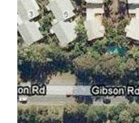
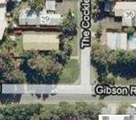
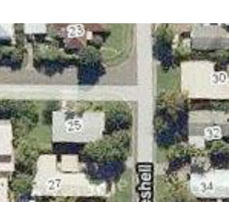
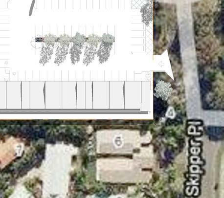
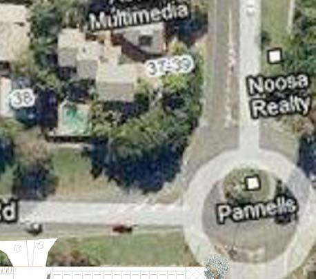
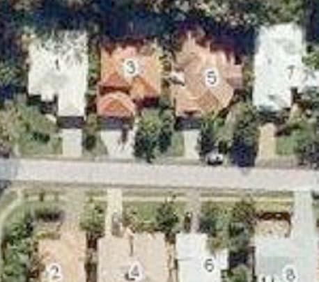
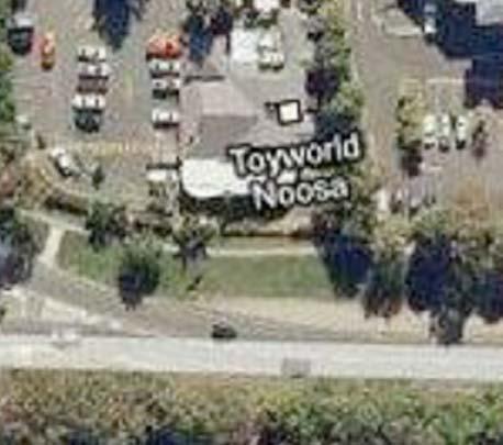
2 Architectural Design Report Background The scheme replaces an existing Nursery / Gardening Centre with a retail Centre consisting of a variety of food outlets, cafes, bakery, delicatessen and a general store. The design approach responds to the commercial requirements of convenience shopping through the provision of: easily visible and accessible carparking, clear definition of vehicular and pedestrian entry, legible retail identification through the appropriate building siting, Built form and use of signage. In addition to considerations of commercial viability, the design proposition also responds sensitively to the locale. The building design has: a hardscape composition that is intended as a designed and memorable part of the development which incorporates significant existing and proposed landscaping, a highly articulated roof form that relates to adjacent residential building forms, thereby mitigating any possible issues with building mass and scale, a series of joining skillion roofs which associate with contemporary sunshine coast architecture, material and colour selections which associate with domestic architecture of the sunshine coast region, building form and materials detailed in manner that is responsive to the quality of light on the Sunshine Coast, signage that is integrated in a considered manner as part of the building design. Site Characteristics Locality & adjoining buildings The site is located along an arterial road diagonally opposite a significant retail shopping precinct with external carparking at the intersection of Skipper Place and Gibson Road Noosaville. The site is immediately neighboured by a residential area to the southern and western boundaries consisting of multi-residential and single residential dwellings. Transportation The site is accessed primarily by motor-vehicle. This pattern is likely to continue with a portion of users on bikes and pedestrians (local residents and workers). Topography The site is regular rectangular site with a street frontage to Gibson Road of approximately 80m. The site could be considered generally flat with the main grade located at approximately RL 4.0 ARCHITECTURAL DESIGN REPORT P1 Issue B 22/10/2010
3 Building Proposal Siting The building is sited to the rear of the property to enable easily visible and accessible carparking located to the front of the site, set amongst existing and proposed native landscape. The building is sited to maintain a presence to the street front, at an appropriate domestic scale, with the majority of the building setback so as not to dominate the street edge. Building Character It is critical to understand the brief from Marquette Properties has been to incorporate the often residual, though large proportions of retail developments (ie. the car zone with is 70% of the site) into the composition so as to be a memorable and comfortable place to shop. The over-riding presence of the development, therefore, will be that it is a complete composition of interior and exterior elements, including building exterior and interiors, landscape, coloured and patterned hardscape, lighting, bollards, signage, etc. Distinctive parts of the composition include: 1. The undulating roof, scaled to have an affinity with the architecture of the region. As the roof cantilevers towards the user, it provides a protected and light reactive pedestrian circulation zone. At night, directional lighting will transform the soffit undulations into distinctive, folding planes of colour. This formal resolution has some association with examples of domestic architecture of the region, along with the south-east Queensland residential work of Donovan Hill. Additionally, it is a technique incorporated into the awarded Domain Resort Community Building at Point Lookout, North Stradbroke Island. 2. The use of colour. A coloured bulkhead above the glazed shopfront, along with the supergraphics of the carpark ground plane will compare against the more conventional shopfront installation. The colour and pattern of the carpark surface will continue into the tenancies to more fully integrate the spatial relationship between building interior and external spaces. 3. The use of bespoke, purpose made fixtures and fittings that match the building design (such as light fittings, bike racks, refuse bins, bollards and signs) will form part of an overall integrated design approach to the centre. 4. Project specific signage incorporated into the exterior fabric and detail of the development. This will be strictly monitored through the life of the building through tenant guidelines. A pylon sign, of type and detail to match the building design, is proposed to signify the development and it s tenants from the approach along Gibson Road. Tenant signage is located under the undulating roof form, against the coloured bulkhead. Building Planning The building is single storey and L shaped. The development is planned with a variety of column free tenancy spaces, sized and allocated to suit intended market mix. Tenancies fronting each street include covered outdoor spaces to activate the public realm in an appropriate manner. Utilities and amenities have been provided for the development. They include bicycle parking, toilets, bike showers, bike lockers, toilet for persons with disability, refuse collection station, bin wash down area and gas bottle store. Lockable bicycle parking is allocated adjacent the vehicular / pedestrian access points to the site. The utilities and amenities are planned to the corner of the building for screening from public view. The refuse recycling station is located inside a room to mitigate impacts of visual amenity, acoustic disturbance, and odours to neighbours. Building Section The building has a series of joining skillion roofs. The roof pitch rises towards the street front so as not to present the roof sheeting in the publicly visible elevation. The parapet walls to the rear of the building project above the gutter line so as to visually screen and acoustically conceal rooftop plant and equipment from neighbouring dwellings. The roof cantilevers beyond the building line to provide covered protection to the tenancy walkway and outdoor terraces to the gable ends of the building. The gable ends, with sloping roof and cantilevered canopies present to the street frontages at an appropriate domestic scale. The entire development including bespoke, sculptural pylon signage are under the 8m height datum. ARCHITECTURAL DESIGN REPORT P2 Issue B 22/10/2010
4 Construction System and Materials The building will be built from a hybrid structural system consisting of coloured tilt panel construction with braced steel framed portals. Roofing is colourbond metal deck, with gable infills where the skillions join finished with painted fibrous cement, (in the manner of residential architecture). Roof flashings and profiles will be finely detailed to match the roof colour and profile. Shop fronts will be flush glazed with coloured frames. Bulkhead infill wall between the shopfront head datum and the undulating roofs will be painted fibrous cement, and will incorporate a tenancy signage band. ESD The development will incorporate ESD initiatives. Rainwater will be harvested for landscape irrigation and refuse bin washdown. A recycling refuse area will also be provided for handling various waste type. Wheelie bins will be used to separate glass, plastics and cardboard/paper recycling. A refrigerated cool room will hold bins for food scrap. Bicycle parking, showers, and bike lockers will also be provided for use by the building staff and patrons. Response to Locale Addressing Streetscape The proposed design integrates with the streetscape through a composition that includes relatively small scale building gables fronting each street. The wall elevation facing Gibson Road is approximately 16 m long, while the wall elevation facing Skipper Place is approximately 8m long. In addition, each elevation opens onto an occupied and covered outdoor terrace. Additionally a landscape buffer is provided to the full length of the site frontage to Gibson Road and Skipper Place, broken only by vehicle and pedestrian cross over. The gable ends are therefore domestic in scale, and express the residential skillion roof forms of the cross section, along with the cantilevered canopy. This approach will present appropriately scaled building forms to the streetscape in a manner that is complimentary to the contemporary Sunshine Coast vernacular and locale. Landscape intent will also play a significant role in integrating the building into the local environment. Where noted on the plans existing significant vegetation will be retained. Native vegetation is planned to the carparking area and landscape buffers to the perimeter of the as described above. In addition to the landscape being incorporated in the total composition of the specific development, it will also integrate the idea of buildings in the landscape as part of the broader landscape setting of the locale. Neighbourhood Impact A 3m setback is provided along neighbouring boundaries with a 2m high fence. There will be a 2m wide landscape buffer and 1m wide service path planned as part of the 3m wide setback. As described above, the building is domestic in scale, and single storey in height along the southern and western boundaries. In some instances the proposed development is lower than the height of neighbouring buildings. As previously noted the roof profile will be articulated into a series of smaller scale parts. ARCHITECTURAL DESIGN REPORT P3 Issue B 22/10/2010
5 Development Summary A full summary of the development statistics are recorded on the Development Application drawings (DA 003). Conclusion The development replaces the current Nursery and Garden Centre with a new and improved retail offering. The development will improve the streetscape by a structured and considered building form with minimum impact to the street scape. The development is conscious of neighbourhood impact by providing landscape zones, acoustic screens and fence and keeping high points away from adjoining sites. It retains the current pattern of traffic access and service vehicles are fully manoeuvrable within the site. The development is under the permitted plot ratio and 8m height datum. Furthermore, the development proposes a high design standard and intended tenant mix above that of a typical retail development offering, and in planning and architectural terms a positive contribution to Noosaville. ARCHITECTURAL DESIGN REPORT P4 Issue B 22/10/2010
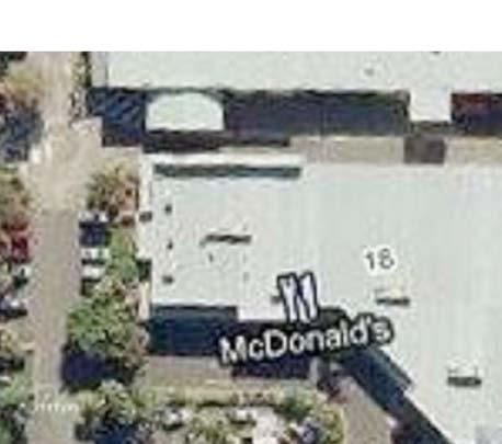
6 Statement of Landscape Intent Cardno-Splat Landscape Character Noosaville is a charming mix of residential and low key urban development. The streets are well vegetated, mostly lined with mature street trees and feature extensive landscaping within the road reserves and roundabouts. Local native Eucalypts and Melaleucas are the dominant tree species, with Pandanus used as a feature tree, particularly in roundabouts and front gardens. The town s main urban centre lies to the north of the site, along Gympie Terrace and opposite the Noosa River. Extensive riverside parklands line the Noosa River through Noosaville, featuring large and mature shade trees, amenity buildings, open grass areas, picnic areas and direct views through to the river. The site for the proposed retail centre is located on the corner of the arterial Gibson Road and local street Skipper Place, south of Noosaville s urban precinct. Diagonally opposite, and sharing the intersection, is a much larger retail outlet and MacDonalds restaurant with extensive car parking to the Gibson Road frontage. The car parking is buffered from the road through the use of canopy trees combined with low growing plants and gardens to their base. Gibson Road is well vegetated with street trees and extensive gardens in both the road reserve and adjacent properties. This is a deliberate planning outcome that has been encouraged by Council. Most residences are accessed from other local streets, which has enabled the establishment of extensive vegetative buffering to the arterial road, and lending a canopy forest-like character to the local area. Similarly, Skipper place is lined with closely planted Melaleuca and Eucalypts, effectively forming a small gateway into the adjacent residential area. The proposed car parking will be located to the Gibson Road and Skipper Place frontage. The proposed retail centre s landscape will seek to retain the existing vegetation along these frontages, especially the mature Eucalypts. Additional tree plantings will ensure adequate shade provision to the car park area. Gardens are proposed to the site s perimeter, to both road frontages and along its shared residential boundaries. It is intended that the landscape development on the site will, over time, result in a well shaded and pleasant shopping precinct that contributes positively to the vegetative character of the local area while providing the visual exposure required by the retail outlets within the centre. Visual Impacts The retention of significant vegetation in the road reserves and on the periphery of the proposed car park area will go a long way towards minimising the visual impact of the proposed development on the existing streetscape and local area. Historically, the site has accommodated commercial / retail land uses, most recently an established retail nursery. Therefore the visual impact of this new development on the street is unlikely to be locally controversial. The site is not especially visible from scenic vantage points or other public spaces, such that scenic amenity considerations will not apply to the site, with the exception of retaining existing canopy trees where possible, and establishing a well shaded car parking area. Landscape Buffers Landscaping is required to buffer the adjacent residences from the activities in the proposed retail centre. The landscape will consist of a two metre wide, slightly mounded planting area against the boundary fence, and edged with a one metre wide pathway providing pedestrian access to the rear of the proposed retail centre. The species used will need to include tall slender and bushy shrubs to act as a visual screen above the fence, and to soften the impact of the fence on the narrow back-of-house zone associated with the residential development. Species will be selected from Council species lists for the Open Forest/Woodland character area to ensure their appropriateness to the site and soil conditions. STATEMENT OF LANDSCAPE INTENT P1 Issue A 18/10/2010
7 Water Sensitive Design Initiatives The storm water design for the site includes bioretention areas in the car park and rain gardens along the boundaries with adjoining residences. Both areas will be similarly landscaped, utilising key design and construction principles developed by the Healthy Waterways partnership. Plant species will include Carex, Isolepis, Dianella, Gahnia and Juncus, selected for their suitability for their water purifying qualities, general hardiness and ease of maintenance. Climatic Considerations The site is oriented to the north east. Negative influences, predominantly cold westerly winds and hot northwesterly winds are buffered by the building. The use of clear trunked canopy trees and low understorey plantings to the northern and eastern boundaries will ensure that any prevailing north easterlies can enter and effectively cool the site. Canopy trees along the northern alignment will shade the car park area through the summer months. STATEMENT OF LANDSCAPE INTENT P2 Issue A 18/10/2010
SCHEDULE 12 TO THE DESIGN AND DEVELOPMENT OVERLAY GLEN WAVERLEY ACTIVITY CENTRE STRUCTURE PLAN
 DD/MM/YY Proposed C120 SCHEDULE 12 TO THE DESIGN AND DEVELOPMENT OVERLAY Shown on the planning scheme map as DDO12. GLEN WAVERLEY ACTIVITY CENTRE STRUCTURE PLAN 1.0 Design objectives DD/MM/YY Proposed
APPENDIX MATAKANA COMMERCIAL URBAN DESIGN GUIDELINES
 APPENDIX MATAKANA COMMERCIAL URBAN DESIGN GUIDELINES 1.0 INTRODUCTION The following urban design guidelines are to be utilised by landowners, planners and other persons involved in development at early
FRUITVALE TRANSIT VILLAGE (Phase 2) Residential Project
 Residential Project") FRUITVALE TRANSIT VILLAGE (Phase 2) Residential Project DEVELOPER: SIGNATURE PROPERTIES ARCHITECT: HKIT ARCHITECTS April 23, 2010 TABLE OF CONTENTS 3 Vision 4 Description of Site 5 Guiding Concepts 6
FRUITVALE TRANSIT VILLAGE (Phase 2) Residential Project DEVELOPER: SIGNATURE PROPERTIES ARCHITECT: HKIT ARCHITECTS April 23, 2010 TABLE OF CONTENTS 3 Vision 4 Description of Site 5 Guiding Concepts 6
MASTER PLAN NO. 62 (SITE DEVELOPMENT PLAN BIRTINYA VILLAGE CENTRE) 2009
 2009") Development Agreement, Development Control Plan 1 - Kawana Waters and Section 6.1.45A (Development Control Plans under Repealed Act) of the Integrated Planning Act 1997 MASTER PLAN NO. 62 (SITE DEVELOPMENT
Development Agreement, Development Control Plan 1 - Kawana Waters and Section 6.1.45A (Development Control Plans under Repealed Act) of the Integrated Planning Act 1997 MASTER PLAN NO. 62 (SITE DEVELOPMENT
Commercial Development Permit Area
 City of Kamloops KAMPLAN Commercial Development Permit Area PURPOSE The purpose of this Development Permit Area (DPA) is to establish objectives and provide guidelines for the form and character of commercial
Urban Design Brief to 1557 Gordon Street & 34 Lowes Road West
 Urban Design Brief 1533 to 1557 Gordon Street & 34 Lowes Road West Reid s Heritage Homes Ltd. & 883928 Ontario Ltd. and RHH Property Management Ltd. City of Guelph Zoning By-law Amendment November 2017
Urban Design Brief 1576 Richmond Street City of London
 Urban Design Brief City of London Treadstone Developments October 31, 2014 Urban Design Brief October 31, 2014 TABLE OF CONTENTS Page No. INTRODUCTION... 1 SECTION 1 LAND USE PLANNING CONCEPT... 1 1.1
Mixed Use Centres Development Permit Guidelines
 1 Mixed Use Centres Development Permit Guidelines Area Commercial or Mixed Use development occurring in City Centre, Urban Centre, Neighbourhood Centre, or Institutional Complex land use designations is
Proposed for Vic West Neighbourhood Plan. Design Guidelines for Intensive Residential Development - Townhouse and Attached Dwelling
 Proposed for Vic West Neighbourhood Plan Design Guidelines for Intensive Residential Development - Townhouse and Attached Dwelling Design Guidelines for Intensive Residential Development - Townhouse and
22.15 OUTDOOR ADVERTISING SIGNAGE POLICY
 22.15 OUTDOOR ADVERTISING SIGNAGE POLICY This policy applies to all land where a planning permit is required to construct or display a sign under the provisions of the Kingston Planning Scheme. 22.15-1
Planning scheme policy for Landsborough (urban design guidelines)
") SC6.2 SC6.2.1 Planning scheme policy for Landsborough (urban design guidelines) Purpose The purpose of this planning scheme policy is to provide advice about achieving outcomes in the Landsborough local
SC6.2 SC6.2.1 Planning scheme policy for Landsborough (urban design guidelines) Purpose The purpose of this planning scheme policy is to provide advice about achieving outcomes in the Landsborough local
Policies and Code Intent Sections Related to Town Center
 Policies and Code Intent Sections Related to Town Center The Town Center Vision is scattered throughout the Comprehensive Plan, development code and the 1994 Town Center Plan. What follows are sections
CHAPTER 13 DESIGN GUIDELINES
 CHAPTER 13 DESIGN GUIDELINES Section 1300.00 Section 1300.01 Design Guidelines Purpose The purposes of this section are to: A. The purpose of this Section is to establish procedures and standards to serve
Ensure that development within the Arrowtown Urban Growth Boundary provides:
 URBAN DEVELOPMENT 4 4.2.5.2 Ensure that development within the Arrowtown Urban Growth Boundary provides: an urban form that is sympathetic to the character of Arrowtown, including its scale, density, layout
City of Vaughan Urban Design Guidelines for Infill Development in Established Low-Rise Residential Neighbourhoods
 City of Vaughan Urban Design Guidelines for Infill Development in Established Low-Rise Residential Neighbourhoods DRAFT - September 2016 Contents 1. Introduction 1 2. Policy Context 3 3. Characteristics
PART 05 VISUAL SETTING
 PART 05 VISUAL SETTING 5.1 How to use the Visual Settings 5.2 Views from the Headland 5.3 Creek Foreshore Park Looking North 5.4 Bridge looking North 5.5 Bridge looking West 5.6 Bridge looking South 5.7
AIRPORT BUSINESS PARK
 PIER MAC PETROLEUM INSTALLATION LTD. AIRPORT BUSINESS PARK DEVELOPMENT APPLICATIONS March 2003 4.1 Airport Business Park Development Permit Area 4.1.1 Justification/Design Concept The design concept envisioned
I539. Smales 2 Precinct
 I539. Smales 2 Precinct I539.1. Precinct Description The Smales 2 Precinct applies to a 4.8 hectare block of land located on the southern side of Northcote Road and fronting Lake Pupuke, Takapuna. The
PUBLIC RIGHT-OF-WAY IN THIS CHAPTER PUBLIC REALM
 PUBLIC RIGHT-OF-WAY This section provides design guidelines for improvements in the public right-of-way. The public right-of-way refers to streets, sidewalks, non-vehicular thoroughfares, parks and greenways
Official Community Plan Bylaw No. 4360, 2004, Amendment Bylaw No. 4897, 2016 (Sewell s Landing)
") District of West Vancouver Official Community Plan Bylaw No. 4360, 2004, Amendment Bylaw No. 4897, 2016 (Sewell s Landing) Effective Date: 1089612v1 District of West Vancouver Official Community Plan Bylaw
District of West Vancouver Official Community Plan Bylaw No. 4360, 2004, Amendment Bylaw No. 4897, 2016 (Sewell s Landing) Effective Date: 1089612v1 District of West Vancouver Official Community Plan Bylaw
New-Cast Mixed-use Development Proposal King Street West, Newcastle, Ontario
 URBAN DESIGN BRIEF New-Cast Mixed-use Development Proposal King Street West, Newcastle, Ontario TABLE OF CONTENTS: 1.0 Executive Summary 2.0 Creating Vibrant and Sustainable Urban Places: Excerpts from
Sierra Springs Regional Commercial Master Site Plan Airdrie, Alberta Hopewell Development Corporation Project No May 26, 2010
 Sierra Springs Regional Commercial Master Site Plan Airdrie, Alberta Hopewell Development Corporation Project No. 205-077 May 26, 2010 TABLE OF CONTENTS Purpose... 2 Master Site Plan Guidelines... 3 Overall
FRASER LANDS CD-1 GUIDELINES (BLOCKS 68 AND 69) Adopted by City Council April 1989
 Adopted by City Council April 1989") $1 City of Vancouver Land Use and Development Policies and Guidelines Community Services, 453 W. 12th Ave Vancouver, BC V5Y 1V4 F 604.873.7344 fax 873.7060 planning@city.vancouver.bc.ca FRASER LANDS CD-1
$1 City of Vancouver Land Use and Development Policies and Guidelines Community Services, 453 W. 12th Ave Vancouver, BC V5Y 1V4 F 604.873.7344 fax 873.7060 planning@city.vancouver.bc.ca FRASER LANDS CD-1
Extract from Whitehorse Planning Scheme - LOCAL PLANNING POLICIES - CLAUSE Preferred Character Statements
 Extract from Whitehorse Planning Scheme - LOCAL PLANNING POLICIES - CLAUSE 22.03 22.03-5 Preferred Character Statements Bush Environment The streetscapes will be dominated by vegetation with subservient
4. INDUSTRIAL 53 CASTLE ROCK DESIGN
 4. INDUSTRIAL 53 CASTLE ROCK DESIGN CASTLE ROCK DESIGN 54 4. INDUSTRIAL Overview Well-designed and attractive industrial centers are the product of blending economic realities with both functional and
medium desnity housing
 This section updated September 2013 This part of the Plan sets out the assessment criteria for medium density housing. The criteria are designed to give designers and builders flexibility and to provide
6 Site Framework Strategies
 6 Site Framework Strategies 6.1 Introduction Section 6 identifies a number of specific areas which are considered to be key sites within the Plan area and which may have potential for development / redevelopment.
URBAN DESIGN BRIEF. 2136&2148 Trafalgar Road. Town of Oakville
 URBAN DESIGN BRIEF 2136&2148 Trafalgar Road Town of Oakville Prepared By: METROPOLITAN CONSULTING INC For 2500674 Ontario Inc November 2016 TABLE OF CONTENTS Page No. 1.0 Introduction/Description of Subject
URBAN DESIGN BRIEF URBAN DESIGN BRIEF 721 FRANKLIN BLVD, CAMBRIDGE August 2018
 URBAN DESIGN BRIEF URBAN DESIGN BRIEF 721 FRANKLIN BLVD, CAMBRIDGE August 2018 DESIGN BRIEF CONTENTS PART A 1.0 INTRODUCTION 2.0 DESCRIPTION & ANALYSIS OF SITE CONTEXT 3.0 DESIGN CONSTRAINTS AND OPPORTUNITIES
Design Guidelines - 1 -
 Design Guidelines REAR YARDS Rear yard decks and porches, attached to a garden or garage suite, should be permitted provided minimum rear yard setbacks, separation distances, and necessary site access
Urban Design Brief December 23, 2015 Southside Construction Group Official Plan & Zoning By-Law Amendment
 Urban Design Brief Proposed Official Plan & Zoning By-Law Amendment 3244, 3263 and 3274 Wonderland Road South Southside Group December 23, 2015 TABLE OF CONTENTS Page No. INTRODUCTION... 1 SECTION 1 LAND
Division 13 Local Business and Industry Buffer Zone: Assessment Criteria and Assessment Tables
 Division 13 Local Business and Industry Buffer Zone: Assessment Criteria and Assessment Tables 4.13.1 Local Business and Industry Buffer Zone The provisions in this division relate to the Local Business
MIXED-USE ZONING DISTRICT DESIGN GUIDELINES
 MIXED-USE ZONING DISTRICT DESIGN GUIDELINES In addition to the development regulations contained in the Mixed-Use Zoning District, design guidelines are presented here to provide an added level of definition
4.0 Design Guidelines For The Village Centre. South fields Community Architectural Design Guidelines Town of Caledon
 4.0 Design Guidelines For The Village Centre 4.0 Design Guidelines for the Village Centre The Village Centre is the focal point of the entire South Fields Community and is designed as a traditional commercial
Multi family Residential Development Permit Area
 City of Kamloops KAMPLAN Multi family Residential Development Permit Area PURPOSE The purpose of this Development Permit Area (DPA) is to establish objectives and provide guidelines for the form and character
RIVERSIDE DESIGN CD-1 GUIDELINES. Adopted by City Council August 9, 1983
 $1 City of Vancouver Land Use and Development Policies and Guidelines Community Services, 453 W. 12th Ave Vancouver, BC V5Y 1V4 F 604.873.7344 fax 873.7060 planning@city.vancouver.bc.ca RIVERSIDE DESIGN
URBAN DESIGN BRIEF 305, 309, & 315 SOUTHDALE ROAD WEST LONDON ONTARIO
 URBAN DESIGN BRIEF 305, 309, & 315 SOUTHDALE ROAD WEST LONDON ONTARIO CARVEST PROPERTIES LTD. December 2013 Section 1 - Land Use Planning Context 1.1 Subject Lands The subject lands are located immediately
GUIDELINES REPLACEMENT HOUSING GUIDELINES LOCATION INTRODUCTION URBAN DESIGN GUIDELINES
 Replacement housing in the former City of North York will be consistent with the following urban design guidelines. They provide a framework for residential re-development in the former City of North York
4 RESIDENTIAL ZONE. 4.1 Background
 4 RESIDENTIAL ZONE 4.1 Background The residential areas within the City are characterised by mainly lowrise dwellings sited on individual allotments. Past architectural styles, settlement patterns and
Bel-Air Lexus Automobile Service Station
 Bel-Air Lexus Automobile Service Station Design Brief 443-447 McArthur Avenue Ottawa April 30, 2015 14-1299-MCA Site Details Application: Site Plan Control Legal Description and Municipal Addresses: 443
Chapter 11. Industrial Design Guidelines 11.1 INTRODUCTION AND PURPOSE 11.3 SITE PLANNING GUIDELINES 11.2 GENERAL DESIGN OBJECTIVES
 Chapter 11 Industrial Design Guidelines 11.1 INTRODUCTION AND PURPOSE The following industrial/design guidelines seek to assure high quality development in Santa Ana s industrial districts by: The design
built form design guidelines
 built form design guidelines Derry Green Corporate Business Park 17 built form design guidelines.1 Built Form Design Guidelines Section : Built Form Design Guidelines is intended to be used by both developers
Highland Village Green Design Guidelines
 Highland Village Green Design Guidelines Publishing Information Title Highland Village Green Design Guidelins Author The City of Calgary Status DRAFT - Proposed document subject to changes Additional Copies
Draft Part 11 Heritage Area Plans West Wallsend / Holmesville
 TABLE OF CONTENTS: PART 1 WEST WALLSEND / HOLMESVILLE HERITAGE AREA PLAN... 3 1.1 INTRODUCTION... 3 1.2 BACKGROUND... 3 1.3 LAND TO WHICH THIS PLAN APPLIES... 3 PART 2 WEST WALLSEND / HOLMESVILLE HERITAGE
therry, elizabeth, franklin and queen: BLOCK plan
 therry, elizabeth, franklin and queen: BLOCK plan INTRODUCTION Therry, Elizabeth, Franklin and Queen Street block Purpose & background The City of Melbourne has prepared this document for developers and
FREEWAY/TOURIST DISTRICT
 FREEWAY/TOURIST DISTRICT DESIGN STANDARDS FOR THE CITY OF MOUNTLAKE TERRACE March, 2014 MOUNTLAKE TERRACE FREEWAY/TOURIST DESIGN STANDARDS March, 2014 1 TABLE OF CONTENTS Introduction...1 Design Site Design
PDP DESIGN & ACCESS STATEMENT
 PDP The Planning & Design Partnership Planning.. Architecture.. Interiors.. Landscape The Chicory Barn Studio, The Old Brickyards, Moor Lane, Stamford Bridge York, The East Riding Of Yorkshire, YO41 1HU.
Part 10 Town Centre Area Plans Toronto
 CONTENTS: 1 INTRODUCTION... 3 1.1 BACKGROUND... 3 1.2 EXISTING CHARACTER... 4 1.3 ENVIRONMENTAL CONSTRAINTS... 6 1.4 DESIRED FUTURE CHARACTER... 6 2 DEVELOPMENT CONTROLS... 8 2.1 BLOCK CONTROLS... 9 3
DRAFT DRAFT DRAFT DRAFT
 # 19 EXPAND GREEN AND OPEN SPACES AND COMMUNITY FACILITIES IN TANDEM WITH NEW DEVELOPMENT The role of Eglinton will change in the coming years, along with the intensity of activity and land uses. As more
Division 9 Southwood Ranch (CR 484/475/475A Corridor-Gateway Development Overlay) Purpose and Intent Applicability.
 Purpose and Intent Applicability.") Division 9 Southwood Ranch (CR 484/475/475A Corridor-Gateway Development Overlay) 5.9.1 Purpose and Intent. The Southwood Ranch Overlay is intended to be a mixed use community with commercial and residential
Division 9 Southwood Ranch (CR 484/475/475A Corridor-Gateway Development Overlay) 5.9.1 Purpose and Intent. The Southwood Ranch Overlay is intended to be a mixed use community with commercial and residential
PLANNING RATIONALE FOR THE PROPOSED RIVERSIDE SOUTH ELEMENTARY SCHOOL 715 BRIAN GOOD AVENUE, OTTAWA, ON
 PLANNING RATIONALE FOR THE PROPOSED RIVERSIDE SOUTH ELEMENTARY SCHOOL 715 BRIAN GOOD AVENUE, OTTAWA, ON Conseil des écoles publiques de l'est de l'ontario (CEPEO) French Public School Board TABLE OF CONTENTS
lot flankage Y street 16m 6m landscape strip for large site 3m landscape strip for small medium site
 Commercial General Commercial Objectives Create developments compatible with adjacent land uses in scale, function and character Define a consistent and attractive street edge with quality landscaping,
5.1 Site Plan Guidelines
 5. Community Core Guidelines Development of the Community Core will take place by plan of subdivision and site plan approval. It will occur in a phased manner that will reflect the timing of residential
Urban Design Guidelines Townhouse and Apartment Built Form
 Urban Design Guidelines Townhouse and Apartment Built Form Town of Wasaga Beach Table of Contents 1. Introduction 1.1. Purpose 1.2. Urban Design Principles 1.3. Application of Guidelines 2. Site Design,
URBAN DESIGN BRIEF Gordon Street City of Guelph. Prepared on behalf of Ontario Inc. March 25, Project No. 1507
 URBAN DESIGN BRIEF 1131 Gordon Street City of Guelph Prepared on behalf of 1876698 Ontario Inc. March 25, 2016 Project No. 1507 423 Woolwich Street, Suite 201, Guelph, Ontario, N1H 3X3 Phone (519) 836-7526
Section Three, Appendix 16C Medium Density Housing, Design Assessment Criteria (Residential 8A zone)
") APPENDIX 16C MEDIUM DENSITY HOUSING, DESIGN ASSESSMENT CRITERIA (RESIDENTIAL 8A ZONE) PURPOSE OF APPENDIX 16C (RESIDENTIAL 8A ZONE) In the Residential 8A Zone the following are defined as restricted discretionary
APPENDIX 16C MEDIUM DENSITY HOUSING, DESIGN ASSESSMENT CRITERIA (RESIDENTIAL 8A ZONE) PURPOSE OF APPENDIX 16C (RESIDENTIAL 8A ZONE) In the Residential 8A Zone the following are defined as restricted discretionary
Urban Design Manual 2.0 DRIVE-THROUGH FACILITIES. Background. Urban Design Challenges
 222221 2.0 DRIVE-THROUGH FACILITIES Background In recent years, drive-through facilities have grown significantly in popularity with drive-through restaurants, in particular, being established on numerous
MVRC ARCHITECTURAL DESIGN STATEMENT
 11251 MOONEE VALLEY RACING CLUB MAY 201 CONTENTS 0 Contents Introduction 1 Site Analysis a. Site Features b. Built form Interfaces c. Existing Streetscape d. Site Opportunities and Constraints 2 Masterplan
CENTERS AND CORRIDORS
 INITIAL DESIGN STANDARDS AND GUIDELINES for CENTERS AND CORRIDORS City of Spokane Planning Services Third Floor, City Hall 808 W. Spokane Falls Blvd. Spokane, WA 99201-3329 (509) 625-6300 www.spokaneplanning.org
DRAFT Northeast Quadrant of Kipling Avenue and Highway 7 DRAFT AUGUST 29, Goals Land Use. The goals of this Plan are to:
 AUGUST 29, 2017 12.15 Northeast Quadrant of Kipling Avenue and Highway 7 12.15.1 Goals 12.15.2 Land Use The goals of this Plan are to: 12.15.2.1 General Provisions: a) Ensure the development of a compact
Clairtrell Area Context Plan
 Clairtrell Area Context Plan March 2005 Urban Development Services City Planning Contents 1. Introduction... 4 2. Development Structure... 6 2.1 Streets... 7 2.1.1 Sheppard Avenue and Bayview Avenue...
Urban Design Brief Fanshawe Park Road. Competition Toyota
 Urban Design Brief 1300 Fanshawe Park Road Competition Toyota May 2, 2014 TABLE OF CONTENTS Page No. INTRODUCTION... 1 SECTION 1 LAND USE PLANNING CONTEXT... 1 1.1 The Subject Lands... 1 1.2 The Proposal...
I404 Beachlands 2 Precinct
 I404. Beachlands 2 I404.1. Precinct Description The Beachlands 2 precinct covers approximately 6 hectares of land at the corner of Beachlands and Whitford Maraetai Roads. Its purpose is to provide for
4.1.3 LAND USE CATEGORIES
 4.1.3 LAND USE CATEGORIES a. City Center District The City Center District incorporates the existing character and mix of uses in downtown Belmont to encourage redevelopment and new development in keeping
CHAPTER FIVE COMMUNITY DESIGN
 CHAPTER FIVE COMMUNITY DESIGN CHAPTER FIVE - COMMUNITY DESIGN Assumptions Frazier Park and Lebec have historically developed according to different patterns of spatial form. While both communities are
I615. Westgate Precinct
 I615. Westgate Precinct I615.1. Precinct Description The Westgate Precinct is located approximately 18km west of the Auckland city centre. There are seven Sub-precincts in the Westgate Precinct: Sub-precinct
Memorial Business Park Site. Proposed Future Development. Design guidelines. August
 Memorial Business Park Site Proposed Future Development Design guidelines August 2014 www.designenvironment.co.nz 0064 3 358 3040 Contents 1.0 Background 1.1 Introduction 3 1.2 Objectives 4 2.0 Context
Housing Development at Balloonagh Tralee Co Kerry
 Design Statement Housing Development at Balloonagh Tralee Co Kerry Area of site 10,400m2 24 houses-12no 3 bed, 12no 2 bed and 4 single bed apartments total residential area of 2411m2 Open space provided
MASTER PLAN NO. 60 (SITE DEVELOPMENT PLAN EASTBANK/REGATTA NORTH PRECINCTS 2 4) 2008
 2008") Page 2 TABLE OF CONTENTS PAGE 1 PRELIMINARY... 5 1.1 CITATION... 5 1.2 TYPE OF MASTER PLAN... 5 1.3 LEGAL REQUIREMENT FOR MASTER PLAN... 5 1.4 LEGAL EFFECT OF THE MASTER PLAN... 5 2 DESCRIPTION OF LAND...
Page 2 TABLE OF CONTENTS PAGE 1 PRELIMINARY... 5 1.1 CITATION... 5 1.2 TYPE OF MASTER PLAN... 5 1.3 LEGAL REQUIREMENT FOR MASTER PLAN... 5 1.4 LEGAL EFFECT OF THE MASTER PLAN... 5 2 DESCRIPTION OF LAND...
WEST LOOP DESIGN GUIDELINES CHECKLIST
 WEST LOOP DESIGN GUIDELINES CHECKLIST Section 1.0 General Strategies 1.1 DESIGN EXCELLENCE: ENCOURAGE HIGH QUALITY AND INNOVATIVE DESIGN OF NEW BUILDINGS WITHIN THE WEST LOOP WITHOUT BEING PRESCRIPTIVE
Regency Developments. Urban Design Brief. Holyrood DC2 Rezoning
 Regency Developments Urban Design Brief Holyrood DC2 Rezoning Stantec Consulting Ltd. 7-31-2017 1. Overview Regency Developments intends to rezone the lands located at 8510 and 8511 93 Avenue, within the
6.6.2 Emerging Community Zone Code Application Purpose and overall outcomes. s6 Zone Codes Emerging Community and Township Zone Codes
 6.6.2 Emerging Community Zone Code 6.6.2.1 Application This code applies to assessable development:- (1) within the Emerging Community Zone as identified on the zoning maps contained within Schedule 2
B L A C K D I A M O N D D E S I G N G U I D E L I N E S for Multi-family Development
 B L A C K D I A M O N D D E S I G N G U I D E L I N E S for Multi-family Development Adopted June 18, 2009 This section of the Design and focuses on site planning and design guidance for new multi-family
WELLINGTON HOSPITAL DESIGN GUIDE TABLE OF CONTENTS
 WELLINGTON HOSPITAL DESIGN GUIDE TABLE OF CONTENTS 1.0 Introduction Page 2 The Place of Wellington Hospital 2 The Future of the Hospital 2 2.0 The Intention of the Design Guide 3 3.0 Analysis 4 General
appendix and street interface guidelines
 appendix five: building and street interface guidelines appendix 5 building and street interface guidelines BOULEVARDS Boulevards are generally characterized by higher levels of traffic movement at higher
Urban Design Brief. 875 Wellington Road. Proposed One-Storey Fast Food Restaurant and Two-Storey Restaurant. Wellington Harlech Centre Inc.
 Urban Design Brief 875 Wellington Road Proposed One-Storey Fast Food Restaurant and Two-Storey Restaurant Wellington Harlech Centre Inc. Prepared By: (519) 433-7587 info@yorkdev.ca May 3 rd 2013 1 Table
II. SINGLE FAMILY RESIDENTIAL
 II. SINGLE FAMILY RESIDENTIAL Castle Rock is made up of numerous individually built houses and subdivision tracts that have been developed during the past century. Some of the tracts are diverse in architectural
Design Guidelines and Development Standards for Southwood Ranch. Prepared February, 2016 by
 Design Guidelines and Development Standards for Southwood Ranch D e s i g n D i s t r i c t Prepared February, 2016 by Table of Contents Introduction 2 District Overlay Map. 3 Development Standards. 4
LITTLETON CENTER DESIGN GUIDELINES
 LITTLETON CENTER DESIGN GUIDELINES Littleton Center Design Guidelines 1 I. DESIGN REVIEW PROCESS These Design Guidelines have been initially created by Hallin Family LLC (the "Developer"), and govern all
Gas Stations ottawa.ca
 Urban Design Guidelines for Gas Stations ottawa.ca Ce document est disponible en français sur ottawa.ca. This document is available in French on ottawa.ca. Approved by City Council May 24, 2006 City of
Housing and Coach House Guidelines - Ladner
 Housing and Coach House Guidelines - Ladner Policy D.8: Encourage Compatible Housing Design Encourage housing design that is sensitive to existing single family housing neighbourhoods by requiring a design
TOWN PLANNING REPORT. Sunshine Coast Suite 1, Corner Surf Road & Gardak St Alexandra Headland Qld 4572
 kha D E V E L O P M E N T M A N A G E R S TOWN PLANNING REPORT PLANNING SURVEYING PROJECT MANAGEMENT COURT APPEALS Sunshine Coast Suite 1, Corner Surf Road & Gardak St Alexandra Headland Qld 4572 PO Box
WINDSOR GLEN DESIGN GUIDELINES
 WINDSOR GLEN DESIGN GUIDELINES Adopted by Council, 2006 WINDSOR GLEN REDEVELOPMENT DESIGN GUIDELINES August 2006 1.0 Master Plan Organization For this area of the Coquitlam Town Centre, a mix of high,
Background Information
 Background Information view at site entrance THE LONDON BOROUGH OF SUTTON As the strategic local authority the Council is working with a range of partners to take forward various development sites in Hackbridge.
13. New Construction. Context & Character
 13. New Construction Context & Character While historic districts convey a sense of time and place which is retained through the preservation of historic buildings and relationships, these areas continue
CONTENTS 8.0 LAND USE 8.1 GENERAL LAND USE 8.2 RESIDENTIAL 8.3 MIXED USE 8.4 COMMERCIAL 8.5 EMPLOYMENT LANDS
 8-2 Land Use 8.0 LAND USE CONTENTS 8.1 GENERAL LAND USE 8.1.1 Uses provided for in all Land Use Designations 8.1.2 Uses prohibited in Hazardous Lands, Hazardous Sites and Special Policy Areas 8.1.3 Uses
CHAPTER 3. Design Standards for Business, Commercial, Industrial, Recreational and Institutional Uses
 CHAPTER 3 Design Standards for Business, Commercial, Section Number Title Ordinance Number Date of Ordinance 16-3-1 Applicability 2006-11 2008-04 07-01-08 16-3-2 Uniform Standards for Architectural Design
Industrial Development Permit Area
 Industrial Development Permit Area PURPOSE The purpose of this Development Permit Area (DPA) is to establish objectives and provide guidelines for the form and character of industrial development in the
RESIDENTIAL. QLDC PROPOSED DISTRICT PLAN [PART THREE] DECISIONS VERSION 8 medium density residential
![RESIDENTIAL. QLDC PROPOSED DISTRICT PLAN [PART THREE] DECISIONS VERSION 8 medium density residential](/thumbs/84/89275880.jpg "RESIDENTIAL. QLDC PROPOSED DISTRICT PLAN [PART THREE] DECISIONS VERSION 8 medium density residential") 8 MEDIUM DENSITY RESIDENTIAL QLDC PROPOSED DISTRICT PLAN [PART THREE] DECISIONS VERSION 8 medium density residential QLDC PROPOSED DISTRICT PLAN [PART THREE] DECISIONS VERSION 8 medium density residential
8 MEDIUM DENSITY RESIDENTIAL QLDC PROPOSED DISTRICT PLAN [PART THREE] DECISIONS VERSION 8 medium density residential QLDC PROPOSED DISTRICT PLAN [PART THREE] DECISIONS VERSION 8 medium density residential
Planning & Development. Background. Subject Lands
 Planning & Development APPLICATION BRIEFING Prepared For: Planning Advisory Committee Submitted by: Jason Fox, Director of Planning & Development Date: Subject: Development Agreement Application by Brentwood
Cit of Kitchener Ur 6 an Design Manual PARTA. Desi n for _--::
 Cit of Kitchener Ur 6 an Design Manual Date PARTA Year ) Desi n for k Nodes Corridors _--:: Section Page 01 of 12 2 INTRODUCTION Purpose & Application Nodes and Corridors have been identified as key intensification
7.2.9 Eudlo local plan code
 7.2.9 local plan code 7.2.9.1 Application (1) This code applies to assessable development:- (a) within the local plan area as shown on Map ZM29 contained within Schedule 2 (Mapping); and (b) identified
CITY OF MERCER ISLAND DESIGN COMMISSION STAFF REPORT
 CITY OF MERCER ISLAND DESIGN COMMISSION STAFF REPORT Agenda Item: 2 March 9, 2011 Project: Description: Applicant: DSR11-004 The applicant is requesting approval to replace the existing exterior wood framed
T O W N O F A J A X URBAN DESIGN GUIDELINES FOR MOTOR VEHICLE GAS BARS / SERVICE CENTRES
 T O W N O F A J A X URBAN DESIGN GUIDELINES FOR MOTOR VEHICLE GAS BARS / SERVICE CENTRES June 2006 Table of Contents TABLE OF CONTENTS... 1 1.0 INTRODUCTION... 2 1.1 Purpose... 2 1.2 Organization of the...
Cape Cabarita (Formerly known as the Wellcome Site) Development Control Plan. Date of Adoption: 4 September 2007 Effective Date: 7 March 2008
 Development Control Plan. Date of Adoption: 4 September 2007 Effective Date: 7 March 2008") Cape Cabarita (Formerly known as the Wellcome Site) Development Control Plan Date of Adoption: 4 September 2007 Effective Date: 7 March 2008 Development Control Plan Index 1 INTRODUCTION...3 1.1 LAND TO
Cape Cabarita (Formerly known as the Wellcome Site) Development Control Plan Date of Adoption: 4 September 2007 Effective Date: 7 March 2008 Development Control Plan Index 1 INTRODUCTION...3 1.1 LAND TO
ELMVALE ACRES SHOPPING CENTRE MASTER PLAN
 ELMVALE ACRES SHOPPING CENTRE MASTER PLAN Contents 1.0 INTRODUCTION... 2 2.0 LOCATION... 2 3.0 EXISTING CONTEXT... 2 4.0 VISION & GUIDING PRINCIPLES... 2 5.0 LAND USE AND BUILT FORM... 4 5.1 St. Laurent
MEMORANDUM. This memo deals with proposed amendments to previously issued Development Permit No for Park Royal North.
 MEMORANDUM Date: August 28, 2015 Our File: 1010-20-15-062 To: Design Review Committee From: Lisa Berg, Senior Community Planner Re: Amendment to Development Permit for Park Royal North This memo deals
Design Guidelines for Commercial Development
 Design Guidelines for Commercial Development Development Services 972-466-3225 cityofcarrollton.com Table of Contents Purpose...1 Design Objectives...2 Intent...3 Building Design Guidelines...4 Materials...5
Building and Site Design Standards
 Commercial Design Standards All Business and Industrial Uses as Described in Section 2234 Requiring Special Permit Review Except Large-Scale Ground Mounted Solar Photovoltaic Installations and Wireless
Tel: (705) Fax: (705)
 Fax: (705)") 521 and 525 Essa Road City of Barrie Tel: (705) 812-3281 Fax: (705) 812-3438 Email: INFO@IPSCONSULTINGINC.com 1 5 0 D U N L O P S T R E E T E A S T, S U I T E 2 0 1, B A R R I E O N T A R I O L 4 M 1 B
521 and 525 Essa Road City of Barrie Tel: (705) 812-3281 Fax: (705) 812-3438 Email: INFO@IPSCONSULTINGINC.com 1 5 0 D U N L O P S T R E E T E A S T, S U I T E 2 0 1, B A R R I E O N T A R I O L 4 M 1 B