2. Create streetlevel
|
|
|
- Myron Payne
- 6 years ago
- Views:
Transcription
 are to be visible, accessible, provide weather protection and contribute to the activation of public")
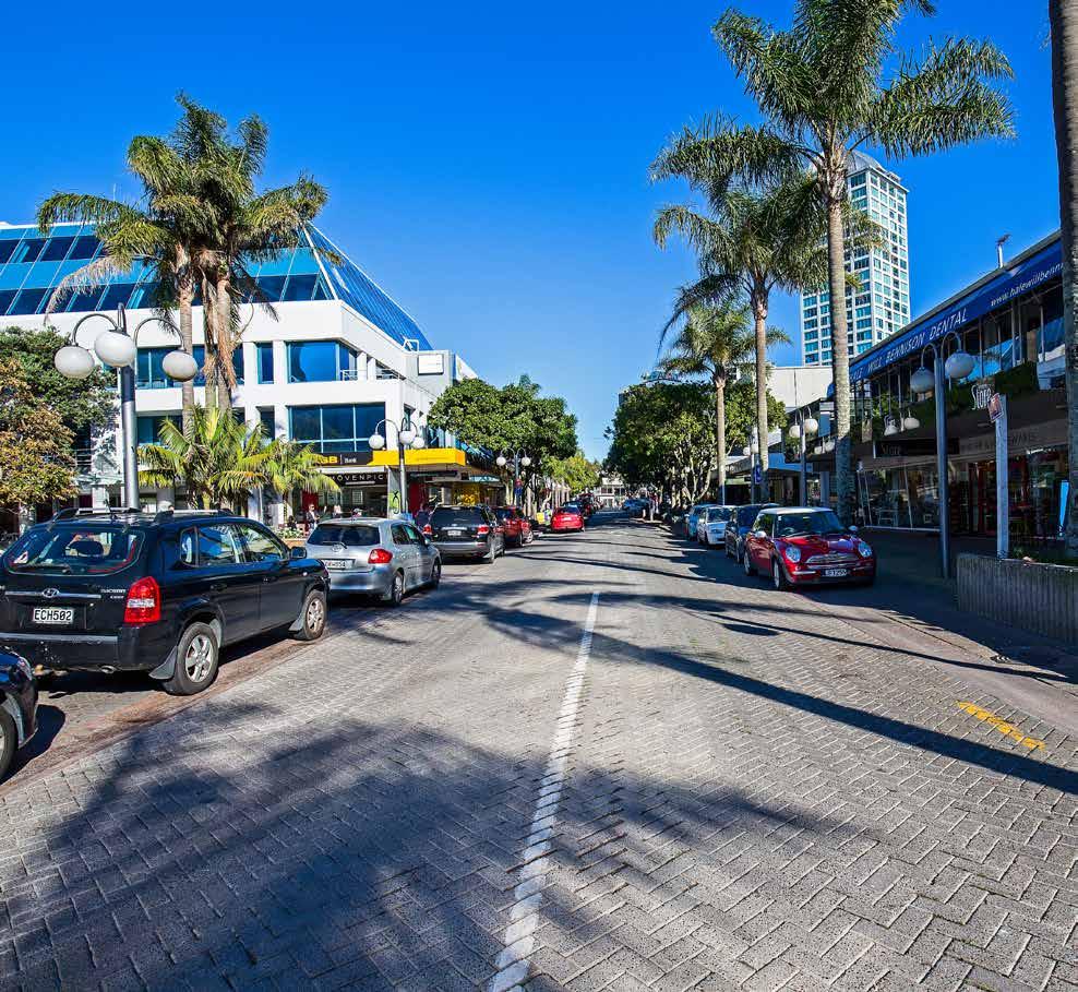
1 2. Create streetlevel vibrancy 2.1 Ensure building entrances are visible Building entrances (including to upper floor activities) are to be visible, accessible, provide weather protection and contribute to the activation of public open spaces. 2.2 Active uses at ground floor Active uses at ground floor to be achieved along street and priority laneway edges. 2.3 Parking on the Anzac Street site to be accessed from Anzac Street Primary vehicle access to the site for car parking to be from Anzac Street. Additional access from Lake Road via Anzac Lane to be minimised. 3. Foster Takapuna s urban identity 3.1 Distinctive identity is important We seek architectural variety that reflects the Takapuna context and conditions. 3.2 Fine grain is desirable The development should be read as a series of buildings, as opposed to a single development. 3.3 Building design should respond to street conditions Provide building frontages of a scale that relates to the adjacent public realm spaces and enables sunlight entry. Above this level, buildings should be set back and provide architectural variety suitable for more distant viewing. 3.4 Create urban edges Build to the street and lane edges, however building line variation can occur where it results in visual interest, building richness and is appropriate for the intended activity. 69
2 70
3 4. Positively contribute to Takapuna s skyline 4.1 Varied height and variable rooflines is desired Buildings to be designed to provide varied height and rooflines. A completely constant frontage height should be avoided. 4.2 Consider local and distant views for building design Key local and distant views (back to the site) to be considered in the design of any tall buildings. 4.3 Elegant architecture An elegant form for any building above frontage height is considered important. 4.4 Design to minimise dominance over public spaces Buildings to be designed to ensure Takapuna s appreciation of sunlight and the appearance of the sky at street-level is not compromised. 5. Ensure sustainability and liveability 5.1 People at the centre of Takapuna Car parking to be located below ground level where feasible. 5.2 Design with local climatic conditions Buildings to be sited and designed for passive solar gain and natural ventilation. Building and public realm design to be cognisant of local prevailing winds. Public realm to be located and designed to avoid and not make strong wind conditions worse. Dual aspect dwellings are desirable for ventilation benefits. With single aspect dwellings, avoid south-facing apartments. 5.3 Green Star Achieve 6 Homestar rating (or other appropriate rating) for new dwellings. 5.4 Create a variety of dwelling sizes A range of dwelling sizes to be accommodated in order to achieve a variety of price points. 6. Incorporate Te Aranga Māori Design Principles 6.1 Māori design Māori cultural association with Takapuna to be expressed in the public realm design and use of native planting. 6.2 Collaboration opportunities Further opportunities to work with mana whenua on other built form aspects to be explored. 71
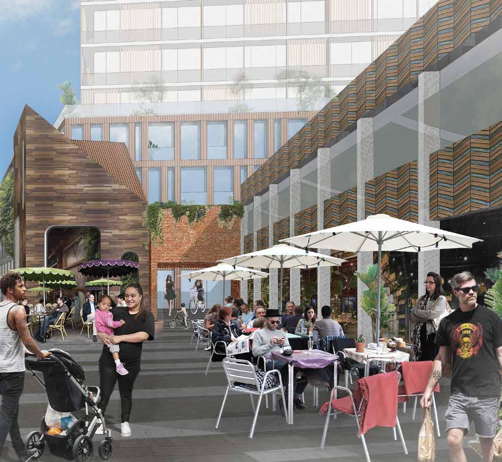
4 A possible plan for the Anzac Street car park site This plan shows how the design principles can be applied to the Anzac Street car park site. It illustrates one way in which the design principles can inform site design. 1. A new public space that can be used flexibly in conjunction with Hurstmere Road and Hurstmere Green. 2. New public spaces edged by activity and buildings, attracting and retaining people in the centre of Takapuna. 3. New laneways to complement the existing Fortieth & Hurstmere laneway and effectively connect the centre of Takapuna with the beach. 4. Align a new laneway to lead to a visual axis set up by Hurstmere Green to Rangitoto. 5. Development fronting onto Potters Park for added definition and surveillance. 6. Possible shared space environment along the existing service lane. 7. Street edges along Anzac Street and Lake Road defined by buildings with active ground floors. 8. Fine grain and varied height enabled across the site. 72

5 Anzac Street 5 7 Anzac Street car park site Potters Park 3 6 Hurstmere Road Shore City shopping mall Como Street Burger King restaurant Lake Road Hurstmere Green Scale 1:1000 0m 25m 50m 75m Key Unlock Takapuna sites Possible new buildings 73
6 Gasometer car park site Balance current-day demands for short-stay car parking with the potential to create building space for activities that contribute to the future vibrancy of Takapuna. Development on the Gasometer car park will focus on providing replacement car parking that is lost as a result of developing the Unlock Takapuna sites. This is consistent with the car parking strategy for Takapuna outlined in this Framework, as the site's location is at the periphery of Takapuna centre. Improvements to the street environment will be necessary to enhance the quality of the connection between this site and the centre of Takapuna. Site layout for new development should seek to provide a through-site link for block permeability advantages. A new north-facing public space is desirable. Under the Unitary Plan, the site has an unlimited height control. Development quantum is instead directed by a Floor Area Ratio (FAR) of 5:1. A bonus FAR of 1:1 is also available. 74
7 Looking south at the Gasometer car park site: Illustrating design principles and possible outcome for the site Creating Takapuna s skyline Varied height and variable rooflines is desired e nu Byron Ave Sustainability and liveability Design with local climatic conditions Takapuna urban identity Distinctive identity is important t ft Stree Northcro rn et re St Create two direct, open-aired through-site links bu Al A walkable network of public spaces Te Aranga Māori Design Principles Design opportunities Street-level vibrancy Huron t Stree Active uses at ground floor 75

8 Gasometer car park site design principles 1. Contribute to a walkable network of public spaces 1.1 Create a through-site link Seek to achieve a through-site link between Huron and Northcroft streets towards the eastern end of the site. 1.2 Public space Design for an attractive, sunny public space that is activated on all edges using quality materials. 1.4 Legible building entries Ensure building entrances (including to upper floor activities) are visible, accessible, provide weather protection and are located to contribute to activation of public space/streets. This approach to creating a walkable network of public spaces organises the site into a possible layout shown below. 1.3 Pedestrian egress from car parking to be located to bring people into key spaces Pedestrian entries/exits to any public car park building to be conveniently located and used to activate the public spaces and streets. 76

9 2. Create streetlevel vibrancy 2.1 Active uses at ground floor Active uses at ground floor to be achieved along all street edges. 2.2 Quality street edges Minimise the amount of street frontage occupied by any above-ground car parking building. A maximum of two vehicle entries into the site to access car parking and servicing. The location of any car park building should avoid the north and west street edges of the site as these are the optimal edges for sunlight and activity. 3. Foster Takapuna s urban identity 3.1 Distinctive identity is important We seek architectural variety that reflects the Takapuna context and conditions. 3.2 Fine grain is desirable The development should be read as a series of buildings, as opposed to a single block. 3.3 Create urban edges Build to the street edge, however building line variation can occur where it results in visual interest, building richness and is appropriate for the intended activity. 77

10 78
11 4. Positively contribute to Takapuna s skyline 4.1 Varied height and variable rooflines is desired Buildings to be designed to provide varied height and rooflines. A completely constant frontage height should be avoided. 4.2 Consider local and distant views for building design Local and distant views (of the site) to be considered in the design of tall buildings. 4.3 Elegant architecture An elegant form for any tall building is considered important. 4.4 Design to minimise dominance over public spaces Tall buildings to be designed to ensure Takapuna s appreciation of sunlight and the appearance of the sky at street-level are not compromised. Protection of public realm from wind effects generated by tall buildings is critical. 5. Ensure sustainability and liveability 5.1 Lifecycle considerations Any car park building to be designed for future adaptive reuse or to enable efficient replacement by a building with a different use, if car parks are surplus to future requirements. 5.2 Design with local climatic conditions Buildings to be sited and designed for passive solar gain and natural ventilation. Dual aspect dwellings are desirable for ventilation benefits. With single aspect dwellings, avoid south-facing apartments. 5.3 Green Star Achieve 6 Homestar rating (or other appropriate rating) for new dwellings. 5.4 Create a variety of dwelling sizes A range of dwelling sizes to be accommodated in order to achieve a variety of price points. 6. Incorporate Te Aranga Māori Design Principles 6.1 Collaboration opportunities Māori cultural association with Takapuna to be understood, considered in the design process and expressed in the public realm design. 79
12 A possible plan for the Gasometer car park site This plan shows how the design principles can be spatially applied to the Gasometer car park. It illustrates one way in which the design principles can inform site design. 1. A new laneway that creates an advantageous through-block link. 2. A new north-facing public space, edged by buildings and activity. 3. Above-ground multi-storey car park, located to minimise impacts on the street edge. More favourable aspect is retained for residential and/or commercial uses. 4. Create urban street edges with appropriate ground-floor conditions. 5. Vehicle entry to car park building is designed to minimise impact on the pedestrian street environment. 6. Tall buildings that create a positive impact on the skyline of Takapuna. 7. Fine-grain and varied height enabled across the site. 80

13 Gasometer car park site Huron Street 4 2 Sentinel Tower Auburn Street Possible car park building 5 Northcroft Street Key Scale 1:1000 0m 25m 50m 75m Unlock Takapuna sites Possible new buildings 81

14 New public space/ square opening out onto Hurstmere Road (potential)
15 85
 86")
16 New east-west laneway, connecting Shore City with Hurstmere Road (potential) 86
17 87
")
18 An upgrade of the existing service lane (potential) 88
SCHEDULE 12 TO THE DESIGN AND DEVELOPMENT OVERLAY GLEN WAVERLEY ACTIVITY CENTRE STRUCTURE PLAN
 DD/MM/YY Proposed C120 SCHEDULE 12 TO THE DESIGN AND DEVELOPMENT OVERLAY Shown on the planning scheme map as DDO12. GLEN WAVERLEY ACTIVITY CENTRE STRUCTURE PLAN 1.0 Design objectives DD/MM/YY Proposed
TIER ONE - CMI URBAN DESIGN OBJECTIVES
 TIER ONE - CMI URBAN DESIGN OBJECTIVES V I S I O N TO CREATE A MOTORWAY CORRIDOR THAT: makes a positive contribution to city-wide connectivity and the urban fabric of Auckland is visually stimulating and
Chapter 13 Residential Areas: Appendices APPENDIX 1 Residential Areas
 Chapter 13 Residential Areas: Appendices Page 1 Chapter 13 Residential Areas: Appendices APPENDIX 1 Residential Areas Design Code for Intensive Housing INTRODUCTION DESIGN ELEMENTS A NEIGHBOURHOOD DESIGN
I209 Quay Park Precinct
 I209. Quay Park I209.1. Precinct description The Quay Park Precinct is located on reclaimed land at the eastern end of the city centre and along the City Centre waterfront. It is dissected to the east
Urban Design Guidelines
 Urban Design Guidelines These Urban Design Guidelines comprise the Key Design Objectives below, the Roads Design Guidelines overleaf and Neighbourhood Framework Plans. Together with Section 3: Urban Design
PART AOTEA PRECINCT
 CONTENTS... PAGE AOTEA PRECINCT...4 14.5.1 INTRODUCTION...4 14.5.2 RESOURCE MANAGEMENT ISSUES...4 14.5.3 RESOURCE MANAGEMENT OBJECTIVES AND POLICIES... 4 14.5.4 RESOURCE MANAGEMENT STRATEGY...5 14.5.5
I615. Westgate Precinct
 I615. Westgate Precinct I615.1. Precinct Description The Westgate Precinct is located approximately 18km west of the Auckland city centre. There are seven Sub-precincts in the Westgate Precinct: Sub-precinct
Chapter 2: OUTLINE PLANNING APPLICATION PROPOSALS. A New Garden Neighbourhood Matford Barton 17
 Chapter 2: OUTLINE PLANNING APPLICATION PROPOSALS A New Garden Neighbourhood Matford Barton 17 2.1. SUMMARY AND STATUS OF THE PROPOSALS 2.1.1. The parameter plans and associated wording in this chapter
TAKAPUNA Town Centre Renewal. High Level Project Plan
 TAKAPUNA Town Centre Renewal High Level Project Plan TAKAPUNA Town Centre Renewal High Level Project Plan CONTENTS Takapuna town centre sits alongside Takapuna beach one of the loveliest innercity beaches
Chapter 5 Urban Design and Public Realm
 5.1 Introduction Public realm is all areas of the urban fabric to which the public have access. It is where physical interaction takes place between people. It therefore, includes buildings and their design,
Woodbrook - Shanganagh
 Section 4: Key Sites Framework Strategy Woodbrook - Shanganagh Local Area Plan 2017-2023 4. Site Framework Strategies The Master Plans shall have regard to the thematic objectives under the LAP Development
Mixed Use Centres Development Permit Guidelines
 1 Mixed Use Centres Development Permit Guidelines Area Commercial or Mixed Use development occurring in City Centre, Urban Centre, Neighbourhood Centre, or Institutional Complex land use designations is
The Proposed Auckland Unitary Plan (notified 30 September 2013)
") 3 Business zones Introduction There are 10 business zones in the Unitary Plan: City Centre Metropolitan Centre Town Centre Local Centre Neighbourhood Centre Mixed Use General Business Business Park Light
3 Business zones Introduction There are 10 business zones in the Unitary Plan: City Centre Metropolitan Centre Town Centre Local Centre Neighbourhood Centre Mixed Use General Business Business Park Light
I333 Three Kings Precinct
 I333. Three Kings I333.1. Precinct description The Three Kings Precinct provides for the development of a vibrant, sustainable urban village on the former quarries and the adjacent land at Three Kings.
Hokowhitu Campus Urban Design Report
 Hokowhitu Campus Urban Design Report Prepared for Palmerston North City Council McIndoeURBAN Hokowhitu Campus Urban Design Report 14 March 2017 1 Contents 1 Introduction 2 Context Location Site characteristics
H14. Business General Business Zone
 H14. Business General Business Zone H14.1. Zone description The Business General Business Zone provides for business activities from light industrial to limited office, large format retail and trade suppliers.
The Master Plan Framework
 The Master Plan Framework The East Harbour Master Plan advances the development of 60 acres of former industrial lands east of the Don River. The Master Plan outlines a vision for a vibrant, transit-oriented
I539. Smales 2 Precinct
 I539. Smales 2 Precinct I539.1. Precinct Description The Smales 2 Precinct applies to a 4.8 hectare block of land located on the southern side of Northcote Road and fronting Lake Pupuke, Takapuna. The
Built Form and Massing
 Initial Urban Design Assessment Former Gasworks Site, 111 Queens Parade and 433 Smith Street, Fitzroy North Prepared for Protect Fitzroy North Incorporated by David Pryor, Place Design Studio 6 April 2018
PHASE III: Reserved Matters Submission
 Statement of Compliance with the outline approval for the proposed residential development of land at: BURGES LANE, WIVELISCOMBE PHASE III: Reserved Matters Submission Foreword Contents: This Statement
therry, elizabeth, franklin and queen: BLOCK plan
 therry, elizabeth, franklin and queen: BLOCK plan INTRODUCTION Therry, Elizabeth, Franklin and Queen Street block Purpose & background The City of Melbourne has prepared this document for developers and
H13. Business Mixed Use Zone
 H13. Business Mixed Use Zone H13.1. Zone description The Business Mixed Use Zone is typically located around centres and along corridors served by public transport. It acts as a transition area, in terms
Public Open House. Overview of the Downtown Plan Official Plan Amendment April 23, 2018
 Public Open House Overview of the Downtown Plan Official Plan Amendment April 23, 2018 1 A 25-Year Plan for Downtown To ensure growth contributes positively to Toronto s Downtown as a great place to live,
ELMVALE ACRES SHOPPING CENTRE MASTER PLAN
 ELMVALE ACRES SHOPPING CENTRE MASTER PLAN Contents 1.0 INTRODUCTION... 2 2.0 LOCATION... 2 3.0 EXISTING CONTEXT... 2 4.0 VISION & GUIDING PRINCIPLES... 2 5.0 LAND USE AND BUILT FORM... 4 5.1 St. Laurent
Design Guidelines - 1 -
 Design Guidelines REAR YARDS Rear yard decks and porches, attached to a garden or garage suite, should be permitted provided minimum rear yard setbacks, separation distances, and necessary site access
URBAN DESIGN BRIEF URBAN DESIGN BRIEF 721 FRANKLIN BLVD, CAMBRIDGE August 2018
 URBAN DESIGN BRIEF URBAN DESIGN BRIEF 721 FRANKLIN BLVD, CAMBRIDGE August 2018 DESIGN BRIEF CONTENTS PART A 1.0 INTRODUCTION 2.0 DESCRIPTION & ANALYSIS OF SITE CONTEXT 3.0 DESIGN CONSTRAINTS AND OPPORTUNITIES
MVRC ARCHITECTURAL DESIGN STATEMENT
 11251 MOONEE VALLEY RACING CLUB MAY 201 CONTENTS 0 Contents Introduction 1 Site Analysis a. Site Features b. Built form Interfaces c. Existing Streetscape d. Site Opportunities and Constraints 2 Masterplan
WELLINGTON HOSPITAL DESIGN GUIDE TABLE OF CONTENTS
 WELLINGTON HOSPITAL DESIGN GUIDE TABLE OF CONTENTS 1.0 Introduction Page 2 The Place of Wellington Hospital 2 The Future of the Hospital 2 2.0 The Intention of the Design Guide 3 3.0 Analysis 4 General
East Bayshore Road Neighbourhood
 East Bayshore Road Neighbourhood Northridge Property Management Urban Design Brief 3195 East Bayshore Road City of Owen Sound January 2016 East Bayshore Road Neighbourhood Northridge Property Management
H10. Business Town Centre Zone
 H10. Business Town Centre Zone H10.1. Zone description The Business Town Centre Zone applies to suburban centres throughout Auckland, the satellite centres of Warkworth and Pukekohe, and the rural towns
97 Lea Bridge Road, Leyton, E10 7QL London Borough of Waltham Forest December 2015
 97 Lea Bridge Road, Leyton, E10 7QL London Borough of Waltham Forest December 2015 Public Realm and Landscape Proposals LEA BRIDGE ROAD, WALTHAMSTOW Public Realm & Landscape Proposals BDP(90)RPT001 December
Welcome to our public exhibition on London Square s plans to redevelop the B&Q site on Smugglers Way. from Monday 10th October 2016.
 WELCOME Welcome to our public exhibition on London Square s plans to redevelop the B&Q site on Smugglers Way. Aerial view of existing site Our plans are for a mixed use development which will provide new
Tāhuhu whakaruruhau ā-taone The sheltering ridge pole
 B2. Tāhuhu whakaruruhau ā-taone - Urban growth and form B2.1. Issues Tāhuhu whakaruruhau ā-taone The sheltering ridge pole Auckland s growing population increases demand for housing, employment, business,
Memorial Business Park Site. Proposed Future Development. Design guidelines. August
 Memorial Business Park Site Proposed Future Development Design guidelines August 2014 www.designenvironment.co.nz 0064 3 358 3040 Contents 1.0 Background 1.1 Introduction 3 1.2 Objectives 4 2.0 Context
1. Assessment of Environmental Effects
 1. Assessment of Environmental Effects Table of Contents 1. Introduction and Overview 1 2. Statutory Assessment 3 3. Site Description 5 4. Proposal Description 7 5. Assessment of Effects on the Environment
4.0 URBAN DESIGN FRAMEWORK. The vision for the future development of the plan area is to:
 4.0 The vision for the future development of the plan area is to: Create a new neighbourhood that focuses on the highly valued natural and aesthetic features of the lands and provides good quality homes,
I404 Beachlands 2 Precinct
 I404. Beachlands 2 I404.1. Precinct Description The Beachlands 2 precinct covers approximately 6 hectares of land at the corner of Beachlands and Whitford Maraetai Roads. Its purpose is to provide for
Assessment of Environmental Effects & Section 32 Analysis
 Request for Plan Change Precinct Properties Downtown Limited Queen Elizabeth Square Assessment of Environmental Effects & Section 32 Analysis Revision History Date Issue Description 01/04/2015 1 Draft
Urban Design Manual PLANNING AROUND RAPID TRANSIT STATIONS (PARTS) Introduction. Station Study Areas
 Introduction. Station Study Areas") 111111 PLANNING AROUND RAPID TRANSIT STATIONS (PARTS) Introduction The ION rapid transit system will link Waterloo, Kitchener and Cambridge through a central transit corridor (CTC). There are a number
111111 PLANNING AROUND RAPID TRANSIT STATIONS (PARTS) Introduction The ION rapid transit system will link Waterloo, Kitchener and Cambridge through a central transit corridor (CTC). There are a number
I326. Ōrākei 1 Precinct
 I326. Ōrākei 1 recinct I326.1. recinct Description The Ōrākei 1 recinct includes the land identified as hapu reservation (land held for the purposes of a marae, church, urupa and related hapu amenities)
H8. Business City Centre Zone
 H8. Business City Centre Zone H8.1. Zone description The city centre is the top of the centres hierarchy and plays a pivotal role in Auckland s present and future success. The Business City Centre Zone
[PLANNING RATIONALE] For Site Plan Control and Lifting of Holding Zone By-Law 101 Champagne Avenue. May 23, 2014
![[PLANNING RATIONALE] For Site Plan Control and Lifting of Holding Zone By-Law 101 Champagne Avenue. May 23, 2014](/thumbs/75/71599615.jpg "[PLANNING RATIONALE] For Site Plan Control and Lifting of Holding Zone By-Law 101 Champagne Avenue. May 23, 2014") [PLANNING RATIONALE] For Site Plan Control and Lifting of Holding Zone By-Law 101 Champagne Avenue May 23, 2014 Contents 1.0 Introduction... 2 2.0 Site Context... 2 2.1 Adjacent Uses... 2 Figure 1: Site
[PLANNING RATIONALE] For Site Plan Control and Lifting of Holding Zone By-Law 101 Champagne Avenue May 23, 2014 Contents 1.0 Introduction... 2 2.0 Site Context... 2 2.1 Adjacent Uses... 2 Figure 1: Site
Keystone Business Park Precinct Structure Plan North East Industrial Precinct. Part 2 Design Principles
 Keystone Business Park Precinct Structure Plan North East Industrial Precinct Part 2 Design Principles Context Issues Services Landform Issues Geotech and contamination Ecology Traffic and access Issues
QUEENSTOWN LAKES DISTRICT COUNCIL SUBDIVISION DESIGN GUIDELINES
 Attachment C: Draft QLDC Subdivision Design Guidelines QUEENSTOWN LAKES DISTRICT COUNCIL DESIGN GUIDELINES A DESIGN GUIDE FOR AND DEVELOPMENT IN THE URBAN ZONES QUEENSTOWN OFFICE 10 Gorge Road Queenstown
Plan Modification to Chapter B2 of the Auckland Unitary Plan(AUP) Operative in part (15 November 2016)
 Operative in part (15 November 2016)") UNITARY PLAN UPDATE REQUEST MEMORANDUM TO FROM Phill Reid Linley Wilkinson DATE 25 September 2018 SUBJECT Plan Modification to Chapter B2 of the Auckland Unitary Plan(AUP) Operative in part (15 November
UNITARY PLAN UPDATE REQUEST MEMORANDUM TO FROM Phill Reid Linley Wilkinson DATE 25 September 2018 SUBJECT Plan Modification to Chapter B2 of the Auckland Unitary Plan(AUP) Operative in part (15 November
CONTENTS 8.0 LAND USE 8.1 GENERAL LAND USE 8.2 RESIDENTIAL 8.3 MIXED USE 8.4 COMMERCIAL 8.5 EMPLOYMENT LANDS
 8-2 Land Use 8.0 LAND USE CONTENTS 8.1 GENERAL LAND USE 8.1.1 Uses provided for in all Land Use Designations 8.1.2 Uses prohibited in Hazardous Lands, Hazardous Sites and Special Policy Areas 8.1.3 Uses
PUBLIC REALM STRATEGY
 CONSULTATION DRAFT PUBLIC REALM STRATEGY Trenchard Street & Frogmore Street City Design Group Place Directorate Public Realm Strategy Trenchard Street & Frogmore Street Contents 1. Introduction 2. Understanding
4.0 Design Guidelines For The Village Centre. South fields Community Architectural Design Guidelines Town of Caledon
 4.0 Design Guidelines For The Village Centre 4.0 Design Guidelines for the Village Centre The Village Centre is the focal point of the entire South Fields Community and is designed as a traditional commercial
H7 Open Space zones. (a) provide for the needs of the wider community as well as the needs of the community in which they are located;
 provide for the needs of the wider community as well as the needs of the community in which they are located;") H7. Open Space zones H7.1. Background The majority of land zoned as open space is vested in the Council or is owned by the Crown. However some areas zoned open space are privately owned. While the open
H7. Open Space zones H7.1. Background The majority of land zoned as open space is vested in the Council or is owned by the Crown. However some areas zoned open space are privately owned. While the open
Housing Development at Balloonagh Tralee Co Kerry
 Design Statement Housing Development at Balloonagh Tralee Co Kerry Area of site 10,400m2 24 houses-12no 3 bed, 12no 2 bed and 4 single bed apartments total residential area of 2411m2 Open space provided
8.0 Design and Form of Development 43/
 42/ 8.0 Design and Form of Development 43/ Rothwells Farm, Golborne/ Development Statement Figure 7. Site Constraints Key 44/ Site Boundary 360 Bus Route/Stops Existing Trees Underground Water Pipe Sensitive
Huddersfield Urban Design Framework. 3. Framework
 3. Framework The illustrative plan has been used as the basis for developing an urban design framework and strategy in Part 3 of this report. This is based on a series of regulatory plans that code the
RIVERSIDE DESIGN CD-1 GUIDELINES. Adopted by City Council August 9, 1983
 $1 City of Vancouver Land Use and Development Policies and Guidelines Community Services, 453 W. 12th Ave Vancouver, BC V5Y 1V4 F 604.873.7344 fax 873.7060 planning@city.vancouver.bc.ca RIVERSIDE DESIGN
I207. Learning Precinct
 I207. Learning Precinct I207.1. Precinct description The Learning Precinct is centred on the Symonds Street ridge where the University of Auckland and Auckland University of Technology have the majority
Site 2 Development Brief
 a South Marketgait Site 2 b Union Street c Site 2 Development Brief Thomson Avenue (Northern Boulevard) Dundee Riverside Drive Discovery Plaza South Union Street Station Earl Grey Place West Site 5 Site
AOTEA SUPERMARKET ZONE. Zone Introduction
 C18 AOTEA SUPERMARKET ZONE Zone Introduction C18.1 Objective This zone identifies a specific area in Aotea for a stand alone supermarket. The zone is site specific and has a range of objectives, policies
For more information, go to
 For more information, go to www.shapeauckland.co.nz The draft Auckland Unitary Plan View the video: Shaping the world s most liveable city One simplified plan Where we live Where we work What we value
PLAN ELEMENTS WORKSHOP. April 5, 2016
 PLAN ELEMENTS WORKSHOP April 5, 2016 needs more housing. But there is no one-size fits-all solution. Every neighborhood has its own character. In some places, density is not only appropriate it is badly
URBAN DESIGN BRIEF Gordon Street City of Guelph. Prepared on behalf of Ontario Inc. March 25, Project No. 1507
 URBAN DESIGN BRIEF 1131 Gordon Street City of Guelph Prepared on behalf of 1876698 Ontario Inc. March 25, 2016 Project No. 1507 423 Woolwich Street, Suite 201, Guelph, Ontario, N1H 3X3 Phone (519) 836-7526
Introduction to MP3. MP3 H4 Park Central (North)
") MP H4 Park Central (North) Introduction to MP A visualisation of the Illustrative Masterplan with MP shaded in blue MP is the third phase of the Elephant Park regeneration and is bounded by on the north,
MP H4 Park Central (North) Introduction to MP A visualisation of the Illustrative Masterplan with MP shaded in blue MP is the third phase of the Elephant Park regeneration and is bounded by on the north,
Subdivision Design Criteria. Penihana North GUIDELINES TO THE RULES
 Created September 2013 Penihana North Subdivision Design Criteria GUIDELINES TO THE RULES This part of the Plan sets out the design criteria for subdivision in Penihana North. The criteria will be considered
Section 5 (S5) - Sneydes Parade
 - Sneydes Parade") EAST WERRIBEE EMPLOYMENT PRECINCT PRECINCT STRUCTURE PLAN 15m High Large Canopy Tree encouraged 41.4 6.0 4.2 2.0 0.3 300mm Kerb 3 Lane incl. dedicated bus lane 6m median (Trees at 25m spacing) 3 Lane incl.
EAST WERRIBEE EMPLOYMENT PRECINCT PRECINCT STRUCTURE PLAN 15m High Large Canopy Tree encouraged 41.4 6.0 4.2 2.0 0.3 300mm Kerb 3 Lane incl. dedicated bus lane 6m median (Trees at 25m spacing) 3 Lane incl.
QUEEN-RIVER SECONDARY PLAN
 34 QUEEN-RIVER SECONDARY PLAN 34. QUEEN RIVER SECONDARY PLAN 1. INTRODUCTION The Queen-River area is approximately 6.4 hectares and is located at the eastern edge of the Downtown as shown on Map 34-1.
6 Site Framework Strategies
 6 Site Framework Strategies 6.1 Introduction Section 6 identifies a number of specific areas which are considered to be key sites within the Plan area and which may have potential for development / redevelopment.
Draft Western District Plan
 Powered by TCPDF (www.tcpdf.org) Draft Western District Plan Submission_id: 31440 Date of Lodgment: 15 Dec 2017 Origin of Submission: Online Organisation name: Goodman Property Services Australia Pty Ltd
Planning, Designing. Adelaide s Major TOD. Urbanism? Sandy Rix General Manager Land Management Corporation. ACNU 2010 Congress
 Planning, Designing and Delivering Adelaide s Major TOD The Edge of Urbanism? Sandy Rix General Manager Land Management Corporation ACNU 2010 Congress Adelaide, South Australia Presentation Content 1.
Re: 1110 Fisher Avenue Proposed Residential Development Revised Proposal File D PLANNING RATIONALE ADDENDUM
 October 23, 2014 Prestige Design & Construction 50 Camelot Drive Ottawa, ON K2G 5X8 Attention: Mr. Enzo DiChiara Dear Mr. DiChiara Re: 1110 Fisher Avenue Proposed Residential Development Revised Proposal
LAND7001 Negotiated Study Exploring Te Aranga Design Principles in Tāmaki Jacqueline Paul Examining the Tamaki Regeneration Project
 LAND7001 Negotiated Study Exploring Te Aranga Design Principles in Tāmaki Jacqueline Paul Examining the Tamaki Regeneration Project 1. Introduction Te Aranga Design Principles is a cultural landscape strategy/approach
Peckham Peckham Area Vision Map
 Area Vision Map PNAAP13 PNAAP8 Sumner Road Surrey Canal Walk Bird in Bush Park Key: NSP Site Allocations PNAAP Allocations Greenspace Low Line Cycle Network Primary Shopping Areas Square Surrey Canal Walk
Urban Design Expert Evidence Leanne Hodyl
 Fishermans Bend GC81 Panel Hearing Urban Design Expert Evidence Leanne Hodyl 14 March 2018 1 Fishermans Bend GC81 Panel Hearing - Urban Design Expert Evidence Leanne Hodyl Overview 1. Role of the Urban
3. PUBLIC SPACE. 3.1 Public Space Network
 3. PUBLIC SPACE 3.1 Public Space Network There are three main types of space in a city: - public, semi-public and private. This document is concerned primarily with public and semi-public urban space.
GUIDELINES REPLACEMENT HOUSING GUIDELINES LOCATION INTRODUCTION URBAN DESIGN GUIDELINES
 Replacement housing in the former City of North York will be consistent with the following urban design guidelines. They provide a framework for residential re-development in the former City of North York
Highland Village Green Design Guidelines
 Highland Village Green Design Guidelines Publishing Information Title Highland Village Green Design Guidelins Author The City of Calgary Status DRAFT - Proposed document subject to changes Additional Copies
TABLE OF CONTENTS 1.0 INTRODUCTION... 3
 TABLE OF CONTENTS 1.0 INTRODUCTION... 3 1.1. BACKGROUND... 3 1.2. THE PROPOSAL... 5 2.0 EXISTING POLICY FRAMEWORK... 5 2.1. PROVINCIAL POLICY STATEMENT (PPS)... 5 2.2. CITY OF LONDON OFFICIAL PLAN (OP)...
2.0 Strategic Context 4
 2.0 Strategic Context 4 2.1 The Area Action Plan is a non-statutory plan, which forms a corporate policy document, expressing particular issues and areas of concern while also providing a vision for the
Workshop 3. City of Burlington Waterfront Hotel Planning Study. September 14, The Planning Partnership
 Workshop 3 City of Burlington Waterfront Hotel Planning Study September 14, 2017 The Planning Partnership The Waterfront Hotel Planning Study 01 The Brant & Lakeshore Planning Study will establish a Strategic
Nelson Residential Street Frontage Guideline
 DRAFT 22-06-2012 Nelson Residential Street Frontage Guideline June 2012 1317273 Contents and purpose Residential s are important Residential s are much more than corridors which move traffic. Streets allow
3.5 Principle 5/Response
 5 Principle 5/Response Existing street network Proposed street network Pedestrian street hierarchy Existing streets Existing Regional Arterial 4 Existing Street Network Existing and proposed streets Indicative
This Review Is Divided Into Two Phases:
 Semiahmoo Town Centre Review The purpose of this review: To review the Semiahmoo Town Centre Concept Plan, originally approved in 1993, to ensure that this centre will continue to serve the needs of South
appendix and street interface guidelines
 appendix five: building and street interface guidelines appendix 5 building and street interface guidelines BOULEVARDS Boulevards are generally characterized by higher levels of traffic movement at higher
THREE PARKS ZONE Three Parks Special Zone The process of applying for resource consents in the zone.
 .25 Three Parks Special Zone The purpose of this zone is to provide for growth and to give effect to the Wanaka 2020 Community (2002) and the more recent Wanaka Structure (2007) and Wanaka Transport Strategy
Proposals A R C H I T E C T S. Tibbalds MJP Architects PCKO Architects Allen Pyke Associates Waterman Group Aedas R&D
 GMV Proposals A R C H I T E C T S Tibbalds MJP Architects PCKO Architects Allen Pyke Associates Waterman Group Aedas R&D Masterplanning concept... the building block... Our Team the individual unit......implementation
Urban Design Guidelines Townhouse and Apartment Built Form
 Urban Design Guidelines Townhouse and Apartment Built Form Town of Wasaga Beach Table of Contents 1. Introduction 1.1. Purpose 1.2. Urban Design Principles 1.3. Application of Guidelines 2. Site Design,
1) Masterplan and design principles
 Masterplan and design principles") Friedrich Ludewig ACME 76 Tabernacle Street London EC2A 4EA Thursday 21 st January 2016 Dear Friedrich, We would like to thank you and the client team for bringing the Northgate development proposal to
Friedrich Ludewig ACME 76 Tabernacle Street London EC2A 4EA Thursday 21 st January 2016 Dear Friedrich, We would like to thank you and the client team for bringing the Northgate development proposal to
edge of gas line corridor setback edge of gas line corridor aligned with Schlumberger building 37.0 m AOD 33.0 m AOD max
 7. Heights and Street Frontage: In accordance with the approved heights parameters, heights to along Western Access Road must respond to the existing low density character in this location. Heights are
Part 9 Specific Land Uses - Housing on Small and Narrow Lots
 19 HOUSING ON SMALL AND NARROW LOTS This section of the DCP applies where development for the purpose of a dwelling house, attached dwellings, or semi-detached dwellings is or are proposed in the R2 Low
WEST LOOP DESIGN GUIDELINES CHECKLIST
 WEST LOOP DESIGN GUIDELINES CHECKLIST Section 1.0 General Strategies 1.1 DESIGN EXCELLENCE: ENCOURAGE HIGH QUALITY AND INNOVATIVE DESIGN OF NEW BUILDINGS WITHIN THE WEST LOOP WITHOUT BEING PRESCRIPTIVE
Planning and Urbanism. getting the buildings and places we want
 Planning and Urbanism getting the buildings and places we want Key issues of urbanism and urban buildings What is the place we want, spatially? (can we draw it and if so how and what level of detail) What
Hockessin Community Redevelopment Plan
 Hockessin Community Redevelopment Plan 3.1 Introduction The Community Redevelopment Plan for the Village of Hockessin is the result of the people s vision for a distinct village center that serves as the
Urban Design Brief to 1557 Gordon Street & 34 Lowes Road West
 Urban Design Brief 1533 to 1557 Gordon Street & 34 Lowes Road West Reid s Heritage Homes Ltd. & 883928 Ontario Ltd. and RHH Property Management Ltd. City of Guelph Zoning By-law Amendment November 2017
Section Three, Appendix 16C Medium Density Housing, Design Assessment Criteria (Residential 8A zone)
") APPENDIX 16C MEDIUM DENSITY HOUSING, DESIGN ASSESSMENT CRITERIA (RESIDENTIAL 8A ZONE) PURPOSE OF APPENDIX 16C (RESIDENTIAL 8A ZONE) In the Residential 8A Zone the following are defined as restricted discretionary
APPENDIX 16C MEDIUM DENSITY HOUSING, DESIGN ASSESSMENT CRITERIA (RESIDENTIAL 8A ZONE) PURPOSE OF APPENDIX 16C (RESIDENTIAL 8A ZONE) In the Residential 8A Zone the following are defined as restricted discretionary
MOUNT PLEASANT COMMUNITY PLAN
 MOUNT PLEASANT COMMUNITY PLAN What is a Community Plan? A community plan describes what the community should be like in the future: it identifies what is valuable and should be retained, as well as Key
8. Urban Villages. Other Relevant Policies & Bylaws Official Community Plan Development Permit Area Designations and Guidelines
 8. Urban Villages Urban villages provide walkable shops and services, encourage a neighbourhood social life, create a sense of place and provide different housing options. More housing near Urban Villages
Uptown Rideau Street Secondary Plan [Amendment #166, January 12, 2016]
![Uptown Rideau Street Secondary Plan [Amendment #166, January 12, 2016]](/thumbs/76/73760497.jpg "Uptown Rideau Street Secondary Plan [Amendment #166, January 12, 2016]") [Amendment #166, January 12, 2016] The policies of this Secondary Plan are in effect, save and except for the property at 560 Rideau Street, for which there remains a site specific appeal to this Secondary
[Amendment #166, January 12, 2016] The policies of this Secondary Plan are in effect, save and except for the property at 560 Rideau Street, for which there remains a site specific appeal to this Secondary
SITE ANALYSIS CALVARY HOSPITAL NORTH ADELAIDE LARGE INSTITUTIONS AND COLLEGES DPA CALVARY HOSPITAL
 SITE ANALYSIS Located at: 81-100 Strangways Terrace 55-79 Barnard Street 2-34 Hill Street 312-320 Ward Street HISTORY The Calvary Hospital was established in 1900 and is one of Adelaide's oldest hospitals.
SEPTEMBER Batavia Coast Marina DESIGN GUIDELINES
 SEPTEMBER 2016 Batavia Coast Marina DESIGN GUIDELINES BATAVIA COAST MARINA DESIGN GUIDELINES REVISION SCHEDULE Rev. Date Details Issued To Approved By A 26/02/2015 First Draft LandCorp M Somers B 19/03/2015
Deicke Richards Aug 2009 Rev A. Varsity Station Village A master plan for a TOD
 Deicke Richards Aug 2009 Rev A Varsity Station Village A master plan for a TOD Introduction The Varsity Station Village project is transforming empty governmentowned industrial land on Queensland s Gold
Design & Access Statement
 PI 007 RIBA Chartered Architects Design & Access Statement Ocean Beach Pleasure Park South Shields 1.0 Appraising the Context 1.1 Assessment of the sites immediate and wider context 1.2 Involvement Consultation
DOWNTOWN PARKS & PUBLIC REALM PLAN
 DOWNTOWN PARKS & PUBLIC REALM PLAN CHALLENGES The Parks and Public Realm Strategy addresses challenges associated with a growing Downtown, including: GOALS 3.3 New buildings will fit within their existing
4.5 Key Development Sites Site Development Frameworks
 4.4.4 Plot Ratio Plot ratio is a tool to help control the bulk and mass of buildings. It expresses the amount of floorspace in relation (proportionally) to the site area, and is determined by the gross