A Plan Enhancement Process for the Future of Howard Design Studio 2 May 28-30, The Howard Plan
|
|
|
- Morgan Owens
- 6 years ago
- Views:
Transcription


1 A Plan Enhancement Process for the Future of Howard Design Studio 2 May 28-30, 2011 The Howard Plan


2 West of Pinecrest Future Land Use Plan Velp Corridor Land Use Analysis & Recommendations Duck Creek /Quarry Area Concepts Questions and Discussion

3 The Process Scheduling
4 West of Pinecrest Future Land Use Plan Velp Corridor Land Use Analysis & Recommendations Duck Creek /Quarry Area Concepts Questions and Discussion
5
6 West of Pinecrest Future Land Use Plan Velp Corridor Land Use Analysis & Recommendations Duck Creek /Quarry Area Concepts Questions and Discussion
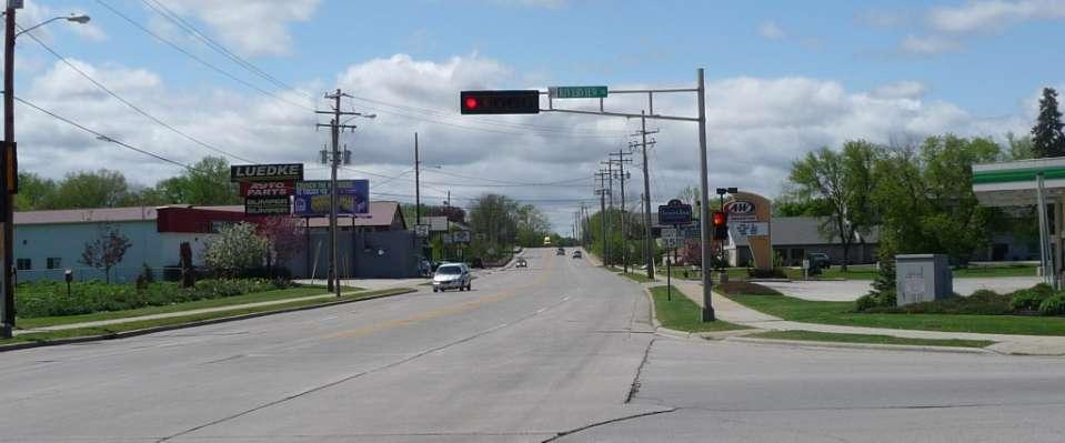
7 Velp Avenue Corridor

8 * * * Velp/Glendale/ Cardinal Lane Corridor * * * Village * Major Hall Gateway * * Minor Gateway *
9 Velp Avenue Corridor Subareas
10 Velp Avenue Corridor Subarea 1: East of Hwy 41


11 Velp Avenue Corridor Subarea 1 Existing Land Use

12 Velp Avenue Corridor Subarea 1 Zoning

13 Velp Avenue Corridor Subarea 1 Existing Land Use

14 Velp Avenue Corridor Reconstruction East of US 41

15 Velp Avenue Corridor Reconstruction East of US 41

16 Velp Avenue Corridor Reconstruction East of US 41
17

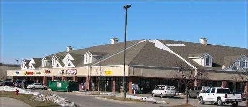
18 Mixed Single-Family Residential and Commercial Land Use
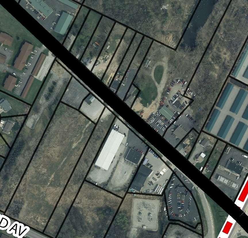
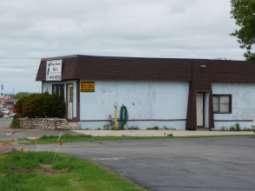
19 Dilapidated Buildings: Potential Redevelopment Sites
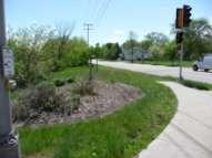
20 Dilapidated Building: Potential Redevelopment Site


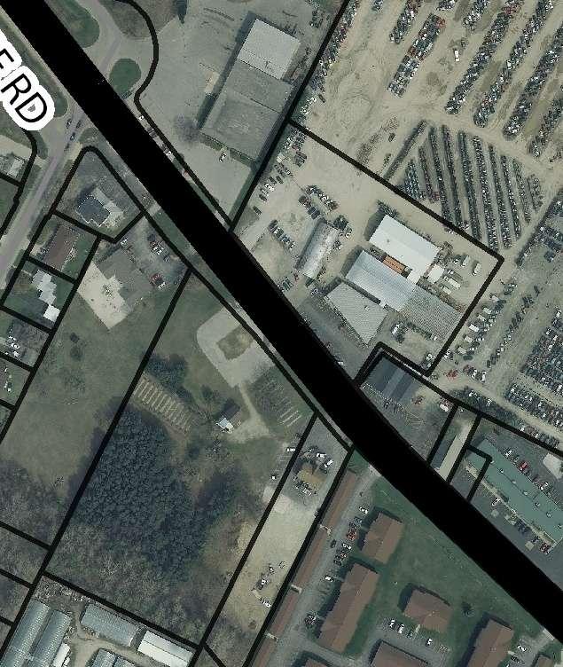
21 Existing Salvage Yard: Unpaved Parking Lot
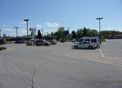
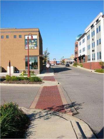
22 Velp Corridor Subarea 1 Recommendations: Simplify Industrial/Commercial Zoning Classifications Improve design standards over time With new development, revitalization incentives Building façade materials, landscaping, monument signs Monitor positive impact of corridor improvements on marketability of development parcels Undertake strategic redevelopment partnerships as needed for deteriorated or underutilized sites along corridor Partnerships include range of activities from provision of development incentives to property acquisition, clearance and assembly of development sites
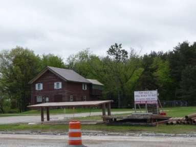
23 Velp Avenue Corridor Subarea 2: Historic Heart of the Village

24 Velp Avenue Corridor Subarea 2: Existing Land Use


25 Velp Avenue Corridor Subarea 2 Zoning
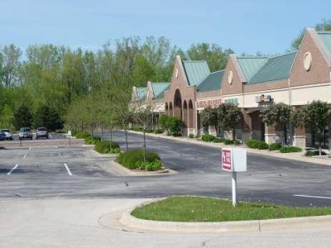
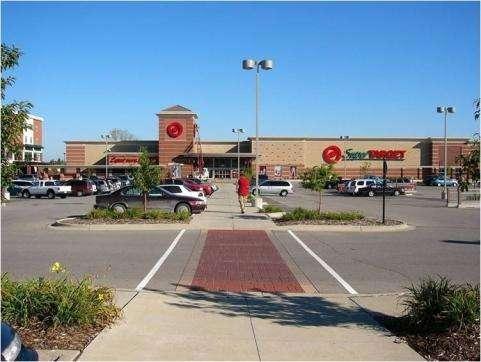
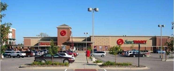
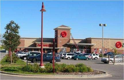
26 Subarea 2: Historic Heart of the Village

27 Gateway Feature Opportunity Site

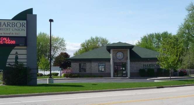
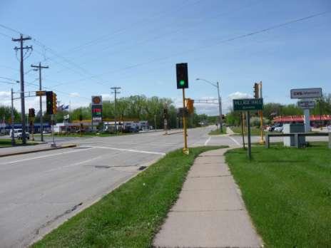
28 Gateway Feature Opportunity Site

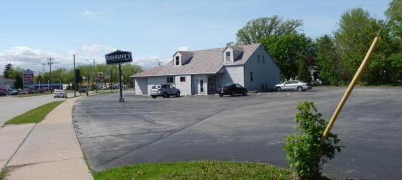
29 Velp Corridor Looking West at Island Ct.


30 Deteriorated Building: Potential Acquisition Site?
31 Riverview Intersection Features


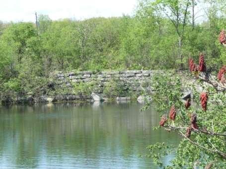
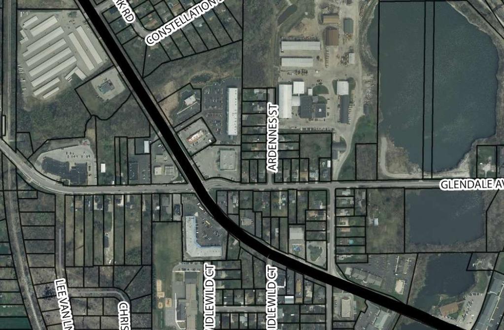
32 Quarries Adjacent to Velp Corridor

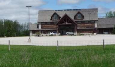
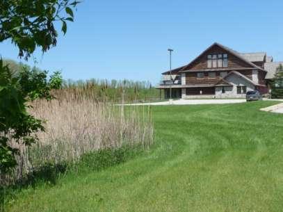
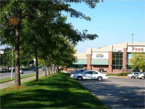
33 Subarea 2 New Development: High Quality

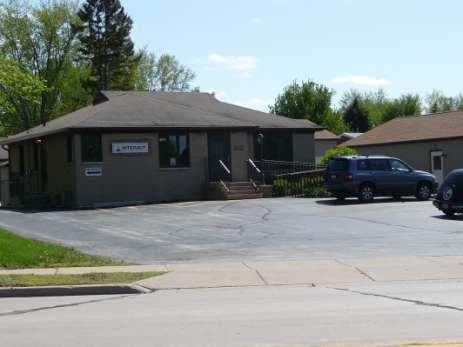
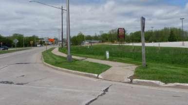
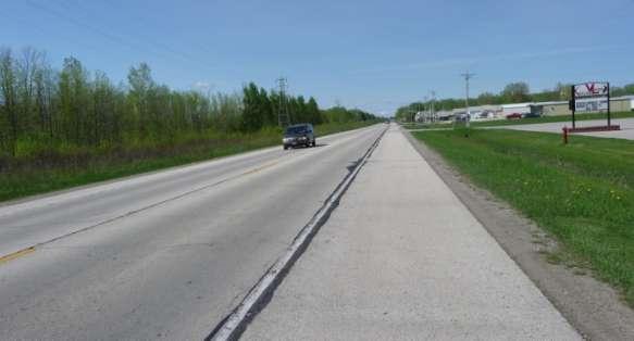
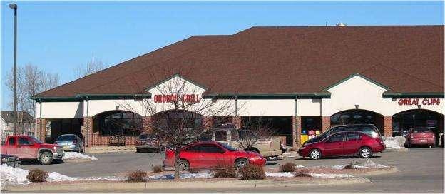
34 Subarea 2 Past Development: Minimum Design Standards

35 Key Intersection: Velp Ave. and Glendale Ave.
36 * * * Velp/Glendale/ Cardinal Lane Corridor * * * Village * Major Hall Gateway * * Minor Gateway *
37
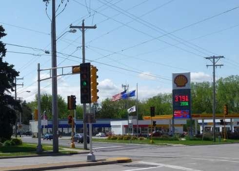
38 Glendale Intersection Features
39 Velp Corridor Subarea 2 Recommendations: Simplify Commercial Zoning Classifications Increase development quality with enhanced design standards Pursue gateway feature at Glendale Ave. under city-wide wayfinding plan Pursue plan to link quarry area development opportunities to civic and historical resources, thereby furthering economic
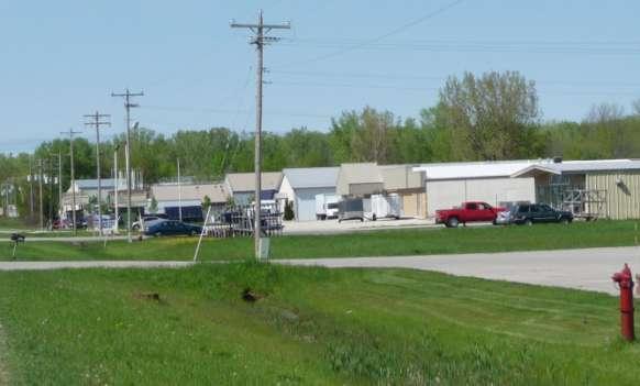
40 Velp Avenue Corridor Subarea 3: North of Glendale to Mountain Bay Trail

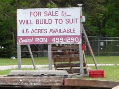
41 Velp Corridor North of Glendale

42 Velp Corridor South of Woodale
43 Velp Corridor Subarea 3 Recommendations: Preserve natural area forest Pursue abandonment of parallel railroad corridor and conversion to trail use

44 Velp Avenue Corridor Subarea 4: North End

45 Velp Avenue Corridor Subarea 4: North End Existing Land Use

46 Velp Avenue Corridor Subarea 4: Zoning

47 Velp Corridor / Industrial Park Character

48 Potential Redevelopment/Infill Development Site Between 4012 and 4018 Velp Ave
49 Velp Corridor Subarea 4 Recommendations: Simplify Industrial Zoning Classifications Improve industrial design standards over time With new development, revitalization incentives Building façade materials, landscaping, monument signs Undertake strategic redevelopment partnerships for deteriorated or underutilized sites along corridor Partnerships include range of activities from provision of development incentives to property acquisition, clearance and assembly of development sites Pursue abandonment of parallel railroad corridor and conversion to trail use

50 Zoning Ordinance Review & Recommendations Velp Avenue Corridor Velp Ave.
51 Commercial Districts: District Hierarchy CURRENT DISTRICTS: Business B-1 Highway Commercial B-2 Neighborhood Commercial B-3
52 Commercial Districts: District Hierarchy Business B- Business (B-1) zoning district is designed to accommodate those retail and office uses which are characteristic of the business and commercial areas of the village. Business B-1 Permitted Uses: By right: Principal retail and office uses - Including retail uses like grocery stores without size limits - Restaurants, excluding drive-in By conditional permit: Drive-in restaurants, car washes, lumber yards, etc.
53 Commercial Districts: District Hierarchy Highway Commercial B- The highway commercial (B-2) zoning district is designed to accommodate those business and retail uses which provide merchandise and services desired by motorists, directly from or for motor vehicles. Highway Commercial B-2 Permitted Uses: By right: Principal retail, office and institutional uses - Permits all B-1 uses, including conditional uses (except Planned Developments) - Permits all motor vehicle sales and services By conditional permit: Farm machinery dealers, manufactured home dealers, mini-warehouses, planned developments
54 Commercial Districts: District Hierarchy Neighborhood Commercial B- The Neighborhood Commercial (B-3) zoning district is designed to accommodate those unique business, commercial, office and retail [uses] commonly found in areas of transition between business or commercial uses and residential uses. It sets forth specific guidelines for development, including regulations pertaining to architectural style, landscaping, green space, signs, parking lots and loading areas. Neighborhood Commercial B-3 Permitted Uses: By right: Principal retail, business, commercial and office uses - Permits list of light impact uses - No grocery stores, no restaurants By conditional permit: Banks, daycare, food stores, department stores, restaurants, shopping centers
55 Commercial Districts: District Hierarchy - Recommendations - Districts: Neighborhood Commercial, Community Commercial, Highway Commercial, Regional Commercial subcategories consistent with Districts - Residential, Civic, Office, Commercial, Industrial etc. Use Types - Reduce number of uses requiring Conditional Uses - Example: Limited Food Sales, less than 10,000 sq. ft. permitted by right in Neighborhood Commercial Districts
56 Commercial Districts: Use Type Example: Retail Services 1. Limited Retail Services: Establishments providing retail services, occupying facilities of 3,000 square feet or less. Typical establishments provide for specialty retailing or retailing oriented to Denison and its surrounding vicinity. 2. Medium Retail Services: Establishments providing retail services, occupying facilities between 3,001 and 10,000 square feet in a single establishment or multi-tenant facility. Typical establishments provide for specialty retailing or general purpose retailing oriented to Denison and its surrounding vicinity. 3. Large Retail Services: Establishments providing retail services, occupying facilities between 10,001 and 40,000 square feet in a single establishment or multi-tenant facility. Typical establishments provide for specialty retailing or general retailing oriented to Denison and its surrounding vicinity. 4. Mass Retail Services: Establishments providing retail services, occupying facilities over 40,000 square feet in a single establishment or multi-tenant facility. Typical establishments provide for general retailing oriented to Denison and the surrounding region.

57 Permitted Use Matrix: Example
58 Industrial Districts: District Hierarchy CURRENT DISTRICTS: General Industrial (I-1) Industrial Park-Business (I-2) Industrial Park- Light Industry (I-3) Industrial Park- Heavy Industry (I-4) Existing Industrial (I-5) Industrial Park-Corporate Headquarters (I-6)
59 Industrial Districts: District Hierarchy General Industrial (I- The general industrial (I-1) zoning district is designed to accommodate those heavy industrial activities which, by their character, should be relatively remote from residential, business and commercial development and which are not obnoxious, unhealthful or offensive by reason of the potential emission or transmission of noise, vibration, smoke, dust, odors, toxic matter, noxious matter, glare or heat. General Industrial (I-1) Permitted Uses: By right: Heavy manufacturing, warehousing and distribution By conditional permit: Junkyard/Salvage yards, rendering, and retail, office and business uses
60 Industrial Districts: District Hierarchy Industrial Park-Business (I- The industrial park-business (I-2) zoning district is one of three zoning districts located within the village industrial park and is designed primarily to accommodate business uses. Industrial Park-Business (I-2) Permitted Uses: By right: Only principal office or retail uses allowed. By conditional permit: Farm machinery, manufactured home dealers, mini-warehouses
61 Industrial Districts: District Hierarchy Industrial Park- Light Industry (I- The industrial park-light industry (I-3) zoning district is one of three zoning districts located within the village industrial park and is designed primarily to accommodate business and light industrial uses. Industrial Park- Light Industry (I-3) Permitted Uses: By conditional permit: Other manufacturing, mini-warehouses
62 Industrial Districts: District Hierarchy Industrial Park- Heavy Industry (I- The industrial park-heavy industry (I-4) zoning district is one of three zoning districts located within the village industrial park and is designed primarily to accommodate light and heavy industrial uses. Industrial Park- Heavy Industry (I-4) Permitted Uses: By right: Medium-intensity manufacturing and processing By conditional permit: Heavy manufacturing and processing, mini-warehouses
63 Industrial Districts: District Hierarchy Existing Industrial (I- The existing industrial (I-5) zoning district is a special type of commercial and/or industrial area designed to accommodate uses existing at the time of village-wide comprehensive zoning, which were inconsistent with proposed area zoning under the village comprehensive plan, but which were uses desired to be continued as other than nonconforming uses. Existing Industrial (I-5) Permitted Uses: By right: All, existing prior to June 19, 1979; Abandonment provisions apply By conditional permit: N/A
64 Industrial Districts: District Hierarchy Industrial Park-Corporate Headquarters (I- Statement: The industrial park-corporate headquarters (I-6) zoning district is designed to accommodate national or regional corporate headquarter facilities and those facilities which would provide service activities, including, but not limited to, warehousing, storage, research and data processing, which are related to and used in conjunction with national or regional headquarter facilities. Industrial Park- Corporate Headquarters (I-6) Permitted Uses: By right: National or Regional Corporate Headquarters By conditional permit: Other manufacturing, distribution, assembling, processing, storage, medical, professional office, employee service or commercial uses; planned developments
65 Industrial Districts: District Hierarchy - Recommendations Simplify Industrial District Hierarchy - Example: INDUSTRIAL DISTRICTS BP Business Park District I-1 Limited Industrial District I-2 General Industrial District OVERLAY AND SPECIAL DISTRICTS PUD Planned Unit Development Overlay District RC Rural Conservation Development Overlay District HW?? Special highway corridor districts as needed FP/FW Floodplain Overlay District
66 Industrial Districts: District Hierarchy Recommendations (cont.) subcategories consistent with Districts - Residential, Civic, Office, Commercial, Industrial etc. Use Types - Reduce number of uses requiring Conditional Uses - Example: Limited Food Sales, less than 10,000 sq. ft. permitted by right in Neighborhood Commercial Districts
67 Commercial Districts: Design Standards - Current Howard Z.O. Design Standards: Building materials: Masonry Exterior building colors: Earth tones Mechanical equipment screened Walls over 50 ft. long require breaks/staggers Trash dumpster materials/screening: Pre/post 2/27/2009 requirements Building additions need not conform, provided addition no larger than existing building
68 Commercial Districts: Landscape and Green space Standards - Current Howard Z.O. Landscape/Green space Standards: 1 shrub per 3,000 sq. ft. of total lot area 1 tree per 5,000 sq. ft. of total lot area - Min. 1 ¾ inch caliper - Evergreen trees min. 4 ft. tall - Large shade trees must be 50% of total - Landscape buffers (trees, hedges, plantings, berms or a combination thereof) shall be installed adjacent to and across from all residential areas.
69 Commercial/Industrial Districts: Design and Landscape Standards - Current Districts subject to standards: Business (B-1): YES Highway Commercial (B-2): NO Neighborhood Commercial (B-3): YES* General Industrial (I-1): NO Industrial Park-Business (I-2): NO Industrial Park-Light Industry (I-3): NO Industrial Park-Heavy Industry (I-4): NO Existing Industrial (I-5): NO Industrial Park-Corporate HQ (I-6): NO *Same as B-1, plus public building facades require landscaping and 25% of lot green space; performance bond required **Note: All new development subject to site plan review process through Village Board
70 Off-street Parking and Loading: Design and Landscape Standards - Current Sec Screening. All open, off-street parking areas containing more than three parking spaces shall be effectively screened on each side adjoining any institutional premises or any property situated in a residential zoning district by a solid wall or fence at least six feet in height, unless such wall or fence is specifically prohibited in division 6 of this article. Off-street loading berths shall be similarly screened by a solid wall or fence at least eight feet in height, unless such wall or fence is specifically prohibited in division 6 of this article. Sec Landscaping. All parking drive and loading areas greater than or equal to 50,000 square feet in area shall be landscaped with trees and shrubs according to standards prescribed by the village plan commission. Detailed landscape design plans for such areas shall be submitted to the village plan commission for review and approval prior to commencement of construction or development on the site.
71 Off-street Parking and Loading: Design and Landscape Standards - Current Sec Driveways. Setback. Except where an easement or agreement exists between owners of abutting property, driveways shall not cross nor be located within five feet of any lot line.
72 Zoning Ord. Design Standards: Recommendations Consider a comprehensive set of design standards to apply in all appropriate districts. Components: Site Design: Relationship to Landforms: Buffers along floodways, preservation of Building Location and Orientation (Commercial and Office Buildings): Orientation of the building, its primary entrance, and parking relative to the primary fronting street Pedestrian Access: Integrated pedestrian system both internal to the project and connecting to the public sidewalk or trail system. Vehicular Access: Shared drives, internal access Parking:. Signs: Monument vs. pole, Integrated wall signage design Screening Lighting Architectural Elements (Commercial and Office Buildings): Entrance design, glass coverage, side and rear treatments Building Materials (Commercial and Office Buildings) Roof Forms (Commercial and Office Buildings) Site Plan Requirements
73 Z.O. Design Standards: Recommendations Consider a comprehensive landscape, screening and buffering ordinance to apply, with variations, in all districts. Components: Open Space: Minimum % of site area that must be green, plus planting requirements Bufferyards: To protect residential properties adjacent to commercial. Required landscaped buffer strip and opaque screening. Buffer sizes based on size of commercial development. Parking Lot/Display Lot Interior Plantings: Tied to maximum number of stalls in a row before required planting area (typically 20 stalls) Parking Lot/Display Lot Perimeter Plantings: Width of planting area tied to size of parking lot. Typically minimum 5-7 feet. Parkway (Terrace) Tree Planting Requirement: Street trees on specified spacing. Approved plant types and standards: Tied to climate, local conditions.

74 Parking Lot Perimeter Landscaping

75 Building Location and Orientation
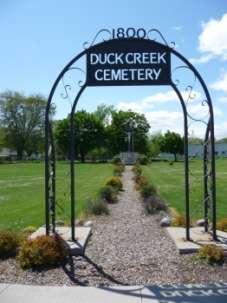
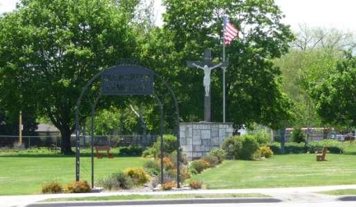
76 Pedestrian Access
77 Signs
78 Architectural Guidelines
79 Architectural Elements, Roof Forms

80 Implementation Tool: Tax Increment Financing
81 West of Pinecrest Future Land Use Plan Velp Corridor Land Use Analysis & Recommendations Duck Creek /Quarry Area Concepts Questions and Discussion

82 Lakeview Dr. Historic Heart of the Village Glendale Ave. Assumption: Quarries are too great a potential resource for the community to continue with marginal and/or inappropriate uses bordering them. Long term view points to some amazing

83 Village Hall Commercial District Glendale Ave. Quarry Walk Master Plan Components Mountain Bay Trail Quarry Redevelopment Sites Relocation of Lakeview Dr. Memorial Park Historic House Duck Creek Cemetery Barney Williams Park
84 Overall Concept of Quarry Walk Master Plan Take advantage of quarry area as a Development AND Community Amenity The two go hand-in-hand Amenity builds investment opportunities Big Idea: investment areas and community resources/amenities Lighted, nicely developed Becomes focus of development along it

85 Quarry Walk Overall Concept

86 Quarry Walk Overall Concept
87 Small-lot single-family housing Trail to Village Hall Promenade Residential/Mixed-Use: -3 stories over parking Mountain Bay Trail Connect Lakeview to Riverview Access to quarry

88 Connect Lakeview to Riverview Townhouses Commercial/ Office Developments

89 Quarry Walk South of Glendale
90 A Plan Enhancement Process for the Future of Howard Design Studio 2 May 28-30, 2011 The Howard Plan
Planning Districts INTRODUCTION
 INTRODUCTION To facilitate detailed examination of development prospects for all areas of the community, Delano has been divided into 14 planning districts. The location of these planning districts is
The Highway Overlay District applies to an area within the City of Papillion's zoning jurisdiction described as:
 ARTICLE XXVIII. HOD Highway Overlay District 205-164. Intent. The Highway Overlay District recognizes the strategic importance of the Highway 370 corridor as an entrance to Papillion from Interstate 80
CHAPTER ADDITIONAL REQUIREMENTS IN THE NC, NEIGHBORHOOD COMMERCIAL ZONE
 CITY OF MOSES LAKE MUNICIPAL CODE CHAPTER 18.31 ADDITIONAL REQUIREMENTS IN THE NC, NEIGHBORHOOD COMMERCIAL ZONE Sections: 18.31.010 Purpose 18.31.020 Minimum Lot Area 18.31.030 Setbacks 18.31.040 Maximum
VILLAGE OF CLEMMONS PLANNING BOARD DRAFT STAFF REPORT
 VILLAGE OF CLEMMONS PLANNING BOARD DRAFT STAFF REPORT PETITION INFORMATION Docket # C-226 Staff Megan Ledbetter Petitioner(s) JBJH Properties, LLC Owner(s) JBJH Properties, LLC Subject Property 5892-49-1766
CHAPTER SPECIAL PURPOSE AND OVERLAY ZONING DISTRICTS
 Special Purpose and Overlay Zoning Districts 106.28.010 CHAPTER 106.28 - SPECIAL PURPOSE AND OVERLAY ZONING DISTRICTS SPECIAL PURPOSE AND OVERLAY ZONING DISTRICTS Sections: 106.28.010 - Purpose 106.28.020
5.1.1 The streetscape along US Highway 64 (Brevard Road); and, The built environment within new residential developments; and,
; and, The built environment within new residential developments; and,") Article 5. Landscaping 5.1 Purpose The Town of Laurel Park s landscape standards are designed to create a beautiful, aesthetically pleasing built environment that will complement and enhance community
Article 5. Landscaping 5.1 Purpose The Town of Laurel Park s landscape standards are designed to create a beautiful, aesthetically pleasing built environment that will complement and enhance community
SECTION UNIFIED DEVELOPMENT ORDINANCE SECTION Part 1 Ordinance. ARTICLE 1 Zoning Districts
 SECTION 1-100 UNIFIED DEVELOPMENT ORDINANCE SECTION 1-300 Part 1 Ordinance SECTION 1-100. Introduction. ARTICLE 1 Zoning Districts Crystal Lake strives to maintain a balance of various land uses for a
CHAPTER 3. Design Standards for Business, Commercial, Industrial, Recreational and Institutional Uses
 CHAPTER 3 Design Standards for Business, Commercial, Section Number Title Ordinance Number Date of Ordinance 16-3-1 Applicability 2006-11 2008-04 07-01-08 16-3-2 Uniform Standards for Architectural Design
The purpose of the requirements in this Article is to provide for landscaping and screening of parking and other outdoor areas that will:
 XIII. LANDSCAPING & SCREENING A. Purpose The purpose of the requirements in this Article is to provide for landscaping and screening of parking and other outdoor areas that will: 1. Protect residential
The transportation system in a community is an
 7 TRANSPORTATION The transportation system in a community is an important factor contributing to the quality of life of the residents. Without a sound transportation system to bring both goods and patrons
DRAFT. 10% Common Open Space
 % OF CHARLOTTE IS CATEGORIZED AS A. LAND USES : Placeholder map displaying location of Place Type GOALS: Accommodate XX% of future growth. Provide a concentration of primarily commercial and civic activity
The Brown Road Innovation Zoning District shall be specified for the areas as designated on the Charter Township of Orion Zoning Map.
 Section 34.00 Preamble The purpose of the Brown Road Innovation Zoning District shall be to encourage the development of property in accordance with the Charter Township of Orion Master Plan in a manner
4.500 Preston Road Overlay District
 Section 4.500 Preston Road Overlay District 2004 Zoning Ordinance 4.500 Preston Road Overlay District (ZC 98-29; Ordinance No. 98-9-12) 4.501 Purpose To provide appropriate design standards for the use
ARTICLE 9: Landscaping
 ARTICLE 9: Landscaping 9-10 Legislative Intent The purpose of this Article is to regulate the planting and preservation of landscape materials; to facilitate the creation of an attractive and healthy environment;
McDonald s Restaurant - Purcellville Town of Purcellville Special Use Permit Statement of Justification July 24, 2014
 Introduction / Written Statement McDonald s Restaurant - Purcellville McDonald s Corporation is proposing to redevelop the existing McDonald s eating establishment with a drive-through located at 121 N
Chapter PEDESTRIAN COMMERCIAL (PC) ZONING DISTRICT
 ZONING DISTRICT") Chapter 11-17 PEDESTRIAN COMMERCIAL (PC) ZONING DISTRICT Sections: 11-17-01 GENERAL PURPOSE 11-17-02 PERMITTED BUILDING TYPES 11-17-03 USES PERMITTED WITH DESIGN REVIEW 11-17-04 USES PERMITTED BY CONDITIONAL
Chapter 11-17 PEDESTRIAN COMMERCIAL (PC) ZONING DISTRICT Sections: 11-17-01 GENERAL PURPOSE 11-17-02 PERMITTED BUILDING TYPES 11-17-03 USES PERMITTED WITH DESIGN REVIEW 11-17-04 USES PERMITTED BY CONDITIONAL
ARTICLE 9: LANDSCAPING AND FENCING REQUIREMENTS
 ARTICLE 9: LANDSCAPING AND FENCING REQUIREMENTS Section 9.01 Intent The intent of the landscaping requirements are to improve the appearance of lot areas and soften paved areas and buildings; to provide
BOULEVARD AND PARKWAY STANDARDS
 88-323 BOULEVARD AND PARKWAY STANDARDS 88-323-01 PURPOSE Considerable public and private investment exists and is expected to occur adjacent to boulevards and parkways within the city. The following standards
VILLAGE OF CHANNAHON COMMERCIAL DESIGN GUIDELINES. Village of Channahon S. Navajo Drive Channahon, IL (815)
") VILLAGE OF CHANNAHON COMMERCIAL DESIGN GUIDELINES Village of Channahon 24555 S. Navajo Drive Channahon, IL 60410 (815) 467-6644 www.channahon.org Adopted March 6, 2006 VILLAGE OF CHANNAHON COMMERCIAL DESIGN
VILLAGE OF CHANNAHON COMMERCIAL DESIGN GUIDELINES Village of Channahon 24555 S. Navajo Drive Channahon, IL 60410 (815) 467-6644 www.channahon.org Adopted March 6, 2006 VILLAGE OF CHANNAHON COMMERCIAL DESIGN
TEMPLE MEDICAL & EDUCATION DISTRICT
 City of Temple, Texas TEMPLE MEDICAL & EDUCATION DISTRICT 1 Description. The City of Temple joined in partnership with key public and private entities to jointly promote education and medical activities
BE IT ORDAINED by the Board of Supervisors of Chesterfield County:
 Attachment A AN ORDINANCE TO AMEND THE CODE OF THE COUNTY OF CHESTERFIELD, 1997, AS AMENDED, BY AMENDING AND REENACTING SECTIONS 19.1-52, 19.1-53, 19.1-236, 19.1-247, 19.1-253, 19.1-263, 19.1-341, 19.1-346,
Section 511: 11 th Street Overlay District 1. Intent: 11 th Street is the primary entrance route into the city from the south, providing direct
 Section 511: 11 th Street Overlay District 1. Intent: 11 th Street is the primary entrance route into the city from the south, providing direct access from US Highway 12. As such, the community has identified
5.1 Commercial and Industrial Development. (Effective April 1, 2006)
") 5.1 Commercial and Industrial Development. (Effective April 1, 2006) A. Applicability: The requirements of this section (5.10) shall apply to all uses within the LB Local Business; HB Highway Business;
5.1 Commercial and Industrial Development. (Effective April 1, 2006) A. Applicability: The requirements of this section (5.10) shall apply to all uses within the LB Local Business; HB Highway Business;
ARTICLE RRCO RED ROCK CORRIDOR OVERLAY DISTRICT
 ARTICLE 11.10 RRCO RED ROCK CORRIDOR OVERLAY DISTRICT (adopted 11/22/2011 MC16-116-11) SECTIONS: 11.10.01 Intent 11.10.02 Boundaries of District 11.10.03 Development Standards 11.10.04 Variance 11.10.01
ARTICLE XII BUFFER REQUIREMENTS
 ARTICLE XII 1200. Intent. It is the intent of this section to establish standards to provide for buffer amenities and screening throughout unincorporated Georgetown County. The purpose of these standards
City of Aurora Planning Department DESIGN STANDARDS FOR MOTOR VEHICLE FUEL DISPENSING STATION. August 3, 1998
 City of Aurora Planning Department DESIGN STANDARDS FOR MOTOR VEHICLE FUEL DISPENSING STATION August 3, 1998 1. GENERAL PURPOSE AND APPLICABILITY The following design standards for motor vehicle fuel dispensing
SITE PLAN REVIEW APPLICATION AND CHECKLIST
 SITE PLAN REVIEW APPLICATION AND CHECKLIST PROJECT SUMMARY: Project Name: City/ETA Location: City ETA (Application fee & number of copies needed are based on location) Property Location (Legal Description
(c) DH-3 - Dixie Highway High Intensity Mixed-Use District (i) DH-3 - Dixie Highway High Intensity Mixed-Use District Use Table.
 DH-3 - Dixie Highway High Intensity Mixed-Use District (i) DH-3 - Dixie Highway High Intensity Mixed-Use District Use Table.") EXHI BI TB EXHIBIT A (c) DH-3 - Dixie Highway High Intensity Mixed-Use District (i) DH-3 - Dixie Highway High Intensity Mixed-Use District Use Table. DH 3 Dixie Highway High Intensity Mixed Use District
EXHI BI TB EXHIBIT A (c) DH-3 - Dixie Highway High Intensity Mixed-Use District (i) DH-3 - Dixie Highway High Intensity Mixed-Use District Use Table. DH 3 Dixie Highway High Intensity Mixed Use District
4 January 11, 2012 Public Hearing APPLICANT:
 . 4 January 11, 2012 Public Hearing APPLICANT: MID-ATLANTIC AUTO PROPERTY OWNER: DZR, LLC STAFF PLANNER: Leslie Bonilla REQUEST: Conditional Use Permit (truck rental, automobile service, and automotive/bulk
DEPARTMENT OF PLANNING JEFFERSON PARISH, LOUISIANA
 DEPARTMENT OF PLANNING JEFFERSON PARISH, LOUISIANA DESIGN REVIEW REPORT : CPZ-3-1 : (S) Cynthia Lee-Sheng AT LARGE: A Chris Roberts B Elton M. Lagasse ADVERTISING DATES: 06/03/1 06/10/1 06/17/1 PAB PUBLIC
A. Background Summary of Existing Challenges and Potential Possibilities. 1. Summary of Existing Assets and Potential Opportunities
 A. Background 1 A Main Street Master Plan Study was performed and completed in October of 2007. The study was initiated to review current land uses and development patterns along Main Street, from Parrish
BUFFERS, TREE PROTECTION AND LANDSCAPING. Sec Purpose and Intent.
 ARTICLE 20 BUFFERS, TREE PROTECTION AND LANDSCAPING Sec. 20.1. Purpose and Intent. Trees improve air and water quality, reduce soil erosion, reduce noise and glare, provide habitat for desirable wildlife,
FREEWAY/TOURIST DISTRICT
 FREEWAY/TOURIST DISTRICT DESIGN STANDARDS FOR THE CITY OF MOUNTLAKE TERRACE March, 2014 MOUNTLAKE TERRACE FREEWAY/TOURIST DESIGN STANDARDS March, 2014 1 TABLE OF CONTENTS Introduction...1 Design Site Design
CHAPTER 10 GC GENERAL COMMERCIAL DISTRICT
 CHAPTER 10 GC GENERAL COMMERCIAL DISTRICT SECTION 10.01 DESCRIPTION AND PURPOSE A. This District is intended for commercial development of a general nature near areas where greater concentrations of residential
Urban Design 9Identity
 Urban Design 9Identity URBAN DESIGN IDENTITY Urban design is about connecting people to their places through the built environment, nature, and overall urban form. Done well, it creates a memorable space
Planning & Zoning Commission Staff Report
 Planning & Zoning Commission Staff Report Meeting Date: May 26, 2015 Drafted by: Katherine Harrison-Rogers CASE # Z2886 PROJECT NAME: APPLICANT/ REPRESENTATIVE: Shawna Runyan PROPERTY OWNER: 1840 (previously
Appendix D North Road/N. Leroy Street Subarea Plan
 North Road/N. Leroy Street Subarea Plan INTRODUCTION The City of Fenton Master Plan was updated in 1996 and included a subarea plan for the North Leroy Street area of the City. It was recognized at that
M E M O R A N D U M July 27, 2018
 M E M O R A N D U M July 27, 2018 To: Southlake 2035 Corridor Planning Committee From: Kenneth Baker, Sr. Director of Planning and Development Services Subject: Item #6 First National Bank Purpose Review,
Temple Terrace Downtown Overlay District. Division 5
 Temple Terrace Downtown Overlay District Division 5 12.299 - Purpose and intent. The purpose of the Downtown Overlay District (DOD) is to establish architectural, landscaping, design, building, and use
ZONING. 300 Attachment 1. City of Oneonta. Design Guidelines ( )
") 300 Attachment 1 City of Oneonta Design Guidelines ( 300-68) A. Site Organization. These guidelines address issues related to both building and parking location. Other issues include vehicle access (curb
300 Attachment 1 City of Oneonta Design Guidelines ( 300-68) A. Site Organization. These guidelines address issues related to both building and parking location. Other issues include vehicle access (curb
CHAPTER FIVE COMMUNITY DESIGN
 CHAPTER FIVE COMMUNITY DESIGN CHAPTER FIVE - COMMUNITY DESIGN Assumptions Frazier Park and Lebec have historically developed according to different patterns of spatial form. While both communities are
Design Guidelines for Residential Subdivisions
 Design Guidelines for Residential Subdivisions Development Services 972-466-3225 cityofcarrollton.com This page intentionally left blank. Table of Contents Purpose... 1 Design Objectives... 1 Design Guidelines
U.S. Highway 377 North Overlay District. 1. General Purpose and Description
 U.S. Highway 377 North Overlay District 1. General Purpose and Description The purpose of the U.S. Highway 377 North Overlay District is to implement the recommendations within the U.S. Highway 377 North
4. INDUSTRIAL 53 CASTLE ROCK DESIGN
 4. INDUSTRIAL 53 CASTLE ROCK DESIGN CASTLE ROCK DESIGN 54 4. INDUSTRIAL Overview Well-designed and attractive industrial centers are the product of blending economic realities with both functional and
Mill Conversion Overlay District Zoning Bylaw Amendment
 Mill Conversion Overlay District Zoning Bylaw Amendment To see if the Town will vote to amend the Zoning By-Law by adding a new Section 13, Mill Conversion Overlay District, and by amending Sections 2.1,
WASHINGTON COUNTY OREGON
 WASHINGTON COUNTY OREGON July 9, 2009 Revisions to Chapter 2 of the Bethany Community Plan The North Bethany Subarea Plan Exhibit pages 7 and 8 The sections for the Core and Flexible Streets were amended
DRAFT Northeast Quadrant of Kipling Avenue and Highway 7 DRAFT AUGUST 29, Goals Land Use. The goals of this Plan are to:
 AUGUST 29, 2017 12.15 Northeast Quadrant of Kipling Avenue and Highway 7 12.15.1 Goals 12.15.2 Land Use The goals of this Plan are to: 12.15.2.1 General Provisions: a) Ensure the development of a compact
ARTICLE 13 STREETS General
 ARTICLE 13 STREETS 13.1 General Streets shall be designed to suit their functions. Many streets have purposes other than vehicular traffic. As an alternative to current N.C. Department of Transportation
Northeast Suburban Area Plan Update Recommendations
 Northeast Suburban Area Plan Update Recommendations General policies from Legacy 2030 provide the framework for recommendations in all area plans. Specific recommendations for the Northeast Suburban Area
The Ritz-Carlton, Paradise Valley
 The Ritz-Carlton, Paradise Valley 7000 E. Lincoln Drive Keys to Success Community Conversation II June 4, 2015 RITZ-CARLTON PARADISE VALLEY Town Council Study Session June 4, 2015 General Plan 2012 Land
ARTICLE 3 LANDSCAPING AND SCREENING REQUIREMENTS
 ARTICLE 3 CHAPTER 4 LANDSCAPING AND SCREENING REQUIREMENTS SEC 3.401 SEC 3.402 (D) (E) PURPOSE: The purpose of this Chapter is to establish minimum standards for the design, installation, and maintenance
DEPARTMENT OF PLANNING JEFFERSON PARISH, LOUISIANA
 DEPARTMENT OF PLANNING JEFFERSON PARISH, LOUISIANA DESIGN REVIEW REPORT DOCKET NO: CPZ--16 SUMMAR NO.: : : Paul D. Johnston AT LARGE: A: Christopher L. Roberts B: Cynthia Lee-Sheng ADVERTISING DATES: PAB
SOUTH MAIN RIVER COMMUNITY REINVESTMENT PROJECT AREA PLAN DATED AUGUST 31, 2018
 SOUTH MAIN RIVER COMMUNITY REINVESTMENT PROJECT AREA PLAN DATED AUGUST 31, 2018 Redevelopment Agency of the City of Logan, Utah South Main River Community Reinvestment Project Area - 1 - INTRODUCTION 1.
Request Conditional Use Permit (Automobile Repair Garage) Staff Planner Kevin Kemp
 Staff Planner Kevin Kemp") Request Conditional Use Permit (Automobile Repair Garage) Staff Planner Kevin Kemp Location 845 Lynnhaven Parkway GPIN 14963473030000 Election District Rose Hall Site Size 0.40 acre portion of a 6.35 acre
Request Conditional Use Permit (Automobile Repair Garage) Staff Planner Kevin Kemp Location 845 Lynnhaven Parkway GPIN 14963473030000 Election District Rose Hall Site Size 0.40 acre portion of a 6.35 acre
COMMUNITY DESIGN. GOAL: Create livable and attractive communities. Intent
 COMMUNITY DESIGN Intent An attractive, well-designed County will attract quality development, instill civic pride, improve the visual character of the community, and create a strong, positive image for
Civic Center District
 Civic Center District The Civic Center district is the civic and social heart of Warrenville, containing such public buildings as the City Hall, Warrenville Public Library, Police Station, Park District
Article 10: Landscaping and Buffering
 10.01: Purpose Article 10: Landscaping 10.01: Purpose The purpose of this article is to: A) Promote and protect the interest of the public convenience, comfort, prosperity, or general welfare in accordance
Cobb County Design Guidelines Mableton Parkway & Veterans Memorial Highway Community Design Workshop January 12, 2017
 Community Design Workshop January 12, 2017 Agenda Opening Remarks / Introductions Scope of Work Existing Conditions Key Issues / Opportunities VPS Summary Draft Vision & Goal Statement Implementation Concepts
Rootstown Township Zoning Resolution 8/26/99. CHAPTER 430 Landscaping And Screening Requirements
 430.01 Purpose. 430.02 Landscaping along the street frontage. 430.03 Screening and landscaping of parking lots 430.04 Screening and buffering when lot abuts a residential district. 430.05 Screening of
Design Review Application *Please call prior to submittal meeting to determine applicable fees*
 CITY OF EAGLE 660 E. Civic Lane, Eagle, ID 83616 Phone#: (208) 939-0227 Fax: (208) 938-3854 Design Review Application *Please call prior to submittal meeting to determine applicable fees* FILE NO.: CROSS
DEVELOPMENT CONTROLS MEDICAL DISTRICT
 6.01. GENERAL DESIGN GUIDELINES A. Site Planning B. Architectural Design C. Medical Facility Signage & Lighting D. Exhibit 48. ARCHITECTURAL DESIGN CONCEPTS 6.02. MEDICAL FACILITY STANDARDS & GUIDELINES
4. Shape Transitions. 4. Shape Transitions
 4. Shape Transitions 49 Zoning District Policies Overall Intent: Maintain neighborhood character by creating compatible transitions that minimize land use conflicts. Strategy: Define the character of zoning
Small Area Plan. South Gateway
 Small Area Plan Adopted May 12, 2008 South Gateway Purpose. The South Gateway Small Area Plan defines the City s expectations for the future of the southern entrance to the City at Interstate 85 and Highway
Town Center (part of the Comprehensive Plan)
") Town Center (part of the Comprehensive Plan) Mercer Island Town Center Looking North (2014) In 1994, a year-long process culminated in a set of design guidelines and code requirements for the Town Center
Town Center (part of the Comprehensive Plan) Mercer Island Town Center Looking North (2014) In 1994, a year-long process culminated in a set of design guidelines and code requirements for the Town Center
lot flankage Y street 16m 6m landscape strip for large site 3m landscape strip for small medium site
 Commercial General Commercial Objectives Create developments compatible with adjacent land uses in scale, function and character Define a consistent and attractive street edge with quality landscaping,
City of Heath. Town Center Concept
 In the give-and-take of getting projects designed, financed, and approved, the famous refrain from the film Field of Dreams is heard often: if you build it, they will come. From the perspective of the
Zoning Interface: Districts and Forms for Sioux Falls Zoning Ordinance
 Zoning Interface: Districts and Forms for Sioux Falls Zoning Ordinance For more information about each form, click on the associated link. Single-Family Residential Districts RR Rural Residential RS Single-Family
CHAPTER 2: FUTURE LAND USE CONCEPTS
 CHAPTER 2: FUTURE LAND USE CONCEPTS INTRODUCTION The future land use concepts presented in this chapter are an expression of community support for a viable and vital US 50 Corridor. Land use recommendations
A. Reducing noise pollution, air pollution, and visual pollution;
 A well designed landscape, when made an integral part of a development plan, provides aesthetic appeal and makes an important contribution to the health, safety, and general welfare of the community by:
EXECUTIVE SUMMARY DRAFT CHAPTER 1 INTRODUCTION EXECUTIVE SUMMARY
 CHAPTER 1 EXECUTIVE SUMMARY INTRODUCTION Through the joint efforts of the City of Tulsa planning staff and the Land Services division of Indian Nations Council of Governments (INCOG), the Berryhill Land
DEPARTMENT OF PLANNING JEFFERSON PARISH, LOUISIANA
 DEPARTMENT OF PLANNING JEFFERSON PARISH, LOUISIANA DESIGN REVIEW REPORT : SUMMAR NO.: 4469 (S) Paul Johnston AT LARGE: A Chris Roberts B Cynthia Lee-Sheng ADVERTISING DATES: PAB PUBLIC HEARING: HEARING:
EXHIBIT A. Tax Increment Reinvestment Zone No. 1 (Town Center) First Amended Project Plan 1
 First Amended Project Plan 1") EXHIBIT A Tax Increment Reinvestment Zone No. 1 (Town Center) First Amended Project Plan 1 1 As amended by Resolution No. 2008-02-001(TR1R) of the Tax Increment Reinvestment Zone No.1, and approved to
EXHIBIT A Tax Increment Reinvestment Zone No. 1 (Town Center) First Amended Project Plan 1 1 As amended by Resolution No. 2008-02-001(TR1R) of the Tax Increment Reinvestment Zone No.1, and approved to
MIDTOWN MIXED-USE VILLAGE. TECHNICAL DATA SHEET COMPONENT C-1 FOR PUBLIC HEARING - PETITION NUMBER Project No RZ1.1. Issued.
 N MIDTOWN MIXED-USE VILLAGE TECHNICAL DATA SHEET COMPONENT C- FOR PUBLIC HEARING - PETITION NUMBER 04-00 Project No. 496 Issued Revised SCALE: " = 0' N 0 0 0 40 RZ. c GENERAL PROVISIONS: a. SITE LOCATION.
Planned Development Review Revisions (Project No. PLNPCM )
") Planned Development Review Revisions (Project No. PLNPCM2014-00139) Standard residential development Planned Development Example: Smaller lot sizes than what is allowed to create open space amenity. What
Planned Development Review Revisions (Project No. PLNPCM2014-00139) Standard residential development Planned Development Example: Smaller lot sizes than what is allowed to create open space amenity. What
8 October 14, 2015 Public Hearing
 8 October 14, 2015 Public Hearing APPLICANT & PROPERTY OWNER: PRICE S HOLDINGS, LLC STAFF PLANNER: Karen Lasley REQUEST: A. Conditional Use Permit (Automobile Repair Garage) B. Change in Nonconforming
Clairtrell Area Context Plan
 Clairtrell Area Context Plan March 2005 Urban Development Services City Planning Contents 1. Introduction... 4 2. Development Structure... 6 2.1 Streets... 7 2.1.1 Sheppard Avenue and Bayview Avenue...
Statement of Intent Proposed Development Five Forks Athletics Scuffletown Rd, Greenville SC
 Statement of Intent Proposed Development Five Forks Athletics Scuffletown Rd, Greenville SC Tax Map #0548020103205 1 P a g e Table of Contents Statement of Intent...page 3-9 Exhibit A Utility Letters Exhibit
Chapter 11. Industrial Design Guidelines 11.1 INTRODUCTION AND PURPOSE 11.3 SITE PLANNING GUIDELINES 11.2 GENERAL DESIGN OBJECTIVES
 Chapter 11 Industrial Design Guidelines 11.1 INTRODUCTION AND PURPOSE The following industrial/design guidelines seek to assure high quality development in Santa Ana s industrial districts by: The design
AMEND DMENT H HOSPITAL
 AMEND DMENT TO LAND USE PLAN ELEMENT VILLAGE OF RIDGEWOOD MASTER PLAN H HOSPITAL ZONE DISTRICT Village of Ridgewood Planning Board February 28, 2014with technical revisions from June 9, 2014 Planning Board
Zoning Technical Review Presented by Camiros. November 10, 2015
 Zoning Technical Review Presented by Camiros November 10, 2015 TECHNICAL REVIEW OVERVIEW Purpose of this Report Outline issues with current Ordinance Present preliminary approaches for revisions Set drafting
Status Update (2006 vs. Now) Citizen s Advisory Committee February Plan for Prosperity
 Citizen s Advisory Committee February Plan for Prosperity") Status Update (2006 vs. Now) Citizen s Advisory Committee February 2018 Plan for Prosperity 2000 2017 2000 2017 Gardnerville Population 6,000 5,760 5746 5,500 5,000 5,067 5,550 5,165 5,394 5,412 5,250
Status Update (2006 vs. Now) Citizen s Advisory Committee February 2018 Plan for Prosperity 2000 2017 2000 2017 Gardnerville Population 6,000 5,760 5746 5,500 5,000 5,067 5,550 5,165 5,394 5,412 5,250
I. Introduction. Prior Approvals
 Statement of Justification First National Bank 19790 Crystal Rock Drive, Germantown, Maryland Application for Site Plan and Limited Preliminary Plan Amendment I. Introduction DPH Architecture, for First
ARTICLE 13 STREETS General
 ARTICLE 13 STREETS 13.1 General Streets shall be designed to suit their functions. Many streets have purposes other than vehicular traffic. As an alternative to current N.C. Department of Transportation
East Whiteland Township Current Land Development Projects
 Current Land Development Projects A. Lincoln Court (Lancaster Avenue / Malin Road) Demolish existing 2 story brick and stucco structure Build onto existing 1 story masonry shopping center to add 8 new
PROPOSED WATERFRONT DISTRICT DESIGN STANDARDS
 PROPOSED WATERFRONT DISTRICT DESIGN STANDARDS 20.25 DESIGN REVIEW. 20.25.080 WATERFRONT DISTRICT A. Purpose. This section is intended to implement The Waterfront District Subarea Plan by: 1. Creating a
ARTICLE 27 CORRIDOR OVERLAY DISTRICTS
 Section 2701 - PURPOSE ARTICLE 27 HIGHWAY 52 CORRIDOR OVERLAY DISTRICT First Reading: 9-1-2015 Second Reading: 10-6-2015 Adoption: 11-7-2015 Yankton County offers one of the most scenic drives in South
(c) Certification of buffer plans. The MPC staff shall certify approved buffer plans to the zoning administrator for the issuance of permits.
 Certification of buffer plans. The MPC staff shall certify approved buffer plans to the zoning administrator for the issuance of permits.") Sec. 8-3066. Visual buffers and screening. (a) Generally. Buffers shall be provided as set forth herein to effectively protect all property from the adverse effects of adjacent land use activity of a more
Sec. 8-3066. Visual buffers and screening. (a) Generally. Buffers shall be provided as set forth herein to effectively protect all property from the adverse effects of adjacent land use activity of a more
WATERFRONT DISTRICT DESIGN STANDARDS
 WATERFRONT DISTRICT DESIGN STANDARDS 20.25.080 WATERFRONT DISTRICT A. Purpose. This section is intended to implement The Waterfront District Subarea Plan by: 1. Creating a safe, vibrant mixed-use urban
14 October 10, 2012 Public Hearing APPLICANT: MPB, INC
 14 October 10, 2012 Public Hearing APPLICANT: MPB, INC PROPERTY OWNER: MUNDEN & ASSOCIATES, LP STAFF PLANNER: Karen Prochilo REQUEST: Conditional Change of Zoning (AG-1 & AG-2 to Conditional O-2) ADDRESS
Planning Board Briefing
 Planning Board Briefing Why Now? The Sector Plan Implementation Chapter States: Before Stage 1 begins, the following must occur: Approval of the Sectional Map Amendment. Approval of the Greater Lyttonsville
Landscaping Standards
 CHAPTER 29 ARTICLE 403 29.403 Landscaping Standards Purpose: The purpose of this section is to protect and promote the public health, safety and general welfare by requiring landscaping in relation to
B. Blocks, Buildings and Street Networks
 B. Blocks, Buildings and Street Networks Figure IV.4 A rational block pattern with connected streets Introduction The single most important element in the physical and functional integration of mixed use
Sec Intent and purpose.
 1 of 5 10/12/2012 10:33 AM Hastings, Michigan, Code of Ordinances >> PART II - CODE OF ORDINANCES >> Chapter 90 - ZONING >> ARTICLE XII. - LANDSCAPING >> ARTICLE XII. - LANDSCAPING Sec. 90-1006. - Intent
D. Landscape Design. 1. Coverage Intent: To provide adequate landscaping materials that enhance the appearance of development projects.
 D. Landscape Design The standards and guidelines in this section give design guidance for the landscaping components of industrial and office projects. City regulations require that all landscaping be
FLORIN ROAD CORRIDOR Site Plan and Design Review Guidelines Checklist
 FLORIN ROAD CORRIDOR Site Plan and Design Review Guidelines Checklist Applicant s Name: Project Address: Phone: Email: Applicant shall fill out the design guidelines checklist for all guidelines applicable
Zoning Ordinance Section 1.100
 4.800 (ZC 98-45; Ordinance No. 98-9-13) 4.801 Purpose To provide appropriate design standards for the development of properties within the State Highway 121 corridor. These standards recognize the significance
EXHIBIT. PUD Written Description
 EXHIBIT D PUD Written Description Krispy Kreme at Merrill Road PUD Revised 09-30-2013 City Development Number: I. PROJECT DESCRIPTION The subject property identified as Real Estate No.120466 0030 on Panel
SECTION TWO: Urban Design Concepts
 SECTION TWO: Urban Design Concepts The Gardnerville Plan for Prosperity shapes economic opportunities presented by regional growth. The Urban Design Concepts provide policies and concepts for land use,
PSec MCN Mahan Corridor Node District
 PSec. 10-269 MCN Mahan Corridor Node District 1. Purpose and Intent 2. Allowable District Location The Mahan Corridor Node (MCN) zoning district is intended to implement the Mahan Gateway Node Map (FLUM)
Prepared by: LCT Design Group, LLC 401 North Franklin Street, Suite 5S Chicago, Illinois 60610
 Prepared by: LCT Design Group, LLC 401 North Franklin Street, Suite 5S Chicago, Illinois 60610 Existing Conditions Residential Guidelines Future Land Use -East Study Area - West Study Area Existing Conditions