Green Streets and Green Infrastructure Planning A Tale of Two Cities: San Mateo and Emeryville
|
|
|
- Linette Stanley
- 6 years ago
- Views:
Transcription


1 Green Streets and Green Infrastructure Planning A Tale of Two Cities: San Mateo and Emeryville SCVURPPP Annual C3 Workshop June 4, 2014 Peter Schultze-Allen, EOA
2 Presentation Overview Goals/Incentives for Green Infrastructure City of San Mateo Approach City of Emeryville Approach Lessons Learned How Can I do this in my City?


3 Goals & Incentives for Green Infrastructure Create Unique/Attractive Streetscapes Improve Walkability Replacing Impervious Surfaces with Landscaping Improve Water Quality Increase Pedestrian Safety Source: City of Emeryville for all

 Traffic calming Room for street")
4 Pedestrian Safety Curb Extensions Don t just reduce crossing distance: Other advantages Better visibility (both ways) Traffic calming Room for street furniture


5 Stormwater Curb Extensions Source: on Source: Source:
6 City of San Mateo Highlights Received Caltrans Planning Grant Already working on Complete Streets Able to Leverage Countywide Sustainable Streets Guidelines Leveraged Redevelopment Activity Taste and Talk Series Building Community Support

7 Caltrans Community-Based Transportation Planning Grant March $300,000 Local Match - $184,000 Total Project Cost = $484,000 February 2013 February 2015


8 Sustainable Streets Combining two concepts for street design: Complete + Green Streets = Sustainable Streets Green Streets support a range of goals beyond stormwater benefits Improve streets for all users Support economic vitality Complement placemaking Reduce carbon footprint Promote public health Complement urban habitats and open spaces Reduce water demand Source: CD+A Source: outdoorchattanooga.com Source: CD+A


9 San Mateo County Sustainable Green Streets and Parking Lots The City is taking advantage of the County s Design Guidebook.


10 Sustainable Streets Network Active Transportation health benefits of walking and biking An adult needs 150 min. of moderate activity per week to experience health benefits of physical activity Physical Activity Guidelines for Americans USHHS, 2008 Source: blog.al.com Less than 10% of Americans achieve this level of activity

11 Delaware Streetscape Project Reduced travel lanes Widened sidewalk Added Pedestrian Scale Lighting Added Class II bike lane Installed decorative bridge railing Green Streets
12 Project Funding Total Project Cost = $1.4M $60K federal CMAQ funds for design $545k MTC Transportation for Livable Communities (TLC) Program funds for construction $627k from Station Park Green Developer $168k from City

13 Green Infrastructure Challenges Green Street Infrastructure is not cheap No real dedicated funding for it Where should it go? Can t put it everywhere, so how do you decide where to install it or incorporate it into streetscape projects Look at Land Uses Major Polluters High Volume Streets

.")
14 Green Infrastructure Challenges Challenges existing practices Responsibilities can overlap departments Funding to departments may need to be shifted Opportunities Examine current practices Establish an O&M strategy and funding plan Monitor and adapt Public/Private partnerships and volunteer/adopt green infrastructure programs Source: Portlandoregon.gov/bse (City of Portland, Environmental Services Report). Source:

15 Taste and Talk Series open forums in the style of a Taste and Talk series Series topics to include, but are not limited to, pedestrians, bicyclists, transit, trucks, level of service, street classification, green streets, ADA compliance and emergency services. Department of Public Works Stewards of the Infrastructure and Environment Page 15
16 City of Emeryville Highlights Received EPA Grant for LID Guidelines Timing worked well with New General Plan Bicycle and Pedestrian Plan Followed Urban Design Guidelines Created Leveraged Redevelopment Activity and Council/Community support for increased landscaping in the City

17 Green Streets Elements
18 Emeryville General Plan Guiding Principle #3 Enhanced and Connected Open Space Network and Green Streets includes Green Streets as Primary Connections between major open space, activity centers and amenities within the City. Required development of streetscape standards & design guidelines that result in Complete, Green and Bay Friendly streets.
19
20
21 Streetscape Goals Multi-functional Safe for All Users Beautify City & Provide High Quality of Life Complete and Green Manage Stormwater (quality and flooding) Bay Friendly Landscaped Connectivity: Complete/Green Street Network Conserve Water
22
23
24 Elements of Street Landscaping Green Streets Define Desirable Impervious Surface Reduction Planter Strip Expansion Street Tree Rootable Soil Volume Minimums Bay Friendly Landscaped Benefits of Environmental Services Building The Network
25
26 Green Streets in PB Plan The List of Projects in the Ped-Bike plan includes Green Street improvements on specific street segments Describes Specific Measures such as Stormwater Curb Extensions with loss of on-street parking spaces Estimated project costs for a total of $20 million in needed projects City-wide
27 Opportunity Site!
28 Lessons Learned In both San Mateo and Emeryville, Complete Streets Policies and Pedestrian Plans were key elements of process. Consider Redevelopment Potential and Urban Forestry goals. Grant funding for Water Quality was added to Transportation funding. What matters most in your City?
29 Policy/Plan Areas to Consider: Green Street/Infrastructure Design Guidelines Green Street/Infrastructure Ordinance General Plan Pedestrian and/or Bicycle Plan Capital Improvement Program Annual Pavement Work Plan Storm/Sewer Master Plan Specific/Precise or Neighborhood Plan
30 Active Transportation Plans both by Alta
31 Where to Start in My Jurisdiction? 1. Assemble a Green Infrastructure Team A. Get Buy-in from Management B. Hold a Study Session for Electeds 2. Add GS/GI to Planning efforts underway 3. Education/Public Outreach - San Mateo s Taste and Talk Series is a good example. 4. Integrate C.3 with C.10, C.11 and C.12 (Pollutants of Concern: Trash, Mercury and PCBs.) 5. Update Urban Forestry Standards
32 Contact Information: Peter Schultze-Allen LEED AP & BFQP Senior Scientist EOA Inc x128 Thanks to Ken Chin from the City of San Mateo for the use of some of his slides.
Getting Started On Your Green Infrastructure (GI) Plan
 Plan") Getting Started On Your Green Infrastructure (GI) Plan Peter Schultze-Allen EOA Inc. Annual SCVURPPP C3 Workshop June 16, 2015 Presentation Outline MRP 2.0 C.3.j (GI) requirements GI Framework elements
Getting Started On Your Green Infrastructure (GI) Plan Peter Schultze-Allen EOA Inc. Annual SCVURPPP C3 Workshop June 16, 2015 Presentation Outline MRP 2.0 C.3.j (GI) requirements GI Framework elements
Green Stormwater Infrastructure Handbook. Kristin Kerr, P.E. EOA / SCVURPPP November 29, 2018
 Green Stormwater Infrastructure Handbook Kristin Kerr, P.E. EOA / SCVURPPP November 29, 2018 Outline of Presentation Overview Handbook Contents Example Details Overview MRP requires GSI Plans to include
Presentation Item C Annotated Model Outline for a Framework for a Green Infrastructure Plan
 Date: August 17, 2016 To: From: Subject: Management Committee Dan Cloak, Consultant Presentation Item C Annotated Model Outline for a Framework for a Green Infrastructure Plan Recommendation: Receive the
The Green Infrastructure Plan Requirement: shifting from gray to green infrastructure June 14, 2016
 The Green Infrastructure Plan Requirement: shifting from gray to green infrastructure June 14, 2016 Connie Goldade Community Design + Architecture Green Infrastructure (GI) Requirements Develop a Green
COMPLETE GREEN STREET CHECKLIST
 COMPLETE GREEN STREET CHECKLIST This document was developed to dissect the structure of an urban street and explore opportunities to make our streets more complete while also integrating green street strategies.
SCVURPPP Green Infrastructure Handbook. Kristin Kerr, P.E. EOA, Inc. April 19, 2017
 SCVURPPP Green Infrastructure Handbook Kristin Kerr, P.E. EOA, Inc. April 19, 2017 Outline of Presentation Overview Handbook Contents Schedule Overview MRP requires GI Plans to include general guidelines,
Ken Kortkamp, PE San Francisco Public Utilities Commission San Francisco, CA
 Ken Kortkamp, PE San Francisco Public Utilities Commission San Francisco, CA Development Process of San Francisco s GI Typical Details SCVURPPP GI Workshop April 19, 2017 Outline How to develop GI details
Study Area. Capitol Way. Greening America s Capitals 11/13/2014. A Greening America s Capitals Project
 Olympia, WA: Greening Capitol Way Supporting Communities move towards sustainability is a priority for the federal government. A Greening America s Capitals Project Office of Sustainable Communities U.S.
Transportation Land Use Integration & Regional Planning. Don Kostelec, AICP Senior Planner, Louis Berger Group February 1, 2010
 Transportation Land Use Integration & Regional Planning Don Kostelec, AICP Senior Planner, Louis Berger Group February 1, 2010 Transportation Land Use Integration DOT-HUD-EPA Sustainable Communities Initiative
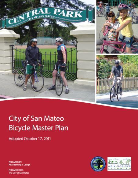
Case Study: City of San Mateo
 Published on GreenPlan-IT (http://greenplanit.sfei.org) Home > Archived Materials > GreenPlan-IT Toolkit Demonstration Report > Chapter 2. Case Study: City of San Mateo Case Study: City of San Mateo Chapter
Green Streets. Sustainable Stormwater Solutions for Greener Communities and a Cleaner Bay
 Green Streets Sustainable Stormwater Solutions for Greener Communities and a Cleaner Bay As the Bay Area continues to grow through development of roads, revitalization of neighborhoods, and construction
Melissa Bernardo Hess, PE, CFM February 18, 2016
 Using Green Infrastructure in Your MS4 Community Melissa Bernardo Hess, PE, CFM February 18, 2016 Today s Discussion What is Green Infrastructure? Why should I consider Green Infrastructure? What practices
GSI Handbook Details Pervious Pavement
 GSI Handbook Details Workshop April 10, 2018 GSI Handbook Details Pervious Pavement Peter Schultze-Allen, EOA / SCVURPPP Outline of Presentation Pervious pavement basics Types of pervious pavement and
Subregion 4 Central Avenue-Metro Blue Line Corridor Transit-Oriented Development (TOD) Implementation Project. Community Meeting April 27, 2011
 Implementation Project. Community Meeting April 27, 2011") Subregion 4 Central Avenue-Metro Blue Line Corridor Transit-Oriented Development (TOD) Implementation Project Community Meeting April 27, 2011 Overview Introduction to Subregion 4 TOD Implementation Program
Subregion 4 Central Avenue-Metro Blue Line Corridor Transit-Oriented Development (TOD) Implementation Project Community Meeting April 27, 2011 Overview Introduction to Subregion 4 TOD Implementation Program
City of Hermosa Beach Administrative Policy #
 City of Hermosa Beach Administrative Policy # SUBJECT: Living Streets Policy Date: Approved by: City Council Authority: Public Works Department & Community Development Department Mayor, PURPOSE The City
LEED-ND 101: Practical Strategies for Achieving Sustainability Goals. Travis Parker Lakewood Planning Director
 LEED-ND 101: Practical Strategies for Achieving Sustainability Goals Travis Parker Lakewood Planning Director Metro Vision Idea Exchange Oct 11, 2012 West Corridor Stations West Corridor Overview West
SMCWPPP IPM Training March 8, 2017 Bay-Friendly Landscaping, IPM and Stormwater
 SMCWPPP IPM Training March 8, 2017 Bay-Friendly Landscaping, IPM and Stormwater Peter Schultze-Allen, BFQP EOA Inc. BAY-FRIENDLY LANDSCAPING A whole systems (watershed) approach to the design, construction
JANUARY 19, 2011 CENTRAL AVENUE-METRO BLUE LINE TRANSIT-ORIENTED DEVELOPMENT IMPLEMENTATION PROJECT COMMUNITY FORUM
 CENTRAL AVENUE-METRO BLUE LINE TRANSIT-ORIENTED DEVELOPMENT IMPLEMENTATION PROJECT COMMUNITY FORUM JANUARY 19, 2011 THE MARYLAND-NATIONAL CAPITAL PARK AND PLANNING COMMISSION PRINCE GEORGE S COUNTY PLANNING
A BLUEPRINT FOR BROCKTON A CITY-WIDE COMPREHENSIVE PLAN
 A BLUEPRINT FOR BROCKTON A CITY-WIDE COMPREHENSIVE PLAN Public Meeting October 2016 1 Plan Summary and Discussion Public Meeting May 4 2017 City of Brockton Bill Carpenter, Mayor Department of Planning
Green Infrastructure The Indianapolis Greenways Connection
 Green Infrastructure The Indianapolis Greenways Connection Fewer things in the transportation industry today make better since than combining the needs for pedestrian and bike trails with the need to locate,
Metro 2010 Pedestrian Symposium Walking into the Future City
 Metro 2010 Pedestrian Symposium Walking into the Future City John Kaliski, AIA, May 12, 2010 How can our transportation and land use policies create complete streets for all users? How do we optimize the
Silverdale Regional Center
 Silverdale Regional Center Vision for Silverdale Regional Center The Silverdale Regional Center Plan (Plan) will guide the evolution of the Silverdale Regional Center from a collection of strip malls and
Community Workshop. Tuesday, February 15, 2011 New Haven Free Public Library
 Community Workshop Tuesday, February 15, 2011 New Haven Free Public Library 1 Planning and Engineering Design Team PARSONS BRINCKERHOFF (PB) Lead Planning and Design NEWMAN ARCHITECTS Urban Architecture
FDOT D4 Complete Streets
 FDOT D4 Complete Streets Context Sensitive Solutions Directs that complete street solutions will complement the context of the community. Collaborative approach to decision making, project development,
A larger version of this map is located on the last page of this PDF.
 MAP Committee Input McLoughlin Area Draft Vision Map A larger version of this map is located on the last page of this PDF. 1. The map above is intended to portray a vision for the McLoughlin area. It highlights
Planning and Design: Applied LID Techniques Redevelopments, Housing, Mixed Use, Infrastructure
 Civil Engineering Landscape Architecture Environmental Restoration Planning Planning and Design: Applied LID Techniques Redevelopments, Housing, Mixed Use, Infrastructure Peg Staeheli, ASLA, LEED AP March
Implementation Guide Comprehensive Plan City of Allen
 Implementation Guide 2030 Comprehensive Plan City of Allen DRAFT 2015 Implementation Guide Allen 2030 Comprehensive Plan INTRODUCTION The Comprehensive Plan serves as a guide for the growth and development
SDOT DPD. SDOT Director s Rule DPD Director s Rule DCLU DR SED DR of 7 CITY OF SEATTLE
 SDOT SDOT Director s Rule 2-07 DPD Applicant: CITY OF SEATTLE Page 1 of 7 Supersedes: DCLU DR 11-93 SED DR 93-4 Seattle Department of Transportation (SDOT) Department of Planning and Development (DPD)
Street Flooding Mitigation Plan KYOVA Interstate Planning Commission. Presented to AMPO National Conference October 18, 2017
 Street Flooding Mitigation Plan KYOVA Interstate Planning Commission Presented to AMPO National Conference October 18, 2017 Saleem Salameh, Ph.D., P.E., M.ASCE Chet Parsons, AICP CTP Agenda: Background
DRAFT. 10% Common Open Space
 % OF CHARLOTTE IS CATEGORIZED AS A. LAND USES : Placeholder map displaying location of Place Type GOALS: Accommodate XX% of future growth. Provide a concentration of primarily commercial and civic activity
July 12, Columbus City Council City Hall 90 West Broad Street Columbus, OH RE: I-70/71 Columbus Crossroads Project
 OHIO DEPARTMENT OF TRANSPORTATION DISTRICT 6 400 EAST WILLIAM STREET DELAWARE, OHIO 43015 800.372.7714 Columbus City Council City Hall 90 West Broad Street Columbus, OH 43215-9015 RE: I-70/71 Columbus
Transportation. Strategies for Action
 Transportation A major priority for the Overlake Neighborhood is to develop a multimodal transportation system. To achieve this system, a balance has to be found among travel, circulation and access needs;
St. Clair Avenue West Area Transportation Master Plan
 1 (Between Keele Street and Old Weston Road) Public Information Centre 1 December 2, 2015 2 Welcome Welcome to the first Public Information Centre for the St. Clair Avenue West Area. The panels will present
Guiding Principles for the SR 520 Replacement Project
 Guiding Principles for the SR 520 Replacement Project Presentation to the Board of Regents Theresa Doherty Assistant Vice President for Regional Affairs May 18, 2006 F-14 The University of Washington is
SOUTH FLORIDA TOD GRANT UPDATE
 Palm Beach Transportation Planning Agency October 2018 SOUTH FLORIDA TOD GRANT UPDATE Presented by Treasure Coast Regional Planning Council in partnership with SFRTA & SFRPC What is Transit Oriented Development
Potential Green Infrastructure Strategies May 6, 2015 Workshop
 Potential Green Infrastructure Strategies May 6, 2015 Workshop Background The City of Cortland is developing the Tioughnioga Urban Headwaters Green Infrastructure Action Plan with funding from the National
The transportation system in a community is an
 7 TRANSPORTATION The transportation system in a community is an important factor contributing to the quality of life of the residents. Without a sound transportation system to bring both goods and patrons
1 North San Antonio Road Los Altos, California MEMORANDUM GREEN INFRASTRUCTURE PLAN FRAMEWORK
 1 North San Antonio Road Los Altos, California 94022-3087 MEMORANDUM DATE: July 11, 2017 TO: FROM: SUBJECT: City Council Aida Fairman, Associate Civil Engineer GREEN INFRASTRUCTURE PLAN FRAMEWORK The City
Kristin Kerr EOA, Inc. February 1, 2017
 O&M (C.3.h) Inspections FY 2016/2017 Implementation Kristin Kerr EOA, Inc. February 1, 2017 Outline of Presentation Background on MRP MRP C.3.h Implementation MRP C.3.h Reporting Resources Municipal Regional
PLAN ELEMENTS WORKSHOP. April 5, 2016
 PLAN ELEMENTS WORKSHOP April 5, 2016 needs more housing. But there is no one-size fits-all solution. Every neighborhood has its own character. In some places, density is not only appropriate it is badly
THE POLICY FRAMEWORK FOR WALKABLE COMMUNITIES. Community Technical Assistance Program Building Active Communities Institute March 2016
 THE POLICY FRAMEWORK FOR WALKABLE COMMUNITIES Community Technical Assistance Program Building Active Communities Institute March 2016 ACTIVE COMMUNITIES BACK THEN ACTIVE COMMUNITIES BACK THEN Lifestyle
GREEN STREETS & INFRASTRUCTURE: A COUNTY APPROACH. Mimicking Nature to Manage Stormwater in Developed Areas
 GREEN STREETS & INFRASTRUCTURE: A COUNTY APPROACH Mimicking Nature to Manage Stormwater in Developed Areas Jennifer Gonzalez, Environmental Planner Passaic County Depar tment of Planning & Economic Development
Making Transit Oriented Development Work For Boonton, NJ
 Making Transit Oriented Development Work For Boonton, NJ Bloustein School of Planning and Public Policy Studio Dan Burton Loannie Dao Webster Slater Brandon Williams Ian Watson Maria Laham Nicola Mammes
10 Implementation. Implementation. Responsibility for Implementation. Blueprint for Bloomsburg. Town of Bloomsburg Comprehensive Plan 10-1
 Implementation 10 Implementation This chapter overviews how to use the comprehensive plan as a land use and programming tool for the Town of Bloomsburg and recommends annual review of the plan by the Town
Plano Tomorrow Vision and Policies
 Plano Tomorrow Vision and Policies PLANO TOMORROW PILLARS The Built Environment The Social Environment The Natural Environment The Economic Environment Land Use and Urban Design Transportation Housing
CHAPTER 7: Transportation, Mobility and Circulation
 AGLE AREA COMMUNITY Plan CHAPTER 7 CHAPTER 7: Transportation, Mobility and Circulation Transportation, Mobility and Circulation The purpose of the Transportation, Mobility and Circulation Chapter is to
Jenifer Street Reconstruction Neighborhood Engagement Meeting November 4, 2015
 Jenifer Street Reconstruction Neighborhood Engagement Meeting November 4, 2015 Hosted by the Marquette Neighborhood Association Facilitated by Urban Assets Funded in part by the City of Madison Neighborhood
Reinventing Miner Avenue as a
 Reinventing Miner Avenue as a Complete Street Reinventing Miner Avenue as a Complete Street Agenda Project Overview / Introductions Previous Meeting Recap Economic Considerations Opportunities & Constraints
The Five Components of the McLoughlin Area Plan
 The Five Components of the McLoughlin Area Plan This documents contains the complete language of the five components of the McLoughlin Area Plan: The Vision Statement The Values The Guiding Principles
The Project. In 2013, construction was completed between 100 Street and 102 Street.
 The Project Jasper Avenue New Vision (JANV) is a major catalyst project identified in the Capital City Downtown Plan (2010) between 92 Street and 109 Street, including the streets half a block north and
Chinatown. Green Street Demonstration Project. land + water. community
 Chinatown Green Street Demonstration Project land + water community 2 Purpose. Dear Stakeholder, Thank you for your interest in making our neighborhood a greener, more sustainable, and attractive place
LID Resources. Matt Yeager San Bernardino County Flood Control District. Jill Bicknell, P.E., EOA, Inc. Santa Clara Valley Urban Runoff Program
 LID Resources Matt Yeager San Bernardino County Flood Control District Jill Bicknell, P.E., EOA, Inc. Santa Clara Valley Urban Runoff Program Presentation Outline Southern California LID Manual Northern
Pedestrian and Bike Bridge LOGO
 6.2.2 Pedestrian and Bike Bridge The proposed pedestrian and bike crossing re-envisions the existing bridge at Pismo Creek on Cypress Street. The bridge is currently underutilized by vehicular through
Sidewalks Street Lights
 Boston Complete Streets Guidelines 013 Boston Transportation Department Sidewalks Introduction 17 Sidewalk Design Principles 18 Sidewalk Zones 0 Sidewalk Zones Widths Preferred and Minimum Widths for Sidewalk
SPRINGHILL LAKE TRANSIT VILLAGE
 Greenbelt Metro Area Sector Plan - Subarea Design Policies and Guidelines - Springhill Lake Transit Village 113 SPRINGHILL LAKE TRANSIT VILLAGE Residential Neighborhood and Village Center CONCEPT Springhill
The Benefits and Challenges Associated with Green Infrastructure Practices
 The Benefits and Challenges Associated with Green Infrastructure Practices Thomas M. Evans ASLA, LEED AP Regional Green Infrastructure Design Services Director OWEA Technical Conference, June 20, 2013
Onondaga County Sustainable Streets Project. Onondaga County Planning Federation June 7, Onondaga County Sustainable Streets Project 1
 Onondaga County Sustainable Streets Project Onondaga County Planning Federation June 7, 2012 Onondaga County Sustainable Streets Project 1 Sustainable Streets 1. Introduction to the SMTC 2. Sustainable
Managing Stormwater Naturally. July 17, 2013
 Managing Stormwater Naturally July 17, 2013 1 This image cannot currently be displayed. Guiding Documents 2 Stormwater Purpose Statement The City Council hereby finds, determines and declares the City
Preliminary Recommendations Tk Takoma/Langley Crossroads Sector Plan
 Preliminary Recommendations Tk Takoma/Langley Crossroads Sector Plan Vision is to achieve a Transit Oriented, pedestrian friendly Community that Celebrates and builds upon the cultural Diversity of the
Public Meeting May 20, 2014
 Public Meeting May 20, 2014 Overview Study Purpose Study Area Overview Strategies Potential Opportunities Implementation and Discussion Skeo Solutions Raleigh Walkable Watershed Pilot 2 Purpose Develop
Public Forum. Kelley s Corner: The Corner that Connects Us. The Cecil Group. March 7, Acton 2020 Town of Acton.
 Public Forum Acton 2020 Town of Acton March 7, 2013 AGENDA Purpose of Forum Kelley s Corner Project Examples of the Planning Processes Next Steps Dialogue: Questions and Answers PURPOSE Acton 2020 April
DALY CITY VISIONING PROCESS COMMUNITY WORKSHOP 3 MAY 8, 2008
 DALY CITY VISIONING PROCESS COMMUNITY WORKSHOP 3 MAY 8, 2008 PROCESS General Plan - a statement of the community s values, vision and aspirations for now and into the future... Timeframe LONG TERM - 2030
Sacramento Area Council of Governments (SACOG)
") Sacramento Area Council of Governments (SACOG) The Blueprint Vision The SACOG Board of Directors adopted the Preferred Blueprint Scenario in December 2004, a bold vision for growth that promotes compact,
Sacramento Area Council of Governments (SACOG) The Blueprint Vision The SACOG Board of Directors adopted the Preferred Blueprint Scenario in December 2004, a bold vision for growth that promotes compact,
SAN RAFAEL GENERAL PLAN 2040 INTRODUCTION AND OVERVIEW
 SAN RAFAEL GENERAL PLAN 2040 INTRODUCTION AND OVERVIEW Steering Committee Presentation February 14, 2018 Purpose of General Plan Guide land use and development decisions Coordinate transportation, infrastructure,
Cobb County Design Guidelines Mableton Parkway & Veterans Memorial Highway Community Design Workshop January 12, 2017
 Community Design Workshop January 12, 2017 Agenda Opening Remarks / Introductions Scope of Work Existing Conditions Key Issues / Opportunities VPS Summary Draft Vision & Goal Statement Implementation Concepts
Promoting Economic Development Through Upfront SEPA Review: Lessons from South Downtown Tacoma
 Promoting Economic Development Through Upfront SEPA Review: Lessons from South Downtown Tacoma 1 This session will focus on the City of Tacoma s South Downtown Subarea Plan and associated Non-Project SEPA
Building Green into Complete Streets in the City of Lancaster, PA
 Building Green into Complete Streets in the City of Lancaster, PA Karl Graybill, AICP, City of Lancaster Cindy McCormick, PE, PTOE, McCormick Taylor MASITE Annual Meeting King of Prussia, PA October 5,
Route 1 Corridor Study
 Route 1 Corridor Study Westbrook, Connecticut A Vision for the Connecticut Shoreline Public Informational Meeting July 28, 2015 Lower Connecticut River Valley Council of Governments Fitzgerald & Halliday,
Urban Greening Plan Proposed Policies and Programs Matrix Existing City Plans and Goals Programs Policies Notes/Comments
 Urban Greening Plan Circulation Plan for Bicyclists and Pedestrians (2007) 1.1 - Develop a coordinated Trail Maintenance Volunteer Program that identifies funding and leverages community efforts and partnerships
Downtown River District
 City & Downtown Development Authority Partnership Infrastructure Analysis & Design Project Transportation & Utilities Fix Current Deficiencies Set the Stage for Future Infill & Redevelopment Who s Involved:
Planning Roles. Responsibilities
 Lesson 3 Planning Roles & Responsibilities 3-1 Learning Outcomes Identify and describe transportation and land use planning processes Describe the relationships among these processes and how they can be
COMMUNITY DESIGN. GOAL: Create livable and attractive communities. Intent
 COMMUNITY DESIGN Intent An attractive, well-designed County will attract quality development, instill civic pride, improve the visual character of the community, and create a strong, positive image for
CHAPTER 8. Mrs. Zimman s Class - Central Elementary
 SUSTAINABILITY CHAPTER 8 Mrs. Zimman s Class - Central Elementary 8.1 OVERVIEW Green infrastructure also known as low impact development (LID) and environmental or sustainable site design is an environmentally
A. WHAT IS A GENERAL PLAN?
 I. Introduction A. WHAT IS A GENERAL PLAN? A general plan is the planning guideline for the future of a city. It contains goals and policies which regulate urban development, the protection of the natural
This page left intentionally blank.
 July 2012 This page left intentionally blank. Table of Contents Appendix A : Project Development Checklist Appendix B: At-Grade Rail Crossings Appendix C: Maintenance and Operations Examples Appendix D:
FUNDING CORRIDOR REVITALIZATION
 FUNDING CORRIDOR REVITALIZATION Integrated corridor planning for the 21 st Century America Planning Association Annual Conference Atlanta, GA April 27, 2014 Mariia Zimmerman, MZ Strategies, LLC mariia@mzstrategies.com
New York Avenue Streetscape and Trail Project Public Meeting #1 Summary
 New York Avenue Streetscape and Trail Project Public Meeting #1 Summary I. King Jordan Student Academic Center (SAC) Gallaudet University, Washington, DC February 23, 2017 Table of Contents 1.0 Introduction...
Juniper Networks CO-8
 Juniper Networks CO-8 Site Location: 1194 N. Mathilda Avenue Sunnyvale, CA Features: Multi-story buildings reduce building footprint Rocky swales and trees in parking lot Rooftop runoff drains to landscaping
Whitemarsh Comprehensive Plan Update: Housing & Land Use. Public Workshop #3: September 20, 2018
 Whitemarsh Comprehensive Plan Update: Housing & Land Use Public Workshop #3: September 20, 2018 Agenda Welcome Process Recap What We ve Heard The Plan Framework Review of Recommended Actions Land Use Housing
understanding Green Infrastructure In Zoning
 understanding Green Infrastructure In Zoning Purpose Measurable standards can be adopted within municipal zoning codes, and subdivision and stormwater regulations, to promote a comprehensive approach to
Chapter 6. Green Streets
 Chapter 6. Green Streets Description Green streets are designed in a holistic manner that minimizes impervious surfaces, emphasizes landscaped elements, includes measures for enhancing water quality, while
Proposed Comprehensive Plan Strategies DRAFT for discussion June 28, 2017
 Proposed Comprehensive Plan Strategies DRAFT for discussion June 28, 2017 Land Use Rural Areas Refine the Farm and Forest area (FF) Update FF boundaries to account for existing lots less than five acres
TRANSPORTATION PROJECTS
 TRANSPORTATION PROJECTS 40 BUFFALO S LWRP PROPOSED PROJECTS T1. Niagara Street/Great Lakes Seaway Trail Streetscape Project City of Buffalo Department of Public Works Niagara Street from Niagara Square
Long Lost Allies? Walking Advocates & Business District Organizations. Matt Kazinka Lake Street Council. Shaina Brassard Seward Redesign
 Long Lost Allies? Walking Advocates & Business District Organizations Shaina Brassard Seward Redesign Rob Hanson West Broadway Business and Area Coalition Matt Kazinka Lake Street Council Jamie Schumacher
Issues Requiring Future Study
 Issues Requiring Future Study Transportation planning is an ongoing process that tends to identify new issues as it finds solutions for others. Some issues are so complex that a solution to one problem
Communications Planning Commission April 19, 2017
 Communications Planning Commission April 19, 2017 Planning Commission, Permit Service Center 1947 Center Street 2 nd Floor Berkeley, Ca. 94704 Re: PUBLIC HEARING TO CREATE DEVELOPMENT STANDARDS SPECIFIC
City of Dallas Complete Streets Program. SAME Infrastructure Forum February 2, 2018
 City of Dallas Complete Streets Program SAME Infrastructure Forum February 2, 2018 Complete Streets Design Manual Adopted by City Council January 27, 2016 JANUARY 27, 2016 2 What are Complete Streets?
Somers Point Master Plan
 Somers Point Master Plan Progress Report and Public Meeting August 20, 2014 Master Plan Reexamination Municipal Land Use Law require that all municipalities reexamine their master plan every ten years.
PIKE PINE RENAISSANCE: ACT ONE. October 19, 2017
 PIKE PINE RENAISSANCE: ACT ONE October 19, 2017 WATERFRONT SEATTLE PROGRAM PROJECT INTRODUCTION Pike and Pine streets, between First and Melrose avenues Pedestrian and streetscape improvements Budget:
Submitted by: Phillip L. Harrington, Director, Department of Public Works. Framework for Green Infrastructure Plan Development
 Page 1 of 8 Office of the City Manager CONSENT CALENDAR June 13, 2017 To: From: Honorable Mayor and Members of the City Council Dee Williams-Ridley, City Manager Submitted by: Phillip L. Harrington, Director,
Citizen Advisory Group Meeting 5: Land Use April 14, 2011
 Citizen Advisory Group Meeting 5: Land Use April 14, 2011 Meeting Agenda 1. Background Review 2. Transportation Follow-up 3. PED Overlay Approach 4. Land Use Mapping 5. Group Exercise 6. Wrap-up and Next
Dogpatch/22nd Street Greening
 TEAM MEMBERS Prepared for: GreenTrustSF Central Waterfront www.gtsfcw.org Prepared by: Fletcher Studio San Francisco, CA www.fletcherstudio.com Landscape Architecture Urban Design Environmental Planning
Over $800,000 Announced to Support Local Green Infrastructure Projects to Improve Communities and Provide Jobs
 FOR IMMEDIATE RELEASE June 29, 2017 Contact: Chesapeake Bay Trust: Kelly Swartout, 410-974-2941 ext. 107, kswartout@cbtrust.org Over $800,000 Announced to Support Local Green Infrastructure Projects to
Public input has been an important part of the plan development process.
 Lakewood s Comprehensive Plan recognizes that transportation helps shape the community, and that the way the community provides for the safe and efficient movement of people affects the character of the
Green Streets An Innovative Street Design Approach
 Green Streets An Innovative Street Design Approach Great streets do not just happen. Overwhelmingly, the best streets derive from a conscious act of conception and creation of the street as a whole. The
TOD 101 CREATING LIVABLE COMMUNITIES WITH TRANSIT
 1 CREATING LIVABLE COMMUNITIES WITH TRANSIT What are transit Centered Communities? Benefits of Partnerships to Support and Implement What You Will Learn Portland s Pearl District Your Trainers Today Catherine
Tonight s Agenda. Summary Presentation Open House. Group Discussion Next Steps: online community wide survey
 Community Open House February 22, 2018 Tonight s Agenda Summary Presentation Open House Station 1: Project Overview and Community Input Station 2: Draft Vision and Guiding Principles Station 3: Western,
Robbinsdale LRT Station. CDI Development Guidelines. August Overview
 Robbinsdale LRT Station August 2018 Overview The City of Robbinsdale may have the coolest opportunity site along the 13 mile stretch of the Bottineau LRT corridor / Blue Line extension. Located a block
Transit-Oriented Development
 Transit-Oriented Development Path to Sustainability West Windsor February 22, 2007 George S. Hawkins Context for Presentation NJ Future is a non-partisan, 501(c)3 non-profit organization. Offer perspective,
José Campos Manager of Planning and Design Review SPUR San José Symposium October 12, 2018
 1 Transbay: Freeways to New Ways José Campos Manager of Planning and Design Review SPUR San José Symposium October 12, 2018 2 Transbay freeway land pre-1989 3 1989 Loma Prieta Earthquake 4 TRANSBAY c.