eight PARKS + RECREATION
|
|
|
- Dina Jones
- 6 years ago
- Views:
Transcription

1 eight PARKS + RECREATION
2 PARKS + RECREATION GOALS GOAL P 1 Strive to provide safe, convenient, and equitable access to high quality parks, natural areas, trails, and recreational opportunities and contribute to the health and well being of all Tacomans. GOAL P 2 Promote public and private partnerships that expand the variety of community services and programs, provide open space, and enhance the quality of life for Tacomans. GOAL P 3 Preserve and expand parklands and facilities to ensure the long-term viability of the park system to serve Tacoma s current and future population. GOAL P 4 Develop and operate park and recreational facilities in a manner that is responsive to the site and the needs of the community. GOAL P 5 Facilitate a multi-faceted inclusive community conversation to ensure that park and recreation facilities are responsive to community interests and needs. GOAL P 6 Manage natural areas and urban forest to protect unique urban habitats and offer Tacomans an opportunity to connect with nature. GOAL P 7 Establish and maintain a complete park and recreation system to serve the diverse needs of Tacoma residents. GOAL P 8 Provide specific area and signature facilities according to adopted master plans. 8-2
3 EIGHT PARKS + RECREATION WHAT IS THIS CHAPTER ABOUT? The goals and policies in this chapter convey the City s intent to: Set clear standards for service delivery and expansion of parks and recreation facilities and services. Achieve interagency and intergovernmental coordination in the provision of park and recreation facilities. Provide more equitable service delivery in areas that are currently deficient in services or are anticipated to be deficient in services based on anticipated growth and development. Promote park and recreation facility design that reflects the City s unique cultural communities and ecological settings. WHY IS THIS IMPORTANT? Good parks and recreation services foster economic benefits and promote tourism. Environmentally, they provide green infrastructure and help manage climate change. Socially, they revitalize communities, create safer neighborhoods, help children learn and grow, improve public and environmental health, and support smart growth. Culturally, open space and program services can nurture a sense of place in the community, and provide opportunities to engage the public of diverse backgrounds. The City of Tacoma and Metro Parks Tacoma together manage more than 3000 acres of developed parks and natural areas, as well as local and regional trails, the urban tree canopy, and community gardens. Programs Book I: Goals + Policies 1 Introduction + Vision 2 Urban Form 3 Design + Development 4 Environment + Watershed Health 5 Housing 6 Economic Development 7 Transportation 8 9 Public Facilities + Services 10 Container Port 11 Engagement, Administration + Implementation 12 Downtown Book II: Implementation Programs + Strategies 1 Shoreline Master Program 2 Capital Facilities Program 3 Downtown Regional Growth Center Plans 4 Historic Preservation Plan METRO PARKS TACOMA is an independent government agency, created in 1907, providing park and recreation services to Tacoma and adjacent areas. The City and MPT work very closely together in planning for park services. In preparing the element of the Comprehensive Plan, MPT s current strategic plan, Green Vision 2030, was consulted to ensure consistency between plans. 8-3

4 Pooch pool party at Stewart Heights Pool are offered for all ages at community centers, swimming pools, and other recreational facilities. Parks and natural areas give life and beauty to the city and are essential assets that connect people to place, self and others. The following policies ensure this legacy is preserved for all Tacomans and future generations and that the City and Metro Parks will rise to meet the challenges posed by growth and change within the City and region. 8-4
5 COMMUNITY ASSESSMENT The community assessment that supports the Parks and Recreation Element includes a review of demographics in Tacoma, input from Tacomans about parks and recreation interests and needs, and an inventory of park and recreation facilities. This assessment also incorporates the needs assessment conducted by Metro Parks Tacoma as part of the MPT Green Vision 2030 Strategic Plan. Key information is summarized below. Demographic Profile. Please see the Housing Element for a summary of Tacoma s demographics and opportunity maps developed by the Puget Sound Regional Council illustrating Tacoman s access to critical opportunity structures and social infrastructure to succeed in life. Public Input. In 2014 and 2015, the City conducted an integrated and wide ranging public outreach effort in support of several planning initiatives, including Tacoma 2025, the Transportation Master Plan, and the Comprehensive Plan update. Collectively, these efforts touched over 2,000 Tacomans and included valuable input on parks, recreation and open space usage in Tacoma. Outreach activities were specifically designed to reach out to broad range of community interests and included interactive booths at farmers markets, festivals and special events, one-on-one interviews, an online community forum and comment opportunities, presentations to community groups, community meetings and workshops, Tacoma 2025 Steering Committee meetings, Transportation Commission meetings and Planning Commission meetings. In 2014, the City also conducted a community wide survey of the quality of life in Tacoma (see sidebar). In addition, prior outreach efforts by Metro Parks Tacoma, including blasts, e-newsletters, webpage updates and workshops, have been reviewed and considered as part of the planning process. Collectively, this information provided guidance for the goals and policies contained in the Parks and Recreation Element, including the focus areas of striving to provide equitable access to park and recreational facilities that contribute to the health and well-being of all Tacomans, promoting partnerships to expand and enhance programs, protecting natural areas to offer Tacomans an opportunity to connect with nature, and establishing and maintaining a complete parks and recreation system to serve diverse needs TACOMA COMMUNITY SURVEY With respect to park and recreation services, this survey found the following: 79% rated City parks as excellent or good 68% rated recreation programs as excellent or good 62% rated recreation centers as excellent or good 45% rated open space as excellent or good 58% report that they have used Tacoma recreation centers 91% report that they have visited a City park Source: cityoftacoma.org/ finance/budget/2014_ reports/community_ Survey_2014_Results.pdf Park and Recreation Facilities. Public park and recreation facilities are shown in Figure 36 on page 8-12 and trails are shown in Figure 37 on page A description of park facility classifications is provided as part of Goal P 7 and supporting policies (Complete Park System). The Public Facilities + Services Element contains additional information about the City s park system including levels of service for park facilities (Table 9 on page 9-12), planned capital improvements (Tables 9.14 and 9.15) and a map of park service gaps (Figure 40 on page 9-37). 8-5


6 GOALS + POLICIES EQUITY + ACCESS Dash Point Park Goal P 1 Strive to provide safe, convenient, and equitable access to high quality parks, natural areas, trails, and recreational opportunities and contribute to the health and well being of all Tacomans. Policy P 1.1 Provide and maintain an adequate supply and variety of parkland and recreational facilities to serve the city s current and future population based on identified level-of-service standards and community needs. Norpoint Park Stewart Heights Park Policy P 1.2 Prioritize investment in acquisition and development of parks and recreation facilities in areas where need is greatest, including: a. Where availability and access to facilities is lowest; and a. Where the greatest population growth is occurring or forecast, such as the mixed use centers. Policy P 1.3 Foster social equity by providing a wide range of accessible, inclusive, affordable, convenient and safe opportunities to meet the diverse needs of the changing community. Policy P 1.4 Provide a variety of recreational facilities and services that contribute to the health and well-being of Tacomans of all ages and abilities. Policy P 1.5 Establish and manage specialized recreational facilities within the park system to respond to identified public needs, take advantage of land assets, and meet cost recovery goals. Wright Park Policy P 1.6 Consider the varied cultural and demographic needs of the community in park and recreational facility design and promote public involvement in all aspects of park and recreation planning. Policy P 1.7 Encourage the multiple use of recreation and open spaces to meet community demands. Puget Park 8-6
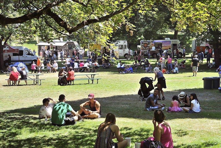
 as enterprises to")


 Youth baseball at Cheney Stadium Foot golf at")


7 Policy P 1.8 Maintain special recreational facilities (such as golf courses and sports stadiums) as enterprises to meet public needs, ensure maximum use, and financial self-sufficiency. Policy P 1.9 Periodically review trends in park and recreation facility use and adapt plans and investments to respond to changing community needs. PARTNERSHIPS Goal P 2 Promote public and private partnerships that expand the variety of community services and programs, provide open space, and enhance the quality of life for Tacomans. Special recreation facilities (clockwise from top left) Youth baseball at Cheney Stadium Foot golf at Meadow Park Golf Course Vintage Hickory International at Meadow Park Golf Course Kandle Pool Rainier s game at Cheney Stadium Policy P 2.1 Jointly plan for new park and recreation facilities and services that contribute to the health and well-being of Tacomans of all ages and abilities. Policy P 2.2 Continue to work in close partnership with Metro Parks Tacoma, including supporting updates to long term plans for the parks and open space system. Policy P 2.3 Encourage public-private partnerships to develop and operate publicly-accessible recreational facilities that meet identified public needs. Norpoint Park 8-7

8 PARTNERSHIPS With a history of successful partnership that extends over 100 years, the City and Metro Parks Tacoma are committed to working together to create healthy opportunities for Tacoma residents to play, learn and grow. Other key partners include the Port of Tacoma, the Tacoma School District, Tacoma Public Utilities, and other public and private partners. Policy P 2.4 Partner with public and private entities to encourage, sponsor, and support a range of public activities and events within appropriate open spaces, as well as within temporary closed streets, such as markets, festivals, and parades. With over 50 developed school campuses and school sites, Tacoma Public Schools play areas and fields are an important part of all Tacoma neighborhoods. Figure 36 on page 8-12 shows both the public park system and school campuses. Policy P 2.5 Support and encourage the use of streets and sidewalks, on a temporary and intermittent basis, for a range of activities, such as markets, festivals, shopping, dining and recreation, while ensuring safety and balancing street and sidewalk use for transportation. Policy P 2.6 Coordinate the planning and improvement of trails with corridor improvements. Policy P 2.7 Recognize public school fields and play areas as a valuable part of the City s park system. Seek opportunities to work with the school districts to enhance the recreational value of these facilities. Policy P 2.8 Maintain an accurate inventory of the city s park and recreation facilities in coordination with Metro Parks Tacoma and other providers. Play equipment at Franklin Park, adjacent to Franklin Elementary School 8-8

9 FUNDING + CAPITAL PLANNING Goal P 3 Preserve and expand parklands and facilities to ensure the long-term viability of the park system to serve Tacoma s current and future population. Policy P 3.1 Maintain a long-range park capital improvements program that balances acquisition, development, and operations; provides a process and criteria for capital improvements project selection; and emphasizes creative and flexible financing strategies. Please see the Public Facilities + Services Element for information on parks and recreation capital facility projects Policy P 3.2 Seek funding for new parks and recreation facilities through a variety of sources and consider innovative strategies for the provision of new facilities: a. Develop zoning incentives, controls and/or funding mechanisms, such as transfer of development rights, to create highly functional urban parks and amenities within mixed use centers, downtown and planned residential developments. b. Consider adopting a fee-in-lieu program that would allow development to contribute toward open space, park, community garden or recreational space within a mixed-use center rather than providing on-site open space. Policy P 3.3 Evaluate opportunities to acquire and/or develop lands declared surplus by other public agencies, or offered as donation by private owners, if consistent with policies herein. MEETING COMMUNITY NEEDS Goal P 4 Develop and operate park and recreational facilities in a manner that is responsive to the site and the needs of the community. Policy P 4.1 Improve parks, recreational facilities and natural areas in accordance with current master plans, management plans, or adopted strategies that reflect user group needs, development priorities, development and maintenance costs, program opportunities, financing strategies, and community input. Remediation of heavy metals on the future Waterway Park site 8-9
 Policy P 4.")

10 Balloons are used to mark topography of a future 11- acre park on the peninsula at Point Defiance (left) Citizens attend an open house to look over the draft update to the Point Defiance Park Master Plan (right) Policy P 4.2 Encourage park and recreation facilities design that complements the natural features of the site. Policy P 4.3 Provide amenities at parks and recreation facilities, such as restrooms, lighting, seating, drinking fountains, trash receptacles, bicycle parking, and shelters when possible, feasible and appropriate to extend the hours of use and service quality. Policy P 4.4 Incorporate green building practices into park design and construction, including green demolition and disposal practices, use of local and recycled products and low impact development techniques. COMMUNITY OUTREACH EXAMPLES OF DIVERSE OUTREACH METHODS: Walking tours Storytelling and listening sessions Social media Video Festivals Partnering with community organizations Goal P 5 Facilitate a multi-faceted inclusive community conversation to ensure that park and recreation facilities are responsive to community interests and needs. Policy P 5.1 Regularly solicit and incorporate community members knowledge about park and recreation needs to ensure a system that is responsive to community interests and needs. Policy P 5.2 Employ a diverse array of outreach methods that recognize different communication styles and increase convenience for citizens. Policy P 5.3 On a regular basis, evaluate park and recreation preferences, needs and trends through assessment of usage and participation rates, surveys and other methods. 8-10


11 Fishing at China Lake NATURAL AREAS Goal P 6 Manage natural areas and urban forest to protect unique urban habitats and offer Tacomans an opportunity to connect with nature. Please see the Environment + Watershed Health Element for a discussion of natural open space areas and the urban forest Policy P 6.1 Preserve, enhance, and manage natural areas and resources to protect and improve their ecological health and to provide compatible public access. COMPLETE PARK SYSTEM Goal P 7 Establish and maintain a complete park and recreation system to serve the diverse needs of Tacoma residents. Functioning within a highly urbanized setting, the City of Tacoma and Metro Parks Tacoma partner together to offer a complete park and recreation system, ranging from low-impact, natural resource-driven habitat areas to recreation-oriented, high-impact parks and sport complexes. This system is made up of both public and private ownerships. On the public side, the City and Metro Parks are the primary owners of most of those lands categorized below. In addition, the Tacoma School District owns school properties that serve residents recreation needs during nonschool hours. The Port of Tacoma, Tacoma Public Utilities and other public agencies also manage open space and recreation assets. This spectrum of publicly-owned open space is complemented by lands managed by private landowners, with whom the City will continue to partner. Canopy (top) and pedestrian bridge (bottom) at Swan Creek Park A brief description of each different type of facilities, together with supporting policies is provided below. Please see also Figure 36, Park and Recreation Facilities for more information. 8-11

12 Figure 36. Park + Recreation Facilities 8-12


 Old Town Park dock Manitou Park Optimist")


13 Neighborhood Parks Neighborhood parks provide daily convenient access to basic recreation opportunities for nearby residents by foot or bicycle. Generally small in size, neighborhood parks are developed primarily for spontaneous and non-structured recreation activities. Sawyer Tot Lot and Optimist Park are examples of neighborhood parks. Neighborhood parks (clockwise from top left) Old Town Park dock Manitou Park Optimist Park Play equipment at Sawyer Tot Lot Baltimore Park field Policy P 7.1 Neighborhood parks should be designed to enhance neighborhood identity, preserve neighborhood open space and improve the quality of life of nearby residents. Policy P 7.2 Neighborhood parks should be located and distributed to provide convenient, daily walking access to basic recreational opportunities for nearby residents living within a 3/4-mile radius of the park. 8-13


14 Festivals held at Wright Park Music and art festival Titlow Park Ethnic Fest Food truck festival Community Parks Community parks are usually more than five acres, preferably ten to 15 acres, providing visitors with access to high and low impact recreation opportunities. Community parks should be designed to enhance community identity and preserve community open space. As a subcategory of community parks, Signature Community Parks have a wider community appeal providing a unique benefit which often contribute to the identity of a planning area and enhance the quality of life of District residents. McKinley Park is an example of a community park and Wapato Park a signature community park. Policy P 7.3 Community parks should be sited and designed to serve those residents living within a 1.5-mile radius of the park and to provide a wider range of recreational opportunities to accommodate large group activities, structured recreation programs, and major outdoor recreation facilities, such as sports facilities. Policy P 7.4 Community park sites should front onto a public street, preferably a collector or arterial street complete with sidewalks and bicycle lanes, or easily accessible by public transit. 8-14


15 Community parks (clockwise from top): Wright Park conservatory; Parks Appreciation Day at McKinley Park; Summer bash events at Norpoint Park; Basketball court at Franklin Park; Skate park at Kandle Park; Wapato Park 8-15


16 Urban Parks Thea s Park 21st Street Park NODAL + LINEAR URBAN PARKS Offering outdoor breathing space in an otherwise concrete built environment, urban parks are a special type of open space serving the unique lifestyles and recreation needs of those who live or work in or close to downtown and designated centers. While urban parks often serve as neighborhood parks for their nearby residents, they may also provide opportunities for community events and district-wide gatherings. They contribute to place-making by enhancing the quality of life and the identity of the urban core and the mixed-use districts. Creating a network of linear urban parks connected with public squares, gardens and plazas will allow urban residents or workers to walk to public spaces or destinations designed for art displays and other leisure pursuits. Urban parks may be developed and/or managed by other public or private agencies or in partnership with them, depending on their locations and forms of development. Thea s Park is an example of an urban park. Policy P 7.5 Plan for the acquisition and design of urban parks within the Downtown and designated centers based on forecast growth and adopted growth assumptions. a. Establish specific targets for open space, park, and recreation facilities to meet needs within mixed-use centers. b. Identify potential locations and opportunities for further action and use innovative methods and partnerships to fund the identified needs. c. Ensure park and recreation opportunities are provided in the mixeduse centers as the population in the center increases Policy P 7.6 Develop nodal urban parks for social gathering and linear urban parks for active recreation such as walking and bicycling. Examples of nodal urban parks include public squares, urban plazas, landscaped courtyards and community gardens. Linear urban parks include widened boulevards and landscaped promenades adorned with street furniture, water features and art work, and completed with bike facilities. Policy P 7.7 Locate and design nodal urban parks to create a focal point and distinctive sense of place for each center. Policy P 7.8 Coordinate the development of linear urban parks with the design of designated corridors and signature trails. 8-16


17 Regional Parks Regional parks, usually over a hundred acres, provide visitors with access to unique regional features and attractions. Regional parks often accommodate large group activities and have infrastructure to support special events and festivals. Contributing to economic development through tourism, regional parks can enhance the economic vitality and identity of the entire region. Point Defiance Park, with 760 acres and a wide variety of attractions, is an example of a regional park. Policy P 7.9 In addition to those facilities normally encouraged in community and neighborhood parks, unique and high quality amenities, landscape improvements and gardens, and infrastructure to support events and festivals should be provided. Sports fields, lit or unlit, may also be included within regional parks. Regional parks (clockwise from top) Owen s beach at Point Defiance Park Trail along Ruston Way Rose garden at Point Defiance Park (left) Point Defiance Park ecology shoreline oblique 8-17


18 Community gardens (clockwise from top left) 40th Street Proctor Swan Creek Park food forest Neighbors Park Please see the Design + Development Element for additional policies Community Gardens Land gardened by a community group for food, plant or fiber production, either for personal or charitable uses. Community gardens provide access to fresh produce; encourage a connection to the environment; support general health and wellbeing through outdoor activity and the therapeutic benefits of gardening; provide safety and beautification benefits; create healthy soil, which helps with stormwater management; and adds to a neighborhood s livability. Properly designed and managed, community gardens can greatly enhance a neighborhood s vitality and can be created on their own or in coordination with neighborhood parks, playgrounds, housing developments or apartment complexes. Policy P 7.10 Enhance existing and support new community gardens within parks and on appropriate public and private lands. Policy P 7.11 Support creative approaches to managing gardens, such as support by educational institutions or volunteer management by community organizations. 8-18


19 Sprayground at South End Recreation & Adventure (SERA) Campus (left) Meadow Park Golf Course (right) Special Recreation Facilities Outdoor or indoor facilities offer opportunities for programmed activities to promote active living, an appreciation for nature and the environment, and to foster respect for culture and heritage amongst all ages. These facilities can be free-standing or sited within a community or regional park and are usually managed by Metro Parks Tacoma. Policy P 7.12 Give priority for the location of new special recreation facilities to areas that are currently underserved. Policy P 7.13 To the extent feasible, locate new destination facilities within or in close proximity to designated centers. Examples of special recreational facilities include multi-purpose centers and mission-led specialty centers, such as sports complexes, athletic fields, golf courses, outdoor and indoor pools, boathouse marinas, nature centers, zoos and aquariums, wildlife parks, botanical conservatories, and historic interpretative centers. 8-19


20 Trails Dome to Defiance Promenade Titlow Park trail between the beach and railway Trails serve both a recreation and an active transportation function. Walking and bicycling provide many benefits to individuals as well as to the community. In Tacoma, trails provide opportunities for walking, bicycling, jogging, in-line skating, dog walking and wildlife watching. An integrated, safety-oriented multi-purpose trail increases mobility choices, reduces reliance on single-occupant vehicles, provides convenient access to schools, centers, transit, parks and other destinations, and encourages regular physical activity to enhance health and wellness. Policy P 7.14 Establish, improve, and maintain a citywide system of public trails that are a component of a larger network of bicycle and pedestrian facilities. This citywide trail system should connect Tacoma s neighborhoods, employment centers, schools, parks, natural areas, recreational facilities, commercial areas, regional trail system, and other key places that Tacomans access in their daily lives. Please see Figure 37, Citywide Trails Map. Policy P 7.15 Utilize Tacoma s natural topography to connect Tacomans to natural areas and the waterfront. Policy P 7.16 Design specific trails according to the purposes served and the location. a. Trails developed primarily for low-impact access to or through habitat areas should be developed to minimize their impact to the environment through location choices, narrower width, and use of pervious surfaces. b. Trails developed as non-motorized transportation corridors should be wide enough for the projected use and developed with a durable hard surface. Policy P 7.17 Locate and develop bicycle and pedestrian facilities that provide on- and off-road recreation for the community Natural trail in Swan Creek Park Policy P 7.18 Develop new trails and recreation facilities to accommodate rollerblading and skateboarding without posing conflicts to other recreational uses. 8-20
21 Figure 37. Citywide Trails 8-21


22 Please see the Urban Form Element for additional policies Julia s Gulch Open Space Corridors Lands that support, nurture and preserve natural and wildlife habitats and native vegetation. Open Space Corridors usually contain environmental assets, such as wetlands, streams, wildlife, native and forested habitats, that are managed for stewardship and conservation via best management practices. These lands often provide opportunities for environmental research and interpretative programs, in addition to low-impact recreational activities. Policy P 7.19 Encourage public access provisions in open space corridors where such access will complement, not negatively disrupt fish, wildlife and plants. Policy P 7.20 Provide opportunities for Tacomans to engage with and experience nature and wildlife amid varied natural settings. Pedestrian bridge through the Tacoma Nature Center Policy P 7.21 Provide opportunities for education and continuous learning about Tacoma s environment assets and geographic setting. Waterfront Tacoma s shorelines and waterfront areas are a source of economic activity, entertainment and recreation, as well as providing invaluable ecological and cultural functions. As such, the promotion of shoreline access and recreation is a major priority for Tacomans. The City s waterfront provides opportunities for recreation and the experience of nature that cannot be replicated in other areas of the City and region. Recognizing the multiple benefits and values of its shorelines, the City and others have made substantial investments to clean up environmental pollution and improve shoreline access, recreation and cultural opportunities. Given the strong connection many people feel to shorelines, investments like these will provide benefits that will be enjoyed and appreciated by a great number of people, improving Tacoma s livability and long-term prosperity. Policy P 7.22 Recognize the strong community connection to Tacoma s shorelines and waters as cultural, historic, recreational, educational, economic, natural and aesthetic assets of tremendous value. 8-22


23 Dragon boat racing at Maritime Fest Owen s beach at Point Defiance Park Pier at Dash Point Park Policy P 7.23 Enhance Tacoma s identity as a waterfront community, including designating and enhancing shoreline areas for public access, recreation, educational and interpretive displays, public art, community events, habitat restoration and other activities. Policy P 7.24 Develop and enhance opportunities for swimming, boating including use of Tacoma s water trails, fishing, SCUBA diving, educational activities, wildlife observation and other shoreline and water-dependent activities. Thea Foss Waterway and 21st Street Bridge Policy P 7.25 Implement the priority actions identified in the Shoreline Master Program Public Access Alternatives. 8-23


24 MASTER PLANS Goal P 8 Provide specific area and signature facilities according to adopted master plans. Over time, the City and partners have identified and conducted will improve the capacity to achieve the goals of this Element by developing plans for specific areas. This list is intended for larger, signature parks and open space sites. It is not exhaustive, and is intended to be updated regularly. Other public agencies, in particular Metro Parks Tacoma, maintain separate projects lists which should be consulted as well. Inclusion in this section is intended to convey the City Council s support for and recognition of the policy direction in these plans, and to convey that they are planning and implementation priorities. Inclusion in this section lends support to applications for City approvals such as conditional use permits, rezones and development regulation agreements meeting the intent of these plans, as well as the policies of the Comprehensive Plan. This section also provides a forum for the Council to refine their policy direction on a given site, in consultation with the Planning Commission and other stakeholders. Point Defiance Zoo & Aquarium Policy P 8.1 Point Defiance Park. MPT s conceptual plan for their signature 768-acre park, referred to as Destination Point Defiance, was developed over multiple years with broad public input and support. It includes commercial, educational and recreational features (including the zoo, a lodge, eating establishments, gift shops, a visitor s center, additional pavilion buildings, a farmers market, entertainment and educational facilities, and bike and kayak rental facilities) that broaden the use of the park and expand its function as a unique destination. While the current (2014) Land Use Intensity Designation is Low, the City recognizes the unique role that Point Defiance Park plays as a citywide and regional destination. Therefore, or until the Land Use Designation changes, alternative review processes such as Development Regulation Agreements may provide an appropriate avenue for City review of more intensive, destination-oriented features within the park. 8-24


25 Policy P 8.2 First Creek Action Plan. In the City collaborated with community stakeholders to develop a consensus vision and framework for action to improve East Tacoma s 3.5 mile First Creek corridor. The plan identifies actions to be implemented by multiple stakeholders over a 5 10 year planning period. Policy P 8.3 Wapato Hills Conceptual Plan. In 2013 the City and MPT collaborated to update the 1996 conceptual plan for the 80-acre Wapato Hills. The final conceptual plan recognizes that Wapato Hills functions primarily as a natural area for recreational walking on a system of trails and viewpoints. The conceptual plan also includes the existing park in the southwest corner and a proposed visitor center on the eastern side. Policy P 8.4 Downtown Subarea Plans. From 2011 to 2014, the City has worked to develop the South Downtown, Hilltop and North Downtown Subarea Plans and EIS s. The South Downtown Subarea Plan and EIS was adopted in December 2013, the Hilltop Subarea Plan and EIS was adopted in May 2014, and the North Downtown Subarea Plan and EIS is slated for adoption in late These plans provide thorough guidance on open space and recreation issues and priorities for the respective subareas. Policy P 8.5 Shoreline Public Access Alternatives. In 2013 the City adopted updates to the Shoreline Master Program (SMP), including the Shoreline Public Access Alternatives. This plan thoroughly addresses open space and recreation issues and priorities in Tacoma s Shoreline Districts. Policy P 8.6 Tacoma Landfill Land Use Plan. This 1998 plan represents incorporation of ideas gathered for the future uses of the closed portions of the City Landfill. The plan reports that over 151 acres will eventually be filled and capped. After landfilling ceases, much of the area may be utilized as a recreation and open space asset. Policy P 8.7 Port of Tacoma Public Access Plan. In 2013 the Port Commission adopted a public access plan to identify specific needs and opportunities to provide public shoreline access. The plan will guide Port actions to meet the City of Tacoma s SMP requirements for the Port to provide public access to shorelines. Dick Gilmur Shoreline Restoration and Kayak Launch at the Port of Tacoma 8-25

26 Swan Creek mountain biking trail Policy P 8.8 Swan Creek Master Plan. Swan Creek Park is a 383-acre greenspace nestled on the boundary between East Tacoma and Pierce County with a salmon bearing stream, wooded canyon, upland forest, paved and natural trails, and a community garden. In 2011 MPT adopted a long-term vision and plan for future site development, stewardship, and programming. 8-26
City of Tacoma Planning and Development Services
 Agenda Item D-1 City of Tacoma Planning and Development Services To: Planning Commission From: Elliott Barnett, Planning Services Division Subject: Application #2014-08 Open Space Element Update Meeting
10.0 Open Space and Public Realm
 10.0 Open Space and Public Realm 10.0 Open Space and Public Realm The Public Open Space System is comprised of: outdoor spaces available for public use that are either publicly owned (e.g., parks and
1. Parks & Recreation Neighborhood Parks Community Parks Special Use Sites 2. Open Space 3. Trails
 Appendix A: Park Classifications The intent of parks and recreation classifications is to aid in making acquisition and design decisions for park sites, facilities and the organization of recreation space
RECREATION AND OPEN SPACE ELEMENT GOALS, OBJECTIVES, AND POLICIES
 RECREATION AND OPEN SPACE ELEMENT GOALS, OBJECTIVES, AND POLICIES Goal 7 To provide park facilities, recreation programs, and open space resources that are safe, adequate, and accessible to all City residents,
This page intentionally blank.
 This page intentionally blank. Parks, Recreation, and Open Space Chapter Relationship to Vision Vision Parks, Recreation and Open Space Chapter Concepts County Government. County government that is accountable
Provide and maintain sufficient public parks, recreation facilities, and open space to meet the recreational needs of County residents and visitors.
 (ROS) Goal Provide and maintain sufficient public parks, recreation facilities, and open space to meet the recreational needs of County residents and visitors. OBJECTIVE ROS.01 The County shall acquire,
City Council March 27, Parks, Recreation, and Trails Master Plan
 City Council March 27, 2018 Parks, Recreation, and Trails Master Plan Planning Process Develop Goals and Objectives Inventory of Areas and Facilities Needs Assessment And Identification Public Participation
Comprehensive Plan ADOPTED APRIL 2014
 Comprehensive Plan ADOPTED APRIL 2014 8 8. Outstanding Recreational & Cultural Opportunities We are proud of our community s parks and recreation system. Our community will ensure that the legacy of our
DRAFT FOR PUBLIC REVIEW. Game Plan for a Healthy City
 DRAFT FOR PUBLIC REVIEW 2018 Game Plan for a Healthy City 2 Denveright. Parks & Recreation Game Plan Draft for Public Review Draft for Public Review Executive Summary Game Plan Overview Executive Summary
Chapter 6. Overall Vision RECOMMENDATIONS. More Trail and Trail. Connections. Equal Access to Park. Facilities and Programs. Water Access.
 Overall Vision More Trail and Trail Connections Equal Access to Park Facilities and Programs Water Access Environment Variety Chapter 6 RECOMMENDATIONS Chapter 6 The following recommendations for park,
3. VISION AND GOALS. Vision Statement. Goals, Objectives and Policies
 Vision Statement Queen Creek s interconnected network of parks, trails, open spaces and recreation opportunities provide safe and diverse activities and programs that sustain its unique, small town, equestrian
Arlington, Virginia is a worldclass
 EXECUTIVE S U M M A RY Arlington maintains a rich variety of stable neighborhoods, quality schools and enlightened land use policies, and received the Environmental Protection Agency s highest award for
COMPREHENSIVE PLAN & UNIFIED DEVELOPMENT ORDINANCE
 Village of Forsyth COMPREHENSIVE PLAN & UNIFIED DEVELOPMENT ORDINANCE Community Planning #6 Prepared by: Vision Statement We envision the Forsyth Community as one which will continue to maintain a small
RECREATION, OPEN SPACE AND GREENWAYS ELEMENT GOALS, OBJECTIVES, AND POLICIES
 RECREATION, OPEN SPACE AND GREENWAYS ELEMENT GOALS, OBJECTIVES, AND POLICIES GOAL R-1: DEVELOP A RECREATION, OPEN SPACE AND GREENWAYS SYSTEM AS AN INTEGRAL COMPONENT OF AN OVERALL, COUNTY-WIDE ECONOMIC
{Best Practices. Summary of Tools, Strategies and Best Practices from 11 Michigan Case Study Communities
 Case Studies Michigan Coastal Community Working Waterfronts { Summary of Tools, Strategies and from 11 Michigan Case Study Communities Table of Contents Zoning...2 Community and Stakeholder Collaboration
Please read the entire document
 projects impacting the waterfront revitalization area. The waterfront revitalization area of the town will have to subareas to the west and east of the village. Page 6 of 6 Wayfinding master plan create
PARKS AND RECREATION
 PARKS AND RECREATION WHAT YOU WILL FIND IN THIS CHAPTER: Background information on the development of the Park, Recreation, and System Plan (PRSP). General overview of Ellensburg s parks and recreation
Mendota Heights 2040 Comprehensive Plan Draft Vers
 4 Parks and Trails The City of Mendota Heights boasts a variety of recreational and open space opportunities. Few cities can claim access to regional trails, riverside and lakeside parks, scenic bluffs
ELK GROVE GENERAL PLAN VISION
 2-1 CHAPTER 2: 2-2 CREATING OUR The Community Vision for Elk Grove, expressed through a Vision Statement and a series of Supporting Principles, is a declaration of the kind of community that Elk Grove
PARTF Scoring System for Grants
 PARTF Scoring System for Grants The members of the N.C. Parks and Recreation Authority use the PARTF scoring system as one of several tools to select grant recipients. Please provide all of the information
CAPITAL PROGRAM UPDATE
 2015-2016 CAPITAL PROGRAM UPDATE Celebrate 2015 & Anticipate 2016 Biennium Invitation to Do Things Differently Partnerships More Important than Ever Communication Tonight s Presentation 2015 2016 Projects
Town of Peru Comprehensive Plan Executive Summary
 Town of Peru Comprehensive Plan Executive Communities that plan grow by choice, not by chance. A plan makes growth thoughtful, understandable, and predictable. A plan shows that a community is managing
PARKS. Chapter Introduction
 Chapter 4. PARKS 4.1. Introduction This Parks Element of the 2016 Comprehensive Plan Update provides direction and guidance, based on citizen input, in order to improve and maintain the City s existing
1 Introduction. 4 Environmental Integrity. 7 Community Facilities
 2037: A CALL TO ACTION 2017 COMPREHENSIVE PLAN EXECUTIVE SUMMARY is the purpose of the Q: What Comprehensive Plan? The comprehensive plan serves as a guide for the community s physical, social, and economic
Support the implementation of Cape Coral's Comprehensive Plan. Protect and utilize the unique natural resources in the City.
 7.0 OVERVIEW - RECOMMENDATIONS Chapter 7 The preparation of the Cape Coral Parks and Recreation Master Plan spanned a period of approximately 12 months. Plan preparation included the input of a wide range
City of Tacoma Planning and Development Services
 Agenda Item E-1 City of Tacoma Planning and Development Services To: Planning Commission From: Elliott Barnett, Planning Services Division Subject: Tacoma Mall Regional Center Subarea Plan and EIS Meeting
North Fair Oaks Community Plan Summary and Information
 North Fair Oaks Community Plan Summary and Information WHAT IS THE NORTH FAIR OAKS COMMUNITY PLAN? The North Fair Oaks Community Plan is part of the San Mateo County General Plan, and establishes policies
Promoting Economic Development Through Upfront SEPA Review: Lessons from South Downtown Tacoma
 Promoting Economic Development Through Upfront SEPA Review: Lessons from South Downtown Tacoma 1 This session will focus on the City of Tacoma s South Downtown Subarea Plan and associated Non-Project SEPA
DISCUSSION TOPIC: ST JOHNS RIVER & ITS TRIBUTARIES (BPII) 2030 COMPREHENSIVE PLAN POLICES AND REGULATORY FRAMEWORK
 2030 COMPREHENSIVE PLAN POLICES AND REGULATORY FRAMEWORK") DISCUSSION TOPIC: ST JOHNS RIVER & ITS TRIBUTARIES (BPII) 2030 COMPREHENSIVE PLAN POLICES AND REGULATORY FRAMEWORK St. John s River & Its Tributaries Issue Summary: The St. Johns River is an important
DISCUSSION TOPIC: ST JOHNS RIVER & ITS TRIBUTARIES (BPII) 2030 COMPREHENSIVE PLAN POLICES AND REGULATORY FRAMEWORK St. John s River & Its Tributaries Issue Summary: The St. Johns River is an important
PARK AND RECREATION MASTER PLAN UPDATE
 PARK AND RECREATION MASTER PLAN UPDATE 2014-2018 Prepared for: Avon Parks, Recreation and Beautification Council (PRBC) and Town of Avon Prepared by: Lehman & Lehman, Inc. 24-Apr-14 Mission Statement The
Capital Projects Update March 2017
 Capital Projects Update March 2017 Partnership Initiatives Eastside Community Center Metro Parks is working with Tacoma Public Schools, the City of Tacoma, Tacoma Housing Authority, Boys & Girls Clubs
Silverdale Regional Center
 Silverdale Regional Center Vision for Silverdale Regional Center The Silverdale Regional Center Plan (Plan) will guide the evolution of the Silverdale Regional Center from a collection of strip malls and
The Five Components of the McLoughlin Area Plan
 The Five Components of the McLoughlin Area Plan This documents contains the complete language of the five components of the McLoughlin Area Plan: The Vision Statement The Values The Guiding Principles
G. RECREATION AND OPEN SPACE ELEMENT. The following summarizes the Recreation and Open Space Element:
 G. RECREATION AND OPEN SPACE ELEMENT The purpose of the Element is to provide the framework and direction for a comprehensive system of public and private sites for recreation, including, but not limited
A BLUEPRINT FOR BROCKTON A CITY-WIDE COMPREHENSIVE PLAN
 A BLUEPRINT FOR BROCKTON A CITY-WIDE COMPREHENSIVE PLAN Public Meeting October 2016 1 Plan Summary and Discussion Public Meeting May 4 2017 City of Brockton Bill Carpenter, Mayor Department of Planning
Port Lavaca Future Land Use
 Port Lavaca Future Land Use Introduction The City of Port Lavaca is beginning to see sustained growth, after many years of relative stable population. New single family homes, apartments, and businesses
Transportation. Strategies for Action
 Transportation A major priority for the Overlake Neighborhood is to develop a multimodal transportation system. To achieve this system, a balance has to be found among travel, circulation and access needs;
STAFF RECOMMENDATION: Adopt the Parks and Recreation Master Plan 2013, or take other action as deemed appropriate.
 Regular 7. CITY COUNCIL AGENDA Meeting Date: 12/02/2013 TITLE: Parks and Recreation Master Plan 2013 Adoption Proposal - Dwight Curtis Responsible Staff: Dwight Curtis Backup Material: Backup material
3.1 community vision. 3.3 required plan elements
 Chapter 3 Community Form 3.1 community vision 3.2 Parks & landscaping concepts 3.3 required plan elements D R A F T 20 Community Form Chapter 3 3.0 Community form 3.1 community vision The Specific Plan
LAND USE OVERVIEW WHAT YOU WILL FIND IN THIS CHAPTER
 LAND USE WHAT YOU WILL FIND IN THIS CHAPTER Information about the City s expected population and employment growth. Description and capacity of existing and future land use designations. Policies that
City of Nogales General Plan
 Open Space, Parks, Recreation and Trails City of Nogales General Plan Residents of Nogales place a high priority in the development of a comprehensive system of open space, parks, recreation and trails
DRAFT SCOPE OF SERVICES PEER REVIEW OF BAKER PARK. Request for Qualifications (RFQ)
") DRAFT SCOPE OF SERVICES PEER REVIEW OF BAKER PARK Request for Qualifications (RFQ) The following scope of services is presented for consideration and development of firm qualifications submittal. Some
DRAFT SCOPE OF SERVICES PEER REVIEW OF BAKER PARK Request for Qualifications (RFQ) The following scope of services is presented for consideration and development of firm qualifications submittal. Some
DALY CITY VISIONING PROCESS COMMUNITY WORKSHOP 3 MAY 8, 2008
 DALY CITY VISIONING PROCESS COMMUNITY WORKSHOP 3 MAY 8, 2008 PROCESS General Plan - a statement of the community s values, vision and aspirations for now and into the future... Timeframe LONG TERM - 2030
6. RECREATION AND OPEN SPACE ELEMENT
 6. RECREATION AND OPEN SPACE Introduction This Recreation and Open Space Element includes Goals, Objectives and Policies (GOP) that apply to the main campus in Gainesville and the Lake Wauburg Recreation
Sustainability, Health, Safety, Recreation & Open Space Working Group August 3, 2017
 Sustainability, Health, Safety, Recreation & Open Space Working Group August 3, 2017 DOWNTOWN OAKLAND SPECIFIC PLAN WELCOME Sustainability, Health, Safety, Recreation & Open Space Working Group Social
The West Vaughan Employment Area Secondary Plan Policies
 Part 2: The West Vaughan Employment Area Secondary Plan Policies 2.1 General Policies It is the policy of Council: 2.1.1. That the West Vaughan Employment Area (the WVEA), identified on Schedule 1, will
PLANNING ADVISORY BOARD AGENDA OCTOBER
 ! City of Langley PLANNING ADVISORY BOARD AGENDA OCTOBER 1, 2014 3-5pm LANGLEY CITY HALL - 112 2 nd Street, Langley WA 1) Call to Order and Roll Call 2) Approval of the Minutes September 10, 2014 3) Public
Plan Overview. Manhattan Area 2035 Reflections and Progress. Chapter 1: Introduction. Background
 Plan Overview The Manhattan Urban Area Comprehensive Plan (the Comprehensive Plan) is a joint planning initiative of the City of Manhattan, Pottawatomie County, and Riley County. The 2014 Comprehensive
2035 General Plan Update and Belmont Village Specific Plan. Joint Study Session with the City Council and Planning Commission April 12, 2016
 2035 General Plan Update and Belmont Village Specific Plan Joint Study with the City Council and Planning Commission April 12, 2016 Agenda 1. Welcome and Introductions 2. General Plan Update Status of
Chapter 11 PARKS, RECREATION AND OPEN SPACE
 Chapter 11 PARKS, RECREATION AND OPEN SPACE INTRODUCTION The 2016 Parks, Recreation and Open Space Plan (Park Plan) for Gig Harbor represents the City s vision and provides goals and objectives for the
CHAPTER 3 VISION, GOALS, & PLANNING PRINCIPLES. City of Greensburg Comprehensive Plan. Introduction. Vision Statement. Growth Management Goals.
 CHAPTER 3 VISION, GOALS, & PLANNING PRINCIPLES Introduction The Greensburg Comprehensive Plan is intended as a working community document. A combination of long and short-term goals, this document is intended
1.0 Purpose of a Secondary Plan for the Masonville Transit Village
 Report to Planning and Environment Committee To: Chair and Members Planning & Environment Committee From: John M. Fleming Managing Director, Planning and City Planner Subject: Masonville Transit Village
Introduction. Chapter 1. Purpose of the Comprehensive Plan Plan Organization Planning Process & Community Input 1-1
 Chapter 1 Introduction Lakewood 2025: Moving Forward Together Purpose of the Comprehensive Plan Plan Organization Planning Process & Community Input 1-1 Purpose of the Comprehensive Plan The Comprehensive
Keyport. Vision for Keyport
 Keyport Vision for Keyport Keyport is a rural, historic waterfront village bounded and limited in size by its natural borders of water and the Naval Undersea Warfare Center. The community consists primarily
About Momentum Midland
 About Momentum Midland Achieving a community s full potential in terms of economic development and quality of life is critically important to its long term sustainability. Core to achieving this is a vibrant
December 1, 2014 (revised) Preliminary Report -- Thomas Jefferson Site Evaluation
 Preliminary Report -- Thomas Jefferson Site Evaluation") December 1, 2014 (revised) TO: FROM: RE Arlington County Board Thomas Jefferson Site Evaluation Working Group by Carrie Johnson, Chair Preliminary Report -- Thomas Jefferson Site Evaluation The Thomas
December 1, 2014 (revised) TO: FROM: RE Arlington County Board Thomas Jefferson Site Evaluation Working Group by Carrie Johnson, Chair Preliminary Report -- Thomas Jefferson Site Evaluation The Thomas
City of Mahtomedi Park System Plan Public Hearing Draft: September 13, 2006
 Chapter 6: IMPLEMENTATION INTRODUCTION Earlier chapters of this Plan analyzed existing conditions, identified park and recreation needs, and proposed park, trail, and open space recommendations. This chapter
Parks Master Plan Implementation: Phase I Waterfront Use and Design REPORT #: September 7, 2016 File #
 0 'O DI Lan-171-14 1 - THE CORPORATION OF THE TOWN OF COBOURG..,. STAFF REPORT TO: FROM: Mayor and Members of Council Dean A. Hustwick, Director of Recreation and Culture DATE OF MEETING: Committee of
WARM SPRINGS PARK MASTER PLAN
 TABLE OF CONTENTS page 1.0 Introduction and Overview 1 2.0 Information Gathering 2 3.0 Conceptual Alternative Development 8 4.0 Master Plan Development 14 5.0 Construction Cost Estimates 19 LIST OF FIGURES
Midtown Greenway Land Use and Development Plan Executive Summary
 Midtown Greenway Land Use and Development Plan Executive Summary Introduction The Midtown Greenway Land Use and Development Plan sets policy direction for land use and development in the Midtown Greenway
Town Center (part of the Comprehensive Plan)
") Town Center (part of the Comprehensive Plan) Mercer Island Town Center Looking North (2014) In 1994, a year-long process culminated in a set of design guidelines and code requirements for the Town Center
Town Center (part of the Comprehensive Plan) Mercer Island Town Center Looking North (2014) In 1994, a year-long process culminated in a set of design guidelines and code requirements for the Town Center
Chapter 1: Introduction
 Chapter 1: Introduction The Penn Avenue Community Works Corridor Vision and Implementation Framework presents an integrated communitybased vision and a coordinated, long-term implementation framework for
SUSTAINABILITY PLAN OTTAWA COUNTY PARKS AND RECREATION COMMISSION FALL 2017
 SUSTAINABILITY PLAN OTTAWA COUNTY PARKS AND RECREATION COMMISSION FALL 2017 Table of Contents Introduction Natural Resources Quality of Life Community Continuing the Mission Sustainability Measuring Sustainability
4 C OMMUNITY D ISTRICTS
 4 C OMMUNITY D ISTRICTS N ew development in the Area will include many different types of land uses, including a destination retail area that attracts people from all over the region; recreation opportunities
Little Neck Planning Area
 Little Neck Planning Area Current Reality The Little Neck Planning Area is characterized by established residential neighborhoods, Town Center and Pembroke. The Eastern and Western Branches of the Lynnhaven
C. Westerly Creek Village & The Montview Corridor
 C. Westerly Creek Village & The VISION Community Vision When the goals of the city are achieved Westerly Creek Village, a distinctive community defined by Montview Boulevard and Westerly Creek, is a strong
Concord Community Reuse Project Goals and Guiding Principles. Overarching Goals (OG)
") Concord Community Reuse Project Goals and Guiding Principles Overarching Goals (OG) No priority is implied by the order of presentation of the goals and guiding principles. Overarching goals for the Concord
Concord Community Reuse Project Goals and Guiding Principles Overarching Goals (OG) No priority is implied by the order of presentation of the goals and guiding principles. Overarching goals for the Concord
Policies and Code Intent Sections Related to Town Center
 Policies and Code Intent Sections Related to Town Center The Town Center Vision is scattered throughout the Comprehensive Plan, development code and the 1994 Town Center Plan. What follows are sections
Visioning Statement and Guiding Principles
 Visioning Statement and Guiding Principles Planning for the Future The General Plan The General Plan represents Woodland's shared vision of the future and defines a path to lead the community toward its
RECREATION AND OPEN SPACE VISION
 City of South Lake Tahoe General Plan Policy Document Recreation and Open Space Element INTRODUCTION This element provides the policy context for the City of South Lake Tahoe to achieve its vision for
2040 LUP is a part of the Comprehensive Plan and carries the same legal authority. Economic Challenges
 1.1. Guiding Anchorage s Growth Where will new residents settle over the next two decades? Where will people work, shop, and play? Will there be enough room to grow? How will Anchorage look? Will growth
City of Tacoma Planning and Development Services
 Agenda Item D-3 City of Tacoma Planning and Development Services To: Planning Commission From: Stephen Atkinson, Associate Planner, Planning Services Division Subject: Land Use Designations - Phase 2 Meeting
CITY OF GAINESVILLE PARKS, RECREATION AND CULTURAL AFFAIRS DEPARTMENT VISION 2020
 CITY OF GAINESVILLE PARKS, RECREATION AND CULTURAL AFFAIRS DEPARTMENT VISION 2020 A BLUE PRINT FOR THE NEXT 20 YEARS The PRCA Vision 2020 Master Plan, adopted in November 2012, addresses the current state
Shoreline Master Program Town of La Conner, Washington
 Shoreline Master Program Town of La Conner, Washington Department of Ecology approval effective Adopted September 24, 2013 by Town of La Conner Ordinance No.1106 Amended May 13, 2014 by Town of La Conner
The urban parks in Charlottesville include Jackson Park, Lee Park, and McGuffey Park.
 Park Classifications Charlottesville s parks can be grouped into 4 different classifications: urban parks, neighborhood parks, community parks, and regional parks. Figure 1 on page 5 inventories the facilities
Great Neck Planning Area
 Great Neck Planning Area Current Reality The Great Neck Planning area is characterized primarily by large lot/lowdensity residential development with the majority of recreational opportunity existing as
Preliminary Plan Framework: Vision and Goals
 Preliminary Plan Framework: Vision and Goals Draft: May 2015 Introduction Since the Town of Milliken s comprehensive plan was last updated in 2010, the community was heavily impacted by the 2013 flood,
The following principles guide the development of goals and strategies to protect and promote these amenities:
 OPEN SPACE/PARKS/TRAILS/RECREATION GOALS/STRATEGIES Cherry Hills Village is a living environment that offers low density development, open areas, public scenic vistas, public trails and public parks. This
Courthouse Planning Area
 Courthouse Planning Area Current Reality The Courthouse Planning Area is the characterized by expansive suburbanscale residential areas as well as the community resource planned area of athletic, educational,
North Oakville East Parks Facilities Distribution Plan. November, 2009
 North Oakville East November, 2009 POLICY CONTEXT 1) Purpose a) The purpose of this document is to be a guide for the location, configuration, design and development of the parks system for the North Oakville
Streets for People, Place-Making and Prosperity. #TOcompletestreets
 COMPLETE STREETS FOR TORONTO Streets for People, Place-Making and Prosperity COMPLETE STREETS: A NEW APPROACH A Complete Streets design approach considers the needs of all users people who walk, bicycle,
Whitemarsh Comprehensive Plan Update: Housing & Land Use. Public Workshop #3: September 20, 2018
 Whitemarsh Comprehensive Plan Update: Housing & Land Use Public Workshop #3: September 20, 2018 Agenda Welcome Process Recap What We ve Heard The Plan Framework Review of Recommended Actions Land Use Housing
BeltLine Corridor Environmental Study
 BeltLine Corridor Environmental Study Citywide Conversation on Transit and Trails April 2, 2009 Agenda & Introductions Introductions Environmental Study Process Overview of the BeltLine Project BeltLine
THE CORPORATION OF THE TOWNSHIP OF KING REPORT TO COMMITTEE OF THE WHOLE. The Parks, Recreation & Culture Department respectfully submit the following
 KING THE CORPORATION OF THE TOWNSHIP OF KING REPORT TO COMMITTEE OF THE WHOLE Monday November 2, 2015 Parks, Recreation & Culture Department PRC-2015-44 RE: Public Art Policy 1. RECOMMENDATIONS: The Parks,
East Bench Master Plan Update
 Community & Economic Development Office of the Director East Bench Master Plan Update To: From: Planning Commission Wayne Mills, Senior Planner Date: November 18, 2015 CC: Re: Nora Shepard, City Planning
Corridor Vision. 1Pursue Minnehaha-Hiawatha Community Works Project. Mission of Hennepin County Community Works Program
 1Pursue Minnehaha-Hiawatha Community Works Project Minnehaha-Hiawatha Community Works is a project within the Hennepin Community Works (HCW) program. The mission of the HCW program is to enhance how the
Focus Groups. 8 Focus Group meetings including 2 with staff, 1 with seniors, and 1 with students
 Project Team Nan Lanahan, Parks & Recreation Jason Gallo, Parks & Recreation Rob Leslie, DEDP John Smolinsky, Planning Board Brent Meredith, Highway Joan Gavrilik, Friends of Parks & Rec MaryLyn Koval,
CHAPTER 1. Ms. Guajardo s Class - Central Elementary CH 1 1
 INTRODUCTION CHAPTER 1 Ms. Guajardo s Class - Central Elementary CH 1 1 1.1 SETTING South Centre City is a linear corridor south of Downtown Escondido paralleling Centre City Parkway and South Escondido
CHAPTER 8 ISSUES, CONCERNS, CONSTRAINTS AND OPPORTUNITIES
 CHAPTER 8 ISSUES, CONCERNS, CONSTRAINTS AND OPPORTUNITIES Introduction This River Conservation Plan was developed during a time of tremendous activity and effort in planning the transformation of the Delaware
City Center Neighborhood Plan
 [1] City Center Neighborhood Plan As adopted by Ordinance No. 2014-09-049 and amended by Ordinance Nos. Formerly CBD Neighborhood as adopted by Ordinance No. 8868 and amended by Ordinance Nos. 8946, 9693,
THEMES, VISION, + PRINCIPLES
 CHAPTER 2: THEMES, VISION, + PRINCIPLES This page intentionally left blank. 20 VISION DRAFT AUGUST 2018 2 2 THEMES, VISION, + GUIDING PRINCIPLES The Key Themes, Vision, and Guiding Principles presented
CITY OF COLWICH COMPREHENSIVE PLAN LAND USE LAND USE 1
 LAND USE LAND USE 1 WHAT YOU WILL FIND IN THIS CHAPTER: Discussion of today s conditions and tomorrow s projections Discussion of challenges and opportunities Discussion of the environmental quality goals,
SAN RAFAEL GENERAL PLAN 2040 INTRODUCTION AND OVERVIEW
 SAN RAFAEL GENERAL PLAN 2040 INTRODUCTION AND OVERVIEW Steering Committee Presentation February 14, 2018 Purpose of General Plan Guide land use and development decisions Coordinate transportation, infrastructure,
Shared Principles and Emerging Plan Directions
 Shared Principles and Emerging Plan Directions Introduction Since the Fairfield Neighbourhood planning process launched in June 2016, we have heard from many residents, businesses, groups and other people
2 Vision. Master Plan
 19 2 Vision Master Plan 20 Chapter 2 MASTER PLAN VISION 2.1 Master Plan Organization Lake Calhoun/Bde Maka Ska and Lake Harriet are places where complex human and natural systems intersect and converge.
New Partners for Smart Growth Conference February 5, 2010
 Dan Stroh, Planning Director City of Bellevue Planning and Community Development Bellevue, WA New Partners for Smart Growth Conference February 5, 2010 Summary of Project Long-range plan update for Bel-Red
A citizen s guide to the. Comprehensive Plan. City of Lakeville, Minnesota 1
 A citizen s guide to the Comprehensive Plan 2008 City of Lakeville, Minnesota 1 Introduction The City of Lakeville completed an update of its Comprehensive Plan in 2008. A comprehensive plan is a tool
A larger version of this map is located on the last page of this PDF.
 MAP Committee Input McLoughlin Area Draft Vision Map A larger version of this map is located on the last page of this PDF. 1. The map above is intended to portray a vision for the McLoughlin area. It highlights
Hopkins. Development Guidelines May Overview. Sponsored by: Blake Road Corridor Collaborative City of Hopkins
 Hopkins Blake Road LRT Station Area Development Guidelines May 2015 Sponsored by: Blake Road Corridor Collaborative City of Hopkins Overview Hopkins is a dynamic community of over 17,000 residents located
The transportation system in a community is an
 7 TRANSPORTATION The transportation system in a community is an important factor contributing to the quality of life of the residents. Without a sound transportation system to bring both goods and patrons