The Region of Waterloo. Central Transit Corridor
|
|
|
- Randell Cox
- 6 years ago
- Views:
Transcription


1 The Region of Waterloo Central Transit Corridor
2
3 MOVING PEOPLE BUILDING COMMUNITIES CENTRAL TRANSIT CORRIDOR COMMUNITY BUILDING STRATEGY FORWARD December 2013 Waterloo Region is a vibrant global community experiencing unprecedented investment, growth and change. Already the fourth largest community in Ontario and the tenth largest in Canada, Waterloo Region continues to grow. With over half of new development already happening in built up areas, and the opening of a new rapid transit system in 2017 to further link Cambridge, Kitchener and Waterloo, a framework is needed to guide growth around over 20 new transit stations. As a key means of guiding this growth, it is our pleasure to present A Community Building Strategy for Waterloo Region s Central Transit Corridor. This initiative has been led by the Region of Waterloo with the Cities of Cambridge, Kitchener and Waterloo, and overseen by our very experienced consulting team at Urban Strategies. The Community Building Strategy (CBS) recommends how our community should grow around rapid transit stations, such as the types of buildings and uses, their design and their connections to the surrounding community, while remaining sensitive to the need for compatibility with adjacent areas, like established neighbourhoods. The CBS also provides valuable information to investment and development interests about the many opportunities that exist in these station areas and beyond. This Community Building Strategy is about us all. While much of the focus is on building around transit investment, it also recognizes that cars need to be accommodated. For our rural communities, the CBS represents an important way to contain the expected growth of our Region, from a population of 550,000 today to over 700,000 in the next 20 years, in a way that will help protect our valuable farmland and environmentally sensitive areas. If you live in a more suburban location, the CBS is designed to support a broader transit system that gets you from your home to many important locations along the rapid transit corridor, and beyond. Not all of the costs for many of the initiatives identified in the CBS are currently contained in municipal budgets. The reality is that we must identify what should be done, and then set priorities. This process will be an evolving one, and opportunities like development proposals will affect those priorities from time to time. The Region and Area Municipalities will continue to work collaboratively and respond to these ongoing opportunities. In recent years, we have seen a series of significant economic, environmental and social changes in our community. We often refer to these changes collectively as The Big Shift. This includes shifts from more outward suburban sprawl to more compact development, greater investment in transit, higher densities of development, and a greater focus on design excellence. In response to these changes, we created The Big Shift Toolbox ( to help our many stakeholders be part of our community vision. The Community Building Strategy is an important element of that Toolbox. Finally, this document captures valuable input generously provided by so many people. We offer our sincere thanks to everyone who has been a part of helping to shape our community. I look forward to seeing our vision become reality. Rob Horne Commissioner Planning, Housing and Community Services


4 Thank You! This document could not have been possible without the guidance of the Project Team and contribution of the hundreds of individuals and stakeholders who participated in the process. Your valuable input was critical to the directions in the Community Building Strategy. The Consultant Team The Project Team Urban Strategies Nelson\Nygaard Colliers International Region of Waterloo City of Cambridge City of Kitchener City of Waterloo Habon Ali Daniel Comerford George Dark Melanie Hare Craig Lametti Peter Markine Alex Young David Fields Jason Schrieber Karl Innanen Kevin Curtis Rob Horne Brooke Lambert Becky Schlenvogt Rapid Transit Office Darshpreet Bhatti Samer Inchasi Masood Mirza Danielle Tobey Elaine Brunn Shaw Paul Smithson Alain Pinard Brandon Sloan Janice Mitchell Scott Nevin Cameron Salisbury
5 CONTENTS THE CORRIDOR TODAY THE OPPORTUNITY WHAT IT WILL LOOK LIKE PLACE-SPECIFIC OPPORTUNITIES 1.1 The Region is Growing 1.2 Growth is Being Focused Along the Central Transit Corridor 1.3 The Region and Cities Have Been Planning for Enhanced Transit 1.4 The Market is Changing to Reflect a More Urban Lifestyle Choice 1.5 The Mobility Network is Being Adapted to Support Growth in People and Jobs The Process for Creating a New Land Place-Specific 56 Developing this Use and Mobility Initiatives 04 Strategy Framework A Vision for the Central Transit Corridor 2.3 The Market Response 2.4 Key Community Building Opportunities Creating Transit- Supportive Places THE STATION AREA SNAPSHOTS TRANSFORMATION OVER TIME GETTING THERE GLOSSARY AND INDEX 5.0 Station Area Snapshots Understanding the CBS Framework Priority Initiatives Glossary and Index Implementation 153 Initiatives 6.2 Station Area Planning List of Abbreviations Managing Parking Over the Short and Long-term 6.4 Illustrating Transformation Over Time


6 6


7 1 THE CORRIDOR TODAY The Corridor Today introduces the Central Transit Corridor and explains what the Community Building Strategy is and why it is needed. It describes the study area and outlines the role of the study within the context of current planning, investment and development initiatives in the Waterloo Region. Chapter 1 includes the following: 1.1 The Region is Growing This section outlines the population changes occurring in the region and the role the Central Transit Corridor will play in accommodating growth and shaping communities. 1.2 Growth is Being Focused Along a Central Transit Corridor This section describes the patterns of mobility found throughout the region and how people are moving in the Central Transit Corridor today. 1.3 The Region and Cities have been Planning for Enhanced Transit This section outlines how the Community Building Strategy builds on regional and local planning direction while integrating with complementary projects including the Region s Growth Management Strategy and the implementation of the Rapid Transit Project. 1.4 The Market is Changing to Reflect a More Urban Lifestyle Choice This section looks at the current real estate market conditions and the already changing nature of investment within the Central Transit Corridor. 1.5 The Mobility Network is Being Adapted to Support Growth in People and Jobs This section describes the integration between Rapid Transit, planned changes to the region s ixpress bus services and regional and local active transportation networks. It outlines the importance of connecting many key destinations away from the Corridor and the opportunities that exist to enhance mobility throughout the region. 1


8 1.1 The Region is Growing The Waterloo Region is experiencing and planning to accommodate significant growth. The majority of this growth is occurring in the three urban municipalities of Cambridge, Kitchener and Waterloo. Swift population increases have made the Waterloo Region one of the fastest growing areas in Canada. Over the next 20 years, the region is expected to grow by 185,000 people and 80,000 new jobs. Though this growth will serve to stimulate new investment and opportunities for redevelopment, it will also create new challenges for the region that must be carefully managed in the short and longer terms. Since the creation of the Regional Official Policies Plan in 1976, the Region has prioritized balancing growth with quality of life. Its long history of managing growth has led to the implementation of policies that work to protect the area s rural landscape whilst promoting initiatives that support intensification and compact growth. In 2003, a Growth Management Strategy was approved by Regional Council to identify when and where new residential and employment growth could be accommodated. Historically, new growth within the region has spread outwards to suburban areas with available land for new community development. In more recent years however, shifts in lifestyle choices, local growth managment initiatives and investments in urban properties have gradually moved growth back to the region s urban areas. The Growth Management Strategy has encouraged this inward trend by introducing policies that limit urban sprawl and focus growth in existing built up areas including the Central Transit Corridor (CTC). The CTC is the central spine that runs through the heart of the urban communities in Cambridge, Kitchener and Waterloo. A high quality, rapid transit (RT) system is being put in place in this Corridor to support the concentration of existing and planned residents and jobs. Underutilized areas surrounding the new rapid transit system offer some of the best opportunities to enhance and establish vibrant and liveable mixed-use communities. Recent investment in business development, arts & culture, innovation and neighbourhood revitalization reinforce Waterloo Region s focus on healthy and vital communities. 2


9 The Central Transit Corridor is the central urban spine of the Region, the three cities and surrounding communities. 3

10 1.2 Growth is Being Focused Along the Central Transit Corridor To help the Region optimize available urban land, a key focus for new growth will be along the CTC. Through integration of land use and transportation planning, areas along the Corridor will be distinguished by having a greater mix of housing, jobs, retail, and leisure choices all within close proximity to enhanced transit. Conestoga Northfield At the heart of the CTC is the Region s planned rapid transit line. The line will be developed in two phases and will include 23 stations connecting the three cities. This integrated transportation corridor connects many key destinations throughout the region including places to live, work, play and shop. Along with improving access to existing places, the Corridor will become the focus for new medium and high density residential, retail and commercial development. Over time, this will lead to the creation of new and enhanced neighbourhoods, corridors and urban centres in each of the cities. R&T Park U of Waterloo Seagram Uptown Waterloo King / Allen Grand River Hospital Transit Hub Frederick / Benton Borden / Ottawa Young / Gaukel Mill Current Land Use: Rapid Transit along the CTC will serve and connect downtowns, neighbourhoods, shopping areas, campuses and employment areas. 4
 Heritage Conservation District Low Density Residential Medium Density Residential High Density Residential Agricultural Park Natural Area Commercial / Office Industrial Utility Retail")
11 Hwy 401 Hespeler / Eagle Cambridge Centre Can-Amera Preston Fairview Park Mall Sportsworld Delta Block Line Ainslie Terminal Phase 1 LRT Phase 1 abrt Phase 2 LRT Estimated 10 Minute Walk from Station (800m) Heritage Conservation District Low Density Residential Medium Density Residential High Density Residential Agricultural Park Natural Area Commercial / Office Industrial Utility Retail Institutional - General Institutional - Post Secondary Source: Municipal Property Assessment Corporation 5


12 The Many Places Along the Corridor The CTC is comprised of many distinct places including opportunities to live, work, study, play, and shop. The pattern of distribution for each of these uses means that the Corridor will be experienced in many different ways depending upon where you live, the type of job you have and what you choose to do in your spare time. Living NORTHFIELD YOUNG / GAUKEL MILL The Corridor today contains a range of housing choices. High and medium density residential communities are located in Uptown Waterloo and Downtown Kitchener but are also clustered around the Universities, Block Line Road and Fairview Park Mall. Within Cambridge, much of the high and medium density can be found around the Preston, Can-Amera and Ainslie Stations. Though some housing variety exists along the RT line, a greater mix of housing options in close proximity to enhanced transit will be needed to encourage greater intensification along the Corridor. Places to live along the Corridor High density housing Medium density housing Low density housing Working NORTHFIELD YOUNG / GAUKEL The Waterloo Region is home to a great number of advanced high-technology manufacturing and industrial businesses. Office campuses for predominately technological firms are found in Waterloo. Downtown Kitchener houses financial and creative industries and Cambridge contains the largest portion of the region s manufacturing. While many of the smaller employment clusters are easily accessed by RT, the larger more built-out employment areas lack the necessary infrastructure to support employees wishing to walk, cycle or take transit to work. MILL Concentration of employment areas along the Corridor Employment area Source of Data: Region of Waterloo 6


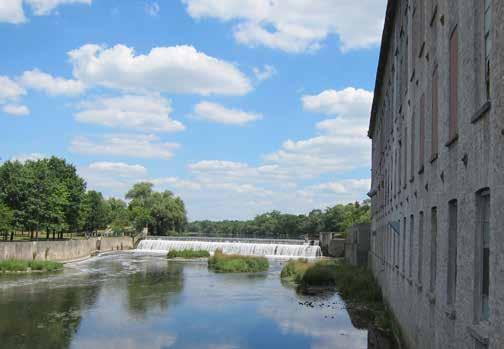
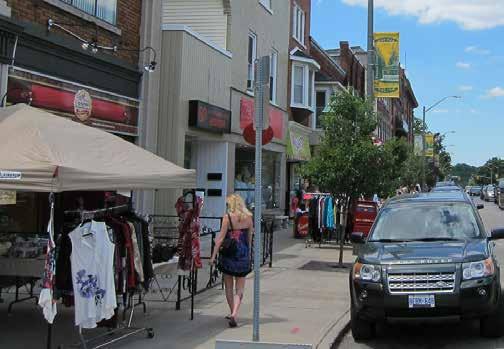
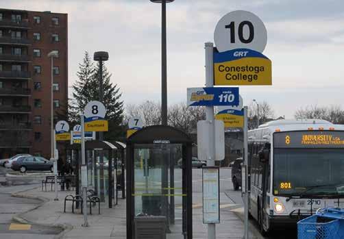
13 Playing NORTHFIELD YOUNG / GAUKEL MILL The Rapid Transit line will provide direct links to some of the region s parks and open spaces, including access to the Grand River Valley through Preston and Galt and the Dumfries Conservation Area, Riverside Park, Kitchener s Victoria Park and Waterloo Park. It will also facilitate greater access to community centres and recreational facilities located within the urban cores. However, the significant population increases that are expected for these areas will result in a greater demand for new facilities and parks and enhanced access to existing open spaces. Parks, open spaces, and community services along the Corridor Park/sports/nature Recreational facility Community Centre Learning NORTHFIELD YOUNG / GAUKEL MILL Over 50,000 full-time students attend the region s three post secondary institutions: the University of Waterloo, Wilfrid Laurier and Conestoga College. The University of Waterloo and Wilfrid Laurier have campuses at the north-end of the region that neighbour the RT stations at the R&T Park, University of Waterloo and Seagram. There are additional satellite campuses in Kitchener and Cambridge. Conestoga College s main campus in Kitchener is situated away from the line and is currently accessed by local bus. A series of elementary and secondary schools are located near the RT line including magnet schools which offer specialized programs or courses. Enhancing connections from home to school and from one school to another will be an important consideration as the student population grows and collaboration between institutions increases. Places of learning along the Corridor Public/Catholic school Post-secondary school Library Shopping NORTHFIELD Three regionally scaled shopping malls are located along the Corridor: Conestoga Mall, Fairview Park Mall and the Cambridge Centre. Additional shopping districts are situated in Uptown Waterloo, Downtown Kitchener, Downtown Cambridge (former Galt City Centre), along Hespeler Road and in areas away from the Corridor such as in St. Jacobs and Hespeler Village. Over time, the Corridor has the potential to expand retail offerings to support growth. YOUNG / GAUKEL MILL Places to shop and dine along the Corridor Retail/Commercial Source of Data: Region of Waterloo 7


14 Patterns of Living Along the Corridor The patterns of people living along the Corridor vary greatly depending on age, stage of life, and life style choices. Generally, the highest population densities are located in proximity to the RT line with the greatest concentrations of people living today between Fairview Park Mall and Conestoga Mall. NORTHFIELD More People 215 People/Hectare Population Density Higher population densities within the region are found in the urban cores of the three municipalities and are particularly focused within the CTC. Significant population increases have occurred in these areas over the last several years and have been generally accommodated in higher density forms of development. YOUNG / GAUKEL MILL Population distribution along the Corridor NORTHFIELD YOUNG / GAUKEL MILL 0 People/Hectare Fewer People More Students 67% Post Secondary Institution Students The largest concentration of students living in the region reside in housing near the University of Waterloo and Wilfrid Laurier campuses. These students are largely living in rental housing including apartments and duplexes off campus. While a majority of students live within the City of Waterloo, a smaller percentage of students attending one of the region s colleges or specialized programs at a satellite campus also reside in Kitchener and Cambridge. The introduction of RT may create opportunities for students to live in areas further from campus but accessible by transit. 17% Fewer Students Distribution of students along the Corridor Source of Data: Region of Waterloo and Census

 A high proportion of seniors aged 65+ are living in")
 Young adults in the region live in both Downtown")
15 NORTHFIELD More Youth 35% School Capacity 100 Students 1600 Students Youth (Ages 0-19) Suburban communities contain the highest concentration of youth. Though there are areas neighbouring the Corridor that have larger youth populations, the majority of young people are currently living away from the Corridor. Their proximity away from urban areas presents a challenge to accessing youth services, shopping and recreational opportunities. YOUNG / GAUKEL MILL Distribution of youth along the Corridor NORTHFIELD Source: Census % Fewer Youth More Seniors 27% Senior (Ages 65+) A high proportion of seniors aged 65+ are living in areas within or very close to the Corridor. These urban areas offer seniors better access to a range of specialized services and also provide smaller, more manageable housing options. YOUNG / GAUKEL MILL Distribution of seniors along the Corridor NORTHFIELD NORTHFIELD 3% Fewer Seniors More Young Adults 35% Young Adults (Ages 25-40) Young adults in the region live in both Downtown areas and suburban communities. Generally, those with children are opting to live in suburban areas with larger housing while single professionals live in the urban cores. BORDEN OTTAWA YOUNG YOUNG/GAUKEL / GAUKEL MILL MILL Distribution of young professionals along the Corridor 10% Fewer Young Adults Source of Data: Region of Waterloo and Census


16 Patterns of Travel Today, patterns of mobility are related to proximity within the CTC. Generally, there are higher levels of walking, cycling and transit use close to the universities and in higher density neighbourhoods along the Corridor. Travel patterns reflect the range of transportation choice available. A key objective in shaping communities and moving people is to increase the transportation choices available to people living, working and visiting Waterloo Region. The travel patterns today demonstrate a greater transportation choice in higher density urban areas where an integration of activities and range of transportation choice exist. These urban areas reflect historic settlement patterns where a finer grid of streets and blocks support walkability and proximity to places of living, working and shopping. Further away from the Corridor, distances between living, shopping and work increase and land use patterns favour automobile travel. Investment in enhanced transit is a key strategy for increasing the level of transportation choice within the CTC and to communities, shopping centres, campuses, employments areas and other destinations throughout the region. 10


17 NORTHFIELD More Take Transit 11% Percentage of the Population that Commutes by Transit The majority of transit commuters reside in urban areas near the CTC. Today, the network of existing transportation options offered through the ixpress and local bus services in these areas facilitates a greater use of transit. YOUNG / GAUKEL MILL 0% Fewer Take Transit Distribution of commuters that use transit as their primary mode of transportation NORTHFIELD More Cycle 4% Percentage of the Population that Commutes by Cycling The core areas of the three cities have higher percentages of cyclists compared to the rest of the region. Residents of these areas are more likely to cycle because of the close commuting distance to places of work, learning and shopping. For short distances, cycling often offers a faster alternative to driving or taking transit. YOUNG / GAUKEL MILL Distribution of commuters that cycle as their primary mode of transportation NORTHFIELD Fewer Cycle More Walk 0% 15% Percentage of the Population that Commutes by Walking Similarly to transit and cycling, those choosing to commute by walking reside closer to the Corridor. As you move further away from the Corridor, the percentage of commutes by walking decreases as result of longer travel times between important destinations. YOUNG / GAUKEL MILL Distribution of commuters that walk as their primary mode of transportation Source of Data: Region of Waterloo and Census 2006 Fewer Walk 0% 11
18 1.3 The Region and Cities Have Been Planning for Enhanced Transit The three cities have each recently developed new Official Plans that complement enhanced transit by directing higher levels of intensification and a greater mix of new uses within the CTC. The delivery of enhanced transit is being led by the Region of Waterloo, which includes the Rapid Transit and Grand River Transit division, in conjunction with the Cities of Cambridge, Kitchener and Waterloo. The following provides a brief summary of the key complementary policies and directions in the Cambridge and Waterloo Approved Official Plans and the Kitchener Second Draft Official Plan. Cambridge New growth will be accommodated where municipal services are available within the urban area, and a significant portion will be shifted from greenfield areas to intensification within the built up area. The City of Cambridge will plan for compact urban development that maintains a balanced land supply, including residential, employment and commercial uses, and promotes mixed-use, transit-oriented development. Intensification is encouraged in the built up area, particularly within the Urban Growth Centre (Downtown Cambridge), community core areas, nodes, regeneration areas, reurbanization corridors, and major transit station areas. The City, in collaboration with the Region, will, where appropriate, establish minimum density targets for intensification consistent with existing or planned transit service levels. New development and intensification will be compact, efficient, and vibrant, and optimize the use of existing and new infrastructure. Intensification areas are identified, and should be placed as close as possible to transit station areas. To achieve intensification targets, higher frequency transit will be required. The planned function of corridors is to connect and facilitate movement between urban structure components and to provide a focus for higher density mixed-use development to support and ensure the viability of existing and planned rapid transit service levels. Waterloo There is limited vacant land left so new growth will be accommodated through intensification. To meet urban growth targets, the City of Waterloo will provide opportunities for new growth within the Urban Growth Centre (Uptown Waterloo), nodes, corridors, and major transit station areas. At least 45 percent of new residential development will be in existing built-up areas. The City of Waterloo aims to develop a compact urban form to facilitate reduced reliance on the automobile, while supporting transit, and promoting connectivity, safe and efficient movement, and sustainable transportation. Kitchener 12 The City will continue to have balanced growth with an ever increasing emphasis on intensification, particularly in the Urban Growth Centre (Downtown Kitchener), major transit station areas, nodes and corridors.


19 CITY OF WATERLOO - APPROVED OFFICIAL PLAN (2012) LEGEND CITY OF CAMBRIDGE - APPROVED OFFICIAL PLAN (2012) LEGEND DRAFT CITY OF KITCHENER - OFFICIAL PLAN (2013) LEGEND A collage of the area municipal official plan land use policy directions. 13
20 1.4 The Market is Changing to Reflect a More Urban Lifestyle Choice As the Waterloo Region has grown, a greater diversity of housing and new forms of development have emerged. Presently, residential, commercial and institutional developers in the region are seeking properties that are more urban, offer integrated uses and have greater amenities in their surroundings. An Evolving Market In advance of RT, Waterloo Region continues to experience significant growth and investment. The existing year supply of greenfield lands will mean that some of this growth will occur in suburban communities in the outer areas of each city. However, unlike traditional suburban neighbourhoods these new communities are being developed to be more compact and vibrant and they are providing more opportunities for people to live, work, study, play and shop within a close proximity. While growth is not new to the region, this community having seen positive growth for many years, there are some important changes in real estate demand and development trends that indicate the market is already responding to demographic trends, economic conditions and policy directions. Residential Figure 2 - Residential Housing Starts by Tenure The housing mix is changing dramatically. In 2010, the number (Waterloo Region) of apartment unit starts exceeded the number of single detached 4500 units being built (Fig. 1). Annual growth in apartment units is 4000 expected to continue over the next years and is showing 3500 a strong propensity to locate within the CTC (Fig. 3). Further, new housing being built is increasing in the form of rental and 3000 condo and there is a decrease in freehold ownership (Fig. 2) Finally, significant demand now and in the next 10 years exists for 2000 rental housing in the region. These three residential trends are the result of a shift in consumer demand, new location-efficient 1500 development, the region s aging population, a significant student 1000 population, and a transition to a lock the door and go lifestyle. 500 They also support an ongoing and increased demand for higher density housing along the Corridor. 0 Housing Starts Total Freehold Rental Condo In order to ground the CBS in the reality of Waterloo Region s market conditions, a high level assessment of current market trends and the future potential market demand within the CTC was undertaken. The following section outlines key trends in the current residential, office, industrial and hotel sectors in the region. Using this as a departure point, an assessment of future market potential can be found in Section 2.3. Figure 1 - Residential Housing Starts by Type (Waterloo Region) Figure 3 - Residential Units Constructed and Forcasted Units to be Constructed in RT Station Areas Source of Data: CMHC (Starts & Completions Survey) and Region of Waterloo Total Units Units within RT Station Areas Average Total Units Average Units Within RT Station Areas % of Units in RT Station Areas % Average 14
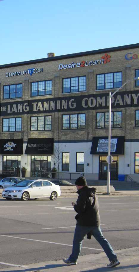
21 Office Throughout the latest economic recession, Waterloo Region continued to see office supply increase and vacancy rates remain at a reasonable level (Fig 4). While in the past decade, much of the office development has occurred in suburban locations, the greatest demand recently has been for brick and beam space in amenity rich locations such as the Lang Tannery and continued investment is seen in sites such as the retrofitted Breithaupt Block. Since 2008, over 20% of the office space built has been within RT station areas (Fig. 5). Industrial A strong industrial presence is expected to continue in Cambridge. The Cambridge Business Park, including Boxwood, and proximity to the Region of Waterloo International Airport represent opportunities for strong industrial districts, with future potential to connect to rapid transit. In Waterloo and Kitchener, the employment focus is expected to shift to tech-based businesses and institutional jobs. Hotels Tourism is a growth sector within Waterloo Region and beyond. In particular, the cluster of natural heritage, cultural attractions and vibrant traditional and historical urban centres, many of which are in the CTC, have the potential to attract significant investment and visitation. The cities of Kitchener, Waterloo and Cambridge have an existing supply of over 3,000 hotel rooms. The hotel market in the region is performing at levels that will justify new hotels soon. Presently there are 6 hotel and lodging projects in the region that are either under construction or have been proposed and it is estimated that there will be an 11% increase in hotel rooms over the next five years. This will likely occur in the cities of Waterloo and Kitchener. Figure 4 - Office Supply and Absorption vs. Vacancy (Waterloo Region) % 12% 10% 8% Figure 6 - Industrial Starts (Waterloo Region) Parking Today, parking remains a key consideration in site location for all market sectors. Once RT is in place, it is anticipated that there will be an opportunity to reduce parking provisions and move toward structured and underground solutions in some areas. In the interim, partnerships and alternative standards for parking may be considered for residential and office development % % 0 2% % Absorption New Supply Vacancy Rate Figure 5 - Non Residential Building Permits (within RT Station Areas) 4,500, ,000, ,500, ,000, ,500,000 2,000, ,500, ,000, , Total SF Built SF Built in RT Station Areas Total SF Average Average SF % Built in RT Station Areas % Average Source of Data: Region of Waterloo and Colliers International 15
 and an Adapted Bus Rapid Transit (abrt).")


22 1.5 The Mobility Network is Being Adapted To Support Growth in People and Jobs In order to accommodate the projected new growth, the Region has decided to invest in a new and improved transit and active mobility network. The RT first phase will open in 2017 and will include Light Rail Transit (LRT) and an Adapted Bus Rapid Transit (abrt). The LRT will connect Conestoga Mall in Waterloo to Fairview Park Mall in Kitchener. An abrt will then link to Cambridge from Fairview to the Ainslie Terminal. The second phase of the project replaces this abrt with LRT. The CBS considers both phases of planned rapid transit. The introduction of Rapid Transit The introduction of RT will support new growth by promoting reurbanization and intensification through more efficient use of land and existing infrastructure. An important piece of work being undertaken to support the investment in a RT line is the reorientation of the current conventional transit system away from a radial pattern to a grid network. A major component of the grid network is a new pattern of ixpress corridors which will cross the RT line at regular intervals and extend convenient express transit service to the edges of the three cities. This re-alignment expands the current level of services to the rapid transit stations along the Corridor and takes advantage of improved access to important destinations. ixpress corridors realigned to enhance connections to RT These transit improvements will be complemented by investments in Active Transportation Networks at the local and regional level that will make it easier for people in the region to walk or bike. The integration of more active forms of transportation provides additional transportation choice and encourages sustainability. Together these transportation systems create an integrated and accessible mobility grid that connects all areas of the CTC. Planned improvements to the Active Transportation Network 16 RT Alignment ixpress Bus Routes Planned Improvements to the Active Transportation Network

23 Hwy 401 Agricultural Park Natural Area Estimated 10 Minute Walk from Station (800m) An integrated RT, ixpress and Active Transportation Network create the foundation of a new mobility grid 17

24 18
1.3 TRANSIT VISION 2040 FROM VISION TO ACTION THEME 1: PUTTING TRANSIT AT THE CENTRE OF COMMUNITIES. Fully integrate transit with community planning
 TRANSIT VISION 2040 FROM VISION TO ACTION TRANSIT VISION 2040 defines a future in which public transit maximizes its contribution to quality of life with benefits that support a vibrant and equitable society,
Urban Design Manual PLANNING AROUND RAPID TRANSIT STATIONS (PARTS) Introduction. Station Study Areas
 Introduction. Station Study Areas") 111111 PLANNING AROUND RAPID TRANSIT STATIONS (PARTS) Introduction The ION rapid transit system will link Waterloo, Kitchener and Cambridge through a central transit corridor (CTC). There are a number
111111 PLANNING AROUND RAPID TRANSIT STATIONS (PARTS) Introduction The ION rapid transit system will link Waterloo, Kitchener and Cambridge through a central transit corridor (CTC). There are a number
Official Plan Review
 Official Plan Review Summary Report - The Built Environment August 2014 Part 1: Introduction Planning for a healthy, prosperous and sustainable community is an important goal for our municipality. From
SECTION ONE: INTRODUCTION. introduction
 introduction 1 INTRODUCTION Since it was first established in 1843 as a trading post for the Hudson s Bay Company, Victoria has evolved into a Provincial capital city that is recognized across Canada and
K. SMART ASSOCIATES LIMITED
 Planning Justification Report Zoning By-Law Amendment 185 King Street North Waterloo, Ontario April 7th, 2017 Project Reference Number 16-245 K. SMART ASSOCIATES LIMITED CONSULTING ENGINEERS AND PLANNERS
ELMVALE ACRES SHOPPING CENTRE MASTER PLAN
 ELMVALE ACRES SHOPPING CENTRE MASTER PLAN Contents 1.0 INTRODUCTION... 2 2.0 LOCATION... 2 3.0 EXISTING CONTEXT... 2 4.0 VISION & GUIDING PRINCIPLES... 2 5.0 LAND USE AND BUILT FORM... 4 5.1 St. Laurent
178 Carruthers Properties Inc.
 178 Carruthers Properties Inc. Planning Rationale for 178 Carruthers Avenue Site Plan Control Application June 2014 Table of Contents 1.0 Introduction 2.0 Overview of Subject Property 3.0 Current Zoning
Corridor Vision. 1Pursue Minnehaha-Hiawatha Community Works Project. Mission of Hennepin County Community Works Program
 1Pursue Minnehaha-Hiawatha Community Works Project Minnehaha-Hiawatha Community Works is a project within the Hennepin Community Works (HCW) program. The mission of the HCW program is to enhance how the
CONTENTS 2.0 A FRAMEWORK FOR SUSTAINABLE GROWTH 2.1 MANAGING SUSTAINABLE GROWTH THE VISION TO GOALS AND OBJECTIVES 2.3 MARKHAM STRUCTURE
 2 A Framework for Sustainable Growth 2.0 A FRAMEWORK FOR SUSTAINABLE GROWTH CONTENTS 2.1 MANAGING SUSTAINABLE GROWTH THE VISION TO 2031 2.2 GOALS AND OBJECTIVES 2.2.1 Protecting the Natural Environment
Public Open House #1
 Public Open House #1 TONIGHT S AGENDA Welcome Project Overview The Big Picture The Station Area The Analysis Thoughts about Future Change Breakout Group Discussions Summation / Next Steps Project Overview
2. Shaping Waterloo Region s Urban Communities
 2. Much of the region s growth over the past several decades has occurred in suburban areas that separated where people live from where they work and shop. This pattern of growth has increased the need
Commercial, Retail and Tourism Executive Summary December 2018
 Town of Wasaga Beach Official Plan Review, Retail and Executive Summary December 2018 1 An Official Plan directs where and how to grow The preparation of a new Official Plan for Wasaga Beach is an opportunity
Port Credit Local Advisory Panel October 20 th Meeting
 Port Credit Local Advisory Panel October 20 th Meeting Focus Of This Evening s Meeting: 1. Hurontario Main Street Higher Order Transit Study 2. Port Credit Mobility Hub & GO Station Parking Structure Study
Employment and Commercial Review Analysis of Policy Directions
 Employment and Commercial Review Analysis of Policy Directions Appendix A The following analysis is town staff s response to the policy directions provided by the consultants who prepared the Employment
[PLANNING RATIONALE] For Site Plan Control and Lifting of Holding Zone By-Law 101 Champagne Avenue. May 23, 2014
![[PLANNING RATIONALE] For Site Plan Control and Lifting of Holding Zone By-Law 101 Champagne Avenue. May 23, 2014](/thumbs/75/71599615.jpg "[PLANNING RATIONALE] For Site Plan Control and Lifting of Holding Zone By-Law 101 Champagne Avenue. May 23, 2014") [PLANNING RATIONALE] For Site Plan Control and Lifting of Holding Zone By-Law 101 Champagne Avenue May 23, 2014 Contents 1.0 Introduction... 2 2.0 Site Context... 2 2.1 Adjacent Uses... 2 Figure 1: Site
[PLANNING RATIONALE] For Site Plan Control and Lifting of Holding Zone By-Law 101 Champagne Avenue May 23, 2014 Contents 1.0 Introduction... 2 2.0 Site Context... 2 2.1 Adjacent Uses... 2 Figure 1: Site
2.0 A FRAMEWORK FOR SUSTAINABLE GROWTH CONTENTS
 2-2 A Framework for Sustainable Growth 2.0 A FRAMEWORK FOR SUSTAINABLE GROWTH CONTENTS 2.1 MANAGING SUSTAINABLE GROWTH THE VISION TO 2031 2.2 GOALS AND OBJECTIVES 2.2.1 Protecting the Natural Environment
Draft Western District Plan
 Powered by TCPDF (www.tcpdf.org) Draft Western District Plan Submission_id: 31440 Date of Lodgment: 15 Dec 2017 Origin of Submission: Online Organisation name: Goodman Property Services Australia Pty Ltd
Building out the Regional Growth Strategy in Surrey: a Strong Centre & a Connected Transit City
 Building out the Regional Growth Strategy in Surrey: a Strong Centre & a Connected Transit City Surrey in the Metro Vancouver Region Regional Growth Strategy identifies Surrey as a major provider of housing
Visioning Statement and Guiding Principles
 Visioning Statement and Guiding Principles Planning for the Future The General Plan The General Plan represents Woodland's shared vision of the future and defines a path to lead the community toward its
1.0 PLANNING MARKHAM S FUTURE CONTENTS
 1-1 Planning Markham s Future 1.0 PLANNING MARKHAM S FUTURE CONTENTS 1.1 THE PURPOSE OF THE OFFICIAL PLAN 1.2 THE MARKHAM CONTEXT 1.3 THE REGULATORY CONTEXT 1.3.1 Province of Ontario 1.3.2 York Region
NO: R035 COUNCIL DATE: FEBRUARY 24, 2014
 CORPORATE REPORT NO: R035 COUNCIL DATE: FEBRUARY 24, 2014 REGULAR COUNCIL TO: Mayor & Council DATE: February 24, 2014 FROM: General Manager, Planning and Development FILE: 6520-01 SUBJECT: Town Centre
planning toronto s downtown Parks and Public Realm Plan Request for Proposals Information Meeting Andrew Farncombe, Project Manager August 19, 2015
 planning toronto s downtown Parks and Public Realm Plan Request for Proposals Information Meeting Andrew Farncombe, Project Manager August 19, 2015 BATHURST ST Keeping Downtown a great place to live, work,
CITY CLERK. Parkland Acquisition Strategic Directions Report (All Wards)
") CITY CLERK Clause embodied in Report No. 10 of the, as adopted by the Council of the City of Toronto at its meeting held on November 6, 7 and 8, 2001. 10 Parkland Acquisition Strategic Directions Report
CITY CLERK Clause embodied in Report No. 10 of the, as adopted by the Council of the City of Toronto at its meeting held on November 6, 7 and 8, 2001. 10 Parkland Acquisition Strategic Directions Report
City of Toronto Official Plan Indicators
 City of Toronto Official Plan Indicators Attachment 1 2017 Gladki Planning Associates in association with Hemson Consulting & Studio Jaywall City of Toronto Official Plan Indicators 1 Introduction What
Edward R. Sajecki Commissioner of Planning and Building
 Corporate Report Clerk s Files Originator s Files CD.03.POR DATE: TO: FROM: SUBJECT: Chair and Members of Planning and Development Committee Meeting Date: February 27, 2012 Edward R. Sajecki Commissioner
John M. Fleming Managing Director, Planning and City Planner. Old East Village Dundas Street Corridor Secondary Plan Draft Terms of Reference
 Report to Planning and Environment Committee To: From: Subject: Chair and Members Planning & Environment Committee John M. Fleming Managing Director, Planning and City Planner Old East Village Dundas Street
Sustainable Growth. Sustainable Growth
 2 Sustainable Growth Sustainable Growth SUSTAINABLE GROWTH 2.1 COMMUNITY VISION... 2-5 2.2 THE CITY SYSTEM... 2-7 2.2.1 AREAS... 2-7 2.2.2 CITY-WIDE SYSTEMS... 2-8 2.2.3 PROVINCIAL PLAN BOUNDARIES AND
5 Direct Growth. 5.1 Introduction
 5 Direct Growth 5.1 Introduction Mississauga s population and employment growth prospects are expected to remain strong over the next 25 years. Mississauga has sufficient land to accommodate projected
CITY OF CAMBRIDGE Growth & Intensification Study Secondary Plan Stakeholder Session September 12th, 2016
 CITY OF CAMBRIDGE Growth & Intensification Study Secondary Plan Stakeholder Session September 12th, 2016 Dillon Consulting Limited Watson & Associates Economists Curtis Planning Inc. Tim Welch Consulting
Urban Design Brief. Watson Parkway North & Watson Road North Guelph, Ontario. Prepared by Coletara Development
 Urban Design Brief Watson Parkway North & Watson Road North Guelph, Ontario Prepared by Coletara Development December, 2013 Urban Design Brief, Coletara Development 1 Introduction This Urban Design Brief
Transforming Saint John s Urban Heart -
 Transforming Saint John s Urban Heart - How Innovative Community Engagement Inspires a Bold Municipal Plan for a More Sustainable and Compact Saint John 2012 NNECAPA Conference - Brunswick, ME October
Stage 2 ION: Light Rail Transit (LRT) from Kitchener to Cambridge
 from Kitchener to Cambridge") Stage 2 ION: Light Rail Transit (LRT) from Kitchener to Cambridge Public Consultation Centre No. 3 Cambridge City Hall, November 21, 2 8 p.m. Preston Memorial Auditorium, November 28, 4 8 p.m. Public Information
Stage 2 ION: Light Rail Transit (LRT) from Kitchener to Cambridge Public Consultation Centre No. 3 Cambridge City Hall, November 21, 2 8 p.m. Preston Memorial Auditorium, November 28, 4 8 p.m. Public Information
PILLAR FOUR INTEGRATE LAND USE & TRANSPORTATION
 PILLAR FOUR INTEGRATE LAND USE & TRANSPORTATION 8 Scarborough Centre on the Move Transportation Master Plan 123 8 Transportation Pillar Four Integrate Land Use & The fourth pillar focuses on the relationship
Key Themes and Responses May 2016
 King and Victoria Transit Hub and Waterloo Street Pedestrian Access Key Themes and Responses May 2016 The following summarizes what Regional staff heard about the King Victoria Transit Hub and Waterloo
1 Introduction. Chapter. In this chapter:
 Chapter 1 Introduction In this chapter: 1.1 A Snapshot of the Region 1.2 Towards a Sustainable Region 1.3 The Provincial Context 1.4 Purpose and Organization The Regional Municipality of York Official
MOBILITY HUB GUIDELINES 2012 TAC Sustainable Urban Transportation Award Submission BACKGROUND MOBILITY HUB GUIDELINES
 MOBILITY HUB GUIDELINES 2012 TAC Sustainable Urban Transportation Award Submission BACKGROUND Rapid population growth, increasing congestion, and years of under investment in transit in the Greater Toronto
Chapter 4. Linking Land Use with Transportation. Chapter 4
 Chapter 4 Linking Land Use with Transportation Chapter 4 59 Chapter 4 Linking Land Use with Transportation Community Design and Transportation Program Introduction Since the 1950s, the predominant development
New Official Plan Quest November 2013
 City of Markham New Official Plan Quest November 2013 Building Markham s Future Together - 6 Key Strategic Priorities 1. Growth - Managing our Growth 2. Transportation/Transit - Improving transportation
DRAFT Land Use Chapter
 Stevens Creek Urban Village DRAFT 1 18 17 Land Use Chapter INTRODUCTION This Land Use Chapter describes how the Stevens Creek Urban Village will accommodate the growth that is planned for it in the Envision
Implementation Guide Comprehensive Plan City of Allen
 Implementation Guide 2030 Comprehensive Plan City of Allen DRAFT 2015 Implementation Guide Allen 2030 Comprehensive Plan INTRODUCTION The Comprehensive Plan serves as a guide for the growth and development
2.0 A FRAMEWORK FOR SUSTAINABLE GROWTH CONTENTS
 2-2 A Framework for Sustainable Growth 2.0 A FRAMEWORK FOR SUSTAINABLE GROWTH CONTENTS 2.1 MANAGING SUSTAINABLE GROWTH THE VISION TO 2031 2.2 GOALS AND OBJECTIVES 2.2.1 Protecting the Natural Environment
MAYFIELD WEST SECONDARY PLAN PHASE 2
 MAYFIELD WEST SECONDARY PLAN PHASE 2 Public Open House #3 February 25, 2010 Draft Preferred Land Use Scenario TOWN OF CALEDON PLANNING & DEVELOPMENT DEPARTMENT Open House Agenda TOWN OF CALEDON 1. Welcome
BROOKLYN PARK / 85TH AVE LRT STATION CDI DEVELOPMENT GUIDELINES DRAFT
 August 2018 Page intentionally left blank The Brooklyn Park Library adjacent to the 85th Ave LRT Station Area. OVERVIEW The Blue Line LRT Extension / Bottineau corridor offers a unique opportunity to leverage
CONTENTS 8.0 LAND USE 8.1 GENERAL LAND USE 8.2 RESIDENTIAL 8.3 MIXED USE 8.4 COMMERCIAL 8.5 EMPLOYMENT LANDS
 8-2 Land Use 8.0 LAND USE CONTENTS 8.1 GENERAL LAND USE 8.1.1 Uses provided for in all Land Use Designations 8.1.2 Uses prohibited in Hazardous Lands, Hazardous Sites and Special Policy Areas 8.1.3 Uses
WELCOME. The Yonge-Eglinton area has experienced significant growth and change in the last decade.
 WELCOME DID YOU KNOW? MIDTOWN IS REPRESENTED BY 3 CITY COUNCILLORS: WARD 16 EGLINTON-LAWRENCE WARD 22 ST. PAUL S WARD 25 DON VALLEY WEST Midtown in Focus: Building a Livable Yonge-Eglinton The Yonge-Eglinton
1.0 Purpose of a Secondary Plan for the Masonville Transit Village
 Report to Planning and Environment Committee To: Chair and Members Planning & Environment Committee From: John M. Fleming Managing Director, Planning and City Planner Subject: Masonville Transit Village
Create Policy Options Draft Plan Plan Approval. Public Consultation Events. Phase 2
 Background Grandview-Woodland Community Plan In the spring of 2012, the City of Vancouver embarked on a comprehensive community planning program in the Grandview-Woodland neighbourhood. The process has
section 3: Vision, Values and Goals
 Vision, Values and Goals 3 2041 Vision: Victoria is an urban sustainability leader inspiring innovation, pride and progress towards greater ecological integrity, livability, economic vitality, and community
Welcome. Walk Around. Talk to Us. Write Down Your Comments
 Welcome This is an information meeting introducing the applications for proposed redevelopment of the Yorkdale Shopping Centre site at 3401 Dufferin Street and 1 Yorkdale Road over the next 20+ years,
Chapter 1. Community Context. Vision Statement Population and Housing Trends Legislative Context Regional Context Statement
 Chapter 1 Community Context Vision Statement Population and Housing Trends Legislative Context Regional Context Statement 1.1 VISION STATEMENT CORPORATE MISSION STATEMENT To promote a safe and livable
HE VISION. Building a Better Connected Place
 HE VISION Building a Better Connected Place WALK INTO THE FUTURE. Life in Cranberry, 2030 Here s what our residents told us they wanted to see in their community by 2030: The Cranberry of 2030 is a place
CITY OF COLWICH COMPREHENSIVE PLAN LAND USE LAND USE 1
 LAND USE LAND USE 1 WHAT YOU WILL FIND IN THIS CHAPTER: Discussion of today s conditions and tomorrow s projections Discussion of challenges and opportunities Discussion of the environmental quality goals,
elbridge Core Strategy
 C elbridge Core Strategy Celbridge is designated as a Moderate Growth Town in the RPGs. The County Development Plan reinforces this designation in its settlement strategy. Moderate Growth Towns within
Animating the Rideau Canal December 2013
 Executive Summary Animating the Rideau Canal December 2013 Why study the Rideau Canal? The Rideau Canal has been an important part of Ottawa throughout its history, and has shaped and been shaped by the
Chapter 3 Core Strategy
 Chapter 3 Core Strategy 3.0 Introduction The core strategy sets out how the development objectives in the Development Plan are consistent with the National Spatial Strategy and the Regional Planning Guidelines.
Trafalgar Road Corridor Planning Study Open House
 Trafalgar Road Corridor Planning Study Open House June 24, 2013 6:30-8:30 p.m. Oakville & Trafalgar Rooms Overview The Livable Oakville Plan identifies the lands along Trafalgar Road, between the QEW and
2040 LUP is a part of the Comprehensive Plan and carries the same legal authority. Economic Challenges
 1.1. Guiding Anchorage s Growth Where will new residents settle over the next two decades? Where will people work, shop, and play? Will there be enough room to grow? How will Anchorage look? Will growth
Section 1 Introduction
 Section 1 Section 1,, describes the role of the Official Plan. The Official Plan is one of five growth management plans that was completed under the umbrella of Ottawa 20/20. 1.1 The Role of the Official
Message from. Planning Our Future. July 2003
 Message from the Regional Chair Planning Our Future July 2003 Planning for the future is something that people in this Region have taken seriously since the first Regional Official Policies Plan was passed
6 Growth Management Challenges and Opportunities
 6 Growth Management Challenges and Opportunities The Town has established a goal of attaining a 50% participation rate with respect to employment opportunities versus residential population. The Town s
MAYFIELD WEST SECONDARY PLAN PHASE 2
 MAYFIELD WEST SECONDARY PLAN PHASE 2 Council Information Workshop February 16, 2010 Draft Preferred Land Use Plan TOWN OF CALEDON PLANNING & DEVELOPMENT DEPARTMENT Workshop Agenda TOWN OF CALEDON 1. Welcome
greenprint midtown SUSTAINABILITY ACTION PLAN 2012
 greenprint midtown SUSTAINABILITY ACTION PLAN 2012 MIDTOWN ALLIANCE SOUTHFACE ENERGY INSTITUTE RENAISSANCE PLANNING GROUP SUSTAINABLE ATLANTA PERKINS+WILL 2 GREENPRINT MIDTOWN 1. Introduction Sustainability
13 THORNHILL YONGE STREET STUDY IMPLEMENTATION CITY OF VAUGHAN OPA 669 AND TOWN OF MARKHAM OPA 154
 13 THORNHILL YONGE STREET STUDY IMPLEMENTATION CITY OF VAUGHAN OPA 669 AND TOWN OF MARKHAM OPA 154 The Planning and Economic Development Committee recommends the adoption of the recommendations contained
4- PA - LD - LIVELY DOWNTOWN. LD - Background
 4- PA - LD - LIVELY DOWNTOWN LD - Background The downtown has been the service centre for the community since the city s inception and the area continues to supply people with their personal services,
RE-Imagining the Downtown Colorado Springs Master Plan
 RE-Imagining the Downtown Colorado Springs Master Plan 2016 APA Colorado State Conference October 25, 2016 Overview 8:00 Welcome, Introductions, and Overview 8:15 Downtown s Planning History 8:30 A Market
and services The protection and conservation of environmentally significant and sensitive natural heritage features and functions.
 6. Land Use 6.0 Preamble A healthy and livable city is one in which people can enjoy a vibrant economy and a sustainable healthy environment in safe, caring and diverse neighbourhoods. In order to ensure
Wasatch CHOICE for 2040
 Wasatch CHOICE for 2040 Economic Opportunities We Can Choose a Better Future We enjoy an unparalleled quality of life along the Wasatch Front. People from all over the world are drawn to our stunning scenery,
URBAN DESIGN BRIEF URBAN DESIGN BRIEF 721 FRANKLIN BLVD, CAMBRIDGE August 2018
 URBAN DESIGN BRIEF URBAN DESIGN BRIEF 721 FRANKLIN BLVD, CAMBRIDGE August 2018 DESIGN BRIEF CONTENTS PART A 1.0 INTRODUCTION 2.0 DESCRIPTION & ANALYSIS OF SITE CONTEXT 3.0 DESIGN CONSTRAINTS AND OPPORTUNITIES
PUBLIC OPEN HOUSE HURONTARIO-MAIN CORRIDOR SECONDARY PLAN
 PUBLIC OPEN HOUSE HURONTARIO-MAIN CORRIDOR SECONDARY PLAN Tuesday, February 28, 2012 6pm 9pm 1 st Floor Atrium, City Hall 2 Wellington Street West, Brampton 1 POLICY FRAMEWORK The 2006 Provincial Growth
Former Rockcliffe Airbase Community Design Plan Guiding Design Vision and Principles December 4, 2013
 APPENDIX 5 - Guiding Design Vision and Principles Former Rockcliffe Airbase Community Design Plan Guiding Design Vision and Principles December 4, 2013 Vision Statement The redevelopment of the former
38 Queen s University Campus Master Plan Part 1
 38 Queen s University Campus Master Plan Part 1 46 The Campus at the City Scale Chapter 4 The Campus at the City Scale 39 Queen s is an urban University centrally located in Kingston. Decisions made by
FORMER CANADIAN FORCES BASE (CFB) ROCKCLIFFE SECONDARY PLAN. Official Plan Amendment XX to the Official Plan for the City of Ottawa
 ROCKCLIFFE SECONDARY PLAN. Official Plan Amendment XX to the Official Plan for the City of Ottawa") FORMER CANADIAN FORCES BASE (CFB) ROCKCLIFFE SECONDARY PLAN Official Plan Amendment XX to the Official Plan for the City of Ottawa 1 INDEX THE STATEMENT OF COMPONENTS PART A THE PREAMBLE PAGE Purpose...
FORMER CANADIAN FORCES BASE (CFB) ROCKCLIFFE SECONDARY PLAN Official Plan Amendment XX to the Official Plan for the City of Ottawa 1 INDEX THE STATEMENT OF COMPONENTS PART A THE PREAMBLE PAGE Purpose...
URBAN DESIGN BRIEF. 2136&2148 Trafalgar Road. Town of Oakville
 URBAN DESIGN BRIEF 2136&2148 Trafalgar Road Town of Oakville Prepared By: METROPOLITAN CONSULTING INC For 2500674 Ontario Inc November 2016 TABLE OF CONTENTS Page No. 1.0 Introduction/Description of Subject
Western City District What we heard
 What we heard Vision to 2056 and Priorities Governance and implementation Infrastructure and funding The protection of the natural landscape including biodiversity and the Metropolitan Rural Area for food
Trafalgar Road Corridor Planning Study FINAL REPORT
 Trafalgar Road Corridor Planning Study FINAL REPORT February 2014 Table of Contents Executive Summary... 1 SECTION I Introduction... 2 What is a corridor?... 2 Why are corridors important?... 2 Why study
Chapter 1: Introduction
 Chapter 1: Introduction The Penn Avenue Community Works Corridor Vision and Implementation Framework presents an integrated communitybased vision and a coordinated, long-term implementation framework for
Public Open House. YWCA, 87 Elm Street December 2nd, 2017, 10 a.m. 2 p.m.
 Public Open House YWCA, 87 Elm Street December 2nd, 2017, 10 a.m. 2 p.m. 1 A 25-Year Downtown Plan A blueprint for future growth and infrastructure in the heart of Toronto Ensuring growth contributes positively
Moving from Vision to Action
 Moving from Vision to Action Photo: John Carvalho What does it mean for a city to move? To see its people belong and connect? To prosper? To become green? Those are the pillars that are helping Mississauga
Burlington s Strategic Plan
 Burlington s Strategic Plan 2015 2040 DRAFT FOR CONSULTATION burlington.ca/strategicplan Welcome to Burlington s 2015 2040 Strategic Plan The City of Burlington s 2015-2040 Strategic Plan is the result
TransitSupportive. Guidelines GHD. Canadian Institute of Planners 2012 Awards for Planning Excellence Award Category: Planning Publications
 TransitSupportive Guidelines Canadian Institute of Planners 2012 Awards for Planning Excellence Award Category: Planning Publications GHD Project Summary We would like to nominate the Ontario Transit-Supportive
LAND USE OVERVIEW WHAT YOU WILL FIND IN THIS CHAPTER
 LAND USE WHAT YOU WILL FIND IN THIS CHAPTER Information about the City s expected population and employment growth. Description and capacity of existing and future land use designations. Policies that
ORANGE COUNTY IMPLEMENTING THE FOUR C s
 ORANGE COUNTY IMPLEMENTING THE FOUR C s East Central Florida Corridor Task Force O R A N G E COUN TY P LA N N I N G DIVISION C O M M U N I T Y, E N V I R O N M E N T A L A N D D E V E L O P M E N T S E
This page has been intentionally left blank.
 This page has been intentionally left blank. Chapter 3 3-2 3. Employment 3.A Niagara Economic Gateway 3.A.1 General The Niagara Economic Gateway comprises: a) The Gateway Economic Zone which includes all
The Five Components of the McLoughlin Area Plan
 The Five Components of the McLoughlin Area Plan This documents contains the complete language of the five components of the McLoughlin Area Plan: The Vision Statement The Values The Guiding Principles
5 TOWN OF MARKHAM OFFICIAL PLAN AMENDMENT NO. 144 MILLIKEN MAIN STREET SECONDARY PLAN
 5 TOWN OF MARKHAM OFFICIAL PLAN AMENDMENT NO. 144 MILLIKEN MAIN STREET SECONDARY PLAN The Planning and Economic Development Committee recommends the following: 1. The communication from Brendan O Callaghan,
Economy Vision Statements: Social Wellbeing Vision Statements: Natural Environment Vision Statements:
 Economy Vision Statements: 1. Our business environment makes us a region of choice for new employers as we encourage entrepreneurship and have a vibrant, diversified and resilient regional economy. 2.
City of Vancouver Regional Context Statement Official Development Plan. (Adopted by By-law No , September 24, 2013)
") City of Vancouver Regional Context Statement Official Development Plan (Adopted by By-law No. 10789, September 24, 2013) Table of Contents Introduction GOAL 1 Create a Compact Urban Area STRATEGY 1.1
City of Vancouver Regional Context Statement Official Development Plan (Adopted by By-law No. 10789, September 24, 2013) Table of Contents Introduction GOAL 1 Create a Compact Urban Area STRATEGY 1.1
Submission to the Kildare County Council Development Plan North Kildare Chamber. Executive Summary
 ` 28 th May 2015 Submission to the Kildare County Council Development Plan 2017-2023 North Kildare Chamber Executive Summary North Kildare Chamber s mission is to work with businesses, community groups,
MALL REVITALIZATION CASE STUDIES
 MALL REVITALIZATION CASE STUDIES DECEMBER 9, 2012 MALL REVITALIZATION OVERVIEW Introduction Sample Case Studies prepared for Lacey Woodland District Steering Committee as it considers strategies to revitalize
PART 1. Background to the Study. Avenue Study. The Danforth
 The Danforth 1.1/ Study Purpose & Key Municipal Goals 1.2/ The Local Advisory Committee 1.3/ The Project Team 1.4/ Study Process/Summary of Method 1.5/ Summary of Consultation 1.1 Study Purpose and Key
Making Transit Oriented Development Work For Boonton, NJ
 Making Transit Oriented Development Work For Boonton, NJ Bloustein School of Planning and Public Policy Studio Dan Burton Loannie Dao Webster Slater Brandon Williams Ian Watson Maria Laham Nicola Mammes
GO Station Mobility Hubs: Draft Precinct Plans. Committee of the Whole July 12, 2018
 GO Station Mobility Hubs: Draft Precinct Plans Committee of the Whole July 12, 2018 Purpose of this Workshop Present Draft Precinct Plans for the 3 GO Station Mobility Hubs Continue the conversations that
Public Open House. Overview of the Downtown Plan Official Plan Amendment April 23, 2018
 Public Open House Overview of the Downtown Plan Official Plan Amendment April 23, 2018 1 A 25-Year Plan for Downtown To ensure growth contributes positively to Toronto s Downtown as a great place to live,
CITY OF RENO APRIL Progressive Urban Management Associates (P.U.M.A.) in association with. Economic and Planning Systems (EPS)
 in association with. Economic and Planning Systems (EPS)") CITY OF RENO APRIL 2017 City of Reno, Nevada Prepared By Progressive Urban Management Associates (P.U.M.A.) in association with Economic and Planning Systems (EPS) EXECUTIVE SUMMARY The City of Reno Downtown
CITY OF RENO APRIL 2017 City of Reno, Nevada Prepared By Progressive Urban Management Associates (P.U.M.A.) in association with Economic and Planning Systems (EPS) EXECUTIVE SUMMARY The City of Reno Downtown
UTSC SECONDARY PLAN COMMUNITY OPEN HOUSE
 WELCOME TO THE UTSC SECONDARY PLAN COMMUNITY OPEN HOUSE 1 Welcome to the first Community Open House for the UTSC Secondary Plan. Hosted by the University of Toronto Scarborough (UTSC), the following panels
Urban Design. in the City of Kitchener. MUDR Presentation May 2010
 Urban Design in the City of Kitchener MUDR Presentation May 2010 Highlights Direction: long term commitment to urban design in Kitchener Themes: density, mixed use, community focal points, transit, accessibility
The Master Plan Framework
 The Master Plan Framework The East Harbour Master Plan advances the development of 60 acres of former industrial lands east of the Don River. The Master Plan outlines a vision for a vibrant, transit-oriented
YONGE STEELES CORRIDOR SECONDARY PLAN. Young + Wright / IBI Group Architects Dillon Consulting Ltd. GHK International (Canada) Ltd.
 Ltd.") PART A: PREAMBLE 1.0 PURPOSE The purpose of this Secondary Plan is to provide a development framework for intensification of the Yonge/ Steeles corridor including the north side of Steeles Avenue West
PART A: PREAMBLE 1.0 PURPOSE The purpose of this Secondary Plan is to provide a development framework for intensification of the Yonge/ Steeles corridor including the north side of Steeles Avenue West
NEW REGIONAL OFFICIAL PLAN HIGH LEVEL PROCESS & FRAMEWORK
 NEW REGIONAL OFFICIAL PLAN HIGH LEVEL PROCESS & FRAMEWORK Why A New Official Plan Originally the role of Regionally Planning and content of Regional Official Plan (1970s) primarily focused on protecting
Growing Community Urban Settlement Area and Hidden Valley Settlement Area
 Town of Huntsville Official Plan Review - POLICY BACKGROUND PAPER Growing Community Urban Settlement Area and Hidden Valley Settlement Area BACKGROUND: Through the Provincial Policy Statement (PPS), the