Monte Cecilia Park DRAFT CONCEPT PLAN FEBRUARY 2015 AUCKLAND COUNCIL
|
|
|
- Warren Morrison
- 6 years ago
- Views:
Transcription

1 Monte Cecilia Park DRAFT CONCEPT PLAN FEBRUARY 2015 AUCKLAND COUNCIL
2
3 1 Site analysis and concept


4 1.1 Location Site Extent MT ALBERT RD HILLSBOROUGH RD BUDOCK RD MONTE CECILIA PARK KORMA RD HERD RD Figure 1. Auckland City Figure 2. Monte Cecilia (aerial photo taken 2010) 4


5 1.2 Existing conditions Photographic analysis FIGURE LEGEND: Figure 3. Delargey Avenue carpark Figure 4. View towards Pah Homestead Figure 5. Pah Homestead Figure 6. View of green near Budock Road Figure 7. View towards northern boundary of park Figure 8. Mature woodland frames northern green Figure 9. View towards Marcellin College Figure 10. Wetland native planting with boardwalk Figure 11. Panoramic view of the central green Auckland Council Monte Cecilia Park 5

6 1.3 Existing Conditions MT ALBERT RD LEGEND: HILLSBOROUGH RD Park Boundary Tree Locations Planter beds Footpath Recent acquisitions, not yet incorporated into park BUDOCK RD Knoll Seymour Park Existing wetland.5m contours Directional & Heritage signage Existing sculptures Proposed sculptures Park entrance P Monte Cecilia Primary School (acquisition by A.C. 2016) Approved & consented location for semipermanent pavilion for events measuring 23m by 14m (322m2) Marcellin College NOTE: Directional and heritage signage and sculptures have been approved by the Local Board for installation in Friary 1939 Knoll delargey ave Pah Stables 1879 P Pah Homestead & Gardens 1879 Orchard KORMA RD The Whare PAH RD Selwyn Heights Retirement Village N HERD RD Scale: A3 6

7 HERD ROAD KEY: Existing carpark/circulation 11 MT ALBERT ROAD 1.4 Monte Cecilia concept with loop road Proposed carpark/circulation Existing paths Proposed path Existing planting Existing wetlands Existing trees Proposed trees 2 1 b NOTES: Removal of building structures including foundations, tidying of planting and reinstatement of lawn. Address retaining wall issue, currently propping up tree root system, approx 20m in length. Handrail to be upgraded to fit in with the character of the park and complement the friary fencing. B a Options for semi-permanent pavilion location Options for permanent playground location, refer to section 2.0 BUDOCK ROAD a 4 5 Potential carpark (up to 44 spaces as shown). Dependent on demand and playground location. Path to connect new carpark to the existing park walkway. HILLSBOROUGH ROAD Possible location for a community vegetable garden for residents of the area. Overflow parking for events and large functions only, grass on gravel and sand base (30 spaces). Removal of pillars along northern edge of Delargey Drive. Tennis courts for recreation and informal use. DELARGEY AVE Whare building. Improved park entrance. Reinstate and extend existing orchard Loop road, refer to page 8 for further details. B A 12 d KORMA ROAD NOTE: Planning constraints will affect the masterplan s detailed design due to sensitivity of the site s cultural and natural heritage. 9 c PAH ROAD The local board wants to recognise the heritage of the park including the Monte Cecilia School/Diocese, Maori heritage and Pakeha/European heritage. Opportunities and ideas will be sought on how this might be done. For a larger view please view page 8 N Scale: A3 Auckland Council Monte Cecilia Park 7

8 KEY: B a Existing carpark/circulation Proposed carpark/circulation Existing paths Proposed path Existing planting Existing trees Proposed trees Options for semi-permanent pavilion location Options for permanent playground location, refer to section Monte Cecilia concept with loop road zoom NOTES: Feature tree groves. Tennis courts for recreation and informal use. Whare building. Central green with contoured landform and low stone walls around perimeter. Possible one way loop around central green for car, bus and service vehicle pick-up / drop-off. Intersection with carriage drive denoted by feature bluestone paving and hedging. 6 Possible bus bay pick-up / drop-off zone (3 parallel parks) DELARGEY AVE 7 Footpath connection to Whare. HILLSBOROUGH ROAD A 8 Existing carparks retained. NOTE: Planning constraints will affect the masterplan s detailed design due to sensitivity of the site s cultural and natural heritage. 4 8 The local board wants to recognise the heritage of the park including the Monte Cecilia School/Diocese, Maori heritage and Pakeha/European heritage. Opportunities and ideas will be sought on how this might be done. B c 3 N HERD ROAD Scale: A3 8


9 1.6 Plant Palette - Feature Areas The indicative plant palette draws upon the existing character of the park. Orchards are suggested to keep in with the homestead atmosphere. Formal hedges and feature tree groves are proposed to compliment the proposed central green and bus-bay. The planting selection should be sensitive to the park heritage and compliment the existing species. The option of a community garden available for residents is to be further explored. Figure 12. Orchards Figure 13. Colourful amenity planting - Monte Cecilia Figure 14. Feature tree groves - Monte Cecilia Figure 15. Community veggie garden Figure 16. Mix of native planting - Monte Cecilia Figure 17. Formal hedging - Monte Cecilia Auckland Council Monte Cecilia Park 9


10 1.7 Plant Palette - Native Underplanting The indicative plant palette seeks to improve native biodiversity while adding interest and colo0ur to the understory. Crown uplifting, the removal of weeds and underplanting will add colour and neaten the newly aquired plots. Ensure continuity witht he rest of the park in the planting design. Low-growing, hardy and evergreen natives such as ferns, carexes and astelias are suggested. Figure 18. Arthropodium cirratum Matapouri Bay Figure 19. Asplenium bulbiferum Figure 20. Asplenium oblongifolium Figure 21. Astelia solandrii Figure 22. Elatostema rugosum Figure 23. Carex dissita Figure 25. Fuchsia procumbens Figure 24. Libertia ixioides 10
11 2 Playground Options


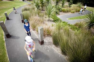
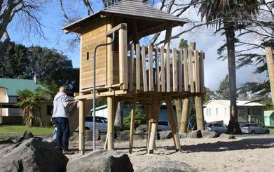
12 2.1 Playground Design Principles Possible concepts of playscape to be explored are footprints left from traces of former occupations of the park, nature and woodlands. The natural setting is to be embraced by incorporating natural play through the landscape. Interactive play elements that aim to provide the widest possible variety of activities and a full range of play experiences are to be used. A strong emphasis on the existing heritage of the park will be a major influencial factor in the design process. Figure 26. Woodland playground Figure 27. Simple effective interventions Figure 28. Interactive elements Figure 29. Natural play elements Figure 30. Merging the landscape with play Figure 31. Landform contouring Figure 32. Bringing play into design Figure 33. Incorporating nature into detailed design 12

13 2.2 Playground Location - Option a PROS: CONS: In an open area, visible from the end of Budock Road Good passive surveillance for safety No dedicated parking nearby Relatively far from main park facilities - homestead etc. Some existing planting for shade Near existing walkway Unencumbered space, plenty room for a range of activities NOTES: Playground as shown would roughly be m² Similar area to the playground in Western Park (CBD) BUDOCK ROAD a The concept, size and shape of the playground would be further developed if this location was chosen and is indicative only N Scale: A3 Figure 34. Playground location option 1 Auckland Council Monte Cecilia Park 13

14 2.3 Playground Location - Option b MT ALBERT ROAD PROS: CONS: Outstanding natural setting with shade trees available nearby Close to existing walkway system Takes advantage of space that is currently unused Adjacent to flat grass space for ball games No dedicated parking nearby Relatively far from main park facilities - homestead etc. Relatively secluded; little passive surveillance NOTES: Playground as shown would roughly be m² b Similar area to the playground in Myers Park (CBD) The concept, size and shape of the playground would be further developed if this location was chosen and is indicative only N Scale: A3 Figure 35. Playground location option 2 14

15 2.4 Playground Location - Option c PROS: CONS: DELARGEY AVE Close to all main park facilities; allows parents to get food/drink from the cafe Near car park Near proposed tennis court and paddling pool Flat, unencumbered area In a busier area of park, doesn t distribute activities throughout park and potentially puts pressure on parking In an exposed area not near planting, limited shade NOTES: Playground as shown would roughly be m² Similar area to the playground in Shore Road playground (Remuera) The concept, size and shape of the playground would be further developed if this location was chosen and is indicative only c Option for parking/circulation is shown for reference. The choice of option for parking and circulation would not affect the success of the playground at this location. N Scale: A3 Figure 36. Playground location option 3 Auckland Council Monte Cecilia Park 15

16 2.5 Playground Location - Option d PROS: CONS: KORMA ROAD Close to proposed car park and pathway Near existing trees, allowing for some shading of the playground Connects to existing walkway Slightly undulating contour makes for interesting design options Relatively far from main park facilities - homestead etc. Proximity to carpark means that safety considerations would be required NOTES: d Playground as shown would roughly be m² Similar area to the playground in Mt Wellington War Memorial The concept, size and shape of the playground would be further developed if this location was chosen and is indicative only N Scale: A3 Figure 37. Playground location option 4 16
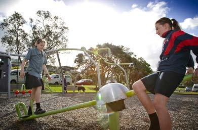
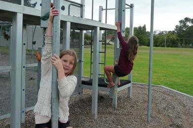
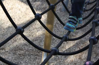

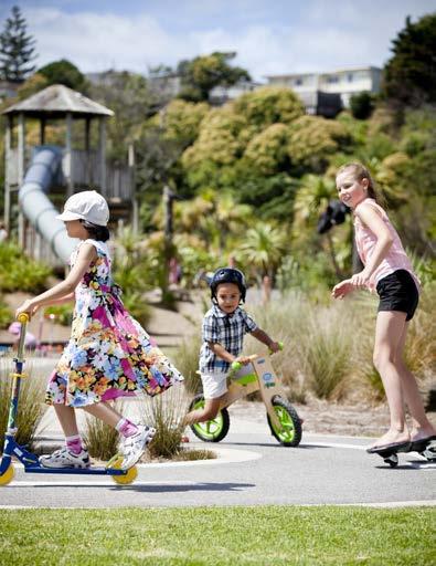


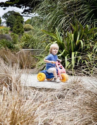


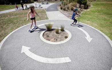

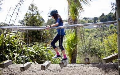
17 2.6 Playground Precedent Images - Potential Play Experiences Rocking: Balance Scootering/Biking Sliding Auckland Council Monte Cecilia Park 17
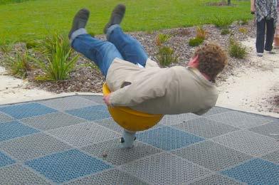

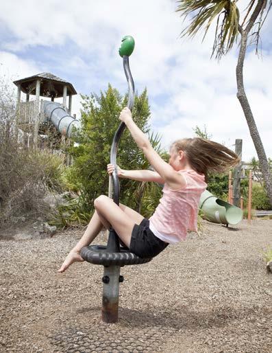
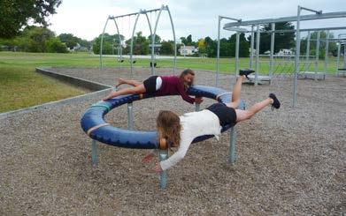


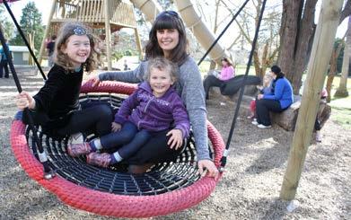
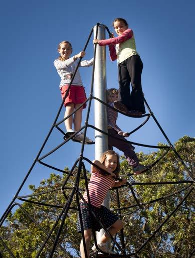

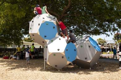
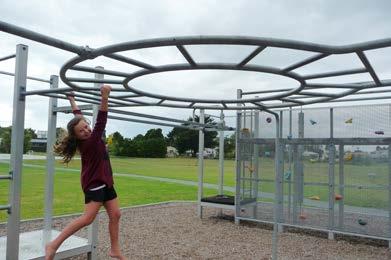

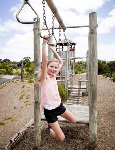
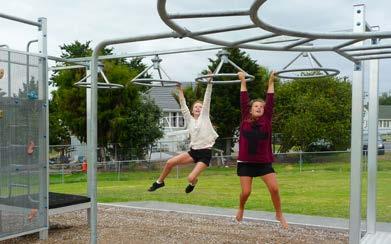
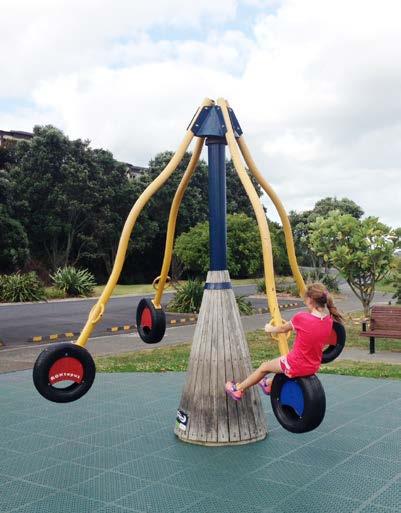
18 2.7 Playground Precedent Images - Potential Play Experiences Spinning Climbing Swinging Hanging 18
8.2 Sector 2 Kelburn Park
 8.2 Sector 2 Kelburn Park Kelburn Park, near Victoria University 8.2.1 Character and use Kelburn Park is a sector of the Town Belt, of a scale and character more like a suburban park. However, the woodland
H7 Open Space zones. (a) provide for the needs of the wider community as well as the needs of the community in which they are located;
 provide for the needs of the wider community as well as the needs of the community in which they are located;") H7. Open Space zones H7.1. Background The majority of land zoned as open space is vested in the Council or is owned by the Crown. However some areas zoned open space are privately owned. While the open
H7. Open Space zones H7.1. Background The majority of land zoned as open space is vested in the Council or is owned by the Crown. However some areas zoned open space are privately owned. While the open
ACADEMY AREA CONCEPT PLAN
 ACADEMY AREA Strip ling C hape l Roa d CONCEPT PLAN 7 S2 U Stripling 52 ROADWAYS AND PARKING: ADVENTURE PLAYGROUND AND SPRAYGROUND: Current roadways follow existing drives. It is recommended that the Folds
PCAL Case Study Open Spaces: Blayney Heritage Park
 PCAL Case Study Open Spaces: Blayney Heritage Park Introduction Blayney Heritage Park is an area of high quality open space that offers a range of active and passive recreation facilities. The multi-purpose
WELCOME TO THE NEW WILTON PARK
 WELCOME TO THE NEW WILTON PARK VISION HISTORY OF WILTON PARK TOWARDS A PLANNING APPLICATION Our objective is to create a truly outstanding environment at Wilton Park. At the heart of our proposals is a
Landscape Site Plan BLOCK D BLOCK A BLOCK C BLOCK B DEC 2009 L A N E W AY ARBUTUS 2 MEWS ARBUTUS STREET YEW STREET EXTENSION LEGEND
 Landscape Site Plan Green Edges Arbutus Mews Public Square Urban Garden Courts Green Roofs City Homes Private Patios Private Roof Terraces Urban Agriculture Plots BLOCK D BLOCK C YEW STREET EXTENSION L
doyle + o troithigh landscape - architecture
 doyle + o troithigh landscape - architecture REPORT: PROJECT: LANDSCAPE DESIGN REPORT. STUDENT HOUSING DEVELOPMENT AT WESTWOOD HOTEL SITE. DATE: MAY 2018. www.doyle-otroithigh.com Landscape design report,
2. reimagine kings way undercroft as a community space
 2. reimagine kings way undercroft as a community space CLARENDON STREET CLARKE STREET QUEENS BRIDGE STREET MORAY STREET CITY ROAD BALSTON STREET BOYD KINGS WAY POWER STREET KAVANAGH WEST GATE FREEWAY Figure
Draft Master Plan for Franklin Park
 Draft Master Plan for Franklin Park Metro Parks Tacoma with SiteWorkshop November 2009 I. overview & background Process & History Master Plan Process The Master Plan is based on a community involvement
Master Plan Presentation August 12, 2015
 Master Plan Presentation August 12, 2015 A vision for tomorrow... May, 13 2015 prepared for: prepared by: SITE LOCATION SITE NTS SITE ANALYSIS +/- 17.8 Ac. RESIDENTIAL HOMES 1 2 RAIL ROAD (SAFETY CONCERNS)
Nelson Residential Street Frontage Guideline
 DRAFT 22-06-2012 Nelson Residential Street Frontage Guideline June 2012 1317273 Contents and purpose Residential s are important Residential s are much more than corridors which move traffic. Streets allow
PUBLIC MEETING APRIL 21, 2016
 HARWOOD PARK PUBLIC MEETING APRIL 21, 2016 HARWOOD PARK CONTEXT - 2 aerial image of site HARWOOD PARK PUBLIC MEETING On April 21, 2016, Parks for Downtown Dallas, the City of Dallas Park and Recreation
Brains and Archibald park concept plan
 Brains and Archibald park concept plan The Brains and Archibald park concept plan has been commissioned by the Whau Local Board for the purpose of providing a vision to guide improvements to Brains Park
VEHICULAR AND PEDESTRIAN CIRCULATION
 This perspective sketch communicates the intended character and quality of a proposed streetscape design. Locate benches near a major intersection where people tend to gather. Seating and lighting provide
Section 4 - Public Realm & Landscape proposals Landscape Masterplan. Section 4 52
 - Public Realm & Landscape proposals Landscape Masterplan 52 Proposed Masterplan - Green Infrastructure Strategy District Park 4.33 Ha to provide Passive and active recreation with a large play area which
Hedges Pond Recreation Area & Preserve
 INTRODUCTION Weston & Sampson Master Plan Presentation Hedges Pond Recreation Area & Preserve Plymouth, Massachusetts June 11, 2009 Our Priority: Completion of a Master Plan that establishes realistic
MICHAELS AVE RESERVE. Draft Concept Plan of South Section September Contents. 1 Project Background. 2 Masterplan Timeline
 MICHAELS AVE ESEVE Draft Concept Plan of South Section September 05 Contents Project Background Masterplan Timeline Photographic Analysis Option A - Updated Masterplan 5 Option B - Alternative Design 6
I539. Smales 2 Precinct
 I539. Smales 2 Precinct I539.1. Precinct Description The Smales 2 Precinct applies to a 4.8 hectare block of land located on the southern side of Northcote Road and fronting Lake Pupuke, Takapuna. The
DRAFT. Marlay Park MASTERPLAN
 DRAFT Marlay Park MASTERPLAN 1.0 Site Location & Context At approximately 100 Hectares Marlay Park is the largest regional park managed by Dún Laoghaire Rathdown County Council. It lies at the foothills
Background Information
 Background Information view at site entrance THE LONDON BOROUGH OF SUTTON As the strategic local authority the Council is working with a range of partners to take forward various development sites in Hackbridge.
GISBORNE PLAYGROUND UPGRADE STRATEGY
 GISBORNE PLAYGROUND UPGRADE STRATEGY OPUS LANDSCAPE ARCHITECTURE 06 MARCH 2014 CONTENTS CONTENTS 1. Introduction and Location Plan 2. Playspace Design Principles 3. Playspace Design Considerations 4. Condition
JACKsON STREET PIER CONCEPTUAL DESIGN PACKAGE SEPTEMBER 21, 2017
 JACKsON STREET PIER CONCEPTUAL DESIGN PACKAGE SEPTEMBER 21, 2017 JACKsON STREET PIER Process outline DESIGN PROCESS OVERVIEW: Sandusky s Jackson Street Pier Conceptual Design process included input from
LANDSCAPING. Design. Development of the site shall not unreasonably impair the ability of adjoining properties to utilize solar energy.
 Landscape design is an integral component of Site Planning and Building. The current pattern of walkways, driveways and landscape elements such as fences, hedges, and retaining walls in the neighborhood
SALEM FOREST RIVER PARK PRELIMINARY POOL AREA ASSESSMENT & MASTER PLAN STUDY. For the City of Salem
 SALEM PRELIMINARY POOL AREA ASSESSMENT & MASTER PLAN STUDY For the City of Salem 6-13-17 This process undertaken by Weston & Sampson is to outline preliminary ideas only of what possibilities exist for
03 HIGH PRIORITY SITES
 03 HIGH PRIORITY SITES HOWARD PARK Howard Park is one of South Bend s largest riverfront parks, hosting nearly acres. Howard Park has a very passive landscape with a recreation building, ice skating rink,
Appendix 1. Private Projects with Respective On Site PUS and Public Parks in the Silver Spring CBD
 Appendix 1 Private Projects with Respective On Site PUS and Public Parks in the Silver Spring CBD Green Space Guidelines for the Silver Spring Central Business District montgomery county planning board,
Welcome to our public exhibition
 About our development Welcome to our public exhibition This exhibition gives you the chance to view and comment on our proposals for a new residential development of 165 high-quality homes, along with
ANCHORAGE PARK REPORT CARD Assessing A Park s Appearance, Function, & Condition
 ANCHORAGE PARK REPORT CARD Assessing A Park s Appearance, Function, & Condition Park Name: Is Your Park an A or an F? Your Name: Contact Information Optional: Date: General Instructions: Phone: Email:
Carterton Construction Ltd is bringing forward plans for up to 85 new family homes and extra care facilities on land east of Burford.
 Welcome Carterton Construction Ltd is bringing forward plans for up to 85 new family homes and extra care facilities on land east of. We are at the early stages of designing our proposals and have a number
vision & process willowburn, tarves community engagement 04/18
 vision & process Historic Conservation area Scotia intend to create a high quality residential development based upon best practice urban design principles. This will include a contemporary reinterpretation
Legend Explanation CONCEPT PLAN
 Legend Explanation CONCEPT PLAN A. Community Hall Flexible Space with associated amenities and catering facilities Adjacent smaller community meeting spaces Raised podium with wide sheltered breakout spaces
1999 Approval to replace World War I monument and relocate plaques Approval to rehabilitate the Chase Mill building and surrounding site
 Memorandum PLANNING DIVISION DEPARTMENT OF COMMUNITY AND NEIGHBORHOODS To: Historic Landmark Commission From: Katia Pace, Principal Planner Date: October 26, 2016 Re: Liberty Park Improvements The purpose
Waterlily Playscape Committee Waterlily Playscape, Waterlily Park, Ocean Shores Draft Concept Plan. G Issue D 14/07/16
 Waterlily Playscape Committee Waterlily Playscape, Waterlily Park, Ocean Shores Draft Concept Plan Issue D 14/07/16 New two level wharf for fishing and interacting with waters edge (exact location to be
A new park will be delivered as part of the Elephant Park regeneration.
 A new park will be delivered as part of the Elephant Park regeneration. The exhibition boards presented here introduce the first phase of the new park that is scheduled to open in spring 2017 that has
Walkway position / alignment. Maintains a 1.5 to 2m separation to existing Norfolk Island Pines to provide usable grassed open space.
 This shall be read in conjunction with: oberts oad Termination Plan efer to Frame Group documentation for ngineering Plans, Profiles and Cross Sections and Construction Methodologies. Final set out of
Story Homes. Land at Thirsk Road, Kirklevington. An Introduction to Story Homes. Our Foundations. Commitment to Consultation.
 Story Homes An Introduction to Story Homes Founded by Fred Story in 1987, Story Homes has a long and successful reputation of building high quality and high specification homes. The family owned business
Memorial Business Park Site. Proposed Future Development. Design guidelines. August
 Memorial Business Park Site Proposed Future Development Design guidelines August 2014 www.designenvironment.co.nz 0064 3 358 3040 Contents 1.0 Background 1.1 Introduction 3 1.2 Objectives 4 2.0 Context
GREENSPACES MANAGEMENT
 GREENSPACES MANAGEMENT 3-year Strategy Routine Management & Improvement Plan covering the 25 sites owned and/or managed by Stroud Town Council. A three-year plan to run from financial year - 2013/14 THE
CURL CURL BEACH LANDSCAPE DRAFT MASTERPLAN
 LANDSCAPE 03 04 05 07 06 08 LANDSCAPE KEY BENEFITS OPEN SPACE EXISTING = 25600m2 PROPOSED = 29000m2 NATURAL/LANDSCAPED AREA EXISTING = 36200m2 PROPOSED = 38450m2 PARKING SPACES MAIN CAR PARK EXISTING =
CARMODY PARK MASTER PLAN
 the site Smith Reservoir Cottonwood Lake Kendrick Lake Carmody Rec Center Carmody Middle School Pool Court Play Carmody Pond Sanderson Ditch Sports Fields Foothills Ice Arena Open Field why a master plan?
North Adelaide Playspace and Pocket Orchard
 The Adelaide City Council invites engagement from the community about Playspace and Pocket Orchard Project Summary Adelaide City Council invites feedback from the community on the Tidlangga (Park 9) Playspace
97 Lea Bridge Road, Leyton, E10 7QL London Borough of Waltham Forest December 2015
 97 Lea Bridge Road, Leyton, E10 7QL London Borough of Waltham Forest December 2015 Public Realm and Landscape Proposals LEA BRIDGE ROAD, WALTHAMSTOW Public Realm & Landscape Proposals BDP(90)RPT001 December
SFMTA PHELAN LOOP AND PUBLIC PLAZA PHELAN OCEAN AVENUE
 SFMTA Municipal Transportation Agency Image: a bus in front of the Palace of the Legion of honor SFMTA PHELAN LOOP AND PUBLIC PLAZA PHELAN AVENUE @ OCEAN AVENUE Community Meeting May 23, 2012 San Francisco,
The open space system should provide connective elements, relate to natural resources, and enhance the suburban character of the landscape..
 The open space system should provide connective elements, relate to natural resources, and enhance the suburban character of the landscape.. Mixed-use and infill development should maintain or enhance
7.2.9 Eudlo local plan code
 7.2.9 local plan code 7.2.9.1 Application (1) This code applies to assessable development:- (a) within the local plan area as shown on Map ZM29 contained within Schedule 2 (Mapping); and (b) identified
SOUTH PARK. Construction of a Portion of South Park at Fresh Kills Park, Staten Island
 SOUTH PARK Construction of a Portion of South Park at Fresh Kills Park, Staten Island FRESHKILLS PARK FIRST PHASE OF SOUTH PARK FRESHKILLS PARK CONTEXT SOUTH PARK EXISTING CONDITIONS PROJECT OPPORTUNITIES
M E M O R A N D U M February 21, 2018
 M E M O R A N D U M February 21, 2018 Project: Action Requested: Background Information: CP18-001, Ordinance No. 1060-A, Amendment to the City of Southlake Parks, Recreation & Open Space / Community Facilities
Throughout. square. (Crystal City Vision Plan 2050)
") 1: Terms related to the PSMP document 1 public space (see also public realm, civic space) An open space designated on the regulating plan, accessible to all, including Plazas, Mini Parks, and Neighborhoods
1: Terms related to the PSMP document 1 public space (see also public realm, civic space) An open space designated on the regulating plan, accessible to all, including Plazas, Mini Parks, and Neighborhoods
open space environment
 This section updated August 09 GUIDELINE TO THE RULES The Open Space Environment Rules apply to activities on sites within the Open Space Environment as shown on the Human Environments Maps. Most of the
PART 6 - HUMAN ENVIRONMENT
 CONTENTS...PAGE 6.1 INTRODUCTION...3 6.2 ISSUES AND STRATEGY...3 ISTHMUS SECTION - OPERATIVE 1999 Page 1 Page 2 ISTHMUS SECTION - OPERATIVE 1999 PART 6 - HUMAN ENVIRONMENT 6.1 INTRODUCTION The Plan seeks
Colchester Northern Gateway Master Plan Vision Review Draft. July 2016
 Colchester Northern Gateway Master Plan Vision Review Draft July 2016 Contents Introduction 4 Context 8 Purpose of the Report 8 Strategic Position 9 Overview of the Process 11 2012 Master Plan Vision 12
ARTICLE IV: DEVELOPMENT STANDARDS 404 MASTER PLANNING
 IV 13 404 MASTER PLANNING Master Planning through the Site Analysis (Master Planning Site Analysis) or Planned Development (Master Planning Planned Development) is provided to encourage development which
INVENTORY NARRATIVE BUILDING AND COMMON AREA LANDSCAPING
 INVENTORY NARRATIVE BUILDING AND The information within these Inventories was gathered between of March and August, 2015. Many aspects of the Inventories will be on-going as major features and minor elements
South Sydney Hospital Site - Open Spaces
 Introduction The former South Sydney Hospital Site is located at Joynton Avenue, Zetland and is owned by the City of Sydney Council. The City is redeveloping the site in line with the Green Square Town
Section Three, Appendix 16C Medium Density Housing, Design Assessment Criteria (Residential 8A zone)
") APPENDIX 16C MEDIUM DENSITY HOUSING, DESIGN ASSESSMENT CRITERIA (RESIDENTIAL 8A ZONE) PURPOSE OF APPENDIX 16C (RESIDENTIAL 8A ZONE) In the Residential 8A Zone the following are defined as restricted discretionary
APPENDIX 16C MEDIUM DENSITY HOUSING, DESIGN ASSESSMENT CRITERIA (RESIDENTIAL 8A ZONE) PURPOSE OF APPENDIX 16C (RESIDENTIAL 8A ZONE) In the Residential 8A Zone the following are defined as restricted discretionary
DESIGN & ACCESS STATEMENT. REVISION A Residential Development, Neon Social Club, Nairn Street, Jarrow.
 DESIGN & ACCESS STATEMENT. REVISION A Residential Development, Neon Social Club, Nairn Street, Jarrow. The following Design & Access Statement is in support of a Full Planning Application for a residential
30% DRAFT GAINSBORO PARK IMPROVEMENT PROJECT THE CITY OF PLEASANT RIDGE CITY OF PLEASANT RIDGE, OAKLAND COUNTY, MICHIGAN
 LEGAL PROPERTY DESCRIPTION SEE NOTES SHEET FOR LEGAL PROPERTY DESCRIPTIONS THE CITY OF PLEASANT RIDGE GAINSBORO PARK IMPROVEMENT PROJECT CITY OF PLEASANT RIDGE, OAKLAND COUNTY, MICHIGAN 4444 Second Avenue
Long Branch-Wayne Local Park Renovation Project
 Montgomery Parks Long Branch-Wayne Local Park Renovation Project Community Meeting #2 September 20, 2016 Oak View Elementary School 7:00-9:00 PM Welcome / Team Introductions M-NCPPC (Montgomery Parks)
Landscape and Streetscape Design 2.5
 Landscape and Streetscape Design 2.5 2.5.1 Goals 2.5.2 Planting 2.5.3 Sidewalks and Pavement 2.5.4 Furnishings 2.5.5 Walls 2.5.6 Lighting 2.5.7 Stormwater 2.5.8 Street Cross Sections 2.5 LANDSCAPE AND
Charles P. Johnson and Associates. Annapolis Landscape Architects
 Charles P. Johnson and Associates Annapolis Landscape Architects AGENDA Introduction Project Limits and Scope Site Analysis Opportunities & Constraints Program Goals Image Boards Design Alternatives Pros
The Vision. Photo provided by The Minervini Group. 46 Vision, Objectives & Strategies
 Vision, Objectives & Strategies The is the public framework and guide for future development of the Grand Traverse Commons. The establishes public polices for infrastructure, the preservation of natural
Draft Ada Street Cardiff Area Plan
 Draft Ada Street Cardiff Area Plan (Draft Amendment to Lake Macquarie Development Control Plan 2014) Exhibition: The draft Area Plan is on public exhibition from 29 February 2016 to 29 March 2016. Submissions:
CA.1 Coastal Area. Index. CA.1.1 Description and Expectations
 Index.1.2.3.4 CA.2 CA.2.1 CA.2.2 CA.2.3 CA.3 CA.3.1 CA.3.2 CA.3.1 CA.4 CA.4.1 CA.4.2 CA.4.3 CA.4.4 CA.5 CA.5.1 CA.5.2 Description and Expectations Objectives Policies Guidance Note Landuse Eligibility
Tonight s Agenda. Disbrow Park & Facilities Master Plan
 Disbrow Park & Facilities Master Plan Public Outreach Forum City of Rye, NY May 11, 2017 Tonight s Agenda. Break (10 min) Introduction: What s in the works? Stantec Presentation - Goals and objectives
South th E ast Communit ity Centre (SECC)
") South East Community Centre (SECC) 1 New Park Design & Community Centre Update Thursday, February 8, 2018 Public Open House Thank you for attending this Open House! The town and the Consulting Team will
South East Community Centre (SECC) 1 New Park Design & Community Centre Update Thursday, February 8, 2018 Public Open House Thank you for attending this Open House! The town and the Consulting Team will
ROAD AND CAR PARK DESIGN GUIDELINES
 3.2 ROAD AND CAR PARK DESIGN GUIDELINES PIHA AREA DESIGN GUIDELINES AUCKLAND REGIONAL COUNCIL 37 Existing Road and Car Park Photos: North Piha carpark Anawhata carpark Winstone Track carpark off Piha Road
Design Specifications & Requirements Manual
 11 PARKS & OPEN SPACES 11.1 DEFINITIONS... 1 11.1.1 Neighbourhood Parks... 1 11.1.2 District Parks... 1 11.1.3. Sport Parks... 1 11.1.4 Urban Parks... 1 11.1.5 Civic Spaces... 1 11.1.6 Open Space System...
Georgeson Botanical Garden Master Plan
 Georgeson Botanical Garden Master Plan Alaska Chapter 2018-03-12 This Master Plan was developed by volunteers representing the Alaska Chapter of the American Society of Landscape Architects. Eliza Bober
master plan hodge park
 KCMO Parks & Commissioners Recreation Board of Parks & Recreation Kansas City, Missouri Mark McHenry Director Heather Runkel Project Manager LAND3 Studio L.L.C. Bob G Bushyhead Principle Michael H Malyn
Subdivision Design Criteria. Penihana North GUIDELINES TO THE RULES
 Created September 2013 Penihana North Subdivision Design Criteria GUIDELINES TO THE RULES This part of the Plan sets out the design criteria for subdivision in Penihana North. The criteria will be considered
10.10 Diamond Harbour Memorial Gardens Cemetery
 10.10 Diamond Harbour Memorial Gardens Cemetery Cemetery Character Diamond Harbour Memorial Gardens Cemetery was officially opened in May 2002. The cemetery is designed in terraces in accordance with the
D18. Special Character Areas Overlay Residential and Business
 D18 Overlay Residential and Business D18. Overlay Residential and Business D18.1. Background The Overlay Residential and Business seeks to retain and manage the special character values of specific residential
Section 6A 6A Purpose of the Natural Features and Landscapes Provisions
 Section 6A 6A Purpose of the Natural Features and Landscapes Provisions This Chapter addresses the protection and management of natural features and landscapes within the City. The City has a number of
B L A C K D I A M O N D D E S I G N G U I D E L I N E S for Multi-family Development
 B L A C K D I A M O N D D E S I G N G U I D E L I N E S for Multi-family Development Adopted June 18, 2009 This section of the Design and focuses on site planning and design guidance for new multi-family
SH20 WESTERN RING ROUTE OPEN SPACE REPORT
 D R A F T May 2010 SH20 WESTERN RING ROUTE OPEN SPACE REPORT May 2010, Page 1 This report has been prepared for the benefit of the New Zealand Transport Agency (NZTA). No liability is accepted by this
E. Natural areas include habitats such as wetlands, tidal marshes, waterways, natural drainage-ways, woodlands and grassland meadows.
 Adopted November 1999 I. Purpose A. The purpose of these guidelines is to assist in the design and layout of open space, as provided on developed lots within the District. The intent of these guidelines
CANOPY AT AMSTEL (THE AMSTEL GOLF COURSE REDEVELOPMENT)
") CANOPY AT AMSTEL (THE AMSTEL GOLF COURSE REDEVELOPMENT) 1000 CRANBOURNE FRANKSTON ROAD, CRANBOURNE The former Amstel Golf Course was rezoned to a General Residential Zone in 2015 to facilitate its redevelopment
CANOPY AT AMSTEL (THE AMSTEL GOLF COURSE REDEVELOPMENT) 1000 CRANBOURNE FRANKSTON ROAD, CRANBOURNE The former Amstel Golf Course was rezoned to a General Residential Zone in 2015 to facilitate its redevelopment
Visualisations of reimagined Italian Garden & Rose Garden. Italian & Rose Gardens
 Visualisations of reimagined Italian Garden & Rose Garden Italian & Rose Gardens High quality heritage restoration toprotct & enhance these jewels of South Cliff Gardens New stone flag footpaths Restoration
1 d 6 5 K Q P B M A K Hadfield Park, Wallan Community Consultation & Development Plan wallan -w hitt l e s e a r oa F O 2 K JUNE a1 J B
 1 d 6 5 K Q P B M A K Hadfield Park, Wallan Community Consultation & Development Plan wallan -w hitt l e s e a r oa F O 2 K JUNE 7 2010 1:600 @ a1 J B E M N N L windham street L LANDSCAPE DRAFTEXEMPLARS
I604. Hobsonville Marina Precinct
 I604. Hobsonville Marina Precinct I604.1. Precinct description Hobsonville Marina Precinct is located at Clearwater Cove, Hobsonville in Auckland s upper Waitemata Harbour. The precinct includes the coastal
Project Location. Jay and Patty Baker Park and Gordon River Greenway Connector Bridge. Naples Beach Golf Club. Gordon River. East. Naples.
 Gordon River Project Location Naples Beach Golf Club East Naples Naples Naples Bay Evergreen Golf and Country Club and Gordon River Greenway Connector Bridge Gordon River Greenway CONNECTOR BRIDGE AND
8.0 Design and Form of Development 43/
 42/ 8.0 Design and Form of Development 43/ Rothwells Farm, Golborne/ Development Statement Figure 7. Site Constraints Key 44/ Site Boundary 360 Bus Route/Stops Existing Trees Underground Water Pipe Sensitive
MASTERPLAN AND PARK IMPROVEMENTS
 ST.JAMES PARK MASTERPLAN AND PARK IMPROVEMENTS Stakeholder Meeting 3 April 26, 2016 Team: PMA Landscape Architects Ltd. Lead Landscape Architects MASS LBP Public Facilitation Consultant RAW Design Architectural
Design Specifications & Requirements Manual
 11 PARKS & OPEN SPACES 11.1 DEFINITIONS... 1 11.1.1 Neighbourhood Parks... 1 11.1.2 District Parks... 1 11.1.3. Sport Parks... 1 11.1.4 Urban Parks... 1 11.1.5 Civic Spaces... 1 11.1.6 Open Space System...
COURTHOUSE CAMPUS BARNSLEY Executive Summary March 2010
 COURTHOUSE CAMPUS BARNSLEY Executive Summary March 2010 Estell Warren Cartwright Pickard Buro Happold King Sturge BWA Barnsley Metropolitan Borough Council introduction Courthouse Campus is the last major
East Bayshore Road Neighbourhood
 East Bayshore Road Neighbourhood Northridge Property Management Urban Design Brief 3195 East Bayshore Road City of Owen Sound January 2016 East Bayshore Road Neighbourhood Northridge Property Management
The planning and zoning board held workshops on January 11, 2016, January 18, 2016 and January 25, 2016 to discuss the issue.
 MIAMI SHORES DEPARTMENT OF PLANNING & ZONING 10050 NE 2 nd Avenue Miami Shores FL 33037-2304 www.miamishoresvillage.com David A. Dacquisto AICP, Director Main Number: 305-795-2207 Fax Number: 305-756-8972
SOUTH CAMBRIDGESHIRE DISTRICT COUNCIL. Planning and New Communities Director
 SOUTH CAMBRIDGESHIRE DISTRICT COUNCIL REPORT TO: Planning Committee 5 June 2013 AUTHOR/S: Planning and New Communities Director S/0747/13/FL HISTON Construction of Car Park at Histon Baptist Church, Station
Khandallah, Broadmeadows, Ngaio, Crofton Downs and Kaiwharawhara
 3 Management sector plans 3.1 Sector 1 Khandallah, Broadmeadows, Ngaio, Crofton Downs and Kaiwharawhara A unique feature of this sector is the harbour escarpment and the steep gullies off Onslow Road and
MORETON, BOBBINGWORTH AND THE LAVERS OPEN SPACE AUDIT JULY Chapter 1 Introduction Page 2. Chapter 2 Allotments Page 3
 MORETON, BOBBINGWORTH AND THE LAVERS OPEN SPACE AUDIT JULY 2009 CONTENTS Chapter 1 Introduction Page 2 Chapter 2 Allotments Page 3 Chapter 3 Cemeteries And Graveyards Page 5 Chapter 4 Formal Playing Pitches
PUBLIC RIGHT-OF-WAY IN THIS CHAPTER PUBLIC REALM
 PUBLIC RIGHT-OF-WAY This section provides design guidelines for improvements in the public right-of-way. The public right-of-way refers to streets, sidewalks, non-vehicular thoroughfares, parks and greenways
WINDSOR GLEN DESIGN GUIDELINES
 WINDSOR GLEN DESIGN GUIDELINES Adopted by Council, 2006 WINDSOR GLEN REDEVELOPMENT DESIGN GUIDELINES August 2006 1.0 Master Plan Organization For this area of the Coquitlam Town Centre, a mix of high,
Marlay Park MASTERPLAN 2018
 Marlay Park MASTERPLAN 2018 1.0 Site Location & Context At approximately 100 Hectares Marlay Park is the largest regional park managed by Dún Laoghaire Rathdown County Council. It lies at the foothills
Appendix A COMMUNITY IMPROVEMENT PLAN DESIGN GUIDELINES
 Appendix A COMMUNITY IMPROVEMENT PLAN DESIGN GUIDELINES INTRODUCTION The continuous and desirable improvement of Arnprior requires a clear understanding of what is envisioned for the Town. These Design
Overport Primary School Landscape Masterplan
 Overport Primary School Landscape Masterplan Endorsements Endorsement by School Principal and School Council President Name of Principal: Julie Gleeson Principal s signature: Date: 26 th May, 2017 Name
Introduction. Welcome to this consultation regarding the draft redevelopment proposals for the former CeramTec factory on Sidmouth Road, Colyton.
 Introduction Welcome to this consultation regarding the draft redevelopment proposals for the former CeramTec factory on Sidmouth Road, Colyton. We are currently considering options for the mixed-use redevelopment
Amenity Guidelines For Medium and High Density Residences
 Amenity Guidelines For Medium and High Density Residences Corporation of the Municipality of Clarington Planning Services Department Approved by Council on January 25, 1993 I:\Administration\Publications\GUIDELINES
CALA HO ME S WELCOME
 WELCOME Welcome to this public consultation event for our proposed residential development of 56 high quality homes on land to the north east of Station Road in Earls Colne. Thank you for taking the time
The planning and zoning board held workshops on January 11, 2016, January 18, 2016 and January 25, 2016 to discuss the issue.
 MIAMI SHORES DEPARTMENT OF PLANNING & ZONING 10050 NE 2 nd Avenue Miami Shores FL 33037-2304 www.miamishoresvillage.com David A. Dacquisto AICP, Director Main Number: 305-795-2207 Fax Number: 305-756-8972
Potten End C of E First School Proposed Expansion to One Form Entry Primary Planning Consultation Presentation
 01 05 06 01 02 06 EXISTING SITE The school is located in an attractive village with predominately two storey pitched roofed houses, gardens and open common land. The existing school building is more modern