Region of Waterloo Multi-Modal Transit Hub Urban Design Brief. 16, 56 and 60 Victoria Street North King Street West City of Kitchener
|
|
|
- Magdalene Foster
- 6 years ago
- Views:
Transcription


1 Region of Waterloo Multi-Modal Transit Hub Urban Design Brief 16, 56 and 60 Victoria Street North King Street West City of Kitchener January 2013
2 Contents 1 Background 1 2 Design Context 2 Community Context 2 Site Context 6 3 Design Framework 8 Provincial Policy Statement 8 Growth Plan for the Greater Golden Horseshoe 8 Mobility Hub Guidelines 9 Regional Official Policies Plan 9 Kitchener Municipal Plan 9 Kitchener Zoning By-law 10 Kitchener Urban Design Manual 11 4 Design Vision 12 5 Design Guidelines 14 Buildings 14 Circulation 20 Public Realm 23 6 Summary 26

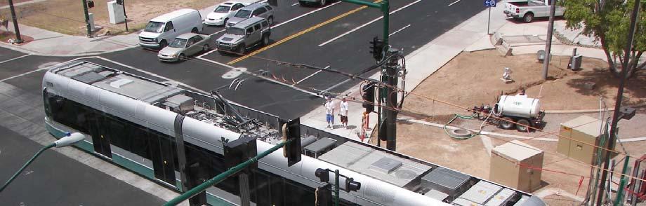
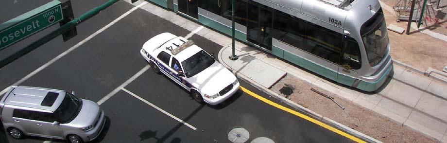
3 1 Background The Region of Waterloo is planning a new multi-modal Transit Hub on a site at the northeast corner of Victoria Street and King Street in Downtown Kitchener, municipally known as 16, 56 and 60 Victoria Street North and 490, 510 and 520 King Street West. The Transit Hub will be a multi-modal facility to accommodate local and regional traffic (pedestrians, cyclists, drivers, taxis, buses, light rail trains) as well as intra-regional traffic (buses and heavy rail). It will be a mixed-use development incorporating opportunities for office, retail, residential, hotel, institutional, and civic uses and activities coupled with the principal transportation function. The proposed development is intended to be a landmark site within the city and the region as a whole, with uses and activities in a built scale and form that support the site s prominence in Downtown Kitchener and Waterloo Region. To implement the proposed uses and form envisioned for the development, amendments to the City of Kitchener s Municipal Plan and Zoning By-law are required. There are two purposes of this Urban Design Brief. First, it has been prepared in support of the amendments to the Kitchener Municipal Plan and Zoning By-law, illustrating consistency with the relevant design policies at the provincial, regional and local levels through design guidelines. Second, it has been prepared to provide sufficient guidance to the ultimate design and development of the Transit Hub through a future master planning exercise and site plan approvals for individual components of the master plan. Overall, the Urban Design Brief provides the overarching design vision and principles for development of the site which will set the foundation for the preparation of more detailed plans that implement this vision. The Urban Design Brief is comprised of five principal sections. The Brief outlines the existing conditions of the site and its context as they affect the design of the site (Section 2); summarizes the policy and regulatory framework at the provincial, regional and local levels that direct the design and development of the site (Section 3); articulates the vision and design principles for the proposed development (Section 4); provides detailed design guidelines for the development of the site that build on and complement the City s Urban Design Manual (Section 6); and illustrates the application of the design principles and guidelines through a series of demonstration concepts. Urban Design Brief 1

4 2 Design Context Community Context The site is situated at the northeast corner of the King Street and Victoria Street intersection at the northern end of Downtown Kitchener, as a principal intersection of two arterial streets within the city that is geographic heart of Waterloo Region. It is located within the Kitchener Urban Growth Centre, as per the Places to Grow legislation, and is intended to accommodate a significant proportion of the Region s future population and employment growth in a compact, dense and transit-supportive fashion. The City s Economic Development Strategy (2011) strives for a Dynamic Downtown, which intends to capture future growth and development by enticing residents to the downtown core by offering a variety of cultural, retail and recreational opportunities, and planning, designing and developing innovative, urban living environments. The site is well connected to the surrounding transportation network, including transit, driving, cycling and walking options, with a number of central neighbourhoods within an 800 metre walking distance (10 minute walk) of the site, and can successfully facilitate the achievement of this vision. The site is located within the centre of the City s Warehouse District, a policy designation that is based on the historic industrial area of Busy Berlin. The area between Joseph Street and King Street has become a research and educational cluster that has successfully attracted national and international talent, currently anchored by the University of Waterloo Health Science Campus and the Tannery development. Building on the significant base of industrial warehouse architecture within the area, the Warehouse District is intended to be fashioned in a quintessential urban form that meshes complementary new developments with preserved and adaptively reused heritage buildings in developing an innovative and creative neighbourhood. A number of surrounding buildings in the community have been identified by the City for their heritage value and have or are in the process of being adapted as per this policy direction of the Warehouse District. Busy Berlin, coined as a catchphrase in the 1890s, described perfectly the bustling, industrious, ever-growing town. As the centuries changed in 1901 and Queen Victoria died, the dawning 20 th century seemed Berlin s for the taking. - Images of Canada Kitchener (Berlin), Rych Mills, 2002, page 7 Urban Design Brief 2

5 Urban Design Brief 3

6 Urban Design Brief 4

7 Urban Design Brief 5


8 Site Context The site is comprised of five different properties that are bounded by the existing CNR railine to the north, Duke Street to the east, Victoria Street to the south, and King Street to the west. It is currently divided into two separate blocks by Waterloo Street. There are four buildings currently on the subject site, as follows: 490 to 520 King Street houses a current one-storey commercial building (The Beer Store); 510 King Street previously contained a onestorey commercial building that was recently demolished; 16 Victoria Street North contains a one-storey commercial building; 50 Victoria Street North contains a one-storey commercial building; and 60 Victoria Street North contains a three-storey former industrial building (Rumpel Felt) that is currently vacant. There is minimal existing vegetation on the subject site, which is generally limited to a small pocket of trees on the 490 to 520 King Street property and some existing, low-lying vegetation along the railine. The site is predominately hard-surfaced in nature, comprised of either buildings or parking areas. The site s topography slopes upwards from Victoria Street towards the railine on the site s northern boundary, which is approximately two metres higher in elevation than the Victoria Street and King Street intersection. Urban Design Brief 6


 with approximately 250 residential units.")

,")

9 The immediately surrounding portion of the City s Warehouse District has seen over the past ten years, and will continue to see, significant change over the past ten years in keeping with the City s policies for Downtown Kitchener. The northwest corner of the King and Victoria intersection contains the University of Waterloo Health Sciences Campus, which houses more than 600 students, faculty and staff in two buildings. The southeast corner of the intersection contains the Kaufman Lofts, a six-storey adaptive re-use of the former Kaufman Footwear Co. building (designated under the Ontario Heritage Act) with approximately 250 residential units. The southwest corner of the intersection contains two one-storey contemporary buildings housing service commercial uses. Further to the west of the southwest corner is the Tannery District, an adaptive re-use of the former Lang Tannery building contains 350,000 square feet innovation office space and ground floor retail uses. To the north of the subject site, across the railine, is the Breithaupt Block (listed on the City s heritage register), which will be an adaptive re-use of the former Merchants Rubber Co. building and will ultimately contain 175,000 square feet of commercial office space. To recognize the immense change and potential for the area, the City has recently identified this area as the Innovation District, and is planning for 15,000 jobs in the area. Urban Design Brief 7

10 3 Design Framework The following provides a general summary of the relevant policies and regulations from provincial, regional and local planning documents that affect the design of the proposed development. A more fulsome review of the land use planning framework affecting the subject site can be found in the Planning Report, dated August 2012 and prepared by GSP Group. Provincial Policy Statement The vision of the Provincial Policy Statement (the PPS ) vision for land use planning is the long-term prosperity and social well-being of Ontarians depends on maintaining strong communities, a clean and healthy environment and a strong economy. To this end, the PPS generally promotes the creation of healthy, liveable and safe communities, through efficient land use patterns, appropriate mixes of different land use types, cost-effective development standards, environmentally sensitive development practices, accessible neighbourhoods, and available infrastructure and public facilities. Opportunities for intensification and redevelopment are encouraged where they can be accommodated taking into account existing buildings and areas and the availability of suitable existing or planned infrastructure and facilities. The development of transportation systems that are safe, accessible and efficient is particularly sought, with land use patterns that minimize vehicular dependence and maximize opportunities for public transit use. Growth Plan for the Greater Golden Horseshoe The site is within the built-up area of the Growth Plan for the Greater Golden Horseshoe, the Province s growth strategy for the Greater Golden Horseshoe region which includes the Region of Waterloo. Generally, this growth strategy strives for complete communities with a range of land use types; a diverse mix of housing options; high quality open spaces; sustainable transportation choices; connected pedestrian and cyclist networks; and energy conservation measures. The Growth Plan sets a minimum intensification target of 40% of total residential units in the municipality to occur within the built-up area by 2015 (or the current intensification level in the municipality should it be higher), such areas which are intended to provide a diverse land use mix, opportunities for walking and cycling, high quality public open spaces, generally higher densities, and appropriate transitions. Specifically, major transit station areas, or those areas within 800 metres (10 minute walk) of a major transit node, are intended to provide a range of residential, commercial, office and community uses, at generally higher densities to support existing and planned transit service, and to accommodate access from various transportation modes. Urban Design Brief 8

11 Mobility Hub Guidelines Mobility Hubs as per Metrolinx s The Big Move report are major transit station areas (areas within a 10 minute walk from a higher order transit station) that are particularly significant for the broader rapid transit system. The Guidelines prepared for these Mobility Hubs provide guidance to assist implementing the existing policies and directions in The Big Move and the Growth Plan. While the Guidelines are meant for Greater Toronto and Hamilton Area, they provide insight into good design for the Transit Hub on the subject site. The seven objectives for Mobility Hubs in the Guidelines are as follows: 1. Seamless integration of modes at the rapid transit station. 2. Safe and efficient movement of people with high levels of pedestrian priority. 3. A well-designed transit station for a high quality user experience. 4. Strategic parking management. 5. A vibrant mixed-use environment with higher land use intensity. 6. An attractive public realm. 7. A minimized ecological footprint. 8. Flexible planning to accommodate growth and change. 9. Effective partnerships and incentives for increased public and private investment. Regional Official Policies Plan The site is designated as City Urban Area in the Regional Official Policies Plan (ROPP), which outlines the Region of Waterloo s planning goals and priorities for a vibrant and sustainable community, and outlines specific strategies and policies to help achieve that vision. The ROPP defers to the lower-tier municipality for the City Urban Area to provide more specific direction for land use designations in their official plans. Generally, the ROPP promotes the establishment of a full range of housing types and densities, efficient land patterns, and innovative lot patterns and housing design; opportunities for mixed-use developments in new residential neighbourhoods; the integration of planning for human services in the land use planning process; the creation of land use patterns and street network patterns and design that support public transit usage; and transportation opportunities for pedestrians, cyclists and transit users. Kitchener Municipal Plan The subject site is designated Warehouse District in the City of Kitchener Municipal Plan. The Warehouse District area, characterized by the number of larger historic industrial buildings, is intended to function as a transition area between the retail core and the surrounding area. New development is to be designed to complement the design and siting of the older industrial building stock. The reuse and conversion of the older industrial building stock is encouraged, particularly as incubators for new industry. New development is intended to emphasize the City's industrial and transportation heritage, which may include utilization of bonusing provisions in the Zoning Urban Design Brief 9
12 By-law for heritage conservation efforts. Permitted uses in the Warehouse District include a limited range of commercial uses (such as boutiques, restaurants, theatres) that are suited to the reuse of existing buildings to create a distinct shopping environment; complementary commercial uses (such as entertainment or exhibition establishments) oriented to a tourist orientation; a full range of smaller scale retail outlets on lots fronting King Street; uses permitted in the Service Commercial District in existing or new buildings that take advantage of access to Victoria Street; retail, office and commercial entertainment within larger historically significant buildings, as well as residential uses in existing buildings such to holding provisions. The proposed Municipal Plan Amendment (MPA) for the Multi-Modal Transit Hub is seeking to maintain the underlying Warehouse District designation, but with a Special Policy Area designation to broaden the range of uses and intensity of development permitted on the site. The policies of the Special Policy Area designation seek to identify: the intent for the site as multi-modal transit facility; the intent for new complementary buildings to the industrial heritage of the Warehouse District; the permission for a broad range of primary uses and complementary issues; opportunities for TDM measures and reduction in parking requirements; the increase in the Floor Space Ratio to 6.0; the desire for high quality urban design in all of the site s places and spaces; and the intent for the Urban Design Brief to be the guide for site plan approvals moving forward with the development. The Planning Report for the Multi-Modal Transit Hub provides specific details regarding the proposed MPA. Kitchener Zoning By-law The subject site is zoned Warehouse District Zone (D-6) in the City of Kitchener Zoning By-law. The D-6 Zone permits a broad range of retail, office and service commercial as well as other community and public facilities. Noteworthy permitted uses include convenience retail, offices, personal services, restaurants, educational establishments, conference facilities, studios, among other uses. There are special regulations on the middle portion of the site with provisions regarding commercial floor space limits, residential use location, and parking requirements. The maximum floor space ratio is 2.0 and the minimum façade height is 6.0 metres. The proposed Zoning By-law Amendment (ZBA) for the Multi-Modal Transit Hub is seeking to maintain the underlying D-6 zone for the site, but with amendments to the site-specific use and regulation provisions that would broaden the range of permitted uses and enable the future development of a high-density, mixed-use development for the Transit Hub. Permitted uses would be added that complement the character and nature of the Innovation District, including artisan establishments, commercial entertainment, residential units, research and development establishments, retail, and scientific, technological or communications establishments. Built form regulations for the site would be amended to enable the desired urban form of the development, which includes increased maximum floor space ratio permissions, increased permissions for retail commercial space, reduced yard setbacks along King Street and Victoria Street, and modified parking requirements for certain permitted uses. The Planning Report for the Multi-Modal Transit Hub provides specific details regarding the proposed ZBA. Urban Design Brief 10
13 Kitchener Urban Design Manual The subject site is within the Warehouse Design District of the City of Kitchener Urban Design Manual. Generally, the primary objectives for Downtown Kitchener respecting design is to make the area a lively place with people and activity downtown and a livable place with a green public realm; secondary objectives include promoting high quality design, respecting cultural heritage resources, embracing art and culture, and embracing multi-culturalism. Specifically, the Warehouse District is intended to evolve into a dense, contemporary urban setting, with former factories converting into trendy loft space and new development re-creating the traditional urban fabric. The design principles for new development in the Warehouse Design District provide for: building styles that respect the area s heritage industrial building form and architecture while adding contemporary additions; façade heights that range between three and six storeys with building massing that frames the street in the traditional perimeter block pattern; adaptive re-use of former industrial buildings and conservation of architectural features, with new contemporary additions that accent rather than replicate heritage features; streetscapes that are designed to soften the building massing along the street; storefronts between building divisions with transparent interfaces with the street; and signage that enhances architectural features of a contemporary design that matches the warehouse character of the area. This design direction will be generally continued in the development of the Transit Hub. Buildings will frame the street, with podiums of three to six storeys, rather than total building heights of three to six storeys. Urban Design Brief 11

14 4 Design Vision The proposed Transit Hub will be the heart of Waterloo Region s future transit network, functioning as the central point for moving residents and visitors to and throughout Waterloo Region. It is intended to be a contemporary, state-of-the-art, multi-modal transportation facility that accommodates a broad range of users arriving by different modes, while furthering the continuing revitalization of Downtown Kitchener. Given this importance, the proposed Transit Hub s design has to reflect the functional prominence of transit use within the region in providing a transit facility that is convenient and easy to use, that exemplifies high quality design and architecture complementing the site s context, and that residents and visitors can identify with and embrace. The relationship between the structure of a city-region and its transportation system is critically important. An attractive and environmentally sustainable urban structure requires fast, frequent and well connected means of movement. An efficient and cost-effective transit system requires nodes (or dense concentrations) of trip origins and destinations. The interface between urban form and the transportation system is particularly important around major transit stations. Focusing growth and development around major transit stations allows more people to live near transit services, and makes more destinations accessible by transit. Transit stations are also the key point of contact between the traveller and the transit system, so they have a significant impact on customer service and the overall travelling experience. A well designed transit station can help make travellers feel relaxed, informed and appreciated. A poorly-designed station can cause frustration. - The Big Move: Transforming Transportation in the Greater Toronto and Hamilton Area, Greater Toronto Transit Authority, 2008, page 46. Urban Design Brief 12
15 The design vision for the Transit Hub identifies the desired, long term objectives for the proposed development. It is a synthesis of the various design goals, objectives and policies at the provincial, regional and local levels, as outlined in the Design Framework section above, which are translated to the subject site and its context within the community. The design vision for the subject site identifies that the Transit Hub will be: 1. A place that provides a seamless and integrated transit node that recognizes the primacy of the transportation function in accommodating those arriving and departing by foot, by bicycle, by car, by bus, and by train. 2. A place that is mixed in terms of land use activities with opportunities for retail shops, offices, residences, civic uses, community facilities, visitor accommodations, among other uses, that supports activity throughout the day in a safe, secure and comfortable fashion. 3. A place that is an efficient and intensified use of the site, adding activity that complements the surrounding Warehouse District and Downtown Kitchener as a whole by achieving provincial and municipal intensification targets in a characteristically urban fashion. 4. A place that is sensitively integrated in the built fabric of the Warehouse District, both physically in terms of movement linkages as well as visually in respecting the industrial heritage of the surrounding area. 5. A place that sensitively protects and incorporates the existing built heritage on the site for a future, long-term use that supports the mixed-use character of the Transit Hub. 6. A place that is a landmark within the city and the region in terms of form and function, easily seen and identified as a prominent addition to the Kitchener skyline with an architectural style and form that distinguishes, yet complements, the surrounding heritage fabric 7. A place that is universally accessible to all users, including those arriving by various modes of transportation, arriving from different directions to the site, as well as those with different special mobility needs. 8. A place that incorporates green and sustainable choices in terms of both building and site design opportunities in respect to energy, water and air quality considerations. 9. A place that provides a grand presence from the street for visitors arriving to Kitchener and that leaves a lasting impression for visitors. 10. A place that includes a series of interconnected vibrant spaces that are animated with activities and spaces throughout all times of the day and that are legibly linked between activities and different transportation modes. Urban Design Brief 13


16 5 Design Guidelines Buildings Orientation and Siting: Site the base portion of all buildings parallel to the Victoria Street property line, or both Victoria Street and King Street in the case of the corner location. Locate principal building entrances so that they are clearly visible and directly accessible from the public sidewalk. Orient buildings close to the King Street and Victoria Street frontages to reinforce the street edge, while ensuring sufficient space for pedestrian movements to access transit. Generate activity along ground floor façades by maximizing transparency, minimizing blank walls, and incorporating active ground floor uses, such as retail, restaurants, cafes, and uses catering to transit users. Set the noise-sensitive uses (such as residential uses) on the upper storeys of the building at least 30 metres back from the railine. Capitalize on key views and vistas to and from the site through design analysis and modeling to ensure the proposed development sits as a landmark in the broader area. Particular emphasis should be placed on the views on King Street (east and west) and on Victoria Street where the street bends. Ensure an adequate separation distance is maintained between new buildings and the Rumpel Felt building (1913 portion). Top: Podium level of development scaled and designed to the pedestrian. Middle : Buildings set tight to the street edge to reinforce the street. Bottom and Left: Development with active ground floor uses that spill out to the street help to animate the public streetscape. Urban Design Brief 14


17 Massing and Scale: Develop a block structure that balances site circulation patterns with the emphasis on pedestrian movements. Ensure taller buildings have slender tower forms with defined base, middle and top sections in the wall elevations for definition and articulation purposes. Scale the building s base section with considerations for the scale of adjacent or surrounding buildings, abutting street widths, and other buildings on the site. Use techniques on the building s middle and top sections to limit visual and shadowing impacts on surrounding buildings and streets, such as setbacks of the building s base to provide additional separation to the street and surrounding buildings; and stepbacks of upper storeys from the base portion to provide additional physical separation of upper storeys from the street and surrounding buildings Use a mix of materials, articulation and recessed/integrated balconies on residential buildings. Ensure top floors of tall buildings contribute to the city skyline through special architectural treatment, particularly for any building at the King and Victoria Street intersection. Integrate mechanical penthouses and roof-top equipment into the design of top floors of all buildings. Ensure any buildings at the King and Victoria Street intersection has the most active edge with street fronting uses, transparent wall elevations, and prominent entrances to the building and transportation facilities. Provide continuous pedestrian weather protection along the base portion of all buildings where there are active uses. Top: Distinct rooftop architecture that defines the top portion of a taller building. Middle and Left: High-rise building option that reinforces the street edge with defined base, middle and roof sections. Bottom: Ground floor orientation and definition of base portion of taller building. Urban Design Brief 15


18 Character and Style Reinforce and emphasize the landmark nature of the site, featuring the highest quality architecture and innovation in its design features. Ensure the new building form communicates a sense of the present that is integrally woven into the neighbourhood s industrial past. Ensure all building design clearly defines the three general components of a building: the base that defines and scales the street edge; the middle that provides visual interest in connecting the base and top portions; and the top that caps the building, provides a distinctive profile, and positively contributes to the skyline. Divide building massing along the Victoria Street frontage into distinct buildings with frontages complementary to the existing and historic patterns. Take cues from the Warehouse District in terms of mass, siting, materials and elements in designing a contemporary addition to the built fabric in the area, rather than using imitative architecture caricaturing the surrounding heritage fabric. Set upper storeys back from the Victoria Street edge so that the streetscape space is primarily formed by a height that is complementary to surrounding buildings with heritage attributes. Follow the rhythm, balance and proportions of surrounding industrial heritage buildings in designing buildings on the site, particularly for the base and middle sections of the building. Provide an appropriate transition in colour, materials and texture to soften building mass and add visual depth to the building elevation. Top: More contemporary architectural expressions can fit within the Warehouse District theme to the area. Bottom: Contemporary building respecting a traditional balance of rhythm and proportions in wrapping the corner of two public streets. Left: Design cues for the subject site set by buildings in the surrounding Warehouse District. Urban Design Brief 16
. Incorporate fascia signage for ground floor retail uses as an integral component of the storefront architecture.")


19 Signage: Develop a signage master plan for the overall development that establishes a coordinated character, style and location for all signage elements on the site (building, wayfinding, and directional). Incorporate fascia signage for ground floor retail uses as an integral component of the storefront architecture. Locate fascia business signage in a more traditional sign band, the horizontal section which divides the storefront windows from the upper façade. Utilize durable, weatherproof materials for all building signage that complement the overall character of the building façade in terms of design, style and materials. Use simple lettering that is clear and easy-to-read and complement graphics that relate to the business function. Heritage Resources: Set the upper storeys of buildings back from the podium base to generate a height and massing that is complementary to surrounding heritage buildings in the Warehouse District. Ensure new buildings respect the prominent heritage attributes and elements of surrounding heritage buildings, including consideration of building setbacks, horizontal and vertical lines, proportions, balance, rhythm, and openings. Ensure through shadow studies that adjacent heritage resources (especially 51 Breithaupt and 283 Duke) are not impacted significantly. Utilize buildings materials for new buildings as well as additions that are compatible to and complementary with the existing palette of materials in the Warehouse District. Should the 1913 Rumpel Felt portion be retained, preserve and restore the building s character-defining elements and attributes, including the wall elevations facing Victoria Street, 50 Victoria, and the rail corridor; Should the 1913 Rumpel Felt portion be retained, ensure that the site and building design surrounding it: o Retains the space immediately west of the 1913 portion of the Rumpel Felt building to allow its western elevation to continue to add to the streetscape; Above: heritage precedents within the Warehouse District of Downtown Kitchener. Urban Design Brief 17


, increasing the surface permeability of the site and lowering any heat island potential for the site.")
20 o o o o o Ensures any additions are contemporary and distinguishable from the 1913 portion through the use of different materials, colours, setbacks and divisions; Restrict upper storey additions to the 1913 portion to two storeys and set back from the Victoria Street edge so that the original building plays the principal role in defining the street space; and Setbacks the upper storeys (generally above the fifth storey) of new buildings to the west of the 1913 portion of the Rumpel Building and its abutting space to minimize shadowing and avoid overwhelming the scale; Builds tight to the intersection of Duke Street and Victoria Street North, recognizing necessary sightlines and pedestrian space, for additions to the existing structure or with new construction; Does not introduce a grade change that would adversely impact the existing Rumpel Felt building relationship with the rail corridor; o Consult the Heritage Impact Assessment (April 2012) completed by Landplan for further guidance; and o Design railway platforms and barriers in a manner that avoids blocking access for heritage restoration works that may be necessary. Sustainability: Consider incorporating sustainability measures at the outset of the design and construction process, with a LEED Silver certification for all buildings as a minimum target. Explore opportunities for sustainable or functional roofs, particularly on the lower podium base, such as green roofs, white roofs, or other methods or technologies. Explore opportunities for incorporating on-site renewable energy generation technologies, such as a geothermal heating, solar facilities, or other technologies. Include entirely covered parking facilities (underground or structured), increasing the surface permeability of the site and lowering any heat island potential for the site. Use native or adapted species that are low maintenance and suited to an urban environment for all landscaped areas. Consider opportunities for rainwater capture for irrigation purposes, both outdoors and indoors. Above: A broad range of techniques technologies for promoting sustainability as part of the site and building design. Urban Design Brief 18
 that relate to the street and the public")


 internal to buildings.")
21 Parking Structures: o o o o o o Design parking structures to provide for ease of circulation and wayfinding on site in a secure fashion. Wrap the at-grade portion of all street-facing elevations with active uses and activities (such as commercial uses) that relate to the street and the public realm. Design and site parking structures to integrate with the buildings in terms of a complementary scale and style to the associated building(s). This should include complementary treatment of massing, style, materials, colours, and articulation, among others considerations, along with appropriate landscaping. Incorporate stairwells within parking structures with glass or transparent openings for visibility purposes. Align rows of parking perpendicular to the building to minimize the number of crossings of drive aisles for pedestrians. Incorporate defined bicycle parking areas, including short term and long term, either within the parking structure or with direct connections to bicycle storage areas (and end-of-trip facilities) internal to buildings. Above/Left: Parking structures that are integrated in the architectural style and detailing of the building and provide a high quality ground level interface with the public realm. Urban Design Brief 19


22 Circulation Pedestrians: Provide multiple building entrances to both King and Victoria Street to ensure connectivity and encourage transit use. Ensure that all pedestrian connections are direct, convenient, safe, comfortable, and barrier-free. Incorporate clearly defined pedestrian linkages reinforced by appropriate landscape materials, paving materials and pedestrian scale lighting. Clearly separate loading, servicing, drop-off areas from pedestrian circulation routes. Where they cross, consider using a different surface treatment, such as imprinted, textured or colour concrete or asphalt, to visually define pedestrian routes. Provide appropriate separation for pedestrian movement and circulation along the railway tracks. Provide continuous pedestrian weather protection along the base portion of all buildings where there are active uses, as appropriate. Provide clearly defined pedestrian linkages in all underground parking facilities. Top: Grand pedestrian concourse connecting to transit platforms as part of transit station. Bottom: Safe and easy access for pedestrians and cyclists a key component of a multi-modal transportation facility. Below: Grand, sunlit entry and ticket space that is easy to navigate and provides a good first impression to travellers. Urban Design Brief 20


23 Cyclists: Consider a combination of indoor bicycle parking facilities and outdoor post and ring type spaces throughout. Ensure outdoor bicycle parking is conveniently located close to building entrances, protected from the weather, visible from the interior of the building and does not impede the movement of pedestrians. Ensure indoor bicycle parking facilities are conveniently located in highly visible locations, minimize conflicts with key pedestrian movements, and are connected directly to cyclist amenities such as storage facilities or shower facilities. Consider defined bicycle entrances to buildings with access to transit platforms that enable minimal exertion and maximize comfort when moving the bicycle to parking facilities. Such measures may include bicycle switchbacks or bike ramps along stairways. Vehicles: Locate all off-street parking within structured facilities, whether underground or above-ground. Consider the sharing of parking spaces for uses in the overall development that have peak parking demands at different times of the day. Ensure parking entrances are fully integrated into site design through appropriate architectural design and are sited to minimize potential conflicts between pedestrians and vehicles. Incorporate preferential parking spaces for carpools, car sharing, and ridesharing to help reduce vehicle parking demands and the necessary overall parking capacity. Transit: Fully integrate transit through special paving materials and architecturally enhanced transit shelter designs. Consider the location and integration of transit stops and shelters along King Street and Victoria Street early in the design process to ensure sufficient space for transit users and pedestrians Ensure building entrances are located near street-side transit stops together with supportive uses (such as coffee shops or convenience retail). Top: Secure bicycle storages as part of transit station development. Middle: Seamless connection between modes an important consideration for an effective multimodal transportation facility. Bottom: Distinct architecture for transit infrastructure and facilities. Urban Design Brief 21
. Incorporate a comprehensive wayfinding system for transit users as part of the development.")
.")

24 Wayfinding: Develop a signage master plan for the overall development that establishes a coordinated character, style and location for all signage elements on the site (building, wayfinding, and directional). Incorporate a comprehensive wayfinding system for transit users as part of the development. Consider as part of the wayfinding system directional signage (such as to transit platforms or pay stations), static transit information displays (such as local and regional routing maps), and real-time transit information displays (such as displaying arrivals/departures). Ensure wayfinding signs and features have a common template (colour, materials, fonts, etc) so that the system reads as a comprehensive package and is easily recognizable by transit users. Consider designing signs and features in keeping with the industrial character of the development and surrounding Warehouse District. Ensure directional signage is located both along the route and at key decision points along the route to ensure ease of use. Signage should be clearly legible from a distance and include easy to read and unambiguous symbols/arrows. Design all wayfinding features in keeping with universal design principles to maximize accessibility, and usability for all transit users. Particular considerations should include the location, placement, height, font, and colour to ensure usability for those with particular needs, whether visual, physical or otherwise. Above and Left: Various elements combine to form a comprehensive wayfinding program that seamlessly direct transit users through an multimodal transit hub. Urban Design Brief 22


25 Public Realm Plaza: Incorporate high quality public space the King Street and Victoria Street corner that acts as a public plaza between the development and the street-side transit facilities. Design this plaza as: i. An active and animated gathering space for transit and building users; ii. iii. iv. A space that allows ground floor uses to spill-out to the plaza to further animate the space; A space that accommodates a circulation route from the street to the building and transit facilities; and A part of the grand entrance at the King Street and Victoria Street intersection. Incorporate opportunities for landscaping, seating, shade structures, public art, bike racks, waste and recycling and other related site furnishings, as appropriate. Ensure a primary pedestrian route through this plaza is maintained which is direct, barrier-free and unobstructed. Walkways: Site buildings to ensure that at least a 4.0 metre sidewalk and boulevard can be provided along the street for easy and unobstructed pedestrian movements. Plantings: Use surface materials for all walkways and paved surface areas that provide barrier free access through the site, such as poured concrete. Incorporate universal design features along the streetscape walkways that are suited to users with visual limitations, including such features as textured banding, bus stop detection strips, and corner curbs and ramps. With a preference for native species, select trees and shrubs with regard to their characteristics and those of the proposed locations including soils, sun, root spread, growth rate, canopy size and salt tolerance. Reinforce the pedestrian circulation system through generous landscaped sidewalks, clearly defined, and Above : structured and unstructured civic spaces that provide valuable space for gathering at key entrances. Urban Design Brief 23


26 landscaped, pedestrian linkages, unique markers at street entrances and decorative street furniture. Use plant materials grouped to frame building elevations, to shade transit stops/shelters along the street, add a visual interest to blank building facades, accentuate building entrances and screen service areas. Ensure landscaping is used in a balanced fashion with unobstructed views to spaces and buildings so as to not create potential hiding areas. Plant shade trees and use permeable and/or light coloured hard surfaces to minimize urban heat island effects in order to create a more comfortable environment at the ground level for transit users. Furnishings: Incorporate site furnishings including waste receptacles, bike racks, and pedestrian scale lighting along both the King Street and Victoria Street streetscapes, where space permits, in a manner that does not obstruct pedestrian circulation or sight lines. Utilize the established form and style of streetscape amenities within the Warehouse District, including the package of decorative light standards, street signage, and street furnishings. Incorporate opportunities for public art in the public realm, both outdoors along the street and indoors in the central concourses and transit platforms. Incorporate pedestrian-scaled lighting throughout the proposed development, both outdoors and indoors, to promote safety and comfort at the Transit Hub during the evenings. Use a hierarchy of lighting levels to provide the necessary illumination required for particular components of the site, focused on pedestrian areas and clearly identifying pedestrian walkways and building entrances. Preferably locate site furnishings on the site rather than within the public right-of-way, to preserve the latter for pedestrian travel routes. Regardless, furnishing plans for the site should be coordinated with any public plans for land within the right-of-way. Top: Established street tree planting on the west side of King Street associated with the Health Sciences campus Middle: Established program of decorative light standards and signage for the Warehouse District. Bottom: Installation of hardy and easily maintained plantings that provide colour and visual interest. Urban Design Brief 24


, and variety of different forms (architectural features, sculptures, landscape features, street")
27 Public Art: Incorporate public art throughout the development, both in outdoor spaces as well as other publicly accessible internal spaces, to enhance the identity and provide visual interest and vibrancy. Locate public art in a variety of locations, including within the boulevard space between the sidewalk edge and curb edge (for smaller pieces), within open public spaces, or internal to buildings that are publicly accessible. Locate public art outside of pedestrian travel routes to limit any conflicts with vehicular, bicycle, or pedestrian circulation. Ensure public art is an original piece of artwork with the primary function of providing visual interest without any commercial advertising function. Ensure public art is accessible and/or visible to the public, located either within a public street right-of-way or other publicly owned space, or on a private property where it has an interface and connection with the public realm. Incorporate a range of different purposes for public art pieces throughout the development, including functional, interpretive, abstract, and historical purposes. Incorporate a range of sizes, artistic mediums (metal, stone, paint), and variety of different forms (architectural features, sculptures, landscape features, street amenities, public works, paintings, or murals) throughout the development. Incorporate interpretive displays, or similar pieces, into the overall public art program that commemorates the industrial heritage of the site. Above and Left: public art presents an endless array of opportunities for providing visual interest and identity to a downtown or main street area. Urban Design Brief 25
28 6 Summary The Region of Waterloo is planning a new multi-modal Transit Hub at the northeast corner of Victoria Street and King Street in Downtown Kitchener. The intent is a mixed-use development that brings together commercial, residential, community, institutional and public uses at the doorstep of the Region s central node within its transit network. Applications to City of Kitchener for an Official Plan Amendment and Zoning By-law Amendment have been proposed to modify the permitted uses and built form regulations on the subject site in order to facilitate the proposed mixed-use Transit Hub. This Urban Design Brief has been prepared in support of these planning applications and provides the design foundation upon which future master site planning exercise and individual site plans will be undertaken. An overall vision establishes the guiding framework for the design and development of the Transit Hub. This vision identifies that the Transit Hub will be a place that: is a seamless and integrated transit node; is mixed in terms of land use activities; is efficient and intense use; is sensitively integrated in the built fabric; protects and incorporates the existing built heritage; is a landmark within the city and the region; is universally accessible to all users; incorporates green and sustainable choices; provides a grand presence from the street; and includes a series of interconnected vibrant spaces. The detailed development plans for the Transit Hub will be prepared by the Region and its development partner at a later date, which should follow the guidelines of this Urban Design Brief as well as detailed servicing, traffic, noise and other technical studies. The proposed development could potentially accommodate ground floor retail uses as well as office uses, residential, educational and institutional uses, and hotel uses, among others. The buildings on the site should have a base section that is sympathetic to the warehouse form of the Warehouse District, with vertical building extensions that capitalize on the prominent location of the King and Victoria intersection as a central hub within the region. Public spaces should be well designed for ease of access to and between various travel modes, and to create a high degree of pedestrian comfort. Urban Design Brief 26
Urban Design Manual PLANNING AROUND RAPID TRANSIT STATIONS (PARTS) Introduction. Station Study Areas
 Introduction. Station Study Areas") 111111 PLANNING AROUND RAPID TRANSIT STATIONS (PARTS) Introduction The ION rapid transit system will link Waterloo, Kitchener and Cambridge through a central transit corridor (CTC). There are a number
111111 PLANNING AROUND RAPID TRANSIT STATIONS (PARTS) Introduction The ION rapid transit system will link Waterloo, Kitchener and Cambridge through a central transit corridor (CTC). There are a number
ELMVALE ACRES SHOPPING CENTRE MASTER PLAN
 ELMVALE ACRES SHOPPING CENTRE MASTER PLAN Contents 1.0 INTRODUCTION... 2 2.0 LOCATION... 2 3.0 EXISTING CONTEXT... 2 4.0 VISION & GUIDING PRINCIPLES... 2 5.0 LAND USE AND BUILT FORM... 4 5.1 St. Laurent
PUBLIC RIGHT-OF-WAY IN THIS CHAPTER PUBLIC REALM
 PUBLIC RIGHT-OF-WAY This section provides design guidelines for improvements in the public right-of-way. The public right-of-way refers to streets, sidewalks, non-vehicular thoroughfares, parks and greenways
Urban Design Brief to 1557 Gordon Street & 34 Lowes Road West
 Urban Design Brief 1533 to 1557 Gordon Street & 34 Lowes Road West Reid s Heritage Homes Ltd. & 883928 Ontario Ltd. and RHH Property Management Ltd. City of Guelph Zoning By-law Amendment November 2017
The Master Plan Framework
 The Master Plan Framework The East Harbour Master Plan advances the development of 60 acres of former industrial lands east of the Don River. The Master Plan outlines a vision for a vibrant, transit-oriented
URBAN DESIGN BRIEF URBAN DESIGN BRIEF 721 FRANKLIN BLVD, CAMBRIDGE August 2018
 URBAN DESIGN BRIEF URBAN DESIGN BRIEF 721 FRANKLIN BLVD, CAMBRIDGE August 2018 DESIGN BRIEF CONTENTS PART A 1.0 INTRODUCTION 2.0 DESCRIPTION & ANALYSIS OF SITE CONTEXT 3.0 DESIGN CONSTRAINTS AND OPPORTUNITIES
[PLANNING RATIONALE] For Site Plan Control and Lifting of Holding Zone By-Law 101 Champagne Avenue. May 23, 2014
![[PLANNING RATIONALE] For Site Plan Control and Lifting of Holding Zone By-Law 101 Champagne Avenue. May 23, 2014](/thumbs/75/71599615.jpg "[PLANNING RATIONALE] For Site Plan Control and Lifting of Holding Zone By-Law 101 Champagne Avenue. May 23, 2014") [PLANNING RATIONALE] For Site Plan Control and Lifting of Holding Zone By-Law 101 Champagne Avenue May 23, 2014 Contents 1.0 Introduction... 2 2.0 Site Context... 2 2.1 Adjacent Uses... 2 Figure 1: Site
[PLANNING RATIONALE] For Site Plan Control and Lifting of Holding Zone By-Law 101 Champagne Avenue May 23, 2014 Contents 1.0 Introduction... 2 2.0 Site Context... 2 2.1 Adjacent Uses... 2 Figure 1: Site
East Bayshore Road Neighbourhood
 East Bayshore Road Neighbourhood Northridge Property Management Urban Design Brief 3195 East Bayshore Road City of Owen Sound January 2016 East Bayshore Road Neighbourhood Northridge Property Management
New-Cast Mixed-use Development Proposal King Street West, Newcastle, Ontario
 URBAN DESIGN BRIEF New-Cast Mixed-use Development Proposal King Street West, Newcastle, Ontario TABLE OF CONTENTS: 1.0 Executive Summary 2.0 Creating Vibrant and Sustainable Urban Places: Excerpts from
Uptown Rideau Street Secondary Plan [Amendment #166, January 12, 2016]
![Uptown Rideau Street Secondary Plan [Amendment #166, January 12, 2016]](/thumbs/76/73760497.jpg "Uptown Rideau Street Secondary Plan [Amendment #166, January 12, 2016]") [Amendment #166, January 12, 2016] The policies of this Secondary Plan are in effect, save and except for the property at 560 Rideau Street, for which there remains a site specific appeal to this Secondary
[Amendment #166, January 12, 2016] The policies of this Secondary Plan are in effect, save and except for the property at 560 Rideau Street, for which there remains a site specific appeal to this Secondary
appendix and street interface guidelines
 appendix five: building and street interface guidelines appendix 5 building and street interface guidelines BOULEVARDS Boulevards are generally characterized by higher levels of traffic movement at higher
Clairtrell Area Context Plan
 Clairtrell Area Context Plan March 2005 Urban Development Services City Planning Contents 1. Introduction... 4 2. Development Structure... 6 2.1 Streets... 7 2.1.1 Sheppard Avenue and Bayview Avenue...
Policies and Code Intent Sections Related to Town Center
 Policies and Code Intent Sections Related to Town Center The Town Center Vision is scattered throughout the Comprehensive Plan, development code and the 1994 Town Center Plan. What follows are sections
Mark-up of the effect of the proposed Bronte Village Growth Area OPA No.18 on the text of section 24, Bronte Village, of the Livable Oakville Plan
 Mark-up of the effect of the proposed Bronte Village Growth Area OPA No.18 on the text of section 24, Bronte Village, of the Livable Oakville Plan Notes: This document is provided for information purposes
Bel-Air Lexus Automobile Service Station
 Bel-Air Lexus Automobile Service Station Design Brief 443-447 McArthur Avenue Ottawa April 30, 2015 14-1299-MCA Site Details Application: Site Plan Control Legal Description and Municipal Addresses: 443
TALL BUILDING GUIDELINES
 TALL BUILDING GUIDELINES Urban Design Guidance for the Site Planning and Design of Tall Buildings in Milton May, 2018 A Place of Possibility Contents 1.0 INTRODUCTION 1 1.1 What is a Tall Building? 2
Welcome. Walk Around. Talk to Us. Write Down Your Comments
 Welcome This is an information meeting introducing the applications for proposed redevelopment of the Yorkdale Shopping Centre site at 3401 Dufferin Street and 1 Yorkdale Road over the next 20+ years,
SECTION ONE: INTRODUCTION. introduction
 introduction 1 INTRODUCTION Since it was first established in 1843 as a trading post for the Hudson s Bay Company, Victoria has evolved into a Provincial capital city that is recognized across Canada and
Regency Developments. Urban Design Brief. Holyrood DC2 Rezoning
 Regency Developments Urban Design Brief Holyrood DC2 Rezoning Stantec Consulting Ltd. 7-31-2017 1. Overview Regency Developments intends to rezone the lands located at 8510 and 8511 93 Avenue, within the
Sierra Springs Regional Commercial Master Site Plan Airdrie, Alberta Hopewell Development Corporation Project No May 26, 2010
 Sierra Springs Regional Commercial Master Site Plan Airdrie, Alberta Hopewell Development Corporation Project No. 205-077 May 26, 2010 TABLE OF CONTENTS Purpose... 2 Master Site Plan Guidelines... 3 Overall
Urban Design Brief December 23, 2015 Southside Construction Group Official Plan & Zoning By-Law Amendment
 Urban Design Brief Proposed Official Plan & Zoning By-Law Amendment 3244, 3263 and 3274 Wonderland Road South Southside Group December 23, 2015 TABLE OF CONTENTS Page No. INTRODUCTION... 1 SECTION 1 LAND
Urban Design Brief. Watson Parkway North & Watson Road North Guelph, Ontario. Prepared by Coletara Development
 Urban Design Brief Watson Parkway North & Watson Road North Guelph, Ontario Prepared by Coletara Development December, 2013 Urban Design Brief, Coletara Development 1 Introduction This Urban Design Brief
Mixed Use Centres Development Permit Guidelines
 1 Mixed Use Centres Development Permit Guidelines Area Commercial or Mixed Use development occurring in City Centre, Urban Centre, Neighbourhood Centre, or Institutional Complex land use designations is
SCHEDULE 'A' TO BY-LAW as Amended by AMENDMENT NO. 90 TO THE WHITBY OFFICIAL PLAN
 SCHEDULE 'A' TO BY-LAW 6413-10 as Amended by 6553-11 AMENDMENT NO. 90 TO THE WHITBY OFFICIAL PLAN SECTION A: GROWTH PLAN CONFORMITY PURPOSE: LOCATION: BASIS: The purpose of this Amendment is to: conform
5.1 Site Plan Guidelines
 5. Community Core Guidelines Development of the Community Core will take place by plan of subdivision and site plan approval. It will occur in a phased manner that will reflect the timing of residential
Urban Design Manual 2.0 DRIVE-THROUGH FACILITIES. Background. Urban Design Challenges
 222221 2.0 DRIVE-THROUGH FACILITIES Background In recent years, drive-through facilities have grown significantly in popularity with drive-through restaurants, in particular, being established on numerous
WEST LOOP DESIGN GUIDELINES CHECKLIST
 WEST LOOP DESIGN GUIDELINES CHECKLIST Section 1.0 General Strategies 1.1 DESIGN EXCELLENCE: ENCOURAGE HIGH QUALITY AND INNOVATIVE DESIGN OF NEW BUILDINGS WITHIN THE WEST LOOP WITHOUT BEING PRESCRIPTIVE
QUEEN-RIVER SECONDARY PLAN
 34 QUEEN-RIVER SECONDARY PLAN 34. QUEEN RIVER SECONDARY PLAN 1. INTRODUCTION The Queen-River area is approximately 6.4 hectares and is located at the eastern edge of the Downtown as shown on Map 34-1.
178 Carruthers Properties Inc.
 178 Carruthers Properties Inc. Planning Rationale for 178 Carruthers Avenue Site Plan Control Application June 2014 Table of Contents 1.0 Introduction 2.0 Overview of Subject Property 3.0 Current Zoning
(DC1) Direct Development Control Provision DC1 Area 4
 Direct Development Control Provision DC1 Area 4") . General Purpose (DC) Direct Development Control Provision DC Area 4 The purpose of this Provision is to provide for an area of commercial office employment and residential development in support of the
. General Purpose (DC) Direct Development Control Provision DC Area 4 The purpose of this Provision is to provide for an area of commercial office employment and residential development in support of the
CONTENTS 6.1 URBAN DESIGN
 6-2 Urban Design and Sustainable Development 6.0 URBAN DESIGN AND SUSTAINABLE DEVELOPMENT CONTENTS 6.1 URBAN DESIGN 6.1.1 General Policies 6.1.2 The Public Realm 6.1.3 Streets and Blocks 6.1.4 Streetscapes
WELLINGTON STREET WEST COMMUNITY DESIGN PLAN
 36 3.CDP POLICIES 37 Wellington Street West CDP Vision Statement 38 3.1 Introduction 3.1.1 Purpose The development of buildings and public spaces is influenced by a variety of factors over time. City of
THE CITY OF VAUGHAN BY-LAW BY-LAW NUMBER A By-law to adopt Amendment Number 1 to the Official Plan of the Vaughan Planning Area.
 THE CITY OF VAUGHAN BY-LAW BY-LAW NUMBER 015-2014 A By-law to adopt Amendment Number 1 to the Official Plan of the Vaughan Planning Area. NOW THEREFORE the Council of the Corporation of the City of Vaughan
WELCOME and introduction
 1 WELCOME and introduction Mobility Hub Locations within Burlington STUDY OVERVIEW STUDY OBJECTIVES The City of Burlington is developing four Area Specific Plans, one for each of Burlington s Mobility
Cit of Kitchener Ur 6 an Design Manual PARTA. Desi n for _--::
 Cit of Kitchener Ur 6 an Design Manual Date PARTA Year ) Desi n for k Nodes Corridors _--:: Section Page 01 of 12 2 INTRODUCTION Purpose & Application Nodes and Corridors have been identified as key intensification
Urban Design Direction for Oakville. Endorsed by Council on May 12, 2014 Endorsed by Council , Version - 1.0
 Urban Design Direction for Oakville Endorsed by Council on May 12, 2014 Endorsed by Council 01.30.2014, Version - 1.0 Urban Design Direction for Oakville Livable by Design Manual Urban Design Direction
Town Center (part of the Comprehensive Plan)
") Town Center (part of the Comprehensive Plan) Mercer Island Town Center Looking North (2014) In 1994, a year-long process culminated in a set of design guidelines and code requirements for the Town Center
Town Center (part of the Comprehensive Plan) Mercer Island Town Center Looking North (2014) In 1994, a year-long process culminated in a set of design guidelines and code requirements for the Town Center
1.3 TRANSIT VISION 2040 FROM VISION TO ACTION THEME 1: PUTTING TRANSIT AT THE CENTRE OF COMMUNITIES. Fully integrate transit with community planning
 TRANSIT VISION 2040 FROM VISION TO ACTION TRANSIT VISION 2040 defines a future in which public transit maximizes its contribution to quality of life with benefits that support a vibrant and equitable society,
TABLE OF CONTENTS 1.0 INTRODUCTION... 3
 TABLE OF CONTENTS 1.0 INTRODUCTION... 3 1.1. BACKGROUND... 3 1.2. THE PROPOSAL... 5 2.0 EXISTING POLICY FRAMEWORK... 5 2.1. PROVINCIAL POLICY STATEMENT (PPS)... 5 2.2. CITY OF LONDON OFFICIAL PLAN (OP)...
SUBCHAPTER 4-B GUIDELINES FOR THE B-3 COMMERCIAL CHARACTER AREA
 1 SUBCHAPTER 4-B GUIDELINES FOR THE B-3 COMMERCIAL CHARACTER AREA Downtown Bozeman should be the location of buildings of greatest height and intensity in the community. The following guidelines apply
13. New Construction. Context & Character
 13. New Construction Context & Character While historic districts convey a sense of time and place which is retained through the preservation of historic buildings and relationships, these areas continue
URBAN DESIGN BRIEF. 2136&2148 Trafalgar Road. Town of Oakville
 URBAN DESIGN BRIEF 2136&2148 Trafalgar Road Town of Oakville Prepared By: METROPOLITAN CONSULTING INC For 2500674 Ontario Inc November 2016 TABLE OF CONTENTS Page No. 1.0 Introduction/Description of Subject
DRAFT Northeast Quadrant of Kipling Avenue and Highway 7 DRAFT AUGUST 29, Goals Land Use. The goals of this Plan are to:
 AUGUST 29, 2017 12.15 Northeast Quadrant of Kipling Avenue and Highway 7 12.15.1 Goals 12.15.2 Land Use The goals of this Plan are to: 12.15.2.1 General Provisions: a) Ensure the development of a compact
Table of Contents. Elm Avenue Improvement Plan City of Waco, Texas. Introduction 1. Existing Context 1 Figure 1 2.
 Table of Contents Introduction 1 Existing Context 1 Figure 1 2 Plan Guidelines 3 Future Urban Form 4 The West-End 4 Main Street 6 The East-End 7 Figure 2 9 Public Improvement Recommendations 7 General
YONGE STEELES CORRIDOR SECONDARY PLAN. Young + Wright / IBI Group Architects Dillon Consulting Ltd. GHK International (Canada) Ltd.
 Ltd.") PART A: PREAMBLE 1.0 PURPOSE The purpose of this Secondary Plan is to provide a development framework for intensification of the Yonge/ Steeles corridor including the north side of Steeles Avenue West
PART A: PREAMBLE 1.0 PURPOSE The purpose of this Secondary Plan is to provide a development framework for intensification of the Yonge/ Steeles corridor including the north side of Steeles Avenue West
URBAN DESIGN BRIEF 181 Burloak Drive, Oakville
 URBAN DESIGN BRIEF 181 Burloak Drive, Oakville February 2017 Our File: 1730B 230-7050 WESTON ROAD / WOODBRIDGE / ONTARIO / L4L 8G7 / T: 905 761 5588/ F: 905 761 5589/WWW.MHBCPLAN.COM TABLE OF CONTENTS
Wide asphalt driveway abutting school property. garage built with incompatible materials, too close to park. incompatible fencing materials
 Wide asphalt driveway abutting school property incompatible fencing materials garage built with incompatible materials, too close to park Lack of plantings as a buffer between private property and open
4.0 Design Guidelines For The Village Centre. South fields Community Architectural Design Guidelines Town of Caledon
 4.0 Design Guidelines For The Village Centre 4.0 Design Guidelines for the Village Centre The Village Centre is the focal point of the entire South Fields Community and is designed as a traditional commercial
Highland Village Green Design Guidelines
 Highland Village Green Design Guidelines Publishing Information Title Highland Village Green Design Guidelins Author The City of Calgary Status DRAFT - Proposed document subject to changes Additional Copies
EXISTING COMPREHENSIVE PLAN
 EXISTING COMPREHENSIVE PLAN Town Center Land Use Element: V. LAND USE POLICIES Town Center Mercer Island's business district vision as described in "Your Mercer Island Citizen-Designed Downtown" was an
Port Credit Local Advisory Panel October 20 th Meeting
 Port Credit Local Advisory Panel October 20 th Meeting Focus Of This Evening s Meeting: 1. Hurontario Main Street Higher Order Transit Study 2. Port Credit Mobility Hub & GO Station Parking Structure Study
FRUITVALE TRANSIT VILLAGE (Phase 2) Residential Project
 Residential Project") FRUITVALE TRANSIT VILLAGE (Phase 2) Residential Project DEVELOPER: SIGNATURE PROPERTIES ARCHITECT: HKIT ARCHITECTS April 23, 2010 TABLE OF CONTENTS 3 Vision 4 Description of Site 5 Guiding Concepts 6
FRUITVALE TRANSIT VILLAGE (Phase 2) Residential Project DEVELOPER: SIGNATURE PROPERTIES ARCHITECT: HKIT ARCHITECTS April 23, 2010 TABLE OF CONTENTS 3 Vision 4 Description of Site 5 Guiding Concepts 6
Downtown Streetscape Manual & Built Form Standards
 City of Guelph Downtown Streetscape Manual & Built Form Standards July 2014 Prepared by Brook McIlroy Inc. in association with Unterman McPhail Associates and McCormick Rankin Inc. City of Guelph Downtown
Trafalgar Road Corridor Planning Study Open House
 Trafalgar Road Corridor Planning Study Open House June 24, 2013 6:30-8:30 p.m. Oakville & Trafalgar Rooms Overview The Livable Oakville Plan identifies the lands along Trafalgar Road, between the QEW and
URBAN DESIGN BRIEF Gordon Street City of Guelph. Prepared on behalf of Ontario Inc. March 25, Project No. 1507
 URBAN DESIGN BRIEF 1131 Gordon Street City of Guelph Prepared on behalf of 1876698 Ontario Inc. March 25, 2016 Project No. 1507 423 Woolwich Street, Suite 201, Guelph, Ontario, N1H 3X3 Phone (519) 836-7526
Old East Village Dundas Street Corridor Secondary Plan
 Old East Village Dundas Street Corridor Secondary Plan DRAF T February 2019 Contents 1.0 INTRODUCTION 1 1.1 Background 1 1.2 Location 2 1.3 Purpose and Use 3 1.4 Vision and Principles 4 2.0 CHARACTER
*** DRAFT 2 FOR PUBLIC REVIEW ***
 6.7 The area is generally bounded by the Red Hill Valley Parkway to the west, Lake Avenue to the east, the Queen Elizabeth Way (QEW) to the north, and by the properties just south of Queenston Road to
13 THORNHILL YONGE STREET STUDY IMPLEMENTATION CITY OF VAUGHAN OPA 669 AND TOWN OF MARKHAM OPA 154
 13 THORNHILL YONGE STREET STUDY IMPLEMENTATION CITY OF VAUGHAN OPA 669 AND TOWN OF MARKHAM OPA 154 The Planning and Economic Development Committee recommends the adoption of the recommendations contained
Appendix A COMMUNITY IMPROVEMENT PLAN DESIGN GUIDELINES
 Appendix A COMMUNITY IMPROVEMENT PLAN DESIGN GUIDELINES INTRODUCTION The continuous and desirable improvement of Arnprior requires a clear understanding of what is envisioned for the Town. These Design
Figure 1- Site Plan Concept
 Figure 1- Site Plan Concept Parking will be provided underground on three levels at rate of 1.0 space/ unit; this rate includes all visitors parking. MMM Group has prepared a parking assessment (April,
Key Themes and Responses May 2016
 King and Victoria Transit Hub and Waterloo Street Pedestrian Access Key Themes and Responses May 2016 The following summarizes what Regional staff heard about the King Victoria Transit Hub and Waterloo
Commercial Development Permit Area
 City of Kamloops KAMPLAN Commercial Development Permit Area PURPOSE The purpose of this Development Permit Area (DPA) is to establish objectives and provide guidelines for the form and character of commercial
VILLAGE OF SKOKIE Design Guidelines for Mixed-Use Districts NX Neighborhood Mixed-Use TX Transit Mixed-Use CX Core Mixed-Use
 VILLAGE OF SKOKIE Design Guidelines for Mixed-Use Districts NX Neighborhood Mixed-Use TX Transit Mixed-Use CX Core Mixed-Use TABLE OF CONTENTS CHAPTER 1 SITE DESIGN Purpose 1 CHAPTER 2 SITE DESIGN Streetscape
Official Plan Review: Draft Built Form Policies
 PG.30.1 REPORT FOR ACTION Official Plan Review: Draft Built Form Policies Date: May 15, 2018 To: Planning and Growth Management Committee From: Chief Planner and Executive Director, City Planning Division
Future Five. Design/ Development Guidelines. January 2008 Amended June 08 per City Council motion
 Future Five Design/ Development Guidelines January 2008 Amended June 08 per City Council motion 5-Points Design Guidelines Table of Contents I. Introduction 3 II. Area boundaries 4 III. Review Process
GUIDELINES REPLACEMENT HOUSING GUIDELINES LOCATION INTRODUCTION URBAN DESIGN GUIDELINES
 Replacement housing in the former City of North York will be consistent with the following urban design guidelines. They provide a framework for residential re-development in the former City of North York
URBAN DESIGN BRIEF REPORT
 URBAN DESIGN BRIEF REPORT PREPARED FOR 2568401 ONTARIO INC NEW GASBAR, CONVENIENCE STORE & CARWASH DEVELOPMENT @ 1509 FANSHAWE PARK ROAD WEST LONDON, ONTARIO GAMA ENGINEERING INC. PROJECT NUMBER 1669 PREPARED
B L A C K D I A M O N D D E S I G N G U I D E L I N E S for Multi-family Development
 B L A C K D I A M O N D D E S I G N G U I D E L I N E S for Multi-family Development Adopted June 18, 2009 This section of the Design and focuses on site planning and design guidance for new multi-family
lot flankage Y street 16m 6m landscape strip for large site 3m landscape strip for small medium site
 Commercial General Commercial Objectives Create developments compatible with adjacent land uses in scale, function and character Define a consistent and attractive street edge with quality landscaping,
DOWNTOWN GEORGETOWN PLANNING STUDY
 DOWNTOWN GEORGETOWN PLANNING STUDY Community Workshop #3 Thursday, May 4, 08 The Planning Partnership OVERVIEW OF STUDY, PROCESS & MILESTONES We are here PURPOSE OF THE STUDY To develop a clear vision
THE GARDEN CITY PLAN. City of St. Catharines Official Plan. City of St. Catharines
 THE GARDEN CITY PLAN City of St. Catharines Official Plan City of St. Catharines August 2010 APPROVAL INFORMATION This Official Plan of the City of St. Catharines Planning Area, known as the Garden City
Derry Green Corporate Business Park
 Town of Milton Derry Green Corporate Business Park Urban Design Guidelines BMI/Pace - June 2010 Draft 3 Prepared by: Brook McIlroy Planning + Urban Design / Pace Architects Suite 300-51 Camden Street Toronto,
Complete Neighbourhood Guidelines Review Tool
 Complete Neighbourhood Guidelines Review Tool Prepared By: City of Regina Planning Department October 2014 Page 1 of 14 Community Development Review Checklist for Secondary Plans and Concept Plans The
38 Queen s University Campus Master Plan Part 1
 38 Queen s University Campus Master Plan Part 1 46 The Campus at the City Scale Chapter 4 The Campus at the City Scale 39 Queen s is an urban University centrally located in Kingston. Decisions made by
Official Plan Review
 Official Plan Review Summary Report - The Built Environment August 2014 Part 1: Introduction Planning for a healthy, prosperous and sustainable community is an important goal for our municipality. From
Midtown Oakville will be a vibrant, transit-supportive, mixed use urban community and employment area.
 Livable Oakville Part E: Growth Areas, Special Policy Areas and Exceptions 20. MIDTOWN OAKVILLE 20.1 Goal The interchange of Trafalgar Road and the QEW and the Oakville GO Station are major entry points
K. SMART ASSOCIATES LIMITED
 Planning Justification Report Zoning By-Law Amendment 185 King Street North Waterloo, Ontario April 7th, 2017 Project Reference Number 16-245 K. SMART ASSOCIATES LIMITED CONSULTING ENGINEERS AND PLANNERS
Lehigh Acres Land Development Regulations Community Planning Project
 Lehigh Acres Land Development Regulations Planning Effort Summary In July, 2010 Commissioner Frank Mann invited the Lehigh Acres community to start discussing how to achieve their recently adopted community
Welcome to the Oakridge Centre Open House
 Welcome to the Oakridge Centre Open House Why is the City hosting this event? This open house is to inform you of a rezoning application submitted to the City of Vancouver to amend the existing CD-1 (Comprehensive
Proposed for Vic West Neighbourhood Plan. Design Guidelines for Intensive Residential Development - Townhouse and Attached Dwelling
 Proposed for Vic West Neighbourhood Plan Design Guidelines for Intensive Residential Development - Townhouse and Attached Dwelling Design Guidelines for Intensive Residential Development - Townhouse and
SECTION TWO: Overall Design Guidelines
 SECTION TWO: Overall Design Guidelines This section provides overall design principles and guidelines for the Gardnerville Mixed-use Overlay. They provide criteria for mixed-use places consisting of residential,
Site Planning. 1.0 Site Context. 2.0 Pedestrian Circulation Systems. Pag e 2-23
 The following photographs from throughout the country illustrate key urban design principles. Photographs are provided to illustrate the overall urban design concepts described in Chapter 1 of the Downtown
Revitalization Guidelines for Corridors, Villages and Town Centres
 Revitalization Guidelines for Corridors, Villages and Town Centres July 2017 Updated May, 2018 Publishing Information Title: Prepared by: Revitalization Guidelines for Corridors, Villages and Town Centres
Urban Design Guidelines for Large-Format Retail
 Urban Design Guidelines for Large-Format Retail May 2006 Compte tenu de la nature de ce document, il n'est disponible qu'en anglais. La Ville pourra, sur demande, traduire ce document au complet ou en
8. Urban Design. 8.0 Preamble. 8.1 Goals
 8. Urban Design 8.0 Preamble A memorable, attractive and liveable city is one where people feel comfortable and are inspired by their surroundings. The physical systems and built form of the city are also
St. Lawrence Neighbourhood Focused Area - Official Plan Amendment Status Report
 STAFF REPORT ACTION REQUIRED St. Lawrence Neighbourhood Focused Area - Official Plan Amendment Status Report Date: May 21, 2015 To: From: Wards: Reference Number: Toronto and East York Community Council
and services The protection and conservation of environmentally significant and sensitive natural heritage features and functions.
 6. Land Use 6.0 Preamble A healthy and livable city is one in which people can enjoy a vibrant economy and a sustainable healthy environment in safe, caring and diverse neighbourhoods. In order to ensure
GO Station Mobility Hubs: Draft Precinct Plans. Committee of the Whole July 12, 2018
 GO Station Mobility Hubs: Draft Precinct Plans Committee of the Whole July 12, 2018 Purpose of this Workshop Present Draft Precinct Plans for the 3 GO Station Mobility Hubs Continue the conversations that
GUIDING PRINCIPLES IN THIS CHAPTER
 GUIDING PRINCIPLES The guiding principles and design concepts in this chapter work together with the Chapel Hill 2020 Comprehensive Plan to support new public places that can be enjoyed by all while also
Arterial Mainstreets ottawa.ca
 Urban Design Guidelines for Development along Arterial Mainstreets ottawa.ca Ce document est disponible en français sur ottawa.ca. This document is available in French on ottawa.ca. Approved by City Council
3. Endorse the LRT vision in transforming Surrey into Connected-Complete-Livable communities, and more specifically, the official vision statement:
 CORPORATE REPORT NO: R038 COUNCIL DATE: February 20, 2017 REGULAR COUNCIL TO: Mayor & Council DATE: February 16, 2017 FROM: General Manager, Engineering FILE: 8740-01 SUBJECT: Surrey Light Rail Transit
HIGHLAND VILLAGE GREEN URBAN DESIGN PRINCIPLES/GUIDELINES
 URBAN DESIGN GUIDING PRINCIPLES/GUIDELINES CONTEXT/CHARACTER The City of Calgary s Municipal Development Plan (MDP), Transit-Oriented Development (TOD) Policy Guidelines and Main Street/Corridor policy
Landscape and Streetscape Design 2.5
 Landscape and Streetscape Design 2.5 2.5.1 Goals 2.5.2 Planting 2.5.3 Sidewalks and Pavement 2.5.4 Furnishings 2.5.5 Walls 2.5.6 Lighting 2.5.7 Stormwater 2.5.8 Street Cross Sections 2.5 LANDSCAPE AND
6. DOWNTOWN. The Downtown Element focuses on supporting and expanding the vitality and enhancement of Downtown Chico as the City s central core.
 VISION In 2030, Downtown Chico is the heart of the community and the center of cultural activity. Engaging and active at the street level, it is a multi-story, mixed-use hub, with specialty retail, restaurants,
Wayfinding. North Gateway: Integrate a vertical gateway marker on the west side of Ward Street at the south corner of Vernon Street.
 3.3.6.2 Wayfinding Existing Conditions Wayfinding signage is important to direct visitors and tourists to different locations in the downtown. A significant part of the wayfinding signage in the downtown
5 Direct Growth. 5.1 Introduction
 5 Direct Growth 5.1 Introduction Mississauga s population and employment growth prospects are expected to remain strong over the next 25 years. Mississauga has sufficient land to accommodate projected
Urban Design. in the City of Kitchener. MUDR Presentation May 2010
 Urban Design in the City of Kitchener MUDR Presentation May 2010 Highlights Direction: long term commitment to urban design in Kitchener Themes: density, mixed use, community focal points, transit, accessibility
The West Vaughan Employment Area Secondary Plan Policies
 Part 2: The West Vaughan Employment Area Secondary Plan Policies 2.1 General Policies It is the policy of Council: 2.1.1. That the West Vaughan Employment Area (the WVEA), identified on Schedule 1, will
Town of Cobourg Heritage Master Plan. Statutory Public Meeting
 Town of Cobourg Heritage Master Plan Statutory Public Meeting April 25 th 2016 Presentation Overview 1. Introduction 2. Project background and schedule overview 3. Review of strategic direction content
The Baileys Planning District portion of the Comprehensive Plan contains site design recommendations for both the Baileys Crossroads Community
 The Baileys Planning District portion of the Comprehensive Plan contains site design recommendations for both the Baileys Crossroads Community Business Center and the Seven Corners Community Business Center.