A WORKING PLAN FOR ART ON THE CENTRAL SEATTLE WATERFRONT
|
|
|
- Sabina Cori Alexander
- 6 years ago
- Views:
Transcription

1 A WORKING PLAN FOR ART ON THE CENTRAL SEATTLE WATERFRONT 1
2 2
3 TABLE OF CONTENTS I. Introduction II. Vision 1. Ecology, Economy, Community 2. A Working Waterfront 3 The Waterfront as Cultural Think Tank 4. Site as Source III. The Geography of the Waterfront Degree City 2. A Constellation of Sites 3. Navigation and Wayfinding 4. Mapping IV. A Waterfront Program for Today and Tomorrow 1. A Framework for Administering the Cultural Vision for the Waterfront 2. Core Commissions 3. Ongoing Cultural Programming - Temporary projects - Talks - Residency - Archive and publication V. Going Forward 1. City Agencies 2. A Future Waterfront Arts Organization and Nonprofit Cultural Partners 3. Other Partners VI. Next Steps: Timeline This document is book 4 of 5 books of the Phase 1B Concept Design and Framework plan for Seattle s Central Waterfront August Prepared for: Central Waterfront Committee, The Seattle Department of Transportation, Department of Planning and Development, and Department of Parks and Recreation Prepared by: Creative Time, Mark Dion, Eric Fredericksen, Tomato James Corner Field Operations CH2MHill, Shiels Obletz Johnsen, Inc. SHoP Architects, Mithun, Berger Partnership, Nelson/ Nygaard, Parsons Brinkerhoff, Parametrix, EnviroIssues 3
4 INTRODUCTION I 4
5 INTRODUCTION This master plan lays out a multi-pronged approach for art on the Central Seattle Waterfront. The plan considers the history of the site as a working waterfront, the physical conditions of its location along the shores of Elliott Bay, and its role as part of Seattle s evolving urban and cultural landscape. First and foremost, this plan anchors the waterfront art program in the overall Framework Plan for Waterfront Seattle. Based on a detailed site analysis of the Central Waterfront, the Framework Plan outlines a vision that allows design and art to work together to reveal and develop the unique character and identity of this site. While the Design drafts strategies for reconnecting downtown Seattle to Elliott Bay physically, the Art Plan develops a program that will engage artists and the public in reconnecting Seattle to Elliott Bay culturally. The design and construction of the Central Waterfront will span decades, beginning with the Elliott Bay Seawall Replacement project in late The seawall will be built in phases and on a seasonal schedule over a period of three years. The viaduct demolition and Battery Street Tunnel decommissioning will follow the seawall construction, and those projects will in turn be followed by the construction of Alaskan Way and Elliott Avenue. Finally, the waterfront promenade and the various projects outlined in the Framework Plan and Concept Design reports will be built. Construction of the waterfront promenade is scheduled for completion around The construction schedule for the other projects remains undetermined. Due to the extended timeframe, it is important for the Art Plan to prepare for the coming years of phased construction on the Central Seattle Waterfront, similar to a play staged in several acts, with different sets, backdrops, and conditions. Anticipating the inevitable changes that will occur locally and globally over the next ten years, this Art Plan aims to be flexible and responsive, articulating an overall vision and program for presenting art on the waterfront over time. Although the site will change and develop year-to-year, this plan makes it possible for art to be physically and conceptually integrated into the design of each phase. The art program must evolve hand in hand with the design. The Concept Design for the waterfront outlines continuous elements that extend the length of the waterfront, ranging from the continuous waterfront promenade to the running thematic element of tidelines. The Design also identifies places along the waterfront that link it directly to adjacent and distinct neighborhoods via east-west connections. Art should address the large scale of the waterfront s continuous elements and contribute to the understanding of narrative along the waterfront. It should draw connections between the waterfront and its adjacent neighborhoods through landmark works, projects, and events that connect a constellation of sites, and through active engagement with the public. From the physical infrastructure of the site to the ephemeral realities of the Bay itself, the Art Plan both responds to and helps define the future of the waterfront through early commissions that are part of the design process, and long-term programmatic opportunities to be executed long after design work is complete. 5
6 INTRODUCTION/ CONTINUED In addition to anchoring art in the geography and design of the waterfront, this plan acts as an advocate for artists of all backgrounds to be directly involved in the evolution of the waterfront. There is no site in Seattle more connected to a history of making, exchanging, and exploring than this. This plan seeks to identify existing opportunities for artist engagement, and to propose new and future possibilities for both artists and audiences. These opportunities are diverse and geographically wide-reaching, inviting artists to research and reflect on the site and ultimately facilitating the continuous involvement of artists on the waterfront over time. An articulated curatorial vision and process is key to ensuring the involvement of artists from the outset and throughout the extended period of design. This vision should run through each commission, project, and event on the site in order to establish a clear identity for the cultural program. This framework will create a legacy of artistic exchange and artist advocacy, placing art and ideas at the very core of the waterfront s identity. The curatorial model for the waterfront will be flexible and always of its time, starting modestly and evolving in concert with the site and its resources to provide the maximum number of opportunities for the presentation and production of groundbreaking art. Lastly, this plan outlines specific projects and programs that can begin shortly after it is adopted and well before any construction has begun. These range from large-scale Core Commissions, tied directly to the infrastructure of the waterfront design, to ongoing cultural programming that addresses the conditions of the waterfront and further develops the dialog around art and artistic production as part of the waterfront s future. These projects will be administered by city agencies, institutional partnerships, and eventually through an independent programming body on the waterfront. The key to the success of these projects is the support of not just one body, but many the city, cultural organizations and institutions, neighborhood groups, artists, and the public at large. No successful program of this magnitude is built on one pillar. For this program and its individual parts to succeed, the Working Plan for Art on the Central Seattle Waterfront must be embraced by the people of Seattle and the artists and audiences that will work collaboratively to articulate its many experiences. Therefore, the final timeline outlines a plan of action for integrating the population of the city into the implementation of the Art Plan from the outset. In this way, we aim to make this an art program that is not simply a reflection of the waterfront, but the key element that defines its character. 6
7 to Seattle Center Broad St University St Post Alley S Main St 7
8 VISION II 8
9 VISION The Central Seattle Waterfront has long been a site of industry, exploration, and exchange. It is the place where Seattle began, and now the waterfront is poised to again be at the center of city life. As part of the larger Elliott Bay waterfront, it is a connector that links old and new, natural and manmade, and the physical with the poetic. A site of great economic, geological, ecological, and cultural complexity, the waterfront can serve as a rich resource and site for art and cultural expression. The incorporation of art will in turn encourage activity, production, and engagement, contributing to the development of new narratives about and encounters with the waterfront. As the design of the new waterfront is realized, art and culture will add layers of complexity, stimulation, and argumentation. The art team has worked closely with the design team from the outset, and through this relationship an art intelligence is integrated into each aspect of the design. Together, the teams shared goal is to ensure that art is physically integrated into the waterfront as it is redeveloped and that artists are provided with the space and infrastructure they need to produce their work. Public projects will negotiate connections between new and old on the site. Some will become landmarks, contributing to the identity, texture, and image of regions within the plan and suggesting links between these regions. Other projects will be dedicated to engaging the public in the development of a new cultural identity on the waterfront through artistic expression. The art team is committed to the idea that art does not merely respond to place, but is essential in producing a sense of place. The central goal of the design team is to reconnect the city with its waterfront. To this end, the Bay Ring has been proposed as a new center of the city and region. The Art Plan will extend these links beyond the shoreline limit and beyond the physical, creating new cultural connections between the city and the rest of the world. Waterfront Seattle is proposed not as a singular place, but instead as a series of neighborhoods that draw from and connect to the existing upland communities those areas that are currently separated from the shoreline by the Alaskan Way Viaduct. The Art Plan considers Waterfront Seattle not strictly a design project or redevelopment, but as a process by which the city will be transformed over time, bringing together the site s history, its present condition, and its future identity. This vision for the waterfront, like the site s future, must extend long after the last brick has been laid and construction for the new waterfront has been completed. To this end, the Art Plan includes suggestions for artworks that will be physically integrated into each phase of design and construction. It also calls for projects of continuing engagement and production on the waterfront that can start immediately. This plan asserts that a thriving waterfront will continue to be a working waterfront, but one where the work will be largely cultural comprising temporary projects, residencies, performances, lectures, and education programs. The core conceptual values that run throughout this plan include: ECOLOGY, ECONOMY, COMMUNITY A WORKING WATERFRONT THE WATERFRONT AS CULTURAL THINK TANK THE SITE AS SOURCE 9
10 ECOLOGY, ECONOMY, COMMUNITY Arts and culture on the waterfront will engage three broad, interconnected subjects that underpin the history and future of the site. Ecological aspects of the waterfront which were destroyed or suppressed by the current seawall and its firm separation of the city from the water will reemerge on the new waterfront. The economies of trade, food production, resource extraction, and tourism which contribute to the current form of the waterfront will continue to play strong roles in shaping the future waterfront. Communities separated from the waterfront by the viaduct will re-emerge from its shadow, with new frontages on the Elliott Bay waterfront. Art and culture are a means by which these three systems will interact, rediscovering and reshaping one another and providing fruitful territory for exploring the meanings, histories, and uses of the waterfront. A WORKING WATERFRONT A port of production, the Seattle Waterfront has always been a home to workers in a variety of fields. From longshormen, engineers, ship captains, shopkeepers and food purveyors, labor is the heart of Seattle s Central Waterfront. In more recent years, scientists, urban planners, and those in the tourism industry have also become part of the identity of this working waterfront. The cultural program for the waterfront needs to not only reflect this history, but become part of its timeline. By inviting artists to take residence on the waterfront, and develop projects directly on site, artists are able to work alongside their waterfront colleagues from other fields. This acknowledges that one of the city s most dynamic and valued workforces is comprised of cultural producers and visual artists. Artmaking is very much part of the future of this working waterfront. The experience of working every day, at the location for which your work will be received, is incomparable. For this reason the working waterfront of Seattle will continue to be that, with artists providing a new, leading voice among its landscape of workers. 10
11 THE WATERFRONT AS CULTURAL THINK TANK As a working port, the waterfront is an inspiring series of sites with layered histories and communities. The inherently cross-disciplinary port of exchange provides a platform for a curatorial model that privileges bold ideas, thoughtful reflection, and in-depth investment by artists in the site and with the public that engages with that site. The Art Plan envisions the waterfront as a cultural think tank a place where new ideas are incubated, theories tested, projects solidified and constructed, and new partnerships developed that will span disciplines, timelines, and audiences. The waterfront s curatorial vision should reflect the site s rich past, its current realities, and its immense possibilities. By exploring environmental issues related to the seawall, documenting the shift in the city s core pathways with the demolition of the viaduct, and examining the relationship between markets and food systems in the region, the waterfront can become a laboratory for cultural production. By imagining this stretch of land as a think tank, art will continuously influence the design, uses, and public experience of the waterfront. 11
12 THE SITE AS SOURCE The Central Seattle Waterfront is a site in flux, with areas of great stability, such as the historic piers, alongside areas that will undergo rapid transformation with the removal of the viaduct. The Central Waterfront will undergo a physical transformation that will span many years and will see several discrete projects realized at different times, mapping out different landscapes. First the seawall replacement project will be executed, then the the viaduct will be removed, followed by the construction of new streets, the promenade, and the Overlook Walk. As these phases of construction unfold, art projects can be used to foreshadow the transformation at various sites along the waterfront, echoing the city s long history of ghostly, unrealized visions of a future Seattle. The design of the Core Projects will be closely related to the Concept Design. As the Port offers a rich model of openness, exchange, and connection across distances, the Elliott Bay waterfront s physical and social history gives us a model for thinking about rapid and unpredictable change. A port is both local and international, and any port is both a universal model and a specific expression of the city it serves. In order to consider this site in context, the Art Plan approaches it through the overlapping lenses of history, geography, ecology, and economy. These lenses can serve as points of entry for projects on the waterfront, or undergird the conversations around the waterfront as it undergoes its latest set of transitions. Here are a selection of lenses that inform the Art Plan: THE LITTLE CROSSING-OVER PLACE PLACE NAMES MOON THE TRANSFORMER HIGH AND LOW SKID ROAD BALLAST ISLAND TIDELINES SALISH SEA LITTORAL UNDERGROUND THE TRIGGERING TOWN 12

13 13
14 THE LITTLE CROSSING-OVER PLACE Mapped by the historian Coll Thrush in his book Native Seattle, the Little Crossing- Over Place was the site of the Denny Party s permanent homestead, established in 1852 near a ruined longhouse, and later renamed Seattle. A small portage, the Crossing-Over Place connected Elliott Bay with a lagoon where King Street Station now stands. The site was chosen by the Denny Party for its proximity to the harbor, abundance of nearby timber, and the freshwater stream that ran to the Bay down the future Yesler Way each key to the site s use as a port for exporting lumber. PLACE NAMES every indigenous name on the land implies that you are here in this place and not in another. They are part of how you know you are not in New York or New Orleans, London or Los Angeles. They are what we expect from Seattle. They are stories about place. Coll Thrush, Native Seattle Language and place are strongly linked. Names are connections to the narratives that we use to build a sense of place. The local names for water and the land alongside it are marvels of economy, describing general conditions (Salt Water, Sour Water), useful characteristics (Serviceberry, Rids the Cold), navigational characteristics (Lift It Over), potential problems (Capsized, Bad Bank), or spiritual significance (Hand Causing Ill Will, Wealth Spirit). As European explorers entered the scene, they overlaid new names, often their own (Puget Sound, Elliott Bay). But their names have interesting connections to the thematics of the original ones. Navigational difficulties gave rise to wonderfully pessimistic names like Point No Point, Deception Pass, and Cape Disappointment. New placenames also could preserve the proper names of earlier inhabitants Seattle after Chief Sealth as a prime example or the bands who lived in the region, like the Duwamish River. This rich profusion of multiple names gives us a sense of the importance of sites, their changes over time, the persistence of specific memories, and local issues both practical and spiritual. MOON THE TRANSFORMER The Creator figure shared by many Salish bands, Moon, was a traveler and, as his longer name indicates, a creator and destroyer, moving across the landscape transforming people into animals, creating the rivers and giving them their names, inventing the plants and salmon that supported the bands living alongside them, and lastly bringing the light of day and darkness of night as he returned to the heavens with his brother Sun. The theme of creation and transformation of existing places and people is of obvious interest to a location that throughout its history has been acted upon by powerful natural forces, and in the 20th century was repeatedly transformed to serve economic needs. The current plans for the waterfront should be thought of in this context: a new iteration of a site which has never known stasis, but has always been subject to powerful forces of transformation. HIGH AND LOW The waterfront embraces all varieties of arts and culture, from amusement park attractions to major works of outdoor and public sculpture, from novelty souvenirs to modern furniture, graffiti artists to architecture firms. Nirvana played a concert at Pier 48 at the peak of their fame, and Artis the Spoonman busked in near-obscurity for decades at the Pike Place Market. Art on the waterfront should seek to retain this all-embracing spirit. SKID ROAD Yesler Way s origins as a skid road a track made of logs laid transversely on which freshly cut timber is hauled to shore suggests something interesting about the relationships between form and process. The process is a circular one logs were cut down to make a road on which newly cut logs were then transported; the town s main road was constructed from the very engine of its new economy. Skid Road emerged as the center of town, and later as Mill Street, divided the town socially, racially, and economically. The road s three names one for the activity, one for the site of labor, and finally one for the mill owner constitute three ways of telling history. BALLAST ISLAND A fast-growing artificial island rose at what is now the foot of Pier 48, composed of rubble dumped by ships coming from San Francisco, Honolulu, Sydney, or Manila to make room for cargoes of timber. The Island was one of the few places in town, according to Thrush, where large numbers of natives were allowed to gather (inhabited in 1893 by Duwamish whose houses on the shore of West Seattle had been burned down by white settlers, then by seasonal workers during the hop harvest, and by Duwamish and other tribal members who came to trade). A strange sort of tourist attraction, Ballast Island ultimately joined the mainland as the shoreline extended out to embrace it, and a marker points out its site at Alaskan Way and Washington. Seattle s waterfront is thus literally both local and international, comprised of earth and rock sluiced down the side of Denny Hill mixed with that of port cities around the Pacific. 14
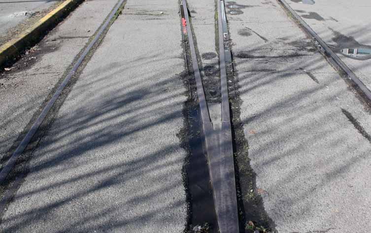
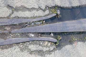
15 TIDELINES The shoreline of Seattle is a fabrication, built out with infill from San Francisco, Manila and Sydney, the sluicing of Denny Hill into the bay, the pilings for finger piers, and the mostly timber seawall that holds it all together. In remaking this shoreline, the Waterfront Seattle project will restructure the seawall and the connections between land and water. This rebuilding will both shore up the failing seawall and restore the Seattle shoreline as habitat for the teeming life of the bay and a passage for the migratory salmon that pass along its shores on their way to sea. SALISH SEA An old-sounding name of recent coinage, Salish Sea is a term that refers to an entire network of inland sea passages including the Georgia Strait, the Strait of Juan de Fuca, and Puget Sound. (Elliott Bay and its openings into Puget Sound were simply called Salt Water locally, before getting their modern names from British explorers.) The new name, derived from a word applied broadly to the peoples who first settled alongside the sea and used its waterways as trade routes, stresses the ecological interconnections between the bodies of water that compose this vast sea. LITTORAL Elliott Bay is one of the world s only biodiversity hot spots within an urban center. It boasts 234 species of fish, 105 crab and shrimp species, 26 marine mammals and 100 marine bird species. Despite the impact of decades of urban and agricultural development, extensive logging, and commercial fishing, the Bay and Puget Sound remain wondrous reserves of life. Severed connections between habitat zones (aquatic, intertidal, riparian, upland) will be restored by the new seawall and emphasized on the new waterfront. UNDERGROUND The waterfront will be reopened and reconnected to the rest of the city after the removal of the Alaskan Way Viaduct. Some of the traffic which used the viaduct will be diverted to a new tunnel running under downtown, with an entrance to the south of the central waterfront. The waterfront itself is loaded with underground services: steam tunnels, major power lines, a railroad tunnel, water mains and pipes taking storm water and treated sewage out to the bay. These various conduits for cars, power, water, freight, and heat can be unearthed, revealed, traced, or documented through art. THE TRIGGERING TOWN When thinking of art and the waterfront, one can start with Richard Hugo, Seattle s great poet, whose work addresses with particular focus the unlovely, often unloved aspects of Seattle s industrial shorelines. (His autobiography is titled The Real West Marginal Way, after the road running alongside the heavily industrialized Duwamish River, which feeds into Elliott Bay.) Hugo s collection of essays on writing poetry, The Triggering Town, should inform and supplement this Art Plan for the waterfront. Hugo wrote intelligently about the relationship between art and the redevelopment of cities, as if anticipating the increasing links between the two activities. He recognized art s ability to announce the new, ameliorate the destructive, and in the best cases, to complicate a site in a productive and provocative way. One problem for modern poets is the wholesale changes in what we see the tearing down of buildings, the development of new housing, the accelerated rate of loss of all things that can serve as visual checkpoints and sources of stability, he writes in his essay Statements of Faith. Poems and by extension, artworks can become a response to the loss of the familiar. A thoughtful redevelopment unavoidably destroys and preserves, making new things appear amidst the old. Art can work in parallel with these processes. It should not merely preserve, or represent (the past or the future), but interact amid the systems, peoples, geographies, economies, and ecologies of its site. On a site as complex as the Seattle Waterfront, art must do more than symbolize or represent these processes. It must sincerely engage them over time. 15
16 THE GEOGRAPHY OF THE WATERFRONT III 16
17 THE GEOGRAPHY OF THE WATERFRONT Art is essential to understanding, experiencing, and interpreting the environment around us. Artists use their particular point of view to create forms and experiences that can be shared with the public at a variety of levels. In this way, their work helps to concentrate, intensify, and recount the experiences and meanings people derive from a place. Geography serves as the basis for understanding the context of the waterfront and its various physical components. The unique geography of the Seattle Waterfront will be a rich source of inspiration for a range of projects, and there are numerous opportunities for embedding art and the process of artistic production into the waterfront as it transforms over time. The waterfront will not be developed all at once, but in bits and pieces, starting with the seawall. However, each project developed on the waterfront, whether temporary or permanent, must be viewed in the context of the whole and must be related to the overall vision for the site. This includes existing works of public art on the waterfront, which must be considered and integrated into the new plans for the waterfront as they develop. Envisioning art as part of the very geography of the waterfront in advance of any artwork being made requires a great leap of faith. Until works have been installed on the waterfront, or until artists are working on commissions and cultural programming, this joining together of places to create a framework for artistic production and experience will require trust in the vision of the art program and a collective act of will on the part of the city, its agents, and citizens to implement the plan s many parts. Imagination and focused determination will together create the construct in which place, geography, ideas, and practice can be fused together. This Art Plan frames geography through the following entry points: 360 DEGREE CITY A CONSTELLATION OF SITES NAVIGATION AND WAYFINDING MAPPING THE WATERFRONT 17
18 360 DEGREE CITY The term 360 Degree City is a neologism used to describe sea cities which do not rely solely upon the land mass at their backs for trade, cultural influence, and economic development. Ports open cities to the sea and in turn to trade, cultural, and material influence, and the effect of continuous exchange. These sites serve as conduits between the land and that which comes from elsewhere. They tend therefore to be open in atmosphere and character, and have an ability to grow and change. In 2008, the United Kingdom s Commission for Architecture and the Built Environment started a program called Sea Change, aiming to help regeneration in coastal areas through targeted investment in culture and heritage. Out of this program emerged a way of thinking about coastal cities that is useful in describing Seattle and its relationship to its environs. The concept of the 360 Degree City helps to illustrate why Seattle s conditions are conducive to the making of art that thrives on the city s status as a port, conduit, and agent of change. Seattle is one of the United States most vital ports, and is a prime example of the 360 Degree City it looks out as well as in. The Elliott Bay waterfront draws in influence and input, and at the same time remains centered on its circular body of water, anchored in its authenticity. The 360 Degree City creates the ideal conditions for strengthening connections internally, within the city, as well as externally, to the surrounding areas and beyond. Today, the viaduct serves the city from Elliott Bay but interrupts its function as a 360 Degree City. The demolition of the viaduct will create opportunities for restoring the connection between downtown Seattle, its waterfront, and Puget Sound. The Art Plan proposes to extend these connections in all directions beyond the edge of the Elliott Bay Seawall, and reorient Seattle around Elliott Bay to make it, once again, a dynamic 360 Degree City. The reach of 360 Degree City is not planar, it s multidimensional, and the connections that can be made between the city and its environs are multiple. The 360 Degree City has a sphere of influence and connection. The reach of the waterfront redesign extends beyond the defined borders of the project, all around Elliott Bay, to form a Bay Ring. The shape of the Bay suggests a fluidity that the streets of the city do not. It offers flexibility in the ways the waterfront might connect with other parts of the Puget Sound region and the world beyond. Informed by the function of the Port, points around the Sound could be linked by the presence of art or art programs in the wider Seattle area, vibrating out regionally, nationally, and internationally. The streets, on the other hand, rigidly define the corridors through which the waterfront can be woven back into the urban fabric. At the same time, they present opportunities for mapping, wayfinding, and interpretation that can form a narrative translated publicly through artistic engagement. The waterfront Concept Design, as described in the rest of this report, aims to develop a landscape where the patterns and textures of the water s edge are integrated and woven into the hard materials and plantings of the central waterfront and expressed through the seawall, the railing, the piers, the slips, the promenade, and the street, and tied into the urban fabric through the east side. 18
19 19
20 A CONSTELLATION OF SITES The idea of a constellation of sites suggests constituent geographical sites that add up to a larger organizational idea. The design of the waterfront weaves art opportunities with location, function, materiality, narrative, and experience to create an alternative mapping of Seattle as an urban space. Artists will be encouraged to consider their projects in the greater context of the waterfront, the design, and vision of the Working Plan for Art on the Central Seattle Waterfront. As the sites develop, opportunities for the reorientation of the city toward the waterfront will also emerge. Thinking about the waterfront as a constellation creates opportunities for artists and curators to embark on projects that connect artworks, audiences, and locations to each other as well as to the waterfront and the design concepts. Those administering the program, curating its various parts, and the artists whose voices will define new experiences for audiences, will be able to touch on the larger themes of the waterfront and create dialogues between neighboring artworks and physical aspects of the waterfront. Imagine an experiential audio tour of Seattle s Central Waterfront created by a sound artist, or a long-term series of ephemeral projects and performances that link areas of the waterfront both physically and conceptually. The process of connecting and reconnecting different parts of the waterfront s cultural program will create endless possibilities for journeys to and from the waterfront as well as to and from artworks. Together with the evolution of ideas through discussions and an array of events, those journeys can be seen as individual narratives. With the documentation of these narratives, the city will develop a navigable record of creative influences on the waterfront, while at the same time the constellations will reveal a different idea of wayfinding at various scales. Right: The potential exists for the creation of a linked matrix of art and event sites that may underpin and stimulate the concept of wayfinding, place, and identity within the city. 20
21 21
22 NAVIGATION AND WAYFINDING Wayfinding, as it is intended to be developed under the Working Plan for Art on the Central Seattle Waterfront, contributes to the means by which place and placefulness are defined and designed into the site. A wayfinding identity already exists downtown through color-coded signage, and the new waterfront wayfinding landscape will contribute to this navigation through a variety of new modes. Wayfinding need not simply be signage, though the development of clear and legible systems of orientation is critical to the process by which new environments come into being and are made navigable. Wayfinding on the waterfront offers a rich set of possibilities in terms of design, synthesis, and mark making, and the urban narratives that evolve as people make their way to and through environments. There are many opportunities for the creation of routes in and around the waterfront. These routes would be delineated to encompass the constellation of sites identified in the Art Plan, connecting existing artworks, potential sites, and newly-commissioned Core, temporary, and ongoing series-based projects. New wayfinding elements might carry fixed point, route, and destination information. This system could be deployed across the city as an early manifestation of the Art Plan in action, connecting new sites and potential sites with existing artworks and embedding them into the fabric of the city. Even a relatively rudimentary wayfinding system will grow over time in richness, meaning, and information, particularly as it is migrated onto digital platforms. This would allow those outside Seattle to see and participate in the act of finding their way across the city, connecting artworks, sites, and ideas to form new matrices of travel and art-viewing. 22
23 23
24 MAPPING THE WATERFRONT By anchoring the plan in the site s geography, mapping (in its many forms) becomes an important conceptual tool. Below are descriptions of mapped sites on the waterfront that are of particular importance to the designers and the art team. These descriptions outline possibilities for connections between site, community, and design as it relates to the Waterfront Art Plan. In the Core Commissions section of this plan, we have laid out specific commissioning models for a select group of sites. In addition to those locations, the following sites should be considered for various scales of commissioning and ongoing curatorial programming. PIONEER SQUARE HISTORIC PIERS UNION STREET WATERFRONT AQUARIUM PLAZA PIER 62/63 OVERLOOK WALK BELLTOWN BLUFF EAST-WEST STREETS ADDITIONAL FRAMEWORK SITES: BELL HARBOR BOARDWALK PIER 48 COLMAN DOCK NORTH END CONNECTIONS 24
25 Images for MH copy 10.pdf 1 22/06/ :55 Images for MH copy 4.pdf 1 13/06/ :15 Images for MH copy 8.pdf 1 13/06/2012 Images for MH copy 7.pdf 1 13:57 13/06/ :08 25


26 PIONEER SQUARE Pioneer Square, founded by settlers in 1852, was once the heart of the city and was the site of major historical events related to the growth of Seattle and its waterfront. From Yesler s Mill to the Washington Street Boat landing, and from the development of Ballast Island to confrontations between different ethnic groups over land and work, there are endless sites and stories for artists to unearth and interpret. The removal of the viaduct will reveal hidden surfaces, including a long, low façade of 19th and 20th century buildings that will alter the visual makeup of Pioneer Square from both water and land. The design proposes the creation of a beach that will reveal the ebb and flow of the tides along it. As part of the seawall project, natural beach ecologies will be created through planting of native flora and placing of boulders that evoke glacial deposition along the waterfront promenade. The Washington Street boat landing will be restored and returned to its current site on Washington Street. Alaskan Way is wide at this end of the waterfront, but there is also a wide median that could provide a site for artistic intervention. 26


27 HISTORIC PIERS Seattle s historic piers create an atmosphere of entertainment, food, and fun along the waterfront and provide many opportunities for art interventions. The ends of the piers could be repurposed as exhibition spaces, or the existing vernacular of kiosks and shops could be expanded to include art events and installations. The space between the piers will be redesigned to reorient and re-center the water between them, offering small public plazas that can host small-scale performances and art events. This part of the waterfront is where the Tideline promenade is most developed, with furnishings, plants, storm water, lighting, and signage all brought together to express tides, change, ebb and flow, scores, and markings. The tidelines mark time, the sun and moon cycles, seasons ( King Tides in winter), tidal datums, and sea level trends. The waterfront design team is working to integrate both horizontal and vertical registrations of the tides into the design of the waterfront, and will mark common effects of the tides such as deposition, coloration of surfaces, and response to topographical changes. 27


28 UNION STREET WATERFRONT The Union Street Pier will become an arena for gatherings and entertainment of all kinds. It will present opportunities to commission and install art or conduct art projects that run over time. It will also provide context for the development of new narratives for the waterfront or the archiving of the waterfront in its various states of use. A water feature will be integrated into the plaza, and allow for changing conditions of fog, water, and dryness to echo or offset the weather. The Seattle Aquarium exhibits can be viewed from here. The design allows for a canoe and kayak launch on the edge of the overlook. + Western Post A 28


29 AQUARIUM PLAZA The Seattle Aquarium is an existing family draw to the central part of the waterfront. Art projects in and around the Aquarium will provide an extraordinary opportunity for artists to engage in collaborations with other trades. In front of the aquarium, the new Elliott Bay seawall will be revealed. The Elliott Bay Seawall design team is working to help restore the area around the seawall and create a more bio-positive environment. The desire to promote and display marine life at the actual site itself could be a great source of inspiration to artists. 29


30 PIER 62/63 Pier 62/63 is currently an open pier. It served as a concert venue in the past, and the city would like to use it again for art programming and events. The shape of the pier will be reworked to align with a new Overlook Walk that will link it to the Pike Place Market up the hill. It will include a grandstand that will allow views south over the water, a kayak launch to the north that will link it to Bell Harbor, a skating rink, and furnishings. 30


31 OVERLOOK WALK The Overlook Walk will link Pier 62/63 and the Aquarium on the waterfront to the Pike Place Market up the hill by bridging over Alaskan Way and providing elevated views of Elliott Bay. It will include grand steps overlooking Pier 62/63, as well as a folding promenade from the Pike Place Market to the waterfront with seating, plantings, and views all around. There will be multiple opportunities here to create art related to the Market, the Train Overlook, the Play Course, the South Overlook, the Amphitheatre Steps and the Fix-Madore Plaza, as well as through all the landscape elements and related buildings. In addition, the Overlook Walk acts as a gateway to and from the waterfront, since Alaskan Way and Elliott Way converge at this location and are framed by it. Western Ave Post Alley


32 BELLTOWN BLUFF Belltown Bluff comprises a number of discrete sites connected by Elliott Avenue in response to the topography of the site. The opportunities for coherent programming across the bluff are limited, but there are a number of places where new perspectives on the waterfront emerge, and these lend themselves to artist interventions. Garage facades and the back of the condominium buildings, which will be in full view from the train overlook, present great surfaces for projections and ephemeral art. The Blanchard Street overlook and its views of Elliott Bay between tall buildings provide another opportunity for artistic intervention. New building sites identified in Belltown could be devoted to artist studios or live/work spaces. The Belltown public garden is another potential art site. + 32

33 3rd Ave EAST WEST STREETS EAST WEST STREETS The east-west streets connect the Central Waterfront to important neighborhoods and existing art institutions within those neighborhoods. The improvements planned on some of the east-west streets described in the Concept Design volume of this Report will provide opportunities for linking art to specific neighborhoods east of the waterfront. South Main Street and South Washington Street link the waterfront to Pioneer Square; Marion Street, Seneca Street and Union Street link it to West Edge and Downtown Seattle; Bell Street links it to Belltown. Finally, Broad street links the waterfront to Seattle Center. These streets could become sites of an artwork, or projects that reflect the larger themes in the design and lead people to and from the city s art institutions and the waterfront. The range of perspectives, from elevated to ground level, could be dramatic in scale and experience, and should be considered for early core commissioning opportunitites. Clay St Cedar St Vine St Wall St Battery St Bell St Blanchard St Elliott Ave 1st Ave 2nd Ave Lenora St Western Ave Virginia St Stewart St Pine St Pike St Western Ave 1st Ave 2nd Ave 3rd Ave Union St Seneca St Spring St Madison St Marion St Columbia St Cherry St James St Yesler Way S Washington St S Jackson St S King St 33


34 FRAMEWORK SITE: BELL HARBOR BOARDWALK The Bell Harbor Boardwalk is a promenade that constitutes a programmable venue overlooking the calm waters of the marina at Bell Harbor. With its relationship to the Overlook Walk, the Bell Harbor Boardwalk could be programmed in a number of ways, or could provide artists with the opportunity to respond to its linearity, materiality, and proximity to the water. E Wes 34


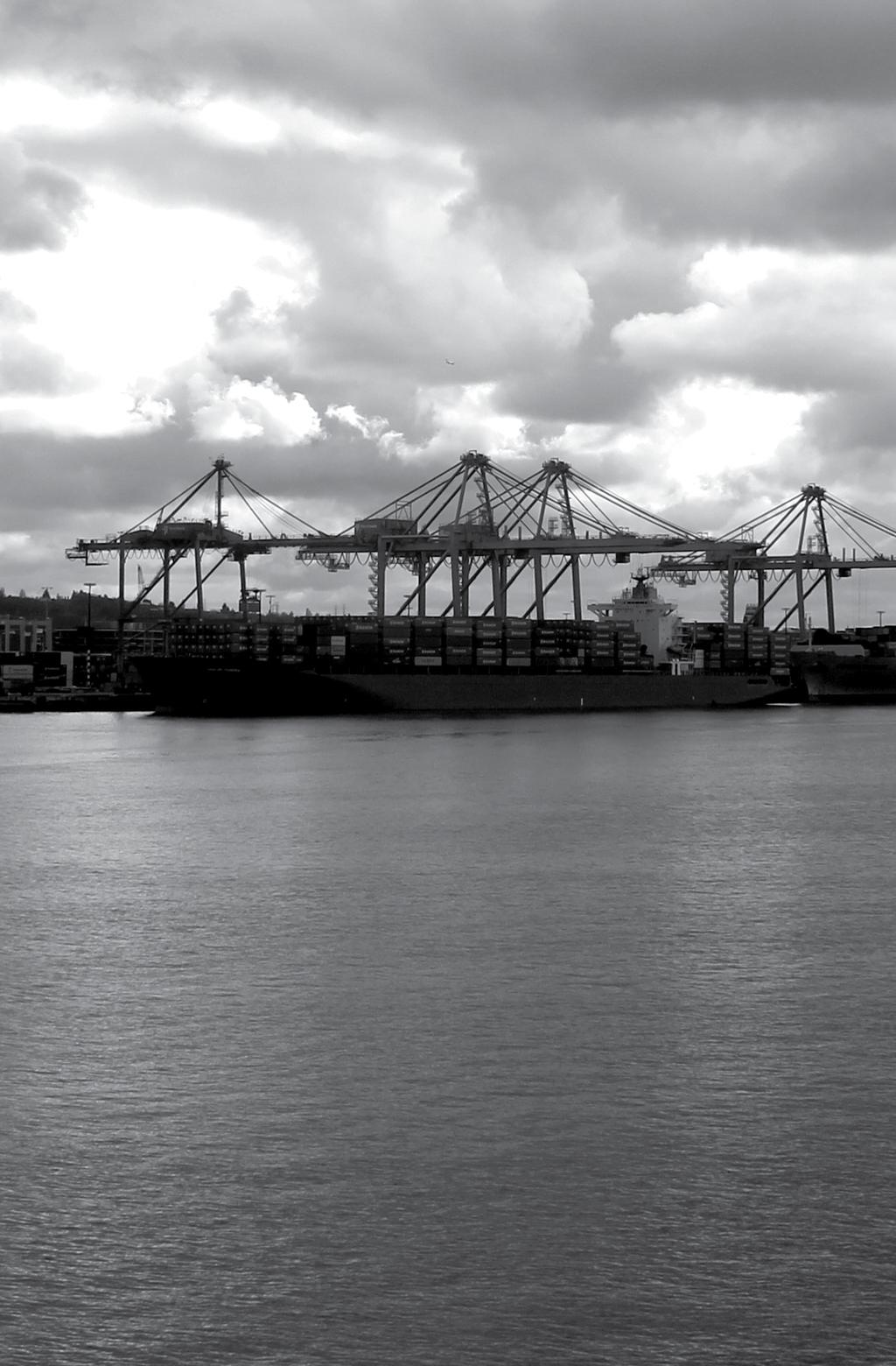
35 FRAMEWORK SITE: PIER 48 Pier 48 is a large, unused space that would present a range of opportunities for artist projects, if opened to the public. The views of the Bay and the Olympic Mountains are spectacular, as the axis along Main Street continues straight to the end of the Pier and on to the horizon. At the same time, proximity to the Port of Seattle and its gigantic cranes, multicolored shipping containers, and commercial ships make this site an ideal one for telling stories of import and export, the local and the global, and Seattle s relationship to the world beyond. Opportunities for events and performances are numerous, as the design creates a large amphitheater at the end of Pier 48. People will be able to gather for all manner of public events and performances, making the waterfront a major cultural draw for the city s inhabitants and visitors to Downtown Seattle. The Pier also offers the opportunity for the curation and commissioning of art events, static installations, and experiences. The design proposes uncovering parts of the pier to reveal the pilings below. A new pier walk will show tidal changes registered on the pilings, as the light below the pier is reflected off the water s surface. Art sites on Pier 48 can draw on the pier s axial connection to Main Street and Pioneer Square, rooting new artworks in the neighborhood s existing art community as well as the International District


36 FRAMEWORK SITE: COLMAN DOCK Colman Dock was designed to be a beacon of the waterfront, with a large clock tower that was once aligned with Smith Tower, further inland. Today, the clock tower is gone, but Colman Dock remains the primary ferry connection between communities around Puget Sound and Downtown Seattle. The high volume of ferry passengers creates continuous passing trade and heavy footfall, which constitute good conditions for permanent artworks, as well as for a changing program of art and art events. The existing pedestrian Marion Street Bridge will be replaced and could be an opportunity to create a gateway to the waterfront. The street frontage will be sheltered from the weather by canopies and offers an opportunity for small art events and temporary exhibitions. + 36


37 FRAMEWORK SITE: THE NORTH END THE NORTH END The North End is a linear site that links the Central Waterfront to the Olympic Sculpture Park. The Olympic Sculpture Park is and will remain one of the most important sites for art on the waterfront. The North End also passes through Bell Harbor with all its marina and cruise ship activities. The North End terminates at Broad Street, where Lake-to-Bay Trail and the Bay Ring merge. Broad Street links the waterfront inland to Seattle Center a hub of artistic production in Seattle. When the waterfront design is completed, the North End could become a place where art projects bring these relationships together and create connections between the waterfront and key cultural organizations in the area. + 37
38 A WATERFRONT PROGRAM FOR TODAY AND TOMORROW IV 38
39 A FRAMEWORK FOR ADMINISTERING THE CULTURAL VISION FOR THE WATERFRONT The waterfront is a unique, dynamic, and important site for Seattle and the region, and the art program based on its shores should match it in ambition. What a waterfront cultural program looks like will evolve along with the site, while remaining firmly anchored in vision of this Art Plan and the rich legacy of public art in Seattle. It is imperative that the cultural program on the waterfront be visionary in its curatorial approach, lean in its administration, and partnershipdriven. It must also have a diverse group of programs that includes permanent and temporary commissions, lectures and events, artist residencies, and publications. This will ensure that art on the waterfront responds not only to the conditions of the site, but also to the current landscape of artistic production nationally and internationally. By providing multiple programmatic platforms, the Art Plan ensures that artists and audiences will have a continued and evolving relationship with the site. For art on the waterfront to be both groundbreaking in the field and of its time and place, it must be guided by a confident vision, and paired with a robust administrative support system. The program should be artist-driven and audience-minded, and it should not prescribe a single working method for artists to adhere to, or for audiences to approach the site. Instead, the cultural program will present a multiplicity of opportunities for artists and the public to define new relationships to this place. The vision of this Art Plan is rooted in the principle that through the production of new art on the waterfront, discovery, innovation, and collaborative discourse become the daily dialog and identity of this place. The city should support the dedication of a focused cultural steward to oversee a program of this physical, conceptual, and monetary scale. In the immediate future, as Percent for Art funds guide commissioning on the site, the city should consider creating a new position to implement the plan s vision, shepherd the curatorial vision and administrative needs for early core Percent for Art commissions, advise the city on cultural policy on the waterfront, and support events, residencies and ongoing artistic programming in the early years of the waterfront s transformation. This new waterfront art manager will work closely with the design team and the cultural community of Seattle, and will act as the point person for a waterfront arts program within the city during planning and construction. As the waterfront moves forward, an independent cultural organization should take shape to support the realization of the long-term and ongoing goals outlined in this plan. An independent body can draw on local, national, and international partnerships, develop programs from a wide range of funding sources, provide a succinct public message for an evolving waterfront arts program, and support new cultural activity on the waterfront that continues long after the capital projects are completed. Working alongside the city and other waterfront constituencies, this organization can carry the torch of arts programming on the site for generations. 39
40 CORE COMMISSIONS This section contains proposals for early commissions to be realized under the City of Seattle Percent for Art Program, administered by the Seattle Office of Arts and Cultural Affairs. These proposals are intended as models for how future art commissions on the Seattle Waterfront might be realized. Particular focus is placed on the intersections of design, art, and place, on the ecology of Elliott Bay, and on the realities of a working port. In line with the working vision of the plan, several projects include calls for public talks, exhibitions of proposals, residencies, and other forms of exchange preceding or accompanying the commissioning and realization of art works for the site. The projects highlight and foster opportunities for artists to work with collaborators from other disciplines, and from significant institutions on the waterfront. The methodologies express a strong curatorial orientation, with the goal of ensuring a focused, thoughtful, well-contextualized program that contributes to the identity of the Central Seattle Waterfront and the legacy of public art in Seattle. The new Central Seattle Waterfront should not merely be seen as a destination for art works but as an active site for the production of new art and ideas. 40
41 41
42 PIER 62/63 Pier 62/63 is an iconic site on the Seattle Waterfront. It has been home to groundbreaking musical performances, events, and commissions of public artwork. The terminus of Pier 62/63 embodies the richness of the entire waterfront site, and its views, ecological features, and entertainment and recreational uses ensure an engaged and active audience. It offers a panoramic view of Seattle s port operations at Harbor Island and on piers to the north, underscoring the various forms of global exchange supported on the waterfront. On the site of the historic industrial waterfront, Pier 62/63 facilitates an appreciation of the beauty of the aquatic environment when looking out, and the grandeur of the Seattle skyline when looking back to the city. This site is perhaps the premier location in the Waterfront Seattle design, and it necessitates a great work of global significance. A sense of place is derived from many factors other than geography. In the same way that significant natural features, critical historical events, or past functions construct and solidify spatial identity, so too can works of art contribute to the identity of a place. Large-scale commissions have the extraordinary potential to be vital signposts. An ambitious commission is well within the scope of Waterfront Seattle, alongside artworks of a diverse variety of scales, budgets, durations, and media. The commission will respond to the same conditions that all artwork on the waterfront must: sensitivity to the waterfront design, knowledge of the history and ecology of the site, and fluency in the concerns and interests of the Seattle community. The artist should be selected from an international list of significant, accomplished artists who can work at a civic scale. A long working relationship with the selected artist would bring them into frequent contact with students, the cultural community, and the public. Early Estimated Budget Design and Construction $750, million Potential Partners Dependent on concept of project proposal HIGH AND LOW ECOLOGY, ECONOMY & COMMUNITY WAYFINDING 42
43 43
44 THE TIDELINE PROMENADE AND SEAWALL The Tideline Promenade extends 2.5 miles along the shores of Elliott Bay. It provides a unique pedestrian experience, contrasting the urban development of the city and the working industrial waterfront with spectacular views of big nature mountains, islands, and the bay. The edge of the waterfront has moved significantly over the years and continues to shift to this day with the Elliott Bay Seawall Project. At the same time, the tides continually rise and fall about 11 feet, making this waterfront a dynamic land-water threshold. The tides leave marks, or tidelines, visible everywhere: driftwood deposited on beaches, barnacles on pier pilings, and marine life on seawalls. The rhythm of the tides persists through the transformations of the waterfront and marks the relationship between land and sea. Topography extends the tidelines upland along walls, steep slopes, steps, and terraces, creating patterns that mark changes in elevation. As horizontal deposition and vertical registration, the tidelines create a design vocabulary that interlaces the waterfront with the ebb and flow of the tides to the west and the journeys uphill to the east, tying together the design over the entire length of the waterfront. The rhythm of the tidelines provides a meter for the organization of design elements such as paving, furnishings, plantings, and signage. The Elliott Bay Seawall team and the Waterfront Seattle team are working to help restore the waterfront and its seawall in ways that will create a more bio-positive environment. The seawall, with its connections to waterfront sites like Aquarium Plaza and its relationship to the tidelines theme that runs through Waterfront Seattle s design, offers artists opportunities to participate in the conceptual framework and physical impact of the design of the waterfront itself. For this commission(s), an artist or artists will work alongside the seawall and waterfront design teams, embedded in the research and design process as the site plan develops. In a sense, the design issues already dictate many of the terms of the artwork, and a project about the seawall will be related to listening, exploring, and responding to the site and its ecology and history. Once an artist(s) is selected, they will work as an embedded member of the design teams over an extended period of time to realize a vision for the seawall and Tidelines design. Working in consultation with the seawall design team artist, the selected artist will identify sites along the extent of the seawall, as well as related upland sites, for their own projects, as the seawall design team artist develops sites for other artworks. As embedded artists, they will also interface with the public throughout the project s lifespan and contribute to the larger discussion of science and biodiversity around the site. The Tideline Promenade/Seawall project will also contribute an enormous amount of research and documentation to the archive of the site and to the historical record of the waterfront s transformation. 360 DEGREE CITY BAY RING TIDELINES LITTORAL Early Estimated Budget To draw from the seawall construction budget, with a range to be determined Potential Partners The Seattle Aquarium Seattle area hatcheries National Fish Habitat Partnership The Nature Conservancy Natural Resources Defense Council The University of Washington School of Oceanography Pacific Science Center Woodland Park Zoo Audubon Society The Bullitt Foundation Sierra Club National Oceanic and Atmospheric Administration Port of Seattle Scientists, students, and scholars 44

45 Pine St Pike St Union St Seneca St Spring St Madison St Marion St Columbia St Cherry St James St Elliott Ave Western Ave Western Ave 1st Ave Bell St Battery St Clay St 1st Ave 2nd Ave 2nd Ave 3rd Ave Wall St Vine St Cedar St Blanchard St 3rd Ave Virginia St Lenora St Y Stewart St 45
46 VIADUCT DEMOLITION The demolition of the Alaskan Way Viaduct and reconstruction of the waterfront has fascinated a broad swath of the population. The scale of the destruction is awesome to imagine, as is the vast amount of people power that will be required in such a significant transformation of urban space. The public presence and enthusiasm around the initial dismantling of sections of the viaduct took many by surprise. What to do with the viaduct material is a question of great interest. An open call for suggestions as to how to best use the viaduct debris will give space to this important public dialog and generate an exhibition project which could lead to new solutions. Proposals should address the viaduct as a site in transition, and reflect on ways the physical material of the viaduct demolition should be disposed of, archived, or transformed in some way in public space. Artists, architects, designers, or anyone with innovative ideas on the subject are welcome to generate proposals. While proposals can be practical and strive for realistic implementation, others might be purely discursive or even fantastical. A formal and structured proposal protocol would assure that the material is delivered in a format suitable for exhibition, including a textual component, renderings, and an option for a model. This project is meant to be extremely generous, good-natured, and even humorous in nature an exercise in public brainstorming. The open call for ideas would result in an exhibition of proposals. The exhibition could be held in a civic gallery, other city-owned space, or at a partner institution. Proposals may lead to a commission, either through city funds or through other funding models and partnerships. However, the entire call and exhibition endeavor may not result in a viable project. This result would not be considered a failure. This exhibition and open call event has great promise as an early project and presents numerous partnership opportunities with media organizations and online forums. While the primary focus of the endeavor is a discursive, communitybuilding program, an inventive solution to use the viaduct rubble could feasibly develop from the process. Potential Partners CleanScapes Seattle Public Utilities Construction Materials Recycling Association BALLAST MOON ISLAND THE LITTLE CROSSING-OVER PLACE TRANSFORMER 46
47 47
48 OVERLOOK WALK (PLAYGROUND) The Overlook Walk creates a strong connection between downtown and the central waterfront, negotiating a vertical transition of some 100 feet via gently graded terraces. More than a pathway, the site is itself a destination, offering views, food and drink, and activities. Play areas are called for in the Concept Design, set on steeply graded areas along the Overlook Walk. The sites provide an excellent opportunity to rethink conventional play structures, and art provides historic examples that could inspire contemporary projects. Japanese artist and landscape architect Isamu Noguchi designed several play structures for New York City between 1940 and His designs which were never built related to their setting in specific landscapes, drawing from his idea that the frontiers of sculpture might open up by relating it to the land and to real walkable space. Noguchi continued to pursue this approach in his sculptural landscape designs, while his ideas for play structures inspired a generation of post-war landscape architects. Since then, the imaginative possibilities of playground design have been little explored. The Overlook Walk offers an opportunity for productive collaborations between disciplines. Artists, educators, urbanists, psychologists, architects, and sociologists should explore the nature of play and of built environments that inspire and challenge children. Today, in part because of the growing models of art and social practice methodologies, there is a renewed enthusiasm for such collaborations. This commission will proceed by first developing a colloquium on play and playgrounds. Experts in play and playground history as well as educators, playground designers, landscape architects, and artists will be invited to give presentations and participate in discussions. This could be organized through the Office of Arts and Cultural Affairs, or through the talk series proposed later in this plan, in collaboration with a partner waterfront institution. Integral to the conference would be a group of artists (four to six) invited to participate. This event would be open to the public, providing insight into the research stage of an art commission and providing an informed foundation for artists and audiences on the waterfront theme. Artists will be given site tours and be provided with information on the site s current framework by the design team. The selected artist or artist team will be expected to work closely with the design team in the Final Design phase of the waterfront development. Once an artist is selected, he will set up a protocol to work directly with the design team on the integration of his work into the site. The site will offer a set of potential play spaces of differing scales and locations, suitable for children of various ages. It is thus possible that a series of artistdesigned play spaces can emerge on the site. THINK TANK SKID TIDELINES ROAD Early Estimated Budget Conference: $15,000 Proposals: $15,000 Design and Construction: $400,000 Potential Partners Seattle Aquarium Seattle Art Museum The Children s Museum Pacific Science Center Alliance for Childhood Ryther Child Center The Children s Environments Research Group, Center for Human Environments, Graduate Center of the City University of New York Area schools Architecture firms/ A.I.A. Seattle Alliance for Childhood 48

49 Western Ave Post Alley
50 OVERLOOK WALK (GARDENS) Plans for the Overlook Walk call for garden space of ample scale. This space, or a significant portion of it, could be a programmed garden in which artists develop new garden concepts for each growing season. The Overlook Walk s proximity to the Pike Place Market, and the wide range of resources in the city related to horticulture, landscape design, and food production, make the site an ideal location for artist-driven garden projects. These projects might address issues including food production and its politics, technological and habitat issues, histories of landscape as an engine of social reform, and garden aesthetics and theory. Each year, a garden commission will be awarded and commissions will be selected from among a broad set of artists working on gardens, ecological issues, and food production. For early Overlook Walk garden commissions, a direct commissioning model should be implemented. The curatorial process should be led by the waterfront art manager, working with the design team, and potential partner organizations. This model is necessary to set up process protocols and garden infrastructure, and for artists to work directly with the design team to develop a flexible space for such commissions. Artists will also work directly with landscape architects and horticulture specialists. As the project anchors itself through these early commissions, it can evolve into focused public requests for proposals in later years. The production and maintenance of the garden program should be done in partnership with local gardening groups, students, others in the art community, and the general public. It will also be an ideal program for which to develop ongoing educational initiatives, inviting experts from across the fields of gardening, landscape design and history, and food production to participate in talks, tours, and classes. The garden program lends itself to the development of field guides, texts on the history of regional horticulture, and an online archive of projects and plant species. Early Estimated Budget $30,000-50,000 annually LITTORAL ECOLOGY, ECONOMY & COMMUNITY Potential Partners Northwest Horticulture Society The Seattle Parks Department Seattle Tilth Seattle Parks Foundation The Bullitt Foundation University of Washington, Washington Park Arboretum and the Center for Urban Horticulture Forterra Weyerhaeuser Volunteer Park Conservancy Private and community gardens 50
51 Western Ave Post Alley
52 OVERLOOK WALK (TRAIN OVERLOOK) There are a number of sites identified in the Waterfront Seattle plan that provide opportunities for the development of interactive public spaces based around spectacular views. One such space is the BNSF Train Overlook on the Overlook Walk at the Elliot Avenue sidewalk, which allows for exciting views of the truly impressive rail traffic as it snakes through the heart of the city. As a site for art, the location lends itself to meditation on the importance of rail as characteristic of the working harbor and its labor history, while also reinforcing the notion of the harbor as a hub of global commerce and exchange. In order to consider such a complex topic, a project that incorporates a time-based experience could be appropriate. For this reason a sound work, social space, or time-based media project should be considered. Five artists working in these areas should be selected to develop proposals for a social space for the Train Overlook on the Overlook Walk. A multi-commission program that could unfold on an annual or semi-annual basis might also be considered, depending on city resources and staffing capacity. This would allow for the realization of multiple approaches to the site, and an array of experiences for audiences. It also considers collaborations between artists of different media for example, sound artists working alongside sculptors, or light artists working alongside sound artists. Early Estimated Budget Proposals: $15,000 Design and construction: $75,000 $200,000 per project Potential Partners Seattle Art Museum Historians and scholars The music community The general public ECOLOGY, ECONOMY WORKING & COMMUNITY WATERFRONT 52
53 53
54 OVERLOOK WALK (UNDERPASS/GATEWAY) One of the most challenging sites for a major art commission is the Overlook Walk Underpass. However, this site also has great potential for a wide variety of possible art forms and media, from sound or light works to projection, tile, and mural-scale painting. This site is located underneath the Overlook Walk, thereby protecting it from weather and allowing for more delicate artworks that might not be condusive to the elements of other outdoor locations. It is well lit, providing direct links to Building B to the east, that provides access to the upper levels and Pike Place Market, and Building C to the west, which will be occupied by the aquarium and aquarium-related activities. The Overlook Walk Underpass is thought of in the design as a gateway to and from the waterfront and Belltown, providing opportunities to approach the site from this gateway perspective, in a similar way to the Marion Street Bridge. For this project we suggest an open request for qualifications. Several artists should be selected and commissioned to make proposals for the site. The site profile should also include a discussion of the problems of maintenance and installation. The scale of the work encouraged should be significant and the project should approach the site as a totality. The selected artist will be expected to work closely with the waterfront team to produce a work complementary to the overall goals of the Overlook Walk section of the Waterfront Seattle design. Since the site is a new one, and not obviously bound by the conditions that characterize the other core waterfront locations, casting a broad net could produce unexpected solutions for the underpass situation. Estimated Budget TBD: dependent on proposal selected and site funding available Potential Partners Seattle Art Museum The music community The Experience Music Project LITTLE CROSSING- OVER UNDERGROUND PLACE 54

55 Western Ave Post Alley
56 ONGOING CULTURAL PROGRAMMING Although many projects are years away, there are numerous opportunities to engage artists and the people of Seattle immediately in art and culture on the waterfront site. Artists will be key participants in the waterfront s present and future articulation. The programs recommended in this section can be as large or small as resources dictate, and they are flexible in their location, administration, and timelines. Projects should link together under a unified voice, yet make room for the inclusion of many perspectives. In many ways, these projects are not just anchors for an early program but the testing ground on which the waterfront art program will be refined and developed through public input from the people of Seattle. 56
57 TEMPORARY PROJECTS The waterfront will be an active site for the commissioning of temporary projects and performances. Given the ever-changing nature of the waterfront, temporary projects provide plentiful opportunities for new commissions, and present myriad possibilities for artists to respond directly to the site. Temporary commissions of all scales can shape an ongoing and engaged experience for audiences on the waterfront. These projects also create dynamic partnership opportunities with civic agencies, nonprofit groups, and community organizations. The waterfront art manager may produce a project directly, but will also act as a support to a city or institutional partner in the production of a project. These projects may include, but are not limited to: physical commissions installed on a particular site or sites sound, light, and video projects one-time and ongoing performances film screenings concerts and music events 57
58 TALKS A lecture program provides the opportunity for artists, cultural producers, and audiences to have a direct relationship with each other. By bringing people together to discuss issues of artistic production around the waterfront, new ideas will develop, new partnerships will be made, and future projects will be fostered. Although a waterfront arts organization will not have a physical location for years, this plan proposes that a series of regularly-organized talks at off-site locations begin immediately. A discussion series can be low-resource yet high-impact, achieving broad reach through partnerships with other local institutions. Lecturers may include artists, curators, historians, scientists, arts administrators, city representatives, engineers, architects, and others, and should provide an in-depth look at the variety of issues facing the waterfront during this transformative moment in its history. These talks should also set the stage for growing partnerships locally, nationally, and internationally between the art program and other organizations. The artistic program for the waterfront should be a jumping-off point for discussion around cultural issues, developing ongoing events that keep the public engaged with the waterfront as a center for cultural production and exploration. Events are key in providing the context for commissions and residencies, and will provide an important forum for discussing the waterfront s many layers during this pivotal moment in its history. These events can be both large and small, and can include artist discussions, lectures, film screenings, site tours, educational programs, festivals, food-based gatherings, and music and dance performances. It is critical that all of these events tie back to the waterfront as a site of ecology, economy, and community, as well as provide the public new ways to engage in the larger dialogue of this place. Events also provide an extraordinary opportunity for public, private, and institutional partnerships and should include artists as well as other cultural producers, scholars, and experts from the many fields that intersect at the waterfront. 58
59 RESIDENCY The conceptual heart of the Working Plan for Art on the Central Seattle Waterfront is Seattle s legacy as a working waterfront, and it is key that an art program on the waterfront reflects this history. Artists must be able to not only respond to the site, but also actively produce new work on the shores of Elliott Bay. Production will be the foundation of the waterfront art program, and waterfront artist residencies will be firmly rooted in this idea of waterfront as think tank. They will give artists the opportunity to work directly with experts in other fields on the creation of new work, or the development of new ideas that expand on and transcend artists individual practices. By working with other disciplines, art has the power to directly engage in the larger cultural and political framework of Seattle. Beginning as a virtual research center during the period when the waterfront is in transition, the residency program will use the site as a springboard for artistic investigation. As the art program grows, a future waterfront arts organization can provide the space and the resources for all fields to come together, under the umbrella of art, to push the boundaries of how we think, live, and interact with each other. This independent programming body will work with artists to set up introductions, conversations, and opportunities for cross-disciplinary investigations. It will also act as a direct interface between the artist and the public, providing rich opportunities for waterfront audiences to be directly involved in the production of new work. In the future, the waterfront residency program should be firmly anchored on the waterfront in its own physical structure that will include production and research space for residents, exhibition and presentation space, and living space for residents from outside Seattle. However, the lack of physical space at this stage should not limit production from occurring on the waterfront right away. In fact, a residency program on the waterfront that is up-and-running during the transition period is key in providing artists voices on the site now, as the redevelopment of the waterfront progresses. 59
60 ARCHIVE AND PUBLICATION As the waterfront approaches this pivotal moment in its history, there is an extraordinary opportunity for archiving the transformation of the site and reflecting on its past, present, and future. As an early project, this plan proposes the development of an archive for cultural production on the Central Seattle Waterfront. This archive will include information about artists, research materials from commissions and residencies, design information as it progresses in the coming years, documentation of events, lectures, and performances, film and video about the history of the site, and any other materials relevant to cultural history and life on the waterfront. The archiving process should start immediately, so as to record any information already in development. It can be small at the start, but will eventually grow into an extensive and valuable resource for the people of Seattle, future artists who may engage with the site, and scholars researching the waterfront. The archive should have both a physical and virtual presence, working toward an online access point with which the world can engage. 60
61 61
62 GOING FORWARD V 62
63 GOING FORWARD The waterfront art program is just one element of the complex and ambitious waterfront redevelopment. What is most important is that all programs provide a vehicle for groundbreaking cultural production. In the introduction for the Seattle Department of Transportation (SDOT) art plan, developed during his residency in 2005, Daniel Mihalyo quotes Jane Jacobs influential book The Death and Life of Great American Cities: The main thing governments must do to foster creativity is remove barriers to creative people. In this spirit, the Art Plan seeks to provide as many vehicles as possible for artistic dialogue and production. The waterfront will become the center of a robust program that utilizes the resources of civic, nonprofit, and private partnerships to create the maximum number of opportunities for people in Seattle and beyond to experience the cultural richness of the Seattle Waterfront. This program is not possible without the dedication of many, and the Art Plan proposes that those responsible for its varied parts proceed in the following ways: CITY AGENCIES A FUTURE WATERFRONT ARTS ORGANIZATION AND NONPROFIT CULTURAL PARTNERS OTHER POSSIBLE PARTNERS 63
64 CITY AGENCIES Long-term commissions include projects developed during the waterfront s construction that will be integrated into the design of particular sites. These projects will be administered by the Office of Arts and Cultural Affairs, and funded through Percent for Art funds generated by capital projects of city departments, including SDOT, Parks, Seattle Public Utilities, and City Light. Beyond the Core Projects proposed in section IV, the city may develop further permanent projects for the waterfront, and develop other programs (talks, residencies, events) as funding and Percent for Art conditions allow. The city should work in partnership with the design team, other organizations, and funders to support rich cultural activity on the waterfront. City agencies can also support the development of cultural activity on the waterfront by considering the impact of zoning, housing funds, development of city land, and nightlife policies. The city should work with all partners to assure the new public spaces developed on the waterfront support the production of live performances, looking at technical, logistical, and safety issues required to support performers and audiences in the spaces devoted to such uses. 64
65 A FUTURE WATERFRONT ARTS ORGANIZATION AND NONPROFIT CULTURAL PARTNERS The foundation laid by the waterfront art vision can also support the emergence of a new organization, one that will continue to present arts programming on the waterfront after construction is complete and Percent for Art Core Projects launched. This programming body should be curatorially focused in its mission, nimble in its administration, and adaptive to its current resources and landscape. Most importantly, it should always provide a means for artists and audiences to experience the waterfront through the lens of art. Although the waterfront art program encompasses large programmatic goals, it need not be large in scale to realize its vision. Eventually, the art program will need to grow in size and independence in order to make it a sustainable organization that fosters art on the waterfront through commissions, events, and residencies. The waterfront art program will grow out of the design process evolving into an independent model in the long term and work with public, private, community, and nonprofit partners to realize a focused and ever-evolving program. This will allow a waterfront arts group to diversify its funding options, develop projects of varying scales, and reach the many audiences that engage with the site. A waterfront arts organization will have the ability to partner with other organizations locally, nationally, and internationally. This will be key to its success, as partnerships are the backbone of successful public practice. The waterfront s residency program, as well as its events and commissions, will certainly be produced in partnership with other organizations allowing all parties to share economic, physical, personnel, and marketing resources to produce the most impactful projects possible. As a hub of cultural activity on the waterfront, the waterfront arts organization should regularly partner on cultural projects presented by other organizations. This will include projects on site, as well as lectures and events related to the waterfront offsite. Partnership opportunities may include: Co-hosting lectures and events both on and off site Co-presenting commissions on site, including providing the infrastructure to support artists on the production of new work Incubating project development as a starting point for possible offsite exhibitions related to an artist s work on the waterfront Co-producing publications Partnering with universities and schools on academic programs on site and in the classroom Partnering with organizations to provide production facilities and living quarters for waterfront artist residents Partnering with exhibition spaces to display parts of the waterfront s art archive, and exhibit work about the waterfront and its history 65
66 OTHER POSSIBLE PARTNERS In addition to working with its civic and nonprofit arts colleagues, the waterfront arts program can partner with community groups, schools, non-arts nonprofit organizations, and private entities. Through commissions, events, and artists residencies, a multiplicity of fields will engage in the defining of culture on the waterfront. Partnerships of all kinds allow artists to explore new ideas and provide the waterfront arts program with exposure to new audiences and participants. 66
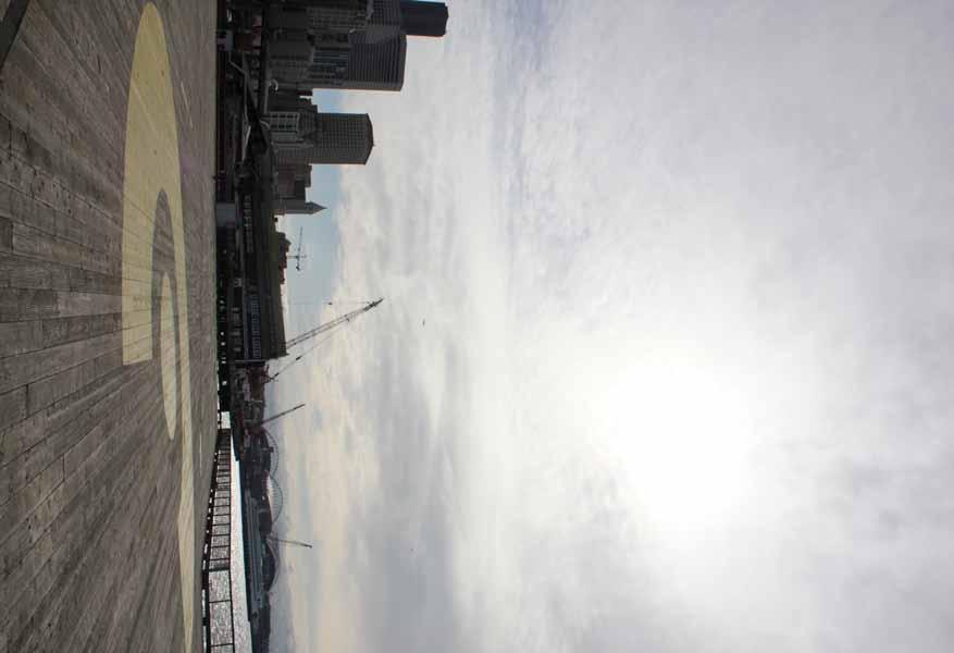
67 67
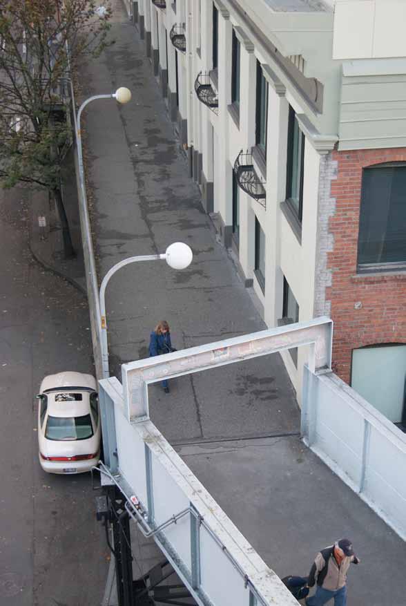
68 68
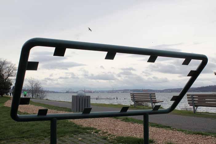
69 69
70 NEXT STEPS: WATERFRONT CULTURAL PROGRAMMING TIMELINE VI 70
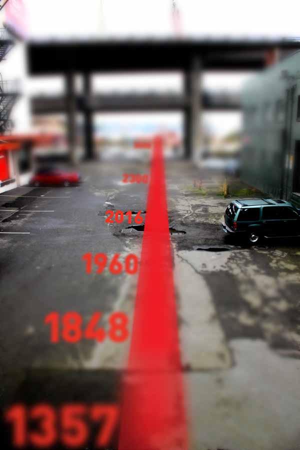
71 71
1.1 WATERFRONT SEATTLE
 1.1 WATERFRONT SEATTLE Over the past few years, the City of has been actively re-imagining the future of its Central Waterfront. The imminent replacement of the Elliott Bay Seawall and removal of the Alaskan
TREASURE ISLAND PHASE ONE PROJECTS PUBLIC ART PROJECT OUTLINE
 TREASURE ISLAND PHASE ONE PROJECTS PUBLIC ART PROJECT OUTLINE BACKGROUND (DEVELOPMENT PROJECT OVERVIEW) The Treasure Island Development is an approved 405-acre redevelopment project on Treasure Island
REDMOND CENTRAL CONNECTOR ART & DESIGN MASTER PLAN
 REDMOND CENTRAL CONNECTOR ART & DESIGN MASTER PLAN Redmond Central Connector Master Plan design principles principles make it redmond: past, present, future not just a place with art, a place that is art
Public Art Plan. We have elected to submit Public Art Plans before or concurrently with the CSP Submittal per the FDP Manual
 Public Art Plan The intent of the Horizon Uptown Public Arts Program is to create great places that engage the community and leverage the neighborhood development and economic vitality. The Horizon Uptown
PORT OF VANCOUVER WATERFRONT DEVELOPMENT. Concept Development Plan City Center Redevelopment Authority April 20, 2017
 PORT OF VANCOUVER WATERFRONT DEVELOPMENT Concept Development Plan City Center Redevelopment Authority April 20, 2017 Port History PORT ESTABLISHED 1912 TERMINAL 1 ACQUIRED 1925 GWM SIGNS LEASE 1935 HARBOR
Call for Artists for: Design and Construction of Environmental Art Activation Story Mill Community Park, Bozeman, MT
 Call for Artists for: Design and Construction of Environmental Art Activation Story Mill Community Park, Bozeman, MT Seeking artists to design, fabricate and install art elements in the nature sanctuary
PUBLIC ART CALL LIONS GATE COMMUNITY CENTRE. For Expressions of Interest Submission Deadline: March 18, 2018 Project Value: $85,000(inclusive)
") LIONS GATE COMMUNITY CENTRE PUBLIC ART CALL For Expressions of Interest Submission Deadline: March 18, 2018 Project Value: $85,000(inclusive) LGCC EOI 1 LIONS GATE COMMUNITY CENTRE (LGCC) PUBLIC ART CALL
LIONS GATE COMMUNITY CENTRE PUBLIC ART CALL For Expressions of Interest Submission Deadline: March 18, 2018 Project Value: $85,000(inclusive) LGCC EOI 1 LIONS GATE COMMUNITY CENTRE (LGCC) PUBLIC ART CALL
38 Queen s University Campus Master Plan Part 1
 38 Queen s University Campus Master Plan Part 1 46 The Campus at the City Scale Chapter 4 The Campus at the City Scale 39 Queen s is an urban University centrally located in Kingston. Decisions made by
- Document 2 - Algonquin Interpretation and The Continuing Conversation toward a Vision for a Revitalized Lansdowne
 140 - Document 2 - Algonquin Interpretation and The Continuing Conversation toward a Vision for a Revitalized Lansdowne On May 4, 2012, the City of Ottawa participated in a Forum with a number of Elders,
Vision Plan Kickoff Meeting Summary Report
 Vision Plan Kickoff Meeting Summary Report October 2018 The Vision Plan With the redevelopment of the Amtrak Property, Penn Station Partners (PSP) seeks to build on the creative talent and entrepreneurial
DOWNTOWN SAN JOSE STREET LIFE PLAN
 DOWNTOWN SAN JOSE STREET LIFE PLAN PRIVILEGING THE PUBLIC REALM This Downtown San Jose Street Life Plan aspires to many goals: Improves the public realm downtown by developing projects and cultivating
Leveraging Cultural Heritage for Community Identity and Economic Development
 Leveraging Cultural Heritage for Community Identity and Economic Development Anne Ketz and Nathan Moe 106 Group, www.106group.com Introduction Heritage-based planning and design is an approach to community
4 Park Planning and Design
 4 Park Planning and Design Park Constellations Elliot Gateway/Mills Loring North Loop Commons Twins Minneapolis Park & Recreation Board Downtown Service Area Master Plan 4-1 PROJECT APPROACH REFERENCE
City Center Neighborhood Plan
 [1] City Center Neighborhood Plan As adopted by Ordinance No. 2014-09-049 and amended by Ordinance Nos. Formerly CBD Neighborhood as adopted by Ordinance No. 8868 and amended by Ordinance Nos. 8946, 9693,
City of Farmington. Downtown Plan. Amendment to the 1998 Master Plan Adopted October 11, 2004
 City of Farmington Amendment to the 1998 Master Plan Adopted October 11, 2004 Introduction Planning Background 1 Scope and Components of the Plan Amendment 2 Concept Introduction 3 Plan Concepts 3 Conceptual
CHONGMING ISLAND SHANGHAI CENTRAL CITY
 Chongming Island CHONGMING ISLAND SHANGHAI CENTRAL CITY Chongming Island Shanghai, China THE VISION: A GREEN ISLAND Chongming Island benefits from a magnificent setting, adjacency to the vibrant center
Brian Peterson, AIA, LEED-AP, CNU-A Introduction: the Art of Urban Design
 URBAN DESIGN AND SUSTAINABLE DEVELOPMENT: MILWAUKEE INNER HARBOR Arch 645/845 UP 858 Spring 2013 Tuesdays, Fridays 1:30-5:20 Brian Peterson, AIA, LEED-AP, CNU-A Brianpeterson1981@gmail.com 608-320-6006
NEXT HOT NEW NEXT HOT
 NEWINTERIORS // ARCHITECTURE // FASHION // ART // DESIGN PACIFIC NORTHWEST DESIGN N O 31: DEC. 2016 / JAN. 2017 NEXT HOT NEW NEXT HOT THIS YEAR S ROUNDUP OF THE PEOPLE, PLACES, AND THINGS YOU NEED TO KNOW
The Five Components of the McLoughlin Area Plan
 The Five Components of the McLoughlin Area Plan This documents contains the complete language of the five components of the McLoughlin Area Plan: The Vision Statement The Values The Guiding Principles
CITYWIDE PLANNING DIVISION
 2014-2019 CITYWIDE PLANNING DIVISION a five-year work program for long-range planning November 2016 TODAY S PRESENTATION 1. Overview 2. Planning Priorities 3. Topics/Focus Areas 5. Essential Practices
Phase 1 : Understanding the Campus Context. Phase 2 : APPROACHES - Alternates & Preferred Plan
 Introduction MASTER PLAN PURPOSE WHY A CAMPUS MASTER PLAN? The purpose of the Master Plan at the University of Illinois at Chicago is to translate UIC s strategic goals and objectives into a compelling
HERITAGE INTERPRETIVE PLAN
 Photo credit: City of Edmonton Archives, EA-160-165 EXECUTIVE SUMMARY HERITAGE INTERPRETIVE PLAN river crossing i THE A L E 101A S T 102 S T EDMONTON BALLPARK 100 S T S T ROSS FLATS APARTMENTS 100A S T
Table of Contents. Elm Avenue Improvement Plan City of Waco, Texas. Introduction 1. Existing Context 1 Figure 1 2.
 Table of Contents Introduction 1 Existing Context 1 Figure 1 2 Plan Guidelines 3 Future Urban Form 4 The West-End 4 Main Street 6 The East-End 7 Figure 2 9 Public Improvement Recommendations 7 General
Creating a culture of Place Making
 Place Making Creating a culture of Place Making People and place come first; start with the community not the experts Develop and allow collaborative, inter-disciplinary approaches & processes Be open
Policies and Code Intent Sections Related to Town Center
 Policies and Code Intent Sections Related to Town Center The Town Center Vision is scattered throughout the Comprehensive Plan, development code and the 1994 Town Center Plan. What follows are sections
A Vibrant Downtown. Chapter 5 Cary Public Art Opportunities 31
 A Vibrant Downtown Cary s vision for Downtown is a unique, vibrant, dynamic, pedestrian friendly location; a regional destination and a place to live, work, and recreate, according to the 2001 Town Center
Ship Creek Redevelopment
 Ship Creek Redevelopment Three Concepts May 2013 Cambridge ARCHITECTURE Philadelphia ENGINEERING Raleigh INTERIORS San Francisco PLANNING Washington, DC www.klingstubbins.com contact@klingstubbins.com
Downtown Dubuque...it s a great time.
 Downtown Dubuque...it s a great time. Your timing could not be better to invest in Downtown. With hundreds of millions in public and private investment occurring on the City s downtown waterfront, millions
Animating the Rideau Canal December 2013
 Executive Summary Animating the Rideau Canal December 2013 Why study the Rideau Canal? The Rideau Canal has been an important part of Ottawa throughout its history, and has shaped and been shaped by the
Highest & Best Use Study Marina Park Lands
 Executive Summary of Report MARCH 2006 TABLE OF CONTENTS 1. Introduction...1 2. Study Process...2 3. Highest And Best Use Program...3 4. Concept Plan...8 5. Public Area Animation...9 6. Marina Park Implementation
REGIONAL ACTIVITY CENTER
 DRAFT REGIONAL ACTIVITY CENTER 70 EAST BENCH MASTER PLAN DRAFT 06 Introduction The East Bench Regional Activity center is comprised of large educational, research, medical, and employment centers. These
11TH STREET BRIDGE PARK COMPETITION
 11TH STREET BRIDGE PARK COMPETITION DESIGN PRINCIPLES, VALUES AND FACILITIES DESCRIPTION The design principles and list of facilities for a future 11th Street Bridge Park have been gathered through over
CALL TO ARTISTS REQUEST FOR QUALIFICATIONS STart PUBLIC ART PROGRAM
 CALL TO ARTISTS REQUEST FOR QUALIFICATIONS STart PUBLIC ART PROGRAM DOWNTOWN TACOMA GATEWAY ARTWORK Sound Transit s Public Art Program (STart) is seeking an artist or artist team to create a site-responsive
the village at market creek
 the village at market creek executive summary october 2012 i ii introduction The Village at Market Creek is primed to grow into one of San Diego s most lively, multi-cultural arts destinations. Our community
The University District envisions, in its neighborhood
 Envisioning the University District Link Light Rail in Seattle s neighborhoods CIY OF SEALE CONCEP-LEVEL SAION AREA PLANNING RECOMMENDAION RESOLUION # 30165 EXHIBI L Vision 08.2000 he University District
Keyport. Vision for Keyport
 Keyport Vision for Keyport Keyport is a rural, historic waterfront village bounded and limited in size by its natural borders of water and the Naval Undersea Warfare Center. The community consists primarily
3.1 Existing Land Use
 3.0 Land Use This strategy has been developed taking into account the position of the Town of Sidney as the economic center of the Saanich Peninsula. It acknowledges existing land use patterns in the downtown
SECOND AND UNIVERSITY SEATTLE, WASHINGTON
 SECOND AND UNIVERSITY SEATTLE, WASHINGTON Contents Overview 02 Vision 04 Access 06 Tower Details 08 Urban Village 18 The Neighborhood 22 Contact 25 The best ideas come from a place of uncertainty. Roll
UrbanGrowth NSW: Sustainable Built Environment Professor David Pitchford CBE LVO Chief Executive, UrbanGrowth NSW
 UrbanGrowth NSW: Sustainable Built Environment 2016 Professor David Pitchford CBE LVO Chief Executive, UrbanGrowth NSW To drive an internationally competitive economy, through the creation of great destinations
Elliot Park 2. Neighborhood Master Plan. Historical Perspective
 Elliot Park 2 Neighborhood Master Plan Historical Perspective August 2002 Early History Development patterns and the growth of Minneapolis largely grew out of the city s historical response to its geography.
The John Bartram Association Action Plan to advance the 10 year Strategic Plan
 The John Bartram Association 2013-2015 Action Plan to advance the 10 year Strategic Plan We are poised to take significant leaps with the opportunities that surround us. In the next three years we are
Highland Falls Waterfront Redevelopment Feasibility Study Village Board Meeting March 20, 2017
 Village Board Meeting March 20, 2017 Agenda I. Public Meeting #1 Visioning Summary II. Public Meeting #2 Comment Summary III. IV. IV. Case Study: Milton Train Station Schematic Design Concepts Schedule/Next
Public Workshop 2 December 11, 2014 OLIN
 Public Workshop 2 December 11, 2014 OLIN TRIPLE IMAGE PANORAMA A NEW VISION FOR THE RIVERFRONT PROMENADE Burlington s Riverfront has historically been a defining character of the City s identity. This
Urban Design Manual PLANNING AROUND RAPID TRANSIT STATIONS (PARTS) Introduction. Station Study Areas
 Introduction. Station Study Areas") 111111 PLANNING AROUND RAPID TRANSIT STATIONS (PARTS) Introduction The ION rapid transit system will link Waterloo, Kitchener and Cambridge through a central transit corridor (CTC). There are a number
111111 PLANNING AROUND RAPID TRANSIT STATIONS (PARTS) Introduction The ION rapid transit system will link Waterloo, Kitchener and Cambridge through a central transit corridor (CTC). There are a number
4- PA - LD - LIVELY DOWNTOWN. LD - Background
 4- PA - LD - LIVELY DOWNTOWN LD - Background The downtown has been the service centre for the community since the city s inception and the area continues to supply people with their personal services,
JACKsON STREET PIER CONCEPTUAL DESIGN PACKAGE SEPTEMBER 21, 2017
 JACKsON STREET PIER CONCEPTUAL DESIGN PACKAGE SEPTEMBER 21, 2017 JACKsON STREET PIER Process outline DESIGN PROCESS OVERVIEW: Sandusky s Jackson Street Pier Conceptual Design process included input from
Welcome! HORSESHOE BAY PARK. Welcome!
 Welcome! HORSESHOE BAY PARK Welcome! Where are we in the process? Today we would like your input on how Horseshoe Bay Park can be upgraded to serve the community s needs better. CONSULT STAKEHOLDERS TAKE
Response to the London Bridge Area Vision and Site Allocations within the New Southwark Plan
 1 Melior Place London SE1 3SZ 020 7407 4701 teamlondonbridge.co.uk info@teamlondonbridge.co.uk 28 April 2017 Response to the London Bridge Area Vision and Site Allocations within the New Southwark Plan
PLANNING ADVISORY BOARD AGENDA OCTOBER
 ! City of Langley PLANNING ADVISORY BOARD AGENDA OCTOBER 1, 2014 3-5pm LANGLEY CITY HALL - 112 2 nd Street, Langley WA 1) Call to Order and Roll Call 2) Approval of the Minutes September 10, 2014 3) Public
What s Up Next In The Seattle Squeeze. PSRC Transportation Policy Board April 11
 What s Up Next In The Seattle Squeeze PSRC Transportation Policy Board April 11 1 Current construction Alaskan Way Viaduct removal Removes the viaduct (including foundations and ramps) and restores the
Bourne Downtown Site Planning
 Prepared for: The Town of Bourne, MA In Cooperation with: Bourne Financial Development Corporation Prepared by:, Inc. June 24, 2009 Table of Contents Introduction and Summary... 1 Site Existing Conditions...
Jodie Milkman, Vice President for Communications, Delaware River Waterfront Corporation (o) , (c) ,
 , (c) ,") NEWS RELEASE CONTACTS: Jodie Milkman, Vice President for Communications, Delaware River Waterfront Corporation (o) 215 629-3216, (c) 267-228-2004, jmilkman@drwc.org Anusha Alikhan, Director of Communications,
NEWS RELEASE CONTACTS: Jodie Milkman, Vice President for Communications, Delaware River Waterfront Corporation (o) 215 629-3216, (c) 267-228-2004, jmilkman@drwc.org Anusha Alikhan, Director of Communications,
iii. Visioning framework
 III. VISION iii. Visioning framework III.1 Overview A vision is a clear and succinct description of what an institution and its community should look like after it successfully implements its goals and
PUBLIC RIGHT-OF-WAY IN THIS CHAPTER PUBLIC REALM
 PUBLIC RIGHT-OF-WAY This section provides design guidelines for improvements in the public right-of-way. The public right-of-way refers to streets, sidewalks, non-vehicular thoroughfares, parks and greenways
The Master Plan Framework
 The Master Plan Framework The East Harbour Master Plan advances the development of 60 acres of former industrial lands east of the Don River. The Master Plan outlines a vision for a vibrant, transit-oriented
Arlington, Virginia is a worldclass
 EXECUTIVE S U M M A RY Arlington maintains a rich variety of stable neighborhoods, quality schools and enlightened land use policies, and received the Environmental Protection Agency s highest award for
APPENDIX C Discipline Report Errata Sheets. Final Environmental Impact Statement Alaskan Way, Promenade, and Overlook Walk
 APPENDIX C Discipline Report Errata Sheets Final Environmental Impact Statement Alaskan Way, Promenade, and Overlook Walk October 2016 Alaskan Way, Promenade, and Overlook Walk Final Environmental Impact
{Best Practices. Summary of Tools, Strategies and Best Practices from 11 Michigan Case Study Communities
 Case Studies Michigan Coastal Community Working Waterfronts { Summary of Tools, Strategies and from 11 Michigan Case Study Communities Table of Contents Zoning...2 Community and Stakeholder Collaboration
Town Center (part of the Comprehensive Plan)
") Town Center (part of the Comprehensive Plan) Mercer Island Town Center Looking North (2014) In 1994, a year-long process culminated in a set of design guidelines and code requirements for the Town Center
Town Center (part of the Comprehensive Plan) Mercer Island Town Center Looking North (2014) In 1994, a year-long process culminated in a set of design guidelines and code requirements for the Town Center
SALISBURY TOMORROW Our Vision
 SALISBURY TOMORROW Our Vision Salisbury is committed to supporting a high quality of life and sense of community for all residents. These commitments need to be reflected in our community programs, services
2.1 Location and Size
 2.0 Context 7 2.1 Location and Size The Saanich Penninsula The study area is centrally located within the Town boundaries on the east side of Highway 17, which runs through Sidney in a north-south direction.
Goals and Action Items
 Goals and Action Items Developing goals and action items is an important part of the recreation planning process. The overall goals of a recreation department are to provide recreation opportunities for
Port of Camas-Washougal Waterfront Trail Master Plan
 Port of Camas-Washougal Waterfront Trail Master Plan The Port s facilities are the products of its mission: To make strategic investments that enhance the community s quality of life by bringing jobs,
Excellencies, Dear colleagues from other agencies and organizations, Ladies and Gentlemen,
 Address by Dr Mechtild Rossler Deputy Director of UNESCO s World Heritage Centre The UNESCO Recommendation on the Historic Urban Landscape on the occasion of the European Heritage Heads Forum Leuven, Belgium,
2011 ASLA Design Awards. Centennial Park Merit Award Design Concepts CLA, Inc. Design over $500,000 Construction Budget
 2011 ASLA Design Awards Centennial Park Merit Award Design Concepts CLA, Inc. Design over $500,000 Construction Budget 2011 ASLA Colorado Professional Design Awards Project Name: Category: Location: Const.
10.0 Open Space and Public Realm
 10.0 Open Space and Public Realm 10.0 Open Space and Public Realm The Public Open Space System is comprised of: outdoor spaces available for public use that are either publicly owned (e.g., parks and
CASE STUDY: MCGREGOR COXALL SYDNEY, AUSTRALIA. McGregor Coxall
 CASE STUDY: MCGREGOR COXALL SYDNEY, AUSTRALIA 1 REVITALIZING THE SPACE WHERE THE WATERS MEET For the Australian landscape architecture and urban design firm, a design has to be more than just a quick solution
GAMMAGE SQUARE - RECOMMENDATIONS
 GAMMAGE SQUARE - RECOMMENDATIONS We envision an expanded cultural district surrounding the historic ASU Gammage. Creating a cultural district will enhance the existing historic landmark by activating the
1 Introduction. Chapter. In this chapter:
 Chapter 1 Introduction In this chapter: 1.1 A Snapshot of the Region 1.2 Towards a Sustainable Region 1.3 The Provincial Context 1.4 Purpose and Organization The Regional Municipality of York Official
Sustainable Waterfront Redevelopment Case Study: Seattle, Washington. By Nicole Faghin, LEED AP
 Sustainable Waterfront Redevelopment Case Study: Seattle, Washington By Nicole Faghin, LEED AP CONTENTS Introduction to AECOM Introduction to Puget Sound Sustainable Redevelopment of Seattle s Waterfront
SQUAMISH 2010 AND BEYOND COMMUNITY VISION
 Our plan has been imagined and created to be both pragmatic and visionary. At the core of the strategy is a consideration of the highway s role and its impact on the community. First and foremost in creating
Wisconsin downtown action council Downtown project case study profile
 Wisconsin downtown action council Downtown project case study profile Project Name Onalaska Waterfront Project Location City of Onalaska Project Type (check all that apply) g Residential g Commercial g
Appendix H Historic Resources Discipline Report. Draft Environmental Impact Statement Alaskan Way, Promenade, and Overlook Walk
 Appendix H Historic Resources Discipline Report Draft Environmental Impact Statement Alaskan Way, Promenade, and Overlook Walk May 2015 Alaskan Way, Promenade, and Overlook Walk Draft Environmental Impact
2040 LUP is a part of the Comprehensive Plan and carries the same legal authority. Economic Challenges
 1.1. Guiding Anchorage s Growth Where will new residents settle over the next two decades? Where will people work, shop, and play? Will there be enough room to grow? How will Anchorage look? Will growth
The San Pedro Public Market. Redefining the Los Angeles Waterfront March 20th LA Waterfront Town Hall
 The San Pedro Public Market Redefining the Los Angeles Waterfront March 20th LA Waterfront Town Hall l JAMES CORNER FIELD OPERATIONS l ADAMSON ASSOCIATES ARCHITECTS 2018 1 The Team l JAMES CORNER FIELD
CHAPTER ONE INTRODUCTION
 1.0 Introduction Bellingham s central waterfront is in a state of transition from its long history as an active industrial site to a new mixed-use neighborhood. Over the past several years, the Port of
Redmond Central Connector
 Redmond Central Connector Redmond Central Master Connector Plan Master Plan Arts Commission Master Plan Development March 10, 2011 By Carolyn Hope, Senior Planner Guy Michaelsen Dave Knight The Berger
CITY CLERK. Parkland Acquisition Strategic Directions Report (All Wards)
") CITY CLERK Clause embodied in Report No. 10 of the, as adopted by the Council of the City of Toronto at its meeting held on November 6, 7 and 8, 2001. 10 Parkland Acquisition Strategic Directions Report
CITY CLERK Clause embodied in Report No. 10 of the, as adopted by the Council of the City of Toronto at its meeting held on November 6, 7 and 8, 2001. 10 Parkland Acquisition Strategic Directions Report
PUBLIC ENGAGEMENT & SIX THEMES OF THE PLAN
 Connecting the heart of Eagle to the soul of the river - Kathy Chandler-Henry, Commissioner Eagle County CHAPTER 1 PUBLIC ENGAGEMENT & SIX THEMES OF THE PLAN town of eagle - river corridor plan 1 PUBLIC
THE VISION. A refreshed and transformed Rossland Museum that will reinforce its position as the West Kootenay s leading museum and archives.
 THE VISION A JOURNEY OF CHANGE A refreshed and transformed Rossland Museum that will reinforce its position as the West Kootenay s leading museum and archives. A landmark site to congregate, create and
Design Guidance. Introduction, Approach and Design Principles. Mauritius. November Ministry of Housing and Lands. .. a
 sig evelo r D Mauritius s. Utilities.. Individu a s. er itects.to ls chpers.po e Public. T. h rban D Sc U e me Promot e h ners. A Design Guidance o.h Planne rs n w iticians r l useholde National Development
GUIDING PRINCIPLES IN THIS CHAPTER
 GUIDING PRINCIPLES The guiding principles and design concepts in this chapter work together with the Chapel Hill 2020 Comprehensive Plan to support new public places that can be enjoyed by all while also
IDA Toolkit. It s time to communicate our value. Here are the tools to express what we do.
 IDA Toolkit U R B A N PL AC E M A N AG E M E N T N A R R AT I V E It s time to communicate our value. Here are the tools to express what we do. For decades urban place management leaders and IDA members
SBPO BOARD MEETING MARCH 20, 2018
 SBPO BOARD MEETING MARCH 20, 2018 TODAY'S AGENDA > Booker Middle School Outreach > Property Information > Schedule > Guiding Principles > Three Concepts Booker Middle School Outreach Property Information
A STRATEGIC PLAN FOR L ARCHE TORONTO
 A STRATEGIC PLAN FOR L ARCHE TORONTO SEPTEMBER 2017 SEPTEMBER 2021 1 Greetings Friends, We are so pleased to share with you L Arche Toronto s Strategic Plan for 2017 2021. This plan was developed in the
Museum Selections.
 Museum Selections Corning Museum of Glass : Contemporary Glass Galleries Corning Museum of Glass : Expansion Study Projects : 2003-2007 New South Field Contemporary Glass Galleries The New South Field
SUMMARY. A Special Place in Our Nation s History
 SUMMARY SUMMARY A Special Place in Our Nation s History Few places in America can claim the Schuylkill River Valley s importance in history. A variety of peoples from the Lenni Lenapi to the first European
2011 ASLA Design Awards
 2011 ASLA Design Awards Interstate 70 Mountain Corridor Aesthetic Guidance Honor Award Design Workshop, Aspen / THK Associates, Inc. / CH2MHill Planning and Urban Design Project Title: Interstate70 Mountain
 Health Sciences City The available land area, although limited, combined with the unique partnership between the primary institutions and the supporting partnerships of the development interests within
Comprehensive Plan ADOPTED APRIL 2014
 Comprehensive Plan ADOPTED APRIL 2014 8 8. Outstanding Recreational & Cultural Opportunities We are proud of our community s parks and recreation system. Our community will ensure that the legacy of our
section 3: Vision, Values and Goals
 Vision, Values and Goals 3 2041 Vision: Victoria is an urban sustainability leader inspiring innovation, pride and progress towards greater ecological integrity, livability, economic vitality, and community
ARISE: The Rock Renaissance Area Redevelopment & Implementation Strategy
 2014 Professional Awards 1 ARISE: The Rock Renaissance Area Redevelopment & Implementation Strategy Janesville, WI Completed December 2014 Analysis & Planning Purpose of Project 2 The purpose of the Rock
UNION STUDIO Greater Kennedy Plaza!
 April May 2013 UNION STUDIO Greater Kennedy Plaza! It s time: Providence s civic plaza and transit hub is re-imagined as a vibrant urban gathering place 1 Kennedy Plaza Reborn THE TEAM Client: The City
An Ambitious Plan: Transforming the blighted South Platte River and surrounding environment into Denver s greatest natural resource.
 CONNECTING THE PEOPLE TO THEIR RIVER SOUTH PLATTE RIVER VISION IMPLEMENTATION PROGRAM: GRANT-FRONTIER PARK TO OVERLAND POND PARK REACH The South Platte River Vision Implementation Program (River Vision)
Future Five. Design/ Development Guidelines. January 2008 Amended June 08 per City Council motion
 Future Five Design/ Development Guidelines January 2008 Amended June 08 per City Council motion 5-Points Design Guidelines Table of Contents I. Introduction 3 II. Area boundaries 4 III. Review Process
hermitage town center
 hermitage town center A Community Vision prepared by Strada for The City of Hermitage and The Mercer County Regional Planning Commission January 2007 table of contents introduction 3 design principles
Chelsea Creek Municipal Harbor Plan
 Chelsea Creek Municipal Harbor Plan Public Meeting #1 June 11th, 2018 1 Presentation outline I. Introduction: Why are we doing this plan? II. Evolution of Chelsea Creek III. State of Chelsea Creek IV.
3. Endorse the LRT vision in transforming Surrey into Connected-Complete-Livable communities, and more specifically, the official vision statement:
 CORPORATE REPORT NO: R038 COUNCIL DATE: February 20, 2017 REGULAR COUNCIL TO: Mayor & Council DATE: February 16, 2017 FROM: General Manager, Engineering FILE: 8740-01 SUBJECT: Surrey Light Rail Transit
FRUITVALE TRANSIT VILLAGE (Phase 2) Residential Project
 Residential Project") FRUITVALE TRANSIT VILLAGE (Phase 2) Residential Project DEVELOPER: SIGNATURE PROPERTIES ARCHITECT: HKIT ARCHITECTS April 23, 2010 TABLE OF CONTENTS 3 Vision 4 Description of Site 5 Guiding Concepts 6
FRUITVALE TRANSIT VILLAGE (Phase 2) Residential Project DEVELOPER: SIGNATURE PROPERTIES ARCHITECT: HKIT ARCHITECTS April 23, 2010 TABLE OF CONTENTS 3 Vision 4 Description of Site 5 Guiding Concepts 6
M i s s i o n B a y W a t e r f r o n t
 114 M i s s i o n B a y W a t e r f r o n t Character of the Area: The Mission Bay Waterfront extends from Pier 48 at China Basin Channel to 18th Street in the Central Basin. This area of the waterfront