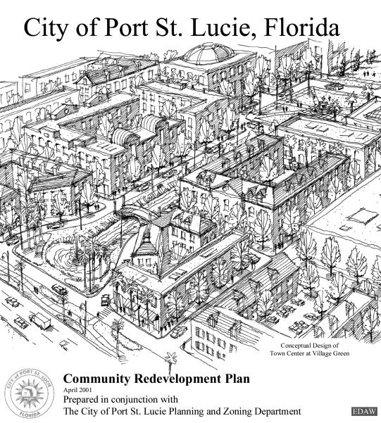
Acknowledgements. Port St. Lucie CRA Master Plan. City of Port St. Lucie City Council
|
|
|
- Sabrina Bailey
- 6 years ago
- Views:
Transcription
1
2
3 DRAFT Acknowledgements City of Port St. Lucie City Council Robert E. Minsky, Mayor James E. Anderson, Vice Mayor Patricia P. Christensen Jack Kelly Glenn H. Magrane Special thanks to: St. Lucie County Board of County Commissioners for funding planning coordination support. City staff including: City Manager's office, Legal Department and Planning & Zoning Department for project input, coordination and support. Parks & Recreation Department staff for support of meeting space. Participation from Planning & Zoning Board members and City Economic Growth Team members. St. Lucie County Property Appraiser's Office for assessment data. Master Plan Consultants: Holland & Knight
4 Executive Summary This is an important time for the City of Port St. Lucie. The City is facing tremendous growth pressure; the current population of 90,000 is projected to exceed 150,000 in the next 20 years and ultimately exceed 200,000. When the City was incorporated in 1961, the original city designers gave little consideration to the diversity of land uses needed to service a city of this size. As a result, most residents of the city work, shop and find entertainment outside of the City and the City has no established central core. This increases traffic, negatively impacts the City s tax base as well as the ability of the City to meet service demands from growth. The formation of a Community Redevelopment Agency (CRA) was determined to be an effective tool to help solve some of these problems. The City adopted a Findings and Declaration of Necessity Report in January 22, 2001 (Resolution 01-R2) and created a CRA (Ordinance 01-01) in February 12, The CRA will guide the redevelopment and revitalization of a 1700-acre area straddling US 1 between Village Green Drive and the City limits in the south for the 20 year planning timeframe. The CRA master plan marks the beginning of a comprehensive long-term master planning process for redevelopment. The master plan itself is meant to be a flexible development framework guiding future land use but with specific projects (detailed in Section 5) that implement the overall vision shown. This framework considers the existing and potential community fabric of Port St. Lucie, its culture, employment base, history, and town character. The master planning process recognizes the importance of quality-of-life issues that will be affected by development as economic development expands and the population of the City continues to grow. The master plan addresses near-term and long-term development scenarios and options and identifies realistic projects for implementation based on the opportunities, needs, and fiscal resources of the community. The result is a plan that accounts for the needs of citizens and business interests, enhances the community, encourages preferred land use patterns, and acknowledges the realities of economic conditions in the region. This CRA Master Plan is a summary of hundreds of hours of staff time, stakeholder and public input. The vision, goals, objectives, and policies developed through the public charrettes and meetings will guide the implementation of the Port St. Lucie CRA master plan. From the effort comes the following vision for the CRA. The City of Port St. Lucie s Community Redevelopment Area will be a central gathering place that creates an identity for the city as well as provides entertainment and economic opportunities. The area will include a variety of development districts and connective open space to better serve Port St. Lucie s current and future population. City of Port St. Lucie es-1
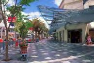
5 An important attribute of the redevelopment plan is its mixed-use approach to future development and redevelopment within the CRA, especially the creation of a town center at Village Green. This breaking of the suburban land use patterns of the original city developers will correct the strict separation of uses that has affected the city s traffic and growth patterns. The creation of a new old downtown for Port St. Lucie along US 1 as well as the proposed development guidelines, will create a park-once area for city residents and visitors. The park-once area will provide the opportunity to park the car and walk to a variety of offices, shops and entertainment. This proposed reworking of the former shopping center will create for Port St. Lucie a central gathering place for the City, a place to shop and dine as well as work and live, all at a scale reminiscent of traditional Florida small towns. This new downtown will connect to a greenspace that provides alternative internal circulation routes on the interior of the CRA. Other district concepts are proposed to create a greater sense of unity and purpose to CRA development. The biggest change proposed is a new way of looking at the CRA, as a focal point for Port St. Lucie, not a jumbled strip of commercial uses. City of Port St. Lucie es-2
6 Table of Contents Acknowledgements Executive Summary List of Tables List of Figures Section Page 1.0 Introduction: Historical Perspective Description of Project Area Redevelopment Analysis: Goals, Objectives, and Policies Social Conditions Demographic Profile Consumer Behavior Industry Profile Physical Conditions Land Use Circulation Site Analysis Citizen Planners-Stakeholder Interviews General Overview Land Use Urban Design Parks/Open Space Housing Neighborhood Transportation Economic Development Entertainment Overall Vision for the CRA and City Citizen Planners-Public Meetings Preference Survey Visioning Exercise Alternative CRA Concepts Comment Cards Additional General Comments Vision Master Plan Redevelopment Initiatives Master Plan The Town Center The District Concept Medical District Arts and Technology District 50 City of Port St. Lucie Page tc-1
7 4.1.5 Town Center District Office Districts Mixed-Use Districts Commercial Districts Recreation District Residential Areas Land Uses Regulatory Mechanisms and Incentives Specific Plans and Improvements, Costs and Timeframe Specific Plans Administration Town Center at Village Green Open Space network and drainage plan Gateways, streetscapes and district signage Arts and Technology District Mixed-Use District Commercial Districts Medical District Residential Districts Other Projects Costs and Funding Sources Schedule Community Redevelopment Agency Composition and Activity Agency Composition Activities and Authority Property Disposition and Development Community Redevelopment Agency Authority Property Acquisition Relocation Procedures Demolition, Site Preparation and Public Improvement Property Disposition and Development Duration, Modification and Severability of the Plan Relocation and Displacement/Neighborhood Impact Residential Population Nearby Residents Traffic Circulation Neighborhood Preservation School Population Public Facilities Proposed Land Use and Development Consistency Land Use and Consistency The Town Center Medical District Arts and Technology District Mixed-Use Districts Commercial Districts 83 City of Port St. Lucie Page tc-2
8 9.1.6 Recreation District Residential Areas Transportation and Consistency Treasure Coast Regional Land Use Study Port St. Lucie/S. St. Lucie County Transit Routing and Scheduling Study Methods of Finance and Budgeting Funding Sources Tax Increment Financing Other Funding Sources Proposed Development Projects: Costs and Schedule Advances and Loans Tax Increment Revenue Bonds Appendix City of Port St. Lucie Page tc-3
9 List of Tables 1.0 Introduction: Historical Perspective Page 2.0 Description of Project Area 3.0 Redevelopment Analysis: Goals, Objectives, and Policies 3-1a Population, Household Size, and Age 5 3-1b Population, Household Size, and Age 6 3-2a Age Structure b Age Structure a Race b Race a Income and Home Ownership 8 3-4b Income and Home Ownership Employment by Industry CRA Existing Zoning Summary CRA Future Land Use Summary Service or Land Use Desired for the CRA Preferred Development Types for the CRA Preferred Housing Alternatives for the CRA Alternative Transportation Modes for the CRA Master Plan Redevelopment Initiatives 4-1 CRA Master Plan Land Use Summary Specific Plans and Improvements, Costs and Timeframe 5-1 Projects, Actions and Funding Sources Community Redevelopment Agency Composition and Activity 7.0 Property Disposition and Development 8.0 Relocation and Displacement/Neighborhood Impact 9.0 Proposed Land Use and Development Consistency 10.0 Methods of Finance and Budgeting 10-1 Estimated Increment Analysis Tax Increment Funding by Project Category 90 City of Port St. Lucie Page ltf-1
10 List of Figures 1.0 Introduction: Historical Perspective 2.0 Description of Project Area 2-1 CRA Location Map and Boundary Redevelopment Analysis: Goals, Objectives, and Policies 3-1 Total Retail Expenditures Site Analysis Preference Survey Zone One Preference Survey Zone Two Preference Survey Zone Three Preference Survey Town Centers Preference Survey Roadway Design Preference Survey Streetscape Elements Preference Survey Landscape Lighting Preference Survey Site Furnishings CRA Charette - Concept A CRA Charette - Concept B CRA Project Priority CRA Concept A CRA Concept B Master Plan Redevelopment Initiatives 4-1 CRA Master Plan Town Center Character Town Center Plan Phase I Town Center Plan Phase II Town Center Plan Phase III Town Center Plan Any Phase Signature Building Character Commercial Area Character Recreation District Character Specific Plans and Improvements, Costs and Timeframe 6.0 Community Redevelopment Agency Composition and Activity 7.0 Property Disposition and Development 8.0 Relocation and Displacement/Neighborhood Impact 9.0 Proposed Land Use and Development Consistency 10.0 Methods of Finance and Budgeting City of Port St. Lucie Page ltf-2
11 1.0 Introduction: Historical Perspective The City of Port St. Lucie is located in St. Lucie County and is one of the largest incorporated areas in the State of Florida at approximately 80 square miles. The City was incorporated in 1961 by General Development Corporation and was designed primarily as a residential community. Over the years, land use changes have diversified land in the community, but it remains predominantly residential. The original city designers gave little consideration to the diversity of land uses needed to adequately service a city with a large and growing population. Recent census estimates for 2001 put the population for Port St. Lucie at 90,000 people, with a projected population to exceed 150,000 in the next 20 years, and ultimately surpassing 200,000. The City of Port St. Lucie does not have an identifiable primary central business district or commercial town center. The result of the initial poor design of the City hinders the efficient use of city resources. The formation of a Community Redevelopment Agency (CRA) has been determined by city leaders to be an effective tool to plan for desired development projects and future improvements. The City s current Comprehensive Plan recognizes the historical problems associated with the City s design and the need to remedy these problems. The formation of a Community Redevelopment Agency is one of several efforts underway by the City in taking appropriate actions to diversify land uses, enhance the tax base, and create a greater sense of place a place for people to work, shop, and play. In 1997, the City of Port St. Lucie began to study the need for forming a redevelopment area. This included various planning studies related to land use demand and projected population growth. The City considered the fiscal impacts of a redevelopment effort and examined four areas to determine the best location to focus redevelopment. It was determined that several of the study areas were not cost effective and were eliminated from consideration. The US 1 corridor was ultimately chosen as the preferred redevelopment area. Previous efforts to diversify land uses in the city have had mixed results. The City initiated a land use conversion policy that allows for the transition of residential lots into commercial and office uses at certain locations on main arterial roadways. These conversion areas are shown on the Future Land Use Map adopted by the City. While this conversion process has had some success in allowing for the transition from residential lots to other land uses, it has also had many difficulties. One difficulty is the inability of the private sector to assemble the necessary lots into the required buildable area due to multiple land ownership patterns. The redevelopment effort allows the City to purchase and assemble properties for a particular goal, and then to resell them as one site, in conjunction with a master plan for a particular area. The City has continued efforts to implement a new Community Redevelopment Agency. A CRA boundary was approved and the master redevelopment planning process started City of Port St. Lucie 1
12 in This included a series of meetings to obtain public input as well as formal public hearings leading up to final master plan adoption. The intent of this Community Redevelopment Master Plan is broad and varied. The plan is the first major effort to redesign and redirect development along the US 1 corridor. It is intended to serve as a future guide for development and redevelopment. Its focus is on incentives and partnerships with developers and property owners in order to achieve its direction. It will also require implementation of specific programs and projects over time. The plan includes a series of goals, objectives and policies. It is a long-range planning document intended to be flexible and implemented through a variety of planning strategies. Although it may require initial capital investments to serve as a catalyst for the CRA, it is also intended to be self-funding over time with revenues generated through a tax increment finance (TIF) mechanism. The district is intentionally large in order to capture improvement revenues (not new tax) from future developments and direct those funds back to the CRA for future projects. CRA improvements are intended to enhance the environment and increase property values over time. The planning, project, and design concepts presented in this document provide a vision for what the City's future could become. They will not be implemented without public support and a commitment by the City to carry forward the concepts. It is a gradual process that will evolve one step or project at a time. It is a beginning and a guide for a more livable city the future Port St. Lucie. City of Port St. Lucie 2
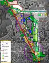
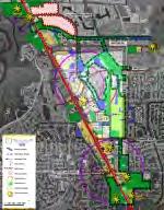
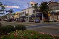
13 2.0 Description of Project Area The Community Redevelopment Area (CRA) is approximately 1,700 acres or 2.7 square miles. The CRA boundary includes the US 1 highway corridor from just above Village Green Boulevard on the north end to Tickridge Road on the south end. Lennard Road forms most of the eastern boundary (see Figure 2-1). The legal description of the CRA is contained in the Appendix. The planning process for the City of Port St. Lucie CRA involved citizens from throughout the community. Public participation was designed as a continuous process that included stakeholder interviews and public workshops. Stakeholders were identified as public officials, large property owners, citizens, and business interests who are active in the community. About 25 stakeholders were interviewed, while over 200 citizens attended three public workshops to discuss issues in and around the CRA. The workshops involved several presentations and exercises that allowed members of the community to act as citizen planners and express their views and preferences on their vision for the future Port St. Lucie. Public hearings were held on CRA plan adoption and Tax Increment Finance ordinance in June City of Port St. Lucie 3


14 VILLAGE GREEN DR T IF F A N LENNARD RD Y A V E WALTON RD. 1.S U R O O M L IL H R D JENNINGS RD Port St. Lucie CRA PORT ST LUCIE BLVD CRA Boundary N Feet W E S March 2001 Figure 2-1: CRA Location Map and Boundary
15 3.0 Redevelopment Analysis: Goals, Objectives, and Policies This section describes the existing conditions of the CRA and summarizes public input on important issues in the CRA. Existing conditions are described in terms of social conditions (demographics) and physical conditions (from existing planning documents, maps, and recent site visits). The existing conditions, along with stakeholder interviews and public meeting input, support the established redevelopment goals, objectives, and policies for the CRA outlined at the end of this section. 3.1 Social Conditions The following is a comparison of five geographic areas: St. Lucie County, the cities of Port St. Lucie, Fort Pierce, Stuart and an approximate one-mile radius around the center of the CRA area. This allows an examination of how the CRA (approximated by the onemile radius) compares with Port St. Lucie, St. Lucie and Martin Counties and the two closest cities. The demographic profile of an area includes information on population, household size, age, race, income, and home ownership. The 1990 data are from the US Census, while the year 2000 updates and 2005 projections are from CACI Marketing data. Population figures for the City of Port St. Lucie and St. Lucie County have been updated by City staff (see Tables 3-1a and 3-1b) Demographic Profile The one-mile ring (study area) covers an area slightly smaller than the CRA. Using the most recent estimate for 2000, the population within the one-mile ring is 6,529. This area holds about 7.5 percent of the City s population and 3.5 percent of the County s population of 188,000. In comparison to the City of Port St. Lucie, the cities of Fort Pierce and Stuart are smaller with populations of 35,604 and 12,801, respectively. Table 3-1a Population, Household Size, and Age One-Mile Radius (study area) City of Port St. Lucie City of Ft. Pierce Year Population 4,927 6,529 7,085 55,866 86,000* 100,000* 36,830 35,604 35,772 Average HH Size Median Age Source: US Census 1990, CACI Marketing and City of Port St. Lucie, *Local population figures modified by City staff based on current information. City of Port St. Lucie 5
16 Table 3-1b Population, Household Size, and Age City of Stuart St. Lucie County Martin County Year Population 11,936 12,801 13, , ,000* 196, , , ,662 Average HH Size Median Age Source: US Census 1990, CACI Marketing and City of Port St. Lucie, *Local population figures modified by City Staff based on current information. The City of Port St. Lucie maintains the highest average household size over time with an expected increase from 2.69 in 1990 to 2.75 in Stuart had the lowest average household size in 1990 and 2000 and is expected to remain the lowest in Tracking changes in age has important implications for requirements for government services and attractiveness to businesses. With a median age of 41.6 in 1990, the study area had a younger population than both Stuart and Martin County. Stuart s median age is 12.8 years older than the youngest median age in the area, which is Fort Pierce. Fort Pierce is projected to have the lowest median age in The average household size and median age measures show the continuing trend of Port St. Lucie remaining popular with larger households and a younger population (families). However, the median age increases by 2005 show the increasing need for services for an aging population, such as alternative housing options, and health and transit services. Tables 3-2a and 3-2b provide more detail on age structure for 1990 and The age group dominated in 1990 and In 1990, for each area except the study area, the largest category was age In the study area, the group was the largest in By 2000, however, the group became the largest group. The City of Port St. Lucie experienced the greatest percent change in the age group at 53.3 percent. Age Group Table 3-2a Age Groups as a Percentage of Total Population in 1990 and 2000 One-Mile Radius (study area) City of Port St. Lucie City of Ft. Pierce % of 1990 Pop. % of 2000 Pop. % Change * % of 1990 Pop. % of 2000 Pop. % Change * % of 1990 Pop. % of 2000 Pop. % Change * <5 6.3% 5.9% 25.3% 7.6% 7.3% 37.4% 8.4% 8.1% -6.9% % 11.4% 52.7% 13.8% 15.7% 63.7% 14.0% 16.0% 10.5% % 5.4% 40.4% 5.2% 5.6% 52.7% 6.6% 7.3% 7.2% % 6.0% 22.7% 4.8% 4.3% 29.3% 6.8% 5.9% -15.0% % 12.5% -10.8% 18.1% 12.6% -0.4% 15.2% 10.2% -34.9% % 13.4% 49.1% 14.4% 16.1% 59.7% 11.5% 12.9% 8.3% % 17.8% 38.1% 18.9% 20.3% 53.3% 18.4% 19.4% 1.7% % 13.9% 20.5% 12.3% 11.1% 29.9% 11.2% 9.6% -17.5% % 10.1% 86.5% 4.2% 5.7% 92.1% 6.3% 8.0% 21.8% % 3.6% 112.6% 0.6% 1.2% 165.9% 1.6% 2.6% 58.6% Source: US Census 1990, CACI Marketing, *Percent change between 1990 and 2000 is based on raw population numbers. While an age group may have increased in total number between 1990 and 2000, it may have decreased as a percentage of the total population. City of Port St. Lucie 6
17 Age Group % of 1990 Pop. Table 3-2b Age Groups as a Percentage of Total Population in 1990 and 2000 City of Stuart St. Lucie County Martin County % of 2000 Pop. % Change * % of 1990 Pop. % of 2000 Pop. % Change * % of 1990 Pop. % of 2000 Pop. % Change * <5 4.4% 4.1% -0.6% 7.0% 6.6% 16.3% 5.1% 4.8% 10.7% % 9.0% 21.0% 12.6% 14.3% 38.6% 9.6% 10.8% 34.4% % 4.7% 18.1% 5.6% 6.0% 30.0% 4.7% 5.0% 25.0% % 4.2% -12.9% 5.4% 4.6% 5.3% 4.9% 4.1% -0.6% % 9.0% -31.7% 15.3% 10.6% -15.0% 13.6% 9.3% -18.6% % 11.8% 12.9% 12.8% 14.4% 37.9% 12.7% 13.6% 27.3% % 20.7% 18.0% 20.2% 21.3% 29.2% 21.9% 24.2% 31.6% % 14.2% -2.6% 13.7% 12.5% 12.1% 16.7% 15.1% 7.6% % 16.1% 22.4% 6.1% 7.8% 57.8% 8.8% 10.3% 39.5% % 6.2% 56.4% 1.2% 1.9% 92.0% 1.9% 2.9% 79.3% Source: US Census 1990, CACI Marketing, *See note under Table 3-2a. The age group declined consistently in each area between 1990 and The study area showed a loss of 10.8 percent of those aged Port St. Lucie lost the least of this age group with a 0.4 percent decrease. The cities of Stuart and Fort Pierce both had decreases of over 30 percent. St. Lucie County had a 15 percent decrease while Martin County had an 18.6 percent decrease in the age group. While the age group declined, the 85 and over age group increased the most in each of the areas. The two largest increases (over 100 percent) were in the study area and City of Port St. Lucie. Race represents people s self-classification according to the race with which they most closely identify. Ancestry can be viewed as a person s nationality, lineage, or country of birth. Persons of Hispanic ancestry may be of any race. Tables 3-3a and 3-3b show the predominance of the white population in each area in 1990 and 2000, with the exception of the City of Fort Pierce. Fort Pierce has a more even distribution between the white and black population. Overall, the racial diversity in each area increased slightly as the white population declined as a total percentage of population. The study area and the City of Port St. Lucie had the greatest increases in all races, especially black, Asian or Pacific Islander (API), Other, and those of Hispanic ancestry. Race Table 3-3a Race as a Percentage of Total Population in 1990 and 2000 One-Mile Radius (study area) City of Port St. Lucie City of Ft. Pierce % of 1990 Pop. % of 2000 Pop. % Change * % of 1990 Pop. % of 2000 Pop.** % Change * % of 1990 Pop. % of 2000 Pop. % Change * White 91.8% 82.4% 19.0% 94.2% 89.4% 48.2% 53.7% 47.4% -14.6% Black 5.6% 13.0% 208.7% 3.8% 7.2% 195.5% 42.4% 47.4% 8.2% API 1.3% 1.9% 100.0% 0.9% 1.3% 119.4% 0.5% 0.7% 27.3% Other 1.4% 2.7% 153.6% 1.1% 2.0% 201.5% 3.4% 4.5% 26.2% Hispanic Ancestry 4.7% 8.4% 134.6% 4.0% 7.6% 196.8% 6.4% 8.5% 28.1% Source: US Census 1990, CACI Marketing, 2001, **US Census release *Percent change between 1990 and 2000 is based on raw population numbers. API=Asian or Pacific Islander, Percentages=100% without Hispanic Ancestry group, as persons may be of any race. City of Port St. Lucie 7
18 Race % of 1990 Pop. Table 3-3b Race as a Percentage of Total Population in 1990 and 2000 City of Stuart St. Lucie County Martin County % of 2000 Pop. % Change * % of 1990 Pop. % of 2000 Pop. % Change * % of 1990 Pop. % of 2000 Pop. % Change * White 83.4% 80.0% 2.8% 81.3% 77.7% 17.3% 91.3% 89.0% 16.2% Black 15.1% 17.2% 21.7% 16.4% 19.0% 41.7% 6.0% 6.8% 36.3% API 0.7% 1.0% 56.3% 0.7% 1.1% 96.4% 0.5% 0.9% 93.3% Other 0.7% 1.8% 162.9% 1.5% 2.2% 75.6% 2.2% 3.3% 78.2% Hispanic Ancestry 3.9% 7.6% 110.2% 4.0% 6.1% 89.6% 4.7% 7.2% 82.8% Source: US Census 1990, CACI Marketing, *See note under Table 3-3a. Rising incomes in the region are important in creating demand for services and housing in the study area. Tables 3-4a and 3-4b show household income, per capita income, and home ownership rates. In 1990, Ft. Pierce had the lowest median household income of $18,913. That same year, the study area s median household income was $28,285 higher than both Stuart and Fort Pierce. The City of Port St. Lucie had the highest median household income of $32,553. In 2005, the study area is projected to have a lower household income than Port St. Lucie and St. Lucie County, but it is projected to surpass Stuart, Fort Pierce, and Martin County. Fort Pierce s per capita income was lowest in 1990 at $9,961. Martin County s $20,328 value was the highest of the five areas. St. Lucie County, Stuart and Port St. Lucie outperformed the study area with a higher per capita income. Martin County is projected to continue with the highest per capita income by the year Table 3-4a Income and Home Ownership One-Mile Radius (study area) City of Port St. Lucie City of Ft. Pierce Year Median Household 28,285 39,498 48,995 32,553 45,996 58,247 18,913 28,598 36,817 Income Per Capita Income 13,115 19,400 24,080 14,018 20,302 25,917 9,961 14,736 18,854 % Owner-occupied 49.3% 50.8% 51.5% 76.4% 78.4% 79% 51.8% 54.3% 55.3% households % Renter-occupied households 50.7% 49.2% 48.5% 23.6% 21.6% 21% 48.2% 45.7% 44.7% Source: US Census 1990, CACI Marketing, City of Port St. Lucie 8
19 Table 3-4b Income and Home Ownership City of Stuart St. Lucie County Martin County Year Median Household 26,233 33,962 37,328 27,710 40,599 51,590 31,760 41,915 45,960 Income Per Capita Income 16,125 24,185 26,151 13,387 20,133 26,833 20,328 29,662 33,897 % Owner-occupied 64.5% 69.7% 70.7% 71.9% 74.9% 76% 76.9% 79.1% 80% households % Renter-occupied households 35.5% 30.3% 29.3% 28.1% 25.1% 24% 23.1% 20.9% 20% Source: US Census 1990, CACI Marketing, Martin County has consistently had the largest share of owner-occupied housing at a rate of 76.9 percent in 1990, 79.1 percent in 2000, and 80 percent in The study area has a significantly smaller proportion of owner-occupied housing. In 1990, over 50 percent of households were renter-occupied. That number is projected to decrease to 48.5 percent by Fort Pierce was only slightly higher than the study area with an owneroccupied housing rate of 51.8 percent in With an increasing population and continuing trends of larger households, rising incomes, and increased home ownership in the study area and Port St. Lucie, the study area is positioned as an important potential source for services and housing to supply the region. Next, consumer behavior is analyzed to find out how households in the study area, St. Lucie County, and Martin County spend their money Consumer Behavior Consumer spending data is calculated from the Bureau of Labor Statistics Consumer Expenditure Interview Survey. The expenditures represent annual averages for the year 2000 compiled by CACI Marketing. Residents of the study area and the city of Port St. Lucie made most retail purchases in St. Lucie and Martin Counties. Figure 3-1 shows the amount that consumers in each area spent on seven major retail categories. City of Port St. Lucie 9
20 Figure 3-1 Total Retail Expenditures % of Expenditures 35% 30% 25% 20% 15% 10% 5% 0% One Mile Radius St. Lucie County Martin County Food Service Apparel & Services Drug Transportation Leisure & Entertainment Home Furnishings Other Retail Expenditures Type of Expenditure The Food Services category includes dollars spent on dining out, groceries, and alcoholic beverages. Although each area spends almost the same proportion on this category, St. Lucie County spends 31 percent of its retail expenditures on food services compared to 30 percent for the study area and Martin County. The Apparel and Services group includes dollars spent on all apparel, footwear, jewelry, and other services. Each study area spent 7 percent of its retail expenditures on this category. The Drug category includes expenditures on prescription drugs and personal care products. In St. Lucie County and the study area, 3 percent of expenditures were spent on these items, while Martin County residents spent 4 percent. Transportation expenditures include dollars spent on automotive services and products and travel. Transportation expenditures in the study area were 30 percent compared to 29 percent in the two counties. The Leisure and Entertainment category includes money spent on books and periodicals, pet care, sporting goods, children s toys, videos, and other equipment. Ten percent of expenditures were for this category in each area. Home Furnishings include major appliances, furniture, housewares, home improvement, and home services. Martin County s expenditures were 16 percent (one percent higher than St. Lucie County and the study area). In general, residents in all of the areas spent the same proportion of their household income on goods and services. However, total retail expenditures at the household level were highest in the study area compared to St. Lucie and Martin Counties. City of Port St. Lucie 10
21 3.1.3 Industry Profile Employment variables help evaluate the composition of the labor force in a particular market. The types of industry in a geographic area impact the economic conditions of an area. For instance, if an industry requires employees with higher education or technical skills, the types of worker that will most likely locate to the area demand different housing, services, and amenities than would lower-skilled, less educated workers. Also, each industry has a variety of complementary businesses or industries that locate nearby as a result. Table 3-5 shows a comparison of employment by industry in the study area, the cities of Fort Pierce, Port St. Lucie, and Stuart, and St. Lucie and Martin Counties. The percentages are based on all employees 16 years of age and older. Table 3-5 Employment by Industry One Mile-Study Area Fort Pierce Port St. Lucie Stuart Martin County St. Lucie County Agriculture, Forestry, Fishing 3.7% 9.8% 2.5% 2.4% 5.0% 5.4% Mining 0.2% 0.0% 0.1% 0.1% 0.1% 0.1% Construction 12.9% 8.2% 12.1% 10.7% 11.2% 10.8% Manufacturing 8.5% 7.1% 9.1% 8.4% 10.1% 8.1% Transportation 1.7% 3.6% 2.9% 2.9% 3.2% 3.3% Communications & Public 2.2% 3.4% 4.5% 3.6% 3.4% 4.1% Utilities Wholesale Trade 4.2% 4.1% 3.4% 1.5% 2.9% 3.8% Retail Trade 21.3% 21.0% 23.6% 22.0% 20.1% 22.0% Finance, Insurance, Real 11.0% 4.9% 7.9% 8.7% 7.8% 6.8% Estate Services (All) 31.3% 31.8% 29.5% 36.3% 33.1% 30.5% Business and Repair 5.4% 3.9% 5.1% 4.8% 5.5% 4.9% Personal 3.5% 5.2% 3.7% 4.0% 3.9% 4.1% Entertainment and Rec. 2.5% 1.1% 2.0% 2.9% 3.1% 1.8% Health 8.7% 8.9% 9.2% 10.8% 8.9% 8.4% Educational 6.6% 8.2% 4.4% 8.3% 5.7% 6.2% Other Professional 4.6% 4.5% 5.1% 5.5% 6.0% 5.1% Public Administration 2.8% 6.1% 4.5% 3.2% 3.0% 5.0% Source: US Census, Overall, the Services sector is the dominant form of employment in the region. In each area, nearly 30 percent or more of employment is in the Services sector. Employment included in the Services sector include business and repair, personal, entertainment and recreation, health, educational, and professional and related. Of the Service sector employment categories, health services compose the largest percentage of the total at 8 to 10 percent for each area. The next largest employment sector is Retail Trade. Retail Trade businesses employ over 20 percent of the workforce in each area. The industry ranges from 20.1 percent in Martin County to 23.6 percent in Port St. Lucie. The third largest employment sector is Construction. The one mile-study area has the largest proportion of this industry at 12.9 percent. Port St. Lucie is not far behind with 12.1 percent, while the area with the lowest percentage of construction employment is Fort Pierce. City of Port St. Lucie 11
22 3.2 Physical Conditions Land Use The physical conditions of the CRA were summarized from existing planning documents and maps, Port St. Lucie GIS database, as well as site visits and photographs. The CRA comprises about 1,700 acres, or just over 3 percent of the land area of the City of Port St. Lucie. About 300 acres (approximately 17 percent) is in unincorporated St. Lucie County. The land uses within the county mostly include residential, vacant property, and the 100-acre Lentz Grove. An interlocal agreement was created to deal with county land within the CRA. The CRA is about 3 miles long by 2 miles wide at its furthest points. Existing zoning and future land use within the CRA were summarized using Port St. Lucie s GIS database. The existing zoning summary (Table 3 6) shows the predominance of residential land use within the CRA (53 percent), with single-family residential accounting for the majority (40 percent). Commercial land uses account for about 14 percent, while open space accounts for about 3 percent of the total land area. Table 3-6 CRA Existing Zoning Summary* Zoning Category Acres Percent Estate Residential % General Commercial % General Use % Highway Commercial % Industrial % Institutional % Limited Mixed District % Mobile Home Residential % Multi-Family Residential % Neighborhood Commercial % Open Space-Conservation % Open Space-Recreational % Planned Unit Development % Professional % Service Commercial % Shopping Center Commercial % Single-Family Residential % Special Exception Use % Warehouse Industrial % Unincorporated St. Lucie County % Unknown % TOTAL 1, % Source: City of Port St. Lucie GIS. *NOTICE: It is understood that, while the City of Port St. Lucie has no indication or reason to believe that there are inaccuracies or defects in information incorporated in the database, the City makes no representations of any kind, including but not limited to the warranties of merchantability or fitness for a particular use, nor are any such warranties to be implied, with respect to the information or data, furnished herein. The future land use summary (Table 3-7) shows the City s desire to balance the variety of land uses within the CRA. Residential land use is expected to decrease to less than 35 City of Port St. Lucie 12
23 percent of the total land area, while commercial land use is expected to increase to 23 percent when land uses are fully implemented. Open space and preservation categories account for about 11 percent of total land area in the CRA, according to the future land use plan. The proposed projects, as described later in the CRA plan, provide opportunities to increase the diversity of land uses beyond that shown in Table 3-7. Table 3-7 CRA Future Land Use Summary* Future Land Use Category Acres Percent Commercial General % Commercial Service % Institutional % Open Space % Preservation % Residential % Residential/Office/Institutional % Utilities % Warehouse/Industrial % Unincorporated St. Lucie County % Unknown % TOTAL 1, % Source: City of Port St. Lucie GIS. *NOTICE: It is understood that, while the City of Port St. Lucie has no indication or reason to believe that there are inaccuracies or defects in information incorporated in the database, the City makes no representations of any kind, including but not limited to the warranties of merchantability or fitness for a particular use, nor are any such warranties to be implied, with respect to the information or data, furnished herein Circulation The street system in the CRA consists of mostly exterior streets that form the boundary of the area. These streets include US 1, Village Green Road, Walton Road, and Lennard Road. There are few interior streets within the CRA, but most serve as connections between US 1 and Lennard Road with the exception of Hillmoor Drive. Streets are generally classified into four categories: primary arterial, minor arterial, collector, and local. The CRA is bounded on the west by one primary arterial street US 1. US 1 forms five major intersections with other streets in the CRA-Village Green Drive, Walton Road, Tiffany Road, Jennings Road, and Port St. Lucie Boulevard. Most of the other streets that enter the CRA or are within the CRA are classified as minor arterial or collector streets. There are very few local streets within the CRA. The City of Port St. Lucie Comprehensive Plan Transportation Element addresses future projected needs and Level of Service improvements for streets in the CRA such as US 1 and Port St. Lucie Boulevard. Additional transportation corridors under study with potential traffic impacts on the CRA include the Walton Road Bridge over the Indian River and West Virginia Drive. West Virginia Drive would include a bridge over the North Fork of the St. Lucie River with two possible connections to US 1 at Village Green Drive or Walton Road. A general list of current development activity in the CRA is included in the Appendix. City of Port St. Lucie 13
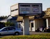
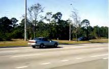
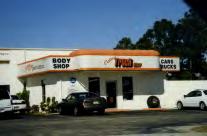
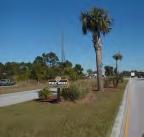
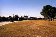
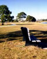
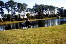
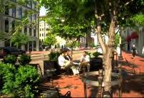
24 In terms of alternative transportation, bicycle lanes run the length of US 1 in the CRA, however few similar lanes exist on other streets. Sidewalks exist along most of the length of US 1 in the CRA, however they are infrequent along other streets. No traditional fixed-route public transit system exists within the City of Port St. Lucie, although there is a demand-based system of transportation provided through the Transportation Disadvantaged Program. A brief review of current transportation studies for the region showed the establishment of a fixed-route system along US 1 with the Village Green area serving as a transportation hub or multi-modal transit center Site Analysis The objective of a site analysis is to create an inventory and description of the project area s resources and features, as well as to understand what currently exists on the site before recommending planning and design alternatives. Site inventories can include environmental as well as cultural features. From the site inventory, an interpretation or analysis of project features can be used in creating a master plan for the area. The CRA site analysis is described below and shown in Figure 3-2. The CRA has both positive and negative features. The most noticeable negative feature of the CRA is that the US 1 highway corridor fails to give travelers a clear identity of Port St. Lucie; where the city begins and ends. Contributing to this identity problem is the location and auto-oriented nature of buildings along US 1. Most of the commercial buildings are set back hundreds of feet from the road right-of-way and are fronted by expanses of parking, creating a large void between the road and buildings. A good example of this void can be seen at the US 1 and Jennings Road intersection, where over 90 percent of the road frontage is devoted to parking. A positive action on US 1 was the recent addition of bicycle lanes. However, the lanes appear to get little use, most likely due to the speed of auto traffic on US 1 and the relatively long distances between land uses. The sidewalks along US 1 also appear to get little use. Circles illustrating the distance a pedestrian could comfortably walk in 5 minutes and 10 minutes from two intersections - US 1 and Port St. Lucie Boulevard and Village Green Drive and Tiffany Road - are shown on the site analysis map. The entire CRA is too large to be a pedestrian-only district, however smaller areas within the CRA could accommodate safer pedestrian and bicycle circulation. A positive feature of the CRA is the amount of existing open space. An informal greenway runs from the southernmost portion of the CRA to the northeast and northwest corners of the site. The open space is currently used in a variety of ways, such as a 100- acre citrus grove (the Lentz Grove), parks, drainage ponds, and canal systems. A recent expansion by the hospital across Tiffany Road has encroached on the existing open space. Areas to consider for aesthetic enhancement include the Tiffany Road park and drainage lake area, and the canal along the northeast edge. With a small investment in trails or trail easements, the greenway has the potential to become valuable passive and active recreation space. City of Port St. Lucie 14

25 Figure 3-2: Site Analysis
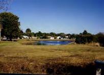
26 The topography of the CRA is relatively flat and water drainage has been extensively modified. There are several large drainage ponds located in the northern portion of the CRA. For the most part, the CRA drains from east to west. Natural conveyance systems have been replaced by canals, culverts, and pumping stations. During heavy storms, some flash flooding occurs in the southern portion of the CRA according to the City. The drainage systems within the CRA will have to be studied and reworked to accommodate larger developments. Residents have reported sandhill crane and wood stork sightings in the area. The sandhill crane is currently listed as threatened by the Florida Fish and Wildlife Conservation Commission (FFWCC). The wood stork is currently listed as endangered by the FFWCC. Before large-scale development occurs in the CRA, an on-site survey by a wildlife biologist should be conducted to determine possible effects on sandhill crane and wood stork habitat. The major commercial areas in the CRA are along US 1 and include the Village Green, Towne Center, and Marketplace shopping centers. These commercial areas contain a variety of retail and office uses, from Wal-Mart to grocery stores to county government offices and a call center. Current development activity in the CRA is listed in the Appendix. Current projects include the relocation of Wal-Mart from its current location to the southwest end of the CRA, the addition of a new PolyMedica office and warehouse on the northwest end along US 1, and hospital expansion near the intersection of Tiffany Road and Village Green Drive. Proposed transportation projects such as the potential Walton Road bridge and the West Virginia Drive bridge will influence land use in the area around the US 1, Walton Road, and Village Green Drive intersections. With construction of the bridges, traffic along Walton Road will likely increase, making the Village Green shopping center area a highly visible commercial area with potential for redevelopment. Highly visible areas, such as the five major intersections with US 1 have the potential for becoming entrance markers or gateways for the City. The construction of the West Virginia Drive bridge will open up views to the North Fork of the St. Lucie River. Locations that could take advantage of existing and new views of natural features are shown with arrows on the site analysis map. Other areas in the CRA that have considerable redevelopment potential include the industrial area located in the north, the 100-acre citrus grove on the western edge, and vacant parcels located along the southern border. City of Port St. Lucie 16
27 3.3 Citizen Planners-Stakeholder Interviews Although the site analysis contains the consultants assessment of existing conditions and potential redevelopment areas, it is important to take advantage of local knowledge and experience regarding the positive and negative features of the CRA. The consultants, along with the City of Port St. Lucie planning staff, relied on one-on-one interviews and public workshops to obtain local knowledge about the CRA. The consultant team conducted stakeholder interviews between January 29-February 1, This section summarizes the findings from 25 interviews. Stakeholders were identified from a list of active community representatives, political leaders in the city and county, and major landowners within the CRA. Interviews were conducted in person or by phone. The stakeholder survey is included in the Appendix. The survey contained questions pertaining to 10 broad planning categories that focused on the following major issues: General Overview Land Use Urban Design Parks/Open Space Housing Neighborhood Transportation Economic Development Entertainment Overall Vision Most questions were open-ended, allowing the respondents to raise any issue of importance. Several questions were structured with scaled responses to permit direct comparison among participants. Below is a brief summary of each section General Overview The majority of the respondents identified land use and transportation as the main issues facing the city. Respondents commented that a better mix and integration of land use is needed; currently there are not enough non-residential areas. Transportation issues consisted mostly of traffic and bad overall circulation. Most respondents viewed the US 1 corridor as the biggest strength of the CRA. Available land was viewed as a great opportunity for new development. Respondents felt favorably about the hospital and medical-related growth in the area. Other strengths include the open space and recreation opportunities as well as the supply of commercial land. The appearance and layout of the Village Green shopping center was viewed as the biggest weakness of the CRA. Connectivity between areas was also a major concern as well as traffic. Respondents noted that the unincorporated areas within the boundary were a weakness. Many respondents said that the appearance of the low-density development was a detractor for the study area. City of Port St. Lucie 17
28 Respondents expressed both positive and negative feelings about current zoning. Most negative comments were that zoning was not strong enough. Suggestions to improve zoning included reducing the number of categories, stricter regulations, a quicker administrative process and architectural design standards. Respondents identified the lack of a town center and social public gathering place as an issue that the CRA plan needs to address. Another major issue is the lack of good employment opportunities for residents. Respondents also wanted design standards and the lack of quality retail businesses to be addressed. Respondents felt that current land use and design is too autooriented. For the CRA plan to be a success, respondents believed that that ownership and support of the plan was most important not just ownership by the city council and planning department, but by the community. Many stakeholders said the CRA plan should focus on redeveloping Village Green and vacant parcels. They felt that a mix of uses is important for the plan to be successful. This should include new entertainment opportunities, retail, housing and preservation and connectivity of greenways and open space Land Use The majority of stakeholders commented that development in the hospital and medical area is very positive for the city. Some also stated that there was a good mix of uses throughout the CRA. Many respondents felt that current development lacked cohesion and was not dense enough. Most said that the Village Green shopping area was a priority for redevelopment. They commented that there was also too much strip development. Finally, too much auto-oriented development is occurring. With respect to the service mix, most respondents would prefer more upscale alternatives for shopping and dining out. Many said that there currently is a good mix of services overall. Respondents rated the following services/land uses on a scale of 1 to 5, with 5 representing the strongest interest in seeing more of the land use provided in the study area. Table 3-8 shows the average score and ranking of service/land use types desired for the CRA. Interviewees showed a strong interest in adding entertainment, professional offices, and specialized retail. They were not as interested in seeing more large scale commercial and residential uses. Table 3-8 Service or Land Use Desired for the CRA Service/Land Use Ranking Average Score Entertainment Business/Professional Offices (accountants, banks, lawyers) Specialized Retail 3 4 (novelty, antique shops) Personal Services (hair salon, dry cleaning) Residential General, Larger Scale Commercial (grocery & drug store) City of Port St. Lucie 18
29 3.3.3 Urban Design When asked to identify a feature of the CRA that gives a positive sense of place, most could not identify any. A few respondents noted the Lentz Grove property provided some identity. Respondents believed that the existing buildings need to be renovated. Many suggested improving design standards and then renovating existing buildings to the new standards. New development should fit in with the existing development. Some also suggested better connections between uses. Strip development was noted as the biggest appearance problem in the CRA. Respondents also mentioned a lack of landscape enforcement. Other issues noted as appearance problems were the Village Green shopping center and large parking lots and building setbacks. Interviewees rated the following four development types on a scale of 1 to 5, with 5 representing the strongest interest in seeing more of the development type provided in the CRA. Table 3-9 shows the average score and ranking of development alternatives preferred for the CRA. Respondents expressed the strongest support for new office and professional buildings along with mixed-use developments. They also favored converting the existing strip centers to other uses. Table 3-9 Preferred Development Types for the CRA Development Type Ranking Average Score New office/professional buildings Mixed-use developments (combine retail and housing) Conversion of existing buildings (strip centers into other uses) Traditional Neighborhood Design Parks/Open Space A large majority of respondents wanted to see more parks, open space or trails of some kind in the CRA. Many commented that it would be great to connect neighborhoods and existing open spaces such as the Savannas Preserve with a bike network throughout the CRA Housing There were many characteristics noted about the current housing stock. Many people replied that the homes were too small and lacked variety, a bad mix of housing stock. Many people also mentioned the deteriorated conditions of some of the houses and the lack of landscaping. Some felt this was due to the high number of rentals with absentee owners. To improve this condition, they suggested rehabilitating existing housing using new design standards and offering incentives to homeowners to achieve this goal. City of Port St. Lucie 19
30 Most respondents noted that there was an imbalance in the supply of owner housing and rental housing. Overall, they thought that there was too much rental housing. Interviewees rated the following five alternative housing types on a scale of 1 to 5, with 5 representing the strongest interest in seeing more of the housing type offered in the CRA. Table 3-10 shows the average score and ranking of desired housing alternatives. Table 3-10 Preferred Housing Alternatives for the CRA Housing Type Ranking Average Score Townhomes Condominiums Duplexes Multi-family rental complexes Single-family detached homes Stakeholders would prefer to see more townhomes in the area. They also heavily favored condominiums. The least desired housing type is the single-family detached home Neighborhood The majority of the respondents did not think there were any neighborhoods that have problems related to noise, traffic, or light caused by nearby commercial or industrial activity. Some did mention that the homes along Walton Road might have this problem. Many respondents said that what gives a neighborhood a special character is a good mix of ages and the people people who bond in the community. They also mentioned that appearance and landscaping give a neighborhood character Transportation The majority of the stakeholders cited lack of connectivity as a transportation obstacle. The disconnected nature of roads within the boundary forces long trip times. Suggestions for improvement include adding and widening roads as well as providing public transit opportunities. Interviewees rated the following five alternative transportation modes on a scale of 1 to 5, with 5 representing the strongest interest in seeing more of the transportation type offered in the CRA. Table 3-11 shows the average score and ranking of preferred transportation modes. Table 3-11 Alternative Transportation Modes for the CRA Transportation Mode Ranking Average Score Walking Bicycling Bus Carpooling/Park-n-ride lot 4 3 Light rail (trolley/streetcar) Most respondents would like to see development that would allow residents to walk and bike. The least valued mode of transportation is light rail. Many interviewees did not think that traffic was a problem in their neighborhood. However, the ones that responded expressed concern over traffic speeds. One reason cited for high speeds was roadway City of Port St. Lucie 20
31 design. They also suggested creating more internal connections. Almost all respondents believed that there was adequate parking in the study area. A few commented that there are parking needs near the hospital Economic Development Responses to threats to business viability included the fact that Port St. Lucie is not a shopping destination and not a demographic pull for businesses. Access to and connectivity between business locations was seen as problematic. Stakeholders suggested that incentives to businesses would be the greatest asset to investment in the CRA. They also believed strongly about providing diverse shopping opportunities. Respondents said that a clean, attractive environment would attract shoppers and businesses. The most requested new commercial use was entertainment. Restaurants were also mentioned frequently. Many respondents stated there was a need for more office and professional businesses. The majority of stakeholders identified the Village Green shopping center as a focus for redevelopment. Another site, the Lentz Grove property, was also mentioned as a focus area Entertainment The most desired form of entertainment for the CRA is a movie theater. Many respondents suggested an IMAX theater. Respondents also felt strongly about adding restaurants to the area. Several people also stressed the need for entertainment for different age groups and families Overall Vision for the CRA and City When asked to define what should be the city s first priority in making improvements to the CRA, most participants focused on the Village Green shopping center. They stated that this area should be redeveloped first. When envisioning the city in the future, respondents frequently mentioned the following: Nice looking homes Diversity of land uses in the city Attract higher income individuals Easy access Planned growth Enhanced city image When asked how respondents would like Port St. Lucie to change over the next 20 years, respondents replied: More centralized services No sprawl New houses Increase in income level City of Port St. Lucie 21
32 Improved roads Self-sufficient community Pedestrian-oriented/multi-modal transit Specific responses from the stakeholder interviews are included in the Appendix. 3.4 Citizen Planners-Public Meetings Public meetings were held on February 1-2 and March 5, Opportunities for input at the February public meetings included a preference survey regarding the existing and desired character of the CRA, general comments received during the meeting, and a visioning exercise to describe the CRA area and the community of Port St. Lucie ten years into the future. From the stakeholder interviews and the workshop exercises, the planners translated ideas and comments onto paper to create two alternative planning concepts for the CRA. Participants were able to see the planning concepts evolve before them at the meeting. At the March meeting, the public was brought up to date on the input received since February. All of the information and materials presented at the February meetings were displayed for public reaction and comment. In addition, the participants were invited to prioritize projects to jump start redevelopment in the CRA. Input from the public meetings is summarized below Preference Survey The preference survey was conducted as a red dot-green dot exercise. First, the participants viewed a series of photographs of existing development in the CRA. Individuals placed red dots on the places or types of development that they disliked and green dots on places or development they preferred. Next, the participants viewed a series of photographs of other communities. The photographs were organized by design elements with pictures of town centers, roadway designs, streetscape elements, landscape lighting styles, and site furnishings. Again, individuals placed red dots on places or development that they disliked and green dots on places or development they preferred. The results of the preference survey are shown in Figures 3-3 to Green dots were recorded as a yes ( yes, I like the image or character of the place or development shown ). Red dots were recorded as a no ( no, I do not like the image or character of the place or development shown ). Photographs of existing development in the CRA were divided into three zones. Zone One images covered the area adjacent to the US 1 corridor. Zone Two images covered areas around the periphery of the CRA, including Village Green Road to Lennard Road to the Port St. Lucie-US 1-Lennard Road intersection. Zone Three images covered interior areas of the CRA (see Figures 3-3 to 3-5). The most preferred image in Zone One shows a pedestrian space with sidewalk and landscaping. The least preferred image was an older, typical commercial sign followed City of Port St. Lucie 22
33 closely by a wide road expanse. The most preferred image in Zone Two shows water and open space. The least preferred images included many of the commercial developments. Finally, in Zone Three, the most preferred images were those of open space and trees. The least preferred image shows a roadway design. Preferred and non-preferred design elements for town centers, roadway designs, streetscape elements, landscape lighting, and site furnishings are shown in Figures 3-6 to Many of these design elements were rated as favorable, with a few exceptions. These character preferences will guide decisions for specific design projects within the CRA. City of Port St. Lucie 23


34 No-4 No-14 No-2 No-5 No-3 No-1 No-2 Yes-14 Yes-2 No-6 Yes-2 Zone One No-5 No-13 No-1 No-3 No-1 No-1 Yes-3 Figure 3-3: Preference Survey-Zone One


35 Yes-6 No-1 No-8 Yes-2 No-1 No comments No-1 Yes-3 No-5 No-5 No-5 No-7 Zone Two No-8 No-3 Yes-2 Figure 3-4: Preference Survey-Zone Two


36 No-3 Yes-10 No-1 Yes-13 Yes-11 No-1 Yes-3 No-5 Yes-9 No-1 Yes-10 No-1 Zone Three Yes-5 No-2 No-1 Yes-5 No-1 No-1 Figure 3-5: Preference Survey-Zone Three


37 Yes-1 No-1 Yes-3 Yes-3 Yes-9 Yes-5 Yes-3 Yes-2 No-2 Yes-2 Yes-2 Yes-2 Yes-5 Yes-2 No-4 Town Center Yes-4 Figure 3-6: Preference Survey-Town Centers


38 Yes-6 Yes-12 Yes-6 Yes-5 Yes-7 No-4 Yes-1 Yes-1 No-1 Yes-3 No-3 Yes-6 Yes-2 No-3 Yes-5 Roadway Figure 3-7: Preference Survey-Roadway Design

39 Figure 3-8: Preference Survey-Streetscape Elements

40 Figure 3-9: Preference Survey-Landscape Lighting

41 Figure 3-10: Preference Survey-Site Furnishings
42 3.4.2 Visioning Exercise For the visioning exercise, citizens were asked the following question: Picture yourself talking to a friend who moved away from Port St. Lucie. It is ten years in the future and the CRA has been a success. How would you describe your community to them? The responses to the visioning exercise were both general and specific. Comments included making the City of Port St. Lucie truly a city for all ages to now having a downtown that contains a variety of cultural, entertainment, and recreation options. Some of these options included a performing arts center, restaurants, coffee shops, big retailers, sports fields, and parks. All of the responses to the visioning exercise are included in the Appendix. Next, two alternative concepts for the CRA were distilled from the public comments and visioning exercise and presented to the public Alternative CRA Concepts The initial drawings of concepts A and B are shown in Figures 3-11 and The major elements of concepts A and B are presented below, followed by additional public comments about each. The main difference between the two concepts involves the location of the town center or pedestrian district. City of Port St. Lucie 32

43 Figure 3-11: CRA Charette-Concept A

44 Figure 3-12: CRA Charette-Concept B
45 Concept A Description Shopping in south, commercial big box retail district Pedestrian walking district in north (town center) Commercial, retail, office, and multi-family in the south Bring new Wal-Mart development to street and add small retailers in front with parking on sides and in back. Greenway to link shopping in the south to the pedestrian district in the north Expand medical district to straddle both sides of US 1 to include existing hospital and new 10 acres in the east. Civic community center in east central part Residential development south of pedestrian district on US 1. This will give residents the opportunity to walk to the pedestrian district. Ability to view the town center from three places Cultural arts center, hotel with conference center Neighborhood and housing revitalization Incubator for businesses artisan live-work area (industrial area in north) Comments on Concept A Create a shuttle bus between north and south ends of district (along US 1) Need place in the plan for kids to go Make the town center safe, secure, and accessible Add seating areas and more landscaping around drainage features (lake) similar to City of Fort Lauderdale Trolley bus that makes a US 1 and Riverwalk loop Sidewalks Stoplight at Rushing and Walton Roads No metered parking in the town center Concept B Description Town center located next to the elementary school and hospital area Shows an entrance to Port St. Lucie from Port St. Lucie Boulevard and US 1 Town center is focused within hospital area Continuing education and mixed-use developments Higher density housing Connect residential neighborhood and families with the elementary school Greenway connecting south to north Family recreation opportunities in the north Comments on Concept B Make town center livable Instill pride of community Schools Draw Martin County residents in Create/allows direct turnpike access City of Port St. Lucie 35
46 3.4.4 Comment Cards In addition to the exercises above, cards were available for submitting written comments about the CRA and the planning process. The comments from both the February and March public meetings are included in the Appendix. Many of the comments concerned traffic congestion on the southern and eastern boundary of the CRA. Others suggested ideas about appropriate land uses in the CRA and those uses that should be the focus of a town center. A performing or cultural arts center was a popular item among residents, but they said that there should be a variety of entertainment options for all ages. Some residents expressed concerns about vacant and underutilized properties as well as the displacement of existing residential areas. The Village Green area was mentioned frequently as a starting point for redevelopment and as an appropriate location for the town center. Other comments concerned clarification of the CRA legal issues such as condemnation power and funding for redevelopment Additional General Comments Additional general comments were recorded at all the public meetings. These comments are also included in the Appendix. Road improvements to solve traffic congestion and the amount of traffic that would be generated by the CRA continued to be a main concern. Additional issues involved the implementation of the CRA plan such as management responsibility, property condemnation, the city-county interlocal agreement, and funding sources. The preservation of green space and the reliance of wildlife like the wood stork on the drainage ponds in the CRA were noted environmental issues. The ultimate success of the plan was noted as relying heavily on business owner, landowner, and resident support of the project. An informal poll was taken at the March 5, 2001 public meeting to begin the process of ranking CRA ideas and projects. Out of over 100 persons in attendance, most felt the highest priorities included: 1) the location of the town center at the existing Village Green shopping center, 2) the creation of an open space network/greenway, and 3) the addition of an arts and/or cultural center or district as a main attraction of the town center. Other projects and ideas were desired but ranked lower. These included an arts and technology district, the continuing education campus, and streetscape for the US 1 highway corridor. Figure 3-13 shows the results of the poll. City of Port St. Lucie 36
47 Figure 3-13 CRA Project Priority Number of Respondents 20 0 Open Space Network/Greenway Locate town center at Village Green Arts and Cultural District Arts and Technology District Streetscape for US 1 Corridor Continuing Education Campus Acquisition of Lentz Grove Multi-Sports Complex Post Office Rank Projects on revenue potential Adopt-A-Program(s) Concepts A and B were refined and updated throughout the planning process as more information and comments were obtained. Concepts A and B were then combined into one plan using the most desired elements from each concept. The evolution of Concepts A and B are shown in Figures 3-14 and The concepts were also posted on the City of Port St. Lucie web site for public access. City of Port St. Lucie 37
48 Figure 3-14: CRA Concept A

49 Figure 3-15: CRA Concept B
50 3.5 Vision Creating a vision statement and the goals, objectives, and policies to attain that vision involved distilling stakeholder interviews and public input into a focused planning document and master plan for the CRA. The master plan for the CRA is discussed in the next section. The overall vision for the revitalization of the CRA is: The City of Port St. Lucie s Community Redevelopment Area will be a central gathering place that creates an identity for the city as well as provides entertainment and economic opportunities. The area will include a variety of development districts and connective open space to better serve Port St. Lucie s current and future population. To achieve this vision, more detailed goals, objectives, and policies were summarized from stakeholder interviews, planning staff work sessions, and public meetings. Ten major goals were identified from this input. The objectives are more measurable than the goals and the policy statements identify ways to implement the goals and objectives. GOAL 1: Objective: Policies: Promote and support the creation of a mixed-use development area that contains office, commercial, and housing uses. This area will serve as both an identifiable town center and regional attraction for the City of Port St. Lucie. The CRA will take specific actions to promote local and regional attractions or entertainment including uses such as arts and cultural facilities, shopping, institutional, medical and recreation-related office and industries and diverse housing types within the Community Redevelopment Area. Market the CRA master plan to attract quality developer(s) and create partnerships to develop desirable office and commercial space. Development will be timed in conjunction with the provision of supporting infrastructure and community facilities. Implement land development regulations to encourage mixed-use developments in designated areas of the Community Redevelopment Area. Consider public-private partnerships or other incentives to create mixeduse projects in appropriate areas in order to diversify development patterns. This goal is consistent with the goals, objectives, and policies described in Section 1, the Future Land Use Element, of the City of Port St. Lucie Comprehensive Plan. City of Port St. Lucie 40
51 GOAL 2: Objective: Policies: Promote and support the creation of entertainment venue(s) for all ages. Identify appropriate areas for a variety of entertainment venues to provide space and opportunities for local and regional groups to participate in free or pay events. The entertainment venues should include space for passive and active events such as shopping, dining, art and cultural festivals, or sporting events. Support design concepts in the Community Redevelopment Area Master Plan that promote entertainment venues and community interaction. Consider cost sharing efforts in the design and infrastructure that results in entertainment related development. Additional effort should include event programming for public spaces and partnerships with private corporations and individuals to bring events to the entertainment venues. Make code changes to limit uses that do not support the vision of the CRA Master Plan per the design ideas and district concepts in the plan. This goal is consistent with the goals, objectives, and policies described in Section 8, the Economic Development Element, and Section 1, the Future Land Use Element, of the City of Port St. Lucie Comprehensive Plan. GOAL 3: Objective: Policies: Establish and coordinate the creation of an open space network within the Community Redevelopment Area that connects land uses such as parks, commercial, and residential via pedestrian, bicycle, and transit access. Connect new open spaces within the CRA to surrounding land uses, open spaces, and trails. Land uses should be accessible to all alternative transportation modes such as pedestrian, bicycle, and transit. Develop programs and fund projects for open space improvements within the Community Redevelopment Area to meet requirements established in the City of Port St. Lucie Comprehensive Plan. Consider incentives and regulations to provide open space in conjunction with development projects. Develop an overlay zoning district to integrate open space and development in accordance with the CRA master plan vision. Seek input from and partner with the water management district to incorporate new drainage infrastructure as part of open space network. City of Port St. Lucie 41
52 This goal is consistent with the goals, objectives, and policies described in Section 7, the Recreation and Open Space Element, of the City of Port St. Lucie Comprehensive Plan. GOAL 4: Objective: Policies: Improve access and visibility for the Port St. Lucie town center by upgrading exterior traffic circulation around the CRA and establishing interior circulation. Designate and program specific improvements related to traffic circulation, access and urban design. Perform necessary traffic studies for improvements. Connect Hilmoor Drive to Lennard Road as a future transportation improvement in relation to a mixed-use project on the Lentz property. Designate urban design, lighting, streetscape and entry feature design improvements at major gateways in the CRA. Consider parking lot design that encourages pedestrian activities near mixed-use developments such as on-street parking, parking structures or multiple (but smaller) parking areas. This goal is consistent with the goals and objectives described in Section 2, the Transportation Element, of the City of Port St. Lucie Comprehensive Plan. GOAL 5: Objective: Policies: Promote and support the development of a variety of housing types within the CRA. Designate specific locations in which to diversify the existing housing stock to provide a pedestrian presence within the CRA. Encourage mixed-use and traditional neighborhood developments and conversion of existing buildings at key locations in the CRA. Encourage mixed-use developments at the Village Green and Lentz Grove property to diversify land uses. Provide a variety of housing types near the hospital and medical facilities to promote people living near workplaces. Develop incentives for the revitalization of single-family neighborhoods within the CRA to improve appearances and increase taxable value of properties. Encourage the redesign of existing multi-family housing developments for better multi-modal access and integration with the CRA. City of Port St. Lucie 42
53 Develop a relocation housing assistance plan (including State Housing Initiatives Program and Community Development Block Grants) if necessary to implement specific future projects for redevelopment. This goal is consistent with the goals, objectives, and policies described in Section 3, the Housing Element, of the City of Port St. Lucie Comprehensive Plan. GOAL 6: Objective: Policies: Promote and support the creation of use districts or enhance existing use districts by attracting related businesses. Designate the following districts in the CRA Master Plan: medical, arts and technology, town center, office, mixed-use, commercial, and recreation. Each district should have a distinct character but maintain connections between districts or allow mixing of compatible uses. Provide and program future infrastructure improvements related to the various districts within the CRA Master Plan. Provide incentives to encourage voluntary redevelopment of appropriate areas within the districts. Target future land use changes needed to carry out the use district concept. Develop a zoning overlay to allow for development and design ideas that support each district. Enhance existing use districts such as the medical district by providing room for business growth. This goal is consistent with the goals, objectives, and policies described in Section 8, the Economic Development Element, and Section 1, the Future Land Use Element, of the City of Port St. Lucie Comprehensive Plan. GOAL 7: Objective: Policies: Plan and support transportation connections to future regional transit routes on major corridors such as US Highway 1. Designate future programs that may serve possible alternative transportation modes. Coordinate with Community Transit services to designate areas for future transit services. Promote opportunities and development designs that encourage people to walk to places after they arrive at the CRA. City of Port St. Lucie 43
54 Consider future transit services such as buses or trolleys to and within the CRA to reduce traffic congestion. Encourage complementary development such as a hotel and conference center adjacent to restaurants and entertainment areas to reduce the need for multiple automobile trips. This goal is consistent with the goals, objectives, and policies described in Section 2, the Transportation Element, of the City of Port St. Lucie Comprehensive Plan. GOAL 8: Objective: Policies: Support and coordinate property code enforcement in the CRA. Identify and document code enforcement needs in residential neighborhoods and commercial areas to prevent declines in property values. Encourage the creation of neighborhood associations for code enforcement policies and property enforcement issues. Monitor code violation areas and advise code enforcement division. Support city policies related to strong code enforcement in the CRA. This goal is consistent with the goals, objectives, and policies described in Section 3, the Housing Element, of the City of Port St. Lucie Comprehensive Plan. GOAL 9: Objective: Policies: Provide administrative and financial mechanisms that direct development to achieve the vision and goals of the CRA Master Plan. Determine various means related to financial and program development needs. Support staffing needs and budgeting for proper management of the CRA. Consider initial start-up funds in the city capital budget for specific improvement projects. Implement a tax increment finance district to capture development improvement revenues for use in the CRA. Research and apply for federal and state grants to fund or leverage projects within the CRA. Consider opportunities for cost sharing with developers to achieve the desired improvements in the CRA. City of Port St. Lucie 44
55 GOAL 10: Objective: Policies: Promote land uses that support concepts expressed in the Community Redevelopment Area Master Plan. Develop measures and mechanisms to diversify land uses to implement the vision of the plan. Purchase small or strategic properties within the CRA in order to consolidate these properties into larger more desirable parcels (the creation of signature building sites, for example). Implement future land use plan and zoning changes to support the desired development patterns within the CRA. Encourage renovation and redevelopment of older strip commercial areas or vacated sites per the direction of the plan. Consider land use changes related to future transportation development including the West Virginia Corridor and possibly the Walton Road Bridge as they relate to gateways into the CRA. City of Port St. Lucie 45
56 4.0 Master Plan Redevelopment Initiatives As established through public input and previously stated in the plan, the vision for the City of Port St. Lucie CRA is: The City of Port St. Lucie s Community Redevelopment Area will be a central gathering place that creates an identity for the city as well as provides entertainment and economic opportunities. The area will include a variety of development districts and connective open space to better serve Port St. Lucie s current and future population. Every program, project and action undertaken by the CRA should keep this vision in mind. The big idea for this master plan is the revitalization of the Village Green shopping center into the Town Center at Village Green, a more traditional downtown with a mix of uses. This proposed reworking of the former shopping center will create for Port St. Lucie a central gathering place for the City, a place to shop and dine as well as work and live, all at a scale reminiscent of traditional Florida small towns. This new downtown will connect to a greenspace that provides alternative internal circulation routes on the interior of the CRA. Other district concepts are proposed to create a greater sense of unity and purpose to CRA development. The biggest change proposed is a new way of looking at the CRA, as a focal point for Port St. Lucie, not a jumbled strip of commercial uses. The vision, goals, objectives, and policies developed in the previous section will guide the implementation of the Port St. Lucie CRA master plan. The CRA master plan marks the beginning of a comprehensive 30-year master planning process for redevelopment. The master plan itself is meant to be a flexible development framework guiding future land use but with specific projects (detailed in the next section) that implement the overall vision shown in Figure 4-1. This framework considers the existing and potential community fabric of Port St. Lucie, its culture, employment base, history, and town character. The master planning process recognizes the importance of quality-of-life issues that will be affected by development as economic development expands and the population of the City continues to grow. The master plan addresses near-term and long-term development scenarios and options. The master plan seeks to identify realistic projects for implementation based on the opportunities, needs, and fiscal resources of the community. The result is a plan that accounts for the needs of citizens and business interests, enhances the community, encourages preferred land use patterns, and acknowledges the realities of economic conditions in the region. City of Port St. Lucie 46

57 Figure 4-1: CRA Master Plan
58 4.1 Master Plan This section describes the town center and district concepts as shown on the Master Plan in Figure The Town Center When looking at the CRA site and planning for future growth and expansion, the first step was to determine a location for a town center, a central gathering place that will function as the heart of the Port St. Lucie community. This area should be large enough to support a multitude of uses including office, civic/institutional, retail, entertainment, and residential. It is also important to define its edges, which will increase the prominence of the town center and create an identity for Port St. Lucie. Many areas in the CRA were considered for the town center, but the area currently occupied by the Village Green shopping center stood out as a favorable choice based on location and public input. The location is highly visible from US 1 and is expected to draw business from local residents and travelers going north and south along the highway corridor. The site is also accessible from within the CRA at Village Green Drive and Tiffany Road, making it possible to enter or exit the town center from all directions. Plus, as in other urban areas, these streets will create a definite edge for the town center. The town center will have connections between it and the surrounding land uses through interior streets, sidewalks, bicycle lanes, and an open space network. As part of the overall identity creation for the City of Port St. Lucie, the plan locates many design features such as gateways, banners, architectural elements, landscaping, street lighting, and median treatments throughout the CRA. Development of the gateways should be reinforced through the use of unique district signs and landscape elements signaling to visitors and residents alike that they have entered a special place. The following elements and guidelines should be used to further detailed gateway design based on each gateway s unique location and character. Graphics, Banners and Signs Graphics and banners are opportunities for expressions of color and motion. These elements should be used as a lineal expression of the gateway experience, giving people a clear understanding that they have arrived. The city seal or other city-adopted graphic should be used as a permanent minor icon either as a stand-alone element on pedestrian scale standards or in conjunction with larger lighting and banner standards. Vertical Icons Vertical icons should be used as opportunities to introduce architectural elements as part of the gateway. Their design, form, and materials should have significant historical or contextual relevance. Vertical icons are items such as columns, piers, statuary, fountains, icon lighting and shade structures. Vertical icons should occur as a single element or group of elements functioning as the dominant focal element at intersections or to define view corridors. City of Port St. Lucie 48
59 Architecture While less easily manipulated than most other gateway elements, buildings should be manipulated at an urban design scale to define the entire spatial sequence of the gateways into the city. Building designs at these gateways should use scale and massing to contribute to the gateway design. Landscape Plants should be used to soften and define the gateways from a vehicular and pedestrian point of view. Seasonal plantings (for color) and flowering trees should be used as focal elements in the landscape in conjunction with vertical icons, signs and along planted medians. Street trees should be used along the full length of the gateways. The cadence of regularly spaced street trees will heighten the feeling of entering a special place. Lighting Lighting is an integral part of accentuating most of the other elements that define the gateways. Appropriate pedestrian-scale light standards should be used. Light standards could incorporate City symbol graphics and banners. Light spacing should be coordinated with street tree plantings. Uplighting should be used to accentuate single and grouped trees as well as to highlight vertical icons. On-street lighting should be consistent with City standards. Median Treatments Where possible the addition of a landscaped median helps in several ways to enhance the gateways. Medians allow space for additional landscaping (color, texture and spatial definition) and street-tree planting to further reinforce the sense of corridor and help to bring the space a more comfortable human scale. Medians also provide central focal points for the location of vertical icons and signs The District Concept The Master Plan defines several character districts. These include a medical district, arts and technology district, retail and shopping district, mixed-use neighborhood district, large commercial development district, and recreation district. Each district is meant to have a distinct character and connections with other districts. These areas of semispecialized activity are found away from the town center, but where possible they would maintain a connection to the town center. Although these areas do not contain the diversity of uses found in the town center, they are not strictly single-use districts. All district development should be compatible with the design guidelines established for Port St. Lucie. These design guidelines can be found in the City of Port St. Lucie Citywide Design Standards. These standards address issues of façade, roof pitch, and signs as well as suggested architectural styles. As specifically stated in the document, these design standards are not intended to stifle imagination nor curtail variety, but to promote a more attractive and unified pattern of growth. This is particularly true for the town center development and any new construction in the CRA. However, retrofitting of existing development should also be considered to complete the visual cohesiveness of the CRA district. City of Port St. Lucie 49
60 4.1.3 Medical District The medical district has an already established core around the hospital. The medical district expansion could include a variety of uses including the heart center, doctors offices, continuing care residential units, uniform shops, pharmacies, and open space where employees and visitors could enjoy the outdoors. The medical district is growing as an important economic driver for the CRA. This district in integrally linked to the recreation district, allowing for a secondary circulation pattern. Visitors and patients can take advantage of the open space to walk or just enjoy the view. The master plan shows the anticipated expansion of the existing hospital across Tiffany as well as linking across US 1 to the new retirement community Arts and Technology District The arts and technology district can respond to requirements for similar spaces and environments. Arts uses could include anything from performing arts spaces to commercial artist studios. Artist studios generally require more industrial-type warehouse space with high ceilings and uninterrupted spaces. Technology uses could include anything from general industrial technology to hi-tech. Technology uses in the district can take advantage of the proposed fiber optic cable that is being installed along the US 1 corridor. Live-work buildings allow artists or businesses to live above or next to their places of work. The industrial area remains south of the arts and technology district. Many of these current uses are not incompatible with the new uses. Zoning overlays and incentives would be used to allow and promote the arts, technology, and industrial character of the district by attracting similar uses and businesses Town Center District The town center would include the liveliest mix of uses promoting 24-hour use of this district. Suggested uses include shopping, entertainment, civic, office and dining, the traditional uses found in a town center. Other uses that could be included as the CRA matures and the market develops are a hotel and conference center, an arts center, a continuing education center, and multi-family residential above retail and office space. A more detailed discussion of the town center district and development phases is discussed in Section 5.0. The town center character drawing and a series phasing studies are shown in Figures 4-2 through 4-6. The studies consider how the town center could be developed over three phases, allowing for CRA funds to accumulate and retail and office demand to increase. The final study considers development that could occur in any phase, so long as the projected uses are feasible. City of Port St. Lucie 50

61 Figure 4-2: Town Center Character Sketch
62 Figure 4-3: Town Center Plan Phase I
63 Figure 4-4: Town Center Plan Phase II

64 Figure 4-5: Town Center Plan Phase III
65 Figure 4-6: Town Center Plan-Any Phase
66 4.1.6 Office Districts Office uses are planned throughout the CRA, particularly in the town center. The office classification on the master plan refers to both existing level of offices as well as a more intensive office development than currently found in Port St. Lucie. This denser office development would occur as the market demands. It would increase the supply of available traditional office space for higher paying office employment (finance, insurance real estate, investment, legal, etc.). Current job trends in Port St. Lucie show that many residents travel outside of the city for employment. Assuming that economic development activity draws businesses to Port St. Lucie, then these office districts would provide space for increasing office uses. The office area located in the northeast portion of the CRA is already planned as an office and warehouse development for PolyMedica. The office area shown between Hillmoor Drive and Jennings Road would include new office space in addition to the existing uses. Office space would also occur in the following mixed-use districts Mixed-Use Districts The mixed-use districts would include office, commercial, retail, residential, recreation, and other related uses. The area at the south end of the CRA includes a heavy commercial presence. The purpose of these mixed-use districts is to prevent segmentation of uses and design more integrated facilities providing options for working, shopping, dining and living. To create the character desired for these districts building facades would be more closely related to the street with parking behind the buildings. As the market allows, some residential units could be located on the upper levels of the buildings. Again, these areas would be connected to surrounding land uses through the open space network. Specific plans for each of these mixed-use districts would be required. The mixed-use district in the southern part of the CRA (at US 1 and Port St. Lucie Boulevard) is a potential location for signature building development that would indicate an entrance into the City of Port St. Lucie (see Figure 4-7). City of Port St. Lucie 56

67 Figure 4-7: US 1 at Port St. Lucie Boulevard (Signature Buildings)
68 4.1.8 Commercial Districts There are three types of commercial districts designated on the Master Plan. These include Commercial-Retail, Big Box Commercial (Off-Street), and Big Box Commercial (On-Street). The Commercial-Retail district in the northern portion of the site would provide room for smaller chain specialty stores or uses like a grocery store. These districts are focussed on the US 1 corridor because they will require the most in and out traffic, they already exist there in numbers and because developers and owners usually require that high level of visibility. The Big Box Commercial (Off-Street) district provides space for stores such as Home Depot and Wal-Mart. These uses currently exist in the area or are already planned. No land use changes are suggested for this area. Specific site plans for these commercial uses should consider reducing or breaking up the amount of surface parking fronting US 1 to improve the area s appearance. Parking should be provided at the sides as well as the front of buildings along with additional landscaping to reduce the visual impact of these large commercial areas. In the Big Box Commercial (On-Street) district, however, special urban design guidelines such as minimal setbacks, parking configuration, and smaller buildings fronting the street would be proposed to help narrow the expanse of space along US 1 (see Figure 4-8 which depicts the US 1 and Jennings Road intersection). As shown on the Master Plan, buildings would front US 1 and parking is placed at the sides and back of buildings. Building facades should be varied and interesting as well as reflect the local Florida vernacular. This arrangement of minimal setbacks and expressive building facades helps to create a sense of place in this district. City of Port St. Lucie 58

69 Figure 4-8: US 1 at Jennings Road (Commercial District)
70 4.1.9 Recreation District The recreation district is shown on the Master Plan as Recreation/Open Space. This recreation district not only functions as a connector between districts, but it also serves as a public recreational amenity, a buffer between uses, and a drainage way for the CRA. East of the town center, the open space and buffer areas help define the edge of the town center, enhance the aesthetics of Village Green Drive, and serve as a non-vehicular connection from other districts and residential areas to the town center. The recreation district corridor runs the entire length of the CRA and connects the northeast and northwest portions to the south. The corridor also provides pedestrian access from residential areas to the elementary school and church located on Lennard Road. The character of the Recreation District is pictured in Figure 4-9. The enhancement of drainage areas along Village Green Drive and links to the future town center are depicted. An early project for the CRA should be the drainage master plan for the CRA. The recreation district will house most of the retention facilities in the form of lakes and ponds and channeled streams. It is important that the redesign of the drainage and retention system for the CRA keep recreation and open space in mind to fulfill the recreation and open space district requirements. City of Port St. Lucie 60

71 Figure 4-9: Recreation District Character Sketch (Linking open space and town center)
72 Residential Areas Finally, there are three residential classifications noted on the plan. These areas include single family, neighborhood revitalization, and multi-family. Single family housing includes any type of single family detached dwelling units. Any new single family dwelling units would most likely have a traditional neighborhood design character. Multi-family residential areas would include any of the following residential types: semidetached houses, townhouses, courtyard apartments or condominiums, mid-rise apartments or condominiums, and apartments above retail or office developments. The Lentz Grove property provides an opportunity for a variety of housing types near the medical district. The area designated as neighborhood revitalization is an existing residential area that will most likely be influenced by the proximity to the new town center. Infrastructure improvements are likely to occur, with the goal of better connecting the public activity and buildings to the street while enhancing private spaces and making them more usable. The design approach shown on the CRA Master Plan offers a viable option for the revitalization of this area of Port St. Lucie. The suggestions made by the plan account for the needs of the citizens of Port St. Lucie, enhance the community, and acknowledge the realities of economic conditions. The plan incorporates a town center for the City, use districts with distinctive characters, residential areas that offer choices in housing types, and an open space and recreation corridor that visually enhances and integrates the community with the town center. 4.2 Land Uses An overview of the mix of land uses in the CRA for master plan implementation is shown in Table 4-1. The master plan shows uses for the entire 1,700 acres within the CRA boundary. However, there are unincorporated county enclaves inside the CRA boundary and they are not officially a part of the CRA. Unincorporated areas within the CRA are subject to an interlocal agreement between the City of Port St. Lucie and St. Lucie County. This land use mix is approximate based on the master plan diagram as drawn. There will likely be a shifting of the mix and percentage of land uses as actual projects are proposed and constructed. A more detailed discussion of land use and consistency is found in Section 9.0. City of Port St. Lucie 62
73 Table 4-1 CRA Master Plan Land Use Summary (including unincorporated areas) Land Use Category Acres Percent Arts and Technology % Civic/School % Commercial % Community % Open Space/Greenway % Industrial % Medical District % Mixed-Use % Multi-Family Residential % Office % Single-Family Residential % Street ROW % TOTAL 1, % Source: 4.3 Regulatory Mechanisms and Incentives For the CRA Master Plan to be successful, the CRA intends to use a variety of regulatory mechanisms and incentive-based programs to direct and achieve the desired development. Regulatory mechanisms include legal tools such as zoning. Incentives are generally monetary or have some value in the development process. The CRA shall have the authority to implement the proposed regulatory and incentive-based mechanisms described below. Changes in land use and zoning initiate land use and zoning applications on behalf of property owners where significant development would occur in accordance with the plan. Assemble properties initiate discussions and purchases of properties in order to consolidate sites to be developed in accordance with the plan. The use of eminent domain to acquire strategic sites must be authorized by the City Council. Partnering on development costs - share in the costs of development by coordinating and planning infrastructure-related improvements such as parking, water management systems, or landscaping. Fund separate improvements - plan and program strategic improvements within an area to serve as an incentive for future private sector development. This may include improving open space and recreational facilities. Pay development-related fees on specific projects - consider paying developmentrelated fees for specific projects in order to reduce development costs to provide for more cost-effective but desired development. City of Port St. Lucie 63
74 Assist in expedited review process - assist in expedited reviews of projects by providing technical assistance. The assistance may include hiring consultants for specific work. Overlay zoning district develop an overlay zoning district that would consider ways to allow for desired development patterns. Annexation incentives consider incentives for annexation such as offsetting the costs of service delivery fees allowing for desired development on specific properties. Beautification projects and code enforcement - develop beautification projects and code enforcement monitoring as a way to ensure that development maintains a high quality appearance. Develop marketing materials - develop marketing materials to achieve economic development goals for the district. For example, soliciting businesses to locate within the CRA district and programming community spaces. City of Port St. Lucie 64
75 5.0 Specific Plans and Improvements, Costs and Timeframe To achieve the vision set out in this redevelopment document, specific actions must be taken. This section sets out the major projects, their relative priorities and specific actions. A redeveloped US 1 corridor has great potential to become a focal point for Port St. Lucie. The CRA plan and TIF District Trust funds are important first steps in the process of redevelopment. They are only a first step, however. The process of preparing the plan involved the community and set the stage for future partnerships, the next step is to develop specific annual work plans that identify partners: people and special interest groups that can assist in achieving the desired redevelopment. Immediately visible physical improvements are popular; however the recommended approach is incremental and will not produce instant dramatic change because initial funding will be limited and the redevelopment will take place over two decades. The renewal process will take time and requires strong development leadership. Public improvements are a kick-start for private investment but careful attention must be paid to the underlying economics and market realities. Organization is of primary importance in community redevelopment. To be completely effective a redevelopment area must move away from a scattershot approach and create a coordinated strategy for revitalization. Successful redevelopment is not a series of capital projects, it is an ongoing management program that includes capital projects. 5.1 Specific Plans Administration Successful community redevelopment is not possible without capitalizing on all local resources. Partnering with existing businesses as well as attracting new investors and entrepreneurs will allow the CRA to flourish from the beginning. Leveraging funds from other local, regional, state and federal agencies can increase the money available for projects requiring public dollars to kick start investment. Leveraging CRA funds is very crucial to the plan s success and especially critical in the early years, when TIF funds are lowest and local experience with the CRA is still limited. It is critical to secure staff, preferably dedicated full-time, to implement the plan by forging partnerships, introducing investors, entrepreneurs and new residents to the area, managing programs and continuing to build support from the rest of the city and surrounding area for businesses, program s and projects within the CRA. With the basics of the plan established (shown in Section 4.0) the CRA should consider hiring an experienced community development agency manager to oversee the redevelopment program. Ideally this professional would devote all of his or her time to The City of Port St. Lucie 65
76 the planning and activities of the Port St. Lucie CRA. This person should be of an entrepreneurial bent and be familiar with the concepts of the national Main Street program. For, while Port St. Lucie is too large to gain Main Street status, their four-part approach to redevelopment has proved very effective. (For more information on the Main Street program see www. mainstreet.org.) Action: Action: Action: Hire an experienced CRA Manager Based on the research and public input in this document, prepare a oneyear and five-year work plan identifying programs that can be accomplished, persons who will be involved, time frames for tasks, funding partners, etc. The programs and projects selected should include short-range as well as longer-range projects so that the CRA can achieve some swift successes as well as lay the foundation for robust future growth. Commit staff and program start-up funds as a part of city budget process Town Center at Village Green The Town Center concept received the overwhelming majority of support in both public meetings and private interviews. As is to be expected, it is therefore both the largest project and the project that will take the longest amount of time to accomplish. However, by partnering with the existing property owners, and phasing the projects, there is a way to approach the redevelopment of Village Green that can show early successes while TIF funds are still low and support the longer-term vision. Because the city owns property in the block (the drainage canals and retention areas), they can bring some equity to the deal in the form of land. Assuming this project is proceeding in conjunction with the second project (greenway and drainage plan for the CRA) then the city s properties become a valuable piece of the larger Village Green Town Center project. By partnering with the major landowner of the block, the CRA can assemble enough property to begin the infrastructure work for the first phase of the project. Figures 4-4 to 4-7 show the preliminary phased master plan for the site. Phase I projects include a transition of existing buildings like the adaptive re-use of the former K-Mart building to new uses. The addition of new buildings would include mixed-use office and retail along US 1 and near the existing drainage pond on the southeast end of the site as well as the construction of a building owned by St. Lucie County for administrative offices. The addition of an amphitheater and landscaping adjacent to the existing pond would start the cultural and recreational component of the town center. Most importantly, the first phase will set the design standard for the redevelopment. Underground utilities, an appropriate sophisticated landscape, correct density, and a mix of uses will establish the standard for this new old downtown. The City of Port St. Lucie 66
77 The preliminary phase must recognize the market realities of Port St. Lucie. At the time this plan was being written, rents for traditional office space are approximately $10 per square foot. However there is a large supply of obsolete retail space that is being rented as office space, dragging down retail rents. For example, former retail space in the Village Green shopping center is renting as office space for under $5 per square foot. Inline small retail spaces are renting for about $10 per square foot, and stores over 10,000 SF are renting for about $6 per square foot. At these rental prices new construction is not economically feasible it costs too much to build compared to rents. With this in mind, the town center must be carefully phased and developed. This means that public spaces and infrastructure must be carefully paced with private development. Several uses have been suggested for the long-term buildout of the town center. In addition to office space (government as well as private), retail and restaurants, there was compelling support for a cultural arts space and educational facilities. Action: Action: Action: Action: Action: Action: Establish legal operating agreement with property owners and the CRA, including roles and responsibilities for public-private redevelopment. Partner with existing landowners and prepare a phased design master plan for the entire block of the Village Green Shopping Center master plan. Partner with other local governments to offer space in the reconfigured town center. There has been interest in the project from St. Lucie County offices as well as the school board administration. This type of use should be strongly encouraged and included in the mix of uses of the town center. Develop design for phase one and begin infrastructure construction. Phase one should retain as much existing usable space while beginning to create the smaller-scale village feel. Work with all partners, especially government offices to have the first phase designed to fit their time frame, so as not to lose potential anchor tenants. Prepare a market study for feasibility of additional uses such as arts center and educational uses. This study should provide the basis for future construction phases. As the market calls for additional phases, carefully commit CRA Funds to support the town center s redevelopment Open Space Network and Drainage Plan The CRA area and surrounding neighborhoods lack adequate open space and recreational opportunities, especially on the east side of US 1 given the hospital s expansion plans. In addition, the CRA has some issues with proper drainage and retention. We suggest combining the requirements of drainage and retention with an agreeable plan for open space. The City of Port St. Lucie 67
78 It is important to upgrade both the drainage system for the entire CRA district as well as provide open and greenspace amenities. As an example, by providing appropriate and adequate shade trees and green spaces within the CRA, opportunities exist for residents to walk or bike, year round in comfort to shops and offices throughout the CRA. This greenspace therefore provides recreational opportunities and also establishes a secondary transportation network. Retention/detention ponds provide needed storage and treatment of stormwater runoff to protect natural water bodies from contamination. Unfortunately, retention ponds are typically designed with no consideration for aesthetic appeal. New ponds will need to be created for the development levels proposed and have the potential to either become another maintenance and aesthetic issue for the community or a major asset. By investing in infrastructure and studying retention and drainage across the CRA, larger lakes can be created to serve as public amenities instead of several small ponds. Study funding and construction grants may be available for this project through partnership with the South Florida Water Management District and other regional, state and federal agencies. Action: Action: Action: Action: Action: Action: Develop an integrated, enhanced water management, recreation, and green space master plan and partner with regional, state and federal agencies for funding of the plan. Coordinate future development plans with timing and implementation of master drainage and greenway plan Encourage the enhancement of existing retention areas at the time of redevelopment by requiring retrofitting of existing ponds into visual amenities. Partner with surrounding neighborhood associations, property owners and business owners to help raise awareness for drainage and recreation plan. Construct required facilities (new drainage channels, boardwalks, landscape, site furnishing, etc.) Program open spaces as appropriate, e.g. nature walks Gateways, Streetscapes and District Signs The creation of the CRA is in effect the creation of a downtown for Port St. Lucie. A downtown should be a destination and as such its main entry points need to be clearly delineated in a way that announces you have arrived. Because the CRA covers US 1 as well as smaller scale neighborhoods, gateway and streetscape treatments may vary. The type of treatment required for US 1 would be out of scale and therefore different than an entry on Village Green Road or Tiffany Road. The City of Port St. Lucie 68
79 Action: Action: Action: Action: Action: Prepare and adopt revised streetscape design standard. Design and construct appropriate gateway treatments. Develop design standards for Commercial, Residential and Mixed-Use Districts in CRA Develop appropriate district sign and wayfinding system. Consider increased maintenance costs for new streetscape and gateway treatments Arts and Technology District The concept of an arts and technology district along the Village Green Drive corridor in the district addresses two problems: 1) the current illegal commercial uses in the industrial district and 2) the need to support arts in the Port St. Lucie area. This project also requires little money from the CRA, just the encouragement of a variety of uses. This could be accomplished by changing land use and zoning (or adding overlay districts) to allow for a diversity of uses. In addition, the arts and technology district area will become more accessible and visible with the planned West Virginia Bridge over the St. Lucie River connecting at Village Green Drive and US 1. To be truly successful, the CRA may need to consider economic development programs or other capital projects for the District once a critical mass of demand has been achieved. Action: Action: Action: Create required overlay district to allow for desired mix of uses. Work with telecom industry to lay fiber optic lines to assure district is wired. Publicize the availability of this new technology in Port St. Lucie s CRA Mixed-Use Districts The master plan calls for several new mixed-use districts. Much of this land is available for development and just needs the demand to materialize for development to occur. These areas offer a real opportunity for appropriately scaled mixed-use neighborhoods. The CRA should partner with existing owners or perhaps acquire land and work with a developer to encourage desired uses. Lentz Grove Property By far the largest developable tract within the CRA boundaries is a 100-acre grove site on the west side of Lennard Road. As it is currently located in the unincorporated county part of the CRA it is subject to an interlocal agreement between the City of Port St. Lucie, St. Lucie County, and the CRA. The Lentz Grove site should be considered crucial to the overall development of the CRA. The City of Port St. Lucie 69
80 Action: Action: Partner with property owner to produce a master plan for the site. The resulting project should be in keeping with the goals of the CRA redevelopment plan. It should contain a mix of uses, be connected to the open space greenway, and be an asset to the community. Connect Hilmoor Drive and Lennard Road through the grove property to create an additional east west corridor. Port St. Lucie Boulevard and US 1 Intersection This intersection is currently one of the most congested in the city. It will also be a main portal into the CRA from the west side of Port St. Lucie. Currently plans to relieve traffic congestion are being considered. A special assessment district is being established to complete Lennard Road past Port St. Lucie Boulevard/Mariposa south to US 1. In addition the County has plans to widen Lennard Road to four lanes within the next five years. Future plans for the parcels surrounding the intersection should be monitored as development pressures increase. Action: Action: Action: Work closely with the county to monitor development in the unincorporated areas to assure development timing and road capacity are concurrent and design consistent with CRA program and policy. Consider and promote opportunities to consolidate small lots and parcels into larger development sites. Promote higher-story signature buildings to identify the CRA and mark entrances into Port St. Lucie Commercial Districts The commercial districts are located in the southern part of the CRA along or near the US 1 highway corridor. Many of the existing or planned big box uses north of Port St. Lucie Boulevard will not change. However, as these uses are vacated each should be studied and considered for adaptive re-uses that would serve the community such as indoor recreation or sports facilities. In the commercial district south of Port St. Lucie Boulevard, the big box developers will be encouraged to move buildings towards the street. Design standards will be amended, if necessary, to allow smaller infill commercial development close to the street and reducing parking standards. These design standards will help create a more enclosed sense of space along US 1 to create an entrance feeling or the sense of having arrived in Port St. Lucie. The areas close to the Port St. Lucie Boulevard and US 1 intersection are potential locations for higher-story signature buildings to help add to that entrance feeling as well. The commercial districts should be compatible and relate to the mixed-use districts. Uses that are not compatible will be transitioned to commercial or mixed-use areas. The City of Port St. Lucie 70
81 Action: Action: Analyze design standards for commercial infill, adaptive re-use and promotion of higher-story signature buildings in commercial or mixeduse areas. Implement design improvement projects to enhance appearance of the district Medical District This district already exists. The hospital and ancillary uses are an economic engine for the city and draw patients and customers from at least two counties. The hospital has just acquired 10 acres of open space in the CRA and is expected to continue to expand medical offices and ancillary facilities. As the hospital expands there will be demand for additional services. This district needs little encouragement to grow, although it should be considered a partner in the redevelopment of the entire CRA. Action: Action: Action: Action: Work closely with property owners in the district to make sure they understand the CRA s design goals and objectives. Partner with existing businesses in the district to attract and expand other compatible tenants and employers to the area. Consider senior housing opportunities in the medical district. Integrate future medical development with recreation and open space amenities Residential Districts The CRA does include some completely residential neighborhoods and the plan is structured to keep the neighborhoods intact and enhance their values with some public improvements. Streetscape improvements for residential neighborhoods are included in the gateway, streetscape and sign action list. Action: Action: Action: Insist on housing code compliance Connect neighborhoods to new greenway Develop new programs or coordinate with existing city housing improvement programs for residential areas Other Projects This redevelopment plan lays out the first steps for the CRA; there are many other areas within the 1700-acre CRA that are ripe for redevelopment. These projects should be considered as they come along as contributors to the overall plan. This plan should be reconsidered every five years or whenever a major event occurs which makes the plans recommendations and projections inaccurate. The City of Port St. Lucie 71
82 5.2 Funding Sources Table 5-1 summarizes the action items under each specific project. Funding sources public, private or grant potential are also noted. Some projects require changes in regulations or staff time and not an actual expenditure of funds. For these projects we have noted were the effort resides on the chart. In some cases a public effort could be assisted by a private expenditure of funds or vice versa. Both expenses and efforts are noted in the following chart. The schedule and estimates for costs by project are found in Section 10. This section includes the projected TIF revenues as well. Order of magnitude costs for capital and program expenses as well as an estimated schedule of project delivery by five-year phase are found in Table Table 5-1 Projects, Actions and Funding Sources Public Funds Private Funds Possible Grant Administration Hire Administrator X X Develop one-year plan X Develop five-year plan X X Fund first year s budget X Town Center at Village Green Establish partnership agreement X X Prepare phased master plan X X X Partner with local agencies to lease space X Design & construct first phase X X X Prepare feasibility study for additional phases X X X Construct additional phases X X X Open Space and Drainage Master Plan Partner/apply for grants for study X X X Coordinate future plans with study X X Encourage enhancement of existing retention areas into visual X X X amenities Partner w/surrounding landowners to raise awareness X X X Construct required facilities X X X Program open space as appropriate X X X Gateways, Streetscapes and District Signs Prepare, adopt and construct revised streetscape standards X X Design and construct appropriate gateway treatments X X X Develop design standards X X Develop/implement district signs X X Budget increased maintenance X X Arts & Technology District Create zoning overlay district X Coordinate with utility provider X X Publicize district X X The City of Port St. Lucie 72
83 Table 5-1 Continued Projects, Actions and Funding Sources Public Funds Private Funds Possible Grant Mixed-Use Districts Lentz Grove Property Produce master plan for site X X Hilmoor Drive extension X X X Port St. Lucie Boulevard-US 1 Intersection Monitor development-infrastructure concurrency X Promote opportunities to consolidate property X X Commercial Districts Analyze design standards for commercial infill and adaptive reuse X X of vacated properties Design improvement projects to enhance appearance X X Medical District Encourage design guidelines X Partner with existing businesses for business attraction X Consider senior housing in medical district X Integrate future construction into open space/recreation plan X Residential District Code Compliance X Tie neighborhoods into greenway plan X X Develop new or work w/existing housing improvement programs X X X The City of Port St. Lucie 73
84 6.0 Community Redevelopment Agency Composition and Activity The Community Redevelopment Agency is necessary to carry out and effectuate the purpose and provisions of the Community Redevelopment Act of The authority of the City of Port St. Lucie Redevelopment Agency (CRA) was provided for in Ordinances 01-1 and 01-2 as adopted by the City Council on February 12, Agency Composition The Community Redevelopment Board consists of five members, serving without compensation as appointed by the City Council. The City Council has appointed itself as the interim board with the option to appoint two additional members to the agency. The City Council has reserved the right to change the composition of the board in the future if it so desires once the agency has become fully operational. Member terms are consistent with the City Council terms at this time. The agency is required to form and adopt by-laws and these were adopted in March The agency is required to elect a Chairman and Vice Chairman of the board. Public notice of all meetings is required and they shall be open to the public. A quorum is required to conduct business. The CRA shall maintain public records and meet at a minimum of once per quarter per year. Official minutes shall be kept by the City Clerk's office. The public may have the right to address the CRA board on issues not scheduled by the CRA upon approval of the agency. The CRA shall have the right to appoint agency subcommittees as needed. The direct liaison between the agency Chair and the City Council shall be the Director of Planning and Zoning as per the approved by-laws. The Planning and Zoning Department shall serve as staff to the agency and the Legal Department as legal counsel to the agency. The Planning and Zoning Department shall set and publish the agenda and provide materials as needed to conduct the meeting. Official actions of the board shall be kept and recorded in the permanent minutes by the City Clerk. 6.2 Activities and Authority The function and authority of the City of Port St. Lucie CRA shall include the ability to analyze economic conditions and changes within the Community Redevelopment Area boundary including factors that influence growth. The agency shall have the right to formulate short and long-range development plans and programs. It shall make recommendations to the City Council regarding actions deemed most appropriate to carry forward the Community Redevelopment Agency Master Plan. The agency shall have the authority to participate in implementation and execution of a Community Redevelopment Area Master Plan and associated programs as within the law including the endorsement of goals, objectives, and policy directives of the plan. The CRA Master Plan may also The City of Port St. Lucie 74
85 provide direction to initiate land use changes in the future for any area of the plan that may be inconsistent with the City's approved Comprehensive Plan. For any area of inconsistency, the CRA board will not have authority for implementing future projects or programs until such time the City's land use map or text is changed to make it consistent with the direction of the CRA Master Plan. The CRA board has authority to amend by-laws and review and consider other matters related to the agency and its activities and the authority to initiate and fund improvements within the district provided they comply with all applicable City codes and development regulations. The CRA was granted all of the authority specified in Section , Florida Statutes. The following authority was reserved to the City Council: 1. To tax property 2. Approve the CRA exercise of the power of eminent domain 3. To determine a slum or blighted area 4. Grant final approval of a Community Redevelopment Master Plan 5. Prior to an amendment to the adopted redevelopment plan, acquire or dispose of property 6. Approve community policing programs 7. Make final land use and zoning approvals 8. Vacate or change street configuration For consistency in design and development, the CRA Master Plan provides direction for several properties that are currently within the County's jurisdiction but considered to be enclaves within the CRA master planning area. For these areas, the CRA has no direct authority. In order to have uniform planning it is intended to include these areas in the plan, even thought they are technically not adopted as a part of the CRA boundary. An interlocal planning agreement between the City of Port St. Lucie, St. Lucie County, and the CRA provides direction for planning coordination and project review of these areas in order for County officials to consider the recommendations of this plan as related to those lands. The plan recognizes that the best solution for planning consistency is to annex these areas into the City. The CRA should consider developing property owner incentives to achieve this goal. The agency shall file an annual report of activities and make it available for public inspection. The City of Port St. Lucie 75
86 7.0 Property Disposition and Development 7.1 Community Redevelopment Agency Authority This plan will be undertaken in accordance with the provisions of the Community Redevelopment Act of 1969 as amended. The City and the CRA may use any and all methods of achieving revitalization of the Redevelopment Area as authorized by law. The following sections generally describe the available development actions Property Acquisition The Act authorizes the City and the Redevelopment Agency to acquire real property in the redevelopment area by purchase, condemnation, gift, exchange or other lawful means in accordance with this plan. The City and CRA may acquire real property within the redevelopment area as may be necessary for public improvements and the assemblage of property for the subsequent disposition to developers for residential and commercial development. These acquisitions will provide sites for public facilities, eliminate unsafe conditions, remove non-conforming uses, or overcome diversity of ownership and faulty lot layout which prevent redevelopment and contribute to the perpetuation of blight in the area. Whenever possible, the designated property will be acquired through negotiation with current owners. The property will be acquired through standard Community Redevelopment Agency procedures. In those instances where negotiation does not result in a mutually satisfactory agreement, the properties may be acquired by eminent domain proceedings and just compensation awarded in accordance with Chapter 170, Florida Statutes subject to the City s approaval Relocation Procedures Relocation of residents and businesses displaced as a result of property acquisition by the CRA will follow procedures which fulfill the intent of the law and objectives stated below, as well as the procedures used by the City of Port St. Lucie (See Section 8.0). The CRA may adopt a separate relocation policy from time to time for a specific project. The CRA will assume responsibility for reasonable moving expenses and financial assistance required under these procedures. To adequately inform affected persons and/or businesses regarding benefits policies and procedures. To provide displaced persons and/or businesses with uniform and consistent services. To make available to displaced persons, within a reasonable period of time prior to development, decent, safe and sanitary replacement dwellings and/or business establishments. The City of Port St. Lucie 76
87 To make replacement housing and/or commercial structures available in the same range of choices to all displaced persons regardless of race, color, religion or national origin. To provide fair and reasonable payments and assistance to residential or commercial displacees. The CRA relocation procedures (See Section 8.0) may be amended from time to time Demolition, Site Preparation and Public Improvement The City and the CRA may each demolish, clear or move buildings, structures and other improvements from any real property in the redevelopment area which it has acquired and as may be necessary to carry out the purpose of this plan. In addition, the City and/or the CRA may construct or cause to be constructed streets, sidewalks, curbs, utilities, lighting, open space, plazas, landscaping, water elements, and other urban infrastructure and amenities deemed necessary to implement this plan. The City and CRA may change portions of the redevelopment area to be devoted to public uses, public improvements and infrastructure Property Disposition and Development The CRA is authorized under the Act to sell, lease, exchange, subdivide, transfer, assign, pledge, encumber by mortgage or deed of trust, or otherwise dispose of any interest in real property. To the extent permitted by law, the CRA is authorized to dispose of real property by negotiated sale or lease. All real property acquired by the CRA in the redevelopment area shall be sold or leased for development for the fair value to further the purpose of this plan and as determined pursuant to (2) Florida Statute (2000). The CRA may reserve such powers and controls through disposition and development documents with the purchasers or lessees of real property from the CRA as may be necessary to ensure that development begins within a reasonable period of time and that such development is carried out pursuant to the purpose of this plan. Interested developers will submit proposals in accordance with Section , Florida Statutes. Selected developers will be required to execute binding disposition agreements with the CRA that will safeguard that the provisions of this plan be implemented. The property may be transferred for fair value subject to the disposition agreement and other conditions or covenants necessary to ensure that the purpose of redevelopment will be effectuated Duration, Modification and Severability of the Plan The plan shall be effective for 30 years from the date of adoption by City Council. From time to time during the term of this plan, the CRA may amend or modify this plan. Although the statute allow for up to 30 years, it is the intent of the CRA to initiate and complete all projects and activities by the twentieth anniversary from the date of adoption The City of Port St. Lucie 77
88 of this plan, provided that the term of any financing or the expenditure of any funds for such projects and activities may extend to the thirtieth anniversary of the adoption of this plan. The CRA reserves the authority and flexibility to extend the initiation, implementation, development, construction, installation, and completion of any project or activity contemplated by this plan in the years 21 through 30 from the date of adoption of this plan as circumstances may warrant from time to time as determined by the CRA in its discretion. The provisions of this plan are severable, and it is the intention of the City and the CRA to confer the whole or any part of the powers, goals, objectives and actions herein provided for and if any of the provisions of this plan or any action implementing any provision of this plan shall be held unconstitutional, invalid or void by any court of competent jurisdiction, the decision of said court shall not affect or impair any of the remaining provisions of this plan. It is hereby declared to be the intent of the City and the CRA that this plan would have been adopted and implemented had such unconstitutional, invalid or void provision or action not been included herein. The City of Port St. Lucie 78
89 8.0 Relocation and Displacement/Neighborhood Impact This section addresses the impact of redevelopment on the CRA and surrounding neighborhoods in accordance with Section (3) of the Florida Statutes. The purpose of this section is to ensure that advance consideration is given to the possible effects of redevelopment on neighborhoods in the CRA. The CRA plan is not anticipated to adversely affect neighborhood residents in terms of relocation, traffic circulation, environmental quality, effect on school population, and other matters affecting the physical and social quality of the neighborhood. In general, neighborhood and city residents will benefit from the substantial public and private improvements proposed in the CRA plan. 8.1 Residential Population Although the residential population within the CRA is over 6,500 people, redevelopment activities should have few negative effects on the existing residents. Any negative impacts, specifically construction activity, should be short-term. However, should displacement and relocation of residents become necessary, the CRA will develop a specific policy to address relocation and assist area residents. The CRA will consider payment or financial assistance for relocation. The detailed policy will by approved by the CRA board prior to implementation of a relocation assistance program. 8.2 Nearby Residents The redevelopment will have significant positive effects on the CRA as well as surrounding neighborhoods, the City of Port St. Lucie, and the region as a whole. Nearby residents will benefit from redevelopment in several ways. Transportation access is likely to improve along with civic uses, open space, and public services. Open space network and greenway improvements will serve as both recreation areas and alternative transportation access to CRA development. In addition, increased activity in the CRA will help make the core of Port St. Lucie a more livable place for all ages and attract more residents. Residential development will also help the City meet projected housing demands as determined in the City s Comprehensive Plan. 8.3 Traffic Circulation If proposed road improvements by FDOT, St. Lucie County, and the City of Port St. Lucie Comprehensive Plan are completed, heavier volumes of traffic should be accommodated due to improved circulation patterns, new interior streets in the CRA, alternative transportation facilities, land use changes, and parcel consolidations. Traffic congestion and safety will be improved as a result of the proposed roadway improvements and public infrastructure improvements. The City of Port St. Lucie 79
90 8.4 Neighborhood Preservation Neighborhoods within and around the CRA will be strengthened by the successful commercial and residential revitalization in the area and by the new cultural, recreational, and employment opportunities made possible by redevelopment projects. There are no historically significant neighborhoods within or surrounding the CRA. The City offers housing assistance through the State Housing Initiatives Partnership (SHIP). This program provides for down payment and closing cost assistance for eligible families. The program offers deferred loans for housing repairs. The Community Services Division of the City will work closely with and coordinate efforts with the CRA to develop and expend housing assistance. Future use of Community Development Block Grant (CDBG) funds may also be considered to aid housing improvements in the CRA. 8.5 School Population Redevelopment activity will significantly add to the economic stability and desirability of residential neighborhoods in the CRA. Neighborhood revitalization includes replacement of existing housing stock, encouragement of more mixed-income units, and meeting market demands for a variety of households without school-age children (singles, young professionals, and empty-nesters). Additional households with families are not expected to add a significant burden to neighborhood schools. In addition, the redevelopment activity in the CRA will add to the educational opportunities for all ages in the City, a concern expressed by those who participated in the CRA Master Plan development. 8.6 Public Facilities Existing public facilities and infrastructure (such as drainage, sewer systems, and water systems) will be upgraded to accommodate the level of development necessary to ensure successful economic revitalization of the CRA. The City of Port St. Lucie 80
91 9.0 Proposed Land Use and Development Consistency An important attribute of the redevelopment plan is its mixed-use approach to future development and redevelopment within the CRA, especially the creation of a town center at Village Green. This breaking of the suburban land use patterns of the original city developers will correct the strict separation of uses that has affected the city s traffic and growth patterns. The creation of a new old downtown for Port St. Lucie along US 1 as well as the proposed development guidelines, will create a park-once area for city residents and visitors. The park-once area will provide the opportunity to park the car and walk to a variety of offices, shops and entertainment. Local residents will be able to shop for groceries, work in offices, carry out government business, meet for coffee, have dinner, or just stroll around and window shop without driving or fighting traffic. As the CRA plan is implemented, it will be coordinated with several on-going studies and plans at the local, regional, and state level. These studies and plans include the Comprehensive Plan for the City of Port St. Lucie, the future Riverwalk Area Master Plan, the Midport DRI development order, the Treasure Coast Regional Land Use Study, and the Port St. Lucie/Southern St. Lucie County Transit Routing and Scheduling Study. Below is a discussion of the CRA plan s consistency with these studies and plans as each was recognized as essential to CRA implementation. 9.1 Land Use and Consistency The current Comprehensive Plan for Port St. Lucie was adopted in 1998 and is a general revision of the previous 1990 plan. The proposed Community Redevelopment Plan is consistent with the 1998 Comprehensive Plan. However, several areas may require changes to the City s future land use map and zoning regulations to fully implement the CRA plan. These include the mixed-use areas and the Arts and Technology District. Land use changes would allow for the transition to diversity that is desired for these areas. The existing land uses are compatible with the CRA master plan, but changes would implement the preferred direction of the master plan. As discussed in Section 3.0 of this document, the redevelopment plan supports and furthers specific goals from the city s Comprehensive Plan. In addition, the position of the City Council serving as the Community Redevelopment Agency and retaining the authority to approve the final Community Redevelopment Plan plus any amendments to the City s Comprehensive Plan guarantees this consistency. Specific CRA projects, as discussed in Section 5.0, will be planned in concurrence with the necessary infrastructure improvements. An existing DRI development order, referred to as the Midport DRI development order, covers the Village Green and Walton Road area. The DRI expires in 2002 and may need to be amended, terminated or a new DRI developed in conjunction with the property The City of Port St. Lucie 81
92 owners in order to implement fully the intent of the CRA Plan at that location. This could serve as a major incentive for private sector investments and should be considered among early CRA activities. The City s future Riverwalk Plan should also consider complementary uses to the CRA Plan and opportunities for future connections and program or project consistency between the two similar efforts to establish activity centers for the city. A comparison of the city s Future Land Use map (part of the city s Comprehensive Plan) with the CRA plan (discussed in Section 4.0) reveals that the CRA plan is generally consistent with the desired future land use for the city of Port St. Lucie with exceptions as noted. The CRA plan takes advantage of the current flexible zoning. The CRA plan encourages mixed-use development within certain areas of the CRA. Proposed uses in the CRA plan often have a residential component to provide for a variety of housing options and dissolve the segregation between residential and other land uses. Overall, this is in keeping with the goals and objectives of the Port St. Lucie Comprehensive Plan, which calls for an appropriate mix of land uses to meet the needs of current and future residents. Unincorporated areas within the CRA are subject to an interlocal agreement between the City of Port St. Lucie, St. Lucie County, and the CRA. A more detailed description of each of the master plan elements is discussed considering the consistency with current zoning and the future land use plan for the City of Port St. Lucie. Noted inconsistencies between the CRA Master Plan and the City s Comprehensive Plan will not be implemented pursuant to the CRA Master Plan until the Comprehensive Plan has been amended The Town Center The current zoning in the proposed town center area is General Commercial. The future land use shows the area as Commercial General. The proposed town center would contain a mix of uses including: cultural and recreational, civic and institutional, commercial and retail, office, and residential. The retail and shopping district is a main element of the town center and contains similar uses. Some of the permitted uses and structures currently allowed by the General Commercial Zoning District are not likely to fit well with the town center concept. An overlay zone may need to be created to allow for a greater diversity of residential types than currently allowed by zoning. Any proposed mixed-use zoning may also require future land use map changes to allow a diversity of uses. The mixed-use areas should be closely examined in the development of any new zoning districts Medical District The Medical District is located along US 1, between Hillmoor Drive and Tiffany Road. Currently, there is a mixture of zoning categories for the parcels in this area. The zoning categories include General Commercial, Institutional, Open Space Conservation, Planned Unit Development (PUD), and Professional. The Future Land Use map designates these parcels as Residential/Office/Institutional (ROI), Preservation, Commercial General, and Institutional. The Medical District is intended to focus on medical-related facilities and The City of Port St. Lucie 82
93 services centered on the hospital. Related facilities and services include doctor s offices, continuing care residential units, uniform shops, pharmacies, and open space for employee and visitor use. These uses are consistent with the existing zoning and future land use. A specific example of a zoning overlay district that may be appropriate for the Medical District is a senior citizen overlay component. The purpose of allowing senior citizen related uses overlay is to provide for development of land for senior citizen housing with standards that reflect the unique requirements of senior living. Examples of these requirements include minimum floor areas for residential units, parking standards, availability of public transportation, and proximity of facilities and services to the site. Some of these requirements such as access to public or alternative transportation and proximity of facilities and services to residential areas are already characteristic features of the CRA Arts and Technology District The current zoning designates the parcels in the Arts and Technology District as Warehouse/Industrial. The future land use map refers to the area as Light Industrial and Commercial Services, along with some Commercial General on US 1. In order to accommodate the live-work component of the district, the Warehouse/Industrial zoning category will have to be amended or changed to include the residential element and associated design guidelines. Another way to accommodate the residential element would be to create an Industrial/Residential (SLR) Mixed Use District or a Service Light Industrial/Residential (SLR) Mixed Use District. This district is designed to maintain and facilitate the growth and expansion of small-scale light industrial uses, business services, wholesale distribution, arts production and performance/exhibition activities, while encouraging the development of on-site mixed live-work types of housing and work space at a compatible scale and density. The industrial area south of the Arts and Technology District remains an industrial use Mixed-Use Districts The mixed-use districts would include office, commercial, retail, residential, recreation, and other related uses. Specific plans for each of these mixed-use districts would be required. The Lentz Grove area adjacent to Lennard Road and the Walton Road area should be considered for mixed-use projects. The Lentz Grove offers and opportunity for a diversity of uses that is connected and integrated with adjacent medical facilities and provides an open space link to adjacent residential areas. As with all properties located in the unincorporated county part of the CRA, it is subject to an interlocal agreement between the City of Port St. Lucie, St. Lucie County, and the CRA Commercial Districts In the Commercial Districts, most of the existing and planned land uses are currently commercial uses. No land use changes are suggested for the Big Box Commercial (Off-Street) District. However in the Big Box Commercial (On-Street) District, special urban design guidelines such as minimal setbacks, parking configuration, and smaller The City of Port St. Lucie 83
94 buildings fronting the street are proposed. Specific In-fill development design studies may be needed to illustrate how these areas could take on a more urban development form. The Commercial-Retail district in the northern portion of the site would provide room for smaller chain specialty stores or uses like a grocery store. Design guidelines that examine these relationships and potential infill projects should be considered to create a better urban environment Recreation District The Future Land Use Map shows that most of the greenway and open space areas in the CRA are consistent with the Recreation District. Specific parcels that are not zoned as Open Space, but are designated as part of the district by the CRA plan may have to be rezoned, purchased fee simple, or purchased as conservation easements on the existing property. Examples of these areas include commercial parcels located near the intersection of Lennard and Jennings Roads and east of Lennard Road shown as a community meeting and park area. A parcel-by-parcel examination is needed to determine future open space networks Residential Areas A majority of the single-family residential areas within the CRA that are currently zoned as Single-Family Residential will remain single-family residential uses. Similarly, the Future Land Use Map shows no changes to these areas. The residential areas closest to the proposed town center will likely see infrastructure improvements to connect the residential areas to the town center by pedestrian, bicycle, transit, and vehicular access. Similarly, a majority of the multi-family residential areas within the CRA that are currently zoned as Multiple Family Residential will remain that use. However, the CRA plan recognizes the need for transition areas between these residential areas and areas like the town center and the medical district. Transition areas will have a more mixed-use character rather than single-use character. The mixed-use areas will help to buffer as well as better connect and integrate the single and multi-family areas with the town center and medical district. These connections will include street, streetscape (lighting, trees, site furniture, etc.), and greenspace improvements. The improvements, as stipulated on the plan, will help to create incentives for investing in homes located in the CRA. Next, the CRA plan is analyzed in the context of regional land use and transportation plans. These plans include a regional land use study by the Treasure Coast Regional Planning Commission and a transit routing and scheduling study by the Florida Department of Transportation and St. Lucie County s Community Transit. 9.2 Transportation and Consistency Treasure Coast Regional Land Use Study The Treasure Coast Regional Planning Council (TCRPC), an agency whose mission is to address and define policy issues with impacts that extend beyond county and municipal boundaries, is the lead coordinating agency for the Regional Land Use Study for Martin The City of Port St. Lucie 84
95 and St. Lucie Counties. This study is an effort to evaluate alternative land use and transportation options so that road widenings to US 1 in the two counties can be minimized or even avoided. This cooperative effort includes study partners from Martin and St. Lucie Counties, the cities of Stuart, Port St. Lucie and Fort Pierce, the Florida Department of Transportation, the Department of Community Affairs and the TCRPC. Consistent with the Eastward Ho! Initiative in the region, the Regional Land Use Study seeks to provide alternative development patterns that can create a more balanced transportation and land use system with improved travel choices. Land use development patterns in the 180-square mile study area result in many long cross-county trips, particularly in peak commuting hours (7-9am and 4-6pm). The mixed-use areas proposed in the CRA plan can help shorten commute times and alleviate the need for a number of cross-county trips. By providing concentrating opportunities for more dense office and retail development as well as supplying housing choices beyond single-family quarter-acre lots, the CRA plan offers an alternative to the usual development forms, allowing for alternative transit options. Therefore the CRA plan supports the letter and the spirit of the Regional Alternative Land Use Plan while helping to create a center for the city of Port St. Lucie. As with any planning study, implementation is an important component and the study results should be reviewed and monitored to be consistent with the CRA plan Port St. Lucie/S. St. Lucie County Transit Routing and Scheduling Study The Florida Department of Transportation (FDOT) is the lead agency conducting a transit routing and scheduling study for the City of Port St. Lucie and southern St. Lucie County. The purpose of the study is to examine how to extend the existing resources of the current community transit system and move from the current demand-response system to a pointdeviation system. The point-deviation system is meant to be a flexible route system with minimal deviations from established routes. The point-deviation system would have defined transit zones with higher service frequencies. Passengers would have to transfer buses to travel between zones. However, the higher service frequencies and better scheduling in the transit zones would create a more viable option for using the transit service as a form of work transportation. In the longer-term, the flexible route system would potentially operate along Port St. Lucie Boulevard and US 1 in the CRA. The Village Green area would serve as a transfer facility between transit zones. The concentration of uses in the town center at the Village Green area as described in the CRA plan works well with the concept of a transit destination or transfer facility that would bring people into the area for employment, business, educational, and entertainment purposes. The City of Port St. Lucie 85
96 10.0 Methods of Finance and Budgeting A viable financing program for redevelopment requires a strong commitment from the public and private sector. The key to implementing the public actions called for in our plan is attracting private market investment and the additional ad valorem tax revenue it produces. To carry out redevelopment, the Community Redevelopment Agency will use all available sources of funding from local, state and federal government and the private sector. It should be noted that the following financial plan is intended as a guide for funding redevelopment activities in the redevelopment area. Flexibility is essential. The timing, cost and tax revenue impact of private investment is, at best, a projection based upon existing knowledge. Interest rates, construction costs, and national economic conditions will vary and cause revisions in investment decisions. The Port St. Lucie CRA has ambitious long-term plans for the redevelopment area, taking advantage of the 30-year planning period. In the early years, the plan calls for more of a partnership approach to redevelopment and private investment since CRA funds will be small Funding Sources Tax Increment Financing As provided for under the Community Redevelopment Act of 1969, the principal source of funding for the Redevelopment Agency will be through the mechanism of Tax Increment Financing. Tax Increment Financing (TIF) realizes the incremental increase in property tax revenues resulting from redevelopment, and uses it to pay for improvements needed to support and encourage new development. TIF is designed to allow local government to finance, over a term of years, front-end costs involved in the redevelopment of blighted areas. By using this tool a local government can develop and adopt a redevelopment plan, repave or reroute streets, provide other public improvements and open space, provide housing, provide redevelopment assistance or incentives and acquire property within the redevelopment area for redevelopment. Eligible activities, under current law, include but are not limited to, the acquisition of land and improvements, relocation of displaced residents, demolition of deteriorated structures, site preparation, infrastructure improvements plus housing and commercial development and other activities implementing this plan. A Redevelopment Trust Fund will be established for the purpose of funding redevelopment projects within the redevelopment area. All funds deposited into the trust fund shall be available to the Redevelopment Agency for any lawful purpose as provided in the Act to further the provisions of this plan in the CRA. The City of Port St. Lucie 86
97 The greatest single source of funding for the Community Redevelopment Agency will come from tax increment revenues determined by growth in certain real property tax revenues within the Redevelopment Area. For the purpose of calculating the amount of tax increment revenues, the base value for the purpose of calculating tax increment in the redevelopment area was established as of January 1, Funds appropriated by taxing authorities (as defined by the Act) in the amount of 95% of the ad valorem taxes assessed against real property values generated by private investment in the Redevelopment areas for each fiscal year subsequent to the base year will be deposited in the Redevelopment Trust fund for use by the Redevelopment Agency to finance redevelopment projects identified in this plan. The projected tax increment has been calculated to reflect the current tax increment base plus the increment projected from the current and anticipated construction activity. To be conservative, we have only estimated new construction for the next five years and have not included potential redevelopment of the Village Green. Projected construction assumptions include: Two new 200,000 SF retail stores, one Super Wal-Mart well into the development process and an additional large retailer. 1 A 112,000 SF office warehouse for PolyMedica, and their planned expansion of an additional 100,000 SF. An assumed tax abatement of 50% over 10 years was applied to this projected development. The current Hospital expansion of 35,000 SF and an additional 50,000 SF new medical office building on their newly acquired 10-acre site An estimated 84,150 SF of multi-family and 100,000 SF of general commercial in currently available development areas. In addition, a 2.5 percent annual appreciation rate in the overall assessed valuation has been calculated, based upon the average increase in value for the past two years. The grand totals in Table 10.1 provide the anticipated tax increment revenues that will flow to the Redevelopment Trust Fund. Estimated increment calculations show that in the first five years of the TIF, cumulative income is approximately $3.5 million dollars. 1 Note: projections also include the assumption that the old Wal-Mart site will be reused as a similar use. The City of Port St. Lucie 87
98 District Taxable Value Table 10-1 Estimated Increment Analysis Increment Above Base Year Annual Tax Increment Revenue Cumulative Tax Increment Revenue Tax Base Increment Year Value Millage Rate ,641, ,641, ,432, ,641,924 5,791, ,187 82, ,213, ,641,924 32,571, , , ,352, ,641,924 54,710, ,455 1,320, ,927, ,641,924 68,285, ,107 2,290, ,171, ,641,924 87,529, ,242,219 3,532, ,150, ,641,924 95,508, ,355,462 4,887, ,329, ,641, ,687, ,471,535 6,359, ,712, ,641, ,070, ,590,510 7,949, ,305, ,641, ,663, ,712,459 9,662, ,113, ,641, ,471, ,837,457 11,499, ,141, ,641, ,499, ,965,580 13,465, ,993, ,641, ,351, ,162,178 15,627, ,700, ,641, ,058, ,356,698 17,984, ,642, ,641, ,000, ,497,802 20,481, ,833, ,641, ,191, ,642,433 23,124, ,279, ,641, ,637, ,790,681 25,915, ,986, ,641, ,344, ,942,634 28,857, ,961, ,641, ,319, ,098,387 31,956, ,210, ,641, ,568, ,258,033 35,214, ,740, ,641, ,098, ,421,670 38,635,746 Source: St. Lucie Tax Assessor s Office, EDAW, April * Millage rate is based upon various taxing authority rates as approved in City TIF ordinance Other Funding Sources To make the most effective use of Tax Increment Revenues, the CRA and the City will use other City, State and Federal funding sources as appropriate and available to carry out the provisions of this plan. The financial plan assumes that funds for the public expenditures identified in the redevelopment plan will be obtained from several sources in addition to Tax Increment Financing. The following are some of the major funding sources and programs that the CRA proposes to use in financing the redevelopment projects. These include, but are not limited to: Community Development Block Grant Capital Improvement Program Federal Aid Gas Tax General Fund Wastewater Impact Fees Transportation Impact Fees Revenue Bonds The City of Port St. Lucie 88
99 State Aid Special Assessments Stormwater Utility Tourist Development Tax HUD, SHIP & HOME 10.2 Proposed Development Projects: Costs and Schedule The Redevelopment plan anticipates public intervention and investment in redevelopment projects by the Redevelopment Agency. While the planning period for the CRA is 30 years, it is almost impossible to accurately project income and expense costs out that far in the future. Many Florida CRAs use a 20-year timeline to project cost estimates and revenues. Therefore, we will use the Florida accepted practice of a 20-year funding timeframe knowing that the CRA should be re-evaluating the plan s costs and revenue estimates on a more frequent basis. Specific TIF funded projects ( ) are identified in Table The total cost of the public improvement program for the duration of this plan ( ) is estimated to be $30.9 million. To offset these public improvement costs the CRA is projected to receive cumulative revenues of approximately $38.6 million. Table 10-2 Tax Increment Funding by Project and Phase Suggested Phasing Total Capital Costs Town Center Phase 1 $3,962,708 $3,962,708 Town Center Phase 2 $1,770,000 $1,770,000 Town Center Phase 3 $1,600,000 $1,600,000 US 1 Streetscape $3,228,169 $3,228,169 $6,456,338 Secondary Streetscape $8,135,009 $8,135,009 Neighborhood Revitalization Streetscape $2,991,886 $2,991,886 Greenway (Amenities and Landscape) $1,922,700 $1,922,700 Drainage $200,000 $200,000 Hillmoor Road Extension $418,238 $418,238 Subtotal capital costs $7,190,877 $18,666,002 $1,600,000 $27,456,878 Program Costs CRA Administration $750,000 $750,000 $750,000 $750,000 $3,000,000 Phased Construction Master Plan for Town $150,000 $150,000 Center Greenway and Drainage Master Plan $150,000 $150,000 Master Plan for Lentz Grove Property $100,000 $100,000 Subtotal Program costs $1,050,000 $850,000 $750,000 $750,000 $3,400,000 Grand Totals by five year phases $8,240,877 $19,516,002 $2,350,000 $750,000 $30,856,878 Source: City of Port St. Lucie, EDAW The basic premise of the financial plan is that tax increment revenues will provide the necessary revenues to service short-term and long-term debt incurred by the Community The City of Port St. Lucie 89
100 Redevelopment Agency to construct the public improvements plus fund other projects and programs identified in the plan. It s possible to include in the revenue projection funds borrowed by the CRA, with Tax Increment Funds pledged to the repayment. The time period and amount for each type of capital improvement are estimates as of the time this plan was adopted. It is possible, and, in fact, likely, that some projects may for a variety of factors extend into one or more time periods before completion or may be accelerated and moved up into a more recent time period. The Community Redevelopment Agency shall have the authority and discretion to make such adjustments to the amounts in each time period as deemed necessary and appropriate to best implement the provisions of this plan Advances and Loans The Community Redevelopment Agency shall have the power to borrow money and accept advances from any source, public or private, including the City of Port St. Lucie, for any lawful purpose in connection with the redevelopment program. Tax Increment Revenues or any other funds deposited into the Redevelopment Trust Fund, which are not otherwise obligated, shall be available for repayment of such loans or advances. Any money that is borrowed or advanced to the Community Redevelopment Agency from the City of Port St. Lucie shall be authorized by the City Council Tax Increment Revenue Bonds When authorized by the City Council, the CRA may issue redevelopment revenue bonds, notes or other obligations to finance the undertaking of any community redevelopment project activity, including the payment of principal and interest upon any loans and retirement of bonds or other obligations previously issued. The security for such bonds may be based upon the anticipated tax increment revenues and such other revenues as may be legally available. The City of Port St. Lucie 90
101
102
103
104
105
106
107
108
109
110
111
112
113
114
115
116
117
118
119
120
121
122
123
124
125
126
127
128
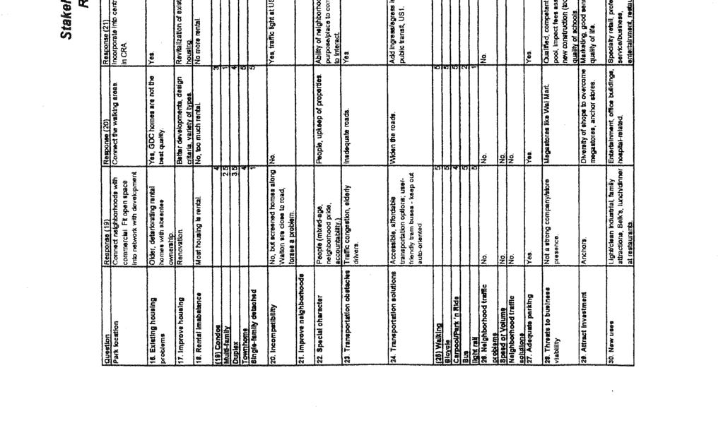
129
EXHIBIT A. Tax Increment Reinvestment Zone No. 1 (Town Center) First Amended Project Plan 1
 First Amended Project Plan 1") EXHIBIT A Tax Increment Reinvestment Zone No. 1 (Town Center) First Amended Project Plan 1 1 As amended by Resolution No. 2008-02-001(TR1R) of the Tax Increment Reinvestment Zone No.1, and approved to
EXHIBIT A Tax Increment Reinvestment Zone No. 1 (Town Center) First Amended Project Plan 1 1 As amended by Resolution No. 2008-02-001(TR1R) of the Tax Increment Reinvestment Zone No.1, and approved to
The transportation system in a community is an
 7 TRANSPORTATION The transportation system in a community is an important factor contributing to the quality of life of the residents. Without a sound transportation system to bring both goods and patrons
Comprehensive Plan. Faribault, Minnesota. Hoisington Koegler Group Inc. Claybaugh Preservation Architecture Inc. Howard R. Green Company Bonz/REA
 Comprehensive Plan Faribault, Minnesota Adopted by the Faribault City Council July 8, 2003 prepared for: prepared by: Hoisington Koegler Group Inc. Claybaugh Preservation Architecture Inc. Howard R. Green
Port Lavaca Future Land Use
 Port Lavaca Future Land Use Introduction The City of Port Lavaca is beginning to see sustained growth, after many years of relative stable population. New single family homes, apartments, and businesses
Implementation Guide Comprehensive Plan City of Allen
 Implementation Guide 2030 Comprehensive Plan City of Allen DRAFT 2015 Implementation Guide Allen 2030 Comprehensive Plan INTRODUCTION The Comprehensive Plan serves as a guide for the growth and development
Demographic and Income Profile
 Demographic and Income Profile Summary Census 21 212 217 Population 3,718 3,985 4,362 Households 1,316 1,418 1,571 Families 1,128 1,212 1,336 Average Household Size 2.82 2.81 2.77 Owner Occupied Housing
Ten Mile Creek Planning Area
 PLANNING AREA POLICIES TEN MILE CREEK Ten Mile Creek Planning Area Location and Context The Ten Mile Creek Planning Area ( Ten Mile Creek area ) is located south of the current Boise AOCI, generally south
SECTION ONE: INTRODUCTION. introduction
 introduction 1 INTRODUCTION Since it was first established in 1843 as a trading post for the Hudson s Bay Company, Victoria has evolved into a Provincial capital city that is recognized across Canada and
4.1.3 LAND USE CATEGORIES
 4.1.3 LAND USE CATEGORIES a. City Center District The City Center District incorporates the existing character and mix of uses in downtown Belmont to encourage redevelopment and new development in keeping
C. Westerly Creek Village & The Montview Corridor
 C. Westerly Creek Village & The VISION Community Vision When the goals of the city are achieved Westerly Creek Village, a distinctive community defined by Montview Boulevard and Westerly Creek, is a strong
TREASURE COAST REGIONAL PLANNING COUNCIL M E M O R A N D U M. To: Council Members AGENDA ITEM 5H
 TREASURE COAST REGIONAL PLANNING COUNCIL M E M O R A N D U M To: Council Members AGENDA ITEM 5H From: Date: Subject: Staff October 17, 2008 Council Meeting Local Government Comprehensive Plan Review Draft
A. WHAT IS A GENERAL PLAN?
 I. Introduction A. WHAT IS A GENERAL PLAN? A general plan is the planning guideline for the future of a city. It contains goals and policies which regulate urban development, the protection of the natural
Corridor Vision. 1Pursue Minnehaha-Hiawatha Community Works Project. Mission of Hennepin County Community Works Program
 1Pursue Minnehaha-Hiawatha Community Works Project Minnehaha-Hiawatha Community Works is a project within the Hennepin Community Works (HCW) program. The mission of the HCW program is to enhance how the
Downtown Dubuque...it s a great time.
 Downtown Dubuque...it s a great time. Your timing could not be better to invest in Downtown. With hundreds of millions in public and private investment occurring on the City s downtown waterfront, millions
Public input has been an important part of the plan development process.
 Lakewood s Comprehensive Plan recognizes that transportation helps shape the community, and that the way the community provides for the safe and efficient movement of people affects the character of the
EXISTING COMPREHENSIVE PLAN
 EXISTING COMPREHENSIVE PLAN Town Center Land Use Element: V. LAND USE POLICIES Town Center Mercer Island's business district vision as described in "Your Mercer Island Citizen-Designed Downtown" was an
Joint Meeting City Council and the Plan Commission. September 1st, 2015
 Joint Meeting City Council and the Plan Commission September 1st, 2015 1 The City Plan Commission shall recommend a City Plan for the physical development of the City Article IX Section 2 of the City of
Staff Report and Recommendation
 Community Planning and Development Planning Services 201 W. Colfax Ave., Dept. 205 Denver, CO 80202 p: 720.865.2915 f: 720.865.3052 www.denvergov.org/cpd TO: City Council Neighborhoods and Planning Committee
City of Heath. Town Center Concept
 In the give-and-take of getting projects designed, financed, and approved, the famous refrain from the film Field of Dreams is heard often: if you build it, they will come. From the perspective of the
Planning Districts INTRODUCTION
 INTRODUCTION To facilitate detailed examination of development prospects for all areas of the community, Delano has been divided into 14 planning districts. The location of these planning districts is
Wasatch CHOICE for 2040
 Wasatch CHOICE for 2040 Economic Opportunities We Can Choose a Better Future We enjoy an unparalleled quality of life along the Wasatch Front. People from all over the world are drawn to our stunning scenery,
Realities and Assets in an In-Town Shopping Center
 SUSTAIN SOUTHERN MAINE MILL CREEK PILOT LESSONS LEARNED April 15, 2013 Realities and Assets in an In-Town Shopping Center 1. An older shopping district that was laid out in a low-density, strip center
ROAD CLOSURE AND LAND USE AMENDMENT SILVER SPRINGS (WARD 1) NORTHEAST OF NOSEHILL DRIVE NW AND SILVER SPRINGS ROAD NW BYLAWS 2C2018 AND 29D2018
 NORTHEAST OF NOSEHILL DRIVE NW AND SILVER SPRINGS ROAD NW BYLAWS 2C2018 AND 29D2018") Page 1 of 19 EXECUTIVE SUMMARY This application proposes redesignating two parcels in the community of Silver Springs from Special Purpose Future Urban Development (S-FUD) District and undesignated road
Page 1 of 19 EXECUTIVE SUMMARY This application proposes redesignating two parcels in the community of Silver Springs from Special Purpose Future Urban Development (S-FUD) District and undesignated road
A BLUEPRINT FOR BROCKTON A CITY-WIDE COMPREHENSIVE PLAN
 A BLUEPRINT FOR BROCKTON A CITY-WIDE COMPREHENSIVE PLAN Public Meeting October 2016 1 Plan Summary and Discussion Public Meeting May 4 2017 City of Brockton Bill Carpenter, Mayor Department of Planning
12/9/2013. HOLLYWOOD/PINES CORRIDOR PROJECT AMPO 2013 Annual Conference October 24, Our Perspective. Broward.
 HOLLYWOOD/PINES CORRIDOR PROJECT AMPO 2013 Annual Conference October 24, 2013 Our Perspective Broward Fort Lauderdale 1 Broward Metropolitan Planning Organization Fort Lauderdale Fort Lauderdale Skyline
WATERFORD Plan of Preservation, Conservation and Development Supplement Part 1 - Policy Element
 WATERFORD 2012 Plan of Preservation, Conservation and Development 2015 Supplement Part 1 - Policy Element Effective June 11, 2015 2015 Plan Update GOAL To respond to the evolving land use needs and continually
Small Area Plan. South Gateway
 Small Area Plan Adopted May 12, 2008 South Gateway Purpose. The South Gateway Small Area Plan defines the City s expectations for the future of the southern entrance to the City at Interstate 85 and Highway
Scope of Services. River Oaks Boulevard (SH 183) Corridor Master Plan
 Corridor Master Plan") Scope of Services River Oaks Boulevard (SH 183) Corridor Master Plan PROJECT AREA The project area consists of the River Oaks Boulevard (SH 183) corridor bounded by SH 199 at the northern end and the Trinity
Scope of Services River Oaks Boulevard (SH 183) Corridor Master Plan PROJECT AREA The project area consists of the River Oaks Boulevard (SH 183) corridor bounded by SH 199 at the northern end and the Trinity
Mark-up of the effect of the proposed Bronte Village Growth Area OPA No.18 on the text of section 24, Bronte Village, of the Livable Oakville Plan
 Mark-up of the effect of the proposed Bronte Village Growth Area OPA No.18 on the text of section 24, Bronte Village, of the Livable Oakville Plan Notes: This document is provided for information purposes
City of Farmington. Downtown Plan. Amendment to the 1998 Master Plan Adopted October 11, 2004
 City of Farmington Amendment to the 1998 Master Plan Adopted October 11, 2004 Introduction Planning Background 1 Scope and Components of the Plan Amendment 2 Concept Introduction 3 Plan Concepts 3 Conceptual
Today Land & People. Northeast Nampa Gateway District. Employment. Land Use Characteristics. Demographics. Current Zoning
 Today Land & People Employment Major employers include Saint Alphonsus, the College of Western Idaho, the Auto Mall, Sorrento Lactalis and Walmart. 3,004 jobs in 2010 (COMPASS-CIM 2040 TAZ data) 4,345
Chapter 1.0 Introduction
 Chapter 1.0 Introduction 1.1 Background The North Metro commuter rail line is part of the RTD FasTracks regional transit system expansion program to build more than 100 miles of rail transit throughout
TEMPLE MEDICAL & EDUCATION DISTRICT
 City of Temple, Texas TEMPLE MEDICAL & EDUCATION DISTRICT 1 Description. The City of Temple joined in partnership with key public and private entities to jointly promote education and medical activities
7Page 91 CLEMMONS COMMUNITY COMPASS 7 COMMUNITY CHARACTER
 7 Community Character The beauty of Clemmons won t necessarily be a reflection of our past, but our future. This quote from Comprehensive Plan Steering Committee member Wayne Dodson captures the essence
INDEPENDENCE BOULEVARD AREA PLAN
 INDEPENDENCE BOULEVARD AREA PLAN Public Meeting October 28, 2008 Tonight s Agenda Introduction 4:00 4:05 Tom Warshauer Presentation 4:05 5:00 Blake Drury Group Exercises 5:00 5:50 All Wrap Up & Next Steps
Retail / Office - Available on Busy Florence Ave.
 Retail / Office - Available on Busy Florence Ave. 1931-1935 Florence Ave. Los Angeles, CA 90001 DEMOS 1 mile 3 mile 5 mile Population 62,398 489,568 1,146,128 Avg. HH Income $43,380 $44,533 $45,775 Daytime
CHAPTER 7: Transportation, Mobility and Circulation
 AGLE AREA COMMUNITY Plan CHAPTER 7 CHAPTER 7: Transportation, Mobility and Circulation Transportation, Mobility and Circulation The purpose of the Transportation, Mobility and Circulation Chapter is to
Request for Statement of Interest in Implementation of the Roosevelt Road Redevelopment Plan
 425 Hillside Avenue Request for Statement of Interest in Implementation of the Roosevelt Road Redevelopment Plan I. INTRODUCTION The is seeking the services of a qualified consulting firm to prepare plans
HE VISION. Building a Better Connected Place
 HE VISION Building a Better Connected Place WALK INTO THE FUTURE. Life in Cranberry, 2030 Here s what our residents told us they wanted to see in their community by 2030: The Cranberry of 2030 is a place
Urban Planning and Land Use
 Urban Planning and Land Use 701 North 7 th Street, Room 423 Phone: (913) 573-5750 Kansas City, Kansas 66101 Fax: (913) 573-5796 Email: planninginfo@wycokck.org www.wycokck.org/planning To: From: City Planning
REGIONAL ACTIVITY CENTER
 DRAFT REGIONAL ACTIVITY CENTER 70 EAST BENCH MASTER PLAN DRAFT 06 Introduction The East Bench Regional Activity center is comprised of large educational, research, medical, and employment centers. These
Cobb County Design Guidelines Mableton Parkway & Veterans Memorial Highway Community Design Workshop January 12, 2017
 Community Design Workshop January 12, 2017 Agenda Opening Remarks / Introductions Scope of Work Existing Conditions Key Issues / Opportunities VPS Summary Draft Vision & Goal Statement Implementation Concepts
Chapter 1: Introduction
 Chapter 1: Introduction The Penn Avenue Community Works Corridor Vision and Implementation Framework presents an integrated communitybased vision and a coordinated, long-term implementation framework for
Plan Overview. Manhattan Area 2035 Reflections and Progress. Chapter 1: Introduction. Background
 Plan Overview The Manhattan Urban Area Comprehensive Plan (the Comprehensive Plan) is a joint planning initiative of the City of Manhattan, Pottawatomie County, and Riley County. The 2014 Comprehensive
Gold Line Bus Rapid Transit Transit Oriented Development (BRTOD) Helmo Station Area Plan
 Helmo Station Area Plan") Appendix F Gold Line Bus Rapid Transit Transit Oriented Development (BRTOD) Helmo Station Area Plan Introduction and Purpose of the Plan The Gold Line Bus Rapid Transit facility is an eleven-mile dedicated
Appendix F Gold Line Bus Rapid Transit Transit Oriented Development (BRTOD) Helmo Station Area Plan Introduction and Purpose of the Plan The Gold Line Bus Rapid Transit facility is an eleven-mile dedicated
DOMINION BOULEVARD CORRIDOR STUDY AND ECONOMIC DEVELOPMENT STRATEGIC PLAN A MODEL FOR CHESAPEAKE S FUTURE
 DOMINION BOULEVARD CORRIDOR STUDY AND ECONOMIC DEVELOPMENT STRATEGIC PLAN A MODEL FOR CHESAPEAKE S FUTURE Overview I. Draft Plan Process II. Draft Plan Overview a. Market Analysis b. Master Land Use Plan
A citizen s guide to the. Comprehensive Plan. City of Lakeville, Minnesota 1
 A citizen s guide to the Comprehensive Plan 2008 City of Lakeville, Minnesota 1 Introduction The City of Lakeville completed an update of its Comprehensive Plan in 2008. A comprehensive plan is a tool
Land Use Amendment in Southwood (Ward 11) at and Elbow Drive SW, LOC
 at and Elbow Drive SW, LOC") 2018 November 15 Page 1 of 10 EXECUTIVE SUMMARY This land use amendment application was submitted by Rick Balbi Architect on 2017 August 31 on behalf of Sable Developments Ltd, and with authorization from
2018 November 15 Page 1 of 10 EXECUTIVE SUMMARY This land use amendment application was submitted by Rick Balbi Architect on 2017 August 31 on behalf of Sable Developments Ltd, and with authorization from
Secrest Short Cut and Monroe Expressway Small Area Plan AUGUST 29, 2018
 Secrest Short Cut and Monroe Expressway Small Area Plan AUGUST 29, 2018 Background and Process Monroe Expressway will be open by the end of 2018 Union County and Indian Trail identified a need to revisit
CITY OF COLWICH COMPREHENSIVE PLAN LAND USE LAND USE 1
 LAND USE LAND USE 1 WHAT YOU WILL FIND IN THIS CHAPTER: Discussion of today s conditions and tomorrow s projections Discussion of challenges and opportunities Discussion of the environmental quality goals,
BUDGETING FOR OUTCOMES TRINITY RIVER CORRIDOR
 BUDGETING FOR OUTCOMES TRINITY RIVER CORRIDOR Trinity River Corridor Team Members: Kelly High, Streets Department Megan Lam, Office of Financial Services Mike Mikeska, Dallas Water Utilities Diana Ochoa,
DRAFT PLAN PRESENTATION
 DRAFT PLAN PRESENTATION 1.23.2018 AGENDA Process Project Schedule Results from Visioning Workshop Draft Plan Highlights Concept Plans Feedback Next Steps PROJECT SCHEDULE KICK-OFF WORKSHOP August 29 th
Sustainably Repositioning Greyfield Sites. Greyfield Sites Anywhere
 Sustainably Repositioning Greyfield Sites Jim Constantine Looney Ricks Kiss Architects Todd Poole 4ward Planning Greyfield Sites Anywhere Pennsylvania Chapter American Planning Association Conference 2009
ITEM #8. Regional Smart Growth Program. Regional Smart Growth Program. Presentation Overview. Coast Highway Vision and Stategic Plan.
 Regional Smart Growth Program Economic Development Commission What is Smart Growth? Adopted as part of the Regional Comprehensive Plan (RCP) RCP provides vision for region based on Smart Growth and sustainability
Definitions. Average Daily Traffic Demand (ADT): The actual number or projected number of cars that pass a point in a 24-hour period.
: The actual number or projected number of cars that pass a point in a 24-hour period.") Definitions Access Management: A combination of physical techniques and transportation policies used to control the flow of traffic between roads and the surrounding lands. Alternative City Form Scenarios:
Definitions Access Management: A combination of physical techniques and transportation policies used to control the flow of traffic between roads and the surrounding lands. Alternative City Form Scenarios:
Town Center (part of the Comprehensive Plan)
") Town Center (part of the Comprehensive Plan) Mercer Island Town Center Looking North (2014) In 1994, a year-long process culminated in a set of design guidelines and code requirements for the Town Center
Town Center (part of the Comprehensive Plan) Mercer Island Town Center Looking North (2014) In 1994, a year-long process culminated in a set of design guidelines and code requirements for the Town Center
East Bench Master Plan Update
 Community & Economic Development Office of the Director East Bench Master Plan Update To: From: Planning Commission Wayne Mills, Senior Planner Date: November 18, 2015 CC: Re: Nora Shepard, City Planning
3. VISION AND GOALS. Vision Statement. Goals, Objectives and Policies
 Vision Statement Queen Creek s interconnected network of parks, trails, open spaces and recreation opportunities provide safe and diverse activities and programs that sustain its unique, small town, equestrian
Policies and Code Intent Sections Related to Town Center
 Policies and Code Intent Sections Related to Town Center The Town Center Vision is scattered throughout the Comprehensive Plan, development code and the 1994 Town Center Plan. What follows are sections
CITY OF CHARLOTTESVILLE, VIRGINIA CITY COUNCIL AGENDA
 CITY OF CHARLOTTESVILLE, VIRGINIA CITY COUNCIL AGENDA Agenda Date: December 16, 2013 Action Required: Adoption of Resolution Presenter: Staff Contacts: Title: James E. Tolbert, AICP, Director of NDS James
hermitage town center
 hermitage town center A Community Vision prepared by Strada for The City of Hermitage and The Mercer County Regional Planning Commission January 2007 table of contents introduction 3 design principles
CHAPTER 3 VISION, GOALS, & PLANNING PRINCIPLES. City of Greensburg Comprehensive Plan. Introduction. Vision Statement. Growth Management Goals.
 CHAPTER 3 VISION, GOALS, & PLANNING PRINCIPLES Introduction The Greensburg Comprehensive Plan is intended as a working community document. A combination of long and short-term goals, this document is intended
The Five Components of the McLoughlin Area Plan
 The Five Components of the McLoughlin Area Plan This documents contains the complete language of the five components of the McLoughlin Area Plan: The Vision Statement The Values The Guiding Principles
7Page 1 CLEMMONS COMMUNITY COMPASS 1 PLAN OVERVIEW
 1 Plan Overview WHAT IS I THE CLEMMONS COMMUNITY COMPASS? The Clemmons Community Compass is our community s comprehensive plan. It serves as our blueprint and provides direction for the future of the Village
Land Use. Hardware Street Vendor Mixed-Use
 Land Use Definition Land Use is the way a piece of real estate is utilized. Existing, proposed, and adopted land uses all play a role in the planning process. Once a land use plan is adopted, the next
Olde Towne Vision Plan
 Olde Towne Vision Plan Introduction In 2016, the City of Bellevue will complete its move of City offices from Olde Towne Bellevue to its new municipal complex on Wall Street. The City intends to sell its
Midtown Greenway PROJECT REPORT CARD
 Midtown Greenway PROJECT REPORT CARD Project Overview and History The Midtown Greenway is a 5.5-mile multi-use trail that connects the Mississippi River to the Minneapolis Chain of Lakes. The corridor,
TRANSPORTATION ELEMENT GOALS, OBJECTIVES, AND POLICIES
 TRANSPORTATION ELEMENT GOALS, OBJECTIVES, AND POLICIES GOAL 2 The City shall provide a safe, convenient, effective, and energy efficient multimodal transportation system which is coordinated with the Future
1.0 Purpose of a Secondary Plan for the Masonville Transit Village
 Report to Planning and Environment Committee To: Chair and Members Planning & Environment Committee From: John M. Fleming Managing Director, Planning and City Planner Subject: Masonville Transit Village
Allen Street Civic District Redevelopment Area Plan Redevelopment Plan & Proposal State College Planning Commission State College Redevelopment
 Allen Street Civic District Redevelopment Area Plan Redevelopment Plan & Proposal State College Planning Commission State College Redevelopment Authority September 17, 2015 Discussion Points Overview of
FUTURE LAND USE ELEMENT
 FUTURE LAND USE ELEMENT GOAL I: To create and sustain a great place to live, play, and prosper Objective 1: The City of Ocala shall incorporate the principles and strategies of the Ocala 2035 Vision into
9 th Street Sub Area Plan
 9 th Street Sub Area Plan In the 1990 s, when the Township prepared the last Master Plan, the 9 th Street corridor was studied as part of a larger 9 th Street Focus Area that included the West Main Street
Tyvola & Archdale Transit Station Area Plan. May 15, 2008
 Tyvola & Archdale Transit Station Area Plan First Public Meeting May 15, 2008 Presentation Outline 1. Purpose and Process 2. Station Area Overview 3. Plan Recommendations Vision Land Use Transportation
ARLINGTON COUNTY, VIRGINIA
 ARLINGTON COUNTY, VIRGINIA County Board Agenda Item Meeting October 15, 2005 DATE: September 28, 2005 SUBJECT: Request to Advertise the adoption of the 2005 Clarendon Sector Plan C. M. RECOMMENDATION:
A larger version of this map is located on the last page of this PDF.
 MAP Committee Input McLoughlin Area Draft Vision Map A larger version of this map is located on the last page of this PDF. 1. The map above is intended to portray a vision for the McLoughlin area. It highlights
About Momentum Midland
 About Momentum Midland Achieving a community s full potential in terms of economic development and quality of life is critically important to its long term sustainability. Core to achieving this is a vibrant
RECREATION, OPEN SPACE AND GREENWAYS ELEMENT GOALS, OBJECTIVES, AND POLICIES
 RECREATION, OPEN SPACE AND GREENWAYS ELEMENT GOALS, OBJECTIVES, AND POLICIES GOAL R-1: DEVELOP A RECREATION, OPEN SPACE AND GREENWAYS SYSTEM AS AN INTEGRAL COMPONENT OF AN OVERALL, COUNTY-WIDE ECONOMIC
Arlington, Virginia is a worldclass
 EXECUTIVE S U M M A RY Arlington maintains a rich variety of stable neighborhoods, quality schools and enlightened land use policies, and received the Environmental Protection Agency s highest award for
Creating Complete Roadway Corridors:
 Creating Complete Roadway Corridors: The AASHTO Guide to Transportation Landscape Architecture and Environmental Design NCHRP Project 15-33 Status Report AASHTO Standing Committee on Design Technical Committee
LAND USE OVERVIEW WHAT YOU WILL FIND IN THIS CHAPTER
 LAND USE WHAT YOU WILL FIND IN THIS CHAPTER Information about the City s expected population and employment growth. Description and capacity of existing and future land use designations. Policies that
Animating the Rideau Canal December 2013
 Executive Summary Animating the Rideau Canal December 2013 Why study the Rideau Canal? The Rideau Canal has been an important part of Ottawa throughout its history, and has shaped and been shaped by the
City Center Neighborhood Plan
 [1] City Center Neighborhood Plan As adopted by Ordinance No. 2014-09-049 and amended by Ordinance Nos. Formerly CBD Neighborhood as adopted by Ordinance No. 8868 and amended by Ordinance Nos. 8946, 9693,
Table of Contents. Elm Avenue Improvement Plan City of Waco, Texas. Introduction 1. Existing Context 1 Figure 1 2.
 Table of Contents Introduction 1 Existing Context 1 Figure 1 2 Plan Guidelines 3 Future Urban Form 4 The West-End 4 Main Street 6 The East-End 7 Figure 2 9 Public Improvement Recommendations 7 General
TOWN COUNCIL / PLANNING COMMISSION
 Workshop #3 TOWN COUNCIL / PLANNING COMMISSION January 20, 2011 Consultant Team In Attendance Tonight BMS Design Group Nevada City and San Francisco Michael Smiley, AICP, ASLA Partner-in-Charge Nancy L.
THAT the attached Terms of Reference for the Thornhill Centre Street Study be approved.
 COMMITTEE OF THE WHOLE AUGUST 18, 2003 THORNHILL CENTRE STREET STUDY PLANNING FILE: 15.92 Recommendation The Commissioner of Planning recommends: THAT the attached Terms of Reference for the Thornhill
The Lower SaLuda Greenway
 The Lower SaLuda Greenway InITIaTIve a FLourIShInG Greenway. a hub For economic GrowTh. a ConneCTIon BeTween CoMMunITIeS. In April 2017 the Michael J. Mungo Foundation and Lexington County commissioned
LAND USE AMENDMENT DOWNTOWN COMMERCIAL CORE (WARD 7) MACLEOD TRAIL SE AND 5 AVENUE SE BYLAW 254D2017
 MACLEOD TRAIL SE AND 5 AVENUE SE BYLAW 254D2017") Page 1 of 10 EXECUTIVE SUMMARY This Land Use Amendment application seeks to redesignate a full downtown block (currently the YWCA site) from a Direct Control based on the CM-2 District (Land Use Bylaw
Page 1 of 10 EXECUTIVE SUMMARY This Land Use Amendment application seeks to redesignate a full downtown block (currently the YWCA site) from a Direct Control based on the CM-2 District (Land Use Bylaw
EDC ADDENDUM to the INTERIM REPORT
 EDC ADDENDUM to the INTERIM REPORT Economic Impact Assessment of Mansfield Park November 2018 STEWARDSHIP STRATEGIES Design Planning Historic Preservation Economic Development INTERIM REPORT - Economic
Kinzie Industrial Corridor
 Mayor Emanuel s Industrial Corridor Modernization Kinzie Industrial Corridor Fulton Market Innovation District Plan Implementation October 19, Rahm Emanuel, Mayor David Reifman, Commissioner Dept. of Planning
Status Update (2006 vs. Now) Citizen s Advisory Committee February Plan for Prosperity
 Citizen s Advisory Committee February Plan for Prosperity") Status Update (2006 vs. Now) Citizen s Advisory Committee February 2018 Plan for Prosperity 2000 2017 2000 2017 Gardnerville Population 6,000 5,760 5746 5,500 5,000 5,067 5,550 5,165 5,394 5,412 5,250
Status Update (2006 vs. Now) Citizen s Advisory Committee February 2018 Plan for Prosperity 2000 2017 2000 2017 Gardnerville Population 6,000 5,760 5746 5,500 5,000 5,067 5,550 5,165 5,394 5,412 5,250
G. RECREATION AND OPEN SPACE ELEMENT. The following summarizes the Recreation and Open Space Element:
 G. RECREATION AND OPEN SPACE ELEMENT The purpose of the Element is to provide the framework and direction for a comprehensive system of public and private sites for recreation, including, but not limited
CHAPTER 7: VISION AND ACTION STATEMENTS. Noble 2025 Vision Statement
 CHAPTER 7: VISION AND ACTION STATEMENTS This chapter presents the vision, policy and action statements that transform the comprehensive planning study, an analysis of Noble s past, future trends and community
Northwest Rail Corridor and US 36 BRT Development Oriented Transit Analysis 4.4 STATION AREA FINDINGS
 4.4 STATION AREA FINDINGS Each station is different, and each one requires a separate set of recommendations based on the vision for the site. This section outlines an initial TOD strategy and recommendations
Cumberland Region Tomorrow is a private, non-profit, citizen based regional organization working with Greater Nashville Regional Council
 Cumberland Region Tomorrow is a private, non-profit, citizen based regional organization working with Greater Nashville Regional Council and others in the public and private sectors, dedicated to planning
IMPLEMENTATION STRATEGIES. In This Chapter. Goals & Strategies 182 Project List 183 Future Land Use 186 CHAPTER 11 IMPLEMENTATION STRATEGIES
 In This Chapter Goals & Strategies 182 Project List 183 Future Land Use 186 11 IMPLEMENTATION STRATEGIES NORTH AUGUSTA, SC 2017 COMPREHENSIVE PLAN 179 Individual commitment to a group effort that is what
City of Palm Coast 2035 Comprehensive Plan - Goals, Objectives, and Policies EXECUTIVE SUMMARY
 EXECUTIVE SUMMARY INTRODUCTION The original Comprehensive Plan, with two adopted planning timeframes, was adopted in 2004, following the City s incorporation in 1999. The first timeframe is five (5) years
Midtown Greenway Land Use and Development Plan Executive Summary
 Midtown Greenway Land Use and Development Plan Executive Summary Introduction The Midtown Greenway Land Use and Development Plan sets policy direction for land use and development in the Midtown Greenway
TABLE OF CONTENTS. Transportation Chapter 1 - Introduction and Purpose of Planning to 1-3. Utilities
 Chapter 1 - Introduction and Purpose of Planning... 1-1 to 1-3 Pennsylvania Municipalities Planning Code (Act 247)...1-1 Previous County Planning Activities...1-1 Objectives of the Plan...1-2 Elements
Yadkin River Greenway Feasibility Study Fact Sheet Village of Clemmons, Town of Lewisville, Town of Bermuda Run
 Fact Sheet Village of Clemmons, Town of Lewisville, Town of Bermuda Run Project Background The Yadkin River Greenway Feasibility Study is a joint project with the Village of Clemmons, the Town of Bermuda
Mariposa Lakes. Planned Community. Project Overview. Stockton, CA
 Planned Community Stockton, CA Project Overview March 2007 Summary of Proposed Community is a master-planned community proposed for development on approximately 3,810 acres in southeast Stockton. In 2004,