Application for LCI Supplemental Study FY 2012 Dec. 16, 2011
|
|
|
- Richard Richards
- 6 years ago
- Views:
Transcription


1 Perimeter Community Improvement Districts LCI Supplemental Study FY 2012 Application for LCI Supplemental Study FY 2012 Dec. 16, 2011
2 Perimeter Community Improvement Districts LCI Supplemental Study FY 2012 Table of Contents Application Form... Page 3 Study Area... Pages 4-5 Matching Funds Resolution... Page 6 Issue Statement... Pages 7-9 Scope of Work... Pages Budget for Study... Page 12 Schedule for Study Development & Completion... Page 13 Commitment and Ability to Implement Existing LCI Plan & Report of Accomplishments... Pages Appendixes... Pages 25-32
3
4 Perimeter Community Improvement Districts LCI Supplemental Study FY Proposed Study Area The study area includes the complete boundaries of the Perimeter Community Improvement Districts. It includes three jurisdictions: a portion of the cities of Sandy Springs and Dunwoody and unincorporated DeKalb County. The area is approximately 4.2 square miles. Three MARTA stations are included within the study area and a fourth one is located at the northern edge of the study area boundary. These stations provide connections to employment, housing, hospitals and medical offices, colleges, shopping, dining and other services and Hartsfield International Airport. The study area also includes major highways GA 400 and I-285 with exits at Peachtree Dunwoody Road, Ashford Dunwoody Road, Hammond Drive and Abernathy Road. In addition, the study area includes several major arterials: Perimeter Center Parkway, Perimeter Center East/West, Hammond Drive, Mt. Vernon Highway and Glenridge Connector. The presence of these major highways and arterials provides good access to Perimeter from all four directions through 11 gateways. A major regional urban center in Metro Atlanta, Perimeter includes diverse uses and activities. It is the largest office district in Metro Atlanta and is home to the world headquarters of global corporations such as UPS, Newell Rubbermaid, Cox Enterprises and others. It includes several educational institutions and the largest concentration of medical facilities in Metro Atlanta. Perimeter also offers considerable shopping and restaurant locations including the second largest mall in Georgia Perimeter Mall. Perimeter is rapidly becoming a mixed-use district with many new apartments and condos including high rise condo towers such as the Manhattan that provide housing near employment and the opportunity for residents of nearby single family areas to downsize their living accommodations as they grow older. 4 P age

5 Perimeter Community Improvement Districts LCI Supplemental Study FY P age
6
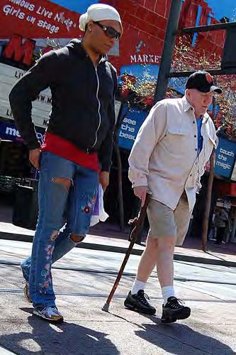
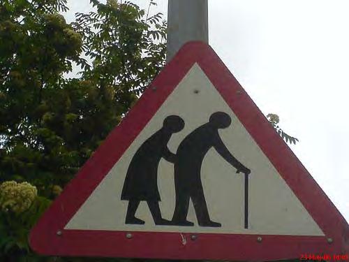
7 Perimeter Community Improvement Districts LCI Supplemental Study FY Issue Statement - Lifelong Communities Feasibility Study a. Ability to Further the LCI Update Implementation: The proposed study will further the implementation of the following goals of the PCIDs 10-year LCI update: To offer diverse choices and opportunities for residents, visitors and companies To provide planned growth management To offer cultural and recreational facilities and activities To integrate multiple modes of transit and have vibrant transit connections at each of the MARTA stations To enhance walkable and pedestrian friendly environments To create well connected pedestrian, bike, shuttle, transit modes to and between various uses, nodes and neighborhoods To provide easy and convenient access to transit To be a successful model for other suburban communities to emulate b. Need, Purpose and Products: One of the fastest growing population sectors in Metro Atlanta is seniors. The statistics for the Central Perimeter Market and the Perimeter Community Improvement Districts reflect this trend. From 2000 to 2010, the number of Baby Boomers (ages 45-64) rose 18 percent to comprise 23 percent of the total market population and the 65+ age group also rose 18% to comprise 11 percent of the market, according to the Atlanta Regional Commission. Together the two groups comprise 34 percent or a little more than a third of the total market population. Within the PCIDs, nearly a fifth of the population is Baby Boomers and those ages 65+ comprise 11 percent for a total of 30 percent of the market population, according to the ARC. Recognizing this trend, the Perimeter CIDs want to extend their LCI program to incorporate Lifelong Community principles and standards as an important component of developing a complete urban community. The PCIDs have a 12-year track record of success in transforming Perimeter from a traffic-clogged suburban shopping, office and hotel district with limited housing and alternative transportation options into a mixed-use urban center with more housing and mobility options. No pedestrian access signs have been removed and replaced with miles of wide, tree-lined sidewalks that offer walkability throughout Perimeter between office buildings, restaurants, shopping and housing. Three bike routes (four miles) are complete as part of comprehensive streetscape projects throughout Perimeter. And, 25 intersections to date throughout Perimeter have received complete upgrades to improve traffic flow and pedestrian accessibility and safety. Many of these intersection improvements include pedestrian countdown signals, one of the main features that seniors desire. In making these infrastructure changes, the PCIDs have followed federal Americans with Disabilities Act Accessibility Guidelines. However, ADA guidelines do not require the environmental design characteristics that seniors need for community accessibility and mobility. As the PCIDs make transportation improvements in the future, there is a need to create and incorporate design standards based on Lifelong Communities principles to address issues such as curb height, travel distances, interaction of slope and distance, intersection design, timing of lights, lighting, hand railing, stair design and visual distractions that can provide barriers for seniors. Improved connectivity between modes of transportation and housing is also needed to implement a lifelong community in Perimeter and land use strategies are needed as well to encourage the 7 P age
8 Perimeter Community Improvement Districts LCI Supplemental Study FY P age incorporation of more housing near services and amenities to meet the needs of empty nesters as they downsize from nearby single family homes and want to age in place in the Perimeter area. With three MARTA stations within its boundaries and a fourth nearby, Perimeter can provide a regional model for other suburban communities for the inclusion and use of transit by seniors as well as developing a connected, barrier-free environment for all transportation users. The PCIDs also can provide a regional model for how a community can meet the needs of seniors who live in nearby existing family neighborhoods and want to downsize yet remain the same community. The purpose of the Lifelong Communities Feasibility Study within the PCIDs is the following: To provide an assessment of availability and accessibility to transportation, housing options, opportunities that encourage healthy lifestyles and social interaction, supportive services and amenities that support a Lifelong Community To provide an assessment of how transportation infrastructure provides the design features needed by seniors To determine barriers and challenges to implementation of Lifelong Communities principles To provide recommendations for implementation of improvements in availability and accessibility of transportation, housing, amenity, services and healthy lifestyle and social interaction options that meet the needs of senior users in the future Products: Demographic and assessment data that can be used to promote and foster Lifelong Communities principles New design standards that address transportation barriers for seniors New wayfinding signs that meet the needs of seniors Recommendations for building and land use zoning codes and standards based on ARC Lifelong Communities principles for incorporation in PCIDs overlay district to be created in 2012 in partnership with City of Dunwoody and for incorporation in the existing Sandy Springs and DeKalb County overlay districts Other implementation recommendations for PCIDs to implement a Lifelong Community c. Outcomes: Better connections and access for seniors to alternative travel modes Expanded access for seniors to services and amenities in Perimeter such as medical offices Increased availability and use by seniors of infrastructure that encourages healthier lifestyles (multiuse paths and pedestrian facilities) More diverse residential neighborhoods that allow aging in place Seamless multi-jurisdictional overlay district for PCIDs that incorporates ARC Lifelong Communities principles d. Support of PLAN 2040: The proposed work supports the following local programs/policies of the PLAN 2040 Local Government Plan Implementation requirements: Increase mobility options for people and goods M1.F Participate in ongoing training through ARC s Community Planning Academy on transportation related topics including Lifelong Community principles and design guidelines.
9 Perimeter Community Improvement Districts LCI Supplemental Study FY P age M1.I Incorporate Lifelong Community principles into local transportation plans. Foster a healthy, educated, well trained, safe and secure population Exc2.B Implement an ongoing public engagement process with business leaders and owners and the general public to sustain continued support and dialogue regarding comprehensive planning goals and objectives. Promote places to live with easy access to jobs and services M3.D Adopt a resolution to support and integrate Lifelong Community principles in the local planning process. M3.N Assess the demographic and socioeconomic makeup of the community in relation to existing and potential future locations of senior centers, senior-focused housing and other senior-focused services. M3.O Analyze the relationship between existing senior center locations, senior-focused housing and other senior-focused services to existing transportation options, land use plans and health and support services. Exc3.G Evaluate codes, services and practices to identify regulatory barriers that obstruct the support of Lifelong Community principles. Exc3.H Amend zoning codes and development regulations to eliminate regulatory barriers that obstruct the support of Lifelong Community principles identified in a code audit. Identify innovative approaches to economic recovery and long term prosperity Exc5.H Develop a distinctive wayfinding and signage system for key areas within the community. e. Transportation Purpose: Moving toward a livable center as described in the original LCI study, the PCIDs are in the conceptual design phase of creating a comprehensive, seamless system of walkways, improved access and infrastructure to the Dunwoody MARTA station and improved interaction between all modes of travel. This is in response to a 2009 report prepared for the PCIDs which documented access and mobility problems and hostile interaction between the walking, driving and cycling public in and around Perimeter s three MARTA stations. The improvements plan for access to the Dunwoody MARTA Station will be a model for the other two transit stations within the PCIDs Medical Center and Sandy Springs. With the population of the Metro Atlanta region aging dramatically, the availability of transit will become more important as many seniors lose the ability to drive. A study by the American Association of Retired Persons found that when older persons lose the car keys, they make 15 percent fewer trips to the doctor and far fewer trips to family, friends and other places. However, Metro Atlanta ranks worst for seniors stranded without transit among metro areas with more than 3 million people in a study by the Center for Neighborhood Technology released by Transportation for America. As it develops plans to improve access to the three Perimeter MARTA Stations, findings from the proposed Lifelong Communities study can be incorporated and serve as a model for other suburban communities for the inclusion and use of transit by seniors. The PCIDs also are in the process of completing a commuter trail system design feasibility study to create alternative access from businesses to Perimeter s transit stations. These trails can also serve as multi-use trails that can promote physical activity and social interaction among seniors by incorporating the findings and recommendations from a Lifelong Communities Feasibility study into these plans as well. Furthermore, a transit village around the Dunwoody MARTA station is being planned by High Street, a Boston, Mass. developer. It is advantageous to have design guidelines and an overlay district with planning and zoning codes in place that meet Lifelong Communities principles before developments such as these come on stream.
10 Perimeter Community Improvement Districts LCI Supplemental Study FY Scope of Work Proposed Project Manager: Jennifer Harper, P.E., Project Manager, PCIDs Study Process Study will involve meeting with the stakeholders within the Perimeter LCI to assist in creating the vision, goals and intent for this Lifelong Communities project. This will be followed by a (1) review of transportation infrastructure design standards that pertain to seniors and an assessment of their current use within the PCIDs boundaries (2) an assessment of availability and accessibility to transportation, housing options, opportunities that encourage healthy lifestyles and social interaction, supportive services and amenities that support a Lifelong Community (3) an assessment of barriers and local challenges that obstruct the support of Lifelong Communities principles including an identification of the various projects, guidelines and regulations that affect or need coordination with the Lifelong Communities project recommendations. The PCIDs will use the ARC Lifelong Community Citizen Survey instrument to help measure Lifelong Community assets within Perimeter. We will the survey to building and property owners within the area, the three local government jurisdictions within the PCIDs, surrounding homeowners associations, chamber of commerce board members, senior organizations in the area and other stakeholders. We will distribute the survey also at public and stakeholder meetings. Recommendations will be developed as specified in the scope of work section. This will be reviewed with the stakeholders for their comments and approval. A final set of recommendations will be published and presented to the multi-jurisdictions within the PCIDs. Specific projects will be identified for implementation by the PCIDs and the PCIDs will work with their multi-jurisdiction partners to accomplish other recommendations that involve new governmental policies and regulations. Task 1: Public and Stakeholder Involvement Core Team (consultant conducting study, PCIDs Program Manager, PCIDs senior management) meets with the Stakeholders (including business and community leaders; representatives from the three governmental jurisdictions within the PCIDs boundaries including economic development, transportation, parks and recreation and public health officials; MARTA representative; community groups and residents and visitors who are representative of the senior demographic) to review the goals and vision, local demographic data and transportation design standards for seniors, Lifelong Communities principles and local challenges and opportunities. Review of analysis and draft recommendations with the Core Team, Stakeholders Presentation of final recommendations to the PCIDs staff and board, stakeholders, ARC and DeKalb County, Cities of Dunwoody and Sandy Springs for adoption. Task 2: Analysis Review local community data on senior population and expected growth Review transportation design standards for seniors Analyze seniors accessibility to transit 10 P age
11 Perimeter Community Improvement Districts LCI Supplemental Study FY 2012 Analyze accessibility of home to community (i.e. dining, shopping, medical care, opportunities that encourage healthy lifestyles and social interaction) within Perimeter LCI area Analyze specific community environment barriers related to sidewalks, crosswalks, curb cuts, ramps, signage etc. Analyze availability of housing options, opportunities that encourage healthy lifestyles and social interaction, amenities and support services for seniors within the Perimeter LCI area Analyze infrastructure codes and ordinances needed to meet needs of seniors in creation of overlay district for the Dunwoody portion of Perimeter and updating of Sandy Springs and DeKalb County overlay districts for Perimeter Task 3: Development of Recommendations For integration of accessibility improvements for seniors to Perimeter s 3 MARTA stations with connectivity/accessibility improvements being planned for those stations by PCIDs For connectivity improvements from housing to community For changes/upgrades within the PCIDs in community options such as senior housing For codes and ordinances for overlay districts in Perimeter area Task 4: Final Document A final report will be prepared to compile the results of the overall work including a description of the publicprivate process used to assist with information gathering and support for improvements; key information, the study process and relevant findings and recommendations. The report will be made available in print and electronic format. 11 P age
12 Perimeter Community Improvement Districts LCI Supplemental Study FY Budget Public and stakeholder Involvement (Task 1) Analysis (Task 2) Development of Recommendations (Task 3) Project Deliverables (Task 4) $ 5,000 $45,000 $25,000 $ 65,000 Total $80, P age
13 Perimeter Community Improvement Districts LCI Supplemental Study FY Schedule for Project Development Duration 4+ (four plus months) Public/stakeholder September through November 2012 Involvement Analysis Analysis August through September 2012 Recommendations September through October 2012 Report October through November P age
14 Perimeter Community Improvement Districts LCI Supplemental Study FY Commitment and Ability to Implement Existing LCI Plan PROJECT/ INITIATIVES 14 P age COMPLETION DATE Livable Centers Initiative report August of the 48 projects in the LCI five year action plan were completed by August 2002 to March 2005 March 2005 LCI Five-Year Plan update March 2005 PCIDs has completed 27 of the 39 projects identified in the 2005 LCI Plan March 2005 to December 2010 update five year action plan. PCIDs will complete three additional projects identified in the 2005 LCI Plan 1 st quarter 2012 update five-year-action plan LCI goals incorporated into Sandy Springs and Dunwoody Comprehensive Sandy Springs Comprehensive Plan adopted Plans through PCIDs participation on committees to develop those Nov. 2007; Dunwoody Comprehensive Plan comprehensive plans. adopted June Sandy Springs adopted PCIDs LCI Public Design Standards and Guidelines as April 2007 part of its overlay district for Perimeter portion of Sandy Springs. Includes street and sidewalk systems; street/sidewalk lighting, landscaping and trees. Fiscal Impact Analysis of the Perimeter Community Improvement District July 2009 for DeKalb and Futon PCID s Perimeter Area Multi-Modal Transportation Plan- Preferred Concept & September 28, 2009 Implementation Strategy Added 3,437 housing units-(1813 rental & 1619 owner) Added 400 rooms 2003 to 2008 Added 821,303 commercial square feet Added 2,172,156 square feet of office space Perimeter Center North Sidewalk and Intersections Winter 2009 Perimeter Center West Streetscapes & Intersections Winter 2009 Transit Corridors, Connectivity Corridors, Intersection Improvements, December 2010 Roadway Improvements, Bike Routes, Enhancement Projects, Open Space Initiatives, Housing Initiatives, and long range Initiatives, Dunwoody Comp Plan works in partnership with the Perimeter CID to March 2010 implement and complement the framework plan and projects identified in the Perimeter Center Livable Initiative study (LCI) and its current and future updates. On-going working relationship with ARC, Fulton County, and DeKalb County Present with initiatives and projects these agencies are identified to pursue. LCI Ten-Year Plan Update completed March 2011 LCI Transportation Implementation grant awarded to DeKalb County for Construction starting March 2011 bike and pedestrian facilities and roadway improvements by PCIDs on Lake Hearn Drive, Perimeter Summit Parkway and Parkside Place. PCIDs and City of Dunwoody plan to partner on cost of developing an RFP going out fall 2012 overlay district for Dunwoody portion of Perimeter. RFP will include look at existing Sandy Springs overlay district for possible cross-jurisdictional compatibility as well as to consider DeKalb portion inside Perimeter districts. Contract awarded to Sprinkle Consulting, Inc. through competitive process August 2011 for Commuter Trail System Design Feasibility Study funded with assistance of LCI Supplemental Study grant. Primary purpose to create pathways from business to transit. Contractor has gathered information on buildings, transit and green space and has obtained GIS mapping from Sandy Springs, Dunwoody and DeKalb County on parks master plans to ensure PCIDs are
15 Perimeter Community Improvement Districts LCI Supplemental Study FY 2012 maximizing resources and current local government thinking with regard to commuter pathways. In 2002, Perimeter was primarily a shopping, office and hotel district. Today a mixed-use environment has emerged. Perimeter Place received Livable Centers Initiative Award from ARC. Significant new housing built including a mix of townhomes, condos and apartments. Outdated office parks have been transitioned to residential uses (The Gables are an example). Area east of Ashford Dunwoody Road transformed into an urban neighborhood. Redevelopment and infill begun on surface parking lots. New development is at higher parking deck densities. Significant new office development over past 10 years incorporated into mixed-use settings. Hit and miss system of sidewalks and crosswalks replaced by sidewalk, streetscape and intersection improvement projects by PCIDs throughout the Perimeter district. PCIDs also added four miles of bike lanes and have additional streetscape and intersection improvement projects totaling $14.6 million underway in various portions of Perimeter. Public space standards developed and institutionalized by PCIDs. New development is incorporating walkability/pedestrian features. Internal connector streets incorporated into new development. Local and national recognition for Perimeter s ability to evolve. Density and land use mix achieved to date ( ) 15 P age
16 REPORT OF ACCOMPLISHMENTS Perimeter Community Improvement Districts LCI Instructions: In the left columns, list all projects/actions identified in your LCI 5-Year Action Plan. Check the appropriate status box for each project. Provide details when necessary, including when a project has missed its deadline or has become irrelevant. Transportation Initiatives STATUS Project Description PE Year Construction Year Complete Underway Not Started Not Relevant Notes Perimeter Center Parkway Streetscape improvements along Perimeter Center parkway from Hammond Drive to Perimeter Center West Perimeter Center West streetscape and intersection improvements Peachtree Dunwoody Road from Glenridge Connector to I-285 streetscape and intersection improvements from Glenridge Connector to I Meadow Lane streetscape & intersection improvements Mt. Vernon Highway sstreetscape & intersection improvements LCI Transportation grant awarded. Perimeter Summit Parkway streetscape & intersection improvements X Perimeter Center East streeetscape & intersection improvements Perimeter Center North streetscape & intersection improvements pedestrian scale street lighting Peachtree Dunwoody Road from I-285 to Abernathy Road streetscape & intersection improvements X Hammond Drive streetscape improvements from Ashford Dunwoody Road to Fulton County line. Intersections include Hammond & proposed Perimeter Town Center North- South Street
17 REPORT OF ACCOMPLISHMENTS Perimeter Community Improvement Districts LCI Project Description PE Year Construction Year Complete Underway Not Started Not Relevant Notes Hammond Drive streetscape improvements from Glenridge Drive to DeKalb County line. Intersections include Hammond & proposed Dunwoody Springs North- South Street/Hammond & Concourse Pkwy/Hammond & Barfield Rd.Hammond & Glenridge Dr I-285 BRT line development connecting Cumberland to Perimeter & Doraville X Perimeter Shuttle inter-perimeter shuttle system. Includes construction, signage, route maps & amenities like benches, trash cans & bicycle racks N/A 2004 X Consultant has been hired to assist in identifying preferred strategy for implementing local transit circulator service & to prodive technical information necessary to move forward to implementation. Study to be completed by September Lake Hearn Drive including Parkside Place streetscape & intersection improvements X LCI Transportation grant awarded. Johnson Ferry streetscape & intersection improvements from Glenridge Dr. to Old Johnson Ferry Rd X Central Park streetscape X Crestline Parkway streetscape X Perimeter Center Parkway Bridge streetscape new streets in Perimeter Town Center pedestrian/roadway TBD TBD X new streets in Perimeter Place mixed-use development (east-west connections) pedestrian/roadway TBD TBD 2009 North Springs East-West connection pedestrian/roadway X New streets in 211 Perimeter Center Parkway mixed-use development pedestrian/roadway TBD TBD X
18 REPORT OF ACCOMPLISHMENTS Perimeter Community Improvement Districts LCI Project Description PE Year Construction Year Complete Underway Not Started Not Relevant Notes New streets in Perimeter Point complex near Sandy Springs MARTA deck pedestrian/roadway TBD TBD X New streets in corporate campus development (eastwest connection) pedestrian/roadway TBD TBD X Cox Enterprises - includes streetscapes Central Park connector pedestrian/roadway TBD TBD X New streets in Hammond Center development (eastwest connection) pedestrian/roadway TBD TBD X Glenridge Dr. new development north-south street pedestrian/roadway TBD TBD X New streets in Glenlake Parkway development (east-west connections) pedestrian/roadway TBD TBD X Dunwoody Springs North- South Connection pedestrian/roadway TBD TBD X New streets in Perimeter Expo development pedestrian/roadway TBD TBD X Summit Boulevard extension pedestrian/roadway TBD TBD X Perimeter Center North extension pedestrian/roadway TBD TBD X Ashford Parkway extension pedestrian/roadway TBD TBD X Perimeter Center Terrace extension pedestrian/roadway TBD TBD X New streets in Perimeter Village shopping center redevelopment pedestrian/roadway TBD TBD X
19 REPORT OF ACCOMPLISHMENTS Perimeter Community Improvement Districts LCI Project Description PE Year Construction Year Complete Underway Not Started Not Relevant Notes Perimeter Mall pedestrian connections pedestrian TBD TBD X Perimeter Center North pedestrian sidewalks & intersections at Ashford Dunwwoody & Mt. Vernon, Ashford Center, Ashford Gables, Ashford Parkway & Ashford Center Parkway 2006 TBD X Perimeter Center Central pedestrian sidewalks & intersections at Ashford Dunwoody & Perimeter Center North, Ashfosrd Dunwoody & Ravinia & Hammond Dr. & Perimeter Mall entrance. Partial sidewalk improvements along Meadow Lane & Ashford Parkway 2004 TBD X Perimeter Center South sidewalks & intersections: Ashford Dunwoody & Lake Hearn, Ashfsord Green & Perimeter Center Parkway. Includes sidewalks on Perimeter Center Parkway & Parkside Place 2007 TBD X Perimeter Intersections Phase I At Ashford Dunwoody & Hammond & Ashford Dunwoody at Perimeter Center West & Perimeter Center Parkway & Hammond Dr Perimeter intersections Phase 2 & sidewalk connections at Ashford Dunwoody & Meadow Lane, Ashfsord Dunwoody & Perimeter Center East & Perimeter Center parkway & Dunwoody MARTA under construction X Fulton PCID Intersection Phase I & sidewalks connections Mt. Vernon & Barfield Rd., Crestline Parkway, Perimeter Center West, Northpark/ Peachtree Dunwoody & Northpark & Merrint Entrance X
20 REPORT OF ACCOMPLISHMENTS Perimeter Community Improvement Districts LCI Project Description PE Year Construction Year Complete Underway Not Started Not Relevant Notes Peachtree Dunwoody at Embassy Row pedestrian 2004 X Glenridge Connector intersections 3 between Johnson Ferry & Peachtree Dunwoody X Glenridge Drive intersections 4 between I-285 & Hammond Dr X Glenlake Parkway at Siebel Office Building X Meridian Mark intersections pedestrian X Bike route on Chardonnay Court to mall entrance at Perimeter Center Place bike route TBD X Orleans Way dead end to mall entrance at Perimeter Center Place bike route TBD X Old Springs House Lane to mall entrance at Perimeter Center East bike route TBD X Perimeter Center West bike route TBD X Hammond Drive streetscape improvements bike route TBD X Abernathy Road at Sandy Springs MARTA Station bike route TBD X Peachtree Dunwoody bike route TBD X
21 REPORT OF ACCOMPLISHMENTS Perimeter Community Improvement Districts LCI Project Description PE Year Construction Year Complete Underway Not Started Not Relevant Notes Perimeter Center Parkway bike route TBD X Lake Hearn Drive/Perimeter Center Parkway extension bridge (Lake Hearn flyover) bike route TBD X Georgetown Trail pedestrian/bike TBD X Georgia 400 Collector- Distributor System Includes interchange improvements at Abernathy & Hammond Dr. & roadway improvements at Mt. Vernon Highway AUTH 2009 X I-285 North including Ashford Dunwoody Rd. Interchange (from GA400 to Shallowford Rd.) interchange capacity AUTH 2010 X I-285/GA 400 Interchange roadway/interchange 2006 TBD X Peachtree Dunwoody Road widening roadway 2010 X Perimeter Center Parkway extension & intersections at the flyover roadway/pedestrian/bike TBD TBD X
22 REPORT OF ACCOMPLISHMENTS Perimeter Community Improvement Districts LCI Project Description PE Year Construction Year Complete Underway Not Started Not Relevant Notes Lake Hearn Dr. widening roadway TBD TBD X Hammond Dr. (Ashford Dunwoody - Fulton County line) roadway/pedestrian X Peachtree Dunwoody Rd. streetscape & intersection improvement program Abernathy Rd. to Spalding Dr. pedestrian/bike 2006 X Perimeter Center West roadway improvements Fulton & DeKalb Counties roadway/pedesetrian TBD X DeKalb County ATMS/Traffic Signalization/ITS technology roadway Fulton County ATMS/Traffic Signalization/ITS technology roadway Pedestrian enhancements - Medical Center MARTA Station streetscape improvements to improve pedestrian safety & circulation in vicinity of Medical Center MARTA Station including Lake Hearn Dr., Johnson Ferry R. & Meridian Mark Rd TBD X
23 REPORT OF ACCOMPLISHMENTS Perimeter Community Improvement Districts LCI Project Housing Initiatives Description PE Year Construction Year Complete Underway STATUS Not Started Not Relevant Notes Project Description Study / Implementation Year Complete Underway Not Started Not Relevant Notes Perimeter Area Market Study Conduct detailed research/analysis related to future residential, commercial & mixed-use development along Perimeter Center Pkwy. TBD X DeKalb & Fulton County Zoning Amendments: Adopt a new zoning category for the LCI study area to regulate use, height, density, parking requirements, setback, design, public space etc X Other Local Initiatives STATUS Project Description Study / Implementation Year Complete Underway Not Started Not Relevant Notes Perimeter Focus Implementation Studies Continued urban design plans fsor subareas within the LCI study area including BRT station area, Ashfsord Dunwoody/I-285 Interchange area, North Springs MARTA Station Stsudy, Peachtree Dunwoody/Ham-mond Dr. etc. Potential studies for Tax Allocation District X Kiosks & wayfinding Public Space enhancements in the Perimeter Enhancements - Perimeter Center area focused around Area MARTA station and retail centers X Pedestrian signage/wayfinding/ kiosks to improve visual appeal of the district X
24 REPORT OF ACCOMPLISHMENTS Perimeter Community Improvement Districts LCI Project Description PE Year Construction Year Complete Underway Not Started Not Relevant Notes Pedestrian scale street lighting DeKalb & Fulton Counties X
25 Perimeter Community Improvement Districts-LCI Supplemental Study- FY 2012 Appendixes Letters of Support DeKalb County City of Sandy Springs City of Dunwoody Walkability Map Map of transit within PCIDs Planning Initiatives Five-Year Implementation Plan in 10-Year LCI Update Photos 25
26
27 Dec. 12, 2011 Mr. Rob LeBeau Land use Planning Division Atlanta Regional Commission 40 Courtland St. N.E. Atlanta, GA Dear Rob: It is our understanding that the Perimeter Community Improvement Districts are applying for LCI Supplemental Grant funds to assess senior access to transportation, housing options, opportunities that encourage healthy lifestyles and social interaction, support services and amenities that support Lifelong Communities and to make recommendations for implementing Lifelong Communities within the Perimeter districts. The PCIDs are multi-jurisdictional and partly located in the City of Dunwoody. We have enjoyed a wonderful working relationship with the PCIDs and are pleased to support this application. With the expected growth in the older adult population in Metro Atlanta including the Dunwoody area, we realize the need to put in place improvements that will make our area senior friendly. Therefore, we will coordinate with the PCIDs on their plans within our jurisdiction. We appreciate the initiative that the PCIDs are taking to address the issue of the needs of senior citizens and feel this will be a great enhancement to the model community that the City of Dunwoody and the PCIDs are working to develop. Sincerely, Ken Wright Mayor
28 Perimeter Community Improvement Districts LCI Supplemental Study FY P age

29 Perimeter Community Improvement Districts-LCI Supplemental Study- FY

30 Perimeter Community Improvement Districts-LCI Supplemental Study- FY
31 Perimeter Community Improvement Districts-LCI Supplemental Study- FY 2012 PLANNING INITIATIVES Five-Year Implementation Plan in 10-Year LCI Update Description/Action Cost Year Responsible Party Funding Source Form Based Code/Smart Overlay Zoning Regulations Perimeter Connectivity Study Comprehensive Multi- Modal Wayfinding Signage Plan Comprehensive Parking management Study Continued Coordination Planning with revive285 Corridor Study Civic Gathering Park Plan Transit Village Plan: Dunwoody Transit Village Plan Transit Village Plan: Sandy Springs Transit Village Plan Transit Village Plan: Medical Center Transit Village Plan Establishing Development Fund 31 TBD 2011 PCIDs/Sandy Springs/Dunwoody/DeKalb PICDs/Sandy Springs/Dunwoody/DeKalb TBD 2011 PCIDs PCIDS/Sandy Springs/Dunwoody/DeKalb TBD 2011 PCID/Fulton/DeKalb PCID/Fulton/DeKalb TBD TBD Ongoing Establish Town Square TBD Creating Main Street $10, Culture/Art Initiative: TBD establish a committee to 15 attract museums art organizations/entities to Perimeter Public Arts Program TBD Establish a campaign to attract desired entertainment to Perimeter Community policing and crime mapping study Bike to work PR campaign LEED ND Pilot Test for retrofit transit villages plan Sustainable Workshop to develop a strategy for ongoing sustainable initiatives PCID/Fulton/DeKalb PCID/Fulton/DeKalb TBD PCIDs/MARTA/property owners/dunwoody/sandy Springs $50, PCIDs/MARTA/property owners/dunwoody $50, PCIDs/MARTA/property owners/sandy Springs $50, PCIDs/MARTA/property owners/dekalb TBD 2011 PCIDs PCIDs TBD PCIDs/MARTA/property owners PCIDs PCIDs PCIDs/corporations/businesses/other partners PIDS/partners PICD/Fulton/DeKalb PCID/Fulton/DeKalb PICDs/MARTA/property owners/dunwoody/sandy Springs PCIDs/Dunwoody/MARTA/ARC PICDS/Sandy Springs/MARTA/ART PCIDs/DeKalb/MARTA/ARC PCIDs PCIDs TBD PCIDs/corporations/businesses/other partners PCIDs/partners TBD 2011 PCIDS/Sandy Springs/Dunwoody PCIDs/Sandy Springs/Dunwoody TBD 2012 PCIDS/Sandy Springs/Dunwoody PCIDs/Sandy Springs/Dunwoody TBD PCIDs/private PCIDs/private TBD 2012 PCIDs/Sandy Springs/Dunwoody PCIDs/Sandy Springs/Dunwoody


32 Perimeter Community Improvement Districts-LCI Supplemental Study- FY 2012 As part of its LCI Plan for Perimeter, the PCIDs have added four miles of bike lanes, miles of sidewalks and upgraded 25 intersections to make them more pedestrian friendly and improve traffic flow. Countdown timers have been added to many of the new crosswalks, a feature very desirable to seniors, but other senior-friendly retrofits are needed that address travel distances, timing of lights, public seating and other issues. Public space standards for Perimeter are part of the PCIDs LCI plan and have been adopted for the Perimeter area by the comprehensive plans of Sandy Springs, Dunwoody and DeKalb County. The standards need to be updated to meet seniors needs. Perimeter is fortunate to have three MARTA stations, but a 2009 report prepared for the PCIDs documented access and mobility problems and hostile interaction between the walking, driving and cycling public in and around the stations. The PCIDs have contracted for the design of a comprehensive, seamless system of walkways, improved access and infrastructure to the Dunwoody MARTA station, which it anticipates will be a model plan that can be used also for the Medical Center and Sandy Springs stations. It is critical to include senior accessibility needs in this design process. 32
Point A Point B Point C Point D. City of Hapeville Public Meeting July 25, 2017
 City of Hapeville Public Meeting July 25, 2017 Fulton County Transit Master Plan Overview Following last year s ¾-cent TSPLOST effort, the Mayors of the 14 Cities outside of Atlanta and the Fulton County
The University District envisions, in its neighborhood
 Envisioning the University District Link Light Rail in Seattle s neighborhoods CIY OF SEALE CONCEP-LEVEL SAION AREA PLANNING RECOMMENDAION RESOLUION # 30165 EXHIBI L Vision 08.2000 he University District
Executive Summary. NY 7 / NY 2 Corridor
 Executive Summary NY 7 / NY 2 Corridor Transportation and Land Use Study December 2005 Prepared for: Town of Colonie Capital District Transportation Committee Prepared by: Introduction: Land use decisions
CHAPTER 7: Transportation, Mobility and Circulation
 AGLE AREA COMMUNITY Plan CHAPTER 7 CHAPTER 7: Transportation, Mobility and Circulation Transportation, Mobility and Circulation The purpose of the Transportation, Mobility and Circulation Chapter is to
Implementation Guide Comprehensive Plan City of Allen
 Implementation Guide 2030 Comprehensive Plan City of Allen DRAFT 2015 Implementation Guide Allen 2030 Comprehensive Plan INTRODUCTION The Comprehensive Plan serves as a guide for the growth and development
Atlanta BeltLine, Inc. Pathways to Urban Sustainability
 Atlanta BeltLine, Inc. Pathways to Urban Sustainability September 30, 2010 WHAT IS THE ATLANTA BELTLINE? Transit 22-mile loop Parks 1300 + new acres Trails 33 miles Jobs & Economic Development 20 areas,
Atlanta BeltLine Subarea 3 Master Plan Update
 Atlanta BeltLine Subarea 3 Master Plan Update April 14, 2018 Workshop Meeting 1 22 miles, connecting 45 neighborhoods 22 MILES of transit 46 MILES of streetscapes and complete streets 33 MILES of urban
V. Vision and Guiding Principles
 V. Vision and Guiding Principles The Master Plan for the Powers Ferry Corridor seeks a foundation in the desires of the community. At times, various elements of the community offered opposing viewpoints,
GPA FALL 2017 CONFERENCE
 Change in Doraville Doraville at the beginning of a new era Design Doraville (Comp. Plan) adopted in 2016 Doraville Town Center Masterplan LCI (2005) Downtown Doraville Masterplan LCI (2010) 2014 Adoption
DRAFT PLAN PRESENTATION
 DRAFT PLAN PRESENTATION 1.23.2018 AGENDA Process Project Schedule Results from Visioning Workshop Draft Plan Highlights Concept Plans Feedback Next Steps PROJECT SCHEDULE KICK-OFF WORKSHOP August 29 th
Public input has been an important part of the plan development process.
 Lakewood s Comprehensive Plan recognizes that transportation helps shape the community, and that the way the community provides for the safe and efficient movement of people affects the character of the
TOWN COUNCIL / PLANNING COMMISSION
 Workshop #3 TOWN COUNCIL / PLANNING COMMISSION January 20, 2011 Consultant Team In Attendance Tonight BMS Design Group Nevada City and San Francisco Michael Smiley, AICP, ASLA Partner-in-Charge Nancy L.
PLAN ELEMENTS WORKSHOP. April 5, 2016
 PLAN ELEMENTS WORKSHOP April 5, 2016 needs more housing. But there is no one-size fits-all solution. Every neighborhood has its own character. In some places, density is not only appropriate it is badly
South Davis County COMMUNITY SPOTLIGHT
 South Davis County COMMUNITY SPOTLIGHT Davis/SLC Community Connector Bus Rapid Transit line connecting SLC & Davis County RTP Phase 1 Project Generate 3,100 average weekday riders Relieve congestion on
The transportation system in a community is an
 7 TRANSPORTATION The transportation system in a community is an important factor contributing to the quality of life of the residents. Without a sound transportation system to bring both goods and patrons
Urban Planning and Land Use
 Urban Planning and Land Use 701 North 7 th Street, Room 423 Phone: (913) 573-5750 Kansas City, Kansas 66101 Fax: (913) 573-5796 Email: planninginfo@wycokck.org www.wycokck.org/planning To: From: City Planning
CHAPTER 3 VISION, GOALS, & PLANNING PRINCIPLES. City of Greensburg Comprehensive Plan. Introduction. Vision Statement. Growth Management Goals.
 CHAPTER 3 VISION, GOALS, & PLANNING PRINCIPLES Introduction The Greensburg Comprehensive Plan is intended as a working community document. A combination of long and short-term goals, this document is intended
3. VISION AND GOALS. Vision Statement. Goals, Objectives and Policies
 Vision Statement Queen Creek s interconnected network of parks, trails, open spaces and recreation opportunities provide safe and diverse activities and programs that sustain its unique, small town, equestrian
TEMPLE MEDICAL & EDUCATION DISTRICT
 City of Temple, Texas TEMPLE MEDICAL & EDUCATION DISTRICT 1 Description. The City of Temple joined in partnership with key public and private entities to jointly promote education and medical activities
Transportation. Strategies for Action
 Transportation A major priority for the Overlake Neighborhood is to develop a multimodal transportation system. To achieve this system, a balance has to be found among travel, circulation and access needs;
The Five Components of the McLoughlin Area Plan
 The Five Components of the McLoughlin Area Plan This documents contains the complete language of the five components of the McLoughlin Area Plan: The Vision Statement The Values The Guiding Principles
Planning Commission Report
 Planning Commission Report To: From: Subject: Planning Commission Meeting: January 6, 2016 Agenda Item: 8-B Planning Commission David Martin, Planning & Community Development Director Introduction to the
CITY OF CHARLOTTESVILLE, VIRGINIA CITY COUNCIL AGENDA
 CITY OF CHARLOTTESVILLE, VIRGINIA CITY COUNCIL AGENDA Agenda Date: December 16, 2013 Action Required: Adoption of Resolution Presenter: Staff Contacts: Title: James E. Tolbert, AICP, Director of NDS James
Living in Albemarle County s Urban Places
 Living in Albemarle County s Urban Places ALBEMARLE COUNTY, VIRGINIA A Closer Look at Albemarle s Approach to Managing Growth and Creating Quality Urban Environments www.albemarle.org Page 2 Living in
greenprint midtown SUSTAINABILITY ACTION PLAN 2012
 greenprint midtown SUSTAINABILITY ACTION PLAN 2012 MIDTOWN ALLIANCE SOUTHFACE ENERGY INSTITUTE RENAISSANCE PLANNING GROUP SUSTAINABLE ATLANTA PERKINS+WILL 2 GREENPRINT MIDTOWN 1. Introduction Sustainability
Silverdale Regional Center
 Silverdale Regional Center Vision for Silverdale Regional Center The Silverdale Regional Center Plan (Plan) will guide the evolution of the Silverdale Regional Center from a collection of strip malls and
Status Report: MD 355 Project
 Status Report: MD 355 Project OCTOBER 2006 M-NCPPC MONTGOMERY COUNTY PLANNING DEPARTMENT Summary of Community Comments, and break to the Results of the MD 355 Participation Session Brookside Gardens -
City of Farmington. Downtown Plan. Amendment to the 1998 Master Plan Adopted October 11, 2004
 City of Farmington Amendment to the 1998 Master Plan Adopted October 11, 2004 Introduction Planning Background 1 Scope and Components of the Plan Amendment 2 Concept Introduction 3 Plan Concepts 3 Conceptual
EXISTING COMPREHENSIVE PLAN
 EXISTING COMPREHENSIVE PLAN Town Center Land Use Element: V. LAND USE POLICIES Town Center Mercer Island's business district vision as described in "Your Mercer Island Citizen-Designed Downtown" was an
Town Center (part of the Comprehensive Plan)
") Town Center (part of the Comprehensive Plan) Mercer Island Town Center Looking North (2014) In 1994, a year-long process culminated in a set of design guidelines and code requirements for the Town Center
Town Center (part of the Comprehensive Plan) Mercer Island Town Center Looking North (2014) In 1994, a year-long process culminated in a set of design guidelines and code requirements for the Town Center
Date: April 10, 2017 City Council Work Session April 24, 2017: Status Report on the Comprehensive Plan Update and Transportation Master Plan
 AGENDA REPORT To: From: By: Honorable Mayor and City Council Members Warren Hutmacher, City Manager Sharon Ebert, Director Community Development Date: April 10, 2017 Agenda: City Council Work Session April
REGIONAL ACTIVITY CENTER
 DRAFT REGIONAL ACTIVITY CENTER 70 EAST BENCH MASTER PLAN DRAFT 06 Introduction The East Bench Regional Activity center is comprised of large educational, research, medical, and employment centers. These
THAT the attached Terms of Reference for the Thornhill Centre Street Study be approved.
 COMMITTEE OF THE WHOLE AUGUST 18, 2003 THORNHILL CENTRE STREET STUDY PLANNING FILE: 15.92 Recommendation The Commissioner of Planning recommends: THAT the attached Terms of Reference for the Thornhill
A. WHAT IS A GENERAL PLAN?
 I. Introduction A. WHAT IS A GENERAL PLAN? A general plan is the planning guideline for the future of a city. It contains goals and policies which regulate urban development, the protection of the natural
Secrest Short Cut and Monroe Expressway Small Area Plan AUGUST 29, 2018
 Secrest Short Cut and Monroe Expressway Small Area Plan AUGUST 29, 2018 Background and Process Monroe Expressway will be open by the end of 2018 Union County and Indian Trail identified a need to revisit
ARLINGTON COUNTY, VIRGINIA
 ARLINGTON COUNTY, VIRGINIA County Board Agenda Item Meeting October 15, 2005 DATE: September 28, 2005 SUBJECT: Request to Advertise the adoption of the 2005 Clarendon Sector Plan C. M. RECOMMENDATION:
Issues Requiring Future Study
 Issues Requiring Future Study Transportation planning is an ongoing process that tends to identify new issues as it finds solutions for others. Some issues are so complex that a solution to one problem
A BLUEPRINT FOR BROCKTON A CITY-WIDE COMPREHENSIVE PLAN
 A BLUEPRINT FOR BROCKTON A CITY-WIDE COMPREHENSIVE PLAN Public Meeting October 2016 1 Plan Summary and Discussion Public Meeting May 4 2017 City of Brockton Bill Carpenter, Mayor Department of Planning
Proposed Comprehensive Plan Strategies DRAFT for discussion June 28, 2017
 Proposed Comprehensive Plan Strategies DRAFT for discussion June 28, 2017 Land Use Rural Areas Refine the Farm and Forest area (FF) Update FF boundaries to account for existing lots less than five acres
Sahuarita District & Phase 1 Master Plan. Town Council December 11, 2017
 Sahuarita District & Phase 1 Master Plan Town Council December 11, 2017 Visioning Study Visioning Process Advisory Group Meetings Community Questionnaire Town Center Case Studies Community Analysis The
Visioning Statement and Guiding Principles
 Visioning Statement and Guiding Principles Planning for the Future The General Plan The General Plan represents Woodland's shared vision of the future and defines a path to lead the community toward its
West Ocala Vision & Community Plan City Council Work Session. Presented by West Ocala Community Plan Steering Committee
 West Ocala Vision & Community Plan City Council Work Session Presented by West Ocala Community Plan Steering Committee November 29,2011 Ocala 2035 Vision West Ocala Community Vision & Master Plan West
East Bench Master Plan Update
 Community & Economic Development Office of the Director East Bench Master Plan Update To: From: Planning Commission Wayne Mills, Senior Planner Date: November 18, 2015 CC: Re: Nora Shepard, City Planning
CITY OF NORCROSS LILLIAN WEBB PARK REDEVELOPMENT AREAS
 7/2/2016 CITY OF NORCROSS LILLIAN WEBB PARK REDEVELOPMENT AREAS 2016 Potential Development Around Lillian Webb Park The Lillian Webb Park Development Project is located north of Buford Highway; east of
ELK GROVE GENERAL PLAN VISION
 2-1 CHAPTER 2: 2-2 CREATING OUR The Community Vision for Elk Grove, expressed through a Vision Statement and a series of Supporting Principles, is a declaration of the kind of community that Elk Grove
Plano Tomorrow Vision and Policies
 Plano Tomorrow Vision and Policies PLANO TOMORROW PILLARS The Built Environment The Social Environment The Natural Environment The Economic Environment Land Use and Urban Design Transportation Housing
Hopkins. Development Guidelines May Overview. Sponsored by: Blake Road Corridor Collaborative City of Hopkins
 Hopkins Blake Road LRT Station Area Development Guidelines May 2015 Sponsored by: Blake Road Corridor Collaborative City of Hopkins Overview Hopkins is a dynamic community of over 17,000 residents located
Johnson Street Bridge Public Realm Update
 Johnson Street Bridge Public Realm Update August 20, 2015 Background Johnson Street Bridge Replacement Project impacts a diverse range of stakeholders In addition to a new bridge, the project also includes
University of the District of Columbia Van Ness Campus Master Plan Community Open House 3. December 8, 2010
 University of the District of Columbia Van Ness Campus Master Plan Open House 3 December 8, 2010 Introductions Sequence of Work: Campus Master Plan BEGIN: INTRODUCE AND START WORK Project Initiation Team
Subareas 9 & 10 Master Plan Updates
 Atlanta BeltLine Subareas 9 & 10 Master Plan Updates Study Group Meeting 4 September 17, 2018 Washington Park Jamboree 1 22 miles, connecting 45 neighborhoods 22 MILES of transit 46 MILES of streetscapes
BROOKHILL NEIGHBORHOOD MODEL ZONING MAP AMENDMENT PREFACE TO APPLICATION
 BROOKHILL NEIGHBORHOOD MODEL ZONING MAP AMENDMENT PREFACE TO APPLICATION June 15, 2015 Revised: August 1, 2016 I. VISION Brookhill is a proposed community based upon the principles of Albemarle County
About Momentum Midland
 About Momentum Midland Achieving a community s full potential in terms of economic development and quality of life is critically important to its long term sustainability. Core to achieving this is a vibrant
THE 355/270 CORRIDOR:
 THE 355/270 CORRIDOR: Strategic Ideas for Sustaining a Livable Work Place Project Summary ACCESS LIFE DESIGN HEALTH WORK Montgomery County Planning Department The Maryland-National Capital Park and Planning
38 Queen s University Campus Master Plan Part 1
 38 Queen s University Campus Master Plan Part 1 46 The Campus at the City Scale Chapter 4 The Campus at the City Scale 39 Queen s is an urban University centrally located in Kingston. Decisions made by
C. Westerly Creek Village & The Montview Corridor
 C. Westerly Creek Village & The VISION Community Vision When the goals of the city are achieved Westerly Creek Village, a distinctive community defined by Montview Boulevard and Westerly Creek, is a strong
1.0 Introduction. Purpose and Basis for Updating the TMP. Introduction 1
 1.0 Introduction The Town of Castle Rock is situated between the metropolitan areas of Denver and Colorado Springs, amidst a unique terrain of rolling hills, mesas, ravines, and waterways. Like many Front
Cobb County Design Guidelines Mableton Parkway & Veterans Memorial Highway Community Design Workshop January 12, 2017
 Community Design Workshop January 12, 2017 Agenda Opening Remarks / Introductions Scope of Work Existing Conditions Key Issues / Opportunities VPS Summary Draft Vision & Goal Statement Implementation Concepts
Ten Mile Creek Planning Area
 PLANNING AREA POLICIES TEN MILE CREEK Ten Mile Creek Planning Area Location and Context The Ten Mile Creek Planning Area ( Ten Mile Creek area ) is located south of the current Boise AOCI, generally south
3. Endorse the LRT vision in transforming Surrey into Connected-Complete-Livable communities, and more specifically, the official vision statement:
 CORPORATE REPORT NO: R038 COUNCIL DATE: February 20, 2017 REGULAR COUNCIL TO: Mayor & Council DATE: February 16, 2017 FROM: General Manager, Engineering FILE: 8740-01 SUBJECT: Surrey Light Rail Transit
Seneca Meadows. Block 4 Locate office, technology, and medical development adjacent to I Screen views of garage structures from I-270.
 Seneca Meadows Seneca Meadows has an industrial park in its southern end and a mixed-use employment area planned for the north end. The district benefits from extensive I-270 visibility, stream valley
City of Hermosa Beach Administrative Policy #
 City of Hermosa Beach Administrative Policy # SUBJECT: Living Streets Policy Date: Approved by: City Council Authority: Public Works Department & Community Development Department Mayor, PURPOSE The City
Chapter 1: Introduction
 Chapter 1: Introduction The Penn Avenue Community Works Corridor Vision and Implementation Framework presents an integrated communitybased vision and a coordinated, long-term implementation framework for
MAIN STREET ECONOMIC DEVELOPMENT STRATEGY
 MAIN STREET ECONOMIC DEVELOPMENT STRATEGY A PATHWAY TO A BETTER POUGHKEEPSIE DRAFT Working Paper #2: Planning Strategies Submitted December 1 st, 2015 to the City of Poughkeepsie LAND USE LAW CENTER PACE
Mississippi Skyway Preliminary Engineering Report
 EXECUTIVE SUMMARY Mississippi Skyway Preliminary Engineering Report CITY OF RAMSEY, MINNESOTA DECEMBER 2014 City of RAMSEY EXECUTIVE SUMMARY Project Need and Intent The Mississippi Skyway pedestrian bridge
Building Great Neighbourhoods. Strathcona
 Building Great Neighbourhoods Strathcona March 21, 2018 Becky Redford Project Manager, Planning & Design Building Great Neighbourhoods Integrated Infrastructure Services Welcome and Purpose To provide
The Private Role in a Public-Private Partnership. Ask Me Anything Conference May 30, 2018
 The Private Role in a Public-Private Partnership Ask Me Anything Conference May 30, 2018 1 Thoughts to Share Today Schmit+Associates Essential Elements of a P3 Community Vision Market Demand Economic Viability
The Vision. Photo provided by The Minervini Group. 46 Vision, Objectives & Strategies
 Vision, Objectives & Strategies The is the public framework and guide for future development of the Grand Traverse Commons. The establishes public polices for infrastructure, the preservation of natural
Planning Charlotte s Future. Transportation & Planning Committee March 14, 2016
 Planning Charlotte s Future Transportation & Planning Committee March 14, 2016 Charlotte s Vision Livable city Vibrant economy Thriving natural environment Diverse population Choices for housing, education,
Somers Point Master Plan
 Somers Point Master Plan Progress Report and Public Meeting August 20, 2014 Master Plan Reexamination Municipal Land Use Law require that all municipalities reexamine their master plan every ten years.
Plan Framework Report. Attachment A
 Plan Framework Report Attachment A Uptown-Douglas Corridor Plan - Plan Framework Report Contents Introduction... 1 Planning Process... 3 Project Objectives... 4 Vision... 5 Community Values... 6 Structural
1.0 Purpose of a Secondary Plan for the Masonville Transit Village
 Report to Planning and Environment Committee To: Chair and Members Planning & Environment Committee From: John M. Fleming Managing Director, Planning and City Planner Subject: Masonville Transit Village
South Fulton Parkway Transit Feasibility Study
 South Fulton Parkway Transit Feasibility Study Study Purpose To conduct a high level assessment of potential transit improvements in the South Fulton Parkway Corridor through the evaluation of various
FUNDING CORRIDOR REVITALIZATION
 FUNDING CORRIDOR REVITALIZATION Integrated corridor planning for the 21 st Century America Planning Association Annual Conference Atlanta, GA April 27, 2014 Mariia Zimmerman, MZ Strategies, LLC mariia@mzstrategies.com
CHAPTER 1. Ms. Guajardo s Class - Central Elementary CH 1 1
 INTRODUCTION CHAPTER 1 Ms. Guajardo s Class - Central Elementary CH 1 1 1.1 SETTING South Centre City is a linear corridor south of Downtown Escondido paralleling Centre City Parkway and South Escondido
Atlanta BeltLine. Subareas 9 & 10. Master Plan Updates. March 26, Washington Park Jamboree 1
 Atlanta BeltLine Subareas 9 & 10 Master Plan Updates March 26, 2018 Washington Park Jamboree 1 22 miles, connecting 45 neighborhoods 22 MILES of transit 46 MILES of streetscapes and complete streets 33
4.1.3 LAND USE CATEGORIES
 4.1.3 LAND USE CATEGORIES a. City Center District The City Center District incorporates the existing character and mix of uses in downtown Belmont to encourage redevelopment and new development in keeping
ITEM #8. Regional Smart Growth Program. Regional Smart Growth Program. Presentation Overview. Coast Highway Vision and Stategic Plan.
 Regional Smart Growth Program Economic Development Commission What is Smart Growth? Adopted as part of the Regional Comprehensive Plan (RCP) RCP provides vision for region based on Smart Growth and sustainability
Small Area Plan. South Gateway
 Small Area Plan Adopted May 12, 2008 South Gateway Purpose. The South Gateway Small Area Plan defines the City s expectations for the future of the southern entrance to the City at Interstate 85 and Highway
40 Years of Smart Growth Arlington County s Experience with Transit Oriented Development in the Rosslyn-Ballston Metro Corridor
 40 Years of Smart Growth Arlington County s Experience with Transit Oriented Development in the Rosslyn-Ballston Metro Corridor A presentation by the Arlington County Department of Community Planning,
DOMINION BOULEVARD CORRIDOR STUDY AND ECONOMIC DEVELOPMENT STRATEGIC PLAN A MODEL FOR CHESAPEAKE S FUTURE
 DOMINION BOULEVARD CORRIDOR STUDY AND ECONOMIC DEVELOPMENT STRATEGIC PLAN A MODEL FOR CHESAPEAKE S FUTURE Overview I. Draft Plan Process II. Draft Plan Overview a. Market Analysis b. Master Land Use Plan
Policies and Code Intent Sections Related to Town Center
 Policies and Code Intent Sections Related to Town Center The Town Center Vision is scattered throughout the Comprehensive Plan, development code and the 1994 Town Center Plan. What follows are sections
ORANGE LINE TRANSIT NEIGHBORHOOD PLANS VAN NUYS NEIGHBORHOOD COUNCIL, PLUM COMMITTEE DEPARTMENT OF CITY PLANNING, CITY OF LOS ANGELES
 Photo: Mission Meridian(Moule & Polyzoides) ORANGE LINE TRANSIT NEIGHBORHOOD PLANS VAN NUYS NEIGHBORHOOD COUNCIL, PLUM COMMITTEE DEPARTMENT OF CITY PLANNING, CITY OF LOS ANGELES JULY 18, 2018 Project partially
The Village of Sugar Grove, in partnership with Kane County, the Illinois Department of Transportation, and the Illinois Tollway welcomes you to the
 The Village of Sugar Grove, in partnership with Kane County, the Illinois Department of Transportation, and the Illinois Tollway welcomes you to the first Public Meeting for the proposed interchange improvement
SPRINGHILL LAKE TRANSIT VILLAGE
 Greenbelt Metro Area Sector Plan - Subarea Design Policies and Guidelines - Springhill Lake Transit Village 113 SPRINGHILL LAKE TRANSIT VILLAGE Residential Neighborhood and Village Center CONCEPT Springhill
Atlanta BeltLine Corridor Environmental Study. Scoping Meeting August 2008
 Atlanta BeltLine Corridor Environmental Study Scoping Meeting August 2008 What Will We Be Discussing Today? Study Overview - How Did We Get Here? - What Is the Study About? - Who Is Involved? - Where Is
Wasatch CHOICE for 2040
 Wasatch CHOICE for 2040 Economic Opportunities We Can Choose a Better Future We enjoy an unparalleled quality of life along the Wasatch Front. People from all over the world are drawn to our stunning scenery,
FUTURE LAND USE ELEMENT
 FUTURE LAND USE ELEMENT GOAL I: To create and sustain a great place to live, play, and prosper Objective 1: The City of Ocala shall incorporate the principles and strategies of the Ocala 2035 Vision into
Concord Community Reuse Project Goals and Guiding Principles. Overarching Goals (OG)
") Concord Community Reuse Project Goals and Guiding Principles Overarching Goals (OG) No priority is implied by the order of presentation of the goals and guiding principles. Overarching goals for the Concord
Concord Community Reuse Project Goals and Guiding Principles Overarching Goals (OG) No priority is implied by the order of presentation of the goals and guiding principles. Overarching goals for the Concord
Sherri Ferguson. President/CEO Portland Chamber of Commerce. Tennessee Certified Economic Developer Capstone Project
 Sherri Ferguson President/CEO Portland Chamber of Commerce Tennessee Certified Economic Developer Capstone Project Strategic Plan Development for the North Gateway of Portland, Tennessee The New Gateway
Official Plan Review
 Official Plan Review Summary Report - The Built Environment August 2014 Part 1: Introduction Planning for a healthy, prosperous and sustainable community is an important goal for our municipality. From
HE VISION. Building a Better Connected Place
 HE VISION Building a Better Connected Place WALK INTO THE FUTURE. Life in Cranberry, 2030 Here s what our residents told us they wanted to see in their community by 2030: The Cranberry of 2030 is a place
Table of Contents. Elm Avenue Improvement Plan City of Waco, Texas. Introduction 1. Existing Context 1 Figure 1 2.
 Table of Contents Introduction 1 Existing Context 1 Figure 1 2 Plan Guidelines 3 Future Urban Form 4 The West-End 4 Main Street 6 The East-End 7 Figure 2 9 Public Improvement Recommendations 7 General
Welcome. Walk Around. Talk to Us. Write Down Your Comments
 Welcome This is an information meeting introducing the applications for proposed redevelopment of the Yorkdale Shopping Centre site at 3401 Dufferin Street and 1 Yorkdale Road over the next 20+ years,
DRAFT ROOSEVELT ROAD. District Recommendations. Figure 5.23 The Roosevelt Road Corridor
 CHAPTER 5 Figure 5.23 The Road Corridor Road will develop as a mixed-use corridor, emphasizing regional retail, west of the river and mixed-use development east of the river. KEY RECOMMENDATIONS 1. High
178 Carruthers Properties Inc.
 178 Carruthers Properties Inc. Planning Rationale for 178 Carruthers Avenue Site Plan Control Application June 2014 Table of Contents 1.0 Introduction 2.0 Overview of Subject Property 3.0 Current Zoning
Sheridan Boulevard S TAT I O N A R E A P L A N S H E R I D A N B O U L E VA R D S TAT I O N A R E A P L A N
 Sheridan Boulevard S TAT I O N A R E A P L A N 1 City of Lakewood Adopted November, 2006 S H E R I D A N B O U L E VA R D S TAT I O N A R E A P L A N The Vision The City of Lakewood s overall vision is
The Lower SaLuda Greenway
 The Lower SaLuda Greenway InITIaTIve a FLourIShInG Greenway. a hub For economic GrowTh. a ConneCTIon BeTween CoMMunITIeS. In April 2017 the Michael J. Mungo Foundation and Lexington County commissioned
2030 Comprehensive Plan VISION STATEMENT
 RESOURCE DOCUMENT for Steering Committee Meeting #2 July 12, 2017 2030 Comprehensive Plan VISION STATEMENT Steering Committee from 2008 Established the Lauderdale s Vision as: Creating a livable, lovable
Courthouse Square Planning & Urban Design Study. Courthouse Square Working Group #13 October 15, 2014
 Courthouse Square Planning & Urban Design Study Courthouse Square Working Group #13 October 15, 2014 1 Courthouse Square Process Working Group Community Courthouse Square Advisory Groups & Civic Associations
Northwest Rail Corridor and US 36 BRT Development Oriented Transit Analysis 4.4 STATION AREA FINDINGS
 4.4 STATION AREA FINDINGS Each station is different, and each one requires a separate set of recommendations based on the vision for the site. This section outlines an initial TOD strategy and recommendations