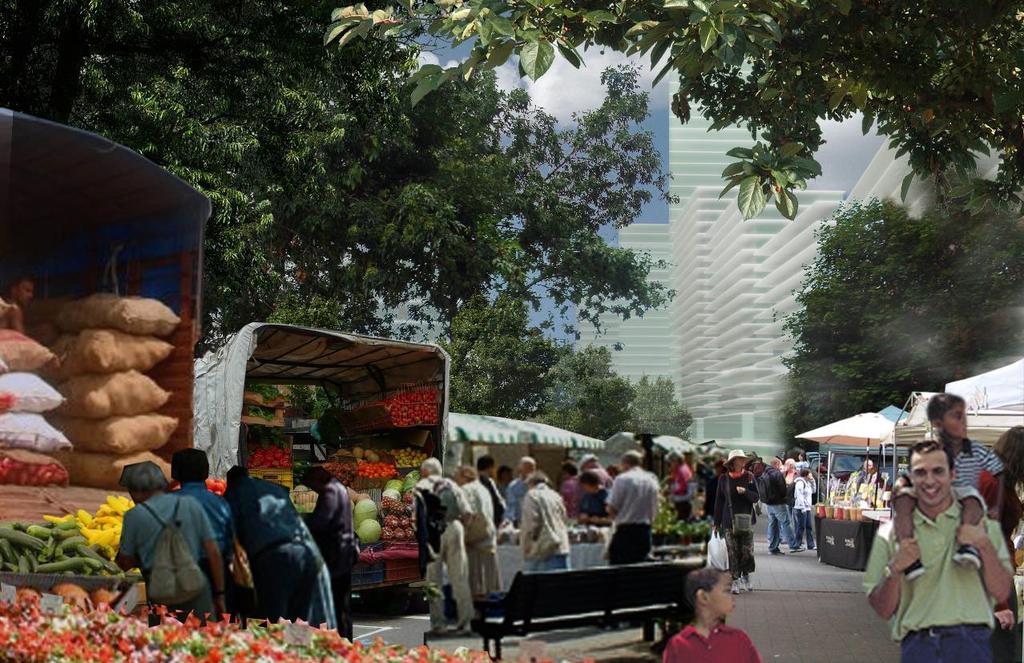
A Vision for Tropicana Site Redevelopment. Image: City of St. Petersburg
|
|
|
- Florence Walsh
- 6 years ago
- Views:
Transcription

1 A Vision for Tropicana Site Redevelopment Image: City of St. Petersburg
2 City of St. Petersburg Planning & Economic Development Department Leading the Process HKS Urban Design Randy Morton Julie Hiromoto Community Outreach The Fan Experience Creating a Market Parking & Civil Eng. Garth Solutions Yvonne Garth Thomas Huggins HKS Sports & Entertainment RCLCO Erin Talkington George F. Young Jonathan J. Gotwald Jerry Dabkowski Project Team HKS
3 Analysis Visioning and Design Principles 4 weeks Exploration Scenario 1- With the Rays 6 weeks Project Outreach City, Stakeholders and Public Concept Master Plan Scenario 1- With the Rays 4 weeks Schedule HKS
4 Inclusive stakeholder involvement Embracing and engaging the community voice Earning and building consensus Delivering a meaningful solution Public Involvement 4 HKS
5 This is what we heard HKS
6 1. Promote Economic Development 2. Create Jobs 3. Promote Diverse Mix of Business 4. Implement Sustainability Provide jobs, entertainment, housing and family oriented places that will promote economic development for every neighborhood The First Principle Image: ampion.wordpress.com

7 1. Connect Neighborhoods and Districts 2. Provide Housing for Multiple Income Levels 3. Cherish Outdoor Space 4. Create Pedestrian Friendly Environment 5. Integrate Regional Bike and Trail System Knit the city together again and re-integrate the Tropicana site with the rest of the grid system The Second Principle Image: careypostcards.com


8 1. Engage Arts 2. Family Oriented Entertainment 3. Celebrate Multicultural Neighborhoods 4. Preserve Authenticity 5. Safe and Family Friendly Place Celebrate and enhance the rich cultural diversity and authenticity as an engine for economic opportunity within the district and the surrounding neighborhoods The Third Principle Image: Pinterest.com Image: howdoitravel.com

9 1. Encourage Public Transportation 2. Optimize Parking 3. Accessible Development Make it easy to get around and expand all transportation options to reduce traffic and increase access between the neighborhoods and Downtown The Fourth Principle HKS

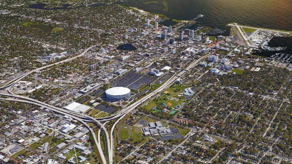
10 It s About The Rays, 86 acres and Much More Image: earth.google.com

11 What the Rays are looking for 1. Catalyst for Development 2. Local Authenticity 3. Regional Connectivity 4. Site Accessibility 5. Size and Geometry 6. Financial Feasibility and Development Readiness

12 Existing Ballpark HKS

13 What Ballparks look like today Image: imgur.com
14 Gas Plant Neighborhood ca Image: tampabay.com

15 Campbell Park ca HKS

16 Integrate Campbell Park and South St. Petersburg like the Gas Plant was..
17 The development should honor the history of the Gas Plant neighborhood and the community

18 Grow Smarter Strategy Life and Marine Sciences Financial Services Specialized Manufacturing Arts and Design Data Analytics Led by the new Economic Development Corporation


19 Work-Trop : Business/Education/Job Training/ Entrepreneurial
20 16 th Street MLK Street 1 st Avenue North Central Avenue 1 st Avenue South Future BRT Trolley Future BRT Booker Creek 30 Buffer Restricted Covenant Area I-175 Pedestrian Bridge Existing Site Constraints HKS
21 16 th Street MLK Street 1 st Avenue North Central Avenue 1 st Avenue South Future BRT Trolley Future BRT Restricted Covenant Area I-175 Pedestrian Bridge New Ballpark Location HKS
22 The Trop
23 New Ballpark Location
24 Create Booker Creek Park
25 Expand Campbell Park, Regional Skate Park and The Bridge
26 Rays Way and Ballpark Plaza
27 Neighborhood Market and Connection to Deuces Live
28 Reintroduce the Street Grid
29 Integrate Development and the Stadium
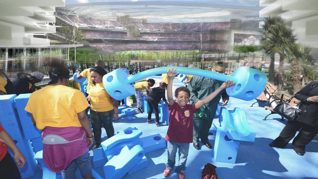
30 Retail, Entertainment, and Kid Zone
31 Arts Program and Gas Plant Legacy
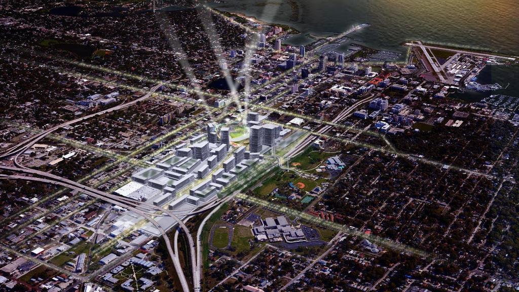
32 Shared Parking

33 Hotel and Conference Space
34 Office Buildings
35 Research and Tech Campus

36 1 st Avenue South Edge Development
37 16 th Street Neighborhood Retail and Offices

38 Housing and Neighborhood Offices
39 Elements of the Plan Public Realm ( 34 Acres) 40% Development ( 52 acres) 60% 7-9 Million SF Booker Creek Park Ballpark Plaza Kids Zone Rays Way New Street Grid Neighborhood Market 16 th Street Improvements Extend Campbell Park and The Bridge Rays Ballpark Entertainment/Retail Hotel/Conference Hall Office Buildings Research and Tech Campus Housing Neighborhood Offices Neighborhood Retail Shared Parking
40 Putting it all Together

41 Massing Rises to the Ballpark

42 View from The Edge District


43 View from Downtown and the Waterfront

44 View from Campbell Park and South St. Petersburg


45 View from Deuces Live and the Warehouse District
46 St. Pete s Newest District

47 A Walk Through the New Trop District
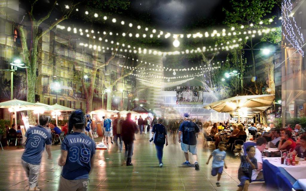
48 Rays Way

49 Ballpark Plaza
50 Kids Zone

51 Office Visibility around the Ballpark and its Brand

52 Research and Tech Campus with Conference Hall

53 Research and Tech Campus

54 Booker Creek Park

55 Integrated Campbell Park and the Wiggly Bridge
56 Plenty of Parking
57 Shared with Ballpark on Game Days


58 Shared with Commercial Development during Business Hours

59 1 st Avenue South Edge District

60 1 st Avenue South Edge District Development

61 Neighborhood Housing, Retail and Offices
62 Neighborhood Market
63 mechanical residential office parking retail Mixed Use Building Strategy

64 16 th Street Housing and Neighborhood Retail and Offices
65 The Sustainable Future of The Trop

66 1. EQUITABLE 2. ACCESSIBLE 3. RESOURCE EFFICIENT 4. HEALTHY 5. QUALITY OF LIFE 6. SMART CITY INTERFACES 7. RESILIENT Sustainable Key Performance Indicators (KPIs) image: City of St Petersburg

67 economically sustainable, equitable growth in a safe, inclusive, and family-friendly environment EQUITABLE HKS

68 multi-modal transit coupled with bike-share on walkable streets ACCESSIBLE Image: City of St Petersburg
69 Walkable streets: zoning, convenience, comfort, and design

70 passive design strategies, energy and water efficient district systems, renewable energy RESOURCE EFFICIENT Image: Duke UCF St Petersburg

71 access to nutrition, improve air and water quality, promote physical activity, enhance thermal comfort, mitigate health hazards HEALTHY Image: Saturday Morning Market

72 preserve natural habitat, limit noise and light pollution, integrate arts, enhance community, and celebrate local history and culture QUALITY OF LIFE Image: City of St Petersburg


73 Smart Technology and evidence-based design allows feedback to influence informed decision making and behavior change SMART CITY INTERFACES HKS

74 Built-in flexibility to accommodate market changes, new technology, and extreme climate events RESILIENT Image: FEMA flood map

75 Future City Initiatives

76 Regional Transportation Network Clearwater US 19 Tampa St Pete Bradenton Sarasota
77 Pinellas Trail US Transit Vision Regional Transportation Network Clearwater Bayside Bridge Tampa Gateway Exp Gulf Beaches BRT St Pete
78 1. Downtown Transportation Plan Integration HKS Downtown Multimodal Hub Bike Trolley Bus BRT Ferry (Pilot) Multi Modal North-South Shuttles

79 Downtown Transport Hub HKS
80 Melrose Mercy Intown West Arts Civic Downtown Bayfront Deuces/ Warehouse Webb s Residential South St. Petersburg Innovation Midtown Midtown Roser Park District Neighborhood Influences HKS
81 3. 16 th Street and Campbell Park Initiative HKS
82 4. Deuces Live, Warehouse Arts District and South St. Petersburg Initiatives HKS
83 5. Innovation District Initiatives HKS
84 A Fully Integrated City HKS
85
86
Tropicana Site Redevelopment Committee of the Whole September 8, Image: City of St. Petersburg
 Tropicana Site Redevelopment Committee of the Whole September 8, 2016 Image: City of St. Petersburg City of St. Petersburg Planning & Economic Development Department Leading the Process HKS Urban Design
THE GAS PLANT DISTRICT MASTER PLAN SCENARIO 2. COMMUNITY MEETING August 6, 2018
 THE GAS PLANT DISTRICT MASTER PLAN SCENARIO 2 COMMUNITY MEETING August 6, 2018 The Gas Plant Neighborhood in the 1970 s The development should honor the history of the Gas Plant neighborhood and the community
EcoVerde MADISON TO DOWNTOWN TO BEACH. Legend Highway Major Connection Major Street Local Street Proposed Access. Response to Tropicana Field RFP
 EcoVerde TO BEACH 275 16th Street North 16th Street South 13th Street North 13th Street South 11th Street North 11th Street South 1st Avenue North Central Avenue 1st Avenue South TO DOWNTOWN 2nd Avenue
THE NEIGHBORHOOD TODAY
 THE NEIGHBORHOOD TODAY CORE AREA VISION How are we Good Urbanism A Site s DNA thinking about Elements of great Unique elements urban communities embedded in a place the site and design? ELEMENTS LIKE:
SBPO BOARD MEETING MARCH 20, 2018
 SBPO BOARD MEETING MARCH 20, 2018 TODAY'S AGENDA > Booker Middle School Outreach > Property Information > Schedule > Guiding Principles > Three Concepts Booker Middle School Outreach Property Information
NORTH CLAYMONT AREA MASTER PLAN COMMUNITY WORKSHOP #1 FEBRUARY 3, 2016
 NORTH CLAYMONT AREA MASTER PLAN COMMUNITY WORKSHOP #1 FEBRUARY 3, 2016 1. Introduction To the team and to the Plan Planning Partners The Claymont Community WILMAPCO New Castle County Claymont Renaissance
Design Charrettes Description of Winning Designs
 Design Charrettes Description of Winning Designs I. Introduction Community and business leaders were invited to participate in a Station Design Charrette hosted by the Pinellas Metropolitan Planning Organization
CITYWIDE PLANNING DIVISION
 2014-2019 CITYWIDE PLANNING DIVISION a five-year work program for long-range planning November 2016 TODAY S PRESENTATION 1. Overview 2. Planning Priorities 3. Topics/Focus Areas 5. Essential Practices
ROBBINSDALE LRT STATION CDI DEVELOPMENT GUIDELINES
 August 2018 OVERVIEW The City of Robbinsdale has a prime-opportunity site in the middle of the 13 mile stretch of the Bottineau LRT corridor / Blue Line extension. Robbinsdale offers a prominent, vital,
Diridon Station Area: Framework for Implementation
 Diridon Station Area: Framework for Implementation LAND USE MISSION: The Diridon Station Area is the most significant opportunity for placemaking in San Jose. Development should integrate and expand into
Vision Plan Kickoff Meeting Summary Report
 Vision Plan Kickoff Meeting Summary Report October 2018 The Vision Plan With the redevelopment of the Amtrak Property, Penn Station Partners (PSP) seeks to build on the creative talent and entrepreneurial
Plano Tomorrow Vision and Policies
 Plano Tomorrow Vision and Policies PLANO TOMORROW PILLARS The Built Environment The Social Environment The Natural Environment The Economic Environment Land Use and Urban Design Transportation Housing
Isabel Neighborhood Plan: Alternatives
 Isabel Neighborhood Plan: Alternatives Presented by: Lori Parks, Associate Planner February 2, 2015 Agenda 1. Background on BART to Livermore 2. Isabel Neighborhood Plan 3. Alternative Scenarios 4. General
PORT OF VANCOUVER WATERFRONT DEVELOPMENT. Concept Development Plan City Center Redevelopment Authority April 20, 2017
 PORT OF VANCOUVER WATERFRONT DEVELOPMENT Concept Development Plan City Center Redevelopment Authority April 20, 2017 Port History PORT ESTABLISHED 1912 TERMINAL 1 ACQUIRED 1925 GWM SIGNS LEASE 1935 HARBOR
St. Louis Park Wooddale LRT Station Site development guidelines
 St. Louis Park Wooddale LRT Station Site development guidelines November 2013 OVERVIEW St. Louis Park s convenient location as a neighbor to Minneapolis means you re only minutes away from some of the
The Five Components of the McLoughlin Area Plan
 The Five Components of the McLoughlin Area Plan This documents contains the complete language of the five components of the McLoughlin Area Plan: The Vision Statement The Values The Guiding Principles
Concord Community Reuse Project Goals and Guiding Principles. Overarching Goals (OG)
") Concord Community Reuse Project Goals and Guiding Principles Overarching Goals (OG) No priority is implied by the order of presentation of the goals and guiding principles. Overarching goals for the Concord
Concord Community Reuse Project Goals and Guiding Principles Overarching Goals (OG) No priority is implied by the order of presentation of the goals and guiding principles. Overarching goals for the Concord
Equitable Growth Through TOD Planning
 Equitable Growth Through TOD Planning Community Meeting # 2 November 2017 Goals Objectives Extend investment from downtown Connect neighborhoods physically and economically Enhance places based on local
Gold Line Bus Rapid Transit Transit Oriented Development (BRTOD) Helmo Station Area Plan
 Helmo Station Area Plan") Appendix F Gold Line Bus Rapid Transit Transit Oriented Development (BRTOD) Helmo Station Area Plan Introduction and Purpose of the Plan The Gold Line Bus Rapid Transit facility is an eleven-mile dedicated
Appendix F Gold Line Bus Rapid Transit Transit Oriented Development (BRTOD) Helmo Station Area Plan Introduction and Purpose of the Plan The Gold Line Bus Rapid Transit facility is an eleven-mile dedicated
FUNDING CORRIDOR REVITALIZATION
 FUNDING CORRIDOR REVITALIZATION Integrated corridor planning for the 21 st Century America Planning Association Annual Conference Atlanta, GA April 27, 2014 Mariia Zimmerman, MZ Strategies, LLC mariia@mzstrategies.com
Ivywild On The Creek PRELIMINARY CREEK DISTRICT MASTER PLAN
 Ivywild On The Creek PRELIMINARY CREEK DISTRICT MASTER PLAN Introduction: Rejuvenating an extraordinary Creekside neighborhood THE CREEKSIDE DISTRICT The Ivywild On The Creek Neighborhood District Master
University of Saskatchewan CAMPUS MASTER PLAN. Senate Meeting Preliminary Presentation. April 21, 2018 DIALOG ECS DA WATT
 University of Saskatchewan CAMPUS MASTER PLAN Senate Meeting Preliminary Presentation April 21, 2018 DIALOG ECS DA WATT project process presentation agenda Stakeholder Engagement Project Control phase1
IMAGINE CLEARWATER. Community Workshop 3. November 2016
 IMAGINE CLEARWATER Community Workshop 3 November 2016 Imagine Clearwater has been a 6-month community-focused process to re-envision the downtown waterfront. VISIONING FRAMEWORK MASTER PLAN HOW CAN WE
DALY CITY VISIONING PROCESS COMMUNITY WORKSHOP 3 MAY 8, 2008
 DALY CITY VISIONING PROCESS COMMUNITY WORKSHOP 3 MAY 8, 2008 PROCESS General Plan - a statement of the community s values, vision and aspirations for now and into the future... Timeframe LONG TERM - 2030
Heart of the Triad A Dynamic Plan for the Future. Steering and Technical Meeting April 27, 2006
 Heart of the Triad A Dynamic Plan for the Future Steering and Technical Meeting April 27, 2006 The Week in Review Specific Group Findings There Was Uniform Agreement the Time Was Right Growth is Imminent
Clearwater Bluff/Waterfront Master Plan Stakeholder Coalition Meeting. June 2016
 Clearwater Bluff/Waterfront Master Plan Stakeholder Coalition Meeting June 2016 PROJECT INTRODUCTION PROCESS DISCUSSION NEXT STEPS The Clearwater Bluff/Waterfront Master Plan has the potential to activate
V. Vision and Guiding Principles
 V. Vision and Guiding Principles The Master Plan for the Powers Ferry Corridor seeks a foundation in the desires of the community. At times, various elements of the community offered opposing viewpoints,
Blueprint Denver A BLUEPRINT FOR AN INCLUSIVE CITY. Executive Summary
 Blueprint Denver A BLUEPRINT FOR AN INCLUSIVE CITY Executive Summary PUBLIC REVIEW DRAFT 2 1/7/2019 DENVERIGHT BLUEPRINTDENVER Blueprint Denver: A Blueprint for an Inclusive City An Equitable City Planning
THE TOWN OF WASAGA BEACH
 THE TOWN OF WASAGA BEACH Downtown Development Master Plan Committee of the Whole Presentation January 26 th 2017 Uses within this designation should reflect a dependence on tourism as opposed to the permanent
Stakeholders Advisory Working Groups (SAWGs) Smart Growth and TOD Land Use (#11) SAWG Meeting
 Smart Growth and TOD Land Use (#11) SAWG Meeting") Presentation - Part II Tappan Zee Bridge/I-287 Corridor Project July 21, 2010 Slide 1. David Kooris (Regional Plan Association) welcomed members of the Land Use Stakeholders Advisory Working Groups (SAWGs)
Presentation - Part II Tappan Zee Bridge/I-287 Corridor Project July 21, 2010 Slide 1. David Kooris (Regional Plan Association) welcomed members of the Land Use Stakeholders Advisory Working Groups (SAWGs)
One said, without a clear understanding of what will be annexed, this is an exercise in futility.
 Stakeholder Focus Groups: Summary of Meetings Stakeholder Focus Group meetings were held on at the Pinellas County Planning Department conference room. Focus Group meetings will be held during each of
ELK GROVE GENERAL PLAN VISION
 2-1 CHAPTER 2: 2-2 CREATING OUR The Community Vision for Elk Grove, expressed through a Vision Statement and a series of Supporting Principles, is a declaration of the kind of community that Elk Grove
SUBJECT: Waterfront Hotel Planning Study Update TO: Planning and Development Committee FROM: Department of City Building. Recommendation: Purpose:
 Page 1 of Report PB-23-18 SUBJECT: Waterfront Hotel Planning Study Update TO: Planning and Development Committee FROM: Department of City Building Report Number: PB-23-18 Wards Affected: 2 File Numbers:
Northwest commuter rail station US 36 BRT. Westminster Station
 Northwest commuter rail station Westminster Station US 36 BRT Westminster Center US 36 & Church Ranch Broomfield Flatiron/96 th St. US 36 & McCaslin Table Mesa Boulder Junction 13-month effort that will
Robbinsdale LRT Station. CDI Development Guidelines. August Overview
 Robbinsdale LRT Station August 2018 Overview The City of Robbinsdale may have the coolest opportunity site along the 13 mile stretch of the Bottineau LRT corridor / Blue Line extension. Located a block
PLAN ON A PAGE SUMMARY
 Questions? Please Call - 423-989-5518. PLAN ON A PAGE SUMMARY The Plan on a Page is a tool for the City of Bristol to engage Bristol s neighborhoods, community organizations, and interest groups to organize
Sustainability, Health, Safety, Recreation & Open Space Working Group August 3, 2017
 Sustainability, Health, Safety, Recreation & Open Space Working Group August 3, 2017 DOWNTOWN OAKLAND SPECIFIC PLAN WELCOME Sustainability, Health, Safety, Recreation & Open Space Working Group Social
PLAN ELEMENTS WORKSHOP. April 5, 2016
 PLAN ELEMENTS WORKSHOP April 5, 2016 needs more housing. But there is no one-size fits-all solution. Every neighborhood has its own character. In some places, density is not only appropriate it is badly
TRANSIT-ORIENTED DEVELOPMENT PLAN PRESENTATION RED-PURPLE BYPASS PROJECT AREA
 TRANSIT-ORIENTED DEVELOPMENT PLAN PRESENTATION RED-PURPLE BYPASS PROJECT AREA Purpose Create a community-led vision for redevelopment in the neighborhood Test specific concepts for CTA-owned parcels Expedite
Atlanta BeltLine Subarea 3 Master Plan Update
 Atlanta BeltLine Subarea 3 Master Plan Update April 14, 2018 Workshop Meeting 1 22 miles, connecting 45 neighborhoods 22 MILES of transit 46 MILES of streetscapes and complete streets 33 MILES of urban
DRAFT FOR PUBLIC REVIEW. Game Plan for a Healthy City
 DRAFT FOR PUBLIC REVIEW 2018 Game Plan for a Healthy City 2 Denveright. Parks & Recreation Game Plan Draft for Public Review Draft for Public Review Executive Summary Game Plan Overview Executive Summary
WELCOME and introduction
 1 WELCOME and introduction Mobility Hub Locations within Burlington STUDY OVERVIEW STUDY OBJECTIVES The City of Burlington is developing four Area Specific Plans, one for each of Burlington s Mobility
Comprehensive Plan Advisory Panel Meeting #3
 Comprehensive Plan Advisory Panel Meeting #3 November 7, 2016 Agenda 1. September 19 th Meeting Notes 2. Summary of Focus Areas Charrette 3. Heart of the City Focus Area a. HOC2/Station Areas Concept &
Sprawling urban development and auto-dominated streets
 Neighborhood-Scale Planning Tools to Create Active, Livable Communities Sprawling urban development and auto-dominated streets make it nearly impossible for people to integrate walking or bicycling into
Affordability & Equity
 Affordability & Equity 1. Impact Fees 2. Displacement Prevention- build more housing to meet growth demands 3. Density Bonuses 4. Regional Housing Bond 5. Stricter Condominium Conversion Laws 6. Vacant
Blueprint Denver Task Force Meeting #
 Blueprint Denver Task Force Meeting #1 6.23.16 1. Welcome and Introductions Your name and affiliation Name 1 thing you love about Denver Name 1 thing you d change about Denver All in 30 seconds! Ready,
How can we improve mobility and access?
 How can we improve mobility and access? North King s Town is located fairly centrally within the city, but there are still multiple opportunities to improve mobility within the study area, including connections
City of Long Beach. creating vibrant and exciting places
 City of Long Beach creating vibrant and exciting places Land Use Element Urban Design Element Overview of the two draft General Plan elements Discuss areas of change Economic goals of the plans Case study
Lower South Street/Louisa Street Charrette Final Presentation. September 22, 2009
 Lower South Street/Louisa Street Charrette Final Presentation September 22, 2009 Recap Mayor and Council called for a Charrette to engage the public on creating a vision for the Lower South Street area.
New Partners for Smart Growth Conference February 5, 2010
 Dan Stroh, Planning Director City of Bellevue Planning and Community Development Bellevue, WA New Partners for Smart Growth Conference February 5, 2010 Summary of Project Long-range plan update for Bel-Red
REGIONAL ACTIVITY CENTER
 DRAFT REGIONAL ACTIVITY CENTER 70 EAST BENCH MASTER PLAN DRAFT 06 Introduction The East Bench Regional Activity center is comprised of large educational, research, medical, and employment centers. These
PLACEMAKING & MOBILITY WORKSHOP. January 27, 2016
 PLACEMAKING & MOBILITY WORKSHOP January 27, 2016 Boston needs more housing. But there is no one-size fitsall solution. Every neighborhood has its own character. In some places, density is not only appropriate
West Ocala Vision & Community Plan City Council Work Session. Presented by West Ocala Community Plan Steering Committee
 West Ocala Vision & Community Plan City Council Work Session Presented by West Ocala Community Plan Steering Committee November 29,2011 Ocala 2035 Vision West Ocala Community Vision & Master Plan West
The Master Plan Framework
 The Master Plan Framework The East Harbour Master Plan advances the development of 60 acres of former industrial lands east of the Don River. The Master Plan outlines a vision for a vibrant, transit-oriented
Unique. Livable. Connected. Sustainable. Anticipate and Manage Change. Variety of Housing Choices. Enhanced Arterial Corridors
 Neighborhood Vision The Old Town Neighborhoods are Unique, Livable, Connected, and Sustainable. As mature, established neighborhoods, many of the ideas and opportunities expressed by stakeholders in support
Queensborough Eastern Neighbourhood Node. Community Open House
 Queensborough Eastern Community Open House The Vision The Queensborough Eastern will become the heart of eastern Queensborough. Through a sensitive mix of viable commercial and residential areas, the neighbourhood
The Private Role in a Public-Private Partnership. Ask Me Anything Conference May 30, 2018
 The Private Role in a Public-Private Partnership Ask Me Anything Conference May 30, 2018 1 Thoughts to Share Today Schmit+Associates Essential Elements of a P3 Community Vision Market Demand Economic Viability
1.0 VISION STATEMENT. December 6, PRINCIPLES
 Vision Statement Lincoln Regional Airport 1.0 VISION STATEMENT 1.1 City LOCATION of AND OVERVIEW The Easton Lincoln Place Land Use Master Plan identifies the principles, goals, policies, and standards
REVIEW AND EVALUATION OF REGIONAL LAND USE
 REVIEW AND EVALUATION OF REGIONAL LAND USE AND TRANSPORTATION SCENARIOS #220831 Environmental Justice Task Force October 7, 2014 VISION 2050 Process Development of Guiding Vision for Land Use and Transportation
Transportation. Strategies for Action
 Transportation A major priority for the Overlake Neighborhood is to develop a multimodal transportation system. To achieve this system, a balance has to be found among travel, circulation and access needs;
City Council Presentation November 6, 2017
 City Council Presentation November 6, 2017 Paul Jensen Recap Downtown Vision Key issues 3-D simulation exercise (CivicKnit - Breeze Kinsey) Planning Commissioner Larry Paul Elements of good design Next
Burlington s Strategic Plan
 Burlington s Strategic Plan 2015 2040 DRAFT FOR CONSULTATION burlington.ca/strategicplan Welcome to Burlington s 2015 2040 Strategic Plan The City of Burlington s 2015-2040 Strategic Plan is the result
THE 355/270 CORRIDOR:
 THE 355/270 CORRIDOR: Strategic Ideas for Sustaining a Livable Work Place Project Summary ACCESS LIFE DESIGN HEALTH WORK Montgomery County Planning Department The Maryland-National Capital Park and Planning
Hopkins. Development Guidelines May Overview. Sponsored by: Blake Road Corridor Collaborative City of Hopkins
 Hopkins Blake Road LRT Station Area Development Guidelines May 2015 Sponsored by: Blake Road Corridor Collaborative City of Hopkins Overview Hopkins is a dynamic community of over 17,000 residents located
U T D N o r t h C a m p u s T O D and D o w n t o w n D e n t o n T O D
 U n i v e r s i t y o f T e x a s a t D a l l a s C i t y o f R i c h a r d s o n U T D N o r t h C a m p u s T O D and D o w n t o w n D e n t o n T O D Rick Leisner, AICP Assistant Director of Development
Subarea 4 Indian Creek. Vision The combination of park networks and transportation amenities make Subarea 4 the greenest hub in the Corridor.
 indian creek 180 extends south from 101st Street to I-435. The I-435 and Metcalf intersection is one of the primary intersections in the Kansas City Metro Area. The area includes several residential neighborhoods
West Kendall Corridor June 11, 2014
 June 11, 2014 Miami-Dade County Department of Regulatory and Economic Resources Development Services Division ā 1 Presentation Outline Review Study Area Review of Citizens Plans and Presentations Planning
WELCOME TO THE CHOUTEAU GREENWAY DESIGN, DEVELOPMENT AND CONSTRUCTION WORKING GROUP!
 WELCOME TO THE CHOUTEAU GREENWAY DESIGN, DEVELOPMENT AND CONSTRUCTION WORKING GROUP! Chouteau Greenway Steering Committee and Working Groups Overview Overview January 9, 2019 Chouteau Greenway will transform
Beaverton City Council: Work Session. SIDEDistrict. May 6, 2014
 BEAVERTON Beaverton City Council: CREEK Work Session SIDEDistrict May 6, 2014 Tonight s Agenda BEAVERTON CREEK SIDE Brief updates Creekside Vision Scenarios & discussion: Redevelopment & Parking Project
Nassau County Cultivating Opportunities for Sustainable Development Nassau County Infill Redevelopment Feasibility Study
 Nassau County Cultivating Opportunities for Sustainable Development Nassau County Infill Redevelopment Feasibility Study NY-CT Sustainable Communities Steering Committee Meeting March 14, 2014 Project
Downtown Elkton Station Area Plan, Elkton, MD. Difficult enough to get support for new starts challenge to fund Houston transit
 Difficult enough to get support for new starts challenge to fund Houston transit More difficult to build Community Support for dense development at station areas Major Concerns: Traffic, Property values,
Lynn Waterfront Master Plan
 Lynn Waterfront Master Plan Public Meeting #2 December 10th, 2018 1 Project Schedule Update September 26, 2018 December 10, 2018 Development of the Master Harbor Plan Amendment and Revised Waterfront Master
Welcome & Introductions
 Charrette Week Report Back - Thursday Evening April 25, 2013 Welcome & Introductions A New Master Plan Land Use and Circulation Putting data and information to work to create solutions for the master plan
Status Report: MD 355 Project
 Status Report: MD 355 Project OCTOBER 2006 M-NCPPC MONTGOMERY COUNTY PLANNING DEPARTMENT Summary of Community Comments, and break to the Results of the MD 355 Participation Session Brookside Gardens -
University Avenue District
 University Avenue District UPDATE ON THE OPPORTUNITY 07.8.15 1 University Avenue District The new century nexus of live, work, learn, research, and engage. An intentional partnership of developers, businesses,
Workshop #3 June 13, 2016
 Downtown Ocoee Master Plan Workshop #3 June 13, 2016 Our Team Our Team and Tonight s Goal Quick Recap: Why a Downtown Plan? How are we developing the plan? How can you still be involved? What s left to
Municipal Development Plan 2013
 UNIQUELY STONY PLAIN: Municipal Development Plan 2013 Quick Reference Guide What is a Municipal Development Plan (MDP)? The Town s highest-level planning document Sets the long-term vision and key themes
Streets, Connectivity & Built Environment Working Group August 2, 2017
 Streets, Connectivity & Built Environment Working Group August 2, 2017 DOWNTOWN OAKLAND SPECIFIC PLAN WELCOME Streets, Connectivity & Built Environment Working Group Social Equity Meeting August 2, 2017
SAN RAFAEL GENERAL PLAN 2040 INTRODUCTION AND OVERVIEW
 SAN RAFAEL GENERAL PLAN 2040 INTRODUCTION AND OVERVIEW Steering Committee Presentation February 14, 2018 Purpose of General Plan Guide land use and development decisions Coordinate transportation, infrastructure,
Eastern Gateway / 7 Corners. City of Falls Church & Fairfax County May 14, 2013
 Eastern Gateway / 7 Corners City of Falls Church & Fairfax County May 14, 2013 Eastern Gateway Concept Plan Current Conditions Vision & Goals Building Potential Transportation Circulator to East Falls
The University District envisions, in its neighborhood
 Envisioning the University District Link Light Rail in Seattle s neighborhoods CIY OF SEALE CONCEP-LEVEL SAION AREA PLANNING RECOMMENDAION RESOLUION # 30165 EXHIBI L Vision 08.2000 he University District
Economy Vision Statements: Social Wellbeing Vision Statements: Natural Environment Vision Statements:
 Economy Vision Statements: 1. Our business environment makes us a region of choice for new employers as we encourage entrepreneurship and have a vibrant, diversified and resilient regional economy. 2.
Moody Centre Station TOD Area Today
 Moody Centre Station TOD Area Today WHAT IS a transit-oriented Murray Street development area? A Transit-Oriented Development (TOD) Area is a dense, walkable residential and commercial area built to support
3. Urban Design in the Central Area
 3. Urban Design in the Central Area The Central Area Planning and Design Group assumes the responsibility to promote high quality urban and architectural design in the Central Area, plan and ensure the
4- PA - LD - LIVELY DOWNTOWN. LD - Background
 4- PA - LD - LIVELY DOWNTOWN LD - Background The downtown has been the service centre for the community since the city s inception and the area continues to supply people with their personal services,
Shared Principles and Emerging Plan Directions
 Shared Principles and Emerging Plan Directions Introduction Since the Fairfield Neighbourhood planning process launched in June 2016, we have heard from many residents, businesses, groups and other people
S A C R A M E N T O C O U N T Y JACKSON HIGHWAY & GRANT LINE EAST VISIONING STUDY
 JACKSON HIGHWAY & GRANT LINE EAST S A C R A M E N T O C O U N T Y P L A N N I N G D E P A R T M E N T SUMMARY AND WORKBOOK November 19, 2008 History of the Visioning Study Sacramento County has two growth
Key Themes and Responses May 2016
 King and Victoria Transit Hub and Waterloo Street Pedestrian Access Key Themes and Responses May 2016 The following summarizes what Regional staff heard about the King Victoria Transit Hub and Waterloo
Citywide Planning Division Five Year Work Program
 Citywide Planning Division Five-Year Work Program HEARING DATE: NOVEMBER 3, 2016 Date: October 27, 2016 Case No.: Project Name: Staff Contact: Recommendation: n/a Citywide Planning Division Five Year Work
Green Gables. April 24, 2013
 Green Gables Preliminary and Final Plat April 24, 2013 Development Team Green Gables Development Corporation (Owner/Developer) DTJ Design (Planner/Landscape Architect) Enertia Consulting Group (Civil Engineer)
b r a n c h av e n u e tr a n s it co r r i d o r r e vita lization pl a n a m o d el fo r s u b u r ban retro fit
 b r a n c h av e n u e tr a n s it co r r i d o r r e vita lization pl a n a m o d el fo r s u b u r ban retro fit P R I N C E G EO RG E S CO U NT Y, M D ADO PTED 0 p R O J E C T C AT E G O R Y : U R B
Executive Summary. NY 7 / NY 2 Corridor
 Executive Summary NY 7 / NY 2 Corridor Transportation and Land Use Study December 2005 Prepared for: Town of Colonie Capital District Transportation Committee Prepared by: Introduction: Land use decisions
BAYFRONT INDUSTRIAL AREA RENEWAL STRATEGY
 BAYFRONT INDUSTRIAL AREA RENEWAL STRATEGY PIC #2 June 14 th, 2018 BACKGROUND & CONTEXT THE BAYFRONT INDUSTRIAL AREA 1,607 ha. Study Area Once housed over 50% of the City s employment Today home to over
Phase I Redevelopment Plan. First Community Meeting
 Hoboken Terminal and Yard Phase I Redevelopment Plan First Community Meeting May 31, 2011 One Hudson Place Phase I Redevelopment Plan Redevelopment Plan First Community Meeting Agenda 1. Redevelopment
Draft Plan Recommendations
 Draft Plan Recommendations Sponsored by Henry County and the Atlanta Regional Commission T S W TEAM Tunnell-Spangler-Walsh & Associates URS Corporation Marketek Study Area 1,300 acres Includes parts of
Overview and Update of the Rutgers-New Brunswick Physical Master Plan. January 2015
 Overview and Update of the Rutgers-New Brunswick Physical Master Plan January 2015 Failure To Plan, is Planning For Failure Winston Churchill 2 Good Planning; The Key to Success 3 The university physical
MALL REVITALIZATION CASE STUDIES
 MALL REVITALIZATION CASE STUDIES DECEMBER 9, 2012 MALL REVITALIZATION OVERVIEW Introduction Sample Case Studies prepared for Lacey Woodland District Steering Committee as it considers strategies to revitalize
South Norfolk Municipal Facilities Study
 South Norfolk Municipal Facilities Study City of Chesapeake, VA P r e s e n t e d b y H B A A r c h i t e c t u r e & I n t e r i o r D e s i g n, I n c. 1 Purpose of the Study (Phase I) Identify potential
A larger version of this map is located on the last page of this PDF.
 MAP Committee Input McLoughlin Area Draft Vision Map A larger version of this map is located on the last page of this PDF. 1. The map above is intended to portray a vision for the McLoughlin area. It highlights
Public Consultation Summary: Lakeview Place Making Workshop January 30, 2008.
 Page 1 of 11 Public Consultation Summary: Lakeview Place Making Workshop January 30, 2008. 1.0 Introduction: On January 30, 2008 the City of Mississauga, in conjunction with the consulting team of Brook