Draft West Central. District Plan. Co-creating a Greater Sydney November 2016
|
|
|
- Frederica Shaw
- 6 years ago
- Views:
Transcription

1 Draft West Central District Plan Co-creating a Greater Sydney November 2016
2 How to be involved This draft Plan sets out aspirations and proposals for Greater Sydney s West Central District, which includes the local government areas of Blacktown, Cumberland (parts of the former Auburn, Parramatta and Holroyd), Parramatta (parts of the former Parramatta, The Hills, Auburn, Holroyd and Hornsby) and The Hills. This draft District Plan is on formal public exhibition until the end of March 2017, and will be finalised towards the end of 2017 to allow as many people as possible to provide input. You can read the entire draft District Plan at and send feedback: via by engagement@gsc.nsw.gov.au by post: Greater Sydney Commission Draft West Central District Plan PO Box 257, Parramatta NSW 2124 Before making a submission, please read our privacy statement at For more information visit call us on or engagement@gsc.nsw.gov.au Draft West Central District Plan Exhibition THIS DOCUMENT SEPARATE DOCUMENT Overview Draft District Plan Maps Background Papers Website Dashboard Summary brochure of the draft District Plan The requirements of the legislative framework A compilation of maps and spatial information used to inform the draft District Plan Data and Reports used to inform the draft District Plan How the draft District Plan is to be monitored Our Vision Towards our Greater Sydney 2056 A draft amendment to update A Plan for Growing Sydney You can view these supporting components, as well as Our vision Towards our Greater Sydney 2056, our proposed 40-year vision for Greater Sydney, at Cover photo: Courtesy of Ross Honeysett and City of Parramatta Council
3 Contents Our vision West Central Introduction The role of district planning Implementation Next steps 20 2 Our vision - Towards our Greater Sydney A Productive City The West Central District s economy Driving the growth of the Central City Job targets in strategic and district centres Growing West Central District's economy with smart jobs Improving access to a greater number of jobs and centres within 30 minutes Coordinating freight activities with land use planning Attracting employment and urban services activity 68 4 A Liveable City The West Central District s people Liveability priorities Improve housing diversity and affordability Coordinate and monitor housing outcomes and demographic trends Create great places Foster cohesive communities Respond to people s need for services A Sustainable City The West Central District s environment Enhancing the West Central District in its landscape Protecting the District s waterways Protecting and enhancing biodiversity Delivering Sydney s Green Grid Managing the Metropolitan Rural Area Creating an efficient West Central District Planning for a resilient West Central District Managing flood hazards in the Hawkesbury-Nepean Valley 168 Glossary 172
4 Chief Commissioner s Foreword On behalf of the Commissioners and staff of the Greater Sydney Commission, I acknowledge the traditional owners of the lands that include the West Central District. We acknowledge the living culture of the traditional custodians of these lands, recognise that they have occupied and cared for this country over countless generations, and celebrate their continuing contribution to the life of Greater Sydney. This draft District Plan sets out a vision, priorities and actions for the development of the West Central District of Greater Sydney. This District is at the core of Greater Sydney s newly conceived Central City. The West Central District will take advantage of high population growth, its cultural diversity and its comparatively affordable lifestyle. When we consider Parramatta s extraordinary heritage and civic assets, the stunning Bicentennial and Millennium Parklands and the many projects planned and underway, we see the West Central District as one of Greater Sydney s most promising areas. As such, we ve started to draw on this ambition with the release of our vision for the Greater Parramatta and the Olympic Peninsula, known as GPOP. In addition to this work, smart planning in urban renewal areas and social housing estates will create well designed, socially cohesive and active, exciting communities. This includes better resource sharing to make the best use of public land. The District will become a premier location for 21st Century innovation hubs. Its health and education precincts around Westmead and Blacktown will offer world-class jobs and educational prospects. Advanced manufacturing can also bring a new dimension to traditional employment lands. Everyone benefits when there is clarity about our city s approach, and better guidance on what we should prioritise. To get this right, we recognise that collaboration will be key. There is a diversity of opportunities and challenges in the District, with many different people, places and organisations involved. The Greater Sydney Commission has been established to bring together all the various parties with an interest in the District s future, and to channel the collective energy into improved planning outcomes. By taking a leadership role, we can make sure that public resources and expertise are brought together to create a more productive, liveable, resilient and sustainable city. We will advocate for effective infrastructure to keep pace with population growth. We need to adequately monitor and plan for demographic changes, such as higher proportions of children and the frail aged in our population. We will make sure that every area of government activity and delivery transport, infrastructure, land use, housing, health, education, heritage and environment is well coordinated. We will work positively with the private sector and local government. I thank everyone from the community, industry, councils, government and the many stakeholder groups who have spoken to us and contributed their ideas and wisdom to develop this draft District Plan. I encourage everyone to take time to review this draft District draft District Plan and provide feedback. Your suggestions, comments and opinions will be crucial in making this Plan a living and working document to guide the West Central District s future. Lucy Hughes Turnbull AO Chief Commissioner
5 District Commissioner s Foreword The West Central District has always played a critical role in Greater Sydney s foundation and growth and will do so into its future. Parramatta sits at the District s heart as Australia s first seat of government and the breadbasket for the fledgling settlement. Along with the surrounding Cumberland Plain, it has been central to Greater Sydney s commerce and industry. Today, post-industrial Parramatta is emerging through our vision for GPOP and the wider area s emergence as Greater Sydney s Central City. Anchoring the West Central District is a rising world-class health and education super precinct in Westmead. The Westmead Campus has more intellectual capital than almost any other place in Australia, with many hundreds of leading scientists and several world-leading research institutes. Adjacent to this rising scientific juggernaut is an integrated ring of specialised and advanced manufacturing and urban services that will allow the District to be Greater Sydney s home for innovative industries. Tomorrow s jobs will emerge here, at the heart of Greater Sydney. The District s core transportation infrastructure must connect many centres to and through Parramatta CBD. Heavy rail and freight, new metros and light rail can be augmented and strengthened to provide better connections across the District. Work to enhance Parramatta River, Prospect Reservoir and a network of smaller creeks and waterways, like Duck Creek and South Creek and their tributaries, will mean waterways are within easy walking distance of every household. We will look into District-wide alternatives to solid waste engineering to generate energy and reduce landfill, and will combine forces across local government areas to design resilience strategies to meet multiple challenges, from flooding and heat islands, to social isolation, health deficits, activity and movement and high levels of car use. We will continue to shape our destiny into the future, as we have done in the past. Professor Edward J. Blakely West Central District Commissioner Through our vision for GPOP, Parramatta CBD is emerging as Australia s next great city and is home to new administrative, business services, judicial and educational jobs, with Parramatta Square as its heart and Western Sydney University as its critical knowledge producing engine. In parallel, Blacktown is experiencing a rapidly growing medical precinct, while Rouse Hill and Castle Hill are introducing more education, medical and lifestyle economic opportunities as they become the new higher density subdivisions for the District s rapidly expanding population and job base. The major thrust for the Central City will be the establishment of GPOP, based on knowledgeintensive jobs in health, technology, financial services, public administration and justice. It stretches from the Westmead health and education precinct, embracing Parramatta CBD before moving through Camellia, north to Telopea and Carlingford and east along the Olympic Peninsula to Strathfield.
6
7 1 Our vision West Central year vision, priorities and actions for the West Central District The West Central District is one of the most dynamic and rapidly growing regions in Australia. This District plays a pivotal role in Greater Sydney s future as an economic and employment powerhouse, a core hub for transport and services and the home of vibrant and diverse centres and communities. It will be at the core of Greater Sydney s Central City. Over the next 20 years, the West Central District s population growth will see the District as the fastest growing location in Greater Sydney and Australia leading the transformation of Greater Sydney and the national economy from industrial to innovation technologies and techniques. The burgeoning area known as Greater Parramatta and the Olympic Peninsula (GPOP) a place with so much potential that it is subject to its own planning process will sit at the District s and Greater Sydney s heart. With the planned investment in Sydney Metro Northwest, Sydney Metro West and the Parramatta Light Rail, our planning will capture the exciting new opportunities generated by this intensive growth and change to build a more connected West Central District. GPOP will consolidate its place at Greater Sydney s heart, with better public transport, cultural and sporting facilities and a knowledgeintensive, services oriented economy. It will be supported by centres at Blacktown, Castle Hill, Epping, Marsden Park, Merrylands, Mount Druitt, Norwest and Rouse Hill. Blacktown, Cumberland, Parramatta and The Hills local government areas will each draw on their unique social and economic characteristics anchored in bio-health and lifestyle, while combining to create a tapestry of emerging innovative economic engines, bolstered by one of Australia s youngest and most diverse populations. Sydney Olympic Park will be transformed into a healthy lifestyle education and innovation centre based on its sports heritage with vital education, commercial and residential hubs. Parramatta CBD will emerge on the banks of the Parramatta River, with a combined education and medical super precinct and one of the largest national bio-medical complex as its anchor. The area s advanced technology clusters could expand to capture global markets. The District s networks of regional parks, large waterways and scenic rural beauty will continue to provide real lifestyle benefits and attract outdoor and adventure entertainment. From new communities in the North West Priority Growth Area, to traditional industrial areas and existing lower density suburbs, the West Central District will be a place of energy, diversity and change.

8 The West Central District Strategic Centre Local Government Area (LGA) Boundary Suburb and Boundary Highway District Centre National Parks and Reserves Railway District Boundary Waterways Motorway


.")


9 3 GPOP: Greater Parramatta and the Olympic Peninsula This draft District Plan has a specific focus on the 4,000 hectare area of the Greater Parramatta and the Olympic Peninsula, which we refer to as GPOP. We released our vision for GPOP, available on our website in October This draft District Plan refers to GPOP in terms of its role within the West Central District and Greater Sydney s productivity, liveability and sustainability. Our 2036 vision is GPOP will be the unifying heart at the centre of Greater Sydney. GPOP spans 13 kilometres east west from Strathfield to Westmead and seven kilometres north south from Carlingford to Lidcombe and Granville. Parramatta River flows east through the heart of GPOP and the planned Parramatta Light Rail forms the GPOP spine (see maps). GPOP Greater Parramatta and the Olympic Peninsula Our true centre: the connected, unifying heart The recently announced Sydney West Metro will link Parramatta and Sydney Olympic Park with Sydney City. GPOP is the first Collaboration Area (defined in Chapter 3) for Greater Sydney. We have worked with key partner agencies, City of Parramatta Council, institutions and businesses throughout We have also been out and about listening and speaking to the community about their aspirations for GPOP. GPOP Vision map 2 Parramatta CBD Westmead Health + Education Super Precinct Dundas Rydalmere ori oa a R Denistone d West Ryde rr es U at ta Rhodes Pa ad Sydney M ot Olympic or w a Park rr am at ta Ri ve r IL Auburn LI A rn Ro R te RE HT W am G Granville 4 F T Pa U Harris Park t Vic Camellia Parramatta CBD Essential Urban Services, Advanced Technology + Knowledge Sectors Eastwood Telopea Westmead 3 Next Generation Living Camellia - Carlingford Carlingford y Lidcombe Concord West North Strathfield Flemington Strathfield Olympic Park Lifestyle Super Precinct 1
10 4 West Central District: Priorities and actions This draft District Plan identifies priorities and actions to realise the vision for the District. This section lists the overarching priorities that will inform strategic planning and summarises the actions outlined in each chapter. Action tables in this section identify outcomes, lead agencies and partner agencies (partners). Further detail on the priorities is included throughout this draft District Plan in terms of implementation and monitoring priorities (Chapter 1) and productivity, liveability and sustainability priorities (Chapters 3, 4 and 5 respectively). Implementation and monitoring actions (Chapter 1) Action Outcome Lead agency Partners IM1: Align land use planning and infrastructure planning Inform the NSW Government s infrastructure decision-making GSC INSW, TfNSW, NSW Health IM2: Develop a framework to monitor growth and change in Greater Sydney IM3: Develop an interactive information hub the Greater Sydney Dashboard Inform the ongoing actions and infrastructure investments of Government required to deliver A Plan for Growing Sydney and the District Plans Enhance the community s understanding of the performance and characteristics of Greater Sydney GSC GSC IM4: Report on local planning Improve the understanding of the effectiveness of District Plans in delivering on the stated priorities and actions GSC Councils Population +550,500 more people by , k 1.25m 1.521m Age Sturcture +43% more babies and pre-schoolers +122,100 increase in persons 65+ by % more 5 to 19 year olds +183% more 85+ year olds
11 5 Productivity priorities and actions (Chapter 3) The proposed priorities and actions for a productive West Central District draw on the opportunity to accommodate growth in GPOP and increase the proportion of knowledgeintensive jobs in places like Norwest, Westmead and Blacktown. Employment and urban services land will be better linked to the Western Sydney Airport, and with greater investment in transport infrastructure and the enrichment of local centres, more people will have access to jobs and services closer to where they live. The overarching priorities are: The overarching priorities are:: Driving the growth of the Central City Planning for job target ranges for strategic and district centres Growing West Central Districts with smart jobs economy Improving access to a greater number of jobs and centres within 30 minutes Coordinating freight activities with land use planning Attracting employment and urban services activity Productivity Actions Action Outcome Lead agency Partners P1: Collaborate to create, own and deliver GPOP Increase total jobs and dwellings, and increase the proportion of health and education and knowledge and professional services jobs GSC DPE, NSW Health, Council, UrbanGrowth NSW, SOPA P2: Develop and implement an economic development strategy for the Central City Increase total jobs and proportion of health and education and knowledge and professional services jobs DoI GSC, Jobs for NSW, AA P3: Expand health and education activities in Westmead Increase in total health and education and knowledge and professional services jobs GSC NSW Health P4: Develop a better understanding of the value and operation of employment and urban services land Increase in total jobs GSC Councils Households +42,450 more single person households by % more single person households +51% Couples with children households Dwellings +53,500 more dwellings by 2021
12 6 Livability priorities and actions (Chapter 4) The proposed priorities and actions for a liveable West Central District are based on the District s position as Greater Sydney s fastestgrowing District. This will require new homes and neighbourhoods, integrated with the District s many rich and exciting centres and unique waterways and parks. The potential of GPOP as a place of both jobs and lifestyle opportunities, well connected to new public transport and the Parramatta River, will set the benchmark for collaborative planning. The overarching priorities are: Improving housing choice Improving housing diversity and affordability Coordinating and monitoring housing outcomes and demographic trends Creating great places Fostering cohesive communities Responding to people s need for services
13 7 Liveability actions Action Outcome Lead agency Partners L1: Prepare local housing strategies Increase in diversity of housing choice Councils L2: Identify the opportunities to create the capacity to deliver 20-year strategic housing supply targets Creation of housing capacity GSC Councils, DPE L3: Councils to increase housing capacity across the District Creation of housing capacity and increase in diversity of housing choice Councils L4: Encourage housing diversity Increase in diversity of housing choice DPE L5: Independently assess need and viability Increase in affordable rental housing GSC Industry CHPs, DPE L6: Support councils to achieve additional affordable housing Increase in affordable housing GSC Councils, DPE L7: Provide guidance on Affordable Rental Housing Targets Increase in affordable rental housing GSC DPE, Councils, State agencies, CHPs L8: Undertake broad approaches to facilitate affordable housing Increase in affordable housing GSC Councils, Industry CHPs, L9: Coordinate infrastructure planning and delivery for growing communities Change in industry perceptions (surveyed) GSC DPE L10: Provide data and projections on population and dwellings for local government areas across Greater Sydney Contribute to more informed infrastructure investment decisions, strategic planning and plan making DPE L11: Provide design-led planning to support high quality urban design Contribute to improved sustainability, productivity and liveability outcomes OGA GSC L12: Develop guidelines for safe and healthy built environments Contribute to improved health outcomes and increased walking and cycling GSC DPE L13: Conserve and enhance environmental heritage including Aboriginal, European and natural Identification and protection of heritage elements OEH, DPE, AA GSC, Councils L14: Develop a West Central District sport and recreation participation strategy and sport and recreation facility plan Contribute to informed decision making for sport and recreation infrastructure and increased participation Office of Sport Councils L15: Support planning for shared spaces L16: Planning for school facilities L17: Support the provision of culturally appropriate services L18: Support planning for emergency services L19: Support planning for cemeteries and crematoria Increase in the provision of community facilities, including open space Improved education infrastructure decision making Improved decision making on matters affecting the aboriginal community Contribute to improved decision making for emergency services operators Improved decision making for new cemeteries GSC, DEC DPE GSC, AA DPE CCNSW State agencies, organisations, providers NSW Property, DEC
14 8 Sustainability priorities and actions (Chapter 5) The proposed priorities and actions for a sustainable West Central District are based on the District s diverse social, cultural and environmental conditions and how these operate within its natural landscape. The Georges River, Hawkesbury-Nepean River, Parramatta River and South Creek will be protected, many green spaces and corridors will integrate with growing residential areas and our planning will focus on access to the Western Sydney Parklands. The overarching priorities are: The overarching priorities are: Enhancing the West Central District in its landscape Protecting the District s waterways Protecting and enhancing biodiversity Delivering Sydney s Green Grid Managing the Metropolitan Rural Area Creating an efficient West Central District Planning for a resilient West Central District Managing flood hazards in the Hawkesbury- Nepean Valley Key: AA Aboriginal Affairs INSW Infrastructure NSW CCNSW Cemeteries and Crematoria NSW OEH Office of Environment and Heritage CHP Community Housing Providers OGA Office of Government Architect DEC Department of Education SOPA Sydney Olympic Park Authority DoI Department of Industry SW Sydney Water DPE Department of Planning and Environment TfNSW Transport for NSW EPA Environment Protection Authority WSPT Western Sydney Parkland Trust GSC Greater Sydney Commission
15 9 Sustainability Actions Action Outcome Lead agency Partners S1: Review criteria for monitoring water quality and waterway health Improved water quality and waterway health OEH GSC S2: Protect the South Creek environment and use development approaches to achieve excellent environment performance Improved water quality and waterway health, and integration of South Creek into land use planning GSC EPA S3: Develop a Strategic Conservation Plan for Western Sydney Protection and management of areas of high environmental value OEH, DPE GSC S4: Update information on areas of high environmental value Protection and management of areas of high environmental value OEH, DPE Councils S5: Use funding programs to deliver the West Central District Green Grid priorities Delivery of the green grid priorities GSC, TfNSW, Councils S6: Develop support tools and methodologies for local open space planning Improved utilisation of open space and increased provision of open space GSC S7: Create new recreational opportunities at Prospect Reservoir Increased recreational opportunities at Prospect Reservoir GSC, WSPT Blacktown Council, SW, Water NSW S8: Update the Urban Green Cover in NSW Technical Guidelines to respond to solar access to roofs Protection of solar access to roofs OEH, DPE S9: Identify land for future waste reuse and recycling Identification of land for waste management EPA, DPE Councils S10: Embed the NSW Climate Change Policy Framework into local planning decisions Contribute to energy efficiency, reduced emissions and improve environmental performance GSC Councils, OEH S11: Support the development of initiatives for a sustainable low carbon future Contribute to energy efficiency, reduced emissions and improve environmental performance GSC, Councils, DPE S12: Support the development of environmental performance targets and benchmarks Contribute to improved environmental performance GSC NSW Climate Council, Australian Government, utility providers S13: Incorporate the mitigation of the urban heat island effect into planning for urban renewal projects and Priority Growth Areas S14: Review the guidelines for air quality and noise measures for development near rail corridors and busy roads S15: Identify and map potential high impact areas for noise and air pollution S16: Address flood risk issues in the Hawkesbury-Nepean Valley Contribute to reductions in ambient temperatures Improved land use and transport decision making Improved land use and transport decision making DPE EPA, DPE EPA Protection of life and property DPE, INSW GSC, Councils
16 10
, Parramatta (parts of the former Parramatta, The Hills, Auburn, Holroyd and Hornsby) and The Hills.")
17 1 Introduction 11 This draft District Plan proposes a 20-year vision for the West Central District, which includes the local government areas of Blacktown, Cumberland (parts of the former Auburn, Parramatta and Holroyd), Parramatta (parts of the former Parramatta, The Hills, Auburn, Holroyd and Hornsby) and The Hills. It has been developed by the Greater Sydney Commission in consultation with State agencies and the community, with technical input from councils. The West Central District sits at Greater Sydney s geographic and demographic heart. It offers a home to a great diversity of people and cultures, drawing on its heritage as Australia s first seat of government and now offering a worldleading biomedical hub alongside business, administrative and innovative jobs within a landscape of regional parks, large waterways and scenic rural beauty. Our work on this draft District Plan builds on the District s characteristics, while drawing on a robust body of technical material that looks into Greater Sydney s changing demographics, economy, housing, open spaces and many other characteristics. It also incorporates feedback garnered through our #GreaterSydney engagement during #GreaterSydney: Insights from the community Our conversations with the community through our #GreaterSydney engagement have provided valuable insights into what the community values about the District and what people want to see changed. We have sought to encapsulate these inputs into this draft District Plan. The feedback so far highlights that people want more jobs, study opportunities and pathways to long-term employment. Better public transport, including more frequent bus and train services, is important, as is easing traffic congestion. People support more affordable housing and want to maintain a mix of housing options. They want to see investment in community infrastructure such as recreational facilities, walking and cycling paths, retail areas and quality open space. There is also a desire for more community activities and events, as well as community-led green spaces such as community gardens. We see this draft District Plan as a first step in the planning for the West Central District. We want as many people as possible to continue to engage with us as we work to develop the draft District Plan further towards finalisation at the end of We intend to achieve this by building collaboration and listening into everything we do.
18 The role of district planning Planning in Greater Sydney has traditionally happened at two levels. The NSW Government developed overarching plans that considered the Greater Sydney s growing population, where people will live and what kind of jobs and transport they will need; while local government developed local environmental plans to identify how land can be used, including for housing, businesses and parks. What has been missing is the district-level planning that connects local planning with the longer-term metropolitan planning for Greater Sydney. To facilitate this connection, Greater Sydney is designated into six Districts that represent neighbouring groups of council areas with similar features and common communities of interest. You can see a map of the six Districts at our website City planning is dynamic. In preparing this draft District Plan during 2016, we have been mindful of the changing technologies and evolving thinking that will impact Greater Sydney to The city-making implications of issues such as driverless cars, emerging business trends, climate change and housing affordability will require further research and testing. For these reasons, this draft District Plan represents a moment in time but will, with your feedback and our commitment to ongoing research, be a living document to better navigate the issues influencing Greater Sydney to The Environmental Planning and Assessment Act 1979 (EP&A Act) requires each District Plan to: provide the basis for strategic planning in the District, having regard to economic, social and environmental matters establish planning priorities that are consistent with the objectives, strategies and actions of A Plan for Growing Sydney identify actions required to achieve those planning priorities. This draft District Plan meets these requirements by: progressing the directions of A Plan for Growing Sydney identifying planning priorities for the District and the actions to achieve them. This draft District Plan translates and tailors metropolitan planning priorities for each District by giving effect to the four goals of A Plan for Growing Sydney: Goal 1: A competitive economy with worldclass services and transport Goal 2: A city of housing choice, with homes that meet our needs and lifestyles Goal 3: A great place to live with communities that are strong, healthy and well connected Goal 4: A sustainable and resilient city that protects the natural environment and has a balanced approach to the use of land and resources. To do this, this draft District Plan interweaves these goals by describing proposed priorities and actions for the District in terms of: A productive city (Goal 1) A liveable city (Goals 2 and 3) A sustainable city (Goals 3 and 4). This draft District Plan is accompanied by a draft amendment to A Plan for Growing Sydney, as noted in Section and detailed in Chapter 2.

19 13 'It is not a vaguely idealistic plan. It has been based on proven facts, and if its authors have looked upward to the stars they have kept their feet upon the ground. We feel that it is a commonsense scheme, practical in its economics and finance. This draft District Plan includes three chapters focusing on the means to enhance the District s productivity, sustainability and liveability in accordance with A Plan for Growing Sydney and the Commission s mandate. It recognises that, next to our people, the land is our greatest asset. Realisation of the Plan in measured stages will unlock the land for its best community use, so that present and future citizens may be able to meet the challenge of advances in technology, economics, social sciences and culture, and secure their benefits for all.' County of Cumberland Plan, 1948 Many elements discussed in these chapters are interrelated. For example, the issue of housing is as much about liveability as it is about productivity and sustainability; our planning for jobs is as important to a productive city as it is to liveable and sustainable city. While we use chapters to discuss policy areas, we recognise that cohesive and vibrant cities have overlapping components and an integrated approach to city making is crucial to success. As noted above, legislation requires district planning to give consideration to the Greater Sydney Region Plan, currently A Plan for Growing Sydney. District planning must also consider priorities identified by the Minister for Planning and other relevant plans, strategies and NSW Government policies including: the Premier s and State Priorities (September 2015) that seek to create jobs, encourage business investment and increase housing supply the Ministerial Statement of Priorities (January 2016) that includes strategic planning for Parramatta, Penrith, Liverpool and Campbelltown updates to the State Infrastructure Plans for 2015/16 and 2016/17 the Western Sydney City Deal (Memorandum of Understanding signed October 2016) the initiatives of Jobs for NSW. These matters, which give greater clarity to Greater Sydney s strategic planning framework, combined with the evolving nature of Greater Sydney, emerging technologies and the complexity and dynamism of city planning, have generated new thinking in strategic planning for Greater Sydney.
20 Draft amendment to A Plan for Growing Sydney To allow our planning for Greater Sydney to relate to our best understanding of the future, this draft District Plan introduces a longerterm, transformational focus on the patterns of development needed for Greater Sydney to be a productive, liveable and sustainable Global Sydney. This ambitious 40-year vision for Greater Sydney as a metropolis of three cities is detailed in Chapter 2. This 40-year vision is a draft amendment to A Plan for Growing Sydney. It is on exhibition alongside this draft District Plan so that feedback around the concept of Greater Sydney as a metropolis of three cities can inform the review of A Plan for Growing Sydney. You can download a standalone version of the draft amendment, titled Our vision - Towards our Greater Sydney 2056 by visiting In this context, this draft District Plan foreshadows how the proposed amendment could influence planning for the District s productivity, liveability and sustainability while also giving effect to A Plan for Growing Sydney. Concurrent with the review of A Plan for Growing Sydney in 2017, Transport for NSW will develop the Future Transport Strategy and Infrastructure NSW will review the State Infrastructure Strategy. Given the important interconnected nature of these and other NSW Government strategies, the Commission, Transport for NSW and Infrastructure NSW will align work programs to the end of 2017 to include: inputs, assumptions and scenario analysis to inform the development of the plans and strategies events for community and stakeholder engagement timeframes for key milestones. This approach will not only allow for a better and more integrated outcome for Greater Sydney but a more transparent approach for stakeholders. Figure 1-1: The regional and district planning process (2016/2017) DISTRICT PLANS STEP 1 STEP 2 Prepare draft District Plans Exhibit GREATER SYDNEY REGION PLAN Prepare Towards our Greater Sydney 2056* Exhibit Prepare comprehensive review of A Plan for Growing Sydney Exhibit Aim to finalise *Draft amendment to update A Plan for Growing Sydney (the initial Greater Sydney Region Plan) Source: Greater Sydney Commission 2016 Aim to finalise
21 What this draft District Plan means for local planning As a document for discussion, this draft District Plan proposes actions that could influence how different levels of government plan for the District, and how public and private investment decisions are made directly influencing growth and change. For local government, this draft District Plan will: inform the preparation of local environmental plans inform assessments or planning proposals guide strategic land use, transport and infrastructure planning across local government areas inform infrastructure planning. Section 75AI of the EP&A Act requires local environment plans to be updated to give effect to each District Plan as soon as practicable after a District Plan is made. This process may require a comprehensive review or be staged to reflect the local government area priorities identified in each District Plan, and to allow for more targeted engagement on these priority areas. This approach will also help councils to manage resources Status of the draft District Plan While councils are required to give effect to District Plans as soon as practicable after a District Plan is made, draft District Plans will guide the preparation of planning proposals under Part 3 of the Act. This is established by the Department of Planning and Environment s Guide to Preparing Planning Proposals (August 2016). The Guide lists assessment criteria for a planning proposal, which include but are not limited to consideration of the strategic merit of the proposal, the site-specific merit of the proposal and consistency with strategic plans, including draft District Plans, State environmental planning policies and Ministerial directions. Local environmental plans will continue to determine whether development is permitted or prohibited on land. While a draft District Plan or District Plan is not a mandatory matter for consideration in the determination of a development application, a consent authority may decide to consider a draft District Plan or District Plan to the extent it relates to the objects of the EP&A Act. The inclusion of Our vision Towards our Greater Sydney 2056 in Chapter 2 of this draft District Plan foreshadows our research and the evolution of our thinking that will inform the review of A Plan for Growing Sydney during It does not replace the legal status of A Plan for Growing Sydney as the current Greater Sydney Region Plan.
22 16 Planning principles A Plan for Growing Sydney identified three planning principles that remain current and underpin many of the priorities of this draft District Plan. Principle 1: Increasing housing choice around all centres through urban renewal in established areas Increasing housing close to centres and stations makes it easier to walk or cycle to shops or services, and to travel to work or other centres; reduces traffic congestion; and makes our neighbourhoods more community oriented. Increasing the variety of housing available makes it easier for people to find a home that suits their lifestyle, household size and their budget. Locating new housing in centres delivers a range of economic, environmental and social benefits to the community. Research by the Organisation for Economic Cooperation and Development (OECD) has similarly found that productivity benefits arise from a more compact city. Principle 2: Stronger economic development in strategic centres and transport gateways Locating jobs in around 30 to 40 large centres across Greater Sydney provides the greatest benefits to the city s overall productivity. Greater Sydney s largest and most important hubs for business and employment are strategic centres and transport gateways. These locations will be an important focus for future growth because of their size, diversity of activities, their connections (mainly to the rail network), and the presence of major institutional activities such as health and education facilities or Greater Sydney s major airports and port. Principle 3: Connecting centres with a networked transport system The public transport network connects people to centres. In doing this, it connects people to jobs, education facilities, health centres and hospitals, and sporting, cultural and entertainment facilities. Centres rely on efficient transport to serve their customers, support their growing business and freight functions, and to connect to the global economy. Efficient links within centres improves convenience for customers, and efficient links into centres and between centres helps people to get to jobs, schools, universities, shops and leisure activities. Making it easy to get to centres and offering a range of services at centres makes them a focal point for the community and increases prospects for economic growth and job creation.
23 Implementation The final District Plan will be formally reviewed every five years, but as a living document, we plan to update it more regularly in response to new government infrastructure, policies, emerging trends or other factors influencing its currency Managing implementation This draft District Plan identifies a number of implementation mechanisms. Existing actions Our actions New collaborations NSW Government actions Planning Priorities Collaboration areas Existing government policies and actions that may be improved through stronger collaboration or the clarity provided from district-level planning. New actions that will be the Commission s responsibility to lead and deliver. New collaborations that the Commission will lead and deliver in partnership with local government and/or State agencies. New actions that are the responsibility of State agencies, with the relevant agency identified. Priorities designed to provide guidance for strategic planning or plan making by the relevant planning authority. Specific parts of Greater Sydney identified as Collaboration Areas, where a significant productivity, liveability or sustainability outcome is achieved through the collaboration of different levels of government and in some cases the private sector or landowners. As the Commission is an independent agency, some actions and priorities included within this draft District Plan may not be NSW Government policy and may be subject to a business plan Planning for land use and infrastructure As Greater Sydney grows, we need to more efficiently and effectively align land use planning and infrastructure investment. This is one of our key objectives. It forms the basis of the work we have commenced with State and local government to identify the infrastructure required to deliver this draft District Plan and prioritise it by place and time. Our insights, as described within this draft District Plan, are drawn from our knowledge of: existing NSW Government infrastructure commitments and existing investigation areas for new housing forecasts in terms of population increases and locations where growth is anticipated, including jobs in centres annual monitoring of changes in development activities across Greater Sydney, with a primary focus on housing. With these insights, we can provide greater clarity around the future location of new land uses in Greater Sydney. This feeds into the planning for infrastructure, from city-shaping infrastructure such as new rail lines that are usually planned by the NSW Government, to local infrastructure such as local roads or parks and community facilities that are usually planned by councils. For NSW Government infrastructure planning, we will utilise our cross-agency Infrastructure Delivery Committee to facilitate collaboration on infrastructure issues across districts and Greater Sydney. We will also develop an Annual Infrastructure Priority List for the NSW Government to inform decision-making on infrastructure provision at a State, district and local level. For local government infrastructure planning, our insights into expected and actual growth in housing can present an opportunity for councils to align their capital programs and infrastructure scheduling, and collaborate across council or district boundaries as
24 18 required. This will assist the timely delivery of infrastructure, make the best use public resources, and could ultimately lead to stronger coordination between State and local planning for infrastructure and land uses. Action IM1: Align land use planning and infrastructure planning To support the efficient and effective alignment of land use planning and infrastructure: the Commission will prepare an Annual Infrastructure Priority List in conjunction with Infrastructure NSW to support the productivity, liveability and sustainability of the District as it grows, consistent with Action of A Plan for Growing Sydney Infrastructure funding and delivery Infrastructure is presently funded through a range of mechanisms: The NSW Government Budget including: -- agency programs for education, health and transport -- funding programs such as the Housing Acceleration Fund, Metropolitan Greenspace Program and Environmental Trust Australian Government funding State infrastructure contributions local infrastructure investment local development contributions and associated programs voluntary planning agreements. In addition to these mechanisms is the concept of value capture or sharing. Value sharing uses part of the economic uplift that new infrastructure and planning generates to help fund that infrastructure. New transport infrastructure, for example, can unlock a number of benefit streams, including direct transport benefits such as reduced travel times, and wider benefits such as reduced congestion and lower fuel consumption. When new or upgraded infrastructure is provided in an area, many of these benefits are effectively monetised because local land values increase, reflecting the market s willingness to pay for these benefits. Value sharing enables the funder of the infrastructure for example, the NSW Government or a local council to participate in the market uplift and offset some of its costs. If properly executed, value sharing can: unlock new funding to make economically beneficial infrastructure more affordable spread the costs of new infrastructure more equitably among its beneficiaries improve projects by providing incentives for governments to plan and design infrastructure with wider land use benefits in mind. We recognise that, like all regulation and interventions in the market, value sharing mechanisms need to be equitable while also being efficient in terms of their operation and compliance. Value sharing mechanisms also need to be effective in terms of meeting objectives in a timely manner. Value sharing mechanisms will only succeed with clarity around the planned infrastructure and how this will be funded whether partially or wholly by the value sharing mechanism or what elements or areas will be funded in response to the development (for example, whether the shared funding will go towards open space and public areas, community infrastructure, roads or upgrades to utilities). It also requires an understanding of the total amount, duration and rate of value sharing (such as dollars per square metre) that can be set while maintaining the financial feasibility of development. In some areas, this could mean that rezoning may be delayed until development is feasible, given the amount of supporting infrastructure required. A number of NSW Government-led urban renewal areas, priority precincts and priority growth areas are addressing this through the use of infrastructure schedules. We will continue to work across government on the amount, mechanisms and purpose of value sharing to create a more consistent approach to capturing value for public benefit, complementary with other existing mechanisms.
25 Monitoring The Greater Sydney Dashboard The Greater Sydney Dashboard will be an interactive web-based tool that will provide access to indicators for cross-district issues such as jobs and housing targets to assist decision-making. It will be used to gain insights from our collaborations and build on evidence already commissioned by various State agencies and councils. The Dashboard will also include a data store to assist decision-making and strategic planning. Monitoring the growth and change of Greater Sydney is critical to inform planning. A Plan for Growing Sydney requires us to establish a monitoring and reporting process to check on progress against the actions identified in our strategic planning documents. Our Greater Sydney Dashboard will include indicators that outline how Greater Sydney and the District are performing against this draft District Plan s aspirations. In line with the requirement of A Plan for Growing Sydney, we are investigating metrics in terms of Greater Sydney s productivity, liveability and sustainability. We will include specific environmental reporting on: carbon emissions across Greater Sydney, in accordance with the C40 (Carbon Disclosure Protocol) requirements potable water consumption, water recycling and wastewater production across Greater Sydney air quality across Greater Sydney. Action IM2: Develop a framework to monitor growth and change in Greater Sydney As the District Plan is finalised alongside the review of A Plan for Growing Sydney and other strategic planning documents, we will have a stronger understanding of the metrics to measure Greater Sydney s economic, social and environmental performance. To do this we will: develop a framework for the monitoring and reporting of the final Regional and District Plans that will consider the issues and outcomes through actions and priorities. Action IM3: Develop an interactive information hub the Greater Sydney Dashboard To provide access to the latest data across a range of metrics, we will: develop the Greater Sydney Dashboard to include data and measures across a range of city-making areas, from population figures to environmental outputs. Action IM4: Report on local planning The Greater Sydney Dashboard will also monitor the implementation of each District Plan s actions and priorities. In the first instance, this will involve each council reporting to the Commission under section 75AI of the EP&A Act on: its review of relevant local environmental plans to give effect to the District Plan as made the preparation of planning proposals under section 55 of the EP&A Act to give effect to the draft and final District Plans.
26 Next steps This draft District Plan and the supporting Our vision Towards our Greater Sydney 2056 are on formal public exhibition until the end of March Public exhibition is an opportunity for people to contribute to the future of the West Central District by providing direct feedback on the proposed priorities and actions in this draft District Plan. The draft District Plan will not be finalised until at least the end of 2017 to allow it to be aligned with the review of A Plan for Growing Sydney in Importantly, this will also provide the opportunity for newly-elected councillors to amalgamated councils to comment. We need the community to tell us if our plans create the right places for them. We need business to tell us if they think they will be competitive and can offer new jobs within these proposed settings. We need strategic planning practitioners to tell us if the plans can be implemented. We need industry to tell us if they ll be willing to invest in the required housing and workplaces and to do so to worldclass standards. We need State agencies to confirm that the proposed priorities and actions align with their portfolio s longer-term planning. A range of engagement activities will help the public to get involved in the future of the West Central District visit the dedicated engagement portal at to find out more. This is an opportunity to participate in the story of Our Sydney, your home. 'By far the greatest and most admirable form of wisdom is that needed to plan and beautify cities and human communities.' Socrates
27 21 KEY CONCEPTS AND TERMS AT A GLANCE For more terms see the glossary at the end of this document or at Greater Sydney is defined as the 33 local government areas of Bayside, Blacktown, Blue Mountains, Burwood, Camden, Campbelltown, Canada Bay, Canterbury- Bankstown, Cumberland, Fairfield, Georges River, Hawkesbury, Hornsby, Hunters Hill, Inner West, Ku-ring-gai, Lane Cove, Liverpool, Mosman, Northern Beaches, North Sydney, Parramatta, Penrith, Randwick, Ryde, Strathfield, Sutherland, The City of Sydney, The Hills, Waverley, Willoughby, Wollondilly and Woollahra. Eastern City: The metropolis of three cities includes the established Eastern City, which spans the North, Central and South Districts and the strategic centres of Northern Beaches Hospital, Macquarie Park (also associated with Central City), Chatswood, St Leonards, North Sydney, Sydney City, Randwick Health and Education, Green Square-Mascot, Sydney Airport, Port Botany and Kogarah. Central City: The metropolis of three cities includes the developing Central City, which is anchored by Greater Parramatta and the Olympic Peninsula (GPOP) in the West Central District and the strategic centres of Blacktown (also associated with Western City), Norwest, Macquarie Park (also associated with Eastern City) and Rhodes. Western City: The metropolis of three cities includes the emerging Western City focused on the proposed Western Sydney Airport. The Western City will encompass the West and South West Districts and include the strategic centres of Penrith, Liverpool, Campbelltown-Macarthur and Blacktown (also associated with Central City). Global Sydney is the combination of the Western, Central and Eastern Cities. Sydney City includes the contiguous areas of Sydney CBD, Barangaroo, Darling Harbour, Pyrmont, The Bays Precinct, Camperdown- Ultimo Health and Education, Central to Eveleigh, Surry Hills and Sydney East. Greater Parramatta includes Parramatta City, and the precincts of Westmead, Parramatta North, Rydalmere and Camellia. Parramatta City covers the central business district of Parramatta. Strategic centres have one or more of the following characteristics: a higher proportion of knowledgeeconomy jobs, principally relating to the presence of major hospitals, tertiary education institutions, stand alone office development or a combination of these the presence of existing or proposed major transport gateways a major role in supporting the increased economic activity of the Eastern, Central or Western Cities. Strategic centres also tend to have over 20,000 jobs. District centres play a significant district role due to the presence of one or more of the following characteristics: the scale of retail activity, generally over 50,000 square metres of floor space the presence of health and education facilities that serve the district and the local community the level of transport services. District centres also generally have between 5,000 to 10,000 jobs.

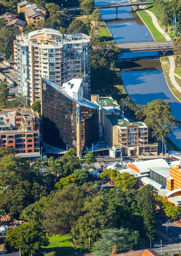
28 22 Photo: Parramatta City Council and Ross Honeysett
29 2 Our vision Towards our Greater Sydney 2056 Our 40-year vision to enable a more productive, liveable and sustainable Greater Sydney 23 This chapter outlines a draft amendment to A Plan for Growing Sydney that aligns with the vision established by this draft District Plan. It is the first step in the comprehensive work that will take place next year to review A Plan for Growing Sydney. This amendment reconceptualises Greater Sydney as a metropolis of three cities, and is presented with this draft District Plan to reflect the most contemporary thinking about Greater Sydney s future. As a draft for consideration, this allows the community and stakeholders to provide feedback to the draft District Plan while understanding the context of an emerging Greater Sydney, which will inform our review during You can read a standalone version of this chapter by visiting A changing, growing Greater Sydney Think about Greater Sydney as you know it today. Not only has it completely transformed in its structure and role from when it first flourished in the 19th Century, it has already surpassed the ambitious city on the Harbour that spread its reach and created its new suburbs throughout the 20th Century. Today, Greater Sydney is an economic powerhouse, generating nearly a quarter of Australia s Gross Domestic Product (GDP). Its economy at $378 billion per year is bigger than the combined value of Australia s manufacturing, mining and construction industries (Figure 2-1). Its financial strengths make it a great place for business. Figure 2-1: Greater Sydney GDP compared to national industries (2015) $378 $344 $326 Sydney GDP National GDP GDP ($ billion) Sydney GDP Mining, manufacturing and construction Professional services $184 Health and education Source: Australian Bureau of Statistics, Catalogue Australian System of National Accounts $142 Wholesale, transport and warehousing
30 24 Greater Sydney is home to nearly 4.7 million people, which includes 2.4 million workers. Its Eastern City, traditionally known as Sydney CBD, is the epicentre of Australia s financial sector and home to key national institutions such as the Reserve Bank of Australia and Australian Securities Exchange (ASX). Other worldrenowned institutions such as the Sydney Opera House, Art Gallery of NSW, Museum of Contemporary Art and National Institute of Dramatic Art (NIDA) highlight Greater Sydney s cultural and artistic credentials. It also offers many local places that provide a diversity of lifestyle choices, from beachside to bushland settings, to busy main streets and ever-changing suburbs across its districts. Greater Sydney s current structure with economic activity and the transport network centred on Sydney City has served it well, yet a singular focus on one city centre cannot continue as Greater Sydney grows, particularly when the city centre sits at the geographic edge, rather than at its geographic heart. In a city-based economy like Australia s we need to get Greater Sydney s structure and spatial layout right. Looking to comparable global cities, we know that few are orientated around a single large central business district like Greater Sydney. Instead, leading global cities develop alternatives in terms of where economic activity is located, how it is distributed and how different areas of economic activity are organised. Compare this with Greater Sydney. Already, the location of the majority of Greater Sydney s jobs in the east, combined with an increasing number of people living in the west, has created capacity constraints such as higher levels of congestion, lower rates of housing affordability and uneven access to employment choices. Greater Sydney is that rare place: a city that is globally competitive while also sharing the lifestyle assets of smaller, highly liveable centres. Thanks to strong economic and population growth, a strong pipeline of planned investments and the need to respond to the fundamental challenges of Greater Sydney s geographic structure, now is the right moment to shape its positive transformation. These moments are rare in Greater Sydney s history and the ability to grab them is even rarer. Think about the significance of the Sydney Harbour Bridge, the Sydney Opera House and the 2000 Sydney Olympic Games. The building of the Harbour Bridge was more than just a connection between north and south: it signalled Greater Sydney s maturity and its confidence in the future. The Opera House was not just developed as a place to see a show instead, it put Greater Sydney on the global stage, attracting visitors from across the world and establishing rich cultural offerings. The Olympic Games were more than a sporting event they regenerated Greater Sydney s geographic heart and transformed thinking about an area that had been neglected. We associate these structures not only with improved productivity, but also with environment and social benefits, as they allow for more connected and sustainable communities that provide greater opportunities without the need to travel long distances.
31 25 The once-in-ageneration opportunity We are at a transformational point. We have an opportunity to shift Greater Sydney s spatial structure in a way that benefits all existing and future citizens. If there is a single change one moment in time that motivates this approach, it is the planned investment in the Western Sydney Airport. This is a game changer for Greater Sydney and will provide, in around 40 years, tens of thousands of jobs. Given the magnitude of this change, together with the scale of growth expected in Western Sydney, we need to plan now for a sustainable supporting transport network. As the new economic activity around the Western Sydney Airport starts to emerge and as the success of the Sydney City in the east continues, the Greater Parramatta and the Olympic Peninsula (referred to as GPOP) will develop its role as Greater Sydney s second city region. Put simply, now is the time to conceive and plan for Greater Sydney maturing into a metropolis of three cities: a metropolis that will collectively create Global Sydney. Greater Sydney has the potential to develop its global economic brand from its current professional and corporate services Eastern City focus towards a broader story that also embraces education, innovation, technology, and advanced production industries. The development of the Central City and the emergence of the Western City, catalysed by Western Sydney Airport, gives Greater Sydney a real opportunity to be a diverse and differentiated global economic powerhouse.' Greg Clark, urbanist and global advisor on cities and investment This means a shift away from thinking of Greater Sydney as a place anchored by an economically strong single central business district a monocentric approach and instead looking at the outstanding assets in three cities and the many local places and connections between these cities a genuine polycentric approach, as shown in Figure 2-2. Western Sydney City Deal The Australian and NSW Governments have agreed to work with local government on the development of a Western Sydney City Deal, a generational deal to deliver almost 100,000 jobs, more housing and better transport for outer Western Sydney in what is the nation s largest ever planning and investment partnership. The Western Sydney City Deal is intended to drive a new economy in the emerging metropolis that incorporates the areas immediately around the Western Sydney Airport, and the broader region. The Western Sydney City Deal pledges to: target additional infrastructure investment to increase public transport and reduce traffic congestion, so people can spend more time with their families deliver more jobs closer to homes and services, with a focus on youth and Aboriginal training and skills development increase housing through better planning and density done well, and streamlining approvals across all three levels of government support clean air, green spaces, vibrant arts and cultural initiatives.

32 26 Figure 2-2: A metropolis of three cities: Global Sydney. Source: Greater Sydney Commission, 2016
33 27 The metropolis of three cities acts as a central organising strategy in the planning for Greater Sydney as an eight million-strong metropolis by It will guide future decision-making and the priorities of government and industry to move to a more productive, sustainable and equitable city. The established Eastern City is the currently established Sydney City and economic corridors to its north through to Macquarie Park and south through Sydney Airport and Port Botany to Kogarah. It is an economic engine especially in the financial, business and professional services and innovation start-up sectors with a beautiful harbour, sought-after suburbs and a large proportion of knowledge-intensive jobs. There are many opportunities to enhance the Eastern City, such as the renewal of government-owned land near Sydney City and tackling congestion. Our planning must support and enable the continued growth of the Eastern City s global industries and branding. The established city contains significant heritage precincts such as The Rocks, Millers Point, Macquarie Street and the Royal Botanic Gardens and the Domain. The Harbour foreshores include significant evidence of Aboriginal occupation and interaction with the landscape. Of the three cities, the developing Central City with GPOP at its heart is anticipated to experience the most significant urban transformation over the next 10 to 15 years. Aboriginal occupation of this area dates back 30,000 years. Historically, Parramatta is an early colonial settlement and significant heritage is a key aspect of its identity. Its central metropolitan location will be one of its greatest advantages. By 2036, it will be one of Greater Sydney s administrative and business centres, and the Westmead health and education precinct will continue to grow and lead best practice in medical and education-related industries. It will be an important area for advanced manufacturing and innovation-driven enterprises. It will offer more opportunities for 21st Century smart jobs, will build its own global brand and, with planned transport investments, will be an easier place to get to and move around in. It is critical that the Central City has strong transport connections and transport capacity to the established Eastern City and the emerging Western City. By 2056, the Western Sydney Airport will be the focus of the emerging Western City. For the first time in over 100 years, this major catalyst will provide the opportunity to change the shape and structure of an extensive area of Greater Sydney. The emerging Western City will also offer the strategic advantage of creating a greater diversity of jobs and greater social opportunities for the thousands of citizens in the centres of Penrith, Blacktown, Liverpool and Campbelltown-Macarthur. The economic growth generated by the Western Sydney Airport will offer the opportunity to furnish the emerging Western City with affordable and diverse housing, transport and social infrastructure and jobs needed to create a place people will want to call home. This new central organising strategy of Greater Sydney as a metropolis of three cities has led to a reconsideration of the approach to centres in A Plan for Growing Sydney. A new hierarchy of centres is proposed, which defines three types of centres: strategic, district and local.

34 28 These centres vary in terms of scale and contribution to Greater Sydney s job growth and productivity as well as service provision to local communities. In brief: strategic centres, including transport gateways, have the scale, industries and location needed to specifically support a city with smart jobs and the success of the Eastern, Central and Western Cities district centres have jobs, facilities and services that support district populations local centres have a range of local jobs and services for local catchments. Our vision for Greater Sydney to 2056 represents the economic, social and environmental integration of a metropolis of three cities. It acknowledges that Greater Sydney is more likely to develop in a sustainable manner when it has a strong, productive economy underpinning a fair and liveable lifestyle and allowing a focus on Greater Sydney s natural environment, resilience and efficiency. This vision can be delivered through a number of metropolitan priorities, summarised in the table below. A Productive Sydney A Liveable Sydney A Sustainable Sydney A growing city A city with smart jobs A 30-minute city An equitable, polycentric city A city of housing choice and diversity A collaborative city A city in its landscape An efficient city A resilient city
35 29
36 30
37 3 A Productive City 31 'Successful cities grow. Cities that attract jobs, investment, institutions, and tourists, will also attract population, both from within their countries and from abroad. Population growth is a hallmark of city success but it brings with it critical choices and challenges that must be addressed.' Greg Clark, urbanist and global advisor on cities and investment The West Central District Productivity Profile The West Central District Productivity Profile describes the District s economy in terms of employment growth, types and locations, economic output and other data. This informs the way we plan for the District s economy and the type of jobs that the District will need to accommodate in the future. You can view the full Productivity Profile by visiting A summary is provided in section 3.1. Since its early days as farmland for the growing colony of NSW, the West Central District has been a productive, thriving place. It is now an important economic component within Greater Sydney and is experiencing significant transformation, extraordinary population growth, and record levels of investment that will change the face of the District for decades to come. Parramatta City sits at the heart of the West Central District and Greater Sydney. More broadly, the area from Greater Parramatta and the Olympic Peninsula, referred to as GPOP, will drive our ambition for the Central City as Greater Sydney transitions to a metropolis of three cities (refer to Chapter 2 for further discussion). Beyond GPOP, the many other economic hubs of West Central District Blacktown, Norwest and Marsden Park, for example, will spread the benefits of investment, innovation and enterprise to more people and businesses. This is a major time of change for the West Central District. Examples of significant concurrent investment in growth and renewal opportunities include: building Sydney Metro Northwest, planning for Parramatta Light Rail and undertaking major road projects such as WestConnex the recent commitment to the new Sydney Metro West, linking Parramatta City to Sydney City planning with public and private sector partners for the transformation of GPOP, including a new Museum of Applied Arts and Science on the banks of the Parramatta River plans to redevelop Westmead into a world-class health city renewing areas alongside planned infrastructure, including new homes, jobs and entertainment areas around stations along the Sydney Metro Northwest Priority Urban Renewal Corridor the renewal and revitalisation of Epping Town Centre planning for Parramatta Road as a strategically important transport route for business, employment and urban services through the Parramatta Road Corridor Urban Transformation Strategy prepared by UrbanGrowth NSW, which sets out the vision, and land use and transport principles to accommodate 27,000 new homes and 50,000 jobs over the next 30 years and identifies Granville and Auburn for transformation. managing the Parramatta North Urban Transformation Program to deliver a potential 2,700 new homes and 2,000 new jobs with heritage conservation at its heart growing new communities supported by considerable investment in roads, public transport and essential infrastructure in the North West Priority Growth Area public and private investment to grow the Norwest Business Park and Norwest Hospital significant planning as well as public and private investment in Marsden Park.

38 32 Figure 3-1: GPOP's major economic anchors Economic anchors Parramatta Light Rail Ferry Central Advanced Technology, Urban Services and Industrial Area Multimodal Interchanges Rapid Bus Routes Entertainment special use Existing heavy rail GPOP Boundary
39 33 This draft District Plan outlines the proposed priorities and actions to drive the West Central District s productive economy. It draws on A Plan for Growing Sydney s Goal 1, which seeks to grow a competitive economy with worldclass services and transport, as well as the priorities from Our vision - Towards our Greater Sydney The West Central District s economy The West Central District's economic assets begin with its many centres. This begins with GPOP, where we are working with councils and State agencies to continue to build and sustain momentum and with community, business and institutions to realise its economic potential. GPOP s western economic anchor is the strategic centre of Greater Parramatta - Parramatta City, North Parramatta and the Westmead health and education super precinct connected by Parramatta Park, as well as the Rydalmere and Camellia precincts. This area includes Western Sydney University s Rydalmere and Parramatta campuses, with potential to link to, and leverage, the University s research focus and foster other connections. GPOP also offers the Olympic Park Lifestyle Precinct and an ecosystem of urban services, advanced technology and industry centred around Silverwater and Auburn. Specifically, Greater Parramatta will have a key role in driving the growth and change of the West Central District and the emerging Central City. Parramatta Park will become an urban oasis with a safe, direct and well-lit path between Parramatta City and Westmead health and education precinct as the area benefits from the greatest growth boom in its history. This diverse range of public and private infrastructure development is listed on the next page. In addition to Greater Parramatta, the West Central District includes a diversity of strategic centres and district centres with distinct employment profiles. Norwest and Sydney Olympic Park are defined as strategic centres and contain the largest proportion of knowledge-intensive jobs in the District. Blacktown, along with the assets at Westmead, offers the West Central District important health and education institutions with the potential for a greater concentration of jobs in the health and education sectors. Blacktown is ideally positioned between the Western and Central Cities and will benefit from, and contribute to, economic growth in the two Cities. The West Central s district centres are Castle Hill, Mount Druitt, Marsden Park and Rouse Hill, which are largely retail-based centres that must support the District s growing population. Other economic-generating areas include employment and urban services land. The District accommodates approximately 34% of Greater Sydney s supply of employment and urban services land in both large precincts such as Eastern Creek and Marsden Park, and smaller precincts such as the Clyde railyards and North Rocks. Employment and urban services lands will be crucial locations for employment and economic activity as the District s economy, and that of Western Sydney, grows and evolves Current economic profile and recent growth The West Central District is home to more than 21% of Greater Sydney s population, approximately 18% of its jobs and generates an estimated 18% of Greater Sydney s economic activity. The District s jobs are categorised as knowledge-intensive and professional jobs, health and education jobs, population-serving jobs and industrial jobs. This categoristaion helps us to compare them to other District profiles and understand why different types of industries locate in different parts of Greater Sydney. The West Central District s proportion of population-serving and health and education jobs (32% and 19% respectively) reflect the District s population growth and its rich offering of health and education institutions.
40 34 The largest growth in additional employees is anticipated to occur in public administration due to the expected take up of leases in the new Parramatta Square development. Financial and insurance services is the third largest sector in total and in terms of additional employees. In terms of overall Gross Regional Product, the financial services sector is forecast to enjoy the most significant growth, followed by public administration, education and health care. Over the past two decades, the number of jobs generated across the West Central District has grown by more than 50%. Employment growth has occurred across all four industry sectors, with the most significant growth in health and education (78%), followed by knowledgeintensive (71%), population-serving (61%) and industrial (17%). This highlights the potential of the health and education sector to continue to play a significant economic role in the West Central District in the future, particularly given the District s significant forecast population growth (as discussed further in Chapter 4). In terms of absolute employment, the greatest increase in jobs was experienced in the population-serving sector (52,800 new jobs) which is reflective of the population growth that has occurred in the District. The share of industrial jobs in the West Central District (26%) is higher than the average for Greater Sydney (19%) (figure 3-2). By contrast the District has a lower proportion of knowledgeintensive jobs (23% compared to 32%). This requires us to consider ways to leverage the District s economic assets and investment opportunities to transition the economy to higher order and more productive industries and the knowledge-intensive economy. Greater Parramatta projects Parramatta Square is a three-hectare mixed use redevelopment precinct that will include a new Western Sydney University Parramatta Campus in 2017, several thousand square metres of A-grade commercial office and retail space, the City of Parramatta s community and civic space, a 90 storey residential building and 20,000 square metres of public space. The new Western Sydney Stadium to be located on the Pirtek Stadium site will cater for bigger crowds for sport and entertainment events with seating for 30,000. It will generate an estimated 1,200 construction jobs and up to 900 jobs when in operation. The Parramatta Riverbank Strategy will activate the Parramatta River as a key cultural precinct. The Riverbank will be the setting of the Museum of Applied Arts and Sciences, as part of a $30 million arts and cultural package for Western Sydney that includes funding to artists and arts organisations as well as a resident arts company at the Riverside Theatre. The Parramatta North Urban Transformation Program brings together State agencies, councils and stakeholders to provide approximately 2,700 new homes, create 2,000 new jobs and improve connections within Greater Parramatta. It will respect the area s social history by conserving heritage and protecting environmental assets. This delivery of social, cultural and recreational infrastructure will unlock and share the heritage of Parramatta North. The Westmead Redevelopment Project is a major initiative of the NSW Government, led by Health Infrastructure NSW, the Western Sydney Local Health District and the Children s Hospital at Westmead. The redevelopment aims to transform Westmead into a worldclass health city. Parramatta City will benefit from two new multi-storey schools, built to cater for up to 2,000 students and a new primary school for up to 1,000 students. Both new schools will be located on existing school sites.
41 35 Table 3-1: West Central District: Historical population and jobs growth ( ) Population Employment Projection % Growth Projection % Growth West Central District Greater Sydney 663, ,000 46% 291, ,300 51% 3,553,100 4,682,000 32% 1,722,700 2,439,800 42% Source: (population) Department of Planning and Environment, 2016 New South Wales State and Local Government Area Population and Household Projections and Implied Dwelling Requirements 2016 to 2036, NSW Government, Sydney; (employment) Transport Performance & Analytics (TPA) (formerly known as Bureau of Transport Statistics), Transport for NSW, Greater Sydney Employment Forecasts, 2011 to 2041 (2016 release), NSW Government, Sydney. Figure 3-2 Employment profile by sector West Central District vs Greater Sydney (2016) 18 % 19 % 32 % 27 % 30 % 19 % 23 % West Central District 32 % Greater Sydney Health and Education Industrial Knowledge and Professional Services Population servicing sectors Source: Transport Performance Analytics (TPA) (formerly known as Bureau of Transport Statistics), Transport for NSW, Greater Sydney Employment Forecasts, 2011 to 2041 (2016 Release)

42 Figure 3-3 West Central District s gross value added (2015) 36 Strategic Centre District Centre District Boundary Waterways Gross value added ($ Million) less than ,390 1,390-62,400 greater than 62,400 Source: Australian Bureau of Statistics, Catalogue , Australian System of National Accounts. Figure 3-3 shows the spatial distribution of economic activity across the District in terms of Gross Value Added (GVA), which measures the value of goods and services in a particular area. Concentrations of economic activity across the District are also areas of high labour productivity (illustrated in Figure 3-4). Labour productivity is a measure of the efficient use of resources. Areas with high labour productivity generate higher economic value per hour worked. The spatial distribution of productivity can help build an understanding of important economic places as well as the profile of economic activity in a particular area.

43 Figure 3-4: West Central District s labour productivity (2015) 37 Strategic Centre District Centre District Boundary Waterways Labour productivity ($/hour) greater than 100 Source: Australian Bureau of Statistics, Catalogue , Australian System of National Accounts. Economic hubs include Blacktown, Norwest, GPOP and employment and urban services precincts such as Huntingwood, Greystanes and Eastern Creek (part of the broader Western Sydney Employment Area). These locations serve an important economic role within the District and will continue to drive its future productivity. The manufacturing sector is one of the largest employer in the District and the second greatest contributor to economic output (12.5% share of GVA). This follows the financial and insurance services (12.8% share) contribution.
44 38 Figure 3-5: West Central District residents' access to jobs during the AM peak (2016) Proportion of jobs accessible within 30 min 40% 35% 30% 25% 20% 15% 10% 5% 0 Greater Sydney Average 16% Central North West Central South South West West Source: Transport Performance & Analytics (TPA) (formerley known as Bureau of Transport Statistics), Transport for NSW, Strategic Travel Model (STM) outputs, 2016, NSW Government, Sydney Figure 3-6: West Central District's journey to work by mode (2011) West Central Greater Sydney 0% 10% 20% 30% 40% 50% 60% 70% 80% 90% 100% Train Bus Ferry Car Motorbike Bicycle Source: Australian Bureau of Statistics, 2011 Census of Population & Housing Walked only
45 Access to jobs Our research shows that during the morning peak, approximately 14% of Greater Sydney s jobs are accessible to the West Central District residents within 30 minutes by public transport or private vehicle. This is lower than the 16% average across Greater Sydney. From an economic perspective, having access to a larger number of jobs means greater potential for job and skill matching, enhanced opportunities for skill and knowledge development, and ultimately better outcomes for households and the overall economy. Public transport access for the residents of the West Central District is provided by the Western and Blue Mountains Rail Line (T1), the Cumberland Line (T5), Carlingford Line (T6) and the Olympic Park Line (T7) together with a network of bus and ferry services. The District also benefits from established road corridors such as the M2, M4 and M7 Motorways. Currently, 17% of trips to work are by train, bus or ferry which compares to 20% across Greater Sydney. Access to employment across the District will improve with the completion of the Sydney Metro Northwest, which will link the District s north to Sydney City, Macquarie Park and North Sydney. The growth of Parramatta City relies on better access from all directions to maximise its locational centrality. The proposed Parramatta Light Rail will improve access within GPOP, connecting revitalisation areas as well as important employment precincts, tertiary education institutions, health, cultural and recreation facilities Economic opportunities With our vision for GPOP and the move towards an emerging Central City, the West Central District is well placed to leverage the opportunities that anchor institutions in the area present to generate a new globally connected and competitive engine for the Central City. The key economic assets in the West Central District include: an established and well-connected Parramatta City a unique set of health and education resources in Westmead, Blacktown, Parramatta City and Rydalmere Sydney Olympic Park an established and strong employment and urban services sector, with significant advanced manufacturing capabilities particularly in Blacktown, Rydalmere, Silverwater, Camellia and Norwest connectivity to the established Eastern City and proximity to the planned Western City including Western Sydney Airport a growing, young and well educated population significant planned and committed investment in public infrastructure. While these assets present major opportunities as drivers of economic activity and diversity in the District, our planning will need to address the ongoing pressure on employment and urban services lands, pressure on commercial floor space in strategic centres to rezone to residential, and connectivity and amenity constraints. Additional transport links are required to improve the connectivity of the skilled workforce in Greater Sydney s northwest to GPOP. This will be considered as part of the Future Transport Strategy, which will be prepared by Transport for NSW in 2017.
46 District priorities This chapter outlines the productivity priorities and actions for the West Central District. The priorities are presented in two ways. Firstly, each heading outlines a priority area, and we provide context and detail to expand on the outcomes sought. Some headings cover factual issues only; these are not included in the list below. Secondly, within the broad priority areas there are, in many cases, more detailed priorities. We identify the specific purpose of these priorities in each case by detailing how they relate to strategic planning and planning proposals. The priorities should be considered in strategic planning activities and planning proposals as appropriate. The full list of productivity priorities covered in this section are outlined below The District priorities include: driving the growth of the Central City -- GPOP -- strategic centres supporting the Central City -- identifying economic development priorities for the Central City -- enhancing connections to the emerging Western City -- integrate transport and land use planning -- supporting the Central City's tourism economy -- support the growth of tourism infrastructure planning for job targets in strategic and district centres -- plan for the growth of centres growing West Central District's economy with smart jobs -- planning priorities for strategic and district centres -- manage growth and change in strategic and district centres and, as relevant, local centres -- grow a vibrant Parramatta City with a productive and diversified economy -- plan for a growing and vibrant Parramatta City -- growing the health and education offerings of Westmead -- expand health and education activities in Westmead -- growing the Blacktown strategic centre, including health and education activities and business park -- grow economic activities in Blacktown strategic centre -- grow economic activities in Norwest strategic centre -- grow economic activities in Norwest strategic centre -- planning for retail floor space provision and demand in the West Central District -- prioritise the provision of retail floor space in centres -- planning for district centres improving access to a greater number of jobs and centres within 30 minutes coordinating freight activities with land use planning attracting employment and urban services activity -- protect and support employment and urban services land
47 Driving the growth of the Central City Our vision Towards our Greater Sydney 2056 introduces the developing Central City, anchored by GPOP and supported by a collection of asset universities, institutes, major hospitals, events spaces, employment and urban services land together with strategic centres. This vision expands on, and re-conceptualises, a number of directions from A Plan for Growing Sydney, including: Direction 1.2: Grow Greater Parramatta Sydney s second CBD Direction 1.3: Establish a new Priority Growth Area Greater Parramatta to the Olympic Peninsula Direction 1.4: Transform the productivity of Western Sydney through growth and investment. To deliver on our ambition for the Central City, we will collaborate across three tiers of government and engage with the community. This will provide clear direction for the private sector, who will, in the main, develop and invest in the Central City. This approach will recognise and capitalise on the transformative opportunities that can collectively drive the growth of the Central City. We have already started delivering on this by establishing a cross-government collaboration, which has already delivered a number of milestones including the October 2016 launch of the GPOP vision GPOP GPOP was identified as a new priority growth area in Direction 1.3 of A Plan for Growing Sydney, with a range of actions to coordinate planning and deliver enabling infrastructure to support growth and urban renewal in the area. It has since been expanded to include the area to Carlingford. GPOP presents a major economic opportunity for the District and Greater Sydney due to its: geographic position at the centre of Greater Sydney planned transformative investment young and diverse labour force mix of existing city-scale assets affordable urban lifestyle. GPOP represents four distinct quarters linked by Parramatta River and the planned Parramatta Light Rail: Parramatta City and Westmead: Health and education super precinct Next Generation Living: Camellia and Carlingford Essential Urban Services, Advanced Technology and Knowledge Sectors in Camellia, Rydalmere, Silverwater and Auburn Olympic Park Lifestyle Super Precinct. Action P1: Collaborate to create, own and deliver GPOP GPOP is the subject of several land use planning activities by State agencies and the City of Parramatta Council that will be consistent with the developing GPOP vision. These include: GPOP Land Use and Infrastructure Strategy, being led by the Department of Planning and Environment Westmead Hospital Redevelopment, being progressed by Health Infrastructure NSW, Western Sydney Local Health District and The Children s Hospital at Westmead Parramatta CBD Planning Proposal, being led by City of Parramatta Council Parramatta North Urban Transformation Program, being led by UrbanGrowth NSW Sydney Olympic Park Master Plan, being led by Sydney Olympic Park Authority Camellia Town Centre Detailed Rezoning Proposal, being led by the Department of Planning and Environment and City of Parramatta Council Telopea Master Plan, being led by the Land and Housing Corporation and City of Parramatta Council Parramatta Road Urban Transformation Strategy, developed by UrbanGrowth NSW.
48 42 In response to these activities, we identify GPOP as a Collaboration Area. We will continue to facilitate cross-agency collaboration and community and industry engagement to deliver on our GPOP vision. A Collaboration Area is a place where a significant productivity, liveability or sustainability outcome is better achieved through the collaboration of different levels of government and in some cases the private sector or landowners. The various forums established within the NSW Government to focus attention on GPOP will continue in 2017 and include: The Greater Parramatta Technical and Investment and Coordination Group with relevant State agencies and the City of Parramatta Council. The remit of the group will be expanded in 2017 to include the entire GPOP area. The GPOP Collaboration Group includes contributors from relevant State agencies, the City of Parramatta Council and special interest agencies, associations and institutions, meeting regularly to inform the GPOP vision and this draft District Plan. It will focus on progressing the 12 directions outlined in the GPOP Vision. A Business Roundtable hosted by the Chief Commissioner in July 2016 started a conversation with the private sector, which will be a key planning and delivery partner. A similar forum will be hosted by the Commission every six months Strategic centres supporting the Central City Greater Parramatta, Blacktown, Norwest and Sydney Olympic Park provide specialised jobs that will complement and support the growth of the Central City. These centres will also be places where people can access many services and lifestyle assets such as entertainment, recreation and retail that contribute to the quality of life. Blacktown functions as a population service centre for the District with a range of business, retail, health, education and public administrative functions. Blacktown is served by rail connection to GPOP and Sydney City and will continue to support the Central City in the next two decades as well as the Western City in the longer term. Norwest is a business park with significant employment opportunities. The centre contains multinational headquarters, commercial business, The Hills Shire Council offices and Norwest Marketown shopping centre. A private hospital is also located nearby, providing health services and significant employment. The centre will be served by a future Sydney Metro station, which will be operational in Sydney Olympic Park, GPOP s eastern anchor, provides a range of residential, commercial and recreational activities and benefits from public transport connectivity, which will be further enhanced with the development of the Parramatta Light Rail and implementation of the Sydney Olympic Park Master Plan. Over the next 20 years, Sydney Olympic Park will continue to grow as a vibrant centre with increased economic activity, improved infrastructure and enhanced public domain. The recent announcement of Sydney Metro West is another game changer for Sydney Olympic Park. Our priorities and actions for the District s strategic centres are outlined in Sections 3.4 of this draft District Plan. The strategic centres of Macquarie Park and Rhodes are also important contributors to the Central City. Our priorities and actions for the growth of these centres are outlined in the draft North District Plan (for Macquarie Park) and draft Central District Plan (for Rhodes).
49 Identifying economic development priorities for the Central City With the emergence of Greater Sydney as a metropolis of three cities, the Department of Industry, in collaboration with the Commission, councils, the investment community and other stakeholders will prepare and implement economic development strategies for each of the three cities. This is a new approach for Greater Sydney it leverages the skills of government to lead the agglomeration of jobs and industry. The economic development strategies will give us a framework to collaborate across public and private organisations to achieve the ambitions of Our vision - Towards our Greater Sydney 2056 and the aspirations of this draft District Plan. The three economic development strategies will be complementary and will reflect our aspirations for the Western, Central and Eastern Cities. They will consider, where relevant: planning strategies to support the growth of health and education super precincts the goals of Growing the First Economy of NSW a framework for Aboriginal economic prosperity, developed in conjunction with Aboriginal Affairs manufacturing and advanced manufacturing clusters tourism and services economy aerospace and defence industries other specific industries as required. The economic development strategies will also draw on the work of Jobs for NSW as detailed in their Jobs for the Future report. This report outlines the aspirations for future employment growth in NSW and how private and public sectors can contribute to achieving it. Jobs for NSW is also providing access to grants and partnerships to guide emerging businesses. Jobs for NSW Jobs for NSW is a private sector-led NSW Government-backed initiative which was established by the NSW Premier and NSW Minister for Industry in 2015 to drive investment and facilitate jobs growth across NSW. Specifically, Jobs for NSW has been tasked with overseeing the $190 million Jobs for NSW Fund and assisting the NSW Government in delivering on its commitment to create 150,000 new jobs across NSW by March Jobs for NSW is focused on driving growth in industries and sectors where NSW has or could have a global competitive advantage. This includes start-ups and fast-growth small-to-medium enterprises in target industries such as tourism, goods exports and advanced manufacturing, with the overall aim of growing the NSW economy. Jobs for NSW is also providing grands and partnerships to guide emerging businesses. Action P2: Develop and implement an economic development strategy for the Central City The Department of Industry, in collaboration with the Commission, Jobs for NSW, Aboriginal Affairs and other State agencies and local councils, as relevant, will develop an economic development strategy for the Central City. The Central City economic development strategy will have a specific focus on the Westmead health and education super precinct see Action P3 for more detail and will align with directions 1, 2, 3 and 5 in the GPOP vision.
50 44 Parramatta Road Corridor Urban Transformation Strategy The Parramatta Road Corridor Urban Transformation Strategy and Implementation Tool Kit were released in November The Strategy is an integrated land use planning and transport framework that establishes the vision for a high quality multi use Corridor with improved transport choices, better amenity and balanced growth of housing and jobs. This will guide the delivery of 27,000 new homes and 50,000 new jobs in a range of industries across the Corridor over the next 30 years. The Implementation Tool Kit responds to community priorities for more open space and more appealing streets, reduced traffic congestion, improved public transport and a better environment for residents and business. The eight 'Precincts' along the Corridor were identified in consultation with local councils. These Precincts have been earmarked for renewal because of their unique access to jobs, transport, infrastructure and services, and their ability to accommodate new development in a balanced way. Two precincts, Granville and Auburn, are in teh West Central District. Delivery of the Strategy is supported by the $198 million Urban Amenity Improvement Plan, which will deliver upgrades of existing facilities and new infrastructure to support growing communities including funding for streetscape upgrades; new or improved open spaces; urban plazas and town squares, and new walking and cycling links to key transport nodes and open spaces.

51 Enhancing connections to the emerging Western City The metropolis of three cities includes the emerging Western City, which is focused on the planned Western Sydney Airport. The Western City will encompass the West, South West and West Central Districts and includes the strategic centres of Penrith, Liverpool, Campbelltown- Macarthur and Blacktown. The draft West and South West District Plans provide actions and policy directions that will collectively drive the delivery of the Western City. This includes a Western Sydney City Deal, which is a collaboration between the NSW and Australian Governments, as well as local government. The western part of the West Central District, including Blacktown, will serve both the Central City and Western City. Our planning for Blacktown and its surrounds will consider opportunities to improve connectivity from Blacktown to GPOP, as well as the Western Sydney Airport. The Western Sydney Rail Needs Scoping Study considers rail service options that will enhance connections to GPOP and other strategic and district centres in the West Central District. Productivity Priority 1: Integrate transport and land use planning The Western Sydney Rail Needs Scoping Study will inform the Future Transport Strategy, which is being developed by Transport for NSW, and will support the final West Central District Plan. Any relevant land use and transport initiatives in councils strategic plans and local environmental plans should align with the updated Future Transport Strategy and planning principles for the priority growth areas across the District. How these matters are taken into account is to be demonstrated in any relevant planning proposal. The Australian and NSW Governments are developing a Western Sydney Rail Needs Scoping Study that will examine the passenger rail transport needs of Western Sydney and the Western Sydney Airport. A Discussion Paper released in September 2016: acknowledges the level of population and employment growth forecast for Western Sydney and associated transport challenges provides an overview of the transport projects underway in Western Sydney examines the rail demand in Western Sydney provides an overview of the initial set of rail options identified to service Western Sydney and the Western Sydney Airport.

52 Supporting the Central City s tourism economy The West Central District has a range of important tourism and cultural assets that attract national and international tourism. These include national and regional parks such as Cattai National Park, Western Sydney Parklands, Parramatta Park and Millennium Parklands. It also has Aboriginal and non-aboriginal heritage items of national, State and local significance including items and landscapes in Parramatta Park, Bella Vista, Prospect Reservoir and Rouse Hill House. Visitors enjoy the landscapes of the rural areas within The Hills Shire and the many cultural and recreational assets such as the Riverside Theatre as well as Sydney Olympic Park Stadium and sporting facilities. The Central City has the potential to leverage the significant investment in planned or committed infrastructure in the West Central District to provide a greater diversity of tourism attractions. For example investment in major recreational, cultural and sporting facilities such as a new Western Sydney Stadium, the Museum of Applied Arts and Sciences in Parramatta and a new Western Sydney Zoo will attract national and international tourism to the District. Our planning can build on this base to grow the tourism offer and supply a greater amount and diversity of short-term visitor accommodation that could convert many of the day visitors to overnight stays. Productivity Priority 2: Support the growth of tourism infrastructure In preparing strategic plans, the relevant planning authorities should consider opportunities to: incentivise investment in hotel and short-term accommodation for overnight visitors invest in more facilities to attract visitors provide industry support and visitor servicing developing place making initiatives. How these matters are taken into account is to be demonstrated in any relevant planning proposal.

53 Planning for job targets in strategic and district centres As Greater Sydney transforms into a city of over six million people by 2036 and eight million people by 2056, we need to plan to attract and best distribute employment and economic growth. Recent projections of future employment consider projected population growth and age profiles, broad economic conditions and trends, sector and industry specific outlooks and Greater Sydney s planned investments. These updated projections have revised the forecast demand for jobs across Greater Sydney from 689,000 by 2036 to 817,000 additional jobs. This is a significant growth opportunity for Greater Sydney as a global city, representing business confidence and economic growth. We do, however, need to plan for how Greater Sydney attracts and accommodate these jobs in the right locations the kind of places that we know are supported by land use and infrastructure investment and are attractive from a commercial perspective Plan for the growth of centres A Plan for Growing Sydney identified 28 strategic centres, and four transport gateways, as places to provide more jobs close to home. In developing Our Vision - Towards our Greater Sydney 2056, the Commission s research found that some centres make a substantially greater contribution to the economy of Greater Sydney. On this basis we have redefined the approach to consider a hierarchy of centres ranging from strategic to district and local. We define strategic centres as having one or more of the following characteristics: a higher proportion of knowledge-intensive jobs, principally relating to the presence of major hospitals, tertiary education institutions, stand-alone office development or a combination of these the presence of existing or proposed major transport gateways a major role in supporting the increased economic activity of the Eastern, Central and Western Cities generally generate over 20,000 jobs.
54 48 The work to support Our vision - Towards our Greater Sydney 2056 also identified that there were a range of centres (some of which had been classified as strategic centres in A Plan for Growing Sydney) that in fact play a significant district role due to the presence of one or more of the following characteristics: the scale of retail activity, generally over 50,000 square metres of floor space the presence of health and education facilities that serve the district and the local community the level of transport services generally between 5,000 to 10,000 jobs. These centres have been identified as district centres. It is the presence and scale of the health and education facilities, transport gateway infrastructure and knowledge-intensive jobs that is the key differentiator between strategic and district centres. In these places the government has greater potential to leverage economic activity from existing infrastructure which can enhance the global competitiveness of Greater Sydney. The differentiation does not intend to impact on the ability for either a strategic or a district centre to attract retail or commercial activity (including office development) of any scale, subject to the normal local planning and development assessment process. Local centres vary in size from a few shops on a corner to a vibrant main street. They are on a smaller scale than district centres and generally serve the local population. In the West Central District, Epping and Merrylands are examples of local centres that, with the right planning and investment, could reach their potential as emerging commercial and retail nodes. We have nominated job targets for the District s strategic and district centres to provide guidance to councils and NSW Government agencies as to the likely and potential scale of employment growth and to inform land use and infrastructure planning (figure 3-2). Our experience emphasises the value of providing targets as a range to account for varying economic conditions, investment opportunities and local aspirations. Table 3-2: West Central District job target ranges for strategic and district centres ( ) Centre Centre Type 2016 Estimate 2036 Baseline Estimate 2036 Higher Estimate Greater Parramatta Parramatta City Westmead Strategic 96, , ,500 Sydney Olympic Park Strategic 30,100 45,000 46,500 Norwest Strategic 32,400 49,000 53,000 Blacktown Strategic 13,200 17,000 19,500 Castle Hill District 9,800 16,000 19,500 Rouse Hill District 4,200 10,000 11,000 Mount Druitt District 6,700 8,000 8,500 Marsden Park District 300 5,000 8,500 Source: Transport Performance & Analytics (TPA) formerly known as Bureau of Transport Statistics), Transport for NSW, Greater Sydney Employment Forecasts, 2011 to 2041 (2016 Release), NSW Government, Sydney)

55 49 The lower end of the range of these job targets reflect the baseline of projected job growth that is anticipated in the centre, while the upper end is an aspirational higher growth scenario to reflect outcomes in the case of further investment and land use planning in centres. On this basis, there will be a need to review the list of strategic and district centres as part of the regular review of the regional plan for Greater Sydney, starting with the review of A Plan for Growing Sydney in 2017.
56 Growing West Central District's economy with smart jobs As identified in Section 3.1, the West Central District includes a lower proportion of jobs in the knowledge-intensive and health and education sectors (42%) as compared to the average for Greater Sydney (51%). Despite this, our research shows that these sectors are growing in the West Central District. As the District grows, there is a significant opportunity to increase the share of knowledge and professional services jobs and health and education jobs, to diversify employment opportunities, particularly for young people entering the workforce. Knowledge and professional services and health and education jobs tend to cluster to take advantage of the benefits of agglomeration. The West Central District s strategic and district centres include existing economic assets and planned infrastructure, that present major opportunities for this kind of economic growth and diversification Planning priorities for strategic and district centres The strategic centres of Greater Parramatta, Blacktown, Norwest and Sydney Olympic Park accommodate a large concentration of jobs and employment activity, substantial areas of commercial floor space, health and education institutes, and other economic assets and transport connections. They are a key area of focus for the growth of jobs, economic activity and enhanced connectivity. provide jobs closer to home in support of the 30-minute city reduce the need to travel by car by co-locating residential, health, employment and education facilities promote healthier lifestyles and community cohesion with improved walking, cycling and public transport access to a wider range of services and opportunities provide attractive, safe and inclusive locations for communities to meet, recreate and spend time. For these reasons we emphasise the need for planning authorities to focus on the design of, accessibility to, and economic strength of centres. We also encourage local councils and the NSW Government to invest in centres to reduce the need for residents to travel longer distances to work or services, to make the best use of infrastructure and support local businesses. In this regard, we must plan for existing centres to grow, new centres to form and the District s network of centres to be enhanced so that they play complementary and supportive roles. The district centres of Castle Hill, Rouse Hill, Mount Druitt and Marsden Park accommodate retail and local services for communities. The growth, innovation and evolution of strategic centres will underpin the success of Greater Sydney. Centres not only provide important services and jobs for local residents, but a focal point for communities. Their vitality and viability is important to local economies as well as the character of local areas. More specifically well planned centres: help to stimulate economic activity and innovation through the co-location of industries ensure the most efficient use of infrastructure
57 51 Productivity Priority 3: Manage growth and change in strategic and district centres and, as relevant, local centres When undertaking planning for strategic, district and local centres, the relevant planning authority should consider: opportunities for existing centres to grow and new centres to be planned to meet forecast demand across a range of retail types the need to reinforce the suitability of centres for retail and commercial uses while encouraging a competitive market the commercial requirements of retailers and commercial operators such as servicing, location, visibility and accessibility the use of B3 Commercial Core Zones in strategic centres and where appropriate in district centres to reinforce and support the operation and viability of nonresidential uses including local office markets. When preparing strategic plans the relevant planning authority needs to demonstrate how its planning for centres has considered strategies to: deliver on the strategic and district centre s job targets meet the retail and service needs of the community facilitate the reinforcement and/or expansion of allied health and research activities promote the use of walking, cycling and integrated public transport solutions provide urban spaces such as meeting places and playgrounds respond to the centre s heritage and history promote community arts and cultural activities reflect Crime Prevention Through Environmental Design (CPTED) principles such as safety and management manage the transition between higher intensity activity in and around a centre and lower intensity activity that frames the centre. How these matters are taken into account is to be demonstrated in any relevant planning proposal.
58 Growing a vibrant Parramatta City with a productive and diversified economy Direction 1.2 of A Plan for Growing Sydney seeks to grow Greater Parramatta. Building on this our vision for Parramatta City to become the commercial and administrative hub of the Central City is discussed further in this section. The Parramatta City office market is the fifth largest suburban office market in Australia with approximately 700,000 square metres of office floor space. It is the fourth largest office market in Greater Sydney and has experienced 14% growth in commercial floor space between 2004 and The commercial office uses in Parramatta City have a focus on information and finance based services, as well as the government sector. Parramatta City has benefited from the government's decentralisation policy with many NSW Government departments already relocated or planned to relocate to Parramatta City over the next few years. In addition to commercial uses, Parramatta City contains a large retail offer anchored by Westfield Parramatta, residential uses, administrative and civic uses, including the Parramatta Justice Precinct and transport functions focused on the Parramatta transport interchange. A recent Sydney Office Market Research Report commissioned by the Department of Planning and Environment found that there is a lack of new premium commercial supply in Parramatta City and strong pressure for residential development in the commercial core. This creates challenges for realising the vision to grow the commercial capacity of Parramatta City and is an important consideration in planning for the Central City. In response to these challenges and investment interest, in 2015 the City of Parramatta Council adopted the Parramatta CBD Planning Strategy which included a vision for growth, principles, and actions to guide a new planning framework. A Planning Proposal has been prepared based on this Strategy to amend the planning controls for Parramatta City to: provide an expanded and more intense commercial core to strengthen and facilitate the role of Parramatta City as a commercial office market and job generator support Parramatta City as a vibrant centre by surrounding the commercial core in appropriate locations with higher density mixed use development. Council expects the planning proposal, if approved, to provide capacity for nearly 49,000 jobs and more than 20,000 new homes. This growth must be supported by appropriate and improved transport connections, traffic management within Parramatta City, new walking and cycling links, travel demand management and parking management solutions. At present, eight strategic road corridors converge on Parramatta, entangling crossregional car and freight flows and causing excessive congestion. Transport for NSW will investigate an outer, inner and link road network that would allow traffic to circumnavigate Parramatta City and Westmead, and efficiently reduce unnecessary vehicle movements. Servicing needs for retail deliveries, construction, maintenance and waste handling will be incorporated. The delivery and staging of road improvements will be aligned with the delivery of Parramatta Light Rail, including consideration of priority for the outer and inner ring roads. Transport for NSW will also work with the City of Parramatta to provide a connected cycling network access to and within Parramatta City.

59 53 1 Parramatta Court House 2 Parramatta Children s Court House 3 Office of State Revenue 4 NSW Fair Trading 5 Heritage Council of NSW 6 City of Parramatta Council 7 Department of Immigration and Border Protection 8 Australian Taxation Office Figure 3-7: Greater Parramatta existing activities UrbanGrowth NSW Hospital Local Public Open Space District Public Open Space Productivity Priority 4: Plan for a growing and vibrant Parramatta City University/Tafe Retail hub Sports Facility Local Government Office State Government Office Federal/Commonwealth Office Industrial Business Mixed Use Regional Public Open Space Waterways Motorway Highway Major Road Local Road Railway Railway Station When undertaking planning for Parramatta City, the relevant planning authority needs to demonstrate how the plan has considered opportunities to: develop and expand the commercial core enhance the urban amenity of the centre, including links to adjacent precincts diversify and enhance arts, culture and entertainment in Parramatta City improve connectivity to, and within, Parramatta City manage car parking identify smart traffic management strategies enhance the Parramatta River and Parramatta Park. How these matters are taken into account is to be demonstrated in any relevant planning proposal.
60 Growing the health and education offerings of Westmead Our approach to health and education super precincts will be refined further and confirmed in our review of A Plan for Growing Sydney in In the West Central District, Westmead has been identified as a health and education super precinct. Across Greater Sydney there are a number of locations where the proximity of health and education assets create significant opportunity to drive economic activity and the prosperity of NSW. We have identified these as health and education super precincts. Health and education super precincts are important locations for knowledge-intensive jobs, innovation and service delivery. It is anticipated that by 2036, 21% of all Greater Sydney jobs will be in the health and education sector. Health and education super precincts mirror closely the list of significant metropolitan health and education precincts identified in A Plan for Growing Sydney. The only exceptions are Rhodes - where there is no major education presence and Rydalmere where there is no major health presence. As Greater Sydney s population grows, we need to ensure that our health and education infrastructure keeps pace with population growth. We need to be certain that demographic changes such as the high growth rate of children and the proportion of frail aged people are monitored and measured, while infrastructure necessary to support this population is planned for and provided. Growing jobs in the health and education sectors delivers on Direction 1.10 in A Plan for Growing Sydney, specifically Actions and The Westmead health and education super precinct on the western edge of GPOP is one of the largest integrated health, research, education and training precincts in the world. Major health and education facilities in the precinct include Westmead Hospital, Westmead Private Hospital, Institute of Clinical Pathology and Medical Research, Westmead Millennium Institute, The Children s Hospital at Westmead, Cumberland Hospital and Children s Medical Research Institute and Kids Research Institute. Action of A Plan for Growing Sydney aims to expand and build on these existing strengths and grow specialised health and education activities in Westmead. NSW Health has prepared a master planning study to inform future planning activities for the Westmead Health Precinct. The Westmead redevelopment is expected to increase the Precinct s workforce from 18,000 to 32,000 by 2036 and with the potential to reach 50,000 with additional investment. The number of students is expected to grow from 2,600 to 9,000 by The vision is to grow Westmead into a worldclass health precinct or health city and Australia s centre for bio-medical technology and research. We support the growth of health and ancillary activities in health and education super precincts and recognise the need to: plan for the expansion of these precincts protect surrounding employment areas for health and education and related land use consider flexibility of zones to accommodate ancillary and complementary uses such as health and medical research activities; private hospitals; allied health; ancillary retail; visitor, carer and aged accommodation in the right locations plan for increased access and enhanced urban amenity within and around health and education super precincts.

61 55 Productivity Priority 5: Expand health and education activities in Westmead The relevant planning authority should demonstrate how its planning has considered opportunities to: revitalise Hawkesbury Road so that it becomes the civic, transport, commercial and community heart of Westmead create greater opportunity for medical and education services together with associated commercial, housing and community facilities contribute to the creation of a walkable and vibrant health city support greater diversity of housing and greater housing choice deliver ancillary uses which complement health and education facilities, including: -- residential and aged care facilities -- visitor accommodation -- health and medical research activities -child - care -- non-critical patient care -- commercial uses which will be complementary to and help to revitalise the health precinct manage traffic and car parking. Action P3: Expand health and education activities in Westmead A coordinated effort across government, industry and universities is required to leverage existing public and private investment and address any barriers to a commercially successful health city in Westmead. Through our existing forums established for GPOP, we will work with the relevant stakeholders to identify priority areas of government, boost the number of researchers at Westmead and facilitate development opportunities that will improve the amenity of the area, its walking connections to Parramatta City, the diversity of residential, retail and commercial uses in the Westmead precinct. This will include identifying key barriers, required actions, practical delivery models, and next steps for the key stakeholders. NSW Health will be a key partner in delivering this action. How these matters are taken into account is to be demonstrated in any relevant planning proposal.
62 Growing the Blacktown strategic centre, including health and education activities and business park Activities within the Blacktown strategic centre are concentrated into distinct precincts and places that create a real identity. Transport accessibility, mixed use residential, retail, recreation and education and health facilities are crucial building blocks of the centre. This clustering of activities creates vibrancy and allows collaboration and competition between common uses. Similarly, planning for the centre is reflected in the built form with opportunities for landmark buildings and high quality urban spaces that attract workers, residents and visitors. The range of uses in the Blacktown strategic centre include the city centre, health and education assets, a business park, leisure and entertainment uses and residential living. The transformation and diversification of the existing employment lands in Blacktown s city centre into a business park environment could create opportunities for more specialised jobs that can complement and contribute to the economic growth of the centre. An increase in residential densities in the city centre will create diversity and contribute to a more compact 30-minute city. Residents will have easy access to jobs, retail, entertainment, arts, community and cultural services as well as local and recreation assets such as the redeveloped Blacktown Showground. The underutilised surplus government land along the North West Transitway adjoining Sunnyholt Road provides opportunities for a significant transformation into diverse and compact housing around the bus stations, reinforcing a northern gateway into the city centre. The Blacktown city centre at the core of the strategic centre offers a variety of business, retail, mixed use residential and administrative functions that creates a vibrancy and attracts investment, employment and diversity of housing. Blacktown Station is the confluence of the Western and Richmond Rail Lines providing accessibility to communities in the west as well as the North West Priority Growth Area with the North West Transitway connecting with The Hills. The ring road system functions to distribute regional traffic around the city centre, enable a more pedestrian orientated centre. Blacktown Hospital and clinical school forms part of the District s cluster of health facilities and specialist services alongside Westmead and Mount Druitt Hospitals. The expansion of Blacktown Hospital will make it the third largest public hospital in NSW, generating more than 5,000 jobs. It is also a major teaching hospital for medical students at Western Sydney University. The health and education precinct provides opportunities for a private hospital and associated specialist medical services that support practitioners, students and patients alongside TAFE NSW Western Sydney Institute and future tertiary educational institutions that could focus on innovative sports and health science that reflect Blacktown City Centre's social profile.

63 57 Figure 3-8: Blacktown strategic centre existing activities Hospital University/Tafe Productivity Priority 6: Grow economic activities in Blacktown strategic centre Local Government Office State Government Office Retail hub Business Mixed Use Local Public Open Space District Public Open Space Major Road Local Road Railway Railway Station When undertaking plan making for the Blacktown strategic centre the relevant planning authority needs to demonstrate how planning has considered opportunities to: protect the commercial core and achieve the job targets identified in this draft District Plan create a vibrant mixed use environment within the centre revitalise and improve the public domain reinforce the ring road network improve pedestrian connectivity, particularly across the Western Railway Line activate the centre through community, cultural and entertainment formalise, reinforce and capitalise on the health and education activities located within the Blacktown health and education precinct deliver ancillary uses which complement the health and education facilities, including: -- residential and aged care facilities -- visitor accommodation -- health and medical research activities -- non-critical patient care -- commercial uses which will be complementary to and help to revitalise the health precinct improve connectivity and wayfinding within the centre promote advanced manufacturing, research and innovation in the Blacktown business park ensure design excellence outcomes for new development within the city centre. How these matters are taken into account is to be demonstrated in any relevant planning proposal.

64 58 Figure 3-9: Norwest district centre existing activities Priority Growth Precinct District Public Open Space UrbanGrowth NSW Regional Public Open Space Hospital Waterways Retail hub Sydney Metro Stage 1 Northwest Local Government Office Sydney Metro Station Industrial Business Mixed Use Local Public Open Space Motorway Major Road Local Road
65 Growing economic activities in Norwest Strategic Centre Norwest Business Park is an established commercial centre that covers approximately 345 hectares. The introduction of the Sydney Metro Northwest and a new station within the existing Norwest Business Park will reinforce Norwest as a strategic centre and the largest employment centre for Greater Sydney's north west, while also providing the impetus to evolve it as a vibrant and active centre of business. Norwest will comprise offices, retailing, community facilities, recreation, culture, education and housing to serve the population of the north west of the District. The Norwest Station Structure Plan (2013) and HIlls Corridor Strategy (2015) provide additional detail regarding the vision for Norwest. Opportunities exist to build on the centre s assets to enhance the competitiveness of its commercial office space and promote economic activity. Productivity Priority 7: Grow economic activities in Norwest strategic centre When undertaking planning for Norwest the relevant planning authority needs to demonstrate how planning has considered opportunities to: retain and grow commercial capacity to achieve the job targets identified in this draft District Plan improve the public domain and connectivity within the centre encourage complementary retail and services around Norwest Lake and the station precinct. How these matters are taken into account is to be demonstrated in any relevant planning proposal.
66 Planning for retail floor space provision and demand in the West Central District Our retail demand and supply research forms part of our evidence base and background studies. The research estimates that, in 2015 there was approximately million square metres of retail floor space across Greater Sydney, equating to 2.4 square metres per person. Looking forward, using the medium population growth scenario, demand will be generated for an additional five million square metres of retail floor space across Greater Sydney by As more than two thirds of this growth is forecast to occur within established areas, that may provide some constraints to retail supply, it is a matter we have identified as neccessary for further research prioritisation. As of 2015, the West Central District provided approximately 2.11 million square metres of retail floor space (2.3 square metres per person), which is a marginally lower level of provision than the Greater Sydney average (2.4 square metres per person). More broadly, Greater Sydney has a long history of focusing its retail offer within centres. This has positively reinforced the polycentric character of Greater Sydney that has provided convinient access to a range of goods and services for many communities, visitors and workers. It has also allowed for centres such as Parramatta, Chatswood, Bondi Junction, Liverpool, Hurstville and Penrith across Greater Sydney to have high concentrations of retail, housing and jobs co-located on the major transport corridors. This has also allowed for efficient and effective use of both privately and publicly funded infrastructure. In this context, our planning should reinforce Greater Sydney's strong focus on centres and support the expansion of existing centres to accommodate the growth in demand for retail and associated services. We should also investigate opportunities for new centres to be formed in locations that are supported by transport and other important forms of infrastructure. Our retail dataset, available as part of our background material, is a useful strategic planning tool that indicates current supply and where demand is likely to require increased retail development at a district and local government area level. Productivity Priority 8: Prioritise the provision of retail floor space in centres When preparing retail and commercial strategies to inform local planning, the following matters should be considered: existing and future supply and demand for retail floor space within the District based on the Department of Planning and Environment s medium population growth scenario the accessibility of different types of retail and commercial floor space to communities opportunities to allow retail and commercial activities to innovate the impacts of new retail and commercial proposals to the viability and vitality of existing and planned centres the need for new retail development to reinforce/enhance the public domain the net social, economic and environmental benefits of new supply within different locations. How these matters are taken into account is to be demonstrated in any relevant planning proposal Planning for district centres Encouraging the growth of district and local centres will reduce the need for people to travel long distances to access jobs and local services. Figures 3-7 to 3-10 outline our specific priorities for each district centre.
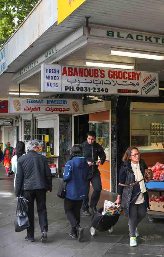
67 61

68 62 Figure 3-10: Castle Hill district centre existing activities Priority Growth Precinct UrbanGrowth NSW Projects Hospital District Public Open Space Regional Public Open Space Waterways Proposed priorities: encourage a greater take up of land for commercial employment uses to complement the significant growth in residential apartments and Castle Towers retail expansion TAFE State Government Office Retail hub Mixed Use zone Local Public Open Space Sydney Metro Stage 1 Northwest Sydney Metro Station Major Road Local Road align State priorities for expenditure on regional roads, schools and utilities to support growth forecasts and to address current deficits seek a greater understanding as to how best to differentiate the employment opportunities of Castle Hill to that of Norwest and how planning controls might modify in response complete the upgrade of Showground Road and the Castle Hill ring road system develop public domain plans to enhance identified pedestrian linkages to feed into the future Castle Hills transport hub plan for the active recreational needs for the future residents encourage greater cultural opportunities and uses in the centre to support a diversity of activity day and night investigate opportunities to improve public transport connections to GPOP.

69 63 Figure 3-11: Rouse Hill district centre existing activities Priority Growth Precinct UrbanGrowth NSW Projects Local Public Open Space District Public Open Space Proposed priorities: investigate opportunities for future expansion of the centre Federal/Commonwealth Office Waterways enhance pedestrian and cycle way linkages, particularly across Windsor Road State Government Office Retail hub Sydney Metro Stage 1 Northwest Sydney Metro Station seek funding from NSW Government for the enhancement of Commercial Road to a minimum of four lanes Sports Facility Business zones Mixed Use zone Major Road Local Road provide additional active sporting opportunities utilising government owned land around Caddies Creek promote complementary business uses on land adjacent to the Rouse Hill Town Centre.

70 64 Figure 3-12: Marsden Park district centre existing activities Priority Growth Precinct University Retail hub District Public Open Space Regional Public Open Space Waterways Proposed priorities: work with Transport for NSW to improve public transport connectivity to Mount Druitt, Western Sydney Employment Area and the Western Sydney Airport Industrial zones Business zones Local Public Open Space Motorway Major Road Local Road work with Blacktown City Council and key stakeholders to coordinate the planning and delivery of the Marsden Park Town Centre as a major retail, commercial and mixed use hub for the new communities in the North West Priority Growth Area support the funding and delivery of recreation and community facilities within the centre promote iconic buildings of high architectural design on key gateway sites in Marsden Park s Town Centre in order to reinforce its important role and function in providing services for new communities ensure the centre is permeable and connected within the surrounding businesses and the community promote a high quality landscaped, pedestrian orientated and vibrant public domain throughout the centre.

71 65 Figure 3-13: Mount Druitt district centre existing activities Hospital University State Government Office Retail hub Industrial zones Mixed Use zone Business zones Local Public Open Space District Public Open Space Regional Public Open Space Waterways Motorway Highrway Major Road Local Road Proposed priorities: work with Transport for NSW and Blacktown City Council to improve connectivity from Mount Druitt to employment opportunities in the Western Sydney Employment Area, the future Western Sydney Airport and Marsden Park work with Transport for NSW and Blacktown City Council to improve accessibility to and within the centre, including connections and wayfinding between Mount Druitt Hospital, railway station and bus interchange improve pedestrian connections to open space, recreation and retail uses promote urban living by improving the amenity within the centre and activating public spaces work with the NSW Government agencies to reinforce the important role of the centre in providing social support services to the disadvantaged communities in the broader Mount Druitt area, including better coordination and integration of social services, including health, education and job skills training.
72 Improving access to a greater number of jobs and centres within 30 minutes Increasing the range of jobs and other opportunities that people can access within 30 minutes requires better transport connections and stronger major economic and employment centres. As Greater Sydney evolves into a metropolis of three cities, people will enjoy better access to hubs of major economic activity, with new housing focused on transport corridors and around employment centres to increase the proportion of people who have easy access to jobs and services. GPOP is a major focus of the Central City and is one of Sydney s most crucial centres of economic activity. It is supported by areas of economic activity providing health, education, population services and knowledge-intensive employment opportunities. Improving transport connections to the Central City and between employment centres in the District is critical to the economic growth of the West Central District and its contribution to the growth of Greater Sydney. The West Central District community has identified traffic congestion and parking provision as key issues to be addressed. The community also expressed the view that better integration across public transport modes would benefit the District.This would mean an environment where people were encouraged to get out of their cars and walk or cycle to their destinations. The NSW Government is investing in transformational transport infrastructure which aim to strengthen the existing linkages and expand the network of highly accessible nodes across the Central City. These investments include: Sydney Metro Northwest Sydney Metro West Westconnex M4 Widening widening of the M4 Motorway to four lanes in each direction between Church Street Parramatta and Homebush Bay Drive. the North West Priority Growth Area road upgrades to Richmond Road and Schofields Road the Lidcombe to Granville Rail Corridor Upgrade to improve network reliability and capacity the Parramatta Rail Turnback to allow for capacity to be increased on thet1 Western Line at Parramatta the Pinch Point Program that aims to reduce traffic delays, manage congestion and improve travel times on Sydney s major roads, including Blacktown Road, Cumberland Highway, Great Western Highway, M4 Connections, Old Windsor Road and Richmond Road a network of rapid bus routes connecting centres in Western Sydney to Parramatta additional bus services between Parramatta and Macquarie Park Parramatta River ferry initiatives including additional weekly services, new Parramatta River ferries and wharf upgrades station and wharf accessibility upgrades and car parking as part of the Transport Access Program. Transport for NSW is investigating other initiatives to improve connections and access within the West Central District and beyond to the Eastern and Western Cities. These include: the Parramatta Light Rail Project the Travel Choices Program for Parramatta City and GPOP, which will provide tailored advice on how residents, workplaces, visitors and other service providers can adapt to a changing centre and growth across the corridor public transport services on the preserved corridor between Cudgegong Road and Marsden Park suitable corridors for the Outer Sydney Orbital and Bells Line of Road Castlereagh Freeway connections walking and cycling projects (see Chapter 4 for further details) a commuter car park implementation plan North West Priority Growth Area road upgrades the Bus Head Start Program, which establishes 'connected network' public transport coverage of priority growth areas
73 67 Rapid Bus Routes in the following areas: -- Parramatta to Sydney City along Parramatta Road and Victoria Road -- Castle Hill Liverpool via Parramatta and T-way -- Castle Hill Sydney City via M2 Motorway -- Rouse Hill Hurstville via T-Way, Parramatta and Bankstown -- Growth Centre Rapid Route: Rouse Hill- Blacktown Suburban Bus Routes in the following areas: -- Connections to Western Sydney Airport and major centres in Western Sydney -- Marsden Park Prariewood via Western Sydney Employment Area and Mount Druitt -- Rouse Hill - Penrith via Schofields and Marsden Park -- Mount Druitt - Penrith via Werrington and Great Western Highway -- Baulkham Hills/ Castle Hill to Parramatta via Westmead along the T-way corridor. Planning for a westbound off ramp from the M4 Motorway to Hill Road. These opportunities will be considered in further detail as part of the development of the Future Transport Strategy, which will be prepared by Transport for NSW in We will collaborate with Transport for NSW and relevant stakeholders to maximise the economic and land use opportunities created by investment in transport infrastructure and to integrate land use and transport planning outcomes. Many of these investments will specifically support our planning for GPOP and its emerging and increasingly diverse mix of uses. Up to 2.8 million trips each day are predicted within GPOP by Meeting customer needs into the future requires staged investment in infrastructure and services that ensure accessibility, quality, choice and a policy framework that maximises the efficiency of our network through demand management. Sydney Metro West The NSW Government has announced a new underground metro railway line will be built between Parramatta City and Sydney City to help cater for Sydney s growth. Sydney Metro West will provide a direct connection between Parramatta City and Sydney City, linking communities not previously serviced by rail as well as supporting growth between the two major centres. The Sydney Metro West project will focus on a corridor between the Parramatta River and existing T1 Western Line, because of the greater potential to transform communities, create new ones and link them using a new state-of the art public transport system. The project supports the Greater Sydney Commission's vision for the Central City that is connected to the established Eastern City by providing improved travel times and service frequently between these two centres. Four key precincts to be serviced have initially been identified at: Parramatta, where the number of jobs is expected to grow substantially Sydney Olympic Park, where there is expected to be significant jobs and residential growth The Bays Precinct, a major urban renewal precinct The Sydney City, which is home to Greater Sydney's largest employment concentration and where there is easy access to the existing public transport network and Stages 1 and 2 of Sydney Metro. The existing T1 Western Line - which is more than a century old - is expected to be overcrowded by the early 2030s, despite ongoing upgrade works and more services. The NSW Government has identified the need for the project and committed to delivering it. Beyond this corridor, opportunities to extend the line east and west will also be considered.

74 68 Westmead Parramatta Olympic Park Figure 3-14: Transport initiatives being investigated for GPOP Parramatta future light rail Rapid Bus Routes WestConnex Ferry Interchange improvements Outer Ring Road Travel Choices Program Commencing in Parramatta Existing Green Space Principal bicycle network missing links Inner Ring Road Westmead Travel Management Association GPOP Boundary North South Corridor Investigations Parramatta River wharf upgrades Existing heavy rail

75 Coordinating freight activities with land use planning Freight and logistics activities are an economic facilitator in any city. This statement is true for every class of freight from air to rail and container freight, to the local delivery of goods or parcel deliveries in vans. Land use planning must therefore recognise, support and mitigate impacts of freight delivery. Maintaining the productivity of the District s freight network is an important consideration in this draft District Plan. The West Central District includes a range of important freight corridors and facilities that play a key role in freight movement around and through Greater Sydney and regional connections. In 2011, 230,000 trips were made to a destination in West Central District by light commercial vehicles. They mainly travelled to Norwest, Castle Hill, Blacktown, Westmead and Parramatta. This volume is expected to grow to 360,000 trips per year by 2036 and 440,000 trips by A number of freight-related initiatives are already underway. These include: WestConnex M4 Widening (under construction) the Villawood Intermodal Terminal Refurbishment (under investigation) the Outer Sydney Orbital Corridor Preservation (under investigation) the Western Sydney Freight Line and Intermodal Terminal (under investigation) the Western Sydney Transport Fuels Pipeline connecting infrastructure (under investigation) Transport for NSW will: continue investigations to identify and preserve suitable freight corridors and intermodal terminal sites continue to plan for and preserve a suitable corridor for the future Outer Sydney Orbital continue investigations into fuel pipelines and connected infrastructure in partnership with industry to reduce the overall number of tanker truck movements and kilometres travelled continue investigations into a suitable corridor for a dedicated Western Sydney Freight Line and location for an Intermodal Terminal.
 Existing internodal terminal Freight activity precincts Proposed Transport corridors (indicative")
76 70 Figure 3-15 Greater Sydney s freight assets Dedicated freight rail Proposed intermodal terminal Shared freight rail Sydney Trains network Major freight road Source: Transport for NSW (2016) Existing internodal terminal Freight activity precincts Proposed Transport corridors (indicative only)
77 Attracting employment and urban services activity Employment and urban services land In 2006, the Employment Lands Taskforce defined employment land as zoned for industrial or similar purposes in planning instruments [and] generally lower density employment areas containing concentrations of businesses involved in manufacturing; transport and warehousing; service and repair trades and industries; integrated enterprises with a mix of administration, production, warehousing, research and development; and urban services and utilities. From 2008, Employment Lands were categorised into precincts. With the implementation of the Standard Instrument Local Environmental Plan, these precincts can now include other business zones that permit a number of industrial uses. In this draft District Plan, the Commission has replaced the term Employment Land with employment and urban services land. While this still describes the same type of land, the terminology reflects the evolving nature of employment areas, the jobs and economic activity they generate, and the way they support urban areas and industries (for example, by providing land for data centres, utilities and distribution centres) as well as local residents (for example, by providing land for panel beaters, council depots, vehicle repairs and household trades). Employment and urban services land supports activities that are critical to Greater Sydney s productivity, sustainability and liveability. In particular, access to urban services locally reduces the need to travel to other areas, minimising congestion of the land transport system. As such, we need to ensure that our employment lands are efficiently managed and protected across Greater Sydney and within the West Central District. In 2015, 4,600 hectares of the West Central District was zoned for employment and urban services land. This land is spread across 65 separate precincts and represents 34% of Greater Sydney s total stock of employment and urban services land. Of this, 29% was undeveloped in Table 3-3 lists the 10 largest employment and urban service areas in the West Central District by local government area based on the Department of Planning and Environment s Employment Lands Development Program In addition to the larger precincts identified in Table 3-3, the District also contains smaller parcels of employment and urban services land that are important to the District s economy.
78 72 Table 3-3: Major employment and urban services precincts in West Central District (January 2015) LGA Precinct Undeveloped land (hectares) Developed land (hectares) Total (hectares) Greystanes Cumberland Smithfield, North Yennora Blacktown Eastern Creek Glendenning Kings Park Marsden Park Ropes Creek Seven Hills Parramatta Camellia/Rosehill Source: Department of Planning and Environment s Employment Lands Development Program 2015 West Central has a strong manufacturing sector. It is the most productive sector for the District, contributing $5,900 million or 12% GVA to the District s economy and accounting for 11% of all employment in the District. Of particular value both now, and for the future, growth of the District is advanced manufacturing industries. Key clusters of advanced manufacturing sectors in West Central include: pharmaceuticals and biotechnology: Norwest, Parramatta and Rydalmere electronics: Blacktown, Baulkham Hills and Auburn automotive: Blacktown specialised and other machinery and equipment: Rydalmere and Blacktown building and other material recycling: Camellia. To remain competitive and encourage economic growth in the District, we need to focus on leveraging the highly productive manufacturing sectors in the District, take advantage of, and grow the skilled workforce and look for opportunities to couple with research and development to meet an increasingly specialised and sophisticated export market with high value products. The West Central District also includes the Western Sydney Employment Area, which is 1,760 hectares of industrial-zoned land south west of the intersection of the M4 and M7 Motorways. The Western Sydney Employment Area benefits from unparalleled opportunities including large lots, and good access to Sydney s major road network. The development of the Western Sydney Airport and the preservation of the Outer Sydney Orbital Corridor and the potential Western Sydney Freight Line and Intermodal Terminal will give this area a significantly increased level of accessibility, to metropolitan, state, national and international markets.
79 73 The nature of employment and urban services land precincts is changing as technologies and new industries emerge. Many precincts are evolving into complex employment lands distinct from industrial land. This trend is consistent with many other parts of Greater Sydney Region, particularly east of Parramatta. While some traditional industrial activities continue to be located in West Central District s employment and urban services land precincts, there has been a significant increase in other types of business in these precincts as well. For example, high value urban manufacturing uses have become common in some precincts, particularly those close to strategic centres. This has enabled an intensification of land use in some areas and a rise in demand for industrial strata units. There is also pressure on a number of employment and urban services land precincts to be converted to residential or retail uses. This draft District Plan provides priorities for protecting employment and urban services land areas in the West Central District while recognising that a broader range of businesses may establish in these areas than was historically was the case. For example, businesses that support urban areas and industries (for example, by providing land for data centres, utilities and distribution centres) or local residents (for example by providing land for panel beaters, council depots, vehicle repairs and household trades) may now be recognised as being appropriately located on employment and urban services land. The Commission identifies as a priority the need for additional work in collaboration with councils to explore and, where appropriate, verify this precautionary approach and to step away from the industrial lands checklist suggested by A Plan for Growing Sydney. This will be part of our review of review of the Regional Plan in Productivity Priority 9: Protect and support employment and urban services land Employment and urban service lands play a critical role in the efficient and effective function of the District. Owing to the comparative scarcity of this resource, a holistic and precautionary approach to their planning should be undertaken. Accordingly, relevant planning authorities should take a precautionary approach to rezoning employment and urban support lands or adding additional permissible uses that would hinder their role and function. The exception being where there is a clear direction in the Regional Plan (currently A Plan for Growing Sydney), the District Plan or an alternative strategy endorsed by the relevant planning authority. Any such alternative strategy should be based on a net community benefit assessment (i.e. analysis of the economic, environmental and social implications) of the proposed exception taking into account a District wide perspective in accordance with Action P4. How these matters are taken into account is to be demonstrated in any relevant planning proposal. Action P4: Develop better understanding of the value and operation of employment and urban services land In order to better understand the contribution of employment and urban services land to the District s productivity, liveability and sustainability, we will work with local councils to further develop our research and understanding of how the District s employment and urban services land operate, the range of uses they support including their industry and supply chains, their interdependencies, key constraints, and opportunities to be improved. In doing this, the particular characteristics and value add of these locations will be identified to inform the preparation of appropriate planning controls to protect, support and enhance the economic functions of these areas.
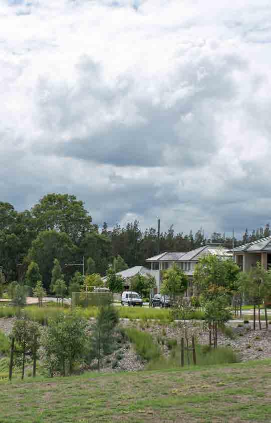
80 74
81 4 A Liveable City 75 'City areas with flourishing diversity sprout strange and unpredictable uses and peculiar scenes. But this is not a drawback of diversity. This is the point of it.' Jane Jacobs The West Central District is made up of a network of distinct centres, places and landscapes that are home to a diversity of people, cultures, places and landscapes. From Bicentennial Parklands and Rouse Hill Regional Park, to the hubs of Turkish and Lebanese culture in Auburn and Granville, and the fabulous curry houses of Harris Park, the West Central District attracts visitors from across Greater Sydney and offers a welcoming and affordable lifestyle for a growing population. West Central is the fastest-growing District in Greater Sydney - a place where population growth over the next 20 years will result in the District becoming home to more people than live in Canberra today. This draft District Plan integrates planning for new homes and neighbourhoods; walking, cycling and public transport; jobs and transport; sustainability; landscape; arts, culture and heritage. This draft District Plan looks at how we can implement the liveability goals of A Plan for Growing Sydney as well as the priorities from Towards Our Greater Sydney In particular, we draw on the goals that seek to develop a city of housing choice, with homes that meet our needs and lifestyles in a great place to live (Goal 2), with communities that are strong, healthy and well connected (Goal 3). Our planning for Greater Sydney aspires to maintain and improve residents quality of life by providing more housing and employment opportunities and the infrastructure that makes it easier for people to access places. We can help to create healthy and connected communities if we collaborate with communities and across the private and public sector, and base our decisions on quality evidence. Our aim is to conserve and enhance quality of life and local identity. We want to collaborate with communities and stakeholders to make the most of public investment in the District s infrastructure and urban places and address the issues that people tell us are important to them. This requires a focus on the type of housing that the District needs as it grows not just in numbers, but the diversity that offers different price points and can help improve affordability. This is important in renewal areas such as Telopea and Mount Druitt where we want to provide a greater mix of social and private housing so that our communities are diverse and cohesive. As the District grows, we need to plan upfront to support new residents with the right mix of schools, health services, community facilities, walking and cycling connections. This needs to be achieved in a way that creates safe, and engaging places for everyone. The West Central District Social Profile Our West Central District Liveability Profile describes the District s population in terms of its existing characteristics, age, gender, country of birth, family type and how we expect these characteristics to change over time. This informs the way we plan for each group s unique needs. You can view the Liveability Profile by visiting We will continue to develop the profile so as to improve the quality and range of social data that forms the basis of smart strategic planning.
82 76 The Liveability Framework Greater Sydney s Liveability Framework forms a foundation for planning and infrastructure delivery to be driven by consideration of people s needs at all stages of life. Use of the Framework to inform the strategic plans would allow governments, planning authorities and services providers to work together across a common framework to plan for and enhance the District s liveability as our population grows. The Liveability Framework places our physical and mental health and wellbeing at the forefront as Greater Sydney transitions from suburban to more urban places. It relies on strong partnerships between State agencies, local government, non-government organisations, private providers and communities. Nine liveability outcomes have been derived from international best practice and refined through consultation with councils, interest groups and the community to form the Framework. Healthy liveable places demonstrate: housing choice by supporting affordable and appropriate housing for all urban design excellence by delivering high quality design that supports community safety, health and wellbeing, and enhances community assets and character connected communities by supporting walking, cycling and public transport movement between destinations sense of belonging and local identity by creating great places that are socially inclusive and promote respect and feelings of belonging social infrastructure provision by promoting an integrated approach to social infrastructure that includes health care, education, fresh food access, public open spaces and other community/cultural facilities community engagement delivered across all liveability outcomes by promoting community empowerment and ownership in shaping resilient cities culture and innovation by celebrating and promoting creative arts, digital technology, culture and innovation diversity of job opportunities by providing access to a range of jobs and learning/skills development environmental quality by managing the quality of and access to the natural environment. This draft District Plan addresses the need for good access to education, health, community and emergency services for people through every stage of their life. It takes a design-led planning approach that focuses on people in order to create great places to meet, work, exercise and socialise. We want people to be able to access public spaces, shops, parks, sports and cultural facilities by foot or bicycle. We want to plan for these places in a way that respects the District s natural and cultural heritage and recognises the survival of traditional Aboriginal culture in the West Central District. At the heart of a liveable West Central District will be the focus on jobs and housing diversity and choice in the GPOP area. Our ambition is for this area to be recognised as one of the most liveable parts of Greater Sydney, with an offering of true city scale assets, a natural environment that integrates with the built environment and diversity of local places. We will collaborate with the Councils in the area, community, business and institutions to create a quality of life that is attractive, in both the local and global context. This will include fostering innovation in the provision and sharing of community facilities..

83 The West Central District s people We talked to people across Greater Sydney during 2015 to understand what they value about their home and local neighbourhood. In West Central, people highly value local green spaces that are nearby ovals, reserves and sportsgrounds. Examples of such spaces include the Western Sydney Parklands and Blacktown International Sportspark that are busy with competitive sports and also used for casual exercise and the newly upgraded picnic areas at Prospect Reservoir. Residents of the West Central District live relatively close to a great range of jobs and high quality health and education facilities established in key centres such as Parramatta, Norwest, Westmead, Blacktown and Rouse Hill. Approximately two-thirds of West Central residents interviewed consider the liveability of their area to be either excellent or very good. They rate their access to transport, shops, parks, natural areas and services very highly. It was clear from our consultation that the District s people from many cultures mix well and get to know each other, sharing stories and cultural traditions. People singled out Toongabbie as an excellent example of a place where this occurs. We also see this in other culturally rich suburbs such as Granville and Auburn that are home to some of the most diverse populations in Greater Sydney places that exemplify Australia s multicultural ethos. It is clear to us that people want our planning to support the District s cultural diversity, affordability, and active lifestyles. We are building on a strong base in the West Central District, with existing health and education precincts and advanced manufacturing enterprises that provide jobs in local places. This enables shorter commutes for residents and less congestion. Enhanced walking and cycling connections, including those along the Parramatta River, will enhance amenity and activity levels and improve mental and physical health outcomes. Improving liveability in the West Central District means sharing equitably among existing communities the many jobs, housing and infrastructure benefits that will result from the growth expected in the District over the coming 20 years.
84 78 Figure 4-1: West Central District projected population growth by age group, ( ) ,150 31, ,900 73, ,250 36, ,300 31, ,100 47, , , ,050 92, ,700 91, ,300 23, to 36 Growth Source: Department of Planning and Environment, 2016 New South Wales State and Local Government Area Population and Household Projections and Implied Dwelling Requirements 2016 to 2036, NSW Government, Sydney Table 4-1: West Central District projected aggregate and proportional growth ( ) by key age group Aggregate growth Proportional % growth < Total < Blacktown 2,100 8,350 35,500 85,900 32,300 8, ,350 36% 35% 48% 41% 99% 209% Cumberland 850 3,350 15,900 38,100 13,350 3,450 74,950 24% 24% 39% 29% 61% 101% Parramatta 2,200 8,900 35,400 92,350 30,950 8, ,900 64% 65% 92% 61% 114% 178% The Hills Shire 1,350 5,400 25,650 67,100 20,150 5, ,350 63% 63% 72% 69% 103% 285% West Central District Greater Sydney 6,500 26, , ,450 96,750 25, ,550 43% 43% 59% 48% 96% 183% 17,100 68, , , , ,700 1,739,850 26% 26% 40% 28% 71% 124% Source: Department of Planning and Environment, 2016 New South Wales State and Local Government Area Population and Household Projections and Implied Dwelling Requirements 2016 to 2036, NSW Government, Sydney

85 West Central District age profile By 2036, the District s population is projected to grow by an estimated 550,500 people, to approximately 1,521,500 (Table 4-1). West Central is Greater Sydney s fastest growing District with population projected to increase by 2.3% over the 20 years to This is much higher than the projected average growth rate of 1.6% for Greater Sydney over the same period. To accommodate these new residents, the District will require additional housing, new employment opportunities and enhanced centres, services and places. We look at the District s changing age profile to understand how and where we need to plan for people at different stages of their life. In West Central not only is the overall population growth rate high, but there will also be faster growth in every age group than is projected across Greater Sydney. The greatest proportional growth - of 183% on today s numbers - will be in those aged 85 and over. This trend towards a significantly older population profile by 2036 is also clear when looking at the total growth of people over 65, which will account for almost 22% of all the District s growth. These changes mean planning authorities and service providers need to strengthen local housing diversity to facilitate opportunities for ageing people to remain in their neighbourhoods with convenient access to day to day needs and health network services. Growth in aged care requirements will vary across the District. The local government areas of Blacktown and Parramatta have the largest projected aggregate growth in both the and 85+ age groups. While The Hills will have a significant proportional increase in persons aged over 65, the total numbers are more modest than those expected in the other West Central District local government areas. At the other end of the age spectrum there will be 43% more babies (that is children under 1 year old) in 2036, giving rise to increased demand for paediatric, child care and early education services across the District. The projected 59% growth in school-aged children, will create demand for school places and necessitate planning for new and more innovative use of existing schools. This will not be uniform across the District, with the largest increases expected in the Blacktown and Parramatta local government areas, which collectively will account for 63% of total increase in school-aged children over today s numbers. By contrast, there will be comparatively small aggregate and proportional growth in schoolaged children in the Cumberland Local Government Area.

86 West Central District population characteristics The District has good accessibility to a range of higher education institutions within the District and nearby and residents of the West Central District are well educated. The proportion of the adult population holding a bachelor degree or a postgraduate degree is only a slightly higher across Greater Sydney when compared to the West Central District (Figure 4-2). While median household incomes across the District are roughly in line with those across Greater Sydney, there are significant spatial variations in levels of socio-economic advantage. There is a slightly higher proportion of low to moderate income households, and the Liveability Profile highlights that there are some neighbourhoods within the Blacktown, Cumberland and Auburn local government areas that experience greater disadvantage. As discussed earlier, the District exemplifies the Australian multicultural ethos people of more than 140 nationalities live in Blacktown alone. Across the District, 45% of residents speak a language other than English at home, which is substantially higher than the 37% average across Greater Sydney. Aboriginal and Torres Strait Islander people comprise a relatively small proportion of the overall population of the District (1.4% as compared to 1.1% across Greater Sydney) with most residing in the local government areas of Parramatta and Blacktown where there is, in fact, the largest representation of Aboriginal people in NSW. The 2015 Population Health Survey by the NSW Ministry of Health indicates that around 49% of the adult population in West Central District is overweight or obese. Obesity is a chronic medical condition which is associated with a wide range of debilitating and life threatening conditions. In addition to this, the 2011 Census also estimated there were 35,000 people living with a disability in the West Central District, with expectations that this will increase significantly over the next 20 years, as our population grows and ages.
87 81 Figure 4-2: West Central District, higher qualification attainment (2011). 28% 28% 18% 20% 6% 7% Bachelor Degree Postgraduate Degree Diploma or Certificate West Central Greater Sydney Source: Australian Bureau of Statistics, 2011 Census of Population and Housing Figure 4-3: West Central District, English as a second language (2011) 45 % 37 % West Central Greater Sydney Source: Australian Bureau of Statistics, 2011 Census of Population and Housing
88 82 Figure 4-4: West Central District, dwelling structure by tenure type (2011) 200, , , , , ,000 80,000 60,000 40,000 20,000 - Separate House Apartments Medium Density Rented Mortgaged Owned outright Source: Australian Bureau of Statistics, 2011 Census of Population and Housing Figure 4-5: West Central District projected household structure ( ) - 100, , , , , , Couple only Couple with children Single parent Other family households Multiple-family households Single person Group Source: Department of Planning and Environment, 2016 New South Wales State and Local Government Area Household Projections and Implied Dwelling Requirements 2016 to 2036, NSW Government, Sydney (Note this does not reflect new LGAs and does not include the part of Epping that has been incorporated into Parramatta City from Hornsby.)
89 West Central District dwelling and household characteristics Almost three quarters of residents (70%) live in detached houses, with 17% living in apartments and 12% in medium density type dwellings (including semi-detached, attached and townhouses and villas). Most detached dwellings (79%) are either owned outright or being purchased, and the majority of apartments (66%) are rented. A common measure of affordability is that housing costs require no more than 30% of the household budget. Housing affordability is identified as a significant concern for many residents with only 14% of those interviewed rating the availabiliy of affordable housing as excellent or very good and only 19% rating the overall cost of living excellent or very good. Underscoring this point, a recent examination of dwelling sales showed that over the 2005 to 2015 period, there was a very significant reduction in the availability of dwellings that were affordable for households on moderate incomes. This challenge is even more pronounced for households on low and very low incomes. The ageing profile of the population across the West Central District is reflected in the mix of current and projected household types. For example, by 2036, single person households are projected to increase by almost 43,000, and couple only households by 41,150. This represents increases of 81% and 61% respectively. Households comprised of couples with children will continue to be the dominant household type in the West Central District. However, the strong growth in single person households will lead to a reduction in the proportion of total households made up of couples with children from 44% in 2016 to 41% in The Blacktown council area will see the greatest proportional increase in single person households (from 14% to 17%) followed by the Parramatta council area (23% to 25%). Meanwhile the greatest proportional reduction in households made up of couples with children will be recorded in Blacktown (from 45% to 42%). To accommodate this growing population, the West Central District will require all types of housing to be built. Given the existing dominance of detached dwellings across the District, we expect the greatest demand for homes will be to accommodate smaller households, including terraces, row or courtyard housing and apartments that also provide for more affordable price points than detached dwellings. We will also need to enable development of flexible housing types including more large homes that can accommodate several family groups or generations living together, as well as more accessible and adaptable housing. Our planning must ensure that there is capacity for new housing that responds to local needs and housing market characteristics and provide proximity to public transport, health, education, infrastructure and services.
90 Liveability priorities This chapter outlines the liveability priorities and actions for the West Central District. The priorities are presented in two ways. Firstly, each heading outlines a priority area, and we provide context and detail to expand on the outcomes sought. Some headings cover factual issues only; these are not included the list below. Secondly, within the broad priority areas there are, in many cases, more detailed priorities. We identify the specific purpose of these priorities in each case by detailing how they relate to strategic planning and planning proposals. The full list of liveability priorities covered in this chapter are outlined below. Improve housing choice Prepare local housing strategies Understand the Greater Sydney housing market and demand Deliver West Central District s five-year housing supply target -- Deliver West Central District s fiveyear housing supply targets Establish West Central District s 20-year strategic targets Create housing capacity in the West Central District. Improve housing diversity and affordability Plan for housing diversity -- Delivery of housing diversity Support planning for adaptable housing and aged care Deliver Affordable Rental Housing -- Implement the Affordable Rental Housing Target Support social housing -- Increase social housing provision Facilitate integrated infrastructure planning. Coordinate and monitor housing outcomes and demographic change Create great places Provide design-led planning Plan for safe and healthy places -- Facilitate the delivery of safe and healthy places Enhance walking and cycling connections -- Facilitate enhanced walking and cycling connections. Foster cohesive communities Conserve and enhance environmental heritage including Aboriginal, European and natural -- Conserve heritage and unique local characteristics Support the creative arts and culture -- Foster the creative arts and culture Create opportunities for more recreation and community facilities Support planning for shared spaces -- Share resources and spaces. Respond to people s need for services Plan to meet the demand for school facilities -- Support innovative school planning and delivery Plan for the provision of early education and child care facilities Support the provision of youth services Support the Aboriginal community -- Provide socially and culturally appropriate infrastructure and services Support planning for health networks Plan for health facilities and services -- Support planning for health infrastructure Plan for emergency services -- Support planning for emergency services Plan for cemeteries and crematoria -- Support planning for cemeteries and crematoria.
91 Improve housing choice All successful and growing global cities face the challenge of providing greater housing supply and choice. With Greater Sydney s robust economy, unprecedented levels of population growth and strong investment interest, demand for housing across Greater Sydney is rapidly increasing. Notable demographic change means that significant new and different forms of housing will be required in Sydney to The Commission is committed to achieving this outcome in a way that also builds a more inclusive city (particularly for the eldery and women) and a more equitable city (particularly for those entering the housing market for the first time). To achieve this, the Commission will leverage existing and new infrastructure projects to enhance housing opportunities. Key to planning for this growth is recognising that the nature of this demand varies by location, by community and by household. To meet the needs of different cultural, socioeconomic and age groups, a variety of housing choices must be delivered across Greater Sydney as well as the West Central District. This supply must be achieved through a range of housing types, tenures and price points. We refer to the range of housing choices in this draft District Plan as the housing continuum (Figure 4-6). More specifically, the housing continuum refers to all types of housing including detached dwellings, apartments, terraces and villas. It refers to different tenures including dwellings that are owned outright, mortgaged or rented. It also refers to homes occupied by single people, families, groups as well as households living in housing stress, through to people on high incomes. Our approach to the housing continuum To improve capacity across the full housing continuum, our approach aims to support and enhance: Delivery: creating conditions to support the supply of housing in well-planned locations served by sufficient local and regional infrastructure Capacity: so that existing planning controls and new investigation areas are creating sufficient opportunity for housing supply targets by 2036 Diversity and adaptability: the diversity of housing types including small lot housing, terraces and apartments in a variety of configurations (one, two and three+ bedrooms) and more adaptable and accessible forms of housing for older people, people with disabilities and families Affordability: building on the direction in A Plan for Growing Sydney by setting a target for the provision of affordable rental housing in new urban renewal and land release areas for the low and very low income households that are the most vulnerable. This also relates to supporting a supply of diverse housing types in the private market that are more affordable to key workers and moderate income households Social housing: the provision of social housing to meet the needs of the growing number of households requiring social housing (presently the waiting list has 37,660 households in Greater Sydney) and to reduce homelessness. Figure 4-6: The housing continuum Emergency shelters & Crisis accommodation Transitional & Supported housing Government Subsided Housing Social housing (including public housing) including housing provided by the government and community sector Affordable rental housing Affordable home ownership & Shared ownership Community Housing Sector non-market housing Private market affordable housing (including boarding housing and student accommodation that may be government subsidised) Private market rental housing Market Housing (Source: Greater sydney Commission, 2016 adapted from City of Sydney Housing Issues paper april 2015 Housing ownership
92 86 NSW Government initiatives Local government and State agencies are implementing policies and measures to support the delivery of housing across the continuum. Currently the Department of Planning and Environment is: implementing the State Environmental Planning Policy (Affordable Rental Housing) 2009, which allows for the development of new generation boarding houses in various locations with floor space incentives subject to environmental and design standards. The Department of Family and Community Services is implementing: Future Directions for Social Housing in NSW, which aims to increase the number of households that transition out of social housing, using affordable rental housing as a stepping stone to the private rental market the Communities Plus Program, which improves diversity through mixed use renewal of existing areas of concentrated social housing the Social and Affordable Housing Fund, which will fund 3,000 additional social and affordable houses in its first tranche through innovative partnerships between community housing providers, nongovernment organisations and the private sector. In September 2016, the NSW Government released the discussion paper Foundations for Change Homelessness in NSW, which aims to engage organisations and individuals to strengthen collective action to reduce homelessness. It focuses on the prevention of homelessness, rather than simply trying to manage it. The private sector and agencies such as UrbanGrowth NSW and Land and Housing Corporation also work with councils in the West Central District to improve housing choice, diversity and affordability. NSW Governmentled projects in these areas seek to improve the quality of housing while providing a better mix of social and private housing to instil a greater sense of community. Another important NSW Government partner in the housing continuum is the community housing sector. This sector has grown considerably in the last five to 10 years and plays an important intermediary role in providing housing choice. Support for this sector will bolster opportunities for people to move out of social housing and provides greater support for the most vulnerable households living in housing stress. Our planning needs to complement and support these initiatives and projects. It is our role to work collectively across government, the not-for-profit and private sectors to find innovative solutions that can address housing affordability and diversity. This includes the provision of greater housing choice for people with a disability, and the provision of larger homes for intergenerational or group households, seniors housing and aged care options. Figure 4-7 shows how the Greater Sydney Commission s proposed initiatives align with the current NSW government initiatives Prepare local housing strategies To provide a comprehensive understanding of how a district or local government area responds to housing need each council will need to prepare a local lousing strategy. Alternatively, Councils may agree to collaborate and prepare a sistrict housing strategy. These strategies are to be underpinned by the housing continuum. The requirements are set out below and detailed in the following sections.
93 87 Action L1: Prepare local housing strategies Councils will prepare local housing strategies and need to consider: the planning principles and directions in A Plan for Growing Sydney capacity to support the five-year housing target capacity to support the strategic housing need of the local government area for the next 20 years local demographic and socio-economic characteristics the local housing market including the feasibility of development for different housing types development staging and market take-up rates and how this aligns with demand challenges and opportunities relating to infrastructure provision urban form and place making accessibility of housing to employment opportunities ways to address housing diversity that are relevant to the needs of the existing and future local housing market including opportunities for, and blockages to, housing diversity and adaptability opportunities to improve housing affordability the prospective displacement of affordable housing opportunities for additional capacity around strategic and district centres and other areas with good transport connectivity and service provision specific local market complexities including addressing ways to incentivise for the provision of larger group homes, smaller homes for singles and couples only, intergenerational homes and medium density housing required by the local community. consider ways to provide adaptable housing in accordance with design guidelines by Livable Housing Australia. Figure 4-7: NSW Government and Greater Sydney Commission housing initiatives Homelessness Social Housing Affordable Rental Housing Own Rent NSW Government Initiatives Greater Sydney Commission Proposed Initiatives Discussion Paper: Foundation for Change - Homelessness in NSW Source: Greater Sydney Commission, 2016 Department of Family and Community Services Future Directions for Social Housing in NSW Communities Plus Social and Affordable Housing Fund Intergrated housing developments Private, non-government and community housing sector + Align planning with Communities Plus program State Environmental Planning Policy No.70 Affordable Rental Housing (Revised Scheme) + Affordable Rental Housing targets for urban renewal and land release areas Land Release Priority Growth Areas and Priority Precincts Greenfield Urban renewal Transformational corridors Housing Acceleration Fund Council facilitated rezonings State Environmental Planning Policy (Housing for Seniors or people with a Disability) 2004 State Environmental Planning Policy (Affordable Rental housing) 2009 Design guide for apartments Design guide for medium density housing + Local Housing Strategies + Housing Diversity + Housing Adaptability
94 Understand the Greater Sydney housing market and demand To better understand how we can support the supply of new housing across the continuum in the West Central District, we need to first understand the factors influencing Greater Sydney s housing market together with the characteristics of more local housing markets operating within the District. The following Housing Market Areas Map and Summary provides a discussion on the specific housing markets identified in the West Central District. A consideration of these factors should form the starting point for any local housing strategy. Greater Sydney is experiencing a strong housing market with record levels of housing approvals fuelled by low interest rates, sustained population growth and a strong investor interest. Research provided by the Department of Planning and Environment tells us that dwelling approvals and completions are currently at their highest levels in 16 years for Greater Sydney and in 20 years for the West Central District. Figure 4-8 shows historic dwelling completions and Figure 4-9 shows additional dwellings across the District in the last five years and highlights development in the vicinity of Parramatta City. Significant efforts in recent years by local and State government have provided substantial improvements in capacity to deliver a pipeline of development across many parts of Greater Sydney. As a consequence, the 30,200 dwellings (excluding granny flats) completed across Greater Sydney in the 2015/2016 financial year is now closer to the estimated number of new dwellings we need each year to meet demand (36,250 dwellings per annum) than at any point in the past decade. On this basis the Department of Planning and Environment estimates that Greater Sydney needs 725,000 additional dwellings over the next 20 years and 202,500 additional dwellings in the West Central District. The Commission considers that this projection is a minimum requirement for three reasons: it is based on the medium population growth scenario and if current trends continue, there is a prospect that a higher growth scenario could transpire leading to greater housing demand over the 20-year period of this draft District Plan due to past undersupply in Greater Sydney s housing market, there is pent up demand at particular price points adding to demand for additional housing Figure 4-8: West Central District dwelling completions between and ,000 7,000 Dwelling Completions 6,000 5,000 4,000 3,000 2,000 1, Source: Department of Planning and Environment, 2016 Metropolitan Housing Monitor Greater Sydney Region

95 89 Figure 4-9: West Central District dwelling completions ( to ) Stratvegic Centre Metropolitan Rural Area 21+ Dwellings Motorway District Centre 1-2 Dwellings Scenic Hills Highway District Boundary 3-5 Dwellings National Parks and Reserves Railway Metropolitan Urban Area 6-20 Dwellings Waterway Railway Station Source: Department of Planning and Environment, 2016 Metropolitan Housing Monitor Greater Sydney Region
96 90 there is the case for a contingency to be added to the demand estimates to address the two prior reasons along with any other unforeseen changes over the next 20 year period such as potential blockages to achieving supply. At this point, we must acknowledge that dwelling completions for Greater Sydney in 2016/2017 are anticipated to exceed the average annual demand figure of 36,250. This exceptional rate of supply, owing to the strong development pipeline, is anticipated to continue for the next few years under current market conditions. In fact, the rate of annual completions over the next few years is likely to reach the highest levels achieved since 1999/2000. Figure 4-10 shows the historic dwelling approvals and completions. A peak of 37,800 completions per annum is possible under current market conditions. Even with this exceptional supply, this only modestly exceeds the average annual level of demand and in turn only marginally counters the undersupply of housing that occurred over the past decade. Furthermore, given the timeframes associated with bringing new capacity and in turn delivering supply to the market, our research indicates that the planning system will need to continue to identify areas to create additional capacity to sustain these outcomes going forward. Given the scale of the challenge to maintain this over the next 20 years, we will start the planning process to increase housing capacity opportunities in partnership with councils now. On this basis, the Commission proposes a number of approaches to guide the process: 1. a five-year supply target by local government area (in accordance with Action of A Plan for Growing Sydney) 2. a 20-year strategic housing target by local government area that allows for the planning for sustained capacity over the period of this draft District Plan 3. the identification of new areas for housing to achieve these targets. Each of these initiatives and how they relate to the West Central District are explored further in the next section. Figure 4-10: Greater Sydney historic dwelling completions and approvals (1998/99 to 2015/16) 60,000 50,000 40,000 30,000 20,000 10, Source: Department of Planning and Environment, Metropolitan Housing Monitor Greater Sydney Region (2016)
 Highway District Centre Railway Waterways District Boundary Railway Station National and State Parks Local Government Area (LGA) Motorway")
97 91 HOUSING MARKET DEMAND AREAS Northern Beaches North Shore Central North Blacktown Marayong Parramatta Rouse Hill Dural Figure 4-11: West Central District housing market areas Strategic Centre Priority Areas and Precincts (including investigation) Highway District Centre Railway Waterways District Boundary Railway Station National and State Parks Local Government Area (LGA) Motorway Source: Greater Sydney Commission, 2016 adapted from Implementing metropolitan planning strategies: taking into account local housing demand, Technical Report (2013), City Futures Research Centre, UNSW
98 92 Greater Sydney Housing Market Areas Research indicates that people living in Greater Sydney generally prefer to remain within their local area when they move, with 82% of residents moving to a new home within 15 kilometres of their former residence. For this reason we have investigated what this means for the West Central District so that people can enjoy have greater housing choice within their district. The assessment of these preferences showed that Greater Sydney contains 18 housing market areas. The implication of these distinct housing market areas is that providing supply in one market area may not satisfy demand in another. Understanding need and capacity by individual housing markets will better provide for people s preferred housing choices. West Central housing market areas In West Central these areas are: Greater Parramatta, comprises of the whole of Cumberland Local Government Area, the majority of Parramatta Local Government Area including Central Parramatta the Westmead to Sydney Olympic Park Priority Growth Area and the Parramatta Light Rail Project, and the south section of Blacktown Local Government Area. Rouse Hill-Dural, includes part of the Hornsby Local Government Area in the North District but the majority sits within The Hills Local Government Area in West Central District. North West, extends from St Marys east into Blacktown and includes the majority of the North West Priority Growth Area around Marsden Park as well Richmond and Windsor. Blacktown-Marrayong, is contained entirely in the east of Blacktown Local Government Area, south of the North West Priority Growth Area. It contains the Blacktown Strategic centre. Central North, contains the whole of Lane Cove and Ryde Local Government Areas as well as most of the urban areas of the Hornsby Local Government Area. A significant part of this housing market area stretches west to Carlingford in the West Central District and Parramatta Local Government Area.
99 Deliver West Central District s five-year housing supply target The Department of Planning and Environment s projections of population and household growth in West Central District for the next five years translates to a dwelling need of 49,400 dwellings (excluding Epping in the Parramatta Local Government Area). Owing to the current strong housing market, our testing using the Urban Feasibility Model the Department of Planning and Environment s tool to understand housing capacity and the economic feasibility of residential development - confirms there are opportunities in West Central District to deliver beyond this minimum dwelling need in the short term. This is important to address pent up demand that has resulted from past undersupply. It is also important to address housing choice and affordability. As such, the Commission has identified a fiveyear housing target that is based on both the District s dwelling need and the opportunity to deliver supply. The five-year target relates to housing including traditional detached and attached houses, apartments and granny flats. The realisation of the housing targets relies on actions by the relevant planning authorities (from providing enabling planning controls through to development assessments), infrastructure provision and the continuation of current market conditions and industry s critical role in delivery. These targets are supported by NSW Government programs that increase capacity and supply including Priority Precincts, UrbanGrowth NSW and Communities Plus projects. In the West Central District these include: North West Priority Growth Area: with new communities growing in areas at North Kellyville, Box Hill, Alex Avenue, East Riverstone, Riverstone, Schofields, Colabee and Marsden Park and planning underway for Marsden Park North, Area 20, Riverstone East (Stages 1 and 2) and West Schofields (Part). Epping Town Centre: Priority Precinct forecast to deliver up to 3,750 dwellings. Rezoned in March Wentworth Point: Priority Precinct to deliver two residential neighbourhoods with around 2,300 apartments. Rezoned in June 2014 Sydney Metro Northwest Priority Urban Renewal Corridor: The Showground, Bella Vista, Kellyville and Priority Precincts will deliver new homes, jobs, shops, cafes and parks along the 23 kilometre rail link that will run from Epping to Cudgegong Road at Rouse Hill Parramatta Road Corridor Urban Transformation Strategy: which sets out to develop Parramatta Road into a multiuse corridor with improved amenity, better transport choices, more job opportunities and increased quantity and diversity of housing. Parramatta Road Urban Transformation Strategy was released in November 2016, whilst it does not rezone land it sets clear directions for this to progressively occur. Table 4-2: West Central District s five-year housing targets by local government area ( ) Local Government Area Housing Target Blacktown 13,950 Cumberland* 9,350 Parramatta* 21,650 The Hills* 8,550 West Central District Total 53,500 Source: Greater Sydney Commission, 2016 *consistent with former LGA boundary
100 94 GPOP including Parramatta North Urban Transformation Program and Carter Street Priority Precinct, Lidcombe: Parramatta North will be revitalised by restoring and protecting existing heritage buildings and infrastructure. The area will become a vibrant place to live with new homes, shops, restaurants, cafes and parks. Rezoned in November The Carter Street Priority Precinct comprising 52 hectares of industrial land to provide 6,000 dwellings, officebased employment and retail services adjacent to Sydney Olympic Park. Rezoned in November Monitoring the realisation of these new homes in the West Central District will help inform the preparation of the Commission s Annual Infrastructure Priority list and subsequent advice to the NSW Government. Livability Priority 1: Deliver West Central s five-year housing targets It is a priority of the draft District Plans for councils to deliver these five year housing targets. Councils need to: plan to provide sufficient capacity and monitor delivery of the five-year housing targets liaise with the Commission to identify barriers to delivering housing in accordance with the targets. How these matters have been taken into account need to be demonstrated in any relevant planning proposal Establish West Central District s 20-year strategic target Notwithstanding the existing strength of Greater Sydney s housing market, planning has a central role in ensuring sufficient capacity is created to support the delivery of a minimum of 725,000 additional new dwellings over the next 20 years across Greater Sydney. This significant challenge requires sustained efforts by all councils and given the timescales associated with development, a longer-term outlook and capacity-based approach is needed. A capacity-based approach creates the opportunity to address a range of factors including: opportunities to address pent up demand across Greater Sydney consistent with the estimates of the NSW Intergenerational Report that there is unmet demand for a further 100,000 dwellings across NSW above the projection of dwelling need by the Department of Planning and Environment the prospect of the higher population projections for Greater Sydney being realised (the estimated demand for 725,000 additional dwellings by 2036 is based on the medium population projection scenario) the need to improve housing choice together with opportunities for people to live locally the productivity benefits of additional housing supply, consistent with the calculations provided by the NSW Intergenerational Report the need for a contingency to support steady supply across each of Greater Sydney s districts in the case of unforeseen blockages that not all capacity built into the planning system is realised as development, nor are all approvals commenced or completed. Councils should therefore start considering now, through the preparation of local housing strategies, how additional capacity can be created from which the private and not-forprofit sectors can deliver supply and housing choice. These housing strategies are to meet the District s 20-year housing target as a minimum.

101 95 Table 4-3: West Central District minimum 20-year housing targets West Central District* 202,500 Greater Sydney 725,000 Minimum 20-year housing target Source: Department of Planning and Environment, 2016 New South Wales State and Local Government Area Population and Household Projections and Implied Dwelling Requirements 2016 to 2036, NSW Government, Sydney. Note: Does not include Epping, which was formerly part of Hornsby local government area. To ensure that new housing opportunities leverage current and future infrastructure provision while improving Greater Sydney s equity and liveability, we will work with local and NSW Government, as well as communities and industry, to identify new and expanded opportunities for housing capacity in proximity to existing and planned infrastructure. Once identified, these areas can be incorporated as investigation areas within the final District Plans and the review of A Plan for Growing Sydney to be further developed in This process will also help us to establish a new and specific 20-year strategic target to 2036 for each local government area in 2017 and continue to inform our infrastructure priority list and advice to government. The testing and progression of these areas through more detailed planning should then be undertaken via the preparation of councils or district local housing strategies and incorporate the Department of Planning and Environment s Priority Precinct program and other programs such as UrbanGrowth NSW and Communities Plus. A framework to guide this process is set out in the following section, Section provides preliminary analysis of these areas based on our initial research and investigations. Action L3 provides further guidance on where to focus these investigation areas. The Commission will: Action L2: Identify the opportunities to create the capacity to deliver 20-year strategic housing supply targets prepare 20-year strategic housing targets and include these in the final District Plan and the review of A Plan for Growing Sydney work with councils and the Department of Planning and Environment to identify investigation areas for additional housing capacity to form part of a local housing strategy.
102 96 Strategic guidance for new housing capacity A Plan for Growing Sydney Goal 2 is for a city of housing choice, with homes that meet our needs and lifestyles. The Directions included: accelerate housing supply across Greater Sydney accelerate urban renewal across Greater Sydney providing homes close to jobs improve housing choice to suit different needs and lifestyles deliver timely well planned land release precincts and housing. Since the release of A Plan for Growing Sydney the projections for growth have been revised upwards. The projections include multiple scenarios with the middle scenario of 725,000 additional dwellings over This is an increase of 9% from A Plan for Growing Sydney owing to revised population projections. The projections for a high growth scenario require an additional 830,000 dwellings. There is a need to accelerate housing supply across Greater Sydney to accommodate new housing growth while also responding to housing affordability. While the planning system cannot directly build new homes, we have a key role to play in creating opportunities for new housing in the right locations. We refer to this as capacity. To do this, we need clear criteria as to where additional capacity needs to be located. Our vision for accommodating homes for the next generation is intrinsically linked to planning for, and integration with, new infrastructure and services. We identify the opportunities to do this in three ways. Urban renewal Urban renewal provides opportunities to focus new housing in existing and new centres with frequent public transport that can carry large numbers of passengers meaning that more people can live in areas that provide access to jobs and services. A Plan for Growing Sydney identifies possible urban renewal corridors. These opportunities need to be investigated further now to determine their ability to provide capacity for new housing in the medium (five to 20 years) and longer (20+ years) term. The need for this additional capacity is greatest in the North and Central Districts. In addition to the general guidance in A Plan for Growing Sydney, we propose the following criteria for investigating urban renewal corridors: Alignment with investment in regional and district infrastructure. This acknowledges the catalytic impacts of infrastructure such as Sydney Metro Northwest and Sydney Metro City & Southwest, NorthConnex, WestConnex, Sydney CBD and South East Light Rail, Parramatta Light Rail and Northern Beaches Hospital and any other future projects committed to by the NSW Government. It also acknowledges the opportunities created by enhancements to existing infrastructure Accessibility to jobs, noting almost half of Greater Sydney s jobs are in strategic and district centres Accessibility to regional transport, noting that high-frequency transport services can create efficient connections to local transport services and expand the catchment area of people who can access regional transport within a decent travel time The catchment area that is within walking distance of centres with regional transport The feasibility of development, including financial viability across a range of housing configurations (one, two and three+ bedrooms) and consistency with market demand Proximity to services including schools and health facilities Consideration of heritage and cultural elements, visual impacts, natural elements such as flooding, special land uses and other environmental constraints Consideration of local features such as topography, lot sizes, strata ownership and the transition between the different built forms Delivery considerations such as staging, enabling infrastructure, upgrades or expansions of social infrastructure such as local schools, open space and community facilities.
 contain older housing stock.")
103 97 Medium density infill development Medium density development within existing areas can provide a greater variety of housing sizes to suit individual household needs, preferences and budgets. Many parts of suburban Greater Sydney that are not within walking distance of regional transport (rail, light rail and regional bus routes) contain older housing stock. These areas present local opportunities to renew older housing with medium density housing. The Department of Planning and Environment s Draft Medium Density Design Guide shows how this local scale renewal can promote good design outcomes. The planning regulations that support delivery are set out in the Department s proposed Medium Density Housing Code. Councils are in the best position to investigate opportunities for medium density in these areas, which we refer to as the missing middle. Medium density housing is ideally located in transition areas between urban renewal precincts and existing suburbs, particularly around local centres and within the one to five-kilometre catchment of regional transport where links for walking and cycling help promote a healthy lifestyle. New communities in land release areas Greater Sydney s north west, west and south west contain land for new communities. The emerging shape of these new communities has shifted in recent years to take advantage of investment in infrastructure such as Sydney Metro Northwest or the rail line to Leppington. Opportunities for more intense development around centres have seen a greater variety of housing types including apartments and terraces. A greater variety of housing choice is supported by housing diversity amendments to the State Environmental Planning Policy (Sydney Region Growth Centres) In the last decade there has been a major shift towards smaller lots which has resulted in a significantly higher dwelling yield. Land release areas offer significant medium and long-term capacity in Greater Sydney s north west and south west.
104 Create housing capacity in the West Central District Over the last 10 years, a range of local government studies have investigated opportunities to increase capacity for housing supply in the West Central District (Figure 4-9) including: Auburn Residential Development Strategy (2015) Auburn Town Centre Strategy 2031 (2009) Blacktown Housing Strategy 2036 (2013) Holroyd Residential Development Strategy (2012) Parramatta CBD Planning Strategy (2015) Parramatta City Centre Master Plan (2007) Hills Corridor Strategy (2015) Hills Residential Direction (2008). In addition to the projects for accelerated housing supply mentioned earlier, there are several further projects in the investigation phase. These include two Priority Growth Areas, GPOP and the North West Priority Growth Area which identify capacity in the short, medium and longer term. GPOP (Greater Parramatta and the Olympic Peninsula) Mixed use renewal areas have been identified as having the greatest potential for major mixed use growth given their strategic location, large lot sizes, ageing assets needing renewal, and/or being in government ownership. Examples of these mixed use urban renewal areas include: There is also the potential for local targeted growth in existing areas including: Church Street North Harris Park and Rosehill Granville Precinct Parts of Rydalmere, Dundas, Telpoea West and Carlingford within 1 kilometre of new light rail stops. North West Priority Growth Area The Department of Planning and Environment is currently planning for new communities at Marsden Park North and West Schofields (Part). Further precincts yet to be released are at Shanes Park and the remaining part of West Schofields. The potential capacity generated by these areas will help address housing supply capacity over the medium term. More details on each of these projects is available on the Department of Planning and Environment website. Action L3: Councils to increase housing capacity across the District In order to increase housing supply and choice, councils are required to implement the following actions and where appropriate incorporate into local housing strategies: Westmead Parramatta North Parramatta City Camellia Town Centre Rydalmere Telopea Olympic Park Carter Street Precinct Homebush Precinct.

105 99 Blacktown Local Government Area The council will: monitor and support the delivery of Blacktown s five-year housing target of 13,950 dwellings progress the delivery of development in the North West Priority Growth Area work with Transport for NSW and the Commission to progress urban renewal opportunities around transport corridors and other areas with high accessibility work with NSW Government agencies to renew social housing estates. Cumberland Local Government Area The council will: monitor and support the delivery of Cumberland s five-year housing target of 9,350 dwellings deliver urban renewal through implementation of the Parramatta Road Corridor Urban Transformation Strategy and supporting Implementation Tool Kit. investigate opportunities for additional housing at local centres and transport corridors that improve connections between strategic and district centres. Parramatta Local Government Area The council will: monitor and support the delivery of Parramatta s five-year housing target of 21,650 dwellings deliver urban renewal through implementation of the Parramatta Road Corridor Urban Transformation Strategy and supporting Implementation Tool Kit progress the delivery of Epping Town Centre urban renewal with the Commission and Department of Planning and Environment work with the Commission to realise the GPOP vision, including: -- progress the delivery of the Camellia Town Centre with the Commission and the Department of Planning and Environment -- work with NSW Government agencies to progress the delivery of Telopea urban renewal as a priority precinct -- progress the delivery of the Carter Street Priority Precinct with the Commission and the Department of Planning and Environment -- progress the finalisation of the Sydney Olympic Park Master Plan 2030 (2016 Review) -- progress the delivery of the Parramatta North Urban Transformation program with the Commission and UrbanGrowth NSW.

106 100 Figure 4-12 GPOP A Liveable City - Housing (2016) Major Mixed Use Renewal Areas Multimodal Interchanges Rapid Bus Routes Potential for Targeted Growth Existing heavy rail Existing Green Space Parramatta Light Rail Ferry GPOP Boundary Source: GPOP, Greater Sydney Commission 2016
107 orth West Priority Land Release Area - Precinct Planning September 2016 MULGRAVE STN!( Status Rezoned 101 Released HAWKESBURY CITY COUNCIL Vineyard Priority Growth Area Townson Road Development Local Government Area!( VINEYARD STN Box Hill PENRITH CITY COUNCIL RICHMOND RD Marsden Park North Riverstone West Riverstone RIVERSTONE STN!( Riverstone East Box Hill Industrial WINDSOR RD THE HILLS SHIRE COUNCIL North Kellyville Area 20 BLACKTOWN CITY COUNCIL Rouse Hill Town Centre Shanes Park Marsden Park West Schofields SCHOFIELDS STN!( Alex Avenue WINDSOR RD Marsden Park Industrial Colebee Schofields QUAKERS HILL STN!( RICHMOND RD Figure 4-13 North West Priority Growth Area Precincts (2016) Rezoned Townson road development Road Released Local Government Area Priority Growth Area Railway Station Source: Department of Planning and Environment, 2016
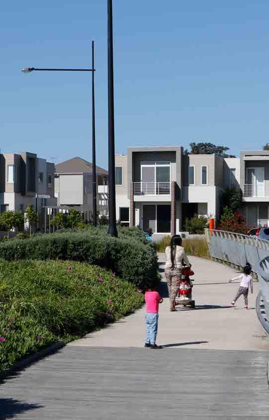
108 102
109 work with Property NSW to progress the Rydalmere Surplus Government Land project -- work with Infrastructure NSW, the Department of Planning and Environment and the Commission to progress the Parramatta Strategic Framework. investigate local opportunities to address demand and diversity in and around local centres and infill areas investigate other potential areas in GPOP. The Hills Local Government Area The council will: monitor and support the delivery of The Hills five-year housing target of 8,550 dwellings work with Transport for NSW and The Commission to progress urban renewal opportunities around the Sydney Metro Northwest Priority Urban Renewal Corridor work with the Commission and Transport for NSW to identify urban renewal opportunities that connect to Sydney Metro investigate local opportunities to address demand and diversity in and around local centres and infill areas and other areas with high accessibility. 4.4 Improve housing diversity and affordability Quality of life relies on how connected people feel within society and how cohesive and safe their community is. Many people want to stay in the area where they have always lived, regardless of their stage of life. This keeps them connected to friends and family, doctors, services, community facilities and local clubs. Our planning can help to facilitate this by providing a mix of all the different types of housing people need. This is known as housing diversity Plan for housing diversity Existing stock in the West Central District is dominated by detached dwellings, although recent development has seen growing proportions of multi-unit dwellings. Cumberland and Parramatta Council areas have the highest proportions of existing multi-unit stock and also have the highest levels of growth in multi-unit dwellings. Blacktown and The Hills Shire have high proportions of existing detached dwelling stock, and completions in these local government areas continue to be dominated by detached dwellings. There can be however a mismatch between supply and housing need. Where dwelling stock is mostly detached and the ageing population is expected to grow, there will be significant growth in demand for smaller homes. Due to planning context and recent economic conditions, there has been significant supply of apartments in the West Central District and this is expected to continue. This provides transitional housing for seniors and more affordable homes for young people. However, it does not supply the full range of housing types. More medium density row, terrace and villa homes are also required to provide greater diversity. In addition, the West Central District s increasing proportion of older people and people with a disability will require the delivery of additional smaller homes, group homes, adaptable homes and aged care facilities.
110 104 Planning for a diversity of housing needs to first consider the nature of existing housing stock (dwelling type or bedroom mix) and current and future needs. It then needs to consider the commercial feasibility of different housing types for example, the financial viability of development of different housing types such as studios compared to three-bedroom apartments can vary greatly in different areas. We need innovative responses to feasibility barriers, particularly in areas where demand for smaller homes is combined with low floor space ratios and/or mostly detached dwellings, creating a barrier to building medium density housing. Some planning controls inhibit the development of larger intergenerational or group homes. The projected growth in people aged 65 and over in the West Central District means that there must be more emphasis on planning for housing diversity, particularly seniors housing and aged care options that allow people to age in place. It will also result in a proportional increase in demand for health and community services together with cultural activities that facilitate continued social inclusion. The ability to age in place, and in community, is fundamental to liveability, as it allows people to maintain established connections with neighbours, friends and family, and importantly, with health and community services. Action L4: Encourage housing diversity To encourage diversity and adaptability the Department of Planning and Environment will: develop a toolkit to support the preparation of local housing strategies provide housing data to the development sector, councils and financiers to help them to understand the existing housing mix provision and to provide the appropriate housing mix. Livability Priority 2: Deliver housing diversity Relevant planning authorities should consider the needs of the local population base in their local housing strategy and how to align local planning controls that: address housing diversity that is relevant to the needs of the existing and future local housing market deliver quality design outcomes for both buildings and places How these matters have been taken into account needs to be demonstrated in any relevant planning proposal. A recent review of the Department of Planning and Environment s Apartment Design Guidelines provides consistent planning and design standards for apartments across NSW. The Department of Planning and Environment has prepared similar draft guidance for medium density housing. Updated data on dwelling completions and types, housing market areas and demographic change will assist in driving more appropriate planning responses. Councils should consider the needs of the local population base in their local housing strategy and how to align local planning controls and good design outcomes for different types of housing.

111 Support planning for adaptable housing and aged care Our planning should support adaptable housing that can be easily modified to become more accessible to accommodate people who are ageing or living with a disability. Adaptable housing can better accommodate these needs where it confirms with guidelines published by Livable Housing Australia. These guidelines relate to good housing design and adaptability and set out features that create long-term homes for the whole community, regardless of age, ability or changing life circumstances. The best way to provide seniors housing and aged care is to co-locate them in areas that have a mix of different uses and services, with good quality footpaths and pedestrian connections so that people can meet their day to day needs, or visit health services and community and cultural facilities. These places also need adequate parking for in-home care visitation services The Affordable Housing challenge The difference between housing affordability and Affordable Rental Housing This draft District Plan uses two different but interrelated terms. Housing affordability is a broad term that we use to describe the challenges people across a range of income groups experience in finding affordable accommodation to rent or own. If a household is spending more than 30% of their income on housing costs, it is likely to impact their ability to afford other living costs such as food, clothing, transport and utilities. Because of this, these households are described as being in housing stress and in need of affordable housing options. In contrast, Affordable Rental Housing is a specific term that we use to describe our approach to addressing the gap in housing provision for those on low and very low incomes.
112 106 The Greater Sydney housing market is recognised as one of the least affordable in the world. In the last decade alone, the ratio of house prices to incomes has continued to grow while median rents have increased in real terms. Our stakeholder engagement identified housing affordability as a key challenge for the West Central District and more broadly for Greater Sydney. This challenge is particularly acute in established areas undergoing urban renewal and gentrification, but is also evident in greenfield development. Development provides additional housing but can also reduce the affordability of housing and displace low income households. More broadly, our research shows that the provision of affordable housing across a range of tenures, types and price points is more than a liveability priority. Internationally, the provision of more affordable forms of housing is recognised to have notable productivity benefits. One London-based study found that over 1 billion a year would be lost in potential extra economic output if London failed to meet the affordable housing needs of its residents. For this reason, this draft District Plan identifies a range of measures to improve affordability across the housing continuum. We want to encourage the supply of housing with a focus on the type of housing that the District needs as it grows, not just in numbers, but also in the diversity of housing types and sizes that offer different price points and can help improve affordability. However, housing supply and diversity are only part of the solution, and an Affordable Rental Housing Target complements these approaches to the affordable housing challenge. A target also complements other government initiatives to address affordability across the housing continuum, including the Department of Family and Community Services Social and Affordable Housing Fund and Communities Plus initiatives. Who is eligible for housing provided through this Affordable Rental Housing Target? Affordable housing is defined under the EP&A Act as housing for very low income households, low income households or moderate income households. Low and very low income households are the most vulnerable to housing stress because proportionally they have less money for living costs once they have paid their housing costs. This draft District Plan identifies the most vulnerable households as eligible for housing secured by Affordable Rental Housing Targets and defined by the income groups in the table below: Household income % of median Sydney income 2016/17 income range Very low 50% < $42,300 per annum or $813 per week Low 50% - 80% up to $67,600 per annum or $1,300 per week People on moderate incomes also experience housing stress and often work in key service areas such as health and education. Accordingly, we support housing affordability for these groups more generally by providing greater housing choice through a mix of dwelling types and price points as discussed in section
113 107 In addition, implementation of the Affordable Rental Housing Target outlined here does not impede the operation of other existing planning controls that address affordable housing such as State Environmental Planning Policy 70 - Affordable Housing (Revised Schemes) and State Environmental Planning Policy (Affordable Rental Housing) This target does not preclude councils from negotiating additional affordable housing for moderate income households, nor does it affect existing planning mechanisms that secure affordable housing across the full income range, such as those in the Sydney or Willoughby council areas Deliver Affordable Rental Housing Affordable Rental Housing Targets The implementation of an Affordable Rental Housing Target complements other approaches to the housing affordability challenge, such as increasing the supply of homes across Greater Sydney (as set out in the previous section) and assisting households that require government support via social housing. Low and very low income households need the greatest help in securing affordable housing options. Recent research by the Australian Housing and Urban Research Institute found that the groups of households most likely to be in long-term housing stress are couples with children (particularly those aged between 35 and 54) and households with a family member with a disability. Recent research estimates that Greater Sydney requires at least 4,000 to 8,000 additional affordable dwellings per annum to meet the needs of this income group. This draft District Plan proposes an Affordable Rental Housing Target that builds on Action of A Plan for Growing Sydney. It requires State and local governments to create affordable housing within government-led urban renewal projects. Our approach seeks to give greater clarity to councils and the development industry with regards to implementing Action While Affordable Rental Housing Targets are not new to Greater Sydney, to date the approach in significant developments such as Sydney Olympic Park, Rouse Hill, Redfern and Green Square has not been consistent. Our approach will be transparent, and tailored to the urban economics of the area in question so as not to hinder housing supply outcomes, and to meet the needs of Greater Sydney s most vulnerable.
114 108 Our approach to affordable rental housing has been designed to meet the needs of Sydney s most vulnerable to: provide additional rental opportunities (in urban renewal and greenfield areas) in light of declining rental affordability across Greater Sydney support residents transitioning out of social housing provide housing opportunities closer to employment centres that will, in turn, reduce pressure on transport infrastructure. Affordable Rental Housing Targets The Affordable Rental Housing Target therefore aims to: be directed to eligible households on low and very low incomes whose housing needs are not met by the market support a mix of household types within communities support the transition out of social housing support development of the community housing sector. Livability Priority 3: Implement the Affordable Rental Housing Target Building on Action of A Plan for Growing Sydney, when preparing planning proposals or strategic plans for new urban renewal or greenfield areas, the relevant planning authority will include an Affordable Rental Housing Target as a form of inclusionary zoning. A target of 5% to 10% of new floor space will be applied at the rezoning stage so that it can factored into the development equation: within areas that have been shown, via a local or District housing strategy, or another form of appropriate research, to have current or future need for affordable rental housing to applicable land within new urban renewal or greenfield areas (government and private) subject to development feasibility assessed at a precinct scale to all new floor space (above the existing permissible floor space) in addition to local and State development contributions and cognisant of any public or private subsidy for affordable rental housing provision to provide a range of dwelling types including one, two and three+ bedroom homes in accordance with any relevant guidance developed by the Commission and Department of Planning and Environment. The Affordable Rental Housing dwellings will be secured by the relevant planning authority and passed onto a registered Community Housing Provider to manage, further developing this emerging sector of the economy. In this regard, we encourage the NSW Government to bring forward its own land to maximise affordable housing and Affordable Rental Housing. How these matters have been taken into account need to be demonstrated in any relevant planning proposal.

115 109 Figure 4-14: Artist s impression of arrival at Telopea Source: Land and Housing Corporation, (2016)
116 110 The Affordable Housing Target in GPOP GPOP offers the opportunity to provide a range of housing choice in mixed use areas. Consequently, the GPOP Vision (October 2016) set a 5% to 10% (subject to viability) affordable rental housing target for nominated areas for very low and low income households. Action L7: Provide guidance on Affordable Rental Housing Targets We will prepare a guidance note on Affordable Rental Housing Targets in collaboration with the Department of Planning and Environment, local government, State agencies, community housing providers, the private sector and the community. Action L5: Independently assess need and viability We will work with industry, community housing providers and the Department of Planning and Environment to enable clear and consistent implementation of the Affordable Rental Housing Target that is cognisant of flow-on housing supply implications. Where required, we will act independently to verify the development feasibility of a nominated target. We will also provide advice to government and determine where exceptions may be granted, for example where the provision of affordable housing would financially hinder the delivery of a critical or major component of city-making infrastructure. We will undertake a strategic needs assessment for Affordable Rental Housing across Greater Sydney to support the work of relevant planning authorities in preparing their local or district housing strategies. Action L6: Support councils to achieve additional affordable housing Action L8: Undertake broad approaches to facilitate affordable housing To address housing affordability more broadly, we will work with councils, industry (including community housing providers), financial institutions and relevant State agencies to investigate or advocate for new opportunities, such as: planning approaches to support the community housing sector to better leverage housing affordability supply outcomes broader financing and taxation changes, such as changes to asset classes for superannuation funds amendments to existing tenancy legislation to allow longer-term rental leases to improve security of tenure more cost effective and innovative building approaches, including prefabricated and modular housing, collective housing, maximum car parking rates and more compact housing forms of suitable design quality. In relevant areas, we will support councils and the Department of Planning and Environment in amending SEPP 70 - Affordable Housing (Revised Schemes). The application of the target identified in this draft District Plan should not prejudice negotiations to secure affordable housing in other locations where this target is not applicable Support social housing In the West Central District, over 20,500 households live in social housing. 11,000 of these homes are located in the Blacktown council area. Clusters of social housing concentration are located in Telopea, Westmead, Ermington, North Parramatta and Regents Park, Mount Druitt, Lalor Park, Doonside, Prospect, Seven Hills and Toongabbie.
117 111 There is considerable demand for social housing and this is expected to increase. Furthermore, in previous years there was a net loss of supply. To reverse this trend, the Department of Family and Community Services commenced Communities Plus. This program is an innovative, self-funded and accelerated development program for existing social housing estates in need of renewal. It is designed to create integrated communities containing affordable housing, replacement and new social housing, as well as private homes. This mix and diversity of housing will enhance social inclusion and outcomes for existing communities. Communities Plus Communities Plus will deliver up to 23,000 new and replacement social housing dwellings, 500 affordable housing dwellings and up to 40,000 private dwellings across Greater Sydney. The program is based on an asset management framework that leverages the value of the existing portfolio to accelerate supply. Private sector developers and community housing providers will be engaged to design, fund and build affordable, social and private housing. As each development is completed, new social housing properties are handed back to the Land and Housing Corporation as payment for the land, making the program entirely self-funded. Community housing providers will manage the social housing properties and own and manage the affordable housing component, further developing this emerging sector of our economy. Currently, many social housing sites are subject to planning controls based on historical land use, rather than reflecting the local environmental capacity for density and height uplift. The Commission and the Department of Planning and Environment are working with Land and Housing Corporation, councils, Transport for NSW and other State agencies to adapt planning controls to maximise outcomes for the Communities Plus projects and thereby the residents of Greater Sydney. The West Central District will continue to require social housing, and much of this provision will come through Communities Plus. One of the four Communities Plus initiatives that have commenced in Greater Sydney is at the Telopea Estate, identified as a major renewal area in GPOP. Land and Housing Corporation and the City of Parramatta are working in partnership to develop a master plan for Telopea. The estate currently accommodates approximately 1,400 dwellings (including 640 Land and Housing Corporation owned social housing dwellings which equates to 46%). The objective is to create a transit oriented community with a mix of new and better social housing integrated with additional private and affordable housing serviced by new public transport, shops, public spaces and community facilities. The master plan aims to deliver around 1,000 social housing dwellings in Telopea comprising no more than 30% of all dwellings. This will provide new housing in an accessible and well serviced community for those who need it the most. The redevelopment will capitalise on the Parramatta Light Rail with new and integrated community facilities to help meet the needs of the area s existing and new community. This draft District Plan recognises and supports this ambition to provide a mix of housing on existing sites to create well-designed, socially cohesive communities. Livability Priority 4: Increase social housing provision Relevant planning authorities and the Department of Family and Community Services (and the Land and Housing Corporation) should collaborate to optimise housing and community diversity outcomes on sites of social housing concentration. Subject to appropriate consultation, feasibility considerations and environmental assessment, relevant planning authorities should translate optimal outcomes for social housing sites into land use controls. How these matters have been taken into account need to be demonstrated in any relevant planning proposal.
118 Facilitate integrated infrastructure planning Action of A Plan for Growing Sydney requires support for urban renewal by directing local infrastructure to centres where there is growth. A major challenge in creating capacity for additional housing, particularly in greenfield and major urban renewal areas, is the coordination of infrastructure and land use planning so that infrastructure is delivered in the right place at the right time, in line with actual growth. This requires a detailed understanding of forecast growth and infrastructure investment programs across a range providers and locations. A more targeted and coordinated approach to planning and delivering regional, district and local infrastructure would achieve this while also expediting investment and development, and potentially boosting the delivery of new housing. This approach will help inform the update and review of funding arrangements for State infrastructure through Special Infrastructure Contributions, as well as inform the Commission s Annual Infrastructure Priority List. Action L9: Coordinate infrastructure planning and delivery for growing communities The Commission will work with the Department of Planning and Environment to better coordinate land use and infrastructure strategies at a State, district and local level to deliver infrastructure to growing communities as needed. This approach to coordinated infrastructure planning could involve: working with the private sector to advance designs for infrastructure to achieve greater certainty of delivery costs and constraints reviewing development forecasts annually to create more accurate information about timing and location of development staging development to get the most efficient use of existing infrastructure capacity staging infrastructure delivery using interim solutions including packaged wastewater treatment systems and temporary intersection improvements involving the community in decisionmaking about infrastructure investment to ensure that it meets local needs.

119 Coordinate and monitor housing outcomes and demographic trends Through the housing continuum approach, we draw together all the actions and programs across State and local government as well as the not-for-profit and private sectors to improve our understanding of where new homes are needed and the type of dwellings required. This, in turn, determines planning needs for education, transport, utilities and other infrastructure. The construction of new homes is a major economic activity and requires a supply of skilled workers, access to capital and availability of materials. To support the construction of new homes all stakeholders need up to date information on housing supply to coordinate supply capacity, infrastructure and delivery. Supply forecasts and completions data needs to consider all housing types so that the mismatch of supply and demand can be closely monitored and used to inform activities across the sector. The Department of Planning and Environment also prepares demographic projections and provides advice on demographic trends. Population projections that accurately describe projected changes in population characteristics like age and household type also inform the planning for education, emergency services, utilities and transport. The Department of Planning and Environment publishes annual housing completions, which will be improved by the inclusion of more detailed data describing all types of housing.
120 114 Action L10: Provide data and projections on population and dwellings for local government areas across Greater Sydney. The Department of Planning and Environment will: regularly prepare updates to 20-year population and dwelling projections for NSW by local government area prepare a housing needs assessment that will assist the preparation of local housing strategies continue to release 20-year projections of population growth, including: -- projections for age profiles (including student population age cohorts) -- households types -implied - dwellings publish annual 10-year housing supply forecasts that: -- include forecast supply by local government area -- enhance the existing forecasts to include details of housing types -- include housing completions across Greater Sydney, including those in new growth areas, to allow comparison of projections and completions. 4.6 Create great places 'Culture and climate differ all over the world, but people are the same. They'll gather in public if you give them a good place to do it.' Jan Gehl, Danish architect and urban designer Improving liveability means putting people at the heart of planning for great places. This means recognising and building on the valued characteristics of individual neighbourhoods while maximising the improvements that come with growth and change. Almost two thirds (64%) of residents in the West Central District consider the liveability of their area to be either excellent or very good. The main reasons for this are proximity and access to transport, shops, parks and natural areas, services, facilities and quality schools. The safety of people and their property is also a highly valued characteristic of the District. What makes the District special in the minds of residents is the benefit of green spaces and easy access to centres such as Parramatta. The West Central District is also regarded as child friendly as well as being an area of diversity. The District has great food and cultural offerings showcasing the multicultural influences across the area. Many residents have a strong sense of community and belonging and feel safe in the District. Enhancing the great places in the West Central District requires protecting, and where possible, enhancing, these highly valued liveability characteristics. In this context, we need to manage growth to create healthy, well-designed, safe and inclusive places that encourage economic and social activity, vibrancy and community spirit. This draft District Plan looks at how we can work across government to provide the kind of places and facilities that help to build a more cohesive community.
121 115 Our ambition for GPOP is to nurture a civic heart with a vibrant community, cultural and arts scene. For Parramatta City, this includes priorities to: celebrate its heritage, stories and legacy activate the Parramatta River with Museum of Applied Arts and Sciences and cultural facilities support the Western Sydney arts scene with expanded shared space and events for artists promote partnerships to provide a wide range of local, district and regional services and infrastructure restore the iconic Roxy Theatre as part of a wider precinct s attraction support a vibrant night time and weekend economy maintain the nature and energy of Harris Park s busy streets host city scale community events and celebrations in Parramatta Square, Parramatta Park and on the Riverbank. At Sydney Olympic Park we want to take advantage of the area s many worldclass events, and look to activate public spaces, using permanent and temporary place making initiatives. We will also encourage city-scale community events and celebrations, including New Year s Eve, and support and extend the outreach of the Royal Agricultural Society Provide design-led planning Design-led planning aims to produce good quality integrated urban land use and transport as key elements of a people-centred, sustainable and liveable environment. It involves working with communities to identify the key strengths of a place what makes it special and ways to enhance this in the future. Clear, shared goals can then be used to shape future initiatives, decision-making, development proposals and funding. The NSW Government s draft architecture and urban design policy, Better Placed (October 2016), seeks to deliver design excellence and a safe, equitable and sustainable built environment. It outlines the importance of successful design for cities and towns noting that: Cities and centres are linked through economic factors they support industry and commerce, employment and services. Accommodating an agglomeration of people and activity is key to a city or centre s productivity. Collectively, urban development is responsible for significant environmental and greenhouse impacts, energy use and displacement of ecological and agricultural land. Cities and towns welcome and house people and communities. The coming together of people in urban places plays an essential social function in accommodating relationships. The draft policy advocates design-led planning and notes that the role of urban design and architecture is essential to all three of these factors and is a key determinant of successful urban places.
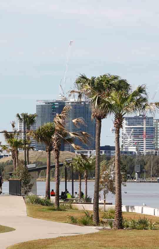
122 116
123 117 The Draft Policy on Urban Design and Architecture establishes seven principles of urban design are relevant to the West Central District, these include: Better Placed: Seven Principles Principle 1: Contextual, local and of its place. The urban environment is where most of us live, work and recreate. Places should be designed to be integral with local people and cultures and connected to their landscape and setting in this way, a place will be of its location - distinctive, resonant and engaging. Principle 2: Sustainable, efficient and durable. Cities, towns and the infrastructure they require have both a positive and negative impact on environmental quality and climate change. An urban area should be designed to be accessible and compact; to minimise consumption of energy, water and natural resources; and to avoid detrimental impacts on natural systems. It should be designed to respond and adapt to changes over time. Principle 3: Equitable, inclusive and diverse. The city represents the coming together of the full spectrum of society in a mutually beneficial arrangement. Cities and towns must accommodate and provide access to opportunities for all. Urban design should provide equitable access to housing, employment, public transport, public space and social opportunities. Principle 4: Enjoyable, safe and comfortable. How people experience cities has a daily impact on people s lives, and investment in development and infrastructure can have an impact for decades and generations. Urban design should be people focused, providing environments that are user-friendly, enjoyable, accessible and dignified. Principle 5: Functional, responsive and fit for purpose. As the setting for our daily lives, the urban environment must work well for a wide range of purposes. Urban design can influence the functionality and workability of urban areas permanently, and so design quality at the outset is essential. Principle 6: Value-creating and cost effective. Substantial investment goes into the urban environment and infrastructure from a range of sources. Well-designed urban places have the potential to be highly cost effective over the long term, creating ongoing and increasing value for all. Principle 7: Distinctive, visually interesting and appealing. For most people the urban environment is where we live our daily lives. The design of the city or precinct is fundamental to how it looks, feels and works for people. Poor design has a lasting, negative impact, while good design provides ongoing benefits for all.
124 118 The draft policy supports productivity, environmental management and liveability by fostering quality processes and outcomes in the delivery of housing, employment, infrastructure, open space and public areas. Accordingly, this draft District Plan seeks to deliver several specific design-led planning outcomes, including: considerations for planning strategic and district centres (Section 3.4) design guidelines for medium density housing (Section 4.3) design guidelines for safe and healthy built environments (Section 4.6) urban agriculture, community and roof gardens for productive food systems (Section 4.6) integration of arts and cultural strategies, investment and actions into urban development (Section 4.7). support for enhanced sharing of community resources and spaces (Section 4.7) Aboriginal, European and natural heritage considerations (Section 4.7). These areas identified above emphasise the broad range of outcomes that need to be balanced when planning for an area. Designled planning and the design principles inform the process for considering how to balance competing objectives while delivering on the core needs of the community such as sufficient housing, affordable housing, economic activity - thus jobs. This is particularly important in the context of the three guiding principles that underpin the planning for how Greater Sydney grows as outlined in A Plan for Growing Sydney. Action L11: Provide designled planning to support high quality urban design To provide high quality urban design, we will support the NSW Government Architect in the development and implementation of design-led planning approaches, specifically for collaboration areas and planning for centres and precincts Plan for safe and healthy places As documented by the Heart Foundation, healthy built environments help prevent physical and mental health problems. This is achieved through the provision of functional well connected streets and public spaces, in neighbourhoods that fulfil the services and social needs of residents. Building on Action of A Plan for Growing Sydney guidelines for the planning, design and development of a safe and healthy built environment can potentially be more effective if they are incorporated into broader considerations outlined in the Liveability Framework and the Draft Policy on Urban Design and Architecture. Design-led planning of the public realm footpaths, squares, open spaces, parks and nature strips should result in places and streets that are safe and functional and that can support people to walk or cycle rather than drive. Walkable, well-lit places and paths can provide a sense of safety for women, young children and older people, all of whom are often the first to sense that a neighbourhood is not safe especially after dark. Functional streets must also provide easy connections to facilitate transport options for day to day needs. Co-located schools, transport and services in mixed use areas capable of growth will improve the sustainability of these centres and their communities and enhance accessibility with the potential to reduce congestion. Healthy built environments can also facilitate access to fresh seasonal food. Designled planning for productive roof gardens, community gardens and other forms of urban agriculture can facilitate better health outcomes and greater community cohesion. These characteristics of healthy safe environments can encourage more active lifestyles helping to reduce obesity and the rate of chronic illnesses such as diabetes and cardio vascular disease. This is especially important for the long-term health of West Central residents, as Western Sydney has been identified as a diabetes hot spot.

125 119 Design-led actions in this draft District Plan also support the Premier s Priority to reduce childhood obesity as well as support the Western Sydney Diabetes Prevention and Management Initiative: a multi-sector partnership for a whole of district approach (the Western Sydney Diabetes Prevention & Management Initiative: Diabetes Prevention and Management Strategy.) Action L13: Develop guidelines for safe and healthy built environments The Commission will work with the Department of Planning and Environment to develop designled planning guidelines for developing a safe and healthy built environment. Livability Priority 5: Facilitate the development of safe and healthy places Relevant planning authorities should: facilitate the development of healthy and safe built environments consider the inclusion of planning mechanisms such as floor space bonuses to incentivise the provision of: -- neighbourhoods with good walking and cycling connections particularly to schools, -- social infrastructure such as public libraries or child care, -- urban agriculture, community and roof gardens for productive food systems. How these matters have been taken into account need to be demonstrated in any relevant planning proposal.
126 Enhance walking and cycling connections We see better walking and cycling connections and end of trip facilities, such as lockers and showers at a workplace, as way to increase activity levels and improve health and wellbeing. This requires thoughtful planning to enable well-designed footpaths and cycling facilities that link to services and transport options. In 2016, cars are the dominant mode for all trips to, from and within the West Central District. Even for short trips under five kilometres just 26% are taken on foot. Car travel is dominant for all distances travelled, particularly for trips of 5-10 kilometres, with 91% of all trips being vehicle driver or passenger. Co-location of complementary land uses such as shops, schools, child care, community and recreation facilities helps people to interact and improves the viability of public transport, walking and cycling, while interconnected networks of footpaths and bicycle paths can connect people to these places while also increasing activity levels and reducing congestion. Transport for NSW is developing a Walkability Tool that will help to identify areas where improvements to the walking environment can be made. The tool assesses how easy it is to access services and destinations by foot, the relative comfort of walkways along adjacent roads and how easy it is for walkers to access public transport. Transport for NSW s Sydney s Walking Future and Sydney s Cycling Future reflects the NSW Government s commitment to working with councils to make walking and cycling more convenient, safer and enjoyable. Funded through the Walking Communities program, improvements to the walking network will help to reduce the amount of time people spend at intersections, enhance facilities for pedestrians, and encourage more people to travel on foot. Transport for NSW is also establishing Sydney s Principal Bicycle Network. This will be made up of high quality, high priority routes that facilitate direct, barrier-free travel between centres. Routes will be separated from motor vehicles and pedestrians and local bicycle routes will connect to form a finer grain cycling network. The Principal Bicycle Network routes already connecting the West Central District are: Parramatta to Westmead cycleway Escarpment Boardwalk on the Parramatta River cycleway Subiaco Creek to University of Western Sydney cycleway Carlingford Rail Line to Parramatta cycleway Completing the network within the Parramatta City Centre Completing the network to the Blacktown City Centre Doonside Road, Blacktown cycleway Duck River cycleway connecting Parramatta River to the Sydney Water Pipeline at Chester Hill Parramatta Light Rail Walking and Cycling Network. Other walking and cycling projects in the West Central District will continue to be delivered by both Roads and Maritime Services and local councils, and will be funded under the NSW Government s Walking and Cycling programs. Transport for NSW and Roads and Maritime Services will continue to provide guidance to councils when making land use decisions that affect accessibility in and around centres. Livability Priority 6: Facilitate enhanced walking and cycling connections Relevant planning authorities should facilitate enhanced walking and cycling outcomes by giving due consideration to the delivery of district and regional connections and walkable neighbourhoods. How these matters have been taken into account need to be demonstrated in any relevant planning proposal.
127 Foster cohesive communities People are proud to call the West Central District home. It offers a real diversity of places and communities, from the newly-established suburbs in the District s north west, to the busier or more traditional places closer to Parramatta City. As the West Central District grows, we have a responsibility to create cohesive communities, each with their own sense of place. Our aim is to build on the District s inclusive and positive image that is welcoming to new residents and encourages others to come and enjoy new cultural experiences. This spirit is exemplified by cultural and public events such as Parramasala, which is well known across Greater Sydney and attract many visitors. Through design-led planning, we will work with communities to identify the key strengths of unique places within the District and explore ways to enhance these in the future. We can enhance social cohesion and achieve this by protecting the heritage and local identity of the many unique neighbourhoods across the District. By collaborating across the creative arts, businesses and communities we can foster cultural development and expression across the District. By protecting and enhancing existing good access to natural landscapes, parks, sportsgrounds and recreation facilities we can maintain this valued liveability characteristic and encourage more active lifestyles. We can also enhance these liveability outcomes by greater sharing of sports and community facilities across the District. Each of these elements of cohesive communities is discussed in more detail below Conserve and enhance environmental heritage including Aboriginal, European and natural The West Central District s rich Aboriginal, cultural and natural heritage reinforces our sense of place and identity. This includes the World Heritage Listed site of Old Government House and Government Domain historic precinct in Parramatta Park, the State Heritage Register listed items such as the Cumberland Hospital and Cattai Estate, significant Aboriginal place listings, rock art sites and middens and conservation areas comprised of Victorian Federation architecture. The District has a long history of Aboriginal occupation and cultural heritage which is an important component of a shared cultural fabric. We must appropriately recognise, protect and manage these assets in collaboration with relevant Custodians and State agencies as the District grows, and work with the Aboriginal community to identify and map the significant stories, and cultural places in the District. Places and items of heritage significance are protected by the Heritage Act 1977, the National Parks & Wildlife Act 1974 and listed in local environmental plans for conservation. This protection can be further enhanced by the implementation of the best practice guidelines contained in the ICOMOS Burra Charter and the NSW Heritage Manual. This heritage is expressed across the District in different places, spaces, buildings and structures, including: The Parramatta Sand Body, where investigation uncovered a substantial archaeological record that has contributed to our understanding of pre-colonial Aboriginal occupation of the Parramatta area and more broadly, the Cumberland Plain The Colebee/Nurragingy Land Grant, the first land grant given to Aboriginal people in Australia The Blacktown Native Institution, for its historical, social and archaeological values. Parramatta Park which is considered both a European and Aboriginal archaeological resource and is of national significance.

128 122 Figure 4-15: GPOP (2016) Health, Education, Research and Enterprise Eco-system Vibrant Recreation, Sporting, Cultural & Arts Experiences Parramatta Ways - existing links Source: Greater Sydney Commission, 2016 Parramatta Ways - missing links Existing heavy rail Existing Green Space Parramatta Light Rail Ferry GPOP Boundary Multimodal Interchanges Rapid Bus Routes
129 123 Sites of European settlement and early convict agriculture are also evident in places like the justice precinct in Parramatta, Bella Vista Farm, and Rouse Hill House. Also important to the District is its biodiversity including parks and landscapes that form significant parts of the Green Grid including Parramatta Park, Prospect Reservoir, Duck River Wetlands, Alpha Park, William Lawson Reserve, Wrights Road Reserve, Bidjigal Reserve, Santa Rosa Park, Edna Hunt Sanctuary and Bicentennial Park. This draft District Plan recognises that development must be more than sympathetic to the District s heritage it must enhance it. Our heritage offers a point of difference that fosters connected communities and local identity. Opportunities to adaptively re-use character and heritage buildings through the development process should be used to protect and enhance places, spaces and qualities valued by the local community. Action L14: Conserve and enhance environmental heritage including Aboriginal, European and natural To support high quality urban design and healthy places, the Office of Environment and Heritage, Department of Planning and Environment, and Aboriginal Affairs will collaborate to map Aboriginal-owned lands, places of significance, local community organisations and public art and place making projects and events celebrating Aboriginal history. Relevant Planning Authorities need to identify, assess, manage and protect the heritage which underpins the community s pride of place. The Commission will work with the Office of Environment and Heritage, State Agencies and councils to identify and share best practice in restoration, alterations, additions and adaptation of heritage items. Livability Priority 7: Conserve heritage and unique local characteristics Relevant planning authorities should: require the adaptive re-use of historic and heritage listed buildings and structures in a way that enhances and respects heritage values. protect Aboriginal, cultural and natural heritage and places, spaces and qualities. How these matters have been taken into account need to be demonstrated in any relevant planning proposal. Aboriginal, cultural and natural heritage in GPOP GPOP is rich in Aboriginal and early Australian colonial history. It features some of Australia s most significant heritage assets from land grants and early estates and contains significant Aboriginal lands set in the catchment of the Parramatta River. The GPOP vision is to: stimulate engagement with Parramatta s rich history and development of cultural assets, and celebrate the extraordinary diversity of people in our city s central heart make Parramatta River a great living waterway and connector, where people enjoy walking, cycling and safe swimming.
130 Support the creative arts and culture Participation in arts and cultural activities fosters social inclusion, local identity and sense of place. Recent research demonstrates that art in Western Sydney continues to break new ground, sets new standards, and rivals in excellence, art created elsewhere in Australia, and overseas. The West Central District s existing cultural facilities are considerable and include: Parramatta Riverside Theatres, the major centre for performing arts in Western Sydney, which hosts over 700 live performances each year Sydney Olympic Park and Parramatta public art trails Blacktown Art Prize and Western Sydney Dance Action heritage places, including buildings, locations and museums, especially those related to the early colonial period of European settlement of Sydney, including: -- Elizabeth Farm, Hambledon Cottage and Experiment Farm Cottage -- St John s Cathedral and Cemetery, the latter dating from 1790 diverse cultural cuisines and food outlets in Harris Park and Parramatta. The cultural activity of the District is reflected in the events and activities that operate from these facilities as well as many other arts and cultural activities that help the West Central District s residents to connect, celebrate and identify with one another. The public domain is an important place for cultural exchange through public art, cultural programs and festivals. Many of these are organised locally and are enhanced by collaboration and partnerships across the District. Neighbourhood street fairs, festivals, fétes, indoor and outdoor exhibitions, workshops and community markets provide important opportunities for people of all ages and walks of life to experience and participate in arts and culture. Examples include Riverbeats and the biannual Festival of the Olive at Elizabeth Farm, subprograms of the Sydney Festival and Parramasala: South Asian Festival. The work of local volunteers and support organisations across the District is further evidence of a strong community spirit. In the District, arts and culture promote local identity and provide for the needs of different groups in the community. The networking of arts and cultural facilities can enhance the creative economy. Nurturing a culture of art in everyday local spaces through design-led planning can facilitate community cohesion and important liveability outcomes. Action of A Plan for Growing Sydney requires us to grow the arts and cultural opportunities in Parramatta to include State-level facilities. Arts and cultural policy, investment and actions should be well integrated into urban development. This can be achieved through planning proposals for urban renewal areas and priority precincts that enhance access to the arts in all communities and nurture a culture of art in everyday local spaces.
131 125 During the review of A Plan for Growing Sydney and the finalisation of the West Central District Plan, we will further explore, in consultation with stakeholders, how the final District Plan can provide direction on the enhancement of arts, culture and night time activities for the West Central District. This will assist us to work towards better access to the arts for all communities across Greater Sydney and will consider: the provision of community infrastructure (library/hubs) in planning for improved places delivering a diverse range of night-time activities in appropriate places cultural diversity as a tourism attraction in places such as Granville, Toongabbie, Parramatta and Auburn options for a new arts and culture precinct for Western Sydney, including the planned cultural site along the Parramatta Riverbank that will include the Museum of Applied Arts and Sciences option for an entertainment precinct in Parramatta to serve the wider Western Sydney community options for new Riverside retail and public spaces Create opportunities for more recreation and community facilities Adequate provision of the whole range of recreation and community facilities contributes to a liveable city. These include local and regional recreation areas, parks and natural landscapes as well as community facilities such as libraries, event spaces, community centres and community gardens. These facilities, usually delivered by local government, are important to people at all stages of life. They should, therefore, be accessible and inclusive so that people of all abilities can enjoy them. The Heart Foundation have identified that people who are not physically active are almost twice as likely to die from coronary heart diseases as those who are. As such, increasing the level of physical activity in the community is likely to have a major impact on public health. Our planning should focus on allowing many activities to occur in the District s recreation spaces. We also need to look at more flexible use of underutilised public spaces to ensure we meet the demand for contemporary green spaces. We need to focus on multi-use recreation use for a range of different user groups. Livability Priority 8: Foster the creative arts and culture Relevant planning authorities should: integrate arts and cultural outcomes into urban development through planning proposals that nurture a culture of art in everyday local spaces and enhance access to the arts in all communities give due consideration to the inclusion of planning mechanisms that would incentivise the establishment and resourcing of creative hubs and incubators and accessible artist-run spaces. How these matters have been taken into account need to be demonstrated in any relevant planning proposal. The West Central District features many of these recreation and community facilities, and in fact our engagement indicated that residents we spoke to highly value the proximity of these facilities to their homes. Future planning and decision-making should continue to enhance access to these facilities and accommodate new and shared use of facilities as required by the existing and future local communities. Action L15: Develop a West Central District sport and recreation participation strategy and sport and recreation facility plan The Office of Sport will coordinate and support collaboration between councils to develop a Sport and Recreation Participation Strategy and a Sport and Recreation Facility Plan for West Central District.
132 126 Opportunities for more recreation and community facilities in GPOP GPOP contains the world-class sporting and event venues of Sydney s Olympic Park in the east, Parramatta Park to the west, connected by the Parramatta River. In addition to the vision to make Parramatta River a great living waterway and connector, the vision is to: activate world class sports, entertainment, cultural and arts destinations across Parramatta City, Rosehill and Olympic Park continue to evolve Olympic Park and surrounds into an inclusive place for active and green living, health and wellness. Shared spaces: Pilot project The Hills Shire and NSW Department of Education are collaborating on a pilot project that seeks to allow shared use of government school facilities with the broader community. While the approach taken in The Hills Shire will not fit all local communities, it is a major step forward in the process of providing better utilisation of public assets. Across Greater Sydney, this approach might provide opportunities to better integrate schools with local communities, particularly in dense urban environments where there are competing land use constraints and growing demands for access to open space and community facilities Support planning for shared spaces Making more productive and sustainable use of existing resources is good urban governance. Given the growing and changing population of the West Central District to 2036, a more clearly articulated governance system for the shared use of community resources could be a game changer for Greater Sydney. By working with State agencies and local government we can identify assets that are available for complementary community use and investment. One example of this is the opportunity for government and nongovernment schools to collaborate with local government to access school facilities and open space. Shared use of resources could extend to: schools open space resources community facilities such as meeting rooms, gymnasiums or art facilities private open space resources such as swimming pools and golf courses services (waste, access, recycled water) for multiple buildings within a street frontage. Action L16: Support planning for shared spaces To support the sharing of spaces we will: collaborate with State agencies, nonprofit organisations, private providers and communities to identify opportunities for the shared use of community and school facilities support the NSW Department of Education s preparation of a joint venture template that will include the shared use of school playgrounds and other spaces where requested, provide strategic planning advice prior to sale regarding alternative uses of surplus government-owned land including schools. Livability Priority 9: Share resources and spaces Relevant planning authorities should consider the delivery of shared local facilities such as community hubs, cultural facilities and public libraries as multifunctional shared spaces. How these matters have been taken into account need to be demonstrated in any relevant planning proposal.
133 Respond to people s need for services In accordance with Action of A Plan for Growing Sydney, making the District a great place to live requires the provision of the infrastructure and services that people need, from birth to the end of life. The full range of service needs must be realised including child care, schools, hospitals, health centres and aged care, as well cemeteries and crematoria to support Greater Sydney s liveability. The delivery of these services is the responsibility of many agencies and organisations that need to consider existing and future demand. This section explores our approach to supporting the planning delivery of these services Education infrastructure As of 2016, government schools in the West Central District accommodate more than 127,000 students representing 65% of the student population. In turn, just under 57,000 students attend non-government schools. By 2036, significant growth in the primary and secondary school aged population is expected to result in an increase in school enrolments of around 91,700 or 56% based on the current enrolments in government and nongovernment schools. Within the District, existing schools are concentrated in established areas around Parramatta, Blacktown, and The Hills, with growth planned around major greenfield development in the North West Growth Centre and throughout the Sydney Metro North West Priority Urban Renewal Corridor. The District s 185 government schools are characterised by high utilisation rates and a significant number of demountable classrooms are used in primary schools. Spare classroom capacity within schools across the District is generally limited. Table 4-4: Actual (2016) and projected (2026 and 2036) NSW School students for West Central District School Level Change Government Primary Government Secondary Government Subtotal Non Government Primary 65,100 85,900 97,650 32,550 50% 41,900 54,850 66,050 24,150 58% 107, , ,700 56,650 53% 28,750 39,100 45,300 16,550 58% Non Government Secondary Non Government Subtotal 28,050 37,850 46,600 18,550 66% 56,800 76,900 91,850 35,050 62% Total 163, , ,550 91,700 56% Source: NSW Department of Education, 2016 NSW Department of Education disclaim liability to the reliance of information in the Child, Adolescent, and Student Projections Information is correct only at the time of release and reflect the assessed observed current and retrospective trend. There is no certainty that these trends will be realised at any reported time point or geography. These projections are not targets and are made independently from Departmental policy direction

134 Figure 4-16: Primary schools in the West Central District, (2016) Strategic Centre District Centre District Boundary Government Primary Schools Non-Government Primary Schools Source: NSW Department of Education, 2016 Airport Metropolitan Urban Area Metropolitan Rural Area Waterways National and State Parks Railway Railway Station Motorway Highway Roads

135 129 Figure 4-17: Secondary schools in the West Central District, (2016) Strategic Centre District Centre District Boundary Government Secondary Schools Non-Government Secondary Schools Source: NSW Department of Education, 2016 Airport Metropolitan Urban Area Metropolitan Rural Area Waterways National and State Parks Railway Railway Station Motorway Highway Roads
136 130 Table 4-5: Count of schools by school type and sector for West Central District, 2016 School Type NSW Public Schools Catholic Independent Primary Secondary Combined (K-12) 1 42 School for Specific Purposes Environmental Education Centre 1 Total Source: NSW Department of Education, 2016 & Catholic Education Commission, 2016 and Association of Independent Schools of NSW, 2016 Recent major investment in government schools include: funding for upgrades to Rosehill Public School, Lidcombe Public School, Auburn North Public School, Rowland Hassall School and Homebush West Public School new primary schools at Wentworth Point, Bella Vista (Kellyville), North Kellyville and Parramatta (Old Kings site) a new high rise high school and redeveloped primary school in Parramatta City Plan to meet the demand for school facilities To ensure school planning meets demand we need an understanding of where the schoolage population is likely to increase, stabilise or decline and, therefore, when new classrooms or schools will be needed, or where capacity will become available. Integrated school investment solutions can then be developed based on the unique characteristics of the District s communities. If no additional classrooms were to be provided in the West Central District by 2036 there would be significant shortfalls based on projected changes in the primary and secondary school aged population. Of particular note, there is significant forecast growth in demand in Parramatta, Epping, Auburn, Schofields and Castle Hill. Existing school infrastructure will accommodate the majority of new enrolments, because most growth in the District will occur in existing areas. This will be achieved through expansion and innovative approaches to the use of land, facilities and floor space. The Department of Education currently optimises use of its infrastructure in a number of ways including: the realignment of school catchment boundaries prioritising in catchment area students increasing the size, amenity and functionality of existing schools using demountable classrooms to manage fluctuations in enrolments. Whilst detailed demand for government school facilities and appropriate responses will be identified by the Department of Education, our planning must recognise that schools are critical infrastructure in growing communities. Furthermore, our planning should support innovative approaches to the design and location of new and expanded school facilities.
137 131 Livability Priority 10: Support innovative school planning and delivery Relevant planning authorities should give due consideration to: innovative land use and development approaches including: -- using travel management plans, that identify travel options, to reduce car use -- enabling the development and construction of schools as flexible spaces, so they can facilitate shared use and change over time to meet varying community need the inclusion of planning mechanisms that would incentivise the -- development of new schools as a part of good quality and appropriate mixed use developments -- the shared use of facilities between schools and the local community including playing fields and indoor facilities, so they can meet wider community needs. How these matters have been taken into account need to be demonstrated in any relevant planning proposal support the creation of a joint forum for government and non-government school sectors to work collaboratively to plan for future growth and change Plan for the provision of early education and child care facilities Demand for early education and child care facilities will also increase in West Central given the expected 32,000 new babies and toddlers that will reside in the District by Planning for these facilities in existing communities will increasingly require innovative approaches to the use of land and floor space, including co-location with compatible land uses such as primary schools and office buildings. In order to meet the increasing demand for child care and early education facilities, the Department of Planning and Education is working jointly with other government and nongovernment agencies to improve the quality and availability of early childhood education and care facilities by streamlining the planning system and aligning it to the National Quality Framework for Early Childhood Education and Care. Out of school hours child care is essential for jobs growth and consistent with the Department of Education s arrangements for joint use. Action L17: Support planning for school facilities To better support planning and decisionmaking across education, providers, relevant planning authorities and the Department of Planning and Environment will: continue to release 20-year projections of the student population in the District annually release housing forecasts showing where and when school catchments will be affected by growth monitor housing completions in new growth areas to confirm where student populations are growing work with NSW Property and the Department of Education to identify the strategic potential of key government sites Support the provision of youth services The District s population is growing and its characteristics are also changing. The West Central District is also highly multicultural. While older people will make up a greater proportion of residents in the future many other sectors of the community also require socially, culturally and age appropriate service provision. The West Central District has considerable demand for targeted youth services and facilities. Age appropriate cultural, social and employment facilities are important to support our youth and address issues such as mental health, homelessness, pre-employment training and job readiness in a socially appropriate manner.
138 Support the Aboriginal community A significant proportion of Aboriginal and Torres Strait Islander people live in the West Central District. Blacktown alone is home to 8,200 Aboriginal and Torres Strait Islander people, making up 2.7% of the population, the largest concentration in NSW. Engagement with the Aboriginal community, built on trust and integrity, should be founded on a framework of self-determination and Aboriginal control, particularly in terms of the management of assets and cultural heritage, and the development of policies and strategies for economic and social opportunities. Equity of access to appropriate whole-of-life social infrastructure can improve the Aboriginal community s health, wellbeing and economic participation. In particular, the consideration of targeted health and education services and child care and aged care services are required. Collaboration with the diverse Aboriginal communities of the District will be required to determine appropriate priorities. Federal and State agencies are working with Aboriginal communities, local government and service providers to deliver high quality educational and health outcomes. The NSW Government has committed $20 million to the establishment of an Aboriginal Centre of Excellence in Western Sydney. The Centre will deliver programs and services that support young Aboriginal people to transition between education and employment. Action L18: Support the provision of culturally appropriate services The Commission and Department of Aboriginal Affairs will establish an ongoing engagement forum with Greater Sydney s Aboriginal community in order to better inform our planning. This will include representatives from Aboriginal Land Councils, Aboriginal youth and students, and Aboriginal service providers. Together, we will prepare and agree on an engagement strategy and focus on deliverable actions that align with Aboriginal community aspirations in each District. Through this approach information can be provided to relevant planning authorities to support planning outcomes for the Aboriginal community. Action L19: Provide socially and culturally appropriate infrastructure and services Relevant planning authorities should: collaborate with Federal and State agencies and service providers to integrate local and District social infrastructure for Aboriginal residents including preschools, child care and aged care services include appropriate planning mechanisms to incentivise the provision of these services required by local communities, where appropriate. How these matters have been taken into account need to be demonstrated in any relevant planning proposal.
139 Support planning for health networks The health network encompasses the whole spectrum of health facilities and services for every segment of the community. The network includes hospitals and emergency services as well as associated surgeries, clinics, pathology and allied health providers. Co-location of business, educational institution and industry provides a competitive advantage. A strong health network is also a generator of local jobs. Planning controls for health precincts and centres that allow complementary and ancillary services such as short-term accommodation, residential aged care, childcare, specialist or allied health infrastructure will support better accessibility to services. These services will co-locate to varying degrees in smaller centres and to a greater extent in the established health care precincts where the employment opportunities can be leveraged to improve transport networks and connectivity. For these reasons planning controls should support the creation of productive local health networks and consider the operational needs of providers. In the West Central District this includes Australia s largest health services precinct at Westmead, an important hub of economic activity, employment and investment. It offers integrated tertiary clinical care, an innovative education and research network, hundreds of private health businesses and the globally connected Westmead Institute for Medical Research and Children s Medical Research Institute Plan for health facilities and services The West Central District is served by Westmead Hospital, Blacktown-Mount Druitt Hospital and Bankstown-Lidcombe Hospital. A network of health services that cover both the Western Sydney and South Western Sydney Local Health Districts supports these tertiary hospitals. Current planning for major new and improved health infrastructure includes: Westmead Hospital redevelopment upgrades to Blacktown and Mount Druitt Hospitals new car parking at Blacktown and Westmead Hospitals HealthOne at Merrylands a new health facility at Rouse Hill community health programs such as GP clinics, medical centres and other specialist health services as administered by the Australian Government s Primary Health Networks. Action L20: Support planning for health infrastructure Relevant planning authorities should give due consideration to the need to support the co-location of uses that complement health precincts including: residential aged care facilities housing for health workers visitor and short term accommodation health and medical research activities child care non-critical patient care commercial uses that are complementary to and service the health precinct. Consideration should also be given to the protection of health precincts and super precincts from residential encroachment into key employment areas. How these matters have been taken into account need to be demonstrated in any relevant planning proposal.
140 Plan for emergency services NSW State Emergency Services, NSW Police, NSW Ambulance, Fire & Rescue NSW and NSW Rural Fire Service all work to protect the safety of our community. Not only do they prepare for, and provide assistance in, times of emergency they also build community resilience and reduce community concerns about personal safety and property security. For all agencies, these highly mobile services need to be able to render assistance quickly and efficiently. The location of these services with a high level of transport connectivity is an essential requirement for emergency services, and needs to be considered in regional and local planning. Early and ongoing collaboration with relevant planning authorities and communities is essential to delivering these services. The implementation of Crime Prevention Through Environmental Design principles through design-led planning is also required. Improved reporting on housing completions and forecast supply by the Department of Planning and Environment will also support agencies to deliver services appropriately across the District, including improved risk profiling and an understanding of how emergency service catchments and demand will be affected by demographic change. Action L21: Support planning for emergency services The Department of Planning and Environment will provide demographic data and projections, as detailed in Action L9, to inform emergency service planning. Livability Priority 11: Support planning for emergency services Relevant planning authorities must consider the operational and locational requirements of emergency services. How these matters have been taken into account need to be demonstrated in any relevant planning proposal Plan for cemeteries and crematoria Cemeteries and crematoria are important infrastructure, as all cities require land for burial or cremation and associated facilities such as chapels, reception centres and car parking. Contemporary facilities often incorporate gardens, bushland settings and open space areas reflecting society s changing preferences. Action L22: Support planning for cemeteries and crematoria To support relevant planning authorities in planning for the full spectrum of their resident s lives, Cemeteries and Crematoria NSW will provide guidance on the appropriate location and development consent conditions for new cemeteries and appropriate land use controls and zoning. Once made available, this information will shared on our website. Livability Priority 12: Support planning for cemeteries and crematoria Relevant planning authorities should give consideration to the need and locational requirements for cemeteries and crematoria. How these matters have been taken into account need to be demonstrated in any relevant planning proposal.
141 135
142 136

143 5 A Sustainable City 137 'The integration of environment and development concerns and greater attention to them will lead to the fulfilment of basic needs, improved living standards for all, better protected and managed ecosystems and a safer, more prosperous future.' Agenda 21, 1992 A sustainable city protects and enhances its natural environment, integrating its bushland, open spaces, waterways and vegetation into the planning for how it will grow and build its resilience and efficiency. This draft District Plan outlines the priorities and actions required to safeguard the West Central District s environment. The Plan draws on Our vision Towards our Greater Sydney 2056, which sets out the strategic basis for Greater Sydney as an efficient and resilient city. It also draws on the ambitions of A Plan for Growing Sydney s Goal 3 for a great place to live with communities that are strong, healthy and well connected and Goal 4 for a sustainable and resilient city that protects the natural environment and has a balanced approach to the use of land and resources. This draft District Plan recognises that a metropolitan-wide approach to sustainability is needed to protect and enhance the environment. This means thinking of sustainability in terms of what is required for all of Greater Sydney and how best to then apply this thinking to protect and enhance the West Central District s environment. Collaboration will be needed to protect the District s environmental elements and to adapt and respond to a changing climate, build resilience to future shocks and create more efficient natural systems as the District grows. It also proposes to make Greater Sydney a net zero-carbon emissions city by This chapter outlines the sustainability priorities and actions for the West Central District. The priorities are presented in two ways. Firstly, each heading outlines a priority area, and we provide context and detail to expand on the outcomes sought. Some headings cover factual issues only; these are not included in the list below. Secondly, within the broad priority areas there are, in many cases, more detailed priorities. We identify the specific purpose of these priorities in each case by detailing how they relate to strategic planning and planning proposals. The priorities should be considered in strategic planning activities and planning proposals as appropriate. The full list of sustainability priorities covered in this section is outlined below: enhancing the West Central District in its landscape protecting the District s waterways maintain and improve water quality and waterway health protect and conserve the values of the Parramatta River and Sydney Harbour enhance access to the Parramatta River and Sydney Harbour foreshore and waterways managing the District's estuaries protecting and enhancing biodiversity avoid and minimise impacts on biodiversity delivering Sydney s Green Grid align strategic planning to the vision for the Green Grid protect, enhance and extend the urban canopy improve protection of ridgelines and scenic areas managing the Metropolitan Rural Area discourage urban development in the Metropolitan Rural Area consider environmental, social and economic values when planning in the Metropolitan Rural Area provide for rural residential development while protecting the values of the Metropolitan Rural Area creating an efficient West Central District support opportunities for District waste management planning for a resilient West Central District mitigate the urban heat island effect urban heat integrate land use and transport planning to consider emergency evacuation needs

144 138 use buffers to manage the impacts of rural activities on noise, odour and air quality assist local communities develop a coordinated understanding of natural hazards and responses that reduce risk managing flood hazards in the Hawkesbury- Nepean Valley. Our vision for South Creek is key to this draft District Plan s approach to sustainability. As well as improving the health of the waterway and vegetation along the South Creek corridor, the South Creek will become a spine for the District, a blue and green corridor within the landscape, which is recognised and valued by people across Greater Sydney. The Greater Sydney Sustainability Profile Our Greater Sydney Sustainability Profile, available at provides maps and baseline information on the landscape and environmental characteristics of places across Greater Sydney, on flows of carbon, energy, water and waste, and on the resilience of communities across Greater Sydney to natural hazards. It has been compiled to support the information contained in this chapter, and the reporting of information on the Greater Sydney Dashboard
145 The West Central District s environment The West Central District s natural environment defines its sense of place. The District is renowned for its varied landscape, which includes major urban and suburban areas, bushland, rural landscapes and national parks and waterways. The District is also renowned as the home of the Sydney 2000 Olympic Games, which provided the opportunity to make a leap forward in how contaminated and degraded areas of the environment could be rehabilitated and restored, providing benefits for future generations that could be show-cased to the world. The District s natural areas envelop both rural and urban areas. The topography of the District, with its ridgelines, hills and plains, and the rivers, creeks and bushland that permeate the District, make the natural environment the starting point for planning and design. The main waterways of the District are the upper reaches of Parramatta River, the Hawkesbury River and South Creek. Prospect Reservoir is also an important waterway and is part of Sydney s drinking water supply, a green break in the landscape and a valuable place for recreation. The West Central District extends across the Parramatta River catchment, the Hawkesbury-Nepean River catchment as well the Georges River and Cooks River catchments which flow towards Botany Bay. The floodplains of the Hawkesbury River and South Creek form part of the broader Cumberland Plain, which is known for its low rolling hills and wide open valleys. Across the Cumberland Plain there are fertile soils with a long history of agricultural production, pockets of valuable bushland, and both established and new urban communities. In the north of the West Central District, the landscape is more rugged, with a mix of rural areas and bushland on the Hornsby Plateau extending to Wisemans Ferry on the Hawkesbury River. The West Central District is part of the larger Sydney Basin Bioregion, which is one of the most species-diverse bioregions in Australia. Encompassing areas of the Cumberland Plain and the Hornsby Plateau, the West Central District supports a range of forest, woodland and wetland ecosystems. The Sydney Basin Bioregion Because biodiversity does not recognise state, district or local government planning boundaries, governments across Australia have adopted a bioregional approach to conserving and managing biodiversity in the landscape. Bioregions are relatively large land areas characterised by broad, landscape-scale natural features and environmental processes that influence the functions of entire ecosystems. Each bioregion displays its own patterns in the landscape, ecosystem processes and fauna and flora. Within each bioregion, smaller subregions have been defined based on differences in geology, vegetation and other biophysical attributes and are the basis for determining the major regional ecosystems. Across Australia, 85 different bioregions have been recognised, with 17 in NSW. The Sydney Basin Bioregion extends from just north of Batemans Bay to Nelson Bay, and almost as far west as Mudgee and is one of two bioregions contained wholly within the State. As well as Sydney itself, the Sydney Basin Bioregion encompasses the towns of Wollongong, Nowra, Newcastle, Cessnock and Muswellbrook. It includes a significant proportion of the catchments of the Hawkesbury-Nepean, Hunter and Shoalhaven river systems, all of the smaller catchments of Lake Macquarie, Lake Illawarra, Hacking, Georges and Parramatta Rivers, and smaller portions of the headwaters of the Clyde and Macquarie rivers.
146 140 While southern areas of the District are highly urbanised, rural areas in the north of the District remain relatively well vegetated. Conservation reserves in the West Central District include: part of Cattai National Park part of Wianamatta Regional Park Rouse Hill Regional Park Prospect Nature Reserve Newington Nature Reserve Maroota Ridge State Conservation Area. The northern fringes of the Western Sydney Parklands also reach into the West Central District, and include an important ecological corridor along sections of Eastern Creek. There are also several privately owned properties where conservation commitments are in place to protect biodiversity and native vegetation in the southern areas of the District. At least 13 threatened ecological communities occur in the West Central District, including Blue Gum High Forest, which is listed as threatened under both Commonwealth and NSW legislation. Once covering large areas of the shale-capped ridgelines of Sydney s north and north west, Blue Gum High Forest has been extensively cleared and now less than 1% is protected in national parks. Trees in the Blue Gum High Forest can grow to more than 30 metres in height, and can form hollows large enough to shelter a wide range of threatened animals and birds that are known to occur in the West Central District. Due to its topography, climate and pattern of land use, the District is also subject to a number of environmental hazards, such as bushfire, extreme heat and flooding. Patterns of land use can also place pressure on environmental assets, including bushland, waterways and agricultural land. These assets will continue to come under pressure as the population of the District grows and urban development continues. Changes to flow rates, as a result of urban development, will need to be carefully managed to retain the structure of stream beds and banks. GPOP: an exemplar sustainable place Being located on the Parramatta River and intersected by the Duck River, Greater Parramatta to the Olympic Peninsula (known as GPOP) presents great opportunities to improve the sustainability of the built environment and build resilience, with green streets and spaces to reduce urban heat. To meet this ambition, we want to enhance the natural environment, specifically working with the community so that Parramatta Park becomes the area s Central Park or The Domain. We support and encourage the community s enthusiasm to improve water quality and make the Parramatta River swimmable again, and with water quality improvements will aim to make this a reality by We also want to connect GPOP s waterways and better use the spaces alongside Parramatta River, Lake Parramatta, Duck River, Duck Creek and Haslams Creek. This will include actions to: encourage enterprise and investment environment management practices support and grow the clean technology sector, building on the existing essential waste and resource recovery clusters in Camellia, Auburn and Silverwater support the environmental sciences sector, with a local focus on monitoring decontaminated sites, landfill sites and water quality promote integrated water cycle management, building on learnings of Sydney Olympic Park s locally-integrated water cycle systems and the Rosehill Recycled Water Scheme incorporate energy efficient technologies and business models to deliver high performing to deliver high performing buildings and precincts. Our efforts to build GPOP s resilience, in line with our metropolitan priorities, will include actions to manage the flooding of the Parramatta River and its impacts on Greater Parramatta through a flood warning system.

147 141 Figure 5-1: Greater Parramatta and the Olympic Peninsula Sustainability Blue grid Parramatta Light Rail Existing Green Space Parramatta Ways - existing links Existing heavy rail GPOP Boundary Parramatta Ways - missing links Rapid Bus Routes Source: Greater Sydney Commission, 2016

148 Enhancing the West Central District in its landscape This draft West Central District Plan considers the way the District s diversity of social, cultural and environmental conditions operate within its natural landscape. There is an opportunity to create new urban communities that are more sustainable and more responsive to the landscape. This draft District Plan outlines our approach to enhancing the West Central District in its landscape by addressing four highly interconnected elements: 1. healthy waterways, which includes natural, artificial and manipulated water systems of the District 2. areas of native vegetation, biodiversity and ecological communities 3. Sydney s Green Grid of parks and open space, which includes public areas used for sport and recreational activity, as well as the public areas and streets where people connect and linger 4. the Metropolitan Rural Area, which includes rural land, the transitional land between urban and rural areas, land used for food production and landscapes with highly valued scenic views.
149 Protecting the District s waterways The West Central District s waterways include the Parramatta River, Hawkesbury River, South Creek and Prospect Reservoir. Prospect Reservoir is an integral part of Sydney's drinking water supply, particularly in times of high demand. Smaller tributaries and creeks in the West Central District, such as Duck River, Eastern Creek, Ropes Creek, Darling Mills Creek, and Upper Parramatta River are also important for their ecological function and for greening and cooling the urban landscapes of the District. The West Central District has important wetland areas around the Parramatta River and Duck River. Wetlands at Homebush Bay are listed as nationally significant and the Upper Duck River Wetlands are home to several threatened ecological communities and are highly valued by the local community. Sydney Harbour is one of Australia s most recognised and valuable assets. The Sydney Harbour and Parramatta River foreshore provides places for major cultural events and celebrations and is important to the city s arts and cultural events, such as New Year s Eve and Vivid. It makes an economic contribution through tourism and as a working waterway, with cruise ships and recreational watercraft operations. Ferries are an iconic element of the District s public transport network. Sydney Harbour also provides opportunities for local recreation around its foreshores. We will examine the range of planning controls and governance frameworks in place for Sydney Harbour and Parramatta River to determine if these should be updated or improved to reflect changing demand for activity and to better coordinate the protection of and access to the Harbour and foreshores. Greater Sydney s other major waterways would benefit from clear strategic plans to guide protection, enhancement and access. Many waterways are managed by a range of stakeholders and we have a clear role to play in facilitating collaboration between these stakeholders. We will explore new forms of governance arrangements for the 'Blue Grid' of waterways in this regard during the review of A Plan for Growing Sydney in Sustainability Priority 1: Maintain and improve water quality and waterway health The Office of Environment and Heritage and the Environment Protection Authority have developed a risk-based framework to assist decisions that maintain, improve or restore water quality in the strategic planning process to help meet the NSW Water Quality and River Flow Objectives. Relevant planning authorities and managers of public land should: adopt the Office of Environment and Heritage and the Environment Protection Authority s framework to determine the appropriate stormwater and wastewater management targets that contribute to maintaining or improving water quality and waterway health to meet the community s values consider more water sensitive approaches to managing stormwater to meet the water quantity and quality targets, including harvesting and re-use of water and management of riparian corridors develop mechanisms to allow offsetting between sub-catchments and facilitate cost-effective opportunities to meet the management targets for environmental offsets while management targets are being established, ensure that the quality of stormwater and wastewater from public land and new development in established urban areas maintains or improves the health of waterways, in line with community values and expectations of how waterways will be used.
150 144 Sustainability Priority 2: Protect and conserve the values of the Parramatta River and Sydney Harbour When preparing strategic plans, relevant planning authorities around Parramatta River downstream of Parramatta weir should consider opportunities to: conserve and interpret Aboriginal and European heritage protect and enhance aquatic and terrestrial biodiversity (see Section 5.4) enhance access to and along the foreshore and provide connected green space around the foreshore (see Section 5.5) manage demand for and the design of essential maritime facilities within the natural and built environment. How these matters are taken into account is to be demonstrated in any relevant planning proposal. Sustainability Priority 3: Enhance access to the Parramatta River and Sydney Harbour foreshore and waterways Councils around Parramatta River and Sydney Harbour should work with Roads and Maritime Services to revise foreshore and waterway access strategies for Sydney Harbour. These strategies should consider ways to manage competing demands placed on Sydney Harbour including: growth in boat ownership changes in boat size demand for moorings, marinas, dingy storage and other boat support infrastructure demand for on-street boat parking public access to the foreshore and waterway protection of flora and fauna. Action S1: Review criteria for monitoring water quality and waterway health State agencies and councils currently apply a range of approaches to managing the District s waterways, which often flow through more than one local government area, reducing the potential to meet water quality objectives. For the West Central District, these objectives cover a range of matters including protection of aquatic ecosystems, primary and secondary recreation, the attractiveness and cleanliness of the waterway and agricultural water for irrigation and livestock. We will support monitoring programs that have consistent indicators and criteria that track progress towards meeting the community s environmental values and long-term goals for the waterway, set out in the NSW Water Quality and River Flow Objectives (available from noting that it can help target where management actions are needed to maintain water quality across the District. As data becomes available, it will be reported annually on the Greater Sydney Dashboard (see Section 1.2.4). The Office of Environment and Heritage will: recommend criteria for monitoring water quality and aquatic ecosystem health for the different waterways in the District, linked to the NSW Water Quality and River Flow Objectives and national guidelines collaborate with councils and other stakeholders to undertake monitoring based on the recommended criteria for each waterway type, as resources become available encourage complementary monitoring programs that can help fill gaps in data on water quality and ecosystem health and raise community awareness and support for the protection of waterways provide open access to water quality and waterway health data through an Information Asset Register.

151 145 Figure 5-2: West Central District catchments and waterways Regional City Centre River Flow Direction Parramatta River Basin 1 in 100 Year Flood Centre District Boundary Source: Greater Sydney Commission, 2016 Sydney Drinking Water Catchment Hawkesbury Nepean River Basin Georges River Basin Lane Cove River Basin Waterway
152 146 Action S2: Protect the South Creek environment and use development approaches to achieve excellent environment performance South Creek is one of the major tributaries of the Hawkesbury-Nepean River. South Creek begins in south west Sydney in Gregory Hills and flows north until reaching its confluence with the Hawkesbury River near Windsor. Its tributaries include Badgerys Creek, Kemps Creek, Ropes Creek and Eastern Creek. While only 20% of the catchment is urbanised, this will increase to 80% over the next 50 years. The development of Western Sydney Airport will contribute to this process. Some of the catchment includes natural and recreational areas used for recreational fishing and as habitat areas; however, approximately 74% of the catchment s waterways are degraded and the remaining 26% are in a moderate condition. Major issues include: poor water quality, including elevated nutrient levels significantly altered flows due to sewage treatment plant discharges and increased peak flows during wet weather, which is resulting in severe bank erosion algal blooms and excessive aquatic weed growth. Statutory mechanisms, such as a Protection of the Environment Policy as detailed under the Protection of the Environment Operations Act 1997, could specify waterway health outcomes that public authorities must consider. Similar guidance is being developed for the Illawarra- Shoalhaven Regional Plan (see case study). This approach could connect waterway health outcomes to local strategic planning and development control, while informing other programs and regulatory decisions in the catchment. We will: work with the Environment Protection Authority and request the Authority lead an investigation into a Protection for the Environment Policy for the South Creek catchment, working with councils and other stakeholders coordinate investigation of innovative approaches to urban design, integrated water cycle management, biodiversity and riparian and open space management by other agencies and utilities aim for this investigation to define an identity and character of future urban development associated with the Western City. The degradation of South Creek has a downstream impact on the health and amenity of the Hawkesbury River, particularly between Windsor and Sackville. Future urban renewal and greenfield development in the South Creek catchment represents an opportunity to deliver an integrated approach to development that supports community expectations for the waterway, as identified in the NSW Water Quality Objectives and River Flow Objectives. These guidelines helped to consider community values for water quality in decision-making.

153 147 Figure 5-2: South Creek Catchment Strategic Centre Centre Corridor Metropolitan Rural Area Urban Area District Centre District Boundary Predominantly Forest Waterway Source: Greater Sydney Commission, 2016
154 148 CASE STUDY: Working towards water sensitive growth Lake Illawarra is a popular coastal location for tourists, and supports a productive commercial and recreational fishery as well as a range of endangered ecological communities. Water quality issues in the lake are long-standing, and are still evident in some parts of the lake. The Illawarra-Shoalhaven Regional Plan adopts the Office of Environment and Heritage and the Environment Protection Authority s framework that protects community benefits associated with the ecological health of the lake from any adverse effects of development in the catchment. The risk-based framework can be used as a strategic planning tool for assessing water quality management requirements for new development, including design of water quality strategies and infrastructure, and tailoring development controls and conditions of consent to manage the quality of water reaching Lake Illawarra Managing the District s estuaries In the West Central District, tidal influence reaches parts of the Parramatta River and the Hawkesbury River. These areas are identified as part of the coastal environment, which can be affected by a range of coastal processes, such as wind, waves, ocean currents, storm events and shifts in climatic systems. These processes continually influence the coast and require effective management regime. The Coastal Management Act 2016 directly integrates coastal management and planning requirements into local land use planning responsibilities under the Environmental Planning and Assessment Act Coastal management programs will be required in councils community and strategic planning and integrated planning and reporting under the Local Government Act Coastal management programs will guide land use planning decisions so that they better reflect coastal management issues at a district level. They may be developed for the whole or any part of the coastal zone within a local government area or across a District. The NSW Government will provide $83.6 million across NSW from 2016 to 2021 to: enable the preparation of coastal management programs support coastal councils to implement coastal management programs support delivery of state-wide science and technical advice review and assess programs and proposals to ensure consistency with the new coastal management framework. We support the NSW Government s coastal reforms and the efforts of councils to develop new coastal management programs when preparing local environmental plans.
155 Protecting and enhancing biodiversity The West Central District s areas of high environmental value include the Cattai National Park, nature reserves at Prospect and Newington and a mosaic of native vegetation in urban and rural areas, providing habitat for threatened species and ecological communities. Established urban areas in the West Central District contain areas of bushland that are important for biodiversity, as well as for their contribution to the visual landscape, waterway health and other environmental processes. Many areas of urban bushland are on public land managed by local councils, while some urban bushland is found on privately owned land. We will examine opportunities to strengthen the protection of bushland in urban areas as part of the review of A Plan for Growing Sydney in The protection of habitat in rivers and estuaries and aquatic threatened species should also be considered in future planning for the West Central District. The Fisheries Management Act 1994 contains separate offsetting measures to manage the impact of activities on aquatic habitats. Conservation outcomes can be delivered more effectively and efficiently through strategic planning at the landscape, rather than on a site-by-site basis. This is because strategic planning can consider opportunities to connect areas of biodiversity, the relationship between different areas and threats to natural features. Strategic planning can also consider the effects of conservation efforts across the landscape. District planning is, therefore, a vital part of the ongoing process of protecting and enhancing biodiversity in the landscape. In 2014, the Independent Biodiversity Legislation Review Panel, as part of the review of biodiversity legislation in NSW, supported the consideration of biodiversity at the landscape scale and recommended the use of biodiversity certification, focused on proposed highintensity development areas that also contain important environmental values. The NSW Government has endorsed the Independent Panel s recommendations and in response, has developed a fresh approach to strategic conservation planning in Greater Sydney, with an initial emphasis on strategic environmental assessment and biodiversity certification of conservation planning in the West Central, West and South West Districts. In these districts, strategic conservation planning will be a key strategy for balancing conservations outcomes with growth and development. The objectives of strategic conservation planning for the West Central District are to: maintain, and where possible improve, the conservation status of threatened species and threatened ecological communities achieve better outcomes for biodiversity conservation than the outcomes that could have been achieved by site-by-site or project-by-project efforts facilitate urban growth and development in line with A Plan for Growing Sydney and this draft District Plan provide an equitable model for recognising and recovering the cost of biodiversity impacts from urban growth and development reduce the potential for land use conflict reduce the cost and timeframes for development approvals, including approvals for infrastructure. The Commission supports this strategic approach to protecting biodiversity in the West Central District. This complements the delivery of Sydney s Green Grid (see section 5.5). The Commission also supports the use of local knowledge and expertise to identify fine-grain opportunities to connect and enhance smaller pockets of biodiversity in the landscape.
156 150 Sustainability Priority 4: Avoid and minimise impacts on biodiversity Efforts to protect biodiversity values should be based on avoiding and minimising impacts to biodiversity, as far as practicable. Only when impacts cannot be avoided or minimised, should consideration be given to offsetting those impacts. Action S3: Develop a Strategic Conservation Plan for Western Sydney The Department of Planning and Environment, the Office of Environment and Heritage and the Commission will work in partnership to develop a Strategic Conservation Plan to introduce a new approach to protecting biodiversity in the West, West Central and South West Districts. Strategic conservation planning will: streamline assessments and reduce costs for major development projects and development in Priority Growth Areas provide opportunities to protect biodiversity offset sites in perpetuity on both public and private land, with funding for ongoing management help connect areas of biodiversity to waterways and Sydney s Green Grid provide certainty for the public and landowners and limit speculation on the future development potential of land in the Metropolitan Rural Area (see Section 5.6) integrate biodiversity planning across District boundaries retain existing vegetation and habitat where possible, and deliver offsets close to the place where biodiversity is lost. We will support the NSW Government s work to develop a Strategic Conservation Plan for the West, West Central and South West Districts. Action S4: Update information on areas of high environmental value Detailed information on areas of high environmental value is available from sources including the Office of Environment and Heritage and councils. High quality vegetation mapping is available for most of Greater Sydney. Where necessary, data and mapping will be ground-truthed to improve its accuracy and effort will be directed towards surveys that fill any information gaps. The Department of Planning and Environment and the Office and Environment and Heritage will: work with councils to update map data layers on areas of high environmental value as new information becomes available continue to make data on areas of high environmental value available to relevant planning authorities and the public. Biodiversity offsets to protect biodiversity The NSW Government has introduced a biodiversity offsets scheme to help address the loss of biodiversity values, including threatened species, due to habitat degradation and loss. Biodiversity offsets are a market-based scheme that provides a streamlined biodiversity assessment process for development, a rigorous and credible offsetting scheme as well as an opportunity for rural landowners to generate income by managing land for conservation. Biodiversity credits' can be generated by landowners and developers who commit to enhance and protect biodiversity on their land. These credits can then be sold, generating funds for the management of the site. Credits can be used to offset the loss of biodiversity that might occur as a result of development. The credits can also be sold to those seeking to invest in conservation outcomes, including philanthropic organisations and government.
157 Delivering Sydney s Green Grid A Plan for Growing Sydney identifies the opportunity to create Sydney s Green Grid, and noted that delivering a city-wide Green Grid would promote a healthier urban environment, improve community access to recreation and exercise, encourage social interaction, support walking and cycling connections and improve the resilience of Greater Sydney. This draft District Plan builds on the concept of Sydney s Green Grid, as articulated in A Plan for Growing Sydney. We see the Green Grid as a major legacy for future generations. We have developed a long-term vision for Sydney s Green Grid with an appreciation of Greater Sydney s landscape and recognition of its diversity of elements and connections, including the Blue Grid of estuaries and waterways, variety of parks and open spaces, and connections to bushland, from local pockets of native vegetation to the Western Sydney Parklands. Our detailed report, which outlines the conceptual approach behind Sydney s Green Grid is available in our background papers at By recognising the different ways people use open space now and into the future, and by planning for open space as a Green Grid, there are more opportunities to provide: Amenity: Open space, in particular, less formal open spaces such as bushland or natural waterways that can influence a place s character, with biodiversity and waterways having an intrinsic value that must be recognised when planning at a wider scale. Activity: With a growing population, more people will require access to more parks and sporting grounds for organised sport and recreation. Accessibility: These spaces need to be connected through networks of streets, places and public areas in ways that makes it easier to walk or cycle. Our objectives for Sydney s Green Grid are for a highly connected and diverse network that: increases access to open space promotes good health and active living creates new high quality public areas and places makes the urban environment more green enhances green spaces promotes green skills in bushland and waterway care and restoration improves access to sport and recreation delivers better tools for future open space planning. The West Central District open space areas include the Western Sydney Parklands, Parramatta Park, Bicentennial Park, Rouse Hill Regional Park, Lake Parramatta and the long corridor of open space along the Duck River. The West Central District also includes some of Greater Sydney's most important sports and recreational facilities including venues at Sydney Olympic Park, Rosehill Racecourse, Sydney Motorsport Park at Eastern Creek and Blacktown International Sportspark. Different types of open space serve different purposes. The Sydney Open Space Audit, available at has categorised open space as either regional open space, district open space or local open space. Regional open space has a regionwide catchment, serving communities across Greater Sydney. District open space serves a number of neighbourhoods or suburbs, with a catchment that often extends across council boundaries. Thirteen per cent of the West Central District is open space and over half of this (58%) is regional open space. Regional open space is well dispersed across the West Central District and as a result, all homes are within five kilometres of regional open space. Our long-term vision for Sydney s Green Grid in the West Central District is shown in Figure 5-3. We have identified several priority Green Grid projects for the West Central District, as shown on Figure 5-3 and described below.

158 152 Figure 5-3: South Creek catchment Regional City Centre Waterways Highway 1 in 100 Year Flood Centre National and State Parks Priority Projects Waterway District Boundary Railway Projects Important to District Metropolitan Urban Area Railway Station Green Grid Opportunities Metropolitan Rural Area Motorway Source: Greater Sydney Commission, 2016
159 153 Priority Projects: Parramatta River Foreshore Will become a continuous open space corridor along both sides of the Parramatta River, connecting key places along the foreshore from Westmead and Parramatta Park to Sydney Olympic Park and Rhodes, with further connections eastward towards Iron Cove in the Central District. Duck River Open Space Corridor Will create a continuous walking and cycling link north-south linking Parramatta, Camellia, Granville, Auburn, Regents Park and south to Bankstown in the South District. Enhancing and expanding the existing open space assets to establish the corridor as a regional open space destination with improved recreational space, habitat for ecological communities and better treatment of stormwater. Prospect Reservoir Water Pipeline Corridor Aims to create a connected open space corridor linking Prospect Reservoir and Western Sydney Parklands within communities including Pemelwuy, Greystanes, Merrylands, Smithfield, Guildford, Chester Hill and Regents Park. This project will also connect with other Green Grid projects including the Duck River Open Space Corridor. Western Sydney Parklands extension and connections Will provide enhanced access to open space, recreation and greener urban landscapes to the growing population of the North West Priority Growth Area. Future extensions north along Eastern Creek could connect the Western Sydney Parklands to the Hawkesbury River. Other important projects to deliver Sydney s Green Grid in the West Central District are Cattai and Caddies Creek Corridors Using the creek corridors for recreation, active transport, urban greening, improved water quality and stormwater treatment and ecological protection. The project will also create east-west links that provide access between the parallel creek corridors. Parramatta Road Corridor Using opportunities provided by the transformation and renewal along Parramatta Road to create improved north-south green links between existing areas of regional open space, the Parramatta River and Cooks River. Ropes Creek Corridor Creating a green link connecting nearby suburbs including Cecil Hills, Erskine Park, Minchinbury, Mount Druitt, Oxley Park, St Marys and Ropes Crossing. This project will also help protect the ecology of the creek, improve water quality and provide opportunities for walking and cycling trails. Toongabbie and Blacktown Creeks Corridor Creating opportunities for a high quality link between Blacktown and Parramatta, increasing access to regional open space and providing opportunities to restore areas of degraded bushland.
160 154 Sustainability Priority 5: Align strategic planning to the vision for the Green Grid Consistent with Action of A Plan for Growing Sydney, relevant planning authorities should consider opportunities to support the delivery of the West Central District Green Grid. This could include how land use zones can be applied, how new development controls are written, or where voluntary planning agreements and agreements for dual use of open space and recreational facilities could contribute to delivering the Green Grid. How these matters have been taken into account is to be demonstrated in any relevant planning proposal. Sustainability Priority 6: Protect, enhance and extend the urban canopy When making strategic plans, relevant planning authorities should consider how tree canopy cover in land release and established urban areas can be protected and increased, with a focus on providing shade to streets. Councils should include green cover and shade tree planting along major transport corridors in local infrastructure investment planning, development control and design. How these matters have been taken into account is to be demonstrated in any relevant planning proposal. Trees in the urban environment provide many benefits. A green canopy provides shade to reduce the ambient temperature at ground level, provides habitat for biodiversity and enhances the amenity of the urban landscape. Trees in the urban environment also provide benefits by removing fine particles from the air and improve air quality. This is particularly important along busy road corridors where air quality can be improved. Some councils in Greater Sydney have already mapped areas at the greatest risk of becoming urban heat islands and are using this information to prioritise planting of shade trees to adapt and respond to a changing climate. The Draft Climate Change Fund Strategic Plan includes an action to increase tree canopy coverage in heat exposed suburbs. Across Greater Sydney, communities have developed an appreciation of visual beauty of scenic landscapes. Scenic landscapes are often associated with particular environmental attributes, havesocial and economic value they can provide communities with a sense of identity, preserve links to Aboriginal and colonial era heritage and culture and provide opportunities for tourism and recreation. As the West Central District grows, it will become more important to map and recognise the importance of these scenic landscapes and to develop planning and design approaches to respect and protect them. The Western Sydney Parklands is one of Greater Sydney s most significant corridors of scenic beauty stretching across the District from Quakers Hill to Prospect Reservoir. Since 1968, successive NSW Government have invested in the Parklands, and now it has become one of Greater Sydney s most valuable assets, providing picnic grounds, protection for heritage and valuable bushland conservation, opportunities for urban farming in the city, major infrastructure corridors, tourism and business hubs and venues for sport. The open spaces and ridgelines of the Parklands provide an important landscape setting for the community. The Western Sydney Parklands Management Trust has stewardship over the Parklands, and has developed the Western Sydney Parklands Plan of Management 2020 and the Parklands Plan of Management 2020 Supplement to guide the management of the Parklands.
161 155 Both of these plans will be updated in The Trust continues to ensure that both public and private investment in the Parklands is managed carefully to enhance the scenic and environmental qualities of the Parklands. Ongoing management of the Parklands by the Trust will allow more people to enjoy them as Western Sydney grows. Transport corridors can be major elements in the visual landscape. The design approach to major transport corridors should consider how the transport infrastructure fits into the landform, the natural and cultural qualities of the area, the views both to and from the corridor, the way people experience scenic landscapes, and how the transport corridor can complement and enhance the scenic qualities of the surrounding landscape. Sustainability Priority 7: Improve protection of ridgelines and scenic areas The scenic qualities of landscapes are already recognised and considered in some areas of Greater Sydney, as part of the strategic planning and development process. All councils should identify and map areas with high scenic value and develop strategies, planning and development controls that protect important scenic landscapes and vistas of them. Planning and development controls should prohibit opportunities for development on ridgelines that would diminish their scenic quality. How these matters have been taken into account is to be demonstrated in any relevant planning proposal. Action S5: Use funding programs to deliver the West Central District Green Grid priorities Consistent with Action of A Plan for Growing Sydney, councils have a leading role in delivering the West Central District Green Grid priorities through their planning and investment in open space. Funding programs managed by the NSW Government can be used to extend and enhance open space as part of the Green Grid. These are: Metropolitan Greenspace Program: matches funding contributions from councils to improve open spaces for recreational purposes and to create links between bushland, parks, waterways and centres. Environmental Trust grants programs: funds projects that rehabilitate or regenerate the environment, or promote environmental education and sustainability. Sydney s Walking Future and Sydney s Cycling Future programs: aim to improve walking and cycling connections. We encourage councils to apply for funding through these programs to deliver the West Central District Green Grid priorities. We will also oversee the distribution of Metropolitan Greenspace Program grants.
162 156 Action S6: Develop support tools and methodologies for local open space planning As the West Central District grows, demand for open space and recreation areas will increase. There may also be increased demand for different types of open space to meet changing community needs. The Commission will provide local councils with a toolkit of resources and a consistent methodology that will help councils plan for the active recreation and open space needs of their communities. The tool kit will recognise the widely varying contexts that influence opportunities to provide open space across Greater Sydney. Action S7: Create new recreational opportunities at Prospect Reservoir Prospect Reservoir is an essential and frequently used component of the drinking water supply system for Sydney. The waterway has the potential to become a valuable location for recreational opportunities around Prospect Reservoir that relate to the magnificent 520-hectare water body, the adjacent Nature Reserve around its northern perimeter and the Western Sydney Parklands. There could be opportunities to enhance and activate the recreational areas along the waterfront and water-based recreation. This could also integrate the reservoir into the wider Western Sydney Parklands tourism precinct'. Action S8: Update the Urban Green Cover in NSW Technical Guidelines to respond to solar access to roofs The Urban Green Cover in NSW Technical Guidelines were developed to increase resilience to urban heat island impacts and help communities prepare for the impacts of climate change. The Guidelines cover vegetation, as well as permeable and reflective surfaces to minimise local temperatures and encourage evaporation from soil and plants. In the vegetation section, these guidelines identify issues that councils should consider when selecting trees such as tolerance to air and water pollution, drought or waterlogging, wind tunnelling, overshadowing and reduced sunlight, as well as lifespan and the location of underground and overhead services. The Office of Environment and Heritage and the Department of Planning and Environment, through their participation in the Low Carbon Living Cooperative Research Centre, will review the Urban Green Cover in NSW Technical Guidelines to investigate taking solar access to roofs into consideration. This will mean trees selected to increase canopy cover do not overshadow roofs that have the potential to accommodate solar hot water systems and solar panels. We will coordinate a working group with Blacktown Council, Sydney Water, Western Sydney Parklands Trust and other stakeholders, which will investigate opportunities for recreation at Prospect Reservoir.
163 Managing the Metropolitan Rural Area A Plan for Growing Sydney adopted the term Metropolitan Rural Area to describe the nonurban areas at the periphery of Greater Sydney. It is important to recognise that a significant proportion of this area bushland in public ownership in the form of national parks. The Metropolitan Rural Area has a range of environmental, social and economic values, including scenic landscapes, habitat and biodiversity, mineral and energy resources, water supply catchments, tourism, heritage and cultural assets and areas of productive agriculture. The Metropolitan Rural Area also supports small rural villages and areas of low intensity rural residential development, providing opportunities for people to live in a rural setting. In the West Central District, the Metropolitan Rural Area includes bushland, areas of productive agriculture, and ruralresidential communities at Middle Dural, Kenthurst and Annangrove. There is widespread support for the continuation of agricultural production in the Metropolitan Rural Area. For this to be achieved, it is important to recognise existing and potential conflicts between these different land uses and activities and the various pressures on continuing agricultural production. Ultimately, our ambition is to see the area as an interconnected system rather than individual activities on individual parcels of land. For example, there are many public values on private land including scenic values, ecosystems services such as riparian corridors that maintain water quality in creeks and waterways or biodiversity. Conversely, private values such as continuing poultry production requires appropriate setbacks and public infrastructure to operate. Our approach to the challenges facing the Metropolitan Rural Area is similar to the approach we take for Greater Sydney as a whole that is, to recognise the pressures as a dynamic force that can be harnessed and redirected to achieve social, economic and environmental benefits. The interaction of these competing interests and the variation in landscape and patterns of activity is complex and varies across the Metropolitan Rural Area. It is not a matter of planning to avoid tensions between activities these activities are already interspersed it is instead a challenge to manage these interactions and develop approaches to distribute costs and benefits equitably and in the context of clearly defined outcomes. Mapping of the range of environmental, social and economic values has been completed, as part of a report on considerations for district planning in the Metropolitan Rural Area, however mapping and understanding the range of values can only provide the basis for a more place-based or locality-specific approach to strategic planning that recognises the complexity of these areas. This will take time and require consultation due to the varying expectations of existing landowners and the public interest. Despite the variation across the Metropolitan Rural Area, common tensions that will need to be resolved on a locality by locality basis include: biodiversity and ecosystem services on private land and the need to conserve and maintain them the value of land for agricultural production being less than the value from having access to, and being part of, the metropolitan area the impact of intensive agricultural production on adjoining properties pressures on the profitability and competitiveness of certain agricultural activities due to both national and global restructuring of agricultural production. In Greater Sydney s semi-rural areas, land values are shaped by both the value of being close to the city (the urban effects) and the value of the land for agricultural production (the agricultural effect). Land values have increased due to demand for rural lifestyle properties that are close to the city. The demand for lifestyle properties will increase. Lifestyle rural residents generally expect the amenity of suburbia and this often results in conflict with existing agricultural activities and inhibits future intensification. There is also an expectation that the services provided in urban areas including schools and community facilities, or mains water, sewerage and in some cases roads with kerbs and guttering will be provided.
164 158 These conflicts, combined with the expectation that land can be subdivided or rezoned at a future date for urban development, can further reduce productivity, leading to under investment. The long-term potential of the Metropolitan Rural Area needs to be seen in relation to the emerging Western City. From this perspective, the potential for the Metropolitan Rural Area to become a parkland city with possible link to food processing and logistic terminals around the Airport for domestic consumption and export. These opportunities will be explored and developed as part of the review of A Plan for Growing Sydney in More than 80% of the Metropolitan Rural Area within the West Central District is privately owned land. Figure 5-4 below shows the different types of uses on privately owned land in the West Central District s portion of the Metropolitan Rural Area, and highlights how only a small proportion of the rural area is actively used for agriculture. Horticulture is relatively important in the West Central, compared to other forms of intensive and irrigated agriculture. There are two agricultural clusters in the West Central District: horticulture, vegetables and fruit trees around Maroota horticulture, vegetables and fruit trees in Middle Dural, Galston and Arcadia (which also extends into the North District. In the West Central District, the most valuable agricultural activity is perennial horticulture for nurseries and cut flowers. Stone fruit is also one of the main agricultural products in these two clusters. West Central District extractive industry operations produce construction materials such as sand and clay. These industries are vital as part of the overall supply of construction materials to support growth and urban development across Greater Sydney. Sydney Regional Environmental Plan No.9 Extractive Industry sets out the NSW Government s approach to identifying and facilitating the development of extractive resources in Greater Sydney and the Central Coast. These types of mineral extractive industries used for construction are not subject to the Strategic Release Framework (available from which is directed to coal and petroleum (including coal seam gas) exploration. The NSW Government provides information on existing and potential future mineral and energy resource operations across Greater Sydney, such as in the Minerals Resource Audit, and this information can be found at the Common Ground website at Potential exists for land use conflicts. NSW Government has policy and legislative tools to support the sustainable development of mineral and energy resources while protecting the environment, agricultural lands, health of communities and facilitating growth in housing and employment. These policy and legislative tools include: phased land uses commensurate with development phases of a mineral (including extractive) and energy resource industry Environmental Planning and Assessment Act 1979 Protection of the Environment Operations Act 1997 Mining Act 1992 and Petroleum (Onshore) Act 1991 State Environmental Planning Policy (Mining Petroleum Production and Extractive Industries) Land Use Conflict Risk Assessment Guide Preliminary Regional Issues Assessment for Potential Coal and Petroleum Exploration Release Areas.

165 159 A Plan for Growing Sydney recommends a strategic framework and criteria to assist decision-making in the Metropolitan Rural Area. In line with Action of A Plan for Growing Sydney, we have mapped and analysed overlapping multiple activities and Metropolitan Rural Area values for each district. A conclusion of this work is that given the complexity and variation across the area, a design-led response is likely to be more appropriate and effective than relying on generic criteria for managing the multiple interests and values, activities and conflicts that vary from locality to locality. Design-led planning is a proactive, consultative planning process that identifies a desired outcome for a specific area, based on its characteristics, future opportunities and community values, as well as potential pathways to reach this outcome (see Section 4.6). This is a more holistic and integrated approach than a criteria response, which in this case manages growth and change on a site by site or project by project basis, applying a set of criteria to weigh up the benefits or costs of each project. Figure 5-4: West Central District Metropolitan Rural Area - and uses on privately owned land Source: Greater Sydney Commission, adapted from the Considerations for District Planning in the Metropolitan Rural Area of the Greater Sydney Region report, AgEconPlus 2016
166 160 Sustainability Priority 8: Discourage urban development in the Metropolitan Rural Area Urban development in the Metropolitan Rural Area is not consistent with the protection of the Area s existing values. Conversion of land to urban residential development is not necessary in the short to medium term given the supply of land for housing in other parts of Greater Sydney, and conversion of rural land to suburban development does not form part of the housing targets that have been defined for the District or individual local government areas. In general, urban development in the Metropolitan Rural Area will not be supported unless the relevant planning authority has undertaken strategic planning in accordance with Sustainability Directions SD8 and SD9. Relevant planning authorities should not support planning proposals affecting land currently within a RU (rural) or E (environmental) zone unless: these are in areas identified in a regional plan or a district plan as urban investigation areas these also form part of, or are identified as a result of, strategic planning in accordance with Sustainability Priorities 9 and 10. Sustainability Priority 9: Consider environmental, social and economic values when planning for the Metropolitan Rural Area Agriculture and primary industries are essential to Greater Sydney and to the West Central District s economy. They need to be planned and protected to avoid their transition to higher and better uses (in financial terms) such as suburban residential development. In planning for the Metropolitan Rural Area, the relevant planning authority should undertake its own review of land use activities in the context of environmental, economic and social values, and consider our research regarding the multiple values and activities in their District to better understand how they are operating, the range of uses operating within them, their interdependencies, key constraints and opportunities to their effective operation and evolution. On this basis, when planning for the planning for the Metropolitan Rural Area in the West Central District, relevant planning authorities should consider how to: provide greater certainty with regards to built form outcomes in and around villages articulate the different landscape and heritage values and character of rural areas, with different planning and development controls clarify the what the future should be for rural lands to prevent speculation and protect against encroachment conserve Aboriginal cultural heritage maximise opportunities from the agriculture industry s proximity to Western Sydney Airport. The resolution of a preferred alignment for the Outer Sydney Orbital will change the structure of major transport corridors in the West Central District, and flowing from this, the relationship between transport and land use boundaries. These relationships will be considered as part of the review of A Plan for Growing Sydney.
167 161 Sustainability Priority 10: Provide for rural residential development while protecting the values of the Metropolitan Rural Area Rural landscapes provide opportunities for housing in rural towns and villages, as well as rural residential living that is already dispersed throughout the Metropolitan Rural Area. Any plans to expand rural towns and villages must first consider how these places fit in the landscape and how their valued characteristics can be protected and extended sympathetically to optimise their cultural and economic potential. This will involve analysis of the key characteristics of these towns and villages as part of a designled approach. Consideration of further subdivision for rural residential development should be approached in a similar way, with careful consideration of siting, impacts and potential to improve and ensure ongoing maintenance of biodiversity, ecological, scenic and productive values. Relevant planning authorities should adopt a design-led approach to planning for localities that conserves the values identified in the report on considerations for district planning in the Metropolitan Rural Area considers restrictions on additional rural residential development that may be affected by existing or future rural and agricultural activity considers setbacks and defines appropriate buffers for rural activities investigates and develops innovative approaches to conserve and manage biodiversity, habitat and scenic landscapes.. Councils should liaise with the Commission to develop design-led approaches for the Metropolitan Rural Area and in the first instance use the design approaches outlined in the NSW Government s draft Architecture and Urban Design Policy, Better Placed (October 2016). How these matters have been taken into account is to be demonstrated in any relevant planning proposal. considers siting and design principles for rural residential development that

168 Creating an efficient West Central District The Western Sydney Parklands is one of Greater Sydney s most significant corridors of scenic beauty stretching across the District from Quakers Hill to Prospect Reservoir. Since 1968, successive NSW Government have invested in the Parklands, and now it has become one of Greater Sydney s most valuable assets, providing picnic grounds, protection for heritage and valuable bushland conservation, opportunities for urban farming in the city, major infrastructure corridors, tourism and business hubs and venues for sport. The open spaces and ridgelines of the Parklands provide an important landscape setting for the community. The Western Sydney Parklands Management Trust has stewardship over the Parklands, and has developed the Western Sydney Parklands Plan of Management 2020 and the Parklands Plan of Management 2020 Supplement to guide the management of the Parklands. Both of these plans will be updated in The Trust continues to ensure that both public and private investment in the Parklands is managed carefully to enhance the scenic and environmental qualities of the Parklands. Ongoing management of the Parklands by the Trust will allow more people to enjoy them as Western Sydney grows. These include: NSW Climate Change Policy Framework Draft Climate Change Fund Strategic Plan NSW Government Resource Efficiency Policy Waste Avoidance and Resource Recovery Strategy Metropolitan Water Plan.
169 163 The NSW Climate Change Policy Framework In December 2015, Australia and 194 other countries agreed on the United Nations Paris Agreement on climate change. They key objectives of the Paris Agreement include: a goal to limit the increase in global temperatures to well below 2 C and pursue efforts to limit the rise to 1.5 C a commitment to achieve net-zero emissions globally, by the second half of the century. The NSW Government endorses the Paris Agreement, and has released the NSW Climate Change Policy Framework, outlining how NSW will take action that is consistent with Australia s commitment to the Paris Agreement. The NSW Climate Change Policy Framework sets out two aspirational objectives for the State; to achieve net zero emissions by 2050; and to be more resilient to a changing climate. These long-term objectives aim to attract investment in renewable energy and energy efficiency, guide public and private sector decision-making, and help make NSW Government policy consistent with national and international policy on climate change. To implement the NSW Climate Change Policy Framework, the NSW Government has prepared the Draft Climate Change Fund Strategic Plan, which sets out priority investment areas and potential actions using $500 million of new funding from the $1.4 billion Climate Change Fund over the period from 2017 to 2022, to help NSW make the transition to a net-zero emissions future and adapt to a changing climate. Improving resource efficiency is critical to reducing greenhouse gas emission reductions to meet the NSW Government target of net zero carbon emissions by 2050, in line with Australia s international commitments to combat climate change. The Commission s ambition is to make Greater Sydney a net zero carbon emission city by Making more efficient use of water, energy, fuels and materials and improving the management of waste and recycling will help Greater Sydney become more sustainable and also help minimise risks from potential future rises in the costs of energy Waste management Waste management infrastructure across Greater Sydney is largely managed and owned by the private sector. The West Central District s waste treatment facilities include landfills, transfer stations and organics treatment facility. A Plan for Growing Sydney noted the need for additional waste and recycling facilities to help manage demand as Greater Sydney grows. Sustainability Priority 11: Support opportunities for District waste management When making plans, relevant planning authorities will: use appropriate land use zones to minimise the potential for conflict with the operation and expansion of existing waste facilities protect precincts that have functioning waste management facilities from encroachment by residential and other sensitive development consider ways to encourage design measures such as fully enclosing waste facilities to minimise dust, odours and noise impacts to mitigate the risks and potential impacts on surrounding communities. How these matters have been taken into account is to be demonstrated in any relevant planning proposal.
170 164 Action S9: Identify land for future waste reuse and recycling As the West Central District grows, the need to manage waste will grow. In higher density neighbourhoods, there may be opportunities to improve the efficiency of waste collection services by introducing innovative precinctbased waste collection, reuse and recycling. In accordance with Action of A Plan for Growing Sydney, the Environment Protection Authority and the Department of Planning and Environment, in participation with councils, will identify additional land for waste management, reuse and recycling and how and where precinct-based waste collection services could operate within Greater Sydney Energy and water Making more efficient use of energy and water is a cost effective way to reduce carbon emissions, reduce pressure on waterways and ecosystem, and reduce costs. The NSW Government has released A Draft Plan to Save NSW Energy and Money, as part of the NSW Climate Change Policy Framework. Steps to reduce greenhouse gas emissions will rely on action taken at the local and district scale, as well as national and international efforts. Monitoring the use of energy and water can help guide and support targeted measures to make the West Central District more efficient and sustainable. We will report annually on carbon emissions across Greater Sydney on the Greater Sydney Dashboard in accordance with the C40 (Carbon Disclosure Protocol) requirements. Access to data will help support the identification of targeted and cost-effective initiatives to help meet the NSW target of net zero carbon emissions by We will also report on a range of environmental measures in line with Action IM3 above (see Section 1.2.4). Adopting a place-based approach and identifying Collaboration Areas enables us to plan for improved environmental performance. This could also improve the ability to: renew and replace inefficient infrastructure (greening the infrastructure grey-grid) organise utilities, car parking, amenities, open space, urban green cover and public spaces apply and further develop successful approaches from other areas of Greater Sydney. Action S10: Embed the NSW Climate Change Policy Framework into local planning decisions We will work with councils, the Office of Environment and Heritage and other State agencies to see how best to implement the NSW Climate Change Policy Framework across Greater Sydney. We will identify which actions in the Draft Climate Change Fund Strategic Plan could be delivered in partnership with State agencies and councils to improve energy efficiency, reduce emissions and improve environmental performance. Action S11: Support the development of initiatives for a sustainable low carbon future When identifying areas that are likely to undergo significant change, relevant planning authorities should identify areas that have the potential to become low carbon high environmental efficiency areas. Our goal is to enable progressive reduction in carbon emissions potable water use and waste and to upgrade the District s ageing infrastructure, with a focus in the first instance, on NSW Government-led urban renewal areas, priority precincts and Priority Growth Areas.
171 165 Action S12: Support the development of environmental performance targets and benchmarks Improving the energy and water efficiency of buildings, and reducing waste in urban renewal projects and infrastructure projects has a wide range of benefits, including reduced greenhouse gas emissions, reduced costs associated with energy use, and greater appeal to building owners and tenants. Adopting innovative transport technologies, such as electric vehicles, can also help make the West Central District more sustainable and efficient. Electric vehicles also have other benefits, such as lower levels of noise and air pollution that can be particularly valuable in densely-settled urban areas. The Commission, in partnership with the NSW Climate Council, the Australian Government, State agencies and utility providers, will investigate ways to define environmental performance targets and benchmarks for areas and projects, and implementation measures to help reach these targets. This will include consideration of the potential growth in use of electric vehicles and options for standardised approaches to charging locations for electric vehicles. We will also consider ways to move towards greater sharing of open source data to support better environmental performance.
172 Planning for a resilient West Central District The West Central District s climate and landscape contribute to its character and lifestyle, however the interface between urban activities and the District s natural landscape, with its rivers, floodplains and bushland, can bring risks including flooding, heatwaves and bushfires. Impacts from natural hazards have the potential to increase as the climate changes, requiring adaptive responses. The NSW Government has a number of policies and programs that aim to make NSW more resilient to natural hazards and a changing climate. As well as the NSW Climate Change Policy Framework and the Draft Climate Change Fund Strategic Plan, AdaptNSW, the NSW and ACT Regional Climate Change Model and a number of other climate change adaptation programs are in place. The most significant natural hazards and acute shocks that affect the West Central District include bushfire, heatwaves and flooding (the next section takes a specific focus on flooding in the Hawkesbury-Nepean Valley). These natural phenomena will be exacerbated by climate change. Urban resilience is 'the capacity of individuals, communities, institutions, businesses and systems within a city to survive, adapt and thrive no matter what kinds of chronic stresses and acute shock they experience'. 100 Resilient Cities project Greater Sydney s resilience challenge and 100 Resilient Cities Around the world, leading cities are examining the challenge of urban resilience and exploring ways to become more resilient. 100 Resilient Cities is an international project developed by the Rockefeller Foundation, dedicated to helping cities around the world become more resilient to the physical, social and economic challenges that are a growing part of the 21st Century. Cities in the 100 Resilient Cities network are provided with resources, including financial and logistical guidance, expert support, and access to a global network of cities, to develop a roadmap to resilience. Work is underway to develop a resilience strategy for Greater Sydney. Greater Sydney s participation in the 100 Resilient Cities network is being led by the City of Sydney. We support the Resilient Sydney office - hosted by the City of Sydney - to develop a resilience strategy for Greater Sydney.
173 167 AdaptNSW is a NSW Government-led approach to understanding climate change and to managing risk and taking actions to adapt to extreme weather. Projections to 2030 across Greater Sydney are: Rain: Average annual rainfall is expected to increase by +1.7% in the Sydney Basin. Rainfall is projected to increase during autumn (+9.7%) with the largest increase seen north of Wisemans Ferry. Rainfall is projected to reduce in spring (-2.6%) and marginally in summer (-0.2%). Parts of the West Central District are at risk of flooding and increases in the amount and intensity of rainfall could make this worse. Bushfire: The Forest Fire Danger Index (FFDI) quantifies bushfire weather conditions, combining observations of temperature, humidity and wind speed. Fire weather is classified as severe when the FFDI is above 50. Severe fire weather is projected to have a slight increase in summer months to Decreases are projected during autumn and across the Sydney Basin in spring. A reduction during autumn is likely due to increases in rainfall. The climate, vegetation, topography and pattern of development in much of the northern half of the West Central District means that bushfires will continue to be a hazard. Heat: Hot days, measured by the number of days a year with a maximum temperature over 35ºC, are projected to increase by an average of four days per year by The West Central District already experiences more hot days than other parts of Greater Sydney and exposure to extreme heat will be an ongoing challenge for the District. Cold: Changes in cold nights, measured by minimum temperature (less than 2ºC) can have considerable impacts on native ecosystems and agricultural crops. Planning law in NSW requires new development on bushfire-prone land to comply with the provisions of the NSW Rural Fire Service s Planning for Bush Fire Protection 2006 as consistent with s. 79BA of the Environmental Planning and Assessment Act Placing development in hazardous areas or increasing housing density in areas with limited evacuation options increases risk to people and property from bushfire. Designing neighbourhoods to minimise the perimeter of land that interfaces with the hazardous areas can also reduce risks. Although clearing vegetation around developments on bushfire-prone land can help reduce risks from bushfire, clearing must be balanced against the protection of bushland and its ecological processes and systems. The Rural Fire Service will continue to require that new development comply with the requirements set out in Planning for Bush Fire Protection Managing flooding is an important priority for communities across Greater Sydney. All local government areas in the West Central District are exposed to some flood threat, whether from major rivers or local overland flow. Damage caused by flooding can be significant. In NSW, councils have responsibility for managing flood risk, including the development of flood studies and floodplain risk management studies. The NSW Government provides councils with technical, financial and policy assistance in floodplain risk management. The NSW Government has also prepared the Floodplain Development Manual 2005, to guide local planning for development on flood liable land.
174 168 Compared to many cities around the world, Greater Sydney enjoys excellent air quality, which enhances our reputation as a sustainable and liveable city. However, the combined effect of air circulation patterns in the Sydney Basin, local topography, and proximity to sources of different sources of air pollution such as woodfire smoke, can lead to localised air quality issues, particularly in parts of the West and South West Districts. We will examine options to improve air quality, particularly where poor air quality impacts on disadvantaged communities, as part of the review of A Plan for Growing Sydney in Transport movements along major road and rail corridors generate noise and are a source of air pollution. The degree of noise or air pollution can be related to the volume of traffic and the level of truck and bus movements. There are controls in place in the State Environmental Planning Policy (Infrastructure) 2007 to assist in reducing the health impacts of rail and road noise and adverse air quality on sensitive adjacent development. Reducing particle pollution is a priority for the West Central District community as exposure can be particularly harmful. The national standard for particle pollution has been exceeded in Greater Sydney for up to 11 days per year in the last decade and the fine particle standard has been exceeded for up to 14 days per year. These events are often associated with extreme events such as bushfires and dust storms. We support public transport, walking and cycling, and electric vehicles as opportunities to reduce air pollution. We will collaborate with the Office of Environment and Heritage and other agencies and utilities to report annually on air quality across Greater Sydney through the Greater Sydney Dashboard. Sustainability Priority 12: Mitigate the urban heat island effect Relevant planning authorities should consider where the urban heat island effect is experienced, and the location of vulnerable communities and use strategic plans to reduce impacts from extreme heat. How these matters have been taken into account is to be demonstrated in any relevant planning proposal. Sustainability Priority 13: Integrate land use and transport planning to consider emergency evacuation needs Relevant planning authorities should coordinate with Transport for NSW and the State Emergency Service to consider land use and local road planning, so that it is integrated with emergency evacuation planning and takes into account the cumulative impact of growth on road evacuation capacity. How these matters have been taken into account is to be demonstrated in any relevant planning proposal. Sustainability Priority 14: Use buffers to manage the impacts of rural activities on noise, odour and air quality When preparing strategic plans, relevant planning authorities will: work with the Environment Protection Authority and councils to identify and determine buffers for agriculture and primary industry activities use strategic plans to prevent or limit development in areas that would be in conflict with agriculture and primary industry protect agriculture and primary industry activities from encroachment by residential and other sensitive development. How these matters have been taken into account is to be demonstrated in any relevant planning proposal.
175 169 Sustainability Priority 15: Assist local communities develop a coordinated understanding of natural hazards and responses that reduce risk The Commission, the NSW Government and local councils will continue to adopt a range of tools, resources and implement actions to adapt to climate change and reduce risks to public and private assets. The Commission will also explore ways to coordinate, improve and communicate information about risks associated with climate change to local communities. Action S13: Incorporate mitigation of the urban heat island effect into planning for urban renewal projects and Priority Growth Areas Air temperatures in the District and other parts of Greater Sydney are expected to increase due to climate change and increasing urbanisation. The highly urbanised environment in parts of the West Central District can increase localised hear even more. The Office of Environment and Heritage has mapped areas where extreme heat is experienced and where it is likely to increase with climate change. These maps are available at nsw.gov.au. The Department of Planning and Environment will consider ways to reduce the impact of the urban heat island effect in its planning for priority urban renewal precincts and corridors, and in the new Development Code for Priority Growth Areas across Greater Sydney. Action S14: Review the guidelines for air quality and noise measures for development near rail corridors and busy roads The Department of Planning and Environment will work with other State agencies to review State Environmental Planning Policy (Infrastructure) 2007 and update the Development Near Rail Corridors and Busy Roads Interim Guideline (Department of Planning 2008) to include contemporary air quality and noise information. This will include analysis of likely rail corridor and road vehicle movement patterns in 2036 to provide an understanding of where air quality and noise issues might need to be managed into the future. The Environment Protection Authority, in collaboration with the Department of Planning and Environment stakeholders, will develop principles for reducing emissions and exposure to air pollution, for use by relevant planning authorities when which can be considered when preparing strategic plans and development decisions across Greater Sydney. Action S15: Identify and map potential high impact areas for noise and air pollution Across the West Central District, the Environment Protection Authority and councils already provide a framework for the operation of potentially hazardous activities to operate and manage any impacts on air quality and noise. The Environment Protection Authority will work with the Department of Planning and Environment and councils to identify and map buffers around industries that have been granted a licence to pollute. Buffers will vary based on the level of risk of impacts on the surrounding community.
176 Managing flood hazards in the Hawkesbury-Nepean Valley The NSW Government has identified Hawkesbury-Nepean Valley as having the greatest single flood exposure in NSW, posing a significant danger to life and property in Western Sydney. Unlike most other river catchments in Australia, the Hawkesbury-Nepean Valley floodplain has significantly higher depths during flood events created by several narrow gorges in the Valley that constrict the flow of floodwaters downstream. Limited flood warning time is a risk factor, and there is a complex interaction between the main flow of the river and the multiple rivers and creeks that contribute to the catchment. This creates challenges for urban development and emergency management planning in the catchment. Already, up to 134,000 people live and work on the floodplain and could require evacuation during a flood; this population will double over the next 30 years. Over 25,000 homes and two million square metres of commercial space are subject to flood risk from the Hawkesbury- Nepean River between Bents Basin and Brooklyn Bridge. This risk will continue to increase as development intensifies in response to existing land use planning controls. In 2016, the NSW Government released a Hawkesbury-Nepean Valley Floodplain Management Strategy. As part this strategy, the NSW Government commenced detailed concept designs, environmental assessments and business case planning for the raising of Warragamba Dam wall for flood mitigation. If approved, this will significantly reduce the frequency of flooding for existing downstream settlements, including Windsor, Richmond and parts of Penrith but would not eliminate all flood risk in the Valley. The Hawkesbury-Nepean Flood Risk Management Task Force The NSW Government has established the Hawkesbury-Nepean Flood Risk Management Task Force to lead Stage Two of the review into flood management and preparedness in the Hawkesbury-Nepean Valley. This follows Stage One the Hawkesbury- Nepean Valley Flood Management Review (March 2014) completed by the Department of Primary Industries, which looked at the current flood management and planning in the Hawkesbury-Nepean Valley to identify opportunities to improve the ways in which floods are managed. In June 2016, the NSW Government announced the Hawkesbury-Nepean Flood Risk Management Strategy, which was developed by the Task Force, to reduce the potential flood risk to life and property in the Hawkesbury-Nepean Valley. The Task Force continues to work closely with NSW Government agencies and other stakeholders to lead policy thinking and provide expert advice to State and local governments and to communities on ways to reduce flood risks in the Hawkesbury- Nepean Valley.
177 171 The key land use planning responses to flood risk will be refined once the NSW Government considers the final business case for the dam raising and additional associated flood risk management investigations across the floodplain. Directions on changes to planning controls will be considered to preserve the risk to life benefits of the dam raising, limit pressure on flood evacuation routes and reduce flood evacuation complexity. Irrespective of the dam raising, a more strategic land use approach to regional flood risk is required to manage the existing and ongoing flood risk. Urban growth in the Valley must be carefully managed in terms of absolute numbers and in the distribution of homes and commercial development. The application of appropriate flood related development controls and restrictions on new development are likely to continue to apply in key areas of risk across the floodplain. In addition, better integration of land use and road planning must account for the cumulative impact of growth on available flood evacuation road capacity and the complexity of flood emergency operations. Key planning principles currently under investigation for future implementation as part of a formal statutory mechanism (such as a state environmental planning policy) include: balancing desired development outcomes in centres such as Penrith with appropriate flood risk management outcomes avoiding alterations to flood storage capacity of the floodplain and flood behaviour through filling and excavation 'cut and fill' or other earthworks providing for the application of more flood compatible building techniques and sub-division designs. Action S16: Address flood risk issues in the Hawkesbury- Nepean Valley The Commission and other State agencies will continue to work together to reduce flood risks in the District in line with outcomes of the Hawkesbury-Nepean Valley Flood Risk Management Strategy. In the interim, prior to the implementation of a statutory mechanism for the Hawkesbury- Nepean Valley, relevant planning authorities will need to demonstrate that the above principles have been addressed when making strategic plans to ensure that the cumulative growth in the Hawkesbury-Nepean Valley does not increase the risk to life. avoiding intensification and new urban development on land below the current 1 in 100 chance per year flood event (1% annual exceedance probability (AEP) flood event) investigating the benefit of applying flood related development controls at levels higher than the current the current 1 in 100 chance per year flood level. This is in recognition of the higher flood depths above the current planning level (1 in 100 chance per year flood level) applied in this Valley and the potential impact on evacuation planning and property providing for less intensive development or avoiding certain urban uses in areas of higher flood risk and allowing more intensive development in areas of lower flood risk, subject to an assessment of the cumulative impact of urban growth on regional evacuation road capacity and operational complexity of emergency management

178 172 Figure 5-5: Hawkesbury-Nepean Valley floodplain Town Roads Creeks and Rivers Source: Infrastructure NSW, 2016 Warragamba Dam National Parks Water Body 1 in 100 Year Flood Probable Maximum Flood (PMF)
Central City District Plan
 OUR GREATER SYDNEY 2056 Revised Draft Central City District Plan OVERVIEW Blacktown Cumberland Parramatta The Hills Snapshot of the Central City District today and into the future People Population, age
Draft South West. District Plan. Co-creating a Greater Sydney November 2016
 Draft South West District Plan Co-creating a Greater Sydney November 2016 How to be involved This draft District Plan sets out aspirations and proposals for Greater Sydney s South West District, which
Eastern City District Plan
 OUR GREATER SYDNEY 2056 Revised Draft Eastern City District Plan OVERVIEW Bayside Burwood Canada Bay City of Sydney Inner West Randwick Strathfield Waverley Woollahra Snapshot of the Eastern City District
Draft South District Plan. Co-creating a Greater Sydney November 2016
 Draft South District Plan Co-creating a Greater Sydney November 2016 How to be involved This draft District Plan sets out aspirations and proposals for Greater Sydney s South District, which includes the
OUR GREATER SYDNEY A metropolis of three cities. OVERVIEW. connecting people. DRAFT Greater Sydney Region Plan
 OUR GREATER SYDNEY 2056. A metropolis of three cities. OVERVIEW. connecting people. DRAFT Greater Sydney Region Plan October 2017 This document is an overview of the draft Greater Sydney Region Plan. To
Central City District What we heard
 What we heard Vision to 2056 and Priorities Governance and implementation Infrastructure and funding The vision for a metropolis of three cities, and the 30 minute city. Feedback requested: Clearer communication
DRAFT GREATER SYDNEY REGION PLAN OBJECTIVES, STRATEGIES AND ACTIONS
 Greater Sydney Commission DRAFT GREATER SYDNEY REGION PLAN OBJECTIVES, STRATEGIES AND ACTIONS Issued: 26 OCTOBER 2017 Version: 1 Subject: Greater Sydney Region and District Plans This information note
Western City District What we heard
 What we heard Vision to 2056 and Priorities Governance and implementation Infrastructure and funding The protection of the natural landscape including biodiversity and the Metropolitan Rural Area for food
Draft South West District Plan - Campbelltown City Council Submission Attachment 1
 Draft South West District Plan - Campbelltown City Council Submission Attachment 1 Campbelltown City Council Report and Resolution - Draft South West District Plan - Draft Submission Ordinary Meeting 28/03/17
South District Plan OVERVIEW
 OUR GREATER SYDNEY 2056 Revised Draft South District Plan OVERVIEW Canterbury-Bankstown Georges River Sutherland Snapshot of the South District today and into the future The Greater Sydney Commission acknowledges
North District What we heard
 What we heard Vision to 2056 and Priorities Governance and implementation Infrastructure and funding The vision for a metropolis of three cities, and the 30 minute city. Feedback emphasised: That for the
South District What we heard
 What we heard Vision to 2056 and Priorities Governance and implementation Infrastructure and funding Feedback supported: The vision for a metropolis of three cities, but emphasised the importance of infrastructure
DRAFT WESTERN CITY DISTRICT PLAN PLANNING PRIORITIES AND ACTIONS
 Greater Sydney Commission DRAFT WESTERN CITY DISTRICT PLAN PLANNING PRIORITIES AND ACTIONS Issued: 26 OCTOBER 2017 Version: 1 Subject: Greater Sydney Region and District Plans This information note is
Draft Eastern District Plan
 Draft Eastern District Plan Submission_id: 31238 Date of Lodgment: 13 Dec 2017 Origin of Submission: Online Organisation name: Turrulla Gardens Pty Ltd C/- Mecone Organisation type: Industry First name:
Eastern City District Plan
 OUR GREATER SYDNEY 2056 Eastern City District Plan connecting communities March 2018 Updated 2 Acknowledgement of Country The Greater Sydney Commission acknowledges the traditional owners of the lands
Draft Western District Plan
 Powered by TCPDF (www.tcpdf.org) Draft Western District Plan Submission_id: 31440 Date of Lodgment: 15 Dec 2017 Origin of Submission: Online Organisation name: Goodman Property Services Australia Pty Ltd
connecting communities
 OUR GREATER SYDNEY 2056 Western City District Plan connecting communities March 2018 Updated 2 Acknowledgement of Country The Greater Sydney Commission acknowledges the traditional owners of the lands
As will be detailed, our site plays a strategic role in providing these opportunities.
 29 March 2017 Greater Sydney Commission PO Box 257 Parramatta NSW 2124 Email: info@gsc.nsw.gov.au Dear Sir/Madam, RE: DISTRICT PLAN-SOUTH WEST AREA. Woodward Park and Liverpool CBD. I have been requested
Draft Western District Plan
 Powered by TCPDF (www.tcpdf.org) Draft Western District Plan Submission_id: 31371 Date of Lodgment: 14 Dec 2017 Origin of Submission: Online Organisation name: Mecone Pty Ltd Organisation type: Industry
REVISED DRAFT NORTH DISTRICT PLAN PLANNING PRIORITIES AND ACTIONS
 Greater Sydney Commission REVISED DRAFT NORTH DISTRICT PLAN PLANNING PRIORITIES AND ACTIONS Issued: 26 OCTOBER 2017 Version: 1 Subject: Greater Sydney Region and District Plans This information note is
Western Sydney Parklands Australia s Largest Urban Park
 Western Sydney Parklands Australia s Largest Urban Park 37 WLA 1 MAGAZINE 21 38 WESTERN SYDNEY PARKLANDS AUSTRALIA S LARGEST URBAN PARK Large urban parks have dual roles to play in meeting the demands
CITY CLERK. Parkland Acquisition Strategic Directions Report (All Wards)
") CITY CLERK Clause embodied in Report No. 10 of the, as adopted by the Council of the City of Toronto at its meeting held on November 6, 7 and 8, 2001. 10 Parkland Acquisition Strategic Directions Report
CITY CLERK Clause embodied in Report No. 10 of the, as adopted by the Council of the City of Toronto at its meeting held on November 6, 7 and 8, 2001. 10 Parkland Acquisition Strategic Directions Report
MACROC Submission on the Draft South West District Plan
 MACROC Submission on the Draft South West District Plan MACROC Cnr Queen & Broughton Streets CAMPBELLTOWN NSW 2560 MACROC Submission on the Draft South West District Plan. March 2017 Page 2 MACROC Submission
A Metropolis of Three Cities
 GREATER SYDNEY REGION PLAN A Metropolis of Three Cities connecting people March 2018 Aboriginal people know if you care for Country, it will care for you Since time immemorial Aboriginal people have managed,
submission_details represented_by_who title age_bracket first_name last_name organisation position_in_organisation withhold_name address_1
 submission_details represented_by_who title age_bracket first_name last_name email organisation position_in_organisation withhold_name address_1 I am making a personal submission 20-29 X Targeting jobs
UrbanGrowth NSW: Sustainable Built Environment Professor David Pitchford CBE LVO Chief Executive, UrbanGrowth NSW
 UrbanGrowth NSW: Sustainable Built Environment 2016 Professor David Pitchford CBE LVO Chief Executive, UrbanGrowth NSW To drive an internationally competitive economy, through the creation of great destinations
Draft Western District Plan
 Powered by TCPDF (www.tcpdf.org) Draft Western District Plan Submission_id: 31356 Date of Lodgment: 14 Dec 2017 Origin of Submission: Online Organisation name: APP Corporation PTY LTD Organisation type:
Fishermans Bend Draft Framework. Submission to public consultation
 Fishermans Bend Draft Framework Submission to public consultation 14 December 2017 An opportunity for a world class innovation precinct The University of Melbourne welcomes the release of the Draft Fishermans
AT A GLANCE... Our People, Culture & Place. A plan to sustain Ballarat s heritage (final draft)
") AT A GLANCE... Our People, Culture & Place A plan to sustain Ballarat s heritage 2017-2030 (final draft) Image: Lydiard Street, Ballarat, c1875-1938, John Henry Harvey collection, La Trobe Picture Collection,
AT A GLANCE... Our People, Culture & Place A plan to sustain Ballarat s heritage 2017-2030 (final draft) Image: Lydiard Street, Ballarat, c1875-1938, John Henry Harvey collection, La Trobe Picture Collection,
RE: QUEENSLAND GOVERNMENT PLANNING POLICY REVIEW
 Planning Group Department of Infrastructure, Local Government and Planning PO Box 15009 CITY EAST QLD 4002 Via email: planningpolicy@dilgp.qld.gov.au 9 February 2017 Dear Sir/ Madam, RE: QUEENSLAND GOVERNMENT
WELCOME TO THE CHOUTEAU GREENWAY ECONOMIC DEVELOPMENT WORKING GROUP!
 WELCOME TO THE CHOUTEAU GREENWAY ECONOMIC DEVELOPMENT WORKING GROUP! Chouteau Greenway Steering Committee and Working Groups Overview Overview January 9, 2019 Chouteau Greenway will transform St. Louis
... on the draft Arden Vision & Framework
 April 2017 Integrated world-class urban renewal Feedback... on the draft Arden Vision & Framework On 1 September 2016 the Victorian Planning Authority (VPA) released the draft Arden Vision & Framework
Macro Town Planning Submission
 7 March 2017 Ref: WTJ16-153_Macro Town Planning Submission_Macquarie Park Investigation Area Macro Town Planning Submission Macquarie Park Investigation Area Multiple Goodman Land Holdings Prepared by
Scottish Natural Heritage. Better places for people and nature
 Scottish Natural Heritage Better places for people and nature Contents Summary... 3 SNH approach... 5 Place-making in policy and practice... 6 Developing the contribution of the natural heritage to place-making...
Wollondilly Resilience Network (WReN) Inc. Comments on the Draft South West District Plan
 Inc. Comments on the Draft South West District Plan") Wollondilly Resilience Network (WReN) Inc. Comments on the Draft South West District Plan March 2017 About WReN Wollondilly Resilience Network (WReN) Inc. is a not for profit community association based
Wollondilly Resilience Network (WReN) Inc. Comments on the Draft South West District Plan March 2017 About WReN Wollondilly Resilience Network (WReN) Inc. is a not for profit community association based
BETTER DEVELOPMENT. The Greens will take on shoddy developers
 BETTER DEVELOPMENT For the Community, by the Community The Greens will take on shoddy developers As our city grows, we need to protect the quality of our homes and our neighbourhoods. We can create spaces
submission_details represented_by_who title age_bracket first_name last_name organisation position_in_organisation withhold_name address_1
 submission_details represented_by_who title age_bracket first_name last_name email organisation position_in_organisation withhold_name address_1 I am making a personal submission 50-59 X Targeting jobs
Vision for Mayfair and Belgravia
 Vision for Mayfair and Belgravia Vision for Mayfair and Belgravia Foreword We have a 20 year vision for Mayfair and Belgravia. It summarises our aspirations for the future of this London estate, which
Hobart A Strategic Framework
 Hobart 2025 A Strategic Framework Adopted by the Hobart City Council 15 October 2007 Table of Contents Introduction...2 Vision and Future Directions...3 FD1 Offers opportunities for all ages and a city
Public Open House. Overview of the Downtown Plan Official Plan Amendment April 23, 2018
 Public Open House Overview of the Downtown Plan Official Plan Amendment April 23, 2018 1 A 25-Year Plan for Downtown To ensure growth contributes positively to Toronto s Downtown as a great place to live,
HS2 Interchange Station Design
 Working on behalf of HS2 Interchange Station Design October 2018 www.hs2.org.uk 1 Interchange Station, Solihull Introduction In February 2018, HS2 Ltd appointed Arup to take forward the design of Interchange
Official Plan Review
 Official Plan Review Summary Report - The Built Environment August 2014 Part 1: Introduction Planning for a healthy, prosperous and sustainable community is an important goal for our municipality. From
City Regions Ireland
 City Regions Ireland 01 CITY REGIONS IRELAND COMPRISES OF CORK CHAMBER, DUBLIN CHAMBER, LIMERICK CHAMBER, WATERFORD CHAMBER AND GALWAY CHAMBER, ALL MEMBERS OF CHAMBERS IRELAND. 5 CITIES 8 PRINCIPLES A
DAREBIN PLANNING SCHEME AMENDMENT C137
 Who is the planning authority? Planning and Environment Act 1987 DAREBIN PLANNING SCHEME AMENDMENT C137 EXPLANATORY REPORT This amendment has been prepared by the Darebin City Council, who is the planning
Northern Territory Compact Urban Growth Policy
 Northern Territory Compact Urban Growth Policy A Reference Policy Document to clause 2.7 (Reference to Policy) of the NT Planning Scheme May 2015 Table of Contents 1 Policy Setting... 3 1.1 Context for
Auckland City Council
 Auckland City Council Future planning framework version 3.0 9 September 2010 Find out more: Telephone (09) 379 2020 or visit www.aucklandcity.govt.nz www.itsmybackyard.co.nz Foreword Future planning framework
1 Introduction. Chapter. In this chapter:
 Chapter 1 Introduction In this chapter: 1.1 A Snapshot of the Region 1.2 Towards a Sustainable Region 1.3 The Provincial Context 1.4 Purpose and Organization The Regional Municipality of York Official
Appendix A. Planning Processes. Introduction
 1 Planning Processes Introduction This appendix outlines a number of planning processes which are used in the Auckland Region to support the effective management of development in the region s rural and
Draft Western District Plan
 Powered by TCPDF (www.tcpdf.org) Draft Western District Plan Submission_id: 31466 Date of Lodgment: 15 Dec 2017 Origin of Submission: Online Organisation name: Coronation Property Co Pty Ltd Organisation
To help in your review of these I have summarised our response into a top ten list of comments (not necessarily in order of importance).
.") Greater Sydney Commission PO Box 257 Parramatta 2124 info@gsc.nsw.gov.au March 31 st 2017 Dear Commissioners Comments on the District Plans As NSW President of the Australian Institute of Landscape Architects,
Greater Sydney Commission PO Box 257 Parramatta 2124 info@gsc.nsw.gov.au March 31 st 2017 Dear Commissioners Comments on the District Plans As NSW President of the Australian Institute of Landscape Architects,
Re: The Northern Road and 1-29 Bradley Street, Glenmore Park Submission to Draft Sydney West District Plan
 3 April 2017 Mr. Sean O Toole West District Commissioner Greater Sydney Commission PO Box 257 Parramatta NSW 2124 Dear Sean, Re: 2065-2113 The Northern Road and 1-29 Bradley Street, Glenmore Park Submission
DUBLIN DOCKLANDS MASTER PLAN AND RELATIONSHIP WITH OTHER PLANS
 .1 National Policy and Programmes.1.1 Sustainable Development A Strategy for Ireland, 1997.1.2 National Climate Change Strategy, 2007-2012.1. National Development Plan 2007-201.1.4 National Spatial Strategy,
WHITELEY TOWN COUNCIL NORTH WHITELEY DEVELOPMENT SEPTEMBER 2014
 WHITELEY TOWN COUNCIL NORTH WHITELEY DEVELOPMENT SEPTEMBER 2014 Dear Resident This Special Edition of the Whiteley Voice which has been prepared in conjunction with the North Whiteley Consortium is to
Newcourt Masterplan. November Exeter Local Development Framework
 Newcourt Masterplan November 2010 Exeter Local Development Framework Background The Exeter Core Strategy Proposed Submission sets out the vision, objectives and strategy for the development of Exeter up
Australia ICOMOS submission on the Greater Sydney Commission s (GSC) Vision and District Plans
 Vision and District Plans") Australia ICOMOS Secretariat Faculty of Arts & Education Deakin University 221 Burwood Highway Burwood Vic 3125 Ph: +61 3 9251 7131 austicomos@deakin.edu.au www.icomos.org/australia ABN: 85 073 285 798
Australia ICOMOS Secretariat Faculty of Arts & Education Deakin University 221 Burwood Highway Burwood Vic 3125 Ph: +61 3 9251 7131 austicomos@deakin.edu.au www.icomos.org/australia ABN: 85 073 285 798
Ebbsfleet Development Corporation
 Title of Paper Planning and Housing Delivery Report September 2018 Presented by Sub-Committee Mark Pullin, Chief Planning Officer Planning Committee Purpose of Paper and Executive Summary This paper provides
BETTER PLACED. A design led approach: developing an Architecture and Design Policy for New South Wales
 BETTER PLACED A design led approach: developing an Architecture and Design Policy for New South Wales DESIGN OFFERS A STAND-ALONE AND CONTRIBUTING PROCESS TO PLANNING OUR FUTURE, BRINGING CREATIVE INTELLIGENCE,
Taking forward the All London Green Grid
 Taking forward the All London Green Grid Foreword Earlier this year, the Mayor published the All London Green Grid Supplementary Planning Guidance to the London Plan which set the vision, and framework,
Managing our Landscapes Conversations for Change
 Managing our Landscapes Conversations for Change Frequently Asked Questions The new State Government is committed to a significant reform program that will change the way natural resources are managed.
Our City Centre is a vibrant, creative and welcoming destination, with a modern business, cultural, shopping, leisure and residential offer
 3. Sheffield in 2034 Our City sits at the heart of a strong, distinctive and internationally successful City Region economy which supports innovation and enterprise Our City Centre is a vibrant, creative
Statement of. Planning Intent. Mick Gentleman MLA Minister for Planning
 Statement of Planning Intent 2 015 Mick Gentleman MLA Minister for Planning Minister s message As Minister for Planning, I would like Canberra to be a city renowned not only for its liveability, but its
Plan Modification to Chapter B2 of the Auckland Unitary Plan(AUP) Operative in part (15 November 2016)
 Operative in part (15 November 2016)") UNITARY PLAN UPDATE REQUEST MEMORANDUM TO FROM Phill Reid Linley Wilkinson DATE 25 September 2018 SUBJECT Plan Modification to Chapter B2 of the Auckland Unitary Plan(AUP) Operative in part (15 November
UNITARY PLAN UPDATE REQUEST MEMORANDUM TO FROM Phill Reid Linley Wilkinson DATE 25 September 2018 SUBJECT Plan Modification to Chapter B2 of the Auckland Unitary Plan(AUP) Operative in part (15 November
South Worcestershire Development Plan. South Worcestershire Design Guide Supplementary Planning Document
 South Worcestershire Development Plan South Worcestershire Design Guide Supplementary Planning Document Statement of Consultation: Early Engagement Scoping Paper February 2017 1. Introduction 1.1 This
SOUTH AFRICA S PREPARATIONS FOR HABITAT III COMMON AFRICAN POSITION FOR HABITAT III. Habitat III Urban Breakfast 5 October 2016
 SOUTH AFRICA S PREPARATIONS FOR HABITAT III COMMON AFRICAN POSITION FOR HABITAT III Habitat III Urban Breakfast 5 October 2016 Context and Background 1. Africa intends actively shaping the New Urban Agenda,
Urban Growth Management in Seven New World cities: Aligning visions and quality neighbourhood outcomes
 Urban Growth Management in Seven New World cities: Aligning visions and quality neighbourhood outcomes New Zealand Centre for Sustainable Cities 14 August 2013 Errol Haarhoff & Lee Beattie School of Architecture
Plano Tomorrow Vision and Policies
 Plano Tomorrow Vision and Policies PLANO TOMORROW PILLARS The Built Environment The Social Environment The Natural Environment The Economic Environment Land Use and Urban Design Transportation Housing
Tāhuhu whakaruruhau ā-taone The sheltering ridge pole
 B2. Tāhuhu whakaruruhau ā-taone - Urban growth and form B2.1. Issues Tāhuhu whakaruruhau ā-taone The sheltering ridge pole Auckland s growing population increases demand for housing, employment, business,
Thanks for attending this information session about plans to provide new housing, open space and community facilities at North Eveleigh.
 Welcome Thanks for attending this information session about plans to provide new housing, open space and community facilities at North Eveleigh. We received your feedback on an initial concept in late
MDP -- District Plan Webform Submissions Submission Details
 MDP -- District Plan Webform Submissions Submission Details Completed Time Represented By Who Title Age Bracket 03/31/2017-16:44 I am submitting my Mr 40-49 organisation's submission First Name Last Name
Create Policy Options Draft Plan Plan Approval. Public Consultation Events. Phase 2
 Background Grandview-Woodland Community Plan In the spring of 2012, the City of Vancouver embarked on a comprehensive community planning program in the Grandview-Woodland neighbourhood. The process has
BETTER URBAN PLANNING
 BETTER URBAN PLANNING SUBMISSION TO THE PRODUCTIVITY COMMISSION 3 OCTOBER 2016 BACKGROUND TO IPENZ The Institution of Professional Engineers New Zealand (IPENZ) is the lead national professional body representing
1.0 Purpose of a Secondary Plan for the Masonville Transit Village
 Report to Planning and Environment Committee To: Chair and Members Planning & Environment Committee From: John M. Fleming Managing Director, Planning and City Planner Subject: Masonville Transit Village
COMMUNITY SUSTAINABILITY AND ENVIRONMENTAL MASTER PLAN IMPLEMENTATION UPDATE
 Attachment 1 COMMUNITY SUSTAINABILITY AND ENVIRONMENTAL MASTER PLAN IMPLEMENTATION UPDATE Priorities and Key Initiatives Committee May 2013 Page E-1 How we grow Goal 2: To ensure sustainable development
represented_by_who title age_bracket first_name last_name organisation position_in_organisation withhold_name address_1 suburb I am making a
 submission_details webform_serial webform_sid webform_time webform_completed_time webform_modified_time webform_draft webform_ip_address webform_uid webform_username 98 27841 03/19/2017-19:06 03/19/2017-19:06
PHASE ONE. A summary report: What the community told Alcoa during Phase One of the community engagement program for Point Henry 575.
 PHASE ONE A summary report: What the community told Alcoa during Phase One of the community engagement program for Point Henry 575. DECEMBER 2015 FEBRUARY 2016 INTRODUCTION In 2014 Alcoa closed its Point
S A C R A M E N T O C O U N T Y JACKSON HIGHWAY & GRANT LINE EAST VISIONING STUDY
 JACKSON HIGHWAY & GRANT LINE EAST S A C R A M E N T O C O U N T Y P L A N N I N G D E P A R T M E N T SUMMARY AND WORKBOOK November 19, 2008 History of the Visioning Study Sacramento County has two growth
The Corporation of the Town of Milton
 Report To: From: Council Barbara Koopmans, Commissioner, Planning and Development Date: May 7, 2018 Report No: Subject: Making it Possible Positioning the Town s Strategy for Growth and Economic Development
Published in March 2005 by the. Ministry for the Environment. PO Box , Wellington, New Zealand ISBN: X.
 Action Pack Published in March 2005 by the Ministry for the Environment Manatū Mō Te Taiao PO Box 10-362, Wellington, New Zealand ISBN: 0-478-18994-X ME number: 580 This document is available on the Ministry
WELCOME TO THE CHOUTEAU GREENWAY DESIGN, DEVELOPMENT AND CONSTRUCTION WORKING GROUP!
 WELCOME TO THE CHOUTEAU GREENWAY DESIGN, DEVELOPMENT AND CONSTRUCTION WORKING GROUP! Chouteau Greenway Steering Committee and Working Groups Overview Overview January 9, 2019 Chouteau Greenway will transform
Welcome. Proposals for land at Smug Oak Lane BRICKET WOOD
 Proposals for land at Smug Oak Lane BRICKET WOOD Previous Linden Homes and Wates Developments scheme Welcome Welcome to Linden Homes and Wates Developments public exhibition. Working together as joint
THE TOWN OF WASAGA BEACH
 THE TOWN OF WASAGA BEACH Downtown Development Master Plan Committee of the Whole Presentation January 26 th 2017 Uses within this designation should reflect a dependence on tourism as opposed to the permanent
NORTHERN LANDS NORTHERN LEADERSHIP
 NORTHERN LANDS NORTHERN LEADERSHIP The GNWT Land Use and Sustainability Framework Our Lands, Our Interests, Our Future ii Land is Life MESSAGE FROM THE PREMIER Land is life. It is the link to our past.
Arlington, Virginia is a worldclass
 EXECUTIVE S U M M A RY Arlington maintains a rich variety of stable neighborhoods, quality schools and enlightened land use policies, and received the Environmental Protection Agency s highest award for
CREATE LASTING MEMORIES.
 CREATE LASTING MEMORIES. Welcome to Albert Park at Box Hill. You ve made it, you ve arrived, you re home. Albert Park at Box Hill is a superbly-set opportunity for families and investors alike to build
Concord Community Reuse Project Goals and Guiding Principles. Overarching Goals (OG)
") Concord Community Reuse Project Goals and Guiding Principles Overarching Goals (OG) No priority is implied by the order of presentation of the goals and guiding principles. Overarching goals for the Concord
Concord Community Reuse Project Goals and Guiding Principles Overarching Goals (OG) No priority is implied by the order of presentation of the goals and guiding principles. Overarching goals for the Concord
Green Square Town Centre
 Green Square Town Centre Delivering major urban renewal Paul Andersen International Public Works Conference 9 September 2009 Outline Policy Context The Project Roles and responsibilities Infrastructure
WATERLOO STATE SIGNIFICANT PRECINCT SUMMARY OF STUDIES
 WATERLOO STATE SIGNIFICANT PRECINCT SUMMARY OF STUDIES Technical studies will be undertaken to inform the master planning process for the Waterloo precinct to develop a Precinct Proposal to redevelop the
Cotswolds AONB Landscape Strategy and Guidelines. June 2016
 Cotswolds AONB Landscape Strategy and Guidelines June 2016 Cotswolds AONB Landscape Strategy and Guidelines Introduction The evolution of the landscape of the Cotswolds AONB is a result of the interaction
VCA Guidance Note. Contents
 Contents 1. Introduction... 2 2. Who can register a VCA?... 2 3. VCAs and sustainable development... 3 4. Verifying conservation performance... 4 4.1 Transparent, voluntary commitments... 4 4.2 Independent
Downtown Whitby Action Plan
 Downtown Whitby Action Plan Final Report October 2016 Table of Contents Introduction 1 Public Consultation 2 Walkability 3 Downtown Whitby Walkability Map 4 Vision 5 Goal & Objectives 6 Objective 1 7 Objective
Welcome to the Oakridge Centre Open House
 Welcome to the Oakridge Centre Open House Why is the City hosting this event? This open house is to inform you of a rezoning application submitted to the City of Vancouver to amend the existing CD-1 (Comprehensive
INCREMENTAL CHANGE AREA REVIEW March 2015 Page 1
 INCREMENTAL CHANGE AREA REVIEW March 2015 Page 1 Table of Contents Introduction... 3 Background to Review... 3 Comparison of the Schedules to the General Residential Zone... 7 Methodology... 7 Policy Context...
ernational and local investment.
 submission_details webform_serial webform_sid webform_time webform_completed_time webform_modified_time webform_draft webform_uid webform_username represented_by_who organisation 493 30398 03/31/2017-17:29
Local Growth Planning in North Central Green Line Communities
 2018 April 30 Page 1 of 6 EXECUTIVE SUMMARY This report outlines a high-level scope for local growth planning for north central Green Line communities. The catalyst for this review is the significant investments
PMP PRINTING SITE COMMUNITY ENGAGEMENT - PHASE 2
 PMP PRINTING SITE COMMUNITY ENGAGEMENT - PHASE 2 FEBRUARY 2019 0317-0511 - PMP Printng - M001 (8 -Floors) -Final date 14.11.2018 Vision: The PMP Printing site will be transformed into a contemporary mixed-use
WELCOME TO THE CHOUTEAU GREENWAY EQUITY WORKING GROUP!
 WELCOME TO THE CHOUTEAU GREENWAY EQUITY WORKING GROUP! Chouteau Greenway Steering Committee and Working Groups Overview Overview January 9, 2019 Chouteau Greenway will transform St. Louis by connecting
District Suburbs. West. Strategic Centre. District Centre. District Boundary. Urban Area. Metropolitan Rural Area. Waterways
 West District W E S T District Suburbs Strategic Centre District Centre District Boundary Urban Area Metropolitan Rural Area Waterways National Parks and Reserves Railway Railway Station Motorway Highway
LIVEABLE. A diverse and welcoming capital city with an enviable lifestyle and strong community. Liveable City of Adelaide Strategic Plan
 LIVEABLE A diverse and welcoming capital city with an enviable lifestyle and strong community 38 Liveable City of Adelaide 2016-2020 Strategic Plan City of Adelaide 2016-2020 Strategic Plan 39 LIVEABLE
2040 LUP is a part of the Comprehensive Plan and carries the same legal authority. Economic Challenges
 1.1. Guiding Anchorage s Growth Where will new residents settle over the next two decades? Where will people work, shop, and play? Will there be enough room to grow? How will Anchorage look? Will growth
CITY COUNCIL AGENDA REPORT
 CITY COUNCIL AGENDA REPORT Subject: COUNCIL MOTION LRT ALIGNMENT REMOVAL FROM THE TRANSPORTATION MASTER PLAN On February 10, 2016 Councillor Hughes provided notice in accordance with Section 23 of Procedure