The Village at Hospital Hill
|
|
|
- Isaac Boone
- 6 years ago
- Views:
Transcription


.")
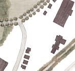

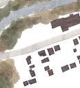
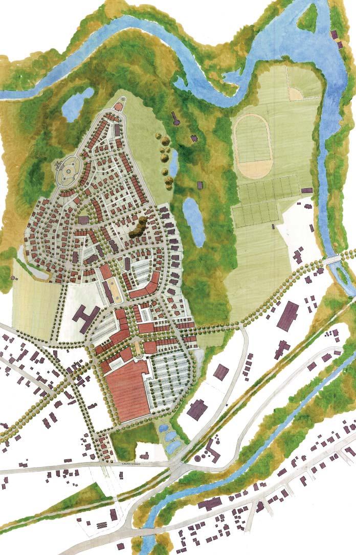
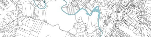
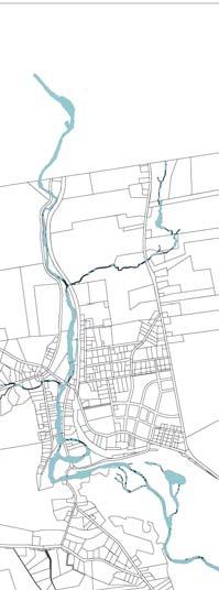
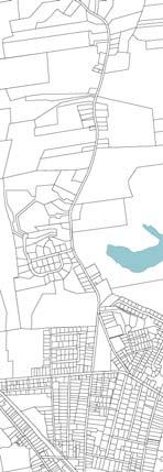
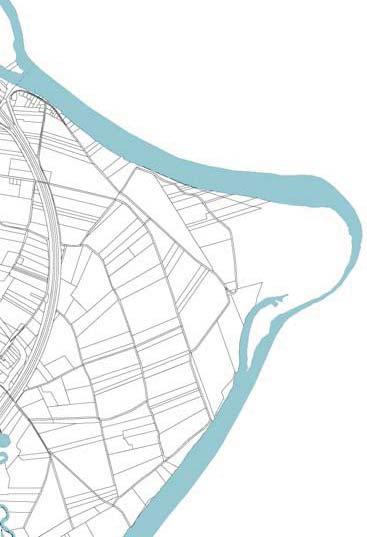
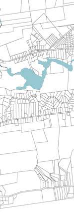
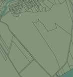
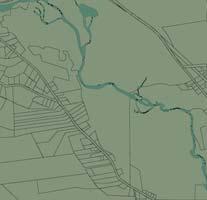
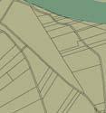
1 The Village at Hospital Hill Design Intention: Create a compact, mixed-use neighborhood which creates a genuine village, consistent with what was originally intended for the redevelopment of Hospital Hill. MILL RIVER PARADISE POND MILL RIVER PARADISE POND Because the site is currently under construction, our proposal works within the constraints of the portions of the development that have been built, but proposes an alternative that emphasizes the public realm by creating public plazas and parks with buildings facing on to them. FORMAL PUBLIC PARK CIVIC BLDG. PUBLIC PARK (PRESERVED MEADOW) BEECH TREES FIELD TENNIS COURTS FORMAL PUBLIC PARK CIVIC BLDG. PUBLIC PARK (PRESERVED MEADOW) BEECH TREES FIELD TENNIS COURTS We propose a more dense, and compact development to encourage successful retail spaces, increase walkability, and reduce the number of vehicular trips into the City. The more compact development also allows the sites with the best views to the surrounding landscape and the City to be preserved as public parks. COACH HOUSE ATTEN. BLDG. community builder apts. HILLTOP APTS. village hill road MALE BEECH TREES TRANSIT STOP ASSISTED LIVING morningside homes prince street (route 66) COACH HOUSE ATTEN. BLDG. community builder apts. BEECH TREES HILLTOP APTS. village hill road MALE TRANSIT STOP ASSISTED LIVING morningside homes prince street (route 66) The proposal includes design strategies described on the opposite page. For plans showing a phasing strategy for this development, please see the appendix (p. A4-A5). BURTS PIT ROAD RUST AVENUE chapel street (route 66) existing church LAUREL STREET KOLLMORGEN TRANSIT STOP BICYCLE PATH BICYCLE PATH EARLE STREET TEXAS ROAD BURTS PIT ROAD RUST AVENUE chapel street (route 66) existing church LAUREL STREET KOLLMORGEN TRANSIT STOP BICYCLE PATH BICYCLE PATH EARLE STREET BUILDING USE KEY: TEXAS ROAD industrial commercial / mixed-use civic building / special use N GROVE STREET GROVE STREET multi-family housing BICYCLE PATH MILL RIVER BICYCLE PATH MILL RIVER assisted living detached single-family home attached single-family home

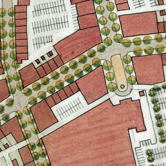
2 Network of Streets Realign Burts Pit Road and Laurel Street to create a T intersection with Route 66. This entails discontinuing a short strip of Prince Street and eliminates the existing awkward Y fork intersection, allowing for a more efficient use of land, and less paving. Public Space Create a central plaza to serve as a community gathering space in front of the former Male Attendants Building by moving the existing parking lot to the rear of the building. Preserve a large portion of the meadow as a public park overlooking downtown Northampton and views to the northeast on the site of the former Old Main. Frame the park with a public street on one edge with townhouses and a community meeting hall or ballroom facing onto it to increase the quality of its character and promote safety through eyes on the street. Introduce an oval-shaped park defined by rowhouses and situated on the hillside with views to the northwest and steps flowing down to the natural landscape. Mix of Uses and Walkability Incorporate the Kollmorgen building, giving it a prominent main entrance on a public plaza flanked by smaller commercial or mixeduse buildings while allowing for mixed-use buildings along Route 66 to screen the bulk of the parking lot and manufacturing building. Introduce a variety of uses throughout the development, arranged around public spaces to activate them at various times of the day. Variety of Housing Types Use of a variety of housing types such as mixed-use buildings, multifamily buildings, flats, townhouses, and detached single family houses to define public spaces and promote a just and generous community where individuals and families from a range of income levels can afford to live. 56
3 57
 KOLLMORGEN VILLAGE HILL RD. BURTS PIT RD.")
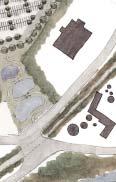
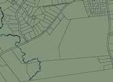
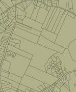
4 AERIAL: The Village at Hospital Hill PRINCE ST. (ROUTE 66) KOLLMORGEN VILLAGE HILL RD. BURTS PIT RD. COMMUNITY GARDEN PLOTS PRESERVED MEADOW FORMAL PUBLIC PARK 58


5 pr Kollmorgen T g KOLLM Village hill Road KOLLMORGEN, terminating the north-south avenue of Hospital Hill Village hill Road ORMAL UBLIC PARK PARK, terminating the north-south avenue of Hospital Hill 59

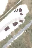
6 View (looking north) on Hospital Hill toward proposed Plaza 60


: Enhance the distinct character of Florence s historic center through mixed-use")
: Densify two blocks of Bay State s historic center through infill on selected sites.")
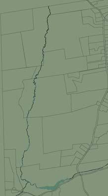
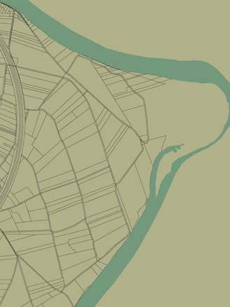
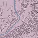
7 E CENTER STREET LEONARD ROAD MAPLE ST. BENSON ST. TRUTH ST. RUGGLES ST. PUBLIC PARK HAYDENVILLE ROAD PUBLIC PARK FLORENCE STREET MILL RIVER EVERGREEN ROAD CHESTNUT AVENUE UPLAND ROAD GROVE AVENUE RIVER ROAD CHARTPAK FRONT STREET MULBERRY STREET MILL RIVER MAIN STREET LEEDS ELEMENTARY SCHOOL FLORENCE STREET WATER STREET RESERVOIR ROAD AUDUBON ROAD N LEEDS NEIGHBORHOOD FAIRFIELD AVE. PLYMOUTH ST. PINE ST. CHESTNUT ST. BICYCLE PATH KEYES ST. MAIN STREET MAPLE STREET PARK STREET MIDDLE STREET CENTRAL FLORENCE NONOTUCK ST. HILL ST. LANDRY AVE. RIVERSIDE DR. SOUTH FLORENCE RIVERSIDE DR. smitty s MILL RIVER 61 Florence, Bay State, & Leeds Design Intention (Florence): Enhance the distinct character of Florence s historic center through mixed-use infill development; to create a new neighborhood center serving the southern portion of Florence; and to integrate affordable housing into the neighborhood centers. Design Intention (Bay State): Densify two blocks of Bay State s historic center through infill on selected sites. Design Intention (Leeds): Expand the number of residences, commercial activities, and public parks in and adjacent to the existing village to make Leeds a more viable mixed-use neighborhood. These proposals include design strategies descriped on the opposite page. CENTRAL BAY STATE


8 Leeds Create Compact Walkable Neighborhood Create connective street network between Route 9 and Florence Street to accommodate expanded residential neighborhood. Promote modest mixed-use infill near intersection of Audubon Rd., Reservoir Rd., River Rd. and Mulberry St. to create a more identifiable village center. Florence Enhance the existing Sense of Place Provide two- to three-story mixed-use infill development, especially along the south side of Main Street. Provide affordable housing, such as tuck-under rowhouses, along a new street network within the large block on the south side of Main Street. Main Street Florence: Existing Incorporate a prominent civic building at the western end of Main street, on the former site of the historic Cosmian Hall. New neighborhood Center Repair the street network to the north of the Mill River, creating a new neighborhood centered on a public square. Incorporate affordable housing types as an alternative to Florence Heights. Bay State Enhance the Center Provide small-scale residential infill (including affordable units) around existing mill buildings to increase spatial definition and create a distinct sense of place. Main Street Florence: Proposed Allow modestly expanded space for grocery/general store to serve neighborhood. 62
9
10 Envisioning Sustainable Northampton Form Based Code General Notes & Specifications: Building Heights: 1) Heights shall be measured relative to the front face of buildings. 2) There are minimum and maximum story heights, but no minimum or maximum building heights. 3) The maximum height of the first floor in Urban Center Commercial, Urban Center Mixed and General Urban Attached Residential buildings shall be five (5) feet above grade. Building Location: Parking: 1) Buildings shall be set on lots relative to the property lines. 2) Facades at front and rear of lots are shown as set-back or build-to lines as indicated. 3) Sides of primary buildings are shown as set-back or build-to lines as indicated. 4) Balconies, open porches and stairs are permitted. 1) Off-street parking shall be provided as indicated. 2) The off-street parking of all buildings built to their side yard lot lines must be rear-loaded. 3) Any front-loaded off-street parking space must be accessed by a single driveway located parallel to a side lot line. 4) Trash pick-up shall occur within the parking areas at the rear of all lots with alleys, or at street curbsides for lots with no alley frontage. Building Use: 1) Permitted building uses are indicated. A mix of uses is generally encouraged. 2) Accessory dwellings must be owned by the same person or persons who own the primary dwelling and either the accessory unit or the primary unit must be owner-occupied. Miscellaneous Notes: 1) Any lot line abutting a street shall be considered a front. 2) Total building lot coverage may not exceed 75% of lot area unless otherwise indicated. 4) Minimum frontage for Sub-Urban lots is sixty (60) feet; for General Urban lots fifty (50) feet; for General Urban Cottage lots thirty-two (32) feet; for General Urban Attached Residential and Urban Center Mixed lots twenty-four (24) feet; and for Urban Center Commercial lots twenty (20) feet. 5) The longer front of Urban Center Commercial and Urban Center Mixed lots not edged by building shall be edged by a masonry wall and/or wrought iron fence not less that five (5) feet nor more than six (6) feet in height. 6) Where possible, above ground utilities shall be located or relocated underground or to alley locations as part of proposed street improvements. C1
11


 designates areas generally not subject to human settlements larger than the family, and differentiates between natural landscapes (both raw and preserved)")

12 Transect Zone Descriptions T-1 NATURAL General Character: Natural landscape with some agricultural use Building Placement: Not applicable Frontage Types: Not applicable Typical Building Height: Not applicable Type of Civic Space: Parks, greenways T-2 RURAL General Character: Primarily agricultural with woodland, wetland, and scattered buildings Building Placement: Variable setbacks Frontage Types: Not applicable Typical Building Height: 1- to 2-story Type of Civic Space: Parks, greenways T-3 SUB-URBAN General Character: Lawns and landscaped yards surrounding detached single-family houses; pedestrians occasionally Building Placement: Large and variable front and side yard setbacks Frontage Types: Porches, fences, naturalistic tree planting Typical Building Height: 1- to 2-story with some 3-story Type of Civic Space: Parks, greenways T-4 GENERAL URBAN General Character: Mix of houses, townhouses and small apartment buildings, with scattered commercial activity; balanced between landscape and buildings; presence of pedestrians Building Placement: No setbacks, or shallow to medium front and side yard Setbacks Frontage Types: Porches, fences, dooryards Typical Building Height: 2- to 4-story with a few taller mixed use and civic buildings Type of Civic Space: Parks, greens, squares, plazas T-5 URBAN CENTER General Character: Mix of houses, townhouses, apartment buildings, offices, workplace, and civic buildings; predominantly attached buildings; trees within the public right-of-way; substantial pedestrian activity Building Placement: No setbacks, or shallow to medium front and side yard setbacks Frontage Types: Stoops, shopfronts, galleries Typical Building Height: 3- to 4-story with some variation Type of Civic Space: Parks, greens, squares, plazas; median landscaping SPECIAL DISTRICT General Character: Dedicated-Use - museums, hospitals, schools, and industrial Building Placement: Varies Frontage Types: Varies Typical Building Height: Varies Type of Civic Space: Varies The Rural-to-Urban Transect is a diagram of human habitat describing the relationship of the rural environment to traditional urban environments. The Rural Transect proper (zones T1 and T2) designates areas generally not subject to human settlements larger than the family, and differentiates between natural landscapes (both raw and preserved) and cultivated landscapes. The Urban Transect refers in turn to that range of human habitats that support human flourishing, within which human settlements are part of a sustainable ecosystem that includes both natural and cultivated landscapes. This range of human habitats, depicted as Transect-zones, progresses from less dense human settlements (T-3) to more dense human settlements (T-6); but each urban Transect-zone denotes a walkable and mixed-use human environment wherein within each Urban T-zone many if not most of the necessities and activities of daily life are within a five-to-ten-minute walk for persons of all ages and economic classes. Transect drawing courtesy of Leon Krier. C3


13 Regulating Plan (Proposed Transect Map) KEY: T1 (NATURAL) T2 (RURAL) T3 (SUB-URBAN) T4 (GENERAL URBAN) T4.1 (GENERAL URBAN ATTACHED ROWHOUSE ONLY) T4.2 (GENERAL URBAN SINGLE-FAMILY DETACHED HOUSE ONLY) T5 (URBAN CORE) SD (SPECIAL DISTRICT) CS (CIVIC SPACE) CB (CIVIC BUILDING) N C
First Generation Suburbs (Traditional Growth Pattern) Second Generation Suburbs (CSD) Retrofit/Infill of CSD (TNDs and TODs)
 Second Generation Suburbs (CSD) Retrofit/Infill of CSD (TNDs and TODs)") First Generation Suburbs (Traditional Growth Pattern) Second Generation Suburbs (CSD) Third Generation Suburbs (CSD) Retrofit/Infill of CSD (TNDs and TODs) Today we are faced with an overwhelming quantity
First Generation Suburbs (Traditional Growth Pattern) Second Generation Suburbs (CSD) Third Generation Suburbs (CSD) Retrofit/Infill of CSD (TNDs and TODs) Today we are faced with an overwhelming quantity
DESIGN 4 Design Guide
 4 Design Guide DESIGN Introduction 86 Introduction Design guide FOR ROUND ROCK This guide attempts to realize high-quality design on an individual project basis by setting forth recommendations for architecture
, C-MS I June 3, 2016 $1500 pd chk #216918
 , C-MS-8 LOTS 21 THROUGH 40, INCLUSIVE, BLOCK 299 CLEMENTS ADDITION TO THE CITY OF DENVER SOUTHEAST QUARTER OF SECTION 34, TOWNSHIP 3 SOUTH, RANGE 68 WEST, SIXTH PRINCIPAL MERIDIAN, CITY
Clairtrell Area Context Plan
 Clairtrell Area Context Plan March 2005 Urban Development Services City Planning Contents 1. Introduction... 4 2. Development Structure... 6 2.1 Streets... 7 2.1.1 Sheppard Avenue and Bayview Avenue...
DRAFT. 10% Common Open Space
 % OF CHARLOTTE IS CATEGORIZED AS A. LAND USES : Placeholder map displaying location of Place Type GOALS: Accommodate XX% of future growth. Provide a concentration of primarily commercial and civic activity
The Village. Chapter 3. Mixed Use Development Plan SPECIFIC PLAN
 The Village SPECIFIC PLAN Chapter 3 3.1 INTRODUCTION 3.1.1 Purpose This Chapter describes the development regulations applicable to the Mixed-Use and Transit Center Planning Areas. These form-based regulations
URBAN DESIGN BRIEF URBAN DESIGN BRIEF 721 FRANKLIN BLVD, CAMBRIDGE August 2018
 URBAN DESIGN BRIEF URBAN DESIGN BRIEF 721 FRANKLIN BLVD, CAMBRIDGE August 2018 DESIGN BRIEF CONTENTS PART A 1.0 INTRODUCTION 2.0 DESCRIPTION & ANALYSIS OF SITE CONTEXT 3.0 DESIGN CONSTRAINTS AND OPPORTUNITIES
B L A C K D I A M O N D D E S I G N G U I D E L I N E S for Multi-family Development
 B L A C K D I A M O N D D E S I G N G U I D E L I N E S for Multi-family Development Adopted June 18, 2009 This section of the Design and focuses on site planning and design guidance for new multi-family
Bourne Downtown Site Planning
 Prepared for: The Town of Bourne, MA In Cooperation with: Bourne Financial Development Corporation Prepared by:, Inc. June 24, 2009 Table of Contents Introduction and Summary... 1 Site Existing Conditions...
Policies and Code Intent Sections Related to Town Center
 Policies and Code Intent Sections Related to Town Center The Town Center Vision is scattered throughout the Comprehensive Plan, development code and the 1994 Town Center Plan. What follows are sections
Seneca Meadows. Block 4 Locate office, technology, and medical development adjacent to I Screen views of garage structures from I-270.
 Seneca Meadows Seneca Meadows has an industrial park in its southern end and a mixed-use employment area planned for the north end. The district benefits from extensive I-270 visibility, stream valley
6. BUILDINGS AND SPACES OF HUMAN SCALE
 The Neighborhood Model: Building Block for the Development Areas Design Approaches 79 6. BUILDINGS AND SPACES OF HUMAN SCALE There are many elements of buildings and spaces that contribute to the creation
appendix and street interface guidelines
 appendix five: building and street interface guidelines appendix 5 building and street interface guidelines BOULEVARDS Boulevards are generally characterized by higher levels of traffic movement at higher
Chapter 5: Mixed Use Neighborhood Character District
 5: Mixed Use Neighborhood Character District 5.1 Introduction The Mixed Use Neighborhood character district acts as a transition or bridge between the State Route 89A District s commercial area to the
NWI Wetland Public Waters Inventory Low Density Residential Medium Density Residential. High Density Residential. Public or Institutional
 Map 1.1 Future Land Use Jennings Bay West Arm Dutch Lake Harrisons Bay Lake Langdon Seton Lake Emerald Lake Black Lake Cooks Bay Halstead Bay Priest Bay Phelps Bay NWI Wetland Public Waters Inventory Low
East Bayshore Road Neighbourhood
 East Bayshore Road Neighbourhood Northridge Property Management Urban Design Brief 3195 East Bayshore Road City of Owen Sound January 2016 East Bayshore Road Neighbourhood Northridge Property Management
Planning Board Briefing
 Planning Board Briefing Why Now? The Sector Plan Implementation Chapter States: Before Stage 1 begins, the following must occur: Approval of the Sectional Map Amendment. Approval of the Greater Lyttonsville
Buildings may be set back to create small plazas provided that these setbacks do not substantially disrupt the street wall s continuity.
 6-22 Community Design Street Walls and Street-front Setbacks The siting of buildings will play a critical role in establishing the character and sense of place for the District. Siting buildings at the
4.0 Design Guidelines For The Village Centre. South fields Community Architectural Design Guidelines Town of Caledon
 4.0 Design Guidelines For The Village Centre 4.0 Design Guidelines for the Village Centre The Village Centre is the focal point of the entire South Fields Community and is designed as a traditional commercial
4 C OMMUNITY D ISTRICTS
 4 C OMMUNITY D ISTRICTS N ew development in the Area will include many different types of land uses, including a destination retail area that attracts people from all over the region; recreation opportunities
URBAN DESIGN BRIEF Gordon Street City of Guelph. Prepared on behalf of Ontario Inc. March 25, Project No. 1507
 URBAN DESIGN BRIEF 1131 Gordon Street City of Guelph Prepared on behalf of 1876698 Ontario Inc. March 25, 2016 Project No. 1507 423 Woolwich Street, Suite 201, Guelph, Ontario, N1H 3X3 Phone (519) 836-7526
Town Center. Block 5 Existing multifamily residential units are expected to remain.
 Area Guidelines Germantown s districts should be developed as distinct communities with unique features that are supported through the guidelines. The guidelines not only help distinguish these districts
4.1.3 LAND USE CATEGORIES
 4.1.3 LAND USE CATEGORIES a. City Center District The City Center District incorporates the existing character and mix of uses in downtown Belmont to encourage redevelopment and new development in keeping
Mark-up of the effect of the proposed Bronte Village Growth Area OPA No.18 on the text of section 24, Bronte Village, of the Livable Oakville Plan
 Mark-up of the effect of the proposed Bronte Village Growth Area OPA No.18 on the text of section 24, Bronte Village, of the Livable Oakville Plan Notes: This document is provided for information purposes
4: THE FRAMEWORK PLAN
 4: THE FRAMEWORK PLAN The American Transect. Drawing by James Wassell FRamework Plan: Purpose and Philosophy The Framework Plan is a land use policy map intended to provide guidance to Boone s leaders
Wide asphalt driveway abutting school property. garage built with incompatible materials, too close to park. incompatible fencing materials
 Wide asphalt driveway abutting school property incompatible fencing materials garage built with incompatible materials, too close to park Lack of plantings as a buffer between private property and open
Urban Design Webpage-Definitions
 Urban Design Webpage-Definitions What is Urban Design? Urban Design addresses the character and quality of the built environment in relation to the human scale. Urban designers are involved with building
Metro. Activity Center Design Guidelines. Recommendations For Developing Focused, Mixed-Use Commercial/Residential Centers
 Metro Activity Center Design Guidelines Recommendations For Developing Focused, Mixed-Use Commercial/Residential Centers Metro Activity Centers What is a MAC? Legacy, the adopted guide for the future growth
FLORIN ROAD CORRIDOR Site Plan and Design Review Guidelines Checklist
 FLORIN ROAD CORRIDOR Site Plan and Design Review Guidelines Checklist Applicant s Name: Project Address: Phone: Email: Applicant shall fill out the design guidelines checklist for all guidelines applicable
FRUITVALE TRANSIT VILLAGE (Phase 2) Residential Project
 Residential Project") FRUITVALE TRANSIT VILLAGE (Phase 2) Residential Project DEVELOPER: SIGNATURE PROPERTIES ARCHITECT: HKIT ARCHITECTS April 23, 2010 TABLE OF CONTENTS 3 Vision 4 Description of Site 5 Guiding Concepts 6
FRUITVALE TRANSIT VILLAGE (Phase 2) Residential Project DEVELOPER: SIGNATURE PROPERTIES ARCHITECT: HKIT ARCHITECTS April 23, 2010 TABLE OF CONTENTS 3 Vision 4 Description of Site 5 Guiding Concepts 6
Carlsbad Village Redevelopment Concept Summary of Features
 Carlsbad Village Redevelopment Concept Summary of Features Calthorpe Associates November 5, 2003 The Redevelopment Concept illustrates a vision for the future of Carlsbad Village. The overall vision of
II. SINGLE FAMILY RESIDENTIAL
 II. SINGLE FAMILY RESIDENTIAL Castle Rock is made up of numerous individually built houses and subdivision tracts that have been developed during the past century. Some of the tracts are diverse in architectural
4.9 Mendocino Avenue Corridor Plan Design Guidelines
 4.9 Mendocino Avenue Corridor Plan Design Guidelines The Mendocino Avenue Corridor Plan addresses the area between College Avenue and Steele Lane. Mendocino Avenue is a busy arterial that runs parallel
Urban Design Brief to 1557 Gordon Street & 34 Lowes Road West
 Urban Design Brief 1533 to 1557 Gordon Street & 34 Lowes Road West Reid s Heritage Homes Ltd. & 883928 Ontario Ltd. and RHH Property Management Ltd. City of Guelph Zoning By-law Amendment November 2017
III - design standards
 III - design standards The Circulation Classification and Character section of the Design Standards chapter prescribes the types of circulation routes, the location of the circulation routes, the connections
SEAPINES STATION DESIGN GUIDELINES CITY OF VIRGINIA BEACH MARCH 2017
 SEAPINES STATION DESIGN GUIDELINES CITY OF VIRGINIA BEACH MARCH 2017 CONTENTS DEFINITIONS... 2 BACKGROUND & PURPOSE... 3 LOCATION... 3 RECOMMENDED BUILDING PLACEMENT & SETBACKS... 5 RECOMMENDED CONCEPTS
Establish a network of streetscaped vehicle and pedestrian routes that connect within and outside the Plan area.
 This Plan s urban design goals are to create an urban scale, walkable community with connections to transit, parks, and services and with amenities and facilities for residents and employees. The 1992
Appendix D North Road/N. Leroy Street Subarea Plan
 North Road/N. Leroy Street Subarea Plan INTRODUCTION The City of Fenton Master Plan was updated in 1996 and included a subarea plan for the North Leroy Street area of the City. It was recognized at that
Civic Center District
 Civic Center District The Civic Center district is the civic and social heart of Warrenville, containing such public buildings as the City Hall, Warrenville Public Library, Police Station, Park District
2. Form and Character. 2.1 Introduction. 2.2 The Downtown Addition Plan. 2.1 Introduction
 2.1 Introduction 2.1 Introduction This section of the Specific Plan describes and illustrates the desired form, character and uses of the Downtown Addition and explains the underlying design principles.
Housing and Coach House Guidelines - Ladner
 Housing and Coach House Guidelines - Ladner Policy D.8: Encourage Compatible Housing Design Encourage housing design that is sensitive to existing single family housing neighbourhoods by requiring a design
5.1 Site Plan Guidelines
 5. Community Core Guidelines Development of the Community Core will take place by plan of subdivision and site plan approval. It will occur in a phased manner that will reflect the timing of residential
WINDSOR GLEN DESIGN GUIDELINES
 WINDSOR GLEN DESIGN GUIDELINES Adopted by Council, 2006 WINDSOR GLEN REDEVELOPMENT DESIGN GUIDELINES August 2006 1.0 Master Plan Organization For this area of the Coquitlam Town Centre, a mix of high,
burlington mobility hubs study Downtown Burlington Mobility Hub
 burlington mobility hubs study Downtown Burlington Mobility Hub Draft Precinct Plan Workbook PIC #3, September 7, 2017 downtown mobility hub objectives City staff and their consultants are proposing an
NEIGHBORHOOD 3: UNIVERSITY EDGE
 NEIGHBORHOOD 3: UNIVERSITY EDGE Aerial View of North Indiana Avenue EXISTING CHARACTER The University Edge neighborhood represents the primary town/gown interface between the campus and the city of Bloomington,
SECTION TWO: Overall Design Guidelines
 SECTION TWO: Overall Design Guidelines This section provides overall design principles and guidelines for the Gardnerville Mixed-use Overlay. They provide criteria for mixed-use places consisting of residential,
Proposed for Vic West Neighbourhood Plan. Design Guidelines for Intensive Residential Development - Townhouse and Attached Dwelling
 Proposed for Vic West Neighbourhood Plan Design Guidelines for Intensive Residential Development - Townhouse and Attached Dwelling Design Guidelines for Intensive Residential Development - Townhouse and
Town Center (part of the Comprehensive Plan)
") Town Center (part of the Comprehensive Plan) Mercer Island Town Center Looking North (2014) In 1994, a year-long process culminated in a set of design guidelines and code requirements for the Town Center
Town Center (part of the Comprehensive Plan) Mercer Island Town Center Looking North (2014) In 1994, a year-long process culminated in a set of design guidelines and code requirements for the Town Center
DRAFT. October Wheaton. Design Guidelines
 October 2011 DRAFT Wheaton Design Guidelines 2 Draft - Design Guidelines - Wheaton Sector Plan Contents 04 Section 1: Introduction 06 Section 2: Context 08 Section 3: Design Guidelines 09 Goal 1: Create
East Garrison Pattern Book. Urban Design Associates
 East Garrison Pattern Book Urban Design Associates july 2004 Design Guidelines for a New Community Master Developer east garrison partners 1, llc Master Code Consultant urban design associates Pittsburgh,
OPEN SPACE TYPES. SIZE 8 acres. SIZE 20 acres. SIZE 1 acre
 TYPICAL CHARACTERISTICS OPEN SPACE TYPES OPEN SPACE TYPES The neighborhood contains an extensive variety of open space types. Most of these spaces incorporate multiple uses and activities, so that each
Highland Village Green Design Guidelines
 Highland Village Green Design Guidelines Publishing Information Title Highland Village Green Design Guidelins Author The City of Calgary Status DRAFT - Proposed document subject to changes Additional Copies
Revitalization Guidelines for Corridors, Villages and Town Centres
 Revitalization Guidelines for Corridors, Villages and Town Centres July 2017 Updated May, 2018 Publishing Information Title: Prepared by: Revitalization Guidelines for Corridors, Villages and Town Centres
Neighborhood Districts
 NEIGHBORHOOD DISTRICTS SEVEN MAIN DISTRICTS Neighborhood Districts While the Development Plan provides a broad-scale overview of the neighborhood, this section focuses on uses and relationships at the
Site Planning. 1.0 Site Context. 2.0 Pedestrian Circulation Systems. Pag e 2-23
 The following photographs from throughout the country illustrate key urban design principles. Photographs are provided to illustrate the overall urban design concepts described in Chapter 1 of the Downtown
DESIGN GUIDELINES FOR: INTENSIVE RESIDENTIAL DEVELOPMENT TOWNHOUSE AND ROWHOUSE
 DESIGN GUIDELINES FOR: INTENSIVE RESIDENTIAL DEVELOPMENT TOWNHOUSE AND ROWHOUSE 1. Introduction Townhouse and Rowhouse Building Typologies Within these guidelines, the term rowhouse means a single row
Developer s Program. The Station at East 54
 Developer s Program The Station at East 54 Existing Conditions The Station at East 54 is proposed for a 1.12 acre site at the northeast corner of Hamilton Road and Prestwick Road, tucked between the East
REQUEST Current Zoning: O-15(CD) (office) Proposed Zoning: TOD-M(CD) (transit oriented development mixed-use, conditional)
 (office) Proposed Zoning: TOD-M(CD) (transit oriented development mixed-use, conditional)") Rezoning Petition 2016-117 Zoning Committee Recommendation January 4, 2017 REQUEST Current Zoning: O-15(CD) (office) Proposed Zoning: TOD-M(CD) (transit oriented development mixed-use, conditional) LOCATION
Rezoning Petition 2016-117 Zoning Committee Recommendation January 4, 2017 REQUEST Current Zoning: O-15(CD) (office) Proposed Zoning: TOD-M(CD) (transit oriented development mixed-use, conditional) LOCATION
Guidelines. Building. The minimum setback of an attached garage from the lot line shall be 6m. 4. Zoning Provision
 Objectives Create dwellings that are compatible with the neighborhood in scale, function and character Create pedestrian friendly neighborhood Prevent garage dominated streetscape Strengthen the dwelling
Historic Preservation Preserve, restore or adaptively re-use historic structures and landscapes.
 Checklist for New Construction Developers of building projects in the Loring Park Neighborhood are encouraged to pursue the standards that are identified below. For large projects requiring special allowances,
8. Urban Villages. Other Relevant Policies & Bylaws Official Community Plan Development Permit Area Designations and Guidelines
 8. Urban Villages Urban villages provide walkable shops and services, encourage a neighbourhood social life, create a sense of place and provide different housing options. More housing near Urban Villages
This Review Is Divided Into Two Phases:
 Semiahmoo Town Centre Review The purpose of this review: To review the Semiahmoo Town Centre Concept Plan, originally approved in 1993, to ensure that this centre will continue to serve the needs of South
OCEAN BOULEVARD PLANNED DEVELOPMENT DISTRICT (PD-5)
") OCEAN BOULEVARD PLANNED DEVELOPMENT DISTRICT (PD-5) Ordinance History: C-5562, 1982 The intent of the Planned Development Plan is to provide a framework to guide new development in a way that is sensitive
OCEAN BOULEVARD PLANNED DEVELOPMENT DISTRICT (PD-5) Ordinance History: C-5562, 1982 The intent of the Planned Development Plan is to provide a framework to guide new development in a way that is sensitive
URBAN DESIGN BRIEF 181 Burloak Drive, Oakville
 URBAN DESIGN BRIEF 181 Burloak Drive, Oakville February 2017 Our File: 1730B 230-7050 WESTON ROAD / WOODBRIDGE / ONTARIO / L4L 8G7 / T: 905 761 5588/ F: 905 761 5589/WWW.MHBCPLAN.COM TABLE OF CONTENTS
SYRINGA VALLEY SPECIFIC PLAN NARRATIVE
 SYRINGA VALLEY SPECIFIC PLAN NARRATIVE Introduction With this application, Pleasant Valley South LLC ( Pleasant Valley ) seeks the City of Boise s approval of a new Specific Plan Ordinance to be added
Chapter 1 - General Design Guidelines CHAPTER 1 GENERAL DESIGN GUIDELINES
 CHAPTER 1 GENERAL DESIGN GUIDELINES 1.0 INTRODUCTION This Publication has been developed to provide current, uniform procedures and guidelines for the application and design of safe, convenient, efficient
for Master Planned Development Framework Design Standards & Guidelines
 B L A C K D I A M O N D DE S I G N G U I D E L I N E S for Master Planned Development Framework Design Standards & Adopted June 18, 2009 Introduction and Purpose The Master Planned Development (MPD) Framework
Historic District Commission Staff Report November 4 th & 18 th, 2015
 Historic District Commission Staff Report November 4 th & 18 th, 2015 Page 1 of 36 8. 54/58 Ceres Street (Minor HVAC units (roof-mounted)) 9. 67-77 State Street (Minor Revise windows and doors) 10. 143
FREEWAY/TOURIST DISTRICT
 FREEWAY/TOURIST DISTRICT DESIGN STANDARDS FOR THE CITY OF MOUNTLAKE TERRACE March, 2014 MOUNTLAKE TERRACE FREEWAY/TOURIST DESIGN STANDARDS March, 2014 1 TABLE OF CONTENTS Introduction...1 Design Site Design
City of Vaughan Urban Design Guidelines for Infill Development in Established Low-Rise Residential Neighbourhoods
 City of Vaughan Urban Design Guidelines for Infill Development in Established Low-Rise Residential Neighbourhoods DRAFT - September 2016 Contents 1. Introduction 1 2. Policy Context 3 3. Characteristics
ATTACHMENT A. SILVERDALE DESIGN STANDARDS Amendments to the Waaga Way Town Center Chapter
 ATTACHMENT A SILVERDALE DESIGN STANDARDS Amendments to the Waaga Way Town Center Chapter Chapter 10. Waaga Way Town Center 10.1 Physical Identity Elements & Opportunities The Waaga Way Town Center includes
SECTION TWO: Urban Design Concepts
 SECTION TWO: Urban Design Concepts The Gardnerville Plan for Prosperity shapes economic opportunities presented by regional growth. The Urban Design Concepts provide policies and concepts for land use,
PROTOTYPE DESIGN/INTRODUCTION
 PART III: PROTOTYPE DESIGN These concepts and guidelines described earlier were used to develop a prototype design for an emerging suburban area located west of the City of Milwaukee. This was done to
REDLANDS TRANSIT VILLAGES SPECIFIC PLAN
 REDLANDS TRANSIT VILLAGES SPECIFIC PLAN CITY COUNCIL STUDY SESSION JANUARY 4, 2019 Redlands Blvd. Eureka St. Orange St. State St. Citrus Ave. Vine St. GENERAL PLAN TRANSIT VILLAGES WE ARE HERE SPECIFIC
PUBLIC RIGHT-OF-WAY IN THIS CHAPTER PUBLIC REALM
 PUBLIC RIGHT-OF-WAY This section provides design guidelines for improvements in the public right-of-way. The public right-of-way refers to streets, sidewalks, non-vehicular thoroughfares, parks and greenways
THE NEIGHBORHOOD TODAY
 THE NEIGHBORHOOD TODAY CORE AREA VISION How are we Good Urbanism A Site s DNA thinking about Elements of great Unique elements urban communities embedded in a place the site and design? ELEMENTS LIKE:
Throughout. square. (Crystal City Vision Plan 2050)
") 1: Terms related to the PSMP document 1 public space (see also public realm, civic space) An open space designated on the regulating plan, accessible to all, including Plazas, Mini Parks, and Neighborhoods
1: Terms related to the PSMP document 1 public space (see also public realm, civic space) An open space designated on the regulating plan, accessible to all, including Plazas, Mini Parks, and Neighborhoods
Figure 3-1: Public Realm Plan
 3 Public Realm Figure 3-1: Public Realm Plan 3.1 Public Realm Concept The public realm concept for the Little Mountain site integrates a clear and accessible movement network with public spaces for social
Historic District Commission
 Historic District Commission Page 1 of 26 Staff Report June 6 th, 2018 ADMINISTRATIVE ITEMS / OLD BUSINESS: Administrative Approvals: 1. 238 Deer Street - Recommend Approval 2. 59 Sheafe Street - Recommend
V. Case Study Sites. Case Study Site Descriptions and Concepts. Case Study #1: Lake Street and Calhoun
 V. Case Study Sites The project area includes a wide variety of neighborhood contexts with diverse development opportunities. To better understand these contexts and how they affect choices concerning
FUTURE LAND USE ELEMENT
 FUTURE LAND USE ELEMENT GOAL I: To create and sustain a great place to live, play, and prosper Objective 1: The City of Ocala shall incorporate the principles and strategies of the Ocala 2035 Vision into
Residential Design Guidelines
 Residential Design Guidelines Single-Family Residential Design Guidelines Introduction These guidelines seek to provide property owners, designers and developers with a clear understanding of the City
Description of Preferred Alternative
 Chapter 2 Description of Preferred Alternative 2.1 Introduction This chapter of the programmatic Sammamish Town Center Sub-area Plan Final EIS provides a more detailed description of the Preferred Alternative
EXISTING COMPREHENSIVE PLAN
 EXISTING COMPREHENSIVE PLAN Town Center Land Use Element: V. LAND USE POLICIES Town Center Mercer Island's business district vision as described in "Your Mercer Island Citizen-Designed Downtown" was an
Historic District Commission Staff Report May 3 rd, 2017
 Historic District Commission Staff Report May 3 rd, 2017 Page 1 of 26 ADMINISTRATIVE ITEMS / OLD BUSINESS: Administrative Approvals: 1. 39 Mount Vernon Street (HVAC) - Approved 2. 133 Islington Street
PROPOSED REDEVELOPMENT OF THE GLEN ABBEY GOLF CLUB. STREETSCAPE DESIGN STUDY (excerpt from the Urban Design Brief) TOWN OF OAKVILLE.
 TOWN OF OAKVILLE.") PROPOSED REDEVELOPMENT OF THE GLEN ABBEY GOLF CLUB STREETSCAPE DESIGN STUDY (excerpt from the Urban Design Brief) TOWN OF OAKVILLE OCTOBER, 2016 for 2.4.2 STREETS Streets are the single largest component
PROPOSED REDEVELOPMENT OF THE GLEN ABBEY GOLF CLUB STREETSCAPE DESIGN STUDY (excerpt from the Urban Design Brief) TOWN OF OAKVILLE OCTOBER, 2016 for 2.4.2 STREETS Streets are the single largest component
BUILDING SCALE AND SETBACKS 5 ELEMENTS:... 5 FAÇADES (COMMERCIAL/RESIDENTIAL) 5
 5") VISION STATEMENT 3 UTILIZATION OF THE GUIDELINES 3 IMPLEMENTATION 3 PROCEDURES FOR DESIGN REVIEW 3 LAND USE AND ZONING 4 LAND USE 4 ELEMENTS:... 4 ZONING 4 ELEMENTS:... 4 BUILDING SCALE AND SETBACKS 5
VISION STATEMENT 3 UTILIZATION OF THE GUIDELINES 3 IMPLEMENTATION 3 PROCEDURES FOR DESIGN REVIEW 3 LAND USE AND ZONING 4 LAND USE 4 ELEMENTS:... 4 ZONING 4 ELEMENTS:... 4 BUILDING SCALE AND SETBACKS 5
BORRISOKANE SETTLEMENT PLAN
 BORRISOKANE SETTLEMENT PLAN 1.0 General Introduction and Development Context Location Borrisokane is located 15km north of Nenagh on the N52. While the town is primarily residential, it acts as a market
TOWN CENTER DESIGN STANDARDS FOR THE CITY OF. August, MOUNTLAKE TERRACE TOWN CENTER DESIGN STANDARDS August,
 TOWN CENTER DESIGN STANDARDS FOR THE CITY OF MOUNTLAKE TERRACE August, 2008 MOUNTLAKE TERRACE TOWN CENTER DESIGN STANDARDS August, 2008 1 TABLE OF CONTENTS Introduction...3 Design Site Design...4 Pedestrian
Urban Design Brief Proposed Residential Development 5219 Upper Middle Road City of Burlington
 Urban Design Brief Proposed Residential Development 5219 Upper Middle Road City of Burlington Prepared by Weston Consulting Prepared for BLOOMFIELD DEVELOPMENT INC. Date: March 2017 Table of Contents 1.
SMALL LOT DESIGN STANDARDS. An Illustrated Working Draft for Test Implementation
 SMALL LOT DESIGN STANDARDS An Illustrated Working Draft for Test Implementation SMALL LOT DESIGN STANDARDS ILLUSTRATED WORKING FOR TEST IMPLEMENTATION OVERVIEW SMALL LOT CODE AMENDMENT & POLICY UPDATE
Behnke Ranch Property, Pasco County: Master Plan Development Approach
 February 24, 2014 , Pasco County: Master Plan Development Approach Location & Program The (Legacy PUD) is located in southwest Pasco County along State Road 54 approximately 1.5 miles west of the Suncoast
A. Background Summary of Existing Challenges and Potential Possibilities. 1. Summary of Existing Assets and Potential Opportunities
 A. Background 1 A Main Street Master Plan Study was performed and completed in October of 2007. The study was initiated to review current land uses and development patterns along Main Street, from Parrish
VEHICULAR AND PEDESTRIAN CIRCULATION
 This perspective sketch communicates the intended character and quality of a proposed streetscape design. Locate benches near a major intersection where people tend to gather. Seating and lighting provide
lot flankage Y street 16m 6m landscape strip for large site 3m landscape strip for small medium site
 Commercial General Commercial Objectives Create developments compatible with adjacent land uses in scale, function and character Define a consistent and attractive street edge with quality landscaping,
The Baileys Planning District portion of the Comprehensive Plan contains site design recommendations for both the Baileys Crossroads Community
 The Baileys Planning District portion of the Comprehensive Plan contains site design recommendations for both the Baileys Crossroads Community Business Center and the Seven Corners Community Business Center.
Additional information about land use types is given in Chapter 5. Design guidelines for Centers and Neighborhoods are given in Chapter 7.
 4. Place Types Introduction In Albemarle County s Development Areas, the Neighborhood is the fundamental unit of community planning. The County s Neighborhood Model, an adopted part of the Comprehensive
URBAN DESIGN BRIEF. 2136&2148 Trafalgar Road. Town of Oakville
 URBAN DESIGN BRIEF 2136&2148 Trafalgar Road Town of Oakville Prepared By: METROPOLITAN CONSULTING INC For 2500674 Ontario Inc November 2016 TABLE OF CONTENTS Page No. 1.0 Introduction/Description of Subject
Regency Developments. Urban Design Brief. Holyrood DC2 Rezoning
 Regency Developments Urban Design Brief Holyrood DC2 Rezoning Stantec Consulting Ltd. 7-31-2017 1. Overview Regency Developments intends to rezone the lands located at 8510 and 8511 93 Avenue, within the
The petition proposes the development of five townhomes on a vacant parcel between Charlotte Latin School and Providence Presbyterian Church.
 Rezoning Petition 2017-202 Final Staff Analysis June 18, 2018 REQUEST LOCATION Current Zoning: R-3 (single family residential) Proposed Zoning: UR-2(CD) (urban residential, conditional) with five-year