West London Dyke, April 1947 Flood. Forks of the Thames, July 2000 Flood. Source: UTRCA
|
|
|
- Sabrina McKenzie
- 6 years ago
- Views:
Transcription


 undertakes major maintenance activities.")


1 This Public Information Centre is the 1 st of 2. Its purpose is to inform the public and to receive input with regards to the West London Dyke Master Repair Plan. The following panels describe the history, recent work and the purposes of this project. Please feel free to take a handout, along with a comment sheet, which you can fill out at your convenience. Questions relating to a panel or in regards to the project in general can be answered by either City of London, Upper Thames River Conservation Authority or Stantec staff. INTRODUCTION The West London Dyke is 2374 m long, comprises of both a concrete and earthen revetment, and runs along the west bank of the North Branch of the Thames River from Oxford Street to the forks of the Thames River and then along the west bank of the main branch to the west side of the Wharncliffe Road Bridge. The City of London owns the dyke and through an agreement, the Upper Thames River Conservation Authority (UTRCA) undertakes major maintenance activities. PROBLEM OPPORTUNITY STATEMENT The UTRCA and the City of London are undertaking a Master Repair Plan covering the next 20 year period to address aging infrastructure, flood protection, public use, and integration of other City initiatives. This study is being conducted in accordance with requirements of Phases 1 and 2 of the Municipal Class Environment Assessment (Class EA) which is an approved process under the Environmental Assessment Act. The intent of the Master Repair Plan is to develop the required strategic plan to allow the UTRCA and the City to have a method for determining when a trigger point for repair and/or replacement of a portion of the dyke is required. West London Dyke, April 1947 Flood When London was settled in the early 1800s, the Thames River offered water, a means of transportation and a power source for mills. Both natives and early settlers had used the low riverside land to the west of the Forks for farming. By the late 1800s, the small settlements of London West and Kensington were growing on the banks of the Thames River from their beginnings surrounding water powered mills. The communities experienced several floods, such as the catastrophic July 1883 flood that killed 17 people. p Rather than resettling away from the hazardous areas, the response was to build a formalized dyke system. Construction of the West London Dyke, the first of the City s seven dykes to be built, began in the late 1880s. By the early 1900s, the dyke had been reinforced, extended and raised at least twice. The flood of April 1937 overtopped the reinforcements, though, and flooded the communities behind the dyke. Additional raising of the dyke occurred after the 1937 flood on the main branch section and before the 1947 flood. In 1947 some overtopping of the dyke on the North Branch section required evacuations, although flooding was not as deep as in The UTRCA was formed following the 1947 Flood and resulted in a watershed management partnership between the Province of Ontario and watershed member municipalities (including the City of London) to carry out a comprehensive watershed flood control program. Besides the London Dyke system that had existed for some time, additional flood control dams, flood plain management, and land stewardship programs were implemented to further ease the flood pressure on the dykes. Source: UTRCA Forks of the Thames, July 2000 Flood Forks of the Thames, July 2000 Flood 1


2 1980 s Investigations & Repairs Geotechnical Investigation undertaken in October 1982 revealed sections of revetment (dyke) in poor condition with noticeable shifting and tilting. Abrupt changes in slope of facing noted with cracking along concrete surface. Based on investigations undertaken, repair of select sections of dyke including grouting behind panels and improvements to toe structure were completed between 1983 and Inspection In 2004, the UTRCA undertook a condition assessment of the Thames River dykes within the City, including the West London Dyke. Approximately 350 m of the dyke north from the Queens Avenue Bridge were identified as being the highest priority for repair. This portion was originally built in the 19th century in order to minimize flooding in the West London area Concrete Repair Program In 2005, while undertaking the initial stages of a concrete repair program on the 350 m segment identified in the 2004 study, it was concluded that a significant portion of this section had come to the end of its useful life and needed to be replaced rather than repaired Phase I Dyke Replacement The first phase of the project (July to December, 2007) replaced a 300 metre section of the dyke north from Queens Avenue, adjacent to Labatt Park. The new dyke structure is located entirely within the footprint of the previous dyke and provided some improvement to flood height protection. Phase 1 was funded by the MNR Water and Erosion Control Infrastructure Program and the City of London. The total cost of the Phase 1 construction project was $3,600, s Repair Work 1980 s Repair Work 2005 Concrete Repair Program 2007 Phase I Dyke Replacement The purpose of the Ontario Environmental Assessment Act (EA Act) is the betterment of the people of the whole or any part of Ontario by providing for the protection, conservation and wise management in Ontario of the environment. Environment is applied broadly and includes the natural, social, cultural, built and economic components. Environmental Assessment (EA) is a decision making process to promote good environmental assessment planning. The key features are: Early consultation Consideration of reasonable range of alternatives Assessment of environmental effects Systematic evaluation of alternatives Clear documentation and traceable decision making Public Involvement The role of those members of the public with an interest in a study is to provide background information to advise the proponent (City of London / UTRCA) of their support and concerns, and to review and provide comments and input about the study findings (as the project progresses Public Information Centre (PIC) 1 and PIC 2). Members of the public with an interest in the study can ask to be placed on the mailing list to receive notification of the consultation opportunities for the project. Municipal Class EA This study is being conducted in accordance with the requirements of Phases 1 and 2 of the Municipal Class EA which is an approved process under the EA Act. It is anticipated to be a Schedule B Class EA. * As referenced in the Municipal Class EA Document 2


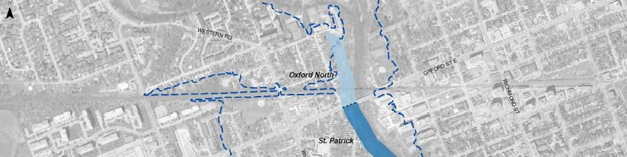
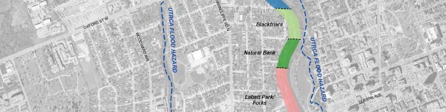
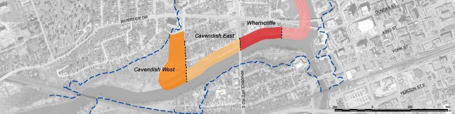
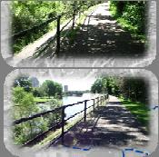
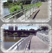
3 Old North Cavendish West St. Patrick s Cavendish East Blackfriars Bridge Wharncliffe Blackfriars / Approaching Natural Bank Forks (Blackburn Memorial Fountain) Harris Park / Approaching Phase I Replacement Labatt Park / Forks (Pedestrian Underpass) 3


 **Work completed in 2007 raised the level of the dyke and may have mitigated/lessened damage amounts In addition to assessing")

 Thames Valley Corridor Study Previous 2007 Master Plan Provision i of Tabs Along Railing Panel with")
4 Flood Risk Reduction Master Plan will review entire structure as a whole. Flood Damage Estimation in the Upper Thames River Watershed was published in August Master Plan will provide update to damage cost estimates. Based upon 100 and 250 year design flows and the study area shown in the figure below, the following dollar amounts associated ated with total estimated flood damages agesare edescribed below: 100 Year Design Storm ~ $23,000,000 (2005 $ s) 250 Year Design Storm ~ $42,000,000 (2005 $ s) **Work completed in 2007 raised the level of the dyke and may have mitigated/lessened damage amounts In addition to assessing damage costs, existing dyke elevations will be reviewed in comparison to flood levels to determine areas that may need to be raised. Flood Damage Estimate Map Master Repair Plan will involve Integration of Other City Initiatives: Bicycle Master Plan Future Pedestrian Pathways (i.e. future Wharncliffe Bridge Underpass) Thames Valley Corridor Study Previous 2007 Master Plan Provision i of Tabs Along Railing Panel with tabs for provision of future panel displays Consideration will need to be given to the following when determining replacement or rehabilitation work in the future: Amenity Function Durability Constructability Capital Cost & Future Maintenance Panel with Tabs for Future Display Panels Top of Dyke Pathway Access Top of Dyke Look Out Pedestrian Walkway 4


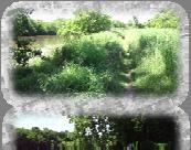
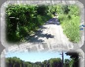
5 Vegetation Management Plan (Dougan & Associates, 2006): Carried out to identify and prioritize vegetation that currently poses a threat to the structural integrity of the dykes Suggest appropriate removal and remediation methods for the hazard vegetation Develop a plan for the future management of vegetation along the dyke Planning must also consider potential implementation of environmental features along and within the areas surrounding the dyke structure, such as: Tree & Shrub Planting Maintenance of existing vegetated areas Aquatic Plantings Implement concepts from other planning projects and initiatives (i.e Master Plan Document) Top of Dyke Vegetation Vegetation at Toe of Dyke Availability of Capital Funding Provincial / Federal Funding Opportunities & Grants Municipal Funding May be replacement, rehabilitation, or extension Ti Trigger point to implement future project may be reached hd sooner on availability of funding (i.e. stimulus funding programs) Project Sign Boards 5
6 Public Consultation Review of public and agency comments Comments from the public are welcomed. Please take a few minutes to complete the Comment Sheet that accompanies the handout you received. Technical Review Planning / Environment Review Determination of potential future works (repair or Hydraulic Review replacement) Engineering Review of each section of dyke Costing (Planning, Design, Implementation, Maintenance) of each works Next PIC (tentatively set for late October 2010) to present recommendations Trigger Point Determination Rick Goldt, C.E.T. Supervisor, Water Control Structures Upper Thames River Conservation Authority 1424 Clarke Road London ON N5V 5B9 Tel: (519) x 244 Fax: (519) Billy Haklander, P.Eng. Environmental Services Engineer Stormwater Management Unit Environmental and Engineering Services Department City of London 300 Dufferin Avenue, 9 th Floor London ON N6A 4L9 Tel: (519) x5862 Fax: (519) Michele Oxlade, B.Sc., EMX Environmental Coordinator Stantec Consulting Ltd Queens Avenue London ON N6A 5J7 Tel: (519) x240 Fax: (519) **For additional information throughout the duration of this project, please visit** 6
7 West London Dyke Master Repair Plan Municipal Class EA Public Information Centre #1 June 16, 2010 COMMENT SHEET Name: Mailing Address: Interest (i.e. property owner, agency): 1. Do you live within the proposed study area? Yes / No 2. Along with protection of life and property, what other features of the dyke are important to you? (Please circle on a scale of 1 5, with 1 being least important and 5 being most important.) Accessibility Amenity Architecture Heritage/History Lighting/Security Other What is your opinion on the works completed to date? Phase 1 Dyke Replacement (2007), Blackburn Memorial Fountain (2008), Dundas/Queens Pedestrian Underpass (2009), etc. 4. Other comments or concerns.
8 West London Dyke Master Repair Plan Municipal Class EA Public Information Centre #1 June 16, 2010 COMMENT SHEET Please place comments in the box provided or submit comments to the following: Michele Oxlade, B.Sc., EMX Environmental Assessment Coordinator Stantec Consulting Ltd Queens Avenue London ON N6A 5J7 Phone: (519) Fax: (519) com This comment sheet will be included as part of the Municipal Class EA process and handled in accordance with MFIPPA requirements.
Bostwick Road. Municipal Class Environmental Assessment. October 13, City of London. Bostwick Road Municipal Class Environmental Assessment
 Bostwick Road Municipal Class Environmental Assessment October 13, 2016 Welcome! Welcome to the first Public Information Centre for the Bostwick Road Municipal Class Environmental Assessment. Representatives
Shift Rapid Transit Public Participation Meeting May 3, 2017
 Shift Rapid Transit Public Participation Meeting May 3, 2017 Shift Rapid Transit Initiative Largest infrastructure project in the city s history. Rapid Transit initiative will transform London s public
ONE RIVER MASTER PLAN ENVIRONMENTAL ASSESSMENT
 ONE RIVER MASTER PLAN ENVIRONMENTAL ASSESSMENT TERMS OF REFERENCE 1. ONE RIVER PROJECT OVERVIEW At its meeting on May 17, 2016, Council considered a staff report regarding the One River Master Plan Environmental
Commissioners Road West Realignment Environmental Assessment
 City of London Commissioners Road West Realignment Environmental Assessment Public Information Centre No. 1 March 30, 2017 Welcome to the Public Information Centre This first Public Information Centre
Vaughan Metropolitan Centre (VMC) Black Creek Renewal CLASS ENVIRONMENTAL ASSESSMENT
 Black Creek Renewal CLASS ENVIRONMENTAL ASSESSMENT") PUBLIC INFORMATION CENTRE Vaughan Metropolitan Centre (VMC) Black Creek Renewal Wednesday, May 10, 2017 6:00 p.m. to 8:00 p.m. Add photo Project Management, Environmental Assessment, Stormwater Management
PUBLIC INFORMATION CENTRE Vaughan Metropolitan Centre (VMC) Black Creek Renewal Wednesday, May 10, 2017 6:00 p.m. to 8:00 p.m. Add photo Project Management, Environmental Assessment, Stormwater Management
WILLIAM STREET STORM SEWER OUTFALL. PUBLIC INFORMATION CENTRE March 23, 2017
 WILLIAM STREET STORM SEWER OUTFALL Municipal Class Environmental Assessment PUBLIC INFORMATION CENTRE March 23, 2017 ACCESSIBILITY Under the Accessibility Standards 2015 for Customer Service Regulation
Victoria Bridge Municipal Class EA Civic Works Committee
 Municipal Class EA John Pucchio, P. Eng., Project Manager June 19 2018 Introduction Existing Conditions Municipal Class EA Proposed Bridge Proposed Road Reconstruction Proposed Improvements Construction
The purpose of tonight s PIC is to:
 The purpose of tonight s PIC is to: Provide an overview of the work completed to date and a summary of the Class EA process being followed; Provide a summary of public input received so far, including
Bostwick Road. Municipal Class Environmental Assessment. Public Information Centre #2 June 14, City of London
 Bostwick Road Municipal Class Environmental Assessment Public Information Centre #2 June 14, 2017 Welcome! Welcome to the 2 nd Public Information Centre for the. Representatives from the and the consulting
The MSII reports for the bridge indicate that the Annual Average Daily Traffic at the bridge is 100. The road can be considered a low volume road.
 Page 1 1 INTRODUCTION 1.1 Background The Bronk Road Bridge is located on Bronk Road about 0.2 km north of Thrasher Road and spans Parks Creek, a tributary of the Moira River. Bronk Road is the road allowance
GLEN ROAD PEDESTRIAN BRIDGE ENVIRONMENTAL ASSESSMENT STUDY PUBLIC INFORMATION CENTRE #2 OCTOBER 24, 2017
 GLEN ROAD PEDESTRIAN BRIDGE ENVIRONMENTAL ASSESSMENT STUDY PUBLIC INFORMATION CENTRE #2 OCTOBER 24, 2017 Glen Road Pedestrian Bridge Class Environmental Assessment 1 WELCOME! Welcome to the second Public
Adelaide Street / Canadian Pacific Railway (CPR) Grade Separation. Public Information Centre #1
 Grade Separation. Public Information Centre #1") 1 Adelaide Street / Canadian Pacific Railway (CPR) Why Are We Here? 2 The purpose of Public Information Centre (PIC) #1 is to: Introduce the study Provide the study background and context Identify the
1 Adelaide Street / Canadian Pacific Railway (CPR) Why Are We Here? 2 The purpose of Public Information Centre (PIC) #1 is to: Introduce the study Provide the study background and context Identify the
City of Toronto. Emery Village Transportation Master Plan
 City of Toronto Emery Village Transportation Master Plan May 2009 Emery Village Transportation Master Plan Toronto, ON May 2009 Consulting Inc. 100 York Blvd., Suite 300 Richmond Hill, ON L4B 1J8 Tel:
APPENDIX F: EXTERNAL APPROVALS
 1.0 RESPONSIBILITIES When the City is constructing the Park or Open Space Development lands (OPTION I), after the subdivision construction process is completed by the Developer, Open Space Development
John M. Fleming Managing Director, Planning and City Planner. Old East Village Dundas Street Corridor Secondary Plan Draft Terms of Reference
 Report to Planning and Environment Committee To: From: Subject: Chair and Members Planning & Environment Committee John M. Fleming Managing Director, Planning and City Planner Old East Village Dundas Street
SCARBOROUGH SUBWAY EXTENSION. Scarborough Subway Extension. Final Terms of Reference
 Scarborough Subway Extension Final Terms of Reference 1 1.0 Introduction and Background 1.1 Introduction Toronto City Council recently confirmed support for an extension of the Bloor-Danforth Subway from
Better Cycling. The City will update the cycling master plan (London ON Bikes) based on the approved BRT network.
 based on the approved BRT network.") Better Cycling Dedicated bike facilities will be constructed along BRT corridors where space is available. Nearby bike routes will also be upgraded to ensure a complete network is available for cyclists.
Better Cycling Dedicated bike facilities will be constructed along BRT corridors where space is available. Nearby bike routes will also be upgraded to ensure a complete network is available for cyclists.
Municipal Class EA Study Public Information Centre No. 1 December 13, :00 pm 7:00 pm. Please sign in so we can keep you updated on this study
 Reconstruction of Regional Road 45 (Creek Road) Between Regional Road 27 (River Road) and Regional Road 63 (Canborough Road) in the Township of Wainfleet Municipal Class EA Study Public Information Centre
Second Line West Pedestrian/Cyclist Crossing of Highway 401 Class EA. Second Line West Pedestrian/Cyclist Crossing of Highway 401 Class EA
 1 1 Purpose of Public Information Centre #2 To provide interested and/or potentially affected stakeholders with an opportunity to participate in the planning and decision-making process for this Municipal
Commissioners Road West Realignment Environmental Assessment
 City of London Commissioners Road West Realignment Environmental Assessment Public Information Centre No. 2 November 29, 2017 Welcome to the Public Information Centre This 2 nd Public Information Centre
Welcome. Walk Around. Talk to Us. Write Down Your Comments
 Welcome This is an information meeting introducing the applications for proposed redevelopment of the Yorkdale Shopping Centre site at 3401 Dufferin Street and 1 Yorkdale Road over the next 20+ years,
Western Road/Wharncliffe Road North Widening from Platts Lane to Oxford Street. Municipal Class Environmental Assessment Public Information Centre #1
 Western Road/Wharncliffe Road North Widening from Platts Lane to Oxford Street Municipal Class Environmental Assessment Public Information Centre #1 June 11, 2014 Welcome Welcome to the first Public Information
Rapid Transit Implementation Working Group September 14, 2017
 Rapid Transit Implementation Working Group September 14, 2017 BACKGROUND Council approved the Rapid Transit Master Plan and Updated Business Case on July 25, 2017. Approval of the RTMP confirmed the BRT
Slope Stability Management Framework
 Slope Stability Management Framework For the assessment, evaluation, prioritization and mitigation of slope stability concerns. 2013/06/19 The Slope Stability Management Framework provides guidance to
GEOMETRIC IMPROVEMENTS AND WATERMAIN LOOPING MUNICIPAL CLASS ENVIRONMENTAL ASSESSMENT
 GEOMETRIC IMPROVEMENTS AND WATERMAIN LOOPING MUNICIPAL CLASS ENVIRONMENTAL ASSESSMENT Veterans Way (previously Powerline Road) and Klondike Park Road Wasaga Beach Welcome Please sign in Take a comment
St. Clair Avenue West Area Transportation Master Plan
 1 (Between Keele Street and Old Weston Road) Public Information Centre 1 December 2, 2015 2 Welcome Welcome to the first Public Information Centre for the St. Clair Avenue West Area. The panels will present
13 THORNHILL YONGE STREET STUDY IMPLEMENTATION CITY OF VAUGHAN OPA 669 AND TOWN OF MARKHAM OPA 154
 13 THORNHILL YONGE STREET STUDY IMPLEMENTATION CITY OF VAUGHAN OPA 669 AND TOWN OF MARKHAM OPA 154 The Planning and Economic Development Committee recommends the adoption of the recommendations contained
Blackfriars Bridge Municipal Class Environmental Assessment. Public Information Centre #1 November 19 th, 2014
 Blackfriars Bridge Municipal Class Environmental Assessment Public Information Centre #1 November 19 th, 2014 Why are you here tonight? To determine the future requirements of the river crossing at Blackfriars
TOWN OF WHITBY REPORT RECOMMENDATION REPORT
 TOWN OF WHITBY REPORT RECOMMENDATION REPORT REPORT TO: Council REPORT NO: PL 95-09 DATE OF MEETING: October 13, 2009 PREPARED BY: Planning/Public Works Joint Report FILE NO(S): N/A LOCATION: N/A REPORT
One River Environmental Assessment. Welcome!
 One River Environmental Assessment Welcome! One River Environmental Assessment Welcome to the One River Environmental Assessment Public Information Centre. Please explore each presentation area to learn
City of Kitchener Integrated Stormwater Management Master Plan (ISWM-MP) Public Open House No. 2 April 28, 2016
 Public Open House No. 2 April 28, 2016") City of Kitchener Integrated Stormwater Management Master Plan (ISWM-MP) Public Open House No. 2 April 28, 2016 Open House Format 20-30 min presentation Facilitated questions and answer session following
City of Kitchener Integrated Stormwater Management Master Plan (ISWM-MP) Public Open House No. 2 April 28, 2016 Open House Format 20-30 min presentation Facilitated questions and answer session following
Dundas Place Flexible Street Public Information Centre
 WELCOME TO THE DUNDAS PLACE DESIGN REVEAL Dundas Place Flexible Street Public Information Centre November 8, 2017 This project is funded by the City of London with support from the Government of Canada
Public Hearing. Charlotte County-Punta Gorda MPO - Meeting Rooms A and B March 14, open house at 4 p.m., formal presentation at 5 p.m.
 Public Hearing Charlotte County-Punta Gorda MPO - Meeting Rooms A and B March 14, 2019 open house at 4 p.m., formal presentation at 5 p.m. Welcome to the Public Hearing for the Harborview Road (CR 776)
TRCA Field Staking Protocol December 2016
 Page 1 of 6 TRCA Field Staking Protocol December 2016 This Protocol describes TRCA staff s current practice for field staking the physical top of bank, the physical toe of slope, and the limit of existing
Town of Lyons Parks Flood Recovery Planning Process. Photograph courtesy of Ed Bruder
 Town of Lyons Parks Flood Recovery Planning Process Photograph courtesy of Ed Bruder Lyons Parks and Recreation Flood Recovery Update 1. Meadow Park Phase II - Project PW20B1 Estimated Completion: Summer
TORONTO TRANSIT COMMISSION AND THE REGIONAL MUNICIPALITY OF YORK
 TORONTO TRANSIT COMMISSION AND THE REGIONAL MUNICIPALITY OF YORK NOTICE OF PREPARATION OF AN ADDENDUM REPORT TO THE HIGHWAY 7 CORRIDOR AND VAUGHAN NORTH-SOUTH LINK ENVIRONMENTAL ASSESSMENT & RESPONSE TO
Adelaide Street / Canadian Pacific Railway (CPR) Grade Separation Class Environmental Assessment. Public Information Centre 3
 Grade Separation Class Environmental Assessment. Public Information Centre 3") 1 Adelaide Street / Canadian Pacific Railway (CPR) Grade Separation Study Process and Purpose of PIC 3 2 Study Commencement February 2016 Phase 1: Problem and Opportunity Identify problems and opportunities
1 Adelaide Street / Canadian Pacific Railway (CPR) Grade Separation Study Process and Purpose of PIC 3 2 Study Commencement February 2016 Phase 1: Problem and Opportunity Identify problems and opportunities
CHATHAM COUNTY S PATH TO SUSTAINABILITY - THE NATURAL RESOURCES SIDE
 CHATHAM COUNTY S PATH TO SUSTAINABILITY - THE NATURAL RESOURCES SIDE GEORGIA ENVIRONMENTAL CONFERENCE SAVANNAH, GEORGIA AUGUST 23, 2012 Jackie Jackson Teel Chatham County-Savannah Metropolitan Planning
Preliminary Design of Major Rehabilitation Works for the Bridge Structure on PTH 1A Over Assiniboine River and CP Rail (Bridge Site No.
 Preliminary Design of Major Rehabilitation Works for the Bridge Structure on PTH 1A Over Assiniboine River and CP Rail (Bridge Site No. 2582-00) Public Consultation Report December 2014 First Street Bridge
10.14 ERRATA UPDATE SHEET 3
 Executive Committee Meeting Addendum #13/15 January 15, 2016 9:30 A.M. HEAD OFFICE, 101 EXCHANGE AVENUE, VAUGHAN Members: Maria Augimeri Michael Di Biase David Barrow Vincent Crisanti Glenn De Baeremaeker
Victoria Street Pedestrian Bridge
 Township of Centre Wellington Victoria Street Pedestrian Bridge Class Environmental Assessment County of Wellington & Township of Centre Wellington Badley Bridge Replacement/Rehabilitation (County of Wellington),
CITY COUNCIL AGENDA REPORT
 CITY COUNCIL AGENDA REPORT Subject: COUNCIL MOTION LRT ALIGNMENT REMOVAL FROM THE TRANSPORTATION MASTER PLAN On February 10, 2016 Councillor Hughes provided notice in accordance with Section 23 of Procedure
Figure 1- Site Plan Concept
 Figure 1- Site Plan Concept Parking will be provided underground on three levels at rate of 1.0 space/ unit; this rate includes all visitors parking. MMM Group has prepared a parking assessment (April,
North Commuter Parkway and Traffic Bridge Project Market Sounding
 North Commuter Parkway and Traffic Bridge Project Market Sounding Introduction KPMG LLP ( KPMG ) has been engaged by the City of Saskatoon ( the City ) to develop a P3 business case for the North Commuter
CHARLES COUNTY GOVERNMENT RFP NO POPES CREEK RAIL TRAIL DESIGN
 CHARLES COUNTY GOVERNMENT Department of Fiscal and Administrative Services Purchasing Division Telephone: 301-645-0656 July 7, 2015 RFP NO. 16-02 POPES CREEK RAIL TRAIL DESIGN ADDENDUM NUMBER ONE TO: All
plan context INTRODUCTION 10 EXISTING SITE CONDITIONS 16 RELATED PLANS & INITIATIVES 10 CONSULTATION 30
 plan context INTRODUCTION 10 RELATED PLANS & INITIATIVES 10 Archaeological Study 10 Hydrologic Study Report 10 Clark Centre for the Arts 10 (Building 191) Scarborough Waterfront Project 11 TRCA Ongoing
Northeast Anthony Henday Drive Manning Freeway to Whitemud Drive Welcome to this Construction Information Session
 Manning Freeway to Whitemud Drive Welcome to this Construction Information Session Purpose To inform interested residents and businesses about the plans accommodation. Background: The Government of Alberta
JANUARY 19, 2011 CENTRAL AVENUE-METRO BLUE LINE TRANSIT-ORIENTED DEVELOPMENT IMPLEMENTATION PROJECT COMMUNITY FORUM
 CENTRAL AVENUE-METRO BLUE LINE TRANSIT-ORIENTED DEVELOPMENT IMPLEMENTATION PROJECT COMMUNITY FORUM JANUARY 19, 2011 THE MARYLAND-NATIONAL CAPITAL PARK AND PLANNING COMMISSION PRINCE GEORGE S COUNTY PLANNING
II PREVIOUS REPORTS PERTINENT TO THIS MATTER II
 ~ ~~ ~~~ ~ ~~ ~ ~~~~ ~ ~~ ~~ ~~~~ ~ Agenda Item # Page # TO: FROM: -..-.-I- 3UBJCL I CHAIR AND MEMBERS ENVIRONMENT AND TRANSPORTATION COMMITTEE MEETING ON OCTOBER 17,2005 DAVID A. LECKIE, P. ENG DIRECTOR
NORTHEAST RIVER CROSSING FUNCTIONAL PLANNING STUDY
 WELCOME Northeast River Crossing Functional Planning Study Phase 2 Public Meeting 4 to 8 PM Informal drop-in format and discussion tables Meeting Purpose Introduce the Northeast River Crossing Functional
CITY OF VAUGHAN EXTRACT FROM COUNCIL MEETING MINUTES OF MAY 27, 2014
 CITY OF VAUGHAN EXTRACT FROM COUNCIL MEETING MINUTES OF MAY 27, 2014 Item 6, Report No. 21, of the Committee of the Whole, which was adopted without amendment by the Council of the City of Vaughan on May
WELCOME TO OPEN HOUSE TWO November 28, 2018
 Langstaff Road Weston Road to Highway 7 Class Environmental Assessment Study WELCOME TO OPEN HOUSE TWO November 28, 2018 Please sign in and join our mailing list Study Overview York Region is conducting
THE PROTECTION OF CHATHAM COUNTY S NATURAL RESOURCES - THE POLICY SIDE
 THE PROTECTION OF CHATHAM COUNTY S NATURAL RESOURCES - THE POLICY SIDE SEA GRANT TIDAL CREEK SUMMIT CHARLESTON, SOUTH CAROLINA DECEMBER 5, 2011 Jackie Jackson Teel Chatham County-Savannah Metropolitan
Study Process / Planning Policy Issues
 Memorandum Date: March 13 th, 2009 To: From: Reference: Subject: Murray Thompson, URS Canada Tyler Drygas, Senior Environmental Planner, URS Canada Detroit River International Crossing Study Response to
The Commissioner of Engineering and Public Works, the Director of Public Works and the Director of Development / Transportation Engineering recommend:
 COMMITTEE OF THE WHOLE JUNE 16, 2008 WATER FOUNTAINS AND AERATION DEVICES IN STORM WATER MANAGEMENT FACILITIES Recommendations The Commissioner of Engineering and Public Works, the Director of Public Works
NYC DEP s Approach to Flood Mitigation: The Local Flood Analysis (LFA) Process
 Process") NYC DEP s Approach to Flood Mitigation: The Local Flood Analysis (LFA) Process Milone & MacBroom, Inc. Jenabay Sezen, EIT Connecticut Association of Floodplain Managers October 25, 2016 Agenda Introduction
NYC DEP s Approach to Flood Mitigation: The Local Flood Analysis (LFA) Process Milone & MacBroom, Inc. Jenabay Sezen, EIT Connecticut Association of Floodplain Managers October 25, 2016 Agenda Introduction
SDOT DPD. SDOT Director s Rule DPD Director s Rule DCLU DR SED DR of 7 CITY OF SEATTLE
 SDOT SDOT Director s Rule 2-07 DPD Applicant: CITY OF SEATTLE Page 1 of 7 Supersedes: DCLU DR 11-93 SED DR 93-4 Seattle Department of Transportation (SDOT) Department of Planning and Development (DPD)
FURTHER TO EXECUTIVE COMMITTEE MEETING #11/12 To be held on Friday, January 11, 2013
 FURTHER TO EXECUTIVE COMMITTEE MEETING #11/12 To be held on Friday, January 11, 2013 FURTHER TO: Pages EX10. APPLICATION FOR PERMITS UNDER ONTARIO REGULATION 166/06 Development, Interference with Wetlands
Stream Corridor Management Plan
 Stream Corridor Management Plan A unified and comprehensive approach to protecting, restoring and managing the Upper Delaware River Graydon Dutcher Delaware County Soil and Water Conservation District
Master Environmental Servicing Plan & Secondary Plan
 East Side Lands Stage 2 1 Master Environmental Servicing Plan & Secondary Plan Public Information Centre #1 June 16, 2016 Welcome! Today s Agenda Please sign in at the front desk. 5:30 pm 6:30 pm: Open
implementation r expression in landscape
 6 ubc okanagan implementation campus plan r expression in landscape 68 6 implementation campus plan sections The Campus Plan supports the academic mission, values and commitments of the University by providing
CITY OF VAUGHAN EXTRACT FROM COUNCIL MEETING MINUTES OF NOVEMBER 15, 2016
 Item 11, Report No. 38, of the Committee of the Whole, which was adopted without amendment by the Council of the City of Vaughan on November 15, 2016. Regional Councillor Di Biase declared an interest
Development Permit Application Form. Property Owner Information as Registered on Legal Title Property Owner Name: Phone:
 Development Application Requirements 1 1926 Tsawwassen Drive Tel: 604-943-2112 Tsawwassen, BC V4M 4G2 www.tsawwassenfirstnation.com Canada Development Permit Application Form Name of Applicant: Address:
South of Eastern Strategic Direction Status Update
 STAFF REPORT ACTION REQUIRED South of Eastern Strategic Direction Status Update Date: July 10, 2014 To: From: Planning and Growth Management Committee Chief Planner and Executive Director, City Planning
Welcome. Tannery and Waterworks Parks Shoreline Improvements Environmental Assessment. Public Information Centre #1 November 27, pm to 8 pm
 Welcome Tannery and Waterworks Parks Shoreline Improvements, Environmental Assessment Tannery and Waterworks Parks Shoreline Improvements Environmental Assessment #1 6 pm to 8 pm Why We Are Here Tannery
Municipal Heritage Bridges Cultural, Heritage and Archaeological Resources Assessment Checklist Revised April 11, 2014
 Municipal Heritage Bridges Cultural, Heritage and Archaeological Assessment Checklist Revised April 11, 2014 This checklist was prepared in March 2013 by the Municipal Engineers Association to assist with
Public Information Centre #1
 and Highway 401 Interchange Improvements WELCOME Public Information Centre #1 Veterans Memorial Parkway Extension and Highway 401 Interchange Improvements Study May 23, 2012 4 p.m. to 7 p.m. Brief Overview
City of Greater Sudbury Subwatershed Study Program. Public Open House Tom Davis Square, C-13 A and B March 9, 2016
 City of Greater Sudbury Subwatershed Study Program Public Open House Tom Davis Square, C-13 A and B March 9, 2016 Welcome to the City of Greater Sudbury Subwatershed Study Program Public Open House Tom
ONTARIO MUNICIPAL BOARD
 PL 120483 ONTARIO MUNICIPAL BOARD Applicant/Appellant: 2124123 Ontario Limited Subject: OPA, Rezoning and Draft Plan of Subdivision Municipal Address: 3940 Highway 7 East Municipality: City of Markham
4155 Yonge Street Official Plan Amendment and Rezoning Application Preliminary Report
 STAFF REPORT ACTION REQUIRED 4155 Yonge Street Official Plan Amendment and Rezoning Application Preliminary Report Date: May 5, 2011 To: From: Wards: Reference Number: North York Community Council Director,
City of Meriden Harbor Brook Flood Control Project Overview
 City of Meriden Harbor Brook Flood Control Project Overview Updated August 2013 OVERVIEW The center of Meriden, including the HUB site is the low point of the town which is ringed by basalt ridges. Running
1071 King Street West Zoning Amendment Application - Preliminary Report
 STAFF REPORT ACTION REQUIRED 1071 King Street West Zoning Amendment Application - Preliminary Report Date: August 9, 2012 To: From: Wards: Reference Number: Toronto and East York Community Council Director,
Welcome to the Oakridge Centre Open House
 Welcome to the Oakridge Centre Open House Why is the City hosting this event? This open house is to inform you of a rezoning application submitted to the City of Vancouver to amend the existing CD-1 (Comprehensive
Land Use Amendment in Southwood (Ward 11) at and Elbow Drive SW, LOC
 at and Elbow Drive SW, LOC") 2018 November 15 Page 1 of 10 EXECUTIVE SUMMARY This land use amendment application was submitted by Rick Balbi Architect on 2017 August 31 on behalf of Sable Developments Ltd, and with authorization from
2018 November 15 Page 1 of 10 EXECUTIVE SUMMARY This land use amendment application was submitted by Rick Balbi Architect on 2017 August 31 on behalf of Sable Developments Ltd, and with authorization from
APPENDIX K WINDSOR OFFICIAL PLAN
 CEAA ENVIRONMENTAL ENVIRONMENTAL IMPACT ASSESSMENT AMBASSADOR BRIDGE ENHANCEMENT PROJECT Replacement Span and Plaza Expansion APPENDIX K WINDSOR OFFICIAL PLAN Avalon Consulting Professionals of Ontario,
The Turtle Creek Master Plan- A Summary. July 7, 2011
 The Turtle Creek Master Plan- A Summary July 7, 2011 Background During 2004, TCA commissioned highly regarded Antonio Di Mambro & Associates to create a Master Plan for the Turtle Creek Corridor. The resulting
VILLAGE OF BOLTON HERITAGE CONSERVATION DISTRICT PLAN
 Page 1 1. INTRODUCTION AND BACKGROUND 1.1 THE PROJECT VILLAGE OF BOLTON HERITAGE CONSERVATION DISTRICT PLAN TERMS OF REFERENCE The Town of Caledon (Town) is a large, predominantly rural municipality with
Pasco County Watershed Meeting for Flood Impacted Areas Port Richey Watershed
 Pasco County Watershed Meeting for Flood Impacted Areas March 15, 2017 Regency Park Library, 9701 Little Road, New Port Richey, Pasco County The following is a summary of the meeting held on March 15,
TABLE OF CONTENTS 1.0 INTRODUCTION... 3
 TABLE OF CONTENTS 1.0 INTRODUCTION... 3 1.1. BACKGROUND... 3 1.2. THE PROPOSAL... 5 2.0 EXISTING POLICY FRAMEWORK... 5 2.1. PROVINCIAL POLICY STATEMENT (PPS)... 5 2.2. CITY OF LONDON OFFICIAL PLAN (OP)...
HALDIMAND COUNTY OBJECTIVE: RECOMMENDATIONS: EXECUTIVE SUMMARY:
 HALDIMAND COUNTY Report PED-COM-09-2018 Community Partnership Program Dunnville Thompson Creek Park Rehabilitation For Consideration by Council in Committee on May 15, 2018 OBJECTIVE: To approve a request
City of Cornwall Municipal Class Environmental Assessment. Proposed Improvement and Extension of Lemay Street
 Welcome City of Cornwall Municipal Class Environmental Assessment Proposed Improvement and Extension of Lemay Street Redevelopment and Design of the Municipal Works Yard Public Information Centre #1 Thursday,
COURTICE MAIN STREET COMMUNITY IMPROVEMENT PLAN
 COURTICE MAIN STREET COMMUNITY IMPROVEMENT PLAN Public Meeting #1 April 28, 2016 Birdseye view of the study area PIC #1 AGENDA Agenda and Format 6:30 6:50 Registration 6:50 7:45 Introductions, Presentation
Riverside South. Rapid Transit Study. Riverside South. Value Planning Workshop
 Riverside South Rapid Transit Study Peter Steacy, P. Eng. Program Manager Transportation Environmental Assessments City of Ottawa Value Planning Workshop Christopher Gordon, P. Eng. Project Manager Transportation
Intention to Designate under Part IV, Section 29 of the Ontario Heritage Act 844 Don Mills Road and 1150 Eglinton Avenue East
 STAFF REPORT ACTION REQUIRED Intention to Designate under Part IV, Section 29 of the Ontario Heritage Act 844 Don Mills Road and 1150 Eglinton Avenue East Date: September 7, 2016 To: From: Toronto Preservation
OTC ENVIRONMENTAL ASSESSMENT WORKSHOP
 OTC ENVIRONMENTAL ASSESSMENT WORKSHOP JULY 18, 2018 Black Creek Pioneer Village 1000 Murray Ross Pkwy North York, ON Register online at: www.otc.org/events Ontario Traffic Council 204-47 Colborne St.,
COUNTY OF LAMBTON OFFICIAL PLAN UPDATE BACKGROUND REPORT NO.
 COUNTY OF LAMBTON OFFICIAL PLAN UPDATE BACKGROUND REPORT NO. 7 TELECOMMUNICATIONS Image Source: (Word Clip Art Stock Photos, 2011) Date: May, 2015 PLANNING AND DEVELOPMENT SERVICES DEPARTMENT 789 Broadway
Baby Point Wastewater Pumping Station Forcemain Class Environmental Assessment Study
 Baby Point Wastewater Pumping Station Forcemain Class Environmental Assessment Study Public Drop-in Event 1 Thursday, October 12, 2017 6:00 p.m. to 8:00 p.m. Humbercrest United Church Welcome Welcome to
Planning Department. Director of Planning. Manager of Planning. Planning Technician/ Sustainability Coordinator. Planner II/ Heritage Coordinator
 Department Director of Manager of Policy Planner Planner II (2) Planner II/ Heritage Coordinator Technician/ Sustainability Coordinator Technician Administrative Clerk March 2017 Department 2018 Business
Lower Don River West Remedial Flood Protection Project TABLE OF CONTENTS. Page. Executive Summary
 TABLE OF CONTENTS Page Executive Summary 1.0 INTRODUCTION...1-1 1.1 Purpose of the Undertaking...1-1 1.2 Study Area Description...1-1 1.3 Description of the Undertaking...1-1 1.4 Rationale for the Undertaking...1-2
Central Lake Ontario Conservation Conservation Lands Master Plan
 Conservation Lands Master Plan Top 13 Frequently Asked Questions 1. What are conservation lands? Where are these conservation lands located in the Central Lake Ontario Conservation watershed? Conservation
OFFICIAL CONTROLS IMPLEMENTATION LEGAL REQUIREMENTS
 IMPLEMENTATION The objective of the Implementation component of the Comprehensive Plan is to identify the changes that need to be made to the official controls in order to be consistent with the Comprehensive
APPENDIX L3. Table of Contents. SWP EA Information Sheets
 E N V I R O N M E N T A L A S S E S S M E N T APPENDIX L3 SWP EA Information Sheets Table of Contents EA Info Sheet 1... L3-1 EA Info Sheet 2... L3-3 EA Info Sheet 3... L3-5 EA Info Sheet 4... L3-7 SCARBOROUGH
Public Meeting #3 May 9, 2009 MVVA Team
 Public Meeting #3 May 9, 2009 MVVA Team Welcome to the third Public Meeting for the Lower Don Lands Municipal Class Environmental Assessment (EA) Infrastructure Master Plan and Keating Channel Precinct
Purpose of Open House #3
 Public Meeting #3 May 9, 2009 MVVA Team Purpose of Open House #3 The main purpose of this Open House is to present and seek input on the: Evaluation of transportation and infrastructure design alternatives
Meadowlily Footbridge Rehabilitation Municipal Class Environmental Assessment Schedule B Screening Report
 City of London Municipal Class Environmental Assessment Prepared by: AECOM 410 250 York Street, Citi Plaza 519 673 0510 tel London, ON, Canada N6A 6K2 519 673 5975 fax www.aecom.com Project Number: 60272778
QUESTIONS AND ANSWERS Windsor Woods, Princess Anne Plaza & The Lakes Combined Drainage Project
 QUESTIONS AND ANSWERS Windsor Woods, Princess Anne Plaza & The Lakes Combined Drainage Project PROJECT OVERVIEW Windsor Woods, Princess Anne Plaza and The Lakes are neighborhoods located in what was once
GUIDELINES EXHIBITION PLACE LOCATION: OBJECTIVES. Structure Plan URBAN DESIGN GUIDELINES
 Development in the Exhibition Place lands will be consistent with the following urban design guidelines. They provide a framework for new development of the lands and are to be read in conjunction with
Smart Growth Development Checklist
 2004 Smart Growth Development Checklist Smart Growth Development Checklist Corporation of the City of New Westminster Guide and manage growth in a manner which is consistent with the principles of sustainable
280 Manse Road - Official Plan Amendment, Zoning Amendment, Draft Plan of Subdivision Applications - Preliminary Report
 STAFF REPORT ACTION REQUIRED 280 Manse Road - Official Plan Amendment, Zoning Amendment, Draft Plan of Subdivision Applications - Preliminary Report Date: March 11, 2014 To: From: Wards: Reference Number:
Red Fox Commercial Outline Plan
 Red Fox Commercial Outline Plan City of Cold Lake, Alberta Prepared by Durrance Projects Ltd and Ross W. Sharp & Associates Ltd October 2014 Rupert 1 Table of Contents 1. PURPOSE...3 1.1. Location...4