Plan Framework Report. Attachment A
|
|
|
- Duane Walsh
- 6 years ago
- Views:
Transcription


1 Plan Framework Report Attachment A

2 Uptown-Douglas Corridor Plan - Plan Framework Report

3 Contents Introduction... 1 Planning Process... 3 Project Objectives... 4 Vision... 5 Community Values... 6 Structural & Big Moves - Emerging Directions... 7 Concept Layers Land Use Objectives Uptown-Douglas Corridor Plan - Plan Framework Report i
4 Introduction What is the Uptown Douglas Corridor Plan? The purpose of the Uptown-Douglas Corridor (UDC) Plan is to create a comprehensive 30 year vision and implementation plan for the Uptown Douglas Corridor. The Plan intends to build on and directly implement the Official Community Plan s vision of environmental integrity, social well-being and economic vibrancy. While the Plan will comprehensively address a range of topics, the focus is land use and mobility enhancements. Where is the Uptown Douglas Corridor? The study area is at the heart of the Capital Regional District and the area runs from the City of Victoria boundary at the south to the Saanich Municipal Hall at the north, including approximately 800 metres on either side of Douglas Street. The area includes two major regional transportation corridors; Douglas Street linking downtown Victoria to the Western communities, and Blanshard Street connecting Highway 17 to the Greater Victoria International Airport and BC Ferries Swartz Bay Terminal. The study area also includes the Saanich Municipal Hall, Fire Hall, Police Station, and outdoor amenities such as the Galloping Goose Trail, Swan Lake Nature Sanctuary and Rutledge Park. What is the purpose of the Framework Report? The purpose of the UDC Plan Framework Report is to identify the directions and concepts that have been developed with the public, stakeholders and the Project Advisory Committee in the initial stages of the project. This framework will guide development of the UDC Plan. This report includes the following: Vision Community Values Structural and Big Moves Policy Directions Concept Layers Green Concept Mobility Concept Land Use Concept Land Use Objectives Vision & Community Values Structural & Big Moves Preliminary Policy Directions Concept Layers Land Use Objectives Policy Development Plan Framework Drafting the Plan 1 Uptown-Douglas Corridor Plan - Plan Framework Report

5 Study Area District of Saanich UPTOWN-DOUGLAS CORRIDOR PLAN AREA View Royal Oak Bay Esquimalt Victoria Regional Context 1-3 Major Centres & Corridors LEGEND UPTOWN - DOUGLAS CORRIDOR PLAN MAJOR PARKS REGION Z 2
6 Planning Process Development of the UDC Plan is occurring in six phases and will be followed with ongoing implementation after the Plan is adopted. Council Check-In Phase 1 Phase 2 Phase 3 Phase 4 Phase 5 Phase 6 Project Initiation Develop a Vision Explore Options Draft the Plan Review & Refine Plan Adoption Sept Jan 2016 Feb Sept 2016 Oct Sept 2017 Oct Dec 2017 Winter 2018 Spring 2018 We Are Here Phase 1 Project Initiation Key highlights: Established the 16 member project Advisory Committee Developed the Baseline Conditions Report Hired consultant to assist in plan development Phase 2 Develop a Vision Key highlights: 18 coffee discussions and 9 pop-up events 321 online survey responses 238 responses to weekly poll questions Developed Vision Developed Community Values Phase 3 Explore Options Key highlights: Developed Structural & Big Moves Hosted Saanich Talks speaker series Completed 3-day Community Design Workshop Developed green, mobility and land use concepts Engaged the community on concepts and workshop results Council check in and endorsement of the Plan Framework Report Phase 4 Draft the Plan Key highlights: Develop the DRAFT Uptown Douglas Corridor Plan Focused stakeholder engagement as needed Phase 5 Review & Refine Key highlights: Consult the public and stakeholders on the Draft Plan Make any required revisions Phase 6 Plan Adoption Key highlights: Present final Uptown Douglas Corridor Plan to Council Public Hearing Final Adoption 3 Uptown-Douglas Corridor Plan - Plan Framework Report


7 Project Objectives In the Council endorsed Terms of Reference, project objectives are identified to guide the development of the UDC Plan. The project objectives are to: 1. Enhance the role and identity of the Uptown Centre as a regional hub and focal point in Saanich; 2. Create a more attractive, vibrant and walkable urban centre; 3. Create a connected, sustainable and balanced transportation network that encourages more walking, cycling and transit use; 4. Enhance and restore key environmental assets, including Cecelia Creek and watershed; 5. Enhance the network of parks, open spaces and cultural and community facilities; 6. Maintain and enhance opportunities for commercial and industrial uses; 7. Promote green infrastructure, green buildings and renewable energy; 8. Integrate public realm improvements and land use changes to support the development of complete streets and the future introduction of rapid transit on Douglas Street; 9. Expand the range of housing choices; and 10. Balance infrastructure and circulation for business traffic, pedestrian mobility, access to future transit infrastructure, bicycle network, parking and truck traffic needs. Uptown-Douglas Corridor Plan - Plan Framework Report 4
8 Vision Public engagement activities took place between May and June, 2016 and included a survey, poll questions, small-group discussions, and pop-up events located throughout the study area. Across all activities, an estimated 2,500 engagement interactions took place, and approximately 900 responses were collected. Based on input from the public, the project Advisory Committee and stakeholders, a vision for the plan was developed. The Uptown-Douglas Corridor area welcomes a diversity of people to live, work and explore in this vibrant, accessible community a showcase of urban sustainability. Gathering places and destinations in the Corridor are green, safe and connected by walking, cycling, transit, and vehicle mobility. 5 Uptown-Douglas Corridor Plan - Plan Framework Report


9 Community Values The public input received in 2016 was also used to develop a set of Community Values. The Community Values are a cornerstone in guiding the development of the Plan. Increase Public safety. Trails, streets, buildings and public spaces are designed so residents and users are safe to live, work and explore. Encourage Active Lifestyles. Active lifestyles and active transportation modes are promoted through urban design, creating and connecting destinations and enhancing walking and bike routes. Build community. Thoughtful place-making and engagement welcomes residents, businesses and visitors and enhances the sense of community in the UDC area for all abilities, ages and stages of life. Enhance the natural environment. A conscious shift is made from grey to green to enhance the natural environment and improve livability. Foster economic vitality. Support economic investment and development that fosters a range of business and employment opportunities. Integrate mobility. Multi-modal infrastructure is developed to connect people and places. Support complete communities. A range of housing options are accommodated close to services, amenities, employment, and recreational opportunities. Rutledge Park Saanich Road looking West Uptown-Douglas Corridor Plan - Plan Framework Report 6
10 Structural and Big Moves Structural and Big Moves The purpose of the Structural and Big Moves is to identify some of the key points of emphasis to help guide development of the Plan. Through several sessions with the project Advisory Committee, the input received from the public consultation that occurred in 2016 was further developed into a set of Structural and Big Moves for the Uptown Douglas Corridor area. These were created in order to frame the Community Design Workshop that was held in January Preliminary Policy Directions In January 2017, Staff and the consultant team led a series of Saanich Talks speaker sessions, as well as a three-day Community Design Workshop. The purpose of the Community Design Workshop was to review, test and refine the Structural and Big moves as well as receive new ideas to inform the development of the Plan. Participants engaged in facilitated discussions and workshops to develop some strategies that could be employed to achieve the structural and big moves. The ideas we heard about the topics have been developed into concept layers and preliminary policy directions that will form the base from which staff will write the policy for the plan. What is a Structural Move? A significant change based on core planning principles that contributes to enhancing the sustainability and vitality of an area. What is a Big Move? A transformative initiative that has the potential to fundamentally change the identity and function of an area. What is a Preliminary Policy Direction? A high level idea that could implement a Structural or Big Move. These ideas will be further developed in plan drafting. 7 Uptown-Douglas Corridor Plan - Plan Framework Report


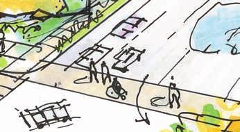
11 Structural and Big Moves Preliminary Policy Directions 1. Put Pedestrians First Develop an exceptional pedestrian realm and safe, people-friendly, connections; enhance eastwest movement and build on the Galloping Goose and Lochside Trails. Break up large blocks with pedestrian and cycling connections. New developments should be designed to engage sidewalks and invite pedestrian activity. Incorporate natural spaces throughout the area as a way to create a better pedestrian experience. Develop a pedestrian and cyclist street hierarchy and create design guidelines to match. 2. Create a Central Landmark Transit Hub Develop a regional transit hub that creates convenient connections for all modes, encourages redevelopment, highlights regional cycling connections and reinforces the pedestrian first priority. Make it multi-modal: seamless and inviting experience for all modes, particularly pedestrians, cyclists and transit users. The transit hub should be designed to be a prominent visual landmark that highlights the area and serves as a point of orientation in the landscape. Incorporate public space: Design the hub to ensure high quality public space is integrated throughout the exchange. Support a transit hub design that incorporates active uses and/or community facilities such as retail/ commercial and a community centre, library or other similar services. 3. Accelerate Rapid Transit Implementation on Douglas Street Support more compact transitoriented development in coordination with the transit hub that increases housing and business options, enhances the pedestrian realm and accelerates the evolution to rapid transit on Douglas Street. Consider land uses along the corridor that would support future transit improvements such as mixed commercial and higher density residential. Develop design standards for the corridor based on transit-oriented design. Develop and improve pedestrian connections to future transit locations. Uptown-Douglas Corridor Plan - Plan Framework Report 8

. Consider public/private partnerships for larger facilities (ie swimming pool).")
12 Structural and Big Moves Preliminary Policy Directions 4. Create a Network of Active and Engaging Public Places Develop/create a series of plaza spaces/parklettes/pocket parks/ streetscape redesigns highlighted by a central civic space. Support the addition of a central civic space for Saanich. Enhance and expand the municipal campus and integrate it into the area. Add community facilities and amenities (community centre, rec centre etc). Consider public/private partnerships for larger facilities (ie swimming pool). Integrate open spaces in new developments (ie small plazas, parklettes etc) 5. Lead Growth with Residential Encourage growth in the core area with a mix of compact multiple dwelling residential units to bring more people into the central area throughout the day and to activate the street with retail and service commercial where appropriate to service this growing population. Focus residential development around the transit hub and parks/open space. Increase residential uses along Oak Street. Support the development of a range of housing options. Encourage purpose-built rental buildings and creative housing ideas to address affordability issues. Require a high energy efficiency standard in new building design and retrofits. Require residential development to relate to the street to enhance public realm and streetscape design. 9 Uptown-Douglas Corridor Plan - Plan Framework Report


13 Structural and Big Moves Preliminary Policy Directions 6. Conserve Light Industrial Retain the light industrial uses west of the Galloping Goose and enhance this area with street improvements and mixed use where appropriate to keep local employment and expand opportunities. Consider access via the Tennyson Connection from the Trans Canada Highway south to Dupplin Road. Examine expansion opportunities for the light industrial area north of Boleskine Road. Integrate live/work residential opportunities north of Boleskine Road, where light industrial uses are compatible. 7. Attract More Diverse and Pedestrian-Oriented Commercial Support existing commercial business and expand street-oriented uses in specific areas to reinforce pedestrian corridors. Support mixed-use commercial buildings on arterial streets with commercial uses on the ground floor and residential on storeys above. Support pedestrian-oriented commercial uses in residential zones focusing on corners or fronting pedestrian spaces. Uptown-Douglas Corridor Plan - Plan Framework Report 10


14 Structural and Big Moves Preliminary Policy Directions 8. Transform Oak Street into a Neighbourhood Street Design Oak Street as the central high street integrating transit, bikes, a pedestrian promenade and amenities along with active and engaging mixed-use buildings framing the street. Support developments that include strong pedestrian realm features such as walkways, plazas and residential units fronting the street. Include on-street parking. Support developments that include retail sales/ commercial on corners. Consider urban design elements such as public art and building design to enhance the public realm. Bring nature into the area through parks, pathways and aggressive tree canopy targets. 9. Develop a Compact Urban Core Foster land use change that increases residential and employment opportunities and positions the area as the heart of Saanich. Support urban-scale development and high quality building design. Support developments that activate the street on all frontages (including facing the Galloping Goose and Lochside Trails). Ensure new development creates a high quality public realm. Consider parking variances if parking is underground. 11 Uptown-Douglas Corridor Plan - Plan Framework Report

15 Structural and Big Moves Preliminary Policy Directions 10. Convert Grey to Green Develop the area as a showcase of urban sustainability through enhancing nature and integrating green infrastructure and green buildings. Triple the tree canopy in 20 years. Infuse intensive landscaping into the built environment. Incentivize buildings with high energy performance. Encourage stormwater management using natural features. Highlight the Cecilia Watershed in parks, developments and street ROWs. Develop a civic space on the municipal property. 11. Transform Blanshard Street and Vernon Avenue into Complete Streets Transition Blanshard Street and Vernon Avenue into pedestrian oriented urban arterial streets. Explore design options that prioritizes local access, a high quality public realm and pedestrian and cyclist mobility. Assess ways to improve access to businesses and improve the effi ciency of vehicle circulation. Support creation of a Master Plan for the Gateway Village (across from the Municipal Hall) and Saanich Plaza sites that integrates potential road changes to create better community connectivity and pedestrian-oriented streetscapes. Create a prominent civic space on the Municipal Hall site that engages Vernon Avenue. Assess conversion of the existing highway island to park space. Support changes that better connect the Nigel Valley with area destinations. Work with the MoTI to explore reductions in the number of travel lanes and lane widths. Plan Concept Uptown-Douglas Corridor Plan - Plan Framework Report 12

16 Concept Layers The goal of the Community Design Workshop was to explore key concepts and potential structural and big moves. Building on the Vision, Community Values and the Structural and Big Moves, participants worked together to develop concept layers organized around three themes. The workshops results have been captured in three layers/concepts: Green Layer Mobility Layer Land Use Layer Since the Community Design Workshop, staff have shared these layers with the public through a variety of public engagement activities including a landowner luncheon, a business owner open house, a public open house, presentations to Council committees, the project Advisory Committee and Community Associations, as well as an online virtual open house and survey. More information on the public engagement process can be found in the Public Engagement Summary. 13 Uptown-Douglas Corridor Plan - Plan Framework Report

17 Green Plan Concept Related Structural & Big Moves Put Pedestrians First Create a Network of Active and Engaging Public Spaces Transform Oak Street into a Neighbourhood Street Convert Grey to Green Uptown-Douglas Corridor Plan Area Improvements to Greenways Potential Future Connections Approx. Historical Location of Cecelia Creek Park / Trail Future Transit Hub / Station 14


18 Mobility Plan Concept Related Structural & Big Moves Put Pedestrians First Create a Landmark Transit Hub Accelerate Rapid Transit Implementation on Douglas Street Conserve Light Industrial Attract More Diverse and Pedestrian Oriented Commercial Transform Oak Street into a Neighbourhood Street Develop a Compact Urban Core Explore complete street designs for Blanshard Street and Vernon Avenue Uptown-Douglas Corridor Plan On Street Pedestrian Improvements Potential Future Connections Bike Lane Improvements Improvements to Intersections Future Transit Hub / Station Future Rapid Bus Lanes 15 Uptown-Douglas Corridor Plan - Plan Framework Report

19 Land Use Concept Related Structural & Big Moves Put Pedestrians First Create a landmark transit hub Accelerate Rapid Transit Implementation on Douglas Street Create a network of Active and Engaging Public Spaces Lead Growth with Residential Conserve Light Industrial Attract More Diverse and Pedestrian Oriented Commercial Transform Oak Street into a Neighbourhood Street Develop a Compact Urban Core Explore complete street designs for Blanshard Street and Vernon Avenue Single-Family Mixed Use (Residential) Light Industrial Mixed Use Institutional Park / Open Space (Existing) Uptown-Douglas Corridor Plan - Plan Framework Report 16
20 Land Use Objectives Land use objectives have been developed based on initial directions that will be further refined and explored as part of the plan drafting process. These objectives indicate the overall intention of the land use policy that will be developed for these areas, subject to further exploration and analysis. General Objectives Lead growth with residential Retain the area s role as a primary employment centre Transition height and density from the area core to established neighbourhoods Support the implementation of rapid transit on Douglas Street with greater concentration of residents and jobs within walking distance Ensure all new buildings are pedestrian oriented and enhance streetscape conditions Improve area connectivity and break up super blocks Ensure each precinct/neighbourhood has sufficient public open space to provide recreation opportunities within close walking distance Douglas-Oak Spine Tennyson Industrial Quarter Rudd Neighbourhood Rutledge Neighbourhood Transit Hub - Mt. View Neighbourhood Vernon Neighbourhood 17 Uptown-Douglas Corridor Plan - Plan Framework Report
21 Sub-Area Objectives Area Specific Objectives In order to develop land use objectives, the UDC has been divided into 6 neighbourhoods or precincts. The areas area as follows: Douglas Oak Spine Tennyson Industrial Quarter Rudd Neighbourhood Rutledge Neighbourhood Transit Hub Mt. View Neighbourhood Vernon Neighbourhood Douglas-Oak Spine Focus the highest density of commercial activity on Douglas Street Expand opportunities for medium to high density multi-family housing Design Oak as a special street with a future focus on medium to high density mixed-use/ residential Expand opportunities to locate active uses fronting the Galloping Goose Trail Add connections to the street grid to enhance walkability Consider opportunities on the old Mayfair Lanes site for mixed-use development that adds public space Tennyson Industrial Quarter Retain industrial uses and support opportunities that increase density (floor space) and the number of jobs Expand opportunities to locate active uses fronting the Galloping Goose Trail Assess potential benefits to the area associated with the extension of Tennyson Street to Douglas Street Enhance streetscape conditions to improve the quality of the area and broaden its attractiveness to a range of employment uses Restrict residential uses in this area Rudd Park Neighbourhood Support family-oriented residential housing. Explore opportunities for medium density residential on Burnside Road to complement City of Victoria land use designations while protecting viewscapes Continue to use Rudd Park as an amenity to anchor multi-family housing developments Explore opportunities to enhance/expand Rudd Park Support redevelopment on the School Board site that retains the heritage building and enhances the site s role as a community space Rutledge Park Neighbourhood Improve connections between the Galloping Goose Trail and Rutledge Park along Cloverdale Ave. through public enhancements and streetoriented developments with active uses. Explore opportunities to integrate the existing highway island into the area as park space Support higher density development on the 4000 Seymour site, with integration of community uses and spaces Support higher density development that integrates community uses and spaces Support the creation of a Master Plan for the 4000 Seymour site that integrates pathways and roads through the site to create better community connectivity and pedestrianoriented streetscapes Transit Hub / Mt. View Neighbourhood Create a landmark transit hub Ensure the transit hub integrates a mix of uses and promotes multi-modal connections and pedestrian actvity Support higher density uses and a diversity of housing within walking distance of the transit hub while protecting viewscapes Explore opportunities to create public space within the Ministry of Highways and Infrastructure right of way green space Vernon Neighbourhood Highlight the Municipal Hall site as the civic centre of Saanich through prominent public space(s) and a greater intensity of uses Support higher density redevelopment of properties located between Blanshard Street and Vernon Avenue Support the creation of a Master Plan for the Gateway Village and Saanich Plaza sites that includes higher density redevelopment as well as the integration of pathways and roads to create better connectivity and pedestrianoriented streetscapes Improve connections to the Nigel Valley Add additional public space in this area Explore further enhancements to Swan Lake Park Uptown-Douglas Corridor Plan - Plan Framework Report 18

22
Burnside Gorge Neighbourhood Plan. Engagement Summary
 Burnside Gorge Neighbourhood Plan Engagement Summary Table of Contents Engagement Summary... 3 Phase One Engagement (April May 2015)... 4 Phase Two Engagement (January March 2016)... 4 Appendix One: Summary
University of Saskatchewan CAMPUS MASTER PLAN. Senate Meeting Preliminary Presentation. April 21, 2018 DIALOG ECS DA WATT
 University of Saskatchewan CAMPUS MASTER PLAN Senate Meeting Preliminary Presentation April 21, 2018 DIALOG ECS DA WATT project process presentation agenda Stakeholder Engagement Project Control phase1
DOWNTOWN GEORGETOWN PLANNING STUDY
 DOWNTOWN GEORGETOWN PLANNING STUDY Community Workshop #3 Thursday, May 4, 08 The Planning Partnership OVERVIEW OF STUDY, PROCESS & MILESTONES We are here PURPOSE OF THE STUDY To develop a clear vision
Welcome. Walk Around. Talk to Us. Write Down Your Comments
 Welcome This is an information meeting introducing the applications for proposed redevelopment of the Yorkdale Shopping Centre site at 3401 Dufferin Street and 1 Yorkdale Road over the next 20+ years,
Welcome to the Oakridge Centre Open House
 Welcome to the Oakridge Centre Open House Why is the City hosting this event? This open house is to inform you of a rezoning application submitted to the City of Vancouver to amend the existing CD-1 (Comprehensive
WELCOME and introduction
 1 WELCOME and introduction Mobility Hub Locations within Burlington STUDY OVERVIEW STUDY OBJECTIVES The City of Burlington is developing four Area Specific Plans, one for each of Burlington s Mobility
SECTION ONE: INTRODUCTION. introduction
 introduction 1 INTRODUCTION Since it was first established in 1843 as a trading post for the Hudson s Bay Company, Victoria has evolved into a Provincial capital city that is recognized across Canada and
4- PA - LD - LIVELY DOWNTOWN. LD - Background
 4- PA - LD - LIVELY DOWNTOWN LD - Background The downtown has been the service centre for the community since the city s inception and the area continues to supply people with their personal services,
1.0 Purpose of a Secondary Plan for the Masonville Transit Village
 Report to Planning and Environment Committee To: Chair and Members Planning & Environment Committee From: John M. Fleming Managing Director, Planning and City Planner Subject: Masonville Transit Village
CDAC. Update: Downtown Dartmouth Update: CDAC July 25 th Motion
 CDAC Update: Downtown Dartmouth Update: CDAC July 25 th Motion 2018-10-24 Downtown Dartmouth Plan Open House October 22, 2018 6:00 pm Open House 6:30 pm Presentation + Q&A 7:20 pm Open House 8:30 pm Close
Town Center (part of the Comprehensive Plan)
") Town Center (part of the Comprehensive Plan) Mercer Island Town Center Looking North (2014) In 1994, a year-long process culminated in a set of design guidelines and code requirements for the Town Center
Town Center (part of the Comprehensive Plan) Mercer Island Town Center Looking North (2014) In 1994, a year-long process culminated in a set of design guidelines and code requirements for the Town Center
PLAN ELEMENTS WORKSHOP. April 5, 2016
 PLAN ELEMENTS WORKSHOP April 5, 2016 needs more housing. But there is no one-size fits-all solution. Every neighborhood has its own character. In some places, density is not only appropriate it is badly
PUBLIC OPEN HOUSE HURONTARIO-MAIN CORRIDOR SECONDARY PLAN
 PUBLIC OPEN HOUSE HURONTARIO-MAIN CORRIDOR SECONDARY PLAN Tuesday, February 28, 2012 6pm 9pm 1 st Floor Atrium, City Hall 2 Wellington Street West, Brampton 1 POLICY FRAMEWORK The 2006 Provincial Growth
Urban Design Manual PLANNING AROUND RAPID TRANSIT STATIONS (PARTS) Introduction. Station Study Areas
 Introduction. Station Study Areas") 111111 PLANNING AROUND RAPID TRANSIT STATIONS (PARTS) Introduction The ION rapid transit system will link Waterloo, Kitchener and Cambridge through a central transit corridor (CTC). There are a number
111111 PLANNING AROUND RAPID TRANSIT STATIONS (PARTS) Introduction The ION rapid transit system will link Waterloo, Kitchener and Cambridge through a central transit corridor (CTC). There are a number
Silverdale Regional Center
 Silverdale Regional Center Vision for Silverdale Regional Center The Silverdale Regional Center Plan (Plan) will guide the evolution of the Silverdale Regional Center from a collection of strip malls and
SUBJECT: Waterfront Hotel Planning Study Update TO: Planning and Development Committee FROM: Department of City Building. Recommendation: Purpose:
 Page 1 of Report PB-23-18 SUBJECT: Waterfront Hotel Planning Study Update TO: Planning and Development Committee FROM: Department of City Building Report Number: PB-23-18 Wards Affected: 2 File Numbers:
McCowan Precinct Plan Study Background & Deliverables
 1 DRAFT & WITHOUT PREJUDICE McCowan Precinct Plan Study Background & Deliverables In September, 2011, City Planning (Scarborough District) began a study of an area within the Scarborough Centre, identified
Complete Neighbourhood Guidelines Review Tool
 Complete Neighbourhood Guidelines Review Tool Prepared By: City of Regina Planning Department October 2014 Page 1 of 14 Community Development Review Checklist for Secondary Plans and Concept Plans The
The Master Plan Framework
 The Master Plan Framework The East Harbour Master Plan advances the development of 60 acres of former industrial lands east of the Don River. The Master Plan outlines a vision for a vibrant, transit-oriented
V. Vision and Guiding Principles
 V. Vision and Guiding Principles The Master Plan for the Powers Ferry Corridor seeks a foundation in the desires of the community. At times, various elements of the community offered opposing viewpoints,
1 Welcome! UBC Okanagan Master Plan Update - Open House
 1 Welcome! UBC Okanagan Master Plan Update - Open House UBC is updating the Master Plan for the Okanagan Campus. The purpose of today s Open House is to: Present the draft 2015 Master Plan Answer any questions
Port Credit Local Advisory Panel October 20 th Meeting
 Port Credit Local Advisory Panel October 20 th Meeting Focus Of This Evening s Meeting: 1. Hurontario Main Street Higher Order Transit Study 2. Port Credit Mobility Hub & GO Station Parking Structure Study
ELMVALE ACRES SHOPPING CENTRE MASTER PLAN
 ELMVALE ACRES SHOPPING CENTRE MASTER PLAN Contents 1.0 INTRODUCTION... 2 2.0 LOCATION... 2 3.0 EXISTING CONTEXT... 2 4.0 VISION & GUIDING PRINCIPLES... 2 5.0 LAND USE AND BUILT FORM... 4 5.1 St. Laurent
Corridor Vision. 1Pursue Minnehaha-Hiawatha Community Works Project. Mission of Hennepin County Community Works Program
 1Pursue Minnehaha-Hiawatha Community Works Project Minnehaha-Hiawatha Community Works is a project within the Hennepin Community Works (HCW) program. The mission of the HCW program is to enhance how the
The University District envisions, in its neighborhood
 Envisioning the University District Link Light Rail in Seattle s neighborhoods CIY OF SEALE CONCEP-LEVEL SAION AREA PLANNING RECOMMENDAION RESOLUION # 30165 EXHIBI L Vision 08.2000 he University District
MAYFIELD WEST SECONDARY PLAN PHASE 2
 MAYFIELD WEST SECONDARY PLAN PHASE 2 Public Open House #3 February 25, 2010 Draft Preferred Land Use Scenario TOWN OF CALEDON PLANNING & DEVELOPMENT DEPARTMENT Open House Agenda TOWN OF CALEDON 1. Welcome
Further input invited as Colchester Growth Strategy nears final phase
 IUE 3 / NOVEMBER 2015 Further input invited as Colchester Growth trategy nears final phase trathcona County is seeking public feedback as it enters the final phase of work on a Growth Management trategy
38 Queen s University Campus Master Plan Part 1
 38 Queen s University Campus Master Plan Part 1 46 The Campus at the City Scale Chapter 4 The Campus at the City Scale 39 Queen s is an urban University centrally located in Kingston. Decisions made by
New Westminster Downtown Parking Strategy Public Open House #1 September 13, 2012
 New Westminster Downtown Parking Strategy Public Open House #1 September 13, 2012 The City is preparing a strategy for parking in Downtown New Westminster. The study team and a group of key stakeholders
Public Open House. Overview of the Downtown Plan Official Plan Amendment April 23, 2018
 Public Open House Overview of the Downtown Plan Official Plan Amendment April 23, 2018 1 A 25-Year Plan for Downtown To ensure growth contributes positively to Toronto s Downtown as a great place to live,
GO Station Mobility Hubs: Draft Precinct Plans. Committee of the Whole July 12, 2018
 GO Station Mobility Hubs: Draft Precinct Plans Committee of the Whole July 12, 2018 Purpose of this Workshop Present Draft Precinct Plans for the 3 GO Station Mobility Hubs Continue the conversations that
Lehigh Acres Land Development Regulations Community Planning Project
 Lehigh Acres Land Development Regulations Planning Effort Summary In July, 2010 Commissioner Frank Mann invited the Lehigh Acres community to start discussing how to achieve their recently adopted community
greenprint midtown SUSTAINABILITY ACTION PLAN 2012
 greenprint midtown SUSTAINABILITY ACTION PLAN 2012 MIDTOWN ALLIANCE SOUTHFACE ENERGY INSTITUTE RENAISSANCE PLANNING GROUP SUSTAINABLE ATLANTA PERKINS+WILL 2 GREENPRINT MIDTOWN 1. Introduction Sustainability
Create Policy Options Draft Plan Plan Approval. Public Consultation Events. Phase 2
 Background Grandview-Woodland Community Plan In the spring of 2012, the City of Vancouver embarked on a comprehensive community planning program in the Grandview-Woodland neighbourhood. The process has
Ann Arbor Downtown Street Design Manual. Ann Arbor DDA IDA 2015 Awards Planning Category
 Ann Arbor Downtown Street Design Manual Ann Arbor DDA IDA 2015 Awards Planning Category 1 Ann Arbor s downtown streets are vibrant public spaces that accommodate multi-modal transportation, special events,
Workshop 3. City of Burlington Waterfront Hotel Planning Study. September 14, The Planning Partnership
 Workshop 3 City of Burlington Waterfront Hotel Planning Study September 14, 2017 The Planning Partnership The Waterfront Hotel Planning Study 01 The Brant & Lakeshore Planning Study will establish a Strategic
THE CITY OF VAUGHAN BY-LAW BY-LAW NUMBER A By-law to adopt Amendment Number 1 to the Official Plan of the Vaughan Planning Area.
 THE CITY OF VAUGHAN BY-LAW BY-LAW NUMBER 015-2014 A By-law to adopt Amendment Number 1 to the Official Plan of the Vaughan Planning Area. NOW THEREFORE the Council of the Corporation of the City of Vaughan
LAND USE AMENDMENT DOWNTOWN COMMERCIAL CORE (WARD 7) MACLEOD TRAIL SE AND 5 AVENUE SE BYLAW 254D2017
 MACLEOD TRAIL SE AND 5 AVENUE SE BYLAW 254D2017") Page 1 of 10 EXECUTIVE SUMMARY This Land Use Amendment application seeks to redesignate a full downtown block (currently the YWCA site) from a Direct Control based on the CM-2 District (Land Use Bylaw
Page 1 of 10 EXECUTIVE SUMMARY This Land Use Amendment application seeks to redesignate a full downtown block (currently the YWCA site) from a Direct Control based on the CM-2 District (Land Use Bylaw
Chairman and Members of the Planning and Development Committee. Thomas S. Mokrzycki, Commissioner of Planning and Building
 LA.09.TOR (Toronto) DATE: TO: FROM: SUBJECT: Chairman and Members of the Planning and Development Committee Thomas S. Mokrzycki, Commissioner of Planning and Building Central Waterfront Secondary Plan
[PLANNING RATIONALE] For Site Plan Control and Lifting of Holding Zone By-Law 101 Champagne Avenue. May 23, 2014
![[PLANNING RATIONALE] For Site Plan Control and Lifting of Holding Zone By-Law 101 Champagne Avenue. May 23, 2014](/thumbs/75/71599615.jpg "[PLANNING RATIONALE] For Site Plan Control and Lifting of Holding Zone By-Law 101 Champagne Avenue. May 23, 2014") [PLANNING RATIONALE] For Site Plan Control and Lifting of Holding Zone By-Law 101 Champagne Avenue May 23, 2014 Contents 1.0 Introduction... 2 2.0 Site Context... 2 2.1 Adjacent Uses... 2 Figure 1: Site
[PLANNING RATIONALE] For Site Plan Control and Lifting of Holding Zone By-Law 101 Champagne Avenue May 23, 2014 Contents 1.0 Introduction... 2 2.0 Site Context... 2 2.1 Adjacent Uses... 2 Figure 1: Site
Downtown Streetscape Manual & Built Form Standards
 City of Guelph Downtown Streetscape Manual & Built Form Standards July 2014 Prepared by Brook McIlroy Inc. in association with Unterman McPhail Associates and McCormick Rankin Inc. City of Guelph Downtown
Municipal Development Plan Update Urban Service Area and Hamlets
 ENCLOSURE 1 Municipal Development Plan Update Urban Service Area and Hamlets Priorities Committee January 24, 2017 MUNICIPAL DEVELOPMENT PLAN UPDATE SHAPING OUR FUTURE MDP Update - Agenda MDP Update Public
DRAFT Land Use Chapter
 Stevens Creek Urban Village DRAFT 1 18 17 Land Use Chapter INTRODUCTION This Land Use Chapter describes how the Stevens Creek Urban Village will accommodate the growth that is planned for it in the Envision
Don Mills Crossing Study and Celestica Lands Development Application Community Meeting, Open House, and Breakout Discussions
 Consultation Summary Don Mills Crossing Study and Celestica Lands Development Application Community Meeting, Open House, and Breakout Discussions This report is not intended to provide a verbatim transcript
Cambie Corridor Planning Program Phase Two Draft Plan. Standing Committee on City Services and Budgets May 5, 2011
 Cambie Corridor Planning Program Phase Two Draft Plan Standing Committee on City Services and Budgets May 5, 2011 Cambie Corridor Program Terms of Reference approved July 2009 Land Use Transportation Energy
CAMBIE CORRIDOR PLAN
 1 WELCOME TO THE OPEN HOUSE PUBLIC REALM PLAN - CAMBIE CORRIDOR Thank you for coming to the Cambie Corridor Public Realm Open House! Place a dot where you live Please provide us with your comments and
Study Area. Capitol Way. Greening America s Capitals 11/13/2014. A Greening America s Capitals Project
 Olympia, WA: Greening Capitol Way Supporting Communities move towards sustainability is a priority for the federal government. A Greening America s Capitals Project Office of Sustainable Communities U.S.
Moody Centre Station TOD Area Today
 Moody Centre Station TOD Area Today WHAT IS a transit-oriented Murray Street development area? A Transit-Oriented Development (TOD) Area is a dense, walkable residential and commercial area built to support
Downtown Whitby Action Plan
 Downtown Whitby Action Plan Final Report October 2016 Table of Contents Introduction 1 Public Consultation 2 Walkability 3 Downtown Whitby Walkability Map 4 Vision 5 Goal & Objectives 6 Objective 1 7 Objective
Midtown Greenway Land Use and Development Plan Executive Summary
 Midtown Greenway Land Use and Development Plan Executive Summary Introduction The Midtown Greenway Land Use and Development Plan sets policy direction for land use and development in the Midtown Greenway
CITY OF CHARLOTTESVILLE, VIRGINIA CITY COUNCIL AGENDA
 CITY OF CHARLOTTESVILLE, VIRGINIA CITY COUNCIL AGENDA Agenda Date: December 16, 2013 Action Required: Adoption of Resolution Presenter: Staff Contacts: Title: James E. Tolbert, AICP, Director of NDS James
Welcome. Community Consultation Meeting November 28, Review and discuss the Bathurst Quay Neighbourhood Plan Framework
 Welcome Community Consultation Meeting November 28, 2016 Why Are We Here Today? Review and discuss the Bathurst Quay Neighbourhood Plan Framework Review and discuss an Action Plan for Implementation Next
Report to: Development Services Committee Report Date: April 24, 2017
 SUBJECT: Cornell Rouge National Urban Park Gateway - Report on Design Charrette and Next Steps PREPARED BY: Lilli Duoba, MES, MCIP, RPP, Manager, Natural Heritage (ext. 7925) REVIEWED BY: Marg Wouters,
UTSC SECONDARY PLAN COMMUNITY OPEN HOUSE
 WELCOME TO THE UTSC SECONDARY PLAN COMMUNITY OPEN HOUSE 1 Welcome to the first Community Open House for the UTSC Secondary Plan. Hosted by the University of Toronto Scarborough (UTSC), the following panels
Implementation Guide Comprehensive Plan City of Allen
 Implementation Guide 2030 Comprehensive Plan City of Allen DRAFT 2015 Implementation Guide Allen 2030 Comprehensive Plan INTRODUCTION The Comprehensive Plan serves as a guide for the growth and development
Welcome. Thank you for attending our first Early Input Opportunity Meeting. The Purpose of this meeting is to: Introduce you to the project team
 Welcome Our proposal at 2050-2070 Marine Drive & 2000 Curling Road represents an exciting opportunity to contribute to the vibrancy of the Lions Gate Village area and our growing community. Thank you for
ROBBINSDALE LRT STATION CDI DEVELOPMENT GUIDELINES
 August 2018 OVERVIEW The City of Robbinsdale has a prime-opportunity site in the middle of the 13 mile stretch of the Bottineau LRT corridor / Blue Line extension. Robbinsdale offers a prominent, vital,
Building out the Regional Growth Strategy in Surrey: a Strong Centre & a Connected Transit City
 Building out the Regional Growth Strategy in Surrey: a Strong Centre & a Connected Transit City Surrey in the Metro Vancouver Region Regional Growth Strategy identifies Surrey as a major provider of housing
Queensborough Eastern Neighbourhood Node. Community Open House
 Queensborough Eastern Community Open House The Vision The Queensborough Eastern will become the heart of eastern Queensborough. Through a sensitive mix of viable commercial and residential areas, the neighbourhood
SAN RAFAEL GENERAL PLAN 2040 INTRODUCTION AND OVERVIEW
 SAN RAFAEL GENERAL PLAN 2040 INTRODUCTION AND OVERVIEW Steering Committee Presentation February 14, 2018 Purpose of General Plan Guide land use and development decisions Coordinate transportation, infrastructure,
Streets, Connectivity & Built Environment Working Group August 2, 2017
 Streets, Connectivity & Built Environment Working Group August 2, 2017 DOWNTOWN OAKLAND SPECIFIC PLAN WELCOME Streets, Connectivity & Built Environment Working Group Social Equity Meeting August 2, 2017
Blueprint Denver Task Force Meeting #
 Blueprint Denver Task Force Meeting #1 6.23.16 1. Welcome and Introductions Your name and affiliation Name 1 thing you love about Denver Name 1 thing you d change about Denver All in 30 seconds! Ready,
Chapter 2: Vision, Goals and Strategies
 Chapter 2: Vision, Goals and Lake Elmo Today & Tomorrow Comprehensive Plan 2040 2 VISION, GOALS & STRATEGIES - DRAFT 4-6-2018 INTRODUCTION Comprehensive Plan Purpose Perhapse the most important objective
Mark-up of the effect of the proposed Bronte Village Growth Area OPA No.18 on the text of section 24, Bronte Village, of the Livable Oakville Plan
 Mark-up of the effect of the proposed Bronte Village Growth Area OPA No.18 on the text of section 24, Bronte Village, of the Livable Oakville Plan Notes: This document is provided for information purposes
URBAN DESIGN BRIEF URBAN DESIGN BRIEF 721 FRANKLIN BLVD, CAMBRIDGE August 2018
 URBAN DESIGN BRIEF URBAN DESIGN BRIEF 721 FRANKLIN BLVD, CAMBRIDGE August 2018 DESIGN BRIEF CONTENTS PART A 1.0 INTRODUCTION 2.0 DESCRIPTION & ANALYSIS OF SITE CONTEXT 3.0 DESIGN CONSTRAINTS AND OPPORTUNITIES
URBAN DESIGN BRIEF. 2136&2148 Trafalgar Road. Town of Oakville
 URBAN DESIGN BRIEF 2136&2148 Trafalgar Road Town of Oakville Prepared By: METROPOLITAN CONSULTING INC For 2500674 Ontario Inc November 2016 TABLE OF CONTENTS Page No. 1.0 Introduction/Description of Subject
City of Farmington. Downtown Plan. Amendment to the 1998 Master Plan Adopted October 11, 2004
 City of Farmington Amendment to the 1998 Master Plan Adopted October 11, 2004 Introduction Planning Background 1 Scope and Components of the Plan Amendment 2 Concept Introduction 3 Plan Concepts 3 Conceptual
Coliseum Station Area Area Redevelopment Plan. Public Engagement #1 June 12, 2017
 Coliseum Station Area Area Redevelopment Plan Public Engagement #1 June 12, 2017 Welcome Engagement Purpose Introduce the project Share information Gather input Project Updates & Newsletter edmonton.ca/coliseumplan
JANUARY 19, 2011 CENTRAL AVENUE-METRO BLUE LINE TRANSIT-ORIENTED DEVELOPMENT IMPLEMENTATION PROJECT COMMUNITY FORUM
 CENTRAL AVENUE-METRO BLUE LINE TRANSIT-ORIENTED DEVELOPMENT IMPLEMENTATION PROJECT COMMUNITY FORUM JANUARY 19, 2011 THE MARYLAND-NATIONAL CAPITAL PARK AND PLANNING COMMISSION PRINCE GEORGE S COUNTY PLANNING
DALY CITY VISIONING PROCESS COMMUNITY WORKSHOP 3 MAY 8, 2008
 DALY CITY VISIONING PROCESS COMMUNITY WORKSHOP 3 MAY 8, 2008 PROCESS General Plan - a statement of the community s values, vision and aspirations for now and into the future... Timeframe LONG TERM - 2030
SUBJECT: Proposed Downtown Mobility Hub Precinct Plan and Proposed Official Plan Policies
 Page 1 of Report PB-81-17 SUBJECT: Proposed Downtown Mobility Hub Precinct Plan and Proposed Official Plan Policies TO: FROM: Committee of the Whole Planning and Building Department Report Number: PB-81-17
Hockessin Community Redevelopment Plan
 Hockessin Community Redevelopment Plan 3.1 Introduction The Community Redevelopment Plan for the Village of Hockessin is the result of the people s vision for a distinct village center that serves as the
New-Cast Mixed-use Development Proposal King Street West, Newcastle, Ontario
 URBAN DESIGN BRIEF New-Cast Mixed-use Development Proposal King Street West, Newcastle, Ontario TABLE OF CONTENTS: 1.0 Executive Summary 2.0 Creating Vibrant and Sustainable Urban Places: Excerpts from
Policies and Code Intent Sections Related to Town Center
 Policies and Code Intent Sections Related to Town Center The Town Center Vision is scattered throughout the Comprehensive Plan, development code and the 1994 Town Center Plan. What follows are sections
section THREE: DISTRICTS districts
 section THREE: DISTRICTS districts 3 INTRODUCTION The Downtown Core Area Plan establishes five Downtown Core Area Districts. As stated in the Introduction, these new Districts do not replace existing neighbourhood
HE VISION. Building a Better Connected Place
 HE VISION Building a Better Connected Place WALK INTO THE FUTURE. Life in Cranberry, 2030 Here s what our residents told us they wanted to see in their community by 2030: The Cranberry of 2030 is a place
ARLINGTON COUNTY, VIRGINIA
 ARLINGTON COUNTY, VIRGINIA County Board Agenda Item Meeting October 15, 2005 DATE: September 28, 2005 SUBJECT: Request to Advertise the adoption of the 2005 Clarendon Sector Plan C. M. RECOMMENDATION:
Shared Principles and Emerging Plan Directions
 Shared Principles and Emerging Plan Directions Introduction Since the Fairfield Neighbourhood planning process launched in June 2016, we have heard from many residents, businesses, groups and other people
section 3: Vision, Values and Goals
 Vision, Values and Goals 3 2041 Vision: Victoria is an urban sustainability leader inspiring innovation, pride and progress towards greater ecological integrity, livability, economic vitality, and community
The Cambie Corridor 2015 Fall workshop series. What we heard WORKSHOP OUTLINE
 The Cambie Corridor 2015 Fall workshop series W 16 AVE Area 5 CAMBIE CORRIDOR Phase 3 What we heard ovember 21, 2015, 9am-noon, 1:30-4:30pm Peretz Centre 89 Participants* WORKSHOP OUTLIE Introductions
CITY COUNCIL AGENDA REPORT
 CITY COUNCIL AGENDA REPORT Subject: COUNCIL MOTION LRT ALIGNMENT REMOVAL FROM THE TRANSPORTATION MASTER PLAN On February 10, 2016 Councillor Hughes provided notice in accordance with Section 23 of Procedure
West Ocala Vision & Community Plan City Council Work Session. Presented by West Ocala Community Plan Steering Committee
 West Ocala Vision & Community Plan City Council Work Session Presented by West Ocala Community Plan Steering Committee November 29,2011 Ocala 2035 Vision West Ocala Community Vision & Master Plan West
Public Open House #1
 Public Open House #1 TONIGHT S AGENDA Welcome Project Overview The Big Picture The Station Area The Analysis Thoughts about Future Change Breakout Group Discussions Summation / Next Steps Project Overview
Potential Green Infrastructure Strategies May 6, 2015 Workshop
 Potential Green Infrastructure Strategies May 6, 2015 Workshop Background The City of Cortland is developing the Tioughnioga Urban Headwaters Green Infrastructure Action Plan with funding from the National
11.12 Vaughan Metropolitan Centre Secondary Plan
 City of Vaughan Official Plan Volume 2 2017 Office Consolidation As Partially Approved by the Ontario Municipal Board 11.12 Vaughan Metropolitan Centre Secondary Plan PARTIALLY APPROVED BY THE ONTARIO
City of Fort Lauderdale UPTOWN URBAN VILLAGE. Public Workshop December 7, 2016
 Public Workshop December 7, 2016 Workshop Agenda Introductions Project Presentation o o o History Project Scope/Timeline Character of Study Area o o o o Land Use Public Realm/Pedestrian Mobility Multimodal
Building Great Neighbourhoods. Strathcona
 Building Great Neighbourhoods Strathcona March 21, 2018 Becky Redford Project Manager, Planning & Design Building Great Neighbourhoods Integrated Infrastructure Services Welcome and Purpose To provide
WELCOME. The Yonge-Eglinton area has experienced significant growth and change in the last decade.
 WELCOME DID YOU KNOW? MIDTOWN IS REPRESENTED BY 3 CITY COUNCILLORS: WARD 16 EGLINTON-LAWRENCE WARD 22 ST. PAUL S WARD 25 DON VALLEY WEST Midtown in Focus: Building a Livable Yonge-Eglinton The Yonge-Eglinton
North Fair Oaks Community Plan Summary and Information
 North Fair Oaks Community Plan Summary and Information WHAT IS THE NORTH FAIR OAKS COMMUNITY PLAN? The North Fair Oaks Community Plan is part of the San Mateo County General Plan, and establishes policies
John M. Fleming Managing Director, Planning and City Planner. Old East Village Dundas Street Corridor Secondary Plan Draft Terms of Reference
 Report to Planning and Environment Committee To: From: Subject: Chair and Members Planning & Environment Committee John M. Fleming Managing Director, Planning and City Planner Old East Village Dundas Street
2.1 Location and Size
 2.0 Context 7 2.1 Location and Size The Saanich Penninsula The study area is centrally located within the Town boundaries on the east side of Highway 17, which runs through Sidney in a north-south direction.
Official Plan Review
 Official Plan Review Summary Report - The Built Environment August 2014 Part 1: Introduction Planning for a healthy, prosperous and sustainable community is an important goal for our municipality. From
City of Tacoma Planning and Development Services
 Agenda Item E-1 City of Tacoma Planning and Development Services To: Planning Commission From: Elliott Barnett, Planning Services Division Subject: Tacoma Mall Regional Center Subarea Plan and EIS Meeting
PART 1. Background to the Study. Avenue Study. The Danforth
 The Danforth 1.1/ Study Purpose & Key Municipal Goals 1.2/ The Local Advisory Committee 1.3/ The Project Team 1.4/ Study Process/Summary of Method 1.5/ Summary of Consultation 1.1 Study Purpose and Key
1.0 VISION STATEMENT. December 6, PRINCIPLES
 Vision Statement Lincoln Regional Airport 1.0 VISION STATEMENT 1.1 City LOCATION of AND OVERVIEW The Easton Lincoln Place Land Use Master Plan identifies the principles, goals, policies, and standards
STUDY AREA LOCATION & CONTEXT:
 UNLOCKING THE POTENTIAL OF THE KEATING CROSS ROAD BUSINESS CORRIDOR A PLAN TO CREATE + RETAIN JOB-GENERATING BUSINESSES AND TO GUIDE INFRASTRUCTURE INVESTMENT The Keating Cross Road Corridor (the Keating
NEW REGIONAL OFFICIAL PLAN HIGH LEVEL PROCESS & FRAMEWORK
 NEW REGIONAL OFFICIAL PLAN HIGH LEVEL PROCESS & FRAMEWORK Why A New Official Plan Originally the role of Regionally Planning and content of Regional Official Plan (1970s) primarily focused on protecting
East Bayshore Road Neighbourhood
 East Bayshore Road Neighbourhood Northridge Property Management Urban Design Brief 3195 East Bayshore Road City of Owen Sound January 2016 East Bayshore Road Neighbourhood Northridge Property Management
City of Long Beach. creating vibrant and exciting places
 City of Long Beach creating vibrant and exciting places Land Use Element Urban Design Element Overview of the two draft General Plan elements Discuss areas of change Economic goals of the plans Case study
Figure 1- Site Plan Concept
 Figure 1- Site Plan Concept Parking will be provided underground on three levels at rate of 1.0 space/ unit; this rate includes all visitors parking. MMM Group has prepared a parking assessment (April,