JACKsON STREET PIER CONCEPTUAL DESIGN PACKAGE SEPTEMBER 21, 2017
|
|
|
- Merry Stanley
- 6 years ago
- Views:
Transcription
1 JACKsON STREET PIER CONCEPTUAL DESIGN PACKAGE SEPTEMBER 21, 2017
2 JACKsON STREET PIER Process outline DESIGN PROCESS OVERVIEW: Sandusky s Jackson Street Pier Conceptual Design process included input from a representative Steering Committee, Stakeholder interviews, public open houses and a wide range of technical data & information. The consulting team, composed of City Architecture and Osborn Engineering, began work in February 2017, upon direction from the City of Sandusky City Commission. Initial Stakeholder Meetings focused on the Pier s current-day conditions and operations and Shoreline Drive. These discussions, often with small groups, aimed to identify specific attributes and their successes or challenges. The consulting team, paired with City of Sandusky representatives, conducted dozens of meetings to learn these important details and suggestions from each group. Discussions were open and honest, with the team asking questions catered for each representative group - meant to identify exact needs and ideas throughout the process. These Stakeholder meetings (occurring throughout the entire process) serve as the basis for the design process. Boat operators needs, parking desires, green space & programming potentials, waterfront & park space advocacy groups and other Stakeholders provided myriad perspectives and ideas. From this foundation, the team developed a series of concepts with the intention of creating a balanced Jackson Street Pier - a true public space that retains & enhances existing uses while providing spaces & opportunities to make new memories along Sandusky s waterfront. In March 2017, the consulting team held the first public open house. Setting up various stations, the team held further discussions from participants. More that 150 people participated in this first public session - providing feedback and direction related to desired activities (both existing and new), specific design elements & amenities and other information. City Architecture began sketching initial site diagrams at this stage. Concurrently, Osborn Engineering led investigative work for the Pier. A full topography and utility survey was conducted, geo-technical explorations sampled the Pier s fill to better understand its condition & bearing capacity, and underwater studies were conducted of the perimeter bulk-heading. The studies revealed additional information that the design team considered. In July 2017, a second public open house was conducted. This session, attracting another large crowd at the Sandusky State Theatre, offered three Pier concepts. Participants were asked to discuss attributes of each that they liked. Additionally, the team received feedback via and binders of online postings from several groups. From these, the team was able to head in new directions, guided by four primary community-driven principles : Retain all uses that are currently offered on the Pier Increase accessibility for people of all ages and physical ability Provide waterfront parking and vehicular access to the northern portion Design beautiful new spaces & flexible places to expand the Pier s usability & attraction The design team began developing a final series of concepts for review with Stakeholders - mainly focused on operations and the Pier s potential. Design challenges included working within the Department of Homeland Security s requirements associated with international ferry services. The team met several times to ensure security measures were met. DESIGN CONCEPT DESCRIPTION: The design, outlined on the following pages, intends to enhance existing uses and celebrate Jackson Street Pier s rich history while providing spaces that balance the Pier as an attractive and centrally located public space. The Pier s design includes a continuous perimeter boardwalk - providing various seating areas & arrangements, fishing access, special paving representing Sandusky s historic role in the Underground Railroad, and expanded spaces for the Goodtime 1. New accessible standards are applied, increasing ADA ramps between the parking areas to all public spaces. Current conditions provide only two sidewalk ramp locations - the new plan will have in excess of twelve. Vehicular access in maintained to the northern section of the Pier. Drivers will enter through the relocated Jackson Street Pier archway, drive around a new landscaped area and head north towards the waterfront parking. A central drop-off circle is created for the Goodtime 1 and Jet Express. The curbless area doubles as a large speed bump calming traffic and reducing vehicular speeds - an important factor that was consistently identifies as an issue by Stakeholders. The raised area s paving pattern replicates a wave lapping against the shoreline, and is intended to represent the shoreline extending south, expanding the Pier s waterfront experience. The adjacent Gateway Plaza is anchored by parking, an open plaza and a public multi-purpose building & public restroom facility. The building s simple architecture is meant to be a background element - emphasizing focus on the outdoor spaces and activities. Overhead doors can be raised for events, allowing activities to spill into the Gateway Plaza or the newly coined Boeckling Alley. During colder months, the building can host events, serve as a warming station and provide a public space on the Pier, extending the season along the northern shore. A Great Lawn is provided, with a slope leading to the new Sun Stairs, a place for panoramic views of the Sandusky Bay - extending from Cedar Point to the coal docks. The flexible space can serve many purposes that attract people to the waterfront & Downtown, provide places for events and creates a simple place for people to recreate. A new Ticket House and adjacent seating area is provided for the Goodtime 1, improving customer experiences while providing a potential new concession area for the Pier. Seating options are providing throughout the Pier s 3.5 acres. Seating walls, enhanced with low-lying landscaping, provide important buffers between pedestrian areas and parking. Traditional benches offer places to rest. Picnic benches are included for friendly get-togethers, whether for families to enjoy the views and spaces or long-time high school friends sharing a meal & stories. Shade trellises are positioned at key viewpoints and can support hanging porch swings, providing a relaxing environment to enjoy Sandusky Bay. Parking areas are incorporated at convenient locations to support existing businesses, adjacent to new uses and along the waterfront, retaining the ability to enjoy the water views. Jackson Street Pier s conceptual design is founded on a diverse collection of community voices. New uses, blended with enhanced existing experiences can position this waterfront property into a new destination for all Sandusky residents, celebrating its heritage while providing engaging spaces & places for new memories.

3 JACKSON STREET PIER EXISTING CONDITIONS AERIAL PHOTOGRAPH

4 SHORELINE DRIVE EXISTING CONDITIONS AERIAL PHOTOGRAPH

5 DOWNTOWN CONTEXT EXISTING CONDITIONS AERIAL PHOTOGRAPH


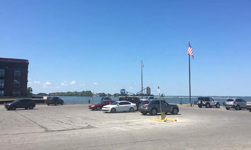
6 JACKSON STREET PIER - EXISTING CONDITIONS


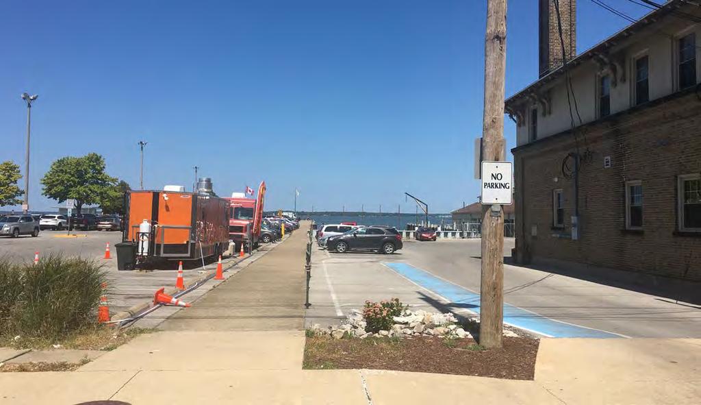
7 JACKSON STREET PIER - EXISTING CONDITIONS


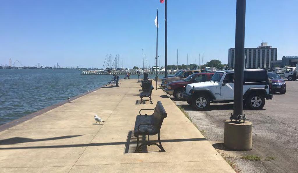
8 JACKSON STREET PIER - EXISTING CONDITIONS

9 INTERNATIONAL SERVICES Improved facilities to meet guidelines while planning for the return of the Jiimaan ferry. GOODTIME TOURS Ticket house, waiting area and potential concessions provide better customer experience within walking distance of dropoff and convenience parking. BOARDWALK Continuous walkway provides new perimeter promenade accentuated with paving patterns and textures. 24 SPACES 23 SPACES BAYFRONT PORCH Expanded boardwalk area that creates defined zones for walking, sitting, movable chairs, fishing (with casting zones) with uninterrupted waterfront views. SHORELINE DRIVE GREAT LAWN Multi-use, flexible green space for passive recreation, programmed events and other waterfront activities within the heart of Sandusky s Downtown. 51 SPACES MULTI-PURPOSE PAVILION & GATEWAY PLAZA Expands Jackson Street Pier s usage with a flexible structure for rentals, events, markets, Boeckling Alley and other activity generators, including cold-weather activities. WAVE PIAZZA Raised unit paver area symbolizing wave crashing along the northern shoreline, open spaces for smaller events, vehicular access & anchored by new amenities building and raised performance space. WATERFRONT SEATING Variety of seating options: traditional benches, porch swings, seating walls and workbench seats that provides options and functionality. PICNIC PATIO Accessible outdoor dining area adjacent to parking and open waterfront views that provides semi-private areas defined by low landscaping and Sun Stairs. SUN STAIRS Seating steps for sunset / sunrise enjoyment and panoramic views of Sandusky Bay & Cedar Point. Sloped green space provides vistas above roof lines of cars. FREEDOM PAVING Special paving patterns celebrating Sandusky s role in the Underground Railroad as a path to freedom. CITY OF SANDUSKY - JACKSON STREET PIER & SHORELINE DRIVE JACKSON STREET PIER - PROPOSED PLAN

10 JACKSON STREET PIER - AERIAL VIEW FROM WATER S EDGE

11 JACKSON STREET PIER - AERIAL VIEW OF PIER PLAZA

12 JACKSON STREET PIER - VIEW ALONG SHORELINE DRIVE & SANDUSKY BAYFRONT CONNECTOR

13 JACKSON STREET PIER - PANORAMIC VIEW ATOP THE SUN STAIRS

14 JACKSON STREET PIER - VIEW ALONG EASTERN BOARDWALK & PICNIC AREA

15 JACKSON STREET PIER - VIEW OF CONTINUOUS MULTI-PURPOSE BOARDWALK ALONG WESTERN PIER

16 JACKSON STREET PIER - AERIAL VIEW LOOKING TOWARDS SANDUSKY BAY
Sub-committee on Harbour Plan Review of Harbour-front Enhancement Committee. Ninth Meeting
 Sub-committee on Harbour Plan Review of Harbour-front Enhancement Committee Ninth Meeting Date: 5 October 2005 Time: 3:30pm Venue: Conference Room 15/F, North Point Government Offices, 333 Java Road, North
BRADENTON RIVERWALK EXPANSION MASTER PLAN
 BRADENTON RIVERWALK EXPANSION MASTER PLAN INTRODUCTION & AGENDA Process Update Community Engagement Summary Center for Active Design (CfAD) Recommendations Context and Existing Conditions Master Plan Alternatives
PRELIMINARY DESIGN + DEVELOPMENT PLAN
 WELCOME! To The Public Open House May 30 th, 2017 HARBOUR WEST PARKS Vision Project Overview The City s vision for Port Credit Harbour West Parks is to develop a vibrant waterfront destination that integrates
Emerson Park Master Plan Update. Public Meeting III August 27, 2014
 Emerson Park Master Plan Update Public Meeting III August 27, 2014 Meeting Agenda: Project Update Presentation of Master Plan Components Discussion and Feedback The Path Forward: Building on the Concept
VEHICULAR AND PEDESTRIAN CIRCULATION
 This perspective sketch communicates the intended character and quality of a proposed streetscape design. Locate benches near a major intersection where people tend to gather. Seating and lighting provide
Water Works: Downtown Minneapolis Riverfront Destination
 Water Works: Downtown Minneapolis Riverfront Destination Previous conceptual design process for Water Works began in 2012 along with the Central Mississippi Riverfront Regional Park Master Plan Update
Community Conversation. Thursday, March 30, James St N 7:00 pm 9:15 pm
 Community Conversation Thursday, March 30, 2017 294 James St N 7:00 pm 9:15 pm Start Time Agenda item Presenter / Facilitator 7:00 Welcome & Agenda Overview Diedre Rozema (City of Hamilton) Participation
5.0 P A R K R E C O M M E N D A T I O N S
 5.0 P A R K R E C O M M E N D A T I O N S 5.1 Confederation Park The analysis of Confederation Park recognizes that it, along with City Hall, is the symbolic heart of Kingston. While the existing layout
2.1 Location and Size
 2.0 Context 7 2.1 Location and Size The Saanich Penninsula The study area is centrally located within the Town boundaries on the east side of Highway 17, which runs through Sidney in a north-south direction.
MASTER PLAN for the EARL NEWHOUSE WATERFRONT
 MASTER PLAN for the EARL NEWHOUSE WATERFRONT on RESERVOIR POND - CANTON, MA Community Meeting #2 - Thursday, January 11 th PROJECT INTRODUCTION Project Goals: To prepare a MASTER PLAN which develops the
Waterfront Development Master Plan
 PORT of VANCOUVER USA Vancouver, WA Waterfront Development Master Plan DRAFT - FINAL CONCEPTUAL MASTER PLAN PROJECT TEAM NBBJ Heritage Research Associates JLA Kittelson Associates Leland Consulting Group
Shared Principles and Emerging Plan Directions
 Shared Principles and Emerging Plan Directions Introduction Since the Fairfield Neighbourhood planning process launched in June 2016, we have heard from many residents, businesses, groups and other people
lakeway mixed use tract open space plan
 LEGEND:. UNDISTURBED NATURAL AREA. ENTRY STATEMENT BUILT INTO HILLSIDE. R.O.W. PLANTING (STREET TREES/LIGHTS). HEB ENTRY DRIVE 5. BIO-FILTRATION IN MEDIAN 6. MAIN ENTRY @ MAIN STREET. EXISTING TREES TO
Johnson Street Bridge Public Realm Update
 Johnson Street Bridge Public Realm Update August 20, 2015 Background Johnson Street Bridge Replacement Project impacts a diverse range of stakeholders In addition to a new bridge, the project also includes
IMAGINE CLEARWATER. Community Workshop 3. November 2016
 IMAGINE CLEARWATER Community Workshop 3 November 2016 Imagine Clearwater has been a 6-month community-focused process to re-envision the downtown waterfront. VISIONING FRAMEWORK MASTER PLAN HOW CAN WE
Fifth and Detroit Street Design May 2017 Capital Improvements Committee. DOWNTOWN Street Design
 1 Fifth and Detroit Street Design May 2017 Capital Improvements Committee Agenda 2 Review Street Configuration Prior Meeting Review Outreach Synopsis Functional Street Design Refinements Curb Edge, Turning
open house 3 CITY OF SALEM Downtown Streetscape Plan
 open house 3 Streetscape concepts CITY OF SALEM Downtown Streetscape Plan analysis concepts we are here refined concepts & document Feb 13th 1 2 3 apr 18th KICKOFF OPEN HOUSE Streetscape Work Group Walking
AMITY STATION Revised Concept Plan Review West Rosemary Street Chapel Hill, NC September 27, 2016
 AMITY STATION Revised Concept Plan Review West Rosemary Street Chapel Hill, NC September 27, 2016 DEVELOPER'S PROGRAM Introduction This is a request for review of a Revised Concept Plan by Chapel Hill
Welcome! HORSESHOE BAY PARK. Welcome!
 Welcome! HORSESHOE BAY PARK Welcome! Where are we in the process? Today we would like your input on how Horseshoe Bay Park can be upgraded to serve the community s needs better. CONSULT STAKEHOLDERS TAKE
Public Workshop 2 December 11, 2014 OLIN
 Public Workshop 2 December 11, 2014 OLIN TRIPLE IMAGE PANORAMA A NEW VISION FOR THE RIVERFRONT PROMENADE Burlington s Riverfront has historically been a defining character of the City s identity. This
Courthouse Square Planning & Urban Design Study. Courthouse Square Working Group #13 October 15, 2014
 Courthouse Square Planning & Urban Design Study Courthouse Square Working Group #13 October 15, 2014 1 Courthouse Square Process Working Group Community Courthouse Square Advisory Groups & Civic Associations
KEY MAP DEVELOPMENT PERMIT AREA MAP. Sunnymede North Sub-Area Plan
 Richmond Official Community Plan BROADMOOR AREA SUNNYMEDE NORTH SUB-AREA PLAN Bylaw 7100 Schedule 2.6C SUNNYMEDE NORTH SUB-AREA PLAN SUNNYMEDE NORTH SUB-AREA PLAN SUNNYMEDE NORTH SUB-AREA PLAN KEY MAP
1. Parks & Recreation Neighborhood Parks Community Parks Special Use Sites 2. Open Space 3. Trails
 Appendix A: Park Classifications The intent of parks and recreation classifications is to aid in making acquisition and design decisions for park sites, facilities and the organization of recreation space
DOWNTOWN GEORGETOWN PLANNING STUDY
 DOWNTOWN GEORGETOWN PLANNING STUDY Community Workshop #3 Thursday, May 4, 08 The Planning Partnership OVERVIEW OF STUDY, PROCESS & MILESTONES We are here PURPOSE OF THE STUDY To develop a clear vision
Washington Plaza at the. Lake Anne Village Center
 Lake Anne Village Center Washington Plaza Design Charrette Washington Plaza at the Lake Anne Village Center Process and Recommendations Presentation to the Reston Association Board of Directors January
East Bayshore Road Neighbourhood
 East Bayshore Road Neighbourhood Northridge Property Management Urban Design Brief 3195 East Bayshore Road City of Owen Sound January 2016 East Bayshore Road Neighbourhood Northridge Property Management
Town Center (part of the Comprehensive Plan)
") Town Center (part of the Comprehensive Plan) Mercer Island Town Center Looking North (2014) In 1994, a year-long process culminated in a set of design guidelines and code requirements for the Town Center
Town Center (part of the Comprehensive Plan) Mercer Island Town Center Looking North (2014) In 1994, a year-long process culminated in a set of design guidelines and code requirements for the Town Center
Project purpose. advise. The purpose of the Beaumaris Lake Open Space Rehabilitation project is to: + Develop a Functional Program Concept
 Project purpose owns Road Beaumaris Road The purpose of the Beaumaris Lake Open Space Rehabilitation project is to: + Develop a Functional Program Concept + Guide Rehabilitation of Landscape and Community
Village of Pemberton DOWNTOWN ENHANCEMENT INITIATIVE FRONTIER STREET PILOT PROJECT WE NEED YOUR HELP TO REVIEW THE PLAN
 Village of Pemberton DOWNTOWN ENHANCEMENT INITIATIVE FRONTIER STREET PILOT PROJECT WELCOME TO THE NEW FRONTIER STREET! WE NEED YOUR HELP TO REVIEW THE PLAN The Village of Pemberton would like your feedback
PUBLIC MEETING APRIL 21, 2016
 HARWOOD PARK PUBLIC MEETING APRIL 21, 2016 HARWOOD PARK CONTEXT - 2 aerial image of site HARWOOD PARK PUBLIC MEETING On April 21, 2016, Parks for Downtown Dallas, the City of Dallas Park and Recreation
New Park / Entry Court & Plaza Concept Design
 New Park / Entry Court & Plaza Concept Design The SECC Public realm is proposed to have a focus on health, wellness, and community and that site users will include patrons of the neighbourhood. The block
AMBLESIDE WATERFRONT
 Overview: An Integrated Vision for the Waterfront The waterfront concept plan shown above is the result of 40 years of acquiring, planning and improving a publicly-owned waterfront. Consistent community
PHASE 3-4 PARKS SOUTH PARK AND CHANNEL PARK
 PHASE 3-4 PARKS SOUTH PARK AND CHANNEL PARK Sheet List L1.0 L2.0 L3.0 L4.0 L5.0 L6.0 L7.0 L8.0 L9.0 L10.0 L11.0 L12.0 L13.0 L14.0 L15.0 L16.0 L17.0 L18.0 L19.0 L20.0 L21.0 L22.0 Cover Open Space Context
Task Force on Kai Tak Harbourfront Development
 Task Force on Kai Tak Harbourfront Development For discussion on 29 March 2018 TFKT/04/2018 Study of Kai Tak Promenade Design Control and Guidelines Conceptual design scheme for Promenade at Runway Precinct
SBPO BOARD MEETING MARCH 20, 2018
 SBPO BOARD MEETING MARCH 20, 2018 TODAY'S AGENDA > Booker Middle School Outreach > Property Information > Schedule > Guiding Principles > Three Concepts Booker Middle School Outreach Property Information
Lehigh Acres Land Development Regulations Community Planning Project
 Lehigh Acres Land Development Regulations Planning Effort Summary In July, 2010 Commissioner Frank Mann invited the Lehigh Acres community to start discussing how to achieve their recently adopted community
TREASURE ISLAND PHASE ONE PROJECTS PUBLIC ART PROJECT OUTLINE
 TREASURE ISLAND PHASE ONE PROJECTS PUBLIC ART PROJECT OUTLINE BACKGROUND (DEVELOPMENT PROJECT OVERVIEW) The Treasure Island Development is an approved 405-acre redevelopment project on Treasure Island
City of Poughkeepsie Waterfront Redevelopment Strategy. Poughkeepsie Waterfront Redevelopment Strategy
 City of Poughkeepsie Waterfront Redevelopment Strategy Poughkeepsie Waterfront Redevelopment Strategy City of Poughkeepsie Prime Assets: Major Waterfront Advantages: - Central City of the Hudson River
Task Force on Kai Tak Harbourfront Development. Station Square at Kai Tak
 For discussion on 24 February 2017 Station Square at Kai Tak PURPOSE This paper seeks Members views on the design of the Station Square at Kai Tak. BACKGROUND 2. Upon the relocation of the Hong Kong International
Popp s Ferry Causeway Park Back Bay Environmental Educational Center CASHIO COCHRAN LLC
 Popp s Ferry Causeway Park Back Bay Environmental Educational Center CASHIO COCHRAN LLC A LIMITED LIABILITY COMPANY Popp s Ferry Causeway Park Master Plan Prepared for: City of Biloxi Department of Parks
Courthouse Square Planning & Urban Design Study. Clarendon / Courthouse Civic Association October 21, 2014
 Courthouse Square Planning & Urban Design Study Clarendon / Courthouse Civic Association October 21, 2014 1 Courthouse Square Process Working Group Community Courthouse Square Advisory Groups & Civic Associations
LANDSCAPE ARCHITECTURE - NEW JERSEY
 LANDSCAPE ARCHITECTURE - NEW JERSEY MD ANDERSON CANCER CENTER AT COOPER ROOFTOP GARDEN Camden NJ Cooper University Hospital Landscape Architecture Langan provided comprehensive planning design and construction
The Process. Phase 1: Detailed Assessment, Design Framework Phase 2: Conceptual Design. Phase 3: Master Plan Document
 Background The Ship Point master planning process was initiated in March of 2017 to advance policy direction from Harbour Vitality Principles (2014) Ship Point design and initial implementation a key action
Courthouse Square Planning & Urban Design Study
 Courthouse Square Planning & Urban Design Study Transit Advisory Committee October 14, 2014 Andrew D huyvetter, AICP, Associate Planner Center for Urban Design and Research Department of Community Planning,
Courthouse Square Planning & Urban Design Study
 Courthouse Square Planning & Urban Design Study Pedestrian Advisory Committee November 12, 2014 Kris Krider, AICP, Planning Supervisor Center for Urban Design and Research Department of Community Planning,
Port of Camas-Washougal Waterfront Trail Master Plan
 Port of Camas-Washougal Waterfront Trail Master Plan The Port s facilities are the products of its mission: To make strategic investments that enhance the community s quality of life by bringing jobs,
Westwind Developments Ltd. PIONEER LANDS AREA STRUCTURE PLAN - PROPOSED AMENDMENT
 FEBRUARY 2013 TABLE OF CONTENTS 1.0 BACKGROUND... 1 1.1 Amendment... 1 2.0 LOCATION & CONTEXT... 2 2.1 Land Ownership... 2 3.0 POLICY CONTEXT... 3 3.1 Municipal Development Plan... 3 3.2 Capital Region
Include new ideas developed during this planning process
 Pull ideas from several previously adopted plans Noblesville Alternative Transportation Plan (2015) PLANoblesville (2016) Noblesville Downtown Parking Study (2016) Cultural Arts Blueprint (2016) Alley
Community Design Guidelines. Port Wallace DRAFT
 Community Design Guidelines Port Wallace DRAFT Energy 1 2 3 Nature Movement Connections Built Form DRAFT Layout Energy 1 Nature Community Design Guidelines GREAT COMMUNITIES PROTECT, CELEBRATE, AND CONSERVE
Lynn Waterfront Master Plan
 Lynn Waterfront Master Plan DECEMBER ALTERNATIVES PRESENTATION City of Lynn / EDIC ZHA / GEI Work Schedule June Kick-Off June September Site Analysis & Property Owner / Stakeholder Meetings September Analysis
COW BAY DEVELOPMENT LANDS
 PRINCE RUPERT PORT AUTHORITY COW BAY DEVELOPMENT LANDS MARCH 28TH, 2012 % of Completion 0 25 50 75 100 4 guiding principles & OBJECTIVES COMMUNITY FEEDBACK BUSINESS & COW BAY MERCHANT FEEDBACK COMMUNITY
3.1 community vision. 3.3 required plan elements
 Chapter 3 Community Form 3.1 community vision 3.2 Parks & landscaping concepts 3.3 required plan elements D R A F T 20 Community Form Chapter 3 3.0 Community form 3.1 community vision The Specific Plan
V. Gateways GATEWAYS / V-1
 V. GATEWAYS / V-1 Many of Chesapeake s gateways are located on highways and call for bold and attractive designs that motorists can understand, appreciate, and enjoy. can also take the form of natural
STUDY AREA. Tonight s Agenda. Project Tasks Completed. Next Steps. Town of Oyster Bay Eastern Waterfront Community Vision & Revitalization Plan
 Town of Oyster Bay Eastern Waterfront Community Vision & Revitalization Plan Public Meeting January 27, 2009 Opening Remarks Presentation Tonight s Agenda Introduction Study Area Overview Public Participation
8. Urban Villages. Other Relevant Policies & Bylaws Official Community Plan Development Permit Area Designations and Guidelines
 8. Urban Villages Urban villages provide walkable shops and services, encourage a neighbourhood social life, create a sense of place and provide different housing options. More housing near Urban Villages
City of Plattsburgh DRI: Downtown Streetscapes & Riverfront Access. Downtown Streetscape and Riverfront Access Design
 City of Plattsburgh DRI: Downtown Streetscapes & Riverfront Access Welcome Thank you for coming this evening. Agenda PART I - Project Context The Downtown Revitalization Program Our DRI Projects Other
The open space system should provide connective elements, relate to natural resources, and enhance the suburban character of the landscape..
 The open space system should provide connective elements, relate to natural resources, and enhance the suburban character of the landscape.. Mixed-use and infill development should maintain or enhance
4 Semi-Private & Private Open Spaces
 4 Semi-Private & Private Open Spaces 4.1 Semi-private Open Space 4.1.1 Common Courtyards The common courtyards for each complex will be designed and programmed for the typical owners living there. They
Parks Master Plan Implementation: Phase I Waterfront Use and Design REPORT #: September 7, 2016 File #
 0 'O DI Lan-171-14 1 - THE CORPORATION OF THE TOWN OF COBOURG..,. STAFF REPORT TO: FROM: Mayor and Members of Council Dean A. Hustwick, Director of Recreation and Culture DATE OF MEETING: Committee of
South th E ast Communit ity Centre (SECC)
") South East Community Centre (SECC) 1 New Park Design & Community Centre Update Thursday, February 8, 2018 Public Open House Thank you for attending this Open House! The town and the Consulting Team will
South East Community Centre (SECC) 1 New Park Design & Community Centre Update Thursday, February 8, 2018 Public Open House Thank you for attending this Open House! The town and the Consulting Team will
Providence Waterfront Park
 I-195 Redevelopment Parcels Providence Waterfront Park June 30, 2014 I-195 30% Design Review 1 November 19, 2012 endorses open space design. 2 Design Chronology October 2013 10% Design Submitted for both
SUBJECT: Waterfront Hotel Planning Study Update TO: Planning and Development Committee FROM: Department of City Building. Recommendation: Purpose:
 Page 1 of Report PB-23-18 SUBJECT: Waterfront Hotel Planning Study Update TO: Planning and Development Committee FROM: Department of City Building Report Number: PB-23-18 Wards Affected: 2 File Numbers:
1.1 WATERFRONT SEATTLE
 1.1 WATERFRONT SEATTLE Over the past few years, the City of has been actively re-imagining the future of its Central Waterfront. The imminent replacement of the Elliott Bay Seawall and removal of the Alaskan
Blood Alley Square/Trounce Alley Redesign
 June 216 Kick-Off Events Questionnaire and Engagement Summary Background The City of Vancouver is redesigning Blood Alley Square and Trounce Alley, important public spaces in the heart of Gastown, which
Mississauga Waterfront. Parks Strategy - Draft
 Potential configuration for river s edge seating. Boating on Credit River: A regatta Boating on Credit River: Active enjoyment 5.2 Port Credit Memorial Park West Priority Park 5.2.1 Site Opportunities
HOLLERING PLACE MASER PLAN Concept for Development
 HOLLERING PLACE MASER PLAN Concept for Development Current Status of the Historic Hollering Place Development Project The city did not receive a responsive proposal for the Historic Hollering Place Development
MEMO 1. INTRODUCTION PURPOSE & PROCESS REQUEST
 MEMO Date: August 22, 2017 To: Board of Commissioners From: Jason Burdette, Planning Director Re: Davidson Commons East Hotel Stakeholder Feedback 1. INTRODUCTION PURPOSE & PROCESS This memorandum summarizes
Riverfront Development Plan
 Planning Studies Project Overview: Continuity Developing Fort Myers underused riverfront was the final step in Downtown redevelopment. To mine all facets of the riverfront, the Plan had to be created cohesively
Reconnecting to a Forgotten River St. Cloud MN. Aaron Hanson Design Design Thesis LA 572, Thesis, Spring 2012
 Reconnecting to a Forgotten River St. Cloud MN Aaron Hanson Design Design Thesis LA 572, Thesis, Spring 2012 site context 2.5 Miles Sartell St. Cloud to Fargo 170 Miles (2 hrs 45 mins) Hwy 10 infrastructure
Preci nct P l ans Figure 56 Campus Aerial Photo, 2008 CAL STATE EAST BAY, HAYWARD CAMPUS MASTER PLAN
 9 Precinct Plans This section contains a detailed discussion of the planning and design concepts for specific areas or precincts of the Cal State East Bay Hayward campus. The Precinct Plans pertain to
Philip A. Ginsburg, General Manager Toks Ajike, Acting Planning and Capital Program Director
 Date: March 7, 2018 To: Through: From: Subject: Recreation and Park Commission Capital Committee Philip A. Ginsburg, General Manager Toks Ajike, Acting Planning and Capital Program Director Dan Mauer,
Walnut Creek BART Station
 Walnut Creek BART Station Mixed Use Transit Oriented Project Design Review Commission Study Session May 17, 2006 Applicant: Walnut Creek Transit Lifestyles Associates Joint Venture: Transit Village Associates
MARINA MARKET & WATERFRONT DEVELOPMENT STUDY PORT ARANSAS, TEXAS
 MARINA MARKET & WATERFRONT DEVELOPMENT STUDY PORT ARANSAS, TEXAS FEBRUARY 2015 PRESENTATION OUTLINE 1 2 3 4 5 6 7 REGIONAL POSITIONING SITE IMPRESSIONS PLANNING & DESIGN PRINCIPLES EXISTING IMPROVEMENTS
North Oakville East Parks Facilities Distribution Plan. November, 2009
 North Oakville East November, 2009 POLICY CONTEXT 1) Purpose a) The purpose of this document is to be a guide for the location, configuration, design and development of the parks system for the North Oakville
Public Workshop: November 12, 2009
 Marlboro Hamlet Master Plan Public Workshop: November 12, 2009 Agenda Project Introduction Land Use Concepts and Zoning Connectivity and Gateways New Development Hamlet Center Open Space and Recreation
PUBLIC RIGHT-OF-WAY IN THIS CHAPTER PUBLIC REALM
 PUBLIC RIGHT-OF-WAY This section provides design guidelines for improvements in the public right-of-way. The public right-of-way refers to streets, sidewalks, non-vehicular thoroughfares, parks and greenways
R STREET CORRIDOR NEIGHBORHOOD Site Plan and Design Review Supplemental Guidelines Checklist
 R STREET CORRIDOR NEIGHBORHOOD Site Plan and Design Review Supplemental Guidelines Checklist Applicant s Name: Project Address: Phone: Email: Applicant shall fill out the design guidelines checklist for
CRYSTAL CITY BLOCK PLAN # CCBP- G 1 DRAFT
 CRYSTAL CITY BLOCK PLAN # CCBP- G 1 DRAFT BLOCK G (Metro Market Square block) Long Range Planning Committee Meeting January 29, 2018 1 1. Introduction 2 1. LRPC Meeting Purpose Review of proposed Crystal
Comparing the Design of Two Yaletown Open Spaces:
 Comparing the Design of Two Yaletown Open Spaces: An Evaluation of Design Elements and the Physical Environment Copyright Andrew Sherstone, 2011 A report submitted to the School of Urban and Regional Planning
SMALL LOT DESIGN STANDARDS. An Illustrated Working Draft for Test Implementation
 SMALL LOT DESIGN STANDARDS An Illustrated Working Draft for Test Implementation SMALL LOT DESIGN STANDARDS ILLUSTRATED WORKING FOR TEST IMPLEMENTATION OVERVIEW SMALL LOT CODE AMENDMENT & POLICY UPDATE
CALDER PLAZA A PLAZA FULL OF OPTIONS GRAND RAPIDS HAS THE ICON... IT S TIME TO CREATE ICONIC EXPERIENCES!
 A PLAZA FULL OF OPTIONS GRAND RAPIDS HAS THE ICON... IT S TIME TO CREATE ICONIC EXPERIENCES! PROJECT VISION: To create a world-class public space that... leverages the space to its fullest potential honors
Title: South Britannia Community Centre Tobi Fenton
 Title: South Britannia Community Centre Tobi Fenton South Britannia is laid out in a grid of 120x60 meter blocks with Main Street oriented towards Howe Sound. The concentrated centre is located at the
Call for Artists Gateway Island Ashland Oregon Requests for Qualifications (RFQ)
") Call for Artists Gateway Island Ashland Oregon Requests for Qualifications (RFQ) The Project The Ashland Public Art Commission (PAC) seeks an artist, or artist team, to develop a site specific, permanent,
Call for Artists Gateway Island Ashland Oregon Requests for Qualifications (RFQ) The Project The Ashland Public Art Commission (PAC) seeks an artist, or artist team, to develop a site specific, permanent,
A L F O N S O A R C H I T E C T S
 A L F O N S O A R C H I T E C T S A L M A T H E P I E R O F S T. P E T E R S B U R G A L F ALFONSO O N S O A R ARCHITECTS C H I T E C T S ALMA 1. Please demonstrate how the project fits within the Pinellas
Midtown Greenway Land Use and Development Plan Executive Summary
 Midtown Greenway Land Use and Development Plan Executive Summary Introduction The Midtown Greenway Land Use and Development Plan sets policy direction for land use and development in the Midtown Greenway
CITY OF MERCER ISLAND DESIGN COMMISSION STAFF REPORT
 CITY OF MERCER ISLAND DESIGN COMMISSION STAFF REPORT Agenda Item: 2 March 9, 2011 Project: Description: Applicant: DSR11-004 The applicant is requesting approval to replace the existing exterior wood framed
Pomegranate Center and Tully s Coffee Gathering Grounds program partnership Butterfly Park Gathering Place Project Preliminary Design I.
 Pomegranate Center and Tully s Coffee Gathering Grounds program partnership Pomegranate Center, ARTS /A Reason To Survive, Olivewood Gardens, San Diego Foundation, and City of National City Butterfly Park
1999 Approval to replace World War I monument and relocate plaques Approval to rehabilitate the Chase Mill building and surrounding site
 Memorandum PLANNING DIVISION DEPARTMENT OF COMMUNITY AND NEIGHBORHOODS To: Historic Landmark Commission From: Katia Pace, Principal Planner Date: October 26, 2016 Re: Liberty Park Improvements The purpose
WARM SPRINGS PARK MASTER PLAN
 TABLE OF CONTENTS page 1.0 Introduction and Overview 1 2.0 Information Gathering 2 3.0 Conceptual Alternative Development 8 4.0 Master Plan Development 14 5.0 Construction Cost Estimates 19 LIST OF FIGURES
Workshop 3. City of Burlington Waterfront Hotel Planning Study. September 14, The Planning Partnership
 Workshop 3 City of Burlington Waterfront Hotel Planning Study September 14, 2017 The Planning Partnership The Waterfront Hotel Planning Study 01 The Brant & Lakeshore Planning Study will establish a Strategic
Queensborough Eastern Neighbourhood Node. Community Open House
 Queensborough Eastern Community Open House The Vision The Queensborough Eastern will become the heart of eastern Queensborough. Through a sensitive mix of viable commercial and residential areas, the neighbourhood
Don Mills Crossing Study and Celestica Lands Development Application Community Meeting, Open House, and Breakout Discussions
 Consultation Summary Don Mills Crossing Study and Celestica Lands Development Application Community Meeting, Open House, and Breakout Discussions This report is not intended to provide a verbatim transcript
ILLUSTRATIVE MASTERPLAN
 ILLUSTRATIVE MASTERPLAN The Development Dairy Crest (Imperial College) The Proposed Development aims to create a new high quality residential neighbourhood, alongside a new public park for White City.
B. Blocks, Buildings and Street Networks
 B. Blocks, Buildings and Street Networks Figure IV.4 A rational block pattern with connected streets Introduction The single most important element in the physical and functional integration of mixed use
V. Vision and Guiding Principles
 V. Vision and Guiding Principles The Master Plan for the Powers Ferry Corridor seeks a foundation in the desires of the community. At times, various elements of the community offered opposing viewpoints,
Design Considerations
 Essential to the development of a successful Master Plan for the Park Complex is input from the community that the park will serve. The community outreach component of the planning process included numerous
for Master Planned Development Framework Design Standards & Guidelines
 B L A C K D I A M O N D DE S I G N G U I D E L I N E S for Master Planned Development Framework Design Standards & Adopted June 18, 2009 Introduction and Purpose The Master Planned Development (MPD) Framework
Park Board Chair and Commissioners General Manager Vancouver Board of Parks and Recreation Love Locks Concept Plan
 Date: June 30, 2015 TO: FROM: SUBJECT: Park Board Chair and Commissioners General Manager Vancouver Board of Parks and Recreation Love Locks Concept Plan RECOMMENDATION A. THAT the Vancouver Park Board
III. PROJECT DESCRIPTION
 III. PROJECT DESCRIPTION LOCATION AND BOUNDARIES The City of Manhattan Beach is located in the South Bay region of Los Angeles County, California, approximately 2 miles south of the Los Angeles International
Las Colonias Park Master Plan
 2013 Las Colonias Park Master Plan City of Grand Junction June 2013 Introduction Las Colonias Park, a 101 acre parcel on the edge of the Colorado River south of downtown, was deeded to the City of Grand