ULI St. Louis Technical Assistance Panel
|
|
|
- Stanley Franklin
- 6 years ago
- Views:
Transcription
1 ULI St. Louis Technical Assistance Panel
2 ULI St. Louis Technical Assistance Panel Sponsored by: Citizens for Modern Transit in partnership with METRO
3 ULI St. Louis Mission Statement The mission of the ULI St. Louis is to provide leadership in the responsible use of land and in creating and sustaining thriving communities worldwide.
4 Technical Assistance Panel Objective, multidisciplinary advice on land use and real estate issues developed over the course of one and a half days ULI St. Louis members from across the region volunteer their time to participate as panelists
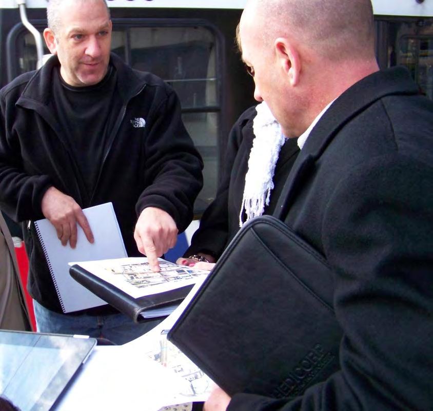
5 TAP Panel Members Panel Work Day: October 30, 2012 Panel Chair Gwen Knight, Enhanced Value Strategies, Inc. Panel Members Chris Cedergreen, Forum Studio Chip Crawford, Forum Studio Marc Hirshman, U.S. Bancorp Community Development Corporation Alison Marischen, Polsinelli Shughart Stan Mulvihill, McCormack Baron Salazar Gregory Patterson, BJC HealthCare Technical Writer & ULI St. Louis District Coordinator: Kelly Annis
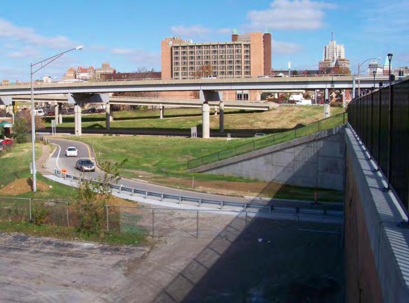
6 Panel s Charge Short Term Long Term Land Uses
7 Short Term 1. What is the best way to integrate, and design for, the land uses at and around the station given the grade separation along Grand?
8 Short Term 2. What potential incentives, i.e. physical infrastructure and financial incentives, could stakeholders provide to increase the desirability for this location?
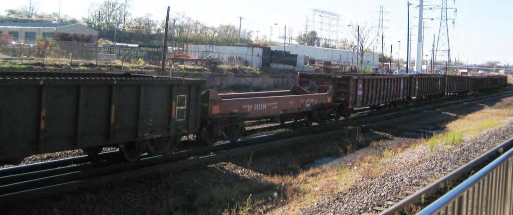
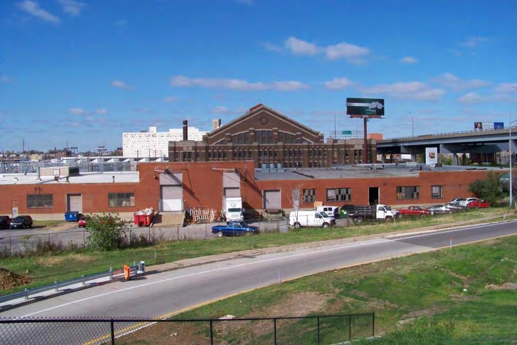
9 Short Term 3. In addition, how can any project better integrate the successful Grand bus line with record ridership into the development?
10 Long Term Considering the parcels owned or controlled by Metro and the City of St. Louis around the Grand Station, what potential uses will attract development talent and investment capital to the site while supporting the needs/goals of St. Louis University and Harris Stowe as two of the primary stakeholders in the area?
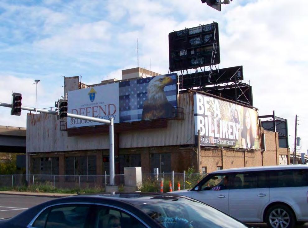
11 Land Uses What land uses would the City of St. Louis like to see around the station, and what is the market for such?

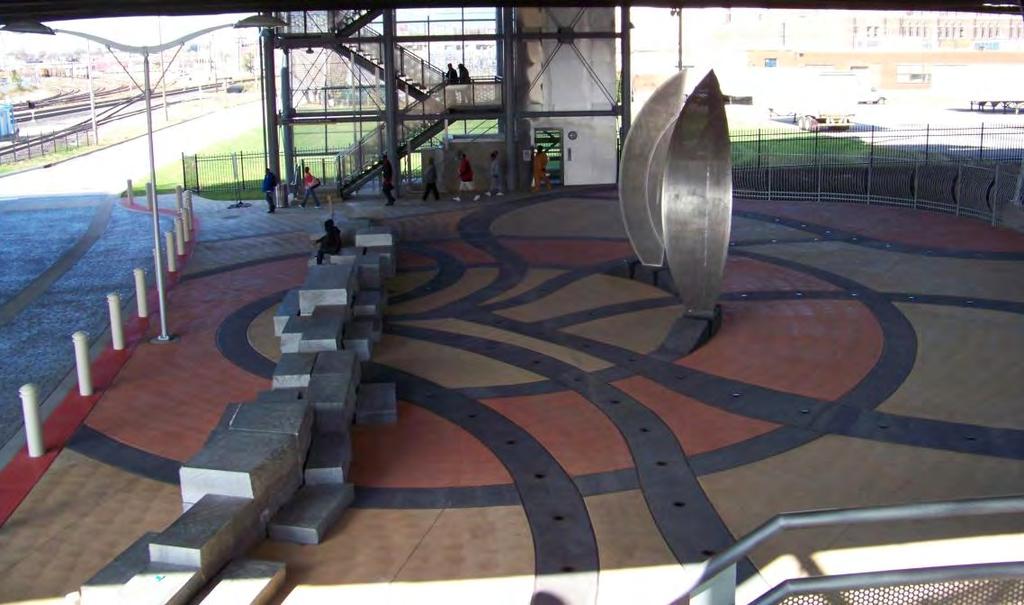
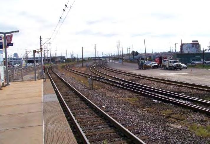
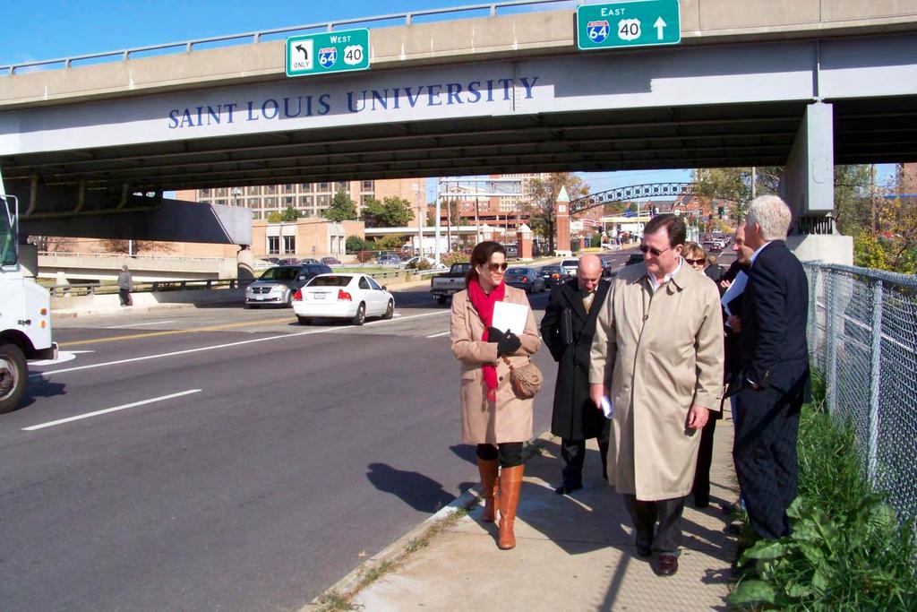
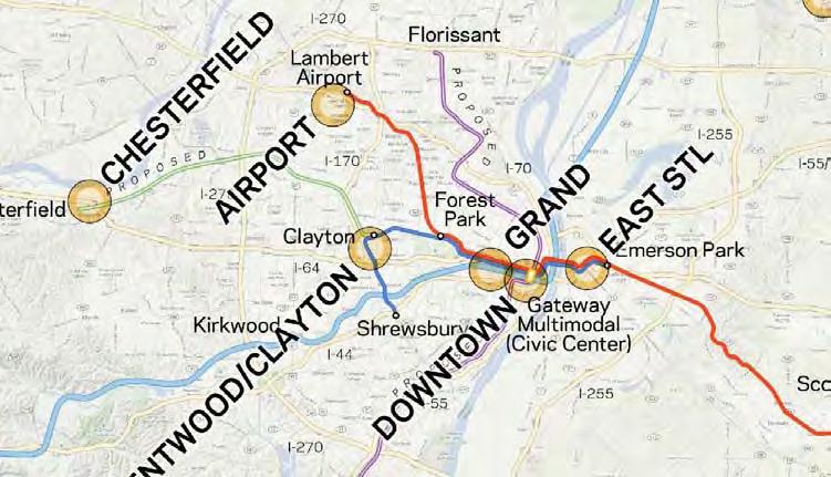
12 Study Area

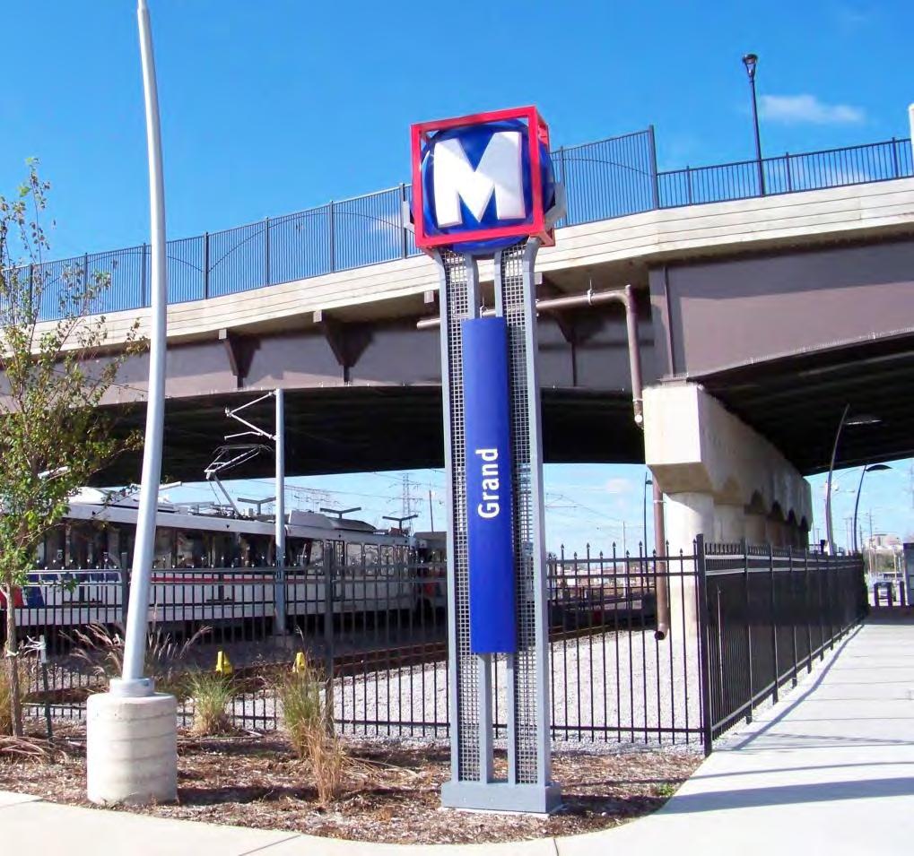
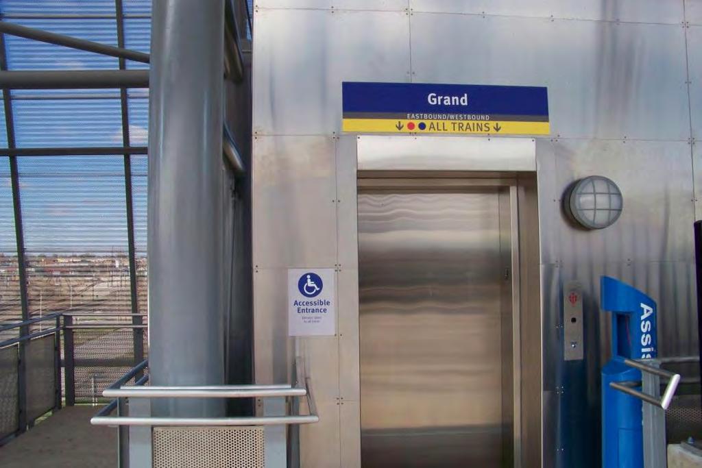
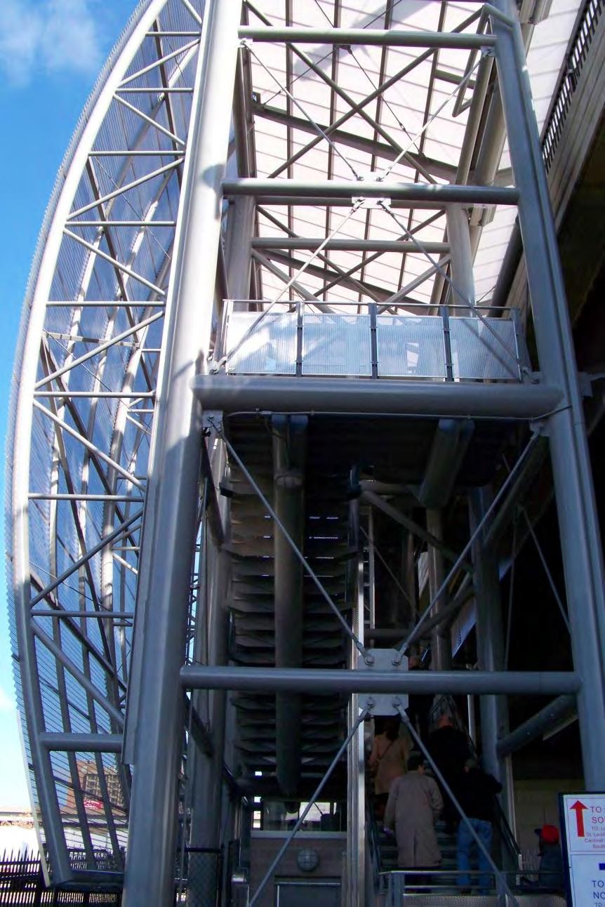
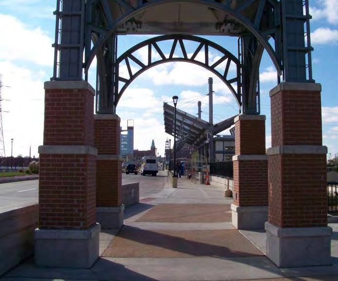
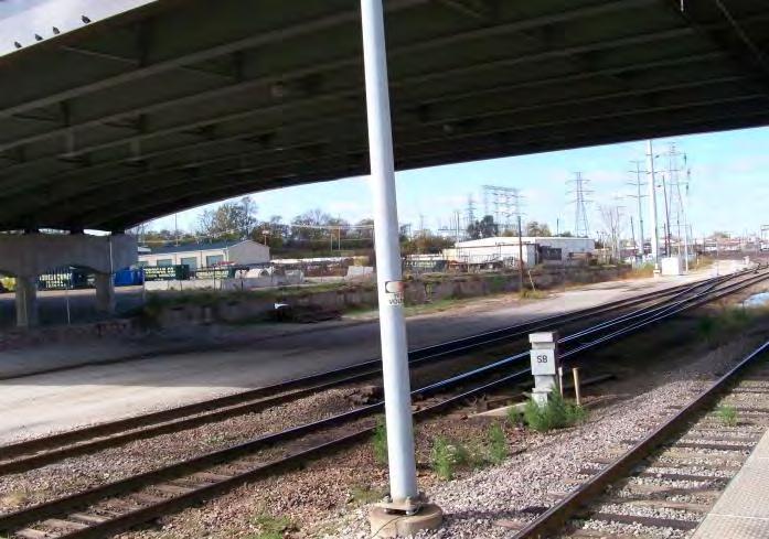
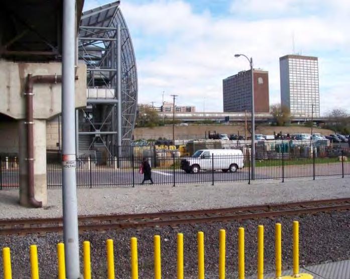
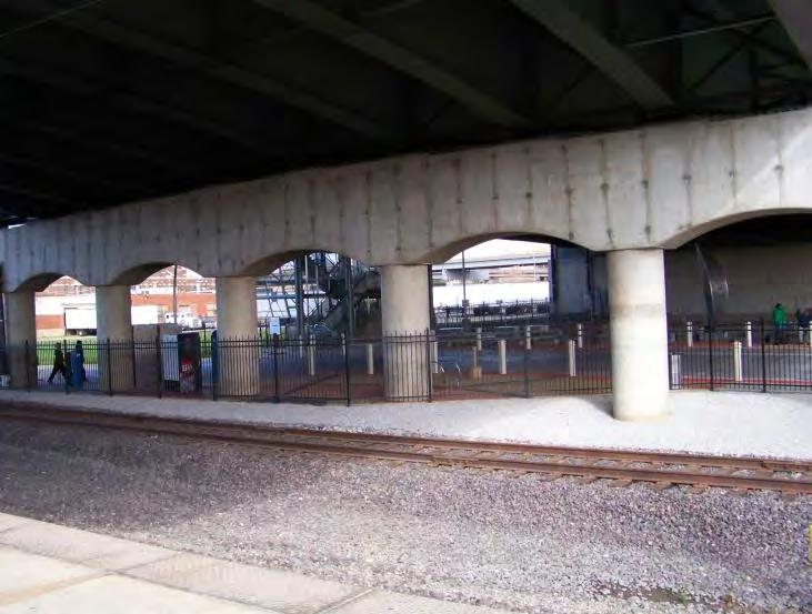
13 Study Area Station is below-grade and situated under Grand Avenue

14 The Grand Avenue bus line enjoys highest ridership numbers throughout the system Study Area

15 Grand Center Study Area Close proximity to Saint Louis University (main campus), Saint Louis University Medical Campus, Harris Stowe University, Grand Center and South Grand amenities SLU Main Campus SLU Medical Harris Stowe South Grand


16 Study Area Heavy industrial area industrial businesses not using abundant freight rail lines running through station area

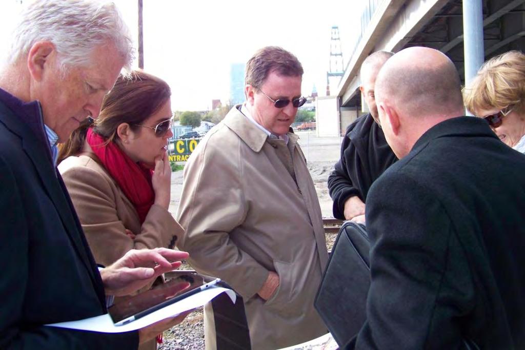
17 Study Area


18 Multiple vacant lots and buildings, many in disrepair Study Area


19 ½ mile study area Study Area

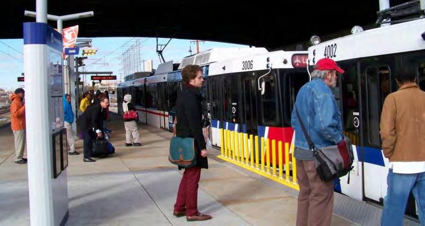
20 Grand Station
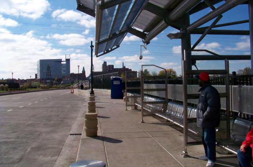
21 Station Highlights


22 360 the Station


23 Surrounding Neighborhood

24 Station Briefing


25 Sponsors Metro Citizens for Modern Transit Surrounding Neighbors Institutional Leaders Business Community Cultural Institutions Real Estate Community Developers St. Louis Development Corporation Stakeholder Meetings
26 Review Charge Short Term Long Term Land Uses
27 Short Term Improvements Increase ridership and enhance current rider experience Universe of opportunities: Grand bus line highest ridership in system Sigma-Aldrich 1,000 employees Metro garage 456 employees Saint Louis University & Harris Stowe University Talk with employers in the area, determine barriers to employee use and proactively market station


28 Short Term Improvements Enhanced experience at the station level Wayfinding at station and on train to nearby universities, medical center, Grand Center, etc.

29 Short Term Improvements Walkability Build on existing measures with signage, graphics, art Broaden and improve sidewalks north and south of bridge improvements Continue kneewalls
30 Short Term Improvements

31 Short Term Improvements Install pavers on Grand to create sense of arrival Create a sense of place by connecting the canopies at the top of the elevator platform

32 Short Term Improvements Reduce speed limits on Grand across bridge; change physical nature of street surface
33 Short Term Improvements Enhance the linkage between south and north bridge entrances Install bike lanes north and south on Grand Improve connections between the north and south SLU campuses and the bridge improvements Continue planters, widen sidewalks, install kneewalls Eliminate the Grand crosswalk at the I-64 ramp Create pedestrian crosswalks over the I-64 ramp (onto Grand from I-64 East) and Forest Park Parkway
34 Address traffic flow at intersection of Forest Park Parkway and Grand Avenue Short Term Improvements
35 Idea #1 Consider moving Parkway to atgrade status Short Term Improvements
36 Short Term Improvements Idea #2 Eliminate the on/off ramps to Grand from Forest Park Parkway. Allows Parkway traffic to continue briskly Lessens car vs. pedestrian competition crossing at Grand Moves some Grand traffic to side streets, freeing up Grand for street car or shuttle (Vandeventer & Compton)
37 Progress Points GET PROPERTY READY FOR DEVELOPMENT Assemble land with City s support/assistance, possible land bank/opportunistic acquisitions; coordinate with SLU s land assemblage activities/plans Clean up properties create larger green spaces Move users inconsistent with long-term goals to other city properties Utilize traditional financial incentives

38 Progress Points Address zoning in the area, form-based code
; CORTEX 353 (west); Chouteau Ave (south); Compton Ave")
39 Progress Points Chapter 353 the Urban Redevelopment Corporation Law Boundaries: Grand Center 353 (north); CORTEX 353 (west); Chouteau Ave (south); Compton Ave (east)
40 Progress Points Chapter 353 the Urban Redevelopment Corporation Law Sets redevelopment guidelines for district Specialized not-for-profit corporation formed to acquire, construct, maintain and operate redevelopment projects per redevelopment guidelines Board of Directors of interested constituents 25-yr real property tax abatement (100% 10 yrs, 50% 15 yrs) may be granted Ability to borrow and mortgage
41 Long Term Vision The Game Changer Transformative change cannot occur in incremental steps here. It needs a bold vision something to transform the site. - ULI St. Louis Grand Station TAP Panelist


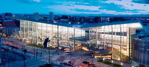
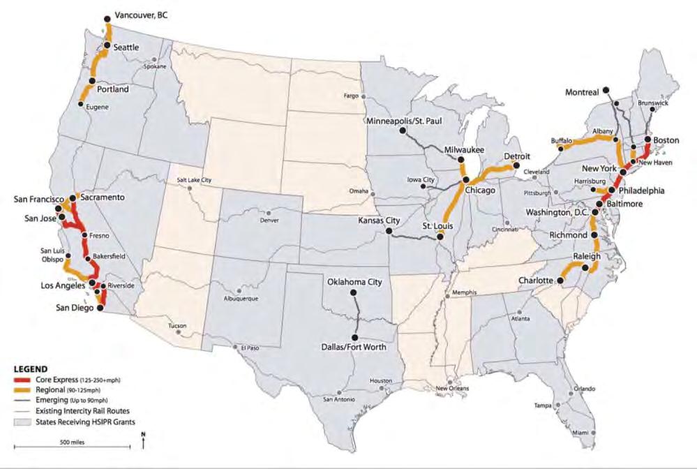
42 Long Term Vision Denver Union Station & Convention Center

43 CORTEX 10+ years in the making, transforming the area Long Term Vision
44 Three Bold Ideas Long Term Vision


45 Chouteau s Greenway Bold Idea #1

46 Bold Idea #1 Chouteau s Greenway

47 Bold Idea #1 Chouteau s Greenway

48 Bold Idea #1 The Greenway
49 Bold Idea #1 The Greenway Every effort should be made to push the Greenway forward breaking out of plan into progress All improvements to Grand Station should keep Greenway plan in mind Variety of local, state, federal, philanthropic sources in cooperation with Great Rivers Greenway, MSD (Green infrastructure initiative and funding?), the City, etc.

50 Bold Idea #2 High-Speed Rail Station at Grand
51 Bold Idea #2 High Speed Rail Connectivity to CBD, CORTEX, BJC, Grand Center Station and corresponding building and parking needs could easily be met at Grand Station Ample opportunities for further connections to light rail and bus lines traversing city
52 Bold Idea #2 High Speed Rail Grand Station generally meets many criteria being evaluated by planners of proposed HSR system High speed rail station and traffic would support commercial development in study area
53 Bold Idea #3 Platform Development Place parking on first 2-3 stories, easily fitting below bridge Place commercial, retail and/or residential on top of parking, level with the bridge platform Embraces light rail and bus connectivity Builds connection between SLU campuses Enhances travel along Grand and encourages pedestrian use

54 Bold Idea #3 -Platform Development

55 Bold Idea #3
56 Bold Idea #3
57 Summary Address short-term improvements to pedestrian experience at station level and Grand Ave level as well as north and south of new Grand Bridge Make ready for development Address traffic at Forest Park Parkway intersection Form Chapter 353, land bank, relocate, and clean up
58 Summary Promote Chouteau s Greenway development effort Financing Variety of local, state, federal, philanthropic sources in cooperation with Great Rivers Greenway, MSD (Green infrastructure initiative and funding?), the City, etc.
59 Summary Consider game-changing vision for Grand Station (Greenway, High Speed Rail, Platform development)
60 Start with the end in mind.
61
ULI St. Louis Technical Assistance Panel
 ULI St. Louis Technical Assistance Panel ULI St. Louis Technical Assistance Panel Sponsored by: Citizens for Modern Transit in partnership with METRO ULI St. Louis Mission Statement The mission of the
ULI St. Louis Technical Assistance Panel Recommendations. Technical Assistance Panel Grand MetroLink Station St. Louis, Missouri
 Grand Scheel MetroLink Street MetroLink Station, Station, St. Louis, Belleville, Missouri Illinois Technical Assistance Panel Grand MetroLink Station St. Louis, Missouri Panel Recommendations to Citizens
LEED-ND 101: Practical Strategies for Achieving Sustainability Goals. Travis Parker Lakewood Planning Director
 LEED-ND 101: Practical Strategies for Achieving Sustainability Goals Travis Parker Lakewood Planning Director Metro Vision Idea Exchange Oct 11, 2012 West Corridor Stations West Corridor Overview West
The University District envisions, in its neighborhood
 Envisioning the University District Link Light Rail in Seattle s neighborhoods CIY OF SEALE CONCEP-LEVEL SAION AREA PLANNING RECOMMENDAION RESOLUION # 30165 EXHIBI L Vision 08.2000 he University District
TEMPLE MEDICAL & EDUCATION DISTRICT
 City of Temple, Texas TEMPLE MEDICAL & EDUCATION DISTRICT 1 Description. The City of Temple joined in partnership with key public and private entities to jointly promote education and medical activities
MONTGOMERY COUNTY METRO STATION AREA DESIGN CHARRETTE
 MONTGOMERY COUNTY METRO STATION AREA DESIGN CHARRETTE Shady Grove Metro Station Area Charrette Closing Presentation October 25-28, 2000 MONTGOMERY COUNTY, MD M-NCPPC Design Collective, Inc. Architects
QUINCE ORCHARD/FIRSTFIELD CORRIDOR CITY OF GAITHERSBURG MTAP 2017
 QUINCE ORCHARD/FIRSTFIELD CORRIDOR CITY OF GAITHERSBURG MTAP 2017 ULI LEADERSHIP INSTITUTE 2017 The Team Allison Davis, WMATA Daniel Park, Rodgers Consulting Debbie Albert, Arlington County Harry Ross,
CHAPTER 7: Transportation, Mobility and Circulation
 AGLE AREA COMMUNITY Plan CHAPTER 7 CHAPTER 7: Transportation, Mobility and Circulation Transportation, Mobility and Circulation The purpose of the Transportation, Mobility and Circulation Chapter is to
JANUARY 19, 2011 CENTRAL AVENUE-METRO BLUE LINE TRANSIT-ORIENTED DEVELOPMENT IMPLEMENTATION PROJECT COMMUNITY FORUM
 CENTRAL AVENUE-METRO BLUE LINE TRANSIT-ORIENTED DEVELOPMENT IMPLEMENTATION PROJECT COMMUNITY FORUM JANUARY 19, 2011 THE MARYLAND-NATIONAL CAPITAL PARK AND PLANNING COMMISSION PRINCE GEORGE S COUNTY PLANNING
NOVEMBER 2016 AARP IN ST. LOUIS & CITIZENS FOR MODERN TRANSIT PLACEMAKING STRATEGIES FOR ST. LOUIS TRANSIT DRAFT
 NOVEMBER 2016 AARP IN ST. LOUIS & CITIZENS FOR MODERN TRANSIT PLACEMAKING STRATEGIES FOR ST. LOUIS TRANSIT DRAFT SECTION 3 RECOMMENDATIONS AARP IN ST. LOUIS + CMT + ARCTURIS + THE INNIS GROUP 37 SECTION
ULI Boston Technical Assistance Panel (TAP) Program. Downtown Marlborough
 Program. Downtown Marlborough") ULI Boston Technical Assistance Panel (TAP) Program Downtown Marlborough ULI the Urban Land Institute Mission To provide leadership in the responsible use of land and in creating and sustaining thriving
ULI Boston Technical Assistance Panel (TAP) Program Downtown Marlborough ULI the Urban Land Institute Mission To provide leadership in the responsible use of land and in creating and sustaining thriving
Making Transit Oriented Development Work For Boonton, NJ
 Making Transit Oriented Development Work For Boonton, NJ Bloustein School of Planning and Public Policy Studio Dan Burton Loannie Dao Webster Slater Brandon Williams Ian Watson Maria Laham Nicola Mammes
TRANSIT-ORIENTED DEVELOPMENT PLAN PRESENTATION RED-PURPLE BYPASS PROJECT AREA
 TRANSIT-ORIENTED DEVELOPMENT PLAN PRESENTATION RED-PURPLE BYPASS PROJECT AREA Purpose Create a community-led vision for redevelopment in the neighborhood Test specific concepts for CTA-owned parcels Expedite
Public input has been an important part of the plan development process.
 Lakewood s Comprehensive Plan recognizes that transportation helps shape the community, and that the way the community provides for the safe and efficient movement of people affects the character of the
Chapter 4. Linking Land Use with Transportation. Chapter 4
 Chapter 4 Linking Land Use with Transportation Chapter 4 59 Chapter 4 Linking Land Use with Transportation Community Design and Transportation Program Introduction Since the 1950s, the predominant development
Planning Districts INTRODUCTION
 INTRODUCTION To facilitate detailed examination of development prospects for all areas of the community, Delano has been divided into 14 planning districts. The location of these planning districts is
The transportation system in a community is an
 7 TRANSPORTATION The transportation system in a community is an important factor contributing to the quality of life of the residents. Without a sound transportation system to bring both goods and patrons
Methuen Technical Assistance Panel, June 18, 2015! City of Methuen, Massachusetts!
 Methuen Technical Assistance Panel, June 18, 2015 City of Methuen, Massachusetts Methuen Technical Assistance Panel, June 18, 2015 About ULI the Urban Land Institute Mission To provide leadership in the
ULI Boston/New England Technical Assistance Panel (TAP) Program. Hospital District, Providence, RI
 Program. Hospital District, Providence, RI") ULI Boston/New England Technical Assistance Panel (TAP) Program Hospital District, Providence, RI ULI the Urban Land InsFtute Mission To provide leadership in the responsible use of land and in crea4ng
ULI Boston/New England Technical Assistance Panel (TAP) Program Hospital District, Providence, RI ULI the Urban Land InsFtute Mission To provide leadership in the responsible use of land and in crea4ng
Robbinsdale LRT Station. CDI Development Guidelines. August Overview
 Robbinsdale LRT Station August 2018 Overview The City of Robbinsdale may have the coolest opportunity site along the 13 mile stretch of the Bottineau LRT corridor / Blue Line extension. Located a block
Chapter 1.0 Introduction
 Chapter 1.0 Introduction 1.1 Background The North Metro commuter rail line is part of the RTD FasTracks regional transit system expansion program to build more than 100 miles of rail transit throughout
Study Area. Capitol Way. Greening America s Capitals 11/13/2014. A Greening America s Capitals Project
 Olympia, WA: Greening Capitol Way Supporting Communities move towards sustainability is a priority for the federal government. A Greening America s Capitals Project Office of Sustainable Communities U.S.
ROBBINSDALE LRT STATION CDI DEVELOPMENT GUIDELINES
 August 2018 OVERVIEW The City of Robbinsdale has a prime-opportunity site in the middle of the 13 mile stretch of the Bottineau LRT corridor / Blue Line extension. Robbinsdale offers a prominent, vital,
Draft Bergamot Area Plan
 ATTACHMENT 1 Draft Bergamot Area Plan Taskforce on the Environment April 15, 2013 www.bergamotplan.net 1 Overview WHAT IS THE BERGAMOT AREA PLAN? A Community-Based Planning Document Guiding the Future
Union Station Master Plan Task 2 Briefing
 Union Station Master Plan Task 2 Briefing Goals and Organization for Tonight s Meeting Presentation Master Plan Schedule and Scope Key Findings Guiding Principles Alternatives Process Draft Alternatives
Salem Strategic Assistance Panel December 11, Salem, MA
 Salem Strategic Assistance Panel December 11, 2017 Salem, MA About ULI the Urban Land Institute Mission To provide leadership in the responsible use of land and in creating and sustaining thriving communities
The Lincoln Neighborhood Corridor Plan. The LiNC
 October 1, 2014 Planning Commission Study Session The Lincoln Neighborhood Corridor Plan The LiNC Purpose of Tonight s Meeting Introduction to The LiNC Review of Existing Conditions and Community Identified
Illustration of Eastlake Farmer s Cooperative Grain Elevator. Chapter 5: implementation 5-1
 Illustration of Eastlake Farmer s Cooperative Grain Elevator Chapter 5: implementation 5-1 chapter 5: implementation Introduction The Eastlake Subarea Plan includes a wide range of recommendations intended
Hopkins. Development Guidelines May Overview. Sponsored by: Blake Road Corridor Collaborative City of Hopkins
 Hopkins Blake Road LRT Station Area Development Guidelines May 2015 Sponsored by: Blake Road Corridor Collaborative City of Hopkins Overview Hopkins is a dynamic community of over 17,000 residents located
2030 Comprehensive Plan VISION STATEMENT
 RESOURCE DOCUMENT for Steering Committee Meeting #2 July 12, 2017 2030 Comprehensive Plan VISION STATEMENT Steering Committee from 2008 Established the Lauderdale s Vision as: Creating a livable, lovable
UPDATE ON THE INDEPENDENCE BOULEVARD AREA PLAN. Citizen Advisory Group Meeting March 3, 2011
 UPDATE ON THE INDEPENDENCE BOULEVARD AREA PLAN Citizen Advisory Group Meeting March 3, 2011 Purpose: Why are we here? To provide an update on the Independence Boulevard Area Plan 1. Overview of the ULI
Access to the University of North Carolina at Chapel Hill, UNC Hospitals, and Chapel Hill Transit.
 M 1/ 4 1/ 2 E IL M E IL Station Family: County: City: UNC Hospitals WHY THIS STATION? University Village Orange Chapel Hill Access to the University of North Carolina at Chapel Hill, UNC Hospitals, and
Windsor Locks Transit-Oriented Development Planning Grant Request. Project Background
 Windsor Locks Transit-Oriented Development Planning Grant Request Project Background Downtown Windsor Locks runs along Main Street in the vicinity of the intersection of Routes 159 and 140. The current
East Central Area Plan
 East Central Area Plan Steering Committee Meeting March 8 th, 2018 CHUN Tears McFarlane House Vision Statement Development Opportunities Analysis Vision Elements 1. Equitable, Affordable and Inclusive
Shift Rapid Transit Public Participation Meeting May 3, 2017
 Shift Rapid Transit Public Participation Meeting May 3, 2017 Shift Rapid Transit Initiative Largest infrastructure project in the city s history. Rapid Transit initiative will transform London s public
SPRINGFIELD, MA Technical Assistance Panel (TAP)
") SPRINGFIELD, MA Technical Assistance Panel (TAP) ULI the Urban Land Institute Mission To provide leadership in the responsible use of land and in creating and sustaining thriving communities worldwide.
SPRINGFIELD, MA Technical Assistance Panel (TAP) ULI the Urban Land Institute Mission To provide leadership in the responsible use of land and in creating and sustaining thriving communities worldwide.
Stakeholders Advisory Working Groups (SAWGs) Smart Growth and TOD Land Use (#11) SAWG Meeting
 Smart Growth and TOD Land Use (#11) SAWG Meeting") Presentation - Part II Tappan Zee Bridge/I-287 Corridor Project July 21, 2010 Slide 1. David Kooris (Regional Plan Association) welcomed members of the Land Use Stakeholders Advisory Working Groups (SAWGs)
Presentation - Part II Tappan Zee Bridge/I-287 Corridor Project July 21, 2010 Slide 1. David Kooris (Regional Plan Association) welcomed members of the Land Use Stakeholders Advisory Working Groups (SAWGs)
A BLUEPRINT FOR BROCKTON A CITY-WIDE COMPREHENSIVE PLAN
 A BLUEPRINT FOR BROCKTON A CITY-WIDE COMPREHENSIVE PLAN Public Meeting October 2016 1 Plan Summary and Discussion Public Meeting May 4 2017 City of Brockton Bill Carpenter, Mayor Department of Planning
Transportation. Strategies for Action
 Transportation A major priority for the Overlake Neighborhood is to develop a multimodal transportation system. To achieve this system, a balance has to be found among travel, circulation and access needs;
EXHIBIT A. Tax Increment Reinvestment Zone No. 1 (Town Center) First Amended Project Plan 1
 First Amended Project Plan 1") EXHIBIT A Tax Increment Reinvestment Zone No. 1 (Town Center) First Amended Project Plan 1 1 As amended by Resolution No. 2008-02-001(TR1R) of the Tax Increment Reinvestment Zone No.1, and approved to
EXHIBIT A Tax Increment Reinvestment Zone No. 1 (Town Center) First Amended Project Plan 1 1 As amended by Resolution No. 2008-02-001(TR1R) of the Tax Increment Reinvestment Zone No.1, and approved to
UAA School of Engineering Parking Garage Master Plan Amendment. 1. Purpose
 UAA School of Engineering Parking Garage Master Plan Amendment 1. Purpose Since the UAA campus master plan was drafted in 2003, adopted in 2004, and amended in 2009 a number of significant changes regarding
University of the District of Columbia Van Ness Campus Master Plan Community Open House 3. December 8, 2010
 University of the District of Columbia Van Ness Campus Master Plan Open House 3 December 8, 2010 Introductions Sequence of Work: Campus Master Plan BEGIN: INTRODUCE AND START WORK Project Initiation Team
Public may provide comments on the GDP within the next two weeks (December 24)
") 25/70 General Development Plan (GDP) Public Meeting Wednesday, December 10, 2014 6:00 8:00 P.M. District 1 Police Station Community Room 1311 W 46th Ave, Denver, CO 80211 Council Woman Montero: This particular
25/70 General Development Plan (GDP) Public Meeting Wednesday, December 10, 2014 6:00 8:00 P.M. District 1 Police Station Community Room 1311 W 46th Ave, Denver, CO 80211 Council Woman Montero: This particular
City of Nogales General Plan
 Open Space, Parks, Recreation and Trails City of Nogales General Plan Residents of Nogales place a high priority in the development of a comprehensive system of open space, parks, recreation and trails
NorthPoint, Inc. Community-Based Development Concept
 NorthPoint, Inc. Community-Based Development Concept 6.0.01 EXECUTIVE SUMMARY The NorthPoint Community Board Development concept is a community development strategy. It leverages NorthPoint s mission,
Northwest Rail Corridor and US 36 BRT Development Oriented Transit Analysis 4.4 STATION AREA FINDINGS
 4.4 STATION AREA FINDINGS Each station is different, and each one requires a separate set of recommendations based on the vision for the site. This section outlines an initial TOD strategy and recommendations
RESOLUTION NO. R Refining the route, profile and stations for the Downtown Redmond Link Extension
 RESOLUTION NO. R2018-32 Refining the route, profile and stations for the Downtown Redmond Link Extension MEETING: DATE: TYPE OF ACTION: STAFF CONTACT: Capital Committee Board PROPOSED ACTION 09/13/2018
Lower South Street/Louisa Street Charrette Final Presentation. September 22, 2009
 Lower South Street/Louisa Street Charrette Final Presentation September 22, 2009 Recap Mayor and Council called for a Charrette to engage the public on creating a vision for the Lower South Street area.
Route 1 Corridor Study
 Route 1 Corridor Study Westbrook, Connecticut A Vision for the Connecticut Shoreline Public Informational Meeting July 28, 2015 Lower Connecticut River Valley Council of Governments Fitzgerald & Halliday,
LUNDY S LANE COMMUNITY IMPROVEMENT PLAN STUDY
 PUBLIC INFORMATION MEETING #2 October 12, 2016 LUNDY S LANE COMMUNITY IMPROVEMENT PLAN STUDY AGENDA 5:00 to 5:30pm: Open House 5:30 to 6:15pm: Presentation 6:15 to 7:00pm: Individual paced workshop with
Pedestrian and Bike Bridge LOGO
 6.2.2 Pedestrian and Bike Bridge The proposed pedestrian and bike crossing re-envisions the existing bridge at Pismo Creek on Cypress Street. The bridge is currently underutilized by vehicular through
Midtown Greenway Land Use and Development Plan Executive Summary
 Midtown Greenway Land Use and Development Plan Executive Summary Introduction The Midtown Greenway Land Use and Development Plan sets policy direction for land use and development in the Midtown Greenway
Potential Green Infrastructure Strategies May 6, 2015 Workshop
 Potential Green Infrastructure Strategies May 6, 2015 Workshop Background The City of Cortland is developing the Tioughnioga Urban Headwaters Green Infrastructure Action Plan with funding from the National
APPENDIX D: Visual and Aesthetic Conditions for NCCU Station Refinement. Durham-Orange Light Rail Transit Project
 APPENDIX D: Visual and Aesthetic Conditions for NCCU Station Refinement Durham-Orange Light Rail Transit Project October 2016 1. Introduction The Combined FEIS/ROD summarizes the effects of the D-O LRT
The Vision. Photo provided by The Minervini Group. 46 Vision, Objectives & Strategies
 Vision, Objectives & Strategies The is the public framework and guide for future development of the Grand Traverse Commons. The establishes public polices for infrastructure, the preservation of natural
ULI Boston Technical Assistance Panel (TAP) Framingham Tech Park
 Framingham Tech Park") ULI Boston Technical Assistance Panel (TAP) Framingham Tech Park ULI the Urban Land Institute Mission To provide leadership in the responsible use of land and in creating and sustaining thriving communities
ULI Boston Technical Assistance Panel (TAP) Framingham Tech Park ULI the Urban Land Institute Mission To provide leadership in the responsible use of land and in creating and sustaining thriving communities
Cobb County Design Guidelines Mableton Parkway & Veterans Memorial Highway Community Design Workshop January 12, 2017
 Community Design Workshop January 12, 2017 Agenda Opening Remarks / Introductions Scope of Work Existing Conditions Key Issues / Opportunities VPS Summary Draft Vision & Goal Statement Implementation Concepts
TOD 101 CREATING LIVABLE COMMUNITIES WITH TRANSIT
 1 CREATING LIVABLE COMMUNITIES WITH TRANSIT What are transit Centered Communities? Benefits of Partnerships to Support and Implement What You Will Learn Portland s Pearl District Your Trainers Today Catherine
Status Update (2006 vs. Now) Citizen s Advisory Committee February Plan for Prosperity
 Citizen s Advisory Committee February Plan for Prosperity") Status Update (2006 vs. Now) Citizen s Advisory Committee February 2018 Plan for Prosperity 2000 2017 2000 2017 Gardnerville Population 6,000 5,760 5746 5,500 5,000 5,067 5,550 5,165 5,394 5,412 5,250
Status Update (2006 vs. Now) Citizen s Advisory Committee February 2018 Plan for Prosperity 2000 2017 2000 2017 Gardnerville Population 6,000 5,760 5746 5,500 5,000 5,067 5,550 5,165 5,394 5,412 5,250
PIKE PINE RENAISSANCE: ACT ONE. October 19, 2017
 PIKE PINE RENAISSANCE: ACT ONE October 19, 2017 WATERFRONT SEATTLE PROGRAM PROJECT INTRODUCTION Pike and Pine streets, between First and Melrose avenues Pedestrian and streetscape improvements Budget:
Existing Conditions. Planning and Design Principles
 penn s south bank enn s South Bank is located south of the Schuylkill River at the intersection of 4th Street and. This acre former heavy industrial site offers the opportunity to accommodate a variety
Lesson 6. Corridor Planning
 Lesson 6 Corridor Planning 1 Learning Outcomes Identify land use strategies and solutions that can be incorporated into multimodal transportation corridor plans Identify land use stakeholders and describe
Goals AND Guiding principles
 Historic photo of Eastlake Train Station sign Chapter 2: Goals AND Guiding principles 2-1 The Plan goals includes a desire to bridge present day conditions with a vision of the area s future. A central
Technical Assistance Panel Proposed MetroLink Station in the Cortex District St. Louis, Missouri
 Cortex Scheel District Street MetroLink Station, Belleville, St. Louis, Illinois Missouri Technical Assistance Panel Proposed MetroLink Station in the Cortex District St. Louis, Missouri Panel Recommendations
Harlem Avenue Corridor Plan: Corridor Planning Across Municipal Boundaries
 Harlem Avenue Corridor Plan: Corridor Planning Across Municipal Boundaries Heather Tabbert, Manager, Local Planning and Programs Division Regional Transportation Authority (RTA) Jen McNeil Dhadwal, Principal
DRAFT Civic Center Station Area Plan. Executive Summary
 DRAFT Civic Center Station Area Plan Executive Summary This project is funded in part through the Metropolitan Transportation Commission s Station Area Planning Program. The preparation of this report
Ivywild On The Creek PRELIMINARY CREEK DISTRICT MASTER PLAN
 Ivywild On The Creek PRELIMINARY CREEK DISTRICT MASTER PLAN Introduction: Rejuvenating an extraordinary Creekside neighborhood THE CREEKSIDE DISTRICT The Ivywild On The Creek Neighborhood District Master
Coatesville Station Area Planning Work in Progress Meeting, August 19, 2010 STATION AREA PLANNING WORK IN PROGRESS PRESENTATION
 COATESVILLE STATION AREA PLANNING WORK IN PROGRESS PRESENTATION Summarize Project Approach and Schedule Discuss What We ve Heard So Far Present Strategies Get Your Feedback On Design Options Tonight s
City of Bristol Route 6 Corridor Implementation Program
 City of Bristol Route 6 Corridor Implementation Program FITZGERALD & HALLIDAY, INC. Innovative Planning, Better Communities June 2017 Route 6 Corridor Plan IMPLEMENTATION PROGRAM The following Implementation
Atlanta BeltLine Corridor Environmental Study. Scoping Meeting August 2008
 Atlanta BeltLine Corridor Environmental Study Scoping Meeting August 2008 What Will We Be Discussing Today? Study Overview - How Did We Get Here? - What Is the Study About? - Who Is Involved? - Where Is
Welcome to the Oakridge Centre Open House
 Welcome to the Oakridge Centre Open House Why is the City hosting this event? This open house is to inform you of a rezoning application submitted to the City of Vancouver to amend the existing CD-1 (Comprehensive
Lower Merion Commercial Districts Issues and Characteristics Handbook November 2013
 Lower Merion Commercial Districts Issues and Characteristics Handbook November 2013 DRAFT TOWNSHIP-WIDE VISION: To maintain and enhance commercial areas to complement the surrounding high-quality residential
Cherokee. Corporate Headquarters 111 East Hargett Street Suite 300 Raleigh, NC
 Cherokee Corporate Headquarters 111 East Hargett Street Suite 300 Raleigh, NC 27601 919-743-2500 Denver 4600 S. Ulster Street Suite 500 Denver, CO 80237 303-689-1460 London 41-43 Maddox Street London W1S
BUDGETING FOR OUTCOMES TRINITY RIVER CORRIDOR
 BUDGETING FOR OUTCOMES TRINITY RIVER CORRIDOR Trinity River Corridor Team Members: Kelly High, Streets Department Megan Lam, Office of Financial Services Mike Mikeska, Dallas Water Utilities Diana Ochoa,
Town of Avon Village Center. A New Village Center for Avon October, 2015
 Town of Avon Village Center A New Village Center for Avon October, 2015 A busy Avon Center approx. 1940 The Avon Town Center Study: In 2004 the Planning and Zoning Commission (PZC) undertook the Avon
Downtown River District
 City & Downtown Development Authority Partnership Infrastructure Analysis & Design Project Transportation & Utilities Fix Current Deficiencies Set the Stage for Future Infill & Redevelopment Who s Involved:
1 October Dear Citizens of Charlotte and Mecklenburg County,
 1 October 2011 Dear Citizens of Charlotte and Mecklenburg County, As co-chairs of the Center City 2020 Vision Plan Steering Committee, we are proud to present the Center City 2020 Vision Plan, which sets
Josh Radoff, Founder, YR&G. Steve Nalley, Neighborhood Planning Supervisor, City and County of Denver Community Planning and Development
 Josh Radoff, Founder, YR&G Steve Nalley, Neighborhood Planning Supervisor, City and County of Denver Community Planning and Development 40 th & Colorado Station Steve Nalley, City & County of Denver Josh
MAIN STREET ECONOMIC DEVELOPMENT STRATEGY
 MAIN STREET ECONOMIC DEVELOPMENT STRATEGY A PATHWAY TO A BETTER POUGHKEEPSIE DRAFT Working Paper #2: Planning Strategies Submitted December 1 st, 2015 to the City of Poughkeepsie LAND USE LAW CENTER PACE
BRYN MAWR. Tier 2 Characteristics: Location: Lancaster Avenue from Old Lancaster Road on the east to Norwood Avenue on the west
 BRYN MAWR Tier 2 Characteristics: Transit-oriented Mixed use Along Lancaster Avenue Serve township-wide needs Civic space Employment centers Location: Lancaster Avenue from Old Lancaster Road on the east
What s Up Next In The Seattle Squeeze. PSRC Transportation Policy Board April 11
 What s Up Next In The Seattle Squeeze PSRC Transportation Policy Board April 11 1 Current construction Alaskan Way Viaduct removal Removes the viaduct (including foundations and ramps) and restores the
At first Work Session on October 22, At second Work Session on November 19, At third Work Session on December 3, 2015
 At first Work Session on October 22, 2015 Staff Reviewed Infrastructure: Transportation Capacity School Capacity Willett Branch Proposed Staging Language At second Work Session on November 19, 2015 Land
Small Area Plan. South Gateway
 Small Area Plan Adopted May 12, 2008 South Gateway Purpose. The South Gateway Small Area Plan defines the City s expectations for the future of the southern entrance to the City at Interstate 85 and Highway
Kenilworth Avenue and Town of Cheverly Industrial Study Briefing
 Kenilworth Avenue and Town of Cheverly Industrial Study Briefing The Maryland-National Capital Park and Planning Commission Prince George s County Planning Department www.pgplanning.org Vanasse Hangen
REGIONAL ACTIVITY CENTER
 DRAFT REGIONAL ACTIVITY CENTER 70 EAST BENCH MASTER PLAN DRAFT 06 Introduction The East Bench Regional Activity center is comprised of large educational, research, medical, and employment centers. These
EXISTING COMPREHENSIVE PLAN
 EXISTING COMPREHENSIVE PLAN Town Center Land Use Element: V. LAND USE POLICIES Town Center Mercer Island's business district vision as described in "Your Mercer Island Citizen-Designed Downtown" was an
Transit Oriented Development. Overview
 Trammell Crow Residential Sean G. Hyatt, Managing Director Transit Oriented Development What is TOD? TOD in King County TOD Characteristics and Examples Veloce (Alexan Redmond TOD) About Trammell Crow
Creating Community Around Commuter Rail in Arvada Colorado. Presented By Mike Elms, AICP Community Development Director City of Arvada Colorado
 Creating Community Around Commuter Rail in Arvada Colorado Presented By Mike Elms, AICP Community Development Director City of Arvada Colorado Arvada s s Location 10 miles west of Denver A first tier suburb
University Avenue District
 University Avenue District UPDATE ON THE OPPORTUNITY 07.8.15 1 University Avenue District The new century nexus of live, work, learn, research, and engage. An intentional partnership of developers, businesses,
Embrace Green Urban Space:
 1 Embrace Green Urban Space: Parks/Green Space as Vital to Urban Livability Jenna Fletcher The Trust for Public Land LUAC November 15, 2012 2 The Trust for Public Land conserves land for people to enjoy
Point A Point B Point C Point D. City of Hapeville Public Meeting July 25, 2017
 City of Hapeville Public Meeting July 25, 2017 Fulton County Transit Master Plan Overview Following last year s ¾-cent TSPLOST effort, the Mayors of the 14 Cities outside of Atlanta and the Fulton County
Allen Street Civic District Redevelopment Area Plan Redevelopment Plan & Proposal State College Planning Commission State College Redevelopment
 Allen Street Civic District Redevelopment Area Plan Redevelopment Plan & Proposal State College Planning Commission State College Redevelopment Authority September 17, 2015 Discussion Points Overview of
KCATA Transit Oriented Development Initiatives
 KCATA Transit Oriented Development Initiatives KCATA: Regional Transportation Authority Created by bi-state compact Approved by Congress 7 County service area Quasi-governmental with broad powers Power
South Davis County COMMUNITY SPOTLIGHT
 South Davis County COMMUNITY SPOTLIGHT Davis/SLC Community Connector Bus Rapid Transit line connecting SLC & Davis County RTP Phase 1 Project Generate 3,100 average weekday riders Relieve congestion on
D-O LRT Zoning Discussion. Chapel Hill Boards & Commissions October 16, 2017
 D-O LRT Zoning Discussion Chapel Hill Boards & Commissions October 16, 2017 Update on Overall D-O LRT Station Area Initiative Objectives Design and educate on principles of Good Transit-Oriented Development
Volume 2: Implementation Plan
 Volume 2: Implementation Plan February 25 th 2002 Implementation Introduction This document outlines the steps that should be taken to implement the Washington Heights Neighborhood Plan. The City Council
Implementation Guide Comprehensive Plan City of Allen
 Implementation Guide 2030 Comprehensive Plan City of Allen DRAFT 2015 Implementation Guide Allen 2030 Comprehensive Plan INTRODUCTION The Comprehensive Plan serves as a guide for the growth and development
Chapter 1: Introduction
 Chapter 1: Introduction The Penn Avenue Community Works Corridor Vision and Implementation Framework presents an integrated communitybased vision and a coordinated, long-term implementation framework for
UNIVERSITY CITY AREA PLAN. Volume Two: Implementation Plan
 UNIVERSITY CITY AREA PLAN Volume Two: Implementation Plan Transforming the University City MSD into the vibrant, people-oriented place envisioned in the University City Plan will occur incrementally through
NACCED/NACo CONFERENCE JULY 10, 2015
 NACCED/NACo CONFERENCE JULY 10, 2015 Regional Growth Framework 2 Regional Growth Framework Regional Priorities Preferred Growth Concept Tools to Support Local Governments 3 Top Priorities for the CONNECT