INDEPENDENCE BOULEVARD AREA PLAN. Economic Development Committee Overview March 10, 2011
|
|
|
- Robert Watkins
- 6 years ago
- Views:
Transcription

1 INDEPENDENCE BOULEVARD AREA PLAN Economic Development Committee Overview March 10, 2011

2 Presentation Outline Purpose: To provide an overview of the Independence Boulevard Area Plan and to request a recommendation for Council to receive public comment Plan Purpose and Development Process Draft Plan Policies and Implementation Strategies Request Action
3 PURPOSE OF THE PLAN
 Transit Station Area")
4 Policy Context Centers, Corridors and Wedges Growth Framework Framework provides starting point for developing area plan Most of plan area is within a growth corridor Includes six (6) Transit Station Area Plans

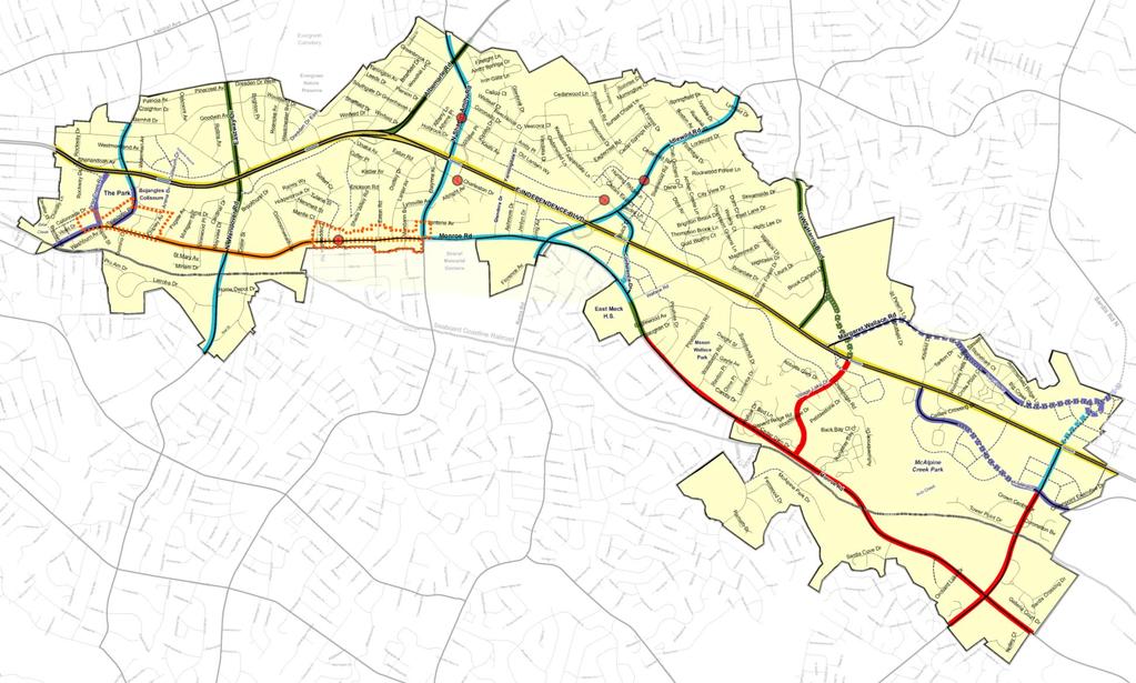
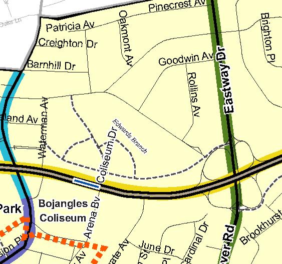
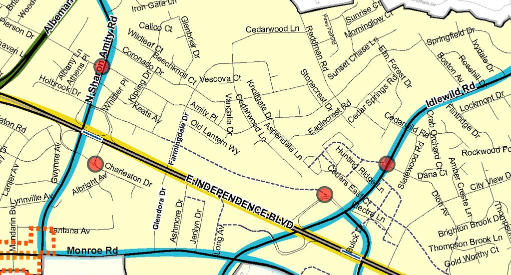
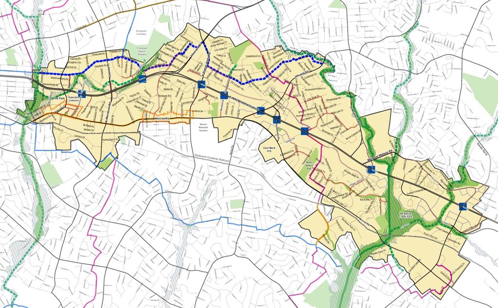
5 Area Plan Boundary Evergreen Nature Preserve The Park Bojangles Coliseum Ovens Auditorium Grayson Park East Meck HS Wallace Park McAlpine Creek Park Galleria Shopping Center


 Begin Refining Draft Concepts/Document CAG")


6 Area Plan May 2008 June/July 2008 Fjklfjkfjaklfja;kl fjf;sklfjal;kfjal;k fjklfjaklfjaklfjakl fjakljfalkjfakldfj akljfakljf Plan Kick-off Stakeholder Interviews Plan Process Begins Public Kick-off meeting Begin CAG Workshops Area Planning Process April 2009 Fjklfjkfjaklfja;kl fjf;sklfjal;kfjal;k fjklfjaklfjaklfjakl fjakljfalkjfakldfj akljfakljf Conclude CAG workshops (6 total) Begin Refining Draft Concepts/Document CAG Updates: May, Sept. & Nov.,2009, Jan. & March, 2010, March 2010 May 2010 Fjklfjkfjaklfja;kl fjf;sklfjal;kfjal;k to Public fjklfjaklfjaklfjakl fjakljfalkjfakldfj Began Planning akljfakljf Draft Plan Available Final Public Meeting Commission & City Council Review of Draft Plan Spring 2011 Council and Planning Committee Review Resumed March 2011 Adoption by City Council scheduled May 2011 Other Initiatives Dec May 2009 April 2010 October 2010 March 2011 Mayor & State Transportation Secretary Conti direct staff to consider strategic modifications to current Independence Road Project City supports redevelopment at Amity Gardens Shopping Center (New Wal-Mart) City Council approves Zoning Ordinance text amendment to reduces the transitional setback along Independence Boulevard ULI- Daniel Rose Fellowship Program kicks off Council scheduled to eliminate transitional setback along Independence where road project is complete and where property acquisition will be completed in the next phases.


7 Purpose of the Plan Address key land use and transportation issues Reverse the trend of disinvestment Reinforce existing neighborhoods for continued stability and livability Provide guidance for future land use and infrastructure by updating the existing land use plans for this area Focus of the Area Plan is NOT to reevaluate existing plans for rapid transit or highway improvements
8 DEVELOPING A NEW VISION


9 Community Issues Unsafe for bicycles and pedestrians Not Enough Trails/Parks Not Active Blighted Retail No Left Turns Low Property Values Crime Traffic Poor Public Transportation Poor Lighting Trash Lost Businesses No Close Shopping Lack of Planning Dangerous Roads Run-Down Apartments


10 Community Values Trees Quiet Transportation Stability Affordability Shopping Access/Location Safety/Security Schools Visibility Parks & Greenways Planning Process Diversity Urban Environment Places of Worship Clean Future Entertainment Growth Potential History Neighborhoods Walkways


11 Key Area Plan Principals and Goals 1. Strengthen and Build Neighborhoods 2. Create Nodes 3. Reclaim/Showcase Natural Systems 4. Orient Toward Monroe and Central 5. Leverage Opportunities 6. Provide Transportation Choices 7. Balance Neighborhood, Community, and Regional Needs 8. Define U.S Implement the Plan


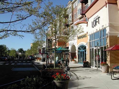
12 Independence Concept Plan Independence District TransitBusiness Nodes Neighborhood Core Employment District Neighborhood General Neighborhood Node Primarily single-use office and Mixedor with Predominantly residential Larger-format commercial and office industrial, with some supporting Multi-Use Residential, Office Predominantly Mixedor Multi-Use some neighborhood-scale Predominantly low to uses (could transition tomoderate other uses over retail uses and/or RetailOffice and/or Retail Residential, services density time withresidential access improvements) Transit Node


13 Center and Corridor Areas


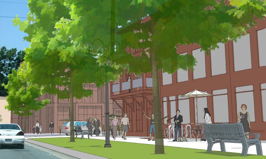
14 Community Design Policies Help ensure that new development complements the existing or desired character of the Community.
15 Future Transportation Network
16 Pedestrian-Bike-Greenways


17 Other Policies Infrastructure and Public Facilities Continue developing park and greenway systems Natural Environment Protect and enhance the natural features


18 Key Implementation Strategies Future Development Property Acquisition Program Infrastructure Improvements Corrective Rezonings PED Overlay

19 Proposed Corrective Rezonings 8 Recommendations Total 6 Align zoning with existing land use and future land use 2 PED overlay district


20 Property Acquisition Program Recommend City program to acquire prioritized properties from willing sellers Collaborate with NCDOT in U-209B project limits Indentify properties in previous expressway section Sample Area


21 Daniel Rose Fellowship Four cities selected for yearlong program of professional development, leadership training, assistance with a local land use challenge Mayor selects 3 fellows and team coordinator class: Charlotte, Detroit, Houston, Sacramento


22 ULI-Rose Panel Concepts Limited Access Express Way BRT/Express Bus Street Car Local/Feeder Bus

23 Comparing the Visions BRT on HOT lanes in the freeway, instead of BRT (or LRT) in the freeway BUT Area Plan is neutral on the transit mode for Independence Number of Station Areas along Independence Boulevard BUT Regional stations with most development potential remain Streetcar Option Along Monroe Road BUT Walkable, pedestrian-oriented development in plan support streetcar
24 Next Steps Area Plan Process Planning Commission Public Comment March 15 City Council Public Comment March 28 Planning Commission Recommendation April 19 ED Committee Recommendation April 28 Other Initiatives Council Decision on Transitional Setback Text Amendment March 21 Metropolitan Transit Commission briefing on ULI Recommendations March 23 ULI Rose Fellowship Program Continues through October 2011 Council Action May 9
25 Action Requested Recommend that City Council receive public comment on the draft Independence Boulevard Area Plan


26 ?
INDEPENDENCE BOULEVARD AREA PLAN. Economic Development Committee Overview May 25, 2010
 INDEPENDENCE BOULEVARD AREA PLAN Economic Development Committee Overview May 25, 2010 Presentation Outline Plan Purpose and Development Process Draft Plan Policies and Implementation Strategies Request
Independence Boulevard Area Plan Planning Committee Public Comment May 18, 2010
 Independence Boulevard Area Plan Planning Committee Public Comment May 18, 2010 Presentation Outline Focus on Key Recommendations within Draft Plan Plan Purpose and Development Process Draft Plan Policies
UPDATE ON THE INDEPENDENCE BOULEVARD AREA PLAN. Citizen Advisory Group Meeting March 3, 2011
 UPDATE ON THE INDEPENDENCE BOULEVARD AREA PLAN Citizen Advisory Group Meeting March 3, 2011 Purpose: Why are we here? To provide an update on the Independence Boulevard Area Plan 1. Overview of the ULI
INDEPENDENCE BOULEVARD AREA PLAN
 INDEPENDENCE BOULEVARD AREA PLAN Public Meeting October 28, 2008 Tonight s Agenda Introduction 4:00 4:05 Tom Warshauer Presentation 4:05 5:00 Blake Drury Group Exercises 5:00 5:50 All Wrap Up & Next Steps
INDEPENDENCE BOULEVARD AREA PLAN. June 24, 2008
 INDEPENDENCE BOULEVARD AREA PLAN Public Meeting #1 June 24, 2008 Tonight s Agenda Introduction Welcome and Ground Rules Overview Presentation Purpose of the Plan What Brings Us Here? A Tour of the Corridor
Planning Charlotte s Future. Planning Committee June 21, 2016
 Planning Charlotte s Future Planning Committee June 21, 2016 Charlotte s Vision Livable city Vibrant economy Thriving natural environment Diverse population Choices for housing, education, employment Safe
Land Use Policy & Development Ordinance Update
 Land Use Policy & Development Ordinance Update Charlotte Chamber of Commerce, Land Use Committee July 27, 2016 Land Use Policy & Development Ordinance Update Land Use Policy & Development Ordinance Update
Planning Charlotte s Future. Transportation & Planning Committee March 14, 2016
 Planning Charlotte s Future Transportation & Planning Committee March 14, 2016 Charlotte s Vision Livable city Vibrant economy Thriving natural environment Diverse population Choices for housing, education,
Coliseum Station Area Area Redevelopment Plan. Public Engagement #1 June 12, 2017
 Coliseum Station Area Area Redevelopment Plan Public Engagement #1 June 12, 2017 Welcome Engagement Purpose Introduce the project Share information Gather input Project Updates & Newsletter edmonton.ca/coliseumplan
Corridor Vision. 1Pursue Minnehaha-Hiawatha Community Works Project. Mission of Hennepin County Community Works Program
 1Pursue Minnehaha-Hiawatha Community Works Project Minnehaha-Hiawatha Community Works is a project within the Hennepin Community Works (HCW) program. The mission of the HCW program is to enhance how the
Prosperity Hucks Area Plan. Transportation and Planning Committee May 11, 2015
 Prosperity Hucks Area Plan Transportation and Planning Committee May 11, 2015 Presentation Outline 1. Background and Location 2. Community Dialog Process 3. Activity Center Recommendations 4. Wedge Recommendations
Citizen Comment Staff Response Staff Recommended Revision Planning Committee
 Citizen Comment Staff Response Staff Recommended Revision Planning Committee Area No. 1: Owner desires retail land uses. Area No. 1a: Owner of two small parcels adjacent to Area No. 1 desires retail land
Public Meeting Final Recommendations August 8, 2013
 Public Meeting Final Recommendations August 8, 2013 Meeting Agenda 1. Existing Conditions 2. Plan Building Blocks & Process 3. The Plan Policies 4. What we heard 5. Next Steps Existing Conditions Existing
Tyvola & Archdale Transit Station Area Plan. June 5, 2008
 Tyvola & Archdale Transit Station Area Plan Second Public Meeting June 5, 2008 Presentation Outline 1. Purpose and Process 2. Station Area Overview 3. Plan Recommendations 4. Comments Received and Proposed
Tyvola & Archdale Transit Station Area Plan. May 15, 2008
 Tyvola & Archdale Transit Station Area Plan First Public Meeting May 15, 2008 Presentation Outline 1. Purpose and Process 2. Station Area Overview 3. Plan Recommendations Vision Land Use Transportation
Urban Planning and Land Use
 Urban Planning and Land Use 701 North 7 th Street, Room 423 Phone: (913) 573-5750 Kansas City, Kansas 66101 Fax: (913) 573-5796 Email: planninginfo@wycokck.org www.wycokck.org/planning To: From: City Planning
1 October Dear Citizens of Charlotte and Mecklenburg County,
 1 October 2011 Dear Citizens of Charlotte and Mecklenburg County, As co-chairs of the Center City 2020 Vision Plan Steering Committee, we are proud to present the Center City 2020 Vision Plan, which sets
University City Area Plan
 University City Area Plan Economic Development & Planning Committee June 6, 2007 Purpose of the Meeting Provide an overview of the plan Set a date for public comment with City Council Mallard Creek Church
International Blvd. TOD Plan Public Workshop #1
 International Blvd. TOD Plan Public Workshop #1 Add photos or project images September 21 and 22, 2010 Workshop Purpose Introduce the public to the Project Review and discuss the existing conditions analysis
Citizen Advisory Group Meeting 5: Land Use April 14, 2011
 Citizen Advisory Group Meeting 5: Land Use April 14, 2011 Meeting Agenda 1. Background Review 2. Transportation Follow-up 3. PED Overlay Approach 4. Land Use Mapping 5. Group Exercise 6. Wrap-up and Next
Introduction. Chapter 1. Purpose of the Comprehensive Plan Plan Organization Planning Process & Community Input 1-1
 Chapter 1 Introduction Lakewood 2025: Moving Forward Together Purpose of the Comprehensive Plan Plan Organization Planning Process & Community Input 1-1 Purpose of the Comprehensive Plan The Comprehensive
Rezoning Issues Setting a Foundation for Zoning Decisions
 Rezoning Issues Setting a Foundation for Zoning Decisions City Council Workshop May 2, 2016 Agenda Goal Need actionable items and sequence of steps Foundation for Zoning Decisions Council Workshop Discussion
Chapter 1: Introduction
 Chapter 1: Introduction The Penn Avenue Community Works Corridor Vision and Implementation Framework presents an integrated communitybased vision and a coordinated, long-term implementation framework for
Midtown Greenway Land Use and Development Plan Executive Summary
 Midtown Greenway Land Use and Development Plan Executive Summary Introduction The Midtown Greenway Land Use and Development Plan sets policy direction for land use and development in the Midtown Greenway
Kinzie Industrial Corridor
 Mayor Emanuel s Industrial Corridor Modernization Kinzie Industrial Corridor Fulton Market Innovation District Plan Implementation October 19, Rahm Emanuel, Mayor David Reifman, Commissioner Dept. of Planning
CHAPTER 1. Ms. Guajardo s Class - Central Elementary CH 1 1
 INTRODUCTION CHAPTER 1 Ms. Guajardo s Class - Central Elementary CH 1 1 1.1 SETTING South Centre City is a linear corridor south of Downtown Escondido paralleling Centre City Parkway and South Escondido
Atlanta BeltLine. Subareas 9 & 10. Master Plan Updates. March 26, Washington Park Jamboree 1
 Atlanta BeltLine Subareas 9 & 10 Master Plan Updates March 26, 2018 Washington Park Jamboree 1 22 miles, connecting 45 neighborhoods 22 MILES of transit 46 MILES of streetscapes and complete streets 33
DOMINION BOULEVARD CORRIDOR STUDY AND ECONOMIC DEVELOPMENT STRATEGIC PLAN A MODEL FOR CHESAPEAKE S FUTURE
 DOMINION BOULEVARD CORRIDOR STUDY AND ECONOMIC DEVELOPMENT STRATEGIC PLAN A MODEL FOR CHESAPEAKE S FUTURE Overview I. Draft Plan Process II. Draft Plan Overview a. Market Analysis b. Master Land Use Plan
CITY OF CHARLOTTESVILLE, VIRGINIA CITY COUNCIL AGENDA
 CITY OF CHARLOTTESVILLE, VIRGINIA CITY COUNCIL AGENDA Agenda Date: December 16, 2013 Action Required: Adoption of Resolution Presenter: Staff Contacts: Title: James E. Tolbert, AICP, Director of NDS James
Broken Arrow Comprehensive Plan Update Public Workshop Meeting #3 January 23,
 Broken Arrow Comprehensive Plan Update Public Workshop Meeting #3 January 23, September 25,2018 2018 26 April 2016 AGENDA 1. Status Presentation - Charrette Recap - Proposed Vision Framework - Preliminary
DRAFT. 10% Common Open Space
 % OF CHARLOTTE IS CATEGORIZED AS A. LAND USES : Placeholder map displaying location of Place Type GOALS: Accommodate XX% of future growth. Provide a concentration of primarily commercial and civic activity
Implementation Guide Comprehensive Plan City of Allen
 Implementation Guide 2030 Comprehensive Plan City of Allen DRAFT 2015 Implementation Guide Allen 2030 Comprehensive Plan INTRODUCTION The Comprehensive Plan serves as a guide for the growth and development
CHARLES PUTMAN CHARLES PUTMAN AND ASSOCIATES, INC
 MEMORANDUM CHARLES PUTMAN & ASSOCIATES, INC. LAND DEVELOPMENT CONSULTANTS PLANNING ZONING PERMITTING 4722 NW Boca Raton Boulevard, Suite C-106 Boca Raton, Florida 33431 Phone: 561/994-6411 FAX: 561/994-0447
Planning Charlotte s Future. Planning Committee May 17, 2016
 Planning Charlotte s Future Planning Committee May 17, 2016 Place Types: Next Steps March - June Public Input: Education & input on community character and place-type framework Public open house (Transportation
Centers, Corridors and Wedges Update. Public Meeting April 20, 2010
 Centers, Corridors and Wedges Update Public Meeting April 20, 2010 1. Welcome and Introductions Presentation Outline 2. The Original Centers & Corridors Concept 3. Why Does Charlotte Need an Updated Growth
ITEM #8. Regional Smart Growth Program. Regional Smart Growth Program. Presentation Overview. Coast Highway Vision and Stategic Plan.
 Regional Smart Growth Program Economic Development Commission What is Smart Growth? Adopted as part of the Regional Comprehensive Plan (RCP) RCP provides vision for region based on Smart Growth and sustainability
REVIEW AND EVALUATION OF REGIONAL LAND USE
 REVIEW AND EVALUATION OF REGIONAL LAND USE AND TRANSPORTATION SCENARIOS #220831 Environmental Justice Task Force October 7, 2014 VISION 2050 Process Development of Guiding Vision for Land Use and Transportation
CITY OF PUYALLUP. Background. Development Services
 CITY OF PUYALLUP Development Services 333 South Meridian Puyallup WA 98371 To: City Council From: Katie Baker, AICP, Planning Division Re: South Hill Neighborhood Plan Adoption Date: (Meeting date: February
CITY COUNCIL AGENDA REPORT
 CITY COUNCIL AGENDA REPORT Subject: COUNCIL MOTION LRT ALIGNMENT REMOVAL FROM THE TRANSPORTATION MASTER PLAN On February 10, 2016 Councillor Hughes provided notice in accordance with Section 23 of Procedure
CDAC. Update: Downtown Dartmouth Update: CDAC July 25 th Motion
 CDAC Update: Downtown Dartmouth Update: CDAC July 25 th Motion 2018-10-24 Downtown Dartmouth Plan Open House October 22, 2018 6:00 pm Open House 6:30 pm Presentation + Q&A 7:20 pm Open House 8:30 pm Close
Kinzie Industrial Corridor
 Mayor Emanuel s Industrial Corridor Modernization Kinzie Industrial Corridor Fulton Market Innovation District Plan Implementation October 10, 2017 Rahm Emanuel, Mayor David Reifman, Commissioner Dept.
Executive Summary. NY 7 / NY 2 Corridor
 Executive Summary NY 7 / NY 2 Corridor Transportation and Land Use Study December 2005 Prepared for: Town of Colonie Capital District Transportation Committee Prepared by: Introduction: Land use decisions
Port Credit Local Advisory Panel October 20 th Meeting
 Port Credit Local Advisory Panel October 20 th Meeting Focus Of This Evening s Meeting: 1. Hurontario Main Street Higher Order Transit Study 2. Port Credit Mobility Hub & GO Station Parking Structure Study
1.0 Purpose of a Secondary Plan for the Masonville Transit Village
 Report to Planning and Environment Committee To: Chair and Members Planning & Environment Committee From: John M. Fleming Managing Director, Planning and City Planner Subject: Masonville Transit Village
Ivywild On The Creek PRELIMINARY CREEK DISTRICT MASTER PLAN
 Ivywild On The Creek PRELIMINARY CREEK DISTRICT MASTER PLAN Introduction: Rejuvenating an extraordinary Creekside neighborhood THE CREEKSIDE DISTRICT The Ivywild On The Creek Neighborhood District Master
12/9/2013. HOLLYWOOD/PINES CORRIDOR PROJECT AMPO 2013 Annual Conference October 24, Our Perspective. Broward.
 HOLLYWOOD/PINES CORRIDOR PROJECT AMPO 2013 Annual Conference October 24, 2013 Our Perspective Broward Fort Lauderdale 1 Broward Metropolitan Planning Organization Fort Lauderdale Fort Lauderdale Skyline
Cobb County Design Guidelines Mableton Parkway & Veterans Memorial Highway Community Design Workshop January 12, 2017
 Community Design Workshop January 12, 2017 Agenda Opening Remarks / Introductions Scope of Work Existing Conditions Key Issues / Opportunities VPS Summary Draft Vision & Goal Statement Implementation Concepts
City of Fort Lauderdale UPTOWN URBAN VILLAGE. Public Workshop December 7, 2016
 Public Workshop December 7, 2016 Workshop Agenda Introductions Project Presentation o o o History Project Scope/Timeline Character of Study Area o o o o Land Use Public Realm/Pedestrian Mobility Multimodal
Joint Public Hearing. Preliminary Subregion 5 Master Plan and Proposed Sectional Map Amendment
 Preliminary Subregion 5 Master Plan and Proposed Sectional Map Amendment Joint Public Hearing April 11, 2013 Council Hearing Room Upper Marlboro 7:00 pm His Lordship s Kindness (Clinton) Presentation Overview
Welcome. Walk Around. Talk to Us. Write Down Your Comments
 Welcome This is an information meeting introducing the applications for proposed redevelopment of the Yorkdale Shopping Centre site at 3401 Dufferin Street and 1 Yorkdale Road over the next 20+ years,
Presentation to Town Council in association with Kubilins Transportation Group Rose & Associates Equinox Environmental
 Presentation to Town Council 03.03.09 in association with Kubilins Transportation Group Rose & Associates Equinox Environmental Vision Statement: Boone 2030 is...a friendly, vibrant, attractive community...financially,
PUBLIC OPEN HOUSE HURONTARIO-MAIN CORRIDOR SECONDARY PLAN
 PUBLIC OPEN HOUSE HURONTARIO-MAIN CORRIDOR SECONDARY PLAN Tuesday, February 28, 2012 6pm 9pm 1 st Floor Atrium, City Hall 2 Wellington Street West, Brampton 1 POLICY FRAMEWORK The 2006 Provincial Growth
Atlanta BeltLine Corridor Environmental Study. Scoping Meeting August 2008
 Atlanta BeltLine Corridor Environmental Study Scoping Meeting August 2008 What Will We Be Discussing Today? Study Overview - How Did We Get Here? - What Is the Study About? - Who Is Involved? - Where Is
The Five Components of the McLoughlin Area Plan
 The Five Components of the McLoughlin Area Plan This documents contains the complete language of the five components of the McLoughlin Area Plan: The Vision Statement The Values The Guiding Principles
Plan Overview. Manhattan Area 2035 Reflections and Progress. Chapter 1: Introduction. Background
 Plan Overview The Manhattan Urban Area Comprehensive Plan (the Comprehensive Plan) is a joint planning initiative of the City of Manhattan, Pottawatomie County, and Riley County. The 2014 Comprehensive
17.11 Establishment of Land Use Districts
 17.11 Establishment of Land Use Districts 17.11.010 Purpose. To promote the health, safety, and general welfare of City residents and those who come to South Salt Lake to work, exchange commerce and recreate.
Key Concepts of the General Plan
 Key Concepts of the General Plan General Plan Purpose Vision for City s future Standards for City Services Land Use Plan General Plan Purpose San Jose is creating its Blueprint for the Future to become
Summary Community Workshop #1 Fruitvale San Antonio Senior Center Monday, March 23, :00-9:00 p.m.
 Summary Community Workshop #1 Fruitvale San Antonio Senior Center Monday, March 23, 2009 7:00-9:00 p.m. Workshop Format and Process The City of Oakland is preparing a Specific Plan that will help define
Cumberland Region Tomorrow is a private, non-profit, citizen based regional organization working with Greater Nashville Regional Council
 Cumberland Region Tomorrow is a private, non-profit, citizen based regional organization working with Greater Nashville Regional Council and others in the public and private sectors, dedicated to planning
SAN RAFAEL GENERAL PLAN 2040 INTRODUCTION AND OVERVIEW
 SAN RAFAEL GENERAL PLAN 2040 INTRODUCTION AND OVERVIEW Steering Committee Presentation February 14, 2018 Purpose of General Plan Guide land use and development decisions Coordinate transportation, infrastructure,
ATTACHMENT A 09/12/2011. Attachment A - 1. A. Preliminary Future Transit Station Sub-area
 ATTACHMENT A A. Preliminary Future Transit Station Sub-area The Centers, Corridors and Wedges Growth Framework describes Transit Station Areas, which are sub-areas within Growth Corridors, as areas surrounding
CONTENTS BACKGROUND AND CONTEXT... 3 Plan Area... 3 History... 3 Previous Planning Initiatives... 4 PLANNING FRAMEWORK... 5 Countywide Transit
 CONTENTS BACKGROUND AND CONTEXT... 3 Plan Area... 3 History... 3 Previous Planning Initiatives... 4 PLANNING FRAMEWORK... 5 Countywide Transit Corridors Functional Master Plan... 5 Veirs Mill Road Bus
2040 LUP is a part of the Comprehensive Plan and carries the same legal authority. Economic Challenges
 1.1. Guiding Anchorage s Growth Where will new residents settle over the next two decades? Where will people work, shop, and play? Will there be enough room to grow? How will Anchorage look? Will growth
ARLINGTON COUNTY, VIRGINIA
 ARLINGTON COUNTY, VIRGINIA County Board Agenda Item Meeting October 15, 2005 DATE: September 28, 2005 SUBJECT: Request to Advertise the adoption of the 2005 Clarendon Sector Plan C. M. RECOMMENDATION:
TREASURE COAST REGIONAL PLANNING COUNCIL M E M O R A N D U M. To: Council Members AGENDA ITEM 5H
 TREASURE COAST REGIONAL PLANNING COUNCIL M E M O R A N D U M To: Council Members AGENDA ITEM 5H From: Date: Subject: Staff October 17, 2008 Council Meeting Local Government Comprehensive Plan Review Draft
Small Area Plan. South Gateway
 Small Area Plan Adopted May 12, 2008 South Gateway Purpose. The South Gateway Small Area Plan defines the City s expectations for the future of the southern entrance to the City at Interstate 85 and Highway
Streets, Connectivity & Built Environment Working Group August 2, 2017
 Streets, Connectivity & Built Environment Working Group August 2, 2017 DOWNTOWN OAKLAND SPECIFIC PLAN WELCOME Streets, Connectivity & Built Environment Working Group Social Equity Meeting August 2, 2017
Urban Design Manual PLANNING AROUND RAPID TRANSIT STATIONS (PARTS) Introduction. Station Study Areas
 Introduction. Station Study Areas") 111111 PLANNING AROUND RAPID TRANSIT STATIONS (PARTS) Introduction The ION rapid transit system will link Waterloo, Kitchener and Cambridge through a central transit corridor (CTC). There are a number
111111 PLANNING AROUND RAPID TRANSIT STATIONS (PARTS) Introduction The ION rapid transit system will link Waterloo, Kitchener and Cambridge through a central transit corridor (CTC). There are a number
TONIGHT S PURPOSE INFORMATION SESSION CANORA & WEST JASPER PLACE SIDE STREETS CONCEPT PLANNING STUDY. Share draft side streets concept plan
 TONIGHT S PURPOSE Share draft side streets concept plan INFORMATION SESSION Share information and answer questions Tuesday, December 1, 2015 Drop-In 5:30 8:00 PM West Jasper/Sherwood Community Hall TONIGHT
TOD 101 CREATING LIVABLE COMMUNITIES WITH TRANSIT
 1 CREATING LIVABLE COMMUNITIES WITH TRANSIT What are transit Centered Communities? Benefits of Partnerships to Support and Implement What You Will Learn Portland s Pearl District Your Trainers Today Catherine
City of Tacoma Planning and Development Services
 Agenda Item E-1 City of Tacoma Planning and Development Services To: Planning Commission From: Elliott Barnett, Planning Services Division Subject: Tacoma Mall Regional Center Subarea Plan and EIS Meeting
A. WHAT IS A GENERAL PLAN?
 I. Introduction A. WHAT IS A GENERAL PLAN? A general plan is the planning guideline for the future of a city. It contains goals and policies which regulate urban development, the protection of the natural
Silver Line CPAM UPDATE. Transportation and Land Use Committee October 20, 2016
 Silver Line CPAM UPDATE Transportation and Land Use Committee October 20, 2016 Purpose General Summary of TLUC Discussion Review of TLUC Recommended Transportation Other TLUC Recommendations Next Steps
North Fair Oaks Community Plan Summary and Information
 North Fair Oaks Community Plan Summary and Information WHAT IS THE NORTH FAIR OAKS COMMUNITY PLAN? The North Fair Oaks Community Plan is part of the San Mateo County General Plan, and establishes policies
Welcome to the Oakridge Centre Open House
 Welcome to the Oakridge Centre Open House Why is the City hosting this event? This open house is to inform you of a rezoning application submitted to the City of Vancouver to amend the existing CD-1 (Comprehensive
SECTION ONE: INTRODUCTION. introduction
 introduction 1 INTRODUCTION Since it was first established in 1843 as a trading post for the Hudson s Bay Company, Victoria has evolved into a Provincial capital city that is recognized across Canada and
CHAPTER 12 IMPLEMENTATION
 CHAPTER 12 IMPLEMENTATION The 2010 Town of Denton Comprehensive Plan is intended to capture a vision of the future of Denton. As such, it provides a basis for a wide variety of public and private actions
Isabel Neighborhood Plan: Alternatives
 Isabel Neighborhood Plan: Alternatives Presented by: Lori Parks, Associate Planner February 2, 2015 Agenda 1. Background on BART to Livermore 2. Isabel Neighborhood Plan 3. Alternative Scenarios 4. General
A BLUEPRINT FOR BROCKTON A CITY-WIDE COMPREHENSIVE PLAN
 A BLUEPRINT FOR BROCKTON A CITY-WIDE COMPREHENSIVE PLAN Public Meeting October 2016 1 Plan Summary and Discussion Public Meeting May 4 2017 City of Brockton Bill Carpenter, Mayor Department of Planning
CAMBIE CORRIDOR PLAN
 1 WELCOME TO THE OPEN HOUSE PUBLIC REALM PLAN - CAMBIE CORRIDOR Thank you for coming to the Cambie Corridor Public Realm Open House! Place a dot where you live Please provide us with your comments and
East Bench Master Plan Update
 Community & Economic Development Office of the Director East Bench Master Plan Update To: From: Planning Commission Wayne Mills, Senior Planner Date: November 18, 2015 CC: Re: Nora Shepard, City Planning
Presentation of the Staff Draft. July 17, 2014 SSRVP Team, Area 3
 Presentation of the Staff Draft July 17, 2014 SSRVP Team, Area 3 Presentation Overview Introduction Plan Framework Plan Recommendations Implementation Next Steps and Request for Public Hearing on September
STAFF SUMMARY FOR S17-02 SPECIAL USE PERMIT APPLICATION
 APPLICATION SUMMARY Case Number: S17-02 Request: STAFF SUMMARY FOR S17-02 SPECIAL USE PERMIT APPLICATION SUP application in order to develop a convenience food store. Applicant: Property Owner(s): Cindee
4.1.3 LAND USE CATEGORIES
 4.1.3 LAND USE CATEGORIES a. City Center District The City Center District incorporates the existing character and mix of uses in downtown Belmont to encourage redevelopment and new development in keeping
In partnership with: Harbor Corridor Plan Bali Hi Mobile Home Park July 24, 2013
 In partnership with: Harbor Corridor Plan Bali Hi Mobile Home Park July 24, 2013 Project Intro 2-miles of Harbor Boulevard Westminster/17 th Street to just north of Edinger Avenue Many people use the corridor
The transportation system in a community is an
 7 TRANSPORTATION The transportation system in a community is an important factor contributing to the quality of life of the residents. Without a sound transportation system to bring both goods and patrons
JWN PlanJam Workshop #1
 Planning for a healthy, vibrant neighborhood community JWN PlanJam Workshop #1 Presented by the Jefferson Westside Neighbors jwneugene.org More information on the Web at: jwneugene.org/infillstds Welcome!
Secrest Short Cut and Monroe Expressway Small Area Plan AUGUST 29, 2018
 Secrest Short Cut and Monroe Expressway Small Area Plan AUGUST 29, 2018 Background and Process Monroe Expressway will be open by the end of 2018 Union County and Indian Trail identified a need to revisit
ELMVALE ACRES SHOPPING CENTRE MASTER PLAN
 ELMVALE ACRES SHOPPING CENTRE MASTER PLAN Contents 1.0 INTRODUCTION... 2 2.0 LOCATION... 2 3.0 EXISTING CONTEXT... 2 4.0 VISION & GUIDING PRINCIPLES... 2 5.0 LAND USE AND BUILT FORM... 4 5.1 St. Laurent
S C O P E O F W O R K A P R I L
 white flint 2 sector plan S C O P E O F W O R K A P R I L 2 0 1 2 MONTGOMERY COUNTY PLANNING DEPARTMENT M-NCPPC MontgomeryPlanning.org 1 white flint 2 sector plan Scope of Work abstract This scope of work
Peoria Avenue BRT Land Use Framework
 Planning Urban Design Landscape Architecture Historic Preservation Community Engagement Peoria Avenue BRT Land Use Framework Public Workshop Presentation Central Center Partners: Duncan Associates CLUE
2030 Comprehensive Plan VISION STATEMENT
 RESOURCE DOCUMENT for Steering Committee Meeting #2 July 12, 2017 2030 Comprehensive Plan VISION STATEMENT Steering Committee from 2008 Established the Lauderdale s Vision as: Creating a livable, lovable
TRANSIT ORIENTED DEVELOPMENT PINELLAS COUNTY MPO LIVABLE COMMUNITIES INITIATIVE PINELLAS COUNTY COMPREHENSIVE PLAN AMENDMENTS
 PINELLAS COUNTY MPO LIVABLE COMMUNITIES INITIATIVE MODEL LAND DEVELOPMENT CODE TRANSIT ORIENTED DEVELOPMENT PINELLAS COUNTY COMPREHENSIVE PLAN AMENDMENTS MPO Livable Communities Initiative Goal: Improve
Corridor-Level Approaches to Creating Transit-Oriented Districts
 Corridor-Level Approaches to Creating Transit-Oriented Districts Dena Belzer Strategic Economics and Center for Transit-Oriented Development August 2011 5-year old partnership dedicated to improving practice
Plan Framework Report. Attachment A
 Plan Framework Report Attachment A Uptown-Douglas Corridor Plan - Plan Framework Report Contents Introduction... 1 Planning Process... 3 Project Objectives... 4 Vision... 5 Community Values... 6 Structural
Gold Line Bus Rapid Transit Transit Oriented Development (BRTOD) Helmo Station Area Plan
 Helmo Station Area Plan") Appendix F Gold Line Bus Rapid Transit Transit Oriented Development (BRTOD) Helmo Station Area Plan Introduction and Purpose of the Plan The Gold Line Bus Rapid Transit facility is an eleven-mile dedicated
Appendix F Gold Line Bus Rapid Transit Transit Oriented Development (BRTOD) Helmo Station Area Plan Introduction and Purpose of the Plan The Gold Line Bus Rapid Transit facility is an eleven-mile dedicated
S A C R A M E N T O C O U N T Y JACKSON HIGHWAY & GRANT LINE EAST VISIONING STUDY
 JACKSON HIGHWAY & GRANT LINE EAST S A C R A M E N T O C O U N T Y P L A N N I N G D E P A R T M E N T SUMMARY AND WORKBOOK November 19, 2008 History of the Visioning Study Sacramento County has two growth
Transit / Housing Oriented Redevelopment
 Broward County Urban Planning and Redevelopment Department Kick-Off Meeting October 24, 2007 Transit / Housing Oriented Redevelopment 1 Future Land Use 2 Broward County Charter Voters approved in 1974.
NEC of Central Avenue and Indian School Road
 NEC of Central Avenue and Indian School Road For this location, there are two applicable plans that provide guidance on development. The two plans include the Indian School Specific Plan (1991) and the
JANUARY 19, 2011 CENTRAL AVENUE-METRO BLUE LINE TRANSIT-ORIENTED DEVELOPMENT IMPLEMENTATION PROJECT COMMUNITY FORUM
 CENTRAL AVENUE-METRO BLUE LINE TRANSIT-ORIENTED DEVELOPMENT IMPLEMENTATION PROJECT COMMUNITY FORUM JANUARY 19, 2011 THE MARYLAND-NATIONAL CAPITAL PARK AND PLANNING COMMISSION PRINCE GEORGE S COUNTY PLANNING