THE CORPORATION OF THE CITY OF PORT COQUITLAM BYLAW NO. 3838
|
|
|
- Philip Dixon
- 6 years ago
- Views:
Transcription

1 THE CORPORATION OF THE CITY OF PORT COQUITLAM BYLAW NO A Bylaw to amend the Official Community Plan of the Corporation of the City of Port Coquitlam. Whereas an Official Community Plan was adopted by Official Community Plan Bylaw, 2004, No. 3467; And whereas Metro Vancouver has adopted a Regional Growth Strategy that requires member municipalities to adopt updated Regional Context Statements in their Official Community Plans by July 29, 2013; And whereas amendments to the Official Community Plan have been prepared to include a new Regional Context Statement along with various revisions, updates and housekeeping changes and after First Two Readings of this Bylaw the Council has: (a) (b) (c) (d) considered the amendment to the plan in conjunction with its financial plan; determined that no applicable waste management plan exists for consideration; determined that consultation is not required with School District No. 43 or provincial and federal ministries and their agencies; and referred the amendment bylaw to Metro Vancouver, TransLink, the Agricultural Land Commission, the City of Coquitlam, the District of Pitt Meadows and the Kwikwetlem First Nation Now therefore the Municipal Council of The Corporation of the City of Port Coquitlam, in open meeting assembled, enacts as follows: 1. This Bylaw may be cited for all purposes as the Official Community Plan, 2013, No
2 2. The Official Community Plan marked as Schedule A is attached hereto and forms part of the Bylaw and is designated as an Official Community Plan of the City of Port Coquitlam and applies to all areas of the City. Read a first time by the Municipal Council and given an affirmative vote by the majority of all members of the Council this 13 th day of May, Read a second time by the Municipal Council and given an affirmative vote by the majority of all members of the Council this 13 th day of May, And whereas the required time limits have been observed, the required Notices have been published, and a Public Hearing has been held this 10 th day of June, Second reading rescinded this 10 th day of June, Read a second time by the Municipal Council, as amended and given an affirmative vote by the majority of all members of the Council this 10 th day of June, Read a third time by the Municipal Council and given an affirmative vote by the majority of all members of the Council this 10 th day of June, Adopted by an affirmative vote of a majority of all members of the Municipal Council of the Corporation of the City of Port Coquitlam this 9 th day of September, 2013 Mayor Corporate Officer RECORD OF AMENDMENTS BYLAW NO. AMENDED SECTION DATE 3847 Environmental/Customer Service Map Temp. Building/Structures Section OCP Bylaw No updated November 25,


3 OCP Bylaw No updated November 25, 2013 OCP Bylaw No updated November 25, Adopted June 2005 (Consolidated November, 2010)
4 Dedication In the dictionary if one was to look up the definition of visionary they would find it stated full of foresight and imagination. In 2003, Port Coquitlam s Director of Development Services, Ernie Levesque, had a vision to have the community take part in rewriting the City s Official Community Plan, which would guide growth and development for the next 10 years. With a Task Force of volunteers from the community, input from the community, direction from the City staff and much work by all, this unique concept was undertaken and completed in late The visionary of this project, however, passed away before the project was completed and in honor of his dedication to our City, we the PocoPlan OCP Task Group would like to dedicate this Official Community Plan to Ernie Levesque. OCP Bylaw No updated November 25,
5 Table of Contents Table of Contents... i 1.0 Introduction Purpose and Content of the Official Community Plan Related Plans Community Vision Objectives Policies and Land Use Designations Community Context History and Population Land Use Growth and Change Regional Context Statement Policies Growth Management and Sustainability Housing and Neighbourhoods Economy Environment and Parks Transportation Design Community Utilities and Services Implementation Development Control OCP Land Use Designations and Zoning Plan Amendment Intergovernmental and Interagency Relations Development Permit Areas Introduction Exemptions Downtown Northside Centre Intensive Residential Commercial Industrial Watercourse Protection Natural Environment Protection Hazardous Conditions Environmental Conservation Appendix 1: Statement of Compliance between the Policies of the OCP and the Regional Growth Strategy OCP Bylaw No updated November 25, 2013 i
 is the City s vision for the future growth and development of the community.")


6 1.0 Introduction 1.1 Purpose and Content of the Official Community Plan The Official Community Plan (OCP) is the City s vision for the future growth and development of the community. The vision reflects the ideas and input of the people who live and work in Port Coquitlam and who participated in the preparation of the Plan. The vision is communicated in words and maps throughout this Plan and will be realized by the changes to be seen in the community as new development occurs, new residents settle, and new businesses are established. This Plan was originally adopted June 27, 2005 to provide the City with a guide for its development over the next ten years by establishing policies, designating land for specified uses, and defining guidelines that regulate the form and character of development. It was substantially updated and amended in 2013 to include a new Regional Context Statement and comply with Metro Vancouver s Regional Growth Strategy. The OCP focuses on land use but it is also concerned with factors important to quality of life. It provides for the integration of land use, economy, environment, transportation, community facilities and services into a broad strategy to direct growth and development. An OCP must include targets for the reduction of greenhouse gas emissions in the area OCP Bylaw No updated November 25,
7 covered by the plan, and policies and actions proposed with respect to achieving those targets. The OCP was prepared under the authority of the Local Government Act, which states that an OCP is a statement of objectives and policies to guide decisions on planning and land use management. Specifically, the Act requires the Plan to include statements and map designations respecting the following: 1. the approximate location, amount, type and density of residential development required to meet anticipated housing needs over a period of at least five years; 2. the approximate location, amount and type of present and proposed commercial, industrial, institutional, agricultural, recreational and public utility land uses; 3. the approximate location and area of sand and gravel deposits that are suitable for future sand and gravel extraction; 4. restrictions on the use of land that is subject to hazardous conditions or that is environmentally sensitive to development; 5. the approximate location and phasing of any major road, sewer and water systems; 6. the approximate location and type of present and proposed public facilities, including schools, parks and waste treatment and disposal sites; 7. other matters that may, in respect of any plan, be required or authorized by the minister. An OCP must also include housing policies respecting affordable, rental and special needs housing. An OCP may include the following: 1. policies relating to social needs, social well-being and social development; 2. policies respecting the maintenance and enhancement of farming on land in a farming area or in an area designated for agricultural use in the community plan; and 3. policies relating to the preservation, protection, restoration and enhancement of the natural environment, its ecosystems and biological diversity. PocoPlan Official Community Plan Review This Official Community Plan is the result of an ambitious twoyear public process called PocoPlan. The most significant part of the process was the establishment of a Task Group composed of local residents who assisted in the preparation of the Plan and encouraged community participation. PocoPlan had many significant achievements including the Challenges and Choices Report, PocoPlan Workbook, Workshops and Open Houses, and the Castle Park Elementary School Art Project. The comments of PocoPlan participants are included in the Plan. PocoPlan was a true community planning process and the results are reflected in this OCP. This OCP does not include policies for future sand and gravel extraction because the City does not have areas of sand and gravel deposits. The OCP addresses the City s role in the Region and its relationships with neighbouring municipalities and other levels of government. It must include a regional context statement which shows how the OCP is consistent with the Regional Growth Strategy, or how it will be made consistent over time. The land use designations of the OCP apply to all lands within and under the jurisdiction of the City of Port Coquitlam. OCP Bylaw No updated November 25,
8 The Local Government Act states that an OCP does not commit or authorize a municipality to proceed with any project that is specified in the Plan, however, all bylaws enacted or works undertaken by a Council after the adoption of an OCP must be consistent with the Plan Notwithstanding any other provisions of this Bylaw, all lands within the Agricultural Land Reserve (ALR) are subject to the provisions of the Agricultural Land Commission Act and the regulations and orders of the Agricultural Land Commission (ALC). The legislation and regulations generally prohibit or restrict non-farm uses and subdivision of ALR lands, unless otherwise permitted or exempted. 1.2 Related Plans The OCP works in conjunction with other City plans to ensure that the community develops in a coordinated manner and that City services are provided effectively and efficiently. The Local Government Act requires that the OCP be considered in conjunction with the City s Financial Plan and Waste Management Plan, if applicable. These Plans must be reviewed to ensure that public infrastructure investment for roads, water, and sewer and drainage systems is coordinated with development. The City adopted a Corporate Strategic Plan - Vision 2020 in It establishes a comprehensive, long-term direction for the City and five outcomes: sustainable future, sense of community, strategic delivery of services, economic strength and community well-being. The 1998 Downtown Plan guides the redevelopment of the City Centre and its key components have been incorporated into the OCP through policies and DPA guidelines. The Downtown Street Beautification Plan adopted in 1999 guided an ambitious streetscape improvement project that was completed in This Plan also specifies the streetscape improvements required with new development and is implemented through land use regulations and guidelines. A Downtown Pedestrian Circulation Study completed in 2011 updates the guidelines. The City adopted a Master Transportation Plan in 1999 to provide a framework for a multi-modal transportation system to improve mobility and access in Port Coquitlam. Much of this Plan has now been implemented and a comprehensive update process has been initiated. The Greenways Plan adopted by Council in 1999 continues to guide decisions related to preserving natural areas in Port Coquitlam. The Cultural Policy and Plan adopted in 2001 identified steps to promote cultural development in the community including leadership, access, facilities and resources. The 2003 Leigh Square Feasibility Study followed up on this work and led to development of the award-winning Leigh Square Community Arts Village. The Parks, Recreation, and OCP Bylaw No updated November 25,
9 Culture Master Plan was endorsed by Council in 2007 to serve as a planning tool to guide Council s decisions. The Corporate & Community Climate Action Plan was endorsed by Council in 2010 as a guiding document for climate action policies and initiatives that can be implemented at the local government level. Based on this work, the OCP sets the City s target for reduction of greenhouse gas emissions and includes supportive policies to achieve this target. The Heritage Strategic Plan was received and a strategy for its implementation endorsed by Council in A comprehensive inventory of heritage resources was completed in The Environmental Strategic Plan endorsed by Council in 2011 sets environmental goals, objectives and strategic directions, describes actions to achieve these goals and identifies an environmental mission to show leadership in supporting a healthy environment. OCP Bylaw No updated November 25,

10 2.0 Community Vision The Corporate Strategic Plan Vision 2020 defines Port Coquitlam s community vision as follows: Port Coquitlam is a happy, vibrant, safe community with healthy, engaged residents and thriving business, supported by sustainable resources and services. The five strategic outcomes to achieve this vision are: A Sustainable Future for the City s finances, the environment and its social resources to create a complete and sustainable community; A Sense of Community with safe, engaged and active residents in a healthy community that embraces inclusiveness; Economic Strength ensured by decisions to support business, facilitate goods movement and protect agricultural lands; Community Well-being providing for the safety of residents, businesses and property, the infrastructure to sustain the quality of life and by valuing parks and natural areas; and Strategic Service Delivery that strengthens public confidence, promotes a team environment and maintains a healthy workplace. The OCP contributes to the vision by planning for growth management, sustainability, housing, neighbourhoods, design, economic development, environment, parks, transportation, community services and utilities. OCP Bylaw No updated November 25,

11 3.0 Objectives The following objectives reflect shared community values and provide a framework for the OCP policies. Growth Management Plan for the orderly and efficient development of land for housing, businesses, jobs, community amenities and facilities. Sustainability Improve the social, environmental and economic wellbeing of the community through planning and land use management. Housing and Neighbourhoods Facilitate the provision of housing that provides residents with choice in housing form, location, tenure and price; facilitate neighbourhood identity and connections between residents. Economy Facilitate business and employment opportunities in the industrial, retail, office, service, public and agricultural sectors in support of a diversified local economy and a higher quality of life in the community. Environment and Parks Protect environmentally sensitive areas, provide adequate park space in the community and establish links between public open spaces. Transportation Ensure that the transportation network is safe and efficient, and accommodates different modes of travel for pedestrians, bicycles, bus and rapid transit, trucks, and private passenger cars. OCP Bylaw No updated November 25,
12 Design - Ensure that development improves the appearance of buildings, public spaces and streetscapes in a manner that is reflective of the community s context and heritage and respectful of the natural setting and existing built environment. Community Ensure that public and private services and facilities, such as those for arts and culture, recreation, library, fire, police, education, faith, health and social needs, are provided to meet the present and future needs of residents. Utilities and Services Ensure the efficient provision of water, drainage, liquid and solid waste, and other utility services throughout the community while accommodating changing technology and new regulatory requirements for these services. OCP Bylaw No updated November 25,

13 4.0 Policies and Land Use Designations The vision of the OCP is implemented through its policies and land use designations. The implementation of these components establishes the development pattern of the community and manages its growth. The policies are the City s statement of priorities for growth and development. The policies address the issues facing the community and legislative requirements for planning and land use and reflect community input. The policies are considered in the development review process and ultimately help Port Coquitlam achieve its community vision and OCP objectives. The OCP does not include policies for every matter included in the Local Government Act. For example, there is no policy for future sand and gravel extraction because the municipality does not have any sand or gravel deposits. The land use designations and map illustrate the desired development pattern for the City and are discussed in more detail in Section 8.2. OCP Bylaw No updated November 25,


14 5.0 Community Context 5.1 History and Population The original inhabitants of the Port Coquitlam area were the Coast Salish people, who utilized the abundant local resources for hunting, gathering and fishing. The first European settlers arrived in the mid-1800s and Canadian Pacific Railway Company (CP Rail) in CP Rail subsequently moved its freight yard and operations to the area in 1911, a decision which had significant impact on the growth and physical development of the community. The City of Port Coquitlam was incorporated March 7, Early years were characterized by slow development due to global economics and repercussions from the First and Second World Wars. The population steadily increased with the establishment of numerous industries and the availability of affordable land and housing in attractive locations. Between 1991 and 1996, Port Coquitlam was the fastest growing community in the Lower Mainland with a population increase of almost 27%. Growth rates have remained above the regional average at about 10% between 1996 and 2001, 3% between 2001 and 2006, and 7% between 2006 and OCP Bylaw No updated November 25,

15 The Regional Growth Strategy includes population projections that indicate the population of Port Coquitlam will reach approximately 68,000 by 2021 and 76,000 by A rough population capacity estimate for Port Coquitlam is 80,000. The City will continue to review and revise these figures as part of on-going research and as more accurate data becomes available. Port Coquitlam Quick Statistics: The population is representative of a diverse number of age groups, ethnicities, languages and lifestyle choices. Despite an increase in the percentage of older adults, Port Coquitlam remains a relatively young community with 68% of the population under the age of 50 (2011 data). Compared to other municipalities in the Lower Mainland, there is a higher percentage of children and a lower percentage of older adults. Port Coquitlam has also experienced increased immigration. Between 1991 and 2006 there was a 9% increase in the number of community members who were born outside of Canada, and a 15% increase in the number of residents who have a mother tongue (language first learned and still understood) other than English. In addition, the City has been part of the regional trend to a higher number of single parent and nontraditional household structures. These changing demographic trends have impacts on the types of housing, community services, and infrastructure needs of the community. 5.2 Land Use 26% of residents consider themselves to be a visible minority (2006) 28% of the population was born outside of Canada (2006) The average number of persons per family is 3.0 (2011) 51% of residents are legally married (2011) 17% of households are single parent families; 82% of these are female (2011). The unemployment rate is 4.9, lower than the provincial average of 6.0 (2006) Average family income is $66,000 (2006), which is slightly lower than $68,000 in 2001 The number of residents with post secondary education has increased by 13% since 1991 (2001) The percentage of multi-family dwelling units compared to single-family dwelling units has risen from 48% (2001) to 58% (2011) Source: Statistics Canada 2001, 2006, and 2011 Census The City of Port Coquitlam is bounded by the Fraser, Pitt and Coquitlam Rivers and has a land base of just over 28 square kilometres. Several factors have contributed to the development pattern of the City. For example, the Lougheed Highway and the CP Rail tracks historically OCP Bylaw No updated November 25,
16 bisected the City, defining a north and south side of the community. Movement between the two sides was limited by the CP Rail yards until the opening of the Coast Meridian Overpass in March This major construction spanning the rail yards added a third north-south transportation link, significantly improving community access to facilities, services and employment. Transportation corridors such as the Mary Hill Bypass and the Fraser River also help shape the distribution of land uses within the City. Of the limited amount of vacant land remaining in the City, most is designated for light industrial and commercial purposes and is located in the Dominion Triangle area. There is also some vacant land intended for residential uses in the Dominion Avenue and South Shaughnessy areas and adjacent to the Coquitlam River. Growth in all sectors will primarily be through redevelopment. The biggest employers in Port Coquitlam vary from industrial related businesses (such as transportation and manufacturing) to public services, large format retail and restaurants. 5.3 Growth and Change The City of Port Coquitlam has grown and changed considerably in the last decade. It has a diverse economy which relies on various types of commercial, industrial and service businesses. The City contains several commercial areas: the community commercial Downtown and Northside districts; general highway commercial uses fronting Lougheed Highway through to Westwood Street; and, large format and lifestyle retail uses in the Dominion Triangle including the newest centre, Fremont Village. In addition to these areas, small commercial nodes are located throughout the City including marine activities along the Fraser and Pitt River. Over 140 hectares of land are currently designated for commercial or mixeduse development. The most significant commercial growth over the last two decades has been in the Dominion Triangle. Most new development in the City will involve the redevelopment of existing sites. Industry continues to play a significant role in the community, with almost 400 hectares of land designated in four industrial areas. Industrial development in the City has increased significantly over the last two decades. The Davies area and Meridian Industrial Parks are developed to capacity and a limited amount of industrial land is left for build-out in the Mary Hill Industrial Estates and Broadway areas. Industrial uses are now being developed in the Dominion Triangle. The City has seen significant changes in residential development with the most significant recent growth along Dominion Avenue and in the Downtown. There are now only a few isolated parcels of vacant lands designated for residential development in the City. Low-density residential neighbourhoods dominate the City s land base with over onethird of the land designated and zoned for this type of development. However, as almost all of this land is developed, new lower density OCP Bylaw No updated November 25,
17 developments will largely be through infill and subdivision of larger parcels. Over 5,600 new housing units were built between 1991 and 2001; 2900 were added between 2001 and The relative percentage of singledetached homes in the City has significantly decreased with the rising supply of multi-family housing such as duplexes, townhouses and apartments. Higher density developments are currently concentrated in the Downtown and near commercial areas, parks and transit services. Future development of new higher density residential developments will involve lot consolidation and redevelopment. OCP Bylaw No updated November 25,
18 6.0 Regional Context Statement Metro Vancouver 2040 Shaping our Future (Bylaw 1136, 2011) was endorsed by the City of Port Coquitlam on March 14, 2011 and adopted by Metro Vancouver as the Regional Growth Strategy on July 29, The City of Port Coquitlam is required by the Local Government Act to include, in its OCP, a Regional Context Statement which identifies the relationship between the OCP and the Regional Growth Strategy and, as applicable, identify how the OCP will be made consistent with the Regional Growth Strategy over time. The Regional Growth Strategy sets out five goals to guide the actions of Metro Vancouver and its member municipalities in achieving a vibrant, diverse, prosperous and sustainable Region: (1) Create a compact urban area (2) Support a sustainable economy (3) Protect the environment and respond to climate change impacts (4) Develop complete communities, and (5) Support sustainable transportation choices. These goals are consistent with the vision and policies of this OCP. This Regional Context Statement describes how the OCP addresses the five major goals and the strategies of the Regional Growth Strategy and outlines actions that will be taken by the City to fulfill the required municipal roles and to achieve population and employment projections. Within the Urban Containment Boundary of the Regional Growth Strategy, the City of Port Coquitlam may amend this OCP to adjust the boundaries of regional land use designations from one regional designation to another, provided such adjustments satisfy its requirements that the aggregate area of all proximate sites so re-designated does not exceed one hectare. Larger sites of up to three hectares may be redesignated from Industrial or Mixed Employment to General Urban if they are on the edge of an employment district and within 150 metres of TransLink s Frequent Transit Network. All together, such re-designation of lands cannot exceed two percent of the City s total lands within each applicable regional land use designation. The City of Port Coquitlam may amend this OCP to adjust the boundary of the Municipal Town Centre, provided such adjustment satisfies the requirements set out in the Regional Growth Strategy and its guidelines for urban centres and frequent transit development areas. OCP Bylaw No updated November 25,

19 Map 1 Port Coquitlam within Metro Vancouver Source: Metro Vancouver Regional Growth Strategy 2011 To assist Port Coquitlam in its long range planning, the Regional Growth Strategy provides projections for a population of 85,000 and an employment level of 35,000 jobs in the City by The Regional Growth Strategy sets out the various land use designations. Map 2 illustrates how these designations apply to Port Coquitlam, the location of the Municipal Town Centre and the Urban Containment Boundary. Appendix 1, Statement of Compliance between the Policies of the OCP and Regional Growth Strategy, identifies how the policies of this Plan comply with the Regional Growth Strategy and is integral to and forms part of this Plan. OCP Bylaw No updated November 25,

20 Map 2 Regional Land Use Designations, Municipal Town Centre and Urban Containment Boundary OCP Bylaw No updated November 25,

21 7.0 Policies 7.1 Growth Management and Sustainability The objective for growth management and sustainability is to plan for the orderly and efficient development of land for housing, businesses, jobs, community amenities and facilities and to improve the social, environmental and economic well-being of the community through good planning and land use management. Growth Management Port Coquitlam is a balanced community with residential, commercial, and industrial areas and many community amenities and natural areas for people to enjoy. The OCP guides its land use and development; however, it also manages growth and change in the community. The OCP and planning processes provide a framework in which the City can make decisions about change while acknowledging differing opinions about how this change will occur. We are a wonderful small city... Let s foster this! PocoPlan Participant In planning and managing growth, the City faces a number of challenges. As there is little vacant land for new development, redevelopment will occur in existing neighbourhoods. The number of residents in the labour force far exceeds the number of people who work in the City and a OCP Bylaw No updated November 25,

22 balance in this ratio is desirable so that more residents can work close to where they live rather than having to travel elsewhere in the Region. Map 3 shows the location of lands within the ALR. An estimated 382 hectares of land is in the ALR including Colony Farm Regional Park and the Carnoustie Golf Course. As much of this land is used for recreation, housing and hobby farms rather than farming, the City should look at ways of using it for its intended purpose. Pursuant to Council s resolution in adopting this OCP on June 27, 2005, the future Fremont Connector road alignment must be reviewed following completion of a comprehensive technical, environmental, social and economic evaluation process on all the alternatives in a transparent evaluation process that provides opportunities for input from regulatory stakeholders and public consultation. The review could include examining the potential for alternative land uses for affected parcels, as well as the potential for enhancements or improvements to remaining agricultural lands. Climate change has emerged as one of the most significant environmental challenges. Strongly related to the use of fossil fuels, the emission and concentration of greenhouse gas emissions in the atmosphere has risen steadily leading to increased average temperatures and a host of local and global impacts. The primary sources of GHG emissions from human activity in Port Coquitlam are energy use from burning of fossil fuels in buildings, transportation systems and industrial processes. Managing patterns of settlement and land use and controlling development to reduce community GHG and air emissions is integral to the OCP. Port Coquitlam, as part of the Metro Vancouver Region, must work cooperatively with other municipalities, Metro Vancouver and other levels of government to ensure managed growth throughout the Region. Sustainability Historically, society has accepted growth and change with marginal consideration for the long-term negative impacts on society and the environment. It was accepted that resources would be used without being replaced, green space would be lost, and pollution and waste would increase. Development patterns raised concerns about sprawl, land consumption, loss of farmland, automobile-oriented commercial development such as big box retail, habitat and stream destruction, waste production, air pollution, greenhouse gases, energy consumption, reduced economic efficiency and infrastructure costs. The benefits of growth, in the form of jobs, better roads and housing, and advances in the quality of life, were seen as more important to society and humankind. This approach causes concern for many people because it is not considered to be sustainable. Sustainability is often defined as development that meets the needs of the present without compromising the ability of future generations to OCP Bylaw No updated November 25,
23 meet their own needs. (The Bruntland Report, Our Common Future: World Commission on Environment and Development, 1987) Smart growth is a collection of urban development strategies to reduce sprawl and encourage development that is fiscally, environmentally and socially responsible. Smart growth is development that enhances quality of life, protects the environment, and uses tax revenues wisely with strategies which focus on compact communities, affordable housing, transportation, economic development, agricultural land, green space, alternative development standards, and community involvement. Port Coquitlam can be more sustainable and smart as it grows by incorporating new ideas and approaches into planning and development. These ideas and approaches are expressed in this OCP and, together, will result in a more integrated approach to community development that considers the City s economic, environmental and social future. Policies for Growth Management and Sustainability: 1. Incorporate sustainable development and smart growth principles and practices into community planning. 2. Ensure development is carried out in a systematic and orderly manner and is accompanied by adequate services and facilities. 3. Work towards developing a complete community with a balance of residential, commercial, and industrial development and with adequate community amenities and facilities. 4. Work towards achieving a jobs/labour force balance by creating more opportunities for Port Coquitlam residents to work in their own community. 5. Continue to participate in regional planning with Metro Vancouver and member municipalities. 6. Support the protection and enhancement of Agricultural designated land in the ALR. 7. Consider appropriate alternative uses for lands within the ALR which have been severed or impacted by the construction of the Fremont Connector. 8. Work towards achieving a target to reduce greenhouse gas emissions of 8% below 2007 levels by Attain corporate and community-wide energy reductions and efficiencies through application of smart growth principles to land use and development decisions; in construction and alteration of buildings and services; by alternate transportation provisions; and, with public information and related initiatives. 10. Encourage the development of community energy systems including the use of district heating and cooling, cogeneration, waste heat recovery, thermal storage and local sources of renewable energy to meet energy needs efficiently and costeffectively. OCP Bylaw No updated November 25,

24 Map 3: Agricultural Land Reserve Map 3: Agricultural Land Reserve The City of Port Coquitlam Official Community Plan OCP Bylaw No updated November 25,
25 7.2 Housing and Neighbourhoods The objectives for housing and neighbourhoods are to facilitate the provision of housing that provides residents with choice in housing form, location, tenure and price and to facilitate neighbourhood identity and connections between residents. Housing Housing, like food and clothing, is a basic human need. The homes and neighbourhoods in which residents live influence their quality of life and how they function as individuals in society. Communities are made up of a diverse mix of people including singles, couples, families, the young and old, and people with special needs. They live in different types of housing including detached houses, townhouses, apartments, secondary suites, mobile homes, and special needs housing. They own and rent their homes through the market and non-market housing sectors. Make better use of residential land, more compact housing areas, better support of transit, and control of urban sprawl. PocoPlan Participant Dwelling Units by Type Dwelling Unit by Type Single Family Ground Oriented Multiple Family Apartments Residential developments are distributed throughout Port Coquitlam including older neighbourhoods with single-detached houses, newer neighbourhoods with a variety of housing types including townhouses, and the Downtown and Northside centres with concentrations of apartment buildings. Recent Census figures show that multiple family housing is continuing to increase as a proportion of the total number of housing units. The percentage of households that own their homes versus renting their homes had not changed significantly between 1991 and 2001 but increased slightly to 80% of homes being owned and 20% rented by OCP Bylaw No updated November 25,


26 Changes in the population and a limited supply of land will create new challenges for housing. The population is aging; however, young people will still form a higher proportion of the population in the future. It is a given that the demand for new housing will continue. Household size is getting smaller therefore the demand for smaller size units may increase. Port Coquitlam has a limited supply of vacant land for new housing therefore some redevelopment will need to occur as infill in existing neighbourhoods. Many people want to live in ground-oriented housing (with a patio or grassed area) but not everyone can afford to buy a house so the City needs to provide options such as duplexes and townhouses. As people age they may want to stay in their neighbourhood but need different types of housing. Others may want to stay in their current home creating a situation where some people are over-housed by choice. Housing affordability is becoming a real concern in Metro Vancouver due to increasing population and land costs. There were an increasing number of households that were spending 30% or more their income on housing although this percentage stabilized between the 1996 and 2001 Census. The federal and provincial governments have reduced their role in the provision and regulation of non-market housing and housing for people with special needs. The City needs to consider its role in these sectors. Some local governments are active in housing programs such as leasing City land, developing non-market housing, and providing grants to non-market housing organizations. A density bonus program has been established whereby developments are permitted additional floor area in exchange for payment that may be used to provide public amenities or special needs housing. Housing Development New residential development includes new residential neighbourhoods such as the Dominion Riverfront, new subdivisions, and redevelopment with new houses, townhouses, or apartment buildings. Apartments are permitted above the ground floor office and retail uses in the Downtown and other commercial areas. Duplexes are permitted in established residential areas subject to distance criteria. Secondary suites are permitted in single-detached houses except in the Riverwood area, which was planned to not permit secondary suites. The City does not have much land available for new residential lots although there is some opportunity to create new lots through consolidation and subdivision of existing lots. This can have an impact on the character of the neighbourhood if smaller lots (33 and 40 feet wide) are introduced into areas that have mostly larger lots (50 feet wide). The OCP includes policies to guide decision-making on appropriate locations for subdivision for new single-detached residential lots. Non-market housing is a broad category that is generally defined as housing for that is made available for rates below market values. This may include government subsidized housing, as well as housing that is provided by other agencies on a nonprofit basis. OCP Bylaw No updated November 25,
27 The future may hold opportunities to introduce newer forms of housing into established residential neighbourhoods. Large lots may be able to accommodate coach houses (a separate, smaller house on the lot) or triplexes that are well integrated into the neighbourhood with good design. The City will explore these opportunities as part of its on-going research. The OCP designates several areas for future multiple family residential developments such as townhouses and apartments. Most of these areas currently include a mix of housing types. It is important that these areas redevelop in a coordinated fashion and that the design improves the appearance and character of the neighbourhood. Non-Market and Special Needs Housing The City is home to several non-market housing developments managed through B.C Housing, non-profit societies and cooperatives. In 2012 there were 1084 units comprised of 550 units for families and 534 units for seniors, people with disabilities and single occupants. Non-market housing is important to the housing stock because it provides safe, affordable, rental housing for people who have low incomes and cannot afford market housing. Special needs housing for people with physical, mental and lifestyle challenges, such as drug and alcohol addictions, is also available in the community. This housing ranges from small, independent group homes to larger licensed facilities. These places are important to the community because they provide homes for people who are vulnerable or face significant challenges in their lives. It is a community responsibility to ensure that these homes are safe for the residents and that they become part of the community. However, the location and capacity of these houses and facilities sometimes causes concern for local residents. The City works with the housing providers, Fraser Health and the Provincial Government to ensure that these houses and facilities are integrated into the neighbourhood. Market Housing is generally defined as housing provided by the private sector at rates that reflect market values. Community concerns must be managed if Port Coquitlam is going to redevelop the older residential neighbourhoods with newer increasing density options. PocoPlan Participant Affordable housing is generally defined as housing for which the occupant is paying no more than 30 percent of his or her income for gross housing costs, including utilities Policies for Housing: 1. Designate land for a variety of housing types to accommodate different housing needs for the growing population in Port Coquitlam. 2. Consider the rezoning and subdivision of Residential designated lots to smaller Residential lots where appropriate, including a context of smaller lots within the immediate area or to obtain land for a road or trail dedication. 3. Permit small lot, single-detached residential uses in areas designated Small Lot Residential subject to City bylaw requirements. 4. Permit duplexes in areas designated Residential and Small Lot Residential, excluding the Riverwood neighbourhood, subject to City bylaw requirements. Consider rezoning to permit a duplex where the OCP Bylaw No updated November 25,
28 site is not closer than 180m (590 ft.) to any other duplex use fronting on the same side of the same street as measured between the two closest property lines along the same side of the street upon which such properties front. 5. Permit secondary suites in areas designated Residential and Small Lot Residential, excluding the Riverwood neighbourhood, subject to City bylaw requirements. 6. Examine innovative approaches for infill development in areas designated Residential, such as coach houses and triplexes. 7. Permit development of areas designated Apartment Residential and High Density Apartment Residential when the remaining lots on that block, if consolidated, are of sufficient size to permit further multiple family residential development. Consider rezoning to permit infill development of a lot or lots when the remaining lots on that block, if consolidated, are of insufficient size to permit an apartment building. 8. Consider a density bonus program to permit additional density for a development providing community amenities, special needs housing or a high level of environmental performance. 9. Explore opportunities to support and encourage the development of rental housing, where appropriate, to ensure that this option is available to households that do not want to or cannot afford to own their home. 10. Examine opportunities to encourage the continued availability of housing at an affordable rate to first time homeowners. 11. Establish a policy for non-market housing that also addresses the City s role in this sector. 12. Assess the need for community care facilities, assisted living residences, and special needs housing for people with physical, mental, and lifestyle challenges and permit these uses in residential and institutional areas subject to City bylaw requirements. 13. Participate in planning for solutions to deal with homelessness in the community. Neighbourhoods Neighbourhood identity is important for people and it is the connections made with neighbours that can make a vibrant community and many Port Coquitlam residents identify with a particular neighbourhood. Established residential neighbourhoods include Lincoln Park and Mary Hill which developed from the 1950s onwards, Riverwood and Citadel Heights which developed in the 1980s and 90s and the Dominion Avenue and Fremont neighbourhoods currently being developed. The Downtown is developing as a mixed-use neighbourhood. Connections can be fostered by ensuring neighbourhoods have parks, local commercial areas, pleasant streets, and homes that present a friendly face to the street while meeting the need for household privacy. Sometimes it is difficult to introduce non-residential uses into OCP Bylaw No updated November 25,

29 an existing neighbourhood or after an area is developed so these uses should be planned ahead of time or considered as areas redevelop. Map 4: Residential Neighbourhoods It is also important to protect the residential character of neighbourhoods. Increasing density and redevelopment in existing neighbourhoods will have an impact on the appearance and function of these areas. There are increasing numbers of people who operate home-based businesses, who are becoming a significant part of the local economy. Home-based businesses provide opportunities for many people but need to be regulated to ensure that they do not negatively impact residential uses. Home-based businesses are also discussed in the Economy section of this OCP. The City has a unique area along Argue Street near the Fraser River that combines marine related businesses and residences. People have lived and run their businesses on these properties for many years and they are an important part of the Fraser River economy. This Plan recognizes the OCP Bylaw No updated November 25,
30 special character of this area by designating it as Marine Traditional Commercial. Policies for Neighbourhoods: 1. Provide opportunities for neighbourhoods to have adequate commercial and community services so that residents do not have to drive elsewhere for these services. 2. Provide for neighbourhood identification through streetscape improvements, signage, and appropriate design. 3. Ensure that neighbourhoods are buffered from the impacts of adjacent non-residential uses through appropriate zoning regulations. 4. Ensure that home-based businesses operate with consideration for the residential focus of the neighbourhood. 5. Require that the design of multiple family housing complements the existing character of the area. 6. Promote the retention of long-established, private marine businesses and residential uses along the Argue Street waterfront by designating this area Marine Traditional Commercial. 7. Consider multiple family residential development in the Dominion Triangle when the proposal is integrated with high employment generating industrial uses and is designed to accommodate changing needs and circumstances including families, aging in place and housing choice. OCP Bylaw No updated November 25,
31 7.3 Economy The objective for the economy is to facilitate business and employment opportunities in the industrial, retail, office, service, public and agricultural sectors in support of a more diversified local economy and a higher quality of life in the community. A vibrant and strong economy is an essential ingredient in a complete community; one that is healthy and attractive to residents and business owners. A complete community means residents have the opportunity to live, work, shop and play, all without having to leave the City. More complete communities can also afford to make the necessary infrastructure, service and facility improvements to ensure the community s needs are met. Increasing local employment reduces pressure on our main arterial routes during peak load times. PocoPlan Participant Economic Development As the City grows it needs to respond to the changing needs of the community and determine what directions to be pursued and what actions to be taken to strengthen and diversify its economy. In some areas, such as the unemployment rate, average family income and new business start-ups, the City is in line with or better than the regional average. However, only 20% of the population live and work in the City and research indicates that people who live and work in the same community are also more likely to patronize local retail and service establishments. In addition, almost 15% of the population has an average income below the low-income cut-off line, which is defined as the income needed for adequate housing, food, and clothing. By spreading out businesses we defeat the feeling of a close knit community! PocoPlan Participant Other factors also need to be considered when assessing the City s economic situation. In 2012 there were over 700 licenced accessory home businesses indicating the number of small and successful home based businesses is growing. The City needs to be aware of the impacts these businesses may have on residential neighbourhoods and the viability of existing and new commercial office space. The tourism industry is also an area that is increasing in regional significance and opportunities, especially with the success of the 2010 Olympics. The Regional Growth Strategy includes an employment target of 35,000 jobs in the City by The City has a rough employment capacity of approximately 42,000 jobs but specific employment projections and targets have not been established. The City will need to examine employment projections and strategies for accommodating projected employment growth. A healthy economy is needed to remain attractive to potential residents, visitors and investors alike. However there is a challenge in providing the appropriate services and infrastructure to meet the needs of the community and it is important to ensure that the City promotes an emergent business industry, a wide range of business types and OCP Bylaw No updated November 25,

32 enterprises, an equitable tax base distribution, and the availability of local employment and business opportunities. The City also needs to consider impediments to development and businesses. Matters such as tax rates, business license fees, application processing time, and Development Cost Charges all affect the growth of the community. Port Coquitlam s downtown area should always be promoted as our primary City Centre to produce community spirit. The downtown is the identity of our City. PocoPlan Participant Policies for Economic Development: 1. Support a balanced economy by encouraging a mix of retail, commercial, service and industrial uses. 2. Examine ways to encouraging a range of employment opportunities in the community. Consider establishing employment targets and projections. 2. Allow for a range of home-based businesses while still maintaining the residential character of residential neighbourhoods. 3. Ensure all new commercial and industrial development contributes to the necessary upgrading of municipal services, including but not limited to, roads, bicycle paths, pedestrian sidewalks and trails, and utilities. 4. Ensure adequate access, parking and transportation options for commercial and industrial businesses. OCP Bylaw No updated November 25,
33 5. Retain the existing industrial and commercial land designations for future economic development and employment generation. 6. Ensure design of industrial and commercial development is compatible with surrounding development and does not adversely impact nearby residential neighbourhoods. 7. Encourage Port Coquitlam to be a viable tourist destination by promoting historical, cultural and natural assets. Port Coquitlam needs corner stores so you don t have to get in your car to get a loaf of bread or a carton of milk. PocoPlan Participant Commercial Lands and Development Port Coquitlam currently offers a variety of commercial activities including community commercial uses (such as the Downtown), general highway uses, and large big box type development. Several small neighbourhood commercial nodes are located in residential neighbourhoods and are designed to meet the needs of the local residents. Traditional marine activity also remains active in several select localities on the Pitt and Fraser Rivers while accessory home based businesses are growing in popularity. Map 5 shows the location of commercial areas. A diverse mix of commercial activity can help stimulate the local economy and provide incentives for both residential and economic growth in a community. However, if commercial mix is not carefully controlled, market forces could suppress the community and local commercial area in favour of convenient highway and large-format retail districts. The result would be that potential businesses and customers would be drawn away from the traditional centres of the City negatively impacting the economic viability of these areas. This would radically alter the form and character of the community. Some home-based businesses (e.g. accounting or software development) don t require commercial or industrial facilities and don t increase local traffic. It enables parents to spend more time with pre-school and elementary school children and reduces daycare costs for families. PocoPlan Participant Policies for Commercial Lands and Development: 1. Reinforce the Downtown as the primary City centre with a vibrant commercial core and a densified residential population. Encourage municipal serving community facilities to locate in the Downtown when appropriate. 2. Encourage a wide range of commercial businesses, but maintain a distinction between the types of retail and services that are permitted in the established commercial areas. In particular: Commercial uses which serve a regional population and require greater parking considerations may locate in Highway Commercial areas of the City adjacent to major arterial roads. Where appropriate, commercial retail uses should also be encouraged to locate in the Downtown in a compatible built form and character. OCP Bylaw No updated November 25,

34 Map 5: Commercial Areas Commercial uses that serve a more local or neighbourhood population should be encouraged to locate in Neighbourhood Commercial areas and the Downtown. Community Commercial uses, such as small retail, offices, and personal services should be discouraged from locating in Highway Commercial or Industrial areas. Office uses should be encouraged to locate in the Downtown and Neighbourhood Commercial areas with increased residential density and close to public transportation choices. 3. Reinforce and enhance the distinct identity of the established commercial centres. Contain future commercial development to these areas and discourage changes in commercial land use designations. 4. Support the development of small pedestrian-oriented neighbourhood commercial sites to serve the local population. In particular, encourage an appropriate neighbourhood commercial development in the Citadel area. More community commercial is needed in areas where increased density is proposed. Walking should be possible if a jug of milk is needed. We need a commercial area or store for Citadel Heights!!! PocoPlan Participant OCP Bylaw No updated November 25,
35 5. Support the development of marine-related activities on the Pitt River, in particular those that incorporate public waterfront access. 6. Encourage new commercial development in the Downtown and Northside commercial areas to be at least two stories in height. Mixed retail, office and/or residential development will also be encouraged. 7. Support the regional Urban Centres concept and transit-oriented development by encouraging mixed-use commercial and residential development along Westwood Street in proximity to the Coquitlam Town Centre. 8. Encourage new residential developments within areas designated High Density Apartment Residential to include commercial uses to service the day to day needs of the residents. Commercial uses should be located at the street level and, where applicable, orientated toward land uses such as commercial, industrial or major community facilities rather than toward adjoining residential areas. Industrial Lands and Development We need more local employment opportunities. PocoPlan Participant Beginning with the CP Rail yards in the late 1800s, industry has always been an integral component to the development of Port Coquitlam. Today over 400 hectares of land is designated for industrial businesses in four distinctive industrial areas. Map 6 shows the location of areas with industrial land use designations. The Mary Hill Industrial Estate, Meridian Industrial Park, and Davies Industrial Area are zoned and developed for industrial purposes. The type of industrial uses in these areas ranges from light industrial to multi-tenant warehouses, single tenant manufacturing and heavier industrial operations. The Dominion Triangle is the remaining area with lands designated and partially zoned for industrial uses and it is starting to develop. Industrial businesses are essential to maintaining a healthy and balanced economy by providing employment, supporting associated business activities and contributing to the municipal tax base. However, it is a challenge to retain industrial lands when aesthetically pleasing options bringing higher land values, such as residential uses, are presented. The City needs to ensure that its bylaws and development policies accurately reflect the form, character and types of uses that will be most beneficial to the City as a whole. High infrastructure costs associated with servicing industrial lands can result in a need for land uses in addition to industrial uses to provide for an economically feasible development. Recognizing the need for an area development plan that will detail the land use, subdivision pattern, and infrastructure required to promote high levels of employment and ensure compatibility of new industrial development with surrounding developments, the area shown as the Dominion Triangle Industrial Area is further defined as a Study Area on Map 2 of this OCP. OCP Bylaw No updated November 25,

36 Map 6: Industrial Areas It is extremely important to retain all the agricultural land and with today s technology and variety there is no reason why all agricultural land cannot be more viable and offer greater returns. PocoPlan Participant Policies for Industrial Lands and Development: 1. Protect existing and designated industrial areas to ensure adequate land for industrial uses. 2. Through an area planning process, examine innovative approaches to for lands within the Dominion Triangle Industrial Area to promote high employment generation compatible with adjacent commercial and residential areas. 3. Ensure that heavy industrial areas, which involve the use of heavy machinery and require more outdoor space, are located in central areas of industrial parks so they are buffered by lighter industrial uses to residential areas. 4. Where appropriate, encourage new types of light, knowledge based and high technology industry to be located in light industrial areas. Discourage office-based businesses and commercial retail uses in all industrial areas. Having commercial and industrial uses in Port Coquitlam creates jobs for people close to home, reducing commuting along with other environmental impacts. PocoPlan Participant OCP Bylaw No updated November 25,
37 5. Encourage attractive industrial development through appropriate landscaping elements, building design, open space and preservation of view and scenic areas. Agriculture The City has 230 hectares of land that are zoned and designated for agriculture and regulated as part of the ALR in the northeast sector of the City. The ALR also includes lands in Colony Farm Regional Park, the Carnoustie Golf Course and the Blakeburn Lagoons. Currently the agricultural lands sustain a mix of berry farming, nursery uses and hobby farms. Agriculture is important to society because it provides a food source and jobs, is an economic contributor, and provides a lifestyle and housing choice for people. Agricultural lands also provide important green and open spaces for the community and future generations to enjoy but can pose a challenge for landowners to sustain viable uses. In Port Coquitlam the viability of agriculture is limited because of small lot sizes, soil conditions, and changing ownership, which has seen people buying property for residential purposes only. The City needs to work with landowners to increase ways to make the lands productive and viable. Policies for Agriculture: 1. Develop ways to support agricultural lands, businesses and enterprises by: Exploring alternative and innovative activities and uses that are appropriate to agricultural lands and conform to the regulations contained in the Agricultural Land Commission Act. Working with federal, provincial, and regional government agencies to develop supportive policies. Ensuring adjacent uses are compatible and/or sufficiently buffered. Examining municipal bylaws to ensure regulations are supportive of agricultural uses. Regulating non-agricultural uses, such as estate houses, on agricultural land. Limiting further subdivision and non-farm uses. Identifying opportunities to support the agricultural community by establishing an advisory committee or an initiating an agriculture strategy. OCP Bylaw No updated November 25,
38 7.4 Environment and Parks The objective for environment and parks is to protect environmentally sensitive areas, provide adequate park space in the community and establish links between public open spaces. Environment Port Coquitlam is located in a magnificent setting bounded by the Fraser, Pitt, and Coquitlam Rivers and the mountains to the north. It benefits from the many natural areas and watercourses located throughout the City. The environment and the quality of the air, water, vegetation, and wildlife are important to individual well-being and community livability. The main watershed is the Coquitlam River while the northern part of the City drains to the Pitt River via Hyde Creek and Cedar Creek. The topography of the area is primarily low relief although the Mary Hill area does rise and descend to the Fraser River. Low relief combined with fine, silty soils results in poor drainage of the City s lowlands. Approximately 45% of Port Coquitlam is located within the floodplain of the Pitt, Fraser, and Coquitlam Rivers. The City is protected from flooding by a system of dikes and pump stations. Once our green spaces are gone it will be almost impossible to recreate them so we have to look out for them now. PocoPlan Participant Various types of forest occur in Port Coquitlam, especially along the rivers and in isolated stands within the City. Extensive tracts of field, thicket and hedgerow are found in Colony Farm Regional Park, parts of the Dominion Triangle, and in the Agriculture Land Reserve area. Wet habitats, such as bog and marsh, are found in and around the Kwikwetlem Indian Reserve #2, portions of Douglas Island, and along river foreshores. The urbanized areas of Port Coquitlam do not provide much habitat for wildlife. Birds of prey are found near open areas such as Colony Farm Regional Park, where the fields sustain various rodents. Congregations of waterfowl such as ducks and herons are found along the foreshore of the Pitt and Fraser Rivers and at the mouth of the Coquitlam River. The watercourses support fish and are part of the overall watershed drainage system. The various creeks and rivers throughout the City provide spawning and rearing habitat for several species of salmon and trout. An environmental assessment of the City was completed in 1992 and areas of concern were identified. These areas are shown on Map 7 and the OCP policies highlight special requirements for these areas. There are DPAs for environmentally sensitive areas and for watercourse protection. The Environmental Strategic Plan identifies strategic directions to achieve Port Coquitlam s environmental goals. All levels of government are involved in managing and regulating activities that affect the environment. Federal and Provincial Ministries have a significant role through legislation and programs. The Fraser OCP Bylaw No updated November 25,

39 Map 7: Environmental Assessment The City of Port Coquitlam Official Community Plan OCP Bylaw No updated November 25,
40 River Estuary Management Program coordinates project review for development on the Pitt River and Fraser River foreshore. The City also has its own policies and programs in the form of a Greenways Plan, DPAs, Soil Removal and Deposit Bylaw, Tree Protection Bylaw and a program for community environmental initiatives. There are many challenges for the environment. As the City develops and population increases there are impacts on the environment. Growth must be managed and monitored to minimize negative effects on the environment, particularly fish and wildlife habitats. The natural environment is managed and regulated by different levels of government, which sometimes results in complexity and overlapping responsibility. There are sites that need to be remediated because of past industrial or commercial activities. Policies for Environment: 1. Protect areas of environmental sensitivity, including land and water, through development control and the securing of these areas in public ownership where appropriate. 2. Protect areas of high environmental sensitivity by not permitting development on these sites. 3. Require that development proposed on environmentally sensitive areas provide environmental studies and plans to minimize the impact on and to preserve as much of the significant, natural site features, such as creeks, streams, trees and vegetation, as possible, and where this is not possible to provide compensation and mitigation. 4. Protect watercourses and adjacent riparian areas through the DP process and consider variances to development regulations to support protection of the environment. 5. Work cooperatively with Federal and Provincial Government environmental agencies to ensure effective management of the natural environment. 6. Require appropriate soil analysis and remediation prior to development for areas of concern for contamination. 7. Consider low impact development standards for implementation through the Zoning Bylaw, Building Bylaw, and Subdivision Servicing Bylaw. 8. Promote the preservation and planting of trees through DPAs and development control, road infrastructure projects, and the Tree Protection Bylaw. 9. Require landscaping, preferably with native trees and plants, on intensive residential, commercial, and industrial development sites. 10. Support the work of environmental stewardship groups. 11. Support and participate in programs to improve air and water quality. 12. Monitor the impact of noise on the livability of the community and take appropriate City action to regulate the impacts, if necessary. OCP Bylaw No updated November 25,

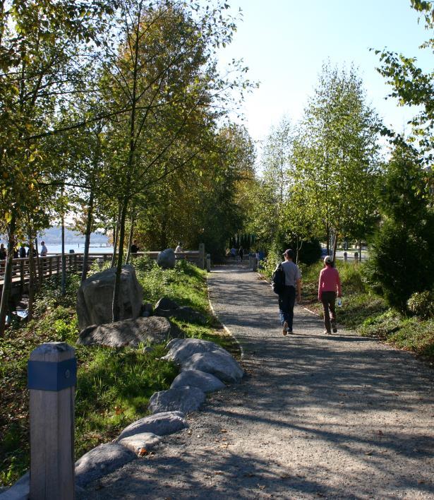
41 Parks Parks and open space in Port Coquitlam provide places for relaxation and activity. These spaces are often natural areas with environmental value. Shared, private open space is often provided in townhouse developments. The Parks, Recreation and Culture Master Plan sets out standards for a hierarchy of parks and open space as follows: 1. Neighbourhood Open Space (e.g. school/park sites, tot lot play areas) 2. City Recreation Open Space (e.g. Lion s Park) 3. City Athletic Parks (e.g. Gates Park) 4. Natural Areas (e.g. Hyde Creek Nature Reserve) 5. Traboulay PoCo Trail The standards for parks and open space, the amount of space required to meet the standard, and the existing space are shown below. The amount of land existing exceeds the amount of land required because certain categories have a surplus of land. To ensure there is adequate park space throughout the community, the OCP designates land Park and Recreation and Park Reserve. Consistent with the requirements of the Local Government Act, the City requires a 5% dedication of land or cash-in-lieu payment for all subdivisions and then uses the funds to purchase park sites. The City also collects Development Cost Charges for new development to fund park acquisition and development. OCP Bylaw No updated November 25,
42 The Traboulay PoCo Trail is one of the City s premier amenities because it encircles the entire municipality and provides links to the Downtown, residential areas, and parks. It is approximately 25 kilometres long and amounts to 25 hectares of linear open space. The City is well served with natural areas and a regional park but there is a shortage of neighbourhood open space and recreation areas. As the population grows there will be increasing demand for park space and this will be most noticeable in areas with multi-family residential housing, which have limited outdoor recreation space. The City s parks and recreation facilities are shown on Map 8. Policies for Parks: 1. Work towards providing a hierarchy of parks and open space throughout the community, based on the standards in the City s Parks, Recreation, and Culture Master Plan. 2. Require dedication of park space in the form of 5% of land or cashin-lieu for all subdivisions in accordance with the Local Government Act. 3. Maintain areas designated as Park Reserve as natural areas for passive recreation with limited improvements such as trails, seating, and interpretative signage. 4. Require the provision of private, shared open space for the use of residents in townhouse developments. 5. Continue to maintain and improve the Traboulay PoCo Trail and ensure that the Trail and associated trail network are consistent with pedestrian/cyclist objectives of the Master Transportation Plan. 6. Support improved connections between parks and open space by continuing to implement the Greenways Plan and recognizing the policies and plans contained in the Metro Vancouver Northeast Sector Recreational Greenways Plan. 7. Support community ownership of the parks and open space system through community gardens and stewardship programs, where appropriate. Parks are generally defined as preserved open areas which provide opportunities for a variety of recreation activities. Park Reserves are generally defined as preserved natural areas which function primary as nature reserves for passive recreation and enjoyment. OCP Bylaw No updated November 25,

43 Map 8: Parks and Recreation The City of Port Coquitlam Official Community Plan OCP Bylaw No updated November 25,
44 7.5 Transportation The objective for transportation is to ensure that the transportation network is safe and efficient, and accommodates different modes of travel for pedestrians, bicycles, bus and rapid transit, trucks, and private passenger cars. A community s transportation system is fundamental to its development. The transportation system must meet the mobility needs of the communities attaining cost efficiency and maintaining, or even improving the character and livability of the City. As land is developed and the population and workforce grow, the demand on the transportation system increases. It is crucial that the system match the pace of development so that it functions efficiently and enables us to be mobile in day-to-day activities. Transportation also supports the economy by ensuring the efficient movement of goods and services. Until we abandon the idea that one person per car is ok we will forever have transportation problems. We need a new mindset. PocoPlan Participant Port Coquitlam has a multi-modal transportation system that includes over 180 kilometres of municipal roads, two Provincial Highways (Mary Hill Bypass, and Lougheed Highway east of Ottawa Street), components of the TransLink Major Road Network including Lougheed Highway west of Ottawa Street and the Coast Meridian Highway and overpass, conventional and community shuttle bus routes, the West Coast Express, and CP Rail. There is also a growing pedestrian and bicycle network with links to the Traboulay PoCo Trail, which is part of the Trans Canada Trail. The City faces many challenges in planning for transportation. In 2001, 80% of the Port Coquitlam labour force commuted to work outside the City and used the road network of other municipalities, although this was reduced to 76% by Commuters from other municipalities travel to and through Port Coquitlam. The development of the northeast area of Coquitlam will inevitably increase traffic volumes through Port Coquitlam. The City funds its transportation improvements using annual property tax revenues, Development Cost Charges, Reserve Funds, funds from the federal and provincial governments, TransLink and public/private partnerships. The City continually faces challenging decisions in determining priorities for transportation network improvements. The road network, cycling facilities, pedestrian improvements, and support to the transit system are all competing for funding. The City also recognizes the need to integrate transportation demand management (TDM) strategies into its improvement programs in concert with the support for sustainable transportation choices as set out in the Regional Growth Strategy. Further, the City recognizes the important role of transportation policies such as TDM in shaping travel mode choices and the support they lend to the Region s growth management plan. OCP Bylaw No updated November 25,
45 In 2004 TransLink adopted the Ten-Year Outlook and Three-Year Financial Plan that included funding for the Coast Meridian Overpass Project, a major project which substantially improved the north-south connections in the community. Other significant regional transportation improvements have included: the Port Mann Bridge, Golden Ears Bridge, Pitt River Bridge, David Avenue Connector, Mary Hill Bypass and the Evergreen Line. These projects have major impacts on the transportation network in Port Coquitlam. The recommendations of the City s Master Transportation Plan 2000 and Strategic Plan 2002 are incorporated into the OCP. The update to the Plan initiated in 2011 is expected to result in amendments to this OCP. Policies for Transportation: 1. Implement transportation improvements for pedestrians, bicycles, transit, trucks and private passenger cars in an orderly and efficient manner in accordance with the City s Master Transportation Plan. 2. Work cooperatively with the Ministry of Transportation and Infrastructure and its subsidiaries, TransLink and other municipalities to plan and implement an integrated, efficient regional and local transportation system while advocating for improvements in Port Coquitlam. 3. Ensure regional and provincial authorities fulfill their mandates that will allow the City to reach its economic development potential when planning and implementing major improvements to the transportation system. 4. Support travel demand management initiatives to reduce the use of single-occupant vehicles including: Parking management programs to reflect shared parking, transit usage and mixed and higher-density land use; Transit priorities on strategic locations of the local and regional road networks; Employee incentives for car pools and transit; High occupant vehicle lanes on Lougheed Highway and the Mary Hill Bypass. 5. Evaluate GHGs in transportation planning and transportation choices and advocate for decisions under the authority of regional, provincial and federal authorities to achieve reductions in GHG emissions in their transportation system operations and investments and regulation of vehicles. Road Network The City s road network is organized into a hierarchy of classified highways: arterial, collector and local roads. The road network is the main conveyor of all modes of travel while providing access to existing and planned development in the City. The major road network showing routes for goods and services vehicles is shown on Map 9a. OCP Bylaw No updated November 25,
46 TransLink is the agency that coordinates the planning and maintenance of the regional Major Road Network. TransLink responsibilities have included funding for major capital projects such as the Coast Meridian Overpass and the Golden Ears Bridge, an annual Minor Capital Works program, and the planning and administration of rapid transit in the Region. Within the City of Port Coquitlam, the Ministry of Transportation and Infrastructure has jurisdiction over the Mary Hill Bypass and the section of Lougheed Highway east of Ottawa Street including the Pitt River Bridge. Policies for the Road Network: 1. Implement a road network hierarchy which includes the following projects (this list does not include all projects and is not listed in order of priority. Furthermore, an update to the Master Transportation Plan is in process. The 2013 OCP update identifies those works constructed as of March 2013): Coast Meridian Overpass to connect Coast Meridian Road (North) to Broadway Street (constructed). Dominion Street widened to arterial standards between Ottawa and the Pitt River dike and to collector standards between Ottawa and Lougheed Highway (constructed). Grade-separated interchange of the Mary Hill Bypass at Lougheed Highway (constructed). Fremont Connector as an arterial between Dominion Avenue and the Lougheed Highway (constructed). Fremont Connector from Dominion Avenue to Victoria Drive using a combination of Burns Road and future alignments (note: proposed corridor is located in the ALR and requires the approval of the ALC; see also Council resolution June 2005). Widening of Lougheed Highway to provide increased capacity. Lincoln Avenue Connector project by the City of Coquitlam. Broadway Street from Mary Hill Bypass to Kingsway Avenue re-constructed to arterial standards (constructed). Pitt River Road between Cameron Avenue and Mary Hill Bypass widened to arterial standards (substantially constructed). Industrial Avenue extended as a collector road through to Broadway Street (constructed). Ottawa Street between Dominion Avenue and Riverside Drive widened to arterial standards (constructed). OCP Bylaw No updated November 25,
47 Map 9a: Major Road Network The City of Port Coquitlam Official Community Plan OCP Bylaw No updated November 25,
48 Map 9b: Transportation Network (2005) The City of Port Coquitlam Official Community Plan OCP Bylaw No updated November 25,
49 Undertake preliminary design and securing of land and rights-of-way for all transportation improvements. 3. Remain flexible in implementing road network improvements so that improvements can be integrated and supportive to new development, redevelopment, and higher density areas. 4. Protect all existing lanes in Port Coquitlam, encourage the creation of new lanes where possible, and discourage property access from collector and arterial streets. 5. Maintain the character and livability of residential neighbourhoods by minimizing the impacts of transportation projects while balancing the need for efficient area-wide circulation and accessibility. 6. Undertake appropriate traffic calming measures in accordance with the City s Traffic Calming Guidelines. 7. Ensure that all road infrastructure projects accommodate pedestrian needs and improve the safety and appearance of the street through the use of appropriate sidewalk widths and materials, traffic signals/timing, lighting, street trees, visibility, curbs, and ramps. 8. Ensure there are adequate parking and loading facilities in the community by: Establishing off-street parking and loading requirements for all development; Managing on-street parking; Implementing a strategy to manage parking in the Downtown. Public Transit Bus transit service in Port Coquitlam is operated by Coast Mountain Bus Company, a subsidiary of TransLink. Long-term planning and overall administrative responsibilities are assumed by TransLink. Current bus services include conventional and community shuttle buses throughout the community. The West Coast Express commuter rail service also operated by TransLink has a station on the eastern edge of the Downtown. This service is currently one-way during rush hours with service to downtown Vancouver in the morning and service from downtown Vancouver in the afternoon. The City would like to see twoway service offered in the future. The City has participated and needs to continue to be involved in planning for rapid transit to the Northeast Sector. The routing and the capability and ease of extending the Evergreen Line from Coquitlam Town Centre into the City are key considerations. Policies for Public Transit: 1. Work cooperatively with TransLink and subsidiary companies, Coast Mountain Bus Company and West Coast Express, to: Improve conventional and community shuttle bus services in Port Coquitlam with frequent and convenient connections to OCP Bylaw No updated November 25,
50 Downtown Port Coquitlam, the Northside commercial centre, and regional destinations such as the Coquitlam Town Centre, Metrotown, Guildford and downtown Vancouver, Extend the commuter rail service hours and improve to bidirectional service for the weekdays, and introduce a weekend service in the future. Provide frequent and convenient connections between Port Coquitlam and the Expo and Millennium SkyTrain stations; Ensure adequate transit services for people with special physical needs and equipment such as electric powered carts. 2. Continue with Port Coquitlam s role as a member municipality in the planning and implementation of the Northeast Sector Rapid Transit Project according to the budget and timeline set forth by TransLink. Ensure the routing and the operational plan of the rapid transit line will allow for timely extension with satisfactory level of service into Port Coquitlam, and future connection to the municipalities east of Pitt River. Review and plan for a viable rapid transit corridor with alternative routings and stations in the City concurrently with the Northeast Sector Rapid Transit Project. Cycling and Walking Cycling and walking are alternative, healthy ways of moving around the community and people bike and walk for pleasure or to go to work. The City s cycling network is shown on Map 10. The Master Transportation Plan includes provision for cycling and pedestrian network improvements. Policies for Cycling and Walking: 1. Facilitate opportunities for cycling by: Preparing a cycling network plan composed of on and off street routes that are integrated with the City s trail network and the regional cycling network. Providing bicycle lanes on major roads and trip-end facilities at transit terminus and at civic facilities, where possible. Requiring bicycle parking and trip-end facilities in major developments. 2. Facilitate opportunities for pedestrians and walking in the community by preparing a trails network plan that connects neighbourhoods to parks, schools, open space and commercial centres with links to the Traboulay PoCo Trail. OCP Bylaw No updated November 25,

51 Map 10: Bicycle Route Network The City of Port Coquitlam Official Community Plan OCP Bylaw No updated November 25,
52 Freight Rail and Marine Transportation CP Rail is a prominent feature of the City s transportation network, and the rail yard occupies a significant portion of the lands in Port Coquitlam. Its extensive rail yard bisects the entire length of the City and, as a result, the planning and operation of CP Rail s facilities have significant impact on the City s development and accessibility. As well, CP Rail is a significant employer and its rail facilities provide the service for the West Coast Express. The City has an extensive shoreline along the Pitt River and Fraser River with viable opportunities for marina related industries and water borne transportation. Policies for Freight Rail and Marine Transportation: 1. Liaise with CP Rail regarding operations and planning for the improvement of railway crossings and rail yard facilities in Port Coquitlam. 2. Work cooperatively with Port Metro Vancouver and the Fraser River Estuary Management Program regarding marine transportation opportunities on the Pitt River and Fraser River. 3. Ensure road transportation connections are adequately provided to and integrated with all potential marine development sites. OCP Bylaw No updated November 25,
53 7.6 Design The objective for design is to ensure that development improves the appearance of buildings, public spaces and streetscapes in a manner that is reflective of the community s context and heritage, and respectful of the natural setting and existing built environment. As Port Coquitlam grows, the built environment (buildings, public spaces and streets) of the City is being transformed. It has singledetached neighbourhoods, townhouse and apartment areas, a traditional downtown, well-designed industrial/warehouse buildings and expanding auto-oriented commercial centres. Many of these developments have unique design elements designed to suit the context of the area. For example, highway commercial developments at Ottawa Street, Nicola Avenue and Fremont Village include large properties dominated by expansive parking lots but they have been designed with building features and landscaping to minimize the warehouse or big box style appearance of the buildings. I agree with design guidelines but want to make sure that innovation and imagination is not overly constrained. PocoPlan Participant The pattern of land uses and the design of these buildings have impacts on the streetscape and the way residents view and interact with the City. Commercial and residential neighborhoods can be pleasant and comfortable or monotonous and uncomfortable depending on the interrelationships between land use, building form, street activity and appearance, and public space. Well-designed neighborhoods are more appealing to residents, visitors, investors and business operators; they encourage pride, community interaction, and can assist in crime prevention. The City has various mechanisms to regulate and promote attractive streets and buildings. Municipal bylaws help regulate development patterns, green space requirements, building siting, construction specifications, and street design and layout. In addition, the Official Community Plan includes DPAs, which specify the design of multifamily, commercial and industrial development. The 1998 Downtown Plan and Downtown Street Beautification Plan details even more specific policies and design specifications for the downtown area. Design also provides an opportunity to incorporate sustainable principles and practices in development. LEED (Leadership in Energy and Environmental Design) is a program being considered by many local governments to make development more sustainable. It includes standards for water preservation and efficiency, conservation of materials and resources, recycling, indoor environmental quality and sustainable site planning. Examples of LEED in practice include: limiting the amount of impervious surface (less pavement), naturescape landscaping (use of drought resistant, native plants), and on-site source control of water drainage. OCP Bylaw No updated November 25,
54 However, the City faces a challenge in establishing design standards and guidelines, which contain a balance between local government design requirements, architectural originality and creativity, and development economics. Building and development design must also consider technical requirements such as flood proofing and accessibility, parking and transportation, physical constraints and environmental impacts. Policies for Design: 1. Encourage all new development, buildings and streetscapes to present a coordinated appearance with an appropriate balance of built and natural elements by: Ensuring new commercial, industrial and multi-family residential development follows design principles contained in the DPA guidelines; and Ensuring new development in the Downtown conforms to design guidelines contained in the 1998 Downtown Plan, 1999 Downtown Street Beautification Plan and 2011 Downtown Pedestrian Circulation Guidelines. 2. Ensure that new development considers technical requirements; such as those for Crime Prevention Through Environmental Design, flood hazard, soil stability, and design for people with accessibility needs. 3. Promote building design and streetscapes that help retain a small town atmosphere and promote the community s unique heritage and culture. 4. Continue to recognize areas that have unique character or identity and encourage new development in these areas to be designed with a coordinated approach that reflects this character or identity. 5. Explore ways to better emphasize public urban spaces such as parks, paths, trails, squares, streets, plazas and civic buildings. 6. Ensure bylaw regulations, such a zoning, building, site servicing and parking, also result in good design and reinforce design policies. 7. Encourage all City road projects to improve the appearance, function, and safety of streetscapes through sidewalk design and finishes, street lighting, trees, and street furniture. 8. Encourage multiple family residential developments: a) In areas designated Apartment Residential, to be low to mid-rise in format and remain consistent with the form and character of existing development; and b) In areas designated Downtown Commercial or High Density Apartment Residential, to be low to mid-rise in format and remain consistent with the form and character of existing development, except Council may consider a comprehensive development zone to accommodate a proposal with a high density and mid to high-rise format where the proposal is designed to: i) incorporate a mix of land uses including multiple family residential use and commercial or community amenity space; OCP Bylaw No updated November 25,
55 ii) achieve a high level of environmental performance standards to LEED TM (Silver) Certification or equivalency; iii) fit the context of the site with a site-specific design developed in consideration of the development s contribution to the urban form, location and streetscape and its impact on access to sunlight for key public and private spaces; iv) incorporate substantive landscape elements to create an attractive pedestrian realm and utilize the parking podium for open space purposes; and, v) provide sufficient on-site parking to meet the specific requirements of the development as determined by traffic and parking analysis. 9. Support the implementation of public art and culture initiatives where it fits with the character of the neighbourhood. 10. Support provincial initiatives to ensure the BC Building Code and other development regulations promote implementation of sustainable design principles and practices to apply in site development and building construction and renovation. 11. Require that all development in the floodplain comply with flood proofing requirements, except where exempted. 12. Ensure residential development in the Dominion Triangle is designed to: i) Incorporate a mix of multiple family housing forms that respond to the context of the site and the City s housing needs; ii) Provide an appropriate amount and form of community amenity space; iii) Achieve a high level of environmental performance standards and integrate measures to minimize GHG emissions; iv) Provide safe and attractive pedestrian connections to public amenities, commercial services and schools; and, v) Provide a compatible transition to adjacent land uses through appropriate urban design. OCP Bylaw No updated November 25,
56 7.7 Community The objective for community is to ensure that public and private services and facilities, such as those for arts and culture, recreation, library, fire, police, education, faith, health and social needs, are provided to meet the present and future needs of residents. A community is defined not only by its physical features but also by the quality of life it is able to provide to its members. For most, an appealing community is not only an attractive and affordable place to live; it also means the availability of facilities, services and programs to keep community members safe, happy, healthy and involved. Facilities and services such as schools, libraries, hospitals, police, fire, health, social assistance and recreation opportunities are an essential component of day-to-day life. Municipalities cannot do everything. They need support from the entire community. The community has to be educated about all the issues. PocoPlan Participant As Port Coquitlam grows, the demand for these facilities and services is increasing. Choices need to be made about how they are going to be provided and who will be providing them. The Corporate Strategic Plan - Vision 2020 touches on many of these issues and identifies a strategy for how the City will address them. In order to meet these needs, there is an increasing role for citizens and business owners to become more involved in the community and in providing community services through partnerships and coordinated activities. Social Issues Social issues affect the well-being of any community, and the manner and degree to which they are addressed has impacts on its residents. The residential population of the City has grown and evolved to include a more diverse mix of ages, ethnicities, incomes and backgrounds. The demographic structure indicates that the City s residents are relatively young. In addition, like other communities in the Lower Mainland, Port Coquitlam experienced significant immigration between 1991 and 2001: 20% of community members defined themselves as immigrants and over 22% considered themselves a visible minority. While the average family income and education levels had risen over decade, 15% of the population still has an average income below the low-income cut-off line. And the structure of families in the community has changed, with a decrease in the number of married couples and a higher percentage of single parent families. Find ways of working cooperatively with local nonprofit organizations which promote social justice issues. PocoPlan Participant At the same time, the federal and provincial governments support and programs for groups such as the homeless, impoverished, disabled, youth, immigrants and seniors have started declining. With these shifting demographics and changes to provincial assistance programs, the City is facing increasing pressure to provide more social services and facilities. The City has a challenge in trying to find the funding and resources to provide these services, and must rely on assistance from community groups and agencies. In some cases, such as income assistance OCP Bylaw No updated November 25,
57 programs, the City cannot afford to provide support, and its role is limited to monitoring the policies and programs of other levels of government and serving as an advocate for those adversely impacted by the reduction in services. The following policies do not imply City funding or responsibility for services rather they are provided to highlight increasing concern about social issues in the community. Policies for Social Issues: 1. Maintain a role for the City in monitoring and facilitating solutions to social issues and problems. 2. Continue to liaise with other government agencies and community groups to ensure that sufficient social services and facilities are provided to keep pace with development and population growth. 3. Encourage the federal and provincial governments to provide social assistance programs that enable all families to have adequate housing, food, and clothing. 4. Encourage partnerships and support for community groups and agencies in providing essential social services to the community. 5. Support programs and policies that recognize the diverse and multicultural nature of the community. Civic Involvement Participating in one s community can take on many different forms and intensities depending on interests, family commitments and available time. Some members sit on committees, or volunteer for events, while other simply stay informed though Council meetings and Public Hearings. Community involvement is good for individual well-being, contributes to quality of life and helps residents feel connected to their community. It also helps the City better respond to the needs and wishes of its citizens and businesses, making the community a better place to live. The more that people are involved in their community, the better the community will be. PocoPlan Participant Community involvement however can be a challenge to administer and promote. Many community members do not have the time to participate in the community due to work, family or other commitments. The City must ensure that information is available in a variety of mediums so that all citizens are able to stay informed about civic matters. The City must also explore new input approaches to ensure that those who do want to be involved in civic matters have the opportunity to do so. Policies for Civic Involvement: 1. Ensure that civic related information is consistently available to the community by exploring innovative approaches and enhancing mediums such as newspaper, website, displays, notice boards, events and meetings. OCP Bylaw No updated November 25,
58 2. Examine alternative methods of gaining public involvement and input, which better respond to the realities of community members daily lives. 3. Encourage citizen involvement in civic committees, associations and events and maintain a City program to recognize and appreciate the work of volunteers. Community Facilities and Services The facilities and services that a community provides are fundamental to the quality of life of its residents. Port Coquitlam offers a range of facilities, services and programs, which include arts and culture, parks, recreation, leisure and education. Many of these facilities and services are provided by the City, such as parks, recreation fields, complexes and senior centers. Community recreation is not a business and should not be run as such. It is an integral aspect of a community. PocoPlan Participant Other facilities and service, such as the library and public schools, are provided by others with input from the City. Still others are private establishments such as places of worship, independent schools and child care facilities. Port Coquitlam also works with and supports community and regional advocacy groups in areas such as heritage, and arts and culture. The City monitors these services and facilities, and where suitable, works to ensure the appropriate levels of service are available to suit the diverse needs of residents. However, as the community grows there are increased demands for community facilities, programs and services. For example, there was a 55% increase in public school student enrolment between 1993 and In the 2002/2003 school year there were over 10,200 students enrolled in Port Coquitlam s 20 elementary, middle and senior schools. In addition, there were over 900 students enrolled in independent schools. The location of existing schools is shown on Map 11. Community participation in recreational programs has also steadily increased over the last decade. The City tailors its recreational and leisure facilities and services to respond to the demographics of the community. For example, as Port Coquitlam has a large number of younger families and residents, it is important that programs are designed to respond to the needs of these participants. The City has also recently addressed the growing demand for arts and culture programs, facilities and opportunities in the City through the development of the Leigh Square Arts Village in the Downtown. However, choices need to be made regarding how to fund these facilities, programs and services. The City faces increasing challenges in delivering the appropriate level and types of services to the community. To do this, the City could explore alternative organization and funding structures, sources and opportunities. OCP Bylaw No updated November 25,
59 The City is home to places of worship serving many different faiths. These facilities vary in size and location. The City endeavors to ensure that these facilities are a benefit to the community in terms of design and fit into the neighbourhood. Policies for Community Facilities and Services: 1. Ensure that sufficient arts, culture, recreation and leisure services and facilities are available to meet the needs of a growing and diverse population through a combination of public, private, and non-profit endeavors. 2. Work with the Fraser Valley Regional Library to maintain sufficient library services to serve the diverse needs of the community. 3. Work with the School District to plan for public schools, promote the development of joint parks/school sites and the community use of schools. 4. Encourage a variety of educational services and opportunities including private and commercial educational facilities. 5. Encourage a sufficient number of childcare facilities throughout the community, including residential areas when appropriate, and in areas close to educational and business facilities. 6. Consider exploring new and innovative funding approaches and partnership opportunities to support the development of new and improved park and recreational facilities. 7. Use the City s Parks, Recreation and Cultural Master Plan as a guide for the development of additional park and recreation space in the community. 8. Explore opportunities to support a wide range of sports programs within the community. 9. Explore opportunities to celebrate the community s vibrant culture and heritage through festivals, events and celebrations. 10. Establish a focus for arts and culture in the community through the development of the Leigh Square Community Arts Village. 11. Consider proposals for places of worship based on response to local need, location near arterial and collector streets, compatibility with the neighbourhood, impact on adjacent land uses, adequate lot size, and the provision of adequate parking. Discourage places of worship from locating in the Agricultural Land Reserve. 12. Support the work of community groups that promote the awareness and conservation of heritage resources in Port Coquitlam. OCP Bylaw No updated November 25,
60 Map 11: Schools The City of Port Coquitlam Official Community Plan OCP Bylaw No updated November 25,
61 Public Health and Safety The availability of adequate health and safety programs and services is of utmost importance to residents and business owners in the community. Key services offered in the community include fire prevention and protection, policing and crime response, community health and hospital services and emergency preparedness. While the City does not directly administer all of these programs and services, it does work closely with many agencies and other levels of government to ensure the community s present and future needs are met. The City needs to respond and adjust to changes within these other levels of government and agencies. For example, the delivery of policing services evolves with changes or restructuring of the RCMP. The City has also experienced impacts as the result of recent structural and delivery changes within the regional and provincial health agencies. With the increase in and aging of the population, the City faces a challenge in continuing to ensure health and safety programs and services are able to effectively meet the needs of the community. There is an increasing emphasis on proactive measures such as education, prevention and preparedness, as well as involving the public to make the community safer for residents, businesses and visitors alike. Core services are probably best offered by government (municipal or otherwise) as public accountability is important. PocoPlan Participant Policies for Public Health and Safety: 1. Work with Fraser Health to ensure sufficient private and public health services are available for residents. 2. Work with the RCMP to ensure the City s safety needs are being met as the population grows and changes. 3. Continue to provide the appropriate level of fire and rescue services. 4. Ensure that development complies with building and fire requirements so that safety standards are being met. 5. Continue to promote the value of volunteer involvement as key in keeping the community healthy and safe. 6. Promote proactive education and awareness campaigns as key methods of preventing crime, fire and health risks to the community. 7. Continue to provide emergency preparedness education programs in the community. 8. Recognize that health and safety issues are not isolated to one community and work in conjunction with other municipalities, levels of government, public health authorities and community groups to ensure a broader focus in dealing with these issues and in assessing the overall health implications of proposed development and infrastructure investment. OCP Bylaw No updated November 25,
62 7.8 Utilities and Services The objective for utilities and services is to ensure the efficient provision of water, drainage, liquid and solid waste, and other utility services throughout the community while accommodating changing technology and new regulatory requirements for these services. The basic City services include roads and streets, water supply, stormwater drainage, solid waste collection, and sanitary sewers. Other utility services such as natural gas, electricity, telephone (land and cellular) and others are provided by non-municipal enterprises. As land is developed and as the population increases these services will need to be upgraded or expanded. The City collects development cost charges (DCCs) from development to help offset the cost of this work. Public utilities must remain just that public. Services must remain at acceptable levels. PocoPlan Participant Water The City obtains its water from the Greater Vancouver Water District (GVWD) system and distributes water to residents and users through its network. The City s system is funded from water rates generated and managed as a utility. The GVWD supply mains are located along the Lougheed Highway, Westwood Street and Woodland Avenue. Pressure reducing valve stations are located at the connection points along the GVWD main. There are two pump stations on the south side of the City that help to maintain adequate water pressure to areas of higher elevation such as Mary Hill and Citadel Heights. Improvements to the GVWD system over the next few years, including the construction of water purification facilities (filtration), will result in significant increases in the cost of treated drinking water and will ultimately result in higher water rates which could drive the demand for introduction of water conservation initiatives such as water meters, low flow toilets and further watering restrictions. Map 12 illustrates the major water network for the City. Future extensions or upgrading of water mains are planned in the northeast sector, where new commercial and industrial development is expected. Certain areas of designated Downtown and Residential Apartment may also require upgrading as development occurs. Drainage Drainage of stormwater runoff is conveyed by a system of storm sewers, open ditches, culverts, and sloughs and discharged to receiving waters as shown in Map 13. The north side of the City generally drains into Coquitlam River and Pitt River or Cedar Creek on the Cedar Drive rightof-way, which conveys the drainage out to Deboville Slough and Pitt River. The south side of the City drains into the Pitt and Coquitlam Rivers. Runoff drains into the receiving waters through flood boxes OCP Bylaw No updated November 25,

63 Map 12: Water Network The City of Port Coquitlam Official Community Plan OCP Bylaw No updated November 25,
64 Map 13: Drainage Network The City of Port Coquitlam Official Community Plan OCP Bylaw No updated November 25,
65 during low tides or is pumped out through pump stations during high tides. There are three main pump stations located at: Dominion Street (east end) and the dike, Harbour Street and the dike, and Reeve Park Station off of Pitt River Road. The City s drainage system also depends on watercourses for carrying runoff, which raises concerns about how the quality and quantity of the runoff impacts the watercourses and adjacent riparian areas. Development may impact the drainage system by increasing peak flows (e.g. during heavy rain), causing erosion, and sedimentation; reducing base flows and groundwater recharge; and impacting riparian areas adjacent to the watercourses that take runoff. I would like to see less hard infrastructure (ditches, pumps, etc.) and more soft infrastructure (erosion preventing trees. less building in steep, wet land). PocoPlan Participant A newer approach to drainage integrates stormwater management and environmental management within the defined watershed. This approach seeks to incorporate techniques that better manage the water as it is conveyed through creeks and streams. It also looks to better on-site management by considering the amount of pervious versus impervious surface on land and introducing best management practices. Over 45% of Port Coquitlam is located in the floodplain of the Coquitlam, Pitt and Fraser Rivers as shown on Map 14. A series of 200- year (design return) standard dikes have been constructed to protect the City from flooding. The diking system extends from the south end of Meridian Industrial Park to the northern boundary of the City along parts of the Coquitlam River from Colony Farm, north to the Coquitlam River Bridge. Floodplain management has changed as the provincial government has reduced services and support. Local government is now responsible for establishing its own regulations, under a framework of the Province for development in the floodplain. Approval of the Province is no longer required for subdivision in the floodplain and the City is responsible for dike maintenance. Sanitary Sewer The City owns and operates the sanitary sewer system, which is connected to the Greater Vancouver Sewerage and Drainage District (GVSDD) trunk sewer mains. The sanitary sewer system, which is illustrated in Map 15, services the entire City with the exception of the agricultural areas, which are individually serviced by septic fields and/or pump-out tanks. A system of pump stations supplements the municipal gravity system and discharges into the GVSDD system, which carry sewage to the Annacis Island treatment plant. The City considers that the system is adequate in most parts of the community. As areas such as the Downtown, Dominion Triangle and north side Apartment designated lands develop, upgrading of the system OCP Bylaw No updated November 25,
66 Map 14: Floodplain The City of Port Coquitlam Official Community Plan OCP Bylaw No updated November 25,

67 Map 15: Sanitary Sewer Network The City of Port Coquitlam Official Community Plan OCP Bylaw No updated November 25,
68 in these areas may be required. Expansion of the system into the agricultural areas is subject to approval from the Agricultural Land Commission. Expansion of the sanitary sewer system would also require the approval of the Metro Vancouver Board and compliance with the Regional Growth Strategy. Similar to many other municipalities, Port Coquitlam needs to reduce/eliminate storm water seepage into the sanitary sewer system, which leads to a heavier demand on waste water treatment plants. The City initiated an Inflow and Infiltration Program in 1999 and is continuing the program annually. The program involves testing, monitoring, detection and repairs to the damaged portions of the sewer system. The repairs will reduce and eliminate storm water seepage into the sanitary system. Solid Waste and Recycling Services The City has implemented an automated system for the collection of garbage, recycling and green waste. Solid waste management becomes increasingly important as a community grows and the amount of solid waste increases. It is a community responsibility to adopt waste reduction measures rather than assuming that waste can always be shipped to landfills outside the community. Non-Municipal Utilities and Services Development requires the provision of utilities such as natural gas, electricity, telephone (land and cellular) and cable. The companies providing these services are responsible for upgrading and extension of services. It is preferable that the utilities be located underground, where appropriate, for protection, safety, and aesthetic reasons with the exception of cellular phone service towers which must be located above ground. The size and location of these towers is a concern for some people in the community. The City needs to cooperate with providers to ensure that residents and businesses have access to services while considering the visual impacts on the neighbourhood. The City also has a role in promoting energy efficiency as a component of land use and development planning. Climate change and greenhouse gases are a concern for everyone. The responsible location of land use, site planning, and building design can all contribute to a reduction in energy use. If consumption is reduced, the City and its residents may be able to reduce energy costs and global environmental impacts. Policies for Utilities and Services: 1. Ensure the efficient and reliable delivery of safe drinking water to meet the needs of the community. 2. Consider the implementation of a water conservation program that may include a universal water metering program. OCP Bylaw No updated November 25,
69 3. Maintain a drainage system that provides efficient service, is designed to accommodate new development, focuses on service to developed areas, and minimizes environmental impacts. 4. Explore integrated stormwater management practices and alternative development standards for managing stormwater by increasing pervious surfaces, improving on-site water management and revising City infrastructure specifications. 5. In partnership with the Provincial Government develop a comprehensive approach to flood protection in terms of maintaining and upgrading the dike system and regulating development in the floodplain. 6. Maintain a sanitary sewer system that provides efficient service, is designed to accommodate new development, focuses on service to developed areas, and minimizes environmental impacts. 7. Provide efficient solid waste services for a growing community with an emphasis on the five Rs of reduce, reuse, recycle, recover and residual disposal. 8. Cooperate with other utility providers to ensure that services are provided where needed while minimizing neighbourhood impacts. 9. Consider energy efficiency principles and practices in land use planning, site planning, and building design. OCP Bylaw No updated November 25,

70 8.0 Implementation The OCP is implemented through various bylaws, plans, and policies. 8.1 Development Control While the OCP establishes general land use designations and policies for future development it is the Zoning Bylaw that establishes the specific uses permitted on property and the regulations for density, form, siting, height and other aspects of development. The application of the Zoning Bylaw must be within the context of the OCP. Another level of development control is that of Development Permit Areas (DPAs), which are designated in Section 9 of this OCP. DPAs can be used to regulate the site planning, design and landscaping of intensive residential, commercial, and industrial developments; protection of the natural environment; protection of development from hazardous conditions; and, environmental conservation. The Subdivision and Servicing Bylaw specifies the regulations for parcel layout in the subdivision of land and prescribes the servicing requirements for the provision of roads and public utilities as part of the subdivision and building processes. The City collects Development Cost Charges (DCCs) to pay for services required as a result of new OCP Bylaw No updated November 25,
71 development. There are DCCs for water, sewer, drainage, highways and parks. The City also collects regional DCCs on behalf of the GVSDD and. The City requires 5% dedication of parkland for all new subdivisions. The dedication is of the land area or an equivalent payment of money in lieu. These funds are placed into a Reserve Fund and are used for parkland acquisition. The Building and Plumbing Bylaw regulates the construction of buildings and structures and their compliance with the B.C. Building Code. The Business Bylaw provides for the licencing and regulation of businesses. The City may issue Temporary Use Permits in certain circumstances, such as for a real estate sales building. Lands in the City will be considered for temporary uses in accordance with the provisions of Section 921 of the Local Government Act. All applicants seeking approval of a Temporary Use Permit must obtain a supporting resolution of Council and each approved permit will set specific guidelines or conditions of use, including a termination date of up to three years from date of approval. A permit may be renewed for up to an additional three year period, allowing for a maximum of six years, subject to a supporting resolution from Council. Other levels of government exert control and regulation over the use of land in municipalities. For example, the Ministry of Transportation and Infrastructure controls land along provincial highways and the Fraser River Estuary Management Program coordinates project review for development along the Fraser River shoreline. Intergovernmental and interagency relations are discussed in Section OCP Land Use Designations and Zoning The OCP land use designations and maps set the pattern for development in the community by identifying where certain types of development will occur. The land use designations are illustrated in Map 16. Each designation is described as follows: Residential The Residential designation allows for single-detached and two-unit attached residential uses. Small Lot Residential The Small Lot Residential designation allows for single-detached and two-unit attached residential uses. Townhouse The Townhouse designation allows for attached residential uses. Apartment The Apartment Residential designation allows for lower profile attached residential uses (three or four storey) and infill developments. OCP Bylaw No updated November 25,
72 High-Density Apartment The High-Density Apartment Residential designation allows for higher profile attached residential uses (over three storeys) and infill developments. Comprehensive Residential The Comprehensive Residential designation allows for a truly sustainable community in an appropriate mix of attached ground-oriented residential and apartment forms. Local Commercial The Local Commercial designation allows for corner stores intended to serve the immediate neighbourhood. Neighbourhood Commercial The Neighbourhood Commercial designation allows for commercial uses intended to serve the larger neighbourhood. Development could include retail and office uses in a building up to four storeys with residential uses above the first storey. Downtown Commercial The Downtown Commercial designation allows for a higher density of development appropriate to the Downtown, including residential uses above the first storey. Highway Commercial The Highway Commercial designation allows for highway-oriented commercial uses that attract a regional market and require more parking than local commercial uses. Permitted uses will include auto-related retail and service, building and gardening supplies, supermarkets and recreation facilities. Marine Commercial The Marine Commercial designation allows for a mix of marine-related and multiple-family residential uses. Marine Traditional Commercial The Marine Traditional designation allows for a mix of single-detached residential and marine-related uses in the Argue Street area near the Fraser River. Light Industrial* The Light Industrial designation allows for clean, business industrial, and advanced technology uses which serve as a transition between the industrial and nearby commercial, residential, and agricultural uses. General Industrial* 1 The General Industrial designation allows for typical industrial uses. Heavy Industrial* The Heavy Industrial designation allows for uses that may produce noise, odours, and vibrations and that may also have outdoor operations. Park and Recreation The Park and Recreation designation is intended for active public parks and recreation uses; it also allows for some commercial recreational uses such as golf courses. Park Reserve The Park Reserve designation identifies park lands that function primarily as nature reserves. Institutional The Institutional designation identifies sites used for public and private institutional uses such as churches and government buildings. 1 *Medium and large format retail, residential uses with the exception of caretaker accommodation and free-standing offices are excluded from all Industrial designations. OCP Bylaw No updated November 25,
73 A-1 Agricultural RS1 Residential Single Dwelling RS2 Residential Single Dwelling 2 RS3 Residential Single Dwelling 3 RS4 Residential Single Dwelling 4 RD Duplex Rth1 Townhouse 1 Rth2 Townhouse 2 Rth3 Townhouse 3 RRh Rowhouse RA1 Apartment 1 RA2 Apartment 2 NC Neighbourhood Commercial CC Community Commercial RC Commercial Recreation CLFC Large Format Commercial CH Highway Commercial SSC Service Station Commercial M1 General Industrial M2 Heavy Industrial M3 Light Industrial P1 Civic Institutional P2 Institutional P3 Parks and Open Space P4 Utilities P5 Insitutional Facility CD Comprehensive Development School The School designation identifies public and private school sites. Agricultural The Agricultural designation allows for agricultural uses. All land designated Agricultural is also in the ALR. While the OCP sets the general pattern of development, it is the Zoning Bylaw that regulates the specific uses and the scale of development that will occur on land. The table below shows the zones permitted in each OCP land designation. The table shall be used as a guide for decisionmaking on the suitability of a zone within a particular designation. Other zones may be used within a particular designation provided that the associated regulations conform to the intent and policies of the designation. Comprehensive development zones, typically used to allow for a mix of uses on a site-specific basis, must comply with applicable policies of this Plan. The zones include those established by the City of Port Coquitlam Zoning Bylaw, 2008, No Table of OCP Designations and Permitted Zones Permitted Zones OCP Designations R Residential RSL Small Lot Residential RT Townhouse A Apartment AH High-Density Apartment RC Comprehensive Residential L Local Commercial N Neighbourhood Commercial D Downtown Commercial CH Highway Commercial MC Marine Commercial MT Marine Traditional 3 IL Light Industrial IG General Industrial IH Heavy Industrial P Park and Recreation PR Park Reserve S School I Institutional A Agricultural 3 3 OCP Bylaw No updated November 25,


74 Map 16: Land Use Designations The City of Port Coquitlam Official Community Plan OCP Bylaw No updated November 25,
75 8.3 Plan Amendment The OCP is a long-term plan that is required to be reviewed every five years and revised every ten years to ensure that it is current and relevant. Communities change and there are external influences which can affect land and development and which must be considered as the OCP is implemented. The City also prepares other plans and policies which may result in amendments to the OCP. Council may consider periodic amendments to the Plan where appropriate. 8.4 Intergovernmental and Interagency Relations The City liaises with many government authorities and agencies in both its day-to-day activities and long term planning. There is also legislation and regulation at the federal and provincial level that affects development. Key authorities and agencies include: Adjacent Municipalities - City of Coquitlam, District of Pitt Meadows Canadian Pacific Railway Federal Government Transport Canada, Fisheries and Oceans Canada Fraser River Estuary Management Program Fraser Valley Regional Library Kwikwetlem First Nation Metro Vancouver Port Metro Vancouver Provincial Government various Ministries School District No. 43 TransLink Utilities and Services - Telus, B.C. Hydro, Fortis These authorities, agencies, and companies have a significant impact on development in the community. Cooperation and coordination with them is essential to realizing the objectives of the OCP. OCP Bylaw No updated November 25,
 may be designated to control certain types of development for purposes including: protection of the natural")
76 9.0 Development Permit Areas 9.1 Introduction The Local Government Act provides that Development Permit Areas (DPAs) may be designated to control certain types of development for purposes including: protection of the natural environment, its ecosystems and biological diversity; protection of development from hazardous conditions; protection of farming; revitalization of an area in which a commercial use is permitted; establishment of objectives for the form and character of intensive residential, multi-family, commercial and industrial developments. Establishment of objectives to promote energy conservation, water conservation and reduction of greenhouse gas emissions. The DPAs define the objectives that justify the designation and specify guidelines respecting the manner by which the objectives will be addressed. A Development Permit (DP) may vary or supplement the regulations of bylaws such as zoning, subdivision and servicing, and OCP Bylaw No updated November 25,
77 parking if the variance is in accordance with the guidelines of this OCP. A DP cannot vary or supplement the use or density of a development from that permitted in the bylaws except where land is designated for the protection of development from hazardous conditions, in which case the use or density may be varied but only as they relate to health, safety, or protection of property from damage. DPAs are designated for: the Downtown, the Northside Centre, Intensive Residential Development Areas, Commercial Development Areas, Industrial Development Areas, Environmentally Sensitive Areas, Watercourses, Areas with Hazardous Conditions, and Environmental Conservation Areas. 9.2 Exemptions Notwithstanding that a development is proposed in an area designated as a DPA under this OCP, a DP will not be required when: 1. A proposed development is limited to subdivision; 2. The proposed alterations or additions are to an existing building or structure where the works: a) do not significantly alter the appearance of the building or structure and do not exceed $50,000.00, or b) is an addition to an existing industrial building located in an industrial zone and is in keeping with applicable design guidelines and fully complies with the regulations of the Zoning Bylaw; or c) are accessory buildings and located in the intensive residential zones, or d) are for works other than a new dwelling in the RS4 zone, or e) in the P1 or P2 zone, are for works other than a new building. 3. The proposed advertising signs are in full compliance with the Sign Bylaw, or when signs attached to a building are located within specified sign bands or other pre-designed sign areas. A DP is required for any new sign or alteration to a sign, other than a text change, when a DP was issued to the property on which the sign is located and that DP regulated signs as part of the overall development. 4. A proposed development is for a temporary building or structure which will comply with the siting regulations of the Zoning Bylaw. The preceding exemptions do not apply to the Watercourse Protection DPA. An Environmental Conservation DP is not required for prefabricated buildings or structures such as portables. OCP Bylaw No updated November 25,
78 9.3 Downtown This area is designated as a DPA under Section 919.1(1) (e) and (f) of the Local Government Act for the establishment of objectives and the provision of guidelines for the form and character of intensive residential development and commercial development in the Downtown. 1. Boundaries The boundaries of the DPA - Downtown are shown on the map titled Development Permit Area Downtown which forms part of the Official Community Plan. Intensive Residential Development shall be defined to include residential development within the following zones: RD (Duplex), RTh1 (Townhouse 1), RTh2 (Townhouse 2), RTh3 (Townhouse 3), RRh (Rowhouse), RA1 (Apartment 1) and RA2 (Apartment 2), NC (Neighbourhood Commercial), CC (Community Commercial), and CD (Comprehensive Development). Commercial Development shall be defined to include commercial development within the following zones: NC (Neighbourhood Commercial), CC (Community Commercial), LFC (Large Format Commercial), HC (Highway Commercial), SSC (Service Station Commercial), and CD (Comprehensive Development). 2. Objectives The objectives of the DPA are to: a. promote the development of a High Street along the commercial segments of Shaughnessy Street that concentrates retail, office, and residential activity into an attractive, pedestrian oriented environment. b. ensure consistency and coordination of architectural form, massing, and siting of new commercial, mixed-use and residential development. c. reinforce the role of the Downtown as the economic and cultural centre of the community through the creation of a distinctive office, shopping and residential precinct. d. create a sense of community in intensive residential areas by improving the relationship and connection between public and private space along intensive residential streets. 3. Guidelines a. Design Character i. All Developments: The character of the City Hall and its historic importance in the community shall be recognized. New buildings, structures or the re-facing, renovation or reconstruction of existing buildings or structures in the Downtown must incorporate architectural elements, details, massing, scale and exterior design that reflects, or is sympathetic to, the character of the City Hall and the early 20 th century time period in which the City Hall was constructed. All buildings, structures, expansions or additions should be architecturally coordinated and compatible with surrounding developments. Due consideration should be given to the relationship between buildings and open areas, location of access points, location of garbage OCP Bylaw No updated November 25,
79 areas and utility kiosks, efficiency of on-site circulation, and overall visual impact of buildings. All buildings should include generous applications of brick masonry on the ground floor facade. Masonry elements should extend to the upper storeys to create a unified effect. ii. Commercial Developments: All buildings and structures are encouraged to have brick masonry facades, wrought iron railings, and heavy cornice detailing, where appropriate. Other acceptable materials for construction or renovation include, but are not limited to, wood siding, split face concrete, stone, and masonry. Imitation stone and brick, aluminium or vinyl siding, shakes or shingles, asphalt shingles and glazing panels are unacceptable finish materials. Commercial development should be built to the front property line articulated with generous areas of clear glass windows and doorway entrances set back into retail units. If a wall faces a street, blank building facades should be minimized or treated to provide pedestrian interest. Large-scale commercial businesses with wide frontages are encouraged to incorporate smaller retail frontages along the main street to maintain continuous street character and to provide pedestrian interest. Weather protection for pedestrians should be provided along these frontages. iii. Intensive Residential Developments: Buildings shall be designed with wall, roof, and ground plane materials that are durable, authentic and of consistently high quality. Simulated building materials should not be used unless made of recycled materials. Acceptable materials include but are not limited to: brick; acrylic stucco (rain screen application); wood and metal roof shingles; brick, pre-cast and in-situ concrete paving; wood decks, trellises, guards and handrails; glass and vinyl windows and doors; wrought iron handrails and architectural metal details. Buildings of two to four-storeys in height should express the individuality of units through vertical expression of facades. Main entrances to intensive residential buildings should be clearly identified in the streetscape. Entrance definition may be achieved by canopies, gateways, rows of tree plantings, lighting or special paving or entry walkways. Where townhouse and apartment developments face streets, regardless of form or density, ground floor units should have individual front doors that are directly accessible and visible from the street. Ground floor dwelling units located at or near grade on streets or public pathways may be raised a minimum of 0.6 metres (2 feet) to aid in the privacy of the dwelling units. OCP Bylaw No updated November 25,
80 Screening around private outdoor space should not be solid and should not exceed a height of 1.2 metres (3.9 feet). b. Siting, Height and Massing of Buildings i. All Developments: All developments located at an intersection will be encouraged to have additional front yard setbacks to create an opening of the urban space at the street corner. The dimensions of the urban space so created must be appropriately proportioned to the volumetric dimensions of the building, and appropriately related to the existing or proposed urban space expansion in other corner properties of the intersection. Development of the expanded corner-yard setback to permit public access and pedestrian nodes shall be encouraged. Commercial Developments: Notwithstanding any provisions of the Zoning Bylaw, ground floor building walls that front onto commercial streets must be set back a minimum of 1.0 metre (3.3 feet) and may be set back no more than 2.0 metres (6.5 feet) from the property line in order to create outdoor activity and seating areas or colonnades. All commercial buildings shall have the appearance of being three to five storeys in height. Any portions of a commercial building or a mixed use commercial/residential building above the three storeys shall be recessed in order to reduce the volumetric impact of the building on the street. ii. Intensive Residential Developments: Articulation of the building facades through the use of variable setbacks on all front, rear and side yards is required. Notwithstanding any provisions of the Zoning Bylaw, and to support the pedestrian scale desired for Downtown streets, portions of any building not exceeding three storeys in height may have their front yards reduced to not less than 2.5 metres (8.2 feet) providing that remaining portions of the building must have increased front yard setbacks such that the average front yard setback is not less than 4.0 metres (13.1 feet). Notwithstanding the above paragraph, no intensive residential building shall be sited within 7.5 metres (24.6 feet) of Pitt River Road. Reductions in the side yard requirements for building walls containing windows in habitable rooms will be discouraged. Any portion of a building above three storeys should be set back in order to reduce the volumetric impact of the building on the street and surrounding properties. OCP Bylaw No updated November 25,
81 Any intensive residential building adjacent to residential designated land should set back all floors above two storeys on the sides of the building facing the residential designated lands. c. Parking, Vehicular Access and Circulation i. All Developments: Parking in commercial and intensive residential buildings will be encouraged, where possible, to locate in underground or multi-level structures. Where parking is provided at street level, it shall not be located within any front yard or side yard facing a street. Where lane access is available, access to parking areas from a street will generally not be permitted. Corner properties without lane access will be encouraged to have vehicular access off the lesser of the two roads fronting the development. Where surface visitor parking spaces are provided at the rear of a building, there must be direct access from the parking area to an entrance to the building. ii. Commercial Developments: Parking structures shall not be located adjacent to an active retail street unless the structure is enclosed at the street edge, for a least its full height, with retail uses. Where lanes are not available, shared access to parking areas will be encouraged to reduce the number of driveway openings onto streets and to reduce conflicts between driveways and pedestrian movements. Mixed-use developments shall be designed so as to ensure that appropriate separation between on-site commercial and residential vehicular movements exist. d. Street Environment i. All Developments: Garbage and recycling bin areas shall not be located in front yard areas or facing onto primary streets. They should be located to permit access and pick-up directly from a lane or secondary street. Bins should not be located in an area where pick-up vehicles must stop and empty the containers while parked on a sloped surface. Location of garbage or recycling bins in an underground structure is discouraged and is only permitted if access and pick-up is possible without interfering with other vehicular movements. Utility kiosks should be located as unobtrusively as possible and in rear lanes whenever possible. Streetscape dimensions and design should conform to the standards of the appropriate type of street that is classified in the 1999 Downtown Street Beautification Plan. OCP Bylaw No updated November 25,
82 ii. Commercial Developments: Weather protection, including awnings, structural canopies, covered arcades, colonnades and built overhangs, should be provided at the first storey of buildings. All weather protection shall be architecturally integrated into the building. Weather protection elements, including awnings and canopies, shall not extend continuously across the full width of a building. Entranceways to individual stores may be distinguished with a change in shape of the canopy or awning. The colour of canopies and awnings shall correspond to an accent colour used on the building and must be compatible with the building and surroundings. Overly bright, fluorescent or neon colours will not be acceptable. A clear height of 2.5 metres (8.2 feet) shall be maintained from the sidewalk level to the bottom of any overhead structure or object within the setback. Abrupt grade changes and transitions between private property and the sidewalk shall be avoided. If unavoidable, barriers such as a raised planter, permanent railing or wing wall should be considered to eliminate hazard to pedestrians. Fixtures within setback areas should be designed and located for pedestrian safety, universal accessibility, visibility and stability. Paving of private property adjacent to public sidewalks should relate to public sidewalk paving. Any accent paving to complement decorative public sidewalks should be square or rectangular in pattern and colours should be earth tones. Paving of private property should complement both the public sidewalk and the architecture and detailing of the building. iii. Intensive Residential Development: Utility kiosks located along a street should be screened to the full extent permitted by the utility s standards using dense shrubs and/or structural screens consistent with wall and fence designs. Any kiosks that remain visible should be painted a colour that blends into the surroundings. e. Landscaping i. All Developments: Parking areas visible from a street, lane or adjacent residential development should be screened with substantial landscaping. Inter-planting of the parking areas with trees is required. Any solid structures or heavy landscaping to be used for screening should permit sufficient visibility for safety surveillance. Retention of mature trees to integrate into the overall landscaping is encouraged. Landscaped areas fronting onto streets shall use trees whenever possible. Native trees and plants should be used for landscaping, where possible. OCP Bylaw No updated November 25,
83 All vegetation used for landscaping shall be mature and of a quality acceptable to the Municipality. All planting must comply with the standards of, or similar to, those endorsed by the B.C. Society of Landscape Architects (BCSLA) and the B.C. Nursery Trades Association (BCNTA), and which are specified in the British Columbia Landscape Standard. All materials, other than vegetation, used for landscaping shall be non-skid type and of durable quality. Where retaining walls are required, the use of brick or stone is encouraged. ii. Commercial Developments: Landscaping in containers should be provided along commercial storefronts. New developments along commercial streets shall provide street trees in accordance with the recommended species, standards and location specified in the Downtown Street Beautification Plan, iii. Intensive Residential Developments: f. Signage Landscaping for intensive residential developments should be in keeping with the pedestrian oriented character of the streetscape. Trees and shrub buffers along the property line should not block eye level visual connections. Fences and walls adjoining a street should not exceed 1.2 metres (4 feet) in height. All developments along intensive residential streets shall provide street trees in accordance with the recommended species, standards, and location specified in the 1999Downtown Street Beautification Plan. i. Notwithstanding any provision of the Sign Bylaw all signs and signage should be architecturally coordinated with the overall design of buildings and landscaping. Acceptable signage in commercial areas include: signs on canopies and awning drops, projecting or suspended signs at right angles to the street, fascia signs, door and window signs, and sandwich board signs. ii. Retail signage shall contribute to the active retail character of the Downtown and be oriented to pedestrians rather than to automobiles. iii. Freestanding signs may be permitted only when all buildings in a development are set back at least 7.5 metres (24.6 feet) from any street. iv. Freestanding signs shall not exceed 2.4 metres (8 feet) in height, providing however, that the provision of the Sign Bylaw will apply to those properties located north of the CP Rail tracks. OCP Bylaw No updated November 25,
84 g. External Lighting: i. No commercial yard or building shall be illuminated, or contain light sources that illuminate, adjacent or nearby residential designated properties to an intensity similar to or higher than the levels of illumination that are created by existing street lights on the said residential designated properties. h. Safety and Security i. All developments shall be designed for safety and security by incorporating the principles and guidelines of Crime Prevention Through Environmental Design (CPTED) including: Access Control (guidance of people coming and going from the building or site by the placement of real and perceived barriers) including: minimizing the number of entrances and exits; installing signage, fencing, landscaping, lighting, vandal resistant materials, and hardware to improve control of access, using appropriate elevations and grading; improving access for police and security personnel, and implementing target-hardening measures after development. Surveillance (placement of features, uses, activities, and people to maximize visibility) including: ensuring unimpeded sightlines, reducing concealment opportunities, improving lighting and placement of windows, increasing pedestrian and street traffic, and installing alarms and cameras. Territoriality (design which promotes definition and ownership of space) including: use of appropriate entrances, exits, windows, glazing, landscaping, signage, fencing, art, colour, lighting, stairs, public furniture, pavement treatments, elevations and grades, land use mix, activity, traffic calming devices, alarms, and cameras. Maintenance (continued use of space for intended purpose and expression of ownership) including: regular cleaning and repair, maintenance of landscaping, and prompt repair of vandalism and removal of graffiti. i. Implementation: i. To facilitate implementation of these guidelines, any DP issued for property within this DPA may, subject to the restrictions of the Local Government Act and unless otherwise specified in the above guidelines, vary or supplement any provisions of the bylaws regulating zoning, parking, works and services, drainage, signs, screening, landscaping and subdivision. ii. Minor alterations to an approved DP, which do not change the intent of the guidelines, may be permitted without an amendment of the DP, subject to the approval of the Director of Development Services. OCP Bylaw No updated November 25,

85 Map 17: Development Permit Area - Downtown The City of Port Coquitlam Official Community Plan OCP Bylaw No updated November 25,
86 9.4 Northside Centre This area is designated as a DPA under Section 919.1(1)(e) and (f) of the Local Government Act for the establishment of objectives and the provisions of guidelines for the form and character of commercial and intensive residential development. 1. Boundaries The boundaries of DPA Northside Centre are shown on the map titled Development Permit Area Northside Centre and which forms part of the Official Community Plan. Intensive Residential Development shall be defined to include residential development within the following zones: RD (Duplex), RTh1 (Townhouse 1), RTh2 (Townhouse 2), RTh3 (Townhouse 3), RRh (Rowhouse), RA1 (Apartment 1) and RA2 (Apartment 2), NC (Neighbourhood Commercial), CC (Community Commercial), and CD (Comprehensive Development). Commercial Development shall be defined to include commercial development within the following zones: NC (Neighbourhood Commercial), CC (Community Commercial), LFC (Large Format Commercial), HC (Highway Commercial), SSC (Service Station Commercial), and CD (Comprehensive Development). 2. Objectives The objectives of the DPA are: a. To facilitate the orderly development of the area and to encourage co-ordination of the siting, form and volume of new commercial and residential buildings and their area for parking, storage and landscaping. b. To control the interface between intensive residential and commercial development and the interface between intensive residential and/or commercial development and other land uses in the area, by implementing adequate buffering between the land uses and regulating the volumetric proportion of the commercial and intensive residential structures. c. The Northside area of the City provides a distinctive cultural and economic focus. It is a principal objective that development proposals, by adhering to development guidelines applicable to this area, promote a sense of co-ordination, visual interest and scale that reinforces the role of the Northside commercial area as a focal point of the community. 3. Guidelines a. Character of Buildings i. All buildings, structures, expansion or additions thereto shall be architecturally co-ordinated and should be planned in a comprehensive manner, giving consideration to the relationship between buildings and open areas, efficiency of the circulation systems, visual impact and design compatibility with the surrounding developments. ii. Planning of all buildings subject to DPs shall be made with due consideration to the relation between height, site coverage, yard setbacks and to surrounding properties and streets. b. Siting and Access OCP Bylaw No updated November 25,
87 i. All developments: All developments located at an intersection will be encouraged to have additional front yard setbacks to create an opening of the urban space at the street corner. The dimensions of the urban space so created must be appropriately proportioned to the volumetric dimensions of the building, and appropriately related to the existing or proposed urban space expansion in other corner properties of the intersection. Garbage and recycling bin areas should be located to permit access and pick-up directly from a lane or street. The bins should not be located in an area where pick-up vehicles must stop and empty the containers while parked on a sloped surface. Location of garbage or recycling bins in an underground structure is discouraged; it may only be permitted if access and pickup is possible without interfering with other vehicular movements. Development of the expanded corner-yard setback to permit public access and use will be encouraged. ii. Commercial developments: Within commercial areas, a continuous facade of development facing the street with minimum front yard setbacks and with minimum breaks in continuity, will be encouraged. Mixed-use buildings should be designed so as to ensure that appropriate separation between on-site commercial and residential vehicular movements exist. iii. Intensive residential developments: Townhouses or apartments shall not back on to public roads. Any fencing along public roads must provide for direct pedestrian access to the residential units by the provision of appropriately designed gates. Articulation of the building facades through the use of variable setbacks on all front, rear and side yards is required. Notwithstanding any provisions of the Zoning Bylaw, portions of any building not exceeding three storeys in height may have their front yards reduced to not less than 2.5 metres (8.2 feet) providing that remaining portions of the building must have increased front yard setbacks such that the average front yard setback is not less than 4.0 metres (13.1 feet). Reductions in the side yard requirements for building walls containing windows in habitable rooms will be discouraged. Any portion of a building above three storeys should be recessed in order to reduce the volumetric impact of the building on the street and surrounding properties. Any residential building adjacent to single-detached designated lands should recess all floors above two storeys on the sides of the building facing the single-detached designated lands. OCP Bylaw No updated November 25,
88 c. Height i. All commercial buildings fronting public streets should be two to three storeys in height to reinforce the pedestrian scale of the Northside area. ii. Any portions of a commercial building or a mixed-use commercial/residential building above three storeys should be recessed in order to reduce the volumetric impact of the building on the street and surrounding properties. d. Parking i. Parking in commercial and intensive residential buildings will be encouraged to locate in underground or multi-level structures. ii. Where parking is provided at street level, it shall not be located within any front yard or side yard facing a street. iii. Where lane access is available, access to parking areas from a street will not be permitted. iv. Corner properties without lane access will be encouraged to have vehicular access off the lesser of the two roads fronting the development. v. Where lanes are not available, shared access to parking areas will be encouraged to reduce the number of driveway openings onto streets and to reduce conflicts between driveways and pedestrian movements. vi. Where surface visitor parking spaces for intensive residential buildings are provided at the rear of the property, there must be direct access from the parking area to an entrance to the building. e. Landscaping i. Parking areas visible from a street, lane or adjacent residential development should be screened with substantial landscaping. Interplanting of the parking areas with trees is required. Any solid structures or heavy landscaping to be used for screening should permit sufficient visibility for safety surveillance. ii. Retention of mature trees to integrate into the overall landscaping is encouraged. Landscaped areas fronting onto streets shall use trees whenever possible. iii. Native trees and plants should be used for landscaping, where possible. iv. All vegetation used for landscaping shall be mature and of a quality acceptable to the Municipality. All planting must comply with the standards of, or similar to, those endorsed by the B.C. Society of Landscape Architects (B.C.S.L.A.) and the B.C. Nursery Trades Association (B.C.N.T.A.), and which are specified in the British Columbia Landscape Standard. v. All materials, other than vegetation, used for landscaping shall be "non-skid" type and of durable quality. OCP Bylaw No updated November 25,
89 f. Safety and Security i. All developments shall be designed for safety and security by incorporating the principles and guidelines of Crime Prevention Through Environmental Design (CPTED) including: g. Signage Access Control (guidance of people coming and going from the building or site by the placement of real and perceived barriers) including: minimizing the number of entrances and exits; installing signage, fencing, landscaping, lighting, vandal resistant materials, and hardware to improve control of access, using appropriate elevations and grading; improving access for police and security personnel, and implementing target-hardening measures after development. Surveillance (placement of features, uses, activities, and people to maximize visibility) including: ensuring unimpeded sightlines, reducing concealment opportunities, improving lighting and placement of windows, increasing pedestrian and street traffic, and installing alarms and cameras. Territoriality (design which promotes definition and ownership of space) including: use of appropriate entrances, exits, windows, glazing, landscaping, signage, fencing, art, colour, lighting, stairs, public furniture, pavement treatments, elevations and grades, land use mix, activity, traffic calming devices, alarms, and cameras. Maintenance (continued use of space for intended purpose and expression of ownership) including: regular cleaning, repair and maintenance of landscaping, and prompt repair of vandalism and removal of graffiti. i. Notwithstanding any provision of the Sign Bylaw, all signs and signage should be architecturally coordinated with the overall design of buildings and landscaping. Free standing signs may be permitted only when all buildings in a development are set back at least 7.5 metres (24.6 feet) from any street. ii. Freestanding signs shall not exceed 2.4 metres (8 feet) in height. h. External Lighting i. No commercial yard or building shall be illuminated, or contain light sources that illuminate, adjacent or nearby residential designated properties to an intensity similar to or higher than the levels of illumination that are created by existing street lights on the said residential designated properties. i. Implementation i. To facilitate implementation of these guidelines, any DP issued for property within this DPA may, subject to the restrictions of the Local Government Act and unless otherwise specified in the above guidelines, vary or supplement any provisions of the bylaws regulating zoning, parking, works and services, drainage, signs, screening, landscaping and subdivision. ii. Minor alterations to an approved DP, which do not change the intent of the guidelines, may be permitted without an amendment of the DP, subject to the approval of the Director of Development Services. OCP Bylaw No updated November 25,
90 Map 18: Development Permit Area - Northside The City of Port Coquitlam Official Community Plan OCP Bylaw No updated November 25,
91 9.5 Intensive Residential These areas are designated as DPAs under Section 919.1(1)(e) for the form and character of intensive residential development. 1. Boundaries DPA Intensive Residential applies to all residential development within the following zones: RS4 (Residential Single Dwelling 4) RD (Duplex), RTh1 (Townhouse 1), RTh2 (Townhouse 2), RTh3 (Townhouse 3), RRh (Rowhouse), RA1 (Apartment 1) and RA2 (Apartment 2), NC (Neighbourhood Commercial), CC (Community Commercial), and CD (Comprehensive Development). DPA Intensive Residential also applies to all lots within the RS1, RS2, RS3 and RS4 zones that include a coach house. 2. Objectives The objectives of the DPA are: a. To facilitate the orderly development of the area and to encourage coordination of the siting, form, and volume of intensive residential buildings and their areas for parking, storage, and landscaping. b. To control the interface between intensive residential and other buildings and the interface between intensive residential and other land uses in the areas, by implementing adequate buffering between the land uses and regulating the proportion of the intensive residential and other land use structures. 3. Guidelines a. Character of Buildings i. All buildings, structures, and expansion or additions thereto shall be architecturally coordinated and should be planned in a comprehensive manner, giving consideration to the relationship between buildings, open areas and other features, efficiency of the circulation systems, visual impact and design compatibility with surrounding development. ii. Planning of all buildings subject to DPs shall be made with due consideration to the relation between building height, site coverage, yard setbacks and in relation to surrounding properties, streets and other features. iii. Buildings shall be designed with wall, roof, and ground plane materials that are durable, authentic and of consistently high quality. Simulated building materials should not be used unless made of recycled materials. iv. Buildings of two to four-storeys in height should express the individuality of units through vertical expression of facades. OCP Bylaw No updated November 25,
92 vi. Main entrances to intensive residential buildings should be clearly identified in the streetscape. Entrance definition may be achieved by canopies, gateways, rows of tree plantings, lighting or special paving or entry walkways. vii. Where townhouse, rowhouse and apartment developments face streets, regardless of form or density, ground floor units should have individual front doors that are directly accessible and visible from the street. viii. Ground floor dwelling units located at or near grade on streets or public pathways may be raised a minimum of 0.6 metres (2 feet) to aid in the privacy of the dwelling units. Screening around private outdoor space should not be solid and should not exceed a height of 1.2 metres (3.9 feet). b. Siting and Access i. Houses, townhouses, row houses or apartments shall not back onto public roads. Any fencing along public roads must provide for direct pedestrian access to the residential units by the provision of appropriately designed gates. ii. Articulation of the building facades through the use of variable setbacks on all front, rear and side yards is required. iii. Reductions in the side yard requirements for building walls containing windows in habitable rooms will be discouraged. iv. Garbage and recycling bin areas should be located to permit access and pick-up directly from a lane or street. The bins should not be located in an area where pick-up vehicles must stop and empty the containers while parked on a sloped surface. Location of garbage or recycling bins in an underground structure is discouraged; it may only be permitted if access and pickup is possible without interfering with other vehicular movements. c. Landscaping i. Parking areas visible from streets and adjacent residential buildings should be screened by substantial landscaping. Interplanting of the parking areas with trees is required. ii. Retention of mature trees to integrate into the overall landscaping is encouraged. Landscaped areas fronting onto streets shall use trees whenever possible. iii. Native trees and plants should be used for landscaping, where possible. iv. All vegetation used for landscaping shall be mature and of a quality acceptable to the Municipality. All planting must comply with the standards of, or similar to, those endorsed by the B.C. Society of Landscape Architects (B.C.S.L.A.) and the B.C. Nursery Trades Association (B.C.N.T.A.), and which are specified in the British Columbia Landscape Standard. v. All materials, other than vegetation, used for landscaping shall be non-skid type and of durable quality. OCP Bylaw No updated November 25,
93 d. Safety and Security i. All developments shall be designed for safety and security by incorporating the principles and guidelines of Crime Prevention Through Environmental Design (CPTED) including: Access Control (guidance of people coming and going from the building or site by the placement of real and perceived barriers) including: minimizing the number of entrances and exits; installing signage, fencing, landscaping, lighting, vandal resistant materials, and hardware to improve control of access, using appropriate elevations and grading; improving access for police and security personnel, and implementing target-hardening measures after development. Surveillance (placement of features, uses, activities, and people to maximize visibility) including: ensuring unimpeded sightlines, reducing concealment opportunities, improving lighting and placement of windows, increasing pedestrian and street traffic, and installing alarms and cameras. Territoriality (design which promotes definition and ownership of space) including: use of appropriate entrances, exits, windows, glazing, landscaping, signage, fencing, art, colour, lighting, stairs, public furniture, pavement treatments, elevations and grades, land use mix, activity, traffic calming devices, alarms, and cameras. Maintenance (continued use of space for intended purpose and expression of ownership) including: regular cleaning and repair, maintenance of landscaping, and prompt repair of vandalism and removal of graffiti. e. Location Specific Guidelines The areas subject to location specific guidelines are shown on the map titled DPA Intensive Residential Location Specific Guideline Areas. i. South Mary Hill View corridors for existing residences must be identified in the design process and protected where possible. Notwithstanding any provision of the Zoning Bylaw, no intensive residential building shall be sited within 7.5 metres (24.6 feet) of Mary Hill Road and all yards facing these streets shall be used exclusively for landscaping and/or outdoor recreation; except that these setbacks may be dedicated to an alternate use, when in the opinion of the Municipality, a significant improvement to the design is achieved by doing so. ii. Westwood Where possible, vehicular access to intensive residential developments should be achieved from a road other than Westwood Street, or from a rear lane. Residential development fronting Westwood Street will only be encouraged when located in an upper level, above one or two floors of commercial use. iii. Aggie Park OCP Bylaw No updated November 25,
94 Development located at an intersection will be encouraged to have additional front yard setbacks to create an opening of the urban space at the street corner. The dimensions of the urban space so created must be appropriately proportioned to the volumetric dimensions of the building, and appropriately related to the existing or proposed urban space expansion in other corner properties of the intersection. Development of the expanded corner-yard setback to permit public access and use should be encouraged. Notwithstanding any provision of the Zoning Bylaw, no intensive residential building shall be sited within 7.5 metres (24.6 feet) of Shaughnessy Street, Prairie Avenue, Oxford Street, or Lougheed Highway and all yards facing these streets shall be used exclusively for landscaping and/or outdoor recreation; except that this setback may be dedicated to an alternate use, when in the opinion of the municipality, a significant improvement to the design is achieved by doing so. Where possible, vehicular access to intensive residential developments fronting Shaughnessy Street, Prairie Avenue or Oxford Street should be achieved from a side street or a rear lane, in consideration of the heavy traffic on the aforementioned roads. Notwithstanding any provision of the Zoning Bylaw, portions of a building not exceeding three storeys in height may have their front yards reduced to not less than 5.5 metres (18 feet). Remaining portions of a building must have larger front yard setbacks such that the average front yard setback is not less than 7.0 metres (23 feet). Any portion of a building above three storeys should be recessed in order to reduce the volumetric impact of the building on the street and surrounding properties. Any intensive residential building adjacent to residential designated lands should recess all floors above two storeys on the sides of the building facing the designated lands. Parking will be encouraged to locate in underground or multi-level structures. Where parking is provided at street level, it shall not be located within any front yard or side yard facing a street. Where lane access is available, parking access from a street will be discouraged. Where surface visitor parking spaces are provided at the rear of the property, there must be direct access from the parking area to an entrance to the building. iv. Pitt River Road West Notwithstanding any provisions of the Zoning Bylaw no intensive residential buildings shall be sited within 7.5 metres (24.6 feet) of Pitt River Road or Shaughnessy Street. All yards facing the above streets shall be used exclusively for landscaping and/or outdoor recreation; except that these yards may be dedicated to an alternate use, when in the opinion of the Municipality, a significant improvement to the design is achieved by doing so. OCP Bylaw No updated November 25,
95 Where possible, vehicular access to intensive residential development fronting Shaughnessy Street or Pitt River Road should be achieved from a side road or a service lane, in consideration of the heavy traffic on the aforementioned roads. v. Mary Hill Road West Notwithstanding any provisions of the Zoning Bylaw no intensive residential buildings shall be sited within 7.5 metres (24.6 feet) of Mary Hill Road or Shaughnessy Street. All yards facing the above streets shall be used exclusively for landscaping and/or outdoor recreation; except that these yards may be dedicated to an alternate use, when in the opinion of the Municipality, a significant improvement to the design is achieved by doing so. Where possible, vehicular access to intensive residential development fronting Mary Hill Road or Shaughnessy Street should be achieved from a side road or a service lane, in consideration of the heavy traffic on the aforementioned roads. vi. Pitt River Road South Notwithstanding any provisions of the Zoning Bylaw no intensive residential buildings shall be sited within 7.5 metres (24.6 feet) of Pitt River Road or Citadel Drive. All yards facing the above streets shall be used exclusively for landscaping and/or outdoor recreation; except that these yards may be dedicated to an alternate use, when in the opinion of the Municipality, a significant improvement to the design is achieved by doing so. Where possible, vehicular access to intensive residential development fronting Pitt River Road should be achieved from a side road or a service lane, in consideration of the heavy traffic on the aforementioned roads. vii. Coquitlam River North Mixed-use commercial/residential buildings will be encouraged on the south side of Kingsway Avenue to act as interface between the commercial developments along Kingsway Avenue and the residential developments along the Coquitlam River. Mixed-use buildings shall be designed so as to ensure that appropriate separation between on-site commercial and residential vehicular movements exist. Residential development fronting Kingsway Avenue will only be encouraged when located in an upper level, above one or two floors of commercial use. Where possible vehicular access to intensive residential developments should be achieved from a side road or a rear lane. Any portion of a building above three storeys should be recessed in order to reduce the volumetric impact of the building on the street and surrounding properties. viii. Riverwood OCP Bylaw No updated November 25,
96 Where possible, vehicular access to intensive residential developments should be achieved from non-arterial or non-collector roads or from a rear lane. Where unavoidable, shared access will be encouraged to minimize the number of driveways openings onto arterial and collector roads. Vehicular access from Dominion Avenue to intensive residential developments will not be permitted. Vehicular access to intensive residential developments from Fremont Street will be discouraged; where access from Fremont Street is unavoidable, turning movements may be restricted. ix. Pitt River Bridge Exterior storage shall be limited to domestic garbage containers and shall be enclosed by an architecturally-integrated opaque or translucent screen having a height of not less than 2.0 metres (6.6 feet). Vehicle access to properties should be obtained from side streets or rear lanes, where possible. Any portions of buildings above the second storey should be recessed in order to reduce the volumetric impact of the building from the street level. Mixed-use commercial/residential buildings shall be designed so as to ensure that appropriate separation between on-site commercial and residential vehicular movements exist. Development adjacent to the Pitt River shall provide open space amenity areas for public access to the dike and river. Front yards and rear yards immediately adjacent to the Mary Hill Bypass or the Lougheed Highway are to be screened by substantial landscaping, a landscaped berm, or a combination thereof, with a minimum 2.0 metre (6.6 feet) height. Solid fences in place of a landscaping screen shall not be permitted. xi. Argue Street Exterior storage shall be limited to domestic garbage containers and shall be enclosed by an architecturally-integrated opaque or translucent screen having a height of not less than 2.0 metres (6.6 feet). All new developments must meet municipal floodplain elevation requirements (200 year flood level of the Pitt, Fraser and/or Coquitlam rivers) Notwithstanding any provisions of the Zoning Bylaw, siting of all buildings and their height must take into consideration the protection of view corridors benefiting properties located north of the Mary Hill Bypass. Parking requirement relaxations shall be discouraged. OCP Bylaw No updated November 25,
97 xii. Citadel Landing Exterior storage shall be limited to domestic garbage containers and shall be enclosed by an architecturally-integrated opaque or translucent screen having a height of not less than 2.0 metres (6.6 feet). Mixed-use buildings should be designed so as to ensure that appropriate separation between on-site commercial and residential vehicular movements exist. Siting and height of all buildings and structures must take into consideration the protection of view corridors benefiting properties located north of the Mary Hill Bypass. Developers of intensive residential buildings in excess of four storeys are required to submit a detailed view analysis in order to assess view impacts for residents north of the Mary Hill Bypass. Reductions in the side yard requirements for residential building walls containing windows in habitable rooms will be discouraged. Relaxations in side yard requirements may be considered for portions of a building wall that does not contain windows. Front yards and rear yards immediately adjacent to streets are to be screened by substantial landscaping, a landscaped berm, or a combination thereof, with a minimum 2.0 metre height (6.6 feet). xiii. Small Lots (RS4 Zone) The design of the houses should be substantially different in appearance from the adjacent buildings as defined by building massing, location of windows, balconies and decks and façade materials and finishing. The primary entrance to the building entry should face the street. Porches, verandas and decks are encouraged in association with this entry and enclosed areas below decks should be screened with permanent materials. Second storeys shall be stepped back, recessed or articulated to reduce visual impact. Houses located on corner lots shall be designed to provide a street presence on both streets by the location of entries, windows and appropriate landscaping. Where vehicle access must be from the street, the visual impact of driveways in the front yard should be minimized by a paved surface limited to 5 m (16 ft.) in width. Single width garages and tandem parking arrangements are encouraged. Where vehicle access is from the lane, onsite vehicle parking should be located in detached garages to minimize impervious surfaces and create usable, landscaped yards. Privacy between properties should be provided by the use of architectural treatment, hedges, fences or planting beds along interior side yard lines to create appropriate screening. Open parking spaces should be screened with landscaping or fencing. Pervious surfaces are encouraged to minimize hard surfaces in the yards. A minimum of one tree should be located in a front yard. OCP Bylaw No updated November 25,
98 xiv. Triangle Residential high rise buildings shall be designed as slender, articulated towers responding architecturally to their highly visible and landmark location. The design and fenestration of buildings shall achieve a high level of environmental performance incorporating sustainable design principles such as solar orientation and day lighting within dwelling units. The design of dwelling units shall also consider views opportunities and privacy for residents. At the ground level, building façades with public accessibility shall have a pedestrianoriented design and scale incorporating building interest and articulation, strong sense of entry, weather protection, a high quality of materials and substantive landscaping. Multi-level residential parking areas are encouraged in underground or building podium locations. The exterior of a parking podium shall be integrated into the overall massing of the building and suitably treated by design, materials and landscaping to create an attractive street wall. xv. Dominion Riverfront Dominion Riverfront shall be comprehensively-planned as a sustainable neighbourhood providing a mix of townhouses and low-rise apartments within a well landscaped setting. A high level of connectivity afforded by internal roads designed with a pedestrian focus, accessible pathways, common outdoor spaces and access to a common recreational facility will facilitate the development of a strong sense of community. Buildings shall be designed with differing architectural and landscape expressions: apartment buildings of a similar contemporary west coast style; townhouses of contextually appropriate expressions of contemporary west coast and vernacular saltbox designs; and, the amenity building as a signature building with a west coast contemporary theme. A cohesive design scheme for the streets and pathways including street furniture, lighting, landscaping and signage shall unite all phases of the development. The siting and design of the buildings shall transition between light industrial developments to the south to agricultural lands to the north. Each development shall achieve a high performance environmental standard. Townhouses shall be designed to delineate the individual dwelling units. End units shall present attractive and articulated facades including fenestration. Entry features to sites and building entries shall be low to the ground and subtle, creating an inviting, barrier-free character. The front entries to townhouses adjacent to the Fremont Connector and Dominion Avenue and apartment units and townhouses shall face the street and provide direct access. Front yards may be defined by landscaping and low fencing not to exceed 1 metre in height. The central, north/south spine road and the central, east/west cul-de-sac will serve as the backbone of a neighbourhood circulation and green space system, linking the outdoor amenity spaces on each parcel with the common open space and amenity facility. Building siting and open spaces shall provide for permeability of views, including an open space with a minimum width of 11 metres between the amenity building and residential buildings. OCP Bylaw No updated November 25,


99 Buildings shall be sited to maximize solar orientation. Site circulation shall provide for service vehicle access to individual garages. Building heights and setbacks may be varied to create an urban feel while maintaining adequate space for landscaping, privacy and light penetration into living spaces. Requirements for outdoor areas associated with a development may be varied to create larger, usable spaces available to all residents of the neighbourhood. Generous and environmentally appropriate landscaping will be located throughout the site, including street trees, rain gardens and planting native and drought-tolerant plant species. xvi. Lots with Coach Houses Coach House Building Design Overall, the building s appearance is secondary or accessory to the principal dwelling The building design is compatible with the principal dwelling Architectural elements are appropriately scaled to the overall building form Windows and skylights promote natural lighting The design, siting and orientation of windows, balconies, patios and decks provides for visual privacy between adjoining properties Coach House Scale, Massing and Building Orientation The area of a second floor is up to 60% of the first storey s footprint Balconies are restricted to the second storey (not rooftop) and have a minimum width of 2m Stairs to a second storey are enclosed within the building If a corner lot, the front door faces the flanking street The floor area of a second storey is integrated within a sloping roof, recessed or articulated For a lot with lane access, the building façade facing the lane includes architectural elements to avoid an appearance of a blank wall and minimize the visual impact of garage door(s) Coach House Lighting Exterior lighting, including high-wattage motion-activated security lights, is designed to enhance the experience of the lane at night and not intrude on neighbouring properties Any lighting within eaves is restricted to the façade facing a lane or exterior side OCP Bylaw No updated November 25,

100 Landscaping A landscaped path connects the coach house to the street Any open parking space for a coach house is screened with landscaping or fencing An outdoor space is provided adjacent to the coach house that consists of lawn or pavers screened by trees, decorative fencing or layered planting and has a minimum depth of 2.4m There are at least two trees on the lot. Other f. Implementation Garbage and recycling space is provided within a designated storage area and screened from private patio areas and the lane, or is located within an accessory structure or the garage i. To facilitate implementation of these guidelines, any DP issued for property within this DPA may, subject to the restrictions of the Local Government Act and unless otherwise specified in the above guidelines, vary or supplement any provisions of the bylaws regulating zoning, parking, works and services, drainage, signs, screening, landscaping and subdivision. ii. Minor alterations to an approved DP, which do not change the intent of the guidelines, may be permitted without an amendment of the DP, subject to the approval of the Director of Development Services. OCP Bylaw No updated November 25,
101 Map 19: Development Permit Area Intensive Residential Location Specific Guideline Areas The City of Port Coquitlam Official Community Plan OCP Bylaw No updated November 25,
102 9.6 Commercial These areas are designated as DPAs under Section 919.1(1)(f) of the Local Government Act for the establishment of objectives and the provision of guidelines for the form and character of commercial development. 1. Boundaries DPA Commercial applies to all commercial development within the following zones: NC (Neighbourhood Commercial), CC (Community Commercial), LFC (Large Format Commercial), HC (Highway Commercial), SSC (Service Station Commercial), and CD (Comprehensive Development). Lands within the Downtown DPA and Northside Centre DPA are excluded. 2. Objectives The objectives of the DPA are: a. To facilitate the orderly development of the area and to encourage coordination of the siting, form, and volume of commercial buildings and their areas for parking, storage, and landscaping. b. To control the interface between commercial and other uses in the area by implementing adequate buffering between the land uses and regulating the proportion of the structures. c. To screen and/or enhance the view of the uses along major highways and arterial streets, from residential areas, and to present an orderly image of the area. 3. Guidelines a. Character of Buildings All buildings, structures, renovations and additions shall be architecturally co-ordinated and planned in a comprehensive manner, giving consideration to the relationship between buildings and the street, efficiency of circulation systems, visual impact and design compatibility with surrounding development. The maximum height of a commercial building within a designated Commercial Location Specific Guideline Area shall be three storeys. A mixed commercial / residential building may be up to four storeys in height subject to an appropriate site context. The residential portion of a mixed commercial/residential building should be set back from the street frontage to break down the building massing and enhance the amenity of the residential units Planning of all buildings subject to DPs shall be made with due consideration to the relation between building height, site coverage, yard setbacks and in relation to the surrounding properties, streets and other features. Exterior storage, where permitted, shall be enclosed by an architecturally-integrated opaque or translucent screen having a height of not less than 2.0 metres (6.6 feet). OCP Bylaw No updated November 25,
103 b. Siting and Access i. Loading spaces shall not be permitted in front yards or side yards that face onto streets. ii Garbage and recycling bins areas should be located to permit access and pick-up directly from a lane or street. The bins should not be located in an area where pick-up vehicles must stop and empty the containers while parking on a sloped surface. Location of garbage or recycling bins in an underground structure is discouraged; it may only be permitted if access and pick-up is possible without interfering with other vehicular movements. iii. Where lanes are not available, shared access to parking areas will be encouraged to minimize the number of driveways opening onto streets and to reduce conflicts between vehicular and pedestrian movements. iv. Mixed use developments shall be designed so as to ensure that appropriate separation between on-site commercial and residential vehicular movements exist. c. Parking i. Where parking is provided at street level it shall not be encouraged to locate within any front yard or side yard facing a street. d. Landscaping i. Parking areas visible from streets and adjacent residential buildings should be screened by substantial landscaping. Interplanting of the parking areas with trees is required. ii. Retention of mature trees to integrate into the overall landscaping is encouraged. Landscaped areas fronting onto streets shall use trees wherever possible. iii. Solid fences in place of landscaping screens along borders shall not be permitted. iv. Native trees and plants should be used for landscaping, where possible. v. All vegetation used for landscaping shall be mature and of a quality acceptable to the Municipality. All planting must comply with the standards of, or similar to, those endorsed by the B.C. Society of Landscape Architects (B.C.S.L.A.) and the B.C. Nursery Trades Association (B.C.N.T.A.), and which are specified in the British Columbia Landscape Standard. vi. All materials, other than vegetation, used for landscaping shall be non-skid type and of durable quality. e. Signage i. All signs and signage should be architecturally coordinated with the overall design of buildings and landscaping. ii. Free-standing signs shall be incorporated into the design of the landscaped areas. OCP Bylaw No updated November 25,
104 iii. Free-standing signs may be permitted only when all buildings in a development are set back at least 6 metres (19.7 feet) from any street. f. External Lighting i. No commercial yard or building shall be illuminated, or contain light sources that illuminate adjacent or nearby residential designated properties to an intensity similar to or higher than the levels of illumination that are created by existing street lights on the said residential properties. g. Safety and Security i. All developments shall be designed for safety and security by incorporating the principles and guidelines of Crime Prevention Through Environmental Design (CPTED) including: Access Control (guidance of people coming and going from the building or site by the placement of real and perceived barriers) including: minimizing the number of entrances and exits; installing signage, fencing, landscaping, lighting, vandal resistant materials, and hardware to improve control of access, using appropriate elevations and grading; improving access for police and security personnel, and implementing target-hardening measures after development. Surveillance (placement of features, uses, activities, and people to maximize visibility) including: ensuring unimpeded sightlines, reducing concealment opportunities, improving lighting and placement of windows, increasing pedestrian and street traffic, and installing alarms and cameras. Territoriality (design which promotes definition and ownership of space) including: use of appropriate entrances, exits, windows, glazing, landscaping, signage, fencing, art, colour, lighting, stairs, public furniture, pavement treatments, elevations and grades, land use mix, activity, traffic calming devices, alarms, and cameras. Maintenance (continued use of space for intended purpose and expression of ownership) including: regular cleaning, repair and maintenance of landscaping, and prompt repair of vandalism and removal of graffiti. h. Location Specific Guidelines The areas subject to location specific guidelines are shown on the map titled DPA Commercial Location Specific Guideline Areas. i. Westwood Commercial development along Westwood Street will be encouraged to minimize the amount and impact of front yard parking by providing appropriate landscaping to soften the visual impact of parking areas from the road. Vehicular access to commercial development shall not be permitted from Fox Street or Woodland Drive. Mixed-use developments shall be designed so as to ensure that appropriate separation between on-site commercial and residential vehicular movements exist. OCP Bylaw No updated November 25,
105 Where lanes are not available, shared access to parking areas will be encouraged to minimize the number of driveways opening onto streets and to reduce conflicts between vehicular and pedestrian movements. All commercial developments backing onto Woodland Drive or Fox Street shall provide an attractive, substantial visual buffer from these streets, by way of landscaping and fencing, to the satisfaction of the Municipality. Parking and/or open space storage areas facing Woodland Drive or Fox Street will be discouraged and where unavoidable, screening by means of fencing and landscaping, to the satisfaction of the Municipality, must be provided. Any solid structures or heavy landscaping to be used for screening should permit sufficient visibility for safety surveillance. No commercial free-standing signs will be permitted facing Woodland Drive, Fox Street, Lancaster Street, Hastings Street, Jervis Street, or Raleigh Street. ii. Aggie Park All developments located at an intersection will be encouraged to have additional front yard setbacks to create an opening of the urban space at the street corner. The dimensions of the urban space so created must be appropriately proportioned to the volumetric dimensions of the building, and appropriately related to the existing or proposed urban space expansion in other corner properties of the intersection. Development of the expanded corner-yard setback to permit public access and use should be encouraged. Commercial development along Lougheed Highway will be encouraged to minimize the amount and impact of front yard parking by providing appropriate landscaping to soften the visual impact of the large parking areas from the Lougheed Highway. Direct vehicle access to commercial properties along the Lougheed Highway should be obtained from a side street or rear lane; where unavoidable, turning movements may be restricted. Any portions of a commercial building or a mixed use commercial/residential building above two storeys should be recessed in order to reduce the volumetric impact of the building on the street. Parking will be encouraged to locate in underground or multi-level structures. Where parking is provided at street level it shall not be located within any front yard or side yard facing a street. Where lane access is available, parking access from a street will be discouraged. OCP Bylaw No updated November 25,
106 Free-standing signs shall not exceed 2.4 metres (8 feet) in height, except that for commercial properties fronting Lougheed Highway, the limitations in the Sign Bylaw, including any amendments or additional regulations Council may adopt from time to time, will apply. iii. Coquitlam River North Commercial development along Kingsway Avenue and Westwood Street will be encouraged to minimize the amount and impact of front yard parking. Where parking is located in the front yard, appropriate landscaping shall be provided to soften the visual impact of the large parking areas from the road. No loading areas are permitted to face onto Kingsway Avenue or Westwood Street. Where lanes are not available, shared access to parking areas will be encouraged to minimize the number of driveway openings onto Kingsway Avenue and Westwood Street to reduce conflicts between vehicular and pedestrian movements. Mixed-use commercial/residential buildings will be encouraged on the south side of Kingsway Avenue to act as interface between the commercial developments along Kingsway Avenue and the residential developments along the Coquitlam River. Mixed-use buildings shall be designed so as to ensure that appropriate separation between on-site commercial and residential vehicular movements exist. Any portions of a commercial building or mixed use building above two storeys should be recessed in order to reduce the volumetric impact of the building on the street. Mixed use commercial/residential developments along Kingsway Avenue should not exceed three stories in height. The residential portion of the building should have a minimum set back from the street of 6 meters. iv. Dominion Triangle Notwithstanding any provisions of the Zoning Bylaw, no buildings shall be sited within 9 metres (29.5 feet) of Lougheed Highway. Vehicle access to and from Dominion Avenue will be discouraged. Where access to and from Dominion Avenue is unavoidable turning movements may be restricted. Parking will be encouraged to locate in multi-level structures. Where parking is provided at street level it shall not be encouraged to locate within any front yard or side yard facing a street. Parking for commercial developments situated along and west of Ottawa Street may be located in front yards or side yards facing a street provided that adequate landscaping is provided to minimize the visual impact of the parking area from the road. Free-standing signs facing or with direct view to Dominion Avenue shall not exceed 2.4 metres (8 feet) in height and shall not be illuminated except by external source. OCP Bylaw No updated November 25,
107 All new development must meet municipal flood proofing requirements (200 year flood level of the Pitt, Fraser and/or Coquitlam rivers.) v. Pitt River Bridge Loading spaces shall not be permitted to face the Mary Hill Bypass or the Pitt River. Vehicle access to properties should be obtained from side streets or rear lanes, where possible. Any portions of buildings above the second storey should be recessed in order to reduce the volumetric impact of the building from street level. Mixed-use commercial/residential buildings shall be designed so as to ensure that appropriate separation between on-site commercial and residential vehicular movements exist. Development adjacent to the Pitt River shall provide open space amenity areas for public access to the dike and river. Front yards and rear yards immediately adjacent to the Mary Hill Bypass or the Lougheed Highway are to be screened by substantial landscaping, a landscaped berm, or a combination thereof, with a minimum 2.0 metre (6.6 feet) height. Solid fences in place of a landscaped screen shall not be permitted. vi. Mary Hill Industrial Estate Notwithstanding any provision of the Zoning Bylaw, a rear yard setback of no less than 7 metres (23 feet) shall be provided for properties that back onto the Mary Hill Bypass and/or Kingsway Avenue. Notwithstanding any provision of the Zoning Bylaw, a front yard setback of no less than 7 metres (23 feet) shall be provided for properties that front onto the Mary Hill Bypass and/or Kingsway Avenue. Vehicle access to individual uses from the Mary Hill Bypass will be discouraged; where unavoidable turning movements may be restricted. Side yards and rear yards immediately to the Mary Hill Bypass and/or Kingsway Avenue are to be screened by substantial landscaping, a landscaped berm, or a combination thereof, with a minimum height of 2.0 metres (6.6 feet). Solid fences in place of a landscaping screen shall not be permitted, but fencing may be used in addition to, and where it complements, landscaping. vii. Coquitlam River North Commercial developments along Kingsway Avenue and Westwood Street will be encouraged to minimize the amount and impact of front yard parking. Where parking is OCP Bylaw No updated November 25,
108 located in the front yard, appropriate landscaping shall be provided to soften the visual impact of the large parking areas from the road. No loading areas are permitted to face onto Kingsway Avenue or Westwood Street. Where lanes are not available, shared access to parking areas will be encouraged to minimize the number of driveway openings onto Kingsway Avenue and Westwood Street and to reduce conflicts between vehicular and pedestrian movements. Any portions of a commercial building above two storeys should be recessed in order to reduce the volumetric impact of the building on the street. iix. The Triangle Large Format Retail and Mixed-Use Centre Building designs shall be composed of simple, modern building forms accented with the decorative weather protection and signage that alludes to industrial and railway imagery. Buildings shall be located and oriented to facilitate pedestrian connections between parking areas, commercial and residential uses and neighbouring parcel development. Building and parking configurations shall be planned to permit future intensification or densification of uses. Rooftop units and other mechanical equipment shall be screened or hidden from parking and public areas, including views from residential units, through the use of roofing, decorative screening or high parapets. Building articulation is encouraged. Buildings adjacent to each other shall be differentiated by varied building heights, forms and massing. Mixed-use buildings shall be designed to ensure appropriate separation between on-site commercial and residential vehicular movements. Pedestrian entries to each use shall be distinct. Parking for mixed-use developments is encouraged to be located underground or within the building. The design and fenestration of buildings shall achieve a high level of environmental performance incorporating sustainable design principles. The design of dwelling units within mixed use buildings shall also consider view opportunities, day lighting and privacy for residents. On-site landscaping shall be planned on a comprehensive basis and provide substantive landscaping to minimize the visual impact of parking areas from public streets, reduce the urban heat island effect of large paved surfaces, and promote pedestrian accessibility between parking areas and buildings. Signage shall be architecturally coordinated with the overall design of the building and in accordance with an overall sign concept for the site. OCP Bylaw No updated November 25,
109 Free-standing signs shall not exceed 2.4 metres (8 feet) in height unless the sign is in accordance with an overall sign concept and is not illuminated except by external source. ix. Pitt River Bridge Loading spaces shall not be permitted to face the Mary Hill Bypass or the Pitt River. Vehicle access to properties should be obtained from side streets or rear lanes, where possible. Any portions of buildings above the second storey should be recessed in order to reduce the volumetric impact of the building from the street level. Mixed use commercial/residential buildings shall be designed so as to ensure that appropriate separation between on-site commercial and residential vehicular movements exist. Development adjacent to the Pitt River shall provide open space amenity areas for public access to the dike and river. Front yards and rear yards immediately adjacent to the Mary Hill Bypass or the Lougheed Highway are to be screened by substantial landscaping, a landscaped berm, or a combination thereof, with a minimum 2.0 metre (6.6 feet) height. Solid fences in place of a landscaping screen shall not be permitted. i. Implementation i. To facilitate implementation of these guidelines, any DP issued for property within this DPA may, subject to the restrictions of the Local Government Act and unless otherwise specified in the above guidelines, vary or supplement any provision of the bylaws regulating zoning, parking, works and services, drainage, signs, screening, landscaping, and subdivision. ii. Minor alterations to an approved DP, which do not change the intent of the guidelines, may be permitted without an amendment of the DP, subject to the approval of the Director of Development Services. OCP Bylaw No updated November 25,


110 Map 20: Development Permit Area Commercial Location Specific Guideline Areas The City of Port Coquitlam Official Community Plan OCP Bylaw No updated November 25,
111 9.7 Industrial These areas are designated as DPAs under Section 919.1(1)(f) of the Local Government Act for the establishment of objectives and provision of guidelines for the form and character of industrial development. 1. Boundaries DPA Industrial applies to all industrial development within the following zones: M1 (General Industrial), M2 (Heavy Industrial), M3 (Light Industrial) and CD (Comprehensive Development). 2. Objectives The objectives of DPA Industrial are to: a. facilitate the orderly development of the area and to encourage coordination of the siting, form, and volume of new industrial buildings and their areas for parking, storage, and landscaping; b. control the interface between industrial and other uses in the area, by implementing adequate buffering between land uses and regulating the proportion of industrial structures; and c. screen and/or enhance the view of the industrial uses along major highways, arterial streets, and adjacent uses and present an orderly image of the area. 3. Guidelines a. Character of Buildings All buildings, structures, and expansion of additions thereto shall be architecturally coordinated and should be planned in a comprehensive manner, giving consideration to the relationship between buildings and open areas, efficiency of the circulation systems, visual impact and design compatibility with the surrounding developments. Planning of all buildings subject to DP shall be made with due consideration for the relationship between building height, site coverage, yard setbacks surrounding properties and streets. Exterior storage, where permitted, shall be enclosed by an architecturally integrated opaque or translucent screen having a height of not less than 2.0 metres (6.6 feet). b. Siting and Access Loading spaces shall not be permitted in front yards or side yards that face onto streets. c. Landscaping i. Parking areas visible from a highway, street, lane or adjacent residential development should be screened with substantial landscaping. Interplanting of the parking areas with trees is required. OCP Bylaw No updated November 25,
112 ii. Retention of mature trees to integrate into the overall landscaping is encouraged. Landscaped areas fronting onto streets shall use trees whenever possible. iii. Native trees and plants should be used for landscaping, where possible. iv. All vegetation used for landscaping shall be mature and of a quality acceptable to the Municipality. All planting must comply with the standards of, or similar to, those endorsed by the B.C. Society of Landscape Architects (B.C.S.L.A.) and the B.C. Nursery Trades Association (B.C.N.T.A.), and which are specified in the British Columbia Standard (B.C.S.L.A. and B.C.N.T.A., 1984), or as it may be amended. v. All materials, other than vegetation, used for landscaping shall be non-skid type and of durable quality. d. Safety and Security i. All developments shall be designed for safety and security by incorporating the principles and guidelines of Crime Prevention through Environmental Design (CPTED) including: e. Signage Access Control (guidance of people coming and going from the building or site by the placement of real and perceived barriers) including: minimizing the number of entrances and exits; installing signage, fencing, landscaping, lighting, vandal resistant materials, and hardware to improve control of access, using appropriate elevations and grading; improving access for police and security personnel, and implementing target-hardening measures after development. Surveillance (placement of features, uses, activities, and people to maximize visibility) including: ensuring unimpeded sightlines, reducing concealment opportunities, improving lighting and placement of windows, increasing pedestrian and street traffic, and installing alarms and cameras. Territoriality (design which promotes definition and ownership of space) including: use of appropriate entrances, exits, windows, glazing, landscaping, signage, fencing, art, colour, lighting, stairs, public furniture, pavement treatments, elevations and grades, land use mix, activity, traffic calming devices, alarms, and cameras. Maintenance (continued use of space for intended purpose and expression of ownership) including: regular cleaning and repair and maintenance of landscaping. i. Notwithstanding any provision of Sign Bylaw, all signs and signage should be architecturally coordinated with the overall design of buildings and landscaping. ii. Free-standing signs shall be incorporated into the design of the landscaped areas. iii. Freestanding signs may be permitted only when all buildings in a development are set back at least 6 metres (19.7 feet) from any street. f. External Lighting i. No industrial yard or building shall be illuminated, or contain light sources that illuminate adjacent or nearby residential designated properties to an intensity similar to or higher than OCP Bylaw No updated November 25,
113 the levels of illumination that are created by existing street lights on the said residential designated properties. g. Area Specific Guidelines The areas subject to location specific guidelines are shown on the map titled DPA Industrial Location Specific Guideline Areas. i. Mary Hill and Coast Meridian Notwithstanding any provision of the Zoning Bylaw, a rear yard setback of no less than 7 metres (23 feet) shall be provided for properties that back onto the Mary Hill Bypass and/or Kingsway Avenue. Notwithstanding any provision of the Zoning Bylaw, a front yard setback of no less than 7 metres (23 feet) shall be provided for properties that front onto the Mary Hill Bypass and/or Kingsway. Vehicle access to individual uses from the Mary Hill Bypass will be discouraged; where unavoidable, turning movements may be restricted. Side yards and rear yards immediately adjacent to the Mary Hill Bypass and/or Kingsway Avenue are to be screened by substantial landscaping, a landscaped berm, or a combination thereof, with a minimum 2.0 metre (6.6 feet) height. Solid fences in place of a landscaping screen shall not be permitted, but fencing may be used in addition to, and where it complements, landscaping. ii. Coquitlam River North Industrial development along Kingsway Avenue and Westwood Street will be encouraged to minimize the amount and impact of front yard parking. Where parking is located in the front yard, appropriate landscaping shall be provided to soften the visual impact of the large parking areas from the road. No loading areas are permitted to face onto Kingsway Avenue or Westwood Street. Where lanes are not available, shared access to parking areas will be encouraged to minimize the number of driveway openings onto Kingsway Avenue and Westwood Street and to reduce conflicts between vehicular and pedestrian movements. Any portions of a building above two storeys should be recessed in order to reduce the volumetric impact of the building on the street. iii. Dominion Triangle Vehicle access to industrial and business industrial uses from Dominion Avenue will be discouraged. Where access from Dominion Avenue is unavoidable, turning movements may be restricted. Parking will be encouraged to locate in multi-level structures. OCP Bylaw No updated November 25,
114 Where parking is provided at street level, it shall be discouraged from locating within any front yard or side yard facing a street. All landscaping fronting streets shall use trees whenever possible. Solid fences in place of landscaping screens along borders shall not be permitted. Free-standing signs facing, or with a direct view to, Dominion Avenue shall not exceed 2.4 metres (8 feet) in height and shall not be illuminated, except by an external source. iv. McLean/Broadway Notwithstanding any provisions of the Zoning Bylaw, all buildings and structures within this area must not exceed a height of 9 metres (29.5 feet). Notwithstanding any provisions of the Zoning Bylaw, the distance between the rear face of any building in this area and the closest lot line of property designated for Residential use in the Official Community Plan must be at least 20 metres (66.0 feet). All landscaping fronting the street shall use trees whenever possible. Freestanding signs shall be incorporated into the design of the landscaped areas and shall not exceed 2.4 metres (8 feet) in height. v. Pitt River Bridge Loading spaces shall not be permitted to face the Mary Hill Bypass or the Pitt River. Vehicle access to properties should be obtained from side streets or rear lanes, where possible. Development adjacent to the Pitt River shall provide open space amenity areas for public access to the dike and river. Front yards and rear yards immediately adjacent to the Mary Hill Bypass or the Lougheed Highway are to be screened by substantial landscaping, a landscaped berm, or a combination thereof, with a minimum 2.0 metre (6.6 feet) height. Solid fences in place of a landscaping screen shall not be permitted. vi. South Lougheed Notwithstanding any provision of the Zoning Bylaw, a rear yard setback of no less than 9 metres (29.5) shall be provided for properties that back onto the Lougheed Highway and Mary Hill Bypass. Notwithstanding any provision of the Zoning Bylaw, a front yard setback of no less than 9 metres (29.5) shall be provided for properties that front onto the Lougheed Highway and Mary Hill Bypass. OCP Bylaw No updated November 25,
115 Development along the Lougheed Highway and Mary Hill Bypass will be encouraged to minimize the amount and impact of front and side yard parking. Where parking is located in the front or side yard, appropriate landscaping shall be provided to soften the visual impact of the large parking areas from the road. Vehicle access to individual uses from the Lougheed Highway and Mary Hill Bypass will be discouraged and, if this is unavoidable, turning movements may be restricted. Side yards and rear yards immediately adjacent to the Lougheed Highway and/or Mary Hill Bypass shall be screened by substantial landscaping, a landscaped berm, or a combination thereof, with a minimum height of 2 metres (6.6 feet). Solid fences in place of a landscaping screen shall not be permitted, but fencing may be used in addition to, and where it complements, landscaping. h. Implementation i. To facilitate implementation of these guidelines, any DP issued for property within this DPA may, subject to the restrictions of the Local Government Act and unless otherwise specified in the above guidelines, vary or supplement any provision of the bylaws regulating zoning, parking, works and services, drainage, signs, screening, landscaping and subdivision. ii. Minor alterations to an approved DP that do not change the intent of the guidelines may be permitted without an amendment of the DP, subject to the approval of the Director of Development Services. OCP Bylaw No updated November 25,

116 Map 21: Development Permit Area Industrial Location Specific Guideline Areas The City of Port Coquitlam Official Community Plan OCP Bylaw No updated November 25,
117 9.8 Watercourse Protection These areas are designated as DPAs under the Local Government Act, Section 919.1(1)(a) and (b) for the protection of the natural environment, its ecosystems and biological diversity and for the protection of development from hazardous conditions. 1. Definitions Active floodplain means an area of land within a boundary that is indicated by the visible high water mark or water level of a stream that is reached during annual flood events as evidenced by riparian area conditions described in the definition of riparian area. Class A Watercourse means a watercourse identified as Class A and Class A (O) on the map titled DPA Watercourse Protection. Class B Watercourse means a watercourse identified as Class B on the map titled DPA Watercourse Protection. Crest of the dike is defined as the edge of the crown of the dike on the wetted river side of the dike. Existing vegetation means native and non-native vegetation. Fish means all life stages of a. salmonids, b. game fish, and c. regionally significant fish. Fish bearing watercourse means a watercourse in which fish are present or potentially present if introduced barriers or obstructions are either removed or made passable for fish. Fish bearing watercourses include, but are not limited to, watercourses identified as Class A Watercourses as defined in this bylaw. Fish habitat means the areas in or about a stream such as, spawning grounds and nursery, rearing, food supply and migration areas, on which fish depend directly or indirectly in order to carry out their life processes. Invasive species are plant species that compete for space, light, water, and nutrients with endemic riparian species of the City. Invasive species include, but are not limited to, Himalayan blackberry, American bittersweet, Scotch broom, purple loosestrife, English ivy, Himalayan Balsam, Japanese knotweed, giant knotweed, morning glory, and vinca. As well, reed canary grass may be invasive where it will compete with planted stock. Natural boundary means the visible high water mark of any lake, river, stream or other body of water where the presence and action of the water are so common and usual, and so long continued in all ordinary years, as to mark on the soil of the bed of the body of water a character distinct from that of its banks, in vegetation, as well as in the nature of the soil itself. OCP Bylaw No updated November 25,
118 Non-fish bearing watercourse means a watercourse that is not inhabited by fish; and provides water, food and nutrients to a downstream fish bearing watercourse or other water body. Non-fish bearing watercourses include, but are not limited to watercourses identified as Class B in this bylaw. Non-permanent watercourse means a watercourse that typically contains surface waters or flows for periods less than 6 months in duration, as confirmed by a qualified professional. Permanent structure means any building or structure that was lawfully constructed, placed or erected on a secure and long lasting foundation on land in accordance with any local government bylaw or approval condition in effect at the time of construction, placement or erection. Permanent watercourse means a watercourse that typically contains continuous surface waters or flows for a period more than 6 months in duration, as confirmed by a qualified professional. Potential vegetation is considered to exist if there is a reasonable ability for regeneration either with assistance through enhancement or naturally, as confirmed by a qualified professional, and is considered to not exist on that part of an area covered by a permanent structure. Qualified Professional means an applied scientist or technologist specializing in an applied science or technology relevant to the matters dealt with in this watercourse protection DPA designation including, but not necessarily limited to, agrology, biology, engineering, geology, hydrogeology, landscape architecture, architecture, land surveying, or land use planning and a. who is registered in BC with their appropriate professional organization, and acting under that association s Code of Ethics and subject to disciplinary action by that association, and b. who, through demonstrated suitable education, experience, and accreditation and knowledge relevant to the particular matter, may be reasonably relied upon to provide advice within their area of expertise. Riparian area means the area adjacent to a stream that may be subject to temporary, frequent or seasonal inundation, and supports plant species that are typical of an area of inundated or saturated soil conditions, and that are distinct from plant species on freely drained adjacent upland sites because of the presence of water. Top of the bank means: a. the point closest to the boundary of the active floodplain of a watercourse where a break in the slope of the land occurs such that the grade beyond the break is flatter than 3:1 at any point for a minimum distance of 15 metres measured perpendicularly from the break, as confirmed by a qualified professional, and b. for a floodplain area not contained in a ravine, the edge of the active floodplain where the slope of the land beyond the edge is flatter than 3:1 at any point for a minimum distance of 15 metres measured perpendicularly from the edge, as confirmed by a qualified professional. Watercourse Protection Area means an area adjacent to a stream that links aquatic to terrestrial ecosystems and includes both the riparian area vegetation and the adjacent upland vegetation that exerts an influence on the stream, the width of which is determined in accordance with these Guidelines. OCP Bylaw No updated November 25,
119 Watercourse means a watercourse or source of water supply, whether usually containing water or not, a pond, lake, river, creek, brook, ditch and a spring or wetland that is integral to a watercourse and provides fish habitat. It includes surface drainage works that are inhabited by or provide habitat for fish. Wetland means land that is inundated or saturated by surface or groundwater at a frequency and duration sufficient to support and under normal conditions that supports vegetation typically adapted for life in saturated soil conditions, including swamps, marshes, bogs, fens, estuaries and similar areas that are not part of the active floodplain of a stream. 2. Location and Boundaries The Watercourse Protection DPA includes all lots, any portion of which is: Within 50 meters (164 feet) of the top of the bank of a watercourse as shown by the area delineated as a DPA on the map titled DPA Watercourse Protection ; or Within 50 meters (164 feet) of the top of the bank of a watercourse as listed in Schedule A to this DPA; or Within 50 meters (164 feet) of the natural boundary, top of the bank, or the crest of the dike, whichever is farthest from the midline of the Coquitlam River, Pitt River, or Fraser River as shown on the map titled Development Permit Area Watercourse Protection or as listed in Schedule A to this DPA. The Watercourse DPA is in relation to the watercourses listed in Schedule A to this DPA determined by the actual location of a fish bearing watercourse or a non-fish bearing watercourse. The map titled Development Permit Area Watercourse Protection shows the approximate location of known Class A and Class B watercourses only. The location of the natural boundary, top of the bank and crest of the dike on the Coquitlam River, Pitt River, or Fraser River must, for the purposes of applying these guidelines, be confirmed on the ground by a qualified professional, as provided in these guidelines. The Watercourse Protection DPA is not a development setback area but an area within which proposals to develop or otherwise alter land must be considered through a DP process as required in these guidelines. 3. Objectives The watersheds and watercourses of the City are foundations for important natural environments, ecosystems, and biological diversity. Water and nutrients typically flow down through the watercourses of a watershed. Watercourses and riparian vegetation provide essential habitats for supporting a diversity of plants, invertebrates, fish, birds, mammals, and other wildlife. Watercourses support salmonoids that are important commercial, recreational, aboriginal, and natural resources. They also serve as natural systems for storage, drainage, and purifying water. Watercourse zones also have aesthetic, microclimatic, and landscape character values. Urban watercourses and riparian areas have been adversely affected by land development, erosion, pollution, and other human disturbances. The Coquitlam River, Pitt River, Fraser River support important salmon populations and other fish species. These rivers are therefore key resources for important natural environments, ecosystems, and biological diversity. They provide essential habitats for a diversity of plants, invertebrates, fish, birds, OCP Bylaw No updated November 25,
120 mammals, and other wildlife. They provide drainage for the City and present some risk of flooding to areas along their banks. As major rivers they have significant aesthetic, microclimatic, recreation, and landscape character values. Land development, channelization, diking, erosion, siltation, pollution, and other human disturbances have adversely affected these rivers. Because of their environmental importance and sensitivity, the conservation of the City s watercourses and rivers is deemed essential to the public interest. The goals of these guidelines is to protect these watercourses and rivers within the City through the conservation and restoration of riparian areas while at the same time recognizing that riparian areas provide other public and private amenities such as trails, yards and gardens. The objectives of the DPA are: a. To protect and conserve the natural environments, ecosystems, and biological diversity of watercourses and rivers, and to restore or enhance these habitats to an ecologically healthy condition by: Protecting, conserving, restoring or enhancing aquatic and riparian habitats, Preventing harmful alteration to aquatic and riparian habitats, Controlling soil erosion and sedimentation in runoff water, Prohibiting obstruction, impeding, and diversion of watercourses, Maintaining, restoring, and, where possible, enhancing the capacity of watercourses for passage of fish, Prohibiting the polluting of watercourses and the discharge of deleterious substances to watercourses, and Conserving wildlife and wildlife habitats in the urban environment. b. To maintain drainage and flood protection function of the watercourses and rivers by: Maintaining natural runoff regimes, Maintaining drainage capacity and flood protection systems, and Avoiding slope instability in lands adjacent to watercourses. c. To facilitate development that is compatible with the conservation of the watercourses and rivers by: Considering watercourse areas in the design of neighbourhoods and development sites, Encouraging development that maintains the aesthetic value, landscape character, and microclimate of watercourse areas, and Using innovative and flexible regulations and incentives that are compatible with watercourse conservation. d. To regulate development activities within and near the watercourses and rivers to achieve the above goals by: Using best management practices for development activities near watercourses, Establishing guidelines and standards for development near watercourses, and Regulating instream work and construction. OCP Bylaw No updated November 25,
121 4. Guidelines for Determining Watercourse Protection Areas A. Determination of Watercourse Protection Areas i. Watercourse Protection Areas are to be established in accordance with their habitat value and potential impacts from adjacent development and for that purpose the permit applicant must submit to the City the information required under Division 10 Watercourse Protection DPs under the City of Port Coquitlam Development Procedures Bylaw 2001, No ii. Except for variations provided for in the guidelines for this DPA, Watercourse Protection Areas are those areas determined with reference to the following existing or potential vegetation conditions by measuring away from the top of the bank on either side of a watercourse and, for the Coquitlam River, Pitt River, and Fraser River, by measuring away from the top of the bank or the crest of the dike, whichever is greater: a. intact and continuous areas of existing or potential vegetation equal to or greater than 50 metres (164 feet) wide; b. limited but continuous areas of existing or potential vegetation equal to 30 metres (98.4 feet) wide or discontinuous but occasionally wider areas of existing or potential vegetation between 30 metres (98.4 feet) and 50 metres (164 feet) wide; c. narrow but continuous areas of vegetation equal to 15 metres (49.2 feet) wide or discontinuous but occasionally wider areas of existing or potential vegetation between 15 metres (49.2 feet) and 30 metres (98.4 feet) wide, and d. very narrow but continuous areas of vegetation up to 5 metres (16.4 feet) wide or discontinuous but occasionally wider areas of riparian vegetation between 5 metre (16.4 feet) and 15 metres (49.2 feet) wide but interspersed with permanent structures. iii. With reference to existing or potential vegetation conditions in paragraph (ii), Watercourse Protection Areas for all fish bearing watercourses, whether or not identified as Class A Watercourses, are: a. if subparagraph (ii)(a) or (ii)(b) applies, at least 30 metres (98.4 feet) wide measured perpendicularly away from the top of the bank except in an agricultural, single residential or duplex zone, at least 15 metres (49.2 feet); b. if subparagraph (ii)(c) or (ii)(d) applies, the greater of the widths determined under (ii)(c) or (ii)(d) or at least 15 metres (49.2 feet) wide measured perpendicularly away from the top of the bank, bank except in an agricultural, single residential or duplex zone, at least 15 metres (49.2 feet). iv. With reference to existing or potential vegetation conditions in paragraph (ii), Watercourse Protection Areas for the Coquitlam River, Pitt River and Fraser River are: a. if subparagraph (ii)(a) or (ii)(b) applies, at least 30 metres (98.4 feet) wide measured perpendicularly away inland from the top of the bank or the crest of the dike of the Coquitlam River, Pitt River, and Fraser River, whichever is greater; OCP Bylaw No updated November 25,
122 b. if subparagraph (ii)(c) or (ii)(d) applies, the greater of the widths determined under (ii)(c) or (ii)(d) or at least 15 metres (49.2 feet) wide measured perpendicularly away from the top of the bank or the crest of the dike, whichever is greater, of the Coquitlam River, Pitt River, and Fraser River. v. With reference to existing or potential vegetation conditions in paragraph (ii) Watercourse Protection Areas for all non-fish bearing watercourses, whether or not identified as Class B Watercourses, are: a. if subparagraph (ii)(a) or (ii)(b) applies, at least 30 metres (98.4 feet) wide measured perpendicularly away from the top of the bank for all permanent watercourses; b. if subparagraph (ii)(a), (ii)(b) or (ii)(c) applies, at least 15 metres (49.2 feet) wide measured perpendicularly away from the top of the bank for non-permanent watercourses; c. if subparagraph (ii)(c) applies, at least 15 metres (49.2 feet) wide measured perpendicularly away from the top of the bank for permanent watercourses; d. if subparagraph (ii)(d) applies, at least 5 metres (16.4 feet) and up to 15 metres (49.2 feet) wide measured perpendicularly away from the top of the bank for all permanent or nonpermanent watercourses. B. Variations in Watercourse Protection Area Boundaries i. In determining the boundaries of a Watercourse Protection Area as defined in section A, the City may make allowances for one or more of the following in varying the boundaries of the Watercourse Protection Area: a. The potential to provide greater opportunity for watercourse protection than would be achieved under section A. b. The existence of obstacles which impair the ability to designate Watercourse Protection Areas in accordance with subsection 4A, including but not limited to the following: biophysical condition; existing parcel sizes; existing roads, works and services; proposed roads, works and services needed to provide access or services to otherwise developable land; the existence of artificial controls on the high water mark or water level of a watercourse. The onus lies with the owner to demonstrate to the satisfaction of the City that varying the Watercourse Protection Area is necessary due to the above circumstances, and such variance is necessary in order to allow use of a site for a use permitted under existing zoning. ii. Where a variation from a Watercourse Protection Area as defined in Section B is allowed, the City may require either or both of the following: a. that the required Watercourse Protection Area width be averaged across the lot or lots to achieve the required area of protection. OCP Bylaw No updated November 25,
123 b. that provisions be included within a DP requiring protection, restoration, or enhancement of watercourse or river environments on the development site if possible, or if this is not possible, elsewhere within the watershed area of the watercourse or river. 5. Preserving, Protecting and Enhancing Watercourse Protection Areas A. Free of Development i. All areas of land within the Watercourse Protection Area must remain free of development, except in accordance with such conditions as the City may specify on the basis of the Environmental Protection Plan and Watercourse Protection Area Management Plan prepared by the applicant in relation to the proposed development under Division 10 of the City of Port Coquitlam Development Procedures Bylaw 2001, No ii. iii. The onus is on the owner to preserve and protect all areas that might be included within the potential Watercourse Protection Area pending establishment of the Watercourse Protection Area as provided in Section 4A of these guidelines. Where a Watercourse Protection Area is disturbed prior to their establishment, the owner may be required to restore or enhance the Watercourse Protection Area to a natural condition as a requirement of a DP. B. Access Where the City determines that access to Watercourse Protection Areas is appropriate for compatible activities, this access must be carefully planned, designed and managed. Planning, design, and management of access shall conform, where possible, to Access Near Aquatic Areas: A Guide to Sensitive Planning, Design and Management, which is published by Fisheries and Oceans Canada and the B.C. Ministry of Environment, C. Implementation i. Where a permit is required under any bylaw of the City adopted under Subsection 8(3)(m) of the Community Charter relating to the removal and deposition of sand, gravel and soil, the City may waive the requirement for such permit, provided that the: a. City s permit requirements for removal and deposit of sand, gravel and soil are incorporated into a DP issued under these guidelines, and b. Effect of the DP issued under these guidelines is to ensure that the removal or deposit of sand, gravel or soil is accomplished in accordance with the requirements of that bylaw. ii. Where a permit is required under any bylaw of the City adopted under Subsection 8(3c) of the Community Charter relating to the protection of trees, the City may waive the requirement for such permit, provided that the: a. A City s permit requirements for the protection of trees are incorporated into a DP issued under these guidelines, and OCP Bylaw No updated November 25,
124 b. Effect of the DP issued under these guidelines is to ensure that the protection of trees is accomplished in accordance with the requirements of that bylaw. iii. iv. The Director of Development Services may, in writing, approve minor alterations to an approved DP, without an amendment of the DP, provided that any alterations do not materially change the extent to which the development complies with these guidelines. A subdivision shall not be approved unless uses permitted under existing zoning can be accommodated in the lot area of each lot exclusive of the Watercourse Protection Areas as defined in subsection B. v. To facilitate implementation of these guidelines, any DP issued for property with a Watercourse DPA may, subject to the restrictions of the Local Government Act and unless otherwise specified in the above guidelines, vary or supplement any provisions of the bylaws regulating zoning, parking, works and services, drainage, signage, screening, landscaping and subdivision. 6. Watercourse Protection Area Management The following requirements and guidelines apply to all Watercourse Protection Areas under a DP unless the City determines such requirements are not necessary or appropriate for conserving the Watercourse Protection Area. A. General Vegetation Requirements i. A qualified professional, acceptable to the City, shall supervise riparian vegetation planting and other works for preservation, protection, restoration, and enhancement of riparian vegetation in Watercourse Protection Areas. ii. iii. iv. Existing natural vegetation in Watercourse Protection Areas shall be preserved, protected, restored or enhanced. All mature and significant trees and natural shrubs shall be retained, except where removal is approved in writing by the City. A DP may require works to be constructed to preserve, protect, restore or enhance watercourse and Watercourse Protection Areas. A DP may require protection measures including that vegetation or trees be planted or retained in order to preserve, protect, restore, or enhance fish habitat or riparian areas; control drainage, control erosion; or protect banks. B. Species Selection i. Vegetation species planted in a Watercourse Protection Area shall be native riparian species to the area, and selected for erosion control and fish and habitat values. ii. iii. Vegetation species may be selected to increase capacity for safety surveillance, visibility, views, and desirable sun angles provided such species also maintain flood safety and enhance the fish and habitat values of the Watercourse Protection Area. Where possible, riparian species should be salvaged from the development site and replanted as part of required planting. OCP Bylaw No updated November 25,
125 C. Trees i. Vegetation in a Watercourse Protection Area must include at least one native or non-native tree for every 25 square metres (269 square feet). Where trees must be planted to achieve this requirement, they should be planted at a spacing of 4.0 metres (13 feet) to 7.0 metres (23 feet), and all trees must be a minimum of 2.0metres (6.6 feet) tall. ii. Coniferous species must account for 50 percent of the total trees on site, including existing and planted trees. Recommended trees include Douglas fir, western red cedar, big-leaf maple, red alder, and bitter cherry. D. Shrubs and Groundcovers i. Native shrubs and groundcovers, excluding grasses and annuals, should cover at least 50 percent of the Watercourse Protection Area, excluding the unvegetated portion of the watercourse channel. To achieve this requirement, additional shrubs and groundcover planting may be necessary, in addition to existing vegetation. ii. Recommended shrub species include red-osier dogwood, salmonberry, thimbleberry, Indianplum, beaked hazel, red elderberry, red flowering currant for wet sites or native rhododendron, Salal, Nootka rose and Oregon grape for dry sites. Recommended groundcovers include sword fern, lady fern, deer fern, and goat s beard. E. Site Preparation i. Native soil from the site should be used for riparian planting, where possible. Where soils have been modified by fill placement, excavation or other activities, additional organic materials or other admixtures should be incorporated prior to planting. The applicant should undertake soil testing where necessary and ensure that the quality of the soil is suitable for plant growth. ii. iii. Bark mulch, gravel, polyethylene sheeting, or cinder stone are not to be used in riparian areas. Temporary straw or leaf mulch or erosion control matting should be used where erosion protection is needed. In areas of exposed soil, a general-purpose seed mix should be used to provide erosion protection. Approximate seed mixes include turf mixes in residential situations and reclamation mixes including a component of fall rye in areas where taller grass growth is not a problem. Grass seeding is not required in areas where groundcovers are established. F. Invasive Plant Species i. Invasive plant species must be controlled. ii. iii. All stems and roots of invasive species must be removed from the riparian area prior to planting. Vegetated riparian areas must be kept free of the invasive species listed above for five years following planting. OCP Bylaw No updated November 25,
126 iv. Methods of removing invasive species shall be identified in the Riparian Planting Plan, and approved by the City. 7. Maintenance A. A DP may include provisions for the following vegetation maintenance activities in a Watercourse Protection Area: i. Maintenance of trees to improve safety, health, and stability, including stabilization treatments as necessary to ensure a windfirm edge, such as feathering, sail pruning, topping, and removal of unsound trees. ii. Maintenance of vegetation in a Watercourse Protection Area, to improve safety surveillance, visibility, views, and desirable sun angles. B. Where any such maintenance activities specified in section 7A above are included in a DP, these activities must be carried out under the supervision of a qualified professional and implemented in a manner that: i. Complies with the DP; ii. iii. iv. Uses appropriate environmental protection measures and conforms to best management practices for riparian habitat protection; Preserves, restores, or enhances the fish and wildlife habitat values of the Watercourse Protection Area; and Does not lead to harmful alteration, disruption or destruction of natural features, functions, or conditions that support fish life processes or wildlife habitat. 8. Exemptions A. A DP is not required for development in this Watercourse DPA unless the development involves: i. removal, alteration, disruption, or destruction of land or vegetation; ii. disturbance of soils; iii. construction or erection of buildings or structures; iv. creation of non-structural impervious or semi-impervious surfaces; v. flood protection works; vi. construction of roads, trails, docks, wharves and bridges; vii. provision and maintenance of sewer and water services; viii. development of drainage systems; ix. development of utility corridors; or x. subdivision as defined in section 872 of the Local Government Act. B. DPs are not required for the following activities within a Watercourse DPA: a. Activities occurring outside of an actual or potential Watercourse Protection Area, which, in the opinion of the City based on information provided pursuant to Section 44 (i) of the City of OCP Bylaw No updated November 25,
127 Port Coquitlam Development Procedures Bylaw 2001, No do not impact upon an existing or potential Watercourse Protection Area as defined in Section 4 of these Guidelines; b. Remedial or emergency actions, approved by the City or other Government agencies with appropriate authority, to address significant emergencies, risks, hazards, or dangers to persons or property, provided such actions have been found necessary by a qualified professional and approved by the City in writing, and are the minimal actions required to mitigate the emergency, risk, hazard, or danger; c. Dike maintenance activities approved by the City, in writing provided such activities avoid critical habitat use times and peak bird nesting periods; d. Maintenance of drainage systems, storm water discharge sites and drainage works or structures approved by the City in writing; e. Where the work is to reconstruct an existing building or structure on the same footprint as the pre-existing building or structure; and f. Reconstruction of a driveway subject to construction of pervious materials, width of less than four metres, and determination that the alignment minimizes potential impact. Provided such activities are carried out under the supervision of a qualified professional and implemented in a manner that: i. Uses appropriate environmental protection measures and conforms to best management practices for riparian habitat protection; ii. Preserves, restores, or enhances the fish and habitat values of the Watercourse Protection Area; and iii. Does not lead to harmful alteration, disruption or destruction of natural features, functions, or conditions that support fish life processes or habitat. OCP Bylaw No updated November 25,
128 Map 22: Development Permit Area Watercourse Protection THE WATERCOURSE CLASSIFICATION SHOWN ON THIS MAP SHALL BE USED ONLY AS A GUIDELINE. FURTHER ENVIRONMENTAL ASSESSMENT MAY BE REQUIRED TO VERIFY THE ACCURACY OF THE CLASSIFICATION. THE DATA PROVIDED IS COMPILED FROM VARIOUS SOURCES AND IS NOT WARRANTED AS TO ITS ACCURACY AND SUFFICIENCY BY THE CITY OF PORT COQUITLAM. BROWN SHADED AREA REPRESENTS RIPARIAN CORRIDORS (50 METERS) THE PHRASE NO FISH DOCUMENTED FOR STREAM CLASSIFICATION B IMPLIES THAT FISH PRESENCE IS UNKNOWN. HOWEVER, BASED ON HABITAT CHARACTERISTICS SUCH AS STREAM GRADIENT, ACCESS AND PROXIMITY TO KNOWN FISH-BEARING WATERS (AND LIMITED SAMPLING RESULTS) IN MOST CASES IT MAY BE INTERPRETED AS NO FISH ARE PRESENT The City of Port Coquitlam Official Community Plan OCP Bylaw No updated November 25,
129 Schedule A to Watercourse Protection Development Permit Area This Watercourse Protection DPA applies to the following watercourses: Coquitlam River Fraser River Pitt River Smiling Creek Watkins Creek Hyde Creek Cedar Creek Fox Creek Maple Creek Reeve Creek Brown Creek Baker Creek Watercourses on the: North and South Sides of Lougheed Highway South Side of Victoria Drive North and South Sides of Laurier Avenue North and South Sides of Prairie Avenue South Sides of Lincoln Drive North and South Sides of Fremont Street North and South Sides of Devon Avenue North and South Sides of Burns Road North and South Sides of Mary Hill Bypass Watercourses: West of Shaughnessy Street within Colony Farm area Leading to Reeve Street Pump Station Located within the Agricultural Land Reserve South of Dominion Avenue, within Dominion Triangle East of Mary Hill Bypass, South of Lougheed Highway North and South of Kingsway East of Thompson Park OCP Bylaw No updated November 25,
130 9.9 Natural Environment Protection These areas are designated as DPAs under Section 919.1(1)(a) of the Local Government Act for the protection of the natural environment, its ecosystems and biological diversity. 1. Boundaries The boundaries of Areas 1, 2, 3, 4, and 5 of DPA Natural Environment Protection are shown on the map titled DPA Natural Environment Protection. 2. Objectives The objective of this DPA is to protect the natural environment of the areas within the DPA, so as to mitigate potential disruption of the environment by any proposed use or development within the area. To fulfill this objective, development will also be expected to maintain appropriate setbacks as specified by DPA Watercourse Protection when it is adjacent to creeks and rivers. Environmentally sound engineering practices will be applied to address offsite and onsite environmental concerns. The sequencing and timing of construction in the areas may be restricted to minimize impacts on wildlife. 3. Guidelines a. Environmental Assessment i. Development proposals in Areas 1, 2, and 3 shall include an environmental impact assessment prepared by qualified geo-technical, soils and/or environmental specialists. Submissions shall include, where applicable: soils analysis and their capacity to accommodate development and any appropriate soils handling procedures that may be necessary. slope analysis including recommendations for appropriate building setback or stabilization approaches. proposed site drainage methods. identification of the 200-year floodplain boundary. identification of wildlife species occurrence and significance of such occurrence. establishment of potential buffer zones to ensure that modifications to surface and ground water regimes and vegetation cover do not contribute to the loss of important vegetation. identification of vegetation communities based on study undertaken at appropriate times of the year, with comments on rarity and frequency of occurrence in Port Coquitlam, ways and means to mitigate potential fish impacts on rivers and streams and to enhance fish habitat. ways and means to mitigate fish impacts on rivers and streams and to enhance fish habitat. ii. In Area 2 (Colony Farm), the environmental impact assessment must also address the following: habitat requirements for existing wildlife species in terms of types and amounts and optimal locations/orientations of old fields to maintain the diversity of wildlife. OCP Bylaw No updated November 25,
131 offsite and onsite drainage implications of flood-proofing any potential development area to the 200-year flood line. iii. Development proposals in Areas 4 and 5 shall include an environmental impact assessment prepared by qualified geo-technical, soils, and/or environmental specialists. The assessment shall outline any potential impacts of the development on the Pitt River edge and foreshore and shall indicate measures that will be taken to mitigate such impacts. b. Landscaping i. Retention of mature or significant stands of trees to integrate into the overall landscaping is encouraged. ii. All landscaping fronting streets shall use trees whenever possible. iii. All sites shall have continuous landscaping borders that abut any surface parking areas. These landscaped areas should be comprised of ground covers and shrubs, and trees appropriate to the surroundings. iv. All vegetation used for landscaping shall be mature and of a quality acceptable to the Municipality. All planting must comply with the standards of, or similar to, those endorsed by the B.C. Society of Landscape Architects (B.C.S.L.A.) and the B.C. Nursery Trades Association (B.C.N.T.A.), and which are specified in the British Columbia Landscape Standard. v. All materials, other than vegetation, used for landscaping shall be non-skid type and of durable quality. c. Character of Buildings: i. All buildings and structures are subject to design review to ensure that the siting and design are appropriate to site conditions. ii. Planning of all buildings subject to DPs shall be made with due consideration to the relation between building height, site coverage, yard setbacks and in relation to surrounding properties and streets. d. Implementation i. To facilitate implementation of these guidelines, any DP issued for properties within this DPA may, subject to the restrictions of the Local Government Act, and unless otherwise specified in the above guidelines, vary or supplement any provisions of the bylaws regulating zoning, parking, works and services, drainage, signs, screening, landscaping and subdivision. ii. Minor alterations to an approved DP, which do not change the intent of the guidelines, may be permitted without an amendment of the DP, subject to the approval of the Director of Development Services. OCP Bylaw No updated November 25,
132 Map 23: Development Permit Area Natural Environment Protection The City of Port Coquitlam Official Community Plan OCP Bylaw No updated November 25,

133 9.10 Hazardous Conditions This area is designated as a DPA under Section 919.1(1)(b) for the protection of development from hazardous conditions 1. Boundaries The boundaries of DPA Hazardous Conditions are shown on the map titled DPA Hazardous Conditions which forms part of the Official Community Plan. 2. Objective The objective of the DPA is to ensure that all new developments give due consideration to the steep slopes in this area. 3. Guidelines a. Slope Retention i. For properties where the slope of the land exceeds 15%, development plans must include provision for site retention through landscaping and man-made retention. ii. All lot grading and excavation work shall be designed by a professional engineer specializing in geo-technical work. b. Implementation i. To facilitate implementation of these guidelines, any DP issued for property within this DPA may, subject to the restrictions of the Local Government Act and unless otherwise specified in the above guidelines, vary or supplement any provisions of the bylaws regulating zoning, parking, works and services, drainage, signs, screening, landscaping and subdivision. ii. Minor alteration to an approved DP, which do not change the intent of the guidelines, may be permitted without an amendment of the DP, subject to the approval of the Director of Development Services. Map 24: Development Permit Area Hazardous Conditions OCP Bylaw No updated November 25,
Chapter 1. Community Context. Vision Statement Population and Housing Trends Legislative Context Regional Context Statement
 Chapter 1 Community Context Vision Statement Population and Housing Trends Legislative Context Regional Context Statement 1.1 VISION STATEMENT CORPORATE MISSION STATEMENT To promote a safe and livable
Regional Context Statement
 Regional Context Statement REGIONAL CONTEXT STATEMENT 3. REGIONAL CONTEXT STATEMENT In 1995, the Provincial Government passed into law the Growth Strategies Act. The purpose of this provincial initiative
CITY OF LANGLEY OFFICIAL COMMUNITY PLAN BYLAW, 2005, NO APPENDIX II - REGIONAL CONTEXT MAP
 CITY OF LANGLEY OFFICIAL COMMUNITY PLAN BYLAW, 2005, NO. 2600 APPENDIX II - REGIONAL CONTEXT MAP ± Legend Agricultural Mixed Employment Industrial Conservation & Recreation Regional City Centre Urban Containment
A Growing Community Rural Settlement Areas
 Town of Huntsville Official Plan Review - POLICY BACKGROUND PAPER A Growing Community Rural Settlement Areas BACKGROUND: In addition to the fully municipally-serviced Urban Settlement Area and the Hidden
Welcome to the Oakridge Centre Open House
 Welcome to the Oakridge Centre Open House Why is the City hosting this event? This open house is to inform you of a rezoning application submitted to the City of Vancouver to amend the existing CD-1 (Comprehensive
CONTENTS 8.0 LAND USE 8.1 GENERAL LAND USE 8.2 RESIDENTIAL 8.3 MIXED USE 8.4 COMMERCIAL 8.5 EMPLOYMENT LANDS
 8-2 Land Use 8.0 LAND USE CONTENTS 8.1 GENERAL LAND USE 8.1.1 Uses provided for in all Land Use Designations 8.1.2 Uses prohibited in Hazardous Lands, Hazardous Sites and Special Policy Areas 8.1.3 Uses
NEW REGIONAL OFFICIAL PLAN HIGH LEVEL PROCESS & FRAMEWORK
 NEW REGIONAL OFFICIAL PLAN HIGH LEVEL PROCESS & FRAMEWORK Why A New Official Plan Originally the role of Regionally Planning and content of Regional Official Plan (1970s) primarily focused on protecting
Municipal Development Plan 2013
 UNIQUELY STONY PLAIN: Municipal Development Plan 2013 Quick Reference Guide What is a Municipal Development Plan (MDP)? The Town s highest-level planning document Sets the long-term vision and key themes
Official Plan Review
 Official Plan Review Summary Report - The Built Environment August 2014 Part 1: Introduction Planning for a healthy, prosperous and sustainable community is an important goal for our municipality. From
1 Introduction. Chapter. In this chapter:
 Chapter 1 Introduction In this chapter: 1.1 A Snapshot of the Region 1.2 Towards a Sustainable Region 1.3 The Provincial Context 1.4 Purpose and Organization The Regional Municipality of York Official
6 Growth Management Challenges and Opportunities
 6 Growth Management Challenges and Opportunities The Town has established a goal of attaining a 50% participation rate with respect to employment opportunities versus residential population. The Town s
and services The protection and conservation of environmentally significant and sensitive natural heritage features and functions.
 6. Land Use 6.0 Preamble A healthy and livable city is one in which people can enjoy a vibrant economy and a sustainable healthy environment in safe, caring and diverse neighbourhoods. In order to ensure
K. SMART ASSOCIATES LIMITED
 Planning Justification Report Zoning By-Law Amendment 185 King Street North Waterloo, Ontario April 7th, 2017 Project Reference Number 16-245 K. SMART ASSOCIATES LIMITED CONSULTING ENGINEERS AND PLANNERS
178 Carruthers Properties Inc.
 178 Carruthers Properties Inc. Planning Rationale for 178 Carruthers Avenue Site Plan Control Application June 2014 Table of Contents 1.0 Introduction 2.0 Overview of Subject Property 3.0 Current Zoning
The Five Components of the McLoughlin Area Plan
 The Five Components of the McLoughlin Area Plan This documents contains the complete language of the five components of the McLoughlin Area Plan: The Vision Statement The Values The Guiding Principles
Edward R. Sajecki Commissioner of Planning and Building
 Corporate Report Clerk s Files Originator s Files CD.03.POR DATE: TO: FROM: SUBJECT: Chair and Members of Planning and Development Committee Meeting Date: February 27, 2012 Edward R. Sajecki Commissioner
PSRC REVIEW REPORT & CERTIFICATION RECOMMENDATION
 PSRC REVIEW REPORT & CERTIFICATION RECOMMENDATION KITSAP COUNTY COUNTYWIDE PLANNING POLICIES July 2, 2012 BACKGROUND A major emphasis of the Washington State Growth Management Act (GMA) is the need to
SECTION ONE: INTRODUCTION. introduction
 introduction 1 INTRODUCTION Since it was first established in 1843 as a trading post for the Hudson s Bay Company, Victoria has evolved into a Provincial capital city that is recognized across Canada and
section 3: Vision, Values and Goals
 Vision, Values and Goals 3 2041 Vision: Victoria is an urban sustainability leader inspiring innovation, pride and progress towards greater ecological integrity, livability, economic vitality, and community
Concord Community Reuse Project Goals and Guiding Principles. Overarching Goals (OG)
") Concord Community Reuse Project Goals and Guiding Principles Overarching Goals (OG) No priority is implied by the order of presentation of the goals and guiding principles. Overarching goals for the Concord
Concord Community Reuse Project Goals and Guiding Principles Overarching Goals (OG) No priority is implied by the order of presentation of the goals and guiding principles. Overarching goals for the Concord
4 Sustainability and Growth Management
 4 Sustainability and Growth Management Introduction Traditionally, has assumed growth and development with limited consideration for the long-term negative social, environmental or economic impacts on
CHAPTER 12 IMPLEMENTATION
 CHAPTER 12 IMPLEMENTATION The 2010 Town of Denton Comprehensive Plan is intended to capture a vision of the future of Denton. As such, it provides a basis for a wide variety of public and private actions
Queensborough Eastern Neighbourhood Node. Community Open House
 Queensborough Eastern Community Open House The Vision The Queensborough Eastern will become the heart of eastern Queensborough. Through a sensitive mix of viable commercial and residential areas, the neighbourhood
YONGE STEELES CORRIDOR SECONDARY PLAN. Young + Wright / IBI Group Architects Dillon Consulting Ltd. GHK International (Canada) Ltd.
 Ltd.") PART A: PREAMBLE 1.0 PURPOSE The purpose of this Secondary Plan is to provide a development framework for intensification of the Yonge/ Steeles corridor including the north side of Steeles Avenue West
PART A: PREAMBLE 1.0 PURPOSE The purpose of this Secondary Plan is to provide a development framework for intensification of the Yonge/ Steeles corridor including the north side of Steeles Avenue West
NO: R035 COUNCIL DATE: FEBRUARY 24, 2014
 CORPORATE REPORT NO: R035 COUNCIL DATE: FEBRUARY 24, 2014 REGULAR COUNCIL TO: Mayor & Council DATE: February 24, 2014 FROM: General Manager, Planning and Development FILE: 6520-01 SUBJECT: Town Centre
2.0 A FRAMEWORK FOR SUSTAINABLE GROWTH CONTENTS
 2-2 A Framework for Sustainable Growth 2.0 A FRAMEWORK FOR SUSTAINABLE GROWTH CONTENTS 2.1 MANAGING SUSTAINABLE GROWTH THE VISION TO 2031 2.2 GOALS AND OBJECTIVES 2.2.1 Protecting the Natural Environment
CONTENTS 2.0 A FRAMEWORK FOR SUSTAINABLE GROWTH 2.1 MANAGING SUSTAINABLE GROWTH THE VISION TO GOALS AND OBJECTIVES 2.3 MARKHAM STRUCTURE
 2 A Framework for Sustainable Growth 2.0 A FRAMEWORK FOR SUSTAINABLE GROWTH CONTENTS 2.1 MANAGING SUSTAINABLE GROWTH THE VISION TO 2031 2.2 GOALS AND OBJECTIVES 2.2.1 Protecting the Natural Environment
2040 LUP is a part of the Comprehensive Plan and carries the same legal authority. Economic Challenges
 1.1. Guiding Anchorage s Growth Where will new residents settle over the next two decades? Where will people work, shop, and play? Will there be enough room to grow? How will Anchorage look? Will growth
EXISTING COMPREHENSIVE PLAN
 EXISTING COMPREHENSIVE PLAN Town Center Land Use Element: V. LAND USE POLICIES Town Center Mercer Island's business district vision as described in "Your Mercer Island Citizen-Designed Downtown" was an
[PLANNING RATIONALE] For Site Plan Control and Lifting of Holding Zone By-Law 101 Champagne Avenue. May 23, 2014
![[PLANNING RATIONALE] For Site Plan Control and Lifting of Holding Zone By-Law 101 Champagne Avenue. May 23, 2014](/thumbs/75/71599615.jpg "[PLANNING RATIONALE] For Site Plan Control and Lifting of Holding Zone By-Law 101 Champagne Avenue. May 23, 2014") [PLANNING RATIONALE] For Site Plan Control and Lifting of Holding Zone By-Law 101 Champagne Avenue May 23, 2014 Contents 1.0 Introduction... 2 2.0 Site Context... 2 2.1 Adjacent Uses... 2 Figure 1: Site
[PLANNING RATIONALE] For Site Plan Control and Lifting of Holding Zone By-Law 101 Champagne Avenue May 23, 2014 Contents 1.0 Introduction... 2 2.0 Site Context... 2 2.1 Adjacent Uses... 2 Figure 1: Site
Building out the Regional Growth Strategy in Surrey: a Strong Centre & a Connected Transit City
 Building out the Regional Growth Strategy in Surrey: a Strong Centre & a Connected Transit City Surrey in the Metro Vancouver Region Regional Growth Strategy identifies Surrey as a major provider of housing
Smart Growth Development Checklist
 2004 Smart Growth Development Checklist Smart Growth Development Checklist Corporation of the City of New Westminster Guide and manage growth in a manner which is consistent with the principles of sustainable
Plano Tomorrow Vision and Policies
 Plano Tomorrow Vision and Policies PLANO TOMORROW PILLARS The Built Environment The Social Environment The Natural Environment The Economic Environment Land Use and Urban Design Transportation Housing
1.0 Purpose of a Secondary Plan for the Masonville Transit Village
 Report to Planning and Environment Committee To: Chair and Members Planning & Environment Committee From: John M. Fleming Managing Director, Planning and City Planner Subject: Masonville Transit Village
Chapter 1: Introduction
 Chapter 1: Introduction The Penn Avenue Community Works Corridor Vision and Implementation Framework presents an integrated communitybased vision and a coordinated, long-term implementation framework for
13 THORNHILL YONGE STREET STUDY IMPLEMENTATION CITY OF VAUGHAN OPA 669 AND TOWN OF MARKHAM OPA 154
 13 THORNHILL YONGE STREET STUDY IMPLEMENTATION CITY OF VAUGHAN OPA 669 AND TOWN OF MARKHAM OPA 154 The Planning and Economic Development Committee recommends the adoption of the recommendations contained
Land Use Amendment in Southwood (Ward 11) at and Elbow Drive SW, LOC
 at and Elbow Drive SW, LOC") 2018 November 15 Page 1 of 10 EXECUTIVE SUMMARY This land use amendment application was submitted by Rick Balbi Architect on 2017 August 31 on behalf of Sable Developments Ltd, and with authorization from
2018 November 15 Page 1 of 10 EXECUTIVE SUMMARY This land use amendment application was submitted by Rick Balbi Architect on 2017 August 31 on behalf of Sable Developments Ltd, and with authorization from
Hamilton Area Plan Bylaw 9000 Schedule 2.14
 Official Community Plan (OCP) Hamilton Area Plan Bylaw 9000 Schedule 2.14 Original Adoption: June 19, 1995 Plan Adoption: February 25, 2014 Planning Area Boundaries Map Hamilton Area Plan Boundary Map
3. Endorse the LRT vision in transforming Surrey into Connected-Complete-Livable communities, and more specifically, the official vision statement:
 CORPORATE REPORT NO: R038 COUNCIL DATE: February 20, 2017 REGULAR COUNCIL TO: Mayor & Council DATE: February 16, 2017 FROM: General Manager, Engineering FILE: 8740-01 SUBJECT: Surrey Light Rail Transit
1.3 TRANSIT VISION 2040 FROM VISION TO ACTION THEME 1: PUTTING TRANSIT AT THE CENTRE OF COMMUNITIES. Fully integrate transit with community planning
 TRANSIT VISION 2040 FROM VISION TO ACTION TRANSIT VISION 2040 defines a future in which public transit maximizes its contribution to quality of life with benefits that support a vibrant and equitable society,
5 TOWN OF MARKHAM OFFICIAL PLAN AMENDMENT NO. 144 MILLIKEN MAIN STREET SECONDARY PLAN
 5 TOWN OF MARKHAM OFFICIAL PLAN AMENDMENT NO. 144 MILLIKEN MAIN STREET SECONDARY PLAN The Planning and Economic Development Committee recommends the following: 1. The communication from Brendan O Callaghan,
Economy Vision Statements: Social Wellbeing Vision Statements: Natural Environment Vision Statements:
 Economy Vision Statements: 1. Our business environment makes us a region of choice for new employers as we encourage entrepreneurship and have a vibrant, diversified and resilient regional economy. 2.
CITY CLERK. Parkland Acquisition Strategic Directions Report (All Wards)
") CITY CLERK Clause embodied in Report No. 10 of the, as adopted by the Council of the City of Toronto at its meeting held on November 6, 7 and 8, 2001. 10 Parkland Acquisition Strategic Directions Report
CITY CLERK Clause embodied in Report No. 10 of the, as adopted by the Council of the City of Toronto at its meeting held on November 6, 7 and 8, 2001. 10 Parkland Acquisition Strategic Directions Report
Zoning and Development Considerations in the Boothbay Harbor Maritime/Water Dependent District
 Zoning and Development Considerations in the Boothbay Harbor Maritime/Water Dependent District Bob Faunce Lincoln County Planner Lincoln County Regional Planning Commission Board of Selectmen and Planning
Port Lavaca Future Land Use
 Port Lavaca Future Land Use Introduction The City of Port Lavaca is beginning to see sustained growth, after many years of relative stable population. New single family homes, apartments, and businesses
PORT WHITBY COMMUNITY
 PORT WHITBY COMMUNITY SECONDARY PLAN UPDATE COMMUNITY IMPROVEMENT PLAN URBAN DESIGN GUIDELINES September 2015 DRAFT PROPOSED AMENDMENT NUMBER # to the Whitby Official Plan PURPOSE: The intent of this Amendment
The Corporation of the City of White Rock
 The Corporation of the City of White Rock Official Community Plan September 2008 Record of Amendments to White Rock Official Community Plan, 2008, No. 1837 Table of OCP Amendments Updated to June 2017
FORMER CANADIAN FORCES BASE (CFB) ROCKCLIFFE SECONDARY PLAN. Official Plan Amendment XX to the Official Plan for the City of Ottawa
 ROCKCLIFFE SECONDARY PLAN. Official Plan Amendment XX to the Official Plan for the City of Ottawa") FORMER CANADIAN FORCES BASE (CFB) ROCKCLIFFE SECONDARY PLAN Official Plan Amendment XX to the Official Plan for the City of Ottawa 1 INDEX THE STATEMENT OF COMPONENTS PART A THE PREAMBLE PAGE Purpose...
FORMER CANADIAN FORCES BASE (CFB) ROCKCLIFFE SECONDARY PLAN Official Plan Amendment XX to the Official Plan for the City of Ottawa 1 INDEX THE STATEMENT OF COMPONENTS PART A THE PREAMBLE PAGE Purpose...
CITY COUNCIL AGENDA REPORT
 CITY COUNCIL AGENDA REPORT Subject: COUNCIL MOTION LRT ALIGNMENT REMOVAL FROM THE TRANSPORTATION MASTER PLAN On February 10, 2016 Councillor Hughes provided notice in accordance with Section 23 of Procedure
Sustainable Growth. Sustainable Growth
 2 Sustainable Growth Sustainable Growth SUSTAINABLE GROWTH 2.1 COMMUNITY VISION... 2-5 2.2 THE CITY SYSTEM... 2-7 2.2.1 AREAS... 2-7 2.2.2 CITY-WIDE SYSTEMS... 2-8 2.2.3 PROVINCIAL PLAN BOUNDARIES AND
Mark-up of the effect of the proposed Bronte Village Growth Area OPA No.18 on the text of section 24, Bronte Village, of the Livable Oakville Plan
 Mark-up of the effect of the proposed Bronte Village Growth Area OPA No.18 on the text of section 24, Bronte Village, of the Livable Oakville Plan Notes: This document is provided for information purposes
City of Toronto Official Plan Indicators
 City of Toronto Official Plan Indicators Attachment 1 2017 Gladki Planning Associates in association with Hemson Consulting & Studio Jaywall City of Toronto Official Plan Indicators 1 Introduction What
ROAD CLOSURE AND LAND USE AMENDMENT SILVER SPRINGS (WARD 1) NORTHEAST OF NOSEHILL DRIVE NW AND SILVER SPRINGS ROAD NW BYLAWS 2C2018 AND 29D2018
 NORTHEAST OF NOSEHILL DRIVE NW AND SILVER SPRINGS ROAD NW BYLAWS 2C2018 AND 29D2018") Page 1 of 19 EXECUTIVE SUMMARY This application proposes redesignating two parcels in the community of Silver Springs from Special Purpose Future Urban Development (S-FUD) District and undesignated road
Page 1 of 19 EXECUTIVE SUMMARY This application proposes redesignating two parcels in the community of Silver Springs from Special Purpose Future Urban Development (S-FUD) District and undesignated road
Draft Urban Hamilton Official Plan. Amendment No. XX
 1 of 75 The following text, together with: Draft Appendix A Appendix B Volume 1, Schedule E-1 Urban Land Use Designations Appendix C Volume 1, Appendix A Parks Classification Map Appendix D Volume 1, Appendix
ELMVALE ACRES SHOPPING CENTRE MASTER PLAN
 ELMVALE ACRES SHOPPING CENTRE MASTER PLAN Contents 1.0 INTRODUCTION... 2 2.0 LOCATION... 2 3.0 EXISTING CONTEXT... 2 4.0 VISION & GUIDING PRINCIPLES... 2 5.0 LAND USE AND BUILT FORM... 4 5.1 St. Laurent
Town of Peru Comprehensive Plan Executive Summary
 Town of Peru Comprehensive Plan Executive Communities that plan grow by choice, not by chance. A plan makes growth thoughtful, understandable, and predictable. A plan shows that a community is managing
Official Plan Review: Draft Built Form Policies
 PG.30.1 REPORT FOR ACTION Official Plan Review: Draft Built Form Policies Date: May 15, 2018 To: Planning and Growth Management Committee From: Chief Planner and Executive Director, City Planning Division
6 PORT SYDNEY SETTLEMENT AREA
 Section 6 Port Sydney Page 61 6 PORT SYDNEY SETTLEMENT AREA 6.1 Basis and Principles Village of Port Sydney Waterfront Community Existing Services 6.1.1 Port Sydney is an historic settlement that has developed
12 AMENDMENT NO. 149, TOWN OF MARKHAM HIGHWAY 404 NORTH SECONDARY PLAN
 12 AMENDMENT NO. 149, TOWN OF MARKHAM HIGHWAY 404 NORTH SECONDARY PLAN The Planning and Economic Development Committee recommends the adoption of the recommendation contained in the following report August
Visioning Statement and Guiding Principles
 Visioning Statement and Guiding Principles Planning for the Future The General Plan The General Plan represents Woodland's shared vision of the future and defines a path to lead the community toward its
CHAPTER 7: Transportation, Mobility and Circulation
 AGLE AREA COMMUNITY Plan CHAPTER 7 CHAPTER 7: Transportation, Mobility and Circulation Transportation, Mobility and Circulation The purpose of the Transportation, Mobility and Circulation Chapter is to
Public Open House #1
 Public Open House #1 TONIGHT S AGENDA Welcome Project Overview The Big Picture The Station Area The Analysis Thoughts about Future Change Breakout Group Discussions Summation / Next Steps Project Overview
TREASURE COAST REGIONAL PLANNING COUNCIL M E M O R A N D U M. To: Council Members AGENDA ITEM 5H
 TREASURE COAST REGIONAL PLANNING COUNCIL M E M O R A N D U M To: Council Members AGENDA ITEM 5H From: Date: Subject: Staff October 17, 2008 Council Meeting Local Government Comprehensive Plan Review Draft
QUEEN-RIVER SECONDARY PLAN
 34 QUEEN-RIVER SECONDARY PLAN 34. QUEEN RIVER SECONDARY PLAN 1. INTRODUCTION The Queen-River area is approximately 6.4 hectares and is located at the eastern edge of the Downtown as shown on Map 34-1.
Transforming Saint John s Urban Heart -
 Transforming Saint John s Urban Heart - How Innovative Community Engagement Inspires a Bold Municipal Plan for a More Sustainable and Compact Saint John 2012 NNECAPA Conference - Brunswick, ME October
Buffers and Agricultural Protection: The BC Experience
 Buffers and Agricultural Protection: The BC Experience Brooke Marshall RPP, MCIP Halton Region Edge Planning Workshop Friends of the Greenbelt Foundation October 18, 2016 ALR Lands in Metro Vancouver
4- PA - LD - LIVELY DOWNTOWN. LD - Background
 4- PA - LD - LIVELY DOWNTOWN LD - Background The downtown has been the service centre for the community since the city s inception and the area continues to supply people with their personal services,
Growing Community Urban Settlement Area and Hidden Valley Settlement Area
 Town of Huntsville Official Plan Review - POLICY BACKGROUND PAPER Growing Community Urban Settlement Area and Hidden Valley Settlement Area BACKGROUND: Through the Provincial Policy Statement (PPS), the
Section 1 Introduction
 Section 1 Section 1,, describes the role of the Official Plan. The Official Plan is one of five growth management plans that was completed under the umbrella of Ottawa 20/20. 1.1 The Role of the Official
Employment and Commercial Review Analysis of Policy Directions
 Employment and Commercial Review Analysis of Policy Directions Appendix A The following analysis is town staff s response to the policy directions provided by the consultants who prepared the Employment
Kelowna Sustainability Checklist
 Kelowna Sustainability Checklist The City of Kelowna endeavours to Sustain the Environment. Encourage development and land use changes that will not compromise the ability of future generations to meet
Planning and Public Consultation Process for the Preparation of a General Land Use Plan for South Port Kells TERMS OF REFERENCE
 APPENDIX "B" Planning and Public Consultation Process for the Preparation of a General Land Use Plan for South Port Kells TERMS OF REFERENCE PURPOSE South Port Kells is located in the northeastern quadrant
CHAPTER 3 VISION, GOALS, & PLANNING PRINCIPLES. City of Greensburg Comprehensive Plan. Introduction. Vision Statement. Growth Management Goals.
 CHAPTER 3 VISION, GOALS, & PLANNING PRINCIPLES Introduction The Greensburg Comprehensive Plan is intended as a working community document. A combination of long and short-term goals, this document is intended
Town of Cobourg Heritage Master Plan. Statutory Public Meeting
 Town of Cobourg Heritage Master Plan Statutory Public Meeting April 25 th 2016 Presentation Overview 1. Introduction 2. Project background and schedule overview 3. Review of strategic direction content
9 CITY OF VAUGHAN OFFICIAL PLAN AMENDMENT NO BOCA EAST INVESTMENTS LIMITED
 9 CITY OF VAUGHAN OFFICIAL PLAN AMENDMENT NO. 631 - BOCA EAST INVESTMENTS LIMITED The Planning and Economic Development Committee recommends the adoption of the recommendations contained in the following
THE GARDEN CITY PLAN. City of St. Catharines Official Plan. City of St. Catharines
 THE GARDEN CITY PLAN City of St. Catharines Official Plan City of St. Catharines August 2010 APPROVAL INFORMATION This Official Plan of the City of St. Catharines Planning Area, known as the Garden City
2.0 Regional Context Statement
 2.0 Regional Context Statement REGIONAL CONTEXT STATEMENT Part 10 of the Municipalities Enabling and Validating Act (No.3) (MEVA), requires UBC to include a Regional Context Statement in a Land Use Plan.
Cambie Corridor Planning Program Phase Two Draft Plan. Standing Committee on City Services and Budgets May 5, 2011
 Cambie Corridor Planning Program Phase Two Draft Plan Standing Committee on City Services and Budgets May 5, 2011 Cambie Corridor Program Terms of Reference approved July 2009 Land Use Transportation Energy
MOBILITY HUB GUIDELINES 2012 TAC Sustainable Urban Transportation Award Submission BACKGROUND MOBILITY HUB GUIDELINES
 MOBILITY HUB GUIDELINES 2012 TAC Sustainable Urban Transportation Award Submission BACKGROUND Rapid population growth, increasing congestion, and years of under investment in transit in the Greater Toronto
City of Royalton Comprehensive Land Use Plan 2005 to Revision February 8, 2011
 City of Royalton Comprehensive Land Use Plan 2005 to 2015 2011 Revision February 8, 2011 PART ONE: INTRODUCTION TO THE COMPREHENSIVE PLAN 1.0 Purpose and Introduction The Comprehensive Land Use Plan provides
City of Vancouver Regional Context Statement Official Development Plan. (Adopted by By-law No , September 24, 2013)
") City of Vancouver Regional Context Statement Official Development Plan (Adopted by By-law No. 10789, September 24, 2013) Table of Contents Introduction GOAL 1 Create a Compact Urban Area STRATEGY 1.1
City of Vancouver Regional Context Statement Official Development Plan (Adopted by By-law No. 10789, September 24, 2013) Table of Contents Introduction GOAL 1 Create a Compact Urban Area STRATEGY 1.1
3.1 Existing Land Use
 3.0 Land Use This strategy has been developed taking into account the position of the Town of Sidney as the economic center of the Saanich Peninsula. It acknowledges existing land use patterns in the downtown
LAND USE AMENDMENT CORNERSTONE (WARD 3) 60 STREET NE AND COUNTRY HILLS BOULEVARD NE MAP 26NE BYLAW 22D2017
 60 STREET NE AND COUNTRY HILLS BOULEVARD NE MAP 26NE BYLAW 22D2017") Page 1 of 14 EXECUTIVE SUMMARY This Land Use Amendment application covers an area of 43.76 hectares ± (108.14 acres ±) located in northeast Calgary, bound by Country Hills Boulevard NE to the south and
Page 1 of 14 EXECUTIVE SUMMARY This Land Use Amendment application covers an area of 43.76 hectares ± (108.14 acres ±) located in northeast Calgary, bound by Country Hills Boulevard NE to the south and
OFFICIAL COMMUNITY PLAN. Bylaw 1750, 2014
 OFFICIAL COMMUNITY PLAN Bylaw 1750, 2014 AS ADOPTED ON JUNE 24, 2014 CITY OF ARMSTRONG BYLAW 1750, 2014 A BYLAW TO ADOPT AN OFFICAL COMMUNITY PLAN WHEREAS the Local Government Act authorizes Council to
Commercial, Retail and Tourism Executive Summary December 2018
 Town of Wasaga Beach Official Plan Review, Retail and Executive Summary December 2018 1 An Official Plan directs where and how to grow The preparation of a new Official Plan for Wasaga Beach is an opportunity
6 RURAL RESIDENTIAL. 6.1 Rural Use. Rural Use (RU) Goals and Objectives. Policy Goal
 Goals and Objectives. Policy Goal") 6 RURAL RESIDENTIAL The vast majority of East Hants 466,426 acres are considered rural in nature and are characterized by a great diversity of uses. Because of this, land use policies in rural areas of
6 RURAL RESIDENTIAL The vast majority of East Hants 466,426 acres are considered rural in nature and are characterized by a great diversity of uses. Because of this, land use policies in rural areas of
City of St. Thomas New Official Plan
 City of St. Thomas New Official Plan Sustainable & Healthy Community Workshop Ann Joyner and Paddy Kennedy Dillon Consulting Limited Work Shop Outline Introduction Presentation Exercise 1 (individual)
North Fair Oaks Community Plan Summary and Information
 North Fair Oaks Community Plan Summary and Information WHAT IS THE NORTH FAIR OAKS COMMUNITY PLAN? The North Fair Oaks Community Plan is part of the San Mateo County General Plan, and establishes policies
Trafalgar Road Corridor Planning Study Open House
 Trafalgar Road Corridor Planning Study Open House June 24, 2013 6:30-8:30 p.m. Oakville & Trafalgar Rooms Overview The Livable Oakville Plan identifies the lands along Trafalgar Road, between the QEW and
TOWN OF BRUDERHEIM Report to the capital region board
 TOWN OF BRUDERHEIM Report to the capital region board Introduction to the Town of Bruderheim Municipal Development Plan amendment and Relation to the CRB Evaluation Criteria 02 march 2017 1 Introduction
Facts in Focus. Compact, Complete Communities
 Facts in Focus 2018 FACTS IN FOCUS DID YOU KNOW? Compact, Complete Communities Citizens daily lives are profoundly impacted by the shape of their cities their urban form. Great urban form can make residents
EXECUTIVE SUMMARY DRAFT CHAPTER 1 INTRODUCTION EXECUTIVE SUMMARY
 CHAPTER 1 EXECUTIVE SUMMARY INTRODUCTION Through the joint efforts of the City of Tulsa planning staff and the Land Services division of Indian Nations Council of Governments (INCOG), the Berryhill Land
Bressa Developments Limited. Planning Justification Report. Revised Draft Plan of Subdivision and Zoning By-Law Amendment
 Bressa Developments Limited Revised Draft Plan of Subdivision and Zoning By-Law Amendment Planning Justification Report Part of Lots 7 & 8 Concession 1, North of Dundas Street Town of Oakville September,
CITY OF PUYALLUP. Background. Development Services
 CITY OF PUYALLUP Development Services 333 South Meridian Puyallup WA 98371 To: City Council From: Katie Baker, AICP, Planning Division Re: South Hill Neighborhood Plan Adoption Date: (Meeting date: February
Director, Community Planning, North York District
 STAFF REPORT ACTION REQUIRED Oakwood Avenue Arts District Official Plan Amendment Final Report Date: September 12, 2008 To: From: Wards: Reference Number: North York Community Council Director, Community
WELCOME. The Yonge-Eglinton area has experienced significant growth and change in the last decade.
 WELCOME DID YOU KNOW? MIDTOWN IS REPRESENTED BY 3 CITY COUNCILLORS: WARD 16 EGLINTON-LAWRENCE WARD 22 ST. PAUL S WARD 25 DON VALLEY WEST Midtown in Focus: Building a Livable Yonge-Eglinton The Yonge-Eglinton
REZONING GUIDE. Zone Map Amendment (Rezoning) - Application. Rezoning Application Page 1 of 3. Return completed form to
 - Application. Rezoning Application Page 1 of 3. Return completed form to") Zone Map Amendment (Rezoning) - Application COMMUNITY PLANNING & DEVELOPMENT REZONING GUIDE Rezoning Application Page 1 of 3 PROPERTY OWNER INFORMATION* CHECK IF POINT OF CONTACT FOR APPLICATION Property
Zone Map Amendment (Rezoning) - Application COMMUNITY PLANNING & DEVELOPMENT REZONING GUIDE Rezoning Application Page 1 of 3 PROPERTY OWNER INFORMATION* CHECK IF POINT OF CONTACT FOR APPLICATION Property
2136 & 2148 Trafalgar Road Town of Oakville Region of Halton
 PLANNING JUSTIFICATION REPORT 2136 & 2148 Trafalgar Road Town of Oakville Region of Halton Zoning By-Law Amendment Application 2500674 Ontario Inc. November 2016 Table of Contents Page 1.0 Location/Summary
John M. Fleming Managing Director, Planning and City Planner. Old East Village Dundas Street Corridor Secondary Plan Draft Terms of Reference
 Report to Planning and Environment Committee To: From: Subject: Chair and Members Planning & Environment Committee John M. Fleming Managing Director, Planning and City Planner Old East Village Dundas Street
WINCHESTER TOWN 3.1 LOCATION, CHARACTERISTICS & SETTING
 WINCHESTER TOWN 3.1 LOCATION, CHARACTERISTICS & SETTING 3.1.1 The area referred to by the City Council, as Winchester Town, consists of the Winchester Wards plus the adjoining built up areas of Badger