Providence Waterfront Park
|
|
|
- Tobias Curtis
- 6 years ago
- Views:
Transcription
1 I-195 Redevelopment Parcels Providence Waterfront Park June 30, 2014 I % Design Review 1
2 November 19, 2012 endorses open space design. 2
3 Design Chronology October % Design Submitted for both Parks and Pavilion October 28, 2013 Comments Received February Construction Budget Finalized. 30% Design started. April % Bridge Plans Submitted May % West Side Park Plans Submitted June % East Side Park Plans Submitted 3
4 Budget 4
5 Proposed Schedule 5
6 Proposed Schedule 6
7 Goals for Park System and Bridge Integrate pedestrian bridge with both west and east side parks. Integrate pedestrian connections of bridge and parks path system into city. Plan and design parks and bridge to link 195 development parcels. Integrate bridge and park paths with urban coastal greenway and other areas in District. 7
8 Goals for Park System and Bridge Integrate t pedestrian bridge with both parks. 8
9 Goals for Park System and Bridge Integrate Pedestrian Connections of Bridge and Parks into City 9
10 Goals for Park System and Bridge Plan and design parks and bridge to link 195 development parcels. 10
11 June 30, % open space design with pavilion 11
12 West Side Park Design Goals Accommodate development of Parcel 42. Accommodate existing iti & planned utility infrastructure. t Enhance views and connections to river & Downtown with iconic piece of art as focus for Knowledge District. Provide active park edges. Maximize ease of maintenance and park surveillance. Use materials with ongoing durability and sustainability. 12


13 West Side Park Design Goals Accommodate development Parcel 42 within park layout that is flexible over time Open Space Design 30% Design 13


14 West Side Park Design Goals Optimize park space. entrance from pedestrian bridge Pavilion with maintenance, storage and restrooms Park Promenade open lawns * grand plaza with moveable chairs at promontory future location of iconic work of art Dorrance Street Entrance Development Parcel Ship Street Triangle Design team incorporated 10% comments into layout, grading, drainage and planting in 30% Design Submission. 14
15 West Side Park Design Goals Integrate bridge and park paths. 15


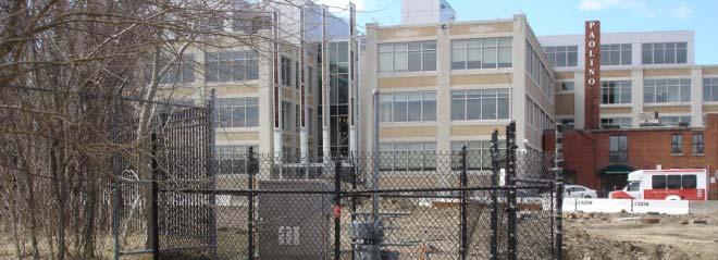
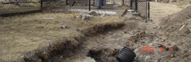
16 West Side Park Design Goals Accommodate existing and planned infrastructure. NBC Structures Utility Infrastructure Ship Street Outfall 16


17 Screen National Grid site and Ship Street utility box with plantings. 17


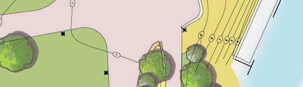
18 West Side Park Design Goals Enhance important views & connections to river & downtown. Provide place for iconic piece of art as focus of Knowledge District. * Asterisk shows potential location of art on plan. Arrow shows viewer s position. ii * 18


19 West Side Park Design Goals Provide active park edges. Pavilion NBC Structures Park Promenade Pavilion along Peck Street avoids utilities and allows space for people waiting in lines for food trucks. 19
20 West Side Park Design Goals Maximize ease of maintenance and park surveillance. 20


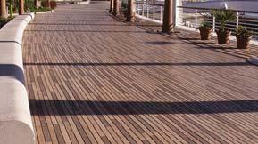

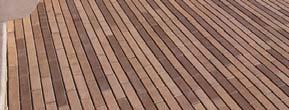
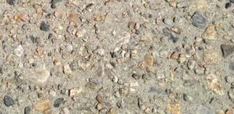

21 West Side Park Design Goals Use materials with ongoing durability and sustainability. Rain Garden * Permeable unit pavers are used as forebay of rain gardens. 21


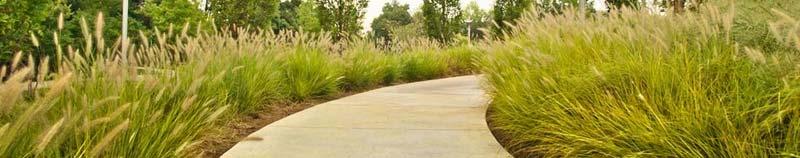
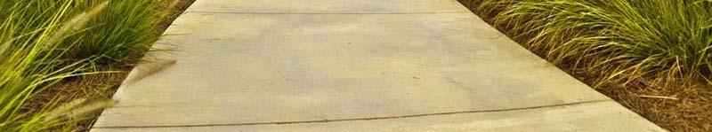
22 West Side Park Design Objectives Create Diverse Spaces. Informal areas along the river, seating areas in the lawn, walkways with views and open plazas such as: Seat walls at river s edge, Movable chairs and tables in the plaza on the promontory, * Restaurant triangle near Ship Street entrance for Parcel
23 West Side Park Design Objectives Create Outdoor Rooms Lawn and Plazas for park visitors. 23


24 Plant diverse trees and plantings to form diverse spaces and enliven park in all seasons. Clockwise from top left: Butterfly Milkweed, Oak, Oak, Sweetgum, Cardinal Flower 24


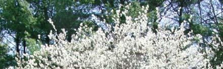

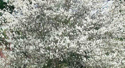


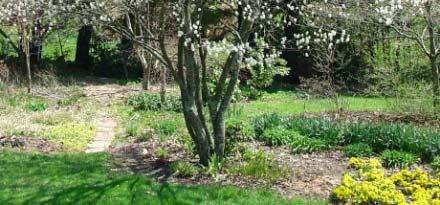
25 Plant deciduous trees with spring flowers and colorful autumn leaves. Autumn Brilliance Serviceberry Fall Autumn Brilliance Serviceberry Spring Tupelo tree above and leaves below - Fall Red Oak - Fall 25
26 Design rain gardens according to Low Impact Development (LID) Site Planning and Design per R.I. Stormwater Design and Installation Standards Manual Grade site to induce sheet flow over specially designed, gently sloped vegetated areas that can treat and infiltrate runoff. 26


27 Plant native species in rain gardens. Clockwise from top left: Virginia Rose, Swamp Azalea, Sensitive Fern, Hay Scented Fern, White Wood Aster, Beach Plum, Panic Grass 27


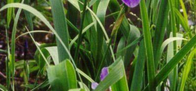
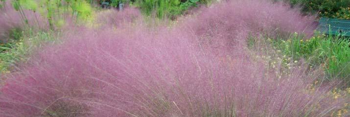

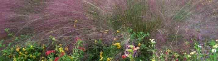

28 Plant hardy native plants in rain gardens. Clockwise from top left: New England Aster, Blue Flag Iris, Wild Blue Indigo, Sparkleberry Winterberry, Purplehair Grass 28
29 Terrace down to river with plantings suitable for flooding by brackish water and requiring minimal maintenance. 29


30 Program for West Side Park Grand plaza at promontory, the park s major gathering space, Additional plazas near Ship and Dorrance Street entrances, Entrances from Memorial Boulevard/Ship Street, Dorrance Street Promenade & heart of Knowledge District, Pedestrian Bridge with landing incorporated into plaza with art. 30


31 Program for West Side Park Seating areas lawn Seating areas * lawn Seating areas Expansive, irrigated sunny lawn, Seating areas - near river, with tables, rain gardens with native plants 31


32 Program for West Side Park NBC Structures Restroom, maintenance, concession and storage along Peck Street sidewalk with shaded seating, space for Farmers Market and for food trucks. Festive and welcoming pavilion along Peck Street also screens NBC Structures. 32
33 Potential Phase 2: Outdoor Theatre Food Trucks on Peck St. Phase 1: Pavilion with Concession, Maintenance, Restrooms - funded Potential Phase 2: Outdoor Theater not funded at this time Pavilion 30% design effort begins in July
34 Program for West Side Park In Phase 1, people can enjoy the lawn and nearby picnic tables on Riverwalk. 34
35 Potential Phase 2 - Places for People If potential Phase 2 stage is built, lawn near Dorrance and Peck Streets are designed d to accommodate a large audience and LED lighting i will line paths. 35


36 Lighting in front of Pavilion LED lights would reduce. operating costs. Form and material of light shown above would be compatible with the pavilion. 36


37 Lighting along park pathways at night Dorrance Street Entrance Ship Street entrance Bridge Entrance LED lights provide lit access at night along park park paths to pedestrian bridge, Dorrance and Ship Streets. LED lights provides lit access at night for night time performances in the park and on the river such as WaterFire. 37


38 Lighting along park pathways LED lights with simple contemporary design 38
IMAGINE CLEARWATER. Community Workshop 3. November 2016
 IMAGINE CLEARWATER Community Workshop 3 November 2016 Imagine Clearwater has been a 6-month community-focused process to re-envision the downtown waterfront. VISIONING FRAMEWORK MASTER PLAN HOW CAN WE
TURN TO THE RIVER CITY PLAZA LANDSCAPE DESIGN CONCEPT May 25, 2016
 Turn to the River is a multi-year project of Art Spaces - Wabash Valley Outdoor Sculpture Collection, Inc. to connect downtown Terre Haute with the Wabash River through public art and design. The four-square
Village of Pemberton DOWNTOWN ENHANCEMENT INITIATIVE FRONTIER STREET PILOT PROJECT WE NEED YOUR HELP TO REVIEW THE PLAN
 Village of Pemberton DOWNTOWN ENHANCEMENT INITIATIVE FRONTIER STREET PILOT PROJECT WELCOME TO THE NEW FRONTIER STREET! WE NEED YOUR HELP TO REVIEW THE PLAN The Village of Pemberton would like your feedback
Hayesville Downtown Improvement Projects Martha Eberle DCA Intern Summer 2010
 Downtown Improvement Projects Martha Eberle DCA Intern Summer 2010 Project 1: Trail etwork Downtown Trail Hia wa ssee Clay County Health Dept Spikebuck Mound and Village Site July 14, 2010 July 14, 14,
Dowdy Park. Concept Plans TOWN OF NAGS HEAD NORTH CAROLINA. Developed by: Albemarle & Associates, Ltd VHB/ Vanasse Hangen Brustlin, Inc.
 TOWN OF NAGS HEAD NORTH CAROLINA Concept Plans Developed by: Albemarle & Associates, Ltd VHB/ Vanasse Hangen Brustlin, Inc. Site Looking Southeast Dowdy Park Existing Conditions Nags Head Woods Sound Future
Task Force on Kai Tak Harbourfront Development. Station Square at Kai Tak
 For discussion on 24 February 2017 Station Square at Kai Tak PURPOSE This paper seeks Members views on the design of the Station Square at Kai Tak. BACKGROUND 2. Upon the relocation of the Hong Kong International
An Introduction to Healing Gardens and Creating Low-cost Wellness Features
 An Introduction to Healing Gardens and Creating Low-cost Wellness Features Oregon Office of Rural Health Oregon Health & Science University Presented by David Sacamano, ASLA, LEED AP HDR Portland Oregon
Courthouse Square Planning & Urban Design Study. Courthouse Square Working Group #13 October 15, 2014
 Courthouse Square Planning & Urban Design Study Courthouse Square Working Group #13 October 15, 2014 1 Courthouse Square Process Working Group Community Courthouse Square Advisory Groups & Civic Associations
/05 Architectural Response
 /05 Architectural Response 5.1 Inspiration Stacked Boxes (Artist : Rachael Whiteread) Cubism ( Architect : Le Corbusier) 52 1133 Melville Rezoning Submission Patterns ( Textile Artist : Annie Albers) Overlapping
1999 Approval to replace World War I monument and relocate plaques Approval to rehabilitate the Chase Mill building and surrounding site
 Memorandum PLANNING DIVISION DEPARTMENT OF COMMUNITY AND NEIGHBORHOODS To: Historic Landmark Commission From: Katia Pace, Principal Planner Date: October 26, 2016 Re: Liberty Park Improvements The purpose
Preferred Riverwalk Alternative Components August 17, 2017:
 Preferred Riverwalk Alternative Components August 17, 2017: 1. Entrance and Future Pump Station Location: Entrance location to line up with main parking entrance to Captain Parkers and allows future Pump
JACKsON STREET PIER CONCEPTUAL DESIGN PACKAGE SEPTEMBER 21, 2017
 JACKsON STREET PIER CONCEPTUAL DESIGN PACKAGE SEPTEMBER 21, 2017 JACKsON STREET PIER Process outline DESIGN PROCESS OVERVIEW: Sandusky s Jackson Street Pier Conceptual Design process included input from
South th E ast Communit ity Centre (SECC)
") South East Community Centre (SECC) 1 New Park Design & Community Centre Update Thursday, February 8, 2018 Public Open House Thank you for attending this Open House! The town and the Consulting Team will
South East Community Centre (SECC) 1 New Park Design & Community Centre Update Thursday, February 8, 2018 Public Open House Thank you for attending this Open House! The town and the Consulting Team will
Port of Camas-Washougal Waterfront Trail Master Plan
 Port of Camas-Washougal Waterfront Trail Master Plan The Port s facilities are the products of its mission: To make strategic investments that enhance the community s quality of life by bringing jobs,
Update on Angus Glen. Community Park. Development Services Committee. December 6, Part A ANGUS GLEN PARK MASTER PLAN. Town of Markham & LA+ED
 Update on Angus Glen Community Park Part A Development Services Committee December 6, 2011 Agenda Overview of Project Background Current Project Status Proposed Park Program and Activities Revised Master
STORMWATER TOOL BOX 4.1
 STORMWATER TOOL BOX 4.1 Median Significant portions of the median will incorporate lowland areas to receive stormwater runoff from one or both sides of the street depending on the final road cross section.
The following concept plans and illustrations are the result of this 10 month study of the alley connections from CSU to the River District.
 W E L C O M E T O T H E F O R T C O L L I N S D O W N T O W N A L L E Y S A N D I N T E G R AT E D W A L K W AY S M A S T E R P L A N O P E N H O U S E The following concept plans and illustrations are
Thousand Oaks Downtown Core Master Plan. Master Plan Open House April 26, 2018
 Thousand Oaks Downtown Core Master Plan Master Plan Open House April 26, 2018 The Site Community Outreach Events Online Community Survey (March 17 - April 22, 2018) 689 responses Pop-Up Workshops Oaks
PARDI MARKET PLAZA MASTER PLANS
 PARDI MARKET PLAZA MASTER PLANS CITY OF DIXON APRIL 25, 2017 Presented by: 1 CITY STAFF INTRODUCTION Deborah Barr Associate Civil Engineer, Project Manager Joe Leach City Engineer/Public Works Director
Riverfront Development Plan
 Planning Studies Project Overview: Continuity Developing Fort Myers underused riverfront was the final step in Downtown redevelopment. To mine all facets of the riverfront, the Plan had to be created cohesively
Johnson Street Bridge Public Realm Update
 Johnson Street Bridge Public Realm Update August 20, 2015 Background Johnson Street Bridge Replacement Project impacts a diverse range of stakeholders In addition to a new bridge, the project also includes
Shared Principles and Emerging Plan Directions
 Shared Principles and Emerging Plan Directions Introduction Since the Fairfield Neighbourhood planning process launched in June 2016, we have heard from many residents, businesses, groups and other people
Emerson Park Master Plan Update. Public Meeting III August 27, 2014
 Emerson Park Master Plan Update Public Meeting III August 27, 2014 Meeting Agenda: Project Update Presentation of Master Plan Components Discussion and Feedback The Path Forward: Building on the Concept
PARDI MARKET PLAZA MASTER PLAN
 PARDI MARKET PLAZA MASTER PLAN CITY OF DIXON PLANNING COMMISSION MAY 16, 2017 Presented by: 1 CITY STAFF INTRODUCTION Deborah Barr Associate Civil Engineer, Project Manager Joe Leach City Engineer/Public
Elliot Norton Park. Community Meeting #2 July 10, 2013, 6:30 pm. Site Design Options, Meeting 2 of 3. Quincy Community Center 885 Washington Street
 Community Meeting #2 July 10, 2013, 6:30 pm Quincy Community Center 885 Washington Street Site Design Options, Meeting 2 of 3 Agenda Sign-in with email or contact information for project updates Introductions
Low Impact Development for your homes, businesses & streets
 Low Impact Development for your homes, businesses & streets What s the problem anyways? - Development Impacts the Water Cycle In the past, our main pollution concern was Point Source Pollution Our current
Community Design Guidelines. Port Wallace DRAFT
 Community Design Guidelines Port Wallace DRAFT Energy 1 2 3 Nature Movement Connections Built Form DRAFT Layout Energy 1 Nature Community Design Guidelines GREAT COMMUNITIES PROTECT, CELEBRATE, AND CONSERVE
Civic Common Master Plan Final Open House. Welcome!
 Civic Common Master Plan Final Open House Welcome! Civic Common Master Plan Study Area Study Area: 7.3 ha Civic Common Context Civic Common The Civic Common is a four square block, 7.3 ha area, that includes:
DOWNTOWN VISIONING FORUM AGENDA JUNE 5, 2014
 DOWNTOWN VISIONING FORUM AGENDA JUNE 5, 2014 Welcome and Introductions Evolution of the Downtown Proposed Downtown Plan Overview and Process Have Your Say! Next Steps Closing Comments 1 WELCOME & INTRODUCTIONS
The Process. Phase 1: Detailed Assessment, Design Framework Phase 2: Conceptual Design. Phase 3: Master Plan Document
 Background The Ship Point master planning process was initiated in March of 2017 to advance policy direction from Harbour Vitality Principles (2014) Ship Point design and initial implementation a key action
Design Considerations
 Essential to the development of a successful Master Plan for the Park Complex is input from the community that the park will serve. The community outreach component of the planning process included numerous
The open space system should provide connective elements, relate to natural resources, and enhance the suburban character of the landscape..
 The open space system should provide connective elements, relate to natural resources, and enhance the suburban character of the landscape.. Mixed-use and infill development should maintain or enhance
SALEM FOREST RIVER PARK PRELIMINARY POOL AREA ASSESSMENT & MASTER PLAN STUDY. For the City of Salem
 SALEM PRELIMINARY POOL AREA ASSESSMENT & MASTER PLAN STUDY For the City of Salem 6-13-17 This process undertaken by Weston & Sampson is to outline preliminary ideas only of what possibilities exist for
TOWN COUNCIL / PLANNING COMMISSION
 Workshop #3 TOWN COUNCIL / PLANNING COMMISSION January 20, 2011 Consultant Team In Attendance Tonight BMS Design Group Nevada City and San Francisco Michael Smiley, AICP, ASLA Partner-in-Charge Nancy L.
BRADENTON RIVERWALK EXPANSION MASTER PLAN
 BRADENTON RIVERWALK EXPANSION MASTER PLAN INTRODUCTION & AGENDA Process Update Community Engagement Summary Center for Active Design (CfAD) Recommendations Context and Existing Conditions Master Plan Alternatives
Welcome! HORSESHOE BAY PARK. Welcome!
 Welcome! HORSESHOE BAY PARK Welcome! Where are we in the process? Today we would like your input on how Horseshoe Bay Park can be upgraded to serve the community s needs better. CONSULT STAKEHOLDERS TAKE
Kittson Parkway / Watershed Park Parking Lot
 Kittson Parkway / Watershed Park Parking Lot Date Constructed: Summer 2005 Site Location / Description: Kittson Parkway, North Delta, British Columbia. Permeable parking lot adjacent to Watershed Park;
Appendix I ARLINGTON COUNTY SECTOR PLANS SUMMARY RECOMMENDATIONS RELATED TO PUBLIC SPACES
 Appendix I ARLINGTON COUNTY SECTOR PLANS SUMMARY RECOMMENDATIONS RELATED TO PUBLIC SPACES The County has developed Sector Plans for various planning areas within Arlington County s Metro corridors. Following
Wilmington Waterfront Overview
 Agenda Introduction Wilmington Waterfront Overview and Objectives Avalon Promenade & Gateway Project Description Site Layout Project Components Entry Plaza Avalon Promenade and Open Space Pedestrian Bridge
Willamette Falls Downtown District Policies and Design Guidelines
 Willamette Falls Downtown District Policies and Design Guidelines The District Policies and Design Guidelines are mandatory for future development within the Willamette Falls Downtown District, and will
VIRGINIA KEY CONSENSUS MASTER PLAN
 VIRGINIA KEY CONSENSUS MASTER PLAN JULY 2010 Existing Conditions JULY 2010 STAKEHOLDER INTERVIEW PROCESS, January 18-22, 2007 PUBLIC MEETING #1: SITE INVENTORY AND ANALYSIS, March 29, 2007 PUBLIC MEETING
Urban Water Management and Soils (ESRM 311 & SEFS 507)
") Urban Water Management and Soils (ESRM 311 & SEFS 507) Cougar Mtn Regional Wildland Park & Lakemont Blvd, Bellevue WA Lecture Today Some Urban Water management terms Examples of water management in urban
Urban Water Management and Soils (ESRM 311 & SEFS 507) Cougar Mtn Regional Wildland Park & Lakemont Blvd, Bellevue WA Lecture Today Some Urban Water management terms Examples of water management in urban
Preliminary Sketch Plan for Fort Hunter Park
 Preliminary Sketch Plan for Fort Hunter Park Public Presentation November 19, 2009 Dauphin County Parks and Recreation 100 Fort Hunter Road Harrisburg, PA 17110 (717) 599-5188 www.dauphinc.org THOMAS COMITTA
URBAN DESIGN + PLANNING BRIDGING COMMUNITIES
 URBAN DESIGN + PLANNING BRIDGING COMMUNITIES East Pleasanton, Pleasanton, CA CARDUCCI ASSOCIATES PROFILE Founded in 1976, Carducci Associates is a professional landscape architecture and planning firm
Des Plaines River Watershed: Opportunity Areas North Community Cluster 1:80,000. Miles. Public Parks or Preserve. Wetland Area
 Service Layer Credits: Harris Corp, Earthstar Geographics LLC Earthstar Geographics SIO 2015 Microsoft Corporation Des Plaines River Watershed: Opportunity Areas North Community Cluster SFR: Single Family
MCCOYS CREEK RESTORATION 30% DESIGN
 MCCOYS CREEK RESTORATION 30% DESIGN THE MCCOYS CREEK RESTORATION PLAN The restoration plan aims to reduce flooding, restore ecosystem health, expand recreational opportunities along the creek, and connect
EXISTING VEHICULAR & PEDESTRIAN CIRCULATION
 46 EXISTING CONDITIONS EXISTING VEHICULAR & PEDESTRIAN CIRCULATION Vehicular and pedestrian circulation patterns are illustrated on this graphic. Campus entry points and major vehicular circulation routes
Queensborough Eastern Neighbourhood Node. Community Open House
 Queensborough Eastern Community Open House The Vision The Queensborough Eastern will become the heart of eastern Queensborough. Through a sensitive mix of viable commercial and residential areas, the neighbourhood
VEHICULAR AND PEDESTRIAN CIRCULATION
 This perspective sketch communicates the intended character and quality of a proposed streetscape design. Locate benches near a major intersection where people tend to gather. Seating and lighting provide
REMINGTON NEIGHBORHOOD PARK
 REMINGTON NEIGHBORHOOD PARK Prepared for G.R.I.A. / GREATER REMINGTON IMPROVEMENT ASSOCIATION by NDC VOLUNTEERS LAURA WHEATON NDC PROGRAM MANAGER The Design Team would like to thank Bin Liu and Hilary
SECONDARY BENEFITS OF STORMWATER BMPS. Growing Sustainable Communities, October 2017
 SECONDARY BENEFITS OF STORMWATER BMPS Growing Sustainable Communities, October 2017 2015 STORMWATER BMPS BENEFITS - AGENDA Stormwater Management Traditional Impacts Stormwater BMPs Primary Benefits Secondary
CAMBIE CORRIDOR PLAN
 1 WELCOME TO THE OPEN HOUSE PUBLIC REALM PLAN - CAMBIE CORRIDOR Thank you for coming to the Cambie Corridor Public Realm Open House! Place a dot where you live Please provide us with your comments and
Minneapolis Sculpture Garden Reconstruction and Cowles Conservatory Renovation. 6:00 p.m.
 Minneapolis Sculpture Garden Reconstruction and Community Advisory Committee (CAC) Meeting #5 April 14, 2014 6:00 p.m. Agenda Project Overview Project Goals, Budget, Schedule Refined Schematic Design COWLES
900 Innes & India Basin Shoreline Park
 India Basin Waterfront Study Task Force A. Philip Randolph Institute Golden Gate Audubon Society Bay Institute Aquarium Foundation Build Inc. Five Points Green Action for Health and Environmental Justice
Lowe Park Master Plan Update Marion, IA August 25 th, 2011
 Lowe Park Master Plan Update Marion, IA August 25 th, 2011 Lowe Park Master Plan Update Concept Plan - June 1 st, 2011 Agenda 1 - INTRODUCTION Vision Statement Aerial of Existing Condition 2 MASTER PLAN
PRELIMINARY DESIGN + DEVELOPMENT PLAN
 WELCOME! To The Public Open House May 30 th, 2017 HARBOUR WEST PARKS Vision Project Overview The City s vision for Port Credit Harbour West Parks is to develop a vibrant waterfront destination that integrates
M E M O R A N D U M February 21, 2018
 M E M O R A N D U M February 21, 2018 Project: Action Requested: Background Information: CP18-001, Ordinance No. 1060-A, Amendment to the City of Southlake Parks, Recreation & Open Space / Community Facilities
Potomac Headwaters Leaders of Watersheds Spring 2019 Application
 Potomac Headwaters Leaders of Watersheds Spring 2019 Application Educating future generations of environmental stewards through classroom education and on the ground conservation practices at schools.
Urban Water Management (ESRM 311 & SEFS 507) Cougar Mtn Regional Wildland Park & Lakemont Blvd, Bellevue WA
 Cougar Mtn Regional Wildland Park & Lakemont Blvd, Bellevue WA") Urban Water Management (ESRM 311 & SEFS 507) Cougar Mtn Regional Wildland Park & Lakemont Blvd, Bellevue WA Lecture Today Urban Water management terms Examples of water management in urban areas Field
Urban Water Management (ESRM 311 & SEFS 507) Cougar Mtn Regional Wildland Park & Lakemont Blvd, Bellevue WA Lecture Today Urban Water management terms Examples of water management in urban areas Field
SOUTH FOX MEADOW STORMWATER IMPROVEMENT PROJECT
 VILLAGE OF SCARSDALE WESTCHESTER COUNTY, NEW YORK COMPREHENSIVE STORM WATER MANAGEMENT SOUTH FOX MEADOW STORMWATER IMPROVEMENT PROJECT In association with WESTCHESTER COUNTY FLOOD MITIGATION PROGRAM Rob
Community Engagement Committee Meeting #1 December 10, :30pm-8:30pm
 Community Engagement Committee Meeting #1 December 10, 2014 6:30pm-8:30pm Welcome and Introductions Dana Murdoch Minneapolis Park and Recreation Board Project Manager Ryan French Walker Art Center Director
QUESTION 8: What are your Public Realm priorities for implementation? What would you like to see happen first? TELL US WHAT YOU THINK
 Public Realm Plan How will the Public Realm Plan be implemented? The Public Realm Plan document will set out a vision for the next 30 years. Over time, Plan elements and aspects can be implemented as opportunities
PARDI MARKET PLAZA PMSCDC WORKSHOP
 PARDI MARKET PLAZA PMSCDC WORKSHOP CITY OF DIXON FEBRUARY 23, 2017 Presented by: CITY STAFF INTRODUCTION Deborah Barr Associate Civil Engineer, Project Manager Joe Leach City Engineer/Public Works Director
V. Gateways GATEWAYS / V-1
 V. GATEWAYS / V-1 Many of Chesapeake s gateways are located on highways and call for bold and attractive designs that motorists can understand, appreciate, and enjoy. can also take the form of natural
Building Great Neighbourhoods. Strathcona
 Building Great Neighbourhoods Strathcona March 21, 2018 Becky Redford Project Manager, Planning & Design Building Great Neighbourhoods Integrated Infrastructure Services Welcome and Purpose To provide
Georgeson Botanical Garden Master Plan
 Georgeson Botanical Garden Master Plan Alaska Chapter 2018-03-12 This Master Plan was developed by volunteers representing the Alaska Chapter of the American Society of Landscape Architects. Eliza Bober
Memorial Park Workshop Notes March 20, :30 10:30am
 Memorial Park Workshop Notes March 20, 2012 7:30 10:30am Black Team Veronica, Jeff, Shelly, Pat, Darcey, Gordy, Jeff Strengths River Size/Space Central Location History River Riffles in River View from/going
Tom Patterson Theatre Technical Review Plans received October 2017
 Tom Patterson Theatre Technical Review Plans received October 2017 Subject Area: Block bounded by Lakeside Drive, Morenz Drive, Water Street, and Waterloo Street South, excluding the lands zoned Residential
Retrofitting Low Impact Development (LID) for Stormwater at Sacramento State. City of Sacramento Sacramento State Facilities Management
 for Stormwater at Sacramento State. City of Sacramento Sacramento State Facilities Management") Retrofitting Low Impact Development (LID) for Stormwater at Sacramento State City of Sacramento Sacramento State Facilities Management Project Background Campus Storm Drain System Drain Inlet - Campus
Retrofitting Low Impact Development (LID) for Stormwater at Sacramento State City of Sacramento Sacramento State Facilities Management Project Background Campus Storm Drain System Drain Inlet - Campus
City of Langley, WA, Request for Qualifications (RFQ) Seawall Park Design
 Seawall Park Design") City of Langley, WA, Request for Qualifications (RFQ) Seawall Park Design INTRODUCTION The City of Langley, WA is soliciting submissions from qualified designers/design teams for a design to improve the
City of Langley, WA, Request for Qualifications (RFQ) Seawall Park Design INTRODUCTION The City of Langley, WA is soliciting submissions from qualified designers/design teams for a design to improve the
EXISTING CONDITIONS 41. Existing Conditions
 EXISTING CONDITIONS 41 Existing Conditions The Existing Analysis phase of the planning process involved a study of the existing conditions on the campus in order to identify key planning issues to be addressed
2035 General Plan Update and Belmont Village Specific Plan. Joint Study Session with the City Council and Planning Commission April 12, 2016
 2035 General Plan Update and Belmont Village Specific Plan Joint Study with the City Council and Planning Commission April 12, 2016 Agenda 1. Welcome and Introductions 2. General Plan Update Status of
Project Location. Jay and Patty Baker Park and Gordon River Greenway Connector Bridge. Naples Beach Golf Club. Gordon River. East. Naples.
 Gordon River Project Location Naples Beach Golf Club East Naples Naples Naples Bay Evergreen Golf and Country Club and Gordon River Greenway Connector Bridge Gordon River Greenway CONNECTOR BRIDGE AND
Title: South Britannia Community Centre Tobi Fenton
 Title: South Britannia Community Centre Tobi Fenton South Britannia is laid out in a grid of 120x60 meter blocks with Main Street oriented towards Howe Sound. The concentrated centre is located at the
City of Farmington. Downtown Plan. Amendment to the 1998 Master Plan Adopted October 11, 2004
 City of Farmington Amendment to the 1998 Master Plan Adopted October 11, 2004 Introduction Planning Background 1 Scope and Components of the Plan Amendment 2 Concept Introduction 3 Plan Concepts 3 Conceptual
ANCHORAGE PARK REPORT CARD Assessing A Park s Appearance, Function, & Condition
 ANCHORAGE PARK REPORT CARD Assessing A Park s Appearance, Function, & Condition Park Name: Is Your Park an A or an F? Your Name: Contact Information Optional: Date: General Instructions: Phone: Email:
A L F O N S O A R C H I T E C T S
 A L F O N S O A R C H I T E C T S A L M A T H E P I E R O F S T. P E T E R S B U R G A L F ALFONSO O N S O A R ARCHITECTS C H I T E C T S ALMA 1. Please demonstrate how the project fits within the Pinellas
DESIGN GUIDELINES. Seattle Children s Major Institution Master Plan. Approved May 7, 2010
 Approved May 7, 2010 Contact: Todd Johnson, todd.johnson@seattlechildrens.org, (206)987-5259 A. MASTER PLAN... 3 A1.0 Context... 3 A1.1 Purpose of Design Guidelines... 3 A1.2 Design Guidelines... 4 B....
COMMUNITY DEVELOPMENT SERVICES PLANNING AND BUILDING DEPARTMENT
 COMMUNITY DEVELOPMENT SERVICES PLANNING AND BUILDING DEPARTMENT http://www.edcgov.us/devservices/ PLACERVILLE OFFICE: 2850 Fairlane Court, Placerville, CA 95667 BUILDING (530) 621-5315 / (530) 622-1708
ROSENTHAL CARPARK LIFE BETWEEN BUILDINGS IN LANE COVE
 south square Life between buildings includes all the very different activities people engage in when they use common city space; purposeful walks from place to place, promenades, short stops, longer stays,
STORMWATER MANAGEMENT FACILITIES/STORMWATER PONDS - What Are They?
 STORMWATER MANAGEMENT FACILITIES/STORMWATER PONDS - What Are They? As land is developed, the natural water cycle is disrupted. Rain infiltrates less, resulting in larger amounts of runoff This increased
Complete Neighbourhood Guidelines Review Tool
 Complete Neighbourhood Guidelines Review Tool Prepared By: City of Regina Planning Department October 2014 Page 1 of 14 Community Development Review Checklist for Secondary Plans and Concept Plans The
Town Center. Block 5 Existing multifamily residential units are expected to remain.
 Area Guidelines Germantown s districts should be developed as distinct communities with unique features that are supported through the guidelines. The guidelines not only help distinguish these districts
Reconnecting to a Forgotten River St. Cloud MN. Aaron Hanson Design Design Thesis LA 572, Thesis, Spring 2012
 Reconnecting to a Forgotten River St. Cloud MN Aaron Hanson Design Design Thesis LA 572, Thesis, Spring 2012 site context 2.5 Miles Sartell St. Cloud to Fargo 170 Miles (2 hrs 45 mins) Hwy 10 infrastructure
ROME WATERFRONT VILLAGE PROJECT NARRATIVE January 25, 2018
 January 25, 2018 The Rome Waterfront Village project is intended to foster the revitalization of the area between South James Street and Erie Boulevard north of the Erie Canal as well as improve public
Stakeholders Advisory Working Groups (SAWGs) Smart Growth and TOD Land Use (#11) SAWG Meeting
 Smart Growth and TOD Land Use (#11) SAWG Meeting") Presentation - Part II Tappan Zee Bridge/I-287 Corridor Project July 21, 2010 Slide 1. David Kooris (Regional Plan Association) welcomed members of the Land Use Stakeholders Advisory Working Groups (SAWGs)
Presentation - Part II Tappan Zee Bridge/I-287 Corridor Project July 21, 2010 Slide 1. David Kooris (Regional Plan Association) welcomed members of the Land Use Stakeholders Advisory Working Groups (SAWGs)
DRAFT. Waterfronts and Open Spaces. 10 The Riverfront Open Space System
 CHAPTER 4 Waterfronts and Open Spaces 10 The Riverfront Open Space System 12 Planned, proposed and envisioned riverfront recommendations. Figure 4.3.23 The riverfront will become a major new public amenity
Landscape and Streetscape Design 2.5
 Landscape and Streetscape Design 2.5 2.5.1 Goals 2.5.2 Planting 2.5.3 Sidewalks and Pavement 2.5.4 Furnishings 2.5.5 Walls 2.5.6 Lighting 2.5.7 Stormwater 2.5.8 Street Cross Sections 2.5 LANDSCAPE AND
Bridgeland-Riverside
 Active Neighbourhoods ridgeland-iverside s D FO O A IL NOH N F W N O S 8 H NU AV 1 S O M C A M P L L S H I L L N A U A L P A K U N AV 12 H S C 4 H S C S C N H I G H S S AIL th D 9 D MO N ON C K Y C A L
Official Community Plan Bylaw No. 4360, 2004, Amendment Bylaw No. 4897, 2016 (Sewell s Landing)
") District of West Vancouver Official Community Plan Bylaw No. 4360, 2004, Amendment Bylaw No. 4897, 2016 (Sewell s Landing) Effective Date: 1089612v1 District of West Vancouver Official Community Plan Bylaw
District of West Vancouver Official Community Plan Bylaw No. 4360, 2004, Amendment Bylaw No. 4897, 2016 (Sewell s Landing) Effective Date: 1089612v1 District of West Vancouver Official Community Plan Bylaw
CHAPPLES PARK MASTER PLAN
 CHAPPLES PARK MASTER PLAN Presentation of Preliminary Development Options Public Open House #2 Wednesday November 2 nd, 2016 TONIGHT S AGENDA 1. Welcome & Introductions 2. Presentation by Sierra Planning
Project Consulting Team:
 THE DOWNTOWN CHERRYVILLE LAND USE + STREETSCAPE MASTER PLAN WAS FUNDED THROUGH THE GENEROUS DONATIONS OF THE FOLLOWING: The Community Foundation of Gaston County ElectriCities of North Carolina The Cherryville
E. Natural areas include habitats such as wetlands, tidal marshes, waterways, natural drainage-ways, woodlands and grassland meadows.
 Adopted November 1999 I. Purpose A. The purpose of these guidelines is to assist in the design and layout of open space, as provided on developed lots within the District. The intent of these guidelines
PITKIN COUNTY AIRPORT LANDSCAPE MASTERPLAN
 WELCOMING VIEW OF AIRPORT CAMPUS AND AN IM- PORTANT SECTION OF THE EXPERIENCE INTO ASPEN. SOUTH MEADOW IS PART OF THE NATIVE GRASS, SAGE, AND WILDFLOWER MEADOW EXTENDING FROM BUTTERMILK MOUNTAIN DOWN TO
Welcome. Community Consultation Meeting November 28, Review and discuss the Bathurst Quay Neighbourhood Plan Framework
 Welcome Community Consultation Meeting November 28, 2016 Why Are We Here Today? Review and discuss the Bathurst Quay Neighbourhood Plan Framework Review and discuss an Action Plan for Implementation Next
DOWNTOWN RESIDENTIAL DISTRICT DEVELOPMENT OPPORTUNITES
 DOWNTOWN RESIDENTIAL DISTRICT DEVELOPMENT OPPORTUNITES Out of all the areas in Downtown Painesville, this district provides the greatest opportunity for change with the vacation of Lake East Hospital.
03 HIGH PRIORITY SITES
 03 HIGH PRIORITY SITES HOWARD PARK Howard Park is one of South Bend s largest riverfront parks, hosting nearly acres. Howard Park has a very passive landscape with a recreation building, ice skating rink,
THE LANDMARK PROJECT: ST. GEORGE CAMPUS BEFORE AND AFTER
 THE LANDMARK PROJECT: ST. GEORGE CAMPUS BEFORE AND AFTER The Landmark Project will reimagine the historic core of the St. George campus by creating dynamic, open spaces where students, faculty and the
7.0 OPEN SPACE 7.1 OPEN SPACE DEDICATION CHAPTER 7: OPEN SPACE
 7.0 OPEN SPACE The intent of these requirements is to allow for the usage of centrally located unencumbered land as neighborhood open spaces and not to permit the use of leftover or otherwise unusable
SITE PLAN (REVISED 8/13/18) l. Development Data Table
 l. Development Data Table") SITE PLAN (REVISED 8/13/18) l. Development Data Table a. Site Acreage: 9.25 b. Tax Parcels included in rezoning: #108-081-07 and #108-081-23 c. Existing Zoning (including overlays and vesting): R-3 (see
SITE PLAN (REVISED 8/13/18) l. Development Data Table a. Site Acreage: 9.25 b. Tax Parcels included in rezoning: #108-081-07 and #108-081-23 c. Existing Zoning (including overlays and vesting): R-3 (see