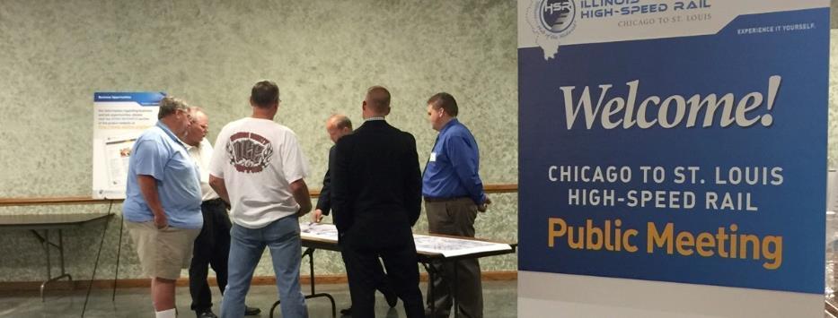
Kankakee River Bridge & Track Improvements Supplemental Environmental Assessment. May 5, 2016
|
|
|
- Nora Preston
- 6 years ago
- Views:
Transcription
1 Kankakee River Bridge & Track Improvements Supplemental Environmental Assessment May 5,

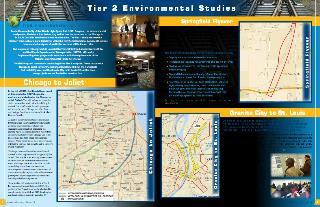
2 History: Chicago-St. Louis Corridor Since 1980 s IDOT has been looking at this corridor for high-speed service 1992 Designated a HSR Corridor EIS Completed Record of Decision received in 2004 Ridership continues to grow 2


3 Chicago to St. Louis Corridor with 9 stops in between Current Improvements Between Joliet & East St. Louis 13 Counties Cook, DuPage, Will, Grundy, Livingston, McLean, Logan, Sangamon, Macoupin, Jersey, Madison, St. Clair, and St. Louis 3

 Federal")
 Others Support Parsons Brinckerhoff - Program")
4 Program Partners Who s Involved? Elected Officials Regional Agencies Transportation Providers Business Community General Public & Interest Groups City/County Technical Staff Program Partners Illinois Department of Transportation (IDOT) Federal Railroad Administration (FRA) Union Pacific Railroad (UPRR) Amtrak Illinois Commerce Commission (ICC) Others Support Parsons Brinckerhoff - Program Manager IDOT Consultants (PTB Advertisements) UPRR Contractors/Consultants 4
5 Current Program Budget: $1.95 Billion > Track & Structures $637 Million 33% > Grade Crossings, Fencing, Overhead Bridges $194 Million 10% > Real Estate $40 Million 2% > Stations $35 Million 2% > Rolling Stock/Equipment $609 Million 31% > Signal & Communications $205 Million 11% > Professional Services $231 Million 12% Total $1,951 Million 100% Note: This summary does not include Tier 1 and Tier 2 EIS s, Joliet Multimodal, or other individual projects. 5


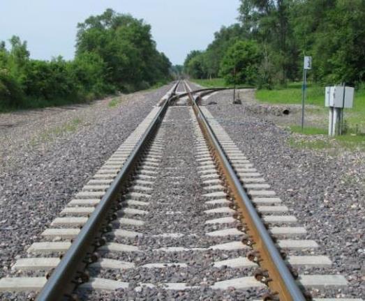
6 What Are We Building? 110 mph speed upgrades 262 miles of main track Realignment of curves New second tracks/sidings Grade crossings & fencing Signaling Turnouts & culverts Bridges 6 new high-speed train sets 8 new/renovated stations 6

7 HSR Program Schedule 7


8 Reliable schedule Passenger amenities IMPROVED PASSENGER EXPERIENCE Reduced travel time New & upgraded stations 8
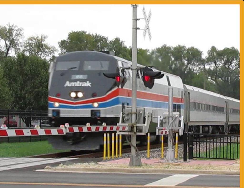
9 New & rehabilitated tracks Fencing IMPROVED SAFETY Upgraded crossings Bridge improvements 9
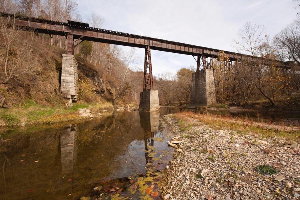
10 Kankakee River Bridge and Track Improvements Project 10

11 Project Location 11

12 Purpose and Need» Improve passenger rail service» Improve/replace deteriorating or functionally obsolete transportation components» Fulfill the need for additional mainline track Enhance operations Increase reliability 12

13 Build Alternative Map 13


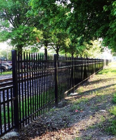
14 Build Alternative Supports the Purpose and Need of the Project» 4.35 acres of additional right-of-way and 1.08 acre of temporary construction easement» Shift existing track location» Replace Kankakee River, Water Street and Forked Creek bridges» New rail maintenance access road» Grade-crossing improvements, new fencing, roadway and signal improvements» Drainage improvements 14
15 North Kankakee Street Improvements» Install four-quadrant gates and pedestrian gates» Reconstruct North Kankakee Street between Canal Street and Chicago Street, including both intersections» Raise roadway up to 6 feet on both sides of track» Install retaining walls» Reconstruct sidewalk behind retaining walls 15
16 Was grade separation considered? Three grade separation alternatives were evaluated: 1. Closing North Kankakee Street and improving existing Water Street grade separation 2. Raising the existing railroad tracks over North Kankakee Street 3. Reconstructing North Kankakee Street under the existing railroad tracks Not recommended due to adverse impacts, including:» displacement of residents and businesses» new right-of-way needs» changed access to businesses» new traffic patterns» flooding issues with underpasses 16


17 No-Build Alternative» No change to single mainline track» Routine maintenance only» No change to existing infrastructure and track signal equipment Does not improve deteriorating infrastructure Does not improve operations and increase reliability of passenger rail 17

18 Environmental Assessment» Evaluation of potential impacts on natural and human environments» Study area spans approximately 1.31 miles within the City of Wilmington Kankakee River Drive on the north N. 1 st Street on the south» Compares the potential impacts between the Build Alternative and the No Build Alternative 18
19 Biological Assessment» Evaluates potential effects on federally listed species, designated and proposed critical habitats» Potential impacts found for: 2 federally listed threatened or endangered species» Coordination with U.S. Fish and Wildlife Service for mitigation 19


20 Summary of Potential Impacts» Acquisition and temporary easements No home displacement» Displacement of selfstorage facility» Vegetation loss» Wetlands» Water quality» Protected species» Train noise» Construction 20
21 Key Proposed Mitigations» Aesthetics re-vegetation after construction» Vegetation and Habitat restore ground surface» Wetlands mitigation banking for permanent impacts» Water Quality Construction Best Management Practices» Protected Species construction timing and relocation» Train noise quiet zone» Construction and travel impacts coordination with City of Wilmington, including emergency services 21


22 Upcoming Construction» Temporary partial or full closure of track crossings» Detours coordinated with City, emergency departments, schools» Temporary bridge» Temporary closure of Water St. N. Kankakee St. and Water St. will not be closed at the same time» Temporary closure of Kankakee St. crossing Detoured to River Rd. or Water St. and IL-53» Access to businesses maintained Construction anticipated to begin mid


23 Comments View the Kankakee River Bridge and Track Improvements Supplemental Environmental Assessment at and at the Wilmington Public Library Comments will be accepted through May 13,

24 Stay Informed 24


25 Business Opportunities» Visit Doing Business section Current business opportunities Learn about the bidding process 25


26 Public Involvement Held Over 230 Events Public Meetings/Hearings Small Group Meetings Festivals/Community Events Schools Stakeholder Outreach Media Outreach Fact Sheets Small Group Meetings Program Website Social Media Program Hotline IDOT-HSR 26
27 Thank you! 27
Overall Map. Chicago. St. Louis. Summit. Joliet. Dwight. Pontiac. Bloomington-Normal Lincoln. Springfield. Carlinville. Alton EXPERIENCE IT YOURSELF.
 Overall Map Summit Chicago Bloomington-Normal Lincoln New Station Planned New Station Planned Dwight Pontiac Joliet Pedestrian overpass and second platform planned Higher speed service began in this section
Illinois Planning and Environmental Studies for FRA Applications for High-Speed and Intercity Passenger Rail (HSIPR)
") Illinois Planning and Environmental Studies for FRA Applications for High-Speed and Intercity Prepared by Tim Selover, PE, AICP Parsons Brinckerhoff On April 16, 2009, President Obama described his Vision
Illinois Planning and Environmental Studies for FRA Applications for High-Speed and Intercity Prepared by Tim Selover, PE, AICP Parsons Brinckerhoff On April 16, 2009, President Obama described his Vision
SOUTHWEST CORRIDOR EXTENSION. Environmental Evaluation and Basic Engineering Results PUBLIC MEETING/OPEN HOUSE November 18, 2009
 SOUTHWEST CORRIDOR EXTENSION Environmental Evaluation and Basic Engineering Results PUBLIC MEETING/OPEN HOUSE November 18, 2009 AGENDA I. Welcome/Introductions II. Project Review and Status III. Environmental
The Illinois Department of Transportation and Lake County Division of Transportation. Route 173, including the Millburn Bypass
 The Illinois Department of Transportation and Lake County Division of Transportation welcome you to this Public Hearing for U.S. Route 45 from Illinois Route 132 to Illinois Route 173, including the Millburn
Meeting Purpose: Date and Time: Location: Attendance: Handouts:
 Meeting Purpose: Date and Time: Location: Attendance: Handouts: PA Turnpike / I-95 Interchange Project Design Advisory Committee (DAC)/Public Officials Meeting #8 April 12, 2012 at 1:30 p.m. Project Office,
WELCOME! 8 8:30 6: TH STREET IMPROVEMENTS. Open House. Presentation & Q&A
 WELCOME! 168 TH STREET IMPROVEMENTS 6:30 Open House 7 8 Presentation & Q&A 8 8:30 Open House WELCOME Todd Pfitzer City of Omaha Engineer Bob Stubbe City of Omaha Public Works Director Jon Meyer Project
Transportation Enhancements TE-2012-US Fish and Wildlife Service Quality of Life. Type of Improvement
 Transportation Enhancements 2012 Quality_of_Life Type of Improvement Infrastructure Bikeway Pedestrian Safety Quality of Life Purpose Primary project purpose is for constructing new bikeways (e.g. bike
SECTION 4(f) DE MINIMIS DOCUMENTATION
 DE MINIMIS DOCUMENTATION") SECTION 4(f) DE MINIMIS DOCUMENTATION Illinois Route 60/83 IL 176 to the intersection of IL 60 (Townline Road) Lake County P-91-084-07 Mundelein Park and Recreation District Project Limit SECTION 4(f)
SECTION 4(f) DE MINIMIS DOCUMENTATION Illinois Route 60/83 IL 176 to the intersection of IL 60 (Townline Road) Lake County P-91-084-07 Mundelein Park and Recreation District Project Limit SECTION 4(f)
Elgin O Hare Western Access Project Local Advisory Committee. February 10, 2014
 Elgin O Hare Western Access Project Local Advisory Committee February 10, 2014 Agenda Project status update Design and construction Funding Aesthetics Project events and outreach Land acquisition Next
Chesterfield County Project Update
 Chesterfield County Project Update SOUTHEAST HIGH SPEED RAIL TIER II ENVIRONMENTAL IMPACT STATEMENT RICHMOND, VA, TO RALEIGH, NC CHESTERFIELD COUNTY, VA OFFICIALS BRIEFING February 2013 Federal Railroad
112th Avenue Light Rail Options Concept Design Report JUNE 2010 PREPARED FOR PREPARED BY TBG PGH
 112th Avenue Light Rail Options Concept Design Report JUNE 2010 PREPARED FOR PREPARED BY TBG060310124909PGH C ontents Introduction 1 Project Overview 1 Public Involvement and Technical Coordination 4 Description
Welcome. to the 95th Street Terminal Improvement Project Public Hearing
 Welcome to the 95th Street Terminal Improvement Project Public Hearing The purpose of this Public Hearing is to solicit comments from the community about the Environmental Assessment prepared for the 95th
East Corridor Final Environmental Impact Statement
 East Corridor Final Environmental Impact Statement Alternatives Considered Operating Plan The requirements for opening day operations versus year 2030 are based on ridership and operations. Opening day
GREEN SHEET ENVIRONMENTAL COMMITMENTS FOR THE IOWA HIGHWAY 100 EXTENSION
 County: Linn County, IA GREEN SHEET Location: IA 100, from its terminus at Edgewood Rd. to US 30 southwest of Cedar Rapids Route: IA 100 Extension Project No.: NHS-100-1(36) 19-57 OLE Project Managers:
Illiana Corridor CPG/TTF Meeting #1
 Illiana Corridor CPG/TTF #1 March 14, 2013 #10 1 Agenda Tier One Recap What happens in Tier Two? Tier Two Purpose and Need Identify Range of Alternatives Landowner Outreach Initial Context Sensitive Solution
Parapet/Formliner/Fencing
 Parapet/Formliner/Fencing Cross Parapet/Formliner/Fencing Street Aesthetic Features Context The I-290 Phase I study is evaluating improvements along 13 miles of the Eisenhower Expressway, from west of
Burloak Drive Grade Separation
 Burloak Drive Grade Separation Transit Project Assessment Process Public Meeting #1 March 30, 2017 GO Lakeshore West Service Plan Weekday Rush Hour 15-minute, two-way service between Aldershot* and Union
MARINA BAY. City of Richmond Officer Bradley A. Moody Memorial Underpass. April 14, 2010
 MARINA BAY NEIGHBORHOOD G O OO PRESENTATION S O City of Richmond Officer Bradley A. Moody Memorial Underpass April 14, 2010 TEAM INTRODUCTIONS Project Oversight and Approval City of Richmond Richmond Community
Northwest Corridor LRT Line to Irving/DFW Public Meeting No. 1 Project Overview
 LRT Line to Irving/DFW Public Meeting No. 1 Project Overview January 21, 2004 Agenda Purpose Corridor Background Environmental Impact Assessment Public Involvement Plan Project Schedule Purpose Project
Fall 2017 Construction Update
 Fall 2017 Construction Update Ward 4 Southeast Engineering Department Riverwalk Red Multi-Use Trail Bridge Rehabilitation The Riverwalk Red Multi Use Trail Bridge was awarded to Cramer and Associates,
PROJECT BACKGROUND. Preliminary Design Scope and Tasks
 PROJECT BACKGROUND Preliminary Design Scope and Tasks The purpose of this Study is the development of preliminary designs for intersection improvements for Trunk Highway (TH) 36 at the intersections of
Pennsy Greenway Trail
 Town of Schererville Pennsy Greenway Trail DES. #s: 0401062, 1173595 & 1382661 Construction of Pennsy Greenway Trail beginning at Wilhelm Street and continuing northwest along the former Penn Central railroad
Municipal Class EA Study Public Information Centre No. 1 December 13, :00 pm 7:00 pm. Please sign in so we can keep you updated on this study
 Reconstruction of Regional Road 45 (Creek Road) Between Regional Road 27 (River Road) and Regional Road 63 (Canborough Road) in the Township of Wainfleet Municipal Class EA Study Public Information Centre
Cottage Grove Road Reconstruction. City of Madison Engineering
 Public Informational Meeting Cottage Grove Road Reconstruction October 8, 2015 Presentation Outline Introduction Project Purpose & Need Proposed Design Overview Environmental Concerns Pedestrian Needs
City of Loveland Public Information Meeting February 19, 2009
 Railroad Quiet Zones City of Loveland Public Information Meeting February 19, 2009 Railroad Quiet Zones AGENDA: 7:00-7:05 Introduction Frank Hempen (City Project Manager) 7:05-7:20 Railroad Quiet Zones
Welcome. Northern Segment of Hwy 100 I-90 to South of Madison Street Meeting Goals:
 Welcome Northern Segment of Hwy 100 I-90 to South of Madison Street Meeting Goals: - Review Environmental Assessment - Share Preferred Alternative -Receive Public Comments 2003 EA Preferred Alternative
WELCOME TO OPEN HOUSE TWO November 28, 2018
 Langstaff Road Weston Road to Highway 7 Class Environmental Assessment Study WELCOME TO OPEN HOUSE TWO November 28, 2018 Please sign in and join our mailing list Study Overview York Region is conducting
Public Hearing. Charlotte County-Punta Gorda MPO - Meeting Rooms A and B March 14, open house at 4 p.m., formal presentation at 5 p.m.
 Public Hearing Charlotte County-Punta Gorda MPO - Meeting Rooms A and B March 14, 2019 open house at 4 p.m., formal presentation at 5 p.m. Welcome to the Public Hearing for the Harborview Road (CR 776)
Right-of-Way Acquisitions and Relocations Technical Memorandum
 Right-of-Way Acquisitions and Relocations Technical Memorandum Southeast Extension Project Lincoln Station to RidgeGate Parkway Prepared for: Federal Transit Administration Prepared by: Denver Regional
Public Officials/Design Advisory Meeting #12. Bensalem Township Municipal building, 2400 Byberry Road Bensalem, PA
 Meeting Purpose: Date and Time: Location: Attendance: Materials: PA Turnpike/I 95 Interchange Project Public Officials/Design Advisory Meeting #12 June 2, 2016 at 11:00 a.m. Bensalem Township Municipal
PUBLIC HEARING. Thursday, December 14, 2017 FDOT Urban Office 2198 Edison Avenue Jacksonville, FL 32204
 DISTRICT TWO PUBLIC HEARING I 10 (SR 8) from I 295 to I 95 Project Development & Environment Study Duval County, Florida Financial Project Number 213326 2 22 01 Efficient Transportation Decision Making
City of Meriden Harbor Brook Flood Control Project Overview
 City of Meriden Harbor Brook Flood Control Project Overview Updated August 2013 OVERVIEW The center of Meriden, including the HUB site is the low point of the town which is ringed by basalt ridges. Running
Highway 15 Project - Hutchinson
 Highway 15 Project - Hutchinson Agenda What are we going to talk about today? Goals and benefits of the project Details about the proposed work Project schedule and costs Any questions you may have about
Planning Districts INTRODUCTION
 INTRODUCTION To facilitate detailed examination of development prospects for all areas of the community, Delano has been divided into 14 planning districts. The location of these planning districts is
Public Information Meeting
 Public Information Meeting Corridor Study / Environmental Analysis for County Road 600 West from County Road 300 North to County Road 1000 North (96 th Street) Study Limits it County Road 600 West from
Project Description WOO/LUC-SR /0.00. Waterville Bridge Replacement
 Ohio Department of Transportation District 2 317 East Poe Rd. Bowling Green, Ohio 43402 (419) 353-8131 John R. Kasich, Governor Jerry Wray, Director Todd Audet, P.E., District Deputy Director Project Description
Citizen Information Meeting
 Prince William County Government Citizen Information Meeting Vint Hill Road Extension May 11, 2016 Benefits: Route 28 Corridor Improvement Program Estimated significant cost savings versus bidding these
Middlebury RS 0174(8)
") Middlebury RS 0174(8) Preferred Alternative Meeting VT 125 Bridge #13 over Middlebury River August 6, 2012 Presented to Presented by Town of Middlebury VTrans & VHB Introductions: Jennifer Fitch VTrans
Middlebury RS 0174(8) Preferred Alternative Meeting VT 125 Bridge #13 over Middlebury River August 6, 2012 Presented to Presented by Town of Middlebury VTrans & VHB Introductions: Jennifer Fitch VTrans
Northern Branch Corridor SDEIS March Table of Contents
 Table of Contents Executive Summary... ES-1 ES.1 Introduction... ES-1 ES.2 Project Background... ES-1 ES.3 Purpose and Need... ES-5 ES.4 Alternatives... ES-6 ES.5 Operating Plan... ES-11 ES.6 Cost Analysis...
HIGH-SPEED RAIL PROGRAM UPDATE. Gilroy Unified School District & Gilroy City Council September 24, 2018 Gilroy City Council Chambers, Gilroy, CA
 HIGH-SPEED RAIL PROGRAM UPDATE Gilroy Unified School District & Gilroy City Council September 24, 2018 Gilroy City Council Chambers, Gilroy, CA OVERVIEW Introductions High-Speed Rail Project Update Overview
I. DESCRIPTION OF PROPOSED ACTION... 1 A. General Description... 1 B. Historical Resume and Project Status... 2 C. Cost Estimates...
 PROJECT COMMITMENTS SUMMARY... S-1 1. Type of Action... S-1 2. Description of Action... S-1 3. Summary of Purpose and Need... S-1 4. Alternatives Considered... S-2 5. NCDOT Alternatives Carried Forward...
PD&E STUDY SR 9/I-95 FROM SOUTH OF SR 870/COMMERCIAL BOULEVARD TO NORTH OF CYPRESS CREEK ROAD FM # ETDM 14222
 PD&E STUDY SR 870/COMMERCIAL BOULEVARD TO NORTH OF CYPRESS CREEK ROAD FM # 435808-1-22-02 ETDM 14222 WELCOME TO THE KICK-OFF MEETING May 24, 2016 1 1 2 3 4 5 6 PLANNING PROJECT DEVELOPMENT AND ENVIRONMENT
7th Avenue Creek Master Plan Development Project. City of St. Charles, IL. IAFSM CONFERENCE March 14, 2018 MARKET
 7th Avenue Creek Master Plan Development Project MARKET City of St. Charles, IL IAFSM CONFERENCE March 14, 2018 7 TH AVENUE CREEK PROJECT AREA 2 2008 RAIN EVENT 3 RESIDENTIAL STRUCTURE FLOODING COMMERCIAL
Capital Improvement Program. Development Services Staff Recommended Projects
 2014-2019 Capital Improvement Program Development Services Staff Recommended Projects Ongoing Capital Improvement Ellsworth Road Ryan to Germann Roads $3.5 M Germann Rd Ryan Rd Half-street improvements
St. Clair Avenue West Area Transportation Master Plan
 1 (Between Keele Street and Old Weston Road) Public Information Centre 1 December 2, 2015 2 Welcome Welcome to the first Public Information Centre for the St. Clair Avenue West Area. The panels will present
West Dennis Center: Bass River to Old Main Street. West Dennis Business District: Old Main Street to Dennis Commons
 West Dennis Center: Bass River to Old Main Street West Dennis Business District: Old Main Street to Dennis Commons Dennisport Center: Dennis Commons to Division Street Main Street Project Goals Project
APWA Expo August 27, Ground Water Recharge With Storm Management: A Sustainable Development
 APWA Expo August 27, 2013 Ground Water Recharge With Storm Management: A Sustainable Development Presented by: Joel S. Koenig, P.E. Andrew J. Hawkins Chris P. Dagiantis, P.E., CFM Bios Joel S. Koenig,
Ashland BRT Environmental Assessment: logos of CTA, CDOT, Chicago Department of Housing and Economic Development
 Ashland BRT Environmental Assessment: logos of CTA, CDOT, Chicago Department of Housing and Economic Development Overview The Chicago Transit Authority (CTA), in partnership with the Chicago Department
Longmeadow Parkway Fox River Bridge Corridor. August 6, 2015
 Longmeadow Parkway Fox River Bridge Corridor August 6, 2015 Longmeadow Parkway Bridge Corridor 5.6 miles from Huntley Road to IL 62 Unique municipal/county/state/federal partnership Links Randall Road
THREE-YEAR CAPITAL IMPROVEMENT PLAN FY
 THREE-YEAR CAPITAL IMPROVEMENT PLAN FY2016 2018 Annual CIP Development Process Public Works & Engineering Divisions Prepare List of Capital Needs and Recommended Deferred Maintenance Public Works & Engineering
MARINA BAY NEIGHBORHOOD PRESENTATION. City of Richmond Officer Bradley A. Moody Memorial Underpass. April 11, 2012
 MARINA BAY NEIGHBORHOOD PRESENTATION City of Richmond Officer Bradley A. Moody Memorial Underpass April 11, 2012 TEAM INTRODUCTIONS Project Oversight and Approval City of Richmond Formally Richmond Community
TOWN OF WHITBY REPORT RECOMMENDATION REPORT
 TOWN OF WHITBY REPORT RECOMMENDATION REPORT REPORT TO: Council REPORT NO: PL 95-09 DATE OF MEETING: October 13, 2009 PREPARED BY: Planning/Public Works Joint Report FILE NO(S): N/A LOCATION: N/A REPORT
2017 General Obligation Bond
 2017 General Obligation Bond Presentation of Public and Council Projects to the Transportation & Mobility Stakeholder Committee April 13, 2017 Agenda Deferred Maintenance Project Development Process Projects
WELCOME 50 street cp rail grade separation + road widening. public information session #1 June 26, pm to 8 pm
 WELCOME 50 street cp rail grade separation + road widening public information session #1 June 26, 2018 5 pm to 8 pm session purpose To provide residents, businesses, and users of 50 Street with the opportunity
The Village of Sugar Grove, in partnership with Kane County, the Illinois Department of Transportation, and the Illinois Tollway welcomes you to the
 The Village of Sugar Grove, in partnership with Kane County, the Illinois Department of Transportation, and the Illinois Tollway welcomes you to the first Public Meeting for the proposed interchange improvement
COMMUNICATION URBAN DESIGN REVIEW BOARD CITY OF DES MOINES, IOWA MAY 16, 2017 MEETING
 COMMUNICATION URBAN DESIGN REVIEW BOARD CITY OF DES MOINES, IOWA MAY 16, 2017 MEETING Subject: Recommendation Prepared by: PRELIMINARY DESIGN REVIEW OF LOCUST STREET BRIDGE CONSTRUCTION & COURT AVENUE,
SECTION II SECTION II STATEMENT OF GOALS, OBJECTIVES, PRINCIPLES, ASSUMPTIONS, POLICIES AND STANDARDS
 STATEMENT OF GOALS, OBJECTIVES, PRINCIPLES, ASSUMPTIONS, POLICIES AND STANDARDS 1 2 STATEMENT OF GOALS, OBJECTIVES, PRINCIPLES, ASSUMPTIONS, POLICIES AND STANDARDS INTRODUCTION The New Jersey Municipal
ENBRIDGE GAS DISTRIBUTION INC. Proposed Relocation for Ninth Line, Markham and Whitchurch-Stouffville. Environmental Screening Report
 Page 1 of 18 ENBRIDGE GAS DISTRIBUTION INC. Proposed Relocation for Ninth Line, Markham and Whitchurch-Stouffville Environmental Screening Report July 2011 Page 2 of 18 Table of Contents 1.0 INTRODUCTION
Open House RIVER DES PERES GREENWAY: LANSDOWNE SHREWSBURY METROLINK TO FRANCIS R. SLAY PARK
 Open House 10.12.16 RIVER DES PERES GREENWAY: LANSDOWNE SHREWSBURY METROLINK TO FRANCIS R. SLAY PARK MEETING AGENDA Great Rivers Greenway and Project Partners River des Peres Greenway Overview Project
6:00 8:00 PM I-95 FROM EXIT 57 TO EXIT 60 PROJECT
 PUBLIC INFORMATIONAL MEETING TUESDAY, APRIL 27, 2010 AT NEWBURYPORT CITY HALL, AUDITORIUM 60 PLEASANT STREET NEWBURYPORT, MASSACHUSETTS 6:00 8:00 PM FOR THE PROPOSED WHITTIER BRIDGE / I-95 IMPROVEMENTS
Downingtown Station Relocation Plan Site Selection Memo June 12, 2012
 Downingtown Station Relocation Plan Site Selection Memo 06.12.12 June 12, 2012 Background and Overview Downingtown is a borough in Chester County, Pennsylvania located approximately 32 miles west of Philadelphia
Better Cycling. The City will update the cycling master plan (London ON Bikes) based on the approved BRT network.
 based on the approved BRT network.") Better Cycling Dedicated bike facilities will be constructed along BRT corridors where space is available. Nearby bike routes will also be upgraded to ensure a complete network is available for cyclists.
Better Cycling Dedicated bike facilities will be constructed along BRT corridors where space is available. Nearby bike routes will also be upgraded to ensure a complete network is available for cyclists.
I-90 Mississippi River Bridge & Interchange Project
 I-90 Mississippi River Bridge & Interchange Project Presentation Outline I. Background: Context & Need for Project II. Preferred Alternative Overview III. Project Development IV. Project Management Tools
Anderson Memorial Bridge Rehabilitation Project Boston/Cambridge
 Anderson Memorial Bridge Rehabilitation Project Boston/Cambridge MEPA Meeting, EEA#14702 Wednesday, March 2, 2011 6:30 PM Dr. Martin Luther King, Jr. School 100 Putnam Avenue, Cambridge, MA Rendering by:
Meeting Purpose: Date and Time: Location: Attendance: Handouts:
 Meeting Purpose: Date and Time: Location: Attendance: Handouts: PA Turnpike/I-95 Interchange Project Public Officials/Design Advisory Meeting #11 May 28, 2015 at 11:00 a.m. Project Office, 900 Northbrook
Northern Branch Corridor SDEIS March 2017
 Northern Branch Corridor SDEIS March 2017 15. 15.1. Chapter Overview 15.1.1. Introduction This chapter discusses changes to the Preferred Alternative resulting in the potential for project improvements
5-Year Street Reconstruction Plan ( )
") 5-Year Street Reconstruction Plan (2006-2010) City of Delano Wenck File #0564-37 Prepared for: CITY OF DELANO 234 2 nd Street West Delano, MN 55328 Prepared by: WENCK ASSOCIATES, INC. 1800 Pioneer Creek
5-Year Street Reconstruction Plan (2006-2010) City of Delano Wenck File #0564-37 Prepared for: CITY OF DELANO 234 2 nd Street West Delano, MN 55328 Prepared by: WENCK ASSOCIATES, INC. 1800 Pioneer Creek
Potential Green Infrastructure Strategies May 6, 2015 Workshop
 Potential Green Infrastructure Strategies May 6, 2015 Workshop Background The City of Cortland is developing the Tioughnioga Urban Headwaters Green Infrastructure Action Plan with funding from the National
Goals for Tonight s Meeting
 South Anthony Boulevard Railroad Grade Separation Study Report to Community November 30, 2011 Andorfer Commons Theatre Indiana Tech University Goals for Tonight s Meeting Recap of the meeting from last
SCARBOROUGH RAPID TRANSIT ENVIRONMENTAL PROJECT REPORT CHAPTER 2 PROJECT DESCRIPTION. Table 2-4: North Segment Alignment Analysis 2-21
 Table 2-4: North Segment Alignment Analysis 2-21 SCARBOROUGH RAPID TRANSIT Based on the above analysis (detailed analysis is contained in Appendix A-4), North Alignment 3 is preferred because it: Has the
Scope of Services. River Oaks Boulevard (SH 183) Corridor Master Plan
 Corridor Master Plan") Scope of Services River Oaks Boulevard (SH 183) Corridor Master Plan PROJECT AREA The project area consists of the River Oaks Boulevard (SH 183) corridor bounded by SH 199 at the northern end and the Trinity
Scope of Services River Oaks Boulevard (SH 183) Corridor Master Plan PROJECT AREA The project area consists of the River Oaks Boulevard (SH 183) corridor bounded by SH 199 at the northern end and the Trinity
FY STATEWIDE TRANSPORTATION IMPROVEMENT PROGRAM New Jersey Department of Transportation Projects
 ROUTE/ Project ID No. TIP No. Burlington County Computerized Signal Control, IV D9911 D9911 This ITS project will be a traffic responsive signal system, consisting of 24 intersections--9 on CR 607, 4 on
Expo Line Transit Project. Project Status Update Meeting West End Corridor Segment C
 Exposition Light Rail Transit Project Project Status Update Meeting West End Corridor Segment C Culver City Senior Center November 18, 2010 Phase 1 Project Description Phase 1 from Downtown Los Angeles
Strachan Ave. Overpass Community Design Update. October 26, 2010 Stephen Lipkus Executive Director Georgetown South Project GO Transit
 Strachan Ave. Overpass Community Design Update October 26, 2010 Stephen Lipkus Executive Director Georgetown South Project GO Transit Welcome Program Overview 6:30 8:30 p.m.: Storyboard Review Project
SAN RAFAEL GENERAL PLAN 2040 INTRODUCTION AND OVERVIEW
 SAN RAFAEL GENERAL PLAN 2040 INTRODUCTION AND OVERVIEW Steering Committee Presentation February 14, 2018 Purpose of General Plan Guide land use and development decisions Coordinate transportation, infrastructure,
FDOT D4 Complete Streets
 FDOT D4 Complete Streets Context Sensitive Solutions Directs that complete street solutions will complement the context of the community. Collaborative approach to decision making, project development,
DuPage Mayors and Managers Conference June 21, 2013 TRANSPORTATION PROGRAM (STP) WORKSHOP
 WORKSHOP") DuPage Mayors and Managers Conference June 21, 2013 TRANSPORTATION PROGRAM (STP) WORKSHOP Lombard Village Hall Marilin Solomon, P.E. Field Engineer West Division (Central & North Central Cook County, DuPage
DuPage Mayors and Managers Conference June 21, 2013 TRANSPORTATION PROGRAM (STP) WORKSHOP Lombard Village Hall Marilin Solomon, P.E. Field Engineer West Division (Central & North Central Cook County, DuPage
Chapter 8. Visualizations
 Examples of Effective Techniques for Improving the Quality of Environmental Documents Chapter 8. Visualizations Visualizations help the reader to see what the project would look like in the real world.
Project Purpose. Project Need
 Project Purpose The purpose of the project is to implement a bridge improvement solution that corrects the existing safety problem at the Strasburg Pike Bridge. The project will provide a structurally
Northern Branch Corridor SDEIS March 2017
 14. Water Quality 14.1. Chapter Overview 14.1.1. Introduction This section discusses changes to the potential for activities associated with the development and operation of the Preferred Alternative to
RIVER ARTS DISTRICT TRANSPORTATION PROJECT
 RIVER ARTS DISTRICT TRANSPORTATION PROJECT A section of the Public Meeting #3 December 6, 2012 The RiverWay Plan The Wilma Dykeman RiverWay is a 17 mile corridor along the French Broad and Swannanoa Rivers.
THE LAUREL STREET GRADE SEPARATION PROJECT IN COLTON, CA: DRAINAGE CHALLENGES AND SOLUTIONS
 ABSTRACT THE LAUREL STREET GRADE SEPARATION PROJECT IN COLTON, CA: DRAINAGE CHALLENGES AND SOLUTIONS Joseph Sawtelle, PE Project Engineer TranSystems 6 Hutton Centre, Suite 1250 Santa Ana, CA 92707 714-708-6881
CHAPTER 7: Transportation, Mobility and Circulation
 AGLE AREA COMMUNITY Plan CHAPTER 7 CHAPTER 7: Transportation, Mobility and Circulation Transportation, Mobility and Circulation The purpose of the Transportation, Mobility and Circulation Chapter is to
We d like to thank you for attending this Wekiva Parkway Section 8 Preliminary Design Update hosted by the Florida Department of Transportation.
 We d like to thank you for attending this Wekiva Parkway Section 8 Preliminary Design Update hosted by the Florida Department of Transportation. We will provide you information on the overall project and
I-70 Corridor Enhancement Plan
 i - Table of Contents Table of Contents Chapter I Overview Chapter II Bridge and Roadway Improvements Chapter III Landscape Enhancements Chapter IV Riparian Corridors Chapter V Showcase Missouri Plan Chapter
Rapid Transit Implementation Working Group
 Rapid Transit Implementation Working Group October 12, 2017 1 Agenda 1. Consultation Update 2. Technical Work Update 3. LTC Rapid Transit Integration 4. Next Steps 2 Consultation Update 3 Consultation
7.0 SECTION 4(F) EVALUATION
 EVALUATION") Chapter 7 Section 4(f) Evaluation 7.0 SECTION 4(F) EVALUATION 7.1 Background Information and Regulatory Requirements This chapter presents the existing conditions and potential effects to parklands and
Chapter 7 Section 4(f) Evaluation 7.0 SECTION 4(F) EVALUATION 7.1 Background Information and Regulatory Requirements This chapter presents the existing conditions and potential effects to parklands and
Mississippi Skyway Preliminary Engineering Report
 EXECUTIVE SUMMARY Mississippi Skyway Preliminary Engineering Report CITY OF RAMSEY, MINNESOTA DECEMBER 2014 City of RAMSEY EXECUTIVE SUMMARY Project Need and Intent The Mississippi Skyway pedestrian bridge
Department of Community Development. Planning and Environmental Review Division Revised Notice of Preparation
 Department of Community Development Michael J. Penrose, Acting Director Divisions Building Permits & Inspection Code Enforcement County Engineering Economic Development & Marketing Planning & Environmental
Southeast Extension to RidgeGate Parkway Scoping Booklet
 Southeast Extension to RidgeGate Parkway Scoping Booklet PUBLIC SCOPING MEETING SCHEDULE Public Scoping Meeting Wednesday, November 2, 2011 6:00pm to 7:30pm City of Lone Tree Recreation Center Willow Room
Public Meeting. US Highway 14 (6TH Street) from Main Ave to Medary Ave Urban Reconstruction Project Brookings, SD P-PH 0014(179)419 PCN 027B
 from Main Ave to Medary Ave Urban Reconstruction Project Brookings, SD P-PH 0014(179)419 PCN 027B") Public Meeting US Highway 14 (6TH Street) from Main Ave to Medary Ave Urban Reconstruction Project Brookings, SD P-PH 0014(179)419 PCN 027B Mark Leiferman Chief Road Design Engineer April 28, 2014 Why
Public Meeting US Highway 14 (6TH Street) from Main Ave to Medary Ave Urban Reconstruction Project Brookings, SD P-PH 0014(179)419 PCN 027B Mark Leiferman Chief Road Design Engineer April 28, 2014 Why
DRAFT SECTION 4(f) EVALUATION INTERSTATE 73 FEIS: I-95 to I-73/I-74 in North Carolina
 EVALUATION INTERSTATE 73 FEIS: I-95 to I-73/I-74 in North Carolina") DRAFT SECTION 4(f) EVALUATION INTERSTATE 73 FEIS: I-95 to I-73/I-74 in North Carolina 1.0 INTRODUCTION Section 4(f) of the Department of Transportation Act of 1966, 49 U.S.C. 303, requires that prior to
DRAFT SECTION 4(f) EVALUATION INTERSTATE 73 FEIS: I-95 to I-73/I-74 in North Carolina 1.0 INTRODUCTION Section 4(f) of the Department of Transportation Act of 1966, 49 U.S.C. 303, requires that prior to
Meeting Display Boards for Public Hearing on the Wilson Transfer Station Project held Tuesday, February 18, 2014.
 Meeting Display Boards for Public Hearing on the Wilson Transfer Station Project held Tuesday, February 18, 2014. Board 1: Welcome Welcome to the Wilson Transfer Station Project Public Hearing. The purpose
Alternatives Development Three conceptual alternatives were developed for the Race Road/Jessup Village Planning Study and are described below:
 Race Road/Jessup Village Planning Study (H550601) Project Newsletter Spring 2015 Project Description The Study Team, consisting of staff from Anne Arundel County (Department of Public Works and Department
Shift Rapid Transit Public Participation Meeting May 3, 2017
 Shift Rapid Transit Public Participation Meeting May 3, 2017 Shift Rapid Transit Initiative Largest infrastructure project in the city s history. Rapid Transit initiative will transform London s public
Bostwick Road. Municipal Class Environmental Assessment. Public Information Centre #2 June 14, City of London
 Bostwick Road Municipal Class Environmental Assessment Public Information Centre #2 June 14, 2017 Welcome! Welcome to the 2 nd Public Information Centre for the. Representatives from the and the consulting
BeltLine Corridor Environmental Study
 BeltLine Corridor Environmental Study Citywide Conversation on Transit and Trails April 2, 2009 Agenda & Introductions Introductions Environmental Study Process Overview of the BeltLine Project BeltLine
Executive Summary. NY 7 / NY 2 Corridor
 Executive Summary NY 7 / NY 2 Corridor Transportation and Land Use Study December 2005 Prepared for: Town of Colonie Capital District Transportation Committee Prepared by: Introduction: Land use decisions
Highway & Bridge Capabilities
 Highway & Bridge Capabilities Part of a diversified family of solutions www.jmt.com An Employee Owned Company I-95/I-295/I-495 Interchange, Woodrow Wilson Memorial Bridge, Prince George s County, MD Our
LITTLE ITALY UNIVERSITY CIRCLE (MAYFIELD STATION) COMMUNITY MEETING FEBRUARY 21, 2013
 COMMUNITY MEETING FEBRUARY 21, 2013") LITTLE ITALY UNIVERSITY CIRCLE (MAYFIELD STATION) COMMUNITY MEETING FEBRUARY 21, 2013 Environmental Assessment (EA) Availability Completed in Compliance with the National Environmental Policy Act (NEPA)
LITTLE ITALY UNIVERSITY CIRCLE (MAYFIELD STATION) COMMUNITY MEETING FEBRUARY 21, 2013 Environmental Assessment (EA) Availability Completed in Compliance with the National Environmental Policy Act (NEPA)