CITY PLANNING COMMISSION AGENDA. ITEM NO(s): C.1 C.3 STAFF: STEVE TUCK
|
|
|
- Meagan Hawkins
- 6 years ago
- Views:
Transcription

1 Page 34 CITY PLANNING COMMISSION AGENDA ITEM NO(s): C.1 C.3 STAFF: STEVE TUCK FILE NOS: CPC ZC QUASI-JUDICIAL CPC NV QUASI-JUDICIAL AR DP QUASI-JUDICIAL PROJECT: APPLICANT: OWNER: OVERLOOK AT PULPIT ROCK FELLOWSHIP BIBLE CHURCH OF COLORADO SPRINGS CLASSIC CONSULTING ENGINEERS & SURVEYORS, LLC SITE donkey barn UCCS apartments Fellowshi p Bible Church
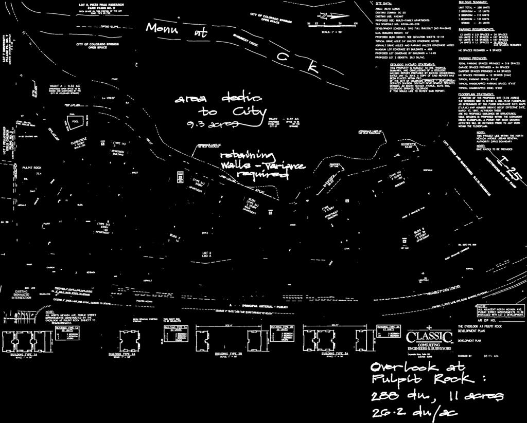
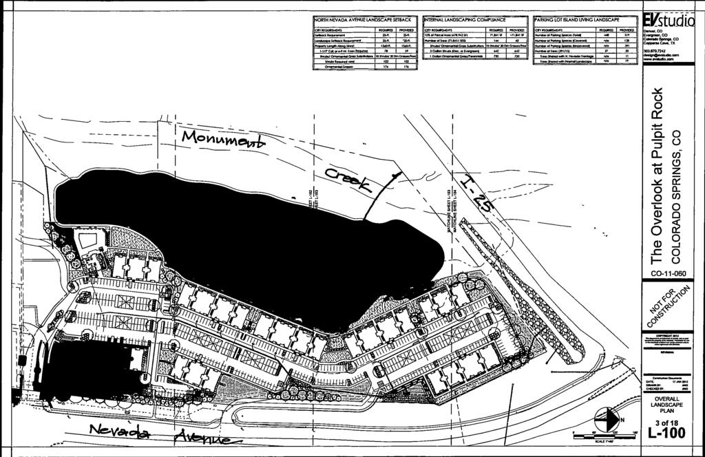
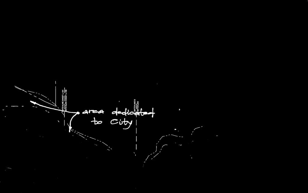
2 Page 35 PROJECT SUMMARY: 1. Project Description: The project proposes 288 apartment units on 11.0 acres and the dedication of 9.3 acres to the City for drainage and open space purposes. The following applications are necessary: 1) the removal of the Conditions of Record (FIGURE 1) from the existing OC/SS (Office Complex with Streamside Overlay) zone, 2) approval of nonuse variances for retaining walls in the front and rear setbacks, and 3) the development plan for the Overlook at Pulpit Rock (FIGURE 2). The site consists of 20.3 acres and is located on the west side of North Nevada Avenue, south of the Interstate 25/Nevada Avenue interchange. The 288 units are in eight buildings with a separate office/clubhouse and outdoor swimming pool. The density of the project is 26.2 dwelling units per acre. A portion of Monument Creek is within this tract to be dedicated to the City. 2. Applicant s Project Statement: FIGURE 3 3. Planning & Development Team s Recommendation: Approve the removal of the Conditions of Record from the OC/SS zone, approve the nonuse variances for the retaining walls within the front and rear setbacks and approve the development plan for the Overlook at Pulpit Rock subject to technical and/or informational modifications to the plan. BACKGROUND: 1. Site Address: Not assigned 2. Existing Zoning/Land Use: OC/CR/SS/vacant 3. Surrounding Zoning/Land Use: North: Interstate 25 and North Nevada Avenue off-ramp East: C-6/vacant, commercial (Harley Davidson dealership) South: OC/CR/SS/religious institution (Fellowship Bible Church of Colorado Springs) West: PIP-2/SS/office 4. Comprehensive Plan/Designated 2020 Land Use: Mature/Redevelopment Corridor and Candidate Open Space 5. Annexation: 1966, Golden Cycle Addition No Master Plan/Designated Master Plan Land Use: North Nevada Avenue Urban Renewal Plan/no specific land use is designated for the property; however, high-density residential complexes are promoted for the Nevada Avenue corridor 7. Subdivision: Not platted 8. Zoning Enforcement Action: None 9. Physical Characteristics: The 20.3-acre site is vacant and has been graded along the east side of the property near Nevada Avenue. The easterly portion of the site is significantly higher than the westerly area (approximately 20 to 60 feet). The westerly area is within the 100-year floodplain, relatively flat and vegetated with mature cottonwood trees and grasses. Monument Creek is located within the site and along the west side of the property for a distance of about 750 feet. STAKEHOLDER PROCESS AND INVOLVEMENT: Public notification consisted of a poster and the mailing of 18 postcards to property owners within 500 feet of the site on two occasions: 1) during the internal review period, and 2) prior to the Planning Commission meeting. No comments or correspondence have been received. Comments from the review agencies are addressed with the recommended revisions to the development plan listed below.
3 Page 36 ANALYSIS OF REVIEW CRITERIA / MAJOR ISSUES / COMPREHENSIVE PLAN & MASTER PLAN CONFORMANCE: 1. Review Criteria/Design & Development Issues: Zoning/Conditions of Record The 20.3-acre site is a portion of the property owned by the religious institution to the south (Fellowship Bible Church of Colorado Springs). The church will retain 8.5 acres. In 1994 the church s property was rezoned to OC with Conditions of Record (FIGURE 1).The Conditions of Record limit the use of the property to a religious institution, require compliance with the Pikes Peak Greenway Master Plan and outline street improvements for Nevada Avenue. The elimination of the Condition of Record restricting the use of the property to a religious institution is necessary to allow the multi-family project. The Condition of Record requiring compliance with the Pikes Peak Greenway Master Plan will be satisfied with the dedication of the land which contains the floodplain and Monument Creek to the City. No additional street improvements are necessary for Nevada Avenue (except curb, gutter and sidewalk) to accommodate the project. The Conditions of Record may be removed since the apartment project addresses the issues listed in the 1994 Conditions of Record. Development Plan/Nonuse Variances The development plan for the Overlook at Pulpit Rock shows 288 apartments in eight buildings with 80 percent of the units containing either one or two bedrooms. The project developer has indicated the units will be marketed to students at the University of Colorado at Colorado Springs. Nonuse variances to Section of the City Code are requested to allow retaining walls in the following locations: 1) in the 25-foot front setback adjacent to Interstate 25 with a setback of 18 feet and a maximum height of 11 feet, 2) in the 20-foot rear setback (along the west property line) with a setback of 8.6 feet and a maximum height of 22 feet, and 3) in the 25-foot front setback adjacent to Nevada Avenue with a setback of 15 feet and a maximum height of 10 feet. The variances are justified due to the property s topographical changes and relatively narrow configuration for the buildable area. Staff concurs with the applicant s justification included in FIGURE 3. The height and length of the retaining walls are minimized with the walk-out building design, which steps the buildings down the site and allows grade to be taken up across the width of the buildings. Access/Circulation Vehicular access from Nevada Avenue is proposed at two locations: 1) an existing signalized driveway shared with the church and 2) a right-in/right-out only driveway near the middle of the site. The curb, gutter and six-foot, detached sidewalk along Nevada Avenue will be constructed with the project. An extensive sidewalk system provides connections within the project, to the public sidewalk along Nevada Avenue, along the edge of the open space parcel and two connections to the open space parcel. Streamside Overlay/Monument Creek The portion of the site with Streamside Overlay zoning is completely contained within the area to be dedicated to the City. The primary purpose of the dedicated parcel is to accommodate stormwater drainage. The land is mostly within the 100-year floodplain and includes a stretch of Monument Creek. This land will also provide passive open space opportunities for the adjacent apartment residents. The area includes many mature Cottonwood trees and is likely to remain in its current condition, as the Parks Department has indicated no ability to maintain the tract.
4 Page 37 Summary The project satisfies the review criteria for the modification to the zoning, the granting of the nonuse variances and the approval of the development plan subject to the revisions to the plan listed below. 2. Conformance with the City Comprehensive Plan: The 2020 Land Use Plan in the Comprehensive Plan indicates the area along Nevada Avenue is within a Mature/Redevelopment Corridor while the floodplain along Monument Creek is designated as Candidate Open Space. The intent of the Mature/Redevelopment Corridor is to transform from exclusively auto-oriented places to more mixed-use centers through infill and redevelopment. Residential uses are encouraged in the mix of uses. The dedication of the 9.3 acres to the City satisfies the Candidate Open Space designation. The Pikes Peak Greenway Master Plan for this stretch states Encourage medium to high density residential development on the east side of the creek with adequate protection of the creek environment. The dedication of the land to the City and the proposed multi-family project fulfills the intent of the Comprehensive Plan and the Pikes Peak Greenway Master Plan. The existing Condition of Record requiring compliance with Pikes Peak Greenway Master Plan is also satisfied. 3. Conformance with the Area s Master Plan: The site is within the North Nevada Avenue Urban Renewal Plan adopted by City Council in While the concept plan within the Urban Renewal Plan does not recommend a specific land use for the site, the text indicates the area west of Nevada Avenue and north of Garden of the Gods Road will be promoted for a mix of office and commercial uses, retail, entertainment, lodging, parking facilities, and high-density residential complexes (Page 16). The project is consistent with this purpose. STAFF RECOMMENDATIONS: Item No: C.1 CPC ZC Deletion of Conditions of Record Approve the deletion of the Conditions of Record for 20.3 acres from OC/CR/SS to OC/SS, based on the finding the request complies with the review criteria in City Code Section B. Item No: C.2 CPC NV Nonuse Variance Approve the nonuse variances to Section of the City Code to allow the following retaining walls: 1) in the 25-foot front setback adjacent to Interstate 25 with a setback of 18 feet and a maximum height of 11 feet, 2) in the 20-foot rear setback with a setback of 8.6 feet and a maximum height of 22 feet, and 3) in the 25-foot front setback adjacent to Nevada Avenue with a setback of 15 feet and a maximum height of 10 feet. The recommendation for approval is based on the finding the request complies with the review criteria in City Code Section B.
5 Page 38 Item No: C.3 AR DP Development Plan Approve the development plan for the Overlook at Pulpit Rock, based on the finding the plan complies with the review criteria in City Code Section E, subject to compliance with the following technical and/or informational modifications to the development plan: Technical and/or Informational Modifications to the Development Plan: 1. Note the City file number of AR DP in the lower right corner of all sheets. 2. Note the property is within the North Nevada Avenue Urban Renewal Plan, City File No. CPC MP Note the existing zoning as OC/CR/SS as established with Ordinance No Note the conditions of record established with Ordinance No Note the proposed zoning as OC/SS. 4. Note that a revocable permit shall be approved by the City prior to the issuance of a building permit. The revocable permit is for the circuitous, north driveway onto Nevada Avenue and the retaining walls located in the right-of-way of Nevada Avenue. Delete possible encroachment agreement required. 5. Note that nonuse variances are requested to allow retaining walls which exceed six feet in height within the required front and rear setbacks. Identify the locations of the variance requests and note the distance from the retaining walls to the adjacent property line. Note the file number of the variance application as CPC NV As required by Engineering Development Review (comment 1) note at the conclusion of the legal description on sheet 1 the proposed legal description: Lot 2, The Overlook at Pulpit Rock Filing No Delete the note All North Nevada Avenue public street improvements constructed by the Overlook at Pulpit Rock subject to Urban Renewal Authority (URA) reimbursement. URA staff has indicated no agreement is in place for reimbursement. 8. As required by Engineering Development Review (comment 8) revise the floodplain statement on sheet 2 regarding the finish floor elevations. 9. As required by Engineering Development Review (comment 9) revise the geologic hazard statement on sheet In the geologic hazard statement on sheet 2 include the City file number of AR DP and correct the agency name and address to: City of Colorado Springs Planning and Development Department, 30 South Nevada Avenue, Suite 105, Colorado Springs, CO. 11. Note the front setback along the northerly property line as 25 feet instead of 20 feet. The property line is considered a front yard because of the adjacent right-of-way of Interstate 25. Revise the landscape plan accordingly. 12. Three existing easements conflict with structures shown on the development plan: 1) right of way easement, Book 1616, Page 170, 2) right of way easement, Book 401, Page 513, and 3) right of way telephone easement Book 375, Page 493. The easements are shown on sheet 10. Note on sheet 10 that these easements shall be vacated prior to recording the final plat. 13. Provide a barrier (e.g. gate or posts and cable) to discourage public access on the gravel, fire access driveway that serves Fellowship Bible Church. If the barrier includes a gate or posts and cable, then note a Knox lock shall be provided. Note the barrier shall be installed prior to the issuance of a Certificate of Occupancy. 14. Note the pavement material for the driveways and parking spaces. 15. Note the curb type to be used at the perimeter of the driveways, parking spaces and landscape islands. 16. As required by Information Technology provide an interior private street name. 17. Show the detached sidewalk along Nevada Avenue as six feet in width instead of five feet.
6 Page As required by Mountain Metropolitan Transit show a concrete bus stop pad between the curb and sidewalk north of the signalized intersection on Nevada Avenue. 19. As required by Engineering Development Review (comment 2) indicate the pedestrian ramp on the south side of the south driveway onto Nevada Avenue will be constructed with this project. Show the ramp connected to the existing pedestrian ramp at the corner. Delete future ped ramp. 20. As required by Engineering Development Review Traffic (comment 1) note a striping and signage plan shall be approved by Traffic Engineering. 21. As required by Engineering Development Review Traffic (comment 2) show a right turn only sign for the right in/right out driveway onto Nevada Avenue. Note the sign shall meet MUTCD and Traffic Engineering standards. 22. As required by Fire Prevention provide adequate fire access for the buildings. 23. As required by Fire Prevention provide the required minimum width for the fire lanes on both sides of the median located southwest of building As required by Fire Prevention revise the driveway located southwest of building Provide a typical detail of the retaining walls indicating proposed materials. 26. Delete the six-foot trail shown within Tract A. Show the trail at both the north and south ending at the edge of the grading that extends for a short distance into Tract A. Parks and Recreation has indicated they will not maintain the trail or the tract; therefore to avoid future confusion regarding trail maintenance; the trail within the tract shall be deleted. Access to the tract and the existing, informal trails within the tract is appropriate and will provide safe and easy access to Tract A for residents of the apartment project. 27. In cross-section A-A on sheet 9 show the sidewalk which parallels the driveway that extends from Nevada Avenue into the site. Note the width of the sidewalk as 6 feet. 28. Note the width of all sidewalks that are adjacent to parking spaces as six feet. 29. Show the location of the bicycle racks on a paved surface near the building entries (one per building plus one for the clubhouse, a total of nine racks). Provide a typical detail of the rack. 30. Note that no more than two low profile (not exceeding six feet in height) signs are permitted. Show the location of the low profile signs. Show the signs with a minimum setback of three feet from the property line. Note the removal of the existing Fellowship Church sign (if this sign is to be relocated to the church s property then the sign must be shown on the Fellowship Bible Church s development plan File CPC DP A2MN12). Delete the note indicating a monument sign located within the Nevada Avenue right-of-way. 31. As required by Colorado Springs Utilities address Action Items 1 through As required for the Streamside Overlay review address items 1, 2, 3 and As required by the City Landscape Architect address items 1, 3 and On sheet 11 indicate in the lighting notes the light fixture as full cut-off. Note the type of light (e.g. metal halide) and the wattage of the fixture. 35. On the elevation drawings note the height of the buildings at the ridge of the roof. 36. Identify the exterior colors of the buildings (e.g. light tan). 37. Note exterior lights attached to the buildings shall be residential in character. Provide a typical detail of the light fixture(s).
7 Page 40 FIGURE 1

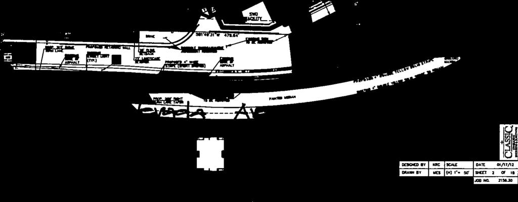

8 Page 41 FIGURE 2

9 Page 42 FIGURE 2


10 Page 43 FIGURE 3

11 Page 44 FIGURE 3

12 Page 45 FIGURE 3
CITY PLANNING COMMISSION AGENDA
 Page 22 CITY PLANNING COMMISSION AGENDA ITEM: C STAFF: STEVE TUCK FILE NO: CPC CU 11-00080 QUASI-JUDICIAL PROJECT: FIRST & MAIN APARTMENTS PHASE 1 APPLICANT: OWNER: NASS DESIGN ASSOCIATES FIRST & MAIN
CONSENT CALENDAR CITY PLANNING COMMISSION AGENDA ITEM: A.1-A.3 STAFF: STEVE TUCK
 Page 8 CONSENT CALENDAR CITY PLANNING COMMISSION AGENDA ITEM: A.1-A.3 STAFF: STEVE TUCK FILE NOS: 1. - CPC MPA 07-00308-A4MJ09 LEGISLATIVE 2. - CPC PUZ 09-00057 QUASI-JUDICIAL 3. - CPC PUD 09-00058 QUASI-JUDICIAL
CONSENT CALENDAR CITY PLANNING COMMISSION AGENDA ITEM NO: A.1, A.2 STAFF: LARRY LARSEN
 Page 8 CONSENT CALENDAR CITY PLANNING COMMISSION AGENDA ITEM NO: A.1, A.2 STAFF: LARRY LARSEN FILE NO: CPC PUZ 14-00013 - QUASI-JUDICIAL FILE NO: CPC PUD 14-00014 QUASI-JUDICIAL PROJECT: APPLICANT: OWNER:
CITY PLANNING COMMISSION AGENDA ITEM: C STAFF: ROBERT TEGLER FILE NO: CPC PUD QUASI-JUDICIAL
 CPC AGENDA June 8, 2006 Page 37 CITY PLANNING COMMISSION AGENDA ITEM: C STAFF: ROBERT TEGLER FILE NO: CPC PUD 05-294 - QUASI-JUDICIAL PROJECT: APPLICANT: OWNER: PARKWOOD AT WOLF RANCH NASS DESIGN ASSOCIATES
CITY PLANNING COMMISSION AGENDA ITEMS: C.1, C.2 STAFF: MEGGAN HERINGTON FILE NO(S): CPC PUZ QUASI-JUDICIAL CPC PUD QUASI-JUDICIAL
: CPC PUZ QUASI-JUDICIAL CPC PUD QUASI-JUDICIAL") Page 32 CITY PLANNING COMMISSION AGENDA ITEMS: C.1, C.2 STAFF: MEGGAN HERINGTON FILE NO(S): CPC PUZ 13-00036 QUASI-JUDICIAL CPC PUD 13-00037 QUASI-JUDICIAL PROJECT: APPLICANT: OWNER: ESTANCIA AT CORDERA
Page 32 CITY PLANNING COMMISSION AGENDA ITEMS: C.1, C.2 STAFF: MEGGAN HERINGTON FILE NO(S): CPC PUZ 13-00036 QUASI-JUDICIAL CPC PUD 13-00037 QUASI-JUDICIAL PROJECT: APPLICANT: OWNER: ESTANCIA AT CORDERA
CITY PLANNING COMMISSION AGENDA. ITEM NO: 6.a 6.b STAFF: LONNA THELEN
 Page 156 CITY PLANNING COMMISSION AGENDA ITEM NO: 6.a 6.b STAFF: LONNA THELEN FILE NO(S): A. - CPC ZC 08-00069 QUASI-JUDICIAL B. - CPC CU 08-00070 QUASI-JUDICIAL PROJECT: APPLICANT: OWNER: PHIL LONG VALUCAR
CITY PLANNING COMMISSION AGENDA ITEM: K STAFF: STEVE TUCK FILE NO.: CPC CU QUASI-JUDICIAL
 Page 92 CITY PLANNING COMMISSION AGENDA ITEM: K STAFF: STEVE TUCK FILE NO.: CPC CU 08-00043 QUASI-JUDICIAL PROJECT: APPLICANT: OWNER: COTTONWOOD ARTISTS SCHOOL & ART GALLERY COTTONWOOD ARTISTS SCHOOL ELMER
SITE CITY PLANNING COMMISSION AGENDA ITEM NO: 5 STAFF: LONNA THELEN FILE NO: CPC CU QUASI-JUDICIAL ART C. KLEIN CONSTRUCTION
 Page 58 CITY PLANNING COMMISSION AGENDA ITEM NO: 5 STAFF: LONNA THELEN FILE NO: CPC CU 10-00022 QUASI-JUDICIAL PROJECT: APPLICANT: OWNER: COLORADO SPRINGS CHARTER ACADEMY ART C. KLEIN CONSTRUCTION COLORADO
CITY PLANNING COMMISSION AGENDA ITEM NO: 11 STAFF: JIM GAGLIARDI FILE NO: CPC CU QUASI-JUDICIAL
 Page 203 CITY PLANNING COMMISSION AGENDA ITEM NO: 11 STAFF: JIM GAGLIARDI FILE NO: CPC CU 08-00095 QUASI-JUDICIAL PROJECT: APPLICANT: OWNER: CHARTER SCHOOL CONDITIONAL USE PERMIT LAND DEVELOPMENT CONSULTANTS,
CITY PLANNING COMMISSION AGENDA ITEM NO: 8 STAFF: ANDREW FIRESTINE FILE NO: CPC PUD QUASI-JUDICIAL
 Page 97 CITY PLANNING COMMISSION AGENDA ITEM NO: 8 STAFF: ANDREW FIRESTINE FILE NO: CPC PUD 05-00232 QUASI-JUDICIAL PROJECT: APPLICANT: OWNER: CORNERSTONE BAPTIST CHURCH BILL BROWN AIA P.C. CORNERSTONE
CITY PLANNING COMMISSION AGENDA
 Page 198 CITY PLANNING COMMISSION AGENDA ITEM NO: 7 STAFF: RYAN TEFERTILLER FILE NO: CPC CU 13-00022 QUASI-JUDICIAL PROJECT: APPLICANT: OWNER: GABION APARTMENTS SPRINGS ENGINEERING C & A PROPERTIES, LLC
CITY PLANNING COMMISSION AGENDA ITEM NO: B STAFF: LARRY LARSEN FILE NO: CPC ZC QUASI-JUDICIAL
 Page 15 CITY PLANNING COMMISSION AGENDA ITEM NO: B STAFF: LARRY LARSEN FILE NO: CPC ZC 14-00079 - QUASI-JUDICIAL PROJECT: APPLICANT: OWNER: PK ZONING FOR NEIGHBORHOOD PARK IN THE TRAILS AT FOREST MEADOWS
CITY PLANNING COMMISSION AGENDA ITEMS: 11, 12, 13 STAFF: RYAN TEFERTILLER
 Page 139 CITY PLANNING COMMISSION AGENDA ITEMS: 11, 12, 13 STAFF: RYAN TEFERTILLER FILE NO(s): CPC PUZ 05-00047 QUASI-JUDICIAL CPC PUD 05-00048 QUASI-JUDICIAL CPC FP 05-00049 QUASI-JUDICIAL PROJECT: RIDGEVIEW
Application Number: SD Project Name: Walton Farms Preliminary Subdivision (acting as Master Plan)
") STAFF REPORT Town of Clayton Planning Department 111 E. Second Street, Clayton, NC 27520 P.O. Box 879, Clayton, NC 27528 Phone: 919-553-5002 Fax: 919-553-1720 Planning Board May 22, 2017 Application Number:
STAFF REPORT Town of Clayton Planning Department 111 E. Second Street, Clayton, NC 27520 P.O. Box 879, Clayton, NC 27528 Phone: 919-553-5002 Fax: 919-553-1720 Planning Board May 22, 2017 Application Number:
Request Conditional Rezoning (R-15 Residential to Conditional A-24 Apartment) Staff Recommendation Approval. Staff Planner Jimmy McNamara
 Staff Recommendation Approval. Staff Planner Jimmy McNamara") Applicant Franklin Johnston Group Management & Development, LLC Property Owner Virginia Wesleyan College Public Hearing July 12, 2017 City Council Election District Bayside Agenda Item 3 Request Conditional
Applicant Franklin Johnston Group Management & Development, LLC Property Owner Virginia Wesleyan College Public Hearing July 12, 2017 City Council Election District Bayside Agenda Item 3 Request Conditional
Asbury Chapel Subdivision Sketch Plan
 Asbury Chapel Subdivision Sketch Plan PART 1: PROJECT SUMMARY Applicant: NVR Inc. Project Size: +/- 76.13 acres Parcel Numbers: 02101112,02116101,02116112, 02116113 Current Zoning: Transitional Residential
AWH REPORT OF THE PLANNING AND DEVELOPMENT DEPARTMENT FOR APPLICATION FOR REZONING ORDINANCE TO PLANNED UNIT DEVELOPMENT
 AWH REPORT OF THE PLANNING AND DEVELOPMENT DEPARTMENT FOR APPLICATION FOR REZONING ORDINANCE TO PLANNED UNIT DEVELOPMENT MAY 8, 2014 The Planning and Development Department hereby forwards to the Planning
Drexel, Barrell & Co.
 Drexel, Barrell & Co. December 21, 2018 Engineers/Surveyors Boulder Colorado Springs Greeley 3 South 7 th Street Colorado Springs, Colorado 80905-1501 719 260-0887 719 260-8352 Fax El Paso County Planning
Drexel, Barrell & Co.
 Drexel, Barrell & Co. June 18, 2018 Engineers/Surveyors Boulder Colorado Springs Greeley 3 South 7 th Street Colorado Springs, Colorado 80905-1501 719 260-0887 719 260-8352 Fax El Paso County Planning
PLANNING COMMISSION. Agenda Item # 3.
 PLANNING COMMISSION Agenda Item # 3. CASE SUMMARY Conditional District Rezoning Planning Commission February 4, 2015 CD-9-215 Jeff Walton, 341-3260, jeff.walton@wilmingtonnc.gov Staff recommendation CONDITIONAL
Request Alternative Compliance to the prescribed criteria of the Oceanfront Resort District Form-Based Code. Staff Planner Kristine Gay
 Applicant/Owner Ocean Rental Properties, LLC Public Hearing April 13, 2016 City Council Election District Beach Agenda Item 1 Request Alternative Compliance to the prescribed criteria of the Oceanfront
Major Subdivision Sketch Plan Checklist
 This checklist provides specific requirements that are apart of the Sketch process. The entire process is described by the Huntersville Subdivision Review Process which details all the submittal and resubmittal
PLANNED UNIT DEVELOPMENT & SUBDIVISION STAFF REPORT Date: May 18, 2017
 & PUD-0000102-2017 PLANNED UNIT DEVELOPMENT & SUBDIVISION STAFF REPORT Date: May 18, 2017 NAME SUBDIVISION NAME Dauphin Creek Estates Subdivision Dauphin Creek Estates Subdivision LOCATION CITY COUNCIL
#8) T-1409 CENTENNIAL & LAMB TENTATIVE MAP
 T-1409 CENTENNIAL & LAMB TENTATIVE MAP") #8) T-1409 CENTENNIAL & LAMB TENTATIVE MAP STAFF REPORT To: Planning Commission Meeting Date: June 14, 2017 Item: T-1409 Prepared By: Robert Eastman GENERAL INFORMATION: Applicant: Property Owner(s): Requested
#8) T-1409 CENTENNIAL & LAMB TENTATIVE MAP STAFF REPORT To: Planning Commission Meeting Date: June 14, 2017 Item: T-1409 Prepared By: Robert Eastman GENERAL INFORMATION: Applicant: Property Owner(s): Requested
ARTICLE 6: Special and Planned Development Districts
 ARTICLE 6: Special and Planned Development Districts 6-10 Traditional Neighborhood Development (TND) District 6-10.10 Purpose and Intent The Traditional Neighborhood Development (TND) District provides
14 October 10, 2012 Public Hearing APPLICANT: MPB, INC
 14 October 10, 2012 Public Hearing APPLICANT: MPB, INC PROPERTY OWNER: MUNDEN & ASSOCIATES, LP STAFF PLANNER: Karen Prochilo REQUEST: Conditional Change of Zoning (AG-1 & AG-2 to Conditional O-2) ADDRESS
8 & 10 Donalda Crescent Official Plan & Rezoning Application Final Report
 STAFF REPORT ACTION REQUIRED 8 & 10 Donalda Crescent Official Plan & Rezoning Application Final Report Date: July 26, 2010 To: From: Wards: Reference Number: Scarborough Community Council Director, Community
Staff Report and Recommendation
 Community Planning and Development Planning Services 201 W. Colfax Ave., Dept. 205 Denver, CO 80202 p: 720.865.2915 f: 720.865.3052 www.denvergov.org/cpd TO: City Council Neighborhoods and Planning Committee
Request Alternative Compliance to the prescribed criteria of the Oceanfront Resort District Form-Based Code. Staff Recommendation Approval
 Applicant & Property Owner Public Hearing February 8, 2017 City Council Election District Beach Agenda Item D1 Request Alternative Compliance to the prescribed criteria of the Oceanfront Resort District
ARLINGTON COUNTY, VIRGINIA
 ARLINGTON COUNTY, VIRGINIA County Board Agenda Item Meeting of September 19, 2015 DATE: September 11, 2015 SUBJECTS: Outdoor Café at Citizen Burger Bar A. SP# 418 Site Plan Amendment to modify an approved
Planning Commission Staff Report June 5, 2008
 Owner/Applicant Taylor Village Sacramento Investments Partners, LP c/o Kim Whitney 1792 Tribute Road #270 Sacramento, CA 95815 Staff Recommendation Planning Commission Staff Report Project: File: Request:
The subject site plan amendment proposes the following revisions to the approved site plan:
 PROPOSED AMENDMENT The subject site plan amendment proposes the following revisions to the approved site plan: 1. The building footprint was modified to accommodate the revised architectural design. 2.
Harmony Technology Park Third Filing, Second Replat Custom Blending, Project Development Plan/Final Development Plan - FDP #130021
 ITEM NO FDP #130021 MEETING DATE July 23, 2013 STAFF Pete Wray ADMINISTRATIVE TYPE I HEARING STAFF REPORT PROJECT: APPLICANT: OWNER: Harmony Technology Park Third Filing, Second Replat Custom Blending,
Planning Districts INTRODUCTION
 INTRODUCTION To facilitate detailed examination of development prospects for all areas of the community, Delano has been divided into 14 planning districts. The location of these planning districts is
RESOLUTION NO R
 e e RESOLUTION NO R04 0054 BE IT RESOLVED by the Mayor and City Council ofthe City ofpapillion that The Papillion Comprehensive Plan is hereby amended to incorporate the Option A Future Land Use Map Transportation
Urban Planning and Land Use
 Urban Planning and Land Use 701 North 7 th Street, Room 423 Phone: (913) 573-5750 Kansas City, Kansas 66101 Fax: (913) 573-5796 Email: planninginfo@wycokck.org www.wycokck.org/planning To: From: City Planning
SITE PLAN REVIEW APPLICATION AND CHECKLIST
 SITE PLAN REVIEW APPLICATION AND CHECKLIST PROJECT SUMMARY: Project Name: City/ETA Location: City ETA (Application fee & number of copies needed are based on location) Property Location (Legal Description
2 August 14, 2013 Public Hearing APPLICANT: CRESCENT COMMUNITY CENTER CORP. PROPERTY OWNER: S. L. ETHERIDGE, LLC
 2 August 14, 2013 Public Hearing APPLICANT: CRESCENT COMMUNITY CENTER CORP. PROPERTY OWNER: S. L. ETHERIDGE, LLC REQUEST: Conditional Use Permit (religious use) STAFF PLANNER: Karen Prochilo ADDRESS /
CHAPTER SPECIAL PURPOSE AND OVERLAY ZONING DISTRICTS
 Special Purpose and Overlay Zoning Districts 106.28.010 CHAPTER 106.28 - SPECIAL PURPOSE AND OVERLAY ZONING DISTRICTS SPECIAL PURPOSE AND OVERLAY ZONING DISTRICTS Sections: 106.28.010 - Purpose 106.28.020
Rezoning Petition Zoning Committee Recommendation August 1, 2017
 Rezoning Petition 2017-090 Zoning Committee Recommendation August 1, 2017 REQUEST LOCATION SUMMARY OF PETITION PROPERTY OWNER PETITIONER AGENT/REPRESENTATIVE COMMUNITY MEETING STATEMENT OF CONSISTENCY
Appendix I. Access Management & Land Use Zoning Strategies Memo
 Appendix I ` Access Management & Land Use Zoning Strategies Memo Route 96 Access Management and Land Use/Zoning Strategies The Town of Victor has access management guidelines in Section 5.0 of the 2014
ARTICLE 13 STREETS General
 ARTICLE 13 STREETS 13.1 General Streets shall be designed to suit their functions. Many streets have purposes other than vehicular traffic. As an alternative to current N.C. Department of Transportation
PLANNING AND ZONING COMMISSION AGENDA MEMORANDUM
 PLANNING AND ZONING COMMISSION AGENDA MEMORANDUM City and County of Broomfield, Colorado To: Planning and Zoning Commission From: John Hilgers, Planning Director Anna Bertanzetti, Principal Planner Meeting
F. Driveways. Driveways which provide access to off-street parking or loading from public streets shall comply with the following:
 Section 20.945.040 General Design Standards for Surface Parking Areas. A. Review Authority. Parking lot design and drainage shall be subject to review and approval of the City Transportation Manager. B.
Request Change in Nonconformity. Staff Recommendation Approval. Staff Planner Jonathan Sanders
 Applicant & Owner Public Hearing April 11, 2018 City Council Election District Beach Agenda Item 5 Request Change in Nonconformity Staff Recommendation Approval Staff Planner Jonathan Sanders Location
KNOXVILLE/KNOX COUNTY METROPOLITAN PLANNING COMMISSION
 KNOXVILLE/KNOX COUNTY METROPOLITAN PLANNING COMMISSION FILE #: 12-A-13-UR AGENDA ITEM #: 33 AGENDA DATE: 12/12/2013 APPLICANT: OWNER(S): METRO KNOXVILLE HMA, LLC Metro Knoxville HMA., LLC TAX ID NUMBER:
The petition proposes the development of five townhomes on a vacant parcel between Charlotte Latin School and Providence Presbyterian Church.
 Rezoning Petition 2017-202 Final Staff Analysis June 18, 2018 REQUEST LOCATION Current Zoning: R-3 (single family residential) Proposed Zoning: UR-2(CD) (urban residential, conditional) with five-year
Planned Development Review Revisions (Project No. PLNPCM )
") Planned Development Review Revisions (Project No. PLNPCM2014-00139) Standard residential development Planned Development Example: Smaller lot sizes than what is allowed to create open space amenity. What
Planned Development Review Revisions (Project No. PLNPCM2014-00139) Standard residential development Planned Development Example: Smaller lot sizes than what is allowed to create open space amenity. What
VILLAGE OF CLEMMONS PLANNING BOARD DRAFT STAFF REPORT
 VILLAGE OF CLEMMONS PLANNING BOARD DRAFT STAFF REPORT PETITION INFORMATION Docket # C-226 Staff Megan Ledbetter Petitioner(s) JBJH Properties, LLC Owner(s) JBJH Properties, LLC Subject Property 5892-49-1766
URBAN DESIGN BRIEF. 2136&2148 Trafalgar Road. Town of Oakville
 URBAN DESIGN BRIEF 2136&2148 Trafalgar Road Town of Oakville Prepared By: METROPOLITAN CONSULTING INC For 2500674 Ontario Inc November 2016 TABLE OF CONTENTS Page No. 1.0 Introduction/Description of Subject
4.1.3 LAND USE CATEGORIES
 4.1.3 LAND USE CATEGORIES a. City Center District The City Center District incorporates the existing character and mix of uses in downtown Belmont to encourage redevelopment and new development in keeping
At Your Disposal CUP Amendment, Lot 20, Village Service Commercial, at 128 Bastille Dr. (PLN17-208)
") MEMORANDUM Archuleta County Development Services Planning Department 1122 HWY 84 P. O. Box 1507 Pagosa Springs, Colorado 81147 970-264-1390 Fax 970-264-3338 TO: Archuleta County Planning Commission FROM:
MEMORANDUM Archuleta County Development Services Planning Department 1122 HWY 84 P. O. Box 1507 Pagosa Springs, Colorado 81147 970-264-1390 Fax 970-264-3338 TO: Archuleta County Planning Commission FROM:
City of Lafayette Study Session Staff Report Design Review Commission
 City of Lafayette Study Session Staff Report Design Review Commission Meeting Date: April 24, 2017 Staff: Payal Bhagat, Senior Planner Subject: HDP18-15 & HDP31-15 Ramesh Patel & Melcor Development (Owners),
Zoning Ordinance Section 1.100
 4.800 (ZC 98-45; Ordinance No. 98-9-13) 4.801 Purpose To provide appropriate design standards for the development of properties within the State Highway 121 corridor. These standards recognize the significance
SECTION 39. Title V, Chapter 6, Article 2, added to the Zoning Code of Sacramento County shall read as follows: GREENBACK LANE SPECIAL PLANNING AREA
 SECTION 39. Title V, Chapter 6, Article 2, added to the Zoning Code of Sacramento County shall read as follows: GREENBACK LANE SPECIAL PLANNING AREA 506-20. INTENT. It is the intent of the Board of Supervisors
REQUEST Current Zoning: O-15(CD) (office) Proposed Zoning: TOD-M(CD) (transit oriented development mixed-use, conditional)
 (office) Proposed Zoning: TOD-M(CD) (transit oriented development mixed-use, conditional)") Rezoning Petition 2016-117 Zoning Committee Recommendation January 4, 2017 REQUEST Current Zoning: O-15(CD) (office) Proposed Zoning: TOD-M(CD) (transit oriented development mixed-use, conditional) LOCATION
Rezoning Petition 2016-117 Zoning Committee Recommendation January 4, 2017 REQUEST Current Zoning: O-15(CD) (office) Proposed Zoning: TOD-M(CD) (transit oriented development mixed-use, conditional) LOCATION
MONTGOMERY COUNTY PLANNING DEPARTMENT THE MARYLAND-NATIONAL CAPITAL PARK AND PLANNING COMMISSION
 MONTGOMERY COUNTY PLANNING DEPARTMENT THE MARYLAND-NATIONAL CAPITAL PARK AND PLANNING COMMISSION MCPB Item No. Date: 12-10-15 Leisure World Clubhouse II Addition Fitness Center, Limited Site Plan Amendment
Proposed Walkability Ordinance for City of Knoxville (6/16/17)
") Proposed Walkability Ordinance for City of Knoxville (6/16/17) New or revised text is highlighted Section 1: Purpose The purpose of this ordinance is to set requirements for walkability and pedestrian
Proposed Walkability Ordinance for City of Knoxville (6/16/17) New or revised text is highlighted Section 1: Purpose The purpose of this ordinance is to set requirements for walkability and pedestrian
General Location Courtyard at LMH Final Development Plan and Final Plat
 R-1 LEYDEN RIDGE LOMA RIDGE LOBDELL R-3 MILLER PARKWAY LAUSSAC Subject Property R-3 LOCHENSHIRE LESMER R General Location Courtyard at LMH Final Development Plan and Final Plat ¹ 230 115 0 230 Feet Airport
MIDTOWN MIXED-USE VILLAGE. TECHNICAL DATA SHEET COMPONENT C-1 FOR PUBLIC HEARING - PETITION NUMBER Project No RZ1.1. Issued.
 N MIDTOWN MIXED-USE VILLAGE TECHNICAL DATA SHEET COMPONENT C- FOR PUBLIC HEARING - PETITION NUMBER 04-00 Project No. 496 Issued Revised SCALE: " = 0' N 0 0 0 40 RZ. c GENERAL PROVISIONS: a. SITE LOCATION.
3. VISION AND GOALS. Vision Statement. Goals, Objectives and Policies
 Vision Statement Queen Creek s interconnected network of parks, trails, open spaces and recreation opportunities provide safe and diverse activities and programs that sustain its unique, small town, equestrian
Project Name: MELWOOD HOTEL. Date Accepted: 1/12/04. Waived. Planning Board Action Limit: Plan Acreage: 1.7 Zone: Dwelling Units:
 The Maryland-National Capital Park and Planning Commission Prince George's County Planning Department Development Review Division 301-952-3530 Note: Staff reports can be accessed at www.mncppc.org/pgco/planning/plan.htm.
Design Guidelines for Residential Subdivisions
 Design Guidelines for Residential Subdivisions Development Services 972-466-3225 cityofcarrollton.com This page intentionally left blank. Table of Contents Purpose... 1 Design Objectives... 1 Design Guidelines
Agenda Item. Applicant Logan Virginia Properties, LLC Property Owners Byler Azalea, LLC & Gateway Free Will Baptist Chuch
 Applicant Property Owners Byler Azalea, LLC & Gateway Free Will Baptist Chuch Public Hearing March 14, 2018 City Council Election District Kempsville Agenda Item 6 Request Conditional Rezoning (B-2 Community
PART 1: PROJECT SUMMARY. Proposed Land Use: 120 single-family lots. The application is Attachment A. The site plan is Attachment B.
 PART 1: PROJECT SUMMARY Applicant: JBH Development, LLC and Hopper Communities, INC Project Size: +/- 80.48 acres Parcel Number: 01513107, 01513108, 01513109, 01513113, 01513120, 01513121, 01513122, 01513124,
UNIFIED DEVELOPMENT CODE
 Zoning UNIFIED DEVELOPMENT CODE Regulates how land is used Sets dimensional requirements for structures Addresses all aspects of site development: accessory structures, temporary uses, parking, landscape,
ARTICLE 13 STREETS General
 ARTICLE 13 STREETS 13.1 General Streets shall be designed to suit their functions. Many streets have purposes other than vehicular traffic. As an alternative to current N.C. Department of Transportation
12 January 12, 2011 Public Hearing APPLICANT: TAILWIND DEVELOPMENT GROUP,LLC PROPERTY OWNER: CITY OF VIRGINIA BEACH
 12 January 12, 2011 Public Hearing APPLICANT: TAILWIND DEVELOPMENT GROUP,LLC PROPERTY OWNER: CITY OF VIRGINIA BEACH STAFF PLANNER: Faith Christie REQUEST: Conditional Change of Zoning (from PD-H1 Planned
The Maryland-National Capital Park and Planning Commission Prince George's County Planning Department Development Review Division
 The Maryland-National Capital Park and Planning Commission Prince George's County Planning Department Development Review Division 301-952-3530 Note: Staff reports can be accessed at www.mncppc.org/pgco/planning/plan.htm.
CONCEPTUAL DEVELOPMENT PLAN REVIEW - CITY OF MARYLAND HEIGHTS
 APPLICATION NUMBER: CDP15-0004 APPLICATION (PROJECT) NAME: MARYLAND OAKS APPLICANT: PROPERTY OWNER NAME: APPLICANT S REQUEST: McBride Maryland Oaks, LLC 16091 Swingley Ridge Road, Suite 300 Chesterfield,
ARTICLE 9: LANDSCAPING AND FENCING REQUIREMENTS
 ARTICLE 9: LANDSCAPING AND FENCING REQUIREMENTS Section 9.01 Intent The intent of the landscaping requirements are to improve the appearance of lot areas and soften paved areas and buildings; to provide
PLANNING JUSTIFICATION REPORT
 PLANNING JUSTIFICATION REPORT 55 DELHI STREET CITY OF GUELPH PREPARED FOR: VESTERRA PROPERTY MANAGEMENT PREPARED BY: LABRECHE PATTERSON & ASSOCIATES INC. SCOTT PATTERSON, BA, CPT, MCIP, RPP PRINCIPAL,
CITY OF KEIZER MASTER PLAN APPLICATION & INFORMATION SHEET
 CITY OF KEIZER MASTER PLAN APPLICATION & INFORMATION SHEET PRE-APPLICATION CONFERENCE Prior to the actual filing of a Master Plan application, it is strongly recommended that the applicant contact Planning
R E S O L U T I O N. Single-Family Residence/ Church. 2,488 sq. ft. 2,488 sq. ft. Area Parking Required: Church
 R E S O L U T I O N WHEREAS, the Prince George s County Planning Board is charged with the approval of Detailed Site Plans pursuant to Part 3, Division 9 of the Zoning Ordinance of the Prince George s
PLANNED UNIT DEVELOPMENT STAFF REPORT Date: June 2, 2016
 # 9 ZON2016-01032 PLANNED UNIT DEVELOPMENT STAFF REPORT Date: June 2, 2016 DEVELOPMENT NAME JJT Properties LLC LOCATION 1147 & 1151 East I-65 Service Road South and 1180 Sledge Drive (Southeast corner
Project phasing plan (if applicable) 12 copies of site plan
 12 copies of site plan") SITE PLAN REVIEW PERMIT APPLICATION City of Grand Haven, 11 N. Sixth Street, Grand Haven, MI 49417 Phone: (616) 847-3490 Fax: (616) 844-2051 Website: www.grandhaven.org 1. Project Information Address/location
SITE PLAN REVIEW PERMIT APPLICATION City of Grand Haven, 11 N. Sixth Street, Grand Haven, MI 49417 Phone: (616) 847-3490 Fax: (616) 844-2051 Website: www.grandhaven.org 1. Project Information Address/location
Exhibit A. 8:9 Scuffletown Rural Conservation District
 Exhibit A 8:9 Scuffletown Rural Conservation District 8:9.1 Intent and Purpose The Scuffletown Rural Conservation (SRC) District is intended to provide for residential development that supports the development
599 Kennedy Road - Official Plan Amendment and Zoning Amendment Application - Preliminary Report
 STAFF REPORT ACTION REQUIRED 599 Kennedy Road - Official Plan Amendment and Zoning Amendment Application - Preliminary Report Date: March 7, 2017 To: From: Wards: Reference Number: Scarborough Community
PLANNING AND ZONING COMMISSION AGENDA MEMORANDUM
 To: Planning and Zoning Commission From: John Hilgers, Planning Director Anna Bertanzetti, Principal Planner Meeting Date Agenda Category Agenda Item # March 14, 2016 Commission Business 4.c. 1. Public
Staff Report to the North Ogden City Planning Commission
 Staff Report to the North Ogden City Planning Commission SYNOPSIS / APPLICATION INFORMATION Application Request: Concept review on a legislative application to rezone land located at approximately 1750
4.500 Preston Road Overlay District
 Section 4.500 Preston Road Overlay District 2004 Zoning Ordinance 4.500 Preston Road Overlay District (ZC 98-29; Ordinance No. 98-9-12) 4.501 Purpose To provide appropriate design standards for the use
EXHIBIT B PROJECT NARRATIVE POULSBO MEADOWS
 EXHIBIT B PROJECT NARRATIVE POULSBO MEADOWS Name of Project: Poulsbo Meadows; A Planned Residential Development (PRD)/Plat Applicants Name: PBH Group LLC/Byron Harris PO Box 1010 Silverdale, WA 98038 Description
5.1.1 The streetscape along US Highway 64 (Brevard Road); and, The built environment within new residential developments; and,
; and, The built environment within new residential developments; and,") Article 5. Landscaping 5.1 Purpose The Town of Laurel Park s landscape standards are designed to create a beautiful, aesthetically pleasing built environment that will complement and enhance community
Article 5. Landscaping 5.1 Purpose The Town of Laurel Park s landscape standards are designed to create a beautiful, aesthetically pleasing built environment that will complement and enhance community
ZONING AMENDMENT & PLANNED UNIT DEVELOPMENT STAFF REPORT Date: April 4, 2013
 ZONING AMENDMENT & PLANNED UNIT DEVELOPMENT STAFF REPORT Date: April 4, 2013 NAME DEVELOPMENT NAME LOCATION DIP Exchange, LLC DIP Exchange, LLC 93 Sidney Phillips Drive (West side of Sidney Phillips Drive,
Re: Thorncreek Commons Commercial Response to Pre-Application Meeting held September 24, 2014 Comments
 8/20/2015 Jay Ruchti Senior Planner City Development Department City of Thornton 9500 Civic Center Drive Thornton, CO Re: Thorncreek Commons Commercial Response to Pre-Application Meeting held September
Rezoning Petition Post-Hearing Staff Analysis July 31, 2018
 Rezoning Petition 2017-050 Post-Hearing Staff Analysis July 31, 2018 REQUEST LOCATION Current Zoning: B-1 (neighborhood business) and O-1 (office) Proposed Zoning: NS (neighborhood services) Approximately
Citizen Advisory Group Meeting 5: Land Use April 14, 2011
 Citizen Advisory Group Meeting 5: Land Use April 14, 2011 Meeting Agenda 1. Background Review 2. Transportation Follow-up 3. PED Overlay Approach 4. Land Use Mapping 5. Group Exercise 6. Wrap-up and Next
Community Development
 Land Use Petition RZ-16-004, VC-16-004-01 and VC-16-004-02 Date of Staff Recommendation Preparation: October 14, 2016 (KLA) PROJECT LOCATION: DISTRICT/SECTION/LANDLOT(S): ACREAGE EXISTING ZONING: PROPOSED
Tyvola & Archdale Transit Station Area Plan. May 15, 2008
 Tyvola & Archdale Transit Station Area Plan First Public Meeting May 15, 2008 Presentation Outline 1. Purpose and Process 2. Station Area Overview 3. Plan Recommendations Vision Land Use Transportation
Section 9 NEIGHBORHOOD DESIGN
 Section 9 NEIGHBORHOOD DESIGN City of Lancaster Comprehensive Plan D u n k i n, S e f k o & A s s o c i a t e s, I n c. NEIGHBORHOOD DESIGN INTRODUCTION There are many ways in which a neighborhood can
RESIDENTIAL PLANNED UNIT DEVELOPMENT / SUBDIVISION AND REZONING CONCEPT AND DEVELOPMENT STAGE PLAN SUBMITTAL NARRATIVE
 RESIDENTIAL PLANNED UNIT DEVELOPMENT / SUBDIVISION AND REZONING CONCEPT AND DEVELOPMENT STAGE PLAN SUBMITTAL NARRATIVE DEVELOPMENT TEAM DONEGAL SOUTH Maple Grove, Minnesota March 27, 2017 Applicant/Developer/Builder:
CHEBOYGAN COUNTY PLANNING COMMISSION
 CHEBOYGAN COUNTY PLANNING COMMISSION 870 SOUTH MAIN ST. PO BOX 70 CHEBOYGAN, MI 49721 PHONE: (231)627-8489 FAX: (231)627-3646 CHEBOYGAN COUNTY PLANNING COMMISSION MEETING & PUBLIC HEARING WEDNESDAY, NOVEMBER
CHARTER TOWNSHIP OF VAN BUREN PLANNING COMMISSION June 24, 2015 MINUTES
 CHARTER TOWNSHIP OF VAN BUREN PLANNING COMMISSION June 24, 2015 MINUTES Vice-Chairperson Boynton called the meeting to order at 7:32 p.m. ROLL CALL: Present: Franzoi, Johnson, Kelley, McKenna, Budd and
Bylaw A Bylaw to amend Bylaw 12800, as amended, The Edmonton Zoning Bylaw Amendment No. 2239
 Bylaw 17672 A Bylaw to amend Bylaw 12800, as amended, The Edmonton Zoning Bylaw Amendment No. 2239 WHEREAS City Council at its meeting of February 22, 2001, gave third reading to Bylaw 12800, as amended;
PLANNED UNIT DEVELOPMENT Date: April 5, 2018
 PLANNED UNIT DEVELOPMENT Date: April 5, 2018 DEVELOPMENT NAME SUBDIVISION NAME LOCATION Robert Myers Robert Myers 2955 and 2989 Dauphin Street (Southeast corner of Dauphin Street and Sage Avenue) CITY
Design Review Application *Please call prior to submittal meeting to determine applicable fees*
 CITY OF EAGLE 660 E. Civic Lane, Eagle, ID 83616 Phone#: (208) 939-0227 Fax: (208) 938-3854 Design Review Application *Please call prior to submittal meeting to determine applicable fees* FILE NO.: CROSS
CHAPTER 7: VISION AND ACTION STATEMENTS. Noble 2025 Vision Statement
 CHAPTER 7: VISION AND ACTION STATEMENTS This chapter presents the vision, policy and action statements that transform the comprehensive planning study, an analysis of Noble s past, future trends and community
CASE NUMBER: 16SN0701 APPLICANT: Hanky, LLC
 STAFF S ANALYSIS AND RECOMMENDATION Planning Commission (CPC) Public Hearing Date: MAY 17, 2016 CPC Time Remaining: 100 DAYS Applicant s Agent: DANIEL L. CASKIE (804-569-7060) Applicant s Contact: MICHAEL
393, 395, 397, 399, 401 and 403 Spring Garden Avenue Official Plan and Zoning By-law Amendment Application Preliminary Report
 STAFF REPORT ACTION REQUIRED 393, 395, 397, 399, 401 and 403 Spring Garden Avenue Official Plan and Zoning By-law Amendment Application Preliminary Report Date: March 29, 2010 To: From: Wards: Reference
CITY COUNCIL STAFF REPORT
 COUNCIL AGENDA: 04/11/17 ITEM: W\0^ CITY OF e: :SS SAN JOSE CAPITAL OF SILICON VALLEY CITY COUNCIL STAFF REPORT File No. C16-030 Applicant: Alex Rubashevsky Location Northwest corner of Oakland Road and