DUBLIN CROSSING SPECIFIC PLAN FINAL OCTOBER 2013
|
|
|
- Percival Ray
- 6 years ago
- Views:
Transcription


1 DUBLIN CROSSING SPECIFIC PLAN FINAL OCTOBER 2013
2
3 DUBLIN CROSSING SPECIFIC PLAN FINAL OCTOBER 2013 (AS AMENDED THROUGH JUNE 2, 2015) Approved by the Dublin City Council on November 5, 2013 Resolution No (FEIR certification) Resolution No (Adoption of Specific Plan) Amendments: Resolution (Specific Plan Amendment) Resolution (CEQA Addendum) Community Development Director Determination of Substantial Conformance Memorandum dated December 15, 2015
4
5 DUBLIN CROSSING SPECIFIC PLAN VISION Located in the heart of the City of Dublin, Dublin Crossing will be a vibrant neighborhood where people can work, live, and play. The large central park will serve as a gathering place for the entire city, with direct access to the Iron Horse Regional Trail and links to the Dublin/Pleasanton BART station. DUBLIN CROSSING SPECIFIC PLAN i
6 i TABLE OF CONTENTS CITY OF DUBLIN City Council Tim Sbranti, Mayor Don Biddle, Vice Mayor Abe Gupta Kevin Hart David Haubert Consultants RBF Consulting, a Company of Michael Baker Corporation Planning Commission Sean O'Keefe, Chair Tara Bhuthimethee, Vice Chair Lynna Do Arun Goel Rameet Kohli City Staff Joni Pattillo, City Manager Chris Foss, Assistant City Manager Gary Huisingh, Public Works Director Tom McCarthy, Police Commander Paul McCreary, Parks and Community Services Director Luke Sims, Community Development Director Linda Smith, Economic Development Director Bonnie Terra, Fire Marshal Colleen Tribby, Administrative Services Director Jeff Baker, Assistant Community Development Director Andrew Russell, City Engineer Jayson Imai, Senior Civil Engineer (Development) Obaid Khan, Senior Civil Engineer (Traffic) Kristi Bascom, Principal Planner ii CITY OF DUBLIN
7 TABLE OF CONTENTS i 1 INTRODUCTION Specific Plan Organization Specific Plan Principles and Objectives Background Planning Process and Entitlements Specific Plan Setting Existing Constraints Relationship to Existing Plans and Policies Statutory Requirements of a Specific Plan LAND USE & DEVELOPMENT STANDARDS Land Use Concept Planning Areas Phasing Plan Land Use Policies Infrastructure and Services Development Standards Permitted Uses DESIGN GUIDELINES General Design Guidelines Residential Design Guidelines Residential Architectural Styles Commercial and Mixed-Use Design Guidelines Crime Prevention Through Environmental Design Mobility and Parking Signage Public Facilities CIRCULATION & STREETSCAPE DESIGN Circulation and Streetscape Design Policies Pedestrian and Bicycle Circulation, Transit Facilities Street Network and Hierarchy Gateways and Entries Streetscape Design INFRASTRUCTURE & PUBLIC SERVICES Sanitary Sewer Potable Water Recycled Water Stormwater and Water Quality Dry Utilities Public Services PUBLIC REALM (PARKS, OPEN SPACE, PUBLIC FACILITIES) Public Realm Policies Connecting to Existing Parks, Recreation Facilities and Trails Community Park/ Central Park Chabot Creek Habitat Corridor Neighborhood Park(s) DUBLIN CROSSING SPECIFIC PLAN iii
8 i TABLE OF CONTENTS 6.6. School ADMINISTRATION, IMPLEMENTATION, & FINANCING Specific Plan Administration and Project Entitlements Affordable Housing Phasing and Financing Project Improvements List of Figures Figure 1-1: Specific Plan Location Figure 1-2: Specific Plan Aerial Figure 1-3: Proximity to BART Station Figure 1-4: Existing Constraints Figure 2-1: Conceptual Land Use Plan Figure 2-2: Illustrative Site Plan Figure 2-3: Planning Areas Figure 2-4: Conceptual Phasing Plan Figure 4-1: Pedestrian and Bicycle Circulation Network Figure 4-2: Existing Street Network Figure 4-3: Proposed Backbone Street Network Figure 4-4: Illustrative B Street Section Figure 4-5: Illustrative Central Parkway (Arnold Road to F Street) Street Section Figure 4-6: Illustrative Central Parkway (F Street to D Street) Street Section Figure 4-7: Illustrative Central Parkway (D Street to B Street) Street Section Figure 4-8: Illustrative G Street (Arnold Road to F Street and D Street to B Street) Street Section Figure 4-9: Illustrative G Street (F Street to D Street) Street Section Figure 4-10: Illustrative G Street (B Street to Scarlett Drive) Street Section Figure 4-11: Illustrative A, C, E, H, and I Streets Street Section 4-22 Figure 4-12: Illustrative D Street Section Figure 4-13: Illustrative F Street Section Figure 4-14: Private Streets Street Sections Figure 4-15: Illustrative Dublin Boulevard Street Section Figure 4-16: Illustrative Scarlett Drive Street Section Figure 4-17: Illustrative Arnold Road Street Section (south of Central Parkway) Figure 4-18: Illustrative Dublin Boulevard/B Street Intersection Figure 4-19: Illustrative Scarlett Drive/G Street Intersection Figure 4-20: Illustrative Arnold Road/G Street Intersection Figure 4-21: Illustrative East Gateway Plaza Figure 5-1: Dublin San Ramon Service District Service Area Figure 5-2: Conceptual Sanitary Sewer System Figure 5-3: Conceptual Potable Water System Figure 5-4: Conceptual Recycled Water System Figure 5-5: Conceptual Stormwater Drainage and Detention System iv CITY OF DUBLIN
9 TABLE OF CONTENTS i List of Tables Table 4-3: Recommended Plant Palette Table 2-1: Land Use Summary Table 2-2: Planning Area Development Summary Table 2-3: Phasing Plan Table 2-4: Single Family Conventional Home (Detached) Development Standards Table 2-5: Alley Loaded Home (Detached) Development Standards Table 2-6: Duet Home (Attached) Development Standards 2-25 Table 2-7: Rowhouse (Attached) Development Standards Table 2-8: Green Court Home (Detached) Development Standards Table 2-9: Motorcourt Home (Detached or Attached) Development Standards Table 2-10: Townhome (Attached) Development Standards Table 2-11: Multi-Family (Attached) Development Standards Table 2-12: Permitted Uses Table 3-1: Contemporary Style Criteria Table 3-2: Craftsman Style Criteria Table 3-3: European Cottage Style Criteria Table 3-4: Mediterranean Style Criteria Table 3-5: Monterey Style Criteria Table 3-6: Spanish Eclectic Style Criteria Table 3-7: Tuscan Style Criteria Table 4-1: Parkway Bioretention Palette Table 4-2: Street Tree Palette DUBLIN CROSSING SPECIFIC PLAN v
10
11 1 INTRODUCTION This chapter explains the purpose of the Specific Plan; background; planning process and entitlements; guiding principles; organization of the Specific Plan; authority to prepare; relationship to existing plans and policies; local and regional context and setting. DUBLIN CROSSING SPECIFIC PLAN 1-1
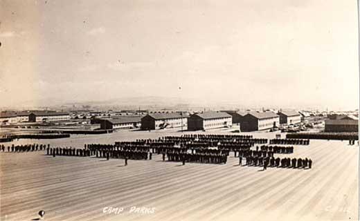
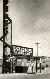
12 1 INTRODUCTION The Dublin Crossing Specific Plan (Specific Plan) is a plan for the orderly development of approximately 189 acres in the City of Dublin (the City). As shown in Figure 1-1: Specific Plan Location, the project site is located in the center of Dublin, north of Interstate 580 and Dublin Boulevard. The project site is located on a portion of the 2,485-acre Camp Park Reserve Forces Training Area (Camp Parks), which currently sits in the middle of the City of Dublin, leaving geographically large portions of the City to the east and to the west of the project site. The Specific Plan address the development of the proposed Dublin Crossing Project (the Project) which is comprised of residential units, commercial uses, parks and open space, and a school. Specifically, the Project includes a maximum of up to 1,995 residential units, up to 200,000 square feet (sf.) of commercial uses, a 30 net-acre Community Park, Neighborhood Park land, and a school site Specific Plan Organization The Specific Plan is organized with the following chapters and content. Chapter 1 Introduction This chapter explains the purpose of the Specific Plan; background; planning process and entitlements; guiding principles; organization of the Specific Plan; authority to prepare; relationship to existing plans and policies; local and regional context and setting. Chapter 2 Land Use and Development Standards This chapter explains the conceptual land use plan for the Specific Plan area; identifies land use policies, and defines the land use designations unique to the Specific Plan. Development standards for each land use designation are also described. Chapter 3 Design Guidelines This chapter explains design concepts and establishes design policies and design guidelines for development in the Specific Plan area. Chapter 4 Circulation and Streetscape Design This chapter explains the circulation and streetscape design including the roadway hierarchy and proposed mobility plans for pedestrians and bicycles. Chapter 5 Infrastructure and Public Services This chapter describes the plan for infrastructure and utility needs (e.g., water, sewer, recycled water, etc.) and public services for the Specific Plan area. Chapter 6 Public Realm (Parks, Open Space, Public Facilities) This chapter identifies the goals and design concepts for the community and neighborhood parks, trails and bikeways; and locates and characterizes public facilities anticipated for the Specific Plan area. Chapter 7 Administration, Implementation, and Financing This chapter discusses the development review procedures by the City of Dublin, and other relevant permitting agencies, applicable to the Specific Plan area. Implementation of the proposed land uses shall be through a tiered process as outlined in this chapter. A process for amendments to the Specific Plan is also discussed. Additionally, financing sources, maintenance responsibilities, and costs are identified for major infrastructure improvements Specific Plan Principles and Objectives The Specific Plan establishes a vision for a vibrant, compact, walkable, bicycle-friendly, transit-oriented community that 1-2 CITY OF DUBLIN
13 INTRODUCTION 1 provides active public gathering spaces and is designed to promote accessibility, connectivity, and a high quality of life. This Specific Plan ensures the creation of unique neighborhoods that blend diverse residences, shops, offices, parks, open space, and education within easy access to public transportation and an interconnected network of sidewalks and bike routes, all providing easier access to daily needs Specific Plan Guiding Principles The following guiding principles provide the framework for the Specific Plan policies, regulations and development standards: Create a strong connection between the eastern and western parts of the City, while also maintaining a distinct identity. Provide a unique community gathering space in the Specific Plan area which will strengthen the image of the City, create a sense of place, and further increase the quality of life for the residents of Dublin. Establish residential land use principles that encourage diverse housing options to meet the needs of Dublin s current and future population, and the creation of neighborhoods with a sense of place. Maximize the use of pedestrian and bicycle friendly connections through the strategic placement and variation of land uses and densities, and the creation of safe multi-modal transportation networks both through the site and into the larger community. Accommodate community needs by providing public spaces such as public parks, open space, trails, community facilities, other public places, and school facilities. Establish new communities that will not negatively impact the City infrastructure, facilities, or services Specific Plan Objectives The following objectives form the basis for anticipated outcomes for the project. They will also be used as the basis for evaluating future development applications and analyzing alternatives in the environmental review process. Ensure a long-term financially viable infill project that provides for the creation of new jobs, recreational opportunities, and expanded housing opportunities. Create a community that is compatible in scale and design with surrounding land uses. Create a project that has a fiscally-neutral impact on the City s financial and services resources 1. Create a community with a strong sense of place and a range of recreation and mobility amenities by designing a unique streetscape that will serve to tie the neighborhoods together with an integrated design theme. 1 Fiscal neutrality occurs when taxation and government spending are neutral, with neither having an effect on demand (i.e. where tax revenue is equal to government spending). DUBLIN CROSSING SPECIFIC PLAN 1-3
14 1 INTRODUCTION Establish a cohesive community feel in the project area through the development and implementation of design guidelines that ensure consistency between individual neighborhoods while allowing unique architectural expression. Provide sufficient land for the Dublin Unified School District (DUSD) to construct an elementary school within the project site. Provide a new Community Park that will be the centerpiece of Dublin Crossing and serve as the focus for major social, cultural, and recreational events for the project, residents of Dublin, and the Tri-Valley region. If the City of Dublin, the Dublin Crossing project developer and the County of Alameda come to an agreement on the transfer of the Alameda County Surplus Property Authority (ACSPA) property to either the City of Dublin or the Dublin Crossing project developer, include the 8.7-acre ACSPA parcel in the project area and plan for its full integration into the project design while maintaining the park acreage within the 30-acre Community Park in the project area. Create a distinctive Dublin Boulevard with amenities and facilities that are consistent with the City of Dublin Streetscape Master Plan, Bicycle and Pedestrian Master Plan, and the City of Dublin General Plan. Provide a range of transportation choices; including walking, bicycling, and access to transit (BART and bus service) to reduce traffic congestion and greenhouse gas emissions. Provide enhanced transportation and circulation amenities that encourage non-vehicular access to and on the Iron Horse Regional Trail, the Dublin/Pleasanton BART station, and to both on-site and adjacent commercial services. Provide an east-west roadway through the project site to enhance circulation between the points east and points west of the area. Provide a neighborhood park that is conveniently located and can serve as a focal point for recreation and neighborhood events. Provide flexibility in land use regulations to allow for site constraints, variations in housing styles, and changing market conditions. Provide a mixture of residential unit types appropriate to the projected housing needs as identified in the City of Dublin General Plan Housing Element. Ensure that each phase (or combination of phases) can stand alone as a well-designed neighborhood, with an adequate circulation network and an attractive transition between the project and the remaining Camp Parks base. Promote environmental stewardship through the inclusion of progressive energy programs and standards in construction and ongoing operation of residential and commercial buildings Background This Specific Plan is the result of a multi-year effort by the US Army, City of Dublin, community members, and Dublin Crossing Ventures ( Developer ) to create a plan for development of the 189-acre Dublin Crossing Specific Plan area ( Specific Plan area ). 1-4 CITY OF DUBLIN

15 INTRODUCTION 1 In 2002, the US Army formally requested an amendment to the General Plan to change the land use designation on the project site from Public Lands to a combination of commercial retail, office space, residential, and open space uses. On April 15, 2003, the Dublin City Council authorized the commencement of a General Plan Amendment study to initiate a comprehensive General Plan Amendment and Specific Plan program over a 172-acre portion of the 2,485- acre Camp Parks area, a 8.5-acre NASA parcel, and (at a later date) an 8.7-acre Alameda County Surplus Property Authority parcel. scenarios, were formulated. The City Council held a series of meetings in 2005 to review the five conceptual land use alternatives. Input from these meetings served as the basis for selecting a preferred land use plan for future development of the Project. In December 2007 the Army and NASA prepared a Notice of Availability to solicit a master developer for the Camp Parks Real Property Exchange Area. The Exchange Agreement provides the Army with an opportunity to construct new and modernize existing facilities through the provision of 172-acres of Army owned property (but excluding the NASA parcel and the 8.7-acre Alameda County Surplus Property Authority parcel), to a developer in exchange for Camp Parks facilities improvements. The Exchange Agreement is not a part of the Specific Plan but was necessary to facilitate acquisition of the property by the project developer. In October 2008, the Army announced the selection of the master developer for the Project. In April 2011, the developer and the US Army officially finalized the Exchange Agreement, authorizing the developer to commence the General Plan Amendment and Specific Plan process. The General Plan Amendment study did not authorize a change in the land use designation on the property but permitted City Staff, in partnership with the Army, to engage the involvement of the community in several strategic visioning meetings. These meetings were used to create a cohesive vision for future development of the site. Based on the information provided from several community meetings, five conceptual land use plans, each illustrating different land use DUBLIN CROSSING SPECIFIC PLAN 1-5
16 1 INTRODUCTION 1-6 CITY OF DUBLIN
17 INTRODUCTION Planning Process and Entitlements Planning Process When subsequent site-specific development proposals for the Specific Plan area are presented to the City, planning staff will use this Specific Plan as a policy and regulatory guide for subsequent project review. Projects will be evaluated for consistency with Specific Plan policies and for conformance with development standards and design guidelines. In situations where policies or standards relating to a particular subject have not been provided in the Specific Plan, the existing policies and standards of the City's General Plan and Zoning Ordinance will continue to apply Project Entitlements The initial project entitlements are expected to include: A certified Project-level Environmental Impact Report (EIR); General Plan Amendment; Specific Plan; Zoning Ordinance and Zoning Map amendments; City/Developer Development Agreement; Implementation of the Specific Plan will include: Large lot Tentative Map to facilitate the US Army/developer property exchange; Multiple small lot Tentative Maps for the various project development phases; Site Development Review approval for individual development projects; Grading and Improvement Plans for infrastructure and utilities; and Other related entitlements and local, state, and federal permits as may be needed to build out the project(s) as envisioned by the Specific Plan. See Chapter 7: Administration, Implementation and Financing for detailed provisions of the project approvals and implementation process Specific Plan Setting Regional Setting The Specific Plan area is located in northern Alameda County, near the center of the Tri-Valley region. As a part of the Eastern San Francisco Bay Area, the City of Dublin plays an important regional role due to its close proximity to major metropolitan centers, including San Francisco (35 miles northwest), Oakland (30 miles northwest) and Silicon Valley (25 miles southwest). The City of Dublin is home to the Dublin/Pleasanton and West Dublin/Pleasanton Bay Area Rapid Transit (BART) stations, Interstates 580 and 680, and the Iron Horse Regional Trail, a multi-modal trail that links numerous cities within Alameda and Contra Costa counties(see Figure 1-1: Specific Plan Location) Local Setting The 189-acre Specific Plan area is centrally located in the City of Dublin and is bound by a network of streets; 5th and 6th street to the north on the active Camp Parks installation, Arnold Road to the east, Dublin Boulevard to the south and Scarlett Drive (with future extension) to the west. The Specific Plan area is located adjacent to the Iron Horse Regional Trail, and close to the Dublin/Pleasanton BART station, with the station entrance approximately one-third mile to the south of the project area boundary. DUBLIN CROSSING SPECIFIC PLAN 1-7

18 1 INTRODUCTION Figure 1-1: Specific Plan Location 1-8 CITY OF DUBLIN
19 INTRODUCTION 1 The Specific Plan area is generally flat and a significant portion is undeveloped. Two seasonal drainage channels traverse the site, one north to south generally through the middle of the project site, and another along the eastern border, parallel to Arnold Street. Figure 1-2: Specific Plan Aerial shows an aerial photograph of the Specific Plan area. Existing and Surrounding Land Uses Of the 189 acres, approximately 62 acres consists of developed land which is generally located in the western part of the Specific Plan area and includes approximately 20 structures and buildings which are currently used for U.S. Army operations, academic activities, administration, equipment storage, and maintenance. Most facilities are currently in use by the U.S. Army, with the exception of a NASA warehouse building that is deteriorated and has not been used for several years. The Specific Plan area is located adjacent to existing urban development. Camp Parks base housing and administrative buildings are located to the north. A complex of office buildings is located east of Arnold Road, along with a vacant parcel at the northeast corner of Dublin Boulevard and Arnold Road. South of Dublin Boulevard is a broad mix of land uses including multi-family residential and commercial. The entrance to the Dublin-Pleasanton BART station is located approximately one-third mile south of the Specific Plan boundary edge adjacent to Interstate 580. Medium-high density single-family residential, retail and industrial uses are located to the west. West of Interstate 680 is Downtown Dublin Existing Mobility Facilities and Services Roadways Interstate Highways Interstate Highway access to the Specific Plan area is provided by I-580 and I-680. I-580 runs south of the Specific Plan area and connects to I-680 and I-880 to the west and I-5 to the east. I-680 runs west of the Specific Plan area and connects to the northerly cities of San Ramon, Danville, Walnut Creek and Concord and the southerly cities of Fremont, Milpitas, San Jose, and Silicon Valley. Dublin Boulevard Dublin Boulevard is the main east-west arterial that runs through the City and is the southern boundary of the Specific Plan area. Dublin Boulevard provides access to the Dublin/Pleasanton and West Dublin/Pleasanton BART stations and commercial, office, and residential areas throughout Dublin. Dublin Boulevard has an existing bikeway network consisting of Class I bike paths and Class II bike lanes. Livermore-Amador Valley Transit Authority (LAVTA, or Wheels ) bus transit service and a bus rapid transit (BRT) line run along Dublin Boulevard. Figure 1-2: Specific Plan Aerial identifies existing and surrounding land uses within the vicinity of the Specific Plan area. DUBLIN CROSSING SPECIFIC PLAN 1-9

20 1 INTRODUCTION Arnold Road Arnold Road is a Class I Collector roadway extending north from Interstate 580onto Camp Parks. Existing office buildings are located on the east side of the roadway. Arnold Road has Class II bike lanes on both sides of the street that connect to a Class I bike path along the north side of Dublin Boulevard CITY OF DUBLIN

21 INTRODUCTION 1 Figure 1-2: Specific Plan Aerial DUBLIN CROSSING SPECIFIC PLAN 1-11


22 1 INTRODUCTION Scarlett Drive Scarlett Drive is a Class II Residential Collector roadway located along the west side of the Specific Plan area. The current alignment terminates at Houston Place and picks up again at Dublin Boulevard. It is anticipated that the Specific Plan will provide for the extension of Scarlett Drive from Houston Place to Dublin Boulevard, adjacent to the Iron Horse Regional Trail. Transit Service Bay Area Rapid Transit (BART) BART is the regional rail service in the San Francisco Bay Area, with stations and stops throughout the greater Bay Area, including the Dublin/Pleasanton and West Dublin/Pleasanton stations. The entrance to the Dublin-Pleasanton BART station is located approximately one-third mile south of the Specific Plan boundary edge. Figure 1-3: Proximity to BART Station identifies quarter-, third-, and half-mile distances from the Dublin/Pleasanton BART station. Livermore-Amador Valley Transit Authority (LAVTA, or Wheels ) Wheels provides services in Dublin and the Tri-Valley area, with nearby stops along Dublin Boulevard, along Dougherty Road, and at the Dublin/Pleasanton BART station CITY OF DUBLIN

23 INTRODUCTION 1 Figure 1-3: Proximity to BART Station DUBLIN CROSSING SPECIFIC PLAN 1-13

24 1 INTRODUCTION Trails Iron Horse Regional Trail Iron Horse Regional Trail is a regional multi-use trail that, at full completion, will span approximately 33 miles from Livermore to Suisun Bay, connecting 12 cities within Alameda and Contra Costa counties. This trail provides an important recreational and commuting component for the communities it serves by connecting residential neighborhoods, commercial and business centers, schools, public transportation, open space, parks, and community facilities Existing Constraints The following are existing physical constraints to development in the Specific Plan area: The Department of the Army Exchange Agreement is an agreement between the U.S. Army and the Developer to which the City is not a party. The Exchange Agreement requires that the project be developed in specific land allocation phases associated with capital improvements to be completed by the Developer on the remaining active Camp Parks installation. Conveyance of the 8.7-acre parcel located at the northwest corner of Dublin Boulevard and Arnold Road which is owned by the Alameda County Surplus Property Authority. Conveyance of the 8.5-acre parcel located adjacent to Scarlett, which is owned by the NASA. Stormwater capacity issues associated with the Chabot storm drainage channel. Existence of a 100-year flood plain within and around the project site. Existing right-of-way and easements, including Dublin Boulevard, Arnold Road, 5th and 6th Streets, and Scarlett Drive. Building window height restrictions along the north side of the project site. Due to sensitivities over potential visual intrusion into a particular building on the military base, within the buffer area, there shall not be any windows on north-facing elevations that are higher than 25 feet from adjacent grade. Existing and future project traffic levels of service on existing roadways and intersections. Safe connectivity of the project to the local and regional transit system, especially at Dublin Boulevard. Maintaining Iron Horse Trail connectivity south across Dublin Boulevard to the Dublin/Pleasanton BART station. Existing underground infrastructure including a 10 gasoline pipeline (owned by Kinder Morgan) and a 1-14 CITY OF DUBLIN
25 INTRODUCTION 1 fiber optic line that extends on the west side of the project site, either adjacent to or under the Iron Horse Regional Trail. Figure 1-4: Existing Constraints identifies the above on-site physical constraints. DUBLIN CROSSING SPECIFIC PLAN 1-15

26 1 INTRODUCTION Figure 1-4: Existing Constraints 1-16 CITY OF DUBLIN
27 INTRODUCTION Relationship to Existing Plans and Policies Dublin General Plan The City of Dublin General Plan (the General Plan) (1985) provides a broader city-wide framework to support future land use and development decisions in the Specific Plan area. California state law requires this Specific Plan to be consistent with the policies and standards contained in the General Plan. Together with the Specific Plan, the City of Dublin will approve any necessary General Plan amendments to provide for the land uses, goals and policies in this Specific Plan. Chapter 2: Land Use and Development Standards outlines goals and policies which support the goals and policies of the General Plan. In situations where policies or standards relating to a particular subject have not been provided in this Specific Plan, the existing policies and standards in the General Plan will continue to apply City of Dublin Zoning Ordinance The City of Dublin Zoning Code (the Zoning Ordinance) provides a citywide framework of regulations that address topics such as permitted uses, development standards, parking and landscaping regulations, permit procedures, and sign regulations. This Specific Plan includes the zoning standards for development within the Specific Plan area. In situations where policies or standards relating to a particular subject are silent in this Specific Plan, the existing regulations of the Zoning Ordinance will continue to apply. In the event that any provision in this Specific Plan conflicts with Zoning Ordinance, the provisions set forth within the Specific Plan shall prevail Park and Recreation Master Plan The City of Dublin Park and Recreation Master Plan provides goals, policies, and standards for park facilities, combined with the active recreation-oriented lifestyle of the population [with] a significant emphasis on the provision of high quality and sufficient recreation opportunities for the community. This Specific Plan provides park and open space system that integrates a continuous network of multi-modal trails and bikeways (see Chapter 6: Public Realm) City of Dublin Bicycle and Pedestrian Master Plan The City of Dublin s Bicycle and Pedestrian Master Plan provides goals, policies and standards for developing and implementing a city-wide bikeway system. This Specific Plan promotes viable transportation alternatives to the automobile and supports walking and bicycling throughout the Specific Plan area, with safe and convenient access to transit, open space, trails, parks, and other recreational amenities (see Chapter 4: Circulation and Streetscape Design) City of Dublin Streetscape Master Plan The City of Dublin Streetscape Master Plan provides goals, policies, and standards for streetscape continuity, aesthetics and connectivity. This Specific Plan implements design standards and guidelines that strengthen and unify the City s streetscape (see Chapter 4: Circulation and Streetscape Design) City of Dublin Public Art Master Plan The City of Dublin Public Art Master Plan provides goals, policies, and standards for public art to create a unique sense of place and a strong identity for public spaces in neighborhoods and business districts, and to provide opportunities for people to experience visual art. This Specific DUBLIN CROSSING SPECIFIC PLAN 1-17
28 1 INTRODUCTION Plan includes design guidelines and standards which promote public art that will create a unique sense of place and a strong identity for the Specific Plan area (see Chapter 3: Design Guidelines) Dublin Transit Center The Dublin Transit Center area covers 91 acres of land on the south side of Dublin Boulevard surrounding the Dublin/Pleasanton BART station. The Master Plan includes policies and design guidelines intended to create a highdensity mixed-use project by encouraging transit as a primary means of transportation. The land uses proposed within this Specific Plan are compatible with those of the Transit Center. The Transit Center Master Plan designates an 8.7-acre parcel, owned by the Alameda County Surplus Property Authority, as Neighborhood Park. Located at the northwestern most portion of the Transit Center Area, this parcel is intended to be included in the Specific Plan area and designated for commercial and mixed-use opportunities and the 8.7 acres is included in the 30 net-acre Community Park. The Dublin Transit Center is a recognized Priority Development Area (PDA) in the Metropolitan Transportation Commission (MTC) and Association of Bay Area Governments (ABAG) Plan Bay Area. The Dublin Crossing Specific Plan area is also included within the PDA. PDAs are areas within communities that have been identified and approved by city or county governments to take on larger shares of future growth. These areas typically are easily accessible to transit, jobs, shopping and other services, such as the Dublin Crossing Specific Plan area Statutory Requirements of a Specific Plan This Specific Plan implements the goals and policies of the General Plan, serves as an extension of the General Plan, and can be used as both a policy and a regulatory document. The purpose of this Specific Plan is to implement the vision by providing goals, policies, programs, development standards and design guidelines to direct future development within the Specific Plan area Authority to Prepare A specific plan is a planning and regulatory tool made available to local governments by the State of California. Specific plans implement a city s General Plan through the development of policies, programs and regulations that provide an intermediate level of detail between General Plan and individual development projects. State law stipulates that specific plans can only be adopted or amended if they are consistent with a city s adopted General Plan. The authority to prepare and adopt a Specific Plan and the requirements for its contents are set forth in California Government Code Sections through Section states, A Specific Plan shall include a text and a diagram or diagrams which specify all the following in detail: The distribution, location, and intent of the uses, including open space, within the area covered by the plan. The proposed distribution, location, and extent and intensity of major components of public and private transportation, sewage, water, drainage, solid waste disposal, energy, and other essential faculties proposed to be located within the area covered by the plan and needed to support the land uses described in the plan. Standards and criteria by which the development will proceed, and standards for the conservation, development, and utilization of natural resources, where applicable CITY OF DUBLIN
29 INTRODUCTION 1 A program of implementation measure including regulation, programs, public works projects, and financing measures to carry out the paragraphs 1, 2, and 3. The Specific Plan shall include a statement of the relationship of the specific plan to the General Plan." Environmental Review The California Environmental Quality Act (CEQA) classifies a specific plan as a Project which is subject to an Environmental Impact Report (EIR). The Dublin Crossing Specific Plan EIR (State Clearinghouse # ) evaluates this Specific Plan as a single project consisting of parcels that are anticipated to be further subdivided and developed over an extended period of time. The EIR analyzes environmental impacts of the potential developments within the Specific Plan area and proposes mitigation measures to reduce significant environmental impacts to a less than significant level as defined by CEQA. The intent of preparing a project-level EIR is to expedite the processing for future projects that are consistent with this Specific Plan, if it is determined that the proposed development would not result in new environmental impact nor require additional mitigation. Through a project-level EIR, the City can approve future applications within the Specific Plan area without an additional environmental document or, if there are changes to this Specific Plan, additional environmental review need only focus on areas of change. DUBLIN CROSSING SPECIFIC PLAN 1-19
30
31 2 LAND USE & DEVELOPMENT STANDARDS This chapter explains the conceptual land use plan for the Specific Plan area; identifies land use policies, and defines the land use designations unique to the Specific Plan. Development standards for each land use designation are also described. DUBLIN CROSSING SPECIFIC PLAN 2-1

32 2 LAND USE AND DEVELOPMENT STANDARDS 2.1. Land Use Concept The Dublin Crossing Specific Plan creates land use designations that will implement the Specific Plan guiding principles and objectives outlined in Chapter 1: Introduction. The land uses, intensities, sizes and locations are designed to focus the vision of Dublin Crossing as a vibrant neighborhood where people can work, live, and play. Furthermore, the land uses are designed to support the Specific Plan land use concept and will act as the regulatory zoning districts for each use. As shown in Figure 2-1: Conceptual Land Use Plan, Dublin Crossing is envisioned as an infill, mixed-use development located in the center of Dublin. It will include a 30 acre Community Park, up to 1,995 residential units, up to 200,000 sf. of commercial space, a neighborhood park, and an school site. A summary of the land use by type is shown in Table 2-1: Land Use Summary. See Table 2-12: Permitted Uses for more detail on the permitted uses in each land use district. The community will be connected by a hierarchy of streets, trails, parks, and interconnected neighborhoods. Land uses are also visually and physically connected to other uses by safe circulation infrastructure, continuity of streetscapes, complementary design features, and by the nature of their compatibility. Land uses in the Specific Plan area reflect a mixture that aims to achieve the vision of a livable urban village. Each of the land uses and the circulation network are described further in this section. Figure 2-2: Illustrative Site Plan illustrates how development within Dublin Crossing may occur. 2-2 CITY OF DUBLIN

33 LAND USE AND DEVELOPMENT STANDARDS 2 Figure 2-1: Conceptual Land Use Plan DUBLIN CROSSING SPECIFIC PLAN 2-3
34 2 LAND USE AND DEVELOPMENT STANDARDS Table 2-1: Land Use Summary Specific Plan Land Use District Total Net Acreage 1 Permitted Density Total Residential Development Potential Total Commercial Development Potential Dublin Crossing Medium Density Residential (DC MDR) Dublin Crossing Medium- High Density Residential (DC M-HDR) units/net acre units/net acre n/a General Commercial/DC Medium-High Density Residential (GC/DC M- HDR) units/net acre 0.25 to 1.0 FAR Up to 1,995 dwelling units 5 75,000 to 200,000 gross square feet General Commercial/DC High Density Residential (GC/DC HDR) units/net acre 0.25 to 1.0 FAR School (S) 3 12 n/a n/a Park (P) 4 30 n/a n/a n/a Open Space (OS) 1.1 n/a n/a n/a Roadways, Utilities, and other Infrastructure 23.8 n/a n/a n/a Total Project Area 189 Notes: (1) Net acreage is defined as the gross acreage less backbone street, public street, and right-of-way area. (2) Can have commercial only, mixed-use, or residential-only uses. FAR applies only to commercial uses. (3) The school site may be developed at the Dublin Crossing Medium Density Residential (DC-MDR) use and density if the site is not utilized for school or park purposes and if the Specific Plan maximum of 1,995 residential units is not exceeded. (4) Park acreage is net usable acres measured from back of sidewalk and includes Chabot Creek. 2-4 CITY OF DUBLIN

35 LAND USE AND DEVELOPMENT STANDARDS 2 Figure 2-2: Illustrative Site Plan DUBLIN CROSSING SPECIFIC PLAN 2-5
36 2 LAND USE AND DEVELOPMENT STANDARDS Parks, Open Space, and Public Facilities The Specific Plan area contains land designed for public use which includes parks/open space, an school site, and public roadways. Central Park and Iron Horse Regional Trail Realignment Located at the crossroads of Dublin Boulevard, Scarlett Drive and the Iron Horse Regional Trail is the proposed 30 net usable acre Dublin Crossing Central Park (Central Park). The Central Park is envisioned as an innovative and uniquely designed community gathering place for the residents of Dublin Crossing and the broader community of Dublin. The Central Park will provide high-quality recreational amenities for both passive and active recreation and civic events (e.g., festivals, farmer s market, art shows, etc.). Amenities could include an amphitheater, organized and informal sports fields, sport courts, restrooms, walking paths, parking, a community garden, demonstration vineyards, play areas, picnic grounds, a carousel, a rose garden, and possibly a building pad for a children s museum (to be built by others). The Iron Horse Regional Trail will be reconfigured with the new project frontage and Scarlett Drive extension/widening, and a secondary trail pathway could be integrated along the southwestern edge of the Central Park. School The Specific Plan provides an opportunity for the Dublin Unified School District (DUSD) to establish a public school on the site which is designated as School (S) on Figure 2-1: Conceptual Land Use Plan. This school site will be designed to accommodate approximately 900 children and could include classrooms, a multi-purpose room, administrative officesparking, and multi-use sports field(s) and playground(s) that will be jointly used by the school and the City for Neighborhood Park purposes. In the event a school does not develop on the site, the parcel may be used entirely for park purposes. An existing drainage channel extends north to south along the eastern side of the proposed land area for Central Park. This channel provides regional drainage from Camp Parks (to the north) and eventually flows under I-580 and into the Chabot Canal. This channel will be relocated and grade-contoured as a natural riparian corridor. The new channel will be located near the eastern border of the Central Park, but the channel acreage is not included in the 30 net-acre park calculations. The Dublin Boulevard frontage of Central Park will create an opportunity for a strong visual civic statement at a key central location within the City. The gateway plaza should include significant landscaping, seating, street furniture, and other element(s). 2-6 CITY OF DUBLIN
37 LAND USE AND DEVELOPMENT STANDARDS Residential Neighborhoods The proposed project will contain residential neighborhoods that will accommodate up to a Specific Plan total of 1,995 residential units with densities ranging from 6 to 60 dwelling units per net acre. There are two land use districts that accommodate exclusively residential development: Dublin Crossing Medium Density Residential (DC MDR) has a density of 6 to 14 units per net acre; and Dublin Crossing Medium-High Density Residential (DC M-HDR) has a density of 14.1 to 25 units per net acre. There will be a variety of housing types throughout the project area including single-family detached, single-family attached and multi-family units which will be located in order to provide a logical transition from the existing high density residential development adjacent to the BART station and from the existing Medium-Density Residential neighborhood across Scarlett Drive Residential density ranges within each residential neighborhood are allowed to provide flexibility of subdivision design and to adapt to changing future housing market conditions Commercial and Mixed Use General Commercial/Dublin Crossing Medium-High Density Residential (GC/DC M-HDR) To provide flexibility to accommodate future market conditions and City housing needs, a combination land use district is proposed for areas along Arnold Road. General Commercial/Dublin Crossing Medium-High Density Residential (GC/DC M-HDR) is proposed for property on the periphery of the project area along Arnold Road, as shown in Figure 2-1: Conceptual Land Use Plan. Uses allowed in this district are commercial, mixed use, and residential. The GC/DC M-HDR land use district can contain commercial uses, up to a Specific Plan area total of 200,000 square feet. The maximum floor area ratio (FAR) of commercial uses in the district is 1.0 and the maximum density for residential development in the land use district is 25 units/net acre. FAR applies only to commercial uses and is calculated using only that portion of the property that is devoted to commercial use. For a vertical mixed-use project, the FAR is calculated using that portion of the property that is devoted to vertical mixed use. General Commercial/Dublin Crossing High Density Residential (GC/DC HDR) To provide flexibility to accommodate future market conditions and City housing needs, a combination land use district is proposed for areas along Dublin Boulevard to Arnold Road. General Commercial/Dublin Crossing High Density Residential (GC/DC HDR) is proposed for property on the periphery of the project area along Dublin Boulevard, as shown in Figure 2-1: Conceptual Land Use Plan. Uses allowed in this district are commercial, mixed use (commercial and residential combined in some way), and residential. In combination with the GC/DC DUBLIN CROSSING SPECIFIC PLAN 2-7
38 2 LAND USE AND DEVELOPMENT STANDARDS M-HDR land use district, the GC/DC HDR land use district can contain commercial uses up to a Specific Plan area total of 200,000 square feet. The maximum floor area ratio (FAR) of commercial uses in the district is 1.0 and the maximum density for residential development in the land use district is 20.1 to 60 units/net acre. FAR applies only to commercial uses and is calculated using only that portion of the property that is devoted to commercial use. For a vertical mixed-use project, the FAR is calculated using that portion of the property that is devoted to vertical mixed use. In terms of site design in the GC/DC HDR district, a gateway plaza shall be located at the northwest corner of Dublin Boulevard and Arnold Road to create a public focal point along Dublin Boulevard and to anchor this corner of the Dublin Crossing project area. This gateway plaza will provide a welcoming entry feature to the district Roadway Network As public spaces, streets will have significant importance within Dublin Crossing. They will facilitate access to the residential, commercial, mixed use, and public uses within the community. This Specific Plan includes a thoughtfully designed streetscape that is conducive to facilitating multiple modes of travel in an inviting, safe, aesthetically-pleasing circulation network. A grid pattern of different street types, each with a defined character and function, will serve the transportation needs of the project. The internal backbone street system is designed to establish connections to the existing exterior roadway network as well as internally between residential neighborhoods, parks, open spaces, an school site, and business /commercial areas. With sidewalks on nearly all streets, and bikeways on many, the streets will become the framework for the pedestrian and bicycle network as they connect to uses both internally and beyond Dublin Crossing. Internal roadway classifications include Residential, Class I, and Class II Collector Streets, Residential Streets, and Private Streets. Chapter 4: Circulation and Streetscape Design provides greater detail on the roadway network. Residential, Class I, and Class II Collector Streets Collector Streets will serve as the primary conduits for interior neighborhood vehicular, bicycles, and pedestrian traffic and to provide access to and from neighborhood residential streets and perimeter streets outside of the Specific Plan area. These streets are not intended to support regional traffic, but they may provide direct access to schools and parks. Collector Streets include B Street, Central Parkway, and G Street. Residential Streets Residential Streets will provide direct multi-modal access to neighborhoods by residents and visitors while discouraging through traffic and high speeds. Residential Streets are intended to provide low-speed access between and within 2-8 CITY OF DUBLIN
39 LAND USE AND DEVELOPMENT STANDARDS 2 neighborhoods, promoting a multi-modal network with an emphasis on comfort, safety, and amenities for pedestrians and bicyclists. Private Streets Private Streets will be privately owned and maintained streets that provide access within common interest subdivisions and commercial and mixed-use developments. Private Streets will be designed for a low volume of traffic with limited vehicular access. Private Streets will be narrower than public Residential Streets and may or may not include sidewalks, on-street parking, or other street features but will not include gates that restrict access Planning Areas Figure 2-3: Planning Areas organizes the project site into distinct Planning Areas for purposes of the overall site development and for identifying smaller parcels within the project area. The Planning Areas do not correlate to project phasing or the order of future development. DUBLIN CROSSING SPECIFIC PLAN 2-9
40 2 LAND USE AND DEVELOPMENT STANDARDS Figure 2-3: Planning Areas 2-10 CITY OF DUBLIN
41 LAND USE AND DEVELOPMENT STANDARDS 2 Table 2-2: Planning Area Development Summary Planning Area Project Phase Approximate Net Area (Acres) Land Use District DC M-HDR ( u/a) 2 4 / DC MDR (6-14 u/a) 3 2 / 3 / 4 30 P-OS 4 1A 3.72 DC M-HDR ( u/a) 5 1A / DC MDR (6-14 u/a) 6 1B / DC MDR (6-14 u/a) 7 1A / 1B 5.33 DC M-HDR ( u/a) 8 1A 6.13 GC/DC HDR 9 1B 3.10 DC M-HDR ( u/a) 10 2 / DC MDR (6-14 u/a) 11 2 / DC M-HDR ( u/a) GC/DC M-HDR 13 3 / GC/DC M-HDR 14 2 / S DC M-HDR ( u/a) 16 2 / GC/DC HDR 17 2 / GC/DC HDR Roadway, Utilities, other Infrastructur e -- Remainder n/a TOTAL Phasing Plan Development of the Specific Plan area includes 5 (five) development phases, with anticipated build-out occurring over a period of approximately 10 years in response to market demands, the acquisition of the property from the U.S. Army, and according to an orderly extension of roadways, infrastructure, public services, and utilities. Over the course of the five phases, park sites, private recreational facilities, the school site, and other amenities will be provided commensurate with the residential and commercial development pursuant to terms in the Project Development Agreement. Figure 2-4: Conceptual Phasing Plan and Table 2-3: Phasing Plan identify proposed development phasing within the Specific Plan area. Project phasing is described in greater detail in Section 7.3 of the Specific Plan. Table 2-3: Phasing Plan Phase Gross Area Estimated Number of Residential Units Estimated Amount of Commercial Square Footage , , , TOTAL 189 acres Up to 1,995 (max.) Up to 200,000 (max.) DUBLIN CROSSING SPECIFIC PLAN 2-11

42 2 LAND USE AND DEVELOPMENT STANDARDS Figure 2-4: Conceptual Phasing Plan 2-12 CITY OF DUBLIN
43 LAND USE AND DEVELOPMENT STANDARDS Land Use Policies The following land use policies shall apply to all development within the project area unless otherwise noted in this Specific Plan. Special implementation measures are described in Chapter 7: Administration, Implementation and Financing. LU Policy 2.1 Concentrate commercial uses near the intersection of Dublin Boulevard and Arnold Road. LU Policy 2.2 Locate higher density residential uses along Dublin Boulevard and within one-half mile walking or biking distance to transit facilities. LU Policy 2.3 Provide pedestrian and bicycle facilities to meet the goals and objectives of the Specific Plan and to promote alternatives to automobile use and reduce parking demand. Pedestrian sidewalks, bicycle lanes, and multi-use trails shall safely connect residential, commercial, and recreational uses to each other and to transit facilities. LU Policy 2.4 Develop a comprehensive Park Master Plan for the Community Park (Central Park) and a pedestrian/bicycle trail network that is consistent with the City of Dublin Bicycle Master Plan and Parks and Recreation Master Plan. LU Policy 2.5 Locate the Central Park near the intersection of Dublin Boulevard, Scarlett Drive and the Iron Horse Regional Trail to provide physical and visual access to the Dublin Community and to enable a strong connection between the parks in the Specific Plan area and the Iron Horse Regional Trail. LU Policy 2.6 Promote development of a wide variety of housing types and housing alternatives for Dublin residents. LU Policy 2.7 Each development phase shown in Figure 2-3 shall include all infrastructure, services, facilities and amenities, both public and private, needed to serve the uses and structures within that phase, which shall be completed in accordance with the provisions in this Specific Plan and Development Agreement. Development of each phase shall result in a project that could stand alone both functionally and aesthetically if future phases were not constructed. LU Policy 2.8 Development of Phase 2 shall include the provision of a 10 foot, landscaped connection outside of the street right-of-way line along the east side of D Street North to connect the residential neighborhood of Phase 1 and Phase 2 with comfortable, multi-modal connections between the two Infrastructure and Services Figure 2-1: Conceptual Land Use Plan provides for a variety of land uses within the Specific Plan area. Each of these land uses will be served by existing and future utility infrastructure planned for future development in and around the Specific Plan area. Project development will require removal and relocation of existing, and construction of new, public utilities within the Specific Plan area. Chapter 5: Infrastructure and Public Services provides detail on infrastructure and public services improvements that will be developed in the Specific Plan area Development Standards The purpose of this section is to provide land use development standards that apply throughout the Specific Plan area. These include standards regarding permitted uses, building height limits, parking requirements, and setbacks. These development standards should be used in conjunction with Chapter 3: Design Guidelines, which describe and illustrate building designs, concepts, and features that will DUBLIN CROSSING SPECIFIC PLAN 2-13
44 2 LAND USE AND DEVELOPMENT STANDARDS ensure the high-quality development that is envisioned for the Specific Plan area. Development standards apply for each of the respective land use designations described below. These are: Dublin Crossing Medium Density Residential (DC MDR) Dublin Crossing Medium-High Density Residential (DC M-HDR) General Commercial/ Dublin Crossing Medium-High Density Residential (GC/DC M-HDR) General Commercial/ Dublin Crossing High Density Residential (GC/DC HDR) Additionally, development standards are provided for specific residential product types. For any residential development, the development standards of both the land use district and the particular product type shall apply CITY OF DUBLIN
45 LAND USE AND DEVELOPMENT STANDARDS Development Standards for DC Medium Density Residential (DC MDR) land use district The DC Medium Density Residential (DC MDR) land use district allows a mix of residential lot configurations from conventional single-family small-lots including two-pack or zipper lots, to attached multi-family lots at a density of 6-14 units per net acre. Residential product types may include a variety of attached and detached housing types, including: Single-Family Conventional Home (Detached) Alley Loaded Home (Detached) Duet Home (Attached) Rowhouse (Attached) Green Court Home (Detached) Motorcourt Home (Detached or Attached) Townhome (Attached) No building shall be taller than 40 feet, except for architectural projections such as chimneys. Building height is measured from adjacent finished grade in accordance with the Zoning Ordinance. Due to sensitivities over potential visual intrusion into a particular building on the military base, there shall be no windows on north-facing elevations that are higher than 25 feet from adjacent grade within the Visual Intrusion Buffer area as identified on Figure 1-4: Existing Constraints,. Usable Outdoor Space (Common and Private) for attached housing units of any type shall be a minimum of 15% of the net site area. Parking shall be provided in accordance with the Zoning Ordinance based on residential use type. In addition to the development standards noted here, refer also to Section 2.6.6: Residential Product Type Development Standards (all Land Use Districts) for product type development standards. Secondary dwelling units, accessory structures, and home occupations are permitted in the DC MDR land use district in accordance with the Zoning Ordinance. Development of residential units in this land use district shall be regulated by the development standards established for each product type noted and in accordance with these standards: DUBLIN CROSSING SPECIFIC PLAN 2-15
46 2 LAND USE AND DEVELOPMENT STANDARDS Development Standards for DC Medium-High Density Residential (DC M-HDR) Land Use District DC Medium-High Density Residential (DC M-HDR) allows for a mix of attached and detached single-family and multi-family housing lot configurations at a density of 14.1 to 25 units/net acre. Residential product types may include a variety of attached and detached housing types, including: Single-Family Conventional Home (Detached) Alley Loaded Home (Detached) Duet Home (Attached) Rowhouse (Attached) Green Court Home (Detached) Motorcourt Home (Detached or Attached) Townhome (Attached) Multi-Family (Attached) In addition to the development standards noted here, refer also to Section 2.6.6: Residential Product Type Development Standards (all Land Use Districts) for product type development standards. Home occupations are permitted in the DC M-HDR land use district in accordance with the Zoning Ordinance Chapter 8.64: Home Occupations Regulations. Development of residential units in this land use district shall be regulated by the development standards established for each product type noted and in accordance with these standards: No building shall be taller than 45 feet, except for architectural projections such as chimneys. Building height is measured from adjacent finished grade in accordance with the Zoning Ordinance. Due to sensitivities over potential visual intrusion into a particular building on the military base, there shall be no windows on north-facing elevations that are higher than 25 feet from adjacent grade within the Visual Intrusion Buffer area as identified on Figure 1-4: Existing Constraints. Usable Outdoor Space (Common and Private) for attached housing units of any type shall be a minimum of 15% of the net site area. Parking shall be provided in accordance with the Zoning Ordinance based on residential use type. The process for considering exceptions to parking requirements is described in Zoning Ordinance Chapter Medium-High Density Residential development provides a transition from the higher density apartments and condominiums along the project periphery to the DC Medium Density Residential land use district in the core of the Specific Plan area CITY OF DUBLIN
47 LAND USE AND DEVELOPMENT STANDARDS Development Standards for General Commercial/DC Medium-High Density Residential (GC/DC M-HDR) Land Use District To provide flexibility to accommodate future market conditions and City housing needs, a combination land use district is proposed for areas along Arnold Road. Uses allowed in this district are residential, commercial, and mixed use (commercial and residential combined in a single project). Mixed-use can take the form of vertical mixed-use, horizontal mixed-use, or a combination of both. Vertical mixed-use is characterized by residential uses over commercial uses. Horizontal mixed-use is characterized by residential and commercial uses developed side by side, as either attached or detached units, but the project is designed so that the residential and commercial uses are integrated and built simultaneously to function as a single project. In multi-story, mixed-use buildings, ground floor commercial uses should include uses that serve daily needs, such as retail and grocery stores and eating and drinking establishments. All other uses are permitted on all floors. Residential product types may include a variety of attached and detached housing types, including: Single-Family Conventional Home (Detached) Alley Loaded Home (Detached) Duet Home (Attached) Rowhouse (Attached) Green Court Home (Detached) Motorcourt Home (Detached or Attached) Townhome (Attached) Multi-Family (Attached) In addition to the development standards noted here, refer also to Section 2.6.6: Residential Product Type Development Standards (all Land Use Districts) for product type development standards. Home occupations are permitted in the GC/DC MDR land use district in accordance with the Zoning Ordinance Chapter 8.64: Home Occupations Regulations. Development in this land use district shall be regulated by the development standards established for each residential product type noted (if residential uses are proposed) and in accordance with these standards: No building shall be taller than 45 feet, except for architectural projections such as chimneys. Building height is measured from adjacent finished grade in accordance with the Zoning Ordinance. Usable Outdoor Space (Common and Private) for attached housing units of any type shall be a minimum of 15% of the net site area. Parking shall be provided in accordance with the Zoning Ordinance based on use type. The process for considering exceptions to parking requirements is described in Zoning Ordinance Chapter DUBLIN CROSSING SPECIFIC PLAN 2-17
48 2 LAND USE AND DEVELOPMENT STANDARDS Development Standards for General Commercial/DC High Density Residential (GC/DC HDR) Land Use District To provide flexibility to accommodate future market conditions and City housing needs, a combination land use district is proposed for areas along Dublin Boulevard, west to Arnold Road. Uses allowed in this district are residential, commercial, and mixed use (commercial and residential combined in a single project). Mixed-use can take the form of vertical mixeduse, horizontal mixed-use, or a combination of both. Vertical mixed-use is characterized by residential uses over commercial uses. Horizontal mixed-use is characterized by residential and commercial uses developed side by side, as either attached or detached units, but the project is designed so that the residential and commercial uses are integrated and built simultaneously to function as a single project. In multi-story, mixed-use buildings, ground floor commercial uses should include uses that serve daily needs, such as retail and grocery stores and eating and drinking establishments. All other uses are permitted on all floors. Residential product types may include a variety of attached and detached housing types, including: Alley Loaded Home (Detached) Duet Home (Attached) Rowhouse (Attached) Green Court Home (Detached) Motorcourt Home (Detached or Attached) Townhome (Attached) Multi-Family (Attached) In addition to the development standards noted here, refer also to Section 2.6.6: Residential Product Type Development Standards (all Land Use Districts) for product type development standards. Home occupations are permitted in the GC/DC HDR land use district in accordance with the Zoning Ordinance Chapter 8.64: Home Occupations Regulations. No building shall be taller than 75 feet, except for architectural projections such as chimneys. Building height is measured from adjacent finished grade in accordance with the Zoning Ordinance. Usable Outdoor Space (Common and Private) for attached housing units of any type shall be a minimum of 15% of the net site area. Parking: For commercial uses, parking shall conform to the City of Dublin Zoning Ordinance Chapter 8.76: Off-Street Parking and Loading Regulations. For residential development in this district, the parking requirement is 1.5 spaces (covered or uncovered) per residential unit plus guest parking provided as an additional 15% of the number of required spaces. The process for considering exceptions to parking requirements is described in Zoning Ordinance Chapter CITY OF DUBLIN
49 LAND USE AND DEVELOPMENT STANDARDS Adjustment to Boundaries of Land Use Districts A minor adjustment to the boundaries of land use districts in the Specific Plan can be considered in accordance with Section 7.1.6: Substantial Conformance of the Specific Plan Residential Product Type Development Standards (all Land Use Districts) Residential product type development standards apply to all residential development allowed within the Specific Plan area. Residential product type standards have been written for the following product types: Single-Family Conventional Home (Detached) Alley Loaded Home (Detached) Duet Home (Attached) Rowhouse (Attached) Green Court Home (Detached) Motorcourt Home (Detached or Attached) Townhome (Attached) Multi-Family (Attached) If a residential product type is proposed that does not fit into the definition of one of the categories above, the Community Development Director will determine which category is most appropriate and the development standards of that product type shall apply. DUBLIN CROSSING SPECIFIC PLAN 2-19

50 2 LAND USE AND DEVELOPMENT STANDARDS Single-Family Conventional Home (Detached) A Single-Family Conventional Home is defined as a dwelling unit that is occupied by one family unit or group, does not share a common wall, is not attached to another dwelling unit, and provides both front door and garage access from a residential street or common driveway. Single-family homes are typically built on lots between 3,000 and 6,000 square feet with private rear yard space. This type of product typically faces a residential street or common driveway. The detached Single-Family Conventional Home shall have: An individual lot, typically with residential street or common driveway frontage; One principal dwelling per lot; Private rear yard space; An enclosed garage with two side-by-side parking spaces that can be attached or detached. Garages shall also have adequate room for storage and room for trash receptacles to be stored; Guest parking in accordance with the requirements of the land use district Second Unit, Guesthouse, and Accessory Structures Detached or attached second unit or guesthouse allowed in accordance with Zoning Ordinance Chapter 8.40: Accessory Structures and Uses Regulations and Chapter 8.80: Second Units Regulations. Accessory structures allowed in accordance with Zoning Ordinance Chapter 8.40: Accessory Structures and Uses Regulations 2-20 CITY OF DUBLIN
51 LAND USE AND DEVELOPMENT STANDARDS 2 Table 2-4: Single Family Conventional Home (Detached) Development Standards Feature Lot Size (minimum) Lot Width (minimum) (1) Criteria 3,000 square feet 35 feet (5) Minimum garage setback for a driveway is 18 feet. Maximum garage setback for no parking driveway is 5 feet. (6) Zero lot line configurations are permitted provided a minimum building separation of 8 feet is provided. Articulated lot lines and Reciprocal Use Easements (RUE) are allowed. (7) Rear setbacks may be a minimum of 10 feet with an average setback of 15 feet. Setbacks (minimum) (2)(3)(4) Front Living Garage (5) Porch 10 feet 18 feet 5 feet Side (6) Interior 4 feet Corner Rear (7) Living Porch 8 feet 5 feet 10 feet Number of Stories (maximum) 3 stories Notes: (1) Flag lots are allowed within the Specific Plan area in cases where conventional rectangular lot layouts are not feasible or practical. Cul-desac lots shall not have a frontage of less than 30 feet. Flag lots shall not have a frontage of less than 25 feet for each lot (lot frontage is measured at right-of-way or property line which ever applies). In cases where more than one flag lot is necessary, shared common driveways should be utilized to reduce pavement and driveway repetition. Landscaping along both sides of the flag lot driveway should be used to avoid an alley appearance. (2) Building setbacks are measured from edge of building foundation to property line. (3) All setbacks at corner lots shall meet the intersection sight distance design criteria of the Zoning Ordinance. All setbacks for front areas shall ensure safe sight distances for pedestrians and vehicles as approved by the City Engineer. (4) Architectural projections such as porches and patios, landings, roof eaves, steps, bay windows, media nooks, fireplaces and other similar features are allowed to project into setback as long as three feet clear is maintained for access into rear yard. DUBLIN CROSSING SPECIFIC PLAN 2-21

; An enclosed garage with two side-by-side parking spaces that can be attached or detached.")

52 2 LAND USE AND DEVELOPMENT STANDARDS Alley Loaded Home (Detached) Alley Loaded Homes are single-family detached dwelling units that provide garage access from a common rear alley and front door access is typically along a residential street. Alleys should be carefully designed as an attractive common space with landscaping, building articulation, and architectural details. The detached Alley Loaded Home shall have: An individual lot, typically with front door access along a residential street and common private rear alleys for garage access;; One principal dwelling per lot; Private rear yard space or private side yards utilizing Reciprocal Use Easements (RUEs); An enclosed garage with two side-by-side parking spaces that can be attached or detached. Garages shall also have adequate room for storage and room for trash receptacles to be stored; Guest parking in accordance with the requirements of the land use district Second Unit, Guesthouse, and Accessory Structures Detached or attached second unit or guesthouse allowed in accordance with Zoning Ordinance Chapter 8.40: Accessory Structures and Uses Regulations and Chapter 8.80: Second Units Regulations. Accessory structures allowed in accordance with Zoning Ordinance Chapter 8.40: Accessory Structures and Uses Regulations 2-22 CITY OF DUBLIN
53 LAND USE AND DEVELOPMENT STANDARDS 2 Table 2-5: Alley Loaded Home (Detached) Development Standards Feature Criteria Lot Size (minimum) Lot Width (minimum) 2,200 square feet 30 feet Setbacks (minimum) (1)(2)(3) Front Living Porch 10 feet 5 feet Side (4) Interior 4 feet Corner Living Porch 8 feet 5 feet Rear (5) Living Garage Number of Stories (maximum) 3 feet 3 feet 3 stories Notes: (1) Building setbacks are measured from edge of building foundation to property line. (2) All setbacks at corner lots shall meet the intersection sight distance design criteria of the Zoning Ordinance. All setbacks for front areas shall ensure safe sight distances for pedestrians and vehicles as approved by the City Engineer. (3) Architectural projections such as porches and patios, landings, roof eaves, steps, bay windows, media nooks, fireplaces and other similar features are allowed to project into setback as long as three feet clear is maintained for access into rear yard. (4) Zero lot line configurations are permitted provided a minimum building separation of 8 feet aggregate is provided. Articulated lot lines and Reciprocal Use Easements (RUE) are allowed. (5) Minimum garage setback for a driveway is 18 feet. Maximum garage setback for no parking driveway is 3 feet. DUBLIN CROSSING SPECIFIC PLAN 2-23

54 2 LAND USE AND DEVELOPMENT STANDARDS Duet Home (Attached) Duet Homes are similar to Single-Family Conventional homes but are attached by a common wall. This type of unit configuration provides each home one conventional side yard and rear yard. Each home is located on an individual lot and is owned by an individual property owner. Duets may also be located at street corners with garages and entries fronting different residential streets. The Duet Home shall have: Individual lots with residential street frontage Dwelling units are attached at their sides in pairs Typically one garage is forward, the other back for articulation An enclosed garage with two side-by-side parking spaces that can be attached or detached. Garages shall also have adequate room for storage and room for trash receptacles to be stored; Guest parking in accordance with the requirements of the land use district Corner units may face different streets One dwelling unit per lot Each home has a side yard on one side only and private rear yard Zero lot line between attached dwelling buildings Second Unit, Guesthouse, and Accessory Structures Second units and guesthouses are not allowed. Accessory structures allowed in accordance with Zoning Ordinance Chapter 8.40: Accessory Structures and Uses Regulations CITY OF DUBLIN
55 LAND USE AND DEVELOPMENT STANDARDS 2 Table 2-6: Duet Home (Attached) Development Standards Feature Criteria Lot Size (minimum) Lot Width (minimum) 3,000 square feet 35 feet Setbacks (minimum) (1)(2)(3) Front Living Porch Garage (4) 10 feet 5 feet 18 feet Side (5) Zero Side Yard Side 0 feet 4 feet Corner Living Porch Rear (6) Number of Stories (maximum) 8 feet 5 feet 10 feet 3 stories Notes: (1) Building setbacks are measured from edge of building foundation to property line. (2) All setbacks at corner lots shall meet the intersection sight distance design criteria of the Zoning Ordinance. All setbacks for front areas shall ensure safe sight distances for pedestrians and vehicles as approved by the City Engineer. (3) Architectural projections such as porches and patios, landings, roof eaves, steps, bay windows, media nooks, fireplaces and other similar features are allowed to project into setback as long as three feet clear is maintained for access into rear yard. (4) Minimum garage setback for a driveway is 18 feet. Maximum garage setback for no parking driveway is 5 feet. (5) Zero lot line configurations are permitted provided a minimum building separation of an aggregate of 8 feet is provided. Articulated lot lines and Reciprocal Use Easements (RUE) are allowed. (6) Rear setbacks may be a minimum of 10 feet with an average setback of 15 feet. DUBLIN CROSSING SPECIFIC PLAN 2-25

56 2 LAND USE AND DEVELOPMENT STANDARDS Rowhouse (Attached) Rowhouses are single-family dwelling units that are attached at their sides in groups of three or more. Each unit is on a separate lot with shared access drives with private maintenance agreements. The intent of rowhouses is to place emphasis on creating urban streetscapes on public streets. To accomplish this, this particular product type configuration minimizes the impact of the automobile and garage and establishes the presence of living area and landscaping along public streets and drives. An attached Rowhouse shall have: Dwelling units are attached at their sides in groups of three or more No side-yard separation between units No traditional private yard area. Private open space is provided in the form of patios, decks, and balconies Unit entries orient to the street An enclosed garage with two side-by-side parking spaces that is oriented to the rear private alley elements. Garages shall also have adequate room for storage and room for trash receptacles to be stored; Guest parking in accordance with the requirements of the land use district Individual lots with street frontage One dwelling unit per lot Rowhouses may be common interest subdivisions but that is not required CITY OF DUBLIN
57 LAND USE AND DEVELOPMENT STANDARDS 2 Table 2-7: Rowhouse (Attached) Development Standards Feature Criteria Lot Size (minimum) Lot Width (minimum) 1,600 square feet 20 feet Setbacks (minimum) (1)(2)(3) Front Living Porch 10 feet 5 feet Side Interior 0 feet Corner Living Porch 8 feet 5 feet Rear (4) Living Garage (5) Number of Stories (maximum) 3 feet 3 feet 3 stories Notes: (1) All building setbacks are measured from building foundation to property line. (2) All setbacks at corner lots shall meet the intersection sight distance design criteria of the Zoning Ordinance. All setbacks for front areas shall ensure safe sight distances for pedestrians and vehicles as approved by the City Engineer. (3) Architectural projections such as porches and patios, landings, roof eaves, steps, bay windows, media nooks, fireplaces and other similar features are allowed to project into setback as long as three feet clear is maintained for access into rear yard. (4) Rear setbacks are measured from property line or alley easement where applicable. (5) Minimum garage setback for driveway parking is 18 feet. Maximum garage setback for no parking driveways is 3 feet. DUBLIN CROSSING SPECIFIC PLAN 2-27

58 2 LAND USE AND DEVELOPMENT STANDARDS Green Court Home (Detached) Green Court Homes are detached single-family dwellings that orient the front of the dwelling unit toward common open space and pedestrian access ways, which function as a shared, attractive and usable open space. The common open space unifies the site with primary building entries linking to pedestrian circulation paths to unit entrances and other uses or areas on the site. Garages for Green Courts are located at the rear of the unit and take access from private alleys. Guest parking is typically accommodated in open parking areas; these should be screened from common open space. Side yard easements over adjacent lots provide additional usable yard area. Second Unit, Guesthouse, and Accessory Structures Second units and guesthouses are not allowed. Accessory structures allowed in accordance with Zoning Ordinance Chapter 8.40: Accessory Structures and Uses Regulations. A detached Green Court Home shall have: Front entrance of dwelling unit oriented toward common open space Garages located along rear of the home, accessed from private alleys An enclosed garage with two side-by-side parking spaces that is oriented to the rear private alley elements. Garages shall also have adequate room for storage and room for trash receptacles to be stored; Guest parking in accordance with the requirements of the land use district Private side yards utilizing Reciprocal Use Easements (RUE) One dwelling unit per lot Building Separation Provisions Minimum separation between facing garage doors shall be 27 feet CITY OF DUBLIN
(2)(3) Front Living Porch 10 feet 5 feet Side (4) Yard Side 4 feet Street Living Porch 8 feet 5 feet Rear Living Garage Number of Stories (maximum) 3 feet 3 feet 3 stories Notes: (1) Building")
59 LAND USE AND DEVELOPMENT STANDARDS 2 Table 2-8: Green Court Home (Detached) Development Standards Feature Criteria Lot Size (minimum) Lot Width (minimum) 1,800 square feet 30 feet Setbacks (minimum) (1)(2)(3) Front Living Porch 10 feet 5 feet Side (4) Yard Side 4 feet Street Living Porch 8 feet 5 feet Rear Living Garage Number of Stories (maximum) 3 feet 3 feet 3 stories Notes: (1) Building setbacks are measured from edge of building foundation to property line. (2) All setbacks at corner lots shall meet the intersection sight distance design criteria of the Zoning Ordinance. All setbacks for front areas shall ensure safe sight distances for pedestrians and vehicles as approved by the City Engineer. (3) Architectural projections such as porches and patios, landings, roof eaves, steps, bay windows, media nooks, fireplaces and other similar features are allowed to project into setback as long as three feet clear is maintained for access into rear yard. (4) Zero lot line configurations are permitted provided a minimum building separation of an aggregate of 8 feet is provided. Articulated lot lines and Reciprocal Use Easements (RUE) are allowed. DUBLIN CROSSING SPECIFIC PLAN 2-29

60 2 LAND USE AND DEVELOPMENT STANDARDS Motorcourt Home (Detached or Attached) Motorcourt Homes are intended to occur in compact groupings (courts) of dwelling units oriented around a shared private motorcourt. The motorcourt should take its access from a public or a private residential street. Garages should take access from the motorcourt. In special circumstances, where motorcourt product types are mixed with other housing types (e.g. single-family detached, rowhouses, etc.), each housing type should conform to the regulations for their respective housing type. Accessory structures allowed in accordance with Zoning Ordinance Chapter 8.40: Accessory Structures and Uses Regulations. The courtyard area should be carefully designed as a single, attractive common space with landscaping and decorative paving designed to complement the entire motorcourt. Buildings in each motorcourt should exhibit a strong, common architectural theme. An attached or detached Motorcourt Home shall have: One dwelling unit per lot, either attached or detached; Detached or attached dwelling units; Private side and rear yards which may utilize Reciprocal Use Easements (RUE); An attached or detached enclosed garage with two side-by-side parking spaces that is oriented to the motorcourt. Garages shall also have adequate room for storage and room for trash receptacles to be stored; Guest parking in accordance with the requirements of the land use district; The minimum separation between building interior side yards is an aggregate of 8 feet. Second Unit, Guesthouse, and Accessory Structures Second units and guesthouses are not allowed CITY OF DUBLIN
61 LAND USE AND DEVELOPMENT STANDARDS 2 Table 2-9: Motorcourt Home (Detached or Attached) Development Standards Feature Lot Size (minimum) Criteria 1,800 square feet (4) Maximum garage setback for no parking in driveways is 5 feet. (5) Zero lot line configurations are permitted provided a minimum building separation of an aggregate of 8 feet is provided. Articulated lot lines and Reciprocal Use Easements (RUE) are allowed. Lot Width (minimum) 30 feet Setbacks (minimum) (1)(2)(3) Front Street Facing Living Porch 10 feet 5 feet Front Interior Living Porch Garage (4) 5 feet 4 feet 5 feet Side (5) Yard Side 4 feet Corner Living Porch 10 feet 5 feet Rear Living Garage Number of Stories (maximum) 4 feet 5 feet 3 stories Notes: (1) Building setbacks are measured from edge of building foundation to property line. (2) All setbacks at corner lots shall meet the intersection sight distance design criteria of the Zoning Ordinance. All setbacks for front areas shall ensure safe sight distances for pedestrians and vehicles as approved by the City Engineer. (3) Architectural projections such as porches and patios, landings, roof eaves, steps, bay windows, media nooks, fireplaces and other similar features are allowed to project into setback as long as three feet clear is maintained for access into rear yard. DUBLIN CROSSING SPECIFIC PLAN 2-31


62 2 LAND USE AND DEVELOPMENT STANDARDS Townhome (Attached) Townhomes are units, attached in groups of 3 or more. Townhomes typically range from two to three stories with vehicular access to garages from the rear of the unit by a private alley or common drive. Townhomes typically share some common areas or common facilities within the townhome complex. Townhome unit entries can either be oriented to common open space areas or a residential street. A pedestrian circulation system should link unit entrances with other uses or areas on the site. Guest parking is typically accommodated in open parking areas; these should be screened from common open space. An attached Townhome shall have: Dwelling units that are attached at their sides in groups of three or more; Individual lots with vehicular access from common driveways and/or private alleys; A separate common circulation system providing the primary pedestrian access to the units; Private patios and/or balconies with common open space amenities; An enclosed garage with two side-by-side parking spaces that is oriented to a common drive. Garages shall also have adequate room for storage and room for trash receptacles to be stored; Guest parking in accordance with the requirements of the land use district. Second Unit, Guesthouse, and Accessory Structures Second units and guesthouses are not allowed. Accessory structures allowed in accordance with Zoning Ordinance Chapter 8.40: Accessory Structures and Uses Regulations CITY OF DUBLIN
63 LAND USE AND DEVELOPMENT STANDARDS 2 Table 2-10: Townhome (Attached) Development Standards Feature Criteria Lot Size (minimum) Lot/Unit Width (minimum) 1,000 square feet 20 feet Setbacks (minimum) (1)(2)(3) Street (4) Living Porch Side 10 feet 5 feet 10 feet Rear (5) Living Garage 3 feet 3 feet Building Separation Provisions (minimum) Building Face to Building Face Porch to Porch Garage to garage Side to Side Number of Stories (maximum) 30 feet 20 feet 27 feet 20 feet (can be reduced to 15 feet where windows and doors are not present) 3 stories Notes: (1) All building setbacks are measured from building foundation to property line. (2) All setbacks at corner lots shall meet the intersection sight distance design criteria of the Zoning Ordinance. All setbacks for front areas shall ensure safe sight distances for pedestrians and vehicles as approved by the City Engineer. (3) Architectural projections such as porches and patios, landings, roof eaves, steps, bay windows, media nooks, fireplaces and other similar features are allowed to project into setback as long as three feet clear is maintained for access into rear yard. (4) Street setbacks apply to all street (not alley) frontages only. (5) Rear setbacks are measured from property line or alley easement where applicable. DUBLIN CROSSING SPECIFIC PLAN 2-33

64 2 LAND USE AND DEVELOPMENT STANDARDS Multi-Family (Attached) Multi-family attached housing allows grouped housing units. This provides for the opportunity for greater affordability and common open space. Multi-Family housing takes the form of either condominium or apartment units clustered on a single parcel or multiple parcels. Given the density of Multi-Family housing, common open space shall be provided to supplement the limited private open space provided by balconies and patios. Attached Multi-Family product types shall have: Attached units which are stacked in buildings or groups of buildings; Private open space provided in the form of patios, decks or balconies where appropriate; Common open space provided in the form of landscaped courtyards, commonly-accessible rooftop gardens or decks, swimming pools, or similar features and amenities; Vehicular access and circulation via private driveways, entry drives, parking drives and/or parking courts; A separate pedestrian circulation system; Aggregated parking that is not always contiguous to units. Parking may be provided within residential buildings, in surface parking areas with or without carports, parking structures, or in designated areas; Parking provided in accordance with the requirements of the land use district. Tandem parking spaces are not allowed for required spaces CITY OF DUBLIN
65 LAND USE AND DEVELOPMENT STANDARDS 2 Table 2-11: Multi-Family (Attached) Development Standards Feature (1) Criteria Lot Size (minimum) Lot Width (minimum) None None Setbacks (minimum) (1)(2)(3) Building to Property Line Building to Parking and Drive Isle Drive Isle or Parking to Property Line 10 feet 5 feet 5 feet Building Separation Provisions (minimum) Garage to Garage Building to Building (2 stories or less) Building to Building (3-4 stories) Building to Building (5-6 stories) Number of Stories (Maximum) 30 feet 10 feet 20 feet 30 feet 6 stories Notes: (1) Setbacks apply to building proximity to property lines. For setbacks interior to the project, refer to the minimum building separations. (2) All setbacks at corner lots shall meet the intersection sight distance design criteria of the Zoning Ordinance. All setbacks for front areas shall ensure safe sight distances for pedestrians and vehicles as approved by the City Engineer. (3) Architectural projections such as porches and patios, landings, roof eaves, steps, bay windows, media nooks, fireplaces and other similar features are allowed to project into setback as long as three feet clear is maintained for access into rear yard. DUBLIN CROSSING SPECIFIC PLAN 2-35
66 2 LAND USE AND DEVELOPMENT STANDARDS 2.7. Permitted Uses Table 2-12: Permitted Uses identifies the statutory permitting/approval requirements for each land use in the Specific Plan area. Where a land use is not identified or this Specific Plan is otherwise silent, provisions identified in the City of Dublin Zoning Ordinance and shall apply. Where there is uncertainty, the Community Development Director has the discretion to make a determination on the suitability of the proposed use. There are some use types (e.g. Daycare Centers, Community Facilities) that are permitted in all traditional residential and commercial zoning districts throughout the City. Although not specifically listed, these use types are also permitted through the same permit approval process in all residential and commercial land use districts in this Specific Plan. In addition, those uses that require a Minor Use Permit in traditional residential and commercial zoning districts throughout the City are also permitted through the same permit approval process in all residential and commercial land use districts in this Specific Plan. Narrative descriptions of the respective permitted use categories are described below. In the Park (P) land use district, allowed uses include those that are included in the Park Master Plan for the park site. In the School (S) land use district, allowed uses include those that are typically associated with a public school and public park, including classrooms, a multi-purpose room, administrative offices, and parking. Allowed uses also include multi-use sports field(s) and playground(s) that could be jointly used by the school and the City for Neighborhood Park purposes Regional Retail Any retail business that is greater than 20,000 square feet and generally serves a broad population including residents from surrounding communities. Such uses include anchor retail stores, department stores, movie theaters, general retail uses and dining establishments Community Retail Any retail business that is 20,000 square feet or less and generally serves local residents and employees. Such uses include retail stores, personal and professional services, neighborhood retail, dining establishments, cafes, and bakeries Dining / Outdoor Dining Any dining establishment, including those with seating for dining that occurs in outdoor areas (including private outdoor spaces and sidewalks) that are adjacent to a dining establishment and those that serve alcohol. Such uses include restaurants, coffee shops, cafes, and bakeries Entertainment Any establishment that provides live entertainment, cultural arts, or cinema, including those that also sell concessions and alcohol. Such uses include movie theaters, art galleries, and performance halls Office Any establishment in which the primary activity is the provision of a service to a client or customer who does not necessarily need to go to the business to be served. Such uses include lawyers, architects, graphic designers, health services, insurance agents, real estate offices, and financial institutions CITY OF DUBLIN
67 LAND USE AND DEVELOPMENT STANDARDS Lodging Any establishment that rents rooms for transient occupancy to overnight guests. Such uses include hotels, motels, bed and breakfasts, and hostels. Lodging uses may include ancillary retail uses and dining businesses that provide convenience to the traveling public Live-Work A combination of living space and working space for personal and professional service and office uses that the owner of the unit operates the business Mixed-Use Any property or building that combines multiple uses in compliance with the development standards for the applicable land use district. Mixed-use developments may be vertical (on top of each other) or horizontal (next to each other). Examples include a single building with ground floor retail use and upper floor residential or office use, or a separate retail building and a separate residential or office building. may also generate secondary income from retail sales that are related to the auto service. Such uses include auto repair and body shops, service centers, auto dealerships, auto rentals, car washes, and gas stations. Vehicle manufacturing, tow yards, and junk yards are prohibited Drive-Through and Drive-In Businesses Any establishment in which the customer or client is served while still present in their vehicle Civic, Cultural, and Institutional Any establishment that is open to the general public or a group of members that involves gathering for religious, social, cultural, or educational purposes. Such uses include museums, churches, gathering halls, community centers, post office, and public parking Temporary Uses Any non-permanent use as defined by the Zoning Ordinance Chapter 8.108: Temporary Use Permit Residential Residential uses as allowed in each land use district, which are specifically noted in Section to Section of the Specific Plan. Such building types include single-family detached homes, attached homes, and multi-family apartments and condominium units Auto Service / Sales / Gas Station Any establishment that generates income from repairing, servicing, and/or sales of vehicles. Auto service businesses DUBLIN CROSSING SPECIFIC PLAN 2-37
68 2 LAND USE AND DEVELOPMENT STANDARDS Table 2-12: Permitted Uses Land Use Dublin Crossing Medium Density Residential (DC MDR) Dublin Crossing Medium-High Density Residential (DC M-HDR) General Commercial/DC Medium-High Density Residential (GC/DC M-HDR) General Commercial/DC High Density Residential (GC/DC HDR) Regional Retail Prohibited Prohibited Allowed Allowed Community Retail Prohibited Prohibited Allowed Allowed Dining / Outdoor Dining Prohibited Prohibited Allowed Allowed Entertainment Prohibited Prohibited Allowed Allowed Office Prohibited Prohibited Allowed Allowed Lodging Prohibited Prohibited CUP/PC 1 CUP/PC 1 Live-Work Prohibited Allowed Allowed 2 Allowed 2 Mixed-Use Prohibited Prohibited Allowed Allowed Residential Allowed Allowed Allowed Allowed Auto Service / Sales / Gas Station Drive-Through and Drive-In Businesses Civic, Cultural, and Institutional Prohibited Prohibited Prohibited Prohibited Prohibited Prohibited Prohibited Prohibited CUP/PC 1 CUP/PC 1 CUP/PC 1 CUP/PC 1 Temporary Uses 5 TUP 3 TUP 3 TUP 3 TUP CITY OF DUBLIN
69 DESIGN GUIDELINES 3 3 DESIGN GUIDELINES This chapter explains design concepts and establishes design policies and design guidelines for development in the Specific Plan area. DUBLIN CROSSING SPECIFIC PLAN 3-1
70 3 DESIGN GUIDELINES The guidelines within this chapter describe and illustrate building designs, concepts, and features that will ensure the high-quality development that is envisioned for the Specific Plan area. The Design Guidelines should be used in conjunction with the development standards described in Chapter 2: Land Use and Development Standards. These guidelines describe and illustrate building designs, concepts and features that are appropriate for the Dublin Crossing Specific Plan area. This chapter supports the objectives of the Specific Plan (described in Chapter 1) by encouraging high quality design and development, creativity and innovation for the uses within the Specific Plan area. These Design Guidelines will serve to ensure cohesive design and community identity. Project designers should use these Design Guidelines to assist them in the preparation of conceptual and final project designs. Graphics and photographic images are included as a visual reference and should not be interpreted as the only design solution. Creative approaches are encouraged. These Design Guidelines serve the following functions: To establish design guidelines for site design, architecture, circulation, parking, lighting, and other distinguishing features. To provide developers, builders, planners, architects, landscape architects and property owners with guidelines and recommendations, to aid in maintaining the high level of community cohesiveness and unity, while still allowing for a degree of personal expression. Create highly desirable neighborhoods that are an asset to the Dublin Crossing Specific Plan area and the City of Dublin. Encourage sustainable design solutions that reduce energy consumption, use water efficiently, and minimize waste. Promote mobility while potentially reducing greenhouse gas emissions, encouraging healthier lifestyles, and providing opportunities for social interaction. Create simple building designs that result in efficient use of space, materials, and resources while maintaining a high level of design integrity and authentic architectural style. The terms shall, should, and may are used within the Design Guidelines. The term shall is used to denote a design standard where compliance is required. The term should is used to denote a guideline that is recommended, but not required in all circumstances. The term may is used to denote a design treatment that is allowed or optional. These Design Guidelines address the following topics: General Design Guidelines Residential Design Guidelines Residential Architectural Styles Commercial and Mixed-Use Design Guidelines Crime Prevention Through Environmental Design Mobility and Parking Signage Public Facilities 3-2 CITY OF DUBLIN


71 DESIGN GUIDELINES General Design Guidelines This section applies to all future development within the Specific Plan area, whether residential, commercial, or mixed use Overall Building Design Buildings shall be sited and designed to have a strong street presence along public frontages, especially along Dublin Boulevard, the Iron Horse Regional Trail, parks, and public streets within the Specific Plan area. Architectural details and enhanced elevations shall be applied to rear and side facades facing streets and other public spaces to avoid blank walls that could dominate public views. Building design and siting should take advantage of natural ventilation, heating, and cooling, sun and wind exposure, and solar energy opportunities. Passive solar orientation and design is encouraged to capture natural daylight and to use natural cooling techniques in place of air conditioning. Building siting should consider solar access for adjacent buildings. DUBLIN CROSSING SPECIFIC PLAN 3-3


72 3 DESIGN GUIDELINES Building Articulation Facades that are visible from streets, walkways, outdoor gathering spaces, parks and open spaces, alleys, and parking areas shall be articulated to improve the design quality. Publicly visible facades shall include the following elements/treatments: Change in plane Change in colors, textures, materials, or masonry patterns Stylized and/or recessed face, windows, or doors Upper floor step-back Overhanding roof eaves, porticos, awnings, canopies, lattice, or grates Columns, posts, or tower elements Three-dimensional expression lines, cornices, or roof parapets Ribs or pilasters Piers and fenestration pattern A tree or other prominent and decorative landscaping features Varied building or roofline heights An equivalent element that subdivides the wall into human scale proportions 3-4 CITY OF DUBLIN

73 DESIGN GUIDELINES 3 Completely blank side and rear building facades are not permitted. These facades shall include articulating elements such as widows, columns, changes in wall texture or color, change in wall plane, or other design feature that breaks up the mass of the building. The level of articulation of side and rear facades, especially those with limited public visibility, may be less than that of the front façade, but they shall not be devoid of articulating elements altogether Building Massing Varied building setbacks should be used to provide articulation and functional features such as entrances, courtyards, outdoor dining or seating areas, etc. Bay windows, stepped buildings, height changes, and setback variations are encouraged between businesses to break up large buildings and create attractive, interesting entries and storefronts. Tower elements or other monumental features are strongly encouraged at focal points such as corners, plazas, major entrances, or where walkways meet sidewalks. All elevations of a tower element or monument feature shall be completely constructed, with no blank walls or partially finished sides. Architectural elements such as windows, arcades, awnings, porticos, and other similar features should be used to break up the massing of large buildings. DUBLIN CROSSING SPECIFIC PLAN 3-5

74 3 DESIGN GUIDELINES Indoor-Outdoor Relationship Architecture and site design shall respond to the regional climate by providing indoor-outdoor transitional spaces where appropriate. Deeply covered, shaded, and protected areas create visual depth and interest while providing shelter and appropriate pedestrian scaled spaces for the public. The following features should be utilized to provide meaningful outdoor gathering and entry spaces: Arcades along storefronts that cover pedestrian walkways, separate buildings, or provide a more pleasing experience for pedestrians. Trellises can create a covered walkway to protect pedestrians from the sun, and provide aesthetic relief and a pedestrian scale to larger buildings. Deep overhangs can provide shade and protection but should only be used when appropriate to the architectural style and character of the building. Awnings cover entries and provide opportunities for signage. Awnings shall be no longer than a single storefront and shall be of a style and color complementary to the architectural style and character of the building. Multiple awnings over individual windows are preferred over one covering an entire storefront. Porches, verandas, courtyards, and gardens accommodate outdoor seating areas adjacent to restaurants, coffee shops, bookstores, and other similar uses. Loggias provide covered seating areas or other covered retail spaces. 3-6 CITY OF DUBLIN

75 DESIGN GUIDELINES Building Materials, Colors, and Finishes A variety of high-quality, durable colors shall be provided to create interesting and attractive building designs and avoid monotony. Green materials that withstand local environmental conditions are strongly encouraged, including recycled-content carpet, cellulose insulation, engineered lumber, certified wood, natural floor coverings, and recycled-content interior finishes. Exterior colors and materials shall be used to define the building form, details, and massing. Low and no volatile organic compound (VOC) paint and finishes are encouraged. When multiple buildings are proposed, a minimum of two color schemes should be provided for each architectural style. In general, each color scheme should have 1 or 2 complimentary main colors and up to three complementary accent colors that are appropriate for the architectural style and character of the building. DUBLIN CROSSING SPECIFIC PLAN 3-7


76 3 DESIGN GUIDELINES Changes in materials and colors should only occur if there is a change in plane. The change of materials and colors on outside corners is prohibited. Instead, materials and colors should change on inside corners. Materials and colors used on the front facade shall be wrapped along the side facade to an inside plane or to an appropriate transition point several feet beyond the front elevation to avoid the appearance of false facades. Decorative elements shall be used to break up the plane of the facade and create visual interest. Encouraged decorative elements include shutters, exposed rafter ends, cross beams, decorative grille work, decorative stucco, clay pipe vents, decorative ceramic tile, and other similar features that are appropriate for the architectural style and character of the building. Building details such as flashing, pipes, and metal vents may be used as an enhancement with complimentary colors/materials or painted to match the building or roof surface so as to virtually disappear. The natural color of brick, stone, and tile should be maintained; these materials should not be painted or glazed. Multi-unit and multi-family residential buildings shall use color and material application to distinguish individual units when appropriate. Corporate/franchise building colors, branding, and architectural features are permitted if the proposed design meets the guidelines contained in this chapter in all other respects. Side or rear facades that face walkways or public streets shall only include false windows and door 3-8 CITY OF DUBLIN


77 DESIGN GUIDELINES 3 openings defined by frames, sills, and lintels, or similar modulations of the wall, when actual doors and windows are not feasible because of the nature of the building use. DUBLIN CROSSING SPECIFIC PLAN 3-9


78 3 DESIGN GUIDELINES Base and Top Treatments Where appropriate to the architectural style and character of the building, facades shall include treatments to define the building base, including: Thicker walls, ledges or sills Textured materials such as stone, masonry or textured concrete Different colored materials such as ceramic tile, granite, marble, smooth finished stone or block, mullions or panels Raised planter boxes Enriched landscaping with a mature height of at least 18 inches Where appropriate to the architectural style and character of the building, facades shall include treatments to define the building top, including: Cornice treatments Roof overhangs (with brackets) Stepped or shaped parapets Textured materials Different colored yet compatible materials 3-10 CITY OF DUBLIN

79 DESIGN GUIDELINES Entry Design Primary building entrances shall be designed as prominent features of the front. Awnings, overhangs, arcades, or other design features that provide shelter are strongly encouraged around entries and along walkways and sidewalks. Entries should be enhanced with additional elements to create a pedestrian scale, including massing variation and changes in materials, color, and roof form. Buildings that are part of a grouping and buildings with multiple businesses shall include compatible design treatments such as arcades, awnings, and simple signage as entry elements. Individual storefront entries should be emphasized. Service entrances shall be located and designed to be visually unobtrusive to site entries, building entrances, and public rights-of-way. Service entrances should be located behind or on the side of buildings. DUBLIN CROSSING SPECIFIC PLAN 3-11
.")

80 3 DESIGN GUIDELINES Windows and Doors Windows shall be proportional to the façade and reflect the architectural style and character of the building. Window size and shape shall provide a balanced relationship with the surrounding roof and walls. Accent shutters are encouraged (as appropriate to the architectural style of the building). Accent shutters shall be proportional to the window opening to appear functional. Windows should further enhance, not dominate, the overall architectural character. Energy efficient windows are required on exterior walls. Windows with clear glazing are most desirable, especially for ground floor uses. Silver or gold metal frames with large unbroken expanses of glazing and dark tinted or reflective glass shall be avoided. Large storefront windows are encouraged for commercial uses to encourage pedestrian activity. Architecturally compatible relief detailing is encouraged on entry doors. Upper story windows that are visible from streets, common spaces, walkways, parks, and open spaces shall be designed with window trims and grids that match the front elevations of the structure CITY OF DUBLIN

81 DESIGN GUIDELINES Roofs A variety of roofing forms, pitches, slopes, details, and high-quality, durable materials should be used on buildings, and shall be compatible with the overall style and character of the building. Roof heights shall be varied to create visual interest and avoid monotony. Flat roofs shall be accompanied by a cornice, trim or other accent features. Gable ends shall be separated so they are not located adjacent to each other. Roofs shall be constructed of high-quality, durable roofing materials and colors that are consistent with the architectural style of the building. A variety of roof materials and colors is required to avoid monotony. Acceptable roofing materials include clay, concrete tile, or 40-year asphalt shingle. Unacceptable materials include pressed wood, corrugated fiberglass, and asphalt roll roofing. Materials such as standing seam metal may be used as a design feature in limited circumstances in higherdensity residential and commercial development. Roof colors and materials that meet or exceed Energy Star requirements shall be used to reduce the heat island effect. Green roofs and rooftop gardens may be used to reduce heat impacts and energy demands. Rooftop solar panels, solar films, small-scale wind turbines, and other similar features may be used to generate energy DUBLIN CROSSING SPECIFIC PLAN 3-13

82 3 DESIGN GUIDELINES Mechanical Equipment and Utilities When centralized trash collection areas are required, enclosures should be located away from public and common areas and/or should include adequate screening in accordance with City of Dublin and the local trash provider requirements. With the exception of solar panels and small-scale wind turbines, roof-mounted mechanical equipment is prohibited on the roof of single-family homes. Roof-mounted mechanical equipment (excluding solar panels, solar films, and small-scale wind turbines) shall be screened from views from streets, walkways, common areas, parking lots, parks, and open spaces with parapets and other architectural features that are compatible with the architectural style and character of the building. Ground-mounted mechanical equipment shall be located behind privacy walls or fences, inside utility cabinets, and/or behind landscaping to screen from streets, walkways, common areas, parking lots, parks, and open spaces. Items to be screened include, but are not limited to power transformers and sectors, electrical equipment, backflow preventers, antennas and large satellite dishes, HVAC (heating, ventilation, and air conditioning) equipment, and other similar mechanical equipment and utilities CITY OF DUBLIN


83 DESIGN GUIDELINES 3 Small-scale wind turbines and solar heating and energy production panels and films are encouraged. The design and location of roof-mounted solar panels and small-scale wind turbines should reflect the architectural style and character of the building. These items do not need to be screened, since screening may limit productivity. Ground-mounted equipment, refuse container enclosures, and similar uses that may become a nuisance shall not be located near windows of the building or adjacent building. Energy and water efficient appliances, fixtures, lighting, and windows shall meet or exceed state energy performance standards. Energy Star qualified (or equivalent rating system) models of mechanical equipment are strongly encouraged. All street and pedestrian lights shall be LED type or as approved by the City Engineer. Equipment should be located to maximize energy efficiency, such as by locating cooling equipment in shaded areas that are protected from the hot sun, thus reducing the energy needed to cool the air. Exterior on-site utilities shall be located underground, including drainage systems, sewers, gas lines, water lines, and electrical, telephone, and communication wires and equipment. DUBLIN CROSSING SPECIFIC PLAN 3-15


84 3 DESIGN GUIDELINES Service, Storage, and Loading Areas Service and storage areas shall be located behind or to the side of buildings and screened from public view of streets, common areas, walkways, and connecting trails with walls and/or landscaping integral with the building and site design. The location and hours of loading and unloading areas should be designed to minimize noise impacts on the surrounding residential neighborhood. The design of outdoor storage areas (including shopping cart storage) shall be integrated into the design of the adjacent buildings to avoid onsite visual impacts. Onsite temporary storage areas should be provided and designed to minimize impacts on adjacent uses. Storage, service, and loading areas shall be designed and located on-site so service vehicle activities and movements do not disrupt the on- and off-site traffic flow. Refuse collection and storage facilities should be generally located away from public areas or screened from public view. Refuse container enclosures shall be designed with similar architectural treatments and colors as the adjacent buildings and shall meet the City s Trash Enclosure Ordinance CITY OF DUBLIN


85 DESIGN GUIDELINES Perimeter Walls and Fences A unified Community Wall design shall be established in the Master Landscape Plan and shall be used consistently throughout the Specific Plan area wherever community walls are present. Walls and fences used throughout the Specific Plan area shall be constructed using high quality materials and consistent with the sophisticated, contemporary aesthetic of adjacent architecture and landscape. Perimeter wall and fence design, location, and height shall reflect the character and overall aesthetic of Dublin Crossing and be consistent in quality and color palette to ensure a consistent aesthetic. Permanent project perimeter walls and fences shall not exceed six (6) feet, except along common property lines with the remaining Camp Parks military installation or in other unique design circumstances. Walls and fences shall be constructed of attractive, durable, and low maintenance materials, including but not limited to precast concrete with textured or stone finishes, wood, wrought iron, tubular steel, or other high-quality and suitable material. Residential fences may be constructed of wood, masonry, vinyl, tubular steel, or a combination of masonry and tubular steel. Viewshed areas may incorporate wood and wire. Landscaping shall be required along walls and fences to break up the massing and provide greenery throughout the Specific Plan area. Long, uninterrupted walls and fences (generally greater than 30 feet) shall be avoided along streets and adjacencies with parks, trails, and other common spaces. DUBLIN CROSSING SPECIFIC PLAN 3-17


86 3 DESIGN GUIDELINES During various development phases, the fencing separating the project area from the remaining U.S. military land will remain. The above design guidelines do not apply to the military fencing, which shall be designed to serve the needs of the military facility CITY OF DUBLIN

87 DESIGN GUIDELINES Onsite Public Art Public art is strongly encouraged throughout the Specific Plan area and is required in compliance with the City s Public Art Master Plan. In addition to the City of Dublin Pubic Art Ordinance, the following guidelines should be considered to achieve high quality art in public places within the Specific Plan area: Quality and merit of the artwork Relevance to the site, such as architecture, use, function, history, development, and landscaping Feasibility and quality of the artwork, including public safety, durability, quality of materials, technical, operational, maintenance, and longterm care Suitability of the artwork to the site Partnerships with local art organizations or advocates for funding or support DUBLIN CROSSING SPECIFIC PLAN 3-19


88 3 DESIGN GUIDELINES Exterior Lighting Adequate lighting shall be provided throughout the site to create a safe and non-threatening environment. The scale, materials, colors, and design detail of light posts and fixtures should reflect the desired character of Dublin Crossing and the architectural style of the surrounding buildings. Light posts shall be appropriately scaled to pedestrians near sidewalks and other areas of pedestrian circulation. Lighting fixtures shall be compatible with the architectural style and character of the building. The color, size, placement, and number of fixtures shall enhance the overall design and character of the building and site. Energy efficient, low voltage lighting is required. All street and pedestrian lights will be LED type or as approved by the City Engineer. Exterior lighting should be unobtrusive and not cause glare or spillover into neighboring properties, and lighting fixtures should direct illumination downward to minimize light pollution impacts. Up-lighting, spotlighting, and decorative color lighting may be appropriate for prominent buildings and features, but illumination should not adversely impact neighboring properties with sensitive uses, such as residential. If security lighting is required, security lighting fixtures shall be hooded, recessed, and/or located in such a manner to only illuminate the intended area CITY OF DUBLIN


89 DESIGN GUIDELINES 3 Pedestrian scale fixtures are strongly encouraged and shall complement the building, shine downward, and emit a warm light along walkways and within common areas. All building entrances, including alleys, plazas, drive isles, paseos, walkways, common areas, and others shall be well lit. Lighting sources (e.g. bulbs) should be concealed from view to prevent glare and promote lighting uniformity. Illuminated bollards or pathway lights shall be integrated into the pedestrian circulation system when other lighting is not provided. DUBLIN CROSSING SPECIFIC PLAN 3-21
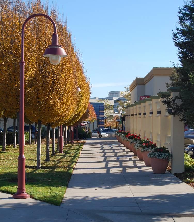
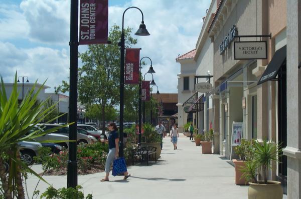
90 3 DESIGN GUIDELINES 3-22 CITY OF DUBLIN
91 DESIGN GUIDELINES Green Building This Specific Plan is intended to promote green building concepts to improve the health, welfare and public safety by encouraging innovative and sustainable design and construction techniques through the use of green building practices, which reduce negative environmental impacts and promote positive environmental impacts. The cumulative efforts of the General Plan, Specific Plan and Green Building Ordinance create a high quality of life for existing residents, future residents and visitors to the City of Dublin based on the following principles. Comfortable Communities Residents should feel comfortable and safe in their homes and neighborhoods. Pedestrian-friendly elements such as dedicated pedestrian and bicycle trails, detached sidewalks, neighborhoods that include high connectivity between other neighborhoods and commercial destinations create an environment that promotes walking and bicycling as a healthy alternative to driving. Additionally, design elements such as traffic calming measures, social areas and well-lit public spaces contribute to an inviting community with increased neighborhood connectivity, social engagement and increased physical activity. Material Conservation Prior to the popularization of green building, conventional construction techniques were typically wasteful with much of the unused material ending up in landfills. Consistent with CalGreen, all developments within the Specific Plan area shall divert at least 50 percent (by weight) of all construction waste from landfills to recycling facilities by either providing on-site bins or by using an independent third-party. Higher diversion rates should be encouraged. Energy Efficiency Improved energy efficiency is paramount to any green home, and comes in many forms. Examples are: Premium insulation for exterior walls and hot-water plumbing Energy Star appliances and lighting Framing techniques such as extended eaves and deciduous trees on the south and west walls Passive cooling by installing whole house fans Small-scale wind turbines Solar water heating and photovoltaic systems Resource Conservation As green building becomes more common, manufacturers are providing a broader variety of building products that are partially or wholly made from recycled material; engineered lumber and composite siding are widely-used examples of resource conservation. In addition to construction materials, water is a resource that can be conserved by using simple plumbing devices that reduce water flow and irrigation systems that reduce water waste. Health Inefficient cooling and heating systems can lead to poor indoor air quality, which contributes to poor health. Green building encourages efficient heating, ventilation and air conditioning (HVAC) installation and operation as well as increased filtration to reducing particulates from the air. Proper wet-room (bathrooms, kitchens, etc.) ventilation and material selection also reduces the potential for moisture build up, which creates an environment for mold to thrive. DUBLIN CROSSING SPECIFIC PLAN 3-23
92 3 DESIGN GUIDELINES Home Owner Education As home buyers become more aware of the green features in their homes, they also need to be educated on the best way to use them. Home builders shall advertise the benefits of green construction and living and provide buyers a manual of green features and how to maintain them Residential Design Guidelines The design intent for the residential neighborhoods of Dublin Crossing is derived from traditional place-making and neighborhood design principles. The resulting neighborhoods and homes will create high quality street scenes and a pedestrian friendly atmosphere. In addition, implementation of the residential design guidelines will promote sustainable designs that contribute to resource conservation, minimize greenhouse gases, and encourage healthy lifestyles. These Residential Design Guidelines should be referenced in conjunction with the General Design Guidelines described above Guiding Principles Residential buildings in the Specific Plan area shall be designed to: Relate to the regional context. Create a walkable, mixed-density community. Provide a broad mix of neighborhood and housing types. Provide both common and private open space areas that meet the needs of residents. Create unique and interesting neighborhoods. Promote social interaction. Provide neighborhood focal points and gathering places. Maximize connection to adjacent neighborhoods and commercial uses. Promote connectivity via a multi-modal circulation network including walking and bicycling CITY OF DUBLIN


93 DESIGN GUIDELINES 3 Utilize durable and sustainable building materials and construction practices that conserve resources and minimize waste. DUBLIN CROSSING SPECIFIC PLAN 3-25


94 3 DESIGN GUIDELINES Architectural Consistency in the Specific Plan area The backbone streetscape design for the Specific Plan area will define the public right of way and will provide a unifying link between neighborhoods and public spaces. Individual single family subdivisions shall be designed to be complementary to one another while still creating neighborhoods with unique design characteristics. While it may be suitable to have a craftsman single family house next to a contemporary single family house in the same neighborhood, the scale of multifamily development and design amplifies design disparities. Design of multi-family residential projects shall be compatible with and among each other. The palette of materials and colors identified in the Residential Design Guidelines can be used with different architectural styles while maintaining continuity between development projects. Multi-family residential along Dublin Boulevard shall incorporate contemporary architectural elements to ensure compatibility with existing housing at the Dublin/Pleasanton BART Station (which is provided for in the Dublin Transit Center General Plan/Specific Plan Amendment Transit-Oriented Design Guidelines and Standards, 2003). Single-family or multi-family residential buildings fronting Scarlett Drive shall have more traditional architectural elements to ensure compatibility with existing apartments and attached units across the street CITY OF DUBLIN

95 DESIGN GUIDELINES Building Placement and Orientation Buildings should be designed so that living spaces and areas of high activity are oriented towards the street. Architectural details and interactive architecture including porches, courtyards, entries, windows, and second story balconies are emphasized. Multi-family residential buildings fronting Dublin Boulevard shall have a front door presence onto the street and any quasi-public aspects of the development (i.e., leasing office, exercise room, community meeting areas) shall be oriented toward Dublin Boulevard and the intersections of A Street, B Street, D Street, and E Street. Appropriate acoustical measures shall be part of the project design. Front yard setbacks should be varied or staggered within each block through use of building design and/or building placement. Single-story elements (e.g., porches) are strongly encouraged on corner lots or on lots adjacent to parks and common open space areas. For single-family homes, also consider the following: A range of dwelling unit sizes, floor plans, and elevations should be provided. When plotting the same floor plan immediately adjacent to and/or across the street from one another, a different elevation style should be used. Exterior color schemes shall be varied for adjacent units with the same elevation style. No more than 40% of the units in a project can be of the same house/plan. Garages should be plotted next to garages and living space next to living space to undulate the street pattern and improve opportunities for onstreet parking. DUBLIN CROSSING SPECIFIC PLAN 3-27

96 3 DESIGN GUIDELINES For multi-family homes, also consider the following: When multiple buildings are provided, buildings should be used to define common areas and walkways. Buildings should be sited close to the street and parking areas should be located behind or to the side of buildings so that buildings - not parking - are the primary focus of the streetscape. Parking may be located in front of buildings provided it is screened with berms, landscaping, landscaped and/or decorative walls, or other features compatible with the overall design concept. Buildings should be plotted to provide a front door presence along public street frontages, common areas, and walkways to increase surveillance of these areas. Appropriate acoustical measures shall be part of the project design. The visibility of garage doors along streets should be minimized by providing garage access from rear alleys. Parking should be provided in close proximity to the unit it is intended to serve. Pedestrian linkages should be provided throughout the site to promote walkability and easy access to parking areas, service areas, and common amenities CITY OF DUBLIN

97 DESIGN GUIDELINES Visible Rear and Side Elevations Building mass shall be varied to minimize the visual impact of similar building silhouettes and similar ridge heights by using a variety of front-to-rear, side-to-side, gabled and hipped roofs, and/or by the introduction of a one-story element. Additional architectural features such as trim, grids on windows, or shutters are strongly encouraged and shall be designed in a manner that is appropriate to the architectural style and character of the building. Additional articulation, where visible, is encouraged, including eyebrow roofs, pot shelves, patio covers, bay windows, and similar features. Buildings along alleys shall be designed with architectural enhancements to eliminate a stark utility feel and to create visual interest for residents. DUBLIN CROSSING SPECIFIC PLAN 3-29


98 3 DESIGN GUIDELINES Building Projections and Architectural Features Building projections are strongly encouraged to add depth for the building façade, break up large wall masses, and provide visual interest. Building projections shall be appropriate for the style and character of the building. Building projections may include porches, stoops, balconies, decks, front courtyards, articulated entries, trellises, bay windows, roof overhangs, and similar features that reflect the architectural style and character of the building. As long as visual sightlines at corners are maintained, masonry walls that are 3.5 feet in height or less and that have a finish material to match the architectural style may be used within front setbacks for front courtyards. The size and scale of columns and posts should be varied and shall reflect the architectural style and character of the building. Whether freestanding or used as a support, columns and posts shall be designed to convey a solid, durable image. If the ground floor is elevated above the grade of the sidewalk, stoops should be provided to access ground floor units. The shape, design, and color of awnings shall be carefully designed to coordinate with, and not dominate, the architectural style of the building. Where multiple awnings are used, on the building, the design and color of the sign awnings shall be consistent CITY OF DUBLIN


99 DESIGN GUIDELINES Garages, Alleys, and Detached Structures Attached and freestanding ancillary structures shall be designed with compatible styles, colors, and materials to the primary building. Alleys and motor courts are encouraged to minimize the impact of garage doors on the street scene. Garages may be attached or detached to match the conditions of the site and provide variety between floor plans. Garages shall be recessed into the wall plane to provide shadowed relief. Multi-paneled roll-up style garage doors are encouraged. Garage door styles shall be consistent with the architectural style of the building. Special paving treatments for driveways and/or shared vehicle spaces should be used to create visual interest. Garage door window inserts are encouraged to allow natural light into the garage. For street-facing garages, garage placement shall be varied to create non-repetitive and interesting streetscapes. The following are examples of encouraged varied garage locations: Flush Garage: The garage plane is in line with the living space of the home. A porch, courtyard or second story projection extends forward of the wall plane. Recessed Garage: The garage plane is setback behind the front living space wall plane. DUBLIN CROSSING SPECIFIC PLAN 3-31


100 3 DESIGN GUIDELINES Deep-Recessed Garage: The garage plane is setback behind the front living space wall plane CITY OF DUBLIN


101 DESIGN GUIDELINES 3 Additional element such as porte-cocheres, trellises, and gates are strongly encouraged to vary and enhance garage appearance. The number of garages that face the street shall be limited so that no more than one two-vehicle garage or two one-vehicle garages per home is provided. Single car garage doors are encouraged to provide variety. Garage door patterns and colors should be varied between units. The architectural style, articulation, relief, and detailing for detached garages, alley loaded garages, and secondary units shall reflect the equivalent features on the main structure. Alleys and motor courts should be treated as public spaces and include landscaping, garage door detailing, and other design features similar to those found on street facing elevations. DUBLIN CROSSING SPECIFIC PLAN 3-33

102 3 DESIGN GUIDELINES Neighborhood Circulation Circulation patterns, lot layouts, open space and common area locations, building placement and orientation, paving materials, and landscaping shall be used to provide a hierarchy of physical and visual neighborhood organizational elements while establishing continuity. Meaningful, walkable destinations and pedestrian nodes shall be created within neighborhoods to redefine the role of the street as a pedestrian social space. Direct pedestrian connections should be provided to minimize walking distances to key locations including parks, the school, commercial and mixed-use areas, and transit stops, including the Dublin/Pleasanton BART station and bus stops. Neighborhood entries and gateways shall be established through use of special street sections, landscaping, signage, monuments, and/or building placement, and designed to help identify individual neighborhoods within the Specific Plan area CITY OF DUBLIN


103 DESIGN GUIDELINES 3 DUBLIN CROSSING SPECIFIC PLAN 3-35
104 3 DESIGN GUIDELINES 3.3. Residential Architectural Styles Residential architecture within Dublin Crossing is intended to include a variety of complementary architectural styles selected from the following palette: Contemporary Craftsman European Cottage Mediterranean Monterey Spanish Eclectic Tuscan Other styles that may be deemed appropriate for the community On the following pages, each architectural style is defined by elements that are typical characteristics of that style. Suggested elements are those that help to further define the character of each style and are meant as elective by a homebuilder. These added suggested elements are encouraged only. These style elements apply only to front and publicly visible side and rear elevations. The photographs are intended to illustrate some of the typical characteristics of each style and are not intended as inflexible requirement or standards CITY OF DUBLIN

105 DESIGN GUIDELINES Contemporary Influenced by the modern movement of the 1950s to 1970s, the Contemporary style is characterized by clean, simple lines and box-like massing. Contemporary roof forms typically consist of parapets or shallow pitched roof forms. This style lends itself well to multi-family and mixed-use buildings. Exterior finishes for contemporary buildings are predominantly stucco with brick or stone accents or color blocking applied to help define massing and variation of wall planes. Windows are rectangular in shape and simple in design. Widows are often grouped or divided to enhance vertical or horizontal massing. Industrial or modern style shades or awnings are often added to provide articulation. Decorative detailing is minimal to maintain a sleek modern appearance and rustic elements are avoided. Refer to Table 3-1: Contemporary Style Criteria. DUBLIN CROSSING SPECIFIC PLAN 3-37

106 3 DESIGN GUIDELINES Table 3-1: Contemporary Style Criteria Elements Characteristics Design Elements to be Incorporated Roofs Parapet or shallow-pitched roof No exposed tiles or shingles Walls Light to medium stucco finish Stone Veneer siding on portions of the front elevation when appropriate Courtyard wall Windows Rectangular shaped windows No window mullions Details Contemporary doors and surrounds for entry, gateway and garage Contemporary balcony railings and hardware Rustic-style details should be avoided Modern shade devices Substantial gateway and entry feature 3-38 CITY OF DUBLIN

107 DESIGN GUIDELINES Craftsman Influenced by the English Arts and Crafts movement of the late 19th century and stylized by California architects such as Bernard Maybeck in Berkeley and the Greene brothers in Pasadena, the Craftsman style stresses the importance of insuring that all exterior and interior elements receive both tasteful and artful attention. Originating in California, Craftsman architecture relies on the simple house tradition, combining hip and gable roof forms with wide, livable porches and broad overhanging eaves. Extensive built-in elements define this style, treating details such as windows and porches as if they were furniture. The horizontal nature is emphasized by exposed rafter tails and knee braces below broad overhanging eaves and rustictextured building materials. The overall effect was the creation of a natural, warm and livable home of artful and expressive character. Divergences in expression of Craftsman designs were obvious between Northern and Southern California and slight changes in elements can still lend homes completely different characters. Substantial, tapered porch columns with stone piers lend a Greene character while simpler double posts on square brick piers and larger knee braces make a Craftsman distinctly more Maybeck. Refer to Table 3-2: Craftsman Style Criteria. DUBLIN CROSSING SPECIFIC PLAN 3-39

108 3 DESIGN GUIDELINES Table 3-2: Craftsman Style Criteria Elements Characteristics Design Elements to be Incorporated Roofs Main gable roof 3.5:12 to 4:12 roof pitch 12 to 18 overhangs at rakes Flat concrete tile or composition asphalt shingles within a minimum warranty of 40 years Shaped outlookers Exposed rafter tails Intersecting gable element Walls Stucco: coarse sand finish (16/20 finish) Lap or shingle siding with stucco accents Windows Grid patterned upper half at front and visible windows Trim around front and visible windows No shutters Details Entry porches with heavy, square or tapered columns or posts on piers Lap or shingle siding Stone accents, particularly at porch piers Knee braces at outlookers Garage door with Craftsman style windows 3-40 CITY OF DUBLIN

109 DESIGN GUIDELINES European Cottage European Cottage is a picturesque style that evolved out of the medieval Tudor and Norman domestic architecture. The resulting English and French inspired cottage" became extremely popular nationwide after the adoption of stone and brick veneer techniques in the 1920 s and 1930 s. The overall shapes and forms contain endless variation of one and two story asymmetrical facades. Some of the most recognizable features of this style are the stucco, wood or halftimber accents in the gable end and the sculptured swooping wall at the front elevation. Refer to Table 3-3: European Cottage Style Criteria. DUBLIN CROSSING SPECIFIC PLAN 3-41

110 3 DESIGN GUIDELINES Table 3-3: European Cottage Style Criteria Elements Characteristics Design Elements to be Incorporated Roofs Main hip or gable roof with at least one intersecting forward gable or hip roof 5.12 to 12:12 roof pitch except min. 3.5:12 at 1-story roofs Tight to 6-inch overhangs at rakes 6 to 12 overhangs at eaves Flat concrete tile or composition shingles Distinctive roof over entry Gable treatment including siding, attic vent, or half-timber, etc. Walls Stucco: coarse sand finish (16/20 finish) Stone accents on front elevation Windows Grid patterned at front and visible windows Trim around front and visible windows Plank shutters at accent windows Bay windows Recessed windows Wood shelves at window sills Details Covered entry Front porch with wood-like or stucco columns Braces at wood-like columns Round top arch at entry Wood or wrought iron balconies 3-42 CITY OF DUBLIN

111 DESIGN GUIDELINES Mediterranean In the 1860s Mediterranean, or the Italian Villa, was one of the fashionable architectural styles in the United States based on the formal and symmetrical palaces of the Italian Renaissance. Mediterranean homes are straightforward and boxy, with only window crowns and cornice moldings as ornamentation. This old world prototype was refined, adapted and embellished into a truly eclectic classic style. The shallow pitched hipped roof often with decorative brackets identities this style. As it became a popular building material, cast iron expanded the Italian style vocabulary to include a variety of embellished design for porches, balconies, railing and fences. Refer to Table 3-4: Mediterranean Style Criteria. DUBLIN CROSSING SPECIFIC PLAN 3-43
 Stucco: fine sand finish (30/30 finish) Windows Grid patterned at")
112 3 DESIGN GUIDELINES Table 3-4: Mediterranean Style Criteria Elements Characteristics Design Elements to be Incorporated Roofs Main hip roof with hip ancillary roofs31/2:12 to 5:12 roof pitch 12 to 18 overhangs at eaves S concrete tile Closed/shaped eave with clay tile 1 story shed Walls Stucco: coarse sand finish (16/20 finish) Stucco: fine sand finish (30/30 finish) Windows Grid patterned at front and visible windows Trim around front and visible windows Paneled or louvered shutters on accent windows Round arch top accent windows Symmetrically ordered and stacked windows and openings Recessed windows Decorative shutter hardware Details Formal entry with surrounds Metal balconies and pot shelves Simulated precast window surrounds Simulated precast columns at entry or between windows Base trim Belt course Decorative metal elements Arched doorways Plank or carriage style garage doors 3-44 CITY OF DUBLIN

113 DESIGN GUIDELINES Monterey Influenced by both the Spanish Colonial and New England Colonial homes, historical Monterey features Spanish detailing while maintaining the Colonial style form. With its stucco or masonry walls, S or flat concrete shake roofs, this style exhibits many of the same elements as an historical Spanish home: simple building form and mass, rusticated corbels, head trim, posts and balconies (if used), and gable roof forms. Interpretations of this style maintain a simple elegance. Later prototypes added many refinements and colonial details that are familiar in the Spanish styles. Though usually thought to be fully adorned with porches, second floor balconies and verandas, many successful, historical adaptations of this style avoided these details and focused simply on careful massing, detail, and the natural beauty inspired through its blend of rich Spanish and Colonial heritage. Refer to Table 3-5: Monterey Style Criteria. DUBLIN CROSSING SPECIFIC PLAN 3-45
 Rusticated brick on first floor Slump block on first floor Sack finishes Board and batt at upper")
114 3 DESIGN GUIDELINES Table 3-5: Monterey Style Criteria Elements Characteristics Design Elements to be Incorporated Roofs 31/2:12 to 4:12 roof pitch 18 to 24 overhangs at eaves Tight to 12 overhangs at rakes Flat or S concrete tile Exposed rafter tails Walls Stucco: coarse sand finish (16/20 finish) Rusticated brick on first floor Slump block on first floor Sack finishes Board and batt at upper level Horizontal siding at upper level Windows Shutters on feature windows Vertically proportioned window configurations Details Simple columns with base trim Shaped wood corbels Head and sill trim with 1 of the following materials: Proportional stucco-wrapped, high density foam trim, medium sand stucco finish (20/30 finish); or Re-sawn wood trim; or Simulated wood trim with re-sawn wood texture. Appropriately styled door and hardware Recessed windows and shutters Windows with divided lites Decorative shutter hardware Cantilevered or supported balcony Metal balcony railing Spanish inspired lighting Complementary hardware trim Arched doors Plans or carriage style garage door 3-46 CITY OF DUBLIN

115 DESIGN GUIDELINES Spanish Eclectic Spanish Eclectic is an adaptation of Mission Revival enriched with additional Latin American details and elements. The style attained widespread popularity throughout the country after its use in the Panama-California Exposition of Architectural distinction is established through the use of tile roofs, smooth stucco walls, heavily textured wooden doors and highly articulated ornamental ironwork. The plans can be informally organized around a courtyard with the front elevation very simply articulated and detailed. The charm of this style lies in the directness, adaptability and contrast of materials and textures. Refer to Table 3-6: Spanish Eclectic Style Criteria. DUBLIN CROSSING SPECIFIC PLAN 3-47
 or heavier")
116 3 DESIGN GUIDELINES Table 3-6: Spanish Eclectic Style Criteria Elements Characteristics Design Elements to be Incorporated Roofs Main gable roof (front to back) 31/2:12 to 5:12 roof pitch Tight to 12 overhangs at rakes 8 to 12 overhangs at eaves Low profile S concrete or clay tile Cross gable at front Shaped, stucco eaves or rafter tails Walls Stucco: coarse sand finish (16/20 finish) or heavier Windows Trim around front and visible windows Grid patterned Arched windows at front elevation Plank shutters on accent windows Recessed windows Details Decorative gable treatment Front porch with wood-like or stucco columns Corbels at wood-like columns Decorative metal grille work, pot shelf, balcony railing, etc. Round top arched openings 3-48 CITY OF DUBLIN

117 DESIGN GUIDELINES Tuscan The Tuscan style draws its inspiration from the informality of the rural farmhouse and settlement building types of traditional villages in Tuscany, including their traditional square towers. Built by their owners with the indigenous materials and colors of the surroundings, these buildings blend into the natural environment. With landscape seen as an extension of the indoor living space, courtyards and gardens were common features of these country villas. The style is characterized by a low-pitched irregular roof line, which may be punctuated by a tower or campanile. The exterior walls tend to be stucco with stone or adobe accents often at the front entry. Refer to Table 3-7: Tuscan Style Criteria. DUBLIN CROSSING SPECIFIC PLAN 3-49
 Stone or adobe block accent at front elevation Windows Grid patterned at front and")
118 3 DESIGN GUIDELINES Table 3-7: Tuscan Style Criteria Elements Characteristics Design Elements to be Incorporated Roofs Main hip roof with gable ancillary roofs 31/2:12 to 5:12 roof pitch Tight 12 overhangs at rakes Tight 18 overhangs at eaves S concrete tile Walls Stucco: coarse sand finish (16/20 finish) Stone or adobe block accent at front elevation Windows Grid patterned at front and visible windows Trim around front and visible windows Paneled shutters at accent windows Secondary shed or gable roofs over 1-story element Shaped Rafter tails Clay tile Large expanses of stone or brick veneer from base of wall to roof overhang are required Precast or simulated pre-cast window trim Recessed windows Decorative shutter hardware Details Decorative metal elements Arch or flat soffit arch above entry Tower elements Covered entry Plank or carriage style garage door 3-50 CITY OF DUBLIN


119 DESIGN GUIDELINES Commercial and Mixed-Use Design Guidelines Commercial and mixed-use use developments within the Specific Plan area should be constructed with a compatible and harmonious quality and style that sets the tone for the overall community. Appropriate site planning and architectural design creates friendly and welcoming commercial destinations to continue the vision established in the residential community, including integrating pedestrianfriendly design. These Commercial and Mixed-Use Design Guidelines should be referenced in conjunction with the General Design Guidelines described above Guiding Principles General Commercial and mixed-use development in the Specific Plan area shall be designed to: Express the highest level of design quality and integrity with variety in design expression. Establish commercial, retail, and mixed-use buildings as the cornerstone of the community. Continue the vision of a walkable, pedestrian friendly community by enhancing the pedestrian experience. Maximize the visibility and exposure of retail buildings and facades to attract patrons and ensure long-term viability. Create inviting places and spaces to shop, eat, and play. De-emphasize parking as much as possible. DUBLIN CROSSING SPECIFIC PLAN 3-51


120 3 DESIGN GUIDELINES Mixed-Use Design Mixed-use provides for the integration of commercial and residential uses. Commercial and residential mixed-uses can take the form of vertical mixed-use, horizontal mixed-use, or a combination of both. Vertical mixed-use is characterized as residential above the base commercial either attached or detached. Horizontal mixed-use is characterized by residential use adjacent to the base commercial either attached or detached and designed and developed as a single, integrated project. Building configurations in mixed-use development generally portray a vertical/urban character with limited or no setbacks, strong pedestrian scaled frontages, distinctive entries, and an opportunity to de-emphasize parking. There is a focus on the pubic street scene and public space, pedestrian scaled courtyards and plazas. Distinctive architectural design and detailing further enhance the quality of the street scene. Examples of potential mixed-use products include live-work and shopkeeper units. Live-work units accommodate residential as the primary use with work space for home occupations at the lower level. The unit is organized vertically. Shopkeeper units provide separate living and working spaces, again organized vertically. Mixed-use commercial buildings typically consist of retail or office space on the ground floor and office or residential space on the upper floors and/or residential directly adjacent to or in close proximity to the commercial use. Commercial mixed-use also include a strong pedestrian relationship to the street and distinctive architectural design CITY OF DUBLIN


121 DESIGN GUIDELINES Building Orientation Commercial spaces should be oriented for maximum visibility from public streets to attract potential customers and support long-term viability. Buildings shall be located directly adjacent to public sidewalks and plazas to define the street edge, internal walkways, and other pedestrian spaces, while ensuring safe and adequate visibility at vehicle driveways for pedestrians on sidewalk. Windows and entries shall face toward the street or other public space to encourage pedestrian activity. Walkways and landscaping shall be designed along storefronts without direct street frontage to create a street scene where there is no street. Massing elements (such as tower features) are strongly encouraged to anchor corners. DUBLIN CROSSING SPECIFIC PLAN 3-53
 Transparent storefront windows should account for approximately 50 percent of the facade length for each business.")

122 3 DESIGN GUIDELINES Special Uses and Conditions Small-scale Retail Establishments (less than 5,000 sf.) Transparent storefront windows should account for approximately 50 percent of the facade length for each business. Seating, plazas, landscaping, and other design elements should be provided to serve as gathering areas and to add to the pedestrian experience. Restaurants Location and design should create or take advantage of gathering areas throughout commercial and mixed-use areas. Outdoor seating areas with tables, chairs, umbrellas, potted plants, trellises and other design features are strongly encouraged. Outdoor seating areas shall be located and designed to be publicly visible. Franchise or chain restaurants shall be designed to reflect the overall architectural style and character of the building or commercial area. Standardized architecture (e.g., franchise or chain architecture) shall only be permitted if the architectural style and design meet the requirements of the Commercial Guidelines contained herein CITY OF DUBLIN


123 DESIGN GUIDELINES 3 Drive-through and Drive-up Uses The design of drive-up or drive-through facilities, whether attached or freestanding, shall reflect the architectural style and character of the building or commercial area, including colors, materials, and architectural design elements. The location and orientation of such facilities shall not detract from the building aesthetic, but shall be located to minimize view from sidewalks, walkways, common areas, and other public views. Sufficient aisle lengths shall be provided to prevent interference with street traffic and onsite circulation routes. Outdoor ordering systems shall be located to direct sound away from residential uses and common areas, or other minimize noise impacts to these uses. Entertainment Uses Uses, including theaters, nightclubs, bars, billiard halls, bowling alleys, and other similar uses shall utilize a high degree of architectural expression to reflect their function. Architectural designs should attract and draw attention. Building entrances shall be emphasized with architectural forms, special materials, distinctive lighting, signage, or other elements that dramatize the use. Entertainment uses shall be separated from residential and other uses that may conflict with the higher levels of light, noise, and pedestrian traffic. DUBLIN CROSSING SPECIFIC PLAN 3-55
124 3 DESIGN GUIDELINES Convenience Stores Shall be located along major streets for easy vehicular access and to minimize impacts to residential uses within the Specific Plan area. When located on a corner, access from adjacent sites or side streets is encouraged to ease congestion along major streets. Freestanding buildings shall be designed with complementary architectural style and character of adjacent commercial uses. Subdued colors and materials are required to promote a harmonious appearance with the surrounding area. Bright accent colors used to express corporate logos shall be used on a limited basis and shall not be internally illuminated except as permitted for a sign. Landscaping, low walls, or berms shall be provided along sidewalks, walkways, and common areas to provide screening. If used, screening walls shall be constructed of noncombustible materials (no wood fences) consistent with the colors and materials of the primary building. Landscaping shall be incorporated into the design of screening walls. Driveways along Dublin Boulevard are prohibited. Instead, developments along the Dublin Boulevard frontage shall provide vehicular access from streets within the Specific Plan area. Dublin Boulevard Frontage The Dublin Boulevard frontage is a critical element of Dublin Crossing due to its regional visibility and the importance of this major east-west arterial throughout the City. Development along Dublin Boulevard shall have a strong street presence with windows, outdoor gathering spaces, and other articulated building features and elements facing the street CITY OF DUBLIN
 to visually screen the wall and to add to the overall aesthetic.")
125 DESIGN GUIDELINES 3 Arnold Road Frontage Access to residential development along Arnold Road shall be from side streets within Dublin Crossing and development along this frontage shall include a perimeter wall with a landscaped buffer. The landscape buffer shall include a variety of plantings (trees, shrubs, and groundcover) to visually screen the wall and to add to the overall aesthetic. Commercial development may front onto Arnold Road and may include driveway access onto Arnold Road. If parking is provided along the street frontage, a minimum 20-foot landscaped buffer shall be provided to visually screen parking areas and to add to the overall aesthetic. Iron Horse Regional Trail Frontage Buildings along the Iron Horse Regional Trail frontage shall be oriented toward the trail, with windows, porches, seating/dining areas, and entries fronting the trail. Walls along the trail are strongly discouraged; however, where walls are provided, they shall include landscaping to visually screen the wall and paths leading to wall openings (which may include gates) should be provided to increase pedestrian connectivity to and activity along the trail. Fences that do not exceed 40 inches in height are allowed along the frontage. Driveways shall not be constructed across the trail unless necessary for fire access or other public safety requirement. Units along the Iron Horse Regional Trail frontage shall be served by internal streets and driveways accessed from G Street or other streets within the Specific Plan area. DUBLIN CROSSING SPECIFIC PLAN 3-57


126 3 DESIGN GUIDELINES 3.5. Crime Prevention Through Environmental Design Dublin Crossing is envisioned as a safe, attractive, and welcoming community. A major effort to ensure public safety revolves around the concept of defensible space, which encourages residents to assert a psychological and/or physical span of spatial control to reduce the opportunity for unlawful activity. The concept of defensible space is applicable to community and site planning, as well as to building design Physical Planning Crime prevention is an important consideration in the physical planning process. Conditions for public safety and public safety can be enhanced and property loss reduced by utilizing site design techniques to deter criminal activity. Carefully planned development can serve to minimize the opportunity of unlawful activity, and thus lower the actual occurrence of crime. The key is to establish design criteria that will affect community control by members of the community. Improving the observational capability of residents to visually survey their residential environment through design considerations is aimed at reducing the workload of law enforcement agencies and enhancing community orientation. Public safety can be enhanced through the application of design considerations that contribute to the reduction in opportunities for crime, fear and negative perceptions CITY OF DUBLIN

127 DESIGN GUIDELINES Ability for Surveillance Open spaces, courtyards, circulation corridors, and individual unit entrances should be designed to be as visible from as many units as possible. Patios, porches, decks, balconies, seating/dining areas, and other outdoors spaces which permit casual observation of streets, alleys, the paseo, and parking areas are encouraged. All site entrances should be visible from a public street, alley, or a paseo, and be well illuminated. Natural surveillance ( eyes on the street ) is strongly encouraged by promoting features that maximize the visibility of people, parking, and building entrances. Windows and entries should be placed to maximize natural surveillance of the site. Sight lines from dwelling units to the parking area should be provided. Common spaces should be located in a central, visible location and common indoor spaces should have windows to encourage natural surveillance between indoor and outdoor areas. DUBLIN CROSSING SPECIFIC PLAN 3-59

128 3 DESIGN GUIDELINES Hierarchy of Space A clear separation between public and private spaces shall be delineated with paving, building materials, grade separations or landscaping. The concept of territorial reinforcement is encouraged by promoting features such as landscaping, paving designs, and gateway treatments that define property lines and distinguish private space from public space. The concept of natural access control is strongly encouraged by designing streets, walkways, building entrances, and development entries to clearly indicate public routes and to discourage access to private areas. Development design should define territory for public space (streets), community space (common open spaces, seating/dining areas, etc.), and private space (individual units and private open spaces.) The use of design elements to define the public/private edge, such as special paving, change in building materials, and grade separations, or physical barriers such as landscaping, fences, walls, screens, or building enclosures, are encouraged. Building entrances and individual unit entries shall be accentuated by architectural elements, lighting, and/or landscaping to further emphasize their private nature Nighttime Illumination Lighting shall be sufficient for sidewalk, paseo, trail, and street illumination. Pedestrian-scale lighting fixtures that provide sufficient levels of illumination are required. Addresses shall be clearly visible from the street and illuminated at night CITY OF DUBLIN


129 DESIGN GUIDELINES Traffic Calming Traffic calming features should be integrated into the design of streets. On-street parking, bulb-outs, medians, landscaping, speed humps or speed tables, and other traffic calming measures contribute to safety by slowing traffic and discouraging cutthrough traffic Access Doors to common facilities should contain some transparency and be access-controlled. Courtyard gates and shared building entrances that access individual units should automatically lock when closed. All front doors in individual dwelling units should have a peephole or other feature to allow residents to see who is at the door before opening it. Single cylinder dead bolt locks shall be installed on the exterior doors of all individual dwelling units. Sliding glass doors should have one permanent door on the outside and the inside moving door should have a locking device and a pin. DUBLIN CROSSING SPECIFIC PLAN 3-61
130 3 DESIGN GUIDELINES 3.6. Mobility and Parking Circulation and Parking This Specific Plan is designated for active streetscapes, which are pedestrian in scale and accommodate multiple modes of travel. Residents, employees, students and visitors, of all ages and abilities, will be able to live, work, learn and play, with little need for automobiles. People coming to the Specific Plan area may come on foot, bike, transit, and other modes. For those who drive, these guidelines promote an environment of park once and walk, as opposed to parking multiple times. A variety of special intersection and parking design features are identified in Chapter 4: Circulation and Streetscape Design. programs, and other Transportation Demand Management strategies reduce the need for automobiles. Development in the Specific Plan area shall be designed to help create a safe and comfortable environment for pedestrians, vehicles and multiple transit modes through the following methods: Providing a clear and discernible vehicular circulation pattern that provides access to convenient parking areas. Combining parallel parking, angled parking, and standard parking throughout commercial areas to create variety and interest and help define various public spaces. Reducing off-street parking requirements with proper Transportation Demand Management strategies when appropriate to take advantage of transit oriented mixed-use and alternate transportation opportunities. Considering additional reductions of off-street parking requirements when options such as employee transit passes, sheltered bicycle parking, car share/van pool 3-62 CITY OF DUBLIN


131 DESIGN GUIDELINES 3 Providing active and on-going management of shared parking where uses have different peak parking demands. Encouraging time limits and parking permit programs to encourage turnover near commercial uses and reduce the amount of on-street parking for transit. Permitting angled parking on private streets or on-site areas to increase the number of spaces provided. DUBLIN CROSSING SPECIFIC PLAN 3-63


132 3 DESIGN GUIDELINES Vehicle Driveways and Curb Cuts Curb cuts are breaks or openings in the curb for the purpose of allowing vehicular access between streets and developed areas. A safe, walkable, and enjoyable pedestrian environment should be enhanced by minimizing curb cuts, which damage walkability and potential building density. Access to private property should be through a minimum number of strategically placed drive isles or alleys opposed to multiple curb cuts for individual uses. The number of driveways should be limited. Shared use driveways are strongly encouraged to provide sufficient vehicular access while minimizing impacts to the pedestrian and bicycle realms CITY OF DUBLIN

133 DESIGN GUIDELINES 3 DUBLIN CROSSING SPECIFIC PLAN 3-65

134 3 DESIGN GUIDELINES Surface Parking Parking lots shall be screened from streets with berms, landscaping, walls, and/or other features compatible with the overall design concept. Parking should be located at the rear of the principal building with access from cross streets and drive isles. For primary entries to larger commercial centers that consist of more than one building, provide an entry sequence for all vehicular circulation routes that generally consists of the following elements: A primary entry identified with enhanced landscaping, enhanced paving, and a community themed monument wall sign or other major street frontage monument. A drive connection to an arrival feature that is bound by an enhanced landscaped area and has minimal direct vehicular conflicts. An arrival feature located adjacent to the primary building entry such as a central courtyard or paseo area, a pedestrian drop off zone, a roundabout with public art or any other focal point feature. A people gathering space located adjacent to or near the arrival feature, spatially defined by building mass to the extent possible and large enough to function as a sitting area or usable plaza/open space. Locate large parking areas behind or to the side of buildings and disperse parking throughout the site and in various locations to break-up large parking fields. Parking may be located in front of buildings provided it is screened with berms, landscaping, walls, or other features compatible with the overall design concept. Measures to manage and appropriately maintain stormwater are required within surface parking lots, such as bioswales, permeable surfaces, and provision of landscaping. Large shade tree species that have limited impacts to sidewalk/walkway/trail uplift are strongly encouraged to shade to vehicles, screen views of parking from adjacent uses and streets, and reduce the heat island effect CITY OF DUBLIN
 on the major fronting rights-ofway.")
135 DESIGN GUIDELINES 3 Structured Parking Structured parking is encouraged to preserve land, minimize environmental impacts, and maintain and contribute to the integrity and safety of the pedestrian streetscape. All parking structures should contain street level active uses (e.g., retail) on the major fronting rights-ofway. Structured parking facades shall contain architectural elements with appropriate proportions and materials to harmonize with the streetscape and nearby buildings. Building provisions for loading should be located behind the principal structure and should be buffered and screened from public spaces and sensitive receptors such as residential uses, parks, and schools. DUBLIN CROSSING SPECIFIC PLAN 3-67
136 3 DESIGN GUIDELINES 3-68 CITY OF DUBLIN

137 DESIGN GUIDELINES Pedestrian Circulation Pedestrian access, public spaces, and buildings shall be designed to accommodate people of all ages and abilities through consultation with appropriate city staff and the Americans with Disabilities Act. Walkways should be provided along natural paths of travel to connect between buildings, sidewalks, parking areas, and common areas. Trellises, landscaping, sitting areas, and building orientation should enhance the pedestrian experience and encourage pedestrian activity. Pedestrian walkways are encouraged within parking lot medians to provide a safe pedestrian path. All pedestrian activity areas shall have adequate lighting. Paving and landscaping should distinguish and unify walkways, common spaces, and other activity areas. Shaded courtyards, plazas, arcades, and paseos are encouraged within, between, or around buildings. DUBLIN CROSSING SPECIFIC PLAN 3-69


138 3 DESIGN GUIDELINES Gathering spaces should be located where high levels of pedestrian activity are anticipated, such as adjacent to major entrances and near uses that allow for more interactivity with the space, including delis, cafes, restaurants, bakeries, theaters, and other food and entertainment services. Strong pedestrian connections between commercial and residential areas are strongly encouraged to enhance pedestrian connectivity and support 24- hour activity. Pedestrian crossing areas shall be enhanced with striping, paving, bollards, bulb-outs, or other design features that notify drivers of potential pedestrian activities. When parking is provided behind buildings, pedestrian plazas or walkways shall connect to rear parking areas. The design of pedestrian connections, public spaces, and buildings shall accommodate people of all ages and abilities through consultation with appropriate city staff and the Americans with Disabilities Act. Well designed and human-scaled pedestrian corridors and spaces that create meaningful gather spaces and allow for increased connectivity are strongly encouraged CITY OF DUBLIN
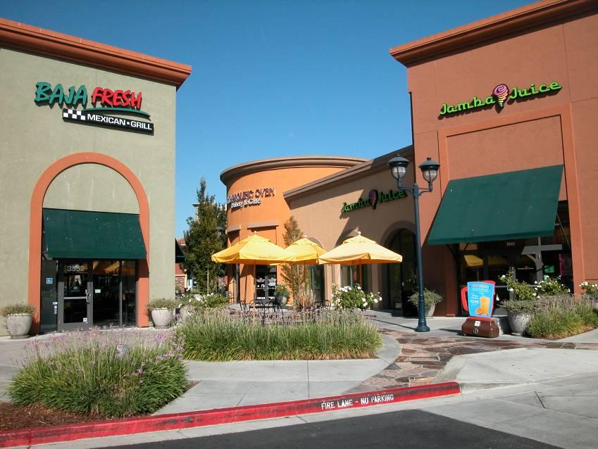
139 DESIGN GUIDELINES 3 DUBLIN CROSSING SPECIFIC PLAN 3-71
 or within a designated area of a parking lot.")

140 3 DESIGN GUIDELINES Bicycle Facilities Bicycle racks and storage lockers are encouraged on all properties that permit commercial uses or publiclyowned facilities (i.e. parks). Bicycle racks should be placed between the sidewalk and building entrance (adjacent to a pedestrian walkway) or within a designated area of a parking lot. Bicycle storage lockers are required for larger commercial uses for longer term and more secure bicycle storage. Bicycle lockers should be fitted with electronic lockers to allow multiple users and enhanced turn over. Bicycle racks shall be placed in visible locations to discourage theft. Bicycle racks and storage lockers shall be tamper resistant and anchored to the ground. Adequate spacing shall be provided between multiple bicycle racks to ensure that bicycles can be easily placed and removed from the racks. In general, a two feet clearance should be maintained around bicycle racks to allow users to access and secure bicycles from the sides. Showers, changing rooms, and other amenities for bicyclists are encouraged for non-residential uses. Residential areas are assumed to have appropriate facilities within each unit CITY OF DUBLIN


141 DESIGN GUIDELINES Trails, Paseos, Plazas, and Integrated Walkways As many building facades as possible should open onto alleys, arcades, plazas, and other open spaces, interconnecting all uses with the public sidewalk and public trail system, where present. An interconnection of active, safe, and pleasurable walkways supports mixed usages. Connections should be identified through alleys, trails, paseos, walkways, courtyards, plazas and traditional sidewalks that help to create a pedestrian network linking all Specific Plan uses and amenities. Enhanced paving, roundabouts, bulb-outs or other design features should be included at intersections where pedestrian and vehicular activities interact to clearly signify the mixing of these activities and encourage slower vehicular travel speeds. Creative design solutions should be provided for vibrant alleys, trails, paseos, and walkways that are active, safe, engaging, and help stimulate public interaction and business activity. DUBLIN CROSSING SPECIFIC PLAN 3-73
142 3 DESIGN GUIDELINES 3.7. Signage For purposes of this Specific Plan, the existing City of Dublin Sign Ordinance, (Municipal Code Chapter 8.84: Sign Regulations) shall apply. However, specific building signage design guidelines have been provided to augment these regulations. In the event of conflict between the City ordinance and the following guidelines, the guidelines shall prevail General Signage Guidelines Signs should be oriented to the pedestrian, even if also designed for vehicles. Lettering styles shall be proportioned, simple, and easy to read. No portion of the sign (including support materials) shall project above the cornice, parapet, or roof eave unless it is integral to the building architecture, such as a uniquely designed theater marquee. Signs shall not cover windows, architectural elements, or architectural details. Businesses in alleys, courtyards, or plazas should be identified from the street. Signs shall be durable, weatherproof, well-designed, and act as unique expressions of the business or building. Mounting hardware shall be an attractive and integral part of the sign design, or be hidden behind the sign. Street numbers shall be prominently displayed at the main entrance to every business and be clearly visible from the street, drive isles, or alleys. Signs may use symbols, characters, or graphics that relate to the product sold or to the name of the business. In general, three dimensional signs are encouraged. In addition to the sign requirements in the zoning ordinance, a master sign program shall be required for buildings with more than three tenants or sites with more than one building (excluding accessary structures). This program should ensure that each tenant sign has an appropriate and compatible size, location, shape, orientation, and scale. The number of signs should be in proportion to the length of the property. All signs on a property shall share common design elements, such as: Materials Size Shape Lighting technique Placement Alignment Method of attachment 3-74 CITY OF DUBLIN


143 DESIGN GUIDELINES Sign Material and Color Sign materials shall complement the overall architectural character of buildings on the property and be constructed out of high quality materials, such as acrylic, aluminum, and weather resistant wood and composite materials. Sign materials shall be durable, weatherproof, and treated or painted so that they will not discolor, rust, fade, crack, or corrode. Sign materials shall make a positive contribution to the legibility of the sign. Glossy finishes that cause glare and reflections are discouraged. Sign colors shall complement the colors of adjacent buildings on the site. The color of the sign frame and letters should generally contrast the background of the sign or wall to maximize legibility. Light letters on a dark background or dark letters on a light background are most legible. The color scheme should be limited to fewer colors to maintain visual balance. Colors or color combinations that interfere with legibility of the sign copy or that interfere with viewer identification of other signs shall be avoided. DUBLIN CROSSING SPECIFIC PLAN 3-75


144 3 DESIGN GUIDELINES Sign Lighting Unless otherwise noted, appropriate types of illumination include: External lighting that is directed on the sign face or provided from an on- or off-site light pole. Backlighting of individually mounted letters and sign symbols. Internal illumination of box signs that illuminate just the letters, logos, or symbols of the sign, but not the sign background. Internally illuminated box signs that illuminate the entire sign (letters, symbols, logos, and background) are discouraged. Sign lighting level shall not overpower the facade or nearby signs. The light source shall be angled toward the sign and should be shielded from pedestrian view. LED or other low energy use lighting sources shall be used for sign lighting Temporary Signs All temporary signs shall conform to the size and display period standards as required in the City of Dublin Municipal Code. Signs designed or intended for temporary use shall not be displayed on a permanent basis. Temporary signs should not interfere with permanent signs and should retain similar color schemes and style as existing signs. Materials shall be sturdy and able to withstand rain, wind, and sun for the duration of use. Temporary window signs should not take over more than 25 percent of the window space CITY OF DUBLIN

 of awnings, but may be placed on any face of marquees.")
145 DESIGN GUIDELINES Appropriate Sign Types Awning/Marquee Signs Awning/marquee signs are signs that are printed on, painted on, or otherwise attached to an awning or marquee above an entry or window. These signs are generally used along building facades that are adjacent to a sidewalk or walkway. Signs shall only be placed on the front face (the skirt or valance) of awnings, but may be placed on any face of marquees. Lettering should not exceed 8 inches in height and symbols or logos should not exceed 12 inches in height. The overall width of the sign (text, symbols, and logos) shall not exceed 80 percent of the awning or marquee width. If illuminated, signs shall be externally illuminated and directed at the sign, not the entire awning or marquee. Marquees on theaters and other unique uses may be internally illuminated. Replaceable valences are encouraged to avoid the need to replace awnings or paint out previous tenant signs when a new tenant moves in. DUBLIN CROSSING SPECIFIC PLAN 3-77


146 3 DESIGN GUIDELINES Directional and Wayfinding Signs Directional signs are small freestanding signs that provide direction to pedestrians and vehicles entering or navigating through the site. Directional signs are strongly encouraged along internal driveways and pedestrian walkways, and when a site has multiple businesses, buildings, or functions. Directional signage is encouraged when the site has multiple businesses or functions (e.g., to direct service trucks to loading/unloading areas and customers to appropriate parking areas). Directional signage shall be simple and include a simple directional arrow and the name of the area, business, or the user to be alerted. Directional signs shall have a similar design and theme as all of the signs on the site. However, these signs should be smaller in terms of scale and height related to other types of freestanding or monument signs. Directional signs shall be illuminated by external lighting fixtures or with internal lighting that only illuminates text and arrows. All traffic and pedestrian signs shall be approved by the City Engineer CITY OF DUBLIN


147 DESIGN GUIDELINES 3 Wall Signs Wall signs are vehicle- and pedestrian-oriented signs that are mounted flat on the facade of a building. Wall signs shall not project more than 12 inches from the facade and should not exceed 24 inches in height. If multiple wall signs are used along a facade, the cumulative width of signs should not exceed 50 percent of the facade width. Building facades shall be designed with specific areas dedicated for wall signs. The location, placement, and size of walls signs should create a consistent pattern of signs on the facade. In general, wall signs should be placed above the building entrances and below the roofline. Wall signs shall not be placed in random locations along a facade nor should they be placed over building details, cornices, molding, windows, or other prominent building features. Wall signs should be positioned within architectural features such as the panels above storefronts, on the transom, or flanking doorways. Wall signs may be illuminated by external lighting fixtures, with back-lighting behind individually cut letters and symbols, or by internally illuminating individually cut sign letters and symbols. Internally illuminated box or can signs are strongly discouraged. Instead, internally illuminated signs (where appropriate) should be individually cut around lettering and symbols. DUBLIN CROSSING SPECIFIC PLAN 3-79
148 3 DESIGN GUIDELINES Monument Signs Monument signs are signs that are located within the front setback (generally between the sidewalk and building) and are attached to a freestanding structure supported by one or more uprights, braces, columns, poles, or other similar structural components placed on or into the ground. Internal illumination is prohibited on monument signs. Illumination from external lighting fixtures or backlighting behind individually mounded letters and symbols is encouraged. Monument signs near vehicular entrances should be oriented perpendicular to the street. No more than one sign is allowed per vehicular entrance. If the vehicular entrance is for more than one business, multiple businesses may be identified on one sign. Monument signs shall not cause line-of-sight issues with driveways or intersections. Monument signs should be located at least 10 feet from driveway entrances. Monument signs should be rectilinear in form and scaled for use by pedestrians and drivers. In general, horizontal monument signs up to 3.5 feet in height are preferred; however, narrower vertical signs may be appropriate up to 8 feet in height for major entries and multi-tenant commercial centers. Landscaping, especially evergreen and flowering plants, is strongly encouraged around the base of the monument sign to highlight and define the base while screening support structures. Landscaping provided should equal at least twice the sign face surface area. Monument signs shall be constructed of high-quality, durable materials. Materials, finished, and colors should complement the architectural style and character of the buildings and other onsite signs CITY OF DUBLIN


149 DESIGN GUIDELINES 3 Plaque Signs Plaque signs are signs that are attached to flat against a building facade, generally at the eye level of pedestrians, and are often used to identify individual businesses or unit, to provide a directory of multiple businesses or units, or to display menus. Plaque signs should not exceed a surface area of 6 square feet and should not project more than 2 inches from the wall face. Only one individual business or unit sign should be provided for each business or unit. Directory signs should be located near common building entrances. Only one directory sign should be provided on a facade. Menu displays are strongly encouraged for restaurants and should generally be located near entrances. Plaque signs shall be illuminated by external lighting fixtures. Menu displays may include internal illumination. DUBLIN CROSSING SPECIFIC PLAN 3-81


 shall be maintained over sidewalks, walkways, and common areas.")
150 3 DESIGN GUIDELINES Projecting Signs Projecting signs are double-sided signs that project perpendicular to the building facade and hang from a mounted wall brace on the facade or from a roof overhang, such as an arcade. Projecting signs are primarily oriented towards pedestrians. Wall-mounted projecting signs shall not extend more than 3 feet from the facade. Signs hanging from a roof overhang should generally be centered with the overhang. The total sign area should not exceed 10 square feet. A minimum vertical clearance of 8 feet (as measured from the bottom of the lowest part of the sign to the adjacent ground surface) shall be maintained over sidewalks, walkways, and common areas. Projecting signs should generally be located near entrances, below second floor windows. No portion of the sign should extend above the roof line. Only one projecting sign should be allowed per tenant. Projecting signs shall be illuminated by external lighting fixtures CITY OF DUBLIN


151 DESIGN GUIDELINES 3 Window Signs Window signs are those signs located within a window/storefront of a business and are oriented toward the adjacent sidewalk or walkway. Window signs shall not occupy more than 25 percent of the window. Permanent window signs should be created with permanent, fade-resistant paint, decals, gold-leaf, or etching. Window signs may also hang on the inside of the window. Mounting hardware and equipment should be concealed. The location, size, and shape of window signs should add to a storefront display, not detract from views into the business. Window signs may be illuminated from external light sources or from lighting within the storefront. Internally illuminated window signs should be limited to open signs. DUBLIN CROSSING SPECIFIC PLAN 3-83
152 3 DESIGN GUIDELINES 3.8. Public Facilities Public Buildings and Community Facilities Public and community use buildings serve as landmarks for the community. Regardless of whether they are privately or publicly owned, these buildings are intended for the use and enjoyment of the community and must therefore be treated as a public amenity. Building designs should reflect the facility s function while at the same time supporting the intended vision for Dublin Crossing by incorporating design features that promote sustainability and public enjoyment. Such facilities may consist of a single building or a group of buildings on one site. Since the intended use of the building(s) will drive the spatial and functional requirements of the building, these design guidelines must remain flexible to ensure that the needs of the intended use(s) are adequately addressed within the design. Furthermore, some uses may be subject to specific design requirements required by the state and other regulatory agencies. Such requirements shall take precedent over the requirements of the Specific Plan and the design regulation and guidelines contained herein. Design building facades to include variety and spontaneity to activate the pedestrian experience. Establish building entries and common areas, not parking, as the primary emphasis of the public street elevation for public buildings. Anticipate and accommodate pedestrian and vehicle circulation in building and site designs to reduce traffic impacts on neighboring streets and jointly optimize pedestrian and vehicular circulation. Use building mass and differentiation of roof forms, materials, color, and apparent floor heights to reduce building bulk and create variety within the building façade. Enhance architecture on all four sides conveys high quality design. Provide connections between indoor and outdoor spaces in building and site design. Define street corners and primary building entries with massing and architectural elements. The following guidelines should be considered in the design of all institutional buildings, in addition to the general design guidelines provided above. Guiding Principles Guiding principles for public buildings and community facilities include the following: Design primary buildings to act as key, thematic icons for the surrounding community. Include design elements, building form, and site designs that reflect the intended use of the building(s) CITY OF DUBLIN

153 DESIGN GUIDELINES 3 DUBLIN CROSSING SPECIFIC PLAN 3-85

154 3 DESIGN GUIDELINES Site Planning and Building Placement Since public buildings act as icons in a community, building placement is an important consideration. Such uses also require special consideration due to the associated traffic and noise. Arrange buildings to create a variety of outdoor spaces including courtyards, plazas, squares, eating areas, arcades, and/or usable open spaces. Orient buildings toward streets, pedestrian pathways and/or active spaces. Include architectural treatments, structures, and/or landscape features that shelter pedestrian walkways, such as arbors or pergolas, where appropriate. Design pedestrian and vehicular circulation routes that are intuitive, well-defined, and easily discernible for appropriate and functional maneuverability and activity levels. Use balconies, shade structures, one story projections, and other architectural elements to create interest and articulate volume. Develop a special relationship between buildings and pedestrians by designing ground story facades at human scale through one or more of the following methods: Breaking facades into bays and smaller forms. Bringing signage down to a pedestrian level to reduce scale. Introducing arcades, courtyards, and other outdoor spaces. Utilizing massing elements to emphasize primary building entries and street corners. Building Mass and Form Community use buildings and facilities tend to be larger in scale and therefore massing is of particular concern. The following guidelines address methods to reduce the apparent mass of large buildings. Avoid long, unbroken faces that exceed approximately 30 feet in length. Use offsets and massing articulation to reflect the organization of the floor plan. Vary building depths to provide interesting massing. When appropriate to the use, provide one story elements at the ends of two-story buildings to soften building mass CITY OF DUBLIN

155 DESIGN GUIDELINES 3 DUBLIN CROSSING SPECIFIC PLAN 3-87


156 3 DESIGN GUIDELINES Roof Forms Change roof pitches and eave heights by using offsets in the plan. Avoid continuous, unbroken roof lines. In general, keep roof pitch slopes relatively shallow to minimize visual massing of buildings while remaining true to the selected architectural style. Combine flat roofs with sloped roofs. The entire roof shall not be flat. When appropriate to style and function, provide broad overhangs in response to climactic conditions, particularly at openings, porch enclosures, balconies, and window recesses. When building forms are visible from adjacent residential neighborhoods, provide full roof solutions to the greatest extent feasible. Design roofs for functionality while enhancing or complementing the overall architectural design of the building. Integrate form, materials, fascia and/or cornice elements into the overall design vocabulary. When used, create contiguous parapets and incorporate them into side/rear elevation returns. Use roof forms to screen mechanical equipment whenever possible. Encourage the use of cool roofs, photovoltaics, or other energy saving materials and features. features such as arbors, porte-cocheres, or architectural features. Design windows to reflect interior uses and provide views to common outdoor spaces and the public street. For schools and other uses that include multiple buildings in a campus setting, convey similar architectural character, colors, and materials on all buildings. Façade Treatments Enhance primary building or campus entries to create a sense of arrival and clearly indicate location. Clearly identify building or campus entries with welldefined primary pedestrian pathways and entry 3-88 CITY OF DUBLIN


157 DESIGN GUIDELINES 3 Parking Locate parking behind or to the side of buildings to reduce the impact of large parking areas on the public street or screen with berms, landscaping, walls, or other features compatible with the overall design concept. Design parking areas to be used as flexible outdoor spaces for farmers markets, festivals, special events, and other community events. Locate drop-off areas and provide adequate stacking for vehicle traffic to avoid creating traffic conflicts on adjacent public streets and to reduce the impact on adjacent residential and commercial uses School The school will serve as a landmark for the Specific Plan area and will express the overall importance of education and recreational spaces to the Dublin community. School designs are regulated by the State of California and Dublin Unified School District. Such requirements shall take precedent over the requirements of this Specific Plan and the design regulation and guidelines contained herein. However, it is encouraged that the school be designed in a manner that is compatible with the surrounding uses, access is provided from two public streets with careful consideration on circulation patterns for pick-up and drop-off, and opportunities for the City and School District to jointly design and utilize play/sports fields and playground areas are provided. The overall design of the school and associated facilities should be distinct and create a campus feel with similar architectural features, materials, and colors. DUBLIN CROSSING SPECIFIC PLAN 3-89
158
159 CIRCULATION AND STREETSCAPE DESIGN 4 4 CIRCULATION & STREETSCAPE DESIGN This chapter explains the circulation and streetscape design including the roadway hierarchy and proposed mobility plans for pedestrians and bicycles. DUBLIN CROSSING SPECIFIC PLAN 4-1
160 4 CIRCULATION AND STREETSCAPE DESIGN This chapter addresses a variety of circulation elements promoting multi-modal mobility, including: streets, multi-use trails and sidewalks, bikeways, pedestrian sidewalks and paths, transit, landscape buffers, gateways, points of interest, and other complete street elements. Complete streets are streets that are designed and operated to enable safe access and movement for pedestrians, bicyclists, motorists, and transit riders of all ages and abilities along and across streets. As public spaces, streets will have significant importance within Dublin Crossing. They will facilitate access to the mixture of residential, commercial and public uses within the community and provide the opportunity for physical exercise and social interaction. This Specific Plan includes a thoughtfully designed streetscape that is conducive to creating an urban community that facilitates multiple modes of travel in an inviting, safe, aesthetically-pleasing, and sustainably-focused manner. The guidelines within this chapter are drawn from and are consistent with the policies from the City of Dublin General Plan Community Design and Sustainability Element, the City of Dublin Streetscape Master Plan, the City of Dublin Bicycle and Pedestrian Master Plan, the City of Dublin Public Art Master Plan, and the City of Dublin Parks and Recreation Master Plan. Where this Specific Plan is otherwise silent or does not address a specific design issue, provisions identified in the City of Dublin Zoning Ordinance or the above-listed documents shall apply. Where there is uncertainty, the Community Development Director has the discretion to make a determination on the suitability of the policy or guideline. This chapter is organized according to the following subsections: Circulation and Streetscape Design Policies Pedestrian and Bicycle Circulation, Transit Facilities Street Network and Hierarchy Gateways and Entries Streetscape Design 4.1. Circulation and Streetscape Design Policies The following circulation and streetscape design policies will apply to the Project: Roadway Design CIR Policy 4.1 Provide a new east-west connection between Scarlett Drive and Arnold Road to provide a more direct route through the Specific Plan area for new development. CIR Policy 4.2 Ensure that fire access roadways and public streets are designed with the minimum widths required to meet the standards of the Fire Department. CIR Policy 4.3 Emphasize and enhance regional corridors, such as Dublin Boulevard, to create a positive identity and image for the City of Dublin and Dublin Crossing. CIR Policy 4.4 Design well connected streets that provide safe and convenient access for residents and that discourage cutthrough vehicular traffic and high speeds. CIR Policy 4.5 Utilize sustainable design principles found in the Community Design and Sustainability and Circulation Elements of the General Plan in the design of Specific Plan streets and associated circulation improvements. CIR Policy 4.6 The City/Developer/School District shall coordinate on the design and installation of all streets fronting the elementary school site to ensure suitable locations for student drop-off and pick-up and a safe vehicular and pedestrian interface. 4-2 CITY OF DUBLIN
161 CIRCULATION AND STREETSCAPE DESIGN Traffic Calming CIR Policy 4.7 Provide traffic calming measures at strategic locations within the Specific Plan area to maintain intended design speed. CIR Policy 4.8 Design pedestrian and bicycle circulation routes for high visibility at vehicular interfaces Pedestrian and Bicycle Circulation CIR Policy 4.9 Establish an interconnected network of sidewalks and bicycle lanes, and multi-use paths that provide safe and convenient pedestrian and bicycle access between the East Dublin/Pleasanton BART Station, Iron Horse Trail, Scarlett Drive, Arnold Drive, and destinations within the Specific Plan area. CIR Policy 4.10 Establish public rights-of-way or easements through the new neighborhoods, as necessary, to ensure that public parks and the Iron Horse Regional Trail are accessible to the general public. CIR Policy 4.11 Work with the East Bay Regional Park District on the concept and final design of the Iron Horse Regional Trail realignment along Scarlett Drive and the potential creation of a secondary trail pathway through Central Park, if appropriate. CIP Policy 4.12 In close coordination with the East Bay Regional Park District, study the construction of an elevated Iron Horse Regional Trail bridge over Dublin Boulevard to provide safer access to the BART station for pedestrians and bicyclists and to mitigate traffic impacts the trail crossing has on traffic flow on Dublin Boulevard. CIR Policy 4.13 Encourage street improvements, such as bulbouts, and other appropriate design techniques to calm traffic and assert the presence of pedestrians and bicyclists. Install bicycle stencils and bicycle-sensitive loop detectors (or other detector type) on bikeways as part of new signals, signal upgrades, and resurfacing/restriping projects. CIR Policy 4.14 Convenient and secure bicycle racks will be provided throughout the Specific Plan area, at the elementary school and parks, near transit facilities and trailheads, and within commercial and mixed-use developments. Bicycle facilities provided shall be consistent with the Bicycle and Pedestrian Master Plan. CIR Policy Prohibit gated neighborhoods, which both visually and practically restrict multi-modal access between neighborhoods. CIR Policy 4.16 Provide pedestrian and bikeways connecting the Specific Plan s parks to the Iron Horse Regional Trail. CIR Policy 4.17 Provide pedestrian connectivity between and around commercial and multi-family residential buildings with direct connections to main pedestrian paths to facilitate pedestrian circulation for residents, visitors, and commercial patrons. CIR Policy 4.18 Provide clearly defined and safe publiclyaccessible pedestrian and bikeways connecting the Specific Plan s planned school and park sites with neighborhoods throughout the Specific Plan area. CIR Policy Plan and design bicycle facilities to be consistent with the City of Dublin Bicycle and Pedestrian Master Plan. CIR Policy 4.20 Connect Specific Plan roads, bikeways and pedestrian paths with existing circulation facilities that connect to BART and local transit systems. DUBLIN CROSSING SPECIFIC PLAN 4-3
162 4 CIRCULATION AND STREETSCAPE DESIGN Public Transportation CIR Policy 4.21 In close coordination with LAVTA, provide transit bus amenities such as pullouts and transit shelters with lighting and real time arrival and departure signs on fronting arterial streets and collector streets adjacent to the Specific Plan area. financial burden to the City. No Final Small Lot Tentative Map shall be recorded until a solution has been identified and accepted by the City. CIR Policy 4.22 Residential and commercial development shall be designed to provide convenient and safe pedestrian and bicycle connections from building entrances to transit facilities Parking CIR Policy 4.23 Minimize the need for parking by allowing for methods to reduce parking demand with appropriate Transportation Demand Management (TDM) strategies for higher density residential development along Dublin Boulevard (near the BART station). TDM strategies for commercial development could include a commuter benefit program and parking cash-out programs, among many others. CIR Policy 4.24 Allow for the potential for reduced parking requirements in mixed-use areas by considering shared parking. The City Engineer can allow variations from the parking standards set forth in Chapter 2 (Land Use and Development Standards) as noted in each land use district. CIR Policy To minimize adverse impacts to residents within the Specific Plan area, prior to filing the first Final Small Lot Tentative Map in the Specific Plan area, the Developer shall coordinate with the City of Dublin to address and identify a solution that is acceptable to the City regarding overflow parking associated with the Dublin/Pleasanton BART Station. Such solution shall have no impact to the General Fund or 4-4 CITY OF DUBLIN
163 CIRCULATION AND STREETSCAPE DESIGN Pedestrian and Bicycle Circulation, Transit Facilities Pedestrian Circulation This Specific Plan emphasizes pedestrian circulation by creating convenient and safe pedestrian connections between local destinations, transit stops and regional trails. The pedestrian network will connect residential neighborhoods with parks, commercial areas, transit, and the school. Pedestrian paths, paseos, trails, and similar pedestrian connections should be provided throughout Dublin Crossing to link neighborhoods with one another. Pedestrian paths between and around commercial, mixed-use, and higher density residential developments are needed to facilitate pedestrian circulation for residents, visitors, and commercial patrons. The hierarchy of pedestrian paths serving the Specific Plan area includes the Iron Horse Regional Trail, multi-use trails, and sidewalks. Figure 4-1: Pedestrian and Bicycle Circulation Network identifies the proposed pedestrian circulation network within the Specific Plan area. Section Perimeter Roadway/Intersection Improvements provides details on specific intersection improvements. Safe Routes to Schools Safe Routes to Schools is a national program that encourages communities to make walking and bicycling to school a safe and healthy activity, from building safer street crossings to establishing programs that encourages children and their parents to walk and bicycle safely to school. This Specific Plan encourages a safe and efficient route to school for children and parents who bike or walk. DUBLIN CROSSING SPECIFIC PLAN 4-5

164 4 CIRCULATION AND STREETSCAPE DESIGN Figure 4-1: Pedestrian and Bicycle Circulation Network 4-6 CITY OF DUBLIN

165 CIRCULATION AND STREETSCAPE DESIGN Bicycle Circulation Bicycle circulation is an essential and integral part of the circulation system, which will encourage bicycle access to many employment centers, local serving retail and service uses, neighborhoods, and recreational opportunities, such as parks and the Iron Horse Regional Trail. This Specific Plan takes full advantage of public parks and rights-of-way by providing bicycle trails and access points along public streets and within parks. The proposed bicycle circulation network includes trailheads, staging areas, and parking facilities that are strategically located and designed for convenience. Chapter 3: Design Guidelines addresses bicycle amenities. Figure 4-1: Pedestrian and Bicycle Circulation Network identifies the proposed bicycle circulation network within the Specific Plan area. Section Perimeter Roadway/Intersection Improvements provides details on specific intersection improvements. The bicycle circulation facilities planned for the Specific Plan area include: Class I Bikeway (Bike or Multi-Use Path): Class I Bikeways (Bike or Multi-Use Paths) will be for the exclusive use of bicycles and pedestrians. This type of bikeway provides a completely separated right of way with cross-flow by motorists minimized. Generally, Class I Bikeways are provided to enhance bicycle access and are considered a lower stress bicycle riding facility as compared to in-street bicycle lanes. Class II Bikeway (Bike Lane): Class II Bikeways (Bike Lanes) are for bicyclists travelling adjacent to vehicle lanes within the street right of way. This type of bikeway provides a striped lane for one-way bike travel on a street. Bike lanes are provided along streets in corridors to improve bicycle access and to meet enhanced bicycle demand anticipated within Dublin Crossing. Several streets within the Specific Plan area will include multiuse paths that connect to key destinations throughout Dublin Crossing and to trails and bike lanes along streets and the Iron Horse Regional Trail. DUBLIN CROSSING SPECIFIC PLAN 4-7

 provides bus service to regional and local destinations.")
166 4 CIRCULATION AND STREETSCAPE DESIGN Public Transit Public transit plays an important role in the success of creating a transit-oriented neighborhood. This Specific Plan provides for direct access along the Iron Horse Regional Trail and B Street/Demarcus Boulevard to the Dublin/Pleasanton BART station and associated transit facilities. Transit amenities, such as bus pullouts and shelters, will be provided at bus stops within or adjacent to the Specific Plan area. The Livermore Amador Valley Transit Authority (LAVTA) provides bus service to regional and local destinations. The LAVTA was established in May 1985 when the cities of Dublin, Livermore, Pleasanton and Alameda County executed a joint powers agreement that created the independent authority. LAVTA operates under the brand name, Wheels. One of the LAVTA s bus services is called RAPID, a high-capacity transit system that operates in the Tri-Valley from East Livermore to West Pleasanton, largely along Dublin Boulevard, directly adjacent to the project site. Major destinations include: area and Contra Costa County, with connections from the Dublin/Pleasanton BART station and along Dublin Boulevard. Future Bus Stop As part of the development of this Specific Plan, at least one bus stop shall be provided along the north side of Dublin Boulevard adjacent to the Specific Plan area. The bus stop shall be constructed to the standards of LAVTA and approved by the City Engineer. Stoneridge Mall Dublin/Pleasanton BART Stations Downtown Dublin Hacienda Crossings Valley Care Medical Center (Livermore Campus) Downtown Livermore Business District Livermore High School Lawrence Livermore National Laboratories Routes also run along Dougherty Road and Arnold Road within the vicinity of the Specific Plan area. Additionally, Contra Costa County Connection provides commuter express routes (35, 36, 97X) throughout the Tri-Valley Images courtesy of Livermore Amador Valley Transit Authority (2013). 4-8 CITY OF DUBLIN


167 CIRCULATION AND STREETSCAPE DESIGN Street Network and Hierarchy Existing Street Network Dublin Boulevard, Scarlett Drive, and Arnold Road are the primary existing arterial roads that border the Specific Plan area. Other existing roadways in the vicinity include Dougherty Road, Demarcus Boulevard, and Central Parkway. The existing street system is shown in Figure 4-2: Existing Street Network. Dublin Boulevard is a major six lane east-west arterial along the southern Specific Plan area boundary. Scarlett Drive is a two-lane collector along the western Specific Plan area boundary that extends from Dougherty Road to just south of Houston Place. The right-of-way continues south to Dublin Boulevard. Arnold Road is a two-lane north-south collector along the eastern Specific Plan area boundary. There are a number of existing internal roadways that currently exist on the project site. All of these roadways will either be substantially reconfigured or removed as part of redevelopment of the project site. DUBLIN CROSSING SPECIFIC PLAN 4-9

168 4 CIRCULATION AND STREETSCAPE DESIGN Figure 4-2: Existing Street Network 4-10 CITY OF DUBLIN
169 CIRCULATION AND STREETSCAPE DESIGN Proposed Street Network As shown in Figure 4-3: Proposed Backbone Street Network, a grid pattern of different street types, each with different character and function, will serve the transportation needs of the project. The internal backbone street system is designed to establish connections to the existing exterior roadway network as well as internally between residential neighborhoods, parks, open spaces, the elementary school site, and the commercial and mixed use land use districts. With sidewalks on all streets and bikeways on many, the streets will become the framework for the pedestrian and bicycle network as they connect to uses both internally and beyond Dublin Crossing. Internal roadway classifications include Collector Streets, Residential Collectors, local streets and Private Streets, as described below and shown in cross-section. Minor modifications to these roadway cross-sections may be approved administratively by the Public Works Director to improve multimodal circulation and safety, assuming the curb-to-curb and total right-of-way widths remain constant. It should be noted that the street names below are temporary placeholder names. The final street names will be determined at a later date and recorded on the Final Tentative Maps. Collector Streets Collector Streets serve as the primary conduits for interior neighborhood traffic and provide access to and from neighborhood residential streets and perimeter streets outside of the Specific Plan area. These streets are not intended to support regional traffic, but they may provide direct access through the project site and to facilities within the Specific Plan area such as schools and parks. Collector Streets include B Street, Central Parkway, and G Street, as identified in Figure 4-3: Proposed Backbone Street Network, and are described below. B Street B Street will serve the main entrance into Dublin Crossing with access from Dublin Boulevard north to G Street. The total right-ofway will be 82 feet plus a 6-foot public services easement on each side. One travel lane in each direction will be 14 feet wide and will include 6-foot striped bike lanes. The roadway will be divided by a 16-foot wide tree-line median creating an aesthetically appealing and visually prominent entry statement. Two separated 8-foot wide sidewalks will be constructed on each side of the street, setting the tone as a community that welcomes multiple modes of transportation. The sidewalk will be separated from vehicle traffic by a five-foot wide landscaped parkway strip planted with a mix of grasses and trees which provide dual functions as stormwater biofiltration and visual amenity. Figure 4-4: Illustrative B Street Section illustrates the street section for B Street. Central Parkway Central Parkway will serve as a primary east-west roadway between B Street and Arnold Road. There are three different roadway cross-sections for the Central Parkway as described below. Central Parkway (between Arnold Road and F Street) The total right-of-way of Central Parkway in this location will be 100 feet plus a 5-foot public service/landscape easement on each side. Between Arnold Road and F Street, the street segment features a 24-foot wide landscaped median that divides the street with one 14-foot travel lane and a 6-foot bike lane in the westbound direction and two 12-foot travel lanes with a bike lane in the eastbound direction. An 8-foot wide sidewalk will be provided on each side of the street. The sidewalk will be separated from vehicular traffic by a five-foot landscaped strip that will be planted with grasses and trees and provide stormwater biofiltration. Figure 4-5: Illustrative Central Parkway (Arnold Road to F Street) Street Section illustrates the street section for Central Parkway between Arnold Road and F Street. DUBLIN CROSSING SPECIFIC PLAN 4-11
170 4 CIRCULATION AND STREETSCAPE DESIGN Figure 4-3: Proposed Backbone Street Network 4-12 CITY OF DUBLIN
171 CIRCULATION AND STREETSCAPE DESIGN 4 Figure 4-4: Illustrative B Street Section DUBLIN CROSSING SPECIFIC PLAN 4-13
 Street Section 4-14 CITY")
172 4 CIRCULATION AND STREETSCAPE DESIGN Figure 4-5: Illustrative Central Parkway (Arnold Road to F Street) Street Section 4-14 CITY OF DUBLIN
173 CIRCULATION AND STREETSCAPE DESIGN 4 Central Parkway (between F Street and D Street) The total right-of-way of Central Parkway in this location will be 80 feet plus a 5-foot public services/landscape easement on each side. Between F Street and D Street, Central Parkway will have a 12-foot two-way left turn lane dividing two 11-foot travel lanes with 6-foot bike lanes on each side. For visual and functional continuity, all other characteristics of the street including street trees and parkway planting will remain the same as Central Parkway between Arnold Road and F Street. On the north side of Central Parkway, a 10-foot multi-use path will be provided along the elementary school frontage. On the south side of Central Parkway, an 8-foot sidewalk will be provided. Figure 4-6: Illustrative Central Parkway (F Street to D Street) Street Section illustrates the street section for Central Parkway between F Street and D Street. Central Parkway (between D Street and B Street) The total right-of-way of Central Parkway in this location will be 72 feet plus a 5-foot public services/landscape easement on each side. Between D Street and B Street, Central Parkway will have a 12-foot two-way left (global change) turn lane dividing two 11-foot travel lanes with 6-foot bike lanes on each side. For visual and functional continuity, all other characteristics of the street including street trees, parkway planting, and 8-foot wide sidewalk will remain the same as Central Parkway between Arnold Road and F Street. Figure 4-7: Illustrative Central Parkway (D Street to B Street) Street Section illustrates the street section for Central Parkway between D Street and B Street. G Street G Street will serve as the primary east-west roadway through the project site, extending from Arnold Road to Scarlett Drive. There are three different roadway cross-sections for G Street as described below. G Street (between Arnold Road and F Street, and D Street and B Street) The total right-of-way of G Street in this location will be 62 feet plus a 6-foot public services/landscape easement on each side. The eastern end of G Street will serve as a minor entry at Arnold Road. The street tree pattern shall be broken here to draw attention to the school, for traffic calming, and visual interest. Two 11-foot travel lanes divided by a 12-foot dual turn lane. An 8-foot wide parking lane will be provided on the south side of the street. A 10-foot wide paved multi-use trail will be constructed along the north side of the street. The multi-use trail and will be separated from vehicular traffic by a five-foot landscaped parkway that will provide stormwater biofiltration. Figure 4-8: Illustrative G Street (Arnold Road to F Street and D Street to B Street) Street Section illustrates the street section for G Street between Arnold Road and F Street and between D Street and B Street. G Street (between F Street and D Street) The total right-of-way of G Street in this location will be 62 feet plus a 6-foot public services/landscape easement on each side and a 10-foot public access easement/public services easement on the south side of G Street adjacent to the school site. This segment of G Street will be the same as between Arnold Road and F Street and between D Street and B Street except that an 8-foot parking lane will be provided between the travel lane and the parkway, and the sidewalk provided will be 10 feet on the south side of the street. Figure 4-9: Illustrative G Street (F Street to D Street) Street Section illustrates the street section for G Street between F Street and D Street. G Street (between B Street and Scarlett Drive) The total right-of-way of G Street in this location will be 70 feet plus a 6-foot public services/landscape easement on each side. This segment of G Street will be the same as between B DUBLIN CROSSING SPECIFIC PLAN 4-15
174 4 CIRCULATION AND STREETSCAPE DESIGN Street and D Street except when adjacent to the Central Park (south side) it will include on-street parking (8 feet) along the park frontage. Figure 4-10 Illustrative G Street (B Street to Scarlett Drive) Street Section illustrates the street section for G Street between B Street and Scarlett Drive. Local Streets Local Streets will provide direct multi-modal access to neighborhoods by residents and visitors while discouraging through traffic and high speeds. Local Streets are intended to provide low-speed access between and within neighborhoods, promoting a multi-modal network with an emphasis on comfort, safety, and amenities for pedestrians and bicyclists. Figure 4-12: Illustrative D Street South Street Section illustrates the envisioned street section for D Street south of Central Parkway. F Street F Street will have a total right-of-way width of 51 feet plus a 6- foot public service/landscape easement on each side and a 10-foot public access easement/public services easement on the west side of F Street adjacent to the school site. All elements of F Street are the same as A, C, E, H, and I Streets, except that the west side of F Street will have a 10-foot multiuse trail at the school frontage instead of a 5-foot wide sidewalk. Figure 4-13: Illustrative F Street Section illustrates the envisioned street section for F Street. A, C, E, H, and I Streets The total right-of-way of these local streets will be 56 feet plus a 6-foot public services/landscape easement on each side. A, C, E, H, and I Streets will have two 10-foot wide travel lanes with 8-foot on-street parking on both sides. Five-foot wide landscaped parkways on both sides will separate pedestrians from traffic and provide pervious stormwater bioretention. Five-foot sidewalks on both sides of the street will be constructed outside of the parkways. Figure 4-11: Illustrative A, C, E, H, and I Streets Street Section illustrates the street section for A, C, E, H, and I Streets. D Street South of Central Parkway D Street south of Central Parkway will have a total right-of-way width of 61 feet plus a 6-foot public service/landscape easement on each side. D Street will include a 10-foot sidewalk on the east of the street, but all other elements of the street section will remain the same as described above for A, C, E, H, and I Streets CITY OF DUBLIN
 Street Section DUBLIN CROSSING SPECIFIC")
175 CIRCULATION AND STREETSCAPE DESIGN 4 Figure 4-6: Illustrative Central Parkway (F Street to D Street) Street Section DUBLIN CROSSING SPECIFIC PLAN 4-17
176 4 CIRCULATION AND STREETSCAPE DESIGN Figure 4-7: Illustrative Central Parkway (D Street to B Street) Street Section 4-18 CITY OF DUBLIN
177 CIRCULATION AND STREETSCAPE DESIGN 4 Figure 4-8: Illustrative G Street (Arnold Road to F Street and D Street to B Street) Street Section DUBLIN CROSSING SPECIFIC PLAN 4-19
178 4 CIRCULATION AND STREETSCAPE DESIGN Figure 4-9: Illustrative G Street (F Street to D Street) Street Section 4-20 CITY OF DUBLIN
179 CIRCULATION AND STREETSCAPE DESIGN 4 Figure 4-10: Illustrative G Street (B Street to Scarlett Drive) Street Section DUBLIN CROSSING SPECIFIC PLAN 4-21
180 4 CIRCULATION AND STREETSCAPE DESIGN Figure 4-11: Illustrative A, C, E, H, and I Streets Street Section 4-22 CITY OF DUBLIN
181 CIRCULATION AND STREETSCAPE DESIGN 4 Figure 4-12: Illustrative D Street Section DUBLIN CROSSING SPECIFIC PLAN 4-23
182 4 CIRCULATION AND STREETSCAPE DESIGN Figure 4-13: Illustrative F Street Section 4-24 CITY OF DUBLIN
183 CIRCULATION AND STREETSCAPE DESIGN 4 Private Streets Private Streets will be privately owned and maintained streets that provide access to common interest subdivisions and commercial and mixed-use developments. Parking on private streets shall be controlled by a Homeowners Association or Property Manager. Private Streets will be designed for a low volume of traffic with limited vehicular access. Private Streets will be narrower than public residential streets and may or may not include sidewalks, on-street parking, or other street features. Private Streets will consist of two 10-foot travel lanes. Parking will be either an 8-foot wide parallel lane or an 18-foot perpendicular space. Space outside of the curbed roadway will vary in its configuration but will include a five-foot landscaped parkway and sidewalk on one or both sides of the street. Figure 4-14: Private Streets Street Sections shows the recommended configurations for Private Streets within the Specific Plan area. Ultimate design may vary due to specific site constraints; however, the design will follow the recommended configurations as closely as possible. Alternatively, Private Streets may be designed to the specifications of an adjacent public street. DUBLIN CROSSING SPECIFIC PLAN 4-25
184 4 CIRCULATION AND STREETSCAPE DESIGN Figure 4-14: Private Streets Street Sections 4-26 CITY OF DUBLIN

185 CIRCULATION AND STREETSCAPE DESIGN Internal Special Roadway Improvements B Street / G Street Intersection B Street will be the primary entry street from the south and G Street will be the primary entry street from the west. B Street will terminate at G Street, creating an opportunity to turn this intersection into a focal point or terminating vista. A roundabout design may be considered at this location to facilitate vehicular travel without the need for a signalized intersection and to create a focal point, including landscaping and an art feature, in the center. coordination between the City and the School District will help ensure safety and efficiency for all users External Roadway Improvements Dublin Boulevard This Specific Plan includes improvements along the north side of Dublin Boulevard along the southern edge of the Specific Plan area boundary. The existing 12-foot Class I asphalt trail will be rebuilt as a 12 foot multi-use concrete pathway for use by pedestrians and bicyclists, as identified the City of Dublin Bicycle and Pedestrian Master Plan. A new landscaped parkway will be constructed between the roadway and the trail and include stormwater bioretention plantings and street trees. Changes within the Dublin Boulevard right of way will include improvements such as enhanced pedestrian crossings at B Street and D Street for connectivity to BART, the provision of transit stops, and the inclusion of bicycle facilities. Figure 4-15: Illustrative Dublin Boulevard Street Section illustrates the proposed improvements for Dublin Boulevard. School Drop-off Zone Schools have a morning and an evening peak, during which times students are dropped off and/or picked up. These peak periods can be dangerous times for all modes of travel. Providing a specialized drop-off area designed with Scarlett Drive Scarlett Drive is currently a two-lane roadway that extends from Dougherty Road to the north and terminates just south of Houston Place. As contemplated in the City s Traffic Improvement Program, Scarlett Drive will be extended and improved. Two travel lanes in each direction will be divided by a center median which will include low shrubs and smaller scale accent trees. The south-bound lanes will also include an 11-foot left turn lane. Six-foot bike lanes will be constructed at the curb edge in both directions. There will be limited or no onstreet parking. DUBLIN CROSSING SPECIFIC PLAN 4-27

186 4 CIRCULATION AND STREETSCAPE DESIGN The Iron Horse Regional Trail (IHRT) runs parallel to the east side of the street. The IHRT consists of a 10-foot paved path and five-foot soft shoulders on each side. In close coordination with the East Bay Regional Park District, the trail is proposed to be realigned in concert with the extension of Scarlett Drive, but the trail will maintain the same width and the same general configuration. Between Scarlett Drive and the IHRT shoulder will be a five-foot parkway, which will include stormwater bioretention plantings and street trees. Figure 4-15: Illustrative Dublin Boulevard Street Section 4-28 CITY OF DUBLIN
187 CIRCULATION AND STREETSCAPE DESIGN 4 The realignment of the IHRT will be integrated into the overall master design of the new Central Park, which could also include a secondary pathway for the trail for those who prefer to meander through Central Park. Figure 4-16: Illustrative Scarlett Drive Street Section illustrates the street section for Scarlett Drive. Arnold Road Improvements will be constructed on the west side of Arnold Road along the Specific Plan area s eastern boundary. At present, a majority of Arnold Road consists of a two-lane roadway with parking and a Class II bike lane on both sides. Arnold Road will remain in its existing condition north of Central Parkway, and will be expanded to four lanes from Central Parkway to Dublin Boulevard. The west side of Arnold Road has a drainage channel that is approximately 30 feet wide. This channel will remain open and will be enhanced with native vegetation. Central Parkway north to Horizon Parkway, the channel will be immediately adjacent to the street and there will be a 10-foot wide multi use trail on the west side of the channel adjacent to the neighborhood and a community wall or fence behind the trail. If there are commercial uses that end up developing along Arnold Road north of Central Parkway, the interface with the street and drainage channel may be re-examined and entrance drives to the commercial area could be considered. Figure 4-17: Illustrative Arnold Road Street Section illustrates a conceptual view for the frontage along Arnold Road. DUBLIN CROSSING SPECIFIC PLAN 4-29
188 4 CIRCULATION AND STREETSCAPE DESIGN Figure 4-16: Illustrative Scarlett Drive Street Section 4-30 CITY OF DUBLIN
 DUBLIN CROSSING SPECIFIC PLAN")
189 CIRCULATION AND STREETSCAPE DESIGN 4 Figure 4-17: Illustrative Arnold Road Street Section (south of Central Parkway) DUBLIN CROSSING SPECIFIC PLAN 4-31
190 4 CIRCULATION AND STREETSCAPE DESIGN Perimeter Roadway/Intersection Improvements This Specific Plan includes improvements to the following existing and proposed intersections along the Specific Plan area boundary: Dublin Boulevard and D Street Dublin Boulevard and B Street Dublin Boulevard and the Iron Horse Regional Trail at Scarlett Drive Scarlett Drive and G Street at the Iron Horse Regional Trail Arnold Road and G Street Arnold Road and Central Parkway These specific intersections are major entry points into Dublin Crossing and shall receive special treatments to enhance the entry experience and safety as it relates to crossing perimeter streets. In general, all intersections shall have (at a minimum) enhanced crosswalks along and across perimeter streets and a clear, direct path for pedestrians and bicyclists. Existing crosswalks should be enhanced as other intersection improvements are made. Dublin Boulevard As part of the development of the Specific Plan area, the following improvements would be made on Dublin Boulevard: On D Street at Dublin Boulevard, separate left-turn lane and shared through-right lane will be constructed, along with a westbound right turn lane from Dublin Boulevard to northbound D Street. Signal modifications will be implemented to accommodate the proposed north leg of the intersection. Special paving and/or striping should be provided along and across Dublin Boulevard as this intersection is a direct street connection to the Dublin/Pleasanton BART station. On B Street at Dublin Boulevard, the existing separate left-turn, right-turn, and through lanes will be reconstructed, along with construction of a westbound right-turn lane from Dublin Boulevard to northbound B Street. Signal modifications will be implemented to accommodate the proposed changes to the northleg of the intersection. Figure 4-18: Illustrative Dublin Boulevard/B Street Intersection illustrates the proposed improvements for the Dublin Boulevard / B Street and Demarcus Boulevard intersection. As B Street is the main entrance into the Specific Plan area and a direct street connection to the Dublin/Pleasanton BART station, this intersection should include special paving and/or striping for crosswalks across Dublin Boulevard and D Street. Pedestrian- and bicycle-oriented signage should be provided at these intersections to guide users into the Specific Plan area and nearby destinations (e.g. Dublin/Pleasanton BART station and Central Park). On Dublin Boulevard along the project frontage, a westbound right-turn lane/auxiliary lane will be constructed on the approach to Scarlett Drive. Across Dublin Boulevard at the Iron Horse Regional Trail / Scarlett Drive, a multi-use (pedestrian and bicycle) overcrossing to connect the Iron Horse Regional Trail segments to the north and south of Dublin Boulevard will be studied. The Developer s contribution towards a future project will be in accordance with the Project Development Agreement CITY OF DUBLIN
191 CIRCULATION AND STREETSCAPE DESIGN 4 Scarlett Drive As contemplated in the City s Traffic Improvement Program, a traffic signal will be installed and separate right- and left-turn lanes will be constructed on G Street at Scarlett Drive. A leftturn lane will be constructed from Scarlett Drive to eastbound G Street in conjunction with the extension of Scarlett Drive to Dublin Boulevard. Scarlett Drive will be widened to four lanes and extended from Houston Place south to Dublin Boulevard along the western edge of the Specific Plan area. Pedestrianand bicyclist-oriented signage should be provided to provide direction into the Specific Plan area, to the Iron Horse Regional Trail, and nearby destinations (e.g. Central Park). Pedestrian- and bicyclist-oriented signage should be provided at these intersections to guide users into the Specific Plan area and nearby destinations (e.g. Dublin/Pleasanton BART station). Arnold Road will be widened to four lanes from Dublin Boulevard to Central Parkway along the eastern edge of the Specific Plan area. Figure 4-19: Illustrative Scarlett Drive/G Street Intersection illustrates the proposed improvements for the Scarlett Drive / G Street intersection. Arnold Road As part of the development of the Specific Plan area, the following improvements would be made on Arnold Road: On G Street at Arnold Road, separate right- and leftturn lanes will be constructed, along with a northbound left-turn lane from Arnold Road to westbound G Street. A traffic signal will be constructed at the intersection of Arnold Road and G Street. Figure 4-20: Illustrative Arnold Road/G Street Intersection illustrates the proposed improvements for the Arnold Road / G Street intersection. On Central Parkway East at Arnold Road, separate left-turn lane and shared through-right lane will be constructed, along with a northbound left-turn lane from Arnold Road to westbound Central Parkway East. Signal modifications will be implemented to accommodate the proposed west-leg of the intersection. DUBLIN CROSSING SPECIFIC PLAN 4-33

192 4 CIRCULATION AND STREETSCAPE DESIGN Figure 4-18: Illustrative Dublin Boulevard/B Street Intersection B Street Dublin Boulevard 4-34 CITY OF DUBLIN

193 CIRCULATION AND STREETSCAPE DESIGN 4 Figure 4-19: Illustrative Scarlett Drive/G Street Intersection G Street Scarlett Drive DUBLIN CROSSING SPECIFIC PLAN 4-35

194 4 CIRCULATION AND STREETSCAPE DESIGN Figure 4-20: Illustrative Arnold Road/G Street Intersection G Street Arnold Road 4-36 CITY OF DUBLIN
195 CIRCULATION AND STREETSCAPE DESIGN Gateways and Entries This Specific Plan identifies design treatments for a number of key gateways and entries into Dublin Crossing. Each of these is described below Central Park Gateway Plaza A gateway plaza at the southeast corner of Central Park could create an inviting public gathering space at a visually prominent corner of Dublin Boulevard. This park frontage creates an opportunity for a strong visual civic statement at a key central location within the City. It will reflect a forwardthinking, upscale community that values a high quality of life. This entry could include a large signage treatment and significant landscaping. Seating and other street furniture (lighting, signage, waste disposal, water fountains, etc.) should be included, and the design should be integrated with the IHRT. At the direction of LAVTA and the City Engineer, a west-bound bus stop could also be included as a pull-out separate from the Dublin Boulevard travel lanes. DUBLIN CROSSING SPECIFIC PLAN 4-37

196 4 CIRCULATION AND STREETSCAPE DESIGN East Gateway Plaza An east gateway plaza located at the northwest corner of Dublin Boulevard and Arnold Road will create another public focal point along Dublin Boulevard. Together with the Central Park Gateway Plaza, this gateway will create a strong landmark for visitors travelling along Dublin Boulevard. Figure 4-21: Illustrative East Gateway Plaza identifies major elements envisioned for this gateway. The design concept includes options such as specimen trees around a central feature and contemporary trellises. Patterned paving in contrasting neutral tones will create visual interest on the ground plane. Seat walls, tables with chairs, and other potential features will provide multiple options for seating and encourage activation of the space. If the property at the corner of Arnold Road and Dublin Boulevard is developed with commercial uses, a second plaza should be incorporated between the retail buildings. This plaza could feature a smaller water element and tables with chairs with the possibly of outdoor eating areas for restaurants. Accent planting in pots and planters should be located throughout the plaza to provide color. The East Gateway Plaza will be constructed concurrent with the commercial development. At the direction of LAVTA and the City Engineer, a west-bound bus stop could also be included as a pull-out separate from the Dublin Boulevard travel lanes CITY OF DUBLIN


197 CIRCULATION AND STREETSCAPE DESIGN 4 DUBLIN CROSSING SPECIFIC PLAN 4-39

198 4 CIRCULATION AND STREETSCAPE DESIGN Figure 4-21: Illustrative East Gateway Plaza Arnold Road Dublin Boulevard 4-40 CITY OF DUBLIN

199 CIRCULATION AND STREETSCAPE DESIGN 4 DUBLIN CROSSING SPECIFIC PLAN 4-41

200 4 CIRCULATION AND STREETSCAPE DESIGN B Street Focal Entry The primary vehicular, bicycle, and pedestrian entry into Dublin Crossing will be at B Street and Dublin Boulevard. This entry shall incorporate distinctive sign monuments at both the east and west corners. These monuments will be strong wayfinding elements that serve as a welcoming beacon to the community. They will convey a contemporary design character with modern forms and materials such as stainless steel or other metals, glass, and/or acrylics such as eco-resins. Surrounding each monument will be accent planting, corner plazas, and sidewalk paving to highlight the area as the primary gateway entry. The corner plazas will feature colored accent paving such as a toned, textured concrete or pavers in neutral tones. Backdrop planting will reflect a contemporary California palette with bold colors such as flax and grasses in simple rows and geometric patterns. Figure 4-19: Illustrative Dublin Boulevard/B Street Intersection illustrates the proposed improvements for the Dublin Boulevard / B Street and Demarcus Boulevard intersection. Two 8-foot wide sidewalks along both sides of B Street and will connect to the existing Class I and II bikeways along Dublin Boulevard. Columnar European Hornbeam trees will create a dramatic effect as the street tree along B Street. In accordance with the City of Dublin Streetscape Master Plan, London Plane trees will be used along Dublin Boulevard Major Entries Major entries occur at: Central Parkway/Arnold Road; G Street/Scarlett Drive; G Street/Arnold Road; and at D Street/Dublin Boulevard. Major entries will announce arrival to Dublin Crossing with vertical monumentation, accent planting and special paving. These entry monuments will incorporate distinctive, customfabricated contemporary materials such as metals and translucent acrylic eco-resins. These entries support and complement gateway elements in design and materials and contribute to the overall placemaking. Monuments will use same design vernacular but in a smaller scale than the focal gateway entry at B Street and Dublin Boulevard Minor Entries Minor entries will occur at two other intersections, namely: 1) A Street/Dublin Boulevard; and 2) E Street/Dublin Boulevard CITY OF DUBLIN
201 CIRCULATION AND STREETSCAPE DESIGN 4 Minor entries will use design elements similar to major entries, but at a smaller scale. Envisioned elements include vertical monumentation, accent planting, and enhanced paving. The minor entry monumentation will resemble the major entries, but be more horizontal in form. These entries will identify the character of Dublin Crossing and their scale will convey circulation hierarchy, thereby acting as a form of wayfinding. DUBLIN CROSSING SPECIFIC PLAN 4-43
202 4 CIRCULATION AND STREETSCAPE DESIGN 4.5. Streetscape Design The circulation network within the Specific Plan area is a key component of the envisioned livable and walkable urban village experience. An attractive and inviting streetscape design will encourage pedestrian and bicycle travel throughout Dublin Crossing and will promote public health and social cohesion, qualities that contribute to exceptional quality of life. Streets within Dublin Crossing will be more than circulation routes; they will also serve as social spaces and aesthetic community amenities. While distinct palettes are used to distinguish among sub areas within the Specific Plan, consistency of style will be retained throughout the project, resulting in a visually interesting, yet unified aesthetic. Public street design will treat stormwater through vegetation and will maximize shade with abundant street trees, thereby minimizing the heat island effect and maximizing aesthetic appeal and pedestrian comfort. Stormwater runoff from impervious paved surfaces will be treated in bioretention areas within the 5-foot landscaped parkway along most streets. Streetscape planting, lighting, and furnishings will differentiate key corridors and reflect the circulation hierarchy, while adding to the sense of place for the Specific Plan area. Recommended landscape design for the Specific Plan area has been carefully developed to include a design that reflects the contemporary urban village character. This can be characterized by clean, contemporary design, native and climate-adapted landscape palettes. Inviting streetscapes and public spaces will encourage the use of outdoor spaces, thereby promoting social interaction, health, wellness and community vitality. Planting, hardscape, furnishings and lighting will work together to make the community legible by highlighting and distinguishing circulation networks and linkages, conveying street hierarchy and creating visually notable key nodes and destinations. Unique and identifiable landscape treatments will convey a sense of place and act as wayfinding within the community CITY OF DUBLIN


203 CIRCULATION AND STREETSCAPE DESIGN 4 DUBLIN CROSSING SPECIFIC PLAN 4-45

204 4 CIRCULATION AND STREETSCAPE DESIGN Parkway Bioretention All streets within the Specific Plan area will include a minimum 5-foot parkway between the sidewalk and roadway. These vegetated bioretention areas will treat stormwater while providing attractive landscaping, including street trees, shrubs, and grasses suitable for landscape stormwater treatment. This parkway bioretention palette identifies plants that will provide aesthetic appeal while performing stormwater management functions, including infiltration, evapotranspiration, pollutant trapping, phytoremediation and soil stabilization. In addition, the Bay Friendly Landscape Guidelines and the Regional Water Quality Control Board Species List shall be consulted to determine suitable species to incorporate. Table 4-1: Parkway Bioretention Palette identifies appropriate plantings that will be used in the parkways. Table 4-1: Parkway Bioretention Palette Scientific Name Common Name Drought Tolerant Aristida purpurea Purple Three- Awn Yes Water Use Low Bouteloua pracilis Blue Grama Yes Low Deschampsia cespitos Tufted Hairgrass Yes Low Elymus glaucus Blue Wild Rye Yes Low Iris douglasiana Douglas Iris Yes Low Juncus patens Blue Rush Yes High Leymus triticoides Creeping Wildrye Yes Low Linum usitatissimum Flax Yes Low Melica imperfecta Coast Range Melic Yes Unknown Muhlenbergia rigens Deergrass Yes Low 4-46 CITY OF DUBLIN


205 CIRCULATION AND STREETSCAPE DESIGN Street Trees Street trees play an important role in creating attractive, comfortable, and walkable streetscapes. Tree selections for the Specific Plan reflect recommendations in the City of Dublin Streetscape Master Plan. Large, broad canopy trees are specified for wider street sections and medians, while smaller canopy trees are identified for parkways to shade sidewalks for pedestrian comfort. Columnar and smaller flowering trees will be used as accents. Existing street tree palettes will be continued for streets that are extended or modified by this Specific Plan, including Dublin Boulevard, Arnold Drive, and Central Parkway. Scarlett Drive, although extended as part of this Specific Plan, was not identified in the City of Dublin Streetscape Master Plan. DUBLIN CROSSING SPECIFIC PLAN 4-47
206 4 CIRCULATION AND STREETSCAPE DESIGN Tree selections for new streets are used as identity and wayfinding elements and convey the scale of the street in the circulation hierarchy. The trees within the palette are recommendations and may be changed prior to installation due to market availability, new introductions, or adaptability to soil types and structures (as in the case of bioretention). Tree selections, once installed, shall be final and constant for consistency. Table 4-2: Street Tree Palette identifies appropriate tree plantings for streets within Dublin Crossing. F Street (Parkway) G Street (Parkway) Quercus coccinea Gleditsia triancanthos Scarlet Oak Honey Locust 30 on center 40 on center Table 4-2: Street Tree Palette Street Scientific Name Common Name Spacing Dublin Boulevard (Parkway) Platanus acerifolia London Plane Tree on center Dublin Boulevard (Median) Crataegus phaenopyrum Washington Thorn on center Pyrus calleryana Callery Pear on center Arnold Drive (West Side Parkway) Quercus virginiana Southern Live Oak 30 on center Central Parkway East (Parkway) Celtis sinensis Chinese Hackberry 20 on center Central Parkway East (Median) Celtis sinensi Chinese Hackberry 20 staggered on center A Street (Parkway) Quercus rubra Red Oak 30 on center B Street (Parkway) Carpinus betulus Fatigiata European Hornbeam 25 on center C Street (Parkway) Ulmus parvifolia Chinese Elm 30 on center D Street (Parkway) Quercus robur Fastigiata English Oak 25 on center E Street (Parkway) Quercus coccinea Scarlet Oak 30 on center 4-48 CITY OF DUBLIN


207 CIRCULATION AND STREETSCAPE DESIGN Plant Palette The plant palette of shrubs, perennials, groundcovers, vines, etc. described below in Table 4-3: Recommended General Landscaping Plant Palette, will create a visually diverse and pleasing aesthetic using plants that are well suited to the Dublin area and do not require excessive water and maintenance. This palette is not intended as an exclusive list, but as recommendations. DUBLIN CROSSING SPECIFIC PLAN 4-49
208 4 CIRCULATION AND STREETSCAPE DESIGN Table 4-3: Recommended Plant Palette Scientific Name Common Name Water Use Abelia grandiflora Glossy Abelia Moderate Arctostaphylos densiflora Howard McMinn McMinn Manzanita Low Asparagus densiflorus Asparagus Fern Moderate Callistemon Little John Dwarf Bottle Brush Low Carex pansa Dune Sedge Moderate Carex tumulicola Berkeley Sedge Moderate Ceanothus Ceanothus Low Cistus hybridus White Rockrose Low Clivia miniata NCN Moderate Coleonema pulchrum Sunset Gold Breath of Heaven Coprosma pulchrum Coprosma Low Correa pulchelia Australian Fuchsia Low Moderate Cuphea hyssopifolia False Heather Moderate Dietes vegeta Fortnight Lily Low Echeveria Echeveria Low Elymus glauca Blue Wild Grass Low Erigeron karvinskianus Fleabane Moderate Euonymus fortunei Euonymus Moderate Feijoa sellowiana Pineapple Guava Low Festuca californica California Fescue Low Festuca idahoensis Low Fremontodenron Flannel Bush Very Low Hebe Hebe Moderate Helictotrichon sempervirens Blue Oat Grass Moderate Hemerocallis Evergreen Daylily Moderate Scientific Name Common Name Water Use Heuchera Coral Bells Moderate Iris douglasiana Douglas Iris Moderate Juncus patens Grey Rush Moderate Kniphofia Red-Hot Poker Low Lantana Lantana Low Leymus sp. Lyme Grass Low Liriope muscari Lily Turf Moderate Liriope Sunproof Lirope Moderate Myrsine africana African Boxwood Low Myrtus communis Dwarf Myrtle Low Nandina domestica Heavenly Bamboo Moderate Pennisetum alopecuriodes Fountain Grass Low Penstemon Sour Grapes Beard Tongue Moderate Phormium tenax New Zealand Flax Moderate Pittosporum tobira Tobira Moderate Prunus laurocerasus English laurel Moderate Rhamnus californica Coffeeberry Low Rhaphiolepis indica Indian Hawthorn Moderate Ribes viburnifolium Catalina Currant Low Rosa ci sp Climbing Rose Moderate Rosa sp Landscape Rose Moderate Rosa Pink Carpet Carpet Rose Moderate Salvia Sage Low Salvia leucantha Mexican Bush Sage Low Teucrium fruticans Germander Low Trachelospermum jasminoides Star Jasmine Moderate Tulbagia violacea Society Garlic Moderate 4-50 CITY OF DUBLIN

209 CIRCULATION AND STREETSCAPE DESIGN 4 Scientific Name Common Name Water Use Arctostaphylos Emerald Carpet Manzanita Low Cotoneaster Lowfast Lowfast Cotoneaster Moderate Campanula portenschiagiana Dalmation Bellflower Moderate Frageria chinensis Wild Strawberry Moderate Lobularia maritima Sweet Allysum Unknown Myoporum Myoporum Low Oenothera berlandieri Mexican Evening Primrose Low Osteospermum fruticosum African Daisy Low Trachelospermum jasminoides Star Jasmine Moderate Verbena Verbena Low Dictis buccinatoria Blood Red Trumpet Vine Moderate Jasminum polyanthum Jasmine Moderate Streetscape Furnishings Streetscape furnishings within Dublin Crossing public spaces (i.e., streets, plazas, paseos, parks, open space areas, etc.) will incorporate clean, contemporary, high quality design. These include benches, waste receptacles, bicycle racks, bollards, signage, etc. Furnishings will be commercial grade, constructed of durable materials and detailed for efficient maintenance practices. Neighborhoods and uses within the Specific Plan area may be distinguished by unique furnishing styles consistent for those areas. The adjoining images represent examples of possible streetscape furnishings that are encouraged throughout the Specific Plan area. The specific street furniture palette will be determined in the Landscape Master Plan, which will be developed as an implementation measure of the Specific Plan. However, furnishings selected will maintain the contemporary aesthetic illustrated herein. DUBLIN CROSSING SPECIFIC PLAN 4-51


210 4 CIRCULATION AND STREETSCAPE DESIGN 4-52 CITY OF DUBLIN

211 CIRCULATION AND STREETSCAPE DESIGN Lighting Consistent with streetscape furnishings, lighting within Dublin Crossing will express the envisioned contemporary aesthetic with simple clean lines and durable materials. Lighting design will help differentiate between land uses, highlight public and pedestrian-scaled spaces, provide continuity and aesthetic appeal along corridors, and ensure pedestrian and vehicular safety. Lighting along key pedestrian and bicycle corridors such as the Iron Horse Regional Trail along the project frontage should be provided. Lighting will include high efficiency technologies (LED), dark-sky cutoffs, will not trespass onto adjacent properties, and will be shielded or recessed to minimize glare and reflections. Streetlevel, pedestrian-level, and bollard light design shall be identified in the project-wide Landscape Master Plan and Infrastructure Master Plan that is to be developed as an implementation measure of the Specific Plan. Consistent lighting fixtures shall be used in the public right-of-way throughout the project area and should carry over into the commercial areas as well. Public street lighting will meet City of Dublin s standards; however, alternative street light designs may be allowed, subject to approval by the Community Development Director. Chapter 3: Design Guidelines addresses guidelines for building and site lighting. DUBLIN CROSSING SPECIFIC PLAN 4-53
212
213 INFRASTRUCTURE AND PUBLIC SERVICES 5 5 INFRASTRUCTURE & PUBLIC SERVICES This chapter describes the plan for infrastructure and utility needs (e.g., water, sewer, recycled water, etc.) and public services for the Specific Plan area. DUBLIN CROSSING SPECIFIC PLAN 5-1

214 5 INFRASTRUCTURE AND PUBLIC SERVICES This Specific Plan provides for a variety of land uses, each of which will be served by existing or future utilities infrastructure within and around the Specific Plan area. Future development within the Specific Plan area will require removal and relocation of existing public utilities, new public utility connections, and the extension of existing infrastructure within and into the Specific Plan area. shown in Figure 5-1: Dublin San Ramon Service District Service Area. Figure 5-1: Dublin San Ramon Service District Service Area This chapter describes the infrastructure improvements needed to facilitate orderly development of the Specific Plan area and to and ensure adequate capacity for future uses. The infrastructure required to support overall Specific Plan uses is referred to as the backbone infrastructure. The following sections describe existing facilities, identify public infrastructure needs of Specific Plan uses, and establish the framework for necessary expansion of sanitary sewer, potable and recycled water, stormwater drainage and detention, water quality, and dry utilities (electrical, natural gas, and telecommunications) infrastructure systems. This chapter also addresses impacts to public services (fire protection, law enforcement, schools, library, postal service, and solid waste management) Sanitary Sewer The Dublin San Ramon Services District (DSRSD) owns and operates the existing sewer system within Camp Parks, including the Specific Plan area. DSRSD also provides sewer collection facilities in the streets adjacent to Camp Parks, including Scarlett Drive, Dublin Boulevard and Arnold Road. These sewer collection facilities convey wastewater to the southwest for treatment at the Regional Wastewater Treatment Plant (RWTP) in Pleasanton, which is owned and operated by DSRSD. DSRSD also provides wastewater treatment services under contract to the Cities of Pleasanton and San Ramon, as 5-2 CITY OF DUBLIN
215 INFRASTRUCTURE AND PUBLIC SERVICES 5 The RWTP has a treatment capacity of 17 million gallons per day (MGD) average dry weather flow, with an 11.5 MGD annual daily average. The current use permit allows for treatment up to 20.2 MGD, which includes 3.2 MGD of Zone 7 brine rejects flow. In the future, DSRSD anticipates a 3.7 MGD expansion to accommodate build-out of the service area between 2030 and Several existing sanitary sewer mains convey wastewater through the Specific Plan area from areas adjacent to, and north of, the Specific Plan area. These sewer mains likely need to be rerouted through the Specific Plan area as required to accommodate phased development as identified in Figure 5-2: Conceptual Sanitary Sewer System. Wastewater generated from the Specific Plan area will be collected and conveyed through a conventional gravity system of pipes located within the new backbone rights-of-way, which will ultimately connect to existing DSRSD sewer conveyance facilities surrounding the Specific Plan area. According to DSRSD, the existing major sewer infrastructure on Dublin Boulevard is adequately sized to serve development of the Specific Plan area. As the project applicant moves forward with phasing, the applicant shall ensure that sanitary sewer service to existing customers is maintained. The project applicant is responsible for installing the sanitary sewer system in the Specific Plan area in accordance with the results of the DSRSD wastewater service analysis for the project. The wastewater service analysis will ensure that the sanitary sewer system network in the Specific Plan area is sized adequately to serve existing flows and the projected, added sewer service demands for the Specific Plan area Potable Water The Dublin San Ramon Services District (DSRSD) owns and operates the potable water system within the boundaries of Camp Parks, including the Specific Plan area. DSRSD also maintains potable water facilities in the streets adjacent to Camp Parks, including Dougherty Road, Scarlett Drive, Dublin Blvd. and Arnold Road. Zone 7 of the Alameda County Flood Control and Water Conservation District (Zone 7) is the sole provider of treated potable water to DSRSD. Zone 7 maintains water distribution facilities adjacent to the Specific Plan area within Dougherty Road, Scarlett Drive, and Dublin Blvd. DSRSD connects to Zone 7 potable water mains at two turnouts: one near Dougherty Road and Scarlett Drive and the other near Arnold Road and the Interstate 580. DSRSD is the purveyor of potable water to the Specific Plan area and surrounding developments. DSRSD owns and maintains the distribution and storage infrastructure required to provide potable, irrigation, and fire water service. The 2010 DSRSD Urban Water Management Plan (UWMP) accounts for development of 1,996 residential units, 440,000 square feet of retail and general office development, 52,000 square feet of public/semi-public uses, 43 acres of parks, and 5 acres of elementary school within the Specific Plan area. DSRSD will be conducting a project specific SB 610 water supply analysis and SB 220 verification of water supply to determine if there is sufficient water supply to serve the proposed development in the Specific Plan area. The Specific Plan area is within DSRSD pressure Zone 1, which includes water storage and pressure from existing reservoirs (water tanks) adjacent to the Specific Plan area. Reservoir 1B, located northwest of the Specific Plan area on Amador Valley Road, is the sole source of storage and pressure for the Specific Plan area. DSRSD Reservoir 10A, located northeast of the Specific Plan area within Camp Parks, is an old Camp Parks water tank that was previously not operational; however, it is currently operational. The 2005 DSRSD Water Master Plan provides for the construction of a new Reservoir 1C adjacent to Reservoir 1B and rehabilitation or upsizing of Reservoir 10A to serve continued development within Zone 1. DUBLIN CROSSING SPECIFIC PLAN 5-3
216 5 INFRASTRUCTURE AND PUBLIC SERVICES Several existing water mains traverse the Specific Plan area, providing service to existing buildings and a looped water system for Camp Parks and adjacent areas. As the project applicant moves forward with project phasing, the applicant shall ensure that reliable water service to existing customers is maintained through a looped system, as approved by DSRSD (see Figure 5-3: Conceptual Potable Water System). The project applicant is responsible for installing the potable water system in the project area in accordance with results of the DSRSD potable service analysis for the project. The analysis will ensure that the potable water system network in the project area is sized adequately to serve existing demands and projected water demands for the Specific Plan area. 5-4 CITY OF DUBLIN
217 INFRASTRUCTURE AND PUBLIC SERVICES 5 Figure 5-2: Conceptual Sanitary Sewer System DUBLIN CROSSING SPECIFIC PLAN 5-5
218 5 INFRASTRUCTURE AND PUBLIC SERVICES Figure 5-3: Conceptual Potable Water System 5-6 CITY OF DUBLIN
219 INFRASTRUCTURE AND PUBLIC SERVICES Recycled Water The Dublin San Ramon Services District (DSRSD) produces and distributes recycled water for landscape irrigation in the City of Dublin as part of its Potable Water Conservation and Water Recycling Program. Except for certain isolated locations, as may be identified by DSRSD upon individual review, all new irrigation systems serving parks, streetscapes, commercial areas, and common area landscaping for multi-family within the potable water service area of DSRSD are required to use recycled water for irrigation. Per DRSD District Code, Section , connection to recycled water is required to obtain water service from DSRSD. DSRSD maintains several domestic recycled water facilities near the Specific Plan area including recycled water mains in Dougherty Road and Dublin Boulevard. All recycled water mains originate at the DSRSD RWTP in Pleasanton, which includes a recycled water treatment facility and a pump station that conveys recycled water from the plant. The project applicant is responsible for installing a recycled water system in the Specific Plan Area in accordance with the results of the DSRSD water service analysis for the project. The water service analysis will ensure that the recycled water system network in the project area is sized adequately to serve projected recycled water demands for the Specific Plan area. The Specific Plan area will be served by recycled water facilities as identified in Figure 5-4: Conceptual Recycled Water System Stormwater and Water Quality Stormwater Drainage and Detention The Specific Plan area is relatively flat with elevations ranging from 336 at the southwest boundary corner to 357 feet at the northeast boundary corner. Camp Parks 1,800+ acre watershed drains through the Specific Plan area. The majority of the runoff from this watershed is conveyed through Camp Parks in natural and engineered swales which cross the Specific Plan area and are intercepted along the north side of Dublin Boulevard and conveyed to various existing Zone 7 drainage facilities. The main drainage channel for runoff from Camp Parks crosses the Specific Plan area and is currently a mapped Federal Emergency Management Agency (FEMA) 100 year floodplain. Zone 7 has indicated the peak 100 year storm runoff within this main channel concentrated at Dublin Boulevard shall not exceed 950 cumulative feet per second (cfs). To the northeast and east of Camp Parks, runoff is collected in an existing concrete trapezoidal channel to a flow splitter near Arnold Road and Broder Boulevard. A portion of the flows enter the drainage channel described above and the remainder is conveyed south along Arnold Road in an open channel to a second flow splitter near Arnold Road and Central Parkway, which divides flow between two existing Zone 7 drainage facilities. A portion of this flow continues down Arnold Road, while the remainder is conveyed in an existing trapezoidal channel across the southeastern portion of the Specific Plan area. Storm drainage system improvements shall be constructed to accommodate development within the Specific Plan area as identified in Figure 5-5: Conceptual Stormwater Drainage and Detention System. Two underground onsite basins (sized at 1.5 and 3.0 acre-feet) will be constructed within Central Park to accommodate a range of 10 percent of the 2 year storm flows to the 10 year storm flows. An offsite basin (sized at 76 acrefeet) to meet the 950 cfs maximum requirement is proposed north of the Specific Plan area along the existing drainage channel. Additionally, best management practices (BMPs) shall be implemented in new developments within the Specific Plan area to ensure that runoff in storm drains does not lower water quality within or outside of the Specific Plan area. DUBLIN CROSSING SPECIFIC PLAN 5-7
220 5 INFRASTRUCTURE AND PUBLIC SERVICES Water Quality Stormwater runoff generated by the Specific Plan area is subject to Provision C.3 of the National Pollutant Discharge Elimination System (NPDES) permit issued to the local municipality by the California Regional Water Quality Control Board (RWQCB) for the San Francisco Bay Region. The regulations require treatment of the post construction runoff from new developments and significant redevelopments before the runoff is discharged to the municipal storm drains to the maximum extent practicable (MEP). RWQCB staff monitors each municipality s implementation of permit requirements. 5-8 CITY OF DUBLIN
221 INFRASTRUCTURE AND PUBLIC SERVICES 5 Figure 5-4: Conceptual Recycled Water System DUBLIN CROSSING SPECIFIC PLAN 5-9
222 5 INFRASTRUCTURE AND PUBLIC SERVICES Figure 5-5: Conceptual Stormwater Drainage and Detention System 5-10 CITY OF DUBLIN
223 INFRASTRUCTURE AND PUBLIC SERVICES 5 Each municipality must report on its development review process, number and type of projects reviewed, and what integrated management practices (IMP) were utilized in projects. Each individual development will be required to develop a site specific stormwater management plan (SWMP) to adequately address the impacts of the proposed project and to show compliance with the post-construction, long-term requirements of Provision C.3. Stormwater pollution prevention plans will also be prepared as a separate document to control short-term, construction-related discharge pollutants as required by RWQCB Order No DWQ. In accordance with the Alameda County Clean Water Program, low impact site design measures for water quality protection will be implemented to reduce water quality impacts from Specific Plan areas development. These measures can include reduction of impervious surfaces, selftreating areas, storing of rainwater onsite, and planting of new trees. These features will be integrated into each component of Specific Plan development to function in a sustainable manner. New backbone streets may take advantage of adjacent landscape areas by including roadside bioretention areas to appropriately treat roadway runoff. Stormwater quality Specific Plan land uses will be addressed on a phaseby-phase basis. Development of the Specific Plan area will conduct grading operations, install underground piping and conduit facilities, install asphalt and concrete surface improvement, construct buildings, and install landscaping and recreational facilities. All of these construction operations will comply with NPDES Permit requirements regarding erosion control, rainy season restrictions, runoff control, dust control, etc. At a minimum, the following storm water quality mitigation measures are proposed for development of the Specific Plan area: All new public facilities will conform to the City of Dublin standard details. Each development area will self-treat runoff to meet the appropriate water quality discharge requirements. The design of storm water collection and conveyance systems will minimize erosion and other potential problems for on-site and adjacent properties. Areas of impervious surfaces in the residential areas will be minimized where possible to reduce runoff. The residential design will include active and passive open spaces, thereby helping to minimize increases in impervious surfaces and associated site runoff. The project will include storm drain system signs or stenciling with language to discourage illegal dumping of unwanted materials into the catch basins and field inlets Dry Utilities Dry utilities within public rights-of-way or utility easements will include new underground electric, gas, and telecommunication utilities to serve the Specific Plan area. Comcast, AT&T and PG&E are currently the major service providers within the City of Dublin. Onsite or adjacent existing overhead lines will be undergrounded as required by the City of Dublin. Conduit and lines needed to support these services will be placed underground. Transformers and large, aboveground boxes will be screened from the public streets by landscaping or other features. The exact location and configuration of the infrastructure necessary for proposed development will be determined at the time of development. DUBLIN CROSSING SPECIFIC PLAN 5-11
224 5 INFRASTRUCTURE AND PUBLIC SERVICES Electric Pacific Gas and Electric Company (PG&E) provides electrical services to the City of Dublin and has primary power service lines in close proximity to the Specific Plan area. Onsite or adjacent existing overhead lines will be undergrounded as required by the City of Dublin. The developer/builders will be required to implement energy conservation measures and construction practices per Title 24 of the California Administrative Code. It is anticipated that PG&E will serve the Specific Plan area for electricity Natural Gas PG&E provides natural gas service to the City of Dublin and has primary gas service lines in proximity to the Specific Plan area. Developer/builders will be required to implement energy conservation measures and construction practices per Title 24 of the California Administrative Code. It is anticipated that PG&E will serve the Specific Plan area for natural gas. PG&E shall be involved with during planning and constructing future distribution facilities serving the Specific Plan area. Kinder Morgan also maintains an existing pump station and 10- inch gasoline transmission line along the southwest Specific Plan area boundary line, along Scarlett Drive. These facilities will be maintained and protected during the Specific Plan development Telecommunications Comcast currently provides cable television and internet service to the City of Dublin. AT&T and numerous long distance telecommunications companies provide telephone and cellular phone service to the City of Dublin. The service providers have the infrastructure in place to serve the Specific Plan area. In addition, a private fiber optic network may be provided to each unit within the Specific Plan area, offering high-speed Internet and other communication services. Telecommunications providers shall be involved with planning and constructing future distribution facilities serving the Specific Plan area Public Services Fire Protection The Specific Plan area will be served by the Alameda County Fire Department (ACFD), which provides fire protection and suppression services under contract to the City of Dublin. Three stations are located within the City: Station No. 16 (7494 Donohue Drive) houses one engine company, a patrol, one water tender and an air support unit. The primary response area covers west and central Dublin, which includes commercial, residential, and wildland interface areas. Station No. 17 (6200 Madigan Avenue) houses an engine and a truck company, one Type 3 engine, and a water rescue boat. The primary response area covers the west, central core, and easternmost sections of the City. Station No. 17 would be the first responder to fire or emergencies within the Specific Plan area. Station No. 18 (4800 Fallon Road) houses an engine company, one patrol, and a bulldozer. The primary response area covers the easternmost portions of the City and is primarily responsible for residential, highdensity housing, urban wildland interface areas, and Interstate 580. AFCD shall be involved during Specific Plan development stages to ensure appropriate access throughout the Specific Plan area and to promote fire safety and prevention CITY OF DUBLIN
225 INFRASTRUCTURE AND PUBLIC SERVICES Law Enforcement The Specific Plan area is served by the Alameda County Sheriff s Office, which has provided contracted police services to the City of Dublin since Police Services are provided by Sheriff Personnel at the Dublin Civic Center (100 Civic Center Plaza). Services provided include uniformed police officers patrolling the City in marked vehicles, criminal investigations, crime prevention, drug enforcement prevention education programs, and special investigation officers responsible for narcotic and vice suppression. The Alameda County Sheriff s Office shall be involved during Specific Plan development stages to promote safe design and crime prevention Schools The Dublin Unified School District (DUSD) provides public education in the City of Dublin. DUSD includes six elementary schools, two middle schools, one comprehensive high school, and one continuation high school. This Specific Plan includes a school site. The proposed school site has been designed to include a residential overlay and would revert to the Dublin Crossing Medium Density Residential (DC-MDR) land use district should neither a school nor a park be constructed on the site. If this site is not developed with a school, the Specific Plan area is currently located within the service boundary of Frederiksen Elementary, Wells Middle, and Dublin High Schools Solid Waste Management Coordination of the solid waste management activities in Alameda County is the joint responsibility of the County s Waste Management Authority and local jurisdictions. The City of Dublin currently contracts with Amador Valley Industries (AVI), a private company for residential and commercial garbage collection within the City limits. Dublin also has an aggressive and comprehensive recycling program and collects both recycling and organic waste. All single-family residences are provided with recycling containers. In addition, free recycling service is available to all commercial customers that subscribe to garbage service. The City of Dublin requires all construction and demolition projects to recycle at least 50 percent of waste generated on a job site. Solid waste generated within the Specific Plan area would be deposited at the Altamont Landfill, which has a total estimated permitted capacity of 62,000,000 cubic yards. The total estimated capacity used is 16,280,000 cubic yards (26.3 percent), and the remaining estimated capacity is at 45,720,000 cubic yards (73.7 percent). The estimated closure date of this landfill is January This Specific Plan encourages solid waste reduction measures, including promoting waste reduction awareness, recycling, construction waste reuse, and composting/recycling green waste. Convenient and readily accessible recycling facilities shall be provided within new residential, commercial, mixeduse, and public facilities developments. The Specific Plan contains policies and guidance to ensure that safe routes to schools are provided for students and parents living within and traveling to and from the Specific Plan area. DUBLIN CROSSING SPECIFIC PLAN 5-13
226
227 PUBLIC REALM (PARKS, OPEN SPACE, PUBLIC FACILITIES) 6 6 PUBLIC REALM (PARKS, OPEN SPACE, PUBLIC FACILITIES) This chapter identifies the goals and design concepts for the community and neighborhood park, trails and bikeways; and locates and characterizes public facilities anticipated for the Specific Plan. DUBLIN CROSSING SPECIFIC PLAN 6-1
228 6 PUBLIC REALM (PARKS, OPEN SPACE, PUBLIC FACILITIES) Proposed public facilities for Dublin Crossing have been designed to create vital public spaces that promote physical and social health and foster community cohesion. The parks and open space system, combined with the circulation network, create a well-connected and diversified system that responds to the needs of a wide range of users. Parks and open spaces are connected through networks of roads and multi-use (bicycle/pedestrian) pathways, providing a range of active and passive recreation opportunities at both community and neighborhood scales. The park and open space system meets the stated land use objectives of providing a 30 net-acre Community Park suitable for social, cultural and recreational events and a joint-use Neighborhood Park. Pedestrian and bicycle facilities are provided within and between public facilities to promote multiple modes of transportation, reduce vehicular traffic and to connect recreational uses and areas with residential and commercial uses and transit facilities. The conceptual ideas for the parks and open space system also reflects goals and policies of the City of Dublin Parks and Recreation Master Plan, recommended strategic goals in the Parks and Community Services Strategic Plan , the City s Bicycle and Pedestrian Master Plan and priorities identified in Uniquely Dublin: A Vision for a Community Place, a strategy document developed in 2006 to guide the future development of a community park in the Specific Plan area. As recommended in this document, the parks and open spaces will provide both active and passive recreation opportunities and will be carefully developed to provide a mix of amenities catering to a culturally diverse population and a broad age demographic from children to seniors. The future design for the Community and Neighborhood Parks should be characterized by contemporary California plant palettes, Bay-Friendly landscaping practices, clean lines, simple forms and sleek furnishings and fixtures. Materials will be high quality and aesthetically pleasing, yet simple and durable. State-of-the-art play equipment will reflect the most current research into play value, health and well-being Public Realm Policies The following public realm policies shall apply to the development of parks and recreational facilities within the Specific Plan area to ensure safe, appealing and active public and semi-public spaces and strong pedestrian and bicycle linkages and connections. PR Policy 6.1 Design the park and open space system to reinforce a sense of community identity and character for the Specific Plan area and the City of Dublin. PR Policy 6.2 Create a park system in which each park satisfies the recreation needs of a variety of user groups and a range of active and passive activities. PR Policy 6.3 Create public open spaces that are active, safe, and inviting, and allow for playful elements, such as interactive sculptures and furniture. PR Policy 6.4 Provide 30 net usable acres of Community Park land ( Central Park ) and Neighborhood Park land in the Specific Plan area in addition to any open space needed for habitat, the realignment of the Iron Horse Regional Trail, or provided for private recreational amenities and facilities. PR Policy 6.5 Foster a network of accessible connections via multi-use pathways, bikeways, streets, sidewalks, and natural systems between parks and the greater Dublin community that will provide greater opportunities for non-vehicular circulation and that will expand Dublin s character as a green city. 6-2 CITY OF DUBLIN
229 PUBLIC REALM (PARKS, OPEN SPACE, PUBLIC FACILITIES) 6 PR Policy 6.6 Community and Neighborhood Park land shall be owned by the City of Dublin and shall be used in accordance with the Specific Plan. Land designated as open space, creeks and waterways, and water treatment/detention/bioretention facilities required to serve the Specific Plan area will not be owned or maintained by the City of Dublin. PR Policy 6.7 Underground water detention facilities shall be allowed within the envelope of Central Park and shall be designed to enable the development of or programming of above-ground facilities. PR Policy 6.8 The drainage channel (now referred to as Chabot Creek) shall be allowed within Central Park and is included within the 30 net-acre calculation of usable park land. Chabot Creek shall not be a part of the public-owned park land, but shall be owned and maintained by a separate entity that is acceptable to the City Connecting to Existing Parks, Recreation Facilities and Trails The City s Parks and Community Services Department manages park planning and development, and oversees park maintenance. The nearest City parks to the Specific Plan area are the Dublin Sports Grounds and Emerald Glen Park. The Dublin Sports Grounds is located at 6700 Dublin Boulevard, nearly a half mile southwest of the Specific Plan area. The Dublin Sports Grounds encompasses approximately 22 acres of land and features one lighted baseball diamond, two lighted softball diamonds, and two lighted soccer fields, in addition to picnic areas and children play structures. Emerald Glen Park is located at 4201 Central Parkway, one mile directly east of the Specific Plan area. Emerald Glen is currently a 40 acre park that will eventually encompass approximately 48 acres. Future phases of the park will include a recreation and aquatic center, and a community center. Amenities at Emerald Glen Park include: baseball, softball, soccer, and cricket fields, bocce ball courts, a lighted skateboard park, lighted tennis and basketball courts, a playground with water play features, restrooms, picnic areas, and a rose garden. The Specific Plan area is also located near the City of Dublin s largest open space area, Dougherty Hills Open Space. Dougherty Hills is approximately 107 acres of passive open space located near the intersection of Amador Valley Boulevard and Stagecoach Road, just over a quarter mile northwest of the Specific Plan area. Dougherty Hills offers meandering trails along the top of the ridge north to the Dublin city limit, with panoramic views of the Tri-Valley and Mount Diablo. The City s existing trail network near the Specific Plan area consists of Class I (separated bike path) and Class II (bike lane) DUBLIN CROSSING SPECIFIC PLAN 6-3
230 6 PUBLIC REALM (PARKS, OPEN SPACE, PUBLIC FACILITIES) bikeways located along Dougherty Road, Dublin Boulevard, Arnold Road and Central Parkway, connecting to public local trails along Alamo Creek and Tassajara Creek, and the Iron Horse Regional Trail Community Park/ Central Park Central Park will be located at the crossroads of Dublin Boulevard, Scarlett Drive and the Iron Horse Regional Trail. This community park will provide the City of Dublin and the residents of Dublin Crossing a welcoming and distinctive amenity, while linking the eastern and western portions of the City at a central location. The Specific Plan s vision for Central Park is to provide for a high-quality and diversified park facility that serves as a central gathering space, provides an array of park amenities that includes active and passive leisure recreational activities and establishes a network of park trails, paseos, bikeways, staging areas, and open space that will link the park with the regional trail system, transit, and linkages to residential neighborhoods, school and commercial uses. Central Park should provide many of the core elements identified in Uniquely Dublin: A Vision for a Community Place. These elements could include a festival/event space; possible café and concessions, play area, small gathering spaces, picnic areas, open spaces, gardens, water features, paths/trails/walkways, storage, restrooms and parking in addition to multiple athletic facilities, a carousel and demonstration vineyards. A conceptual plan for Central Park should also provide a location for the Valley Children s Museum, an idea the City Council has continuously supported. The southern portion of the park has the opportunity to include an iconic feature and to create a project gateway for the Specific Plan area. Although a number of conceptual elements have been identified for Central Park, the actual park design process will follow the typical City process of involving and engaging the community in developing a Park Master Plan for the 30 netacre space that will be built out over time. In accordance with the Project Development Agreement, Central Park is expected to be acquired and developed in three phases of 6-4 CITY OF DUBLIN
231 PUBLIC REALM (PARKS, OPEN SPACE, PUBLIC FACILITIES) 6 ten acres each. Each phase of the park will be designed to function on its own and also as part of a larger park once the facility is completed. The following pages include several illustrations of concepts that could be included in Central Park. DUBLIN CROSSING SPECIFIC PLAN 6-5

232 6 PUBLIC REALM (PARKS, OPEN SPACE, PUBLIC FACILITIES) Community Garden Community gardens provide opportunities for residents to grow their own fresh and organic foods. Shared gardens build community, while promoting physical health and emotional well-being. Multi-Use Fields Baseball fields with a soccer overlay could allow for flexible use for organized little league, softball and soccer. These fields could also be used for informal recreation when not used by team sports. 6-6 CITY OF DUBLIN


233 PUBLIC REALM (PARKS, OPEN SPACE, PUBLIC FACILITIES) 6 Basketball, Tennis, and Bocce Ball Courts Tennis and basketball are some of the active sports that could be offered at Central Park. Bocce ball provides a recreation and social opportunity for a range of age groups, including seniors. DUBLIN CROSSING SPECIFIC PLAN 6-7
 Great Meadow An expansive lawn area")


234 6 PUBLIC REALM (PARKS, OPEN SPACE, PUBLIC FACILITIES) Great Meadow An expansive lawn area surrounded with a walking/jogging loop would provide opportunities for exercise, play, relaxation and socialization. This great meadow could be used for informal recreational and socializing. 6-8 CITY OF DUBLIN


235 PUBLIC REALM (PARKS, OPEN SPACE, PUBLIC FACILITIES) 6 Habitat Corridor The Chabot Creek could expose visitors to natural systems that provide peaceful respite. Interpretive signage could teach visitors of all ages about local ecology. Rose Garden A demonstration garden could provide a serene getaway within Central Park. Meandering paths and shaded seating could provide comfort while visitors enjoy roses. DUBLIN CROSSING SPECIFIC PLAN 6-9


236 6 PUBLIC REALM (PARKS, OPEN SPACE, PUBLIC FACILITIES) Park Arrival Area The arrival area could include a small welcoming plaza with accent planting, seating and interpretive signage and features. Decorative bollards would provide safety and announce an area that is meant for pedestrians and bicyclists. Group Picnic Areas Large and small group picnic areas and single tables could be distributed throughout Central Park CITY OF DUBLIN

 Food service provides a source of enjoyment and leisure and draws people together socially.")
237 PUBLIC REALM (PARKS, OPEN SPACE, PUBLIC FACILITIES) 6 Civic Museum (by others) A civic museum, such as the Valley Children s Museum, or some other public-serving facility, could provide a regional recreation and education destination where all ages have the opportunity to discover together. A building site will be reserved for this type of use subject to City Council approval by a date specific. If this facility is not constructed a small meadow could be installed in its place. Café / Concessions (by others) Food service provides a source of enjoyment and leisure and draws people together socially. Options could include a restaurant-style café facility potentially accommodated within the Valley Children s Museum site or a more casual walk-up snack bar. DUBLIN CROSSING SPECIFIC PLAN 6-11


238 6 PUBLIC REALM (PARKS, OPEN SPACE, PUBLIC FACILITIES) Carousel Visually prominent from Dublin Boulevard, a carousel could be an iconic focal point for Central Park. As a unique park offering, the feature will draw users and has the potential to be a revenue generator. Demonstration Vineyard The clean lines of the agricultural pattern of grape fields reflect modern California and could provide a distinct amenity to Central Park. The demonstration vineyard could be enjoyed by all and used by local schools and organizations to teach children about the agricultural history or the area CITY OF DUBLIN


239 PUBLIC REALM (PARKS, OPEN SPACE, PUBLIC FACILITIES) 6 Gathering Plaza/ Gateway A tree lined plaza could provide a pleasing gathering space for festivals and regular events such as farmer s markets or music festivals. Shade trees and seating would provide comfort for a range of users. DUBLIN CROSSING SPECIFIC PLAN 6-13


240 6 PUBLIC REALM (PARKS, OPEN SPACE, PUBLIC FACILITIES) Promenade A tree-lined promenade can create an appealing circulation spine through Central Park. This promenade could include benches and special amenities such as chess board tables or interactive features. Iron Horse Regional Trail Internal circulation trails within the park will also provide connection to the Iron Horse Regional Trail CITY OF DUBLIN


241 PUBLIC REALM (PARKS, OPEN SPACE, PUBLIC FACILITIES) 6 Amphitheater An amphitheater is a versatile outdoor space for a range of events, including public concerts, theater performances, graduations and weddings. Plaza with Focal Feature A distinctive fountain or other central element in the plaza area can provide a landmark element, meeting point and aesthetic amenity. DUBLIN CROSSING SPECIFIC PLAN 6-15

 requirements, and may be custom or pre-engineered.")
242 6 PUBLIC REALM (PARKS, OPEN SPACE, PUBLIC FACILITIES) Restroom Restroom facilities provide for user needs with durable, low maintenance fixtures, meets Americans with Disabilities Act (ADA) requirements, and may be custom or pre-engineered CITY OF DUBLIN


243 PUBLIC REALM (PARKS, OPEN SPACE, PUBLIC FACILITIES) 6 Play Areas Play equipment reflects the latest technologies and safety requirements that are universally accessible. Parking Parking for Central Park could be provided in lots along the Scarlett Drive edge and in other key locations. On-street parking could be provided along G Street adjacent to the park and along both sides of A Street along the eastern border of Central Park. DUBLIN CROSSING SPECIFIC PLAN 6-17

244 6 PUBLIC REALM (PARKS, OPEN SPACE, PUBLIC FACILITIES) 6.4. Chabot Creek Habitat Corridor Chabot Creek is classified as a drainage channel and riparian habitat corridor, and is required by State and Federal regulatory permitting agencies to be preserved in its current location to provide wildlife habitat. Chabot Creek will be owned and maintained by a separate entity (likely a private association or other public agency such as Zone 7). The feature is physically and visually within Central Park, however the creek itself is not owned or maintained by the City. However, future trails and recreational amenities at the top of the creek bank (and outside any areas restricted for use by resource agencies) are within the public park boundary. Chabot Creek runs northeast to southwest through the park providing an excellent opportunity at the top of the creek bank for passive recreation and education including the potential for multi-use trails with staggered observation points integrated into a re-created natural riparian environment Chabot Creek Habitat Corridor: Central Park Section This section of Chabot Creek runs through Central Park, where the habitat corridor provides a passive-nature themed and educational amenity within the envelope of Central Park. The corridor preserves an existing drainage channel and conveys stormwater flows through the site. Native riparian planting on the banks could provide suitable habitat for birds, insects and small animals. A walking path with occasional overlooks and educational signage could create opportunities for bird watching and nature appreciation. Vehicular access is restricted to authorized vehicles only. Signage indicating this restriction will be posted fencing will be located as necessary to ensure pedestrian access only CITY OF DUBLIN

245 PUBLIC REALM (PARKS, OPEN SPACE, PUBLIC FACILITIES) 6 The exhibit below illustrates the Chabot Creek (A), a pedestrian bridge (B), and riparian planting (C). Enhancements to Chabot Creek shall be completed by the Developer and shall not be a part of the City s construction of Central Park. DUBLIN CROSSING SPECIFIC PLAN 6-19

246 6 PUBLIC REALM (PARKS, OPEN SPACE, PUBLIC FACILITIES) Chabot Creek Habitat Corridor: G Street Section This section of Chabot Creek north of G Street and extending to the north edge of the project site will be designed as a passive open space with the creek corridor. This segment has a more shallow profile and will also feature native riparian and other ecologically suitable planting that will attract nesting birds, insects and other small wildlife. This section will not be within Central Park and will be owned and maintained by separate entity (likely a private association or other public agency such as Zone 7). Location: The development of this habitat corridor and open space area is the responsibility of the Developer. A. Drainage channel B. Riparian planting C. Screen planting 6-20 CITY OF DUBLIN
 A Neighborhood Park will be located within the Specific Plan area, which will be designed in concert with the surrounding development.")
247 PUBLIC REALM (PARKS, OPEN SPACE, PUBLIC FACILITIES) Neighborhood Park(s) A Neighborhood Park will be located within the Specific Plan area, which will be designed in concert with the surrounding development. The actual park design process will be closely coordinated with the Dublin Unified School District as they move forward with planning the design of the school site. The playground(s), recreational field(s), and other amenities are intended to be jointly-used by both the school community and the surrounding neighborhood. The precise location of the five net-acre site within the Mixed Use site will be determined at the time the whole parcel is master-planned. The concept park design will be developed at the same time the adjacent development proposal is being considered to ensure that the public space integrates well into the commercial and (likely) residential development. The construction of the Neighborhood Park will be completed by the City School In keeping with the Specific Plan objective of providing public services within the Specific Plan area to minimize the need for residents to leave to meet routine needs, a 12-acre school site has been designated. The City and Master Developer will continue to work with the Dublin Unified School District (DUSD) to plan for school facilities. DUBLIN CROSSING SPECIFIC PLAN 6-21
Gold Line Bus Rapid Transit Transit Oriented Development (BRTOD) Helmo Station Area Plan
 Helmo Station Area Plan") Appendix F Gold Line Bus Rapid Transit Transit Oriented Development (BRTOD) Helmo Station Area Plan Introduction and Purpose of the Plan The Gold Line Bus Rapid Transit facility is an eleven-mile dedicated
Appendix F Gold Line Bus Rapid Transit Transit Oriented Development (BRTOD) Helmo Station Area Plan Introduction and Purpose of the Plan The Gold Line Bus Rapid Transit facility is an eleven-mile dedicated
The transportation system in a community is an
 7 TRANSPORTATION The transportation system in a community is an important factor contributing to the quality of life of the residents. Without a sound transportation system to bring both goods and patrons
ARTICLE 6: Special and Planned Development Districts
 ARTICLE 6: Special and Planned Development Districts 6-10 Traditional Neighborhood Development (TND) District 6-10.10 Purpose and Intent The Traditional Neighborhood Development (TND) District provides
Staff Report and Recommendation
 Community Planning and Development Planning Services 201 W. Colfax Ave., Dept. 205 Denver, CO 80202 p: 720.865.2915 f: 720.865.3052 www.denvergov.org/cpd TO: City Council Neighborhoods and Planning Committee
AWH REPORT OF THE PLANNING AND DEVELOPMENT DEPARTMENT FOR APPLICATION FOR REZONING ORDINANCE TO PLANNED UNIT DEVELOPMENT
 AWH REPORT OF THE PLANNING AND DEVELOPMENT DEPARTMENT FOR APPLICATION FOR REZONING ORDINANCE TO PLANNED UNIT DEVELOPMENT MAY 8, 2014 The Planning and Development Department hereby forwards to the Planning
LAND USE AND CIRCULATION: LAND USE ELEMENT
 City of Dublin General Plan Chapter 2 LAND USE AND CIRCULATION: LAND USE ELEMENT 2.1 INTRODUCTION Government Code sec. 65302(a) identifies the required content for land use elements. A land use element
SAN RAFAEL GENERAL PLAN 2040 INTRODUCTION AND OVERVIEW
 SAN RAFAEL GENERAL PLAN 2040 INTRODUCTION AND OVERVIEW Steering Committee Presentation February 14, 2018 Purpose of General Plan Guide land use and development decisions Coordinate transportation, infrastructure,
Isabel Neighborhood Plan: Alternatives
 Isabel Neighborhood Plan: Alternatives Presented by: Lori Parks, Associate Planner February 2, 2015 Agenda 1. Background on BART to Livermore 2. Isabel Neighborhood Plan 3. Alternative Scenarios 4. General
Complete Neighbourhood Guidelines Review Tool
 Complete Neighbourhood Guidelines Review Tool Prepared By: City of Regina Planning Department October 2014 Page 1 of 14 Community Development Review Checklist for Secondary Plans and Concept Plans The
CHAPTER 1. Ms. Guajardo s Class - Central Elementary CH 1 1
 INTRODUCTION CHAPTER 1 Ms. Guajardo s Class - Central Elementary CH 1 1 1.1 SETTING South Centre City is a linear corridor south of Downtown Escondido paralleling Centre City Parkway and South Escondido
4.1.3 LAND USE CATEGORIES
 4.1.3 LAND USE CATEGORIES a. City Center District The City Center District incorporates the existing character and mix of uses in downtown Belmont to encourage redevelopment and new development in keeping
S A C R A M E N T O C O U N T Y JACKSON HIGHWAY & GRANT LINE EAST VISIONING STUDY
 JACKSON HIGHWAY & GRANT LINE EAST S A C R A M E N T O C O U N T Y P L A N N I N G D E P A R T M E N T SUMMARY AND WORKBOOK November 19, 2008 History of the Visioning Study Sacramento County has two growth
Planning Commission Staff Report June 5, 2008
 Owner/Applicant Taylor Village Sacramento Investments Partners, LP c/o Kim Whitney 1792 Tribute Road #270 Sacramento, CA 95815 Staff Recommendation Planning Commission Staff Report Project: File: Request:
FUTURE LAND USE ELEMENT
 FUTURE LAND USE ELEMENT GOAL I: To create and sustain a great place to live, play, and prosper Objective 1: The City of Ocala shall incorporate the principles and strategies of the Ocala 2035 Vision into
2 Project Description
 Project Description 2 Project Description The proposed project involves the adoption of the Bay Fair Transit Oriented Development (TOD) Specific Plan ( proposed Specific Plan ). The proposed Specific Plan
A. WHAT IS A GENERAL PLAN?
 I. Introduction A. WHAT IS A GENERAL PLAN? A general plan is the planning guideline for the future of a city. It contains goals and policies which regulate urban development, the protection of the natural
Hockessin Community Redevelopment Plan
 Hockessin Community Redevelopment Plan 3.1 Introduction The Community Redevelopment Plan for the Village of Hockessin is the result of the people s vision for a distinct village center that serves as the
A BLUEPRINT FOR BROCKTON A CITY-WIDE COMPREHENSIVE PLAN
 A BLUEPRINT FOR BROCKTON A CITY-WIDE COMPREHENSIVE PLAN Public Meeting October 2016 1 Plan Summary and Discussion Public Meeting May 4 2017 City of Brockton Bill Carpenter, Mayor Department of Planning
VANDEN MEADOWS SPECIFIC PLAN TABLE OF CONTENTS Page 1.0 INTRODUCTION SUMMARY Schools Foxboro Parkway
 VANDEN MEADOWS SPECIFIC PLAN TABLE OF CONTENTS Page 1.0 INTRODUCTION 6 1.1. SUMMARY 6 1.1.1. Schools 11 1.1.2. Foxboro Parkway 11 1.1.3. Improvements to Leisure Town Road 11 1.1.4. New Neighborhood Park
Policies and Code Intent Sections Related to Town Center
 Policies and Code Intent Sections Related to Town Center The Town Center Vision is scattered throughout the Comprehensive Plan, development code and the 1994 Town Center Plan. What follows are sections
Joint Study Session of the Sutter County. March 2, 2009
 Joint Study Session of the Sutter County Board of Supervisors and Planning Commission March 2, 2009 CURRENT APPLICATION General Plan Amendment Specific Plan Specific Plan Appendices Utility Plans Transit/AQ
Neighborhood Districts
 NEIGHBORHOOD DISTRICTS SEVEN MAIN DISTRICTS Neighborhood Districts While the Development Plan provides a broad-scale overview of the neighborhood, this section focuses on uses and relationships at the
VANDEN MEADOWS SPECIFIC PLAN TABLE OF CONTENTS Page 1.0 INTRODUCTION SUMMARY Schools Foxboro Parkway
 0 VANDEN MEADOWS SPECIFIC PLAN TABLE OF CONTENTS Page 1.0 INTRODUCTION 6 1.1. SUMMARY 6 1.1.1. Schools 11 1.1.2. Foxboro Parkway 11 1.1.3. Improvements to Leisure Town Road 11 1.1.4. New Neighborhood Park
Sheridan Boulevard S TAT I O N A R E A P L A N S H E R I D A N B O U L E VA R D S TAT I O N A R E A P L A N
 Sheridan Boulevard S TAT I O N A R E A P L A N 1 City of Lakewood Adopted November, 2006 S H E R I D A N B O U L E VA R D S TAT I O N A R E A P L A N The Vision The City of Lakewood s overall vision is
PLANNING COMMISSION. Submitted
 PLANNING COMMISSION City Hall 1275 Main Street El Centro, CA 92243 Submitted PLANNING COMMISSION ACTION ITEM (1844) Meeting: 05/10/16 12:00 AM Department: Community Development Category: Public Hearing
ELMVALE ACRES SHOPPING CENTRE MASTER PLAN
 ELMVALE ACRES SHOPPING CENTRE MASTER PLAN Contents 1.0 INTRODUCTION... 2 2.0 LOCATION... 2 3.0 EXISTING CONTEXT... 2 4.0 VISION & GUIDING PRINCIPLES... 2 5.0 LAND USE AND BUILT FORM... 4 5.1 St. Laurent
City of Hermosa Beach Administrative Policy #
 City of Hermosa Beach Administrative Policy # SUBJECT: Living Streets Policy Date: Approved by: City Council Authority: Public Works Department & Community Development Department Mayor, PURPOSE The City
Town of Portola Valley General Plan. Nathhorst Triangle Area Plan
 Town of Portola Valley General Plan Amended December 10, 1997 Table of Contents Introduction... 1 Planning Area... 1 Objectives... 2 Principles... 2 Standards... 4 Description... 4 Community Commercial...
North Oakville East Parks Facilities Distribution Plan. November, 2009
 North Oakville East November, 2009 POLICY CONTEXT 1) Purpose a) The purpose of this document is to be a guide for the location, configuration, design and development of the parks system for the North Oakville
Transportation. Strategies for Action
 Transportation A major priority for the Overlake Neighborhood is to develop a multimodal transportation system. To achieve this system, a balance has to be found among travel, circulation and access needs;
III. Design Principles
 III. Design Principles The design of Bay Meadows Phase II has been guided by a series of Urban Design Principles. These principles, informed by consultant site analysis, City staff recommendations, and
Town Center (part of the Comprehensive Plan)
") Town Center (part of the Comprehensive Plan) Mercer Island Town Center Looking North (2014) In 1994, a year-long process culminated in a set of design guidelines and code requirements for the Town Center
Town Center (part of the Comprehensive Plan) Mercer Island Town Center Looking North (2014) In 1994, a year-long process culminated in a set of design guidelines and code requirements for the Town Center
EXISTING COMPREHENSIVE PLAN
 EXISTING COMPREHENSIVE PLAN Town Center Land Use Element: V. LAND USE POLICIES Town Center Mercer Island's business district vision as described in "Your Mercer Island Citizen-Designed Downtown" was an
1.0 VISION STATEMENT. December 6, PRINCIPLES
 Vision Statement Lincoln Regional Airport 1.0 VISION STATEMENT 1.1 City LOCATION of AND OVERVIEW The Easton Lincoln Place Land Use Master Plan identifies the principles, goals, policies, and standards
Mitchell Ranch South MPUD Application for Master Planned Unit Development Approval Project Narrative. Introduction
 Mitchell Ranch South MPUD Application for Master Planned Unit Development Approval Project Narrative Introduction Mitchell Ranch South is a proposed single family (detached) residential development on
URBAN DESIGN BRIEF URBAN DESIGN BRIEF 721 FRANKLIN BLVD, CAMBRIDGE August 2018
 URBAN DESIGN BRIEF URBAN DESIGN BRIEF 721 FRANKLIN BLVD, CAMBRIDGE August 2018 DESIGN BRIEF CONTENTS PART A 1.0 INTRODUCTION 2.0 DESCRIPTION & ANALYSIS OF SITE CONTEXT 3.0 DESIGN CONSTRAINTS AND OPPORTUNITIES
3. Project Description
 3.1 PROJECT LOCATION The Platinum Triangle (herein after also referred to as the Project Area ) is located at the confluence of the Interstate 5 (I-5 Freeway) and the State Route 57 (SR-57 Freeway), in
DRAFT Land Use Chapter
 Stevens Creek Urban Village DRAFT 1 18 17 Land Use Chapter INTRODUCTION This Land Use Chapter describes how the Stevens Creek Urban Village will accommodate the growth that is planned for it in the Envision
3.0 PROJECT DESCRIPTION
 3.0 PROJECT DESCRIPTION 3.1 BACKGROUND Under California law (Government Code Section 65300 et seq.), every city and county is required to have a general plan. The general plan is to be comprehensive and
BROOKHILL NEIGHBORHOOD MODEL ZONING MAP AMENDMENT PREFACE TO APPLICATION
 BROOKHILL NEIGHBORHOOD MODEL ZONING MAP AMENDMENT PREFACE TO APPLICATION June 15, 2015 Revised: August 1, 2016 I. VISION Brookhill is a proposed community based upon the principles of Albemarle County
Silverdale Regional Center
 Silverdale Regional Center Vision for Silverdale Regional Center The Silverdale Regional Center Plan (Plan) will guide the evolution of the Silverdale Regional Center from a collection of strip malls and
Mariposa Lakes. Planned Community. Project Overview. Stockton, CA
 Planned Community Stockton, CA Project Overview March 2007 Summary of Proposed Community is a master-planned community proposed for development on approximately 3,810 acres in southeast Stockton. In 2004,
Westwind Developments Ltd. PIONEER LANDS AREA STRUCTURE PLAN - PROPOSED AMENDMENT
 FEBRUARY 2013 TABLE OF CONTENTS 1.0 BACKGROUND... 1 1.1 Amendment... 1 2.0 LOCATION & CONTEXT... 2 2.1 Land Ownership... 2 3.0 POLICY CONTEXT... 3 3.1 Municipal Development Plan... 3 3.2 Capital Region
SECTION IV: DEVELOPMENT CONCEPT
 80 SECTION IV: DEVELOPMENT CONCEPT Section IV: DEVELOPMENT CONEPT This section provides an overall understanding and rationale for what is envisioned in The Preserve, the intended quality and character
Ten Mile Creek Planning Area
 PLANNING AREA POLICIES TEN MILE CREEK Ten Mile Creek Planning Area Location and Context The Ten Mile Creek Planning Area ( Ten Mile Creek area ) is located south of the current Boise AOCI, generally south
Concord Community Reuse Project Goals and Guiding Principles. Overarching Goals (OG)
") Concord Community Reuse Project Goals and Guiding Principles Overarching Goals (OG) No priority is implied by the order of presentation of the goals and guiding principles. Overarching goals for the Concord
Concord Community Reuse Project Goals and Guiding Principles Overarching Goals (OG) No priority is implied by the order of presentation of the goals and guiding principles. Overarching goals for the Concord
OP Council Resolution June 16, Planning and Development Services
 OP-08-01 Council Resolution June 16, 2008 Planning and Development Services Kingsgate Landing Outline Plan Table of Contents 1.0 Introduction 1 1.1 Purpose of Plan 1 1.2 Plan Area Location 1 1.3 Ownership
4.9 Land Use and Planning
 This section describes the regulatory framework and existing conditions related to land uses in the Project Site and vicinity, and the potential for the Project to result in environmental impacts related
3. VISION AND GOALS. Vision Statement. Goals, Objectives and Policies
 Vision Statement Queen Creek s interconnected network of parks, trails, open spaces and recreation opportunities provide safe and diverse activities and programs that sustain its unique, small town, equestrian
Derry Green Corporate Business Park
 Town of Milton Derry Green Corporate Business Park Urban Design Guidelines BMI/Pace - June 2010 Draft 3 Prepared by: Brook McIlroy Planning + Urban Design / Pace Architects Suite 300-51 Camden Street Toronto,
COMMUNITY DESIGN. GOAL: Create livable and attractive communities. Intent
 COMMUNITY DESIGN Intent An attractive, well-designed County will attract quality development, instill civic pride, improve the visual character of the community, and create a strong, positive image for
Department of Community Development. Planning and Environmental Review Division Revised Notice of Preparation
 Department of Community Development Michael J. Penrose, Acting Director Divisions Building Permits & Inspection Code Enforcement County Engineering Economic Development & Marketing Planning & Environmental
LAND USE AMENDMENT CORNERSTONE (WARD 3) 60 STREET NE AND COUNTRY HILLS BOULEVARD NE MAP 26NE BYLAW 22D2017
 60 STREET NE AND COUNTRY HILLS BOULEVARD NE MAP 26NE BYLAW 22D2017") Page 1 of 14 EXECUTIVE SUMMARY This Land Use Amendment application covers an area of 43.76 hectares ± (108.14 acres ±) located in northeast Calgary, bound by Country Hills Boulevard NE to the south and
Page 1 of 14 EXECUTIVE SUMMARY This Land Use Amendment application covers an area of 43.76 hectares ± (108.14 acres ±) located in northeast Calgary, bound by Country Hills Boulevard NE to the south and
McCowan Precinct Plan Study Background & Deliverables
 1 DRAFT & WITHOUT PREJUDICE McCowan Precinct Plan Study Background & Deliverables In September, 2011, City Planning (Scarborough District) began a study of an area within the Scarborough Centre, identified
Appendix C: Interim Mixed-Use Evaluation Criteria
 Appendix C: Interim Mixed-Use Evaluation Criteria C-1 Appendix C: Interim Mixed-Use Evaluation Criteria PURPOSE: The implementation of numerous policies contained within the Master Plan hinges on the creation
IMPLEMENTATION STRATEGIES. In This Chapter. Goals & Strategies 182 Project List 183 Future Land Use 186 CHAPTER 11 IMPLEMENTATION STRATEGIES
 In This Chapter Goals & Strategies 182 Project List 183 Future Land Use 186 11 IMPLEMENTATION STRATEGIES NORTH AUGUSTA, SC 2017 COMPREHENSIVE PLAN 179 Individual commitment to a group effort that is what
and services The protection and conservation of environmentally significant and sensitive natural heritage features and functions.
 6. Land Use 6.0 Preamble A healthy and livable city is one in which people can enjoy a vibrant economy and a sustainable healthy environment in safe, caring and diverse neighbourhoods. In order to ensure
DOMINION BOULEVARD CORRIDOR STUDY AND ECONOMIC DEVELOPMENT STRATEGIC PLAN A MODEL FOR CHESAPEAKE S FUTURE
 DOMINION BOULEVARD CORRIDOR STUDY AND ECONOMIC DEVELOPMENT STRATEGIC PLAN A MODEL FOR CHESAPEAKE S FUTURE Overview I. Draft Plan Process II. Draft Plan Overview a. Market Analysis b. Master Land Use Plan
4- PA - LD - LIVELY DOWNTOWN. LD - Background
 4- PA - LD - LIVELY DOWNTOWN LD - Background The downtown has been the service centre for the community since the city s inception and the area continues to supply people with their personal services,
3.10 LAND USE SETTING PROJECT SITE EXISTING LAND USE DESIGNATIONS AND ZONING. General Plan Land Use Designations.
 This section of the Draft EIR addresses the existing land uses on and adjacent to the project site and discusses the potential impacts of the proposed project on existing land uses. Key issues addressed
3.1 community vision. 3.3 required plan elements
 Chapter 3 Community Form 3.1 community vision 3.2 Parks & landscaping concepts 3.3 required plan elements D R A F T 20 Community Form Chapter 3 3.0 Community form 3.1 community vision The Specific Plan
V. Vision and Guiding Principles
 V. Vision and Guiding Principles The Master Plan for the Powers Ferry Corridor seeks a foundation in the desires of the community. At times, various elements of the community offered opposing viewpoints,
Developer s Program. The Station at East 54
 Developer s Program The Station at East 54 Existing Conditions The Station at East 54 is proposed for a 1.12 acre site at the northeast corner of Hamilton Road and Prestwick Road, tucked between the East
C. Westerly Creek Village & The Montview Corridor
 C. Westerly Creek Village & The VISION Community Vision When the goals of the city are achieved Westerly Creek Village, a distinctive community defined by Montview Boulevard and Westerly Creek, is a strong
Land Use Amendment in Southwood (Ward 11) at and Elbow Drive SW, LOC
 at and Elbow Drive SW, LOC") 2018 November 15 Page 1 of 10 EXECUTIVE SUMMARY This land use amendment application was submitted by Rick Balbi Architect on 2017 August 31 on behalf of Sable Developments Ltd, and with authorization from
2018 November 15 Page 1 of 10 EXECUTIVE SUMMARY This land use amendment application was submitted by Rick Balbi Architect on 2017 August 31 on behalf of Sable Developments Ltd, and with authorization from
Mark-up of the effect of the proposed Bronte Village Growth Area OPA No.18 on the text of section 24, Bronte Village, of the Livable Oakville Plan
 Mark-up of the effect of the proposed Bronte Village Growth Area OPA No.18 on the text of section 24, Bronte Village, of the Livable Oakville Plan Notes: This document is provided for information purposes
The Vision. Photo provided by The Minervini Group. 46 Vision, Objectives & Strategies
 Vision, Objectives & Strategies The is the public framework and guide for future development of the Grand Traverse Commons. The establishes public polices for infrastructure, the preservation of natural
RESOLUTION NO R
 e e RESOLUTION NO R04 0054 BE IT RESOLVED by the Mayor and City Council ofthe City ofpapillion that The Papillion Comprehensive Plan is hereby amended to incorporate the Option A Future Land Use Map Transportation
Wadsworth Boulevard S TAT I O N A R E A P L A N
 Wadsworth Boulevard S TAT I O N A R E A P L A N City of Lakewood Adopted November, 2006 The Vision The City of Lakewood s overall vision is to transform the area around the light rail station into a mixed-use
Section 9 NEIGHBORHOOD DESIGN
 Section 9 NEIGHBORHOOD DESIGN City of Lancaster Comprehensive Plan D u n k i n, S e f k o & A s s o c i a t e s, I n c. NEIGHBORHOOD DESIGN INTRODUCTION There are many ways in which a neighborhood can
DOWNTOWN DUBLIN SPECIFIC PLAN
 DOWNTOWN DUBLIN SPECIFIC PLAN Final December 2010 DOWNTOWN DUBLIN SPECIFIC PLAN DOWNTOWN DUBLIN SPECIFIC PLAN i i TABLE OF CONTENTS CITY OF DUBLIN City Council Tim Sbranti, Mayor Kasie Hildenbrand, Vice
Planning Districts INTRODUCTION
 INTRODUCTION To facilitate detailed examination of development prospects for all areas of the community, Delano has been divided into 14 planning districts. The location of these planning districts is
13 THORNHILL YONGE STREET STUDY IMPLEMENTATION CITY OF VAUGHAN OPA 669 AND TOWN OF MARKHAM OPA 154
 13 THORNHILL YONGE STREET STUDY IMPLEMENTATION CITY OF VAUGHAN OPA 669 AND TOWN OF MARKHAM OPA 154 The Planning and Economic Development Committee recommends the adoption of the recommendations contained
Review of Opportunity Area C Draft Comprehensive Plan and Draft BOS Follow-On Motions. Special Working Group Meeting March 4, 2015
 Review of Opportunity Area C Draft Comprehensive Plan and Draft BOS Follow-On Motions Special Working Group Meeting March 4, 2015 The slides that follow identify where the draft Comprehensive Plan has
Description of Preferred Alternative
 Chapter 2 Description of Preferred Alternative 2.1 Introduction This chapter of the programmatic Sammamish Town Center Sub-area Plan Final EIS provides a more detailed description of the Preferred Alternative
[PLANNING RATIONALE] For Site Plan Control and Lifting of Holding Zone By-Law 101 Champagne Avenue. May 23, 2014
![[PLANNING RATIONALE] For Site Plan Control and Lifting of Holding Zone By-Law 101 Champagne Avenue. May 23, 2014](/thumbs/75/71599615.jpg "[PLANNING RATIONALE] For Site Plan Control and Lifting of Holding Zone By-Law 101 Champagne Avenue. May 23, 2014") [PLANNING RATIONALE] For Site Plan Control and Lifting of Holding Zone By-Law 101 Champagne Avenue May 23, 2014 Contents 1.0 Introduction... 2 2.0 Site Context... 2 2.1 Adjacent Uses... 2 Figure 1: Site
[PLANNING RATIONALE] For Site Plan Control and Lifting of Holding Zone By-Law 101 Champagne Avenue May 23, 2014 Contents 1.0 Introduction... 2 2.0 Site Context... 2 2.1 Adjacent Uses... 2 Figure 1: Site
PORT WHITBY COMMUNITY
 PORT WHITBY COMMUNITY SECONDARY PLAN UPDATE COMMUNITY IMPROVEMENT PLAN URBAN DESIGN GUIDELINES September 2015 DRAFT PROPOSED AMENDMENT NUMBER # to the Whitby Official Plan PURPOSE: The intent of this Amendment
Goal 1: To Encourage the Orderly, Harmonious and Judicious Use of University Resources in the Development of University Land.
 2.0 Future Land Use Goal 1: To Encourage the Orderly, Harmonious and Judicious Use of University Resources in the Development of University Land. Objective 1.1: Make available future building sites that
Outline Plan in Belvedere (Ward 9) at Street SE, LOC (OP)
 at Street SE, LOC (OP)") 2018 October 04 Page 1 of 12 EXECUTIVE SUMMARY This outline plan application was submitted by B&A Planning Group on 2016 July 15, on behalf of Tristar Communities Inc. for 50.14 hectares (123.89 acres)
2018 October 04 Page 1 of 12 EXECUTIVE SUMMARY This outline plan application was submitted by B&A Planning Group on 2016 July 15, on behalf of Tristar Communities Inc. for 50.14 hectares (123.89 acres)
THAT the attached Terms of Reference for the Thornhill Centre Street Study be approved.
 COMMITTEE OF THE WHOLE AUGUST 18, 2003 THORNHILL CENTRE STREET STUDY PLANNING FILE: 15.92 Recommendation The Commissioner of Planning recommends: THAT the attached Terms of Reference for the Thornhill
Table L-1 Summary Action Strategy. Action Item Timing Status Responsible Agency
 CHAPTER 4: CIRCULATION ELEMENT ISSUE #1: MAJOR THOROUFARES AND TRANSPORTATION ROUTES A balanced transportation system for Fontana is provided that meets the mobility needs of current and future residents
CHAPTER 7: Transportation, Mobility and Circulation
 AGLE AREA COMMUNITY Plan CHAPTER 7 CHAPTER 7: Transportation, Mobility and Circulation Transportation, Mobility and Circulation The purpose of the Transportation, Mobility and Circulation Chapter is to
Chapter 1: Introduction
 Chapter 1: Introduction The Penn Avenue Community Works Corridor Vision and Implementation Framework presents an integrated communitybased vision and a coordinated, long-term implementation framework for
CHARLES PUTMAN CHARLES PUTMAN AND ASSOCIATES, INC
 MEMORANDUM CHARLES PUTMAN & ASSOCIATES, INC. LAND DEVELOPMENT CONSULTANTS PLANNING ZONING PERMITTING 4722 NW Boca Raton Boulevard, Suite C-106 Boca Raton, Florida 33431 Phone: 561/994-6411 FAX: 561/994-0447
2. Form and Character. 2.1 Introduction. 2.2 The Downtown Addition Plan. 2.1 Introduction
 2.1 Introduction 2.1 Introduction This section of the Specific Plan describes and illustrates the desired form, character and uses of the Downtown Addition and explains the underlying design principles.
Former Rockcliffe Airbase Community Design Plan Guiding Design Vision and Principles December 4, 2013
 APPENDIX 5 - Guiding Design Vision and Principles Former Rockcliffe Airbase Community Design Plan Guiding Design Vision and Principles December 4, 2013 Vision Statement The redevelopment of the former
Rapid City Planning Commission Comprehensive Plan Amendment Project Report
 Rapid City Planning Commission Comprehensive Plan Amendment Project Report June 7, 2018 Applicant Request(s) Item #3 Case # 18CA001 Comprehensive Plan Amendment to change the future land use from Mixed-
Glenborough at Easton Land Use Master Plan
 Implementation 114 9.0 IMPLEMENTATION 9.1 OVERVIEW This chapter summarizes the administrative procedures necessary to implement the proposed land use plan, infrastructure improvements, development standards,
SPECIFIC PLAN Requirements
 CITY OF LANCASTER PLANNING DEPARTMENT 44933 Fern Avenue, Lancaster, California 93534 (661) 723-6100 SPECIFIC PLAN Requirements Purpose The purpose of a specific plan is to provide for the logical development
YONGE STEELES CORRIDOR SECONDARY PLAN. Young + Wright / IBI Group Architects Dillon Consulting Ltd. GHK International (Canada) Ltd.
 Ltd.") PART A: PREAMBLE 1.0 PURPOSE The purpose of this Secondary Plan is to provide a development framework for intensification of the Yonge/ Steeles corridor including the north side of Steeles Avenue West
PART A: PREAMBLE 1.0 PURPOSE The purpose of this Secondary Plan is to provide a development framework for intensification of the Yonge/ Steeles corridor including the north side of Steeles Avenue West
VANDEN MEADOWS SPECIFIC PLAN TABLE OF CONTENTS
 VANDEN MEADOWS SPECIFIC PLAN TABLE OF CONTENTS Chapter 1 Chapter 2 Chapter 3 Chapter 4 Chapter 5 Chapter 6 Chapter 7 Chapter 8 Chapter 9 Introduction Vision and Goals Land Use Transportation and Circulation
THEMES, VISION, + PRINCIPLES
 CHAPTER 2: THEMES, VISION, + PRINCIPLES This page intentionally left blank. 20 VISION DRAFT AUGUST 2018 2 2 THEMES, VISION, + GUIDING PRINCIPLES The Key Themes, Vision, and Guiding Principles presented
PUBLIC RIGHT-OF-WAY IN THIS CHAPTER PUBLIC REALM
 PUBLIC RIGHT-OF-WAY This section provides design guidelines for improvements in the public right-of-way. The public right-of-way refers to streets, sidewalks, non-vehicular thoroughfares, parks and greenways
38 Queen s University Campus Master Plan Part 1
 38 Queen s University Campus Master Plan Part 1 46 The Campus at the City Scale Chapter 4 The Campus at the City Scale 39 Queen s is an urban University centrally located in Kingston. Decisions made by
Glenborough at Easton Land Use Master Plan
 Vision Statement Sunrise Blvd. Hazel Ave. Prairie City Rd. Gencorp Property Lincoln Regional Airport 1.0 VISION STATEMENT The identifies City of the principles, goals, policies, and standards Lincoln that
Introduction. Chapter 1. Purpose of the Comprehensive Plan Plan Organization Planning Process & Community Input 1-1
 Chapter 1 Introduction Lakewood 2025: Moving Forward Together Purpose of the Comprehensive Plan Plan Organization Planning Process & Community Input 1-1 Purpose of the Comprehensive Plan The Comprehensive
PLAN ELEMENTS WORKSHOP. April 5, 2016
 PLAN ELEMENTS WORKSHOP April 5, 2016 needs more housing. But there is no one-size fits-all solution. Every neighborhood has its own character. In some places, density is not only appropriate it is badly
9 CITY OF VAUGHAN OFFICIAL PLAN AMENDMENT NO BOCA EAST INVESTMENTS LIMITED
 9 CITY OF VAUGHAN OFFICIAL PLAN AMENDMENT NO. 631 - BOCA EAST INVESTMENTS LIMITED The Planning and Economic Development Committee recommends the adoption of the recommendations contained in the following
SOUTH NATOMAS COMMUNITY PLAN
 SOUTH NATOMAS Community Plan Part Three : COMMUNITY PLAN AREAS AND SPECIAL STUDY AREAS SACRAMENTO 2030 GENERAL PLAN Contents Community Location... 3-SN-3 Community Vision... 3-SN-4 Community Profile...
Baumgarten MPUD. Exhibit 3 Evaluation Criteria
 Pursuant to LDC subsections 10.02.13 B, 10.02.08 F and Chapter 3 G. of the Administrative Code, staff s analysis and recommendation to the Planning Commission, and the Planning Commission s recommendation