Toronto Complete Streets Guidelines Stakeholder Advisory Group #
|
|
|
- Roxanne Tucker
- 6 years ago
- Views:
Transcription
1 Toronto Complete Streets Guidelines Stakeholder Advisory Group #


2 What are Complete Streets? 2 Streets designed with all users in mind: pedestrians/those with disabilities cyclists street car and bus riders motorists street trees Primary Goal To build a city with streets and spaces that support the surrounding community, and where all users and uses have a well-functioning network so that people can travel easily and safely with the mode of their choice

3 Benefits of Complete Streets 3 Improved safety Stronger place making Social benefits Environmental benefits Expanded mobility options Reduced infrastructure costs A more attractive and livable public realm

4 Who is involved? 4
5 Creating Complete Streets 5 Multiple Role of Streets Mobility Places of Commerce, Social and Cultural Exchange Ecosystems/Stormwater Services and Utilities Coordination within the Project Delivery Process Planning/Project Definition Scoping Design Construction Measurement Maintenance
6 Council Direction: Adopted Motion PW22.10 develop Complete Streets Guidelines in consultation with the GM, Transportation Services and Chief Planner and ED, City Planning... Adopted Motion PW25.7(4) Toronto Water, Transportation Services, Engineering and Construction Services City Planning to develop green infrastructure standards for the public right-ofway
7 Informing the Complete Streets Guidelines: Public Consultations Complete Streets: project scoping (2013) Vibrant Streets: (2006) Eglinton Connects EA ( ) Feeling Congested? ( ) Richmond Adelaide Bike Lanes EA ( ) Six Points Interchange EA ( ) Toronto Walking Strategy ( ) John Street EA ( ) North York Centre South Service Road EA (2014)
8 Common Themes From Public Input 8 Accessibility Highest priority, develop accessibility checklists Aesthetics & Design High-quality design improvements, green space and public art Coordination Enhance speed of projects through coordination with utilities Costs Investment needed for highquality design and maintenance Connections Connect streets to parks, trails and transit
9 Common Themes From Public Input 9 Mobility Consider All Users and Choices Difference between Suburbs And Downtown Need Safe, Dedicated, Separated Bike Lanes Mode Priority Create Flexible Simple Guide Public Input Involve Users At Every Stage Safety Safe For All Users Stewardship Buy-in And Coordination Between City Departments

10 Work Plan - Simplified 10
11 Phase 1 Work Completed 11 Kickoff Symposium with 400+ attendees Staff Street Tours Three Technical Advisory Committee Workshops Best Practises Review Policy Gap Analysis
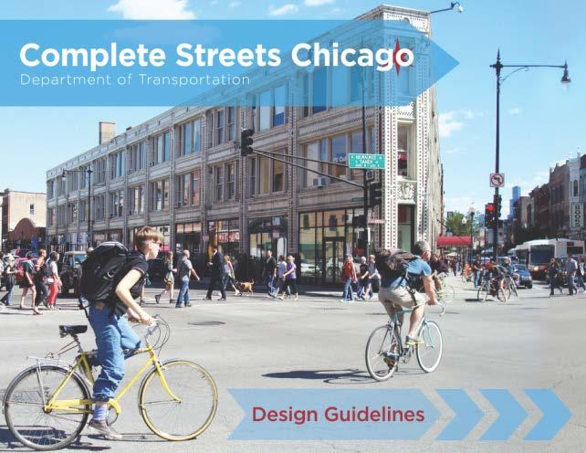
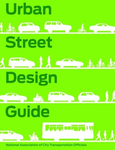
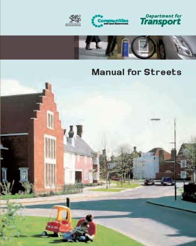
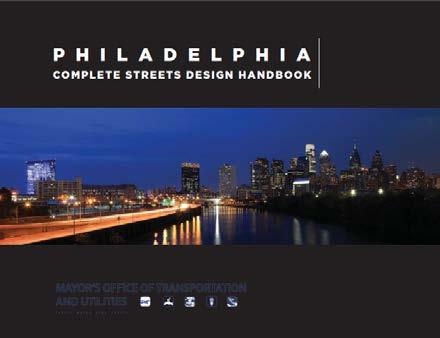
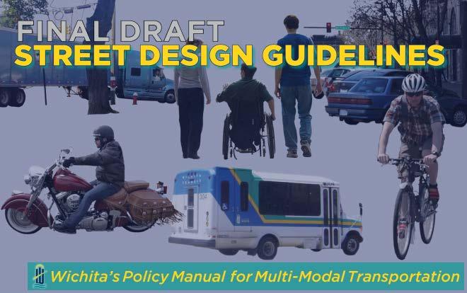
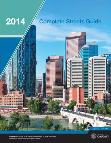
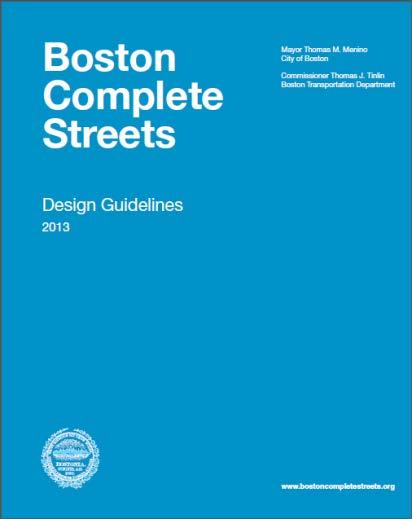
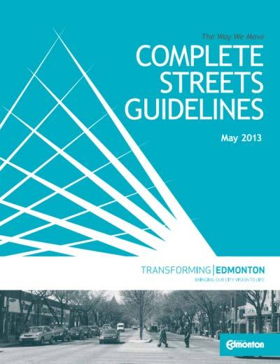
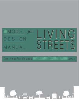
12 12 Boston, Calgary, Chicago, Edmonton, London ON, Los Angeles County, NACTO, New York City, Philadelphia, United Kingdom, Wichita KS Best Practices Review

13 13
14 Best Practices Review 14 Review Structure What it is What it is not Unique aspects Application Implementation
15 Common Elements 15 Vision Principles and goals Typology (Street Context) Multimodal networks and approach to street design Guidelines for street elements
16 Common Elements 16 Vision Principles and goals Typology (Street Context) Multimodal networks and approach to street design Guidelines for street elements Best of the Best Define priority and framework for decision-making Consistent and inclusive project development process How to assemble the elements Consider maintenance and lifecycle Performance metrics and/or design values Mechanism for review and compliance
17 Gap Analysis Summary Current State of Toronto Policy Direction 17 No one clear aspirational plan for Toronto streets No definition of modal hierarchy More focus on design that process No clear performance metrics No framework for weighing trade-offs Political influence/interference Varied procedures and cultures Many initiatives and guidance Inconsistent process
18 A Good Guide 18 clear intentions review/compliance process tailored to existing processes decision-points and outcomes, not prescriptions written by and for practitioners research, experimentation, data, review training, outreach, pilots, updates understands that streets are not highways is graphically rich, augmented by text knows the audience and type of document up front
19 Guide Sections and Intended Audience 19 Audience Style Section Technical Developers & Investors Advocates / External Stakeholders Elected Officials & Broader Public Graphic Technical Appendices Vision & Goals Procedures & Engagement Street Contexts Decision Guidance Implementation & Process with Checklist Performance Metrics useful to the audience some parts are useful to the audience
20 20 Toronto Complete Streets Vision and Guiding Principles
 21 City streets are significant public open spaces which connect people and places and support the development")
21 Toronto Complete Streets Vision Revised OP Policy 3.1.1(5) 21 City streets are significant public open spaces which connect people and places and support the development of sustainable, economically vibrant and complete communities.
22 Toronto Complete Streets Vision Revised OP Policy 3.1.1(5) 22 Provide safe and efficient movement of all users Provide building access and address Provide space for street elements Improve quality and convenience of active transportation options Reflect local context and character Provide amenities (view corridors, sky view, sunlight) Serve as community destinations and public spaces
23 Guiding Principles Adapted from Vision and TCSG Symposium presentation: October Increase Connectivity Respect Needs of All Expand Mobility Choices Improve Safety & Comfort Create Vibrant Public Spaces Encourage Walking, Cycling, and Transit Use Support Complete, Active, Healthy, Green, Sustainable and Resilient Communities Sensitively Respond to Context Support Economic Prosperity
24 24 Emerging Lessons for Toronto Street Context


25 Streets Design is not Plumbing 25 The typical access vs. mobility framework is like plumbing: big pipe medium pipe small pipe
26 Highway Classification v Street Context (Boston) 26

27 Link and Place 27 Jones, Boujenko, and Marshall (2007). Dual function of streets as Links and as Places Shift from a roads-based to a streets-based approach Informs: Classification Design values Priorities Performance measures Design outcomes

28 28 TO place THROUGH place

29 Link + Place 29

30 Link + Place 30» Place status = street context; land use and/or character; current or aspirational» Link status = Transportation function, may be volume, intensity of multimodal use, or modal priorities» Context sensitive street design» May or may not name resulting street types» May have additional overlay of mode or special use
31 31 Downtown Mixed-use Industrial Neighbourhood Park Regional Ctr Activity Centre Nbd Centre Campus Residential Commercial Core Mixed use Residential Ceremonial Destination Main Street Living Street Home Zone
32 Alley Shared Street Connector Boulevard Main Local Bicycle Blvd Transit Blvd Access Through Tertiary Secondary Primary Path Local Collector Boulevard Arterial Local Minor Major 32
33 33 Downtown Arterial Main Street Arterial Parkway Mixed Use Connector Campus Circulator Neighbourhood Shopping Festival Street Neighbourhood Living Pathway

34 DC Street Context 34

35 Boston Shared Street Street Context 35

36 Santa Monica Street Context 36

37 New Orleans Street Context 37
38 Purpose of Establishing a Street Context Matrix 38 A tool to provide additional guidance during street visioning and design stages reflect the surrounding environment accommodate all modes reflect existing regulatory constraints affect desired outcomes Categorize streets with similar characteristics Move beyond functional classification Consider local built form and land use context
39 NACTO USDG on Street Context 39 Classification schemes, in and of themselves, are rarely adequate as a design tool for the diversity of situations to be encountered on city streets.
40 Recommendations: Street Context 40 Use the Link + Place model to define different streets in Toronto Do not code or map streets Use it for discussion and training purposes Public outreach Internal training and thinking
41 For Discussion Reviewing the Guide Section and Intended Audience Table, how could the proposed sections be most helpful to you? Would you like to see any changes to the table? 2. What do you think about the vision and principles for Complete Streets? What, if anything, do you think is missing? 3. What do you think about the proposed approach to Street Context? Would you suggest any changes?
42 Next Steps 42 April 2015 Bike Summit Active City Forum Internal Interviews (Eglinton and Six Points) May 2015 Draft Design Standards and Guidelines TAC Workshop #4 Stakeholder Advisory Group #2 Public Open House Moving Conversations
43 43 Thank you. End
Streets for People, Place-Making and Prosperity. #TOcompletestreets
 COMPLETE STREETS FOR TORONTO Streets for People, Place-Making and Prosperity COMPLETE STREETS: A NEW APPROACH A Complete Streets design approach considers the needs of all users people who walk, bicycle,
TORONTO COMPLETE STREETS GUIDELINES
 TORONTO COMPLETE STREETS GUIDELINES Presentation by Fiona Chapman, Manager, Pedestrian Projects Public Realm Section, Transportation Services, City of Toronto June 2017 PURPOSE OF THE PROJECT To develop
CITY OF CHARLOTTESVILLE, VIRGINIA CITY COUNCIL AGENDA
 CITY OF CHARLOTTESVILLE, VIRGINIA CITY COUNCIL AGENDA Agenda Date: December 16, 2013 Action Required: Adoption of Resolution Presenter: Staff Contacts: Title: James E. Tolbert, AICP, Director of NDS James
University of Saskatchewan CAMPUS MASTER PLAN. Senate Meeting Preliminary Presentation. April 21, 2018 DIALOG ECS DA WATT
 University of Saskatchewan CAMPUS MASTER PLAN Senate Meeting Preliminary Presentation April 21, 2018 DIALOG ECS DA WATT project process presentation agenda Stakeholder Engagement Project Control phase1
CHAPTER 1. Ms. Guajardo s Class - Central Elementary CH 1 1
 INTRODUCTION CHAPTER 1 Ms. Guajardo s Class - Central Elementary CH 1 1 1.1 SETTING South Centre City is a linear corridor south of Downtown Escondido paralleling Centre City Parkway and South Escondido
Welcome. Walk Around. Talk to Us. Write Down Your Comments
 Welcome This is an information meeting introducing the applications for proposed redevelopment of the Yorkdale Shopping Centre site at 3401 Dufferin Street and 1 Yorkdale Road over the next 20+ years,
CITY COUNCIL AGENDA REPORT
 CITY COUNCIL AGENDA REPORT Subject: COUNCIL MOTION LRT ALIGNMENT REMOVAL FROM THE TRANSPORTATION MASTER PLAN On February 10, 2016 Councillor Hughes provided notice in accordance with Section 23 of Procedure
URBAN DESIGN ACTION PLAN. Community Design and Environmental Services Committee April 20, 2009
 URBAN DESIGN ACTION PLAN Community Design and Environmental Services Committee April 20, 2009 What is the Urban Design Action Plan? The Action Plan is a guiding document to address how design-thinking
Gary & Regional Investment Project. October 27, Creating Tomorrow Today Comprehensive Regional Plan - NIRPC
 Creating Tomorrow Today 2040 Comprehensive Regional Plan Gary & Regional Investment Project October 27, 2010 Creating Tomorrow Today - 2040 Comprehensive Regional Plan - NIRPC What is NIRPC? - Northwestern
Toronto Complete Streets Guidelines
 c. DTAH 58 60 3.1 70 3.2 Performance Measurement 71 3.3 Exceptions Chapter 3 describes the five general steps in the street design process. Not all projects follow these steps, as the number of steps and
3. Endorse the LRT vision in transforming Surrey into Connected-Complete-Livable communities, and more specifically, the official vision statement:
 CORPORATE REPORT NO: R038 COUNCIL DATE: February 20, 2017 REGULAR COUNCIL TO: Mayor & Council DATE: February 16, 2017 FROM: General Manager, Engineering FILE: 8740-01 SUBJECT: Surrey Light Rail Transit
John M. Fleming Managing Director, Planning and City Planner. Old East Village Dundas Street Corridor Secondary Plan Draft Terms of Reference
 Report to Planning and Environment Committee To: From: Subject: Chair and Members Planning & Environment Committee John M. Fleming Managing Director, Planning and City Planner Old East Village Dundas Street
STREETSCAPE MANUAL ONLINE TRAINING SESSION 1: Background
 TRAINING SESSION 1: The Urban Design Streetscape Manual is a reference tool developed to help implement City policy and guide the design, construction and maintenance of streetscape improvements in Toronto.
1.0 Purpose of a Secondary Plan for the Masonville Transit Village
 Report to Planning and Environment Committee To: Chair and Members Planning & Environment Committee From: John M. Fleming Managing Director, Planning and City Planner Subject: Masonville Transit Village
38 Queen s University Campus Master Plan Part 1
 38 Queen s University Campus Master Plan Part 1 46 The Campus at the City Scale Chapter 4 The Campus at the City Scale 39 Queen s is an urban University centrally located in Kingston. Decisions made by
Ann Arbor Downtown Street Design Manual. Ann Arbor DDA IDA 2015 Awards Planning Category
 Ann Arbor Downtown Street Design Manual Ann Arbor DDA IDA 2015 Awards Planning Category 1 Ann Arbor s downtown streets are vibrant public spaces that accommodate multi-modal transportation, special events,
PART 1. Background to the Study. Avenue Study. The Danforth
 The Danforth 1.1/ Study Purpose & Key Municipal Goals 1.2/ The Local Advisory Committee 1.3/ The Project Team 1.4/ Study Process/Summary of Method 1.5/ Summary of Consultation 1.1 Study Purpose and Key
Blueprint Denver Task Force Meeting #
 Blueprint Denver Task Force Meeting #1 6.23.16 1. Welcome and Introductions Your name and affiliation Name 1 thing you love about Denver Name 1 thing you d change about Denver All in 30 seconds! Ready,
Chairman and Members of the Planning and Development Committee. Thomas S. Mokrzycki, Commissioner of Planning and Building
 LA.09.TOR (Toronto) DATE: TO: FROM: SUBJECT: Chairman and Members of the Planning and Development Committee Thomas S. Mokrzycki, Commissioner of Planning and Building Central Waterfront Secondary Plan
Making TOD Work in the Heart of Suburban Sprawl
 Making TOD Work in the Heart of Suburban Sprawl Rocky Mountain Land Use Institute March 6, 2009 Speakers Ben Herman, FAICP, Principal Clarion Associates Darcie White, AICP, Principal Clarion Associates
Route 1 Corridor Study
 Route 1 Corridor Study Westbrook, Connecticut A Vision for the Connecticut Shoreline Public Informational Meeting July 28, 2015 Lower Connecticut River Valley Council of Governments Fitzgerald & Halliday,
FUNDING CORRIDOR REVITALIZATION
 FUNDING CORRIDOR REVITALIZATION Integrated corridor planning for the 21 st Century America Planning Association Annual Conference Atlanta, GA April 27, 2014 Mariia Zimmerman, MZ Strategies, LLC mariia@mzstrategies.com
Welcome to the Oakridge Centre Open House
 Welcome to the Oakridge Centre Open House Why is the City hosting this event? This open house is to inform you of a rezoning application submitted to the City of Vancouver to amend the existing CD-1 (Comprehensive
GO Station Mobility Hubs: Draft Precinct Plans. Committee of the Whole July 12, 2018
 GO Station Mobility Hubs: Draft Precinct Plans Committee of the Whole July 12, 2018 Purpose of this Workshop Present Draft Precinct Plans for the 3 GO Station Mobility Hubs Continue the conversations that
PUBLIC MEETING AND OPEN HOUSE: Don Mills Crossing Phase 2 Celestica Development Applications. February 21, 2017
 PUBLIC MEETING AND OPEN HOUSE: Don Mills Crossing Phase 2 Celestica Development Applications February 21, 2017 PURPOSE OF TONIGHT S MEETING Engage the community on the Don Mills Crossing Study and development
Coliseum Station Area Area Redevelopment Plan. Public Engagement #1 June 12, 2017
 Coliseum Station Area Area Redevelopment Plan Public Engagement #1 June 12, 2017 Welcome Engagement Purpose Introduce the project Share information Gather input Project Updates & Newsletter edmonton.ca/coliseumplan
DRAFT Subject to Modifications
 TREASURE COAST REGIONAL PLANNING COUNCIL M E M O R A N D U M To: Council Members AGENDA ITEM 8 From: Date: Subject: Staff May 19, 2017 Council Meeting Florida Department of Transportation Complete Streets
INDEPENDENCE BOULEVARD AREA PLAN. June 24, 2008
 INDEPENDENCE BOULEVARD AREA PLAN Public Meeting #1 June 24, 2008 Tonight s Agenda Introduction Welcome and Ground Rules Overview Presentation Purpose of the Plan What Brings Us Here? A Tour of the Corridor
SAN RAFAEL GENERAL PLAN 2040 INTRODUCTION AND OVERVIEW
 SAN RAFAEL GENERAL PLAN 2040 INTRODUCTION AND OVERVIEW Steering Committee Presentation February 14, 2018 Purpose of General Plan Guide land use and development decisions Coordinate transportation, infrastructure,
Town of Oakville Streetscape Strategy
 Town of Oakville Streetscape Strategy Endorsed by PDC on February 10, 2014 (PD-011-14) Town of Oakville Streetscape Strategy [endorsed by PDC February 10, 2014] 0 Town of Oakville Streetscape Strategy
Complete Streets Guidelines & Implementation Strategy. Public Open House #2 June 12, :30-8:00 pm
 Complete Streets Guidelines & Implementation Strategy Public Open House #2 June 12, 2018 5:30-8:00 pm Purpose The purpose of this project is to develop Complete Streets guidelines and an implementation
Port Credit Local Advisory Panel October 20 th Meeting
 Port Credit Local Advisory Panel October 20 th Meeting Focus Of This Evening s Meeting: 1. Hurontario Main Street Higher Order Transit Study 2. Port Credit Mobility Hub & GO Station Parking Structure Study
Official Plan Review
 Official Plan Review Summary Report - The Built Environment August 2014 Part 1: Introduction Planning for a healthy, prosperous and sustainable community is an important goal for our municipality. From
Scope of Services. River Oaks Boulevard (SH 183) Corridor Master Plan
 Corridor Master Plan") Scope of Services River Oaks Boulevard (SH 183) Corridor Master Plan PROJECT AREA The project area consists of the River Oaks Boulevard (SH 183) corridor bounded by SH 199 at the northern end and the Trinity
Scope of Services River Oaks Boulevard (SH 183) Corridor Master Plan PROJECT AREA The project area consists of the River Oaks Boulevard (SH 183) corridor bounded by SH 199 at the northern end and the Trinity
Plan Overview. Manhattan Area 2035 Reflections and Progress. Chapter 1: Introduction. Background
 Plan Overview The Manhattan Urban Area Comprehensive Plan (the Comprehensive Plan) is a joint planning initiative of the City of Manhattan, Pottawatomie County, and Riley County. The 2014 Comprehensive
Public Open House. Overview of the Downtown Plan Official Plan Amendment April 23, 2018
 Public Open House Overview of the Downtown Plan Official Plan Amendment April 23, 2018 1 A 25-Year Plan for Downtown To ensure growth contributes positively to Toronto s Downtown as a great place to live,
DRAFT FOR PUBLIC REVIEW. Game Plan for a Healthy City
 DRAFT FOR PUBLIC REVIEW 2018 Game Plan for a Healthy City 2 Denveright. Parks & Recreation Game Plan Draft for Public Review Draft for Public Review Executive Summary Game Plan Overview Executive Summary
MOBILITY HUB GUIDELINES 2012 TAC Sustainable Urban Transportation Award Submission BACKGROUND MOBILITY HUB GUIDELINES
 MOBILITY HUB GUIDELINES 2012 TAC Sustainable Urban Transportation Award Submission BACKGROUND Rapid population growth, increasing congestion, and years of under investment in transit in the Greater Toronto
Quarterly Report & Code Evaluation
 A New Zoning Code for a 21st Century Los Angeles To create livable communities, encourage sustainable development and foster economic vitality, we need a modern and user-friendly zoning code we need to
4.1 Vaughan Metropolitan Centre Vaughan, Ontario. 4.2 Newmarket Secondary Plan Newmarket, Ontario BACKGROUND REPORT
 4.0 PRECEDENTS BACKGROUND REPORT 4.1 Vaughan Metropolitan Centre Vaughan, Ontario FROM INDUSTRIAL LANDS TO A VIBRANT DOWNTOWN The Vaughan Metropolitan Centre (VMC) Secondary Plan outlines the vision and
Planning Charlotte s Future. Planning Committee May 17, 2016
 Planning Charlotte s Future Planning Committee May 17, 2016 Place Types: Next Steps March - June Public Input: Education & input on community character and place-type framework Public open house (Transportation
Streets, Connectivity & Built Environment Working Group August 2, 2017
 Streets, Connectivity & Built Environment Working Group August 2, 2017 DOWNTOWN OAKLAND SPECIFIC PLAN WELCOME Streets, Connectivity & Built Environment Working Group Social Equity Meeting August 2, 2017
Blueprint Denver A BLUEPRINT FOR AN INCLUSIVE CITY. Executive Summary
 Blueprint Denver A BLUEPRINT FOR AN INCLUSIVE CITY Executive Summary PUBLIC REVIEW DRAFT 2 1/7/2019 DENVERIGHT BLUEPRINTDENVER Blueprint Denver: A Blueprint for an Inclusive City An Equitable City Planning
Unique. Livable. Connected. Sustainable. Anticipate and Manage Change. Variety of Housing Choices. Enhanced Arterial Corridors
 Neighborhood Vision The Old Town Neighborhoods are Unique, Livable, Connected, and Sustainable. As mature, established neighborhoods, many of the ideas and opportunities expressed by stakeholders in support
North Fair Oaks Community Plan Summary and Information
 North Fair Oaks Community Plan Summary and Information WHAT IS THE NORTH FAIR OAKS COMMUNITY PLAN? The North Fair Oaks Community Plan is part of the San Mateo County General Plan, and establishes policies
Don Mills Crossing Study and Celestica Lands Development Application Community Meeting, Open House, and Breakout Discussions
 Consultation Summary Don Mills Crossing Study and Celestica Lands Development Application Community Meeting, Open House, and Breakout Discussions This report is not intended to provide a verbatim transcript
Official Plan Review: Draft Built Form Policies
 PG.30.1 REPORT FOR ACTION Official Plan Review: Draft Built Form Policies Date: May 15, 2018 To: Planning and Growth Management Committee From: Chief Planner and Executive Director, City Planning Division
Building Great Neighbourhoods. Strathcona
 Building Great Neighbourhoods Strathcona March 21, 2018 Becky Redford Project Manager, Planning & Design Building Great Neighbourhoods Integrated Infrastructure Services Welcome and Purpose To provide
Date: April 10, 2017 City Council Work Session April 24, 2017: Status Report on the Comprehensive Plan Update and Transportation Master Plan
 AGENDA REPORT To: From: By: Honorable Mayor and City Council Members Warren Hutmacher, City Manager Sharon Ebert, Director Community Development Date: April 10, 2017 Agenda: City Council Work Session April
Planning Commission Report
 Planning Commission Report To: From: Subject: Planning Commission Meeting: January 6, 2016 Agenda Item: 8-B Planning Commission David Martin, Planning & Community Development Director Introduction to the
SUBJECT: GO Station Mobility Hubs Preferred Concepts: Aldershot GO, Burlington GO and Appleby GO. Planning and Development Committee - Public Meeting
 Page 1 of Report PB-76-17 SUBJECT: GO Station Mobility Hubs Preferred Concepts: Aldershot GO, Burlington GO and Appleby GO TO: FROM: Planning and Development Committee - Public Meeting Planning and Building
Chapter 1.0 Introduction
 Chapter 1.0 Introduction 1.1 Background The North Metro commuter rail line is part of the RTD FasTracks regional transit system expansion program to build more than 100 miles of rail transit throughout
West Loop. Neighborhood Plan. Prepared by: Neighbors of West Loop, Chicago, IL August 14, 2018
 West Loop Neighborhood Plan Prepared by: Neighbors of West Loop, Chicago, IL August 14, 2018 Introduce Neighbors of West Loop (NoWL) Present the draft Neighborhood Plan Gather your input Identify ways
Planning Charlotte s Future. Transportation & Planning Committee March 14, 2016
 Planning Charlotte s Future Transportation & Planning Committee March 14, 2016 Charlotte s Vision Livable city Vibrant economy Thriving natural environment Diverse population Choices for housing, education,
c. DTAH Toronto Complete Streets Guidelines
 c. DTAH Toronto Complete Streets Guidelines 164 166 C.1 Project Delivery Process 168 C.5 This section provides a summary of the overarching process for delivering street projects in Toronto. The conclusion
Chapter 2: Vision, Goals and Strategies
 Chapter 2: Vision, Goals and Lake Elmo Today & Tomorrow Comprehensive Plan 2040 2 VISION, GOALS & STRATEGIES - DRAFT 4-6-2018 INTRODUCTION Comprehensive Plan Purpose Perhapse the most important objective
Land Use Policy & Development Ordinance Update
 Land Use Policy & Development Ordinance Update Charlotte Chamber of Commerce, Land Use Committee July 27, 2016 Land Use Policy & Development Ordinance Update Land Use Policy & Development Ordinance Update
PILLAR FOUR INTEGRATE LAND USE & TRANSPORTATION
 PILLAR FOUR INTEGRATE LAND USE & TRANSPORTATION 8 Scarborough Centre on the Move Transportation Master Plan 123 8 Transportation Pillar Four Integrate Land Use & The fourth pillar focuses on the relationship
Mid-Rise Buildings on Toronto s Avenues Responding to the Public Realm Andrea Oppedisano, City of Toronto
 Mid-Rise Buildings on Toronto s Avenues Responding to the Public Realm Andrea, City of Toronto Introduction The Avenues and Mid-Rise Buildings Study explores opportunities to encourage a built form that
Concord Community Reuse Project Goals and Guiding Principles. Overarching Goals (OG)
") Concord Community Reuse Project Goals and Guiding Principles Overarching Goals (OG) No priority is implied by the order of presentation of the goals and guiding principles. Overarching goals for the Concord
Concord Community Reuse Project Goals and Guiding Principles Overarching Goals (OG) No priority is implied by the order of presentation of the goals and guiding principles. Overarching goals for the Concord
1.0 PLANNING MARKHAM S FUTURE CONTENTS
 1-1 Planning Markham s Future 1.0 PLANNING MARKHAM S FUTURE CONTENTS 1.1 THE PURPOSE OF THE OFFICIAL PLAN 1.2 THE MARKHAM CONTEXT 1.3 THE REGULATORY CONTEXT 1.3.1 Province of Ontario 1.3.2 York Region
CHAPTER 7: Transportation, Mobility and Circulation
 AGLE AREA COMMUNITY Plan CHAPTER 7 CHAPTER 7: Transportation, Mobility and Circulation Transportation, Mobility and Circulation The purpose of the Transportation, Mobility and Circulation Chapter is to
McCowan Precinct Plan Study Background & Deliverables
 1 DRAFT & WITHOUT PREJUDICE McCowan Precinct Plan Study Background & Deliverables In September, 2011, City Planning (Scarborough District) began a study of an area within the Scarborough Centre, identified
Hurontario/Main Street Corridor Master Plan Mississauga and Brampton Building a new and integrated vision for the corridor
 Hurontario/Main Street Corridor Master Plan Mississauga and Brampton Building a new and integrated vision for the corridor Martin Powell, Commissioner of Transportation and Works, City of Mississauga Paper
DOMINION BOULEVARD CORRIDOR STUDY AND ECONOMIC DEVELOPMENT STRATEGIC PLAN A MODEL FOR CHESAPEAKE S FUTURE
 DOMINION BOULEVARD CORRIDOR STUDY AND ECONOMIC DEVELOPMENT STRATEGIC PLAN A MODEL FOR CHESAPEAKE S FUTURE Overview I. Draft Plan Process II. Draft Plan Overview a. Market Analysis b. Master Land Use Plan
WAC #7 3/14/14. Coachella General Plan Update
 WAC #7 3/14/14 Coachella General Plan Update Agenda 2 Introductions Public Draft General Plan Overview and Discussion of Next Steps Implementation and Evaluation Health Element Process Evaluation (discussion)
Richmond Road Complete Street Meeting #1, April 25, 2016
 Richmond Road Complete Street Meeting #1, April 25, 2016 Agenda Overview Richmond Road Complete Street Other Ongoing Studies Discussion Map buses/day removed from Sir John A. Macdonald Parkway Confederation
PLAN ON A PAGE SUMMARY
 Questions? Please Call - 423-989-5518. PLAN ON A PAGE SUMMARY The Plan on a Page is a tool for the City of Bristol to engage Bristol s neighborhoods, community organizations, and interest groups to organize
Report to: Development Services Committee Report Date: April 24, 2017
 SUBJECT: Cornell Rouge National Urban Park Gateway - Report on Design Charrette and Next Steps PREPARED BY: Lilli Duoba, MES, MCIP, RPP, Manager, Natural Heritage (ext. 7925) REVIEWED BY: Marg Wouters,
Create Policy Options Draft Plan Plan Approval. Public Consultation Events. Phase 2
 Background Grandview-Woodland Community Plan In the spring of 2012, the City of Vancouver embarked on a comprehensive community planning program in the Grandview-Woodland neighbourhood. The process has
City Council and Planning & Zoning Commission Workshop March 20, 2018
 City Council and Planning & Zoning Commission Workshop March 20, 2018 Completed July 27, 2017 Kick-Off Sept 13 Built Environment Nov 8 Natural Environment Jan 10, 2018 Economic Environment Feb 7 Social
Urban Planning and Land Use
 Urban Planning and Land Use 701 North 7 th Street, Room 423 Phone: (913) 573-5750 Kansas City, Kansas 66101 Fax: (913) 573-5796 Email: planninginfo@wycokck.org www.wycokck.org/planning To: From: City Planning
This page left intentionally blank.
 July 2012 This page left intentionally blank. Table of Contents Appendix A : Project Development Checklist Appendix B: At-Grade Rail Crossings Appendix C: Maintenance and Operations Examples Appendix D:
CDAC. Update: Downtown Dartmouth Update: CDAC July 25 th Motion
 CDAC Update: Downtown Dartmouth Update: CDAC July 25 th Motion 2018-10-24 Downtown Dartmouth Plan Open House October 22, 2018 6:00 pm Open House 6:30 pm Presentation + Q&A 7:20 pm Open House 8:30 pm Close
Atlanta BeltLine Corridor Environmental Study. Scoping Meeting August 2008
 Atlanta BeltLine Corridor Environmental Study Scoping Meeting August 2008 What Will We Be Discussing Today? Study Overview - How Did We Get Here? - What Is the Study About? - Who Is Involved? - Where Is
ELK GROVE GENERAL PLAN VISION
 2-1 CHAPTER 2: 2-2 CREATING OUR The Community Vision for Elk Grove, expressed through a Vision Statement and a series of Supporting Principles, is a declaration of the kind of community that Elk Grove
Urban Design Manual PLANNING AROUND RAPID TRANSIT STATIONS (PARTS) Introduction. Station Study Areas
 Introduction. Station Study Areas") 111111 PLANNING AROUND RAPID TRANSIT STATIONS (PARTS) Introduction The ION rapid transit system will link Waterloo, Kitchener and Cambridge through a central transit corridor (CTC). There are a number
111111 PLANNING AROUND RAPID TRANSIT STATIONS (PARTS) Introduction The ION rapid transit system will link Waterloo, Kitchener and Cambridge through a central transit corridor (CTC). There are a number
Complete Neighbourhood Guidelines Review Tool
 Complete Neighbourhood Guidelines Review Tool Prepared By: City of Regina Planning Department October 2014 Page 1 of 14 Community Development Review Checklist for Secondary Plans and Concept Plans The
planning toronto s downtown Parks and Public Realm Plan Request for Proposals Information Meeting Andrew Farncombe, Project Manager August 19, 2015
 planning toronto s downtown Parks and Public Realm Plan Request for Proposals Information Meeting Andrew Farncombe, Project Manager August 19, 2015 BATHURST ST Keeping Downtown a great place to live, work,
Designing Walkable Urban Thoroughfares: A Context Sensitive Approach
 Designing Walkable Urban Thoroughfares: A Context Sensitive Approach Communities Want: Flexibility Compatibility with adjacent land uses Balanced land use/transportation functions Safe and attractive streets
Employment and Commercial Review Analysis of Policy Directions
 Employment and Commercial Review Analysis of Policy Directions Appendix A The following analysis is town staff s response to the policy directions provided by the consultants who prepared the Employment
Toronto Parks Renaissance Strategy
 Toronto Parks Renaissance Strategy Overview, Emerging Themes and Directions Presentation to EDPC, May 4, 2006 Parks Renaissance Strategy Presentation Agenda Project Overview Emerging Themes and Directions
City of Tacoma Planning and Development Services
 Agenda Item E-1 City of Tacoma Planning and Development Services To: Planning Commission From: Elliott Barnett, Planning Services Division Subject: Tacoma Mall Regional Center Subarea Plan and EIS Meeting
SUBJECT: Revised proposed new official plan recommended for adoption
 Page 1 of Report PB-04-18 SUBJECT: Revised proposed new official plan recommended for adoption TO: FROM: Planning and Development Committee Department of City Building Report Number: PB-04-18 Wards Affected:
THE GARDEN CITY PLAN. City of St. Catharines Official Plan. City of St. Catharines
 THE GARDEN CITY PLAN City of St. Catharines Official Plan City of St. Catharines August 2010 APPROVAL INFORMATION This Official Plan of the City of St. Catharines Planning Area, known as the Garden City
SUBJECT: Waterfront Hotel Planning Study Update TO: Planning and Development Committee FROM: Department of City Building. Recommendation: Purpose:
 Page 1 of Report PB-23-18 SUBJECT: Waterfront Hotel Planning Study Update TO: Planning and Development Committee FROM: Department of City Building Report Number: PB-23-18 Wards Affected: 2 File Numbers:
TransitSupportive. Guidelines GHD. Canadian Institute of Planners 2012 Awards for Planning Excellence Award Category: Planning Publications
 TransitSupportive Guidelines Canadian Institute of Planners 2012 Awards for Planning Excellence Award Category: Planning Publications GHD Project Summary We would like to nominate the Ontario Transit-Supportive
GATEWAY AREA STRUCTURE PLAN
 CHESTERMERE GATEWAY AREA STRUCTURE PLAN COMMUNITY OPEN HOUSE SEPTEMBER 22 nd, 2015 PLAN AREA ± 512 hectares (± 1,265 acres) GATEWAY LOCATION UNDEVELOPED LANDS PRESENT AGRICULTURAL USE REGIONAL LAND USE
Whitemarsh Comprehensive Plan Update: Housing & Land Use. Public Workshop #3: September 20, 2018
 Whitemarsh Comprehensive Plan Update: Housing & Land Use Public Workshop #3: September 20, 2018 Agenda Welcome Process Recap What We ve Heard The Plan Framework Review of Recommended Actions Land Use Housing
1.3 TRANSIT VISION 2040 FROM VISION TO ACTION THEME 1: PUTTING TRANSIT AT THE CENTRE OF COMMUNITIES. Fully integrate transit with community planning
 TRANSIT VISION 2040 FROM VISION TO ACTION TRANSIT VISION 2040 defines a future in which public transit maximizes its contribution to quality of life with benefits that support a vibrant and equitable society,
A. Background Summary of Existing Challenges and Potential Possibilities. 1. Summary of Existing Assets and Potential Opportunities
 A. Background 1 A Main Street Master Plan Study was performed and completed in October of 2007. The study was initiated to review current land uses and development patterns along Main Street, from Parrish
Institute Response to Design Guidelines: Design Quality and Housing Choice
 Institute Response to Design Guidelines: Design Quality and Housing Choice The Australian Institute of Landscape Architects South Australian Chapter (AILA SA) is pleased to provide a response on the Draft
Executive Summary. NY 7 / NY 2 Corridor
 Executive Summary NY 7 / NY 2 Corridor Transportation and Land Use Study December 2005 Prepared for: Town of Colonie Capital District Transportation Committee Prepared by: Introduction: Land use decisions
LAND USE AMENDMENT DOWNTOWN COMMERCIAL CORE (WARD 7) MACLEOD TRAIL SE AND 5 AVENUE SE BYLAW 254D2017
 MACLEOD TRAIL SE AND 5 AVENUE SE BYLAW 254D2017") Page 1 of 10 EXECUTIVE SUMMARY This Land Use Amendment application seeks to redesignate a full downtown block (currently the YWCA site) from a Direct Control based on the CM-2 District (Land Use Bylaw
Page 1 of 10 EXECUTIVE SUMMARY This Land Use Amendment application seeks to redesignate a full downtown block (currently the YWCA site) from a Direct Control based on the CM-2 District (Land Use Bylaw
LAND USE AMENDMENT CORNERSTONE (WARD 3) 60 STREET NE AND COUNTRY HILLS BOULEVARD NE MAP 26NE BYLAW 22D2017
 60 STREET NE AND COUNTRY HILLS BOULEVARD NE MAP 26NE BYLAW 22D2017") Page 1 of 14 EXECUTIVE SUMMARY This Land Use Amendment application covers an area of 43.76 hectares ± (108.14 acres ±) located in northeast Calgary, bound by Country Hills Boulevard NE to the south and
Page 1 of 14 EXECUTIVE SUMMARY This Land Use Amendment application covers an area of 43.76 hectares ± (108.14 acres ±) located in northeast Calgary, bound by Country Hills Boulevard NE to the south and
Citizen Engagement for a Sustainable Built Environment
 Citizen Engagement for a Sustainable Built Environment Examples and Case Studies from Michigan Communities Genesee County Metropolitan Planning Commission 10 th Annual Planning Forum October 23, 2015 Wayne
1 ESRI User Conference Eastside Greenway
 1 ESRI User Conference Eastside Greenway Grand Rapids, Michigan ~200,000 residents 45 sq. miles Leader in smart public investment Green infrastructure program ArtPrize BeerCity USA 2 ESRI User Conference
4 Sustainability and Growth Management
 4 Sustainability and Growth Management Introduction Traditionally, has assumed growth and development with limited consideration for the long-term negative social, environmental or economic impacts on
The Five Components of the McLoughlin Area Plan
 The Five Components of the McLoughlin Area Plan This documents contains the complete language of the five components of the McLoughlin Area Plan: The Vision Statement The Values The Guiding Principles
DOWNTOWN GEORGETOWN PLANNING STUDY
 DOWNTOWN GEORGETOWN PLANNING STUDY Community Workshop #3 Thursday, May 4, 08 The Planning Partnership OVERVIEW OF STUDY, PROCESS & MILESTONES We are here PURPOSE OF THE STUDY To develop a clear vision