SBPO BOARD MEETING MARCH 20, 2018
|
|
|
- Christopher Ford
- 6 years ago
- Views:
Transcription

1 SBPO BOARD MEETING MARCH 20, 2018
2 TODAY'S AGENDA > Booker Middle School Outreach > Property Information > Schedule > Guiding Principles > Three Concepts
3 Booker Middle School Outreach
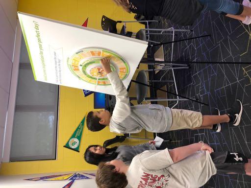
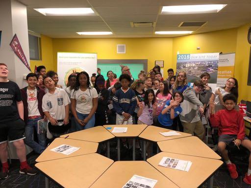
4
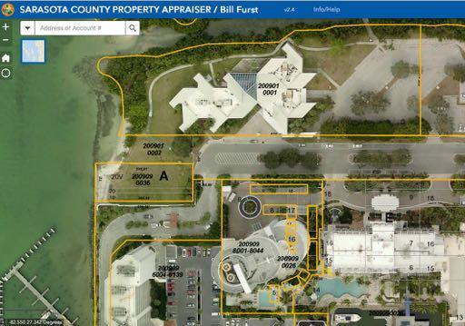
5 Property Information


6 PRIVATE LAND SBPO SITE CENTENNIAL PARK 23 ACRES 42 ACRES 11 ACRES 10TH STREET ROSEMARY DISTRICT IN MA EE T ST R DOWNTOWN GULF STREAM COCOANUT AVE N TAMIAMI TRAIL BLVD OF THE ARTS FRUITVILLE ROAD
7
8
9 Schedule
10 TASK 1 EXISTING CONDITIONS AND KICK-OFF (4 WEEKS) Review existing conditions and analyses Consider existing opportunities and challenges Create engagement plan Hold kick-off TASK 6 IMPLEMENTATION (28 WEEKS) TASK 2 STRATEGIC ASSESSMENT AND VISIONING (8 WEEKS) Deepen understanding of the site's challenges and opportunities Broaden and deepen engagement Translate understanding into preliminary design strategies Develop short and long-term actions with roles and responsibilities Understand cost, funding and financing tools Solidify project governance Develop programming potentials TASK 3 DEVELOP MASTER PLAN ALTERNATIVE SCENARIOS (8 WEEKS) Create master plan scenarios Develop probable costs and viability considerations Assess governance model potentials TASK 4 DEVELOPMENT OF DRAFT MASTER PLAN (4 WEEKS) Refine feedback into a draft master plan and present to community Develop short and long-term programming strategies TASK 5 DEVELOPMENT OF FINAL MASTER PLAN (4 WEEKS) Refine feedback into a final master plan and present to the community * DEC JAN FEB MAR APR MAY JUNE DEC. 4-7 * * * * FEB. 5-8 MASTER PLAN APR MAY JUN TASK 7 City Commission Presentation SEPT. 6
11 TASK 1 EXISTING CONDITIONS AND KICK-OFF (4 WEEKS) TASK 2 STRATEGIC ASSESSMENT AND VISIONING (8 WEEKS) TASK 3 DEVELOP MASTER PLAN ALTERNATIVE SCENARIOS (8 WEEKS) FEB 20 FINAL ASSESSMENT AND VISION (DESIGN APPROACHES) MARCH 6 DESIGN REVIEW #1 (EARLY CONCEPTS) MARCH 20 DESIGN REVIEW #2 (DRAFT CONCEPTS) TASK 4 DEVELOPMENT OF DRAFT MASTER PLAN (4 WEEKS) TASK 5 DEVELOPMENT OF FINAL MASTER PLAN (4 WEEKS) APRIL 3 SCENARIO PUBLIC MATERIALS (FINAL CONCEPTS) * Survey up until 2/20! Bill + Steve at Sasaki! DEC JAN FEB MAR APR * * * * * * * * MAY JUNE FEB. 5-8 YOU ARE HERE! APR
12 Guiding Principles
13 SBPO leads the creation of a comprehensive, longterm master plan for our one-of-a-kind Bayfront that: Delivers on the Expectations of our City: Financially feasible Operationally doable Environmentally sustainable - AND - Realizes the Aspirations of our Community...
14 Adopted Guiding Principles And how they will be experienced in this place... Aspiration ASPIRATION IMAGINE THE POSSIBILITIES OF THE BAY Cultural Heritage Bayfront/ Natural Assets Activation Connectivity Sustainability CULTURAL VITALITY A GREEN & BLUE OASIS AN ENLIVENED DESTINATION CONNECTED & ACCESSIBLE FOR ALL ECONOMIC SUSTAINABILITY A HUB FOR SARASOTA S ART, CULTURE AND HISTORIC LEGACIES CELEBRATE NATURAL BEAUTY AND PROMOTE ENVIRONMENTAL HEALTH A GATHERING PLACE FOR FAMILY, FRIENDS AND FUN A WALKABLE AND SAFE DISTRICT LINKING DOWNTOWN AND THE BAY A FINANCIALLY FEASIBLE, SUSTAINABLE LONG-TERM SUCCESS
15 Three Concepts* *PLEASE NOTE THESE SCHEMES ARE PRELIMINARY, DIAGRAMMATIC AND IN PROGRESS. WE LOOK FORWARD TO PUBLIC INPUT AT THE APRIL MEETINGS, TO BE ANNOUNCED AT THEBAYSARASOTA.ORG
16 Shift the Horizon A dramatic new hillscape

17 LANDFORM WATER VIEW VERTICALITY

18 Connected + Accessible Tamiami dives into a underpass while a land bridge flows over it, allowing for seamless pedestrian connectivity. A parking supply is connected by small internal spur roads. UNDERPASS

19 A Green + Blue Oasis The high ground is pulled back from the water and elevated. A large open park touches the water's edge creating a floodable zone. FLOODABLE + LP FACILITIES HIGH + DRY + HP

20 A Green + Blue Oasis: Sea Level Rise Sidebar Sea Level Rise modeling methodologies are consistent with that of the City of Sarasota Climate Adaptation Plan adopted in January 2018 Non-essential elements, such as parking lots, will be elevated to withstand nuisance flooding and King Tides New building structures will be elevated to meet FEMA requirements while allowing for adaptability for future climate conditions Sea Level Rise Projections

21 Cultural Vitality A central, consolidated cultural hub co-locates the Van Wezel and Orchestra. Cultural facilities are integrated into a strong landscape/landform expression beside the historic district. A NEW CENTRAL CULTURAL HUB

22 An Enlivened Destination A central green space ramps up towards the cultural hub then back down towards the Bay, allowing for dramatic views. Iconic piers reach out into the Bay, expanding opportunities for fishing and views. PIER PIER PIER BOAT RAMP LAND BRIDGE

23 An Enlivened Destination: Underpass Sidebar The underpass allows for an uninterrupted pedestrian connection from the east side of Route 41 and the Rosemary District to the Bayfront Increased green space, reduced noise, and improved pedestrian safety are a few of the benefits of the underpass Lowering of Route 41 allows for a significantly improved "front door" to the existing historic district at the Bayfront site Tamiami Road Profile
24 Bridge the Divide Unexpected combinations and connections
25 PROGRAM INSIDE/OUTSIDE PLACES WATER/LAND

26 Connected + Accessible A new Bayfront drive creates easy internal access for the site. Central parking is accessed off the 10th Street roundabout and complemented with small landscaped surface lots.
27 Connected + Accessible PARKING + TRANSPORTATION SIDEBAR How do we establish parking demand? Parking demand is a result of many factors; a shared parking analysis studies the interplay of time, use, supply, and operations. Factors considered: Program Likely operating schedule of facilities Operations and supply One Scenario: Simultaneous operation of the Van Wezel and Orchestra Free parking and all parking on site 20% of people arriving to site do not park on site Approximately 2,400 parking spaces needed
28 Connected + Accessible PARKING + TRANSPORTATION SIDEBAR How do we optimize alternative transportation? 1. Carshare: Curb space for drop-off/pick-up and staging area for taxis and carshare vehicles 2. Carpools: Initiatives to promote carpooling 3. Bicycles: Bike paths, bike parking, secure bike parking, valet bike parking service, showers/lockers, maintenance equipment or staff 4. Walking: Pedestrian bridge, lighting, landscaping, shade, paths 5. Transit: Bus stops, shelters, real-time arrival signage, adequate service/headways 6. Boat: Real-time boat info, convenient docking area
29 Connected + Accessible PARKING + TRANSPORTATION SIDEBAR What are the transportation ideas we are exploring? 1. A tiered parking rate structure 2. Periphery parking 3. Shared parking 4. Park Once 5. Peak event traffic management 6. Rideshare transportation hubs 7. Parking structures that support adaptive reuse 8. Transportation information systems + parking technology 9. Multi-modal transportation infrastructure 10. Transportation demand management strategy

30 A Green + Blue Oasis A soft Bayfront edge creates a floodable landscape. The new buildings model best practices for waterfront resiliency and sustainability. FLOODABLE HIGH + DRY

31 Cultural Vitality A large iconic building bridging over the channel houses both Van Wezel and the Orchestra, creating a new focal point for the Bay.

32 An Enlivened Destination The water's edge is activated and pulled into the site expanding water recreation. In parallel, green fingers extend toward the Bay and over Tamiami. BLUE FINGER Urban piers extend to the Bay, and new paths and bridges create a connected network. URBAN FINGERS GREEN FINGER
33 Grow an Ecological Village A truly 'blue and green' cultural oasis
34 HUMAN-SCALED PRODUCTION DISCOVERY SHADE

35 Connected + Accessible Improved crossings atgrade and traffic calming along Tamiami allow visitors to easily enter the site. Parking structures anchor the north and south end of the site along a new internal spur road that connects 10th Street to Boulevard of the Arts.

36 A Green + Blue Oasis A new channel separates the existing cultural district from the new ecological island. LOW/WET The island's soft edges create a resilient site that will help buffer from coastal flooding and sea level rise. LOW/WET LOW/WET HIGH + DRY

37 Cultural Vitality Van Wezel and the Orchestra are two separate buildings and anchor both ends of a new cultural district. The new buildings are located along a waterfront boardwalk creating an active water's edge.
38 An Enlivened Destination A well-shaded and walkable urban village contrasts against an ecologically-rich, car-free, public park of water, trails, and islands. Water recreation is found throughout the site and allows for easy access into the Bay. ISLAND PARK RECREATIONAL BOATING URBAN VILLAGE HUMAN POWERED CRAFT
39 An Enlivened Destination BOATING SIDEBAR Types of Boats Program Who is our existing boating community? Likely operating schedule of facilities Operations and supply Site Users Coming from land: enjoy views, touch the water, see activity in the water, regatta on the bay, etc. How can we enhance and improve people getting out on the bay? Coming from the water: boating and water use, what activities can we encourage?
40 An Enlivened Destination BOATING SIDEBAR How does the existing boat ramp work? Works very well (approach, circulation, parking, slips) Opportunities to "shorten" existing inlet (too deep for function) or create another shorter inlet Boat ramp counts underway now!
41 An Enlivened Destination BOATING SIDEBAR Beach: The Bay has a long reach - provide protected places that enable less choppy water and more water recreation! How can we enhance and diversify the experience? Boardwalk: A continuous experience of the waterfront! Steps: People should tough the water get close to the water in the main part of the park! Pier: Much needed to activator the water! Larger boats, historic boats, temporary boats, tours


42 Shift the Horizon Bridge the Divide Grow an Ecological Village
SBPO BOARD MEETING APRIL 3, 2018
 SBPO BOARD MEETING APRIL 3, 2018 TASK 1 EXISTING CONDITIONS AND KICK-OFF (4 WEEKS) Review existing conditions and analyses Consider existing opportunities and challenges Create engagement plan Hold kick-off
Waterfront Development Master Plan
 PORT of VANCOUVER USA Vancouver, WA Waterfront Development Master Plan DRAFT - FINAL CONCEPTUAL MASTER PLAN PROJECT TEAM NBBJ Heritage Research Associates JLA Kittelson Associates Leland Consulting Group
New Westminster Downtown Parking Strategy Public Open House #1 September 13, 2012
 New Westminster Downtown Parking Strategy Public Open House #1 September 13, 2012 The City is preparing a strategy for parking in Downtown New Westminster. The study team and a group of key stakeholders
GOODY CLANCY WITH KITTELSON & ASSOCIATES RHODESIDE & HARWELL FARR ASSOCIATES W-ZHA
 1 1. Welcome 5 min. 2. Follow-up from 9/22 / Corridor of Light, ground floor uses 20 min. 3. Small on-site open spaces / Overview of types, identities 15 min. 4. Rosslyn Plaza Park / Rosslyn Plaza PDSP
Sustainability, Health, Safety, Recreation & Open Space Working Group August 3, 2017
 Sustainability, Health, Safety, Recreation & Open Space Working Group August 3, 2017 DOWNTOWN OAKLAND SPECIFIC PLAN WELCOME Sustainability, Health, Safety, Recreation & Open Space Working Group Social
A Vision for Tropicana Site Redevelopment. Image: City of St. Petersburg
 A Vision for Tropicana Site Redevelopment Image: City of St. Petersburg City of St. Petersburg Planning & Economic Development Department Leading the Process HKS Urban Design Randy Morton Julie Hiromoto
Streets, Connectivity & Built Environment Working Group August 2, 2017
 Streets, Connectivity & Built Environment Working Group August 2, 2017 DOWNTOWN OAKLAND SPECIFIC PLAN WELCOME Streets, Connectivity & Built Environment Working Group Social Equity Meeting August 2, 2017
4/8/2015 Item #10D Page 1
 MEETING DATE: April 8, 2015 PREPARED BY: Christy Villa, Associate Civil Engineer DEPT. DIRECTOR: Glenn Pruim DEPARTMENT: Public Works CITY MANAGER: Larry Watt SUBJECT: NORTH COAST HIGHWAY 101 STREETSCAPE
Bourne Downtown Site Planning
 Prepared for: The Town of Bourne, MA In Cooperation with: Bourne Financial Development Corporation Prepared by:, Inc. June 24, 2009 Table of Contents Introduction and Summary... 1 Site Existing Conditions...
MARINA MARKET & WATERFRONT DEVELOPMENT STUDY PORT ARANSAS, TEXAS
 MARINA MARKET & WATERFRONT DEVELOPMENT STUDY PORT ARANSAS, TEXAS FEBRUARY 2015 PRESENTATION OUTLINE 1 2 3 4 5 6 7 REGIONAL POSITIONING SITE IMPRESSIONS PLANNING & DESIGN PRINCIPLES EXISTING IMPROVEMENTS
Proposed Comprehensive Plan Strategies DRAFT for discussion June 28, 2017
 Proposed Comprehensive Plan Strategies DRAFT for discussion June 28, 2017 Land Use Rural Areas Refine the Farm and Forest area (FF) Update FF boundaries to account for existing lots less than five acres
In partnership with: Harbor Corridor Plan Bali Hi Mobile Home Park July 24, 2013
 In partnership with: Harbor Corridor Plan Bali Hi Mobile Home Park July 24, 2013 Project Intro 2-miles of Harbor Boulevard Westminster/17 th Street to just north of Edinger Avenue Many people use the corridor
Vision Plan Kickoff Meeting Summary Report
 Vision Plan Kickoff Meeting Summary Report October 2018 The Vision Plan With the redevelopment of the Amtrak Property, Penn Station Partners (PSP) seeks to build on the creative talent and entrepreneurial
City of Farmington. Downtown Plan. Amendment to the 1998 Master Plan Adopted October 11, 2004
 City of Farmington Amendment to the 1998 Master Plan Adopted October 11, 2004 Introduction Planning Background 1 Scope and Components of the Plan Amendment 2 Concept Introduction 3 Plan Concepts 3 Conceptual
Lynn Waterfront Master Plan
 Lynn Waterfront Master Plan DECEMBER ALTERNATIVES PRESENTATION City of Lynn / EDIC ZHA / GEI Work Schedule June Kick-Off June September Site Analysis & Property Owner / Stakeholder Meetings September Analysis
12 th Street Connector Alignment Study VISIONING PUBLIC WORKSHOP - JUNE 25, :00PM TO 8:00PM
 12 th Street Connector Alignment Study VISIONING PUBLIC WORKSHOP - JUNE 25, 2018 6:00PM TO 8:00PM Goals for Today s Workshop Agenda: Project Introduction, Purpose, and Goals Existing Conditions Traffic
City of Kingston. North King s Town Secondary Plan Open House + Workshop #1 February 28, 2018
 City of Kingston North King s Town Secondary Plan Open House + Workshop #1 February 28, 2018 1 event agenda 30 min Panel Review + Discussion 30 min Presentation + Q&A 75 min Workshop Session 15 min Report
preliminary master plan Cover Slide executive summary public presentation
 preliminary master plan public presentation executive summary Cover Slide {agenda} + Master Plan Process + Context and Overviews + Preliminary Concepts - Entry/Gateways - Core District - Streetscape +
2017 Game Plan Update Denver Parks and Recreation
 2017 Game Plan Update Denver Parks and Recreation SASAKI ERO MATRIX PLACE MATTERS ETC Task Force Meeting 4 March 23, 2017 TODAY Welcome + Goals Presentation Feedback Summary Draft Goals Draft Visions for
Somers Point Master Plan
 Somers Point Master Plan Progress Report and Public Meeting August 20, 2014 Master Plan Reexamination Municipal Land Use Law require that all municipalities reexamine their master plan every ten years.
ARISE: The Rock Renaissance Area Redevelopment & Implementation Strategy
 2014 Professional Awards 1 ARISE: The Rock Renaissance Area Redevelopment & Implementation Strategy Janesville, WI Completed December 2014 Analysis & Planning Purpose of Project 2 The purpose of the Rock
Rt 29 Solutions Hydraulic Planning Advisory Panel. September 28, 2017
 Hydraulic Planning Advisory Panel September 28, 2017 Agenda Item 1: Introductions Hydraulic Planning Advisory Panel members Technical Team members 2 Agenda item 2: Public Interaction and Feedback Live
PLAN ELEMENTS WORKSHOP. April 5, 2016
 PLAN ELEMENTS WORKSHOP April 5, 2016 needs more housing. But there is no one-size fits-all solution. Every neighborhood has its own character. In some places, density is not only appropriate it is badly
Potential Green Infrastructure Strategies May 6, 2015 Workshop
 Potential Green Infrastructure Strategies May 6, 2015 Workshop Background The City of Cortland is developing the Tioughnioga Urban Headwaters Green Infrastructure Action Plan with funding from the National
Niagara National Heritage Area
 Niagara National Heritage Area What is a National Heritage Area? It is a regional place where natural, cultural, historic and recreational resources combine to form a nationally distinctive landscape and
Rt 29 Solutions Hydraulic Planning Advisory Panel. September 14, 2017
 Hydraulic Planning Advisory Panel September 14, 2017 Agenda Item 1: Introductions Hydraulic Planning Advisory Panel members Technical Team members 2 Agenda item 2: Public Interaction and Feedback Live
10.0 Open Space and Public Realm
 10.0 Open Space and Public Realm 10.0 Open Space and Public Realm The Public Open Space System is comprised of: outdoor spaces available for public use that are either publicly owned (e.g., parks and
Downtown Area. Draft Vision and Strategies. February 24, 2015 Public Meeting
 Downtown Area Draft Vision and Strategies February 24, 2015 Public Meeting 1 SEA District North Beach Sea and Sky 3 Uptown Opportunity Neighborhoods Hillcrest Assist owner-occupants in negotiating fair
Burnside Gorge Neighbourhood Plan. Engagement Summary
 Burnside Gorge Neighbourhood Plan Engagement Summary Table of Contents Engagement Summary... 3 Phase One Engagement (April May 2015)... 4 Phase Two Engagement (January March 2016)... 4 Appendix One: Summary
Plan Framework Report. Attachment A
 Plan Framework Report Attachment A Uptown-Douglas Corridor Plan - Plan Framework Report Contents Introduction... 1 Planning Process... 3 Project Objectives... 4 Vision... 5 Community Values... 6 Structural
edmonton.ca/ribbonofgreen #ribbonofgreen
 WHAT IS THE RIBBON OF GREEN? The Ribbon of Green is Edmonton s entire river valley and ravine system. The Ribbon of Green (2018) Project will provide strategic guidance for the southwest and northeast
The Five Components of the McLoughlin Area Plan
 The Five Components of the McLoughlin Area Plan This documents contains the complete language of the five components of the McLoughlin Area Plan: The Vision Statement The Values The Guiding Principles
1.1 WATERFRONT SEATTLE
 1.1 WATERFRONT SEATTLE Over the past few years, the City of has been actively re-imagining the future of its Central Waterfront. The imminent replacement of the Elliott Bay Seawall and removal of the Alaskan
Building Great Neighbourhoods. Strathcona
 Building Great Neighbourhoods Strathcona March 21, 2018 Becky Redford Project Manager, Planning & Design Building Great Neighbourhoods Integrated Infrastructure Services Welcome and Purpose To provide
Welcome. Community Consultation Meeting November 28, Review and discuss the Bathurst Quay Neighbourhood Plan Framework
 Welcome Community Consultation Meeting November 28, 2016 Why Are We Here Today? Review and discuss the Bathurst Quay Neighbourhood Plan Framework Review and discuss an Action Plan for Implementation Next
BRADENTON RIVERWALK EXPANSION MASTER PLAN
 BRADENTON RIVERWALK EXPANSION MASTER PLAN INTRODUCTION & AGENDA Process Update Community Engagement Summary Center for Active Design (CfAD) Recommendations Context and Existing Conditions Master Plan Alternatives
JACKsON STREET PIER CONCEPTUAL DESIGN PACKAGE SEPTEMBER 21, 2017
 JACKsON STREET PIER CONCEPTUAL DESIGN PACKAGE SEPTEMBER 21, 2017 JACKsON STREET PIER Process outline DESIGN PROCESS OVERVIEW: Sandusky s Jackson Street Pier Conceptual Design process included input from
Small Area Plan. South Gateway
 Small Area Plan Adopted May 12, 2008 South Gateway Purpose. The South Gateway Small Area Plan defines the City s expectations for the future of the southern entrance to the City at Interstate 85 and Highway
TOWN OF NEW CASTLE - Master Plan Update
 Our Presentation Today (1) Recap the Master Planning Process To Date (2) Present the Outline of the Master Planning Work Plan (3) Present the Calendar for the Master Plan (4) Outline the scope of a Downtown
THEMES, VISION, + PRINCIPLES
 CHAPTER 2: THEMES, VISION, + PRINCIPLES This page intentionally left blank. 20 VISION DRAFT AUGUST 2018 2 2 THEMES, VISION, + GUIDING PRINCIPLES The Key Themes, Vision, and Guiding Principles presented
PHASE ONE. A summary report: What the community told Alcoa during Phase One of the community engagement program for Point Henry 575.
 PHASE ONE A summary report: What the community told Alcoa during Phase One of the community engagement program for Point Henry 575. DECEMBER 2015 FEBRUARY 2016 INTRODUCTION In 2014 Alcoa closed its Point
SUBJECT: Waterfront Hotel Planning Study Update TO: Planning and Development Committee FROM: Department of City Building. Recommendation: Purpose:
 Page 1 of Report PB-23-18 SUBJECT: Waterfront Hotel Planning Study Update TO: Planning and Development Committee FROM: Department of City Building Report Number: PB-23-18 Wards Affected: 2 File Numbers:
WAC #7 3/14/14. Coachella General Plan Update
 WAC #7 3/14/14 Coachella General Plan Update Agenda 2 Introductions Public Draft General Plan Overview and Discussion of Next Steps Implementation and Evaluation Health Element Process Evaluation (discussion)
University of Saskatchewan CAMPUS MASTER PLAN. Senate Meeting Preliminary Presentation. April 21, 2018 DIALOG ECS DA WATT
 University of Saskatchewan CAMPUS MASTER PLAN Senate Meeting Preliminary Presentation April 21, 2018 DIALOG ECS DA WATT project process presentation agenda Stakeholder Engagement Project Control phase1
India Basin/Hunters Point Shoreline Community Workshop May 21, 2008
 India Basin/Hunters Point Shoreline Community Workshop May 21, 2008 Workshop Agenda Welcome Process Overview Context & Existing Conditions Presentation of Draft Concepts Land Use and Open Space Priorities
CHARLES PUTMAN CHARLES PUTMAN AND ASSOCIATES, INC
 MEMORANDUM CHARLES PUTMAN & ASSOCIATES, INC. LAND DEVELOPMENT CONSULTANTS PLANNING ZONING PERMITTING 4722 NW Boca Raton Boulevard, Suite C-106 Boca Raton, Florida 33431 Phone: 561/994-6411 FAX: 561/994-0447
Emerson Park Master Plan Update. Public Meeting III August 27, 2014
 Emerson Park Master Plan Update Public Meeting III August 27, 2014 Meeting Agenda: Project Update Presentation of Master Plan Components Discussion and Feedback The Path Forward: Building on the Concept
{Best Practices. Summary of Tools, Strategies and Best Practices from 11 Michigan Case Study Communities
 Case Studies Michigan Coastal Community Working Waterfronts { Summary of Tools, Strategies and from 11 Michigan Case Study Communities Table of Contents Zoning...2 Community and Stakeholder Collaboration
Union Station Master Plan Task 2 Briefing
 Union Station Master Plan Task 2 Briefing Goals and Organization for Tonight s Meeting Presentation Master Plan Schedule and Scope Key Findings Guiding Principles Alternatives Process Draft Alternatives
City of Bristol Route 6 Corridor Implementation Program
 City of Bristol Route 6 Corridor Implementation Program FITZGERALD & HALLIDAY, INC. Innovative Planning, Better Communities June 2017 Route 6 Corridor Plan IMPLEMENTATION PROGRAM The following Implementation
Isabel Neighborhood Plan: Alternatives
 Isabel Neighborhood Plan: Alternatives Presented by: Lori Parks, Associate Planner February 2, 2015 Agenda 1. Background on BART to Livermore 2. Isabel Neighborhood Plan 3. Alternative Scenarios 4. General
TOWN COUNCIL / PLANNING COMMISSION
 Workshop #3 TOWN COUNCIL / PLANNING COMMISSION January 20, 2011 Consultant Team In Attendance Tonight BMS Design Group Nevada City and San Francisco Michael Smiley, AICP, ASLA Partner-in-Charge Nancy L.
The University District envisions, in its neighborhood
 Envisioning the University District Link Light Rail in Seattle s neighborhoods CIY OF SEALE CONCEP-LEVEL SAION AREA PLANNING RECOMMENDAION RESOLUION # 30165 EXHIBI L Vision 08.2000 he University District
Lynn Waterfront Master Plan
 Lynn Waterfront Master Plan Public Meeting #2 December 10th, 2018 1 Project Schedule Update September 26, 2018 December 10, 2018 Development of the Master Harbor Plan Amendment and Revised Waterfront Master
Tropicana Site Redevelopment Committee of the Whole September 8, Image: City of St. Petersburg
 Tropicana Site Redevelopment Committee of the Whole September 8, 2016 Image: City of St. Petersburg City of St. Petersburg Planning & Economic Development Department Leading the Process HKS Urban Design
The John Bartram Association Action Plan to advance the 10 year Strategic Plan
 The John Bartram Association 2013-2015 Action Plan to advance the 10 year Strategic Plan We are poised to take significant leaps with the opportunities that surround us. In the next three years we are
Anatomy of A Vibrant Downtown. Anatomy of a Vibrant Downtown
 Anatomy of A Vibrant Downtown The goal of MAIN ST. REVITALIZATION PLANNING is to provide a framework that will help transform your downtown into a VIBRANT DOWNTOWN a place where people love to LIVE, WORK,
Rio/29 Small Area Plan. Design Plan & Implementation Framework Open House - January 25, 2018
 Rio/29 Small Area Plan Design Plan & Implementation Framework Open House - January 25, 2018 MEETING PURPOSE PRESENTATION 1. Orient to the updated design plans 2. Introduce implementing options 3. Explain
THE GAS PLANT DISTRICT MASTER PLAN SCENARIO 2. COMMUNITY MEETING August 6, 2018
 THE GAS PLANT DISTRICT MASTER PLAN SCENARIO 2 COMMUNITY MEETING August 6, 2018 The Gas Plant Neighborhood in the 1970 s The development should honor the history of the Gas Plant neighborhood and the community
Denver Moves: Transit Task Force
 Insert transit picture Denver Moves: Transit Task Force Meeting #8 October 5, 2017 1. Welcome & Introductions Opening remarks and housekeeping Task Force and audience introductions Upcoming events and
Northwest Rail Corridor and US 36 BRT Development Oriented Transit Analysis 4.4 STATION AREA FINDINGS
 4.4 STATION AREA FINDINGS Each station is different, and each one requires a separate set of recommendations based on the vision for the site. This section outlines an initial TOD strategy and recommendations
ITEM #8. Regional Smart Growth Program. Regional Smart Growth Program. Presentation Overview. Coast Highway Vision and Stategic Plan.
 Regional Smart Growth Program Economic Development Commission What is Smart Growth? Adopted as part of the Regional Comprehensive Plan (RCP) RCP provides vision for region based on Smart Growth and sustainability
REVIEW AND EVALUATION OF REGIONAL LAND USE
 REVIEW AND EVALUATION OF REGIONAL LAND USE AND TRANSPORTATION SCENARIOS #220831 Environmental Justice Task Force October 7, 2014 VISION 2050 Process Development of Guiding Vision for Land Use and Transportation
Port of San Diego Sea Level Rise Ad Hoc Committee Meeting 1 of 3.. September 18, 2018
 Port of San Diego Sea Level Rise Ad Hoc Committee Meeting 1 of 3. September 18, 2018 Agenda Welcome Introductions Rules of the Ad-Hoc Presentation Background Vulnerability Assessment Results Non-Agenda
Mobility Districts and Traffic Studies
 Mobility Districts and Traffic Studies During the last Comprehensive Plan update in 2008, the City of Sarasota identified the need to develop a citywide strategy for enhancing the mobility options of all
City Council Special Meeting AGENDA ITEM NO. C.
 City Council Special Meeting AGENDA ITEM NO. C. DATE: 01/04/2019 TO: Honorable Mayor and City Council Members SUBJECT: Transit Villages Specific Plan project Study Session (Development Services Director
ENVISIONING TOMORROW S FORT MYERS BEACH
 ENVISIONING TOMORROW S FORT MYERS BEACH NATURAL ENVIRONMENT... 2-1 MOBILITY... 2-1 TIMES SQUARE... 2-1 AVENUE OF PALMS... 2-2 RESIDENTIAL NEIGHBORHOODS... 2-2 A SECOND MAIN STREET... 2-4 FORT MYERS BEACH,
Whitemarsh Comprehensive Plan Update: Housing & Land Use. Public Workshop #3: September 20, 2018
 Whitemarsh Comprehensive Plan Update: Housing & Land Use Public Workshop #3: September 20, 2018 Agenda Welcome Process Recap What We ve Heard The Plan Framework Review of Recommended Actions Land Use Housing
City of Hermosa Beach Administrative Policy #
 City of Hermosa Beach Administrative Policy # SUBJECT: Living Streets Policy Date: Approved by: City Council Authority: Public Works Department & Community Development Department Mayor, PURPOSE The City
CHAPTER 3 VISION, GOALS, & PLANNING PRINCIPLES. City of Greensburg Comprehensive Plan. Introduction. Vision Statement. Growth Management Goals.
 CHAPTER 3 VISION, GOALS, & PLANNING PRINCIPLES Introduction The Greensburg Comprehensive Plan is intended as a working community document. A combination of long and short-term goals, this document is intended
DALY CITY VISIONING PROCESS COMMUNITY WORKSHOP 3 MAY 8, 2008
 DALY CITY VISIONING PROCESS COMMUNITY WORKSHOP 3 MAY 8, 2008 PROCESS General Plan - a statement of the community s values, vision and aspirations for now and into the future... Timeframe LONG TERM - 2030
Blueprint Denver Task Force Meeting #
 Blueprint Denver Task Force Meeting #1 6.23.16 1. Welcome and Introductions Your name and affiliation Name 1 thing you love about Denver Name 1 thing you d change about Denver All in 30 seconds! Ready,
Public responses to the question what do you want Muscatine to be, 20 years from now? (Responses were categorized as follows)
") Mississippi Drive Kickoff Event 9/1/2015 Blue Zones Kickoff Presentation Public responses to the question what do you want Muscatine to be, 20 years from now? (Responses were categorized as follows) Physical
Mississippi Drive Kickoff Event 9/1/2015 Blue Zones Kickoff Presentation Public responses to the question what do you want Muscatine to be, 20 years from now? (Responses were categorized as follows) Physical
Silverdale Regional Center
 Silverdale Regional Center Vision for Silverdale Regional Center The Silverdale Regional Center Plan (Plan) will guide the evolution of the Silverdale Regional Center from a collection of strip malls and
DRAFT FOR PUBLIC REVIEW. Game Plan for a Healthy City
 DRAFT FOR PUBLIC REVIEW 2018 Game Plan for a Healthy City 2 Denveright. Parks & Recreation Game Plan Draft for Public Review Draft for Public Review Executive Summary Game Plan Overview Executive Summary
EXECUTIVE SUMMARY EXECUTIVE SUMMARY
 1 EXECUTIVE SUMMARY EXECUTIVE SUMMARY Penn s Landing is envisioned as a welcoming riverfront green space adjacent to a refurbished civic marina becoming the centerpiece for adjacent development. With a
Corridor Vision. 1Pursue Minnehaha-Hiawatha Community Works Project. Mission of Hennepin County Community Works Program
 1Pursue Minnehaha-Hiawatha Community Works Project Minnehaha-Hiawatha Community Works is a project within the Hennepin Community Works (HCW) program. The mission of the HCW program is to enhance how the
Welcome. Green Line LRT. Beltline Alignment Options. Stay engaged! Follow the Green Line story at calgary.ca/greenline
 Welcome Green Line LRT Beltline Alignment Options Stay engaged! Follow the Green Line story at calgary.ca/greenline Green Line LRT Why are we here? Our Challenge Determine the best alignment in the Beltline.
Council Agenda Report
 Agenda Item #5.4. Council Agenda Report SUBJECT: BRIDGE TO BEACH MULTI-USE PATHWAY PROJECT SIGNAGE, KIOSKS AND MAP DESIGN APPROVAL MEETING DATE: JUNE 21, 2012 RECOMMENDATION Staff recommends that the City
Preliminary Plan Framework: Vision and Goals
 Preliminary Plan Framework: Vision and Goals Draft: May 2015 Introduction Since the Town of Milliken s comprehensive plan was last updated in 2010, the community was heavily impacted by the 2013 flood,
Welcome! HORSESHOE BAY PARK. Welcome!
 Welcome! HORSESHOE BAY PARK Welcome! Where are we in the process? Today we would like your input on how Horseshoe Bay Park can be upgraded to serve the community s needs better. CONSULT STAKEHOLDERS TAKE
ANCHOR TO ANCHOR. Rescale the street to create an iconic boulevard.
 ANCHOR TO ANCHOR Rescale the street to create an iconic boulevard. UR NE ER UV GO NE LA OBJECTIVES 1. Maintain appropriate traffic flow and prioritize commercial curb access 2. Mark gateways at the street
SAFETY AND CONNECTIVITY IN A PLANNED COMMUNITY
 DALE CITY TLC SAFETY AND CONNECTIVITY IN A PLANNED COMMUNITY PROJECT KICKOFF MEETING MARCH 7, 2016 AGENDA 1. Introductions 2. Project Overview 3. Discussion 4. Site Visit PROJECT KICKOFF MEETING MARCH
Gold Line Bus Rapid Transit Transit Oriented Development (BRTOD) Helmo Station Area Plan
 Helmo Station Area Plan") Appendix F Gold Line Bus Rapid Transit Transit Oriented Development (BRTOD) Helmo Station Area Plan Introduction and Purpose of the Plan The Gold Line Bus Rapid Transit facility is an eleven-mile dedicated
Appendix F Gold Line Bus Rapid Transit Transit Oriented Development (BRTOD) Helmo Station Area Plan Introduction and Purpose of the Plan The Gold Line Bus Rapid Transit facility is an eleven-mile dedicated
CITYWIDE PLANNING DIVISION
 2014-2019 CITYWIDE PLANNING DIVISION a five-year work program for long-range planning November 2016 TODAY S PRESENTATION 1. Overview 2. Planning Priorities 3. Topics/Focus Areas 5. Essential Practices
TOWN OF BETHLEHEM MEETING SUMMARY LOCAL WATERFRONT REVITALIZATION PROGRAM UPDATE
 TOWN OF BETHLEHEM LOCAL WATERFRONT REVITALIZATION PROGRAM UPDATE MEETING SUMMARY Purpose: LWRP Update Public Workshop #3 Date and Time: October 24, 2017, 6:00 pm - 8:00 pm Location: Town Hall, 445 Delaware
The Vision. Photo provided by The Minervini Group. 46 Vision, Objectives & Strategies
 Vision, Objectives & Strategies The is the public framework and guide for future development of the Grand Traverse Commons. The establishes public polices for infrastructure, the preservation of natural
Coliseum Station Area Area Redevelopment Plan. Public Engagement #1 June 12, 2017
 Coliseum Station Area Area Redevelopment Plan Public Engagement #1 June 12, 2017 Welcome Engagement Purpose Introduce the project Share information Gather input Project Updates & Newsletter edmonton.ca/coliseumplan
Horizon 2035 Land Use and Transportation Element
 CITY OF SUNNYVALE Horizon 2035 Land Use and Transportation Element City Council Study Session March 7, 2017 Overview General Plan Context Mixed Use Villages Transportation Mode & Parking General Plan Policy
Public Meeting #3 May 9, 2009 MVVA Team
 Public Meeting #3 May 9, 2009 MVVA Team Welcome to the third Public Meeting for the Lower Don Lands Municipal Class Environmental Assessment (EA) Infrastructure Master Plan and Keating Channel Precinct
Purpose of Open House #3
 Public Meeting #3 May 9, 2009 MVVA Team Purpose of Open House #3 The main purpose of this Open House is to present and seek input on the: Evaluation of transportation and infrastructure design alternatives
Pedestrian and Bike Bridge LOGO
 6.2.2 Pedestrian and Bike Bridge The proposed pedestrian and bike crossing re-envisions the existing bridge at Pismo Creek on Cypress Street. The bridge is currently underutilized by vehicular through
University of the District of Columbia Van Ness Campus Master Plan Community Open House 3. December 8, 2010
 University of the District of Columbia Van Ness Campus Master Plan Open House 3 December 8, 2010 Introductions Sequence of Work: Campus Master Plan BEGIN: INTRODUCE AND START WORK Project Initiation Team
Centennial Hall Planning Comments Public Meetings, 9/19/2011. General Comments
 Centennial Hall Planning Comments Public Meetings, 9/19/2011 General Comments Space/Location Too tight. Acquire more space (Women s Club?) Is there a more central visitor center site? Site very important
Shared Principles and Emerging Plan Directions
 Shared Principles and Emerging Plan Directions Introduction Since the Fairfield Neighbourhood planning process launched in June 2016, we have heard from many residents, businesses, groups and other people
Parks Master Plan Implementation: Phase I Waterfront Use and Design REPORT #: September 7, 2016 File #
 0 'O DI Lan-171-14 1 - THE CORPORATION OF THE TOWN OF COBOURG..,. STAFF REPORT TO: FROM: Mayor and Members of Council Dean A. Hustwick, Director of Recreation and Culture DATE OF MEETING: Committee of
Preparing Hudson River Waterfronts for an Era of Rapid Sea Level Rise
 Preparing Hudson River Waterfronts for an Era of Rapid Sea Level Rise CITY OF KINGSTON TIDAL WATERFRONT FLOODING TASK FORCE Gregg Swanzey Director, Office of Economic Development & Strategic Partnerships,
The Chinese University of Hong Kong Campus Master Plan Stage 3 Stakeholders' Engagement Report
 The Chinese University of Hong Kong Campus Master Plan Stage 3 Stakeholders' Engagement Report CONTENTS 1.0 OVERVIEW... 2 2.0 KEY FINDINGS... 3 2.1 Conserving Places of Value... 3 2.2 Places for Academic
CENTRAL ESTUARY PLAN AVISION FOR OAKLAND S WATERFRONT
 Central Estuary Plan A VISION FOR OAKLAND S WATERFRONT Specific Plan and Environmental Assessment Presentation to the Parks and Recreation Advisory Commission December 9, 2009 This Afternoon s Presentation
M i s s i o n B a y W a t e r f r o n t
 114 M i s s i o n B a y W a t e r f r o n t Character of the Area: The Mission Bay Waterfront extends from Pier 48 at China Basin Channel to 18th Street in the Central Basin. This area of the waterfront