5.1 AESTHETICS AND VISUAL RESOURCES
|
|
|
- Dayna Mason
- 6 years ago
- Views:
Transcription
1 5.1 AESTHETICS AND VISUAL RESOURCES This section describes the existing visual environment in and around the project area. The analysis assesses the potential for aesthetics/light and glare impacts using accepted methods of evaluating visual quality, as well as identifying the type and degree of change the proposed project would likely have on the character of a landscape. The project analysis is primarily based on information provided by the project Applicant and verified through site visits conducted by Michael Baker International, Inc. (Michael Baker) on December 14, Where additional information has been used to evaluate the potential impacts, that information has been referenced. Photographic documentation and visual simulations of the proposed project site and proposed site conditions are utilized to supplement the visual analysis and to fulfill the requirements of CEQA. The following analysis of the potential aesthetic impacts is derived primarily from the following sources: S 2 ~ J 2 Engineering, Inc. Preliminary Grading Plan. May 26, S 2 ~ J 2 Engineering, Inc. Phased Vesting Tentative Map of Tierra Robles. July 22, Shasta County. Shasta County General Plan Shasta County. Shasta County Code Title 17, Zoning. Shasta County. Shasta County Zoning Plan Shasta Red, LLC. Tierra Robles Design Guidelines. July 13, This following discusses impacts associated with the potential for the proposed project to degrade the existing visual character or quality of the site and its surroundings through changes in the existing landscape. Potential effects are evaluated relative to important visual features and the existing visual landscape and its users. Degradation of the visual character of a site is usually addressed through a qualitative evaluation of the changes to the aesthetic characteristics of the existing environment and the proposed project-related modification that would alter the visual setting ENVIRONMENTAL SETTING REGIONAL SETTING The proposed project site is located within a rural area of unincorporated Shasta County, which is in California s Northern Sacramento Valley. Shasta County is situated where the Central Valley of California meets the convergence of the Klamath and Coastal Mountain Ranges to the northwest and west, with the Cascade Mountain range to the northeast and east. The county s terrain varies from low valleys to steep forested mountains. The County is bounded by the Cascade Mountain range to the east and north and the Coast Mountain range to the west. Mount Lassen, located in Lassen Volcanic National Park, is the County s highest peak at 10,457 feet above mean sea level (msl), whereas the lower elevations of 400 to 700 feet above msl, are on valley floor around the City of Redding. Coniferous forest is the main vegetation in the mountain regions of Shasta County. Other areas of the County are characterized by grasslands, oak woodlands, and cultivated/pasture lands. DRAFT OCTOBER AESTHETICS AND VISUAL RESOURCES
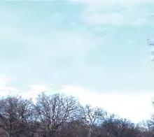
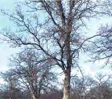
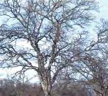
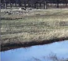
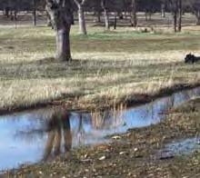
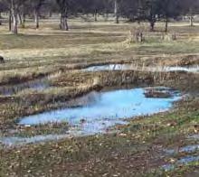
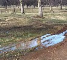
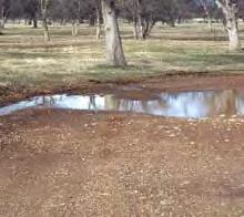
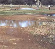
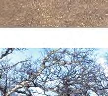
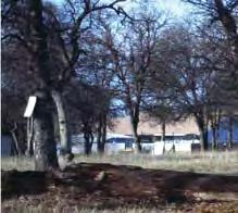
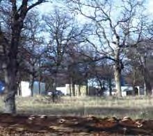
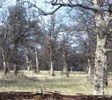
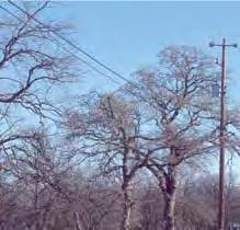
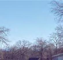
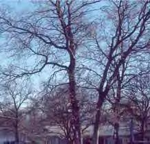
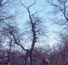
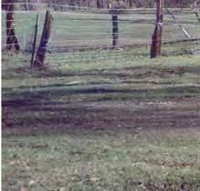
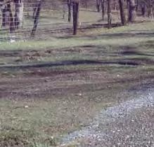
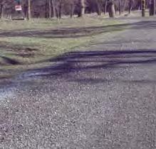
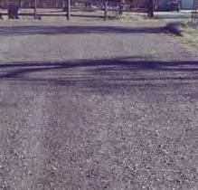
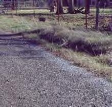
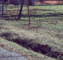
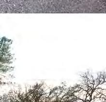
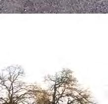
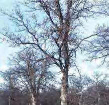
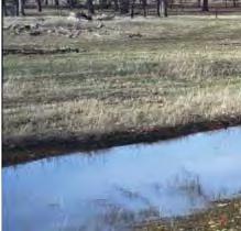
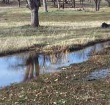
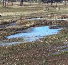
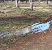
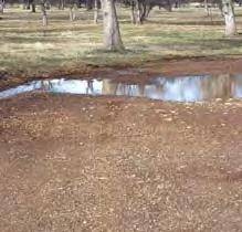
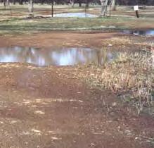
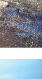
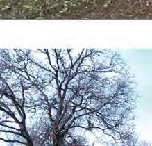
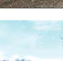
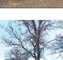
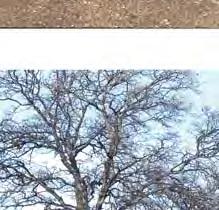
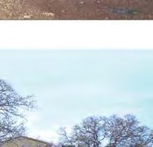
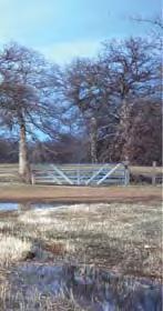
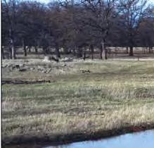
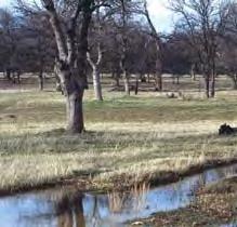
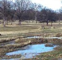
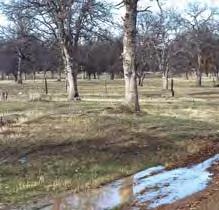
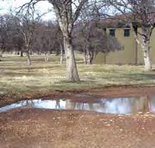
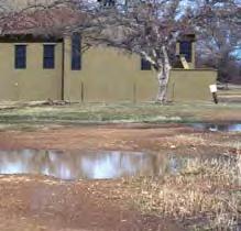
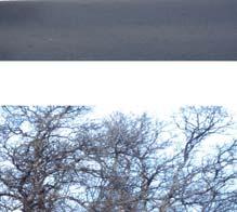
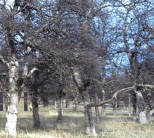
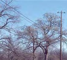
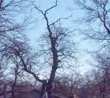
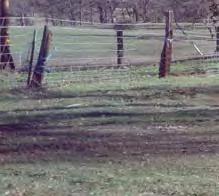
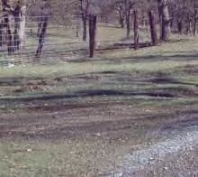
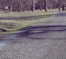
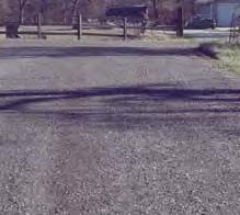
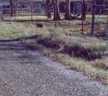
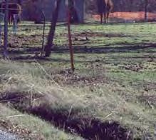
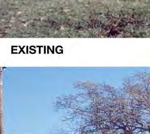
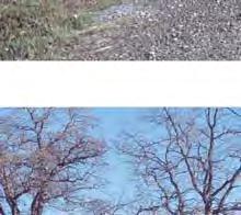
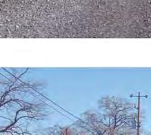
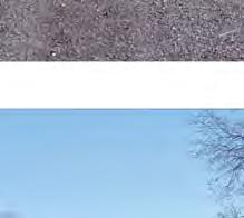
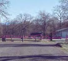
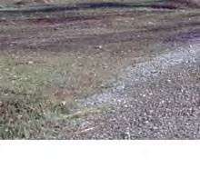
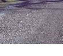
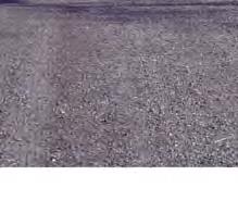
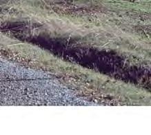
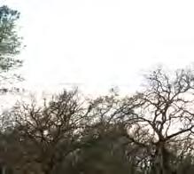
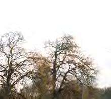
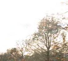
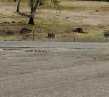
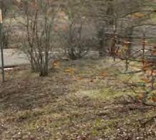
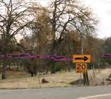
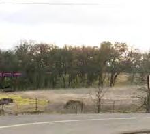
2 LOCAL SETTING The views surrounding the site are generally similar to the visual conditions within the proposed project site, and are characterized by woodlands and open space with varying topography. The majority of lands immediately adjacent to the proposed project site are predominantly rural residential uses with associated undeveloped ranch land and transportation uses. Vast open space and woodland areas are located to the north, south, east, and west of the proposed project site with generally varying topography. Distant views to ridgelines to the north, east, and west are not afforded from the proposed project site and are nominally visible from local roadways in the vicinity (refer to Figure 5.1-1, EXISTING CONDITIONS PHOTOGRAPHS). PROJECT SITE The project site encompasses approximately acres of vacant land historically used for ranching purposes. A single wood and wire corral, some interior fences, and a network of dirt roads cross the proposed project site. Onsite topography is characterized as level to rolling terrain in the western portion of the proposed project site, and steeper slopes and ridges are located in the eastern portion of the property, with elevations ranging from approximately 600 feet above msl to 650 feet above msl. The upland areas of the proposed project site have a vegetative composition that is dominated by blue oaks with scattered gray pine over an annual grassland understory. Tree canopy cover ranges from 10 percent to 50 percent with the majority of the trees being greater that six-inch diameter at breast height (dbh). Annual grasses and forbs comprise the understory with patches of manzanita, coffee berry, and poison oak being the predominant shrubs. Three major drainage systems traverse the proposed project site, including Clough Creek, which flows southwest across the northwest corner of the property, an unnamed stream that flows south across the east central portion of the proposed project site, and a major unnamed drainage that flows from north to southeast across the eastern side of the proposed project site. Along Clough Creek there is a narrow belt of riparian habitat interspersed with upland vegetation with annual grasses. There are also scattered pockets of riparian habitat located along the creek in the northeast portion of the property. These drainage systems provide some aesthetic value on the proposed project site. SCENIC HIGHWAYS The California Scenic Highway Program is administered by the California Department of Transportation (Caltrans). The goal of the program is to preserve and protect scenic highway corridors from change that would affect the aesthetic value of the land adjacent to highways. Interstate 5 (I-5), located approximately 4.9 miles to the west of the proposed project site, and State Route 44 (SR-44), located approximately 2.2 miles to the south, are designated as Eligible State Scenic Highways Not Officially Designated by Caltrans. 1 The proposed project site is not visible from these eligible State scenic highways. 1 Caltrans (California Department of Transportation) California Scenic Highway Mapping System. [Online]: Accessed June 20,2017. DRAFT OCTOBER AESTHETICS AND VISUAL RESOURCES


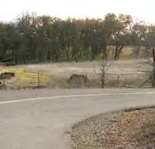
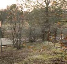
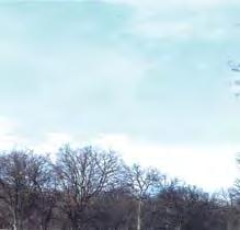
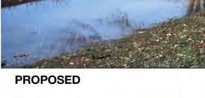
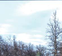
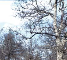
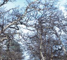
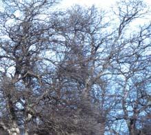
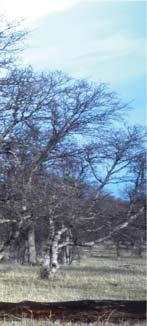
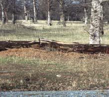
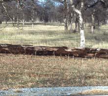
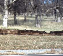
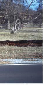
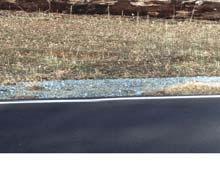
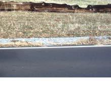
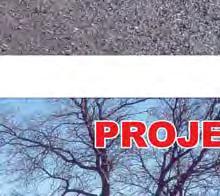
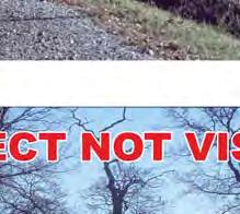
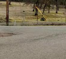
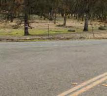
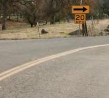
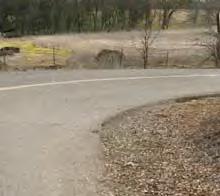
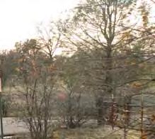
3 View of the project site looking north from Northgate Drive. View of existing rural residential uses to the south of the project site. View of existing rural residential uses to the south of the subject site. View of existing rural residential uses to the south of Boyle Road. TIERRA ROBLES PLANNED DEVELOPMENT EIR Existing Conditions Photographs Figure 5.1-1
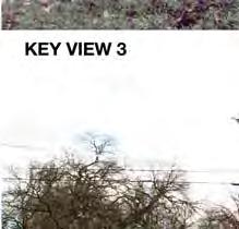
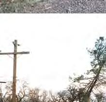
4 The Scenic Highways Element is an optional element of the Shasta County General Plan authorized by Section of the Government Code. The Scenic Highways Element is intended to establish and protect highways with scenic value, be they State or County roads. In the vicinity of the proposed project site, Figure SH-1, Scenic Highways, in the Scenic Highway Element of the Shasta County General Plan designates I-5, State Route 299 (SR-299), and a portion of SR-44 as a Corridor in Which Natural and Man-Made Environment Contrast. SR-299 is also designated as a State Route Eligible for Official Highway Designation, Corridor in Which Natural Environment is Dominant to the north, and SR-44 is designated as a State Route Eligible for Official Scenic Highway Designation, Corridor in Which Natural and Man- Made Environment Contrast to the south. VISUAL CHARACTER/QUALITY Michael Baker conducted a photographic inventory of the project area to document the existing visual character and quality of the proposed project site and its surroundings; refer to Figure The most prominent factors influencing the character of the proposed project site and its surroundings are the woodland areas and open space. The project area consists of rural residential and open uses with varying rolling topography and moderately wooded areas. Residential uses and transportation uses surround the proposed project site. The proposed project site currently consists of undeveloped vacant land open space, and was previously used for ranching and grazing cattle activities. The proposed project site is covered with a variety of tree species, including blue oaks with scattered gray pine over an annual grassland understory in the upland areas. Some occurrences of live oak are also found within the steeper draws of the drainage in the northeast corner of the proposed project site. Three drainage systems dissect the proposed project site in generally a north-south direction, including Clough Creek. These onsite drainage systems contain some riparian areas, and provide visual interest to the proposed project site and surrounding area. KEY VIEWS In order to analyze the potential change in character/quality at the proposed project site, the existing visual conditions, as seen from offsite Key View locations, has been documented. A Key View is an area (in this case, the proposed project site) that can be seen from a particular public location. Selected Key Views, which were determined in consultation with County staff, represent public views from both the public right-of-way and publicly accessible areas located within the vicinity of the proposed project site. Characteristics for each Key View are defined within foreground, middle ground, and/or background views. Characteristics located within foreground views are located at close range and tend to dominate the view. Characteristics located within middle ground views are distinguishable, yet not as sharp as those characteristics located in the foreground views. Features located within the background views have few details and distinctions in landform and surface features. The emphasis of background views is an outline or edge. Silhouettes and ridges of one landmass against another are the conspicuous visual aspects of the background, with the skyline serving as the strongest line. Objects in the background eventually fade to obscurity with increasing distance. The following four Key Views were selected for this analysis (refer to Figure 5.1-2, KEY VIEW LOCATION MAP, for the locations of the identified Key Views): DRAFT OCTOBER AESTHETICS AND VISUAL RESOURCES

5 RD LAKES 7 DESCHUTES ROAD OLD ALTURAS ROAD 4 7 LAKES ROAD FALLING LEAF ROAD RAE LANE 3 OAK KNOLL RD CHOLET WAY 1 NORTHGATE DRIVE 2 BOYLE ROAD 1 Project Site Direction of Photo Key View Location Key View Number SOURCE: Google Earth, 2016 N.T.S. TIERRA ROBLES PLANNED DEVELOPMENT EIR Key View Location Map Figure 5.1-2
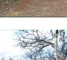
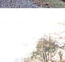
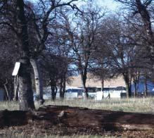
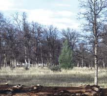
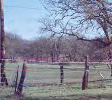
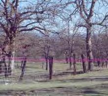
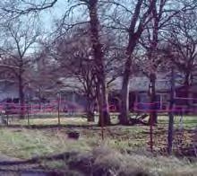
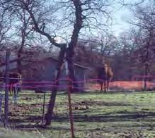
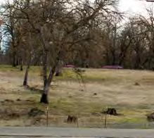
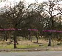
6 Key View 1 Key View 1 is a northern view of the proposed project site from Northgate Drive to the south of the proposed project site. This Key View represents views from rural residential uses to the south of the proposed project site. Key View 2 Key View 2 is a northern view of the proposed project site from Boyle Road, to the south of the proposed main access road at Boyle Road. This Key View represents views from rural residential uses to the south of the proposed project site along Boyle Road. Key View 3 Key View 3 is an eastern view of the proposed project site from along Oak Knoll Road. This Key View represents views from rural residential uses to the west of the proposed project site. Key View 4 Key View 4 is a southern view of the proposed project site from the intersection of Old Alturas Road and Seven Lakes Road. This Key View represents views from rural residential uses to the north of the proposed project site. The following describes the existing visual character/quality of the proposed project site and surrounding area, as seen from the identified Key Views. Key View 1 The existing character consists of open space and woodlands (refer to Figure 5.1-3, KEY VIEWS 1 AND 2 EXISTING CONDITIONS). Foreground views of vacant annual grassland and dirt access road (with associated gate entry) to the proposed project site are afforded. Middle ground and background views include open space and scattered woodland areas as well. Key View 2 The existing character within this Key View consists of woodland areas and annual grasses (refer to Figure 5.1-3). Foreground views consist of a small portion of Boyle Road and annual grassland. Existing rural residential uses are visible to the west of the proposed project site. No background views are afforded as a result of dense trees and relatively flat topography seen this this Key View. Key View 3 The existing character of Key View 3 is comprised of open space, woodlands, and rural residential uses. Foreground views consist a gravel road (Oak Knoll Road), and annual grasses (refer to Figure 5.1-4, KEY VIEWS 3 AND 4 EXISTING CONDITIONS). Middle ground views are comprised of a rural residential use and woodland areas. No background views are afforded as a result of existing topographic conditions and dense trees. Key View 4 The existing character, as viewed from Key View 4, is comprised of open space and woodlands. Foreground views are dominated by the paved Alturas Road, roadside vegetation, and an overhead power line running in an east-west direction. Middle ground consists of open space and woodland areas to the north of the proposed project site. No background views are afforded as a result of existing topographic conditions and dense trees (refer to Figure 5.1-4). DRAFT OCTOBER AESTHETICS AND VISUAL RESOURCES


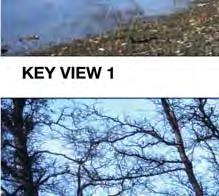
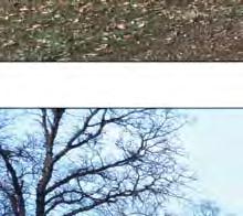


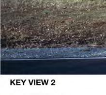
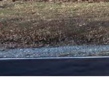
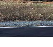
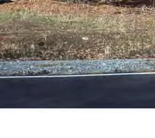
7 01/16 JN ENVIRONMENTAL IMPACT REPORT TIERRA ROBLES PLANNED DEVELOPMENT Key Views 1 and 2 Existing Conditions Figure 5.1-3


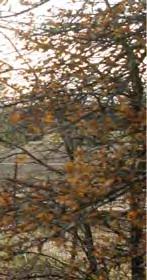


8 EIR Key Views 3 and 4 Existing Conditions Figure 5.1-4
9 LIGHT AND GLARE Lighting effects are associated with the use of artificial light during the evening and nighttime hours. There are two primary sources of light: light emanating from building interiors passing through windows and light from exterior sources (i.e., street lighting, building illumination, security lighting, parking lot lighting, and landscape lighting). Light introduction can be a nuisance to adjacent residential areas, diminish the view of the clear night sky and, if uncontrolled, can cause disturbances. Uses such as residences and hotels are considered light sensitive, because occupants have expectations of privacy during evening hours and may be subject to disturbance by bright light sources. Light spill is typically defined as the presence of unwanted light on properties adjacent to the property being illuminated. With respect to lighting, the degree of illumination may vary widely depending on the amount of light generated, height of the light source, presence of barriers or obstructions, type of light source, and weather conditions. Glare is primarily a daytime occurrence caused by the reflection of sunlight or artificial light by highly polished surfaces such as window glass or reflective materials and, to a lesser degree, from broad expanses of light-colored surfaces. Daytime glare generation is common in urban areas and is typically associated with buildings with exterior facades largely or entirely comprised of highly reflective glass. Glare can also be produced during evening and nighttime hours by the reflection of artificial light sources such as automobile headlights. Glare generation is typically related to either moving vehicles or sun angles, although glare resulting from reflected sunlight can occur regularly at certain times of the year. Glare-sensitive uses include residences, hotels, transportation corridors, and aircraft landing corridors. The proposed project site consists of vacant undeveloped land, open space, and woodland areas. Currently, sources of light and glare are not present within the boundaries of the proposed project site. Surrounding light and glare occur in the project area as a result of exterior and interior lighting for residential uses, as well as vehicle headlights from motorists traveling along Boyle Road, Old Alturas Road/Seven Lakes Road, and Northgate Drive REGULATORY SETTING The following is a description of Federal, State, and local environmental laws and policies that are relevant to the California Environmental Quality Act (CEQA) review process. FEDERAL National Scenic Byways Program The National Scenic Byways Program is part of the U.S. Department of Transportation, Federal Highway Administration (FHWA). Established in Title 23, Section 162 of the United Sates Code, the program is a grass-roots collaborative effort established to help recognize, preserve, and enhance selected roads throughout the United States. FHWA s May 18, 1995 interim policy sets forth the procedures for the designation by the U.S. Secretary of Transportation of certain roads as National Scenic Byways or All- American Roads based on their archaeological, cultural, historic, natural, recreational, and scenic qualities. There are 150 such designated byways in 46 states. There are no federally designated byways in the project vicinity. 2 2 FHWA (Federal Highway Administration). America s Byways. [Online]: Accessed June 20,2017. DRAFT OCTOBER AESTHETICS AND VISUAL RESOURCES
10 STATE California Scenic Highway Program California s Scenic Highway Program was created by the legislature in Its purpose is to protect and enhance the natural scenic beauty of California highways and adjacent corridors, through special conservation treatment. The State laws governing the Scenic Highway Program are found in the Streets and Highways Code, Sections 260 through 263. Caltrans has compiled a list of State highways that are designated as scenic and county highways that are eligible for designation as scenic. As discussed above, Caltrans has identified I-5 (located approximately 4.9 miles to the west of the proposed project site) and SR-44 (located approximately 2.2 miles to the south) as designated Eligible State Scenic Highways Not Officially Designated. LOCAL Shasta County General Plan The Shasta County General Plan Design Review Element, as amended through September 2004, provides the following visual resource and aesthetics objectives relative to the proposed project. There are no specific Shasta County General Plan policies that relate to aesthetics. DR-1. Promote a visually appealing developed environment in urban, suburban, town center, mixed use, and rural residential settings. DR-2. Provide the County's communities the opportunity to develop their individual and local character, as reflected by citizens involved in their planning process. Shasta County Code Section , Lighting, of the Shasta County Code contains the following policy related to aesthetics that would apply to the proposed project. All lighting, exterior and interior, shall be designed and located so as to confine direct lighting to the premises. A light source shall not shine upon or illuminate directly on any surface other than the area required to be lighted. No lighting shall be of the type or in a location such that constitutes a hazard to vehicular traffic, either on private property or on abutting streets STANDARDS OF SIGNIFICANCE SIGNIFICANCE CRITERIA In accordance with State CEQA Guidelines, the effects of a project are evaluated to determine whether they would result in a significant adverse impact on the environment. An EIR is required to focus on these effects and offer mitigation measures to reduce or avoid any significant impacts that are identified. The criteria used to determine the significance of impacts may vary depending on the nature of the project. According to Appendix G of the State CEQA Guidelines, the proposed project would have a significant impact related to aesthetics/light and glare, if it would: DRAFT OCTOBER AESTHETICS AND VISUAL RESOURCES
11 Have a substantial adverse effect on a scenic vista. Refer to AREAS OF NO PROJECT IMPACT, below. Substantially damage scenic resources, including but not limited to, trees, rock outcroppings, and historic buildings within a State scenic highway. Refer to AREAS OF NO PROJECT IMPACT, below. Substantially degrade the existing visual character or quality of the site and its surroundings. Refer to Impact 5.1-1, below. Create a new source of substantial light or glare, which would adversely affect day or nighttime views in the area. Refer to Impact 5.1-2, below. Based on these standards, the effects of the proposed project have been categorized as either a less than significant impact or a potentially significant impact. Mitigation measures are recommended for potentially significant impacts. If a potentially significant impact cannot be reduced to a less than significant level through the application of mitigation, it is categorized as a significant and unavoidable impact. AREAS OF NO PROJECT IMPACT In October 2012 and February 2016, the County conducted an Initial Study to determine significant effects of the proposed project. In the course of this evaluation, certain impacts of the proposed project were found to not to be significant because of the inability of a project of this scope to create such impacts or the absence of project characteristics producing effects of this type. The effects determined not to be significant are not required to be included in primary analysis sections of the Draft EIR. As such, the following impacts either are not applicable to the proposed project or are not reasonably foreseeable and are not addressed further within this section (refer to Section 10.0, EFFECTS FOUND NOT TO BE SIGNIFICANT): Have a substantial adverse effect on a scenic vista. Substantially damage scenic resources, including but not limited to, trees, rock outcroppings, and historic buildings within a State scenic highway POTENTIAL IMPACTS AND MITIGATION MEASURES METHODOLOGY The potential impacts of the proposed project were evaluated qualitatively by comparing the anticipated project effects on aesthetics, light, and glare with existing conditions. The evaluation is based on professional judgment, an analysis of project consistency with the goals and polices of the General Plan, and the significance criteria established by Appendix G of the State CEQA Guidelines, which the County has determined to be appropriate criteria for this Draft EIR. Further information in this section is based on, but not limited to, the County s General Plan, available literature, and other publicly available information from the affected agencies. DRAFT OCTOBER AESTHETICS AND VISUAL RESOURCES
12 Photographic simulations have been utilized to depict at a conceptual level of detail the before and after conditions of the proposed project. For comparative purposes, site photographs are used to demonstrate the general character at different points of the project area. These simulations are subject to change and are intended to provide the reader with information on the form, size, and scale of the proposed structures within the project area. Although architectural details are used in the photosimulations to provide a general analysis, these architectural details have not yet been designed/finalized on a project-level bases and are subject to change upon final design, In accordance with CEQA, the effects of a project are evaluated to determine if they would result in a significant adverse impact on the environment. Aesthetics/light and glare impacts are analyzed below according to topic. Mitigation measures directly correspond with an identified impact. IMPACT Implementation of the proposed project would substantially degrade the existing visual character or quality of the site and its surroundings. Significance: Less Than Significant Impact. Impact Analysis: The potential short-term (construction) and long-term (operational) visual impacts are discussed below. Short-Term Construction As described in Section 3.0, PROJECT DESCRIPTION, the timing of the development and build-out of the proposed project would be ultimately driven by market conditions. Construction of the project is anticipated to begin within one to two years after the approval of the tentative map and build-out anticipated over a 10- to 15-year period. Basic infrastructure construction such as roadways, bridges, and utilities would be installed prior to construction of individual houses. The residential units would then be developed individually by homeowners depending on market conditions and demand. Approximately percent of the total project area would be graded for building sites if the total designated building envelope was graded on each lot. The proposed project has been designed so the grading for the individual homes would be limited to the clearing of the necessary trees from the building pad and construction of the building foundation on the existing grade. Surrounding sensitive receptors that would have views of the proposed project site during construction include rural residential uses. Sensitive receptors that would have moderate and short duration views would include motorists traveling along Boyle Drive, Old Alturas Road, and Seven Lakes Lane. Construction-related activities would temporarily influence the character of the proposed project site, as viewed from surrounding uses and motorists. During grading of the proposed project, the various construction activities would intermittently alter the character of the proposed project site and its surroundings. Graded surfaces, construction debris, construction equipment, and truck traffic would be visible. Additionally, soil would be stockpiled and equipment for grading activities would be staged at various locations throughout the project site. The duration and intensity of project construction would vary with each stage. Equipment used for construction would vary day-to-day depending on the activity, but would include scrapers/earthmovers, wheeled dozers, water trucks, forklifts, wheeled loaders, and/or DRAFT OCTOBER AESTHETICS AND VISUAL RESOURCES
13 motor graders. Adjoining residents would have direct views of the project s construction activities, which would visibly degrade the character for this area. Upon completion of grading activities for the proposed Tentative Tract Map No. 1996, individual home owners would then construct homes on the graded pads at the site. Construction of the onsite residential structures is anticipated to occur over approximately 10 years. As these impacts are temporary in nature and would cease upon project completion, the project s construction-related impacts to the visual character or quality of the site and its surroundings are considered to be less than significant. Long-Term Operation The visual analysis of a proposed project must consider its visual quality and compatibility in consideration of the area s visual sensitivity. The analysis provided below examines the proposed project for compatibility with the character of the surrounding residential and open space land uses, in consideration of the following visual elements: Architectural features (e.g., repetition of design elements: materials, texture, colors, form, type of construction, details, and building systems); Scale (e.g., size relationships between adjacent buildings, and between buildings and adjacent open spaces); and Front, side, and rear yard setbacks. Implementation of the proposed project would allow for the subdivision of 166 residential lots, acres of open space (the majority of which would be situated in the eastern portion of the proposed project site), and acres of dedicated public roadway right-of-way (46.48 acres onsite and 5.23 acres offsite). The proposed residential lots would range between 1.38 acres and 6.81 acres in size, and would developed with unique custom homes in compliance with the proposed Design Guidelines (refer to Appendix 15.2, TIERRA ROBLES COMMUNITY SERVICES DISTRICT). The proposed Design Guidelines were created to provide property owners, architects, homebuilders, and contractors with a set of parameters for the preparation of their drawings and specifications. Adherence to these Design Guidelines would assure homeowners that a consistent level of quality would be maintained. The Tierra Robles Architectural Review Committee (TRARC) or the Committee would review all designs, plans, and construction to assure: Primary site design issues have been adequately considered; Excellence in architectural design; The special landscape potential of the home-site is addressed; and Compatibility and integration with surrounding land uses. Chapter III, Landscape, of the Design Guidelines encourages landscape design that is similar to the native terrain and natural beauty of the area. Chapter IV, Architecture, provides design guidelines for the residential structures to create a cohesive style and feel amongst the project. Chapter IV includes architectural design guidelines to minimize disruption to the natural topography and landscape of the project area. DRAFT OCTOBER AESTHETICS AND VISUAL RESOURCES
14 Although the actual size of the homes would vary, an average residence would be approximately 3,200 square feet with an average of 3.5 bedrooms. The proposed residential structures would be a maximum of 35 feet in height, or two stories. Housing types would consist of a mix of architectural styles, including the Country French, Italianate, Spanish Colonial, Prairie, Monterey, and Cottage styles described in the Design Guidelines. The architectural design of each unit would be encouraged to be architecturally interesting, minimize disruption to the natural topography and landscape, provide building materials with pleasing and harmonious exterior appearance, use appropriate exterior colors (with bright colors limited or used in restraint), utilize a consistent scale, each design element should be designed to be in proportion to the others, and specific features of the architectural style would be encouraged to be well developed and carefully detailed. Specifically, simple two story box massing with little or no relief (i.e., Colonial, Italian Renaissance, Greek Revival, etc.) would not be typically accepted by the TRARC. Foundations and exterior walls would be constructed of brick, stucco, stone, or wood. Brick materials would be earth tone in color and the textures would not have contrived surfaces. Acceptable roofing materials would be appropriate to the architecture of the house and of high grade with a minimum 30- year life span. Windows and doors would be made of wood, vinyl, vinyl-clad wood, or vinyl-clad aluminum. Alternative window materials would be considered on a case by case basis. Glazing would be clear or gray tinted only. Reflective window materials would not be permitted. Warm earth tone colors including, but not limited to dark ochers, browns, grays, creams, rusts, buffs, rose beige, and terra cotta would be preferred. The project does not include any perimeter walls or fences. The construction of fencing would be restricted to backyard fences or privacy fencing adjacent to the residence. As described in the Design Guidelines, all walls and fences at residential lots would be a maximum of six feet in height, and designed to be compatible with the total surrounding environment and would not obstruct natural views. All fences would be required to conform to the Tierra Robles Master Fencing Plan (refer to Appendix 15.2). This plan designates the location and design of fencing for individual home sites. Approximately 15 roadway segments would be constructed on-site, along with an emergency access easement to Old Alturas Road (refer to Figure 3-8, TYPICAL ROADWAY SECTIONS). The roadway network would also result in two 40-foot span bridges at two locations to cross Clough Creek. The internal street network would be designed and constructed to meet applicable local street standards. Tierra Robles Parkway would be constructed to run northerly from Boyle Road beginning approximately 1.25 miles east of the intersection of Boyle Road and Old Alturas Road. This new road would be located within an 84-foot wide right-of-way which would traverse the proposed project site, and ultimately tie into Seven Lakes Road, adjacent to its intersection with Old Alturas Road. A series of internally looped roads with right-ofway ranging between 50 feet to 60 feet in width would be connected to this main road which would provide access to the internal lots of the proposed project. Landscaping would be required and would be encouraged to enhance the surroundings of the residential structures. Landscaping would be similar to the trees, shrubs, and ground covers that complement the existing character of the oak woodland, grassland, and riparian areas on-site. Riparian plants would be encouraged to be used in riparian areas while drier highly drought resistant plants would be encouraged to be utilized in the development/grassland interface. The Design Guidelines provide provides a list of suggested plant materials, which has been selected to complement and best represent the encouraged promontory style of design. These plants would be planted throughout the community along streets and DRAFT OCTOBER AESTHETICS AND VISUAL RESOURCES
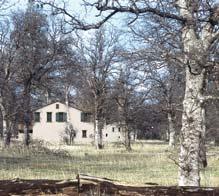
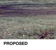
15 open space areas. The minimum landscape standards would be provided in Chapter III, Landscape, of the Design Guidelines. In order to demonstrate the degree of change resulting the proposed grading, building massing, and infrastructure, photosimulations were prepared for the identified Key Views 1 through 4. The photosimulations depict massing and scale, and are intended to generally illustrate the form, size, and function of the project s proposed structures, in the context of their environmental setting. The following analyzes the project s effects on the existing visual character/quality of the site and its surroundings. Key View 1. Views from Key View 1 are afforded from adjoining residential uses near the existing access road along Northgate Drive (refer to Figure 5.1-5, KEY VIEW 1 EXISTING AND PROPOSED CONDITIONS). Project implementation would result in residential units, up to two stories in height. Due to the limited amount of grading proposed on each lot, the existing surrounding grasses and trees mostly remain, maintain a similar character to the existing proposed project site and surrounding area. The proposed residential structures would be comprised of earth tone colors similar to the existing natural landscape, and would be of similar scale and massing as existing residential structures in the surrounding area. New residential structures are nominally visible in background views, and the exterior earth tone colors are similar to the colors of the existing natural landscape. Thus, impacts to the character/quality of the site and surroundings would be less than significant at Key View 1. Key View 2. Views from Key View 2 are afforded from motorists traveling along Boyle Road as well as rural resident uses to the south and west of the proposed project site (refer to Figure 5.1-6, KEY VIEW 2 - EXISTING AND PROPOSED CONDITIONS). Project implementation would change the character of the area as a result of the addition of hardscape and massing from the new residential structures. However, as shown in Figure 5.1-6, the proposed residential units would appear generally similar in massing and scale to the existing development to the west of the proposed project site. Further, the proposed exterior earth tone colors, encouraged by the Design Guidelines, reduce color contrast of the new structures with the surrounding natural landscape. As such, the proposed residential uses from the proposed project would appear similar in massing and scale to the surrounding community. Impacts to character/quality of the proposed project site and its surroundings, as seen from Key View 2, would be less than significant. Key Views 3 and 4. Based on the proposed grading, scale of proposed buildings (up to two stories in height), and the existing topography and intervening structures and woodlands, the proposed project would not be readily visible from uses to the north along Oak Knoll Road or Old Alturas Road (refer to Figure 5.1-7, KEY VIEW 3 - EXISTING AND PROPOSED CONDITIONS, and Figure 5.1-8, KEY VIEW 4 - EXISTING AND PROPOSED CONDITIONS). No readily visible impacts would result in this regard. Offsite Improvements Several offsite intersection improvements have been identified for the proposed project (refer to MM through MM in Section 5.16, TRAFFIC AND CIRCULATION). These improvements would generally occur at-grade, within previously disturbed right-of-way and would to be constructed in accordance with County and/or City design criteria. Aesthetic impacts associated with these mitigation measures would be less than significant. DRAFT OCTOBER AESTHETICS AND VISUAL RESOURCES


16 EIR Key View 1 Existing and Proposed Conditions Figure 5.1-5


17 EIR Key View 2 Existing and Proposed Conditions Figure 5.1-6


18 - Depicts locations of proposed structures that are not visible due to intervening trees and topography. TIERRA ROBLES ENVIRONMENTAL PLANNED DEVELOPMENT IMPACT REPOR EIR Key View 3 Existing and Proposed Conditions Figure 5.1-7


19 - Depicts locations of proposed structures that are not visible due to intervening trees and topography. TIERRA ROBLES ENVIRONMENTAL PLANNED DEVELOPMENT IMPACT REPOR EIR Key View 4 Existing and Proposed Conditions Figure 5.1-8
20 In conclusion, implementation of the proposed project would not result in substantial changes to the visual character/quality of the site or its surroundings. The proposed residential units would be of similar massing and scale, compared to the surrounding rural residential community. Further, the proposed project would be required to comply with the proposed Design Guidelines, which would ensure that the proposed building materials and landscaping would be of similar character to the existing surrounding environment. Thus, impacts to the long-term character/quality of the project site and surrounding area would be less than significant. Mitigation Measures: No mitigation measures are required. Level of Significance After Mitigation: No mitigation measures are required. Less than significant impacts would occur. IMPACT Implementation of the proposed project could create a new source of substantial light or glare, which could adversely affect day or nighttime views in the area. Significance: Less Than Significant Impact. Impact Analysis: Potential short-term and long-term light and glare impacts are discussed below. Longterm impacts were evaluated based on a photometric analysis prepared for the proposed project. Short-Term Construction Construction activities for the project would likely be limited to normal daytime hours (i.e., 7:00 a.m. to 7:00 p.m. on weekdays). The project would not require nighttime lighting for construction activities. Thus, implementation of the proposed project would not result in substantial lighting conditions during construction. A less than significant impact would occur in this regard. Long-Term Operation Light sources associated with the project would include new exterior residential lights, and vehicle headlights entering and exiting the project site. However, all residential exterior lighting would be required to comply with the Design Guidelines, and (Lighting), of the Shasta County Code. The Design Guidelines and Shasta County Code require new exterior lighting to be oriented or shielded to minimize glare, and avoid light spillage onto adjacent neighbors. Glare shields would be required to eliminate bright spots and glare sources, and exterior lighting would utilize low-voltage or similar non-glare direct task type fixtures as close to grade as possible. All exterior lighting would be equivalent to Good Light Fixtures as defined by the International Dark Sky Association, 3 and would be reviewed and approved by the TRARC prior to installation. Compliance with the Design Guidelines and County s lighting standards would result in a less than significant impact from exterior lighting sources at the project site. 3 IDSA (International Dark Sky Association). Outdoor Lighting Basics. [online]: Accessed June 20, DRAFT OCTOBER AESTHETICS AND VISUAL RESOURCES
21 The two primary access roads to the project site would be located at the southern portion of the site near Boyle Road, and to the north near Alturas Road. Vehicle headlights entering and exiting the project site from the proposed access roads would create a new light source in the project area. In addition, vehicle headlights navigating the project site via the proposed onsite roadway system would create additional light sources. However, existing residential uses in the project area are currently exposed to vehicle headlights driving on Boyle Road, Alturas Road, and Deschutes Road, as well as local residential streets. In addition, sight distance between the surrounding residential uses and the proposed residential units, as well as existing intervening trees would further reduce vehicle headlight sources associated with the proposed project. A less than significant impact would occur in this regard. Glare Impacts The proposed project would include the use of passive solar design at the onsite residential uses. As a Condition of Approval for the proposed project, each single-family residence would include the potential for use of a combination of photovoltaic (PV) cells, solar water heating, and other solar construction design techniques. Unlike collector solar systems where sunlight is concentrated in a mirror, focused and redirected to an engine, a PV panel is designed to absorb solar energy and convert it directly to electricity. The more sunlight that is absorbed, the more energy that can be produced. According to a study prepared by SunPower Corporation in 2010, The glare and reflectance levels from a given PV system are decisively lower than the glare and reflectance generated by the standard glass and common reflective surfaces in the environments surrounding the given PV system. 4 Also, many PV systems include an anti-reflective layer on the glass that can reduce the sunlight that is reflected and increase the amount of sunlight that is absorbed. Most solar panels are now designed with at least one anti-reflective layer and some panels have multiple layers. These measures further reduce reflectivity. As such, glare impacts from the proposed project would be less than significant. Mitigation Measures: No mitigation measures are required. Level of Significance After Mitigation: No mitigation measures are required. Less than significant impacts would occur CUMULATIVE SETTING, IMPACTS, AND MITIGATION MEASURES IMPACT Project development, together with cumulative projects, may result in long-term cumulative aesthetic, light and glare impacts. Significance: Less Than Significant Impact. Cumulative Setting: The geographic scope for cumulative impacts to aesthetics/light and glare includes past, present, and reasonably foreseeable projects as identified in Section 4.0, BASIS OF CUMULATIVE ANALYSIS. Impacts of the proposed project would be cumulatively considerable if they have the potential to combine with similar impacts of the identified cumulative projects. 4 SunPower Corporation PV Systems: Low Levels of Glare and Reflectance vs. Surrounding Environment. DRAFT OCTOBER AESTHETICS AND VISUAL RESOURCES
22 Impact Analysis: Future development in accordance with the County s General Plan would result in further development within the County. As development occurs through the County, residents and visitors to the area would notice the visual effects of increased development. The significance of these visual and aesthetic changes is difficult to determine, because aesthetic value is subjective and potential impacts are site-specific. Short-Term Construction Overall, buildout of the Shasta County General Plan would result in increased development throughout the County. However, there are no cumulative projects located within the viewshed of the proposed project site. Grading activities associated with the construction of other cumulative projects are not anticipated to visible concurrently with construction of the proposed project. Long-Term Operation Buildout of the Shasta County General Plan would result in increased development throughout the County and result in a change in the character/quality of the County. However, with implementation of the policies and implementation measures of the Shasta County General Plan, as well as compliance with the County s Design Review program on a project-by-project basis, this overall increase in development would result in less than significant impacts. The proposed project would cumulatively contribute to the increased developed appearance in the area. As discussed in Impact 5.1-1, above, implementation of proposed project would result in less than significant impacts as a result of this change in character/quality. Further, the proposed project would be subject to the County s Design Review program, as well as adherence to the proposed Design Guidelines and would be subject to review and approval by TRARC for all designs, plans, and construction. Thus, cumulative impacts to long-term character/quality would be less than significant, and the proposed project would not significantly contribute to cumulative long-term visual impacts. As discussed in Impact 5.1-2, above, each project would be subject to (Lighting), of the Shasta County Code which requires all new exterior lighting to be oriented or shielded to minimize glare, and avoid light spillage onto adjacent neighbors. Glare shields would be required to eliminate bright spots and glare sources, and exterior lighting would utilize low-voltage or similar non-glare direct task type fixtures as close to grade as possible. Compliance with the County s lighting standards would result in a less than significant cumulative impacts from increased lighting sources. Mitigation Measures: No mitigation measures are required. Level of Significance After Mitigation: No mitigation measures are required. Less than significant impacts would occur. DRAFT OCTOBER AESTHETICS AND VISUAL RESOURCES
Nob Hill Pipeline Improvements Project EIR
 Section 3.1 Aesthetics This section addresses the visual aspects that may affect the views experienced by the public, including the potential to impact the existing character of each area that comprises
5.1 AESTHETICS AND VISUAL RESOURCES Physical Setting
 5.1 AESTHETICS AND VISUAL RESOURCES 5.1.1 Physical Setting Aesthetic values are an important aspect in establishing the identity, sense of place, and quality of life in a community. Natural features in
5. Environmental Analysis
 5.1 This section of the Draft Environmental Impact Report (DEIR) describes the existing landform and aesthetic character of the project area and discusses the potential impacts to the visual character
3.10 LAND USE SETTING PROJECT SITE EXISTING LAND USE DESIGNATIONS AND ZONING. General Plan Land Use Designations.
 This section of the Draft EIR addresses the existing land uses on and adjacent to the project site and discusses the potential impacts of the proposed project on existing land uses. Key issues addressed
6.8 SCENIC HIGHWAYS Introduction
 6.8 SCENIC HIGHWAYS 6.8.1 Introduction The Scenic Highways Element is an optional General Plan element authorized by Section 65303 of the Government Code. The Scenic Highways Element is intended to establish
CHAPTER 10 AESTHETICS
 CHAPTER 10 AESTHETICS CHAPTER 10 AESTHETICS This section identifies and evaluates key visual resources in the project area to determine the degree of visual impact that would be attributable to the project.
IV.B. VISUAL RESOURCES
 IV.B. VISUAL RESOURCES ENVIRONMENTAL SETTING Existing Visual Character Project Site The project site is located at 17331-17333 Tramonto Drive in the Pacific Palisades community of the City of Los Angeles
3.1 AESTHETICS Background and Methodology
 3.1 AESTHETICS 3.1.1 Background and Methodology 3.1.1.1 Regulatory Context The California Environmental Quality Act (CEQA) requires that project sponsors evaluate the project s potential to cause aesthetic
3.1 Aesthetics, Light, and Glare
 3.1 3.1.1 Introduction This section describes the existing aesthetics, light, and glare setting and potential effects from project implementation on visual resources and the site and its surroundings.
4.1 AESTHETICS WATSON INDUSTRIAL PARK ENVIRONMENTAL IMPACT REPORT EXISTING CONDITIONS
 This Subsection describes the aesthetic qualities and visual resources present on the Project site and in the site s vicinity and evaluates the potential effects that the Project may have on these resources.
5.11 AESTHETICS ENVIRONMENTAL SETTING
 5.11 AESTHETICS ENVIRONMENTAL SETTING The lies on a relatively flat valley floor surrounded by rugged hills and mountains. The topography of the planning area is defined by the Box Springs Mountains and
IV. ENVIRONMENTAL IMPACT ANALYSIS B. AESTHETICS 1. VIEWS
 IV. ENVIRONMENTAL IMPACT ANALYSIS B. AESTHETICS 1. VIEWS ENVIRONMENTAL SETTING Existing Visual Character Project Site The project site is located at 10250 Wilshire Boulevard in the Westwood community of
City of Lafayette Study Session Staff Report Design Review Commission
 ++ City of Lafayette Study Session Staff Report Design Review Commission Meeting Date: January 08, 2018 Staff: Subject: Chris Juram, Planning Technician SS12-17 Miramar Homebuilders, R-20 Zoning: Request
Environmental Setting, Impacts, and Mitigation Measures
 CHAPTER 3 Environmental Setting, Impacts, and Mitigation Measures Format of the Environmental Analysis The assessment of each environmental resource discussed in this chapter includes the following: Environmental
SECTION 5.1 Aesthetics, Light, and Glare
 SECTION 5.1 Aesthetics, Light, and Glare 5.1 AESTHETICS, LIGHT, AND GLARE Visual resources information for this section was compiled from photographs and site surveys conducted by RBF Consulting. The purpose
6.1 Aesthetics Introduction
 SECTION 6.0 ENVIRONMENTAL ANALYSIS 6.1 Aesthetics 6.1.1 Introduction The aesthetic quality of the proposed Project is determined by its visual character, consisting of elements such as natural and man-made
4.0 AFFECTED ENVIRONMENT AND ENVIRONMENTAL CONSEQUENCES
 4.0 AFFECTED ENVIRONMENT AND ENVIRONMENTAL CONSEQUENCES The following sections discuss the impacts associated with environmental resources for the tunneling method Alternatives A and B. The construction
Visual Impact Assessment 830 Pratt Avenue St Helena, CA
 Visual Impact Assessment 830 Pratt Avenue St Helena, CA 1. Introduction The following aesthetic visual impact assessment has been prepared pursuant to the California Environmental Quality Act (CEQA). The
The impacts examined herein take into account two attributes of aesthetic values:
 IV. ENVIRONMENTAL IMPACT ANALYSIS This section addresses the potential impacts to views and aesthetics as a result of the proposed Project at the Project Site and the development scenarios analyzed for
II. SINGLE FAMILY RESIDENTIAL
 II. SINGLE FAMILY RESIDENTIAL Castle Rock is made up of numerous individually built houses and subdivision tracts that have been developed during the past century. Some of the tracts are diverse in architectural
6.3 VISUAL RESOURCES. Landscape Character
 6.3 VISUAL RESOURCES 6.3.1 Affected Environment The DMR discussion is divided into two areas, DMR and Dillingham Trail, which would extend from SBMR to DMR. The ROI includes all areas within the line of
3.1 AESTHETICS AND VISUAL RESOURCES
 3.1 AESTHETICS AND VISUAL RESOURCES This section examines the potential for the proposed Project to create aesthetic and visual impacts as defined by the California Environmental Quality Act (CEQA) as
California Department of Transportation, California Scenic Highway Program; Placer Vineyards Specific Plan EIR prepared by Placer County;
 3.1 AESTHETICS 3.1.1 INTRODUCTION This section describes the visual character of the project site and views from surrounding public areas. This section also evaluates the change to visual resources in
-MENDOCINO COUNTY PLANNING AND BUILDING SERVICES- DIVISION II OF TITLE 20--COASTAL ZONING CODE
 CHAPTER 20.504 VISUAL RESOURCE AND SPECIAL TREATMENT AREAS Sec. 20.504.005 Applicability. Sec. 20.504.010 Purpose. Sec. 20.504.015 Highly Scenic Areas. Sec. 20.504.020 Special Communities and Neighborhoods.
Infill Residential Design Guidelines
 Infill Residential Design Guidelines Adopted March 23, 2004 Amended September 10, 2013 City of Orange Community Development Department Planning Division Phone: (714) 744-7220 Fax: (714) 744-7222 www.cityoforange.org
3.7 Aesthetics. A. Setting. 1. Existing Views of the Quarry
 3.7 Aesthetics A. Setting 1. Existing Views of the Quarry The existing quarry is visible from Highway 101 and from locations on the Ridgewood Ranch to the south. It is also possibly visible from distant
Section 3.16 Visual Quality
 Chapter 3 Affected Environment, Environmental Consequences, and Mitigation Measures Section 3.16 Visual Quality Introduction This section discusses existing conditions, effects and mitigation measures
Visual and Aesthetics
 Such a connection could accommodate timed transfers and improve connections between local transit service and Presidio Shuttle service. Level of Service The results of the analysis are provided on a route-by-route
2.0 AREA PLANS. Lakeside Business District. Lakeside Business District Land Use Categories:
 Lakeside Business District Lakeside Business District Land Use Categories: Campus Commercial Campus Commercial means a mixture of uses which includes corporate offices, office parks, hotels, commercial,
URBAN DESIGN GOALS / POLICIES / MEASURES
 URBAN DESIGN GOALS / POLICIES / MEASURES GOALS / POLICIES Authority Consideration of urban design issues in the general plan is provided under the Land Use Element requirements which direct attention to
GENERAL PLAN CONSISTENCY ANALYSIS
 GENERAL PLAN CONSISTENCY ANALYSIS Prepared by Planning Staff 10/28/2013 APPLICABLE GOALS, POLICIES AND PROGRAMS FROM the LAND USE CHAPTER Goal LU-1 Policy LU-1.1 Policy LU-1.2 Goal LU-2 Protect the character
File No (Continued)
") (Continued) Request for: (1) a Site Plan Review; (2) a Variance (to build on a significant ridgeline); (3) an Oak Tree Permit (to encroach into the protected zone of 25 oak trees and for potential thinning
(Continued) Request for: (1) a Site Plan Review; (2) a Variance (to build on a significant ridgeline); (3) an Oak Tree Permit (to encroach into the protected zone of 25 oak trees and for potential thinning
COMMUNITY DESIGN. GOAL: Create livable and attractive communities. Intent
 COMMUNITY DESIGN Intent An attractive, well-designed County will attract quality development, instill civic pride, improve the visual character of the community, and create a strong, positive image for
4.8 Landform Alteration and Aesthetics
 4.8 Landform Alteration and Aesthetics 4.8 LANDFORM ALTERATION AND AESTHETICS This section describes the potential environmental effects related to temporary and permanent impacts to landform and aesthetics,
3.2 AESTHETICS/VISUAL QUALITY
 3.2 AESTHETICS/VISUAL QUALITY This section evaluates the potential impacts of the proposed project on the existing visual conditions within MTRP. Design features proposed to reduce or avoid adverse effects
920 BAYSWATER AVENUE PROJECT
 920 BAYSWATER AVENUE PROJECT VISUAL ASSESSMENT Prepared for the City of Burlingame Prepared by Circlepoint 46 S First Street, San Jose, CA 95113 June 2018 This page intentionally left blank. 920 Bayswater
RESOLUTION NO
 RESOLUTION NO. 2018- RESOLUTION OF THE PLANNING COMMISSION OF THE CITY OF BELMONT APPROVING A SINGLE-FAMILY DESIGN REVIEW AND TREE REMOVAL PERMIT FOR A VACANT LOT ON LOWER LOCK AVENUE (APN: 043-042-750,
This section describes the existing conditions in the project area and identifies the resources that could be affected by the project.
 4.4 VISUAL RESOURCES The following analysis identifies changes in the visual environment experienced by existing offsite viewers with exposure to the site of the Mitchell Farms Subdivision (project). In
4.1 AESTHETICS. Table Impact and Mitigation Summary: Aesthetics. Impact Mitigation Measures Residual Impact
 4.1.1 Summary 4.1 AESTHETICS Table 4.1-1 summarizes the identified environmental impacts, proposed mitigation measures, and residual impacts of the proposed project with regard to aesthetics. Additional
4.1 AESTHETICS AND VISUAL QUALITY
 SCOPE AND METHODOLOGY 4.1 AESTHETICS AND VISUAL QUALITY This section evaluates the potential impacts to aesthetics and visual quality. Aesthetics refers to visual resources and the quality of what can
There are no federal programs or policies addressing visual resources that pertain to the 2018 LRDP.
 3.1 AESTHETICS This section describes the existing visual characteristics of the plan area and evaluates the potential of the 2018 LRDP to result in substantial adverse visual impacts. The visual impact
CHAPTER ADDITIONAL REQUIREMENTS IN THE NC, NEIGHBORHOOD COMMERCIAL ZONE
 CITY OF MOSES LAKE MUNICIPAL CODE CHAPTER 18.31 ADDITIONAL REQUIREMENTS IN THE NC, NEIGHBORHOOD COMMERCIAL ZONE Sections: 18.31.010 Purpose 18.31.020 Minimum Lot Area 18.31.030 Setbacks 18.31.040 Maximum
3.1 Aesthetics and Visual Resources
 3.1 This section discusses visual resources in the project area, the impacts on the visual resources that would result from the proposed project, and the mitigation measures that would reduce these impacts.
III. PROJECT DESCRIPTION
 III. PROJECT DESCRIPTION A. PROJECT LOCATION Regional Setting The project site is located in the southeast quadrant of the City of Chico in Butte County, California and is comprised of four parcels totaling
3.1 AESTHETICS AND VISUAL SENSITIVITY
 This section of the Draft EIR discusses the potential impacts of the project on aesthetics and visual resources. The primary visual and aesthetic issues include the change in character to portions of the
Site Design (Table 2) Fact Sheet & Focus Questions:
 Fact Sheet & Focus Questions:") Site Design (Table 2) Fact Sheet & Focus Questions: BACKGROUND WHAT IS SITE DESIGN? Site design refers to the arrangement of buildings and open spaces on adjacent sites to maximize the shared benefits
Site Design (Table 2) Fact Sheet & Focus Questions: BACKGROUND WHAT IS SITE DESIGN? Site design refers to the arrangement of buildings and open spaces on adjacent sites to maximize the shared benefits
5.1 AESTHETICS, LIGHT, AND GLARE
 This section describes the existing aesthetic resources in the Project area and discusses potential impacts associated with implementation of the proposed Project. The analysis focuses on the anticipated
CHAPTER 13 DESIGN GUIDELINES
 CHAPTER 13 DESIGN GUIDELINES Section 1300.00 Section 1300.01 Design Guidelines Purpose The purposes of this section are to: A. The purpose of this Section is to establish procedures and standards to serve
3.5 VISUAL AND AESTHETIC QUALITIES
 3.5 VISUAL AND AESTHETIC QUALITIES 3.5.1 Introduction to Analysis 3.5.1.1 Summary of Results The Preferred Alternative would represent a minimal change to the visual character of the existing rail corridor.
3.0 Cumulative Scenario and Methodology. 3.0 Cumulative Scenario and Methodology
 3.0 Cumulative Scenario and Methodology Under the CEQA Guidelines, a cumulative impact consists of an impact which is created as a result of the combination of the project evaluated in the environmental
3.1 AESTHETICS ENVIRONMENTAL SETTING VISUAL CHARACTER OF THE PROJECT SITE VISUAL CHARACTER OF THE SURROUNDING AREA
 3.1 AESTHETICS Aesthetic or visual resources are the natural and human-built features of the landscape that contribute to the public s appreciation and enjoyment of the aesthetic environment. This section
Visual and Aesthetic Resources
 Visual and Aesthetic Resources 7.1 INTRODUCTION This chapter evaluates the effects of the Modified Design on visual and aesthetic resources, in comparison to the effects of 2004 FEIS Design. The 2004 FEIS
4.1 AESTHETICS/VISUAL RESOURCES
 4.1 AESTHETICS/VISUAL RESOURCES This section provides a discussion of the visual resources in and around the project site, with an emphasis on the visual character and scenic qualities of the Gaviota Coast
AESTHETICS AND VISUAL RESOURCES 3.1
 AESTHETICS AND VISUAL RESOURCES 3.1 This section provides an overview of the visual character, scenic resources, views, scenic highways, and sources of light and glare that are encountered on the project
1. INTRODUCTION. a. Light. b. Glare
 IV.A.2 LIGHT & GLARE 1. INTRODUCTION This section describes the existing sources of nighttime illumination and glare on the Project site and in the surrounding area and evaluates potential changes resulting
Harvard-Westlake Parking Improvement Plan, Lighting Evaluation, Lighting Design Alliance, September 25, 2013 (Appendix I)
") 3.1 AESTHETICS The purpose of this section is to characterize the visual (aesthetic) environment that currently exists in the Project area and to identify potential impacts to: visual character, views
3.1 AESTHETICS The purpose of this section is to characterize the visual (aesthetic) environment that currently exists in the Project area and to identify potential impacts to: visual character, views
DRAFT ENVIRONMENTAL IMPACT REPORT DEEP VALLEY DRIVE AND INDIAN PEAK ROAD MIXED-USE RESIDENTIAL PROJECT
 LSA ASSOCIATES, INC. JUNE 2012 SECTION 4.1 AESTHETICS DRAFT ENVIRONMENTAL IMPACT REPORT 4.1 AESTHETICS Introduction This section provides a discussion of the existing visual and aesthetic resources on
Bel-Air Lexus Automobile Service Station
 Bel-Air Lexus Automobile Service Station Design Brief 443-447 McArthur Avenue Ottawa April 30, 2015 14-1299-MCA Site Details Application: Site Plan Control Legal Description and Municipal Addresses: 443
VISUAL RESOURCES 1. INTRODUCTION 2. EXISTING CONDITIONS. a. Visual Character
 IV.A VISUAL RESOURCES 1. INTRODUCTION This section addresses the potential changes in visual character that would result from implementation of the proposed Wilshire and La Brea Project. Also evaluated
City of Lafayette Staff Report
 City of Lafayette Staff Report For: By: Design Review Commission Greg Wolff, Senior Planner Meeting Date: April 27, 2015 Subject: SS03-15 Gundi & Peter Younger (Owners), R-40 Zoning: Request for a Study
Residential Design Guidelines
 Residential Design Guidelines Single-Family Residential Design Guidelines Introduction These guidelines seek to provide property owners, designers and developers with a clear understanding of the City
B. AESTHETICS. 1. Setting
 This section evaluates the effects of the proposed project on the aesthetics of the project site and its surroundings. This analysis also considers the consistency of the proposed project with applicable
Draft Gaviota Coast Plan Chapter 7: Visual Resources
 Draft Gaviota Coast Plan Chapter 7: Visual Resources 11/28/2012 Long Range Planning Division Planning and Development Department County of Santa Barbara Page Intentionally Blank Cover Photo: Gaviota Morning
I. STAFF POLICY RECOMMENDATIONS. The following RMP policy strategies are proposed by staff in support of a Scenic Resource Protection Program:
 Policy Consideration: Scenic Resource Protection Program Status: For Consideration by the Highlands Council at September 14, 2006 Work session Date: September 12, 2006 I. STAFF POLICY RECOMMENDATIONS The
Introduction Environmental Setting. Visual Character. Surrounding Land Uses. Regional Setting. Project Site
 Contra Costa County Tassajara Parks Project Recirculated Draft EIR Aesthetics, Light, and Glare 3.1 - Aesthetics, Light, and Glare 3.1.1 - Introduction This section describes the existing aesthetics, light,
APPENDIX A 6 CONCEPTUAL PRELIMINARY PLAN GUIDE AND CHECKLIST FOR MAJOR SUBDIVISIONS CARRBORO DEVELOPMENT GUIDE APPENDIX A
 6 CONCEPTUAL PRELIMINARY PLAN GUIDE AND CHECKLIST FOR MAJOR SUBDIVISIONS Conceptual Preliminary Guide/Checklist for Major Subdivisions Page 1 FORM: REVIEW DATE: CONCEPTUAL PLAN REVIEW 2000 REVIEWED BY:
THE PLANNING AREA 2.1 PLANNING AREA LOCATION
 2. The Planning Area Brisbane Baylands Specific Plan 21 2 THE PLANNING AREA 2.1 PLANNING AREA LOCATION The Baylands is located approximately midway between San Francisco s central business district and
IV. ENVIRONMENTAL IMPACT ANALYSIS B. AESTHETICS 1. SHADE/SHADOW
 IV. ENVIRONMENTAL IMPACT ANALYSIS B. AESTHETICS 1. SHADE/SHADOW ENVIRONMENTAL SETTING The issue of shade and shadow pertains to the blockage of direct sunlight by onsite buildings, which affect adjacent
CHAPTER 15 AESTHETICS. Setting. Introduction. Impacts and Mitigation Measures of the 2015 Plan Alternatives
 CHAPTER 15 AESTHETICS Introduction Setting Impacts and Mitigation Measures of the 2015 Plan Alternatives CHAPTER 15 AESTHETICS INTRODUCTION Public acceptance of a project may be strongly influenced by
IV. ENVIRONMENTAL IMPACT ANALYSIS
 IV. ENVIRONMENTAL IMPACT ANALYSIS A. AESTHETICS/VIEWS EXISTING CONDITIONS REGIONAL SETTING The project area (between Devonshire Street and the SR-118 freeway) is generally characterized by single-family
NOTICE OF PREPARATION
 NOTICE OF PREPARATION DATE: January 6, 2016 TO: LEAD AGENCY: Responsible Agencies, Organizations, and Interested Parties Contact: Tyler Barrington, Principal Planner Planning Department Community Development
Silverlakes Equestrian Sports Park Draft Environmental Impact Report
 Silverlakes Equestrian Sports Park Draft Environmental Impact Report Aesthetics 4.1 - Aesthetics 4.1.1 - Introduction This section describes the existing aesthetic setting and potential effects from project
12.0 LAND USE AND PLANNING
 This section describes the existing and proposed land uses and land use designations on each of the project sites and surrounding properties, and analyzes the potential for the project to conflict with
5.1.1 The streetscape along US Highway 64 (Brevard Road); and, The built environment within new residential developments; and,
; and, The built environment within new residential developments; and,") Article 5. Landscaping 5.1 Purpose The Town of Laurel Park s landscape standards are designed to create a beautiful, aesthetically pleasing built environment that will complement and enhance community
Article 5. Landscaping 5.1 Purpose The Town of Laurel Park s landscape standards are designed to create a beautiful, aesthetically pleasing built environment that will complement and enhance community
3. ENVIRONMENTAL SETTING, IMPACTS, AND MITIGATION MEASURES
 3. ENVIRONMENTAL SETTING, IMPACTS, AND MITIGATION MEASURES Organization of this Chapter This chapter presents the environmental setting of the project for the various impact categories, and then evaluates
City of Lafayette Study Session Staff Report Design Review Commission
 City of Lafayette Study Session Staff Report Design Review Commission Meeting Date: April 24, 2017 Staff: Payal Bhagat, Senior Planner Subject: HDP18-15 & HDP31-15 Ramesh Patel & Melcor Development (Owners),
HICKORY NUT FOREST DESIGN GUIDELINES
 HICKORY NUT FOREST DESIGN GUIDELINES Introduction Hickory Nut Forest is a "net-zero energy", conservation development that is designed to protect and celebrate the property s unique ecology. A conservation
AESTHETIC APPEARANCE. Design Guidelines for Grade-Separated Pedestrian, Cyclist and Equestrian Structures
 III. AESTHETIC APPEARANCE The aesthetic qualities of a grade-separated structure are as important as the specific design criteria. For example, a structure may be constructed to the exact criteria set
IV. ENVIRONMENTAL IMPACT ANALYSIS B. AESTHETICS
 IV. ENVIRONMENTAL IMPACT ANALYSIS B. AESTHETICS INTRODUCTION This section evaluates the potential impacts of the Proposed Project on aesthetics, views and vistas, light and glare, and shade and shadows
PLANNING COMMISSION AGENDA REPORT NOVEMBER 15, 2012
 PLANNING COMMISSION AGENDA REPORT NOVEMBER 15, 2012 TO: FROM: Members of the Planning Commission Michael Klein, Associate Planner FILE NO.: 120000890 PROPOSAL: APPLICANT: Request for an Administrative
Glenborough at Easton Land Use Master Plan
 Implementation 114 9.0 IMPLEMENTATION 9.1 OVERVIEW This chapter summarizes the administrative procedures necessary to implement the proposed land use plan, infrastructure improvements, development standards,
EXHIBIT B PROJECT NARRATIVE POULSBO MEADOWS
 EXHIBIT B PROJECT NARRATIVE POULSBO MEADOWS Name of Project: Poulsbo Meadows; A Planned Residential Development (PRD)/Plat Applicants Name: PBH Group LLC/Byron Harris PO Box 1010 Silverdale, WA 98038 Description
Genex Kidston Connection Project: Draf t Environmental Assessment Report Powerlink Queensland
 : Draf t Environmental Assessment Report Powerlink Queensland Chapter 14 \\autsv1fp001\projects\605x\60577456\6. Draft Docs\6.1 Reports\4. Compiled draft 17 September\Covers\Chapters\Ch 14.docx Rev ision
Notice of Preparation of an Environmental Impact Report and Scoping Meeting for the Canyon Lane Roadway Improvements Development Project
 of an Environmental Impact Report and Scoping Meeting for the As the Lead Agency, the County of San Mateo (County) will prepare an Environmental Impact Report (EIR) for the (project), and would like your
The analysis area for the scenic resource is the project area described in Chapter 1. Affected Environment/Existing Condition
 Chapter 3 - Scenic Resource SCENIC RESOURCES Introduction The Spotted Bear Ranger District is a destination point for outdoor recreation activities and offers a variety of recreation opportunities: driving
ENVIRONMENTAL IMPACT ANALYSIS
 IV. ENVIRONMENTAL IMPACT ANALYSIS A. AESTHETICS This section addresses the potential impacts to aesthetics and views that could result from the proposed project, including development of the Add Area,
4 Residential and Urban Living Zones
 4 Residential and Urban Living Zones Refer to Chapters 11 to 20 for additional rules that may apply to these zones. 4.1 OBJECTIVES AND POLICIES Objective Res1 Policy 1 Policy 2 Policy 3 Policy 4 Policy
City of Placerville Planning Commission AGENDA REPORT ITEM 7
 Placerville, a Unique Historical Past Forging into a Golden Future City of Placerville Planning Commission REPORT ITEM 7 MEETING DATE: September 1, 2015 APPLICATION NO: 225 Placerville Drive Site Plan
VISUAL QUALITY POLICIES
 VISUAL QUALITY POLICIES The County will: GOALS AND OBJECTIVES 4.1 Protection of Visual Quality a. Protect and enhance the natural visual quality of San Mateo County. b. Encourage positive visual quality
APPENDIX D: Visual and Aesthetic Conditions for NCCU Station Refinement. Durham-Orange Light Rail Transit Project
 APPENDIX D: Visual and Aesthetic Conditions for NCCU Station Refinement Durham-Orange Light Rail Transit Project October 2016 1. Introduction The Combined FEIS/ROD summarizes the effects of the D-O LRT
Chapter 5: Recreation
 Chapter 5: Recreation Introduction and Setting Recreational opportunities within Nevada County are varied, ranging from public parks with intensively used active recreational facilities, to vast tracts
MASTER PLAN. 201 Planning Concepts. Chapter 2
 Chapter 2 MASTER PLAN 201 Planning Concepts 202 Master Land Use Plan 203 Affordable Housing Program 204 Parks, Open Space, and Recreation Trails 205 Grading Concept 206 Circulation Plan 207 Landscape Concept
4.1 AESTHETICS. A. Regulatory Framework
 4.1 This section includes a description of the existing visual setting of the project site and an analysis of the effects the proposed project would have on aesthetics in the project vicinity. Aesthetics
McCormick Pit Category 1 Class A License, Pit Below Water For Blueland Farms Limited. Visual Impact Assessment Report February 2013
 McCormick Pit Category 1 Class A License, Pit Below Water For Blueland Farms Limited Visual Impact Assessment Report February 2013 TABLE OF CONTENTS EXECUTIVE SUMMARY... v 1.0 BACKGROUND... 1 Figure 1.
Galiuro Drilling EA Scenery Debby Kriegel 12/9/16
 Galiuro Drilling EA Scenery Debby Kriegel 12/9/16 INTRODUCTION The 1.7 million acre Coronado National Forest (CNF) is comprised of 12 sky island mountain ranges. CNF visitors have opportunities to sightsee
Chapter 1 - General Design Guidelines CHAPTER 1 GENERAL DESIGN GUIDELINES
 CHAPTER 1 GENERAL DESIGN GUIDELINES 1.0 INTRODUCTION This Publication has been developed to provide current, uniform procedures and guidelines for the application and design of safe, convenient, efficient
Urban Design Manual 2.0 DRIVE-THROUGH FACILITIES. Background. Urban Design Challenges
 222221 2.0 DRIVE-THROUGH FACILITIES Background In recent years, drive-through facilities have grown significantly in popularity with drive-through restaurants, in particular, being established on numerous
Tazewell Pike. Neighborhood Conservation Overlay District Design Guidelines
 Tazewell Pike Neighborhood Conservation Overlay District Design Guidelines Knoxville Knox County Metropolitan Planning Commission November 2, 2000 These design guidelines were: Adopted by the Knoxville
I. INTRODUCTION. Project Background and Study Area
 I. INTRODUCTION Project Background and Study Area Freedom Parkway is a key east-west corridor connecting I-25 on the west to the Town of Kersey on the east, running approximately one to two miles south
4. INDUSTRIAL 53 CASTLE ROCK DESIGN
 4. INDUSTRIAL 53 CASTLE ROCK DESIGN CASTLE ROCK DESIGN 54 4. INDUSTRIAL Overview Well-designed and attractive industrial centers are the product of blending economic realities with both functional and