Catalina Magnet High School Project
|
|
|
- Phyllis Park
- 6 years ago
- Views:
Transcription
 2011 proposed phase 1 shrubs (20) proposed flagstone crossing points (3) The collaborated with Catalina Magnet High School as part of the")


 proposed phase 1 garden containers (3) proposed phase 2 benches (18) proposed phase 2 shrubs (14-20) proposed phase 2 garden")


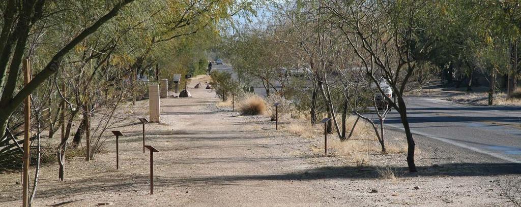
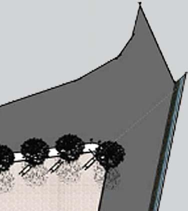
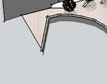
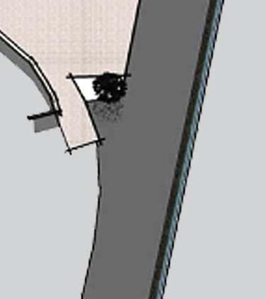
1 Catalina Magnet High School Project Lunch Patio Design Phase 1 existing trees existing shrubs proposed phase 1 trees (3) proposed phase 1 tables (4) 2011 proposed phase 1 shrubs (20) proposed flagstone crossing points (3) The collaborated with Catalina Magnet High School as part of the Communities Putting Prevention to Work (CPPW) Grant for this project. The proposal was to plant trees and add picnic tables and benches to three interior courtyards on the campus. The focus of this project was to create more hospitable environments that promote greater access to nutrition and physical fitness. The central interior courtyards at the school act as community gathering spots with the potential to offer environments that foster learning, healthy food and activity habits, and positive communication practices. The project was carried out by two classes that were engaged in empowerment and community change curriculum. proposed phase 1 garden containers (3) Phase 2 existing trees existing shrubs proposed phase 1 trees (3) proposed phase 1 tables (4) proposed phase 1 shrubs (20) proposed phase 1 garden containers (3) proposed phase 2 benches (18) proposed phase 2 shrubs (14-20) proposed phase 2 garden containers (3) Above: These photos show the proposed area for one of the lunch courtyards. In this state, the students didn t have a shaded area to eat their lunch. Students At Work Students and others from the community (right) help plant trees to bring the multi-phase project closer to completion. Armory - Expand the focus of wellness at Catalina Magnet High School - Teach literacy to ESL students by looking at the community and the surrounding environment Blenman-m Catalina High School The two plans for the shaded courtyard areas were designed by ESL refugee students. neighborhood project included: /Blenman-m proposed phase 2 rain water tanks and associated downspouts (2) Thunderbird / In Progress - Have students design and implement the courtyard plans to create a sense of pride for their school
 2 red oaks (quercus bucklyi) at location of existing bubblers 2011 The, in collaboration with Roskruge Bilingual Magnet School, has utilized funds from the Communities Putting Prevention to")
 to replace trees that have been removed 2 Armory hedge to screen traffic: 8 jojoba chi(simmondsia chi nensis);; 2 between nensis) each tree vines in planters")

 Thompson Seedless or vitis arizonica - canyon grape (native grape) N The school hopes to install the rain harvesting cistern and plant several")
 Intended to increase access to healthy foods and promote physical activity, the garden is nearing completion.")
2 Roskruge Bilingual Magnet School # priority three fruit trees in school garden: heritage pomegranate, heritage quince Location of Student Garden replace dead tree with desert willow (chilopsis linearis) 2 red oaks (quercus bucklyi) at location of existing bubblers 2011 The, in collaboration with Roskruge Bilingual Magnet School, has utilized funds from the Communities Putting Prevention to Work (CPPW) grant to enhance the school s existing Student Garden. plant 2 Texas red oaks (quercus buckleyi) to replace trees that have been removed 2 Armory hedge to screen traffic: 8 jojoba chi(simmondsia chi nensis);; 2 between nensis) each tree vines in planters to cover chain link fence: catclaw (macfedyana unguis-cati) (5) and blue wisteria (5) 4 3 In Process Photos to the right show the project in progress. The school is awaiting installation of a cistern and planting of citrus trees. An example of the type of cistern the school will install is shown below. In Process Roskruge BMS Blenman-m replace ailing trees with Desert Museum palo verdes/ pistache (2) Student Garden 2 parkinsonia x Desert Museum // pistache at Museum location of existing bubblers 7 deciduous vine for shading outdoor class classroom (2) Thompson Seedless or vitis arizonica - canyon grape (native grape) N The school hopes to install the rain harvesting cistern and plant several citrus trees during the Spring 2012 semester. /Blenman-m The image to the left shows the priority of the plantings in this project. 5 plant 3 shade trees in raised bed outside fence (parkinsonia x Desert Museum ) Intended to increase access to healthy foods and promote physical activity, the garden is nearing completion. School staff and students have worked to implement this plan, while CPPW funds have contributed to the tools, vegetation, and cistern for the project. black mission fig Tree Planting project include: - Create a space for enhanced social support Thunderbird / - Provide for greater access to healthy foods - Promote physical activity


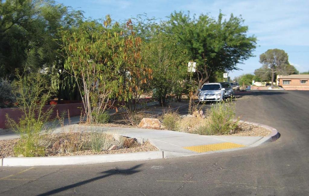
3 Neighborhood Walking Paths Drainage Water runoff conditions, as shown in the photo to the right, depict how drainage is handled in this neighborhood. The lack of infrastructure to handle runoff causes soil loss, erosion, and damage to the roads, as show by the photo below Planting Basins collaborated with Neighborhood Association to create a concept document for neighborhood improvements. It began with analyzing neighborhood issues such as context, neighborhood character, street width, traffic, and street functions. One way to solve drainage issues is to create sunken planting basins, as shown in the images above and below. The planting basins support vegetation and wildlife on available rainfall alone. meeting with Neighborhood Association, ideas and concerns were added to the scope of the project. These included speeding and cut-through traffic, drainage and erosion issues, landscape improvements, and improved walkability. Blenman-m Ft. Lowell Historic Neighborhood Proposal Great streets do not just happen. Overwhelmingly, the best streets derive from a conscious act of conception of the street as a whole. The hands of decision makers are visible. Dunbar Spring Neighborhood Thunderbird / Armory The wide streets in this neighborhood (photo above) provide an opportunity to create walking paths. Along wide streets, walking paths reinforce the existing aesthetic and increase vegetative cover when natural materials and native Sonoran desert plants are used. They also slow traffic and provide an opportunity for shade. Visual barriers are more effective at both decreasing cut-through traffic and reducing speed. The traffic circle shown in the photo on the right is a successful example of this. It is also an attractive addition to the neighborhood. /Blenman-m 22 Traffic Speed and Volume A long, unobstructed view down a neighborhood street, similar to the image to the right, encourages speed and cut through traffic. Traffic circles at the intersections help calm traffic on both streets. Walking Opportunities 19 Traffic Calming Lifeless dead-end streets and barren street corners become attractive and functional elements of neighborhood life with relatively small investment. The addition of a simple bench and more vegetation provide shade and create a nice rest stop for neighborhood walkers. Chicanes are a series of alternating bump-outs emanating from the side of the road into the roadway. The driver experiences an s-like drive as the roadway meanders around the chicanes, alternating on opposite sides of the road. Though not optimal for bicyclists, chicanes are effective at traffic calming and an attractive addition to the neighborhood. - Allan B. Jacobs Neighborhood


4 N CAMPBELL AV N WILMO T RD St. Mark s Church Design Proposal Urban Heat Island Effect The image above shows the conceptual plan for mitigating the heat island effect. Part of the plan is to add trees around an existing basketball court The Greening Concept plan for St. Mark s Church was completed by the Drachman Institute in 2006 as a component of the larger Neighborhood Plan. 3rd Street Enhanced Bike Route St. Mark s expansive parking lot lacked any shade from trees and contributed to an increase in ambient temperature. Known as the Urban Heat Island effect, heat radiates from the asphalt surface and increases temperature in the vicinity. The plan was completed in conjunction with area residents and St. Mark s church to help mitigate the impact of the parking lot, contribute to a sense of place and community, and enhance neighborhood safety. Greening the ing Lot Trees planted in and around the parking lot help to break up the large area of asphalt, contributing to the reduction of ambient temperature in the area. When fully grown, these trees will provide additional shade. These images above and below represent the proposed plan for the parking lot to the south of the church. /Blenman-m Blenman-m N COUNTRY CLUB RD E BROADWAY BL Thunderbird / Armory Broadmoor- Broadway


 Arr 1 The")


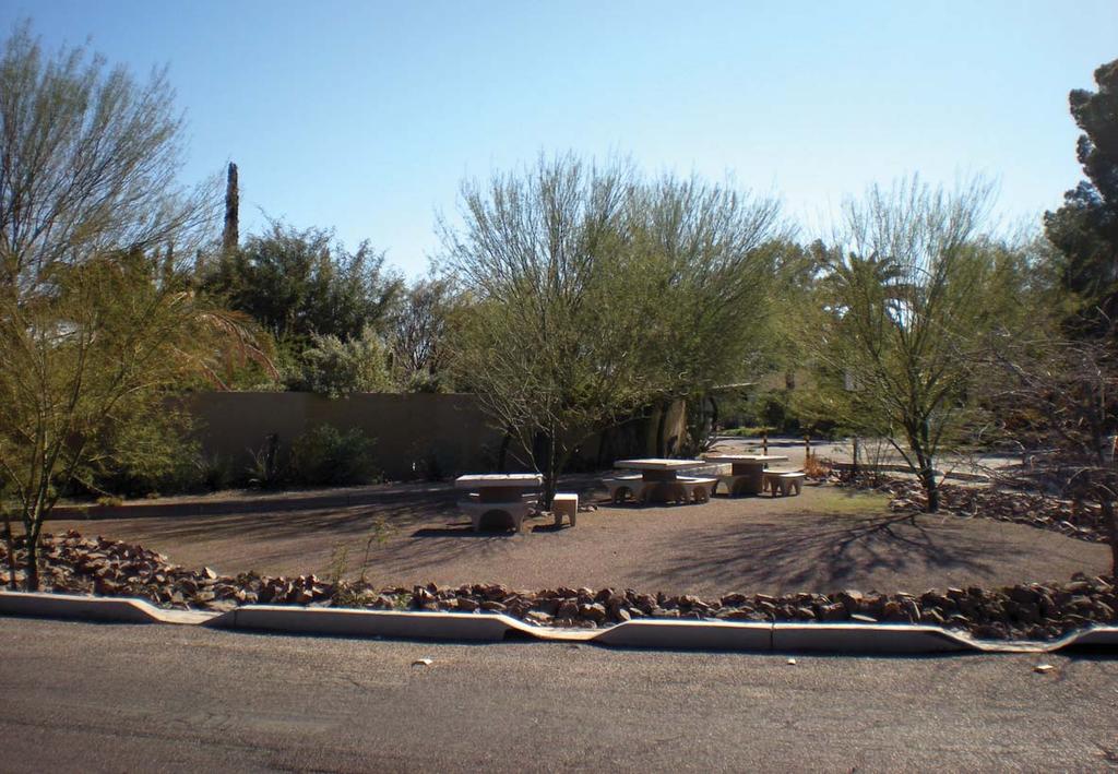


5 Broadmoor Neighborhood Project The purpose of the Malvern Street Gathering Place was to bring people of the neighborhood together. The space reduces excessive street width, as shown in the proposed plan below right, to create this gathering space. The final design of the gathering space is shown below. 3 Malvern Street Gathering Place 2004 n r e alv 1 M Treat Path Bridge oyo Ch ico The purpose of the Treat Path Bridge was to provide a safe crossing over the Wash. There were several different concepts for the bridge. One of these concepts is shown above. The final realization of the Treat Path Bridge is shown to the left. (S) Arr 1 The collaborated with the Broadmoor Neighborhood to create a plan to enhance the neighborhood character while improving safety. Techniques for improvement included the transformation of excess street area into community space and creating a more coherent sense of place for the neighborhood. The plan proposed to enhance the walking path through more visible designations of street crossing as well as to provide a more unified character along the path. The new sidewalk, benches, and brick crossings accomplish these goals. 2 Treat Walking Path - Beautify Treat Path and improve safety at path road crossings BroadmoorBroadway Armory Thunderbird / - Celebrate the Treat Path and the Crossings as neighborhood places Blenman-m neighborhood project included: /Blenman-m - Reinforce the neighborhood s identity


 in 1997 to")


6 Neighborhood Association - creating identity and building community Left: This picture shows the proposal of a crossing feature along the High School Wash Below: Plan shows the proposed design along the entire wash. Above Left: View of one of the streets where chicanes were proposed 9th and 10th Street Chicanes Below Left: Rendering of street with proposed chicanes Far Left: Aerial view of proposed chicanes 1997 Proposal along wash The collaborated with the Neighborhood Association (RHNA) in 1997 to develop a neighborhood plan for streetscape improvements and the creation of a small neighborhood park along the High School Wash. The plan was revived in 2004, and the neighborhood secured Pima County Bond Funds to implement the 9th and 10th Street chicane systems. The park and the chicanes were implemented in association with the neighborhood and many other organizations. Small Neighborhood Located at the east end of the neighborhood along High School Wash, the small community park provides a community space along with several stormwater mitigation techniques. Left: View of the street after the chicanes have been implemented Below Left: Chicanes provide niches for residents to park their cars on the street Below: Chicanes use native vegetation to help control water run off. neighborhood project included: - Create an urban wildlife habitat for birds - Calm traffic and reduce cut through traffic Blenman-m Armory /Blenman-m Thunderbird / - Beautify the neighborhood - Create a more attractive street and streetscape
Fifth and Detroit Street Design May 2017 Capital Improvements Committee. DOWNTOWN Street Design
 1 Fifth and Detroit Street Design May 2017 Capital Improvements Committee Agenda 2 Review Street Configuration Prior Meeting Review Outreach Synopsis Functional Street Design Refinements Curb Edge, Turning
Dogpatch/22nd Street Greening
 TEAM MEMBERS Prepared for: GreenTrustSF Central Waterfront www.gtsfcw.org Prepared by: Fletcher Studio San Francisco, CA www.fletcherstudio.com Landscape Architecture Urban Design Environmental Planning
Green Infrastructure and Low-Impact Development Technologies
 Green Infrastructure and Low-Impact Development Technologies The guiding principles of these technologies is to manage stormwater at their sources using natural means, and establish conditions so that
Green Streets An Innovative Street Design Approach
 Green Streets An Innovative Street Design Approach Great streets do not just happen. Overwhelmingly, the best streets derive from a conscious act of conception and creation of the street as a whole. The
Conceptual Design. Main Street Enhancement and Extension Project. Bothell, Washington. June 11, 2009
 Conceptual Design Main Street Enhancement and Extension Project Bothell, Washington June 11, 2009 Berger/ABAM Engineers and Cascade Design Collaborative, Inc For Main Street Bothell to succeed it must
Landscape and Streetscape Design 2.5
 Landscape and Streetscape Design 2.5 2.5.1 Goals 2.5.2 Planting 2.5.3 Sidewalks and Pavement 2.5.4 Furnishings 2.5.5 Walls 2.5.6 Lighting 2.5.7 Stormwater 2.5.8 Street Cross Sections 2.5 LANDSCAPE AND
Regenerative Rights-of-Way: Local Harvests and Enhancements in Our Community Commons by Brad Lancaster
 Regenerative Rights-of-Way: Local Harvests and Enhancements in Our Community Commons by Brad Lancaster www.harvestingrainwater.com www.desertharvesters.org Tucson, Arizona and the Santa Cruz river 1904
More than 30 adults and 19 children were involved in these community workshops.
 Linwood Workshops held at Household of Faith Deliverance Church 3.29.08 and 4.05.08 What is a Design Workshop? We use the term workshop (often called charrette among design professionals) to describe a
Green Infrastructure Overview
 Green Infrastructure Overview Christopher C. Obropta, Ph.D., P.E. obropta@envsci.rutgers.edu Jeremiah Bergstrom, LLA, ASLA jbergstrom@envsci.rutgers.edu February 26, 2016 Water Resources Program NJDEP
CHAPTER 8. Mrs. Zimman s Class - Central Elementary
 SUSTAINABILITY CHAPTER 8 Mrs. Zimman s Class - Central Elementary 8.1 OVERVIEW Green infrastructure also known as low impact development (LID) and environmental or sustainable site design is an environmentally
Green Infrastructure & Low Impact Development
 Green Infrastructure & Low Impact Development CITY OF COVINGTON STORMWATER MANAGEMENT WHAT IS GREEN INFRASTRUCTURE? Green infrastructure uses vegetation, soils and natural processes to manage water and
VEHICULAR AND PEDESTRIAN CIRCULATION
 This perspective sketch communicates the intended character and quality of a proposed streetscape design. Locate benches near a major intersection where people tend to gather. Seating and lighting provide
Toronto Complete Streets Guidelines
 Toronto Complete Streets Guidelines 108 110 7.1 Green Infrastructure Design Principles 112 7.2 Context-Sensitive Green Streets 114 7.3 Key Green Street Elements Green infrastructure refers to natural and
Project Consulting Team:
 THE DOWNTOWN CHERRYVILLE LAND USE + STREETSCAPE MASTER PLAN WAS FUNDED THROUGH THE GENEROUS DONATIONS OF THE FOLLOWING: The Community Foundation of Gaston County ElectriCities of North Carolina The Cherryville
Jenifer Street Reconstruction Neighborhood Engagement Meeting November 4, 2015
 Jenifer Street Reconstruction Neighborhood Engagement Meeting November 4, 2015 Hosted by the Marquette Neighborhood Association Facilitated by Urban Assets Funded in part by the City of Madison Neighborhood
MISSION STREETSCAPE PLAN. Neighborhood Commercial Streets handle continuous activity. Neighborhood Commercial STREET ROW: Main Design Treatments
 Neighborhood Commercial STREET ROW: 64-80 Main Design Treatments CORNER reduce crossing distance for pedestrians, create entrances to a residential area and slow cars down. help widen sidewalk allocating
Sustainable Storm Water Management
 Incorporating Water Management into the Community Planning Process August 16, 2012 Sustainable Storm Water Management Samantha Brown Environmental Engineer SD1 SD1 s Service Area CVG Airport SD1 Service
Potential Green Infrastructure Strategies May 6, 2015 Workshop
 Potential Green Infrastructure Strategies May 6, 2015 Workshop Background The City of Cortland is developing the Tioughnioga Urban Headwaters Green Infrastructure Action Plan with funding from the National
Hidden Pointe Landscape Master Plan. June, archi terra
 Hidden Pointe Landscape Master Plan June, 2006 t h e archi terra g r o u p 1 Table of Contents Background Purpose and Goals of the Master Plan Master Plan Process Existing Conditions Entrance Hidden Pointe
Improve Neighborhood Design and Reduce Non Point Source Water Pollution
 HOW TO Planning Guide Improve Neighborhood Design and Reduce Non Point Source Water Pollution This document was funded by a grant from the New Hampshire Coastal Program with funding from the National Oceanic
The Vision. Photo provided by The Minervini Group. 46 Vision, Objectives & Strategies
 Vision, Objectives & Strategies The is the public framework and guide for future development of the Grand Traverse Commons. The establishes public polices for infrastructure, the preservation of natural
SOUTH DAKOTA STATE UNIVERSITY GROUNDS MANAGEMENT PLAN FY 2013
 SOUTH DAKOTA STATE UNIVERSITY GROUNDS MANAGEMENT PLAN FY 2013 SOUTH DAKOTA STATE UNIVERSITY GROUNDS MANAGEMENT PLAN Table of contents: Introduction & Goals 03 Prioritization 03 Improvement Strategies 07
Workshop Overview. 5:10 5:20pm City Permit Requirements Gary Wittwer, City Of Tucson, Dept. of Trans
 Workshop Overview 5:00 5:10pm Welcome 5:10 5:20pm City Permit Requirements Gary Wittwer, City Of Tucson, Dept. of Trans 5:20 5:30pm C2E Program Overview Candice Rupprecht, Tucson Water 5:30 5:40pm UA HydroCats
LOW IMPACT DEVELOPMENT GUIDANCE MANUAL AND LID WORKING GROUP ACTIVITIES. Powerpoint Templates. MS4 Statewide Stormwater Summit June 18, 2013
 LOW IMPACT DEVELOPMENT GUIDANCE MANUAL AND LID WORKING GROUP ACTIVITIES MS4 Statewide Stormwater Summit June 18, 2013 Powerpoint Templates Evan Canfield, Ph.D, P.E. Pima County Regional Flood Control Outline
2016 WORKSHOP LVR Field Trip
 2016 WORKSHOP LVR Field Trip ***Note*** Many of the sites on this tour were NOT related to, or funded by, the DGLVR program. They are being shown to encourage discussion about the kinds of projects that
REGIONAL ACTIVITY CENTER
 DRAFT REGIONAL ACTIVITY CENTER 70 EAST BENCH MASTER PLAN DRAFT 06 Introduction The East Bench Regional Activity center is comprised of large educational, research, medical, and employment centers. These
CAL POLY MASTER PLAN UPDATE, March 2015
 Some Key Themes in the General Guiding Principles Academic Mission The plan must foremost advance the University s academic mission and student success. Foresight and Adaptability The plan should take
Preservation & Design Awards
 EVANSTON PRESERVATION COMMISSION Preservation & Design Awards 2018 Nomination Form The Evanston Preservation Commission is pleased to call for nominations for the 2018 Evanston Preservation & Design Awards.
San Francisco Bay Pilot: Sausal Creek Community Leader Charrette May 11, 2016 Marcus Griswold
 San Francisco Bay Pilot: Sausal Creek Community Leader Charrette May 11, 2016 Marcus Griswold 1 Overview Project Overview Watershed Context Assets and Challenges Opportunities Green Streets Creek Access
COMMUNITY GARDEN 2020 PROPOSAL Proposed by ERIANA KONCELIK
 COMMUNITY GARDEN 2020 PROPOSAL Proposed by ERIANA KONCELIK Fall 2017 An application for a 2020 grant through Stockton University to continue to beatify the campus and promote student engagement Table of
Neighborhood Districts
 NEIGHBORHOOD DISTRICTS SEVEN MAIN DISTRICTS Neighborhood Districts While the Development Plan provides a broad-scale overview of the neighborhood, this section focuses on uses and relationships at the
Alternative Uses of Compost: Rain Gardens and Green Solutions for Stormwater Management
 Alternative Uses of Compost: Rain Gardens and Green Solutions for Stormwater Management Photos: David Dods, URS David Dods, Senior Environmental Engineer URS Corporation, Overland Park, Kansas Agenda 1.
SOUTH UNIVERSITY Street Design Setting a Direction for Schematic Design
 1 SOUTH UNIVERSITY Street Design Setting a Direction for Schematic Design Meeting Agenda 2 1. Project Scope 2. Design Direction 3. Design Details 4. Schedule and Construction Logistics 3 SOUTH UNIVERSITY
The West College Avenue Corridor Redevelopment Plan
 The West College Avenue Corridor Redevelopment Plan Proposed dby Educational Property Group, Inc. & Apex Development Project Summary The intent of this proposal is to introduce market-driven mixed-use
Lehigh Acres Land Development Regulations Community Planning Project
 Lehigh Acres Land Development Regulations Planning Effort Summary In July, 2010 Commissioner Frank Mann invited the Lehigh Acres community to start discussing how to achieve their recently adopted community
SECTION TWO: Urban Design Concepts
 SECTION TWO: Urban Design Concepts The Gardnerville Plan for Prosperity shapes economic opportunities presented by regional growth. The Urban Design Concepts provide policies and concepts for land use,
Community Sensitive Design: (Context Sensitive Design)
") What is? Community Sensitive Design: (Context Sensitive Design) The process by which urban design, land-use planning and aesthetic enhancements are applied to a project to make it an integral part of the
What is? Community Sensitive Design: (Context Sensitive Design) The process by which urban design, land-use planning and aesthetic enhancements are applied to a project to make it an integral part of the
Kittson Parkway / Watershed Park Parking Lot
 Kittson Parkway / Watershed Park Parking Lot Date Constructed: Summer 2005 Site Location / Description: Kittson Parkway, North Delta, British Columbia. Permeable parking lot adjacent to Watershed Park;
COMPLETE GREEN STREET CHECKLIST
 COMPLETE GREEN STREET CHECKLIST This document was developed to dissect the structure of an urban street and explore opportunities to make our streets more complete while also integrating green street strategies.
Status Update (2006 vs. Now) Citizen s Advisory Committee February Plan for Prosperity
 Citizen s Advisory Committee February Plan for Prosperity") Status Update (2006 vs. Now) Citizen s Advisory Committee February 2018 Plan for Prosperity 2000 2017 2000 2017 Gardnerville Population 6,000 5,760 5746 5,500 5,000 5,067 5,550 5,165 5,394 5,412 5,250
Status Update (2006 vs. Now) Citizen s Advisory Committee February 2018 Plan for Prosperity 2000 2017 2000 2017 Gardnerville Population 6,000 5,760 5746 5,500 5,000 5,067 5,550 5,165 5,394 5,412 5,250
Complete Streets Master Plan for Downtown New Britain CRCOG Transportation Committee Meeting Monday, December 9, 2013
 CRCOG Transportation Committee Meeting Monday, December 9, 2013 Introduction Why the Project was Initiated About Downtown New Britain Master Plan Goals Master Plan Overview Master Plan Study Areas and
urban design Introduction
 ACHIEVE SP RI NGF I ELD.3 Introduction Urban Design Areas Design Areas are areas within Springfield that have a unique and recognizable character that is different from other areas in the community. The
STORMWATER QUALITY MARION STREET GREEN INFRASTRUCTURE PROJECT COMMON SOURCES OF URBAN POLLUTANTS URBAN STORMWATER
 STORMWATER QUALITY COMMON SOURCES OF URBAN POLLUTANTS Fertilizers Litter Pet-waste COMMON POLLUTANTS FOUND IN URBAN STORMWATER BACTERIA TRASH METALS Dumpsters Vehicle exhaust, automotive fluids, etc. IMPACTS
Quality Public Realm & Streetscapes
 1 Quality Public Realm & Streetscapes Lambeth Community Association/Business Association 1.1 Install decoration and/or decorative lighting on London Hydro poles along Main Street from Campbell Street to
LOUISIANA STATE UNIVERSITY COMPREHENSIVE & STRATEGIC CAMPUS MASTER PLAN. APPENDIX G - Stormwater Study Findings & Stormwater Solutions
 LOUISIANA STATE UNIVERSITY COMPREHENSIVE & STRATEGIC CAMPUS MASTER PLAN APPENDIX G - Stormwater Study Findings & Stormwater Solutions LSU: MP Narrative July 2017 3.5 Open Space Existing Conditions The
Long Lost Allies? Walking Advocates & Business District Organizations. Matt Kazinka Lake Street Council. Shaina Brassard Seward Redesign
 Long Lost Allies? Walking Advocates & Business District Organizations Shaina Brassard Seward Redesign Rob Hanson West Broadway Business and Area Coalition Matt Kazinka Lake Street Council Jamie Schumacher
The open space system should provide connective elements, relate to natural resources, and enhance the suburban character of the landscape..
 The open space system should provide connective elements, relate to natural resources, and enhance the suburban character of the landscape.. Mixed-use and infill development should maintain or enhance
Public Art Plan. We have elected to submit Public Art Plans before or concurrently with the CSP Submittal per the FDP Manual
 Public Art Plan The intent of the Horizon Uptown Public Arts Program is to create great places that engage the community and leverage the neighborhood development and economic vitality. The Horizon Uptown
Ivywild On The Creek PRELIMINARY CREEK DISTRICT MASTER PLAN
 Ivywild On The Creek PRELIMINARY CREEK DISTRICT MASTER PLAN Introduction: Rejuvenating an extraordinary Creekside neighborhood THE CREEKSIDE DISTRICT The Ivywild On The Creek Neighborhood District Master
City of St. Louis 2013 Sustainable Neighborhood Small Grant Competition
 City of St. Louis 2013 Sustainable Neighborhood Small Grant Competition 43 groups representing 30 neighborhoods submitted applications 7 teams were awarded a $5,000 grant Shaw Thurman Gateway Franz Park
4 Park Planning and Design
 4 Park Planning and Design Park Constellations Elliot Gateway/Mills Loring North Loop Commons Twins Minneapolis Park & Recreation Board Downtown Service Area Master Plan 4-1 PROJECT APPROACH REFERENCE
Impervious Cover Reduction Action Plan for City of Vineland, Cumberland County, New Jersey
 Impervious Cover Reduction Action Plan for City of Vineland, Cumberland County, New Jersey Prepared for the City of Vineland by the Rutgers Cooperative Extension Water Resources Program May 23, 2016 Table
Landscape Design. earth-wise guide to. earth-wise guide to
 earth-wise guide to earth-wise guide to Landscape Design The purpose of this fact sheet is to provide background information on creating a green garden for either the do-it-yourselfer of for those working
QUESTION 8: What are your Public Realm priorities for implementation? What would you like to see happen first? TELL US WHAT YOU THINK
 Public Realm Plan How will the Public Realm Plan be implemented? The Public Realm Plan document will set out a vision for the next 30 years. Over time, Plan elements and aspects can be implemented as opportunities
Importance of townhouse design
 Importance of townhouse design Townhouses in the past Townhouses in the past Montco2040 Goals Townhouse Trends in Montco Attached and multifamily housing have become the dominant form of built housing,
CITY OF EDMONTON FIRST PLACE PROGRAM
 CITY OF EDMONTON FIRST PLACE PROGRAM Kirkness (3015 151 Ave NW) Consultation Meeting #2 June 23, 2015 Clareview Community Rec Centre (Rm MP #2) 3804 139 Ave NW AGENDA 1. Opening comments. 2. Firm Up Site
Program Schedule, Budget and Scope
 Sewer System Improvement Program + Program Schedule, Budget and Scope Mission & Valencia Green Gateway Presentation: July 9, 2013 San Francisco Public Utilities Commission Mission & Valencia Green Gateway
Chinatown. Green Street Demonstration Project. land + water. community
 Chinatown Green Street Demonstration Project land + water community 2 Purpose. Dear Stakeholder, Thank you for your interest in making our neighborhood a greener, more sustainable, and attractive place
hermitage town center
 hermitage town center A Community Vision prepared by Strada for The City of Hermitage and The Mercer County Regional Planning Commission January 2007 table of contents introduction 3 design principles
include playgrounds, sports fields, community gardens and picnic areas.
 DEVELOPMENT PLAN OPEN SPACE SYSTEM OPEN SPACE SYSTEM The neighborhood provides for a range of open space types. The Village Square is an important open space in the neighborhood. It serves as a gathering
FY Capital Improvement Program Arroyo Projects
 FY 219-223 Capital Improvement Program FY 218 FY 219 FY 22 FY 221 FY 222 FY 223 1 2 3 4 5 6 7 8 9 1 Hahamongna - Implement Master Plan - Oak Grove Area Improvements (7756) Hahamongna - Implement Master
Tazewell Pike. Neighborhood Conservation Overlay District Design Guidelines
 Tazewell Pike Neighborhood Conservation Overlay District Design Guidelines Knoxville Knox County Metropolitan Planning Commission November 2, 2000 These design guidelines were: Adopted by the Knoxville
Study Area. Capitol Way. Greening America s Capitals 11/13/2014. A Greening America s Capitals Project
 Olympia, WA: Greening Capitol Way Supporting Communities move towards sustainability is a priority for the federal government. A Greening America s Capitals Project Office of Sustainable Communities U.S.
Chapter 4. Linking Land Use with Transportation. Chapter 4
 Chapter 4 Linking Land Use with Transportation Chapter 4 59 Chapter 4 Linking Land Use with Transportation Community Design and Transportation Program Introduction Since the 1950s, the predominant development
SUNY Green Infrastructure Summit. April 17, 2014
 SUNY Green Infrastructure Summit April 17, 2014 Environmental Facilities Corporation Public benefit corporation Mission: To promote environmental quality by providing low cost financing and technical assistance
CITY OF VIRGINIA BEACH PLANNING COMMISSION DESIGN AWARDS PROGRAM 2012
 Virginia Beach City Public Schools COLLEGE PARK ELEMENTARY SCHOOL CITY OF VIRGINIA BEACH PLANNING COMMISSION DESIGN AWARDS PROGRAM 2012 NOMINATION APPLICATION SUSTAINABLE DEVELOPMENT PROJECT NARRATIVE
EXEMPLAR: School Grounds and Gardens
 EXEMPLAR: School Grounds and Gardens Your is your opportunity to share out all the effort your school put into your certification project. Please respond to each question with as much detail as possible.
Alex Li, Luke VanKeersbilck, Michael Pillado, Xavier Barneclo, Brandon Duran, Sean McCarthy
 Naturally Green Alex Li, Luke VanKeersbilck, Michael Pillado, Xavier Barneclo, Brandon Duran, Sean McCarthy Rain Barrel Pilot Project Report NOVEMBER 2016 About Naturally Green Naturally Green is a local,
3.1 community vision. 3.3 required plan elements
 Chapter 3 Community Form 3.1 community vision 3.2 Parks & landscaping concepts 3.3 required plan elements D R A F T 20 Community Form Chapter 3 3.0 Community form 3.1 community vision The Specific Plan
Stormwater Low Impact Development - A Natural Solution
 Stormwater Low Impact Development - A Natural Solution Sarah U Ren Program Director The Watershed Center of Grand Traverse Bay 231-935-1514, suren@gtbay.org Our Mission: The Watershed Center advocates
CHAPTER 8 ISSUES, CONCERNS, CONSTRAINTS AND OPPORTUNITIES
 CHAPTER 8 ISSUES, CONCERNS, CONSTRAINTS AND OPPORTUNITIES Introduction This River Conservation Plan was developed during a time of tremendous activity and effort in planning the transformation of the Delaware
URBAN DESIGN BRIEF URBAN DESIGN BRIEF 721 FRANKLIN BLVD, CAMBRIDGE August 2018
 URBAN DESIGN BRIEF URBAN DESIGN BRIEF 721 FRANKLIN BLVD, CAMBRIDGE August 2018 DESIGN BRIEF CONTENTS PART A 1.0 INTRODUCTION 2.0 DESCRIPTION & ANALYSIS OF SITE CONTEXT 3.0 DESIGN CONSTRAINTS AND OPPORTUNITIES
Green Streets. Sustainable Stormwater Solutions for Greener Communities and a Cleaner Bay
 Green Streets Sustainable Stormwater Solutions for Greener Communities and a Cleaner Bay As the Bay Area continues to grow through development of roads, revitalization of neighborhoods, and construction
Town Center (part of the Comprehensive Plan)
") Town Center (part of the Comprehensive Plan) Mercer Island Town Center Looking North (2014) In 1994, a year-long process culminated in a set of design guidelines and code requirements for the Town Center
Town Center (part of the Comprehensive Plan) Mercer Island Town Center Looking North (2014) In 1994, a year-long process culminated in a set of design guidelines and code requirements for the Town Center
Courthouse Square Planning & Urban Design Study. Courthouse Square Working Group #13 October 15, 2014
 Courthouse Square Planning & Urban Design Study Courthouse Square Working Group #13 October 15, 2014 1 Courthouse Square Process Working Group Community Courthouse Square Advisory Groups & Civic Associations
Biodiversity And Urban Trees Tanya M. Quist, PhD
 Biodiversity And Urban Trees Tanya M. Quist, PhD Asst. Professor, University of Arizona School of Plant Science Director, University of Arizona Campus Arboretum UA Trees Are Rooted in Land Grant Mission
Silverdale Regional Center
 Silverdale Regional Center Vision for Silverdale Regional Center The Silverdale Regional Center Plan (Plan) will guide the evolution of the Silverdale Regional Center from a collection of strip malls and
Phase 1 : Understanding the Campus Context. Phase 2 : APPROACHES - Alternates & Preferred Plan
 Introduction MASTER PLAN PURPOSE WHY A CAMPUS MASTER PLAN? The purpose of the Master Plan at the University of Illinois at Chicago is to translate UIC s strategic goals and objectives into a compelling
PALO ALTO HIGH SCHOOL Palo Alto Unified School District MEETING NOTES. DATE: 21 September Palo Alto HS Update
 PALO ALTO HIGH SCHOOL Palo Alto Unified School District MEETING NOTES DATE: 21 September 2010 SUBJECT: Landscape Subcommittee Meeting Palo Alto HS Update The purpose of the meeting was to update the Landscape
A.9. Cannon River. Campostella Park. Adjacent Industrial & City Facility Uses
 Campostella Park Classification: Nature Area 14 acres Character: This park is an undeveloped, heavily wooded natural open space park located along the Cannon River, just to the southwest of Babcock Park
Saving Coastal Watersheds
 Saving Coastal Watersheds Habitat for Humanity and N.C. Coastal Federation team up to manage storm-water runoff with rain gardens. STORY BY Denice Patterson 7 PHOTOGRAPHY BY Jason Hudson When Fred and
I-70/71 Innerbelt Project
 I-70/71 Innerbelt Project Project Progress Meeting and Design Enhancement Update November 9, 2009 Ohio Department of Transportation MS Consultants MSI Design Overview of Presentation 1. Recap Recent Project
Lynn Housing Authority and Neighborhood Development. Washington Street Gateway District Plan A p r i l
 Lynn Housing Authority and Neighborhood Development Washington Street Gateway District Plan A p r i l 2 0 0 8 rendering of sagamore hill from lynnway pedestrian overpass table of contents project area
City of Farmington. Downtown Plan. Amendment to the 1998 Master Plan Adopted October 11, 2004
 City of Farmington Amendment to the 1998 Master Plan Adopted October 11, 2004 Introduction Planning Background 1 Scope and Components of the Plan Amendment 2 Concept Introduction 3 Plan Concepts 3 Conceptual
Hockessin Community Redevelopment Plan
 Hockessin Community Redevelopment Plan 3.1 Introduction The Community Redevelopment Plan for the Village of Hockessin is the result of the people s vision for a distinct village center that serves as the
Syme Residence Hall Rain Garden
 Syme Residence Hall Rain Garden Location: North Carolina State University, NC Client: NCSU Housing Department Design Firm(s): NCSU Landscape Architecture Department Students Landscape architect/project
Century Park to Ellerslie Road Preliminary Engineering
 Century Park to Ellerslie Road Preliminary Engineering South LRT Extension Stakeholder Information Panel Brochure March 2010 www.edmonton.ca/lrtprojects LRT Station (left) and Transit Centre Architectural
Living Streets Corridor Pilot Study Potential Alternatives
 Living Streets Corridor Pilot Study Potential Alternatives OCTOBER 16 2012 Tonight s Discussion Project background Recap of April 2012 public meeting Priority site considerations Draft plans Comments/questions
SDOT DPD. SDOT Director s Rule DPD Director s Rule DCLU DR SED DR of 7 CITY OF SEATTLE
 SDOT SDOT Director s Rule 2-07 DPD Applicant: CITY OF SEATTLE Page 1 of 7 Supersedes: DCLU DR 11-93 SED DR 93-4 Seattle Department of Transportation (SDOT) Department of Planning and Development (DPD)
Route 347. New York State Department of Transportation Region 10, Long Island. THE GREENING of ROUTE 347
 The GREENING of Route 347 The Greening of Route 347 The Greening of Route 347: History 3 The Greening of Route 347 4 The Greening of Route 347 5 The Greening of Route 347 Smith Haven Mall 6 The Greening
New York Avenue Streetscape and Trail Project Public Meeting #1 Summary
 New York Avenue Streetscape and Trail Project Public Meeting #1 Summary I. King Jordan Student Academic Center (SAC) Gallaudet University, Washington, DC February 23, 2017 Table of Contents 1.0 Introduction...
Improve the appearance of off-street parking areas, vehicular use areas, and property abutting public and private roads;
 Bedford Township, MI (Monroe Co.) 2012 http://library.municode.com/index.aspx?clientid=02123 400.1907 - Landscaping and screening. Se 1907. 1. Intent. Landscaping, greenbelts, and screening are necessary
Eastcreek Farm. Planned Development Standards September, 2014
 Eastcreek Farm Planned Development Standards September, 2014 ekfarm Contents 01. General Standards 02. Residential Development Standards 03. Architectural Design Standards 04. Landscape Design Standards
LANDSCAPING. Design. Development of the site shall not unreasonably impair the ability of adjoining properties to utilize solar energy.
 Landscape design is an integral component of Site Planning and Building. The current pattern of walkways, driveways and landscape elements such as fences, hedges, and retaining walls in the neighborhood
BRADENTON RIVERWALK EXPANSION MASTER PLAN
 BRADENTON RIVERWALK EXPANSION MASTER PLAN INTRODUCTION & AGENDA Process Update Community Engagement Summary Center for Active Design (CfAD) Recommendations Context and Existing Conditions Master Plan Alternatives
HICKORY NUT FOREST DESIGN GUIDELINES
 HICKORY NUT FOREST DESIGN GUIDELINES Introduction Hickory Nut Forest is a "net-zero energy", conservation development that is designed to protect and celebrate the property s unique ecology. A conservation
V. Vision and Guiding Principles
 V. Vision and Guiding Principles The Master Plan for the Powers Ferry Corridor seeks a foundation in the desires of the community. At times, various elements of the community offered opposing viewpoints,
2017 Summer Projects
 2017 Summer Projects Mission: The Anchorage Park Foundation builds healthy parks and healthy people by mobilizing public support and financial resources for Anchorage parks, trails and recreation opportunities.
open house 3 CITY OF SALEM Downtown Streetscape Plan
 open house 3 Streetscape concepts CITY OF SALEM Downtown Streetscape Plan analysis concepts we are here refined concepts & document Feb 13th 1 2 3 apr 18th KICKOFF OPEN HOUSE Streetscape Work Group Walking
Rezoning Issues Setting a Foundation for Zoning Decisions
 Rezoning Issues Setting a Foundation for Zoning Decisions City Council Workshop May 2, 2016 Agenda Goal Need actionable items and sequence of steps Foundation for Zoning Decisions Council Workshop Discussion