Washington Pass Overlook
|
|
|
- Catherine Patterson
- 6 years ago
- Views:
Transcription


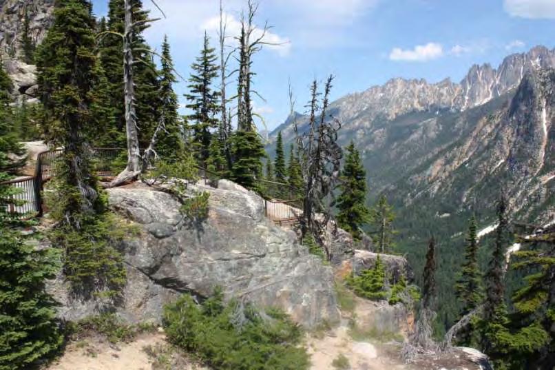
1 Washington Pass Overlook The Washington Pass Overlook is located on the Methow Valley Ranger District on the Okanogan-Wenatchee National Forest. The overlook is at the crest of Washington Pass and is part of the North Cascades Scenic Byway
 20 between Sedro-Woolley and the junction of SR 20 and SR 153 near Twisp as a State Scenic Highway in 1967.")
2 The North Cascades Highway The route begins in Port Townsend and crosses west across Washington State, the North Cascades Scenic Byway is a segment of the route, it is also part of the Cascade Loop Scenic Highway. Washington State Legislature designated State Route (SR) 20 between Sedro-Woolley and the junction of SR 20 and SR 153 near Twisp as a State Scenic Highway in In 1984 the North Cascades Highway was designated as a Washington State Scenic Byway and a National Forest Scenic Byway.

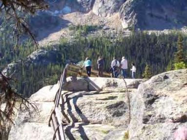
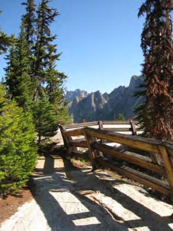
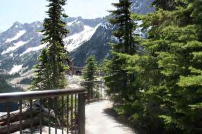
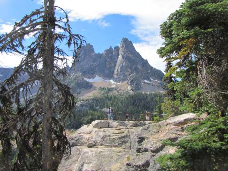
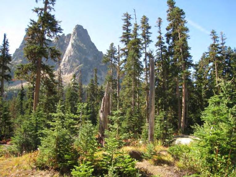
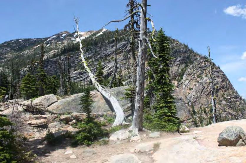
3 North Cascades Scenic Byway The North American Alps The 138 mile corridor starts at the eastern city limits of Sedro-Woolley and travels eastward through the pastoral Upper Skagit Valley, traverses a spectacular glacial mountain landscape and descends into the beautiful Methow Valley. On federal land ownership, the travel corridor goes through Mount Baker-Snoqualmie NF, North Cascades National Park, and Okanogan-Wenatchee NF. The North Cascades is a rugged, wild, and beautiful landscape! Approximately 100,00 visitors stop at Washington Pass Overlook every year.

4 Mount Baker National Forest Skagit Wild and Scenic River

5 North Cascades National Park View from Lake Diablo Overlook in the Ross Lake National Recreation Area along North Cascades Highway

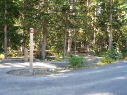
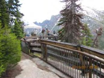
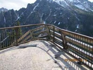
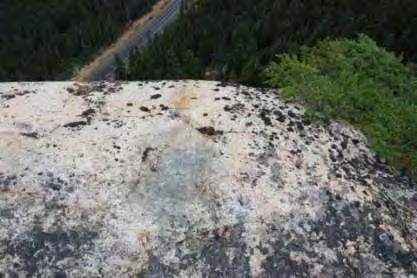
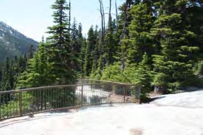
6 Okanogan-Wenatchee National Forest Washington pass is the highest elevation of the highway at 5,477 feet. A hairpin turn adds adventure to the spectacular scenery!
 infrastructure of the day use site including restrooms, picnic tables, interpretive kiosk and trail leading to")
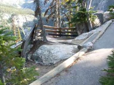
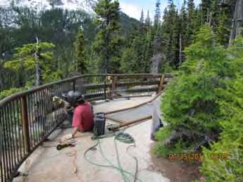
7 Washington Pass Overlook Project Overview Need for project: 1. Provide improved higher level of accessibility for access to existing or new (proposed) infrastructure of the day use site including restrooms, picnic tables, interpretive kiosk and trail leading to overlook. 2. Extend seasonal use by providing restrooms that will be usable in the shoulder season (not dependent upon solar power and when water is shut off) Funding; 2 year project in collaboration with Federal Highway Administration (FHWA) and USFS 2009 to 2011 Phase 1 - $200,000 Phase 2 - $400,000


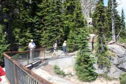
8 Overall Design Objectives Address tourism while enhancing the scenic highway resource Provide a unified approach to design, detail, maintenance, and interpretation for North Cascades Scenic Byway Utilize the Cascadian Architectural style to maintain a rustic character and design continuity Provide a high level of accessibility for all facilities

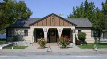
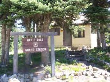
9 Examples of Cascadian Architectural Style

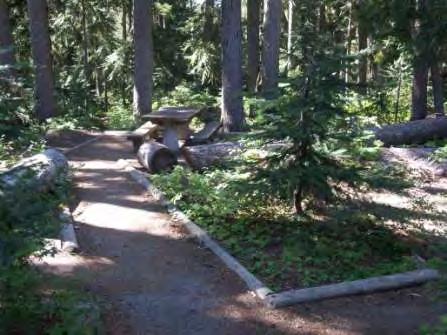
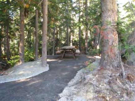
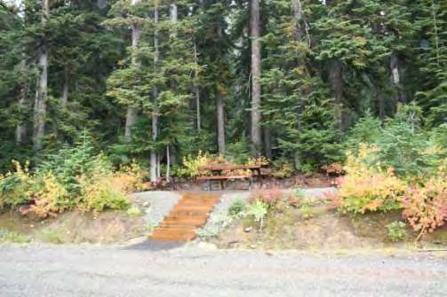
10 Background Information for Phase 1 The site is generally open from late June or early July until mid-september. Fall closure is determined by when water is shut off at site and when solar panels that provide power to the heaters and fans required for operation of the existing composting toilets are removed for the winter. Once the restroom is closed for the season, the site must be closed for sanitations reasons. Enhancement project includes installing sealed-vault toilets to provide facilities throughout the entire season of highway operation. This would extend the seasonal use by approximately two months. The project also includes reconstructing existing picnic areas and adding new sites to meet accessibility standards.


11 Phase 1 Planning, Survey and Design Our dedicated engineering survey crew through extreme winter conditions

12 Phase 1 Siteplan

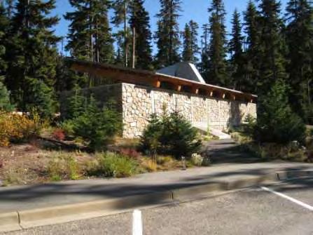
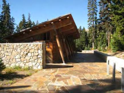
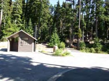
13 Results of phase 1 implementation Installed 4 CXT Accessible Cascadian Toilets (1 double and 3 singles) Reconstructed 5 new accessible picnic sites near existing areas Constructed 6 new sites on north side of parking area with view of Liberty Bell Constructed 1 Information Kiosk Swept and Striped parking area

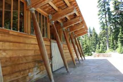
14 Existing Restroom The restroom facility was built in 1994 and received awards from the American Institute of Architects and the American Wood Council. The composting toilet system has never worked well, solar panels are used to power heaters and fans to improve the compost system and vent odor. The panels are removed in the fall due to extreme snow loads and the whole site must be closed due to sanitation concerns.
15

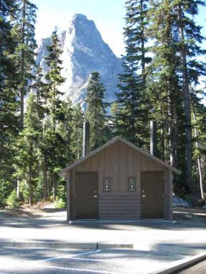
16 New Toilets

17 Old Picnic Sites
18 New Accessible Picnic Sites
19
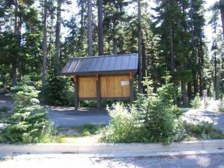
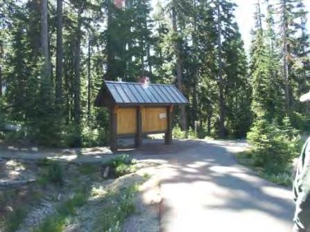
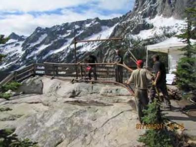
20 Accessible Kiosk


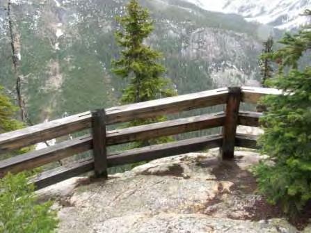
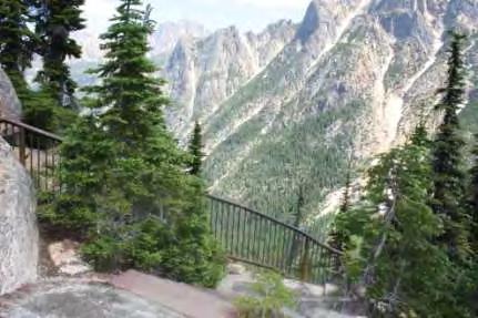
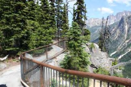
21 Background Information for Phase 2 Washington Pass Overlook and Diablo Overlook provide a similar day use experience offering amenities such as restrooms, parking, picnic sites, interpretation, short accessible pedestrian walkways and outstanding views of the surrounding landscape. We coordinated with the National Park Service to design our railing to match the Diablo Overlook.

22 Phase 2 Siteplan

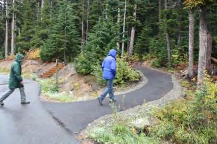
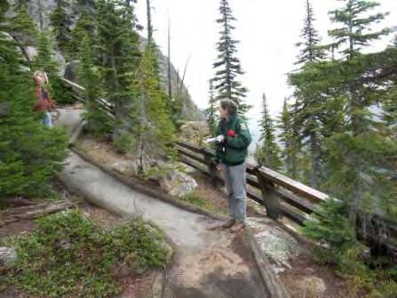
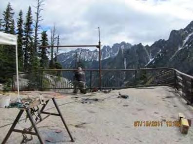
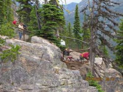
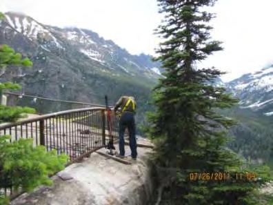
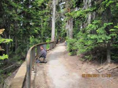
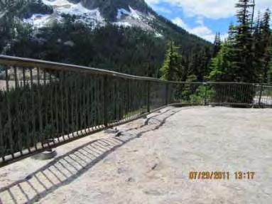
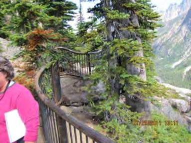
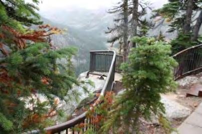
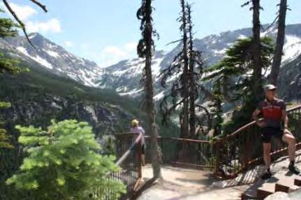
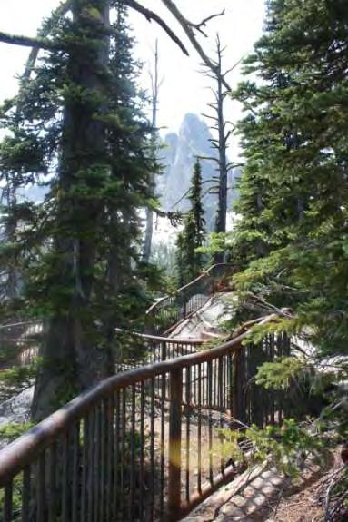
23 Results of phase 2 implementation Reconstructed 440 of accessible path that provides access to a natural rock platform overlook 700 above the highway Replaced wood retaining wall with concrete block retaining wall Installed 360 of new weathering steel railing along paths and around the flat rock outcrop and hiking trail Replaced all log curbs with new log curbs and added new curbs where necessary


24 Reconstructed 440 of accessible path that provides access to a natural rock platform overlook 700 above the highway


25 Replaced wood retaining wall with concrete block retaining wall


26 Installed 360 new weathering steel railing along paths and around flat rock outcrop and hiking trail


27 Does not meet current safety standards, is weathering and needs to be replaced Existing Railing
28
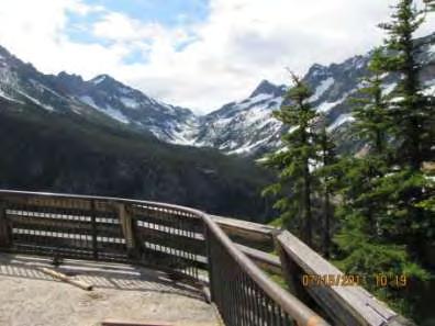
29 Implementation
30
31


32 New Railing

33
34
35

36


37 Replaced all log curbs with new log curbs and added new curbs where necessary


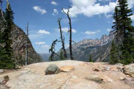
38 Scenic Views From Hiking Trail
39
40

41 Okanogan-Wenatchee National Forest Design Team
6.8 SCENIC HIGHWAYS Introduction
 6.8 SCENIC HIGHWAYS 6.8.1 Introduction The Scenic Highways Element is an optional General Plan element authorized by Section 65303 of the Government Code. The Scenic Highways Element is intended to establish
All Roadside Parks Are Not Created Equal. Context Sensitive Solutions for MDOT s Special Roadside Facilities in Houghton and Keweenaw Counties
 All Roadside Parks Are Not Created Equal Context Sensitive Solutions for MDOT s Special Roadside Facilities in Houghton and Keweenaw Counties Western U.P. Planning & Development Region In Partnership with:
Preservation of Scenery National Historic Trails. Rob Sweeten BLM Kevin Rauhe EPG
 Preservation of Scenery National Historic Trails Rob Sweeten BLM Kevin Rauhe EPG EPG Background Landscape architects with expertise in visual resources Resource staff includes: archaeologists, biologists,
I. STAFF POLICY RECOMMENDATIONS. The following RMP policy strategies are proposed by staff in support of a Scenic Resource Protection Program:
 Policy Consideration: Scenic Resource Protection Program Status: For Consideration by the Highlands Council at September 14, 2006 Work session Date: September 12, 2006 I. STAFF POLICY RECOMMENDATIONS The
Daniels Park Master Plan
 Daniels Park Master Plan Prepared for: Douglas County & The City and County of Denver October, 2007 EXHIBIT A Contents Daniels Park Overview 2 Project History & Goals 2-3 Regional Context Map 4 Park Zone
2011 ASLA Design Awards. Top of the Rockies National Scenic and Historic Byway Merit Award Bluegreen. Planning & Urban Design
 2011 ASLA Design Awards Top of the Rockies National Scenic and Historic Byway Merit Award Bluegreen Planning & Urban Design ASLA Colorado 2011 Design Awards Category 2: Planning Project Fact Sheet Project
I-70 Corridor Enhancement Plan
 i - Table of Contents Table of Contents Chapter I Overview Chapter II Bridge and Roadway Improvements Chapter III Landscape Enhancements Chapter IV Riparian Corridors Chapter V Showcase Missouri Plan Chapter
West Dennis Center: Bass River to Old Main Street. West Dennis Business District: Old Main Street to Dennis Commons
 West Dennis Center: Bass River to Old Main Street West Dennis Business District: Old Main Street to Dennis Commons Dennisport Center: Dennis Commons to Division Street Main Street Project Goals Project
The Palisades Interstate Parkway and Henry Hudson Drive designated a New Jersey State Scenic Byway, 2005
 The Palisades Interstate Parkway and Henry Hudson Drive designated a New Jersey State Scenic Byway, 2005 What are scenic byways? How Did Scenic Byways Come About? National Scenic Byways Program Administered
Objective: Resolution to recommend adoption of the Big Thompson Assessment to the Planning Commission
 Type of Meeting: Administrative Matters Name of requestor: Zac Wiebe - 619-4534, Kerri Rollins - 619-4577, Gary Buffington - 619-4560 Department: Natural Resources Preferred appearance date: 8/18/2015
Potential Green Infrastructure Strategies May 6, 2015 Workshop
 Potential Green Infrastructure Strategies May 6, 2015 Workshop Background The City of Cortland is developing the Tioughnioga Urban Headwaters Green Infrastructure Action Plan with funding from the National
Mendota Heights 2040 Comprehensive Plan Draft Vers
 4 Parks and Trails The City of Mendota Heights boasts a variety of recreational and open space opportunities. Few cities can claim access to regional trails, riverside and lakeside parks, scenic bluffs
HILLSBOROUGH COUNTY Greenways and Trails Plan Update. Executive Summary. Date
 HILLSBOROUGH COUNTY Greenways and Trails Plan Update Executive Summary Date PURPOSE AND PROJECT OVERVIEW The Hillsborough County Greenways Master Plan (1995) and the City of Tampa s Greenways and Trails
Saratoga Quarry Park Master Plan
 Project Team City of Saratoga John Cherbone, Director of Public Works Iveta Harvancik, Senior Engineer PlaceWorks Isabelle Minn, Principal-in-Charge Isby Fleischmann, Project Manager Kyle Simpson, CEQA
Benjamin Farmer, Principal- Managing Partner,
 Benjamin Farmer, Principal- Managing Partner, Farmer Morgan, L.L.C. Farmer Morgan is a planning, design and construction management firm that undertakes capital infrastructure and redevelopment projects
The River Future. San Gabriel River Confluence with Cattle Canyon Creek Improvements Project (the Cattle Canyon Project)
") The River Future San Gabriel River Confluence with Cattle Canyon Creek Improvements Project (the Cattle Canyon Project) Collaboration Agency Leads Engaged Stakeholders Non-Profit Organizations USFS Pacific
The River Future San Gabriel River Confluence with Cattle Canyon Creek Improvements Project (the Cattle Canyon Project) Collaboration Agency Leads Engaged Stakeholders Non-Profit Organizations USFS Pacific
OVERMOUNTAIN VICTORY TRAIL BURKE CALDELL CORRIDOR FEASIBLITY STUDY REQUEST FOR QUALIFICATIONS CALDWELL COUNTY PATHWAYS
 OVERMOUNTAIN VICTORY TRAIL BURKE CALDELL CORRIDOR FEASIBLITY STUDY REQUEST FOR QUALIFICATIONS CALDWELL COUNTY PATHWAYS Caldwell County Pathways along with our co-partners City of Lenoir, Town of Gamewell,
Highbridge Park Enhance the picturesque park: Provide more opportunities for healthy activity: Improve forest and ecology health:
 Enhance the picturesque park: Expose gigantic rocks and meadows Provide more opportunities for healthy activity: Improve the recreation center, athletic fields, playgrounds & restrooms Improve forest and
Grand River Ravines Georgetown Township
 Grand River Ravines Georgetown Township Project Description: The Grand River Ravines County Park property is composed of the 68-acre former Fillmore at the Bend Open Space purchased in 1999 and two more
FOREST SERVICE MANUAL NATIONAL HEADQUARTERS (WO) WASHINGTON, DC
 WASHINGTON, DC") Page 1 of 11 FOREST SERVICE MANUAL NATIONAL HEADQUARTERS (WO) WASHINGTON, DC FSM 2300 RECREATION, WILDERNESS, AND RELATED RESOURCE MANAGEMENT Amendment No.: 2300-2011-2 Effective Date: October 19, 2011
Page 1 of 11 FOREST SERVICE MANUAL NATIONAL HEADQUARTERS (WO) WASHINGTON, DC FSM 2300 RECREATION, WILDERNESS, AND RELATED RESOURCE MANAGEMENT Amendment No.: 2300-2011-2 Effective Date: October 19, 2011
Project Team. 2M Associates. City of Saratoga. HT Harvey Biology. PlaceWorks. NV5 Infrastructure. Tom Origer Associates History/Archeology
 Project Team City of Saratoga John Cherbone, Director of Public Works Iveta Harvancik, Senior Engineer PlaceWorks Isabelle Minn, Principal-in-Charge Isby Fleischmann, Project Manager Kyle Simpson, CEQA
Section 4: Goals, Objectives, and Strategies
 99 Section 4: Goals, Objectives, and Strategies Goal 1 Resource Protection, Maintenance, Preservation, and Enhancement Protect, preserve, maintain, and enhance the natural, recreational, archaeological,
REGIONAL TRANSPORTATION COMMISSION OF SOUTHERN NEVADA AGENDA ITEM
 REGIONAL TRANSPORTATION COMMISSION OF SOUTHERN NEVADA AGENDA ITEM Metropolitan Planning Organization [ X ] Transit [ ] Administration and Finance [ ] SUBJECT: PROJECT SELECTION PROCESS FOR TRANSPORTATION
Preliminary Management Recommendations for the proposed Sedona Verde Valley Red Rock National Monument
 Preliminary Management Recommendations for the proposed Sedona Verde Valley Red Rock National Monument The Monument shall be managed consistent with the values that underlie the designation as a National
Rogue River Recreation and Access Management Plan- Table Rocks Reach. Jackson County, Oregon Department of Fish and Wildlife, National Park Service
 Rogue River Recreation and Access Management Plan- Table Rocks Reach Jackson County, Oregon Department of Fish and Wildlife, National Park Service Today s Agenda Welcome Project refresher Project status/timeline
MOUNT ROSE AND WASHOE VALLEY SCENIC BYWAY CORRIDOR MANAGEMENT PLANS
 MOUNT ROSE AND WASHOE VALLEY SCENIC BYWAY CORRIDOR MANAGEMENT PLANS PARK COMMISSION JANUARY 5, 2016 PREPARED BY Aspen Asheville Austin Chicago Denver Dubai Houston Lake Tahoe Los Angeles CORRIDOR MANAGEMENT
UPPER BRODHEAD CREEK PARADISE CREEK GREENWAY PLAN
 UPPER BRODHEAD CREEK PARADISE CREEK GREENWAY PLAN The Upper Brodhead & Paradise Creeks Greenway Cooperating Municipalities Mount Pocono Borough Paradise Township Barrett Township Price Township Funding
The only significant recreation deficiency in Conway is the absence of an integrated greenway and multipurpose trail system.
 CHAPTER 6 RECREATION 1. Introduction This recreation chapter is prepared in compliance with recently revised state statutes dealing with the completion of municipal master plans [RSA 674:2 III (F)]. This
Chapter 5: Recreation
 Chapter 5: Recreation Introduction and Setting Recreational opportunities within Nevada County are varied, ranging from public parks with intensively used active recreational facilities, to vast tracts
Sherman Pass Project Post-Fire Treatment Scenery Report Barbara Jackson, Landscape Architect, 3/30/2016
 Sherman Pass Project Post-Fire Treatment Scenery Report Barbara Jackson, Landscape Architect, 3/30/2016 Introduction This report updates the 2015 Sherman Pass Project Scenery Report based on changes in
Statewide Greenways Vision
 Greenways Vision The formation of a greenways vision is based on a thorough analysis of the current state of recreation and open space in a region and the existing pressures that threaten it. Lehigh and
Seneca Meadows. Block 4 Locate office, technology, and medical development adjacent to I Screen views of garage structures from I-270.
 Seneca Meadows Seneca Meadows has an industrial park in its southern end and a mixed-use employment area planned for the north end. The district benefits from extensive I-270 visibility, stream valley
Northeast Everglades Natural Area
 Northern Palm Beach County Natural Areas Master Plan Northeast Everglades Natural Area August 3, 2006 GLATTING JACKSON KERCHER ANGLIN LOPEZ RINEHART, INC. Community Planning 1 Public Land Partners Agenda
Keyport. Vision for Keyport
 Keyport Vision for Keyport Keyport is a rural, historic waterfront village bounded and limited in size by its natural borders of water and the Naval Undersea Warfare Center. The community consists primarily
MetroParks Board Meeting 2018 Capital Improvement Projects
 MetroParks Board Meeting 2018 Capital Improvement Projects Stephen L. Avery Planning & Operations Director Last Edited: 3.12.18 Presentation Outline MetroParks Mission Statement Strategic Master Plan MetroParks
12 Foot Davis and Adjacent Sites
 Peace River, Alberta Proposed Concept Design Presentation and Discussion January 26, 2010 Peace River Provincial Recreation Area 12 Foot Davis Grave Site Dr. Greene Cairn North Environments Landscape Architects
Historic Ottawa Beach Waterfront Walkway Park Township
 Historic Ottawa Beach Waterfront Walkway Park Township Project Description: Public access improvements to the shoreline of Lake Macatawa are the final steps in completing the park master plan for the Historic
Anoka River Walk West Rum River Corridor Plan
 Anoka River Walk West Rum River Corridor Plan Ferry Street Corridor Peninsula Point Park to Calhoun Street Points of Interest Bonnell Overlook Dam Giddings Gardens Stone House Windego Amphitheater Woodbury
Atlanta BeltLine, Inc. Pathways to Urban Sustainability
 Atlanta BeltLine, Inc. Pathways to Urban Sustainability September 30, 2010 WHAT IS THE ATLANTA BELTLINE? Transit 22-mile loop Parks 1300 + new acres Trails 33 miles Jobs & Economic Development 20 areas,
The Trinity River Corridor Project Update
 The Trinity River Corridor Project Update Councilmember Carolyn A. Davis Community Meeting October 14, 2008 The project covers 20 miles of the Trinity River, approx. 10,000 acres 2 Trinity River Corridor
Preliminary Sketch Plan for Fort Hunter Park
 Preliminary Sketch Plan for Fort Hunter Park Public Presentation November 19, 2009 Dauphin County Parks and Recreation 100 Fort Hunter Road Harrisburg, PA 17110 (717) 599-5188 www.dauphinc.org THOMAS COMITTA
To qualify for federal Transportation Enhancement (TE) funds a project must meet two basic federal requirements:
 funds a project must meet two basic federal requirements:") Eligibility Requirements To qualify for federal Transportation Enhancement (TE) funds a project must meet two basic federal requirements: 1) Relate to surface transportation and 2) Be one of the 12 designated
Eligibility Requirements To qualify for federal Transportation Enhancement (TE) funds a project must meet two basic federal requirements: 1) Relate to surface transportation and 2) Be one of the 12 designated
Turkey Creek Streamway Corridor
 Turkey Creek Streamway Corridor Turkey Creek Corridor Overview History Watershed Corridor Inventory Coalition Corridor Plan Stages of Development Benefits Funding Turkey Creek History Kansas and Missouri
LAKE COUNTY REGIONAL TRAIL PROJECTS
 LAKE COUNTY REGIONAL TRAIL PROJECTS LAKE APOPKA LOOP TRAIL SOUTH LAKE TRAIL LEESBURG-WILDWOOD TRAIL LAKE-CROSS FLORIDA GREENWAY LAKE LOUISA-HORIZON WEST WEKIVA PARKWAY- SR 46 CORRIDOR SR 40 CORRIDOR VAN
Built Environment. Image & Identity BEIG Chapter 4, Part 1. United States Department of Agriculture. Forest Service. Technology & Development Program
 D E P A RTMENT OF AGRICULT U R E United States Department of Agriculture Forest Service Technology & Development Program FOREST SERVICE Built Environment Image Guide Image & Identity BEIG Chapter 4, Part
PREVIOUS PUBLIC PARTICIPATION BRIEF October 2014
 Comprehensive Planning During the development of the county comprehensive plan, Cultivating Community: A Plan for Union County s Future from 2007 through 2009, and three concurrent multi municipal plans
& SUSTAINABILITY PLAN
 Chapter 6: IMPLEMENTATION, MANAGEMENT, & SUSTAINABILITY PLAN Overview The Oxbow Park and Zollman Zoo Master Plan presents a long-term vision for the park. While phasing of improvements is suggested, Olmsted
The Auburn Plan Designing the Future of Auburn February 28, 2005
 The Auburn Plan Designing the Future of Auburn February 28, 2005 Block-by-Block Bicycle Tour Aerial survey Focus Group Meetings September 7 and 8 Design Workshops October 11, 14, and 21 Revitalization
Errol Heights Park and Community Garden Frequently Asked Questions March 22, 2018
 Errol Heights Park and Community Garden Frequently Asked Questions March 22, 2018 Question 1: What improvements are planned for Errol Heights Park? How will the community be engaged in the process to shape
THE LAND CONSERVANCY OF SAN LUIS OBISPO COUNTY
 THE LAND CONSERVANCY OF SAN LUIS OBISPO COUNTY WWW.LCSLO.ORG WHO WE ARE Through voluntary and collaborative measures, we work to permanently protect and enhance lands having important scenic, agricultural,
April 21, 2007 CCRP Workshop Summary
 April 21, 2007 CCRP Workshop Summary Group 1 1. Reuse around BART with a lot of housing and jobs 2. Greenway around creek 3. Transit and auto connection all through the site from Kirker Pass to Port Chicago
Framework for Sustainable Recreation
 Framework for Sustainable Recreation USDA Framework for Sustainable Recreation Laurie Thorpe, USFS Rachel Franchina, USFS Robert Burns, WVU Service USDAForest Forest Service Presentation Outline USFS Framework
RECREATION AND OPEN SPACE VISION
 City of South Lake Tahoe General Plan Policy Document Recreation and Open Space Element INTRODUCTION This element provides the policy context for the City of South Lake Tahoe to achieve its vision for
1.0 Circulation Element
 5/9/18 1.0 Circulation Element 1.1 Introduction As growth and development occur in Apache County, enhancements to its circulation system will be necessary. With time, more roads will be paved and air and
CHAPTER 10 AESTHETICS
 CHAPTER 10 AESTHETICS CHAPTER 10 AESTHETICS This section identifies and evaluates key visual resources in the project area to determine the degree of visual impact that would be attributable to the project.
Mark Greenig Recreation and Land Use Planner CH2M Hill
 Mark Greenig Recreation and Land Use Planner CH2M Hill Land Use (Slide L1) Objectives: Document existing land uses in the Study Area along with identifying applicable land use and management plans. Evaluate
Grand Rounds History
 Grand Rounds History 1883 Plan for Minneapolis Park System prepared by Landscape Architect Horace W. S. Cleveland. The system of connecting parks and parkways was first called the Grand Rounds by William
PORTERVILLE WORKSHOP MINUTES
 Workshop 3 Policy Scenarios PORTERVILLE WORKSHOP MINUTES December 13, 2004 On December 13, 2004, 20 people attended a workshop in Porterville to discuss policy options for Tulare County s General Plan
Name of Action: Arrangement of beach locations on the River Vikhra
 COMUS PROJECT PILOT TOWN: MSCISLAŬ REFERENCE PLAN ACTION N 3.1 Name of Action: Arrangement of beach locations on the River Vikhra Location Image Summary: To develop recreation sites on the beaches of the
CHAPTER 7: Transportation, Mobility and Circulation
 AGLE AREA COMMUNITY Plan CHAPTER 7 CHAPTER 7: Transportation, Mobility and Circulation Transportation, Mobility and Circulation The purpose of the Transportation, Mobility and Circulation Chapter is to
February 27, 2018 City Council Presentation The Crown Jewel Park in the City of Fairfax
 February 27, 2018 City Council Presentation The Crown Jewel Park in the City of Fairfax Master Planning Charge Van Dyck Park s first Master Plan will provide the City with a road map as to how best incorporate
5.11 AESTHETICS ENVIRONMENTAL SETTING
 5.11 AESTHETICS ENVIRONMENTAL SETTING The lies on a relatively flat valley floor surrounded by rugged hills and mountains. The topography of the planning area is defined by the Box Springs Mountains and
City of Plattsburgh DRI: Downtown Streetscapes & Riverfront Access. Downtown Streetscape and Riverfront Access Design
 City of Plattsburgh DRI: Downtown Streetscapes & Riverfront Access Welcome Thank you for coming this evening. Agenda PART I - Project Context The Downtown Revitalization Program Our DRI Projects Other
NARRATIVE: NORTH FERRY STREET PUMP HOUSE, OVERLOOK, AND RIVERWALK IMPROVEMENTS
 NARRATIVE: NORTH FERRY STREET PUMP HOUSE, OVERLOOK, AND RIVERWALK IMPROVEMENTS The City of Schenectady is applying to the New York State Department of Parks, Recreation and Historic Preservation for a
Eligible, see Statement of Significance. Roadside Development on Minnesota Trunk Highways,
 Historic Name CS # 0115 Other Name SHPO Inv # Location Both sides of TH 169 on isthmus between Little Pine Lake and Hickory Lake Hwy District Reference City/Township County Farm Island Township Aitkin
Visual Analysis. Prepared for: State of Alaska Department of Transportation and Public Facilities. and
 Prepared for: State of Alaska Department of Transportation and Public Facilities and Prepared by: HDR Alaska, Inc. 2525 C Street, Suite 305 Anchorage, AK 99503 Land Design North/USKH 2515 A Street Anchorage,
The Benefits and Challenges Associated with Green Infrastructure Practices
 The Benefits and Challenges Associated with Green Infrastructure Practices Thomas M. Evans ASLA, LEED AP Regional Green Infrastructure Design Services Director OWEA Technical Conference, June 20, 2013
Fort Ord Regional Trails Planning
 Fort Ord Regional Trails Planning FORA Board July 11, 2014 Josh Metz, Associate Planner Overview Base Reuse Plan (BRP) trails planning context Trails planning in FORA jurisdictions and related entities
4.1 AESTHETICS AND VISUAL QUALITY
 SCOPE AND METHODOLOGY 4.1 AESTHETICS AND VISUAL QUALITY This section evaluates the potential impacts to aesthetics and visual quality. Aesthetics refers to visual resources and the quality of what can
Concept Master Plan. for. Draft of. Wildlife Management Area. Prepared for. June, 2008
 Draft of Concept Master Plan for Vermillion Highlands: A Research, Recreation and Wildlife Management Area Prepared for Vermillion Highlands Steering Committee - Minnesota Department of Natural Resources
STREAM BANK STABILIZATION THORPS MORTIMER RECREATION AREA Grandfather Ranger District SITE LOCATION & DRAINAGE AREA
 STREAM BANK STABILIZATION THORPS CREEK @ MORTIMER RECREATION AREA SITE LOCATION & DRAINAGE AREA SITE LOCATION Drainage Area = 1.14 sq. miles STREAM BANK STABILIZATION THORPS CREEK @ MORTIMER RECREATION
Draft Stillwater 2030 Comprehensive Plan- Goals and Policies
 Draft Stillwater 2030 Comprehensive Plan- Goals and Policies Instructions- Review each goal and policy and discuss with group any changes, deletions for additions to the list using your groups pen. Keep
Please read the entire document
 projects impacting the waterfront revitalization area. The waterfront revitalization area of the town will have to subareas to the west and east of the village. Page 6 of 6 Wayfinding master plan create
North Shore Trail. Council Meeting June 10, 2002
 North Shore Trail Council Meeting June 10, 2002 Process Guiding Principles Inventory and Analysis Preliminary Concepts (4) Final Concept Phasing Strategy Estimated Costs OVERVIEW Purpose: Prepare an overall
Table L-1 Summary Action Strategy. Action Item Timing Status Responsible Agency
 CHAPTER 4: CIRCULATION ELEMENT ISSUE #1: MAJOR THOROUFARES AND TRANSPORTATION ROUTES A balanced transportation system for Fontana is provided that meets the mobility needs of current and future residents
THE COMMUNITY-DRIVEN DESIGN PROCESS
 THE COMMUNITY-DRIVEN DESIGN PROCESS A PUBLIC DRIVEN PROCESS STEERING COMMITEE THE COMPREHENSIVE PLAN OPPORTUNITIES AND CONSTRAINTS THE COMMUNITY DRIVEN DESIGN PROCESS A Public Driven Process Beginning
SARANAC LAKE VISION CONCEPTS
 DRAFT SARANAC LAKE VISION CONCEPTS A GENUINE PLACE TO LIVE, WORK, SHOP AND EXPERIENCE CULTURE IN THE HEART OF THE ADIRONDACKS PHOTO COURTESY OF SARANAC LAKE SARANAC LAKE, NEW YORK DECEMBER 2007 SARANAC
The Vision. Photo provided by The Minervini Group. 46 Vision, Objectives & Strategies
 Vision, Objectives & Strategies The is the public framework and guide for future development of the Grand Traverse Commons. The establishes public polices for infrastructure, the preservation of natural
Glenn Highway MP DSR. Landscape Narrative
 Glenn Highway MP 34-42 DSR Landscape Narrative Project Landscape Goals The Glenn Highway MP 34-42 Project extends through a variety of landscape types typical to the Matanuska-Susitna Valley. In general,
AASHTO s Center for Environmental Excellence is pleased to announce the winners of the 2005 Best
 Best Practices in Context-Sensitive Solutions AASHTO s Center for Environmental Excellence is pleased to announce the winners of the 2005 Best Practices in Context-Sensitive Solutions (CSS) competition.
RZC Public View Corridors and Gateways
 RZC 21.42 Public View Corridors and Gateways 21.42.010 Purpose 21.42.020 Scope and Authority 21.42.030 Administration 21.42.040 Gateways Design 21.42.050 Unidentified Public Views 21.42.060 Identification
IDENTIFYING, EVALUATING, AND PRESERVING MINNESOTA'S HISTORIC ROADSIDE FACILITIES
 IDENTIFYING, EVALUATING, AND PRESERVING MINNESOTA'S HISTORIC ROADSIDE FACILITIES Overview Minnesota built many wayside rest areas during 1930s & '40s (New Deal-WPA, CCC) Many are now threatened Limited
Charles P. Johnson and Associates. Annapolis Landscape Architects
 Charles P. Johnson and Associates Annapolis Landscape Architects AGENDA Introduction Project Limits and Scope Site Analysis Opportunities & Constraints Program Goals Image Boards Design Alternatives Pros
Transportation Committee
 Transportation Committee Business Item No. 2013-286SW Meeting date: October 14, 2013 For the Metropolitan Council meeting of October 16, 2013 Subject: Southwest Light Rail Transit (Green Line Extension):
Member Service Plan Sierra Nevada AmeriCorps Partnership
 Member Service Plan Sierra Nevada AmeriCorps Partnership Service plans lay the framework for what each Member will be doing during their service. Service plans detail the major projects and expected results
Corridor Vision. 1Pursue Minnehaha-Hiawatha Community Works Project. Mission of Hennepin County Community Works Program
 1Pursue Minnehaha-Hiawatha Community Works Project Minnehaha-Hiawatha Community Works is a project within the Hennepin Community Works (HCW) program. The mission of the HCW program is to enhance how the
PARKS AND RECREATION
 PARKS AND RECREATION WHAT YOU WILL FIND IN THIS CHAPTER: Background information on the development of the Park, Recreation, and System Plan (PRSP). General overview of Ellensburg s parks and recreation
Otay Regional Trail Alignment Study. Public Workshop March 14 th, 2017 from 5:30-8 p.m.
 Public Workshop March 14 th, 2017 from 5:30-8 p.m. Purpose of the Study A multi-agency planning effort to create a coordinated and sustainable trail system that enhances recreation and provides trail connections
FY Capital Improvement Program Parks and Landscaping. 8 - Summary
 PARK PROJECTS FY 211-215 Capital Improvement Program Description FY 21 FY 211 FY 212 FY 213 FY 214 FY 215 1 Restroom Bldgs (Replace or Construct)-Jefferson, McDonald, 5,774,623 4,669,623 1,15, Allendale,
RLRC COMMUNITIES THIEF RIVER FALLS AREA CHARACTER COMMUNITY TRAIL OPTIONS OAKLAND PARK EXISTING CONDITIONS OAKLAND PARK DESIGN DESIGN DETAILS
 THIEF RIVER FALLS AREA CHARACTER COMMUNITY TRAIL OPTIONS OAKLAND PARK EXISTING CONDITIONS OAKLAND PARK DESIGN DESIGN DETAILS 61 THIEF RIVER FALLS AREA CHARACTER Thief River Falls has a number of existing
Pennsy Greenway Trail
 Town of Schererville Pennsy Greenway Trail DES. #s: 0401062, 1173595 & 1382661 Construction of Pennsy Greenway Trail beginning at Wilhelm Street and continuing northwest along the former Penn Central railroad
2011 ASLA Design Awards
 2011 ASLA Design Awards Interstate 70 Mountain Corridor Aesthetic Guidance Honor Award Design Workshop, Aspen / THK Associates, Inc. / CH2MHill Planning and Urban Design Project Title: Interstate70 Mountain
WELCOME! 8 8:30 6: TH STREET IMPROVEMENTS. Open House. Presentation & Q&A
 WELCOME! 168 TH STREET IMPROVEMENTS 6:30 Open House 7 8 Presentation & Q&A 8 8:30 Open House WELCOME Todd Pfitzer City of Omaha Engineer Bob Stubbe City of Omaha Public Works Director Jon Meyer Project
DRAFT Anan Wildlife Observatory Recreation Site Master Plan. Prepared by: Wrangell Ranger District Tongass National Forest Alaska
 DRAFT Anan Wildlife Observatory Recreation Site Master Plan Prepared by: Wrangell Ranger District Tongass National Forest Alaska December, 2015 Signature Sheet Approved: James King Director of Recreation,
Minto-Brown Island. November 18, City of Salem, Parks & Transportation Services
 Minto-Brown Island Park Master Plan Public Meeting #1 November 18, 2014 City of Salem, Parks & Transportation Services Division, i i Public Works Welcome... and thanks for participating in the master planning
VISUAL ASSESSMENT REPORT FOR THE TRI-STATE MONTROSE-NUCLA-CAHONE TRANSMISSION LINE IMPROVEMENT PROJECT SOUTHWEST COLORADO
 FOR THE TRI-STATE MONTROSE-NUCLA-CAHONE TRANSMISSION LINE IMPROVEMENT PROJECT SOUTHWEST COLORADO Prepared for Tri-State Generation and Transmission Association, Inc. 1100 West 116 th Avenue Westminster,
Metropolitan Parks and Open Space Commission
 Business Item No. 2013-xxx Metropolitan Parks and Open Space Commission Meeting date: October 1, 2013 For the Community Development Committee meeting of October 7, 2013 Subject: Mendota-Lebanon Hills Greenway
open house 3 CITY OF SALEM Downtown Streetscape Plan
 open house 3 Streetscape concepts CITY OF SALEM Downtown Streetscape Plan analysis concepts we are here refined concepts & document Feb 13th 1 2 3 apr 18th KICKOFF OPEN HOUSE Streetscape Work Group Walking
PLANNING AND NATURAL RESOURCES COMMITTEE. Public Access Conceptual Design Alternatives for the Red Barn Area of La Honda Creek Open Space Preserve
 PLANNING AND NATURAL RESOURCES COMMITTEE R-17-56 May 9, 2017 AGENDA ITEM AGENDA ITEM 2 Public Access Conceptual Design Alternatives for the Red Barn Area of La Honda Creek Open Space Preserve GENERAL MANAGER
Image and the Built Environment
 Chapter 1 Image and the Built Environment A land ethic, then, reflects the existence of an ecological conscience, and this in turn reflects a conviction of individual responsibility for the health of the