Project Analysis and Evaluation. UNIT 10 Project Analysis and Evaluation
|
|
|
- Anis Gray
- 6 years ago
- Views:
Transcription
1 Project Analysis and Evaluation UNIT 10 Project Analysis and Evaluation 1
2 Objective Provide accurate and complete information to the decision maker. 2
3 Initial Project Considerations What is your role? When to be scared! Project complexity? Use third party consultants? Cost recovery? Skill set and workload? Part of a larger project? 3


4 Objective Analyze a project proposal p using the visual contrast rating system to determine the elements of a project that are inconsistent with VRM objectives and recommend measures to improve the visual quality of that project 4


5 Contrast Rating A systematic process we use to identify, describe and analyze potential visual impacts of proposed projects and activities 5
6 Visual Contrast Rating Systematic process mandated by Bureau policy Helps identify where and how the greatest visual contrasts occur in a project and how these can be mitigated Assists Bureau personnel not formally trained in the design arts to apply basic principles of design to resolve visual impacts and review analysis done by others. 6


7 Basic Philosophy The degree to which a development adversely affects the visual quality of a landscape is directly related to the amount of visual contrast t between it and the existing landscape character 7
8 Visual Contrast Rating System The amount of contrast is measured by separating the landscape into major features: (land/water, vegetation, structures) then predicting i the magnitude of contrast in each of the landscape character elements: FORM LINE COLOR - TEXTURE 8


9 Contrast Rating System Prototype VMS system developed in
10 Analytical Format Landsc cape Charac cter Elemen nts Form Line Color Texture Major Features Land/Water Vegetation Structures 10
11 Analytical Format Quickly reveals elements & features that cause the greatest visual impact A guide to methods to reduce the visual impact of a proposed project or activity Provides basis for design that reflects and responds to the setting 11


12 Visual Contrast Rating Not a pass fail exercise. We want an A Every attempt is made to reduce visual impacts even if the proposed project meets VRM Management Objectives for the area 12
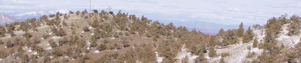
13 Steps - Contrast Rating Process 1. Obtain a complete project description 2. Identify VRM Objectives from RMP 3. Assess project visibility - Select Key Observation point(s) 4. Prepare visual representation/simulation 5. Complete Contrast Rating 13
14 Step 1 Obtain Detailed Project Description Emphasize early contact with project proponent Coach proponent on project design Proposal must be comprehensive Materials? Scale? Colors/Reflectivity? Lights? Temp structures/seasonal use? 14


15 Step 2 - Identify VRM Class From RMP 15
16 No VRM Class Map??? Follow BLM policy Handbook Inform manager! Inventory project area. Find RMP emphasis for that area. Develop range of alternatives. Prepare contrast ratings. 16


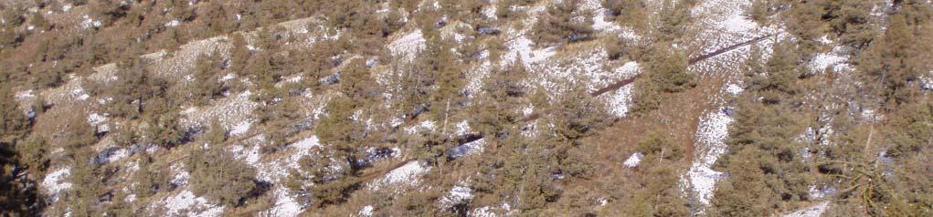
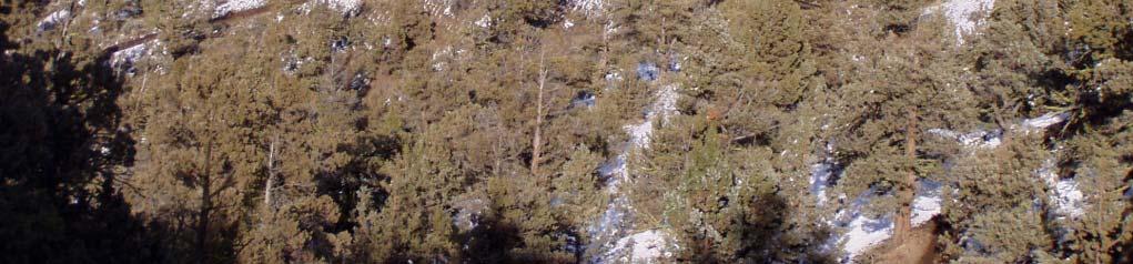
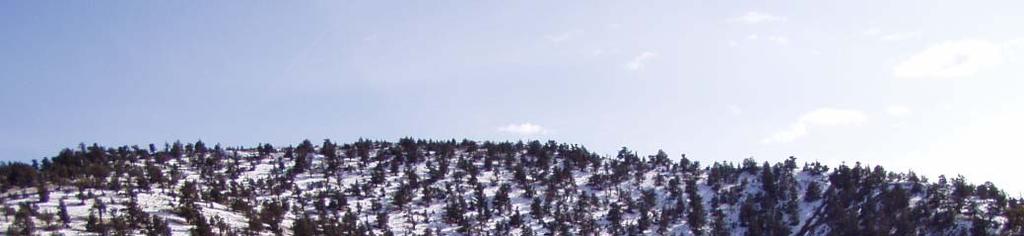
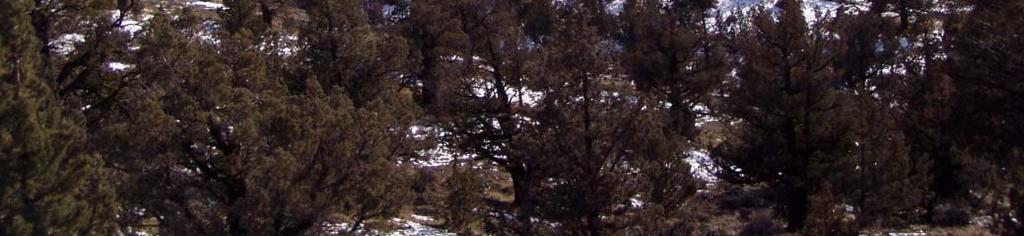
17 Step 3 Assess Project Visibility Viewshed Analysis Section/Line of sight analysis Site and area reconnaissance Key Observation Point A critical viewpoint or place from which we analyze the visual impact of a Proposed Project 17
18 Typical Project KOPs Scenic Overlooks, Rivers & Roads Important Vantage Points Places from which a proposed project is seen by large numbers of viewers (representative) or critical viewers Views From Communities or Subdivisions Point where view of proposed project is most revealing (careful to avoid bias in analysis) 18
19 KOP Considerations RMP direction, IDT input Distance Angle of observation # of Viewers Length of time project is in view Relative project size Season of use Light conditions & other factors as appropriate 19


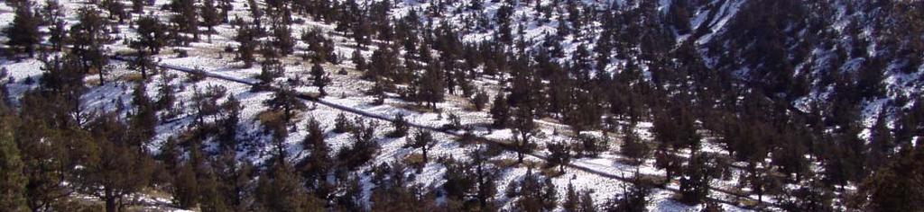
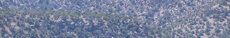
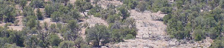
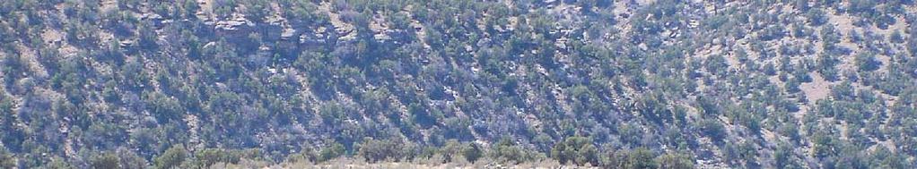
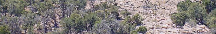
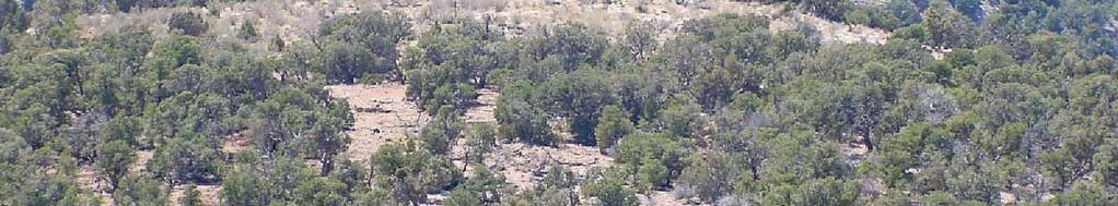
20 Rock Quarry low angle 20
21 Rock Quarry high angle 21

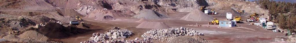


22 Rock Quarry - foreground 22


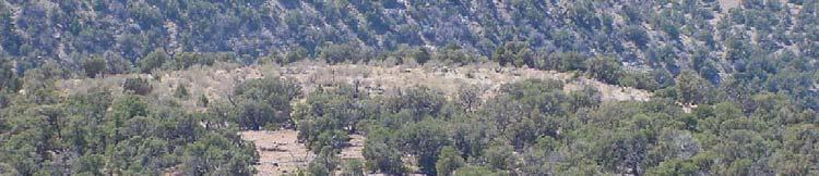
23 Rock Quarry - Background 23
24 Seasonal considerations 24
25 Step 4 Prepare Visual Simulations Helps to understand the project Helps to understand the visual impact Great way to illustrate impacts in EA Seeing an image of the project is much more powerful than trying to imagine it Helps eliminate bias Allows all team members to see the project the same 25
26 Penstock/pump station site 26
27 Quick paintshop line drawing 27
28 Built project 28
29 Color option/mitigation 29
30 Reduce edge contrast Old well pad. 30
31 Reduce edge contrast Old well pad with edges blended. 31
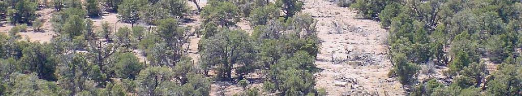
32 32
33 Step 5 Complete Contrast Rating See Bureau Manual Handbook H (Note the Illustrations and appendices) Tips/techniques: Use IDT and mentor in field If possible, take a recon trip first to familiarize yourself with directions, setting and light conditions at different times of day GPS and photograph the locations you conduct the analysis from Cover elements on worksheet can use different format or record observations on tape recorder 33
34 34
35 Let s Walk Through an Example What is the first step in the process? 35
36 Obtain Complete Project Description 36


37 Review established VRM objectives 37
 38")
38 Select KOP(s) 38
39 Prepare Visual Simulation Photo of proposed project site 39
40 Simulation of Proposed Project 40
41 Complete Contrast Rating Section A of Form Form (September 1985) UNITED STATES DEPARTMENT OF THE INTERIOR BUREAU OF LAND MANAGEMENT Date: Feb 24, 2004 District: N/A Resource Area: Lander VISUAL CONTRAST RATING WORKSHEET Activity: Oil & Gas 1. Project Name: Well No Key Observation Point 29/91 Sec 21: SESE 3. VRM Class VRM Class IV SECTION A. PROJECT INFORMATION 4. Location Township 29N Range 91W Section Location Sketch 41
42 Section B of Contrast Rating Form Characteristic Landscape Description FO ORM SECTION B. CHARACTERISTIC LANDSCAPE DESCRIPTION 1. LAND/WATER 2. VEGETATION 3. STRUCTURES Gently rolling terrain, low hills Low, continuous sagebrush cover, smooth, regular pattern None noted in view toward the project from the KOP LI INE Mostly horizontal undulating lines. A horizontal landscape Weak horizontal lines created by changes in vegetative patterns None noted in view toward the project from the KOP COLOR Light brown to buff where visible Gray-green of sagebrush is dominant, mostly continuous None noted in view toward the project from the KOP TEX- TURE Smooth, continuous Medium to slightly coarse in immediate foreground to smooth/fine in middleground d None noted in view toward the project from the KOP 42
43 Section C of Contrast Rating Form Proposed Activity Description FORM LINE COLOR TEX- TURE SECTION C. PROPOSED ACTIVITY DESCRIPTION 1. LAND/WATER 2. VEGETATION 3. STRUCTURES Flat, leveled pad(s), Veg removed from pad, Cylindrical tanks, rectangular curvilinear road(s), road(s), reclaimed veg separator unit. narrow, linear form low, sparce A dominant visual element Where seen, pad appears as a distinct horizontal line, same with roads Light brown to buffcolored pad(s) & road surfaces. Smooth texture on pad(s) & road(s) Sharper line(s) where veg removed Tan to light buff most of year, light green in spring. Smooth where reestablished (grasses) Sage may re-establish in 20 years Structures have vertical alignment and are visible Carlsbad Canyon contrasts with darker gray of sagebrush Smooth texture of facilities a dominant feature of project 43
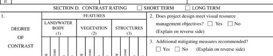
44 Section D of Contrast Rating form SECTION D. CONTRAST RATING SHORT TERM X LONG TERM 1.Degree FEATURES of Land/Water Body Vegetation Structures 2. Does Project Design meet visual Contrast resource management objectives? Yes X_ No (explain on reverse) 3. Additional mitigating measures recommended. Yes X_ No (explain on reverse) TS ELEMEN Strong Moderate Weak None Form X X X Line X X X Color X X X Texture X X X Strong Moderate Weak None Strong Moderate Weak None Evaluator s Names Date: Cimarron Chacon 7/16/04 Allysia Angus Consider mitigation measures as you id contrast: What are strong elements in the project setting? What are strong elements in the project? What can you borrow from the setting? What can you change in the setting? What can you change in the project: make it fit in setting (color, form, texture, scale ) move it 44
45 Section D Reverse Side of form Comments from Item 2. SECTION D. (Continued) The line created by the clearing for the road and drill pad creates a contrast that will attract attention. The installation of storage tanks and the separator unit will introduce vertical-aligned forms that contrast with the characteristic landscape. The structures will have a smooth texture as opposed to the coarse texture of surrounding sagebrush. The facilities introduce vertical lines which will contrast with the predominately horizontal landscape. The color of the tanks as proposed will contrast with the darker color of the dominant sagebrush. 45
46 Contrast Rating form Mitigating Measures Additional Mitigating Measures (See item 3) 1. As per agreement with company representatives, relocate drill pad 250 feet northwest behind/between low stabilized sand dunes. 2. Relocate access road behind/between stabilized dunes 3. Use low profile tanks a maximum of 12 feet high rather than the standard 18 foot tanks 4. Paint facilities a color compatible with sagebrush, the dominant veg species in the area 46
47 Simulation of Project with Mitigation 47
48 Review of VRM Class Objectives Class I Preserve the existing character of the landscape. Manage for natural ecological changes Change Allowed: Very Low Activities must not attract attention 48
49 Review of VRM Class Objectives Class II Retain the existing character of the landscape Change allowed: Low Activities may be visible but should not attract attention of the casual observer 49
50 Review of VRM Class Objectives Class III Partially retain the existing character of the landscape Change allowed: Moderate Activities may attract attention but should not dominate the view of the casual observer 50
51 Review of VRM Class Objectives Class IV Provide for management activities which require major modification of the existing character of the landscape Change allowed: High Activities may attract attention, may dominate the view, but are still mitigated 51
52 What next? Report prepared p for project record. Discuss with project team and manager. Information available for NEPA, may influence range of alternatives. Information available for public and others. 52
53 53
54 54
Appendix C Visual Analysis Information
 Appendix C Visual Analysis Information C-1 Table C-1. Summary of Visual Resource Contrast Rating Analysis at Key Observation Points. VIEWPOINT DESCRIPTION EXISTING VISUAL SETTING VISUAL CHANGE 1 IMPACT
Appendix 17A Scenic Quality Rating Forms
 1 2 Appendix 17A Scenic Quality Rating Forms UNITED STATES DEPARTMENT OF THE INTERIOR BUREAU OF LAND MANAGEMENT SCENIC QUALITY RATING SUMMARY Date: March 7, 2018 Landscape Character Unit: N/A Key Observation
Preserving National Historic Trail Settings Advancing the Principles of BLM Manual 6280
 Preserving National Historic Trail Settings Advancing the Principles of BLM Manual 6280 National Historic Trails Workshop Jeremy Call and Craig Johnson Logan Simpson Design October 2014 NTS Experience
APPENDIX V FRAMEWORK VISUAL RESOURCES MANAGEMENT PLAN
 APPENDIX V FRAMEWORK VISUAL RESOURCES MANAGEMENT PLAN TABLE OF CONTENTS V1.0 INTRODUCTION... 1 V1.1 PLAN PURPOSE... 1 V1.2 PLAN UPDATES... 1 V1.3 AGENCY-SPECIFIC LAWS, REGULATIONS AND STANDARDS... 1 V1.3.1
Preservation of Scenery National Historic Trails. Rob Sweeten BLM Kevin Rauhe EPG
 Preservation of Scenery National Historic Trails Rob Sweeten BLM Kevin Rauhe EPG EPG Background Landscape architects with expertise in visual resources Resource staff includes: archaeologists, biologists,
Long Distance Landscapes
 Long Distance Landscapes CONDUCTING A BASELINE VISUAL ASSESSMENT FOR THE PACIFIC NORTHWEST NATIONAL SCENIC TRAIL Presented by: Brad Cownover and Matt Ramich Landscape Architects, US Forest Service OVERVIEW:
Galiuro Drilling EA Scenery Debby Kriegel 12/9/16
 Galiuro Drilling EA Scenery Debby Kriegel 12/9/16 INTRODUCTION The 1.7 million acre Coronado National Forest (CNF) is comprised of 12 sky island mountain ranges. CNF visitors have opportunities to sightsee
6.3 VISUAL RESOURCES. Landscape Character
 6.3 VISUAL RESOURCES 6.3.1 Affected Environment The DMR discussion is divided into two areas, DMR and Dillingham Trail, which would extend from SBMR to DMR. The ROI includes all areas within the line of
Views from the Bridge
 Chapter 2 Views from the Bridge Alternative 2A would primarily have adverse visual impacts to views from the Bridge, with the exception of a strongly adverse visual impact from Viewpoint 11 (Car View East)
Visual Impact Assessment 830 Pratt Avenue St Helena, CA
 Visual Impact Assessment 830 Pratt Avenue St Helena, CA 1. Introduction The following aesthetic visual impact assessment has been prepared pursuant to the California Environmental Quality Act (CEQA). The
VISUAL ASSESSMENT REPORT FOR THE TRI-STATE MONTROSE-NUCLA-CAHONE TRANSMISSION LINE IMPROVEMENT PROJECT SOUTHWEST COLORADO
 FOR THE TRI-STATE MONTROSE-NUCLA-CAHONE TRANSMISSION LINE IMPROVEMENT PROJECT SOUTHWEST COLORADO Prepared for Tri-State Generation and Transmission Association, Inc. 1100 West 116 th Avenue Westminster,
Nob Hill Pipeline Improvements Project EIR
 Section 3.1 Aesthetics This section addresses the visual aspects that may affect the views experienced by the public, including the potential to impact the existing character of each area that comprises
VISUAL RESOURCES PLAN
 VISUAL RESOURCES PLAN BIG CREEK HYDROELECTRIC SYSTEM MAMMOTH POOL PROJECT (FERC PROJECT NO. 2085) BIG CREEK NOS. 1 AND 2 (FERC PROJECT NO. 2175) BIG CREEK NOS. 2A, 8, AND EASTWOOD (FERC PROJECT NO. 67)
3.1 AESTHETICS Background and Methodology
 3.1 AESTHETICS 3.1.1 Background and Methodology 3.1.1.1 Regulatory Context The California Environmental Quality Act (CEQA) requires that project sponsors evaluate the project s potential to cause aesthetic
The analysis area for the scenic resource is the project area described in Chapter 1. Affected Environment/Existing Condition
 Chapter 3 - Scenic Resource SCENIC RESOURCES Introduction The Spotted Bear Ranger District is a destination point for outdoor recreation activities and offers a variety of recreation opportunities: driving
Scenic Resources Revised 7/19/2011
 1 Scenic Resources Revised 7/19/2011 Affected Environment The existing characteristic landscape of the Kiowa and Rita Blanca National Grasslands includes high mesas, dissected plateaus, deep canyons, volcanic
3.7 Aesthetics. A. Setting. 1. Existing Views of the Quarry
 3.7 Aesthetics A. Setting 1. Existing Views of the Quarry The existing quarry is visible from Highway 101 and from locations on the Ridgewood Ranch to the south. It is also possibly visible from distant
Assessment of Landscape, Visual and Natural Character Effects
 Assessment of Landscape, Visual and Natural Character Effects Consent Footprint Amendments Mangamaunu Half Moon Bay Okiwi Bay South Report prepared for: New Zealand Transport Agency and KiwiRail Holdings
The impacts examined herein take into account two attributes of aesthetic values:
 IV. ENVIRONMENTAL IMPACT ANALYSIS This section addresses the potential impacts to views and aesthetics as a result of the proposed Project at the Project Site and the development scenarios analyzed for
McCormick Pit Category 1 Class A License, Pit Below Water For Blueland Farms Limited. Visual Impact Assessment Report February 2013
 McCormick Pit Category 1 Class A License, Pit Below Water For Blueland Farms Limited Visual Impact Assessment Report February 2013 TABLE OF CONTENTS EXECUTIVE SUMMARY... v 1.0 BACKGROUND... 1 Figure 1.
Uwharrie National Forest Aesthetic Study
 Alcoa Power Generating Inc. Yadkin Division Yadkin Project Relicensing (FERC No. 2197) Uwharrie National Forest Aesthetic Study Draft Report Prepared by TABLE OF CONTENTS EXECUTIVE SUMMARY...ES-i 1.0 INTRODUCTION...1
COMPLIANCE CHECKLIST HILLSIDE RESIDENTIAL DESIGN GUIDELINES MANUAL
 COMPLIANCE CHECKLIST HILLSIDE RESIDENTIAL DESIGN GUIDELINES MANUAL The following checklist summarizes development guidelines and standards. See the appropriate section for a complete explanation of the
Visual Impact Assessment - December Figure 5.2: Viewshed analysis of the haul route.
 Visual Assessment - December 2014 Figure 5.2: Viewshed analysis of the haul route. 21 Baobab Resources (Pty) Ltd 5.1.3 Visual Exposure The following can be deduced from the Figure 5.1: the area to the
ROSEMONT 138kV TRANSMISSION LINE PROJECT. Public Open House Meeting #2 August 27, 2009
 ROSEMONT 138kV TRANSMISSION LINE PROJECT Public Open House Meeting #2 August 27, 2009 Project Overview Tucson Electric Power (TEP), as a part of its obligation to serve, is proposing to construct and operate
MANAGEMENT. Table 7. Forest Scenery Goal and Objectives: Takatz Lake Hydroelectric Project
 Management MANAGEMENT The second phase of Scenic Management Systems is establishing the management requirements including the development of scenery goals and objectives. This phase references the established
5.8 Visual Resources and Aesthetic Qualities
 I-70 East Supplemental Draft EIS 5.8 Visual Resources and Aesthetic Qualities 5.8 Visual Resources and Aesthetic Qualities This section discusses the visual resources and aesthetic qualities of the study
3.2 Aesthetics and Visual Resources
 3.2 AESTHETICS AND VISUAL RESOURCES This section addresses the effects on aesthetics and visual resources that would be caused by the proposed Tule Wind Project. The following discussion describes the
3.1 This evidence is based on the landscape and visual impact assessment included in Chapter 10 and Appendix I of the EIS.
 LANDSCAPE & VISUAL 1 QUALIFICATIONS AND EXPERIENCE 1.1 My name is Raymond Holbeach and I am a Regional Director for RPS Planning & Environment with full responsibility for management of the RPS Belfast
CHAPTER 10 AESTHETICS
 CHAPTER 10 AESTHETICS CHAPTER 10 AESTHETICS This section identifies and evaluates key visual resources in the project area to determine the degree of visual impact that would be attributable to the project.
Relevance of Scenic Resources Management:
 Relevance of Scenic Resources Management: Panel on Benefits, Applications and Challenges Joan Harn, NPS, moderator Greg Currie, BLM Lisa Klinger, USFS Susan Overson, NPS ~ 30 years 3 bridge proposals 2
Visual and Aesthetics
 Such a connection could accommodate timed transfers and improve connections between local transit service and Presidio Shuttle service. Level of Service The results of the analysis are provided on a route-by-route
CHAPTER 15 AESTHETICS. Setting. Introduction. Impacts and Mitigation Measures of the 2015 Plan Alternatives
 CHAPTER 15 AESTHETICS Introduction Setting Impacts and Mitigation Measures of the 2015 Plan Alternatives CHAPTER 15 AESTHETICS INTRODUCTION Public acceptance of a project may be strongly influenced by
Garden Bridge Planning Application
 Planning Application Additional Verified photomontages and assessment September 2014 Contents Page 1 Visual assessment 2 1.1 Introduction 2 1.2 Baseline 2 1.3 Potential effects and good environmental
Genex Kidston Connection Project: Draf t Environmental Assessment Report Powerlink Queensland
 : Draf t Environmental Assessment Report Powerlink Queensland Chapter 14 \\autsv1fp001\projects\605x\60577456\6. Draft Docs\6.1 Reports\4. Compiled draft 17 September\Covers\Chapters\Ch 14.docx Rev ision
IV. ENVIRONMENTAL IMPACT ANALYSIS A. AESTHETICS
 IV. ENVIRONMENTAL IMPACT ANALYSIS A. AESTHETICS This section provides a discussion of the visual character of the project site and surrounding area and an analysis of potential visual character, scenic
BEST PRACTICE RECOMMENDATION: A Visual Impact Assessment Process for Evaluating Wind-Energy Projects 1
 BEST PRACTICE RECOMMENDATION: A Visual Impact Assessment Process for Evaluating Wind-Energy Projects 1 Aesthetic impacts are often expressed as a primary concern about wind-energy projects. Unfortunately,
Design II CRAFTS SUPPLEMENT
 Design II CRAFTS SUPPLEMENT 4-H MOTTO Learn to do by doing. 4-H PLEDGE I pledge My HEAD to clearer thinking, My HEART to greater loyalty, My HANDS to larger service, My HEALTH to better living, For my
DRAFT ENVIRONMENTAL IMPACT REPORT DEEP VALLEY DRIVE AND INDIAN PEAK ROAD MIXED-USE RESIDENTIAL PROJECT
 LSA ASSOCIATES, INC. JUNE 2012 SECTION 4.1 AESTHETICS DRAFT ENVIRONMENTAL IMPACT REPORT 4.1 AESTHETICS Introduction This section provides a discussion of the existing visual and aesthetic resources on
D.14 Visual Resources
 The Visual Resources section of this EIR describes the scenic and visual impacts to the landscape that are associated with the construction and operation of the Proposed Project. Visual resources were
ROUTE 340 VIEWSHED SURVEY: MAPPING & SCENIC AREA PRIORITIZATION
 ROUTE 340 VIEWSHED SURVEY: MAPPING & SCENIC AREA PRIORITIZATION JEFFERSON COUNTY, WEST VIRGINIA JUNE 2010 Prepared for Jefferson County Historic Landmarks Commission Prepared by together with Carol Truppi
Meeting Display Boards for Public Hearing on the Wilson Transfer Station Project held Tuesday, February 18, 2014.
 Meeting Display Boards for Public Hearing on the Wilson Transfer Station Project held Tuesday, February 18, 2014. Board 1: Welcome Welcome to the Wilson Transfer Station Project Public Hearing. The purpose
2.2.2 Mixed Urban/Community Core Districts
 corridor is visible only from streets that cross them. In others, the rights-of-way are paralleled by frontage roads from which the rail corridors are fully visible to road users. The views within the
Introduction. The future belongs to those who believe in the beauty of their dreams. Eleanor Roosevelt ( )
") The future belongs to those who believe in the beauty of their dreams. Eleanor Roosevelt (1884-1962) Introduction 2012 Parks, Recreation, Trails & Open Space Visioning Master Plan Parks, Recreation, Open
The future belongs to those who believe in the beauty of their dreams. Eleanor Roosevelt (1884-1962) Introduction 2012 Parks, Recreation, Trails & Open Space Visioning Master Plan Parks, Recreation, Open
North York Moors National Park Authority Planning Committee
 Item 8 North York Moors National Park Authority Planning Committee 12 December 2013 Consultation from Redcar and Cleveland Borough Council on proposed Wind Farm at Bank Field Guisborough 1. Purpose of
Presented by: Remy Norbert DUHUZE Director/ER&PC REMA
 Presented by: Remy Norbert DUHUZE Director/ER&PC REMA 1 Presentation Outline What is Environment, Social and Economic Impact Assessment? Objectives and Principles of EIA EIA background & regulations Stakeholders
Information for File MMJ Main Stem Bassett Creek Restoration Project
 Information for File 2013-03866-MMJ Main Stem Bassett Creek Restoration Project Applicant: Minneapolis Park and Recreation Board (MPRB) Corps Contact: Melissa Jenny Address: Corps of Engineers, St. Paul
List of Equipment, Tools, Supplies, and Facilities:
 Unit C: Traits of Soil Lesson 3: Understanding Soil Color Student Learning Objectives: Instruction in this lesson should result in the students achieving the following objectives: 1. Identify physical
Visual Analysis. Prepared for: State of Alaska Department of Transportation and Public Facilities. and
 Prepared for: State of Alaska Department of Transportation and Public Facilities and Prepared by: HDR Alaska, Inc. 2525 C Street, Suite 305 Anchorage, AK 99503 Land Design North/USKH 2515 A Street Anchorage,
COMMUNITY DESIGN. GOAL: Create livable and attractive communities. Intent
 COMMUNITY DESIGN Intent An attractive, well-designed County will attract quality development, instill civic pride, improve the visual character of the community, and create a strong, positive image for
3. Highway Landscaping Assessment
 Guidelines for Highway Landscaping 3-1 3. Highway Landscaping Assessment 3.1 Introduction This section outlines the steps necessary to assess the highway landscaping component of a state highway construction
File No (Continued)
") (Continued) Request for: (1) a Site Plan Review; (2) a Variance (to build on a significant ridgeline); (3) an Oak Tree Permit (to encroach into the protected zone of 25 oak trees and for potential thinning
(Continued) Request for: (1) a Site Plan Review; (2) a Variance (to build on a significant ridgeline); (3) an Oak Tree Permit (to encroach into the protected zone of 25 oak trees and for potential thinning
Visual Assessment and Addendum
 Seward Highway Milepost 75 90 Road and Bridge Rehabilitation Project Visual Assessment and Addendum January 2016 Contents: Addendum for the MP 88 Variant Errata: The and Addendum for the MP 88 Variant
Pre-Visit Lesson Plan
 Teacher: Pre-Visit Pre-Visit Lesson Plan Thank you for booking a field trip with Pacific Bonsai Museum! This lesson will help you and your students familiarize yourselves with the basic concepts of the
4.1 AESTHETICS EXISTING ENVIRONMENTAL SETTING ALAMITOS BAY MARINA REHABILITATION PROJECT CITY OF LONG BEACH
 4.1 AESTHETICS This section provides a discussion of the existing visual and aesthetic resources on site and in the surrounding area as well as an analysis of potential impacts from implementation of the
IMPORTANT NOTICE. Architectural Inventory Form COLORADO CULTURAL RESOURCE SURVEY I. IDENTIFICATION th Street 5WL.5601
 IMPORTANT NOTICE OAHP1403 Rev. 9/98 COLORADO CULTURAL RESOURCE SURVEY Architectural Inventory Form Page 1 This survey form represents an UNOFFICIAL COPY and is provided for informational purposes only.
6 Landsc apes and rur al char ac
 LANDSCAPES AND RURAL CHARACTER QLDC PROPOSED DISTRICT PLAN [PART TWO] DECISION VERSION ter 6 Landsc apes and rur al char ac 6.1 Purpose Appendix C QLDC DISTRICT PLAN [PART TWO] DECISION VERSION 6 Landsc
Lesson 3: Understanding Soil Color
 Lesson 3: Understanding Soil Color 1 Bright colored Color Dull colored Humus Mottle colored Native vegetation Structure Tall prairie grass Texture Deciduous hardwood forest 2 I. Soils have many features
GUIDELINES TORONTO GENERAL HOSPITAL LOCATION. INTRODUCTION Existing College Wing Buildings and Site Plan - Figure 1A and Figure 1B.
 GENERAL HOSPITAL Development in the south-east quandrant of University Avenue and College Street will be consistent with the following urban design guidelines. LOCATION Lands owned by the Toronto General
14 LANDSCAPE AND VISUAL IMPACT ASSESSMENT
 Indaver Carranstown Landscape and Visual Impact Assessment 14 LANDSCAPE AND VISUAL IMPACT ASSESSMENT 14.1 INTRODUCTION ARC Consultants have been commissioned by the Applicant to carry out a visual impact
Integrated Visual Design Procedures and Standards
 FOREST STEWARDSHIP FOREST INVESTMENT ACCOUNT Integrated Visual Design Procedures and Standards Revised April 10, 2008 TABLE OF CONTENTS 1.0 Introduction... 1 2.0 Minimum Content... 1 3.0 Defining the
Visual Impact Rating Form - Instructions
 Visual Impact Rating Form Instructions Project Name: Baron Winds Project EDR Project No: 13039 Date: 05.16.17 Reference: Visual Impact Rating Form - Instructions These instructions are intended to guide
Appendix One. Landscape. Areas of Outstanding Landscape Value: Criteria for Selection. Landscape Character
 Areas of Outstanding Value: Criteria for Selection The dimensions of landscape are landscape character and landscape quality. The analysis of landscape character and quality draws heavily on the visual
National Association of Conservation Districts. Kris Hoellen Vice President, Sustainable Programs The Conservation Fund September 19, 2013
 National Association of Conservation Districts Kris Hoellen Vice President, Sustainable Programs The Conservation Fund September 19, 2013 Our Mission The Conservation Fund forges partnerships to conserve
HISTORIC LANDMARK COMMISSION STAFF REPORT
 HISTORIC LANDMARK COMMISSION STAFF REPORT Park Strip Raised Planter Boxes Minor Alteration PLNHLC2014-00603 163 D Street Meeting Date: November 6, 2014 Planning Division Department of Community and Economic
Design Elements & Principles. Landscape Curb Appeal Principles & Elements of Design COLOR. Elements Color Form Texture Line
 Design Elements & Principles Landscape Curb Appeal Principles & Elements of Design Carol Brouwer, Ph.D. Elements Color Form Texture Line Principles Order Unity Dominance Accent Repetition Interconnection
Commissioners Road West Realignment Environmental Assessment
 City of London Commissioners Road West Realignment Environmental Assessment Public Information Centre No. 1 March 30, 2017 Welcome to the Public Information Centre This first Public Information Centre
Section 3.16 Visual Quality
 Chapter 3 Affected Environment, Environmental Consequences, and Mitigation Measures Section 3.16 Visual Quality Introduction This section discusses existing conditions, effects and mitigation measures
Annex E3. Landscape and Visual ENVIRONMENTAL RESOURCES MANAGEMENT SOUTH DEEP SOLAR PV EIA
 Annex E3 Landscape and Visual ENVIRONMENTAL RESOURCES MANAGEMENT SOUTH DEEP SOLAR PV EIA Silver Solutions 887 CC trading as Visual Resource Management Africa P O Box 7233, George, 6531 Cell: 083 560 9911
Bassett Creek Valley Working Group. October 4, 2017
 Bassett Creek Valley Working Group October 4, 2017 1 Today s Topics Introductions Overview of Design Teams (P+W and WSP) Expertise Working Group Roles and Responsibilities Schedule & Community Engagement
3.16 Visual Affected Environment. Sterling Highway MP Project Draft SEIS Chapter 3, Affected Environment and Environmental Consequences
 3 Affected Environment and Environmental Consequences 3.16 Visual 3.16.1 Affected Environment Sterling Highway MP 45 60 Project Draft SEIS This section identifies existing scenic resources within the project
In preparation for a school visit to the Huntington Botanical Gardens Japanese Garden
 Botanical Garden Programs: Japanese Gardens JAPANESE STONE LANTERNS: CULTURE AND DECORATION IN THE JAPANESE GARDEN Grades 4 7 I. Introduction In preparation for a school visit to the Huntington Botanical
Elements of Landscape Design
 Elements of Landscape Design Sources by: C. Kohn Agricultural Sciences Waterford WI By: K.Tenneson Agricultural Sciences Los Molinos, CA Elements of Design The elements of design are the components and
Elements of Landscape Design. By C. Kohn Agricultural Sciences Waterford WI
 Elements of Landscape Design By C. Kohn Agricultural Sciences Waterford WI Elements of Design The elements of design are the components and characteristics of a landscape that add harmony, visual appeal,
Step one, field: Observe and describe a soil profile
 1 Step one, field: Observe and describe a soil profile This step will give students more experience describing soils in the field. Find or make an exposure that is representative of a soil type or contains
Cheyenne River Range Area Management Plan. Buffalo Gap National Grassland Wall Ranger District. Scenery Resource Specialist Report
 Cheyenne River Range Area Management Plan Buffalo Gap National Grassland Wall Ranger District Scenery Resource Specialist Report Prepared by: /s/ Stephen P. Keegan Stephen Keegan, June 1, 2016 Forest Landscape
Nature s inspiration truly makes it home. The unique textures,
 Gracious Style Natural Appeal Limestone Chisel Gray Ledgestone Sienna Fieldstone Allegheny Nature s inspiration truly makes it home. The unique textures, subtle hues and unforgettable character found
Visualisations for aquaculture
 Scottish Natural Heritage Visualisations for aquaculture Draft Guidance Note draft 1 Contents Section 1 1 Summary of recommendations 1 Section 2 4 Introduction 4 Landscape and Visual Impact Assessment
Biology and Wildlife. Erosion, Drainage, and Storm water. Chavez Ranch Road Project Comment Response Table - Page 1 January 2017
 Air Quality Commenters are concerned that there would be increased particulate matter and introduction of chemical pollutants during the construction of the project that could affect the air quality and
B - Coalfield River Corridor Landscape Character Type
 B - Coalfield River Corridor Landscape Character Type Landscape Character Type - Coalfield River Corridor The Coalfield River Corridors Landscape Character Type is located in the two converging valleys
3.1 AESTHETICS AND VISUAL SENSITIVITY
 This section of the Draft EIR discusses the potential impacts of the project on aesthetics and visual resources. The primary visual and aesthetic issues include the change in character to portions of the
2014 Iowa FFA Soil Judging CDE Exam
 2014 Iowa FFA Soil Judging CDE Exam 1. Landscape position is one aspect of evaluating the surface features of a certain tract of land. Identifying the correct landscape position will indicate: a. If the
Rain Garden Design & Construction Worksheet
 Rain Garden Design & Construction Worksheet Engineering Design Steps Step 1: Determine Drainage Area What areas do you want to capture water from? Drainage Area Gutter/Roof area 1 Gutter/Roof area 2 Driveway
Unit E: Basic Principles of Soil Science. Lesson 3: Understanding Soil Color
 Unit E: Basic Principles of Soil Science Lesson 3: Understanding Soil Color 1 Important Terms Bright-colored Color Deciduous hardwood forest Dull-colored Humus Mottle-colored Native vegetation Structure
Fire and Emergency Services Newfoundland and Labrador. Public Hearings Proposed Lower Churchill Hydroelectric Generation Project March 2011
 Fire and Emergency Services Newfoundland and Labrador Public Hearings Proposed Lower Churchill Hydroelectric Generation Project March 2011 1 Overview Fire and Emergency Services- Newfoundland and Labrador
Urban Planning and Land Use
 Urban Planning and Land Use 701 North 7 th Street, Room 423 Phone: (913) 573-5750 Kansas City, Kansas 66101 Fax: (913) 573-5796 Email: planninginfo@wycokck.org www.wycokck.org/planning To: From: Kansas
September 14, Ken Cunningham, Chief a I. Conservation Services Division ti9 r< New Mexico Department of Game and Fish. P0 Box
 September 14, 2011 j Conservation Services Division ti9 r< Ken Cunningham, Chief a I fl4j Richardson Building www.urscorp.com Fax: 575-526-1390 Phone: 575-526-1180 Las Cruces, NM 88005-2610 101 North Alameda,
Architectural Inventory Form
 COLORADO CULTURAL RESOURCE SURVEY Page 1 of 8 Official Eligibility Determination (OAHP use only) Rev. 9/98 OAHP1403 Date Initials Determined Eligible National Register Determined Not Eligible National
DRAFT NFPA 805 TRANSITION PILOT PLANT OBSERVATION GUIDANCE
 Revision D January 14, 2005 DRAFT NFPA 805 TRANSITION PILOT PLANT OBSERVATION GUIDANCE I. INTRODUCTION The Commission s requirements for fire protection of nuclear power plants allow licensees to voluntarily
September 20, 2016 Soils Investigation for Agricultural Designation Windemere Place, Missoula County, Montana
 September 20, 201 Soils Investigation for Agricultural Designation Windemere Place, Missoula County, Montana The purpose of this report is to compare on-site soils of the proposed subdivision with the
Municipal Class EA Study Public Information Centre No. 1 December 13, :00 pm 7:00 pm. Please sign in so we can keep you updated on this study
 Reconstruction of Regional Road 45 (Creek Road) Between Regional Road 27 (River Road) and Regional Road 63 (Canborough Road) in the Township of Wainfleet Municipal Class EA Study Public Information Centre
Principles of Design. Floral Design
 Principles of Design Floral Design Principles The principles of design are the "guidelines" of design. These six qualities either please or displease the eye of the viewer. Harmony Unity Balance Scale
HARTENBOS NORTH (population: Census 2011)
") 5.8 HARTENBOS NORTH (population: + 184 Census 2011) Figure 5.8.1.1 Hartenbos North: Aerial photograph CNdV africa (Pty) Ltd DRAFT CONCEPTUAL DEVELOPMENT FRAMEWORK REPORT page 439 5.8.1 SPATIAL ANALYSIS,
5.8 HARTENBOS NORTH (population: + 184 Census 2011) Figure 5.8.1.1 Hartenbos North: Aerial photograph CNdV africa (Pty) Ltd DRAFT CONCEPTUAL DEVELOPMENT FRAMEWORK REPORT page 439 5.8.1 SPATIAL ANALYSIS,
Hearing Topic: 058 Public Open Space. Primary Evidence: from Andrea Broughton
 Submitter: Andrea & Alex Broughton Submission Number: 5650-1 Hearing Topic: 058 Public Open Space Primary Evidence: from Andrea Broughton Date: 10 June 2015 1. Introduction My name is Andrea Broughton
1 Describe the concept of soil texture and its importance. 2 Determine the texture of a soil sample.
 Interest Approach Provide students with various samples of soil. One sample should be nearly all sand, one nearly all clay, and one nearly all silt. Ask students to determine how the samples differ. Would
Creating Complete Roadway Corridors:
 Creating Complete Roadway Corridors: The AASHTO Guide to Transportation Landscape Architecture and Environmental Design NCHRP Project 15-33 Status Report AASHTO Standing Committee on Design Technical Committee
Appendix A Terminology and Component Changes
 Appendix A Terminology and Component Changes Numerous changes in terminology were made when The Visual Management Sys-tem was updated. Following are lists of terminology changes in the Scenery Management
Architectural Inventory Form
 IMPORTANT NOTICE OAHP1403 Rev. 9/98 COLORADO CULTURAL RESOURCE SURVEY Page 1 This survey form represents a only. All information, particularly determinations of eligibility for the National Register, the
ROAD CLOSURE AND LAND USE AMENDMENT SILVER SPRINGS (WARD 1) NORTHEAST OF NOSEHILL DRIVE NW AND SILVER SPRINGS ROAD NW BYLAWS 2C2018 AND 29D2018
 NORTHEAST OF NOSEHILL DRIVE NW AND SILVER SPRINGS ROAD NW BYLAWS 2C2018 AND 29D2018") Page 1 of 19 EXECUTIVE SUMMARY This application proposes redesignating two parcels in the community of Silver Springs from Special Purpose Future Urban Development (S-FUD) District and undesignated road
Page 1 of 19 EXECUTIVE SUMMARY This application proposes redesignating two parcels in the community of Silver Springs from Special Purpose Future Urban Development (S-FUD) District and undesignated road
DOCKETED 09-RENEW EO-1
 Karen Douglas Charlton H. Bonham Commissioner Director California Energy Commission California Department of Fish an Wildlife 1516 Ninth Street 1416 Ninth Street Sacramento, CA 95814 Sacramento, CA 95814
GATHERING PLACE, BY THE WATER
 nathaniel stern GATHERING PLACE, BY THE WATER Gathering Place, by the water is a dispersed installation of ten to twenty rectangular and/or cylindrical containers, hand-made of acrylic and wood, and suspended