Cobb County Design Guidelines Mableton Parkway & Veterans Memorial Highway Community Design Workshop January 12, 2017
|
|
|
- Amy Townsend
- 5 years ago
- Views:
Transcription


1 Community Design Workshop January 12, 2017
2 Agenda Opening Remarks / Introductions Scope of Work Existing Conditions Key Issues / Opportunities VPS Summary Draft Vision & Goal Statement Implementation Concepts Wrap-up & Next Steps Mableton parkway & Veterans Memorial Highway Community Design Workshop January 12, :30 8:30 PM
3 Project Overview Purpose of the Project A. Develop road way and architectural standards that can be used during the land entitlement process to assist areas of the county in improving visual appeal, integrating historic features, and providing guidance to place making initiatives. B. The goal of the guidelines is to assist staff, architects, engineers, landscape architects, planners, developers, and the community to allow each disparate group to make informed design decisions for private developments and public facility investments. SCOPE OF WORK: 1.0 Initial Review & Analysis 2.0 Public Participation Process 3.0 Developing Design Guidelines 4.0 Approval Process PROJECT SCHEDULE: Initial Community Meeting: November 3, 2016 Design Workshop: January 12, 2017 Community Meeting: Early February, 2017

4 Site Map Aerial Photograph Veterans Memorial Highway 6.9 Miles Mableton Parkway 3.8 Miles

5 EXISTING CONDITIONS Hydrology, Parks & Trails

6 EXISTING CONDITIONS Transportation


7 EXISTING CONDITIONS Zoning LCI Study Areas
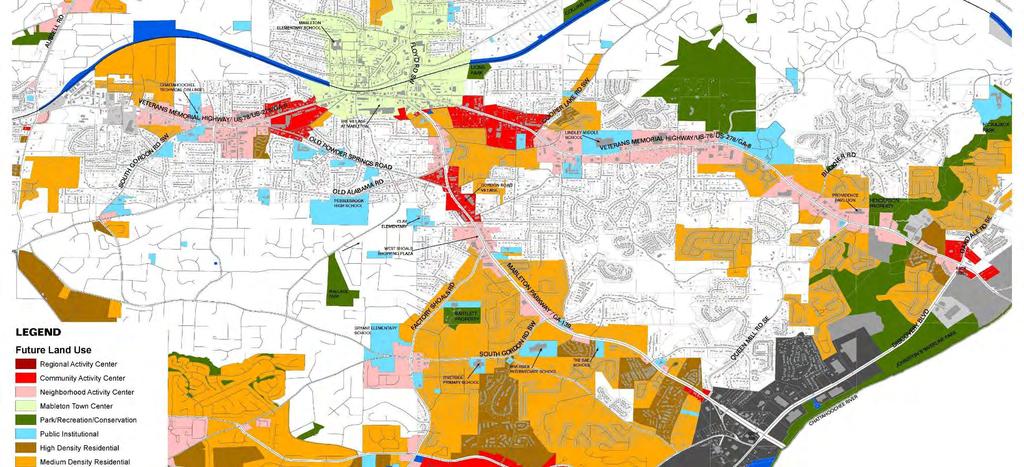
8 EXISTING CONDITIONS Future Land Use Map


9 EXISTING CONDITIONS Future Land Use Designations, Definitions & Guidelines
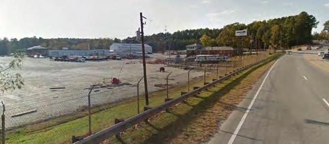
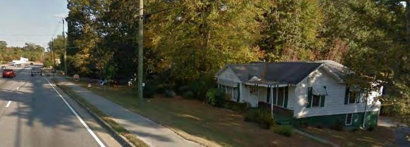
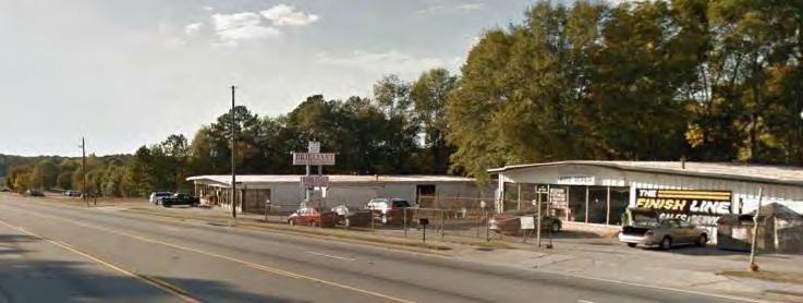
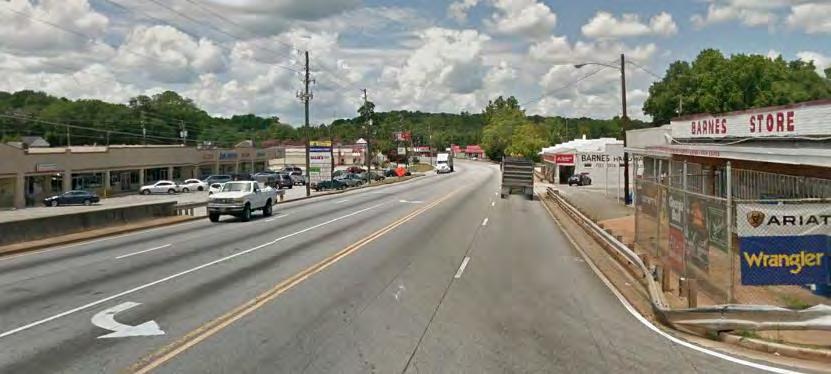
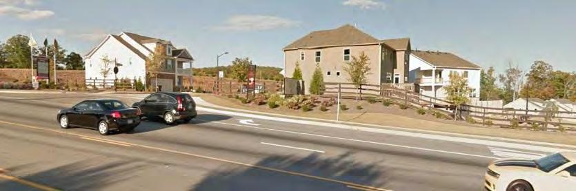
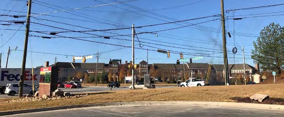
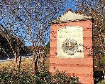
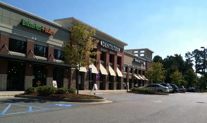
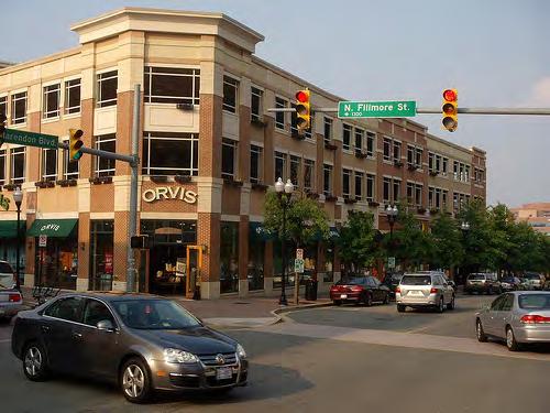
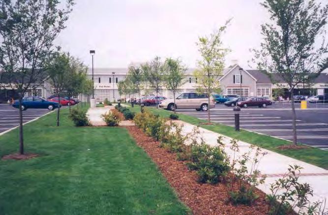
10 EXISTING CONDITIONS Site Photos Veterans Memorial Highway
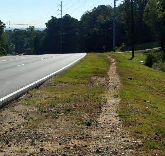
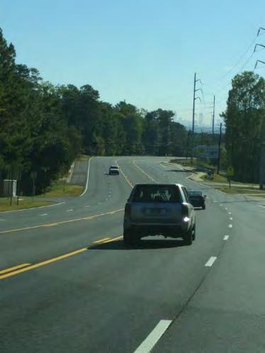
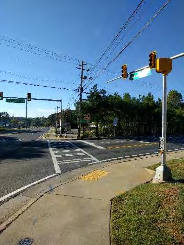
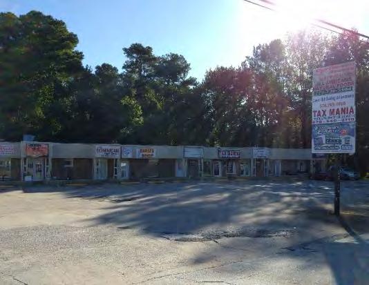
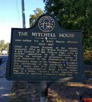
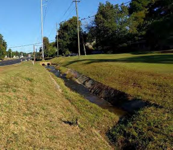
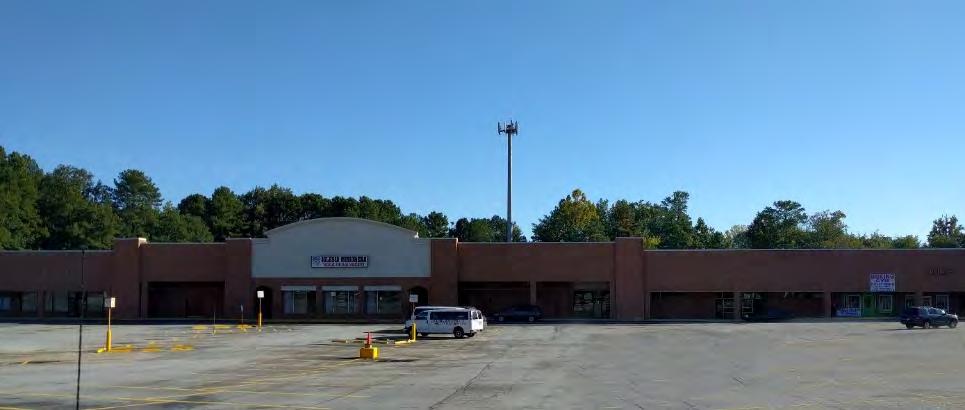
11 EXISTING CONDITIONS Site Photos Mableton Parkway

12 EXISTING CONDITIONS Character Zones
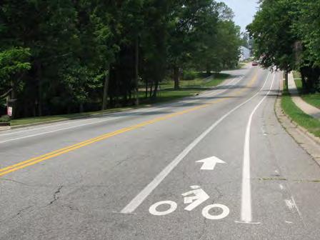
13 Key Issues Aging Commercial Strip Development (More Along Veterans) Large Number of Small Commercially Zoned Parcels (More Along Veterans) Excessive Retail/Commercial Capacity (More Along Veterans) State Route / Federal Highway GDOT Control Limited Pedestrian Facilities No Bicycle Facilities Limited Public Transit - CobbLinc Service Only on Mableton Parkway Few Parks / Community Green Spaces Proximity to Multiple Schools Little to No Landscape Treatment Within or Outside the ROW (Newer Development is the Exception)


14 Reinventing Suburban Strips Urban Land Institute TEN PRINCIPLES: 1. Ignite Leadership and Nurture Partnership 2. Anticipate Evolution 3. Know the Market 4. Prune Back Retail-Zoned Land 5. Establish Pulse Nodes of Development 6. Tame the Traffic 7. Create the Place 8. Diversify the Character 9. Eradicate the Ugliness 10.Put Your Money (and Regulations) Where Your Policy Is

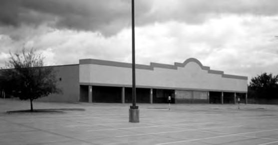
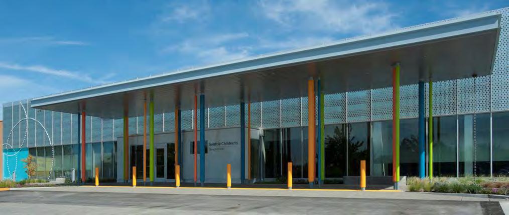
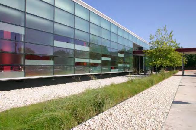
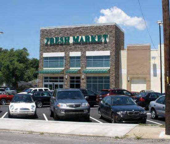
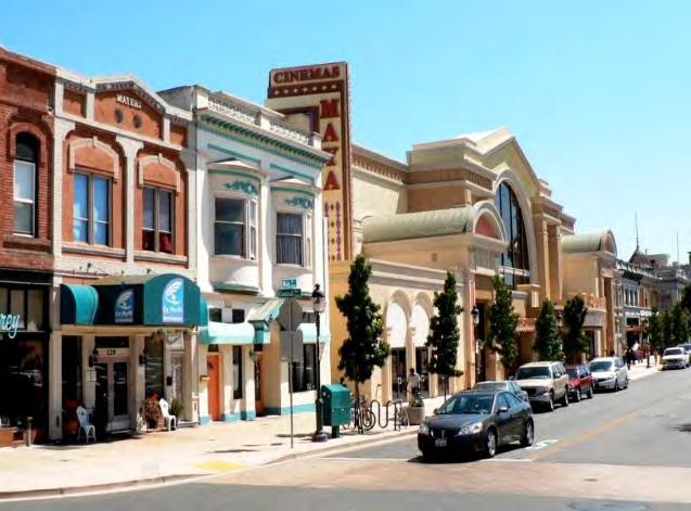
15 Examples Adaptive Reuse

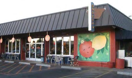
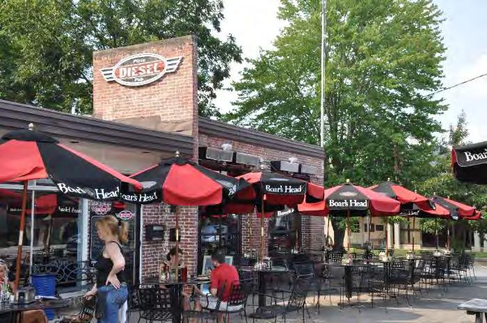
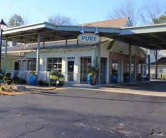
16 Examples Adaptive Reuse
17 Key Opportunities Page 1 of 2 Encourage Redevelopment & Reinvestment Along the Corridor Concentrate Higher-Density, Mixed-use Development At Key Neighborhood Nodes / Intersections Increase Diversity of Retail/Commercial Uses Provide for Alternative Land Uses (Residential, Office, Institutional, Park) in the Segments Between Nodes Provide Incentives to Stimulate Investment Consider an Overlay District as an Implementation Tool Reduce the Auto-oriented Uses and the Auto-scale of the Corridor; Provide walkable/bikeable/accessible Activity Nodes
18 Key Opportunities (Cont.) Page 2 of 2 Provide / Increase Sidewalk & Multi-use Trail Connectivity to Adjacent Neighborhoods, Parks, Trails & Schools Provide Parks / Green Space Opportunities Provide/Reestablish CobbLinc Service Along Veterans Memorial Provide Public Realm (w/in ROW) Pedestrian Enhancements (Sidewalks, Lighting, Landscaping, Accessible Signalized Intersections) (Complete Streets) Requires Public Sector Investment Cobb County / GDOT
19 Vision Statement VISION To create a modern urban arterial that is attractive, walkable and safe and provides a variety of commercial/retail and housing options. To stimulate investment, encourage development or redevelopment, and enhance the corridors in terms of aesthetics, function and land use through the application of design guidelines and economic incentives.

20 Concept Diagram

21 Design Guidelines Overlay District Option An overlay district is used to establish alternative land development requirements within a specific area of your community that requires special attention, such as an environmentally sensitive area or rapidly developing strip corridor. The overlay is usually superimposed over conventional zoning districts. It consists of a physical area with mapped boundaries and written text spelling out requirements that are either added to, or in place of, those of the underlying regulations.
22 Design Guidelines Potential Overlay District Components Land Use & Zoning Components: Encourage Medium to High Density Residential Redevelopment in older Commercial/Retail Segments Encourage Mixed-use Retail/Commercial Redevelopment in Key Neighborhood Center Nodes Consider Minimum Parcel Size for Redevelopment Encourage Active Mixed Uses at Key Nodes Design Standards: Landscape: Public Right-of-Way Street Frontage Zone Parking Lot Landscape Signage Building Scale, Mass, Orientation & Materials Stormwater / Green Infrastructure Transportation / Access Management Policy (Reduce Curb Cuts; Require Inter-parcel Access) Incentive Based Components: Node Conversion / Redevelopment Mixed-use / Commercial / Retail Segment Conversion / Redevelopment Residential / Office / Institutional
23 Design Guidelines Overlay District Commercial property Owner Incentives Commercial property rezonings, new building permits and/or major site plan revisions which incorporate the Study Area recommendations should be eligible for a range of specific incentives. The incentives should be proportional to the extent of the proposed impacts. These incentives could include: 1. Expedited Permit Review Process 2. Property Tax Credit / Abatement (3-5 year) 3. Increased Density / Lot Coverage and/or Building Height 4. Reduced Parking Requirements 5. Stormwater Credits For Green Infrastructure In addition to and/or in lieu of the above, in some cases there may be the potential for public/private cost-sharing for major community infrastructure elements (i.e. Multi-use Trails, Stormwater Infrastructure, Public Streets, etc.)

24 VPS Summary Commercial


25 VPS Summary office 3.62 Industrial


26 VPS Summary parking


27 VPS Summary Street frontage landscaping


28 VPS Summary Bicycles & Sidewalks

29 Design Guidelines Prototypical Section Constrained Right-of-Way

30 Design Guidelines Plan Diagram Constrained ROW 5 Lane Roadway R.O.W. Corridor Landscape Zone: Street Trees 36 Evergreen Hedge Corridor Frontage Zone: No More Than One Bay of Parking Permitted Main Building Oriented To Street All Service, Loading, Storage & Dumpsters Behind Building Existing Signage, Landscape Standards & Site Plan Regs Apply

31 Design Guidelines Prototypical Sections Wide Right-of-Way

32 Design Guidelines Plan Diagram Wide ROW 5 Lane Roadway Drainage Swale R.O.W. Corridor Landscape Zone: 36 Evergreen Hedge to Screen Parking Corridor Frontage Zone: No More Than One Bay of Parking Permitted Main Building Oriented To Street All Service, Loading, Storage & Dumpsters Behind Building Existing Signage, Landscape Standards & Site Plan Regs Apply
33 Design Guidelines Access Management Example


34 Building Character Activity Center


35 Building Character Village Center
36 Wrap up Summary & Feedback Summary: Redevelopment is difficult and takes time. Patience is required. It has to be market driven but incentives and government support can assist. The results can be transformative and are worth the effort. Your Feedback: Break-out tables Red Dot / Green Dot Exercise Sticky Notes to Explain/Add Comment Comment Card Next Meeting: Early February, 2017 Report Presentation
37 Wrap Up Break-Out Groups / Comment Cards
Citizen Advisory Group Meeting 5: Land Use April 14, 2011
 Citizen Advisory Group Meeting 5: Land Use April 14, 2011 Meeting Agenda 1. Background Review 2. Transportation Follow-up 3. PED Overlay Approach 4. Land Use Mapping 5. Group Exercise 6. Wrap-up and Next
Tyvola & Archdale Transit Station Area Plan. June 5, 2008
 Tyvola & Archdale Transit Station Area Plan Second Public Meeting June 5, 2008 Presentation Outline 1. Purpose and Process 2. Station Area Overview 3. Plan Recommendations 4. Comments Received and Proposed
Mableton Parkway & Veterans Memorial Highway Design Guidelines
 Mableton Parkway & Veterans Memorial Highway Design Guidelines Background and Purpose Mableton Parkway and Veterans Memorial Highway are key corridors in the Mableton community. Both are critically important
Old Town Neighborhoods Plan. Choices Event Wednesday, December 9, 2015
 Old Town Neighborhoods Plan Choices Event Wednesday, December 9, 2015 Agenda 6:00 6:10 p.m. Welcome + Sign In 6:10 6:30 p.m. Presentation 6:30 8:00 p.m. Workshop + Open House Seeking your input on: Neighborhood
Steering Committee Meeting
 Neighborhood Planning Initiative NPI EAST CENTRAL AREA PLAN Steering Committee Meeting November 9, 2017 6:00PM 8:00PM Tears McFarlane House East Central Area Plan Steering Committee Meeting 11/9/17 AGENDA
DRAFT PLAN PRESENTATION
 DRAFT PLAN PRESENTATION 1.23.2018 AGENDA Process Project Schedule Results from Visioning Workshop Draft Plan Highlights Concept Plans Feedback Next Steps PROJECT SCHEDULE KICK-OFF WORKSHOP August 29 th
CHAPTER 2: FUTURE LAND USE CONCEPTS
 CHAPTER 2: FUTURE LAND USE CONCEPTS INTRODUCTION The future land use concepts presented in this chapter are an expression of community support for a viable and vital US 50 Corridor. Land use recommendations
Reinventing Miner Avenue as a
 Reinventing Miner Avenue as a Complete Street Reinventing Miner Avenue as a Complete Street Agenda Project Overview / Introductions Previous Meeting Recap Economic Considerations Opportunities & Constraints
V. Vision and Guiding Principles
 V. Vision and Guiding Principles The Master Plan for the Powers Ferry Corridor seeks a foundation in the desires of the community. At times, various elements of the community offered opposing viewpoints,
Tyvola & Archdale Transit Station Area Plan. May 15, 2008
 Tyvola & Archdale Transit Station Area Plan First Public Meeting May 15, 2008 Presentation Outline 1. Purpose and Process 2. Station Area Overview 3. Plan Recommendations Vision Land Use Transportation
Presentation August 6, 2018
 Steering Committee Meeting #4 Presentation August 6, 2018 1 A. Commercial Strip Development and Alternatives B. Public Kick-off Meeting C. Next Steering Committee Meeting Road Map of Planning Process 2
SH 199 Corridor Master Plan. Community Meeting No. 2 May 31, 2017
 Community Meeting No. 2 May 31, 2017 Transportation Projects On or Near SH 199 SH 199 from 0.3 miles south of FM 1886 to south end of Lake Worth bridge Construct freeway mainlanes and frontage roads 10-Year
Danvers High Street I-1 District Study
 Danvers High Street I-1 District Study Presentation of Final Recommendations Planning Board Presentation June 26 th, 2018 1 Introductions Metropolitan Area Planning Council Sam Cleaves AICP, Principal
Roosevelt Corridor. R e i n v e s t m e n t P l a n. Public Meeting Gilbert Elementary School May 12, :00 pm
 Roosevelt Corridor R e i n v e s t m e n t P l a n Public Meeting Gilbert Elementary School May 12, 2009 6:00 pm Agenda 6:00 6:10 6:25 6:40 6:55 7:00 Opening Comments Councilwoman Jennifer V. Ramos District
12 January 12, 2011 Public Hearing APPLICANT: TAILWIND DEVELOPMENT GROUP,LLC PROPERTY OWNER: CITY OF VIRGINIA BEACH
 12 January 12, 2011 Public Hearing APPLICANT: TAILWIND DEVELOPMENT GROUP,LLC PROPERTY OWNER: CITY OF VIRGINIA BEACH STAFF PLANNER: Faith Christie REQUEST: Conditional Change of Zoning (from PD-H1 Planned
Courtice Main Street Study Community Vision Workshop PLANNING SERVICES DEPARTMENT
 Courtice Main Street Study Community Vision Workshop PLANNING SERVICES DEPARTMENT July 22, 2009 Tonight s Meeting 7:00 pm Introduction David Crome, Director of Planning 7:05 Presentation Stasia Bogdan,
9 th Street Sub Area Plan
 9 th Street Sub Area Plan In the 1990 s, when the Township prepared the last Master Plan, the 9 th Street corridor was studied as part of a larger 9 th Street Focus Area that included the West Main Street
Making TOD Work in the Heart of Suburban Sprawl
 Making TOD Work in the Heart of Suburban Sprawl Rocky Mountain Land Use Institute March 6, 2009 Speakers Ben Herman, FAICP, Principal Clarion Associates Darcie White, AICP, Principal Clarion Associates
Town Center (part of the Comprehensive Plan)
") Town Center (part of the Comprehensive Plan) Mercer Island Town Center Looking North (2014) In 1994, a year-long process culminated in a set of design guidelines and code requirements for the Town Center
Town Center (part of the Comprehensive Plan) Mercer Island Town Center Looking North (2014) In 1994, a year-long process culminated in a set of design guidelines and code requirements for the Town Center
Scope of Services. River Oaks Boulevard (SH 183) Corridor Master Plan
 Corridor Master Plan") Scope of Services River Oaks Boulevard (SH 183) Corridor Master Plan PROJECT AREA The project area consists of the River Oaks Boulevard (SH 183) corridor bounded by SH 199 at the northern end and the Trinity
Scope of Services River Oaks Boulevard (SH 183) Corridor Master Plan PROJECT AREA The project area consists of the River Oaks Boulevard (SH 183) corridor bounded by SH 199 at the northern end and the Trinity
City of Lake Mary, Florida. Evolution of a Historic Downtown with Transit Oriented Development Strategies
 City of Lake Mary, Florida Evolution of a Historic Downtown with Transit Oriented Development Strategies What is Transit Oriented Development? Walkable villages located at and around transit stations in
EXISTING COMPREHENSIVE PLAN
 EXISTING COMPREHENSIVE PLAN Town Center Land Use Element: V. LAND USE POLICIES Town Center Mercer Island's business district vision as described in "Your Mercer Island Citizen-Designed Downtown" was an
Request for Proposal
 Request for Proposal 10 th Street Corridor Master Plan Department of Planning and Zoning 500 Quartermaster Court Suite 200 Jeffersonville, IN 47130 April 18, 2017 For further information contact: Chad
Lower Merion Commercial Districts Issues and Characteristics Handbook November 2013
 Lower Merion Commercial Districts Issues and Characteristics Handbook November 2013 DRAFT TOWNSHIP-WIDE VISION: To maintain and enhance commercial areas to complement the surrounding high-quality residential
City of Bristol Route 6 Corridor Implementation Program
 City of Bristol Route 6 Corridor Implementation Program FITZGERALD & HALLIDAY, INC. Innovative Planning, Better Communities June 2017 Route 6 Corridor Plan IMPLEMENTATION PROGRAM The following Implementation
TO: Denver Planning Board FROM: Analiese Hock, Senior City Planner DATE: March 13, 2018 RE:
 Community Planning and Development Planning Services 201 W. Colfax Ave., Dept. 205 Denver, CO 80202 p: 720.865.2915 f: 720.865.3052 www.denvergov.org/cpd TO: Denver Planning Board FROM: Analiese Hock,
Comprehensive Plan Advisory Panel Meeting #3
 Comprehensive Plan Advisory Panel Meeting #3 November 7, 2016 Agenda 1. September 19 th Meeting Notes 2. Summary of Focus Areas Charrette 3. Heart of the City Focus Area a. HOC2/Station Areas Concept &
A BLUEPRINT FOR BROCKTON A CITY-WIDE COMPREHENSIVE PLAN
 A BLUEPRINT FOR BROCKTON A CITY-WIDE COMPREHENSIVE PLAN Public Meeting October 2016 1 Plan Summary and Discussion Public Meeting May 4 2017 City of Brockton Bill Carpenter, Mayor Department of Planning
Silver Line CPAM UPDATE. Transportation and Land Use Committee October 20, 2016
 Silver Line CPAM UPDATE Transportation and Land Use Committee October 20, 2016 Purpose General Summary of TLUC Discussion Review of TLUC Recommended Transportation Other TLUC Recommendations Next Steps
SLIDE TITLE TRANSIT-ORIENTED DEVELOPMENT PLAN RED-PURPLE BYPASS STUDY AREA PUBLIC MEETING #2 RED AND PURPLE MODERNIZATION. RPM TOD Plan Update
 SLIDE TITLE TRANSIT-ORIENTED DEVELOPMENT PLAN RED-PURPLE BYPASS STUDY AREA PUBLIC MEETING #2 RED AND PURPLE MODERNIZATION 1 SLIDE TITLE AGENDA Project Introduction TOD s and Development Trends Real Estate
Rio/29 Small Area Plan. Design Plan & Implementation Framework Open House - January 25, 2018
 Rio/29 Small Area Plan Design Plan & Implementation Framework Open House - January 25, 2018 MEETING PURPOSE PRESENTATION 1. Orient to the updated design plans 2. Introduce implementing options 3. Explain
PLAN ELEMENTS WORKSHOP. April 5, 2016
 PLAN ELEMENTS WORKSHOP April 5, 2016 needs more housing. But there is no one-size fits-all solution. Every neighborhood has its own character. In some places, density is not only appropriate it is badly
VILLAGE OF CLEMMONS PLANNING BOARD DRAFT STAFF REPORT
 VILLAGE OF CLEMMONS PLANNING BOARD DRAFT STAFF REPORT PETITION INFORMATION Docket # C-226 Staff Megan Ledbetter Petitioner(s) JBJH Properties, LLC Owner(s) JBJH Properties, LLC Subject Property 5892-49-1766
TREASURE COAST REGIONAL PLANNING COUNCIL M E M O R A N D U M. To: Council Members AGENDA ITEM 5H
 TREASURE COAST REGIONAL PLANNING COUNCIL M E M O R A N D U M To: Council Members AGENDA ITEM 5H From: Date: Subject: Staff October 17, 2008 Council Meeting Local Government Comprehensive Plan Review Draft
Silverdale Regional Center
 Silverdale Regional Center Vision for Silverdale Regional Center The Silverdale Regional Center Plan (Plan) will guide the evolution of the Silverdale Regional Center from a collection of strip malls and
Plano Tomorrow Vision and Policies
 Plano Tomorrow Vision and Policies PLANO TOMORROW PILLARS The Built Environment The Social Environment The Natural Environment The Economic Environment Land Use and Urban Design Transportation Housing
ARLINGTON COUNTY, VIRGINIA
 ARLINGTON COUNTY, VIRGINIA County Board Agenda Item Meeting of April 12, 2014 DATE: April 2, 2014 SUBJECT: to the Arlington County Zoning Ordinance, Article 11.1 "CP-FBC" Columbia Pike Form Based Code
Small Area Plan. South Gateway
 Small Area Plan Adopted May 12, 2008 South Gateway Purpose. The South Gateway Small Area Plan defines the City s expectations for the future of the southern entrance to the City at Interstate 85 and Highway
Tonight s Agenda. 7:45 p.m. Next Steps 8:00 p.m. Close
 Community Workshop #3 January 28, 2016 Team Tonight s Agenda 6:00 p.m. Welcome and Introductions! 6:15 p.m. Draft Specific Plan Overview Project Process Update Vision and Objectives Overview Key Findings
Status Update (2006 vs. Now) Citizen s Advisory Committee February Plan for Prosperity
 Citizen s Advisory Committee February Plan for Prosperity") Status Update (2006 vs. Now) Citizen s Advisory Committee February 2018 Plan for Prosperity 2000 2017 2000 2017 Gardnerville Population 6,000 5,760 5746 5,500 5,000 5,067 5,550 5,165 5,394 5,412 5,250
Status Update (2006 vs. Now) Citizen s Advisory Committee February 2018 Plan for Prosperity 2000 2017 2000 2017 Gardnerville Population 6,000 5,760 5746 5,500 5,000 5,067 5,550 5,165 5,394 5,412 5,250
The transportation system in a community is an
 7 TRANSPORTATION The transportation system in a community is an important factor contributing to the quality of life of the residents. Without a sound transportation system to bring both goods and patrons
S A C R A M E N T O C O U N T Y JACKSON HIGHWAY & GRANT LINE EAST VISIONING STUDY
 JACKSON HIGHWAY & GRANT LINE EAST S A C R A M E N T O C O U N T Y P L A N N I N G D E P A R T M E N T SUMMARY AND WORKBOOK November 19, 2008 History of the Visioning Study Sacramento County has two growth
INDEPENDENCE BOULEVARD AREA PLAN. June 24, 2008
 INDEPENDENCE BOULEVARD AREA PLAN Public Meeting #1 June 24, 2008 Tonight s Agenda Introduction Welcome and Ground Rules Overview Presentation Purpose of the Plan What Brings Us Here? A Tour of the Corridor
City Council Special Meeting AGENDA ITEM NO. C.
 City Council Special Meeting AGENDA ITEM NO. C. DATE: 01/04/2019 TO: Honorable Mayor and City Council Members SUBJECT: Transit Villages Specific Plan project Study Session (Development Services Director
Hockessin Community Redevelopment Plan
 Hockessin Community Redevelopment Plan 3.1 Introduction The Community Redevelopment Plan for the Village of Hockessin is the result of the people s vision for a distinct village center that serves as the
Tonight s Agenda. Summary Presentation Open House. Group Discussion Next Steps: online community wide survey
 Community Open House February 22, 2018 Tonight s Agenda Summary Presentation Open House Station 1: Project Overview and Community Input Station 2: Draft Vision and Guiding Principles Station 3: Western,
DRAFT. 10% Common Open Space
 % OF CHARLOTTE IS CATEGORIZED AS A. LAND USES : Placeholder map displaying location of Place Type GOALS: Accommodate XX% of future growth. Provide a concentration of primarily commercial and civic activity
NEC of Central Avenue and Indian School Road
 NEC of Central Avenue and Indian School Road For this location, there are two applicable plans that provide guidance on development. The two plans include the Indian School Specific Plan (1991) and the
Pine Island Road Corridor Master Plan
 RECOMMENDED DEVELOPMENT PLAN Figure 9: Del Prado Village District Conceptual Framework The Conceptual Framework (Figure 8) for development of the Pine Island Corridor is to encourage mixed-use development
Exhibit Planning and Design Workshop February 3-6, Commissioned by the Maryland-National Capital Park and Planning Commission (M-NCPPC)
") Exhibit Planning and Design Workshop February 3-6, 2014 Commissioned by the Maryland-National Capital Park and Planning Commission (M-NCPPC) Planning and Design Workshop The Montgomery County Planning
Exhibit Planning and Design Workshop February 3-6, 2014 Commissioned by the Maryland-National Capital Park and Planning Commission (M-NCPPC) Planning and Design Workshop The Montgomery County Planning
PINE CURVE REZONING. BACKGROUND Purchased as two parcels in 2001 and 2002
 BACKGROUND Purchased as two parcels in 2001 and 2002 WHAT THE PROJECT IS AND IS NOT A Rezoning establishes the land use standards for Annexed and Zoned Greater Downtown District Historic Center September
LUNDY S LANE COMMUNITY IMPROVEMENT PLAN STUDY
 PUBLIC INFORMATION MEETING #2 October 12, 2016 LUNDY S LANE COMMUNITY IMPROVEMENT PLAN STUDY AGENDA 5:00 to 5:30pm: Open House 5:30 to 6:15pm: Presentation 6:15 to 7:00pm: Individual paced workshop with
INDEPENDENCE BOULEVARD AREA PLAN. Economic Development Committee Overview May 25, 2010
 INDEPENDENCE BOULEVARD AREA PLAN Economic Development Committee Overview May 25, 2010 Presentation Outline Plan Purpose and Development Process Draft Plan Policies and Implementation Strategies Request
University Parkway Corridor Plan. Public Workshop Sept. 18, 2017
 University Parkway Corridor Plan Public Workshop Sept. 18, 2017 AGENDA 1. Overview of Process 2. Study Area 3. Components of the Plan 4. What We Know 5. What We Have Heard 6. Tonight s Input 7. Next Steps
East Central Area Plan
 East Central Area Plan Steering Committee Meeting March 14 th, 2019 Tears-McFarlane House Community Room East Central Area Plan Steering Committee Meeting March 14, 2019 CHUN Tears-McFarlane House Community
Secrest Short Cut and Monroe Expressway Small Area Plan AUGUST 29, 2018
 Secrest Short Cut and Monroe Expressway Small Area Plan AUGUST 29, 2018 Background and Process Monroe Expressway will be open by the end of 2018 Union County and Indian Trail identified a need to revisit
PUBLIC NOTICE. All meetings will be held at Hinesville City Hall located at 115 East ML King Jr. Drive, Hinesville, GA beginning at 5:30 PM.
 100 Main Street Suite 7520 Hinesville, Georgia 31313 Phone: 912-408-2030 H.E. Sonny Timmerman Executive Director April 2, 2013 PUBLIC NOTICE On March 7, 2013, Mayor and Council took action to initiate
Natomas Vision Plan and PLNP
 Natomas Vision Plan 20030171 and PLNP2014-00172 Department of Community Development Planning and Environmental Review Leighann Moffitt Sub-Agenda 1. Staff Presentation Leighann Moffitt, County Planning
Welcome to the LYNX Blue Line Extension Transit Station Area Plans Public Workshop No. 3. Presentation will begin at 6:00 P.M.
 Welcome to the LYNX Blue Line Extension Transit Station Area Plans Public Workshop No. 3 Presentation will begin at 6:00 P.M. Meeting Agenda Blue Line Extension (BLE) Project Update LYNX Blue Line Extension
TRANSIT-ORIENTED DEVELOPMENT POLICY DRAFT. City Planning and Development Department Kansas City, Missouri
 TRANSIT-ORIENTED DEVELOPMENT POLICY DRAFT City Planning and Development Department Kansas City, Missouri What is Transit Oriented Development (TOD)? Development that focuses land uses around a transit
PINE CURVE REZONING. Property does not meet criteria for open space preservation and is not a candidate for a park
 PINE CURVE REZONING BACKGROUND Purchased as two parcels in 2001 and 2002 Annexed and Zoned Greater Downtown District Historic Center September 25, 2002 and October 7, 2002 WHAT THE PROJECT IS AND IS NOT
FUTURE DEVELOPMENT AREAS
 FUTURE DEVELOPMENT AREAS Refer to the Future Development Map on Page 2. Suburban Residential (Less than 3 units/acre) Suburban Residential neighborhoods form the backbone of Smyrna. While growth and redevelopment
REVIEW AND EVALUATION OF REGIONAL LAND USE
 REVIEW AND EVALUATION OF REGIONAL LAND USE AND TRANSPORTATION SCENARIOS #220831 Environmental Justice Task Force October 7, 2014 VISION 2050 Process Development of Guiding Vision for Land Use and Transportation
Lambeth Main Street Streetscape Improvements
 Lambeth Main Street Streetscape Improvements Open House October 5th, 2017 Agenda 1. Introduction 2. Project Background 3. Context 4. Project Objectives 5. Design Principles & Approach 6. Streetscape Design
Broken Arrow Comprehensive Plan Update Public Workshop Meeting #3 January 23,
 Broken Arrow Comprehensive Plan Update Public Workshop Meeting #3 January 23, September 25,2018 2018 26 April 2016 AGENDA 1. Status Presentation - Charrette Recap - Proposed Vision Framework - Preliminary
Citizen Comment Staff Response Staff Recommended Revision Planning Committee
 Citizen Comment Staff Response Staff Recommended Revision Planning Committee Area No. 1: Owner desires retail land uses. Area No. 1a: Owner of two small parcels adjacent to Area No. 1 desires retail land
TOD 101 CREATING LIVABLE COMMUNITIES WITH TRANSIT
 1 CREATING LIVABLE COMMUNITIES WITH TRANSIT What are transit Centered Communities? Benefits of Partnerships to Support and Implement What You Will Learn Portland s Pearl District Your Trainers Today Catherine
Village Center Zoning. Town of Sutton, MA June 15, 2016
 Village Center Zoning Town of Sutton, MA June 15, 2016 Village Center Zoning Project Phase 1 was the development of the new Model Bylaw Phase 2 sought communities to work with to update existing or create
INDEPENDENCE BOULEVARD AREA PLAN
 INDEPENDENCE BOULEVARD AREA PLAN Public Meeting October 28, 2008 Tonight s Agenda Introduction 4:00 4:05 Tom Warshauer Presentation 4:05 5:00 Blake Drury Group Exercises 5:00 5:50 All Wrap Up & Next Steps
4.1.3 LAND USE CATEGORIES
 4.1.3 LAND USE CATEGORIES a. City Center District The City Center District incorporates the existing character and mix of uses in downtown Belmont to encourage redevelopment and new development in keeping
FUTURE LAND USE ELEMENT
 FUTURE LAND USE ELEMENT GOAL I: To create and sustain a great place to live, play, and prosper Objective 1: The City of Ocala shall incorporate the principles and strategies of the Ocala 2035 Vision into
PLANNED UNIT DEVELOPMENT STAFF REPORT Date: June 2, 2016
 # 9 ZON2016-01032 PLANNED UNIT DEVELOPMENT STAFF REPORT Date: June 2, 2016 DEVELOPMENT NAME JJT Properties LLC LOCATION 1147 & 1151 East I-65 Service Road South and 1180 Sledge Drive (Southeast corner
ARTICLE 6: Special and Planned Development Districts
 ARTICLE 6: Special and Planned Development Districts 6-10 Traditional Neighborhood Development (TND) District 6-10.10 Purpose and Intent The Traditional Neighborhood Development (TND) District provides
Burton Station Village Community Meeting February 26, 2014
 February 26, 2014 SGA Plan Overview Recent announcements by the City of Norfolk regarding the closure of Lake Wright Golf Course and retail development proposals Update on infrastructure improvement plans
LAND USE AMENDMENT DOWNTOWN COMMERCIAL CORE (WARD 7) MACLEOD TRAIL SE AND 5 AVENUE SE BYLAW 254D2017
 MACLEOD TRAIL SE AND 5 AVENUE SE BYLAW 254D2017") Page 1 of 10 EXECUTIVE SUMMARY This Land Use Amendment application seeks to redesignate a full downtown block (currently the YWCA site) from a Direct Control based on the CM-2 District (Land Use Bylaw
Page 1 of 10 EXECUTIVE SUMMARY This Land Use Amendment application seeks to redesignate a full downtown block (currently the YWCA site) from a Direct Control based on the CM-2 District (Land Use Bylaw
Preliminary Recommendations Tk Takoma/Langley Crossroads Sector Plan
 Preliminary Recommendations Tk Takoma/Langley Crossroads Sector Plan Vision is to achieve a Transit Oriented, pedestrian friendly Community that Celebrates and builds upon the cultural Diversity of the
LEED for Neighborhood Development. A Brief Overview
 LEED for Neighborhood Development A Brief Overview What is LEED ND? LEED for Neighborhood Development First national standard for neighborhood design Developed as a partnership U.S. Green Building Council
PLACEMAKING & MOBILITY WORKSHOP. January 27, 2016
 PLACEMAKING & MOBILITY WORKSHOP January 27, 2016 Boston needs more housing. But there is no one-size fitsall solution. Every neighborhood has its own character. In some places, density is not only appropriate
The transportation and land use connection
 The transportation and land use connection A sustainable trend? 180% 160% 140% 120% 100% 80% 60% 40% 20% 0% Annual vehicle miles traveled US Population Road mileage We re driving more. Infrastructure can
9/19/2018 TODAY S WEBINAR AGENDA CONTINUING EDUCATION UPCOMING TRAINING FROM APBP
 TODAY S WEBINAR AGENDA 3:00 pm: Introduction 3:05 pm: Presentation 3:45 pm: Questions 4:00 pm: Webinar Ends For technical assistance during the webinar: 1-800-263-6317 Choose these prompts: 1, 1, 1 CONTINUING
CHAPTER 1. Ms. Guajardo s Class - Central Elementary CH 1 1
 INTRODUCTION CHAPTER 1 Ms. Guajardo s Class - Central Elementary CH 1 1 1.1 SETTING South Centre City is a linear corridor south of Downtown Escondido paralleling Centre City Parkway and South Escondido
hermitage town center
 hermitage town center A Community Vision prepared by Strada for The City of Hermitage and The Mercer County Regional Planning Commission January 2007 table of contents introduction 3 design principles
ARLINGTON COUNTY, VIRGINIA
 ARLINGTON COUNTY, VIRGINIA County Board Agenda Item Meeting October 15, 2005 DATE: September 28, 2005 SUBJECT: Request to Advertise the adoption of the 2005 Clarendon Sector Plan C. M. RECOMMENDATION:
Community Meeting November 18, 2015
 Top Concerns We ve Heard Use of Urban Road Code Total number of units and effect on schools and transportation Land swaps with Parks Department: how do these benefit the community? Zoning classifications:
MAPPING EXERCISE Legend
 BIG IDEAS EXERCISE MAPPING EXERCISE Legend Small Town Feel Economic Development Waterfront Development Pedestrian Connectivity Entertainment and Community Events Community Character/Identity Unique Commercial
Atlanta BeltLine. Subareas 9 & 10. Master Plan Updates. March 26, Washington Park Jamboree 1
 Atlanta BeltLine Subareas 9 & 10 Master Plan Updates March 26, 2018 Washington Park Jamboree 1 22 miles, connecting 45 neighborhoods 22 MILES of transit 46 MILES of streetscapes and complete streets 33
Windsor Locks Transit-Oriented Development Planning Grant Request. Project Background
 Windsor Locks Transit-Oriented Development Planning Grant Request Project Background Downtown Windsor Locks runs along Main Street in the vicinity of the intersection of Routes 159 and 140. The current
RESIDENTIAL DISTRICTS
 RESIDENTIAL DISTRICTS The residential district standards have been revised to reflect on-the-ground conditions, while continuing to respect the use patterns established within the neighborhoods. This will
Sewanee Village + Request for Builder/Developer Proposals
 Sewanee Village + Request for Builder/Developer Proposals Contact: Frank X. Gladu Special Assistant to the Vice Chancellor University of the South 735 University Ave Version 3 Sewanee TN 37383 Released:
4 LAND USE DESIGNATIONS
 4 LAND USE DESIGNATIONS Chapter 4 describes the land use designations and densities that will implement the development vision for North Burlingame outlined in Chapter 3. Land use densities are described
Request Conditional Use Permit (Automobile Repair Garage) Staff Planner Kevin Kemp
 Staff Planner Kevin Kemp") Request Conditional Use Permit (Automobile Repair Garage) Staff Planner Kevin Kemp Location 845 Lynnhaven Parkway GPIN 14963473030000 Election District Rose Hall Site Size 0.40 acre portion of a 6.35 acre
Request Conditional Use Permit (Automobile Repair Garage) Staff Planner Kevin Kemp Location 845 Lynnhaven Parkway GPIN 14963473030000 Election District Rose Hall Site Size 0.40 acre portion of a 6.35 acre
Potential Green Infrastructure Strategies May 6, 2015 Workshop
 Potential Green Infrastructure Strategies May 6, 2015 Workshop Background The City of Cortland is developing the Tioughnioga Urban Headwaters Green Infrastructure Action Plan with funding from the National
Information Session July 25, 2018
 Concord Pike (US 202) Master Plan Information Session July 25, 2018 1 Concord Pike (US 202) Master Plan 2018 Project Partners Wilmington Area Planning Council Delaware Department of Transportation New
Chapter 1.0 Introduction
 Chapter 1.0 Introduction 1.1 Background The North Metro commuter rail line is part of the RTD FasTracks regional transit system expansion program to build more than 100 miles of rail transit throughout
Broadway District Specific Plan. Community Workshop #2 February 23,2016
 Broadway District Specific Plan Community Workshop #2 February 23,2016 1 Agenda Introductions Project Progress Status Upcoming Milestones Emerging Framework Land Use Urban Design Circulation Infrastructure
Staff Report and Recommendation
 Community Planning and Development Planning Services 201 W. Colfax Ave., Dept. 205 Denver, CO 80202 p: 720.865.2915 f: 720.865.3052 www.denvergov.org/cpd TO: City Council Neighborhoods and Planning Committee
Atlanta BeltLine Subarea 3 Master Plan Update
 Atlanta BeltLine Subarea 3 Master Plan Update April 14, 2018 Workshop Meeting 1 22 miles, connecting 45 neighborhoods 22 MILES of transit 46 MILES of streetscapes and complete streets 33 MILES of urban
Rezoning Issues Setting a Foundation for Zoning Decisions
 Rezoning Issues Setting a Foundation for Zoning Decisions City Council Workshop May 2, 2016 Agenda Goal Need actionable items and sequence of steps Foundation for Zoning Decisions Council Workshop Discussion
Route 9 Gateway Project. October 9, 2014 Informational Meeting
 Route 9 Gateway Project NYS DOT P.I.N. 1759.67 Town of Lake George, New York October 9, 2014 Informational Meeting Open House 3:00-3:30 Presentation 3:30-4:15 Introductions Town Representatives Dennis
1.0 VISION STATEMENT. December 6, PRINCIPLES
 Vision Statement Lincoln Regional Airport 1.0 VISION STATEMENT 1.1 City LOCATION of AND OVERVIEW The Easton Lincoln Place Land Use Master Plan identifies the principles, goals, policies, and standards