ENVISIONING A CULTURAL LANDSCAPE MANSAGAR LAKE PROJECT, JAIPUR, INDIA MEENAKSHI KUMAR. (Under the Direction of Georgia Harrison) ABSTRACT
|
|
|
- Henry Lyons
- 5 years ago
- Views:
Transcription
1 ENVISIONING A CULTURAL LANDSCAPE MANSAGAR LAKE PROJECT, JAIPUR, INDIA by MEENAKSHI KUMAR (Under the Direction of Georgia Harrison) ABSTRACT The profession of architectural conservation is a well established field and the need to conserve and preserve monuments as part of our urban cultural landscape is well recognized. However, what is less realized is the fact that conservation of the landscape setting of these monuments is equally important. Based on Aldo Rossi s theory that the presence of monuments and large buildings gives the city its character, as they embody the memory of the city, this thesis addresses the issue of conservation of the contiguous settings of a monument, as an important part of conserving the monument. In particular, it addresses the issue of envisioning a cultural landscape in the absence of archeological data and records about a site. It identifies the Mansagar Lake Project in Jaipur, India, as a contiguous setting for the Jal Mahal monument and demonstrates with the use of design archetypes, the relevance of memory in the cultural landscape of Jaipur. INDEX WORDS: Urban Heritage, Cultural landscapes, collective memory, archetypes, India, Jaipur.
2 ENVISIONING A CULTURAL LANDSCAPE MANSAGAR LAKE PROJECT, JAIPUR, INDIA by MEENAKSHI KUMAR B.Arch, School of Planning and Architecture, 2006 A Thesis Submitted to the Graduate Faculty of the University of Georgia in Partial Fulfillment of the Requirements for the Degree MASTER OF LANDSCAPE ARCHITECTURE ATHENS, GEORGIA 2009
3 @2009 Meenakshi Kumar All Rights Reserved
4 ENVISIONING A CULTURAL LANDSCAPE MANSAGAR LAKE PROJECT, JAIPUR, INDIA by MEENAKSHI KUMAR Approved: Major Professor: Committee: Georgia Harrison Marianne Cramer James Reap Lara Mathes Electronic Version Approved: Maureen Grasso Dean of the Graduate School The University of Georgia May 2009
5 ACKNOWLEDGEMENTS I would like to thank my Major Professor, Georgia Harrison, and the members of my Reading Committee, Marianne Cramer, James Reap and Lara Mathes for their guidance and advice given for this thesis. I would also like to thank my parents and my friends Emily, Lauren, Eileigh, Sara, Megan, Anne, Josh, Indrani, Meghna, Devangana and Molly, for being there for me. iv
6 TABLE OF CONTENTS Page ACKNOWLEDGEMENTS... iv LIST OF FIGURES... vii CHAPTER 1 INTRODUCTION Why Jaipur? Urban heritage: a shared resource The need for conservation Purpose and Methodology ENVISIONING A CULTURAL LANDSCAPE Introduction Urban cultural landscapes Settings of an Urban Cultural landscape The collective memory of a place Interpretation Envisioning a cultural landscape Interpretation of the case studies DECODING PATTERNS AND ARCHETYPES Symbolism and meaning in the landscape Patterns in the urban landscape Archetypes Interpretation v
7 4 PURANA GHAT, AMBER AND JAIPUR A brief history Purana Ghat, Amber and Jaipur Archetypes found in Jaipur Interpretation THE MANSAGAR LAKE PROJECT The Project Analysis for development of precinct Communities associated with the project Vision for the Project CONCLUSION References vi
8 LIST OF FIGURES Page Figure 2.1: Location map of Tide Point Figure 2.2: Fog on the promenade Figure 2.3: Future expansion Figure 2.4: The landscape Figure 2.5: Party on the Promenade Figure 2.6: Site map of Taj Heritage District Project Figure 2.7: The project Figure 3.1: Semiological triangle Figure 3.2: Attitudes of people Figure 3.3: The Balance Theory model Figure 3.4: Tree square Figure 3.5: Ghats at Varanasi Figure 3.6: Temple Ghats: Pashpatinah Figure 3.7: Maidan in Mumbai Figure 3.8: The Mandala Figure 3.9: The cosmic man Figure 3.10: Haveli Courtyard Figure 3.11: Courtyards Perspective Figure 3.12: Section through a haveli Figure 4.1: Map of western & central India Figure 4.2: Generic town form sketch vii
9 Figure 4.3: Map of Ghat Ki Gunni Figure 4.4: Plan of Ram Niwas Garden Figure 4.5: Fortification at Amber Figure 4.6: The four courts at Amber Figure 4.7: Map of Amber city and Fort Figure 4.8: Parterre gardens at Amber Figure 4.9: Parterre Garden Figure 4.10: Planting Plan Figure 4.11: Map of Jaipur Figure 4.12: 12 Map of Jaipur and surrounding areas Figure 4.13: Map of Jaipur Figure 4.14: Evolution of Jaipur plan Figure 4.15: Streets of Jaipur Figure 4.16: Shopping in Jaipur Figure 4.17: The nine grids Mandala Figure 4.18: Jaipur city Figure 4.19: Street in Jaipur Figure 4.20: Shops on the ground floor Figure 4.21: Joshi Haveli Figure 4.22: Charbagh at Taj Mahal Figure 4.23: Charbagh at Amber Fort Figure 4.24: Galtaji Tank Figure 4.25: A well in Rajasthan Figure 4.26: Panna Mian Baoli Figure 4.27: Baoli viii
10 Figure 5.1: Jal Mahal and Mansagar Lake, Jaipur Figure 5.2: Image of the site Jal Mahal and Mansagar Lake Figure 5.3: Mandala Figure 5.4: Jaipur Figure 5.5: Monument as the center of Mandala Figure 5.6: Extending the axis Figure 5.7: Movement pattern Figure 5.8: The central landscape spine and the char-bagh Figure 5.9: The courtyard element Figure 5.10: Steps leading to water Figure 5.11: Tree square and Maidan Figure 5.12: Allocation of use on site ix
11 Chapter 1 Introduction We prefer a world that can be modified progressively against a background of valued remains, a world that can leave a personal mark alongside the marks of history. The management of change and the active use of remains for present and future purpose are preferable to an inflexible reverence for a sacrosanct past.(tiesdell, Oc, & Heath,1996) Every city and every town, every street, every plaza and every building, tells us something about us; our aspirations, our inspirations, our values, our cultures and our ways of life are what these patterns and designs reflect and symbolize within context. Acting as a medium of non-verbal expression, they embody in them symbols and specific meanings that are either bold enough to be evident or subtle enough to be deciphered over time. They stand testimony to what society was, what society is and the political and economic powers that dictated and continue to dictate their will(lang, Desai, & Desai, 1997). As cultures change the meaning of many of these urban patterns change, consciously or subconsciously, to acquire new meanings. However, these urban patterns and designs leave behind their mark on our world in the form of memories and symbols that give its inhabitants an identity, thus making these patterns and design a part of our cultural heritage(lang, et al., 1997; Steinberg, 1996). Today, the rapid pace of social, economic and global change is affecting every sphere of life. Cities, historic centers and the cultural landscapes are also affected by these changing forces. While addressing the need for change may be through maintaining a link with the past preceding it(urbanism- Memories and new initiatives, 2006), which past we 1
12 choose and what memories from that past need to be conserved are questions that continue to interest landscape architects, architects, planners and urban designers. The observation here is that though traditions change with time, what stands very strong is that change is tradition(urbanism- Memories and new initiatives, 2006). The task of maintaining continuity with change becomes even more complex while designing in urban cultural landscapes. The urban cultural landscape is dotted with numerous structures and monuments that need to be preserved. The profession of architectural conservation is well established and the need to conserve and preserve these monuments and structures is well recognized. However, what is less evident is the fact that conservation of the landscape is critical to conserve the setting and backdrop of these monuments and structures(lamba, 2007). The United States National Park Service identifies four types of treatments for cultural landscape preservation; preservation, rehabilitation, restoration and reconstruction. However, as may sometimes be the case, all the structures and their gardens that once existed in the urban cultural landscape no longer exist. According to the NPS system, if you do not have proof that it existed you cannot reconstruct it to its historic authenticity(national Park Service, 2005). But the question that remains unanswered is: In the absence of any archeological data about the site, what approach can we adopt for designing a cultural landscape? This is a design thesis that explores design ideas and responses for sites that form an important part of the urban cultural landscape but have no historic data recorded about what existed. 2
13 The objective of this thesis is to establish the relevance of memory in the urban cultural landscape that helps nurture some form of identity to create meaningful places. The assumption that this thesis makes is that there is substantial continuity between different cultures in their appropriateness of time and space (Petruccioli). Different elements of the city and the urban fabric change at different rates. Thus, despite the constant change that is taking place around us, some essence of identity is retained(urbanism- Memories and new initiatives, 2006). The Mansagar Lake Project in the city of Jaipur, which is the capital of Rajasthan state in India, has been chosen to study, explore and demonstrate using urban patterns, elements and archetypes, the relevance of memory in bringing about continuity and change in the urban cultural landscape. 1.1 Why Jaipur? Of the historic cities and great nations of the world, only few can rival India in the richness of its cultural and architectural heritage. Having witnessed successive invasions from different cultures, the country s land mass has been through major political upheavals and has faced the crisis of power and identity time and again. These cultures were absorbed, to varying degrees, in the Indian life and visually manifested themselves in both the built and the natural environment. The Muslims ( CE), the Mughals ( CE) and the British ( CE) were the main ruling powers of India(Wikipedia, 2009a). These rulers constructed cities, buildings and gardens of their own taste and at places of their choice(chengappa, 2002). They did not necessarily disregard what existed but definitely built structures and patterns to leave the mark of their reign over the 3
14 subcontinent. These ranged from forts and palaces to gardens, pavilions around water bodies, tombs, temples and mosques. The country has thus accumulated layers of history and symbols of over 600 years of trans-indian Imperia that form an integral part of its cultural and architectural heritage. The traditional patterns of villages and settlements in India were a response to geography and socio-cultural factors. Settlement morphology, climate, topography and the urban fabric were interrelated, giving the urban fabric and architecture potential for regional character. While the hot and humid regions had buildings spread far apart, the hot and arid desert of Rajasthan had small narrow lanes and the houses were densely packed(lang, et al., 1997). However, the case of Jaipur is a unique one. Known worldwide as the Pink City, Jaipur has a unique presence on the national & international tourism map. It falls on the famous golden triangle (Delhi- Agra-Jaipur). Located at a strategic point on the National Highway (NH) 8 that connects Delhi and Mumbai, Jaipur with its exotic culture and tradition attracts domestic as well as foreign tourists((il&fs), 2005). Jaipur was the first planned city of India. Built during the Mughal times, the city was designed using the traditional Hindu planning principles. Built on a plain, Jaipur had a regular grid iron pattern plan that was nothing like the traditional fortified, haphazardly developed strongholds and cities of the Rajputs. Despite the increasing pressures on its infrastructure and form today, the city structure stands intact and the changes that take place are at the mohalla or the neighborhood level(d. S. Jain; Tillotson, 1987). The unique planning of Jaipur has fascinated many scholars and urban planners. Besides that the economy of Jaipur relies heavily on heritage tourism and 4
15 cultural industries. The city has often been visited by international celebrities such as President Clinton (2001) and, Prince Charles (2006). These factors have increasingly put pressure for the conservation and sustenance of this living heritage city. Organizations such as the JNNURM (Jawaharlal Nehru Urban Renewal Scheme) have revived local administration s interest in the conservation of this heritage city and its resources(d. S. Jain). 1.2 Urban heritage: a shared resource Heritage is the legacy of the past, what we live today, and what we pass on to our future generations (World Heritage Center, 2009). Urban heritage can be seen as a sub-set of our heritage that includes both tangible and non-tangible elements. Historic city centers, city walls and gates, monuments and religious buildings that manifest themselves in visual presence qualify as tangible elements of our urban heritage. Customs, beliefs, myths and festivals, which play an important role in the articulation of space and the built environment, and give them a unique character that stands testimony to the local and national cultural heritage of a place or a country, qualify as non-tangible elements of or urban heritage. Urban heritage is a shared resource, a resource that is layered with unique memories and cultural expressions arising as a result of people and place interaction(center for the Study of Architecture in the Arab World, 2008; Steinberg, 1996). These expressions and memories manifest themselves visually in the form of cities, towns and various other urban settlements. The layers of memories within these urban patterns help generate a memorable identity for its inhabitants, and reflect different people, interests and time periods contained within it(center for the Study of Architecture in the Arab World, 2008). 5
16 This sense of identity and belonging comes from the symbolic meaning within context that is embodied in these urban patterns. It can also be seen as a result of interaction between people that help nurture culture, and can simply be justified by the human need to function as a social organism(urbanism- Memories and new initiatives, 2006). Therefore it can be established that urban heritage is a shared resource; a resource that helps provide stability within this ever increasing pace of change, and thus raises the need to be conserved. 1.3 The need for conservation To understand and strengthen the case for the conservation of urban heritage, we need to take into account the fourth dimension of urban patterns- the temporal dimension. Focusing on the effect of time on the changing fabric of the city, Aldo Rossi discusses the idea of a city's 'collective memory', where urban form is a repository of culture from the past and for the future. Rossi argues that the fabric of the city consists of two elements: the general urban texture of buildings defining streets and squares, which change over time; and monuments and large scale buildings whose presence gives a city its particular character and embodies the 'memory of the city(urbanism- Memories and new initiatives, 2006). This thesis focuses only on the latter issue only; monuments that dot our urban landscape. Why it is important to conserve these monuments and their settings? The notion of area conservation, based on the concept of cultural heritage conservation, was first initiated by UNESCO. It manifested itself in the form of the Convention Concerning the Protection of the World s Cultural and Natural Heritage, in Even though, before that, in 1964, ICOMOS had promoted the Venice 6
17 Charter, the idea did not have a far reaching effect since it focused on the conservation of historic monuments only(steinberg, 1996). The UNESCO convention considers the following as "cultural heritage": Monuments: architectural works, works of monumental sculpture and painting, elements or structures of an archaeological nature, inscriptions, cave dwellings and combinations of features which are of outstanding universal value from the point of view of history, art or science; Groups of buildings: groups of separate or connected buildings which, because of their architecture, their homogeneity or their place in the landscape are of outstanding universal value from the point of view of history, art or science; Sites: works of man or the combined works of nature and man, and areas including archaeological sites which are of outstanding universal value from the historical, aesthetic, ethnological or anthropological point of view (World Heritage Center, 2009) As is clear from the scope of the term cultural heritage, the term includes a broad range of elements of both the built and natural heritage. The problem of urban heritage conservation is affected by multiple factors. These may include political, cultural, social, economical and urbanization issues. For the purpose of this thesis, area conservation approach towards urban heritage will be studied in the context of Jaipur, and the term cultural heritage will be used to refer to the cultural heritage of sites. 1.4 Purpose and Methodology This thesis identifies the 100 acre land on the precinct of Lake Mansagar as a cultural heritage site that has potential to be developed as a public space that can 7
18 help solve the problem of lack of open spaces within the walled city of Jaipur. The project consists of three components: the Jal Mahal monument, the Mansagar Lake and the 100 acre land on the lake precinct that forms the setting for the monument and lake. The purpose of this thesis is to identify and decode the meaning of symbols and archetypes that form a part of the urban cultural landscape of Jaipur, and apply that knowledge to envision the cultural landscape of Mansagar Lake project. Majority of the thesis research material has been gathered from the Library of Congress, The library of School of Planning and Architecture, New Delhi and the Main library at the University of Georgia. After the first introduction chapter, the second chapter traces the evolution of the term cultural landscape and studies the role of collective memory in the urban cultural landscape. The second chapter also includes two cases- the Tide Point Project in Baltimore and the Taj Heritage District Project in Agra. Both the case study projects are designed cultural landscapes that make use of the collective memory of the place to create meaningful places, but differ in their design approach to the problem. The third chapter studies the process of decoding the meaning of different symbols and archetypes found in the urban cultural landscape of India. It discusses the symbolism and meaning behind archetypes found across the Indian subcontinent. The fourth chapter zooms in to the regional scale to discuss the history and culture of Jaipur and looks at the different archetypal elements and patterns found in the region. The fifth chapter applies the knowledge gained to the cultural landscape design of Mansagar Lake in Jaipur, and the sixth chapter summaries conclusions that this thesis makes about the process and issues involved in envisioning a cultural landscape. 8
19 Chapter 2 ENVISIONING A CULTURAL LANDSCAPE 2.1 Introduction All societies value their architectural heritage; what varies is the method of translation and communication of these values into practice. In India there are two distinct approaches: first is based on the principles of the Archeological Survey of India (ASI) and the second on the traditional practices of local masons that find their roots in Indian civilization(s)(menon, 2004). The ASI and its state specific departments in India are the only government agencies that are concerned with conservation of urban heritage in India. Unfortunately, their approach to conservation of urban heritage is restricted to the preservation of historic monument and archeological sites only. Maintenance of ancient monuments and archaeological sites and remains of national importance is the prime concern of the ASI (Archeaological Survey of India, 2008). Set up in 1904 as a formal government body, under the British rule in India, the organization continues to follow guidelines for conservation based on the European system of conservation. The problem here is that there is a fundamental difference in the ideology of the European and indigenous approach towards conservation. The ideology of traditional masons views heritage as evolving over time and accommodates authentic contemporary interventions undertaken in the traditional way. This approach looks at buildings as organic entities which follow the cycle of time to live, grow and die(menon, 2004). 9
20 The European system on the other hand is based on the Venice Charter for Conservation that looks at time as a linear concept. (Menon, 2004). The question that arises is, in the absence of a formal organization, who decides what qualifies as urban heritage and how can urban heritage be conserved based on the traditional Indian approach to conservation? This responsibility has been taken over by various citizen groups such as the Indian National Trust for Art and Cultural Heritage (INTACH)(Menon, 2004). Even though many non-government and non-profit organizations such as INTACH are taking forward the task of architectural heritage conservation based on the traditional approach to conservation, terms such as cultural landscape or historic district, are still not clearly defined. The Jal Mahal monument as a part of the Mansagar Lake Project has been given the status of a heritage monument. The project brief states that the approach to designing the lake precinct development should be based on traditional designs. However, nowhere has the site been recognized as a cultural landscape that needs to be conserved. This chapter of the thesis looks at the definition of the term cultural landscape in the Indian context and establishes a case for the Mansagar Lake precinct to qualify as a cultural landscape. 2.2 Urban Cultural Landscapes "Landscapes are culture before they are nature; constructs of the imagination projected onto wood and water and rock....once a certain idea of landscape, a myth, a vision, establishes itself in an actual place, it has a peculiar way of muddling categories, of making metaphors more real than their referents; of becoming, in fact, part of the scenery (Schama 1995:61)(Osborne, 2001). The concept of cultural landscapes is believed to have originated from the European tradition of landscape painting. From the 1500s onwards, many European 10
21 artists painted landscapes with less emphasis on human figures and more on region specific landscapes. The word "landscape" itself combines 'land' with a verb of Germanic origin, "scapjan/ schaffen" to mean 'shaped lands'. Land regarded to have been shaped by natural forces, and the unique details of such landshaffen (shaped lands) became the subject of 'landscape paintings(wikipedia, 2009a). The geographer Otto Schluter is credited with having first formally used cultural landscape as an academic term in the early twentieth century. He defined two forms of landscape: the Urlandschaf (natural landscape) or landscape that existed before major human induced changes and the Kulturlandschaft ('cultural landscape') a landscape created by human culture. The major task of geography was to trace the changes in these two landscapes(wikipedia, 2009a). Carl O. Sauer, a human geographer, was one of the most influential in promoting and developing the idea of cultural landscapes. He stressed the idea of culture as a force in shaping the visible features of the Earth s surface. Within his definition, the physical environment retains a central significance, as the medium with and through which human cultures act(osborne, 2001). Since the time of Sauer the concept of cultural landscapes has been used, debated, developed and refined within academia. The World Heritage Convention (1992) defined cultural landscapes as combined works of nature and of man. According to the convention, cultural landscapes are a visual manifestation of the evolution of human society and settlement over time, under the influence of the physical constraints and/or opportunities presented by their natural environment and of successive social, economic and cultural forces, both external and internal (World Heritage Center, 2009). 11
22 The National Park Service of the United States defines a cultural landscape as a geographic area (including both cultural and natural resources and the wildlife or domestic animals therein), associated with a historic event, activity, or person or exhibiting other cultural or aesthetic values (National Park Service, 2005). For this thesis, a cultural landscape will be defined as a landscape influenced and shaped, to varying degrees, by human activities. The term includes the different and diverse, tangible and non-tangible manifestations of the interaction between humankind and its natural environment. Cities, towns and urban patterns created by man all qualify as urban cultural landscapes. 2.3 Settings of an urban cultural landscape All urban cultural landscapes have a visually dynamic quality. The position of the urban landscape changes with respect to the position of the viewer, making it a landscape experience-- an experience that gives its viewer valuable insight into the complexity of the urban heritage, uses, economical and social distribution over the town and the collective memory, symbols and meanings behind the contents of the pattern within context(osborne, 2001). More importantly, an experience that lets the viewer view the elements of the landscape with reference to each other rather than in isolation, making the settings of these elements of great importance. Even though much work has been done and much effort has been put into framing policies and guidelines to protect cultural assets, the concept of settings and their role and value in conservation of heritage resources is not fully clarified and is given a secondary treatment. 12
23 The UNESCO Convention of World Heritage (1972) considers the setting for cultural assets to be the immediate surrounds beyond the defined cultural and natural boundary for that site. However, in the case of many resources, there can be two types of settings: non-contiguous settings and contiguous settings. Settings for heritage properties are sometimes at a distance from the primary resource and its defined boundary. This more distant or non-contiguous setting may be an area or a set of points where the views towards the resource are framed and need to be protected(osborne, 2001). As is the case in most heritage cities of the world, there are many historic monuments that dot the urban cultural landscape of the cities in India. Many of these structures lie derelict and have lost their relevance as part of the urban landscape. Most conservation efforts focus towards restoring the structures and very little or no effort is put into developing their settings to enhance the landscape experience. Jal Mahal, in Jaipur is one such monument. The Jal Mahal monument part of the Mansagar Lake project has both contiguous as well as non-contiguous settings. However, in the case of Jaipur there is a well- established system of policies and design controls that dictate the rules to protect non-contiguous views and maintain the overall historic character of the city. Therefore this thesis will look at only the contiguous setting of the project site. Monuments and other cultural assets are inseparable from the history to which they testify and from the setting in which they occur. As part of the overall urban Cultural landscapes, monuments such as the Jal Mahal, remind us of our social and cultural roots, reinforcing the sense of belonging and identity, and thus forming an integral part of our collective memory and identity(osborne, 2001). 13
24 2.4 The collective memory of a place To remember, says Umberto Eco, is like constructing and then travelling again through a space: "We are already talking about architecture. Memories are built as a city is built''(mike Crang, 2001). In his book, The Architecture of the City (1982), Rossi introduces us to the concept of how shaping of space is an instrument for the shaping of memory. A shared space such as a street is loaded with collective memories that can be seen in the form of group identity through the elements of the urban landscape such as monuments and streets, and can be expressed in the form of accumulated memories of association through daily life events(hebbert, 2005). A person remembers a place he has been a part of by mapping certain urban images in his mind. For the inhabitant of the city, perception of these urban spaces happens through a cumulative build up of images, thus memory(urbanism- Memories and new initiatives, 2006). It is through the interconnections among these shared images of the mind that the framework of our collective memory is formed and it is within this framework that individual memories are sustained(lang, et al., 1997). The appreciation of collective memory is a central aspect of urban landscape planning and carries implications for place-making and the built fabric of the city, and helps in shaping the identity of a city(osborne, 2001). These memories form points of reference that bind the otherwise sprawling mass of the urban life. The main concern here is to make connections between identity and the construction of meaning-full places in the urban cultural landscape(osborne, 2001). There is no inherent identity to places, says Lynch. Identity is constructed by human behavior in reaction to places (Osborne, 2001). Elements in the urban 14
25 landscape, such as, monuments, streets, and parks evoke specific kinds of meanings and serve visual points of reference for identity (Lynch 1972). They are associated with specific kinds of activities. The process can be seen as one of interdependence between people and the places they inhabit. People are constituted through the place they create(osborne, 2001). Having said all this, we can infer that the collective memory of an urban cultural landscape is of two types: the memory of the past and the memory of use. 2.5 Interpretation The need to conserve the Jal Mahal monument and the ecology of Mansagar Lake for their heritage value has been recognized by the Jaipur Development Authority (JDA). But the value of the lake precinct as a cultural landscape has to be recognized by its designers. The land on the precinct of Lake Mansagar connects the Jal Mahal monument and Lake Mansagar to the historic Mansagar dam. It is also seen as a missing link between the Bhagwali Kalojaa Reserve Forest and the Kilangarh Reserve Forest. For the local community it is a place from where they derive direct and indirect benefits; children from the surrounding communities play here, the site is used to graze cattle during the summer months and a part of the lake bed is used for seasonal farming during the summer. The lake precinct, as a part of the historic city of Jaipur, forms a part of the rich culture and tradition of the city. Shaped by human nature interaction the site is a cultural landscape. The challenge here is not only to conserve the Jal Mahal monument and improve the ecology of the Lake Mansagar, but also to interpret the site as a 15

26 cultural landscape. Since nothing from the past exists on the site, the task here is to envision the cultural landscape keeping in mind the collective memory and identity that it fosters for the people of Jaipur. 2.6 Envisioning a Cultural Landscape Choosing a past helps us to construct a future. Kevin Lynch(Hayden, 1995) Having looked at all the factors that need to be considered while designing an urban cultural landscape- history, culture and collective memory-- the next step is to study design approaches adopted in the past that guide the vision for a cultural landscape. For this, we look at two projects, the Tide Point project in Baltimore and the Yamuna waterfront project, Agra. Both project approaches involve preserving the history and memory of the place; however, the former combines this with contemporary uses while the latter expresses the rich history of its culture by using representative symbols found in the cultural landscapes Tide Point Project, Baltimore The Tide Point project at Baltimore was an inner city development project which focused on redesigning waste industrial areas. 15 acres of waterfront area was landscaped and redesigned in a way that retained the old industrial landscape of the abandoned Figure 2.1 Location map of Tide Point soap factory but took advantage of (Struever Bros. Eccles & Rouse, 2006) 16
 for over 60 years, is located directly across Harbor point and near the National aquarium in Baltimore.")

27 the Charm City s harbor view. According to architect Washburn, the project was approached believing that discovery requires only new eyes to see (Freeman, 2003). Tide Point, which was originally the products manufacturing area for Procter and Gamble (P& G) for over 60 years, is located directly across Harbor point and near the National aquarium in Baltimore. Towards the south of Tide Point is Locust Point- a historic German neighborhood with row housing that developed after World War 1. The soap maker s history at Locust Point is said to have begun in 1929 when P&G built a series of brick--faced structures and installed over 100 cylindrical storage tanks between the various factory buildings(freeman, 2003). In 1994, P&G sold the property to a Korean company, which eventually sold it to Struever Bros. in The renovation of the site began in Proposal suggested that the five brick buildings be restored and converted into an office Figure 2.2 Fog on the promenade Figure 2.3 Future expansion of Tide Point (Struever Bros. Eccles & Rouse, 2006) (Struever Bros. Eccles & Rouse, 2006). complex. Some of the cylindrical tanks were also retained and the circular bases that existed were accentuated with art sculpture installations on them. A wooden deck promenade has been installed over the shore area to reduce the ecological 17


28 disturbance caused by construction(freeman, 2003; Struever Bros. Eccles & Rouse, 2006). Figure 2.4 The landscape Figure 2.5 Party on the Promenade What the landscape design for Tide point essentially does is to combine old and new materials that help retain the feeling of an industrial landscape but at the same time create a waterfront promenade which can be used by people for their day to day activities. For the Locust Point neighborhood, it is place where people can go for a jog or take a stroll, and for the workers of the Tide Point office it is a place where they can sit and eat their lunch and relax(struever Bros. Eccles & Rouse, 2006). The design can be seen as a successful response as it brings about an urban renewal of an old industrial landscape by preserving the memory of the old but at the same time creating a meaningful place for people The Taj Heritage District Project The Taj Heritage District Project was initiated in 1994, after the Supreme Court of India, in its effort to conserve the Taj Mahal from industrial air pollution damages, ordered the construction of a green belt around the historic monument. The project involved analysis, planning, and design of an area of the Yamuna riverfront in Agra that included the Taj Mahal and the Agra Fort(Vincent Bellafiore, 18

29 2002). What form this green belt should exactly take was the question that interested most landscape architects. Based on the recommendations of the US National Park Service and the Smithsonian Institute, the site initially covered an area of 340 acres of farmland across the river from the Taj Mahal. The main use suggested on the land was for local recreational purposes and for tourists viewing the Taj(America Society of Landscape Architects, 2002; Vincent Bellafiore, 2002). However, later after an initial series of site analysis, the project area was expanded to integrate the conservation of heritage sites with cultural resources in the area. The project area included 3 villages with 12,000 inhabitants. Also found in the project area were the remains of three types of Mughal gardens-tomb, the Agra Fort and the moonlight garden of Mahtab Bagh. These structures are the remains of the 44 Mughal style gardens on the river bank of Yamuna in Agra that no longer exist. The land uses in the area have changed over time from mainly farmland to a mix of rural and urban(america Society of Landscape Architects, 2002). Figure 2.6 Site map of Taj Heritage District Project (Vincent Bellafiore, 2002) 19


.")
.")
30 Even though a seventeenth century map in the Jaipur museum shows the layout of the 44 ancient Mughal gardens, the re-creation of these gardens was not seen as a practical solution for two reasons: it would be a huge drain on public resources and it would completely cut off public access to the waterfront(sinha, 2003). The design proposal for the project incorporated current patterns of landscape use and was based upon cultural landscape prototypes. The solution thus reached combined historic preservation with vernacular landscape archetypes existing within the regional and local context(sinha, 2003). These included the three traditional archetypes found in the region: ghats (steps leading down to the water), tree squares and maidans or open grounds (refer to more complete descriptions in the next chapter). If designed effectively they were seen as open space types that would help create a lively waterfront(sinha, 2003). Mughal Tomb remains Garden Remains Land Use Proposal Figure 2.7 The project (America Society of Landscape Architects, 2002) 20
31 2.7 Interpretation of the case studies Corbin in his article on Vacancy and Landscape says many of the places of our day- to-day lives become invisible due to familiarity. A vast discontinuous stretch of landscapes, abandoned and dysfunctional, are found more in inner-city areas where they are ignored seen. These sites have tremendous potential to be developed as peoples places as they are layered with unseen layers of history(corbin, 2003). The Tide Point project is an example of one such successful response. A response that introduces new ideas of postmodern landscaping to an old industrial area, but, at the same time retains the identity of both. The Mansagar lake project has many similarities to the Tide Point property. An old heritage monument that lies derelict, a stretch of 100 acres of lake front area that is lies unused and is an ecological disaster, and more importantly a cultural landscape extending over 100acres that lies ignored seen on a heavily used interstate highway. Strategically located between the old fort of Amber and the city of Jaipur, the monument cannot be missed by anyone entering Jaipur city. But still the land continues to lie unused and abandoned. While the Tide point approach was of creating something new with the old, a different approach to the problem can be seen in the Taj Mahal Cultural Heritage District Project. The Taj Mahal Cultural Heritage District Project cultural landscape design response can be seen as one loaded with symbolic meanings to which the people within the cultural context could relate. Not only did it respect the existing heritage, but created a lively waterfront by using traditional open space archetypes found in the region. 21
32 Relating this approach to the Mansagar Lake project brings out a lot of similarities. Nothing about what existed on the site is known. The lakefront does not have an existing design vocabulary whatsoever and historic preservation of the monument is the only thing that seems to relate directly to the history of the site. For a symbolically significant approach like this to be executed on the site requires knowledge of the symbols and meanings of natural and traditional archetypes found in the local context before the design problem can even be approached. The next chapter therefore decodes meanings related to symbols and archetypes found in the urban cultural landscape of India. 22
33 Chapter 3 DECODING PATTERNS AND ARCHETYPES According to Janet Boyer, to discover meaning and symbols in the urban cultural landscape we need to look at patterns and symbols that govern our life(boyer). One way of discovering patterns and symbols is by decoding prevalent archetypes. This chapter of the thesis tries to decode meanings associated with traditional Indian design archetypes that inform urban landscape planners and related practitioners, endeavoring to find a contemporary design expression for design projects in Indian cities. The intention here remains the same, to decode symbolic meanings within the cultural landscape that help reinforce collective memory and nurture some form of identity to help create meaningful places. The word decoding means extracting the meaning from (Ask Oxford, 2009). India is one of the world s most rapidly industrializing societies that is witnessing an unprecedented scale of change in the built and natural environment. With the wide range of regional diversity found in the country, its landscape is diverse and complex. Thus, in the Indian context the word decoding is applicable not only to the architecture and planning of cities, but also to the memory of different cities. Unfortunately not much work has been done in the field of cultural landscapes in India. Even though many articles have been written on the topic, Amita Sinha s book on Landscapes in India Forms and meaning, is the only publication that describes cultural landscapes in India. 23
34 Amita Sinha s account of Indian cultural landscapes cannot be regarded as one that presents a complete picture of the complex cultural landscape of India. This is because the publication touches upon only the Hindu and Buddhist landscapes found in India. It does not talk about Islamic landscapes or structures built by other groups such as Sikhs, Parses or Christians that also form an important part of the multicultural landscape. This paper is based majorly on Amita Sinha s theory of archetypes in the Indian cultural landscape. However, it is restricted in scope and touches upon only those archetypes that are applicable to the study and a better understanding of the cultural landscape of Jaipur. Since this chapter presents a macro perspective of symbols and meanings in the Indian cultural landscape, the archetypes more specific to the region of Jaipur will be discussed in the next chapter while discussing the history of Jaipur. 3.1 Symbolism and meaning in the landscape A sign, in simple terms, can be understood as an element (or elements) of architectural communication having precise utilitarian and social function, established in time through the practice of tradition and culture. (D'Souza, 2003) The initial perspective on landscapes was from an anthropological point of view, addressing the landscape as an assemblage of culture-traits and complexes. Today, however, the focus has shifted to deriving and decoding the symbolic meanings contained within these complex layers of the urban landscape(mike Crang, 2001). How symbols and signs are interpreted and used in a given design and within a particular cultural context determines what the design conveys to the people of that culture. 24
35 To understand this better we need to first understand the meaning of the word sign itself. The science of signs is referred to as semiotics. Initially conceived in the field of linguistics, the use of semiotics in urban forms, patterns and architecture was started by architectural critics who saw the failure of modern architecture in communicating any form interpretive or symbolic meaning within the city(wikipedia, 2009a). There are different scholarly views about semiotics and its use in architecture. Umberto Eco looks at signs as having a function only within given cultural context. According to him, a sign is verified only on the basis of codified meaning of a given cultural context and substantiated through time. However, meanings based on everyday patterns in peoples lives are temporary and indeterminate. In order to be understood as signs, human life patterns and behavior need to be observed over a long period of time(d'souza, 2003). What is evident is that architectural signs have multiple interpretations. According to Newton D souza, an architectural sign needs to be understood in three ways or three steps; by identifying the meanings of the sign, its legibility within a cultural context and the meaning the sign conveys in the contemporary world within context. Having said all this, it is now important to look at how the task of creating symbolic meanings can be addressed Creating Symbols in the Landscape Reading the symbolic meanings associated with signs is one task; however, the creation of symbolic meaning using signs in the urban landscape is a totally different task. The creation of symbols requires the recognition of the meanings of specific urban patterns, and the attitudes people have to them. While all urban 25
36 patterns and forms reflect some aspect of the past, unless they are exact copies of existing patterns, they also display some amount of originality(lang, et al., 1997). Rapport in his book, states that the link between a pattern spaces and its meanings depends on an association between the form and some referent. While the same pattern may have different meanings for different people, there are also many shared meanings which contribute to the unification of people within a culture. The relationship between the pattern (or symbol), the meaning signified and the referent, or another pattern with which the symbol is associated, is often depicted in a triangular form(lang, et al., 1997). Signified thought Referent + + Symbol Referent Figure 3.1 Semiological triangle + Person/group Symbol Figure 3.2 Attitudes of people However, Rapport also points out that the relationship generated between symbols and their meaning as a result of peoples attitudes is different Attitudes are composed of beliefs and values and depend not only on the perception of an association between that pattern and a referent, but also introduce -- the concept of values and association to the triangle. The attitudes towards specific symbolic meanings, as positive or negative are explained by Friz Heider who developed the balance theory model. The model suggests that three elements are seen as either favorable or unfavorable in relationship to each other. One of the elements is the observer, the second is the symbol and the third is the referent (person, group of 26
37 people, set of ideas). Referent The basic tenet of the theory is that "people, as individuals or as groups, have a tendency to - + maintain a balance in the relationship between the elements. People attempt to restore any imbalance - three by changing attitudes to keep Person/group Symbol the relationships consonant. Figure 3.3 The Balance Theory model The importance of architectural symbols can only be appreciated within such a framework(lang, et al., 1997). 3.2 Patterns in the urban landscape The word pattern comes from the old French word Patron. It refers to something that serves as a model, from the idea of a patron giving an example to be copied (Ask Oxford, 2009). The symbolic meaning of a particular urban or architectural pattern depends not only on the pattern itself, but also on its cultural context. The degree of enclosure, the proportion of open spaces, the sequential experience of movement through a set of spaces and the degree of penetration or hierarchy of open spaces are all culturally bound and have to be seen as carrying specific meanings within specific cultures(lang, et al., 1997). The term "pattern" is usually attributed to Christopher Alexander, the author of A Pattern Language. According to Alexander, patterns are elements or entities that constitute the common language that binds the people in a society(wikipedia, 2009b). These patterns are interrelated and exist at different scales, regional scale, cluster level and house level. 27
38 Many of these patterns such as arcades and alcoves are developed more than five hundred years ago. They are deep-rooted and are very much a part of human history. Such patterns can be seen as archetypes(alexander, Ishikawa, & Silverstein, 1977). As far as the study of patterns in the urban cultural landscape is concerned, the scope of this thesis is restricted to the study of archetypal patterns only. 3.3 Archetypes The ability to transform natural forms into meaningful architectural shapes and space defines a civilization. Accordingly to Amita Sinha, the task of transforming forms and meanings is approached differently by different cultures(sinha, 2006). Laurie Olin is also of the same opinion. According to him landscape forms are derived out of patterns in nature, and designed landscapes are based on archetypal settings that are developed within a particular culture and region(sinha, 2006). Created as a result of human-nature interaction, cultural landscapes contain archetypal symbols. Classified as natural and spatial (the former found in nature and the latter shaped by human activities), archetypes form the building blocks for structures that are unique, but at the same time have some common characteristics. In the Indian context, archetypal symbols are neither copied nor imitated exactly; Instead, they adapt to differences in climate, topography, settlement morphologies and traditions in different regions(sinha, 2006). In Indic thought, the transformation of nature into built landscape is achieved through the concepts of cosmology. Cosmology is the study of the physical universe considered as a totality of phenomena in time and space. (Wikipedia, 2009b)While 28

39 natural archetypes are believed to be the generators of built form, spatial archetypes are used to organize space(sinha, 2006) Natural Archetypes Right from the time of the Indus valley civilization, the tree and water are elements that have always been worshipped. Thus, it is not surprising that most of the open space archetypes have developed over the years consider the area around a tree and water bodies as sacred precinct(terukazu Nii, 2002). In her article about open space types of India, Amita Sinha identifies the tree square, the ghats and maidans as the three main vernacular archetypes for open spaces in India Tree square In the Vedic times, two concepts, one of a column being the center of the Earth, and the other of a cosmic vertical axis linking the earth and sky, fused giving rise to the veneration of the tree. The benevolent tree offers fruit, purifies air, induces rain, and provides shade. It matures, replicates and completes a regenerative cycle. Thus, from ancient times the fact that the tree was considered a symbolic cosmic axis can be understood(sinha, 2003). In rural areas, trees form a public space. They Figure 3.4 Tree square act as neighborhood courtyards in a dense urban mass and rural community. They generally have a square or circular platforms built around them. In conjunction with a water source, such as a well or a tank, trees form a strong focus and a pleasant micro-climate(sinha, 2003). 29

 in the lives of plants, animals, man and the Gods.")
40 Ghats According to the Vedas, the universe is constitutive of five basic elements: Earth, water, light, air and ether. Life is believed to have evolved from water. Water is the first need of living creatures in all ages and it is regarded as one of the basic factors for human existence. The role of water in keeping the creation continued had been expressed through water cosmology. The water cosmology recognizes the role of sap, semen and soma (sacrificial liquid- the source of vitality) in the lives of plants, animals, man and the Gods. This philosophy has influenced the planning concepts, construction details, elemental decorations, landscaping- all forms and expressions of architecture through the ages(iwha, 2003). The Ghats are the traditional architecture with a definitive step form, which dictates riverfront development along Indian rivers. The Ghat area is a main landwater interface that has always been a strong and significant component of settlement morphology. The physical transition from land to water by a series of Figure 3.5 Ghats at Varanasi Figure 3.6 Temple Ghats: Pashpatinah steps is symbolically associated with the passage from life to death. It is this central idea that converts the interface into a sacred entity that follows both pragmatic as well as religious functions(sinha, 2006). Ghats are public places supporting a continuous series of activities on a daily and seasonal basis, beginning with bathing at dawn to promenading in the evening. 30

41 Spaces may be divided for different functions - bathing ghats lie alongside washing ghats and cremation areas Maidans Maidans are large open spaces at the edge of the rural settlement or in-between urban neighborhoods. They lack any built features and are flexible in their use: from playing cricket and hockey to fairgrounds, wedding celebrations, political rallies and religious Figure 3.7 Maidan in Mumbai gatherings. It is likely that large open spaces were always part of the Indian vernacular landscape, acting as village commons. In this, they are different from courtyard-like quality of tree squares. They are not defined spatial volumes with any degree of enclosure. Instead, they have an expansive quality, not compromised by trees or buildings acting as their edge(sinha, 2006) Spatial Archetypes From Vedic times, architecture has been used as a medium to depict a nonmanifest world through form. This is done by constructing the cosmic model. The circle of the cosmos is depicted in the form of a square pattern of a specific measurement. The relationship of the square to cosmic space is indicated by its orientation to the cardinal points. The space thus enclosed by the square is believed to be the ideal space that has cosmic proportions and is classical in its regularity(d'souza, 2003; Sinha, 2006). 31
.")

42 Figure 3.8 The Mandala Figure 3.9 The cosmic man The form of four quarters formed by a cross in a square is a spatial archetype that symbolizes the basic unit of architectural forms. These squares are the abstraction of the cosmos in geometrical form, where architecture is perceived as a bridge between the cosmos and the man - the model of 'cosmic man' (vastupurusha mandala). (Lang, et al., 1997)The cosmic-man model is a system of self-similar multiple squares starting from I, 4, 9, 16 to 1024(D'Souza, 2003; Lang, et al., 1997). In Indian tradition, sacred and secular architectural forms are not always clearly demarcated. As a result this model can be applied at any scale and finds infinite applications in architecture, be it at the city planning level, urban design or a house planning level. The unit is also repeated and elaborated to develop considerably different versions of the ideal diagram. For instance, one way of developing the grid is to further subdivide it into nine squares each believed to be representing a god(sinha, 2006) The Shilpa-Shastras and the Vastu-purusha mandala Ancient texts on city planning, urban design and architecture, to a large extent, have exerted their influence on sites and built forms in India. Having survived 32
43 through the Hindu, Islamic and European colonial eras of the country, these texts hold great relevance in the minds of designers and the common man even today(lang, et al., 1997). Based on religion and astrology, these texts can be distinguished by their specificity of instructions. In Sanskrit, the Shilpa-Shastras, the Manasara, and Mayamatam are texts that are directly related to planning, architecture and urban design. Out of these texts, the Shilpa-Shastras (shilpa-meaning art and shastrasmeaning ancient religious texts), is considered the most important and the one which has the maximum impact. Having being written over a period of over a thousand years, they reflect an oral tradition, where the rules for building different built forms are passed down from the mason to the apprentice(s. Jain, 2005; Lang, et al., 1997; Sinha, 2006). The Shilpa-Shastras are known to consist of sixty-four treatises. These treatises specify rules for the layout of cities, villages, individual dwellings, palaces as well as details concerning size and proportion of columns, doors, windows, etc. (Acharya c.1933, 1979). According to the Shastras, space had to be allocated to temples first, then to caste groups in descending order of importance. The use of individual discretion is severely limited and a sense of the whole ward or city must dominate the individual buildings so as to bring out its organic entity (Roy, 1978). The word Vaastu means site and includes both natural as well as designed sites. Vastu was always a flexible system says Bryde. Although it offered a paradigm for design, it was site-specific and accommodated historical and regional change(bryden, 2004). For town planning, the Vaastu shastra states that the Vastu- Purusha mandala could be drawn up in thirty different ways. It was the priest who 33

44 chose the most astrologically auspicious form that could contain the total number of subdivisions needed to accommodate for the intended population. Even though there is no existing evidence that before the Mughal era all buildings were based on the vastu-purusha mandala, it seems to have been followed in temple towns such as Madhurai in south India and later in Jaipur in Rajasthan(Lang, et al., 1997; Roy, 1978) The Haveli as an archetype The term haveli is used for the medieval palaces of the nobles in North India(Dr. S. Jain). The haveli as a home can been seen as a symbol of self, where the archetype self is associated with patterns and meanings within a specific culture(sinha, 2006). It is essentially a dwelling type with an enclosed central open space called the chowk or the courtyard that is used for various day to day activities. All rooms and other component of the house Figure 3.10 Haveli Courtyard are clustered around this courtyard making it an inward looking space and the center of all household activities. Even though courtyard- type dwellings are found across traditions in different parts of the world such as the South East, China and the Mediterranean region, in India it forms a spatial archetype that is a dynamic entity and changes with social patterns. Its basic structure is governed by the vaastu purusha mandala. While the haveli is aligned in the cardinal directions and the forces of energy are believed to run along the north-south and east-west axis, the center is left void, symbolizing not 34

. 3.4 INTERPRETATION As stated earlier, there is a wide range and a large number of archetypes found in the Indian urban cultural landscape.")
45 emptiness but the concentration of energy at the center of the square form(s. Jain, 2005; Roy, 1978; Sinha, 2006). The main purpose of a courtyard house is privacy and security. Intertwined with connotations from the metaphysical world, the only thing that remains constant in these houses is the central void. The spatial introversion is symbolic of social introversion, particularly for women(bryden, 2004). Figure 3.11 courtyards Perspective Figure 3.12 Section through a haveli (S. Jain, 2005). 3.4 INTERPRETATION As stated earlier, there is a wide range and a large number of archetypes found in the Indian urban cultural landscape. While many of these archetypes are region specific the ones discussed in this paper are found across the Indian subcontinent. These archetypes acquire different forms as they adapt to the regional variations in topology and climate. What is clear is that the symbolism and meaning behind most of these archetypes is related to the metaphysical. We as landscape architects learn to decipher the meaning of these archetypes through formal education. But the 35
46 question that remains is how does the common man relate to these archetypes and their meaning? The common man relates to these archetypes through use or activities associated with the archetypes or just simply by the subconscious memory of typical forms found within a culture. In other words the meaning of archetypes for the common man lies in the collective memory of form and/or use of the archetype. To further explain this point let us take the example of the tree square. By acquired knowledge we know that the tree is considered the center of the cosmic axis and that the area constructed around it marks the tree as a sacred element. For the common man the tree square would be a place where he could take rest and where he could get shade from the sun. If he found a tree square in an urban plaza or in the courtyard of a house, the function of the space would remain the same for him. The point that comes across is that archetypes have multiple symbolisms. One is the meaning that we learn, and the other is the meaning which is acquired over time as a result of use or function within a culture. As designers our responsibility is to decode what a particular archetype means to the common man. While using archetypes to design, it becomes important for the designer to choose what archetype to design with and determine what meaning does that archetype conveys to the populace. In accordance with Friz Heider s balance theory model, our designs should use cultural archetypes that have collective association. It should be designed keeping in mind the meaning that it conveys to the present day society. 36
47 CHAPTER 4 CHAPTER: 2 PURANA GHAT, AMBER AND JAIPUR Having talked about Indian cultural landscapes and archetypes in chapter three, this chapter of the thesis now zooms in to study the region specific cultural landscape of Jaipur and decode the meaning of archetypes found in the region. What we know as present day Jaipur was actually the last capital of the Dhoondhar Kingdom. Founded in 966 CE the Dhoondhar Kingdom was established by the Kachchwaha Rajputs(S. Jain, 2005). There are three main areas in this region the Purana Ghat area (that existed before the Dhoondhar Kingdom), Amber city and Fort (founded around 1150 CE by the Rajputs) and the city of Jaipur (founded in 1727, also by the Rajputs)(S. Jain, 2005). This section of the thesis begins by looking at the history of the region. It then sifts through the architectural history and planning principles of the three areas mentioned above to identify natural, spatial and pattern archetypes found in the region. The intention here remains the same-- to identify archetypes that reinforce collective memory and nurture some form of identity to create meaningful places. 4.1 A brief history During pre-islamic times in India most gardens and landscapes were usually associated with major buildings such as temples and palaces. Most of the buildings surviving from pre-islamic times are temples because they were generally the only buildings built of stone(chengappa, 2002). 37
48 There were two different traditions of garden and landscape design in pre- Islamic India, which could be called the formal and the informal traditions. The formal is based on the geometric surrounds of a civic building and is based on the mandala archetype. The informal is that based on the simple life of a forest dweller living as part of nature(chengappa, 2002). The examples of formal landscapes can be seen in the layout of temples and towns that exist from the pre-islamic period. The idea of informal landscapes is generally found in epics such as the Ramayana and Mahabharata and in wall paintings that date back to pre-islamic India(Chengappa, 2002). India s Muslim conquerors were Afghans and Central Asians who drew their cultural ideas from Persia. The Persian style was brought to India by Babur, a descendent of Jengez Khan. Babur, who had gained control over Kabul in 1504 CE, defeated Ibrahim Lodi in the first battle of Panipat (1526 CE) in India and founded the Mughal dynasty. The Indo- Islamic fusion style that developed thereafter came to be known as the Mughal style of architecture(ruggles, 2008). The need for a fusion style was felt by the Mughals for three reasons: to gain political legitimacy, to establish memory in the places they conquered and for place making. The main design element used in Islamic gardens is the char-bagh or the quartered garden. The form is believed to have originated in Persia from the concept of a paradise garden. The paradise garden is a walled garden from which four rivers flow in the four cardinal directions. The chahar bagh form as seen in India is a square or rectangular enclosure, quartered by water channels that are said to represent the four rivers flowing out of Eden(Chengappa, 2002). 38
49 The original Muslim concept of the char-bagh and the Indian concept of the Mandala had enough similarities that they could be synthesized relatively easily to produce a pattern which could be recognized as belonging in either tradition(chengappa, 2002). The char-bagh as an archetype that is found in all Islamic and Mughal gardens around the world. Its presence is also seen in Islamic gardens in India and the gardens that the Mughals built in northern and central India including Jaipur. The Dhoodhar kingdom was never conquered by the Mughals. The Rajput capitals of Amber and Jaipur were founded by Rajput kings who adopted Islamic forms and landscapes as a gesture to establish and gain political legitimacy in front of the Mughal Empire which was the central ruling power at that time. 4.2 Purana Ghat, Amber and Jaipur History Dulhe Rai, the first ruler of Dhoondhar kingdom, established the Kachchwaha region by conquering the Meena tribe that dominated areas such as Machi which lay towards the eastern side of Jaipur. He founded the first capital of the kingdom at Dausa after entering Machi though the hilly area then known as Purana Ghat (S. Jain, 2005). Purana Ghat was a narrow valley line with hillocks on both sides that served as a natural entryway to the city of Jaipur from the eastern side. All cities and strongholds located to the east of the Dhoondhar kingdom were connected to the region through the Purana Ghat area or what is known as the present day Ghat ki Gunni complex (S. Jain, 2005). Dulhe Rai s successor, Kakil Deo founded the Amber Fort towards the north of present-day Jaipur, which became the capital for the next seven centuries. 39
50 The earliest known textual reference to Amber indicates that the town was founded by the Mina clan, and later, around 1150 CE, taken over by the Kachchwaha who built Amber fort. The town of Amber developed between CE with shops, temples, step-wells, houses and gardens, in accordance with the needs and beliefs of the people(s. Jain, 2005; Roy, 1978). During the time that Amber served as the capital of the Dhoondhar kingdom, the city of Agra became the new Imperial capital of the Mughal Empire. During this period the Purana Ghat region passageway served as an important connection between the two imperial capitals of Agra and Delhi. Also, it linked the region to the coastal town of Gujrat which was an important trade port between India and other Islamic nations(s. Jain, 2005). The planning and development of the town and palace at Amber was also seen as a response to the location of the town on the trade route from Delhi to Gujrat. Even though the land was arid and rainfall scanty, the main occupation of the people of Amber was agriculture. The techniques for irrigation and water harvesting systems and the architecture of associated structures were of much Gujrat importance. Most customs and festivity were to celebrate crop sowing Figure 4.1 Map of western & central India and harvesting (S. Jain, 2005). (Tillotson, 1987). 40

51 Raja Man Singh was one of the last Rajput rulers whose capital was at Amber. His successor, Sawai Jai Singh II (1700CE-1743CE), founded Jaipur in 1727 CE. The walled city of Jaipur was built on the plains that lay south of Amber and served as the next capital after Amber(S. Jain, 2005; Lang, et al., 1997; Tillotson, 1987) Design and Planning The settlement pattern of Dhoondhar, Amber and Jaipur was like that of a typical medieval town in Rajasthan. They developed in a concentric form with the most powerful dwelling at the center. The overall pattern was a response to the topographical variation. The destination and access points of these settlements were marked with reference to the mountains and water bodies and the location of the settlement began by locating the ruler s palace at the highest point on the terrain. The presence of the religious deity marked the reference point for the palace and the rest of the settlement (S. Jain, 2005). A: religious center B: political center C: gates and walls D: havelis and houses Figure 4.2 Generic town form sketch(s. Jain, 2005) The center and access points for these settlements were clearly marked out with gates that followed a hierarchical system. These towns were invariably surrounded by two or three concentric walls with the palace strategically located near the center and surrounded by a dense fabric of dwellings or havelis(s. Jain, 2005). 41
52 These settlements also followed a certain economic structure. Dausa and amber contain remains of another fort wall surrounding the field area indicating an agrarian society. With the foundation of Jaipur there was a shift in this economic structure from an agriculture-based society to a business and trade-based society (S. Jain, 2005) Ghat Ki Guni Complex The Ghat ki Gunni passageway is regarded as a sustainable landscape planning model that responds to the topography and climate of the region. Surrounded by green hillocks, the passageway creates a cool and shaded environment in the harsh desert conditions of Rajasthan. Built on the valley line of hillocks Ghat Ki Guni connects two plains which have an altitude difference of more than seventy meters. Responding to the topography of this area most structures in Ghat ki Guni are built in levels that are interconnected with each other (S. Jain, 2005). In order to welcome the Mughal rulers and establish strong and peaceful alliances with them the rulers of Amber built a number of structures, mainly palaces and garden complexes, in the Purana Ghat area. Many of these gardens and structures incorporated Islamic patterns, forms and details(s. Jain, 2005). Even though most of the structures in Ghat ki Guni region are called havelis or palaces, they are in essence gardens or garden complexes that have high walls with elaborate architectural features. The high wall forms the edge of the street and lends it a strong architectural character(s. Jain, 2005). These gardens take advantage of the topography to create design elements such as cascading water, which formed an important part of Mughal landscapes. 42

53 According to landscape architect Mohamed Shaheer, The thematic connection within the broad range of gardens categorized as Islamic are 3 fold: the presence of flowing water as an absolute necessity, the strategic siting of the garden at a place with convenient access to a water source and thus already geographically identifiable, and the use of grid plotted internal space for ceremonial functions (Ruggles,2008). Figure 4.3 Map of Ghat Ki Gunni (S. Jain, 2005) 43

54 There are mainly three important garden complexes that exist in the region today: the Sisodia palace and garden, the Vidyadhar garden and the Ram Niwas garden(s. Jain, 2005). Out of these three gardens, the influence of Mughal landscape elements is clear in the Sisodia Rani garden and the Ram Niwas garden. Figure 4.4 Plan of Ram Niwas Garden Sisodia Rani Garden: the garden is laid in four levels with the lowest level being a huge square intersected by water channels and pathways forming the charbagh pattern with a central fountain. The upper two levels are rectangular with water cascading from the central channels to the lowest level(s. Jain, 2005). Ram Niwas garden: this garden is a combination of three square-spaces at three levels. A high wall bordering the length of the garden is crowned with the most interesting feature of the complex, a continuous arcade comprising octagonal chhatris (pavilions), three bay and five bay pavilions crowned by domes. The upper square of the garden has a covered pavilion and the lowest level has a stepwell. (S. Jain, 2005) 44

.")
55 Amber Fort and palace Like most Rajput fort palaces, Amber is a single mass of fortification built on a hill slope. The palace consisted of a single complex rather than a group of buildings. These palaces did not have design plans; they grew haphazardly as succeeding princes added structures according to their changing needs and requirements. Figure 4.5 Fortification at Amber Amber remained the capital of Dhoondhar kingdom for seven centuries. The palaces and buildings within the fort were rebuilt and reused time and again to accommodate the changing needs of the rulers(tillotson, 1987). The four courts at the Amber palace where built over a century s time, without paying attention to any kind of symmetry in plan form. What was common was that they were built along the ridge line of hill and are thus built on a single line. (S. Jain, 2005; Tillotson, 1987). Figure 4.6 The four Courts at Amber During the 17 th century when Amber was being rebuilt two sets of gardens were added to the fort. The first one is a moated Mughal parterre garden, built as an artificial island above a water body, and located outside the fortification. The second garden is built inside the fortified palace in the courtyard of the Zenana or the women s quarters(stuart, 2004). 45

56 Figure 4.7 Map of Amber city and Fort (S. Jain, 2005) 46
 In the fort of Amber, the planning and design of the fort followed the traditional Rajput architecture, but")

 Located at the center of an octagonal water pool, the parterre garden has three levels with terraced areas at the ends")
57 Moonlight gardens of Amber Figure 4.8 Parterre gardens at Amber (Stuart, 2004) In the fort of Amber, the planning and design of the fort followed the traditional Rajput architecture, but the only two gardens in the fort were designed as Mughal moonlight gardens. The moonlight gardens were designed for the women of the palace since they were not allowed into the gardens during the day. They were planted with pale colored flowers to reflect the moon and starlight at night(stuart, 2004). Figure 4.9 Parterre Garden(Stuart, 2004) Located at the center of an octagonal water pool, the parterre garden has three levels with terraced areas at the ends that served as viewing points(stuart, 2004). The parterres were treated as bedding gardens that needed to be replanted twice a year and had raised side beds that defined the boundary. These raised beds were planted with shrubs that had fragrant flowers(stuart, 2004). 47
. Materials: Marble and red brick are the main materials used in these gardens.")
58 As in the case of all Mughal gardens, the genius of the parterre gardens at Amber is known to lie in its precise and elaborate detailing. The following can be seen as the elements of the moonlight gardens at Amber(Stuart, 2004). Materials: Marble and red brick are the main materials used in these gardens. While the garden details, paths and pools are made of marble, all hard surfaces are made of brick that are laid on edge. The intersections are emphasized by placing a star with insets or Figure 4.10 Planting Plan(Stuart, 2004) marble, or by using colored glazed tiles(stuart, 2004). Water: The central idea of Islamic design is that the garden should be alive with the flow of water, whose primary purpose is to irrigate the garden. The presence of flowing water is considered an absolute necessity. Flowing water is in the form of rills, channels and fountains in the gardens(stuart, 2004). Lighting: To add glitter and light to the garden candles and lights were placed in glass bowls all over the garden. Glazed niches were created in retaining walls, buildings and around tanks and pools in which candles were placed(stuart, 2004) Jaipur CHAPTER: 2 The shift of the Dhoondhar kingdom capital from Amber to Jaipur was seen as a matter of prestige. The king at that time, Raja Sawai Jai Singh, felt that the capital at Amber was too small for a king of his stature and so he decided to build a completely new city. The transfer of Rajput kingdom capitals had never occurred 48

59 before for such a reason. Most kings decided to transfer their capitals either for security and defense purposes or due to scarcity of resources(tillotson, 1987). There are mainly two reasons that can be attributed to the origin of a new capital of Jaipur. Firstly, that the city of Amber as a whole was built on a hilly terrain which was getting congested and physical constraints did not allow for further expansion of the city to accommodate for the growing needs. Secondly, it had major political implications with Sawai Jai Singh wanting to build a Rajput city that was at par with the grandeur of Mughal cities(s. Jain, 2005; Tillotson, 1987). The building of Jaipur is considered unusual for many reasons. It was conceived all at once, was built from scratch and completed very fast. It had a regular grid iron pattern plan as opposed to the haphazard, organic development of traditional Rajput capitals(tillotson, 1987). The plan of Jaipur has been studied and written about extensively by scholars simply because of its unusual regularity in plan. However, according to Tillotson, the plan of Jaipur does not totally differ from the Figure 4.11 Map of Jaipur (S. Jain, 2005) plans of other Rajput capitals or other towns in India which are known to have developed without any established planning principles. He argues that the regularity in the plan of Jaipur is the only thing that makes it different from other Rajput cities, 49

60 but it does adhere to some of the planning principles that these cities embodied(tillotson, 1987). Most Rajput capitals contain a fortified palace contained within a city which itself had an outside wall. The major route of the city connects the main entrance gate of the city to the entrance gate of the palace and the bazaar (market) is situated along this route. Rajput settlements in general adhere to these planning principles prescribed in the silpa-sastra. Even though not all planning principles are followed in accordance with the silpa-sastra, the cities are seen as following planning principles within the Hindu tradition(tillotson, 1987). The city plan of Jaipur conforms to this model of planning with the walled city palace being contained within the city, which itself has a defined boundary wall. Also the bazaar is located along the route connecting the western entrance gate of the city to the entrance gate palace. Figure 4.12 Map of Jaipur and surrounding areas(borie, et al., 2007) 50

61 Fig.4.13 Map of Jaipur (S. Jain, 2005) 51
62 Evolution of the plan The site for the new capital was the valley located south of Amber, a terrain that was supposedly the bed of a dried lake. The basic plan of Jaipur was derived, by marking the loci using the surrounding topography of the site as explained below: a) The first step was to demarcate the centre near the water body of Talkatora in alignment with Ganesh Garh a temple on the hills in the north. The centre of the city was established at the Jai Niwas in 1715 AD(Borie, Cataláa, & Papillault, 2007; S. Jain, 2005; Sachdev & Tillotson, 2002). b) The next step was identifying the main axes of the city. The east-west axis was aligned with the natural ridge running at a slight angle of 15 degrees to the northeast. (Borie, et al., 2007). c) This was followed by the marking of the north-south axis in alignment with the highest point in the north being the Jaigarh fort and that in the south being the hillock of Shankar Garh, marked by an ancient Shiva temple(s. Jain, 2005). The crossing of the two cardinal axes defined the main public square of the city called the Bari Chaupar. Since Jai Niwas was the centre for the generation of the city plan, a road parallel to the north-south axis and situated at an equal distance from Jai Niwas was located on the west. This created the second town square the Choti Chaupar and effectively placed the Palace Complex in the centre of the city(d. S. Jain). The east-west axis of the town was divided by three perpendicular roads into eight portions with the central ones of equal size and the outer ones as per the remaining dimensions till the Chandpol (gate) in the west and Surajpol (gate) in the east. These three squares or chaupars worked as the centres and sub centres for further subdivision of the Jaipur city(d. S. Jain). 52


63 The North South axis The East West axis Streets and squares Fortification Creating water bodies Displacing the square Fig Evolution of Jaipur Plan (Borie, et al., 2007) 53
. Figure 4.15 Streets of Jaipur Figure 4.16 Shopping in Jaipur During the 19 th century influences of the British contributed to significant urban transformations in the city.")

64 The main commercial streets of Jaipur had the primary purpose of trade with a series of equal size shops and the urban façade was further enriched by punctures of entrances to Haveli temples(roy, 1978). Figure 4.15 Streets of Jaipur Figure 4.16 Shopping in Jaipur During the 19 th century influences of the British contributed to significant urban transformations in the city. The city extended beyond the old city walls, adapted newer modes of transport such as the railways and adopted a modernized water supply system(d. S. Jain). An important part of the Indo-Saracenic movement that was prevalent at that time was to arrest the disintegration of Indian tradition. This movement was termed as the Indian Revival. Aimed at promoting the traditional arts and crafts of Jaipur, this movement also created a distance between the modern and the traditional. The city was distinctly marked into new and old areas. This was the beginning of stark contrasts both in the urban fabric and in the social lifestyle that has further increased with time and can be observed in most traditional Indian cities today(d. S. Jain). However, it is the tourism potential of Jaipur that has helped the city to maintain both its urban fabric to an extent and to continue its traditional arts and crafts. 54

65 It is clear from this chapter that the rich heritage of Jaipur is layered with symbols and meanings, at the city planning level, urban design level and the individual dwelling level. While many of these symbols are architectural and may not be that obvious to the common man, their presence is what gives the city the character to which the common man relates. Before the commencement of any design response in a particular setting, it is very important to try and decipher hidden architectural meanings of Jaipur that can inform the design process. 4.3 Archetypes found in Jaipur Jaipur city plan and the Mandala Designed by Vidyadhar Bhattacharya, a Bengali architect, the overall geometry of the layout of Jaipur is derived from the traditional Hindu architecture based on self-similar squares (mandalas). The specific mandala model used for Jaipur is made up of nine squares representing the nine planets; a model that was used to reflect Raja Sawai Jai Singh s interest in astronomy(d'souza, 2003). Figure 4.17 The nine grid Mandala Figure 4.18 Jaipur city (Tillotson, 1987) Even though there is no written evidence to prove the use of vaastu shastra in the planning if Jaipur, its influence is unmistakable in the layout of the city. For instance, 55
66 one of the squares of Jaipur is subdivided into nine smaller squares, the palace is located in the center of the city and the main route connects the palace gate to the main entrance gate of the city. The use of modular proportions that corresponds to each side of the nine squares is evident in the planning and detailing of the city(lang, et al., 1997). In Jaipur city planning, specific terms for measurements were used. Sawaya, a quarter extra, is expressed in the planning and details of Jaipur. The side of the nine sqares was 2640 feet. The width of the main roads was 39 1/4 gaz (108 feet), secondary roads were 54 feet, half this size, while the tertiary roads were 27 feet, a quarter of this dimension. The width of the square was three times that of the main street, i.e., 117 ¾ gaz or 350 feet(s. Jain, 2005). However, the mandala plan of Jaipur is heavily debated within academia because of certain deviations that it exhibits from the traditional plan. Due to physical constraints-the presence of an existing hill- square three was displaced but reappears next to square seven and squares one and two have been combined to house the palace. Also, the site is oriented northeast instead of due north and the sides of the greater squares are unevenly divided to form a rectangular shape that is different from the ideal diagram(tillotson, 1987). While many architects consider it to be a success because of the clarity in the city form, other scholars view it as a pragmatic response attributed to the iron grid planning of the city with commercial streets of monumental scale, instead of adhering to the traditional principles of Vastushastra(D'Souza, 2003). However, what can be credited to the makers of Jaipur is that their vision for the city plan of Jaipur integrated traditional planning guidelines of the silpa-sastra with contemporary 56
67 Mughal architectural vocabulary, that not only had political legitimacy but also created new concepts for a trade city(s. Jain, 2005) Urban design: streets and squares The city of Jaipur was designed keeping in mind the overall unity of architectural elements. The two main civic spaces were located on the crossing of the major axis. The one on the east was called Bada Chaupar (big square) and the one on the west was called Chota Chaupar (small square). Both the squares looked identical and were three times the size of the main street. They were about half a mile apart from each other and had a well- articulated pedestrian movement system. The main east-west axis that ran between these two squares connected the royal palaces and formed the main urban design element in the city(roy, 1978). These squares were essentially fountain squares. Both the chaupars had square enclosures in the center that contained ornamental fountains. These fountains functioned as social spaces where people interacted with each other. They also added character to the main street providing visual and climatic relief in the arid climate. They were meaningful places that had both passive as well as active use(roy, 1978). Like the two civic squares the streets of Jaipur also served more functions than just vehicular movement. They are lined with shops on both sides with street shopping occupying almost a quarter of the street on both sides. This treatment of the street shows that pedestrian movement was given equal importance to the vehicular movement(roy, 1978). This function not only converted the main street into a bazaar it also added to the legibility and robustness to the edge of the street. 57

.")
68 Figure 4.19 Street in Jaipur Figure 4.20 Shops on the ground floor In a desert environment the two most important climatic conditions that affect people physically and mentally are the brightness of the sunlight and disorientation in the vast landmass. The streets of Jaipur were designed keeping these two factors in mind. While the main street was 180 feet wide, the buildings on both sides were 50 to 55 feet tall, approximately half the street width(roy, 1978). It is widely recognized that the mixed use of these streets adds clarity and legibility to the city and is symbolic of the collective memory of the city. The proportion of the street width to building height created a street shaft that was physically comforting and optically provided a comfortable distance to view the built mass. These proportions generated a space that gave people mental comfort. This model and proportion of street planning continues to be followed in Jaipur even today, by implementation of strict by-laws for the Heritage city(roy, 1978) The Haveli as an archetype The Majority of the havelis in Jaipur have one or two courtyards. However, an increase in the status of the owner or in the number of family members resulted in an increase in either the scale of the haveli or the number of courtyards. The location 58

 houses were required to use dimensions that are a quarter more than a whole number.")
. 4.3.4 Charbagh The char-bagh as an archetype is found in the gardens of Jaipur that were influenced by Islamic tastes.")
69 and the type of haveli were determined by the owner s social, political and financial conditions(s. Jain, 2005). As mentioned earlier, the term sawaya was used in the measurement of planning and detail of Jaipur. Following the same measurement, the construction of the Figure 4.21 Joshi Haveli (S. Jain, 2005) houses were required to use dimensions that are a quarter more than a whole number. Another traditional local rule of thumb formula determines the size of the courtyard in proportion to the plot size. The court can vary from a width of 3 gaz-13 gaz and length of 8 gaz 18 gaz depending on the size of the plot(s. Jain, 2005) Charbagh The char-bagh as an archetype is found in the gardens of Jaipur that were influenced by Islamic tastes. The char-bagh archetype is seen in the garden havelis of Ghat ki Gunni as well as the moonlight garden at Amber. Figure 4.22 Charbagh at Taj Mahal Figure 4.23 Charbagh at Amber Fort 59
.")
70 4.3.5 Specific design archetypes for water In the pre-historic periods, soil erosion was less of a problem because of the considerable amount of uncultivated areas and the practice of mixed cropping. Water harvesting was mainly done in arid areas to meet the domestic needs and to irrigate the crop(venkateswarlu, 2005). The attempts in rainwater harvesting made by the Chalukya kings stated rules for the construction and engineering of wells, tanks and other water harvesting devices for the city and its populace. These included tanks, wells and baolis or step wells(venkateswarlu, 2005) Tanks Tanks date back to Mohen-jo-daro and Harappan civilization (3,500 to 1500BCE). They were then constructed for flood control, irrigation, and groundwater recharge(venkateswarlu, 2005). The use of tanks and wells for water Figure 4.24 Galtaji Tank management purposes finds mention in most religious texts. While the Yajurveda had references to dams construction to distribute water, Atharvaveda references were made on drought management(venkateswarlu, 2005). References were available on the orientation of ponds so as to store water more efficiently. Further, the tank banks need be stabilized by planting suitable trees. Thus harvesting rainwater from a protected catchment for use in agriculture and other human activities was very traditional(venkateswarlu, 2005). In present day Jaipur tanks are generally found in temple compounds and have many religious rituals associated with them. 60
. Figure 4.25 A well in Rajasthan Wells ranged from rooftop harvesting to small narrow wells. There were also regular wells and step wells.")

71 Wells From Vedic period and even earlier references were available on wells. They were dugouts. Most of them were owned by individuals and were meant to meet the domestic needs for water. (Venkateswarlu, 2005). Figure 4.25 A well in Rajasthan Wells ranged from rooftop harvesting to small narrow wells. There were also regular wells and step wells. Around tanks several wells were dug to capture the seepage. Wells as an archetype are found all across the Indian subcontinent(venkateswarlu, 2005). Even though most wells in the Jaipur area are now dry, they still exist in the urban landscape and form an important part of the collective memory of the people Baolis or step wells Considered as a building typology, the baoli functioned as a socio-religious node for the community. It was a place for interaction between women who went there to fetch water and formed an important part of the local culture. It formed an important part of the social activities that in a way celebrated the presence of water in the desert(pandya, 2004). Figure 4.26 Panna Mian Baoli Negotiated by a series of steps, the boalis ensured the availability of water even during the dry season. In most cases the baoli was located within a temple compound or formed the center of the village(pandya, 2004). The Dhoondhar area is 61

72 known for its three hundred baolis, built at various locations and in different time periods(s. Jain, 2005). The most famous of these today are the Panna Mian Baoli and the Kale Hanumanji ki baoli. Located in an area with a number of temples, mosques and forts, the Panna Mian baoli attracts a lot of visitors due to its location. The Kale Hanumanji ki baoli now falls in the center of the Jaipur city and is still known to hold water(s. Jain, 2005). The most elaborate baoli water system in this Figure 4.27 Baoli region is found at the Nahargarh fort. A number of water channels have been created that lead from the ground level to the water level to help maximize water storage. Apart from the main tank a number of small tanks were created that stored water separately for the cattle. These water systems today are being conserved and restored as they provide valuable in knowledge about rainwater harvesting systems (S. Jain, 2005). 4.4 INTERPRETATION The city of Jaipur and its surrounding areas are rich and diverse in cultural traditions. The urban cultural landscape of the city is loaded with traditional archetypes that either trace back their origin to the Vedic times or are centered on maximizing the use of water in this arid region. Many of archetypes found in the region stand testimony to the successive and political powers that ruled the Indian subcontinent. These archetypes rule the city at all scales: the regional scale, the urban scale and the scale of the private dwelling. While the metaphysical significance of these 62
73 archetypes may not be evident to the people of the city, their association with these archetypal elements is related more to their use (generally linked to water), and with the social activities that take place around the element. For example, the step wells were constructed to ensure the availability of water to the common man though out the year. But the memory of the step well today is associated more with its use as a place to socialize by the women who went to fetch water. How some of these archetypes can be used in the urban cultural landscape and what meaning they convey to the people today, is what the next chapter of this thesis explores through design. 63

74 Chapter 5 Mansagar Lake Project 5.1 The Project Jal Mahal is an 18 th century pleasure palace located in the middle of the Mansagar Lake. Mansagar Lake is a 300 acre lake surrounded by the Nahargarh hills. The Jal Mahal Project Area falls in the Jaipur Amer tourist corridor and is the only major waterbody in Jaipur. The project location is in the close vicinity of key tourist attraction of Amer, Jaigarh and Nahargarh Forts and walled city of Jaipur. Almost every tourist, visiting Jaipur passes through this area((il&fs), 2005). Figure 5.1 Jal Mahal and Mansagar Lake, Jaipur The Amer Road, along which Mansagar lake is situated, is a major tourism strip of Jaipur City. The establishments along the road house number of handicraft emporiums and eateries. The Kanak Temple Complex in North, the Parasram Dwara on the Amber road, and the Royal Cenotaphs on Amer road are major tourist attractions((il&fs), 2005). 64

75 Restoration of the Mansagar Lake precinct including the Jal Mahal Monument would integrate these tourism sites and lead to the conservation and revitalization of traditional arts, food, handicrafts and festivals of the city. Figure 5.2 Image of the site Jal Mahal and Mansagar Lake (Google Earth) 65
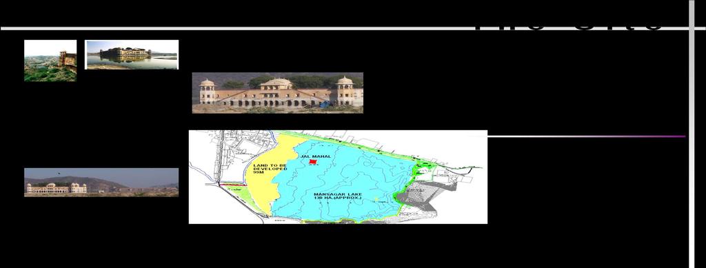
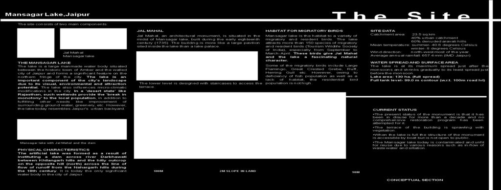
76 66
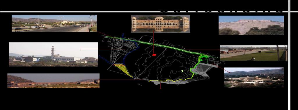
77 67
78 5.2 Analysis for development of the precinct Natural Resources Water: The Mansagar Lake is the only urban lake in the city of Jaipur. Presently the lake is polluted because of the untreated sewage that flows into the lake, causing eutrophication and unwanted artificial land formation. The Ecological Restoration of the lake has been taken up as a joint venture by the Rajasthan Government and Infrastructure Leasing & Financial Services (IL&FS). The dried lake bed on the south side of the lake is available for development. The proposed level of water, based on ecological analysis of the lake, is at the 98.0 m contour. The edge of the lake has slope ranging from 1:30 to 1: 250. There is a need to establish a level difference between the level of the lake and the land to prevent flooding of the land((il&fs), 2005; Sehgal, 2004) Land: The project area is located in a valley surrounded by the Aravalli hills on three sides. These hills rise approximately 220m above the project area and are designated as reserved forests. The runoff from these slopes has increased the siltation in the lake due to erosion. A proposal for the afforestation of these slopes has been executed in the past five years to check the rate of erosion. The land use designated for this area is recreation. There is no large recreation area in the surroundings for the local community. The land is seen as a missing link between the Bhagwali Kalojaa Reserve Forest and the Kilangarh Reserve Forest. The creation of a green lung on the site can also help improve the micro-climate of city by protecting it from the hot winds from the northeast ((IL&FS), 2005; Sehgal, 2004). 68
79 5.2.3 Vegetation: The hills on the north and eastern side of the projects are delineated as reserved forests. These are dry tropical forests. They consist of species such as Acacia Albida, Acacia Nilotica and Tamarindus Indica. The dried part of the lake bed has scanty vegetation with a thorny ground cover and patches of wild grasses. Also, a part of the lakebed is used by farmers for seasonal farming(sehgal, 2004) Migratory birds: The project area attracts a number of migratory birds during the winter season. Special bird-watching festivals are held on the Mansagar dam to enjoy the migratory period between September and March. Around 180 bird species have been observed in this area according to a survey conducted by the Jaipur Development Authority. However, due to deficiency of fish in the lake and degraded environmental conditions, bird populations and migratory birds visiting the site are reducing in number((il&fs), 2005; Sehgal, 2004). 5.3 Communities association with the project The local community is associated with the project area for various activities: On the lake edge seasonal vegetables and fodder is grown by farmers during the summer months on a small scale. Farming is not the primary occupation. Children from the neighborhood communities use the vacant land as a playfield. The local people use the project area for grazing their cattle during the summer months. Many of the residents of the nearby communities operate temporary kiosks near the main entrance to the site. 69

80 The project area is used as a site for organizing various cultural activities such as kite-flying festivals at the city level and bird-watching fairs at the Mansagar dam(sehgal, 2004). 5.4 Vision for the project This thesis looks at the site as a place for celebration: a place that celebrates the rich and diverse cultural heritage of the people of Jaipur, and a place that celebrates the presence of a water body in the arid landscape of Jaipur. The design has been conceptualized using traditional archetypal forms such as the nine grid Mandala and tree squares. Using archetypes to derive the design: Figure 5.3 Mandala Figure 5.4 Jaipur 1) The grid system used in Jaipur is a nine square grid. The palace has been placed in the center square. The memory of the plan today is that of proportion and use. The proportion followed in the city plan is: for street width W, the street squares are 3xW and the building height is ½ x W. The squares are fountain squares that functioned as social gathering spaces. The memory is also that of mixed use. Along 70


81 the main streets that run north to south a mixes use pattern is found where the ground floor is used as shops and the first floor is used for civic purposes. Keeping this pattern in mind, in the design, the Jal Mahal monument been considered to be the center of a nine grid Mandala. Figure5.5Monument as the center of a Mandala Figure 5.6 Extending the axis The grid was enlarged so that part of it lies on the site. The axis of the grid that lies on the site, and the rest of the grid were extended on to the site. These lines were then used to derive the movement pattern on site. Figure 5.7 Movement pattern 71

82 The pattern derived on site follows the same proportion that is found in the Jaipur city. The main axis derived from the Mandala has been treated as an urban street whose proportion is based on the height of the structures along it. The urban plazas formed by the intersection of the streets have been designed as fountain squares and are three times the size of the main street. 2) The next step was to create a central landscape spine based on the char-bagh archetype. The Islamic gardens found in Amber are moonlight gardens. Based on the char-bagh form they are parterre gardens that are meant to be used at night. In the design a central landscape spine has been created that has two large char-bagh forms. The two forms have been placed axially with a water channel connecting the water features which has been placed in the center of the two platforms. The central landscape spine helps segregate the more public use of shops from the semi-public use of the Arts Center. Figure 5.8 The central landscape spine and the char-bagh. 72
83 3) Using the haveli as an archetype: The haveli is a dwelling type with a central open space. All rooms and other components of the house are clustered around this central open space making it the center of all activities. This central open space or the courtyard, acts as a semi public space that facilitates interaction between people within the house. The space also acts as an air-shaft that regulates the flow of air within the space. The proportion of the shaft is such that it blocks the sun at all times during the day and creates a cool and shaded open space in the arid climate. Figure 5.9 The courtyard element In the design two courtyards have been provided. The first one acts as a shopping courtyard and the second one is a art display courtyard. The proportion space within the courtyard has been maintained and the courtyard archetype has been used as a semi-public open space. 73
84 4) Ghats as an archetype: The ghats are steps leading to water that are a strong component of settlement morphology along rivers in India. Keeping in mind that the Mansagar Lake has a sensitive ecological system, in the design, only a small part along the lake edge has been designed as steps that lead into water and symbolize the ghats. The rest of the lake edge has been treated as a lakefront promenade punctuated by viewing pavilions at regular intervals for viewing the monument and the lake. GHATS Figure 5.10 Steps leading to water. 5) Tree square as an archetype: The tree square as an archetype is generally found in rural areas where they function as social gathering spaces. In this proposal the tree square is used in conjunction with a water source and helps create a pleasant micro-climate in the arid region. 74
85 TREE SQUARE Figure 5.11 Tree square and Maidan 6) Maidan as an archetype: Maidan is a large open space that is flexible in its use. It is used as a fairground, for wedding celebrations and for political rallies. In the case of the Mansagar Lake project the site is used by children of the nearby communities as a playground. It is also used by the people who work in the surrounding areas for relaxing and having lunch. Many inter-state competitions such as kite-flying competitions are also organized on the site. Keeping all these functions in mind a large Maidan has been provided near the main highway. 7) Archetypes for water: There are mainly three types of water structures found in Jaipur: wells, tanks and step-wells. None of these archetypes have been used in the design for two reasons. Firstly, because creating any of these features would affect the ecological restoration of the lake. Secondly, ground water is found only three feet below the site level; therefore creating any of these features is not a feasible option. 75

86 Allocation of use on site: Figure 5.12 Allocation of use on site The grid pattern that was used to derive the movement pattern on site was also used to segregate uses on site. In doing so the first step was to study the by-laws and look at the setback requirements. A setback of 100m has been provided near the highway and a maidan has been created in this open space. Similarly a setback of 50 m has been left from the lake edge and a number of pavilions and kiosks have been provided in there. Since these by-laws are formulated by the Archeological survey of India which follows the European system of conservation based on the Venice Charter, the design is also compatible with the Venice Charter for conservation of monuments. Within these parameters the following uses were allocated on site: 1) Maidan: a Maidan has been created on the 100m setback near the highway. This has been provided for the people of the surrounding communities who 76
87 currently use the site for various purposes such as organizing festivals, relaxing and as a playground. 2) Shops: The design considers the image of the city as a commercial hub to be an important part of the collective memory of the city. The design therefore has a large component of shops and kiosks that promote the traditional handicrafts and food of Jaipur. A shopping spine has been created along the main axis that has been derived from the Mandala form. 3) Arts festival center: Designed with classrooms, seminar rooms and exhibition space, the Arts center is a place for children and young people where they can learning the different arts and crafts of Jaipur. 4) Fruit orchards: Fruit orchards were typically found in Rajput landscapes. Before the char-bagh archetype was introduced in Jaipur orchard gardens were commonly found in the region. Therefore, a portion of the site has been designed for fruit orchards as these help improve the fertility of the soil and can also help generate work for the people in the surrounding communities. 5) Farm area: A farmland area has been provided near the lake bed for farmers who use the dried lake bed for seasonal farming during summers. This land can also be used for kite flying festivals which are generally held during the winter months. 6) The Ecological Park: The Ecological Park has been provided to improve the conditions of the lake and organize bird watching fairs and festivals. One of the major ecological concerns related to the site is the dwindling number of migratory birds that visit the site every year. The ecological park will help provide trees for these nesting birds and ensure that they visit the site during their migratory season. 77

88 A ECOLOGICAL PARK MAIDAN SHOPS B B ART CENTER FARMLAND A ORCHARD 78
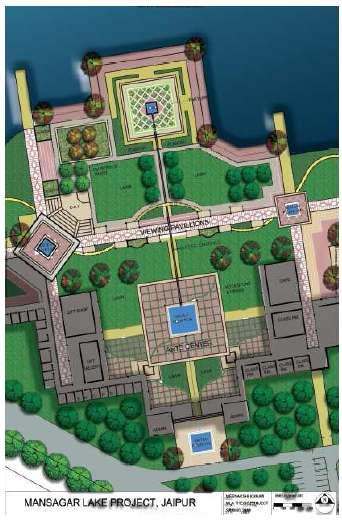
89 79
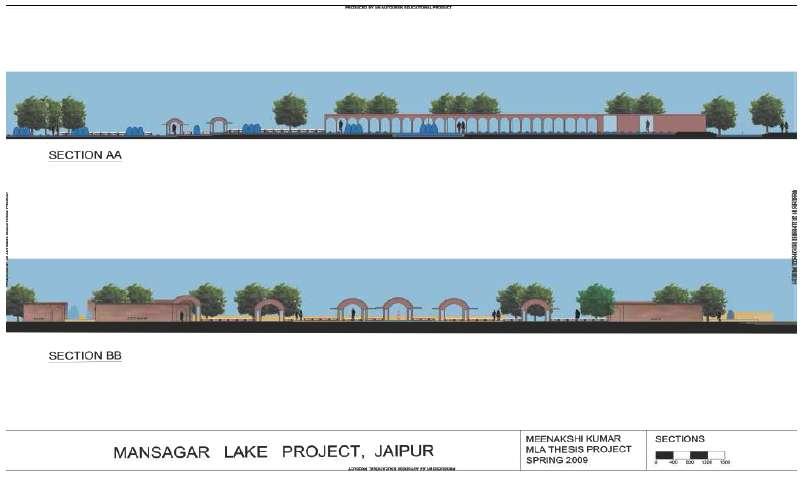
90 80
Lecture - 32 Historic Cities and Heritage Areas
 Architectural Conservation and Historic Preservation Prof. Sanghamitra Basu Department of Architecture and Regional Planning Indian Institute of Technology, Kharagpur Lecture - 32 Historic Cities and Heritage
CHAPTER I: INTRODUCTION
 CHAPTER I: INTRODUCTION 1. The problem statement Ideally, urban environments, specifically well-designed plazas, should provide significant functional and physical qualities and affordances to people,
RECOMMENDATION ON THE HISTORIC URBAN LANDSCAPE
 RECOMMENDATION ON THE HISTORIC URBAN LANDSCAPE PREAMBLE Considering that historic urban areas are among the most abundant and diverse manifestations of our common cultural heritage, shaped by generations
Thailand Charter on Cultural Heritage Management
 Thailand Charter on Cultural Heritage Management Principles and Rationale Thailand has a long history that can be traced back to several ten thousand years since prehistoric times to the present, as seen
HERITAGE IN INDIAN URBAN PLANNING
 HERITAGE IN INDIAN URBAN PLANNING Garima Dhabhai 2015 POLICY BRIEF SERIES RESEARCH My research focuses on the growing importance of heritage as a factor in contemporary urban planning in India. I examine
UNIVERSITY OF MUMBAI
 AC 6/6/2012 Item No. 4.80 UNIVERSITY OF MUMBAI Syllabus for the Master of Architecture Programme : M.Arch. Course :Urban Design (As per Credit Based Semester and Grading System with effect from the academic
UNITED NATIONS EDUCATIONAL, SCIENTIFIC AND CULTURAL ORGANIZATION
 World Heritage Distribution limited 15 GA WHC-05/15.GA/7 Paris, 23 September 2005 Original : English/French UNITED NATIONS EDUCATIONAL, SCIENTIFIC AND CULTURAL ORGANIZATION FIFTEENTH GENERAL ASSEMBLY OF
University of Canberra. This thesis is available in print format from the University of Canberra Library.
 University of Canberra This thesis is available in print format from the University of Canberra Library. If you are the author of this thesis and wish to have the whole thesis loaded here, please contact
A Study on Landscape Design Paradigm from the Perspective of Visual Impact and Experience
 2017 3rd International Conference on Social Science, Management and Economics (SSME 2017) ISBN: 978-1-60595-462-2 A Study on Landscape Design Paradigm from the Perspective of Visual Impact and Experience
RIGA LATVIA. KEY FEATURES OF THE CITY Demographic Facts. Urban Figures. Heritage. EXISTING GOVERNANCE MECHANISMS Development and Management Plans
 RIGA LATVIA KEY FEATURES OF THE CITY Demographic Facts around 700.000 inhabitants in the city 1.15 million people in the Riga region Urban Figures the medieval core of the Old Town the 19th century grid
GREATER SHEPPARTON CULTURAL HERITAGE AWARDS GUIDELINES
 GREATER SHEPPARTON CULTURAL HERITAGE AWARDS GUIDELINES Adopted by Resolution of Council on 21 August 2018 Greater Shepparton City Council is proud to present the Cultural Heritage Awards program. The Awards
Study on the Creative Design of Cultural Landscape in Urban Landscape
 2nd International Conference on Social Science and Technology Education (ICSSTE 2016) Study on the Creative Design of Cultural Landscape in Urban Landscape Xiao Qianwen Hubei University of Technology Lizhi
THE AOTEAROA-NEW ZEALAND LANDSCAPE CHARTER
 THE AOTEAROA-NEW ZEALAND LANDSCAPE CHARTER NEW ZEALAND INSTITUTE OF LANDSCAPE ARCHITECTS Draft for review and discussion by NZILA members: March 2009 Updated version for NZILA Exec: November 2009 Updated
Cotswolds AONB Landscape Strategy and Guidelines. June 2016
 Cotswolds AONB Landscape Strategy and Guidelines June 2016 Cotswolds AONB Landscape Strategy and Guidelines Introduction The evolution of the landscape of the Cotswolds AONB is a result of the interaction
Excellencies, Dear colleagues from other agencies and organizations, Ladies and Gentlemen,
 Address by Dr Mechtild Rossler Deputy Director of UNESCO s World Heritage Centre The UNESCO Recommendation on the Historic Urban Landscape on the occasion of the European Heritage Heads Forum Leuven, Belgium,
United Nations Educational, Scientific and Cultural Organization RECOMMENDATION ON THE HISTORIC URBAN LANDSCAPE
 United Nations Educational, Scientific and Cultural Organization RECOMMENDATION ON THE HISTORIC URBAN LANDSCAPE Paris, 10 November 2011 Recommendation on the Historic Urban Landscape, including a glossary
Recommendation on the Historic Urban Landscape, including a glossary of definitions
 Recommendation on the Historic Urban Landscape, including a glossary of definitions 10 November 2011 Preamble The General Conference, Considering that historic urban areas are among the most abundant and
The term Cultural Landscape can be seen as two combining words: culture and landscape.
 Cultural Landscape in Urban Areas: The Remnants Assistant Professor Supagtra Suthasupa, Ph.D. Department of Urban Design and Planning, Faculty of Architecture Silpakorn University, Bangkok 10210, Thailand
CHAPTER THEORETICAL FRAMEWORK
 CHAPTER 3 THEORETICAL FRAMEWORK 3.1. INTRODUCTION The relationship between people and their environment has been investigated extensively in the past by researchers from different fields including anthropology,
General Terms Property, as used to describe eligibility for the National Register of Historic Places:
 Key Definitions Historic Landscapes Compiled by Camille Fife and Barbara Wyatt The field of historic landscape preservation has generated a specific vocabulary. Definitions have been published by two National
The University of Sheffield
 The University of Sheffield School of Architecture Critical Reflective Essay for ARC 6989: Reflections on Architectural Design (MAAD) Name: Ding Li, MAAD Registration No: 110204279 Abstract The site, where
Foreword to the Third + Edition
 U n i v e r s i t y of Oregon Campus Plan - Third + Edition, 2017 i Foreword to the Third + Edition Third + Edition (November 2017) This third + edition of the 2005 Campus Plan integrates amendments approved
SUSTAINABLE CONSERVATION SYSTEMS FOR PRESERVATION OF MONUMENTS, SITES IN THEIR SETTINGS
 SUSTAINABLE CONSERVATION SYSTEMS FOR PRESERVATION OF MONUMENTS, SITES IN THEIR SETTINGS Staneva Hristina / Bulgarian National Correspondent of the HEREIN Project Associated member of the ICVA This paper
The Charter of Athens, From heritage preservation to integrated conservation. Charter of Athens Venice charter 1964
 From heritage preservation to integrated conservation Charter of Athens 1931 Venice charter 1964 Recognition of the importance of cultural heritage and its conservation. Importance of training Definition
Guidelines on the inclusion of Cultural Landscapes, Towns, Canals, Cultural Routes and Fossil Sites on the World Heritage List 1
 Guidelines on the inclusion of Cultural Landscapes, Towns, Canals, Cultural Routes and Fossil Sites on the World Heritage List 1 1. The World Heritage Committee has identified and defined several specific
STANDARDS OF INTERNATIONAL CULTURAL AND FINANCIAL INSTITUTIONS FOR CULTURAL HERITAGE PROTECTION AND MANAGEMENT
 STANDARDS OF INTERNATIONAL CULTURAL AND FINANCIAL INSTITUTIONS FOR CULTURAL HERITAGE PROTECTION AND MANAGEMENT Arlene K. Fleming Cultural Resource and Development Specialist, USA Abstract Cultural heritage
World Heritage Cultural Landscapes
 International Expert Workshop on Integrity & Authenticity of World Heritage Cultural Landscapes Dec 11, 2007 - Dec 12, 2007 Aranjuez, Spain Patricia M. O Donnell, FASLA, AICP, IFLA, ICOMOS Heritage Landscapes,
Planning the City from Tourist s Perspective to Enhance the City Image A Case of Aurangabad
 Planning the City from Tourist s Perspective to Enhance the City Image A Case of Aurangabad Smita Yatish Prabhune M.Tech (Town and Country Planning Student at College of Engineering Pune, Shivajinagar,
CHAPTER 4.1 COMMUNITY HERITAGE AND HISTORIC PRESERVATION ELEMENT
 CHAPTER 4.1 COMMUNITY HERITAGE AND HISTORIC PRESERVATION ELEMENT Vision: Retention of the community s heritage and atmosphere through identification, preservation and ongoing support of important traditions,
Faculty of Design and Art. Course Description for The Bachelor of Product Design
 Faculty of Design and Art Course Description for The Bachelor of Product Design Technique Etching and Pry 2 Folklore 3 Multimedia Technology 4 Exploration Graphic 5 Batik Design 6 Prototype Design And
THE OPEN SPACE CONTRIBUTING TO NEIGHBORHOOD SUSTAINABILITY THROUGH PUBLIC EVENTS: A CASE FROM AKARA, TURKEY. Bahar Gedikli Charleston, October 2010
 THE OPEN SPACE CONTRIBUTING TO NEIGHBORHOOD SUSTAINABILITY THROUGH PUBLIC EVENTS: A CASE FROM AKARA, TURKEY Bahar Gedikli Charleston, October 2010 Sustainable urban development?! Sustainable urban development
Legal protection of monuments in their settings: a means of maintaining the spirit of the place
 : a means of maintaining the spirit of the place Prof. dr. Ph.D. in Law University of Hasselt and Catholic University of Leuven Winkselsesteenweg 80 B 3020 Herent Belgium annemarie.draye@uhasselt.be Abstract.
1. Introduction _ 2. Theoretical Intention _ 3. Architectural Intention _ 4. Concept Statement 5. Conceptual Precedents _ 6.
 07 1. Introduction _ 2. Theoretical Intention _ 3. Architectural Intention _ 4. Concept Statement 5. Conceptual Precedents _ 6. Design Informants DESIGN CONCEPT FIGURE 7.1 Concept Development, Digital
The Pimachiowin Aki Management Plan: A case-study of collaborative planning in Canada s boreal forest.
 The Pimachiowin Aki Management Plan: A case-study of collaborative planning in Canada s boreal forest. Jennifer Pritchard in collaboration with Jim Thomas, MCIP, CSLA. Abstract The Pimachiowin Aki Management
Design Guidance. Introduction, Approach and Design Principles. Mauritius. November Ministry of Housing and Lands. .. a
 sig evelo r D Mauritius s. Utilities.. Individu a s. er itects.to ls chpers.po e Public. T. h rban D Sc U e me Promot e h ners. A Design Guidance o.h Planne rs n w iticians r l useholde National Development
A study on the regional landscape planning framework on the relationships between urban and rural areas: case study of Tokachi region, Hokkaido, Japan
 A study on the regional landscape planning framework on the relationships between urban and rural areas: case study of Tokachi region, Hokkaido, Japan K. Yamagishi & H. Kobayashi Laboratory of Urban Planning
OSPMadrid 21. patriomonio construido de Espane. John Kunz Week 2: 18 January
 OSPMadrid 21 patriomonio construido de Espane John Kunz Week 2: 18 January Big Idea Buildings and their surroundings, which constitute the built environment, live in time: they evolve more or less easily
Hampton Park Charleston, SC Designing coherent and acceptable spaces for cultural and social events that also honor the site s history.
 Hampton Park Charleston, SC Hampton Park: Design with Culture James L. Ward, Registered Landscape Architect & Assistant Professor at the College of Charleston Historic Preservation and Community Planning
Delhi Declaration on Heritage and Democracy
 Delhi Declaration on Heritage and Democracy The 19 th General Assembly of the International Council on Monuments and Sites (ICOMOS) i in Delhi, India on 11 15 December 2017 convened approximately 1000
The Burra Charter The Australia ICOMOS charter for the conservation of places
 Page 1 of 20 Carta de Burra (Spanish translation) pdf file La Charte de Burra (French translation) pdf file Piagam Burra (Indonesian translation) pdf file Review Background Australia ICOMOS wishes to make
WHAT DEFINES A NATIONAL PARK CITY
 WHAT DEFINES A NATIONAL PARK CITY Article 3 What Constitutes the attributes that define a National Urban Park (Photo: Venice Caitlin McCarthy 2016) Neil McCarthy Deputy Chair World Urban Parks Chair Advocacy
Image title: I have this field set as non-repeatable, to limit it to one important name or title.
 DATA STRUCTURE Database field Rules Non-repeatable, Required Because of the academic nature of this database for the architectural students, I made most fields required since the students will need as
Required total credit : 43 All graduate students must register one of RES 501, RES 502 or RES 503, RES 504 or RES 505, RES 506 or RES 509, RES 510.
 İZMİR INSTITUTE OF TECHNOLOGY GRADUATE SCHOOL OF ENGINEERING AND SCIENCES DEPARTMENT OF ARCHITECTURAL RESTORATION CURRICULUM OF THE M.S. PROGRAM IN ARCHITECTURAL RESTORATION (NON-THESIS) Fall Semester
HISTORIC CENTRES OF INDUSTRIAL CITIES ASPIRANTS TO THE TITLE OF CULTURAL TOURISM DESTINATIONS
 10th International Conference for Cultural Tourism in Europe CULTURAL VALUES, DIVERSITY AND HERITAGE: PILLARS OF SUSTAINABLE TOURISM FOR DEVELOPMENT HISTORIC CENTRES OF INDUSTRIAL CITIES ASPIRANTS TO THE
THE ARCHITECTURAL POLICY OF ESTONIA. Passed at the Parliamentary sitting , protocol no. 43, item no. 5
 THE ARCHITECTURAL POLICY OF ESTONIA Passed at the Parliamentary sitting 22.10.2002, protocol no. 43, item no. 5 THE ARCHITECTURAL POLICY OF ESTONIA With the development of a market economy the responsibility
CHAPTER 2 URBAN PLANNING AND DEVELOPMENT IN INDIA AND THE CASE CITY OF CHENNAI
 9 CHAPTER 2 URBAN PLANNING AND DEVELOPMENT IN INDIA AND THE CASE CITY OF CHENNAI This chapter gives a background of urban development in India in general and describes in detail the urban planning and
VILLAGE OF BOLTON HERITAGE CONSERVATION DISTRICT PLAN
 Page 1 1. INTRODUCTION AND BACKGROUND 1.1 THE PROJECT VILLAGE OF BOLTON HERITAGE CONSERVATION DISTRICT PLAN TERMS OF REFERENCE The Town of Caledon (Town) is a large, predominantly rural municipality with
Negative Space Positive Environment
 Negative Space Positive Environment Mapping Opportunities for Urban Resilience M. Kowalik Dr. M. Guaralda Queensland University of Technology Outline Background Understanding Cities Approaches to Urban
Comparative Urban Planning Systems in Poland and the United States
 Comparative Urban Planning Systems in Poland and the United States INTRODUCTION... 2 WHY PLAN?... 3 The United States... 5 Poland... 10 GOVERNMENTAL AND ADMINISTRATIVE PLANNING BODIES... 15 The United
The Old Royal High School, Edinburgh Public Discussion organised by the Architectural Heritage Society of Scotland 23 rd February 2015
 The Old Royal High School, Edinburgh Public Discussion organised by the Architectural Heritage Society of Scotland 23 rd February 2015 Presentation by Susan Denyer, Secretary ICOMOS-UK and World Heritage
CONSERVATION PLAN BASED ON THE CONCEPT OF INTEGRITY
 CONSERVATION PLAN BASED ON THE CONCEPT OF INTEGRITY Y. N. Yen a C. F. Cheng a, * a China University of Technology, 56 Sec. 3 Shin Long Rd., 116 Taipei, Taiwan - (alexyen, aabbyy)@ cute.edu.tw KEY WORDS:
Historic Preservation s Future : Willowbank School of Restoration Arts. Lisa Prosper
 Historic Preservation s Future : Willowbank School of Restoration Arts Lisa Prosper AIA Rochester Our mission is to promote the profession and practice of Architecture in the Greater Rochester Area. We
Cooperative Research in Water Management
 Proceedings of the 8 th International Conference on Applied Informatics Eger, Hungary, January 27 30, 2010. Vol. 1. pp. 273 281. Cooperative Research in Water Management Margit Horosz-Gulyás, Katalin Katonáné
HERITAGE INTERPRETIVE PLAN
 Photo credit: City of Edmonton Archives, EA-160-165 EXECUTIVE SUMMARY HERITAGE INTERPRETIVE PLAN river crossing i THE A L E 101A S T 102 S T EDMONTON BALLPARK 100 S T S T ROSS FLATS APARTMENTS 100A S T
Leveraging Cultural Heritage for Community Identity and Economic Development
 Leveraging Cultural Heritage for Community Identity and Economic Development Anne Ketz and Nathan Moe 106 Group, www.106group.com Introduction Heritage-based planning and design is an approach to community
LANDSCAPE CHARACTER ASSESSMENT
 THE COUNTY DURHAM LANDSCAPE CHARACTER ASSESSMENT FOREWORD The landscape of County Durham is one of great contrast and diversity. From the North Pennines in the west to the Durham Coast in the east it contains
OWHC Organization of World Heritage Cities
 OWHC Organization of World Heritage Cities Safeguarding and Further Developing World Heritage Cities Position Paper Seite 1 Structure I. About the OWHC Introduction Objectives Structure Safeguarding and
The Sustainability of Urban Heritage Preservation. The Case of Aleppo. Inter-American Development Bank. Meinolf Spiekermann
 Inter-American Development Bank Institutional Capacity and Finance Sector DISCUSSION PAPER The Sustainability of Urban Heritage Preservation No. IDB-DP-125 The Case of Aleppo Meinolf Spiekermann August
Conserving Nature Through Tourism? Issues of tourism and Protected Areas. Professor Andrew Holden
 Conserving Nature Through Tourism? Issues of tourism and Protected Areas Professor Andrew Holden Kenya video https://www.youtube.com/watch?v=rdck9 SgdEZY Reflection What does the term natural environment
HERITAGE A SUPLEMENT TO TOOLKIT ON FORMULATION OF CITY DEVELOPMENT PLAN. Focus on. Ministry Of Housing and Urban Poverty Alleviation
 A SUPLEMENT TO TOOLKIT ON FORMULATION OF CITY DEVELOPMENT PLAN Focus on HERITAGE Ministry Of Urban Development Ministry Of Housing and Urban Poverty Alleviation GOVERNMENT OF INDIA SUPLEMENT TOOLKIT ON
Research on Landscape Design of Urban Park
 2012 4th International Conference on Computer Modeling and Simulation (ICCMS 2012) IPCSIT vol.22 (2012) (2012) IACSIT Press, Singapore Research on Landscape Design of Urban Park Sirong Liu + Hubei University
A REGIONAL HERITAGE STRATEGIC PLAN for OKANAGAN - SIMILKAMEEN
 A REGIONAL HERITAGE STRATEGIC PLAN for OKANAGAN - SIMILKAMEEN The Regional District of Okanagan-Similkameen is preparing a Regional Heritage Strategic Plan. The Strategic Plan will identify important themes
- Displacement of disadvantaged populations by profit-driven redevelopment projects;
 PROJECT DESCRIPTION LED Landscape Education for Democracy LED (Landscape Education for Democracy): An interdisciplinary, international course unit training conceptual thinking, diversity management and
RECOMMENDED COURSE SEQUENCE
 RECOMMENDED COURSE SEQUENCE 3-Year Program First Professional Degree First Year LA 501 Studio I 3 LA 504 Studio III 3 LA 503 Studio II 3 LA 506 Studio IV 3 LA 592A & 696L Plants in the Landscape & Lab
Community & Privacy. Much care should be taken when attempting to establish these intermediate
 Context Community & Privacy To think about community one must first have an overall idea for a guide, then focus attention to the elemental aspects of the community so that the whole may begin to grow
LANDSCAPES FOR EVERYONE: CREATING A BETTER FUTURE. A shared vision of why we must treasure our landscapes and how Government can help
 LANDSCAPES FOR EVERYONE: CREATING A BETTER FUTURE A shared vision of why we must treasure our landscapes and how Government can help BRITAIN S DIVERSE LANDSCAPES NEED CHAMPIONS A consortium of national
ON THE WATERFRONT: CULTURE, HERITAGE AND REGENERATION OF PORT CITIES November 2008 BT Convention Centre, Kings Waterfront, Liverpool
 ON THE WATERFRONT: CULTURE, HERITAGE AND REGENERATION OF PORT CITIES 19 21 November 2008 BT Convention Centre, Kings Waterfront, Liverpool ON THE WATERFRONT: CULTURE, HERITAGE AND REGENERATION OF PORT
Purpose of the Master Plan
 Purpose of the Master Plan 4 Master Plan Purpose The Master Plan is a policy framework for decisions that affect the physical, social and economic environment of the Town. The Parker 2035: Master Plan
TRANSITION OF TIME HISTORICAL INFLUENCE
 TRANSITION OF TIME HISTORICAL INFLUENCE Architecture, a history book written in stone, is a recorder of the transition of time. Architectures in different eras have characteristics formed by different
BACKGROUND. schematic map showing the european settlements around the hooghly
 BACKGROUND schematic map showing the european settlements around the hooghly The Hooghly River has been witness to the changing fortunes of the country; it was here that the seeds of industrialisation
LANDSCAPE ARCHITECTURE
 Landscape Architecture 1 LANDSCAPE ARCHITECTURE Dexter Bldg.(34), Room 251 Phone: 805.756.1319 https://landscape.calpoly.edu Department Chair: Omar Faruque Academic Program Program name Landscape Architecture
Degrees in Architecture and Fundamentals of Architecture
 SYLLABUS "Urbanism 1" BASIC INFORMATION OF THE COURSE Title: Degrees in Architecture and Fundamentals of Architecture Year of plan of study: 2010 and 2013 1 / 19 Centre: E.T.S. Architecture Subject: Urbanism
BEIT SAHOUR OLD TOWN : A CORNER OF CULTURE
 BEIT SAHOUR OLD TOWN : A CORNER OF CULTURE 1. Context The city of Beit Sahour holds a huge legacy of customs and traditions due to its origins going back to the Bronze Age (3000 B.C.). The Canaanites inhabited
Site Assessment Technical Document Appendix A: Glossary
 Central Bedfordshire Council www.centralbedfordshire.gov.uk Site Assessment Technical Document Appendix A: Glossary July 2017 1.1.11-1 - ii Appendix A: Glossary Term Agricultural Land Classification AONB
MANAGING CHANGE IN THE HISTORIC ENVIRONMENT. Historic Battlefields August 2016
 MANAGING CHANGE IN THE HISTORIC ENVIRONMENT Historic Battlefields August 2016 Above: Most of Culloden battlefield lay under forestry until clearance by the National Trust for Scotland in the 1980s. While
Thematic Workshop Management of Heritage Places and Artefacts Petra, Jordan 17/19 May Background Paper
 Thematic Workshop Management of Heritage Places and Artefacts Petra, Jordan 17/19 May 2010 Background Paper Géraldine Chatelard Research Fellow, French Institute for the Near East (Ifpo), Amman Objectives
Dr Mechtild Rossler (UNESCO World Heritage Centre): World Heritage and Cultural Heritage Management: New Conservation Challenges
: World Heritage and Cultural Heritage Management: New Conservation Challenges") Dr Mechtild Rossler (UNESCO World Heritage Centre): World Heritage and Cultural Heritage Management: New Conservation Challenges Presented on the XV th International Summer University at ISES 2 nd of July
Dr Mechtild Rossler (UNESCO World Heritage Centre): World Heritage and Cultural Heritage Management: New Conservation Challenges Presented on the XV th International Summer University at ISES 2 nd of July
Scotland s Landscape Charter
 Scotland s Landscape Charter The Scottish Landscape Forum Foreword Scotland s landscapes, which are renowned throughout the world, show the imprint of countless generations of Scots who have shaped this
Oxford Green Belt Study. Summary of Final Report Prepared by LUC October 2015
 Oxford Green Belt Study Summary of Final Report Prepared by LUC October 2015 Project Title: Oxford Green Belt Study Client: Oxfordshire County Council Version Date Version Details Prepared by Checked by
Inspiring Technovation
 1 2 Table of content List of table and figures... Executive summary... 1. Introduction... 2. Material and methods... 3. Results... 3.1 Today s facts about Versailles: a diagnostic approach... 3.1 Vision
INTACH AWARD FOR BEST PRACTICES IN CONSERVATION
 INTACH AWARD FOR BEST PRACTICES IN CONSERVATION ENTRY FORM (Please FILL OUT in English, PRINT, SIGN and SEND together with required materials). The form should be submitted together with the Project Description
Resolution XII NOTING also that with the increasingly rapid urbanization, wetlands are being threatened in two principle ways:
 12 th Meeting of the Conference of the Parties to the Convention on Wetlands (Ramsar, Iran, 1971) Punta del Este, Uruguay, 1-9 June 2015 Resolution XII.10 Wetland City 1 Accreditation of the Ramsar Convention
Phase 1 : Understanding the Campus Context. Phase 2 : APPROACHES - Alternates & Preferred Plan
 Introduction MASTER PLAN PURPOSE WHY A CAMPUS MASTER PLAN? The purpose of the Master Plan at the University of Illinois at Chicago is to translate UIC s strategic goals and objectives into a compelling
CITY OF FARGO PARKING RAMP SITE EVALUATION
 CITY OF FARGO PARKING RAMP SITE EVALUATION EXECUTIVE SUMMARY Helenske Design Group (architect) and Carl Walker Inc (Parking Consultant) were retained by the City of Fargo to complete a downtown parking
K.U.K., B. ARCHITECTURE
 (B. Arch. Thesis Project based on Research Skills) (AR-502) Project Exam. Marks - 300 Internal Assessment - 300 Duration of Exam. - - hrs Contact Hrs / week - 18 To prepare the student to independently
LONGDEN VILLAGE DEVELOPMENT STATEMENT
 LONGDEN VILLAGE DEVELOPMENT STATEMENT 2017-2027 1 Longden Development Statement 2017-2027 15/01/18 1. Background 1.1 Longden Village Longden village is a very rural and traditional community first mentioned
Workshop on the Management of Historic Urban Landscapes of the XXth century, December 2007 Chandigarh, India
 Workshop on the Management of Historic Urban Landscapes of the XXth century, 18-21 December 2007 Chandigarh, India INTRODUCTION The participants of the International Workshop on the Management of Historic
Fort Wellington National Historic Site
 Fort Wellington National Historic Site DECEMBER 2015 PUBLIC CONSULTATION DOCUMENT Invitation to participate Fort Wellington National Historic Site has begun the process of reviewing its management plan.
PUBLIC REALM STRATEGY
 CONSULTATION DRAFT PUBLIC REALM STRATEGY Trenchard Street & Frogmore Street City Design Group Place Directorate Public Realm Strategy Trenchard Street & Frogmore Street Contents 1. Introduction 2. Understanding
Authority of the General Plan
 Authority of the General Plan This La Habra Heights General Plan will serve as the blueprint for future planning and development in the City. This General Plan describes the City s vision for the future
1. MAKING CHOICES. What kind of city will Toronto be in the 21st century?
 1. MAKING CHOICES Toronto is a great city! It has evolved into a special place that people care about deeply. It is a wonderful city in which to live, offering a diversity and richness of urban life that
Scottish Natural Heritage. Better places for people and nature
 Scottish Natural Heritage Better places for people and nature Contents Summary... 3 SNH approach... 5 Place-making in policy and practice... 6 Developing the contribution of the natural heritage to place-making...
Executive Summary and Introduction
 Section I Executive Summary and Introduction Introduction Purpose and Implementation Vision Themes and Strategies Description of Plan Methodology and Approach History of Comprehensive Planning Page 1 of
INTERIOR ARCHITECTURE AND ENVIRONMENTAL DESIGN COURSE DESCRIPTIONS
 INTERIOR ARCHITECTURE AND ENVIRONMENTAL DESIGN COURSE DESCRIPTIONS 1. Semester İÇM101 PRESENTATION TECHNIQUES I (RENDERİNG I) It is aimed To create a "Basic Art" formation, which is necessary for improving
Portrait of Place Lesson Plan
 Portrait of Place Lesson Plan Utah Museum of Fine Arts www.umfa.utah.edu Educator Resources Fall 2015 samples from lesson plan activity 1 Portrait of Place Lesson Plan Utah Museum of Fine Arts www.umfa.utah.edu
12 TH ANNUAL CHILTERNS AONB PLANNING CONFERENCE ENGLISH HERITAGE: HISTORIC ENVIRONMENT GOOD PRACTICE ADVICE
 12 TH ANNUAL CHILTERNS AONB PLANNING CONFERENCE ENGLISH HERITAGE: HISTORIC ENVIRONMENT GOOD PRACTICE ADVICE MARTIN SMALL HISTORIC ENVIRONMENT PLANNING ADVISER ENGLISH HERITAGE Policy ENGLISH HERITAGE GOOD
Purpose of the Master Plan
 Purpose of the Master Plan 4 Master Plan Purpose The Master Plan is a policy framework for decisions that affect the physical, social and economic environment of the Town. The Parker 2035: Master Plan
Draft Resolution XII.10
 12 th Meeting of the Conference of the Parties to the Convention on Wetlands (Ramsar, Iran, 1971) Punta del Este, Uruguay, 1-9 June 2015 Ramsar COP12 DR10, Rev. 2 21:45, 8 June Draft Resolution XII.10
The Conservation of Disappearing Sugar Industry Cultural Landscapes in Taiwan
 The Conservation of Disappearing Sugar Industry Cultural Landscapes in Taiwan Chun-Hsi Wang* 1 and Chao-Ching Fu 2 1 Ph.D. Candidate, Department of Architecture, National Cheng Kung University, Taiwan
Brian Peterson, AIA, LEED-AP, CNU-A Introduction: the Art of Urban Design
 URBAN DESIGN AND SUSTAINABLE DEVELOPMENT: MILWAUKEE INNER HARBOR Arch 645/845 UP 858 Spring 2013 Tuesdays, Fridays 1:30-5:20 Brian Peterson, AIA, LEED-AP, CNU-A Brianpeterson1981@gmail.com 608-320-6006