Town of Genoa Comprehensive Plan - April
|
|
|
- Holly Shields
- 5 years ago
- Views:
Transcription

1 Town of Genoa Comprehensive Plan - April
2 2 Town of Genoa Comprehensive Plan - April 2013
3 Table of Contents Introduction... 5 Public Participation... 6 Plan Structure... 7 Adopting and Implementing the Comprehensive Plan... 7 Review and Maintenance of the Plan... 8 Implementing the Genoa Comprehensive Plan... 8 History of Planning and Land Use in the U.S Prior Local and Regional Planning Initiatives Federal and State Planning Initiatives Chapter 1: Goals and Recommendations Community Vision Statement Agriculture and Farmland Protection Water Quality Protection and Environmental Stewardship Community Well-Being and Infrastructure Management Economic Development and Community Revitalization Chapter 2: Community Inventory and Analysis Location History of the Community Hamlets and Historic Settlements Historic and Cultural Resources Demographic Profile Municipal Infrastructure and Services Land Use and Zoning Natural Resources and Environment Cayuga Lake Wetlands Agricultural Lands BioEnergy Solar Energy Wind and Wind Energy The Marcellus Shale & Natural Gas Public Parks and Protected Areas Chapter 3: Regional Influences Appendix A: Principals of Smart Growth Appendix B: Conservation Subdivisions Town of Genoa Comprehensive Plan - April
4 Appendix D: Community Survey and Comments List of Maps Town Base Map Historical Town Map Town Aerial Imagery Topography and Highway Map Town Land Use Map Town Parcel Map Wetlands Map Floodplains Map Farmland Classification of Soils Current Agricultural Districts Proposed Agricultural Districts GIS DATA Disclaimer The original sources of each dataset is identified on the maps. Due to the different sources and scales of projection, key features such as roads, parcel boundaries and streams may not overlap accurately when comparing several data layers on the same map.acreage calculations for various parameters in this report were generated through the use of ArcGIS and are an approximation of the actual size. For more precise measurements, contact the Cayuga County Planning Department. 4 Town of Genoa Comprehensive Plan - April 2013
 A community is the mental and spiritual condition of knowing that the place is shared, and that the people who share the place defi ne and limit the possibilities of each other s lives.")
5 Genoa Main Street (Route 90), date unknown. (source: A community is the mental and spiritual condition of knowing that the place is shared, and that the people who share the place defi ne and limit the possibilities of each other s lives. It is the knowledge that people have of each other, their concern for each other, their trust in each other, the freedom with which they come and go among themselves. Wendell Berry, from his essay The Loss of the Future in The Long-Legged House (1969) Introduction The Town of Genoa Comprehensive Plan was initiated, generated, and supported by the Genoa community in a collaborative process intended to guide Town officials and the community in making decisions that affect the future of the Town. The Comprehensive Plan provides a basis for guiding future growth, development and community preservation. The plan also acts as a historical document that identifies present land use and infrastructure, as well as the physical, cultural, and demographic characteristics of the Town. In 2008, the Genoa Town Board agreed to establish a Comprehensive Planning Committee (CPC) to research and prepare a Comprehensive Plan. In June, the Town residents, landowners, business owners, and other concerned citizens were asked to serve on the Comprehensive Planning Committee. initiated a public request in the Town Newsletter for residents, landowners, business owners, and other concerned citizens to serve on the Comprehensive Planning Committee. The Town board accepted volunteers and the CPC held its first official meeting on July 16, 2008 and began to identify the formal process it would follow to develop the plan. The Town of Genoa CPC was guided and assisted in the comprehensive planning process by the Central New York Regional Planning Board (CNYRPB), under a grant provided by Congressman James Walsh. Town of Genoa Comprehensive Plan - April
6 Through in-depth study, analysis, and community participation, the Comprehensive Plan provides a sound basis for guiding future growth, development, and community preservation. Community input from surveys and the Comprehensive Planning Committee played an important role in the development of the Comprehensive Plan by directly informing a series of clearly defined goals and recommended actions for the Town to pursue. Any future land use or zoning regulations must be consistent with the findings and recommendations of the Comprehensive Plan. Members of the Comprehensive Plan Committee: Maria Bachich Suan Tosto Anto Parseghian Dave Baildon - Secretary Dan Thayer Ken Patchen Barb Patchen John Berry David Stilwell - Chair Al Armstrong - Town Board Liason Public Participation Community input included surveys, public meetings and regular meetings of the Comprehensive Planning Committee. A community survey was developed and used in 2009 to collect some initial community input. Some general conclusions were evident from the data collected: 1. Nearly all respondents (94%) indicated a desire to promote a variety of healthy and sustainable agri cultural practices. a. Related issues cited in survey responses were: air quality, water quality, noisy/large trucks on roads, hedgerow preservation (preservation of the trees and shrubs bordering farm fields that help to prevent the decline of water and air quality), enforcement of laws (labor and housing) 2. Preservation of rural character and natural resources in the Town are important to a large majority of respondents a. Related issues cited in survey responses were: preservation of farmland and right to farm, protection of water resources from runoff of manure/agricultural inputs 3. Improvements to hamlet centers and public services were revealed as the most important development initiatives. a. Related issues cited in survey responses were: access to basic services, improved internet access, improved schools, need for a community park/playground, added attractions (museum, etc.), public access to lake, senior housing Other issues cited in survey responses included a need for cottage industry, and opportunities for alternative/ renewable energy. Additional public outreach was made through a booth at the Harvest Festival in In 2010, four issue meetings were held and open to the public. The issues discussed were Agriculture (January, 2010), Business (March, 2010), Open Space and Recreation (October, 2012), Environment (April, 2012). Additional meetings and interviews were conducted with highway, fire, water, infrastructure, and ambulance services as well as churches, and the historical society. Meeting minutes were posted on the Town website and four articles were published in the Genoa Tribune. The Comprehensive Planning Committee formulated a second survey in 2011 which was mailed to 985 town residences and property owners and was available for public review at the Town Hall. The intent of 6 Town of Genoa Comprehensive Plan - April 2013
7 the survey was not only to seek out opinions on present day Genoa and what the public sees for the Town of Genoa in the future, but to better understand how the community would like to address identified issues and how to focus efforts to assure that identified community values and needs are considered and respected in future development decisions. Out of the 985 surveys sent out, 162 completed surveys were returned, a 16% response rate. Analysis of the results of the written survey and community inventory formed the basis for this comprehensive plan. All CPC meetings were open to the public. Plan Structure The contents of this plan include an Introduction and four chapters. Chapter 1: Goals and Recommendations, lays out the specific goals and recommendations by topic area; Chapter 2: Community Inventory and Analysis, Chapter 3: Regional Influences is intended to give background information on existing conditions in the town and region; and Chapter 4: Issues of Community Concern, is a discussion of issues revealed through the public participation process. Four Appendices in the back of the Plan contain information on Principals of Smart Growth, Conservation Subdivisions, History of Planning and Land Use in the U.S., and the Community Survey. Adopting and Implementing the Comprehensive Plan Legislative Authority In the State of New York, village and town governments are granted authority to adopt a comprehensive plan pursuant to Village Law or Town Law 272-a. The comprehensive plan, a set of policy and analytic documents and maps, strategies and tools for the guidance of community well-being, land use, and development, is also intended to provide the foundation for local zoning laws. Once adopted, all land use policy decisions in the Town must be in accordance with the comprehensive plan. The review of future projects no longer occurs on an independent project-by-project basis, but rather in consideration of the comprehensive plan and the community vision. This Plan provides guidance as to where and how future development should occur in the Town. In addition, all other governmental agencies must consider this plan when directing or funding capital projects that occur within the Town. Adopting the Comprehensive Plan The purpose of adopting a comprehensive plan is the protection of the health, safety, and general welfare of the citizens of the community and their environment. Once adopted, review of future projects occurs in consideration of the community vision and the Comprehensive Plan. In addition, all other governmental agencies must consider this plan when directing or funding capital projects that occur within the Town. Adoption of a comprehensive plan is a discretionary decision and is considered a Type I action pursuant to Article 8 of the Environmental Conservation Law and Title 6 of the New York Code of Rules and Regulations Part 617.4(b)(1).This means that the plan must meet the provisions of the New York State Environmental Quality Review Act (SEQRA) prior to final adoption by Town Board. In accordance with New York State General Municipal Law 239, the Governing Board must refer the adoption or amendment of the proposed comprehensive plan to the County Planning Board s 239 Land Use Committee for review for potential inter-municipal impacts of the proposed plan. The Governing Board may adopt a Comprehensive Plan (or an amendment to a Comprehensive Plan) by resolution. Town of Genoa Comprehensive Plan - April
8 Review and Maintenance of the Plan Because communities are continually changing and adjusting to new conditions, this comprehensive plan is a work in progress, and can be thought of as a document that provides guiding principles for the future development and growth decisions. This Comprehensive Plan should be reviewed regularly to ensure its continued relevance with the existing conditions, goals and objectives of the Town of Genoa. Following the adoption of the Plan; every five years, the Town Board should conduct an in-depth review of the plan. This can be done by reassembling a Comprehensive Planning Committee to make recommendations for changes to goals and recommendations in the plan, or through public discussions, meetings, and/or an updated community survey. The in-depth review should assess the status and effectiveness of the plan s recommendations and implementation actions such as land use regulation revisions, capital improvement programming, expansion of recreational opportunities, tourism, economic development, and progress on other work identified in the Goals & Recommendations (Chapter 1) of the plan. As policy-making changes and the physical characteristics of the community change, the Comprehensive Plan should change to account for those changes. The plan should be a living document about, by, and for the good of, the community. Circumstances that may warrant revising the plan include: A finding of significant change within the community or substantial unforeseen circumstances or impacts; A finding of significant public benefit associated with the proposed revision or a need to maintain and protect public investments and resources; or The need to maintain compliance with new laws, regulations, court actions, or other mandates Implementing the Genoa Comprehensive Plan All of the work that the community has done thus far in preparing the Comprehensive Plan can be lost without a solid framework for implementation based on available funding resources and realistic expectations. Some recommendations in this plan may be implemented over a longer period of time, others will be a concentrated, short-term effort, but all elements of the Plan should be considered in terms of budgets and time frame. A Comprehensive Plan is a valuable resource a community can use to win significant grant funding from a wide variety of sources. Forming partnerships with various public agencies at the local, county, state and federal levels is advisable as these agencies can often assist communities in their funding and implementation efforts. Special committees may be established by the Town Board to address specific focus areas identified in the Plan. Committees and Planning Boards should include members of the community most familiar with the Comprehensive Plan and its guiding principles. Examples of committees include a Conservation Advisory Committee, a Farmland Preservation Committee, an Historic Preservation Committee, or a Energy and Technology Committee. Community efforts can often be strengthened and community benefits broadened by cooperative planning and promotional strategies among neighboring communities. Through cooperative efforts with other agencies and inter-municipal relationships with neighboring municipalities, planning can have positive impacts on the community, as well as on the region as a whole. 8 Town of Genoa Comprehensive Plan - April 2013
9 History of Planning and Land Use in the U.S. Towns across America, as a result of an evolving story of settlement, bear unique physical and cultural characteristics reflected in their villages and along their roadsides. Rural towns like Genoa contribute to, and are affected by regional centers of social, cultural, and economic activity. Rural life offers residents, employees, and visitors a wealth of opportunities and experiences to enjoy every day. Rural character and identity rests upon both tangible and intangible elements such as sights, sounds, scents and experiences that combine to provide the Genoa community with a familiar sense of place, and for many, a profound sense of meaning. A Comprehensive Plan provides a framework within which these unique characteristics and elements of a place can be drawn upon to create or preserve an environment supportive of a community s vision for itself. Through careful analysis, including direct community involvement in the process, rural planning addresses problems and takes advantage of opportunities to create unique, viable and pleasant rural places. This Comprehensive Plan for the Town of Genoa, strives to do just that for a community already rich in citizen commitment and possibilities. As European settlers emigrated to the United States they adopted English common law under which land they owned, their property, meant a place in which they held a bundle of rights including: 1) the right to control and use the property; 2) the right to benefits from the property; 3) the right to transfer or sell the property; and 4) the right to exclude others from the property. However, those rights were not absolute; they were, as they still are, subject to the rights of society often as codified in law. In the early history of the United States, society placed few limitations on the use of land as it seemed an endless resource, especially with a limited population base. From Jefferson s Corps of Discovery to the Homestead Act to massive federal irrigation, road building, and energy producing projects, the challenge was not limiting use of land but rather getting it settled, cultivated, and developed. However, as the population increased and people began to congregate in cities, the need arose for local governmental control to put some limits on the movement of industry and commerce into residential areas and to prevent residents from becoming nuisances to each other. These limitations generally took the form of zoning ordinances regulating incompatible uses, building heights, setbacks, and lot sizes. However, as the density of populations grew and spread, some began to recognize a need for planning, and noting the changing times, Theodore Roosevelt reminded his constituents in the summer of 1910: Every man holds his property subject to the general right of the community to regulate its use to whatever degree the public welfare may require it. Concern for the public welfare reached a peak in the 1960s and 70s as members of Congress observed that the balance between economic growth and development on the one hand, and protection of natural resources on the other, had tipped too far in the direction of growth and development. Congress moved to expand legal limitations that would address the issue of dwindling natural resources and environmental degradation. As a result, federal laws such as The National Environmental Policy Act, The Wilderness Act, The National Forest Management Act, The Endangered Species Act, etc., were enacted that have had significant impacts on land use. Many states also passed their own laws and adopted policies that complemented the new federal laws. Town of Genoa Comprehensive Plan - April
10 In New York, the enactment of Article IX of the State Constitution, the Municipal Home Rule Law, the Statute of Local Governments, and the State Environmental Quality Review Act have provided municipalities the power to enact local laws that compliment several of the federal laws mentioned above. The scope of this power and the procedures for implementing it, are set out in the Municipal Home Rule Law, adopted in Section 10 of the Municipal Home Rule Law contains the constitutional grants of power to local governments and adds thereto the powers to collect local taxes authorized by the Legislature, to provide for the protection and enhancement of the physical and visual environment, the apportionment of local legislative bodies, and assessments for local improvements, as well as the powers granted to local governments in the Statute of Local Governments. The Municipal Home Rule Law also includes a Bill of Rights for Local Governments and provision for a unique Statute of Local Governments, under which home rule powers may be given to quasi-constitutional protection against change (Section 2(b)(1)). Among the rights and powers enumerated under the Bill of Rights for Local Governments are the right to have a legislative body elected by the people; to adopt local laws; to have local officers elected or appointed by the local residents or officers; the power to agree (as authorized by the Legislature) with the federal government, a State, or other government, to provide cooperative governmental services and facilities. Also included are the power of eminent domain; the power to make a fair return on the value or property used in the operation of certain utility services, and the right to use the profits therefore for refunds or any other lawful purpose; and the power to apportion costs of governmental services of function upon portions of local areas as authorized by the Legislature. Prior Local and Regional Planning Initiatives Various community-based planning initiatives have contributed to the development of the Genoa Comprehensive Plan. In May of 1987, A Plan For the Town of Genoa, Cayuga County N.Y. was completed in consultation with the Cayuga County Department of Planning and the Town Board. The twenty-two page document included information from the 1980 census, maps and general notes on agriculture, development, water quality and other issues of community interest. The document concluded with a recommendation that the Town adopt regulations to promote high quality residential development. A Set Back and Lot Area Law was adopted by the Town Board in the spring of The Local Law includes provisions, permit requirements, appeals process and penalty information. The development of the Owasco Lake Watershed Management Plan, in July of 2001, was a result of the collaboration, co-operation, and work of agency staff, municipal officials, and the public. The plan was produced by the Cayuga County Department of Planning and Development. Owasco Lake is an important resource to the communities within its watershed. Indeed, over 70% of the people residing in Cayuga County use it as a drinking water source. Residents and tourists enjoy recreational opportunities and the scenic views of the lake, while agriculture, fisheries, and wildlife depend on its water. The development of the Owasco Lake Watershed Management Plan was an important community action taken for the protection of the watershed and Owasco Lake water quality. The plan documents on-going lake management efforts, serves as a guide for future development and environmental initiatives in the watershed, and lists sources of revenue to fund projects. The Owasco Lake Watershed Management Plan Steering Committee and the Cayuga County Water Quality Management Agency, with the support of the New York State Department of Environmental Conservation and the Owasco Watershed Lake Association, produced The State of the 10 Town of Genoa Comprehensive Plan - April 2013
11 Owasco Lake Watershed Report which contains information on watershed characteristics, land use, economy, cultural resources, laws, ordinances, regulations, management programs, municipalities, and issues of concern. The report also discusses issues that affect or will affect the future of the lake. The information contained in the report was used in the development of the Owasco Lake Watershed Management Plan. Since watershed management is a dynamic process, the action plan will be evaluated and updated yearly by the Water Quality Management Agency. In June of 1997, The City of Syracuse contracted with Cornell Cooperative Extension of Onondaga County to provide a lake management plan report for the Environmental Protection Agency for Skaneateles Lake, located in the Oswego River Drainage Basin. Skaneateles Lake, although not geographically connected to the Town of Genoa, is the next Finger Lake to the east of Owasco Lake and shares many physical characteristics and uses as both a regional water supply and recreational water body surrounded by agricultural lands. The Skaneateles Lake Watershed Management Plan was developed to chart the course for future lake management programs and the funding of the federal Clean Lakes Program in the Skaneateles watershed and may provide a good basis for developing Best Management Practices (BMPs) related to the Owasco Lake Watershed and the Town of Genoa. The plan is in no way conclusive, but does provide a number of recommendations for action that may be taken by the diverse municipalities, citizens, non-profit organizations, and government agencies that are charged with managing the resources of Skaneateles Lake and could be a helpful and informative resource for similarly situated municipalities like the Town of Genoa. Federal and State Planning Initiatives As a part of the development of this Comprehensive Plan, relevant federal and state planning initiatives were reviewed. The New York State Open Space Conservation Plan (2009) serves as the blueprint for the State s land conservation efforts, which during the past several years have conserved nearly a million acres of land with an investment of more than $658 million. The Plan is required by law to be revised every three years. The plan references the federal Coastal and Estuarian Land Conservation Program (CELCP) established in 2002 to protect important coastal and estuarian areas that have significant conservation, recreation, ecological, historical, or aesthetic values, or that are threatened by conversion from their natural or recreational state to other uses (Public Law , Department of Commerce, Justice, and State Appropriations Act of 2002). Priority status is given to lands which can be effectively managed and protected and that have significant ecological value. Issues in the New York State Open Space Conservation Plan, of particular importance to the Town of Genoa, concern the Finger Lakes shorelines which are considered part of a Major Resource Area. The Plan notes that the shorelines of the Finger Lakes are tied up in private ownership to a degree seldom seen in other states resulting in most citizens having little direct experience of these unique lakes, even though their length provides hundreds of miles of shoreline. Public access for swimming, photography, shoreline fishing, and canoeing is extremely minimal, and natural, forested shoreline is itself a scarce resource having been incrementally lost over time to home site development. Strategies for these unique shorelines mentioned in the Plan include acquisition of additional public access, and consolidation of existing State projects. Specifically, lake shore protection projects are recommended that would establish a network of strategically spaced open shoreline parcels to support low intensity and passive recreational uses including: kayaking, boating, birdwatching, angling, hunting, and simply seeking solitude by the water (pg. 106). The Finger Lakes support a large and diverse population of waterfowl and raptors, which in turn generates significant Town of Genoa Comprehensive Plan - April
12 public interest and educational opportunities. Cayuga Lake is one of four of the Finger Lakes designated as Important Bird Areas by New York Audubon and is a significant wintering area for waterfowl. Forested areas along and above these lakeshores provide habitat for raptors and neo-tropical songbirds. The State Open Space Conservation Plan suggests that projects to preserve portions of the shoreline of these lakes, including Cayuga Lake, for public access or wildlife could utilize acquisitions, easements, or additions to existing public segments. Parties including New York State, local governments, and nonprofit organizations should prepare to capitalize on opportunities which will become increasingly critical as shoreline development and prices continue to climb, and while it is not possible to predict future opportunities, potential lakeshore protection projects should be considered wherever possible. The New York Statewide Comprehensive Recreation Plan (SCORP) is prepared periodically by the New York State Office of Parks, Recreation and Historic Preservation (OPRHP) to provide statewide policy direction and to fulfill the agency s recreation and preservation mandate. The updated SCORP refers to the Finger Lakes including Cayuga Lake as a major water recreational resource. The document serves as a status report and for overall guidance in recreation resource preservation, planning, and development through The document is also used to guide the allocation of state and federal funds for recreation and open space projects as well as for the allocation of municipal and not-for-profit funds to local areas and facilities with the greatest needs. 12 Town of Genoa Comprehensive Plan - April 2013
 Chapter 1: Goals and Recommendations As a direct result of the public participation process and input from a community survey mailed to 985 Town residences and property owners and made")
13 Scene near Shaw estate, Genoa NY, date unknown. (source: Chapter 1: Goals and Recommendations As a direct result of the public participation process and input from a community survey mailed to 985 Town residences and property owners and made available for public review at the Town Hall, the following survey summary analysis was made. This analysis resulted in a Community Vision Statement (see page 15) formulated by the Comprehensive Planning Committee and intended to provide guidance in planning and development decisions for the Town of Genoa in the future. What did the community survey data reveal? The 2011 Genoa Community Survey was mailed to all residents and landowners in the Town of Genoa in early July and was also made available in digital format on line. Announcement of the mailing and availability of the community survey was published in local newspapers along with the due date for completed paper surveys to be returned to the Town offices. Out of 985 surveys mailed, a total of 162 surveys were completed by Genoa residents and landowners in the allotted time period, a 16% representative sampling. DEMOGRAPHICS (who are we and what is important to us) Over 50% of the survey respondents were over the age of % were under the age of 35, and 36% of the respondents were between the ages of 36 and 55 years. Town of Genoa Comprehensive Plan - April
14 70% of survey respondents have lived in Genoa for over ten years. However, it is notable that over 29% have lived in Genoa less than 10 years, and 11% less than 5 years. Over 40% of survey respondents in Genoa swim or hike in the Town, 30% bicycle, 28% hunt or boat, 13% ski or snowmobile, and 21% participate in other recreational activities in the Town. 88% of survey respondents plan to be living in their current home 5 years from now. Survey responses indicated that the most important issues to respondents included the need to: encourage protection of natural resources - air, water, wetlands, etc. (89%); encourage best agricultural practices (88%); encourage enhanced stewardship of Cayuga Lake, preserve scenic views; and retain the Town s rural character (77%). 76% of survey respondents do not want to encourage industrial mining in the Town. 70% of survey respondents indicated they are reliant upon a private well as their source of drinking water, and 24% indicated they are not satisfied with their drinking water. GENOA AT PRESENT (what are the issues of greatest concern to Town residents and businesses?) Things to improve in Genoa: Survey results indicated that a majority of Genoa residents and business owners have concerns about: water quality; air quality (60% of respondents were very concerned about air quality); big truck traffic; current agricultural practices; and the loss or lack of public access to the lakefront in Genoa. The majority of survey respondents rated the availability of groceries, pharmacy, employment opportunities, health services, internet services, recycling, and sports and recreation facilities as poor or non-existent in Genoa. Things that are good or adequate at present in Genoa: Ambulance service, drinking water quality and quantity, air quality (80% of respondents rated it as good ), electric service, fire protection, affordable housing availability, police protection, public road maintenance, school district quality, snow removal, cellular and television service were all either good or adequate in the opinion of a majority of survey respondents. THE FUTURE (what do we want for our Town in the future?) A majority of survey respondents indicated the types of development they want to encourage in Genoa in the future including: single family housing, and farmers - artisans markets (over 85%); cottage [home] business, town historical society or museum, restaurants, professional services, public access to Cayuga Lake, picnic-park-playground areas, shopping [retail] business, renewable solar and wind energy facilities, light manufacturing, hiking-biking-skiing paths, and senior housing (over 70%); community center, outdoor athletic fields, and bio-energy (over 60%). 69% of respondents indicated that they do not want to encourage heavy industrial use, and when asked should Genoa encourage natural gas exploration and development in the Town, 61% answered No. Genoa survey respondents registered strong positive opinions (over 70%) about the need to revise or develop local laws and land use regulation: where land use adversely impacts environmental quality; for protection of environmental quality; for vehicle weight limits or industrial use limits to protect Town roads; where land use significantly lowers surrounding land values; for effective code enforcement; for siting of commercial wind power facilities; for light industrial uses; for location and scale of agricultural processing uses; and for solid waste disposal. 60% of survey respondents supported the need to revise or develop local laws and land use regulation for: incompatible uses; public/community uses; siting for cellular towers; scale 14 Town of Genoa Comprehensive Plan - April 2013
15 and location of farming operations; mobile home placement and siting; loss of rural character-scenic viewsopen space; preservation of farmland; siting for residential wind and solar power; and for negative visual impacts. 58% of respondents indicated they would like the Town to consider land use regulation or zoning. From these survey responses, some clear conclusions can be drawn. Genoa is a rural/agricultural town with valuable natural and cultural resources, some of which have already been compromised. Genoa s future depends on the protection of its resources, both natural and cultural, and on improving land use regulations and town government policies with an eye toward accomplishing specific goals and objectives as identified in this community survey. These include: land-use regulation for the protection of the environment; preservation of the rural/agricultural character of the town and scenic views; enhanced stewardship of Cayuga Lake; public access to Cayuga Lake; ensuring the use of best agricultural practices; and protections from the impacts of heavy industrial uses in the Town. With the potentially competing goals of encouraging needed and desired development in the Town, and protecting the Town s valued environmental and cultural resources; the Genoa community survey results point toward the necessity for thoughtful and effective implementation of land use tools that can ensure needed protections while allowing desired development to add to the quality of life in Genoa. Community Vision Statement: The Town of Genoa would like to protect its environment and preserve its rural character, scenic beauty, and cultural and historic assets; enhance the stewardship and public enjoyment of Cayuga Lake through best practices for agriculture, and improved land use regulations; and discourage heavy industrial uses while accommodating new growth and services that meet the changing needs of the community. The community survey and the community inventory, and analysis have formed the basis for the following goals and recommendations. Town of Genoa Comprehensive Plan - April
16 Goals and Recommendations Agriculture and Farmland Protection 1. Preserve the rural-agrarian character of the Town a. Support the protection of farmland balanced with managed community growth and preservation of open space. b. Facilitate a collaborative relationship with educational institutions and community-oriented non-profit organizations in support of local agriculture and the farming community. c. Consider sponsoring an annual Agriculture Day in conjunction with the Soil and Water Conservation District and Cornell Cooperative Extension to educate the general public about the importance of local agriculture and local food. d. Work in collaboration with state, county and other agencies to encourage farmland preservation. e. Consider working with Cayuga County to establish a local Purchase of Development Rights (PDR) program to preserve high quality farmland. f. Continue to support farmland protection and agricultural easements. 2. Support future viability of local agricultural practices a. Encourage growth in a wide range of local agricultural services and businesses in support of a sustainable local farming community including local processing and local markets. b. Continue to support the Right-to-Farm law. c. Work with Soil & Water District and Extension personnel on agricultural issues, including securing the services of an ombudsman to mediate disputes between agricultural entities and non-farm neighbors. d. Support tax incentives to keep farmland in production. e. Continue to allow agricultural values of farmland (not residences or farm buildings) for fire, ambulance and other special districts for which a benefit assessment exists. f. Evaluate and implement tax abatement programs in agricultural assessments from the State Agricultural Assessment Program coupled with comparable penalties for converting farmland to non-farm use. g. Encourage the use of programs such as the Cayuga County Agricultural Environmental Management (AEM) program for best management practices (BMP s) in all agricultural activities within the Town. Water Quality Protection and Environmental Stewardship 3. Identify environmentally sensitive areas for future protection through incentive based programs, or, as necessary, by regulatory means. a. Establish a local Conservation Advisory Committee, charged with the following: 1. Inventory and map sensitive areas of Town (e.g. wetlands, floodplains, creeks, gorges and riparian areas, steep slopes, forest, undeveloped shoreline). 2. Evaluate and make recommendations to Town Board for overlay districts to protect sensitive areas. 3. Establish environmental review procedures and provide recommendations to the Town Board for environmental regulatory requirements for development (e.g residential, industrial, mining, wind development). 4. Review development plans from the perspective of natural resource conservation. 5. Provide education and outreach to Town citizens about the value of natural resources of the Town. 16 Town of Genoa Comprehensive Plan - April 2013
17 4. Actively seek cooperative relationships with neighboring municipalities, agencies and organizations toward achieving shared environmental protection goals. a. Work with neighboring towns to advance natural resource protection in the Finger Lakes region. b. Work collaboratively within the Town to reduce carbon emissions to the atmosphere. c. Actively work with the Cayuga Lake and Owasco Lake Watershed Associations to improve the quality of water in both lakes d. Actively participate in the Cayuga Lake Inter-municipal Organization. e. Work with Cayuga County Soil and Water Conservation District to encourage participation in the Natural Resources Conservation Service (NRCS) program that assists farmers to convert highly erodible crop and pasture land to perennial cover-erosion control buffers. f. Work with Finger Lakes-Lake Ontario Water Protection Alliance (FL-FLOWPA), Cayuga County Water Quality Management Agency (CCWQMA), and other appropriate agencies to seek funding to adopt the same Best Management Practices for Cayuga and Owasco Lake Watersheds as recommended in the Skaneateles Lake Watershed Agricultural Program. g. Work with the local land trust to develop a program to encourage local landowners to set aside land bordering streams and gorges to keep them forever wild for pleasure, the protection of wildlife and to improve water quality. h. Partner with town and county highway departments to install siltation basins to capture runoff from agricultural lands and road ditches. 5. Adopt effective policies and regulations for protecting and enhancing environmental quality. a. Create a Type I action list under NY State Environmental Quality Review Act (SEQR) to require additional environmental reviews on actions within 500 feet of a sensitive environmental feature. b. Protect air quality by regulating the type and placement of outdoor furnaces, assist in the enforcement of the no burning trash law. c. Adopt green practices for all Town operations and minimize the Town s carbon footprint. d. Provide tax incentives for land conservation to protect sensitive environmental areas. e. Establish Town owned preserves for natural area preservation and compatible recreation. 6. Adopt effective land use policies and regulations for protecting and enhancing water quality. a. Prohibit development within flood plains. b. Use established environmental protection guidelines to regulate and limit development in areas with steep slopes (15% or more) to prevent soil erosion and sedimentation to water resources. c. Establish a storm water management plan for the Town d. Establish local watershed protection overlay districts to delineate where vegetated buffers to riparian corridors, plowed fields, and roadside ditches are needed to protect water resources from pollutant and nutrient runoff. Use Town roadway easements to help define these overlay zones. e. Support/encourage/enforce watershed inspection and protection activities in both watersheds. f. Offer tax incentives for land conservation/protection along creeks, streams and waterways. g. Support the development of an agricultural watershed protection program such as the Skaneateles Lake Watershed Agricultural Program (SLWAP). h. Use the Town roadway easements to develop a buffer zone between plowed fields and roadside ditches to eliminate runoff of sediment, fertilizers and manure. i. Develop site plan review to ensure that all development requirements include standards for best management practices to minimize soil disturbance, erosion, and storm water runoff, (particularly in lake- Town of Genoa Comprehensive Plan - April
18 front and streamside areas), through erosion and runoff abatement procedures and limits on percentage of lot coverage with impervious surfaces, and make sure that those standards are met. j. Evaluate potential climate change impacts of all Town actions, including seeking assistance in tracking the Town s carbon footprint. k. Ensure that manure is spread and tilled in according to existing regulations and guidelines. (i.e. Section 1100 of NYS The Public Health Law, section d.7 states that manure shall not be field spread within 75 feet of a lake or watercourse unless it is plowed underground on the same day it is spread). l. Encourage best management practices for the use of phosphorous fertilizers m. Encourage the preservation of vegetated and forested land cover throughout the Town, especially on sloping lands above the lake or along tributaries to the lake. 7. Evaluate and promote environmental stewardship in the Town. a. Develop a citizens volunteer group to monitor water quality in streams, creeks and waterways for contaminants flowing into Cayuga Lake. b. Institute Town clean up days to keep debris out of streams and creeks. c. Determine whether the county requirement to inspect septic systems is sufficiently protective of sensitive environmental areas and public health and if not establish a more stringent Town inspection program for those areas. d. Encourage the development of an Environmental Education Outreach Program for Town residents to protect Cayuga Lake from increased pollution and nutrient run-off from both development and agricultural practices. e. Research for possible implementation of water quality systems for monitoring ground water. Community Well-Being and Infrastructure Management 8. Develop an effective land use planning and regulatory process that seeks to advance the goals in this plan. a. Establish a Town Planning Board to conduct site plan review for road, street and drive development, sanitary sewer, water system and storm water drainage plans, slope restrictions, erosion and sediment control measures, subdivision and other development planning. b. Plan and adopt local policies to address preservation of the Town s rural character, farmland, open space and scenic views, including the use of planned development districts, overlay districts or zoning for future development. c. Prohibit heavy industry, gas exploration and production, and industrial mining in the Town. d. Assure appropriate siting and scale of agricultural processing operations. e. Establish procedures to prevent negative visual impacts. f. Assure effective code enforcement. g. Consider land use compatibility in all development decisions (including land use that significantly lowers surrounding land values). h. Implement a system of fee-based permits and yearly safety and code inspections for rental housing with strict enforcement. 9. Seek opportunities to develop and improve community resources. a. Establish a community center within the Town. b. Establish a Town recreation program. 18 Town of Genoa Comprehensive Plan - April 2013
19 c. Support high quality educational opportunities for the community. d. Seek opportunities to establish low income senior housing within the Town. e. Encourage citizens to support local agriculture and businesses in the Town. f. Encourage, and provide guidance and incentives to citizens to reduce, reuse, and recycle. 10. Assess the need and best locations for infrastructure improvements, new infrastructure, and infrastructure protection in the Town. a. Work to establish broadband internet service throughout the Town. b. Establish a transfer station and recycling facility within the Town. c. Evaluate the need to upgrade or extend the existing public water infrastructure, but with consideration of farmland and open space conservation goals. d. Support the local ambulance service (with modest tax increases if necessary). e. Adopt regulation defining and prohibiting Heavy Industry in terms of Town road use limitations by: weight carried, combined with number of trips and hours of use allowed per day, light and noise levels, seismic activity, etc. f. Investigate opportunities and appropriate regulatory frameworks for cell towers, renewable energy and green technologies development and use in the Town including wind, solar photovoltaic, geothermal, and bioenergy (while seeking to protect both quality of life and land values.) Economic Development and Community Revitalization 11. Create an environment that attracts desired types of business development including commercial facilities, light manufacturing, retail businesses, professional services, tourism related business, restaurants, renewable wind and bioenergy, farmer s and artisan markets, and other low impact, eco-friendly cottage industry endeavors. a. Work to improve the general vitality and appearance of both hamlets (Genoa & King Ferry). b. Establish a community ombudsman position to address community business/agriculture/ residential conflicts. 12. Capitalize on the potential for Town s historic resources to contribute to new economic development in the Town. a. Establish a local historic preservation committee or working group to identify, document and seek assistance in preserving the Town s many historic resources. b. Provide local tax incentives for historic building preservation. c. Explore grant funding opportunities for preservation planning and the development and promotion of thematic links to nearby historic resources and heritage trails. 13. Increase opportunities for local economic development related to tourism and recreation. a. Establish a volunteer committee to explore opportunities to develop a plan for a Town-wide system of recreation trails and points of interest including public lake access. b. Inventory and preserve the Town s scenic views (from public roadways), as well as lake shore and other natural areas. c. Work with landowners to develop a system of trails for hiking, cross country skiing, and ski mobiling. Explore the development of a system of well-marked interconnected greenway trails and bike paths that could provide a community-wide link to public, recreational and historic resources in the Town. Town of Genoa Comprehensive Plan - April
20 d. Seek to create public access to the lake through fundraising and private donations toward the purchase and development of lakefront property near the end of one of the roads if there is a willing seller and/or accept a gift of right of way or donation by individual property owner. e. Plan for the development of a Town park, recreation and picnic area at the Town hall or on other suitable land that could be funded and built with public, private, and business donations. 20 Town of Genoa Comprehensive Plan - April 2013
 Location Chapter 2: Community Inventory and analysis The Town of Genoa is located at the southern-most part of Cayuga County in the heart of the Finger Lakes Region of Central New York.")
21 Southeast of East Genoa New York, looking southwest (source: Location Chapter 2: Community Inventory and analysis The Town of Genoa is located at the southern-most part of Cayuga County in the heart of the Finger Lakes Region of Central New York. The Town is bounded on the north by the Towns of Ledyard and Venice, on the south by Tompkins County, and on the east by the Town of Locke. The western border of the Town of Genoa is formed by Cayuga Lake. Cayuga County is comprised of a hilly southern plateau where the Town is located, and a relatively flat central plain region with drumlins in the north. Cayuga means People of the Great Swamp in the Iroquoian language of the Cayuga people native to the region. Primarily a rural, agricultural community, Genoa is located between the cities of Ithaca and Auburn, approximately halfway between the southeastern shore of Lake Ontario and the New York/Pennsylvania border. The region features deep north-south valleys bordered by beautiful sloping shorelines occasionally cut by picturesque glens and gorges. ( The gently rolling farmland to the east of the lake shore varies in elevation between about 400 and 1400 feet. The landscape of Genoa offers spectacular views in places, of the deep, glacially-formed Cayuga Lake and surrounding farmland. Cayuga Lake, though facing some identified issues in water quality, offers a prime water supply source to populations in the region. The Town of Genoa is within easy commuting distance of several state and private Colleges and Universities including: Cayuga County Community College, Cornell University, Hobart and William Smith Colleges, Ithaca College, Le Moyne College, Onondaga Community College, Rochester Institute of Technology (RIT), SUNY College of Environmental Science & Forestry (ESF), SUNY - Cortland, SUNY Health Science Center, SUNY - Oswego, Syracuse University, Tompkins-Cortland Community College, University of Rochester, and Wells College. Town of Genoa Comprehensive Plan - April
22 The quality of life in Genoa is enhanced by its proximity to Ithaca and Cayuga Lake, good schools, nearby cultural attractions, parks and recreational opportunities, and low crime rates. Outdoor recreation opportunities abound in central Cayuga County with opportunities for hiking, biking, cross-country skiing, snowmobiling, snowshoeing and enjoying the outdoors. In the Town of Genoa, direct access to Cayuga Lake offers opportunities for water activities including boating, sailing, canoeing, kayaking, swimming, and sport fishing. Unfortunately for those residents of the Town that do not own waterfront land there is very little public access available to the lakefront and all of the opportunities it offers. ( org/profile.html#dem) 22 Town of Genoa Comprehensive Plan - April 2013
23
24 24 Town of Genoa Comprehensive Plan - April 2013

25 History of the Community Cultural History Prior to European colonization, lands in the Finger Lakes Region of Central New York were home to the Haudenosaunee (ho-den-o-shaw-nee) People of the Six Nations of the Iroquois. The Cayugas, one of the six nations, were known as the People of the Great Swamp. The Haudenosaunee raised crops and livestock in clearings, wetlands, and forested areas they maintained near regionally nomadic settlements. During the Revolutionary War, both New York State and the Continental government offered land as a bounty for enlistment in the military forces. In 1779, George Washington launched an effort to clear the Iroquois people from their ancestral homes across New York State, and that year the Sullivan-Clinton Campaign employed over 5,000 troops, roughly one third of the Revolutionary Army in that effort. By Sullivan s official report, the 1779 Campaign burned forty Haudenosaunee towns and their agricultural fields including those of the settlement at Cayuga Castle just to the north of the Town. 1 Several hundred acres of land in the present Town of Genoa, still known today as the Indian Fields, were cleared and cultivated by the Haudenosaunee prior to early American settlement. These along with their burial grounds in the area of Indian Field Road, were destroyed by Sullivan s men. Many of the orchard trees that were cultivated by the Haudenosaunee remained unharmed for use of the early settlers of the Town. On March 20, 1781, in an attempt to raise two military regiments, New York State passed legislation promising bounties of un-appropriated land equal to five times the grant of the federal government (500 acres) to an enlisting private fulfilling a three year enlistment. By July 1782, an area in central New York known as the Military Tract was set aside for this purpose. The Military Tract, located in the Finger Lakes area, contained 28 Townships, including two Native American reservations 1 Source: ( Map of the Expedition of the army under General John Sullivan against the Indians of Western New York, in the Seneca and Cayuga lake regions, June 18th to Sept. 15, Manuscript. (Source: Town of Genoa Comprehensive Plan - April

26 Land of the Cayugas map created in 1964 showing locations of some Haudenoshaunee villages, sites and orchards in the vicinity of the Town of Genoa prior to the 1779 Sullivan Campaign. (Source: 26 Town of Genoa Comprehensive Plan - April 2013

27 for the Cayugas and the Onondagas. In both 1795 and 1807, as the new American colonial government continued to pursue a westward push, the State of New York purchased the lands of the region from the Iroquois, although the state land purchases were never ratified by the U.S. Congress. 2 Each of the subsections 2 Source: (Iroquoia, Engelbrecht, William, 2003) Map of the Military Tract of Central New York, 1793 (source: Town of Genoa Comprehensive Plan - April

28 or Townships within the Military Tract was comprised of 60,000 acres, and the Townships were named for classical heroes as they were surveyed, mapped and numbered 1 through 26. The townships as originally surveyed were too large and geographically challenging to administer and were gradually divided into smaller towns. Maps of the early 1800s indicate a large reservation of land labeled Cayuga Reservation around the north end of Cayuga Lake and located to the north the Town of Genoa. In1789 the Town of Milton was surveyed into twenty-five 100-lot townships, with three more added later. In 1802 Milton became smaller when the Town of Locke formed its own government. The name of Milton was changed to Genoa in 1808 and in 1817 the southernmost sixty lots of the Town of Genoa were included in the formation of the Town of Lansing in the newly formed Tompkins County. This left the Town of Genoa with forty lots in an approximately four by ten mile configuration stretching eastward from the east shore of Cayuga Lake. Detail of an 1825 map of Scipio and surrounding Towns by Vance showing the extent of the Town of Scipio across Owasco Lake to what is today the Town of Niles. (Source: 28 Town of Genoa Comprehensive Plan - April 2013
29 The first settler of the Town of Genoa (then the Town of Milton) was John Clark who came from Washington county in Some of the other early families were Adams, Armstrong, Atwater, Bothwell, Bradley, Close, Drake, King, Lyon, Moe and Terry. The first meeting of the Town of Milton was held April 1, 1794 at the home of Jonathan Woodworth located at the site of today s Lansingville in the town of Lansing. King Ferry, in the western part of the town of Genoa, was earlier called Northville and in the eastern part of the town is the Hamlet of Genoa. 3 Prior to cleared roadways, there were paths and blazed trails through the forested lands to and along Cayuga Lake. In the early years following settlement of the Town, and continuing into the first half of the nineteenth century, the major thoroughfare crossing southern Cayuga County in a north-south direction was along Route 34B, then known as Poplar Ridge Road. The History of Cayuga County by Elliot G. Storke calls attention to the productive soil in the area which inevitably led to the growth of a wealth of farming enterprises in the Town of Genoa. James Stuart, a British visitor to America, traveled across New York State by stage in September, 1828, on the well-known Genesee Road. In order to see more of the Finger Lakes Region than was possible on this central route, he took a side tour from Auburn to Ithaca which would have had him travelling through or very near the Town of Genoa. The following passages are from his journal: There is a great deal of ground in the neighbourhood [of Aurora] devoted to orchards, at present in all their glory, loaded with fruit. The coachman drove so near the trees close to the road that we had as many apples as we chose to pull. We dined at a small hotel at Aurora on pork, which, as we have always hitherto found it in this country, was excellent. The hogs are allowed in this country to run out in the forests and orchards, where they subsist in great measure in the autumn on nuts, acorns, and fallen apples, and in some cases on fallen peaches. Before being killed they are put up for a short time on Indian corn. The flesh of the hogs fed in this way is firm and good. Our fellow-passengers consisted of a Pennsylvania farmer; an Ithaca storekeeper; and a female, with her son Ulysses. We passed many good farms, some of them recently brought into cultivation, on which the usual processes of housebuilding, and inclosing by strong wooden rails, were in progress. 4 The New York Oswego & Midland Railroad, or the Short Line, as it was also known, was a rail line that travelled during the late nineteenth century by a more central route north and south through the county between the Hamlets of Genoa and East Genoa on its route between Auburn and Ithaca From Three Years in North America, by James Stuart, (Edinburgh, 1833), Clayton Mau. Town of Genoa Comprehensive Plan - April

.")
30 Above is a lithograph by J.S. Skinner of the 1850 Agricultural Fair at Auburn, NY showing a variety of livestock, visitors and buildings in an enclosed fairgrounds, looking like an early predecessor of the New York State Fair. (Source: com). At right a Comparitive View of the Agricultural Condition of the County of Cayuga in 1850 and 1845 (Source: rootsweb.ancestry.com). 30 Town of Genoa Comprehensive Plan - April 2013
.")
31 1875 map showing the Cayuga Lake Railroad and the New York Oswego & Midland Railroad crossing through the Town of Genoa (Source: Town of Genoa Comprehensive Plan - April
.")
32 Map of the Lehigh Valley Railroad connecting New York s Pennsylvania Station with Chicago, Toronto, Buffalo, and Philadelphia along with Towns across central New York State including the Town of Genoa where the rail line ran along the eastern shore of Cayuga Lake beginning in the 1870s until the early 1960s (Source: 32 Town of Genoa Comprehensive Plan - April 2013
 (Top photo) Postcard showing the ferry scow Busy Bee, equipped for sail or steam made several daily trips across Cayuga Lake between King s Ferry, in Genoa, and Kidder s Ferry until 1914.")
 The King s Ferry landing on the Genoa shore in 2011.")
33 (Above image source: (Top photo) Postcard showing the ferry scow Busy Bee, equipped for sail or steam made several daily trips across Cayuga Lake between King s Ferry, in Genoa, and Kidder s Ferry until Passengers, including horses and carriages, cargo and mail were carried across the lake on board the vessel where connections could be made to the Lehigh Valley Railroad and what was then known as The Fourth Great Western Turnpike and is today NYS Scenic Route (Bottom photo) The King s Ferry landing on the Genoa shore in The once publicly accessible beach, now in private ownership is off limits to public access, despite the original stipulations of sale of the land that were intended to keep the waterfront area forever public. 1 Richard F. Palmer, 1994, (accessed May 24, 2011) Town of Genoa Comprehensive Plan - April


34 Above is the Atwater Homestead just above the lake in King s Ferry (date unknown). Below, the old Atwater Homestead pictured in 2011, remains in it s original site and retains it s wonderful historic character Source for top image: rootsweb.ancestry.com) 34 Town of Genoa Comprehensive Plan - April 2013
35
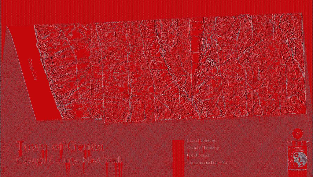
36 Insert 11 x 17 Historical Map Insert Town of Genoa Comprehensive Plan - April
37 36 Town of Genoa Comprehensive Plan - April 2013

38 Main Street (NYS Rt. 90) in the Hamlet of Genoa (date unknown). (Source: Hamlets and Historic Settlements Since its early history, agriculturally-based enterprises comprised the mainstays of Genoa s economy. The abundant creeks and brooks throughout the Town provided energy for grist mills and saw mills that once existed throughout the Town. In addition to the superior soils for farming, reliable sources of water power, and scenic setting of rolling hills and lake views; it was the early transportation linkages by way of canal, lake, railroad, and early highway that spurred the growth of the Town of Genoa and each of it s rural hamlets. In 1875, the Cayuga Southern Railroad crossed the Town along it s western boundary at Cayuga Lake. The Utica and Elmira Railroad also crossed the Town running north and south just to the east of center. What was then known as The Fourth Great Western Turnpike (NYS Scenic Route 90) carried east-west travellers across the Town of Genoa to and from the shores of Cayuga Lake where connections by ferry and steam boat could be made from the Cayuga-Seneca Canal, to the Erie Canal between Buffalo and New York City. Town of Genoa Comprehensive Plan - April

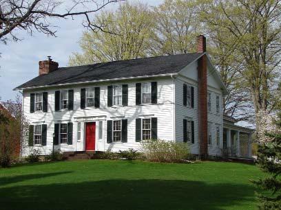
39 To quote author, Elliot G. Storke ( ), Genoa, in the late eighteenth century, was a place of industry and thrift, and substantial and enduring wealth...the result; manifest alike in material, mental and moral progress. 5 The Town of Genoa (organized as Milton in 1789 and then named Genoa in 1808 for Genoa in Piedmont, Italy), really was a place of industry, prosperity, and purpose, and this fact is evident to this day in the many surviving large and gracious homes, and the churches occupying lands at it s primary nodes, and along the Town s historic thoroughfares. From the earliest days of settlement, goods and services were brought and sent by way of canal via Cayuga Lake, or railroad, many manufactured locally. As a result of both it s wealth of natural resources, and it s location on the Erie Canal-linked lake, railroad, and early westward highway, the Town of Genoa and it s residents prospered into the early twentieth century. Canal boats from Springport shipped pork, lard, butter, eggs, apples, potatoes and ash to Albany, Oswego and Syracuse. Unfortunately, by the mid-twentieth century the robust economic prosperity of the Town began to fade, along with the role of railroads and canalways, and the economy of rural central New York State. Remnants of the Town of Genoa s economic heyday, exist today in the large and architecturally-detailed historic structures that remain scattered throughout the Town. Some seem to appear as ghosts from the past, still standing in delicate shell form, with bare wood, weathered-grey, and surrounded by the rich farmland that, in part, brought such prosperity to the Town s people. 5 From The History of Cayuga County by Elliot G. Storke 38 Town of Genoa Comprehensive Plan - April 2013

, faces east atop the hill on Indian Field Road.")
40 A gracious old home on Clearwater Rd. just above the 19th century location of King Ferry Station on the shore of Cayuga Lake. A large old house in the Queen Anne and Shingle-style (c c.1900), faces east atop the hill on Indian Field Road. Town of Genoa Comprehensive Plan - April


41 This Georgian-style farmhouse on NY Scenic Route 90 at the east edge of the Hamlet of Genoa appears on an 1853 map of the Town of Genoa and survives today as a part of a working farm (May 2011). Commercial development at the Hamlet of Genoa on approach from the north at the junction of Rts. 34 and Town of Genoa Comprehensive Plan - April 2013

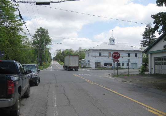
42 Aerial image of the Hamlet of Genoa (Source: The Hamlet of Genoa Genoa Village, as it was once known, is located in the northern part of the Town on Salmon Creek. Through the early part of the twentieth century, a rail station on the Utica, Ithaca and Elmira Railroad was located in Genoa, helping to spur early commercial and residential development in the hamlet. Grist mills and flour mills were established along Salmon Creek where reliable water-power was available. For many years during the nineteenth century, threshing machines and steam tractors were manufactured in the Hamlet of Genoa in support of agricultural operations in the Town and across the region. The physical form of the hamlet s development corresponds to the paths of the Salmon River, the former north-south railroad, the old east-west turnpike (Rt. 90) and an early north-south carriage route through Cayuga County (Rt. 34). Although domestic manufacturing and small, local business in Genoa have evolved to include twentieth and twenty-first century commercial and industrial economies of scale; a diversity of successful commercial operations in Genoa has continued. With few exceptions, most development, or lack of development in the Hamlet in recent years has been in response to improved roadways that have facilitated high-speed or heavy over-the-road industrial and through traffic. Not unlike many rural hamlets across central New York, one corner of Genoa s busiest crossroads (Rts. 34 and 90) is occupied by an expansively paved gas station and convenience store (pictured at left). Town of Genoa Comprehensive Plan - April
 in 2011, where many of the stately homes and trees remain.")
.")
 in May 2011.")
43 Entering the Hamlet of Genoa from the east on NYS Scenic Route 90 (Main Street) in 2011, where many of the stately homes and trees remain. At left, the Genoa Firehouse and Master s Store on Main Street, date unknown (Source: rootsweb.ancestry.com). Below, the same buildings in commercial use along the side-walked Main Street (NYS Scenic Route 90 in the Hamlet) in May Town of Genoa Comprehensive Plan - April 2013
.")

44 Smith s Store on a tree-lined Main Street in the Hamlet of Genoa, was established in (Source: rootsweb.ancestry.com). Smith s IGA has been in the same building since 1890, although modifications to the building s lower facade and roof, and other physical changes to the streetscape are evident. The loss of the large Elm trees that once lined the Main Street in Genoa are no longer there. Smith s IGA served the community until its close of business in Town of Genoa Comprehensive Plan - April
.")
45 An 1859 map of the Hamlet of Genoa on the Salmon River (Source: 44 Town of Genoa Comprehensive Plan - April 2013

.")


46 Main Street in the Hamlet of Genoa, December (Source: Above, Genoa Academy (date unknown). At left, Genoa Presbyterian Church Below, Genoa Hospital in1906. (Source: genealogy.rootsweb.ancestry.com). Town of Genoa Comprehensive Plan - April

47 Aerial image of the Hamlet of King Ferry (Source: The Hamlet of King Ferry King Ferry was once known as Northville. Situated on a beautiful plateau in the north-west part of the town, the Hamlet is approximately eight miles south-east of Aurora. Prior to the twentieth century Northville (King Ferry) was home to three churches, Presbyterian, Episcopal, and Catholic, a district school, two general stores, one drug store, one shoe shop, a harness shop, a hardware store and tin shop, a blacksmith, one hotel built in 1849 and a population of about 300. The Northville Temperance Society was formed in August In that same year, in the west half of the Town of Genoa, there were two distilleries, four licensed hotels and four stores, selling about 250 barrels of ardent spirits. History has it that only eighteen individuals in the town could be induced to sign the pledge, and notwithstanding the Society first met with violent opposition, in the fifth year after its organization not a license was granted in the town. In 1836, some public-spirited citizens formed a stock company and built a steam flouring-mill. King Ferry post-office was established at Ogdens Corners, in 1807, with Capt. David Ogden, Sr. as postmaster. The office was kept in a wing on the north side of his house, one mile west of Northville, until 1822, when it was moved to Northville. 6 For a time, the Hamlet of King Ferry was home to a glove factory. Today, King Ferry is home to a winery, a marina, and both Genoa and King Ferry have hotel accommodations and restaurants. 6 From HISTORY OF CAYUGA COUNTY, NY , BY Elliot G. Storke 46 Town of Genoa Comprehensive Plan - April 2013


48 King Ferry, Town of Genoa map, (Source: (Source: Town of Genoa Comprehensive Plan - April
.")

49 Main Street, King Ferry, date unknown (Source: Lighthouse in King Ferry, 1960 (Source: 48 Town of Genoa Comprehensive Plan - April 2013

.")
50 (Above) The King Ferry Post Offi ce that once stood on the northwest corner at the center of the Hamlet of King Ferry, date unknown. The King Ferry Hotel can be seen at the left of both photos. Today, the signifi cantly widened roadways at the junction of Routes 90 and 34B (below) have take the place of the old post offi ce and carriage parking. (Source for top image: genealogy.rootsweb.ancestry.com). Town of Genoa Comprehensive Plan - April


51 Looking east on State Scenic Byway Route 90 in the Hamlet of King Ferry, June Our Lady of the Lake Catholic Church in King Ferry, June An historic building at the intersection of Routes 34B and 90 in the Hamlet of King Ferry, June Green space at the northeast corner in the Hamlet of King Ferry, June King Ferry Presbyterian Church in King Ferry, June Town of Genoa Comprehensive Plan - April 2013


52 King Ferry Golf Club, overlooking Cayuga Lake in King Ferry, NY June King Ferry Hotel at the Hamlet crossroads in King Ferry, NY June Treleaven King Ferry Winery in King Ferry, NY June The Rural Life Museum and Genoa Historical Association in King Ferry, NY June Town of Genoa Comprehensive Plan - April


53 Several crossroads in the Town of Genoa were historically areas of settlement, including East Genoa, Five Corners, Goodyears, Belltown, and Atwater. East Genoa, June Five Corners, June Goodyears, June Belltown, June Atwater, June Old Atwater Post Office Building, now a private residence, 6/ Town of Genoa Comprehensive Plan - April 2013

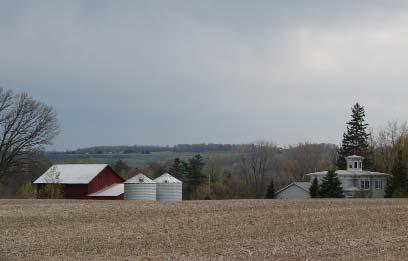
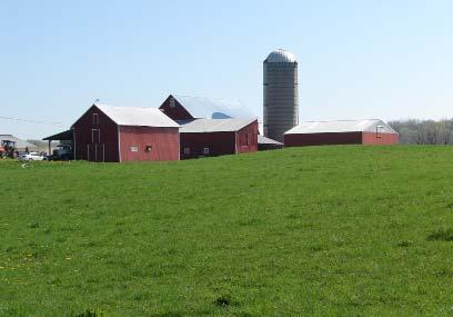
54 The scenically unique rural-agrarian landscape of the Finger lakes Region. This view is looking southwest across a farm field from Powers Road in the Town of Genoa, May Historic and Cultural Resources The Rural-Agrarian Landscape As described by O. D. Von Engeln in his 1988 book The Finger Lakes Region, Its Origin and Environment, the Town of Genoa is located in a region that is scenically unique. Von Engeln s description of the geographical environment of the Finger Lakes Region with its general expression wide farm acres and level upland pastures [amid] long, narrow, roughly parallel lakes...with high, almost cliff-steep shores.[and] narrow, deep gorges is an accurate description of the landscape surrounding the Town of Genoa. Located along the NYS Designated Scenic Route 90, Genoa is in the picturesque region of the eastern Finger Lakes, with some extraordinary cultural resources in its historic architecture and scenic farmlands. NYS Routes 34 and 34B from the City of Auburn to the north, cross the Town of Genoa continuing south to Ithaca in Tompkins County. There are scenic vistas of farmland gently sloping toward Cayuga Lake along Route 34B in the western end of the Town of Genoa. Route 34B is a scenic rural two lane road featuring picturesque farm fields with historic barns and buildings along its course. Route 34 bisects the Town to the east of center at the Hamlet of Genoa and continues south to the Hamlets of East Genoa and North Lansing. Several roads in the Town of Genoa offer scenic views of nineteenth century community buildings, farm houses and barns surrounded by farm fields. Many of these homesteads are grand in architectural style and in scale, and reflect the once booming economy of the Town of Genoa which thrived on commerce related to well-travelled routes over land and by way of Cayuga Lake and the Seneca-Cayuga Canal. Some of these historic buildings have been refurbished, and others are rapidly deteriorating for lack of investment. Town of Genoa Comprehensive Plan - April


55 Some of the many wonderful cultural resources in the Town of Genoa, photographed by Dan Thayer in Town of Genoa Comprehensive Plan - April 2013
56
57 56 Town of Genoa Comprehensive Plan - April 2013
58 Demographic Profile Population Cayuga County s total population for 2010 was 80,026, a 2.4% drop in population since The largest proportion of this population resides within the center of the County and includes the City of Auburn with a population of 27,687, surrounded by the five towns of Sennett, Throop, Owasco, Fleming and Aurelius. Other than the City of Auburn, there are twenty-three incorporated towns in Cayuga County. The total number of households in the County is approximately 32,038, with approximately 12,272 of those in Auburn. Although the County offers a diversity of housing choices, the majority of homes were built before 1939 and the County is well known for its wealth of 19th century architecture. In the year 2000 the US census numbered Genoa s total town population at 1,914. The 2010 census shows an increase of 21 people over the decade to a new total of 1,935. It is worth noting that there was a more thorough participation by the public in this last census. Most of the towns in the southern part of Cayuga County also gained modest numbers, with the exception of the town of Moravia which lost 414 people, over 10% of its population. All northern towns lost people. Sterling being the highest percentage change at -11.4%. The City of Auburn went from 28,574 to 27,687, a loss of 887 residents or -3.1%. Hispanic or Latino (of any race) went up from 46 to 66 people officially on the census. However, being an agricultural community, we may have substantially more among us during times of harvest. There is also the question of whether we are getting an accurate count on the census as to the number of Hispanic people that live here. Despite all the encouragement to participate in the census; understandably, there had to be some noncompliance due to immigration issues. One disturbing trend to watch for in the new census as it becomes available is the disappearance of a certain sector of our population; that is, the year olds. This segment which once made up a majority of adults is now despairingly low. In the 2000 census there were a 192 of this age group; while in the same year, the group numbered 320. There were to 24 year olds in Income In 2000 the median household income in Genoa was $43,618. In 2000, 8% of the total population in the Town of Genoa (including children) lived below the poverty line. The national average wass around 12%. Housing The median home price in January 2012 was $154,900 in Genoa. From what I could ascertain our property tax rate (together with county and school) is currently about $27.98 per $1000 assessed value. If your house is assessed at $155,000. You can expect to pay about $4336 in annual tax. Business/Economic Base It is estimated that a staggering 70% of our employable people work outside the town, and that the average commute is 27 minutes. In addition to the many agricultural operations in the Town of Genoa, there are a number of small businesses serving local markets, and a few that supply regional products and services. Local products include Town of Genoa Comprehensive Plan - April
59 organic farm-grown produce, home building services, furniture and cabinets, paper and fabric design, physical therapy, hair salon, cut flowers and perennials, energy, and real estate. Municipal Infrastructure and Services The Town of Genoa has two voting districts. Genoa Town government consists of an elected Town Supervisor, Town Clerk/Registrar, Highway Superintendent, Water Superintendent and Clerk, Town Justice, Court Clerk, Assessor, Bookkeeper, Code Enforcement, Dog Control, and Historian. Power lines in the Town are owned by New York State Gas and Electric, and there is a sub-station located on Route 90 close to the intersection of Indian Field Road. There is no natural gas available in the town. Telephone lines are owned, and service provided by Verizon. There is a cell phone tower at the intersection of Route 90 and Lake Road, and a grouping of satellite dishes for internet/cable at the top of Pine Hollow Hill. Town of Genoa has been exploring a variety of high speed internet options for the town, taking into consideration the availability, cost, and reliability of several technologies and exploring possible sources of grant funding to support the development of necessary infrastructure. The lack of quality high speed internet is impacting local businesses. The Town is exploring options for wireless internet, or radio from 12 towers (including one across the lake) to provide 90% coverage. There is an urgent need for high speed Internet in the town. The lack of high speed Internet has seriously impacted the town s small businesses. Many small business owners have stated that had they known about the town s Internet situation they would not have settled here. Area students and many households are also negatively affected by the lack of Internet service. Grant proposals have been submitted over the last four years but all have been turned down. The town does not have municipal household waste pick up. Commercial haulers privately contracted by each individual household pick up household waste. Some households choose to take waste to the Auburn landfill or the Ledyard Transfer Station. Many households are burning their trash in open barrels. New York State has implemented a law banning the burning of household waste. A side effect of not having some sort of municipal solution is the dumping of household trash along roadsides, open areas, gorges and streams. There has been discussion of establishing a transfer station similar to the Ledyard Transfer Station, which is open on Saturdays, and also that the Town of Genoa share a transfer station with a neighboring town. The town is serviced by the Southern Cayuga Ambulance Service. The ambulance service is located on Route 34B in the Village of Poplar Ridge. The Southern Cayuga Ambulance Service is located on Route 34B in the Village of Poplar Ridge and serves the towns of Genoa, Scipio, Venice and half of Ledyard. The Town of Genoa contributes each year for services to the town. Southern Cayuga has one Advanced Life Support Ambulance (ALS) plus equipment and trained personnel and can provide almost all emergency room services in the field, receiving about 300 calls a year, more than half are ALS level calls. The service contracts with the four towns that provide a budget of $40,000. The amount each town pays is based on how many calls they had the previous year and the population base. The town of Genoa currently pays $13,000. per year. This budget along with billing for calls pays for the staff. Up until 2010 there was an Ambulance Guard program where subscribers paid $35 to $45 annually to be covered with services. This has been temporarily discontinued awaiting the ruling of the New York State Attorney General s office. The income of about $10,000 a year is sorely missed. Southern Cayuga has done well with grants, most recently a $20,000. grant for a new cardiac monitor. The ambulance service has concerns about housing code issues and is hoping that the new code enforcement officer. will remedy the situation. The future might include a merger with 58 Town of Genoa Comprehensive Plan - April 2013

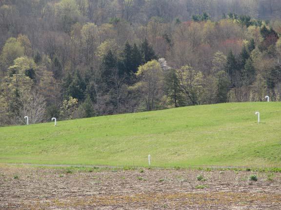

60 Town of Genoa Comprehensive Plan - April
61 Four Towns Ambulance Service based out of Moravia although they are currently not open to the idea. If the two joined they would be providing service to eight communities, they could have more employees and possibly offer health insurance to the employees. There are two fire departments in the town, Genoa Fire Department located on Route 90 in the Village of Genoa and King Ferry Fire Department located on Route 34B in the Village of King Ferry. A single Fire Commissioner, elected to a 5 year term, presides over the two fire departments. A Fire Chief for each department, is elected by the firemen for a 1 year term, a District Treasurer, is also elected, and there are nine EMTs. All equipment gets regular servicing and testing. Genoa Fire Department has 40 all volunteer members on the roster. Eighteen or nineteen are certified interior firemen, and several are new young members, but 10 to 15 members will be retiring in the next ten years. Call volume is increasing. Eighty percent of the calls are EMS calls, including motor vehicle accidents, and many calls to other districts. Genoa is the first alarm for Moravia. The high call rate to other districts is due to the special equipment and ample personnel in Genoa (village). In addition to calls to other districts, there are other reasons for calls including Meth Labs and traffic incident calls. The average response time is 4 minutes. Fire and emergency communications services are all on the same system with police communications separate. The radio towers, are date from the 1940s and 1950s, and they often go down, especially the one at Frozen Ocean. When this happens, the signal for a call cannot reach the department - a very serious situation. When it is a known problem the fire department has a member sitting by the phone in case a call comes in because the southern end of the county cannot receive the 911 signals. The call is then made by phone to members. The fire fighters can be paged, but the ambulance services cannot. An estimate to fix this problem for all of Southern Cayuga was $22 million, and this situation needs to be addressed immediately. The Genoa Fire Department is considering joining more closely with the King Ferry Department, possibly have one district with two companies. This has been discussed along with installing hydrants along Route 90 in the future. It has been noted that there are many dangerous code violation situations existing in the Town that need to be addressed. There are no municipal sewer systems in the town of Genoa. The Town of Genoa water district is self supporting and serves approximately 900 people with 290 service connections. The average hook-up uses 60 to 70 gallons a day. The highest total water usage for one day was 147,000 gallons, which is well under top capacity. All other homes and businesses receive their water from wells, springs or the lake. The area included in the water district is: Route 90 from Route 34 west through the entire Village of Genoa continuing west through the Town of King Ferry continuing west to the intersection of Lake Road and then north to the Migrant Camp; Clearview Road west from Lake Road to the Richard May home; from the intersection of Route 90 and Route 34B south to the Shaw farm and north to the end of the Fessenden farm; and from the intersection of Route 34 and Route 90 north on route 34 to the DeForrest home. The system is old, dating from 1964, with mostly 6 inch to 8 inch asbestos lined concrete or iron pipes. None of the system has been updated or replaced. There is a risk of the pipes failing, especially at road and creek crossings, such as happened at Bradley Street (in the Village of Genoa) and at the bottom of the hill on Route 90. The Town of Genoa water supply comes from the Salmon Creek aquifer. Town water is naturally filtered and also treated with chlorine, and combined with it s natural fluoride content, and has always passed Health Department guidelines for water quality. There are four wells at the municipal well site on the Maple Street Extension in the Village of Genoa. Three can operate up to 150 gallons/minute, while the fourth can 60 Town of Genoa Comprehensive Plan - April 2013
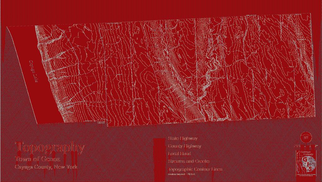
62
63 62 Town of Genoa Comprehensive Plan - April 2013
64 operate up to 100 gallons/minute. They are shallow wells averaging about 36 feet deep. The fourth well was dug during the drought of The pumps are centrifugal except the small one, which is operated manually. There is a 5 year old propane generator to supply power if needed. The Town has two water towers. One holds 238,000 gallons and the other holds 138,000 gallons. They fill at night using the night rate, and the small pump helps to keep the towers full. The Cayuga County Health Department sets the guidelines for water quality. Tests occur at regular intervals. Some tests are every year, some every three years, some every five years while some are monthly or at other intervals. The system is tested before and after water treatment. Temperature and other tests check for direct flow and any influence from the local creek. The water is naturally filtered and only treated with chlorine. The water has natural floride. Every customer receives an annual report on water testing results, and a water report is read at the monthly town meeting. The system has never been found to be over or even close to the limits for poor water quality. The Cayuga County Health Department would like to see the town have a second source of water in the event the existing wells are compromised and not able to provide water. The current back up plan is delivering water by truck from the Bolton Point in Lansing and Union Springs facility in Union Springs. The best possibility for a second well site would be Pine Hollow/Locke Woods on the far eastern side of the Town. Bolton Point Water System in Lansing and the Fleming Water System have been mentioned as possibilities. Drawing water from the lake would be too expensive due to the water treatment process, and the Aurora Water Plant is too old to consider. Currently the town is paying for legal assistance to re-do the Water District, and working on new map. The Town Highway Department is located on Route 90 in the Village of Genoa. The Highway Department has four full time employees, three 10-wheeler trucks, a ditcher/excavator, a payloader, a wood chipper, a tractor with a cutter for roadside mowing and a broom to clean intersections, one-ton pickup truck, one old 4WD plow truck for just in case, and a water hauling truck for water district use. The department services all of their own equipment and only use outside help if they are unable or not equipped to handle a repair. Approximately ¾ of the town budget is dedicated to roads and highways. The Town Highway Department maintains Town roads and is also under contract to plow and sand 11 ½ miles of State Roads (34, 34B and 90) and 17 miles of County Roads. The highway department has been gradually transitioning all of the town roads from gravel to macadam. This is an ongoing process and will continue in the future. A plan is in place to spread out ongoing road maintenance so that the town does not have to borrow money or float a bond. There are some bridges in the Town that will need repair/replacement, for example, the bridge on Creek Road is on the state list to repair possibly in 2014, and it is expected that funds will be provided by a state grant. Other concerns include out-of-town trash haulers using Routes 90 and 34B that present safety issues and cause damage to Town roads. Additionally, there is an increasing problem with repairing damage to roads caused by extremely large industrial farm equipment and trucks. There are no medical facilities in the Town of Genoa. The nearest doctor is at the Community Medical Center in the Village of Aurora. The nearest hospitals are located in Auburn, Auburn Memorial Hospital, Cortland, Cortland Convenient Care, and Ithaca, Cayuga Medical Center and Guthrie Clinic. There are numerous doctors, dentists, and other health care providers in Auburn, Cortland, and Ithaca. There is a physical therapy facility in the Village of King Ferry, as well as one veterinarian. Children in the Town of Genoa attend school in the Southern Cayuga Central School District. There are less than 800 children in the entire school system. The majority of children are bused to school. Children in grades pre kindergarten through 5th grade attend the Emily Howland School in the Village of Sherwood. Town of Genoa Comprehensive Plan - April
65 Grades 6 through 12 go to the Southern Cayuga High School building in the Village of Poplar Ridge. Grades 6 through 8 are in the middle school and grades 9 through 12 are in high school. All housed under the same roof. High School Students wanting a technical/trade education may attend the BOCES school complex in Auburn and are bused to school. There is a small private elementary school, Peachtown School, in the Village of Aurora. Each year the number of children attending school in the district has been decreasing. The decrease has resulted in cutting teachers, higher costs and empty class- rooms. There are two former Town school buildings now in private ownership, one on route 34b and the other on Academy St. The Emily Howland School, housing grades K through 4 is to close in June of There are no libraries in the Town of Genoa. The nearest libraries are Aurora Library, located in the Village of Aurora and the Hazard Library located in Village of Poplar Ridge. Both libraries are members of the Fingerlakes Library System. True community interaction is facilitated through direct personal association in a conducive physical location, and despite the current trend to the contrary, churches can still serve as centers of community engagement. There are numerous Christian churches in the community, but no mosques, synagogues or temples. Town of Genoa churches have been declining in membership and vitality in recent years. The occupied buildings are in good condition, especially the three in King Ferry, which have all had substantial renovation work done recently. As of 2011, there are five active churches in the Town, all being Trinitarian, two of which meet in the same sanctuary. The five are: Our Lady of the Lake Church (Roman Catholic) Located in King Ferry; Covenant Community Church (Evangelical, independent) Located in King Ferry; First Presbyterian Church of King Ferry (PCUSA); United Church of Genoa; and, International Church of Jesus Christ (Services in Spanish) Located in Genoa. Concerns cited by local church members include the aging and decline of membership; the loss of interest of young adults many of whom leave the town altogether (less than 5% of town residents attend a local church); the lack of opportunity for work or career advancement for young people; not enough effort to make the youth in the community feel welcomed, loved and appreciated; drug and alcohol abuse in the community; and an overwhelming sense of apathy in the community. A noted apprehension towards change and new ideas among the community may forestall needed solutions. Some of the concerns expressed by the community include the general poor appearance of the town including homes and businesses, and the four corners of King Ferry was mentioned often; the lack of commerce and jobs; the large CAFO dairy farming methods that make the community unattractive for new families to move into town; new companies are not willing to spend capital in a no growth district; big truck noise; and high property taxes. Some of the suggestions made by the community include: having more fun events for families and children such as the Wheat Harvest Festival; young peoples recreation area - playground, ball field, a large play room for winter; providing a place for teenagers to meet, so they don t hang around on main street; a large banquet hall for receptions; more use of trash or recycling collection site in the town; and sidewalks in King Ferry. There continues to be a push to make the public school center of community involvement, however, the school is five to twelve miles away for most in the Town. Also, schools have a particular function and are not necessarily suited to meet certain community needs. The Genoa community could focus on the available resources that local churches may represent as lovely buildings with welcoming congregations where community events, lectures, and ensembles might take place. A sign of hope in the community is the conscious effort to act more locally. People are trying to make a difference in their neighborhoods. There is a more deliberate local shopping and hiring of local services going on. 64 Town of Genoa Comprehensive Plan - April 2013
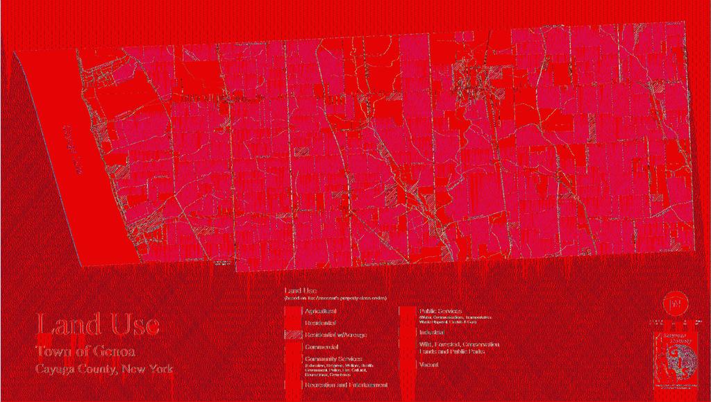
66
67 66 Town of Genoa Comprehensive Plan - April 2013

68 There are two food pantries in the town. The pantry in King Ferry is operated out of the Lady of the Lake Catholic Church, located on Route 90, however it is not affiliated with the church. The pantry services about 96 households in the Southern Cayuga School District including the migrant camp in King Ferry. The Genoa Food Pantry, located on Route 90, is operated out of the United Church of Genoa although it is not affiliated with the church. It provides service for any household in need in the Southern Cayuga School District. Land Use and Zoning There is currently no zoning in the Town of Genoa. The principal land uses in the Town are agricultural (75%), residential (18%), vacant land (5%), commercial/industrial (1.2%), and lakefront. Genoa has a minimum lot size requirement of 40,000 sq. ft. and a minimum 80,000 sq. ft. requirement for subdivision of land in the Town. Future land use policy in the Town should seek to address issues of community concern (see pages of Chapter 1). Specific land use goals and recommendations can be found under Goals 5, 6, 8, 10 and 13, in Chapter 1. 7 Natural Resources and Environment The natural setting of the Town of Genoa, on east and west elevated plateaus, gently sloping toward the west and Cayuga Lake, features vast areas of open agricultural fields and rich soils through which Salmon Creek and little Salmon Creek course on their way to an outlets on Cauyga Lake in the Town of Lansing to the south. Due to its location amid the eastern Finger Lakes, the Town of Genoa has a somewhat extended growing season even though it receives heavy amounts of snow in winter that are typical of Central New York State. The unusual topography of this region results in a great diversity of landscapes and ecological types within relatively small geographical areas like the Town of Genoa. A windy ridge crosses the Town from north to south accompanied by open agricultural fields and expansive views. There are also significant areas of hardwood forest, occasional out-croppings of limestone, wooded ravines with rocky waterfalls, and a mix of rocky and sandy shoreline along Cayuga Lake. The Town of Genoa 7 For more detailed information on Land Use Law in New York State, see Pace University Law School s What is Land Use Law, A Beginner s Guide on-line at Town of Genoa Comprehensive Plan - April
69 Salmon Creek Valley, looking southward (photo courtesy of Dan Thayer). features large, open areas of nearly flat land on a split, gently sloping plateau between the south end of the Owasco Inlet and Cayuga Lake. Over all the Town slopes gently to the west from an elevation of 1150 feet at its highest ridges to Cayuga Lake at an elevation of 381 feet. Areas of steep slopes exist along the center of the Town along Little Salmon Creek, and along the west edge of the Town at Cayuga Lake. Along these areas of the Town, the elevation drops abruptly at over 15% slope in many places to the creek and Cayuga Lake. A series of five or more ravines and deep gullies in the shale rocks, some forming beautiful cascades, have been cut by small streams that traverse the sloping lands draining the highlands above the lake. Cayuga Lake Carved into the Appalachian Plateau in Central New York State by Pleistocene glaciers, the 435-foot deep Cayuga Lake is a major natural resource in the Central New York Region. Cayuga Lake is the longest, widest and one of the deepest of the eleven Finger Lakes, and it is the second-largest at 38.2 miles long, 1.75 miles average width, with a shoreline of over 95 miles. This spectacular topography of the lake and its watershed was formed through periods of glacial advance and recession which deepened and widened the Cayuga Lake Valley and smoothed the surrounding hills. Because Cayuga Lake is so large and deep, water that enters the lake takes over 10 years to cycle through it. The economic and natural resources provided in the Cayuga Lake Watershed have a long history of cultural and economic value to Genoa residents and visitors alike including agriculture, tourism and recreation, real estate, industry and commerce, wildlife, parks, fisheries, wetlands, forestry, and water. There are four miles of Cayuga Lake shoreline in the Town of Genoa, and yet, the Town owns no lakefront land. Considering 68 Town of Genoa Comprehensive Plan - April 2013
70 the scenic, ecological, recreational and economic value of Cayuga Lake shoreline, this is a significant loss for the Genoa community with no public access available to the community to the Town s most valuable natural and recreational resource. Cayuga Lake Watershed is part of the Oswego River Basin in Central New York State and a diverse system comprised of many contributing hydrologic components. Water in this system flows from upland streams to the Finger Lakes, to low-grade rivers and the New York Barge Canal via the Seneca-Cayuga Canal, and ultimately to Lake Ontario. Within the Oswego River Basin, Cayuga Lake is downstream of Keuka and Seneca Lake with Keuka Lake waters flowing into Seneca Lake via the Keuka Lake Outlet and Seneca Lake waters flowing into the extreme northern end of Cayuga Lake via the Seneca-Cayuga Canal. The Cayuga Lake Watershed, the largest of the Finger Lakes, covers 785 square miles (approximately 500,000 acres) of agricultural, residential, industrial, and forest land. The dominant surface water feature of the basin is the lake itself, but a network of more than 140 streams flow into the lake, and the northern outlet of the lake receives about 48 percent of the total runoff from the Oswego River Basin s 5,100 square miles, before it flows into the Seneca River and on to the Oswego River and Lake Ontario. There are six counties and 44 municipalities (cities, towns, and villages) located within the land area of the Cayuga Lake Watershed, and it is home to over 120,000 people. The Cayuga Lake Preliminary Watershed Characterization, 2000 notes that the soils of the Cayuga Lake Watershed are among the richest and most fertile in the nation. According to the 1992 Census of Agriculture, the hundreds of farms (cash crop, beef and dairy) in the watershed generate annual receipts of approximately $176,423,000. The watershed s beaches, rivers, and lakes are an attractive vacation destination, and tourism and recreational activities include boating, bicycling tours, hiking, sport and recreational fishing, hunting, bird watching, swimming, and camping. Proximity to Cayuga Lake raises home values significantly, and the beauty and bounty of the Finger Lakes Region attracts businesses and educational institutions seeking a high quality of life for their employees and families. The watershed supports both warm and cold water fish, including lake trout and four species of salmonids. More than 6,000 acres of high quality wetlands exist in the watershed along with thousands of acres of valuable forests important for timber, wildlife, recreation, and water quality. Many communities and hundreds of households depend on both surface and ground waters of Cayuga Lake and its watershed for their drinking water. 8 The Cayuga Lake Watershed is an important link in the waterfowl flyway of the Atlantic Coast with seasonal visitation of approximately 314 bird species, including many shorebirds and waders. There are seven state parks and numerous county/town parks that provide public access to the lake as well as preserve the integrity of various natural resources. Unfortunately, even with four miles of the western shore of Cayuga Lake, there is no public access to the lake in the Town of Genoa. 8 Source: Town of Genoa Comprehensive Plan - April


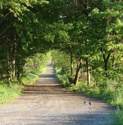
71 Photos of the Town of Genoa, courtesy of Dan Thayer. 70 Town of Genoa Comprehensive Plan - April 2013
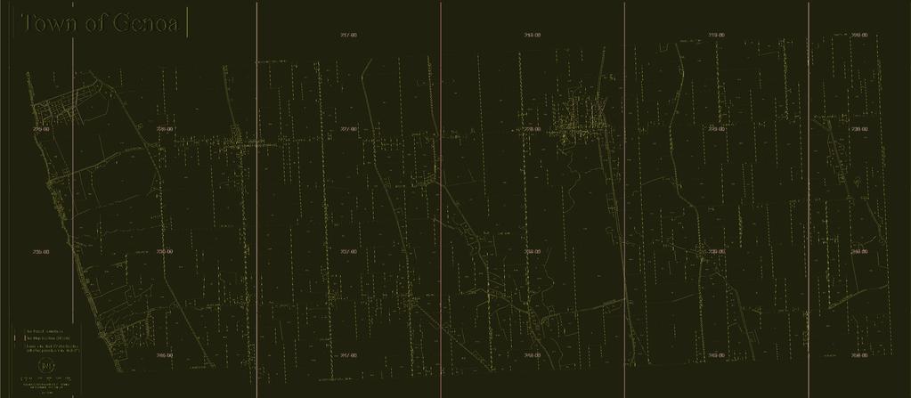
72
73 72 Town of Genoa Comprehensive Plan - April 2013


74 Photos of the Town of Genoa, courtesy of Dan Thayer. The NYS Department of Environmental Conservation has placed the south basin of Cayuga Lake on a list of impaired waterbodies since sediment and phosphorus were identified as primary threats to the lake. Phosphorus attaches readily to soil particles along with other pollutants that travel by way of runoff to the lake. 9 Forests and vegetation on the steep slopes above Little Salmon Creek, Salmon Creek and Cayuga Lake serve as important buffers by filtering out and minimizing sediment and nutrient runoff into the lake. The quality of stormwater run-off from the many creeks and streams in the Cayuga Lake Watershed is also key to maintaining the existing quality of the lake water which serves as a public water supply. Roadway pollutants and nutrient and chemical run-off from agricultural practices in combination with unchecked erosion, poorly planned land clearing, insufficient vegetated buffers (including mown lawn), have the potential to severely impact the quality of the resource. There are currently no special requirements in the Town for the preservation of these important vegetated buffer lands adjacent to the Towns streams and along the lake shore. 10 The Town of Genoa water supply comes from the Salmon Creek aquifer. 9 Source: 10 Source: Audubon Society, le.do?siteid=2807&navsite=state, and Skaneateles Highlands Conservation Planning and Stakeholder Survey Project, Finger Lakes Land Trust and CNY Regional Planning and Development Board, Town of Genoa Comprehensive Plan - April

75 Wetlands The Town of Genoa has over thirty federally and state recognized wetlands. Many of the Town s wetlands are wooded and are perched in the agricultural plateau land above the lake. Along the rim of the head of the plateaus above the creeks and lake, several miles of steeply sloping lands drain the Genoa highlands by way of a multitude of streams and rivulets that feed the creeks to Cayuga Lake. Many of these tributary drainages have been channelized and directed through vast stretches of farm fields where high concentrations of nutrients can enter and travel to the creeks and lake. Historically, Genoa s streams furnished numerous mill sites along their courses. Today, the gentle over-all slope of the land in the Town to the west, carries most of the runoff in the Town of Genoa to Cayuga Lake. Photo courtesy of Dan Thayer 74 Town of Genoa Comprehensive Plan - April 2013
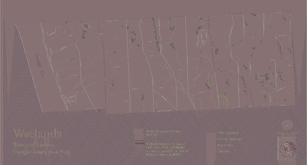
76
77 76 Town of Genoa Comprehensive Plan - April 2013

78
79 78 Town of Genoa Comprehensive Plan - April 2013


80 Photos courtesy of Dan Thayer Agriculture A full 75% of the land in the Town of genoa is in agricultural use, although some 200 parcels are considered vacant farm land. There are several thousand acres in field crops in the Town of Genoa, nearly 1,000 acres in dairy farming with the rest in cattle, livestock products and poultry. In Cayuga County, as evidenced by U.S. Census data, the number of farms has dropped dramatically in recent decades, down from over 70%, from 2,934 farms in 1950 to 873 farms in However, the number of farms in Cayuga County has grown about 7% since 1992 to a reported 936 farms in the 2007 agricultural census. Land in farming in Cayuga County, as in other central New York counties, has also trended downward steadily and significantly (33%) between 1950 and 2000 according to the U.S. Census. There are currently six agricultural districts in Cayuga County. The County Planning Board is in the process of consolidating them into three districts for more efficient administration. There are 418 Farm Bureau members in Cayuga County. The entire Town of Genoa is located within Cayuga County Agricultural District 3. The purpose of agricultural districting is to encourage the continued use of farmland for agricultural production. Based on a combination of landowner incentives and protections, districting is designed to forestall the conversion of farmland to non-agricultural uses. Included in the benefits to farmers are preferential real property tax treatment (agricultural assessment and special benefit assessment), and protections against overly restrictive local laws, government funded acquisition or construction projects, and private nuisance suits involving agricultural practices. The Agricultural Districts Law protects farmers against local laws which unreasonably restrict farm operations located within an agricultural district, and was established to protect and promote a farmer s opportunity to operate a successful business. Under the Agricultural Districts Law farmers are provided: - Limitations on eminent domain, other public projects, or private citizen construction projects - Protection from unreasonably restrictive anti-farming local laws - Right to Farm Law protection from nuisance lawsuits - Exemption of non-agricultural value from local real property taxes through agricultural assessment. Conflict between farmers and non-farm residents of the Town is primarily due to the impact that the spreading of manure on fields can have on air quality and water quality from runoff to nearby streams to the lake. The use of chisel and hose drag equipment to put the manure directly under the soil is a recent positive development that some farms are employing which dramatically reduces apparent environmental quality impacts of manure use, and use of this manure application method should be encouraged. Town of Genoa Comprehensive Plan - April

81 The primary land use in the Town of Genoa is agricultural. In May of 2011, there were 42 farm enterprises participating in 55 collective endeavors, meaning that some farms were active in more than one particular agricultural venture. There were 12,455 head of dairy cows in the Town, including five CAFOs (approximately 11,100 head), seven small dairies (approximately 1,155 head), and one organic dairy (approximately 200 head). There were eight beef farms including one organic beef farm. Other livestock inthe Town included three sheep farms, one poultry farm, and four horse farms. Seventeen field crop farms in the Town included four organic farms, and there were five garden plants/fruit/ vegetable farms (including two organic), one vinyard, and one seed propagation farm. All large farms in the Town, including Confined Animal Feeding Operations (CAFOs), are inspected annually and regulated by the state DEC which regulates waste water discharges, effluent limits, and requires discharge reports and annual reports from CAFOs. The DEC also performs facility 30 to 35 inspections per year including compliance activities. If a CAFO is not following regulations, the DEC can take action in terms of penalties, fines and scheduled corrective actions, but in general, Genoa farms have been found to be following their Best Management Practice (BMP) plans. Farms in Genoa make use of Agricultural Environmental Management (AEM) practices and new agricultural technology to improve practices, and organic farming in Genoa is a growing industry sector. Although large farms in the community use local labor, available local labor is insufficient to meet these farms needs, and as a result, farm laborers from outside the Town are recruited. Genoa has a long history of farming and derives it s much-valued rural character from the existence of productive farmlands in the Town. It is important that the Town remain supportive of agricultural production operations that are in compliance with applicable regulations. Farmland preservation is an important component of rural community planning and should be an active agenda item for the Town of Genoa. A town with a comprehensive plan can submit three Purchase of Development Rights (PDR) applications per year to the county. The County can select and submit up to five applications for PDR funds to the State of New York. New York State decides which farms are to be awarded PDR funding with a cap of 2.3 million dollars per County. After the PDR is set up, a land trust monitors the protection of the farmland in perpetuity. 80 Town of Genoa Comprehensive Plan - April 2013
82
83 82 Town of Genoa Comprehensive Plan - April 2013
84 Map showing the location of six current agricultural districts in Cayuga County (Source: Cayuga County Planning, 2009). Town of Genoa Comprehensive Plan - April
.")
85 84 Map showing the proposed consolidation of the six existing agricultural districts in Cayuga County into three agricultural districts (Source: Cayuga County Planning, 2009). Town of Genoa Comprehensive Plan - April 2013
86 BioEnergy Sustainable agricultural practice such as biomass production offers potential for economic growth in agriculture in Genoa as well as for environmental benefits provided by this kind of land cover including water quality protection and habitat support. Emerging technologies in the use of biomass as a feedstock for biofuels, bioproducts, and bioenergy will likely lead to economic advantages in the development of biomass resources over many other agricultural products. Because bio-energy and bio-products from biomass offer higher net energy ratios in the generation of end products, a growing market for their use is opening up. Biomass, although not currently a significant component of Genoa land cover, can be produced and harvested on a sustainable basis as short-rotation woody crops (SRWC) such as shrub willow or as switchgrass. Biomass crops can easily be grown in ways that reduce total carbon in the atmosphere by capturing carbon in the soil, and they can be raised in areas of lower quality soils or areas that would otherwise require drainage. Untilled soil, with perennial grasses, woody crops, or no-till annual crops, not only captures carbon from the atmosphere that is held in the roots, leaves and stalks left on the soil; it also prevents soil erosion and minimizes storm water runoff and sedimentation of water resources, an especially important environmental benefit for agriculture in the Finger Lakes Region. Another benefit, with the growing economic viability of biomass production, is the preservation of Genoa s beautiful rural-agrarian landscapes. Solar Energy While Central New York may not have the abundant solar resources of Southern California or the southwestern states, it is important to recognize that Photo Voltaic (PV) systems can perform well in relatively cloudy and cold climates. In fact, cold temperatures and snow cover can actually increase the electrical output of PV modules. While cloudy regions will require larger, more expensive solar arrays than sunny regions, the size and cost of other components such as inverters will stay the same. Because a system s PV panels represent only about 30 percent of a system s total installed costs, a system installed in an area with one-half the sunlight of another area does not cost twice as much. Even in Syracuse, which averages only about 3.65 kwh per square meter per day of solar radiation capacity for the year, PV systems can be costeffective under certain conditions. There are both state (NYSERDA) and federal incentive programs in place currently to encourage both municipal and private solar energy investment. An emerging tool that municipalities can use to help spur investment in residential PV systems is the property tax assessment model, pioneered by the Berkeley FIRST (Financing Initiative for Renewable and Solar Technology) program. The Berkeley FIRST program allows property owners to borrow money from the city s Sustainable Energy Financing District to install solar photovoltaic electric systems and allow the cost to be repaid over 20 years through an annual special tax on their property tax bill. The primary innovation of this program is that, since both the solar system and the tax obligation remain with the house, if the property is transferred or sold, the new owners will pay the remaining tax obligation. Since there is little or no up-front cost for the homeowner, it eliminates the primary risk that has discouraged investment in residential PV systems, i.e., that the homeowner may move before they recoup their investment in reduced energy costs. Wind & Wind Energy Wind energy is a renewable resource that is abundant in Genoa. Due to the geography of the Town of Genoa, located at the eastern shore of Cayuga Lake with a nearby power transmission line, the Town is well situated to take advantage of this resource. Town of Genoa Comprehensive Plan - April
87 Community-based wind energy projects are typically developed by local farmers, ranchers, and investors, or local governments or educational institutions, rather than national or local professional developers and have historically been smaller in size than corporate-owned projects. Publicly-owned community-based projects have often been used to provide on-site or behind-the-meter lower-cost energy for local governments or community institutions. Unlike community-based wind energy projects, which typically use megawattscale turbines to produce electricity for export to the grid, on-site generation typically uses smaller turbines to power a facility directly, offsetting the need to purchase more expensive retail electricity. The Marcellus Shale & Natural Gas Marcellus Shale, also referred to as the Marcellus Formation, is a Middle Devonian-age carbonaceous shale that occurs in the subsurface beneath a large swath of the northeastern U.S. The Town of Genoa is located entirely within the Marcellus Formation which is estimated to contain an undiscovered resource of about 1.9 trillion cubic feet of natural gas. Natural gas occurring within the Marcellus Shale can be difficult to extract through tiny disconnected pore spaces, but recently energy companies have begun to employ a new extraction technique known as hydraulic fracturing that creates fractures in the shale and allows the gas to flow more readily through the rock and into a well bore. This extraction method involves high-pressure and high volumes of water, and a chemical gel injection to induce fractures in the rock surrounding the well bore to increase the flow of gas to the well. The hydraulic fracturing method for gas extraction in New York State is currently under review by the NYSDEC. Comments on NYSDEC s draft Supplemental Generic Environmental Impact Statement were submitted in December 2009 by the Federal Environmental Protection Agency (EPA) citing concerns about potential impacts to human health and the environment that warrant further scientific and regulatory analysis. Of particular concern to EPA were issues involving water supply, water quality, wastewater treatment operations, local and regional air quality, management of naturally occurring radioactive materials disturbed during drilling, and cumulative environmental impacts of hydraulic fracturing for natural gas extraction. Natural gas is a highly valuable resource and royalties to property owners from a well yielding over one million cubic feet of natural gas can be very high. Landowners in Towns like Genoa, within the extent of the Marcellus Shale, have been entertaining offers to lease their land for signing bonuses or royalties for gas production. In addition to protecting vulnerable water supplies, communities located within the targeted region should review local regulations to assure protection from environmental impacts such as air-born emissions, and visual, noise and industrial impacts to existing rural character. New pipeline systems, wastewater (flowback) storage tanks, 24/7 noise and lights, as well as significantly increased truck traffic on local roads are some of the potential impacts on existing rural character of hydraulic fracturing for natural gas. 86 Town of Genoa Comprehensive Plan - April 2013
88 Public Parks, Recreation and Protected Areas There are currently only about 9 acres of lands dedicated to recreational or entertainment uses in the Town. Although the predominant agricultural land use in the Town of Genoa results in vast areas of open space, the Town is comprised largely of working landscapes with scattered residential properties. There are no public Town right-of-ways to the shore of Cayuga Lake. There are 74 acres of conserved land in the Town. Town of Genoa Comprehensive Plan - April
89 Chapter 3: Regional Influences The Finger Lakes Region The Town of Genoa is located in the eastern Finger Lakes Region of Central New York State. The Finger Lakes Region, approximately midway between New York City and Niagara Falls, encompasses 14 counties with 11 lakes ranging in size from 11 to 40 miles in length with more than 650 miles of shoreline. Located in the area formed by the cities of Rochester, Syracuse, Binghamton, and the Corning/Elmira area, the region is bordered by Pennsylvania to the south and Lake Ontario to the north. Lakes in the region include Canandaigua, Cayuga, Owasco, Keuka, Seneca, Skaneateles, Canadice, Conesus, Hemlock, Honeoye and Otisco. The names of these lakes reflect the region s rich Native American heritage. The region draws visitors from all over the world to experience Finger Lakes Region Wines, stunning rural scenery, historic villages, beautiful waterfalls, and recreational opportunities that abound throughout the area during all four seasons of the year. Sixteen major cities lie within 500 miles of the Town of Genoa including Syracuse (45 miles), Rochester (79 miles), Albany (189), Toronto (205), New York City (234 miles), Baltimore (319 miles), Boston (352 miles), and Pittsburgh (339 miles). Immediate support industries in Cayuga County include trucking, warehousing and an array of small manufacturing facilities. For employment, entertainment, and other needs, the Town of Genoa has easy access to the cities of Auburn (16 miles), Ithaca (22 miles) and Cortland (23 miles) and Syracuse (45 miles) away. The nearest railroad to the Town of Genoa is the Finger Lakes Scenic Railway offering limited passenger excursion service between Syracuse and Victor, New York with a stop at Skaneateles Junction. The railway is a part of the Empire Link, a collaborative business arrangement between Norfolk Southern Corporation and ten short line railroad members of the American Short Line and Regional Railroad Associations Eastern Region with limited seasonal east/west passenger service. The railroad collaborative has also allowed the conversion of short haul truck traffic to rail, an attractive option for shippers in New York, Pennsylvania and New Jersey by using excess freight capacity on these lines. Amtrak offers daily service to major cities throughout the region from Syracuse, about 38 miles away. There are no airport facilities in the Town of Genoa. The Skaneateles Aerodrome, a small regional airport is located in Skaneateles and the Ithaca/ Tompkins Regional Airport is located just northeast of Ithaca, New York. Hancock International Airport is located in Syracuse, New York. Cayuga County is traversed by the Erie Canalway National Heritage Corridor, a 524 mile-long scenic navigable waterway constructed in 1825 connecting the Great Lakes of New York State with the Atlantic Ocean at New York City via the St. Lawrence Seaway and the Hudson River. The Cayuga-Seneca Canal, Montezuma to Finger Lakes section of the federally designated National Heritage Corridor includes the entire Town of Genoa. This National Heritage Corridor is celebrated as the birthplace of the women s rights movement, and a region of natural beauty, elegant architecture, wine country, and world-class cultural and recreational attractions. Cultural events and festivals along its route are taking root as well as an off-road multiple-use trail, currently in development, that will stretch 350 miles when completed and become the longest such trail in the nation. As the Canalway Trail continues development, it will become a significant recreational and economic asset promoted and open to hikers, joggers, bicyclists, cross country skiers, and visitors to the region, connecting and benefiting hamlets, villages and cities across New York State. In ad- 88 Town of Genoa Comprehensive Plan - April 2013
90 dition, the National Park Service is also currently working on establishing a Water Trail that will pass along the shores of the Town of Genoa on Cayuga Lake. The Cayuga Lake Scenic Byway along Route 90 lies to the west of the Town of Genoa encircling Cayuga lake. With gorges at it s southern end, vineyards on its gentle slopes, and marshes at its northern end, the Cayuga Lake Scenic Byway features diverse landscapes and spectacular views. A tour of 87 miles around Cayuga Lake leads through charming historic villages, past scenic waterfalls, parks and farmland with opportunities for bird watching and site seeing along the way. The Auburn Fleming Trail is a flat 1.6 mile trail through woods, wetlands and farmland connecting Route 34 in the Town of Fleming to Dunning Ave. in the City of Auburn. It is an easy walk or bike ride through a scenic area just to the north of the Town of Genoa. Genoa is approximately an hour s drive from the City of Syracuse and one hour and twenty-five minutes from the City of Rochester. The city of Ithaca, Ithaca College and Cornell University are approximately 26 miles from Genoa; just a 35 minute drive. Genoa is also located approximately 12 miles from each of the two county correctional facilities; Cayuga Correctional Facility in Moravia, and the correctional facility at Auburn, NY. The Cayuga County Freedom Trail passes through the Town of Genoa. Sites listed on the driving tour through Genoa include the Slocum and Hannah Howland House, Howland Tenent Houses, Opendore, Herman and Hannah Phillips House, the Letchworth Home, Emily Howland House, Sherwood Cemetery, and the Howland Stone Store Museum in the hamlet of Sherwood that features permanent and rotating exhibits related to the extraordinary lives and work of early abolitionists and equal rights proponents. The Rural Life Museum is located just a few miles south of Genoa at the intersection of Routes 34B & Route 90 in King Ferry, NY. The small visitor s center and museum features a restored one room schoolhouse and a nineteenth century threshing barn. Town of Genoa Comprehensive Plan - April
91 90 Town of Genoa Comprehensive Plan - April 2013
92 Appendix A Principals of Smart Growth Smart growth is development that serves the economy, community, and the environment. It provides a framework for communities to make informed decisions about how and where they grow. Smart growth makes it possible for communities to grow in ways that support economic development and jobs; create strong neighborhoods with a range of housing, commercial, and transportation options; and achieve healthy communities that provide families with a clean environment. In so doing, smart growth provides a solution to the concerns facing many communities about the impacts of the highly dispersed development patterns characteristic of the past 50 years. Though supportive of growth, communities are questioning the economic costs of abandoning infrastructure in the city and rebuilding it farther out. They are questioning the necessity of spending increasing time in cars locked in traffic and traveling miles to the nearest store. They are questioning the practice of abandoning brownfields in older communities while developing open space and prime agricultural land and thereby damaging our environment at the suburban fringe. As these quality-of-life issues become increasingly important for American communities, local and state policymakers, planners, developers, and others are turning to smart growth as one solution to these challenges. In the early 1990s, numerous national private sector, public sector and nongovernmental partner organizations also recognized the problems facing communities, and in 1996, they came together to form the Smart Growth Network, a broad coalition of 32 organizations that support smart growth. As a first step, the network examined the breadth of characteristics of successful communities and from that process, developed ten guiding principles for smart growth. They illustrate the characteristics associated with healthy, vibrant, and diverse communities that offer their residents choices of how and where to live, and were a first step in articulating the goals of smart growth. The ten principals of Smart Growth are: 1 MIX LAND USES 2 TAKE ADVANTAGE OF COMPACT DESIGN 3 CREATE A RANGE OF HOUSING OPPORTUNITIES AND CHOICES 4 CREATE WALKABLE COMMUNITIES 5 FOSTER DISTINCTIVE, ATTRACTIVE COMMUNITIES WITH A STRONG SENSE OF PLACE 6 PRESERVE OPEN SPACE, FARMLAND, NATURAL BEAUTY, AND CRITICAL ENVIRONMENTAL AREAS 7 STRENGTHEN AND DIRECT DEVELOPMENT TOWARD EXISTING COMMUNITIES 8 PROVIDE A VARIETY OF TRANSPORTATION OPTIONS 9 MAKE DEVELOPMENT DECISIONS PREDICTABLE, FAIR, AND COST EFFECTIVE 10 ENCOURAGE COMMUNITY AND STAKEHOLDER COLLABORATION IN DEVELOPMENT DECISIONS More detailed information is available on Smart Growth, along with technical assistance and options for forming policy direction at the local level to implement smart growth from the Smart Growth Network in Getting to Smart Growth, at and from New York State s Smart Growth Task Force at Town of Genoa Comprehensive Plan - April
93 92 Town of Genoa Comprehensive Plan - April 2013
94 Appendix B Conservation Subdivisions Small rural-agricultural towns like Genoa will inevitably face development pressures as a consequence of regional population growth and the attraction of scenic farmlands and lakefront or lake-view land for residential housing. Rural residential development, in its conventional form of two acre lots subdivided out of large agricultural parcels and commercial strip malls along rural roadways can multiply quickly to produce sprawling suburban developments that consume large areas of open space and drastically alter a Towns rural-agrarian character. The existing rural character of the Town of Genoa was the single most common reason chosen by survey respondents for living in Genoa, and is therefore an important quality to protect. There are effective land use tools for residential and other kinds of development that foster protection of the open space that is a key component of Genoa s rural character. One of the most effective methods used takes place in the process of the subdivision of land. It is called Conservation Subdivision Regulation. This method of regulating the subdivision of land is intended to preserve or protect natural, scenic, historic, or cultural features of value to a community while allowing flexibility in the overall development design and layout of major subdivisions (4 or more lots). Planning and development studies in recent years have demonstrated clear economic and environmental benefits of using Conservation Subdivision Design methods versus conventional subdivision methods. One example, The Belle Hall Study evaluated the economic and environmental costs of two different residential subdivision plans and concluded that a conservation-oriented design that maintained half of the tract as green space, yet had the same number of developed lots, had substantially less environmental impact and cost half as much to build (see below). Good design can make the difference in our perception and acceptance of density in developments and can also offer great added benefit to a community in terms of municipal cost, community amenities, environmental protection, and farmland conservation. Specifications set for lot sizes in a single residential subdivision may not seem significant, however; conventional large lot size requirements of two to five acres implemented communities across a county or region can have a staggering cumulative impact consuming open space, scenic views, and the viability of agriculture. Smart planning strategies (and land use regulation that conserves open space) result in far less land being consumed by development. These strategies also ensure that much less of the municipal budget is spent on infrastructure and community services than would be spent as a result of conventional development patterns. Conventional subdivision regulations currently in use in the Town of Genoa may not support the community s desire to protect the rural-agrarian character of the Town. Implementing a Conservation Subdivision Design approval process with a conservation site analysis prior to site plan layout could be very beneficial. This would include identifying the location of any significant natural or cultural resources on a sketch plan, followed by a dialogue between the property owner (or developer) and the planning board about the Town of Genoa Comprehensive Plan - April

95 conservation value of the lands proposed for development. The conservation method of subdivision of land is intended to allow an opportunity to preserve or protect natural, scenic, historic, or cultural features of value to the community while also allowing flexibility and an opportunity for developers to initiate creative solutions to protecting important community resources (i.e. steep slopes, scenic views, prime agricultural soils, trail corridors, stream corridors, wetlands, woodlands, historic sites, stone walls, etc.). Smart planning strategies such as conservation subdivision design, while not inhibiting development, result in far less open land being consumed in the process, and much less money spent by municipalities on infrastructure and community services than would be spent as a result of conventional subdivision design. 94 Town of Genoa Comprehensive Plan - April 2013
96 Appendix D Community Survey and Comments Town of Genoa Comprehensive Plan - April
97 Town of Genoa 2011 Community Survey Results An update from the Comprehensive Plan Committee From previous articles in the Genoa- King Ferry Tribune and meeting minutes, a Comprehensive Plan for the Town of Genoa is and has been a work in progress since the original Board request in late 2007 to form a committee to update and refine the Town s 1987 Comprehensive Plan. Much work and many meetings later, the most recent survey was prepared and mailed to landowners and residents of the Town of Genoa in July of this year. This survey was also made available in digital format on line. Announcement of this mailing and availability of the community survey was published in local newspapers along with the due date for completed paper surveys to be returned to the Town offices. Out of 985 surveys mailed, a total of 162 surveys were completed by Genoa residents and landowners in the allotted time period, a 16% representative sampling. The data from the survey was reviewed by the Comprehensive Plan Committee and then given to Jeanie Gleisner, consultant and planner from CNY s Board of Regional Planning and Development. Gleisner indicates that she sees some clear conclusions that can be drawn by the results of this survey. Below you will find her summary analysis. This narrative along with detailed results and graphs compiled by her can be viewed a the Town of Genoa website Comprehensive Plan page - *************************************************************************** ******* DEMOGRAPHICS (who are we and what is important to us) Over 50% of the survey respondents were over the age of 55. Eleven percent were under the age of 35, and 36% of the respondents were between the ages of 36 and 55 years. 70% of survey respondents have lived in Genoa for over ten years. However, it is notable that over 29% have lived in Genoa less than 10 years, and 11% less than 5 years, reflecting a strong recent population growth in the Town of Genoa. Over 40% of survey respondents in Genoa swim or hike in the Town, 30% bicycle, 28% hunt or boat, 13% ski or snowmobile, and 21% participate in other recreational activities in the Town. 88% of survey respondents plan to be living in their current home 5 years from now. Survey responses indicated that the most important issues to respondents included the need to: encourage protection of natural resources - air, water, wetlands, etc. (89%); encourage best agricultural practices (88%); encourage enhanced stewardship of Cayuga Lake, preserve scenic views; and retain the Town s rural character (77%). 76% of survey respondents do not want to encourage industrial mining in the Town. 70% of survey respondents indicated they are reliant upon a private well as their source of drinking water, and 24% indicated they are not satisfied with their drinking water. GENOA AT PRESENT (what are the issues of greatest concern to Town residents and businesses?) Things to improve in Genoa: Survey results indicated that a majority of Genoa residents and business owners have concerns about: water quality; air quality; big truck traffic; current agricultural practices; and the loss or lack of public access to the lakefront in Genoa. The majority of survey respondents rated the availability of groceries, pharmacy, employment
98 opportunities, health services, internet services, recycling, and sports and recreation facilities as poor or non-existent in Genoa. Things that are good or adequate at present in Genoa: Ambulance service, drinking water quality and quantity, air quality, electric service, fire protection, affordable housing availability, police protection, public road maintenance, school district quality, snow removal, cellular and television service were all either good or adequate in the opinion of a majority of survey respondents. THE FUTURE (what do we want for our Town in the future?) A majority of survey respondents indicated the types of development they want to encourage in Genoa in the future including: single family housing, and farmers - artisans markets (over 85%); cottage [home] business, town historical society or museum, restaurants, professional services, public access to Cayuga Lake, picnic-park-playground areas, shopping [retail] business, renewable solar and wind energy facilities, light manufacturing, hiking-biking-skiing paths, and senior housing (over 70%); community center, outdoor athletic fields, and bioenergy (over 60%). 69% of respondents indicated that they do not want to encourage heavy industrial use, and 61% do not want to encourage natural gas exploration and development in the Town. Genoa survey respondents registered strong positive opinions about the need to revise or develop local laws and land use regulation: where land use adversely impacts environmental quality; for protection of environmental quality; for vehicle weight limits or industrial use limits to protect Town roads; where land use significantly lowers surrounding land values; for effective code enforcement; for siting of commercial wind power facilities; for light industrial uses; for location and scale of agricultural processing uses; and for solid waste disposal (over 70%). The need to revise or develop local laws and land use regulation for: incompatible uses; public/community uses; siting for cellular towers; scale and location of farming operations; mobile home placement and siting; loss of rural character-scenic views-open space; preservation of farmland; siting for residential wind and solar power; and for negative visual impacts was supported by over 60% of survey respondents. 58% of respondents indicated they would like the Town to consider land use regulation or zoning. From these survey responses, some clear conclusions can be drawn. Genoa is a rural/agricultural town with valuable natural and cultural resources, some of which have already been compromised. Genoa s future depends on the protection of its resources, both natural and cultural, and on improving land use regulations and town government policies with an eye toward accomplishing specific goals and objectives as identified in this community survey. These include: land-use regulation for the protection of the environment; preservation of the rural/agricultural character of the town and scenic views; enhanced stewardship of Cayuga Lake; public access to Cayuga Lake; ensuring the use of best agricultural practices; and protections from the impacts of heavy industrial uses in the Town. With the potentially competing goals of encouraging needed and desired development in the Town, and protecting the Town s valued environmental and cultural resources; the Genoa community survey results point toward the necessity for thoughtful and effective implementation of land use tools that can ensure needed protections while allowing desired development to add to the quality of life in Genoa. The next step for local government is to
99 translate the results of the survey into recommendations for the Town of Genoa Comprehensive Plan, which becomes a valuable guide for the creation of Genoa s laws. *************************************************************************** ******* In closing, Gleisner has also submitted a draft of recommendations to the Comprehensive Plan Committee. We, the Committee, are currently in the process of reviewing, revising and prioritizing these recommendations. A final recommendation document will be presented to the Town Board for their review most likely by the first of next year.
100
101
102
103
104
105
106
107
108
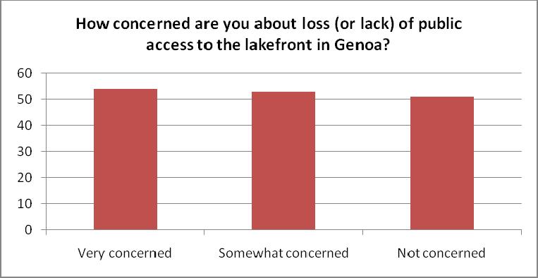
109
110
111
112
113
114
115
116
117
118
119
120
121
122
123
124
125 96 Town of Genoa Comprehensive Plan - April 2013
126 Town of Genoa Comprehensive Plan - April

127 98 Town of Genoa Comprehensive Plan - April 2013
Town of Peru Comprehensive Plan Executive Summary
 Town of Peru Comprehensive Plan Executive Communities that plan grow by choice, not by chance. A plan makes growth thoughtful, understandable, and predictable. A plan shows that a community is managing
Town of Scipio Comprehensive Plan - January
 Town of Scipio Comprehensive Plan - January 2011 1 2 Town of Scipio Comprehensive Plan - January 2011 Table of Contents Introduction... 5 Public Participation... 6 Plan Structure... 6 Adopting and Implementing
This page intentionally blank.
 This page intentionally blank. Parks, Recreation, and Open Space Chapter Relationship to Vision Vision Parks, Recreation and Open Space Chapter Concepts County Government. County government that is accountable
Town of Victory Comprehensive Plan - May
 Town of Victory Comprehensive Plan - May 2011 1 2 Town of Victory Comprehensive Plan - May 2011 Table of Contents Introduction... 5 Chapter 1 Goals and Recommendations... 7 Community Vision Statement...
Improve Neighborhood Design and Reduce Non Point Source Water Pollution
 HOW TO Planning Guide Improve Neighborhood Design and Reduce Non Point Source Water Pollution This document was funded by a grant from the New Hampshire Coastal Program with funding from the National Oceanic
SECTION II SECTION II STATEMENT OF GOALS, OBJECTIVES, PRINCIPLES, ASSUMPTIONS, POLICIES AND STANDARDS
 STATEMENT OF GOALS, OBJECTIVES, PRINCIPLES, ASSUMPTIONS, POLICIES AND STANDARDS 1 2 STATEMENT OF GOALS, OBJECTIVES, PRINCIPLES, ASSUMPTIONS, POLICIES AND STANDARDS INTRODUCTION The New Jersey Municipal
CHAPTER 4 FUTURE LAND USE AND URBAN SERVICES DISTRICTS
 CHAPTER 4 FUTURE LAND USE AND URBAN SERVICES DISTRICTS Introduction This chapter discusses how Benzie County should grow and change in the future. A community can grow and change in many different ways.
SALISBURY TOMORROW Our Vision
 SALISBURY TOMORROW Our Vision Salisbury is committed to supporting a high quality of life and sense of community for all residents. These commitments need to be reflected in our community programs, services
TABLE OF CONTENTS. Transportation Chapter 1 - Introduction and Purpose of Planning to 1-3. Utilities
 Chapter 1 - Introduction and Purpose of Planning... 1-1 to 1-3 Pennsylvania Municipalities Planning Code (Act 247)...1-1 Previous County Planning Activities...1-1 Objectives of the Plan...1-2 Elements
4-Town Comprehensive Plan DRAFT 7/30/07
 4-Town Comprehensive Plan DRAFT 7/30/07 Acknowledgements ning Committee Town of Harrisburg Norman Roof Randy Nicol Town of Martinsburg Terry Thisse Paul Kelly Town of Montague Jan Bagdanowicz Wendy Perry
Preface. Erie. Scranton. Allentown. Pittsburgh. Harrisburg. Philadelphia
 The Southern Alleghenies Region The Southern Alleghenies Region spans the Laurel Highlands and Allegheny Front in the west across the Appalachians to the east. It is comprised of Blair, Bedford, Cambria,
Arlington, Virginia is a worldclass
 EXECUTIVE S U M M A RY Arlington maintains a rich variety of stable neighborhoods, quality schools and enlightened land use policies, and received the Environmental Protection Agency s highest award for
Update to Town of Owasco Comprehensive Plan
 Update to Town of Owasco Comprehensive Plan with Conservation Lands and Trails Plan September 2016 Town of Owasco Comprehensive Plan Update - April 2016 1 Table of Contents Introduction... 5 Public Participation...
Yadkin River Greenway Feasibility Study Fact Sheet Village of Clemmons, Town of Lewisville, Town of Bermuda Run
 Fact Sheet Village of Clemmons, Town of Lewisville, Town of Bermuda Run Project Background The Yadkin River Greenway Feasibility Study is a joint project with the Village of Clemmons, the Town of Bermuda
Green Infrastructure Policies and Ordinances
 Green Infrastructure Policies and Ordinances October 23, 2013 By Karen Firehock, Green Infrastructure Center 2013 Georgia Urban Forest Council s 23 rd Annual Conference The mission of the nonprofit Green
TOWN OF SPRINGFIELD, NEW HAMPSHIRE
 TOWN OF SPRINGFIELD, NEW HAMPSHIRE NATURAL RESOURCES INVENTORY EXECUTIVE SUMMARY March 2008 Prepared by: Watershed to Wildlife, Inc. Natural Resource Consultants 42 Mill Street, Suite 3 Littleton, NH 03561
Sorted citizen input comments in review of Blount County plans July, August, and September 2007
 Sorted citizen input comments in review of Blount County plans July, August, and September 2007 The following presents sorted citizen input comments from three sessions held in July, August and September
DRAFT Amsterdam/Churchill Community Plan (4/17/08) Adopted By the Gallatin County Commission
 Adopted By the Gallatin County Commission") DRAFT Amsterdam/Churchill Community Plan (4/17/08) Adopted By the Gallatin County Commission Table of Contents Acknowledgements Chapter 1: Introduction A Brief History What s Next Authority Organization
DRAFT Amsterdam/Churchill Community Plan (4/17/08) Adopted By the Gallatin County Commission Table of Contents Acknowledgements Chapter 1: Introduction A Brief History What s Next Authority Organization
CHAPTER 2: PLANNING PRINCIPLES
 CHAPTER 2: PLANNING PRINCIPLES 2 Comprehensive Principles The following overarching Principles provide the basis for the goals and policies included in the Mendocino County General Plan. These Principles
3. VISION AND GOALS. Vision Statement. Goals, Objectives and Policies
 Vision Statement Queen Creek s interconnected network of parks, trails, open spaces and recreation opportunities provide safe and diverse activities and programs that sustain its unique, small town, equestrian
WATERFORD Plan of Preservation, Conservation and Development Supplement Part 1 - Policy Element
 WATERFORD 2012 Plan of Preservation, Conservation and Development 2015 Supplement Part 1 - Policy Element Effective June 11, 2015 2015 Plan Update GOAL To respond to the evolving land use needs and continually
Chapter 13: Implementation Plan
 Implementation A. Introduction The Implementation Plan, in table form on the following pages, provides a summary of all the Action Items recommended in Chapters 2 through 12. The table also indicates which
RECREATION AND OPEN SPACE ELEMENT GOALS, OBJECTIVES, AND POLICIES
 RECREATION AND OPEN SPACE ELEMENT GOALS, OBJECTIVES, AND POLICIES Goal 7 To provide park facilities, recreation programs, and open space resources that are safe, adequate, and accessible to all City residents,
Gloucester County s Comprehensive Plan. The Community Connection
 Gloucester County s Comprehensive Plan The Community Connection Current Comp Plan Adopted in 1991 with a 20 year planning horizon Updated in 1995 with Part V- Implementation Recommendations and Appendix
CHAPTER 12 IMPLEMENTATION
 CHAPTER 12 IMPLEMENTATION The 2010 Town of Denton Comprehensive Plan is intended to capture a vision of the future of Denton. As such, it provides a basis for a wide variety of public and private actions
Chapter 9 Community Facilities & Services Plan. Introduction. Cooperative Efforts. Monitoring of Needs
 Chapter 9 Community Facilities & Services Plan Introduction The location of key community facilities such as water, sewer, schools, parks, and roads is important to the provision of the necessary services
CHAPTER VI Plan Implementation
 Versailles-Midway CHAPTER VI Plan Implementation While prior sections focused on the tools the Commission needs to help it make the dayto-day decisions associated with subdivision, site plan and rezoning
Chapter 3. Community Vision and Goals
 Chapter 3. Community Vision and Goals 3.1 Public Involvement Charlevoix s master plan was prepared in a way that maximized public participation. Dating back to 2004, the Planning Commission and staff held
Canyon Lake Master Plan Revision Public Information Meeting March 18, 2016
 Canyon Lake Master Plan Revision Public Information Meeting March 18, 2016 Marcus Schimank Canyon Lake Manager Capital Regional Office U.S. Army Corps of Engineers Fort Worth District US Army Corps of
EL DORADO COUNTY GENERAL PLAN PARKS AND RECREATION ELEMENT PRINCIPLE INTRODUCTION STATE AUTHORIZATION
 EL DORADO COUNTY GENERAL PLAN PARKS AND RECREATION ELEMENT PRINCIPLE The General Plan must identify the types of governmental services, including parks and recreation facilities, which are necessary to
Village of Fair Haven Goals & Objectives
 Village of Fair Haven Goals & Objectives 1 Natural Environmental Quality & Aesthetics Embrace policies and programs that preserve and enhance the Village s natural resources, environment, water quality,
2018 Northampton Township Comprehensive Plan
 2018 BUCKS COUNTY, PENNSYLVANIA What is a? A comprehensive plan is a municipality s main policy document that details the collective vision for the future, the historic, environmental, and cultural facilities
TOWN OF BETHLEHEM OPEN SPACE CONSERVATION PLAN PUBLIC MEETING: OCTOBER 12, 2017
 TOWN OF BETHLEHEM OPEN SPACE CONSERVATION PLAN PUBLIC MEETING: OCTOBER 12, 2017 Welcome and Agenda 6:00 6:45: Open House, Part One 6:45 7:15: Presentation and Questions 7:15 8:00: Open House, Part Two
LAND USE ELEMENT. Purpose. General Goals & Policies
 LAND USE ELEMENT Purpose This Land Use Element contains the goals and policies necessary to support the City s responsibility for managing land resources and guiding development through implementing regulations,
Whitemarsh Township Greenway Plan
 Whitemarsh Township Greenway Plan Prepared for: Whitemarsh Township August 16, 2007 Table of Contents Table of Contents... i Introduction... 1 Study Area Setting... 2 Regional Setting... 2 Township Character...
Sustainable Keuka Lake
 Sustainable Keuka Lake Steve Butchko, Town of Wayne Supervisor Chelsea Robertson, Senior Planner STC Kemberli Sargent, Planner STC www.sustainablekeuka.net This presentation was prepared for the New York
CONSERVATION ELEMENT GOALS, OBJECTIVES, AND POLICIES
 CONSERVATION ELEMENT GOALS, OBJECTIVES, AND POLICIES Goal 4 To conserve, manage, appropriately use and protect the natural resources of the City ensuring continued resource availability and environmental
Lake O the Pines Master Plan Revision Public Information Meeting April 25 & 27, 2017
 Lake O the Pines Master Plan Revision Public Information Meeting April 25 & 27, 2017 Presented By Matthew Like, Lake Manager U.S. Army Corps of Engineers Fort Worth District US Army Corps of Engineers
Chapter 10 IMPLEMENTATION RECOMMENDATIONS
 Chapter 10 IMPLEMENTATION RECOMMENDATIONS The recommended land use plan presented in the previous chapter provides a design for the attainment of the urban and rural development and open space preservation
LU Encourage schools, institutions, and other community facilities that serve rural residents to locate in neighboring cities and towns.
 Application No. 891627: Comprehensive Plan Text Amendment - Rural School Policies - Amend policies consistent with State Legislation allowing schools in the rural area and extension of sewer service to
Support the implementation of Cape Coral's Comprehensive Plan. Protect and utilize the unique natural resources in the City.
 7.0 OVERVIEW - RECOMMENDATIONS Chapter 7 The preparation of the Cape Coral Parks and Recreation Master Plan spanned a period of approximately 12 months. Plan preparation included the input of a wide range
10.0 Open Space and Public Realm
 10.0 Open Space and Public Realm 10.0 Open Space and Public Realm The Public Open Space System is comprised of: outdoor spaces available for public use that are either publicly owned (e.g., parks and
Green Infrastructure. NYS Department of Environmental Conservation
 Green Infrastructure Green infrastructure is an interconnected network of natural areas and open spaces that sustains ecosystems. Benedict, M.A. and E.T. McMahon. 2006. Green Infrastructure Linking Landscapes
STEWARDSHIP OF LONG ISLAND SOUND S ECOLOGICAL AND RECREATIONAL RESOURCES
 STEWARDSHIP OF LONG ISLAND SOUND S ECOLOGICAL AND RECREATIONAL RESOURCES Robin Kriesberg, Save the Sound, Inc. Thomas Halavik, US Fish and Wildlife Service Coastal Program An Initiative to Identify, Protect
PSRC REVIEW REPORT & CERTIFICATION RECOMMENDATION
 PSRC REVIEW REPORT & CERTIFICATION RECOMMENDATION KITSAP COUNTY COUNTYWIDE PLANNING POLICIES July 2, 2012 BACKGROUND A major emphasis of the Washington State Growth Management Act (GMA) is the need to
Planning for and Managing Open Space and Natural Areas
 Planning for and Managing Open Space and Natural Areas Increasingly, development proposals in Delaware include large amounts of open space and natural areas. While open space is important as a community
G. RECREATION AND OPEN SPACE ELEMENT. The following summarizes the Recreation and Open Space Element:
 G. RECREATION AND OPEN SPACE ELEMENT The purpose of the Element is to provide the framework and direction for a comprehensive system of public and private sites for recreation, including, but not limited
Executive Summary. Parks and Recreation Plan. Executive Summary
 Parks and Recreation Plan Executive Summary The Whitemarsh Township Parks and Recreation Plan sets forth a vision for how Whitemarsh Township can provide a premiere parks and recreation system reflective
Chapter 5: Natural Resources and Environment
 NATURAL RESOURCES AND ENVIRONMENT 5-1 5 Chapter 5: Natural Resources and Environment BACKGROUND AND INTENT Urban expansion represents the greatest risk for the future degradation of existing natural areas,
OPEN SPACE CHAPTER 7: OVERVIEW. Preserve open space to protect natural resources, enhance character and provide passive recreation opportunities
 CHAPTER 7: OPEN SPACE OVERVIEW Ridgefield has made tremendous progress permanently preserving areas of town as open space. Open space preservation can serve many important purposes, including: protect
A citizen s guide to the. Comprehensive Plan. City of Lakeville, Minnesota 1
 A citizen s guide to the Comprehensive Plan 2008 City of Lakeville, Minnesota 1 Introduction The City of Lakeville completed an update of its Comprehensive Plan in 2008. A comprehensive plan is a tool
Shoreline Master Program Town of La Conner, Washington
 Shoreline Master Program Town of La Conner, Washington Department of Ecology approval effective Adopted September 24, 2013 by Town of La Conner Ordinance No.1106 Amended May 13, 2014 by Town of La Conner
Municipal Plan*Assessment
 Municipal Plan*Assessment This tool was developed to assist in reviewing municipal master plans and in determining if these plans are consistent with smart growth principles, neighboring municipal plans,
Office of Greenways & Trails Providing Statewide Leadership and Coordination. Southeast Greenways and Trails Summit October 1-3, 2017
 Office of Greenways & Trails Providing Statewide Leadership and Coordination Southeast Greenways and Trails Summit October 1-3, 2017 1 Office of Greenways and Trails The Office of Greenways and Trails
HOUSING ELEMENT GOALS, OBJECTIVES, AND POLICIES
 HOUSING ELEMENT GOALS, OBJECTIVES, AND POLICIES Goal 6 Maintain and enhance the supply of decent, safe, energy efficient and affordable housing and maximize viable options and opportunities for present
CHAPTER 3 VISION, GOALS, & PLANNING PRINCIPLES. City of Greensburg Comprehensive Plan. Introduction. Vision Statement. Growth Management Goals.
 CHAPTER 3 VISION, GOALS, & PLANNING PRINCIPLES Introduction The Greensburg Comprehensive Plan is intended as a working community document. A combination of long and short-term goals, this document is intended
I. STAFF POLICY RECOMMENDATIONS. The following RMP policy strategies are proposed by staff in support of a Scenic Resource Protection Program:
 Policy Consideration: Scenic Resource Protection Program Status: For Consideration by the Highlands Council at September 14, 2006 Work session Date: September 12, 2006 I. STAFF POLICY RECOMMENDATIONS The
Joe Pool Lake Master Plan Revision Public Information Meeting May 23, 2017
 Joe Pool Lake Master Plan Revision Public Information Meeting May 23, 2017 Presented By Jason Owen Lake Manager U.S. Army Corps of Engineers Fort Worth District US Army Corps of Engineers Purpose of this
Lewisville Lake Master Plan Revision Public Information Meeting May 2 & 4, 2017
 Lewisville Lake Master Plan Revision Public Information Meeting May 2 & 4, 2017 Presented By Rob Jordan Lake Manager U.S. Army Corps of Engineers Fort Worth District US Army Corps of Engineers Purpose
FOREST SERVICE MANUAL NATIONAL HEADQUARTERS (WO) WASHINGTON, DC
 WASHINGTON, DC") Page 1 of 11 FOREST SERVICE MANUAL NATIONAL HEADQUARTERS (WO) WASHINGTON, DC FSM 2300 RECREATION, WILDERNESS, AND RELATED RESOURCE MANAGEMENT Amendment No.: 2300-2011-2 Effective Date: October 19, 2011
Page 1 of 11 FOREST SERVICE MANUAL NATIONAL HEADQUARTERS (WO) WASHINGTON, DC FSM 2300 RECREATION, WILDERNESS, AND RELATED RESOURCE MANAGEMENT Amendment No.: 2300-2011-2 Effective Date: October 19, 2011
Recreation, Open Space, Greenway Plan & Smart Agriculture Initiative
 Recreation, Open Space, Greenway Plan & Smart Agriculture Initiative This portion of the Plan represents a follow-up to Section 2, which addressed the natural environment of the two townships. This portion
Planned Development Review Revisions (Project No. PLNPCM )
") Planned Development Review Revisions (Project No. PLNPCM2014-00139) Standard residential development Planned Development Example: Smaller lot sizes than what is allowed to create open space amenity. What
Planned Development Review Revisions (Project No. PLNPCM2014-00139) Standard residential development Planned Development Example: Smaller lot sizes than what is allowed to create open space amenity. What
Official Plan Review
 Official Plan Review Summary Report - The Built Environment August 2014 Part 1: Introduction Planning for a healthy, prosperous and sustainable community is an important goal for our municipality. From
Central Lake Ontario Conservation Conservation Lands Master Plan
 Conservation Lands Master Plan Top 13 Frequently Asked Questions 1. What are conservation lands? Where are these conservation lands located in the Central Lake Ontario Conservation watershed? Conservation
Public Information Meeting
 Lavon Lake Master Plan Revision Public Information Meeting March 10, 2015 Presented By Michael Kinard Lake Manager U.S. Army Corps of Engineers Fort Worth District US Army Corps of Engineers Purpose of
Conservation Corridor Planning and Green Infrastructure Themes
 Conservation Corridor Planning and Green Infrastructure Themes Prepared by the Green Infrastructure Center Inc. and the Northern Virginia Regional Commission February 22, 2011 Brief Overview Project Background
Executive Summary Purpose of the Plan Defining Open Space and Greenways
 Executive Summary Bucks County possesses a vast array of open space resources including natural areas, parks, farmland and historic and cultural resources that contribute to a high quality of life valued
EXECUTIVE SUMMARY DRAFT CHAPTER 1 INTRODUCTION EXECUTIVE SUMMARY
 CHAPTER 1 EXECUTIVE SUMMARY INTRODUCTION Through the joint efforts of the City of Tulsa planning staff and the Land Services division of Indian Nations Council of Governments (INCOG), the Berryhill Land
{Best Practices. Summary of Tools, Strategies and Best Practices from 11 Michigan Case Study Communities
 Case Studies Michigan Coastal Community Working Waterfronts { Summary of Tools, Strategies and from 11 Michigan Case Study Communities Table of Contents Zoning...2 Community and Stakeholder Collaboration
CITY OF LANGLEY OFFICIAL COMMUNITY PLAN BYLAW, 2005, NO APPENDIX II - REGIONAL CONTEXT MAP
 CITY OF LANGLEY OFFICIAL COMMUNITY PLAN BYLAW, 2005, NO. 2600 APPENDIX II - REGIONAL CONTEXT MAP ± Legend Agricultural Mixed Employment Industrial Conservation & Recreation Regional City Centre Urban Containment
Riparian Buffer on the Bushkill Creek. Policies
 Riparian Buffer on the Bushkill Creek Riparian buffers provide numerous benefits to landowners and the community by protecting groundwater recharge areas, providing flood control, providing stormwater
Exhibit A. 8:9 Scuffletown Rural Conservation District
 Exhibit A 8:9 Scuffletown Rural Conservation District 8:9.1 Intent and Purpose The Scuffletown Rural Conservation (SRC) District is intended to provide for residential development that supports the development
DRAFT MAP AMENDMENT FLU 04-4
 DRAFT MAP AMENDMENT FLU 04-4 SW 24 TH AVENUE ROADWAY CORRIDOR The University of Florida participates with the Metropolitan Transportation Planning Organization (MTPO) in its responsibilities for the continuing,
Brice Prairie Master Plan
 Brice Prairie Master Plan Town of Onalaska Community Meeting #1 Sand Lake Elementary School January 28, 2006 9 am 11 am Agenda Background What is a Master Plan? Brice Prairie Capacity Reports Starter Ideas
13 Maintenance and Operations Plan 223
 222 13 Operations Maintenance and Plan 223 Chapter 13 MAINTENANCE AND OPERATIONS PLAN 13.1 Stewardship The Minneapolis Park and Recreation Board (MPRB) is the steward of a nationally-acclaimed park system.
Implementation Vision
 Introduction The implementation chapter is the how to portion of the plan. It describes the actions necessary to realize the visions presented in this document through the goals, objectives, and policies
Ten Mile Creek Planning Area
 PLANNING AREA POLICIES TEN MILE CREEK Ten Mile Creek Planning Area Location and Context The Ten Mile Creek Planning Area ( Ten Mile Creek area ) is located south of the current Boise AOCI, generally south
DISCUSSION TOPIC: ST JOHNS RIVER & ITS TRIBUTARIES (BPII) 2030 COMPREHENSIVE PLAN POLICES AND REGULATORY FRAMEWORK
 2030 COMPREHENSIVE PLAN POLICES AND REGULATORY FRAMEWORK") DISCUSSION TOPIC: ST JOHNS RIVER & ITS TRIBUTARIES (BPII) 2030 COMPREHENSIVE PLAN POLICES AND REGULATORY FRAMEWORK St. John s River & Its Tributaries Issue Summary: The St. Johns River is an important
DISCUSSION TOPIC: ST JOHNS RIVER & ITS TRIBUTARIES (BPII) 2030 COMPREHENSIVE PLAN POLICES AND REGULATORY FRAMEWORK St. John s River & Its Tributaries Issue Summary: The St. Johns River is an important
The following principles guide the development of goals and strategies to protect and promote these amenities:
 OPEN SPACE/PARKS/TRAILS/RECREATION GOALS/STRATEGIES Cherry Hills Village is a living environment that offers low density development, open areas, public scenic vistas, public trails and public parks. This
CHAPTER 7: VISION AND ACTION STATEMENTS. Noble 2025 Vision Statement
 CHAPTER 7: VISION AND ACTION STATEMENTS This chapter presents the vision, policy and action statements that transform the comprehensive planning study, an analysis of Noble s past, future trends and community
Hibbing. Land Use. Hibbing Comprehensive Plan 8.1. Land Use
 Hibbing 8.1 Introduction 8.3 Information and Assessment 8.5-8.14 Recommendations 8.15-8.17 Implementation 8.18-8.19 8.2 Introduction Although land use was not identified as a discrete goal during the community
COMMISSION ACTION FORM
 ITEM #: 6 DATE: 09-06-17 COMMISSION ACTION FORM REQUEST: Introduction and Initial Review of Proposed Amendments to the Ames Urban Fringe Future Land Map for the North Growth Gap Area BACKGROUND INFORMATION:
Port Lavaca Future Land Use
 Port Lavaca Future Land Use Introduction The City of Port Lavaca is beginning to see sustained growth, after many years of relative stable population. New single family homes, apartments, and businesses
IV. Development in the Rural Overlay District
 Intracoastal Waterway Route 17 Route 168 Great Dismal Swamp VIRGINIA NORTH CAROLINA IV. Development in the Rural Overlay District IV-1 Route 17 in Chesapeake s Rural Overlay District affords distant views
Master Plan Objectives and Policies
 Master Plan Objectives and Policies Introduction This chapter identifies the Park issues and recommended policies established by this Master Plan. The issues were identified through meetings with staff,
VILLAGE & TOWN OF BERGEN: COMPREHENSIVE PLAN
 VILLAGE & TOWN OF BERGEN: COMPREHENSIVE PLAN CPC Public Hearing April 21, 2016 History 1996 Comprehensive Plan Comprehensive Plan Update Committee Consultant (LaBella Associates): December 2014 Residents
RECREATION, OPEN SPACE AND GREENWAYS ELEMENT GOALS, OBJECTIVES, AND POLICIES
 RECREATION, OPEN SPACE AND GREENWAYS ELEMENT GOALS, OBJECTIVES, AND POLICIES GOAL R-1: DEVELOP A RECREATION, OPEN SPACE AND GREENWAYS SYSTEM AS AN INTEGRAL COMPONENT OF AN OVERALL, COUNTY-WIDE ECONOMIC
City of Mahtomedi Park System Plan Public Hearing Draft: September 13, 2006
 Chapter 6: IMPLEMENTATION INTRODUCTION Earlier chapters of this Plan analyzed existing conditions, identified park and recreation needs, and proposed park, trail, and open space recommendations. This chapter
COMMUNITY DESIGN. GOAL: Create livable and attractive communities. Intent
 COMMUNITY DESIGN Intent An attractive, well-designed County will attract quality development, instill civic pride, improve the visual character of the community, and create a strong, positive image for
COMMUNITY ENVIRONMENTAL MANAGEMENT
 COMMUNITY ENVIRONMENTAL MANAGEMENT CEM HANDBOOK FOR COMMUNITY CONSERVATION PLANNING ----- Draft ----- Prepared by the CENTER FOR COMMUNITY ENVIRONMENTAL MANAGEMENT in association with the NEW YORK STATE
Strategic Plan
 Strategic Plan 2015-2025 Providing Natural Resources Conservation and Stew- ardship in Delaware County in Partnership with USDA-Natural Resources Conservation Service Welcome to the Delaware SWCD Strategic
Illustration of Eastlake Farmer s Cooperative Grain Elevator. Chapter 5: implementation 5-1
 Illustration of Eastlake Farmer s Cooperative Grain Elevator Chapter 5: implementation 5-1 chapter 5: implementation Introduction The Eastlake Subarea Plan includes a wide range of recommendations intended
Minnesota Department of Natural Resource - Natural Resource Guidance Checklist Conserving Natural Resources through Density Bonuses
 Minnesota Department of Natural Resource - Natural Resource Guidance Checklist Conserving Natural Resources through Density Bonuses NRDB Why Use Density Bonuses & This Checklist Local units of government
SECTION FOUR: MISSION STATEMENT, GOALS & OBJECTIVES
 SECTION FOUR: MISSION STATEMENT, GOALS & OBJECTIVES Chapter Summary Chapter Ten: Mission Statement, Goals & Objectives To fulfill its mission, the Parks and Recreation Commission has identified four basic
SAN RAFAEL GENERAL PLAN 2040 INTRODUCTION AND OVERVIEW
 SAN RAFAEL GENERAL PLAN 2040 INTRODUCTION AND OVERVIEW Steering Committee Presentation February 14, 2018 Purpose of General Plan Guide land use and development decisions Coordinate transportation, infrastructure,
Purpose of the Master Plan
 Purpose of the Master Plan 4 Master Plan Purpose The Master Plan is a policy framework for decisions that affect the physical, social and economic environment of the Town. The Parker 2035: Master Plan
COLVER ROAD INDUSTRIAL CONCEPT PLAN
 COLVER ROAD INDUSTRIAL CONCEPT PLAN A CONCEPTUAL LAND USE AND TRANSPORTATION PLAN FOR TA-4 AN URBAN RESERVE AREA OF THE CITY TALENT City of Talent Adopted by City Council Resolution No., June, 2015 PART
Mendota Heights 2040 Comprehensive Plan Draft Vers
 4 Parks and Trails The City of Mendota Heights boasts a variety of recreational and open space opportunities. Few cities can claim access to regional trails, riverside and lakeside parks, scenic bluffs
Subject: Hendry County Evaluation and Appraisal Report Letter of Understanding - Identification of Major Issues
 HENDRY COUNTY PLANNING & ZONING DEPARTMENT POST OFFICE BOX 2340 165 S. LEE STREET LABELLE, FLORIDA 33975 (863) 675-5240 FAX: (863) 675-5317 SUNCOM 744-4750 November 16, 2007 Mr. Mike McDaniel, Chief Office
Parks, Open Space and Trails
 Introduction Parks have often been referred as the lungs of our cities, cleansing the air of pollutants and particulate matter. Parks are also gathering places for families and community. They offer spaces