DESIGN 4 Design Guide
|
|
|
- Annis Bell
- 5 years ago
- Views:
Transcription
1 4 Design Guide DESIGN
2 Introduction 86
3 Introduction Design guide FOR ROUND ROCK This guide attempts to realize high-quality design on an individual project basis by setting forth recommendations for architecture and urban design. These guidelines should be used during the private development entitlement review and maintenance processes and the city-led urban design processes to promote a high degree of design quality and creativity. 87
4 Introduction Purpose and Applicability Purpose The Guide presented in this Chapter is intended to support the Master Plan vision by offering specific design recommendations both for individual architecture projects and for public urban design projects. Goals of the Guide The main goals of the Design Guide are to: Introduce building design guidelines that respect the architecture, scale, layout and visual attributes of existing downtown Round Rock. Suggest updated development guidelines that establish lot size, floor area ratios, parking and street standards, which are more conducive to human-scaled and sustainable growth. Suggest urban form guidelines that are compatible with the visions of the Master Plan. Create an armature for development that will enable a vibrant and walkable community. Describe design components to use in a future Form Based Code. Relationship to the Future Form Based Code The concepts contained in this Design Guide are presented so that they can be synthesized and spliced into a future Form Based Code. The Design Guide suggests the elements that should be included in the Form Based Code and provides example standards. A Form Based Code would be able to regulate building form, design, and placements within the downtown area. The Code would be the tool through which the vision for downtown that has been articulated by the City Council is achieved. Without an enforcement mechanism the design goals for the city may remain merely concepts and development will likely continue without a cohesive vision. See Chapter Three for a discussion on the Form Based Code. How to Use this Guide The Design Guide should be used by developers, designers, and planners who are making decisions about building style, location, use, and form in downtown. The Guide describes the priorities and design intent of the city. How the Guide is Organized A regulating plan is presented at the beginning of the document that divides the area into zones, each having a set of recommended densities, heights, etc. The Building Guidelines section describes recommendations related to the building type and design for each zone. The Urban Form Guidelines section discusses recommendations that relate to the public-right-of-way, such as street improvements, landscaping recommendations, etc. 88

5 1. REGULATING PLAN 2. BUILDING GUIDELINES 3. URBAN FORM GUIDELINES Introduction Urban Standards The Regulating Plan shows the Master Plan study area organized into zones. Each zone has its own recommendations in terms of appropriate building envelope, land use, and urban form, which are discussed in the following pages. These guidelines relate to building type and design, within the private realm, provided by private developers. They include: Building Density and Height Land Use Build-to Line Frontage Occupancy Frontage Types Building Types Yard Types Historic Preservation Guidelines General Architectural Guidelines Residential Architectural Guidelines Parking and Service Fences, Walls, and Hedges Utilities, Storage, and Trash Urban form guidelines relate to the area between the buildings and the public right-of-way. They include: Critical Urban Design Features Block Network and Circulation Streets Street Sections Intersections and Sidewalks Sustainability and Green Space Trees and Landscaping Street Furniture and Lighting 89
6 REGULATING PLAN 90
7 Downtown Transect Zones The Regulating Plan on the facing page shows the Master Plan area organized into Transect Zones. Each zone has its own recommendations in terms of building envelope, land use, and urban form. Round Rock s zones include: T2 Open Space Zone T3L Sub-Urban Zone (Low) T3+ Sub-Urban Zone (High) T4L General Urban Zone (Low) T4+ General Urban Zone (High) T5L Urban Center Zone (Low) T5+ Urban Center Zone (High) T6 Urban Periphery Zone HC Historic Core Zone IH Interstate Highway District Zone There are also two Overlay Zones: HRC C Historic Residential-Character Overlay Area Civic Overlay Area This page describes the Transect Zones and the Overlay Zones and clarifies their intent. See the following page for examples of requirements that would be appropriate for each Transect Zone, and should be considered in the potential future Form Based Code. Round Rock s Transect Zones The general intent is that the scale of urban form will increase farther away from the historic downtown core area. The historic downtown core area would maintain the existing scale (1-2 stories) and urban form, including tall pedestrian-oriented ground floors with uses such as retail and restaurants, potentially with mixed-uses above. Density would continue to be concentrated within the historic downtown core area (around Round Rock, Mays, and Main), with less dense areas in the Flat, near the creek, and north of the creek. T2 Openspace Zone consists of sparsely settled lands in open state for civic and openspace uses. These include greenspace and riparian areas around the creek. T3 (L/+) Sub-Urban Zone consists of low density residential areas, adjacent to higher zones with some limited mixed-use. Setbacks are relatively deep. The roads may be irregular to accommodate natural conditions. This includes areas that are further from the core downtown area. Note that the areas east of Lewis/Spring Street would be primarily single-family residential. L signifies a smaller and less dense urban form, while + signifies a slightly more intense urban form. T6 Urban Periphery Zone consists of the highest density and height, and the greatest variety of uses. It may have larger blocks; streets have steady street planting and buildings are set close to the wide sidewalks. While typically only large towns and cities have a T6 zone, downtown Round Rock uses this zone for areas next to the Interstate. The overall intent is that height and scale would increase farther away from the historic downtown core area. Downtown Historic Core Zone (HC) consists of the area immediately around the new town green and the historic Main Street. The zone maintains a scale consistent with the historic Main Street from Mays to Burnet, which contains tall 1 story and 2 story mixed-use buildings. Interstate Highway District (IH) consists of the area with buildings that by their function, disposition, or configuration cannot, or should not, conform to one or more of the six normative Transect Zones. In this case, the area adjacent to the Interstate is designated as a Special District because its urban form will be different from all other zones in the area. The Interstate Highway District area will be more auto-oriented. Round Rock s Overlay Areas REGULATING PLAN Transect Zones - Introduction The regulating plan for Round Rock uses a Transect System. The Transect is a framework that identifies a range of development patterns from the most rural to the most urban. Its continuum, when subdivided, lends itself to the creation of zoning categories. The Transect helps conceptualize land use depending on the urban or rural nature of a specific area. In addition to the usual building use, density, height, and setback recommendations, other elements of the intended habitat are integrated including those of the private lot, building, and public frontage. The zones presented here are recommendations that may be made regulatory or altered if the city chooses to adopt a future Form Based Code. T4 (L/+) General Urban Zone consists of a mixed-use but primarily residential urban fabric. It may have a wide range of building types: single-family, sideyard, and rowhouses. Setbacks and landscaping are variable. Streets with curbs and sidewalks define the blocks. This zone includes areas that surround the core downtown area. L signifies a smaller and less dense urban form, while + signifies a taller, more dense form. T5 (L/+) Urban Center Zone consists of higher density mixed-use buildings that accommodate retail, offices, rowhouses and apartments. It has a tight network of streets, with wide sidewalks, steady street planting and buildings set close to the sidewalks. This includes areas of the historic core downtown area. The core areas contain mixed-use buildings with ground floor retail and other pedestrian-oriented uses. L signifies a smaller and less dense urban form, while + signifies a taller more dense form. Historic Residential-Character Overlay Area (HRC) is applied to areas which require special attention because of the prevalence of historical buildings. The HRC Overlay Area includes many historically-designated or potentially historic residential buildings (e.g. the Nelson-Crier House). The HRC Zone is discussed in detail on page 112. Civic Overlay Area (C) is applied to areas around the creek that are envisioned as public open space, the City Hall area, and to the Main Street entry green area. These areas are designated as civic because they are critical in establishing the envisioned Plan, offering important civic uses. The city should favor introduction of civic uses in these areas, rather than other forms of development. See the following page for examples of requirements that would be appropriate for each Transect Zone. 91
8 Example Standards for Each Zone The following are recommended requirements, appropriate for each Transect Zone. For recommended Land Uses for each zone, see page 98. REGULATING PLAN T2 T3 T2 Example Standards Minimum DU/A: None Commercial FAR: 0 on a case by case basis Building Height: 1-2 stories Build-to-Line (measured from public right-of-way): n/a Frontage Occupancy: n/a T3L Example Standards (See Exceptions*) Maximum Dwelling Units Per Acre (DU/A): single family, only. Minimum DU/A: None Commercial FAR: 0 Building Height: 1-3 stories (45 ft) Build-to-Line (measured from public right-of-way): n/a Frontage Occupancy: n/a T3+ Example Standards T5 T5L Example Standards (See Exceptions**) Maximum Dwelling Units Per Acre (DU/A): 60 units per acre Minimum DU/A: 18 units per acre Commercial FAR: 2 Building Height: 2-4 stories (55 ft) Build-to-Line (measured from public right-of-way): 0-5 feet Frontage Occupancy: 75% - 90% T5+ Example Standards (See Exceptions**) Maximum Dwelling Units Per Acre (DU/A): 80 units per acre Minimum DU/A: 20 units per acre Commercial FAR: 2.5 Building Height: 2-5 stories (65 ft) Build-to-Line (measured from public right-of-way): 0-5 feet Frontage Occupancy: 75% - 90% IH HC IH Interstate Highway District, Example Standards Maximum Dwelling Units Per Acre (DU/A): No limit Minimum DU/A: No limit Commercial FAR: 2 Building Height: up to 5 stories (65 ft) Build-to-Line (measured from public right-of-way): n/a Frontage Occupancy: n/a HC, Historic Core, Example Standards Housing + Commercial FAR: 1.5 Building Height: 1-2 stories (20 ft min) Build-to-Line (measured from public right-of-way): 0-3 feet Frontage Occupancy: 90% - 100% Maximum Dwelling Units Per Acre (DU/A): 8 units per acre Minimum DU/A: None Commercial FAR: 0.4 Building Height: 1-3 stories (45 ft) Build-to-Line (measured from public right-of-way): n/a Frontage Occupancy: n/a T4L Example Standards (See Exceptions**) Maximum Dwelling Units Per Acre (DU/A): 18 units per acre T6 Notes: T6 Example Standards Maximum Dwelling Units Per Acre (DU/A): No limit Minimum DU/A: 50 units per acre Commercial FAR: 6 Building Height: up to 16 stories (180 ft) Build-to-Line (measured from public right-of-way): 5-10 feet Frontage Occupancy: 90% - 100% HRC- Overlay HRC, Historic Residential-Character Area Overlay** Example Standards All standards in this Overlay Zone reflect the standards of the Transect Zone in which the parcel lies. There are no special density, FAR, height, or build-to-line standards for buildings in the Overlay Zone. Properties within the zone need to abide by certain considerations related to existing historic properties. See pages The differences or gaps between the recommended HRC and existing H Overlay design guidelines need to be addressed in the development of the Form-Based Code. 92 T4 Minimum DU/A: 10 units per acre Commercial FAR: 1.0 Building Height: 2-3 stories (45 ft) Build-to-Line (measured from public right-of-way): 5-15 feet Frontage Occupancy: 60% minimum T4+ Example Standards (See Exceptions**) Maximum Dwelling Units Per Acre (DU/A): 20 units per acre Minimum DU/A: 12 units per acre Commercial FAR: 1.2 Building Height: 2-5 stories (65 ft) Build-to-Line (measured from public right-of-way): 5-10 feet Frontage Occupancy: 60% minimum 1. DU/A figures do not require a residential component, but indicate minimum density when there is a residential component. 2. Build-to-Lines do not apply to Monarch Trees. 3. Build-to-Lines can apply to front plaza space * Exceptions in the T3L Transect include the following: 1. The T3L area north of Pecan could be used for town homes or condominiums at higher densities. 2. The Nelson Crier house has potential for a number of civic uses, restaurants, and galleries once it is no longer retained as a residence. 3. The Round Rock Community Foundation property (old Main Street ball fields) should be designed for a combination of open space and family-oriented social service facilities and administrative offices. The property should be comprehensively planned to effectively integrate those uses. A special zoning district (PUD) will be required to develop this property. C- Overlay C, Civic Overlay Example Standards All standards in this Overlay Zone reflect the standards of the Transect Zone in which the parcel lies. There are no special density, FAR, height, or build-to-line standards for buildings in the Overlay Zone. However, the Overlay Zone indicates areas where future civic uses are envisioned. Properties within the zone should be prioritized for civic uses. ** Exceptions for T4L, T4+, T5L, and T5+ zones: 1. One story may be permitted as a Special Exception, notably for restaurant and entertainment uses. One story may also be allowed with a minimum facade height. A Special Exceptions process should be developed during the Form-Based Code creation.

9 Regulating Plan Mays St IH-35 Transect Zones: IH T6 * T5+ * The boundary between T6 and T5+ should be flexible to take advantage of the intersection of IH 35 and Palm Valley Boulevard. T5L Palm Valley Blvd - Hwy 79 REGULATING PLAN T4+ T4L T3L T3+ Georgetown St T2 Round Rock Ave Lewis St HC - Historic Core Overlay Areas: HRC- Historic Residential-Character Area (See page 112 for recommendations for this Overlay Area) Main St Mays St Burnet St Main Street C- Civic (Signifies areas where civic uses are contemplated. Note that the boundary of the Civic Overlay along Brushy Creek should remain flexible so that parkland and trail uses can be integrated with future development near the creek.) *Dots represent properties with Historic Overlay Zoning as of May Regulating Plan
10 REGULATING PLAN 94
11 2. BUILDING Guidelines SECTION These guidelines relate to building type and design, within the private realm, provided by private developers. They include: Building GUIDELINES Building Density and Height Land Use Build-to Line Frontage Occupancy Frontage Types Building Types Yard Types Historic Preservation Guidelines General Architectural Guidelines Residential Architectural Guidelines Parking and Service Fences, Walls, and Hedges Utilities, Storage, and Trash 95

12 BUILDING DENSITY and Height Building GUIDELINES 96 Each zone is characterized by it density and height. Regulating building density and height helps ensure that downtown develops in a pattern that is consistent with the Master Plan Vision. Generally, taller heights and greater densities should be permitted farther from the immediate historic downtown core area, including areas along Palm Valley Blvd - Hwy 79, near the Interstate, and areas of the town center that are not within the Historic Core. Note that minimum dwelling units per acre (DU/A) figures for Transect Zones do not require a residential component, but indicate minimum density when there is a residential component. Examples zones with higher density and height include T6, T5, and T4 zones. Lower densities and heights are appropriate for the Creekside District and the residential areas north of the Creek. Example zones with lower density and heights include T2 and T3. Density and Height Recommendations by Zone T2: Generally, throughout the T2 zone, building heights should be 1-2 stories for civic uses and open space. T3L: Generally, throughout the T3L zone, building heights should be between 1-3 stories, with land uses limited to single family homes (and bed and breakfasts). T3+: Generally, throughout the T3+ zone, building heights should be between 1-3 stories, density should be up to 8 dwelling units per acre (DU/A), and commercial floor area ratio (FAR) should be 0.4. T4L: Generally, throughout the T4L zone, building heights should be between 2 and 3 stories, density should be between 10 and 18 DU/A, and commercial FAR should be 1.0. T4+: Generally, throughout the T4+ zone, building heights should be between 2 and 5 stories, density should be between 12 and 20 DU/A, and commercial FAR should be 1.2. T5L: Generally, throughout the T5L zone, building heights should be 2-4 stories and density should be between 18 and 60 DU/A with a commercial FAR of 2. T5+: Generally, throughout the T5+ zone, building heights should be 2-5 stories and density should be between 20 and 80 DU/A with a commercial FAR of 2.5. T6: Generally, throughout the T6 zone, building heights should be up to 16 stories, density should be at least 50 DU/A with no maximum, and commercial FAR should be 6. IH: Generally, throughout the IH (Interstate Highway District) zone, building heights should be up to 5 stories, density can vary, and commercial FAR should be 2. HC: The Historic Core zone should maintain the 1-2 story height that currently exists on historic Main Street between Mays and Burnet. In this area 1 story buildings should maintain a minimum of 20 feet in height to the top of the parapet or to the bottom of the eave. Housing plus commercial FAR should be 1.5. HRC- Overlay: The Residential Historical Character Overlay does not include any special recommendations for building density or height. Building density and height is regulated by the Transect Zone, rather than the Overlay. C- Overlay: The Civic Overlay does not include any special recommendations for building density or height. Building density and height is regulated by the Transect Zone, rather than the Overlay. Other Recommendations For T4L, T4+, T5, and T5+ transects, one story may be permitted as a Special Exemption, notably for restaurant and entertainment uses with a minimum facade height. A Special Exemption process be developed during Form-Based Code creation. Buildings should be measured by the number of stories and or/ height in feet. Tower elements may exceed the maximum building height by one story up to 400 SF per tower. Raised basements should not exceed ½ of a story in height along the front façade. Streets recommending three to four story buildings should have a frontage occupancy composed of a minimum of 25% of four story building height. Existing historical density and height along Main Street between Mays and Burnet, is preserved in the Historic Core (HC) Zone, around the town green Tower element can exceed height limit. Height of buildings within the Historic Core (HC) should maintain existing scale of the area, of 1-2 stories and a minimum of 20 feet.

13 Recommended Ground Floor Uses The diagram to the right and the following page describe recommended land uses. Legend: The Land Use vision for downtown encourages: A mix of land-uses throughout the area. The concentration of retail and mixed-use (retail/commercial, retail/residential) in the town center, specifically around the town green, and along Main and Mays. This includes restaurant uses, which would enhance the streets around the town green area with outdoor dining. Street edges with ground floor civic functions may have ancillary and supportive retail functions such as cafes, gift shops, and the like. Rationale for the Recommendations By concentrating ground floor retail, including restaurants, in these areas, the Plan creates a cohesive pedestrian-friendly district in the core of downtown. Retail and restaurant uses activate the street with shoppers, visitors, people-watchers, and outdoor dining. As the heart of downtown, the town green is activated by these uses. The suggested land uses are compatible with the Economic Demand Analysis performed as part of this Plan, in terms of quantities of uses. A Note on Priority Areas The area along Main Street and around the town green is a priority for ground floor retail and restaurants. This area should be targeted first for incentives and programs to encourage these uses. Areas along Palm Valley - Highway 79 at Mays are secondary priority areas for ground-floor retail. As downtown redevelops and expands, retail should be extended along Mays, and along Liberty from Mays to Burnet. Other secondary areas for possible ground floor retail include areas in Southwest Downtown, along Round Rock Ave, along Bagdad between Mays and Burnet, and along the part of Burnet near Main Street. IH-35 Mays St Retail Recommended Other Areas of Potential for Retail Civic Recommended Priority Area Palm Valley Blvd - Hwy 79 Georgetown Street Open Space Historic Nelson Crier House Special Use Recommended: museum, gallery, restaurant, etc. Building GUIDELINES The Link Between Land Use and Form Wherever certain uses are recommended, building form and massing should be compatible with the vision for each particular zone. For instance a neighborhood meeting hall in the T3+ zone should be scaled to respect the primarily residential buildings that surround it. Likewise, parking structures that are recommended for use in the T5 zone should be wrapped with retail or other pedestrian-oriented uses at the street level so that they do not negatively impact the public realm and jeopardize the vision that this Plan outlines for the downtown area. Round Rock Ave Main Street Mays St Burnet St Lewis St Main Street 97 Ground Floor Use Diagram
14 Building GUIDELINES Land Use Recommendations The following are land uses that are appropriate for each Transect Zone. For recommended Development Standards, see page 92. T2 T3 T4 T2 Land Uses Recommended: Open space and civic uses only. T3L Land Uses (See Exceptions*) Recommended: Predominantly single-family residential. Other recommended uses include bed and breakfasts. Note that the areas east of Lewis/Spring Street should be primarily single-family residential. T3+ Land Uses Recommended: Predominantly single-family residential with the possibility of low density town homes where property is not suited for single-family. Other recommended uses include bed and breakfasts, and very limited commercial (personal services, office). Note that the areas east of Lewis/ Spring Street should be primarily single-family residential. T4L Land Uses Recommended: Mixed-use**, but primarily residential. Also includes small office and retail uses (<3,000 SF for entire building), including home office (<1,000 SF). Other recommended uses include those that are civic, such as schools, libraries, theaters, fire/police stations, museums and green/openspace. T4+ Land Uses T5 T6 T5L Land Uses Recommended: Higher density mixed-use with retail, offices, rowhouses, and apartments. Uses in this area should be pedestrian oriented. Recommended uses include larger office and retail uses (> 3,000 SF for entire building) and larger residential use configurations, including multi-family and live-work. Hotels are another recommended use, along with a wider variety of civic uses. Civic uses in the zone are more urban than those in the T4 zones. Parking structures and more substantial green and open/spaces are also appropriate. T5+ Land Uses Recommended: Same as T5L (scale is increased, but uses are the same). T6 Land Uses Recommended: A variety of more intense uses such as larger office and retail (>3,000 SF for entire building). Hotels are another recommended use because of the location near the Interstate. Larger civic uses can also be located in the zone, along with some larger residential use configurations, such as multi-family, mixed-use, and condominiums. Parking structures are also appropriate. * Exceptions in the T3L Transect include the following: 1. The T3L area north of Pecan could be used for town homes or condominiums at higher densities. 2. The Nelson Crier house has potential for a number of civic uses, restaurants, and galleries once it is no longer retained as a residence. 3. The Round Rock Community Foundation property (old Main Street ball fields) should be designed for a combination of open space and familyoriented social service facilities and administrative offices. The property should be comprehensively planned to effectively integrate those uses. A special zoning district (PUD) will be required to develop this property. IH HC HRC- Overlay C- Overlay IH Insterstate Highway District, Land Uses Recommended: A variety of more auto-oriented uses, given location near the Interstate, including shopping centers, gas stations, service stations, and various commercial configurations. HC Historic Core, Land Uses Recommended: Pedestrian-oriented mixed-uses for both existing and new buildings, which include retail or pedestrian-oriented commercial uses on the ground floor, and residential, hotels, inns, office, and other uses above. Civic uses are also appropriate for the Historic Core, including live theaters, movie theaters, libraries, information kiosks, green/openspace and other uses that activate the public realm. HRC Historic Residential-Character Area Overlay, Land Uses Land Use is governed by the underlying zone, rather than the overlay. Therefore buildings within the HRC Overlay, should be compatible with the uses prescribed by the applicable zone. Note, however that the HRC Overly is a Residential Character area and as such, while building uses may vary, buildings themselves should respect the historical residential character that exists in the area. C Civic Overlay, Land Uses Land Use is governed by zone, rather than the overlay. Therefore buildings within the C Overlay should be compatible with the uses prescribed for each zone. Note, however that the C Overly is a Civic area and as such, new buildings should be considered especially for civic uses, in order to support the visions of this Master Plan. 98 Recommended: Same as T4L (scale is increased, but uses are the same). ** Mixed-use refers to some combination of residential, commercial and/or other use in one building. Usually commercial or retail uses are on the ground floor.
15 BUILD-TO LINE The most important element in defining the public realm is the street wall. This street wall is made up of building facades that are built on a Build-to Line. A Build-to Line requires that buildings must be built up to a predetermined line and are not permitted to be located further back, except where the frontage occupancy allows for a break in the street wall. Buildings should be located with front facades along Build-to Lines. Build-to Lines are measured from the public right-of-way. The future Form Based Code should include standards for Build-to Lines in order to ensure that the relationship between the buildings and the public realm is appropriately activated. General Recommendations Larger Build-to Lines (10-15 ) are appropriate for more residential areas outside of the town center area. Small Build-to Lines (0-5 ) are appropriate for the areas along historic Main Street and the new town green, so that new development is compatible with the look and feel of existing historic buildings. Buildings should be located at block corners (rather than voids). Buildings should have two primary facades when located at block corners, which are oriented to the two streets. Build-to Line Recommendations by Zone T2: Build-to Lines do not apply T3L: Build-to Lines do not apply T3+: Build-to Lines do not apply T4L: 5-15 (from the public right-of-way) T4+: 5-10 (from the public right-of-way) T5L: 0-5 (from the public right-of-way) T5+: 0-5 (from the public right-of-way) T6: 5-10 (from the public right-of-way) IH: Build-to lines do not apply HC: 0-3 (from the public right-of-way) HRC Overlay: Build-to Line governed by zone C Overlay: Build-to Line governed by zone Frontage Occupancy Frontage occupancy is the minimum amount of building face that must be built along or within 3 feet of the Build-to Line. This ensures that a street wall will spatially define the public realm. The more urban the setting, the greater the intended spatial definition, and therefore the greater the frontage occupancy requirement. Buildings should occupy the Build-to Line at certain percentages based on their location in each Transect Zone. General Recommendations Frontage Occupancy in the Master Plan Area should be greater within the Historic Core (HC) and T5 and T6 zones. Frontage occupancy in the Plan Area should be less within the T2, T3L, T3+, and T4 zones. Frontage Occupancy Recommendations by Zone T2: Frontage occupancy does not apply T3L: Frontage occupancy does not apply T3+: Frontage occupancy does not apply T4L: 60% minimum T4+: 60% minimum T5L: Between 75% - 90% T5+: Between 75% - 90% T6: Between % IH: Build-to lines do not apply HC: Between 90% - 100% HRC Overlay: Frontage occupancy governed by zone C Overlay: Frontage occupancy governed by zone Before: No Build-to Line Alley Notes Frontage occupancy requirements should apply to all floors of buildings (excluding occupied or unoccupied space in roofs). For frontage occupancy purposes, single buildings that form a courtyard, 15' in width or less, by recessing a portion of the occupied building from the Build-to-line, should be measured as the full width of the building parallel to the Build-to line. Total actual courtyard widths should not exceed 15% of the total Build-to line frontage. Recessing to create a courtyard, should be a maximum of 30' deep. Build-to Lines can apply to front plaza space. Streets requiring two to four story buildings should have a frontage occupancy composed of a maximum of 75% of four story building height. After: With Build-to Line Alley Building GUIDELINES Monarch Trees Build-to Lines should not apply to Monarch Tree locations, and should not encroach on them. Monarch trees (as defined in the Round Rock Tree Ordinance) are large mature trees that represent a major asset to the community, providing visual respite, shade, and environmental benefits. A certified arborist should certify the health and longevity of any Monarch Tree in question. Right-of-way line 5 ft Main Street 25 ft Sidewalk Street 10 ft Conditions without a Build-to Line. Each building is set back a different amount from the street. The street wall is not continuous. There is street-facing parking negatively impacts the pedestrian-experience. Build-to line Right-of-way line 3 5 ft 5 ft 5 ft Main Street Sidewalk Street Conditions with a Build-to Line. Each building has most of its building face located directly along the Build-to Line. Note that the building in the middle has a lower percentage of frontage occupancy than the buildings on either side (less of its building face along the Build-to line). 99


 and T5 and T6 zones.")


. Product displays (flowers, food, etc.")

16 FRONTAGE TYPES Frontage types describe building facades in terms of their relationship to the street. Identifying recommended frontage types helps the Master Plan define the desired look and feel of new development in downtown and to encourage a lively town center atmosphere. Shopfront Recommended for: T4+, T5L, T6, IH, HC Arcade / Gallery Recommended for: T4+, T5L, T5+, T6, IH, HC Building GUIDELINES Recommended frontage types include: Shopfronts Arcades / Galleries Stoops Dooryards Forecourts Front Yards Sideyards Each of these frontage types contribute to the vision of downtown as a walkable, pedestrian-oriented, and small scale urban center. General Recommendations Street-facing façades of proposed buildings should be designed as one of the building frontage types included here. Frontage types that are closer to the sidewalk or street edge are more appropriate for the Historic Core (HC) and T5 and T6 zones. Frontage types that are looser, setback from the street edge, and incorporate more open space areas, are recommended for the T2, T3L, T3+, and T4 zones. Zone Recommendations Shopfronts: recommended for the T4+, T5L, T5+, T6, IH, and HC zones. Arcades and Galleries: recommended for the T4+, T5L, T5+, T6, IH, and HC zones. Stoops: recommended for all T4, T5, and T6 zones. Dooryards: recommended for all zones except T2, IH, and HC. Forecourts: recommended for T4, T5, and T6 zones. Front Yards: appropriate for T3L, T3+, T4L, T4+, and T5L zones. Sideyards: recommended for T3L, T3+ and T4 zones only. 100 Entries: Should be flush with exterior grade. Uses: Cafe seating is permitted, either building-adjacent or curb-adjacent. Ground Plane: Should be scored concrete or pavers from curb to building face. Furnishing Location: A furnishing zone should be established contiguous with the curb where street furniture should be located (see Landscape Guidelines). Product displays (flowers, food, etc.) are encouraged. Residential uses above and behind retail are encouraged except in IH zone. Buildings equipped with cantilevered shed roof or awning are encouraged. Street trees should be planted in tree pits with tree grates. Entries: Should be flush with exterior grade. Ground Plane: Should be scored concrete or pavers from curb to building face. Furnishing Location: A furnishing zone should be established contiguous with the curb where street furniture should be located (see Landscape Guidelines). Uses: Cafe seating is permitted, either building-adjacent or curb-adjacent. Product displays (flowers, food, etc.) are encouraged. Residential uses above and behind retail are encouraged except in IH zone. Street trees should be planted in tree pits with tree grates.


17 Stoop Dooryard Forecourt Recommended for: T4L, T4+, T5L, T5+, T6 Recommended for: T3L, T3+, T4L, T4+, T5L, T6 Recommended for: T4L, T4+, T5L, T5+, T6 Building GUIDELINES Covered stoops are allowed. Ground Plane: Should be grass, shrubs or ground cover. Furnishing Location: Street lights should be centered in the tree planting strip that is contiguous with the street curb. Street trees should be planted in tree planting strip. Ground Plane: Should be grass, shrubs or ground cover. Furnishing Location: Street lights should be centered in the tree planting strip that is contiguous with the street curb. Entries for multi-family buildings with corridors: Primary entrances to buildings should be ADA accessible per code. Ground floor units should have primary entries from corridor and should be addressed from common building entry ground floor units should also have a secondary entry from the sidewalk. Ground Plane: Should be grass, shrubs or ground cover. Furnishing Location: Street lights should be centered in the tree planting strip that is contiguous with the street curb. Porches are not permitted. Forecourt should be used sparingly and in conjunction with stoops and shop fronts. Frontage Delineation: Gardens and vehicular drop-offs are suitable in the resulting forecourt. 101


18 Front Yard Sideyard Recommended for: T3L, T3+, T4L, T4+, T5L Recommended for: T3L, T3+, T4L, T4+ Building GUIDELINES 102 The façade is set back substantially from the front property line. The front yard may or may not be visually continuous with adjacent yard. The deep setback provides a buffer from high-speed thoroughfares. A porch and fence can also be incorporated. Facade is set back substantially from one side of the property line. Side yard is fenced and may or may not be visually continuous with adjacent yards. The deep setback provides a buffer from high speed thoroughfares. It is recommended that a porch and fence be incorporated.


19 Building Types The following pages describes appropriate building types for downtown. Building types are examples of buildings that are compatible with the scale and character envisioned for downtown. Recommended building types include: High-Rises Commercial Blocks Texas Donuts Liner Buildings Hybrid Courts Stacked Dwellings Live Work Units Townhouses Courtyard Housing Villas Duplexes, Triplexes, and Quadplexes Sideyard House Front Yard Houses Rationale for the Recommendations Identifying building types helps the Master Plan define the desired look and feel of new development in downtown and encourages a lively town center atmosphere. Building types help describe what forms of development are appropriate in scale, massing, and articulation. The example building types can be used as a guide for developers and designers to understand some key components, including frontages, access, lot width, etc. General Recommendations Buildings should be designed as one of the types included here. Building types that are larger in scale and massing are more appropriate for the Historic Core (HC), T4+, T5, and T6 zones. Building types that are smaller in scale and massing, are setback from the street edge, and incorporate more openspace areas, are recommended for the T4L, T3L, T3+, and T2 zones. Specific Recommendations High-Rises: recommended for the T6 zone only. Commercial Blocks: recommended for T4+, T5L, T5+, T6, and HC. Texas Donuts : recommended for T4+, T5L, T5+, T6, IH, and HC. Liner Buildings: recommended for T4+, T5L, T5+, T6, IH, and HC. Hybrid Courts: recommended for all T4 and T5 zones. Stacked Dwellings: recommended for all T4 and T5 zones, and IH. Live Work Units: recommended for all T4 and T5 zones. Townhouses: recommended for T4L, T4+, and T5L. Courtyard Housing is recommended for T4L, T4+, and T5L. Villas : recommended for T4L and T4+. Duplexes, Triplexes, and Quadplexes: recommended for T3+ and T4L. Sideyard Houses: recommended for T3L, T3+ only. Front Yard Houses: recommended for T3L, T3+ only. High-Rise - Top Middle Base A building over 5 stories, containing a mix of uses including ground floor retail and pedestrian-oriented commercial, with upper floors configured for office, residential, and or hotel. High rise buildings should contain a 1 to 4 story base, a middle, and a top of several stories. Lot Width/Frontage Frontage length varies by Transect Zone. Access Guidelines The main entrance to each ground floor storefront is directly from the street. Where an alley is present, parking is accessed through the alley. For lots without alley access, parking is from the side street. Recommended for: T6 only Parking Guidelines Where parking is required on site, it is accommodated in an underground garage, and or a podium. Parking entrances to subterranean garages, podiums and/ or driveways should be located as close as possible to the side or rear of each lot. Parking should be available to the public at market rates. Service Guidelines Services (including all utility access, above ground equipment, trash containers) should be located on an alley or on the rear of the lot for those without alley access. Landscape Guidelines In the front yard, there should be no required landscape except for the streetscape. Frontage Guidelines Balconies are allowed in any yard (front, side, rear) and are encouraged. Building facade should be dominated by balconies. See applicable frontage guidelines. Building GUIDELINES 103


. Courtyard dimensions should be of significant amount to allow light in.")
20 Building GUIDELINES Commercial Block- A building designed for occupancy by retail, service, and/or office uses on the ground floor, with upper floors also configured for office or residential uses. Lot Width/Frontage Frontage length varies by Transect Zone. Recommended for: T4+, T5L, T5+, T6, HC Parking Guidelines Where parking is required on site, it is accommodated in an underground garage, surface parking, tuck under parking or a podium. Parking entrances to subterranean garages, podiums and/ or driveways should be located as close as possible to the side or rear of each lot. Parking should be available to the public at market rates. Service Guidelines Services (including all utility access, above ground equipment, trash containers) should be located on an alley or on the rear of the lot for those without alley access. Landscape Guidelines In the front yard, there should be no required landscape except for the streetscape. Frontage Guidelines Balconies are allowed in any yard (front, side, rear) and should face the street. Building facade should be dominated by balconies. See applicable frontage guidelines. * Buildings over 5 stories should be considered a high-rise. Texas Donut- A building/garage ensemble, designed for occupancy by retail, service, and/or office uses on the ground floor, with upper floors configured for such uses, and residences or a hotel. These buildings can be either attached to or detached from the garage with appropriate fire separation. Recommended for: T4+, T5L, T5+, T6, IH, HC Where an alley is present, parking should be accessed through the alley. For lots without alley access, parking is from the side street. Parking Guidelines Required parking is typically in the garage. Parking entrances to garages are located as close as possible to the side or rear of each lot. Parking garages should be predominantly screened by occupiable building(s). Parking garages with green roofs and/or active recreational space should be encouraged. Service Guidelines Services (including all utility access, above ground equipment, trash containers) should be located on an alley or on the rear of the lot for those without alley access. Open Space Guidelines Private patios are allowed in any yard (front, side, rear). Courtyard dimensions should be of significant amount to allow light in. Landscape Guidelines All yards should be landscaped. Frontage Guidelines See applicable frontage guidelines. Building Size and Massing Guidelines Buildings may be composed of one dominant volume. 104 Access Guidelines The main entrance to each ground floor storefront is directly from the street. Where an alley is present, parking is accessed through the alley. For lots without alley access, parking is from the side street. Lot Width/Frontage Frontage length varies by Transect Zone. If building has a long street frontage, it should be designed to appear as several buildings. Access Guidelines The main entrance to each ground floor storefront is directly from the street. Entrance to the residential portions of the building is through one or more street-level lobby/ lobbies. * Buildings over 5 stories should be considered a high-rise.


 and are encouraged. See applicable frontage guidelines.")
21 Liner Building- A building that conceals a separately constructed garage, designed for occupancy by retail, service, and/ or office uses on the ground floor, with upper floors configured for such uses, and residences or a hotel. These buildings can be either attached to, or detached from the garage with appropriate fire separation. Lot Width Frontage length varies by Transect Zone. Access Guidelines The main entrance to each ground floor storefront is directly from the street. Entrance to the upper levels of the building is through a street level lobby, or through a podium lobby accessible from the street or through a side yard. For corner lots without alley-access, parking is from the side street through the building. Where an alley is not present, parking is accessed from the street through the building. Where a visible alley is present, parking should be accessed through the alley. Recommended for: T4+, T5L, T5+, T6, IH, HC Parking Guidelines Parking should be included behind the liner building. Service Guidelines Services (including all utility access, above ground equipment, trash containers) should be located on an alley or on the rear of the lot for those without alley access. Open Space Guidelines There are no required open spaces for this type. Frontage Guidelines Balconies are allowed in any yard (front, side, rear) and are encouraged. See applicable frontage guidelines. Front building facade should not be dominated by balconies. Building Size and Massing Guidelines Buildings may be composed of one dominant volume. * Buildings over 5 stories should be considered a high-rise. Hybrid Court- Recommended for: T4L, T4+, T5L, T5+ A building designed for occupancy by retail, service, and/or office uses on the ground floor, with upper residential floors that combine a double-loaded corridor of stacked dwellings with a courtyard housing type. Lot Width/Frontage Frontage length varies by Transect Zone. Access Guidelines The main entrance to each ground floor storefront is directly from the street. Entrance to the residential portions of the building is through a street level lobby, through a podium lobby or courtyard accessible from the street, or through a side yard. For lots with alleys, garages and services should be accessed from the alley. For lots without alleys, garages and services should be accessed by a narrow drive. Parking Guidelines Where parking is required on site it is accommodated in an underground garage podium, surface parking, tuck under parking, or any combination of the above. If a podium is used, it should be no greater than one story above grade and should have a liner of habitable space on any primary street. Service Guidelines Services (including all utility access, above ground equipment and trash containers) should be located on an alley when present, or in the rear of the lot for those lots without alley access. Open Space Guidelines The primary shared open space is a central yard designed as a courtyard. Courtyards can be located on the ground or on a podium. Sideyards may also be formed to provide outdoor patios connected to ground floor commercial uses. Private patios are allowed in any yard (front, side, rear) Landscape Guidelines All yards should be landscaped or landscaped and hardscaped. Frontage Guidelines Stoops up to 4 feet in height may be placed above subterranean parking, provided they are landscaped and scaled to the street and building. Balconies are allowed in any yard (front, side, rear). See applicable frontage guidelines. Building GUIDELINES 105


22 Building GUIDELINES Stacked Dwellings- A structure of single-floor and/or multi-floor dwellings of similar configuration either above or below. It may have ground floor retail or live/work. Lot Width/Frontage Frontage length varies by Transect Zone Access Guidelines The main entrance to the building is through a street level lobby, or through a combination of street/podium lobby directly accessible from the street, except that the main entrance to each ground floor dwelling is directly from the street. Secondary access is through an elevator and corridor. Where an alley is present, parking is accessed through the alley. For lots without alley-access, parking is accessed via a side street, where possible. Recommended for: T4L, T4+, T5L, T5+, IH Parking Guidelines Any required parking should be accommodated in an underground garage podium or on adjacent blocks by agreement. Parking entrances to subterranean garages and/ or driveways are located as close as possible to the side or rear of each lot - surface parking should be in rear of lot or middle of block. If a podium is used, it should be no greater than one story above grade and should have a liner of habitable space on any primary street. Surface parking, where utilized, should be screened by walls or hedges of at least 36 inches in height. Service Guidelines Services (including all utility access, above ground equipment, and trash containers) should be located on an alley or on the rear of the lot for those without alley access. Open Space Guidelines The main shared open space is the rear yard designed as a courtyard. Courtyards are located on the ground or on a podium. Sideyards can be formed as common use gardens. Private patios are allowed in any yard (front, side, rear). Landscape Guidelines All yards should be landscaped. At least one large tree planted directly in the ground should be provided in the rear yard. Frontage Guidelines Balconies are allowed in any yard (front, side, rear), except that balconies facing the street should not be deep. See applicable frontage guidelines. Building Size and Massing Guidelines Dwellings can be as repetitive or unique as deemed by individual designs. *Buildings greater than three stories should have structured parking. Live Work- Recommended for: T4L, T4+, T5L, T5+ An integrated residence and working space located on the ground floor, occupied and utilized by a single household. Lot Width/Frontage Maximum: 125 ft. Access Guidelines The main entrance to the ground floor flex space should face and be accessed directly from the street. The upstairs dwelling should be accessed by a separate entrance. For lots with alleys, garages and services should be accessed from the alley. For lots without alleys, garages and services should be accessed by a narrow driveway. Parking Guidelines At least one of the required parking spaces should be in a garage, attached to or detached from the dwelling. Additional required parking spaces can be street parking. Service Guidelines Services (including all utility access, above ground equipment, trash containers) should be located on an alley when present, or in the rear of the lot for those lots without alley-access. Landscape Guidelines Where yards are provided they should be landscaped, except front yards may be hardscaped. Landscaping should not obscure front yards on adjacent lots or the shopfront of ground floor flex space. Surface parking areas should be landscaped. Frontage Guidelines Balconies are allowed in any yard (front, side, rear), except that balconies facing the street should not be deep. Buildings on corner lots should be designed with two front facades. See applicable frontage guidelines. Building Size and Massing Guidelines Buildings should be composed of 2- and/or 3-story volumes in compliance with the recommendations for the applicable zone. 106
. Landscape Guidelines All yards should be landscaped.")
. Decks or terraces may overhang rear setback. A row of houses attached to each other with shared walls.")


23 Townhouse, Detached Garage- Recommended for: T4L, T4+, T5L Townhouse, Integral Garage- Recommended for: T4L, T4+, T5L Open Space Guidelines Front yards are defined by the applicable frontage type recommendations. Private patios are allowed in any yard (front, side, rear). Landscape Guidelines All yards should be landscaped. Open Space Guidelines Rear of building should be setback from alley right-of-way line. Front yards are defined by the applicable setback and frontage type requirements. Private patios are allowed in any yard (front, side, rear). Decks or terraces may overhang rear setback. A row of houses attached to each other with shared walls. Each unit has a rear yard and an individual garage accessed from an alley. Frontage Guidelines Balconies are allowed in any yard (front, side, rear). See applicable frontage guidelines. Building Size and Massing Guidelines Buildings should be composed of 2- and/or 3- story volumes. Buildings on corner lots should be designed with two front facades. Attic space may be occupied and not count as a story when applying the height limits of the applicable zone. String length: recommended maximum = 4 in T4L zone, recommended maximum = 8 in T4+ and T5 zones. Accessory Dwellings Permitted above garage as an in-law dwelling. A row of houses attached to each other with shared walls. Each unit has a rear yard but share a garage accessed from an alley. Landscape Guidelines Front and side yards should be landscaped. Frontage Guidelines Balconies are allowed in any yard (front, side, rear). See applicable frontage guidelines. Building Size and Massing Guidelines Buildings should be composed of 2- and/or 3- story volumes. Buildings on corner lots should be designed with two front facades. Attic space may be occupied and not count as a story when applying the height limits of the applicable zone. String length: recommended maximum = 8. Accessory Dwellings Not permitted. Building GUIDELINES Lot Width Maximum: 30 ft - Except on corner lots where it may be 40 ft. Lot Width Maximum: 30 ft - Except on corner lots where it can be 40 ft. Access Guidelines The main entrance to each unit should face and be accessed directly from the street. Garages and services should be accessed from an alley or on side streets when possible. Parking Guidelines Required parking should be in a garage that is detached from the dwelling. All garages should be accessed from an alley or in the case of corner lots, from a side street. Access Guidelines The main entrance to each unit should face and be accessed directly from the street. Garages and services should be accessed from an alley or on side streets for corner lots. Parking Guidelines Required parking should be in a garage that is attached to the dwelling. All garages should be accessed from an alley or in the case of corner lots, from a side street. 107


24 Building GUIDELINES 108 Courtyard Housing- A structure type consisting of residences that can be arranged in four possible configurations: townhouses, townhouses over flats, flats, and flats over flats. Buildings are arranged next to each other on one or more courts to form a shared type that is partly or wholly open to the street. Lot Width Maximum: 120 ft. Access Guidelines The main entry to each ground floor dwelling is directly off a common courtyard or from the street Access to second story dwellings should be through an open or roofed stair, serving up to 2 dwellings. Elevator access, if any, is provided between the garage and courtyard/ podium only. Where an alley is present, parking and service should be accessed through the alley. Recommended for: T4L, T4+, T5L Parking Guidelines Entrances to subterranean garages and/ or driveways should be located as close as possible to the side or rear of each lot. Where an alley is not present, parking should be accessed from the street by sideyard driveways flanked by planters. On a corner lot without alley-access, parking should be accessed from the side street and services should be underground and/ or in the side and rear yards. Open Space Guidelines Courtyard housing should be designed to provide a central courtyard and/or partial, multiple, separated or interconnected courtyards. Landscape Guidelines All yards should be landscaped. Frontage Guidelines Buildings on corner lots should be designed with two front facades. Each building should maintain setbacks from property lines and in compliance with the regulations for the applicable zone, providing as much direct access to yards as possible. See applicable frontage guidelines. Building Size and Massing Guidelines Buildings should be composed of one, two and three story masses, each designed to house scale, and not necessarily representing a single dwelling. Attic space may be occupied and not count as a story when applying the height limits of the applicable zone. A large house containing anywhere from two to eight dwelling units. Each dwelling unit is individually accessed from a central lobby, which in turn is accessed directly from the street. Lot Width Maximum: 120 ft. Access Guidelines Villa- Recommended for: T4L, T4+ Access to the building should occur directly from and face the street. Said access should be a single point leading to a central lobby that provides access to individual dwellings without use of a corridor. Second floor dwellings should be accessed by a stair located in the lobby and, again, without use of a corridor. Where an alley is present, parking and services should be accessed through the alley. Subterranean parking entrances should be located as close as possible to the side or rear of each lot. Parking and Services Guidelines If provided at-grade, one parking space for each dwelling unit should be within a garage. The remaining required parking spaces can be within a garage, carport, or as open. Garages on corner lots without alleys can face the side street if provided with one-car garage doors and planters Garages facing a side street should not accommodate more than two cars. Where an alley is present, services, above ground equipment and trash container areas should be located on the alley. Where an alley is not present, above ground equipment and trash container areas should be located behind the façade of the building and be screened from view from the street with landscaping or a fence. Open Space Guidelines Front yards are defined by the Build-to line and frontage recommendations of the applicable zone. The yard area is intended for common use by all dwelling occupants. Dwelling units accessed above the first floor can provide usable, outdoor space in balconies or loggias. Dwelling units accessed at the first floor may provide usable, outdoor space, exclusive of the common yard area required above. Landscape Guidelines All yards should be landscaped. Frontage Guidelines Buildings on corner lots should be designed with two front facades. See applicable frontage guidelines. Building Size and Massing Guidelines Buildings should be massed as large houses, composed principally of two story volumes, each designed to house scale. Attic space can be occupied and not count as a story when applying the height limits of the applicable zone.


25 Duplex, Triplex, Quadplex- Recommended for: T3+, T4L Service Guidelines Where an alley is present, services, including all utility access and above ground equipment and trash container areas should be located on the alley. Where an alley is not present, utility access, above ground equipment and trash container areas should be located behind the front of the house, and be screened from view from the street with a hedge or fence. Sideyard House - Recommended for: T3L, T3+ Service Guidelines Where an alley is present, services, above ground equipment and trash container areas should be located on the alley. Where an alley is not present, utility access, above ground equipment and trash container areas should be located behind the front of the house and be screened from view from the street with a hedge or fence. Duplexes, triplexes, and quadplexes are multiple dwelling types that are architecturally presented as large single-family houses. Lot Width Maximum: 75 ft. Access Guidelines The main entrance to each dwelling should face and be accessed directly from the street Access to second floor dwellings should be by a stair, which may be open or enclosed. Parking Guidelines Required parking should be within individual garages, which should contain up to four cars A street facing garage should have one-car garage doors. Open Space Guidelines Each ground floor dwelling should have a private or semi-private yard. Required yards should be enclosed by a fence, wall or hedge. Front yards are defined by the applicable setback and frontage recommendations. Porches, stoops and dooryards can encroach into a required yard, as specified for the zone. Landscape Guidelines All yards should be landscaped. Frontage Guidelines On corner lots, entrances to triplex and quadplex dwellings on both frontages is suggested. Building elevations abutting side yards should be designed to provide at least one horizontal plane break and one vertical break. See applicable frontage guidelines. Building Size and Massing Guidelines Buildings on corner lots should be designed with two front facades. Buildings should be massed as large houses, composed principally of two story volumes, each designed to house scale. Dwellings within buildings may be flats and/or townhouses. Accessory Dwellings Permitted above garage as an in-law dwelling. A Side Yard House is flanked by a side yard of a width comparable to the street build-to line and is accessed via a walkway parallel to that yard area. Lot Width Maximum: 60 ft. Access Guidelines The main entrance should be accessed directly from the street through an allowed frontage type or side yard area equal in width to the street build-to line. Where an alley is not present, this type is allowed only on a corner lot. Parking Guidelines Required parking can be provided in a garage, carport or as open. Parking may be accessed from alley or from street. If parking is accessed from street, driveway width should be relatively narrow, and paving surface should be pavers, framed by wall openings. Open Space Guidelines At least one side yard should be designed to provide an open area. Front yards are defined by the setback and frontage recommendations of the applicable zone. Private porches are preferred along side yards. Landscape Guidelines All yards should be landscaped. Frontage Guidelines Houses on corner lots should be designed with two front facades. Side facades facing yards of other side yard house should have minimal windows. See applicable frontage guidelines. Building Size and Massing Guidelines Buildings should be composed of one and/ or two story volumes, each designed to house scale. Accessory Dwellings Recommended above garage as an in-law dwelling. Building GUIDELINES 109


26 Frontyard House- Recommended for: T3+, T3L Service Guidelines Where an alley is present, services, including all utility access and above ground equipment and trash container areas should be located on the alley. Where an alley is not present, utility access, above ground equipment and trash container areas should be located behind the front of the house and be screened from view from the street with a hedge or fence. Building GUIDELINES A structure occupied by one primary residence. Where permitted, it can also accommodate commercial uses. Lot Width Maximum: 60 ft. in T-4 Zones, unlimited in T-3 Zones Maximum facade length: 48 ft. Access Guidelines The main entrance to the house should face and be accessed directly from the street. Where an alley is present, parking and services should be accessed through the alley. Where an alley is not present, parking and services should be accessed by a driveway that minimally intrudes on the pedestrian experience. 110 Parking Guidelines If garage is proposed, garage should not constitute the majority of the width of front facade of house. Open Space Guidelines At least one side yard should be designed to provide an open area. Front yards are defined by the setback and frontage type requirements of the applicable zone. Private patios and balconies are allowed in any yard (front, side, rear). Landscape Guidelines All yards should be landscaped. Frontage Guidelines A house s ground level should be designed so that living areas (e.g., living room, family room, dining room, etc.), rather than sleeping and service rooms, are oriented toward the front street. Building elevations abutting side yards should be designed to provide at least one horizontal plane break of at least three feet, and one vertical break of at least two feet. Houses on corner lots should be designed with two front facades. See applicable frontage guidelines. Building Size and Massing Guidelines Buildings should be composed of one and/ or two story volumes, each designed to house scale. Accessory Dwellings Permitted above garage as an in-law, carriage house or mews dwelling.
, but are appropriate for less intense zones (T2, T3L, and T3+).")


 in a T4 condition, can provide visual relief to the street.")
27 Yards Certain residential yard types are appropriate for each Transect Zone. Generally, larger yards that are closer to the public right-of-way are not appropriate for more intense zones (T4, T5, T6, and HC), but are appropriate for less intense zones (T2, T3L, and T3+). Sideyards, Rearyards, and Integrated Courtyards are appropriate for all zones, but more relevant for the T4+ and T5 zones, where buildings are closer together and have smaller setbacks. The following discusses sample yard types and where in downtown they are appropriate. Edge Yard Edge yards are created by default, the result of a building s placement in the center of its lot creating setback on all sides. This generally weakens the sense of enclosure required by buildings in an urban setting. Edge yards are appropriate in T3 and IH zones. Court Yard Courtyard buildings occupy the boundaries of their lots, while internally defining one or more private patios. It may be particularly useful for residential buildings. Courtyards are appropriate in the T4, T5, and T6 zones, but are more applicable to the more intense of these zones. Side Yard Side yards are the result of buildings that occupy one side of the lot, allowing a setback on the other. The result can appear to be a freestanding building, and when used appropriately, (e.g. with enclosing walls and lush landscape) in a T4 condition, can provide visual relief to the street. These yards can also be used to take advantage of climatic orientation in response to the sun or breeze. Side yards can be used to provide delightful outdoor seating areas for pad-side restaurants. Side yards should always be enclosed with a wall or high quality fence, such as wrought iron with piers, aligned with the front facade to provide continuity of the street edge. Side yards are appropriate in the T3, T4, and IH zones. They may also be appropriate for T5 zones, but in limited quantities. Rear Yard Rear yards result from buildings that occupy the entirety of the front portion of their lot leaving the rear open. This is a very urban type, as the continuous facade encloses the street edge. Rear facades can be designed for more functional purposes. Rear yards may accommodate surface parking or structured parking. Edge Yard Side Yard Court Yard Special Yard Special Yard Special yards refer to yards for buildings that are not subject to categorization. This may include civic buildings that express the aspirations of institutions, such as museums, City Halls, court houses, and the like. Theaters do not fall into this categorization. Special Yards are appropriate for the C (Civic Overlay Area) and in other areas of the Plan where such buildings are built. Urban Form Guidelines Rear yards are appropriate in the T3, T4, T5, and T6 zones. They minimally impact the public realm. 111 Read Yard
28 Design Guidelines for Historic residential-character OVERLAY District and other Historic Areas Building GUIDELINES 112 Design Guidelines for Historic Commercial and Residential Districts and Properties was published by the City of Round Rock in 2000 as a guide for property owners and city officials to assist in both the preservation of historic properties and development of compatible new or infill construction in historic and character districts. The following guidelines are based the City s existing guidelines along with standard preservation practice from the Secretary of the Interior s Standards and other best practices from around the nation. They should be used as a guide for all properties that fall within the HRC zone. The guidelines should also apply to the existing Round Rock Commercial National Register Historic District around downtown Main Street, all individually designated historic landmarks, and any other areas identified by the city as areas of historical significance. As with the city s existing Guidelines, for the purposes of these guidelines, commercial and residential properties are defined not by their present use (i.e. office retail v. residences), but by the historic building type as it currently appears. Note that the differences or gaps between the recommended HRC and existing H overlay design guidelines need to be addressed in the development of the Form-Based Code. See page 50 for further discussion. Residential-Character Overlay, Commercial Building Guidelines Site Issues for New Construction: Maintain the line of building fronts in the block. Locate off-street parking to the rear of the site. Provide visual screening at parking and service areas. Align new buildings with adjacent historic buildings, typically at the sidewalk edge. Locate service and mechanical areas away from primary facades. Maintain alley access for service and parking functions. Design buildings to abut the sidewalk or right of way edge, to reinforce the pattern of existing historic commercial buildings. Building Issues for New Construction: Maintain compatible building heights, typically one- to two-story buildings. Maintain compatible building widths. For larger buildings, use bays or modules similar in scale to that of adjacent, historic buildings. Maintain the alignment of horizontal elements along a block. Use similar floor-to-floor heights as at adjacent buildings. Maintain similar building forms to the historic precedents. Rectangular facade forms, vertically oriented, and flat roofs are traditional. Use stone masonry, which is the dominant historic building material. Masonry materials that convey a sense of scale are appropriate choices. Distinguish between the street level and the upper levels. Provide transparent ground floor display windows with smaller punched windows at upper levels. Orient the primary entrance to the street. Maintain pedestrian oriented street frontage with sidewalk activities. Base signage types on traditional precedents to be compatible in scale, proportion and material with the building facade. Design awnings and canopies, traditional building features to fit storefront openings and enhance facade proportions. Preservation Issues for Existing Buildings: Preserve original building materials and architectural details in place, whenever feasible. Repair deteriorated building materials and architectural details, rather than replace them. Replace original building materials and architectural details that have deteriorated beyond repair with similar kind. Consider removing the covering and restoring the original facade, if original building materials and architectural details have been slip covered. Maintain historical commercial facades, including cornice and mouldings, upper level windows, and street level display windows. Residential-Character Overlay, Residential Building Guidelines Site Issues for New Construction: Site new buildings on the parcel to be compatible with the range of setback and yard dimensions existing on the block. Locate driveways to be perpendicular to the street and secondary to the front or corner side yard. Maintain the traditional pattern of parking at the rear of the lot. Garages in accessory buildings are encouraged. Maintain and preserve existing tree canopy and street tree plantings. Maintain alley access for service and parking functions. Design fences to be compatible with district character and traditional precedents. Building Issues for New Construction: Maintain compatible building heights, relative to adjacent buildings. Consider sloping roof forms (gable, hip, etc.), since they are traditional precedents. Use traditional building materials, such as wood board siding, wood shingles, brick, stone or stucco, for exterior walls. Design windows and doors to be compatible with the patterns and proportions of those on existing buildings in the district, and use similar materials. Construct additions to existing buildings to be compatible with, but discernible from, the existing building. Design building form and details with human scale massing and building articulation. Preservation Issues for Existing Buildings: Preserve original building materials and architectural details in place, whenever feasible. Repair deteriorated building materials and architectural details, rather than replace. Replace original building materials and architectural details that have deteriorated beyond repair with the same material. Preserve the original form and scale of the roof. Preserve the original form, material and character of the porch.


29 Proposed Historic Residential - Character Area Adaptively-reused building at 400 W. Main Street. City of Round Rock historically designated house in downtown with characteristic front porch setback from the street and ample landscaping. Building GUIDELINES 113 Historical building in downtown. Adaptively-reused building at 309 E. Main Street.
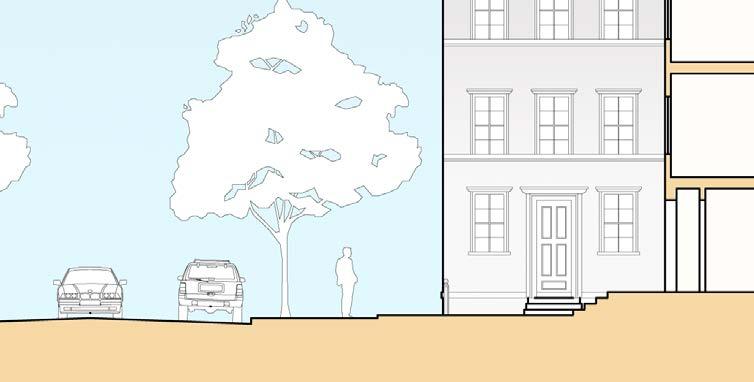
30 Building GUIDELINES 114 GENERAL Architecture Guidelines Architectural guidelines are important for establishing an aesthetic quality across the entire Round Rock Master Plan Area. Though the guidelines are not required by the Plan, they are recommended and following them will help in the project review process. The design guidelines in this section are intended to: Encourage the design of building frontages to emphasize human scale designs and high quality craftsmanship. Support the building vernacular of the city. Encourage sustainability at all levels. See page 139 for commercial lighting recommendations. Rationale for the Guidelines Architectural Guidelines help realize the vision of the Master Plan by translating visions into actual design practice, through a set of best practices related to architectural techniques, forms, and materials for new development, renovations and additions. By discussing architecture and design issues such as building composition and facade articulation, Design Guidelines help to explain how key concepts in the Master Plan, such as ground floor activation, can be realized. Design Guidelines provide the link between the city s vision for downtown and preferred design practices for the development community to facilitate a pedestrian friendly, vertical and compact, transit-supportive, sustainable, and aesthetically pleasing downtown. This section aims to provide the development community with specific recommended architectural techniques, forms, and materials to consider. Architecture Guidelines provide design guidance without dictating specific solutions. Not every guideline presented will be appropriate or feasible for every development. Context-sensitive application and implementation is key. Also, there may be creative design solutions not presented, which achieve Master Plan goals. Projects may still be found consistent with Architectural Guidelines by capturing the overall essence of the Guidelines, without incorporating each and every design feature suggested. If a Form Based Code is adopted in the future, it may contain a set of architecture guidelines based on those outlined here. The design of the building facade contributes to the quality of public space. The following guidelines relate to building facade, entry windows, and roof. Building Entrances Orient primary building entrances to the street front, rather than to the parking lot, alley, or interior of lot. Where an entry from a rear parking lot is desired, it should be in addition to the front entry (not instead of). Front entries should not be locked or blocked during business hours. Define building entrances using architectural features and articulation. Incorporate appropriate building massing and entry designs at street corners to anchor the intersections. Entrances incorporated within angled or curvilinear building forms are encouraged at corner locations. Include special paving and landscaping at entrances to enhance the overall building design. Facades & Windows Use windows or transparent materials to make up at least 25-50% of upper facades visible from public areas. Place windows to overlook public areas to allow for increased safety. Employ building techniques that break mass and volume into smaller units to create human-scaled form(s), (e.g. transitional elements such as second floor setbacks, stepped facades, roof decks, balconies, varying materials, and architectural ornaments can be utilized to break up large volumes). Recess entry ways to stores for visual interest and to minimize doors swinging into the sidewalk right-of-way. Avoid large expanses of solid surfaces and blank walls facing the street. Alternative cladding systems should be anticipated, including, but not limited to, storefront or curtainwall glazing systems with spandrel glass. Retail Facades & Windows Design storefronts to have at least 50-75% transparency. Break up blank walls with windows, entry ways, or other architectural elements to reflect the rhythm of typical storefronts, with entrances every feet. Recess storefront to create outdoor dining, corner features, or arcades for pedestrians. Locate window display areas near building entries. Consider the privacy of neighbors and adjacent buildings when placing windows along street. Provide frequent building entrances along the street for commercial buildings with long frontages. Locate ground floor retail or commercial space at the building frontage. Assure that side or rear building entrances are accompanied by a front, street-facing entrance. The street fronting entrance should not be locked or blocked during business hours. Assure shopfront windows are large, transparent, and visible, unblocked by interior fixtures, spandrel glass or paper signs. Doors and Windows Where clearly visible from the street: Specialty windows (e.g. oval, octagonal, Palladian) should be limited. Triangular windows are not recommended. If exterior shutters are used, they should be sized and mounted appropriately to fit the window (with appropriate hardware even if actually non-operable). Windows should be grouped only if they are separated by a significant mullion to create a horizontal composition. Window sills should project from building face. All lintels should be consistent with the building style. Where masonry is used, all entryway and window openings should have concrete, or masonry lintels. Any building utilizing masonry or stucco as the exterior material should not have window frames flush with the outside plane of the wall.

, or aluminum. Chose attic vents that are appropriate to the building style.")


31 Roofs Integrate roof top equipment into building architecture and screen it from public view. Use roof materials that are appropriate to the architectural style of the building. Locate roof-vent penetrations at least 10 feet from any exterior building face. Design eaves to be continuous, unless overhanging a balcony or porch. Encourage the use of cornices on buildings with flat roofs. They should include a projection beyond the building face. Use gutters and downspouts made of galvanized steel, copper (not copper coated), or aluminum. Chose attic vents that are appropriate to the building style. Materials Use durable and quality materials to give the building a sense of authenticity, weight, and mass. Use quality materials where concrete, stucco, etc. are used, to articulate structure. Avoid material or color changes at the outside corners of buildings that give an impression of thinness and artificiality. Examples of preferred materials include: Building materials: brick, wood, stone, adobe, cast masonry and metal that maintains design integrity. Doors and windows: painted or sealed wood, steel, or high quality metal trim with opaque or semi-solid stain, metal, carved or cast stone, tile, brick, stucco, or terra cotta for sill plates Awnings: canvas or other high-quality fabric. White roofs or cool roofs can help reduce building temperatures. Recessed windows with trim and columns give facade a sense of depth and permanence. 4th floor setback helps maintain a human-scale. Large shopfront windows and entryways with planters and pedestrian-scaled shop signage create visual interest. Building GUIDELINES Examples of materials to avoid include: Wood, metal or concrete panels applied to stucco walls as decoration. Plywood siding, light, transparent, Driftwood stains, and thin layers of stone or unit masonry which appear veneer-like. Vinyl siding, wood shingles, and smeared CMUs. Window grilles and gates. Aluminum mullions, imitation masonry, false shutters, opaque panels, and vinyl clad windows. Reflective, mirrored, tinted glazing. Asphalt shingles should be avoided. Vinyl or plastic awnings. 115 Recessed entry helps articulate entry and expand public right-of-way for an active sidewalk. Large windows with minimal glazing face primary street with secondary entrance and smaller windows on secondary street.


32 Parking and Service Building GUIDELINES Garages, driveways, and other auto entrances break up the street wall and diminish the pedestrian experience. Parking placement should not only take into account pedestrian safety but should also consider the impact to the public realm. Parking Downtown Parking should be accommodated on-street and, if on-site, should not be located directly in front of buildings. An attempt should be made to make parking areas appear as plazas, rather than as parking lots, through the use of landscaping and special paving. Screening with low walls, hedges, and other landscaping should be located between sidewalk and parking lot. Parking lot design should incorporate a variety of materials to differentiate spaces from driving aisle, or areas of high and low use, so as to break up the appearance of a large sea of concrete and to reduce the urban heat island effect. On-Street Parking On-Street parking directly in front of lot should count toward required parking for that lot s use. Structured Parking The relationship of parking to the street should be low impact, landscaped, and articulated with architectural elements so as to maintain a pleasant street wall. Parking should give priority to pedestrian entrances. Parking areas should be designed with clear pedestrian passages leading to the street, providing safe pathways and articulated with a different paving material. Driveway cuts and widths should be minimized. Visible parking structures and entrances should be screened and landscaped to the maximum extent possible. Particular attention should be placed in the design and programming of the base of parking structures. Parking structures along streets with a pedestrian orientation, should be screened by habitable liner building, upper level sections should be screened from view by a highly-articulated facade. Structured parking should be located behind the block perimeter buildings where possible. Where block size does not permit structures may be visible provided that there is ground floor retail and architectural screening above retail. Residential Garages Garage design should be subordinate to the main dwelling. Garages with deep recessed garages and motor courts, alley access and side entries are encouraged. Garage doors should not dominate the street scene. Multiple panel door designs, windows or other architectural details should be used on garage doors to reduce their impact and scale. See Master Plan Chapter 3 on Implementation Strategies for greater discussion of parking reform to create a vibrant, pedestrian-oriented environment. Parking Landscaping Parking lot landscape recommendations are a minimum of one shade tree per twenty spaces with a minimum of one landscaped island for every ten spaces. Service Service functions should be located behind buildings, preferably in alleys. Service functions should be screened from view, unless such services take place in alleys. Vehicular and service entries to garages should be designed to look like a part of the building. 116 Surface parking should be located behind buildings. Surface parking lot placed behind two street-facing retail buildings. Surface parking lots are linked together behind lot for inter-parking connectivity. This is a good way to share parking between uses. Parking placed below building with auto-entrance to parking garage behind building, prioritizing the street frontage for pedestrian use and safety. This is a more expensive solution on a per space basis and is more difficult to share among buildings and other uses, but is aesthetically more appealing. Parking garage placed behind street-facing retail buildings. Structured parking maximizes land used for parking by building up, rather that out. It is less expensive than underground parking and easier to share, as in a park-once garage. However, the garage should be screened or hidden from primary streets.


.")


 square feet if it is determined that the sign's architectural design is of such a quality and/or character as")

 if it is determined that the sign's architectural design")

33 SIGNAGE Currently, the Round Rock Sign Ordinance determines the type, size, spacing, and features of signs in the downtown area. Because this Master Plan envisions a downtown area that is urbane, small-scale, compact, and pedestrian-friendly, it also recommends certain scale, type, and design of signs that are appropriate. The existing Sign Ordinance will need to be modified to reflect the scale and character of this Master Plan and the future Form Based Code. Non-Recommendations Sign Types The following sign types are not recommended in the Specific Plan area: Roof and parapet signs Internally illuminated plastic signs Billboards and other auto-oriented signage Free standing signs, with the exception of monument signs (see below, right*). Recommendations Sign Types The sign types in the box below are recommended for the Plan area: Awning Valance: A sign or graphic attached to or printed on an awning's valance. Wall: A sign affixed directly to an exterior wall or fence. Hanging: A sign attached to and located below any eave, canopy or awning. Window: A sign affixed to or behind a window. Blade: A sign that projects at a right angle from the face of the building and is located on a pier adjacent to the transom windows. General Recommendations Recommended Sign Height Limits (all dimensions are above grade). These height limits should not apply to signs located on a movie theater building: Marquee: A sign installed at a movie theater to identify the theater and advertise the movies currently playing. Awning Valance and Projecting: 12 feet Monument: 4 feet Hanging and Wall: 15 feet Window: 7 feet Freestanding theater marquee: 20 feet to the top of the marquee area. All wall signs should have an equal margin above and below the sign. Building-mounted signs (exclusive of marquees) should be limited to a maximum of two hundred (200) square feet. One sign may be increased in size in excess of two hundred (200) square feet if it is determined that the sign's architectural design is of such a quality and/or character as to warrant the increase in size. Individual backlit letters, halo lighting and reversed channel letters. Projecting: Any sign which projects from and is supported by a building wall with the display of the sign perpendicular to the building wall. A-frame: These signs are acceptable as long as they do not block the sidewalk and do not interfere with ADA requirements. The overall height of the sign structure can exceed 20 feet (up to the maximum height limit in the land use district) if it is determined that the sign's architectural design is of such quality and/or character as to warrant the increase in height. The top of the marquee area should not exceed 20 feet in height above the ground. Projecting signs should be limited to a 2 foot projection from the wall face they are mounted on and should be not greater than 10 square feet in area of a single face. Projecting Signs should clear public sidewalks and private walkways by at least 7 feet. Multi-family residential properties of 12 or more units may have one sign of 10 square feet or less. Address numerals, traffic direction, and public information signs should not be counted toward signage area. Temporary signs such as A-frames are acceptable as long as they do not block the sidewalk and do not interfere with ADA requirements. *Monument Sign: These signs are sculptural in appearance and often reflect the architectural characteristics of the building and neighborhood. They are freestanding and are usually located in the front or side setback of a commercial, civic, or retail building. Monument signs can be the focal point of landscaping and should be illuminated by ground lighting or down-lighting, rather than internally. The signs should be crafted with durable and attractive materials. Urban Form Guidelines 117


34 Building GUIDELINES Balconies Balconies are encouraged on projects facing major public spaces such as parks and plazas. Design should minimize conflicts or interaction with pedestrians and sidewalks below and balconies should not obscure views or sign visibility. Standard balconies should have a minimum usable width of 6 feet and a maximum usable width of 8 feet. The maximum length of a balcony may not exceed more than half the width of the building facade, and should not exceed 60 feet in length, except that French balconies may extend the entire length of the facade on one story, for a three or more story buildings only. Balconies on primarily retail streets should not project more than 2 feet from the building face. All balconies should be accessible from inside the building. In multi-family residential buildings, standard balconies should not create a relentless horizontal and vertical stacking pattern. They should create a complex and varied pattern along the facade using various balcony sizes and architectural configurations. The underside of standard balconies should be architecturally designed to form a pleasant pattern when viewed from the street. Standard balconies may be projecting or recessed or a combination of both. Longer balconies should be articulated with vertical elements such as columns, brackets etc. Balconies should not be completely enclosed. Longer balconies may have shutters, screens and windows along its outside edge. These shutters or screens should have a clear pattern and rhythm that relates to the balcony supports and brackets. Standard balconies may have railings or opaque walls as long as they are conducive to the character of the particular building style. Standard balconies should be structurally supported by brackets or beams when facing public streets. Balconies are encouraged to have planters along railings or potted plants. The planters should be planted with flowering plants and flowering hanging plants. Awnings Awnings should fit the entrance or window openings. Mounting should respect and enhance moldings that may be found above storefront and/ or sign panel. Open-ended awnings are preferable compared to closed. Canvas and high quality fabric is preferred, vinyl is not appropriate. Colors should complement building colors and design. Covering should not project more than 7 ft. or 66% of distance between building and curb. 118 Photos show various signage, balconies, and awnings that add texture, and color to the urban form.


35 Residential Architecture Guidelines Round Rock s neighborhood fabric is unique in terms of architectural styles. The primary focus for residential guidelines is on developing a high-quality environment. See page 139 for residential lighting guidelines. General Residential Guidelines The massing and dimensional ratios of building components should create a harmonious visual balance and contribute to the architectural rhythm. Human scale proportions and architectural building details which emphasize and reflect the presence and importance of people are encouraged. The arrangement and design of architectural elements such as windows, doors, cornice details etc. should take into consideration scale, style and proportion of the overall architectural form. All building elevations should be architecturally enhanced. Massing offsets, fenestration, varied textures, openings, recesses, and design accents are strongly encouraged to ensure there are no un-articulated walls and monolithic roof forms. One-story architectural elements and massing should be incorporated into two and three-story building designs to the greatest extent possible. Architectural elements such as balconies, verandas and porches that add architectural character are encouraged. Equal spacing between porch columns is encouraged. When porches are made of wood, they should have a visible horizontal wooden beam between the roof eaves and column supports. Porches may extend beyond the side facades of the buildings to create porte-cocheres. Specific porch architecture details such as roof slopes, eave overhangs, column and railing proportions and shapes, materials, and relationships of porch to the building itself should be designed appropriate to each individual style. For reference, use Abram s Guide to American House Styles published by Harry N. Abrams, Inc., Building GUIDELINES Porches and Stoops Front porches create architecturally attractive semi-private front yard spaces and foster community interface. Porches are encouraged as they help create frontages compatible with the scale and character of the existing single-family neighborhood fabric in downtown. When a porch contains the main entrance to a building, a walkway should connect it to the sidewalk. For porches to be most effective and functional, the minimum width of a porch from the face of the building to the porch edge should be 8 feet. All porches should be raised above the adjacent sidewalk elevation. Porches may extend into the second story of a building. However no porch should be more than a single story high. Porches may have a front or side location. When on the side, they must extend at least to the front face of the building. Porches may wrap along more than one façade of a building. But they should not exceed two full façades. Porches may either be recessed elements with a roof continuous with the building roof, or they may be protruding elements added on to the face of a building. An appropriate porch for Round Rock with small stoop. An existing stoop in downtown. A porch overhang appropriate for single-family development. 119


 to screen them and deter graffiti.")


36 Utilities, Storage, Trash Trash and recycling receptacles, as well as utility and mechanical equipment should be screened from public view to enhance the quality of space. Trash and Recycling Building GUIDELINES Utility, service areas and mechanical equipment should be screened from view. All screening devices should be compatible with the architecture, materials and colors of adjacent buildings. Trash and storage enclosures should be architecturally compatible with the project design. Landscaping should be provided adjacent to the enclosure(s) to screen them and deter graffiti. Trash storage should be enclosed within or adjacent to the main structure or located in a separate freestanding enclosures. Trash enclosures should be sited to minimize nuisance to adjacent properties. The location of trash enclosures should be easily accessible for trash collection and should not impede general site circulation patterns during loading operations. Cart storage should be integrated within commercial buildings and site design. Large freestanding enclosures or unscreened cart corrals are generally considered unacceptable. Mechanical equipment should not vent to the street-side of the building. Back flow and fire standpipes, along with utility box transformers should be screened. 120 Photos show preferred trash and recycling receptacles with buffering from fences and walls.


 and may have stucco or masonry")
37 Fences, Walls, Hedges Garden walls, retaining walls, hedges and fences define the edge between the public street and private yards, as well as the street face where buildings are absent. Fences, Walls & Hedges Fences, walls, and hedges should compliment the architecture of the building that they enclose and be compatible with the land use intensity (i.e. residential uses should incorporate a softer texture of enclosure such as wood fences and landscaped hedges, whereas commercial buildings may use masonry walls). Solid perimeter walls should be constructed of high quality enduring construction materials such as masonry and/or ornamental metal. Walls and fences should be architecturally enhanced and complimented by adjoining landscaping. Tiered planting should be provided adjacent to perimeter walls to softer their appearance from surrounding areas. The top of the wall/fence should remain level in stepped conditions. Saw-tooth fence design solutions are discouraged. Garden walls, retaining walls, hedges and fences should be built at least two feet from the back of the sidewalk, assuming that it falls within the property line, to allow room for footings and planting. Walls and fences should not be used in front of retail except in situations where retaining walls are necessary to accommodate grade changes. Retaining walls should be masonry or stone or another durable high-quality material. Fences should be made of ornamental iron, steel, wood pickets or a synthetic wood product (such as Wood-filled Recycled Plastic Lumber) and may have stucco or masonry piers. Hedges may be used in place of any fence, subject to the same height parameters and high maintenance standards. Vinyl, plastic, or chain link fencing should not be used. Fence reveals street wall but does not cut off view to and from home. Fence incorporates architectural elements of the neighborhood style. x Hedges obscure house. x Wall is unsightly and monotonous. x x Building GUIDELINES 121 Fence is softened behind hedges. Unsightly fence.
38 Building GUIDELINES 122
39 2. URBAN Form Guidelines The following section describes the recommended Urban Form Guidelines related to the area between the buildings, what is generally known as the public right-of-way. They include: Critical Urban Design Features Block Network and Circulation Streets Street Sections Intersections and Sidewalks Sustainability and Green Space Trees and Landscaping Street Furniture and Lighting Urban Form Guidelines 123
40 Lewis St Critical Urban Design Features The overall vision of downtown Round Rock as a vibrant city center, centered around the new town green, is supported by several critical urban design features: Prominent facades Critical paths Prominent retail fronts Prominent features These features described on the map should be taken into consideration during development of private property and improvements to the public realm. Prominent facades: have added attention to detail, entry doors, minimal, if any, auto access and service, and are oriented to the pedestrian. Critical paths: are key routes for vehicular and pedestrian circulation. Round Rock Ave Mays St Georgetown St Urban Form Guidelines Prominent retail fronts: are located where retail is highly encouraged and is intended to be pedestrian-oriented in design. Prominent features: are located at visually significant places, for example at the termination of significant vistas or at primary corners. These features can include vertical extensions of roof lines, bay windows, enhanced materials, or other unique features. Main Street Mays St Burnet St Austin Ave Liberty Ave Main Street Legend: Prominent Facade, Strong Frontage Prominent Retail Front 124 Critical Paths Prominent Feature Green Space Critical Urban Design Features in the heart of Round Rock

41 MAYS Block Network & Circulation This section addresses the blocks in the Master Plan area in terms of size, character, and arrangement. The Block and the Street There is a direct relationship between block size and pedestrian-friendly design the smaller the block, the greater the permeability of the street network and the more comfortable it is to move through the area as a pedestrian. A block is defined by three or more thoroughfares (not an alley or pedestrian only passage) measured along the proposed curb line. Blocks in downtown are historically feet long. Maintaining this length will help encourage pedestrian activity. It is suggested that the maximum length of new blocks should be limited to linear feet. The Master Plan illustrates the intent for an interconnected network of streets. However, individual parcel developers may require modifications to this Plan to fit specific block size requirements, TxDOT requirements, parcel availability, or other conditions that may be encountered. Closing or vacating streets permanently for new developments may have negative long-term effects on downtown circulation by making the street system more confusing to users and forcing higher traffic volumes on to other streets, thereby degrading both traffic and pedestrian conditions and creating longer blocks that are not pedestrian friendly. Streets, including alleys in the downtown area should not be closed or vacated. Cul-de-sacs, street closures and other dead-end conditions are highly discouraged. Informed Purchase Purchasers of properties along stubbed-out streets awaiting connection should be given copies of the Master Plan as part of their purchase agreement and acknowledge by signed agreement that they have been informed of the Master Plan s intention to connect this street at some point in the future. This requirement should apply to the resale of said properties for as long as this Plan, as amended, is in effect. ROUND ROCK MAYS BURNET LEWIS LIBERTY MAIN PECAN GEORGETOWN PALM VALLEY BLVD (HWY 79) Urban Form Guidelines 125 Proposed block network
42 Street Hierarchy Streets should be appropriately-scaled to their use: Primary Streets: key circulation, mix of intensities, more pedestrian and vehicular accommodation, key for development, most developed. Secondary Streets: single use development as opposed to mixed-use development, fed from primary streets, less circulation than primary street, less mix of intensities than primary streets, less of pedestrian and vehicular traffic than primary streets. Tertiary Streets: mostly residential, mostly low intensity in terms of land use and density. IH-35 Mays St Legend: Primary Street Secondary Street Tertiary Street Plan Boundary These classifications are different from current Round Rock street designations and are recommended because of their emphasis on the pedestrian-orientation of the street, rather than purely automotive function of the street. Urban Form Guidelines Main is the main pedestrian corridor east/west, while Lewis, Sheppard, and Mays are the key pedestrian corridors north/south in downtown. A Note on Alleys and Driveways Within downtown, alleys: Should not be located on a street, or section of street, that fronts on a public green space. Should align with each other when across a street or should be separated by a minimum of 75 feet. Should be a minimum of 75' from an intersection measured from the Right-of-Way. Round Rock Ave Lewis St Palm Valley Blvd - Hwy 79 Georgetown Street Main Street Main Street Mays St Burnet St 126 Street Hierarchy Plan
43 Street Sections The street should be viewed as an outdoor living room where people can congregate, move around, and function. The following guidelines depict suggested right-of-way (ROW) widths for key streets in downtown and show the essential characteristics for each street (e.g. sidewalks, parking, furnishing zones, etc.). These street sections are recommendations only. Round Rock Avenue A Round Rock Avenue B Legend: Round Rock Ave Main Street Mays Street Georgetown Ave Free-Flow Park Edge ROUND ROCK A B C D E MAYS MAIN LEWIS Free-Flow Residential Existing Residential Prosed Alley PALM VALLEY BLVD (HWY 79 GEORGETOWN Recommendations: Primary street Design Speed*: up to 35 MPH Sidewalks: 15 with 5 planting strip Curb Radius: 20 at intersecting streets Street Tree Placement: 30 spacing Street Tree Location: Centered in planting strip Street Light Location: Centered between street trees within the planting strip Travel lanes should be 12 for each lane, two lanes for each direction Recommendations: Primary street Design Speed: up to 35 MPH Sidewalks: 10 with 5 planting strip Curb Radius: 20 at intersecting streets Street Tree Placement: 30 spacing Street Tree Location: Centered in the planting strip Street Light Location: Centered between street trees within the planting strip Travel lanes should be 12 for each lane, two lanes for each direction Urban Form Guidelines Key * Design speed is the maximum speed that a vehicle can travel safely on a road. Design speed is determined by the design and geometric features of the thoroughfare, such as sight distance, curvature, etc. Design speed is typically higher than the posted speed limit to result in safety-conservative values for design criteria such as sight distance or alignment. 127
44 Round Rock Avenue C Round Rock Avenue D Round Rock Ave E Urban Form Guidelines Recommendations: Primary Street Design Speed: up to 35 MPH Sidewalks: 12 with 5 planting stirp Curb Radius: 20 Street Tree Placement: 30 spacing Street Tree Location: Centered in the planting strip Street Light Location: Centered between street trees within the planting strip On-Street parking should be provided on one side of street Recommendations: Primary street Design Speed: up to 30 MPH Sidewalks: 20 with trees in tree wells Curb Radius: 20' Street Tree Placement: 30 spacing Street Tree Location: Centered in tree pits Street Light Location: Centered between street trees Travel lanes should be 12 for each lane On-Street parking should be provided both sides of street Recommendations: Primary street Design Speed: up to 30 MPH Sidewalks: 20 with trees in tree wells Curb Radius: 20 Street Tree Placement: 30 spacing Street Tree Location: Centered in tree pits Street Light Location: Centered between street trees Travel lanes should be 12' for each lane On-Street parking should be provided on both sides of street 128
45 Main Street Mays Street Georgetown Street Recommendations: Recommendations: Recommendations: Primary street From Main Street Bridge to Burnet Street Design Speed: up to 30 MPH Sidewalks: 18 with trees in tree wells Curb Radius: 20 Street Tree Placement: 30 spacing Street Tree Location: Centered in tree pits Street Light Location: Centered between street trees within the planting strip Travel lanes should be 14 for each lane On-Street rear angled parking should be provided on both sides of street Primary street From south of Brushy Creek Bridge to north of Logan Street Design Speed: up to 30 MPH Sidewalks: 15 with trees in tree wells Curb Radius: 20' Street Tree Placement: 30 spacing Street Tree Location: Centered in tree pits Street Light Location: Centered between street trees Travel lane should be 12 for each lane, turn lane should be 12 On-Street parking should be provided on both sides of street Secondary street From south of Brushy Creek Bridge to Main Street Design Speed: up to 30 MPH Sidewalks: 7 with 7 planting strip Curb Radius: 15 Street Tree Placement: 30 spacing Street Tree Location: Centered in the planting strip Street Light Location: Centered between street trees within the planting strip Travel lane should be 12' for each lane On-Street parking should be provided on both sides of street Urban Form Guidelines 129
46 Free-Flow Park Edge Free-Flow Residential Existing Residential Proposed Alley Urban Form Guidelines 130 Recommendations: Recommendations: Recommendations: Recommendations: Secondary or tertiary street Design Speed: up to 25 MPH Sidewalks: vary Curb Radius: 15 Street Tree Placement: 30 spacing Street Tree Location: Centered within the planting strip Street Light Location: Centered between street trees within the planting strip Travel lane should be 10' for each lane On-Street parking should be provided on both sides of street Tertiary street Design Speed: up to 25 MPH Sidewalks: 5 with 7 planting strip Curb Radius: 15 Street Tree Placement: 30 spacing Street Tree Location: Centered within the planting strip Street Light Location: Centered between street trees within the planting strip Travel lane should be a 12' yield street On-Street parking should be provided on both sides of street Tertiary street Design Speed: up to 30 MPH Sidewalks: varies. Many streets have no sidewalks. Turning Radius: 15 Street Tree Placement: 30 spacing Street Tree Location: Placed within the green Street Light Location: Centered between street trees within the green On-Street parking should be provided on both sides of street Travel lane should be a 14 yield street Alley Design Speed: up to 15 MPH Sidewalks: n/a Turning Radius: 10 No street tree planting required No street lights required No on-street parking Travel lanes should be 10 for each lane


47 Intersections & Sidewalks Intersections are urban spaces that serve as seams or barriers between neighborhoods and/or districts. Sidewalks are an essential component of creating a pedestrian-friendly environment. Well-designed sidewalks provide the necessary sense of comfort and safety to encourage walking. These guidelines focus on making intersections and sidewalks a safer place for pedestrians by suggesting bulb outs, sidewalk extensions, midstreet crossings, and urban design features such as textured paving and landscaping to slow traffic and draw attention to the crosswalks. Crosswalks and Curb Extensions Curbs In commercial areas, crosswalks should be marked by a paving design and texture that is clearly different from the street paving. In residential areas, cross walks should be marked clearly for vehicular and pedestrian traffic. Curb extensions (bulb outs) shorten crossing distances and provide sidewalk space for curb ramps and landings. Installing curb extensions physically deters parking at intersection corners and improves the visibility of pedestrians. Bulb out intersection corners should be used on all streets that have a parking lane, except when space is limited or where larger turning radii are required for large vehicles. The dimension of the curb radius affects the pedestrian safety of an intersection. The smaller the radius, the less area required to cross and the slower the speed of a vehicle making a turn. A curb ramp should be installed at both ends of the crossing in a direct line of travel, consistent with the standards of the ADA as well as local and state codes. Curbs should be vertical (not mountable). Where possible, use granite, especially on curbs fronting mixeduse buildings. Sidewalks Sidewalks are strongly encouraged on both sides of the street especially when such streets are fronted by buildings. Sidewalks should be separated from any parking space by a physical barrier that will obstruct vehicles from intruding into the required clear path of pedestrian travel. Retail sidewalks should be paved from building face to street curb and punctuated with trees and grates. Special paving (using texture, color or patterned brick or stone) should be used to enhance the architecture and the pedestrian experience. In commercial areas, the buffer zone is often the furnishing zone where utility poles, trees, hydrants, signs, benches, transit shelters, and planters should be placed. The furnishing zone in a low-density commercial zone should be a minimum of 5 feet wide. The furnishing zone is over and above the clear area of the sidewalk. Landscaping adjacent to sidewalks should be pedestrian-friendly, and free from spiky plants, rapidly growing vines, and other landscaping that may cause harm to pedestrians. Streetscapes that are primarily paved should include planters with trees and/or plants. Sidewalk designs should conform to the ADA, as well as all state and local codes. Preferred street intersection design with textured crosswalks and planted bulb outs at intersections, shortening the crossing distances. Sidewalk appropriate for Round Rock s retail areas with tree planters in furnishing zone, parallel to parking lane. Landscaping occupies the shy distance between the building and the sidewalk. The ground floor is elevated as privacy is important for residential units along busy streets. Urban Form Guidelines 131 Planted parkway, parallel to parking lane, appropriate for Round Rock s residential areas.


.")

48 Sustainability & Green Space The city can employ sustainable strategies within the public right-of-way to: Reduce stormwater runoff Lower area temperatures to reduce the urban heat island effect Improve air quality and reduce pollution Expand the tree canopy of the city to reduce pollution and enrich the look and feel of the city The following recommendations discuss green streets, pocket parks, tree planting patterns, and landscaping to achieve sustainable environment goals. Portland green street before and after with rain garden, grate, and permeable bricks to collect and divert stormwater. Urban Form Guidelines Sustainable Approach The following design and construction strategies are encouraged: Recommended use of low albedo concrete over asphalt in parking lots and roadway to increase solar reflectivity of pavement. Use of permeable pavement in parking lots, parking lanes, and other low speed, low weight bearing areas to reduce stormwater runoff. Preservation and expansion of tree canopy. Installation of LED lighting for street lamps to reduce energy consumption. Planting of the medians, roundabouts, and sidewalk extensions (bulb outs). Additional vegetation to pocket parks and yards where possible. Use of permeable and sustainable materials for sidewalk construction. Landscaping with native species and drought resistant plants using timed irrigation systems for watering vegetated areas within the public right of way. Street-edge bio-swales for the collection of rain water. 132 Example of alley with permeable paving from the Chicago Green Alley Handbook. Before After Before and after images from the Chicago Green Alley Handbook showing differences between impermeable and poor drainage and permeable paving.


, for example, can be used temporarily as a pocket park for events and activities until the town green is developed or until the")


49 Pocket Parks Pocket parks can be used to add green space to urban areas - transforming oddly sharped or vacant parcels (that may be too small or awkward to develop into community areas). They add a respite from busy streets and can accommodate recreational uses - such as play grounds for children, chess tables for seniors, and more passive activities such as reading, picnicking, and socializing. Pocket parks are generally designed so that they are visible from the street with a minimum of 50% street frontage for safety. They typically include seating areas, shade trees or shade structures, and vegetation that add greenery, texture, and visual interest to the public right of way. Because the Round Rock Master Plan area has many differently sized and oriented parcels, pocket parks, or small planted green areas, could be incorporated in those areas as part of future redevelopment efforts. The city could also consider allowing large projects that cannot fulfill open space requirements on-site to develop pocket parks in adjacent or nearby parcels that would not normally be attractive or profitable for development. Ultimately, attractive pocket parks would increase the desirability of commercial and residential areas - raising property values and making Round Rock a more livable place. The vacant lot at 205 E Main Street (the former Senior Center site), for example, can be used temporarily as a pocket park for events and activities until the town green is developed or until the site is partially developed. See Implementation Chapter 3 for details on recommended vacant parcel policy. Parkways Planters and vegetated strips along sidewalks, known as parkways, add to a street s texture and richness with greenery and flowers. Parkways provide: a buffer between the sidewalk and the streets, an area in which to plant street trees, and a feeling of safety to pedestrians. The median and parkway along Round Rock Avenue and the parkway on Georgetown are examples of potential integrated water retention or bio-swale areas. Parkway Recommendations Parkways should be included in the design of all streets except retail streets. (See recommended street sections on following pages.) All furniture (e.g. benches, bike racks, bus stop seating, signposts, etc.) located within parkways should be placed at least 2 feet from the curb edge. Parkways in residential neighborhoods should not be raised, and should be continuous along the street length, broken only by driveway aprons and entries. Parkways may be designed to have a variety of materials such as cobbles or river pebbles for a permeable surface. Parkways designed to incorporate bioswales or water retention areas to mitigate stormwater runoff are encouraged. Parkways may project out beyond the curb edge to create breaks in the street parking. These projections are encouraged to be designed as a pattern along the entire street length. Vegetation within parkways should be disease resistant, drought tolerant, and appropriate to the Round Rock climate. Pocket park between buildings. Rain garden with pebbles and plants creates permeable surface, absorbing and filtering rain water from street during storm. Landscaped planter along residential street, providing room for street trees. Pocket park in front of parking lot, along a street. Urban Form Guidelines Parkways can be designed as bio-swales or water retention areas to mitigate stormwater runoff and can reduce the need of storm water ponds. (See Infrastructure Section for proposed pond location.) Pocket park in median, provides pedestrian path and respite from traffic. Rain water drain as art piece and flower box along roadway, greening the urban environment. 133


50 Trees & Landscaping Round Rock Avenue B Landscape Recommendations by Street The following boxes depict landscape recommendations for key streets in downtown. These guidelines describe the general intent and vision for streetscaping throughout downtown. It is recommended that: Every street in the Round Rock Master Plan Area should have street trees planted along their length. Shade trees should be added to new curb extensions, or bulb-outs. Canopy trees should be planted within the furnishing zone along commercial streets and within parkway areas on residential streets. Mature trees should be preserved as a community asset. Trees should be selected to: Enclose or frame the space of the street with a canopy. Provide shade. Provide a safety layer between traffic and pedestrians creating the feeling of safety for the pedestrian. Enhance building architecture. Reduce the heat island effect created by paved surfaces. Aid in storm water management through evapotranspiration. Not interfere or obscure windows in retail areas. Avoid a mono-culture, susceptible to disease and infestation. Legend: Round Rock Ave Main Street Mays Street Georgetown Ave Free-Flow Park Edge Free-Flow Residential Existing Residential Proposed Alley PA L M Mature Trees LE RO RO U N CK D -H W B C GEORGETOWN A D MAIN 0 YB LV D Y VA L MAYS Under the Round Rock Tree Ordinance, monarch trees are protected. A tree is designated a monarch tree by the forestry manager and is selected if it its diameter represents 80 percent of the diameter of a species largest and healthiest tree in the City of Round Rock. A monarch tree can only be removed with City Council authorization. Special attention should be given to preserving large mature trees, as they represent a significant asset to the community. LEWIS Urban Form Guidelines Landscaping improvements foster civic pride and contribute to the environmental quality and the economic, physical and social health of our community. Most great streets in the world have a well established tree canopy. Round Rock has a substantial tree canopy including old trees that should be preserved. Round Rock Avenue A Key Paving: Sidewalks - Tan concrete paving, scored, square Crosswalks - Tan concrete pavers (bands) with red concrete pavers (fields) Curbs Tan concrete to match existing Street Trees: Ulmus crassifolia/cedar Elm in parkway Quercus virginiana High Rise / High Rise Live Oak in median Understory Planting: Planted parkways Planted median Other: Pedestrian-scaled light post located in planted parkway Paving: Sidewalks - Tan concrete paving, scored, square Crosswalks - Tan concrete pavers (bands) with red concrete pavers (fields) Curbs Tan concrete to match existing Street Trees: Ulmus crassifolia/cedar Elm in parkway Understory Planting: Planted parkways Other: Pedestrian-scaled light post located in planted parkway
 and parkway (south side) Quercus virginiana High Rise / High Rise Live Oak in bulb-outs/curb extensions (north")
.")

 Curbs Tan concrete to match existing Street Trees: Quercus virginiana High Rise / High Rise Live Oaks at finger planters Quercus shumardii/red Oaks in tree grates Planting: Planted parkways")
51 Paving: Sidewalks - Tan concrete paving, scored, square Red concrete paver band at curb (north side only) Crosswalks - Tan concrete pavers (bands) with red concrete pavers (fields) Curbs Tan concrete to match existing Street Trees: Ulmus crassifolia/cedar Elm in tree pits (north side) and parkway (south side) Quercus virginiana High Rise / High Rise Live Oak in bulb-outs/curb extensions (north side only) Understory Planting: Planted parkway (south side only) Planted bulb-outs/curb extensions at on-street parking (north side only) Other: Pedestrian-scaled light post located in planted parkway Round Rock Avenue D Paving: Sidewalks - Tan concrete paving, scored, square Red concrete paver band at curb (both sides). Crosswalks - Tan concrete pavers (bands) with red concrete pavers (fields) Curb Tan concrete to match existing Street Trees: Ulmus crassifolia/cedar Elm in tree pits (both sides) Quercus virginiana High Rise / High Rise Live Oak in bulb-outs/curb extensions at on-street parking Understory Planting: Planted trees pits Planted bulb-outs/curb extensions at onstreet parking Other: Pedestrian-scaled light post located at back of curb Main Street Paving: Sidewalks - Tan concrete pavers (bands) with red concrete pavers (fields) Crosswalks - Tan concrete pavers (bands) with red concrete pavers (fields) Curbs Tan concrete to match existing Street Trees: Quercus virginiana High Rise / High Rise Live Oaks at finger planters Quercus shumardii/red Oaks in tree grates Planting: Planted parkways Planters at diagonal parking Other: Pedestrian-scaled light post along back of curb Mays Street Paving: Sidewalks - Tan concrete paving; scored 18 square 4-0 wide red concrete paver band at curb (both sides). Crosswalks - Tan concrete pavers (bands) with red concrete pavers (fields) Curb Tan concrete to match existing Urban Form Guidelines Round Rock Avenue C Street Trees: Acer barbatum Caddo /Caddo Maple in 4-0 x 8-0 tree pits Quercus virginiana High Rise / High Rise Live Oaks in bulb-outs/curb extensions at on-street parking Quercus virginiana High Rise / High Rise Live Oaks in median Planting: 4-0 x 8-0 planted tree pits 11-0 wide planted median Other: Pedestrian-scaled light post along back of curb 135


52 Urban Form Guidelines Georgetown Street Paving: Sidewalks - Tan concrete paving, scored, square Crosswalks - Tan concrete pavers (bands) with red concrete pavers (fields) Curb Tan concrete to match existing Street Trees: Quercus Monterrey/Monterey Oak in parkway Quercus virginiana High Rise / High Rise Live Oak in bulb-outs/curb extensions at on-street parking 136 Understory Planting: Planting beneath street trees within turfed parkway Planted bulb-outs/curb extensions at onstreet parking Other: Pedestrian-scaled light post located in planted parkway Free-Flow Park Edge Paving: Sidewalks - Natural gray concrete paving, scored, square Curb Natural gray concrete Street Trees: Along development side; single species selected from Recommended Plant List Informal layout; multiple species selected from Recommended Plant List Understory Planting: Planting beneath street trees within turfed parkway on development side Other: Pedestrian-scaled light post located in planted parkway Free-Flow Residential Paving: Sidewalks - Natural gray concrete paving, scored, square Curb Natural gray concrete Street Trees: Single species selected from Recommended Plant List Understory Planting: Planting beneath street trees within turfed parkway Other: Pedestrian-scaled light post located in planted parkway Existing Residential Paving: Sidewalks - Not applicable Curb Not applicable Street Trees: Informal layout; multiple species selected from Recommended Plant List Understory Planting: Not applicable

 M3622 M4836 M6058 M7250 TREE OPENING 36 48 60 72 12,20 16,22 16,26 22,36 WEIGHT IRON ALUMINUM 115 205 310 500 42 75 110 180 USE FRAME")

 338-4766 FOR LANDSCAPE ARCHITECTURE (800) 338-4766 FOR LANDSCAPE ARCHITECTURE Tree grates can provide interest to public realm.")


 48 TREE OPENING 16,18 WEIGHT IRON ALUMINUM 304 102 Urban Form Guidelines ADA USE FRAME 4800F Lightwell covers are bolted to prevent")


53 Trees & Landscaping Examples MARINA A.D.A. Marina MODEL SHOWN: M4836 MODEL SHOWN: M6084 1/2"x1"x1/4" THICK GRINDING PADS FOR LEVELING-TYP. 4 OR MORE PLACES Mature trees provide pleasant canopy, shading street. Using a variety of textures and materials enhances the public realm. GRATE MODEL NO. GRATE MODEL NO. SIZE (INCHES) M3622 M4836 M6058 M7250 TREE OPENING ,20 16,22 16,26 22,36 WEIGHT IRON ALUMINUM USE FRAME M3622F M F M6000F M7200F SIZE (INCHES) TREE OPENING M ,15, M4800F M ,15, M6000F Starburst IRONSMITH TREE GRATES Drought tolerant, native species should be used in landscaping to reduce water and energy use. M M M M ,18 16,18,28 16,18,28 16,26, USE FRAME CAMELIA Camelia IRONSMITH TREE GRATES (800) FOR LANDSCAPE ARCHITECTURE (800) FOR LANDSCAPE ARCHITECTURE Tree grates can provide interest to public realm. WEIGHT IRON ALUMINUM Slot openings taper from 3/8" to 1/2" maximum to meet A.D.A. guidelines. Tree opening can be expanded to accommodate growth or ordered with the larger opening. Available in cast gray iron or cast aluminum these Grates are designed to carry pedestrian loads only Aluminum grates should be installed with frame and pilfer proof bolts to prevent unauthorized removal. For coating options, please see section on "Finishes". STARBURST SERIES 1 Cast with 1/2" maximum slot openings to meet A.D.A. guidelines. Tree opening can be expanded to accommodate growth or ordered with the larger opening. Available in cast grey iron or cast aluminum MODEL SHOWN: M these Grates are designedcto1984 carry pedestrian loads only IRONSMITH Aluminum grates should be installed with frame and pilfer proof bolts to prevent unauthorized removal. For coating options, please see section on "Finishes". 1" RIBS M3600F M4800F M6000F M7200F GRATE MODEL NO SIZE (INCHES) 48 TREE OPENING 16,18 WEIGHT IRON ALUMINUM Urban Form Guidelines ADA USE FRAME 4800F Lightwell covers are bolted to prevent unauthorized removal. Cast with 1/4" maximum slot openings to meet A.D.A. guidelines. Lightwell covers are bolted to prevent unauthorized removal. Lightwell covers available in clear polycarbonate at extra cost. Cast with 1/4" maximum slot openings to meet A.D.A. guidelines. Tree opening can be expanded to accommodate growth or ordered with the larger opening. Available in cast grey iron or cast aluminum these Grates are designed to carry pedestrian loads only Aluminum grates should be installed with frame and pilfer proof bolts to prevent unauthorized removal. For coating options, please see section on "Finishes". Grates are designed to carry pedestrian loads only Grates can be provided in cast iron or cast aluminum Tree Opening: 16", or 18" Tree grates should be uniform along Main, Mays, and Round Rock. Images above show example grates foroptions street trees on commercial See section on Finishes for finish sidewalks. These particular tree grates by IRONSMITH are completely recyclable and made from at least 75% recycled content. Desirable urban landscaping for private properties, which interface with the street. IRONSMITH TREE GRATES FOR LANDSCAPE ARCHITECTURE IRONSMITH TREE GRATES FOR LANDSCAPE ARCHITECTURE (800) (800)


54 Street Furniture & Lighting Street furniture enhances the look and feel of the public right-of-way and contributes toward creating a pedestrian friendly environment. It does this by adding texture to the street, providing shade and seating, and creating a unique sense of character in each neighborhood. Street Furniture All streets should have street furniture, where possible. Placement of street furniture is encouraged on residential streets with commercial activity. Street furniture should also be included in public plazas, courtyards, and parks. Street furniture and lighting should be uniform to enhance its identity and contribute to its sense of place. Street furniture represents a public art opportunity for the city. Uniquely-designed benches, bike racks, signage, tables, chairs, and trash cans can contribute to the character and individuality of the local environment. Moveable tables and chairs allow for spontaneity and flexible social interaction. Urban Form Guidelines Bench under shade tree creates a moment of respite. Bench faces sidewalk and building front rather than traffic. 138 Street dining enhances the public realm and creates a safer, more vibrant street atmosphere. Decorative benches can act as public art.


55 Street Lighting, General Pedestrian scale/ decorative light fixtures are encouraged throughout downtown in order to create a greater sense of unity and character. Light quality should not be harsh, glaring, blinking or shed beyond property boundaries. Facade lighting should highlight architectural details and should be incorporated into building design. Lighting should be used to accent building architecture and/ or landscaping. Compact fluorescents or halogen lighting elements should be utilized on the exteriors of private buildings. Lighting fixtures should be shielded so that light is aimed downward to reduce glare. Street lamps and traffic lights should use LED (low emitting diode) bulbs to reduce city energy use. Lighting should illuminate entrances and pathways for pedestrian and vehicular security. Residential Neighborhood Lighting The placement of lighting in residential parking areas should consider bedroom window locations. No lighting on private property should produce an illumination level greater than 1/2 foot candle on any property within a residential zoning district except on the site of the light source. Commercial Lighting The height of lamp posts should be designed to be proportional to the width of the street. Incandescent exterior lights are not recommended. Lighting for commercial uses should be shielded. Lighting that is visible from adjacent properties or roads should be indirect or incorporate full shield cut-offs to reduce sky-glow and address dark-sky issues. Lighting should be energy-efficient, and shielded or recessed; glare and reflections should be confined to the maximum extent feasible within the boundaries of the site. Along walkways, low-level lighting fixtures mounted on short posts are encouraged. Urban Form Guidelines 139 Photos show desirable, human-scaled pedestrian lighting used to distinguish neighborhoods.
56
57 APPENDIX I. Market Analysis II. Traffic Analysis Market analysis overview Hotel market and tourism overview Economic analysis stakeholder interviews Traffic Components Commentary of level-of-service calculations Level-of-service comparison Trip generation estimates III. Recommended Plants IV. Glossary of Terms
58 Appendix 142 I. Market Analysis Market Analysis Overview The following summarizes the findings of the market analysis, March Introduction The economic analysis informs design decisions incorporated into the Master Plan. The analysis looks at general demographic and real estate trends in the Round Rock area, and potential demand for retail, residential and office space in the downtown area. General & Limiting Conditions This study is based on estimates, assumptions and other information developed by Economics Research Associates from its independent research effort, general knowledge of the industry, and information provided by and consultations with the client and the client s representatives. No responsibility is assumed for inaccuracies in reporting by the client, the client s agent and representatives, or any other data source used in preparing or presenting this study. This report is based on information that was current as of December 2008 and Economics Research Associates has not undertaken any update of its research effort since such date. Because future events and circumstances, many of which are not known as of the date of this study, may affect the estimates contained therein, no warranty or representation is made by Economics Research Associates that any of the projected values or results contained in this study will actually be achieved. Market Overview of the Austin Region According to a recent overview by Wells Fargo Economics (June- July 2008), the national downturn is hitting the Austin region harder than other Texas metropolitan areas. The employment growth rate is slowing and unemployment is increasing, although the unemployment rate for the MSA remains relatively low. While median home prices have decreased in the region, the decline has not been as drastic as that experienced in other parts of the country. The biggest risk to the regional housing market is the rate of inflation. If interest rates are increased too aggressively by the Federal Reserve, it is anticipated that the housing market will remain flat through It appears that housing permit issues are close to the bottom of the cycle in the housing market. As a further indication of the weak housing market, the months in inventory index for housing is expected to increase (the month in inventory index increased to 5.3 months in April, up from 3.1 months in early 2007). Office Market Recently, slowing job growth and new empty buildings have contributed to an overall vacancy rate of 17.2% within the Austin- Round Rock office market - the highest recorded vacancy rate since early As a result, some landlords are offering free rent and other incentives in order to attract tenants. Rents fell in the third quarter across all classes of office space. An estimated 2.0 million square feet of new office space is currently under construction as a result of more favorable job growth conditions forecast during the planning stages for the projects. Vacancy rates are expected to continue to increase across the region as the area absorbs the significant amount of new office space currently under construction. The construction of new arterial roads such as State Highway 45 and the introduction of La Frontera, with over one million square feet of retail space, have helped to increase the viability of Round Rock as an attractive office market. As of third quarter 2008, the Round Rock submarket recorded a relatively high vacancy rate of 37.0% in 1.7 million square feet of space. The high vacancy rate is due in part to the significant office inventory which came on line during the third quarter in Round Rock 439,852 square feet of new space was added. As might be expected, overall Class A rent levels are currently relatively low in Round Rock - $26.78 per square foot/year versus $31.10 for the entire Austin regional market. An additional 270,000 square feet of office space is listed as under construction within the Round Rock submarket. While total jobs increased over the past year within the Austin- Round Rock MSA, the rate of job growth has declined and it is expected that office leasing activity in the region will not rebound until there is a rebound in the local job market. The national credit crisis and uncertainty on Wall Street are further hampering the local office market. Projected office demand in downtown Round Rock is based in part on forecast employment growth within the Austin-Round Rock MSA. Based on projections provided by TXP (an economic and policy consulting group based in Austin) in April of 2008, the strong appeal of the region for expansion by both residents and firms has allowed Austin to perform better than many other regions across the country. We have estimated that new employment growth in the area between 2007 and 2023 (it is assumed that office space recently built/under construction accounts for some of the recent employment growth) will generate office space demand for 1.7 million square feet of new office space in the area. Given just over 900,000 square feet of space which is vacant (newly constructed) or under construction, new office space demand is likely satisfied for the next several years. Small-scale, niche office space (live/work) may be a possibility in the downtown area for those tenants looking for non-traditional office space. It is estimated that the downtown district could reasonable capture 8 to 10% of total office market demand, or long term demand of approximately 73,000 to 91,000 square feet of new office space. Housing Market Building permits issued in Williamson County reflect the ongoing downturn, with a drop in permits issued of just over 50% from 2007 (through October) to 2008 (through October). The county also experienced a notable drop from 2006 to 2007 in total permits issued, with a yearend decrease of about 24% reported. Data through November of 2008, compared to the previous time frame one year ago, reveals that total certificates of occupancy issued within the city have decreased by 42%. Total home sales in the Austin MSA are estimated to drop by about 15% from 2007 to 2008, with the average sales price decreasing only slightly to $244,900. Total listings have also reached a relatively high 11,806. Housing market demand is based on projected population growth for the region (Austin-Round Rock MSA) and the downtown s relative fair share capture of new growth. The analysis also assumes that new downtown residential development will include a mix of housing types, potentially including attached ownership, rental, live-work, and mixed-use development (e.g. combining housing with office and/or retail) units. It is likely that new housing development will be restricted by available space for construction rather than market demand. Based on estimates, 207 new residential units are supportable between 2009 and 2013, 240 units between 2013 and 2018, and 257 new units between 2018 and 2023.
59 Retail Market Occupancy rates for retail space range from 73 percent to 97 percent across all Austin-Round Rock MSA districts. In Round Rock, 91 percent of the retail space was occupied, leaving approximately 245,000 square feet vacant. The top ten retail centers (in terms of size) located close to the City of Round Rock account for approximately 4.7 million square feet of retail a significant existing supply. Due to the existing pedestrian environment, the 100 block of East Main Street is the primary opportunity and the 200 block is the secondary opportunity for retail improvements in downtown Round Rock. ERA recommends and supports urban planning initiatives to reconfigure or enhance (from the pedestrian s perspective) the intersection of Main and Mays Street. ERA estimated the amount of square feet of retail in different usage categories to better understand the balance of retail to office to consumer service in the downtown core. It should be noted that these estimates are not exact and are based on limited available building dimensions and current tenant listings. We have estimated that there is approximately 10,000 square feet of retail space and 25,000 square feet of restaurant/food oriented space, and 83,000 square feet of other (civic, office, vacant) located in the downtown core area. ERA assessed market demand for retail in downtown Round Rock. The retail demand analysis is based upon the identification of potential key markets that will likely generate sales in downtown Round Rock (provided the right retail environment is present) and their purchasing power. People who live in the Round Rock area will be downtown s major customers. It is however, important to differentiate residents based on their proximity to downtown. For this reason ERA defined Primary and Secondary Trade Areas from which downtown Round Rock could potentially draw customers. Only a portion of household expenditures will occur in downtown Round Rock. This is largely dependent on the quality of the tenant mix as a whole and individual retailers, as well as market factors. Several variables impact market penetration including: (1) proximity to downtown Round Rock (2) access to downtown (3) market characteristics and typical expenditure patterns (4) proximity to competitive offerings. ERA included estimated a range of potential captured expenditures. We estimate that the downtown core could support between 107,000 and 145,000 square feet of active retail space, thereby creating a downtown destination core of retail space. As a true main street in the midst of big-box centers, strip malls, and indoor malls, downtown Round Rock can offer a different product. The balance of retail types and sizes is critical to the overall success of a project. Furthermore, downtown Round Rock increases its successes for making deals if it does not compete with the mega shopping centers for their national chain oriented tenants. Currently Round Rock has approximately 120,000 square feet of ground level street-oriented space in its downtown core. ERA recommends that retail recruitment efforts take advantage of this space. Round Rock should fulfill retail demand by first filling existing ground level space with retail before building more space. Appendix 143
60 Hotel Market and Tourism Overview Appendix 144 Introduction Economics Research Associates (ERA) was retained as a subconsultant to Torti Gallas and Partners, Inc. to look at the potential commercial and housing market for downtown Round Rock, Texas as part of the Round Rock Downtown Master Plan effort. The Market Analysis report was issued in January of 2009 (See Appendix 122) and represents our findings with respect to quantifiable market support for various land uses. The following analysis includes a hotel market overview. The hotel market overview includes a summary of tourism statistics as well as a review of hotel performance in Round Rock versus the entire Austin-Round Rock MSA. Most major chains already have a presence in the Round Rock area, reflecting in part the population and employment growth that has occurred in the area over the past several years. The only full-service hotel in the area, Marriott North, is located near Dell Headquarters. Other hotels in the area are primarily limited service, located along Interstate 35, the main access route through the region. ERA also researched three relatively new modern, lower price point concept hotels which are not currently located in the Round Rock market, but which would be compatible with the technology and visitor submarkets. Priority projects identified in the Master Plan include several projects located within the public realm (e.g. Main Street bridge, Mays Street/ Round Rock street improvements). Key components of the Master Plan include the creation of streets that reinforce pedestrian safety and also the creation of an environment that generates pedestrian activity and in turn leverages private investment. One of the roles of the public sector is to put in place policies that guide development and inform design. The implementation discussion revolves around potential public financing mechanisms, adaptive reuse strategies, retail development and leasing, and vacant lot approaches. Hotel Market Overview ERA evaluated the current performance of Round Rock s existing lodging market in order to determine market demand and positioning. Currently, the Austin-Round Rock market offers a limited-service focused series of lodging options with price points and average daily rates (ADR s) generally falling below $100 per day. Most of the hotel products are concentrated along Interstate 35 at the Round Rock exits. The exception is the full-service Marriott located near the Dell Headquarters offices just south of the Downtown Master Plan study area. The greater Austin area follows the pattern in many Metropolitan Statistical Areas (MSA s), with higher price levels and occupancies occurring in the Central Business Districts (CBD s) and more budget prices properties locating in the outer areas. Round Rock falls within this price and performance range. Visitation Visitation to the greater Austin market is strong and growing. According to most recent available data, the greater Austin MSA (which includes Round Rock) receives approximately 19 million visitors per year, an increase of two million visitors since Reportedly, tourism is predominantly leisure travel, which accounts for 64 percent of travel person-days to the region. Of this 64 percent, vacation travel accounted for 13 percent of person days and non-vacation 51 percent. Visiting friends and relatives was the most commonly cited reason for visiting Austin, accounting for 30 percent of person-days. Business travel produced 36 percent of person-days to the Austin MSA. Nineteen percent was related to group meetings and 17 percent was transient business. The patterns of visitation to the Austin area indicate a strong driveto orientation, with 72 percent of travelers arriving by automobile. Traffic counts along I-35 at Round Rock support this pattern, with an estimated 50,000 cars per day (or about 18 million vehicles per year in both directions). Sixty-four percent of person-days were generated by travelers from 250 miles or less (one-way). The average party size (adults and children) was 2.1 people, with an average age of 44 years, and an average household income of $72,740. Hotel Supply Market Overview There are currently 26,000 hotel rooms in the greater Austin market area, with 5,000 of these located in Austin s Central Business District (CBD); these rooms serve the Austin Convention Center, the State Capitol complex, the downtown business community and sports events at the University of Texas and other area schools. As seen below in Table 1, as classified based on service levels provided by Smith Travel Research, a leading hospitality industry database, almost half (48 percent) of these Austin CBD rooms are high end properties, 32 percent are mid-price levels, and 20 percent are economy brands. In contrast, most of the room supply is in the limited service price level. Table 1: Current Hotel Supply N Percent of u Market High End ### 48% Mid-Level ### 32% Economy ### 20% Total ### 100% Source: Smith Travel Research, Economics Research Associates, Current Hotel Supply Current Market Performance As seen below, the CBD performs favorably in comparison to the overall Austin area, and has for some time. The Austin-Round Rock market performs favorably compared to the Texas market overall. Over the last five years, the CBD has experienced an average occupancy of approximately 71 percent, with Austin overall averaging approximately 67 percent, and Texas at approximately 66 percent. The ADR over this same time period in the CBD has been $137, while Austin s ADR is around $104, and that of Texas overall is $93. Round Rock hotel occupancies ERA also reviewed hotel trend indicators for the Round Rock area based on information provided locally. As reflected below, occupancy for the 2nd quarter 2008 was down just over five percentage points from 2nd quarter 2007, with the average daily room rate increasing from $93.92 to $ It is worth noting that performance in first and second quarter 2007 was relatively strong compared to the previous two years. Total room revenues have continued to grow over the past few years, although the effects of the economic downturn in late early 2009 may alter this pattern while the national and regional economies recover. In general, Texas has not seen as deep a downturn as have other states due to energy production and a diverse state economy. This suggests that there could be an opportunity to provide another hotel product as part of the revitalization of downtown, particularly if located with easy access off I-35 and proximity to the retail core. Also, a hotel product that is somewhat differentiated in character, but still preserving a low to mid-level price point could be competitive with the exclusively highwayoriented lodging properties. A differentiated product may also draw visitors from outside of the immediate area, or visitors to nearby sports, cultural, and convention facilities (e.g. Dell Diamond). Development of a restaurant cluster within the downtown district would also increase the potential draw of visitors to the region. There are currently about 62,000 cars traveling daily along I-35 northbound of State Route 45. A northbound exit ramp would increase the viability of a hotel while at the same time increasing visitation and visibility of downtown Round Rock.
61 Round Rock Room Ave. % Nights Daily Revenue Occupancy Sold Rate nd Q $12,519, % 130,600 $ st Q $12,045, % 134,300 $ th Q $10,772, % 127,100 $ rd Q $11,890, % 133,700 $ nd Q $13,186, % 140,400 $ st Q $11,957, % 142,500 $ th Q $10,317, % 131,600 $ rd Q $11,338, % 138,100 $ nd Q $11,786, % 137,400 $ st Q $9,570, % 130,300 $ th Q $8,362, % 121,500 $ rd Q $8,827, % 121,200 $ nd Q $9,419, % 131,600 $ st Q $7,873, % 122,600 $64.22 Note: Average daily rate calculated as room revenue divided by rooms sold. Based on sample of 20 hotels. Round Rock hotel performance trends MP3 players. The hotel also offers a 24-hour guest kitchen with madeto-order meals and a complimentary continental breakfast. There are currently nineteen Hyatt Place hotels in Texas, including two in Austin (at the Arboretum and at I-35 and Highway 290), so the company is very familiar with the Round Rock area. Aloft Starwood Hotels & Resorts recently introduced Aloft, a more moderate price point alternative to the W Hotel concept. Guest rooms feature nine-foot ceilings and oversized windows to create an urban loft aesthetic. Other features include walk-in showers and a high-tech office and entertainment center similar to that described for Hyatt Place. As with the signature W Hotel, Aloft features unique public spaces and fitness facilities as well as a one-stop food and beverage area. There are currently four Aloft hotels in other parts of Texas, with a fifth scheduled to open at the Domain in north Austin in late NYLO NYLO was designed to appeal to both leisure and business travelers seeking innovative design as well as good value. NYLO targets corporate travelers aged 25 to 55. As with Aloft, the trademark of NYLO is loftstyle accommodations with 10-foot ceilings, exposed brick interiors, custom designed furniture and lighting, and original artwork. NYLO also features a restaurant/bar that includes a library area with a business center, boutique shop, and café. NYLO made the decision to operate a few corporately owned hotels before launching franchise operations. Subsequently, NYLO first made brands available for franchising in February of Currently, NYLO has two locations open and operating Plano NYLO at Legacy was the first and the second in Warwick NYLO near downtown Providence, Rhode island. Additional hotels are planned for Overland Park (Kansas City), in Las Colinas (Dallas-Ft. Worth), and in Broomfield (Denver/Boulder, Colorado). General & Limiting Conditions Every reasonable effort has been made to ensure that the data contained in this report are accurate as of the date of this study; however, factors exist that are outside the control of Economics Research Associates, an AECOM company (ERA) and that may affect the estimates and/or projections noted herein. This study is based on estimates, assumptions and other information developed by Economics Research Associates from its independent research effort, general knowledge of the industry, and information provided by and consultations with the client and the client s representatives. No responsibility is assumed for inaccuracies in reporting by the client, the client s agent and representatives, or any other data source used in preparing or presenting this study. This report is based on information that was current as of March 2009 and Economics Research Associates has not undertaken any update of its research effort since such date. Current Supply ERA examined the current hotel supply in the Round Rock area in order to better understand potential candidate hotels for the study area. As reflected below, most major chains already have a presence in the Round Rock area, reflecting in part the population and employment growth that has occurred in the area over the past several years. The only full-service hotel in the area, Marriott North, is located near Dell Headquarters. Other hotels in the area are primarily limited-service (under 150 keys, more affordable ADR s) products and are located along I-35, the main access route through the region. The opportunity may exist for a newer concept, modern limited service hotel within the study area. As examples of the types of hotel product that would complement the Master Plan objectives, three relatively new lower price-point concept hotels are highlighted below. While the current market offers financing challenges, it may be beneficial to discuss future long-term expansion plans with desired operators. It should be noted that NYLO is a relatively new concept with few existing locations, but one of the first was located near Dallas, indicating receptiveness to Texas locations Hyatt Place Hyatt Place is a relatively new updated concept by Hyatt Hotels; the concept includes spacious modern guestrooms with complimentary Wi- Fi and a 42 flat panel HDTV that can be integrated with laptops and Property Total Rooms Aust in Marriot t at Round Rock 295 Best Western Executive Inn 70 Candlew ood Suites 98 Comf ort Suites 63 Count ry Inn and Suit es 61 Courtyard by Marriott 113 Days Inn and Suit es 49 Extended St ay America North 138 Hampt on Inn-Aust in Round Rock 94 Hilton Garden Inn 122 Holiday Inn Hot el & Suit es 91 La Quint a Inn Nort h 116 La Quint a Inn Sout h 86 Residence Inn - Round Rock 96 Round Rock Inn 60 Springhill Suites 104 St aybridge Suit es 81 Value Place 120 Wingat e by Wyndham 100 TOTAL 1,957 Source: Round Rock Convention & Visitors Bureau, Economics Research Associat es Round Rock hotel inventory Because future events and circumstances, many of which are not known as of the date of this study, may affect the estimates contained therein, no warranty or representation is made by Economics Research Associates that any of the projected values or results contained in this study will actually be achieved. Possession of this study does not carry with it the right of publication thereof or to use the name of Economics Research Associates in any manner without first obtaining the prior written consent of Economics Research Associates. No abstracting, excerpting or summarization of this study may be made without first obtaining the prior written consent of Economics Research Associates. This report is not to be used in conjunction with any public or private offering of securities, debt, equity, or other similar purpose where it may be relied upon to any degree by any person other than the client, nor is any third party entitled to rely upon this report, without first obtaining the prior written consent of Economics Research Associates. This study may not be used for purposes other than that for which it is prepared or for which prior written consent has first been obtained from Economics Research Associates. This study is qualified in its entirety by, and should be considered in light of, these limitations, conditions and considerations. Appendix 145
62 Economic Analysis Stakeholder Interviews Appendix 146 Stakeholder Interviews Summary Following is a summary of various stakeholder interviews completed during the master planning process: Various Retailers Currently paying rents ranging from about $1.25 to $1.68 per square foot per month. Market includes mostly Round Rock residents stay at home moms. Close-in market. Also limited drive by traffic. No pedestrian traffic along major thoroughfares. There is a need to advertise availability of free parking around the block. Currently only in store sales may develop web based sales in the future. The retailer wanted to build downtown because of the charm of the historic downtown area. Reportedly, the tenant looked at three other spaces before an owner agreed to rent the space to a retail tenant (instead of a lower risk office tenant). Some retailers are financially able to operate at a lost during the first few start up years. Fit out can be done at minimum cost. Main competition is located in a strip mall about one mile from the downtown area. The competitive store originally started out on Main Street in downtown Round Rock and was ultimately priced out of the retail space. Rents are currently dropping. During the mid 1990 s, the area was a popular location for dot com businesses and priced out some of the existing retailers. There is a desire to create a destination and more variety, e.g. bookstore, etc. Business peaks Friday afternoon, Saturday. Marketing through an newsletter, flyers, and advertising in the Community Impact Newspaper. Market includes Round Rock, Pflugerville, Huto, Georgetown, North Austin. Merchandise is more affordable than Georgetown was not a good year in terms of store sales economy, Main Street 101 closed (owner worked for Dell and was transferred), opening of Steinmart, nearby mall. Drive by exposure better on Mays Street than on Main. Failure of businesses due to abundance of street front office, individually owned businesses, need for more food service, no walk-by pedestrian traffic, In the Jackson Building, mentioned that architects willing to pay $3 to $4 per square foot for office space, will have a photo studio located in the back of the building. Market includes broader Round Rock area majority of customers from word of-mouth. What is not working the space is too large and expensive to operate (utilities, staff, etc) Need to educate public about free parking garage. Sales down since September. Competition includes the malls located throughout the area. Employees can be difficult to hire. Artisan strolls stopped two years ago need more coordinated, regularly occurring special events. Food Service There was an initial surge in sales when the restaurant opened and for the first three years. High volume lunches. Located in current location because of historical location and proximity to Dell. Dinner business is recovering. More volume at lunch more revenue at night/dinner. Total of 80 covers in restaurant. General partner owns another restaurant in Austin. Majority partner is opening another restaurant at La Frontera. Desires streetscaping, parking (peak days are especially bad), entertainment, ease of access Would welcome more competition downtown only nearby competition is Gumbos same price point. The Domain (five minutes away via the Toll Road) impacted business because of opening of several new white table cloth restaurants. Chamber of Commerce Need more restaurants first. Made a wish list of potential tenants to contact: Amy s Ice Cream (Austin), Maggie Moos (La Frontera), sports bars, entertainment, restaurants, Café Java. Friar Tucks is opening in the Quick s building. The owner reportedly also looked at locating in downtown Taylor and ultimately decided on a Round Rock location due, in part, to more desirable demographics. There has been an expressed interest in developing a Farmer s Market (very preliminary). Interest expressed in developing a gateway for downtown and an increase in public facilities. A small incentive currently exists in the downtown area - property owners can receive a 75% property tax abatement from an historic review board, however, the incentive typically does not filter down to local businesses. Downtown Broker Following is a summary of current rent levels: 203 East Main Bella Nottee, historic building, 7,566 square feet - $11.43 per square foot triple net (+$4.50), five year with escalations (third year $12.18, fifth year $13.18). 601 Highway 35, Nappa Auto Parts, slightly outside of downtown core, 8,000 square feet, $7.50 per square foot, triple net, five year lease. Sat vacant for two years, lower than average rent. 206 West Main, 12 different tenants, including office and service tenants, $14 per square foot gross. 203 East Main, sold for $91 per square foot 100 East Main, sold four years ago for $90 per square foot 101 East Main, Quinns, owner put $500,000 of own money into fit-out. Outside of study area 1009 South Mays, office building $18 psf gross, 1015 South Mays - $18 psf gross, 2nd floor, no elevator, Old Town Square 41,000 square feet available, office space, $18 - $20 psf full service. Generally all Class B and C office space. Texas Austin CBD Austin 2001 Occupancy 62.7% 62.8% 64.6% Avg. Daily Rate $ $ $ RevPAR $ $ $ Occupancy 61.0% 58.4% 65.2% Avg. Daily Rate $ $ $ RevPAR $ $ $ Occupancy 60.1% 59.1% 66.6% Avg. Daily Rate $ $ $ RevPAR $ $ $ Occupancy 62.7% 60.5% 66.7% Avg. Daily Rate $ $ $ RevPAR $ $ $ Occupancy 67.6% 68.9% 71.8% Avg. Daily Rate $ $ $ RevPAR $ $ $ Occupancy 69.3% 74.1% 75.2% Avg. Daily Rate $ $ $ RevPAR $ $ $ Occupancy 67.6% 73.3% 75.3% Avg. Daily Rate $ $ $ RevPAR $ $ $ Average Occupancy 64.4% 65.3% 69.3% Avg. Daily Rate $ $ $ RevPAR $ $ $ Change Occupancy 7.5% 14.2% 8.7% Avg. Daily Rate $ $ $ RevPAR $ $ $ Source: PKF Consulting, Economics Research Associates, Hotel Performance,
63 II. Traffic Analysis Traffic Components Methodology Good mobility is defined as the safe and efficient movement of people and goods through a transportation system. The historical concern for mobility has been on moving motor vehicles. Communities are becoming concerned with what they view as conflicts between vehicles and other roadway users which result in adverse impacts to quality of life. Studies throughout the U.S. are finding direct correlations between the potential economic vitality of roadway corridors and the level of focus the design of those corridors place on motor vehicles. Property along a corridor that is viewed as people-centric has the potential for a greater level of value than property along a vehicular-centric corridor. Thus the context of public roadway corridors is critical to the economic vitality of the communities they serve. Streets are for people, and people will use streets based on their needs, their means, and the context of the street. Context includes the level of functionality and the design of the street, whether it is a neighborhood street or an interstate highway, and the functionality and design of the adjacent land use. Land use planning is critical to creating a place that supports the needs of people to live, work, play, learn and sustain life every day. The Round Rock Downtown Master Plan uses a systems-level approach considering context-sensitive solutions (CSS) that serve all roadway users pedestrians, bicyclists, transit riders, and motorists. Briefly, the seven principles of CSS which are used to judge and measure success are: The project satisfies the purposes and needs as agreed to by a full range of stakeholders. This agreement is forged in the earliest phase of the project and amended as warranted as the project develops. The project is a safe facility for both the user and the community. The project is in harmony with the community, and it preserves environmental, scenic, aesthetic, historical and natural resource values of the area, in other words, exhibits context sensitive design. The project exceeds the expectations of both designers and stakeholders and achieves a level of excellence in people s minds. The project involves efficient and effective use of the resources (time, budget and community) of all involved parties. The project is designed and built with a minimal disruption to the community. The project is seen as having added lasting value to the community. Options for Roadway Corridors The capacity of a roadway corridor is not determined specifically by the number of through lanes, but by the efficiency of the intersections along that corridor. To provide efficient throughput for vehicles along a corridor, the following design feature options are presented for consideration: Two way stop control. This is a common method of intersection control and exists throughout the study area. Along the uncontrolled roadways adjacent to the intersection, higher vehicular speeds occur because through traffic does not have to stop. Walkability can be curtailed. Other considerations include the impacts to the context of the corridor downstream of the intersection. Use all-way stop control instead of two-way stop control. This is a common method of intersection control and exists throughout the study area. The limitation of all-way stop control is that all vehicles must stop whether or not other motorists, cyclists or pedestrians are present. Running of stop signs by inattentive or aggressive motorists is a significant safety issue. Instances of motorists demonstrating discourtesy to pedestrians, bicyclists or other motorists who legally have the right-of-way is commonplace. Throughput of vehicular traffic volumes is the lowest of all intersection control options. Install a traffic signal. This is a common method of intersection control and exists at key intersections within the study area. Traffic signals do provide a higher level of throughput than allway stops and can be timed to reflect demands at different times of day or days of week. Running of red lights by inattentive or aggressive motorists is a significant safety issue. Instances of motorists demonstrating discourtesy to pedestrians, bicyclists or other motorists who legally have the right-of-way is commonplace, particularly during right-turn maneuvers. Vehicular speeds tend to increase on the approaches to the intersection when through traffic does not have to stop. Given the operational and maintenance costs associated with a traffic signal and the accompanying liability, the approval of the installation of traffic signals at relatively minor intersections by governing jurisdictions is very limited. Additionally, signal timing and phasing is by practice not optimized for all traffic conditions such as special events or especially heavy flows during inclement weather or the day before a designated holiday. Construct a modern roundabout. Circular intersections have been in the US since the 1900s, however their popularity waned in the 1940s and 1950s due to safety concerns. In the 1980s, revised designs (ergo modern roundabouts) were exported from Europe and Australia to the United States. Since then further research and design modifications has yielded an intersection control method that offers many unique advantages: it is statistically safer than traffic signals or stop-controlled intersections; it offers high capacity with low delay while reducing speeds of through traffic; it serves all modes of travel (automobiles, trucks, buses, bicycles and pedestrians); it offers geometric flexibility to minimize impacts to adjacent properties; it provides opportunities for landscaping and other aesthetic treatments. Additional right-of-way at the intersection may be required for a modern roundabout. Provide Auxiliary Lanes. Auxiliary lanes provide for the separation of through and turning vehicular traffic at intersections. This can be accomplished by either widening the existing roadway to provide lateral space for the additional lanes, or by reapportioning the existing roadway to provide the auxiliary lanes. Widening a roadway offers limited walkability due to higher vehicular speeds and volumes and longer roadway crossing distances. Additional right-of-way would be required to implement this strategy, and the subsequent effectiveness would be dependent on the manner of intersection control chosen for the intersection. This strategy negatively affects the pedestrian realm because sidewalks are narrowed, street-crossings are made more difficult, and faster vehicles pose safety concerns. This strategy conflicts with the expressed intents of the master plan. Reapportioning a roadway requires an understanding of the existing and projected traffic demands and the balance between through and turning vehicles. In circumstances where four-lane undivided roadways experience excessive delays due to relatively high left turn demands, reapportioning the roadway to two through lanes with a continuous left turn lane can yield improved levels of service, depending on the method of intersection control. This method is typically considered controversial as the general public views any reduction in the overall number of through lanes as a detriment to vehicular mobility. Thus consideration of this strategy must include significant community outreach and stakeholder consensus building. Construct a grade-separated interchange. This method of intersection control exists at the intersection of US 79 and IH 35. Grade separation provides for the greatest efficiency in terms of moving vehicular traffic through an intersection. However, it is also the most expensive and most invasive in terms of right-ofway and visual impact. Vertical clearances and their associated transitions will require the project to extend several hundred feet from the intersection itself and may require other elevated structures to clear other adjacent roadways. Areas underneath elevated structures have the potential to attract transient persons and typically are challenges to landscape or implement other positive aesthetic treatments. As the corridor is vehicular-centric, people may not feel safe walking underneath the structures, especially if not well lit or kept maintained and cleared of trash and graffiti. Frontage roads with additional at-grade signalized intersection. Appendix 147

64 Appendix 148 On-Street Parking Options There are several methods of designing on-street and off-street parking spaces. Typically a parking space width of 8-6 is assumed. How the space is oriented relative to the curb is determined by the available area for parking and maneuvering, the speed and volume of approaching or conflicting traffic, and the context of the area where parking is being proposed. The various methods of parking are described below. Preferred, Recommended in Master Plan Provide parallel parking. This option requires the narrowest area to implement approximately eight feet. It also provides the least number of standard parking spaces per unit length of roadway (about five standard parking spaces could be installed along 100 feet of roadway). The width of the parking area is 8-0 ; the maneuvering area is the width of the adjacent travel lane. The driving skill set necessary to implement this maneuver successfully on the first attempt varies throughout the driving population, thus the speed of the maneuver and the delay to through traffic varies. The exiting maneuver occurs relatively quickly and the driver can utilize the vehicle s left outside side mirror to judge an appropriate gap in traffic to conduct the exiting maneuver. Ingress and egress of the left side of the passenger compartment of the vehicle requires pedestrians to stand in the travel way exposed to moving traffic. Additionally, parallel parking adjacent to a bicycle route imparts a degree of risk to cyclists due to vehicle doors being opened in the path of an oncoming bicycle. Additional shared use lane widths are required to ameliorate this risk. Not-Preferred Eliminate all on-street parking. This option maximizes the potential for motor vehicles to fully utilize the roadway but it Example of angled back-in parking also promotes higher traffic speeds. Any adjacent properties would have to provide all of their parking needs via off-street parking. There would be no buffer between pedestrians and motor vehicles, which creates safety concerns where standard sidewalks are installed with no buffer space immediately adjacent to the roadway. Provide 90 degree head-in parking. This option provides the greatest number of standard parking spaces per unit length of roadway (about 11 standard parking spaces could be installed along 100 feet of roadway). However, this option also requires the widest area to implement. The entering parking maneuver occurs relatively slowly and delays through traffic. The exiting parking maneuver presents a crash risk and delays through traffic. In most instances, the exiting motorist cannot see oncoming traffic due to adjacent parked vehicles. The driver executes most of the exiting maneuver blind with the hope that a through motorist will stop and allow the exiting maneuver to safely take place. Another aspect of risk is that the loading of the rear storage compartment of a vehicle requires pedestrians to stand in the travel way exposed to moving traffic. Provide angled head-in parking. This option provides a compromise between the number of parking spaces per unit length of roadway and width of implementation. Angled parking at 45 degrees yields about eight standard parking spaces per 100 feet of roadway; angled parking at 60 degrees yields about ten standard parking spaces per 100 feet of roadway. The entering parking maneuver occurs relatively quickly and imparts little delay to through traffic. The exiting parking maneuver presents a crash risk and imparts delay to through traffic. In most instances, the exiting motorist cannot see oncoming traffic due to adjacent parked vehicles. The driver executes most of the exiting maneuver blind with the hope that a through motorist will stop and allow the exiting maneuver to safely take place. Another aspect of risk is that the loading of the rear storage compartment of a vehicle requires pedestrians to stand in the travel way exposed to moving traffic. Off-Street Parking Options One of the key issues facing the study area is strategic management of parking. Because many of the land uses are, and will likely continue to be, a drive-to location for many people, appropriate parking supply for that function will need to be provided. The challenge becomes for relatively small parcels how to provide an adequate amount of parking and be able to develop a building size that results in an economy of scale. Other than consolidation of smaller parcels into larger parcels, property owners need options which encourage development and still provide adequate parking. The development of surface parking lots results in limited return on investment and relatively low density that is contraindicated for the intents of the Master Plan. Rather, structured parking can provide the necessary number of parking spaces while also achieving density. However, a parking structure need not look like a parking garage; it can have a mixture of retail on ground level with parking above, or it can also provide services as a transit center. Architectural detailing can help disguise the parking garage aspect of the facility and create the impression of another vibrant storefront along a walkable corridor. Another strategy is to consider pooled and shared parking. Instead of a small parcel development being required to provide all of its parking onsite, a mechanism could exist where the developer purchases parking credits from a defined pool of available spaces. These spaces could be found in structured parking, on-street parking, or even within surface parking owned by other developers. Also considered would be time of day, day of week, and seasonal demands for parking; for example, businesses with evening peak parking demands could partner with businesses whose peak parking times occur during the day and both have their parking requirements satisfied without additional parking spaces. There is no such thing as free parking, and on-street parking and structured parking should be priced appropriately to support at least a portion of the true cost of implementation and management. Additionally, on-street parking should be priced to be attractive for short-term parking but encourage the use of garages for long-term parking. Traffic Network Simulation Model and Alternatives Analysis for Master Plan Existing conditions capacity analyses were conducted for AM and PM peak hours for various intersections using Synchro, software developed to automate procedures found in the Highway Capacity Manual. Results of the capacity analysis are reported in Level of Service (LOS) format, with the most favorable conditions designated as LOS A and the poorest conditions indicated by LOS F. Level of service is based on the amount of delay each vehicle encounters at the intersection. Typically, for densely developed urban environments, LOS D or better in a typical peak hour is considered acceptable from the standpoint of motor vehicle mobility. The level of service criteria for signalized intersections, along with a brief description of the conditions experienced for each level of service grade, can be seen in Table 1 on page 157. The level of service criteria for unsignalized intersections can be seen in Table 2 on page 157. Synchro reports the efficacy of a single lane modern roundabout in terms of Intersection Capacity Utilization (ICU) instead of Level of Service (LOS) format. While LOS is based on the calculated average delay per vehicle in seconds, ICU measures the reserve capacity of an intersection by analyzing service volumes to capacity volume (v/c) ratios of the movements against the maximum capacity of the intersection. Synchro will not analyze multi-lane roundabouts.
65 Traffic volumes were provided by the City of Round Rock and are believed to reasonably reflect a typical weekday while school is in session. For the signalized intersections, existing traffic signal timings collected from the City of Round Rock were used in the analysis. Traffic growth for the Round Rock area is approximately 2% per year based on data obtained from Capitol Area Metropolitan Planning Organization (CAMPO). However, considering the order of magnitude of the redevelopment envisioned for the study area, it is reasonable to consider that the traffic generated by the redevelopment is part of the annual growth rate estimate. Therefore a background growth rate of 1% was assumed and background traffic volumes for the year 2030 were determined by growing existing traffic volumes at a rate of 1% per year starting in For trip generation in the study area, the existing types of land uses were categorized and their sizes determined. The anticipated land uses were also categorized and their sizes estimated. The differential between these two inventories was determined and the number of trips generated during an average weekday s AM and PM peak hours was calculated using trip generation rates from the ITE Trip Generation Manual, 7th Ed. A table summarizing the numbers of expected trips generated by the redevelopment of the study area appears on pages The redevelopment of the study area creates additional traffic overall, but the creation of a walkable community tends to reduce the net number of additional trips because of trip sharing or being able to park once and visit multiple destinations. As the intent of the project is to create a walkable community, pedestrian volumes will be relatively higher than normally due to the ability of the public to park once and travel to more than one destination. Conversely vehicular traffic generation volumes will be lower due to a relatively higher percentage of shared trips. Studies conducted nationally indicate trip sharing for mixed-use developments are markedly higher than developments that are more homogeneous. For Land Use Program Areas 2, 3 and 4 (see page 55) a reduction of vehicular trips of 8% was assumed. For Program Areas 5, 6, 7 and 8, (see page 55) a trip reduction of 13% was considered. This larger percentage for the southern half of the study area considers denser land uses with a greater residential component, a well-defined street grid, and the close proximity of the proposed commuter rail station. The trip distribution for residential land uses was assumed to be 85% to and from points south of Round Rock, while the remaining 15% of trips were distributed evenly to the north, east and west. Commercial trips were assumed to be evenly distributed at 25% to each cardinal direction. The ratio of residential land uses to commercial land uses was then calculated and a weighted trip distribution determined: 38% of all trips were to or from the south; 21% of all trips were to and from the east and the west; 20% of all trips were to or from the north. Assignment of internally generated trips was considered separately for each area. Using the assumed trip distributions, the most likely travel routes to and from the centroid of the individual areas was determined. The traffic generated by the additional development within the individual area was then assigned to these routes. Traffic volumes in the year 2030 were calculated by adding the traffic volumes resulting from redevelopment to the future background traffic volumes. Also considered in the traffic modeling was the changes in the traffic patterns stemming from the implementation of the Master Plan. The elimination of Round Rock Avenue from Brown to Mays causes drivers to choose between either Liberty or Brown and Main Street. Traffic was reassigned to one of these two routes based on knowledge of local travel patterns and anticipated levels of delay. Operational Concerns / Functionality Gaps Identified (Existing Conditional Analysis) Currently, there are numerous operational issues within the study area which are briefly described below. Main/Round Rock (RM 620)/Mays (IH 35 Business). Significant delays occur at this intersection. Overall, the intersection has LOS E during the peak hours with major approaches at LOS F. To provide for the heavy left turn demands, the signals are configured to serve only one direction at a time, which is referred to as split phasing. While an appropriate strategy for the existing configuration for this intersection, it is one of the most inefficient methods of traffic signal timing because intersection movements which do not conflict can not be served simultaneously. From a walkabilty perspective, this intersection presents significant challenges: crossing distances are relatively long; some of the existing curb ramps are not ADA compliant; the angled intersection of Round Rock Avenue causes pedestrians to look far over their shoulder to determine if approaching traffic is yielding; and the relatively heavy eastbound to southbound right turns create challenges for pedestrians wishing to cross the street. Because of the heavy left turn demands along Mays, the inside through lanes function as de facto left turn lanes. Georgetown and Palm Valley (US 79). The northbound and southbound approaches are split phased due to a lack of separate left turn lanes. While there are pedestrian signals, there are no curb ramps or crosswalks which results in significant challenges for pedestrians to cross. Mays (IH 35 Business) and Palm Valley (US 79). There are no pedestrian signals, curb ramps or crosswalks at this intersection. Coupled with the dedicated right turn lanes and right turn slip ramps, this intersection is especially hazardous for use by pedestrians. Bagdad under Mays (IH 35 Business). The Bagdad underpass of Mays is not in compliance with currently accepted geometric design standards. Horizontal curves do not accommodate a large vehicle to turn and remain within its marked lane, and the vertical clearance does not accommodate fire apparatus or other road-legal trucks. Pedestrian facilities are not ADA compliant and pass though an area where bat guano accumulations are notable. There is no roadway or pedestrian lighting. The stub connection of Bagdad to Mays just north of the bridge structure serves as a barrier to walkability along the Mays Street corridor. Mays (IH 35 Business) from Brushy Creek bridge to Lake Creek bridge. The sidewalks along this roadway are typically four feet wide and are not ADA compliant; some portions do not have sidewalks. Parking is prohibited and the inside lanes tend to function as de facto left turn lanes. Georgetown from Main to Palm Valley (US 79). Although Georgetown is a four lane roadway, the bridge crossing Brushy Creek is only two lanes wide. Sidewalks along the corridor are not contiguous. There is not a direct connection along the Brushy Creek trails at Georgetown. Palm Valley (US 79) from west of IH 35 to east of Georgetown. This corridor provides critical regional connectivity to communities east of Round Rock. It also creates a linear obstacle to walkability between the north and south sides of the corridor. According to various sources, a variety of future concepts for the corridor have been considered from a vehicular mobility standpoint: Grade-separated direct-connector ramps between US 79 and IH 35. This facility would be similar to the existing interchange between IH 35 and the SH 45 toll road along the southern limits of Round Rock. Vertical clearance requirements would likely dictate elevated roadways along US 79 to some point east of Mays. There would likely be significant right-of-way impacts in the vicinity of US 79 and Appendix 149
66 Appendix 150 IH 35. Walkability and enhanced redevelopment potential of adjacent properties are not supported by this option. This option is not included in CAMPO s regional modeling through Extension of US 79 westward to RM 620. This concept would provide linkage between the two roadways and would eliminate the need to utilize IH 35 to travel between the two routes. The intersection of US 79 and IH 35 could be either at-grade or grade-separated. The alignment would travel along a portion of Sam Bass Road and cross Brushy Creek near the historic Chisholm Trial crossing. Concerns regarding historical and environmental impacts are anticipated to be associated with this concept. This option is not included in CAMPO s regional modeling through US 79 elevated main lanes. Similar to the reconstructed portion of US 183 west of IH 35 in Austin, this concept would provide four or more lanes on an elevated structure and multilane frontage roads at grade for local access. This concept is supported by the grade-separated direct-connector ramps presented previously. This concept would likely require additional right-of-way along the length of the elevated portion of roadway. Walkability and enhanced development potential of adjacent properties are not supported by this option. This option is not included in CAMPO s regional modeling through Widening of US 79 to provide additional lanes. Regional modeling by CAMPO for 2030 anticipates US 79 being widened from four lanes to six lanes. While providing no additional details, the concept is assumed to preserve at-grade signalized intersections. This option could be designed to remain within existing right-of-way. While the redevelopment potential of the adjacent properties remains unchanged, walkability is not improved by this option due to the additional width of roadway. Recommendations for Transportation Issues Main/Round Rock (RM 620)/Mays (IH 35 Business). Two strategies are proposed for this intersection: the reconfiguration of the intersection into a traditional four-legged intersection by eliminating Round Rock Avenue and extending Main Street to Mays, and the reconfiguration of Mays Street into a two lane roadway with on-street parking and a continuous left turn lane. The removal of the diagonal portion of roadway from Brown to Mays restores the street grid system and allows the Main Street corridor to be contiguous across Mays. The reconfiguration of Mays into a three-lane roadway eliminates the de facto left turn lane condition and allows the center lane to be used for left turns. The existing traffic signal would be reconfigured to provide left turn signals. The split phasing would be eliminated and a traditional timing and phasing plan that allows for simultaneous movements would be introduced. On-street parking and bulbouts at intersections also improves walkability along the corridor and helps to convey a sense of place that is more pedestrian oriented. As a result, throughput and walkability along the corridor is improved. Round Rock from IH 35 to Brown/Liberty. Landscaped medians and on-street parking in select areas will help to convey to motorists a change in context as they drive eastward towards the downtown area. This strategy does not reduce the number of lanes at IH 35, but it does reapportion the right-of-way to better serve the concept of the Town Square and elimination of the diagonal portion of Round Rock from Brown to Mays. Round Rock/Liberty and Brown. This revised intersection would be signalized as part of the creation of the Town Square area. Two lanes eastbound affords motorists the option to turn right onto Brown or veer left onto Liberty, effectively distributing the traffic loads between the two corridors. Bulb-outs, curb ramps and crosswalks would afford the necessary walkability components. Liberty from Brown to Burnet. There is a need to provide an appropriate level of throughput along this corridor without creating adverse conditions for pedestrians or inappropriate levels of cut-through traffic for neighborhoods east of Burnet. The introduction of bulb-outs and on-street parking enhances walkability and imparts traffic calming to the corridor. The introduction of splitter islands and pedestrian refuges along Liberty east of Mays helps to discourage the use of Liberty as a through route to Georgetown. They also enhance the safety of pedestrians crossing Liberty in the vicinity of the library. Main Street from IH 35 to Mays. The concept for this corridor is to create an appropriate level of local mobility and enhance walkability through the implementation of a two lane, two way roadway with on-street parking and adequate sidewalks. The creation of a new roadway connection from IH 35 to San Saba is critical to the development of visibility for the newly developed area and to provide options for the distribution of vehicular traffic. The intersection of Main Street and the IH 35 frontage road will be governed by TxDOT access management policies. In response to those polices the existing driveway serving the hotel should be relocated to the southern property line and the site s parking lot modified to support the change in driveway location. In consideration for relocating the hotel s driveway southward, a secondary driveway from the hotel property to the new Main Street extension should be considered. From San Saba to Mays, Main Street is configured to provide onstreet parking in the form of parallel and angled back-in parking spaces. The angled back-in parking concept is recommended to provide optimum local throughput along the corridor by minimizing delays to the traffic stream created by parking maneuvers. Bulbouts, crosswalks, curb ramps and sidewalks provide improved walkability for the area. Main Street from Mays to Burnet. The existing median with its parallel parking spaces would be eliminated and the existing sidewalks would be widened to accommodate a greater level of walkability. The currently configured angled head-in parking would be revised to angled back-in parking to reduce delays along the corridor and improve safety. Main Street from Burnet to Georgetown. The present twoway, two lane configuration with on-street parking would be further defined through the implementation of bulb-outs at all intersections. This improvement also serves to reduce speeds along the corridor and improve walkability. Bagdad under Mays (IH 35 Business). A short-term solution is to realign Bagdad to pass underneath two bridge spans instead of one. Thus the eastbound and westbound traffic can be divided and additional clearance for a more appropriate geometric design for the roadway can be developed. Vertical clearances can be improved somewhat along the westbound roadway by lowering the profile of the road; the eastbound roadway would enjoy greater vertical clearance due to the rise in the bridge structure itself. There would also be additional space for sidewalks and street lighting. The encroachment of the public right-of-way by the commercial business along the south side of Bagdad must be mitigated. A long-term solution for the alignment of Bagdad is to realign it further south to support the proposed rail/transit terminal. The roadways can serve as both an east-west corridor with adequate horizontal and vertical clearance for vehicles and provide efficient access to the transit facility by buses and patrons. Mays (IH 35 Business) from Brushy Creek bridge to Lake Creek bridge. The roadway is reconfigured from a four lanes to two lanes with a continuous left turn lane and on-street parking. Sidewalks are contiguous and wider to enhance walkability. Bulb-outs are installed at intersections to shorten pedestrian crossing distances and reduce speeds along the corridor. An additional traffic signal is installed at Liberty and Mays to support the realignment of the Round Rock corridor. Georgetown from Main to Palm Valley (US 79). The bridge across Brushy Creek limits the Georgetown corridor to two through lanes. Thus it is recommended the corridor be reconfigured to provide two through lanes and on-street parking defined by bulb-outs at the intersections. Contiguous sidewalks and ADAcompliant crosswalks are also recommended along the corridor. The introduction of splitter islands at either end of the Brushy
67 Creek bridge serve to calm traffic as it enters the residential area and also provides a pedestrian refuge to support the Brushy Creek trail system. Georgetown and Main. This intersection would be reconstructed into a single lane modern roundabout. This improvement would improve safety of the intersection, provide adequate levels of throughput, serve all roadways users by improving walkability at the intersection, and create a gateway for the Main Street corridor. The roundabout can be designed to minimize impacts to adjacent properties, but on-street parking and driveways in the vicinity of the intersection would have to be either reconfigured or eliminated. Burnet and Main. This intersection would be reconstructed into a single lane modern roundabout. This improvement would improve safety of the intersection, provide adequate levels of throughput, serve all roadways users by improving walkability at the intersection, and create a gateway for the downtown portion of the Main Street corridor. It would also reduce the level of delay experienced by north-south motorists at this intersection during peak periods. The roundabout can be designed to minimize impacts to adjacent properties, but on-street parking and driveways in the vicinity of the intersection would have to be either reconfigured or eliminated. Burnet and Liberty. This intersection would be reconstructed into a single lane modern roundabout. Coupled with the bulbouts and splitter islands along Liberty from Mays to Burnet, this improvement would further disguise the corridor s connectivity between Mays and Georgetown. During the master planning charrette, concerns were raised about the potential for increased traffic along Liberty between Burnet and Georgetown. Two mitigation options were discussed: a diagonal diverter oriented to turn eastbound traffic to the south and westbound traffic to the north, and a cul-de-sac of Liberty east of Burnet. These options, which are diversionary in nature, are contrary to the concept of an effective grid street system. Such devices tend to shift traffic to other streets, which is viewed unfavorably by residents of those streets. Additionally, restrictive and diversionary devices are typically not supported by fire and life safety personnel. In general, devices which impart traffic calming through reduction of travel speeds rather than by diversion of traffic have a greater degree of success for implementation. Palm Valley (US 79) from west of IH 35 to east of Georgetown. Existing intersections can be improved through the implementation of ADA-compliant curb ramps and cross walks in conjunction with upgraded pedestrian signals and push buttons. Consideration should also be given to adding lanes to eliminate the need for split phasing of the signal. A slip road or frontage road along Palm Valley (US 79) would allow for local traffic to access shops and building along the sides and park in a safe manner, off the main street. Overall Transportation Circulation Plan Effective traffic circulation for the study area depends on a multi-layered system. IH 35, US 79 and RM 620 provide regional connectivity. Main Street, Georgetown, Mays, and McNeil Road serves to connect the study area to the regional system, while Burnet provides local connectivity to the south. Also critical is a robust, well interconnected trail system utilizing the Brushy Creek and Lake Creek greenways for bicycle and pedestrian connectivity. The potential for the Austin/San Antonio Regional Rail System to establish a commuter rail station near Bagdad and Burnet provides for expanded options for commuters. The area north of Brushy Creek is primarily dependent on Mays and US 79 for connectivity while the area south of Brushy Creek can utilize Mays, Round Rock, Georgetown and McNeil Road for connectivity. The key to connecting these two portions of the community together is the effective use of public roadways and public trails systems. The primary connection is Mays Street with Georgetown as a secondary connection and Lee Road/Summit as a tertiary connection. The development of park space along Brushy Creek and a bike/pedestrian bridge across Brushy Creek east of May further develops an effective and redundant grid network of streets, sidewalks and trails. Along all local streets, adequate and contiguous sidewalks foster walkability. South of Brushy Creek, the existing grid is enhanced by the realignment of the Round Rock corridor onto Liberty and the extension of Main Street to IH 35. North of Brushy Creek, the extension of Summit to US 79 and the development of backage roads for the various planned redevelopments provide an expanded street grid network and improved mobility. Intersection improvements are planned at several key locations to reduce delays and enhance safety and walkability. The reapportionment of Mays from a four-lane roadway to a two lane roadway with a continuous left turn lane allows for improvements to the existing traffic signal system that improves the throughput of the corridor while better serving all roadway users. The realignment of Bagdad under Mays provides improved connectivity along the southern edge of the study area. Through traffic along the Mays Street corridor experiences delays at the intersections of Liberty and Mays and Main and Mays. While traffic modeling has assumed an overall growth of traffic along the corridor, motorists who routinely utilize Mays may choose alternate routes in order to avoid the peak hour delays, which may tend to moderate overall delays. Motorists coming from the south may utilize Logan and Burnet or Mays Crossing and the IH 35 east service road to access the study area from the perimeter. Motorists from the north may elect to use Georgetown or Sunset to Summit/Lee to take advantage of the redundancy of the street grid. Creation of a walkable community with strategically placed parking means patrons to the area will park and walk further distances than traditionally occurs, further reducing congestion in the core of the study area. Current and Future Capacity of System Intersections or movements with levels of service A, B, or C have reserve capacity. Level of service D represents the point where demand is equal to capacity. Levels of service E or F represent conditions where demand exceeds capacity. From the data presented in the level of service analysis tables on page 154, the current and future capacity of key streets is summarized. The scope of the Master Plan did not include analysis of the null alternative : the traffic conditions in 2030 assuming no improvements occur and traffic volumes increase annually at the rates assumed by CAMPO. However, it is reasonable to conclude from observations of the existing conditions that levels of service will continue to degrade over time. It is neither stated or implied that implementation of the Master Plan results in improved levels of service for motor vehicles. What the Master Plan does suggest is that a walkable community affords better mobility for people. In other words, the level of service for motor vehicles for the null alternative will be as low as those of the implemented Plan. The difference is the null alternative provides a low quality of walkability and the Plan offers a high quality of walkability and thus a higher quality of life for the study area. Mays (IH 35 Business) from Brushy Creek bridge to Lake Creek bridge. Mays is the challenging street for the study area. At present, the north/south approaches to the intersection of Main Street/Round Rock and Mays are over-capacity during the peak hours, thus throughput along Mays is limited to the capacity of this signalized intersection. Other intersections have reserve capacity. In 2030 Mays will be over-capacity due to the volume of through traffic. The intersections of Liberty and Mays and Main and Mays will be over-capacity while the intersections of Anderson and Mays and Logan and Mays will have reserve capacity. Round Rock from IH 35 to Brown. While not specifically modeled, field observations suggest the intersections along this street have reserve capacity. In 2030, the signalized intersection of Round Rock/Liberty and Brown will be over-capacity during the peak hours due to the volume of through traffic. Liberty from Brown to Burnet. At present, the east/west approaches to the intersection of Liberty and Mays has reserve capacity during the peak hours. In 2030 these approaches are anticipated to be over-capacity. Main from IH 35 to Brown. While not specifically modeled, field observations suggest the intersections along this portion of the Main Street corridor are under-capacity. In 2030, it is anticipated the street will have adequate capacity for local circulation of vehicular traffic. Appendix 151
68 Main from Brown to Burnet. At present, the east/west approaches to the intersection of Main/Round Rock and Mays are over-capacity during the peak hours. In 2030 the east/west approaches to Main and Mays are anticipated to be at capacity; depending on time of day, some movements will be over-capacity while others will have reserve capacity. Main from Burnet to Georgetown. At present, the intersections along this portion of Main Street are under-capacity. In 2030 the corridor is anticipated to have adequate capacity to support circulation of local traffic. Georgetown from Main to Palm Valley/US 79. At present the street has reserve capacity. In 2030 the street is anticipated to have adequate capacity to support circulation of local traffic. Appendix 152
69 Commentary on Level of Service Calculations What is Level of Service (LOS)? The Highway Capacity Manual (HCM), a publication of the Transportation Research Board, is the definitive document when it comes to determining how cities analyze the capacity and quality of service of their roadways and intersections as experienced by pedestrians, bicyclists, transit riders and motorists. Quality of service is measured by Level-of-Service (LOS) and considers such service measures as speed and travel time, freedom to maneuver, traffic interruptions, and comfort and convenience. The level of service grading system uses the letters A through F to report relative quality of service. Most frequently applied to the flow of motor vehicles, an A grade signifies the best operating conditions and an F grade signifies the worst. Each level of service represents a range of operating conditions and the user s perception of those conditions. Safety is not included in the measures that establish service levels (1). Beyond a vehicular LOS system, the HCM has a pedestrian-related LOS system, which is based on the flow and spacing of pedestrians; the more square feet that each pedestrian has to move around, the higher the LOS rating. Historically, transportation planners and traffic engineers have sought to implement roadway and intersection designs which will provide a LOS of B or C for the daily peak periods of traffic demand through some future planning horizon year. A byproduct of this philosophy is wide roadways which are relatively unoccupied during off-peak periods. Significant vehicular travel speeds tend to occur under these conditions and the facility is perceived by bicyclists and pedestrians as being unsafe or uninviting. However, the differential gap between new lane-miles of roadways being constructed and vehicle-miles being traveled continues to widen; this differential is observable as increased congestion. How to Interpret Level of Service for Round Rock? Many transportation professionals are now accepting of levels of service D, E and even F because the financial resources and political will to attempt to out-build congestion do not exist. Focus is shifting to managing vehicular congestion within existing corridor boundaries while creating improvements to encourage other modes of travel such as walking, bicycling and transit. A by-product of lower levels of service is that cars are traveling slowly enough for pedestrians to feel safe and welcome (2). Encouraging a lower LOS rating is appropriate for towns and cities, such as downtown Round Rock where pedestrian-orientation, walkability, visual interest, and safety are the main goals. A higher LOS rating can result in higher travel speeds and often wider roads that are barriers to pedestrians and bicyclists. Comments on the Roadway Design Criteria for Round Rock The City of Round Rock s current Transportation Criteria Manual is based on traditional traffic engineering philosophies which tend to be motor vehicle-centric. While these criteria are reasonably well suited for areas outside of the study area, application of those criteria within the study area are not context-sensitive and conflict with the intent of the Plan. As examples: The roadway design criteria prescribes relatively wide roadways and design speeds up to 35 MPH; a vehicle/pedestrian crash at this speed poses a 63% risk of the crash being fatal to the pedestrian (3). The traffic impact analysis criteria seeks LOS D or better and prescribes roadway widening or reduced development intensity to meet this. The pavement design manual does not include considerations for alternative pavements such as unit pavers or pervious pavement systems. The section on sidewalks and curb ramps requires any sidewalk to be within public right-of-way as opposed to a public access easement that can minimize setback requirements and keep the corridor relatively narrow. The section on bikeways prescribes shared use lane widths that are narrower than minimum criteria recommended by current industry guidelines (4). For the study area a different set of planning and design criteria should be considered. In lieu of revising the Transportation Criteria Manual, the City of Round Rock may adopt by reference current state of the practice publications which explore context-sensitive design methodologies. The two most cited publications are: Context Sensitive Solutions in Designing Major Urban Thoroughfares for Walkable Communities; An ITE Proposed Recommended Practice, Institute of Transportation Engineers, Washington, D.C A Guide for Achieving Flexibility in Highway Design, American Association of State Highway and Transportation Officials, Washington, D.C Adoption of these publications would support the overall vision as presented in this Master Plan. Alternative design criteria can take into consideration things like pedestrian safety, architectural interest, a mixture of uses, shade, pedestrian-scaled lighting and amenities, intersection conditions, and the presence of pedestrians. They also recognize that a street with free flowing vehicles does not necessarily make for an inviting and successful urban space. They seek to quantify the livability of an urban space, encouraging the walkability, bikability, and pleasantness of the environment. While the things presented in this Plan, such as narrowed roads, street corners that bulb out to accommodate pedestrians, and bike lanes might mean a lower LOS, they make the public right-of-way more inviting to pedestrians and urban dwellers. Investments in the pedestrian environment have positive impacts on all road users. It reduces auto-dependency and air pollution, improves livability, increases mobility for low-income households and even increases retail sales and property values. 1. Highway Capacity Manual, Transportation Research Board, Washington, DC, In the U.K it is generally acceptable for roads to operate at 85% capacity, or at a D or E LOS. Even in the US it is common to design to 85% of peak hour capacity in the horizon year. 3. Zegeer, et al, Pedestrian Facilities User Guide Providing Safety and Mobility. Report FHWA- RD Federal Highway Administration, US Department of Transportation. Washington, DC, March Guide for the Development of Bicycle Facilities. American Association of State Highway and Transportation Officials, Washington, DC, Appendix 153
70 Level-of-Service Comparison AM Peak Hour Level-of-Service Comparison for Signalized and Stop-Controlled Intersections Downtown Round Rock Master Plan Round Rock, Texas Movement Intersection Level of Service EB Left EB Thru EB Right WB Left WB Thru WB Right NB Left NB Thru NB Right SB Left SB Thru SB Right Anderson Ave. at N. Mays St. Existing E E E F F F A A A A A A B Proposed D C C D D D F A A A A A B Liberty Ave. at N. Mays St. Existing D D D C C C A A A A A A A Proposed F E E F F F F A A A F F F N. Brown St. at Round Rock Ave. Existing N/A A A A A N/A C N/A C N/A N/A N/A A Proposed N/A F B F B N/A C N/A C N/A N/A N/A E Mays St. at Main St (Round Rock Ave.) Existing F F E E F F E E E D D D E Proposed C F F F C C F B B A F F F Lampasas St. at E. Main St. Existing A A A A A A A A A A A A A Proposed B B B B B B A A A A A A A E. Main St. at Sheppard St. Existing A A A A A A A A A A A A A Proposed A A A A A A A A A A A A A E. Bagdad Ave. at S. Burnet St. Existing B N/A B N/A N/A N/A A A N/A N/A A A A Proposed B N/A B N/A N/A N/A A A N/A N/A A A A E. Logan St. at S. Mays St. Existing E E E F F E F A A F A A D Proposed E E E F F E F B B E A A C PM Peak Hour Level-of-Service Comparison for Signalized and Stop-Controlled Intersections Downtown Round Rock Master Plan Round Rock, Texas Level of Service per Movement Intersection Level of Service EB Left EB Thru EB Right WB Left WB Thru WB Right NB Left NB Thru NB Right SB Left SB Thru SB Right Anderson Ave. at N. Mays St. Existing F E E F F F A A A A A A B Proposed D D D D D D D A A D A A B Liberty Ave. at N. Mays St. Existing D D D D D D A A A A A A A Proposed F C C F F F F C C C F F F N. Brown St. at Round Rock Ave. Existing N/A A A A A N/A C N/A C N/A N/A N/A A Proposed N/A F B F D N/A D N/A D N/A N/A N/A F Mays St. at Main St (Round Rock Ave.) Existing F F E E F F F F F D D D F Proposed C F F F C C F C C B F F F Lampasas St. at E. Main St. Existing B B B A A A A A A A A A A Proposed D D D B B B B B B B B B C E. Main St. at Sheppard St. Existing B B B A A A A A A A A A A Proposed C C C B B B B B B B B B C E. Bagdad Ave. at S. Burnet St. Existing B N/A B N/A N/A N/A A A N/A N/A A A A Proposed B N/A B N/A N/A N/A A A N/A N/A A A A E. Logan St. at S. Mays St. Existing E E E F F E F B B F A A C Proposed E E E F F E F C C F A A C Appendix AM Peak Hour Intersection Capacity Utilization and Volume to Capacity Comparison For Intersections Converted to Single-Lane Roundabouts Downtown Round Rock Master Plan Round Rock, Texas Volume to Capacity Ratio per Approach EB WB NB SB Intersection Capacity Utilization Burnet St. at E. Main St. Existing % Proposed % E. Main St. at Georgetown St. Existing % Proposed % PM Peak Hour Intersection Capacity Utilization and Volume to Capacity Comparison For Intersections Converted to Single-Lane Roundabouts Downtown Round Rock Master Plan Round Rock, Texas Volume to Capacity Ratio per Approach EB WB NB SB Intersection Capacity Utilization Burnet St. at E. Main St. Existing % Proposed % E. Main St. at Georgetown St. Existing % Proposed % 154
71 Trip Generation Estimates ITE Code Trip Generation Land Use Size Unit Trip Generation Estimates for Area Two: North of Palm Valley (US 79) and East of Mays (IH 35 Bus.) Downtown Round Rock Master Plan Round Rock, Texas Weekday A.M. Peak P.M. Peak Total Enter Exit Total Enter Exit Total Enter Exit 814 Retail 69,650 Square Feet 3,088 1,544 1, Restaurant 29,850 Square Feet 3,796 1,898 1, Office 51,500 Square Feet Light Industrial 0 Square Feet Civic -32,117 Square Feet -2,214-1,107-1, Cultural -21,411 Square Feet Single Family 35 Dwelling Units Apartment 138 Dwelling Units Hotel 0 Rooms Subtotals 5,992 2,996 2, Internal Trip Reduction 8% Totals 5,512 2,756 2, Trip Generation Estimates for Area Three: North of Brushy Creek, East of IH 35, West of Mays (IH 35 Bus.), and South of Palm Valley (US 79) Downtown Round Rock Master Plan Round Rock, Texas Weekday A.M. Peak P.M. Peak ITE Code Trip Generation Land Use Size Unit Total Enter Exit Total Enter Exit Total Enter Exit 814 Retail -5,734 Square Feet Restaurant -2,457 Square Feet Office 66,000 Square Feet Light Industrial 0 Square Feet Civic 4,800 Square Feet Cultural 3,200 Square Feet Single Family 9 Dwelling Units Apartment 36 Dwelling Units Hotel 0 Rooms Subtotals Internal Trip Reduction 8% Totals Trip Generation Estimates for Area Four: North of Brushy Creek, East of Mays (IH 35 Bus.), and South of Palm Valley (US 79) Downtown Round Rock Master Plan Round Rock, Texas Weekday A.M. Peak P.M. Peak ITE Code Trip Generation Land Use Size Unit Total Enter Exit Total Enter Exit Total Enter Exit Trip Generation Estimates for Area Five: South of Brushy Creek, East of IH 35, West of Mays (IH 35 Bus.), and North of Main Downtown Round Rock Master Plan Round Rock, Texas Weekday A.M. Peak P.M. Peak ITE Code Trip Generation Land Use Size Unit Total Enter Exit Total Enter Exit Total Enter Exit 814 Retail 14,700 Square Feet Restaurant 6,300 Square Feet Office 21,000 Square Feet Light Industrial 0 Square Feet Civic 0 Square Feet Cultural 0 Square Feet Single Family 15 Dwelling Units Apartment 62 Dwelling Units Hotel 0 Rooms Subtotals 2,240 1,120 1, Internal Trip Reduction 8% Totals 2,061 1,031 1, Retail 28,316 Square Feet 1, Restaurant 12,136 Square Feet 1, Office 44,122 Square Feet Light Industrial 0 Square Feet Civic 0 Square Feet Cultural 0 Square Feet Single Family 38 Dwelling Units Apartment 151 Dwelling Units Hotel 100 Rooms Subtotals 5,462 2,731 2, Internal Trip Reduction 13% Totals 4,752 2,376 2, Appendix 155
72 ITE Code Trip Generation Land Use Size Unit Trip Generation Estimates for Area Six: South of Brushy Creek, East of Mays (IH 35 Bus.), and North of Main Downtown Round Rock Master Plan Round Rock, Texas Weekday A.M. Peak P.M. Peak Total Enter Exit Total Enter Exit Total Enter Exit 814 Retail 37,530 Square Feet 1, Restaurant 16,084 Square Feet 2,046 1,023 1, Office 28,537 Square Feet Light Industrial 0 Square Feet Civic -1,082 Square Feet Cultural -722 Square Feet Single Family 74 Dwelling Units Apartment 296 Dwelling Units 1, Hotel 0 Rooms Subtotals 6,590 3,295 3, Internal Trip Reduction 13% Totals 5,734 2,867 2, Trip Generation Estimates for Area Seven: South of Main, East of IH 35, West of Mays (IH 35 Bus.) and North of Union Pacific Railroad Downtown Round Rock Master Plan Round Rock, Texas Weekday A.M. Peak P.M. Peak ITE Code Trip Generation Land Use Size Unit Total Enter Exit Total Enter Exit Total Enter Exit 814 Retail 19,838 Square Feet Restaurant 8,502 Square Feet 1, Office 30,173 Square Feet Light Industrial 0 Square Feet Civic 36,701 Square Feet 2,530 1,265 1, Cultural 24,467 Square Feet Single Family 25 Dwelling Units Apartment 100 Dwelling Units Hotel 0 Rooms Subtotals 6,284 3,142 3, Internal Trip Reduction 13% Totals 5,468 2,734 2, Trip Generation Estimates for Area Eight: South of Main, East of Mays (IH 35 Bus.), and North of Union Pacific Railroad Downtown Round Rock Master Plan Round Rock, Texas Weekday A.M. Peak P.M. Peak ITE Code Trip Generation Land Use Size Unit Total Enter Exit Total Enter Exit Total Enter Exit Appendix 814 Retail 22,260 Square Feet Restaurant 9,540 Square Feet 1, Office -10,860 Square Feet Light Industrial 0 Square Feet Civic 27,660 Square Feet 1, Cultural 18,440 Square Feet Single Family 4 Dwelling Units Apartment 15 Dwelling Units Hotel 0 Rooms Subtotals 4,548 2,274 2, Internal Trip Reduction 13% Totals 3,956 1,978 1,
73 TABLE 1 Level of Service Criteria for Signalized Intersections Level of Service Stopped Delay (sec/veh) Description A 10 At a single intersection most vehicles do not stop at all. When linked with other signals, vehicles progress through intersections without stopping. B > 10 and 20 At a single intersection some vehicles stop before getting a green signal. When linked with other signals, some cars may have to stop but most progress through the intersection without stopping. C > 20 and 35 At a single intersection, a significant number of vehicles must stop and wait for a green signal. Some vehicles may have to wait through one full signal cycle before being able to move through the intersection. D > 35 and 55 At this level, congestion is noticeable. Many vehicles have to stop while waiting for a green signal. A noticeable number of vehicles have to wait through one full cycle before being able to continue through the intersection. E > 55 and 80 At this level, almost all vehicles have to wait through one or more full signal cycles before moving through the intersection. When linked with other signals, progression is slow. F > 80 At this level, the number of vehicles entering the intersection exceeds its capacity. Vehicles have to wait through multiple full signal cycles before moving through the intersection. TABLE 2 Level of Service Criteria for Unsignalized Intersections Level of Service Avg. Total Delay (sec/veh) Description A 10 At most, one vehicle is waiting to move through the intersection when the driver reaches the stop sign. Most often, the driver pulls up to the stop sign and is immediately free to proceed through the intersection. B > 10 and 15 When the driver reaches the intersection, one or two vehicles are in front of him. Once those vehicles proceed through the intersection, the driver is able to continue without opposition. C > 15 and 25 At this level, several vehicles may be in front of the driver at a two-way stop-controlled intersection. At an all-way stopcontrolled intersection, there may be two or more vehicles at each approach that the driver has to wait for before getting his turn. D > 25 and 35 At this level, there are at least four vehicles in front of the driver and several vehicles at the other approaches. Also, for two-way stop-controlled conditions, the volume of traffic on the uncontrolled street may be high. E > 35 and 50 When the driver reaches the intersection, there are between five and eight vehicles in front of him and many vehicles at the other approaches that must also proceed through the intersection before the driver may continue. F > 50 At this level, the driver must wait for eight to ten cars at his approach to move through the intersection along with at least five vehicles at the other approaches. This level can also occur at two-way stop-controlled intersections when the uncontrolled street has such a high volume that no gaps are available in the traffic stream for the vehicles at the cross street to continue. Appendix 157
74 III. Recommended plants Appendix 158 Shade Trees Live Oak Red Oak Monterry Oak (Mexican) Maple Big Tooth Maple Caddo Maple Trident Burr Oak Chinquapin Oak Cedar Elm Lacebark Elm Pecan Bald Cypress River Birch Goldenraintree Ornamental Trees Anacacho Orchid Tree Possumhaw Holly Yaupon Holly Weeping Yaupon Holly Crape Myrtle Wax Myrtle Flame Leaf Sumac Red Buckey Smoke Tree Mexican Plum Mexican Buckeye Texas Mountain Laurel Desert Willow Chitalpa Redbud Forest Pansey Texas Redbud Retama Chaste Tree Desert Willow Shrubs Dwarf Yaupon Holly Dwarf Wax Myrtle Variegated Privet Wax Leaf Ligustrum Redtip Photinia Red Yucca Soft Leaf Yucca Little Leaf Boxwood Rosemary Yellow Bells Forsythia Quercus virginiana Quercus shumardii Quercus Monterry Acer palmatumm Acer barbatum Caddo Acer rubrums Tridens Quercus macrocarpa Quercus muhlenbergia Ulmus crassifolia Ulmus parvifolia carya illinoensis Taxodium distichum Betula Nigra koelreuteria paniculata Bauhinia congesta Ilex decidua Ilex vomitoria Ilex vomitoria prostata Lagerstroemia indica Myrica pusilla Rhus lanceolata Aesculus pavia cotinus obovatus Prunus mexicana Ugnadia speciosa Sophora secundiflora chilopsis linearis chilopsis x catalpa Cercis Canadensis Forest Pansy cercis texensis Parkinsonia aculeata Vitex agnus-castus chilopsis linearis Ilex vomitoria nana Myrica communis Compacta Ligustrum sinense Variegatum Ligustrum japonicum Photinia glabra Hesperaloe parviflora Yucca recurvifolia Buxus microphylla Rosmarinus officinalis Esparanza Forsythia x intermedia Pavonia Pavonia lasiopetala Purple Fringe Flower Loropetalum Chinese rubrum Razzleberri Damianita chrysactinia mexicana White Honeysuckle Bush Lonicera albiflora Italian Jasmine Jasminum multiflorum Burning Bush Euonymous Euonymous alatus Nandina Nandina domestica Eleagnus Eleagnus pungens Giant Liriope Liriope muscari Big Blue Big Muhly Muhlenbergia lindheimerii Texas Sage Leucophyllum frutescens Silverado Green Cloud Sage Leucophyllum frutescens Green Cloud Dwarf Yaupon Illex vomitoria nana Soft Leaf Yucca Yucca recurvifolia Red Yucca Hesperaloe parvifolia Rosemary Rosmarinus officianalis White Honeysuckle Bush Lonicera albiflora Yellow Bells Esparanza sp. Ornamental Grasses Miscanthus Gracillimus Miscanthus sinensis gracillimus Miscanthus ( Giant ) Miscanthus sinensis Purple Fountain Grass Pennisetum Atropurpurea Flame Grass Miscanthus sinensis purpurascens Dwarf Fountain Grass Haemlin Pennisetum alopecuroides Haemlin Gulf Muhly Muhlenbergia capillarius Ground Cover Ruellia Katie Dwarf Ruellia brittonianna Katie Dwarf Liriope Liriope muscari Mondo Grass Ophiopogon japonicus Vinca Minor Vinca minor Yarrow Achillea millefolium Vines Lady Banksia Rosa banksiae Antique Roses Rosa species Firethorn Pyracantha Pyracantha coccinea Confederate Jessamine Gelsimium sempervirens Cross Vine Bignonia capeolata Trumpet Creeper campsis radicans Virginia Creeper Parthenocissus quinquefolia Fig Vine Ficus pumila Coral Honeysuckle Lonicera sempervirens Carolina Yellow Jasmine Gelsimium sempervirens Evergreen Wisteria Milletia reticulata Morning Glory Ipomoea purpurea
75 IV. Glossary of Terms This Article provides definitions for terms in this Guide that are technical in nature or that otherwise may not reflect a common usage of the term. If a term is not defined in this Article, then existing City Code definitions should be used. DEFINITIONS A Activity Center: an area with a concentration of services, attractions, amenities, and an activation of the public realm. Activity centers are within walking distance one from the other. Adaptive Reuse: the process of adapting old structures for purposes other than those initially intended. Americans with Disability Act (ADA): a federal law designed to eliminate discrimination against individuals with disabilities by mandating equal access public spaces, to jobs, public accommodations, government services, public transportation, and telecommunications. Arcade / Gallery: a frontage type with a covering over the sidewalk, forming a covered walkway. B Block: the aggregate of private lots, passages, rear lanes and alleys, circumscribed by thoroughfares. Block Network (see Street Grid ): intersecting horizontal and vertical streets framing blocks. Usually features many linkages between streets. Block Face: the aggregate of all the building facades on one side of a block. The Block Face provides the context for establishing architectural harmony. Building Configuration: the form of a building, based on its massing, private frontage, and height. Building Height: the vertical extent of a building measured in stories, not including a raised basement or a habitable attic. Height limits do not apply to masts, belfries, clock towers, chimney flues, water tanks, elevator bulkheads and similar structures. Building Height should be measured from the average grade of the enfronting thoroughfare. Build-to-Line: requires that buildings must be built up to a predetermined line and are not permitted to be located further back, except when it is allowed to have a break in the street wall. Building Guidelines: guidelines that relate to building type and design within the private realm. Building Type: a structure category determined by function, disposition on the lot, and configuration, including frontage and height. Bulbout: a traffic-calming device at the sidewalk that includes an extended curb and sidewalk, and landscaping at block corners. C Catalytic Project: a project identified in the Master Plan, with the potential to bring activity, investment, and revitalization to downtown Round Rock. Projects include things like streetscaping and new public spaces. Central Business District (CBD): the commercial and often geographic heart of a city. Charrette: a collaborative session in which a group of designers drafts a solution to a design problem. While the structure of a charrette varies, depending on the design problem and the individuals in the group, charrettes often take place in multiple sessions in which the group divides into sub-groups. Each sub-group then presents its work to the full group as material for future dialogue. Such charrettes serve as a way of quickly generating a design solution while integrating the aptitudes and interests of a diverse group of people. Civic: the term defining not-for-profit organizations dedicated to arts, culture, education, recreation, government, transit, and municipal parking. Civic Building: a building designed specifically for a civic function. The particulars of the design of civic buildings should be determined by Variance. Civic Space: an outdoor area dedicated for public use. Civic Space types are defined by the combination of certain physical constants including the relationship between their intended use, their size, their landscaping and their enfronting buildings. Commercial: the term collectively defining workplace, office and retail functions. Commercial Block: a building type design for occupancy by retail, service, and/or office uses on the ground floor, with upper floors configured for office or residential uses. Context: surroundings made up of the particular combination of elements that create specific habitat. Corridor: a lineal geographic system incorporating transportation and/or greenway trajectories. A transportation corridor may be a lineal urban Transect Zone. Courtyard Housing: a housing type with residences arranged next to each other on one or more courts to form a shared type that is partly or wholly open to the street. Cul-de-sac: a dead-end street with only one inlet/outlet and usually limits through traffic. Court Yard: occupy the boundaries of their lots. While internally defining one or more private patios. It may be particularly useful for residential buildings. Courtyard Building: a building that occupies the boundaries of its lot while internally defining one or more private patios. Curb: the edge of the vehicular pavement detailed as a raised curb or flush to a swale. The Curb usually incorporates the drainage system. D Density: the number of dwelling units within a standard measure of land area, usually given as net units per acre. Design Speed: is the velocity at which a thoroughfare tends to be driven without the constraints of signage or enforcement. There are four ranges of speed: Very Low: (below 20 MPH); Low: (20-25 MPH); Moderate: (25-35 MPH); High: (above 35 MPH). Lane width is determined by desired design speed. Diagonal Diverter: a traffic calming technique that diverts traffic at an intersection to make a right turn. Traffic cannot travel straight through the intersection. Dooryard: a frontage type similar to a stoop, but setback from the street behind landscaping. Driveway: a vehicular lane within a lot, usually leading to a garage. Duplex / Triplex / Quadplex: a housing type with multiple family dwellings that are architecturally presented as large single-family houses. Dwelling Units Per Acre (DU/A): a density description that calculates numbers of residential dwelling units per acre. E Edge Yard: created by default, the result of a building s placement in the center of its lot creating setback on all sides. This is generally weakens the sense of enclosure required by buildings in an urban setting. Elevation: an exterior wall of a building not along a Frontage Line. See: Facade. Energy Star: a joint program of the U.S. Environmental Protection Agency and the U.S. Department of Energy that provides an energy performance rating system for consumer products and building systems. Entrance, Principal: the main point of access of pedestrians into a building, usually from the front street. F Facade: the exterior wall of a building that is set along a Frontage Line at the front of the building. The facade is the face of the building which interacts with the public realm. (See Elevation; Frontage Line). Floor Area Ratio (FAR): a broad measure of building bulk that controls both visual prominence and traffic generated. FAR is the relationship of the total square feet of a building to the square footage of the land area. It is the total enclosed square footage of a building site divided by the total site area. For example a 20,000 SF building on a 10,000 SF lot has an FAR of 2.0. Forecourt: a frontage type that includes a courtyard at the front of the building along the street. Form Based Code: an alternative to conventional zoning, the Form Appendix 159
76 Appendix 160 Based Code focuses on regulation of the physical form of buildings and the urban realm, rather than the separation of land uses. Frontage: a building elevation that faces a public street or public open space. Elevations to interior side and rear property lines (including those facing alleys) are secondary rather than primary frontages. Frontages influence pedestrian activity. Front Yard: a frontage type where the facade is setback substantially from the street and includes a front yard area. Front Yard House: a building type that is one single structure occupied by one primary residence. Frontage Line: the lot lines that coincides with a public frontage. The line to which buildings must be built up to. Facades along Frontage Lines define the public realm. Frontage Occupancy: the percentage of a building directly at a frontage line. Occupancy requirements apply to all floors of buildings (excluding occupied or unoccupied space in roofs, or where setbacks are required to achieve greater heights). If an individual building is recessed from the frontage line to save an existing tree, that frontage should be counted as occupied frontage. Furnishing Zone: in a low-density commercial zone should be a minimum of 5 feet wide. The furnishing zone is over and above the clear area of the sidewalk. G Gateway: buildings, signs, sculptures, framed vistas, trees, lighting, and/or landscaping that frames an entry to the community. H Heritage Trail: a proposed trail in downtown Round Rock, to be used for active recreation purposes. The trail starts in Old Town Brushy, passes under the Interstate, through downtown, and across Brushy Creek. High-Rise: a building over 5 stories, containing a mix of uses with a pedestrian-oriented first floor. The building contains a base, middle, and top. House (Syn.: Single): an edgeyard building type. A single-family dwelling on a large lot, often shared with an ancillary building in the rearyard. Human-Scale: a term used to describe building scales and frontages that are friendly to the pedestrian (rather than the automobile), in terms of the size of the ground floor, distance between entries and windows, and lengths of building facades. Hybrid Court: a building type with retail, service and/ or office uses on the ground floor and upper residential floors that combine double-loaded corridors of stacked dwellings with a courtyard housing type. I Implementation Strategies: a series of step-by-step action items and policy recommendations to carry out the goals and visions of the Master Plan. Infill: a building project that takes place on or adjacent to a site or sites already containing existing buildings. Development integrates within existing urban fabric and thus must dialog with and respect existing conditions. L Level-of-Service (LOS): a measure-of-effectiveness by which traffic engineers determine the quality of service on elements of transportation infrastructure. Liner Building: a building type that conceals a separately constructed garage designed for occupancy by retail, service, and/or office uses on the ground floor and residential or hotel uses above. Live-Work: a fee-simple dwelling unit that contains a Commercial component anywhere in the unit. Lodging: premises available for daily and weekly renting of bedrooms. The area allocated for food service should be calculated and provided with parking according to retail use. Lot Line: the boundary that legally and geometrically demarcates a lot (see Frontage Line). Such lines appear graphically on Community and Site Plans. Codes reference lot lines as the baseline for measuring setbacks. Lot Width: the length of the principal Frontage Line of a lot. M Median: a traffic island on a divided road, typically planted with landscaping. The median gives the crossing pedestrian a place to rest. Metropolitan Statistical Area (MSA): a geographic area with a significant population nucleus, along with any adjacent communities that have a high degree of economic and social integration with that nucleus. Designated by the federal Office of Management and Budget. Mixed-use: multiple functions within the same building through superimposition or adjacency, or in multiple buildings within the same area by adjacency. Monarch Tree: a large mature tree that represent a major asset to the community of Round Rock, as defined by the Round Rock Tree Ordinance. N Neighborhood: an urbanized area that is primarily residential. A neighborhood should be based upon a partial or entire Standard Pedestrian Shed. The physical center of the neighborhood should be located at an important traffic intersection associated with a Civic or Commercial institution. New Market Tax Credits: investors contribute to a development entity and receive a tax credit as a percentage of the initial investment. O Office: premises available for the transaction of general business but excluding retail, artisan and manufacturing uses. Ornamental Tree: a tree selected mostly for its beauty and aesthetic purposes, rather than for functional reasons. P Parking Garage/Structure: a building containing two or more stories of parking. Parking Structures should have liner buildings (single-loaded building space that is exposed to the public realm on one side and the parking structure on the other side), at the first story or higher. Park Once: a concept, where drivers are encouraged to park once in one location and then walk around to multiple destinations. This reduces vehicular traffic and vehicle emissions, and increase sidewalk activity. Paseo: See Passage. Passage: a pedestrian connector passing between buildings, providing shortcuts through long blocks and connecting rear parking areas to frontages. Path/Trail: a pedestrian way traversing a park or rural area, with landscape matching the contiguous open space. Paths should connect directly with the urban sidewalk network. Pedestrian Shed: An area, approximately circular, that is centered on a common destination. A Pedestrian Shed is applied to determine the approximate size of a Neighborhood. A Standard Pedestrian Shed is 1/4 mile radius or 1320 feet, about the distance of a five-minute walk at a leisurely pace. It has been shown that provided with a pedestrian environment, most people will walk this distance rather than drive. The outline of the shed must be refined according to actual site conditions, particularly along Thoroughfares. Planter: the element of the public streetscape which accommodates street trees. Planters may be continuous or individual. Primary Streets: streets with key circulation, mix of intensities, more pedestrian and vehicular accommodation, key for development, most well-rounded and most developed street, mix of uses, mix for transit. Pocket Park: a small neighborhood park on one parcel. Principal Building: the main building on a lot, usually located toward the frontage.
77 Private Frontage: the privately held layer between the frontage line and the principal building facade. The structures and landscaping within the Private Frontage may be held to specific standards. The variables of Private Frontage are the depth of the setback and the combination of architectural elements such as fences, stoops, porches and galleries. Public Frontage: the area between the curb of the vehicular lanes and the frontage line. Elements of the Public Frontage include the type of curb, walk, planter, street tree and streetlight. Public Improvement District: a taxing entity which can finance, construct and maintain public improvements. R Rear Alley: a vehicular driveway located to the rear of lots providing access to service areas and parking, and containing utility easements. Alleys should be paved from building face to building face, with drainage by inverted crown at the center or with roll curbs at the edges. Rear Yard: Rear yards result from buildings that occupy the entirety of the front portion of their lot leaving the rear open. This is a very urban type, as the continuous facade encloses the street edge. Rear facades can be designed for more functional purposes. Rear yards may accommodate surface parking or structured parking. Rearyard Building: a building that occupies the full frontage line, leaving the rear of the lot as the sole yard. This is a more urban type, as the continuous facade spatially defines the public thoroughfare. For its residential function, this type yields a rowhouse. For its commercial function, the rear yard can accommodate substantial parking. Regulating Plan: a diagram showing the Master Plan area divided into zones through which building form is regulated. Residential: premises available for long-term human dwelling. Residential parking district: an area where parking revenues go to improve that neighborhood s infrastructure and streetscape. Retail: premises available for the sale of merchandise and food service. Retail Frontage Line: frontage lines designated on a Community Plan that require the provision of a Shopfront, causing the ground level to be available for retail use. Right-of-Way (ROW): the public area from the setback line on one side of the street to the setback line the other. The ROW includes sidewalks, planters, bike parking and travel lanes, and any road fixtures, such as center islands. Roundabout: a road junction at which traffic streams one-way around a central island. Rowhouse: a single-family dwelling that shares a party wall with another of the same type and occupies the full frontage line (Syn: Townhouse; see Rearyard Building). S Secondary Street: street with single use development as opposed to mixed-use development that are fed from primary streets, have less circulation than primary street, have less mix of intensities than primary streets, and have less of pedestrian and vehicular traffic than the main streets. Setback: the area of a lot measured from the lot line to a building facade or elevation. This area must be maintained clear of permanent structures with the exception of: galleries, fences, garden walls, arcades, porches, stoops, balconies, bay windows, terraces and decks (that align with the first story level) which are permitted to encroach into the setback. Shared Parking: parking spaces that are available to more than one function. The requirement is reduced by a factor, shown as a calculation. The Shared Parking ratio varies according to multiple functions in close proximity which are unlikely to require the spaces at the same time. Shopfront: a frontage type appropriate for more urban settings with retail entrances along the ground floor and building facades located along the frontage line. Shy Distance: a designated width or buffer area along a path to allow for a pedestrian to instinctively avoid proximity to objects such as buildings, retaining walls, curbs, poles, and fences. Side Yard: a frontage type where the result of buildings that occupy one side of the lot, allows a setback on the other. The result can appear to be a freestanding building, and when used appropriately, and can provide visual relief to the street. Sideyard House: a building that occupies one side of the lot with a setback to the other side. Sidewalk: the paved layer of the public frontage dedicated exclusively to pedestrian activity. Special Yard: a building that is not subject to categorization. This may include civic buildings that express the aspirations of institutions, such as museums, City Halls, court houses, and the like. Theatres do not fall into this categorization. Splitter Island: a traffic island that separates two-way traffic for safety. Stacked Dwelling: a building type that includes dwellings on top of other dwellings, which may or may not have line/work or retail in the ground floor. Standard Pedestrian Shed: An area, approximately circular, that is centered on a common destination. A Pedestrian Shed is applied to determine the approximate size of a Neighborhood. A Standard Pedestrian Shed is 1/4 mile radius or 1320 feet, about the distance of a five-minute walk at a leisurely pace. It has been shown that provided with a pedestrian environment, most people will walk this distance rather than drive. The outline of the shed must be refined according to actual site conditions, particularly along thoroughfares. (Sometimes called a walkshed or walkable catchment. ) See Pedestrian Shed. Stoop: a frontage type with a raised entry way and a set of stairs leading directly to the sidewalk. Story: a habitable level within a building. Streetscape: the urban element that establishes the major part of the public realm. The streetscape is composed of thoroughfares (travel lanes for vehicles and bicycles, parking lanes for cars, and sidewalks or paths for pedestrians) as well as the visible private frontages (building facades and elevations, porches, yards, fences, awnings, etc.), and the amenities of the public frontages (street trees and plantings, benches, streetlights, etc.). Street Screen: sometimes called Street Wall. A freestanding wall built along the frontage line, or coplanar with the facade, often for the purpose of masking a parking lot from the thoroughfare. Street Grid (see Block Network ): where streets run at right angles to each other, forming a grid Street Wall: the "wall" that is created by the established frontage line along a street. The type of street wall that a street has, influences the way pedestrians and vehicles interact with and use the street. A tight urban street wall coupled with wide sidewalks and narrow roadways can encourage pedestrian activity, while a loose and setback street wall is more appropriate for a less dense single-family neighborhood. Sustainability: a process or section of processes that can be continued with minimal long-term negative effect on the environment. T Tax Increment Financing: a public financing tool to use future gains in taxes to finance current improvements. Tertiary Street: streets with importance to the rest of the street connection and are still recognized. They are mostly residential and mostly low intensity. Texas Donut: a building type with a garage wrapped with habitable building liner. The building can be attached or detached. Thoroughfare: a vehicular way incorporating moving lanes and parking lanes within a right-of-way. Townhouse: a building type with a row of houses attached to each other, each having an individual yard. Traffic Calming: a term used to reference a variety of street design and traffic design techniques, such as speed bumps, narrow lanes, certain parking arrangements, etc., with the goal of slowing traffic and making drivers aware of the pedestrian. Transect Zone: zones of the regulating plan, through which urban form is regulated. Appendix 161
78 Transit-Oriented Development (TOD): Development within walking distance (either a 1/4 mile, 5 minute walk or a 1/2 mile, 10 minute walk) from a current or proposed transit station, stop, or hub. TOD is compact, pedestrian- and bike- oriented, and usually includes mixed-use buildings of sufficient density to provide a range of destinations within walking distance of transit. Town Center: the mixed-use center or main Commercial corridor of a community. Townhouse: Syn. Rowhouse. (See Rearyard Building.) Type: a category determined by function, disposition, and configuration, including size or extent. There are community types, street types, civic space types, etc. (See also: Building Type.) U Urban Form Guidelines: guidelines that relate to the area between the buildings within the public right-of-way. V Variance: a ruling that would permit a practice that is not consistent with either a provision or the Intent of this Plan. Villa: a housing type that is a large house containing more than one dwelling unit accessed through a central lobby from the street. Appendix 162
79

80 Torti Gallas and Partners 523 West 6th Street, Suite 212 Los Angeles, CA 90014
The Village. Chapter 3. Mixed Use Development Plan SPECIFIC PLAN
 The Village SPECIFIC PLAN Chapter 3 3.1 INTRODUCTION 3.1.1 Purpose This Chapter describes the development regulations applicable to the Mixed-Use and Transit Center Planning Areas. These form-based regulations
Policies and Code Intent Sections Related to Town Center
 Policies and Code Intent Sections Related to Town Center The Town Center Vision is scattered throughout the Comprehensive Plan, development code and the 1994 Town Center Plan. What follows are sections
Buildings may be set back to create small plazas provided that these setbacks do not substantially disrupt the street wall s continuity.
 6-22 Community Design Street Walls and Street-front Setbacks The siting of buildings will play a critical role in establishing the character and sense of place for the District. Siting buildings at the
Lehigh Acres Land Development Regulations Community Planning Project
 Lehigh Acres Land Development Regulations Planning Effort Summary In July, 2010 Commissioner Frank Mann invited the Lehigh Acres community to start discussing how to achieve their recently adopted community
Chapter PEDESTRIAN COMMERCIAL (PC) ZONING DISTRICT
 ZONING DISTRICT") Chapter 11-17 PEDESTRIAN COMMERCIAL (PC) ZONING DISTRICT Sections: 11-17-01 GENERAL PURPOSE 11-17-02 PERMITTED BUILDING TYPES 11-17-03 USES PERMITTED WITH DESIGN REVIEW 11-17-04 USES PERMITTED BY CONDITIONAL
Chapter 11-17 PEDESTRIAN COMMERCIAL (PC) ZONING DISTRICT Sections: 11-17-01 GENERAL PURPOSE 11-17-02 PERMITTED BUILDING TYPES 11-17-03 USES PERMITTED WITH DESIGN REVIEW 11-17-04 USES PERMITTED BY CONDITIONAL
4.0 Design Guidelines For The Village Centre. South fields Community Architectural Design Guidelines Town of Caledon
 4.0 Design Guidelines For The Village Centre 4.0 Design Guidelines for the Village Centre The Village Centre is the focal point of the entire South Fields Community and is designed as a traditional commercial
Metro. Activity Center Design Guidelines. Recommendations For Developing Focused, Mixed-Use Commercial/Residential Centers
 Metro Activity Center Design Guidelines Recommendations For Developing Focused, Mixed-Use Commercial/Residential Centers Metro Activity Centers What is a MAC? Legacy, the adopted guide for the future growth
5.1 Site Plan Guidelines
 5. Community Core Guidelines Development of the Community Core will take place by plan of subdivision and site plan approval. It will occur in a phased manner that will reflect the timing of residential
B L A C K D I A M O N D D E S I G N G U I D E L I N E S for Multi-family Development
 B L A C K D I A M O N D D E S I G N G U I D E L I N E S for Multi-family Development Adopted June 18, 2009 This section of the Design and focuses on site planning and design guidance for new multi-family
The broad range of permitted and special uses allowed in the district remain, but some descriptions have been clarified.
 Memorandum To: Emily Fultz, AICP City Planner, City of Edwardsville From: Michael Blue, FAICP Principal, Teska Associates Date: January 24, 2019 RE: B-1 Zoning District Update A draft, updated B-1 Central
Clairtrell Area Context Plan
 Clairtrell Area Context Plan March 2005 Urban Development Services City Planning Contents 1. Introduction... 4 2. Development Structure... 6 2.1 Streets... 7 2.1.1 Sheppard Avenue and Bayview Avenue...
WATERFRONT DISTRICT DESIGN STANDARDS
 WATERFRONT DISTRICT DESIGN STANDARDS 20.25.080 WATERFRONT DISTRICT A. Purpose. This section is intended to implement The Waterfront District Subarea Plan by: 1. Creating a safe, vibrant mixed-use urban
PROPOSED WATERFRONT DISTRICT DESIGN STANDARDS
 PROPOSED WATERFRONT DISTRICT DESIGN STANDARDS 20.25 DESIGN REVIEW. 20.25.080 WATERFRONT DISTRICT A. Purpose. This section is intended to implement The Waterfront District Subarea Plan by: 1. Creating a
Highland Village Green Design Guidelines
 Highland Village Green Design Guidelines Publishing Information Title Highland Village Green Design Guidelins Author The City of Calgary Status DRAFT - Proposed document subject to changes Additional Copies
3.0 URBAN DESIGN. December 6, OVERVIEW
 Urban Design 3.0 URBAN DESIGN December 6, 2007 3.1 OVERVIEW The highly urban character of Easton Place is defined by the overall design of the community. The following sections provide an overview of the
DRAFT Northeast Quadrant of Kipling Avenue and Highway 7 DRAFT AUGUST 29, Goals Land Use. The goals of this Plan are to:
 AUGUST 29, 2017 12.15 Northeast Quadrant of Kipling Avenue and Highway 7 12.15.1 Goals 12.15.2 Land Use The goals of this Plan are to: 12.15.2.1 General Provisions: a) Ensure the development of a compact
VILLAGE OF SKOKIE Design Guidelines for Mixed-Use Districts NX Neighborhood Mixed-Use TX Transit Mixed-Use CX Core Mixed-Use
 VILLAGE OF SKOKIE Design Guidelines for Mixed-Use Districts NX Neighborhood Mixed-Use TX Transit Mixed-Use CX Core Mixed-Use TABLE OF CONTENTS CHAPTER 1 SITE DESIGN Purpose 1 CHAPTER 2 SITE DESIGN Streetscape
Wide asphalt driveway abutting school property. garage built with incompatible materials, too close to park. incompatible fencing materials
 Wide asphalt driveway abutting school property incompatible fencing materials garage built with incompatible materials, too close to park Lack of plantings as a buffer between private property and open
appendix and street interface guidelines
 appendix five: building and street interface guidelines appendix 5 building and street interface guidelines BOULEVARDS Boulevards are generally characterized by higher levels of traffic movement at higher
Walnut Creek Transit Village Design Guidelines. Part Three III - 25
 C. General Design Criteria Part Three DRAFT 0/6/ III - 5 Frontage Types Frontage is a semi-public transition zone at the ground level where public and private realms meet. An understanding of various frontage
2. Form and Character. 2.1 Introduction. 2.2 The Downtown Addition Plan. 2.1 Introduction
 2.1 Introduction 2.1 Introduction This section of the Specific Plan describes and illustrates the desired form, character and uses of the Downtown Addition and explains the underlying design principles.
6. BUILDINGS AND SPACES OF HUMAN SCALE
 The Neighborhood Model: Building Block for the Development Areas Design Approaches 79 6. BUILDINGS AND SPACES OF HUMAN SCALE There are many elements of buildings and spaces that contribute to the creation
4.1.3 LAND USE CATEGORIES
 4.1.3 LAND USE CATEGORIES a. City Center District The City Center District incorporates the existing character and mix of uses in downtown Belmont to encourage redevelopment and new development in keeping
DRAFT. 10% Common Open Space
 % OF CHARLOTTE IS CATEGORIZED AS A. LAND USES : Placeholder map displaying location of Place Type GOALS: Accommodate XX% of future growth. Provide a concentration of primarily commercial and civic activity
Mark-up of the effect of the proposed Bronte Village Growth Area OPA No.18 on the text of section 24, Bronte Village, of the Livable Oakville Plan
 Mark-up of the effect of the proposed Bronte Village Growth Area OPA No.18 on the text of section 24, Bronte Village, of the Livable Oakville Plan Notes: This document is provided for information purposes
FLORIN ROAD CORRIDOR Site Plan and Design Review Guidelines Checklist
 FLORIN ROAD CORRIDOR Site Plan and Design Review Guidelines Checklist Applicant s Name: Project Address: Phone: Email: Applicant shall fill out the design guidelines checklist for all guidelines applicable
chapter DESIGN GUIDELINES NEW RIVER MASTER PLAN REPORT
 chapter DESIGN GUIDELINES NEW RIVER MASTER PLAN REPORT .76 DESIGN GUIDELINES An Overview design guidelines NEW RIVER MASTER PLAN Design Guidelines can transform the image of a city. Specific, design-based
CHAPTER 3. Design Standards for Business, Commercial, Industrial, Recreational and Institutional Uses
 CHAPTER 3 Design Standards for Business, Commercial, Section Number Title Ordinance Number Date of Ordinance 16-3-1 Applicability 2006-11 2008-04 07-01-08 16-3-2 Uniform Standards for Architectural Design
SECTION UNIFIED DEVELOPMENT ORDINANCE SECTION Part 1 Ordinance. ARTICLE 1 Zoning Districts
 SECTION 1-100 UNIFIED DEVELOPMENT ORDINANCE SECTION 1-300 Part 1 Ordinance SECTION 1-100. Introduction. ARTICLE 1 Zoning Districts Crystal Lake strives to maintain a balance of various land uses for a
WEST LOOP DESIGN GUIDELINES CHECKLIST
 WEST LOOP DESIGN GUIDELINES CHECKLIST Section 1.0 General Strategies 1.1 DESIGN EXCELLENCE: ENCOURAGE HIGH QUALITY AND INNOVATIVE DESIGN OF NEW BUILDINGS WITHIN THE WEST LOOP WITHOUT BEING PRESCRIPTIVE
URBAN DESIGN BRIEF. 2136&2148 Trafalgar Road. Town of Oakville
 URBAN DESIGN BRIEF 2136&2148 Trafalgar Road Town of Oakville Prepared By: METROPOLITAN CONSULTING INC For 2500674 Ontario Inc November 2016 TABLE OF CONTENTS Page No. 1.0 Introduction/Description of Subject
VICTORIA DOWNTOWN DEVELOPMENT PLANNING
 VICTORIA DOWNTOWN DEVELOPMENT PLANNING A Vision & Guide for the Future Downtown Victoria thrives as a center for the community, offering a great mix of entertainment, culture, business, and recreational
GUIDING PRINCIPLES IN THIS CHAPTER
 GUIDING PRINCIPLES The guiding principles and design concepts in this chapter work together with the Chapel Hill 2020 Comprehensive Plan to support new public places that can be enjoyed by all while also
EXISTING COMPREHENSIVE PLAN
 EXISTING COMPREHENSIVE PLAN Town Center Land Use Element: V. LAND USE POLICIES Town Center Mercer Island's business district vision as described in "Your Mercer Island Citizen-Designed Downtown" was an
13. New Construction. Context & Character
 13. New Construction Context & Character While historic districts convey a sense of time and place which is retained through the preservation of historic buildings and relationships, these areas continue
CHAPTER MIXED USE ZONES
 CHAPTER 20.225 MIXED USE ZONES Sections: Section 20.225.010 Section 20.225.020 Section 20.225.030 Section 20.225.040 Section 20.225.050 Section 20.225.060 Section 20.225.070 Section 20.225.080 Section
(DC1) Direct Development Control Provision DC1 Area 4
 Direct Development Control Provision DC1 Area 4") . General Purpose (DC) Direct Development Control Provision DC Area 4 The purpose of this Provision is to provide for an area of commercial office employment and residential development in support of the
. General Purpose (DC) Direct Development Control Provision DC Area 4 The purpose of this Provision is to provide for an area of commercial office employment and residential development in support of the
INSTITUTIONAL USE DESIGN COMPATIBILITY TECHNIQUES
 INSTITUTIONAL USE DESIGN COMPATIBILITY TECHNIQUES INTRODUCTION Community institutions are an important part of the character and vitality of neighborhoods in Forsyth County. Institutional uses include
Public Frontage Regulations Map
 2.4. PUBLIC FRONTAGE REGULATIONS The Public Frontage is the area between the face of the curb and the back of the sidewalk. It includes the sidewalk, street trees, street lighting, and any landscaped planting
EXISTING TOWNHOUSE. What s working & What s not?
 What s working & What s not? Distance from the sidewalk/street to the building Landscape vs. Hardscape in front of the building Porches, stoops, steps, and entries Residential vs. contemporary character
LOW DENSITY RESIDENTIAL
 LOW DENSITY RESIDENTIAL Corner lots with coach houses to increase diversity, provide unity to the streetscape and increase eyes on the street. Garages and ancillary units accessed via rear lanes. Parking
VEHICULAR AND PEDESTRIAN CIRCULATION
 This perspective sketch communicates the intended character and quality of a proposed streetscape design. Locate benches near a major intersection where people tend to gather. Seating and lighting provide
4.9 Mendocino Avenue Corridor Plan Design Guidelines
 4.9 Mendocino Avenue Corridor Plan Design Guidelines The Mendocino Avenue Corridor Plan addresses the area between College Avenue and Steele Lane. Mendocino Avenue is a busy arterial that runs parallel
Zoning Code Issues Prioritization
 City of Streetsboro The City of Streetsboro has begun the process of updating its Zoning Code. The new Zoning Code will be based on the recently adopted Comprehensive Plan, which establishes the overall
Residential Design Standards Stakeholders Meeting
 Residential Design Standards Stakeholders Meeting CHARLOTTE-MECKLENBURG PLANNING DEPARTMENT JULY 29 TH, 2008 Agenda Introductions Housekeeping Recap of 1 st meeting Presentation-Planning Policies and Regulations
WINDSOR GLEN DESIGN GUIDELINES
 WINDSOR GLEN DESIGN GUIDELINES Adopted by Council, 2006 WINDSOR GLEN REDEVELOPMENT DESIGN GUIDELINES August 2006 1.0 Master Plan Organization For this area of the Coquitlam Town Centre, a mix of high,
PUBLIC FRONTAGE REGULATIONS MAP
 2.4. PUBLIC FRONTAGE REGULATIONS The Public Frontage is the area between the face of the curb and the back of the sidewalk. It includes the sidewalk, street trees, street lighting, and any landscaped planting
The Village at Hospital Hill
 The Village at Hospital Hill Design Intention: Create a compact, mixed-use neighborhood which creates a genuine village, consistent with what was originally intended for the redevelopment of Hospital Hill.
Site Planning. 1.0 Site Context. 2.0 Pedestrian Circulation Systems. Pag e 2-23
 The following photographs from throughout the country illustrate key urban design principles. Photographs are provided to illustrate the overall urban design concepts described in Chapter 1 of the Downtown
City of Farmington. Downtown Plan. Amendment to the 1998 Master Plan Adopted October 11, 2004
 City of Farmington Amendment to the 1998 Master Plan Adopted October 11, 2004 Introduction Planning Background 1 Scope and Components of the Plan Amendment 2 Concept Introduction 3 Plan Concepts 3 Conceptual
RESIDENTIAL DISTRICTS
 RESIDENTIAL DISTRICTS The residential district standards have been revised to reflect on-the-ground conditions, while continuing to respect the use patterns established within the neighborhoods. This will
SUBCHAPTER 4-B GUIDELINES FOR THE B-3 COMMERCIAL CHARACTER AREA
 1 SUBCHAPTER 4-B GUIDELINES FOR THE B-3 COMMERCIAL CHARACTER AREA Downtown Bozeman should be the location of buildings of greatest height and intensity in the community. The following guidelines apply
Duplex Design Guidelines
 Duplex Design Guidelines Adopted by Council May 29, 2006 Prepared By: Table of Contents 1.0 Application and Intent 1 2.0 Areas of Application 2 3.0 Design Principles 3 4.0 Design Guidelines 4 4.1 Site
CONTENTS 8.0 LAND USE 8.1 GENERAL LAND USE 8.2 RESIDENTIAL 8.3 MIXED USE 8.4 COMMERCIAL 8.5 EMPLOYMENT LANDS
 8-2 Land Use 8.0 LAND USE CONTENTS 8.1 GENERAL LAND USE 8.1.1 Uses provided for in all Land Use Designations 8.1.2 Uses prohibited in Hazardous Lands, Hazardous Sites and Special Policy Areas 8.1.3 Uses
Resolution : Exhibit A. Downtown District Design Guidelines March 2003
 Resolution 03-011: Exhibit A Downtown District Design Guidelines March 2003 DOWNTOWN DISTRICT DESIGN GUIDELINES CITY OF SOUTHLAKE, TEXAS Adopted March 2003 1 DOWNTOWN DISTRICT DESIGN GUIDELINES Adopted
Proposed for Vic West Neighbourhood Plan. Design Guidelines for Intensive Residential Development - Townhouse and Attached Dwelling
 Proposed for Vic West Neighbourhood Plan Design Guidelines for Intensive Residential Development - Townhouse and Attached Dwelling Design Guidelines for Intensive Residential Development - Townhouse and
Community Design Plan
 Gardena General Plan 2006 Authority While the is not a required element of a General Plan, it is included because improving the community appearance and image is paramount to the overall quality of life
MIXED-USE VILLAGE OVERLAY FLOATING DISTRICT
 MIXED-USE VILLAGE OVERLAY FLOATING DISTRICT Zoning regulations developed by committee to the Planning Board for the Town of DeWitt, NY Issue date: 13 July 2017 revised 3/12/2018, revised 4/26/2018, 5/9/2018
SECTION TWO: Overall Design Guidelines
 SECTION TWO: Overall Design Guidelines This section provides overall design principles and guidelines for the Gardnerville Mixed-use Overlay. They provide criteria for mixed-use places consisting of residential,
Chapter 5: Mixed Use Neighborhood Character District
 5: Mixed Use Neighborhood Character District 5.1 Introduction The Mixed Use Neighborhood character district acts as a transition or bridge between the State Route 89A District s commercial area to the
OPPORTUNITY SITES. A. Introduction. Chapter 5
 OPPORTUNITY SITES A. Introduction As described in Chapter 2, the land use framework establishes an organizing structure for where and how growth within the plan area will occur. The land use framework
SECTION TWO: Urban Design Concepts
 SECTION TWO: Urban Design Concepts The Gardnerville Plan for Prosperity shapes economic opportunities presented by regional growth. The Urban Design Concepts provide policies and concepts for land use,
599 Kennedy Road - Official Plan Amendment and Zoning Amendment Application - Preliminary Report
 STAFF REPORT ACTION REQUIRED 599 Kennedy Road - Official Plan Amendment and Zoning Amendment Application - Preliminary Report Date: March 7, 2017 To: From: Wards: Reference Number: Scarborough Community
Executive Summary. May 2014 Page 1
 Executive Summary The Mediterranean Style Design Standards are provided as an incentive to property owners to encourage and expand the creative use of the various architectural styles in association with
QUEEN-RIVER SECONDARY PLAN
 34 QUEEN-RIVER SECONDARY PLAN 34. QUEEN RIVER SECONDARY PLAN 1. INTRODUCTION The Queen-River area is approximately 6.4 hectares and is located at the eastern edge of the Downtown as shown on Map 34-1.
Community Mixed Use Zone Districts (CMU)
") 18.28.500 Community Mixed Use Zone Districts (CMU) The Community Mixed Use Zone Districts (CMU) are intended to help implement the land use goals and strategies found in the Golden Vision 2030 values,
18.28.500 Community Mixed Use Zone Districts (CMU) The Community Mixed Use Zone Districts (CMU) are intended to help implement the land use goals and strategies found in the Golden Vision 2030 values,
(Note: bold typing indicates sections that have been added or modified from the currently adopted Design Guidelines.)
") Draft July 31, 2014 3.0 Multifamily (Note: bold typing indicates sections that have been added or modified from the currently adopted.) The purpose of this chapter is to provide planning and design guidelines
Draft July 31, 2014 3.0 Multifamily (Note: bold typing indicates sections that have been added or modified from the currently adopted.) The purpose of this chapter is to provide planning and design guidelines
SMALL LOT DESIGN STANDARDS. An Illustrated Working Draft for Test Implementation
 SMALL LOT DESIGN STANDARDS An Illustrated Working Draft for Test Implementation SMALL LOT DESIGN STANDARDS ILLUSTRATED WORKING FOR TEST IMPLEMENTATION OVERVIEW SMALL LOT CODE AMENDMENT & POLICY UPDATE
ARTICLE 8 DESIGN STANDARDS
 ARTICLE 8 DESIGN STANDARDS 8.000 Overview. The purpose of this Article is to establish additional standards for certain uses. These standards are intended to reduce adverse effects on surrounding property
Regency Developments. Urban Design Brief. Holyrood DC2 Rezoning
 Regency Developments Urban Design Brief Holyrood DC2 Rezoning Stantec Consulting Ltd. 7-31-2017 1. Overview Regency Developments intends to rezone the lands located at 8510 and 8511 93 Avenue, within the
A. Background Summary of Existing Challenges and Potential Possibilities. 1. Summary of Existing Assets and Potential Opportunities
 A. Background 1 A Main Street Master Plan Study was performed and completed in October of 2007. The study was initiated to review current land uses and development patterns along Main Street, from Parrish
Temple Terrace Downtown Overlay District. Division 5
 Temple Terrace Downtown Overlay District Division 5 12.299 - Purpose and intent. The purpose of the Downtown Overlay District (DOD) is to establish architectural, landscaping, design, building, and use
DESIGN REVIEW COMMITTEE AGENDA ITEM
 DESIGN REVIEW COMMITTEE AGENDA ITEM AGENDA DATE: AUGUST 2, 2017 TO: THRU: FROM: SUBJECT: Chair Imboden and Members of the Design Review Committee Anna Pehoushek, Assistant Community Development Director
3.1 community vision. 3.3 required plan elements
 Chapter 3 Community Form 3.1 community vision 3.2 Parks & landscaping concepts 3.3 required plan elements D R A F T 20 Community Form Chapter 3 3.0 Community form 3.1 community vision The Specific Plan
Town Center (part of the Comprehensive Plan)
") Town Center (part of the Comprehensive Plan) Mercer Island Town Center Looking North (2014) In 1994, a year-long process culminated in a set of design guidelines and code requirements for the Town Center
Town Center (part of the Comprehensive Plan) Mercer Island Town Center Looking North (2014) In 1994, a year-long process culminated in a set of design guidelines and code requirements for the Town Center
The transportation system in a community is an
 7 TRANSPORTATION The transportation system in a community is an important factor contributing to the quality of life of the residents. Without a sound transportation system to bring both goods and patrons
ARTICLE 6: Special and Planned Development Districts
 ARTICLE 6: Special and Planned Development Districts 6-10 Traditional Neighborhood Development (TND) District 6-10.10 Purpose and Intent The Traditional Neighborhood Development (TND) District provides
Introduction Plan Overview Performance and Development Standards Design Guidelines
 TABLE OF CONTENTS Introduction... 6-11 Plan Overview... 6-19 Performance and Development Standards... 6-27 Design Guidelines... 6-33 6-9 6-10 This page is intentionally left blank. 6-11 INTRODUCTION This
III - design standards
 III - design standards The Circulation Classification and Character section of the Design Standards chapter prescribes the types of circulation routes, the location of the circulation routes, the connections
REQUEST Current Zoning: O-15(CD) (office) Proposed Zoning: TOD-M(CD) (transit oriented development mixed-use, conditional)
 (office) Proposed Zoning: TOD-M(CD) (transit oriented development mixed-use, conditional)") Rezoning Petition 2016-117 Zoning Committee Recommendation January 4, 2017 REQUEST Current Zoning: O-15(CD) (office) Proposed Zoning: TOD-M(CD) (transit oriented development mixed-use, conditional) LOCATION
Rezoning Petition 2016-117 Zoning Committee Recommendation January 4, 2017 REQUEST Current Zoning: O-15(CD) (office) Proposed Zoning: TOD-M(CD) (transit oriented development mixed-use, conditional) LOCATION
A. OVERVIEW, GOALS, AND GUIDELINES III - 1 PART THREE FINAL 02/20/13 WALNUT CREEK TRANSIT VILLAGE DESIGN GUIDELINES
 A. OVERVIEW, GOALS, AND GUIDELINES III - OVERVIEW, GOALS, AND GUIDELINES OVERVIEW The Walnut Creek Transit Village Design Guidelines for the Private Realm addresses site-specific urban design recommendations,
Yonge Eglinton Centre Urban Design Guidelines
 Yonge Eglinton Centre Urban Design Guidelines City Planning Urban Design January 2009 YONGE EGLINTON CENTRE INTRODUCTION.................................................... 1 GENERAL SITE PLAN OBJECTIVES......................................
City of Vaughan Urban Design Guidelines for Infill Development in Established Low-Rise Residential Neighbourhoods
 City of Vaughan Urban Design Guidelines for Infill Development in Established Low-Rise Residential Neighbourhoods DRAFT - September 2016 Contents 1. Introduction 1 2. Policy Context 3 3. Characteristics
DRAFT. October Wheaton. Design Guidelines
 October 2011 DRAFT Wheaton Design Guidelines 2 Draft - Design Guidelines - Wheaton Sector Plan Contents 04 Section 1: Introduction 06 Section 2: Context 08 Section 3: Design Guidelines 09 Goal 1: Create
DEVELOPMENT CONTROLS MEDICAL DISTRICT
 6.01. GENERAL DESIGN GUIDELINES A. Site Planning B. Architectural Design C. Medical Facility Signage & Lighting D. Exhibit 48. ARCHITECTURAL DESIGN CONCEPTS 6.02. MEDICAL FACILITY STANDARDS & GUIDELINES
17.11 Establishment of Land Use Districts
 17.11 Establishment of Land Use Districts 17.11.010 Purpose. To promote the health, safety, and general welfare of City residents and those who come to South Salt Lake to work, exchange commerce and recreate.
First Generation Suburbs (Traditional Growth Pattern) Second Generation Suburbs (CSD) Retrofit/Infill of CSD (TNDs and TODs)
 Second Generation Suburbs (CSD) Retrofit/Infill of CSD (TNDs and TODs)") First Generation Suburbs (Traditional Growth Pattern) Second Generation Suburbs (CSD) Third Generation Suburbs (CSD) Retrofit/Infill of CSD (TNDs and TODs) Today we are faced with an overwhelming quantity
First Generation Suburbs (Traditional Growth Pattern) Second Generation Suburbs (CSD) Third Generation Suburbs (CSD) Retrofit/Infill of CSD (TNDs and TODs) Today we are faced with an overwhelming quantity
New Street Proposed Redevelopment Architecture & Urban Design Brief
 2130 2136 New Street Proposed Redevelopment Architecture & Urban Design Brief Prepared By: Cynthia Zahoruk Architect Inc. 3077 New Street, Burlington, ON, L7N 1M6 TABLE OF CONTENTS Background and Objective
MIXED-USE ZONING DISTRICT DESIGN GUIDELINES
 MIXED-USE ZONING DISTRICT DESIGN GUIDELINES In addition to the development regulations contained in the Mixed-Use Zoning District, design guidelines are presented here to provide an added level of definition
II. SINGLE FAMILY RESIDENTIAL
 II. SINGLE FAMILY RESIDENTIAL Castle Rock is made up of numerous individually built houses and subdivision tracts that have been developed during the past century. Some of the tracts are diverse in architectural
Design Guidelines for Residential Subdivisions
 Design Guidelines for Residential Subdivisions Development Services 972-466-3225 cityofcarrollton.com This page intentionally left blank. Table of Contents Purpose... 1 Design Objectives... 1 Design Guidelines
5.1.1 The streetscape along US Highway 64 (Brevard Road); and, The built environment within new residential developments; and,
; and, The built environment within new residential developments; and,") Article 5. Landscaping 5.1 Purpose The Town of Laurel Park s landscape standards are designed to create a beautiful, aesthetically pleasing built environment that will complement and enhance community
Article 5. Landscaping 5.1 Purpose The Town of Laurel Park s landscape standards are designed to create a beautiful, aesthetically pleasing built environment that will complement and enhance community
The open space system should provide connective elements, relate to natural resources, and enhance the suburban character of the landscape..
 The open space system should provide connective elements, relate to natural resources, and enhance the suburban character of the landscape.. Mixed-use and infill development should maintain or enhance
Design Guidelines Update Strategy Report
 Olde Town Arvada Design Guidelines Update Strategy Report Arvada Olde Town Design Guidelines Update Strategy Report July 7, 2010 Introduction The City of Arvada is in the process of updating the Design
III. PROJECT DESCRIPTION
 III. PROJECT DESCRIPTION LOCATION AND BOUNDARIES The City of Manhattan Beach is located in the South Bay region of Los Angeles County, California, approximately 2 miles south of the Los Angeles International
Future Five. Design/ Development Guidelines. January 2008 Amended June 08 per City Council motion
 Future Five Design/ Development Guidelines January 2008 Amended June 08 per City Council motion 5-Points Design Guidelines Table of Contents I. Introduction 3 II. Area boundaries 4 III. Review Process
Tel: (705) Fax: (705)
 Fax: (705)") 521 and 525 Essa Road City of Barrie Tel: (705) 812-3281 Fax: (705) 812-3438 Email: INFO@IPSCONSULTINGINC.com 1 5 0 D U N L O P S T R E E T E A S T, S U I T E 2 0 1, B A R R I E O N T A R I O L 4 M 1 B
521 and 525 Essa Road City of Barrie Tel: (705) 812-3281 Fax: (705) 812-3438 Email: INFO@IPSCONSULTINGINC.com 1 5 0 D U N L O P S T R E E T E A S T, S U I T E 2 0 1, B A R R I E O N T A R I O L 4 M 1 B
Othello Neighborhood Design Guidelines
 Othello Neighborhood Design Guidelines 1 S ORCAS ST S OTHELLO ST 42ND AVE S 2 Note: Design Review does not apply to all zones. See Citywide Guidelines for details. Additionally, zoning areas on this map
Additional information about land use types is given in Chapter 5. Design guidelines for Centers and Neighborhoods are given in Chapter 7.
 4. Place Types Introduction In Albemarle County s Development Areas, the Neighborhood is the fundamental unit of community planning. The County s Neighborhood Model, an adopted part of the Comprehensive
MIDTOWN MIXED-USE VILLAGE. TECHNICAL DATA SHEET COMPONENT C-1 FOR PUBLIC HEARING - PETITION NUMBER Project No RZ1.1. Issued.
 N MIDTOWN MIXED-USE VILLAGE TECHNICAL DATA SHEET COMPONENT C- FOR PUBLIC HEARING - PETITION NUMBER 04-00 Project No. 496 Issued Revised SCALE: " = 0' N 0 0 0 40 RZ. c GENERAL PROVISIONS: a. SITE LOCATION.