Presenting a Vision for Thread Lake
|
|
|
- Griselda Houston
- 5 years ago
- Views:
Transcription

1 Presenting a Vision for Thread Lake FEBRUARY 20, 2014
2 SPECIAL THANKS TO: International Academy of Flint Flint River Watershed Coalition South Saginaw Business and Resident Association South Side Neighborhood Association Circle Drive Neighborhood Association Diplomat Specialty Pharmacy City of Flint Planning Department Elizabeth Jordan Planning Commission Ward 9 Denise Smith-Allen Planning Commission Ward 7 2
3 THIS PROJECT INVOLVES THREE LAKES: THREAD LAKE, FLINT PARK LAKE, & KEARSLEY RESERVOIR EFFORTS TO REDISCOVER THE LAKES & IMPROVE WATER QUALITY IMAGINING A DIFFERENT FUTURE FOR THE LAKES ENGAGING NEIGHBROHOODS SURROUNDING THE LAKES 3

4 3 LAKES IN FLINT Kearsley Reservoir ALL UNTAPPED RESOURCES! Flint Park Lake FULL of OPPORTUNITIES! Thread Lake 4


5 WHAT ABOUT YOUR NEIGHBORHOODS City of Flint TONIGHT we will present a vision for Thread Lake. This vision was Wad created after receiving feedback from the community! YOU HELPED CREATE THIS VISION! 5


6 HOW WAS THIS VISION CREATED? 6
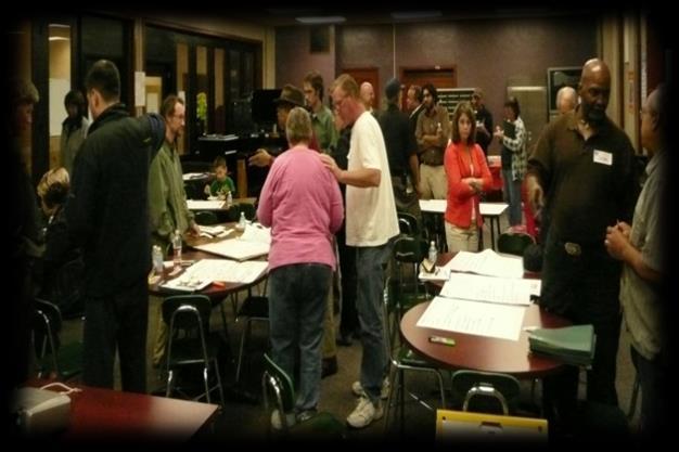
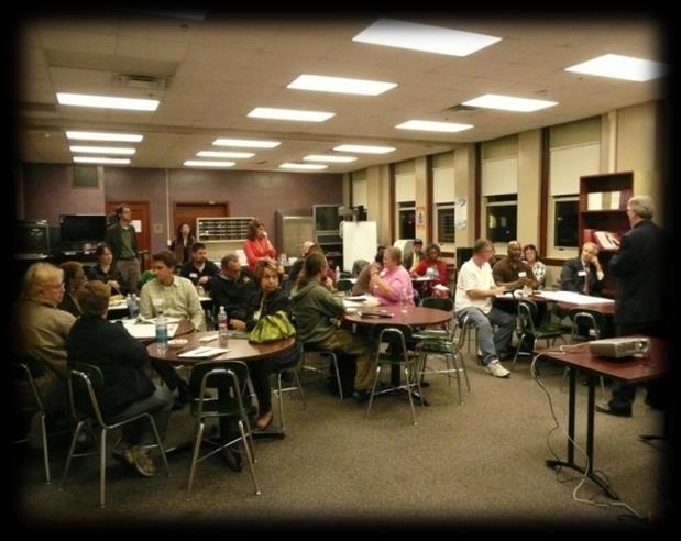
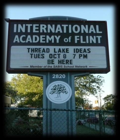
7 PROJECT TIMELINE Interviewed local neighborhood leaders Attended Southside Neighborhood Picnic Brennan Community Center, August 17 th, 2013 Hosted Thread Lake Ice Cream Social Vista Center, September 7 th, 2013 Hosted Thread Lake Visioning Session International Academy, October 8 th, 2013 Collaborate with other efforts Hosted Follow-Up Presentation for Thread Lake Vision Document(TODAY) Presenting the Vision (TODAY) 7

8 THREAD LAKE Study Area 8

9 THREAD LAKE Neighborhoods The 3 neighborhoods surrounding Thread Lake are actively engaged in their community, and feature representative organizations that helped rally public support and input to make this Vision document possible. 9

10 IImagine Flint Master Plan South Saginaw Corridor The City s new Master Plan has defined the S. Saginaw Corridor as a potential sub-area focus. Local stakeholder groups such as the South Saginaw Task Force strive to coordinate efforts to make improvements to the subarea. The corridor will be the subject of a more intensive future subarea study 10

11 Progress Since We Started December 2013 Michigan National Resources Trust Fund awarded the South Saginaw Task Force with a $225,000 grant for improvements to McKinley Park & Vista Center 11

12 Progress Since We Started PlacePlan for CSX Multi-Use Trail Michigan State University faculty and students will produce a plan for a CSX Multi-Use Rail Trail The 3-mile segment will connect South Saginaw Street north of Atherton Road to the Flint River Trail 12


13 Progress Since We Started August 2013 Genesee Count Land Bank received $20 million from the federal government for blight removal Many of these properties are in the neighborhoods surrounding Thread Lake 13


14 ANYTHING IS POSSIBLE! This vision builds on the positive momentum in your neighborhoods! 14
15 Vision Vision Summary 33 Goals prioritized chronologically Short Term: 1-2 years (13 goals) Short Term: 3-5 years (10 goals) Long Term: 6-10 years (7 goals) Long Term: years (3 goals) Three key topics: 1) Recreational Improvements 2) Neighborhood Stabilization and Targeted Redevelopment 3)Improved Water Quality 15
16 AA Vision for Thread Lake LONG-TERM IMPROVED WATER QUALITY RECREATIONAL IMPROVEMENTS NEIGHBORHOOD STABILIZATION AND TARGETED REDEVELOPMENT SHORT-TERM 2014 THREAD LAKE VISION Vision Goals & Objectives are centered around 3 principal concerns: 1) Recreational Improvements 2) Neighborhood Stabilization & Targeted Redevelopment 3) Improved Water Quality 16

17 A Vision for Thread Lake- Recreational Improvements A proposed bicycle and walking path around Thread Lake, which would also connect with the proposed CSX Rail Trail to the southwest of the Lake and then to the Flint River Trail 17

18 A Vision for Thread Lake- Recreational Improvements This proposed trail plan could enhance connectivity of Thread Lake, the Flint Golf Club, and nearby public parks, while also providing greater linkage to the City. 18
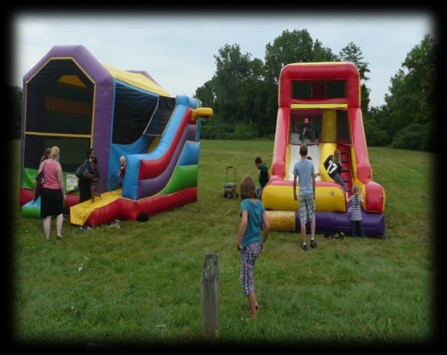
19 Vision Other Recreational Goals: Short-Term: 1-2 Years Restore full recreational functions to McKinley Park and Thread Lake Park; including continued maintenance of the grounds and facilities with assistance of state, county, and private resources. Short-Term: 3-5 Years Complete paving of Flint River Trail, and build and pave the trail that encircles Thread Lake. Long-Term: 6-15 Years Make additional recreational improvements to the parks around the Lake and expand trail connections to the Lake. Improve the Vista Center building in McKinley Park and enhance the quality and appearance of the building. 19


20 Thread Lake can offer vast recreational opportunities year-round whether in the summertime or winter! 20

")

21 A Vision for Thread Lake- Neighborhood Stabilization &Targeted Redevelopment A boulevard (ending in a cul-de-sac) on Winans Ave. at Lippincott Blvd. could serve as a northern gateway to Thread Lake Park. 21


22 A Vision for Thread Lake- Neighborhood Stabilization &Targeted Redevelopment Madison Ave. off of S. Saginaw St. could serve as a gateway to McKinley Park, and access point to the western side of Thread Lake. 22
23 Other Neighborhood Vision Stabilization &Targeted Redevelopment Goals: Short-Term: 1-2 Years Hold a major kickoff event to celebrate park improvements that attracts thousands to the restored parks and enlists support and assistance for all the actions that follow. Demolish target abandoned buildings and reseed those lots. Establish mechanism to regularly mow vacant lots in all neighborhoods. Neighborhood safety improved by stakeholder design of new neighborhood watch system. Restore fencing on I-475 pedestrian overpass Begin aggressive paint-it/fix-it program for targeted houses and businesses in all three neighborhoods. Provide incentives to homeowners to invest more in exterior home improvements. Implement simplest Complete Streets improvements to South Saginaw, including shifting to a three lane configuration. 23
24 Other Neighborhood Vision Stabilization &Targeted Redevelopment Goals: Short-Term: 3-5 Years Complete Streets improvements to South Saginaw including new decorative lighting and landscaping for at least the Atherton Street intersection area for two blocks in each direction. Improve wayfinding to key assets along South Saginaw and around Thread Lake. City initiates neighborhood stabilization program with aggressive code enforcement. The Genesee County Land Bank and Thread Lake neighborhoods team in planning and development of more infill housing on vacant lots in neighborhoods around Thread Lake. Neighborhoods work with outside stakeholders on plan for new passive solar homes to be built on vacant lots, perhaps along the new boulevard entrances to McKinley Park and Thread Lake Park. New mixed-use development (3-4 stories of residences above commercial) is built on South Saginaw corridor especially between I- 475 and Atherton. 24
25 Other Neighborhood Vision Stabilization &Targeted Redevelopment Goals: Long Term: 6-10 Years Continue neighborhood stabilization and home improvements. Continue neighborhood stabilization and home improvements Continue urban residential infill projects Continue increasing residential density along South Saginaw and improving the quality of commercial establishments Hold a giant 10 year celebration Long Term: Years Streets improvements to South Saginaw including new decorative lighting and landscaping for at least the Atherton Street intersection area for two blocks in each direction. Continue urban infill and densification along South Saginaw Street Complete commercial redevelopment along South Saginaw Street Install Bus Rapid Transit along South Saginaw Street and further enhance landscaping, lighting, and aesthetic improvement along the corridor 25

26 Thread Lake is not isolated from the larger watershed A Vision for Thread Lake- Improving Water Quality Water quality is determined by runoff from nearby properties, properties surrounding Thread Creek, and by drainage from nearby farmland. 26
27 Periphery Improvements of Water Quality Develop best management practices for stormwater runoff on Thread Creek and around Thread Lake to stabilize and maintain current water quality. Begin preparation and distribution of educational materials on protecting water quality to stakeholders and households, and assist schools with curriculum development on water quality protection and monitoring. 27
 Drain and Dredge Thread Lake 2)")

28 Two Options for Improving Water Quality 1) Drain and Dredge Thread Lake 2) Determine annual schedule for aquatic weed harvesting or use of aquatic herbicides 28


29 Thread Lake and the surrounding neighborhoods are full of OPPORTUNITIES 29
30 PLANNING & ZONING CENTER AT MSU NEXT STEPS Make revisions to Vision document based on your input and stakeholder feedback Share final draft with you and the City of Flint Planning Department Thread Lake Community begins strategic planning for possible implementation of short term Vision goals and objectives 30
31 CONTACTS Mark Wyckoff, Director Planning & Zoning MSU 112A Human Ecology 552 West Circle Drive East Lansing, MI toorpard@landpolicy.msu.edu Rebecca Fedewa, Executive Director Flint River Watershed Coalition 400 N. Saginaw Street, Suite 233 Flint, MI (810) phone (810) direct rfedewa@flintriver.org Project Website 31
32 THANKS FOR COMING! With YOUR help the future can be very different from the present and the past it can be as YOU envisioned it. 32
A Vision for Flint Park Lake & Adjoining Neighborhoods
 A Vision for Flint Park Lake & Adjoining Neighborhoods A Vision for Flint Park Lake & Adjoining Neighborhoods in the City of Flint, Michigan Prepared by: Planning & Zoning Center at Michigan State University
12/9/2013. HOLLYWOOD/PINES CORRIDOR PROJECT AMPO 2013 Annual Conference October 24, Our Perspective. Broward.
 HOLLYWOOD/PINES CORRIDOR PROJECT AMPO 2013 Annual Conference October 24, 2013 Our Perspective Broward Fort Lauderdale 1 Broward Metropolitan Planning Organization Fort Lauderdale Fort Lauderdale Skyline
Oroville Area Urban Greening Plan. Joint Meeting of the Oroville Planning, Park, and Arts Commissions October 12, 2015
 Oroville Area Urban Greening Plan Joint Meeting of the Oroville Planning, Park, and Arts Commissions October 12, 2015 Project Team Lead Agency Butte County Department of Development Services Claudia Stuart,
Draft Cary Community Plan Review Part 3: Shop, Engage, Serve, Special Area Plans, Other Updates. October 27, 2015 Police Department Training Room
 Draft Cary Community Plan Review Part 3: Shop, Engage, Serve, Special Area Plans, Other Updates Committee for the Future October 27, 2015 Police Department Training Room AGENDA 1. Welcome and Call to Order
City of Tacoma Planning and Development Services
 Agenda Item E-1 City of Tacoma Planning and Development Services To: Planning Commission From: Elliott Barnett, Planning Services Division Subject: Tacoma Mall Regional Center Subarea Plan and EIS Meeting
Potential Green Infrastructure Strategies May 6, 2015 Workshop
 Potential Green Infrastructure Strategies May 6, 2015 Workshop Background The City of Cortland is developing the Tioughnioga Urban Headwaters Green Infrastructure Action Plan with funding from the National
SCTPO Project Summary September 2014
 A1A MULTIMODAL CORRIDOR PLANNING AND ENGINEERING ANALYSIS Florida Department of Transportation SCTPO Project Summary September 2014 PRESENTATION FOOTER Meeting Agenda What We Plan To Do Project Background
Onondaga County Sustainable Streets Project. Onondaga County Planning Federation June 7, Onondaga County Sustainable Streets Project 1
 Onondaga County Sustainable Streets Project Onondaga County Planning Federation June 7, 2012 Onondaga County Sustainable Streets Project 1 Sustainable Streets 1. Introduction to the SMTC 2. Sustainable
S C O P E O F W O R K A P R I L
 white flint 2 sector plan S C O P E O F W O R K A P R I L 2 0 1 2 MONTGOMERY COUNTY PLANNING DEPARTMENT M-NCPPC MontgomeryPlanning.org 1 white flint 2 sector plan Scope of Work abstract This scope of work
Harlem Avenue Corridor Plan: Corridor Planning Across Municipal Boundaries
 Harlem Avenue Corridor Plan: Corridor Planning Across Municipal Boundaries Heather Tabbert, Manager, Local Planning and Programs Division Regional Transportation Authority (RTA) Jen McNeil Dhadwal, Principal
CHAPTER 7: Transportation, Mobility and Circulation
 AGLE AREA COMMUNITY Plan CHAPTER 7 CHAPTER 7: Transportation, Mobility and Circulation Transportation, Mobility and Circulation The purpose of the Transportation, Mobility and Circulation Chapter is to
ICLEI Webinar Sustainability in the Master Plan and Zoning Code
 ICLEI Webinar Sustainability in the Master Plan and Zoning Code Sustainability in Grand Rapids 2000 2002 New Master Plan 2004 2005 Neighborhood Pattern Workbook 2006 2007 Form-Based Zoning Ordinance 2007
S.R.7/U.S.441 COLLABORATIVE THE COLLEGE OF CORRIDOR KNOWLEDGE
 S.R.7/U.S.441 COLLABORATIVE THE COLLEGE OF CORRIDOR KNOWLEDGE S.R.7 Corridor : A Sense of Place? ANYWHERE USA SR 7: Civilizing the Corridor Bad rules = Bad development! The SR 7 Collaborative A model for
Oroville Area Urban Greening Plan. Second Communitywide Workshop
 Oroville Area Urban Greening Plan Second Communitywide Workshop Monday, November 18, 2013 PROJECT TEAM Lead Agency Butte County Department of Development Services Claudia Stuart, Principal Planner Chris
TOWN COUNCIL / PLANNING COMMISSION
 Workshop #3 TOWN COUNCIL / PLANNING COMMISSION January 20, 2011 Consultant Team In Attendance Tonight BMS Design Group Nevada City and San Francisco Michael Smiley, AICP, ASLA Partner-in-Charge Nancy L.
BeltLine Corridor Environmental Study
 BeltLine Corridor Environmental Study Joint TAC and SAC Meeting December 8, 2008 What We Will Discuss Today Outreach and Agency Coordination Scoping Results Existing Conditions Historical and Archeological
Subarea 4 Indian Creek. Vision The combination of park networks and transportation amenities make Subarea 4 the greenest hub in the Corridor.
 indian creek 180 extends south from 101st Street to I-435. The I-435 and Metcalf intersection is one of the primary intersections in the Kansas City Metro Area. The area includes several residential neighborhoods
Scope of Services. River Oaks Boulevard (SH 183) Corridor Master Plan
 Corridor Master Plan") Scope of Services River Oaks Boulevard (SH 183) Corridor Master Plan PROJECT AREA The project area consists of the River Oaks Boulevard (SH 183) corridor bounded by SH 199 at the northern end and the Trinity
Scope of Services River Oaks Boulevard (SH 183) Corridor Master Plan PROJECT AREA The project area consists of the River Oaks Boulevard (SH 183) corridor bounded by SH 199 at the northern end and the Trinity
G. RECREATION AND OPEN SPACE ELEMENT. The following summarizes the Recreation and Open Space Element:
 G. RECREATION AND OPEN SPACE ELEMENT The purpose of the Element is to provide the framework and direction for a comprehensive system of public and private sites for recreation, including, but not limited
E x E C U T I v E S U M M A R y / P L A N N I N G C O N T E x T 14 //
 14 // executive summary / planning context COMMUNITY GREENING PLAN PLANNING CONTEXT Capital Region Water has entered into a partial consent decree with the United States Department of Justice to address
EXECUTIVE SUMMARY DRAFT CHAPTER 1 INTRODUCTION EXECUTIVE SUMMARY
 CHAPTER 1 EXECUTIVE SUMMARY INTRODUCTION Through the joint efforts of the City of Tulsa planning staff and the Land Services division of Indian Nations Council of Governments (INCOG), the Berryhill Land
City of Long Beach. creating vibrant and exciting places
 City of Long Beach creating vibrant and exciting places Land Use Element Urban Design Element Overview of the two draft General Plan elements Discuss areas of change Economic goals of the plans Case study
2035 General Plan Update and Belmont Village Specific Plan. Joint Study Session with the City Council and Planning Commission April 12, 2016
 2035 General Plan Update and Belmont Village Specific Plan Joint Study with the City Council and Planning Commission April 12, 2016 Agenda 1. Welcome and Introductions 2. General Plan Update Status of
Mississippi Skyway Preliminary Engineering Report
 EXECUTIVE SUMMARY Mississippi Skyway Preliminary Engineering Report CITY OF RAMSEY, MINNESOTA DECEMBER 2014 City of RAMSEY EXECUTIVE SUMMARY Project Need and Intent The Mississippi Skyway pedestrian bridge
People who are members of historically disenfranchised racial, ethnic, cultural, and other identity groups are encouraged to apply.
 CALL TO ARTISTS REQUEST FOR QUALIFICATIONS CITY OF TACOMA MUNICIPAL ART PROGRAM East 64 th Streetscape, Tacoma, WA APPLICATION DEADLINE October 10, 2018, 11:59pm BUDGET $72,000, all-inclusive SUMMARY The
REQUEST FOR COUNCIL ACTION 6A AGENDA ITEM ORIGINATING DEPT. AGENDA ITEM CITY ADMINISTRATOR APPROVAL
 DATE REQUEST FOR COUNCIL ACTION 6A AGENDA ITEM ORIGINATING DEPT. AGENDA ITEM CITY ADMINISTRATOR APPROVAL Community Development Territorial Greens PUD Concept Plan Development Stage Plan Subdivision (Preliminary
San Francisco Bay Pilot: Sausal Creek Community Leader Charrette May 11, 2016 Marcus Griswold
 San Francisco Bay Pilot: Sausal Creek Community Leader Charrette May 11, 2016 Marcus Griswold 1 Overview Project Overview Watershed Context Assets and Challenges Opportunities Green Streets Creek Access
VACANT TO VIBRANT : GREEN INFRASTRUCTURE & URBAN REVITALIZATION
 VACANT TO VIBRANT : GREEN INFRASTRUCTURE & URBAN REVITALIZATION Calumet Summit 2013: Connecting for Action Lauren Riga, Director City of Gary Department of Green Urbanism Gary Storm Water Management District
S A C R A M E N T O C O U N T Y JACKSON HIGHWAY & GRANT LINE EAST VISIONING STUDY
 JACKSON HIGHWAY & GRANT LINE EAST S A C R A M E N T O C O U N T Y P L A N N I N G D E P A R T M E N T SUMMARY AND WORKBOOK November 19, 2008 History of the Visioning Study Sacramento County has two growth
Gary & Regional Investment Project. October 27, Creating Tomorrow Today Comprehensive Regional Plan - NIRPC
 Creating Tomorrow Today 2040 Comprehensive Regional Plan Gary & Regional Investment Project October 27, 2010 Creating Tomorrow Today - 2040 Comprehensive Regional Plan - NIRPC What is NIRPC? - Northwestern
The Turtle Creek Master Plan- A Summary. July 7, 2011
 The Turtle Creek Master Plan- A Summary July 7, 2011 Background During 2004, TCA commissioned highly regarded Antonio Di Mambro & Associates to create a Master Plan for the Turtle Creek Corridor. The resulting
A larger version of this map is located on the last page of this PDF.
 MAP Committee Input McLoughlin Area Draft Vision Map A larger version of this map is located on the last page of this PDF. 1. The map above is intended to portray a vision for the McLoughlin area. It highlights
CITY OF CHARLOTTESVILLE, VIRGINIA CITY COUNCIL AGENDA
 CITY OF CHARLOTTESVILLE, VIRGINIA CITY COUNCIL AGENDA Agenda Date: December 16, 2013 Action Required: Adoption of Resolution Presenter: Staff Contacts: Title: James E. Tolbert, AICP, Director of NDS James
ROUND ONE PROJECTS. Capital Grants 18 DELAWARE VALLEY REGIONAL PLANNING COMMISSION
 ROUND ONE PROJECTS DVRPC awarded the first round Take Me to the River grants in 2008 (see Figure 5 for project locations). The 13 projects selected were chosen based on their ability to reconnect citizens
RESEDA - WEST VAN NUYS COMMUNITY PLAN
 RESEDA - WEST VAN NUYS COMMUNITY PLAN Executive Summary As part of the initial outreach effort, the Department of City Planning hosted two workshops for the Reseda-West Van Nuys Community Plan Area during
Implementation Guide Comprehensive Plan City of Allen
 Implementation Guide 2030 Comprehensive Plan City of Allen DRAFT 2015 Implementation Guide Allen 2030 Comprehensive Plan INTRODUCTION The Comprehensive Plan serves as a guide for the growth and development
Murphy Crossing Site Redevelopment Community Engagement Meeting September 19, 2016
 Murphy Crossing Site Redevelopment Community Engagement Meeting September 19, 2016 SUMMARY 1 EXECUTIVE SUMMARY STATEMENT OF PURPOSE ABI has conducted a detailed study of 1. Market potential 2. Building
Planning Commission Report
 Planning Commission Report To: From: Subject: Planning Commission Meeting: January 6, 2016 Agenda Item: 8-B Planning Commission David Martin, Planning & Community Development Director Introduction to the
MAIN STREET ECONOMIC DEVELOPMENT STRATEGY
 MAIN STREET ECONOMIC DEVELOPMENT STRATEGY A PATHWAY TO A BETTER POUGHKEEPSIE DRAFT Working Paper #2: Planning Strategies Submitted December 1 st, 2015 to the City of Poughkeepsie LAND USE LAW CENTER PACE
124 Subarea Visions. Vision Plan. A. Nelessen Associates, INC I Visioning I Planning I Urban Design
 Subareas 124 Subarea Visions The next seven sections describe specific recommendations tailored to each subarea. Each subarea is discussed separately except for certain aspects of 95th Street and Antioch
WELCOME and introduction
 1 WELCOME and introduction Mobility Hub Locations within Burlington STUDY OVERVIEW STUDY OBJECTIVES The City of Burlington is developing four Area Specific Plans, one for each of Burlington s Mobility
PUBLIC SPACES MASTER PLAN UPDATE (POPS) Crystal City Citizen s Review Council October 24, 2018
 Crystal City Citizen s Review Council October 24, 2018") PUBLIC SPACES MASTER PLAN UPDATE (POPS) Crystal City Citizen s Review Council October 24, 2018 1 PLANNING CONTEXT Arlington County Comprehensive Plan UPDATE Related Documents: CIP Sector Plans Area Plans
PUBLIC SPACES MASTER PLAN UPDATE (POPS) Crystal City Citizen s Review Council October 24, 2018 1 PLANNING CONTEXT Arlington County Comprehensive Plan UPDATE Related Documents: CIP Sector Plans Area Plans
Equitable Growth Through TOD Planning
 Equitable Growth Through TOD Planning Community Meeting # 2 November 2017 Goals Objectives Extend investment from downtown Connect neighborhoods physically and economically Enhance places based on local
Please see attached for more detailed project information. Project Schedule Designer Award by SBC Executive Sub-Committee December 21, 2015
 Project Title Campus Beautification Projects Volunteer Blvd Ph 1 540/009-08-2015 Institution Description UT Knoxville This project will improve Volunteer Boulevard from West Cumberland Ave. to East Cumberland
Por favor, levanten la mano si necesita traduccion en espanol Please raise your hand if you need Spanish translation
 FEDERAL BOULEVARD CORRIDOR WIDE STUDY PUBLIC MEETING #1 APRIL 27, 2016 Por favor, levanten la mano si necesita traduccion en espanol Please raise your hand if you need Spanish translation HDR DESIGN WORKSHOP
Industrial Corridor Modernization Little Village
 Industrial Corridor Modernization Little Village Rahm Emanuel, Mayor David Reifman, Commissioner Dept. of Planning and Development Working Group April 26, 2018 dpd@cityofchicago.org cityofchicago.org/dpd
Citizen Engagement for a Sustainable Built Environment
 Citizen Engagement for a Sustainable Built Environment Examples and Case Studies from Michigan Communities Genesee County Metropolitan Planning Commission 10 th Annual Planning Forum October 23, 2015 Wayne
Public may provide comments on the GDP within the next two weeks (December 24)
") 25/70 General Development Plan (GDP) Public Meeting Wednesday, December 10, 2014 6:00 8:00 P.M. District 1 Police Station Community Room 1311 W 46th Ave, Denver, CO 80211 Council Woman Montero: This particular
25/70 General Development Plan (GDP) Public Meeting Wednesday, December 10, 2014 6:00 8:00 P.M. District 1 Police Station Community Room 1311 W 46th Ave, Denver, CO 80211 Council Woman Montero: This particular
Infrastructure Engineering Planning Construction Suite 300 Minneapolis, MN Tel: Fax:
 Infrastructure Engineering Planning Construction 701 Xenia Avenue outh uite 300 Minneapolis, MN 55416 Tel: 763-541-4800 Fax: 763-541-1700 Memorandum To: Minnehaha Creek Watershed District Board From: Tony
Imagining Ward 3 Session #2. April 18, :00 pm 8:30 pm
 Imagining Ward 3 Session #2 April 18, 2016 7:00 pm 8:30 pm Project Team City of Mississauga Karen Crouse, Project Leader, Policy Planning Division Frank Marzo, Planner, Policy Planning Division Brook McIlroy
TRANSPORTATION PROJECTS
 TRANSPORTATION PROJECTS 40 BUFFALO S LWRP PROPOSED PROJECTS T1. Niagara Street/Great Lakes Seaway Trail Streetscape Project City of Buffalo Department of Public Works Niagara Street from Niagara Square
3. VISION AND GOALS. Vision Statement. Goals, Objectives and Policies
 Vision Statement Queen Creek s interconnected network of parks, trails, open spaces and recreation opportunities provide safe and diverse activities and programs that sustain its unique, small town, equestrian
Atlanta BeltLine. Subareas 9 & 10. Master Plan Updates. March 26, Washington Park Jamboree 1
 Atlanta BeltLine Subareas 9 & 10 Master Plan Updates March 26, 2018 Washington Park Jamboree 1 22 miles, connecting 45 neighborhoods 22 MILES of transit 46 MILES of streetscapes and complete streets 33
City of Bristol Route 6 Corridor Implementation Program
 City of Bristol Route 6 Corridor Implementation Program FITZGERALD & HALLIDAY, INC. Innovative Planning, Better Communities June 2017 Route 6 Corridor Plan IMPLEMENTATION PROGRAM The following Implementation
Gold Line Bus Rapid Transit Transit Oriented Development (BRTOD) Helmo Station Area Plan
 Helmo Station Area Plan") Appendix F Gold Line Bus Rapid Transit Transit Oriented Development (BRTOD) Helmo Station Area Plan Introduction and Purpose of the Plan The Gold Line Bus Rapid Transit facility is an eleven-mile dedicated
Appendix F Gold Line Bus Rapid Transit Transit Oriented Development (BRTOD) Helmo Station Area Plan Introduction and Purpose of the Plan The Gold Line Bus Rapid Transit facility is an eleven-mile dedicated
Town of Sahuarita Open Space Plan Element. University of Arizona Planning Program Projects Team
 Town of Sahuarita Open Space Plan Element University of Arizona Planning Program Projects Team Introduction Planning students in the Planning Program Project Class Overall Goal Potential uses of $1.5 Million
FOUR MILE RUN VALLEY WORKING GROUP AND CHARGE
 FOUR MILE RUN VALLEY WORKING GROUP AND CHARGE Adopted April 16, 2016 Amended July 19, 2016 Overview of Integrated Effort The overall goal of the Four Mile Run Valley (4MRV) initiative is to develop a comprehensive
Memorandum CITY OF DALLAS
 Memorandum DATE September 23, 2016 CITY OF DALLAS TO The Honorable Members of the Transportation and Trinity River Project Committee: Lee M. Kleinman (Chair), Deputy Mayor Pro Tem Erik Wilson (Vice-Chair),
REVIEW AND EVALUATION OF REGIONAL LAND USE
 REVIEW AND EVALUATION OF REGIONAL LAND USE AND TRANSPORTATION SCENARIOS #220831 Environmental Justice Task Force October 7, 2014 VISION 2050 Process Development of Guiding Vision for Land Use and Transportation
Hockessin Community Redevelopment Plan
 Hockessin Community Redevelopment Plan 3.1 Introduction The Community Redevelopment Plan for the Village of Hockessin is the result of the people s vision for a distinct village center that serves as the
CITY COUNCIL AGENDA REPORT
 CITY COUNCIL AGENDA REPORT Subject: COUNCIL MOTION LRT ALIGNMENT REMOVAL FROM THE TRANSPORTATION MASTER PLAN On February 10, 2016 Councillor Hughes provided notice in accordance with Section 23 of Procedure
ADOPTED CAPITAL IMPROVEMENT PROGRAM BUDGET ARROYO PROJECTS
 ADOPTED CAPITAL IMPROVEMENT PROGRAM BUDGET ARROYO PROJECTS HAHAMONGNA FY 212-216 Capital Improvement Program Priority Description Total Estimated Costs Appropriated Through FY 211 Adopted FY 212 FY 213
The University District envisions, in its neighborhood
 Envisioning the University District Link Light Rail in Seattle s neighborhoods CIY OF SEALE CONCEP-LEVEL SAION AREA PLANNING RECOMMENDAION RESOLUION # 30165 EXHIBI L Vision 08.2000 he University District
Atlanta BeltLine Corridor Environmental Study. Scoping Meeting August 2008
 Atlanta BeltLine Corridor Environmental Study Scoping Meeting August 2008 What Will We Be Discussing Today? Study Overview - How Did We Get Here? - What Is the Study About? - Who Is Involved? - Where Is
Streets for People, Place-Making and Prosperity. #TOcompletestreets
 COMPLETE STREETS FOR TORONTO Streets for People, Place-Making and Prosperity COMPLETE STREETS: A NEW APPROACH A Complete Streets design approach considers the needs of all users people who walk, bicycle,
The transportation system in a community is an
 7 TRANSPORTATION The transportation system in a community is an important factor contributing to the quality of life of the residents. Without a sound transportation system to bring both goods and patrons
Northwest Rail Corridor and US 36 BRT Development Oriented Transit Analysis 4.4 STATION AREA FINDINGS
 4.4 STATION AREA FINDINGS Each station is different, and each one requires a separate set of recommendations based on the vision for the site. This section outlines an initial TOD strategy and recommendations
TOWN OF JUPITER. Honorable Mayor and Members of Town Council Andrew D. Lukasik, Town Manager
 DATE: June 07, 2016 TO: THRU: TOWN OF JUPITER Honorable Mayor and Members of Town Council Andrew D. Lukasik, Town Manager FROM: Thomas V. Driscoll, P.E., Director of Engineering, Parks & Public Works SUBJECT:
Corridor Vision. 1Pursue Minnehaha-Hiawatha Community Works Project. Mission of Hennepin County Community Works Program
 1Pursue Minnehaha-Hiawatha Community Works Project Minnehaha-Hiawatha Community Works is a project within the Hennepin Community Works (HCW) program. The mission of the HCW program is to enhance how the
Sustainably Repositioning Greyfield Sites. Greyfield Sites Anywhere
 Sustainably Repositioning Greyfield Sites Jim Constantine Looney Ricks Kiss Architects Todd Poole 4ward Planning Greyfield Sites Anywhere Pennsylvania Chapter American Planning Association Conference 2009
1.0 Purpose of a Secondary Plan for the Masonville Transit Village
 Report to Planning and Environment Committee To: Chair and Members Planning & Environment Committee From: John M. Fleming Managing Director, Planning and City Planner Subject: Masonville Transit Village
Town of Cobourg Heritage Master Plan. Statutory Public Meeting
 Town of Cobourg Heritage Master Plan Statutory Public Meeting April 25 th 2016 Presentation Overview 1. Introduction 2. Project background and schedule overview 3. Review of strategic direction content
West Loop. Neighborhood Plan. Prepared by: Neighbors of West Loop, Chicago, IL August 14, 2018
 West Loop Neighborhood Plan Prepared by: Neighbors of West Loop, Chicago, IL August 14, 2018 Introduce Neighbors of West Loop (NoWL) Present the draft Neighborhood Plan Gather your input Identify ways
Chapter 1: Introduction
 Chapter 1: Introduction The Penn Avenue Community Works Corridor Vision and Implementation Framework presents an integrated communitybased vision and a coordinated, long-term implementation framework for
SPRINGHILL LAKE TRANSIT VILLAGE
 Greenbelt Metro Area Sector Plan - Subarea Design Policies and Guidelines - Springhill Lake Transit Village 113 SPRINGHILL LAKE TRANSIT VILLAGE Residential Neighborhood and Village Center CONCEPT Springhill
TREASURE COAST REGIONAL PLANNING COUNCIL M E M O R A N D U M. To: Council Members AGENDA ITEM 5H
 TREASURE COAST REGIONAL PLANNING COUNCIL M E M O R A N D U M To: Council Members AGENDA ITEM 5H From: Date: Subject: Staff October 17, 2008 Council Meeting Local Government Comprehensive Plan Review Draft
Midtown Greenway Land Use and Development Plan Executive Summary
 Midtown Greenway Land Use and Development Plan Executive Summary Introduction The Midtown Greenway Land Use and Development Plan sets policy direction for land use and development in the Midtown Greenway
City of Plattsburgh DRI: Downtown Streetscapes & Riverfront Access. Downtown Streetscape and Riverfront Access Design
 City of Plattsburgh DRI: Downtown Streetscapes & Riverfront Access Welcome Thank you for coming this evening. Agenda PART I - Project Context The Downtown Revitalization Program Our DRI Projects Other
Request for Proposals: Architectural/Design Guidelines
 Request for Proposals: Architectural/Design Guidelines January 11, 2017 1.0 INTRODUCTION The City of Issaquah, Washington is soliciting proposals from qualified consulting firms to lead a community conversation
WAC #7 3/14/14. Coachella General Plan Update
 WAC #7 3/14/14 Coachella General Plan Update Agenda 2 Introductions Public Draft General Plan Overview and Discussion of Next Steps Implementation and Evaluation Health Element Process Evaluation (discussion)
EXISTING COMPREHENSIVE PLAN
 EXISTING COMPREHENSIVE PLAN Town Center Land Use Element: V. LAND USE POLICIES Town Center Mercer Island's business district vision as described in "Your Mercer Island Citizen-Designed Downtown" was an
Secrest Short Cut and Monroe Expressway Small Area Plan AUGUST 29, 2018
 Secrest Short Cut and Monroe Expressway Small Area Plan AUGUST 29, 2018 Background and Process Monroe Expressway will be open by the end of 2018 Union County and Indian Trail identified a need to revisit
HOUSING ELEMENT GOALS, OBJECTIVES, AND POLICIES
 HOUSING ELEMENT GOALS, OBJECTIVES, AND POLICIES Goal 6 Maintain and enhance the supply of decent, safe, energy efficient and affordable housing and maximize viable options and opportunities for present
Description of Preferred Alternative
 Chapter 2 Description of Preferred Alternative 2.1 Introduction This chapter of the programmatic Sammamish Town Center Sub-area Plan Final EIS provides a more detailed description of the Preferred Alternative
AGENDA ACTION ITEMS INFORMATION ITEMS
 NOACA Bicycle and Pedestrian Advisory Council Meeting Friday, March 21 st, 2014 10:30 a.m. NOACA Office 1299 Superior Avenue Cleveland, Ohio 44114 Phone: (216) 241-2414; website: www.noaca.org AGENDA ACTION
Goals for Tonight s Meeting
 South Anthony Boulevard Railroad Grade Separation Study Report to Community November 30, 2011 Andorfer Commons Theatre Indiana Tech University Goals for Tonight s Meeting Recap of the meeting from last
TO: Denver Planning Board FROM: Analiese Hock, Senior City Planner DATE: March 13, 2018 RE:
 Community Planning and Development Planning Services 201 W. Colfax Ave., Dept. 205 Denver, CO 80202 p: 720.865.2915 f: 720.865.3052 www.denvergov.org/cpd TO: Denver Planning Board FROM: Analiese Hock,
Gilbert Lindsay Plaza
 Gilbert Lindsay Plaza Gilbert Lindsay Plaza is a 5-acre landscaped pedestrian plaza situated along Figueroa Street that was developed and designed as the major urban outdoor amenity of the Los Angeles
NORTH CLAYMONT AREA MASTER PLAN COMMUNITY WORKSHOP #1 FEBRUARY 3, 2016
 NORTH CLAYMONT AREA MASTER PLAN COMMUNITY WORKSHOP #1 FEBRUARY 3, 2016 1. Introduction To the team and to the Plan Planning Partners The Claymont Community WILMAPCO New Castle County Claymont Renaissance
ARISE: The Rock Renaissance Area Redevelopment & Implementation Strategy
 2014 Professional Awards 1 ARISE: The Rock Renaissance Area Redevelopment & Implementation Strategy Janesville, WI Completed December 2014 Analysis & Planning Purpose of Project 2 The purpose of the Rock
Municipal Plan*Assessment
 Municipal Plan*Assessment This tool was developed to assist in reviewing municipal master plans and in determining if these plans are consistent with smart growth principles, neighboring municipal plans,
California Environmental Quality Act (CEQA) Environmental Review Process
 Environmental Review Process") California Environmental Quality Act (CEQA) Environmental Review Process Los Angeles Union Station Forecourt and Esplanade Improvements constitute a Project Los Angeles County Metropolitan Transportation
California Environmental Quality Act (CEQA) Environmental Review Process Los Angeles Union Station Forecourt and Esplanade Improvements constitute a Project Los Angeles County Metropolitan Transportation
PROPOSED REDEVELOPMENT OF THE GLEN ABBEY GOLF CLUB. STREETSCAPE DESIGN STUDY (excerpt from the Urban Design Brief) TOWN OF OAKVILLE.
 TOWN OF OAKVILLE.") PROPOSED REDEVELOPMENT OF THE GLEN ABBEY GOLF CLUB STREETSCAPE DESIGN STUDY (excerpt from the Urban Design Brief) TOWN OF OAKVILLE OCTOBER, 2016 for 2.4.2 STREETS Streets are the single largest component
PROPOSED REDEVELOPMENT OF THE GLEN ABBEY GOLF CLUB STREETSCAPE DESIGN STUDY (excerpt from the Urban Design Brief) TOWN OF OAKVILLE OCTOBER, 2016 for 2.4.2 STREETS Streets are the single largest component
4-Town Comprehensive Plan DRAFT 7/30/07
 4-Town Comprehensive Plan DRAFT 7/30/07 Acknowledgements ning Committee Town of Harrisburg Norman Roof Randy Nicol Town of Martinsburg Terry Thisse Paul Kelly Town of Montague Jan Bagdanowicz Wendy Perry
A BLUEPRINT FOR BROCKTON A CITY-WIDE COMPREHENSIVE PLAN
 A BLUEPRINT FOR BROCKTON A CITY-WIDE COMPREHENSIVE PLAN Public Meeting October 2016 1 Plan Summary and Discussion Public Meeting May 4 2017 City of Brockton Bill Carpenter, Mayor Department of Planning
edmonton.ca/ribbonofgreen #ribbonofgreen
 WHAT IS THE RIBBON OF GREEN? The Ribbon of Green is Edmonton s entire river valley and ravine system. The Ribbon of Green (2018) Project will provide strategic guidance for the southwest and northeast
PLAN ELEMENTS WORKSHOP. April 5, 2016
 PLAN ELEMENTS WORKSHOP April 5, 2016 needs more housing. But there is no one-size fits-all solution. Every neighborhood has its own character. In some places, density is not only appropriate it is badly
Rich Valley Greenway Master Plan. Central Greenway Connectivity Study
 Rich Valley Greenway Master Plan Central Greenway Connectivity Study Dakota County Planning Commission February, 2017 Rich Valley Greenway Master Plan Dakota County Greenway Vision Establish a County-wide
The West Vaughan Employment Area Secondary Plan Policies
 Part 2: The West Vaughan Employment Area Secondary Plan Policies 2.1 General Policies It is the policy of Council: 2.1.1. That the West Vaughan Employment Area (the WVEA), identified on Schedule 1, will
Denver Moves: Transit Task Force
 Insert transit picture Denver Moves: Transit Task Force Meeting #8 October 5, 2017 1. Welcome & Introductions Opening remarks and housekeeping Task Force and audience introductions Upcoming events and