Integrated Multi Modal Public Transit Hub
|
|
|
- Valentine Melton
- 5 years ago
- Views:
Transcription
 Deepa Dave (AM Urban")
1 Leaders Programme in Urban Transport Planning and Management Integrated Multi Modal Public Transit Hub at Central Business District- Ahmedabad Neela Munshi (Senior Town Planner) Deepa Dave (AM Urban Planner)
2 Structure of Presentation About Ahmedabad Ahmedabad 2021 Central Business District- Overview Principles, Analysis and Proposals Integrated Multi Modal Public Transit Hub Financial Mechanism Implementation & Monitoring Strategies 2


3 Strategic Location Delhi Gujarat Ahmedabad Urban Development Authority (AUDA) 3

4 Administrative Boundaries in the AUDA Region Carved out from 4 Districts 9 Talukas and 169 villages Gandhinagar Twin City th Ahmedabad 7 Largest city in India 5 Growth centers / Satellite Towns Ahmedabad UrbanGrowing Development Authority Planning andsir, ManagementII SIR, SEZs Third Fastest Cities in the World Leaders Programme in Urban Transport Viramgam Changodar 4

5 Ahmedabad city

6 Revised Development Plan Ahmedabad


7 Ahmedabad 2021 CBD FSI 5.4 R-AH Zone FSI 2.7 Transit Corridor FSI 4.0 High Density Zone FSI 4.0 Ahmedabad Today 6.4Mn Population Mn Population projected Base FSI in Ahmedabad 1.8 7
8 City Profile 8
 6.4 Arterial road Density 1.85 Public transport Use 22% NMV Use 32% Trip Length (total) km 5.7 Vehicle km/capita Road fatalities per 6.")
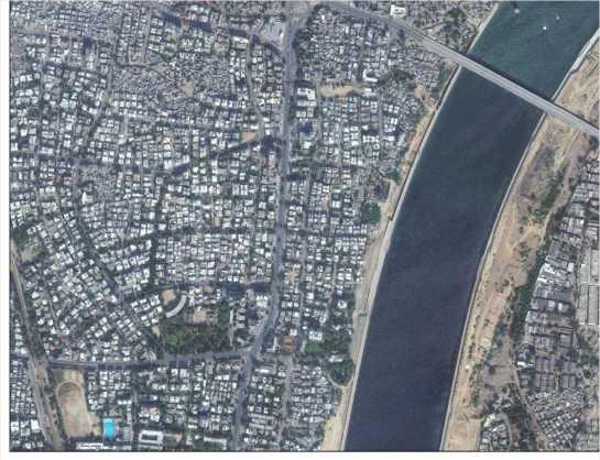
9 CBD connectivity with the City AHMEDABAD AHMEDABAD Population Density (Urban Built in persons/ha ) 174 Population Density (Urban Sprawl in 155 persons/ha) Compactness index 0.90 POPULATION (Million) 6.4 Arterial road Density 1.85 Public transport Use 22% NMV Use 32% Trip Length (total) km 5.7 Vehicle km/capita Road fatalities per

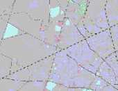
10 CBD connected with Rail Network 10


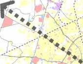
11 Transit Oriented Zone- FSI 4.0 CBD 11

12 Central Business District 12

13 Centrally Located - near geographic & historic core 13
14 Low Density Development & Mixed land use Gross FSI
15 Well connected with Eastern part of the city Usmanpura Gandhi Bridge Nehru Bridge Ellis Bridge Gross FSI


16 Major Road and Rail Usmanpura Gandhi Bridge Nehru Bridge Ellis Bridge Gross FSI

17 Existing Connectivity and Footprint Ellis Bridge Nehru Bridge Gandhi Bridge Usmanpura Riverfront Development Gandhigram Station Area under CBD 119ha Total Ground coverage 42 Ha Ground coverage 35% Average FSI Consumption 0.72

18 CBD- connected commercial streets Ellis Bridge Nehru Bridge Gandhi Bridge Usmanpura Gandhigram Station 18

19 Land-use Land-use Class Residential Gamtal Commercial Area in Ha Public Use Mix Land Use Leaders Programme in Urban Transport Planning and ManagementGrand Total II Area in %

20 CBD Educational Ellis Bridge Nehru Bridge Gandhi Bridge Usmanpura Gandhigram Station 20
21 CBD- Entertainment 21

22 CBD- Sports and Culture 22
23 CBD - Recreational 23


24 Public Transportation Propose METRO GSRTC Propose BRTS AMTS Existing Railway 24


25 Current Issues Eateries on footpath Vendors Vendors 25

26 Current Issues No Space for Bicycle riders Eateries Motorised, Non-motorised and pedestrian conflict Vendors Haphazard Parking Parking 26


27 Current Issues Parking at bus stops Parking and vendors at Bus Bay Missing Links Parking in No Parking Zone 27
28 Principles, Analysis and Proposals 28
 High intensity of infrastructure Provide space for informal sector Principles Source: TOD Standard,")
29 Aspects of a CBD Higher density development Higher transit connectivity Improved Connectivity & Walkable Block Size (Pedestrian Friendly) Mixed Uses (Horizontal & Vertical Mix) High intensity of infrastructure Provide space for informal sector Principles Source: TOD Standard, itdp 29
30 Objectives To provide Seamless Mobility Ensure safety Driver of smart growth and Downtown revitalization Land use Transportation Integration Improve urban environment -a city a better place to live Street level with easy access to bus/metro station Reduce travel time 30

31 Connect - Enhance Accessibility 31


32 Walk- Improve Missing link and Walkability 32
33 Shift Improve Cross Section (Ashram Road- Main Spine) Pedestrian Area 5+3 Mt 3 M FROM FRONT MARGIN Vehicular Movement 9mt Pedestrian Area 5+3 Mt 3 M FROM FRONT MARGIN 33

34 Create Pedestrian Friendly Network 34


35 Special Regulation for Local Area Plan Under Ground Parking Ashram Road Open space between the blocks Proposed connectivity between two building No of FP - 5 Proposed Pedestrian walkway Existing New Structure 35


36 Shared Parking Under Ground Parking Parking between more than one land parcel will be permitted Entry 36

37 Need tool to develop planned redevelopment.. 37
38 Special Regulations for Local Area Plan Regulations required Part of Front margin shall be used for pedestrian movement /part of public domain Provide Connectivity between two buildings within the block New proposed pedestrian walkways within the block should be permitted Green space character and/or area shall be maintained Shared Under ground parking within the block shall be permitted 38


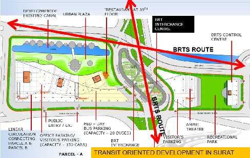
39 Need for a HUB Intercity Smart Para Transit Pedestrian Transit Regional Transit Tourist Service HUB Bicycle Shearing Parking Car Sharing Planning Regulation Enforcement To provide seamless transportation To enhance Safety To provide Comfort To attract Pedestrian To provide Convenient 39 interconnection to transit
40 Integrated Multi Modal Public Transit Hub 40

41 Proposed BRT-MRTS Stations with Interchange Hub Interchange Node 41

42 Interchange Hub Other facilities within CBD Transit supportive landuse Commercial complexes High denisity office towers Mid density residential Hospital Restaurants Child day care center METRO, BRT, AMTS, GSRTC Public Spaces City plaza Entertainment spaces. Access Areas Parking Public Amenities 24X7 Para transport Facilities Short term Long term Full day Taxi stands Auto stands Bicycle rentals Factors such as available area, site shape, adjoining road layout, relation to pedestrian and passenger objectives, and/or 42 the number of vehicles and passengers will influence the design
43 Key Elements Mixed use activity Pedestrian friendly Connectivity of Streets Transit friendly design features Accessibility to alternative modes of transportation 43
44 Components Walkable environment High density- High quality development Collector support transit system Trolley / Street Cars / Feeder Bus Managed parking Parking with in 10mins walking radius Improve Connectivity Shorten local trips Improve multimodal mobility Transit station as prominent feature 44

45 Proposed Interchange Hub with Context of City 45
46 Proposed Interchange Hub Paring for Multimodal hub 46

47 Land Ownership- Ahmedabad Municipal Corporation 47


48 Metro station on level 1 and other recreational and shopping on upper story GSRTC station on Ground level and other recreational and shopping on upper story Parking Parking Multimodal hub BRT station on Ground level and other recreational and shopping on upper story Under ground parking for vehicles, Para transit parking at ground level and upper level parking for Bicycles and cars Open space and plaza on rest of the part 48

49 Multi Level Urban Plaza parkingparatransit at ground level UG parking and Ground floor station and upper floors shopping/commercial 49
50 Proposed Road Section 50

51 Concept Plan Pedestrian Movement Stadium 51

52 Concept Plan- Vehicular Movement Stadium 52
53 Improve Connectivity with the River Front Stadium 53

54 Encourage Pedestrian Movement Road towards Riverfront Source : SRFDCL, AMC, Ahmedabad 54

55 Source : SRFDCL, AMC, Ahmedabad 55


56 Bogota Mohawk College Itly 56
57 Alternate 2 57
58 Multimodal hub Usmanpura 58

59 Parking Multimodal hub Usmanpura 59
60 Financial Mechanism 60
61 Finance A. Use Planning mechanism to finance plan proposals B. Use all other sources to finance the plan a. Use Development Premium to raise finances b. Tap state and central funding sources 61
62 Use Development Premium to Raise Finances In case of Redevelopment Use Chargeable FSI as tool for financial mechanism FSI in sqmt Jantri Rate per sqmt Rs in Cr 30% Redevelopment % Redevelopment Source: AUDA 62

63 Tap State and Central Funding Sources 63
64 Implementation & Monitoring Strategies 64
65 Implementation Strategies a. Rely primarily on the AUDA mechanism to deliver serviced land b. Establish a plan implementation monitoring system c. Inter-government Co-ordination between Different Agencies d. Need Prepare building design Guidelines and Design Guidelines for Complete Street 65

66 Implementation of SP Ring Road A successful Example Ahmedabad s 76 km long Ring Road was developed through the TPS mechanism 66

67 Establish a Plan Implementation Monitoring System 67

68 Inter-government Co-ordination between Different Agencies 68


69 Road Ahead.. To Prepare Conceptual building design Guidelines Building façade Colour Material Landscape Flooring Lighting To prepare Conceptual design Guidelines for Complete Streets Bicycle Lane/Route Street furniture Urban Services Pedestrian walkways Space for Vendors 69
70 Thank You 70
71 71

72 Thank You 72
73 73
LEADERS IN URBAN TRANSPORT PLANNING. Ahmedabad Urban Development Authority
 LEADERS IN URBAN TRANSPORT PLANNING Ahmedabad Urban Development Authority Regional Context Gandhinagar Twin City 4 Growth centers and Satellite Towns Sanand SIR, Changodar SIR Dholera SIR, SEZs 2 What
TRANSIT ORIENTED DEVELOPMENT
 TRANSIT ORIENTED DEVELOPMENT Dhaka September 13, 2018 Prof. H. M. Shivanand Swamy Centre of Excellence in Urban Transport Why TOD? Economic Increased Density in prime, Convenient Locations Environmental
SUSTAINABLE TRANSPORT & INTEGRATED LAND USE PLANNING
 SUSTAINABLE TRANSPORT & INTEGRATED LAND USE PLANNING UNESCAP Capacity Building Workshop, Colombo Integrated Land use and Urban Transport Planning : Principles and Practices 31st October 2017 ACTIVE TRANSPORTATION
City of Lake Mary, Florida. Evolution of a Historic Downtown with Transit Oriented Development Strategies
 City of Lake Mary, Florida Evolution of a Historic Downtown with Transit Oriented Development Strategies What is Transit Oriented Development? Walkable villages located at and around transit stations in
CHAPTER 7: Transportation, Mobility and Circulation
 AGLE AREA COMMUNITY Plan CHAPTER 7 CHAPTER 7: Transportation, Mobility and Circulation Transportation, Mobility and Circulation The purpose of the Transportation, Mobility and Circulation Chapter is to
Port Credit Local Advisory Panel October 20 th Meeting
 Port Credit Local Advisory Panel October 20 th Meeting Focus Of This Evening s Meeting: 1. Hurontario Main Street Higher Order Transit Study 2. Port Credit Mobility Hub & GO Station Parking Structure Study
I615. Westgate Precinct
 I615. Westgate Precinct I615.1. Precinct Description The Westgate Precinct is located approximately 18km west of the Auckland city centre. There are seven Sub-precincts in the Westgate Precinct: Sub-precinct
12600 S Existing Conditions
 STUDY AREA BOUNDARY Study Area Boundary Study Area Context The District Riverton Meadows Vista Station Mountain View Village Market Center 2 Mile Radius 12600 S Existing Conditions 12600 S is a river of
CHAPTER 3 VISION, GOALS, & PLANNING PRINCIPLES. City of Greensburg Comprehensive Plan. Introduction. Vision Statement. Growth Management Goals.
 CHAPTER 3 VISION, GOALS, & PLANNING PRINCIPLES Introduction The Greensburg Comprehensive Plan is intended as a working community document. A combination of long and short-term goals, this document is intended
NAGPUR METRO WORK RETAIL LEISURE CULTURE
 NAGPUR METRO WORK RETAIL LEISURE CULTURE NAGPUR WHERE INDIA CROSSES Best known as the Orange City of India, Nagpur is a major commercial, political, industrial and defence center in the Vidarbha region
The Need to Develop a Transit Ready Community
 Evaluation & Appraisal Report (EAR) Major Issue # 6 The Need to Develop a Transit Ready Community July 3, 2007 EAR Major Issue # 6 Transit Ready Existing Comp Plan policies apply only to Indiantown Road:
TRANSIT ORIENTED DEVELOPMENT PINELLAS COUNTY MPO LIVABLE COMMUNITIES INITIATIVE PINELLAS COUNTY COMPREHENSIVE PLAN AMENDMENTS
 PINELLAS COUNTY MPO LIVABLE COMMUNITIES INITIATIVE MODEL LAND DEVELOPMENT CODE TRANSIT ORIENTED DEVELOPMENT PINELLAS COUNTY COMPREHENSIVE PLAN AMENDMENTS MPO Livable Communities Initiative Goal: Improve
TRANSPORTATION ELEMENT GOALS, OBJECTIVES, AND POLICIES
 TRANSPORTATION ELEMENT GOALS, OBJECTIVES, AND POLICIES GOAL 2 The City shall provide a safe, convenient, effective, and energy efficient multimodal transportation system which is coordinated with the Future
THE GARDEN CITY PLAN. City of St. Catharines Official Plan. City of St. Catharines
 THE GARDEN CITY PLAN City of St. Catharines Official Plan City of St. Catharines August 2010 APPROVAL INFORMATION This Official Plan of the City of St. Catharines Planning Area, known as the Garden City
Westbound: A One-day Exploration of Growth
 Westbound: A One-day Exploration of Growth Frog Pond Area 2018 UGB Expansion Proposal June 13, 2018 Growing Out: UGB Asks Four cities submitted proposals to expand greater Portland s urban footprint by
A Plan for the Heart of the Region: Tukwila, WA
 : Tukwila, WA 1 The Plan orchestrates the Restructuring of a 1,000-acre Regional Shopping Area into a Social and Symbolic for the Region. REGIONAL CONTEXT Downtown Seattle (Metropolitan ) 20 miles Bellevue
178 Carruthers Properties Inc.
 178 Carruthers Properties Inc. Planning Rationale for 178 Carruthers Avenue Site Plan Control Application June 2014 Table of Contents 1.0 Introduction 2.0 Overview of Subject Property 3.0 Current Zoning
TOD GUIDANCE DOCUMENT & CITY SPECIFIC PLANS
 National Dissemination Workshop Guidance Documents For Transit Oriented Development (TOD), Non-Motorised Transport (NMT) And Public Bicycle Sharing (PBS) TOD GUIDANCE DOCUMENT & CITY SPECIFIC PLANS IBI
Isabel Neighborhood Plan: Alternatives
 Isabel Neighborhood Plan: Alternatives Presented by: Lori Parks, Associate Planner February 2, 2015 Agenda 1. Background on BART to Livermore 2. Isabel Neighborhood Plan 3. Alternative Scenarios 4. General
1.4 TRANSIT VISION 2040 FROM VISION TO ACTION THEME 1: PUTTING TRANSIT AT THE CENTRE OF COMMUNITIES. Fully integrate transit with community design
 TRANSIT VISION 2040 FROM VISION TO ACTION TRANSIT VISION 2040 defines a future in which public transit maximizes its contribution to quality of life with benefits that support a vibrant and equitable society,
THE NEIGHBORHOOD TODAY
 THE NEIGHBORHOOD TODAY CORE AREA VISION How are we Good Urbanism A Site s DNA thinking about Elements of great Unique elements urban communities embedded in a place the site and design? ELEMENTS LIKE:
Embrace Green Urban Space:
 1 Embrace Green Urban Space: Parks/Green Space as Vital to Urban Livability Jenna Fletcher The Trust for Public Land LUAC November 15, 2012 2 The Trust for Public Land conserves land for people to enjoy
heuston gateway: sections heuston gateway: regeneration strategy and development framework plan
 B B1 A B1 B C A heuston gateway: sections B B1 C 117 4.3.3 Zoning The station is the central hub of the area and this function must be preserved and developed. However large areas of the Heuston Station
Policies and Code Intent Sections Related to Town Center
 Policies and Code Intent Sections Related to Town Center The Town Center Vision is scattered throughout the Comprehensive Plan, development code and the 1994 Town Center Plan. What follows are sections
Transit-Oriented Development
 Transit-Oriented Development Path to Sustainability West Windsor February 22, 2007 George S. Hawkins Context for Presentation NJ Future is a non-partisan, 501(c)3 non-profit organization. Offer perspective,
Integrated Urban Development. April Reflections from the NZPI Study Tour of Portland, Seattle and Vancouver
 Integrated Urban Development April 2009 Reflections from the NZPI Study Tour of Portland, Seattle and Vancouver Integrated Urban Development Urban Growth Management Transportation Transit Orientated Mixed
ORDINANCE AN ORDINANCE TO ADD A NEW SECTION 4.N. IN THE ZONING CODE FOR THE TOWN OF MIDDLETOWN, RELATING TO MIXED-USE DEVELOPMENT
 Introduced: November 5, 2018 Approved: ORDINANCE 18-11-01 AN ORDINANCE TO ADD A NEW SECTION 4.N. IN THE ZONING CODE FOR THE TOWN OF MIDDLETOWN, RELATING TO MIXED-USE DEVELOPMENT BE IT ENACTED BY THE MAYOR
Speers Road Corridor Study. Livable Oakville (Official Plan) Council Sub Committee March 20, 2017
 Council Sub Committee March 20, 2017") Speers Road Corridor Study Livable Oakville (Official Plan) Council Sub Committee March 20, 2017 Overview 1) Study Purpose & Background 2) Study Area 3) Policy Context and Plan Review 4) Speers Road Corridor
Speers Road Corridor Study Livable Oakville (Official Plan) Council Sub Committee March 20, 2017 Overview 1) Study Purpose & Background 2) Study Area 3) Policy Context and Plan Review 4) Speers Road Corridor
Prosperity Hucks Area Plan. Transportation and Planning Committee May 11, 2015
 Prosperity Hucks Area Plan Transportation and Planning Committee May 11, 2015 Presentation Outline 1. Background and Location 2. Community Dialog Process 3. Activity Center Recommendations 4. Wedge Recommendations
Northwest commuter rail station US 36 BRT. Westminster Station
 Northwest commuter rail station Westminster Station US 36 BRT Westminster Center US 36 & Church Ranch Broomfield Flatiron/96 th St. US 36 & McCaslin Table Mesa Boulder Junction 13-month effort that will
Subarea 4 Indian Creek. Vision The combination of park networks and transportation amenities make Subarea 4 the greenest hub in the Corridor.
 indian creek 180 extends south from 101st Street to I-435. The I-435 and Metcalf intersection is one of the primary intersections in the Kansas City Metro Area. The area includes several residential neighborhoods
MONTGOMERY COUNTY METRO STATION AREA DESIGN CHARRETTE
 MONTGOMERY COUNTY METRO STATION AREA DESIGN CHARRETTE Shady Grove Metro Station Area Charrette Closing Presentation October 25-28, 2000 MONTGOMERY COUNTY, MD M-NCPPC Design Collective, Inc. Architects
13 THORNHILL YONGE STREET STUDY IMPLEMENTATION CITY OF VAUGHAN OPA 669 AND TOWN OF MARKHAM OPA 154
 13 THORNHILL YONGE STREET STUDY IMPLEMENTATION CITY OF VAUGHAN OPA 669 AND TOWN OF MARKHAM OPA 154 The Planning and Economic Development Committee recommends the adoption of the recommendations contained
Executive Summary. NY 7 / NY 2 Corridor
 Executive Summary NY 7 / NY 2 Corridor Transportation and Land Use Study December 2005 Prepared for: Town of Colonie Capital District Transportation Committee Prepared by: Introduction: Land use decisions
Rio/29 Small Area Plan. Design Plan & Implementation Framework Open House - January 25, 2018
 Rio/29 Small Area Plan Design Plan & Implementation Framework Open House - January 25, 2018 MEETING PURPOSE PRESENTATION 1. Orient to the updated design plans 2. Introduce implementing options 3. Explain
Be it enacted by the Town Board of the Town of Guilderland that the following new A (Transit Oriented Development (TOD) District) is adopted:
 District) is adopted:") Local Law No. 4 of 2018 (Adoption of 280-18A (Transit Oriented Development District) Be it enacted by the Town Board of the Town of Guilderland that the following new 280-18A (Transit Oriented Development
Local Law No. 4 of 2018 (Adoption of 280-18A (Transit Oriented Development District) Be it enacted by the Town Board of the Town of Guilderland that the following new 280-18A (Transit Oriented Development
1 Adapted from the Statewide Transit-Oriented Development Study by CalTrans, 2006
 APPENDIX C: LAND USE PLANNING FOR ENHANCED RAIL SERVICE 72 BACKGROUND One of the consistent themes heard from localities in the Route 29 corridor Planning Forums was the need for expanding rail service
EXHIBIT A. Tax Increment Reinvestment Zone No. 1 (Town Center) First Amended Project Plan 1
 First Amended Project Plan 1") EXHIBIT A Tax Increment Reinvestment Zone No. 1 (Town Center) First Amended Project Plan 1 1 As amended by Resolution No. 2008-02-001(TR1R) of the Tax Increment Reinvestment Zone No.1, and approved to
EXHIBIT A Tax Increment Reinvestment Zone No. 1 (Town Center) First Amended Project Plan 1 1 As amended by Resolution No. 2008-02-001(TR1R) of the Tax Increment Reinvestment Zone No.1, and approved to
Sabarmati Riverfront Development Integrated Environmental Improvement and Urban Revitalization
 Sabarmati Riverfront Development Integrated Environmental Improvement and Urban Revitalization Ahmedabad and the Sabarmati Ahmedabad was established on Sabarmati in 1411 Painting: Amit Ambalal Ahmedabad
ITEM #8. Regional Smart Growth Program. Regional Smart Growth Program. Presentation Overview. Coast Highway Vision and Stategic Plan.
 Regional Smart Growth Program Economic Development Commission What is Smart Growth? Adopted as part of the Regional Comprehensive Plan (RCP) RCP provides vision for region based on Smart Growth and sustainability
Urban Design and Infrastructure An Overview
 Urban Design and Infrastructure An Overview Alex Taranu, FCIP, RPP, OAA Municipal Urban Designers roundtable May27th, 2011 1 Urban Design and Infrastructure - Overview 1. Introduction Urban Design and
appendix and street interface guidelines
 appendix five: building and street interface guidelines appendix 5 building and street interface guidelines BOULEVARDS Boulevards are generally characterized by higher levels of traffic movement at higher
NJ s Land Use and Transit Policies
 1 NJ s Land Use and Transit Policies NJ TRANSIT created in 1979 to reverse decline of public transportation State Development & Redevelopment Plan adopted (1986) encourages growth in areas where population,
Keystone Business Park Precinct Structure Plan North East Industrial Precinct. Part 2 Design Principles
 Keystone Business Park Precinct Structure Plan North East Industrial Precinct Part 2 Design Principles Context Issues Services Landform Issues Geotech and contamination Ecology Traffic and access Issues
B. Blocks, Buildings and Street Networks
 B. Blocks, Buildings and Street Networks Figure IV.4 A rational block pattern with connected streets Introduction The single most important element in the physical and functional integration of mixed use
Public Open House #1
 Public Open House #1 TONIGHT S AGENDA Welcome Project Overview The Big Picture The Station Area The Analysis Thoughts about Future Change Breakout Group Discussions Summation / Next Steps Project Overview
Stakeholders Advisory Working Groups (SAWGs) Smart Growth and TOD Land Use (#11) SAWG Meeting
 Smart Growth and TOD Land Use (#11) SAWG Meeting") Presentation - Part II Tappan Zee Bridge/I-287 Corridor Project July 21, 2010 Slide 1. David Kooris (Regional Plan Association) welcomed members of the Land Use Stakeholders Advisory Working Groups (SAWGs)
Presentation - Part II Tappan Zee Bridge/I-287 Corridor Project July 21, 2010 Slide 1. David Kooris (Regional Plan Association) welcomed members of the Land Use Stakeholders Advisory Working Groups (SAWGs)
01 the vision NEW LYNN IS WAITING FOR THE GREAT LEAP FORWARD
 [A] FRAMEWORK 01 the vision 02 the framework 03 urban design principles 04 c o n t e x t 05 issues a n d o p p o r t u n i t i e s 06 creating a t.o.d. 07 key recommendations 08 seven strategic areas of
LEED-ND 101: Practical Strategies for Achieving Sustainability Goals. Travis Parker Lakewood Planning Director
 LEED-ND 101: Practical Strategies for Achieving Sustainability Goals Travis Parker Lakewood Planning Director Metro Vision Idea Exchange Oct 11, 2012 West Corridor Stations West Corridor Overview West
3. Endorse the LRT vision in transforming Surrey into Connected-Complete-Livable communities, and more specifically, the official vision statement:
 CORPORATE REPORT NO: R038 COUNCIL DATE: February 20, 2017 REGULAR COUNCIL TO: Mayor & Council DATE: February 16, 2017 FROM: General Manager, Engineering FILE: 8740-01 SUBJECT: Surrey Light Rail Transit
Chapter 4. Linking Land Use with Transportation. Chapter 4
 Chapter 4 Linking Land Use with Transportation Chapter 4 59 Chapter 4 Linking Land Use with Transportation Community Design and Transportation Program Introduction Since the 1950s, the predominant development
FUTURE LAND USE ELEMENT
 FUTURE LAND USE ELEMENT GOAL I: To create and sustain a great place to live, play, and prosper Objective 1: The City of Ocala shall incorporate the principles and strategies of the Ocala 2035 Vision into
Urban Development Areas Frederick County
 18 Urban Development Areas Frederick County UDA Needs Profile: All UDAs Frederick County, Virginia's northernmost county has two UDA s, surrounded by the City of Winchester and located adjacent to the
Field trip report. Field trip transport planning, , 2 ECTS, 2017S
 Field trip report Field trip transport planning, 231.043, 2 ECTS, 2017S Transit-Oriented Development (TOD) initiated by private railway companies in Japan The example of Utsukushigaoka on the Tama Den-en
Complete Neighbourhood Guidelines Review Tool
 Complete Neighbourhood Guidelines Review Tool Prepared By: City of Regina Planning Department October 2014 Page 1 of 14 Community Development Review Checklist for Secondary Plans and Concept Plans The
Transport Demand Management (TDM) Policies and Measures for Sustainable Cities
 Policies and Measures for Sustainable Cities") 1 Intergovernmental 11 th Regional Environmentally Sustainable Transport (EST) Forum in Asia 2-5 October 2018, Ulaanbaatar, Mangolita Transport Demand Management (TDM) Policies and Measures for Sustainable
1 Intergovernmental 11 th Regional Environmentally Sustainable Transport (EST) Forum in Asia 2-5 October 2018, Ulaanbaatar, Mangolita Transport Demand Management (TDM) Policies and Measures for Sustainable
Chapter 1.0 Introduction
 Chapter 1.0 Introduction 1.1 Background The North Metro commuter rail line is part of the RTD FasTracks regional transit system expansion program to build more than 100 miles of rail transit throughout
Subregion 4 Central Avenue-Metro Blue Line Corridor Transit-Oriented Development (TOD) Implementation Project. Community Meeting April 27, 2011
 Implementation Project. Community Meeting April 27, 2011") Subregion 4 Central Avenue-Metro Blue Line Corridor Transit-Oriented Development (TOD) Implementation Project Community Meeting April 27, 2011 Overview Introduction to Subregion 4 TOD Implementation Program
Subregion 4 Central Avenue-Metro Blue Line Corridor Transit-Oriented Development (TOD) Implementation Project Community Meeting April 27, 2011 Overview Introduction to Subregion 4 TOD Implementation Program
Joint Meeting City Council and the Plan Commission. September 1st, 2015
 Joint Meeting City Council and the Plan Commission September 1st, 2015 1 The City Plan Commission shall recommend a City Plan for the physical development of the City Article IX Section 2 of the City of
Making TOD Work in the Heart of Suburban Sprawl
 Making TOD Work in the Heart of Suburban Sprawl Rocky Mountain Land Use Institute March 6, 2009 Speakers Ben Herman, FAICP, Principal Clarion Associates Darcie White, AICP, Principal Clarion Associates
ORANGE COUNTY IMPLEMENTING THE FOUR C s
 ORANGE COUNTY IMPLEMENTING THE FOUR C s East Central Florida Corridor Task Force O R A N G E COUN TY P LA N N I N G DIVISION C O M M U N I T Y, E N V I R O N M E N T A L A N D D E V E L O P M E N T S E
The Master Plan Framework
 The Master Plan Framework The East Harbour Master Plan advances the development of 60 acres of former industrial lands east of the Don River. The Master Plan outlines a vision for a vibrant, transit-oriented
MPD 2021 Review TOD Policy
 MPD 2021 Review TOD Policy CURRENT CITY PATTERN: Population Density evenly distributed all over city. Large Travel distances & pollution due to segregated land use and vehicular dependency. Rohtak Road
[PLANNING RATIONALE] For Site Plan Control and Lifting of Holding Zone By-Law 101 Champagne Avenue. May 23, 2014
![[PLANNING RATIONALE] For Site Plan Control and Lifting of Holding Zone By-Law 101 Champagne Avenue. May 23, 2014](/thumbs/75/71599615.jpg "[PLANNING RATIONALE] For Site Plan Control and Lifting of Holding Zone By-Law 101 Champagne Avenue. May 23, 2014") [PLANNING RATIONALE] For Site Plan Control and Lifting of Holding Zone By-Law 101 Champagne Avenue May 23, 2014 Contents 1.0 Introduction... 2 2.0 Site Context... 2 2.1 Adjacent Uses... 2 Figure 1: Site
[PLANNING RATIONALE] For Site Plan Control and Lifting of Holding Zone By-Law 101 Champagne Avenue May 23, 2014 Contents 1.0 Introduction... 2 2.0 Site Context... 2 2.1 Adjacent Uses... 2 Figure 1: Site
VICTORIA DOWNTOWN DEVELOPMENT PLANNING
 VICTORIA DOWNTOWN DEVELOPMENT PLANNING A Vision & Guide for the Future Downtown Victoria thrives as a center for the community, offering a great mix of entertainment, culture, business, and recreational
MALL REVITALIZATION CASE STUDIES
 MALL REVITALIZATION CASE STUDIES DECEMBER 9, 2012 MALL REVITALIZATION OVERVIEW Introduction Sample Case Studies prepared for Lacey Woodland District Steering Committee as it considers strategies to revitalize
TRANSIT NEIGHBORHOOD PLANS PROGRAM OVERVIEW
 TRANSIT NEIGHBORHOOD PLANS PROGRAM OVERVIEW OCTOBER 2017 Los Angeles Department of City Planning @LATNP and @Planning4LA Outline Introduction Policy Framework The Transit Neighborhood Plans Program Overview:
Status Report: MD 355 Project
 Status Report: MD 355 Project OCTOBER 2006 M-NCPPC MONTGOMERY COUNTY PLANNING DEPARTMENT Summary of Community Comments, and break to the Results of the MD 355 Participation Session Brookside Gardens -
Metro. Activity Center Design Guidelines. Recommendations For Developing Focused, Mixed-Use Commercial/Residential Centers
 Metro Activity Center Design Guidelines Recommendations For Developing Focused, Mixed-Use Commercial/Residential Centers Metro Activity Centers What is a MAC? Legacy, the adopted guide for the future growth
WALTER RAND TRANSPORTATION CENTER
 WALTER RAND TRANSPORTATION CENTER PLANNING AND DESIGN STUDY Public Meeting May 25, 2017 TONIGHT S AGENDA Introduction and Welcome Project Objectives The Study Area: WRTC and its Context Circulation Assessment
CHARLES PUTMAN CHARLES PUTMAN AND ASSOCIATES, INC
 MEMORANDUM CHARLES PUTMAN & ASSOCIATES, INC. LAND DEVELOPMENT CONSULTANTS PLANNING ZONING PERMITTING 4722 NW Boca Raton Boulevard, Suite C-106 Boca Raton, Florida 33431 Phone: 561/994-6411 FAX: 561/994-0447
Executive Summary. Transit-Oriented Redevelopment of the Dwaraka Bus Station: Feasibility Study
 Executive Summary Transit-Oriented Redevelopment of the Dwaraka Bus Station: Feasibility Study The purpose of this project is to study the feasibility of redeveloping Visakhapatnam s Dwaraka Bus Station,
THE NEW COMMUNITY PLANNING GUIDEBOOK
 MUNICIPAL DEVELOPMENT PLAN: VOLUME 2, PART 1 THE NEW COMMUNITY PLANNING GUIDEBOOK Adopted by Council [Approval Date] calgary.ca contact 311 Onward/ We will create great communities with quality living
ELMVALE ACRES SHOPPING CENTRE MASTER PLAN
 ELMVALE ACRES SHOPPING CENTRE MASTER PLAN Contents 1.0 INTRODUCTION... 2 2.0 LOCATION... 2 3.0 EXISTING CONTEXT... 2 4.0 VISION & GUIDING PRINCIPLES... 2 5.0 LAND USE AND BUILT FORM... 4 5.1 St. Laurent
This Review Is Divided Into Two Phases:
 Semiahmoo Town Centre Review The purpose of this review: To review the Semiahmoo Town Centre Concept Plan, originally approved in 1993, to ensure that this centre will continue to serve the needs of South
Seneca Meadows. Block 4 Locate office, technology, and medical development adjacent to I Screen views of garage structures from I-270.
 Seneca Meadows Seneca Meadows has an industrial park in its southern end and a mixed-use employment area planned for the north end. The district benefits from extensive I-270 visibility, stream valley
Planning Districts INTRODUCTION
 INTRODUCTION To facilitate detailed examination of development prospects for all areas of the community, Delano has been divided into 14 planning districts. The location of these planning districts is
MAIN STREET ECONOMIC DEVELOPMENT STRATEGY
 MAIN STREET ECONOMIC DEVELOPMENT STRATEGY A PATHWAY TO A BETTER POUGHKEEPSIE DRAFT Working Paper #2: Planning Strategies Submitted December 1 st, 2015 to the City of Poughkeepsie LAND USE LAW CENTER PACE
Economy Vision Statements: Social Wellbeing Vision Statements: Natural Environment Vision Statements:
 Economy Vision Statements: 1. Our business environment makes us a region of choice for new employers as we encourage entrepreneurship and have a vibrant, diversified and resilient regional economy. 2.
6. REGIONAL AND COMMUNITY FACILITIES DESIGNATIONS 6.1. OBJECTIVES FOR REGIONAL AND COMMUNITY FACILITIES LAND USE DESIGNATIONS
 6. REGIONAL AND COMMUNITY FACILITIES DESIGNATIONS INTRODUCTION The Regional and land use designations provide the primary locations for uses which satisfy the health, education and other service needs
Gold Line Bus Rapid Transit Transit Oriented Development (BRTOD) Helmo Station Area Plan
 Helmo Station Area Plan") Appendix F Gold Line Bus Rapid Transit Transit Oriented Development (BRTOD) Helmo Station Area Plan Introduction and Purpose of the Plan The Gold Line Bus Rapid Transit facility is an eleven-mile dedicated
Appendix F Gold Line Bus Rapid Transit Transit Oriented Development (BRTOD) Helmo Station Area Plan Introduction and Purpose of the Plan The Gold Line Bus Rapid Transit facility is an eleven-mile dedicated
1.3 TRANSIT VISION 2040 FROM VISION TO ACTION THEME 1: PUTTING TRANSIT AT THE CENTRE OF COMMUNITIES. Fully integrate transit with community planning
 TRANSIT VISION 2040 FROM VISION TO ACTION TRANSIT VISION 2040 defines a future in which public transit maximizes its contribution to quality of life with benefits that support a vibrant and equitable society,
12/9/2013. HOLLYWOOD/PINES CORRIDOR PROJECT AMPO 2013 Annual Conference October 24, Our Perspective. Broward.
 HOLLYWOOD/PINES CORRIDOR PROJECT AMPO 2013 Annual Conference October 24, 2013 Our Perspective Broward Fort Lauderdale 1 Broward Metropolitan Planning Organization Fort Lauderdale Fort Lauderdale Skyline
Official Zoning Map Amendment Application #2018I-00047
 Community Planning and Development Planning Services 201 W. Colfax Ave., Dept. 205 Denver, CO 80202 p: 720.865.2915 f: 720.865.3052 www.denvergov.org/cpd TO: Denver Planning Board FROM: Chandler Van Schaack,
Energy Efficient Strategies for Urban Transportation Planning
 EinT2018 3 rd International Conference ENERGY in TRANSPORTATION 2018 Energy Efficient Strategies for Urban Transportation Planning Prof. Dr. Doaa M. El-Sherif, PhD, Arch. Email: doaa_elsherif@yahoo.com
YONGE STEELES CORRIDOR SECONDARY PLAN. Young + Wright / IBI Group Architects Dillon Consulting Ltd. GHK International (Canada) Ltd.
 Ltd.") PART A: PREAMBLE 1.0 PURPOSE The purpose of this Secondary Plan is to provide a development framework for intensification of the Yonge/ Steeles corridor including the north side of Steeles Avenue West
PART A: PREAMBLE 1.0 PURPOSE The purpose of this Secondary Plan is to provide a development framework for intensification of the Yonge/ Steeles corridor including the north side of Steeles Avenue West
Town Center (part of the Comprehensive Plan)
") Town Center (part of the Comprehensive Plan) Mercer Island Town Center Looking North (2014) In 1994, a year-long process culminated in a set of design guidelines and code requirements for the Town Center
Town Center (part of the Comprehensive Plan) Mercer Island Town Center Looking North (2014) In 1994, a year-long process culminated in a set of design guidelines and code requirements for the Town Center
6. DOWNTOWN. The Downtown Element focuses on supporting and expanding the vitality and enhancement of Downtown Chico as the City s central core.
 VISION In 2030, Downtown Chico is the heart of the community and the center of cultural activity. Engaging and active at the street level, it is a multi-story, mixed-use hub, with specialty retail, restaurants,
Lehigh Acres Land Development Regulations Community Planning Project
 Lehigh Acres Land Development Regulations Planning Effort Summary In July, 2010 Commissioner Frank Mann invited the Lehigh Acres community to start discussing how to achieve their recently adopted community
K. SMART ASSOCIATES LIMITED
 Planning Justification Report Zoning By-Law Amendment 185 King Street North Waterloo, Ontario April 7th, 2017 Project Reference Number 16-245 K. SMART ASSOCIATES LIMITED CONSULTING ENGINEERS AND PLANNERS
Riverfront Park. Proposed. Riverfront Market. Park. Gandhi Bridge. Nehru. Bridge
 Riverfront Park Proposed Development Proposed Park Proposed Heritage Plaza Riverfront Market Proposed Cultural Center Sardar Bridge Dr. Ambedkar Bridge Subhash Bridge Dadhichi Rushi Bridge Riverfront Park
«Corridor» designs in town planning : Sustainable planning for large cities in developed countries
 CODATU XIII «Corridor» designs in town planning : Sustainable planning for large cities in developed countries Challenges of implementation in booming cities in emerging and developing countries Lyon Town
Turcot: For a sustainable and active future
 Turcot: For a sustainable and active future Turcot: Pour un site actif et un développent durable This site offers one of largest undeveloped open space near a CBD in the country. Currently the location
1.0 VISION STATEMENT. December 6, PRINCIPLES
 Vision Statement Lincoln Regional Airport 1.0 VISION STATEMENT 1.1 City LOCATION of AND OVERVIEW The Easton Lincoln Place Land Use Master Plan identifies the principles, goals, policies, and standards
Kensington Center. Public Meeting # Transit-Oriented Development, Town of Berlin, CT
 Kensington Center Public Meeting #1 10.27.16 Transit-Oriented Development, Town of Berlin, CT CivicMoxie 2016 What is Transit-Oriented Development Definition: Transit-Oriented Development (TOD) = is an
PLAN ELEMENTS WORKSHOP. April 5, 2016
 PLAN ELEMENTS WORKSHOP April 5, 2016 needs more housing. But there is no one-size fits-all solution. Every neighborhood has its own character. In some places, density is not only appropriate it is badly
Strategic Planning in the Making: Legacy and Vision for Hong Kong. Mr. K. K. LING, JP, FHKIP, RPP Director of Planning
 The Hong Kong Institute of Surveyors Planning & Development Conference 2016 Planning and Development, Past Present & Future (22 October 2016) Strategic Planning in the Making: Legacy and Vision for Hong
Transportation Working Team Duane Diggs, Co-Chair (VOICE Buffalo) Kelly Dixon, Co-Chair (GBNRTC) Paul Ray, Facilitator (UB Regional Institute)
 Kelly Dixon, Co-Chair (GBNRTC) Paul Ray, Facilitator (UB Regional Institute)") towards a more sustainable Buffalo Niagara Transportation Working Team Duane Diggs, Co-Chair (VOICE Buffalo) Kelly Dixon, Co-Chair (GBNRTC) Paul Ray, Facilitator (UB Regional Institute) Agenda Welcome,
towards a more sustainable Buffalo Niagara Transportation Working Team Duane Diggs, Co-Chair (VOICE Buffalo) Kelly Dixon, Co-Chair (GBNRTC) Paul Ray, Facilitator (UB Regional Institute) Agenda Welcome,
Proposed Comprehensive Plan Strategies DRAFT for discussion June 28, 2017
 Proposed Comprehensive Plan Strategies DRAFT for discussion June 28, 2017 Land Use Rural Areas Refine the Farm and Forest area (FF) Update FF boundaries to account for existing lots less than five acres
STEERING COMMITTEE MEETING # 5 SEPTEMBER 18, 2018
 STEERING COMMITTEE MEETING # 5 SEPTEMBER 18, 2018 STEERING COMMITTEE MEETING #5 AGENDA 1. Introduction 2. Market Conditions 3. Preliminary Development Concepts 4. Open Discussion 5. Next Steps PLANNING