LAKEVIEW VILLAGE VISION & MASTERPLAN PRESENTATION TO CITY OF MISSISSAUGA. April 9, 2018
|
|
|
- Jonathan Pitts
- 5 years ago
- Views:
Transcription


1 LAKEVIEW VILLAGE VISION & MASTERPLAN PRESENTATION TO CITY OF MISSISSAUGA April 9, 2018


2
3 AGENDA Introduction Vision Plan Comparison The Big Moves Trail Connections Plan Overview Districts Conveyance Comparison Discussion


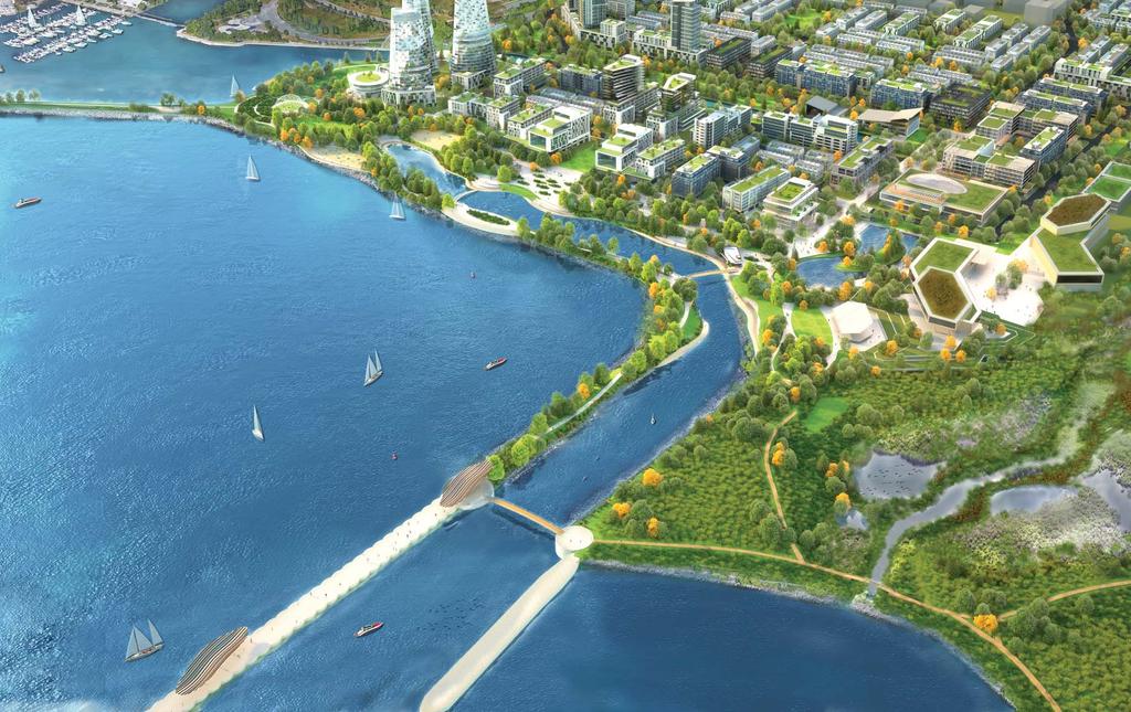
4 VISION Lakeview Village will become the GTA s next great waterfront community, reconnecting Mississauga to Lake Ontario. A diverse mix of residential offerings will allow people the unique opportunity to live and play on the lake. Institutional, cultural, office, retail and amenities draw everyone to Inspiration Lakeview. Unique gathering and recreational spaces weave throughout the community contributing to a dynamic walkable, connected and active lifestyle at the water s edge and extending onto the lake at Inspiration Point.
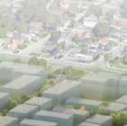
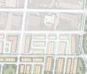
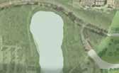
5 PLAN COMPARISON LAKESHORE ROAD EAST RANGEVIEW ESTATES BOULEVARD LAKESHORE NEIGHBOURHOOD NEW STREET RANGEVIEW STREET NEW OGDEN AVENUE HYDRO ROAD LAKEVIEW GATEWAY HYDRO NEW HAIG BOULEVARD PLACE OGDEN GREEN HYDRO PLACE DOUGLAS KENNEDY BLVD. AVIATOR GREENWAY NEW AVIATOR AVENUE GENERATOR LN. GREENWAY WATERWAY STREET WATERWAY COMMON SQUARE NEW HAIG BOULEVARD G.E. BOOTH (LAKEVIEW) WASTEWATER TREATMENT FACILITY PROSPECT LN. THE DOCKS PANORAMA POINT LAKEVIEW BOULEVARD OGDEN VISTA ESPLANADE CAMPUS CHANNELSIDE INSPIRATION WESTERN PIER COAL HILL AMPHITHEATRE LAKEVIEW WATERFRONT CONNECTION CONSER- VATION AREA WESTERN PIER

6 THE BIG MOVES 01 A Continuous Waterfront 02 A Blue and Green Network 03 A Fine Grain Street Pattern The true inspiration for the site is its waterfront location. Generous green and water-related open spaces are the Created to support all types of users, including 04 Bring Transit to the Site 05 A Cultural Hub at the Head of the Piers 06 Employment and Innovation Corridor
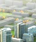
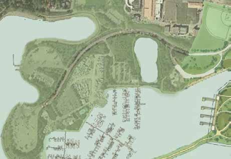
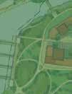
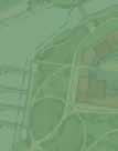
7 THE PLAN LAKESHORE ROAD EAST RANGEVIEW ESTATES BOULEVARD LAKESHORE NEIGHBOURHOOD NEW STREET RANGEVIEW STREET NEW OGDEN AVENUE HYDRO ROAD LAKEVIEW GATEWAY HYDRO NEW HAIG BOULEVARD PLACE OGDEN GREEN HYDRO PLACE DOUGLAS KENNEDY BLVD. AVIATOR GREENWAY NEW AVIATOR AVENUE GENERATOR LN. GREENWAY PUBLIC MARINA WATERWAY STREET WATERWAY COMMON SQUARE NEW HAIG BOULEVARD G.E. BOOTH (LAKEVIEW) WASTEWATER TREATMENT FACILITY PROSPECT LN. PORT CREDIT YACHT CLUB THE DOCKS PANORAMA POINT LAKEVIEW BOULEVARD OGDEN VISTA ESPLANADE CAMPUS CHANNELSIDE INSPIRATION WESTERN PIER COAL HILL AMPHITHEATRE LAKEVIEW WATERFRONT CONNECTION CONSER- VATION AREA WESTERN PIER
8 A CONTINUOUS WATERFRONT 01 A Continuous Waterfront Urban Strategies - Inspiration Lakeview Big Moves
9 A CONTINUOUS WATERFRONT 01 A Continuous Waterfront Urban Strategies - Inspiration Lakeview Big Moves


10 A BLUE AND GREEN NETWORK 02 A Blue and Green Network Urban Strategies - Inspiration Lakeview Big Moves
11 A BLUE AND GREEN NETWORK 02 A Blue and Green Network Urban Strategies - Inspiration Lakeview Big Moves
12 A FINE GRAIN STREET PATTERN 03 A Fine Grain Street Pattern Urban Strategies - Inspiration Lakeview Big Moves
13 A FINE GRAIN STREET PATTERN 03 A Fine Grain Street Pattern Urban Strategies - Inspiration Lakeview Big Moves LEGEND: ARTERIAL ROAD (LAKESHORE RD. E.) COLLECTOR ROAD CHARACTER STREETS LOCAL STREETS
14 A FINE GRAIN STREET PATTERN 03 A Fine Grain Street Pattern Urban Strategies - Inspiration Lakeview Big Moves LEGEND: ARTERIAL ROAD (LAKESHORE RD. E.) COLLECTOR ROAD CHARACTER STREETS LOCAL STREETS 5 MINUTE WALKING RADIUS (400m)
15 BRING TRANSIT TO THE SITE TO PORT CREDIT GO STATION TO LONG BRANCH GO STATION 04 Bring Transit to the Site Urban Strategies - Inspiration Lakeview Big Moves LEGEND: ARTERIAL ROAD (LAKESHORE RD. E.) COLLECTOR ROAD CHARACTER STREETS LOCAL STREETS EXISTING TRANSIT LINK POTENTIAL FUTURE TRANSIT LINK EXISTING PLANNED TRANSIT JUNCTION
16 A CULTURAL HUB AT THE HEAD OF THE PIERS 05 A Cultural Hub at the Head of the Piers Urban Strategies - Inspiration Lakeview Big Moves

17 EMPLOYMENT AND 06 Employment and Innovation Corridor Urban Strategies - Inspiration Lakeview Big Moves
18 EXTENSIVE TRAIL CONNECTIONS LEGEND: PUBLIC OPEN SPACES PRIVATE OPEN SPACES PEDESTRIAN PRIORITY STREETS EXISTING WATERFRONT TRAIL FUTURE WATERFRONT TRAIL EXISTING TRAIL / CYCLING CONNECTIONS FUTURE TRAIL / CYCLING CONNECTIONS
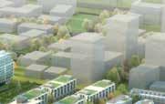
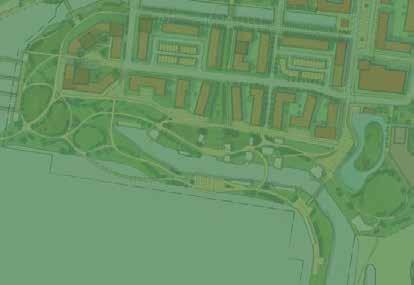
19 PLAN OVERVIEW Residential Unit Breakdown - Townhouse: 648 (10.4%) Mid-Rise: 3907 (62.4%) 11+ Storeys: 1705 (27.2%) 6260 Total Units RANGEVIEW ESTATES BOULEVARD LAKESHORE ROAD EAST LAKESHORE NEIGHBOURHOOD NEW STREET RANGEVIEW STREET NEW OGDEN AVENUE HYDRO ROAD LAKEVIEW GATEWAY HYDRO NEW HAIG BOULEVARD PLACE Gross Floor Area - Residential: 5,300,000 sq.ft Employment/Institutional: 612,000 sq.ft Retail/Cultural: 210,000 sq.ft PORT CREDIT YACHT CLUB PUBLIC MARINA DOUGLAS KENNEDY THE DOCKS PANORAMA POINT BLVD. OGDEN GREEN AVIATOR GREENWAY NEW AVIATOR AVENUE WATERWAY STREET WATERWAY COMMON LAKEVIEW BOULEVARD OGDEN VISTA ESPLANADE HYDRO SQUARE GENERATOR LN. PROSPECT LN. NEW HAIG BOULEVARD GREENWAY CAMPUS PLACE G.E. BOOTH (LAKEVIEW) WASTEWATER TREATMENT FACILITY CHANNELSIDE INSPIRATION WESTERN PIER COAL HILL AMPHITHEATRE LAKEVIEW WATERFRONT CONNECTION CONSER- VATION AREA WESTERN PIER
20 PLAN OVERVIEW Residential Unit Breakdown - LAKESHORE ROAD EAST Townhouse: 648 (10.4%) RANGEVIEW ESTATES LAKESHORE NEIGHBOURHOOD NEW S STREET RANGEVIEW ROAD NEW OGDEN AVENUE HYDRO ROAD LAKEVIEW GATEWAY NEW HAIG BOULEVARD PLACE OGDEN SQUARE PLACE AVIATOR NEW AVIATOR AVENUE DOUGLAS KENNEDY WATERWAY FOUR SISTERS FOUR SISTERS THE GREENWAY WATERWAY ROAD LAKEVIEW BOULEVARD CAMPUS LAKE PROSPECT ESPLANADE THE WATERFRONT COAL HILL LAKEVIEW WATERFRONT CONNECTION CONSER- VATION AREA WESTERN PIER
21 PLAN OVERVIEW Residential Unit Breakdown - LAKESHORE ROAD EAST Mid-Rise: 3907 (62.4%) RANGEVIEW ESTATES LAKESHORE NEIGHBOURHOOD NEW S STREET RANGEVIEW ROAD NEW OGDEN AVENUE HYDRO ROAD LAKEVIEW GATEWAY NEW HAIG BOULEVARD PLACE OGDEN SQUARE PLACE AVIATOR NEW AVIATOR AVENUE DOUGLAS KENNEDY WATERWAY FOUR SISTERS FOUR SISTERS THE GREENWAY WATERWAY ROAD LAKEVIEW BOULEVARD CAMPUS LAKE PROSPECT ESPLANADE THE WATERFRONT COAL HILL LAKEVIEW WATERFRONT CONNECTION CONSER- VATION AREA WESTERN PIER
22 PLAN OVERVIEW Residential Unit Breakdown - LAKESHORE ROAD EAST 11+ Storeys: 1705 (27.2%) RANGEVIEW ESTATES LAKESHORE NEIGHBOURHOOD NEW S STREET RANGEVIEW ROAD NEW OGDEN AVENUE HYDRO ROAD LAKEVIEW GATEWAY NEW HAIG BOULEVARD PLACE OGDEN SQUARE PLACE AVIATOR NEW AVIATOR AVENUE DOUGLAS KENNEDY WATERWAY FOUR SISTERS FOUR SISTERS THE GREENWAY WATERWAY ROAD LAKEVIEW BOULEVARD CAMPUS LAKE PROSPECT ESPLANADE THE WATERFRONT COAL HILL LAKEVIEW WATERFRONT CONNECTION CONSER- VATION AREA WESTERN PIER
23 PLAN OVERVIEW Gross Floor Area - LAKESHORE ROAD EAST Retail/Cultural: 210,000 sq.ft RANGEVIEW ESTATES LAKESHORE NEIGHBOURHOOD NEW S STREET RANGEVIEW ROAD NEW OGDEN AVENUE HYDRO ROAD LAKEVIEW GATEWAY NEW HAIG BOULEVARD PLACE OGDEN SQUARE PLACE AVIATOR NEW AVIATOR AVENUE DOUGLAS KENNEDY WATERWAY FOUR SISTERS FOUR SISTERS THE GREENWAY WATERWAY ROAD LAKEVIEW BOULEVARD CAMPUS LAKE PROSPECT ESPLANADE THE WATERFRONT COAL HILL LAKEVIEW WATERFRONT CONNECTION CONSER- VATION AREA WESTERN PIER
24 PLAN OVERVIEW Gross Floor Area - LAKESHORE ROAD EAST Employment / Institutional: 612,000 sq.ft RANGEVIEW ESTATES LAKESHORE NEIGHBOURHOOD NEW S STREET RANGEVIEW ROAD NEW OGDEN AVENUE HYDRO ROAD LAKEVIEW GATEWAY NEW HAIG BOULEVARD PLACE OGDEN SQUARE PLACE AVIATOR NEW AVIATOR AVENUE DOUGLAS KENNEDY WATERWAY FOUR SISTERS FOUR SISTERS THE GREENWAY WATERWAY ROAD LAKEVIEW BOULEVARD CAMPUS LAKE PROSPECT ESPLANADE THE WATERFRONT COAL HILL LAKEVIEW WATERFRONT CONNECTION CONSER- VATION AREA WESTERN PIER
25 THE PLAN LAKESHORE ROAD EAST RANGEVIEW ESTATES BOULEVARD LAKESHORE NEIGHBOURHOOD NEW STREET RANGEVIEW STREET NEW OGDEN AVENUE HYDRO ROAD LAKEVIEW GATEWAY HYDRO NEW HAIG BOULEVARD PLACE OGDEN GREEN HYDRO PLACE DOUGLAS KENNEDY BLVD. AVIATOR GREENWAY NEW AVIATOR AVENUE GENERATOR LN. GREENWAY PUBLIC MARINA WATERWAY STREET WATERWAY COMMON SQUARE NEW HAIG BOULEVARD G.E. BOOTH (LAKEVIEW) WASTEWATER TREATMENT FACILITY PROSPECT LN. PORT CREDIT YACHT CLUB THE DOCKS PANORAMA POINT LAKEVIEW BOULEVARD OGDEN VISTA ESPLANADE CAMPUS CHANNELSIDE INSPIRATION WESTERN PIER COAL HILL AMPHITHEATRE LAKEVIEW WATERFRONT CONNECTION CONSER- VATION AREA WESTERN PIER
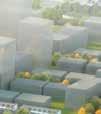
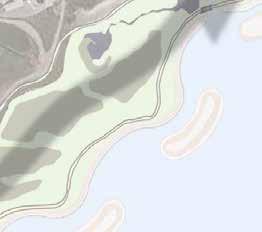
26 Lakeview Inlet Inspiration Point DISTRICTS LAKESHORE ROAD EAST Ogden Green Waterway Common RONT ENADE RK PUBLIC MARINA RANGEVIEW ESTATES DOUGLAS KENNEDY THE DOCKS PANORAMA POINT BLVD. The Marina BOULEVARD AVIATOR GREENWAY WATERWAY STREET WATERWAY COMMON LAKEVIEW BOULEVARD CHANNELSIDE NEW STREET RANGEVIEW STREET NEW OGDEN AVENUE NEW AVIATOR AVENUE ESPLANADE LAKESHORE NEIGHBOURHOOD Ogden OGDEN GREEN Green Waterway Common Lakeview OGDEN VISTA Inlet HYDRO HYDRO ROAD LAKEVIEW GATEWAY HYDRO GENERATOR LN. Serson SQUARE Square PROSPECT LN. Lakeshore Gateway NEW HAIG BOULEVARD GREENWAY CAMPUS NEW HAIG BOULEVARD PLACE Serson Innovation Corridor PLACE G.E. BOOTH (LAKEVIEW) WASTEWATER TREATMENT FACILITY Lakeshore Gateway Serson Square INSPIRATION WESTERN PIER COAL HILL AMPHITHEATRE The Marina Inspiration Point LAKEVIEW WATERFRONT CONNECTION CONSER- VATION AREA Serson Innovation Corridor WESTERN PIER


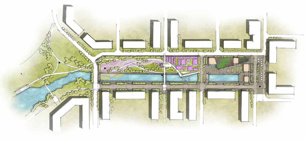
27 WATERWAY COMMON Waterway Common will serve as a central community gathering space that represents a unique four season experience framed by residential living on the park. It will celebrate the former smokestacks that defined the Mississauga waterfront while representing a sense of renewal and transition to community and nature.


 16.")


 5.")


 6.")
28 WATERWAY COMMON vertical public art element 2. biotope aquatic cleansing 3. fragrant and wildflower gardens (butterflies, herbs, cut flowers and perennials) 9. changing water levels and circulation 10. pedestrian bridge 11. festival pavilion (ceremonial events and photos) 16. cultural or community use building (green roof, water harvesting, rain garden) 17. water wall and kids water play 18. skate and reflecting pool active and passive greens (picnicking, frisbee play, kite flying, etc.) 5. main spine walkway linkage 12. celebration orchard (cherry or peach flowering trees) 13. viewing terrace 19. plaza space 20. glass pavilion building (cultural, restaurant use) 6. upper and lower canal promenade 14. water play and performance stage 21. strong built form edge 7. treed promenade 15. stormwater management function 8. shared street 21 20

29 WATERWAY COMMON

30 WATERWAY COMMON WATERWAY COMMON WINTER ACTIVITY

31 WATERWAY COMMON


32 SQUARE A central gathering place with four-season programming, a mix of ground floor specialty retail uses with patios and the potential for above grade residential or office uses. Serson Square is also an arts and cultural hub incorporating multi-cultural programs, specialty uses and waterfront attractions.

33 SQUARE SQUARE COMMUNITY GATHERING HUB


34 LAKEVIEW INLET A unique residential neighbourhood with lakefront views, connected to the waterfront trail.


35 LAKEVIEW INLET


36 LAKEVIEW INLET - WATERFRONT PROGRAMMING 1 small craft boat marina 2 great lawn 3 pier lookout 4 varying edge conditions 5 urban beach 6 vista park plaza 7 unique features paddle sport launch 9 beach volleyball recreation pond 11 coal amphitheatre 12 waterfront trail 13 children s play zone 14 unique facility structures 15 unique bridges


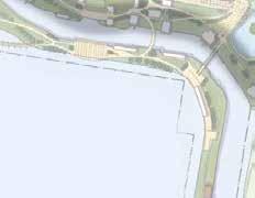
37 INSPIRATION POINT This former industrial pier extends onto the lake and provides people with an unparalleled vista of the skyline, with public art, pop-ups and active public space.


38 High-tech green campus with a potential mix of office, educational technology and innovation uses, providing a captive retail customer base and day/night energy.


39 THE MARINA Lakefront living across from the marina. Signature high-rise towers with views of the lake and the skyline. Access to the lake, neighbourhood public space and a connection to the waterfront trail.


40 OGDEN GREEN Townhome living anchored by Ogden Green park with direct connections to Serson Square and Waterway Common, and a strong central view corridor to Lakeview Inlet and waterfront activities.


41 LAKESHORE GATEWAY A gateway to Lakeview Village with a landmark building on Lakeshore Road East and ground floor anchor retail opportunities. The district continues south with a mix of residential or office uses along Serson Creek.


42 LAKE PROSPECT NEW AVIATOR AVENUE WATERWAY ROAD LAKEVIEW BOULEVARD FUTURE DISTRICTS Rangeview A continuation of the Ogden Green neighbourhood fabric and green space network. LAKESHORE ROAD EAST RANGEVIEW ESTATES Lakeshore Commercial LAKESHORE NEIGHBOURHOOD NEW S STREET Rangeview RANGEVIEW ROAD NEW OGDEN AVENUE HYDRO ROAD LAKEVIEW GATEWAY NEW HAIG BOULEVARD PLACE OGDEN SQUARE PLACE AVIATOR DOUGLAS KENNEDY WATERWAY FOUR SISTERS FOUR SISTERS THE GREENWAY CAMPUS ESPLANADE THE WATERFRONT COAL HILL LAKEVIEW WATERFR CONNECTION CON VATION AREA WESTERN PIER Lakeshore Commercial Transformation of existing industrial uses, potential for ground floor commercial (non-destination uses) and residential.
43 Lakeview Inlet Inspiration Point DISTRICTS LAKESHORE ROAD EAST Ogden Green Waterway Common RONT ENADE RK PUBLIC MARINA RANGEVIEW ESTATES DOUGLAS KENNEDY THE DOCKS PANORAMA POINT BLVD. The Marina BOULEVARD AVIATOR GREENWAY WATERWAY STREET WATERWAY COMMON LAKEVIEW BOULEVARD CHANNELSIDE NEW STREET RANGEVIEW STREET NEW OGDEN AVENUE NEW AVIATOR AVENUE ESPLANADE LAKESHORE NEIGHBOURHOOD Ogden OGDEN GREEN Green Waterway Common Lakeview OGDEN VISTA Inlet HYDRO HYDRO ROAD LAKEVIEW GATEWAY HYDRO GENERATOR LN. Serson SQUARE Square PROSPECT LN. Lakeshore Gateway NEW HAIG BOULEVARD GREENWAY CAMPUS NEW HAIG BOULEVARD PLACE Serson Innovation Corridor PLACE G.E. BOOTH (LAKEVIEW) WASTEWATER TREATMENT FACILITY Lakeshore Gateway Serson Square INSPIRATION WESTERN PIER COAL HILL AMPHITHEATRE The Marina Inspiration Point LAKEVIEW WATERFRONT CONNECTION CONSER- VATION AREA Serson Innovation Corridor WESTERN PIER
44 THE PLAN LAKESHORE ROAD EAST RANGEVIEW ESTATES BOULEVARD LAKESHORE NEIGHBOURHOOD NEW STREET RANGEVIEW STREET NEW OGDEN AVENUE HYDRO ROAD LAKEVIEW GATEWAY HYDRO NEW HAIG BOULEVARD PLACE OGDEN GREEN HYDRO PLACE DOUGLAS KENNEDY BLVD. AVIATOR GREENWAY NEW AVIATOR AVENUE GENERATOR LN. GREENWAY PUBLIC MARINA WATERWAY STREET WATERWAY COMMON SQUARE NEW HAIG BOULEVARD G.E. BOOTH (LAKEVIEW) WASTEWATER TREATMENT FACILITY PROSPECT LN. PORT CREDIT YACHT CLUB THE DOCKS PANORAMA POINT LAKEVIEW BOULEVARD OGDEN VISTA ESPLANADE CAMPUS CHANNELSIDE INSPIRATION WESTERN PIER COAL HILL AMPHITHEATRE LAKEVIEW WATERFRONT CONNECTION CONSER- VATION AREA WESTERN PIER

45 LAND CONVEYANCE COMPARISON LAKESHORE ROAD EAST RANGEVIEW ESTATES LAKESHORE NEIGHBOURHOOD NEW S STREET RANGEVIEW ROAD HYDRO ROAD LAKEVIEW GATEWAY NEW HAIG BOULEVARD PLACE NEW OGDEN AVENUE OGDEN SQUARE PLACE AVIATOR NEW AVIATOR AVENUE DOUGLAS KENNEDY WATERWAY FOUR SISTERS FOUR SISTERS THE GREENWAY WATERWAY ROAD LAKEVIEW BOULEVARD CAMPUS LAKE PROSPECT ESPLANADE THE WATERFRONT COAL HILL LEGEND: SURVEYED CONVEYED LANDS TO CITY OF MISSISSAUGA (27.15 ha. / 67.1 ac.) CONVEYED LANDS ADJUSTED TO URBAN STRATEGIES MASTERPLAN (28.20 ha. / 69.7 ac.) LEGEND: CONCEPTUAL REVISED CONVEYED LANDS BOUNDARY (27.15 ha. / 67.1 ac.) DEVELOPMENT BOUNDARY LAKEVIEW WATERFRONT CONNECTION CONSER- VATION AREA DEVELOPMENT BOUNDARY WESTERN PIER
46 DISCUSSION LAKESHORE ROAD EAST RANGEVIEW ESTATES BOULEVARD LAKESHORE NEIGHBOURHOOD NEW STREET RANGEVIEW STREET NEW OGDEN AVENUE HYDRO ROAD LAKEVIEW GATEWAY HYDRO NEW HAIG BOULEVARD PLACE OGDEN GREEN HYDRO PLACE DOUGLAS KENNEDY BLVD. AVIATOR GREENWAY NEW AVIATOR AVENUE GENERATOR LN. GREENWAY PUBLIC MARINA WATERWAY STREET WATERWAY COMMON SQUARE NEW HAIG BOULEVARD G.E. BOOTH (LAKEVIEW) WASTEWATER TREATMENT FACILITY PROSPECT LN. PORT CREDIT YACHT CLUB THE DOCKS PANORAMA POINT LAKEVIEW BOULEVARD OGDEN VISTA ESPLANADE CAMPUS CHANNELSIDE INSPIRATION WESTERN PIER COAL HILL AMPHITHEATRE LAKEVIEW WATERFRONT CONNECTION CONSER- VATION AREA WESTERN PIER
Lakeview. March 18, N. Barry Lyon Consultants Ltd. UEM TMIG
 Lakeview March 18, 2014 N. Barry Lyon Consultants Ltd. UEM TMIG Mississauga s Waterfront A Coordinated Approach mississauga.ca/waterfront Mississauga s Waterfront - Projects Natural Heritage and Urban
Table 8-4: Road Classification Local Roads, second table, of Chapter 8 Create a Multi-Modal City, be amended by adding the following:
 1 Port Street East Official Plan Amendment APPENDIX 3 Amendments to Mississauga Official Plan Table 8-4: Road Classification Local Roads, second table, of Chapter 8 Create a Multi-Modal City, be amended
13 Major Nodes Introduction General
 13 Major Nodes 13.1 Introduction There are three Major Node Character Areas in Mississauga: Central Erin Mills; Lakeview Waterfront; and Uptown. This section identifies the modifications to the General
13.4 Lakeview Waterfront
 Appendix 2 13.4 Lakeview Waterfront 13.4.2 Historical and Current Context Map 13-4.1: Lakeview Waterfront Major Node Character Area The Lakeview Waterfront Major Node Character Area ( Lakeview Waterfront
PRELIMINARY DESIGN + DEVELOPMENT PLAN
 WELCOME! To The Public Open House May 30 th, 2017 HARBOUR WEST PARKS Vision Project Overview The City s vision for Port Credit Harbour West Parks is to develop a vibrant waterfront destination that integrates
The Master Plan Framework
 The Master Plan Framework The East Harbour Master Plan advances the development of 60 acres of former industrial lands east of the Don River. The Master Plan outlines a vision for a vibrant, transit-oriented
THRIVE STABLE COMMUNITY V PROSPER VISION DESIGN TRUST ACTIVE DISTINCT SAFE FUTURE LANDUSE ENERGY FORM INFRASTRUCTURE STREETSCAPE URBAN MULTI-MODAL
 LE ATION PEDESTRIANS FUTURE C THRIVE SAFE PLAN INNOV IVERSE INSPIR VISION ENERGY CONSULTATION INNOVATION VIBRANT BUILDING F PROSPER DISTINCT SAFE NATURAL STREETSCAPE FORM INFRASTRUCTURE DIVERSE VIBRANT
Workshop #3 June 13, 2016
 Downtown Ocoee Master Plan Workshop #3 June 13, 2016 Our Team Our Team and Tonight s Goal Quick Recap: Why a Downtown Plan? How are we developing the plan? How can you still be involved? What s left to
Online Survey Results 1 Port Street East
 Online Survey Results 1 Port Street East Inspiration Port Credit is about envisioning a bright, new future for the Port Credit waterfront. Through an online survey in the fall of 2014, we asked what the
Chairman and Members of the Planning and Development Committee. Thomas S. Mokrzycki, Commissioner of Planning and Building
 LA.09.TOR (Toronto) DATE: TO: FROM: SUBJECT: Chairman and Members of the Planning and Development Committee Thomas S. Mokrzycki, Commissioner of Planning and Building Central Waterfront Secondary Plan
THE NEIGHBORHOOD TODAY
 THE NEIGHBORHOOD TODAY CORE AREA VISION How are we Good Urbanism A Site s DNA thinking about Elements of great Unique elements urban communities embedded in a place the site and design? ELEMENTS LIKE:
Moody Centre Station TOD Area Today
 Moody Centre Station TOD Area Today WHAT IS a transit-oriented Murray Street development area? A Transit-Oriented Development (TOD) Area is a dense, walkable residential and commercial area built to support
Public Consultation Summary: Lakeview Place Making Workshop January 30, 2008.
 Page 1 of 11 Public Consultation Summary: Lakeview Place Making Workshop January 30, 2008. 1.0 Introduction: On January 30, 2008 the City of Mississauga, in conjunction with the consulting team of Brook
Figure 3-1: Public Realm Plan
 3 Public Realm Figure 3-1: Public Realm Plan 3.1 Public Realm Concept The public realm concept for the Little Mountain site integrates a clear and accessible movement network with public spaces for social
Hamilton Pier 7&8 Public Meeting and Workshop #1
 Hamilton Pier 7&8 Public Meeting and Workshop #1 May 12, 2015 May 01, 2015 Meeting Agenda 6:30 Doors Open 6:30-6:45 Review Boards 6:45-7:10 Introductions and Presentation Study Overview Policy Background
burlington mobility hubs study Downtown Burlington Mobility Hub
 burlington mobility hubs study Downtown Burlington Mobility Hub Draft Precinct Plan Workbook PIC #3, September 7, 2017 downtown mobility hub objectives City staff and their consultants are proposing an
Queensborough Eastern Neighbourhood Node. Community Open House
 Queensborough Eastern Community Open House The Vision The Queensborough Eastern will become the heart of eastern Queensborough. Through a sensitive mix of viable commercial and residential areas, the neighbourhood
Brampton. Secondary Plan. Review. Bram West. A New Direction in Planning & Public Consultation
 Brampton Bram West Secondary Plan Review A New Direction in Planning & Public Consultation Introduction The Bram West Secondary Plan Review offers an important opportunity for the community to define a
Welcome. Community Consultation Meeting November 28, Review and discuss the Bathurst Quay Neighbourhood Plan Framework
 Welcome Community Consultation Meeting November 28, 2016 Why Are We Here Today? Review and discuss the Bathurst Quay Neighbourhood Plan Framework Review and discuss an Action Plan for Implementation Next
Inspiration Port Credit. Exploring the Options Public Engagement March 26, 2013
 Inspiration Port Credit Exploring the Options Public Engagement March 26, 2013 Port Credit Port Credit Foundations Change has been happening in Port Credit for years. Source: City of Mississauga, Mississauga
Burnside Gorge Neighbourhood Plan. Engagement Summary
 Burnside Gorge Neighbourhood Plan Engagement Summary Table of Contents Engagement Summary... 3 Phase One Engagement (April May 2015)... 4 Phase Two Engagement (January March 2016)... 4 Appendix One: Summary
Thank you for coming to the Rail Corridor Land Use Study Public Meeting.
 01 Welcome! Thank you for coming to the Rail Corridor Land Use Study Public Meeting. Tonight is an opportunity to learn about the Land Use Study for the Rail Corridor Site. In Fall 2016, Toronto City Council
LAKEVIEW LOCAL ADVISORY PANEL. THE COPORATION OF THE CITY OF MISSISSAUGA THURSDAY, NOVEMBER 18, 2010
 LAKEVIEW LOCAL ADVISORY PANEL THE COPORATION OF THE CITY OF MISSISSAUGA www.mississauga.ca/lakeviewportcreditreview THURSDAY, NOVEMBER 18, 2010 MISSISSAUGA SENIORS CENTRE LUCY TURNBALL ROOM (1389 Cawthra
Westwind Developments Ltd. PIONEER LANDS AREA STRUCTURE PLAN - PROPOSED AMENDMENT
 FEBRUARY 2013 TABLE OF CONTENTS 1.0 BACKGROUND... 1 1.1 Amendment... 1 2.0 LOCATION & CONTEXT... 2 2.1 Land Ownership... 2 3.0 POLICY CONTEXT... 3 3.1 Municipal Development Plan... 3 3.2 Capital Region
Comprehensive Plan Advisory Panel Meeting #3
 Comprehensive Plan Advisory Panel Meeting #3 November 7, 2016 Agenda 1. September 19 th Meeting Notes 2. Summary of Focus Areas Charrette 3. Heart of the City Focus Area a. HOC2/Station Areas Concept &
Thank you! Events and Entertainment in Northeast False Creek. Tuesday, March 7, 2017
 Events and Entertainment in Northeast False Creek Tuesday, March 7, 2017 Thank you! Thank you for taking the time to attend the Events and Entertainment in Northeast False Creek (NEFC) workshop in partnership
CENTRAL ESTUARY PLAN AVISION FOR OAKLAND S WATERFRONT
 Central Estuary Plan A VISION FOR OAKLAND S WATERFRONT Specific Plan and Environmental Assessment Presentation to the Parks and Recreation Advisory Commission December 9, 2009 This Afternoon s Presentation
Part 2 Common Elements
 WHITE FLINT SECTOR PLAN Round Table Discussion: Part 2 Common Elements October 8, 2007 The M-NCPPC 1 Role Regional Marketplace North Bethesda s Downtown with a Conference Center District The M-NCPPC 2
Highland Falls Waterfront Redevelopment Feasibility Study Village Board Meeting March 20, 2017
 Village Board Meeting March 20, 2017 Agenda I. Public Meeting #1 Visioning Summary II. Public Meeting #2 Comment Summary III. IV. IV. Case Study: Milton Train Station Schematic Design Concepts Schedule/Next
2. East Riverside Planning Area
 2. East Riverside Planning Area 2.0 Preamble The following Secondary Plan provides direction for the development of the East Riverside Planning Area, designated on Schedule A: Planning Districts & Policy
City of Kingston. North King s Town Secondary Plan Open House + Workshop #1 February 28, 2018
 City of Kingston North King s Town Secondary Plan Open House + Workshop #1 February 28, 2018 1 event agenda 30 min Panel Review + Discussion 30 min Presentation + Q&A 75 min Workshop Session 15 min Report
2.1 Location and Size
 2.0 Context 7 2.1 Location and Size The Saanich Penninsula The study area is centrally located within the Town boundaries on the east side of Highway 17, which runs through Sidney in a north-south direction.
University of Saskatchewan CAMPUS MASTER PLAN. Senate Meeting Preliminary Presentation. April 21, 2018 DIALOG ECS DA WATT
 University of Saskatchewan CAMPUS MASTER PLAN Senate Meeting Preliminary Presentation April 21, 2018 DIALOG ECS DA WATT project process presentation agenda Stakeholder Engagement Project Control phase1
10.0 Open Space and Public Realm
 10.0 Open Space and Public Realm 10.0 Open Space and Public Realm The Public Open Space System is comprised of: outdoor spaces available for public use that are either publicly owned (e.g., parks and
Plan Framework Report. Attachment A
 Plan Framework Report Attachment A Uptown-Douglas Corridor Plan - Plan Framework Report Contents Introduction... 1 Planning Process... 3 Project Objectives... 4 Vision... 5 Community Values... 6 Structural
What We Heard. Downtown Georgetown Planning Study. April 4, 2018
 What We Heard Downtown Georgetown Planning Study April 4, 2018 Workshop 2 - July 5, 2017 01 DESIGN SUMMIT The Downtown Georgetown Planning Study will guide growth and development in the downtown over the
MAYFIELD WEST SECONDARY PLAN PHASE 2
 MAYFIELD WEST SECONDARY PLAN PHASE 2 Public Open House #3 February 25, 2010 Draft Preferred Land Use Scenario TOWN OF CALEDON PLANNING & DEVELOPMENT DEPARTMENT Open House Agenda TOWN OF CALEDON 1. Welcome
Waterfront Project VISION, GOALS AND OBJECTIVES
 Waterfront Project VISION, GOALS AND OBJECTIVES INTRODUCTION The City of North Vancouver created the Waterfront Project in 2005 in order to provide a focus for waterfront redevelopment opportunities and
Highest & Best Use Study Marina Park Lands
 Executive Summary of Report MARCH 2006 TABLE OF CONTENTS 1. Introduction...1 2. Study Process...2 3. Highest And Best Use Program...3 4. Concept Plan...8 5. Public Area Animation...9 6. Marina Park Implementation
APPENDIX K WINDSOR OFFICIAL PLAN
 CEAA ENVIRONMENTAL ENVIRONMENTAL IMPACT ASSESSMENT AMBASSADOR BRIDGE ENHANCEMENT PROJECT Replacement Span and Plaza Expansion APPENDIX K WINDSOR OFFICIAL PLAN Avalon Consulting Professionals of Ontario,
CREATE A VIBRANT MIXED-USE COMMUNITY
 CREATE A VIBRANT MIXED-USE COMMUNITY Land Use Public Realm Plan Built Form Heritage Tell us what you think! Place a sticky note here or leave us a comment form LAND USE The land use framework of this Secondary
Mariposa Lakes. Planned Community. Project Overview. Stockton, CA
 Planned Community Stockton, CA Project Overview March 2007 Summary of Proposed Community is a master-planned community proposed for development on approximately 3,810 acres in southeast Stockton. In 2004,
Shared Principles and Emerging Plan Directions
 Shared Principles and Emerging Plan Directions Introduction Since the Fairfield Neighbourhood planning process launched in June 2016, we have heard from many residents, businesses, groups and other people
City of Long Beach. creating vibrant and exciting places
 City of Long Beach creating vibrant and exciting places Land Use Element Urban Design Element Overview of the two draft General Plan elements Discuss areas of change Economic goals of the plans Case study
PORT WHITBY COMMUNITY
 PORT WHITBY COMMUNITY SECONDARY PLAN UPDATE COMMUNITY IMPROVEMENT PLAN URBAN DESIGN GUIDELINES September 2015 DRAFT PROPOSED AMENDMENT NUMBER # to the Whitby Official Plan PURPOSE: The intent of this Amendment
York Road Arial View
 Arial View Bridge Ave YORK ROAD THE SITE TODAY View west down View west from View east The 1.5 ha site is located south of the and to the east of Queen Street. The site includes an existing car park, disused
12 th Street Connector Alignment Study VISIONING PUBLIC WORKSHOP - JUNE 25, :00PM TO 8:00PM
 12 th Street Connector Alignment Study VISIONING PUBLIC WORKSHOP - JUNE 25, 2018 6:00PM TO 8:00PM Goals for Today s Workshop Agenda: Project Introduction, Purpose, and Goals Existing Conditions Traffic
Lakeview and Port Credit District Policies Review Public Engagement Process
 Lakeview and Port Credit District Policies Review Public Engagement Process Brook McIlroy Planning + Urban Design/PACE Architects MSAi Architects Poulos and Chung Transportation Engineers December 11,
Four Big Ideas. Three Key Opportunities. Principles. Draft Place Making Master Plan. 1. The Foreshore 2. Green Links. 3.
 project background Four Big Ideas 1. The Healthy Thriving Place. An International Focus 3. Reclaiming Mooloolaba 4. The Resort Heart of the Coast In November 01 a big ideas workshop was held involving
3.5 Principle 5/Response
 5 Principle 5/Response Existing street network Proposed street network Pedestrian street hierarchy Existing streets Existing Regional Arterial 4 Existing Street Network Existing and proposed streets Indicative
GUIDELINES EXHIBITION PLACE LOCATION: OBJECTIVES. Structure Plan URBAN DESIGN GUIDELINES
 Development in the Exhibition Place lands will be consistent with the following urban design guidelines. They provide a framework for new development of the lands and are to be read in conjunction with
Stadium District Masterplan
 Stadium District Masterplan Masterplan (noun): an evolving long-term planning document that establishes the framework and key elements of a site. It reflects a clear vision synthesizing developer goals
Edward R. Sajecki Commissioner of Planning and Building. SUBJECT: Draft Lakeview Local Area Plan (January 2014)
") Corporate Report Clerk s Files Originator s Files CD.03.LAK DATE: TO: FROM: Chair and Members of Planning and Development Committee Meeting Date: February 3, 2014 Edward R. Sajecki Commissioner of Planning
Corporate Report Clerk s Files Originator s Files CD.03.LAK DATE: TO: FROM: Chair and Members of Planning and Development Committee Meeting Date: February 3, 2014 Edward R. Sajecki Commissioner of Planning
Glendale Niagara District Plan
 Glendale Niagara District Plan Planning and Economic Development Committee September 5 2018 District Plans A District Plan is a proactive planning strategy intended to drive growth and economic prosperity
Subarea 4 Indian Creek. Vision The combination of park networks and transportation amenities make Subarea 4 the greenest hub in the Corridor.
 indian creek 180 extends south from 101st Street to I-435. The I-435 and Metcalf intersection is one of the primary intersections in the Kansas City Metro Area. The area includes several residential neighborhoods
TAHOE CITY VISION PLAN June 2012
 TAHOE CITY VISION PLAN June 2012 Tahoe City Public Utility District North Lake Tahoe Resort Association Sustainable Community Advocates Agenda Process Overview Purpose TRPA Regional Plan Update Conversations
Prepared by: a for the of the. Waterspace Strategy Sustainable Development Liverpool South Docks
 Prepared by: a for the of the Waterspace Strategy Sustainable Development Liverpool South Docks a Waterspace Strategy for the Sustainable Development of the Liverpool South Docks British Waterways identified
Welcome! HORSESHOE BAY PARK. Welcome!
 Welcome! HORSESHOE BAY PARK Welcome! Where are we in the process? Today we would like your input on how Horseshoe Bay Park can be upgraded to serve the community s needs better. CONSULT STAKEHOLDERS TAKE
Mississauga remakes Lakeview s long-lost waterfront
 Mississauga remakes Lakeview s long-lost waterfront 26-hectare project will rebuild wetlands from the Toronto line to the site of the GTA s last coal-fired power plant. By: May Warren Staff Reporter, Published
City of Poughkeepsie Waterfront Redevelopment Strategy. Poughkeepsie Waterfront Redevelopment Strategy
 City of Poughkeepsie Waterfront Redevelopment Strategy Poughkeepsie Waterfront Redevelopment Strategy City of Poughkeepsie Prime Assets: Major Waterfront Advantages: - Central City of the Hudson River
CALL TO ACTION: DESIGN FOR WELL BEING. CaGBC National Conference Toronto, ON June 3, 2014
 CALL TO ACTION: DESIGN FOR WELL BEING CaGBC National Conference Toronto, ON June 3, 2014 Health is a state of complete physical, mental and social wellbeing and not merely the absence of disease or infirmity.
Town Center. Block 5 Existing multifamily residential units are expected to remain.
 Area Guidelines Germantown s districts should be developed as distinct communities with unique features that are supported through the guidelines. The guidelines not only help distinguish these districts
HE VISION. Building a Better Connected Place
 HE VISION Building a Better Connected Place WALK INTO THE FUTURE. Life in Cranberry, 2030 Here s what our residents told us they wanted to see in their community by 2030: The Cranberry of 2030 is a place
2.5 Roads. Loading and service areas adjacent to Highway 401 should be screened through architectural walls and/or landscape buffer planting.
 N HIGHWAY OFF RAMP 2.5 Roads A legible road network with a clear hierarchy will help create a connected community, both within and surrounding the Milton Heights. The following section outlines the proposed
nokomis-hiawatha regional park master plan and park improvements
 master plan and park improvements CAC Workshop # August 26th, 2014 charge of the cac The Nokomis Hiawatha Regional Park CAC shall: Become knowledgeable about the project and its scope Understand and represent
Mark-up of the effect of the proposed Bronte Village Growth Area OPA No.18 on the text of section 24, Bronte Village, of the Livable Oakville Plan
 Mark-up of the effect of the proposed Bronte Village Growth Area OPA No.18 on the text of section 24, Bronte Village, of the Livable Oakville Plan Notes: This document is provided for information purposes
Glendale Niagara District Plan. New Text
 Glendale Niagara District Plan New Text NIagara-on-the-Lake Committee-of-the-Whole September 10 2018 District Plans A District Plan is a proactive planning strategy intended to drive growth and economic
DRAFT ROOSEVELT ROAD. District Recommendations. Figure 5.23 The Roosevelt Road Corridor
 CHAPTER 5 Figure 5.23 The Road Corridor Road will develop as a mixed-use corridor, emphasizing regional retail, west of the river and mixed-use development east of the river. KEY RECOMMENDATIONS 1. High
SARANAC LAKE VISION CONCEPTS
 DRAFT SARANAC LAKE VISION CONCEPTS A GENUINE PLACE TO LIVE, WORK, SHOP AND EXPERIENCE CULTURE IN THE HEART OF THE ADIRONDACKS PHOTO COURTESY OF SARANAC LAKE SARANAC LAKE, NEW YORK DECEMBER 2007 SARANAC
DRAFT. Waterfronts and Open Spaces. 10 The Riverfront Open Space System
 CHAPTER 4 Waterfronts and Open Spaces 10 The Riverfront Open Space System 12 Planned, proposed and envisioned riverfront recommendations. Figure 4.3.23 The riverfront will become a major new public amenity
City Center Neighborhood Plan
 [1] City Center Neighborhood Plan As adopted by Ordinance No. 2014-09-049 and amended by Ordinance Nos. Formerly CBD Neighborhood as adopted by Ordinance No. 8868 and amended by Ordinance Nos. 8946, 9693,
BURTON STATION STRATEGIC GROWTH AREA PLAN UPDATE PUBLIC MEETING 3/26/18
 BURTON STATION STRATEGIC GROWTH AREA PLAN UPDATE PUBLIC MEETING 3/26/18 1 WHERE WE ARE? 2 PRIMARY OBJECTIVES OF THE PLAN UPDATE 1. Update the land use designation for Burton Station Village to reflect
Master Site Development Plan (MSDP) Rocky View County Campus at Balzac East
 Rocky View County Campus at Balzac East") Master Site Development Plan (MSDP) Rocky View County Campus at Balzac East Balzac East, Alberta July 2009 CONTENTS 1.0 purpose 1 2.0 guiding principles 2 3.0 site description 3 4.0 site analysis and county
Master Site Development Plan (MSDP) Rocky View County Campus at Balzac East Balzac East, Alberta July 2009 CONTENTS 1.0 purpose 1 2.0 guiding principles 2 3.0 site description 3 4.0 site analysis and county
15. Rock Bay Employment Sub-Area
 15. Employment Sub-Area Future Land Use Directions and Urban Design The area will continue to serve as Victoria s urban industrial district. The waterfront is a key location for heavier, often harbour-dependent
URBAN DESIGN BRIEF URBAN DESIGN BRIEF 721 FRANKLIN BLVD, CAMBRIDGE August 2018
 URBAN DESIGN BRIEF URBAN DESIGN BRIEF 721 FRANKLIN BLVD, CAMBRIDGE August 2018 DESIGN BRIEF CONTENTS PART A 1.0 INTRODUCTION 2.0 DESCRIPTION & ANALYSIS OF SITE CONTEXT 3.0 DESIGN CONSTRAINTS AND OPPORTUNITIES
Create a connected ecological network. Connect districts with transit. Let the centre define the community
 District A - D Southeast False Creek A 1 A 2 A 3 A 4 Create a connected ecological network Connect districts with transit Let the centre define the community Provide a variety of affordable housing types
C. Westerly Creek Village & The Montview Corridor
 C. Westerly Creek Village & The VISION Community Vision When the goals of the city are achieved Westerly Creek Village, a distinctive community defined by Montview Boulevard and Westerly Creek, is a strong
Illustrative Campus Plan with Proposed Development
 Illustrative Campus Plan with Proposed Development Approved Compiled Plan January 2003 Figure IV-52 89 The supportive relationship and interaction between the campus and the surrounding community is an
Lambeth Main Street Streetscape Improvements
 Lambeth Main Street Streetscape Improvements Open House October 5th, 2017 Agenda 1. Introduction 2. Project Background 3. Context 4. Project Objectives 5. Design Principles & Approach 6. Streetscape Design
Planning Commission March 14, Presented by: City of Bellingham Port of Bellingham
 Planning Commission March 14, 2013 Presented by: City of Bellingham Port of Bellingham 1 Agenda Waterfront District Background Waterfront District Proposal Overview Sub-area Plan Development Regulations
3.1 Existing Land Use
 3.0 Land Use This strategy has been developed taking into account the position of the Town of Sidney as the economic center of the Saanich Peninsula. It acknowledges existing land use patterns in the downtown
Contemporary. Nature
 Creating a town Building a community You ll be inspired to see how an address at The Gables can enrich your life. You ll find contemporary urban design embraced by nature, and extensive parklands surrounding
Please read the entire document
 projects impacting the waterfront revitalization area. The waterfront revitalization area of the town will have to subareas to the west and east of the village. Page 6 of 6 Wayfinding master plan create
GOODY CLANCY WITH KITTELSON & ASSOCIATES RHODESIDE & HARWELL FARR ASSOCIATES W-ZHA
 1 1. Welcome 5 min. 2. Follow-up from 9/22 / Corridor of Light, ground floor uses 20 min. 3. Small on-site open spaces / Overview of types, identities 15 min. 4. Rosslyn Plaza Park / Rosslyn Plaza PDSP
A. Selma Park, Davis Bay and Wilson Creek
 A. Selma Park, Davis Bay and Wilson Creek This waterfront neighbourhood consists of three separate community areas, linked by Highway 101, but with different character, land use patterns and future potential.
North Oakville East Parks Facilities Distribution Plan. November, 2009
 North Oakville East November, 2009 POLICY CONTEXT 1) Purpose a) The purpose of this document is to be a guide for the location, configuration, design and development of the parks system for the North Oakville
WHAT WE LEARNED FROM YOU
 PUBLIC CONSULTATION SUMMARY WHAT WE LEARNED FROM YOU Prepared By: in conjunction with: Poulos and Chung Ltd. Terraprobe Baird and Associates Philips Engineering Ltd. City of Mississauga Waterfront Parks
Port Credit Local Advisory Panel October 20 th Meeting
 Port Credit Local Advisory Panel October 20 th Meeting Focus Of This Evening s Meeting: 1. Hurontario Main Street Higher Order Transit Study 2. Port Credit Mobility Hub & GO Station Parking Structure Study
DOWNTOWN SIDNEY LOCAL AREA PLAN. urban design CHARRETTE REPORT 04 july 2008
 DOWNTOWN SIDNEY LOCAL AREA PLAN urban design CHARRETTE REPORT 04 july 2008 1.0 INTRODUCTION urban design is the art of making places. Successful downtown communities are places where people can live,
CONTENTS 8.0 LAND USE 8.1 GENERAL LAND USE 8.2 RESIDENTIAL 8.3 MIXED USE 8.4 COMMERCIAL 8.5 EMPLOYMENT LANDS
 8-2 Land Use 8.0 LAND USE CONTENTS 8.1 GENERAL LAND USE 8.1.1 Uses provided for in all Land Use Designations 8.1.2 Uses prohibited in Hazardous Lands, Hazardous Sites and Special Policy Areas 8.1.3 Uses
MOUNT PLEASANT SECONDARY PLAN & VILLAGE BLOCK PLAN. Wednesday, March 5, 2008 Informal Public Open House
 MOUNT PLEASANT SECONDARY PLAN & VILLAGE BLOCK PLAN Wednesday, March 5, 2008 Informal Public Open House 1. Welcome & Introductions 2. Highlights of Provincial Growth Plan 3. Overview and Status Update -
TSAWWASSEN TOWN CENTRE REDEVELOPMENT BLOCK A 004
 Current Context The context for the project includes storey multi-family residential to the northwest, a TD bank immediately north, highway oriented commercial to the east, a surface parking lot to the
Trafalgar Road Corridor Planning Study Open House
 Trafalgar Road Corridor Planning Study Open House June 24, 2013 6:30-8:30 p.m. Oakville & Trafalgar Rooms Overview The Livable Oakville Plan identifies the lands along Trafalgar Road, between the QEW and
Community Conversation. Thursday, March 30, James St N 7:00 pm 9:15 pm
 Community Conversation Thursday, March 30, 2017 294 James St N 7:00 pm 9:15 pm Start Time Agenda item Presenter / Facilitator 7:00 Welcome & Agenda Overview Diedre Rozema (City of Hamilton) Participation
2.0 Urban Design Concepts
 0 Urban Design Concepts Urban Design Concept diagrams The Waterfront Axis The Park Axis The Wharf Axis Waterfront Precincts 0.1 The Four Key Concepts: This Concept for the Wynyard Quarter establishes four
DOWNTOWN GEORGETOWN PLANNING STUDY
 DOWNTOWN GEORGETOWN PLANNING STUDY Community Workshop #3 Thursday, May 4, 08 The Planning Partnership OVERVIEW OF STUDY, PROCESS & MILESTONES We are here PURPOSE OF THE STUDY To develop a clear vision
Complete Neighbourhood Guidelines Review Tool
 Complete Neighbourhood Guidelines Review Tool Prepared By: City of Regina Planning Department October 2014 Page 1 of 14 Community Development Review Checklist for Secondary Plans and Concept Plans The
MALL REVITALIZATION CASE STUDIES
 MALL REVITALIZATION CASE STUDIES DECEMBER 9, 2012 MALL REVITALIZATION OVERVIEW Introduction Sample Case Studies prepared for Lacey Woodland District Steering Committee as it considers strategies to revitalize
Workshop 3. City of Burlington Waterfront Hotel Planning Study. September 14, The Planning Partnership
 Workshop 3 City of Burlington Waterfront Hotel Planning Study September 14, 2017 The Planning Partnership The Waterfront Hotel Planning Study 01 The Brant & Lakeshore Planning Study will establish a Strategic
appendix and street interface guidelines
 appendix five: building and street interface guidelines appendix 5 building and street interface guidelines BOULEVARDS Boulevards are generally characterized by higher levels of traffic movement at higher