Gilroy High-Speed Train Station Visioning Project Vision Report March 2012
|
|
|
- Gyles Park
- 5 years ago
- Views:
Transcription


1 Gilroy High-Speed Train Station Visioning Project March 2012 FACT SHEET: Transit Capitol Expressway Light Rail Project Project Description The Capitol Expressway Transit Improvement Project will transform Capitol Expressway into a multi-modal boulevard offering bus rapid transit, light rail transit, and safe pathways
2


3 Gilroy High-Speed Train Station Visioning Project March 2012 Project Team: Hatch Mott MacDonald Hexagon Transportation Consultants BAE Urban Economics Voz de la Gente For more information: Don Dey, City Transportation Engineer, Project Manager 7351 Rosanna Street, Gilroy, CA (408) Funded by the City of Gilroy and the Santa Clara Valley Transportation Authority (VTA)
4
5 Table of Contents 1.Introduction 1 2. Context 5 High Speed Rail in California 7 Station Area Existing Conditions 11 Framework of Existing Plans and Policies 20 Community Visioning Process Vision 33 Preferred Vision Alternatives 35 Comparison of Preferred Vision Alternatives 47 Comparison Matrix Next Steps Appendix 65 City Council Study Session # 2: Questions & Answers 67 Online Survey Results 70
6
7 1 Introduction
8 1 Introduction
 station being planned for Gilroy by the California High Speed Rail Authority (CHSRA).")


9 In the second half of 2011, the City of Gilroy engaged residents and stakeholders in a visioning process to evaluate the opportunities, costs, and potential benefits of the proposed high-speed train (HST) station being planned for Gilroy by the California High Speed Rail Authority (CHSRA). At the time of the visioning process, the CHSRA was considering two different locations for a Gilroy station, as well as several options for the configuration of the tracks as they run through the Gilroy area. The visioning process was sponsored by the City to evaluate the options and determine the best possible arrangement for HST in Gilroy, and then to present these findings to the CHSRA to aid their decision-making. This is the outcome of the visioning process. The goals for this are: to present for consideration the relative merits of the East of Gilroy Outlets station location versus the Downtown station location; to describe the relative merits of alternative vertical alignments in each location; and to determine physical and economic development opportunities that may present themselves upon construction of the HST station in Gilroy. The visioning process produced three primary documents that can be considered a set. The first was an Existing Conditions Report that summarized the physical conditions, City policies, and economic factors for the two proposed sites in Gilroy in The second was an Evaluation Report that contained a technical assessment of four preliminary concepts developed during the community engagement process. This Vision Report is the third report. It briefly summarizes findings from Gilroy High-Speed Train Station Visioning Project 3
10 and the East of Gilroy Outlets station site, which were developed using the feedback from the community and Council as a guide. Following the descriptions is a comparison of the relative merits of the two station sites. This section also weighs the merits of two vertical alignments for each of the station sites. Chapter Four: Next Steps has a brief summary of recommended follow-up steps to the Visioning Project. The Appendix contains a set of answers to specific questions that were posed by Council Members at the City Council Study Session #2 on December 12, the Existing Conditions Report and the Evaluation Report but does not reproduce them. The is organized as follows. Chapter Two: Context contains a description of the California High Speed Rail project and how Gilroy fits into the project. It also contains a summary of the existing physical and regulatory context. Lastly it describes the community engagement efforts conducted during the visioning process. These efforts included community workshops held in Spanish and English, stakeholder interviews, an online survey, and two City Council Study Sessions. Chapter Three: Preferred Vision Alternatives describes the visions for the Downtown station site The intent of this document is to provide a viable communitybased conceptual vision for each of the alternatives being considered by the CHSRA in order to facilitate decisionmaking by the City of Gilroy. For timing and budget reasons, the visioning process was necessarily a high-altitude look at the issues. More detailed analysis will need to be done in future planning phases. The Station Area Planning Project consists of three phases: Phase 1 - HST Station Visioning Project is documented in this report and will be followed by Phase 2 HST Station Area Planning Project, which will involve technical studies of the station area. Phase 3 HST Specific Plan and General Plan Update will follow Phase 2 and will include the environmental review of the proposed development contained in Phase 2. 4 Gilroy High-Speed Train Station Visioning Project
11 2 Context
12 2 Context

13 High Speed Rail in California In 2008, the voters of California approved Proposition 1A to build a high-speed train system between northern and southern California. The high-speed train system would link the major population centers of Sacramento, the San Francisco Bay Area, the Central Valley, Los Angeles, the Inland Empire, Orange County, and San Diego using more than 800 miles of track. Traveling at speeds of up to 220 miles per hour on a dedicated, separated track, the system could carry travelers from San Francisco to Anaheim in approximately 2 hours and 40 minutes. Sacramento Map of the State-wide Alignment High Speed Rail Pacific Surfliner (Amtrak) San Joaquin (Amtrak) Capitol Corridor (Amtrak) Proposed Station Along with San Jose and Merced, Gilroy was selected as one of three station sites along the San Jose to Merced high-speed train section that would link San Francisco with the Central Valley via the Pacheco Pass. Located approximately 30 miles south of San Jose and 95 miles southwest of Merced, the Gilroy station would serve Monterey County, San Benito County, and a substantial part of southern Santa Clara County. San Francisco Transbay Terminal Millbrae-SFO Redwood City or Palo Alto San Jose Diridon Gilroy Stockton Downtown Modesto Downtown Merced Fresno Visalia/Tulare/Hanford (Potential Station) Bakersfield Palmdale Airport Sylmar Burbank Los Angeles Norwalk Anaheim Irvine Industry Ontario Airport Riverside Murrieta Escondido University City San Diego Figure 2.1 Statewide Map of the High-Speed Rail System (Source: California High-Speed Rail Authority) Gilroy High-Speed Train Station Visioning Project 7
14 High Speed Rail and Gilroy The proposed San Jose to Merced section generally follows the existing Caltrain/Union Pacific Railroad (UPRR) corridor between San Jose and Gilroy in the Santa Clara Valley until south of Gilroy, where it turns east toward the Pacheco Pass. However, as the section passes through Gilroy, the route splits into two different potential alignments between San Martin and Casa de Fruta. Both of these potential alignments, their corresponding station sites, and the land that surrounds them make up the station areas that are the focus of this Vision Report and the visioning process as a whole: the Downtown Gilroy station area and East of Gilroy Outlets station area. The Downtown Gilroy alignment would run along the east side of the Caltrain/UPPR right-of-way with a station in Downtown Gilroy before gradually curving east towards Casa de Fruta. The East of Gilroy Outlets alignment would run along the east side of Highway 101 until the Highway 101/Masten Avenue interchange, where it would curve away from the highway Santa Clara County Henry Coe State Park Casa de Fruta 156 US 101 To East Gilroy East of UPRR to East Gilroy Dunne Tennent US 101 To Downtown Gilroy Coyote Coyote (South of Bernal Road) Monterey Highway East of UPRR to Downtown Gilroy Butter eld 3 Morgan Hill San Martin Leavesley 2e 4 5 2c 152 Pajaro Floodplain c Program Alignment Alignment Alternatives Design Option Station Serving Single Alignment Subsection Divider Aerial Structures Trench Structures Tunnels Roads / Highways Station Location Downtown Gilroy East Gilroy Morgan Hill Vertical Alignment HST Aerial HST At-Grade East Gilroy Vertical Alignment HST Aerial HST At-Grade Gilroy Vertical Alignment HST Aerial HST At-Grade HST Trench HST Partially-Covered Trench 152 Gilroy San Benito County Figure 2.2 Alignment Alternatives between San Martin and Casa de Fruta (Source: California High-Speed Rail Authority) 8 Gilroy High-Speed Train Station Visioning Project
15 and cross Leavesley Road in Gilroy about a half-mile east of Highway 101. The station site in this alignment would be north of Leavesley Road, between the highway and Marcella Avenue. South of the station, the alignment would gradually curve toward Casa de Fruta. HWY 101 LEAVESLEY ROAD For each of these two horizontal alignments, there are two potential vertical alignments. In the Downtown Gilroy station area, the tracks would either be on a modified atgrade structure approximately 15-feet above grade, or in a trench approximately 60-feet below grade. In the East of Gilroy Outlets station area, the tracks would either run at-grade, or on an aerial structure with a 25-foot clearance, above grade. FIRST STREET MONTEREY STREET GILMAN ROAD As a result, there are four potential alignments for a high-speed train in Gilroy: HWY 152 Downtown Gilroy Modified At-Grade Downtown Gilroy Trench East of Gilroy Outlets At-Grade East of Gilroy Outlets Aerial 0 1,500 Feet TENTH STREET GILROY Figure 2.3 Potential Alignments and Station Locations in GIlroy Miles The right-of-way required would vary along the train s alignment depending on whether the train is at-grade, trenched, or on an aerial structure. The typical right-of-way required for the alignment is 50 to 60 feet, for two parallel tracks. When the alignment passes through a station, the combination of four tracks (two for stopping trains and two for passing trains) and platforms would require the right-of-way to be at least 120 feet. For the modified at-grade vertical alignment option in Downtown Gilroy, the existing Caltrain/UPPR could be potentially moved and reconstructed alongside the high-speed train tracks on the same structure. This would require a wider right-of-way throughout Downtown and at the station. Gilroy High-Speed Train Station Visioning Project 9
 Top Left Modified At-Grade Bottom Left Trench Top Right At-Grade")


16 Figure 2.4 Visual Simulations of Potential Vertical Train Profiles (Source: California High-Speed Rail Authority) Top Left Modified At-Grade Bottom Left Trench Top Right At-Grade Bottom Right Aerial Station and Facilities The number of passengers expected to use the high-speed train system in Gilroy is the same regardless of the station s ultimate location, vertical alignment, and architectural design, due to the city s regional location. Therefore, there are common standard requirements for the facilities in either the Downtown Gilroy or East of Gilroy Outlets station. According to CHSRA s Draft 2012 Business Plan issued on 11/01/2011, it is projected that 111 trains will run through Gilroy in each direction on an average weekday when the system is in full operation. About 70 of these trains will stop in Gilroy, and the remaining 41 trains will pass through. The average weekday ridership is estimated to be 13,400 passengers, boarding and arriving, resulting in a demand of around 6,400 parking spaces to accommodate this number of passengers. About 20% of the 6,400 parking spaces are recommended to be located in close proximity to the station, while the remaining spaces could be accommodated in more remote locations. A further consideration is the space required for drop-off and pick-up areas. With 6,700 boarders 10 Gilroy High-Speed Train Station Visioning Project


17 per day, there could be more than 300 cars dropping off in a peak hour. Furthermore, the station s platforms would need to be approximately 1,410 feet long to accommodate the length of two 660-foot-long trains linked together to provide the desired 1,000 seat capacity. Old Gilroy Street High Speed Rail Timeline In previous estimates, the entire Phase 1 system (San Francisco to Anaheim) would be fully operational by The latest Business Plan by the CHSRA estimates a later operational debut and a level of service that will be available on an incremental basis. In the new plan, the Initial Construction Section (ICS) of the first phase will open between Merced and Bakersfield in the Central Valley in 2018 as a non-electrified track used by existing services. It is anticipated that the first section to be fully electrified and capable of running trains at over 200mph will open by This Initial Operating Service (IOS) would either link San Jose with Bakersfield (which would include Gilroy) or Merced with the San Fernando Valley. While no decision has been made to date on which option would occur first, it is anticipated that one option will open in 2022, followed by the other in 2027, thus completing a Bay to Basin highspeed train connection. A San Francisco to Los Angeles fullyoperational service would begin in In Gilroy, the earliest a high-speed train station would be operational would either be in 2022 or 2027, depending on which IOS option is constructed first. With high-speed train service to a limited number of stations and time required to build ridership, the likely use of the Gilroy station will be quite low at initial opening. The number of average weekday boarders Monterey Street Leavesley Road 10th Street at opening could be around 500, with a similar number of car parking spaces required. This number will increase as more destinations become available from Gilroy by high-speed train and familiarity with the service grows. If the Gilroy station does not open until 2027, then it will benefit from a greater high-speed train service provision than if it had opened 5 years earlier. In this situation, the average weekday would likely be around 1000, with a similar number of car parking spaces required. Figure 2.5 Top Downtown Gilroy: Potential Station Location and Platform Area Bottom East of Gilroy Outlets: Potential Station Location and Platform Area Gilroy High-Speed Train Station Visioning Project 11
18 Station Area Existing Conditions FOURTH STREET LEWIS STREET The following section summarizes the existing conditions and policy framework for the Downtown Gilroy and East of Gilroy Outlets station areas. The Existing Conditions Report, which serves as a companion document to this, contains more detail about the existing conditions of the station areas. Downtown Gilroy Station Area DOWDY STREET SIXTH STREET SEVENTH STREET CHURCH STREET MONTEREY STREET OLD GILROY STREET HIGHWAY 101 A Downtown Gilroy station would be located on a largely vacant site directly east of the existing Caltrain station, bounded by Old Gilroy Street, Alexander Street, Ninth Street, and the UPRR right-of-way. The station area consists of the land that is within a half-mile radius of this potential station location. Downtown is historically the city s activity center, serving as a major transportation hub and location of services for the city and the region. As a result, Downtown is characterized by a dense, compact development pattern that is typical of historical urban Downtowns. City Limits Station Area Boundary Potential Station Platform Potential Rail Line TENTH STREET Single-Family Residential Multi-Family Residential General Commercial Service Commercial Office Industrial/Manufacturing Utilities Transportation Civic Religious Recreation Vacant Agricultural FEET Land Use Land uses in the Downtown Gilroy station area range from lowto high-intensity residential, to industrial and manufacturing, to local- and regional-serving retail. However, most similar land uses are clustered together and follow a clear pattern of development. Local-serving retail uses, such as restaurants and independent retailers, are located along Monterey Street, particularly from Third to Ninth Streets. The dense concentration of these uses on narrow parcels is indicative of the street s role as a pedestrian-oriented commercial district. These uses are buffered from residential neighborhoods west Figure 2.6 Downtown Gilroy Existing Land Uses 12 Gilroy High-Speed Train Station Visioning Project

19 and east of the street by a mix of industrial, office, and civic uses. The residential neighborhoods consist predominantly of low-intensity residential but contain a small number of multifamily residential buildings. Higher intensity residential uses are located near major thoroughfares, such as on Tenth Street, and clustered around Sixth Street as it intersects Monterey Street. Civic uses are located throughout the station area, with a concentration located west of Monterey Street, between Sixth, Seventh, Dowdy, and Church Streets. Clusters of uses requiring large parcels, such as industrial and regional and citywide commercial, are generally found in the southeast section of the station area, taking advantage of the proximity to regional serving corridors, such as Highway 101 and Tenth Street. Character Although the character of the station area varies, it is largely defined by the Downtown s core the segment of Monterey Street from Fourth Street to Seventh Street. The core exhibits a dense development pattern of narrow, compact parcels along the street with buildings built directly behind the sidewalk. The area derives character from the presence of a number of historic buildings, architecturally anchoring the Downtown blocks. Buildings are consistently human-scale and pedestrianoriented, characterized by transparent storefronts with large windows and entrances. Though architectural style varies, buildings contribute to a sense of place and adhere to common themes such as a consistent façade rhythm, building height, and pedestrian orientation. Recent streetscape improvements, including landscaped bulb-outs (expanded sidewalks at street corners), benches, and street lamps, contribute to the pedestrian-friendliness of Monterey Street, which is characterized by a narrow roadway and wide sidewalks. The character gradually changes in the outer areas to the north and south of the Downtown core, exhibiting more automobileoriented patterns of development, as buildings become larger, less pedestrian-oriented, and buffered by parking lots and driveways. Eventually, the development pattern becomes entirely different as Tenth Street reaches Highway 101. This area is characterized by large parcel sizes and large buildings set back from the street surrounded by surface parking. Due to the high concentration of auto-oriented commercial and industrial developments, the area is generally not conducive to pedestrian activity. Downtown Gilroy exhibits a strong historic character Gilroy High-Speed Train Station Visioning Project 13

20 The residential areas to the west and east of the core are typically single-family in character, with most buildings being single-story homes with front yards and driveways connecting to streets. In addition to a largely residential feel, the western side of the station area includes the Gilroy Civic Center, which comprises the City Hall, Police Department, and the new library. Landmarks Downtown Gilroy is home to many of the city s key landmarks, several of which have historical significance. Monterey Street is anchored at Sixth Street by the Old City Hall building, an ornate, two-story building with a whimsical character, whose Old City Hall is an example of a historic Gilroy Landmark clock tower can be seen from many vantage points within Downtown. The Strand Theater is another major landmark in Downtown, located on Monterey Street, just south of Lewis Street. The building, which was once a popular opera hall and a movie theater, has recently been converted to retail use, but the façade still retains the original architectural details that help define it as a major landmark. The current Gilroy Caltrain station, on Monterey Street between Seventh and Eighth Streets, anchors the transit center as a major transportation hub. Gateways The Downtown s visual distinctiveness from surrounding neighborhoods communicates a sense of arrival into the unique neighborhood. Traveling from north of the station area, the recently completed, four-story mixed-use building at the intersection of Lewis and Monterey Streets signifies the northern entrance into Downtown by virtue of its size and architectural style. Visually, its urban character distinguishes it from most uses north of Lewis Street, which are generally auto-oriented, and marks the beginning of a stretch of compact development. Recent streetscape improvements that begin at this intersection, and extend all along Monterey Street in the Downtown core, also contribute to the sense of entrance. Entrance into Downtown from the south is less distinct. The intersection of Eighth Street and Monterey Street, and the entrance to the Caltrain station, present a natural gateway, although these are at the midpoint of the station area. Streetscape improvements at this intersection, including bulb-outs and bollards, help signify the Downtown core. Although Tenth and Monterey Streets form an intersection of major arterials, development here does not have a well-defined character that creates a sense of arrival. 14 Gilroy High-Speed Train Station Visioning Project

21 On the east side, the UPPR tracks run parallel, about a block east, to Monterey Street. As these tracks are a physical barrier between the eastern neighborhoods and Downtown, they are a natural representation of entrance into the Downtown, an impression that is reinforced by their crossing gates. The transition from single-family residential to more intensive civic, office, and retail uses visually communicates the entrance into Downtown to travelers coming from neighborhoods west of Monterey Street. dead-ends. Pedestrian access to the eastern portions of Gilroy is limited to Sixth Street and Leavesley Road, which is out of the station area. There is less pedestrian connectivity in the southeast portion of the station area, as a combination of autooriented land uses and development patterns have made it an unfavorable environment for pedestrians. Connections Downtown Gilroy is organized around Monterey Street, a street running north-south parallel to Highway 101. The central location of this two-lane thoroughfare makes it an essential connection between neighborhoods, although the grid street pattern of the Downtown provides good access on side streets as well. Tenth Street crosses perpendicularly with Monterey Street, and provides direct access to Highway 101. North of the station area, Leavesley Road (SR152), an east-west street intersecting Monterey Street, provides a connection to Highway 101 and the Gilroy Premium Outlets. In addition to these streets, Sixth Street, parallel to Tenth Street, crosses over Highway 101 and connects Downtown s neighborhoods to the farmland east of the city. At the center of the station area is the Caltrain station and Gilroy Transit Center, which provides regional transportation access to the South Bay and the San Francisco Peninsula. Connectivity for pedestrians in the Downtown core is generally good, as most of the area is developed on a grid block pattern, with some minor instances of irregularity, such as jogs and The Gilroy Transit Center in Downtown Gilroy Gilroy High-Speed Train Station Visioning Project 15

22 Bicycle Facilities In general, there is a lack of designated bicycle facilities within the Downtown Gilroy station area. There are no north-south roads in the station area that have designated bicycle facilities. Some segments of Tenth Street have designated bike lanes. In addition, the bike lanes that are present do not connect to other roads with bike lanes, resulting in an incomplete network. However, planned bicycle facilities will significantly expand the local bicycle network, connecting the station area to neighborhoods to the east and west and providing a more complete network. Caltrain Transit Downtown Gilroy is the main hub for transit for the city. The Transit Center, located at the Caltrain station, is served by VTA buses, San Benito County Transit shuttles, Monterey-Salinas Transit buses, Caltrain commuter trains, and Greyhound. 16 Gilroy High-Speed Train Station Visioning Project
23 East of Gilroy Outlets Station Area An East of Gilroy Outlets station would be located on what is currently agricultural land just north of Leavesley Road, approximately halfway between the Gilroy Premium Outlets and Marcella Avenue. The station area consists of the land that is within a half-mile radius of this potential station location. The essence of the East of Gilroy Outlets station area is largely reflective of its location in the peripheral, undeveloped portion of the city and exhibits a rural and agricultural character. Most of the station area is outside of Gilroy s city limits. LAS ANIMAS AVENUE MARCELLA AVENUE Land Use Land uses in the East of Gilroy Outlets station area are less varied than in Downtown, as it is mostly undeveloped. The predominant use is agricultural farmland, with a small amount of low-intensity residential along Marcella Avenue. Regional commercial uses, such as the Gilroy Premium Outlets, are located along the western side of the station area near Highway 101. SAN YSIDRO AVENUE HIGHWAY 101 GILROY PREMIUM OUTLETS GILROY PREMIUM OUTLETS LEAVESLEY ROAD ARROYO CIRCLE City Limits Station Area Boundary Potential Station Platform Potential Rail Line Single-family Residential Multi-family Residential General Commercial Service Commercial Industrial/manufacturing Civic Agricultural Vacant Office FEET Figure 2.7 East of Gilroy Outlets Existing Land Uses Gilroy High-Speed Train Station Visioning Project 17


24 Character Almost the entire station area is dominated by an agricultural and rural landscape with striking views of the hills and ridges of the Santa Cruz Range to the west and the Contra Costa Range to the east. Leavesley Road is the major road, running from Highway 101 and the outlets east through the station area. Marcella Avenue is a perpendicular local road to the east of the proposed station and is the location of a handful of rural, single-family homes. The homes are large with ranch-like features and built on large parcels that have free-growing grass and unpaved driveways. The roads in this area generally do not contain sidewalks and directly abut onto properties. The rest of the station area is characterized by large plots of farmland. A small portion of the station area is developed. The Gilroy Premium Outlets, a busy shopping complex characterized by rows of retail stores surrounding large, centralized areas of surface parking forms the western boundary of the station area adjacent to the highway. The East of Gilroy Outlets station area is largely rural Landmarks A major local and regional shopping destination, the Gilroy Premium Outlets represent almost the entirety of the built structures in the East of Gilroy Outlets station area. The outlets are highly visible from Highway 101 and serve as a citywide landmark. The outlets have a typical retail orientation, with front entries opening onto a large parking area. The backs are featureless blank walls with highway-oriented signage. 18 Gilroy High-Speed Train Station Visioning Project

25 Gateways The Gilroy Premium Outlets function as the gateway to the East of Gilroy Outlets station area as they occupy the western edge of the station area. This western entrance is signified by heavy automobile traffic, attributable to Outlet shoppers and people traveling on Highway 101. Visually, the stark and immediate contrast between the colorful structures and commercial signage of the Outlets and the agricultural nature of the station area provides a memorable statement for travelers. Transit As the station area is largely undeveloped, there is limited transit service. A VTA bus line provides service between the Gilroy Transit Center and Saint Louise Hospital, which is just north of the station area, with stops in the station area along San Ysidro Avenue. This bus line operates with approximately 30 minutes between buses during weekday commute hours. Connections The major connection from the East of Gilroy Outlets station area to the rest of the city to the west, as well as Santa Clara County to the east, is Leavesley Road, a major arterial until it passes east of the Gilroy Premium Outlets, where it then narrows to a two-lane rural road. The station area benefits from proximity to Highway 101, located directly west of the Gilroy Premium Outlets, which is accessible by Leavesley Road. Perpendicular local routes San Ysidro and Marcella Avenues connect travelers on Leavesley Road to Las Animas Avenue, which leads to Saint Louise Regional Hospital, just north of the station area. Bicycle Facilities There are limited bicycle facilities in the East of Gilroy Outlets station area. They are concentrated around the outlets, on the western side of the station area. Planned bicycle facilities will expand the network parallel to the freeway. The Gilroy Outlets are a major regional destination and local landmark Gilroy High-Speed Train Station Visioning Project 19
26 Framework of Existing Plans and Policies The following is a review of key documents related to development in and around Gilroy and the implications they could have on the future high-speed train (HST) project. The documents included in this review are the City of Gilroy General Plan, the Downtown Gilroy Specific Plan, the Santa Clara County General Plan, and Santa Clara County Local Agency Formation Commission (LAFCO) policies. Although the policies in these documents will inform the Vision, it will be necessary to change these policies in the future to accommodate a high-speed train system. City of Gilroy General Plan The Gilroy General Plan lays out a vision for the future of Gilroy that is intended to guide physical and economic development in the city. The General Plan describes land use designations for the city that control what types of land uses may occur, which may have implications for a new station and surrounding development. Land Uses The General Plan designates a variety of land uses within the Downtown Gilroy station area. The core of Downtown is covered by the Downtown Specific Plan, discussed in the following section. Other designations include Downtown Commercial, General Service Commercial and Low and Medium Density Residential. In the East of the Gilroy Outlets area, the General Plan designates mostly Campus Industrial and Open Space south of Leavesley Road. Campus Industrial is a new designation, described in more detail later in this chapter. Figure 2.8 General Plan Land Use Plan Map (Source: Gilroy 2020 General Plan) 20 Gilroy High-Speed Train Station Visioning Project
27 The area north of Leavesley Road, including the station location, is outside the General Plan s 20-Year Growth Boundary (see discussion of LAFCO policy later in this chapter). Related Goals & Policies The General Plan includes a number of goals and policies related to the two potential station areas. Community Design The City s goal is to create an attractive community that preserves and strengthens Gilroy s historic, small-town character. Monterey Street should be promoted as the focal point for creating a sense of historic continuity and community identity. Opportunities for a new park or plaza in the Downtown area should be explored (Policy 1.06). East of Highway 101, lands should be restricted to industrial and agricultural uses except for commercial development that draws a clear majority of customers from outside of Gilroy and public/quasi-public facilities identified by the City (Policy 1.03). Economic Development An important element in the economic development of Gilroy is the creation of a diverse mix of traditional and new businesses and industries with a vital center around the historic Downtown. East of the existing city limits, well-designed campus industrial areas should be created to attract high tech businesses and related industries (Policy 3.07). Agriculture should be recognized as an important base industry (Policy 3.11) and should be encouraged as an interim and long-term use in areas designed for industrial development (Policy 3.12). To further business development in Downtown, it should be made attractive to new users, with amenities such as convenient parking and access to regional transit services (Policy 3.26). Agriculture Continued viability of agriculture and agri-tourism is important. The City s hope is that supporting this viability will encourage landowners to keep their land in cultivation (Policy 4.01). It is also recommended that the County, LAFCO, and other relevant agencies be involved to help landowners protect agricultural and grazing lands from encroachment by other uses (Policy 4.02). Transit The City aims to create local and regional transit systems that are responsive to the changing needs of residents. It will support this goal by encouraging higher density mixed-use and residential transit-oriented development in close proximity to transit services (Policy 13.03). The City also looks to support regional transit through coordination of planning efforts and development policies that promote transit use. Bicycle and Pedestrian Circulation By promoting bicycling and walking as significant transportation modes, the City hopes to improve personal health, allow for recreational enjoyment, and minimize environmental impacts from other forms of transportation. The City intends to accomplish this through the emphasis of these modes as a key strategy for achieving air quality goals (Policy 14.01) and through land use planning that promotes walking and biking (Policy 14.02). Gilroy High-Speed Train Station Visioning Project 21
28 Areas of Special Concern The General Plan s Strategic Direction identifies a number of areas of special concern. Two of those areas that relate to the Visioning Project are the Campus Industrial Areas and Downtown. Campus Industrial Areas A large portion of Gilroy s workforce commutes to the northern areas of the county for high-tech jobs. In the hopes of retaining this growing population, the City s General Plan established a new industrial land use designation Campus Industrial to encourage more high-tech industrial development in Gilroy. The largest area designated as Campus Industrial is east of the Gilroy Premium Outlets, south of Leavesley Road, north of the Ronan Channel and west of Llagas Creek. This is informally known as the Gilroy 660 because it contains approximately 664 acres of land. The County currently has jurisdiction over the Gilroy 660 and has designated it as an Agricultural Preserve. However, the Gilroy 660 has been included in the City s planning boundary and is slated for Campus Industrial development in the City s General Plan. The General Plan spells out a number of guidelines that should be considered when looking at new growth and development in this area. These guidelines address integrated site design, use controls, commercial uses, access and circulation, parking, landscaping, and architectural design. The City has identified a number of tools to help implement the goals of this area including a new Campus Industrial zoning district, Planned Unit Development (PUD) zoning and a Specific Plan process for the area. Downtown In recent years, Downtown Gilroy has experienced a period of decline due to competition from the Outlets and other shopping centers in the city, but it remains a highly valued part of the city. The General Plan lays out a vision to help revitalize Downtown by placing a high priority on redevelopment in the core. The General Plan specifically notes the opportunities available with a major redevelopment site, the expanding transit center with regional rail service, and a growing public-private partnership aimed at improving Downtown s physical environment. As described in the following section, the City prepared the Downtown Gilroy Specific Plan to provide more focused and detailed guidance for the development of the Downtown area. 22 Gilroy High-Speed Train Station Visioning Project


29 Downtown Gilroy Specific Plan The Downtown Gilroy Specific Plan is of particular importance as it shares much of the same planning area as the Downtown Gilroy station area. The Specific Plan represents the adopted policy for the future development of the Downtown and it would function as the starting point for the formation of a desirable development program around a Downtown station, to be reflected in a revised Downtown Gilroy Specific Plan, to be prepared in the future if the Downtown station location is chosen. There are a number of recommendations set forth in the Specific Plan that are applicable to the introduction of a high-speed train system in Downtown Gilroy and the influx of new development it could bring. The most pertinent of these recommendations are the six proposed districts and accompanying development standards which set the framework for future development within the specific plan area. These standards would provide guidance for allowable development intensities in the Downtown Gilroy station area. 50 max 10 max corner lot 25 min P No specific requirement max P alley sidewalk 0 min 0 min Residential Residential (apartments above street level ground fl oor) Setbacks: Front Min: 0 Front Max: 15 Side Min: 0 Rear Min 1 : 0 Corner Lot Min 2 : 0 Corner Lot Max 2 : 10 1 Parcels East of Monterey Street 51 to accommodate drive access & parking 2 Approval dependent on vehicle sight lines Building Height: Min: 25 at street front Max: 50 (3-4 stories) Building For Portions stories the fro Buildings street designe Guideli Railroad Cor Applies Parking Location: Permitted in rear only (except public-owned parking) Parking Requirements:* Retail: 1 space/500 sf Restaurants: 1 space/6 seats +1 spac Offi ces: 1 space/400 sf Residential units < 800 sf: 1 space/unit + 1 guest Residential units > 800 sf: 1.5 spaces/unit + 1 gue * All parking requirements may be satisfi ed by paying in-lieu fee The Downtown Gilroy Specific Plan includes standards for building development (Source: Downtown Gilroy Specific Plan) Gilroy High-Speed Train Station Visioning Project 23
: 1.")
30 Figure 2.9 Downtown Districts Map with the Downtown GIlroy station area boundary (Source: Downtown Gilroy Specific Plan) Downtown Historic District Max FAR: 2.5 Max Height: 50 feet Downtown Expansion District Max FAR: 2.5 Max Height: 50 feet Civic/Cultural Arts District Max FAR (Monterey Street to Church Street): 1.5 Max FAR (Church Street to Dowdy Street): 1.0 Max Height: 50 feet Transitional District Max FAR: 1.5 Max Density: 20 du/ac Max Height: 40 feet Cannery District Max FAR: 2.0 Max Density: 40 du/ac Max Height: 50 feet Gateway District Max FAR: 0.75 Max Density: 30 du/ac Max Height: 40 feet 24 Gilroy High-Speed Train Station Visioning Project

31 NOTE: For applicable land use chapter policies, refer to Book B, pp. Q-1 through Q-34 of General Plan NOTE: For applicable policies, refer to Book B, pp. R-1 through R-8 of General Plan Santa Clara County General Plan The Santa Clara County General Plan aims to manage growth to protect the quality of life in the County through compact development and resource conservation. Agricultural land and its preservation is an important issue in the South County that is addressed throughout the General Plan s policies as well as LAFCO policies. USE AND AREA DESIGNATIONS URBAN SERVICE AREA RESOURCE CONSERVATION AREAS Agriculture Large Scale Agriculture Medium Scale Baylands Hillsides Open Space Reserve Other Public Open Lands Ranchlands Regional Parks, Existing RURAL RESIDENTIAL AREAS OTHER LAND USES Major Educational & Institutional Uses Land Uses The County General Plan designates the areas surrounding Gilroy as Agriculture Large Scale, Agriculture Medium Scale, and Open Space Reserve. The area surrounding the East of Gilroy Outlets station area is designated entirely as Agriculture Large Scale. Policies The South County Joint Area Plan section of the Santa Clara County General Plan contains a number of policies that are relevant to the HST station area planning study. Urban Growth and Development Urban growth should be managed consistently with the ability to provide public facilities and services (SC 1.8), occur in an orderly and contiguous pattern (SC 1.9), and occur only in cities and where services can be provided (SC 1.10). Public services provided to rural areas should be provided at a minimal level (SC 1.11). Expansion of urban service areas should be based on cities General Plans and consistent with City schedules (SC 1.12). Major Gas and Electric Utilities Major Public Facilities Roadside Services Transportation Solid Waste Disposal Sites, Active Sites MAPPED AREAS WITH SPECIAL LAND USE POLICIES SM San Martin Planning Area LGW Los Gatos Watershed Area NAH New Almaden Historical Area GW Guadalupe Watershed Area of Critical Environmental Concern SITE SPECIFIC AMENDMENTS 1 - Pfeiffer 7 - Aiassa (1984) 13 - Della Maggiora 2 - Denhart 8 - Sakai 14 - Grant 3 - Alvarez 9 - Fellows 15 - Vogt 4 - Gassett 10 - Silvera 16 - Kingston 5 - Carey Avenue 11 - Aiassa (1990) 17 - Lewellen 6 - Willis 12 - Hixon Figure 2.10 Regional Context (Source: Santa Clara County General Plan) Gilroy High-Speed Train Station Visioning Project 25
32 Infrastructure: Transportation A balanced transportation system, assuring access to all and integration of other appropriate modes of transportation, should be provided (SC 11.1). The transportation system should be compatible with existing and proposed uses, promote environmental objectives (SC 11.2), and be expanded as needed to meet changing needs for local and regional access (SC 11.4). Bicycling and walking should be promoted as alternate modes of transportation (SC 11.3). Planning should be integrated for land use and transportation development (SC 11.5). Agriculture Agricultural lands should be protected from incompatible land use encroachment (SC 14.2), and the County and cities should establish programs for permanent preservation of agricultural lands (SC 14.3). Some prime agricultural lands in South County (particularly within the prime areas east and south of Gilroy) should be preserved for agricultural use (SC 14.4). Rural/Urban Land Use The County should continue its adopted land use policies in the unincorporated area of the South County to promote agriculture and balance the issues of: rural residents/land owners and the need for effective natural resource management; enhanced rural scenic quality; and lands for planned urban growth, rural activities, and long-term open space. LAFCO Policy A Local Agency Formation Commission (LAFCO) is a decision-making entity that regulates the boundaries of local jurisdictions, including the areas in which they provide services such as water and sewer pipes. Each county in California has its own LAFCO, which is charged with preserving agricultural lands and open space, discouraging urban sprawl, and encouraging orderly growth. In 1996, Santa Clara County and its LAFCO, together with the City of Gilroy, developed and adopted the Strategies to Balance Planned Growth and Agricultural Viability, in response to concerns about the incremental urbanization of farmland in south Santa Clara County. The Strategies included a series of action proposals for implementation. One action proposal called for the City to reaffirm that its 20-year growth boundary served as a long-term urban growth boundary east of Highway 101. However, another action proposal called for the growth boundary to be amended generally in conjunction with a comprehensive citywide revision of the City s General Plan. In 2002, when the City adopted a comprehensive update of its General Plan, it adopted a Campus Industrial land use designation for the Gilroy 660. The Santa Clara County LAFCO did not support this decision, and has continued to express concerns about development of the farmland east of Gilroy, including the East of Gilroy Outlets Station Area. As LAFCO has noted, the City would be required to get LAFCO s approval before annexing or providing urban services to this 26 Gilroy High-Speed Train Station Visioning Project
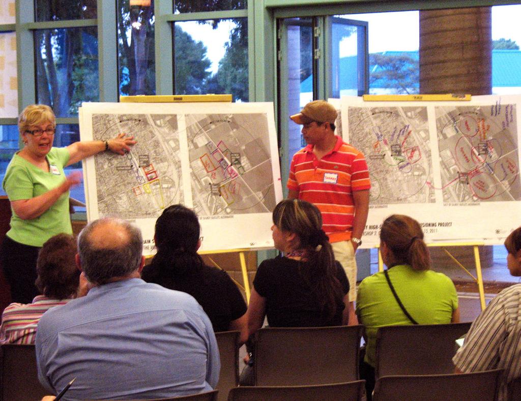
33 area (a portion of the station site is within the municipal boundary and could receive urban services). Community Visioning Process The community s input is at the heart of the Visioning Project, providing valuable insight regarding the things that make Gilroy a great place to live and work. The City of Gilroy led the Visioning Project through an extensive public engagement process with community members, stakeholders, and decisionmakers. The following section is a summary of this participation process, centered on issues and opportunities identification, preliminary concept development and evaluation, and preferred vision alternatives development. process. Each participant then received colored dots, which they used to vote on the issues that were most important to them. Participants were asked to vote only once per issue, rather than placing multiple dots on a similar issue. Some of the most prevalent issues among participants were noise, cultural/ historic resources, traffic impacts, parking, impacts to homes, and impacts to the local street network. For this workshop, and those that followed, the City conducted extensive outreach in an effort to encourage as many participants as possible, including: newspaper notices, postcards and notices sent to Spanish-Language Workshop In May of 2011, the City conducted a Spanish-language workshop to reach out to the community s Spanish speaking residents to inform them about the Visioning Project. Participants were invited to ask questions and voice concerns about the project and high-speed trains in general. The presentation and discussion were made in Spanish and translated in English. Community Workshop 1: Key Issues and Goals The City held its first community workshop in May of 2011 to provide an overview of the Visioning Project, present examples of high-speed train systems in cities similar to Gilroy, and solicit input about key issues and goals for the project team to consider. Participants worked as a large group to identify issues, goals, and questions that should be addressed through the visioning The public participatory process is integral to the Visioning Project Gilroy High-Speed Train Station Visioning Project 27


34 all properties within the station areas, and s to interested organizations and individuals throughout the city and region. Project Website Launch After the first workshop the City established a website for the Visioning Project to provide meeting summaries, informational and project-related documents, updates on the project s status, and notices on upcoming meetings. Community Workshop 2: Creating the Vision In June of 2011, the City held the Visioning Project s second community workshop to inform participants about the existing conditions of both of station areas, Downtown Gilroy and East of Gilroy Outlets. The community was also asked to discuss and envision changes that a new high-speed train station would bring to the two sites. They worked in small groups to create their own visions on large maps. Top Project website Bottom Participants work on a vision at the second workshop Preliminary Concepts The City and project team took the ideas from this workshop to create four preliminary concepts that incorporated the community s input. The four concepts represented the possibility of two vertical alignments for each station site: Downtown Gilroy Modified At-Grade, Downtown Gilroy Trench, East of Gilroy Outlets At-Grade, and East of Gilroy Aerial. Each preliminary concept had different types and levels of development, which reflected the varied opinions and desires of the public from the workshop. 28 Gilroy High-Speed Train Station Visioning Project


35 In the Downtown Gilroy station area, community members envisioned various types of development and public improvements on numerous sites throughout Downtown. In response to this diverse input, the two Downtown Gilroy preliminary concepts were organized around different circulation approaches to the station. In the East of Gilroy Outlets station area, community members envisioned two general ways to develop around the station: either limited development focused to west of the proposed high-speed train tracks, or intensive development throughout the station area with local-serving and regional-serving uses. The two preliminary concepts for this station area reflected these two diverse viewpoints. City Council Study Session 1 The Gilroy City Council met in July of 2011, to receive an update on the Visioning Project and review the set of preliminary concepts for each of the potential station areas. The meeting was held in the Council Chambers at Gilroy City Hall. Members of the public also had an opportunity to share their thoughts with the Council during the meeting s public comment period. Community Workshop 3: Refining the Vision In August of 2011, the preliminary concepts developed after Workshop 2 were presented to the public at the third workshop for the Visioning Project. The workshop was in the format of an Open House, which allowed participants to view and give their feedback on each of the preliminary concepts. Top A visioning exercise includes drawing on maps Bottom Participants review concepts in the third workshop Gilroy High-Speed Train Station Visioning Project 29


 shelters and amenities at Story and Ocala as part of the future Santa Clara/Alum Rock BRT service along Capitol Expressway.")


36 Project Description The Capitol Expressway Transit Improvement Project will transform Capitol Expressway into a multi-modal boulevard offering bus rapid transit, light rail transit, and safe pathways with connections to the regional trail system. The project includes the following two phases: Phase I of the project will include pedestrian and bus improvements along Capitol Expressway to accommodate pedestrian access and to improve safety. The project includes new sidewalks and a landscaping buffer between the sidewalk and the roadway along the expressway from Capitol Avenue to Quimby Road. During this phase the reconstruction of the Eastridge Transit Center will take place. These improvements will also support subsequent bus rapid transit (BRT) shelters and amenities at Story and Ocala as part of the future Santa Clara/Alum Rock BRT service along Capitol Expressway. Phase II will extend light rail from the existing Alum Rock Light Rail Station Phase I - Pedestrian Safety Improvements on Capitol Expressway to the Eastridge Transit Center. Light rail will operate primarily in the center of Capitol Expressway with elevated track structures crossing Capitol Avenue, Story Road, and Tully Road. The Eastridge extension will include three stations: Story Road, Ocala Avenue (optional) and Eastridge. Project Status In May 2005 and in August 2007, the VTA Board of Directors certified the Final Environmental Impact Report, and the Supplemental EIR, respectively, and approved the Light Rail Alternative. In order to be eligible for federal funding, VTA is in the process of preparing an Environmental Impact Statement for the Light Rail Alternative. Design plans for the light rail improvements and associated utility relocation plans and right-of-way mapping has been completed to a final design level. The pedestrian improvement portion of the project along the expressway will be constructed prior to the completion of light rail. This work includes sidewalk and landscaping on Capitol Expressway between Capitol Avenue and Quimby Road. VTA is in the process of preparing construction documents for these pedestrian improvements. Continued on back CHES CELR 3/17/10 Vision Refinement The feedback from the City Council session and third workshop was integral in helping the City and consultant team refine the preliminary concepts. As they were being fine-tuned, the preliminary concepts were vetted through stakeholders and City staff to ensure that they were feasible and appropriate. TH ST MIXED-USE INFILL RELOCATED CALTRAIN DEPOT PEDESTRIAN OVERPASS CHURCH ST PEDESTRIAN PLAZA EIGLEBERRY ST NINTH ST E NINTH ST PUBLIC EVALUATION REPORT DECEMBER 2011 P THE PLANNING CENTER DC&E P TRANSIT CENTER P P FACT SHEET: Transit Capitol Expressway Light Rail Project EIGHTH ST PEDESTRIAN DROPOFF CONVE CENTE HOTEL Funded by the City of Gilroy and the Santa Clara Valley Transportation Authority (VTA) Community Values and Evaluation of Preliminary Concepts The concepts were then evaluated according to a set of Community Values, which had emerged from the course of the participatory process. The detailed evaluation can be found in the Evaluation Report, which serves as a companion document to this. These Community Values reflect the themes that arose most frequently from the questions asked, topics discussed, and comments received during the visioning process. Topics ranged from community character to traffic. The Community Values are: Preservation of Community Character Preservation of Agricultural Land Preservation of and Support for Downtown Businesses Economic Prosperity Cost Efficiency Economically Viable Development Minimal Disruption to Traffic Adequate Parking Support for Transit Minimization of Noise Adequate Emergency Services Sensitive Treatment of Amah Mutsun Cultural Resources Evaluation Report Providing Transit Solutions for Santa Clara County 30 Gilroy High-Speed Train Station Visioning Project

37 The Preferred Vision Alternatives described in the next chapter are guided by these Community Values, which can be viewed as guiding principles threaded along the process to ensure a community-supported, economically-beneficial station area vision that will strengthen the role of Gilroy as a historic, agricultural, and commercial center within the region. As detailed in the previous section, the final land use and urban design concepts in this report evolved from many rounds of revisions of plans and alternatives through an intensive public input process. Community Workshop 4: Finalizing the Vision In November of 2011, the City presented the conceptual visions and preliminary evaluation findings at the fourth and final public workshop for the Visioning Project. Using this information, community members then worked in small groups to discuss the merits and drawbacks of the different visions. Each participant was then asked to formally state their preferences for a station location, vertical alignment, and development intensity. This vital information, along with City Council input, is the basis for the development of preferred vision alternatives for Downtown Gilroy and East of Gilroy Outlets, discussed in the next chapter. Participants voice their preferences in the last workshop two potential station locations and vertical alignments. While no official action was taken at the session, the City Council voiced their support for a Downtown station location and modified at-grade vertical alignment, pending further study and refinement of the concepts, which serve as the foundation for this, as well as project going forward into the next phase. City Council Study Session 2 After finalizing the evaluation findings, the City presented the four conceptual visions and their evaluations to the City Council in December of The study session provided the councilmembers a chance to discuss the pros and cons of the concepts, especially the relative merits and drawbacks of the Gilroy High-Speed Train Station Visioning Project 31
38 32 Gilroy High-Speed Train Station Visioning Project
39 3 Vision
40 3 Vision Vision
41 Preferred Vision Alternatives Whether the new station is going to be located in Downtown or East of Gilroy Outlets, high-speed train service offers an opportunity for the city to improve its standing as a historic, agricultural, and commercial center in the region and the state. One Preferred Vision Alternative for each station location, Downtown Gilroy and East of Gilroy Outlets, emerged from the extensive community and City Council input, and from the evaluation of the four preliminary concepts developed in the visioning process (please refer to the Evaluation Report). Each location presents a different set of constraints and opportunities, which need to be compared and contrasted to arrive at one preferred location that forms the basis for the next stage in the planning process. The community values that resulted from the visioning process, as summarized in the previous chapter, play a key role in the decision making process for a preferred station location. Each Vision Alternative addresses these values in a different way due to its location, context, and overall concept. The project description accompanying each plan alternative includes more detail concerning the integration of community values, as well as potential benefits and impacts. The concepts for both station areas are guided by organizing principles that are the result of public input as well as City staff and consultant guidance and that illustrate overall development strategies for each station area. The plans do not specify exact locations for new buildings, parking facilities, open spaces, or street improvements, but rather provide a general framework for a more detailed development plan that will follow in the subsequent planning phase. The Preferred Vision Alternatives include a set of plan elements that form the concept and illustrate intended overall ideas, connections, and networks. Preferred Vision Alternative Elements: HST alignment Parcel-unspecific development opportunities Station location and access General location of transit center at station Main vehicular access to the station area Gateway opportunities Street network Landmarks Park and open space opportunities Green connections and buffers Pedestrian connections Potential locations for parking facilities Proposed under- or overpasses It is important to remember that the land uses and new development associated with the proposed high-speed train system would occur over a period of many years. The California High-Speed Rail Authority (CHSRA) estimates Gilroy High-Speed Train Station Visioning Project Administrative Draft 35
42 Modified At-Grade Option HST ROW HST STATION HST STATION Varies 60 - HST / Existing UPRR ROW Existing UPRR ROW operation of the system would begin in about 2022, with full operation anticipated for The new development in and around the station areas would be expected to coincide to a large degree with the operation of the high-speed train system, as new traffic and pedestrian activity creates expanded demand for new goods and services in the area 27 Varies 0-16 Trench Option Proposed HST ROW (60-90 ) Barrier Wall Caltrain Caltrain Existing UPRR ROW (Approx. 60 ) Vertical Alignments The Preferred Vision Alternatives reflect the proposed horizontal high-speed train alignment in each location but do not determine the vertical alignment. Two alternative vertical alignments are considered in each location and each plan could accommodate both alternative alignments with appropriate modification. Existing ROW Existing UPRR ROW Approx. 60 Existing ROW 60 HST ROW Downtown Vertical Alignments (Figure 3.1) Caltrain Caltrain Security Fence 27 Min. HST EXPRESS HST EXPRESS Varies up to 55 Modified at-grade option, which consists of an elevated embankment for both high-speed train and Caltrain/UPRR tracks; streets cross in shallow underpasses; Trenched option, which consists of an up to 60-foot deep and between 50- to 120-foot wide partially covered trench for the high-speed train tracks with the Caltrain/UPRR tracks remaining at grade; streets cross at-grade. Figure 3.1 Vertical Options for Downtown HST Alignment (typical sections) Not to scale 36 Gilroy High-Speed Train Station Visioning Project
43 At-Grade Option Proposed ROW HST HST Proposed ROW Proposed HST ROW 50 Aerial Option East of Gilroy Outlets Vertical Alignments (Figure 3.2) At-grade option, which consists of separated at-grade tracks; streets cross in under- or overpasses; 10.7' HST EXPRESS 16.5 HST EXPRESS 10.7' 27 Aerial option, which consists of an elevated structure; streets cross at-grade. The elevation of the structure would vary, reaching a maximum height of approximately 27 feet. Proposed ROW Proposed ROW Varies Typically 8-10 Varies 17 minimum at Crossings Proposed HST ROW 50 Figure 3.2 Vertical Options for East Gilroy HST Alignment (typical sections) Not to scale Gilroy High-Speed Train Station Visioning Project 37
44 10 MIN. WALK Downtown Specific Plan Area SECOND ST HST ALIGNMENT Downtown Specific Plan Area Infill Sites THIRD ST FOURTH ST STRAND THEATER MONTEREY ST LEWIS ST NEW UNDER/ OVERPASS MARTIN ST CHESTNUT ST FIFTH ST ALEXANDER ST 5 MIN. WALK New Mixed-Use Development: Convention Center, Hotel, Office New Mixed-Use Development: Office, Residential Station Plaza MIXED-USE INFILL OLD CITY HALL Open Space Opportunity FOREST ST P Potential HST Parking Structure PRINCEVALLE ST CARMEL ST CIVIC CENTER DOWDY ST SIXTH ST HANNA ST Feet SEVENTH ST EIGHTH ST EXISTING CALTRAIN DEPOT EXTEND DOWNTOWN STREETSCAPE NINTH ST CHURCH ST TENTH ST ROSANNA ST TRANSIT CENTER EIGLEBERRY ST DROP-OFF ELEVENTH ST Figure 3.3 Preferred Downtown Station Area Concept Plan P STATION DROP-OFF P P E NINTH ST P EXISTING UPRR RIGHT OF WAY P EIGHTH ST MIXED-USE OFFICE/ RESIDENTIAL P BANES LN OLD GILROY ST CONVENTION CENTER/ HOTEL/ OFFICE CHESTNUT ST P HIGHWAY 101 NEW DEVELOPMENT OPPORTUNITIES ALONG TENTH STREET CORRIDOR EXTENDED ALEXANDER STREET SOUTH OF TENTH STREET REMOTE PARKING SOUTH OF DOWNTOWN PRIMARY VEHICULAR ACCESS FROM 10TH STREET EXIT Main Vehicular Access Extension of Monterey Streetscape Gateway Opportunity New Street Existing Landmark New Transit Center New Passenger Drop-Off HST Alignment Existing Caltrain/UPRR Alignment 38 Gilroy High-Speed Train Station Visioning Project


45 Downtown Gilroy Station Area Preferred Vision Alternative Organizing Principles The Preferred Downtown Vision Alternative, resulting from the merged ideas of the two concepts developed in the community process, envisions careful infill development and public improvements in the downtown core area and moderate new development along the Tenth Street corridor. Organizing Principles include: The concept principles remain the same for the two considered vertical alignments, modified at-grade or trench An updated Downtown Gilroy Specific Plan (DTSP) will guide the portion of the station area development that falls within its boundary The integration of the new station with the existing historic fabric, and with Monterey Street as Gilroy s pedestrian main street in particular, is a key component of the plan Station access is organized differently on its two sides: The main pedestrian access with a public plaza and new transit center is located on station s west side, directly fronting on Monterey Street; and the main vehicular access occurs on the station s east side on Alexander Street via Tenth Street Figure 3.4, Top Existing view looking west from Alexander Street at Lewis Street Figure 3.5, Bottom Simulated view looking west from Alexander Street at Lewis Street with modified at-grade combined HST and Caltrain alignment Gilroy High-Speed Train Station Visioning Project 39
46 Platform Existing ROW Caltrain Caltrain 20 at Platform HST STATION HST EXPRESS HST EXPRESS HST STATION at Platform Proposed ROW 23 Varies 0 to Approx. 16 Most new development occurs on the east side of the station and along the Tenth Street corridor outside of the Downtown Specific Plan boundary The development along both sides of Tenth Street forms a new gateway to Downtown Gilroy from Highway 101 New development will occur over a long timeframe and is not intended to displace existing viable development without owner s agreement Existing Caltrain ROW 60 Proposed HST ROW Approx. 120 at Platforms Figure 3.6 Modified At-Grade Option, typical station section (no station building shown) Not to scale Existing ROW Caltrain Caltrain Proposed ROW Existing UPRR ROW at Platform HST STATION HST EXPRESS HST EXPRESS Proposed HST ROW Approx. 120 at Platforms Figure 3.7 Trench Option, typical station section (no station building shown) Not to scale HST STATION at Platform Proposed ROW 50 Preferred Vision Alternative Description The Preferred Vision Alternative for the Downtown Station area incorporates a modified at-grade alignment, where the tracks would run through Downtown at a height of approximately 16 feet above the existing grade. Additionally, in this concept, the Caltrain/UPRR tracks would be elevated onto the same grade and structure as the high-speed train tracks. Where streets cross the train s right-of-way, they would be reconfigured to pass below the tracks through shallow underpasses, including: I.O.O.F. Avenue and Lewis, Martin, Sixth, Old Gilroy, and Tenth Streets. A section and visual simulation of how this alignment is potentially grade-separated is shown in Figures 3.1 and 3.5. Alternatively, a trenched alignment (where the high speed train tracks would run in 60-foot deep and 50-foot wide trench, with the Caltrain/UPRR tracks remaining in the current right of way at grade [see Figure 3.1]) could be integrated in the Preferred Vision Alternative with some modifications. The existing at-grade street crossings would remain as well and continue on a capped portion of the 40 Gilroy High-Speed Train Station Visioning Project
47 trench. In addition, parks or public plazas could be placed on top of the trench in some locations to improve the visual connectivity between the two sides of the tracks. Regardless of the chosen vertical alignment, vehicular traffic from the freeway to Downtown is directed to Tenth Street in an effort to divert traffic away from Monterey Street and other local streets, and onto Alexander and Tenth Streets, which would have adequate capacity. This centralized circulation system allows for the articulation of Tenth Street as a new gateway corridor to downtown through a cluster of proposed developments adjacent to the station. New office, hotel, convention center, mixed-use, and multifamily developments would be centralized in the southeast quadrant of the station area to create a pedestrian-friendly and transit-oriented district that not only forms a symbiotic relationship with the high-speed train, but also with the established Downtown core. The close proximity of jobs and housing, as well as goods and services, would promote transit and pedestrian modes of transportation, creating a lively street-level atmosphere and a reduced dependency on cars. It is intended that this transitoriented district be an extension and complement to the businesses in Downtown, and not a competitor. On the west side of the station, a large, multi-use plaza forms the pedestrian-oriented front door to the station, with a new transit center and preserved Caltrain Depot incorporated into the design. This new plaza ties the station to the rest of Downtown and complements the pedestrian character of Monterey Street. The east side of the station is designated for automobile access, drop-off and waiting areas, and centralized parking facilities. The east side is, in effect, the utilitarian side of the station. Both sides of the station would be connected for pedestrian passage through the station itself. Potential locations for parking structures serving the station are proposed on the east side of the station within a 10-minute walking radius; they are meant to be alternative locations, which could function in any combination depending on actual parking requirements. The CHSRA projects that station parking demand could range from 1,000 spaces on the day of opening to a maximum of 6,500 spaces at full build-out. Only twenty percent of the required parking spaces need to be located in the direct vicinity of the station, whereas the remaining eighty percent of spaces could be at locations within a 3-mile radius. Some remote parking facilities with shuttle service to the station could be considered in the south-east of downtown to allow for the best use of land surrounding the station. In addition, existing parking lots within the 3-mile radius that may not be used to capacity currently, could serve as potential parking for HST users as well. In the downtown core area several sites were identified as opportunities for residential mixed-use development that includes ground floor retail. On the west side of Monterey Street, opportunities for sites are located at Eigleberry Street between Fifth and Sixth Street, between Sixth and Seventh Street, and south of Tenth Street at Monterey Street. The development of these sites is guided by the allowed uses and guidelines set forth in the Downtown Specific Plan. New public Gilroy High-Speed Train Station Visioning Project 41
48 green spaces could be created as part of any new development along Monterey Street, including the immediate station area. Street improvements are envisioned along Monterey Street and Tenth Street. The existing pedestrian-oriented streetscape on Monterey Street between Fourth and Eighth Streets should be extended to the envisioned gateways to the north and south to visually define the downtown core area. Tenth Street s importance as a new corridor to downtown should be reflected through a unified streetscape treatment including street trees, green median, and widened sidewalks. New gateways to downtown, located at the intersections of Second Street and Tenth Street with Monterey Street, and at the intersection of Tenth Street and Highway 101 could be created through building placement and articulation or public art. South of Tenth Street, a new mix of uses is envisioned to replace the current commercial and industrial uses. New residential and office mixed uses with ground floor retail along Tenth Street would be organized around a new grid of streets and new open spaces. Potential HST parking garages could be located along the tracks as well. Southbound station traffic would be diverted from Monterey Street and Alexander Street to Chestnut Street. East of Gilroy Outlets Station Area Preferred Vision Alternative Organizing Principles In the visioning process for the East of Gilroy Outlets station area, community members envisioned either limited development west of the proposed high-speed train tracks, or more intensive development (please refer to the Evaluation Report). Elements of both concepts are merged in the Preferred Vision Alternative that assumes limited development on both sides of the station, roughly within a ¼-mile radius (see Figure 3.8). Organizing Principles include: The concept principles remain the same for the two considered alignments, at-grade or aerial structure The development area almost forms a square around the station, with the station as its centerpiece and boundaries defined by Marcella Avenue to the east; a new street to the west, east of the Gilroy Outlets; and new green buffers to the north and south. The main access to the area occurs from Leavesley Road and continues on a new street grid that also connects to Marcella Avenue. A new gateway opportunity exists in Leavesly Road east of the Gilroy Outlets Vehicular access to the station is provided on both sides of the station 42 Gilroy High-Speed Train Station Visioning Project
49 New Mixed-Use Development: Convention Center, Hotel, Office New Mixed-Use Development: Office, Retail New Mixed-Use Development: Office Station Plaza LAS ANIMAS AV 10 MIN. WALK EXISTING AGRICULTURAL LAND TO REMAIN Open Space Opportunity Potential HST Parking Structure P P MULTI-USE REGIONAL TRAIL HST ALIGNMENT GREEN BUFFER 5 MIN. WALK EXISTING AGRICULTURAL LAND TO REMAIN MARCELLA AV Main Vehicular Access Multi-Use Regional Trail Pedestrian Connection Gateway Opportunity P OFFICE/ CONVENTION CENTER/ HOTEL P OFFICE PEDESTRIAN PLAZA P MIXED-USE OFFICE/RETAIL OFFICE DROP-OFF P PEDESTRIAN CONNECTION New Street Existing Landmark New Transit Center New Passenger Drop-Off SAN YSIDRO AV EXISTING OUTLETS LEAVESLEY RD DROP-OFF TRANSIT CENTER P OFFICE GREEN CONNECTION TO CREEK HST Alignment MULTI-USE REGIONAL TRAIL Green Buffer EXISTING OUTLETS REMAINDER OF GILROY 660 FOR FUTURE DEVELOPMENT HIGHWAY Feet ARROYO CIR Figure 3.8 Preferred East Of Gilroy Outlets Concept Plan Gilroy High-Speed Train Station Visioning Project 43


50 Mixed-use office and retail uses in the immediate area surrounding the station, and office, convention center, and hotel uses at the fringes, form a new transitoriented district A new street and green network connects to existing infrastructure Development will occur over a long timeframe Figure 3.9, Top Existing view looking east along Leavesley Road from the Gilroy Outlets Figure 3.10, Bottom Simulated view looking east along Leavesley Road from the Gilroy Outlets with aerial HST alignment Preferred Vision Alternative Description The Preferred Vision Alternative envisions a new transitoriented village on the east side of Gilroy, less than two miles from Downtown, that is characterized by compact development and a mix of uses that are based on transit, employment, and retail. This new employment center is well-connected regionally through high-speed train and locally through its proximity to Downtown and the entire city. The intent is to create a viable and sustainable neighborhood that relies on transit, pedestrian, and bicycle travel as much as possible. The character of most of the development would be urban: buildings would be built to the edge of the street with front doors facing the sidewalk and open spaces that are integrated into the neighborhood fabric and people s activities. The Preferred Vision Alternative depicts an aerial high-speed train alignment where the tracks are elevated approximately 25 feet above grade. A minimum clearance of 17 feet would be provided at street crossings, which would be at grade in this scenario, easily linking the east with the west side. Alternatively, an at-grade train alignment could be accommodated with little anticipated change in the development pattern but with 44 Gilroy High-Speed Train Station Visioning Project
51 necessary under- or overpasses for cross streets. Leavesley Road is the main access road to the district and connects to Marcella Avenue on the east side and two new main northsouth streets on the west side of the station. At the intersection of Leavesley Road with a new street located directly east of the Gilroy Outlets, a new gateway could be created by buildings, streetscape design, or public art. The new street could also provide additional access and connectivity to the existing Gilroy Outlets. Within the district, a new street grid forms blocks of various sizes to allow for different types of development. The station forms the heart of the district and could be accessed from both sides through generously-sized plazas. This configuration helps to divert traffic from Leavesley Road to the station. While drop-off areas would be located on both sides, a new transit center is proposed at the west-side plaza, providing connections to the Gilroy Outlets and Downtown. The two plazas would be framed by the new transit-oriented district surrounding the station. All development would occur within an approximate radius of ¼ mile, or a five-minute walk, to take advantage of the proximity of the station and to create a walkable and attractive environment for working and visiting. The highest density is assumed in the immediate station area with buildings ranging between three and four stories that accommodate a mix of office and retail uses, with retail fronting on the streets and on the plazas. This core area is surrounded by office uses, and a convention center with related hotel uses on the west side, that have a slightly lower density with buildings ranging between two and three stories. 23 Varies 0 to Approx Proposed ROW 20 at Platform 20 at Platform HST STATION HST EXPRESS HST EXPRESS HST STATION Proposed HST ROW Approx. 120 at Platforms HST EXPRESS HST EXPRESS HST STATION HST STATION 20 at Platform Proposed ROW at Platform Concourse Level Figure 3.11 Aerial Option, typical station section (no station building shown) Not to scale Proposed HST ROW Approx. 120 at Platforms Figure 3.12 At-Grade Option, typical station section (no station building shown) Not to scale 5.8 Gilroy High-Speed Train Station Visioning Project 45
52 Parking for HST users would be provided in decentralized parking structures that would be located within the five-minute walking radius. Potential generic locations are indicated on the Preferred Vision Alternative; however, the exact location and number of facilities need to be determined in the next phase of the plan development. The assumed maximum number of parking spaces dedicated to HST passengers is 6,400 spaces when the system is in full operation. Required parking for all other uses would be integrated in the development, either onsite or as part of a district parking strategy. In reference to the agricultural pattern dominant in the area, the district is defined by clear edges on its north, east, and south sides. Green buffers on the north and south sides serve as a visual delineation while providing connections to trails and the outlying landscape. Interspersed within development would be green pockets of parks and trails, connecting the station area to other parts of Gilroy. Two larger green spaces could contribute to the identity of the neighborhoods on either side of the station and become an integral part of the larger green and pedestrian network. Additionally, the East of Gilroy Outlets station area overlaps with a portion of the anticipated development south of Leavesley Road, known as the Gilroy 660. It is assumed that a portion of the development in this Preferred Vision Alternative would supplant some of the anticipated development in the Gilroy Gilroy High-Speed Train Station Visioning Project


53 Comparison of Preferred Vision Alternatives The specific values and goals that have emerged from both the community process and City Council input have been used as criteria for evaluating the preliminary concepts for each station area, as described in the Evaluation Report. These goals and values are used again here to discuss and compare potential benefits and impacts of the two preferred alternatives. Both Preferred Vision Alternatives are intended to be diagrammatic for easier comparison of the key concepts and to provide a general direction for the subsequent, in-depth study that will follow after the selection of the preferred station location. Preservation of Community Character An important Community Value is the preservation of community character of Gilroy, which in the core parts of Downtown can be described as having small-town, pedestrianfriendly, and historic character. In the East of Gilroy Outlets station area, the character is represented by a busy shopping center that is surrounded by an agricultural and rural landscape. A new Downtown HST Station and alignment has the benefit of adding energy and activity to downtown but also risks upsetting the continuity of the street grid and raising issues of scale new development, if not designed carefully. Regardless of the vertical alignment, the high-speed train would bring a large piece of infrastructure to Downtown that would need to be integrated into the existing urban fabric. The station would include 1,400-foot long platforms and new tracks would Examples of Gilroy s unique character Top Monterey Street in Downtown Gilroy Left Farmland in the East of Gilroy Outlets station area Gilroy High-Speed Train Station Visioning Project 47


54 be added to the existing Caltrain/ UPRR tracks, resulting in a widened right-of-way going through Downtown. This potentially significant addition to the Downtown needs to be addressed by appropriate design and the provision of a high level of connectivity. These changes should also be weighed against the increased number of people and amount of activity that the station could bring to Downtown, which would help preserve and strengthen the Downtown s character and importance as Gilroy s center. The use of vacant parcels for new buildings and the reactivation of retail spaces, in combination with streetscape improvements and additional open spaces could considerably contribute to Downtown s future vitality. Top An at-grade train station in Millbrae Bottom A trenched station in Stratford, UK The modified at-grade alignment could potentially create a more significant visual barrier than the trenched option. However, the trench is relatively deep and wide with very extensive approaches to the north and south in addition to the at-grade Caltrain/ UPRR. Some of the trench could be covered with green spaces and plazas that would bring activity and enhance the community character, but most of the trench would be required to be open on top for ventilation reasons. The modified at-grade option would require crossing streets to be reconfigured into shallow underpasses, while the trenched option would leave crossings at grade. Only the modified atgrade alignment would eliminate the traffic conflicts, and the train horn and bell noises associated with the existing at-grade crossings, since existing Caltrain crossings would remain with the trenched option. 48 Gilroy High-Speed Train Station Visioning Project


55 In the southeast quadrant of the station area, outside of the Downtown Specific Plan area, more significant change is anticipated, with a proposed convention center, a hotel, residential mixed-use, and office buildings. This much new development has the potential to greatly change the feel of the neighborhood. However, this intensive area of new development can be considered an extension of the character and energy that is in Downtown, with a pedestrian-friendly and active urban environment. In contrast to a new Downtown HST Station, a new station located east of the existing Gilroy Outlets is likely to have little impact on the character on Downtown. It would, however, transform approximately 200 acres of agricultural land into a new transit-oriented and employment-based district, and change the current rural character in this area. This development would be designed to feel distant from and very different from Downtown, with contemporary construction of buildings and new uses such as office, retail, hotel, and a convention center. The rural nature of Leavesley Road would be transformed into a more developed, arterial right-of-way that is connected to a new, pedestrian-friendly street grid in the station area. In terms of the vertical high-speed train alignment, the considered aerial structure allows for better connectivity between the east and west side of the district, as existing and new streets would cross at grade, but would have a bigger visual impact to the existing landscape than the at-grade alignment. The atgrade alignment would require new under- or overpasses for crossing streets, with overpasses having a greater visibility in the landscape than underpasses. Top Left A recently constructed gradeseparated crossing in San Carlos Top Right A photosimulation created by CSHRA showing a trench capped to accommodate an at-grade street crossing Bottom The rural East of Gilroy Outlets station area will be transformed into a transit-oriented district if the station is located here Gilroy High-Speed Train Station Visioning Project 49

56 Preservation of Agricultural Land Preservation of agricultural land is another important community value in Gilroy. Since the Downtown Station Area expands a half mile within Downtown, no agricultural lands are anticipated to be effected. However, the East of Gilroy Outlets Station Area would use about 200 acres of agricultural land for future development, thus generating a negative impact on the preservation of agricultural land. A mixed-use infill development in Downtown Gilroy with ground floor retail and residential above Preservation of and Support for Downtown Businesses Many community members voiced their support for Downtown businesses and do not want new development to negatively affect the economic well-being of businesses there. Based on conditions today, it is clear that Downtown has a greater need for revitalization than the East of Gilroy Outlets station area, and it is likely that new public investment in an HST station would provide a valuable catalyst effect in the Downtown area, once improvements are in place. The types of mixed-use development proposed for the Downtown concept are infill projects with ground floor retail and residential of office uses above, on vacant or underutilized parcels, leaving thriving Downtown businesses intact. Unlike the large master-planned, lifestyle-center types of commercial development, mixed-use buildings have small floor plates that accommodate locally-serving and convenience-related retail uses, such as coffee shops, restaurants, and bookstores. These retail uses would be similar and complimentary to the small, independent mix of shops that currently make up Downtown. With a station located in Downtown, new visitors, and hence new potential customers, would patronize Downtown businesses. Lastly, the increase in daytime population as a result of HST, new residential development, a new conference center and related hotel would result in an increased demand for retail space, some of which could be captured in ground floors of existing historic buildings, strengthening the viability of historic Downtown. 50 Gilroy High-Speed Train Station Visioning Project

57 In the East of Gilroy Outlets Preferred Vision Alternative, some retail is proposed as part of the mixed-use development immediately surrounding the station. Most services would be convenience and lifestyle related serving new office workers and visitors of the convention center. While most of the retail uses would be smaller-scale, a limited number of medium-sized retailers, such as a large restaurant or a grocery store, could be attracted to the area. To lower the risk of shifting business activity away from Downtown and to protect well-established Downtown businesses, the city could enact policies that limit the type and size of businesses that could locate in the East of Gilroy Outlets Station Area. between a Downtown station or East of Gilroy Outlets station. A downtown station would generate estimated annual HST user expenditures of $12 million and $91,700 in annual tax revenues, assuming that each passenger would spend $5 a day in Downtown. In comparison, an East of Gilroy Outlet station would generate estimated annual HST user expenditures of $4.8 million and $36,700 in annual tax revenues, assuming that each passenger spends $2 a day in Downtown. The East of Gilroy Outlets station would generate less HST user spending in Downtown due to its distance to Downtown. Economic Prosperity While measures to preserve Downtown s unique character and existing businesses are fundamental to a successful integration of the high-speed train, economic growth spurred by the new station and new development can strengthen the viability of the City for years to come. Daily HST user spending, which is the HST passenger spending on convenience-related goods and services, such as dining and shopping, and job creation are the most relevant factors for assessing economic prosperity in connection with the high-speed train. In the long-term, the macroeconomic benefits, such as increased productivity due to travel efficiency gains and a broadened regional labor market, of a HST station in Gilroy would be similar between each station location. At the neighborhood-scale, however, there are potential differences in the economic effects of HST user spending and job creation The existing Downtown offers an ideal scale and mix of uses to attract HST users to spend some time in Gilroy Gilroy High-Speed Train Station Visioning Project 51
58 Downtown Gilroy is well-suited to support the conveniencerelated needs of HST passengers because it is precisely the type of neighborhood that caters to this type of demand: Downtown consists of a rich mix of convenience businesses in a compact and walkable environment immediately adjacent to the new station. HST user spending in this area could provide a noticeable boost. Hotel and conference facilities that are proposed in connection with the new station could create an additional economic stimulus. If visitors are attracted to Downtown lodging and meeting facilities, nearby retailers and restaurants also stand to benefit from related purchasing activity. In terms of job creation, the Association of Bay Area Governments (ABAG) anticipates a growth of about 10,000 jobs by 2035 for the entire City of Gilroy, with the strongest growth in Retail, Financial and Professional Services; Health, Educational, and Recreation Services; and Other sectors. Other includes the Construction, Information, and Government sectors. Both station areas have the capacity to generate a significant percentage of the projected jobs as both areas include retail, office, hotel, and convention center uses. Based on the amount of new development envisioned in each station area, the Downtown station area could generate up to 4,800 jobs while the East of Gilroy Outlets station area has the potential to create even more jobs - up to 8,000 in the proposed development plan. Cost Efficiency It is anticipated that the CHSRA would pay for costs directly related to the construction of a station and alignment in Gilroy, as well as for the cost of additional infrastructure improvements that are required to ensure adequate traffic and safety conditions regardless of the station location. In the Downtown alignment, the trench option would cost approximately $2.2 billion compared to $1.0 billion for the modified at-grade alignment. Both the aerial and at-grade alignments in East Gilroy would cost roughly the same at $1.5 billion and $1.4 billion, respectively. However, the at-grade alignment in East Gilroy is the only option that would generate a significant additional cost of $191 million to the City of Gilroy, since the City would be responsible to construct overpasses for new streets crossing the tracks and new streets are currently planned for this area. The cost estimates were developed by the consultant team based on available information; the actual cost estimate by the CHSRA is likely to be higher. Economically-Viable Development Another important value to the community is the viability of potential new development. The amount and types of proposed development around a new station should be feasible in light of projections of demand. The Association of Bay Area Governments (ABAG) growth projections for Gilroy between 2010 and 2035 translate into approximately 6,000 new dwelling units and 10,000 new jobs. This could equate to the demand for 5 million square feet of non-residential development, including office, retail, industrial, and institutional space. These projections should be considered when evaluating the 52 Gilroy High-Speed Train Station Visioning Project

59 projected amounts of development in each Preferred Vision Alternative. The Downtown Station Area Preferred Vision Alternative proposes 1,700 residential units; 250,000 square feet of retail; 1,000,000 square feet of office; 200,000 of conference center use; and 350 hotel rooms. Of the 1,700 residential units, approximately 670 units would be accommodated south-east of Downtown, in the area south of Tenth Street and west of Chestnut Street. The remaining 1030 units would be integrated in the Downtown area, which are slightly fewer units than the projected 1,576 units in the Downtown Specific Plan. New multi-family development is encouraged in the Downtown due to its rich resources of transit and amenities. Similarly, the majority of office-based employment could be located in the southeast quadrant of the Downtown station area due to large parcels of vacant, underutilized, or industrial land that is suitable for large office uses. Retail uses would be integrated with mixed-use development. The proposed office and commercial development would generate approximately 4,800 new jobs. The amount of proposed development translates into absorption to 28% of ABAG s residential growth projection, 27% of the non-residential growth projection, and 48% of the job growth projection. In comparison, the available land for office and other nonresidential uses in the East of Gilroy Outlets Station Area is larger and could accommodate a higher percentage of non-residential uses than the Downtown Station Area. The proposed development in the East of Gilroy Station Area consists of 1,100,000 square feet of office; 30,000 square feet of convenience retail; 200,000 square feet of conference center use; and 350 hotel rooms. This amount of development would create about 8,000 new jobs. The proposed development would accommodate 43% of ABAG s non-residential growth projection and 80% of the job growth projection. While the preferred alternative for the East of Gilroy Outlets does not currently include any residential uses in order to support the creation of a new office center of regional importance, residential uses could get considered in the subsequent planning process. The existing Downtown fabric is ideal for accommodating multi-family residential buildings that would benefit from close proximity to amenities and public transit Gilroy High-Speed Train Station Visioning Project 53

60 The conference center and hotel development are land uses that should be studied further in both station areas to assess their viability in connection with the high-speed train. Minimal Disruption of Traffic One of the major issues expressed at the community workshops was concern regarding new traffic. Gilroy s residents want HST service to minimize disruption to traffic in their community. Both station areas intensify uses and generate additional traffic that needs to be mitigated by appropriate measures. It is anticipated that there would be 10,600 daily trips solely attributable to HST users in addition to the increased number of trips associated with the proposed new development. Top Monterey Street s pedestrian-oriented character should be preserved by directing station traffic to Tenth and Alexander Streets and by focusing on public transit and bicycles Bottom Tenth Street would become the main access street to the station area from Highway 101 that would be framed with new mixed-use development on both sides In the Downtown Station Area, HST station area access is focused on Tenth Street so that local and major roads, such as Monterey Street, would not be impacted by a large increase in traffic. The passenger drop-off area and parking garages would be located on the east side of the station, concentrating traffic on Alexander Street. Alexander Street may require improvements that do not involve an increase in the number of lanes to allow for the increased number of trips. Even with new traffic improvements proposed in the order for the General Plan network to work at acceptable levels, the preferred Downtown Station Area Plan would generate approximately 11,000 new daily trips (combined HST user and new development traffic) beyond what is already anticipated in the General Plan. Because of this, additional mitigation measures would need to be explored to accommodate the additional traffic. 54 Gilroy High-Speed Train Station Visioning Project

61 In the East of Gilroy Outlets station area, a very limited road system currently exists and significant new infrastructure investment would be required. Traffic impacts in this station area would be unavoidable because of the change from a previously undeveloped area to a developed area that includes a new train station, and new hotel and office uses, with new trips generated from HST uses as well as from development. A variety of additional roadway and intersection improvements would be needed to support the level of development proposed and maintain acceptable levels of service throughout the City. One of these important improvements called out in the General Plan network would be a new Highway 101 interchange at Buena Vista Avenue, which would share the traffic entering the station area with the existing Leavesley Road interchange. While the General Plan does not anticipate growth in the same specific areas as the East of Gilroy Outlets station area, it does anticipate future campus industrial development in the area south of Leavesley Road known as Gilroy 660 (referring to the approximate 660 acres contained in the area), some of which would overlap the same area as station area. This portion of the 660 would generate about 25,800 new daily trips which are comparable to the anticipated 24,800 daily trips (combined HST user and new development traffic) in the preferred alternative for the East of Gilroy Outlets station area. Adequate Parking Driving will be the most common mode of access for HST passengers. It is anticipated that 2,100 vehicles would arrive at the Gilroy HST station to park each day. With an average length of stay of three days, it is calculated that peak parking demand Top Parking garages can be designed to fit into the existing fabric with the use of approriate materials, articulation, and ground floor retail, as this example in Petaluma shows Bottom The existing Caltrain Station is located in Downtown and could be an integral part of a new intermodal station Gilroy High-Speed Train Station Visioning Project 55
62 would be around 6,500 spaces at full operation. However, parking demand may be significantly lower at the time of the station opening. Both station areas provide adequate parking to HST users within a five-minute walking radius from the station. Parking is assumed to be accommodated in dispersed parking structures at partial or full build-out. In the Downtown Station Area, existing parking capacity and remote parking facilities should be explored to reduce the amount of parking garages in the eastern downtown core area. Parking demand associated with new residential or commercial development is assumed to be met either on-site or by other parking strategies such as district parking. Support for Transit (Bus/Rail Interconnectivity) Another Community Value expressed at the community workshops was the desire for existing transit services to not be negatively affected. Additionally, a HST station should enhance or support transit that already exists in Gilroy. Due to its existing transit services including Caltrain and buses, the Downtown Station Area provides more access to and support for transit than the East of Gilroy Outlets Station Area. Furthermore, the proposed relocation of the transit center closer to the new station and plaza improves intermodal connectivity and pedestrian access from Downtown. In contrast, the East of Gilroy Outlets HST station would be located approximately three miles away from the existing Caltrain Station, which would take at least 10 minutes to travel to by vehicle, causing a long delay between potential multimodal transfers between Caltrain and HST. Highway 101 would represent a significant barrier to HST passengers who would walk or bike to take other transit, a situation that could be improved by the proposed multi-use trail connecting to Downtown. Although a new transit center would be located in the station area, it could potentially take years before full bus service is extended into the station area and such a setup would generate additional operation costs to the system. Minimization of Noise Since high-speed trains are capable of speeds of around 200 miles per hour, many community members have voiced concern about the level of noise that could potentially be created from passing trains. Generally, high-speed trains generate less noise than diesel trains at speeds less than 150 miles per hour and more noise at speeds above 150 miles per hour due to aerodynamic resistance. Factors that contribute to the level of noise that is audible from a high-speed train are the speed the train is traveling, the distance between the train tracks and the listener, the type of ground surface, the presence of buildings or sound barriers, and the vertical profile of the alignment. Because of these different factors it is difficult to determine and compare the actual impacts of the different alignments in each station area, and between the two different station locations. The anticipated maximum speed of a high-speed train passing through Gilroy is 185 miles per hour. At full system operation in 2035, there could be up to 41 through trains (not stopping in Gilroy) traveling at this speed daily. At 100 feet away from the centerline of the tracks, the maximum audible noise level from 56 Gilroy High-Speed Train Station Visioning Project


63 a train passing by at this speed is about weighted decibels (dba), which is comparable to a diesel truck from a distance of 50 feet. This is considered the theoretical maximum level of noise that could be heard outside of the station, experienced by the listener for approximately 4 to 5 seconds as the train passes. In the Downtown Station Area, the built environment would already attenuate noise up to 10dBA and a sound barrier would reduce levels by an additional 5 dba. Dropping 10 dba is generally considered a reduction of 50 percent of the perceived loudness of sound. The constant ambient noise in Downtown would make perception of train noise less intrusive. For the atgrade alignment, the maximum noise level would be at dba at Monterey Street, which is 400 feet away from the tracks. The trench alignment would reduce HST noise by another 5dBA but would not eliminate the noise generated by Caltrain, including the horns. For the approximately 150 residences located within this distance, even a reduced noise level of dba would potentially exceed limits for residential uses and need to be mitigated by additional measures. In the East of Gilroy Outlets Station Area, the aerial alignment would cause perceived noise levels to rise by 1 to 2 dba when compared to an at-grade alignment. Associated noise impacts would be lessened due to the proposed new grid of mixed-use and office development, and would likely be more acceptable than for Downtown due to the lack of residential uses. Top The noise of HST, particularly on aerial structures and at-grade alignments, need to be mitigated by appropriate measures Bottom Glass sound barriers can reduce noise without being massive and adding to the barrier effect Gilroy High-Speed Train Station Visioning Project 57
64 Adequate Emergency Services According to the Police and Fire Departments, a Downtown station site would likely generate more requests for police services than a station site located in the East of Gilroy Outlets station area. This is because the Downtown station would draw additional traffic through the Downtown area, creating a higher number of potential conflicts in one area. Furthermore, Gilroy public safety staff has also indicated that a trench configuration for the tracks would be preferable to a modified at-grade configuration, because public safety personnel could more easily access an emergency site in a trench than on an elevated structure. The Police Department anticipates an increase in assaults, vehicle burglaries, and vandalism associated with train station parking facilities. They are also concerned that the high profile of HST could make it an attractive target for terrorist activity. Although CHSRA would establish and operate its own law enforcement organization, the Gilroy Police Department would still be the first responder to incidents on CHSRA property. Overall, the increased demand for police and fire services would result in increased costs to the City s budget. However, it is anticipated that CHSRA would be required to offset this cost as part of mitigation measures of a significant impact under the California Environmental Quality Act (CEQA). In the Downtown station area, the trenched option could potentially cause more conflicts with existing burial sites than the modified at-grade option due to the significant excavation required to build the trench. The East of Gilroy Outlets station area has a higher overall risk of impacting burial sites since this area has been undisturbed, as opposed to the Downtown Station Area. The two considered vertical alignment options in East Gilroy would have similar impacts on shallow burial sites that could be disturbed by planned structure footings. Comparison Matrix A summary of the evaluation discussed above is illustrated in the matrix below. The two station locations are compared qualitatively in relative and not absolute terms, using the categories positive, negative, and neutral. A relative comparison means for example that one station location addresses one specific criteria better than the other in which case one would receive a positive, and the other a negative assessment. If both station areas address a criteria in a similar way or in a different way with specific trade-offs or benefits, they receive a neutral assessment. Neutral in absolute terms can still mean a significant improvement compared to the current condition. Sensitive Treatment of Amah Mutsun Cultural Resources The preservation of Amah Mutsun cultural resources is an important value to members of the Amah Mutsun Tribal Band. 58 Gilroy High-Speed Train Station Visioning Project
65 COMMUNITY VALUE Preservation of Community Character DOWNTOWN STATION AREA EAST OF GILROY OUTLETS STATION AREA Preservation of Agricultural Land Preservation of and Support for Downtown Businesses Economic Prosperity Cost Efficiency (per vertical alignment) Mod. At-Grade: Trench: Aerial: At-Grade: Economically Viable Development Minimal Disruption of Traffic Adequate Parking Support for Transit (Bus/ Rail Interconnectivity) Minimization of Noise Adequate Emergency Services Sensitive Treatment of Amah Mutsun Cultural Resources Positive Neutral Negative Table 3.1 Comparison Matrix of Station Locations Gilroy High-Speed Train Station Visioning Project 59
66 60 Gilroy High-Speed Train Station Visioning Project

67 4Next Steps
68 4Next Steps
69 The Preferred Vision Alternatives for the Downtown and East of Gilroy Outlets Station Area presented in this report resulted from a comprehensive visioning process documented in the accompanying Existing Conditions and Evaluation Reports. These efforts comprise Phase I of the Station Area Planning project and are intended to guide the City of Gilroy to make a recommendation for a preferred station location. Following the first phase, after the determination of a preferred station location has been made, will be the development of a fully detailed Station Area Plan, referred to as Phase II of the Station Area Planning Project. Similar to Phase I, an extensive community engagement process will be an integral part of Phase II. The goal of Phase II is to study potential impacts in more depth in order to develop a station area plan that will achieve the vision set out by the City of Gilroy. More research will be done to plan for positive new development and to fully assess economic, traffic and other potential impacts of the high-speed train and associated private development on the chosen station area site. The plan will be based upon the best practices for transit-oriented development within a half-mile radius of the station and will address location, transportation connectivity, and development issues. General Plan and Zoning Code amendments, and performing other tasks necessary for implementation. The City of Gilroy is committed to make the high-speed train a successful and beneficial project for the city, its residents, and the entire region. To achieve this goal, it is important to integrate the vision in the next steps and ensure that all planning in the subsequent phases is coordinated with the California High- Speed Rail Authority, stakeholders, and residents. This exceptional, once-in-a-century opportunity demands no less than a comprehensive vision for Gilroy s unique context and a sensitive solution that provides the highest quality level of thought, community engagement, planning, design, and political leadership. Phase III of Gilroy s HST Station Area Planning project is the implementation phase involving environmental clearance, adopting the Station Area Plan as a Specific Plan, adopting Gilroy High-Speed Train Station Visioning Project 63
70 64 Gilroy High-Speed Train Station Visioning Project

71 5 Appendix
Chapter 4. Linking Land Use with Transportation. Chapter 4
 Chapter 4 Linking Land Use with Transportation Chapter 4 59 Chapter 4 Linking Land Use with Transportation Community Design and Transportation Program Introduction Since the 1950s, the predominant development
HIGH-SPEED RAIL PROGRAM UPDATE. Gilroy Unified School District & Gilroy City Council September 24, 2018 Gilroy City Council Chambers, Gilroy, CA
 HIGH-SPEED RAIL PROGRAM UPDATE Gilroy Unified School District & Gilroy City Council September 24, 2018 Gilroy City Council Chambers, Gilroy, CA OVERVIEW Introductions High-Speed Rail Project Update Overview
Gold Line Bus Rapid Transit Transit Oriented Development (BRTOD) Helmo Station Area Plan
 Helmo Station Area Plan") Appendix F Gold Line Bus Rapid Transit Transit Oriented Development (BRTOD) Helmo Station Area Plan Introduction and Purpose of the Plan The Gold Line Bus Rapid Transit facility is an eleven-mile dedicated
Appendix F Gold Line Bus Rapid Transit Transit Oriented Development (BRTOD) Helmo Station Area Plan Introduction and Purpose of the Plan The Gold Line Bus Rapid Transit facility is an eleven-mile dedicated
CHAPTER 1. Ms. Guajardo s Class - Central Elementary CH 1 1
 INTRODUCTION CHAPTER 1 Ms. Guajardo s Class - Central Elementary CH 1 1 1.1 SETTING South Centre City is a linear corridor south of Downtown Escondido paralleling Centre City Parkway and South Escondido
The transportation system in a community is an
 7 TRANSPORTATION The transportation system in a community is an important factor contributing to the quality of life of the residents. Without a sound transportation system to bring both goods and patrons
Plan Overview. Manhattan Area 2035 Reflections and Progress. Chapter 1: Introduction. Background
 Plan Overview The Manhattan Urban Area Comprehensive Plan (the Comprehensive Plan) is a joint planning initiative of the City of Manhattan, Pottawatomie County, and Riley County. The 2014 Comprehensive
ELMVALE ACRES SHOPPING CENTRE MASTER PLAN
 ELMVALE ACRES SHOPPING CENTRE MASTER PLAN Contents 1.0 INTRODUCTION... 2 2.0 LOCATION... 2 3.0 EXISTING CONTEXT... 2 4.0 VISION & GUIDING PRINCIPLES... 2 5.0 LAND USE AND BUILT FORM... 4 5.1 St. Laurent
Community Meeting #1: Project Kick Off
 Community Meeting #1: Project Kick Off November 17, 2015 What are 3 things you like about Downtown Gilroy that you want to hold onto in the future? Please write them down and share with us! Tonight s Meeting
2.0 AREA PLANS. Lakeside Business District. Lakeside Business District Land Use Categories:
 Lakeside Business District Lakeside Business District Land Use Categories: Campus Commercial Campus Commercial means a mixture of uses which includes corporate offices, office parks, hotels, commercial,
A. WHAT IS A GENERAL PLAN?
 I. Introduction A. WHAT IS A GENERAL PLAN? A general plan is the planning guideline for the future of a city. It contains goals and policies which regulate urban development, the protection of the natural
Chapter 1.0 Introduction
 Chapter 1.0 Introduction 1.1 Background The North Metro commuter rail line is part of the RTD FasTracks regional transit system expansion program to build more than 100 miles of rail transit throughout
Town Center (part of the Comprehensive Plan)
") Town Center (part of the Comprehensive Plan) Mercer Island Town Center Looking North (2014) In 1994, a year-long process culminated in a set of design guidelines and code requirements for the Town Center
Town Center (part of the Comprehensive Plan) Mercer Island Town Center Looking North (2014) In 1994, a year-long process culminated in a set of design guidelines and code requirements for the Town Center
Station Area Plan Introduction & Draft Alternatives Review
 Station Area Plan Introduction & Draft Alternatives Review City Council Meeting - February 22, 2016 Project Background: California High-Speed Rail San Jose to San Fernando Valley Segment CHSRA will select
The University District envisions, in its neighborhood
 Envisioning the University District Link Light Rail in Seattle s neighborhoods CIY OF SEALE CONCEP-LEVEL SAION AREA PLANNING RECOMMENDAION RESOLUION # 30165 EXHIBI L Vision 08.2000 he University District
City of Farmington. Downtown Plan. Amendment to the 1998 Master Plan Adopted October 11, 2004
 City of Farmington Amendment to the 1998 Master Plan Adopted October 11, 2004 Introduction Planning Background 1 Scope and Components of the Plan Amendment 2 Concept Introduction 3 Plan Concepts 3 Conceptual
4. ENVIRONMENTAL IMPACT ANALYSIS 7. LAND USE AND PLANNING
 4. ENVIRONMENTAL IMPACT ANALYSIS 7. LAND USE AND PLANNING 4.7.1 INTRODUCTION The following analysis discusses the consistency of the Proposed Project with the corresponding land use and zoning designations
Northwest Rail Corridor and US 36 BRT Development Oriented Transit Analysis 4.4 STATION AREA FINDINGS
 4.4 STATION AREA FINDINGS Each station is different, and each one requires a separate set of recommendations based on the vision for the site. This section outlines an initial TOD strategy and recommendations
1.0 Introduction. Purpose and Basis for Updating the TMP. Introduction 1
 1.0 Introduction The Town of Castle Rock is situated between the metropolitan areas of Denver and Colorado Springs, amidst a unique terrain of rolling hills, mesas, ravines, and waterways. Like many Front
This Review Is Divided Into Two Phases:
 Semiahmoo Town Centre Review The purpose of this review: To review the Semiahmoo Town Centre Concept Plan, originally approved in 1993, to ensure that this centre will continue to serve the needs of South
CITY OF PUYALLUP. Background. Development Services
 CITY OF PUYALLUP Development Services 333 South Meridian Puyallup WA 98371 To: City Council From: Katie Baker, AICP, Planning Division Re: South Hill Neighborhood Plan Adoption Date: (Meeting date: February
Metro. Activity Center Design Guidelines. Recommendations For Developing Focused, Mixed-Use Commercial/Residential Centers
 Metro Activity Center Design Guidelines Recommendations For Developing Focused, Mixed-Use Commercial/Residential Centers Metro Activity Centers What is a MAC? Legacy, the adopted guide for the future growth
REGIONAL ACTIVITY CENTER
 DRAFT REGIONAL ACTIVITY CENTER 70 EAST BENCH MASTER PLAN DRAFT 06 Introduction The East Bench Regional Activity center is comprised of large educational, research, medical, and employment centers. These
Policies and Code Intent Sections Related to Town Center
 Policies and Code Intent Sections Related to Town Center The Town Center Vision is scattered throughout the Comprehensive Plan, development code and the 1994 Town Center Plan. What follows are sections
7Page 91 CLEMMONS COMMUNITY COMPASS 7 COMMUNITY CHARACTER
 7 Community Character The beauty of Clemmons won t necessarily be a reflection of our past, but our future. This quote from Comprehensive Plan Steering Committee member Wayne Dodson captures the essence
4.1.3 LAND USE CATEGORIES
 4.1.3 LAND USE CATEGORIES a. City Center District The City Center District incorporates the existing character and mix of uses in downtown Belmont to encourage redevelopment and new development in keeping
Carlsbad Village Redevelopment Concept Summary of Features
 Carlsbad Village Redevelopment Concept Summary of Features Calthorpe Associates November 5, 2003 The Redevelopment Concept illustrates a vision for the future of Carlsbad Village. The overall vision of
Urban Design Manual PLANNING AROUND RAPID TRANSIT STATIONS (PARTS) Introduction. Station Study Areas
 Introduction. Station Study Areas") 111111 PLANNING AROUND RAPID TRANSIT STATIONS (PARTS) Introduction The ION rapid transit system will link Waterloo, Kitchener and Cambridge through a central transit corridor (CTC). There are a number
111111 PLANNING AROUND RAPID TRANSIT STATIONS (PARTS) Introduction The ION rapid transit system will link Waterloo, Kitchener and Cambridge through a central transit corridor (CTC). There are a number
Planning Districts INTRODUCTION
 INTRODUCTION To facilitate detailed examination of development prospects for all areas of the community, Delano has been divided into 14 planning districts. The location of these planning districts is
Table of Contents. Elm Avenue Improvement Plan City of Waco, Texas. Introduction 1. Existing Context 1 Figure 1 2.
 Table of Contents Introduction 1 Existing Context 1 Figure 1 2 Plan Guidelines 3 Future Urban Form 4 The West-End 4 Main Street 6 The East-End 7 Figure 2 9 Public Improvement Recommendations 7 General
A. Background Summary of Existing Challenges and Potential Possibilities. 1. Summary of Existing Assets and Potential Opportunities
 A. Background 1 A Main Street Master Plan Study was performed and completed in October of 2007. The study was initiated to review current land uses and development patterns along Main Street, from Parrish
CHAPTER 7: Transportation, Mobility and Circulation
 AGLE AREA COMMUNITY Plan CHAPTER 7 CHAPTER 7: Transportation, Mobility and Circulation Transportation, Mobility and Circulation The purpose of the Transportation, Mobility and Circulation Chapter is to
EXISTING COMPREHENSIVE PLAN
 EXISTING COMPREHENSIVE PLAN Town Center Land Use Element: V. LAND USE POLICIES Town Center Mercer Island's business district vision as described in "Your Mercer Island Citizen-Designed Downtown" was an
III. Design Principles
 III. Design Principles The design of Bay Meadows Phase II has been guided by a series of Urban Design Principles. These principles, informed by consultant site analysis, City staff recommendations, and
1.0 VISION STATEMENT. December 6, PRINCIPLES
 Vision Statement Lincoln Regional Airport 1.0 VISION STATEMENT 1.1 City LOCATION of AND OVERVIEW The Easton Lincoln Place Land Use Master Plan identifies the principles, goals, policies, and standards
Executive Summary. NY 7 / NY 2 Corridor
 Executive Summary NY 7 / NY 2 Corridor Transportation and Land Use Study December 2005 Prepared for: Town of Colonie Capital District Transportation Committee Prepared by: Introduction: Land use decisions
Transportation. Strategies for Action
 Transportation A major priority for the Overlake Neighborhood is to develop a multimodal transportation system. To achieve this system, a balance has to be found among travel, circulation and access needs;
Community Meeting #2.1
 Community Meeting #2.1 Thursday, October 20, 2016, 7:00 p.m. to 9:00 p.m. Eliot Elementary School, 475 Old Gilroy Street, Gilroy, CA 95020 Meeting Summary The City of Gilroy held its third community meeting
Civic Center District
 Civic Center District The Civic Center district is the civic and social heart of Warrenville, containing such public buildings as the City Hall, Warrenville Public Library, Police Station, Park District
YONGE STEELES CORRIDOR SECONDARY PLAN. Young + Wright / IBI Group Architects Dillon Consulting Ltd. GHK International (Canada) Ltd.
 Ltd.") PART A: PREAMBLE 1.0 PURPOSE The purpose of this Secondary Plan is to provide a development framework for intensification of the Yonge/ Steeles corridor including the north side of Steeles Avenue West
PART A: PREAMBLE 1.0 PURPOSE The purpose of this Secondary Plan is to provide a development framework for intensification of the Yonge/ Steeles corridor including the north side of Steeles Avenue West
City of Hermosa Beach Administrative Policy #
 City of Hermosa Beach Administrative Policy # SUBJECT: Living Streets Policy Date: Approved by: City Council Authority: Public Works Department & Community Development Department Mayor, PURPOSE The City
CHAPTER 3 VISION, GOALS, & PLANNING PRINCIPLES. City of Greensburg Comprehensive Plan. Introduction. Vision Statement. Growth Management Goals.
 CHAPTER 3 VISION, GOALS, & PLANNING PRINCIPLES Introduction The Greensburg Comprehensive Plan is intended as a working community document. A combination of long and short-term goals, this document is intended
Citizen Advisory Committee Meeting #3.2
 Citizen Advisory Committee Meeting #3.2 August 10, 2016, 7:00 p.m. to 9:00 p.m. Police Department Conference Room, 7301 Hanna Street, Gilroy, CA 95020 Meeting Summary I. Call to Order Members present:
Town Center. Block 5 Existing multifamily residential units are expected to remain.
 Area Guidelines Germantown s districts should be developed as distinct communities with unique features that are supported through the guidelines. The guidelines not only help distinguish these districts
EXHIBIT A. Tax Increment Reinvestment Zone No. 1 (Town Center) First Amended Project Plan 1
 First Amended Project Plan 1") EXHIBIT A Tax Increment Reinvestment Zone No. 1 (Town Center) First Amended Project Plan 1 1 As amended by Resolution No. 2008-02-001(TR1R) of the Tax Increment Reinvestment Zone No.1, and approved to
EXHIBIT A Tax Increment Reinvestment Zone No. 1 (Town Center) First Amended Project Plan 1 1 As amended by Resolution No. 2008-02-001(TR1R) of the Tax Increment Reinvestment Zone No.1, and approved to
3.0 URBAN DESIGN. December 6, OVERVIEW
 Urban Design 3.0 URBAN DESIGN December 6, 2007 3.1 OVERVIEW The highly urban character of Easton Place is defined by the overall design of the community. The following sections provide an overview of the
Land Use. Hardware Street Vendor Mixed-Use
 Land Use Definition Land Use is the way a piece of real estate is utilized. Existing, proposed, and adopted land uses all play a role in the planning process. Once a land use plan is adopted, the next
Chapter 1 - General Design Guidelines CHAPTER 1 GENERAL DESIGN GUIDELINES
 CHAPTER 1 GENERAL DESIGN GUIDELINES 1.0 INTRODUCTION This Publication has been developed to provide current, uniform procedures and guidelines for the application and design of safe, convenient, efficient
EXECUTIVE SUMMARY DRAFT CHAPTER 1 INTRODUCTION EXECUTIVE SUMMARY
 CHAPTER 1 EXECUTIVE SUMMARY INTRODUCTION Through the joint efforts of the City of Tulsa planning staff and the Land Services division of Indian Nations Council of Governments (INCOG), the Berryhill Land
hermitage town center
 hermitage town center A Community Vision prepared by Strada for The City of Hermitage and The Mercer County Regional Planning Commission January 2007 table of contents introduction 3 design principles
A P P E N D I X B - O P P O R T U N I T Y S I T E S
 A P P E N D I X B - O P P O R T U N I T Y S I T E S OPPORTUNITY SITES As listed in the Land Use Element, the City has identified 15 Opportunity Sites expected to be the focus of change and revitalization
4 LAND USE DESIGNATIONS
 4 LAND USE DESIGNATIONS Chapter 4 describes the land use designations and densities that will implement the development vision for North Burlingame outlined in Chapter 3. Land use densities are described
Midtown Greenway Land Use and Development Plan Executive Summary
 Midtown Greenway Land Use and Development Plan Executive Summary Introduction The Midtown Greenway Land Use and Development Plan sets policy direction for land use and development in the Midtown Greenway
THE PLANNING AREA 2.1 PLANNING AREA LOCATION
 2. The Planning Area Brisbane Baylands Specific Plan 21 2 THE PLANNING AREA 2.1 PLANNING AREA LOCATION The Baylands is located approximately midway between San Francisco s central business district and
Derry Green Corporate Business Park
 Town of Milton Derry Green Corporate Business Park Urban Design Guidelines BMI/Pace - June 2010 Draft 3 Prepared by: Brook McIlroy Planning + Urban Design / Pace Architects Suite 300-51 Camden Street Toronto,
CHAPTER 7: VISION AND ACTION STATEMENTS. Noble 2025 Vision Statement
 CHAPTER 7: VISION AND ACTION STATEMENTS This chapter presents the vision, policy and action statements that transform the comprehensive planning study, an analysis of Noble s past, future trends and community
2. INTRODUCTION 2.1 AUTHORITY 2.2 PURPOSE AND INTENT 2.3 SITE LOCATION
 2. INTRODUCTION 2.1 AUTHORITY The City of Gardena initiated and prepared the Artesia Corridor Specific Plan pursuant to the provisions of California Government Code, Title 7, Division 1, Chapter 3, Article
3.10 LAND USE SETTING PROJECT SITE EXISTING LAND USE DESIGNATIONS AND ZONING. General Plan Land Use Designations.
 This section of the Draft EIR addresses the existing land uses on and adjacent to the project site and discusses the potential impacts of the proposed project on existing land uses. Key issues addressed
Today Land & People. Northeast Nampa Gateway District. Employment. Land Use Characteristics. Demographics. Current Zoning
 Today Land & People Employment Major employers include Saint Alphonsus, the College of Western Idaho, the Auto Mall, Sorrento Lactalis and Walmart. 3,004 jobs in 2010 (COMPASS-CIM 2040 TAZ data) 4,345
SOUTH NATOMAS COMMUNITY PLAN
 SOUTH NATOMAS Community Plan Part Three : COMMUNITY PLAN AREAS AND SPECIAL STUDY AREAS SACRAMENTO 2030 GENERAL PLAN Contents Community Location... 3-SN-3 Community Vision... 3-SN-4 Community Profile...
V. Vision and Guiding Principles
 V. Vision and Guiding Principles The Master Plan for the Powers Ferry Corridor seeks a foundation in the desires of the community. At times, various elements of the community offered opposing viewpoints,
1.0 Purpose of a Secondary Plan for the Masonville Transit Village
 Report to Planning and Environment Committee To: Chair and Members Planning & Environment Committee From: John M. Fleming Managing Director, Planning and City Planner Subject: Masonville Transit Village
Isabel Neighborhood Plan: Alternatives
 Isabel Neighborhood Plan: Alternatives Presented by: Lori Parks, Associate Planner February 2, 2015 Agenda 1. Background on BART to Livermore 2. Isabel Neighborhood Plan 3. Alternative Scenarios 4. General
New Rail Hubs along High Speed Rail Corridors The Urban Design Challenge
 Institute of Urban and Regional Development (IURD) TRANSIT & CITIES CONFERENCE UC Berkeley March 20-21, 2014 Plenary Session 2: Transit and Urban Design New Rail Hubs along High Speed Rail Corridors The
SECTION TWO: Urban Design Concepts
 SECTION TWO: Urban Design Concepts The Gardnerville Plan for Prosperity shapes economic opportunities presented by regional growth. The Urban Design Concepts provide policies and concepts for land use,
38 Queen s University Campus Master Plan Part 1
 38 Queen s University Campus Master Plan Part 1 46 The Campus at the City Scale Chapter 4 The Campus at the City Scale 39 Queen s is an urban University centrally located in Kingston. Decisions made by
PLAN ELEMENTS WORKSHOP. April 5, 2016
 PLAN ELEMENTS WORKSHOP April 5, 2016 needs more housing. But there is no one-size fits-all solution. Every neighborhood has its own character. In some places, density is not only appropriate it is badly
Appendix C: Interim Mixed-Use Evaluation Criteria
 Appendix C: Interim Mixed-Use Evaluation Criteria C-1 Appendix C: Interim Mixed-Use Evaluation Criteria PURPOSE: The implementation of numerous policies contained within the Master Plan hinges on the creation
3.0 LAND USE PLAN. 3.1 Regional Location. 3.2 Existing Conditions Existing Uses. Exhibit Regional Location Map
 3.0 LAND USE PLAN 3.1 Regional Location The Anaheim Resort Specific Plan (ARSP) area is located in the City of Anaheim, which is 35 miles southeast of downtown Los Angeles and 7 miles northwest of Santa
Land Use Amendment in Southwood (Ward 11) at and Elbow Drive SW, LOC
 at and Elbow Drive SW, LOC") 2018 November 15 Page 1 of 10 EXECUTIVE SUMMARY This land use amendment application was submitted by Rick Balbi Architect on 2017 August 31 on behalf of Sable Developments Ltd, and with authorization from
2018 November 15 Page 1 of 10 EXECUTIVE SUMMARY This land use amendment application was submitted by Rick Balbi Architect on 2017 August 31 on behalf of Sable Developments Ltd, and with authorization from
Sheridan Boulevard S TAT I O N A R E A P L A N S H E R I D A N B O U L E VA R D S TAT I O N A R E A P L A N
 Sheridan Boulevard S TAT I O N A R E A P L A N 1 City of Lakewood Adopted November, 2006 S H E R I D A N B O U L E VA R D S TAT I O N A R E A P L A N The Vision The City of Lakewood s overall vision is
Section 9 NEIGHBORHOOD DESIGN
 Section 9 NEIGHBORHOOD DESIGN City of Lancaster Comprehensive Plan D u n k i n, S e f k o & A s s o c i a t e s, I n c. NEIGHBORHOOD DESIGN INTRODUCTION There are many ways in which a neighborhood can
ARLINGTON COUNTY, VIRGINIA
 ARLINGTON COUNTY, VIRGINIA County Board Agenda Item Meeting October 15, 2005 DATE: September 28, 2005 SUBJECT: Request to Advertise the adoption of the 2005 Clarendon Sector Plan C. M. RECOMMENDATION:
Corridors. Re-vitalize our Corridors and Gateways
 Corridors Re-vitalize our Corridors and Gateways Artist s rendering from the 287 Strategic Plan, 2015 Corridors are the major throughways of Loveland but they also provide important commercial, community
John M. Fleming Managing Director, Planning and City Planner. Old East Village Dundas Street Corridor Secondary Plan Draft Terms of Reference
 Report to Planning and Environment Committee To: From: Subject: Chair and Members Planning & Environment Committee John M. Fleming Managing Director, Planning and City Planner Old East Village Dundas Street
3.1 community vision. 3.3 required plan elements
 Chapter 3 Community Form 3.1 community vision 3.2 Parks & landscaping concepts 3.3 required plan elements D R A F T 20 Community Form Chapter 3 3.0 Community form 3.1 community vision The Specific Plan
LAND USE OVERVIEW WHAT YOU WILL FIND IN THIS CHAPTER
 LAND USE WHAT YOU WILL FIND IN THIS CHAPTER Information about the City s expected population and employment growth. Description and capacity of existing and future land use designations. Policies that
DRAFT. October Wheaton. Design Guidelines
 October 2011 DRAFT Wheaton Design Guidelines 2 Draft - Design Guidelines - Wheaton Sector Plan Contents 04 Section 1: Introduction 06 Section 2: Context 08 Section 3: Design Guidelines 09 Goal 1: Create
Downtown Streetscape Manual & Built Form Standards
 City of Guelph Downtown Streetscape Manual & Built Form Standards July 2014 Prepared by Brook McIlroy Inc. in association with Unterman McPhail Associates and McCormick Rankin Inc. City of Guelph Downtown
SAN RAFAEL GENERAL PLAN 2040 INTRODUCTION AND OVERVIEW
 SAN RAFAEL GENERAL PLAN 2040 INTRODUCTION AND OVERVIEW Steering Committee Presentation February 14, 2018 Purpose of General Plan Guide land use and development decisions Coordinate transportation, infrastructure,
DRAFT Land Use Chapter
 Stevens Creek Urban Village DRAFT 1 18 17 Land Use Chapter INTRODUCTION This Land Use Chapter describes how the Stevens Creek Urban Village will accommodate the growth that is planned for it in the Envision
Small Area Plan. South Gateway
 Small Area Plan Adopted May 12, 2008 South Gateway Purpose. The South Gateway Small Area Plan defines the City s expectations for the future of the southern entrance to the City at Interstate 85 and Highway
Town of Portola Valley General Plan. Nathhorst Triangle Area Plan
 Town of Portola Valley General Plan Amended December 10, 1997 Table of Contents Introduction... 1 Planning Area... 1 Objectives... 2 Principles... 2 Standards... 4 Description... 4 Community Commercial...
Hockessin Community Redevelopment Plan
 Hockessin Community Redevelopment Plan 3.1 Introduction The Community Redevelopment Plan for the Village of Hockessin is the result of the people s vision for a distinct village center that serves as the
Page 1 of 19 URBAN DESIGN FRAMEWORK FOR BOLTON STREET WATERFORD
 Page 1 of 19 URBAN DESIGN FRAMEWORK FOR BOLTON STREET WATERFORD 1.0 Introduction: The relocation of the City Council stores and depot from Bolton Street creates an exciting opportunity for development
OVERVIEW OF PLANS FOR THE JEFFERSON COUNTY COUNTRYSIDE FARM In the Context of Quality Place Characteristics
 OVERVIEW OF PLANS FOR THE JEFFERSON COUNTY COUNTRYSIDE FARM In the Context of Quality Place Characteristics By Steve Grabow, Professor and Community Development Educator University of Wisconsin-Extension,
Implementation Guide Comprehensive Plan City of Allen
 Implementation Guide 2030 Comprehensive Plan City of Allen DRAFT 2015 Implementation Guide Allen 2030 Comprehensive Plan INTRODUCTION The Comprehensive Plan serves as a guide for the growth and development
Corridor Vision. 1Pursue Minnehaha-Hiawatha Community Works Project. Mission of Hennepin County Community Works Program
 1Pursue Minnehaha-Hiawatha Community Works Project Minnehaha-Hiawatha Community Works is a project within the Hennepin Community Works (HCW) program. The mission of the HCW program is to enhance how the
Community Working Group Workshops - Workshop Summary September TOD Corridor Strategy and Access Planning Study. Workshop Introduction
 Community Working Group Workshops - Workshop Summary September 11-13 2018 TOD Corridor Strategy and Access Planning Study With VTA s BART Phase II (the Study), VTA seeks to build upon existing transportation
PORT WHITBY COMMUNITY
 PORT WHITBY COMMUNITY SECONDARY PLAN UPDATE COMMUNITY IMPROVEMENT PLAN URBAN DESIGN GUIDELINES September 2015 DRAFT PROPOSED AMENDMENT NUMBER # to the Whitby Official Plan PURPOSE: The intent of this Amendment
Planning Board Briefing
 Planning Board Briefing Why Now? The Sector Plan Implementation Chapter States: Before Stage 1 begins, the following must occur: Approval of the Sectional Map Amendment. Approval of the Greater Lyttonsville
FUTURE LAND USE ELEMENT
 FUTURE LAND USE ELEMENT GOAL I: To create and sustain a great place to live, play, and prosper Objective 1: The City of Ocala shall incorporate the principles and strategies of the Ocala 2035 Vision into
SUBJECT: Waterfront Hotel Planning Study Update TO: Planning and Development Committee FROM: Department of City Building. Recommendation: Purpose:
 Page 1 of Report PB-23-18 SUBJECT: Waterfront Hotel Planning Study Update TO: Planning and Development Committee FROM: Department of City Building Report Number: PB-23-18 Wards Affected: 2 File Numbers:
Complete Neighbourhood Guidelines Review Tool
 Complete Neighbourhood Guidelines Review Tool Prepared By: City of Regina Planning Department October 2014 Page 1 of 14 Community Development Review Checklist for Secondary Plans and Concept Plans The
South Davis County COMMUNITY SPOTLIGHT
 South Davis County COMMUNITY SPOTLIGHT Davis/SLC Community Connector Bus Rapid Transit line connecting SLC & Davis County RTP Phase 1 Project Generate 3,100 average weekday riders Relieve congestion on
Welcome. Walk Around. Talk to Us. Write Down Your Comments
 Welcome This is an information meeting introducing the applications for proposed redevelopment of the Yorkdale Shopping Centre site at 3401 Dufferin Street and 1 Yorkdale Road over the next 20+ years,
Chapter 1: Introduction
 Chapter 1: Introduction The Penn Avenue Community Works Corridor Vision and Implementation Framework presents an integrated communitybased vision and a coordinated, long-term implementation framework for
EXECUTIVE SUMMARY. Introduction
 EXECUTIVE SUMMARY Introduction State Route 68 is a designated scenic route that connects the world-renowned Monterey Peninsula to US Highway 101 and the Salinas Valley. SR 68 is a key route for bicycle,
THEMES, VISION, + PRINCIPLES
 CHAPTER 2: THEMES, VISION, + PRINCIPLES This page intentionally left blank. 20 VISION DRAFT AUGUST 2018 2 2 THEMES, VISION, + GUIDING PRINCIPLES The Key Themes, Vision, and Guiding Principles presented
DENVER DESIGN DISTRICT GDP
 DENVER DESIGN DISTRICT GDP Urban Design Standards and Guidelines November 17, 2008 Amended February 3, 2016 City and County of Denver CF Property Management, Inc. C/O Denver Design District - Starboard
Local Growth Planning in North Central Green Line Communities
 2018 April 30 Page 1 of 6 EXECUTIVE SUMMARY This report outlines a high-level scope for local growth planning for north central Green Line communities. The catalyst for this review is the significant investments