GETTING ALONG IN THE RIGHT-OF-WAY
|
|
|
- Gabriella Lisa Robinson
- 5 years ago
- Views:
Transcription


1 GETTING ALONG IN THE RIGHT-OF-WAY Micro-Infrastructure Session NACTO Designing Cities Conference November 1, 2017 Elyse Parker, Director, Public Realm Section Transportation Services City of Toronto

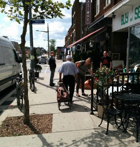
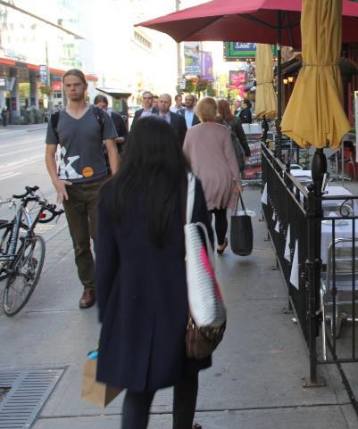
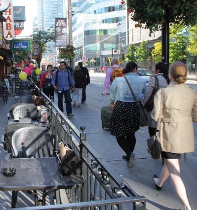
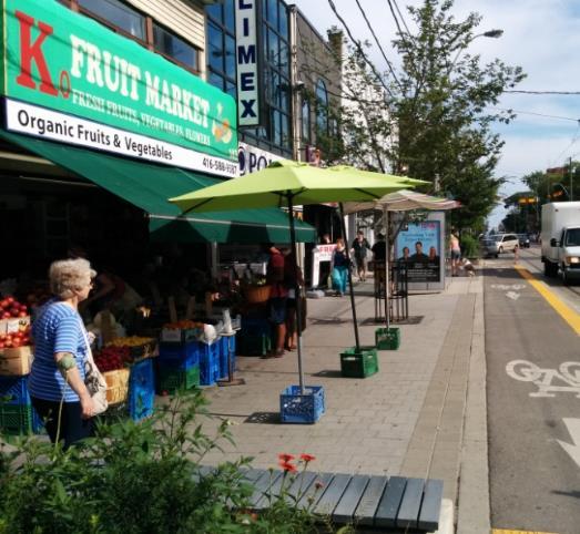
2 Wall of Shame
3 The Legacy of Metropolitan Toronto s First Chairman: Frederick Big Daddy Gardiner Mr. Gardiner was a student of highway engineering and an unabashed fan of big, wide roads, which he argued were essential to knitting together his booming fiefdom. He once said he would cut five or six feet off many sidewalks just to make wider streets. When critics complained he would ruin neighbourhoods, he replied: There have got to be a few hallways through living rooms if we are going to get our metropolitan arterial system built. Globe & Mail, Marcus Gee, May 29, 2015
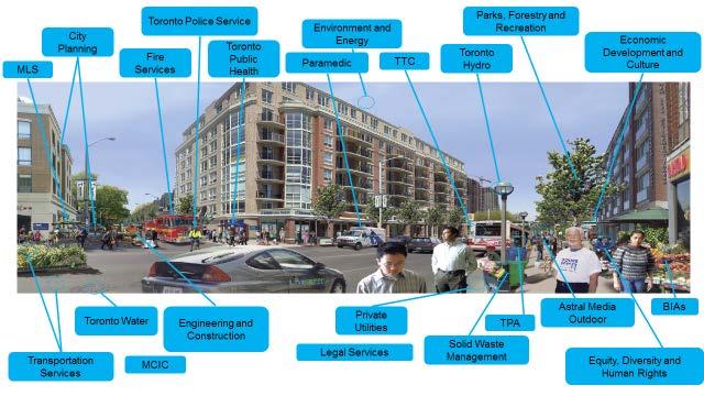
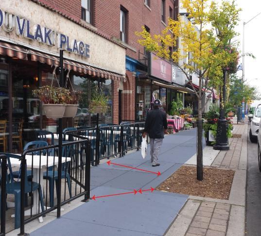
4 Many Demands on a limited right-of-way Pedestrians Lay-by Lanes Hydro/Traffic Poles Bicycles AODA Ramps Gas Meters Transit Transit Stops and Shelters Utility Vaults Cars Taxi and Valet Zones Parking Meters Delivery Trucks Bicycle Racks Vendors Courier Services Parked Cars Newspaper Boxes Emergency Vehicles Construction Cafes Green Infrastructure Waste Collection Sandwich Boards Trees and Planters Fire Hydrants Driveways Street Furniture
5 5
6 Inter-Related Policies Policies & Strategies Provincial Policy Statement Provincial Growth Plans Regional Official Plans Official Plans Transportation Master Plans (not all municipalities have one) Active Transportation Master Plan (not all municipalities have one) Design Guidelines & Standards TAC Geometric Design Guidelines Highway Capacity Manual, Highway Safety Manual Ontario Highway Traffic Act Ontario Provincial Standards for Roads Ontario Traffic Manual Municipal Class EA Road Classification Accessibility for Ontarians with Disabilities Act - Standards TIS Guidelines / Development Review Engineering and Construction Standards Municipal Streets Bylaws Operations Practices & Regulations Traffic Services Operating Practices Road safety reviews and audits Right of Way / Road Ops truck turning templates ROW street occupancy permits Parking Bylaws / Speed Limits / Other Regulations Transit Operations Fire services or emergency medical services access How streets are planned, designed and operated


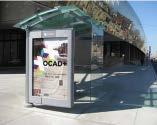
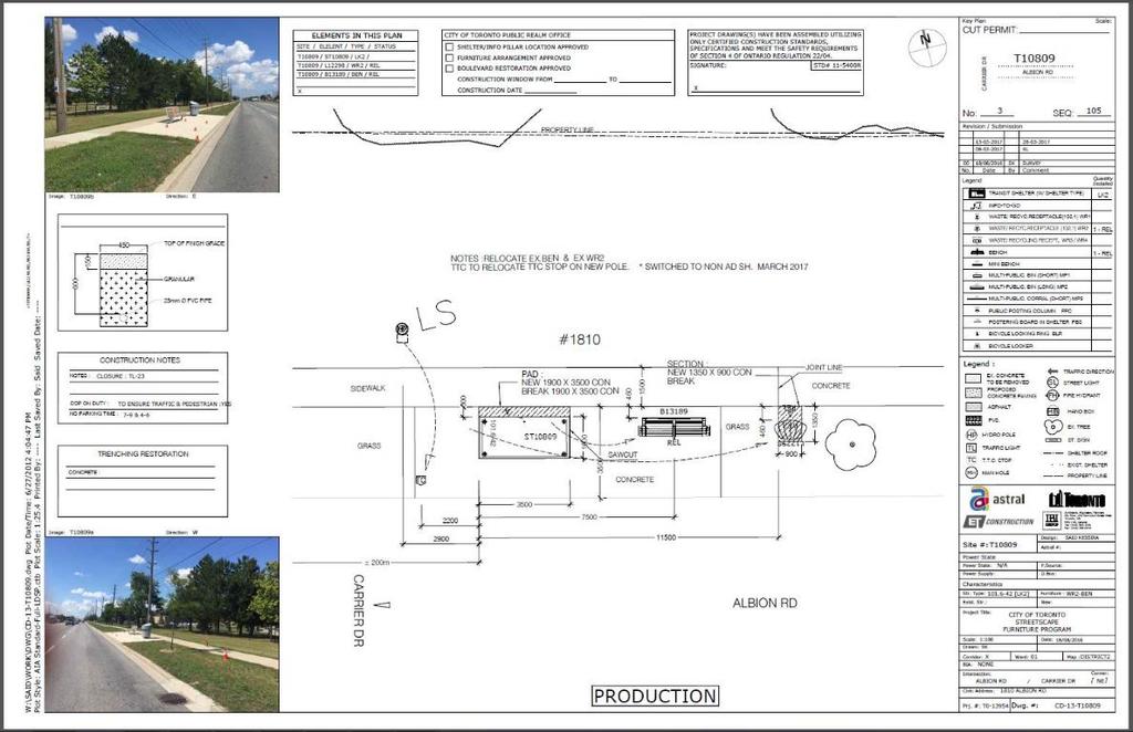
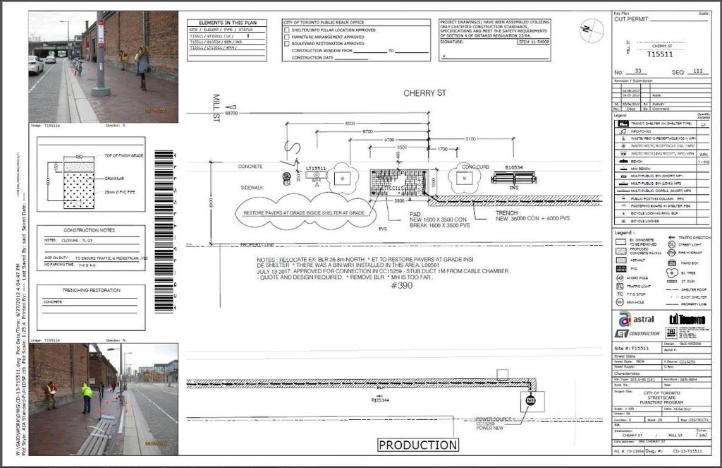
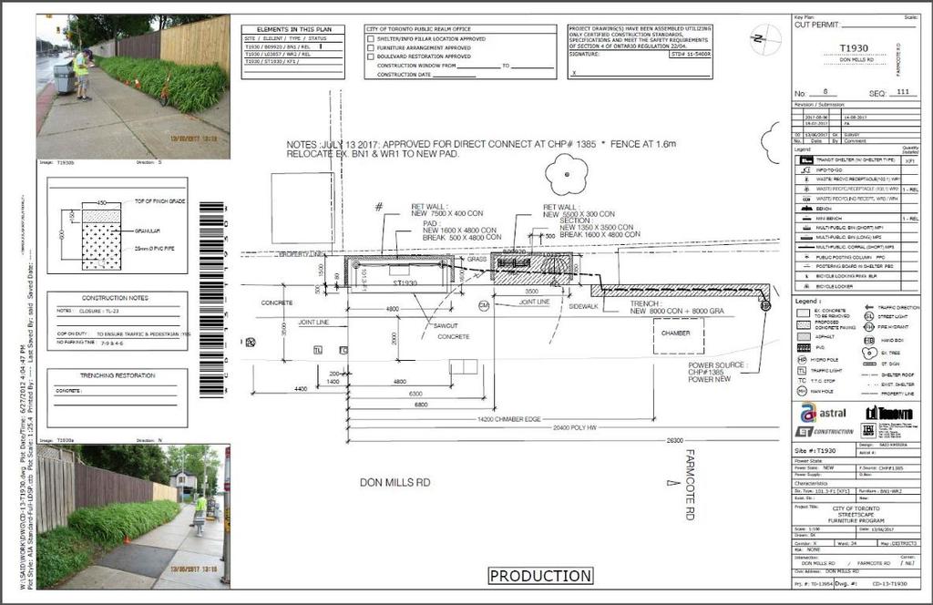
7 Toronto s Street Furniture Program
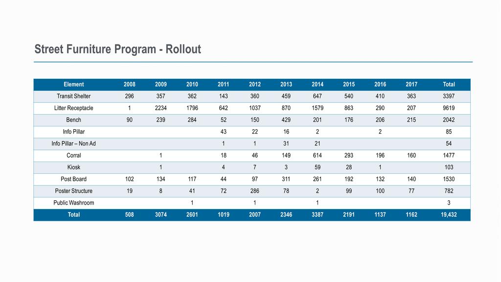
8
9
 or quality@astral.com City of Toronto Survey and identify furniture locations Agreement management, monitor performance Public 311 or streetfurniture@toronto.")
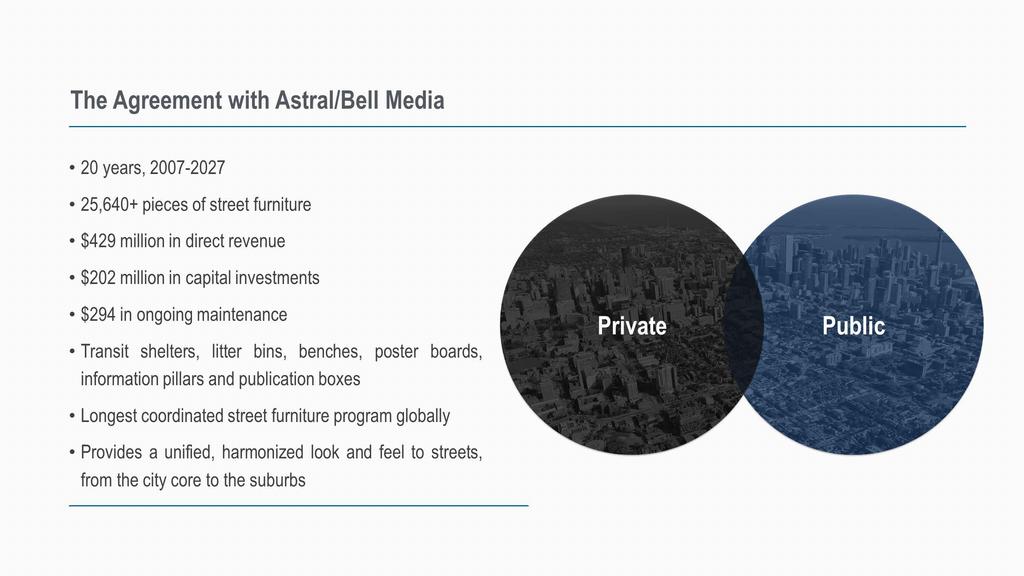
10 Partnership with Astral/Bell Media Consolidation of previous street furniture contracts Bell Astral Media: Install, maintain and own elements Advertising exclusivity Revenue sharing with the City Public: ASTRAL ( ) or City of Toronto Survey and identify furniture locations Agreement management, monitor performance Public 311 or Joint Decisions Element design and quantities Street Furniture Program Overview
11


12 Making Advertising Work on City Streets Approach to advertising on transit shelters originated in France in the 1960 s, started in Toronto in the late 1970s. Amount of advertising permitted on Toronto city streets 198,000 sq. ft. Street furniture contract acts as the City s policy on advertising on city streets no other advertising permitted. Takes the advertising that was once on litter bins and benches and consolidates it into a higher quality product. Modification to Street Furniture contract in Year 7 provided a limited amount of digital advertising, with up to an additional $16.M over the life of the contract


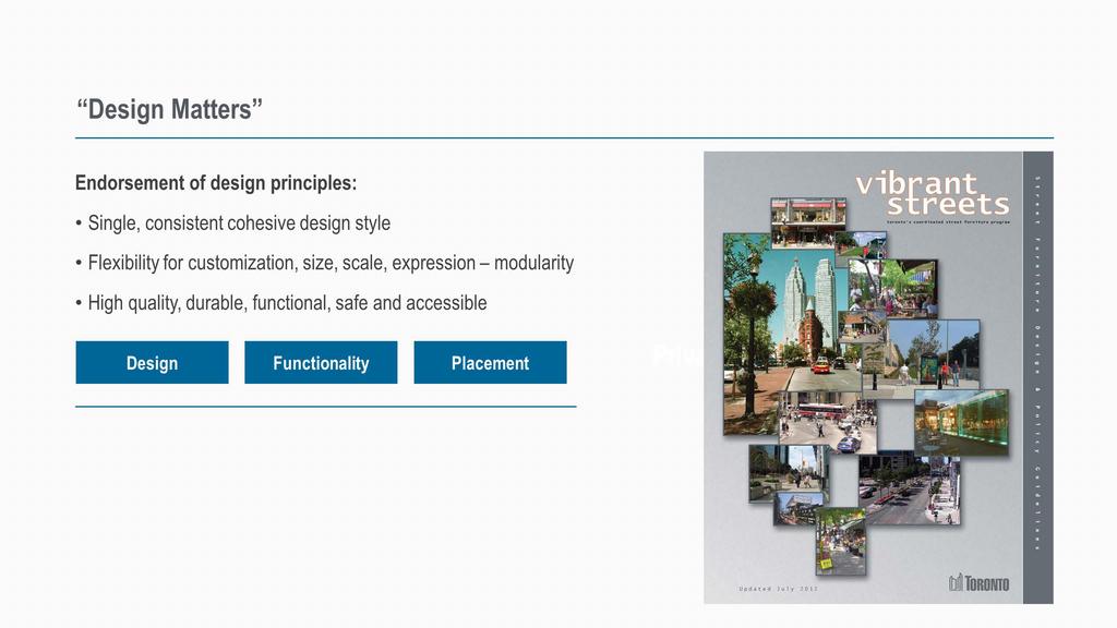
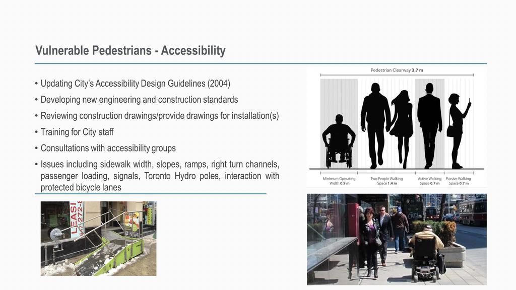
13 Vibrant Streets Placement Guidelines BUT THIS IS NOT A STREET Edge Zone Pedestrian Clearway Furnishing and Planting Zone Edge Zone Pedestrian Clearway Furnishing and Planting Zone Green Street Preferred Location Green Street Alternate Location
14 Transit Shelter Types Basic Shelter with Ad Caisson Front Access Basic Shelter with Solar Ad Caisson Rear Access Basic Shelter with Solar Powered Security Lighting - Rear Access Type Q10-SA Residential Shelter 4 Post with Ad Caisson Rear Access Type RN2 Rear Access
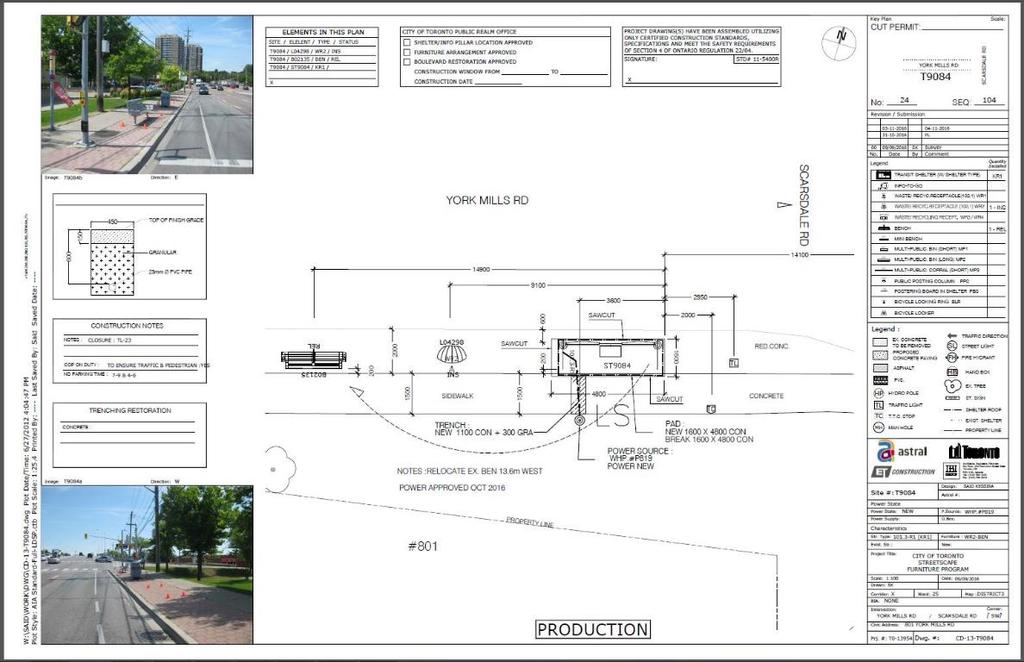
15 100 Specification pages for elements and varied conditions


16 Publication Box Licensing: Migrations Corral Kiosk


17 Shelter Conversion: College and Dufferin Streets Before After


18 Post and Ring Bicycle Parking Program 17,000 bicycle rings on city streets Contract for 1000 each year 500 new and 500 repairs Development of Bicycle Parking Strategy is underway
19


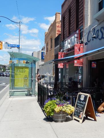
20 Café Guidelines Narrow pedestrian clearways Pedestrians forced to weave Busy sidewalks Café encroachments around sidewalk cafes
")
21 Wayfinding System Toronto 360 Phase Two Pedestrian Wayfinding System Map Design Signage Product Design Financial District Pilot Project +UPExpress, TTC Pilot Project Evaluation Placement Guidelines Highway Destination Signage Policy Bicycle Wayfinding Strategy Phase Three Citywide roll-out over next 5 years Consistent citywide and local maps for range of uses (e.g. cycling, tourism, parks) Digital strategy roll-out 600 signs (totems, fingerposts, wall mounted) 4,800 bus shelters + Astral Info-pillars BIAs, BikeShare stations, TTC stations, Crosstown PTIF funding


22 Wayfinding System Toronto 360 Accessible: Place signage to support universal accessibility. Unobstructed: Maintain a distinct, liner pedestrian clearway, and avoid creating physical obstructions. Visible: Place signage in a manner that is prominent and clearly visible in the urban realm. Placement Goals Coordinated: With applicable policies, other elements, and the physical context Site Responsive: Place signage in a manner that is responsive to specific site conditions Uncluttered: Identify opportunities to relocate obsolete structures near the wayfinding signage
23 Some Solutions?
 Clustering with space for")


24 Buy It Extend public right-of-way Required exemption to buy land without environmental due diligence (up to 540 square feet) Clustering with space for litter bins (need to Protect Ad Face) Land required from 85 to 290 square feet Land cost from $28 to $235 per square feet (so far not sure where price tolerance is, but not $235 per square feet) Negotiation some property owners request additional public realm enhancements Complications Easements, underground utilities

25 Redesign It


26 Developing Visual Acuity and Best Practice
27 Beautify It
28 The Future (or what I would like to see) Working from the same plan/drawings Education, shared values and agency alignment Willingness to make tough decisions

29 GET IN TOUCH Elyse Parker Director, Public Realm Section Transportation Services, City of Toronto
Street Furniture Update 2016 Rollout and Publication Boxes. Ryan Lanyon February 16, 2016
 Street Furniture Update 2016 Rollout and Publication Boxes Ryan Lanyon February 16, 2016 Introduction Who am I? Cycling NGO City of Ottawa Smart Commute Metrolinx City of Toronto GM s Office Street Furniture
TORONTO COMPLETE STREETS GUIDELINES
 TORONTO COMPLETE STREETS GUIDELINES Presentation by Fiona Chapman, Manager, Pedestrian Projects Public Realm Section, Transportation Services, City of Toronto June 2017 PURPOSE OF THE PROJECT To develop
Toronto Complete Streets Guidelines
 c. DTAH 58 60 3.1 70 3.2 Performance Measurement 71 3.3 Exceptions Chapter 3 describes the five general steps in the street design process. Not all projects follow these steps, as the number of steps and
STREETSCAPE MANUAL ONLINE TRAINING SESSION 3: Decision-Making
 TRAINING SESSION 3: The Urban Design Streetscape Manual is a reference tool developed to help implement City policy and guide the design, construction and maintenance of streetscape improvements in Toronto.
Streets for People, Place-Making and Prosperity. #TOcompletestreets
 COMPLETE STREETS FOR TORONTO Streets for People, Place-Making and Prosperity COMPLETE STREETS: A NEW APPROACH A Complete Streets design approach considers the needs of all users people who walk, bicycle,
BATHURST QUAY NEIGHBOURHOOD PLAN IMPLEMENTATION. Streetscape & Public Realm Improvement Plan - Canada Malting Silo Site and Eireann Quay
 BATHURST QUAY NEIGHBOURHOOD PLAN IMPLEMENTATION Streetscape & Public Realm Improvement Plan - Canada Malting Silo Site and Eireann Quay Bryan Bowen, Waterfront Secretariat November 25, 2017 Presentation
2016 REVISIONS COMMENT FORM RULES AND REGULATIONS FOR CONSTRUCTION IN THE PUBLIC WAY COMMENT PERIOD: JUNE 1 TO JUNE 30, 2015
 AGENCY: 2016 REVISIONS COMMENT FORM Section Title Number Chapter 1 Introduction Comment 1.1 CDOT Mission Statement 1.2 Purpose of Rules and Regulations for Construction in the Public Way 1.3 Chicago Department
GLEN ROAD PEDESTRIAN BRIDGE ENVIRONMENTAL ASSESSMENT STUDY PUBLIC INFORMATION CENTRE #2 OCTOBER 24, 2017
 GLEN ROAD PEDESTRIAN BRIDGE ENVIRONMENTAL ASSESSMENT STUDY PUBLIC INFORMATION CENTRE #2 OCTOBER 24, 2017 Glen Road Pedestrian Bridge Class Environmental Assessment 1 WELCOME! Welcome to the second Public
URBAN DESIGN BRIEF Gordon Street City of Guelph. Prepared on behalf of Ontario Inc. March 25, Project No. 1507
 URBAN DESIGN BRIEF 1131 Gordon Street City of Guelph Prepared on behalf of 1876698 Ontario Inc. March 25, 2016 Project No. 1507 423 Woolwich Street, Suite 201, Guelph, Ontario, N1H 3X3 Phone (519) 836-7526
3 Development Process 3.1 Stage One page Stage Two page Stage Three page CENTRAL PICKERING DEVELOPMENT PLAN
 3 Development Process 3.1 Stage One page 24 3.2 Stage Two page 25 3.3 Stage Three page 28 22 CENTRAL PICKERING DEVELOPMENT PLAN The Central Pickering Development Plan establishes the key elements of new
Welcome. Walk Around. Talk to Us. Write Down Your Comments
 Welcome This is an information meeting introducing the applications for proposed redevelopment of the Yorkdale Shopping Centre site at 3401 Dufferin Street and 1 Yorkdale Road over the next 20+ years,
SOUTH UNIVERSITY Street Design Alternatives in Progress
 1 Alternatives in Progress 2016.01.20 Meeting Agenda 2 1. Progress & Schedule 2. Utilizing the Street Design Manual 3. Site Characteristics and Input Received 4. Street Geometry What can we accomplish
Mixed Use Centres Development Permit Guidelines
 1 Mixed Use Centres Development Permit Guidelines Area Commercial or Mixed Use development occurring in City Centre, Urban Centre, Neighbourhood Centre, or Institutional Complex land use designations is
toronto's coordinated street furniture program
 S t r e e t toronto's coordinated street furniture program F u r n i t u r e D e s i g n & P o l i c y G u i d e l i n e s Updated July 2012 Toronto s Coordinated Street Furniture Program Design and Policy
St. Clair Avenue West Area Transportation Master Plan
 1 (Between Keele Street and Old Weston Road) Public Information Centre 1 December 2, 2015 2 Welcome Welcome to the first Public Information Centre for the St. Clair Avenue West Area. The panels will present
Don Mills Crossing Study and Celestica Lands Development Application Community Meeting, Open House, and Breakout Discussions
 Consultation Summary Don Mills Crossing Study and Celestica Lands Development Application Community Meeting, Open House, and Breakout Discussions This report is not intended to provide a verbatim transcript
Allen Street Civic District Redevelopment Area Plan Redevelopment Plan & Proposal State College Planning Commission State College Redevelopment
 Allen Street Civic District Redevelopment Area Plan Redevelopment Plan & Proposal State College Planning Commission State College Redevelopment Authority September 17, 2015 Discussion Points Overview of
Urban Design Manual PLANNING AROUND RAPID TRANSIT STATIONS (PARTS) Introduction. Station Study Areas
 Introduction. Station Study Areas") 111111 PLANNING AROUND RAPID TRANSIT STATIONS (PARTS) Introduction The ION rapid transit system will link Waterloo, Kitchener and Cambridge through a central transit corridor (CTC). There are a number
111111 PLANNING AROUND RAPID TRANSIT STATIONS (PARTS) Introduction The ION rapid transit system will link Waterloo, Kitchener and Cambridge through a central transit corridor (CTC). There are a number
Dundas Place Flexible Street Public Information Centre
 WELCOME TO THE DUNDAS PLACE DESIGN REVEAL Dundas Place Flexible Street Public Information Centre November 8, 2017 This project is funded by the City of London with support from the Government of Canada
Toronto Complete Streets Guidelines
 Toronto Complete Streets Guidelines 108 110 7.1 Green Infrastructure Design Principles 112 7.2 Context-Sensitive Green Streets 114 7.3 Key Green Street Elements Green infrastructure refers to natural and
599 Kennedy Road - Official Plan Amendment and Zoning Amendment Application - Preliminary Report
 STAFF REPORT ACTION REQUIRED 599 Kennedy Road - Official Plan Amendment and Zoning Amendment Application - Preliminary Report Date: March 7, 2017 To: From: Wards: Reference Number: Scarborough Community
Mavis Road Class Environmental Assessment
 Mavis Road Class Environmental Assessment Public Information Centre #2 Wednesday November 9, 2016 6:00 to 8:00 p.m. Please sign in and complete a comment sheet Review the displays on your own or join in
STREETSCAPE MANUAL ONLINE TRAINING SESSION 2: Searching the Manual
 TRAINING SESSION 2: The Urban Design Streetscape Manual is a reference tool developed to help implement City policy and guide the design, construction and maintenance of streetscape improvements in Toronto.
University of the District of Columbia Van Ness Campus Master Plan Community Open House 3. December 8, 2010
 University of the District of Columbia Van Ness Campus Master Plan Open House 3 December 8, 2010 Introductions Sequence of Work: Campus Master Plan BEGIN: INTRODUCE AND START WORK Project Initiation Team
STREETSCAPE MANUAL ONLINE TRAINING SESSION 2: Searching the Manual
 TRAINING SESSION 2: The Urban Design Streetscape Manual is a reference tool developed to help implement City policy and guide the design, construction and maintenance of streetscape improvements in Toronto.
Cit of Kitchener Ur 6 an Design Manual PARTA. Desi n for _--::
 Cit of Kitchener Ur 6 an Design Manual Date PARTA Year ) Desi n for k Nodes Corridors _--:: Section Page 01 of 12 2 INTRODUCTION Purpose & Application Nodes and Corridors have been identified as key intensification
THE CITY OF VAUGHAN BY-LAW BY-LAW NUMBER A By-law to adopt Amendment Number 1 to the Official Plan of the Vaughan Planning Area.
 THE CITY OF VAUGHAN BY-LAW BY-LAW NUMBER 015-2014 A By-law to adopt Amendment Number 1 to the Official Plan of the Vaughan Planning Area. NOW THEREFORE the Council of the Corporation of the City of Vaughan
STREETSCAPE MANUAL ONLINE TRAINING SESSION 1: Background
 TRAINING SESSION 1: The Urban Design Streetscape Manual is a reference tool developed to help implement City policy and guide the design, construction and maintenance of streetscape improvements in Toronto.
Fifth and Detroit Street Design May 2017 Capital Improvements Committee. DOWNTOWN Street Design
 1 Fifth and Detroit Street Design May 2017 Capital Improvements Committee Agenda 2 Review Street Configuration Prior Meeting Review Outreach Synopsis Functional Street Design Refinements Curb Edge, Turning
P A R K L E T 2016 PILOT PROJECT
 GRAND FORKS, NORTH DAKOTA P A R K L E T 2016 PILOT PROJECT City of Grand Forks Planning & Community Development Department LIVE, LEARN, WORK, PLAY, AND STAY The purpose of the Grand Forks Parklet Application
Maintenance Fees for Pavers on City Streets
 PW17.7 REPORT FOR ACTION Maintenance Fees for Pavers on City Streets Date: November 3, 2016 To: Public Works & Infrastructure Committee From: Acting General Manager, Transportation Services Wards: All
Access Management: An Overview
 Figures 1-5 Below Evolution of development along a highway. In the early stages, land along the road is used for farming with little traffic generated. As time passes, the highway corridor becomes a de
MASTER PLAN QUEEN ST. WEST BIA
 QUEEN ST. WEST BIA MASTER PLAN QUEEN ST. WEST BIA EXECUTIVE COMMITTEE IN ASSOCIATION WITH PMA LANDSCAPE ARCHITECTS LTD. SWEENY STERLING FINLAYSON & CO ARCHITECTS INC. FUGITIVE GLUE MARCH 2013 4.5.4 PLAZA
Ballston Station Multimodal Study. Stakeholder Meeting October 5, 2010
 Ballston Station Multimodal Study Stakeholder Meeting October 5, 2010 Agenda Welcome and Introductions Update on Short Term Improvements Update on the Multimodal Study Recap of Goals and Key Issues Working
Toronto Complete Streets Guidelines Stakeholder Advisory Group #
 Toronto Complete Streets Guidelines Stakeholder Advisory Group #1 2015-03-24 What are Complete Streets? 2 Streets designed with all users in mind: pedestrians/those with disabilities cyclists street car
Wayfinding. North Gateway: Integrate a vertical gateway marker on the west side of Ward Street at the south corner of Vernon Street.
 3.3.6.2 Wayfinding Existing Conditions Wayfinding signage is important to direct visitors and tourists to different locations in the downtown. A significant part of the wayfinding signage in the downtown
Gas Stations ottawa.ca
 Urban Design Guidelines for Gas Stations ottawa.ca Ce document est disponible en français sur ottawa.ca. This document is available in French on ottawa.ca. Approved by City Council May 24, 2006 City of
planning toronto s downtown Parks and Public Realm Plan Request for Proposals Information Meeting Andrew Farncombe, Project Manager August 19, 2015
 planning toronto s downtown Parks and Public Realm Plan Request for Proposals Information Meeting Andrew Farncombe, Project Manager August 19, 2015 BATHURST ST Keeping Downtown a great place to live, work,
Corporate Report. Further, that Legal Services be directed to prepare the necessary amendments to the City s Delegation By-law.
 Corporate Report Report from Planning and Building Services, Planning Services Date of Report: April 27, 2016 Date of Meeting: May 16, 2016 Report Number: PBS-122-2016 File: 60.2.43 Subject: Expansion
The West Vaughan Employment Area Secondary Plan Policies
 Part 2: The West Vaughan Employment Area Secondary Plan Policies 2.1 General Policies It is the policy of Council: 2.1.1. That the West Vaughan Employment Area (the WVEA), identified on Schedule 1, will
38 Queen s University Campus Master Plan Part 1
 38 Queen s University Campus Master Plan Part 1 46 The Campus at the City Scale Chapter 4 The Campus at the City Scale 39 Queen s is an urban University centrally located in Kingston. Decisions made by
South Yonge Street Corridor
 South Yonge Street Corridor Streetscape Master Plan Study Draft Final Report Phase 3: Streetscape Master Plan and Pre-Subway Plan May 2011 Prepared by: In Partnership with: South Yonge Street Corridor
Clairtrell Area Context Plan
 Clairtrell Area Context Plan March 2005 Urban Development Services City Planning Contents 1. Introduction... 4 2. Development Structure... 6 2.1 Streets... 7 2.1.1 Sheppard Avenue and Bayview Avenue...
Director, Community Planning, Toronto and East York District
 Lower Yonge Precinct Plan Update STAFF REPORT ACTION REQUIRED Date: October 16, 2012 To: From: Wards: Reference Number: Toronto and East York Community Council Director, Community Planning, Toronto and
THE GARDEN CITY PLAN. City of St. Catharines Official Plan. City of St. Catharines
 THE GARDEN CITY PLAN City of St. Catharines Official Plan City of St. Catharines August 2010 APPROVAL INFORMATION This Official Plan of the City of St. Catharines Planning Area, known as the Garden City
8implementation. strategies
 PROGRAM STRATEGIES 8implementation strategies T he implementation actions of this chapter are designed to support and carry out the land use, economic development, transportation, urban design, and program
COMPLETE GREEN STREET CHECKLIST
 COMPLETE GREEN STREET CHECKLIST This document was developed to dissect the structure of an urban street and explore opportunities to make our streets more complete while also integrating green street strategies.
Hamilton Road Corridor Streetscape Master Plan. Open House October 4 th, 2017
 Hamilton Road Corridor Streetscape Master Plan Open House October 4 th, 2017 Agenda 1. Introductions Agenda Overview 2. Project Background 3. Existing Conditions 4. Strengths, Weaknesses, Opportunities
BUENOS AIRES: THE MICROCENTRO PLAN
 BUENOS AIRES: THE MICROCENTRO PLAN BUENOS AIRES THE MICROCENTRO PLAN Experiences and Lessons Learned _ Metropolis Meeting 2015 INCLUSION INNOVATION SUSTAINABILITY CONTENTS 1. Urban Context 2. Urban Design
DESIGN GUIDELINES FOR LARGE SIDEWALK PATIOS ON CITY PROPERTY AND SAMPLE DRAWINGS
 DESIGN GUIDELINES FOR LARGE SIDEWALK PATIOS ON CITY PROPERTY AND SAMPLE DRAWINGS For additional information: Phone: 3-1-1 (outside Vancouver, 604-873-7000) E-mail: street.activities@vancouver.ca or Visit
Arterial Mainstreets ottawa.ca
 Urban Design Guidelines for Development along Arterial Mainstreets ottawa.ca Ce document est disponible en français sur ottawa.ca. This document is available in French on ottawa.ca. Approved by City Council
THE CITY OF VAUGHAN BY-LAW BY-LAW NUMBER
 THE CITY OF VAUGHAN BY-LAW BY-LAW NUMBER 123-2013 A By-law to designate the whole of the City of Vaughan as a Site Plan Control Area, and to adopt site development guidelines and rules of procedure for
TOP TEN LIST OF COMMUNITY CONCERNS REGARDING PROPOSED AMENDMENTS TO CHAPTER 42
 TOP TEN LIST OF COMMUNITY CONCERNS REGARDING PROPOSED AMENDMENTS TO CHAPTER 42 1. Extend the urban area to Beltway 8 in stages, over say a three-year period, prioritizing development in transit and declining
Chapter PEDESTRIAN COMMERCIAL (PC) ZONING DISTRICT
 ZONING DISTRICT") Chapter 11-17 PEDESTRIAN COMMERCIAL (PC) ZONING DISTRICT Sections: 11-17-01 GENERAL PURPOSE 11-17-02 PERMITTED BUILDING TYPES 11-17-03 USES PERMITTED WITH DESIGN REVIEW 11-17-04 USES PERMITTED BY CONDITIONAL
Chapter 11-17 PEDESTRIAN COMMERCIAL (PC) ZONING DISTRICT Sections: 11-17-01 GENERAL PURPOSE 11-17-02 PERMITTED BUILDING TYPES 11-17-03 USES PERMITTED WITH DESIGN REVIEW 11-17-04 USES PERMITTED BY CONDITIONAL
West Dennis Center: Bass River to Old Main Street. West Dennis Business District: Old Main Street to Dennis Commons
 West Dennis Center: Bass River to Old Main Street West Dennis Business District: Old Main Street to Dennis Commons Dennisport Center: Dennis Commons to Division Street Main Street Project Goals Project
John M. Fleming Managing Director, Planning and City Planner. Old East Village Dundas Street Corridor Secondary Plan Draft Terms of Reference
 Report to Planning and Environment Committee To: From: Subject: Chair and Members Planning & Environment Committee John M. Fleming Managing Director, Planning and City Planner Old East Village Dundas Street
PARKLET PROPOSAL PACKAGE & PROCESS
 500.3 I PARKLETS The term parklet refers to a small temporary constructed seating or community gathering area over an on-street parking space or an extension of the sidewalk into the operating State highway
Blood Alley Square/Trounce Alley Redesign
 June 216 Kick-Off Events Questionnaire and Engagement Summary Background The City of Vancouver is redesigning Blood Alley Square and Trounce Alley, important public spaces in the heart of Gastown, which
2900 Steeles Avenue East at Don Mills Road in the Town of Markham
 STAFF REPORT INFORMATION ONLY 2900 Steeles Avenue East at Don Mills Road in the Town of Markham Date: January 23, 2008 To: From: Wards: Reference Number: North York Community Council Director, Community
Chairman and Members of the Planning and Development Committee. Thomas S. Mokrzycki, Commissioner of Planning and Building
 LA.09.TOR (Toronto) DATE: TO: FROM: SUBJECT: Chairman and Members of the Planning and Development Committee Thomas S. Mokrzycki, Commissioner of Planning and Building Central Waterfront Secondary Plan
WEST LOOP DESIGN GUIDELINES CHECKLIST
 WEST LOOP DESIGN GUIDELINES CHECKLIST Section 1.0 General Strategies 1.1 DESIGN EXCELLENCE: ENCOURAGE HIGH QUALITY AND INNOVATIVE DESIGN OF NEW BUILDINGS WITHIN THE WEST LOOP WITHOUT BEING PRESCRIPTIVE
Maplewood Avenue Downtown Complete Street Project
 Maplewood Avenue Downtown Complete Street Project Second Public Meeting January 24, 2018 Welcome and Introduction of Project Team City Planning and Public Works Staff City of Portsmouth Juliet Walker Planning
REPORT TO: Council FOR: Regular Meeting. PRESENTED: April 1, 2008 FILE: , Byl 1932 & 1936
 DISTRICT OF SQUAMISH REPORT TO: Council FOR: Regular Meeting PRESENTED: April 1, 2008 FILE: 2006-08, Byl 1932 & 1936 DEPARTMENT: Planning Department SUBJECT: First and Second Readings for Bylaws 1932 (rezoning)
4.9 Mendocino Avenue Corridor Plan Design Guidelines
 4.9 Mendocino Avenue Corridor Plan Design Guidelines The Mendocino Avenue Corridor Plan addresses the area between College Avenue and Steele Lane. Mendocino Avenue is a busy arterial that runs parallel
4- PA - LD - LIVELY DOWNTOWN. LD - Background
 4- PA - LD - LIVELY DOWNTOWN LD - Background The downtown has been the service centre for the community since the city s inception and the area continues to supply people with their personal services,
City of Dallas Complete Streets Program. SAME Infrastructure Forum February 2, 2018
 City of Dallas Complete Streets Program SAME Infrastructure Forum February 2, 2018 Complete Streets Design Manual Adopted by City Council January 27, 2016 JANUARY 27, 2016 2 What are Complete Streets?
Eglinton West LRT Update
 Eglinton West LRT Update Community Consultation Update May 16, 2016 Background Rapid transit along Eglinton Ave between Kennedy Station and Pearson Airport was included in the Metrolinx Regional Transportation
Landscape and Streetscape Design 2.5
 Landscape and Streetscape Design 2.5 2.5.1 Goals 2.5.2 Planting 2.5.3 Sidewalks and Pavement 2.5.4 Furnishings 2.5.5 Walls 2.5.6 Lighting 2.5.7 Stormwater 2.5.8 Street Cross Sections 2.5 LANDSCAPE AND
1296 Kennedy Road - Zoning Amendment Application - Preliminary Report
 STAFF REPORT ACTION REQUIRED 1296 Kennedy Road - Zoning Amendment Application - Preliminary Report Date: January 15, 2016 To: From: Wards: Reference Number: Scarborough Community Council Acting Director,
Urban Design Guidelines for Large-Format Retail
 Urban Design Guidelines for Large-Format Retail May 2006 Compte tenu de la nature de ce document, il n'est disponible qu'en anglais. La Ville pourra, sur demande, traduire ce document au complet ou en
City of Hermosa Beach Administrative Policy #
 City of Hermosa Beach Administrative Policy # SUBJECT: Living Streets Policy Date: Approved by: City Council Authority: Public Works Department & Community Development Department Mayor, PURPOSE The City
CITY OF VAUGHAN EXTRACT FROM COUNCIL MEETING MINUTES OF NOVEMBER 15, 2016
 Item 11, Report No. 38, of the Committee of the Whole, which was adopted without amendment by the Council of the City of Vaughan on November 15, 2016. Regional Councillor Di Biase declared an interest
Glen Road Pedestrian Bridge Environmental Assessment
 Glen Road Pedestrian Bridge Environmental Assessment Presentation to Design Review Panel July 18, 2017 Glen Road Pedestrian Bridge Class Environmental Assessment STUDY AREA Bloor Street East Streetscape
TRANSPORTATION ELEMENT GOALS, OBJECTIVES, AND POLICIES
 TRANSPORTATION ELEMENT GOALS, OBJECTIVES, AND POLICIES GOAL 2 The City shall provide a safe, convenient, effective, and energy efficient multimodal transportation system which is coordinated with the Future
Lambeth Main Street Streetscape Improvements
 Lambeth Main Street Streetscape Improvements Open House October 5th, 2017 Agenda 1. Introduction 2. Project Background 3. Context 4. Project Objectives 5. Design Principles & Approach 6. Streetscape Design
providing proof of liability insurance, indemnifying the City from any claims or liabilities arising from use of City property.
 Sidewalk Café Guidelines The following Guidelines provide standards for the design, establishment and maintenance of Sidewalk Cafés in Edmonton. The intent is to encourage the use of public spaces to advance
DRAFT. 10% Common Open Space
 % OF CHARLOTTE IS CATEGORIZED AS A. LAND USES : Placeholder map displaying location of Place Type GOALS: Accommodate XX% of future growth. Provide a concentration of primarily commercial and civic activity
Commercial Development Permit Area
 City of Kamloops KAMPLAN Commercial Development Permit Area PURPOSE The purpose of this Development Permit Area (DPA) is to establish objectives and provide guidelines for the form and character of commercial
PUBLIC RIGHT-OF-WAY IN THIS CHAPTER PUBLIC REALM
 PUBLIC RIGHT-OF-WAY This section provides design guidelines for improvements in the public right-of-way. The public right-of-way refers to streets, sidewalks, non-vehicular thoroughfares, parks and greenways
Ann Arbor Downtown Street Design Manual. Ann Arbor DDA IDA 2015 Awards Planning Category
 Ann Arbor Downtown Street Design Manual Ann Arbor DDA IDA 2015 Awards Planning Category 1 Ann Arbor s downtown streets are vibrant public spaces that accommodate multi-modal transportation, special events,
PORT WHITBY COMMUNITY
 PORT WHITBY COMMUNITY SECONDARY PLAN UPDATE COMMUNITY IMPROVEMENT PLAN URBAN DESIGN GUIDELINES September 2015 DRAFT PROPOSED AMENDMENT NUMBER # to the Whitby Official Plan PURPOSE: The intent of this Amendment
I voice my concerns with regard to the Mobility Plan, specifically with regard to the following issues and statements in the Plan:
 Adam Lid Council File # 15-0719: Mobility Plan Hearing: 8/4/15: 2:30 PM 1 message RJ STROTZ Reply-To: RJ STROTZ To: "Adam.Lid@lacity.org"
CARVER COUNTY DIVISION OF PUBLIC WORKS LANDSCAPE POLICY. Adopted by the Carver County Board of Commissioners March 3, 2015
 CARVER COUNTY DIVISION OF PUBLIC WORKS LANDSCAPE POLICY Adopted by the Carver County Board of Commissioners March 3, 2015 Policy Statement Goals It is the goal of Carver County Public Works to provide
Chapter 14 Streetscape Improvements
 This chapter presents streetscape design concepts for key streets and gateways in the Downtown Specific Plan area. This chapter is organized as follows: 14 Streetscape Improvements 14.1 Streetscape Treatments
Attachment 1 TOWN OF NEW TECUMSETH. Manual for the Preparation of an Urban Design Report
 Attachment 1 TOWN OF NEW TECUMSETH Manual for the Preparation of an Urban Design Report July 2010 TABLE OF CONTENTS Background, Policy Framework and the Preparation of Urban Design Reports 1. Introduction
THE CORPORATION OF THE TOWN OF OAKVILLE BY-LAW NUMBER
 THE CORPORATION OF THE TOWN OF OAKVILLE BY-LAW NUMBER 2017-120 A by-law to adopt an amendment to the Livable Oakville Plan, Official Plan Amendment Number 20 (Downtown Oakville Growth Area) WHEREAS the
COMMUNITY DESIGN. GOAL: Create livable and attractive communities. Intent
 COMMUNITY DESIGN Intent An attractive, well-designed County will attract quality development, instill civic pride, improve the visual character of the community, and create a strong, positive image for
2.5 Roads. Loading and service areas adjacent to Highway 401 should be screened through architectural walls and/or landscape buffer planting.
 N HIGHWAY OFF RAMP 2.5 Roads A legible road network with a clear hierarchy will help create a connected community, both within and surrounding the Milton Heights. The following section outlines the proposed
Trafalgar Road Corridor Planning Study Open House
 Trafalgar Road Corridor Planning Study Open House June 24, 2013 6:30-8:30 p.m. Oakville & Trafalgar Rooms Overview The Livable Oakville Plan identifies the lands along Trafalgar Road, between the QEW and
Streets Vision
 streets 86 2.9 Vision : The Most Prevalent and Important Public Spaces Fixed routes of human travel have served as corridors for commerce and places for human interaction from the earliest trails and foot
URBAN DESIGN BRIEF URBAN DESIGN BRIEF 721 FRANKLIN BLVD, CAMBRIDGE August 2018
 URBAN DESIGN BRIEF URBAN DESIGN BRIEF 721 FRANKLIN BLVD, CAMBRIDGE August 2018 DESIGN BRIEF CONTENTS PART A 1.0 INTRODUCTION 2.0 DESCRIPTION & ANALYSIS OF SITE CONTEXT 3.0 DESIGN CONSTRAINTS AND OPPORTUNITIES
5.0 WAYFINDING STREETSCAPE DESIGN MASTER PLAN 55
 OVERVIEW 57 SIGN TYPE A: GATEWAY 57 SIGN TYPES B & C: WAYFINDING KIOSKS & BOLLARDS 58 SIGN TYPES D: POLE MOUNTED ELEMENTS 59 SIGN TYPE E: LARGE-SCALE TYPOGRAPHIC INSTALLATION 60 SIGN TYPE F: VERTICAL CHOPSTICKS
Broadview Avenue Zoning Amendment Application Final Report
 STAFF REPORT ACTION REQUIRED 796-802 Broadview Avenue Zoning Amendment Application Final Report Date: May 26, 2017 To: From: Wards: Reference Number: Toronto and East York Community Council Director, Community
PROPOSED REDEVELOPMENT OF THE GLEN ABBEY GOLF CLUB. STREETSCAPE DESIGN STUDY (excerpt from the Urban Design Brief) TOWN OF OAKVILLE.
 TOWN OF OAKVILLE.") PROPOSED REDEVELOPMENT OF THE GLEN ABBEY GOLF CLUB STREETSCAPE DESIGN STUDY (excerpt from the Urban Design Brief) TOWN OF OAKVILLE OCTOBER, 2016 for 2.4.2 STREETS Streets are the single largest component
PROPOSED REDEVELOPMENT OF THE GLEN ABBEY GOLF CLUB STREETSCAPE DESIGN STUDY (excerpt from the Urban Design Brief) TOWN OF OAKVILLE OCTOBER, 2016 for 2.4.2 STREETS Streets are the single largest component
Monroe Street Reconstruction. Business Roundtable March 29, 2017
 Monroe Street Reconstruction Business Roundtable March 29, 2017 Thank you to HotelRED and Roman Candle Pizza! Tonight s Agenda 1. Monroe Street Business Strategy Overview 2. Reconstruction Project Scope
Silverdale Regional Center
 Silverdale Regional Center Vision for Silverdale Regional Center The Silverdale Regional Center Plan (Plan) will guide the evolution of the Silverdale Regional Center from a collection of strip malls and
REVISED AGENDA MATERIAL
 [First Last name] Councilmember District [District No.] REVISED AGENDA MATERIAL Meeting Date: March 15, 2015 Item Number: 7 Item Description: Adopt a First Reading of an Ordinance Revising BMC 14.48.200
DOWNTOWN JACKSONVILLE MASTER PLAN S T R E E T H I E R A R C H Y
 DOWNTOWN JACKSONVILLE MASTER PLAN S T R E E T H I E R A R C H Y Gateway Intra-District Business Inter-District 44 CELEBRATING THE RIVER: A PLAN FOR DOWNTOWN JACKSONVILLE The Transportation Network This
Completing the Vision:
 Completing the Vision: North A1A-Lane Reconfiguration TDLC-Transportation Design for Liveable Communities Surf Rd. Redirection of Traffic Phase III Streetscape October 30, 2012 1 Project Overview District
Mark-up of the effect of the proposed Bronte Village Growth Area OPA No.18 on the text of section 24, Bronte Village, of the Livable Oakville Plan
 Mark-up of the effect of the proposed Bronte Village Growth Area OPA No.18 on the text of section 24, Bronte Village, of the Livable Oakville Plan Notes: This document is provided for information purposes