Burnside Gorge Neighbourhood Plan. Engagement Summary
|
|
|
- Theodore Bennett
- 5 years ago
- Views:
Transcription

1 Burnside Gorge Neighbourhood Plan Engagement Summary
2 Table of Contents Engagement Summary... 3 Phase One Engagement (April May 2015)... 4 Phase Two Engagement (January March 2016)... 4 Appendix One: Summary of Urban Design Workshop FOR MORE INFORMATION: City of Victoria E engage@victoria.ca 1 CENTENNIAL SQUARE, VICTORIA, BC V8W 1P6 victoria.ca/burnside

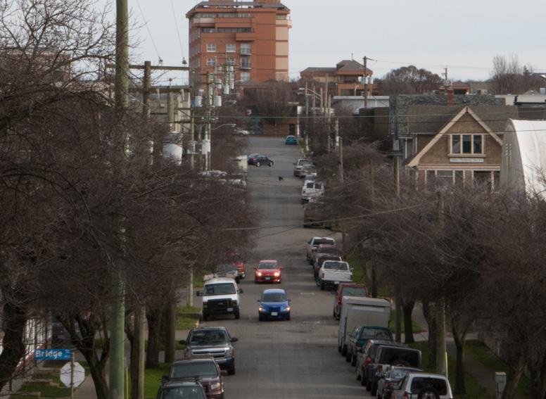
3 Engagement Summary Burnside Gorge is one of Victoria s most diverse neighbourhoods in terms of land use, with residential areas to the west, the City s largest industrial and general employment areas stretching to the Downtown, and the Douglas corridor. From April 2015 to March 2016, the City engaged over 1,500 people (1,000 in Phase 1,500 in Phase 2) through 42 events on the future of their community. The community s feedback was used to develop their neighbourhood plan which will help guide future growth and development. The plan includes short term improvements to be done over the next three to five years. Top Ten Desired Improvements The community s hopes for their community are best summed up by the results of their top ten desired improvements: 1. Better waterfront access and paths 2. Improvements to roads to better support people who walk and bicycle 3. Provide diverse housing choices 4. Enhance street design (sidewalks, benches, lamps, landscape, banners, etc.) 5. Spaces for gathering, events and festivals (such as a festival street, plaza or bandshell) 6. Continue restoration of shoreline habitat 7. Trees and greenery within neighbourhood 8. Investment in parks and playgrounds 9. Green infrastructure on streets, parks or public spaces to improve water quality 10. Conservation of heritage city of victoria Burnside Gorge Neighbourhood Plan Engagement Summary 3

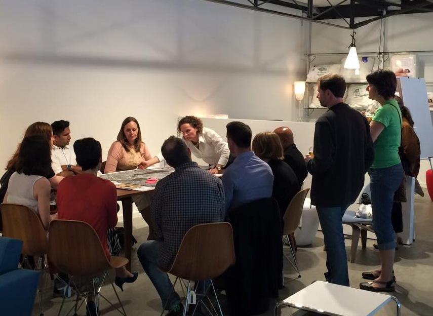
4 Phase 1 Engagement (April May 2015) In the spring of 2015 more than 1,000 citizens provided input through a number of events held in the community, including both City and citizen-led workshops, meetings with key stakeholder groups, and an online survey. Engagement focused on identifying community values, local issues, and opportunities specific to the Burnside Gorge area. This included more than 70 face-to-face interactions, more than 300 surveys and 2,300 interactions on social media. What We Did Advisory Group Seven pop-up booths at festivals and community-gathering spots: 325 people Community-led and City workshops: 151 people Three Walking Tours: 20 people Online survey: 300 people Stakeholder meetings: 168 people Direct outreach to businesses: 50 people What We Heard Need to knit the neighbourhood together: walking and cycling for all ages Waterfront is key: ensure public access The Galloping Goose is an asset: needs to be connected The neighbourhood needs a heart : more shopping and services as part of an urban village Seek opportunities for additional multi-unit housing & mixed use development Ensure access to parks, green space, recreation Keep the neighbourhood family-friendly Support industry and artisans Proactively address social issues Celebrate and preserve heritage Phase 2 Engagement (January March 2016) In the second phase of engagement, the community was presented with multiple options for future change and growth based around five theme areas that emerged from feedback collected in Phase 1: Transportation & Mobility Parks, Recreation & Trails Urban Villages Housing Employment Lands: Commercial Industrial What We Did Open Houses: 130 people Neighbourhood Walks: 25 people Survey: 235 people 3 Urban Design workshops: 50 people Facilitated by urban designers, led by Frank Ducote Create future scenarios Focus areas: - Urban village and residential areas - Rock Bay - Douglas corridor 4 Burnside Gorge Neighbourhood Plan Engagement Summary city of victoria

5 What We Heard Transportation & Mobility Participants at the Open Houses and Neighbourhood Walks provided feedback on specific measures to improve walkability and cycling routes at five key transportation corridors. Major Road Redesign Bridge Street: Between John and David Streets, Bridge Street should support the evolution of an Industrial Arts village, with a pedestrian crossing and street enhancements such as benches, lamps, and landscaping to create a sense of place. There is also strong interest in developing a bicycle route connecting to a future bridge over Rock Bay, but maintaining on-street parking is a key concern for the business district. Burnside Road: Walking comfort and safety is the primary concern, with a strong interest in adding planted boulevards separating pedestrians from traffic, improving crossings at Washington Avenue and Jutland Road, and encouraging Saanich to redesign Burnside as a two lane road east of Harriet Road. There is also interest in seeing on-street parking replaced with protected bicycle lanes. In the long term, the road may accommodate on-street parking as new development results in improvements to the road, sidewalks and landscape. Gorge Road: Bicycle safety, as well as walking comfort and safety, are both primary concerns. The current conditions make walking and cycling destinations feel farther than they actually are. In the short term, there is strong support to redesign Gorge Road to accommodate protected bicycle lanes by removing one westbound travel lane if feasible. At the same time, removing encroaching vegetation and other impediments could improve the pedestrian experience. In the long term, Gorge Road should maintain sufficient travel lanes for frequent bus transit and should add planted boulevards separating pedestrians from the street. There is interest in an improved crossing at Balfour. Government Street: There is strong support for removing one lane of traffic and creating protected bicycle lanes, connecting to Gorge Road and thus linking the western parts of Burnside neighbourhood to the Downtown. This option retains on-street parking. Government Street is envisioned as a Main Street with adjacent businesses, large canopy trees, and funky public art and street furniture south of Pembroke Street. Jutland Road: Because of Jutland Road s role as a business street, a balance is sought between bicycle improvements and retaining on-street parking. Crossings at Burnside and Gorge road need improvements for pedestrian comfort. In the long-term, Jutland road can be designed as a Main Street with adjacent business, bicycle lanes, on-street parking and attractive sidewalks. city of victoria Burnside Gorge Neighbourhood Plan Engagement Summary 5

6 Trail Connections Enhance connections from Galloping Goose to the neighbourhood Create a bicycle and pedestrian connections from Washington Avenue to Balfour Complete waterfront walkway, starting with a bicycle and pedestrian connection from the Galloping Goose to Arbutus Park Bicycle connection through Rock Bay desired Parks, Recreation, Trails Engagement focused on waterfront improvements, support for recreational activities and general expansion of green space. Waterfront is key asset Top activities desired: Kayaking (launch) Other boating Swimming Walking Improve Arbutus Park Strong support Families / Picnics / Dogs / Nature / Water access / safety Small park at Harriet Support Water access, not just overlook More spaces to play More green/open space in general (majority of residents in multi-unit housing) Green space at Burnside School site 6 Burnside Gorge Neighbourhood Plan Engagement Summary city of victoria
7 Urban Villages Retail analysis shows that based on expected growth, the neighbourhood could support one large and one small urban village, totaling 2 3 blocks of retail frontage. Based on feedback in Phase 1, two potential locations for a mixed-use large urban village, and two potential locations for a smaller urban village were presented. Two possible large urban village locations were presented Selkirk and Cecelia-Jutland: 55 60% preferred Gorge Road: 40 45% preferred Most survey respondents supported both locations At the Open House, it was made clear that the neighbourhood could only support one large urban village Urban design participants focused on the Selkirk and Jutland-Cecelia area. However, participants noted that this location should be supplemented by a village located further west on Gorge Road. Complete Selkirk Village with a blend of work and compatible residential uses above, including new development incorporating a new Legion Hall. Two potential small urban village locations Housing There was strong interest in further developing Burnside at Harriet village There was less support for Gorge at Harriet location due to concerns for the pedestrian comfort at this intersection, with many stakeholders suggesting a location closer to the Gorge Road Hospital Engagement in this theme area centered on where additional housing and greater density would be supported. Urban Housing 4 5 storeys acceptable along Burnside and Gorge, Cecelia-Jutland area 4 8 storeys acceptable adjacent to Selkirk Village storeys acceptable at Mayfair and Humber Green Humber Green as mixed use Housing Diversity Residential-above-industrial at edges of Rock Bay near Downtown and Selkirk Village Townhomes appropriate in traditional residential areas Cottage clusters and courtyard housing acceptable west of Cecelia Ravine Affordability is a concern Caution about converting motels to single occupant units Allow a range of low-rise multi-family development and townhomes in the residential areas southeast of Jutland Road, with a focus on Manchester Road as a greenway city of victoria Burnside Gorge Neighbourhood Plan Engagement Summary 7
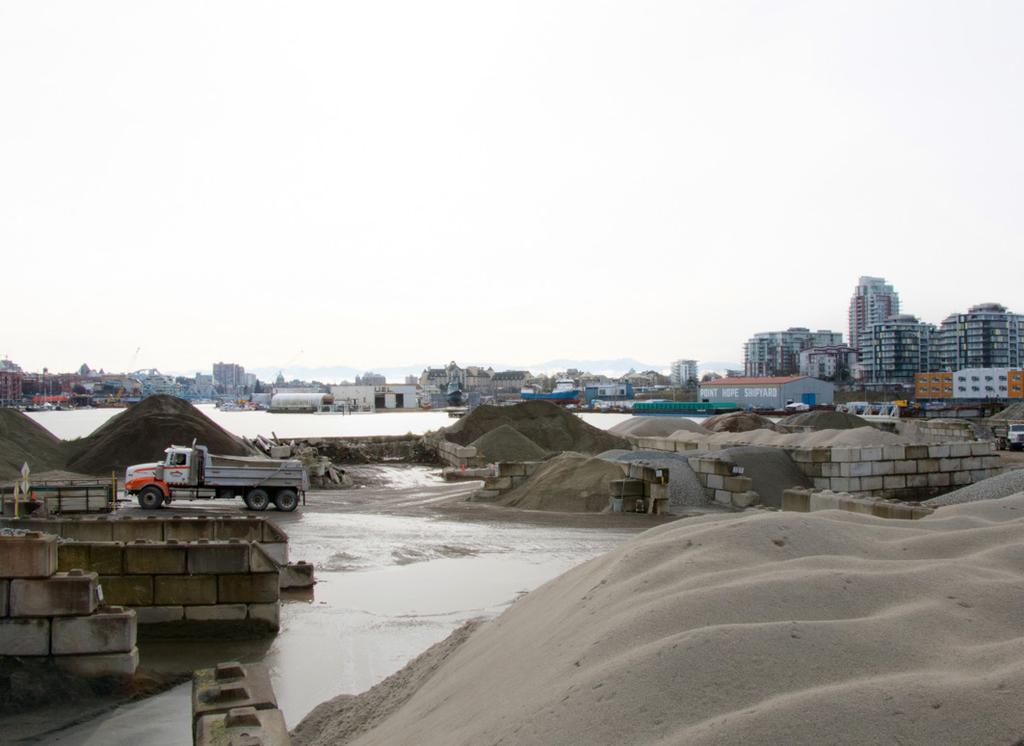
8 Commercial/Industrial Engagement centered on how to best support commercial activity, focusing on the light industrial businesses and artisans who cluster in the Rock Bay area. Land use regulations, public space design, amenities and business vitality policies were a focus. Participants were also asked under what conditions limited residential uses might be acceptable. Rock Bay Phase 1 input demonstrated significant support for light industrial and commercial uses in the area. Phase 2 focused on how to support commercial/industrial activity and identify compatible uses. Maintain industrial business identity Diversify range of commercial uses, without displacing Improve public or on-street parking Develop Industrial Arts villages with creative placemaking and new uses on Bridge Street and south of Pembroke Street and a festival street to support events on Discovery Street Public realm improvements (cleanup/beautification, greenery, signage) Promotion (storytelling, brochure, organization) Business incubation Residential-above-light industrial only on the edges Caution regarding public access to the waterfront and accommodating bicycles, non-compatible business and housing in what is largely a production-oriented light industrial area Urban design participants recommended new development should be encouraged with industrial businesses at ground level, accessory office or retail only, while allowing upper floors to accommodate general commercial uses up to four storeys Support for industrial arts village on Bridge street Redevelop the BC Hydro/Transport Canada lands using high level principles, including: a park at Barclay point and bridge spanning Rock Bay; an active or well-designed frontage along Pembroke Street and Government Street; viewsheds and possible public access from streets terminating opposite these lands; and the potential for waterfront walkways around Rock Bay. Douglas Corridor The charrette recommended the Douglas Corridor continue to be a focus for future employment, with opportunities for additional residential development, connectivity and public space improvements supporting the evolution of Rapid Transit in this corridor. New buildings should front onto Douglas Street to a maximum height of 15m, consistent with the downtown. There is a possibility for taller towers above to add residential development. Douglas Street from Burnside Road to Tolmie should be developed as a Main Street with smaller storefronts facing Douglas Street and the possibility for residential development above. Redevelopment of Mayfair Mall should support this vision; the Douglas-Finlayson intersection becomes a focal area for placemaking. The Douglas-Burnside intersection may become a focal point for development with a potential Rapid Transit station location (not previously identified in BC Transit study). The light industrial district around Alpha, Beta and Gamma streets is an important area for jobs, and should be retained. South of Bay Street, there are westward views from Douglas Street which should be protected. 8 Burnside Gorge Neighbourhood Plan Engagement Summary city of victoria

9 Humber Green, Mayfair and others Mayfair Area Mixed use adjacent to Mayfair Mall Connect and integrate with transit future Improved landscaping and site design Alphabet streets are important industrial lands Humber Green Where s that? Put the green in Humber Green Pedestrian improvements Mixed use is okay, more density is okay Central location for businesses North edge of Downtown Gorge Road Enhance as a tourism destination (Access the Waterway, Goose) Heritage Which heritage sites need to be protected? Conservation of key buildings Dunedin-Manchester houses Scattered houses throughout Industrial buildings Interpretation and celebration First Nations Gorge Waterway Burnside Snapshot 5860 residents 2800 households 18% have children at home (Victoria: 19%) 49% live alone (Victoria: 49%) 21% are low-income (Victoria: 21%) 60% commute by auto (Victoria: 53%) 63% rent (Victoria: 59%) 1,400 business 14,000 employees (20% of City s) city of victoria Burnside Gorge Neighbourhood Plan Engagement Summary 9
10 Appendix 1 Summary of Urban Design Workshop (Charrette) Results Three urban design workshops called charrettes were held in February and March to look at future change in land use and public space in three subareas of the Burnside neighbourhood: the urban village and residential areas to the west; the Rock Bay area; and the Douglas Corridor. The charrettes were facilitated by a team of urban designers led by Frank Ducote, and brought together stakeholders representing residents, businesses and landowners. Each charrette produced 2 3 future scenarios, which were then reported out for identification of commonalities and key themes. The urban design team then synthesized these scenarios into a single option which was presented to stakeholders for feedback the following day. The Burnside Neighbourhood Design Workshops provides more detailed recommendations which will be considered in developing policies for the Burnside Neighbourhood Plan. Urban Village and Residential Areas: The main proposal is to develop an expanded urban village extending from Selkirk Village to the Jutland- Cecelia intersection, anchored by a revitalized Burnside School Building. New opportunities for living and working would evolve around this focal point and adjacent to the existing Selkirk Village, with Jutland evolving into a pedestrian-friendly Main Street. East-west connections from Balfour Road through to Cecelia Road realize the vision of a connected neighbourhood, while new residents near Selkirk Village support more vibrant shops and services. The charrette also recommended the evolution of a smaller focal point along Gorge Road near Gorge Road Hospital. Key recommendations from the charrette include: Support the development of a village focused on the Burnside School site, with a green and possible housing on the site itself, and a High Street on Jutland Road. Support the development of an area for working and living between Burnside School and Cecelia Ravine. Allow a range of low-rise multi-family development and townhomes in the residential areas southeast of Jutland Road, with a focus on Manchester Road as a greenway. Complete east-west connections from the neighbourhood to Cecelia Ravine and Cecelia Road. Complete Selkirk Village with a blend of work and compatible residential uses above, including new development incorporating a new Legion Hall. Rock Bay Employment Lands: Rock Bay should be a place for making first, supporting a vibrant and evolving industrial district with compatible businesses and improved public space and pedestrian conditions. Key recommendations from the charrette include: Making First : Businesses that produce, distribute and repair goods and equipment cluster here, with evolving creative industries. The district should be supported as a light industrial district with harbour-oriented industries at the waterfront. Other uses should be compatible to the district s main function, without displacing it. New development should be encouraged with industrial businesses at ground level, with accessory office or retail only, while allowing upper floors to accommodate general commercial uses up to four storeys. Pedestrian conditions and street trees should be enhanced throughout the district. An industrial/arts village should be supported on Bridge Street, with a broader range of uses possible and enhanced public space, focusing on cheap and cheerful improvements with a feel appropriate to an industrial district. The charrette recommended some high level principles for the redevelopment of the BC Hydro/ Transport Canada lands, including: a park at Barclay point and bridge spanning Rock Bay; an active or well-designed frontage along Pembroke Street and Government Street; viewsheds and possible public access from streets terminating opposite these lands; and the potential for waterfront walkways around Rock Bay. Government Street and Douglas Streets should continue to evolve as Main Streets fronted by small shops. 10 Burnside Gorge Neighbourhood Plan Engagement Summary city of victoria
11 The form and character of Rock Bay south should feel like a grittier extension of downtown. A festival street should be developed on Discovery Street, supporting events. Residential uses should be permitted only east of Douglas Street, as contained in the Downtown Core Area Plan, with possible residential uses above employment on the west side of Douglas Street. Douglas Corridor: The charrette recommended the Douglas Corridor continue to be a locus for future employment, with opportunities for additional residential development, connectivity and public space improvements supporting the evolution of Rapid Transit in this corridor. Key recommendations from the charrette include: New buildings should front onto Douglas Street to a maximum height of 15m, consistent with the downtown. There is a possibility for taller towers above to add residential development. Douglas Street from Burnside Road to Tolmie should be developed as a Main Street with smaller storefronts facing Douglas Street and the possibility for residential development above. Redevelopment of Mayfair Mall should support this vision; the Douglas-Finlayson intersection becomes a focal area for placemaking. The Douglas-Burnside intersection may become a focal point for development with a potential Rapid Transit station location (not previously identified in BC Transit study). The Five Points Humber Green intersection should be redesigned to become a pedestrian-friendly space with key buildings visually anchoring the prominent corners. Routes off of the major arterials should be connected for ease of pedestrian and bicycle movement. This includes east-west routes such as Frances Street, Topaz Street and King s Street. A north-south connection through the Mayfair Mall site should eventually link Nanaimo Street in Victoria to Oak Street in Saanich. The light industrial district around Alpha, Beta and Gamma streets is an important area for jobs, and should be retained. South of Bay Street, there are westward views from Douglas Street which should be protected. city of victoria Burnside Gorge Neighbourhood Plan Engagement Summary 11
15. Rock Bay Employment Sub-Area
 15. Employment Sub-Area Future Land Use Directions and Urban Design The area will continue to serve as Victoria s urban industrial district. The waterfront is a key location for heavier, often harbour-dependent
SUMMARY OF PHASE ONE ENGAGEMENT BURNSIDE GORGE AND DOUGLAS AREA PLAN
 SUMMARY OF PHASE ONE ENGAGEMENT BURNSIDE GORGE AND DOUGLAS AREA PLAN OVERVIEW Throughout April, May and June the City of Victoria engaged with more than 1,000 people on the future of the Burnside neighbourhood.
Plan Framework Report. Attachment A
 Plan Framework Report Attachment A Uptown-Douglas Corridor Plan - Plan Framework Report Contents Introduction... 1 Planning Process... 3 Project Objectives... 4 Vision... 5 Community Values... 6 Structural
8. Urban Villages. Other Relevant Policies & Bylaws Official Community Plan Development Permit Area Designations and Guidelines
 8. Urban Villages Urban villages provide walkable shops and services, encourage a neighbourhood social life, create a sense of place and provide different housing options. More housing near Urban Villages
SECTION ONE: INTRODUCTION. introduction
 introduction 1 INTRODUCTION Since it was first established in 1843 as a trading post for the Hudson s Bay Company, Victoria has evolved into a Provincial capital city that is recognized across Canada and
Appendix A: Park Improvement Plan. Cecelia Ravine Park Improvement Plan. Summary Report. April Cecelia Ravine Park Improvement Plan
 Appendix A: Park Improvement Plan Cecelia Ravine Park Improvement Plan Summary Report April 2018 Cecelia Ravine Park Improvement Plan 1 CITY OF VICTORIA 2 Appendix A: Park Improvement Plan Table of Contents
Johnson Street Bridge Public Realm Update
 Johnson Street Bridge Public Realm Update August 20, 2015 Background Johnson Street Bridge Replacement Project impacts a diverse range of stakeholders In addition to a new bridge, the project also includes
Town Center (part of the Comprehensive Plan)
") Town Center (part of the Comprehensive Plan) Mercer Island Town Center Looking North (2014) In 1994, a year-long process culminated in a set of design guidelines and code requirements for the Town Center
Town Center (part of the Comprehensive Plan) Mercer Island Town Center Looking North (2014) In 1994, a year-long process culminated in a set of design guidelines and code requirements for the Town Center
Shared Principles and Emerging Plan Directions
 Shared Principles and Emerging Plan Directions Introduction Since the Fairfield Neighbourhood planning process launched in June 2016, we have heard from many residents, businesses, groups and other people
section 3: Vision, Values and Goals
 Vision, Values and Goals 3 2041 Vision: Victoria is an urban sustainability leader inspiring innovation, pride and progress towards greater ecological integrity, livability, economic vitality, and community
Revitalization Guidelines for Corridors, Villages and Town Centres
 Revitalization Guidelines for Corridors, Villages and Town Centres July 2017 Updated May, 2018 Publishing Information Title: Prepared by: Revitalization Guidelines for Corridors, Villages and Town Centres
DALY CITY VISIONING PROCESS COMMUNITY WORKSHOP 3 MAY 8, 2008
 DALY CITY VISIONING PROCESS COMMUNITY WORKSHOP 3 MAY 8, 2008 PROCESS General Plan - a statement of the community s values, vision and aspirations for now and into the future... Timeframe LONG TERM - 2030
Lehigh Acres Land Development Regulations Community Planning Project
 Lehigh Acres Land Development Regulations Planning Effort Summary In July, 2010 Commissioner Frank Mann invited the Lehigh Acres community to start discussing how to achieve their recently adopted community
Comprehensive Plan Advisory Panel Meeting #3
 Comprehensive Plan Advisory Panel Meeting #3 November 7, 2016 Agenda 1. September 19 th Meeting Notes 2. Summary of Focus Areas Charrette 3. Heart of the City Focus Area a. HOC2/Station Areas Concept &
section THREE: DISTRICTS districts
 section THREE: DISTRICTS districts 3 INTRODUCTION The Downtown Core Area Plan establishes five Downtown Core Area Districts. As stated in the Introduction, these new Districts do not replace existing neighbourhood
Mark-up of the effect of the proposed Bronte Village Growth Area OPA No.18 on the text of section 24, Bronte Village, of the Livable Oakville Plan
 Mark-up of the effect of the proposed Bronte Village Growth Area OPA No.18 on the text of section 24, Bronte Village, of the Livable Oakville Plan Notes: This document is provided for information purposes
Broken Arrow Comprehensive Plan Update Public Workshop Meeting #3 January 23,
 Broken Arrow Comprehensive Plan Update Public Workshop Meeting #3 January 23, September 25,2018 2018 26 April 2016 AGENDA 1. Status Presentation - Charrette Recap - Proposed Vision Framework - Preliminary
4- PA - LD - LIVELY DOWNTOWN. LD - Background
 4- PA - LD - LIVELY DOWNTOWN LD - Background The downtown has been the service centre for the community since the city s inception and the area continues to supply people with their personal services,
Introduction. Intent of the Plan. Urban Design and Land Use Approach
 Introduction Intent of the Plan This is the Second Public Open House for the. The intent of the is to update current City policy in order to encourage future development that will ensure a diverse, lively,
Policies and Code Intent Sections Related to Town Center
 Policies and Code Intent Sections Related to Town Center The Town Center Vision is scattered throughout the Comprehensive Plan, development code and the 1994 Town Center Plan. What follows are sections
Cambie Corridor Planning Program Phase Two Draft Plan. Standing Committee on City Services and Budgets May 5, 2011
 Cambie Corridor Planning Program Phase Two Draft Plan Standing Committee on City Services and Budgets May 5, 2011 Cambie Corridor Program Terms of Reference approved July 2009 Land Use Transportation Energy
The Master Plan Framework
 The Master Plan Framework The East Harbour Master Plan advances the development of 60 acres of former industrial lands east of the Don River. The Master Plan outlines a vision for a vibrant, transit-oriented
Key Moves in the Plan
 Key Moves in the Plan 2 Add housing that fits the neighbourhood s character Make it easier to leave the car behind Oak Bay Avenue Village plan to be completed in future planning process Future active transportation
ELMVALE ACRES SHOPPING CENTRE MASTER PLAN
 ELMVALE ACRES SHOPPING CENTRE MASTER PLAN Contents 1.0 INTRODUCTION... 2 2.0 LOCATION... 2 3.0 EXISTING CONTEXT... 2 4.0 VISION & GUIDING PRINCIPLES... 2 5.0 LAND USE AND BUILT FORM... 4 5.1 St. Laurent
Urban Design Manual PLANNING AROUND RAPID TRANSIT STATIONS (PARTS) Introduction. Station Study Areas
 Introduction. Station Study Areas") 111111 PLANNING AROUND RAPID TRANSIT STATIONS (PARTS) Introduction The ION rapid transit system will link Waterloo, Kitchener and Cambridge through a central transit corridor (CTC). There are a number
111111 PLANNING AROUND RAPID TRANSIT STATIONS (PARTS) Introduction The ION rapid transit system will link Waterloo, Kitchener and Cambridge through a central transit corridor (CTC). There are a number
URBAN DESIGN BRIEF URBAN DESIGN BRIEF 721 FRANKLIN BLVD, CAMBRIDGE August 2018
 URBAN DESIGN BRIEF URBAN DESIGN BRIEF 721 FRANKLIN BLVD, CAMBRIDGE August 2018 DESIGN BRIEF CONTENTS PART A 1.0 INTRODUCTION 2.0 DESCRIPTION & ANALYSIS OF SITE CONTEXT 3.0 DESIGN CONSTRAINTS AND OPPORTUNITIES
PLANNING ADVISORY BOARD AGENDA OCTOBER
 ! City of Langley PLANNING ADVISORY BOARD AGENDA OCTOBER 1, 2014 3-5pm LANGLEY CITY HALL - 112 2 nd Street, Langley WA 1) Call to Order and Roll Call 2) Approval of the Minutes September 10, 2014 3) Public
Queensborough Eastern Neighbourhood Node. Community Open House
 Queensborough Eastern Community Open House The Vision The Queensborough Eastern will become the heart of eastern Queensborough. Through a sensitive mix of viable commercial and residential areas, the neighbourhood
1.0 Purpose of a Secondary Plan for the Masonville Transit Village
 Report to Planning and Environment Committee To: Chair and Members Planning & Environment Committee From: John M. Fleming Managing Director, Planning and City Planner Subject: Masonville Transit Village
Vic West. Neighbourhood Plan DRAFT
 Vic West Neighbourhood Plan DRAFT The City of Victoria acknowledges that the land and water of the Victoria West neighbourhood is the traditional territory of the Lekwungen people. DRAFT city of victoria
New-Cast Mixed-use Development Proposal King Street West, Newcastle, Ontario
 URBAN DESIGN BRIEF New-Cast Mixed-use Development Proposal King Street West, Newcastle, Ontario TABLE OF CONTENTS: 1.0 Executive Summary 2.0 Creating Vibrant and Sustainable Urban Places: Excerpts from
Old East Village Dundas Street Corridor Secondary Plan
 Old East Village Dundas Street Corridor Secondary Plan DRAF T February 2019 Contents 1.0 INTRODUCTION 1 1.1 Background 1 1.2 Location 2 1.3 Purpose and Use 3 1.4 Vision and Principles 4 2.0 CHARACTER
10.0 Open Space and Public Realm
 10.0 Open Space and Public Realm 10.0 Open Space and Public Realm The Public Open Space System is comprised of: outdoor spaces available for public use that are either publicly owned (e.g., parks and
appendix and street interface guidelines
 appendix five: building and street interface guidelines appendix 5 building and street interface guidelines BOULEVARDS Boulevards are generally characterized by higher levels of traffic movement at higher
This Review Is Divided Into Two Phases:
 Semiahmoo Town Centre Review The purpose of this review: To review the Semiahmoo Town Centre Concept Plan, originally approved in 1993, to ensure that this centre will continue to serve the needs of South
Preliminary Plan Framework: Vision and Goals
 Preliminary Plan Framework: Vision and Goals Draft: May 2015 Introduction Since the Town of Milliken s comprehensive plan was last updated in 2010, the community was heavily impacted by the 2013 flood,
CDAC. Update: Downtown Dartmouth Update: CDAC July 25 th Motion
 CDAC Update: Downtown Dartmouth Update: CDAC July 25 th Motion 2018-10-24 Downtown Dartmouth Plan Open House October 22, 2018 6:00 pm Open House 6:30 pm Presentation + Q&A 7:20 pm Open House 8:30 pm Close
About Momentum Midland
 About Momentum Midland Achieving a community s full potential in terms of economic development and quality of life is critically important to its long term sustainability. Core to achieving this is a vibrant
4. Parks, Open Space and Waterways
 4. s, Open Space and Waterways Other Relevant Policies & Bylaws Official Community Plan s and Open Spaces Master Plan ways Plan Management and Improvement Plans Goals: 1. Protect and enhance Vic West s
3.1 Existing Land Use
 3.0 Land Use This strategy has been developed taking into account the position of the Town of Sidney as the economic center of the Saanich Peninsula. It acknowledges existing land use patterns in the downtown
Welcome & Introductions
 Charrette Week Report Back - Thursday Evening April 25, 2013 Welcome & Introductions A New Master Plan Land Use and Circulation Putting data and information to work to create solutions for the master plan
Status Report: MD 355 Project
 Status Report: MD 355 Project OCTOBER 2006 M-NCPPC MONTGOMERY COUNTY PLANNING DEPARTMENT Summary of Community Comments, and break to the Results of the MD 355 Participation Session Brookside Gardens -
Key Themes and Responses May 2016
 King and Victoria Transit Hub and Waterloo Street Pedestrian Access Key Themes and Responses May 2016 The following summarizes what Regional staff heard about the King Victoria Transit Hub and Waterloo
HE VISION. Building a Better Connected Place
 HE VISION Building a Better Connected Place WALK INTO THE FUTURE. Life in Cranberry, 2030 Here s what our residents told us they wanted to see in their community by 2030: The Cranberry of 2030 is a place
The Five Components of the McLoughlin Area Plan
 The Five Components of the McLoughlin Area Plan This documents contains the complete language of the five components of the McLoughlin Area Plan: The Vision Statement The Values The Guiding Principles
Ivywild On The Creek PRELIMINARY CREEK DISTRICT MASTER PLAN
 Ivywild On The Creek PRELIMINARY CREEK DISTRICT MASTER PLAN Introduction: Rejuvenating an extraordinary Creekside neighborhood THE CREEKSIDE DISTRICT The Ivywild On The Creek Neighborhood District Master
Welcome. Community Consultation Meeting November 28, Review and discuss the Bathurst Quay Neighbourhood Plan Framework
 Welcome Community Consultation Meeting November 28, 2016 Why Are We Here Today? Review and discuss the Bathurst Quay Neighbourhood Plan Framework Review and discuss an Action Plan for Implementation Next
LAND USE AMENDMENT DOWNTOWN COMMERCIAL CORE (WARD 7) MACLEOD TRAIL SE AND 5 AVENUE SE BYLAW 254D2017
 MACLEOD TRAIL SE AND 5 AVENUE SE BYLAW 254D2017") Page 1 of 10 EXECUTIVE SUMMARY This Land Use Amendment application seeks to redesignate a full downtown block (currently the YWCA site) from a Direct Control based on the CM-2 District (Land Use Bylaw
Page 1 of 10 EXECUTIVE SUMMARY This Land Use Amendment application seeks to redesignate a full downtown block (currently the YWCA site) from a Direct Control based on the CM-2 District (Land Use Bylaw
Further input invited as Colchester Growth Strategy nears final phase
 IUE 3 / NOVEMBER 2015 Further input invited as Colchester Growth trategy nears final phase trathcona County is seeking public feedback as it enters the final phase of work on a Growth Management trategy
Civic Center District
 Civic Center District The Civic Center district is the civic and social heart of Warrenville, containing such public buildings as the City Hall, Warrenville Public Library, Police Station, Park District
Corridor Vision. 1Pursue Minnehaha-Hiawatha Community Works Project. Mission of Hennepin County Community Works Program
 1Pursue Minnehaha-Hiawatha Community Works Project Minnehaha-Hiawatha Community Works is a project within the Hennepin Community Works (HCW) program. The mission of the HCW program is to enhance how the
Unique. Livable. Connected. Sustainable. Anticipate and Manage Change. Variety of Housing Choices. Enhanced Arterial Corridors
 Neighborhood Vision The Old Town Neighborhoods are Unique, Livable, Connected, and Sustainable. As mature, established neighborhoods, many of the ideas and opportunities expressed by stakeholders in support
2.1 Location and Size
 2.0 Context 7 2.1 Location and Size The Saanich Penninsula The study area is centrally located within the Town boundaries on the east side of Highway 17, which runs through Sidney in a north-south direction.
C. Westerly Creek Village & The Montview Corridor
 C. Westerly Creek Village & The VISION Community Vision When the goals of the city are achieved Westerly Creek Village, a distinctive community defined by Montview Boulevard and Westerly Creek, is a strong
Downtown Whitby Action Plan
 Downtown Whitby Action Plan Final Report October 2016 Table of Contents Introduction 1 Public Consultation 2 Walkability 3 Downtown Whitby Walkability Map 4 Vision 5 Goal & Objectives 6 Objective 1 7 Objective
Northwest commuter rail station US 36 BRT. Westminster Station
 Northwest commuter rail station Westminster Station US 36 BRT Westminster Center US 36 & Church Ranch Broomfield Flatiron/96 th St. US 36 & McCaslin Table Mesa Boulder Junction 13-month effort that will
Workshop 3. City of Burlington Waterfront Hotel Planning Study. September 14, The Planning Partnership
 Workshop 3 City of Burlington Waterfront Hotel Planning Study September 14, 2017 The Planning Partnership The Waterfront Hotel Planning Study 01 The Brant & Lakeshore Planning Study will establish a Strategic
PLAN ELEMENTS WORKSHOP. April 5, 2016
 PLAN ELEMENTS WORKSHOP April 5, 2016 needs more housing. But there is no one-size fits-all solution. Every neighborhood has its own character. In some places, density is not only appropriate it is badly
How can we improve mobility and access?
 How can we improve mobility and access? North King s Town is located fairly centrally within the city, but there are still multiple opportunities to improve mobility within the study area, including connections
Public Consultation Summary: Lakeview Place Making Workshop January 30, 2008.
 Page 1 of 11 Public Consultation Summary: Lakeview Place Making Workshop January 30, 2008. 1.0 Introduction: On January 30, 2008 the City of Mississauga, in conjunction with the consulting team of Brook
Public Open House. Yonge Street and Bernard Avenue (Bernard KDA) Planning Study Update Town of Richmond Hill. March 30, 2017
 Planning Study Update Town of Richmond Hill. March 30, 2017") Public Open House Yonge Street and Bernard Avenue (Bernard KDA) Planning Study Update Town of Richmond Hill March 30, 2017 Open House Review of Project Purpose and Process Policy Refresher Highlights of
Public Open House Yonge Street and Bernard Avenue (Bernard KDA) Planning Study Update Town of Richmond Hill March 30, 2017 Open House Review of Project Purpose and Process Policy Refresher Highlights of
Create a connected ecological network. Connect districts with transit. Let the centre define the community
 District A - D Southeast False Creek A 1 A 2 A 3 A 4 Create a connected ecological network Connect districts with transit Let the centre define the community Provide a variety of affordable housing types
REGIONAL ACTIVITY CENTER
 DRAFT REGIONAL ACTIVITY CENTER 70 EAST BENCH MASTER PLAN DRAFT 06 Introduction The East Bench Regional Activity center is comprised of large educational, research, medical, and employment centers. These
The Cambie Corridor 2015 Fall workshop series. What we heard WORKSHOP OUTLINE
 The Cambie Corridor 2015 Fall workshop series W 16 AVE Area 5 CAMBIE CORRIDOR Phase 3 What we heard ovember 21, 2015, 9am-noon, 1:30-4:30pm Peretz Centre 89 Participants* WORKSHOP OUTLIE Introductions
b r a n c h av e n u e tr a n s it co r r i d o r r e vita lization pl a n a m o d el fo r s u b u r ban retro fit
 b r a n c h av e n u e tr a n s it co r r i d o r r e vita lization pl a n a m o d el fo r s u b u r ban retro fit P R I N C E G EO RG E S CO U NT Y, M D ADO PTED 0 p R O J E C T C AT E G O R Y : U R B
DOWNTOWN GEORGETOWN PLANNING STUDY
 DOWNTOWN GEORGETOWN PLANNING STUDY Community Workshop #3 Thursday, May 4, 08 The Planning Partnership OVERVIEW OF STUDY, PROCESS & MILESTONES We are here PURPOSE OF THE STUDY To develop a clear vision
Carlsbad Village Redevelopment Concept Summary of Features
 Carlsbad Village Redevelopment Concept Summary of Features Calthorpe Associates November 5, 2003 The Redevelopment Concept illustrates a vision for the future of Carlsbad Village. The overall vision of
THE 355/270 CORRIDOR:
 THE 355/270 CORRIDOR: Strategic Ideas for Sustaining a Livable Work Place Project Summary ACCESS LIFE DESIGN HEALTH WORK Montgomery County Planning Department The Maryland-National Capital Park and Planning
City of Le Sueur DOWNTOWN MASTER PLAN
 City of Le Sueur DOWNTOWN MASTER PLAN City Council Update 9/11/2017 Hoisington Koegler Group Inc. Presentation Agenda 01 Schedule Update / Tonight s Objectives 02 What We ve Heard - Engagement Comments
4.9 Mendocino Avenue Corridor Plan Design Guidelines
 4.9 Mendocino Avenue Corridor Plan Design Guidelines The Mendocino Avenue Corridor Plan addresses the area between College Avenue and Steele Lane. Mendocino Avenue is a busy arterial that runs parallel
The University District envisions, in its neighborhood
 Envisioning the University District Link Light Rail in Seattle s neighborhoods CIY OF SEALE CONCEP-LEVEL SAION AREA PLANNING RECOMMENDAION RESOLUION # 30165 EXHIBI L Vision 08.2000 he University District
Small Area Plan. South Gateway
 Small Area Plan Adopted May 12, 2008 South Gateway Purpose. The South Gateway Small Area Plan defines the City s expectations for the future of the southern entrance to the City at Interstate 85 and Highway
38 Queen s University Campus Master Plan Part 1
 38 Queen s University Campus Master Plan Part 1 46 The Campus at the City Scale Chapter 4 The Campus at the City Scale 39 Queen s is an urban University centrally located in Kingston. Decisions made by
History: a Grand Urban Boulevard
 History: a Grand Urban Boulevard 1890 1910: At its peak, Euclid Avenue, "Millionaire's Row," was considered the second most beautiful urban street in the country next to Fifth Avenue in Manhattan. 1910-2030:
DOWNTOWN RESIDENTIAL DISTRICT DEVELOPMENT OPPORTUNITES
 DOWNTOWN RESIDENTIAL DISTRICT DEVELOPMENT OPPORTUNITES Out of all the areas in Downtown Painesville, this district provides the greatest opportunity for change with the vacation of Lake East Hospital.
Figure 3-1: Public Realm Plan
 3 Public Realm Figure 3-1: Public Realm Plan 3.1 Public Realm Concept The public realm concept for the Little Mountain site integrates a clear and accessible movement network with public spaces for social
CREATE A VIBRANT MIXED-USE COMMUNITY
 CREATE A VIBRANT MIXED-USE COMMUNITY Land Use Public Realm Plan Built Form Heritage Tell us what you think! Place a sticky note here or leave us a comment form LAND USE The land use framework of this Secondary
North Fair Oaks Community Plan Summary and Information
 North Fair Oaks Community Plan Summary and Information WHAT IS THE NORTH FAIR OAKS COMMUNITY PLAN? The North Fair Oaks Community Plan is part of the San Mateo County General Plan, and establishes policies
Bourne Downtown Site Planning
 Prepared for: The Town of Bourne, MA In Cooperation with: Bourne Financial Development Corporation Prepared by:, Inc. June 24, 2009 Table of Contents Introduction and Summary... 1 Site Existing Conditions...
Moody Centre Station TOD Area Today
 Moody Centre Station TOD Area Today WHAT IS a transit-oriented Murray Street development area? A Transit-Oriented Development (TOD) Area is a dense, walkable residential and commercial area built to support
Blueprint Denver A BLUEPRINT FOR AN INCLUSIVE CITY. Executive Summary
 Blueprint Denver A BLUEPRINT FOR AN INCLUSIVE CITY Executive Summary PUBLIC REVIEW DRAFT 2 1/7/2019 DENVERIGHT BLUEPRINTDENVER Blueprint Denver: A Blueprint for an Inclusive City An Equitable City Planning
Hamilton Pier 7&8 Public Meeting and Workshop #1
 Hamilton Pier 7&8 Public Meeting and Workshop #1 May 12, 2015 May 01, 2015 Meeting Agenda 6:30 Doors Open 6:30-6:45 Review Boards 6:45-7:10 Introductions and Presentation Study Overview Policy Background
Sustainability, Health, Safety, Recreation & Open Space Working Group August 3, 2017
 Sustainability, Health, Safety, Recreation & Open Space Working Group August 3, 2017 DOWNTOWN OAKLAND SPECIFIC PLAN WELCOME Sustainability, Health, Safety, Recreation & Open Space Working Group Social
Table of Contents. Elm Avenue Improvement Plan City of Waco, Texas. Introduction 1. Existing Context 1 Figure 1 2.
 Table of Contents Introduction 1 Existing Context 1 Figure 1 2 Plan Guidelines 3 Future Urban Form 4 The West-End 4 Main Street 6 The East-End 7 Figure 2 9 Public Improvement Recommendations 7 General
Don Mills Crossing Study and Celestica Lands Development Application Community Meeting, Open House, and Breakout Discussions
 Consultation Summary Don Mills Crossing Study and Celestica Lands Development Application Community Meeting, Open House, and Breakout Discussions This report is not intended to provide a verbatim transcript
MOUNT PLEASANT COMMUNITY PLAN
 MOUNT PLEASANT COMMUNITY PLAN What is a Community Plan? A community plan describes what the community should be like in the future: it identifies what is valuable and should be retained, as well as Key
Table 8-4: Road Classification Local Roads, second table, of Chapter 8 Create a Multi-Modal City, be amended by adding the following:
 1 Port Street East Official Plan Amendment APPENDIX 3 Amendments to Mississauga Official Plan Table 8-4: Road Classification Local Roads, second table, of Chapter 8 Create a Multi-Modal City, be amended
Transportation Working Team Duane Diggs, Co-Chair (VOICE Buffalo) Kelly Dixon, Co-Chair (GBNRTC) Paul Ray, Facilitator (UB Regional Institute)
 Kelly Dixon, Co-Chair (GBNRTC) Paul Ray, Facilitator (UB Regional Institute)") towards a more sustainable Buffalo Niagara Transportation Working Team Duane Diggs, Co-Chair (VOICE Buffalo) Kelly Dixon, Co-Chair (GBNRTC) Paul Ray, Facilitator (UB Regional Institute) Agenda Welcome,
towards a more sustainable Buffalo Niagara Transportation Working Team Duane Diggs, Co-Chair (VOICE Buffalo) Kelly Dixon, Co-Chair (GBNRTC) Paul Ray, Facilitator (UB Regional Institute) Agenda Welcome,
Welcome! MILLENNIUM LINE BROADWAY EXTENSION. Over the next 30 years, Metro Vancouver will welcome 1 million new residents and 600,000 new jobs.
 WELCOME Welcome! MILLENNIUM LINE BROADWAY EXTENSION Over the next 30 years, Metro Vancouver will welcome 1 million new residents and 600,000 new jobs. The Broadway Corridor is home to the second largest
WHAT WE HEARD REPORT - Summary Bonnie Doon Mall Redevelopment Application (LDA )
") WHAT WE HEARD REPORT - Summary Bonnie Doon Mall Redevelopment Application (LDA18-0184) PROJECT ADDRESS: 1 Bonnie Doon Shopping Centre NW, 8420 85 Street NW & 8715 85 Street NW PROJECT DESCRIPTION: Rezoning
WHAT WE HEARD REPORT - Summary Bonnie Doon Mall Redevelopment Application (LDA18-0184) PROJECT ADDRESS: 1 Bonnie Doon Shopping Centre NW, 8420 85 Street NW & 8715 85 Street NW PROJECT DESCRIPTION: Rezoning
City of Long Beach. creating vibrant and exciting places
 City of Long Beach creating vibrant and exciting places Land Use Element Urban Design Element Overview of the two draft General Plan elements Discuss areas of change Economic goals of the plans Case study
Welcome. Walk Around. Talk to Us. Write Down Your Comments
 Welcome This is an information meeting introducing the applications for proposed redevelopment of the Yorkdale Shopping Centre site at 3401 Dufferin Street and 1 Yorkdale Road over the next 20+ years,
Rapid Transit Implementation Working Group Transit Oriented Development and Transit Villages January 12, 2017
 Rapid Transit Implementation Working Group Transit Oriented Development and Transit Villages January 12, 2017 Purpose of Presentation Highlight opportunities for Transit-Oriented Development in London
1 October Dear Citizens of Charlotte and Mecklenburg County,
 1 October 2011 Dear Citizens of Charlotte and Mecklenburg County, As co-chairs of the Center City 2020 Vision Plan Steering Committee, we are proud to present the Center City 2020 Vision Plan, which sets
*** DRAFT 2 FOR PUBLIC REVIEW ***
 6.7 The area is generally bounded by the Red Hill Valley Parkway to the west, Lake Avenue to the east, the Queen Elizabeth Way (QEW) to the north, and by the properties just south of Queenston Road to
ADMINISTRATION RECOMMENDATION(S) 2018 January 25. That Calgary Planning Commission recommend APPROVAL of the proposed Land Use Amendment.
 2018 January 25. That Calgary Planning Commission recommend APPROVAL of the proposed Land Use Amendment.") Page 1 of 9 EXECUTIVE SUMMARY This land use amendment proposes to redesignate a parcel from DC Direct Control District to Multi-Residential Contextual Grade-Oriented (M-CG) District to allow for multi-residential
Page 1 of 9 EXECUTIVE SUMMARY This land use amendment proposes to redesignate a parcel from DC Direct Control District to Multi-Residential Contextual Grade-Oriented (M-CG) District to allow for multi-residential
A BLUEPRINT FOR BROCKTON A CITY-WIDE COMPREHENSIVE PLAN
 A BLUEPRINT FOR BROCKTON A CITY-WIDE COMPREHENSIVE PLAN Public Meeting October 2016 1 Plan Summary and Discussion Public Meeting May 4 2017 City of Brockton Bill Carpenter, Mayor Department of Planning
Transforming Saint John s Urban Heart -
 Transforming Saint John s Urban Heart - How Innovative Community Engagement Inspires a Bold Municipal Plan for a More Sustainable and Compact Saint John 2012 NNECAPA Conference - Brunswick, ME October
Chapter 1: Introduction
 Chapter 1: Introduction The Penn Avenue Community Works Corridor Vision and Implementation Framework presents an integrated communitybased vision and a coordinated, long-term implementation framework for
Complete Neighbourhood Guidelines Review Tool
 Complete Neighbourhood Guidelines Review Tool Prepared By: City of Regina Planning Department October 2014 Page 1 of 14 Community Development Review Checklist for Secondary Plans and Concept Plans The