Carrboro Greenways Commission January 9 th, 2007
|
|
|
- Denis Woods
- 5 years ago
- Views:
Transcription
1 Carrboro Greenways Commission January 9 th, 2007
2 Statewide The flooding of Crabtree Valley in the early 1970 s (right before Crabtree Valley Mall was set to open) caused city, state, and federal officials to examine land use and floodplain management issues 1972 formation of the Capital Area Greenway System 1972 formation of the Capital Area Greenway System in Raleigh
3 Statewide 1973: Thesis of Bill Flournoy, NCSU Lanscape Architecture student, proposed a strategic use of part of the city s floodplain for an open space corridor system between adjoining land uses. Based in part on Flournoy s thesis City of Raleigh Based in part on Flournoy s thesis, City of Raleigh created a Greenway Commission in 1974.
4 Statewide Raleigh s success inspired communities throughout NC to establish their own local, county wide, and regional greenway programs throughout the 1980 s Large scale regional trails include the Mountains to Sea trail, the American Tobacco Trail, the Haw River Trail, and the proposed north south, 2600 mile East Coast Greenway in the central part of the state.
5 Statewide First National Greenways Conference held in Raleigh in 1992* NC one of the first to convene a citizen s ii commission i to study the effects of a statewide greenways program. Led to the release of the NC Greenways Advisory Panel report in July, 1994.*
6 Carrboro A Brief Timeline 1969 Research Triangle Planning Commission releases Development Guide: Triangle wide planning effort to identify development trends and plan for a regional open space network Land Use Study with brief description of Bolin Creek Basin 1970 Community Facilities and Land Development Plan: Carrboro should adopt a policy of stream valley open space preservation and acquisition.
7 Carrboro A Brief Timeline 1980 Neighborhood Parks and Greenway System Plan (NPGSP); Greenway along Bolin Creek Proposed from Estes to Seawell School Road. Two purposes listed: 1) preserving natural ecological processes and 2) providing low cost recreation areas. Due to community concerns noted in a public hearing on May 10, 1983, the BOA removed the Greenway Plan from the NPGSP.
8 Carrboro A Brief Timeline Several developments approved along Bolin Creek: Bolin Forest, Fox Meadow, Spring Valley, Cobblestone, and Highlands Buffer requirements for streams located outside University Lake Watershed enacted Joint Planning Area Land Use Plan establishes Town planning gjurisdictions and Rural Buffer.
9 Carrboro A Brief Timeline 1989 Inventory of Natural Areas and Wildlife Habitats of Orange County, NC: Identifies Bolin Creek corridor form Estes to Homestead and Morgan Creek corridor be designated natural areas 1989 Year 2000 Task Force Report: The town should encourage and contribute to the development of greenways and parklands along streams and easements dedicated to public use. These areas should be preserved as much as possible in their natural state.
10 Carrboro A Brief Timeline 1990 s Water quality monitoring of Bolin Creek initiated in a joint effort with Chapel Hill Several developments approved along Bolin Creek tributaries (Meadow Run, Wexford, Cates Farm, Lake Hogan Farms, Sunset Creek, Tupelo Ridge, Highlands North, The Cedars at Bolin Forest)
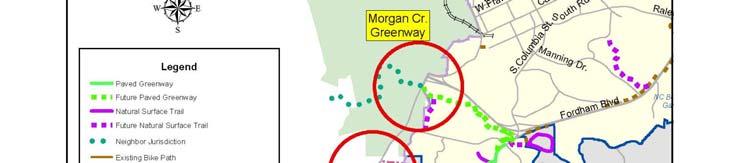
11 Carrboro A Brief Timeline 1994 Recreation and Parks Comprehensive Master Plan; Includes proposal for Bolin Creek Greenway, a 7 mile, off street trail. Also envisions Morgan Creek Greenway as 3 mile greenway from Smith Level to University Lake with connections along a Morgan Creek tributary to Southern Community Park.
12 Carrboro A Brief Timeline 1997 A Landscape with Wildlife for Orange County: Recommends preservation of prime forest areas and wildlife corridor connections between these areas. 500 ft buffers recommended around prime forest areas Chapel Hill Greenways; Comprehensive Master Plan; Effort to formalize greenway planning efforts that began with 1985 Greenways Task Force Report.
13 Carrboro A Brief Timeline 1999 Facilitated Small Area Plan for Carrboro s Northern Study Area; Bolin Creek floodplain included among northern study area s unique natural areas. Identifies strategies for acquisition/dedication to protect the creek and long term goal of connecting of Homestead Road at Lake Hogan Farms to the Bolin Creek greenway.
14 Carrboro A Brief Timeline 1999 Report of the Master Recreation and Parks Work Group; Report prepared by group of citizens and staff throughout h the county which h assessed needs including begin acquiring property along Morgan Creek and Bolin Creek Orange County Lands Legacy; Includes criteria for distribution of bond funds for public acquisition of open space, greenways, and riparian corridors.
15 Carrboro A Brief Timeline 1999 Rating Land in Orange County by its Wildlife Value A Landscape with Wildlife, Part II; Report presents a methodology for evaluating land as habitat for native wildlife in Orange County Carrboro Visions i 2020; Policy recommendations of developing greenways and parklands along streams and easements, and practice ecologically sound maintenance of open space.
16 Carrboro A Brief Timeline 2001 Voter support for greenways as part of $75 million bond countywide bond referendum Acceptance of Offers of Dedication for Public Access; In accordance with possible bond for parks and greenways, 38 offers of dedication made to town since 1981 identified. Town accepts these offers.
17 Carrboro A Brief Timeline 2002 Town of Chapel Hill Parks and Recreation Master Plan; Chapel Hill s first formal master plan for Parks and Recreation Voter support for greenways as part of $4.6 million bond Town bond for sidewalks and greenways Pacifica and Winmore approved along areas of Bolin Creek, Public Access granted from Pacifica to branch of Bolin Creek
18 Carrboro A Brief Timeline 2003 Funds for Greenway Planning for Morgan and Bolin Creek included in Durham, Chapel Hill, Carrboro Metropolitan Planning Organization i list (DCHC MPO) for Surface Transportation Direct allocation in FY 04 and 06 with funds allocated for construction for FY 06 and 08, respectively Adam s Tract purchased through cooperative effort of Town, County, and Clean Water Management Trust Fund.
19 Carrboro A Brief Timeline 2006 Recreation and Parks Comprehensive Master Plan Update; Includes detailed sections on Greenway Guidelines and Development Criteria and Alternative Funding Sources 2006 Carrboro Greenways Summit 2007 Carrboro Greenways Commission Formed
20 Carrboro 30+ year emphasis on natural resource protection 20+ year emphasis on public access to stream corridors
21 Carrboro Greenway development has occurred in an incremental fashion while taking steps to address financial constraints, citizen and property concerns.

22
23 Staff Liaisons to Commission Brendan Moore, Recs & Parks Facilities Administrator ; Randy Dodd*, Environmental Planner ; Adena Messinger, Transportation Planner ; Staff Responsibilities Logistics (set agendas, record minutes, facilitate meetings) Update Greenways Commission webpage Liaison to NCDOT/MPO as needed
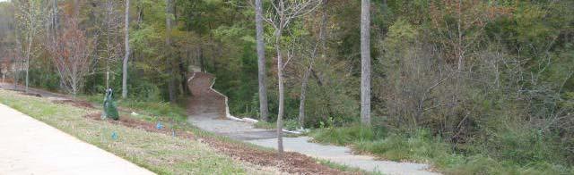
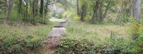
24 Role of Commission Members Commission Charge The commission shall recommend to the Board policies, programs, and actions that may assist the town in safeguarding the water quality, environment and livability of the community by establishing greenways The commission may also encourage effective stewardship and management of such greenways and promote educational, recreational, and public health usage consistent with the protection of this resource.
25 Role of Commission Members Commission Charge Greenways defined: Greenways are unbroken chains of preserved open space surrounding stream and wildlife corridors, headwaters, water recharge areas and significant ecosystems that also provide bicycle and pedestrian connections between neighborhoods and for the community.
26 Role of Commission Members Upcoming Tasks Commission meetings structure (today) Election of officers (today) Work with staff to develop RFQ for consultant(s) to prepare conceptual plans for the Morgan Creek Greenway and Bolin Creek Greenway Recommendation to Board of Aldermen re: consultant selection

27
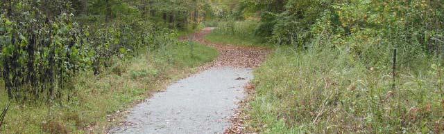
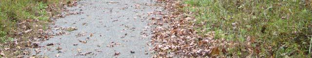
28 Planned and Existing Greenways A whirlwind tour Overview of Carrboro greenway geography Existing greenway patchwork Leveraging of neighborhood development process
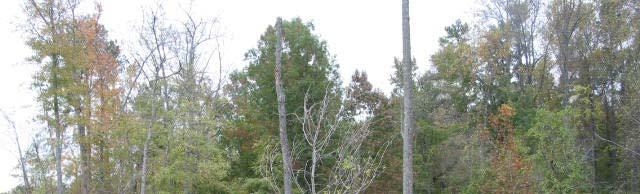
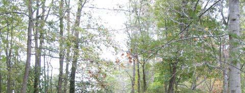
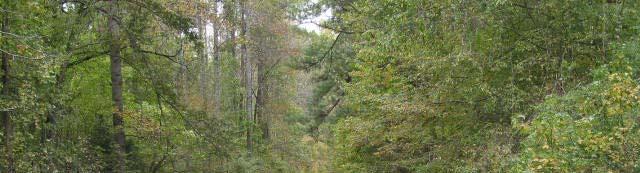
29 Bolin Creek Downtown Morgan Creek
30 54 Bypass Smith Level Rd. Morgan Creek
31 Open Space Greenway Morgan Creek
32 Deeded Greenway Morgan Creek
33 54 Bypass Tom s Creek
34 Greenway Open Space Tom s Creek
35 Deeded Greenway Rose s Walk Tom s Creek
36 Rose s Walk Greenway
37
38 Public schools McDougle Carolina North Adams Bolin Creek
39 Planned Greenway Open Space Adam s Tract Bolin Creek
40 Horne Hollow Deeded Greenway Pacifica Deeded Greenway Bolin Creek
41 Horne Hollow


42 Pacifica Deeded Greenway Future Greenway
43 Planned Greenway Open Space Upper Bolin Creek
44 Deeded Greenway Upper Bolin Creek
45 Ballentine Twin Creeks Jones Property Lake Hogan Farms Colleton Crossing Carolina Commons Homestead Rd. Winmore Claremont Claremont II Upper Bolin Creek
46 Jones Property


47 Lake Hogan Farms

48 Lake Hogan Farms
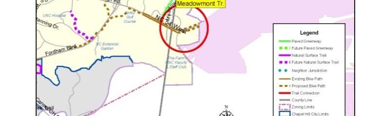
49 Winmore
50
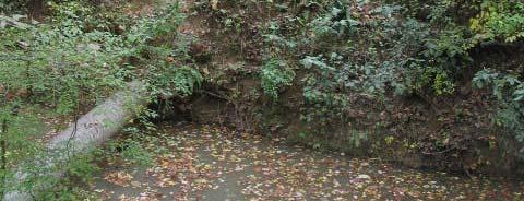
51 Claremont `


52


53
54


55 Chapel Hill Connectivity


56 Bolin Creek Greenway: Chapel Hill
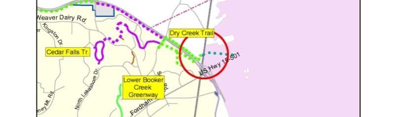
57 Connection to Baldwin Bld Park Would provide connectivity between parks in Chapel Hill and Carrboro Would meet objectives in Carrboro s Vision i 2020 and the R&P Master Plan update of 2006 Staff recommendation (in Resolution A): Support this trail connection Recommend including stream restoration along this segment of Bolin Creek, obtaining funding from environmental agencies/programs
58 Segment 6: Village Drive to Seawell School Road Use existing OWASA corridor rather than following road Avoid steep slopes at Estes and north


59 Segment 6: Estes undercrossing location Three-barrel culvert too small Elevation change is challenge Preferred solution: new underpass to north of culvert
60 Segment 6: North to Seawell School Rd.
61 Operations and management Prioritize segments Specify geography, estimate costs, ID primary stakeholders tkhld Grand opening Construction Greenway Plan Preliminary corridor design Public outreach for nearby neighborhoods Final design and engineering Secure e land or ROW Determine public/private funding and acquire funds
62 Current Funding Sources Durham Chapel Hill Carrboro Metropolitan Planning Organization (DCHC MPO)/Town Bond DCHC MPO STP-DA Projects Currently Funded for Carrboro Project Name Planning Estimate* Construction Estimate** Total Cost Programmed MPO/Town Share via Bond (80%/20%) Bolin Creek Greenway $70,000 $737,500 $807,500 $646,000/$161,500 Morgan Creek Greenway $50,000 $600,000 $650,000 $520,000/$130,000 Total $120,000 $1,337,500 $1,457,500 $1,166,000/$291,500 * These estimates were put together in 2003 and provided for a level of design that would include where the trail would be built, what easements would be required, and identification of stream crossings. They included a 10% contingency for attorney fees and environmental coordination. ** These estimates were put together in 2003 and included a portion for design and survey work.
63 Comprehensive Bicycle Plan NCDOT planning grant Greenways, Inc. Kick off: January 24 th
City of Missoula and Missoula County Open Space Planning Open House
 City of Missoula and Missoula County Open Space Planning Open House FEBRUARY 6, 2018 The following slides contain the display board content from the open house. Please use boards to answer questions in
RECREATION, OPEN SPACE AND GREENWAYS ELEMENT GOALS, OBJECTIVES, AND POLICIES
 RECREATION, OPEN SPACE AND GREENWAYS ELEMENT GOALS, OBJECTIVES, AND POLICIES GOAL R-1: DEVELOP A RECREATION, OPEN SPACE AND GREENWAYS SYSTEM AS AN INTEGRAL COMPONENT OF AN OVERALL, COUNTY-WIDE ECONOMIC
The City shall enhance and improve the accessibility of parks and recreational facilities while protecting their quality. by:
 GOALS, OBJECTIVES AND POLICIES GOAL 1: To provide open space and recreation as an essential element needed for the betterment of the City s character and quality of urban life. The City shall plan for
Portage County Parks, Trails and Greenways Plan
 Portage County Parks, Trails and Greenways Plan Agenda for Local Planning Meeting Introductory Presentation Why we need a Plan Plan project goals and process Benefits Overview of local planning region
Office of Greenways & Trails Providing Statewide Leadership and Coordination. Southeast Greenways and Trails Summit October 1-3, 2017
 Office of Greenways & Trails Providing Statewide Leadership and Coordination Southeast Greenways and Trails Summit October 1-3, 2017 1 Office of Greenways and Trails The Office of Greenways and Trails
Whitemarsh Township Greenway Plan
 Whitemarsh Township Greenway Plan Prepared for: Whitemarsh Township August 16, 2007 Table of Contents Table of Contents... i Introduction... 1 Study Area Setting... 2 Regional Setting... 2 Township Character...
COASTAL CONSERVANCY. Staff Recommendation March 25, 2004 LOS ANGELES GREEN VISION PLAN. File No.: Project Manager: Marc Beyeler
 COASTAL CONSERVANCY Staff Recommendation March 25, 2004 File No.: 04-014 Project Manager: Marc Beyeler RECOMMENDED ACTION: Authorization to disburse up to $50,000 to the University of Southern California
Yadkin River Greenway Feasibility Study Fact Sheet Village of Clemmons, Town of Lewisville, Town of Bermuda Run
 Fact Sheet Village of Clemmons, Town of Lewisville, Town of Bermuda Run Project Background The Yadkin River Greenway Feasibility Study is a joint project with the Village of Clemmons, the Town of Bermuda
Update for City Council 7 Years of Progress. May 2013
 Update for City Council 7 Years of Progress May 2013 Setting the Stage Needs Assessment 2006 City of Charlottesville Inventory National Guideline Service Level School Sites Inventory Total Current Inventory
CHAPTER 1 Introduction
 CHAPTER 1 Introduction From sea to summit, Lane County covers almost 4,800 square miles of diverse Oregon landscape. Stretching from the Pacific Ocean through the Coastal Range, the Willamette Valley to
Working together to leverage limited Funds
 Working together to leverage limited Funds ARAPAHOE COUNTY OPEN SPACES 10 County Budget Conference September 20, 2013 The Power of Partnerships 2013 SORP Conference 5/23/2014 Why Talk About Open Space?
National Association of Conservation Districts. Kris Hoellen Vice President, Sustainable Programs The Conservation Fund September 19, 2013
 National Association of Conservation Districts Kris Hoellen Vice President, Sustainable Programs The Conservation Fund September 19, 2013 Our Mission The Conservation Fund forges partnerships to conserve
Green Infrastructure Planning for Sustainability and Resiliency
 Green Infrastructure Planning for Sustainability and Resiliency Linking Lands and Communities in the Land-of-Sky Region SAMAB Conference - November 18, 2010 www.linkinglands.org Linda Giltz, AICP, Regional
The Illinois Department of Transportation and Lake County Division of Transportation. Route 173, including the Millburn Bypass
 The Illinois Department of Transportation and Lake County Division of Transportation welcome you to this Public Hearing for U.S. Route 45 from Illinois Route 132 to Illinois Route 173, including the Millburn
CHAPEL HILL GREENWAYS
 CHAPEL HILL GREENWAYS Comprehensive Master Plan A Planning Guide for Future Physical Improvements and Operational Policies Greenways Commission Town of Chapel Hill, North Carolina [[INSERT DATE UPON ADOPTION]]
But What About the People? The Role of Urban Planning and Green Infrastructure
 But What About the People? The Role of Urban Planning and Green Infrastructure The Southeast Conservation Adaptation Strategy: A Model for Collaborative Conservation David Rouse, FAICP, ASLA Managing Director,
City of Nogales General Plan
 Open Space, Parks, Recreation and Trails City of Nogales General Plan Residents of Nogales place a high priority in the development of a comprehensive system of open space, parks, recreation and trails
RECREATION AND OPEN SPACE ELEMENT GOALS, OBJECTIVES, AND POLICIES
 RECREATION AND OPEN SPACE ELEMENT GOALS, OBJECTIVES, AND POLICIES GOALS, OBJECTIVES AND POLICIES GOAL 1: TO PROVIDE A FULL RANGE OF RECREATIONAL ACTIVITIES THAT ARE ACCESSIBLE, COMPATIBLE AND CONTINUOUS
This page intentionally blank.
 This page intentionally blank. Parks, Recreation, and Open Space Chapter Relationship to Vision Vision Parks, Recreation and Open Space Chapter Concepts County Government. County government that is accountable
Trail Feasibility and Planning Project for Northern Dutchess County, New York
 for Northern Dutchess County, New York Funded in Part by Grants from the Hudson River Valley Greenway, Land Trust Alliance Conservation Partnership Program and the Thomas Thompson Trust 1 STEERING COMMITTEE
Onondaga County Sustainable Streets Project. Onondaga County Planning Federation June 7, Onondaga County Sustainable Streets Project 1
 Onondaga County Sustainable Streets Project Onondaga County Planning Federation June 7, 2012 Onondaga County Sustainable Streets Project 1 Sustainable Streets 1. Introduction to the SMTC 2. Sustainable
Planning & Zoning Board Meeting. DRAFT Comprehensive Transportation Plan Update, February 23, 2018 version
 Planning & Zoning Board Meeting DRAFT Comprehensive Transportation Plan Update, February 23, 2018 version May 10, 2018 Overview Overview of Agency Comments Overview of proposed modifications to the Draft
1.0 INTRODUCTION 1.1 TH 14 WEST STUDY AREA Project Description Functional Classification Purpose of the Project
 1.0 INTRODUCTION 1.1 TH 14 WEST STUDY AREA 1.1.1 Project Description The Trunk Highway (TH) 14 West Corridor is a two-lane roadway approximately 22 miles in length. Located in Nicollet County, the corridor
Provide and maintain sufficient public parks, recreation facilities, and open space to meet the recreational needs of County residents and visitors.
 (ROS) Goal Provide and maintain sufficient public parks, recreation facilities, and open space to meet the recreational needs of County residents and visitors. OBJECTIVE ROS.01 The County shall acquire,
3. VISION AND GOALS. Vision Statement. Goals, Objectives and Policies
 Vision Statement Queen Creek s interconnected network of parks, trails, open spaces and recreation opportunities provide safe and diverse activities and programs that sustain its unique, small town, equestrian
Parks and Open Space Preservation and Dedication. January 26, 2016 Fort Worth City Council Pre-Council Meeting Randle Harwood and Richard Zavala
 Parks and Open Space Preservation and Dedication January 26, 2016 Fort Worth City Council Pre-Council Meeting Randle Harwood and Richard Zavala Purpose How does the City of Fort Worth preserve and protect
OPEN SPACE FORUM SEPTEMBER 28, 2016 THE ARTS CENTER
 OPEN SPACE FORUM SEPTEMBER 28, 2016 THE ARTS CENTER AGENDA: 1. Introductions 2. History of Open Space Committee 3. Saratoga Springs Open Space Purchases 4. Committee Actions and Path Forward 5. Comments
Status Report for Parks and Recreation Capital Projects
 Attachment #2 Town of Chapel Hill Status Report for Parks and Recreation Capital Projects Prepared by Bill Webster, Assistant Director Chapel Hill Parks & Recreation Department March 19, 2009 1. Athletic
Oakland County s Green Infrastructure Vision. L. Brooks Patterson Oakland County Executive
 Oakland County s Green Infrastructure Vision L. Brooks Patterson Oakland County Executive Southeast Michigan 20 miles northwest of Detroit Consists of 910 square miles Population of 1.2 million More than
Preface. Erie. Scranton. Allentown. Pittsburgh. Harrisburg. Philadelphia
 The Southern Alleghenies Region The Southern Alleghenies Region spans the Laurel Highlands and Allegheny Front in the west across the Appalachians to the east. It is comprised of Blair, Bedford, Cambria,
Chapter 5: Natural Resources and Environment
 NATURAL RESOURCES AND ENVIRONMENT 5-1 5 Chapter 5: Natural Resources and Environment BACKGROUND AND INTENT Urban expansion represents the greatest risk for the future degradation of existing natural areas,
City of Tacoma Planning and Development Services
 Agenda Item D-1 City of Tacoma Planning and Development Services To: Planning Commission From: Elliott Barnett, Planning Services Division Subject: Application #2014-08 Open Space Element Update Meeting
STATE OF NORTH CAROLINA DECLARATION OF
 Prepared by and Return to: Orange County Parcel Identification Number(s): STATE OF NORTH CAROLINA COUNTY OF ORANGE DECLARATION OF RESTRICTIVE COVENANTS THIS DECLARATION OF RESTRICTIVE COVENANTS ( Declaration
Parks, Trails, and Open space Element
 Parks, Trails, and Open space Element Parks, Trails, and Open Space element Parks, Recreation, and Open Space are important components of the quality of life desired by the residents of Elk Grove. This
Planning for Staten. Habitat Restoration and Green Infrastructure. Island s North Shore
 Habitat Restoration and Green Infrastructure Planning for Staten Island s North Shore Community Board 1 March 1, 2018 NYC Parks Forestry, Horticulture, and Natural Resources Funded by the NYS Department
The Rocky Mountain Arsenal and the Northeast Greenway Corridor Project:
 The Rocky Mountain Arsenal and the Northeast Greenway Corridor Project: Contamination to Collaboration Presented by Howard Kenison Overview of Presentation Rocky Mountain Arsenal Contamination Litigation,
Mendota Heights 2040 Comprehensive Plan Draft Vers
 4 Parks and Trails The City of Mendota Heights boasts a variety of recreational and open space opportunities. Few cities can claim access to regional trails, riverside and lakeside parks, scenic bluffs
Rosemount Greenway Master Plan Executive Summary. draft. Spring for more information visit
 Rosemount Greenway Master Plan Executive Summary Spring 2012 draft for more information visit www.hkgi.com/projects/dakota INTRODUCTION The Rosemount Greenway Master Plan portrays a vision to establish
M E M O R A N D U M. DATE: July 19, Patrick D. O Keeffe, City Manager. Economic Development & Housing
 M E M O R A N D U M DATE: July 19, 2011 TO: FROM: Patrick D. O Keeffe, City Manager Economic Development & Housing SUBJECT: Resolution of the City Council of the City of Emeryville Approving the Application
Town of Sahuarita Open Space Plan Element. University of Arizona Planning Program Projects Team
 Town of Sahuarita Open Space Plan Element University of Arizona Planning Program Projects Team Introduction Planning students in the Planning Program Project Class Overall Goal Potential uses of $1.5 Million
The following principles guide the development of goals and strategies to protect and promote these amenities:
 OPEN SPACE/PARKS/TRAILS/RECREATION GOALS/STRATEGIES Cherry Hills Village is a living environment that offers low density development, open areas, public scenic vistas, public trails and public parks. This
Lake Arlington Master Plan. Presented by Randle Harwood, Planning and Development Director October 27, 2015
 Lake Arlington Master Plan Presented by Randle Harwood, Planning and Development Director October 27, 2015 1 Land Use Strategy 4 Land Use Strategy Typical Residential Development New residential development
Durango Parks & Recreation Department. Strategic Plan
 Durango Parks & Recreation Department Strategic 2019-2023 Adopted April 2019 Overview The purpose of the adopted 2010 Parks, Open Space, Trails and Recreation Master is to provide a 10-year road map for
WASHINGTON COUNTY OREGON
 WASHINGTON COUNTY OREGON LONG RANGE PLANNING DIVISION North Bethany Subarea Stream Corridors: Existing Regulations In Oregon, there is a distinct difference between the land use rules that apply in rural
SECTION FOUR: MISSION STATEMENT, GOALS & OBJECTIVES
 SECTION FOUR: MISSION STATEMENT, GOALS & OBJECTIVES Chapter Summary Chapter Ten: Mission Statement, Goals & Objectives To fulfill its mission, the Parks and Recreation Commission has identified four basic
IMPLEMENTING SOMERSET COUNTY S INVESTMENT FRAMEWORK
 IMPLEMENTING SOMERSET COUNTY S INVESTMENT FRAMEWORK SMART CONSERVATION THROUGH SMART GROWTH NJ LAND CONSERVATION RALLY March 22, 2014 Laurette Kratina, PP, AICP, Supervising Planner Somerset County Planning
Longmeadow Parkway Fox River Bridge Corridor. August 6, 2015
 Longmeadow Parkway Fox River Bridge Corridor August 6, 2015 Longmeadow Parkway Bridge Corridor 5.6 miles from Huntley Road to IL 62 Unique municipal/county/state/federal partnership Links Randall Road
Arlington, Virginia is a worldclass
 EXECUTIVE S U M M A RY Arlington maintains a rich variety of stable neighborhoods, quality schools and enlightened land use policies, and received the Environmental Protection Agency s highest award for
OVERMOUNTAIN VICTORY TRAIL BURKE CALDELL CORRIDOR FEASIBLITY STUDY REQUEST FOR QUALIFICATIONS CALDWELL COUNTY PATHWAYS
 OVERMOUNTAIN VICTORY TRAIL BURKE CALDELL CORRIDOR FEASIBLITY STUDY REQUEST FOR QUALIFICATIONS CALDWELL COUNTY PATHWAYS Caldwell County Pathways along with our co-partners City of Lenoir, Town of Gamewell,
TOWN OF BETHLEHEM OPEN SPACE CONSERVATION PLAN PUBLIC MEETING: OCTOBER 12, 2017
 TOWN OF BETHLEHEM OPEN SPACE CONSERVATION PLAN PUBLIC MEETING: OCTOBER 12, 2017 Welcome and Agenda 6:00 6:45: Open House, Part One 6:45 7:15: Presentation and Questions 7:15 8:00: Open House, Part Two
STEWARDSHIP OF LONG ISLAND SOUND S ECOLOGICAL AND RECREATIONAL RESOURCES
 STEWARDSHIP OF LONG ISLAND SOUND S ECOLOGICAL AND RECREATIONAL RESOURCES Robin Kriesberg, Save the Sound, Inc. Thomas Halavik, US Fish and Wildlife Service Coastal Program An Initiative to Identify, Protect
WARM SPRINGS PARK MASTER PLAN
 TABLE OF CONTENTS page 1.0 Introduction and Overview 1 2.0 Information Gathering 2 3.0 Conceptual Alternative Development 8 4.0 Master Plan Development 14 5.0 Construction Cost Estimates 19 LIST OF FIGURES
Parks, Trails, and Open Space Element
 P arks, Recreation, and Open Space are important components of the quality of life desired by the residents of Elk Grove. This Element of the General Plan addresses the City s goals, policies, and actions
RECREATION AND OPEN SPACE ELEMENT GOALS, OBJECTIVES, AND POLICIES
 RECREATION AND OPEN SPACE ELEMENT GOALS, OBJECTIVES, AND POLICIES Goal 7 To provide park facilities, recreation programs, and open space resources that are safe, adequate, and accessible to all City residents,
TABLE OF CONTENTS. Transportation Chapter 1 - Introduction and Purpose of Planning to 1-3. Utilities
 Chapter 1 - Introduction and Purpose of Planning... 1-1 to 1-3 Pennsylvania Municipalities Planning Code (Act 247)...1-1 Previous County Planning Activities...1-1 Objectives of the Plan...1-2 Elements
Staff will be providing an overview of the project need, purpose and intent for consideration as part of the Amendment cycle.
 Agenda Item D-2 City of Tacoma Planning and Development Services To: Planning Commission From: Stephen Atkinson, Planning Services Division Subject: Open Space Corridors Project Meeting Date: March 1,
ADOPTION OF THE REVISED OPEN SPACE AND CONSERVATION ELEMENT OF THE GENERAL PLAN
 TO: FROM: SUBJECT: Honorable Mayor and City Council Planning Department ADOPTION OF THE REVISED OPEN SPACE AND CONSERVATION ELEMENT OF THE GENERAL PLAN RECOMMENDATION: It is recommended that the City Council:
OFFICIAL CONTROLS IMPLEMENTATION LEGAL REQUIREMENTS
 IMPLEMENTATION The objective of the Implementation component of the Comprehensive Plan is to identify the changes that need to be made to the official controls in order to be consistent with the Comprehensive
Pinellas County Greenways
 Pinellas County Greenways USING GREENWAYS TO LINK OPEN SPACES The Florida Greenways Commission has defined a greenway as...a corridor of protected open space that is managed for conservation and/or recreation.
2. Would the proposed project comply with the Land Use map? 3. Would the proposed project require a rezoning? 4. What is the proposed zoning district?
 TOWN OF CHAPEL HILL Planning and Sustainability Department 405 Martin Luther King Jr. Blvd. Chapel Hill, NC 27514 www.townofchapelhill.org phone (919) 968 2728 Concept Plans are intended to be an opportunity
Support the implementation of Cape Coral's Comprehensive Plan. Protect and utilize the unique natural resources in the City.
 7.0 OVERVIEW - RECOMMENDATIONS Chapter 7 The preparation of the Cape Coral Parks and Recreation Master Plan spanned a period of approximately 12 months. Plan preparation included the input of a wide range
systems is available on the Colorado Wetland Information Center (CWIC) website.
 website.") Colorado Natural Heritage Program Wetland Program Plan -- Dec 2015 Status Update and Addendum -- The Colorado Natural Heritage Program (CNHP) developed a Wetland Program Plan (WPP) in 2010 for the planning
Colorado Natural Heritage Program Wetland Program Plan -- Dec 2015 Status Update and Addendum -- The Colorado Natural Heritage Program (CNHP) developed a Wetland Program Plan (WPP) in 2010 for the planning
RECREATION AND OPEN SPACE ELEMENT
 RECREATION AND OPEN SPACE ELEMENT Last amended August 19, 2008 Table of Contents Objective Page 5.1 Park system defined... 5-1 5.2 Access to parks and recreational facilities... 5-2 5.3 Recreation and
COASTAL CONSERVANCY. Staff Recommendation June 5, 2008 SAN DIEGO RIVER TRIBUTARY CANYONS PROJECT. File No Project Manager: Megan Johnson
 COASTAL CONSERVANCY Staff Recommendation June 5, 2008 SAN DIEGO RIVER TRIBUTARY CANYONS PROJECT File No. 08-059 Project Manager: Megan Johnson RECOMMENDED ACTION: Authorization to disburse an amount not
MILLS PARK & PANTHER CREEK GREENWAY
 , North Carolina August 19th, 2014 Introduction, North Carolina Why are we here? Planning Investment to Date - Park, North Carolina 2012 Parks, Recreation, and Cultural Resources Master Plan Planning Investment
Transportation Projects Quarterly Report. Morrisville Planning Department May 22, 2018
 Transportation Projects Quarterly Report Morrisville Planning Department May 22, 2018 Transportation Improvements Most Common Ways the Town secures transportation improvements: 1. Development 2. Grant
M-NCPPC Park System in
 Park Planning & Stewardship Division Park & Trail Planning Section East County Science Center Master Plan Parks, Recreation, Trails, and Open Space- Issues and Opportunities PARK PLANNING & STEWARDSHIP
Riparian Buffer on the Bushkill Creek. Policies
 Riparian Buffer on the Bushkill Creek Riparian buffers provide numerous benefits to landowners and the community by protecting groundwater recharge areas, providing flood control, providing stormwater
The Long Road from Planning to Breaking Ground:
 The Long Road from Planning to Breaking Ground: A Collaboration Between Roanoke County and VDOT Megan G. Cronise, AICP VDOT Coordinating Transportation and Land Use Planning Forum May 10, 2018 Where is
Chapter 5: Recreation
 Chapter 5: Recreation Introduction and Setting Recreational opportunities within Nevada County are varied, ranging from public parks with intensively used active recreational facilities, to vast tracts
APPENDIX A 6 CONCEPTUAL PRELIMINARY PLAN GUIDE AND CHECKLIST FOR MAJOR SUBDIVISIONS CARRBORO DEVELOPMENT GUIDE APPENDIX A
 6 CONCEPTUAL PRELIMINARY PLAN GUIDE AND CHECKLIST FOR MAJOR SUBDIVISIONS Conceptual Preliminary Guide/Checklist for Major Subdivisions Page 1 FORM: REVIEW DATE: CONCEPTUAL PLAN REVIEW 2000 REVIEWED BY:
FOUR MILE RUN VALLEY WORKING GROUP AND CHARGE
 FOUR MILE RUN VALLEY WORKING GROUP AND CHARGE Adopted April 16, 2016 Amended July 19, 2016 Overview of Integrated Effort The overall goal of the Four Mile Run Valley (4MRV) initiative is to develop a comprehensive
Nine Mile Creek Regional Trail Update. Edina City Council Workshop March 4, 2014
 Nine Mile Creek Regional Trail Update Edina City Council Workshop March 4, 2014 Presentation Outline: Where we ve been - Recap of route assessment process and approved route Where we are now - Summary
G. RECREATION AND OPEN SPACE ELEMENT. The following summarizes the Recreation and Open Space Element:
 G. RECREATION AND OPEN SPACE ELEMENT The purpose of the Element is to provide the framework and direction for a comprehensive system of public and private sites for recreation, including, but not limited
SECTION 9 PUBLIC FORUM DRAFT 5/31/2017 SEVEN YEAR ACTION PLAN
 SECTION 9 SEVEN YEAR ACTION PLAN The Seven-Year Action Plan addresses the objectives of the Open Space and Recreation Plan and identifies actions to meet these objectives. While the Open Space and Recreation
PUBLIC SPACES MASTER PLAN UPDATE (POPS) Crystal City Citizen s Review Council October 24, 2018
 Crystal City Citizen s Review Council October 24, 2018") PUBLIC SPACES MASTER PLAN UPDATE (POPS) Crystal City Citizen s Review Council October 24, 2018 1 PLANNING CONTEXT Arlington County Comprehensive Plan UPDATE Related Documents: CIP Sector Plans Area Plans
PUBLIC SPACES MASTER PLAN UPDATE (POPS) Crystal City Citizen s Review Council October 24, 2018 1 PLANNING CONTEXT Arlington County Comprehensive Plan UPDATE Related Documents: CIP Sector Plans Area Plans
7th Avenue Creek Master Plan Development Project. City of St. Charles, IL. IAFSM CONFERENCE March 14, 2018 MARKET
 7th Avenue Creek Master Plan Development Project MARKET City of St. Charles, IL IAFSM CONFERENCE March 14, 2018 7 TH AVENUE CREEK PROJECT AREA 2 2008 RAIN EVENT 3 RESIDENTIAL STRUCTURE FLOODING COMMERCIAL
Prepared for the Citizens of Forsyth County by the City-County Planning Board
 Prepared for the Citizens of Forsyth County by the City-County Planning Board Bryce A. Stuart Municipal Building 100 East First Street, Winston-Salem, NC 27101 336.727.8000 www.cityofws.org/planning www.legacy2030.com
ALLEN CREEK GREENWAY. Citizens Advisory Committee Meeting #5 July 19, Allen Creek Greenway Master Plan. July 2017
 1 ALLEN CREEK GREENWAY MASTER PLAN Citizens Advisory Committee Meeting #5 July 19, 2017 Agenda 2 Final DRAFT Preferred Plan (30 min) Master Plan Document Outline (5 min) Potential Implementation Strategy
Missing Link Study Grand Rounds Parkway Planning and Design Introduction
 Missing Link Study Grand Rounds Parkway Planning and Design Introduction June 19, 2007 Minneapolis Park and Recreation Board HNTB Hoisington Koegler Group Inc. Hess Roise 1 The Missing Link Study The Minneapolis
Mendota-Lebanon Hills Greenway Master Plan Executive Summary. August draft for more information visit
 Mendota-Lebanon Hills Greenway Master Plan Executive Summary August 2013 draft for more information visit www.hkgi.com/projects/dakota INTRODUCTION The Mendota-Lebanon Hills Greenway Master Plan portrays
BROOKHILL NEIGHBORHOOD MODEL ZONING MAP AMENDMENT PREFACE TO APPLICATION
 BROOKHILL NEIGHBORHOOD MODEL ZONING MAP AMENDMENT PREFACE TO APPLICATION June 15, 2015 Revised: August 1, 2016 I. VISION Brookhill is a proposed community based upon the principles of Albemarle County
METROPOLITAN COUNCIL 390 North Robert Street, St. Paul, MN Phone (651) ; TDD (651)
 ; TDD (651)") DATE: December 20, 2011 METROPOLITAN COUNCIL 390 North Robert Street, St. Paul, MN 55101 Phone (651) 602-1000; TDD (651) 291-0904 TO: Metropolitan Parks and Open Space Commission FROM: Tori Dupre, Senior
DATE: December 20, 2011 METROPOLITAN COUNCIL 390 North Robert Street, St. Paul, MN 55101 Phone (651) 602-1000; TDD (651) 291-0904 TO: Metropolitan Parks and Open Space Commission FROM: Tori Dupre, Senior
Ottawa County Parks, Recreation & Open Space Plan. February, 2006
 2006 Ottawa County Parks, Recreation & Open Space Plan February, 2006 TABLE OF CONTENTS ACKNOWLEDGMENTS.................................................... v PLAN ADOPTION..........................................................vi
Regional Open Space Conservation Plan. Regional Staff Committee January 18, 2018
 Regional Open Space Conservation Plan Regional Staff Committee January 18, 2018 Schedule We are here Task 1 - Stakeholder Input & Work Plan Dev. v z 2016 2017 2018 Oct Nov Dec Jan Feb Mar Apr May Jun Jul
Atlanta BeltLine, Inc. Pathways to Urban Sustainability
 Atlanta BeltLine, Inc. Pathways to Urban Sustainability September 30, 2010 WHAT IS THE ATLANTA BELTLINE? Transit 22-mile loop Parks 1300 + new acres Trails 33 miles Jobs & Economic Development 20 areas,
Open Space, Natural Areas, Parks, and Recreation
 Open Space, Natural Areas, Parks, and Recreation WHAT ARE THE CITY S CURRENT VALUES? This section addresses open spaces, natural areas, parks and recreation, and stormwater multi-use projects under separate
City of East Point Comprehensive Floodplain Management Program
 City of East Point Comprehensive Floodplain Management GAFM 2012, 7 th Annual Technical Conference Reza Aral, CFM, CPESC (City of East Point, GA) Shayne Wood, P.E. (CDM Smith) March, 28, 2012 Agenda Overview
Executive Summary. The Mebane CLP is not a regulatory document, but is intended to guide land development decisions. The plan includes:
 Executive Summary P URPOSE AND O RGANIZATION OF THE P LAN The City of Mebane, with input from citizens and an appointed CLP Advisory Committee, adopted Mebane by Design, a Comprehensive Land Development
The Trust for Public Land. in Minnesota
 The Trust for Public Land in Minnesota Protecting Minnesota s Natural Legacy In Minnesota, The Trust for Public Land (TPL) is protecting strategic land and water resources for people to enjoy as parks,
Town of Peru Comprehensive Plan Executive Summary
 Town of Peru Comprehensive Plan Executive Communities that plan grow by choice, not by chance. A plan makes growth thoughtful, understandable, and predictable. A plan shows that a community is managing
PARK PLANNING & STEWARDSHIP DIVISION
 MCPB Item # July 30, 2015 MEMORANDUM July 23, 2015 TO: Montgomery County Planning Board VIA: FROM: Mike Riley, Director of Parks Mitra Pedoeem, Acting Deputy Director of Parks John E. Hench, Ph.D., Chief,
Developer s Program. The Station at East 54
 Developer s Program The Station at East 54 Existing Conditions The Station at East 54 is proposed for a 1.12 acre site at the northeast corner of Hamilton Road and Prestwick Road, tucked between the East
Great Rivers Greenway CLEAN GREEN CONNEC TED T RAILS
 Great Rivers CLEAN GREEN CONNEC TED T RAILS Great Rivers (GRG) was established in 2000 to create a clean, green, connected St. Louis region. Today, many new and exciting projects demonstrate the social,
Secrest Short Cut and Monroe Expressway Small Area Plan AUGUST 29, 2018
 Secrest Short Cut and Monroe Expressway Small Area Plan AUGUST 29, 2018 Background and Process Monroe Expressway will be open by the end of 2018 Union County and Indian Trail identified a need to revisit
Inventory and Management Recommendations for Future Recreational Needs
 Inventory and Management for Future Recreational Needs Greenway Corridor Draft Report Prepared for: Woodbury Park and Recreation Submitted by: Jon Benson, Project Manager Tara Grover, Mark Gustafson, Pamela
Call for Artists for: Design and Construction of Environmental Art Activation Story Mill Community Park, Bozeman, MT
 Call for Artists for: Design and Construction of Environmental Art Activation Story Mill Community Park, Bozeman, MT Seeking artists to design, fabricate and install art elements in the nature sanctuary
Enhance the High Line Canal Projects
 Enhance the High Line Canal Projects Joint Project Proposal for Arapahoe County Open Spaces Funding Partner Sponsors: South Suburban Park and Recreation District City of Centennial City of Littleton October
PUBLIC SPACES MASTER PLAN UPDATE (POPS) Joint Facilities Advisory Commission (JFAC) November 28, 2018
 Joint Facilities Advisory Commission (JFAC) November 28, 2018") PUBLIC SPACES MASTER PLAN UPDATE (POPS) Joint Facilities Advisory Commission (JFAC) November 28, 2018 1 AGENDA POPS Planning Context Timeline Public Input Final POPS Draft Next Steps 2 PLANNING CONTEXT
PUBLIC SPACES MASTER PLAN UPDATE (POPS) Joint Facilities Advisory Commission (JFAC) November 28, 2018 1 AGENDA POPS Planning Context Timeline Public Input Final POPS Draft Next Steps 2 PLANNING CONTEXT
Member Service Plan Sierra Nevada AmeriCorps Partnership
 Member Service Plan Sierra Nevada AmeriCorps Partnership Service plans lay the framework for what each Member will be doing during their service. Service plans detail the major projects and expected results