TRANSIT NEIGHBORHOOD PLANS PROGRAM OVERVIEW
|
|
|
- Stewart Ryan
- 5 years ago
- Views:
Transcription
1 TRANSIT NEIGHBORHOOD PLANS PROGRAM OVERVIEW OCTOBER 2017 Los Angeles Department of City


2 Outline Introduction Policy Framework The Transit Neighborhood Plans Program Overview: Transit Neighborhoods Strategies for Planning around Transit in Los Angeles Current Transit Neighborhood Plans Projects Conclusion: Successful Transit Neighborhoods 2
3 Introduction


4 Los Angeles Transit Network The transit network in LA is rapidly growing as a result of voterapproved transportation funding, Measures R and M Source: Metro, 2017
 directs jobs and housing near transit (e.g. light rail) Regional State CA Global Warming Solutions Act, 2006 CA Sustainable Communities and Climate Protection Act, 2008 SB375")
5 Policy Framework Recent state and regional laws and policies require cities to direct growth to transit areas to reduce greenhouse gas emissions (GHGs) through coordinated transportation and land use planning The Regional Transportation Plan and Sustainable Communities Strategy (RTP/SCS) directs jobs and housing near transit (e.g. light rail) Regional State CA Global Warming Solutions Act, 2006 CA Sustainable Communities and Climate Protection Act, 2008 SB375
 Ensure an adequate mix of housing types and affordability levels to")
6 Policy Framework Citywide Policies relevant to transit-served areas General Plan Framework (1996) Accommodate new housing and employment as a means to preserve stable single family neighborhoods, as appropriate Improve urban form and neighborhood design to create more walkable neighborhoods General Plan Housing Element (2013) Ensure an adequate mix of housing types and affordability levels to accommodate projected growth Encourage preservation and expansion of affordable housing Community Plans (Land Use Element of the General Plan) Direct growth to transit-served corridors and centers Industrial Land Use Policy (2008) Retain industrially zoned land for job-producing uses Consider a greater mix of uses, as appropriate 6 6

7 LA s History of Planning Around Transit Roughly 100 years ago, the region had an extensive street car system that covered 1,000 miles of tracks from Downtown to the Inland Empire, the Coast, Orange County, and San Fernando 7


8 LA s History of Planning Around Transit Past plans for areas around transit include: Ave 57 Neighborhood Specific Plan, 2000 Jordan Downs Specific Plan, 2013 Cornfield / Arroyo Seco Specific Plan, 2012 Vermont / Western Station Neighborhood Area Plan, 2001 Warner Center Specific Plan,
 City s current program for")
 26 stations, 7")

9 Transit Neighborhood Plans Los Angeles Transit Neighborhood Plans (TNP) City s current program for planning around transit Partially funded by 2 Metro TOD Planning grants (Round 1 and Round 3) 26 stations, 7 lines Aims to increase transit ridership, reduce GHGs, and orient development around transit Encourages complete neighborhoods 9
10 Overview: Transit Neighborhoods


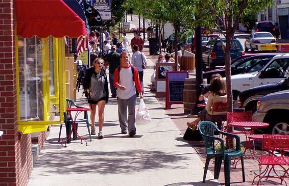
11 Transit Neighborhoods What is a Transit Neighborhood? Compact mixed-use neighborhoods within walking distance of high frequency public transportation Combines housing, jobs, and retail Complete, walkable neighborhoods that provide amenities for residents, workers, and visitors Provides access to a variety of destinations without reliance on the automobile Encourages development projects that include affordable housing, neighborhood amenities, and publicly accessible open space 11


12 Benefits of Transit Neighborhoods Transit neighborhoods can promote sustainable development patterns by: Improving mobility options for residents, workers, and visitors Encouraging active, vibrant, and safe neighborhoods with access to amenities Fostering equity by providing housing opportunities at many income levels Allowing more residents and employees to access high quality public transportation Reducing greenhouse gas emissions and auto-dependence and improving air quality 12

13 Benefits of Transit Neighborhoods USC study (2013) of the Expo Line Phase I showed households within a ½ mile of a station: tripled their rail ridership reduced their daily driving by 40% reduced vehicle miles traveled by miles/day Source: 2013 USC Exposition Light Rail Line Study, Studies of other California neighborhoods show transit ridership depends on proximity to transit, especially workplace proximity Source: 2011 Public Policy Institute of California, 13

14 Benefits of Transit Neighborhoods Overall transit ridership increases with proximity to the station Higher transit ridership rates among workers (jobs) compared to residents (housing) in areas closest to stations Within ¼ mile of station, 10.5% of workers take transit compared to 9.7% of residents Beyond ¼ mile from station, there is higher ridership among residents 10.5% of workers 9.7% of residents Source: 2011 Report from Public Policy Institute of California 14
 per capita as a result of: Shorter vehicle trips More walking, biking, and transit")
 Increases in VMT per")
15 Benefits of Transit Neighborhoods Increasing jobs and housing near transit leads to decreased Vehicle Miles Traveled (VMT) per capita as a result of: Shorter vehicle trips More walking, biking, and transit trips More multi-destination trips (mixed use) Whereas, adding jobs and housing in areas not served by transit could cause: Greater increases in total Vehicle Miles Traveled (VMT) Increases in VMT per capita 15
16 Benefits of Transit Neighborhoods As an example, analysis for the proposed Expo Transit Neighborhood Plan shows an anticipated 3.1% decrease in VMT per capita by 2035 with an increase of jobs and housing near the Expo Line stations Service Population (Employees + Residents) Total VMT % Change (2013 to 2035) +12.2% +8.9% -3.1% VMT per capita (Service Pop/Total VMT) Source: Expo Corridor TNP Draft EIR,


17 Benefits of Transit Neighborhoods Maintaining land for jobs near transit is important to: Meet the estimated demand for jobs in the future Preserve the City s tax base to pay for essential City services Retain the City s competitiveness in growing industries Capture the City s share of regional job growth 17 17


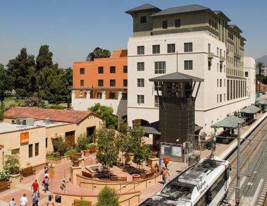
18 How do we do TNPs in LA? Transit neighborhoods are found in a wide range of contexts, and as a result, the approach to planning these areas is varied. Downtown Expo/La Cienega Station


19 TNP Strategies Strategies for successful Transit Neighborhoods Zoning Regulations Urban Design Standards and Guidelines Public Realm Improvements Public Benefits Transportation Demand Management Mariachi Plaza, Boyle Heights North Hollywood Wilshire/Vermont Station

20 TNP Strategies Zoning Regulations Establish a mix of land uses Apply urban design and other development standards Create incentives to direct development to areas around transit Set flexible or decreased parking requirements 20


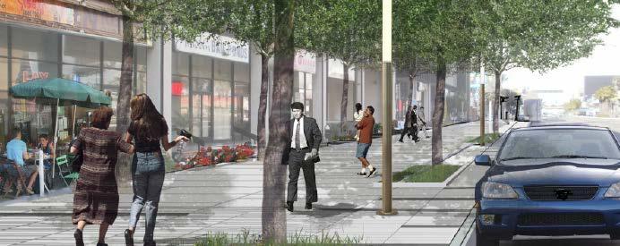
21 TNP Strategies Urban Design Standards and Guidelines Buildings that front public streets and contribute to street life and neighborhood identity Active uses at the ground level High levels of transparency to promote eyes on the street Site planning that improves the walking environment Building breaks and pedestrian paseos Incorporation of public plazas and other pedestrian amenities Reduced vehicle/pedestrian conflicts Frontages that improve the relationship of the building to the street Prominent building entrances Articulation and architectural features


22 TNP Strategies Public Realm Improvements Streets that support multiple modes of transportation Wider sidewalks Pedestrian amenities such as trees, landscaping, and street furniture Walkable blocks with safe street crossings at regular intervals Bicycle lanes and related improvements 22
 for projects that incorporate")

23 TNP Strategies Public Benefits Development incentives (i.e. density and height) for projects that incorporate elements that benefit the community, such as: Affordable housing Publicly accessible open space Public realm improvements Mobility amenities (e.g. car share, bicycle parking, etc.) Community facilities Neighborhood-serving uses (e.g. small retail, restaurants, grocery stores, etc.) 23


24 TNP Strategies Transportation Demand Management Establish programs that reduce vehicle trips and encourage carpooling, walking, biking, and public transit Incorporate project design features such as: Mobility Hubs that offer bike share and car share Bike parking and maintenance facilities Shower and locker facilities Manage parking resources to support the use of other modes Require vehicle trip reduction 24


25 Los Angeles Planning Tools Tools that implement the TNP strategies: Zoning Regulations Specific Plans Community Plan Implementation Overlay (CPIO) zones New re:code LA zones Streetscape Plans Urban Design Guidelines 25
26 Current TNP Projects Following is an overview of the various TNP projects. For more details, please visit

27 TNP: Exposition Corridor Exposition Corridor Transit Neighborhood Plan


28 TNP: Exposition Corridor Zoning Regulations Position industrial land near stations to accommodate jobs along with limited retail and housing Encourage a mix of uses on key commercial corridors Create more capacity for housing in key locations Create more walkable neighborhoods 28


29 TNP: Exposition Corridor Urban Design Standards and Streetscape Plans Ensure new development within the transit corridor is pedestrian-oriented, human-scaled and is compatible with the surrounding context Address massing, height, relationship of building to the street, transparency, setbacks, etc. Establish blueprint for street improvements that promotes multi-modal use of streets 29

30 TNP: Crenshaw Blvd Before After Streetscape Plan Complements the new Metro light rail stations along Crenshaw Boulevard by establishing a blueprint for a complete, multimodal street Enhances community identity and visually ties the corridor together Adopted in

31 TNP: Century / Aviation Airport Blvd Arbor Vitae St Sepulveda Blvd 96 th St 98 th St La Cienega Blvd Century Blvd Aviation Blvd Proposed Century / Aviation CPIO Proposed Century Blvd Streetscape Plan


32 TNP: Century / Aviation Zoning Regulations and Streetscape Plan Complement planned improvements to the LAX infrastructure and new light rail line Encourage active visitor- and employee-serving uses like restaurants, entertainment, and retail Create incentives to convert dead spaces near the sidewalk to active uses Require pedestrian-friendly building design and pedestrian amenities (e.g. open space, trees, outdoor dining, arcades) Manage parking to encourage walking, biking, and transit Unbundling and sharing parking Parking reductions for active uses 32
 2 nd Street and Broadway (Historic Broadway Station) Village Place Type 1 st Street and")
33 TNP: Regional Connector Downtown Community Plan Update (DTLA 2040) Creates zones and update policies to support transit orientation Distinguishes types of places based on access to transit and walkability Example Place Types: Transit Core Place Type 2 nd Place and Hope (Grand Ave/Bunker Hill Station) 2 nd Street and Broadway (Historic Broadway Station) Village Place Type 1 st Street and Alameda (Little Tokyo/Arts District Station) 33

34 TNP: Regional Connector Transit Core Place Type The densest and most intense part of the City, with zoning that allows the greatest development potential Served by the confluence of the regional transportation system Defines the City s skyline with sculpted towers and interesting rooflines Zoning incentives for office, hotel, and entertainment uses Vibrant public realm that serves workers, visitors, tourists, and residents alike


35 TNP: Regional Connector Village Place Type Zoning that creates a compact and fine-grained environment Concentration of active storefronts with frequent building entrances Active uses along paseos and alleys that cater to pedestrians Protection of areas with unique scale and/or block patterns Emphasis on small, neighborhoodserving businesses
, and Pasadena (NoHo to Pasadena BRT) TNP includes 5 station areas: Sherman Way, Reseda, Sepulveda, Van Nuys,")
36 TNP: Orange Line Orange Line has 18 bus rapid transit stations Future upgrade to light rail is possible Future planned connections: Westside (Sepulveda Pass), Pacoima/Sylmar (East San Fernando Valley Transit Corridor), and Pasadena (NoHo to Pasadena BRT) TNP includes 5 station areas: Sherman Way, Reseda, Sepulveda, Van Nuys, North Hollywood


37 TNP: Orange Line Preliminary Objectives Support unique character of each station Require pedestrian-friendly design using the new re:code LA zoning tools Revitalize main streets by accommodating changes of use in older buildings on small lots Foster connections to job centers and LA River Preserve light industrial spaces while encouraging a mix of uses, introducing residential or live/work uses Allow for density that will support placemaking and neighborhood-serving uses Regulations would encourage more pedestrian friendly design Existing: parking in front, multiple driveways, no shade Concept: sidewalk entrance, awning & trees for shade Residential Light Industrial Source Tarzana Crossing, Source Orange Line BRT Sustainable Corridor Implementation Plan, 2010.

38 TNP: Purple Line Beverly Hills Fairfax Ave. Wilshire Blvd. La Brea Ave. Study Area 38


39 TNP: Purple Line Preliminary Objectives Tailor building scale and design to complement existing character using new re:code LA zoning tools Focus anticipated growth on major commercial corridors within walking distance of stations Support strong markets for office space (especially medical office) and multifamily housing, as well as opportunities for hotels Encourage building design, open spaces, and amenities that cater to pedestrians Foster small, neighborhood-serving businesses in addition to regional uses 39
40 Conclusion Successful Transit Neighborhoods Encompass a diverse mix of uses in particular, affordable housing and jobs Employ incentive-based zoning to capture public benefits Incorporate project features and programs that encourage use of a variety of transportation modes Require improved, pedestrian-friendly urban design (buildings and streetscape) Use parking resources efficiently 40


41 How can you get involved? Visit us at for project updates and to join our mailing list. Follow us on Facebook and Contact us at 41
ORANGE LINE TRANSIT NEIGHBORHOOD PLANS VAN NUYS NEIGHBORHOOD COUNCIL, PLUM COMMITTEE DEPARTMENT OF CITY PLANNING, CITY OF LOS ANGELES
 Photo: Mission Meridian(Moule & Polyzoides) ORANGE LINE TRANSIT NEIGHBORHOOD PLANS VAN NUYS NEIGHBORHOOD COUNCIL, PLUM COMMITTEE DEPARTMENT OF CITY PLANNING, CITY OF LOS ANGELES JULY 18, 2018 Project partially
EXPO LINE COMMUNITY WORKSHOPS NOVEMBER 27 TH & DECEMBER 3 RD Los Angeles Department of City Planning
 EXPO LINE COMMUNITY WORKSHOPS NOVEMBER 27 TH & DECEMBER 3 RD 2012 Los Angeles Department of City Planning Agenda for Tonight Open House 6:00 to 6:15pm Presentation and Questions 6:15 to 6:50 Small Group
The University District envisions, in its neighborhood
 Envisioning the University District Link Light Rail in Seattle s neighborhoods CIY OF SEALE CONCEP-LEVEL SAION AREA PLANNING RECOMMENDAION RESOLUION # 30165 EXHIBI L Vision 08.2000 he University District
TRANSIT ORIENTED DEVELOPMENT PINELLAS COUNTY MPO LIVABLE COMMUNITIES INITIATIVE PINELLAS COUNTY COMPREHENSIVE PLAN AMENDMENTS
 PINELLAS COUNTY MPO LIVABLE COMMUNITIES INITIATIVE MODEL LAND DEVELOPMENT CODE TRANSIT ORIENTED DEVELOPMENT PINELLAS COUNTY COMPREHENSIVE PLAN AMENDMENTS MPO Livable Communities Initiative Goal: Improve
THE GREEN VISION WORKSHOP Friday, November 6, 2009
 THE GREEN VISION WORKSHOP Friday, November 6, 2009 SUSTAINABLE LONG RANGE PLANNING IN SANTA MONICA Eileen Fogarty Director, Planning and Community Development GREEN BUILDINGS Santa Monica has the most
A.1 New Policy Topic Areas
 A.1 New Policy Topic Areas TOPIC AREA #1 SUSTAINABILITY, OPEN SPACE & CONSERVATION Even though the term sustainability was not widely used when the General Plan was last updated, many sustainable policies
Urban Design Manual PLANNING AROUND RAPID TRANSIT STATIONS (PARTS) Introduction. Station Study Areas
 Introduction. Station Study Areas") 111111 PLANNING AROUND RAPID TRANSIT STATIONS (PARTS) Introduction The ION rapid transit system will link Waterloo, Kitchener and Cambridge through a central transit corridor (CTC). There are a number
111111 PLANNING AROUND RAPID TRANSIT STATIONS (PARTS) Introduction The ION rapid transit system will link Waterloo, Kitchener and Cambridge through a central transit corridor (CTC). There are a number
DRAFT Land Use Chapter
 Stevens Creek Urban Village DRAFT 1 18 17 Land Use Chapter INTRODUCTION This Land Use Chapter describes how the Stevens Creek Urban Village will accommodate the growth that is planned for it in the Envision
Blueprint Denver A BLUEPRINT FOR AN INCLUSIVE CITY. Executive Summary
 Blueprint Denver A BLUEPRINT FOR AN INCLUSIVE CITY Executive Summary PUBLIC REVIEW DRAFT 2 1/7/2019 DENVERIGHT BLUEPRINTDENVER Blueprint Denver: A Blueprint for an Inclusive City An Equitable City Planning
City of Villages Parking Strategies. William Anderson, FAICP City Planning & Community Investment San Diego Parking Symposium July 14, 2006
 City of Villages Parking Strategies William Anderson, FAICP City Planning & Community Investment San Diego Parking Symposium July 14, 2006 City of Villages Strategy A hierarchy of walkable, mixed use districts
REDLANDS TRANSIT VILLAGES SPECIFIC PLAN
 REDLANDS TRANSIT VILLAGES SPECIFIC PLAN CITY COUNCIL STUDY SESSION JANUARY 4, 2019 Redlands Blvd. Eureka St. Orange St. State St. Citrus Ave. Vine St. GENERAL PLAN TRANSIT VILLAGES WE ARE HERE SPECIFIC
CHAPTER 1. Ms. Guajardo s Class - Central Elementary CH 1 1
 INTRODUCTION CHAPTER 1 Ms. Guajardo s Class - Central Elementary CH 1 1 1.1 SETTING South Centre City is a linear corridor south of Downtown Escondido paralleling Centre City Parkway and South Escondido
Draft Bergamot Area Plan
 ATTACHMENT 1 Draft Bergamot Area Plan Taskforce on the Environment April 15, 2013 www.bergamotplan.net 1 Overview WHAT IS THE BERGAMOT AREA PLAN? A Community-Based Planning Document Guiding the Future
RESEDA - WEST VAN NUYS COMMUNITY PLAN
 RESEDA - WEST VAN NUYS COMMUNITY PLAN Executive Summary As part of the initial outreach effort, the Department of City Planning hosted two workshops for the Reseda-West Van Nuys Community Plan Area during
TOPIC AREA #1 SUSTAINABILITY, OPEN SPACE & CONSERVATION
 TOPIC AREA #1 SUSTAINABILITY, OPEN SPACE & CONSERVATION Even though the term sustainability was not widely used when the General Plan was last updated, many sustainable policies were incorporated throughout
ARLINGTON COUNTY, VIRGINIA
 ARLINGTON COUNTY, VIRGINIA County Board Agenda Item Meeting October 15, 2005 DATE: September 28, 2005 SUBJECT: Request to Advertise the adoption of the 2005 Clarendon Sector Plan C. M. RECOMMENDATION:
EXISTING COMPREHENSIVE PLAN
 EXISTING COMPREHENSIVE PLAN Town Center Land Use Element: V. LAND USE POLICIES Town Center Mercer Island's business district vision as described in "Your Mercer Island Citizen-Designed Downtown" was an
Policies and Code Intent Sections Related to Town Center
 Policies and Code Intent Sections Related to Town Center The Town Center Vision is scattered throughout the Comprehensive Plan, development code and the 1994 Town Center Plan. What follows are sections
3.0 URBAN DESIGN. December 6, OVERVIEW
 Urban Design 3.0 URBAN DESIGN December 6, 2007 3.1 OVERVIEW The highly urban character of Easton Place is defined by the overall design of the community. The following sections provide an overview of the
FRUITVALE TRANSIT VILLAGE (Phase 2) Residential Project
 Residential Project") FRUITVALE TRANSIT VILLAGE (Phase 2) Residential Project DEVELOPER: SIGNATURE PROPERTIES ARCHITECT: HKIT ARCHITECTS April 23, 2010 TABLE OF CONTENTS 3 Vision 4 Description of Site 5 Guiding Concepts 6
FRUITVALE TRANSIT VILLAGE (Phase 2) Residential Project DEVELOPER: SIGNATURE PROPERTIES ARCHITECT: HKIT ARCHITECTS April 23, 2010 TABLE OF CONTENTS 3 Vision 4 Description of Site 5 Guiding Concepts 6
THE 355/270 CORRIDOR:
 THE 355/270 CORRIDOR: Strategic Ideas for Sustaining a Livable Work Place Project Summary ACCESS LIFE DESIGN HEALTH WORK Montgomery County Planning Department The Maryland-National Capital Park and Planning
Today Land & People. Northeast Nampa Gateway District. Employment. Land Use Characteristics. Demographics. Current Zoning
 Today Land & People Employment Major employers include Saint Alphonsus, the College of Western Idaho, the Auto Mall, Sorrento Lactalis and Walmart. 3,004 jobs in 2010 (COMPASS-CIM 2040 TAZ data) 4,345
Corridor-Level Approaches to Creating Transit-Oriented Districts
 Corridor-Level Approaches to Creating Transit-Oriented Districts Dena Belzer Strategic Economics and Center for Transit-Oriented Development August 2011 5-year old partnership dedicated to improving practice
The Need to Develop a Transit Ready Community
 Evaluation & Appraisal Report (EAR) Major Issue # 6 The Need to Develop a Transit Ready Community July 3, 2007 EAR Major Issue # 6 Transit Ready Existing Comp Plan policies apply only to Indiantown Road:
Transportation Working Team Duane Diggs, Co-Chair (VOICE Buffalo) Kelly Dixon, Co-Chair (GBNRTC) Paul Ray, Facilitator (UB Regional Institute)
 Kelly Dixon, Co-Chair (GBNRTC) Paul Ray, Facilitator (UB Regional Institute)") towards a more sustainable Buffalo Niagara Transportation Working Team Duane Diggs, Co-Chair (VOICE Buffalo) Kelly Dixon, Co-Chair (GBNRTC) Paul Ray, Facilitator (UB Regional Institute) Agenda Welcome,
towards a more sustainable Buffalo Niagara Transportation Working Team Duane Diggs, Co-Chair (VOICE Buffalo) Kelly Dixon, Co-Chair (GBNRTC) Paul Ray, Facilitator (UB Regional Institute) Agenda Welcome,
Chapter 1: Introduction
 Chapter 1: Introduction The Penn Avenue Community Works Corridor Vision and Implementation Framework presents an integrated communitybased vision and a coordinated, long-term implementation framework for
WESTSIDE SUBWAY EXTENSION PROJECT. Addendum to the Visual and Aesthetic Impacts Technical Report
 PROJECT to the Visual and Aesthetic Impacts Technical Report August 2011 Visual and Aesthetic Impacts Technical Report SUMMARY On October 28, 2010, the Metro Board selected the Westwood/VA Hospital Extension
TRANSIT-ORIENTED DEVELOPMENT POLICY DRAFT. City Planning and Development Department Kansas City, Missouri
 TRANSIT-ORIENTED DEVELOPMENT POLICY DRAFT City Planning and Development Department Kansas City, Missouri What is Transit Oriented Development (TOD)? Development that focuses land uses around a transit
1.0 VISION STATEMENT. December 6, PRINCIPLES
 Vision Statement Lincoln Regional Airport 1.0 VISION STATEMENT 1.1 City LOCATION of AND OVERVIEW The Easton Lincoln Place Land Use Master Plan identifies the principles, goals, policies, and standards
CHAPTER 7: Transportation, Mobility and Circulation
 AGLE AREA COMMUNITY Plan CHAPTER 7 CHAPTER 7: Transportation, Mobility and Circulation Transportation, Mobility and Circulation The purpose of the Transportation, Mobility and Circulation Chapter is to
Coast Highway Oceanside, California
 Coast Highway Oceanside, California Coast Highway Plan Zones What We ve Heard - Walkable/Bikeable Community (Senior and Child Friendly) -Wider Sidewalks -Street Trees -Traffic Calming -Bike Lanes -Paseos
40 Years of Smart Growth Arlington County s Experience with Transit Oriented Development in the Rosslyn-Ballston Metro Corridor
 40 Years of Smart Growth Arlington County s Experience with Transit Oriented Development in the Rosslyn-Ballston Metro Corridor A presentation by the Arlington County Department of Community Planning,
Planning Commission Report
 Planning Commission Report To: From: Subject: Planning Commission Meeting: January 6, 2016 Agenda Item: 8-B Planning Commission David Martin, Planning & Community Development Director Introduction to the
ROBBINSDALE LRT STATION CDI DEVELOPMENT GUIDELINES
 August 2018 OVERVIEW The City of Robbinsdale has a prime-opportunity site in the middle of the 13 mile stretch of the Bottineau LRT corridor / Blue Line extension. Robbinsdale offers a prominent, vital,
Figure BE-4: Urban Form - Corridors. Urban Form and Land Use. Page BE-24 Redwood City General Plan S A N F R A N C I S C O B A Y.
 and Land Use Bird Island S A N F R A N C I S C O B A Y Foster City Bair Island Belmont Greco Island San Carlos Veterans Blvd. El Camino Real Broadway Middleeld Rd. Menlo Park Woodside Rd. Features El Camino
ITEM #8. Regional Smart Growth Program. Regional Smart Growth Program. Presentation Overview. Coast Highway Vision and Stategic Plan.
 Regional Smart Growth Program Economic Development Commission What is Smart Growth? Adopted as part of the Regional Comprehensive Plan (RCP) RCP provides vision for region based on Smart Growth and sustainability
Create Policy Options Draft Plan Plan Approval. Public Consultation Events. Phase 2
 Background Grandview-Woodland Community Plan In the spring of 2012, the City of Vancouver embarked on a comprehensive community planning program in the Grandview-Woodland neighbourhood. The process has
Taming Tysons Corner Transforming the Quintessential Edge City
 Taming Tysons Corner Transforming the Quintessential Edge City Transit is the greatest catalyst for change at Tysons, but how do we take advantage of this billion-dollar investment? If transit is built
WELCOME and introduction
 1 WELCOME and introduction Mobility Hub Locations within Burlington STUDY OVERVIEW STUDY OBJECTIVES The City of Burlington is developing four Area Specific Plans, one for each of Burlington s Mobility
PLAN ELEMENTS WORKSHOP. April 5, 2016
 PLAN ELEMENTS WORKSHOP April 5, 2016 needs more housing. But there is no one-size fits-all solution. Every neighborhood has its own character. In some places, density is not only appropriate it is badly
ELMVALE ACRES SHOPPING CENTRE MASTER PLAN
 ELMVALE ACRES SHOPPING CENTRE MASTER PLAN Contents 1.0 INTRODUCTION... 2 2.0 LOCATION... 2 3.0 EXISTING CONTEXT... 2 4.0 VISION & GUIDING PRINCIPLES... 2 5.0 LAND USE AND BUILT FORM... 4 5.1 St. Laurent
THE NEIGHBORHOOD TODAY
 THE NEIGHBORHOOD TODAY CORE AREA VISION How are we Good Urbanism A Site s DNA thinking about Elements of great Unique elements urban communities embedded in a place the site and design? ELEMENTS LIKE:
WEST LOOP DESIGN GUIDELINES CHECKLIST
 WEST LOOP DESIGN GUIDELINES CHECKLIST Section 1.0 General Strategies 1.1 DESIGN EXCELLENCE: ENCOURAGE HIGH QUALITY AND INNOVATIVE DESIGN OF NEW BUILDINGS WITHIN THE WEST LOOP WITHOUT BEING PRESCRIPTIVE
6. DOWNTOWN. The Downtown Element focuses on supporting and expanding the vitality and enhancement of Downtown Chico as the City s central core.
 VISION In 2030, Downtown Chico is the heart of the community and the center of cultural activity. Engaging and active at the street level, it is a multi-story, mixed-use hub, with specialty retail, restaurants,
appendix and street interface guidelines
 appendix five: building and street interface guidelines appendix 5 building and street interface guidelines BOULEVARDS Boulevards are generally characterized by higher levels of traffic movement at higher
Metro. Activity Center Design Guidelines. Recommendations For Developing Focused, Mixed-Use Commercial/Residential Centers
 Metro Activity Center Design Guidelines Recommendations For Developing Focused, Mixed-Use Commercial/Residential Centers Metro Activity Centers What is a MAC? Legacy, the adopted guide for the future growth
RECOMMENDATION REPORT
 DEPARTMENT OF CITY PLANNING RECOMMENDATION REPORT City Planning Commission Case No.: CPC-2013-621-ZC-GPA-SP Date: November 9, 2017 Time: After 11:00 a.m. Place: City Hall Council Chambers, Room 340 200
City of Long Beach. creating vibrant and exciting places
 City of Long Beach creating vibrant and exciting places Land Use Element Urban Design Element Overview of the two draft General Plan elements Discuss areas of change Economic goals of the plans Case study
JANUARY 19, 2011 CENTRAL AVENUE-METRO BLUE LINE TRANSIT-ORIENTED DEVELOPMENT IMPLEMENTATION PROJECT COMMUNITY FORUM
 CENTRAL AVENUE-METRO BLUE LINE TRANSIT-ORIENTED DEVELOPMENT IMPLEMENTATION PROJECT COMMUNITY FORUM JANUARY 19, 2011 THE MARYLAND-NATIONAL CAPITAL PARK AND PLANNING COMMISSION PRINCE GEORGE S COUNTY PLANNING
Robbinsdale LRT Station. CDI Development Guidelines. August Overview
 Robbinsdale LRT Station August 2018 Overview The City of Robbinsdale may have the coolest opportunity site along the 13 mile stretch of the Bottineau LRT corridor / Blue Line extension. Located a block
TOD 101 CREATING LIVABLE COMMUNITIES WITH TRANSIT
 1 CREATING LIVABLE COMMUNITIES WITH TRANSIT What are transit Centered Communities? Benefits of Partnerships to Support and Implement What You Will Learn Portland s Pearl District Your Trainers Today Catherine
Transit-Oriented Development
 Transit-Oriented Development Path to Sustainability West Windsor February 22, 2007 George S. Hawkins Context for Presentation NJ Future is a non-partisan, 501(c)3 non-profit organization. Offer perspective,
East Central Area Plan
 East Central Area Plan Steering Committee Meeting March 8 th, 2018 CHUN Tears McFarlane House Vision Statement Development Opportunities Analysis Vision Elements 1. Equitable, Affordable and Inclusive
CHARLES PUTMAN CHARLES PUTMAN AND ASSOCIATES, INC
 MEMORANDUM CHARLES PUTMAN & ASSOCIATES, INC. LAND DEVELOPMENT CONSULTANTS PLANNING ZONING PERMITTING 4722 NW Boca Raton Boulevard, Suite C-106 Boca Raton, Florida 33431 Phone: 561/994-6411 FAX: 561/994-0447
Chapter 4. Linking Land Use with Transportation. Chapter 4
 Chapter 4 Linking Land Use with Transportation Chapter 4 59 Chapter 4 Linking Land Use with Transportation Community Design and Transportation Program Introduction Since the 1950s, the predominant development
2.0 THE PLATINUM TRIANGLE VISION
 2.0 THE PLATINUM TRIANGLE VISION The envisions an exciting future for the area surrounding Angel Stadium of Anaheim, the Honda Center and The Grove of Anaheim. 2.1 Planning Principles In order to further
LAND USE OVERVIEW WHAT YOU WILL FIND IN THIS CHAPTER
 LAND USE WHAT YOU WILL FIND IN THIS CHAPTER Information about the City s expected population and employment growth. Description and capacity of existing and future land use designations. Policies that
SUSTAINABLE TRANSPORT & INTEGRATED LAND USE PLANNING
 SUSTAINABLE TRANSPORT & INTEGRATED LAND USE PLANNING UNESCAP Capacity Building Workshop, Colombo Integrated Land use and Urban Transport Planning : Principles and Practices 31st October 2017 ACTIVE TRANSPORTATION
The Five Components of the McLoughlin Area Plan
 The Five Components of the McLoughlin Area Plan This documents contains the complete language of the five components of the McLoughlin Area Plan: The Vision Statement The Values The Guiding Principles
Diridon Station Area: Framework for Implementation
 Diridon Station Area: Framework for Implementation LAND USE MISSION: The Diridon Station Area is the most significant opportunity for placemaking in San Jose. Development should integrate and expand into
Port Credit Local Advisory Panel October 20 th Meeting
 Port Credit Local Advisory Panel October 20 th Meeting Focus Of This Evening s Meeting: 1. Hurontario Main Street Higher Order Transit Study 2. Port Credit Mobility Hub & GO Station Parking Structure Study
Key Concepts of the General Plan
 Key Concepts of the General Plan General Plan Purpose Vision for City s future Standards for City Services Land Use Plan General Plan Purpose San Jose is creating its Blueprint for the Future to become
Horizon 2035 Land Use and Transportation Element
 CITY OF SUNNYVALE Horizon 2035 Land Use and Transportation Element City Council Study Session March 7, 2017 Overview General Plan Context Mixed Use Villages Transportation Mode & Parking General Plan Policy
Update to Zoning Advisory Committee December 2016 DRAFT
 Update to Zoning Advisory Committee December 2016 Boyle Heights Setting Approximate Population: 85,000 Plan Area: Approx. 6 square miles Location: Directly East of DTLA LA River forms western border Freeways
REGIONAL ACTIVITY CENTER
 DRAFT REGIONAL ACTIVITY CENTER 70 EAST BENCH MASTER PLAN DRAFT 06 Introduction The East Bench Regional Activity center is comprised of large educational, research, medical, and employment centers. These
Isabel Neighborhood Plan: Alternatives
 Isabel Neighborhood Plan: Alternatives Presented by: Lori Parks, Associate Planner February 2, 2015 Agenda 1. Background on BART to Livermore 2. Isabel Neighborhood Plan 3. Alternative Scenarios 4. General
Gold Line Bus Rapid Transit Transit Oriented Development (BRTOD) Helmo Station Area Plan
 Helmo Station Area Plan") Appendix F Gold Line Bus Rapid Transit Transit Oriented Development (BRTOD) Helmo Station Area Plan Introduction and Purpose of the Plan The Gold Line Bus Rapid Transit facility is an eleven-mile dedicated
Appendix F Gold Line Bus Rapid Transit Transit Oriented Development (BRTOD) Helmo Station Area Plan Introduction and Purpose of the Plan The Gold Line Bus Rapid Transit facility is an eleven-mile dedicated
Tonight s Agenda. Summary Presentation Open House. Group Discussion Next Steps: online community wide survey
 Community Open House February 22, 2018 Tonight s Agenda Summary Presentation Open House Station 1: Project Overview and Community Input Station 2: Draft Vision and Guiding Principles Station 3: Western,
FUTURE LAND USE ELEMENT
 FUTURE LAND USE ELEMENT GOAL I: To create and sustain a great place to live, play, and prosper Objective 1: The City of Ocala shall incorporate the principles and strategies of the Ocala 2035 Vision into
4.1.3 LAND USE CATEGORIES
 4.1.3 LAND USE CATEGORIES a. City Center District The City Center District incorporates the existing character and mix of uses in downtown Belmont to encourage redevelopment and new development in keeping
Quarterly Report & Code Evaluation
 A New Zoning Code for a 21st Century Los Angeles To create livable communities, encourage sustainable development and foster economic vitality, we need a modern and user-friendly zoning code we need to
TRANSPORTATION MATTERS. Creating solutions for sustainable and accessible places
 TRANSPORTATION MATTERS Creating solutions for sustainable and accessible places WE PUT PEOPLE FIRST Nelson\Nygaard solves livability challenges through transportation planning. We integrate all modes of
ORANGE COUNTY IMPLEMENTING THE FOUR C s
 ORANGE COUNTY IMPLEMENTING THE FOUR C s East Central Florida Corridor Task Force O R A N G E COUN TY P LA N N I N G DIVISION C O M M U N I T Y, E N V I R O N M E N T A L A N D D E V E L O P M E N T S E
3.0 PROJECT DESCRIPTION
 3.0 PROJECT DESCRIPTION 3.1 OVERVIEW OF DRAFT PROGRAM ENVIRONMENTAL IMPACT REPORT This Draft Environmental Impact Report (DEIR) evaluates the potential environmental impacts associated with the adoption
Eastern Gateway / 7 Corners. City of Falls Church & Fairfax County May 14, 2013
 Eastern Gateway / 7 Corners City of Falls Church & Fairfax County May 14, 2013 Eastern Gateway Concept Plan Current Conditions Vision & Goals Building Potential Transportation Circulator to East Falls
Urban Planning and Land Use
 Urban Planning and Land Use 701 North 7 th Street, Room 423 Phone: (913) 573-5750 Kansas City, Kansas 66101 Fax: (913) 573-5796 Email: planninginfo@wycokck.org www.wycokck.org/planning To: From: City Planning
178 Carruthers Properties Inc.
 178 Carruthers Properties Inc. Planning Rationale for 178 Carruthers Avenue Site Plan Control Application June 2014 Table of Contents 1.0 Introduction 2.0 Overview of Subject Property 3.0 Current Zoning
40 Years of Smart Growth Arlington County s Experience with Transit Oriented Development in the Rosslyn-Ballston Metro Corridor
 40 Years of Smart Growth Arlington County s Experience with Transit Oriented Development in the Rosslyn-Ballston Metro Corridor A presentation by the Arlington County Department of Community Planning,
Highland Village Green Design Guidelines
 Highland Village Green Design Guidelines Publishing Information Title Highland Village Green Design Guidelins Author The City of Calgary Status DRAFT - Proposed document subject to changes Additional Copies
CAMBIE CORRIDOR PLAN
 1 WELCOME TO THE OPEN HOUSE PUBLIC REALM PLAN - CAMBIE CORRIDOR Thank you for coming to the Cambie Corridor Public Realm Open House! Place a dot where you live Please provide us with your comments and
1.3 TRANSIT VISION 2040 FROM VISION TO ACTION THEME 1: PUTTING TRANSIT AT THE CENTRE OF COMMUNITIES. Fully integrate transit with community planning
 TRANSIT VISION 2040 FROM VISION TO ACTION TRANSIT VISION 2040 defines a future in which public transit maximizes its contribution to quality of life with benefits that support a vibrant and equitable society,
Visioning Statement and Guiding Principles
 Visioning Statement and Guiding Principles Planning for the Future The General Plan The General Plan represents Woodland's shared vision of the future and defines a path to lead the community toward its
Planning for TOD Implementation at a Corridor Scale
 Planning for TOD Implementation at a Corridor Scale Catherine Cox Blair, Reconnecting America Presentation to DRCOG and the Sustainable Communities Initiative May 14, 2012 What is Reconnecting America?
Buildings may be set back to create small plazas provided that these setbacks do not substantially disrupt the street wall s continuity.
 6-22 Community Design Street Walls and Street-front Setbacks The siting of buildings will play a critical role in establishing the character and sense of place for the District. Siting buildings at the
Crossroads Specific Plan City of Temple City GPAC Review Draft 10/05/16
 TEMPLE CITY GENERAL PLAN Crossroads Specific Plan City of Temple City GPAC Review Draft 10/05/16 Introduction... 1-3 What is a Specific Plan?... 3 Where is the Crossroads Specific Plan?... 4 Why a Specific
Welcome to the Oakridge Centre Open House
 Welcome to the Oakridge Centre Open House Why is the City hosting this event? This open house is to inform you of a rezoning application submitted to the City of Vancouver to amend the existing CD-1 (Comprehensive
Draft for Public Review. The Market and Octavia Neighborhood Plan
 Draft for Public Review The Market and Octavia Neighborhood Plan San Francisco Planning Department As Part of the Better Neighborhoods Program December 2002 IOverview Why Plan a Better Neighborhood Here
Tyvola & Archdale Transit Station Area Plan. June 5, 2008
 Tyvola & Archdale Transit Station Area Plan Second Public Meeting June 5, 2008 Presentation Outline 1. Purpose and Process 2. Station Area Overview 3. Plan Recommendations 4. Comments Received and Proposed
Chapter 1.0 Introduction
 Chapter 1.0 Introduction 1.1 Background The North Metro commuter rail line is part of the RTD FasTracks regional transit system expansion program to build more than 100 miles of rail transit throughout
3.0 LAND USE PLAN. 3.1 Regional Location. 3.2 Existing Conditions Existing Uses. Exhibit Regional Location Map
 3.0 LAND USE PLAN 3.1 Regional Location The Anaheim Resort Specific Plan (ARSP) area is located in the City of Anaheim, which is 35 miles southeast of downtown Los Angeles and 7 miles northwest of Santa
Community Design Plan
 Gardena General Plan 2006 Authority While the is not a required element of a General Plan, it is included because improving the community appearance and image is paramount to the overall quality of life
TOD 203 CORRIDOR PLANNING and TOD
 2 CORRIDOR PLANNING and Scales of What You Will Learn The Transit Corridor Types of Corridors Objectives and Strategies for Transit and at the Corridor Level Main Street Corridor Planning and Your Trainers
Corridor Vision. 1Pursue Minnehaha-Hiawatha Community Works Project. Mission of Hennepin County Community Works Program
 1Pursue Minnehaha-Hiawatha Community Works Project Minnehaha-Hiawatha Community Works is a project within the Hennepin Community Works (HCW) program. The mission of the HCW program is to enhance how the
4.9 Mendocino Avenue Corridor Plan Design Guidelines
 4.9 Mendocino Avenue Corridor Plan Design Guidelines The Mendocino Avenue Corridor Plan addresses the area between College Avenue and Steele Lane. Mendocino Avenue is a busy arterial that runs parallel
LEED-ND 101: Practical Strategies for Achieving Sustainability Goals. Travis Parker Lakewood Planning Director
 LEED-ND 101: Practical Strategies for Achieving Sustainability Goals Travis Parker Lakewood Planning Director Metro Vision Idea Exchange Oct 11, 2012 West Corridor Stations West Corridor Overview West
City of Pasadena General Plan
 City of Pasadena General Plan DRAFT LAND USE ELEMENT January 22, 2015 City of Pasadena General Plan Draft Land Use Element Table of Contents Section 1: Land Use Element Goals and Policies Guiding Principles...
OPPORTUNITY SITES. A. Introduction. Chapter 5
 OPPORTUNITY SITES A. Introduction As described in Chapter 2, the land use framework establishes an organizing structure for where and how growth within the plan area will occur. The land use framework
Status Report: MD 355 Project
 Status Report: MD 355 Project OCTOBER 2006 M-NCPPC MONTGOMERY COUNTY PLANNING DEPARTMENT Summary of Community Comments, and break to the Results of the MD 355 Participation Session Brookside Gardens -
DOWNTOWN AREA PLAN. June 9, 2009
 DOWNTOWN AREA PLAN June 9, 2009 Issues Identified by Councilmembers Overlap with Southside Plan Southwest Residential Area & Herrick Shadows & Residential Areas Shadows on Streets & Canyon Effect Transit
1 Adapted from the Statewide Transit-Oriented Development Study by CalTrans, 2006
 APPENDIX C: LAND USE PLANNING FOR ENHANCED RAIL SERVICE 72 BACKGROUND One of the consistent themes heard from localities in the Route 29 corridor Planning Forums was the need for expanding rail service